Wanderlusting the Old Front Road
I’ve known since I was a kid that there is an old switchback road forking off the modern front road to Los Alamos, opposite the Clinton P. Anderson overlook. The road has long been closed, with both barbed wire and a boulder-encrusted berm blocking vehicular access, but there’s no prohibition on foot traffic. I’ve not previously thought about exploring this area, since it’s just Bandelier Tuff, like you find all over the Jemez. I’ve joked that geology in Los Alamos consists of climbing down into canyons to see what’s below the Bandelier Tuff and climbing up hills to see what sticks up above it.
The Bandelier Tuff is the product of two massive eruptions in the Jemez Mountains, at 1.62 and 1.25 million years ago. Those dates may seem suspiciously precise, but there’s nothing suspect about them: The Bandelier Tuff is one of the most thoroughly dated of geological formations. It’s the Kim Kardashian of radioisotope dating. Each eruption emptied a vast underground magma chamber, whose roof collapsed to produce the Valles caldera. The magma had a high silica content, making it extremely viscous, and it was supercharged with gases. As a result, when it hit the surface, it exploded into a mass of red-hot gas and tiny particles of volcanic glass (a pyroclastic flow). This mixture flowed away from the caldera and settled on the surface to form the Pajarito Plateau to the east and the Jemez Plateau to the west. (North and south were the high terrain of the La Grulla Plateau and the Keres Highlands, which blocked most of the outflow.) The Pajarito and Jemez Plateaus are classical examples of what geologists call outflow sheets, and the Bandelier Tuff making up these plateaus is described as an ignimbrite.
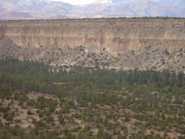
The outflow sheets were subsequently deeply eroded to form the beautiful pink finger mesas of the Los Alamos area. They’re featured in the title panorama for this site, which I took from the Clinton P. Anderson Scenic Overlook.
Cindy was feeling under the weather yesterday, so she asked me to run uptown (i.e. the main Los Alamos town site, as seen from White Rock) to pick up some groceries from Smith’s. Although I’d spent some time trimming bushes earlier (not actually a good thing to do to my shoulder), I hadn’t really gotten my exercise for the day — important for keeping my diabetes in remission — and decided I’d stop along the way to do a bit of hiking. Mostly on impulse, I pulled into the overlook and started up the old switchback road.
I don’t know how old the road is, but it was in use when Los Alamos was the site of the secret laboratory designing the first nuclear bomb in the 1940s. It was out of use by the time my family moved here, in 1965. The road was carved out of the relatively soft tuff, then a road bed of gravel was laid down, which is now heavily gullied and overgrown with weeds. It makes a pretty good hiking trail, though. I climbed up the first switch with vague intentions of taking some photographs south from the top of the mesa.
The view was quite nice, but the local tuff was much more interesting than I anticipated. And there turned out to be a fairly well-maintained trail down the south side of the mesa, though it does not show up at all on the satellite photo. Looking at the Los Alamos trail system map, I see that this even has a name: the Breakneck Trail. Well then.
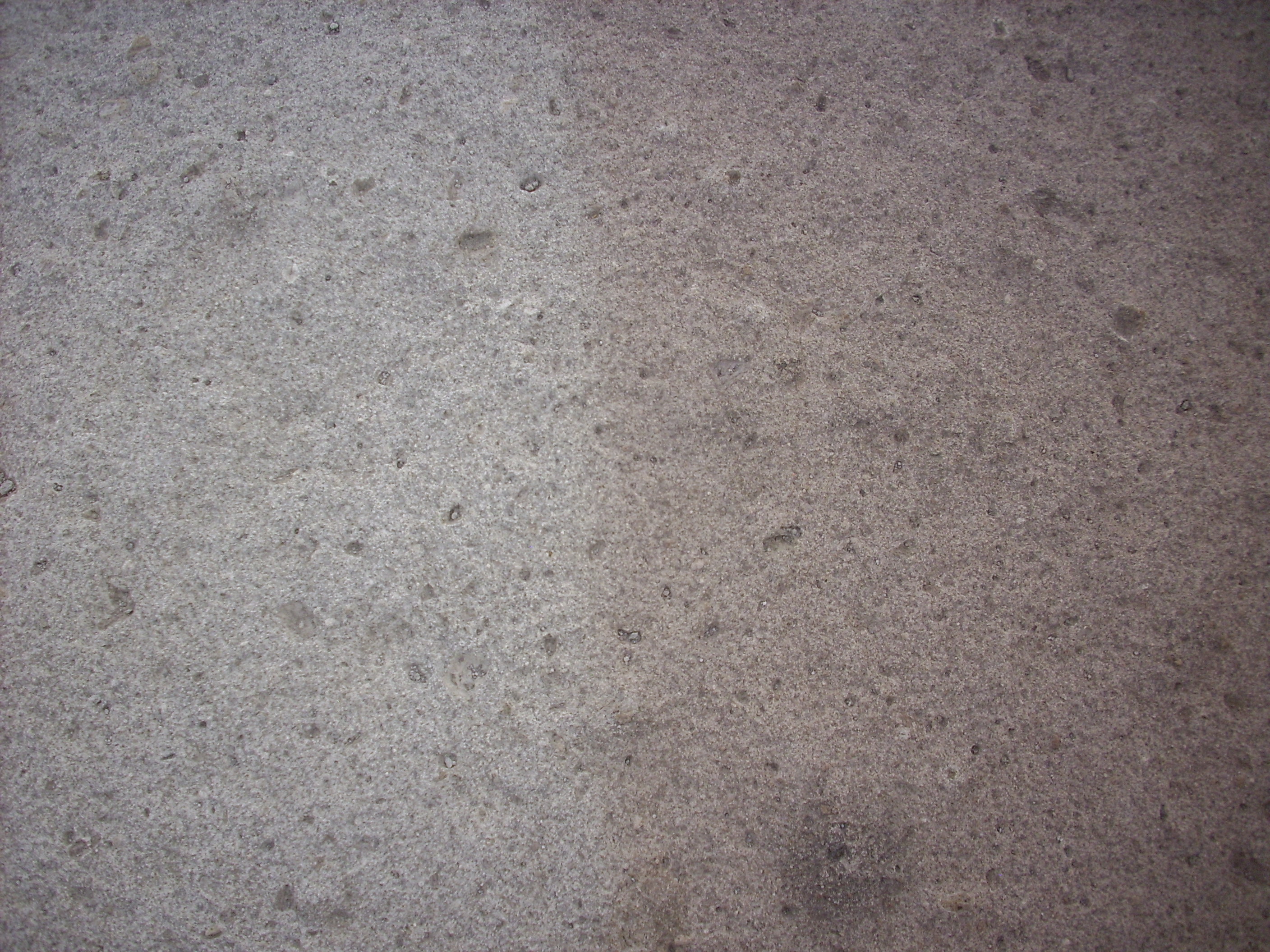
Near the head of the trail, the tuff has a peculiar spongy character.
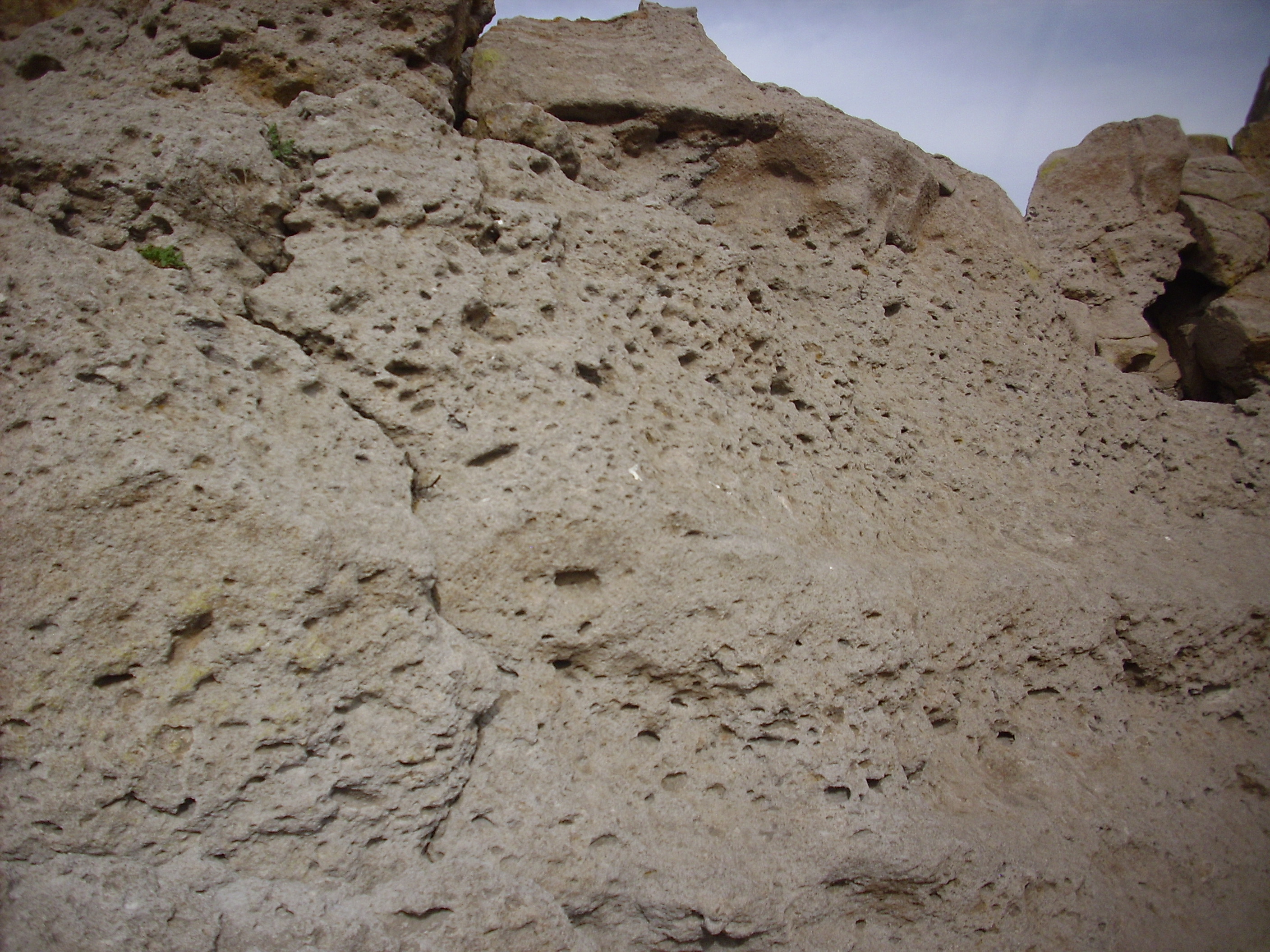
Close examination shows traces of very delicate pumice in some of the cavities. This pulse of the eruption swept up large quantities of pumice, probably erupted earlier, which became embedded in the flow, then eroded faster than the surrounding tuff to produce the countless tiny pits visible here.
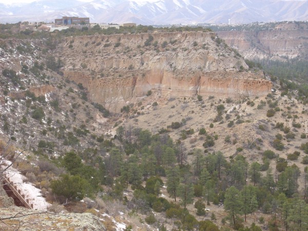
I found a convenient spot off the trail to look around at the view. To the east, I was struck by a sharp color boundary in the tuff.
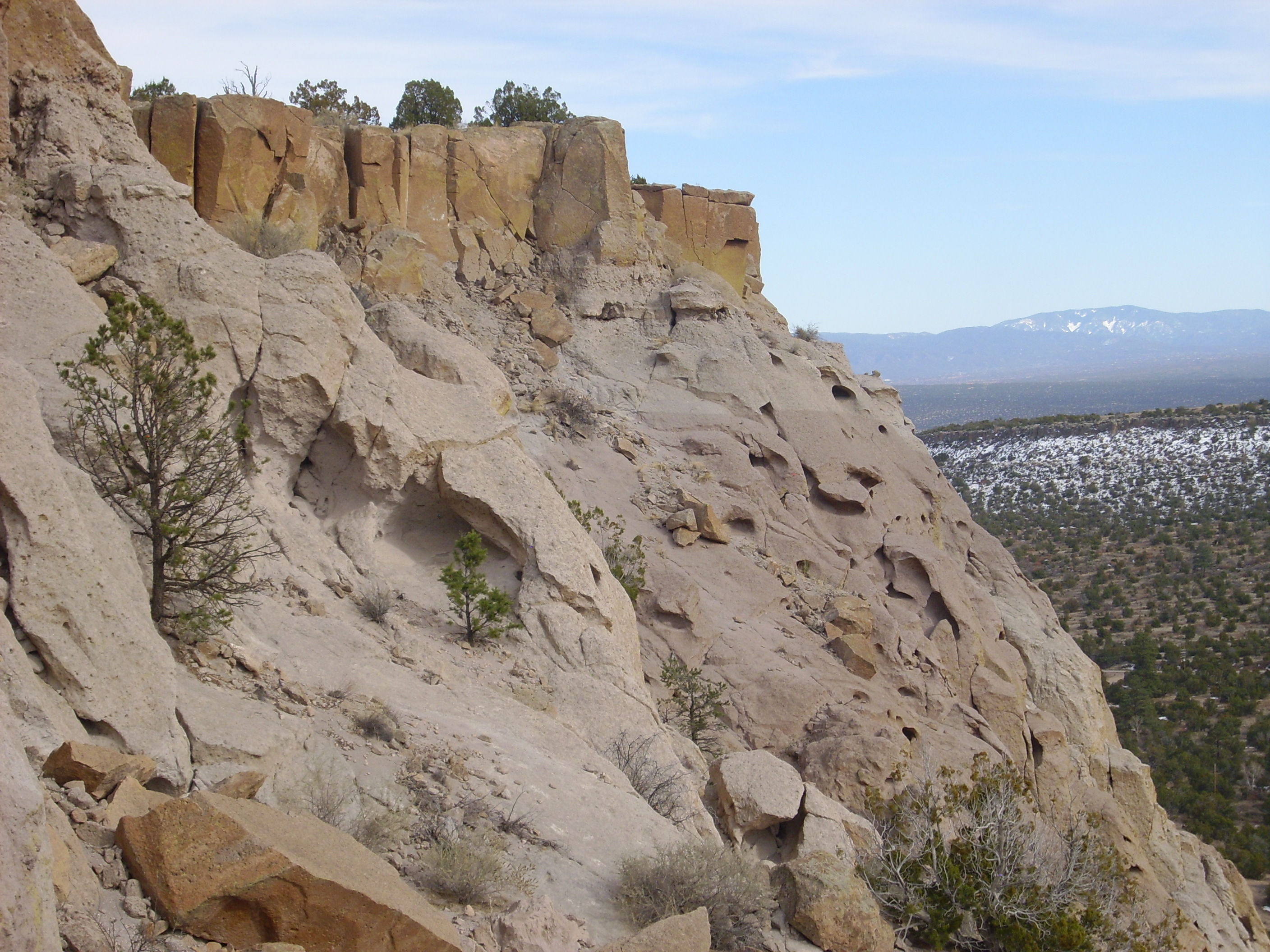
The entire thickness of the mesa in this photograph belongs to the Tsherige Member of the Bandelier Tuff. The Tsherige Member was deposited by the second of the two giant eruptions, at 1.25 million years ago. This eruption did not take place in a single pulse. Instead, there were at least five separate pulses, separated by intervals of days to weeks. Each pulse produced a cooling unit, so called because it had just enough time to cool slightly before the next cooling unit was erupted. Cooling units thus are distinguished by subtle changes in the character of the rock.
The topmost part of the mesa in this photograph is sheer cliffs of dark reddish-orange resistant tuff. This tuff was probably hot enough when deposited that the bits of volcanic glass making up the tuff were soft enough to meld together. Such a tuff is described as a welded tuff. Tuff that is cool enough when deposited that the bits of volcanic glass are already solid is described as an unwelded tuff. There are degrees of welding, ranging from a densely welded tuff to a weakly welded tuff. Some of the Bandelier Tuff close to the vents in the Jemez is very densely welded, while the tuff here is only moderately welded.
Just below the sheer cliffs, the slope becomes gentler (though still very steep). If you look closely, you can see that this is the layer with the many pits that I passed by earlier. Beneath this the tuff becomes more uniform. However, about two-thirds of the way down the slope, the color of the tuff changes abruptly from a very pale pink to a somewhat darker red. It’s subtle but unmistakable.
Looking west, I could see the entire thickness of the Tsherige Member, plus the underlying Cerro Toledo Interval.

You see the same topmost layer of welded tuff, then the gentler slope with the color break. Then comes another set of vertical cliffs, with definite color layers. I’m guessing there are at least three cooling unit here. At the base of the cliffs is a thin multicolored layer, just above the point where the slope becomes quite gentle. This layer is the Cerro Toledo Interval.
I mentioned that the Tsherige Member was erupted 1.25 million years ago, and that there was a similar eruption 1.62 million years ago. The earlier eruption produced the Otowi Member of the Bandelier Tuff. This is similar to the Tsherige Member, but tends to be unwelded on the east side of the Jemez, where it forms gentle slopes that are often mantled in rubble eroded from the overlying Tsherige Member. This is the case here. There’s Otowi Member under the gentle slope at the base of the cliffs, but it’s mostly buried in debris.
During the nearly 400,000 years between the two Bandelier eruptions, enough erosion took place to produce a fair amount of sediment on top of the Otowi Member. This was supplemented with thin layers of pumice from smaller eruptions in the caldera. This mixture of pumice and sediment separating the two members of the Bandelier Tuff is known as the Cerro Toledo Interval.
The color break near the top of the Tsherige Member intrigued me. I retraced my steps along the trail, looking for the break in the rocks I was passing. Sure enough:
It’s really quite a sharp transition; this photograph shows an area of a little over a square foot. Other than the change in color, there’s no obvious change in the character of the tuff. The texture is the same above and below.
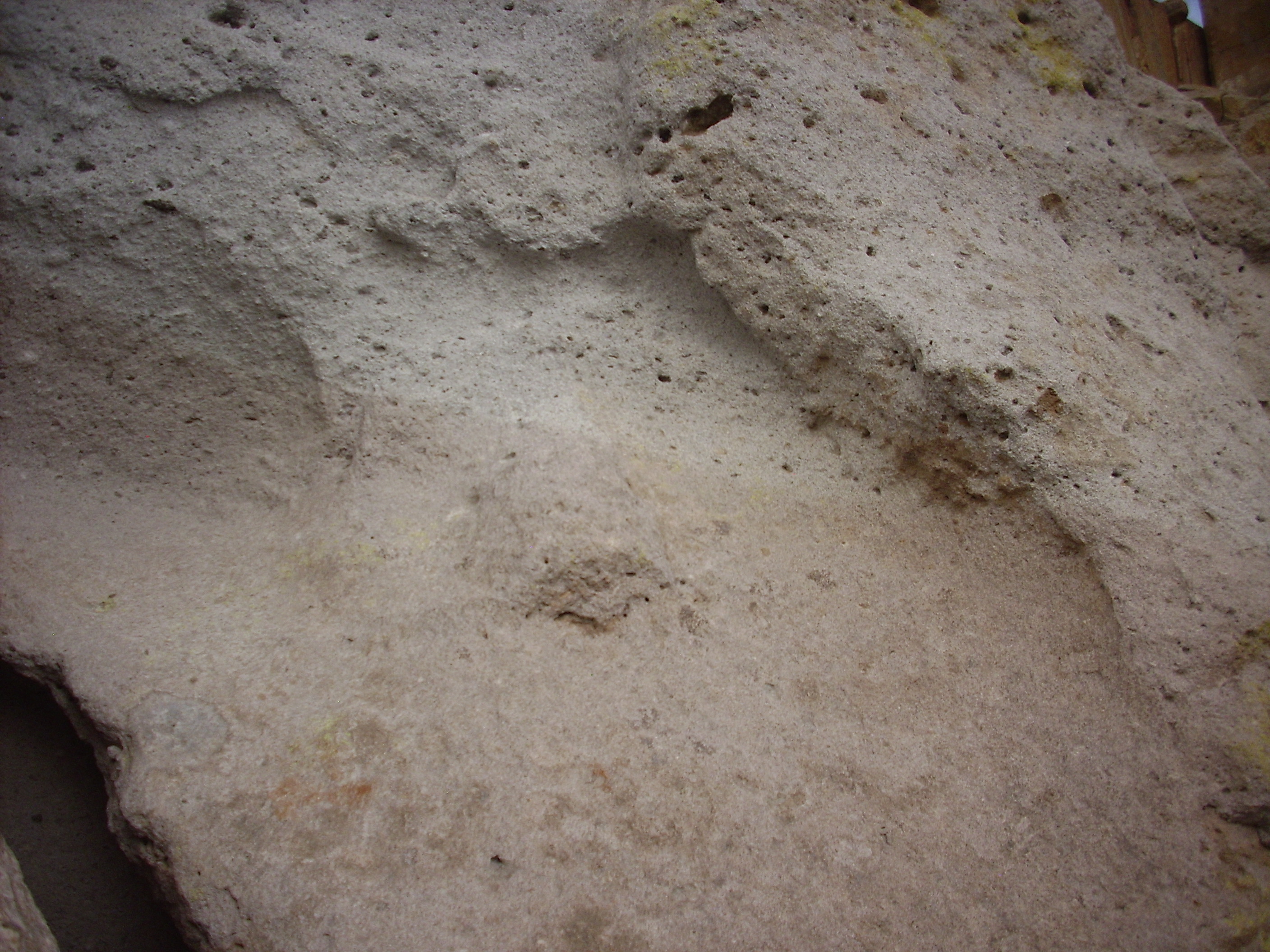
Near the top of the mesa, there was a boulder than had a gently sloping upper surface that cut through the transition.
The photograph shows an area about six inches across here. You can see that there is no change at all in the texture of the rock — just a color change.
I’m not quite sure what to make of it. I would expect a cooling unit boundary to show some change in texture. Perhaps this is the boundary between two eruptive pulses that were so close together that there was no time for the first to cool significantly. I’m not geologist enough to tell you for sure.
Being stupid, I risked my injured shoulder by scrambling up to the very top of the mesa near the trail head for a panorama. I managed not to hurt myself (further) and got a panorama to the south, looking across the tops of the Pajarito Plateau mesas towards the Cerros del Rio.
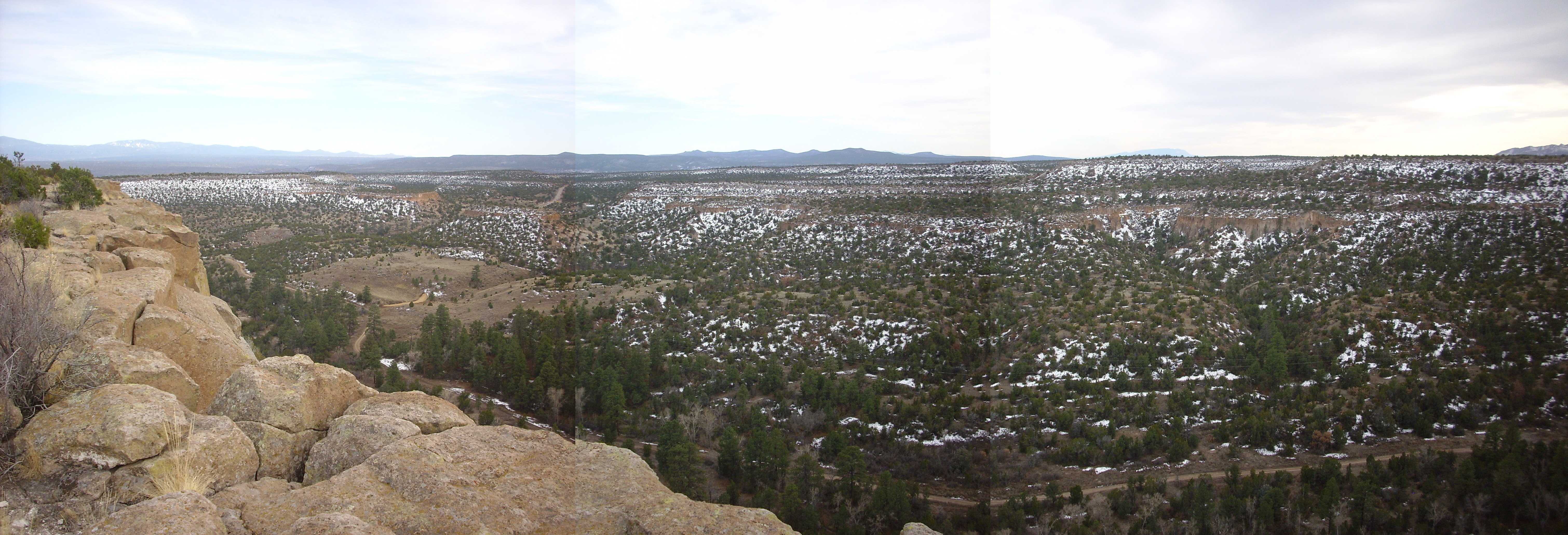
On the left skyline are the Sangre de Cristo Mountains near Santa Fe. The Cerros del Rio fills the second frame. Sandia Crest peeks over the mesa in the third frame, and part of the San Miguel Mountains are visible on the skyline at right. You can see the road to White Rock on the boundary between the second and third frame, and on the skyline above is Ortiz Peak, a major andesite eruptive center of the Cerros del Rio.
The Cerros del Rio erupted between 5 and 1.2 million years ago, with most of the activity around 3 million years ago. The lava was mostly low in silica and thus low in viscosity. (The more silica, the more viscous the lava.) It easily spread out over the surface to form the basalt plateau on either side of White Rock Canyon. My back yard is full of the stuff. The low peaks of the Cerros del Rio were formed of slightly more silica-rich lava that cooled to form a kind of volcanic rock called andesite.
I headed back to the switchback road and took the second switch, up to the mesa to the west. On my way I noticed some footprints in the tuff.
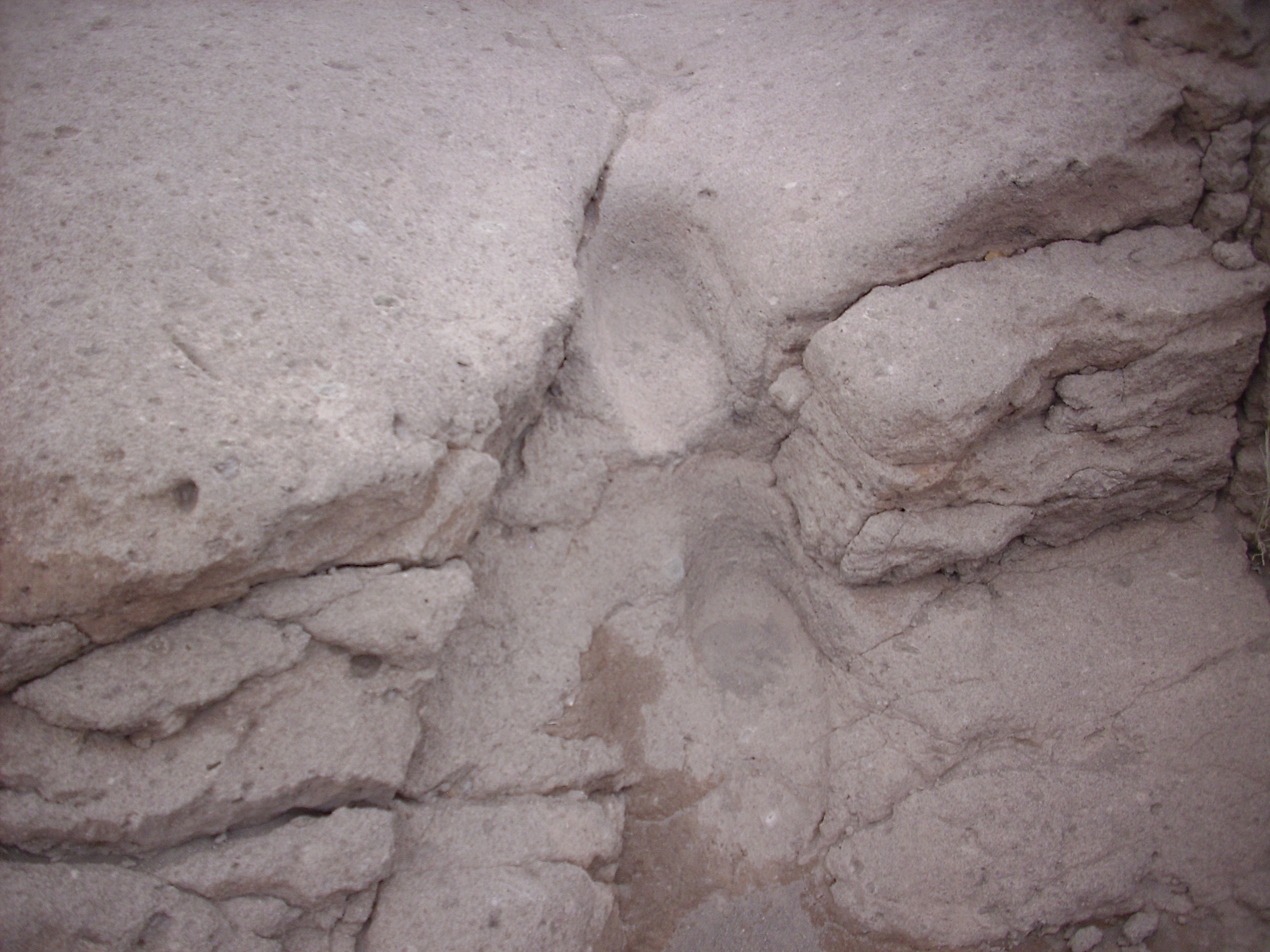
These are definitely human-made. Whether they are ancient is a question I can’t answer. This area saw a fair amount of traffic in the 1940s but very little since, so my guess is that these are artifacts of ancient peoples.
I continued up the switchback onto the mesa top and hiked a ways west. I then headed north, to the mesa rim, for a nice panorama to the northwest.

On the skyline, west of Los Alamos, is the Sierra de los Valles, which is underlain by the Tschicoma Formation. This is moderately silica-rich lava that was erupted mostly between 5 and 3 million years ago. It cooled to form a rock type called dacite. The mesa in the foreground at left is Los Alamos Mesa, on which the main town site is built. Behind Los Alamos Mesa at the right edge of the first frame is North Mesa, separated by a narrow valley from Kwage Mesa, which extends across most of the second frame. Behind Kwage Mesa is Barranca Mesa. The canyon is Pueblo Canyon, which continues west north of Los Alamos Mesa.
One can see that the terrain across which the Tsherige Member was erupted was uneven, by comparing the thickness of the Tsherige Member under Los Alamos Mesa and Kwage Mesa.
Los Alamos Mesa:
Kwage Mesa:
You can see that Kwage Mesa has a significantly greater thickness of Tsherige Member.
The photograph of Los Alamos Mesa also shows the Cerro Toledo Interval pinching out to the left. (Click to enlarge). This was likely due to the interval being eroded away to the left. Underneath, at the head of the small gully, a fair thickness of Otowi Member is exposed. Notice that it is very similar to the Tsherige Member.
Hiking back to my car, I saw a second trail to the cliff edge overlooking the switchback road. Here was a bench and a sign quoting an early Los Alamos resident on her reaction to first coming up the switchback and seeing the magnificent views in all directions. I didn’t photograph the sign, because it was old enough to be somewhat illegible.
Coming back down the switchback, I noticed a fairly recent rock fall on the road.
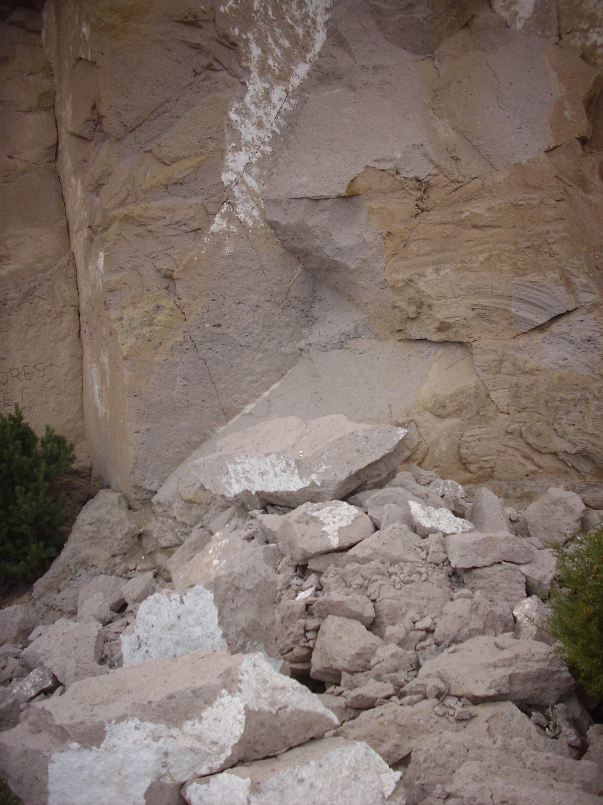
This cannot be older than the date of construction of the modern road, sometime in the 1940s or 1950s. The rock fall covers about half the width of the old switchback road, and the roadbed beneath shows signs of having already been extensively gullied when the rock fall took place. So this is not more than a few decades old.
Geology is an ongoing process.