Kent and Bruce’s Excellent Adventure
It’s a long story, but the basics of it are that I turned 50 and Mom turned 80. Some time ago, actually. I’m 52 now and Mom is 83.
Let me start over.
I had always planned to experience some great adventure when I turned 50. My original plan was to drive the Alaska Highway to see the transit of Venus in June of that year. However, Alaska turned out to be some considerable distance away, gasoline was getting expensive, and I was still learning to cope with my newly diagnosed diabetes. I was also a bit short on accumulated vacation time. I had to settle for watching the transit at my home in White Rock, New Mexico, where I at least got to see the ingress. (Egress was after sunset here.)
However, the idea of experiencing a great adventure continued to appeal to me, and then Mom decided we needed a big family get together because she was getting older, and you know. This was not something I could miss. Besides, I had managed to accumulate a lot more vacation time and Bear Lake, Idaho, where she planned to have the reunion, is quite a bit closer than Alaska. And then it occurred to me: I have made the long drive from New Mexico to Bear Lake probably a couple of dozen times in my life, but I have never driven the additional four hours to visit Yellowstone National Park.
Also, paleontologist Bruce Rabe has come my way a couple of times to visit and we’ve had a great time looking at northern New Mexico geology together. What better place to eyeball some more geology than Yellowstone? Bruce was interested in the idea, and the plans started rolling. Unfortunately, my wife, Cindy, would not be able to come. She hadn’t accumulated much vacation from her new job yes, and our kids are not currently in any condition for long adventures. (All three have serious health problems.) Cindy kindly gave me permission to go without her, for which I cannot express enough gratitude.
So after much study of geology guides to Yellowstone and its environs, and a certain amount of gathering up diabetic-friendly snacks and camping gear, since I planned to make the trip affordable by camping rather than staying in hotels, the great adventure got under way.
Day 1: Excitement! Adventure!
“You are in a maze of twisty little forest roads, all alike…”
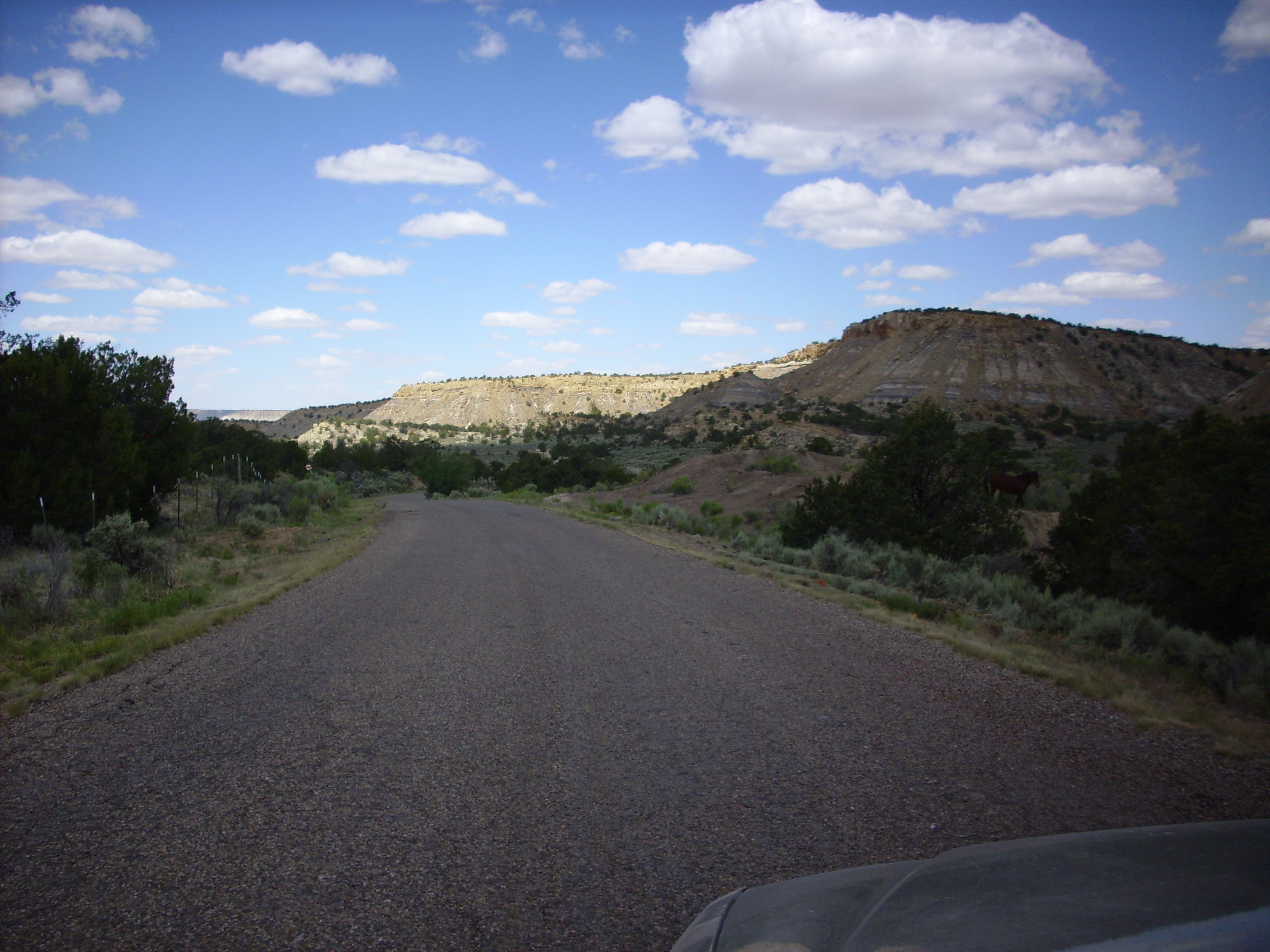
After packing and getting a good night’s sleep, I departed from White Rock on Friday, June 27, 2014, and headed up into the Jemez Mountains. This is old stomping grounds and I won’t describe much of my route, except to say that I drove past Bandelier National Monument and the Valle Grande to La Cueva. From here I ventured into new territory (cue the ominous music!) on the mistaken belief that there was a secondary road from La Cueva through the Sierra Nacimiento Mountains to Cuba. I mean, you can see the road plainly on Google Map, and everything.
Turns out it’s a gravel road, which becomes fairly appalling in a few places. Here my car and I had a little conversation in my head:
KOREAN CLOWN CAR: “Nope, nope, nope. Not gonna go …”
KENT: “YES YOU ARE.”
I took pictures.
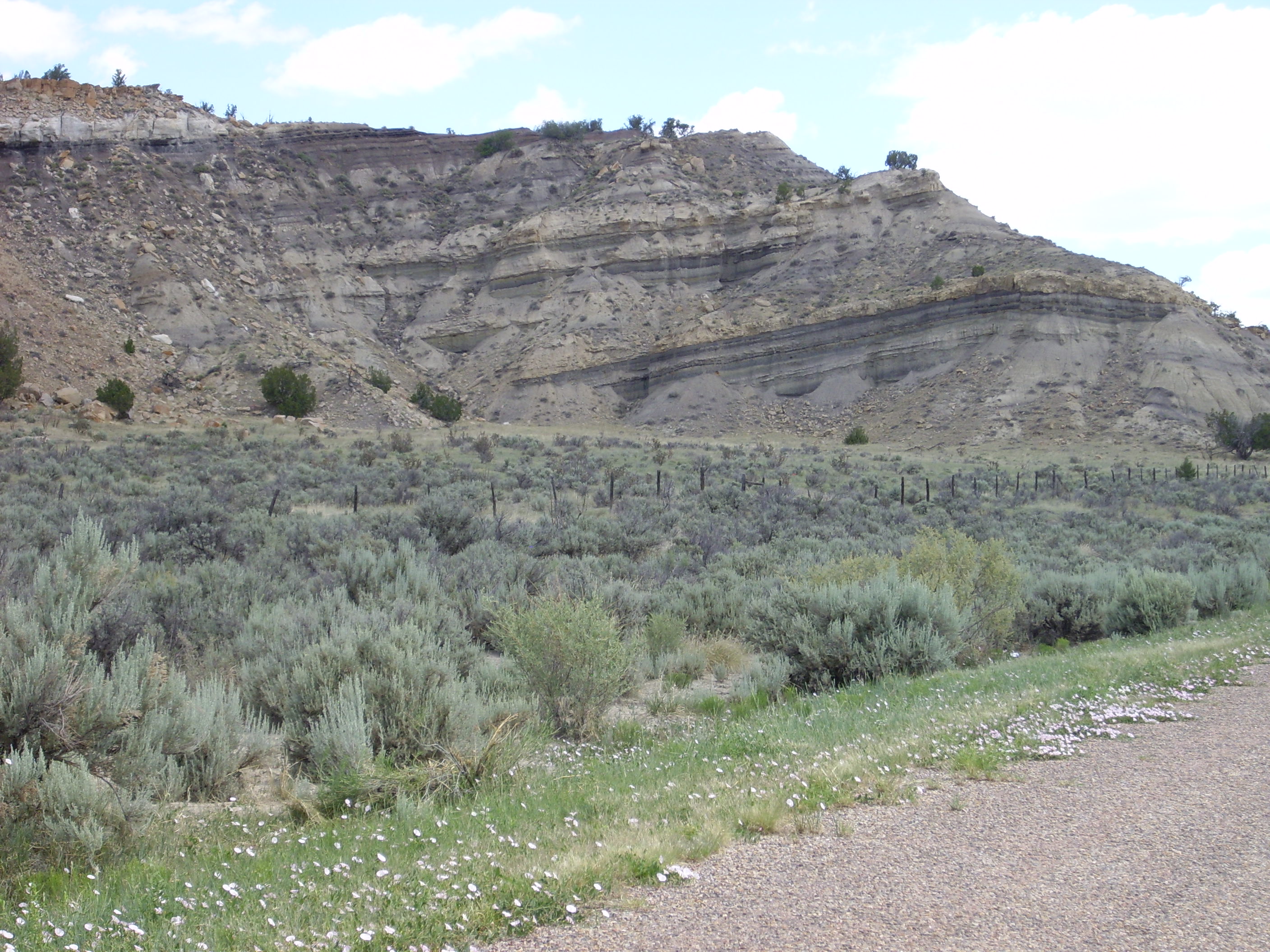
This is actually one of the better spots on the, since the roadbed is cut into solid Bandelier Tuff. The Bandelier Tuff is a welded pyroclastic tuff. This means it formed from red-hot rock fragments and gas, which settled onto the ground while the rock fragments were still soft enough from the heat to meld together. The eruptions that formed the Bandelier Tuff took place 1.6 and 1.2 million years ago, producing two layers of tuff that were not recognized as separate eruptions by the first geologists in this area. (The two layers subsequently became known as the upper and lower Bandelier Tuff, then as the Otowi (lower) and Tsherige (upper) Members of the Bandelier Tuff.) The volume of tuff was enormous, leaving a caldera or large crater in the Jemez Mountains 11 miles across. But even these enormous eruptions are dwarfed by the caldera eruptions that formed Yellowstone.
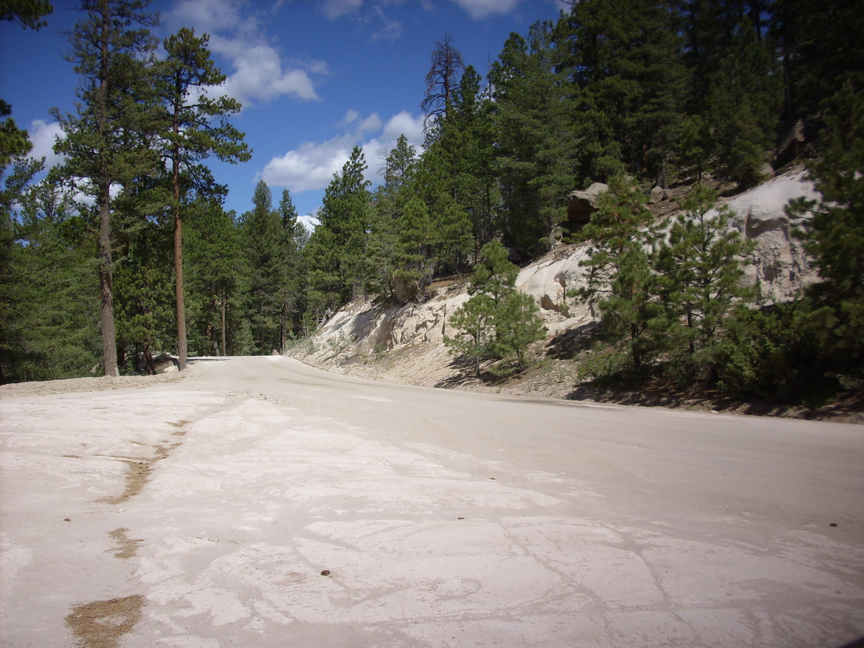
The tuff takes some weird shapes as it weathers.
 \
\
A little further down the road, a road construction flag man (who looked a little like an evil dwarf from a classical computer game) appeared and told me that the road was under construction further ahead and it would be a 45 minute delay. However, he also told me I could also get to Cuba via the girl scout camp road. Well, okay, then. This turned out to work, more or less.
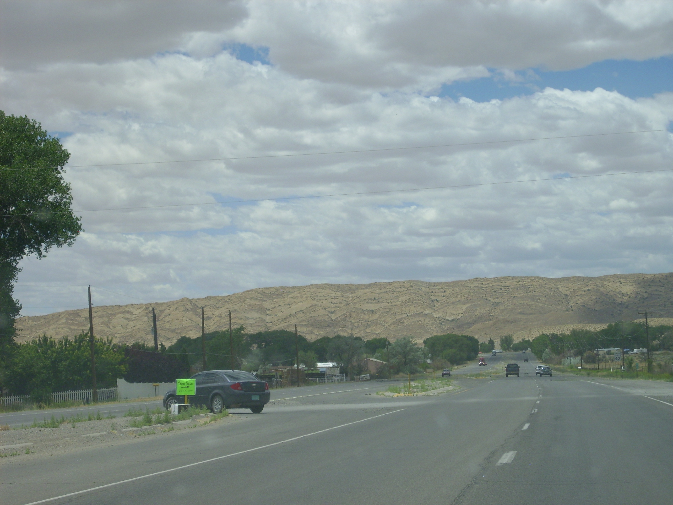
Along the way, the road descended into Triassic redbeds of the Sierra Nacimiento uplift.
The red color of the road bed is from eroded Triassic red sandstones. These were all hidden under vegetation or dirt, but showed where the sandstones had been uplifted by the tectonic forces that created the Rio Grande Rift and made a pathway for the magma that would form the Jemez Mountains.
I finally emerged onto a paved road out of the forest, not too much worse for the wear. My steering wasn’t quite as aligned as it had been, and there was a green mark on my front bumper (don’t ask) and I was grumbling naughty words to myself, but I was at last on my way.
Except that I came out at the foot of a T intersection, and there were no signs to indicate which way to go, left or right. However, the mileposts indicated that left was Forest Road Something-or-other, while right was City Road Something-or-other. Right sounded promising. I went about fifteen minutes in that direction, though, and the road seemed to be turning back into the mountains. Well, shucks and other comments. I turned around and went back the other way. Sure enough:
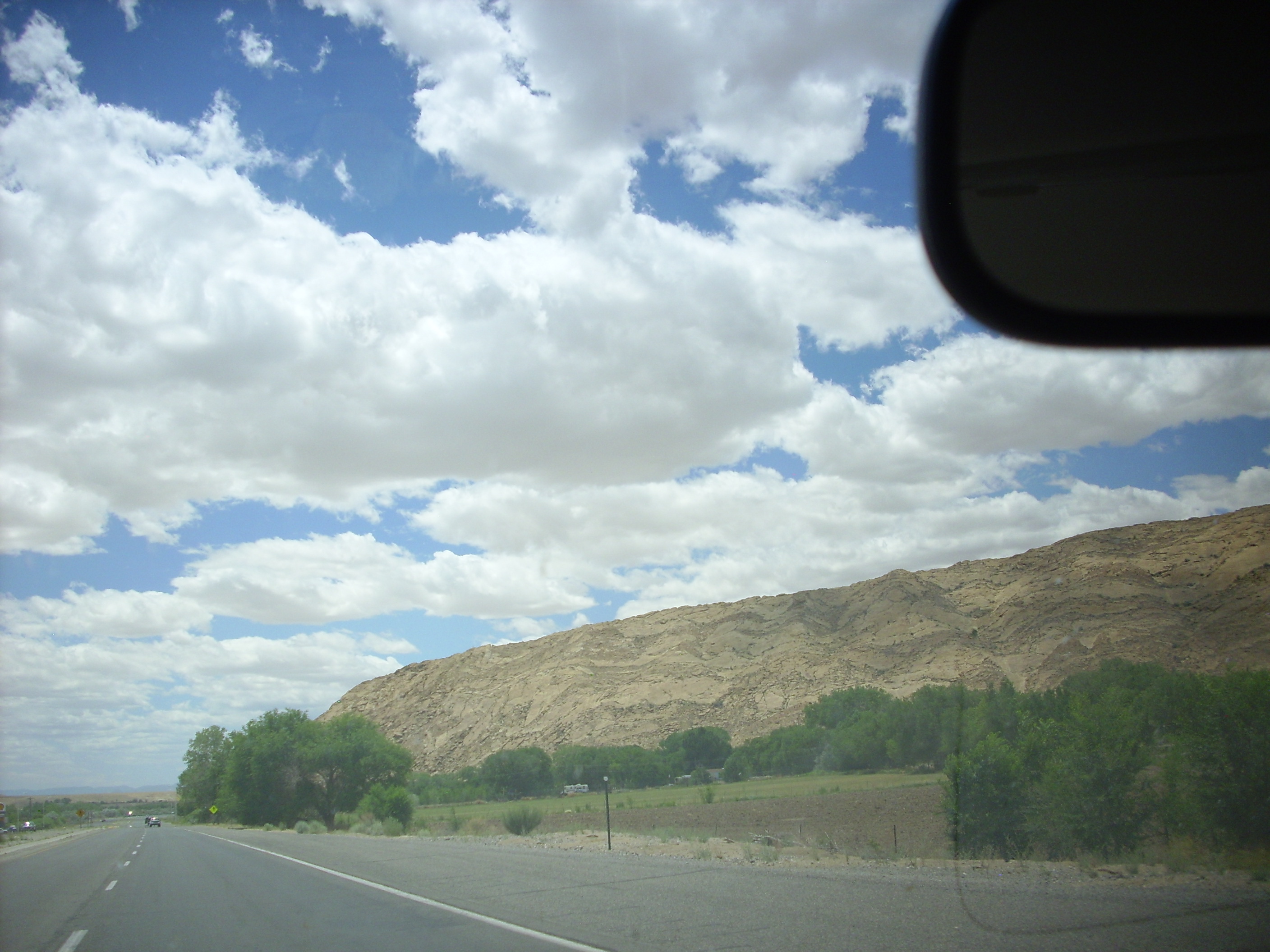
It became a dirt road. More shucks and other comments. At least the local geology was interesting.
The Sierra Nacimiento Mountains, out of which I had just emerged, are block mountains, with the main fault on the east side and the west slide sloping down to this area. That makes this the eastern limit of the San Juan Basin, which is the southeastern part of the Colorado Plateau.
The Colorado Plateau is a large chunk of crust that has somehow remained relatively undisturbed for tens of millions of years. I once attended a seminar about it at LANL where the speaker talked about how the crust and its underlying mantle were unusually cold and therefore unusually rigid. The Jemez Mountains erupted where the Rio Grande Rift cut into the east edge of the Colorado Plateau and intersected a rather mysterious deep crustal feature called the Jemez Lineament.
The Jemez Lineament includes the Taos volcanic fields, the Raton volcanic fields, the Mount Taylor area, and more volcanic fields stretching into Arizona. It’s tempting to think it’s a hot spot trace, like the Snake River Plateau (of which we will see much more later), but the volcanic fields are all about the same age (very recent) so the hot spot theory doesn’t quite work. Another theory is that it marks a very old rift in the deep crust from hundreds of millions of years ago, in Precambrian time.
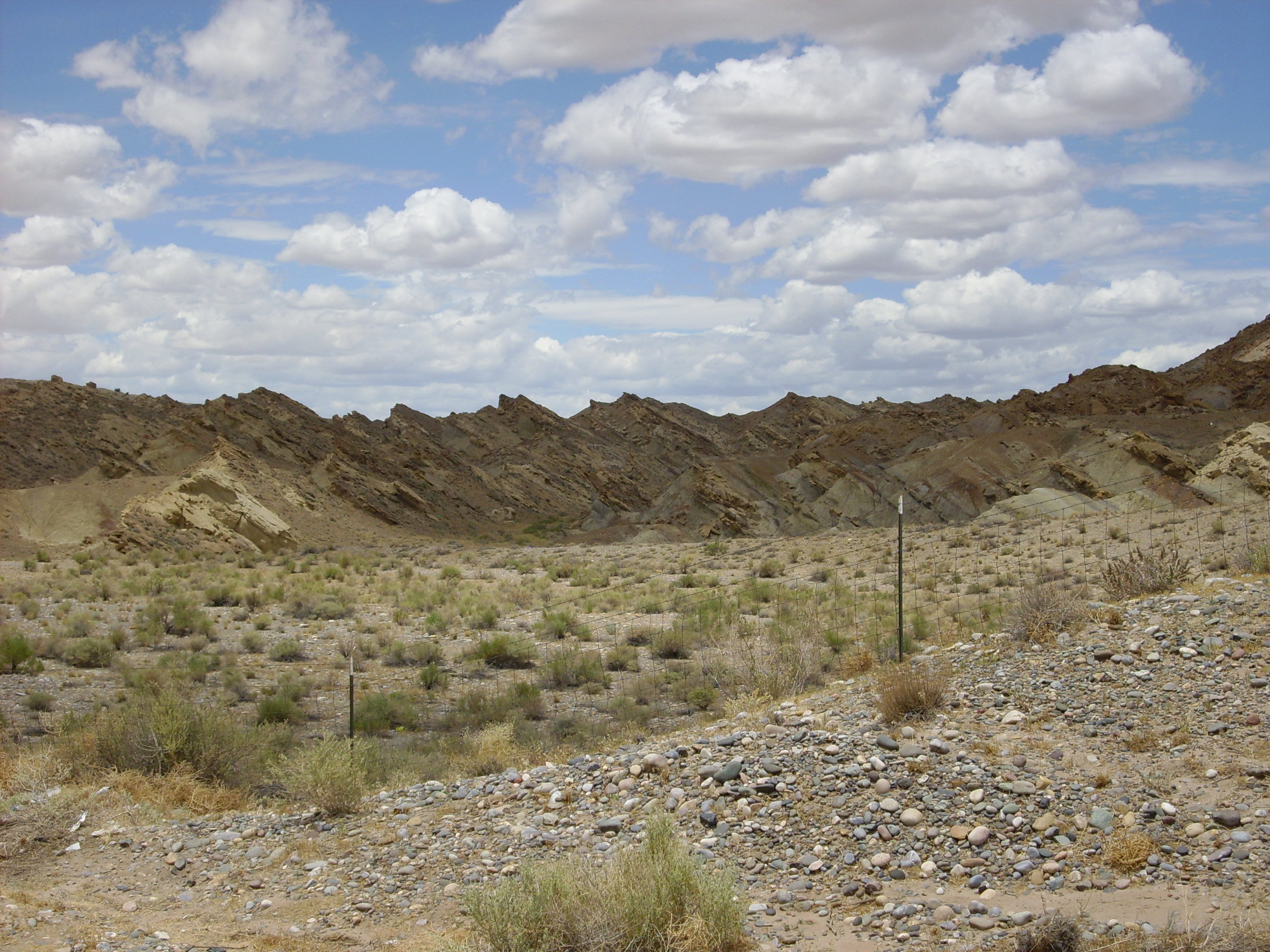
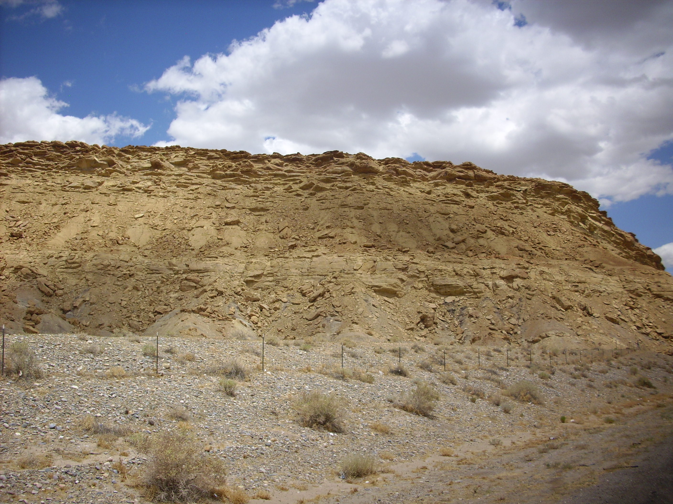
The rocks in the photo are layers of shale and sandstone, capped by a hard sandstone (visible at upper left on top of the mesa) that I continued to see capping mesas clear to Farmington. It looks a little like Navajo Sandstone but I didn’t have any road logs for the San Juan Basin to tell me for sure. A geologist friend from Farmington suggests it is probably the San Jose Sandstone.
Sorry, no map links; even now I can’t look at Google Maps and figure out just where I was.
But I turned around, and eventually the road going northeast ended up in Cuba, which was nestled much closer to the mountains than I expected. Cuba is a dusty little mining and foresting town without much to recommend it except that it is on the start of a major highway to Farmington, it has gas stations and restrooms, and it is not the winding forest roads of the Sierra Nacimiento. I was glad to be there.
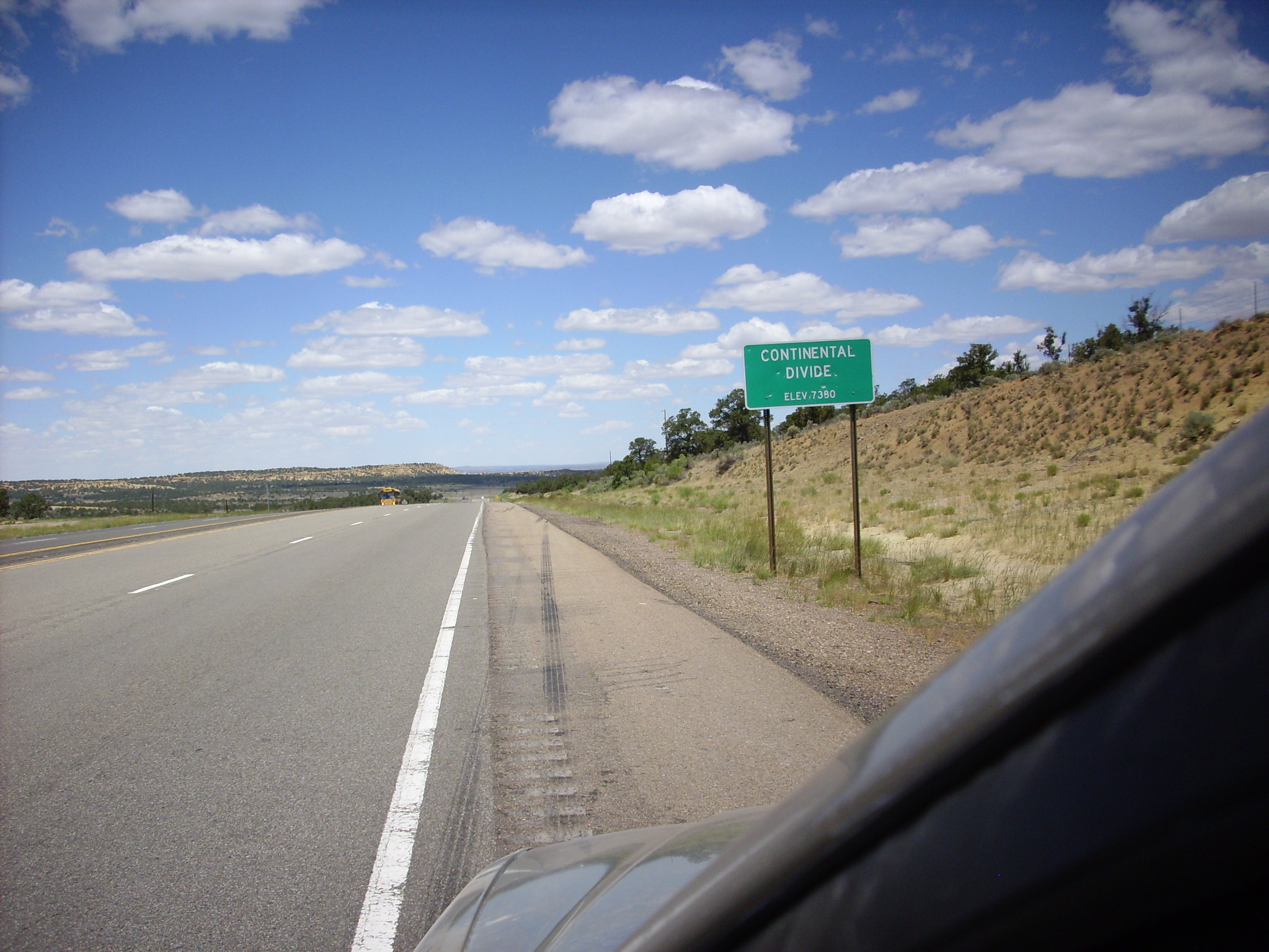
After refueling, I headed out the main highway, soon reaching the continental divide.
and Huerfano Mountain (I think)
Note that I’m taking this through my car window while driving along the highway. On some highways, this is safer than pulling to the side, and on the Interstate highway system you generally aren’t allowed to pull to the side for a non-emergency anyway.
I do not know how my camera knows how to set the focus. Obviously it’s not bouncing sonar off the target, since it works through car windows. I’m guessing there’s some kind of edge detection algorithm in the camera. Dad would have though this was way cool; we take too much of our consumer electronics for granted.
I finally arrived at Bloomfield, east of Farmington.
The Bloomfield-Farmington corridor is old Mormon settler country. Further west, this intersects with Navajo country, at Shiprock. I stopped at Bloomington for a Lottaburger, just because I couldn’t resist a Lottaburger even if the bun provides an awful lot of carbohydrates.
There is an impressive hogback ridge on the road between Bloomfield and Farmington, which my pictures will not do justice to. Still.
This is the east side of the hogback.
Looking north along the area just behind the hogback, showing the beds plunging sharply to the east.
Looking back at the hogback from the west.
The hogback represents a sequence of hard sandstone separated by beds of shale, with deep beds of shale above and beneath. The earth here was tilted sharply to the east by tectonic forces relativelyl recently (in geological time), and the hard sandstone forms the hogback as the softer shale is eroded away.
An even more impressive site is Shiprock, located southwest of the town of the same name. My route did not come terribly close, and, in any case, Shiprock itself is on tribal land and strictly off-limits to non-tribal members, as it is considered a sacred site. I did get a photo from north of the town, where the road rises above the San Juan river valley.

Shiprock is a volcanic neck, meaning it is the central core of an ancient stratovolcano. A stratovolcano is composed of alternate layers of lava and ash which erode relatively quickly, leaving the hardened lava of the central vent.
From here I turned north to Cortez, passing some more San Juan Basin mesas that I really ought to have photographed. But, by now, I was frantic to get to Arches National Monument before dark. From Cortez, the road passes northwest to Monticello over some fairly flat countryside. Someone going the other way on the road kicked a big rock up on my brand new windshield with a tremendous wallop; I was very lucky it merely scratched the surface, not even cracking the windshield.
From Monticello I detoured briefly into the Abajo Mountains west of town, which are laccoliths, mountains formed by lava pushing up the sedimentary rocks in the area without quite breaking through to the surface. The lava then cooled slowly to produce beautiful crystalline rock, which in this case is a hornblende diorite:

What a pretty rock. This is not a common rock type, hence my pilgrimage to grab a chunk. The big white crystals are plagioclase feldspar and the dark needles are hornblende. The gray matrix may be a mixture of microcline (another feldspar) and pyroxene, but I’m not petrologist enough to know for sure. This is a rock with a moderate abundance of silica, not enough to produce quartz but enough to produce feldspar.
From near where I collected this rock, one can look north to a similar cluster of laccoliths, the Lasal Mountains.
I refueled again, bought fresh ice for my ice chest, and headed up to Arches National Park. The highway passes through some of the most scenic country in the western United States.
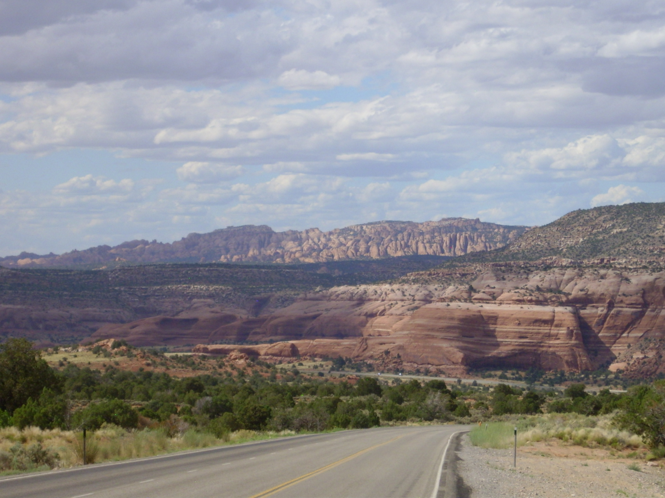
The rocks here are mostly Navajo and Entrada Sandstone, the latter being younger (and found higher up the cliffs.) Navajo tends to be pale and Entrada a rich red. The Navajo was laid down as sand dunes around 180 million years ago, in the early Jurrasic. The Entrada was laid down between 180 and 140 million years ago as river deltas coming off the Paradox Uplift to the east. Perhaps unsurprisingly, some geologists divide the rocks in this area up a little differently; I’m going with the classification used in my road logs.
Friday afternoon: All your arches are belong to us
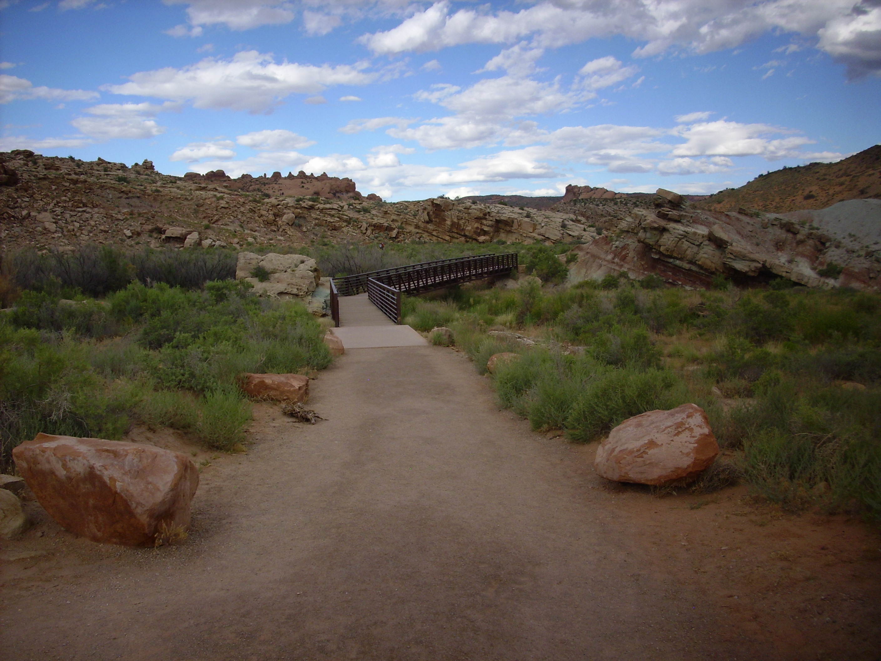
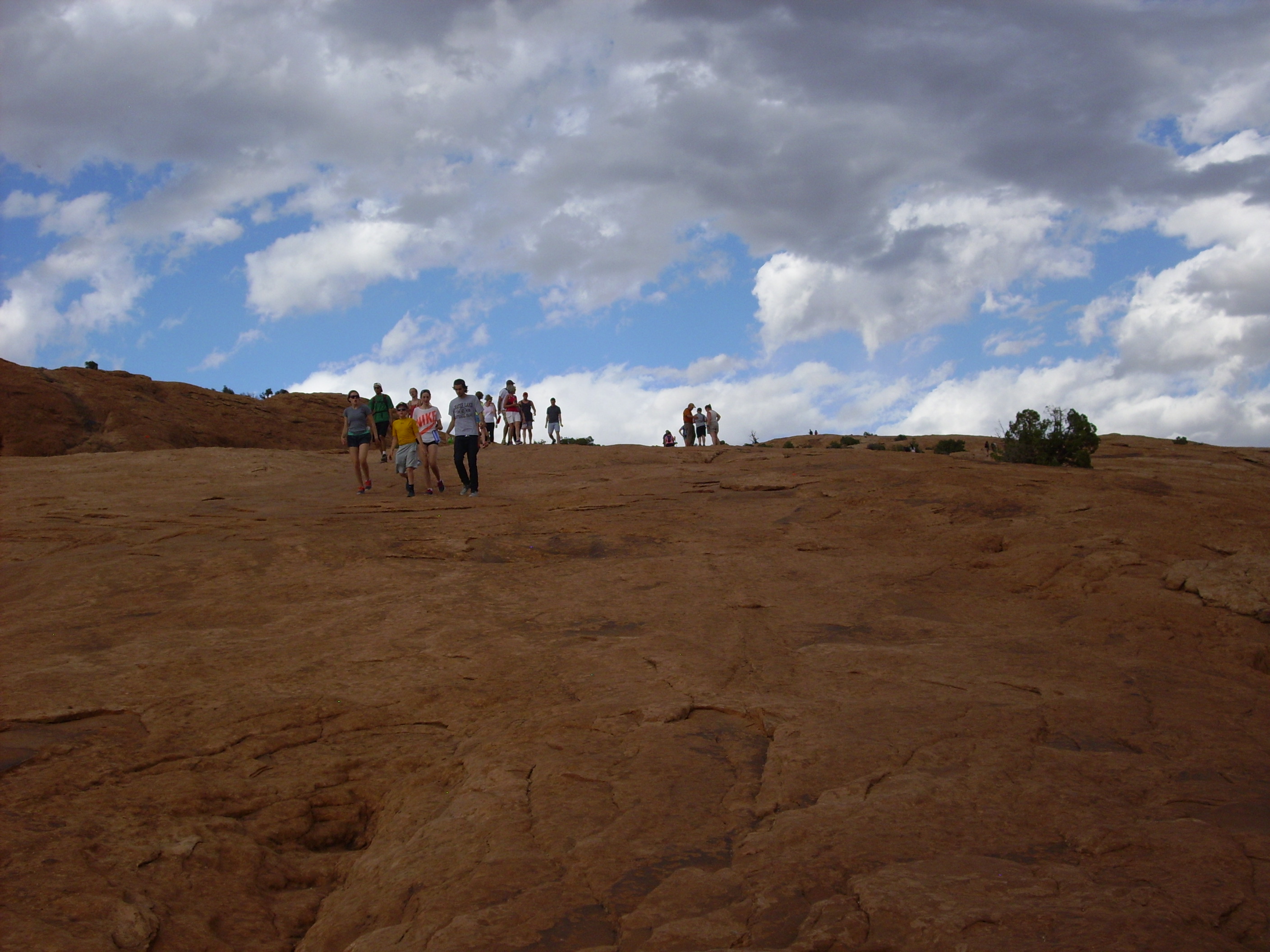
I pulled into Arches, bought an annual national parks pass, and headed to the trailhead for Delicate Arch. It was a madhouse — a maaaaadhoooouuuuuse!
It took some patience, but I finally found a parking space, shouldered my pack, and began hiking the trail. The weather was almost ideal: It was late afternoon and partly cloudy with just a hint of a breeze.
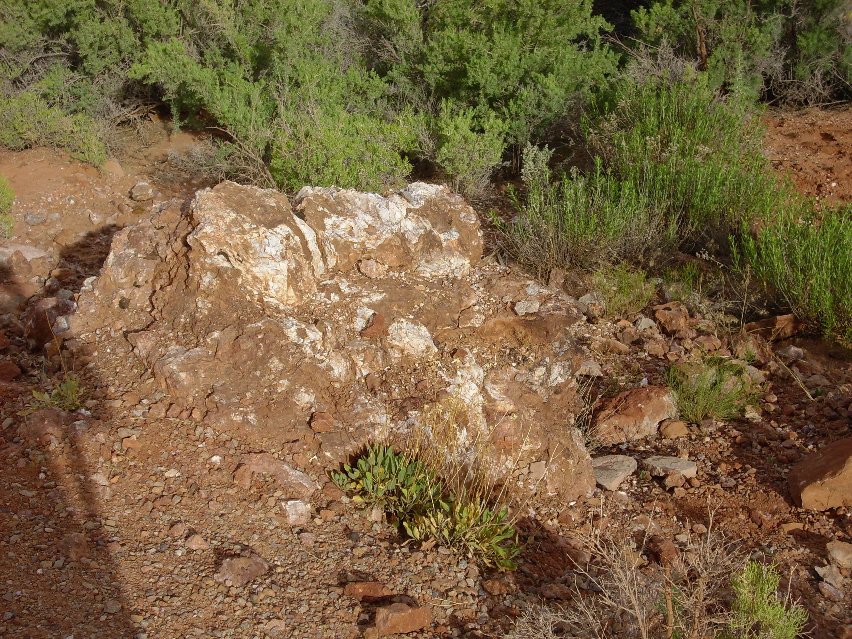
At one point there is an outcropping of light material. This could be gypsum forcing its way to the surface from deep below ground. Arches was created by such gypsum and salt flows; gypsum and salt beds hundreds of feet thick were laid down beneath the sandstone, which have since slowly flowed like putty out of the ground, undermining the sandstone until it collapsed. This produced hundreds of long parallel fractures in the sandstone, which eventually eroded into the sandstone fins in which arches form.
The other possibility is that this is an outcropping of the Cutler Formation. Some of the interpretive signs in the area claimed that the color came from unusual iron minerals, and the Cutler is famous for its unusual minerals, which include uranium ore.

Further along the trail are some massive chert beds.

Chert is very poor quality opal. Or opal is gem-quality chert; take your pick. It’s silica that has been deposited by water and is very poorly crystallized, so that it is almost amorphous.
I am stumped how chert formed in a sandstone bed. It’s not a question of lack of silica; it’s how the right environment could have existed. Chert usually forms in the presence of limestone, which raises the pH and forces the silica out of solution, and there is none here. Perhaps there was once, but it’s now all chert.
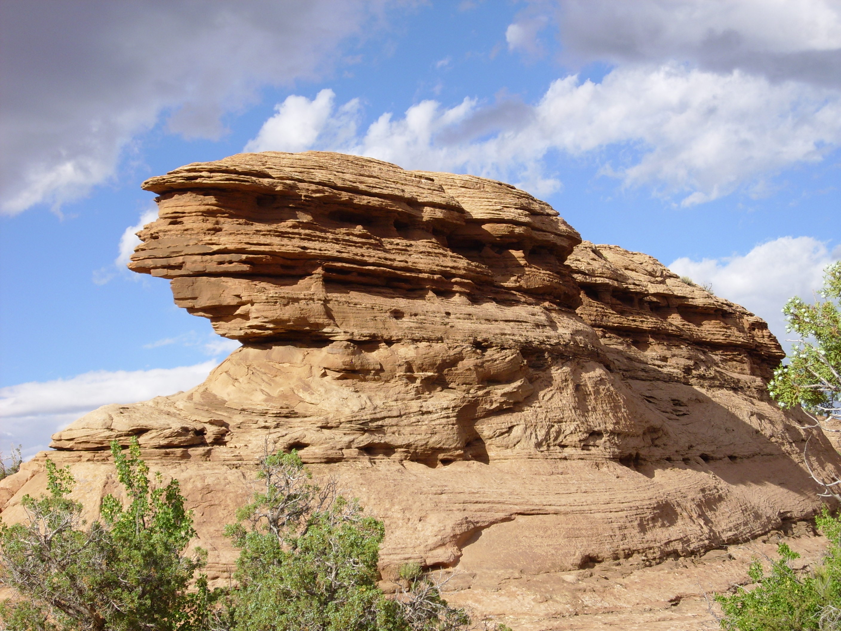
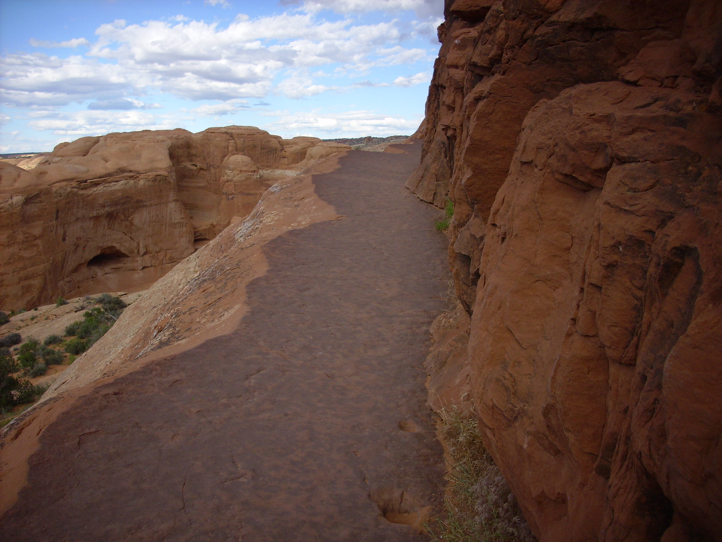
The trail climbs up a long sandstone shelf.
There is a tiny little arch on this shelf that I didn’t think to take a picture of. Some wiseacre looked at it, scratched his head, and quipped “I thought it would be a bit, y’know, larger …” I did photograph a fracture filled with … chert? … and some rock formations showing dramatic bedding.
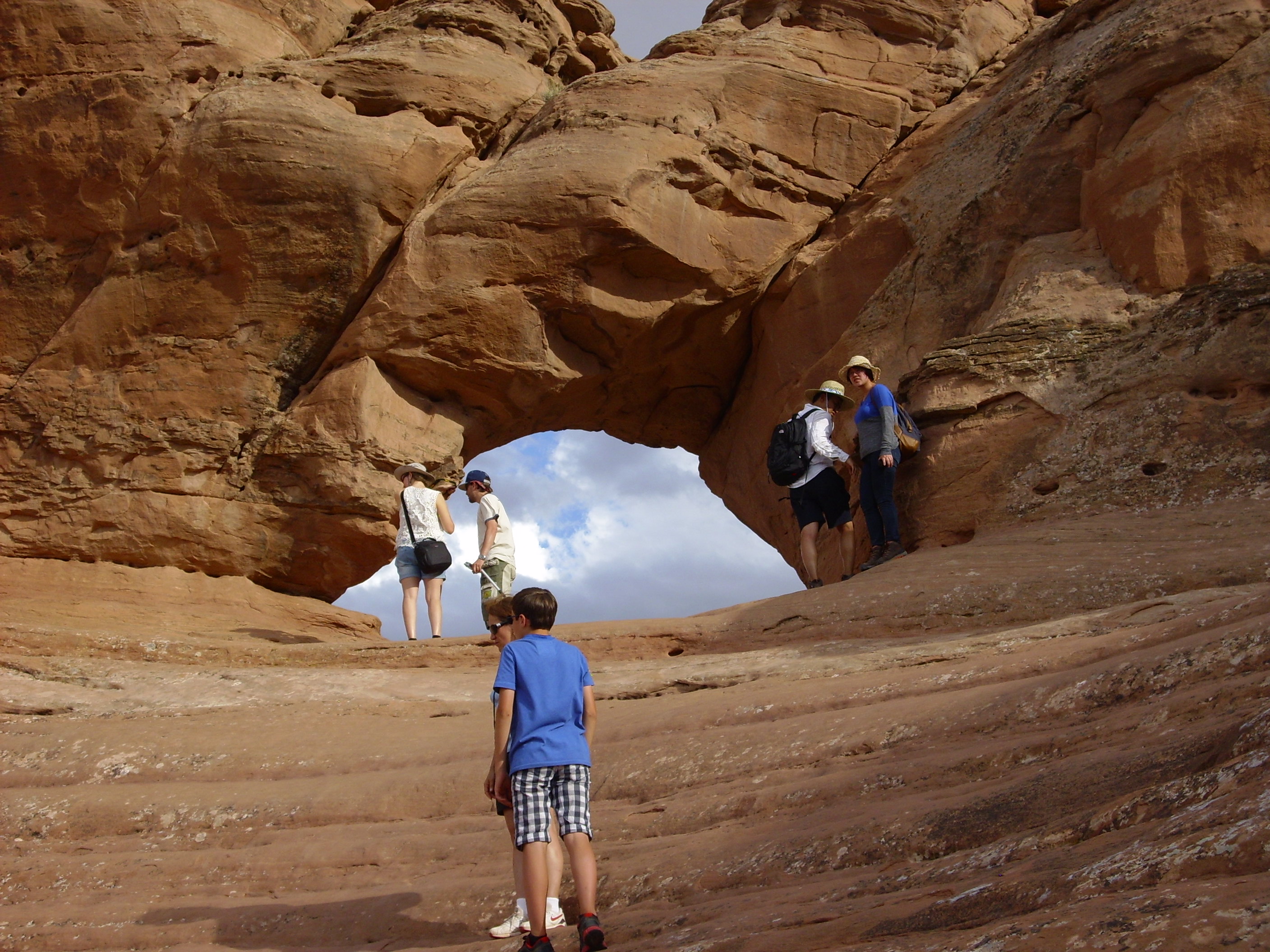
The trail teases us with a small window that is not the Delicate Arch.
The road goes ever on and on …
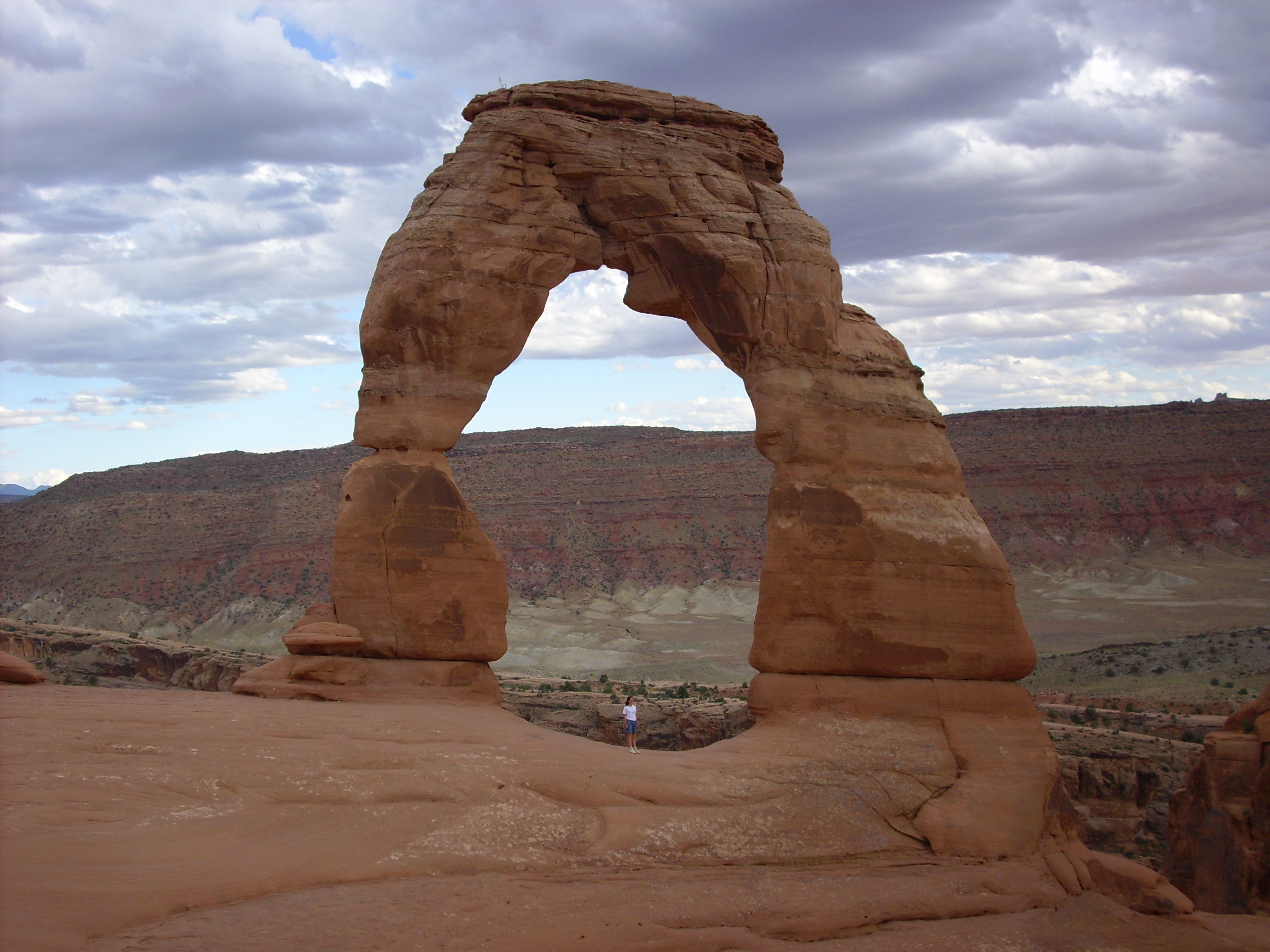
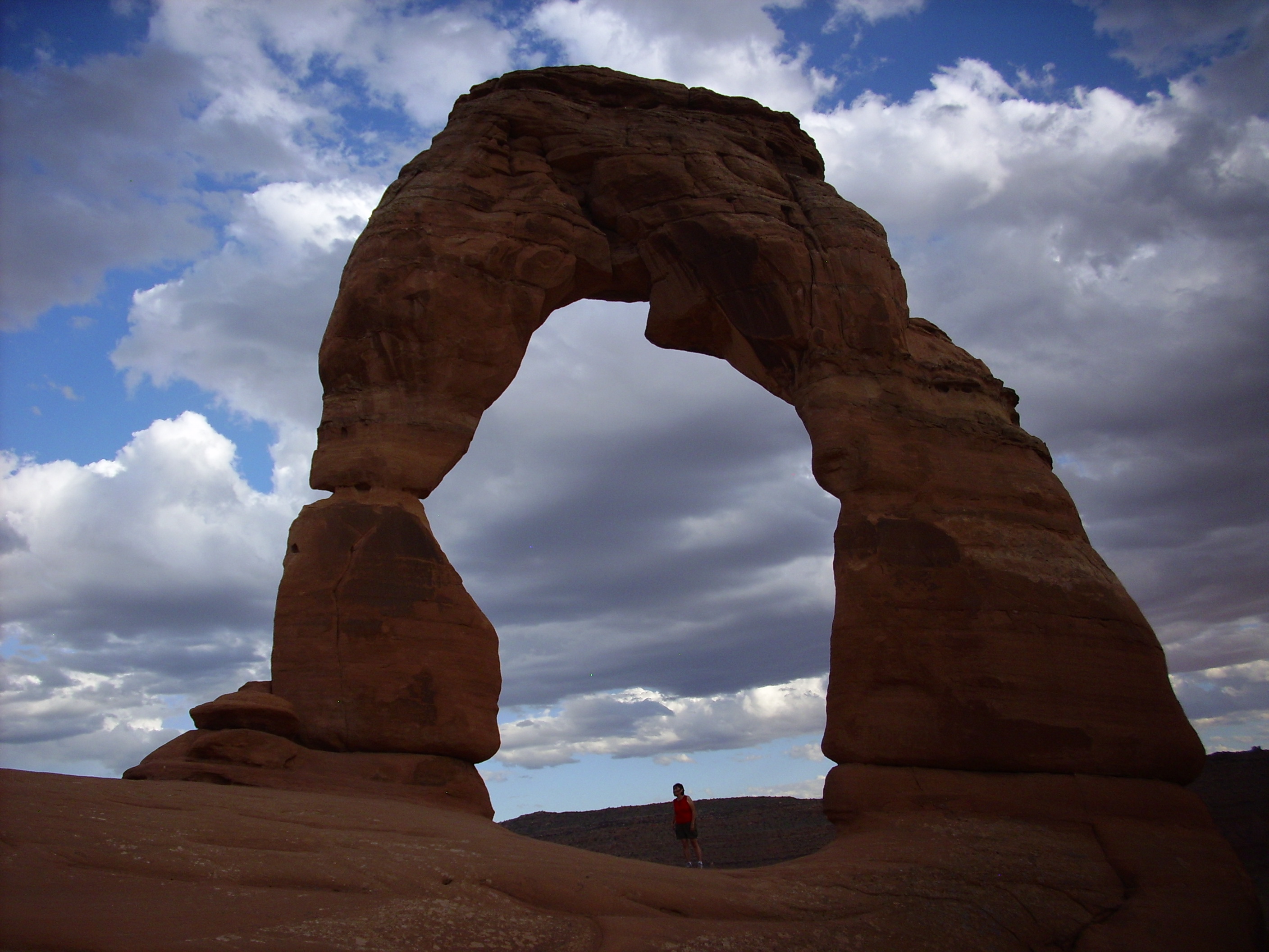
And finally the Delicate Arch. I’m no Ansel Adams, but this’ll do:
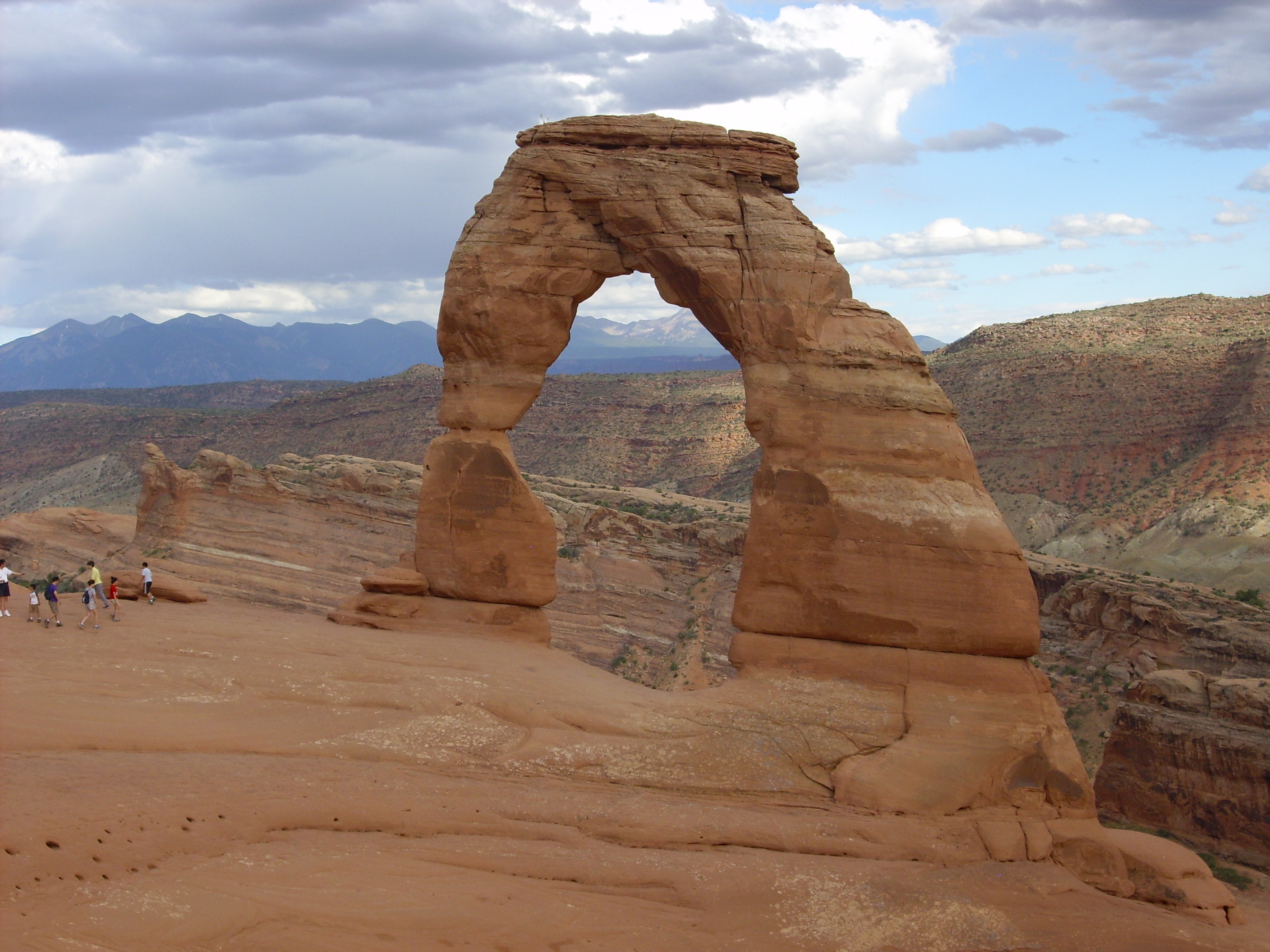
I tried finding the perfect spot from which to photograph the arch, but this turned out to be hanging from a rope on the side of a cliff northwest of the arch, which I could not manage. I couldn’t really beat my first photo.
There was an interesting mix of tourists on the trail. I’d guess half were foreign tourists, and I think most of those were Chinese. I can tell a tonal language from Japanese, and I didn’t hear any Asians speaking a non-tonal language until I got to Yellowstone.
I figure they’re here to look it all over before they foreclose on it.
I hiked back, drove to Devil’s Garden campground, found my spot, started pitching my tent, and discovered that the tent pegs did not make it on the trip. Well, shucks. And other comments. Fortunately it was a dome tent, so it could sort of stand by itself once the rods were in, so long as there was no breeze. Naturally, there was breeze. And the pad I had was tragically inadequate. I ate a somewhat drab dinner of beanie weanie and sweet potato chips with Glucerna, then wandered down to the amphitheater to hear a ranger talk about early pioneers in the area. Afterwards I turned in but did not get much sleep. I made plans to buy some more equipment once I reached Orem.
Tomorrow: Miles and miles of miles and miles.