Kent and Bruce’s Excellent Adventure, Day 8
Day 8: Craters of the Moon!
We chose July 4 for Craters of the Moon on the theory that Yellowstone would be a madhouse on the holiday. Actually, the weekend crowds were never that bad, but it still seemed a good choice of day for a non-Yellowstone adventure. Since we were headed the other way, Bruce met me at my camp, and we proceeded south.
As I mentioned earlier, my camp was directly on the north rim of the Henry’s Fork caldera. This caldera has had two supereruptions and a number of smaller eruptions. The first supereruption, 2.1 million years ago, was the largest in the Yellowstone area and is thought to have produced a caldera 50 by 40 miles in size. The second eruption, 1.3 million years ago, was smaller and involved just the west end of the previous caldera, leaving a rim still visible today as the Henry’s Fork caldera. The west side of the rim forms a clear semicircle, while the east side has been buried under ash flows and lava from the third caldera eruption and subsequent eruptions, from 640,000 years ago on.
We stopped near the center of the caldera and I took a series of panorama shots. Let’s see how well these can be assembled.
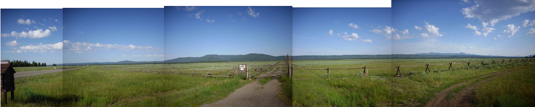
At the left, looking south, you see Big Bend Ridge, the south rim of the caldera. This is interrupted in the third section by Bishop Mountain, a rhyolite dome that erupted (likely from the caldera ring fracture) some time after the second caldera eruption. The north rim continues from there, with the Centennial Mountains (unrelated to the caldera) in the background.
You can see it’s quite a big caldera, somewhat larger than Valles.
There are a number of small rhyolite domes within the caldera, formed long after the last caldera eruption, and likely from a fissure produced by regional extension. We stopped at one because I have a photo in one guide book that makes it look an awful lot like the Tshicoma Formation in the Jemez.
The dome was just north of a forest road.
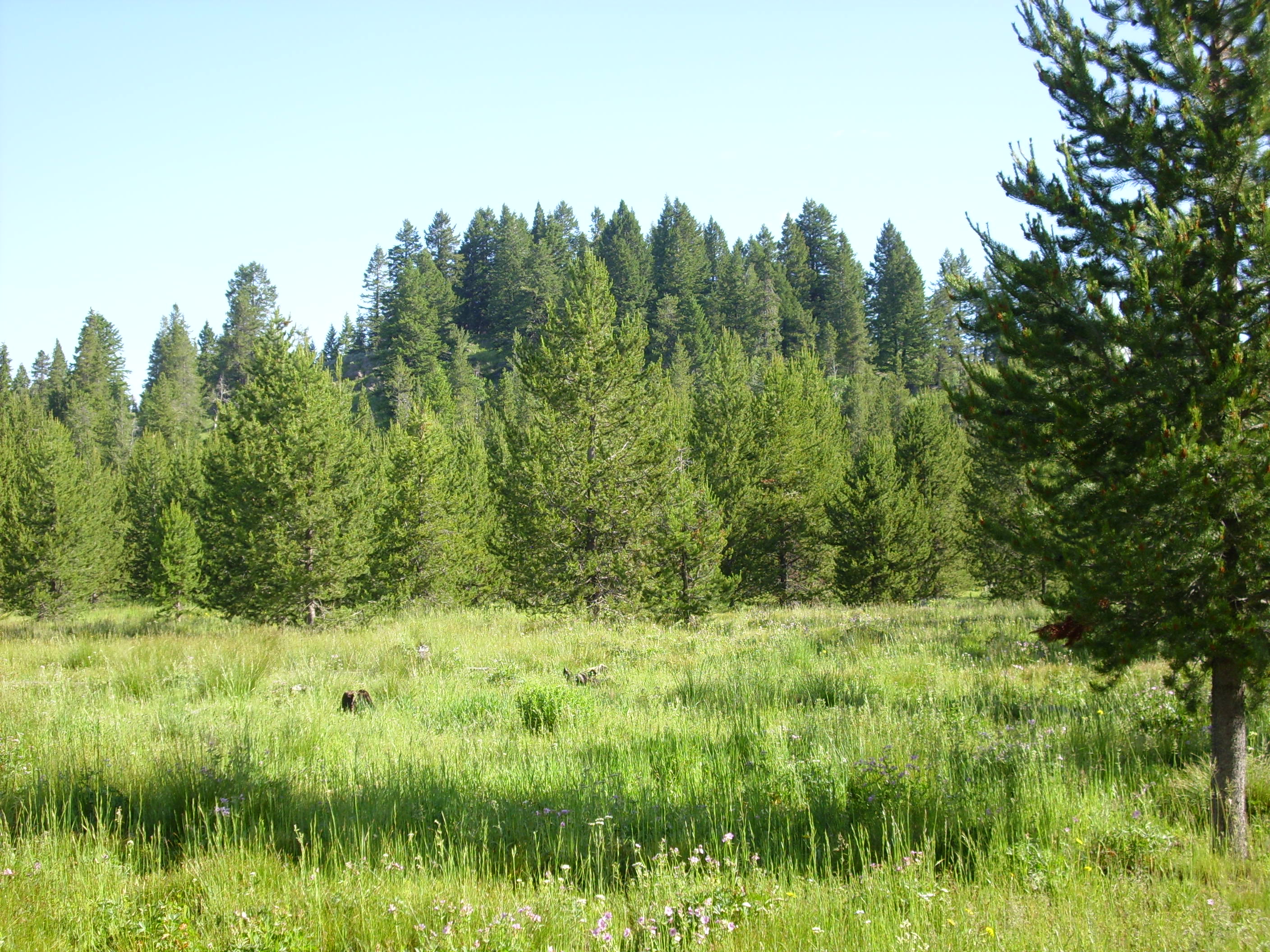
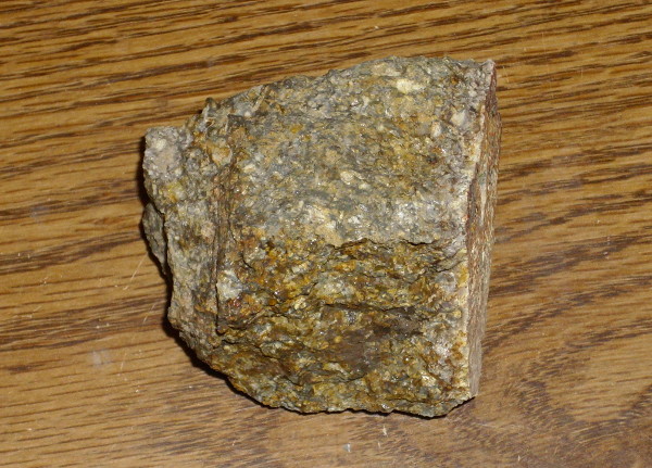
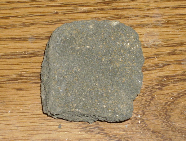
I tromped off through the wet grass while Bruce guarded the car. Some kind of raptor was ahead of me protesting the intrusion of its territory, but I never caught sight of it. I brought back a sample of the dome rock.
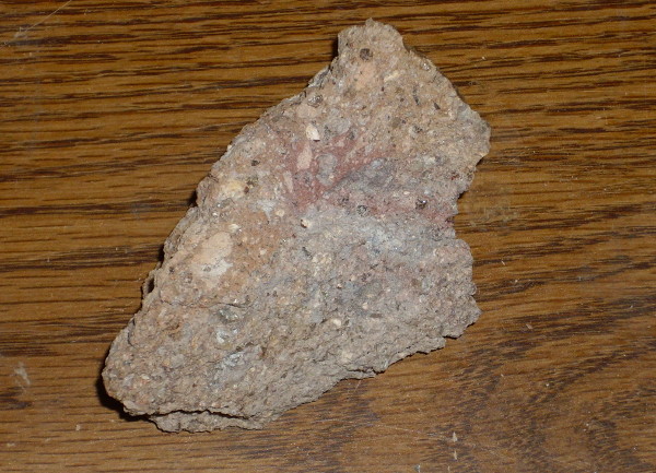
This strongly resembles the Big Bend Ridge Rhyolite I showed earlier, to which it is probably closely related. However, this Island Park Rhyolite is less than half the age.
This rock did not resemble the Tschicoma at all. My book didn’t lie; it just took its sample from a different small dome within the caldera. We did not get another chance to visit that one on this trip.
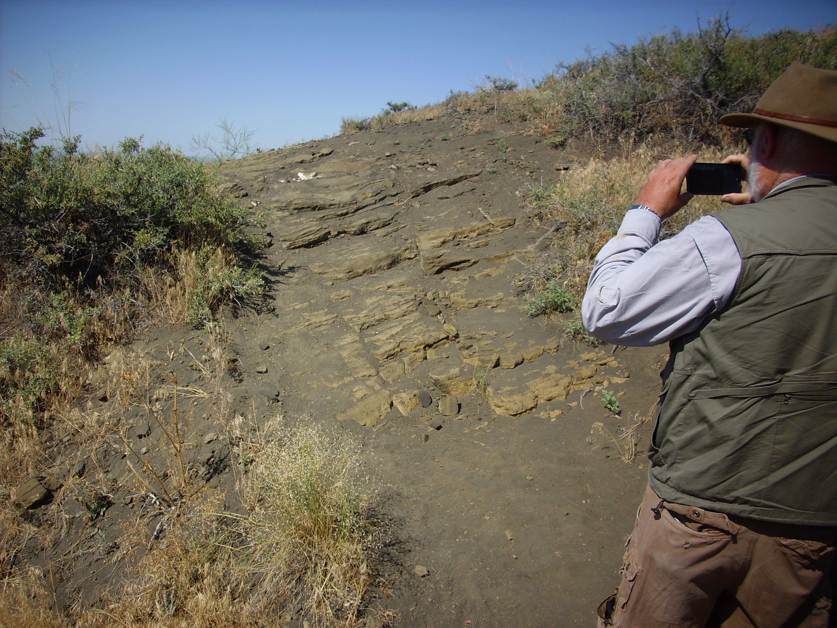
We stopped on a road cut through the south caldera rim that was recommended in one of our road logs.
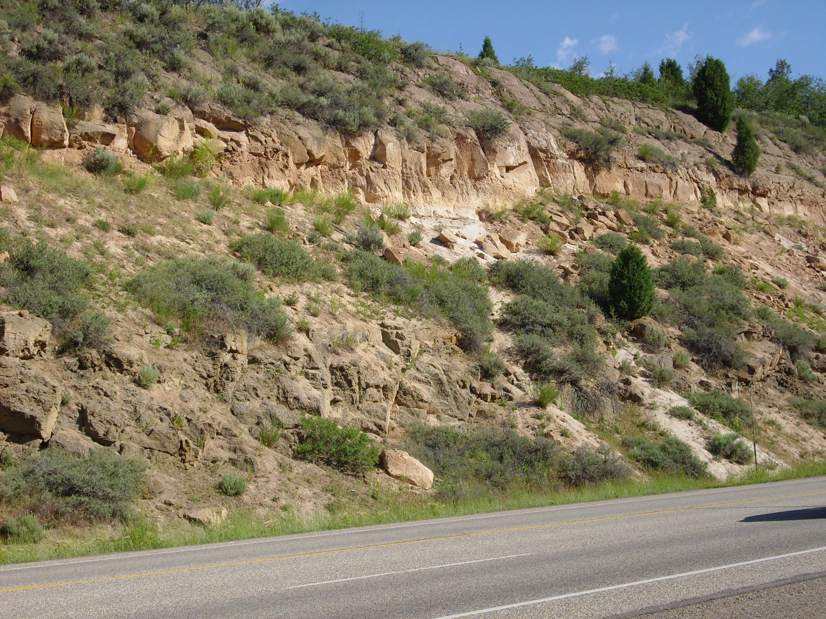
This looks an awful lot like some of the mesas back home, and this is no coincidence. Our mesas are two separate eruptions of tuff, the Tsherige Member on top and the Otowi Member beneath, with pumice beds at the base of each. Here we don’t see the base of the lower Huckleberry Ridge Tuff, but we do see pumice beds at the base of the Mesa Falls Tuff on top of it. The big difference with home is that at Island Park the lower tuff is more durable, while at home the upper tuff is more durable. As a result, the cliffs here are not quite as steep and dramatic as at home.
I already posted pictures of my samples of these two tuffs, but what the heck: Hucklbeberry Ridge Tuff:
and Mesa Falls Tuff.
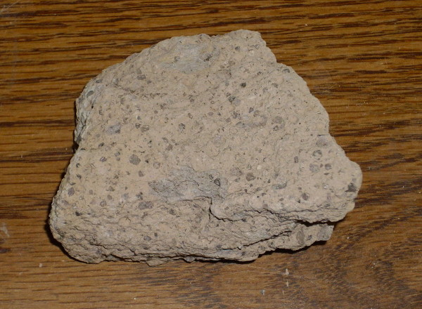
You can tell the difference even in the road cut photograph.
From there we headed for Idaho Falls. However, along the way, we took a small side trip to the Menan Buttes. These are maars, which form when lava erupts through water-saturated ground. The steam blows the lava to bits and produces a broad, low cone composed of a kind of tuff that is not an ignimbrite. In this case, the lava was quite low in silica, producing an unusual basaltic tuff.
We first stopped at a small maar to the south:
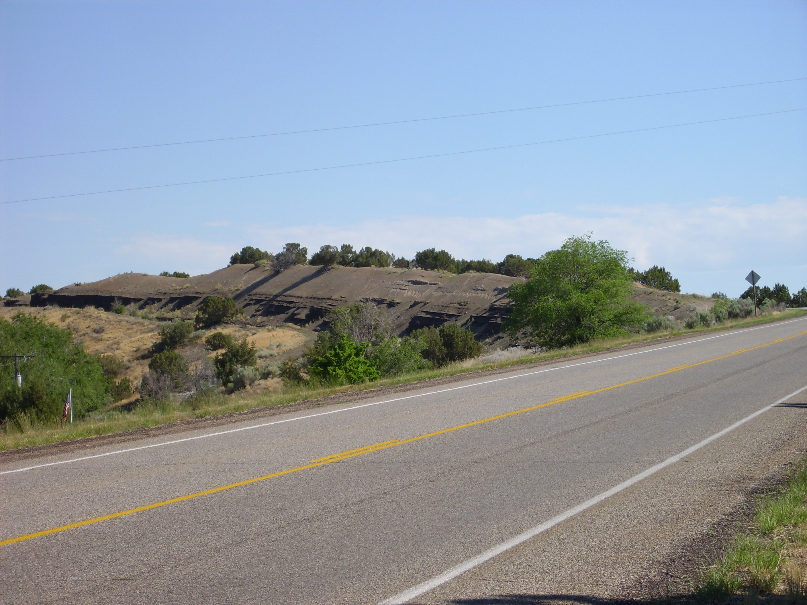
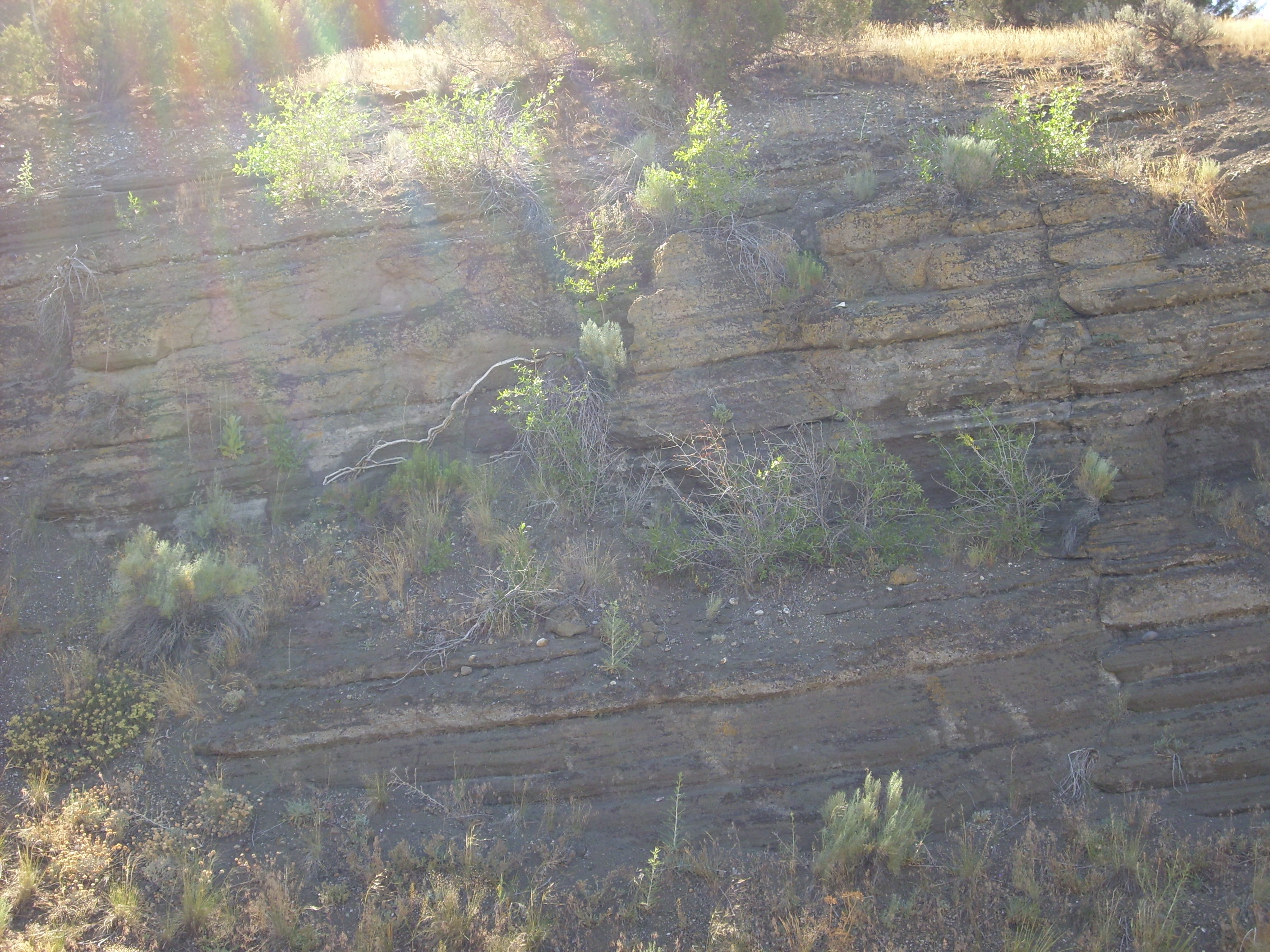
The layers of ash here were so poorly consolidated that I preferred not to take a sample.
We then drove to the main buttes. North Butte:
We found that there is a parking area and trail head controlled by BLM. We hiked a short distance up this trail, enough to satisfy our curiosity. South Menan Butte from the North Butte:
North Butte, close up.
The contrast of the rough rocks with the fresh ash beds above had me thinking the lower rocks were lava, which was one reason I wanted to climb partway up the trail. They were not. I’m wondering if the difference in appearance is because the upper beds are much younger, from a second eruption. That’s unusual with these kind of cones, which usually erupt once from a given spot, but they sure look fresher. Now I almost wish I’d climbed up to get a better look. But our day turned out long enough.
Some of the beds on the side of cone looked so much like ordinary sandstone it was uncanny.
Yeah, that’s Bruce. We wondered if these were in fact river sandstones forced up by the eruption, but close examination showed the grains were cinders, not sand grains. Here’s a photo of a sample I took.
You could almost mistake this for a piece of broken blacktop pavement, but it most certainly is not. It’s a basaltic tuff.
I suppose I was a bad boy. The signage encouraged visitors to refrain from taking rock samples, but did not actually prohibit it. Bruce concluded, and I agreed, that the sign was put up by some low-level administrator who very much wanted to ban rock collecting but lacked an authority to do so.
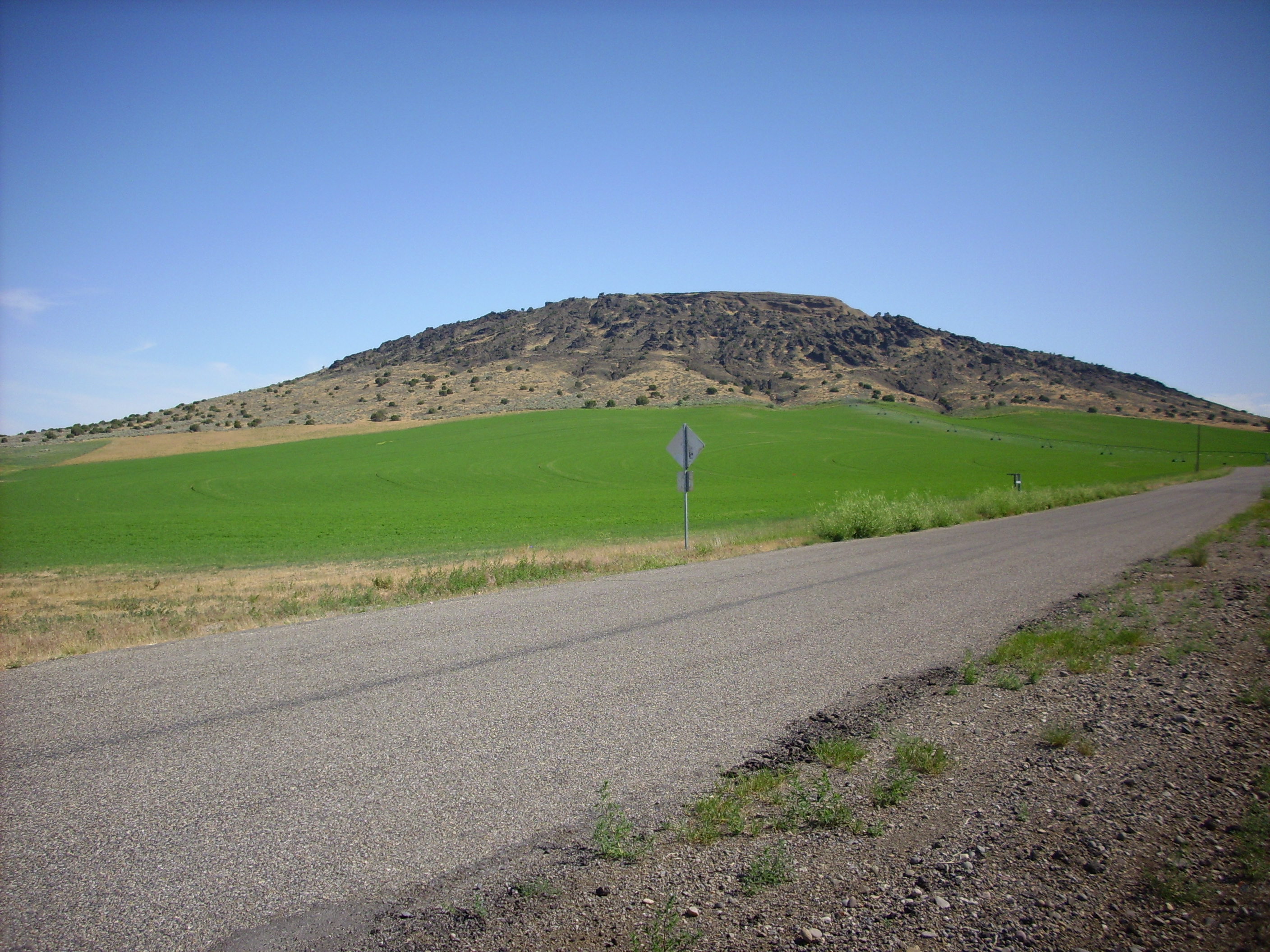
We got back on the main highway, headed west from Idaho Falls, and drove across a fair bit of Snake River plain. It’s pretty flat and the rock outcrops you see are old basalt. Well, except for a few domes erupted through the basalt:

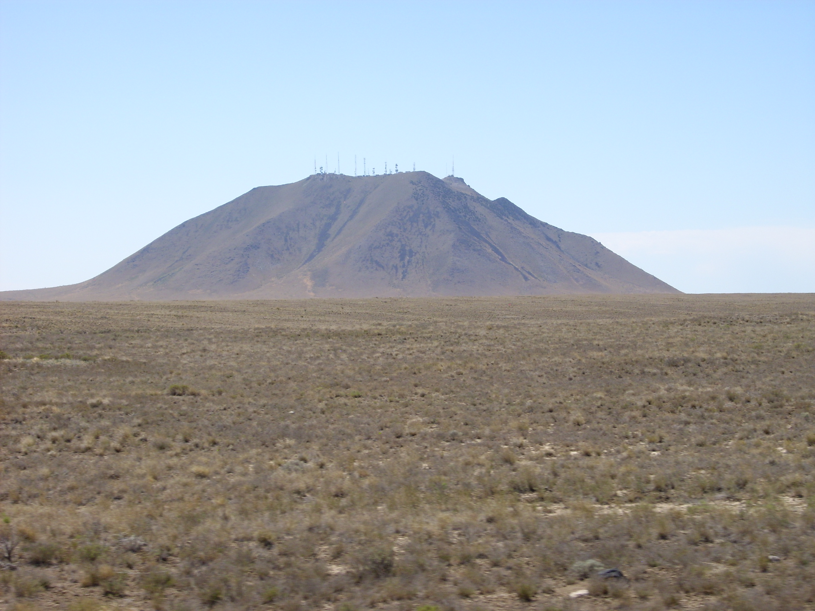
At first glance, Middle Butte looks like a mafic dome (mafic = rich in magnesium and iron and low in silica), but apparently it is rhyolite that popped up a solid plug of basalt from beneath rather than just flowing out as a dome. The edges of the plug have eroded off and scattered all over the slopes to make the whole thing look a little like basalt from a distance.
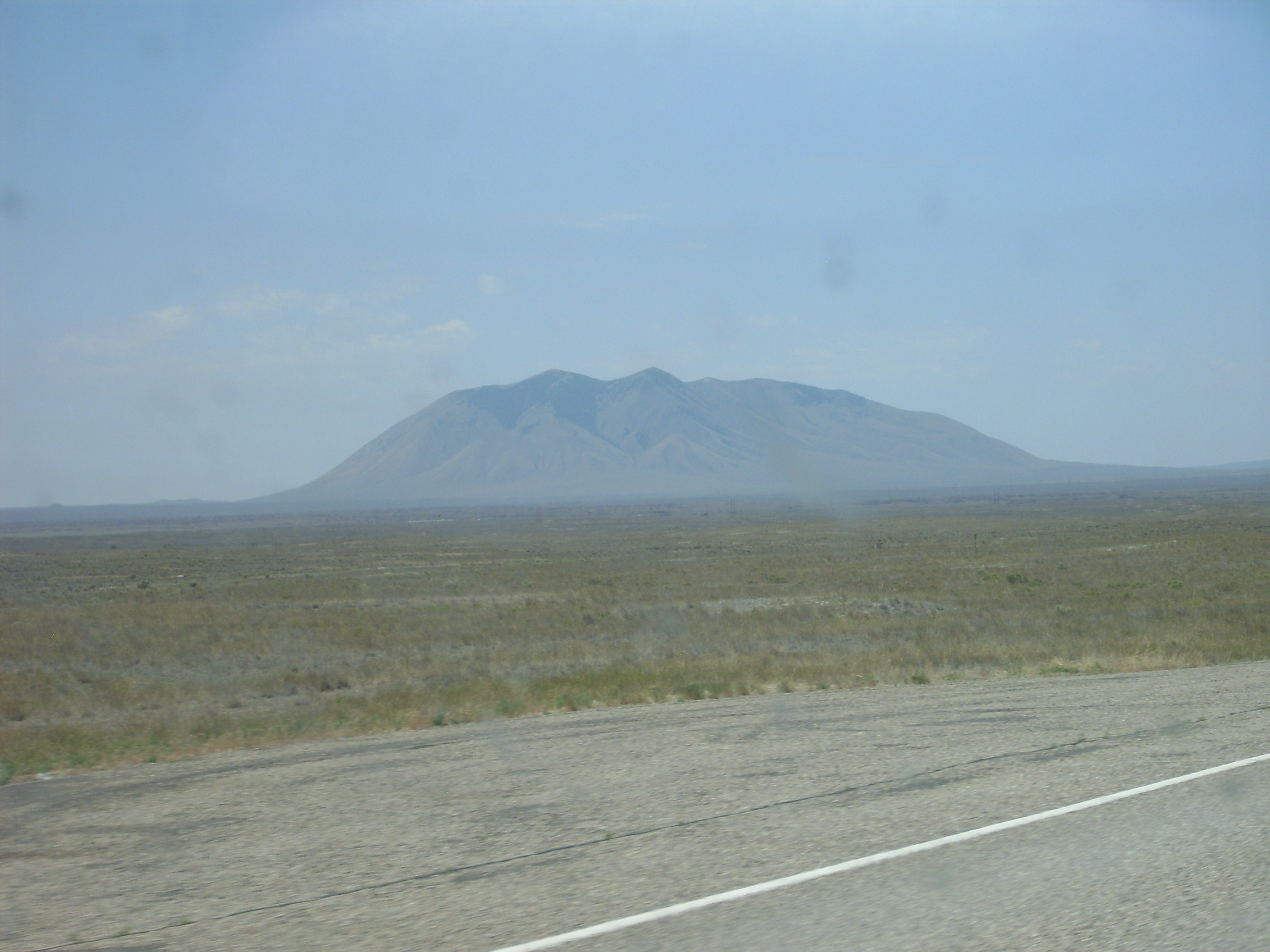
Wikipedia claims this is the largest rhyolite dome in the world. I’m skeptical; some of the flows in Yellowstone seem more voluminous, but then they may not count as domes, precisely.
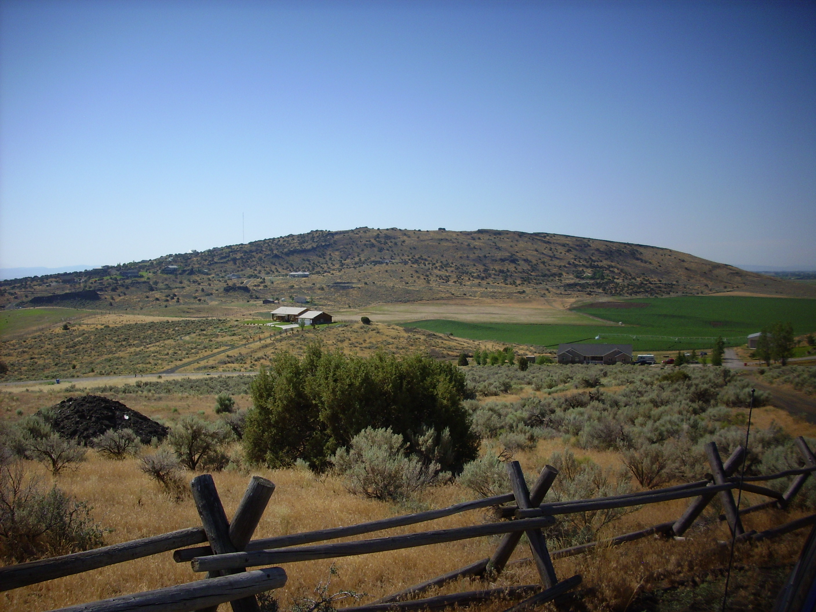
Through the town of Arco:
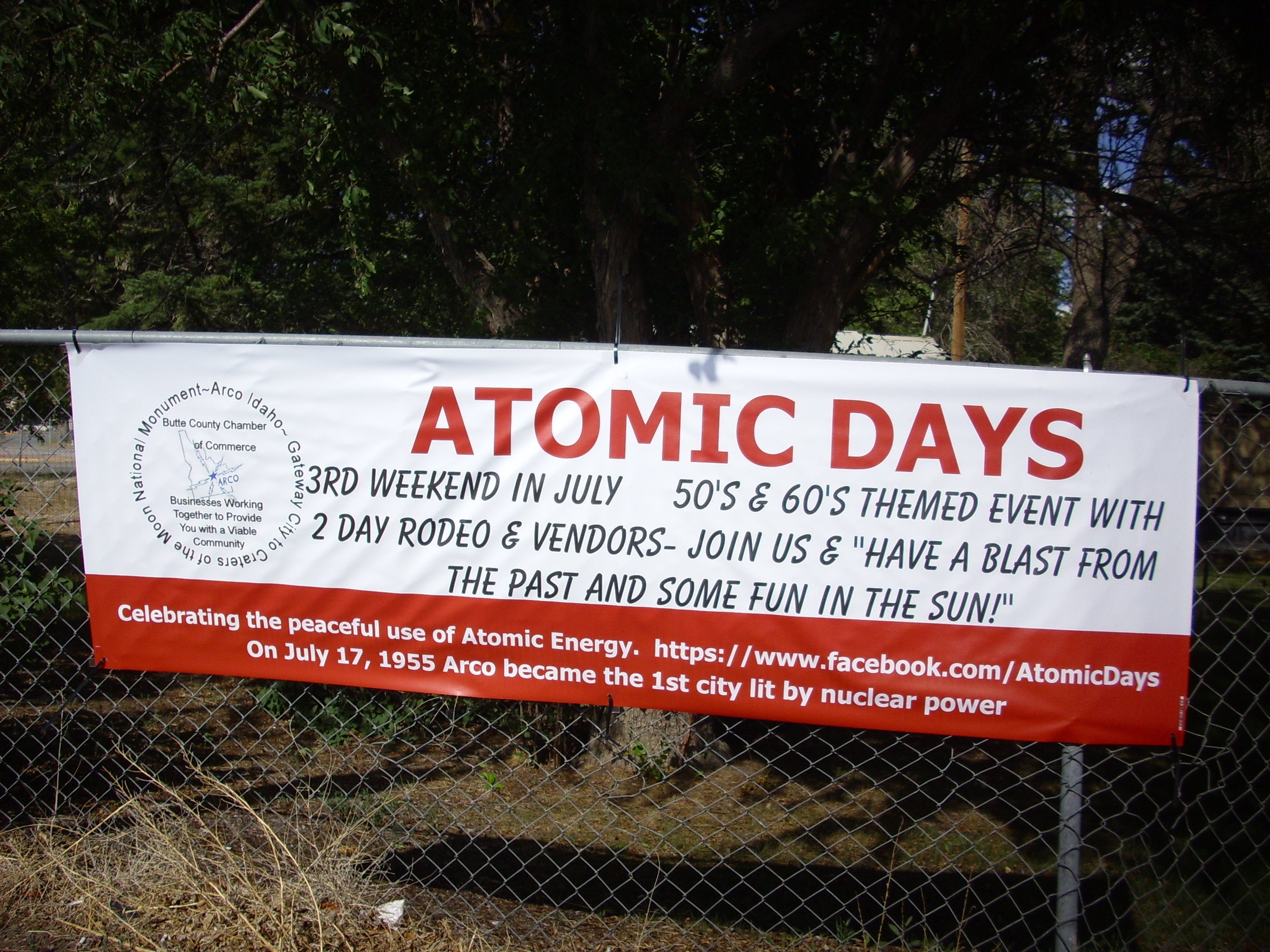
And to Craters of the Moon.
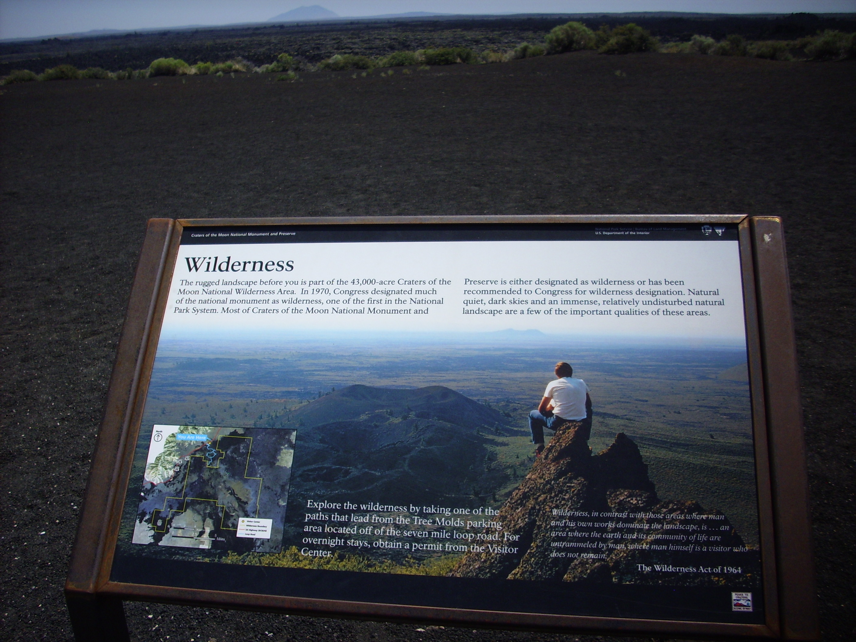
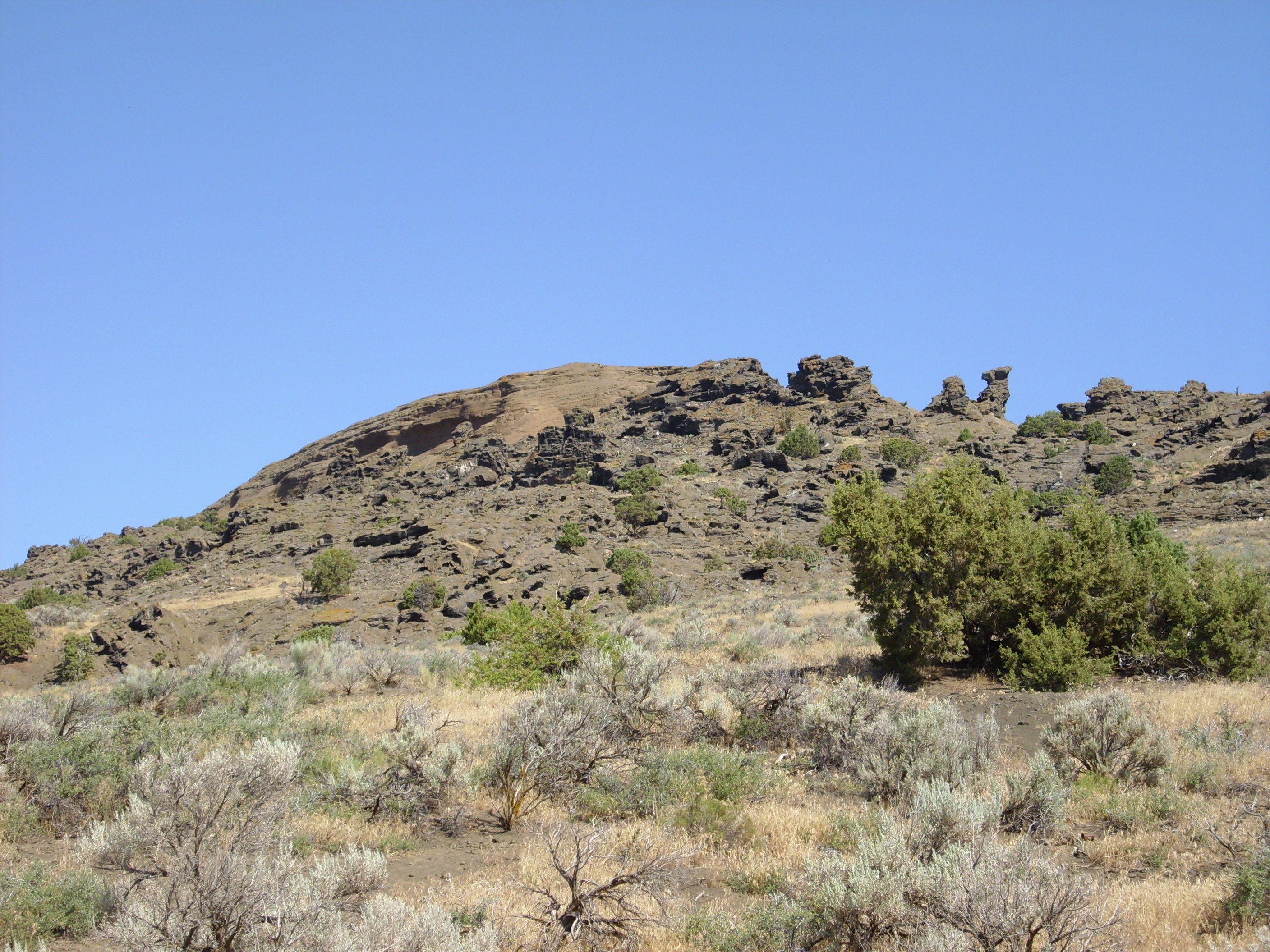
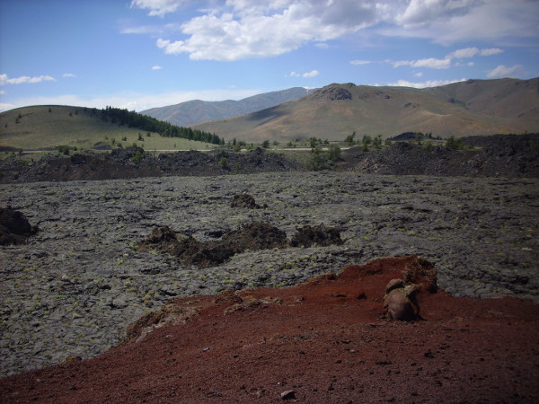
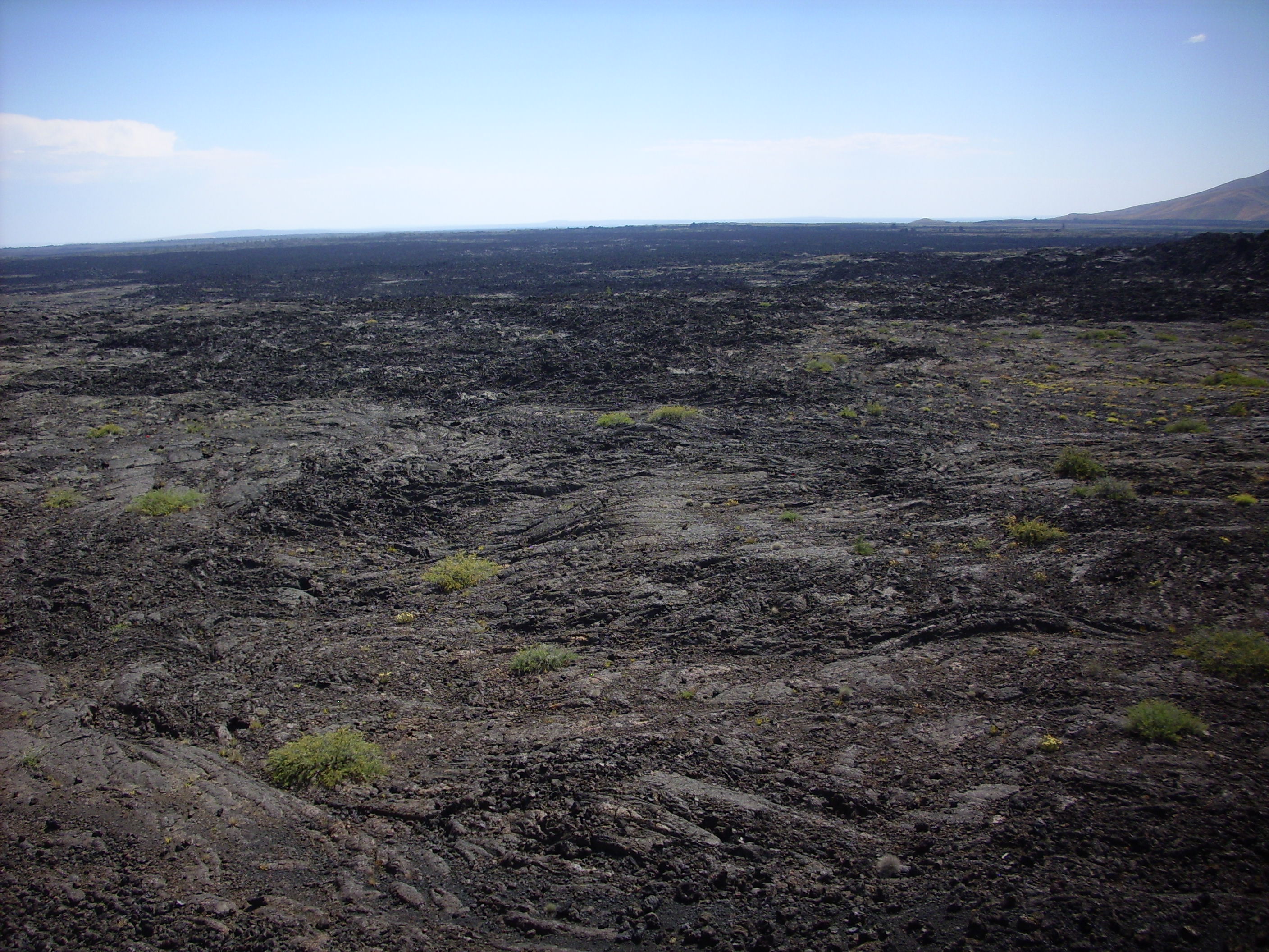
It does look that way. Craters of the Moon is centered on the northern part of the Great Rift, a crack in the Earth’s crust extending across the Snake River Plain and reaching far down. The rift is quite prominent at some points, and the deepest part of the crack goes down at least 500 feet. Basalt lava (low in silica, very fluid) comes boiling up about every 2000 years, then spreads out over the Snake River Plain. The youngest flows here are about 2000 years old. Yeah, we’re due. Fortunately this kind of eruption would not be very destructive in this sparsely-inhabited area. It would, in fact, be way cool to watch, in the manner of Hawaiian volcanic eruptions.
Let’s have some more fun with panoramas.
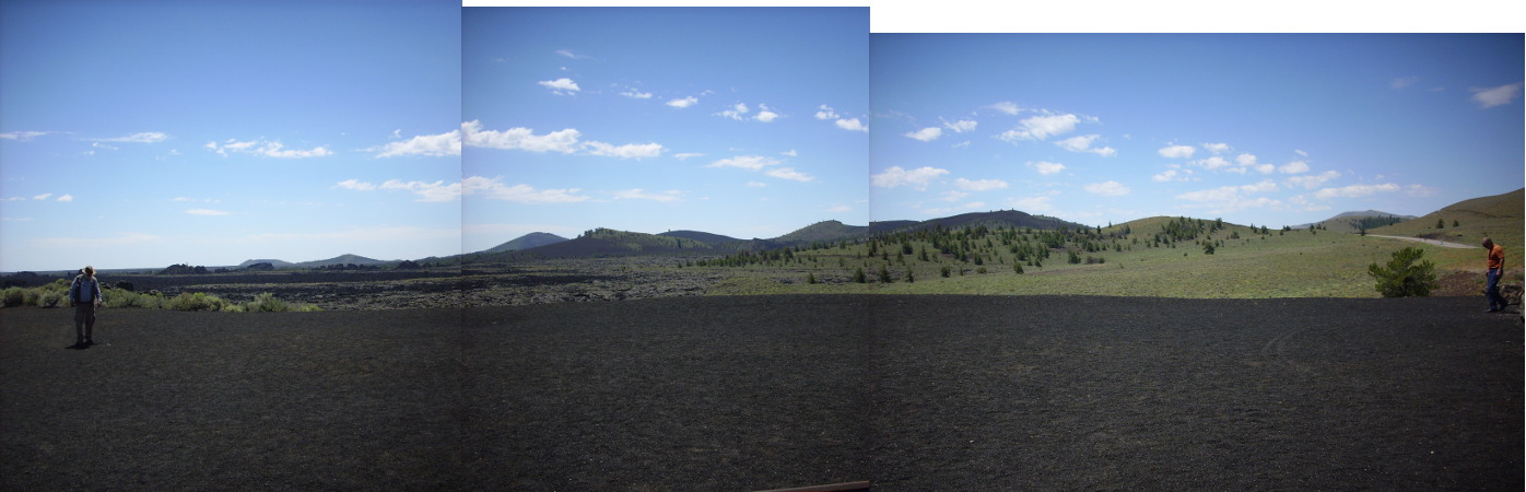
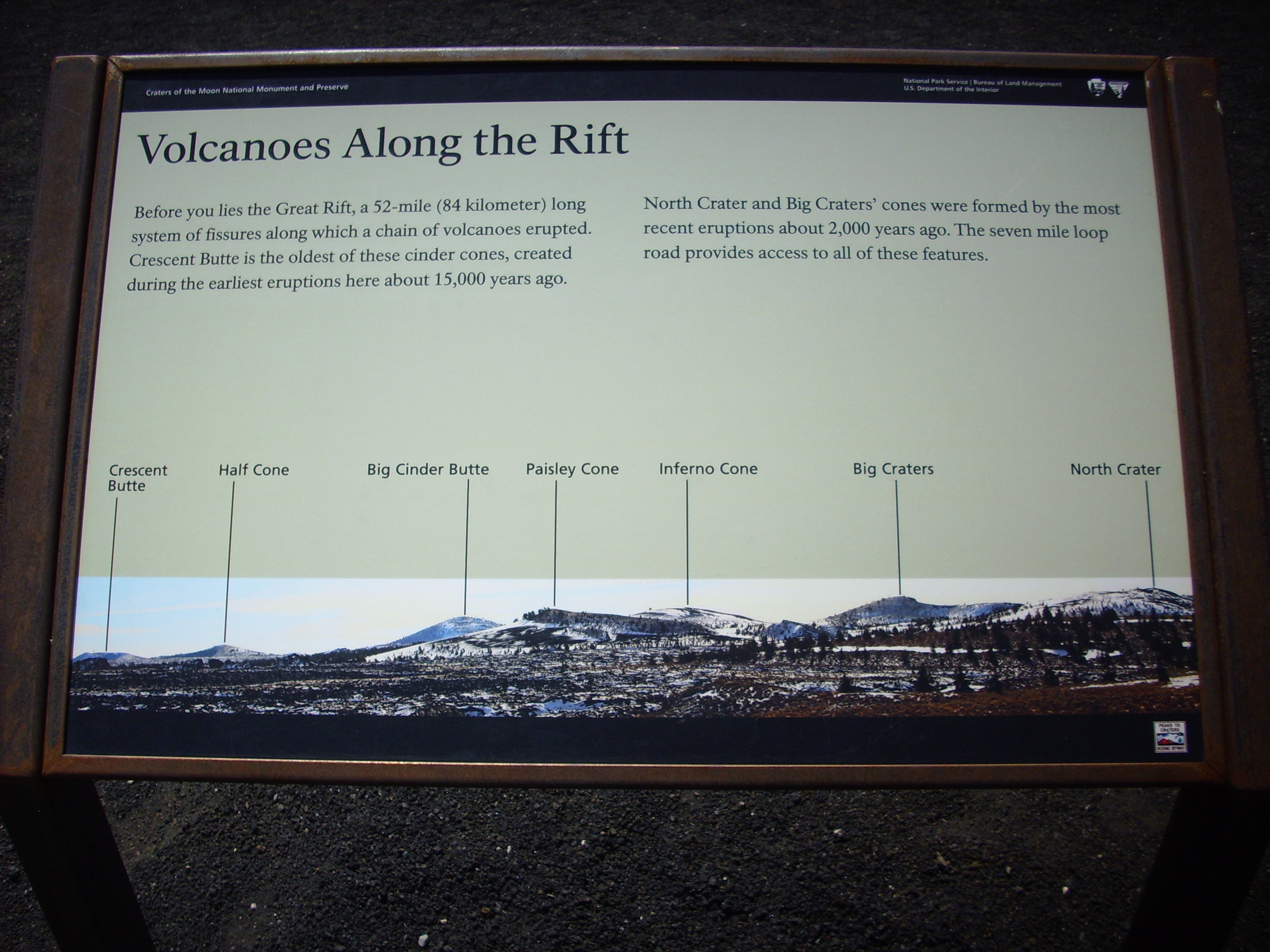
Some more shots, for a feel of the area.
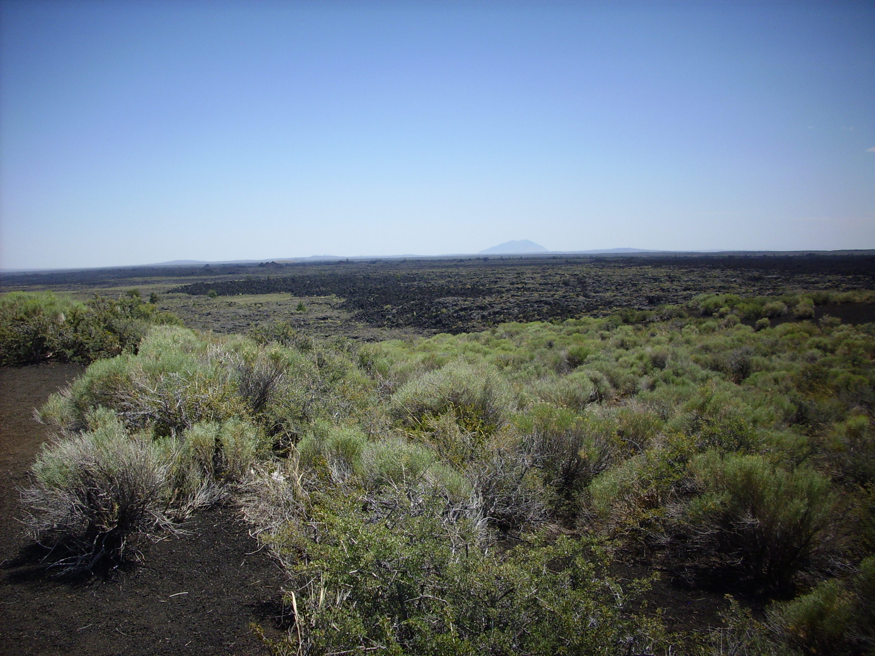
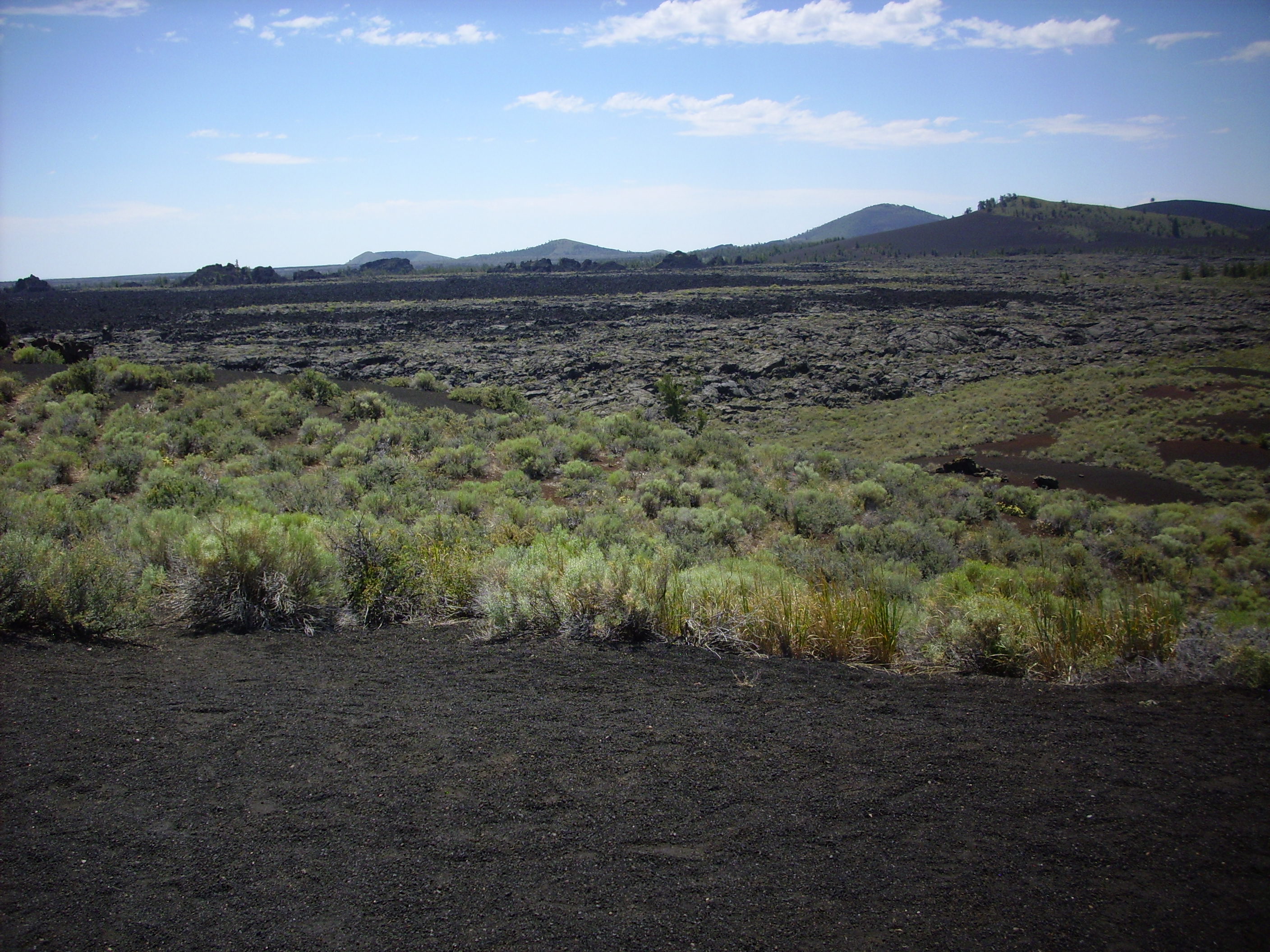
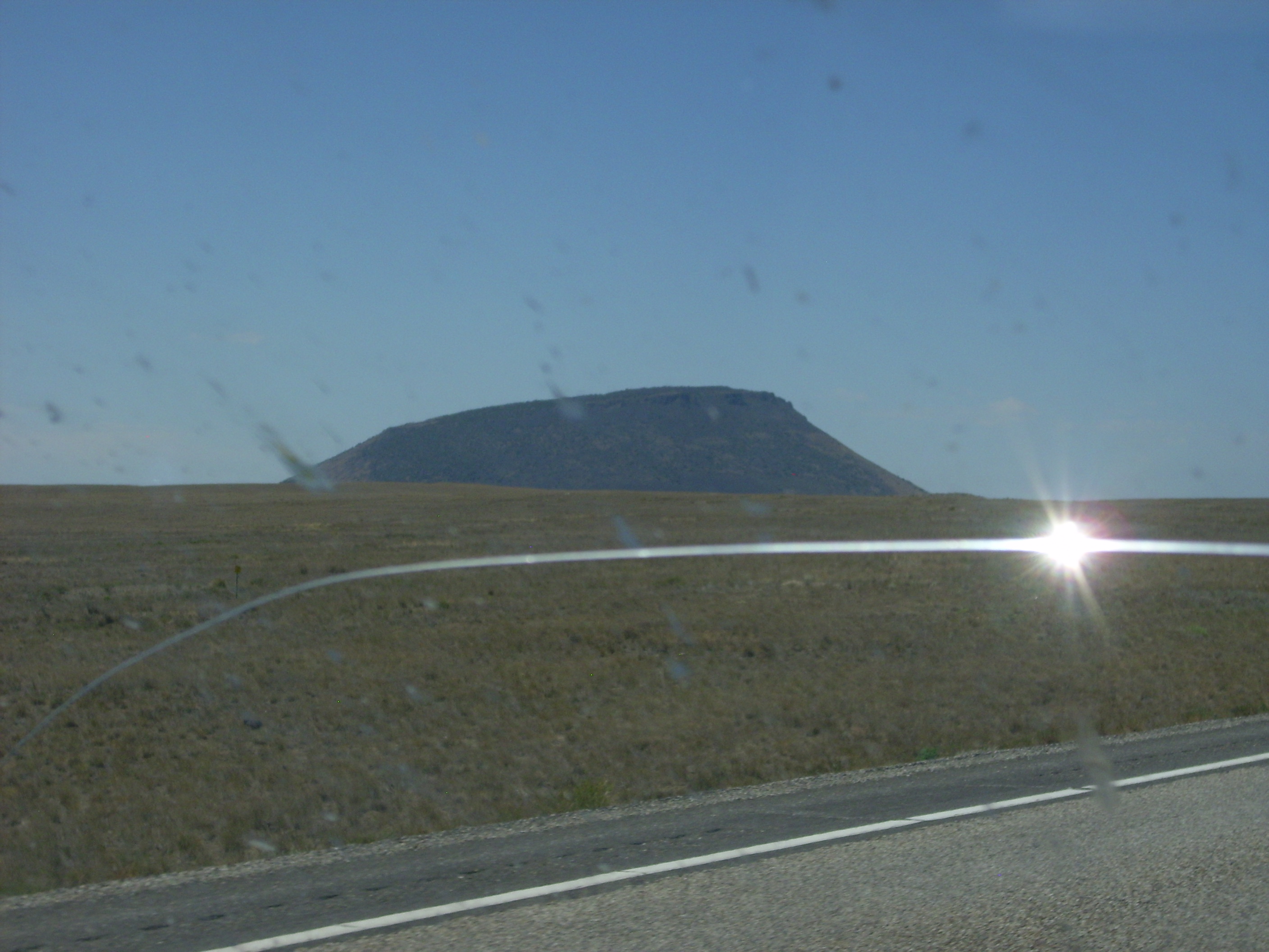
That’s Big Southern Butte in the distance in the first one.
We drove on in to the monument headquarters for a pit stop, water, and the bookstore. The museum displays were high quality. Bruce charmed the rangers (all women that day, for some reason) into making him take a customer satisfaction survey, then for good measure charmed them into making me take it as well. Well, really, what wasn’t to like? I found a very interesting book on plate tectonics, for which Bruce produced a card good for 15% off. The ranger began ringing it up. “Great! That card saves you $17!”
Um, did not realize the book was that expensive. Bruce stepped in, bought it, then let me have it on semipermanent loan. I am embarrassed but grateful.
Oh, and after I got home, I left it on a table only to find it half-read when I came back. Apparently Cindy found it interesting as well. I shall have to put a review up at Debunkers.
I’m not quite sure how it happened, but somewhere along the line Bruce mentioned to one of the rangers that he was a retired paleontologist, word spread, and a mom brought over her young daughter, who wants to be a paleontologist someday, to meet Bruce. Heh. It warmed my heart to see Bruce in mentoring mode with the youngster.
I think we both, for kicks, mentioned on the survey that about the only thing that would improve the place would be dancing girls. Well, when we got to the monument entrance booth, and as the ranger there was checking us through, a hornet came buzzing into her booth. We got our request! 😀
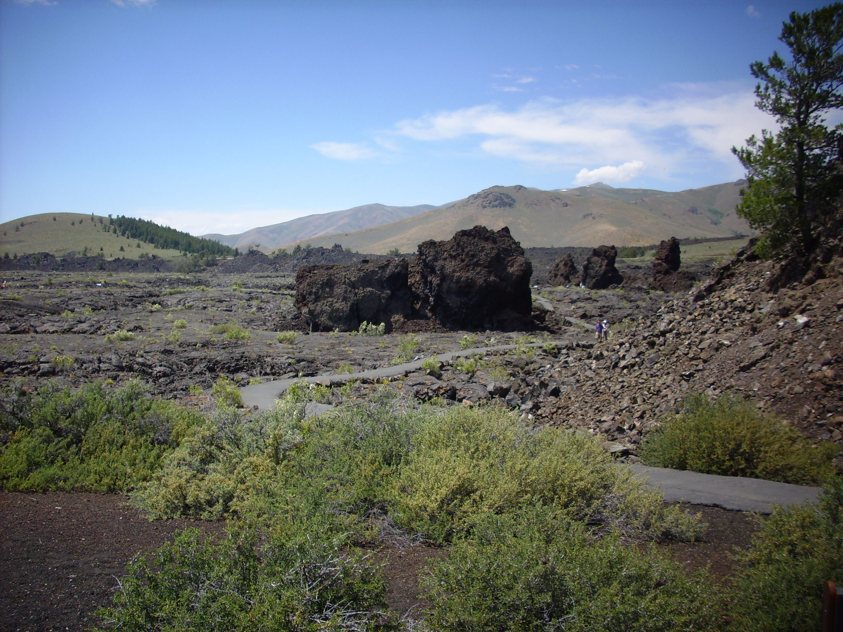
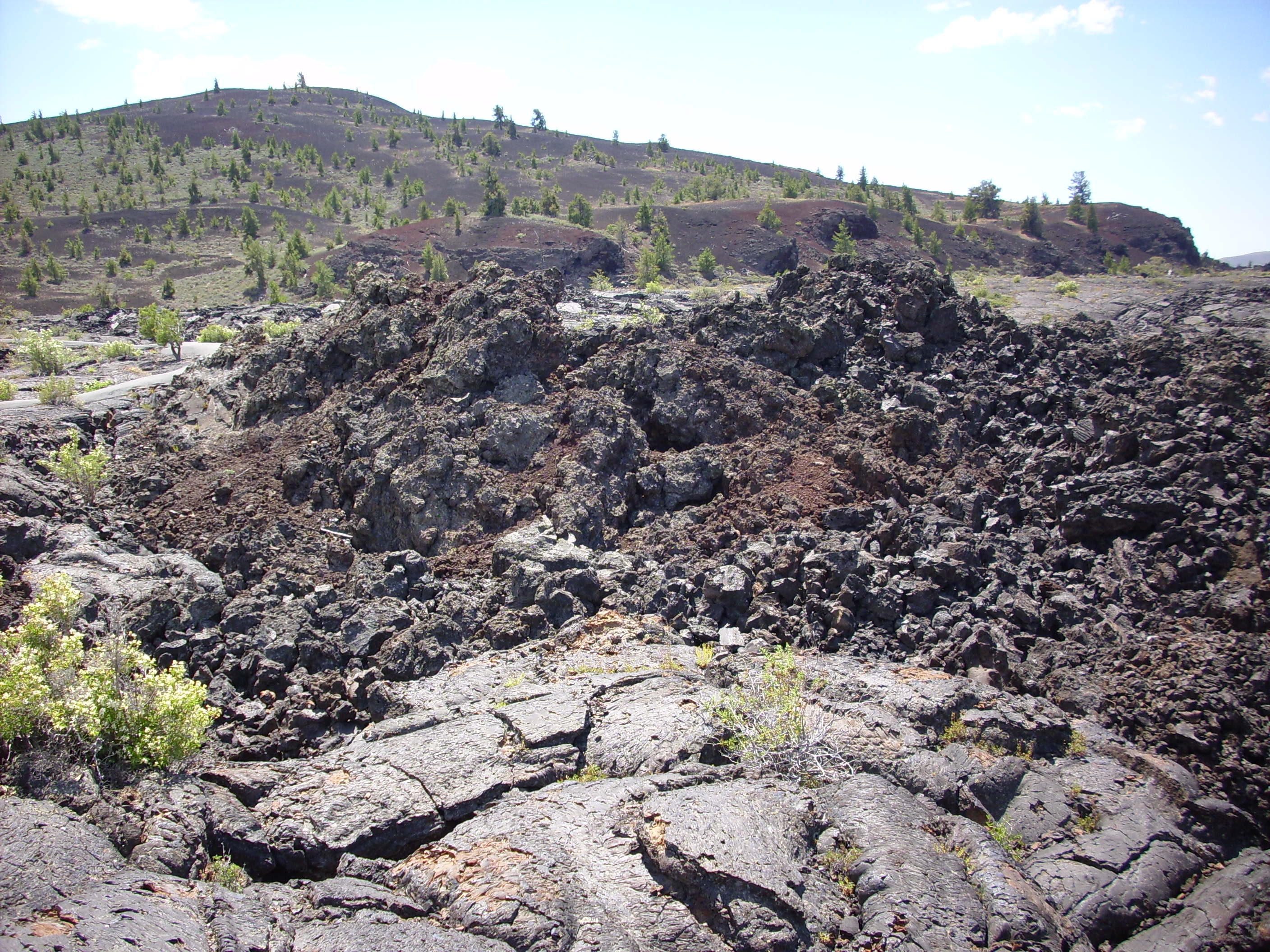
The park has got some really cool basalt formations. The first trail takes you around an area where a large lava flow destroyed an existing cinder cone, which is a kind of very small volcano that forms around a basalt vent. Big chunks of the cinder cone walls were rafted away by the lava.
The lava in the flow was mostly pahoehoe, which is hot enough and retains enough volatiles to flow relatively smoothly.

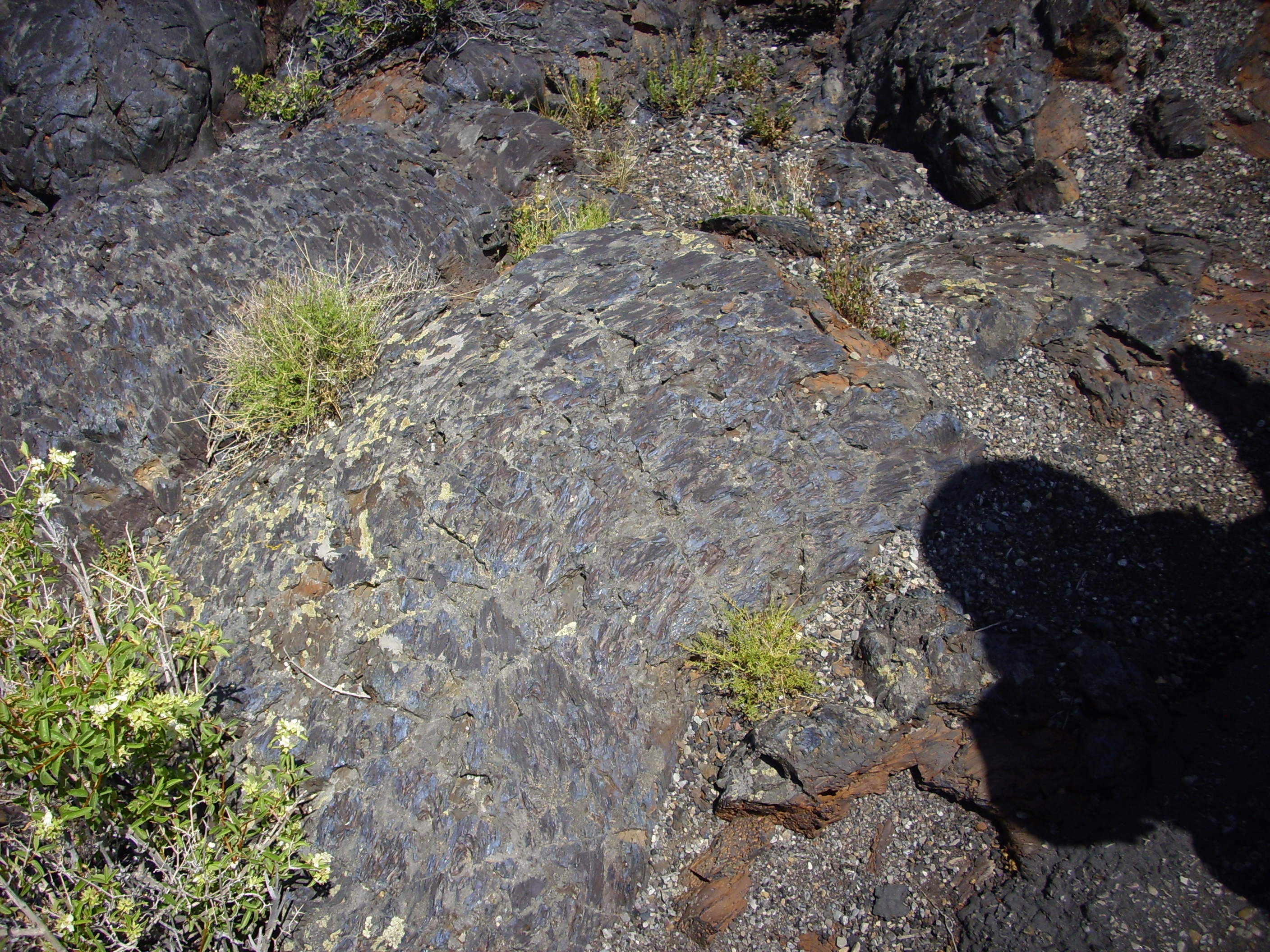
The ropy surface is quite common. There is also spiny pahoehoe, which looks almost like a petrified log.
Bruce admiring the view.

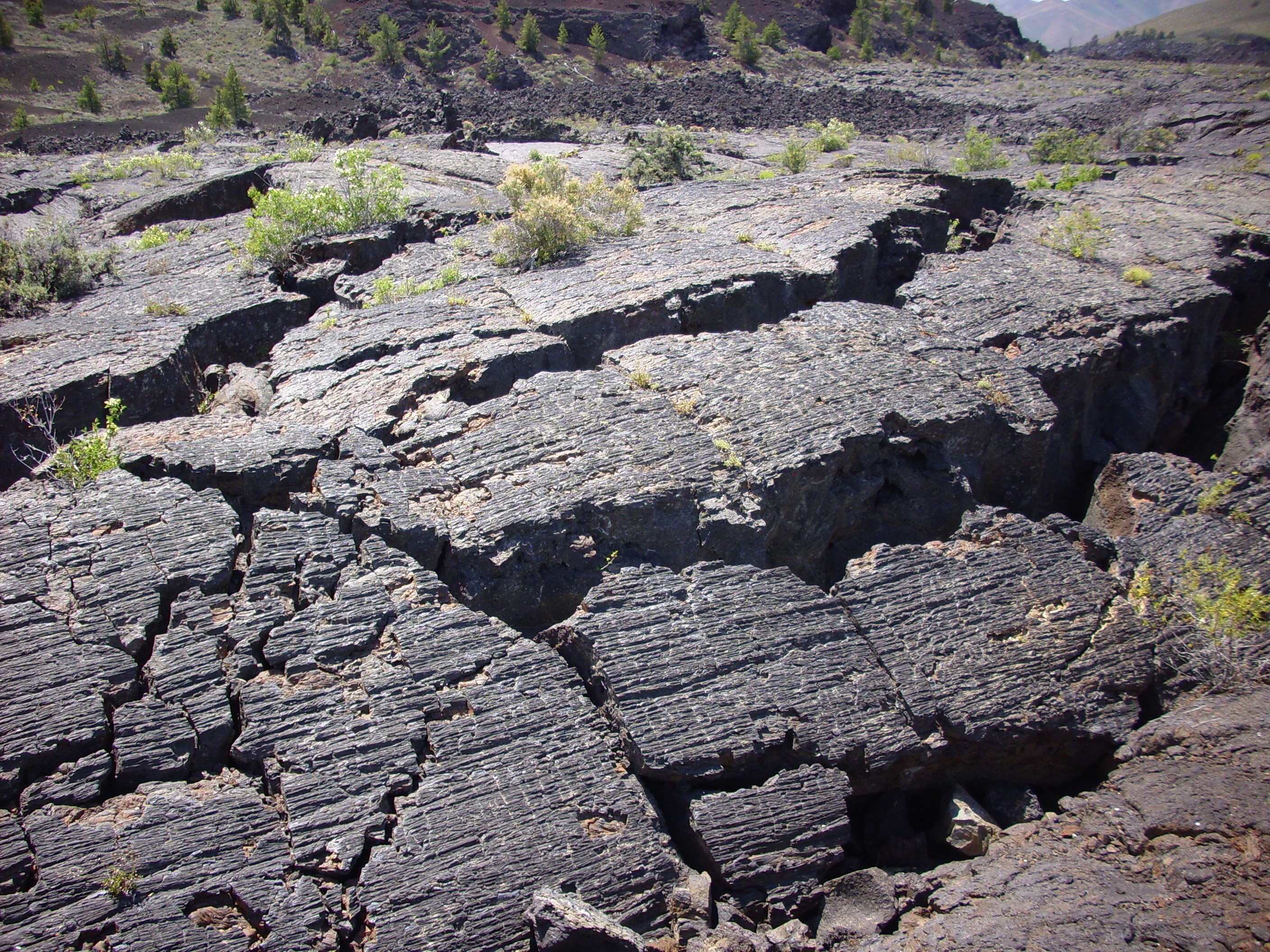
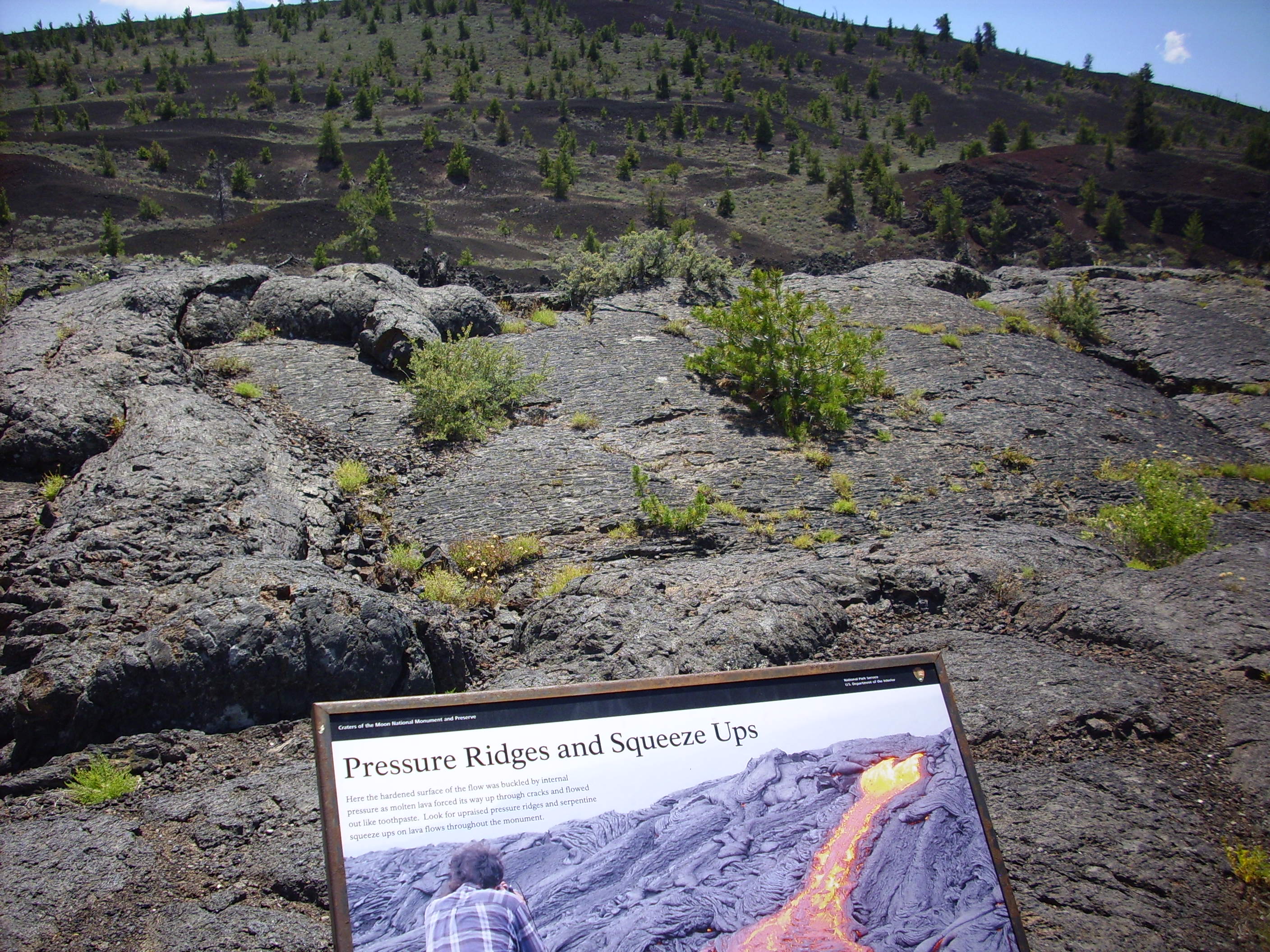
Here is a pressure ridge, which is a low ridge in the lava produced when the lave surface has hardened but liquid lava beneath pushes up and cracks the surface along a long fracture.
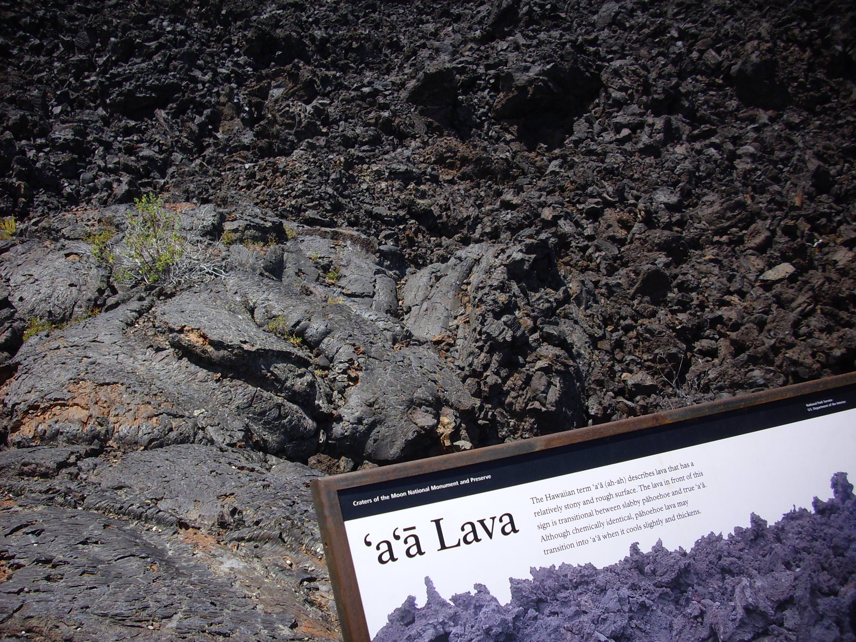
In addition to pahoehoe lava, there is a’a lava, which occurs when the lava becomes somewhat cooler and loses most of its dissolved gases. This is rubbly lava with very sharp edges, which I am assured can destroy a pair of boots in short order.
Almost unique to Craters of the Moon is blue dragon lava, so-called because it shimmers a pale iridescent blue when the light hits it right.
(Click to enlarge.) This iridescence is apparently due to titanium minerals that produced a layer of fine crystals on the surface of the lava. It is found only on the youngest flows at Craters of the Moon, and apparently almost nowhere else.
We then hiked about a third of the way along the North Crater Trail. This was not an easy trail, but we had heard that there were pumice and granulite xenoliths embedded in the flows at about this point on the trail, and we had to take a look.
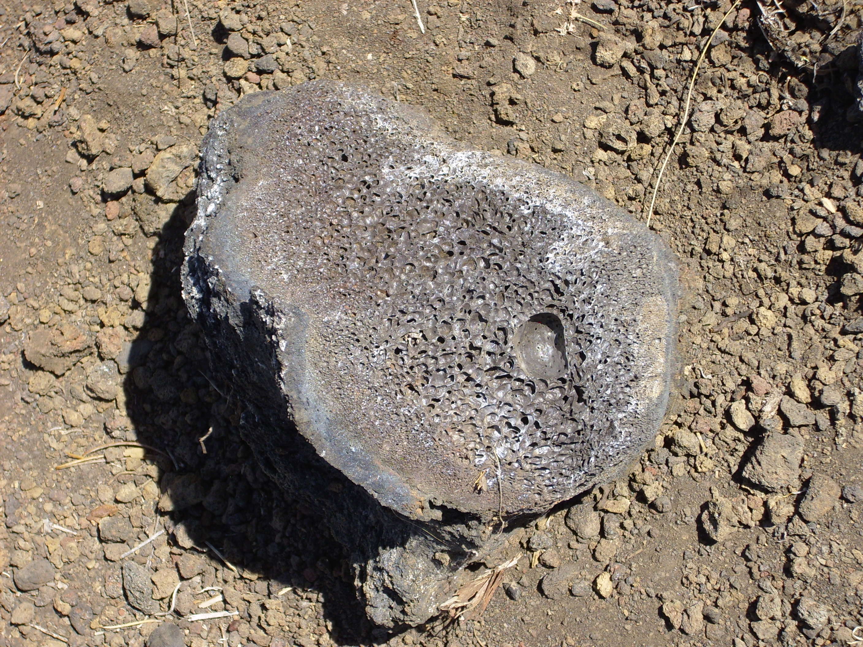
This is a volcanic bomb cracked in half. You can see that the interior was still full of gas bubbles but the crust had outgassed and hardened.
The view from here to the northwest. The low escarpment in the middle distance marks the Highway Fault.
We wondered if this might be one of the xenoliths, but decided it was just the world’s smallest lava tube.

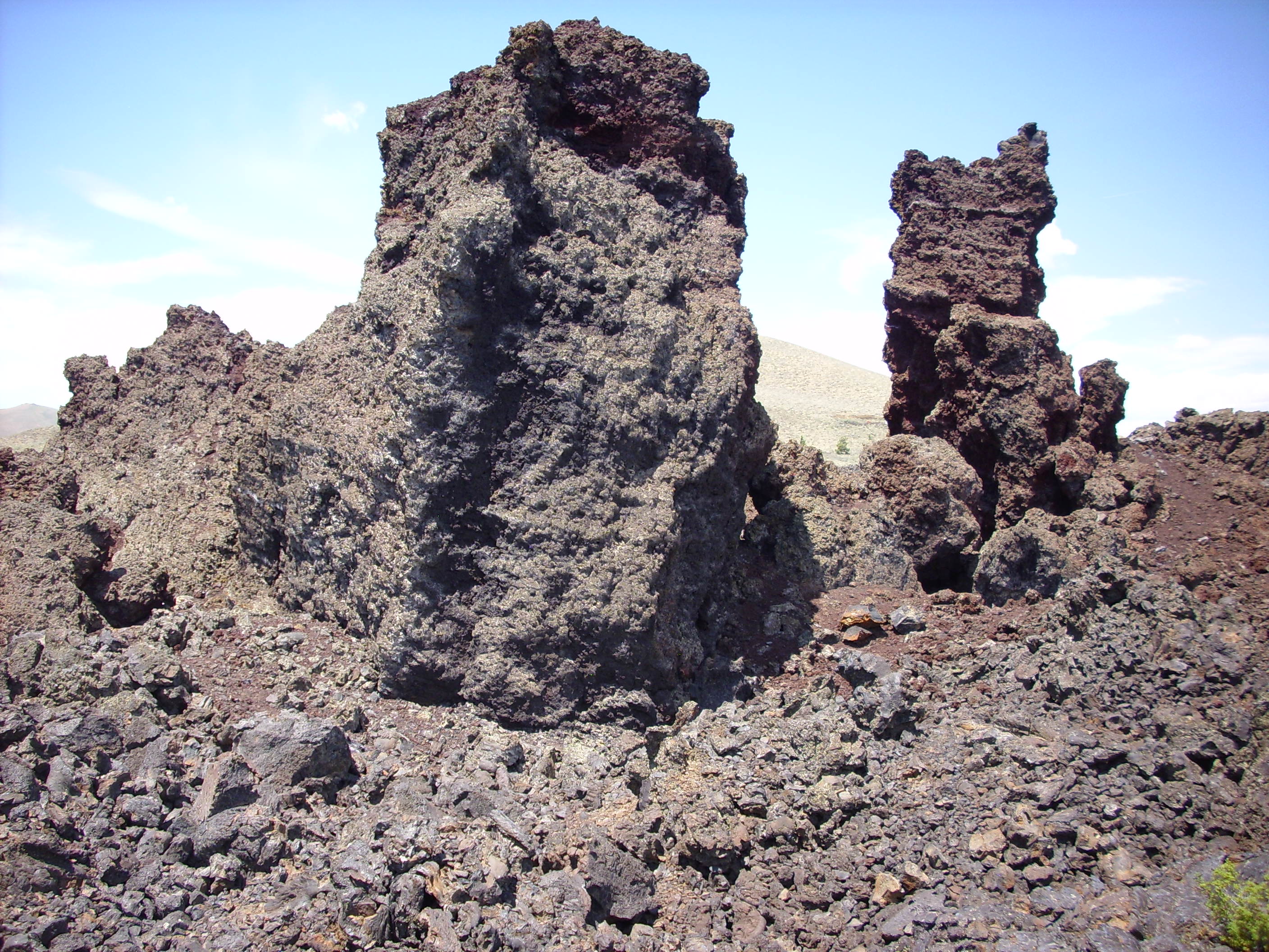
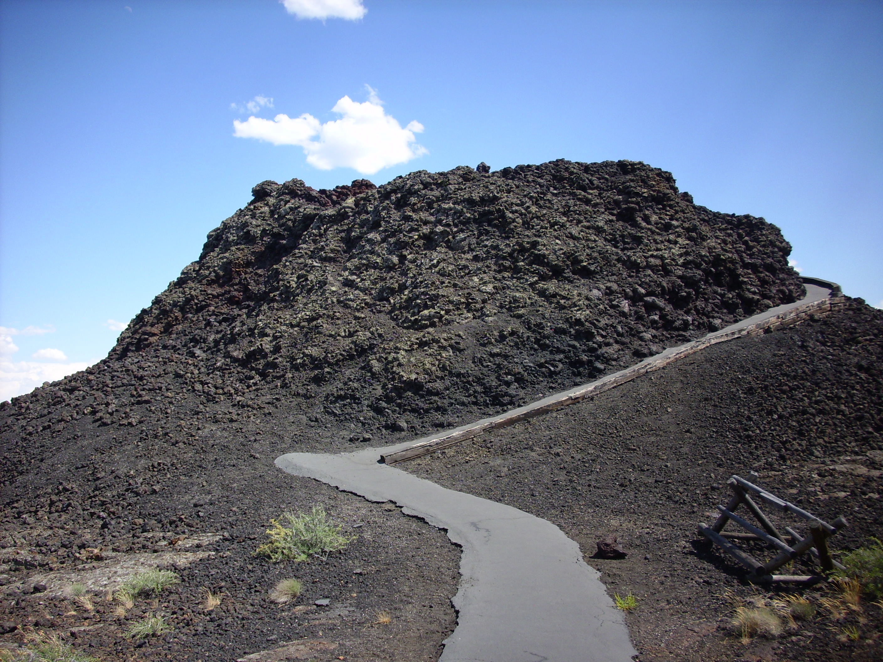
We turned a corner and saw the crater itself.
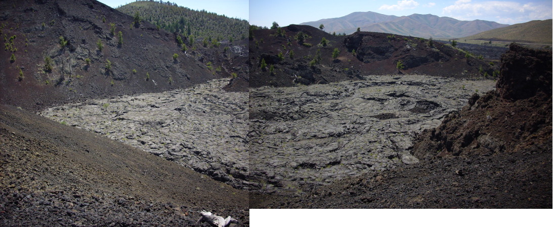
What you are seeing is the interior of a fairly large cinder cone whose northwest wall was undermined, then rafted away, by the lava rising in the crater.
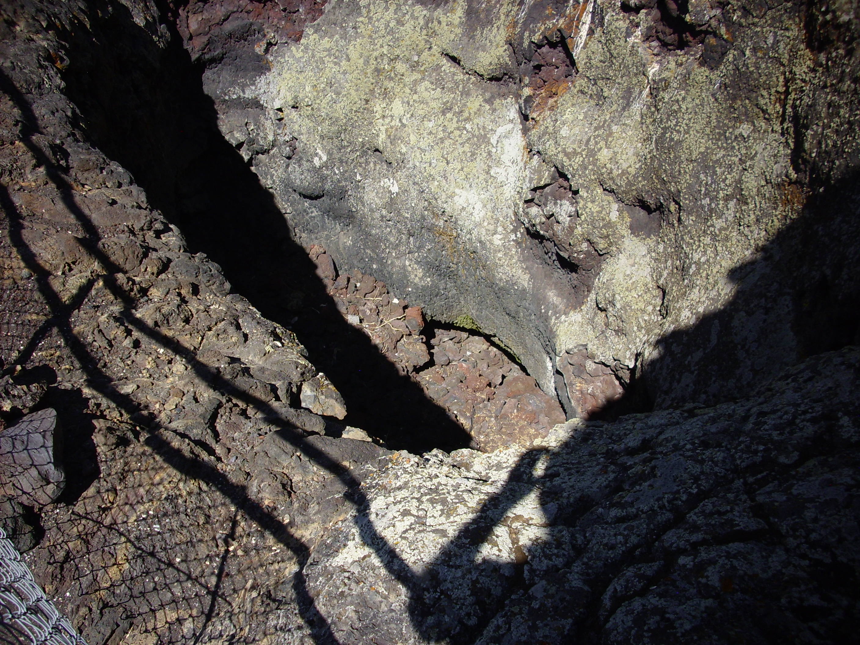
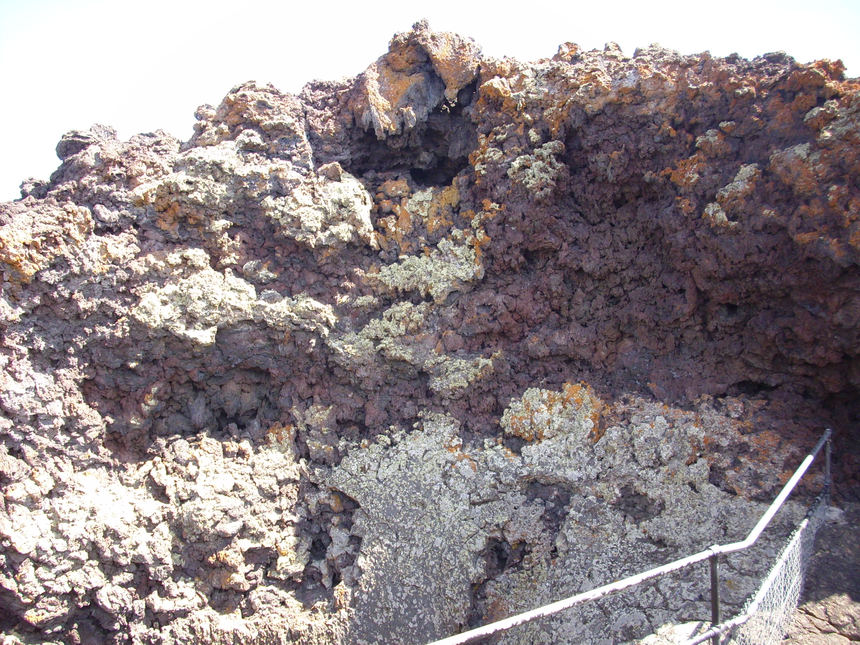
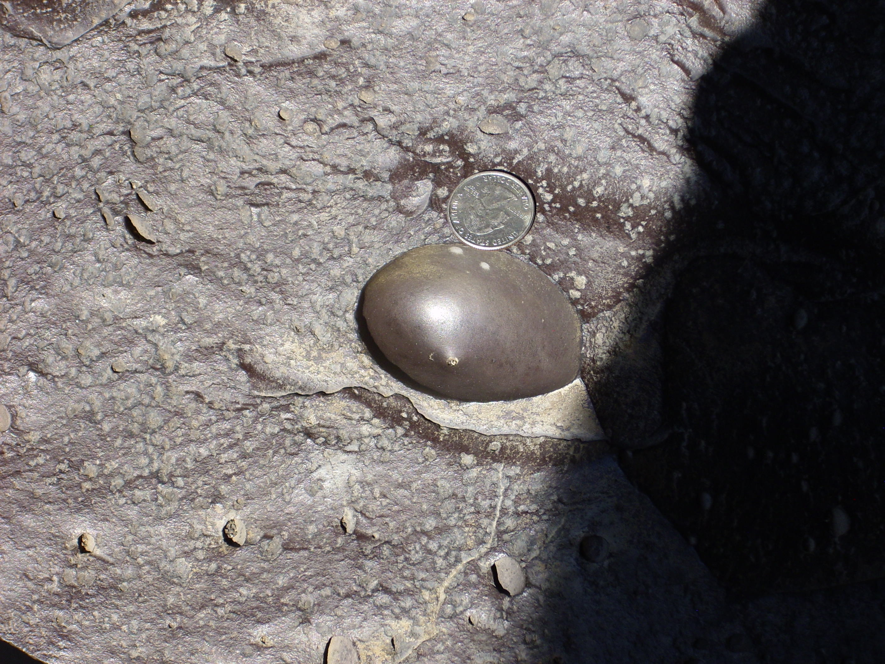
Around here we saw what looked like pumice embedded in lava. A xenolith?

We had about given up on the granulite xenolith, but I pressed on ahead to get a better view of the crater. Then voila!
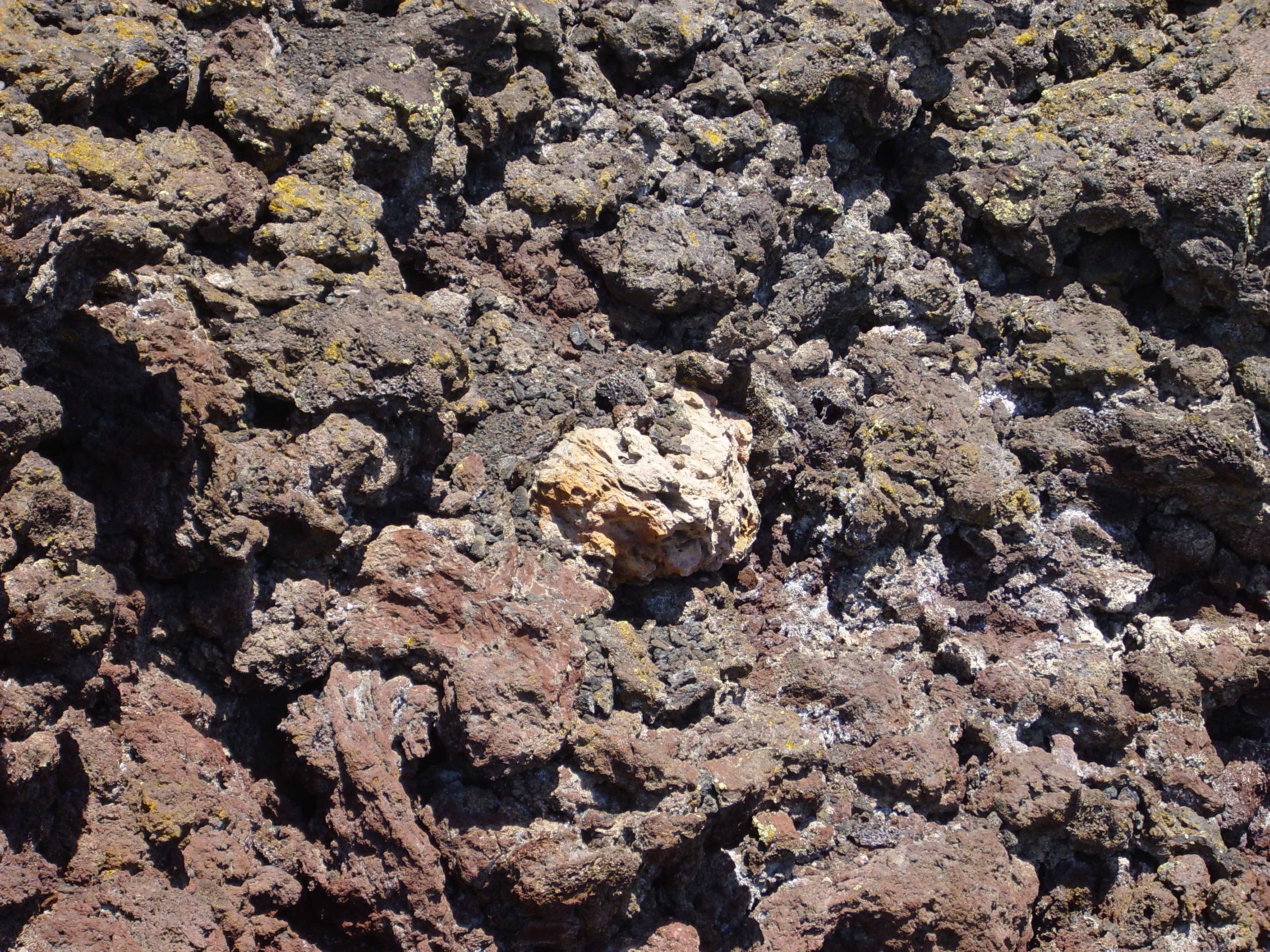
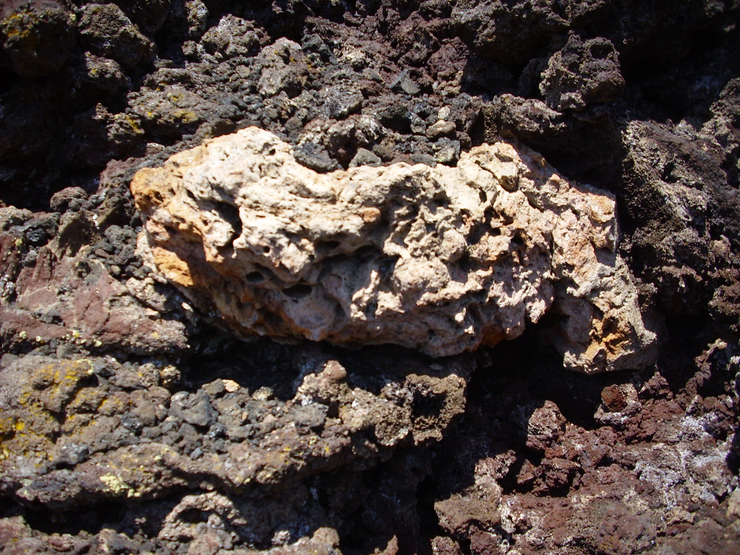
Amid all that black rock, this white rock really stands out. It’s definitely a xenolith, but we puzzled over its makeup. It was rather frothy and bubbly over its surface, like a silicic pumice, but how would a silicic pumice get here? Parts looked more granular. Perhaps this was a granulite that got partially melted over much of its surrface.
Xenolith? That’s a chunk of foreign rock found embedded in an igneous rock formation. It’s usually “country rock” (the regional rock the volcano erupted through) torn from the sides of the volcanic conduit and brought to the surface.
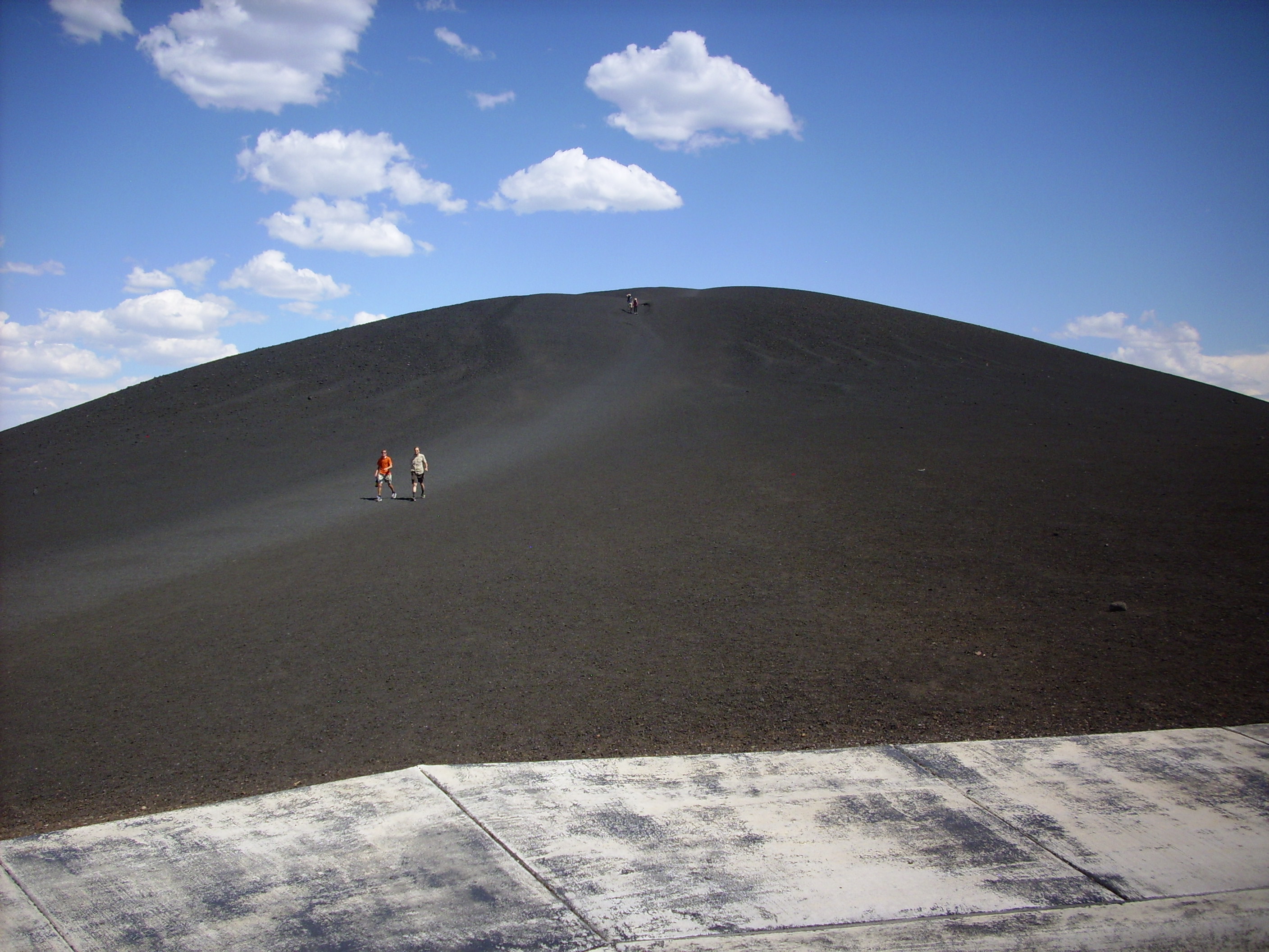
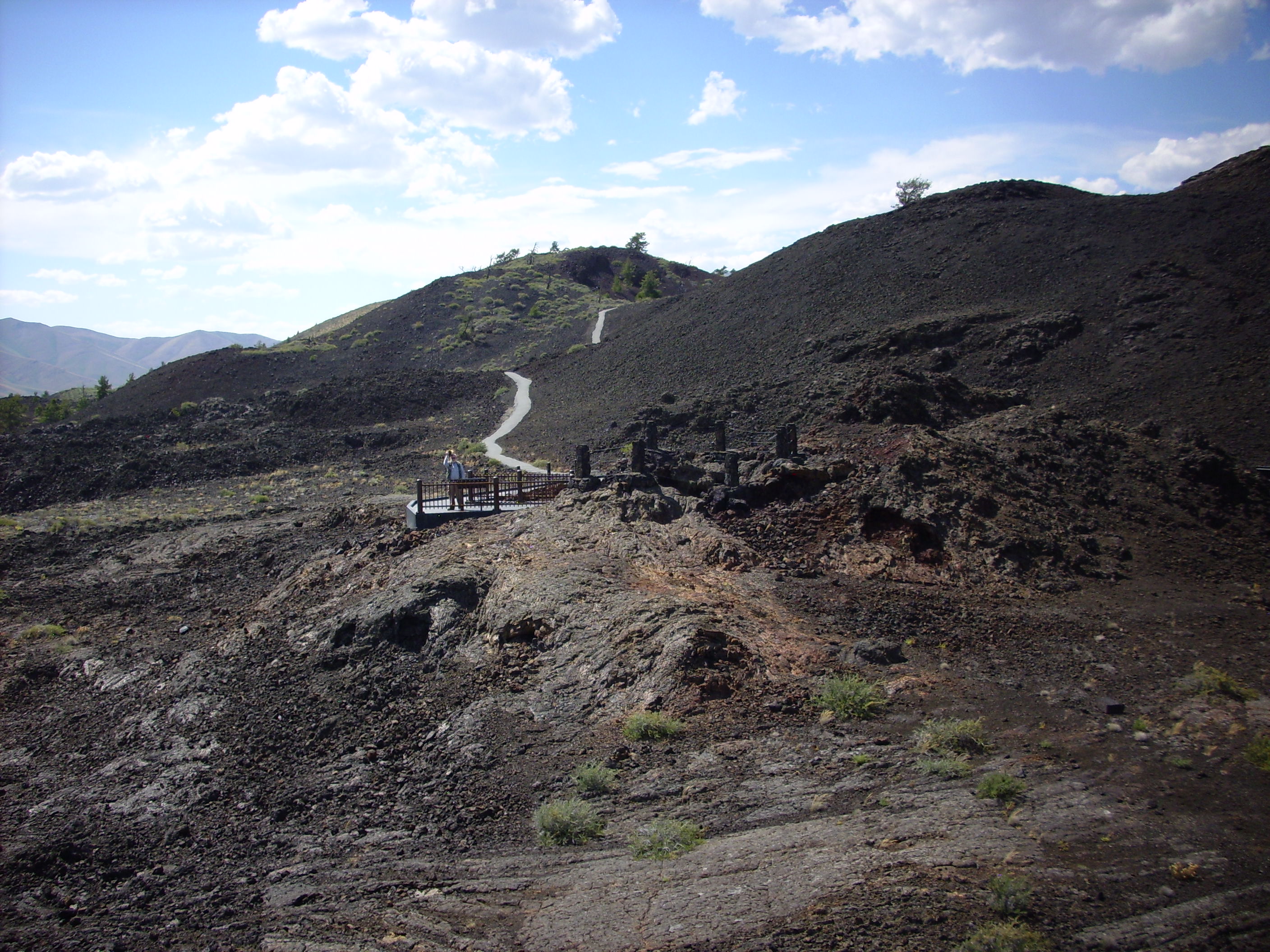
This is Inferno Cone. We did not attempt the climb. Too tired.
But we did walk to the little spatter cones nearby. Spatter cones are always quite small and form around vents on lava flows. These are actually fairly big ones.

“One does not simply walk into Mordor.”
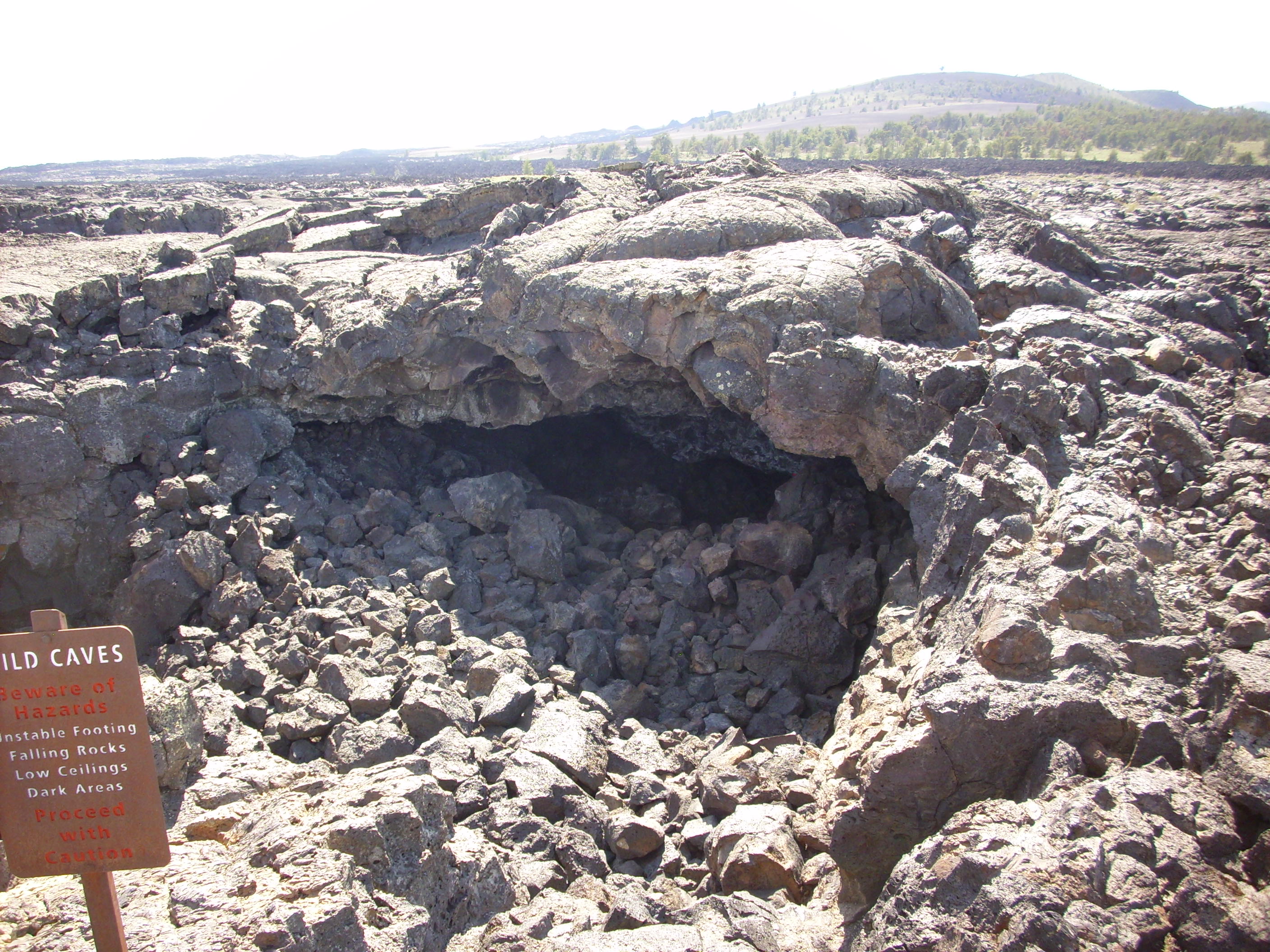
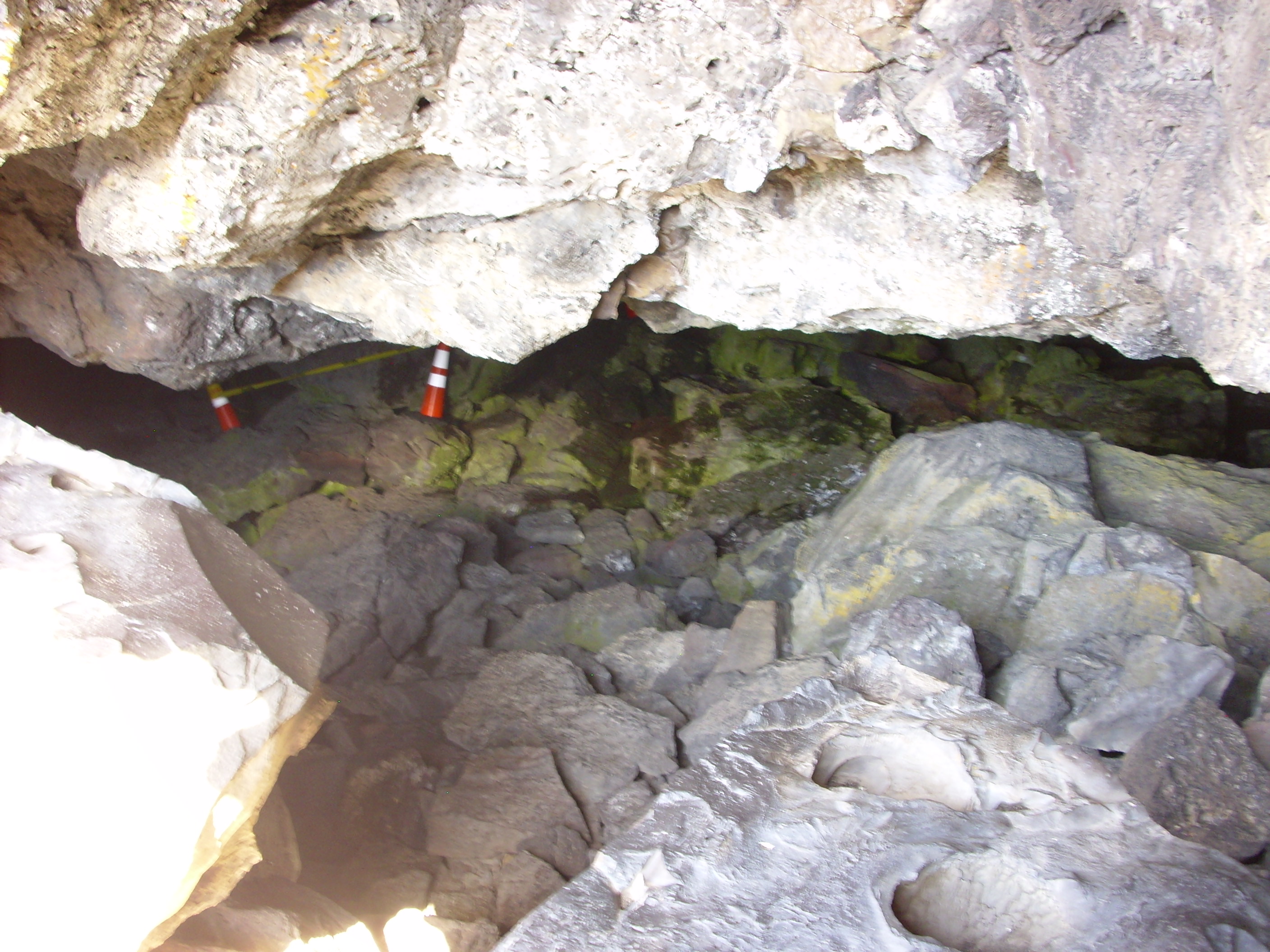
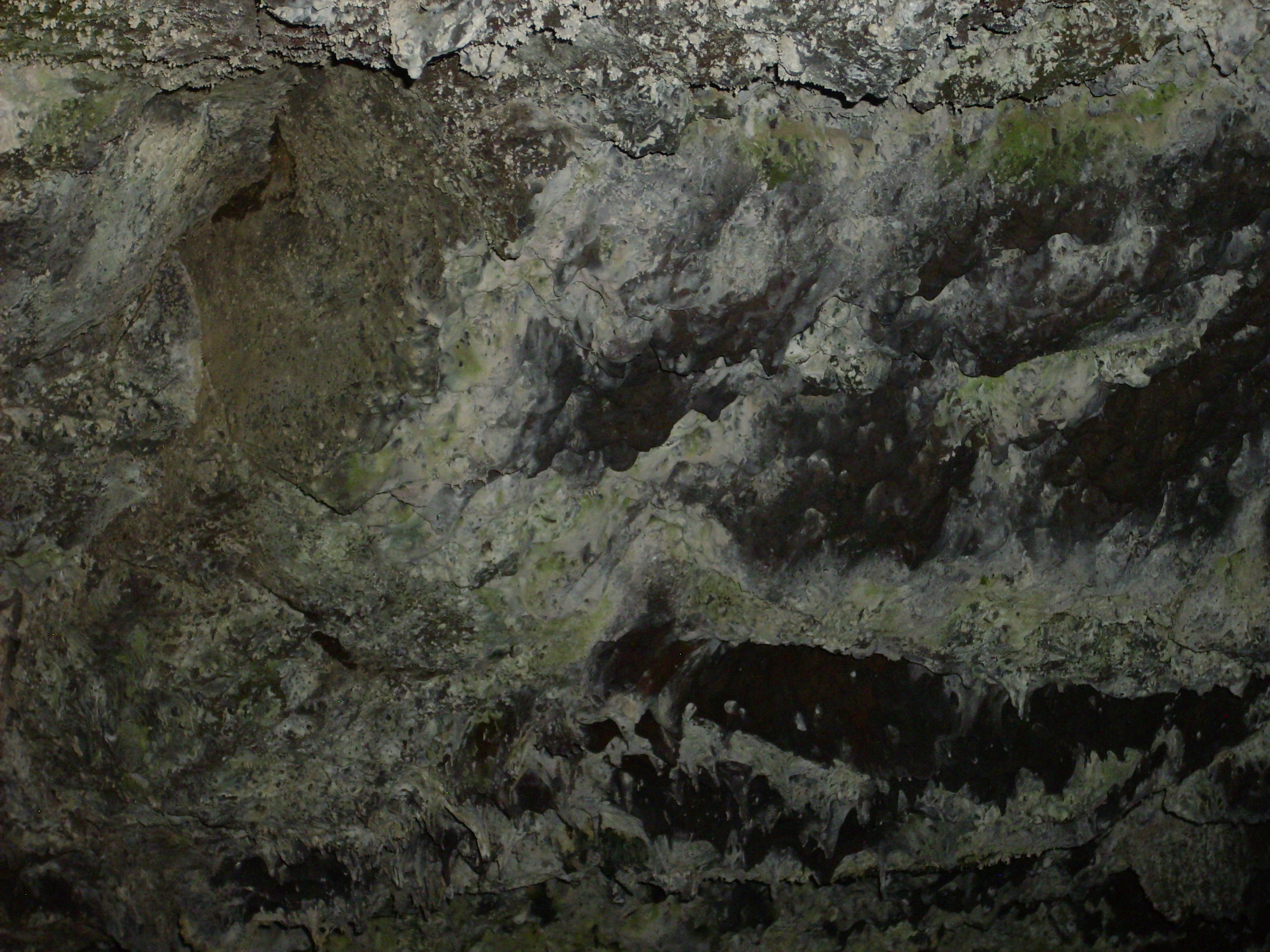
From there we drove to the trail head to the lava caves section of the park. Most of these are partially collapsed lava tubes. We had to get a bat permit; this basically consisted of declaring that, why, no, we had not been frequenting caves full of diseased bats.
On the trail out, we encounter an impressive pressure ridge.

Alas, my pictures within mostly did not turn out. I still haven’t mastered the use of the flash, and the flash is not that terribly powerful to begin with. However, I did get a nice shot of a skylight.
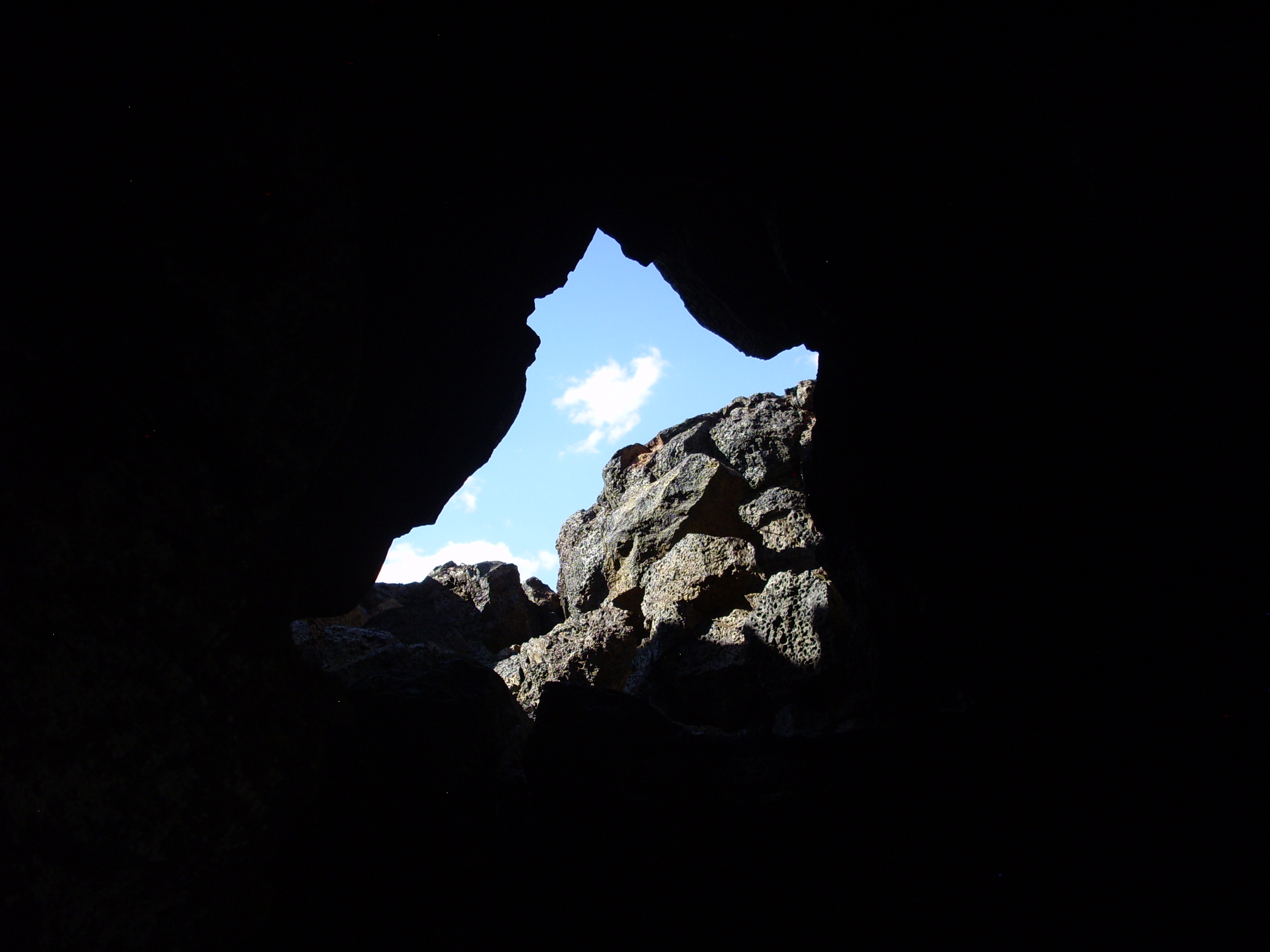
Peering the other way:
A remarkably smooth gas bubble in the lava:
There were just a few very short stalactites in the cave. Not much calcite around to form travertine. And are those bats? I didn’t notice them at the time …
Tired and ready for home. A few sights along the way:
World’s largest collection of numbered rock specimens.

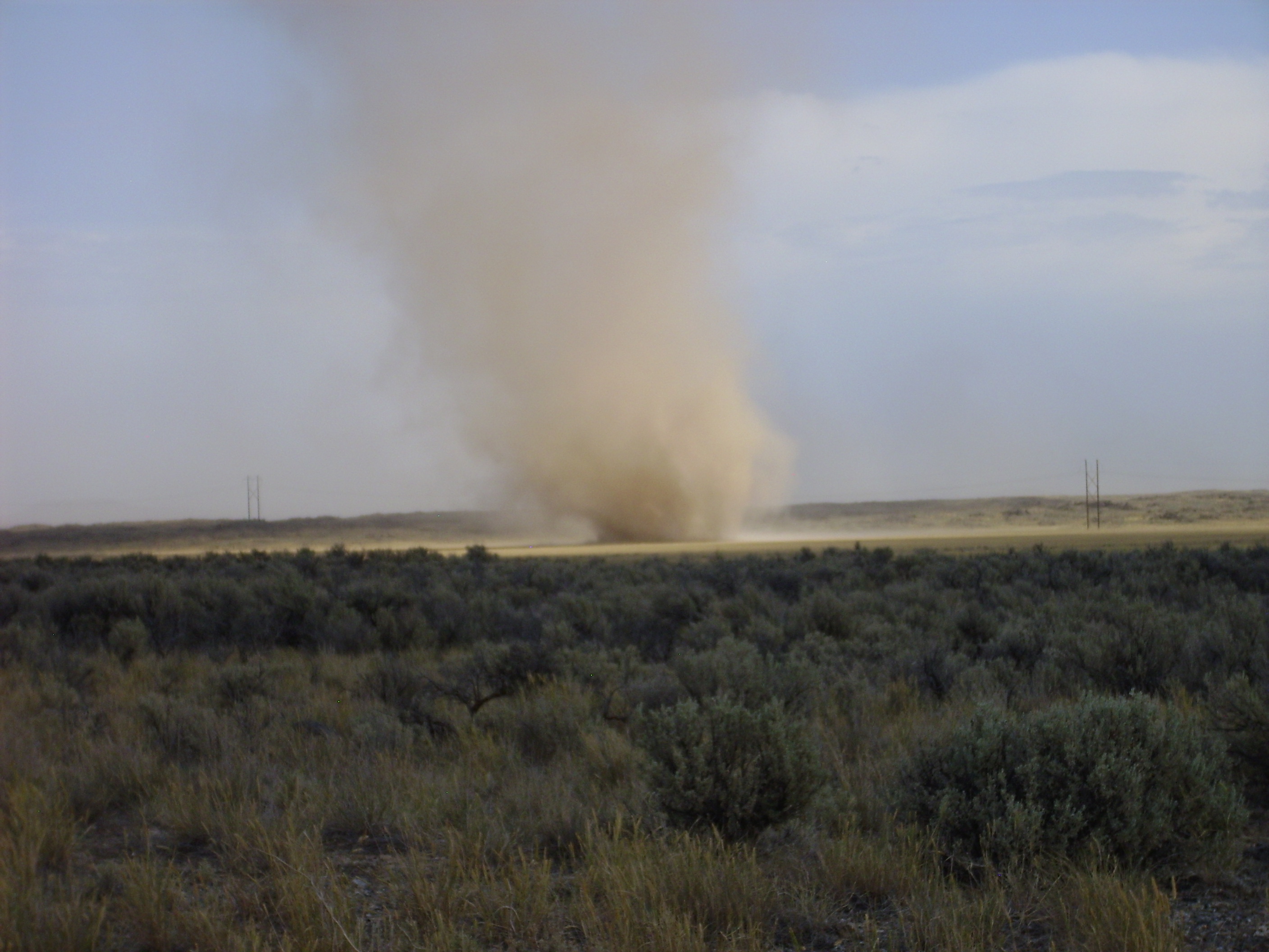
Dust devil!


And finally … they take the unorganized militia seriously in St. Anthony, Idaho!

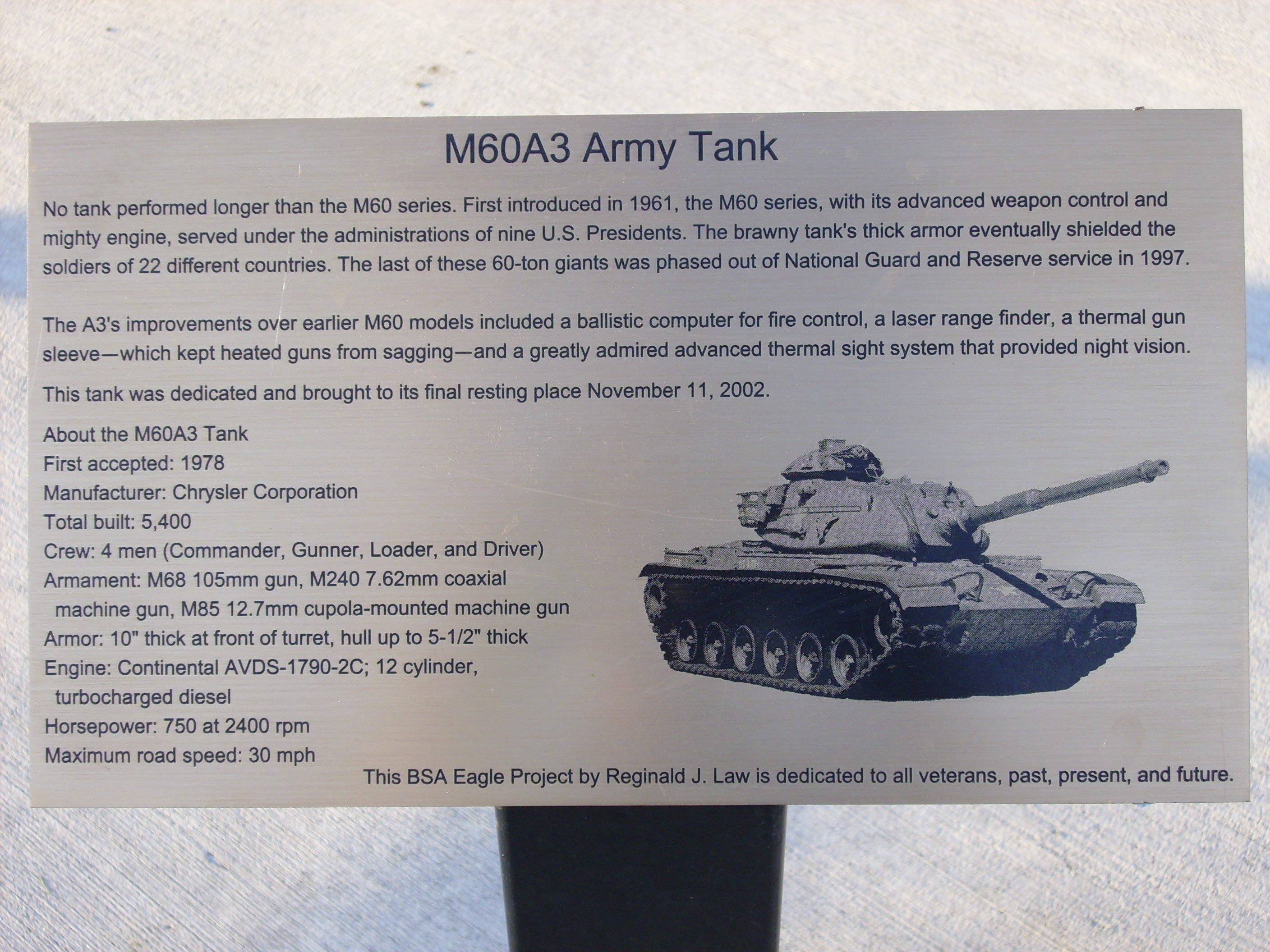
Next time an ambitious Scout tells me how cool his Eagle Project idea is, I’m going to whip out these pictures and show him what a real Eagle Project looks like.
That body makes me look fat.