Great American Eclipse wanderlust, day 6
Day 5 may be found here.
Less than a week to go.
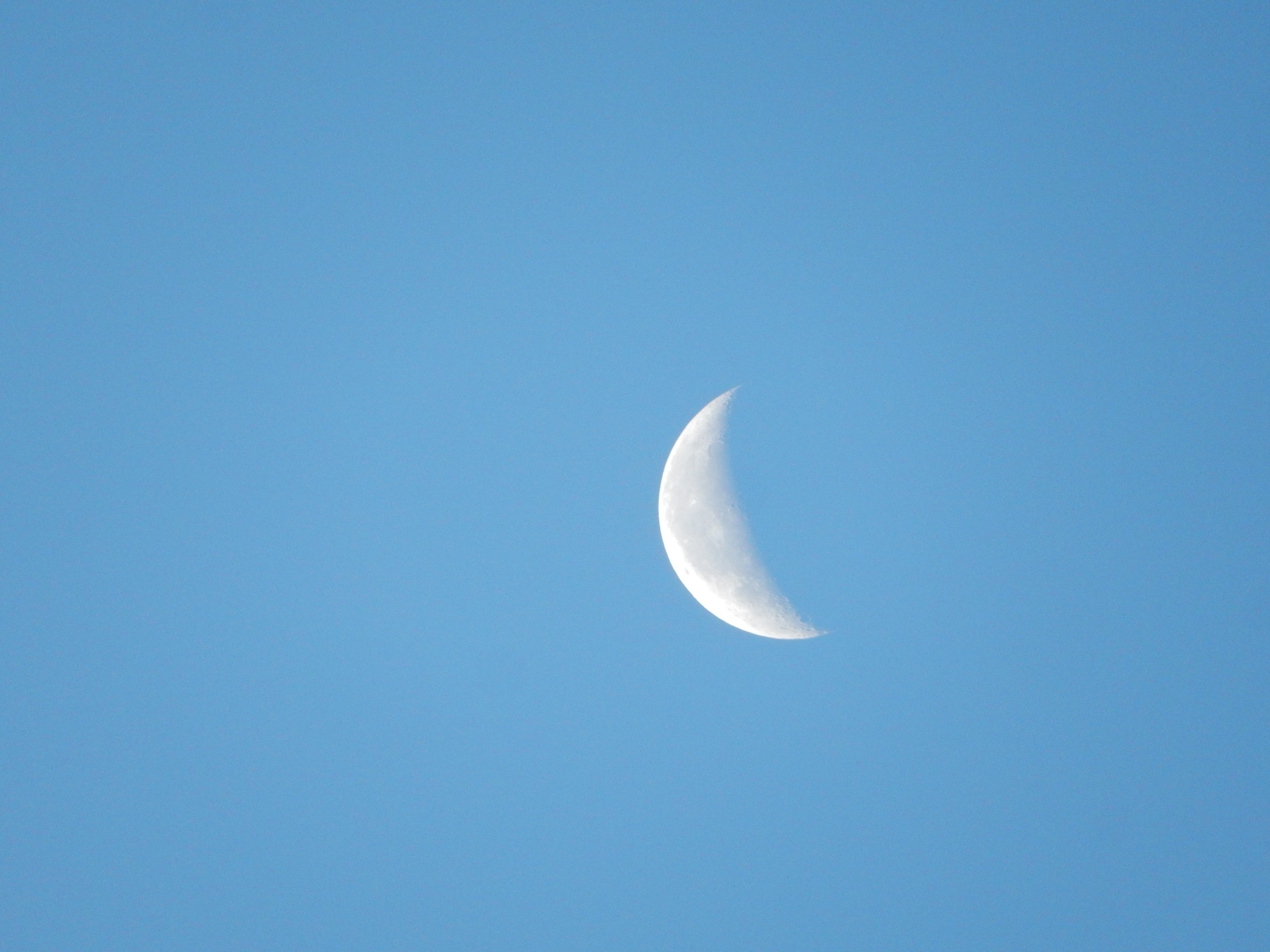
And the picture here is good enough to encourage me to think that I may get a good shot of the eclipse itself.
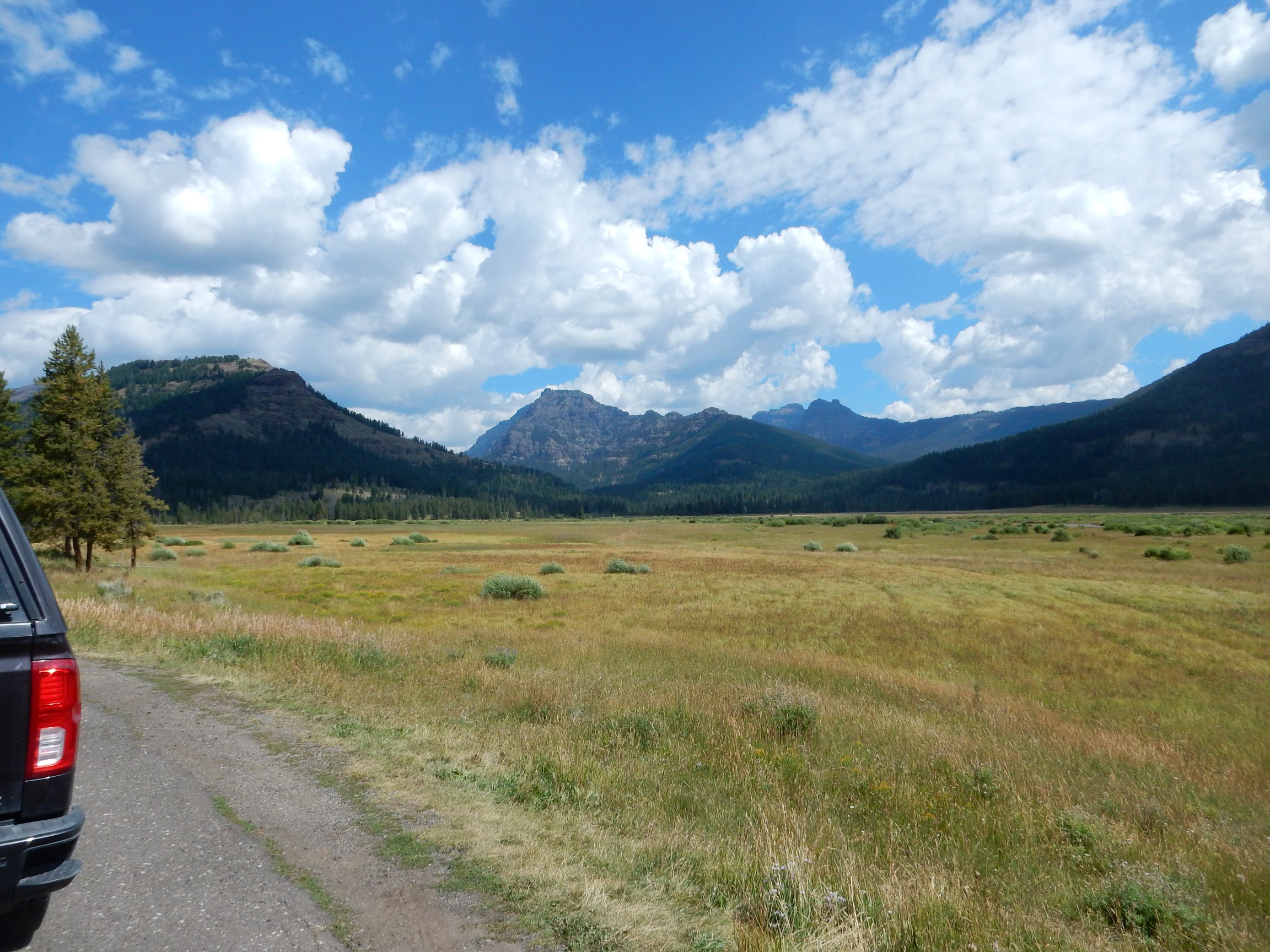
My goal today is to drive to the northeast entrance of the park, which my guide book tells me is the least traveled road and which I did not visit last time. The weather appears to be gorgeous.
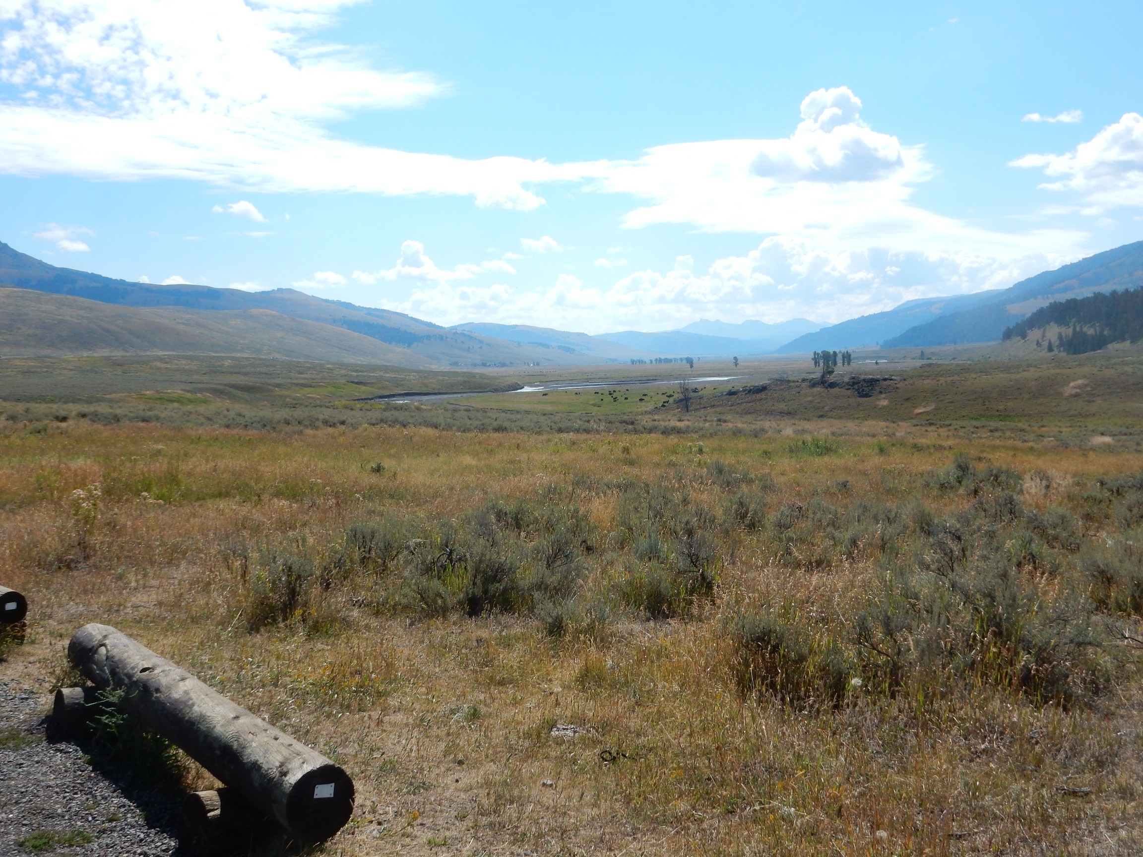
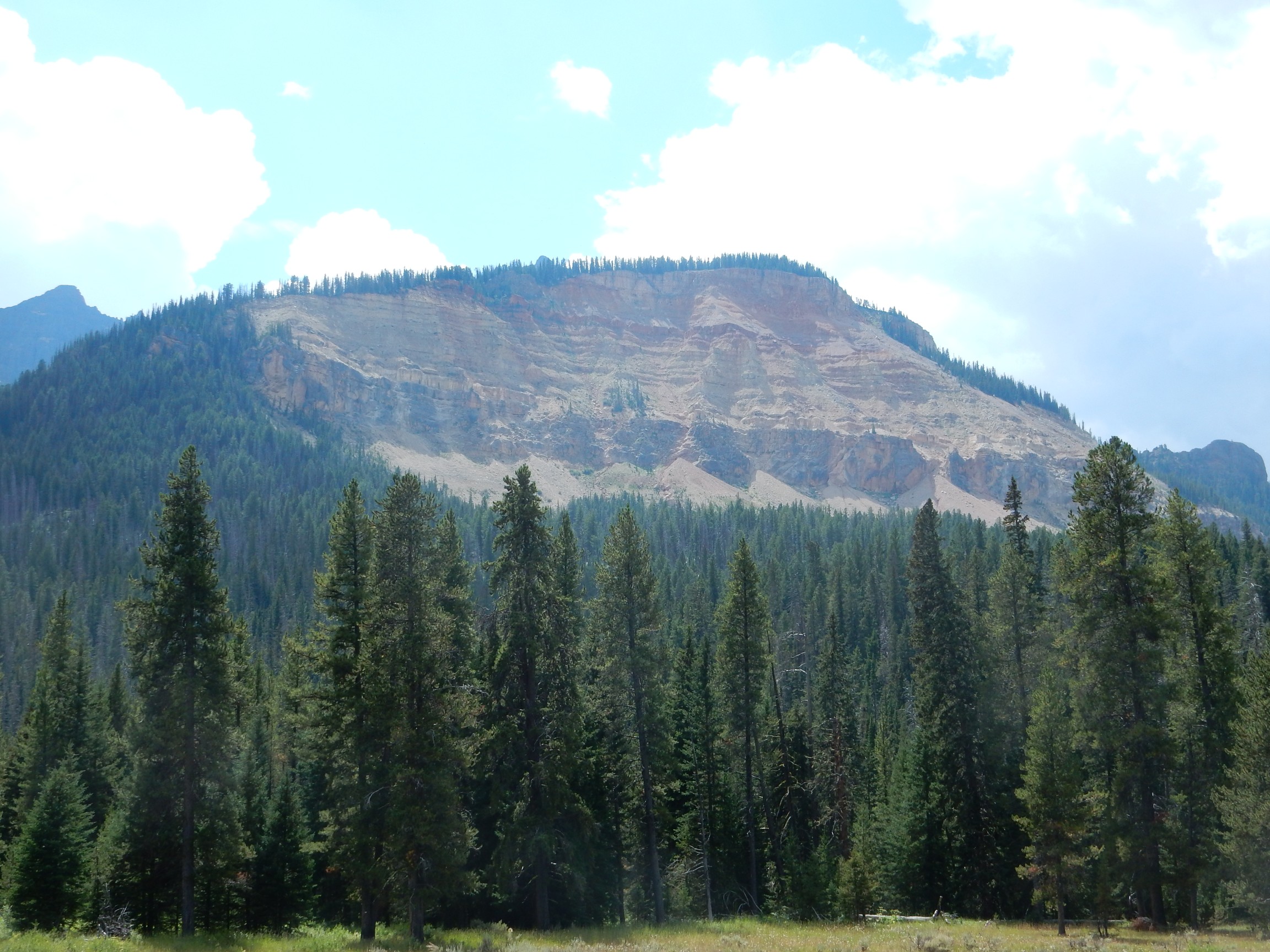
My attention is snagged by some obvious hot springs across Gibbons Meadows.
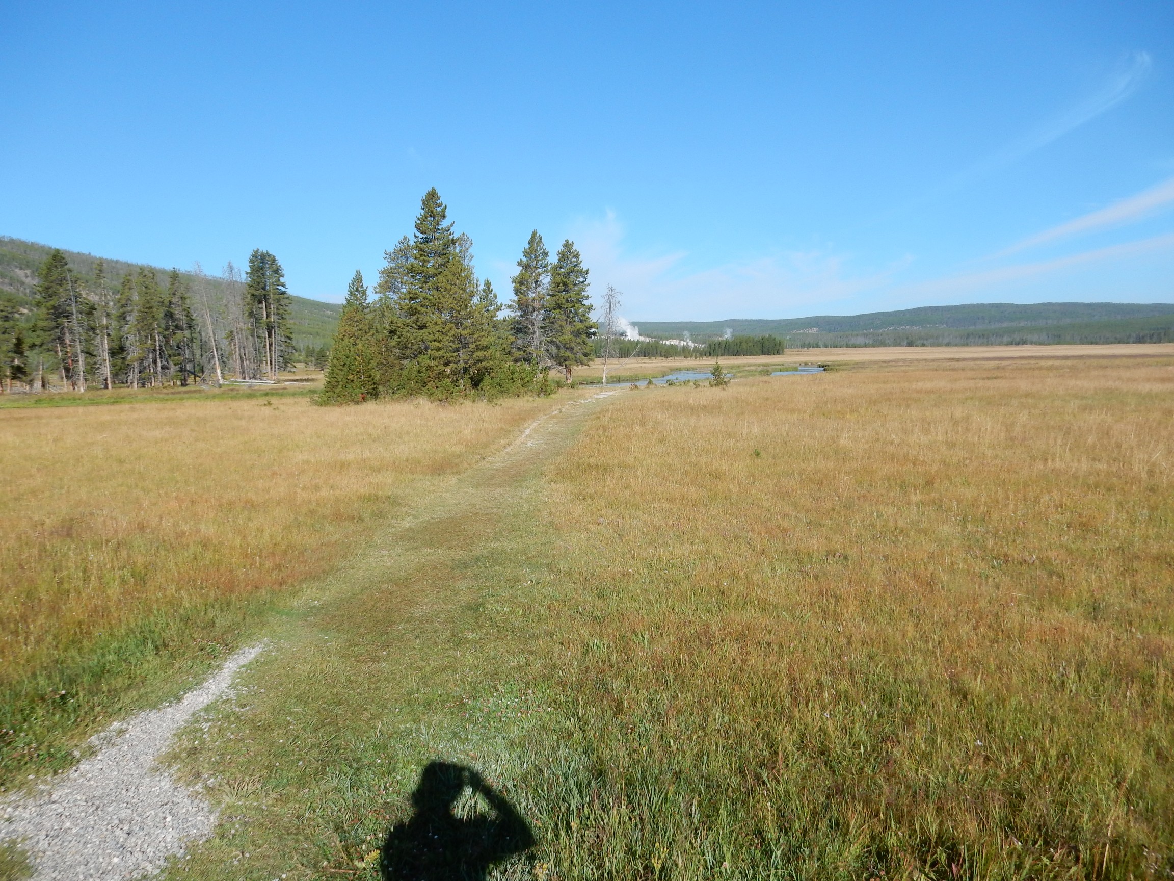
There appears to be a trail, across flat ground. Seems like a good place to test out my knee and get my daily exercise. I had taken four baby aspirins instead of one last night, and my knee doesn’t feel too bad.
I head out. It’s a lovely meadow, and the trail soon runs along the river bank. There are wildflowers:
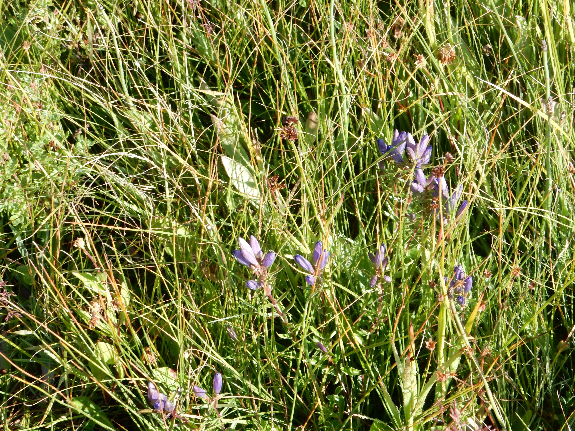
Perhaps a slightly different variety of fireweed?
The river starts to curve back to the east and the trail vanishes. The little bulb comes on in my head: This river, the Gibbon River, is substantial and is across any likely path to the hydrothermal springs. I can’t get there from here.
I turn around. My knee is already hurting badly. Crep.
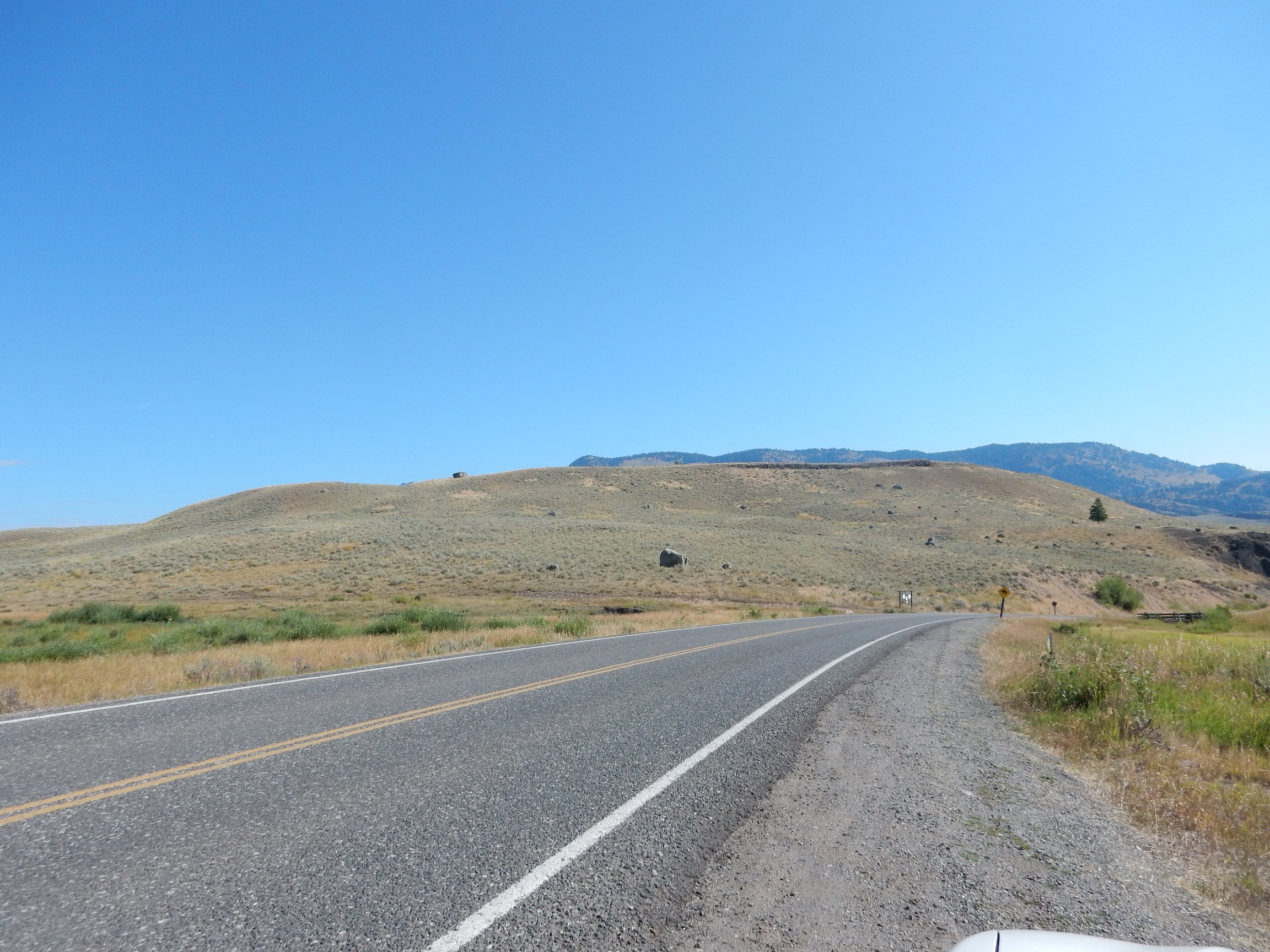
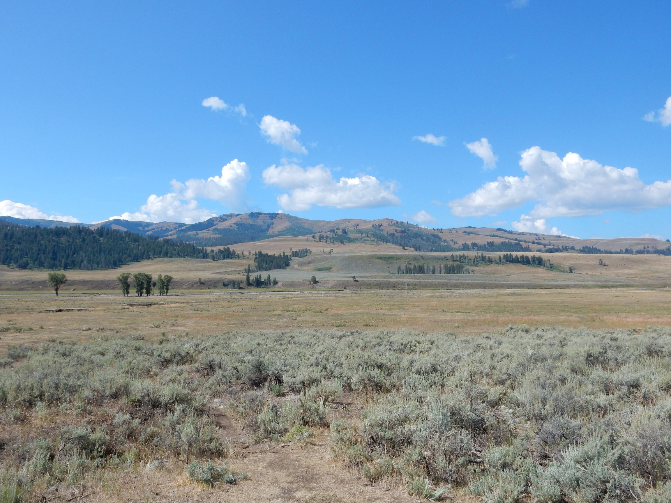
I drive on over Dunraven Pass and to Tower Junction. Here I take the road to the northeast entrance; new ground for me.
Ground covered with erratics.
Around 2.5 million years ago, India collided with Asia, throwing up large masses of silicate rock (the Himalayas) that began absorbing carbon dioxide from the atmosphere. At about the same time, Antarctica reached its current position over the South Pole, and the Antarctic Circumpolar Current became established. Both events had the effect of cooling the Earth’s climate. Thus the Pleistocene (2.58 million to 12,000 years ago) became an ice age, with periodic glaciations interrupted by shorter and warmer interglacial periods. The Holocene (12,000 years ago to roughly the present) is an interglacial period. Yep, we’re due eventually to frost over again, unless anthropogenic global warming fries us instead.
During the last glaciation, the Pinedale Glaciation (30,000 to 12,000 years ago), a large glacier filled this valley, the Lamar Valley. The glacier brought in large rocks from the surrounding mountains that were dropped on the surface when the glacier melted. These “foreign” rocks are known as erratics; they are also found in the American Midwest, where they often are of rock types that do not crop out within hundreds of miles of their present location.
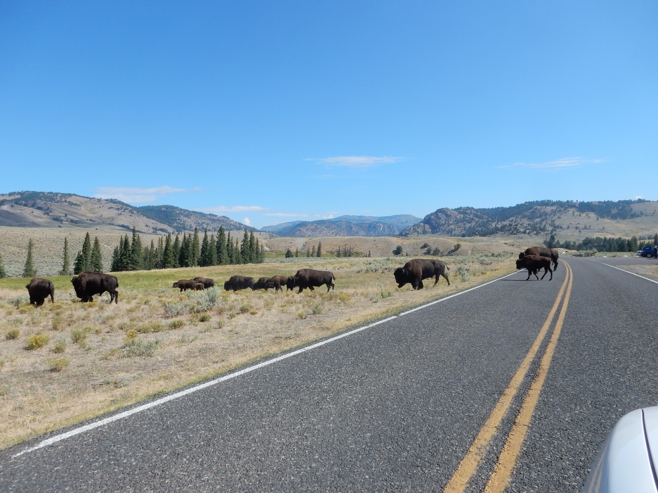
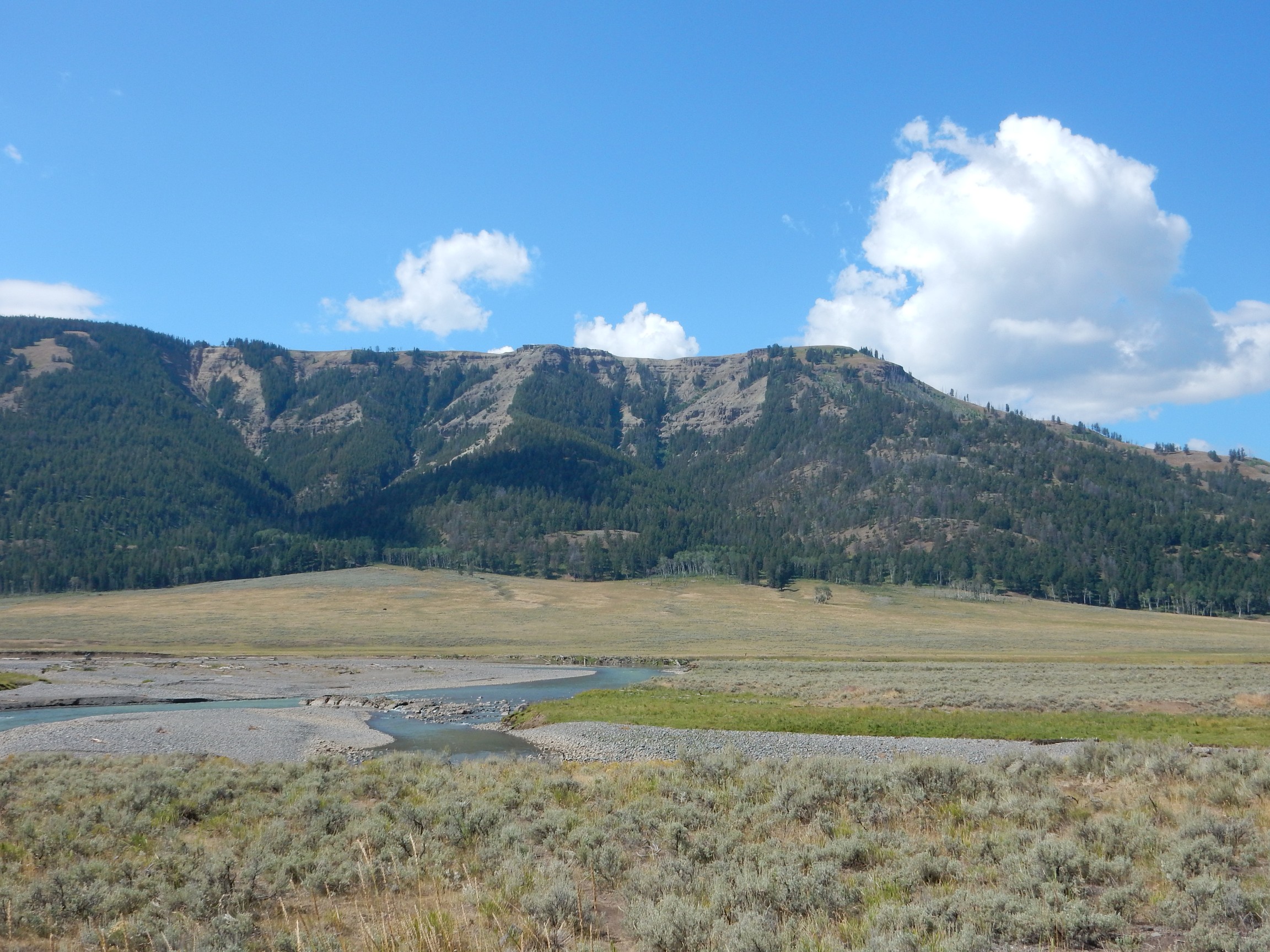
My drive across the Yellowstone River is interrupted.
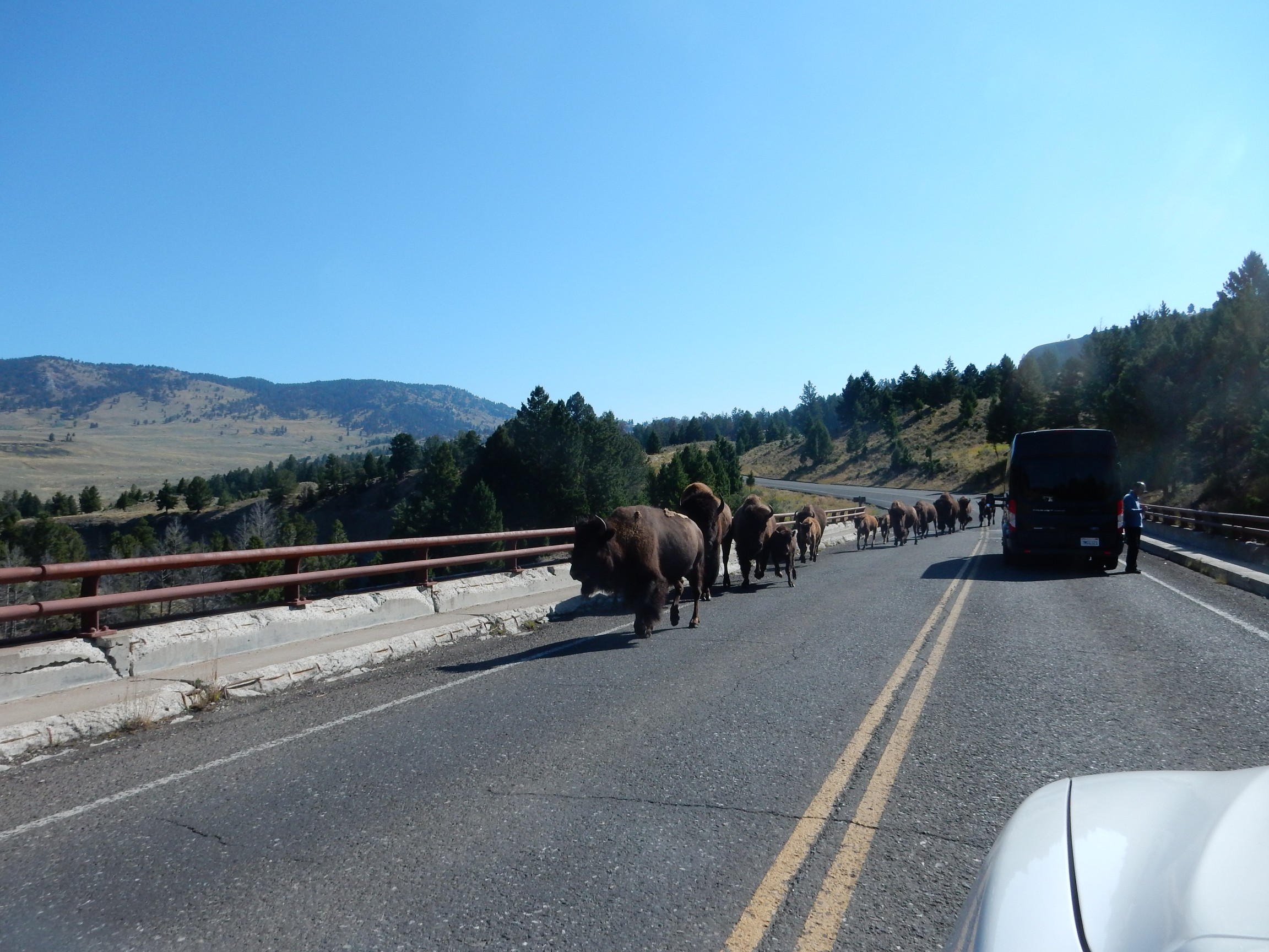
The traffic rule is to yield to wildlife. A large furry mammal weighing the better part of a ton always has the right of way.
There is a pullout further down with signage.
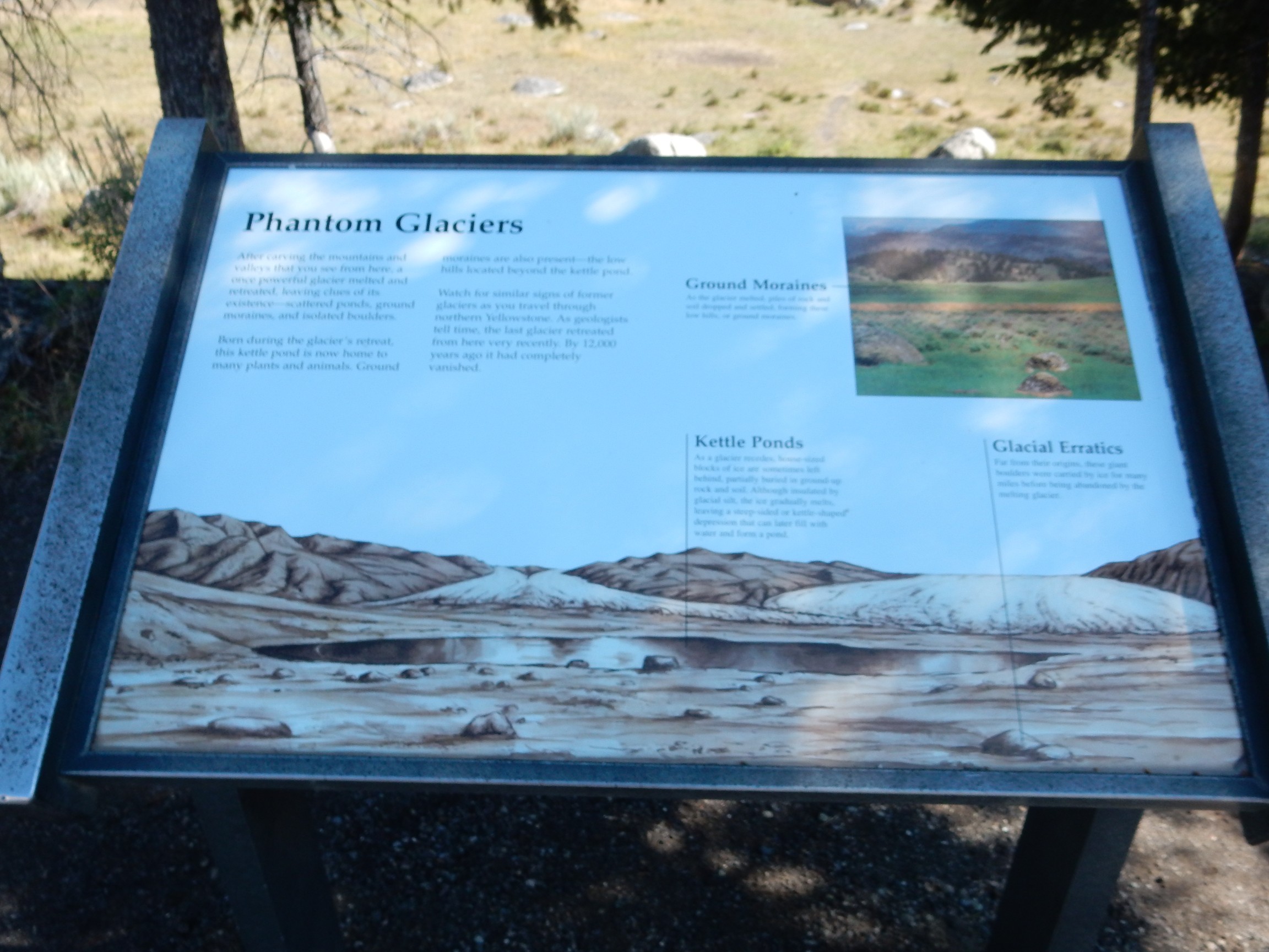
This illustrates some common geomorphic features left behind by glaciers.
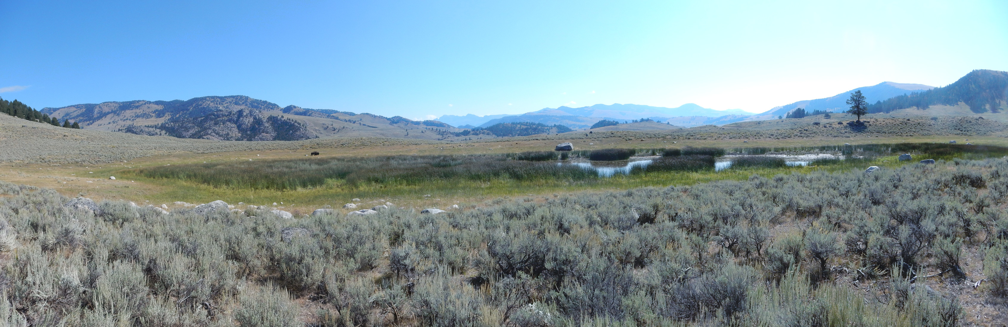
The pond just ahead is identified as a kettle pond, left behind by the melting glacier. I decide to do some hiking and photography.
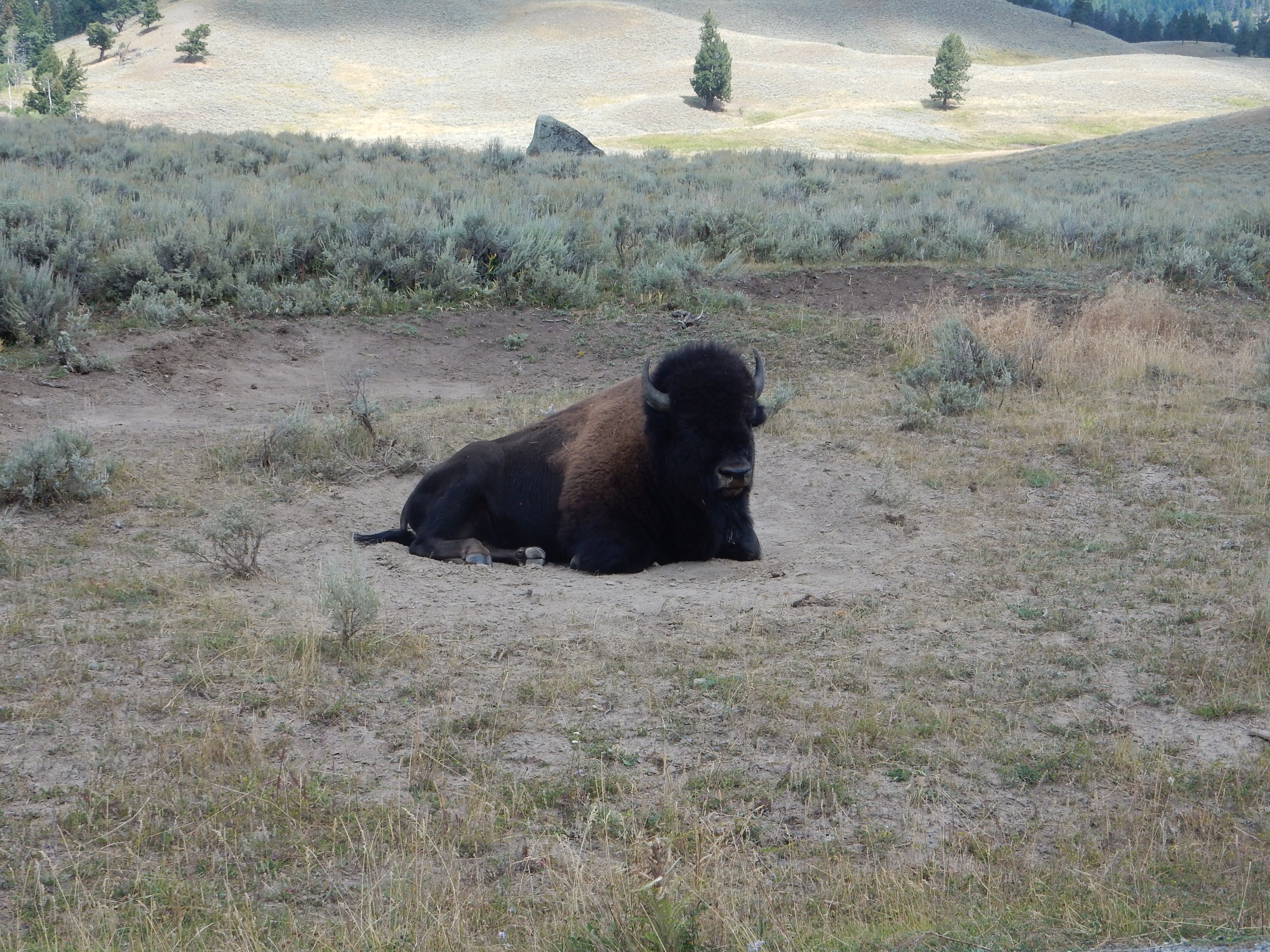
Almost immediately I spot a large, solitary buffalo.
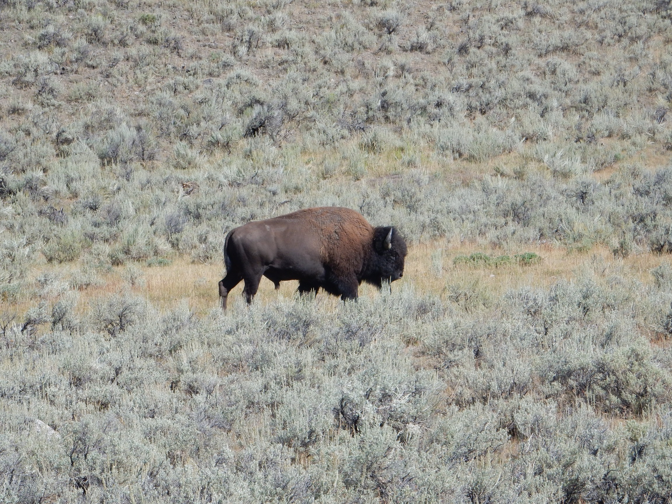
This big fellow is headed roughly the same way I meant to go. I divert slightly.
The pond:
Kettle ponds form when a big chunk of ice left behind by a glacier is buried in glacial outwash. This insulates and preserves the ice for some time. When the ice finally melts, the sand and gravel it’s buried in collapses to form the pond.
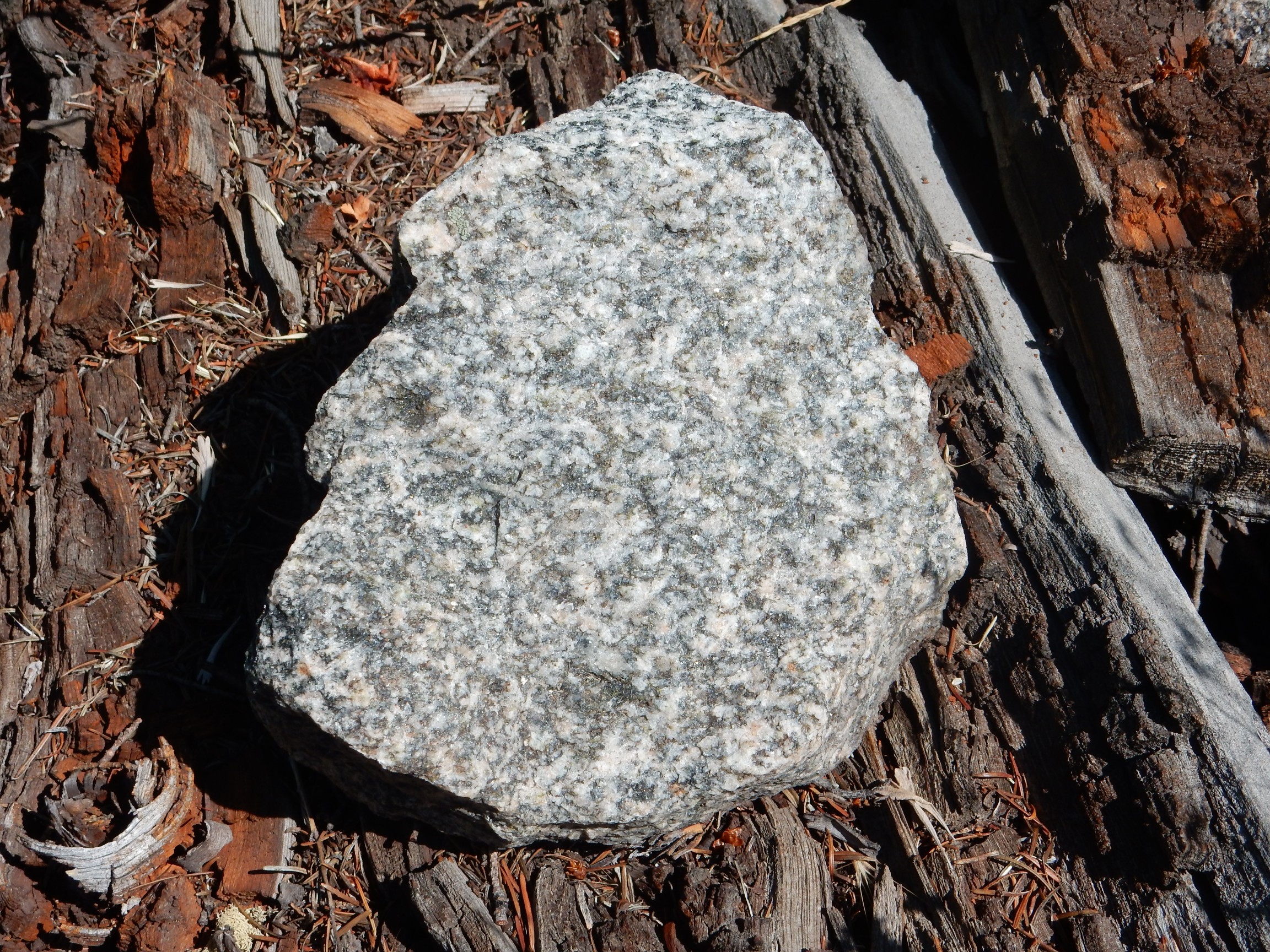
Glacial erratics:
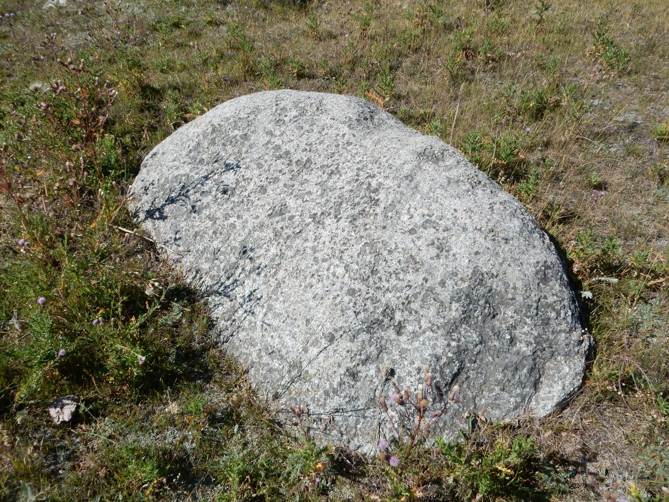
Granite from the surrounding mountains.
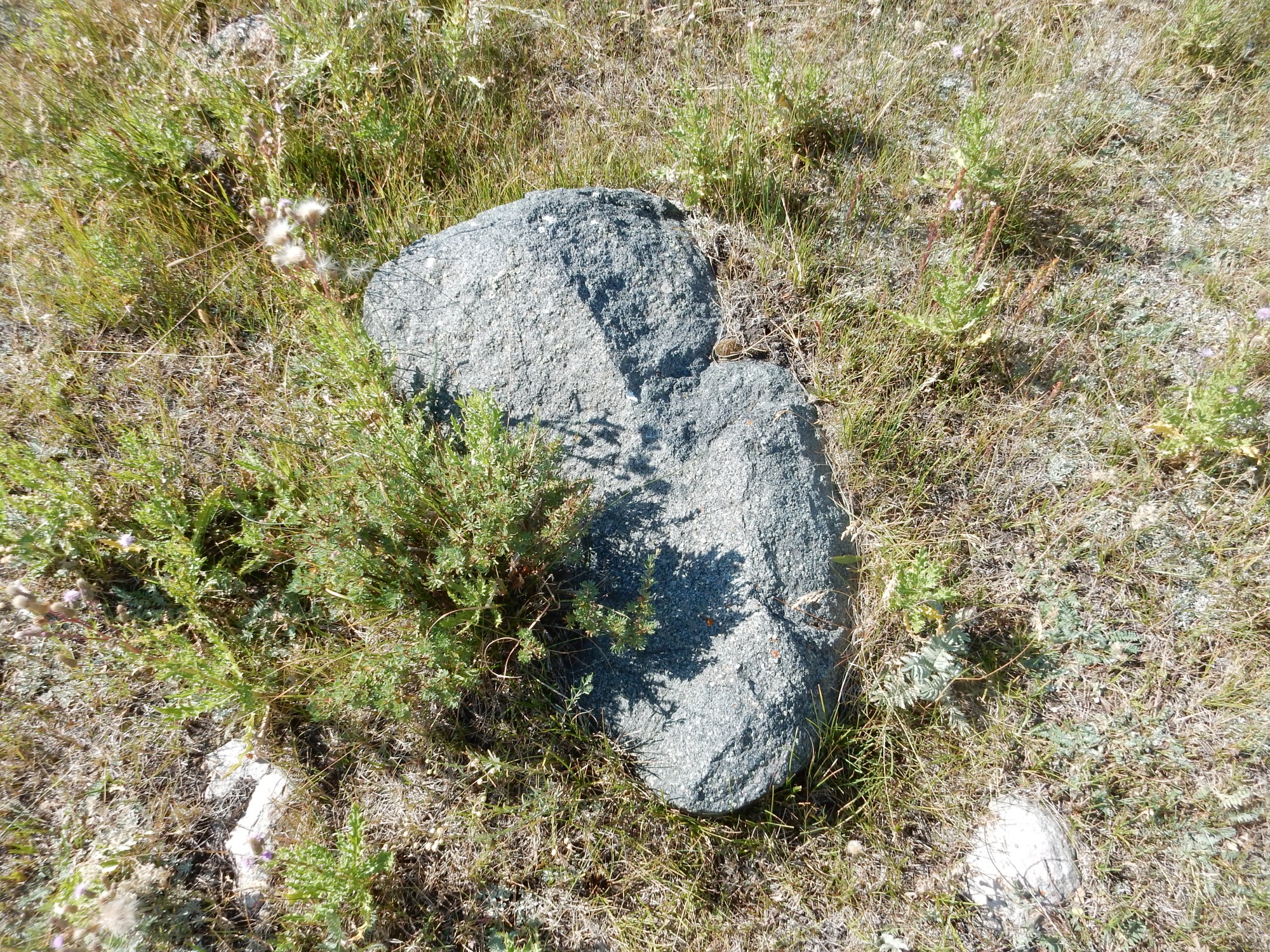
Gabbro. And a very pretty one. Not that common a rock type, at least on the continents, and it crops out nowhere that I know of in the park. This was the first time on this trip that I felt my fingers twitching for a geologist’s hammer. (I refrained.)
The pond, seen end-on.

The while boulders scattered all over the area are glacial erratics.
Wildlife. Looks like a pintail duck, though ducks show less differences betweens species than drakes. I confess I’m much more geologist than ornithologist.
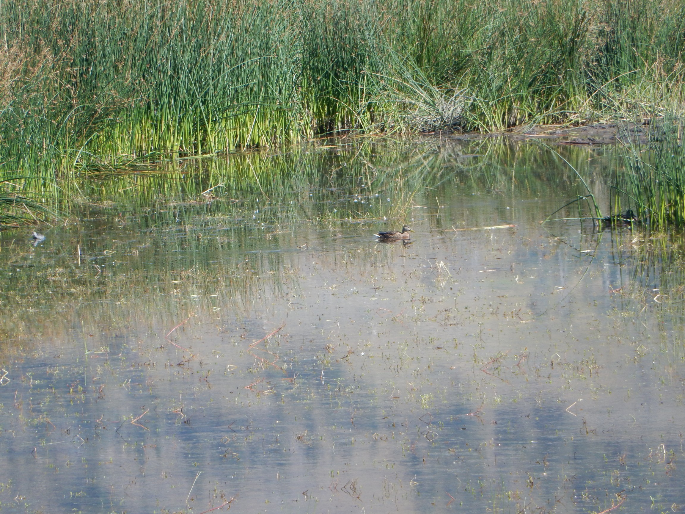
Notice also that there’s a ghostly-looking duck-shaped something at far left. Dunno. The Duck of Christmas Past? There’s also a duck at right in the reeds; I can’t quite make out coloring, but it might be a mallard drake.
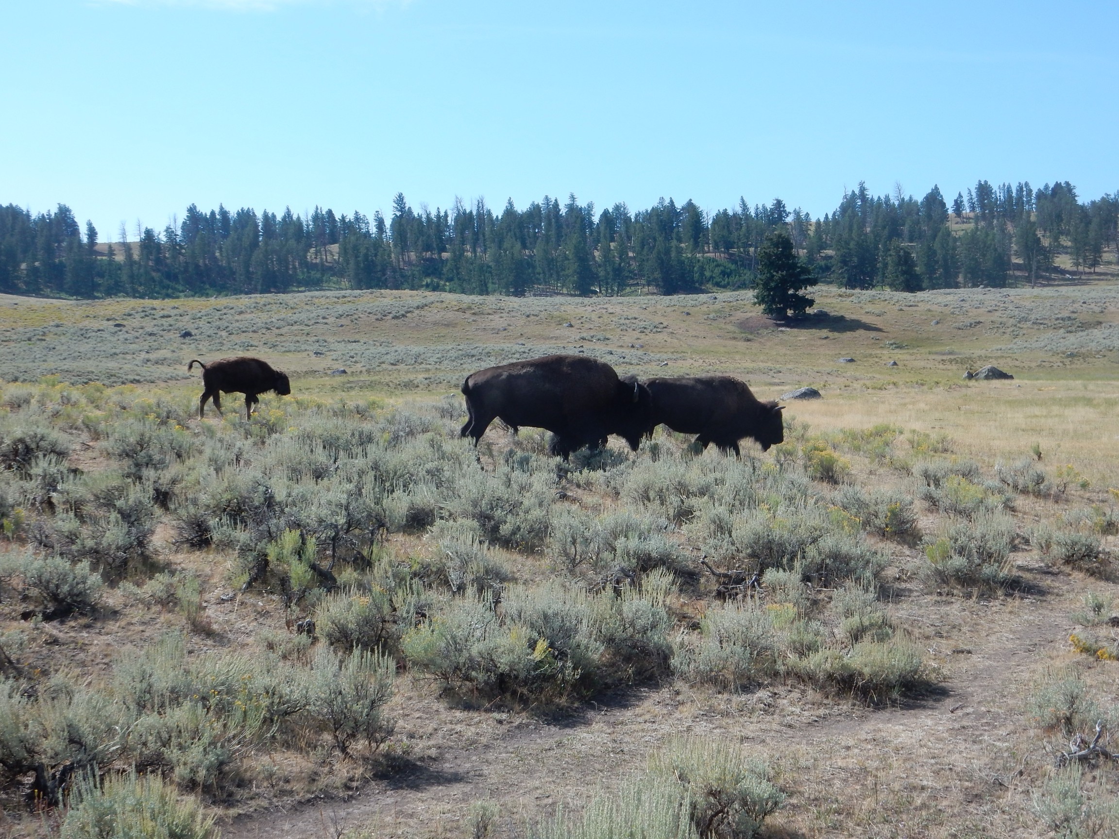
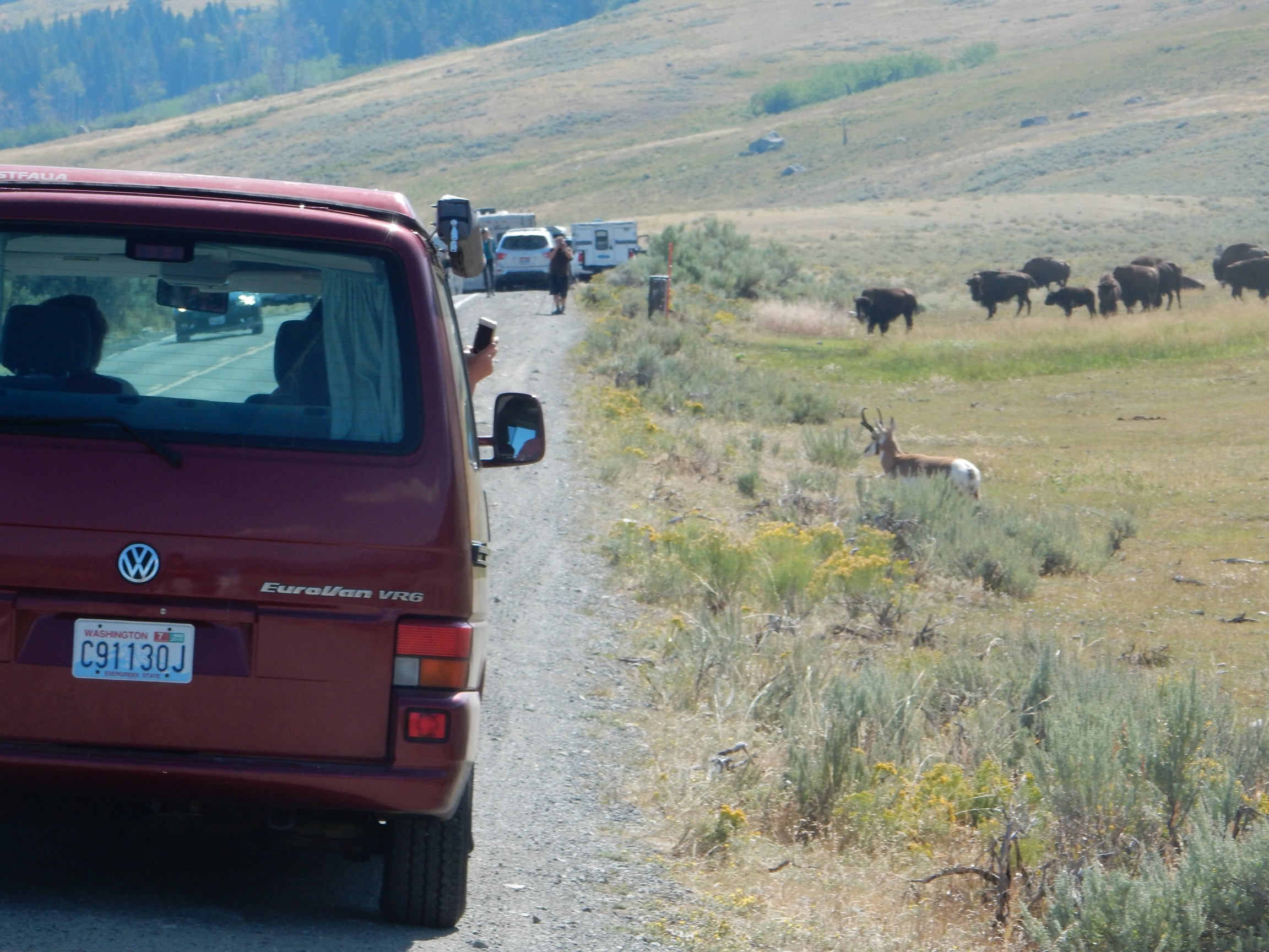
Further down the road: Bison.
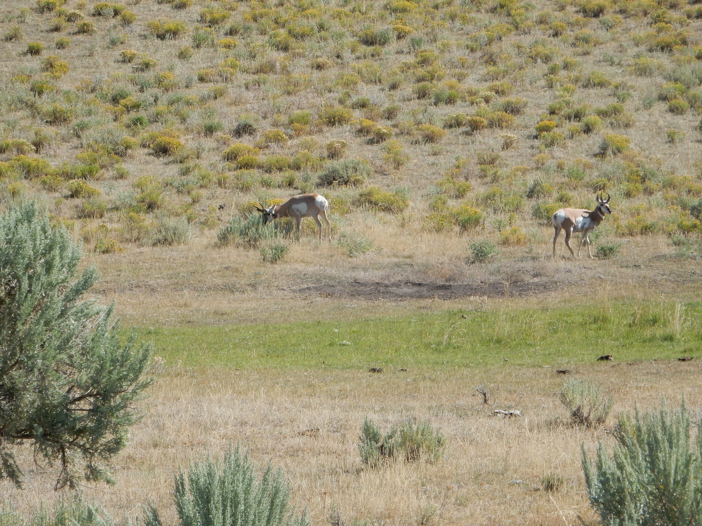
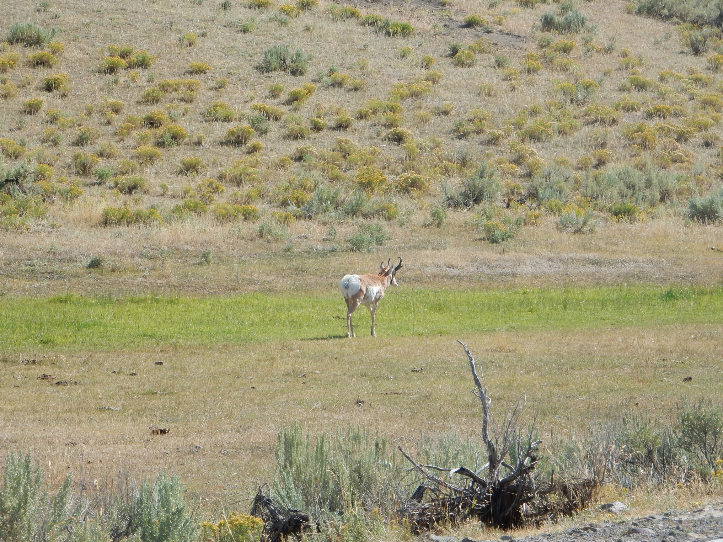
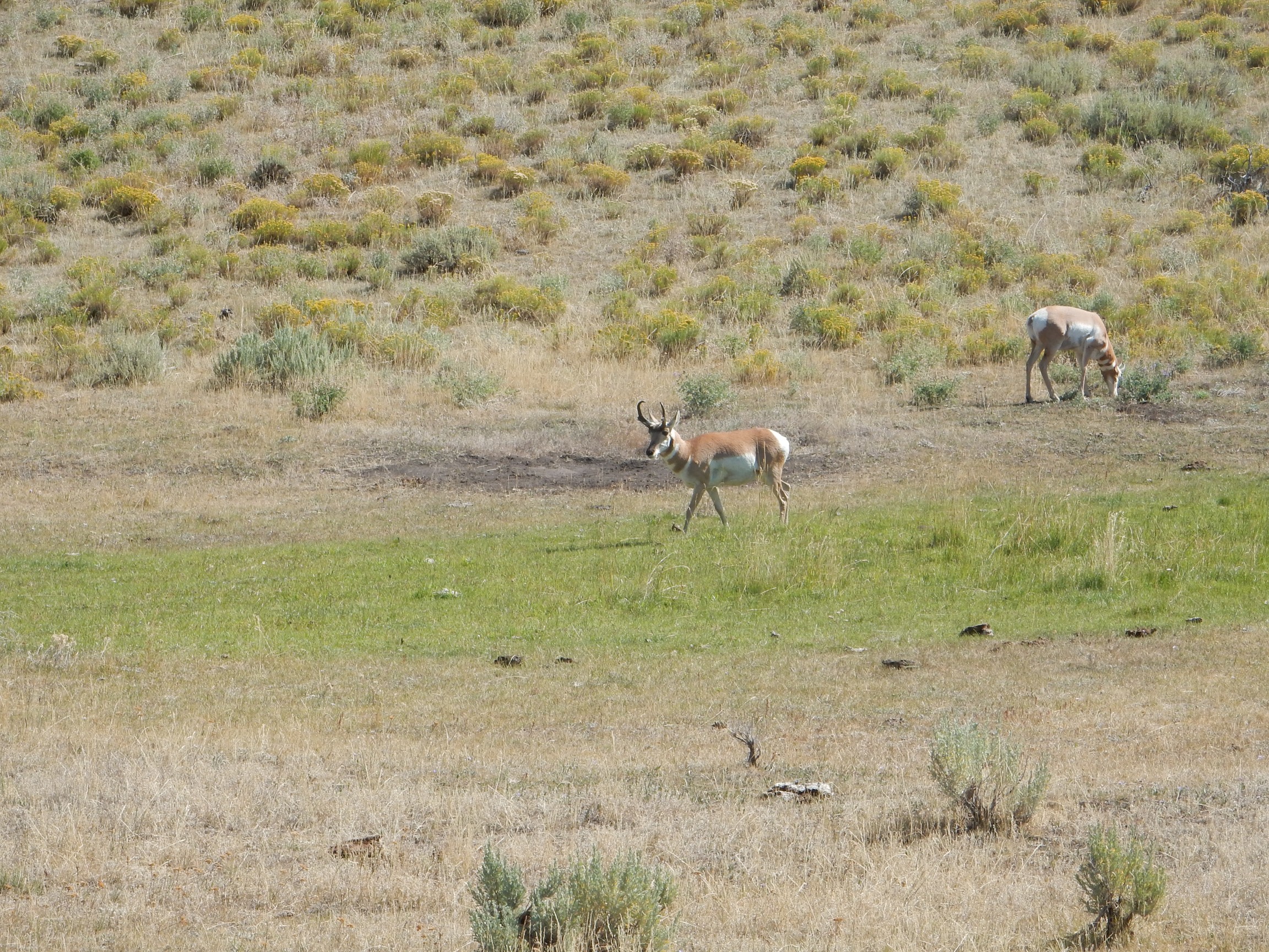
And pronghorn.
I find them rather goofy-looking. But then:
Behold the hippopotamus!
We laugh at how he looks to us,
And yet in moments dank and grim,
I wonder how we look to him.Peace, peace, thou hippopotamus!
We really look all right to us,
As you no doubt delight the eye
Of other hippopotami.
Ogden Nash, of course.
Pronghorn are almost as closely related to giraffes as to domestic goats. You can kind of see it in their necks and horns.
Yet another herd further down the road.
Q: Why did the bison cross the road?
A: What is this, some kind of joke?
I pull into Lamar Canyon. There is a knot of tourists; also, my map shows an outcrop here I’m interested in. I unobtrusively line myself up with one tourist’s telescope, to try and figure out what he’s looking at, and discover what appears to be a large nest in a tree across the river. “What is that, a raptor’s nest?” A younger woman replies: “Osprey.” So, yeah, basically. I take a stab at a deep telephoto shot.
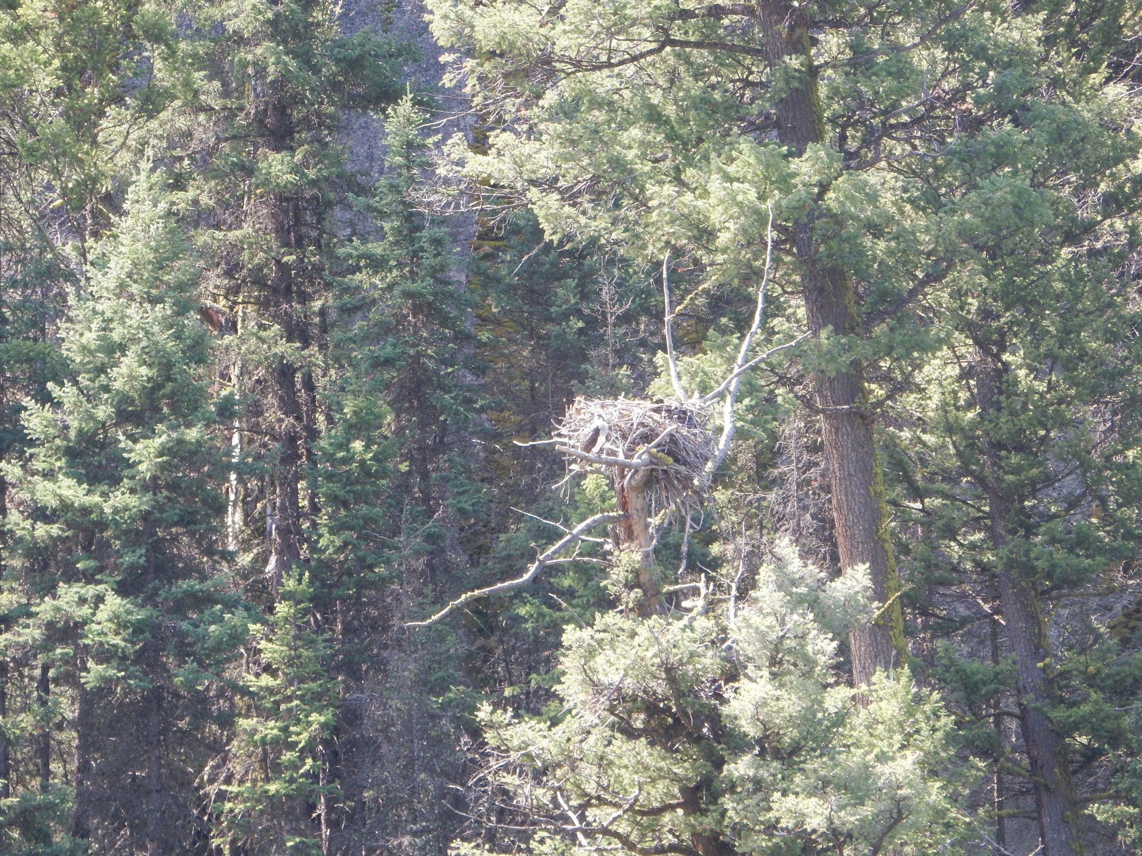
You will really want to click to get the full resolution version of this one. I didn’t see it at the time, but the osprey’s there, nicely blending in with the twigs and branches.
Oh, and the rock outcropping:
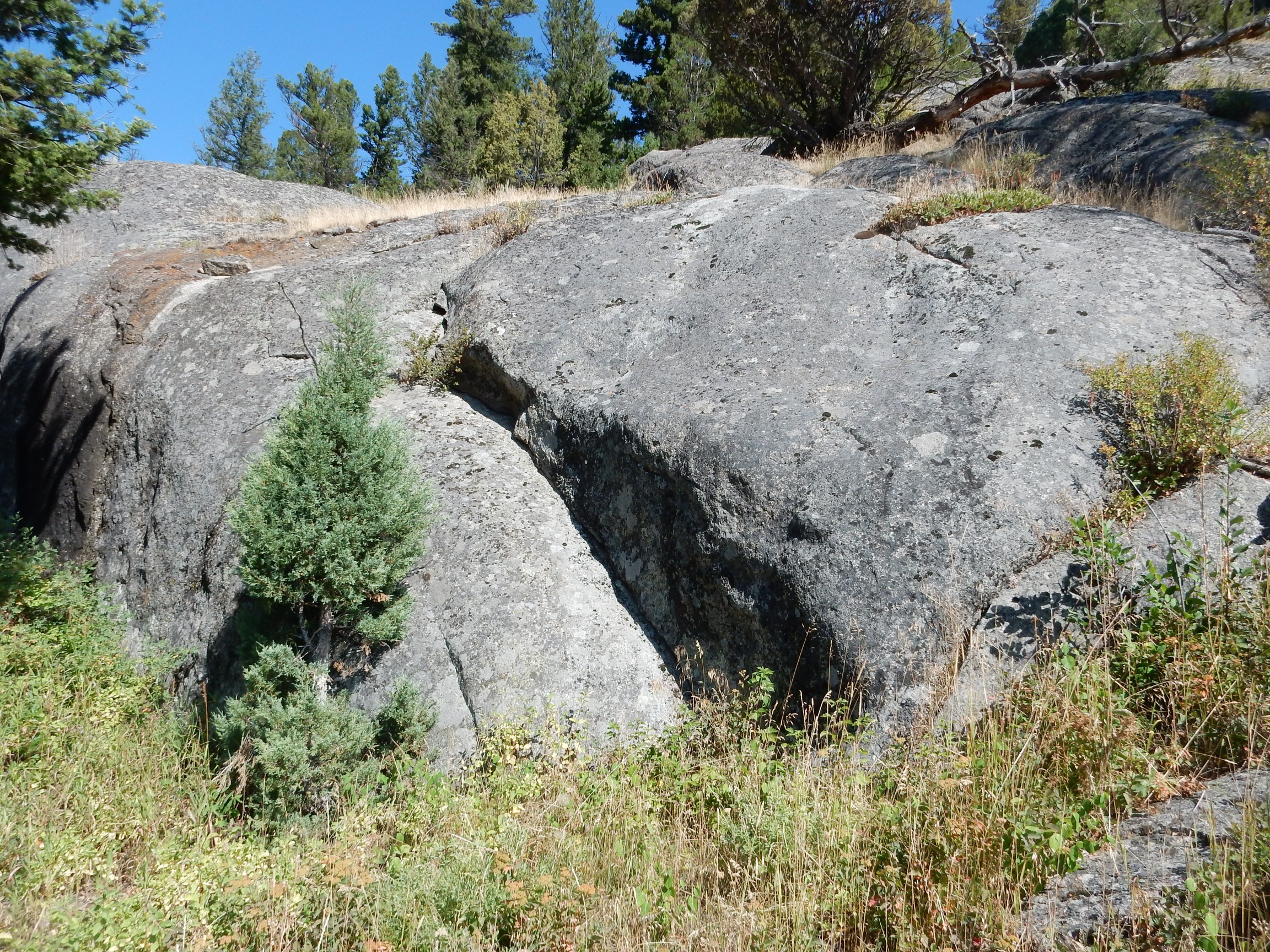
Shows the nicely rounded shape so characteristic of weathered granite. This is Precambrian granite of the Yellowstone basement. I don’t know the precise age of this particular outcrop, but a lot of the granite in this area is over 2.5 billion years old — making it some of the closest Archean Eon (2.5 to 4 billion years) rock to my area.
It’s a fairly pretty granite.
Yes, my fingers started twitching. No, it’s still sitting in Lamar Canyon. I know the rules.
Even if they’re ridiculous. You can fish in many national parks and monuments. A very few even permit hunting. Some permit grazing. But, to my knowledge, there’s not a single one that permits a rockhound to so much as pick up a pebble. It’s one reason I’m less than wildly enthusiastic about the penchant of Democratic presidents to designate large swaths of Western lands as national monuments.
[/rant]Looking down Lamar Valley:
Upper Lamar Valley winds up into the distant mountains. The Park Service has refrained from building any roads into the upper valley, so it’s almost pristine. I’m good with that.
River terraces are remnants of an older and higher flood plain of the associated river. These suggest that the Lamar River is continuing to cut downwards as the region is uplifted by the Yellowstone hot spot.
In the opposite direction is a landslide that my guide book describes as a superb example of the landform.
Landslides are characteristic of glacial valleys in this area. Glacial valleys tend to be steep (“U-shaped”) valleys, and when the glacier melts, any weak rock beds in the steep valley walls tend to collapse. The weak formation in this area is the Lamar River Formation.
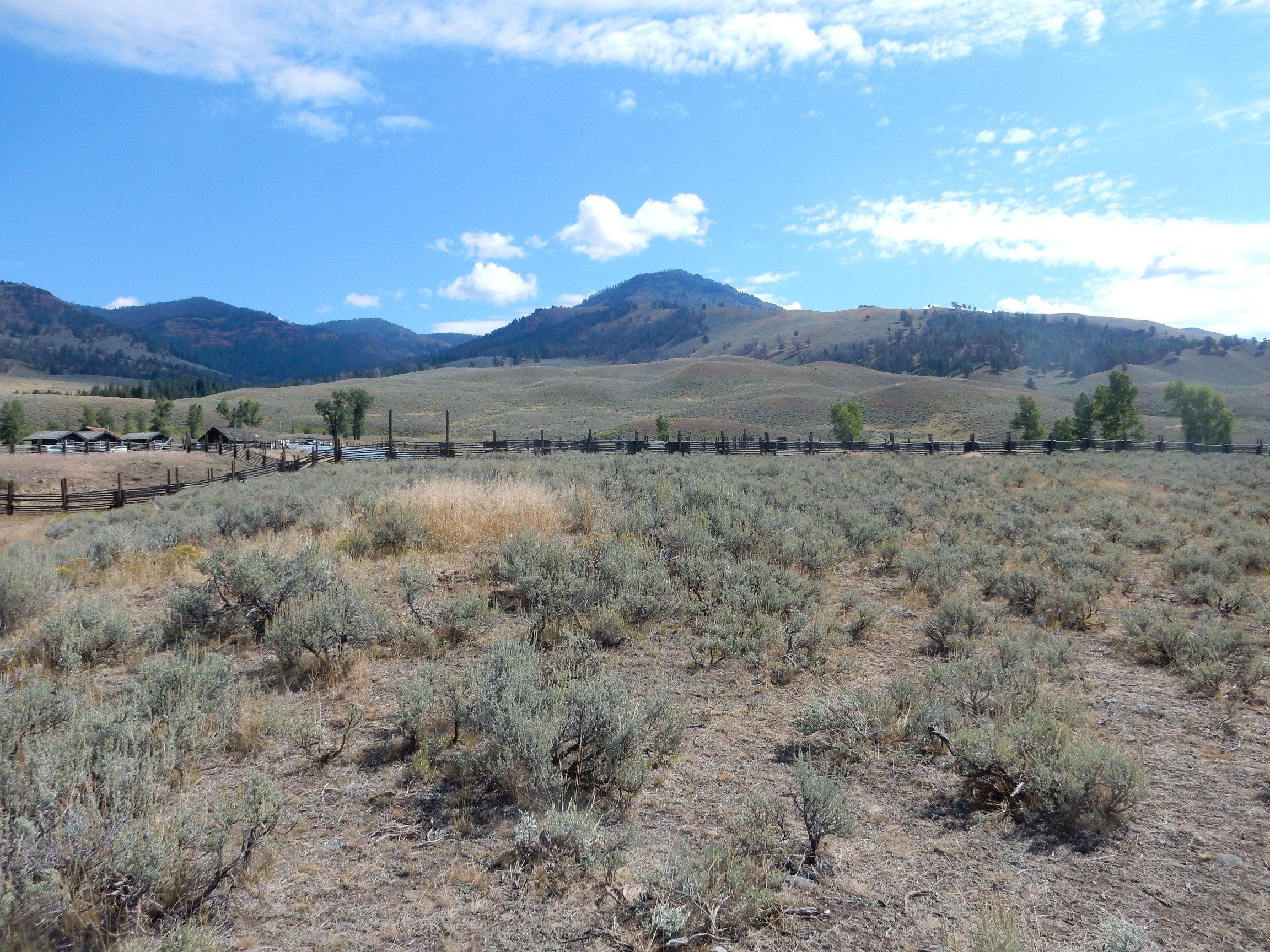
At left is the Lamar Ranger Station, where buffalo were once raised like cattle. The local signage is slightly disdainful of this, but my impression is that this contributed materially to saving the species.
I am not disdainful of efforts to save the wolf.
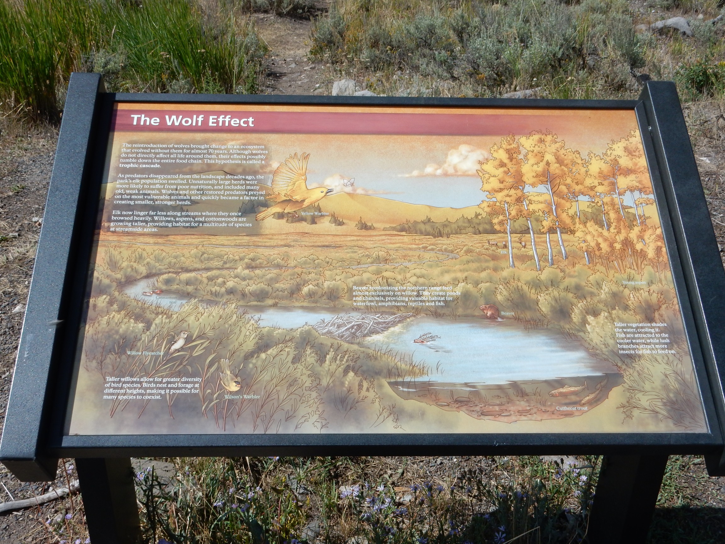
With a large elk herd reestablished in the Valles caldera back home, I hope the grey wolk is also becoming reestablished in the caldera. Coyotes are a bit small to take down an elk. On the other hand, I’m not unmindful of Hispanic ranchers who have been grazing their herds in the Jemez for centuries and may not be overly fond of large wolves. Life is full of hard tradeoffs.
It is about time for lunch. I find a pullout, already partially occupied by German tourists.*
There are some ducks way down in the river, but I already have good pictures of ducks closer up. I pull out my binoculars and peruse the mountains, which are Lamar River Formation and labeled on my map as “Fossil Forest.” Sure enough, I see some light patches in the dark conglomerate beds that look very much like fallen logs. The odds are good that they’re petrified logs 50 million years old.
Lunch consumed, I continue on my way. I pause to exchange greeting with another siestanista.
Bison remind me of Great Danes: They have a perpetually sour expression on their faces, even when they’re in a good mood. They’re the Lavell Edwards of ungulates.
The road leaves Lamar Valley to follow Soda Butte Creek. Soda Butte:
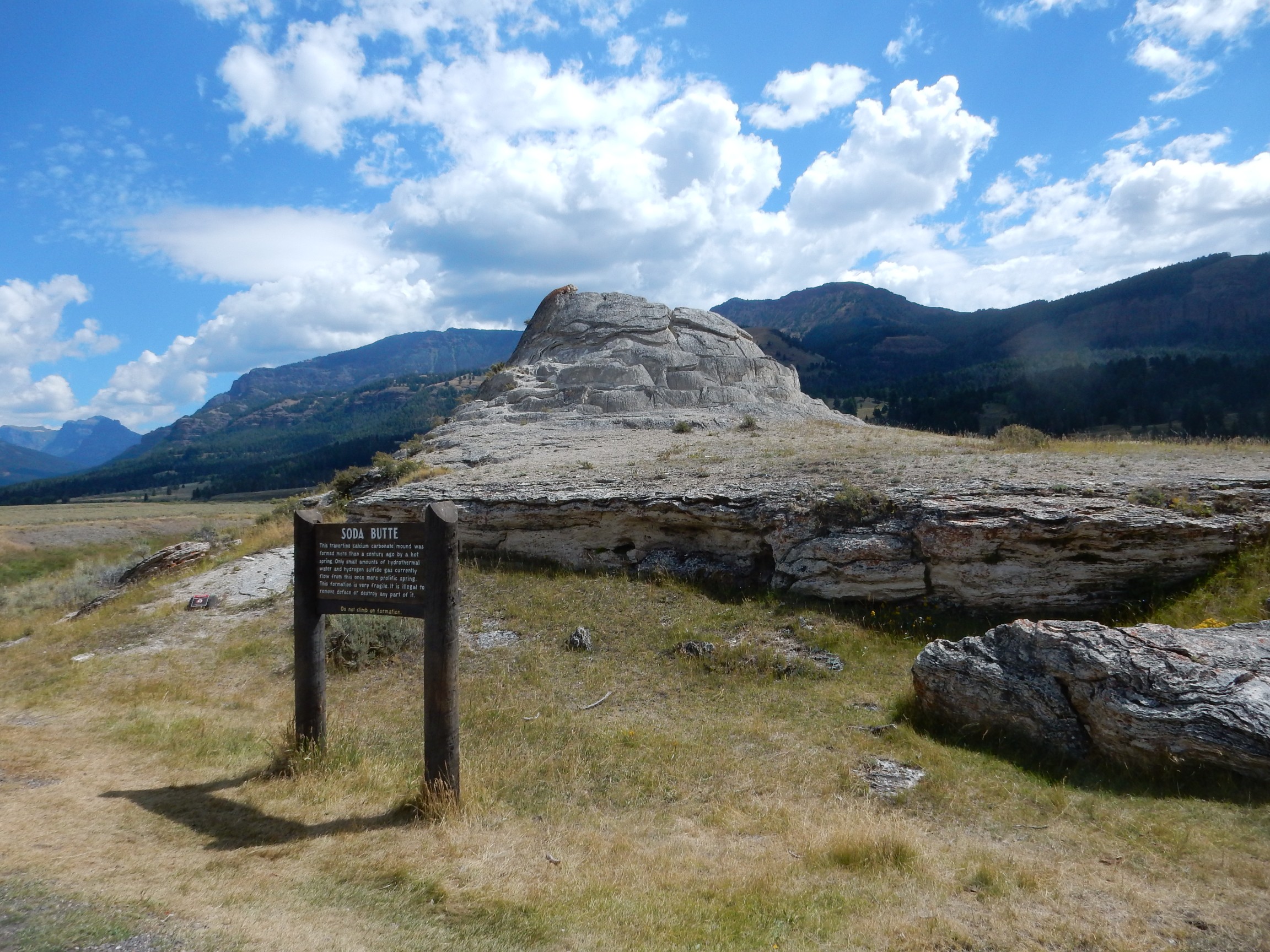
This is probably the hydrothermal feature most distant from the caldera rim, and, like Mammoth Springs, it’s mostly travertine. It’s also mostly inactive, and has been for a century. The only indication of activity is a distinct sulfur smell in this area.
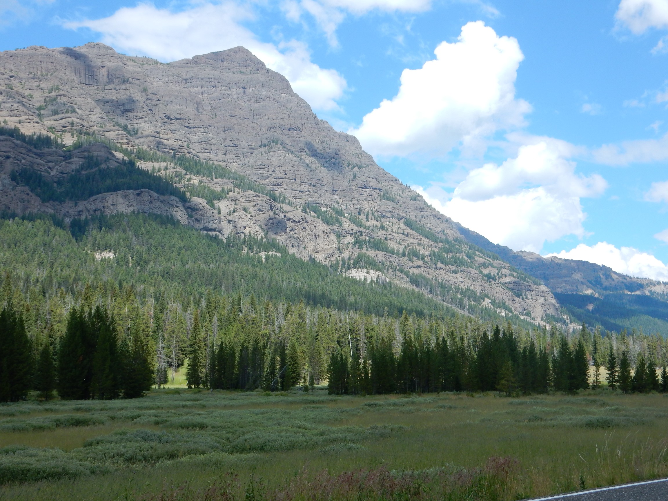
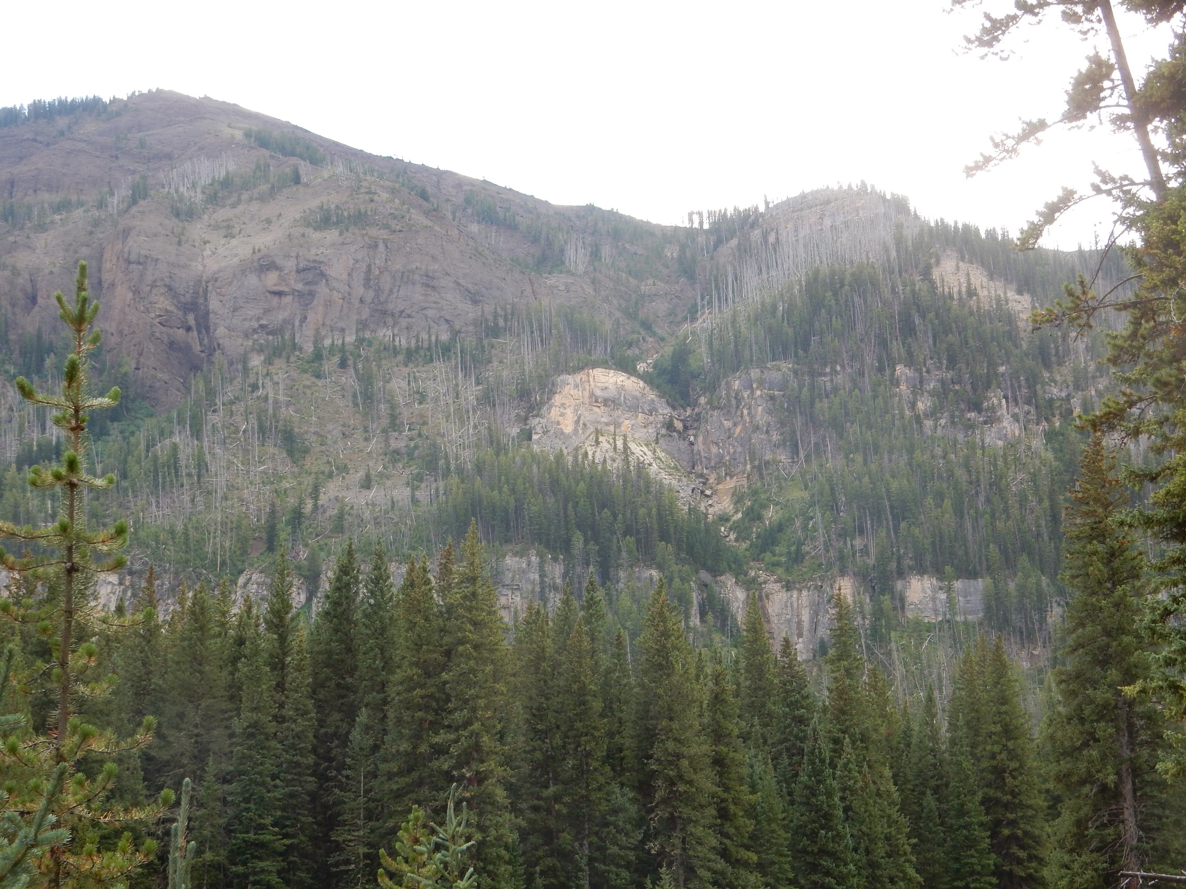
Druid Peak, I think.
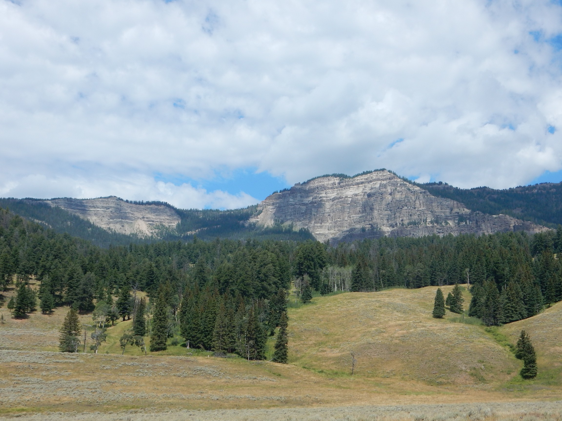
The lower slopes are Lamar River Formation, but the upper beds are Wapiti Formation, yet another Absaroka Volcanic Supergroup formation.
I note that the weather is starting to close in again.
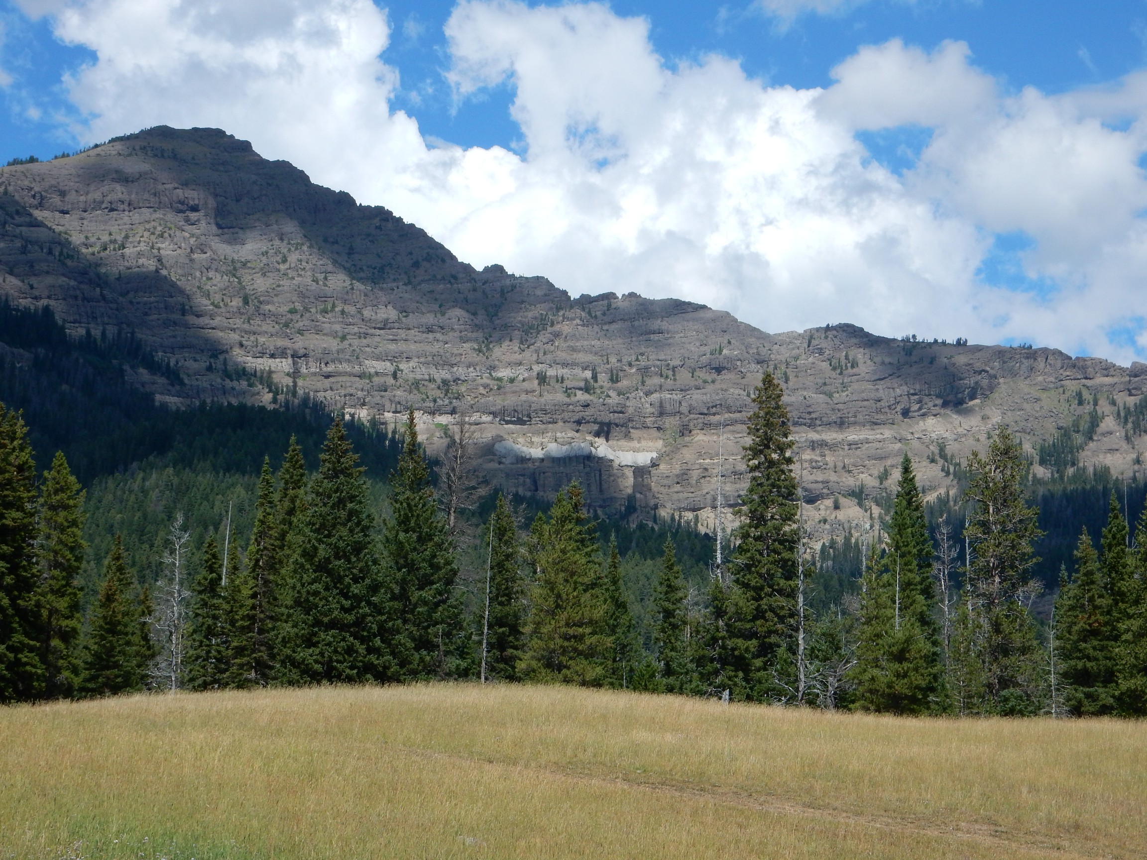
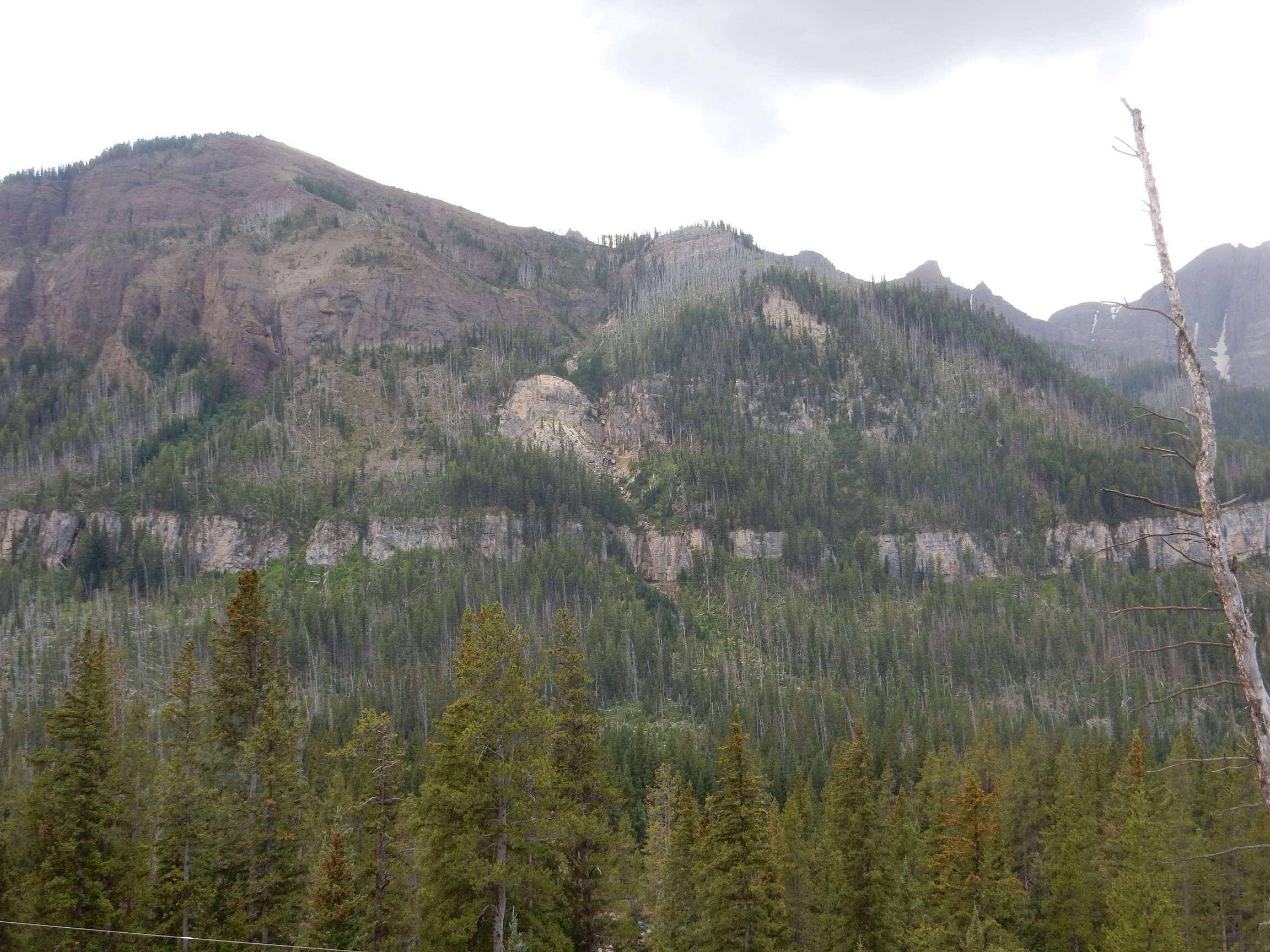
A view up the valley towards Abiathar Peak. I believe that’s Amphitheater Peak beyond.
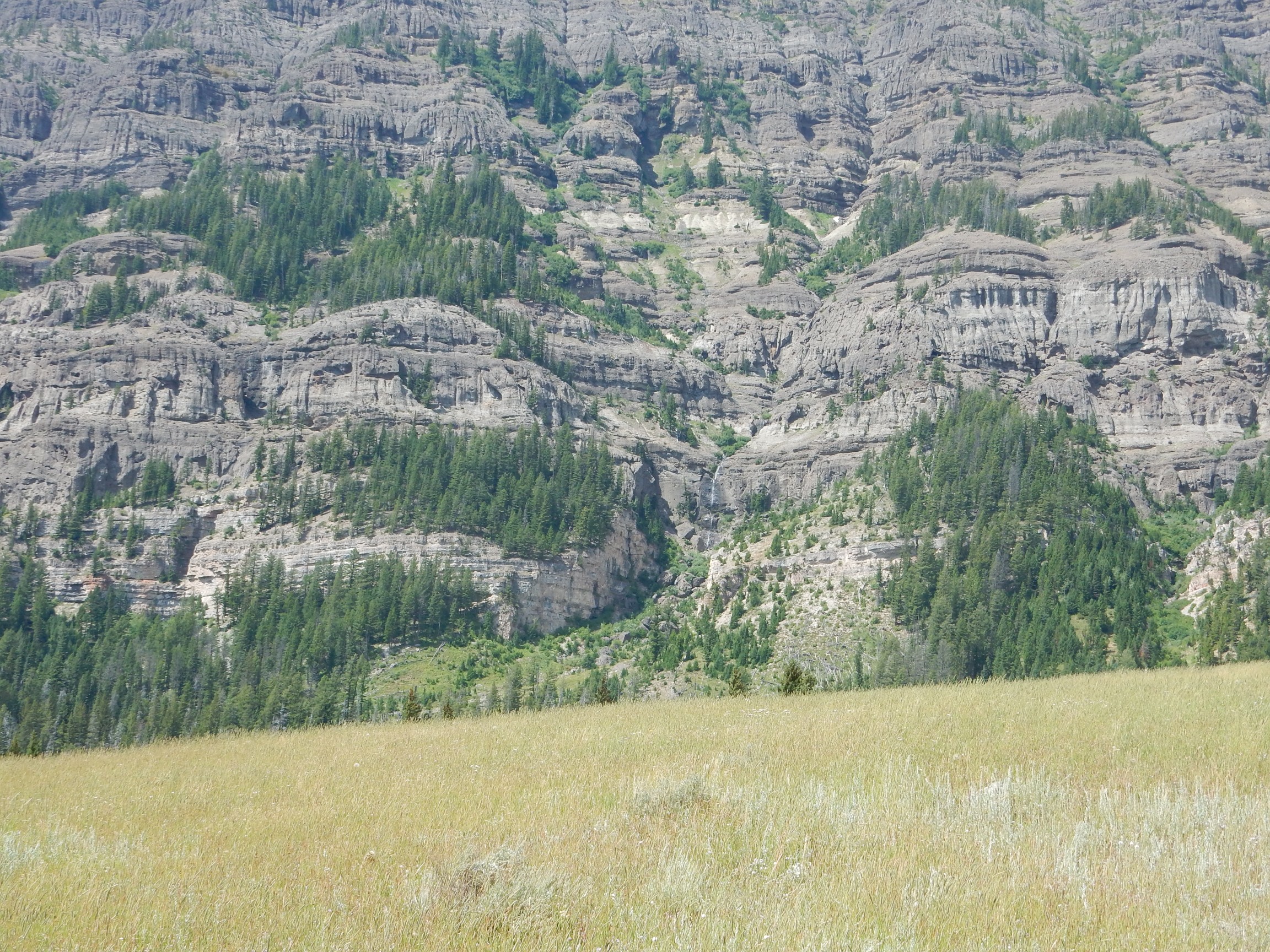
Close view of Barronette Peak.
This is mostly underlain by Lamar River Formation, but there’s Paleozoic beds at its base. The prominent bed visible here is probably the Madison Limestone, a Mississippian formation correlating to the oldest Phanerozoic rocks in New Mexico.
There is a trail, and some people around, and I am tempted to hike up to this. But ars longa, vita brevis; there aren’t that many people around; and a rugged hike across unknown terrain on a twisted knee seems like something Cindy (my patron saint of Common Sense) would not want to know I had done. I refrain.
Gonna digress and say something about how we date rock beds**. The relative ages of rock beds is not too hard; the ones on top must have been laid down after the ones beneath them. There are exceptions (due to folding or thrust faulting) but there is almost always severe distortion of the rock beds in these cases that gives them away. However, we can’t get absolute ages this way, and we can’t always be certain there isn’t a gap in the rock record (an unconformity.) Sedimentary beds can be correlated based on the fossils appearing in them; the lower beds have simpler forms, confirming their greater age, and the appearance of certain characteristic fossils in beds separated by hundreds or thousands of miles tells us they’re about the same age. Again, this gives relative ages, not absolute ages.
Absolute ages come mostly from radiometric dating. For example, zircon grains form from certain silica-rich magmas, and the zircon structure easily incorporates uranium, but not lead. Uranium slowly decays, at a known rate, and when we find lead in a zircon grain, we can be pretty sure it’s almost all from radioactive decay of some of the uranium the grain started out with. The ratio of the two gives us the age of the grain, and thus of the igneous bed it’s found in — or, if the grain is part of a sedimentary bed, we know the sedimentary bed cannot be older than the zircon grain (which presumably weathered out of an igneous rock before becoming part of the sedimentary bed.) This is a particularly simple case, because the chemistry is so ideal; but many other radioisotopes can be used if you’re clever enough. Potassium-rich rocks are often dated by measuring the argon trapped in the rock from decay of a radioactive isotope of potassium; this is a tad trickier because relatively mild heating of the rock can allow the argon to escape and the rock to look younger than it is. Once we date enough igneous rocks, and use them to constrain the ages of sedimentary rocks, we can calibrate the fossil scale and start using it for absolute dates.
Thus, we know the ages of the various Yellowstone eruptions from geologists taking samples of the various tuff beds and perform potassium-argon radiometric dating. The ages from separate measurements are consistent enough to give us confidence they’re right. Similar dating gives us the age of the Eocene conglomerates and lava flows of the Absaroka Volcanic Group, while the fossil assemblages give us the ages of the older sedimentary rocks in the park. The oldest rocks, of the Precambrian basement, are dated using uranium-lead dating.
Ash bed in the Lamar River Formation.
LIght cliffs of the Cathedral Cliffs Formation come into view. Both south
and north of the road.
This is an andesite, only slightly lower in siilica than the Lamar River, Sepulcher, and Wakiti formations, but for some reason much lower in dark iron minerals. I had to park and walk across a meadow to get a clear photograph; but it was also an opportunity to make an offering to the forest fertility gods. I’d been on the road a while now.
I continue east, looking for the breakaway point for the Heart Mountain Detachment. The road leaves the park without me spotting it; well, I’ll go as far as Cooke City and see if I can spot it coming back.
Republic Mountain, south of Cooke City:
The white band is the Cambrian Pilgrim Limestone, which is an oolitic limestone full of trilobite fossils, around 540 million years old. That sounds very intriguing, but I never get a good opportunity to get closer (let alone take a sample.) Above these are beds of the Ordovician Bighorn Dolomite. Then comes Eocene Lamar River Formation. This is a classic discomformity, where there is a gap in rock record (here, of about 400 million years) between parallel beds of rock. However, this particular discomformity, which is found throughout the area east of Yellowstone, has some unique and puzzling features I’ll ruminate on presently.
Coming back through Silver Gate, I think I see the breakaway point through the trees.
Not the best angle. I drive back through the park entrance, and try a side road to the river; the road dead ends and I’m too far west. I turn around and start up the road; it’s a picnic area and a girl maybe ten years old dashes out right in front of me. Vigorous application of brakes. I start down the road again; a grizzled old great-grandfather glares at me and give me the universal “Slow your engine” sign. What can I say? He has a point.
Back through the park entrance. There’s a pullout for an outhouse just beyond and, yes, there’s a trail to the river and a decent view of the breakaway point.
Still. Trees in the way of the lower beds. I retrace and climb the hill north of the road, which seems to have a bare patch towards the top. It’s steep and covered with branches, and my knee complains; but not as much as I might have feared. Ah:
That’s the shot I’m looking for.
So what’s all the fuss? This is, like, way cool for geologists; probably the wayest coolest thing on this trip except for the eclipse itself. Geologists looking at this mountain noticed that the right half was composed of Paleozoic rocks much older than the Eocene Lamar River Formation, which makes up the upper left half of the mountain. This normally indicates a fault down the mountain face displacing the beds. But the Pilgrim LImestone, and a thin layer of Bighorn Dolomite above it, are undisturbed, continuing left under the young volcanic beds. It’s like the fault ended where the discontinuity began between the Bighorn Dolomite and the Lamar River Formation.
Faults are often buried, so that only the lower beds are displaced while the upper beds are undisturbed. But it’s almost unheard of for a fault to abruptly end in the lower beds. Geologists have mightily puzzled over this for nearly a century. Could erosion have produced a scarp in the old beds, subsequently buried under Lamar River Formation, so that this isn’t a fault at all? But the younger beds are also displaced; how could erosion have done this?
Another clue is that chunks of Paleozoic rock the same age as the rock missing on the left side of the mountain are found scattered for fifty miles to the east. Some of these “chunks” are mountain-sized (including the eponymous Heart Mountain), and the “chunks” of old rock sit on much younger rock — not unknown, since this can be produced by a kind of shallow regional faulting that produces “decollement” of the upper beds, but this didn’t’ look like decollement.
Part of the problem is that modern geology began as a reaction against the idea that all the rock beds we see were laid down in Noah’s Flood. Geologists came to believe that “catastrophism” was to be rejected out of hand, and that geologists should assume instead that everything we see in the rock record was the result of the slow working of the same geologic processes we see today over vast periods of time. This made geologists reluctant to believe that such things as meteor impacts or thousand-year floods might be an important part of the geologic record. And it may have kept geologists from seeing the real explanation for the Heart Mountain Detachment.
The current explanation, which matches all the known facts fairly well, is that the Heart Mountain Detachment was a landslide of truly epic proportions. Fifty million years ago, part of the flank of a giant volcano of the Absaroka range broke loose over an area of a hundred square miles along a weak bed in the Bighorn Dolomite, and went thundering off to the east. And part of the detachment point is right before you in the side of the mountain in the previous photograph.
(In other news, while there is no credible evidence of a worldwide flood in the last sixty million years, there is some credible evidence of truly epic regional floods. One such flood came when an ice dam broke and released the contents of a very large lake all over eastern Washington state, some tens of thousands of years ago. A few geologists even think it possible that the Black Sea basin flooded catastrophically around 10 to 15 thousand years ago, and gave rise to the flood legends of the Middle East.)
I climb back in my car and head through the park entrance yet again. The ranger remember me: “Weren’t you here earlier today”? Yeah, just a few minutes ago. I’m flattered I’m memorable. I head back through the Lamar Valley; the clouds have gathered and it starts to rain. However, the storm passes by the time I reach Norris Geyser Basin, there’s still hours of daylight, and I decide to see the geysers. The area is crawling with tourists but I manage to find a parking spot.
I remember, incorrectly, that the basin entrance is north of the parking lot. It takes a few minutes to get oriented properly.
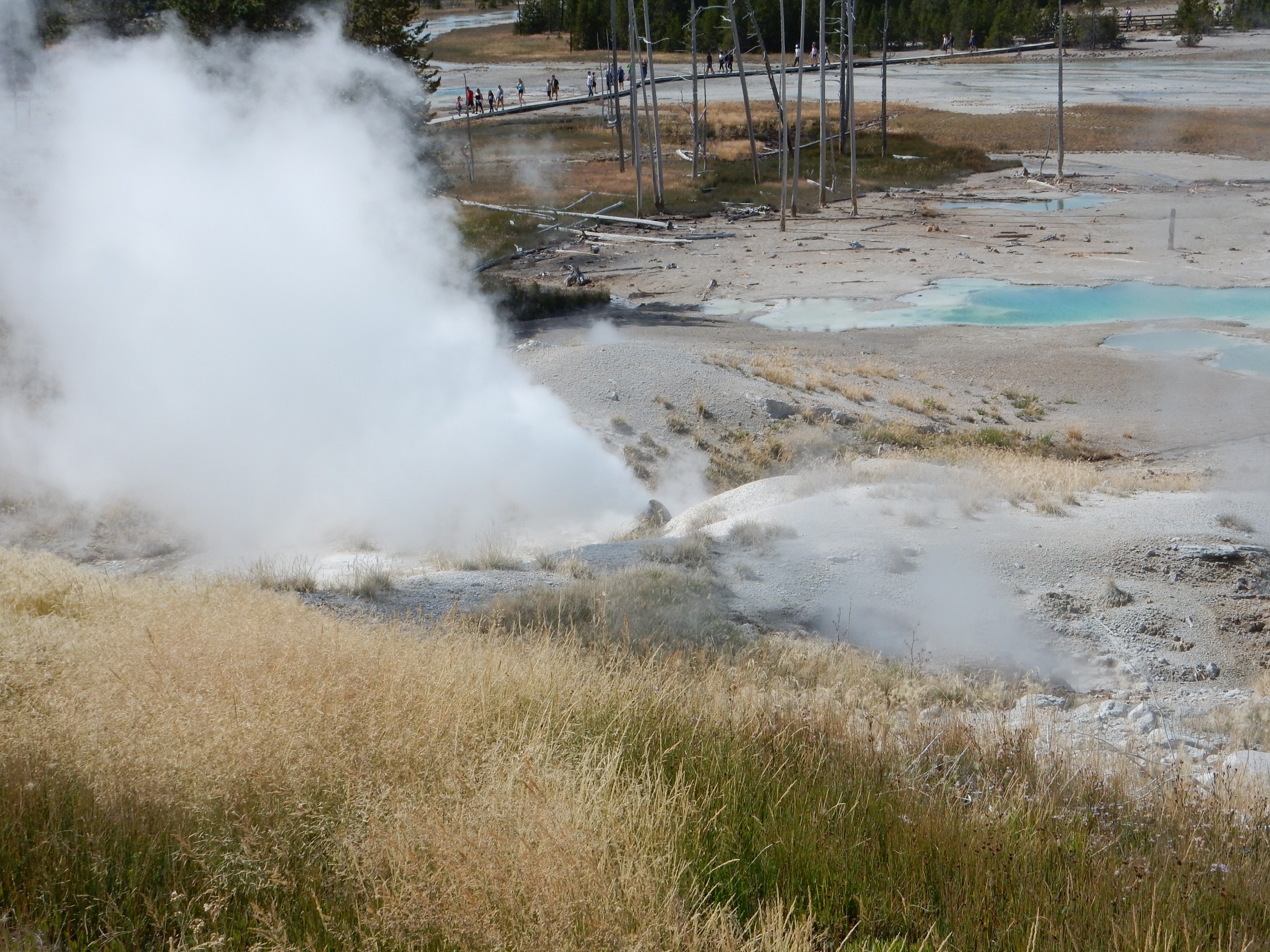
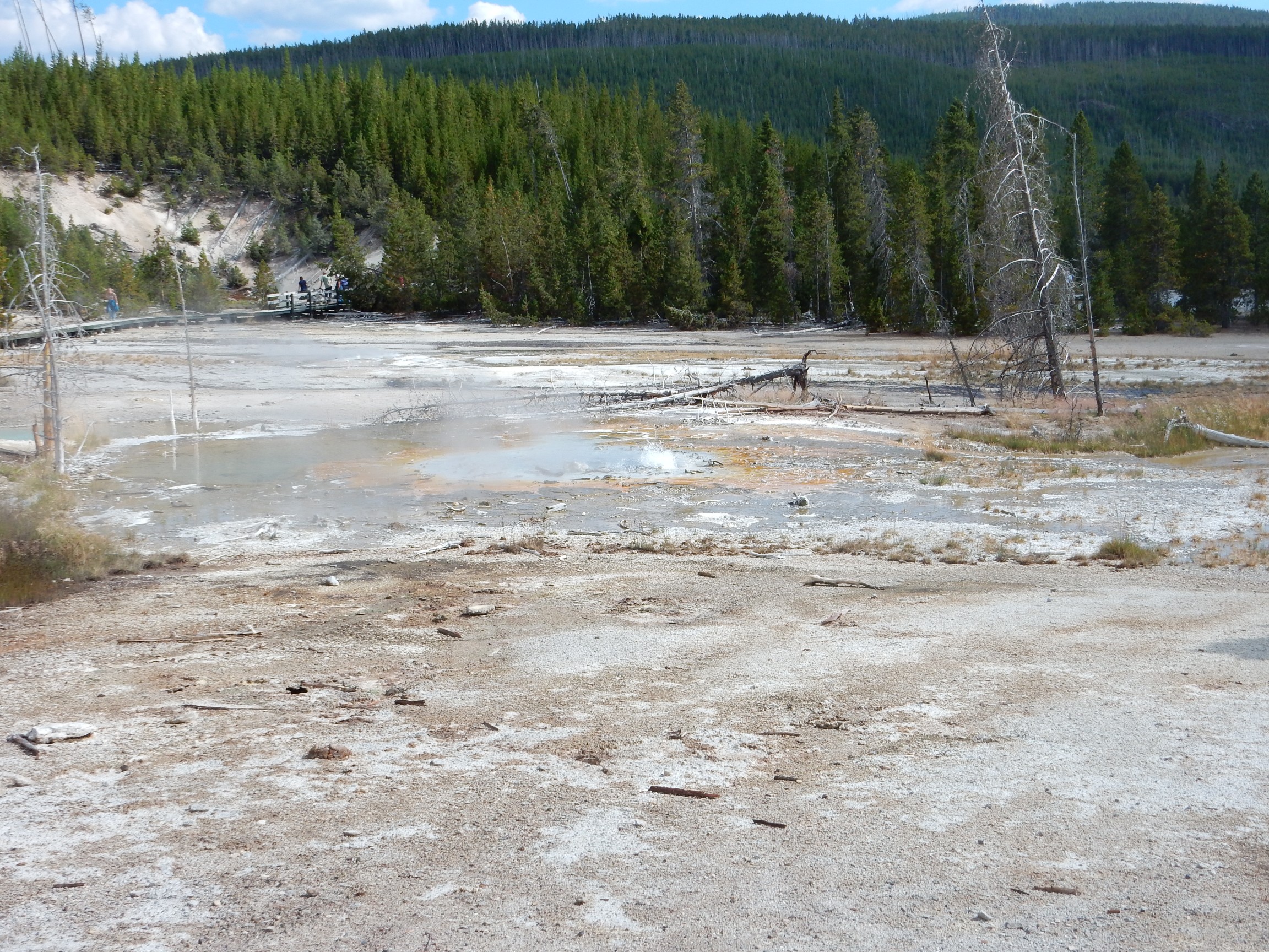
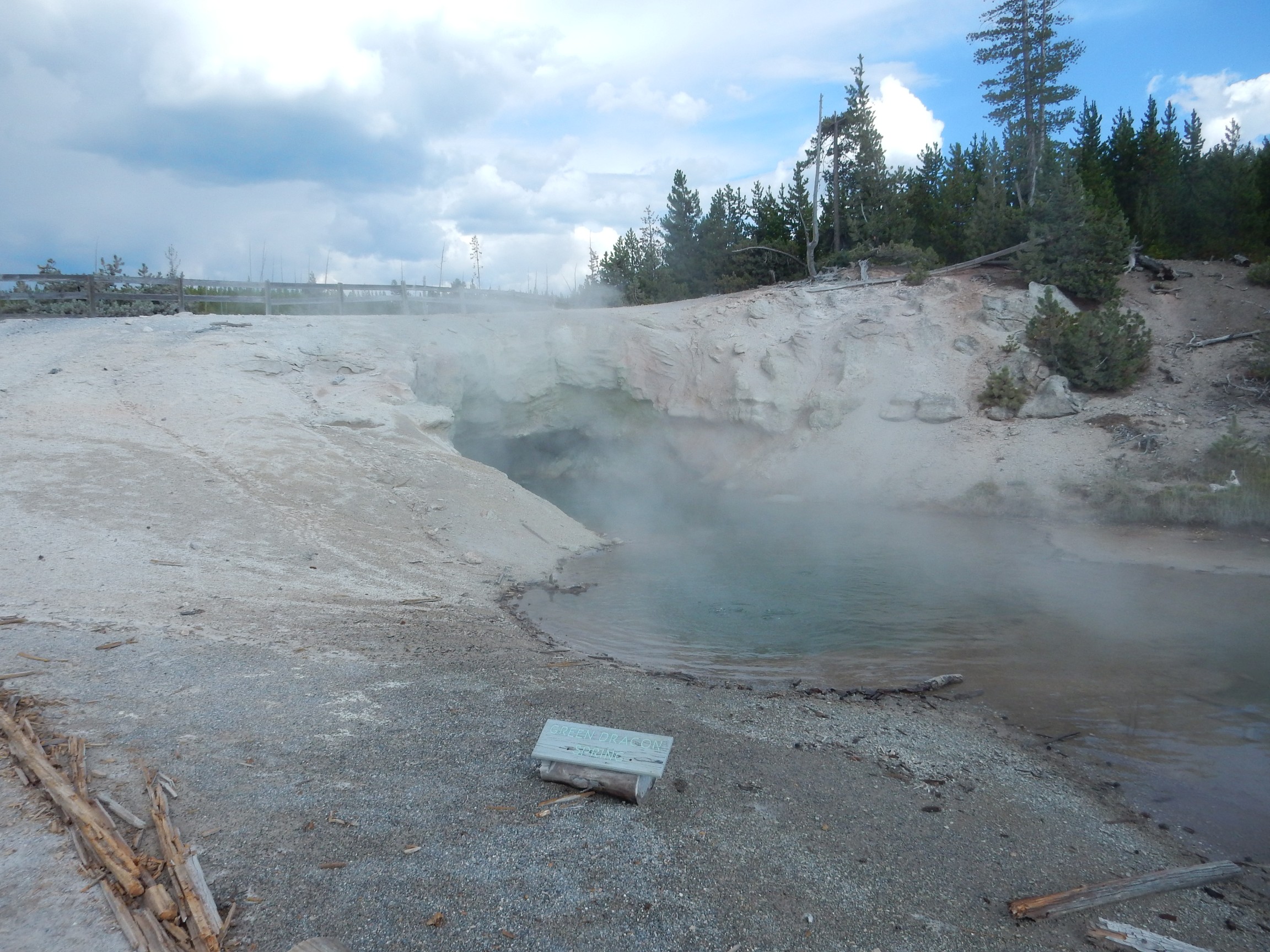
Norris Basin is nearly as cool as Upper Geyser Basin and Old Faithful.
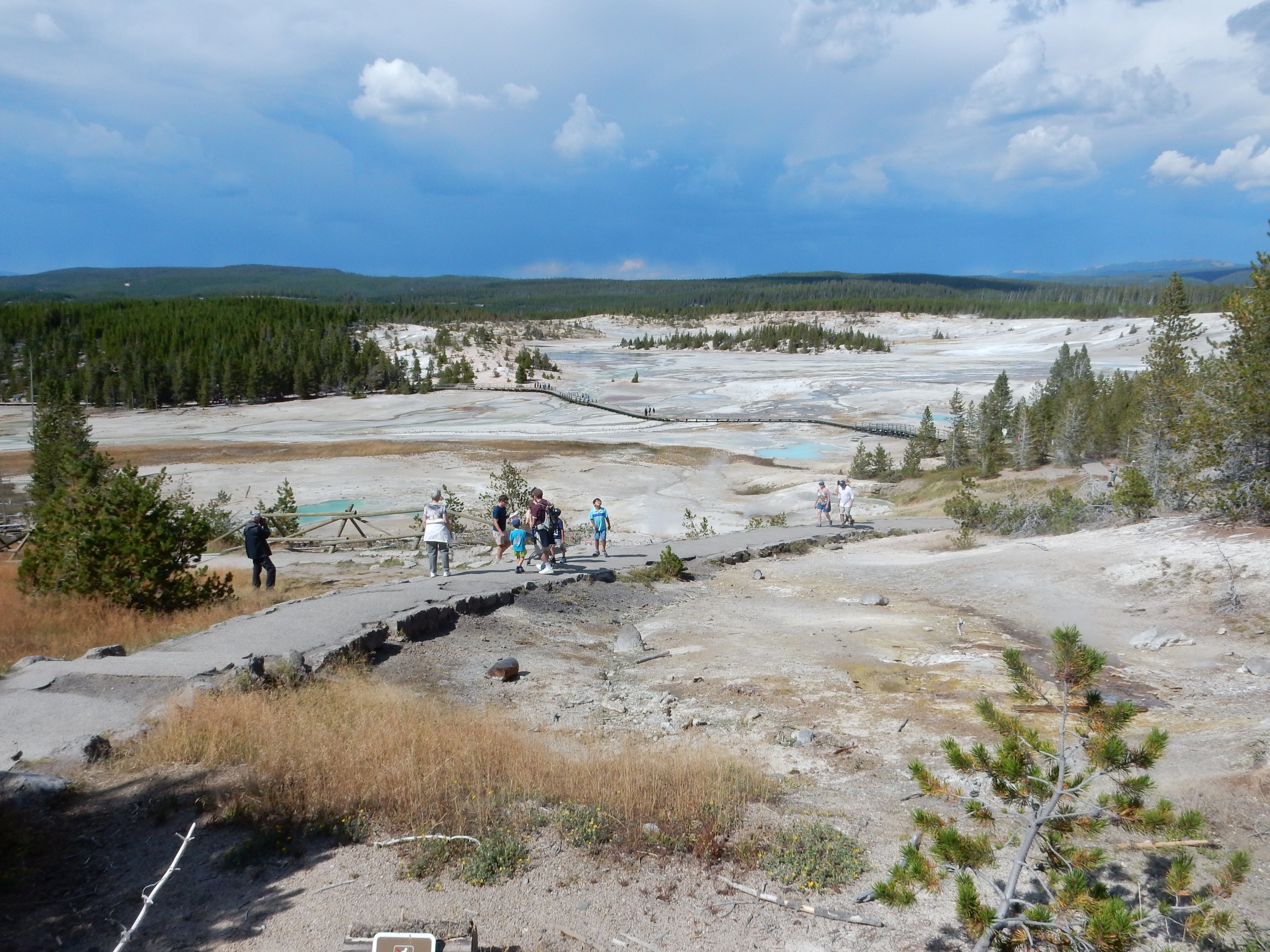
Or rather, it’s literally the hottest geyser basin in the park. It’s situated very close to the caldera rim and the ring fracture along which the caldera collapsed, and precaldera north-south faulting further opens the rocks here. The groundwater gets very hot, and the features in the basin are constantly changing as sinter closes down some vents and nearby earthquakes open others.
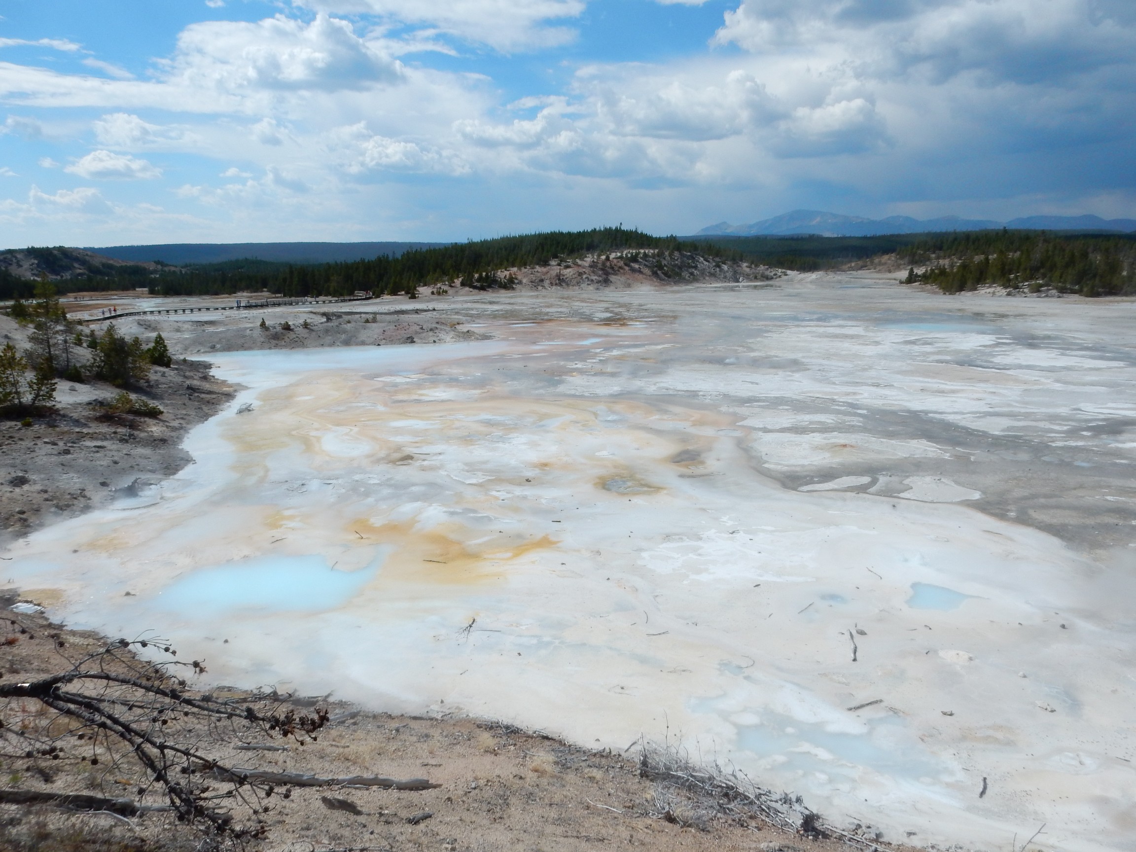
Hmm. “Porcelain basin” has a slightly unpleasant connotation to me; but this area is lovely.
Thermophiles by the boardwalk.
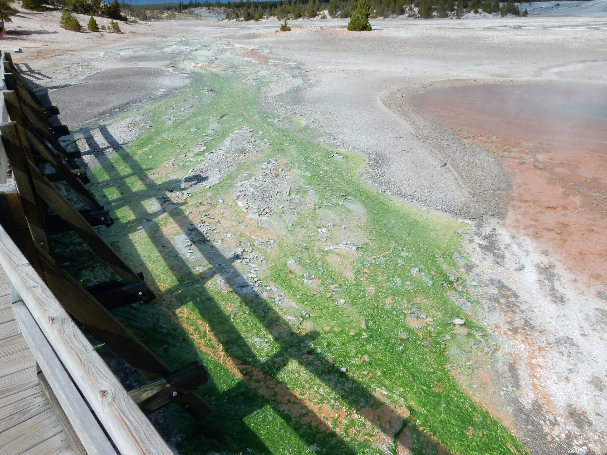
I wish I had a good field guide to thermophiles. The signage in the park is uselessly vague. Cyanobacteria? Green sulfur bacteria? Green nonsulfur bacteria? Purple sulfur bacteria that happen to be green (the way that the black bear I came closest to in the wild was brown in color?) Their biochemistry is varied and fascinating.
Crackling Lake, crackling away.
Last time I was here, I took pictures of just about every geyser I saw in the park. It’s natural to gravitate back to these on a second visit, but I made a conscious effort to visit stuff I didn’t remember visiting before, and I avoided taking pictures of every geyser again. For one thing, while I had means to recharge my batteries, sitting for an hour and a half to do so is the one way I’ve discovered to make Yellowstone boring.
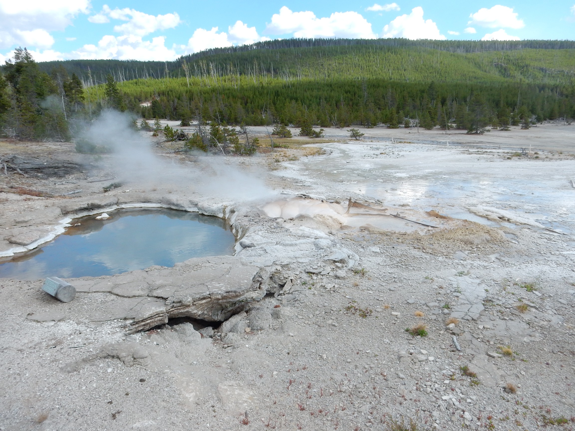
Vixen Geyser. This one fountains more or less continually.
Porcupine Geyser. This one has had a very tumultuously history, culminating in the geyser blowing itself apart. With the vent blasted wide, it is now a hot spring.

The Bluebird of Happiness?
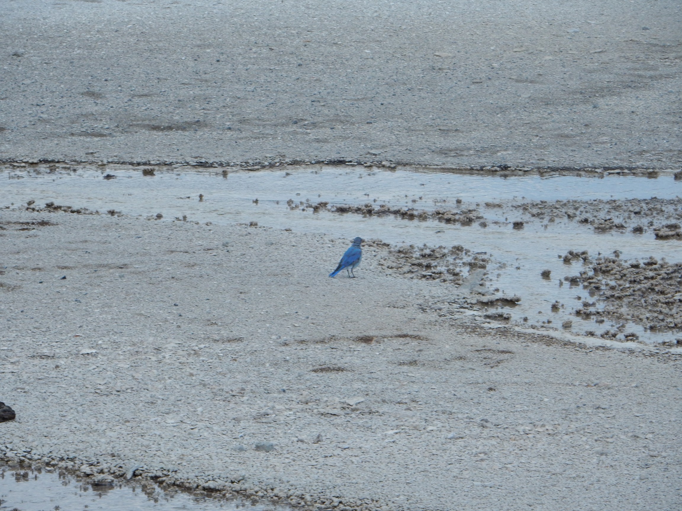
My knee certainly wasn’t happy. I was hiking in considerable pain, even with the walking stick.
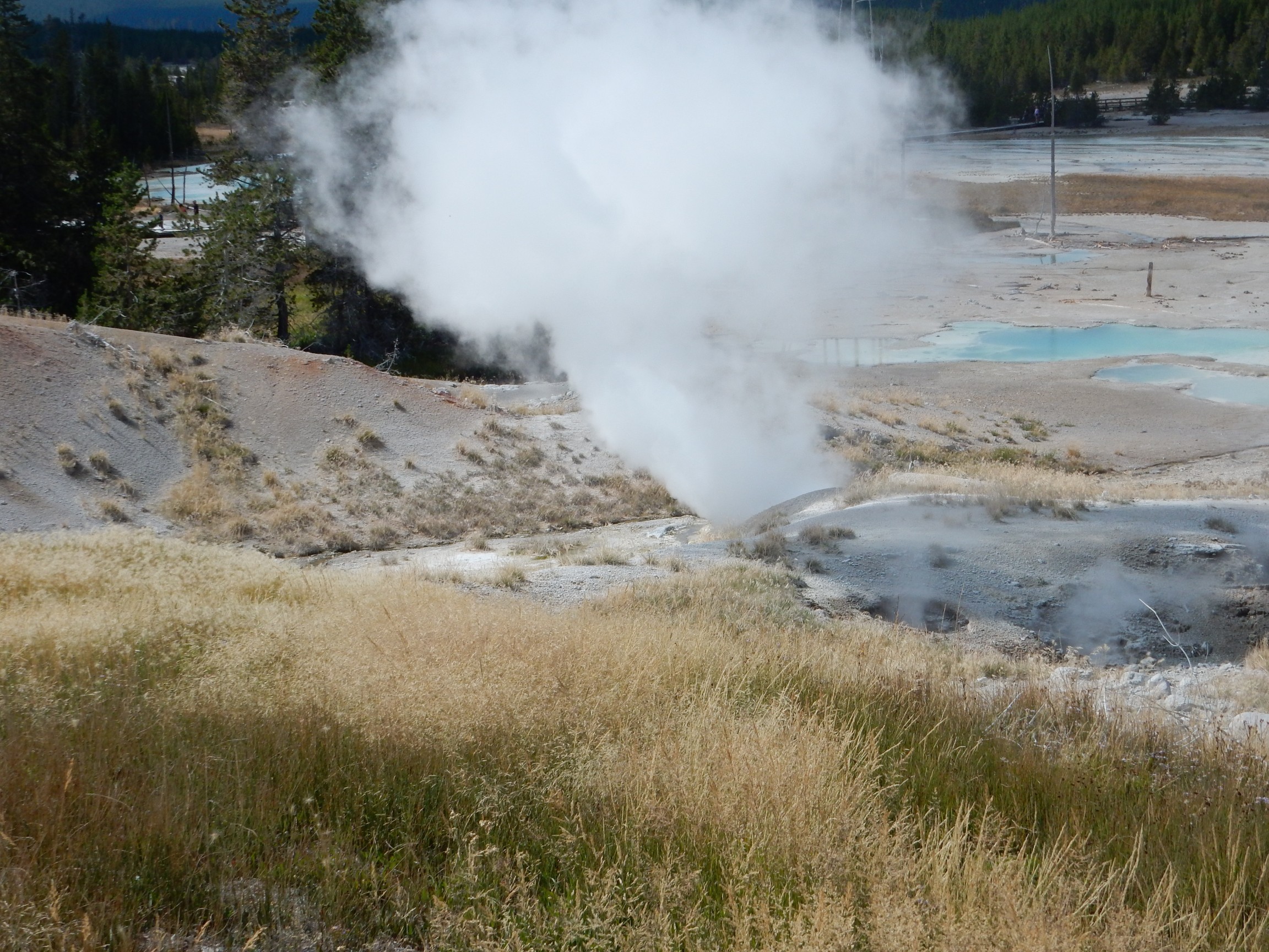
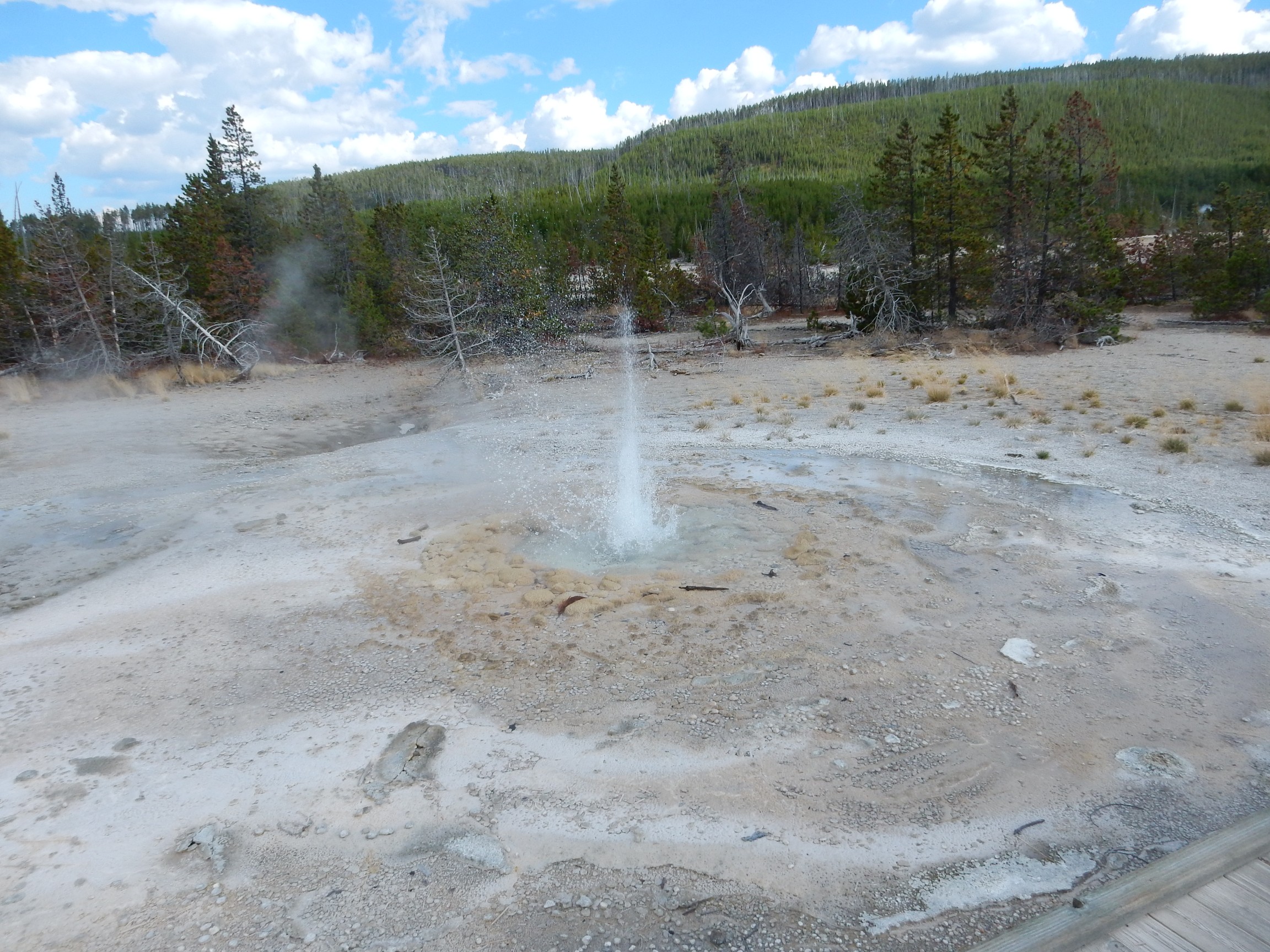
Steamboat Geyser. This is reputedly the largest geyser in the world, at least on the rare occasions it has a full eruption. It tends to spew a lot between eruptions.
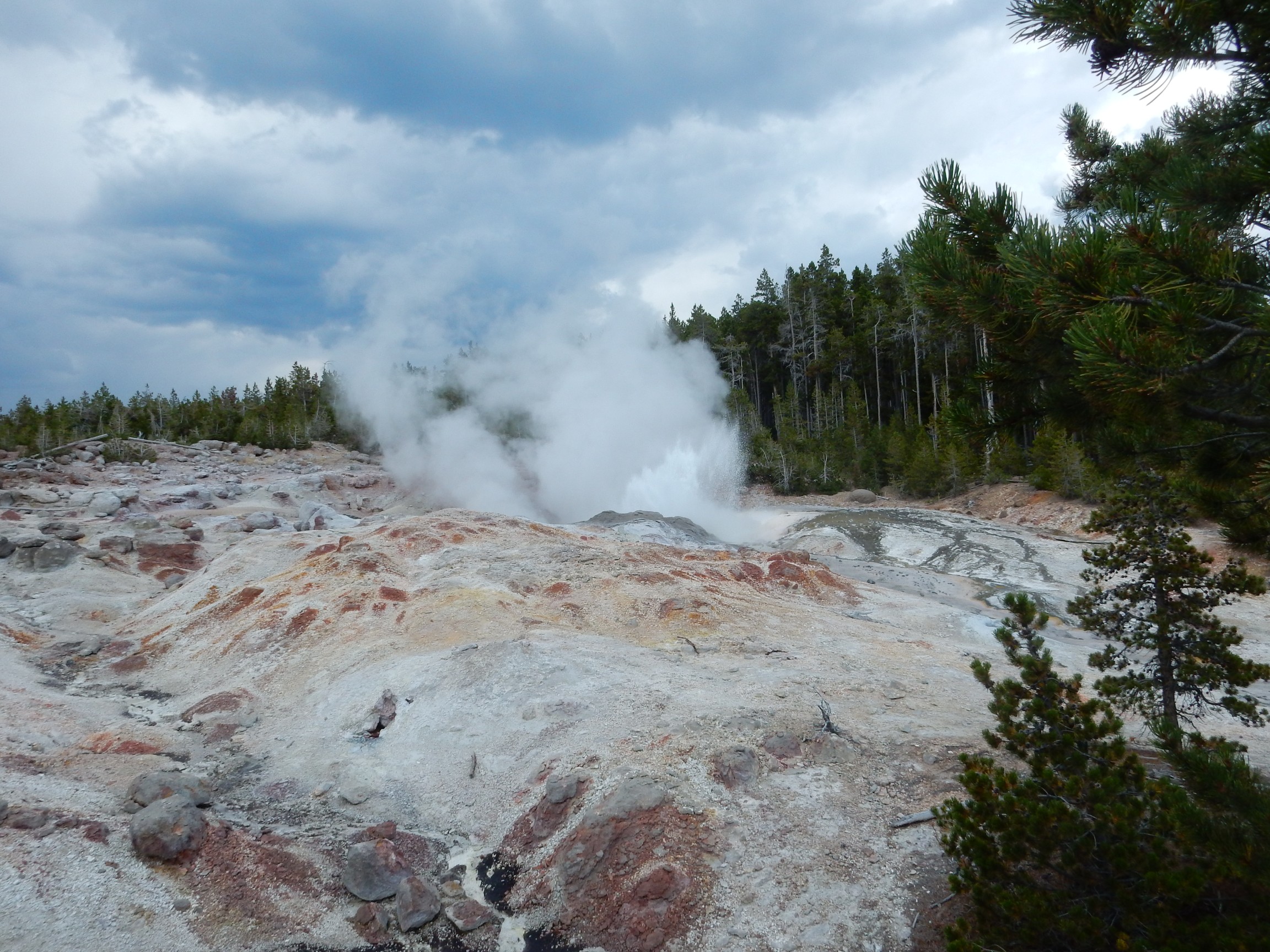
I found myself ruminating on the hydrology. Hydrology is, after all, the only area of geology in which I have any professional qualifications and experience (namely, completing the U.S. Geologic Survey certification course on groundwater modeling and applying it to the WIPP certification.) Steamboat Geyser is high on a hill and yet it is spewing hot water. There appears to be a considerable difference in hydrostatic head from Steamboat Geyser the geysers in the valley floor. This suggests that the plumbing of separate geysers is unconnected, with gravel and sand of limited permeability in between. I find myself wondering if differences in water temperature are also part of it; a column of hot water has less hydrostatic head than a column of cold water of equal height, because cold water is denser. It would follow that higher geysers tend to be hotter geysers. Water full of steam bubbles also would have less hydrostatic head, for the same reason.
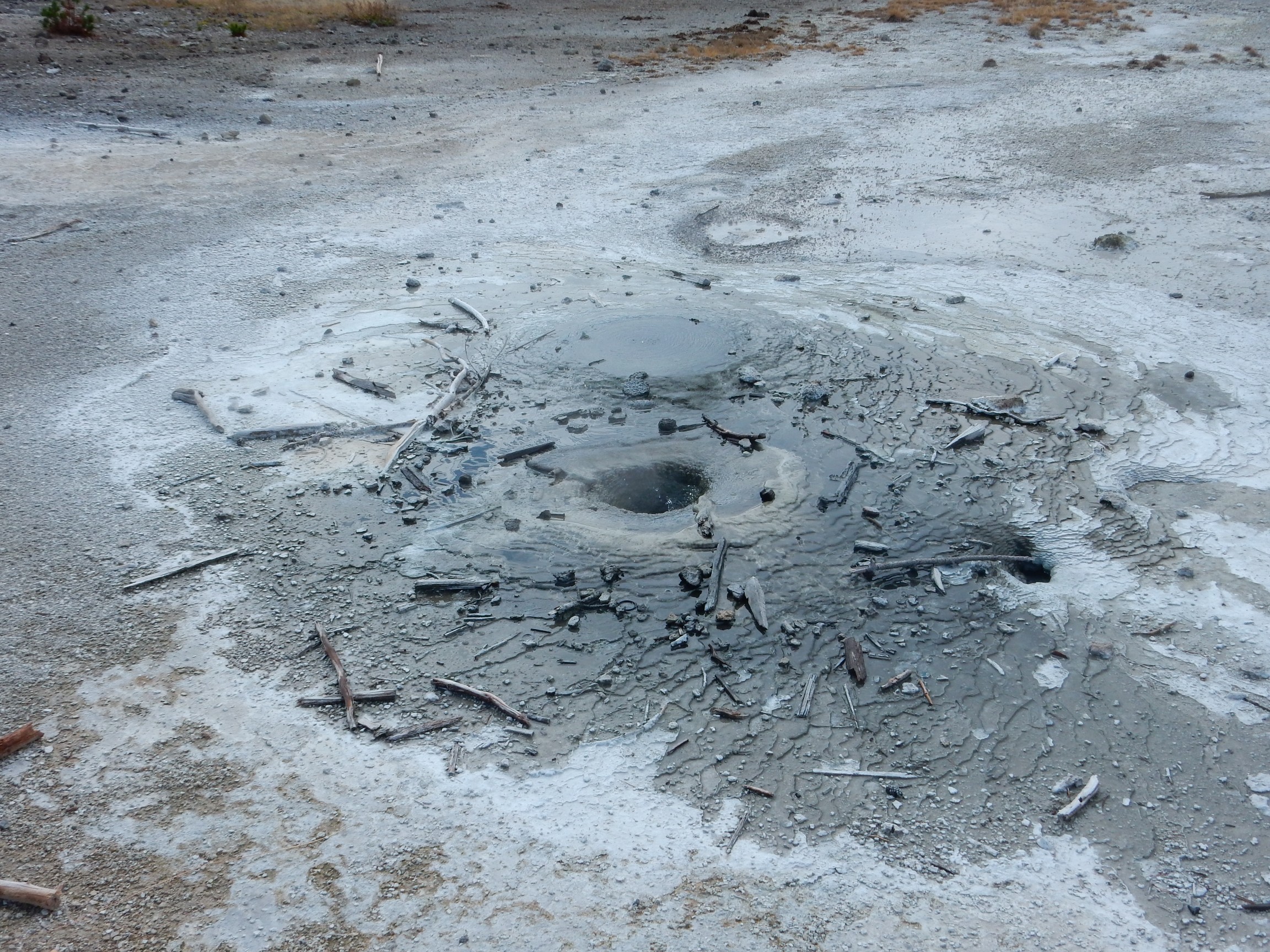
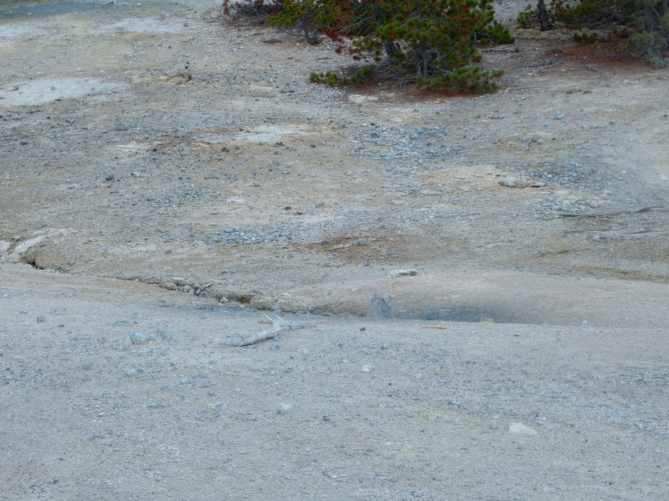
Itty bitty, possibly unnamed, mud fountain.
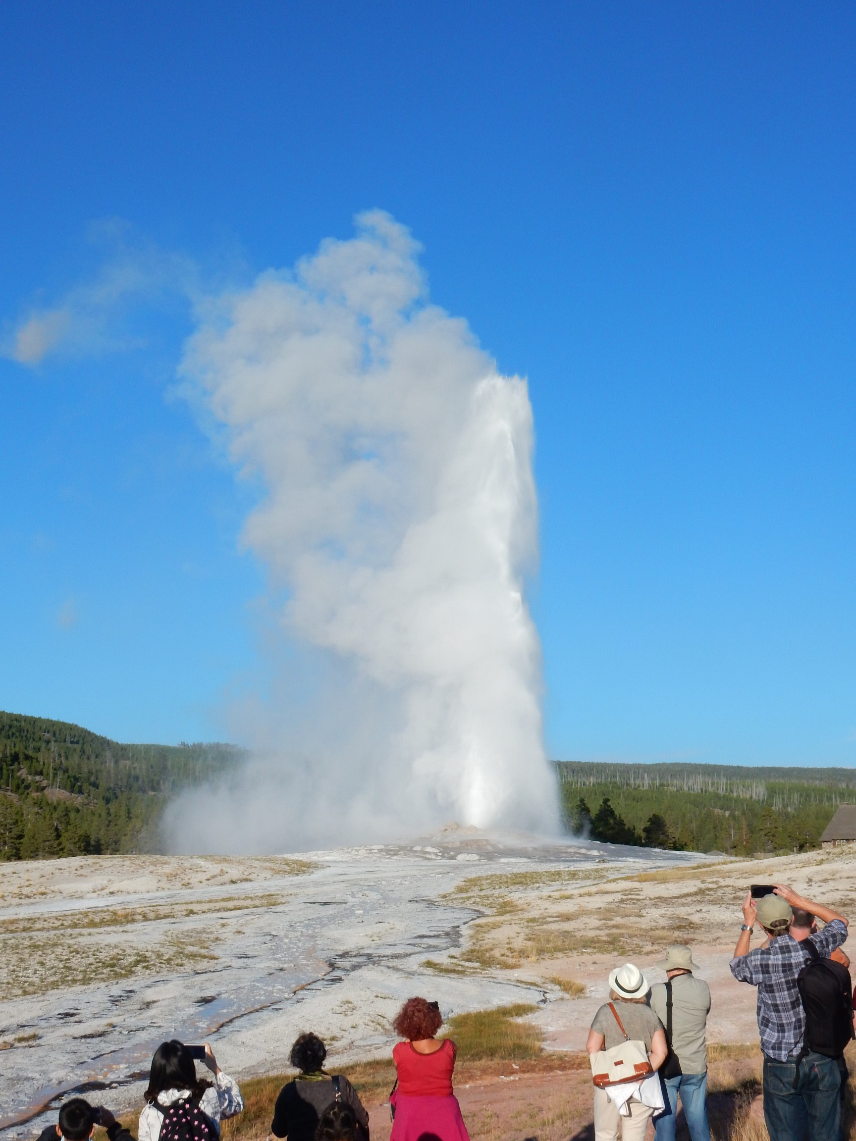
At the visitor’s center, there is a bookstore. I ask the proprietor about finding an outlet to plug in to. Her suggestion is excellent: Head to Upper Geyser Basin. Go to one of the upper floors of the Old Faithful Inn. There are reading desks there with lamps and outlets. Plug in, then listen to the live music, and sip on your favorite beverage from the bar while your batteries recharge. (I don’t drink, but the rest sounded good.)
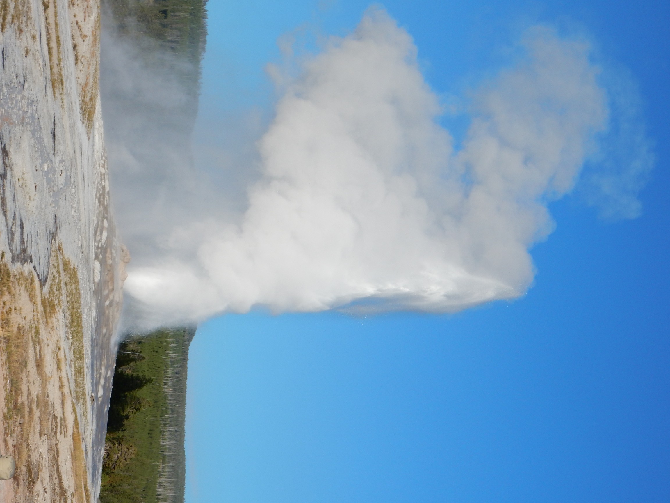
I head out. On arrival, I learn that the next Old Faithful eruption is expected in about twenty minutes. I get a good ten minute’s charging on my camera, then head out to the viewing area and watch the eruption.
Apologies for this video; it’s sideways and I don’t know how to edit it. Your viewer may allow you to rotate it; mine does.
Still shots:
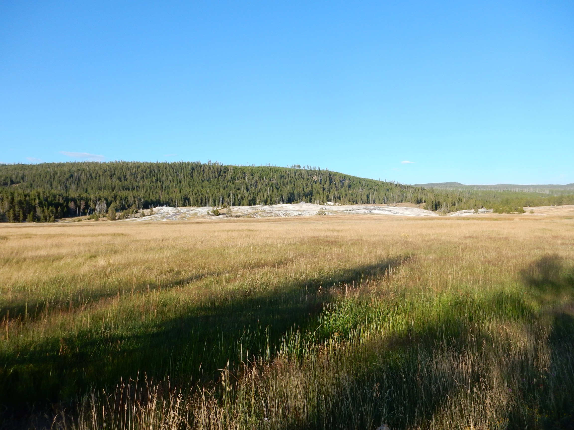
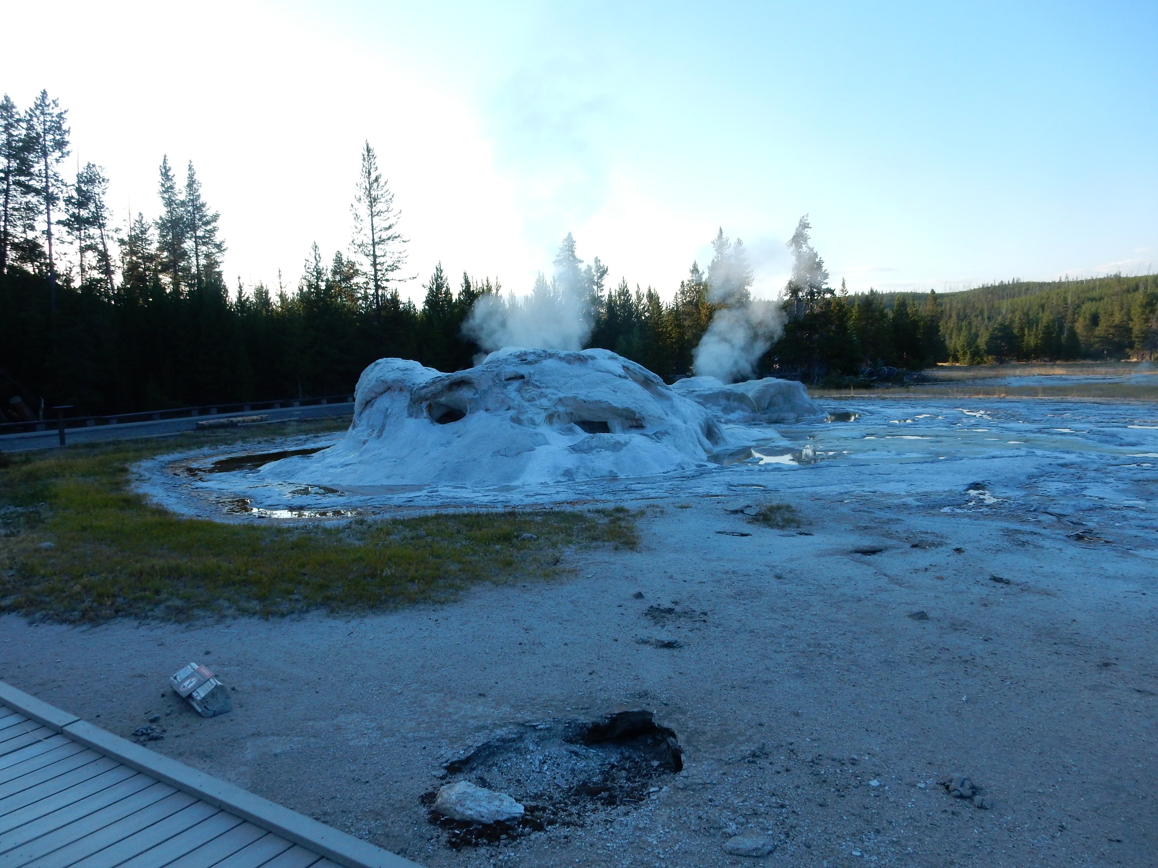
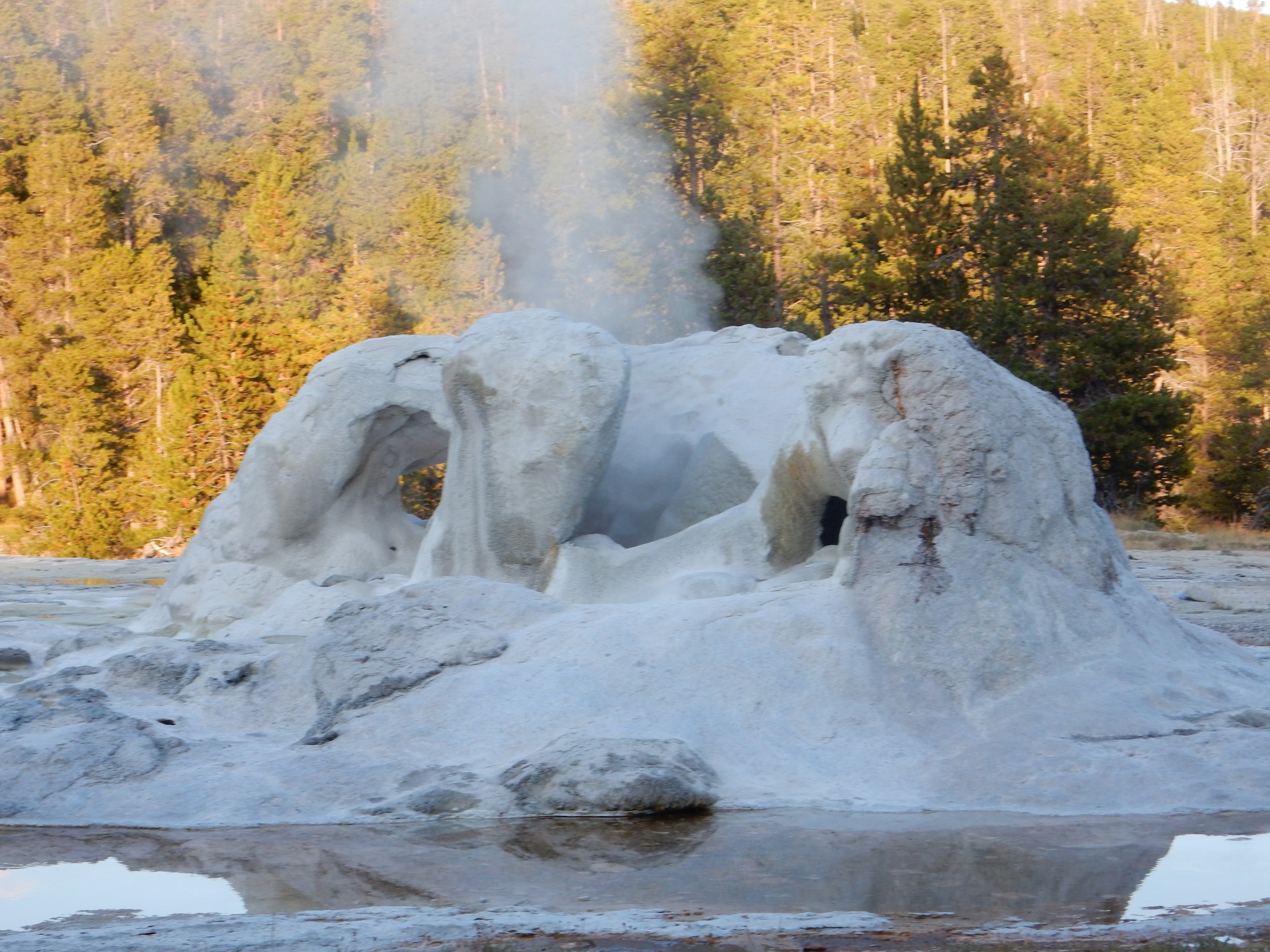
I decide that I will use the remaining daylight to walk through the geyser basin, then finish recharging my battery. The basin:
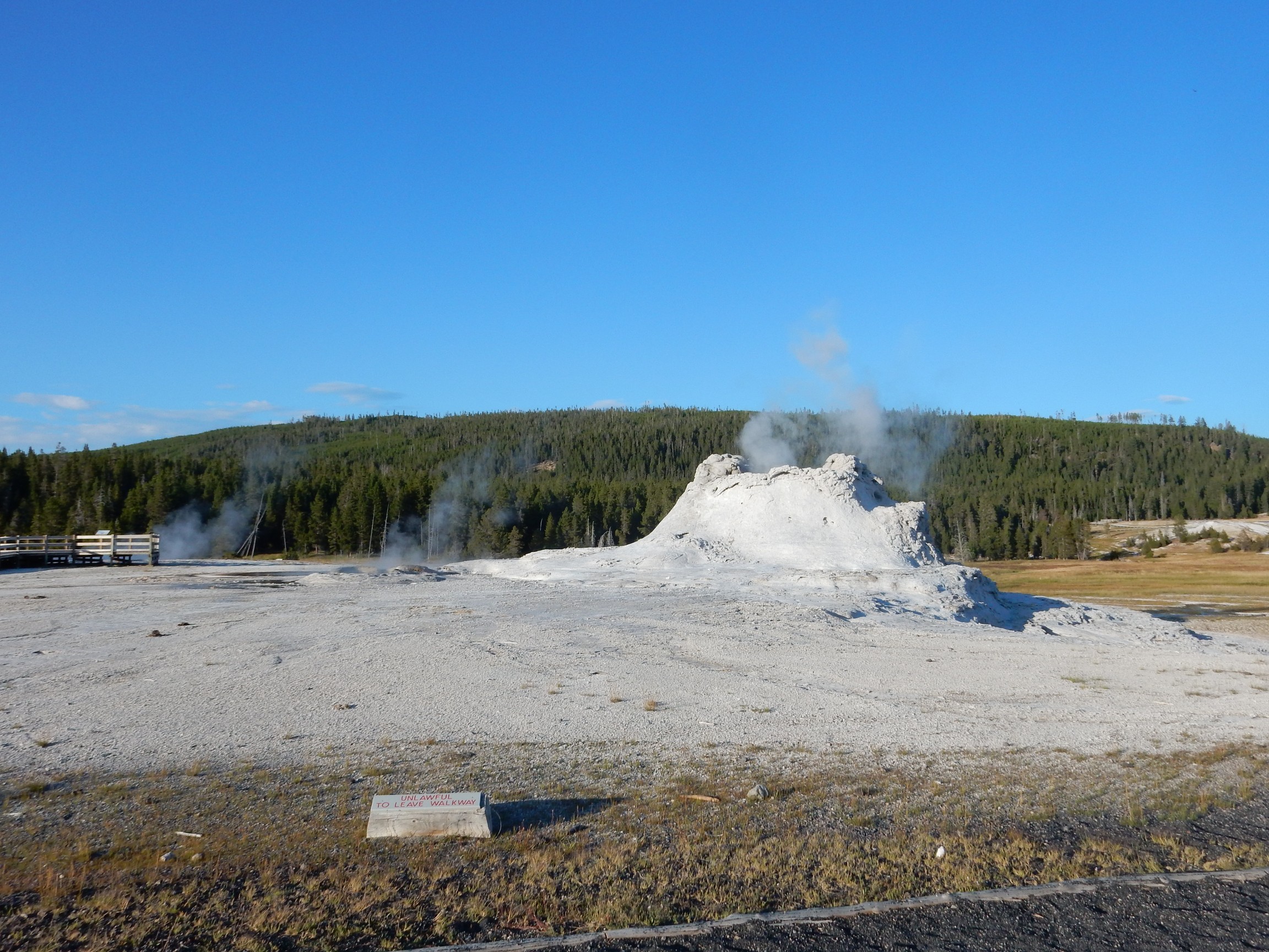
I’ve never seen this one do much but steam, but it apparently erupts once in a great while.
I’m not actually sure what this one is:
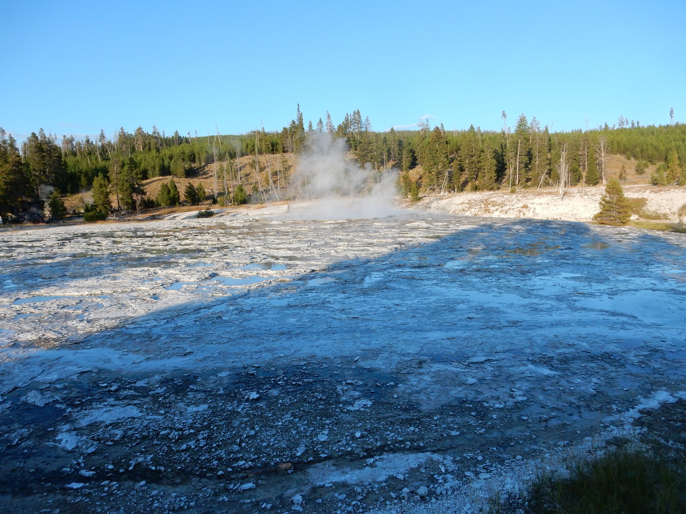
Not named on my map.
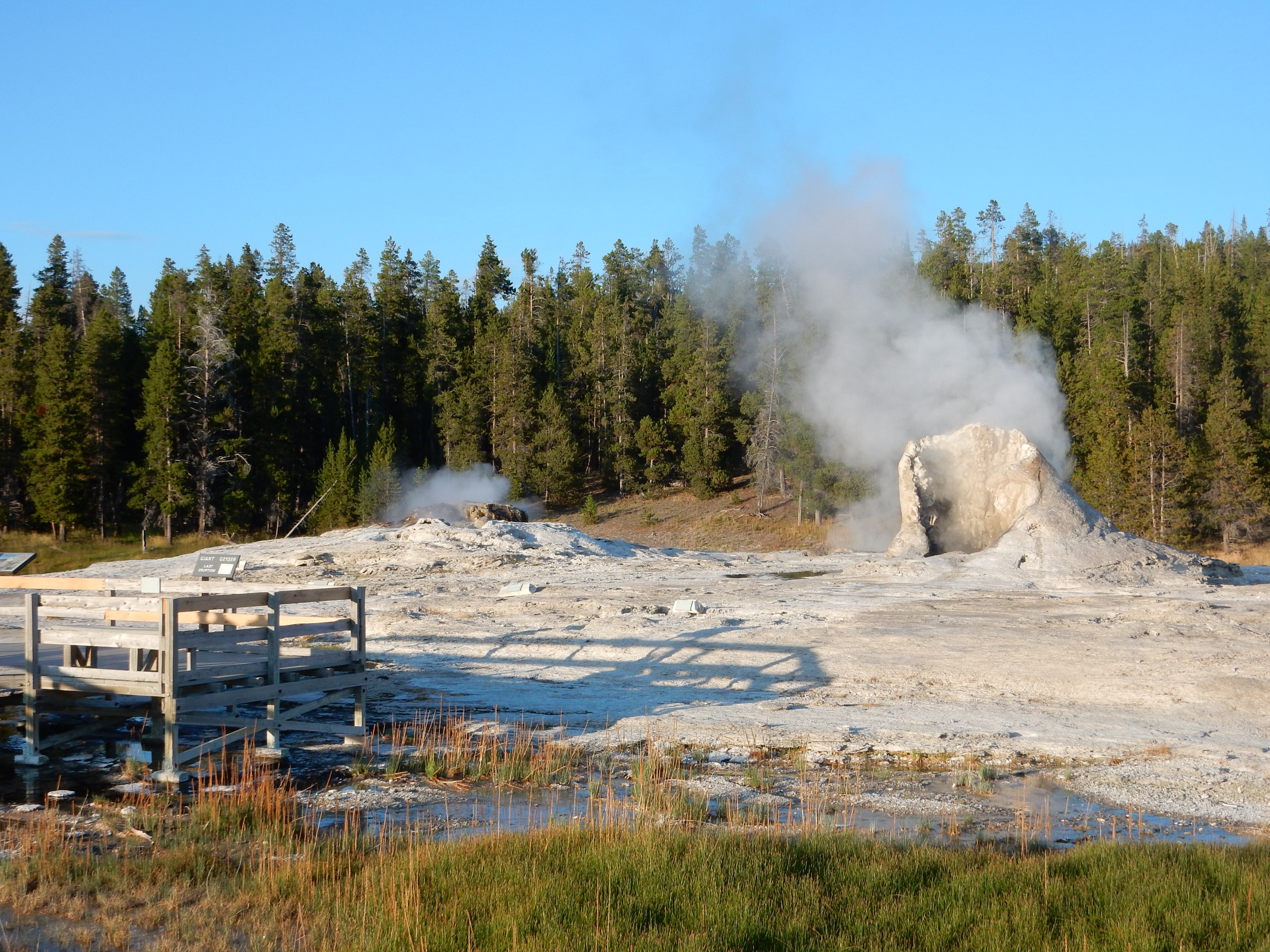
I’ve mentioned that Old Faithful is rather unusual in being as regular in its eruptions as it is. Giant Geyser apparently also has large eruptions, but at very irregular intervals, which is much more typical of large geysers. The estimate on the sign here read something like “Next eruption: Sometime between three in the morning tomorrow and a day and a half from now.
My walk ends at Morning Glory Pool.
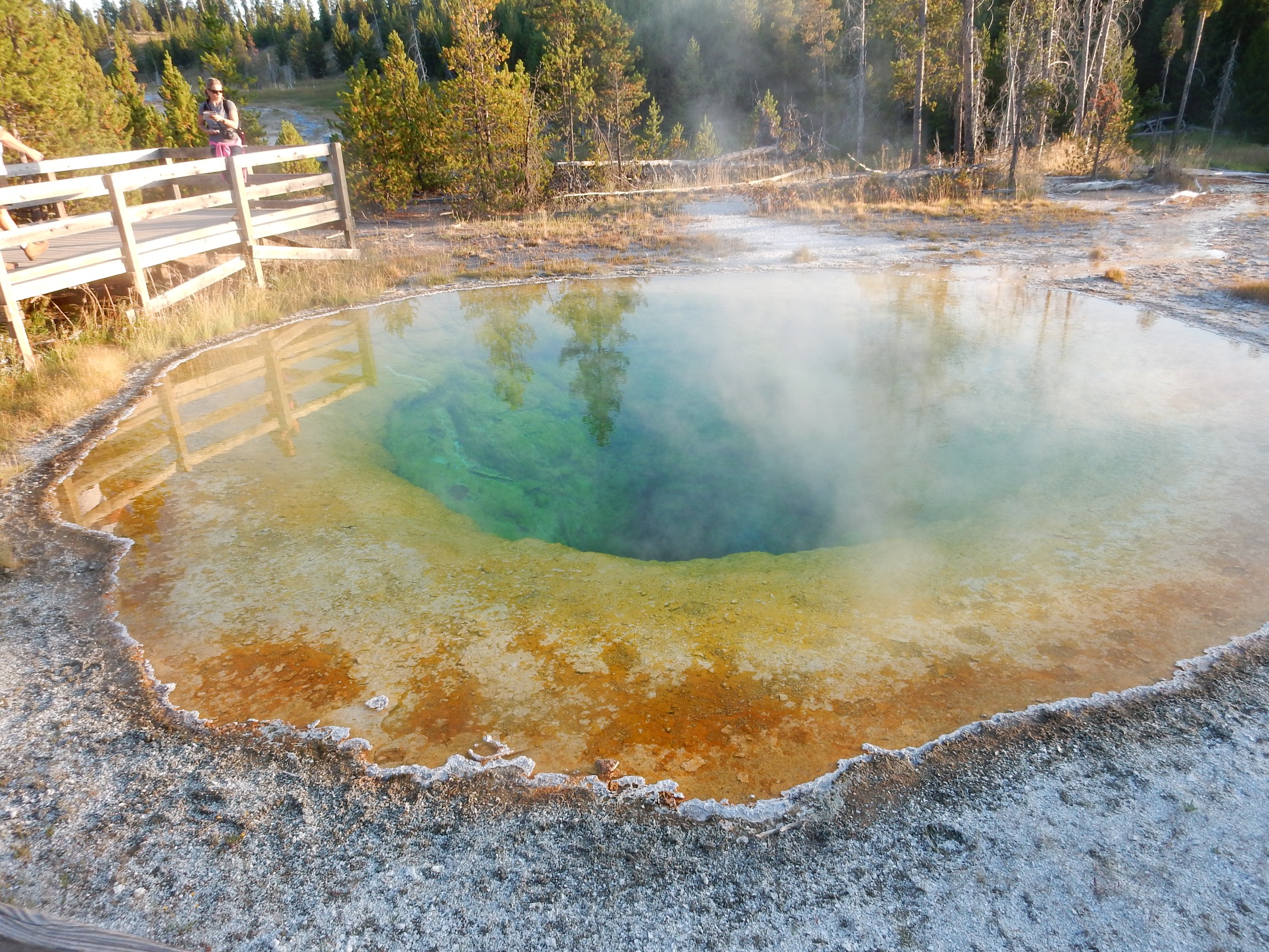
This is one of the prettiest smaller pools in the park. The reds and greens are from thermophiles. The blue is light reflected by colloids in the water — including, I’d guess, colloidal sulfur. The concentration of colloids is very low, judging from the clarity of the water, but enough to give the blue color.
I return to the Old Faithful Inn, plug back in, and read my maps and guide book and think about plans for the rest of the trip, while listening to a not awful piano player/cellist/singer perform live music. It’s very dark by the time my battery finishes recharging, which makes for a long drive back to my campsite. Here I eat a hasty dinner, include four baby aspirin in my night time pill regimen, call Cindy and report that all is well (except for my knee), and turn in.
Next: South Park, sort of.
*I am resisting snarky Evil Kent jokes about German occupation. The Germans I met on this trip were almost all very nice people I would probably be glad to have as neighbors (Evil Kent: “Though maybe not as president of my homeowner association.”)
**”Dinner and a rock concert” is not the correct answer.
Pingback: Great American Eclipse wanderlust, day 5 | Wanderlusting the Jemez
Pingback: Great American Eclipse wanderlust, day 7 | Wanderlusting the Jemez
Love the Morning Glory pool! It’s been a while since I got to see it when I was a kid.
It’s absolutely gorgeous. Wish you could have come with me.
Pingback: Great American Eclipse wanderlust, day 9 | Wanderlusting the Jemez