Kent and Bruce’s Excellent Adventure, Day 6
Day 6: Yellowstone, At Last!
We paused in the morning to take a few more photographs of each other. Or, to be more precise, to have helpful strangers take photographs of us.
Here is all of us except (I believe) Bailey, Susan’s daughter, and Cameron, Susan’s son.
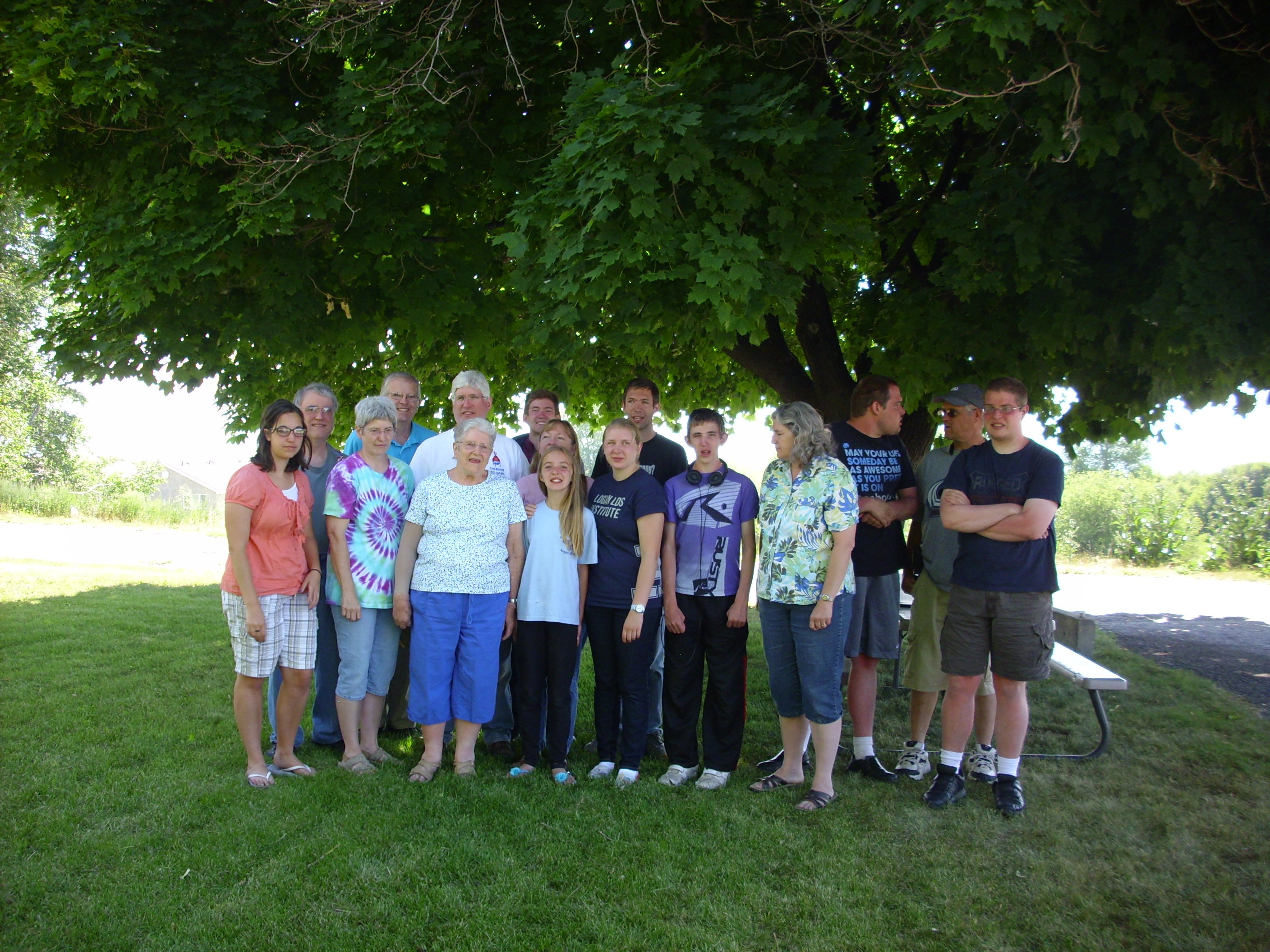
Front row, left to right: Lisa (Lori’s daughter), Lori, Mom, Catherine, Bethany (Catherine’s older sister), Tim, Susan, and Dustin. Back row, left to right: Robert (Lori’s husband), myself, Scott, Steven (Scott’s son), Jeff (Scott’s), and Brian (Susan’s son) glaring at his father, Lowell.
Oh, and it appears that Lisa is sandwiched between Catherine and Steven.
Brian, like Dustin and my son Michael, is autistic, which is probably why he is staring at his father instead of the camera.
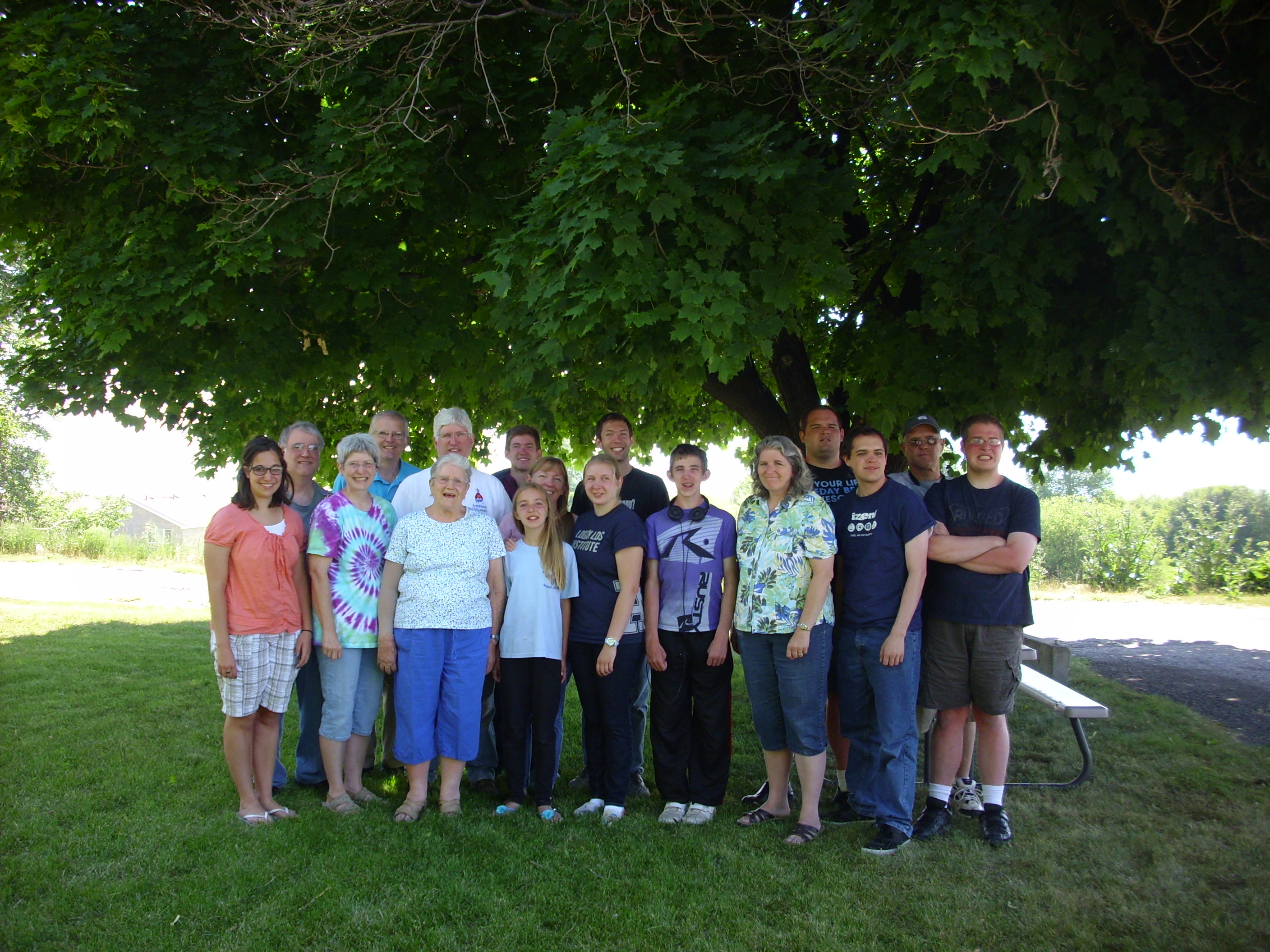
Another shot, in which we are better prepared and Cameron is in the picture.
Mom and her kids.
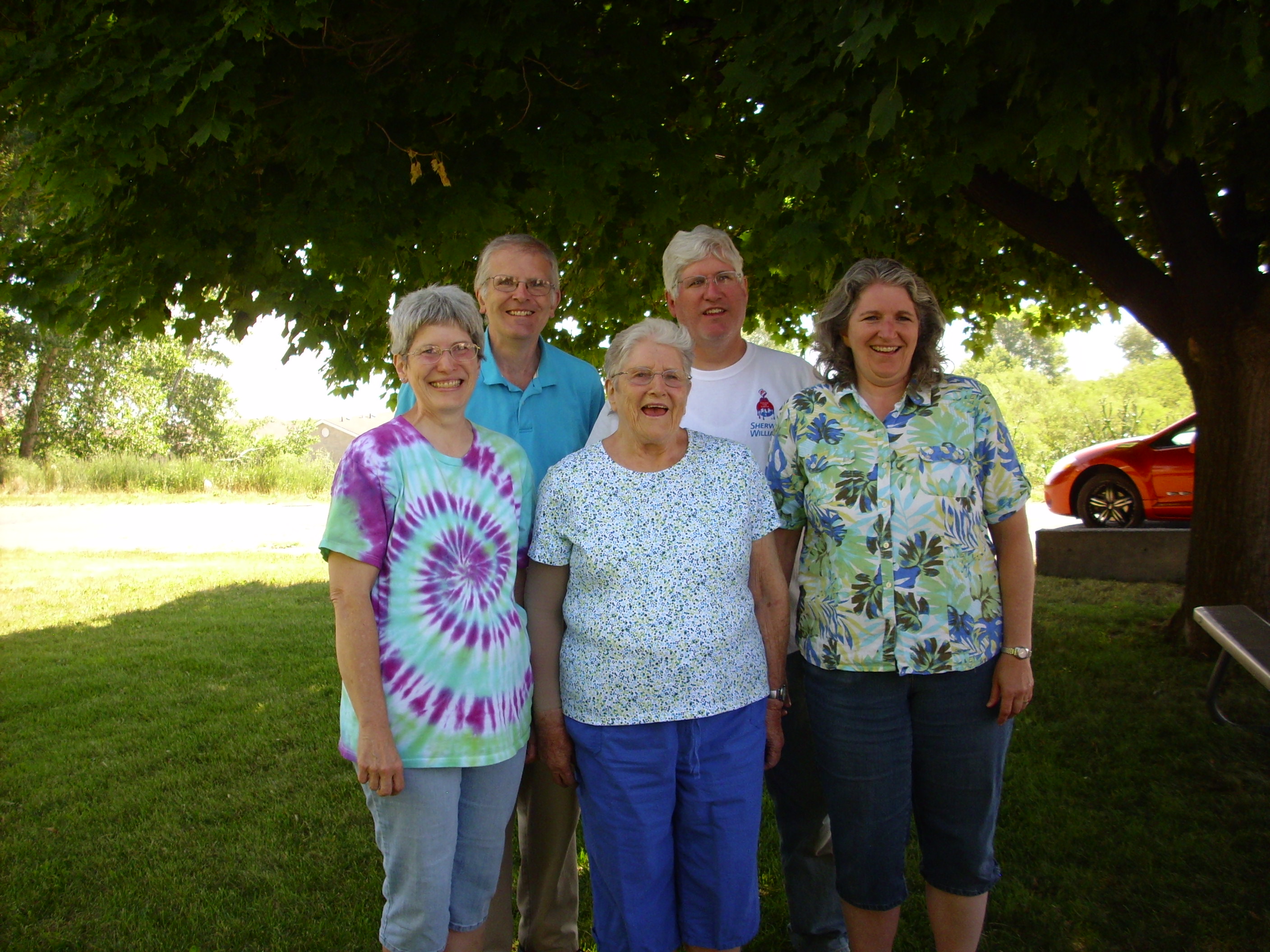
Left to right, Lori, Mom, and Susan in front, me and Scott in the back.
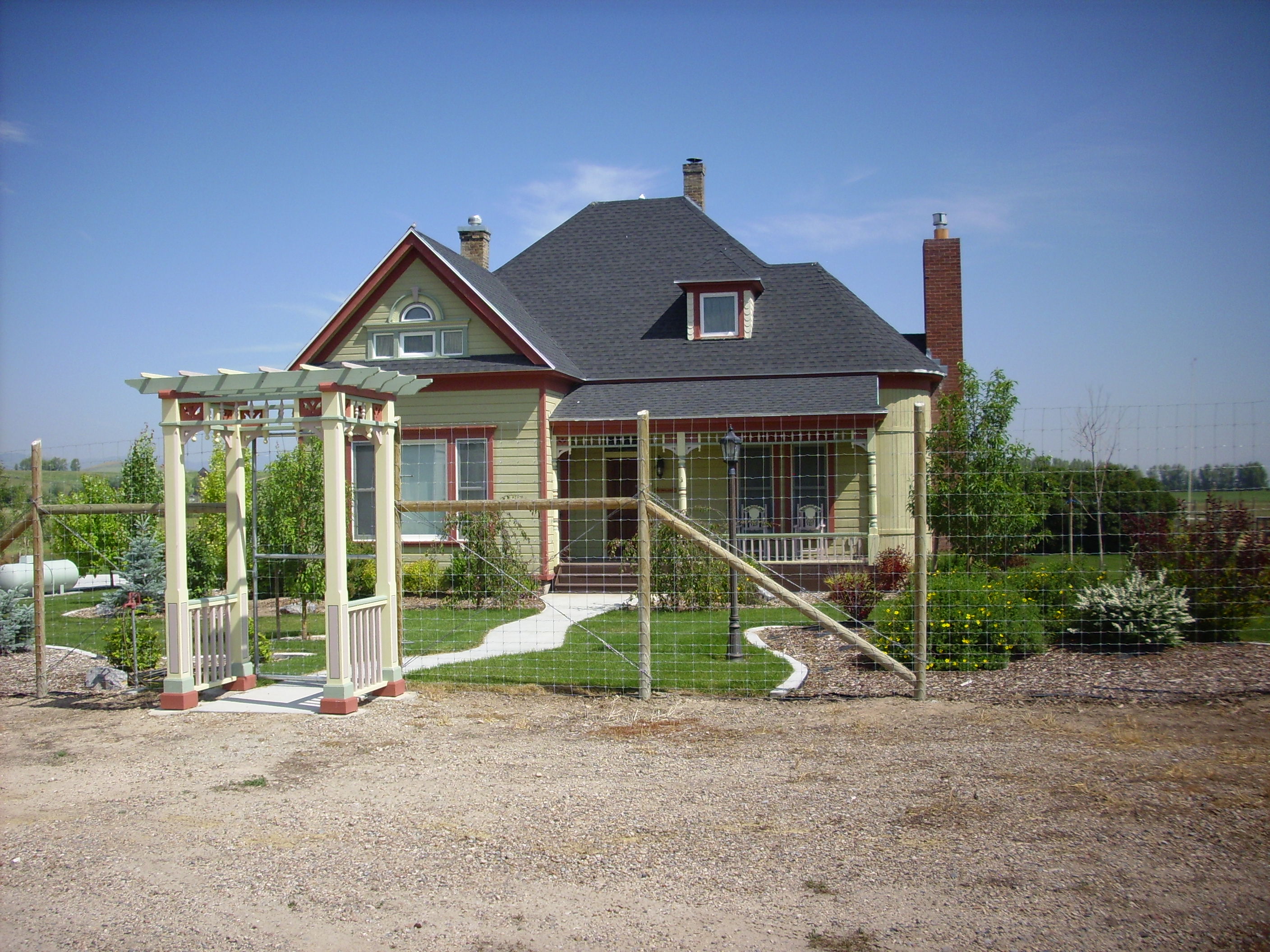
I did a bit of laundry, then we parted company, not without some poignant goodbyes. On the way out I stopped at the house my mother grew up in (which was in bad enough shape that I didn’t take a picture; do not want to remember it that way) and the house my father grew up in (rather better cared for):
Oh, the stories I could tell: Picking peas in Grandma’s garden, eating all of Grandma’s raspberries with cream, feeding bread to the chickens and coal to the pigs, exploring the barn, racing around the back yard in a motorbike, burning my finger on the steel reinforcement wire that was all that was left of an old tire fed to a burn barrel, watching chickens get decapitated and participating in their subsequent gutting and cleaning, watching repairmen replace the busted water line out front, digging up cattails to see if the rumor their rhizomes were edible was true (not in my estimation), and many other fascinating things.
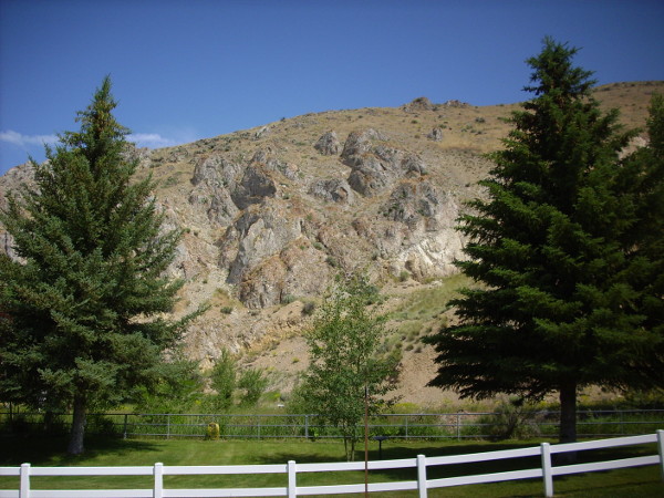
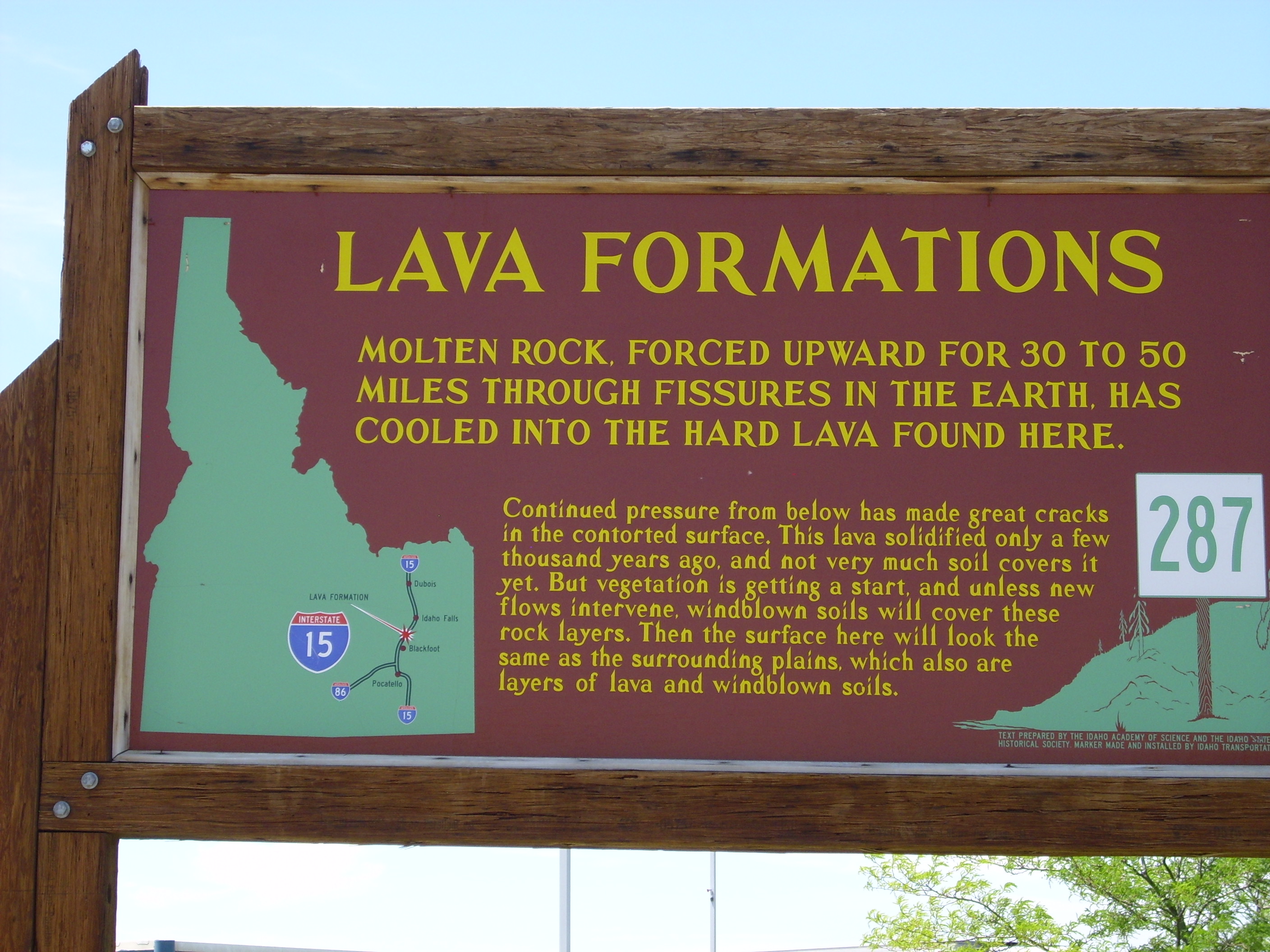
I proceeded from there through Montpelier north to Pocatello. It is beautiful country, but I felt obligated to press on and not sample all the geology. A couple of exceptions:
An area marked as an old phosphate mine in the Phosphoria formation just east of Monticello.
I picked up a rock or two, but the identity is uncertain enough that they’re probably not keepers.
About this time, Bruce called. (You knew he had to come into the story sooner or later.) He had got mixed up and came out a day early. Ah, retirement! We made arrangements to meet that afternoon and make our first foray into Yellowstone.
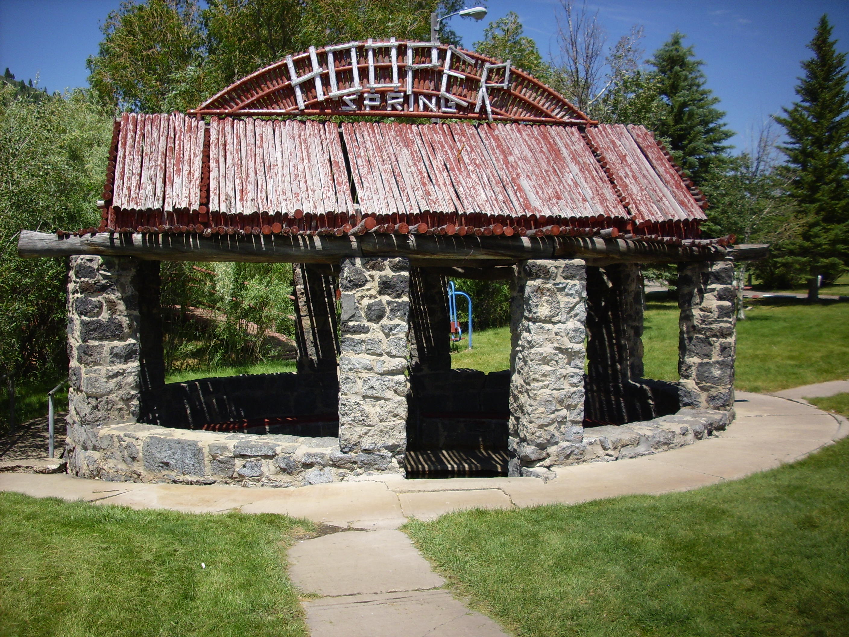
I also stopped at Hooper Springs, another old childhood memory being relived.
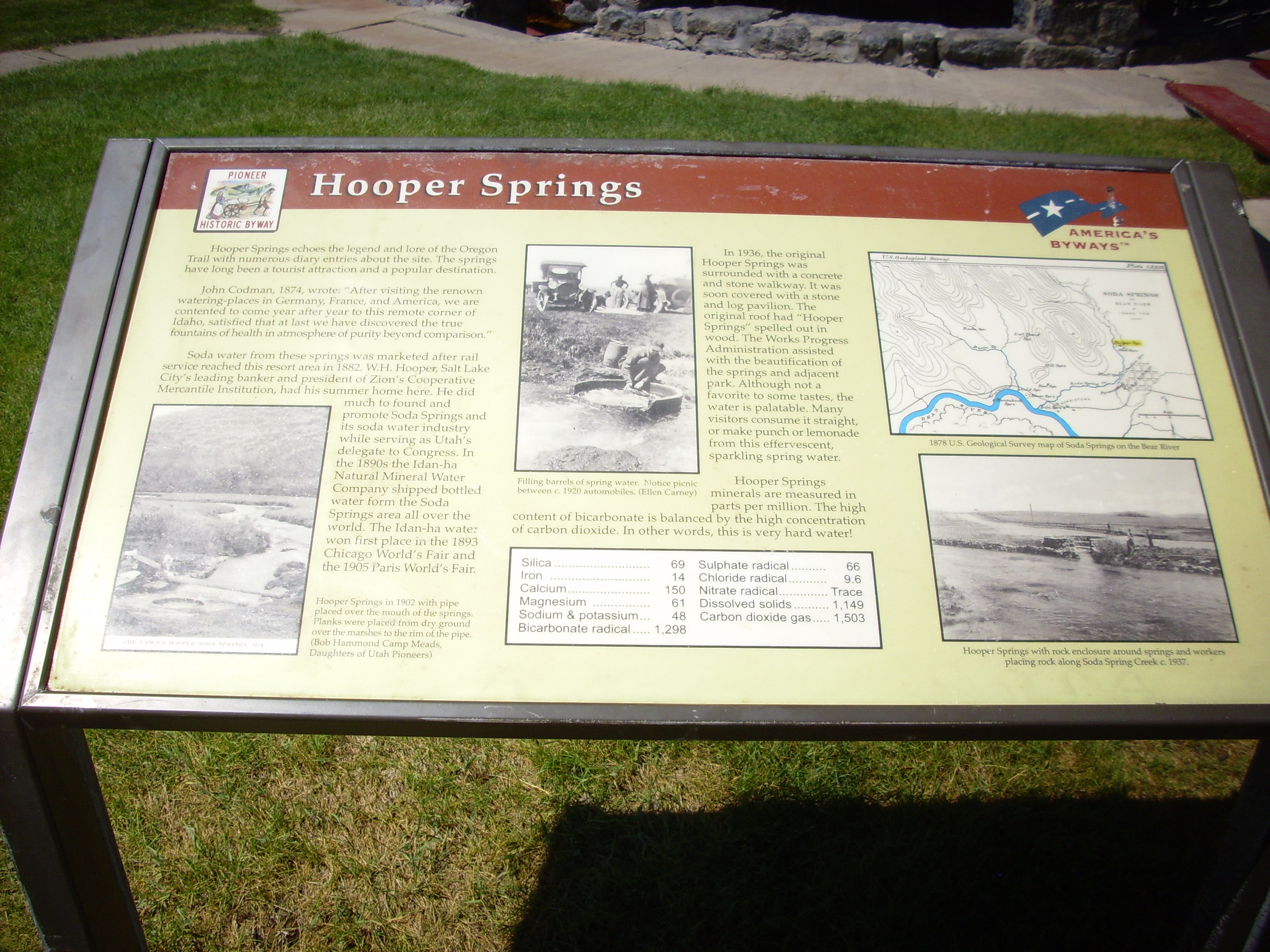
The springs here are not particularly hot, but are charged with bicarbonate and a few other salts that give a distinct fizzy water taste. The main spring is here:
The spring itself is pictured here.
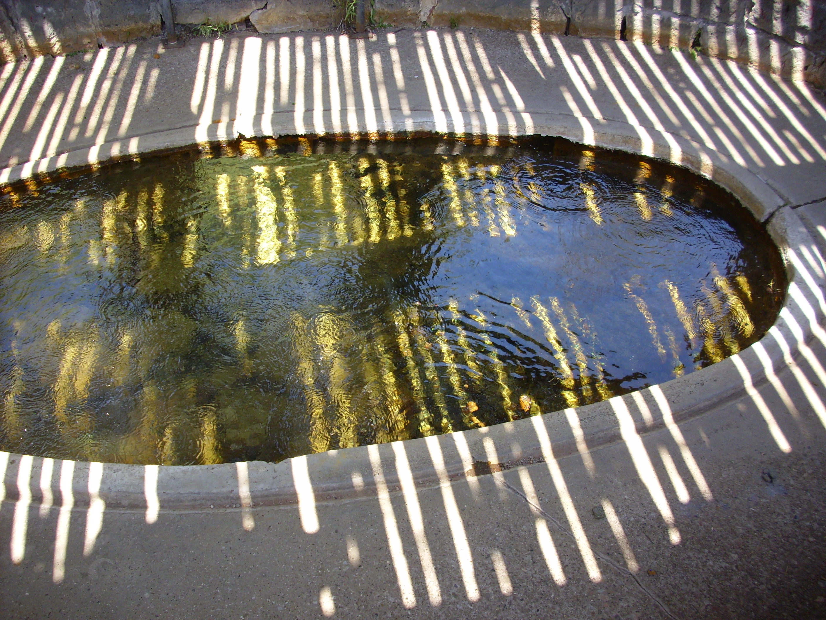
There is a lot of algae growth, but what was more disquieting is that some of the algae had come loose and floated to the surface, where it looked for all the world like someone’s dog had had intestinal distress … but I couldn’t come here and not taste, so I scooped from the other side of the pool, and suffered no ill effects. I also ate lunch out of my ice box.
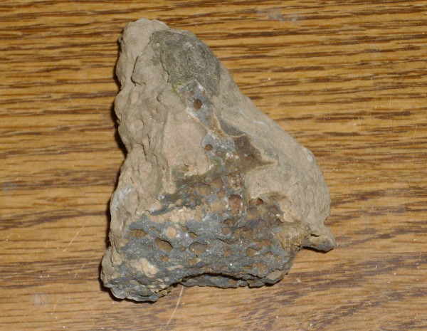
Nearby is a major phosphate plant mining the Phosphoria Formation.
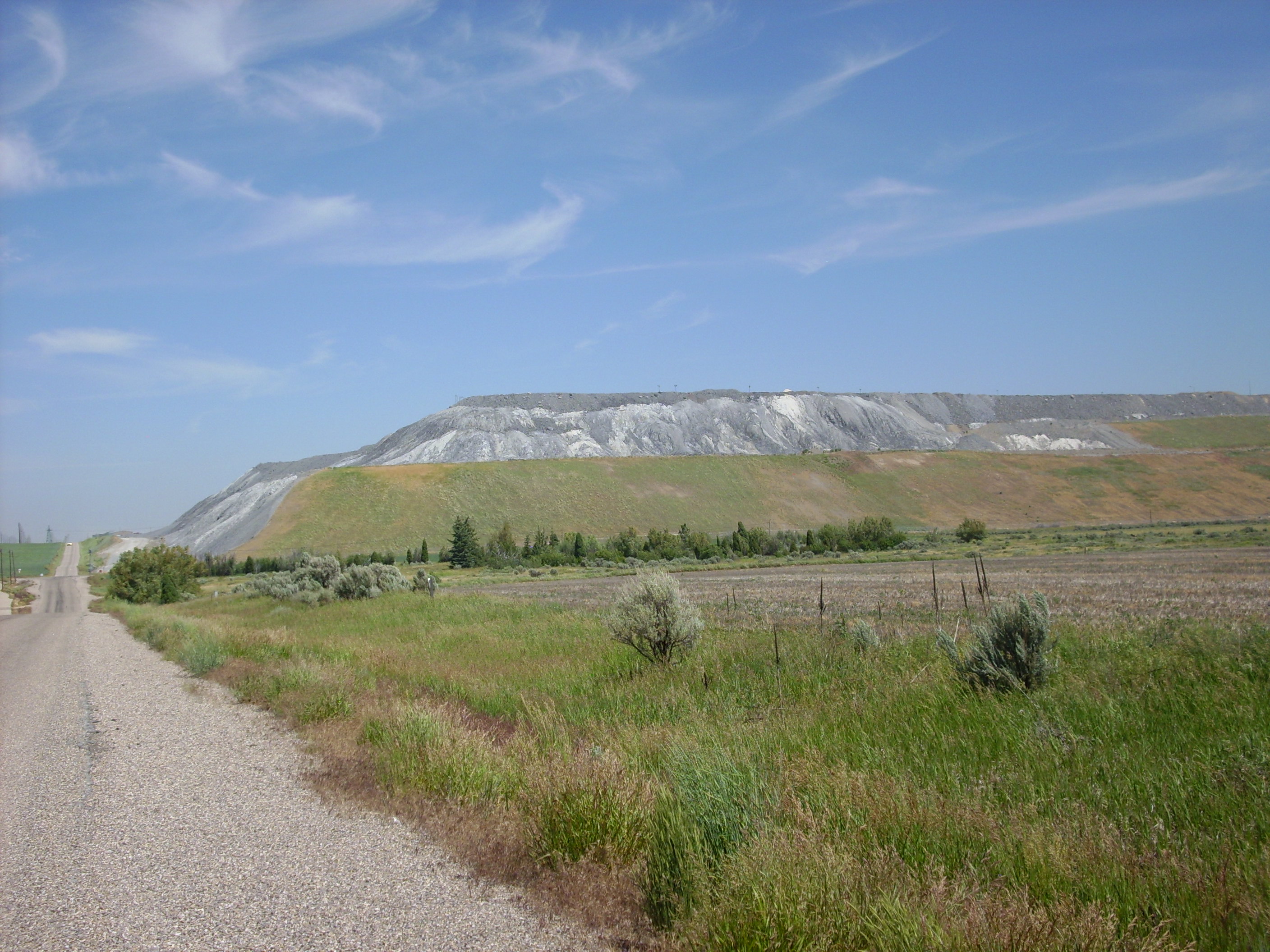
I believe that’s a ginormous pile of mine tailings. I drove up alongside, and found a likely-looking chunk of rock that had rolled outside the plant fence.
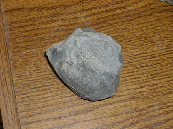
Now, there’s an outside chance that’s just a chunk of basalt (abundant in the area) but I don’t think so. It seems a tad lighter than basalt (in both color and weight), its hardness is closer to limestone than basalt, and its texture under a loupe is unlike any basalt I’ve seen, looking almost like a fused mass of tiny broken shells. And it fizzes slightly with hydrochloric acid. Phosphate rock, then. Such rock tends to resemble limestone, but heavier, harder and darker.
Phosphate rock is crushed and (nowadays) treated with sulfuric acid, then phosphoric acid, to produce the triple superphosphate fertilizer used by farmers and gardeners. There are huge reserves in the western United States in the Phosphoria Formation, found throughout Idaho, Wyoming, Utah, and Montana. This was all deposited from a shallow sea during the Permian, about 280 million years ago.
I then drove from Hooper Spring through Lava Hot Springs (more childhood memories; I think we had a couple of family reunions there) and to Pocatello. This was a beautiful drive though mountains, and Pocatello is on the edge of the Snake River Plain. The Snake River Plain marks the track of a hotspot in the Earth’s upper mantle. This hotspot has produced repeated volcanic eruptions, beginning 16 million years ago in northern Nevada and moving northeast to erupt most recently 650,000 years ago in Yellowstone. The plain forms a flat track in the mountains of Idaho, with a very few large peaks of its own; Big Southern Butte is the most prominent and was clearly visible towering over the plain to the north.
As I drove northeast towards Yellowstone, I encountered a sign for a rest area.
REST AREA. NEXT REST AREA 63 MILES.
Meh.
GEOLOGICAL ATTRACTION.
Well then.
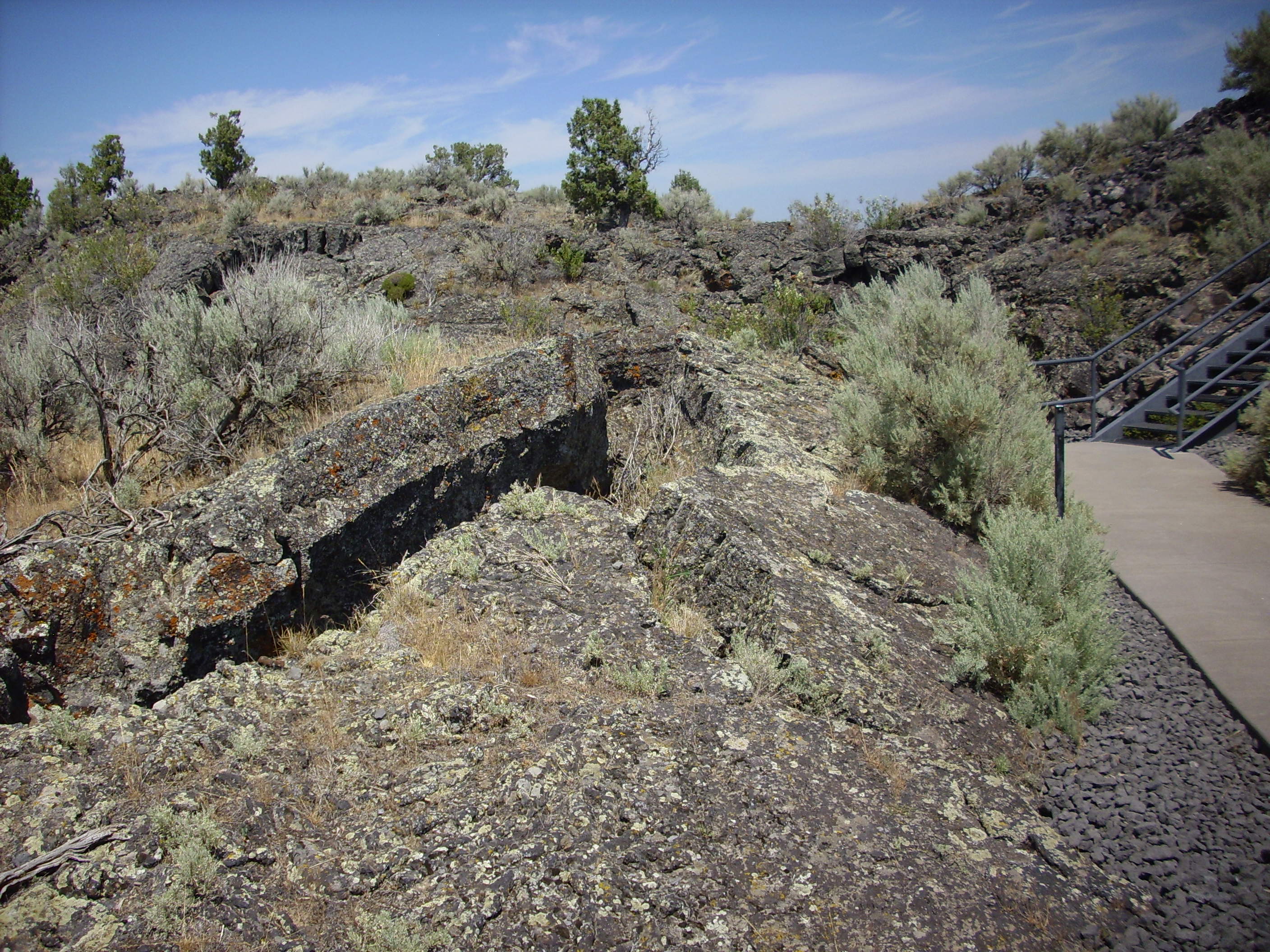
This was Hell’s Half Acre, part of a large flood basalt flow in the Snake River Plain. The residual heat from the hotspot, combined with the thinned crust and the continued pulling apart of this part of the North American continent, combine to produce pathways for hot magma to reach the surface. This is basalt, which is a silica-poor magma that has relatively low viscosity and so floods across large areas rather than piling up into a volcanic mountain. White Rock is built on the stuff, but this is much fresher.
This is Bureau of Land Management land, which normally permits collection of hand samples. Where’s my geological hammer?
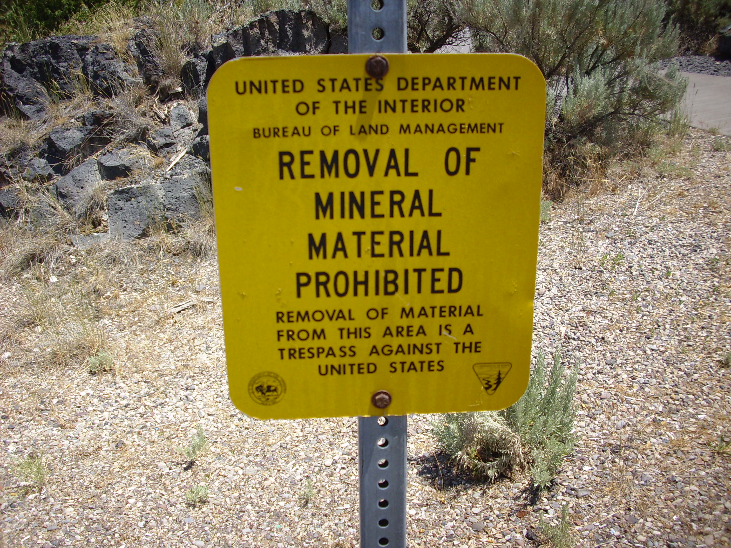
Awwww …
Still, some interesting basalt geology. Here is an example of a pressure ridge.
Some pahoehoe lava with residual signage.
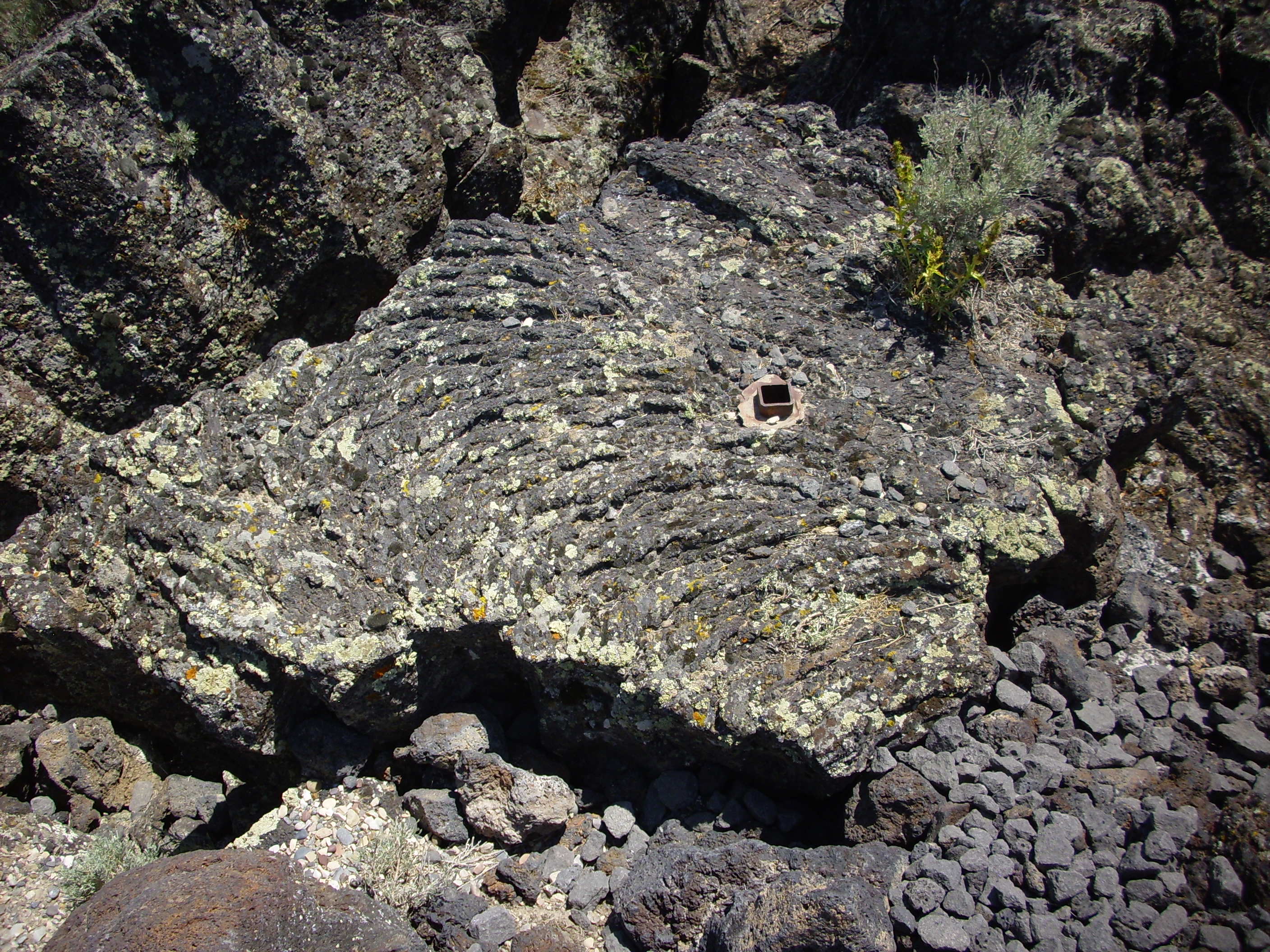
The ropy surface is typical. Pahoehoe lava still retains some of its gas content, is very hot, and flows relatively easily. As it cools and outgasses, it turns into rubbly a’a lava. I did not see much a’a in this area. More interpretive signage:
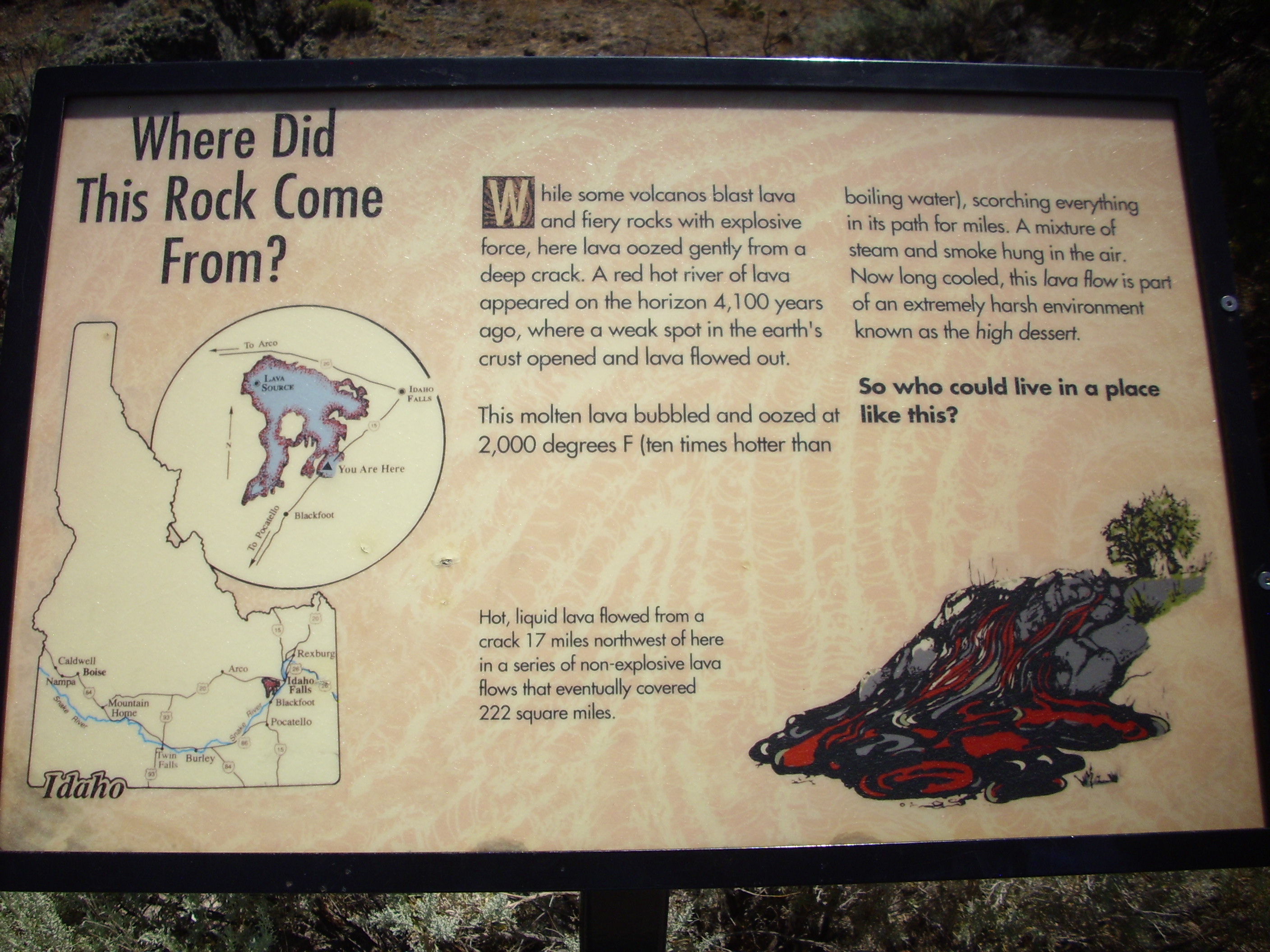
“Half acre” is far too modest, but I assume it alliterates aesthetically.
On to Yellowstone. In the distance, the Grand Tetons come into view.

I do not recommend looking up the meaning of “Grand Teton.” Suffice to say that Bruce and I got wondering whether there is a Grand Teton High School somewhere and, if so, what its mascot is and what its cheerleading squad was like. (This was followed by Bruce commenting on how a few days away from the family has some guys acting like twelve-year-olds again.)
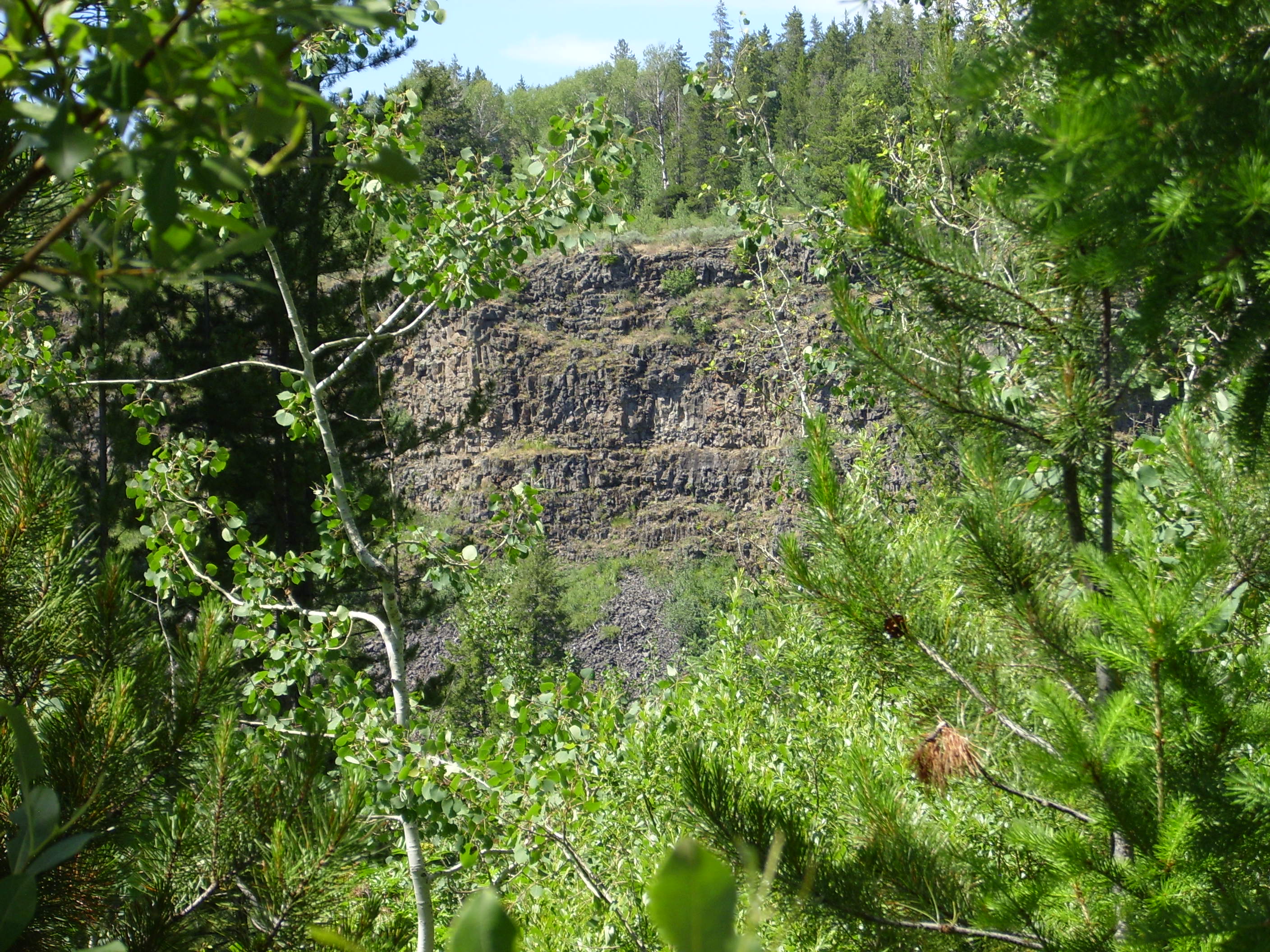
I discovered that the main road into Island Park was under construction, and decided to take the Mesa Falls Scenic Byway. This descends into a canyon rimmed with the Warm River Basalt.
This is one of the earliest flows associated with the Yellowstone caldera, dating back 2.2 million years. I later got a sample, since this is outside the park boundaries.
Just a very typical basalt, which is hard to get very excited about unless it has unusual xenocrysts or something. This does not. It’s just solid black rock without much silica. The interest is knowing that it erupted just before the start of the first Yellowstone supereruption. There is corresponding basalt northwest of Island Park and a very great thickness of such basalt at Tower Junction in Yellowstone.
Further up the road encounters the Snake River Butte Rhyolite, erupted shortly after the Warm River Basalt. This is very silica-rich rock, showing that the volcanic activity at this point was what vulcanologists call bimodal eruption — the lava is either very poor or very rich in silica, with little mixing between the two.
Across the canyon of the Warm River, to the east, are bluffs of the Lava Creek Tuff. This was erupted 650,000 years ago during the last Yellowstone supereruption.
Probably a good place to pause and give some background on Yellowstone. The Yellowstone Plateau is the current position of the Yellowstone hotspot that produced the Snake River Plain. It is a supervolcano that has experienced three supereruptions and numerous smaller eruptions. The supereruptions occurred 2.1 million, 1.3 million, and 640,000 years ago, plus or minus a bit, based on radiological dating of the rocks. Each eruption was vastly larger and more destructive than any eruption ever recorded by man, and drained a magma chamber deep in the earth that collapsed to produce a large pit or caldera. Here is an NPS graphic showing the calderas, borrowed from Wikipedia:

Each supereruption produced vast volumes of red hot gas and lava fragments that spread out in all directions, then settled to the surface to produce what is called an ignimbrite or tuff. This rock is almost always rich in silica (though we will see an exception a bit later) and consists of a few visible crystals bound in an amorphous matrix of rock, often with visible bits of pumice embedded in the tuff. If these bits of pumice are squashed flat, this indicates that the tuff was very hot when it was deposited, causing the entire rock mass to be tightly welded together — a welded tuff.
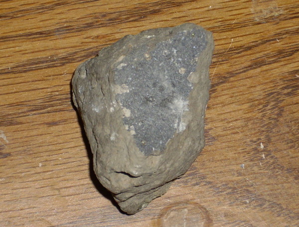
The first supereruption, 2.1 million years ago, was the largest. It created a caldera 50 by 40 miles across and spread ash across most of North America. The tuff deposited by this eruption is called the Huckleberry Ridge Tuff, and it looks like this:
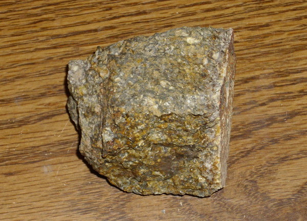
I don’t know how typical this sample is, but it’s a very hard tuff with a high proportion of visible quartz crystals. And, yes, I collected it outside of Yellowstone, on a road cut in a national forest, where collecting is presumably legal.
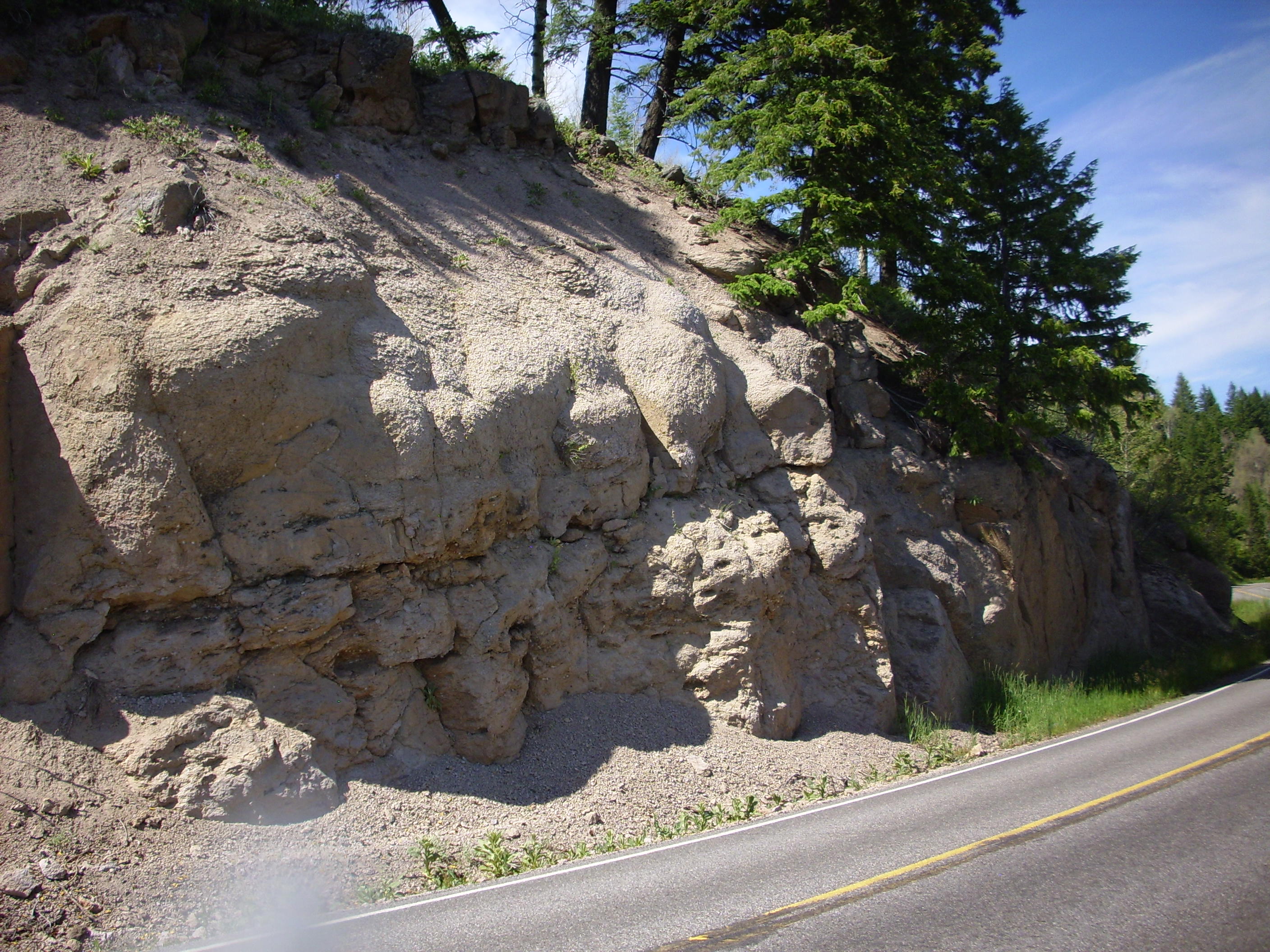
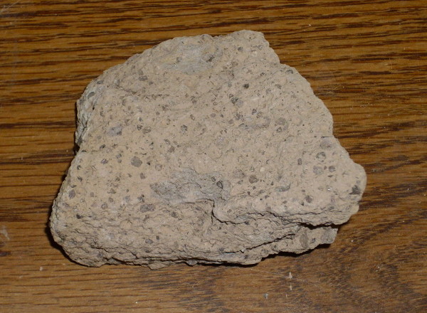
The second eruption, 1.3 million years ago, was the smallest of the three supereruptions. It erupted from the western end of the earlier caldera, so that the caldera rims more or less coincide here, producing the Henry’s Fork caldera. My campsite while I was in Yellowstone was located here, almost directly on the north rim of the caldera. I slept on top of a caldera ring fracture; how cool is that? 😀
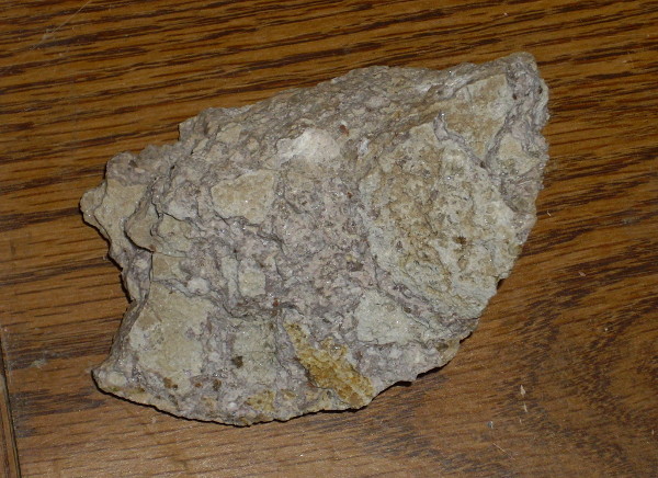
The tuff produced by this eruption is called the Mesa Falls Tuff. Here’s a sample that I collected from nearly the same spot as the previous one, but higher up the road cut. (I’ll tell that story later.)
Some of you will notice that this looks an awful lot like the tuff from around White Rock. Why, yes. Yes, it does. This is unsurprising, because the geological processes involved were very similar. The Jemez Mountains mark a supervolcano (though not as super as Yellowstone) that has had at least two supereruptions.
The third eruption, 640,000 years ago, was intermediate in size, taking up most of the east side of the original caldera. This eruption produced the Lava Creek Tuff:
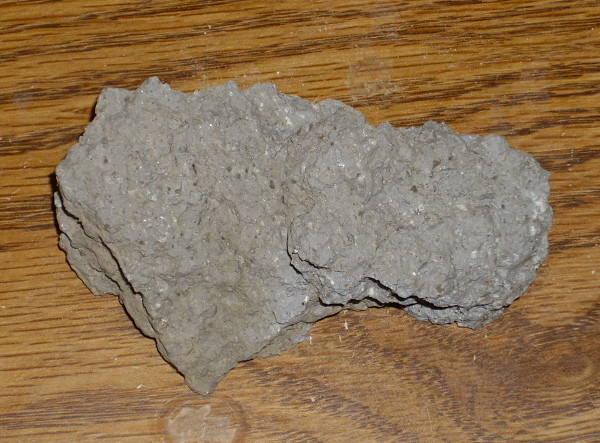
This is a rather hard, crystal-poor tuff. Or at least it is where I collected it, from a tongue of Lava Creek tuff that was thrown far west of Yellowstone into the Mack’s Inn area of Island Park, a short distance north of my campsite.
It’s faintly possible that the Snake River rhyolite sample I showed earlier is actually a tongue of Lava Creek. There is some mapped in that area, and that’s actually what I thought I was collecting at the time. But I don’t think so now; the rocks are very different and the mapping is much more reliable for the specimen above.
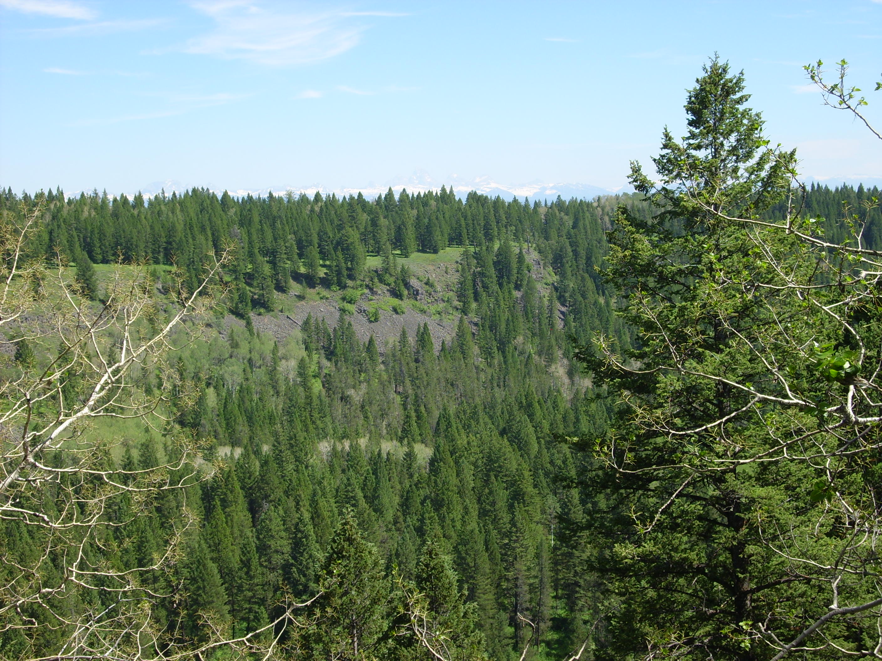
The Island Park area is now essentially extinct. There are no thermal springs here and very few earthquakes compared with Yellowstone.
From here I stopped at the Lower Mesa Falls turnoff. North are bluffs of Garrit Basalt:
Another boring black rock. My back yard is full of stuff very similar. In fact, this whole area is a lot like White Rock, except with vegetation. The Garrit Basalt is possibly the youngest formation in the Island Park area, where it forms a flat layer covering most of the old caldera floor.
The falls:
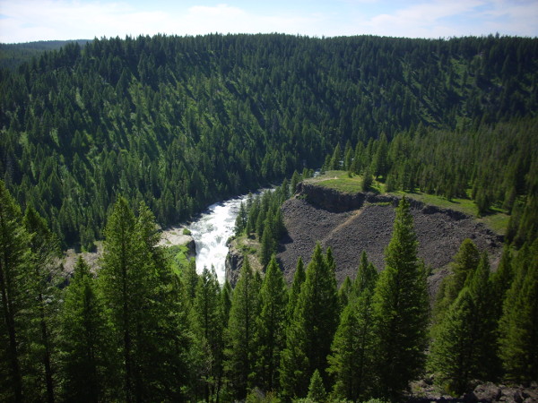
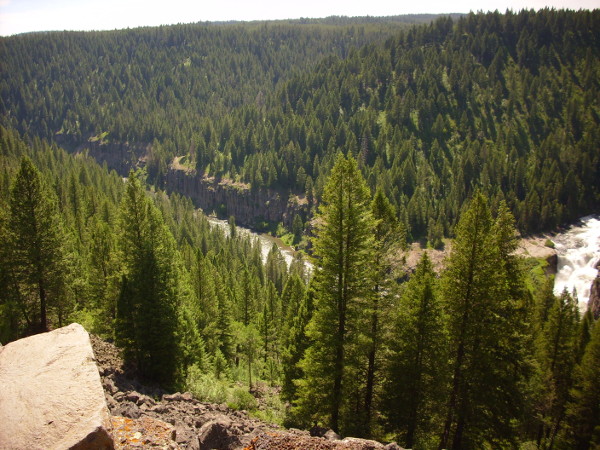
The falls are produced by a particularly resistant layer of Mesa Falls Tuff. This is another difference from White Rock: Here, the tuff is younger than the basalt and sits on top of it. At Mesa Falls, the basalt is younger.
I drove on to Island Park from here. Island Park boasts of having the longest main street in America, 15 miles long. The town was incorporated by all the merchants along the road, who wanted to be able to have liquor licenses, which are only issued to establishments within city limits in Idaho. So Island Park is a long, skinny, sparsely inhabited city of Idaho.
I refueled and iced up, bought some more supplies, then found my campsite in Buffalo Campground. I found the resident administrator and asked if it was safe to leave my tent set up during the day. He seemed baffled at the thought that anyone would steal a tent, which seemed like a good sign. So I set up camp.
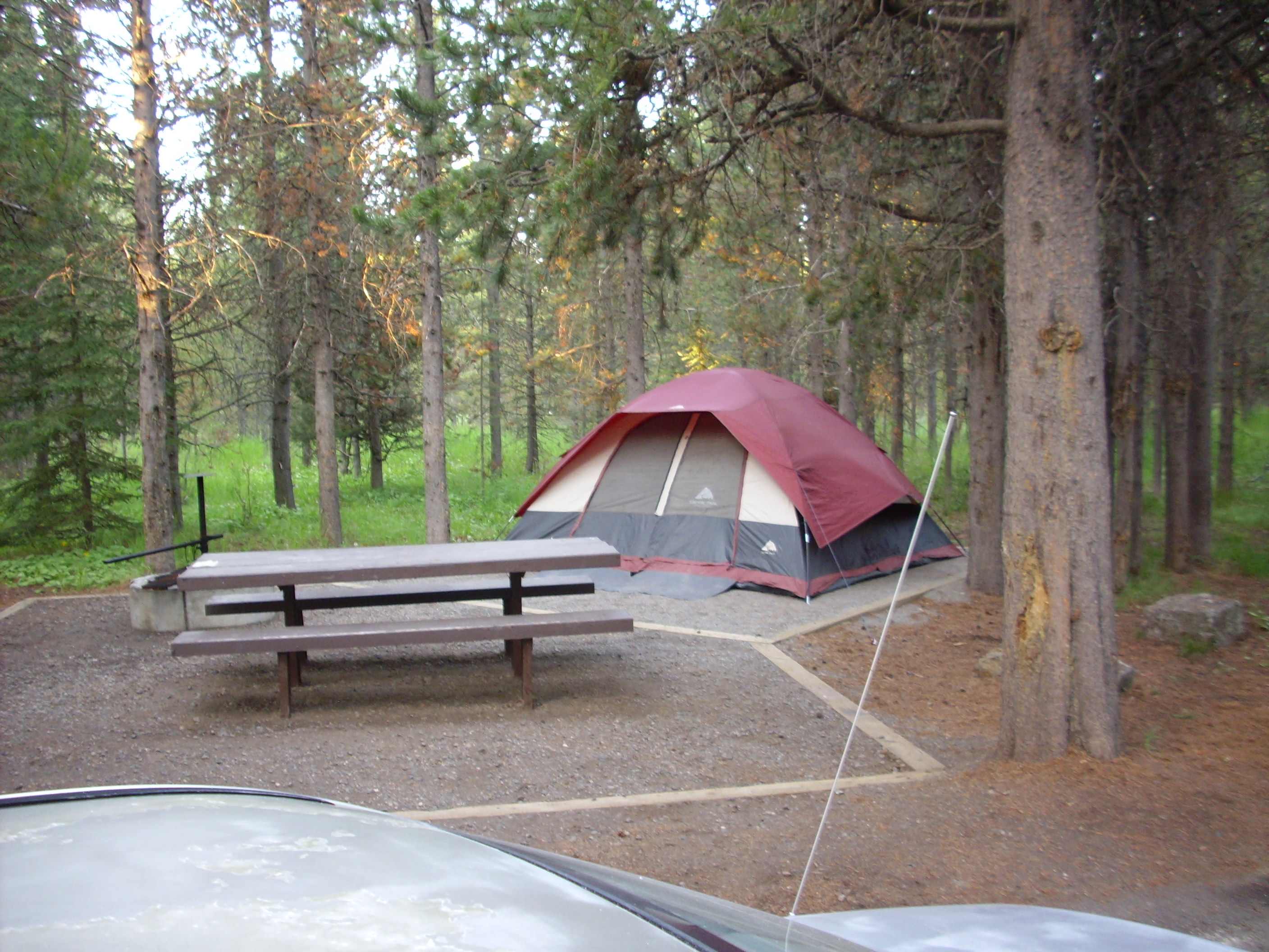
Tent sweet tent
Bruce met me at this point and we finally drove in to Yellowstone. Excitement! Adventure!

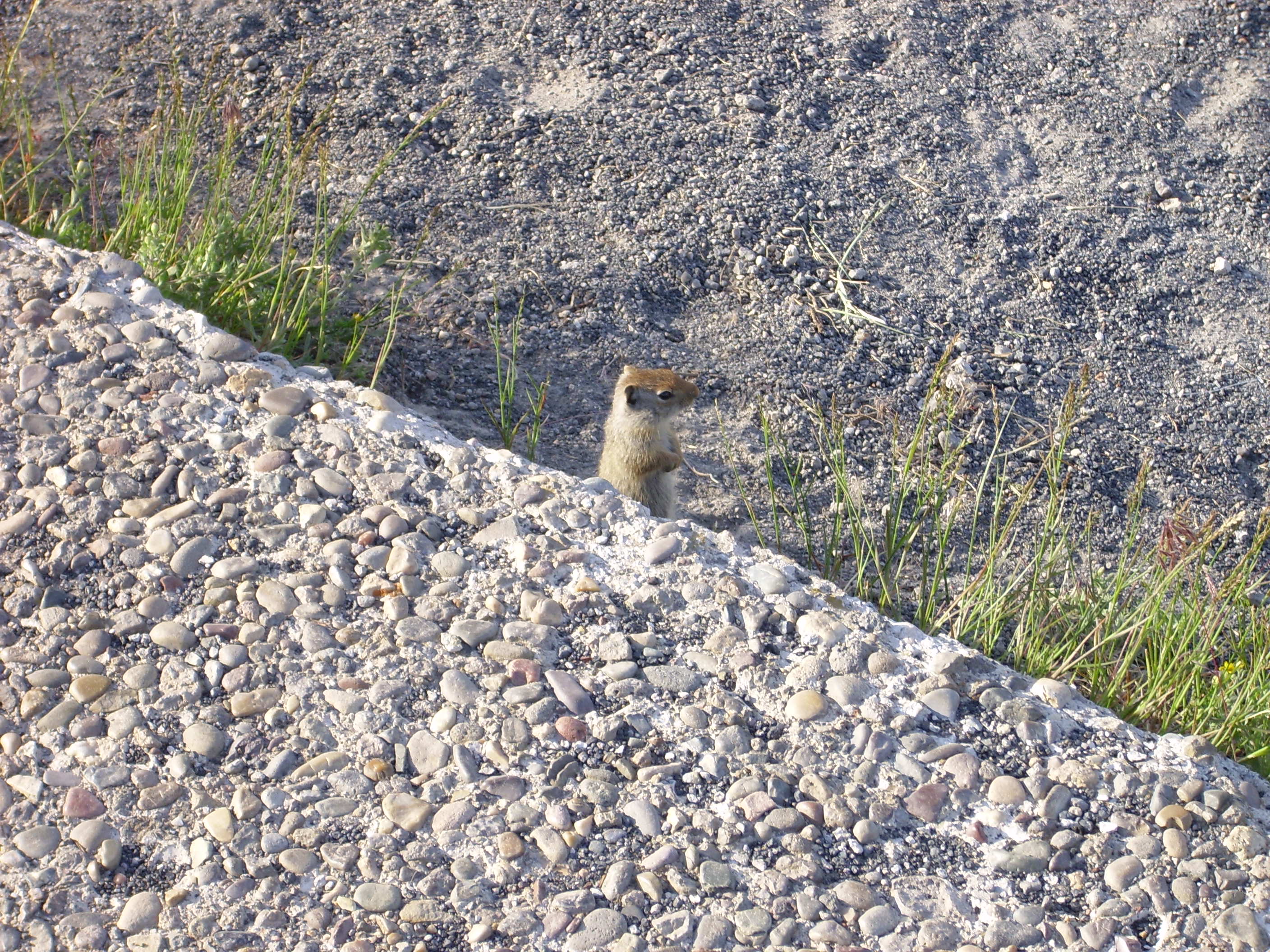
This was in the Madison River Valley, which is likely a glacial valley passing through the northwest caldera rim and draining into —
“Squirrel!”
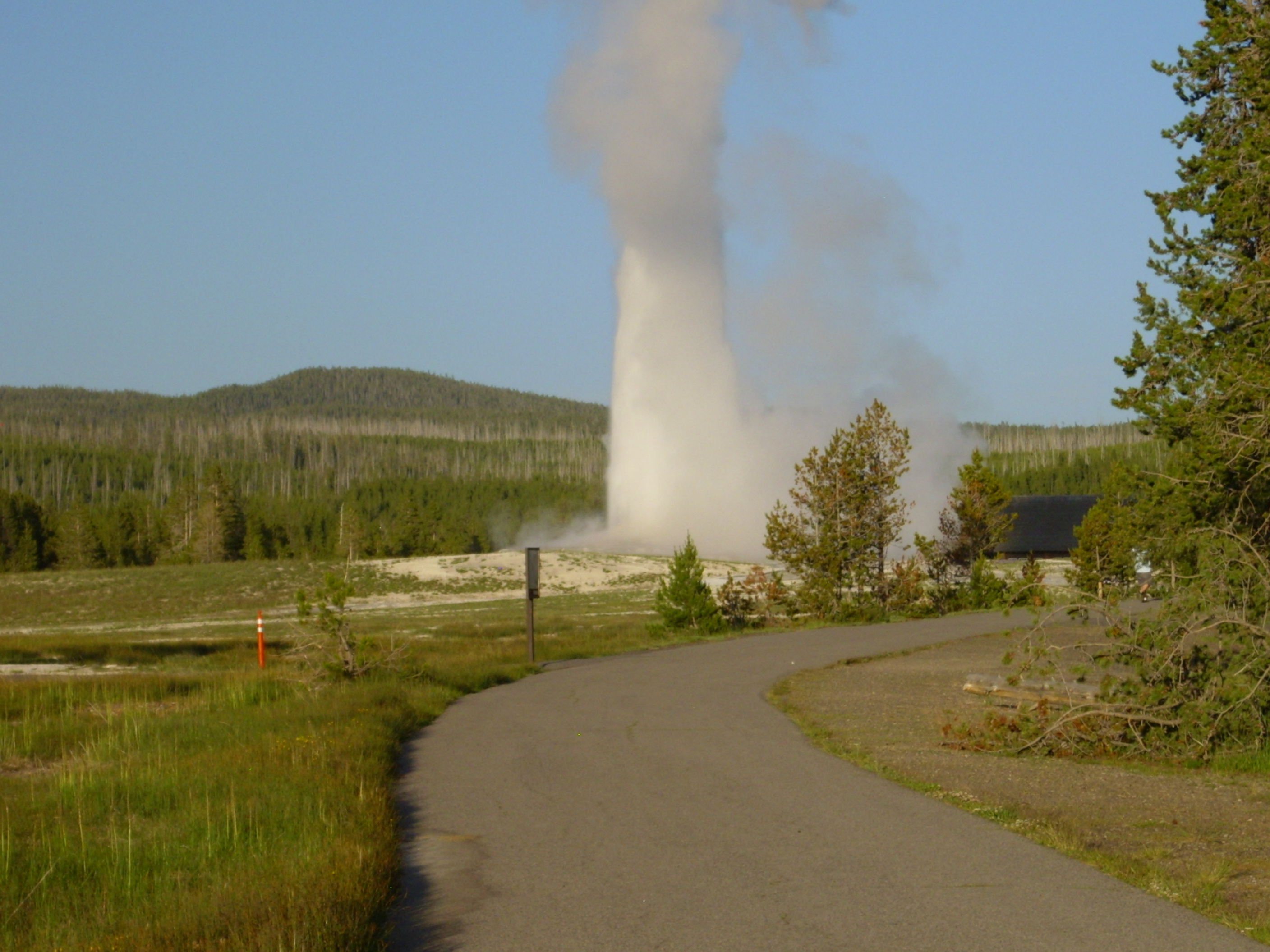
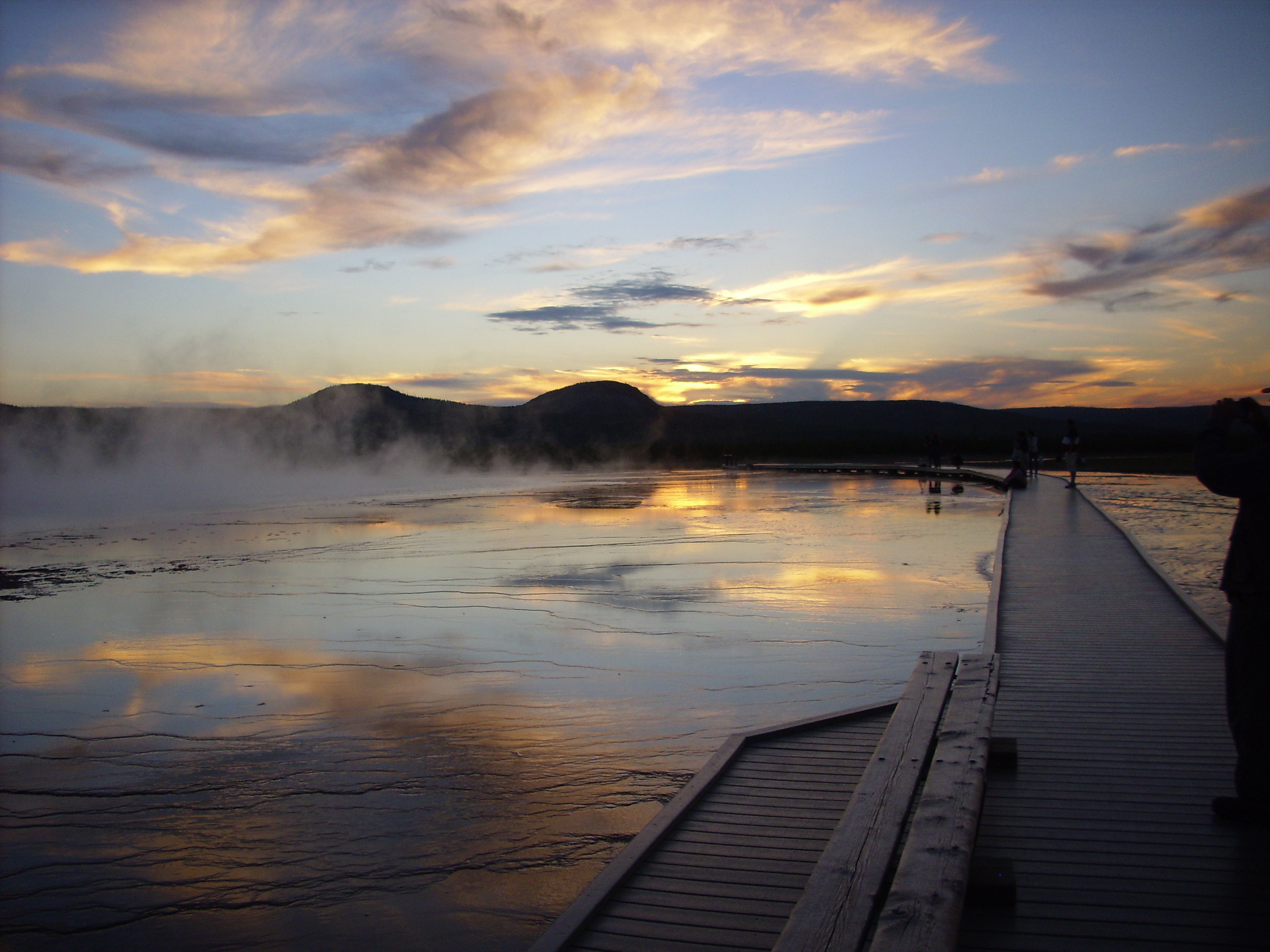
We went from there to Upper Geyser Basin, because Old Faithful is iconic and everything. My first view of a geyser:
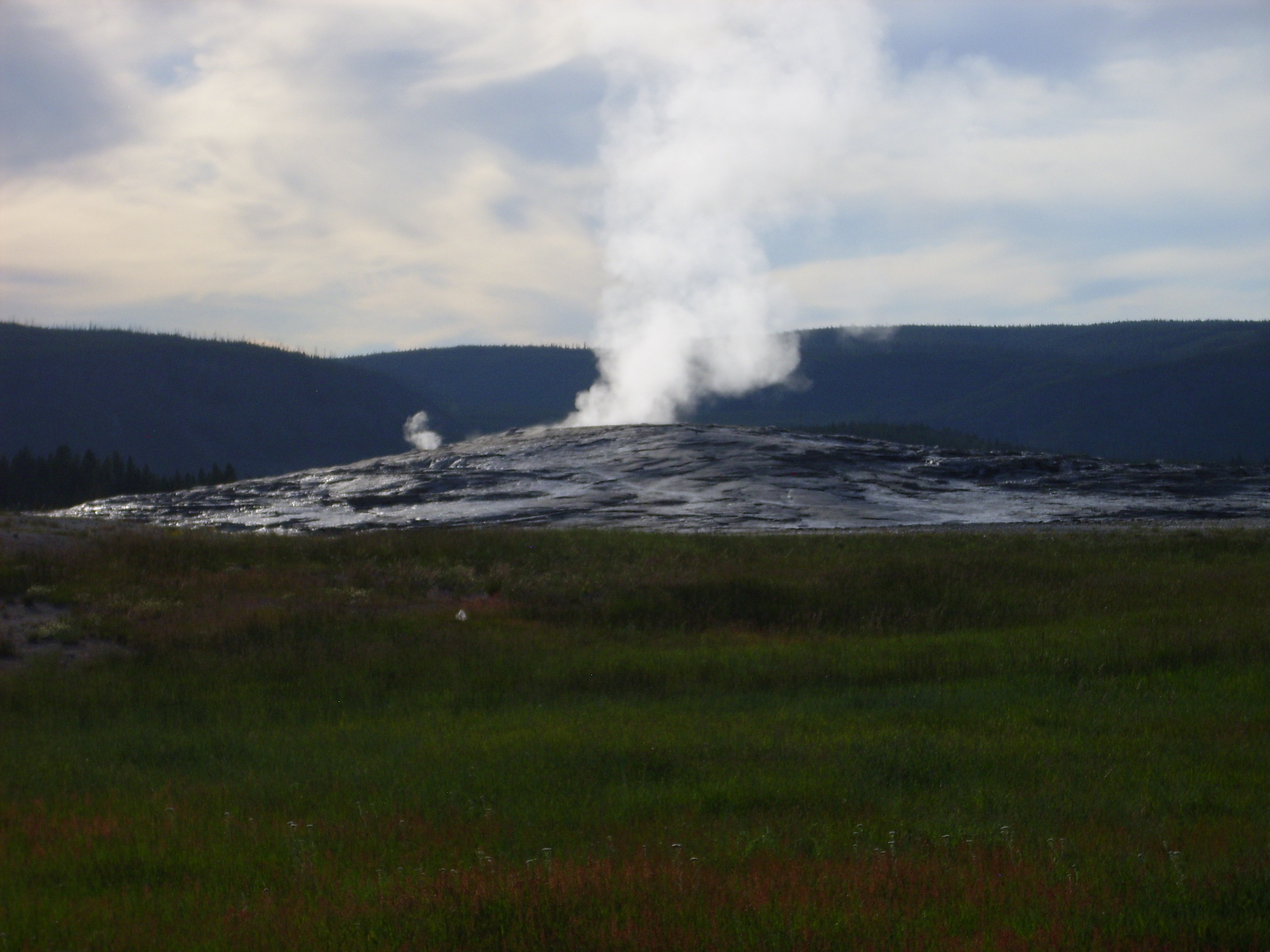
That’s Old Faithful between eruptions. Judging from the number of tourists headed the other way, we just missed an eruption.
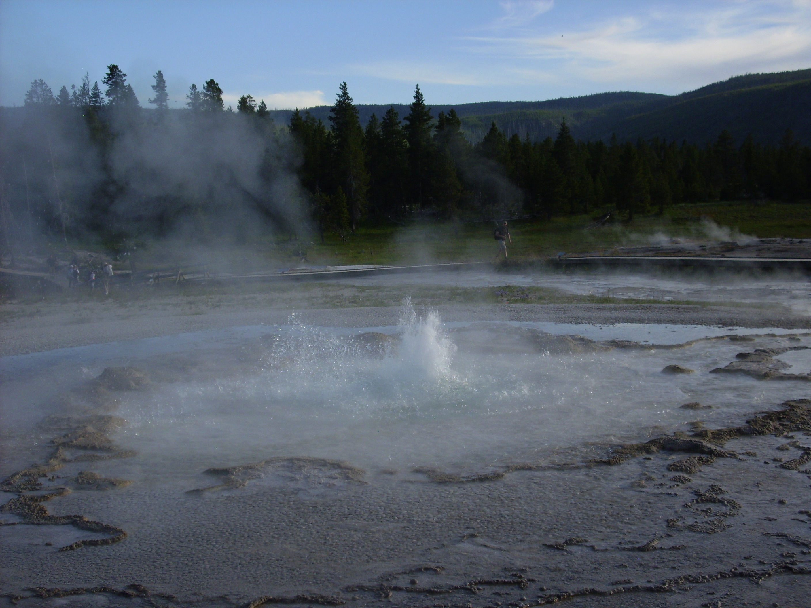
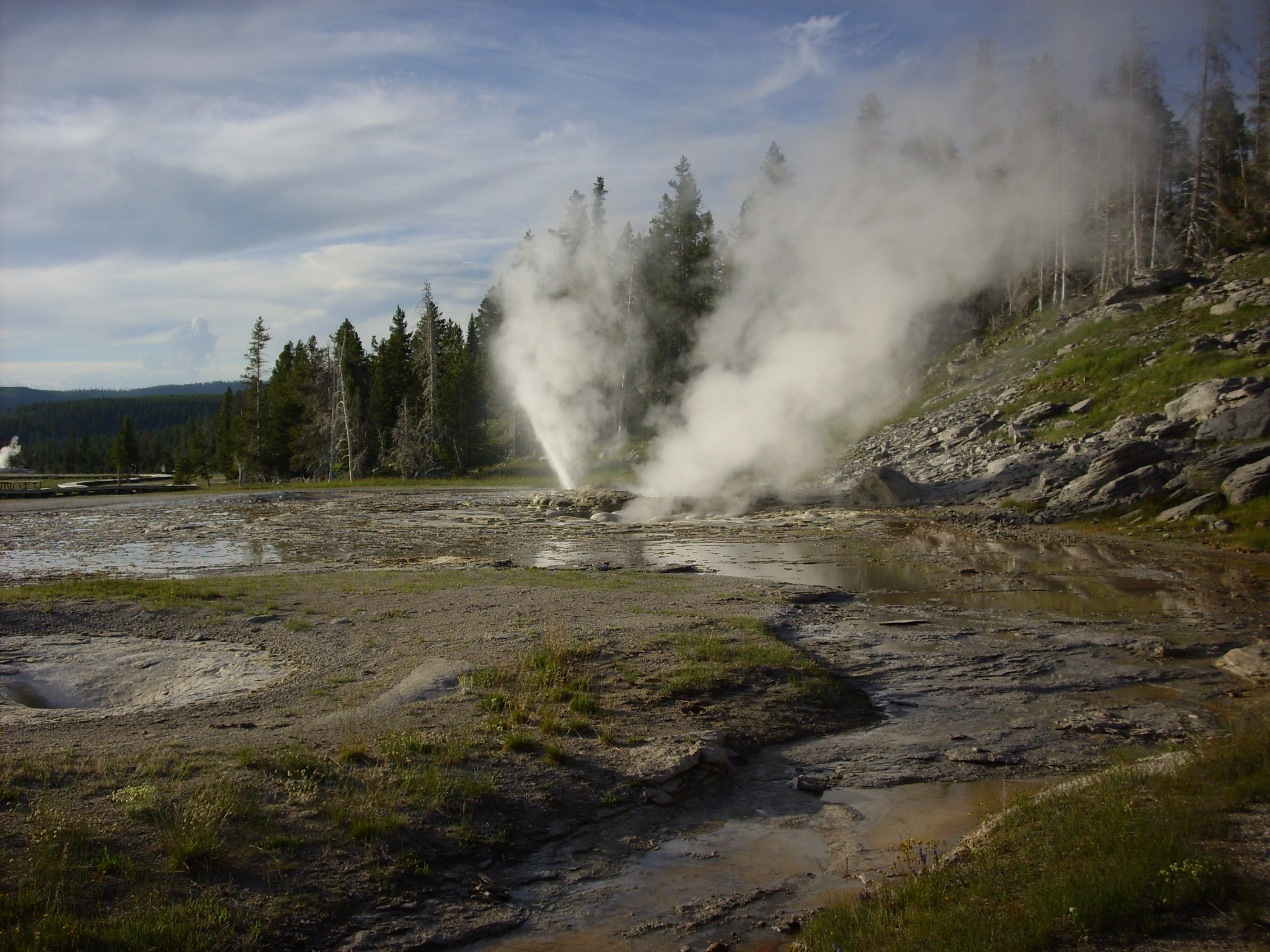
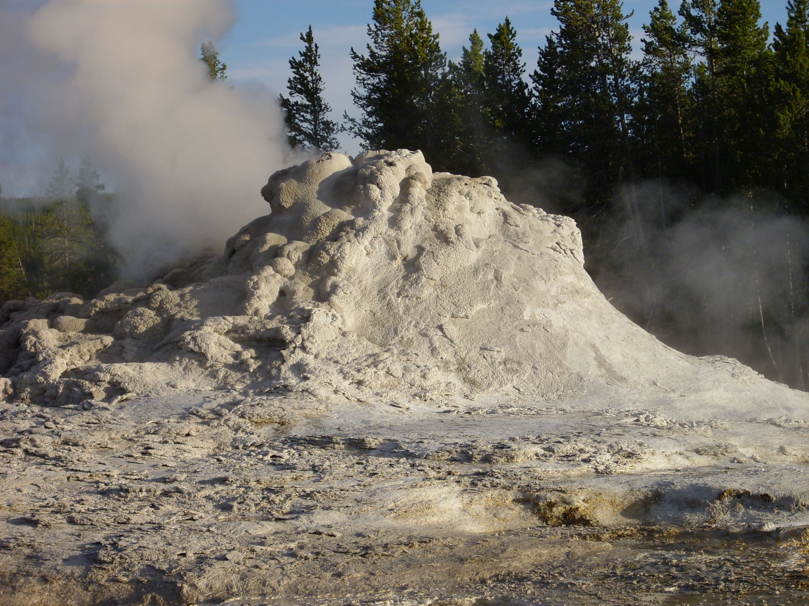
More geysers:
Pump Geyser, perhaps?

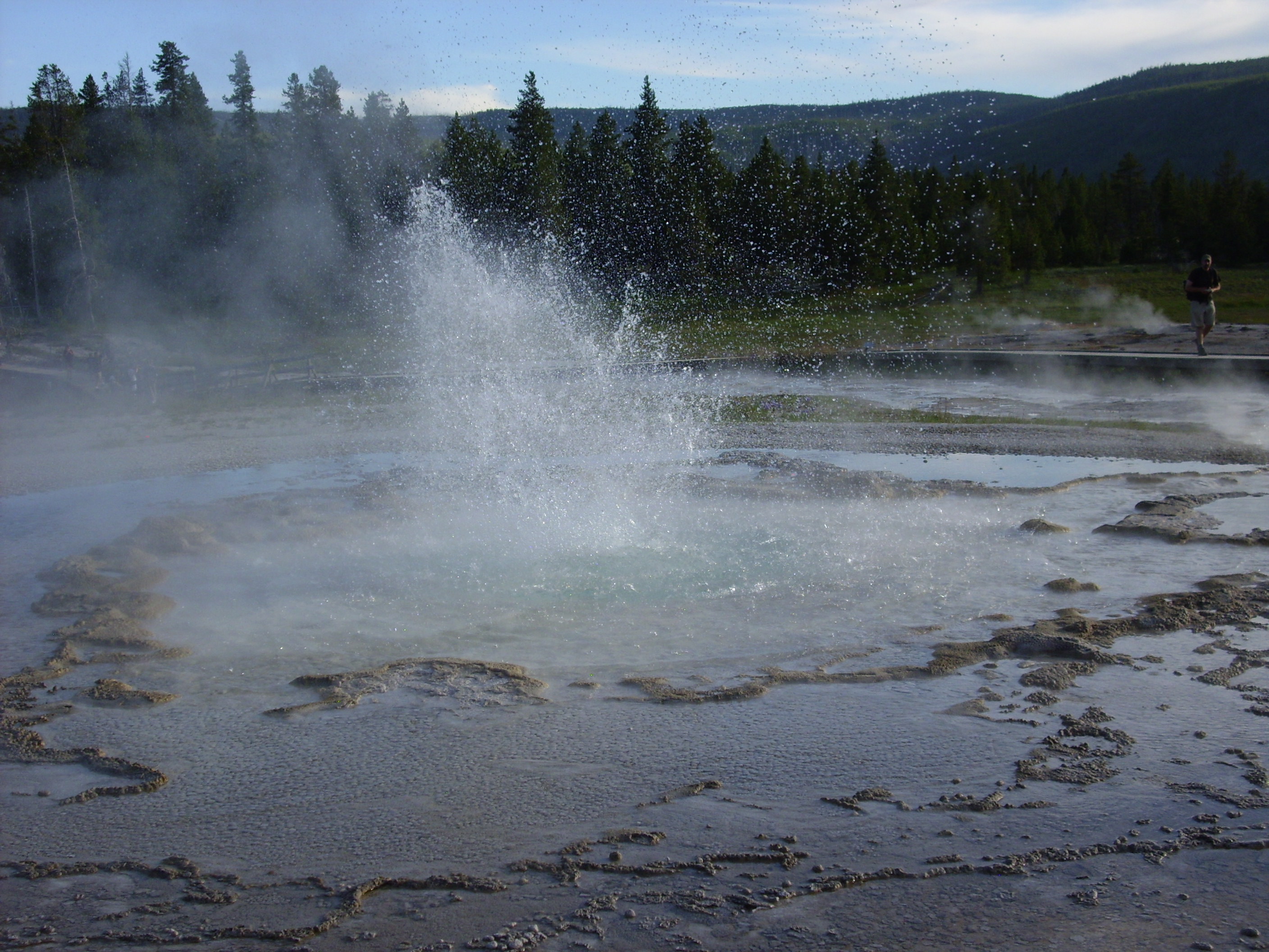
Sawmill Geyser, which erupted for us:
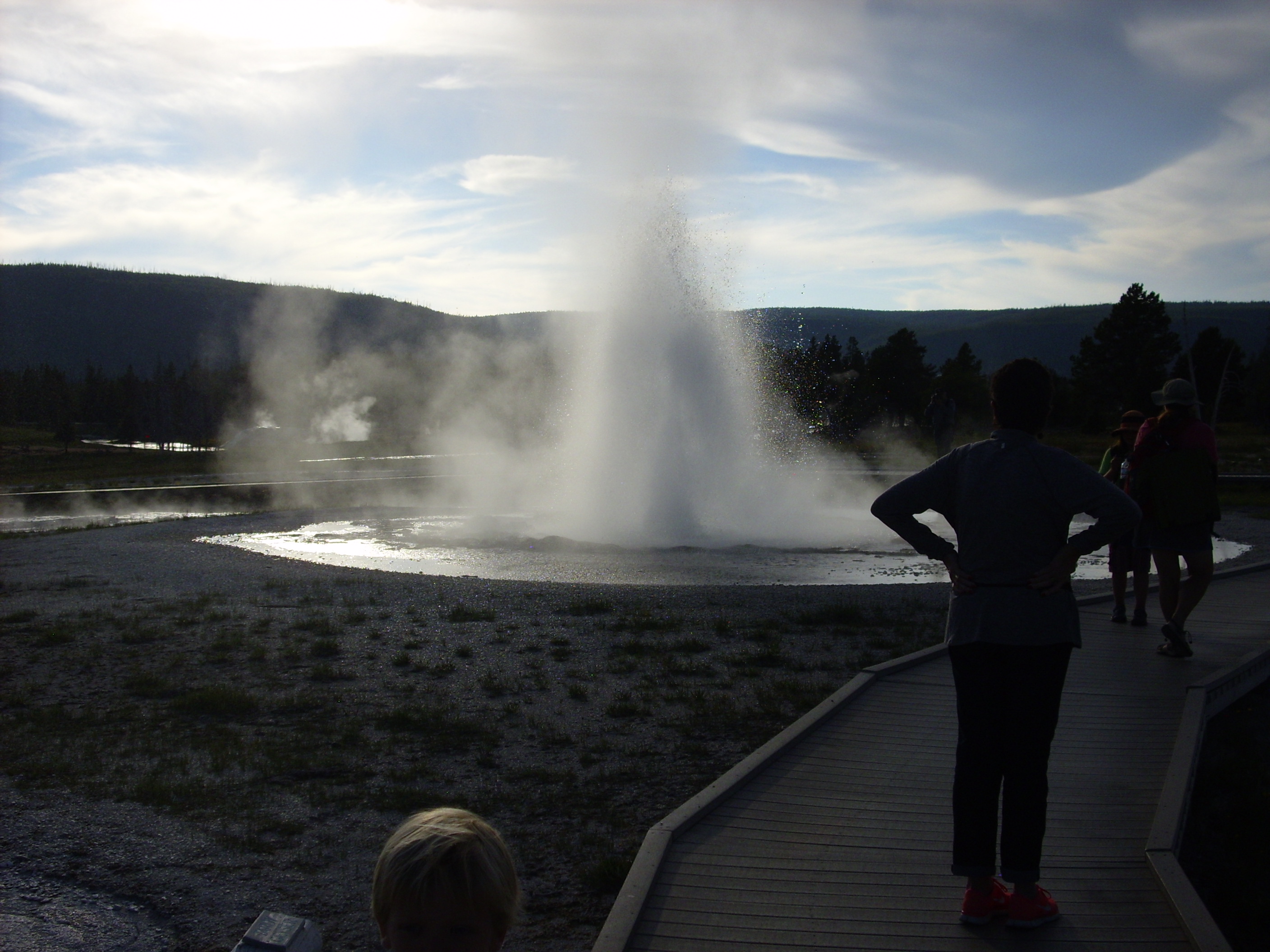
I should mention at this point, and then try very hard to forget, that Upper Geyser Basin this particular evening had the largest concentration of mosquitoes I encountered anywhere on this trip. And I had forgotten the DEET.
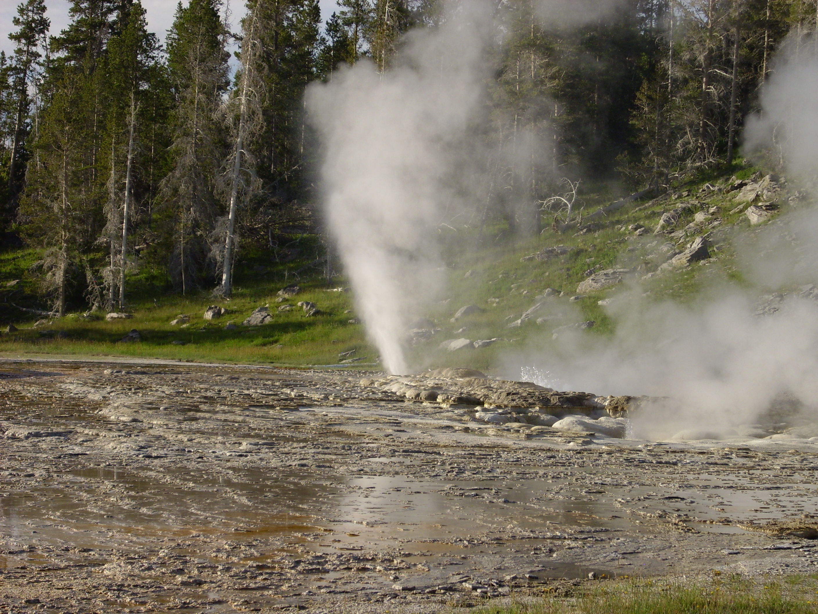
I’m not sure, but I think this sequence is Sawmill close up.


We apparently just missed seeing Grand Geyser go off.
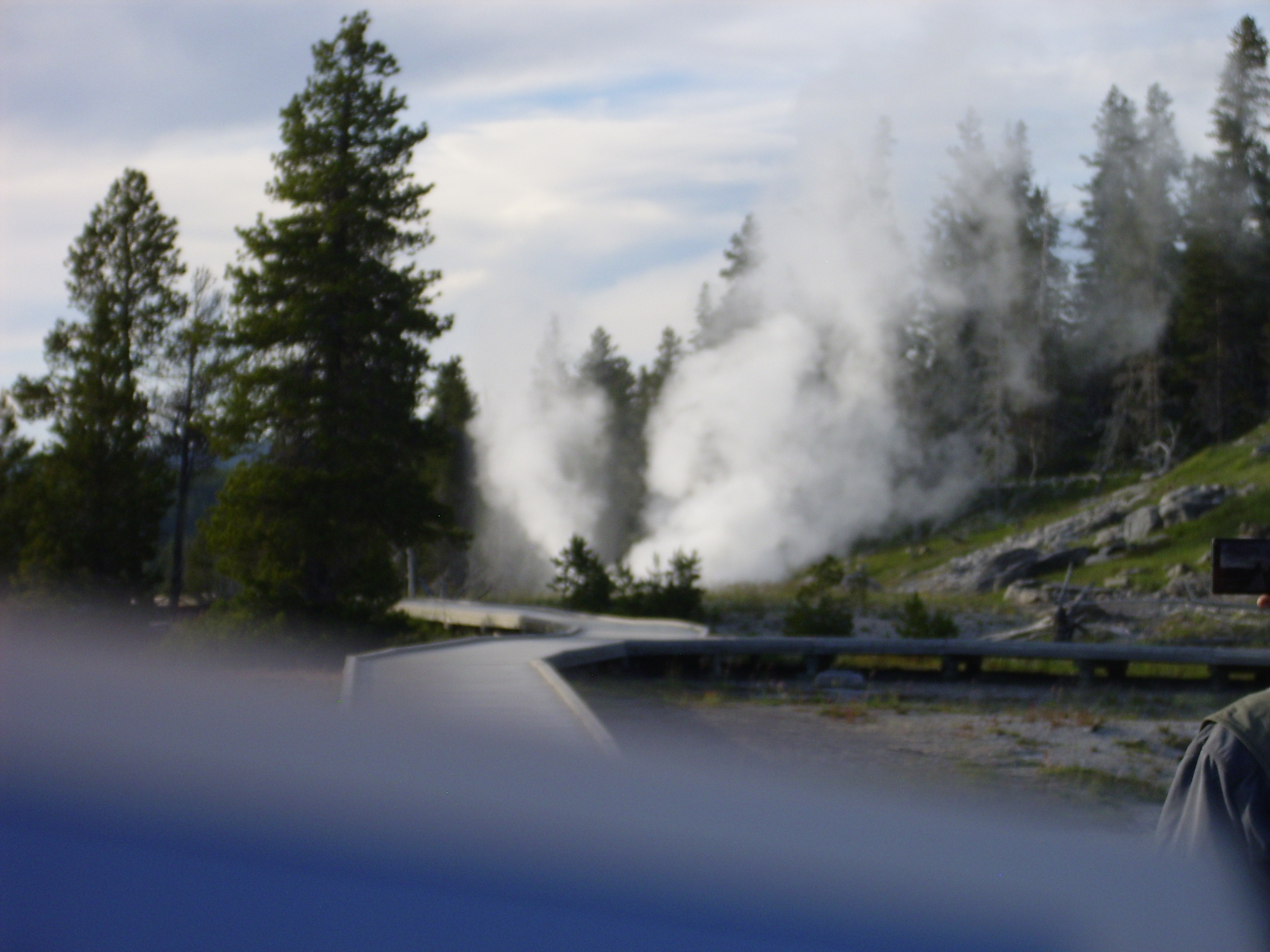
Well, shucks. At least we got to see Vent Geyser do its thing. (Vent usually erupts immediately after an eruption of Grand.)

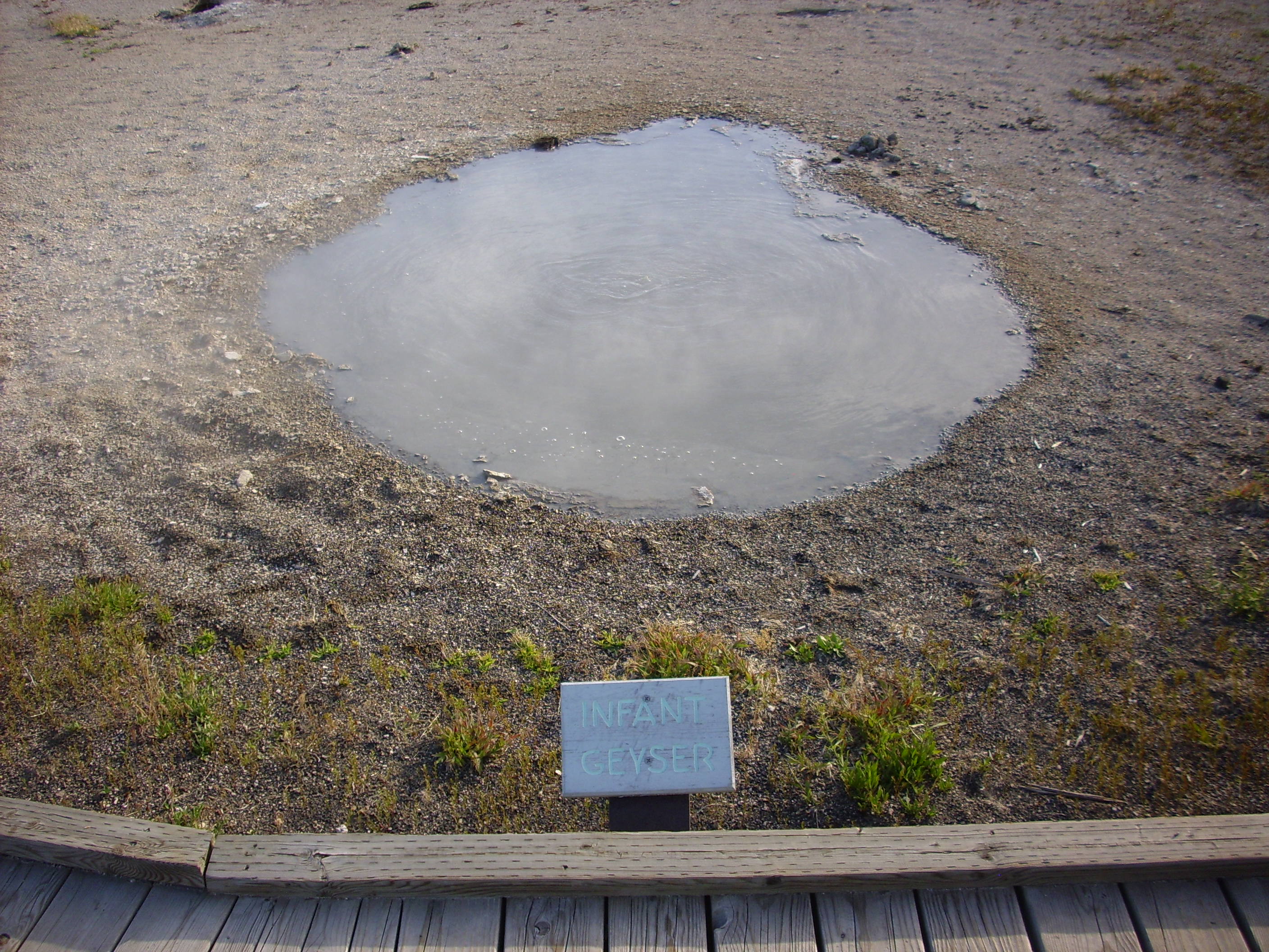
If the geysers are starting to get tedious, feel free to skip ahead. No, really. It was a lot less tedious actually being there, and I just want to document what these pictures are of before I forget.
After a while I realized that I could make many of the pictures self-documenting. I believe this next is Shield Springs, based on there being a sign in front saying “Shield Springs.”
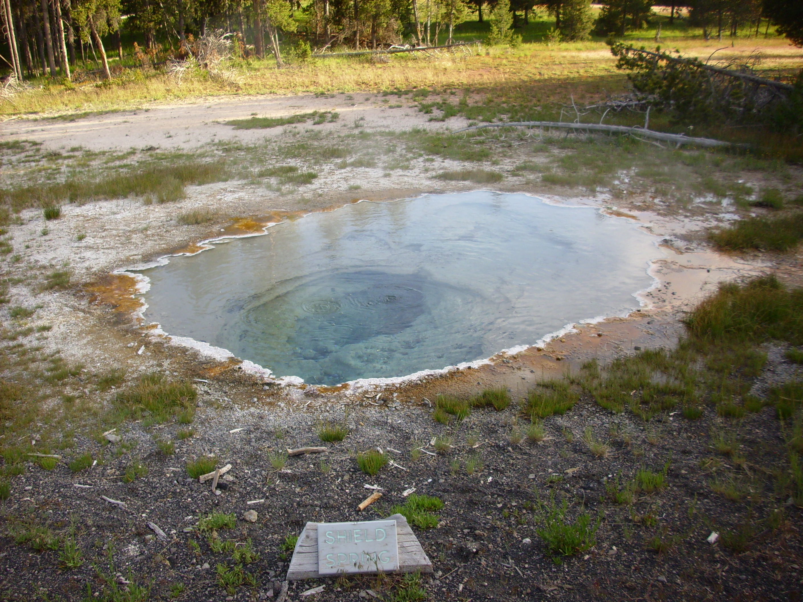
The blue in the center is from suspended bits of sulfur and reflection of the sky. The concentric areas of orange and green are various archaea, bacteria, and algae thriving and different temperatures and chemical environments around the pool. Some of the bacteria are yellow and green sulfur bacteria (which are not, actually, always yellow or green) that oxidize reduced sulfur in the water as an energy source. Archaea are like bacteria, but different. 😉 Okay, they’re very simple single celled organisms without organelles, like bacteria, but with major differences in chemistry, such as having ether linkages rather than ester linkages in the lipids of their cell walls. Um, ask Cindy.
Supposedly the archaea are more closely related to us than the bacteria. Hi, cousins!
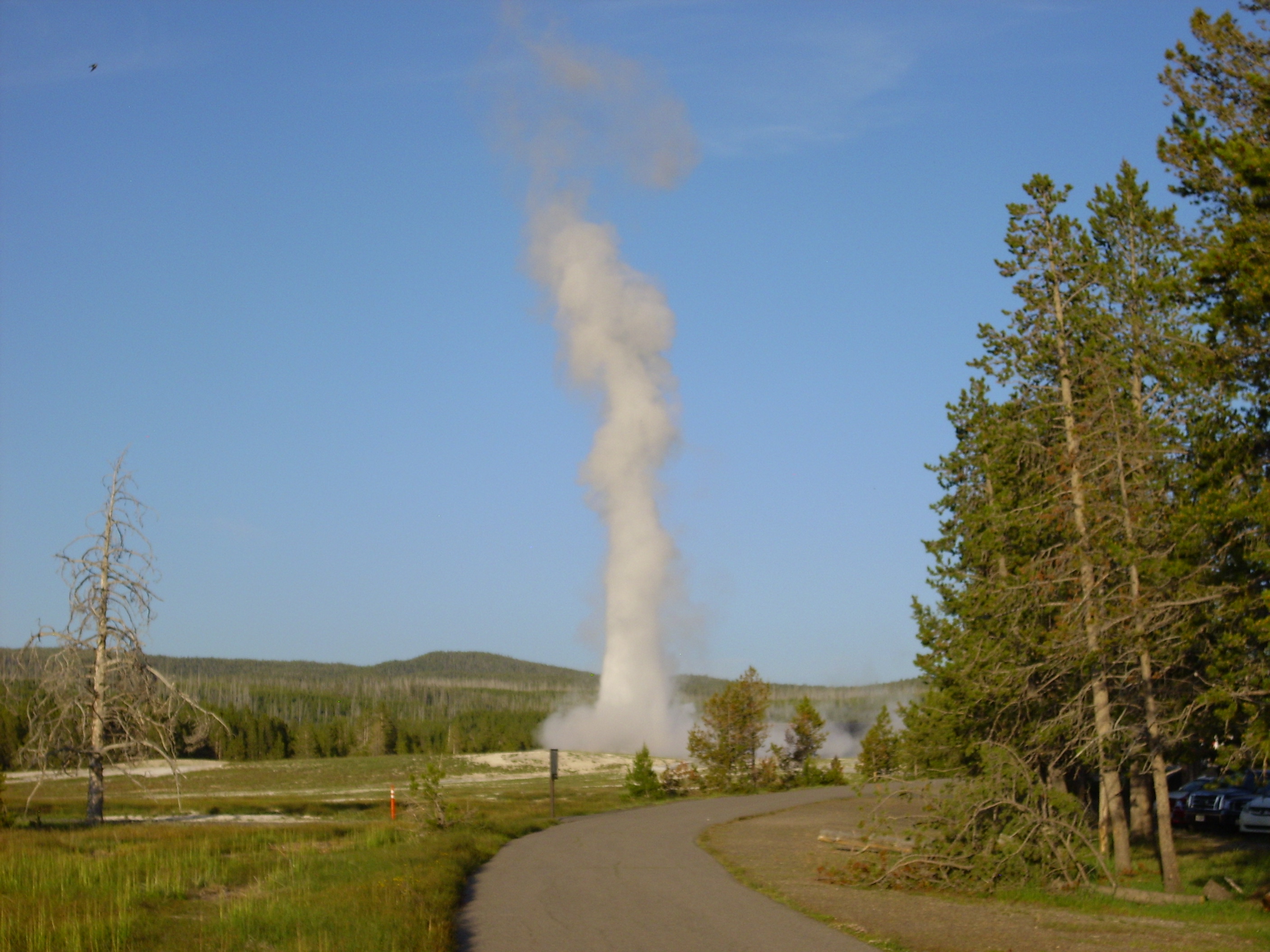
We didn’t quite make it back to Old Faithful for the next scheduled eruption. Well, distant shots have their own merits:
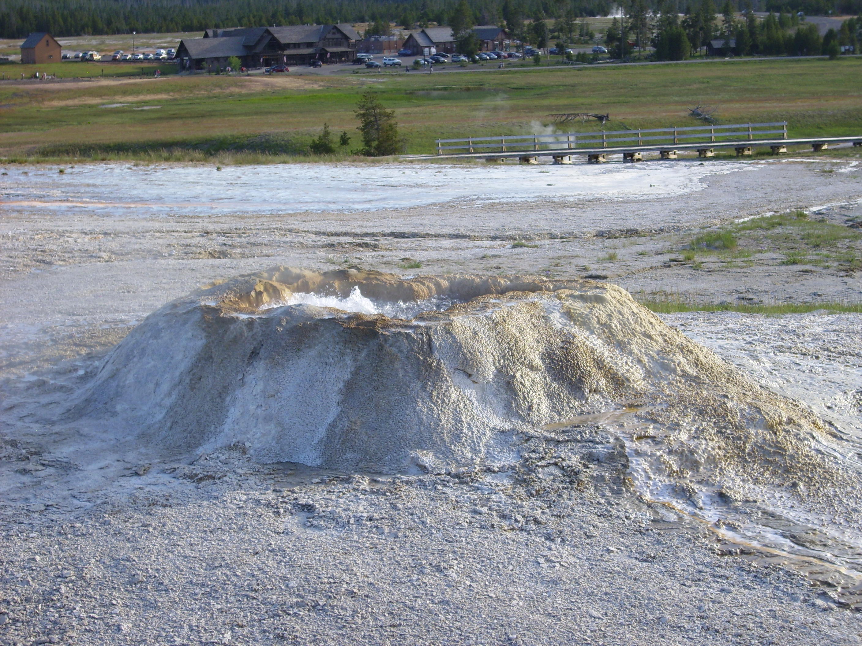
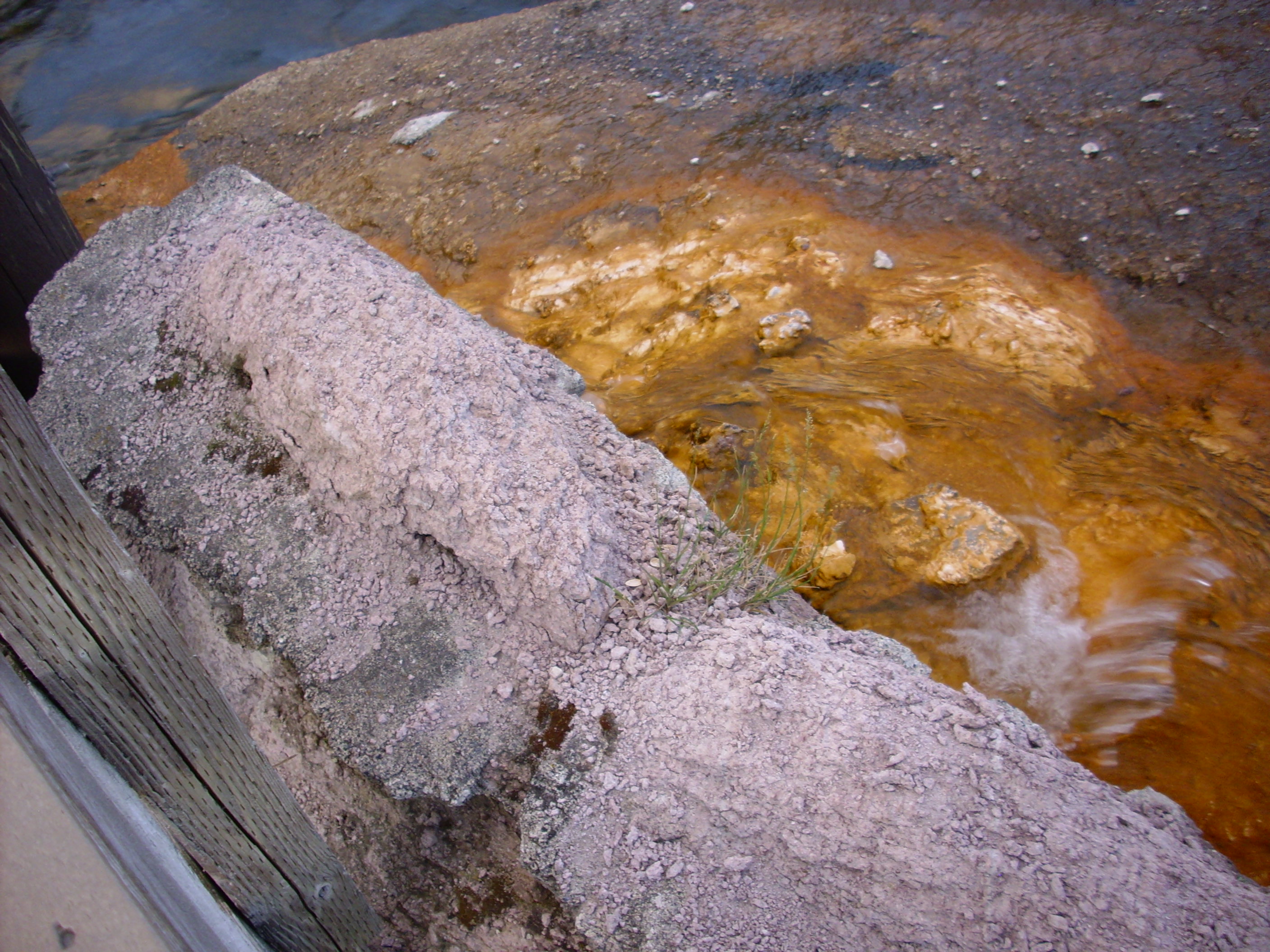
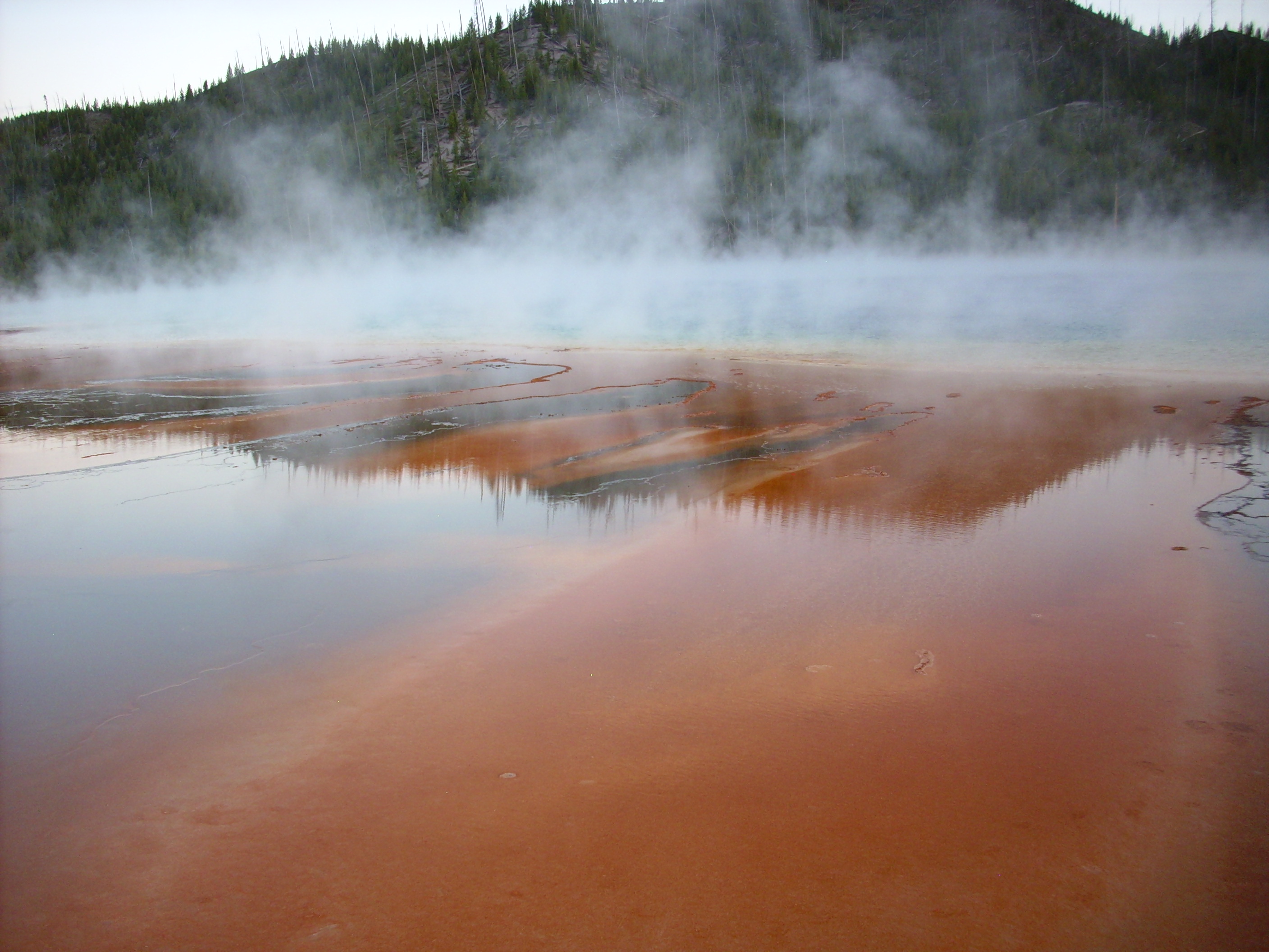
From there we quickly visited Midway Geyser Basin, with its huge Grand Prismatic Springs.
Algae growth in the runoff:
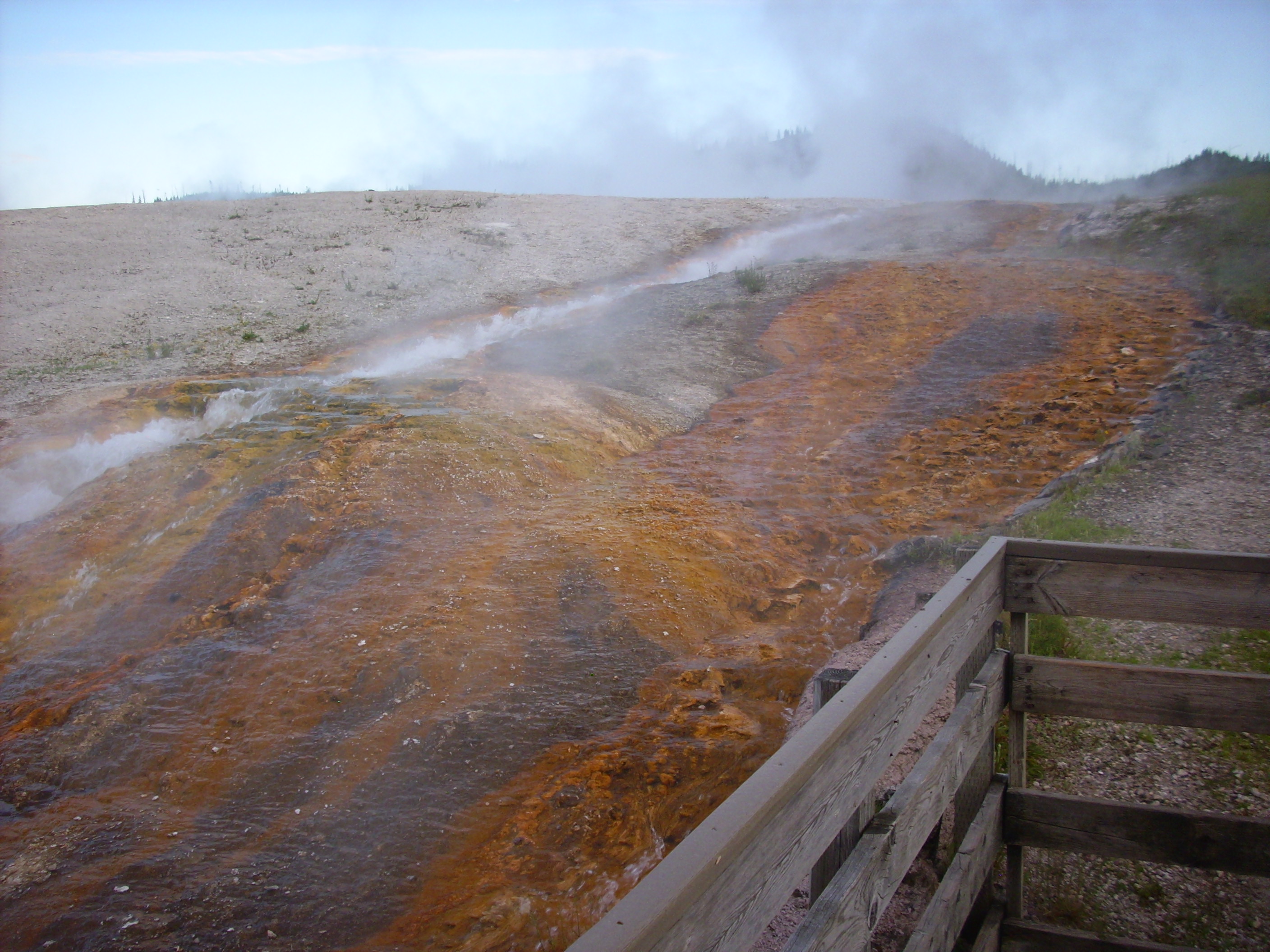
A disintegrating stone wall. This is what the acid fumes from the springs can do to solid rock in a few decades.
… Why am I suddenly humming Pink Floyd to myself? I don’t even like Pink Floyd …
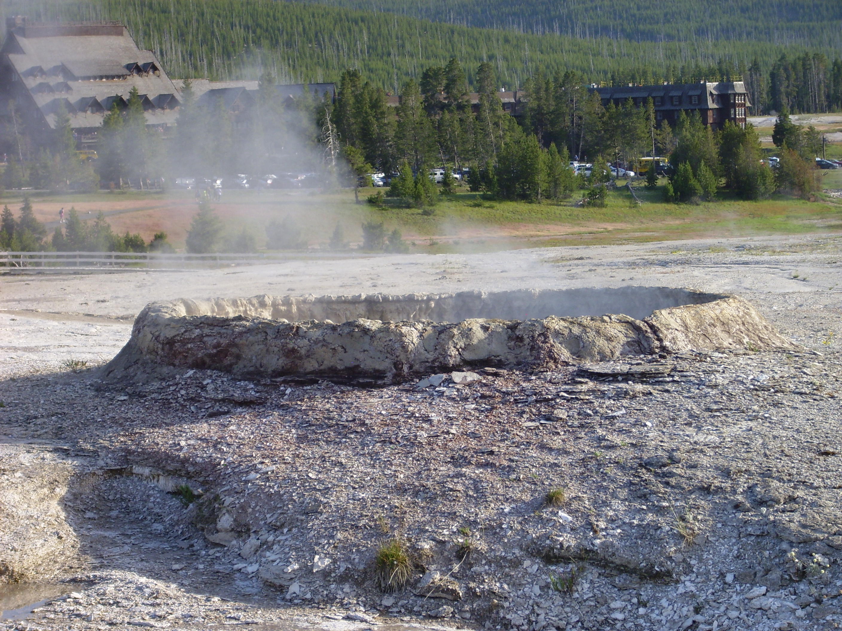
The lip of a hydrothermal crater. These typically form during droughts, when lower water tables reduce the pressure on very hot water near the surface, allowing it to explode into steam and take a good layer of soil and rock with it. You can see the layers of sinter, deposited silica, around the crater rim.

Grand Prismatic Springs.

![]() But we can be tranquil and thankful and proud for Nature’s endowed with a pyroclastic cloud.
But we can be tranquil and thankful and proud for Nature’s endowed with a pyroclastic cloud.
And we know for certain that some lovely day an earthquake will set the spark off and this will all be blown away. ![]()
We got back to West Yellowstone late enough that nothing was open, but we talked a small ice cream and sandwich bar into making just two more sandwiches. Then Bruce dropped me off at my camp for the night.