Kent and Bruce’s Excellent Adventure, Day 7
Day 7: First full day in Yellowstone
At about 5:30 AM I discovered that my campground had its own unkindness of ravens, and they called roll every morning at that ghastly hour. On balance, I probably prefer roosters. The ravens apparently wake some nearby cows, who begin lowing. It worked that way every morning I was at Buffalo Campground.
Not a bad campground otherwise. The tent pad was good, the table gave me a place to set up my camp stove and cook breakfast (usually reduced-sugar oatmeal with reduced-sugar cranberry raisins and flax meal, bran cereal with buttermilk and xylitol, and hams and egg.) There was a restroom with running water to brush my teeth at night. No showers, though. I was pretty ripe by the time I got to Denver.
I met Bruce in West Yellowstone at about 9 in the morning, and we headed on into the park.
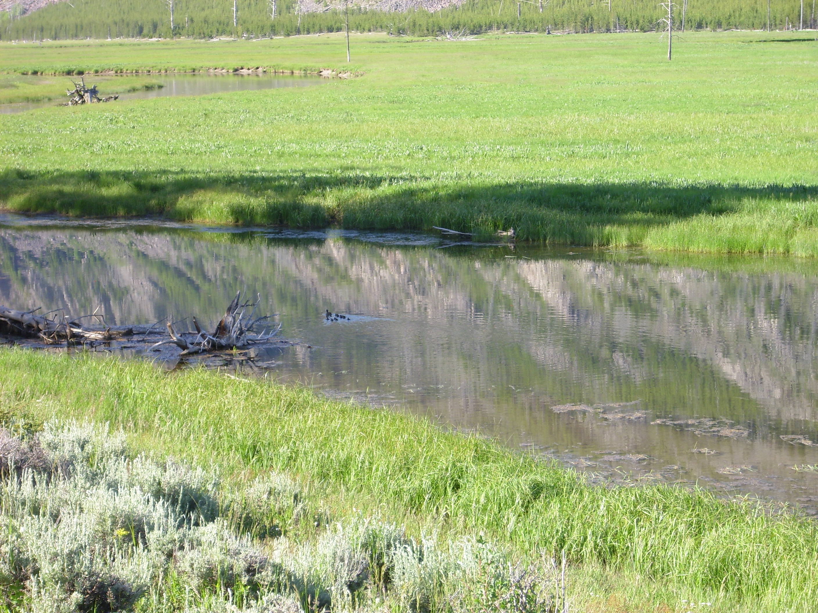
Where the first cool thing we saw was a mama duck and ducklings in the Madison River.
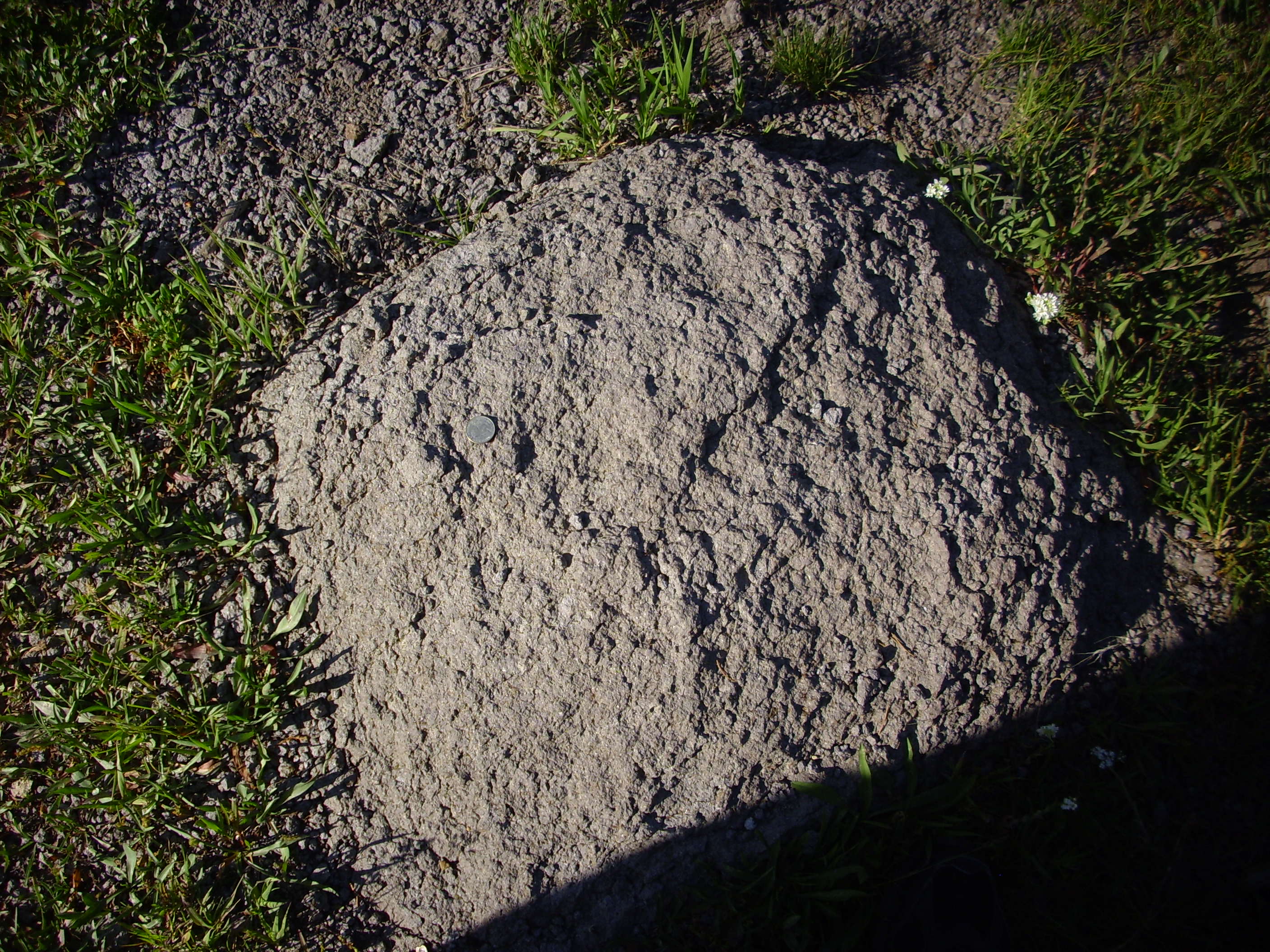
Click to enlarge. Actually, you can click and enlarge every photograph in these posts except the photographs of rock samples.
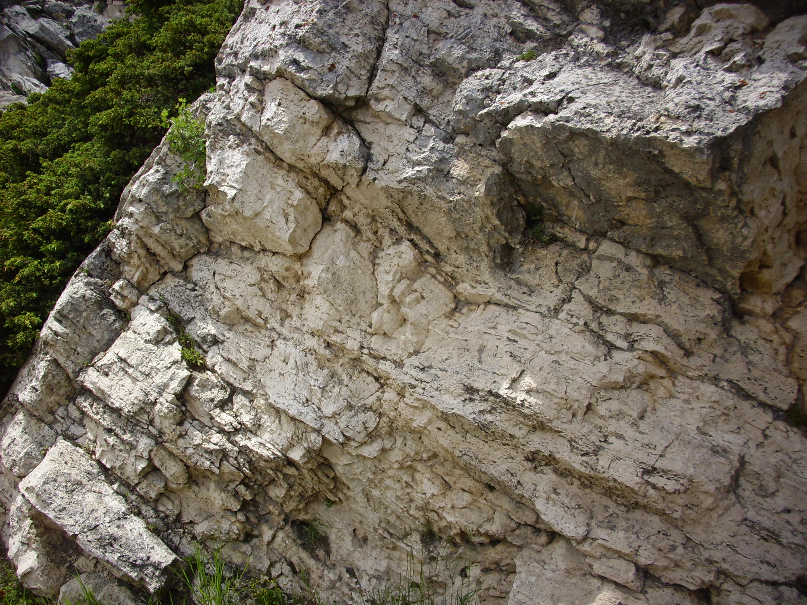
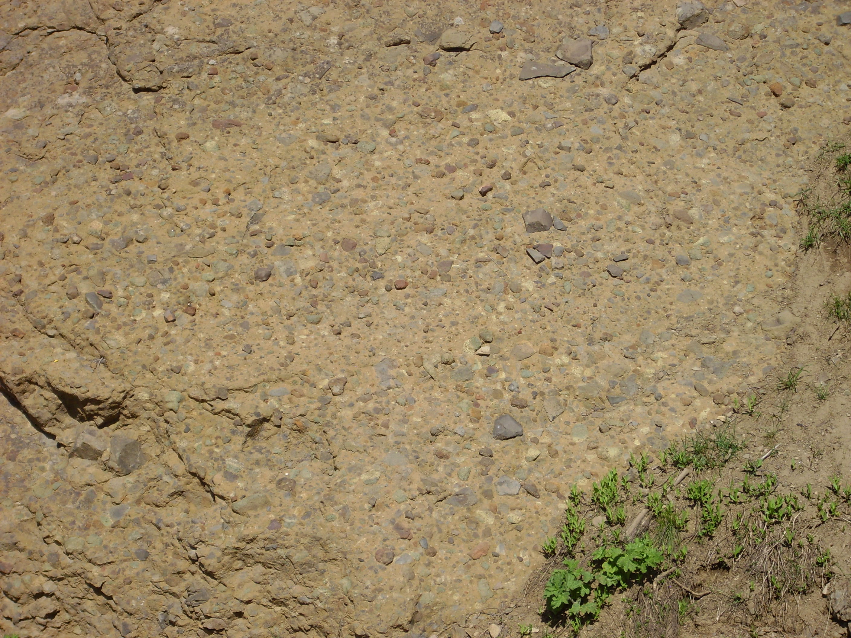
Gen-yooo-wine Yellowstone rock, with Mr. Quarter for scale. Looks like Lava Creek Tuff. Everthing was exciting at this point, but with time I would get over it.
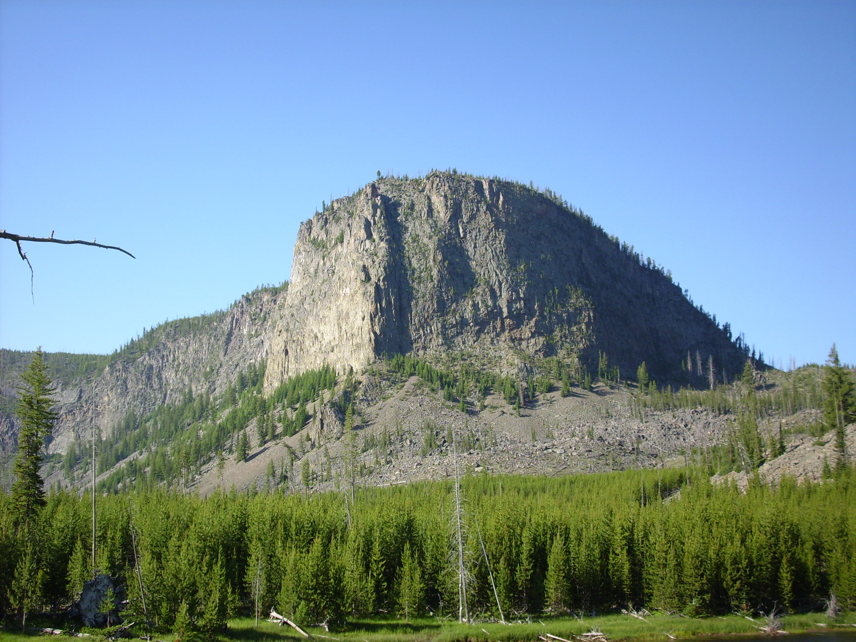
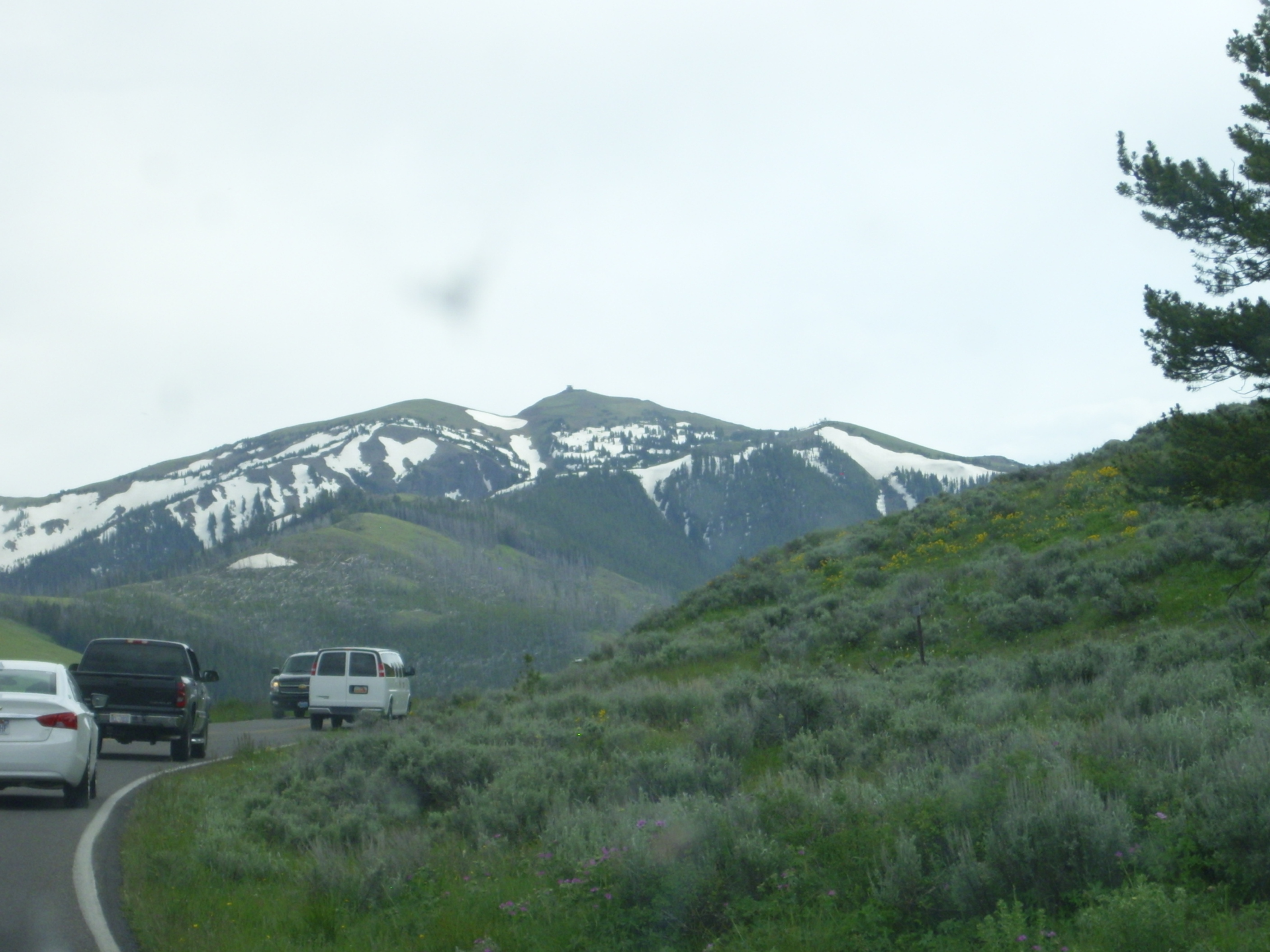
Mount Haynes forms part of the Yellowstone caldera rim. We are seeing it here from the Madison River valley, which cuts through the caldera rim north of Mount Haynes. Mount Haynes is part of the Mount Jackson Rhyolite, which has been dated to 790,000 to 640,000 years ago and is capped in several places with the Lava Creek Tuff. It thus formed from silica-rich lava erupted shortly before the third caldera eruption. No sample; I could not find an outcropping outside the park.
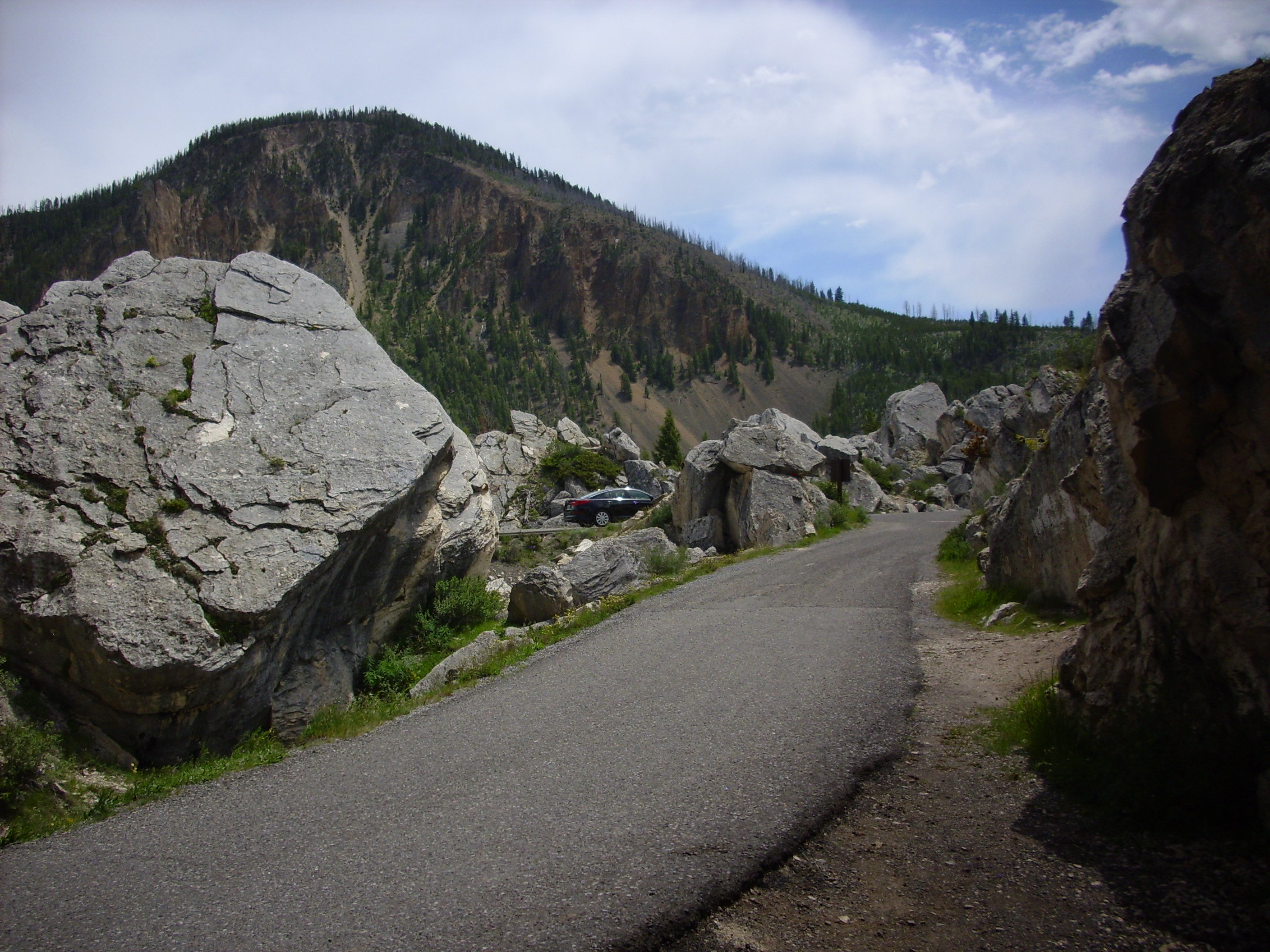
The Madison River Valley crosses the caldera rim not far from Purple Mountain.
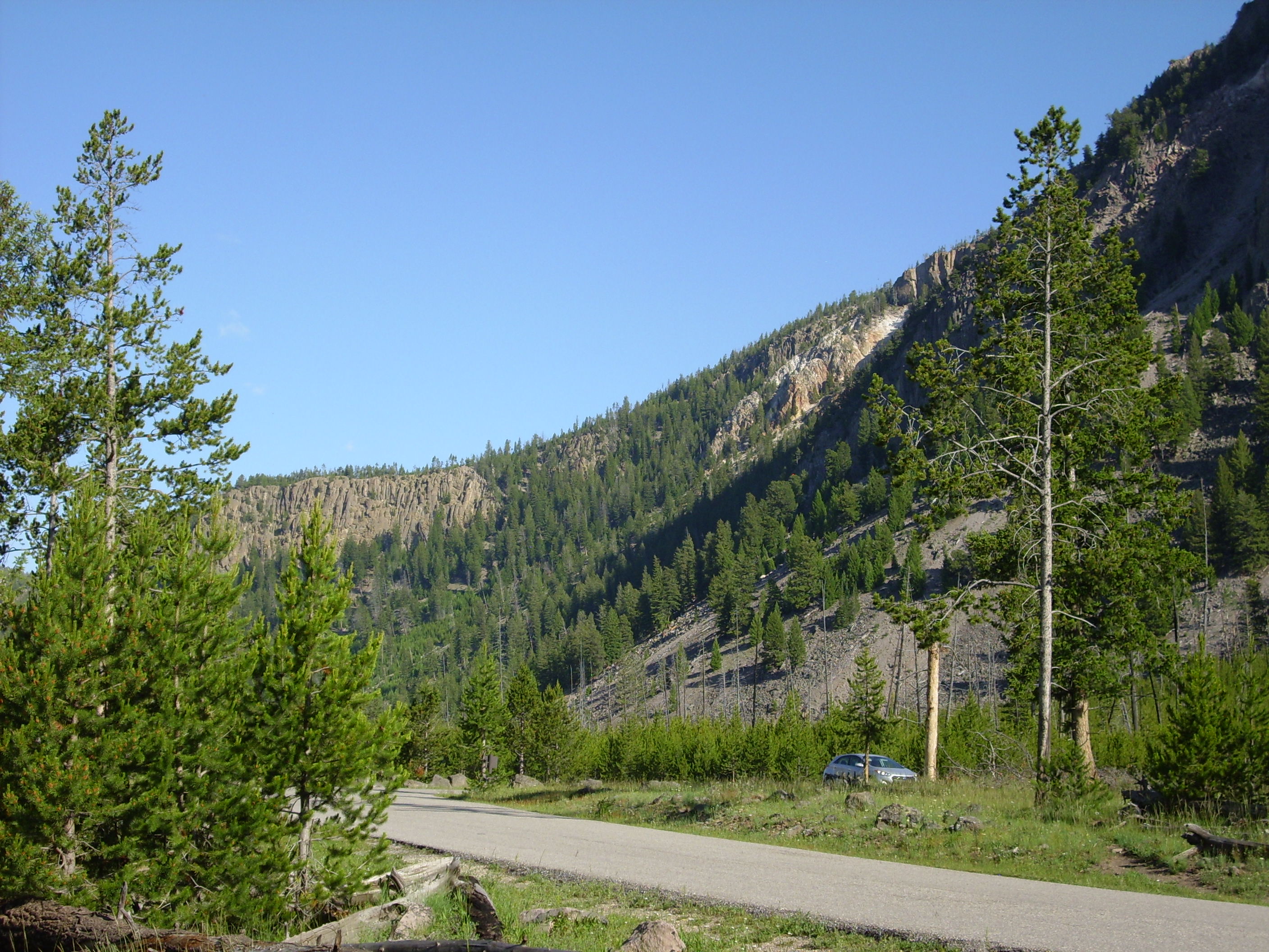
Purple Mountain is one of two prominences on the north caldera rim I was inclined to hike to for the view. Bruce wisely talked me out of either; they would have been time consuming, Bruce’s knees were probably not up to a long climb, and I would likely have overestimated myself. Walking around the geyser areas turned out to be plenty of exercise.
Purple Mountain is mostly Lava Creek Tuff sitting on top of older tuffs and rhyolites.
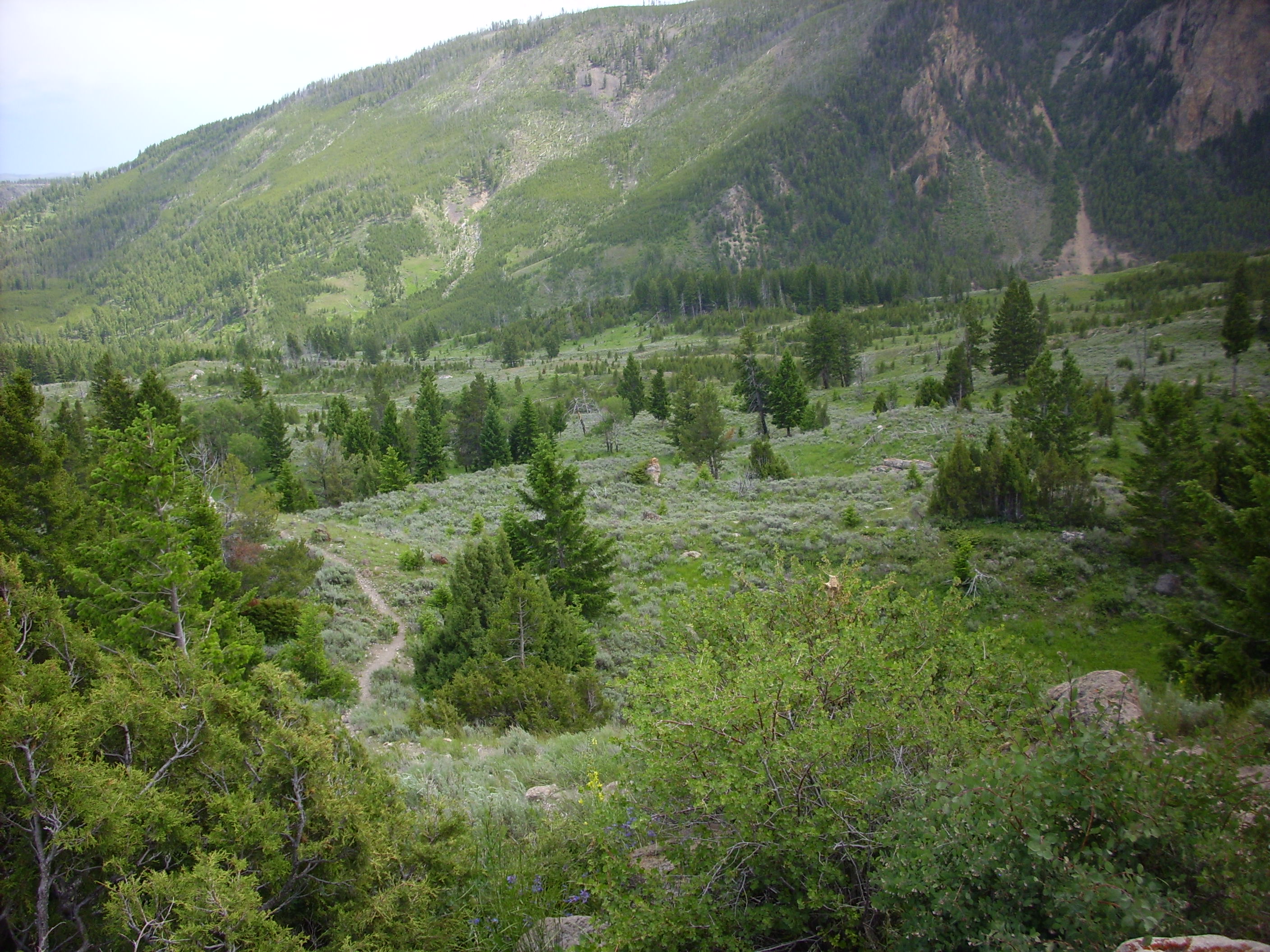
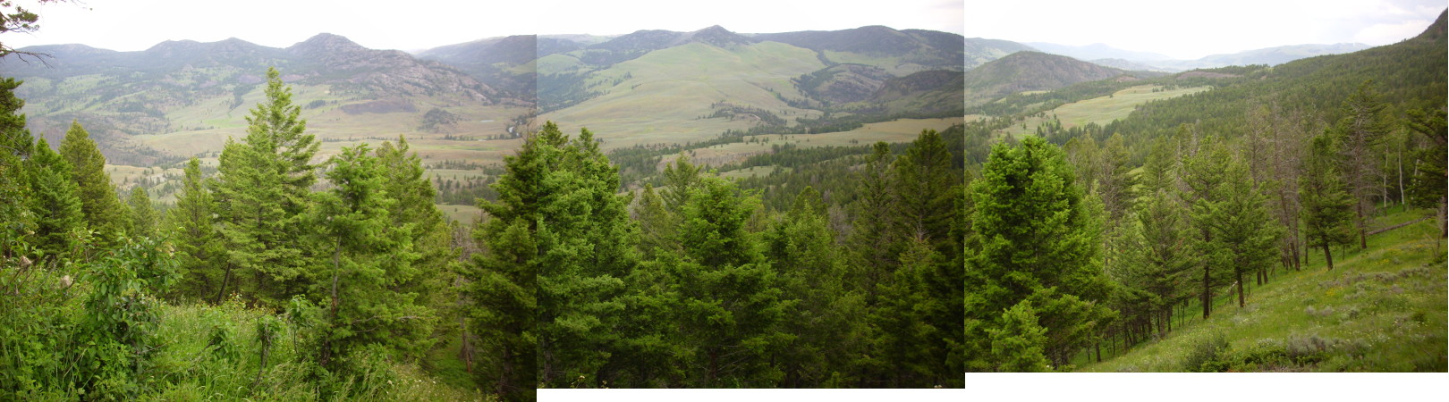
To the south, from a high spot on the road, we could look across the Yellowstone Plateau.

The Yellowstone Plateau is mostly rhyolite (the Plateau Rhyolite) that erupted following the last caldera eruption. It’s something like the ring of lava domes you see to the north of Valles Caldera back home, but these flows were much more voluminous and spread out further, essentially filling the caldera and overflowing to the west, as you can see fairly easily on a relief map. This obscures much of the outline of the caldera. The last of these flows, the Pitchstone Flow in south Yellowstone, has been dated as 70,000 years old, just a little older than the Banco Bonito flow in the Jemez. Where there to be another eruption in Yellowstone in my lifetime, my money would be on another rhyolite flow like these. Still, we’re “due” for another caldera eruption … sometime in the next 300,000 years or so. You probably have time to finish dessert.
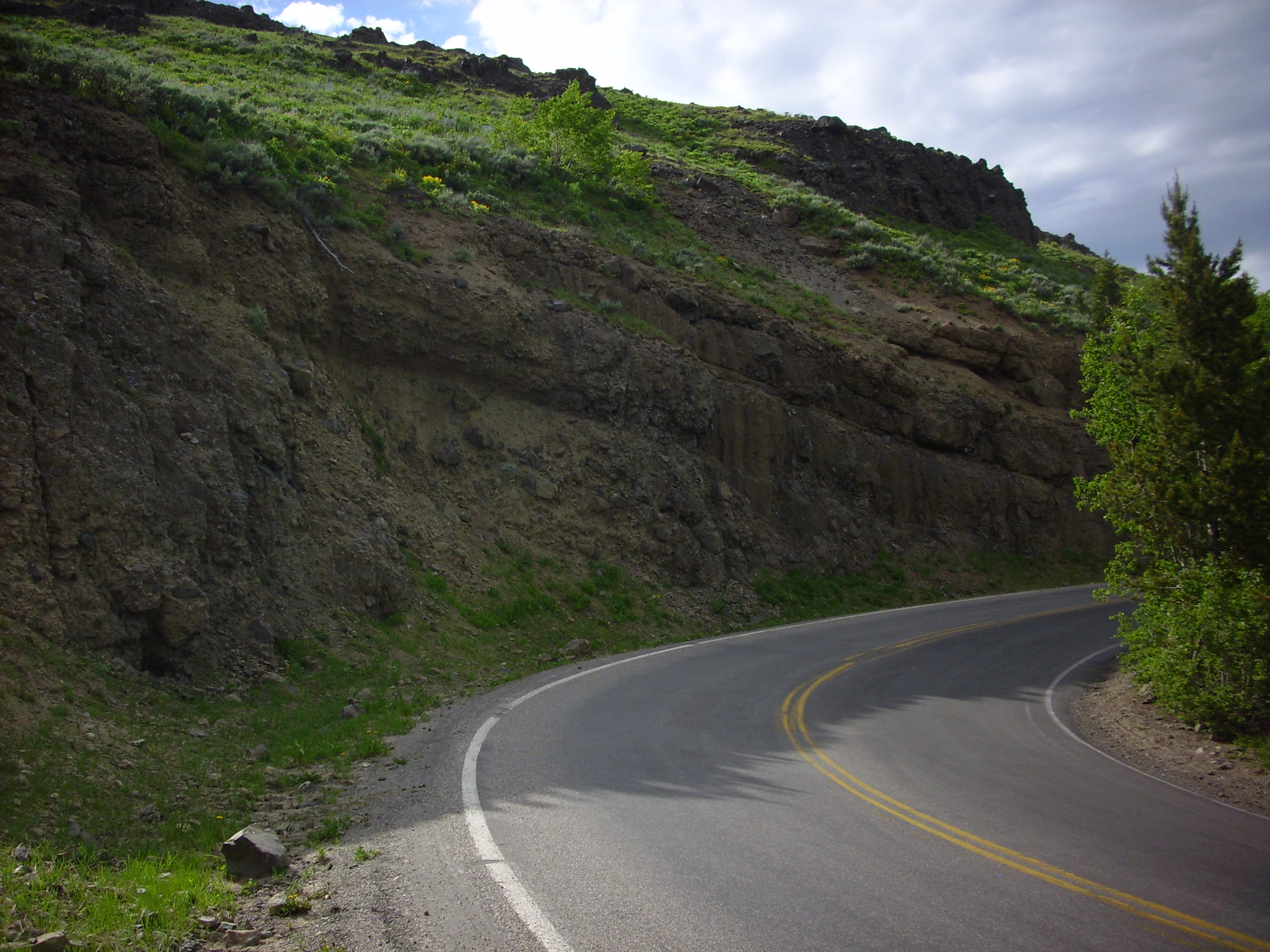
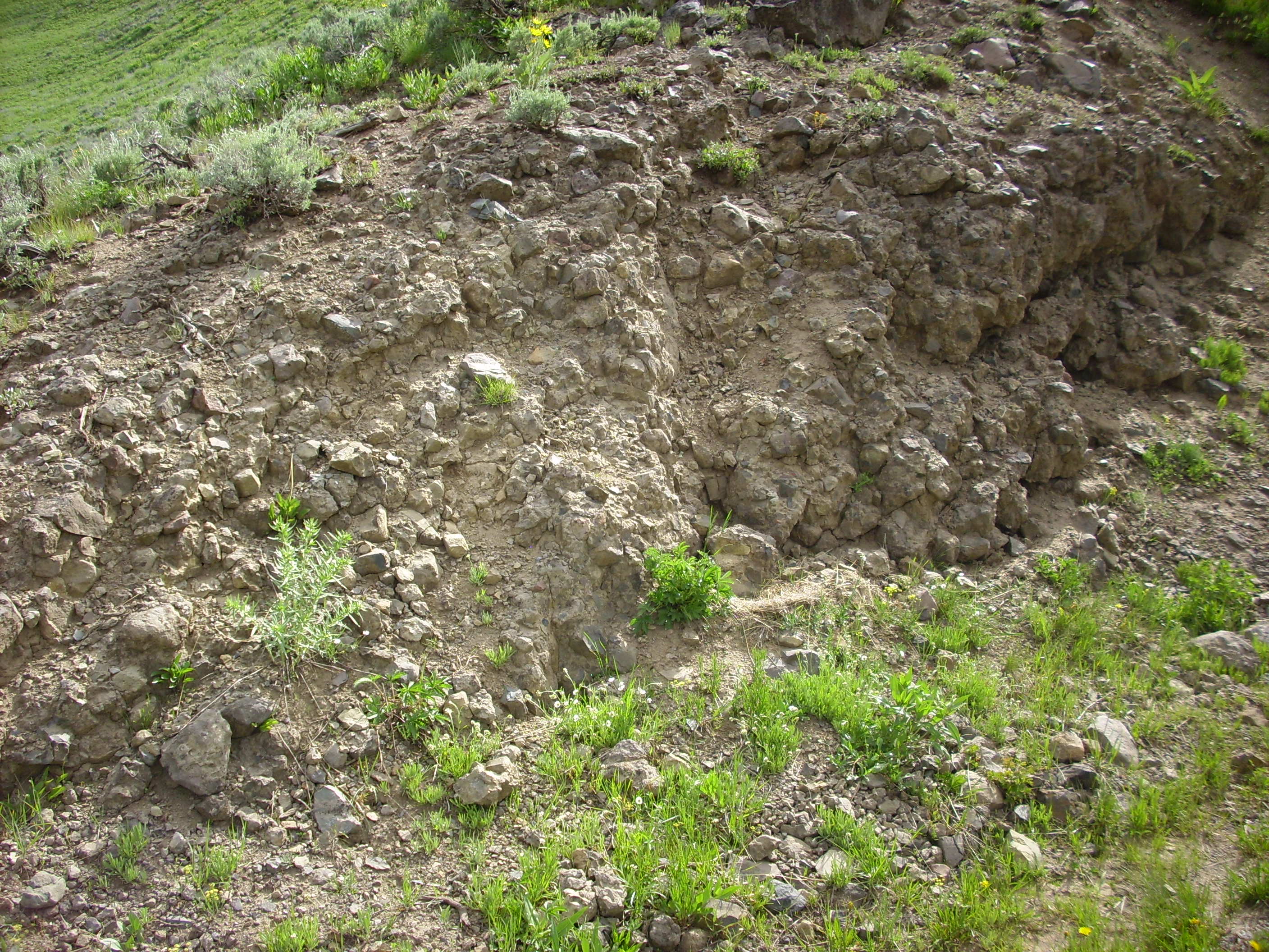
Near Gibbon Falls the road crosses the caldera rim again. Great thicknesses of Lava Creek Tuff are exposed in the road cut and west side of the canyon.
The falls are produced by a particular durable layer of tuff. The east side of the canyon is relatively young Central Plateau rhyolite erupted 87,000 years ago.

Beryl Spring next, I believe.
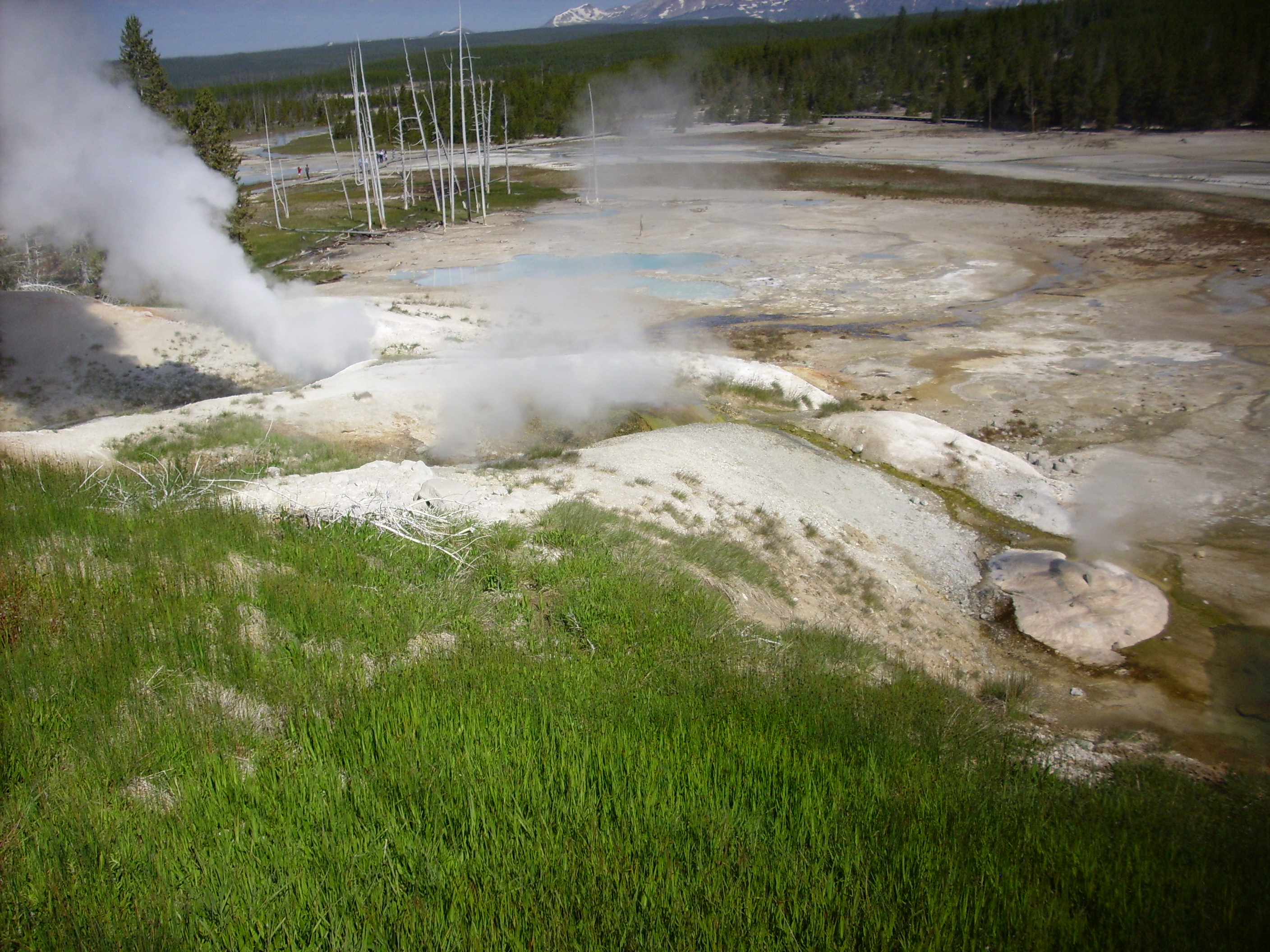
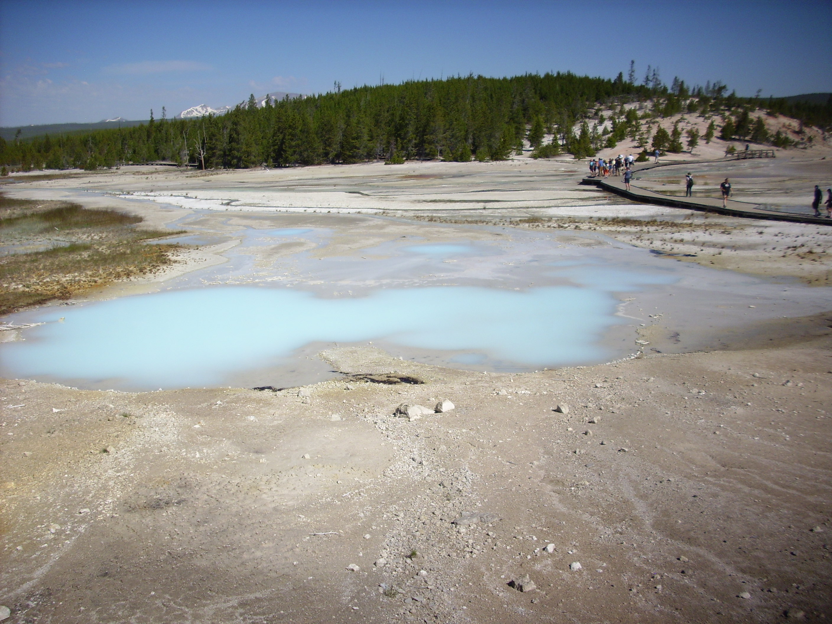
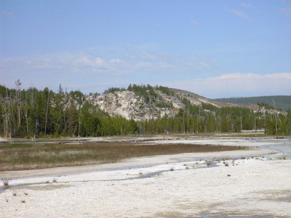
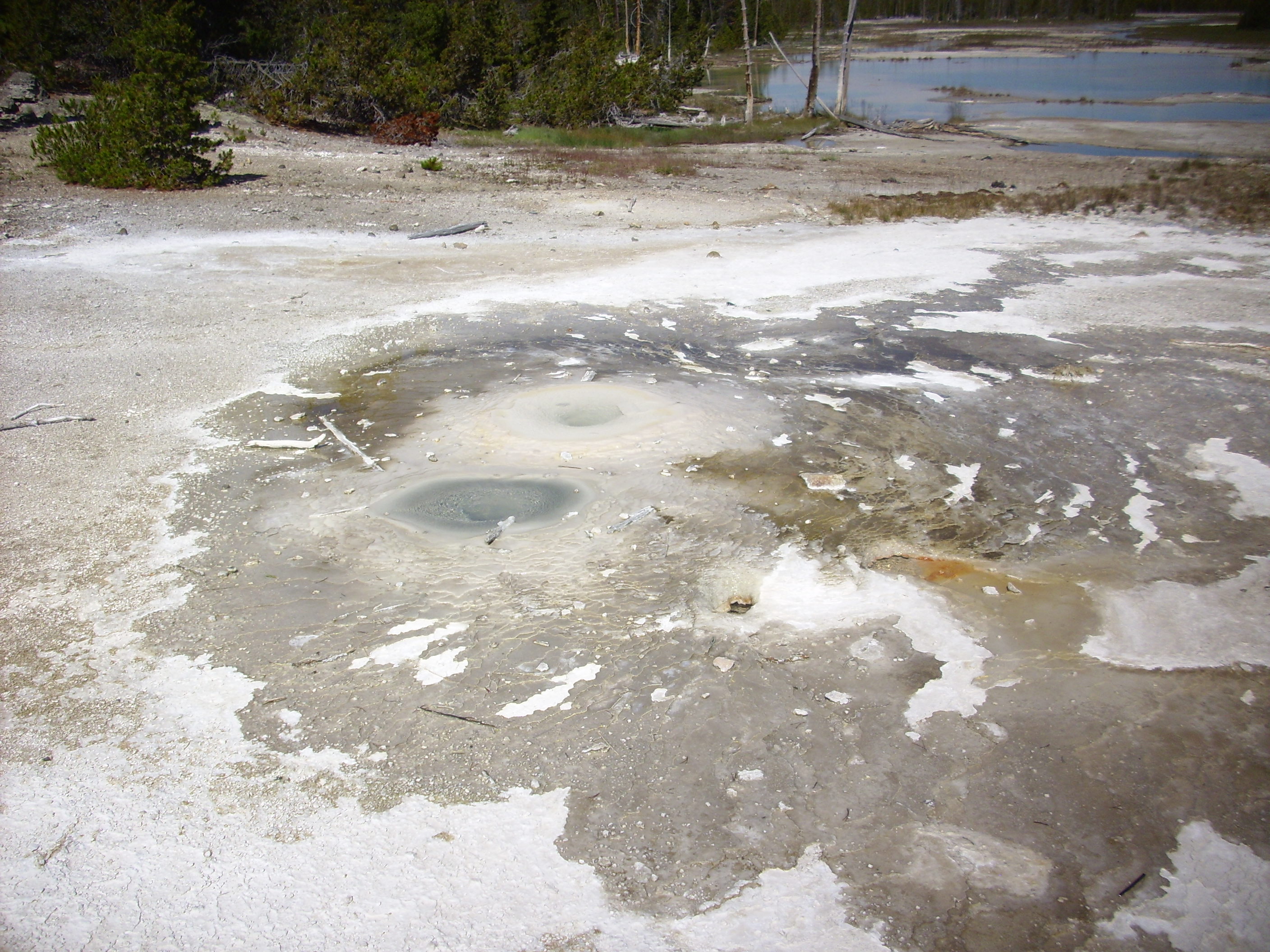
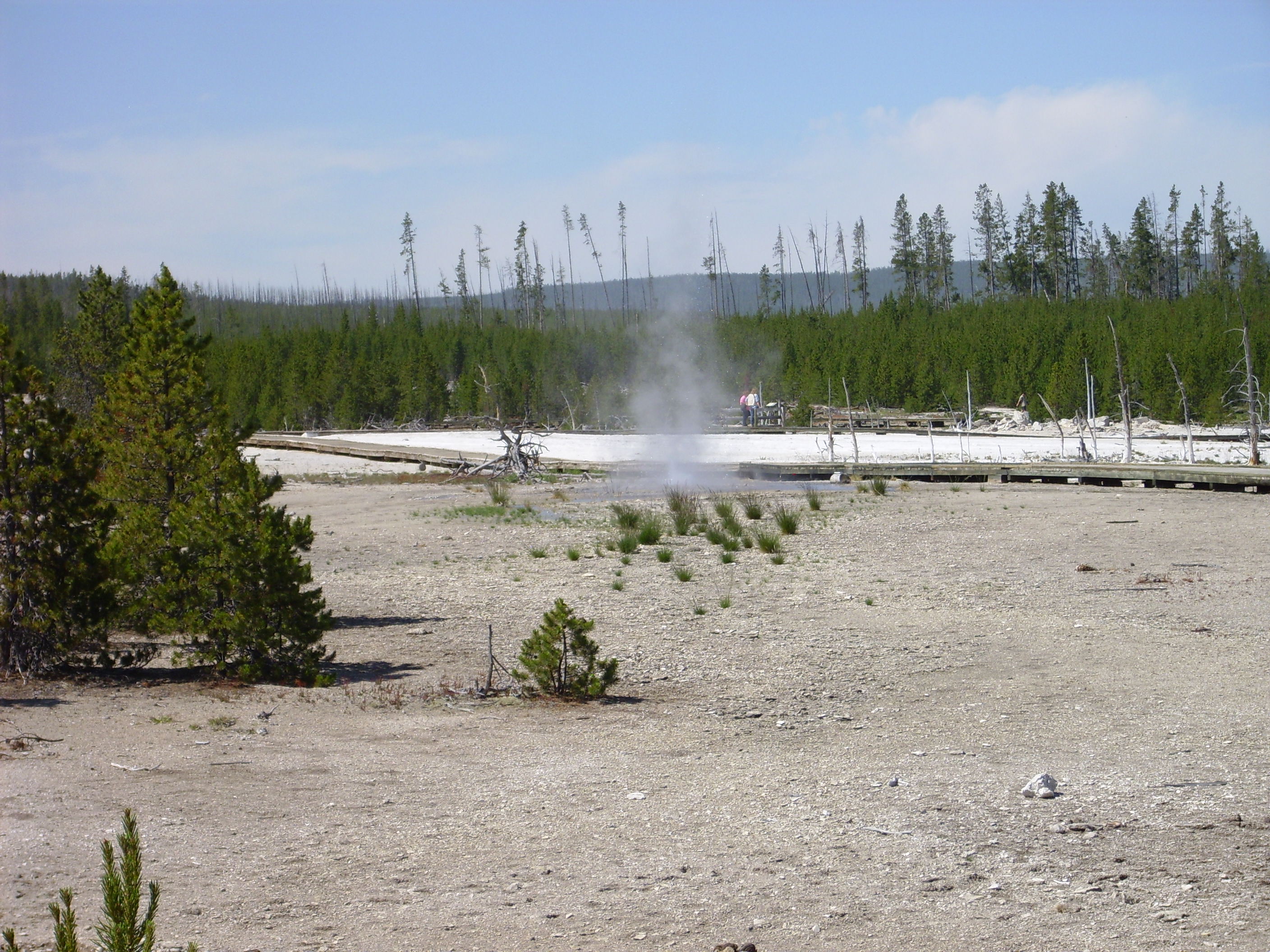
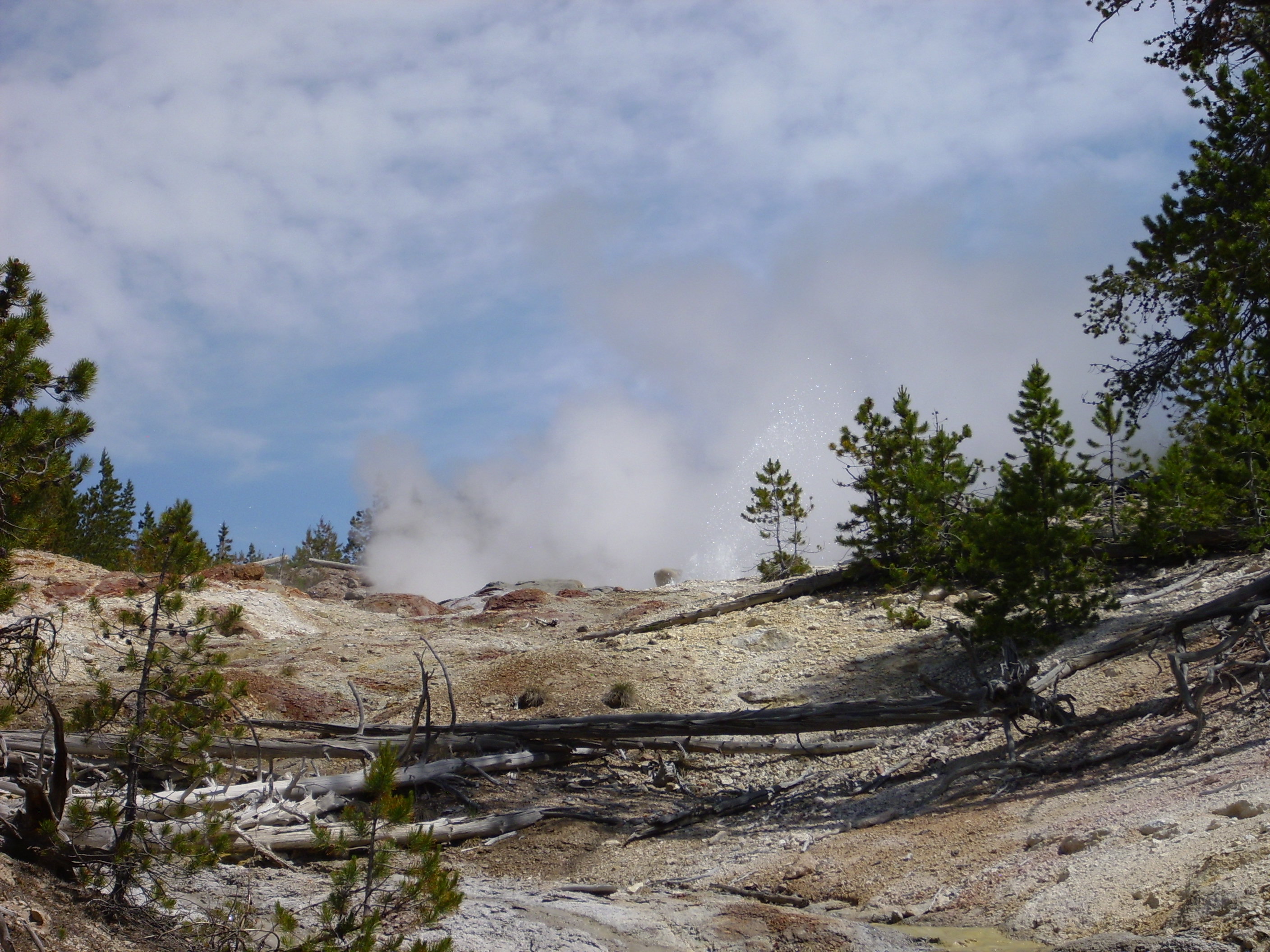
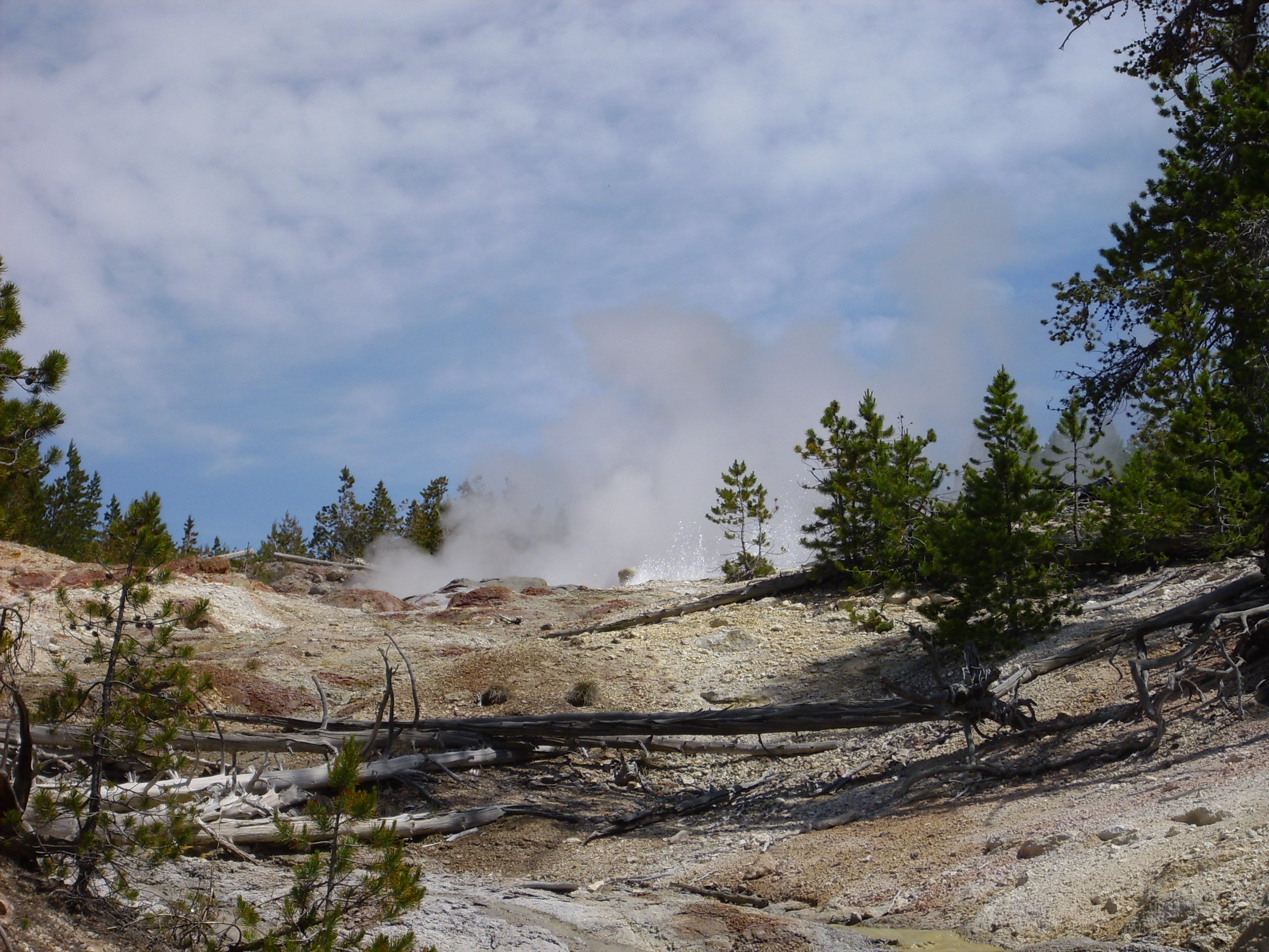
From there to Norris Geyser Basin, the hottest and most active in the park.
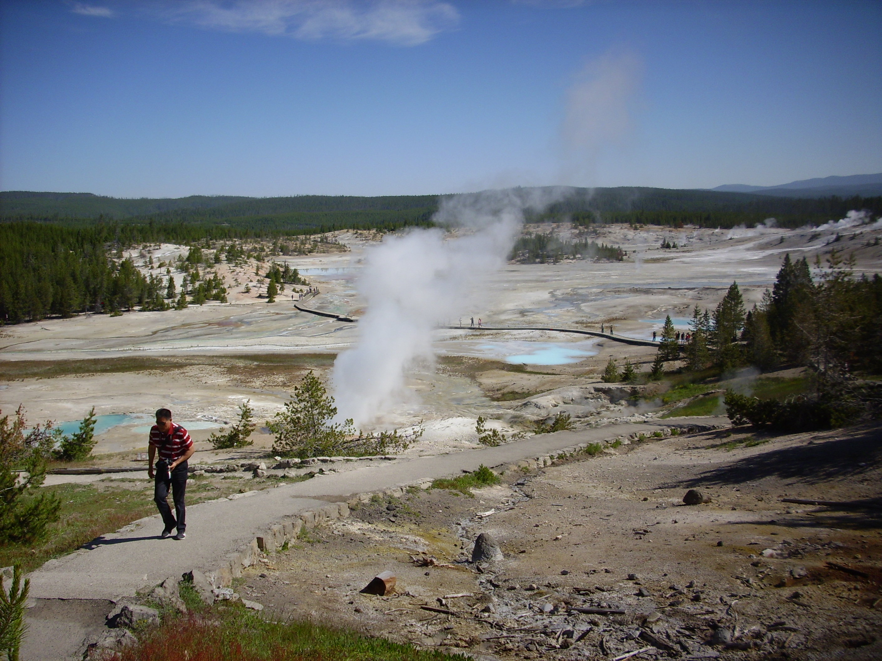
Norris is located near the intersection of several faults, including a north-south fault that continues up to Mammoth, a northwest-trending fault that continues up to Lake Hebgen, and the caldera ring fault. (Though still some distance north of the caldera rim.) Hot rock is very close to the surface here, there is a lot of glacial till to hold water, and the fractures help ensure that the two will come into contact. Because a major regional fault runs through the area, the activity here changes pretty much any time there is a nearby earthquake of any size. Or a huge earthquake far away; there were noticeable changes in the geyser behavior following the Denali earthquake of 2002 in Alaska.

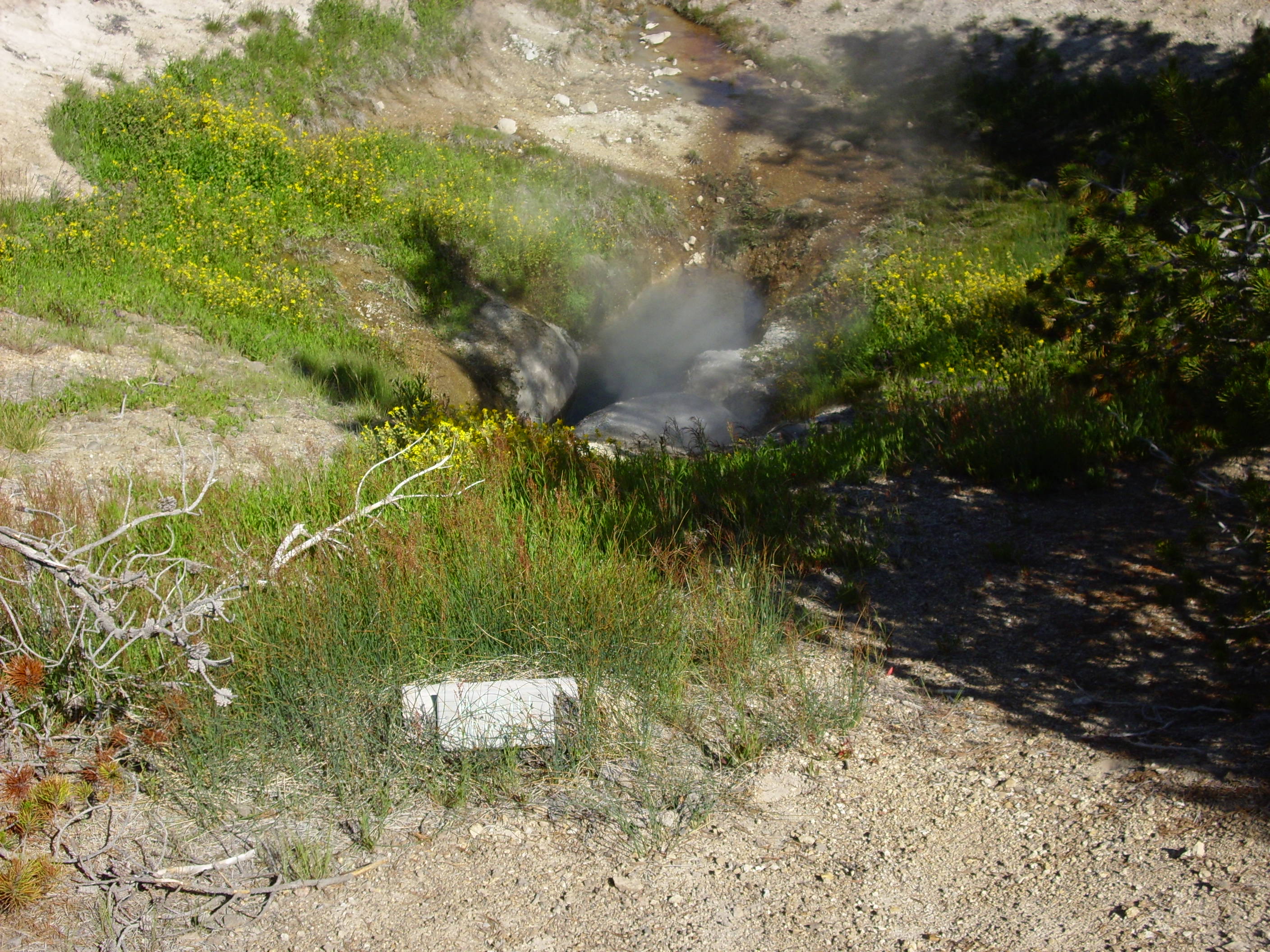
Dunno which one this is. Ledge, possibly?

Or maybe this is Ledge? Can’t read the sign.
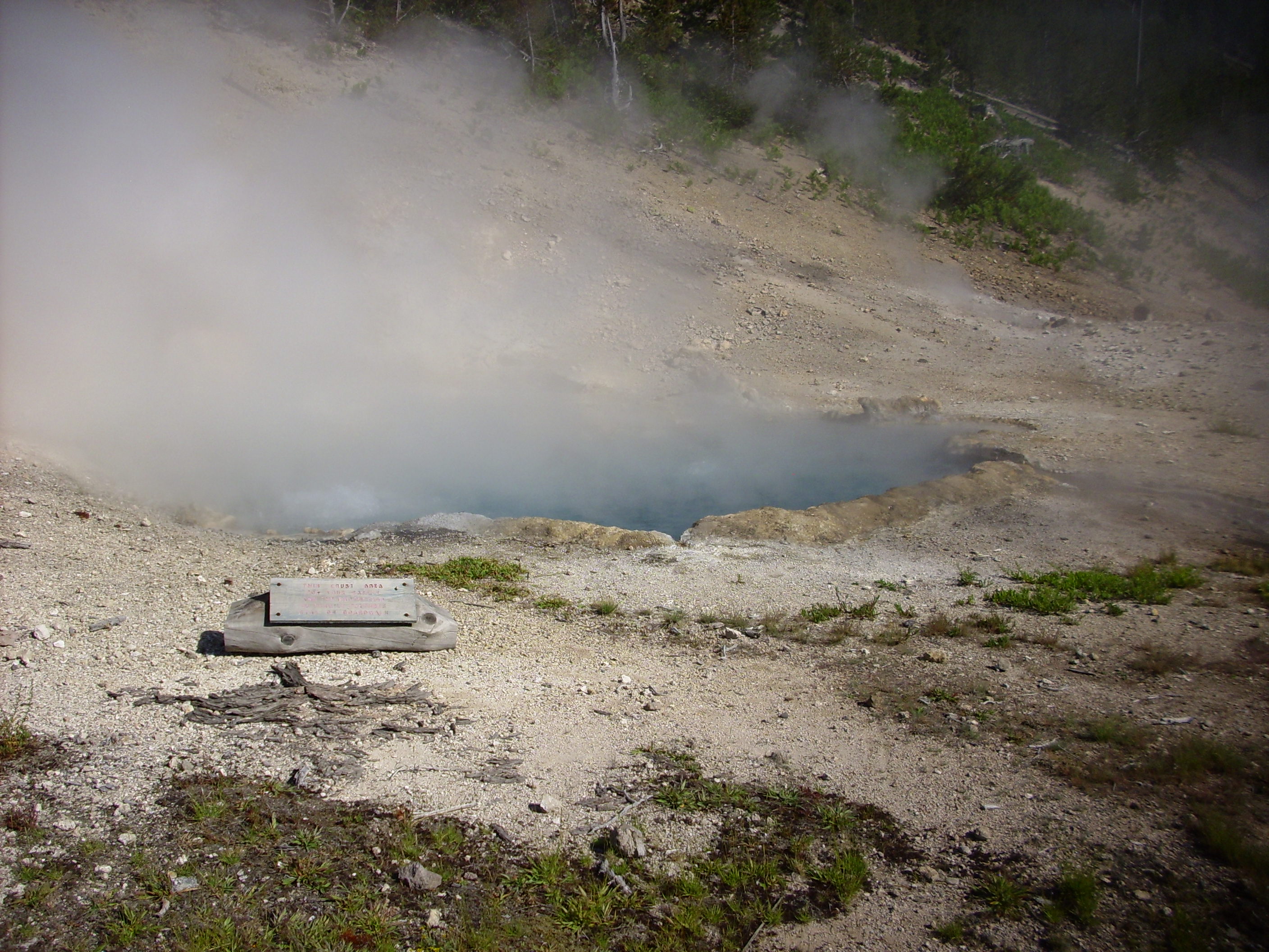
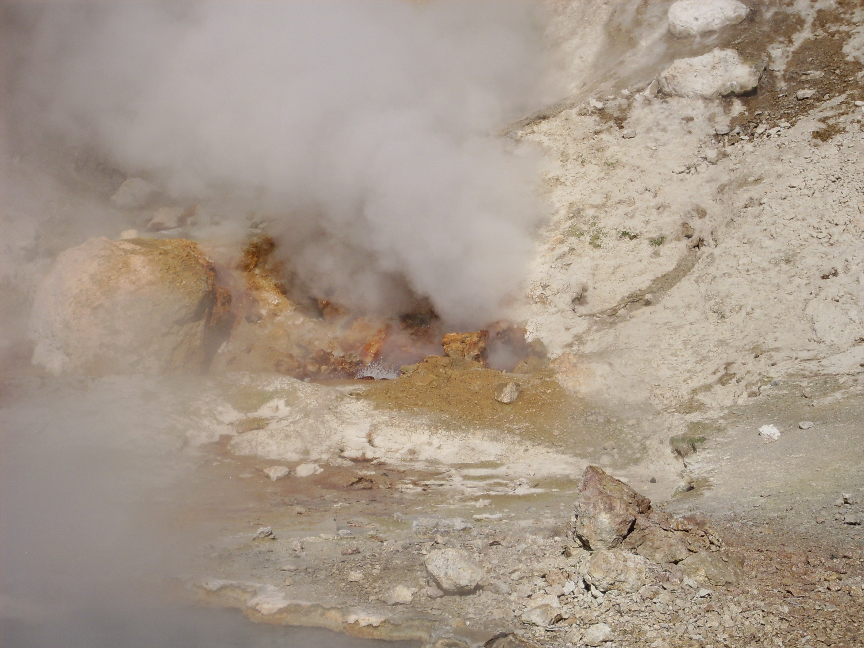
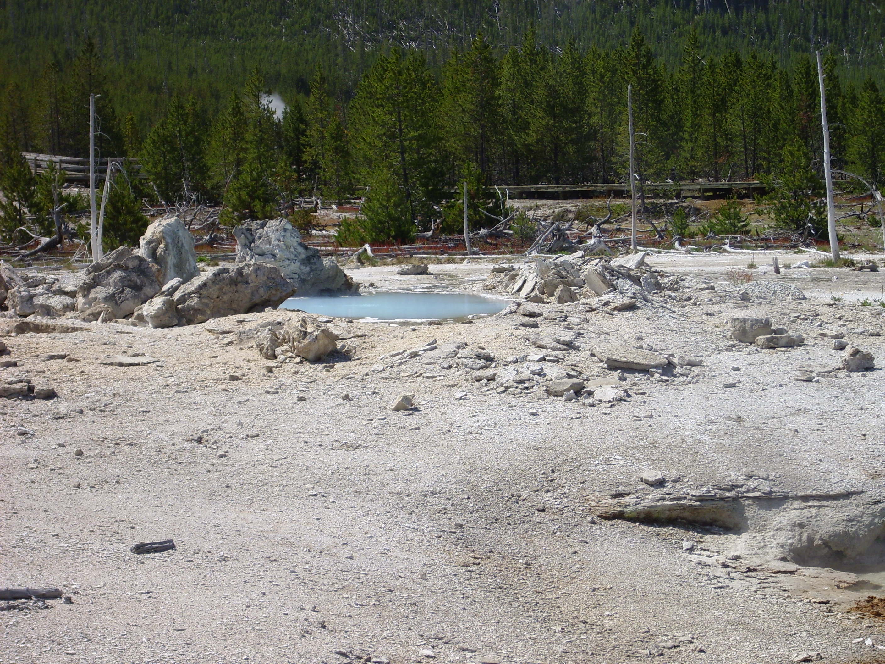
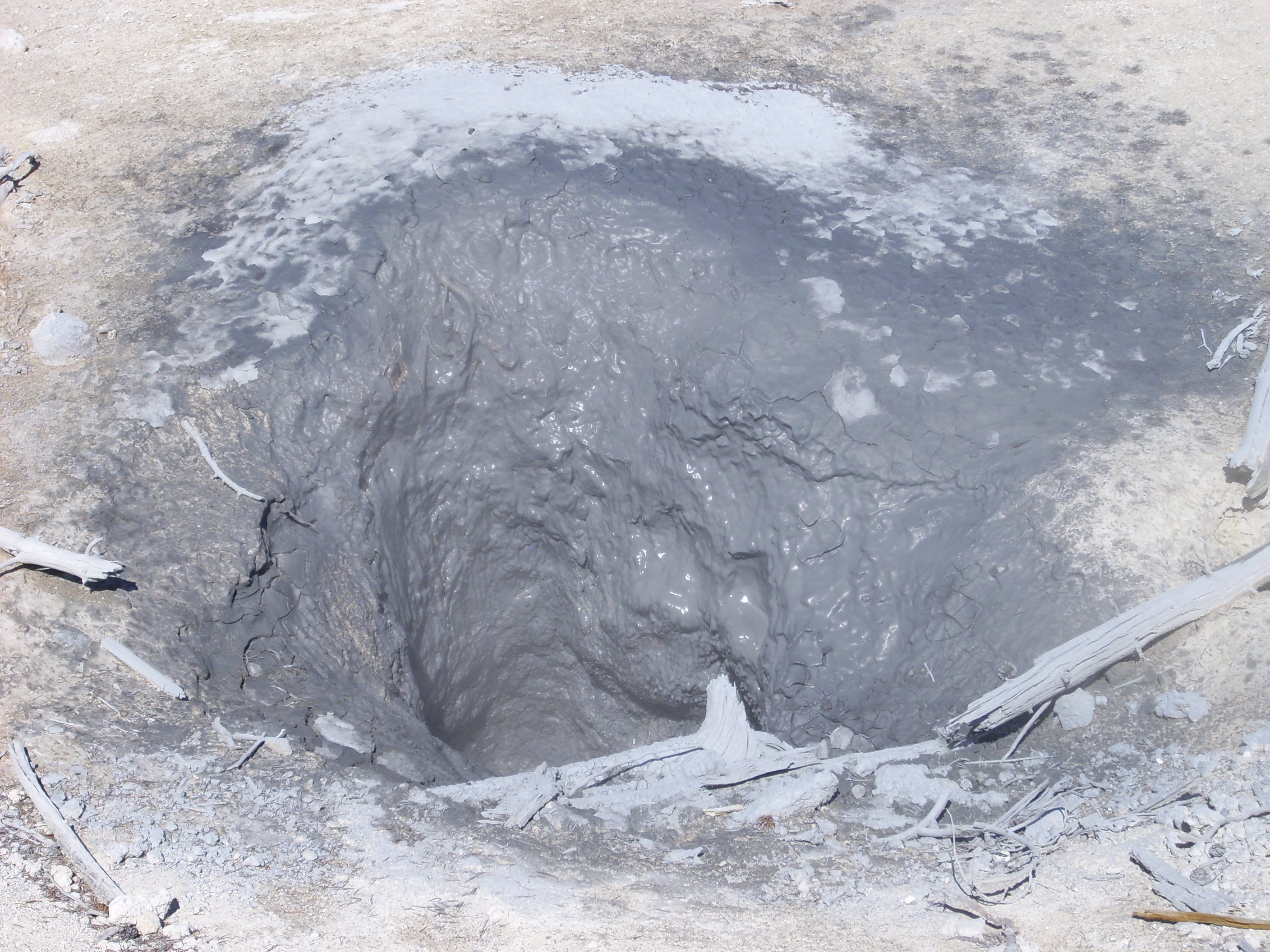
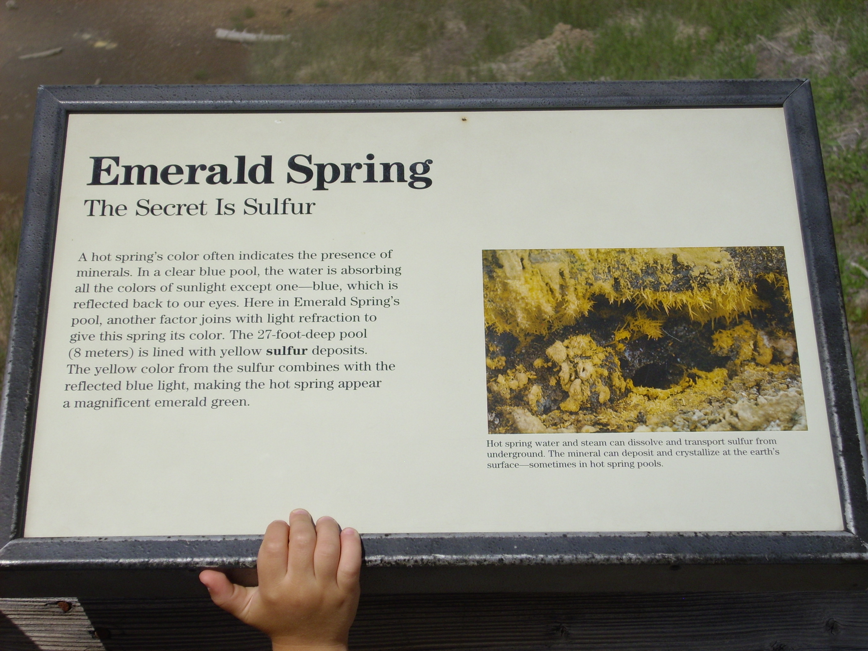
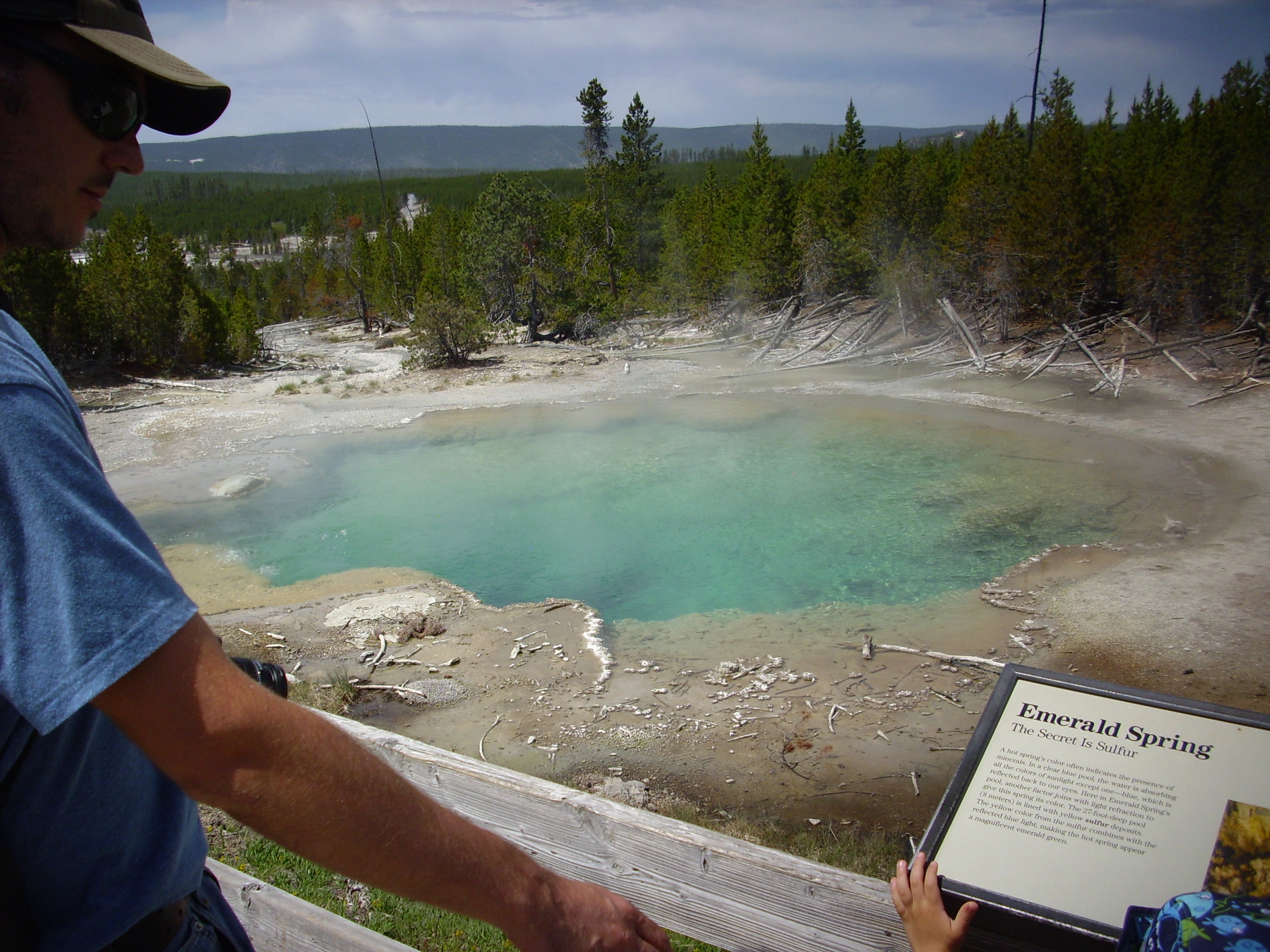
Muddy blue pool. The blue color in what we would normally expect to be muddy brown water probably comes from colloidal sulfur. In fact, another pool just northeast of here is labeled Colloidal Pool on the park map.
If Wikipedia is to be trusted, this next photograph is of a hydrothermally altered glacial kame:
A kame is formed where debris accumulates in a depression on a retreating glacier. In this case, hydrothermal heating from beneath was probably what thinned the glacier to create the depression, and then the debris was dropped on the hydrothermal source and hydrothermally altered. The hydrothermal activity has shifted since.
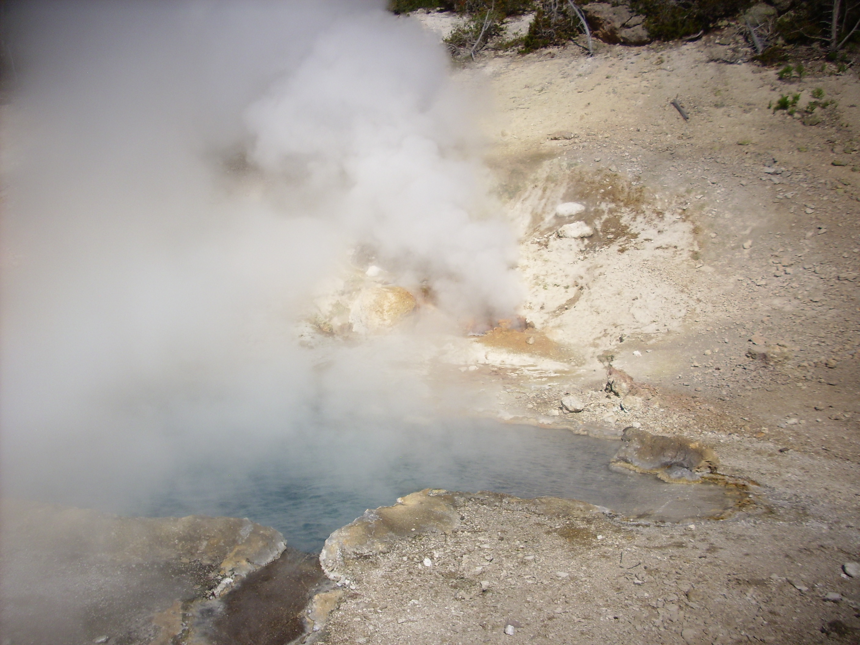
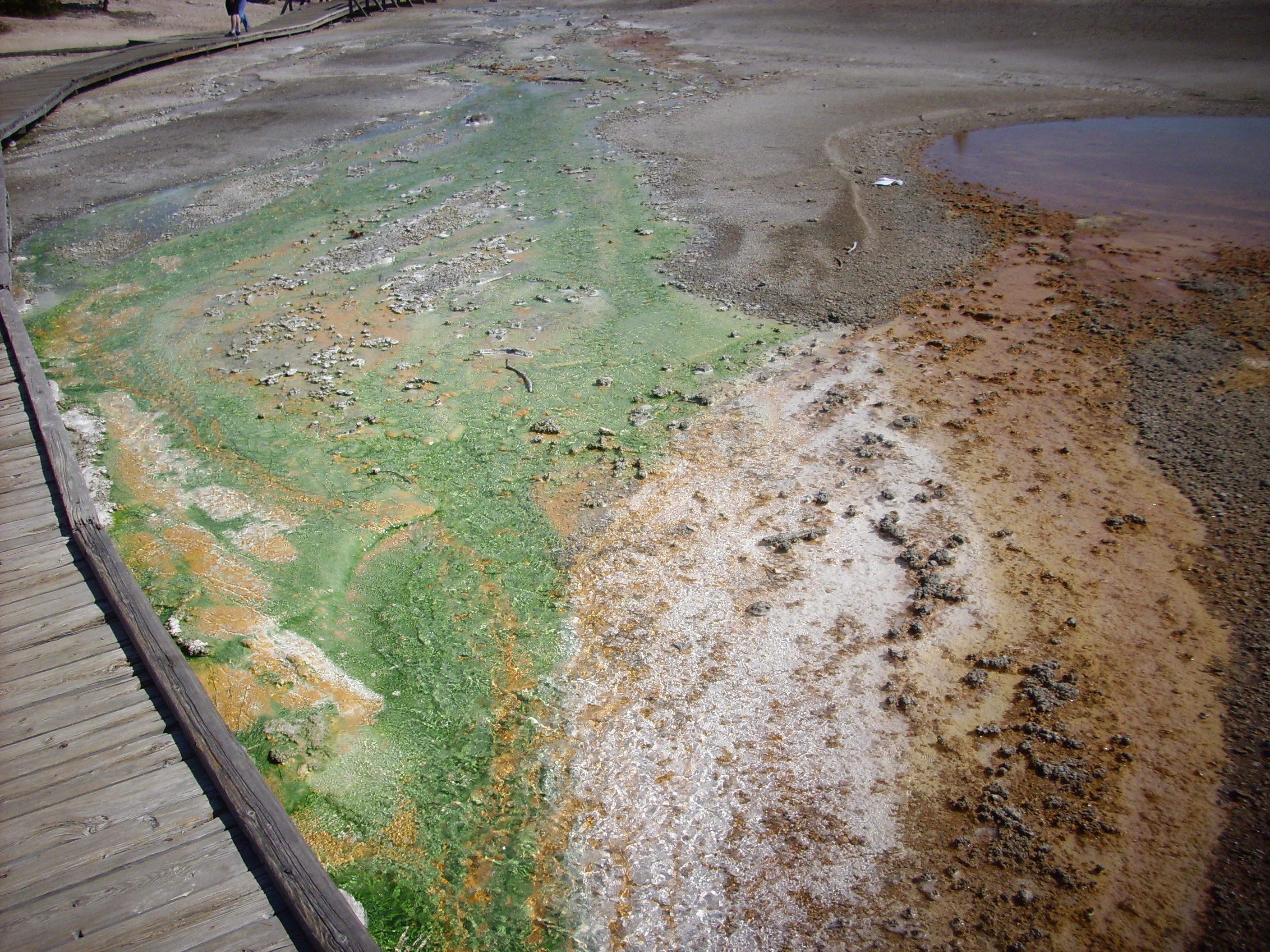
Thermophilic organisms in the spring water. The light green is quite possibly green sulfur bacteria.
Crackling Lake. Numerous vents in the foreground are constantly spitting and crackling.
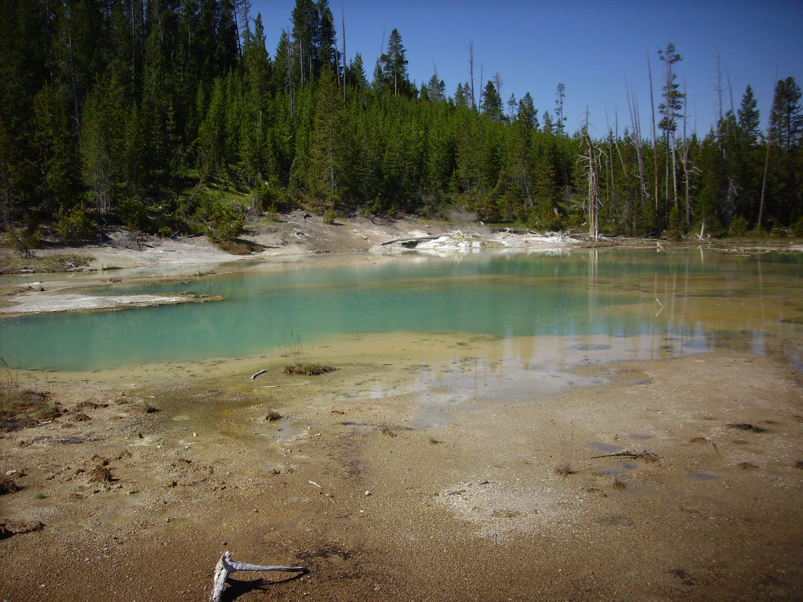
Not marked on the Park Service map but clearly visible on Google.
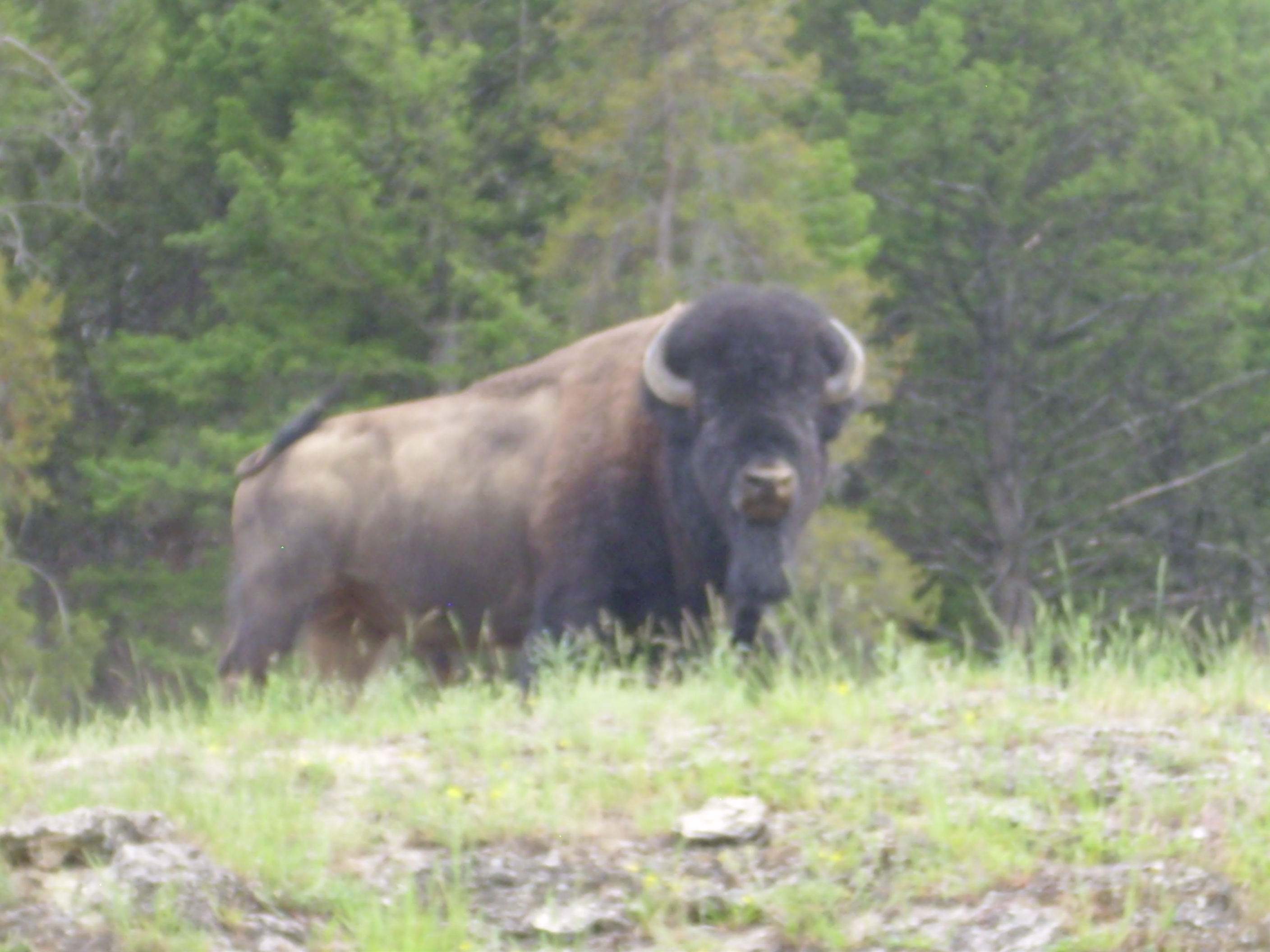
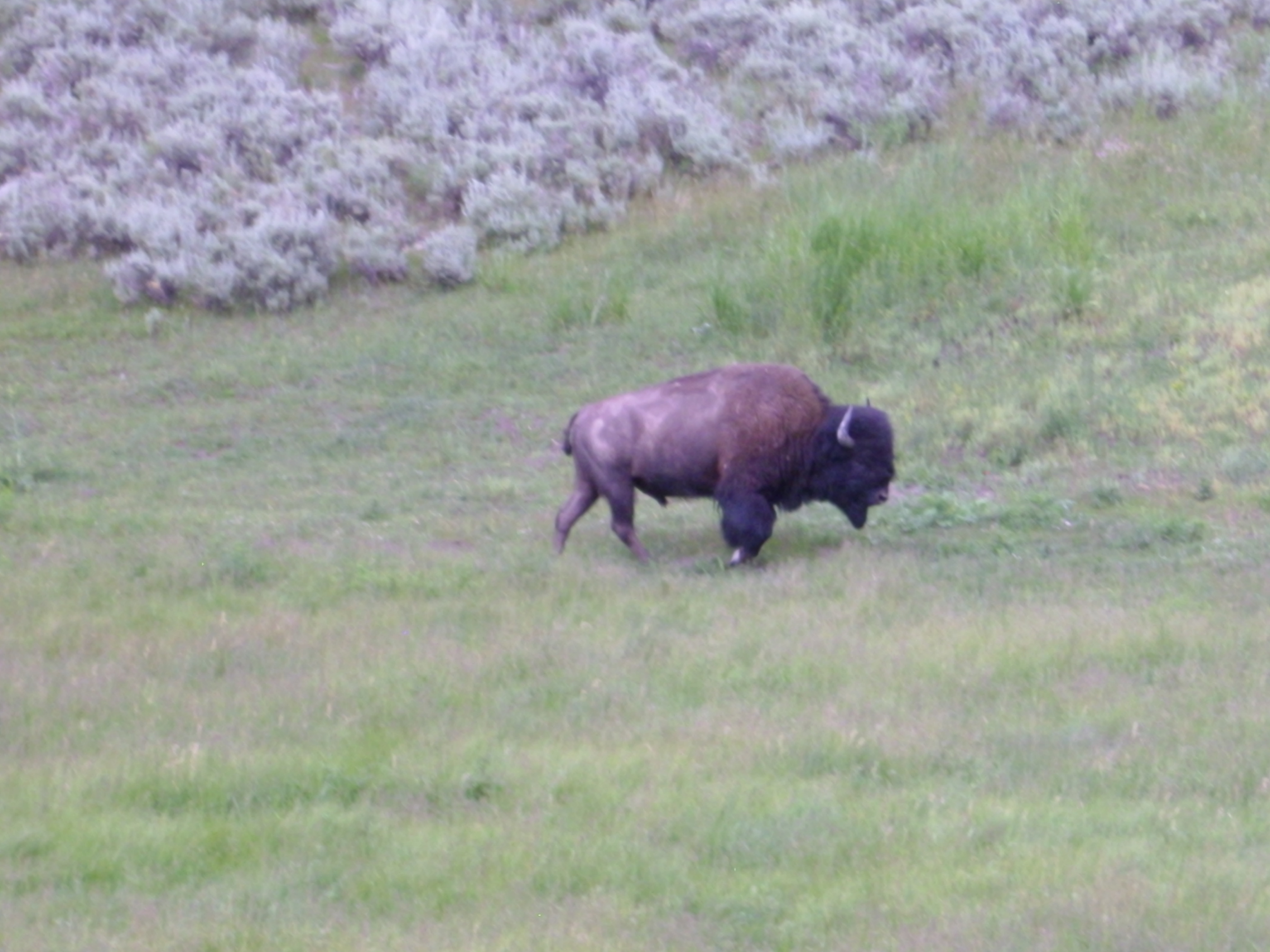
Wildlife!
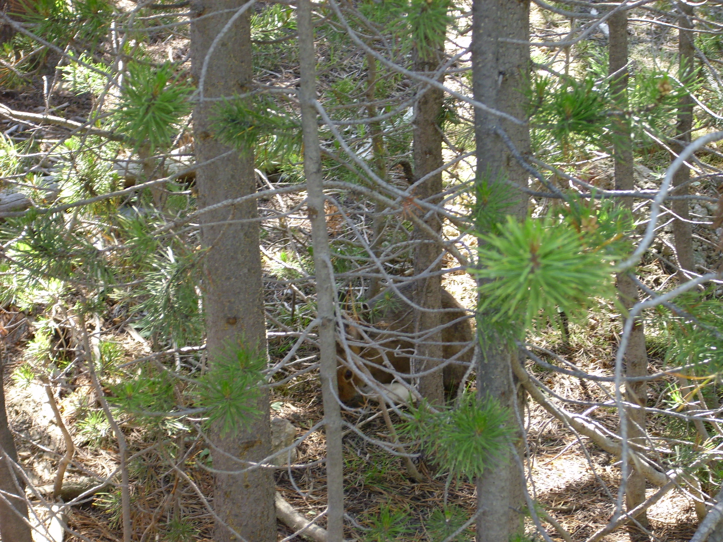
Bruce thought this was a snowshoe hare. Sounds good to me.
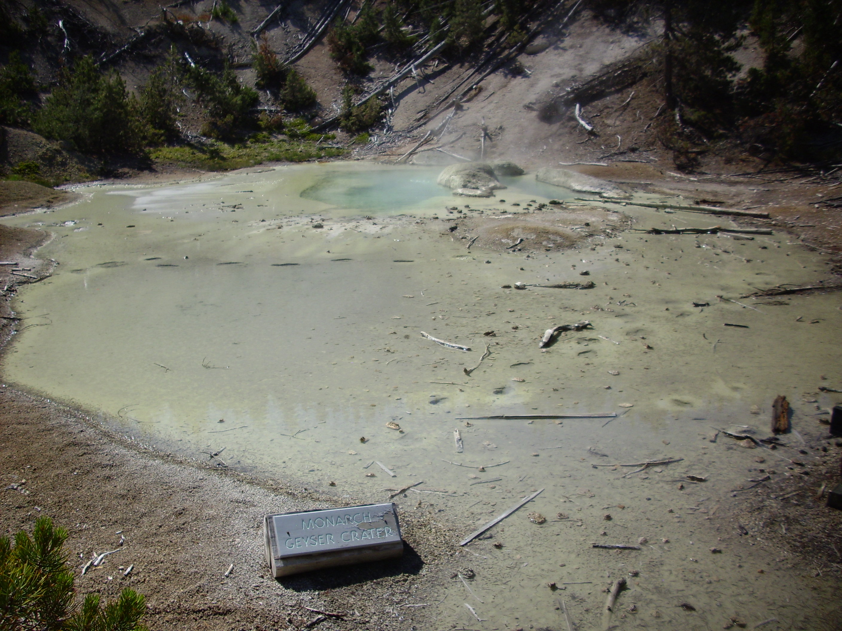
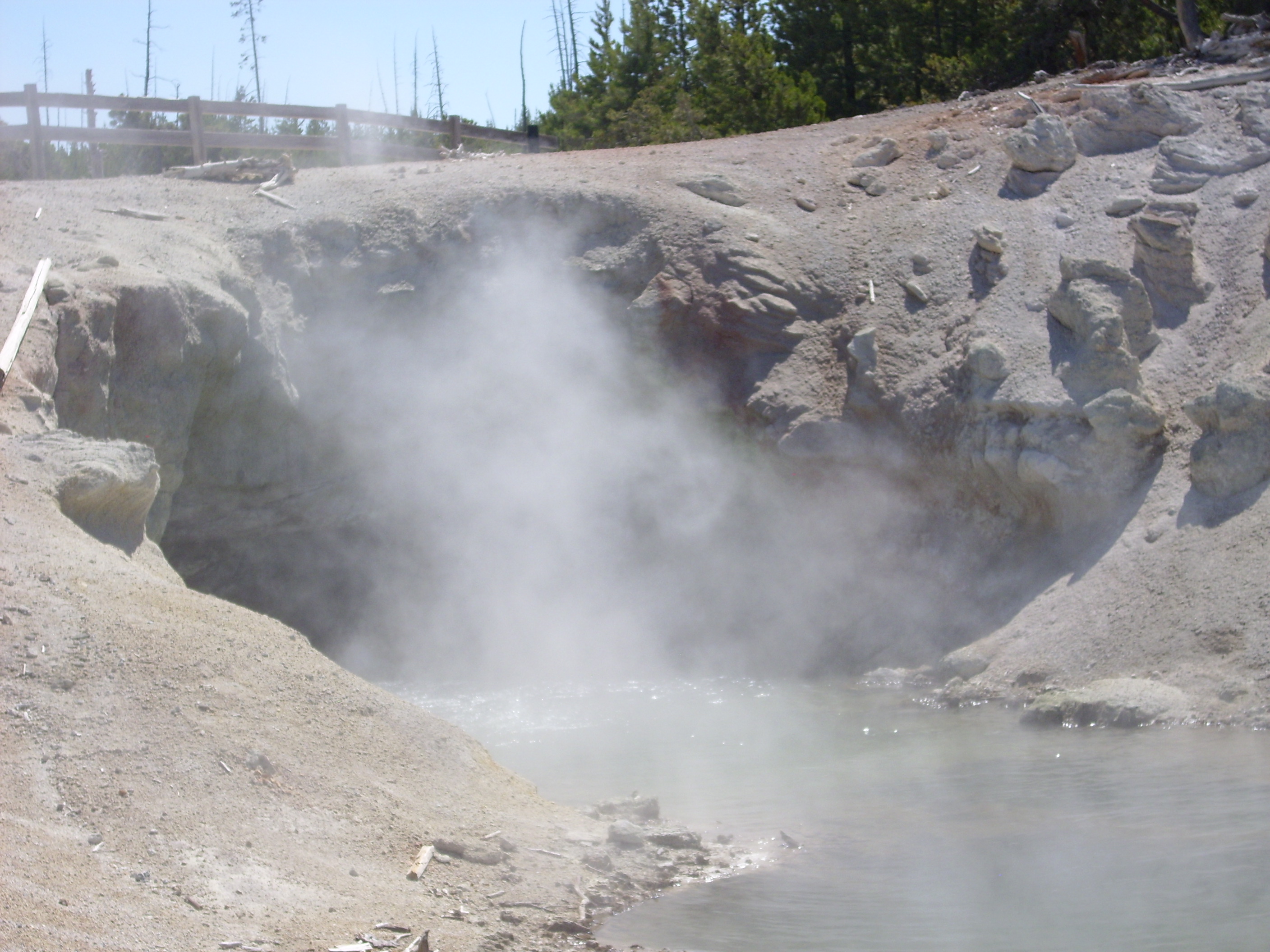
Monarch Geyser crater. Once fairly active, but nowadays like Ferb: He don’t talk much.
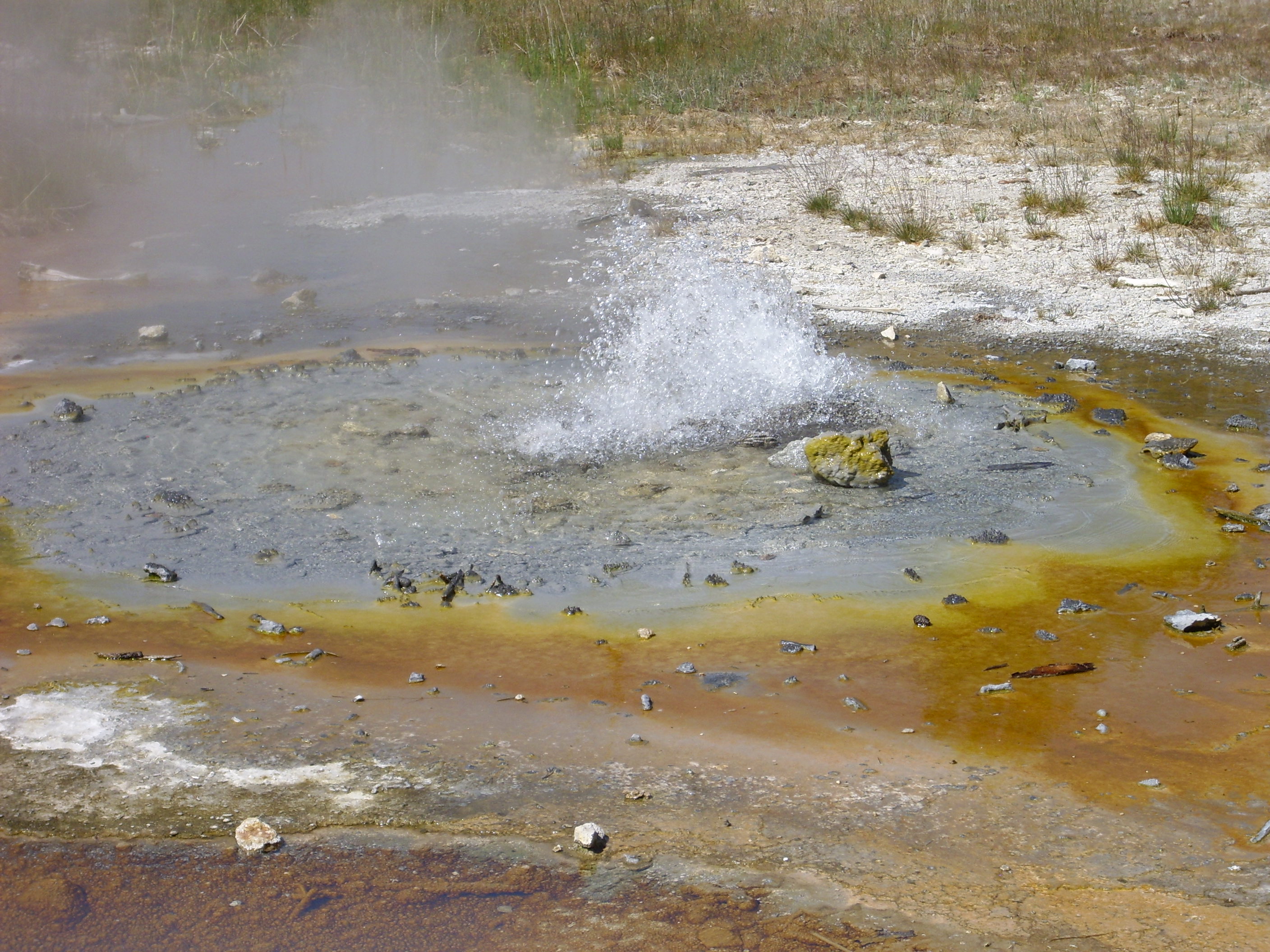
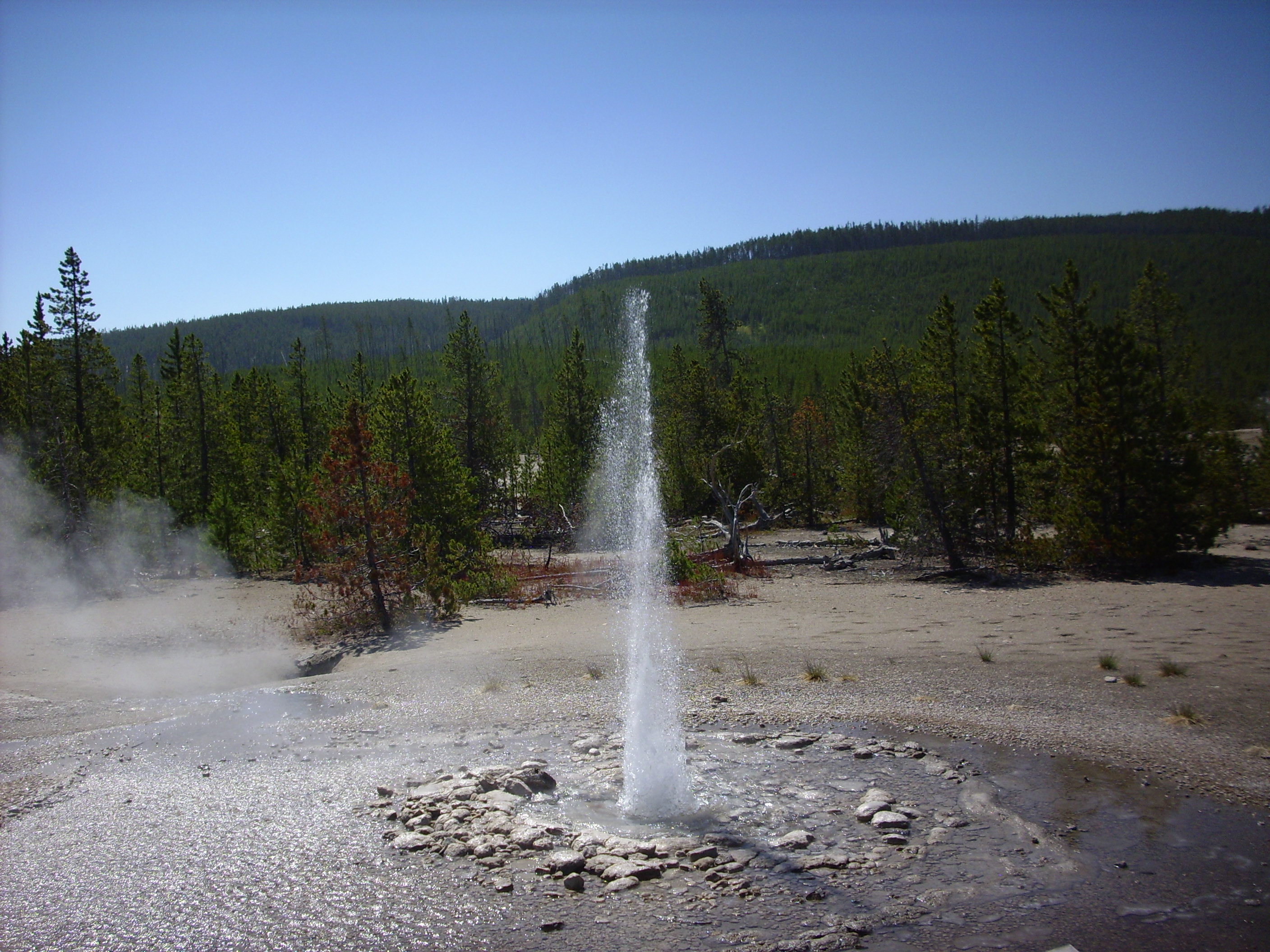
Vixon Geyser. This one erupted more or less constantly the whole time we were there.
Porkchop Geyser. This used to have fairly regular eruuptions, but it blew itself apart many years ago. You can see the blocks of debris and the small blue pool that has now formed on top.l


Tangential, and perhaps indelicate, but I noticed that my flatulence had a strong sulfur smell after a day or two at the park and for a day or two after leaving. I can imagine there might be a fair amount of sulfate in the local water supply, which is harmless, but which bacteria in the colon can convert to strong-smelling reduced sulfur compounds.
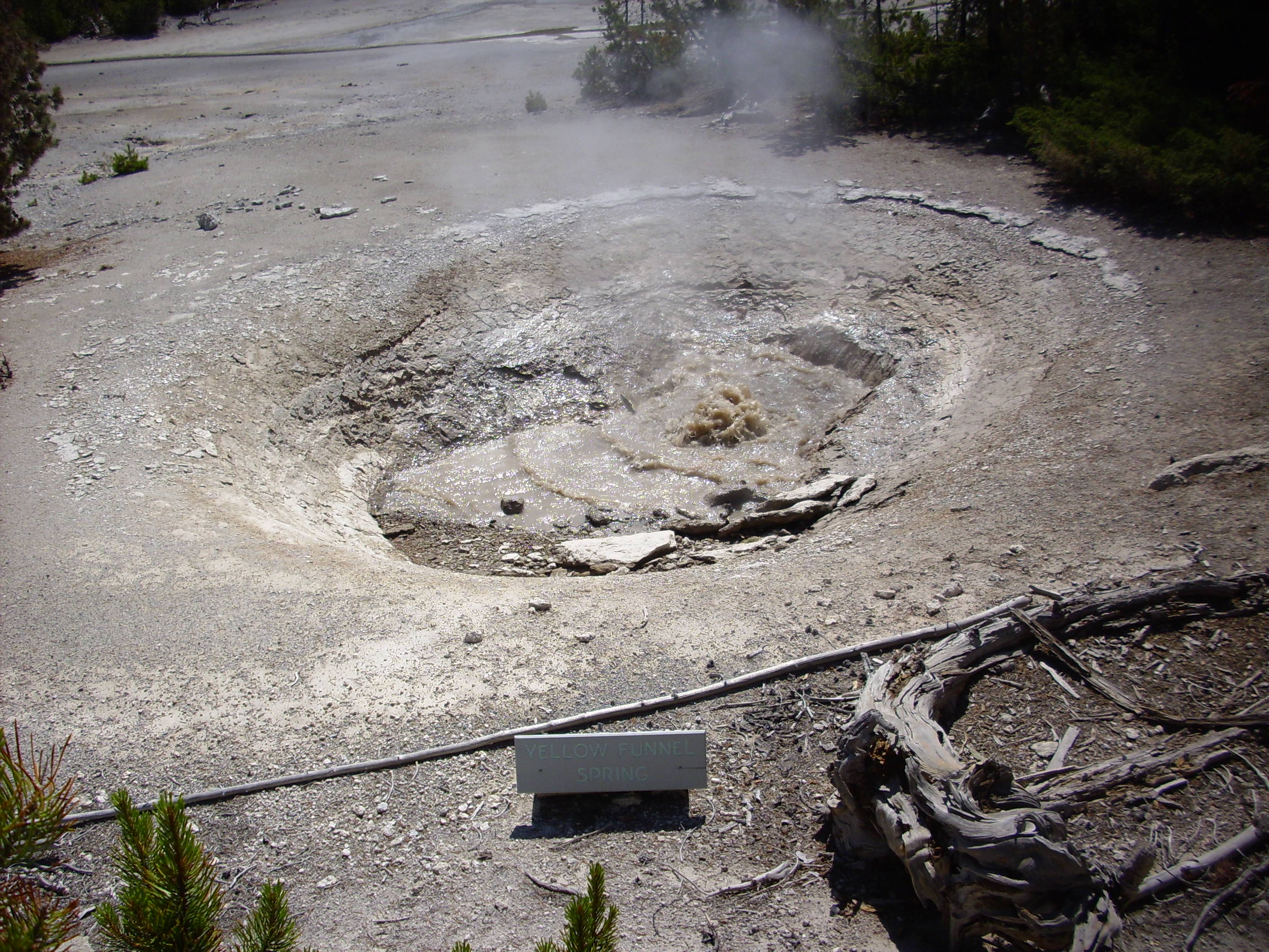
A Frenchman, whose English was otherwise fairly good (certainly much better than my French), was unfamiliar with the word “funnel” and Bruce and I struggled for suitable synonyms. The man finally understood, unless it’s that he finally gave up on us ever coming up with a good definition but was too polite to say so. (Evil Kent: “But he was French, so probably not.”)

Yeah, more or less.
From the map, it look like this drains into Gray Lake. In fact, both Gray Lake and Green Dragon Spring appear to drain into the pool in the foreground. There was a lot about the hydrology of the geyser basins that was puzzling, but Bruce suggested that with all the sinter (silica deposits from hot water) in the ground, strange things were possible.
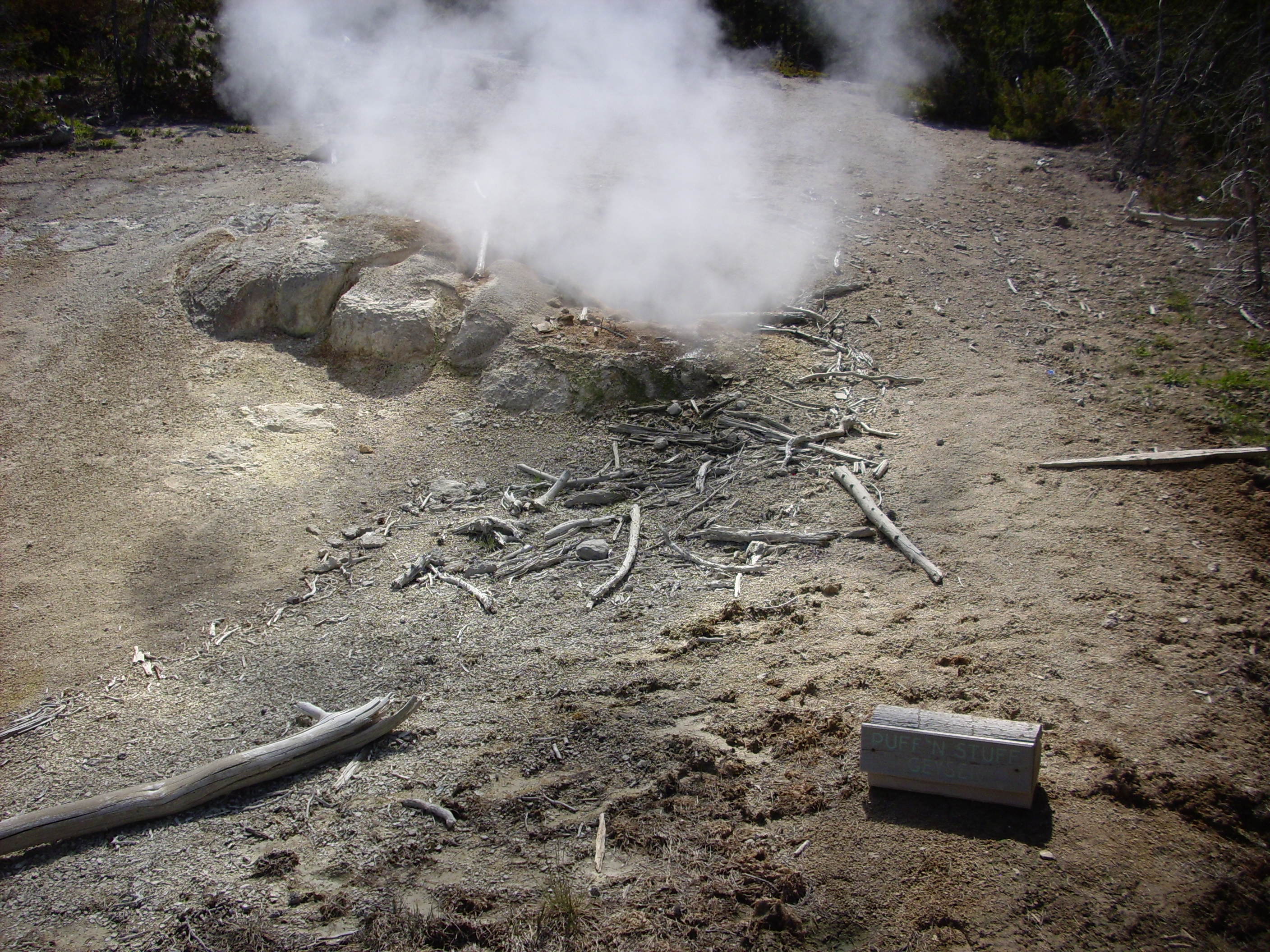
I was sorry to see this moderately interesting little geyser blighted with that name. Man, I hated that show.
Mystic Spring. This had more visible sulfur than almost anything else I saw in the park.
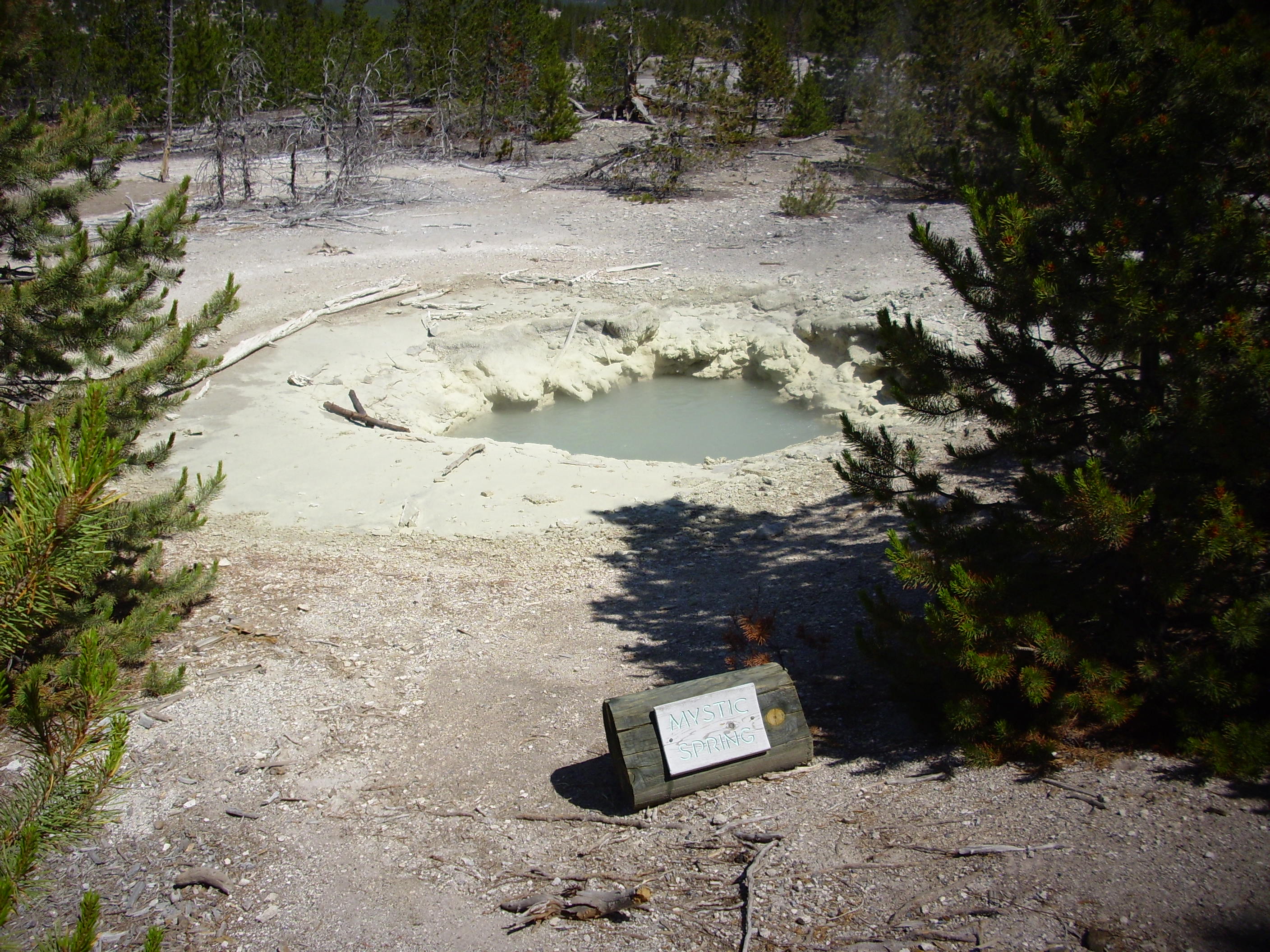
Unless it’s all yellow sulfur bacteria. Well, they store sulfur as granules in their cells, so it’s kind of the same thing.
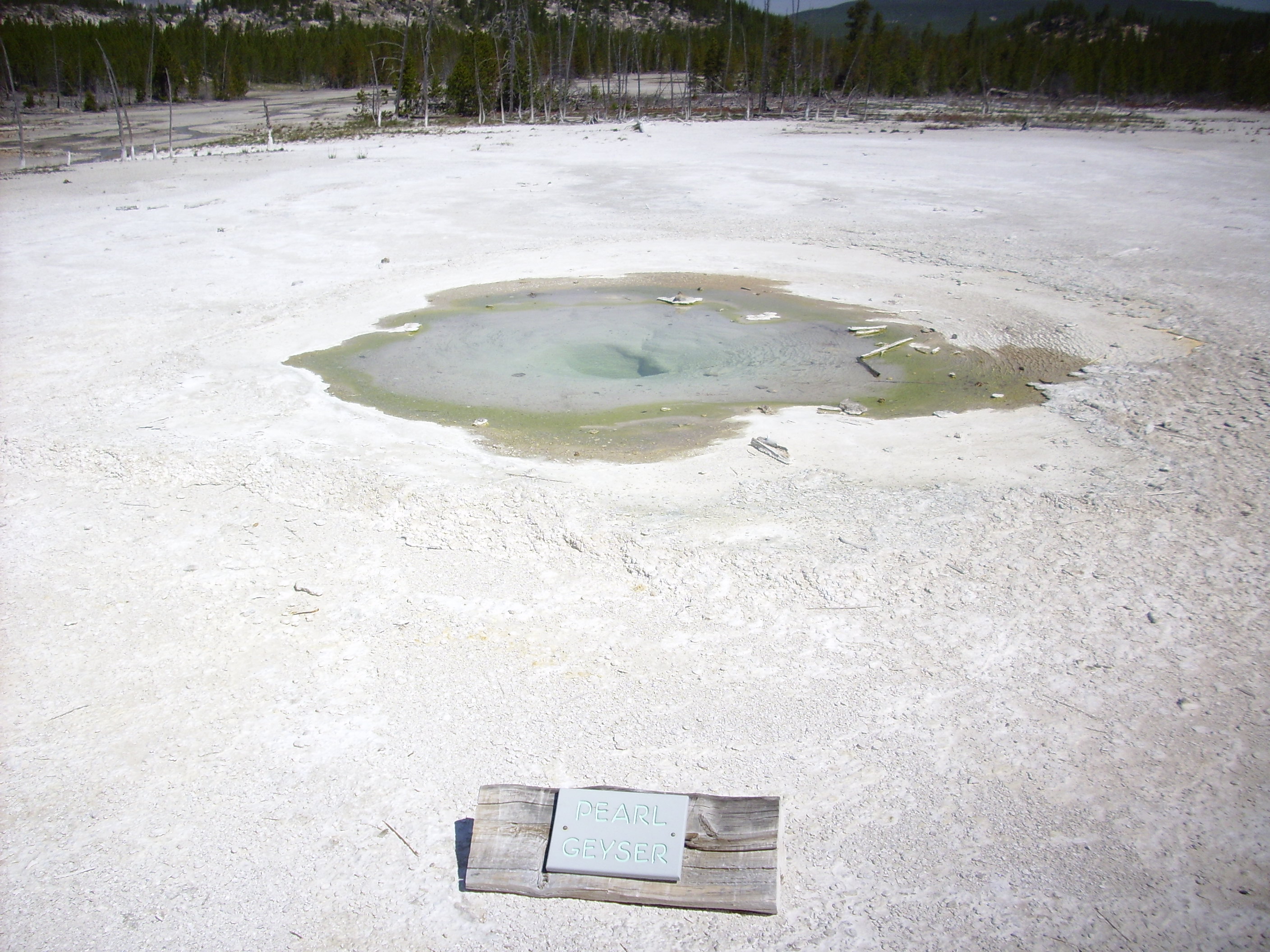
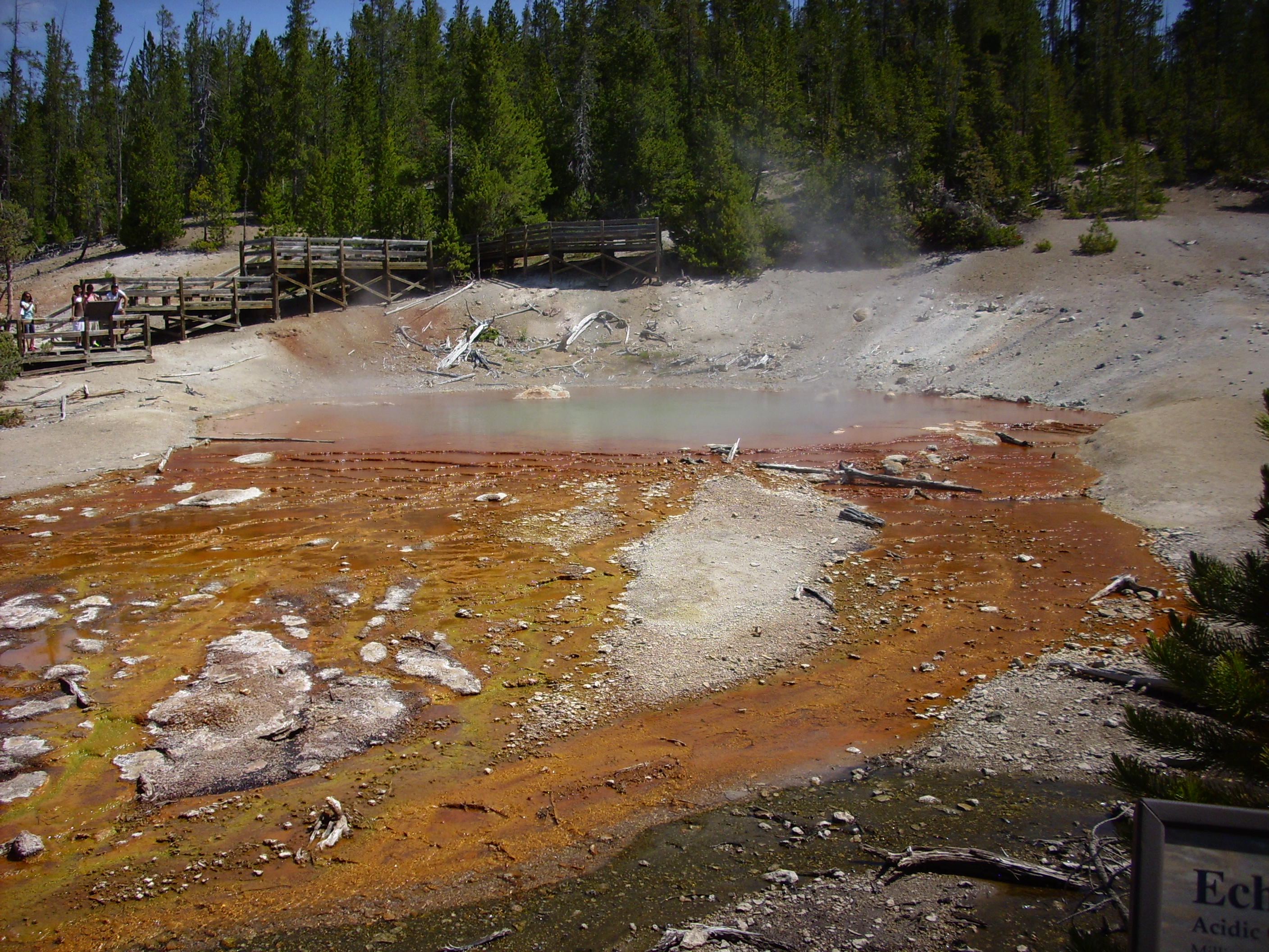
Crater Spring.

Echinus Geyser. Kind of unpredictable, and the park plays that up.

We waited around a bit for … I dunno, something amazing … but no luck.
Steamboat Geyser is a famous one. So far as I can gather, it sputters and spews most of the time, but occasionally really blows its top. We saw lots of sputtering, but it was only taunting us.

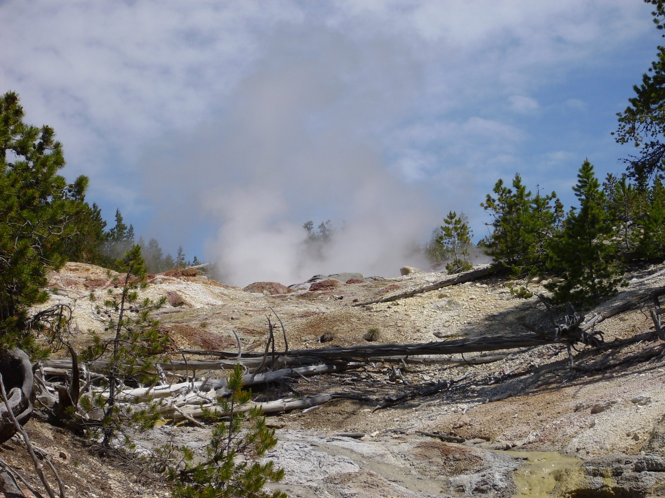
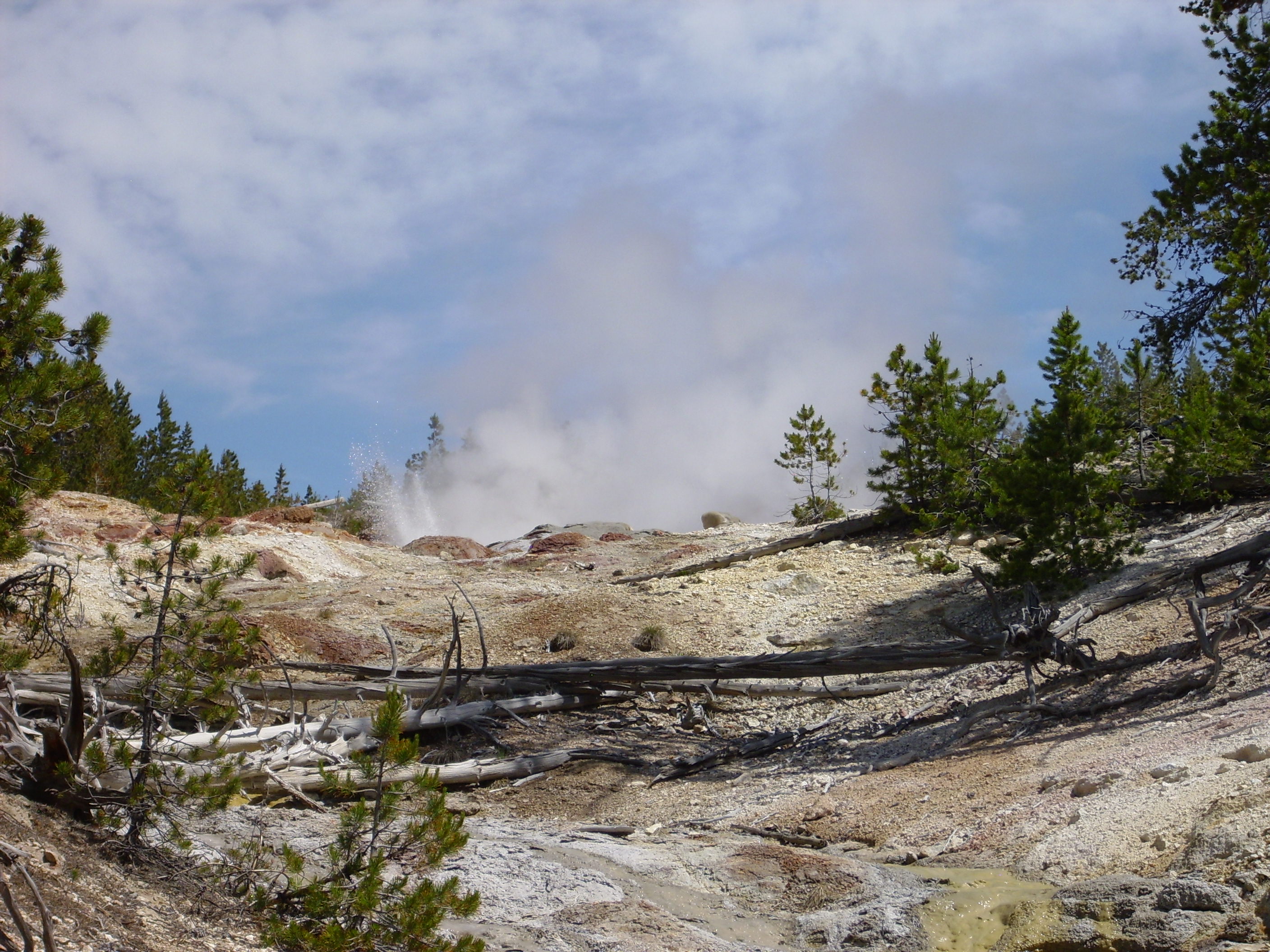
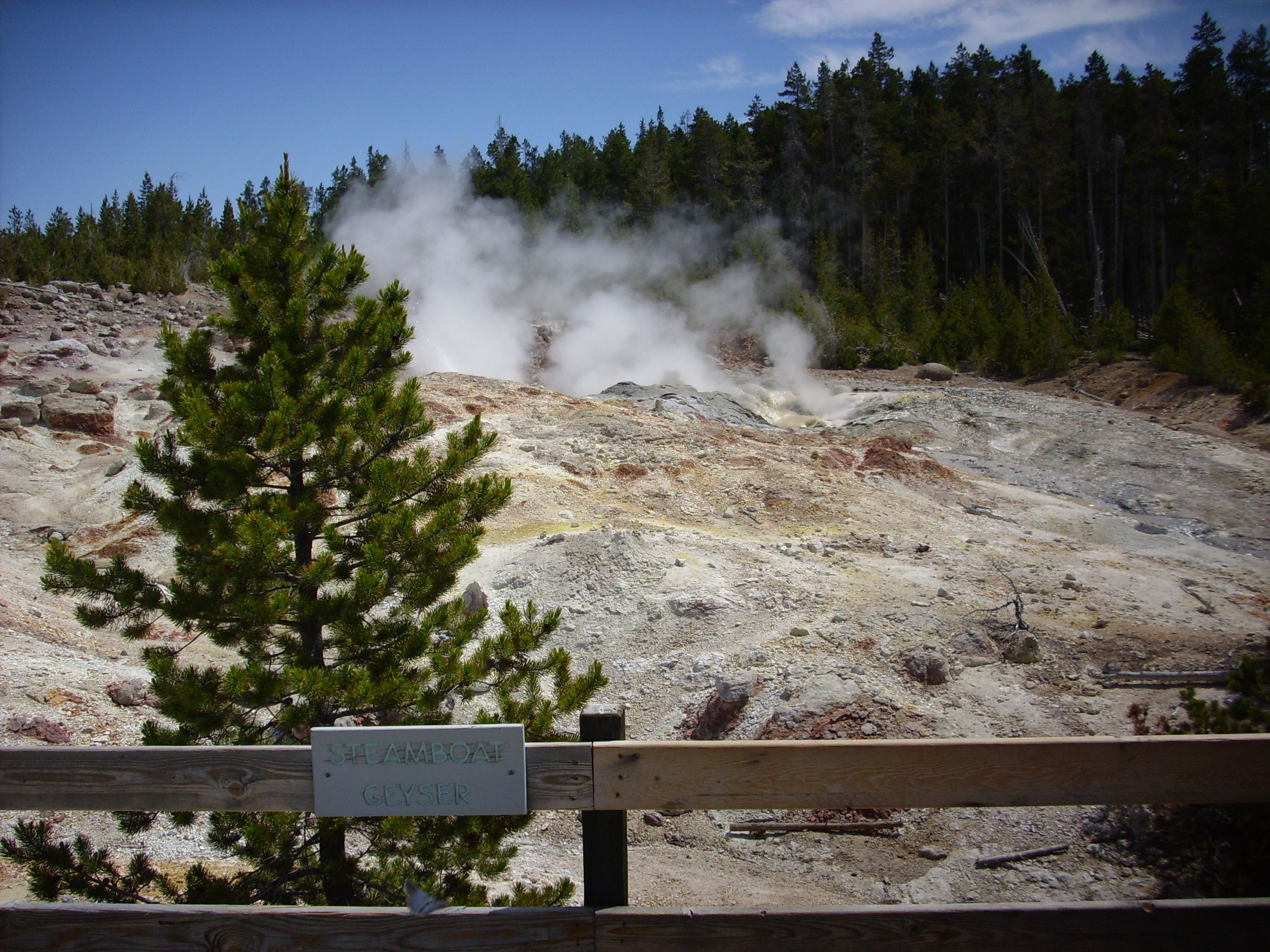
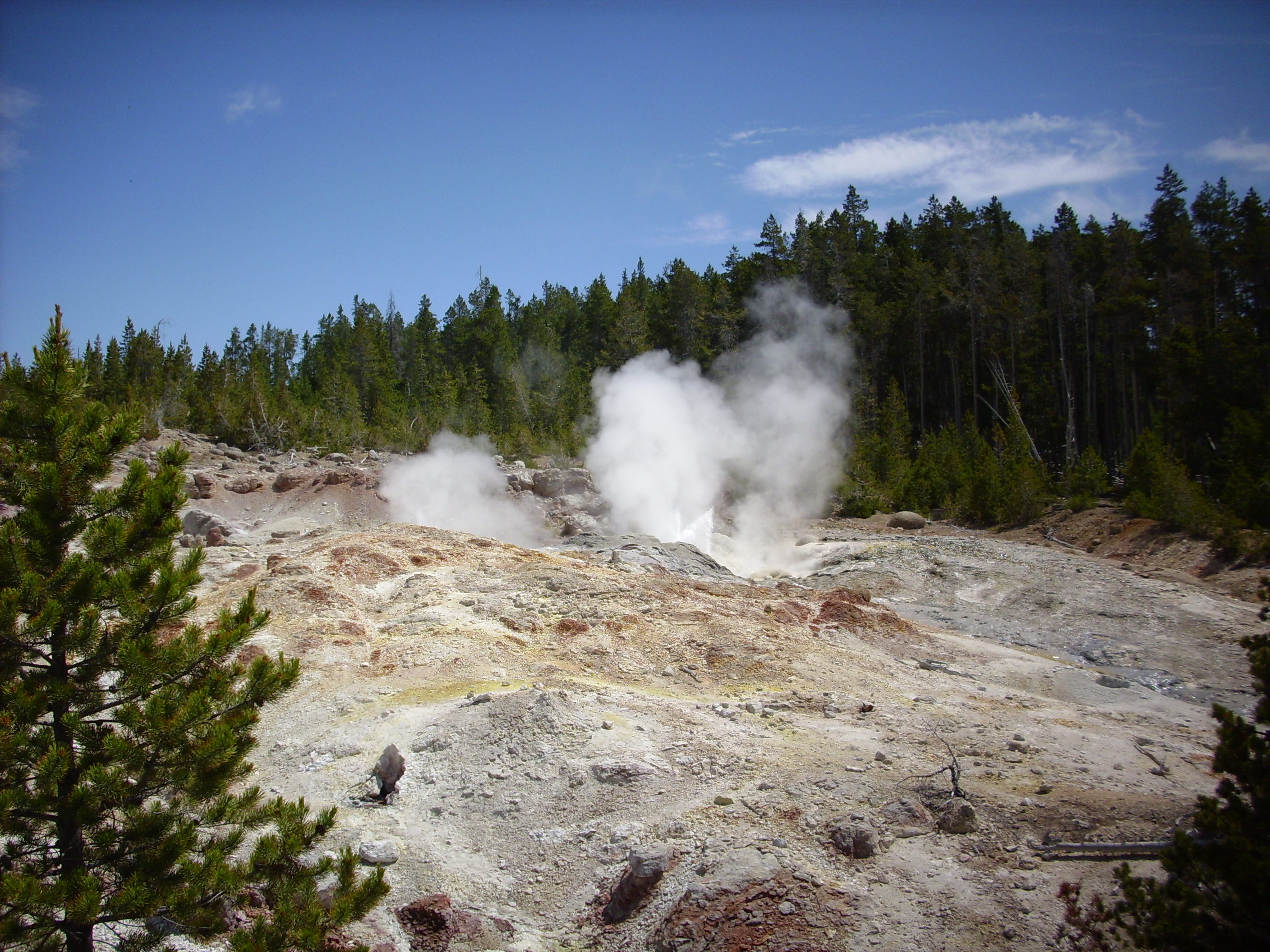

“If you do not go away, we will taunt you a second time …”
That is not Bruce, by the way. Nor is the adult with him Bruce. (Well, one or the other might be Bruce, but not the Bruce, if you know what I mean.)
We resume the drive north. Looking west, we see Electric Peak of the Gallatin Range, with a nice glacial cirque at left. These are mountains produced by block faulting well outside the caldera. In other words, they are normal Idaho, Montana, and Wyoming mountains, so to speak.
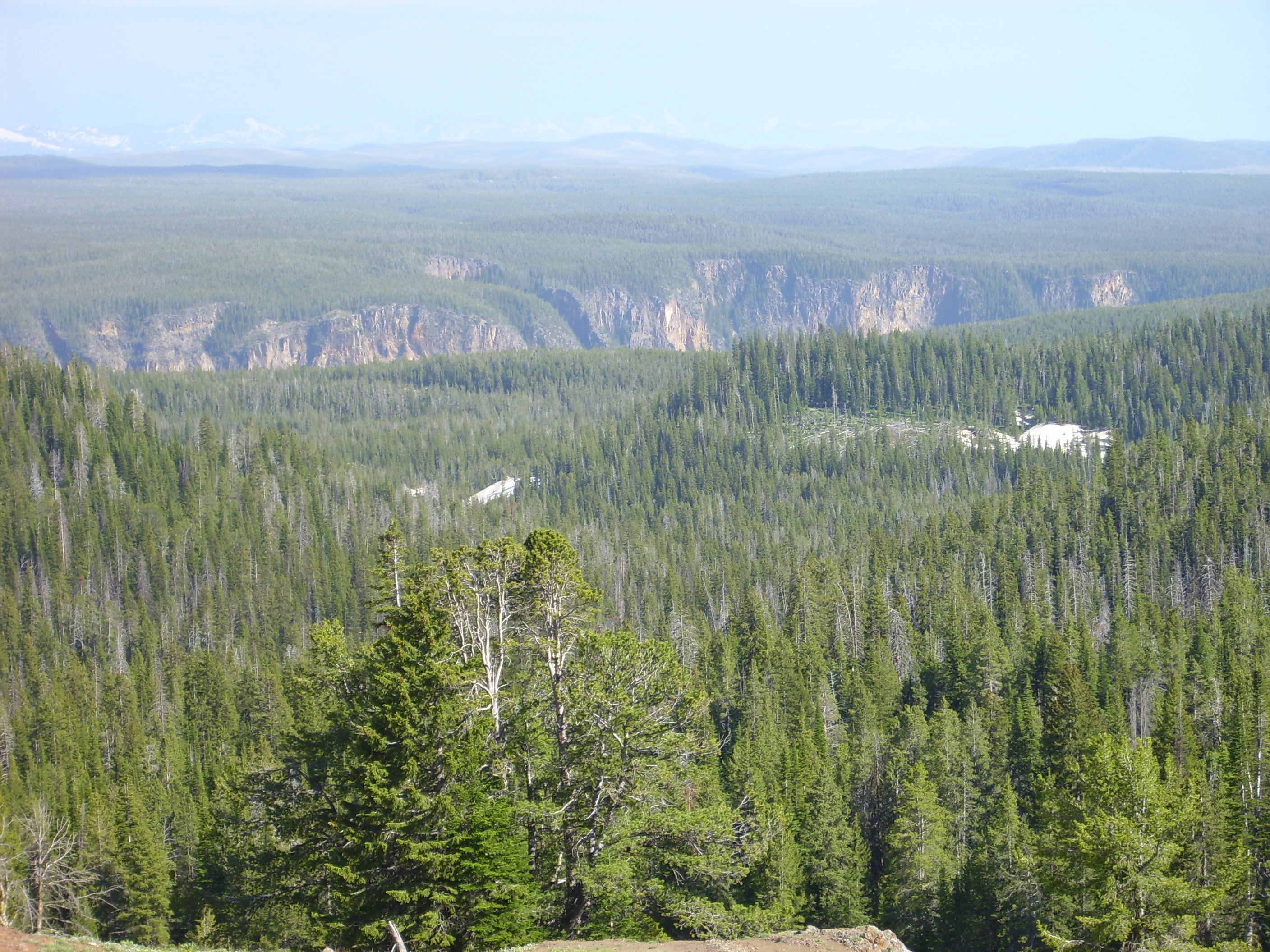
We headed north through some beautiful country. (I don’t think Yellowstone has much of any other kind, actually.)
Roaring Mountain was closed due to road construction. Grrrrr. Um, that’s me growling over the construction, not my impression of the mountain roaring. Though nowadays I’m told it’s not so much a roar as a kind of mumble.
Further along the road were the Obsidian Cliffs. These are part of the Roaring Mountain flow, which erupted 180,000 years ago.

Obsidian forms from high-silica lava that contains very little water. You may be thinking that “contains very little water” is an understatement for any red-hot molten rock, but these things are relative. Magma underground often contains a fair amount of dissolved volatiles like water, carbon dioxide, and various other gases. When these bubble out of the magma, and especially if it is very high silica to begin with, you get a very viscous magma that has great difficulty crystallizing. It forms glass instead.
The most recent eruptions in the Jemez are of massive obsidian. I’m guessing this represents the last of a magma chamber that has blow off almost all its volatiles already. Perhaps the same process is at work here.
We could not actually see obsidian very well. The light was wrong for the cliffs, and the cliffs are barricaded to keep anyone from getting very close. Apparently obsidian is so “Oooh shiny” that everyone wants a piece.
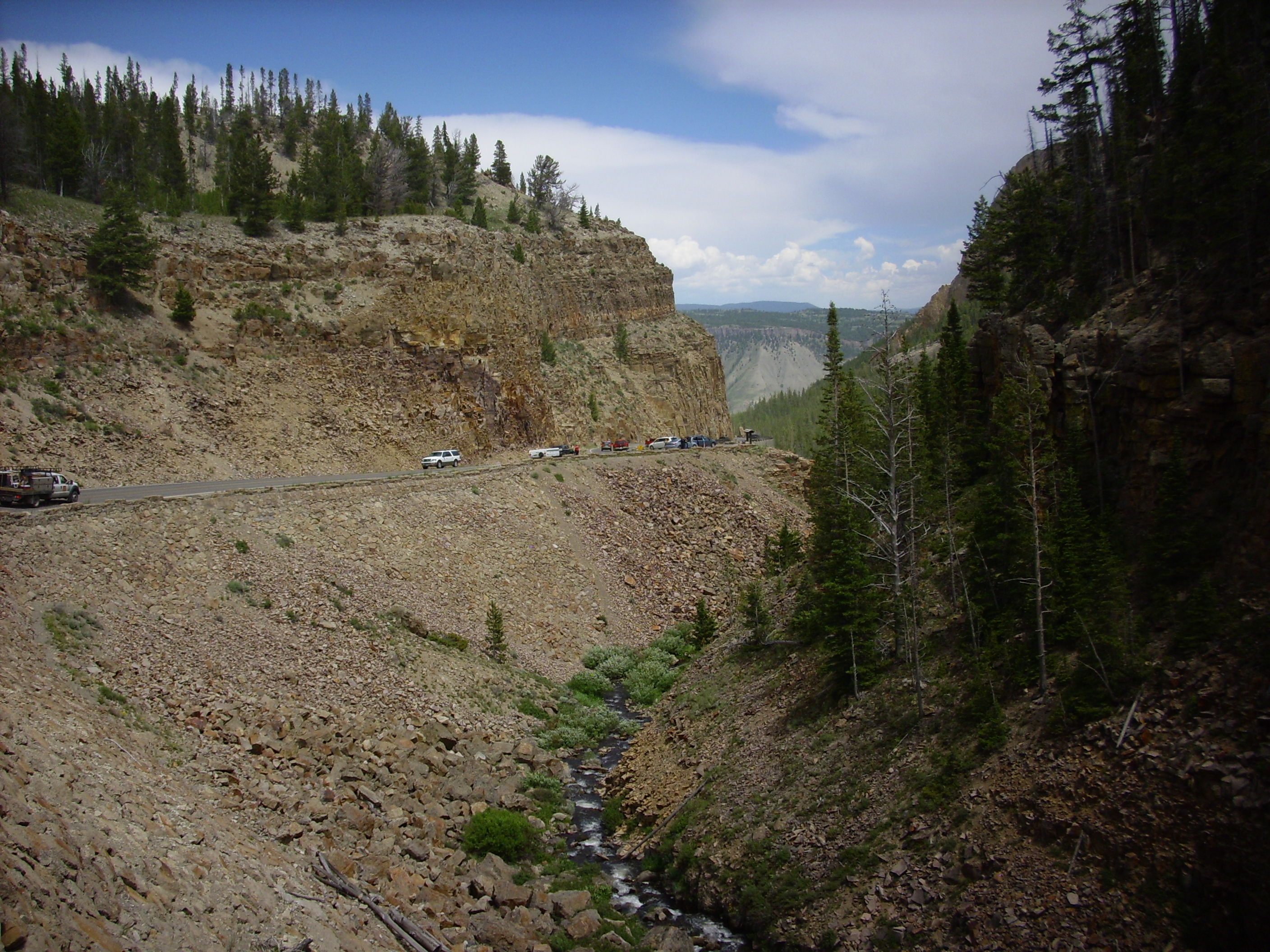
We pulled into the parking area at Sheepeater Cliffs for lunch.
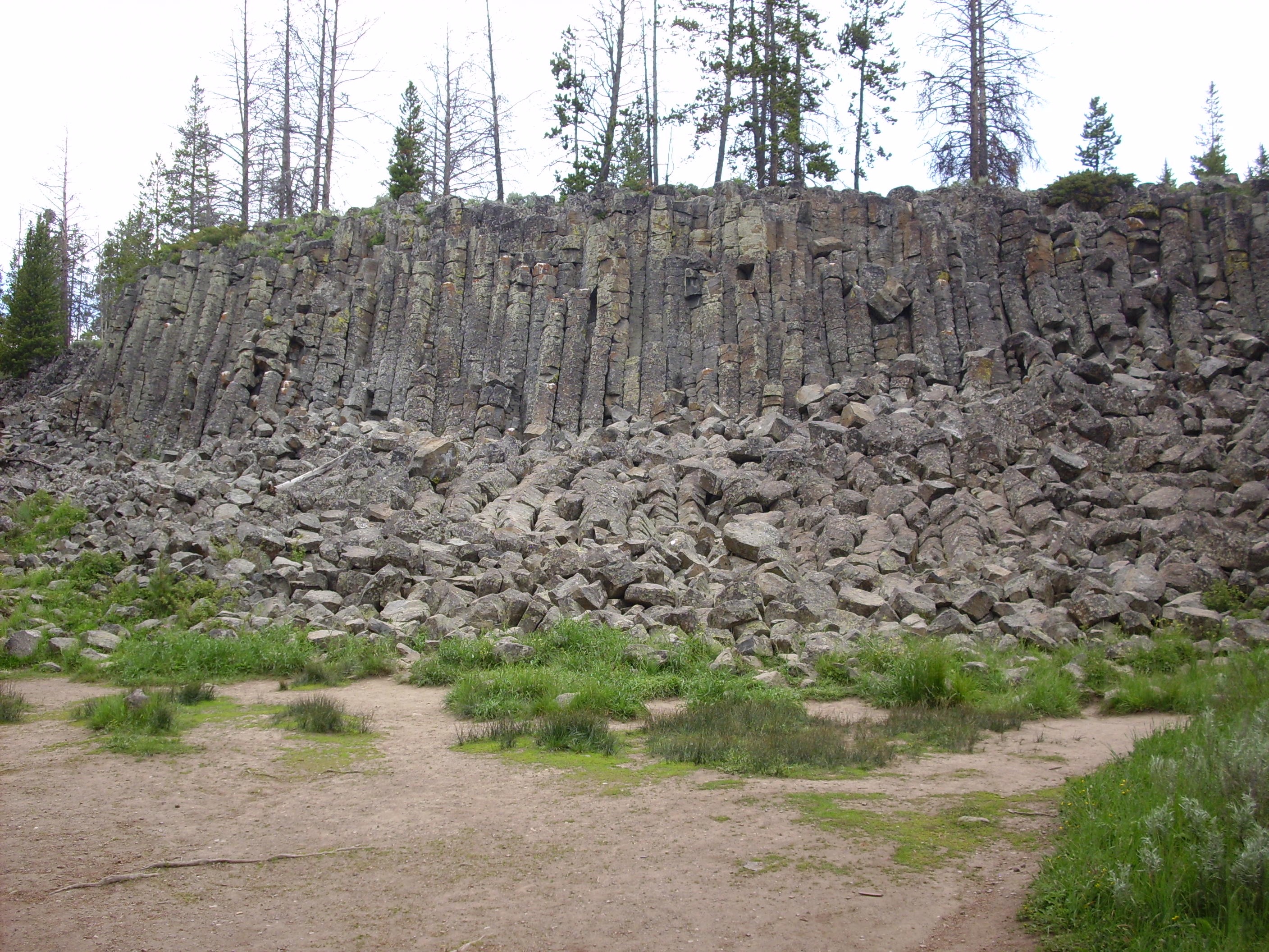
The cliffs are silica-poor basalt erupted 500,000 years ago, not long after the last caldera eruption. It is not uncommon for basalt to erupt around the margins of supervolcanoes, but rarely within the caldera itself. The caldera is underlain by a thick wad of soft silica-rich magma that blocks silica-poor magma rising from below, but the surrounding rocks are cool enough to fracture and let the magma through.
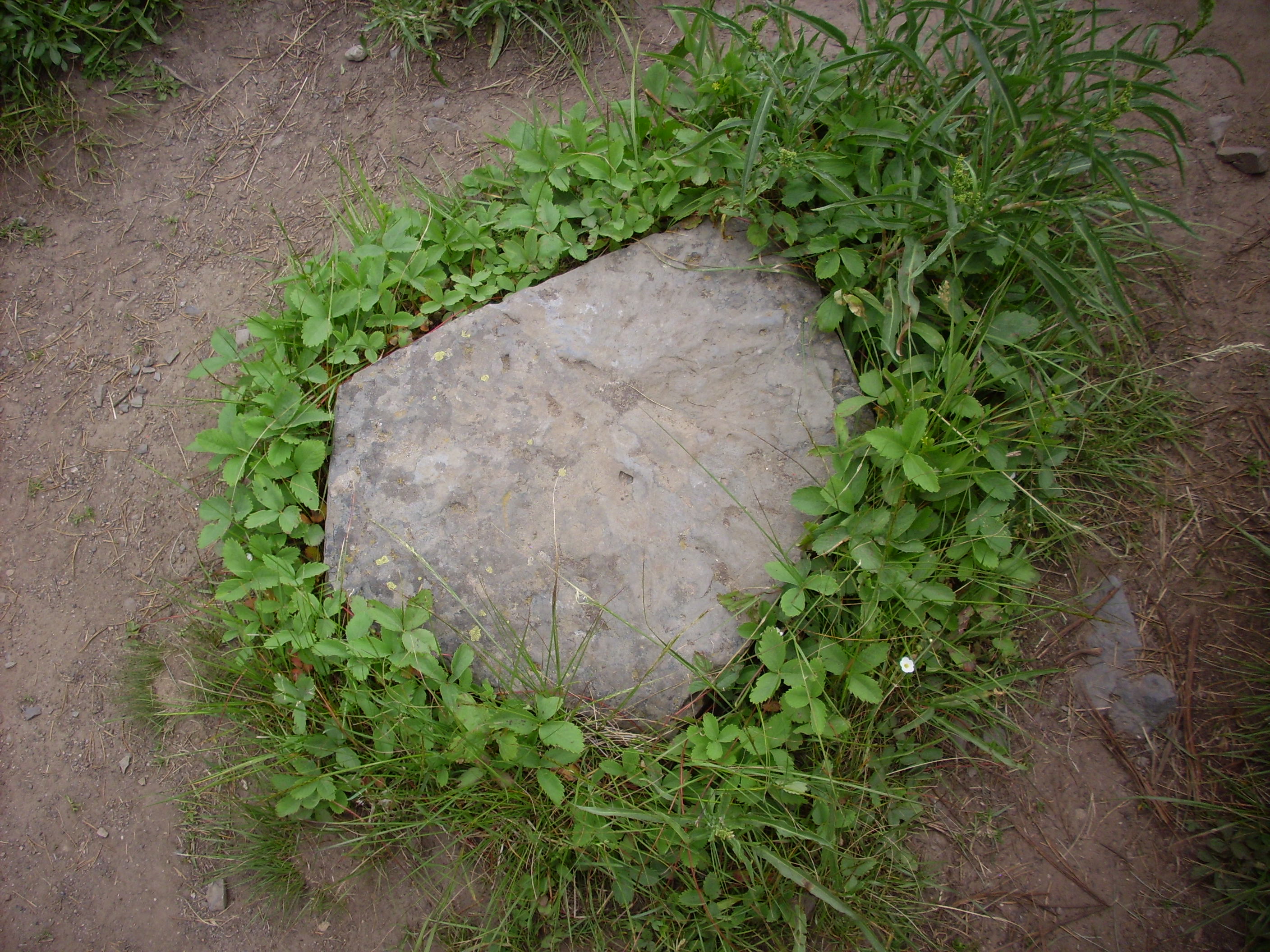
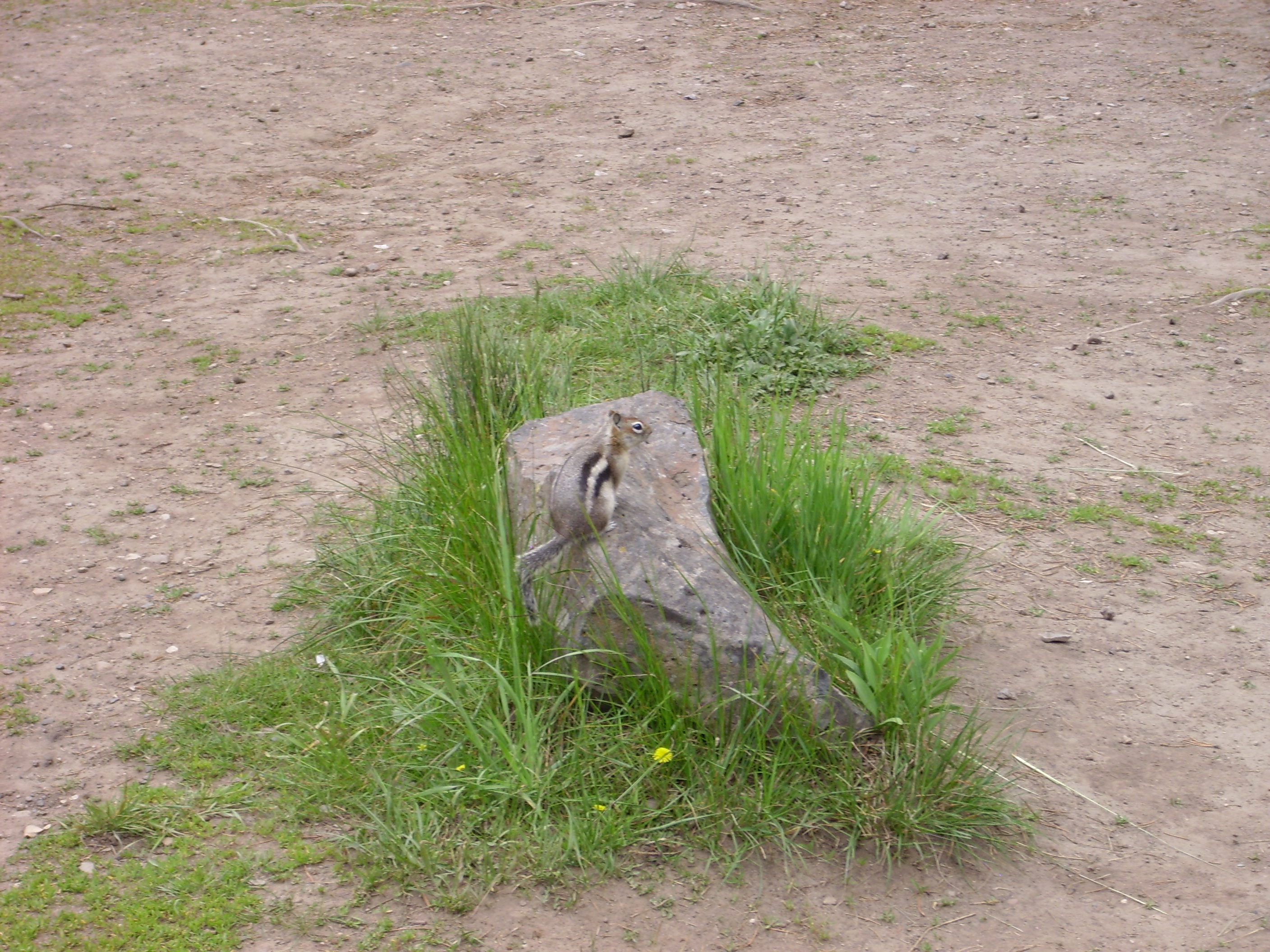
The columns are cooling columns, formed when the lava cracks apart as it cools and shrinks. The second photo shows a “paving stone” from part of a cooling column, surrounded by a garland of —
“Squirrel!”
I finished lunch, looked for an outhouse, and discovered that, with all the will in the world, it is apparently not possible to build an outhouse that does not stink to high heaven in the summer. The one here was of very modern construction and well-maintained, but.
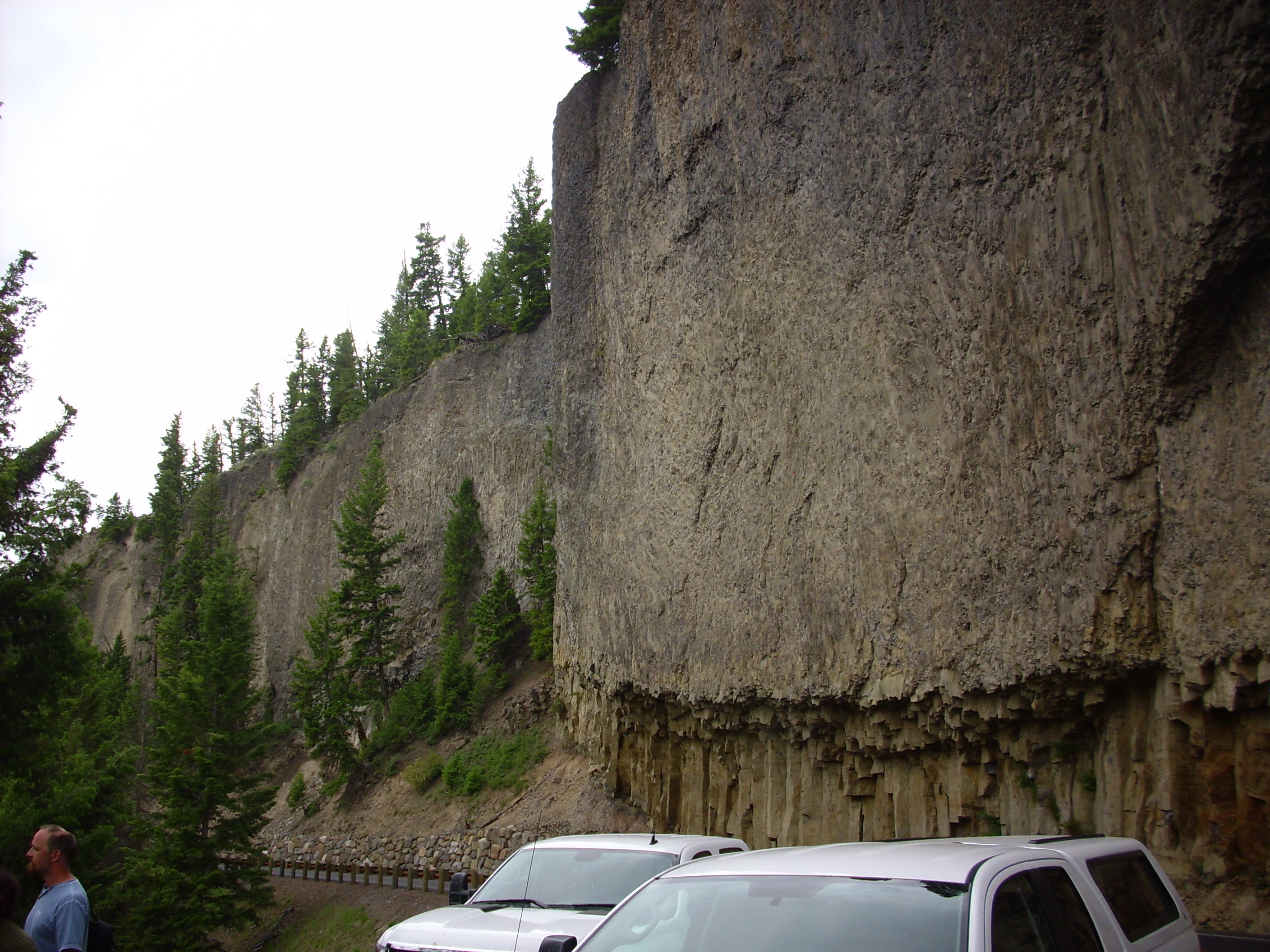
Headed north again, and past Bunsen Peak.

Bunsen Peak is composed of dacite, a rock with somewhat less silica than rhyolite, and it has been dated as about 50 million years old. That was long before there was a Yellowstone hot spot. It is part of the Absaroka Volcanic Supergroup, a huge mass of volcanic rock resembling today’s Cascade volcanoes whose remnants are found scattered around the Yellowstone area. This is a bit puzzling: This area is thought to have been well inland by this time, so why there would be subduction-type vulcanism is a puzzle. Still. Bunsen Peak was likely one of the conduits to the surface for these eruptions, and it has been preserved because of its location well north of the Yellowstone caldera and the durability of its rocks, which chemically resemble those in the Cerros de los Valles just west of Los Alamos.
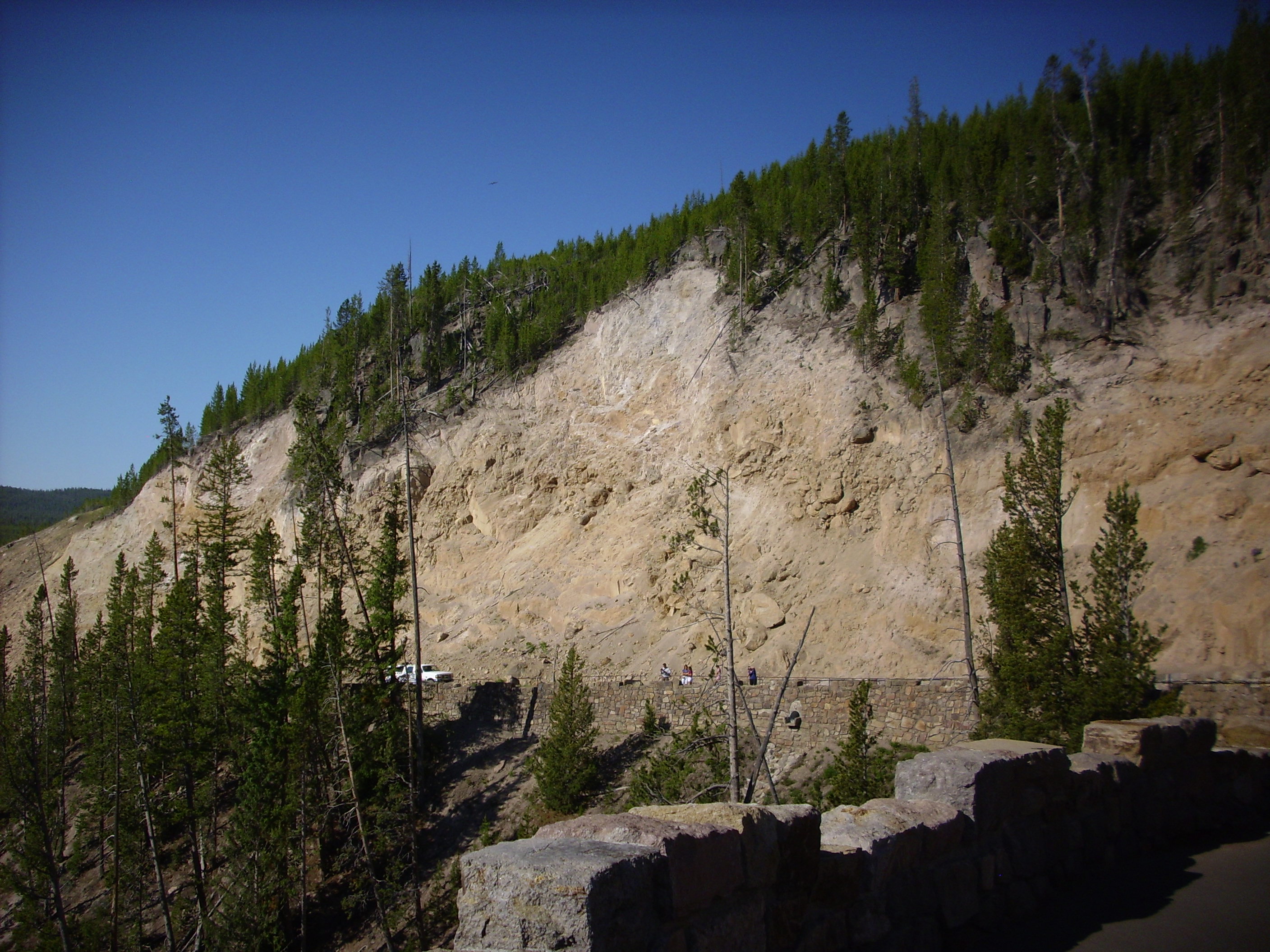
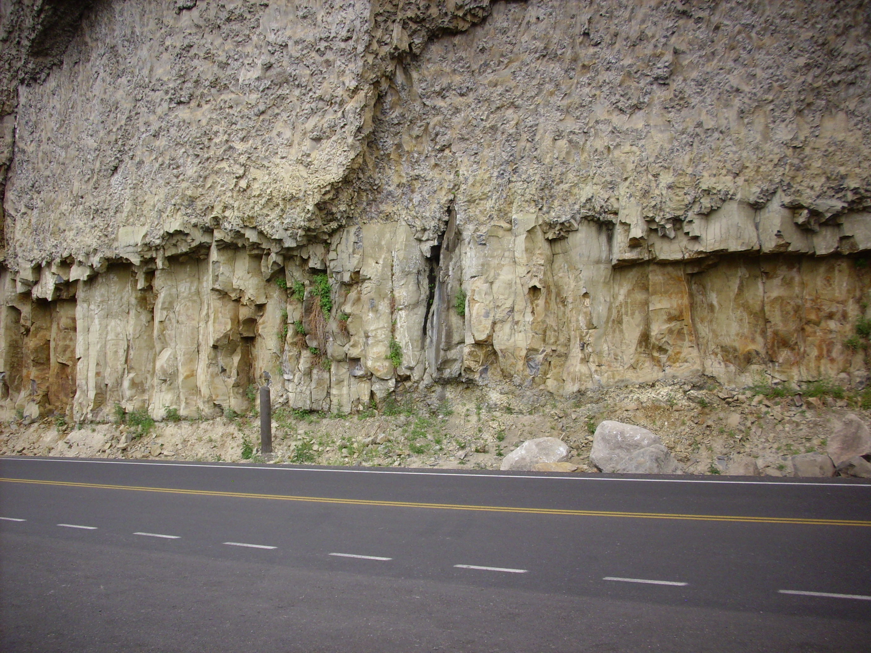
Past Bunsen Peak is the Golden Gate.


The rocks here are mostly Huckleberry Ridge Tuff from the first caldera eruption, 2.1 million years ago. I got out the loupe and took a good look, then got out the binoculars. About then a roaring blast of wind came through the canyon, which picked up sand and gravel and sandblasted me rather thoroughly. I had to take refuge on the lee side of Bruce’s car, while yelping in pain from the wind-driven gravel that had already hit me. We had experienced a thunderstorm downburst, I think, channeled through the narrow canyon to make for a most unpleasant weather experience.
Beyond Golden Gate is a landslide of travertine blocks from ancient hot springs (63,000 years ago) higher up the mountain.
The terrain below is a mix of landslide and glacial deposits.
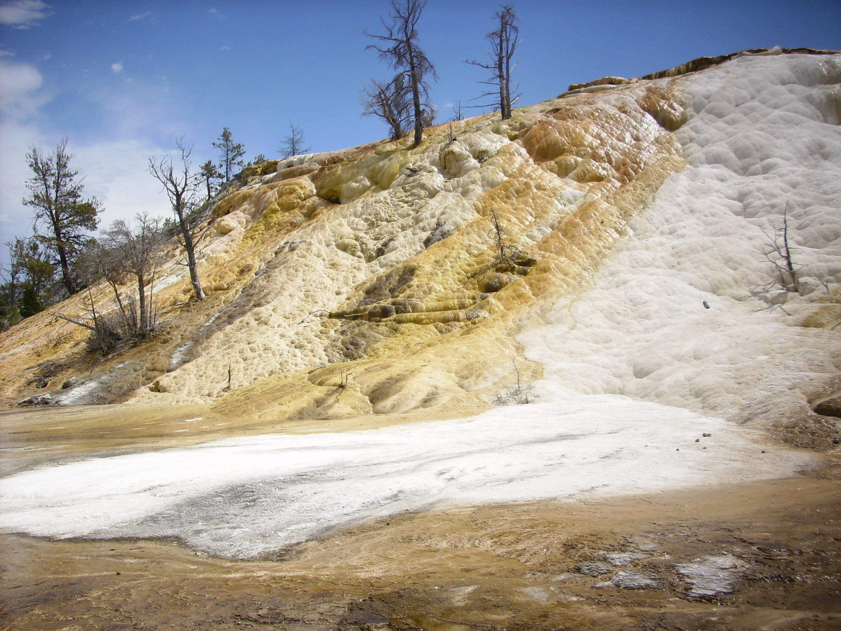
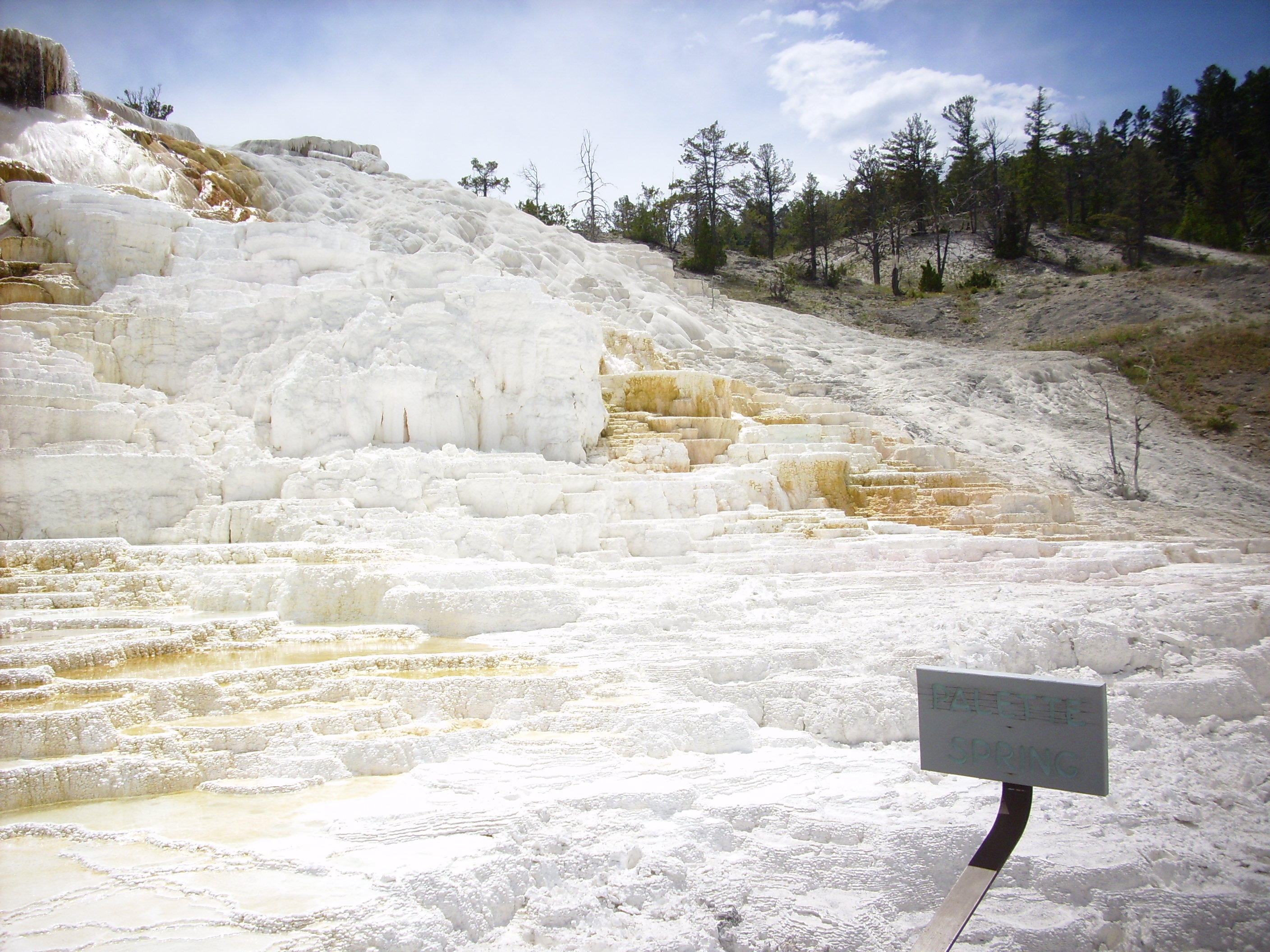
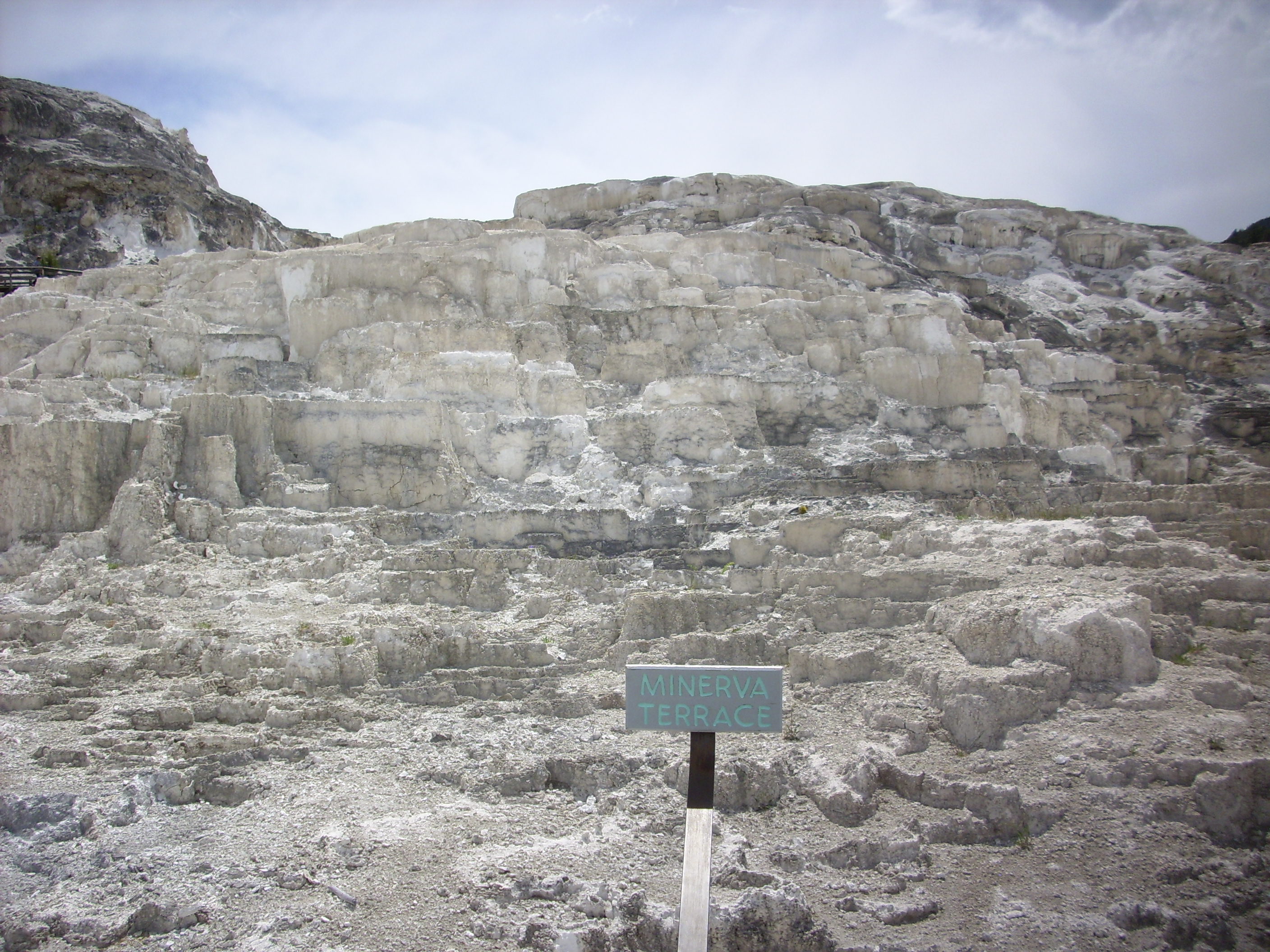
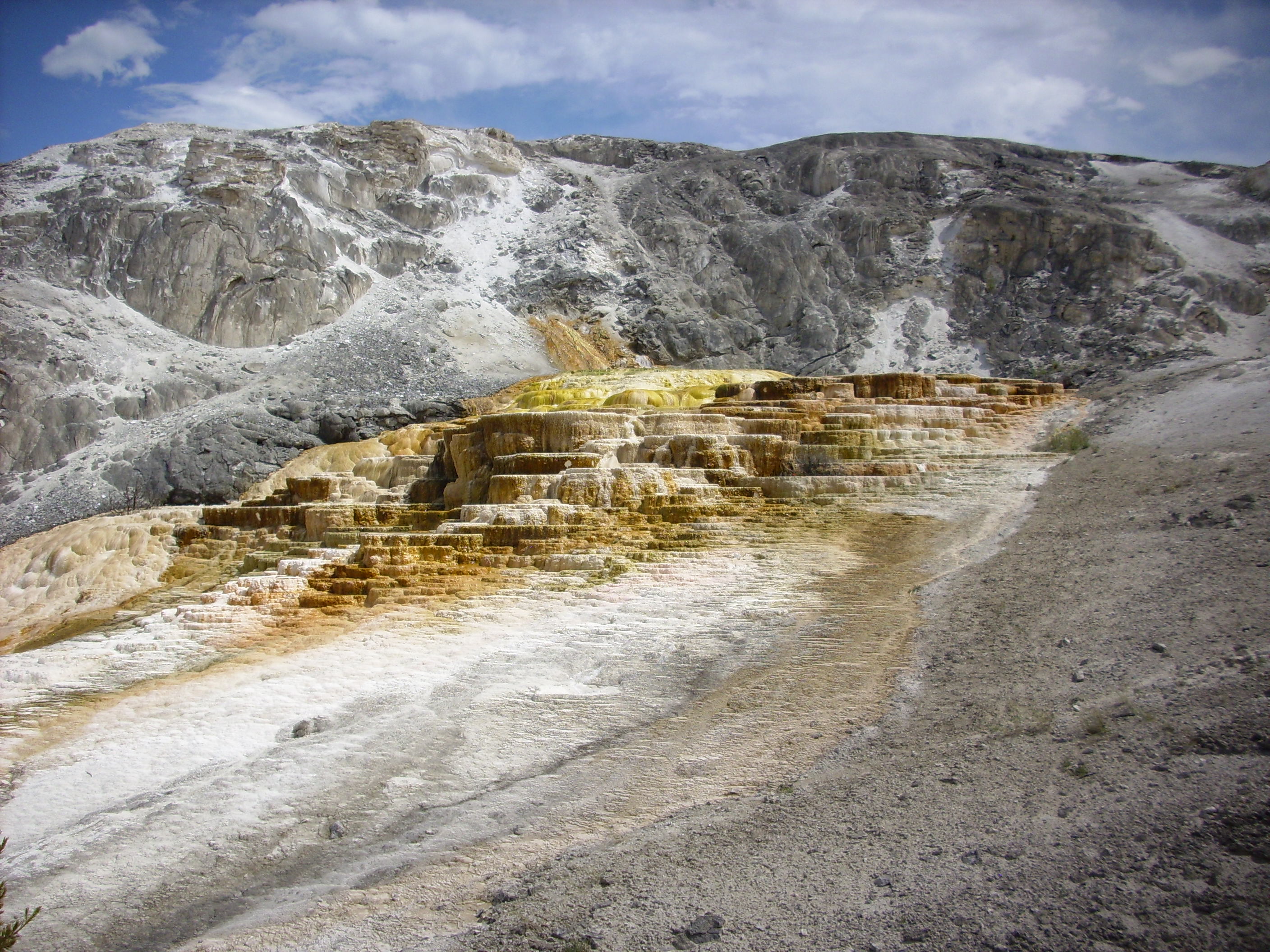
Beyond that is Mammoth Springs. These are different from most in the park in that there is very little sinter (silica deposits) and a great deal of travertine (calcite deposits.) This is well north of the caldera, but along a fault that carries water from the caldera to this area, where it dissolves limestone underground that is redeposited on the surface. The results are spectacular.

Palette Spring.
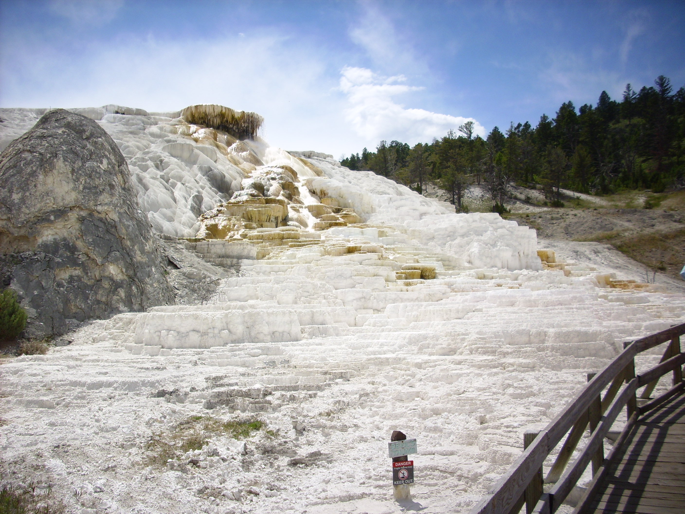

The big blackened rock in the first photo is apparently called Devil’s Thumb.
Minerva Terrace.
Cleopatra Terrace.
East of Mammoth across the Gardiner River valley is Mount Everts. This is an erosional remnant of what was once a plateau of Cretaceous sediments, and the top of Everts was actually a shallow valley on the plateau. The first Yellowstone caldera eruption deposited a layer of Huckleberry Ridge Tuff in this shallow valley which protected the Cretaceous sediments from further erosion. The shallow valley thus became a mountain after the Gardiner River eroded away the plateau further west. This photo shows the west flank of Everts, with thick layers of Cretaceous sediments beneath a cap of Huckleberry Ridge tuff.
If you click on the photo to enlarge, you can make out a thin black layer at the base of the tuff in the center of the photo, under which is a zone of sediments that were baked to a darker red by the hot tuff.
Bruce and I experimented with using a spotting scope to take telephoto photographs of this feature, but the results were dismal, at least with my little Polaroid tourist camera.
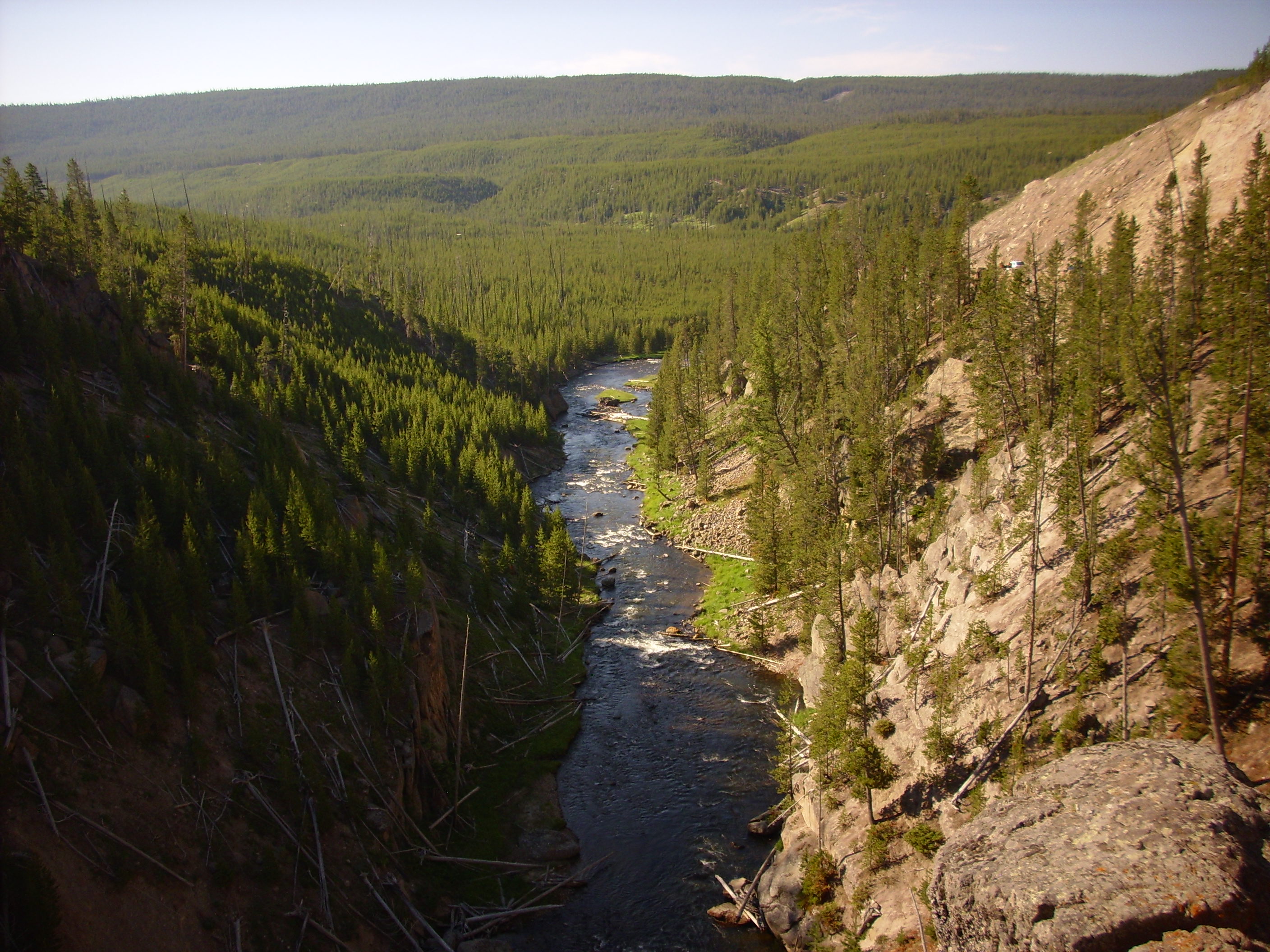
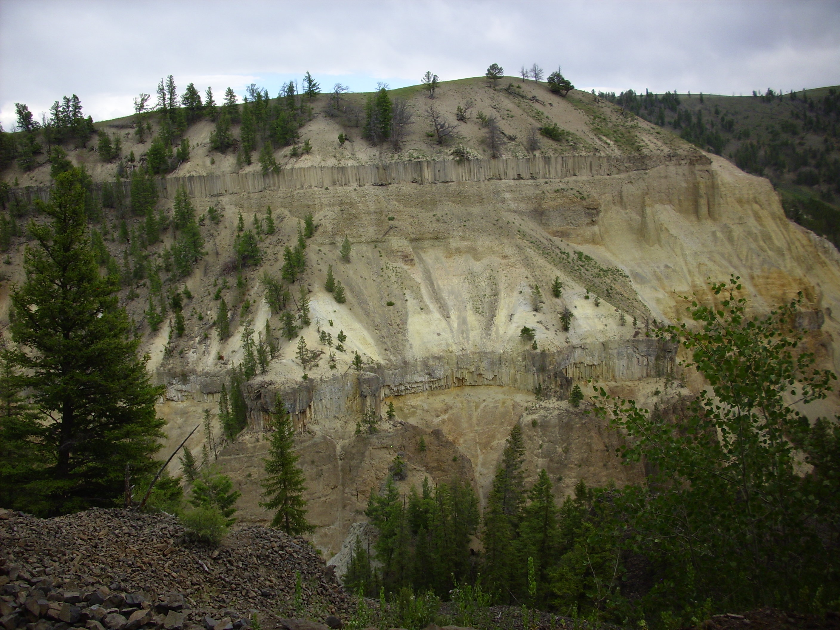
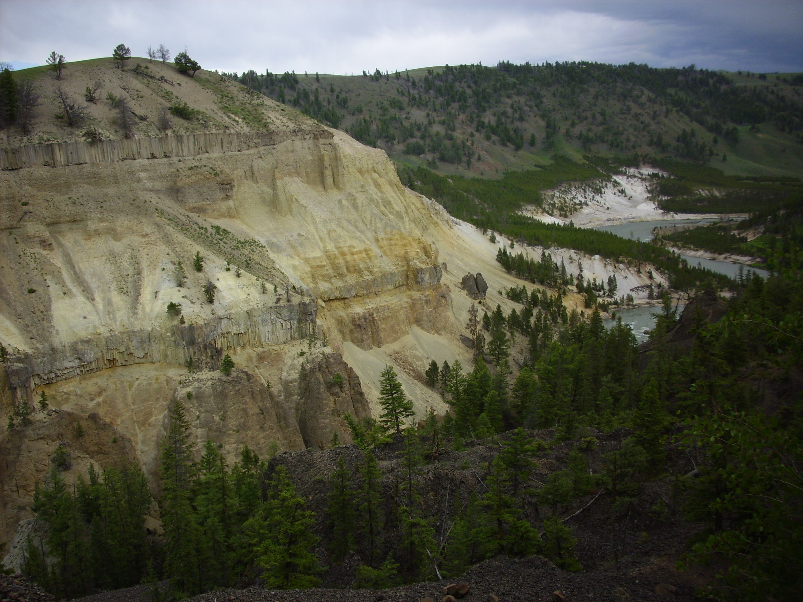
We then headed east into the northeast part of Yellowstone. There is a mix of old and young geology here, but basically the area is a high plateau with some glacial deposits. At one point the Gardiner River cuts into a basalt flow to produce Undine Falls.
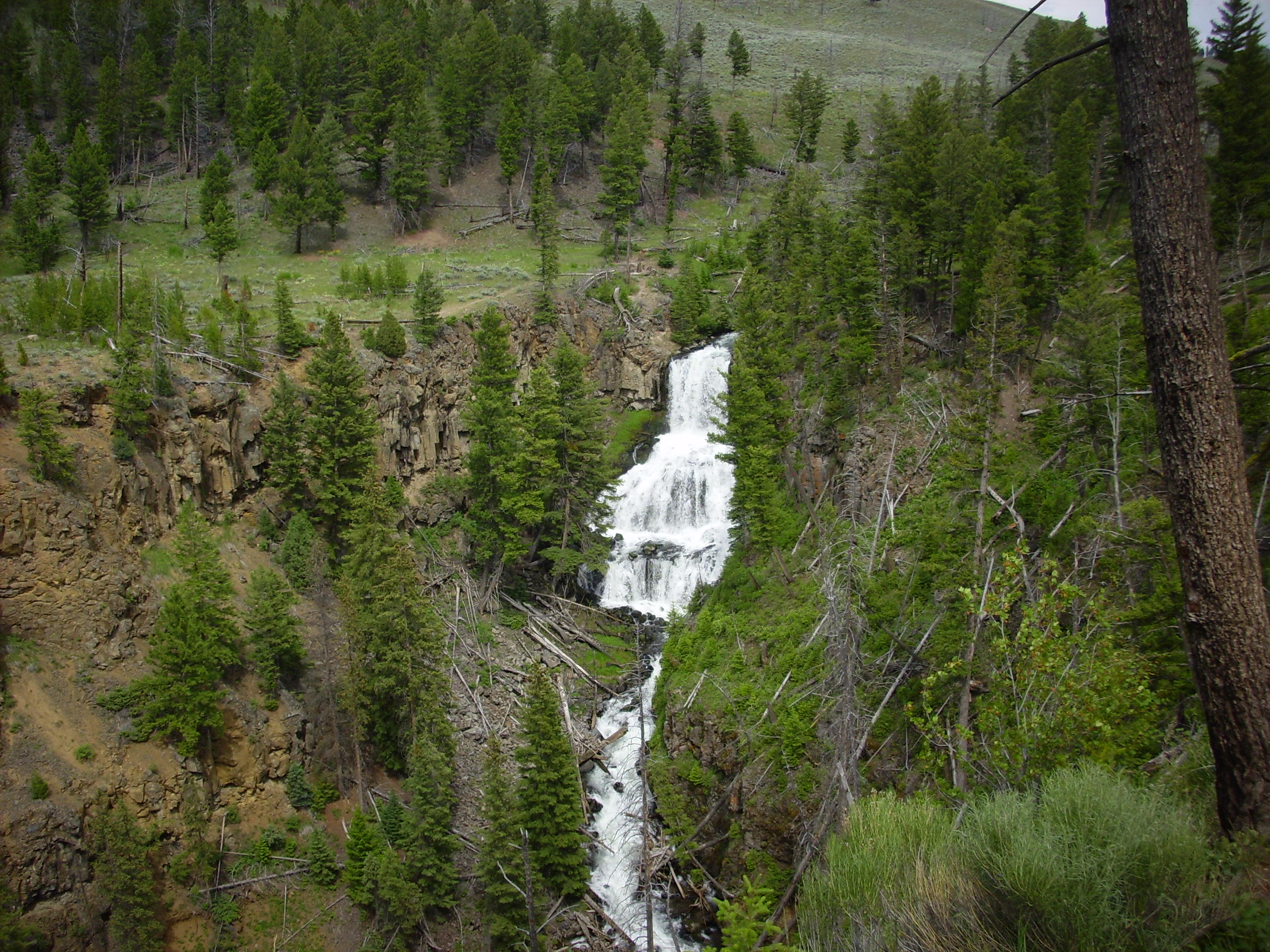
The basalt (named, curiously enough, the Undine Falls Basalt) erupted into a valley of Cretaceous shale about 700,000 years ago, just before the last Yellowstone caldera eruption. I count at least four cooling units through my binoculars, meaning that basalt came down this valley four times and had enough time to at least begin cooling between each flow. The falls form because the soft Cretaceous shale underneath easily erodes, producing a cliff of basalt.
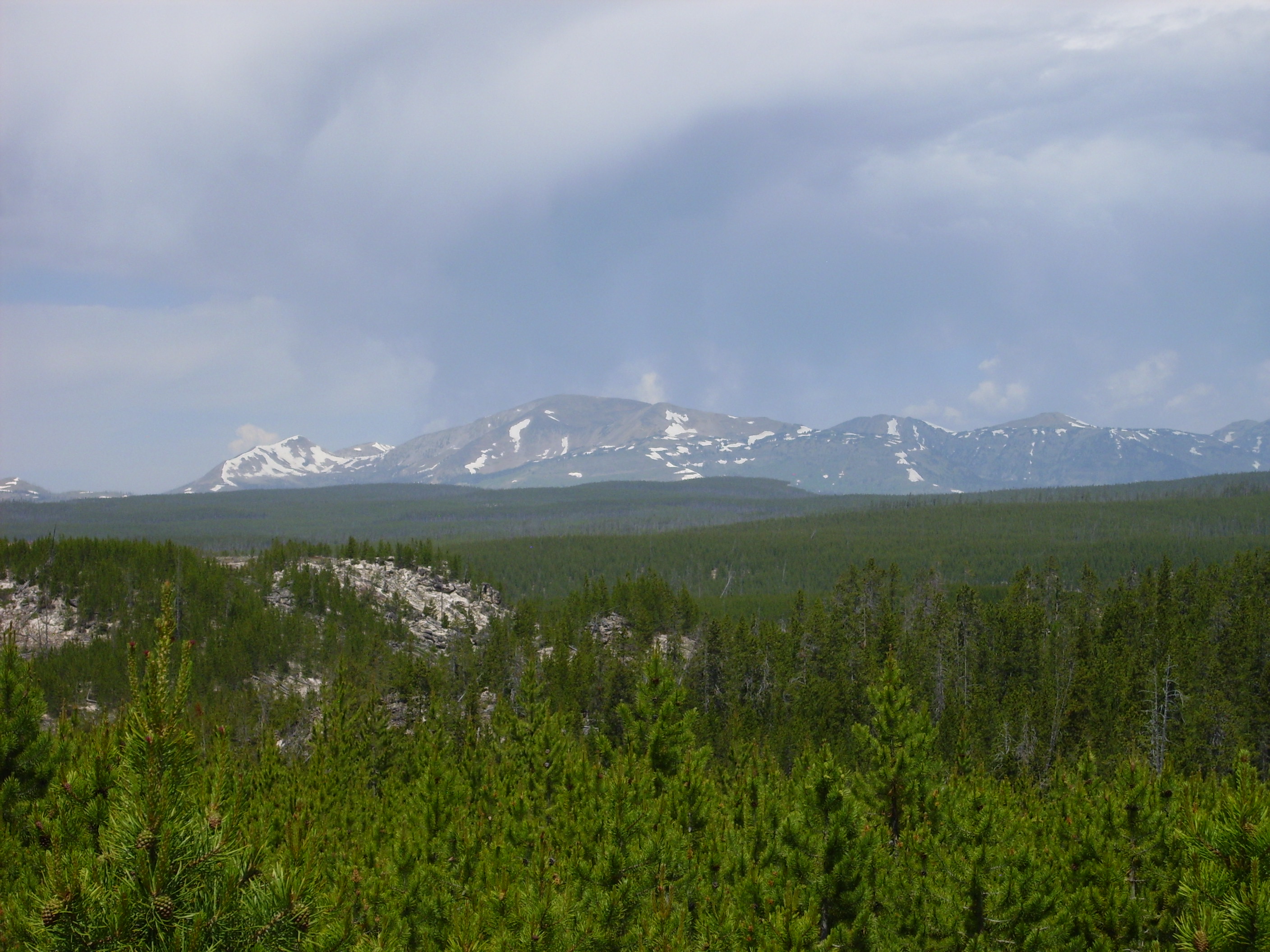
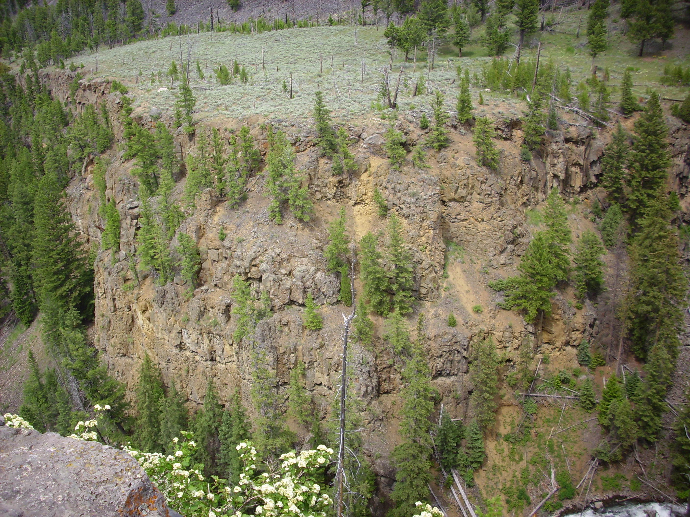
On across beautiful meadows with the occasional tuff outcropping or glacial feature. Finally we reach a pulloff looking northeast at the southwestern edge of the Beartooth Uplift.
Gonna take another crack at assembling a panorama.
Meh. Not too bad.
The Beartooth Uplift is a high plateau that was pushed up by the approaching Yellowstone hot spot, then had its surface layers of soft sedimentary rocks eroded off by glaciers to expose the hard Precambrian rock underneath. This rock formed over 600 million years ago (some portions have been dated to over 2 billion years) and was then eroded flat around 515 million years ago. When the area was uplifted again in the last few million years and the sediments eroded off, the flat surface was exposed a second time.
The hill left of center in the panorama is Garnet Hill, which is considered the southern limit of the Beartooth Uplift. It is composed of a pink granite from which it gets its name.
We didn’t see much of the Beartooth Plateau. There was simply not enough time to see everything. I think Bruce in particular would have liked to see a lot more of it. I may come back up this way in 2017 for the total solar eclipse; perhaps we can hit the area then. (Hopefully Cindy will be able to make it on that trip as well; I missed her badly on this one, though I won’t pretend I didn’t enjoy the freedom to be just as geeky as I pleased.)
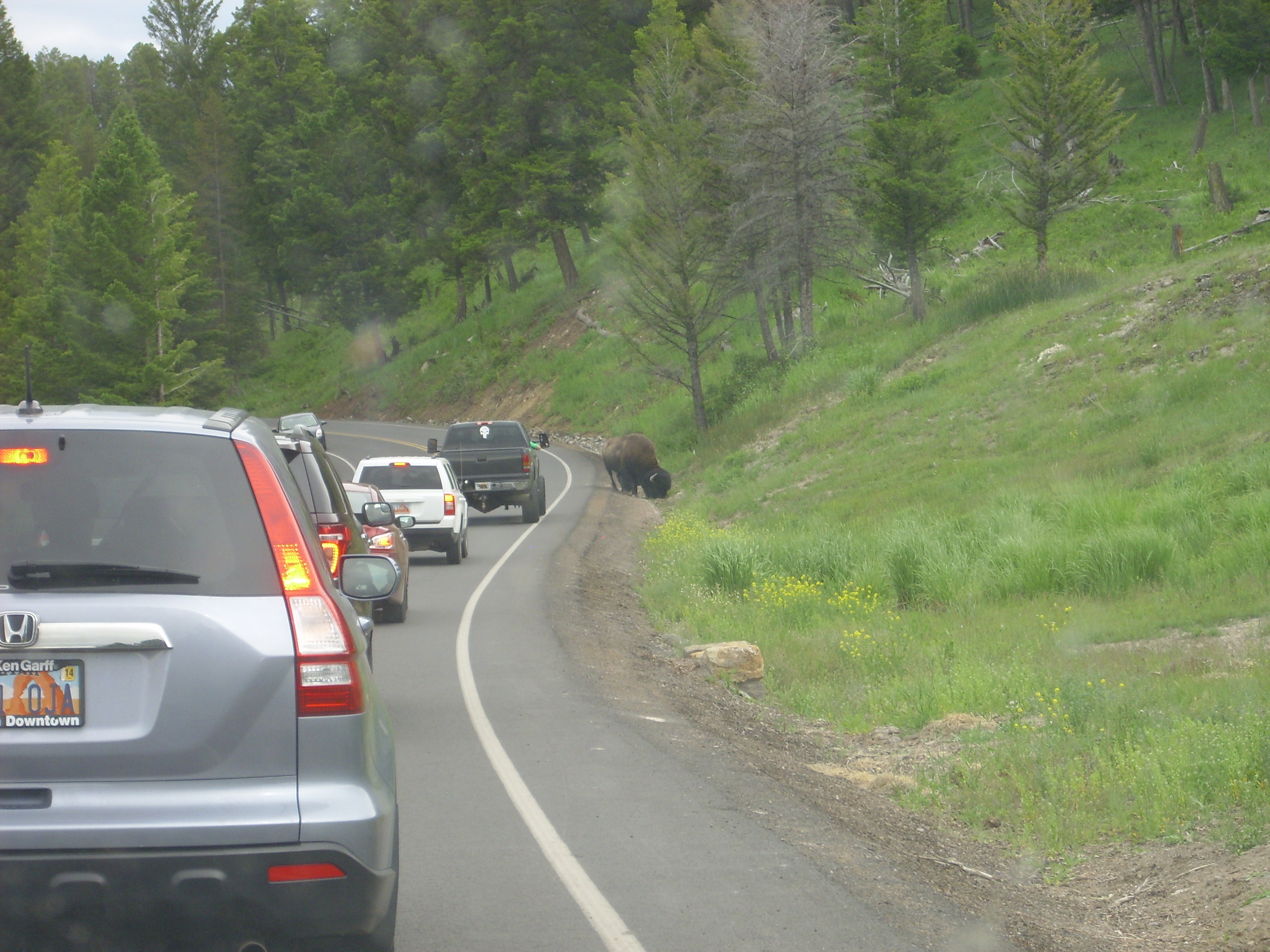
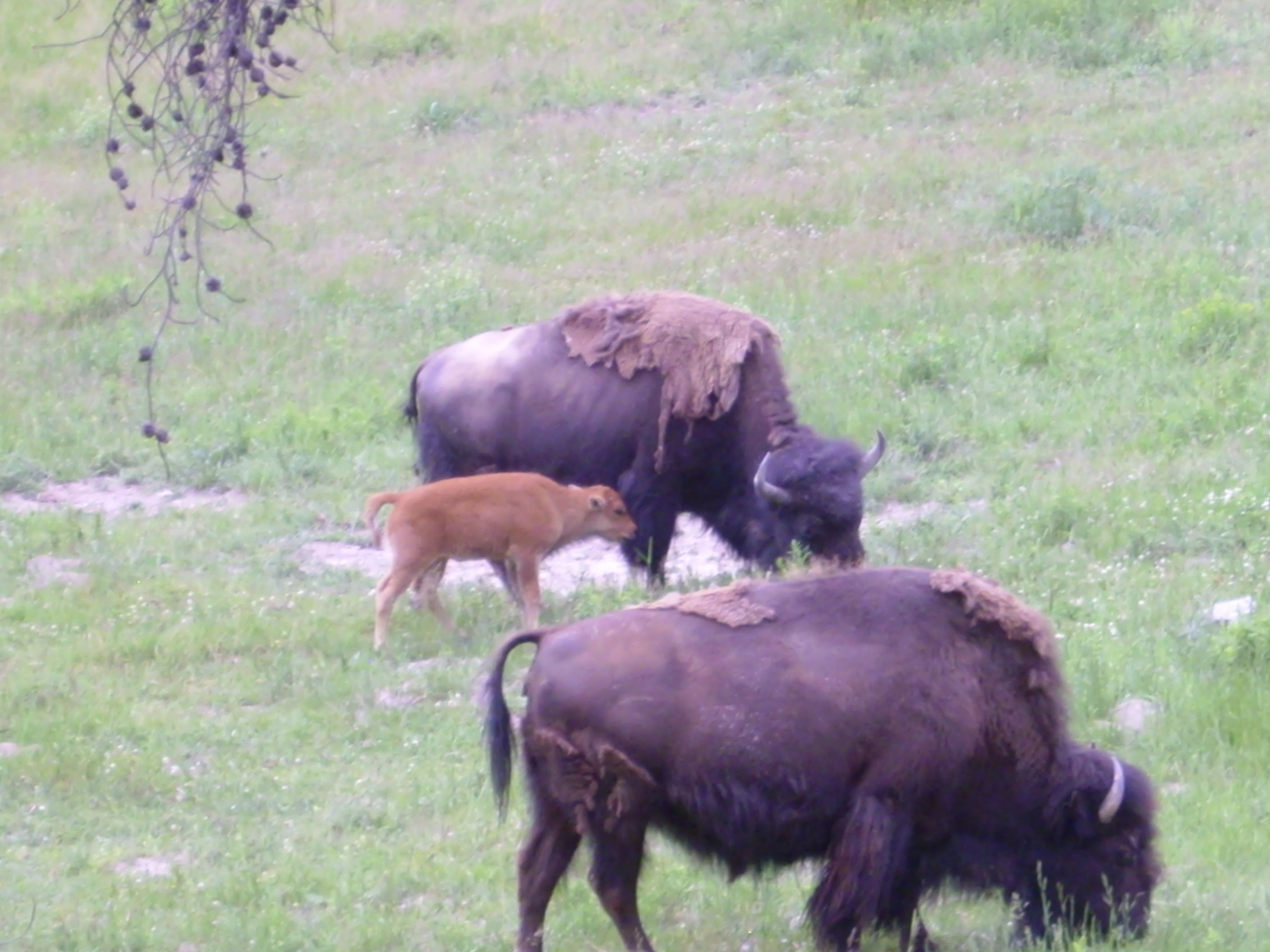
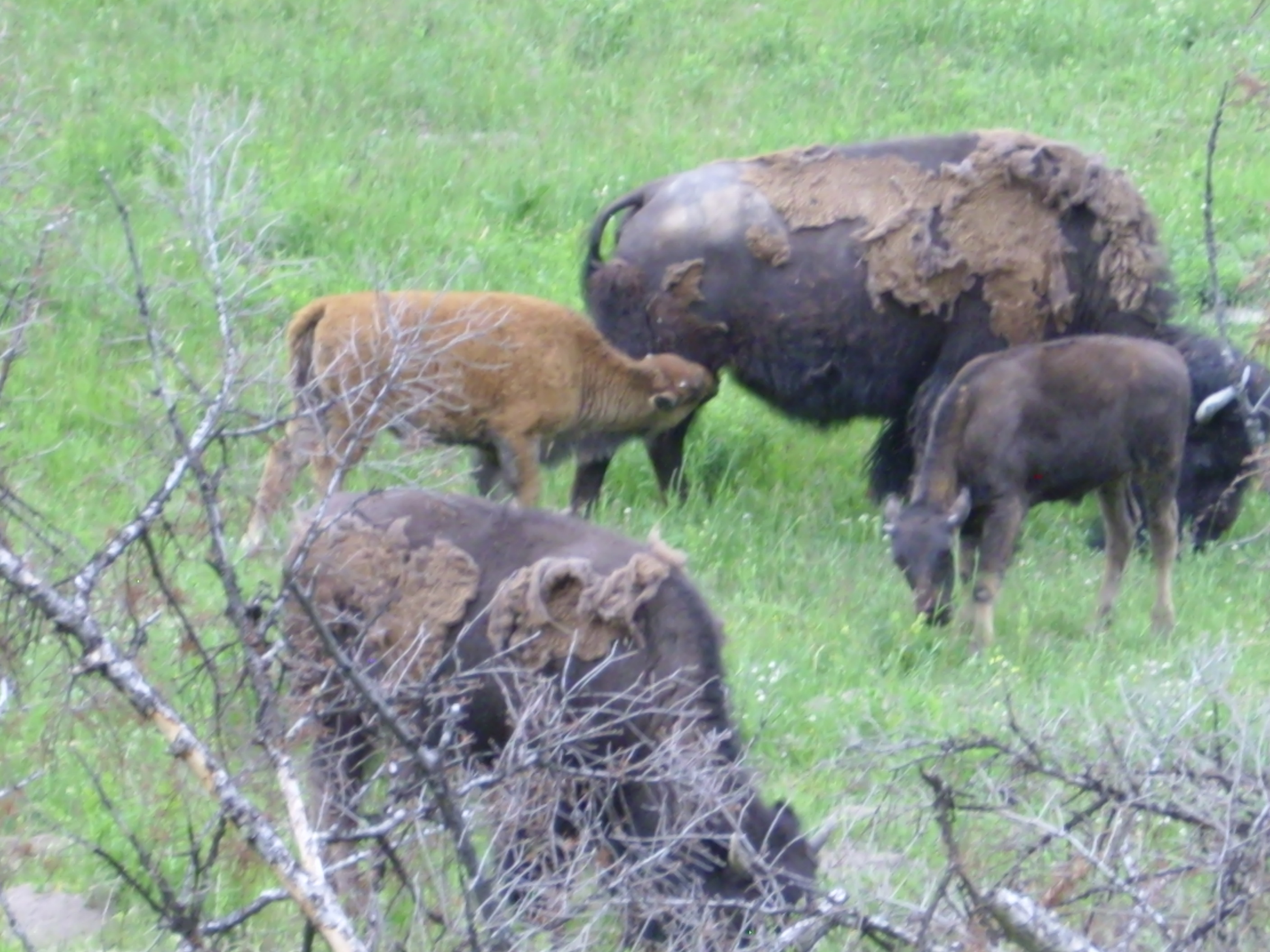
A few miles down the road we hit a traffic jam, and — Wildlife!
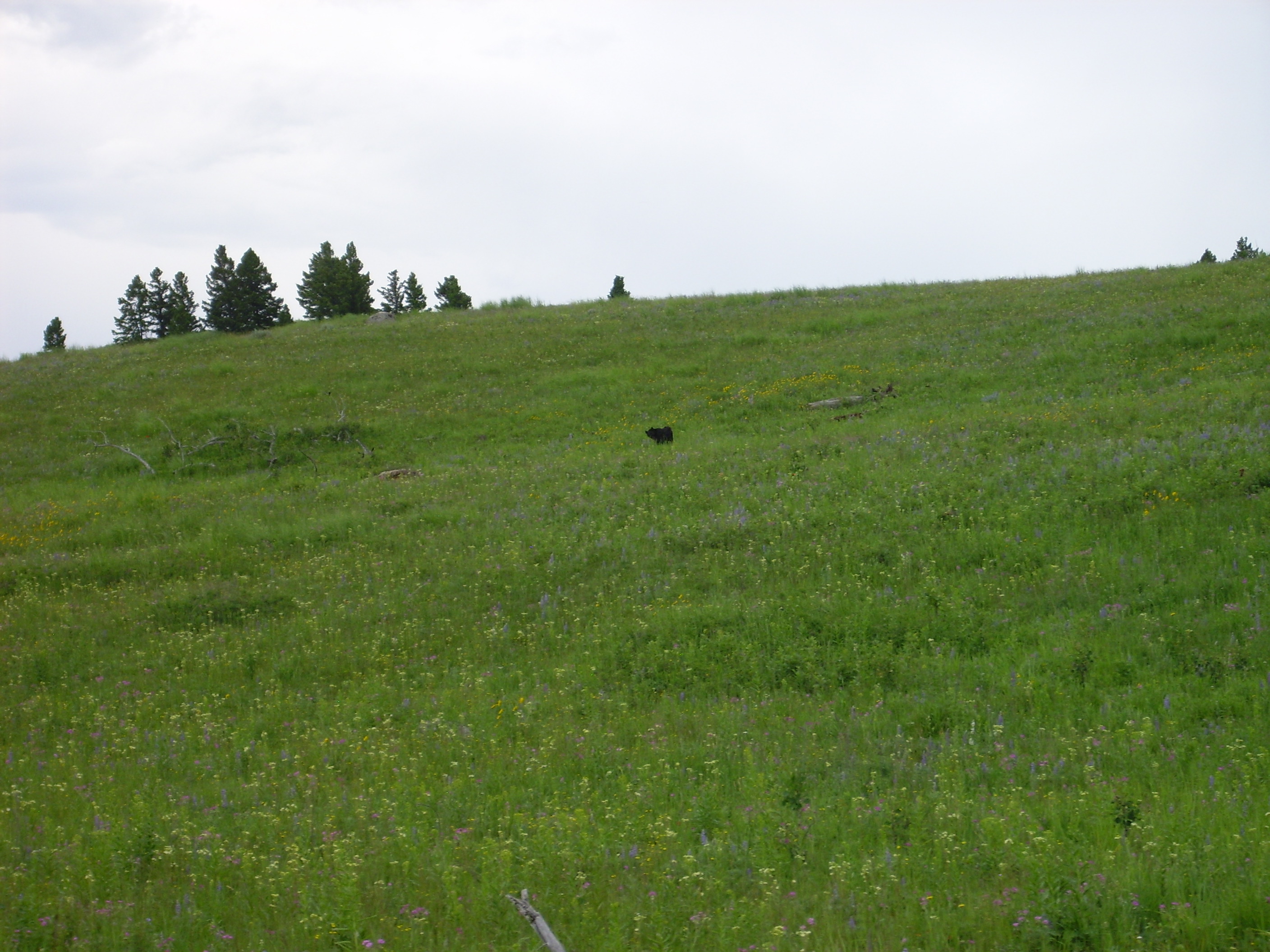
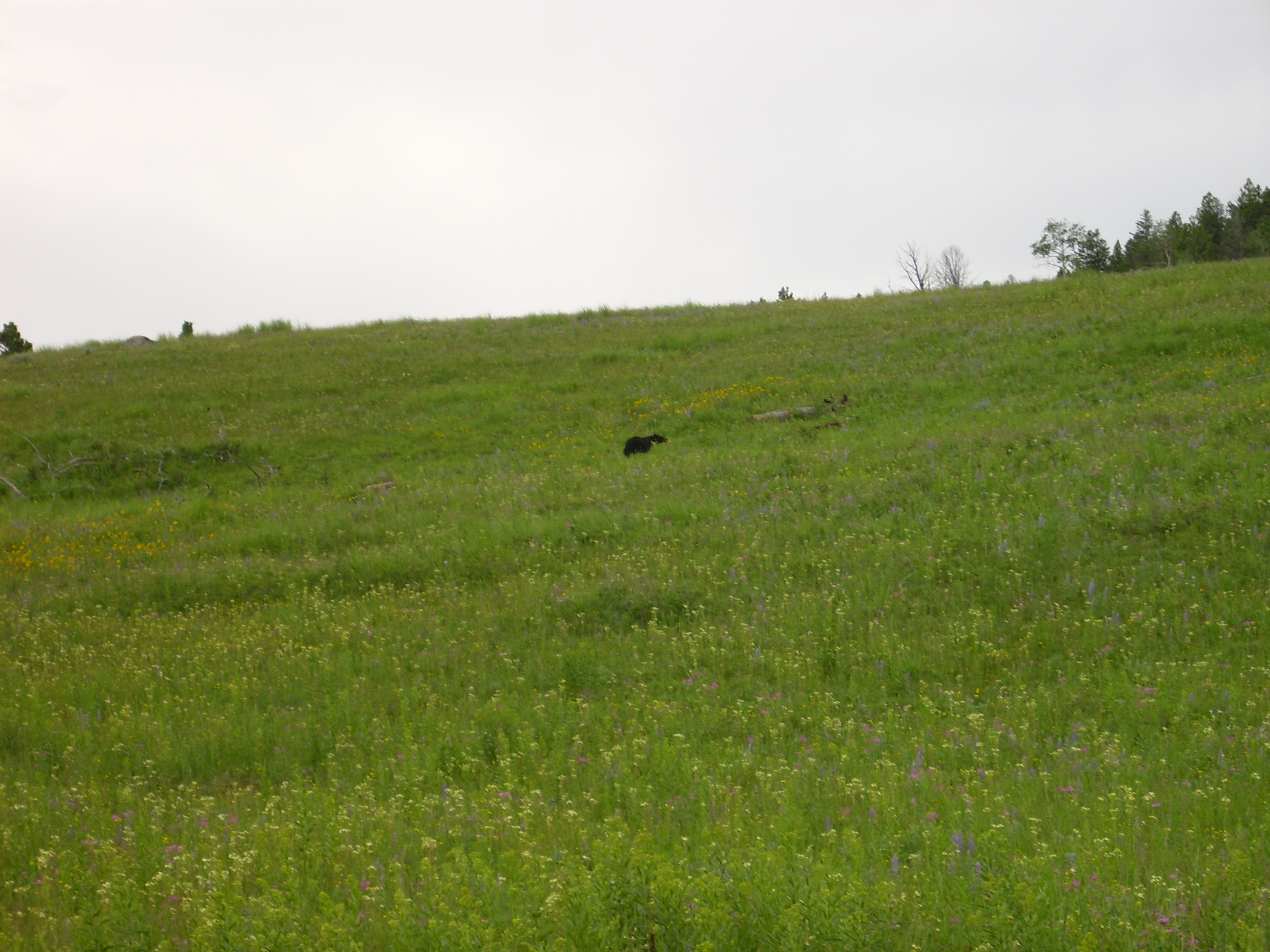
That’s a black bear meandering around up there, happy to ignore all the monkey-boys down the hill on the road as it does its thing.
We took a side road to see a big standing petrified log. This is a remnant of a forest that was buried by ash from the Absaroka volcanoes, 50 million years ago. The buried wood was impregnated with silica from the ash and preserved. There was once quite a lot of petrified wood in this area, but most was taken as souvenirs by early Park visitors.
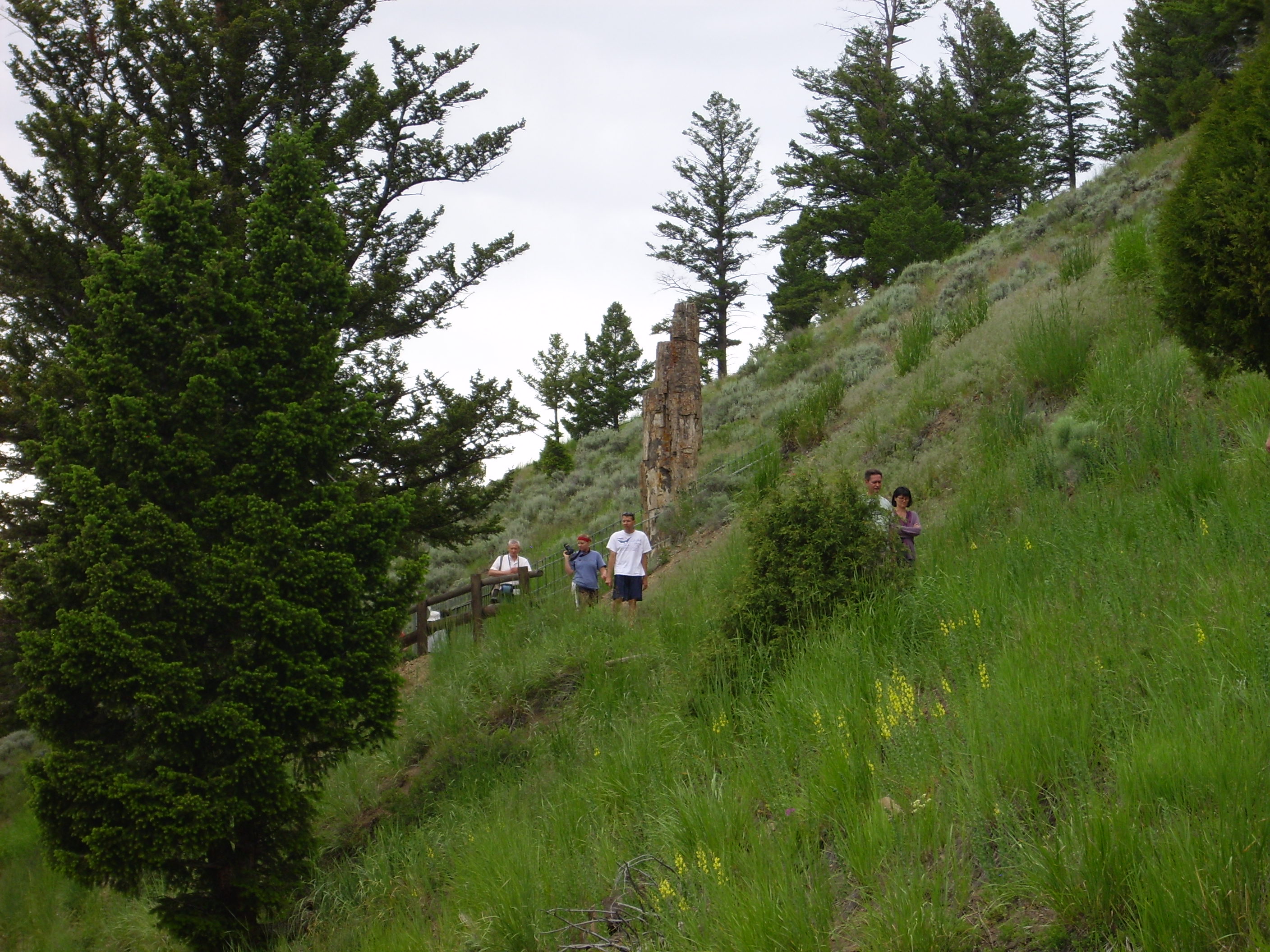

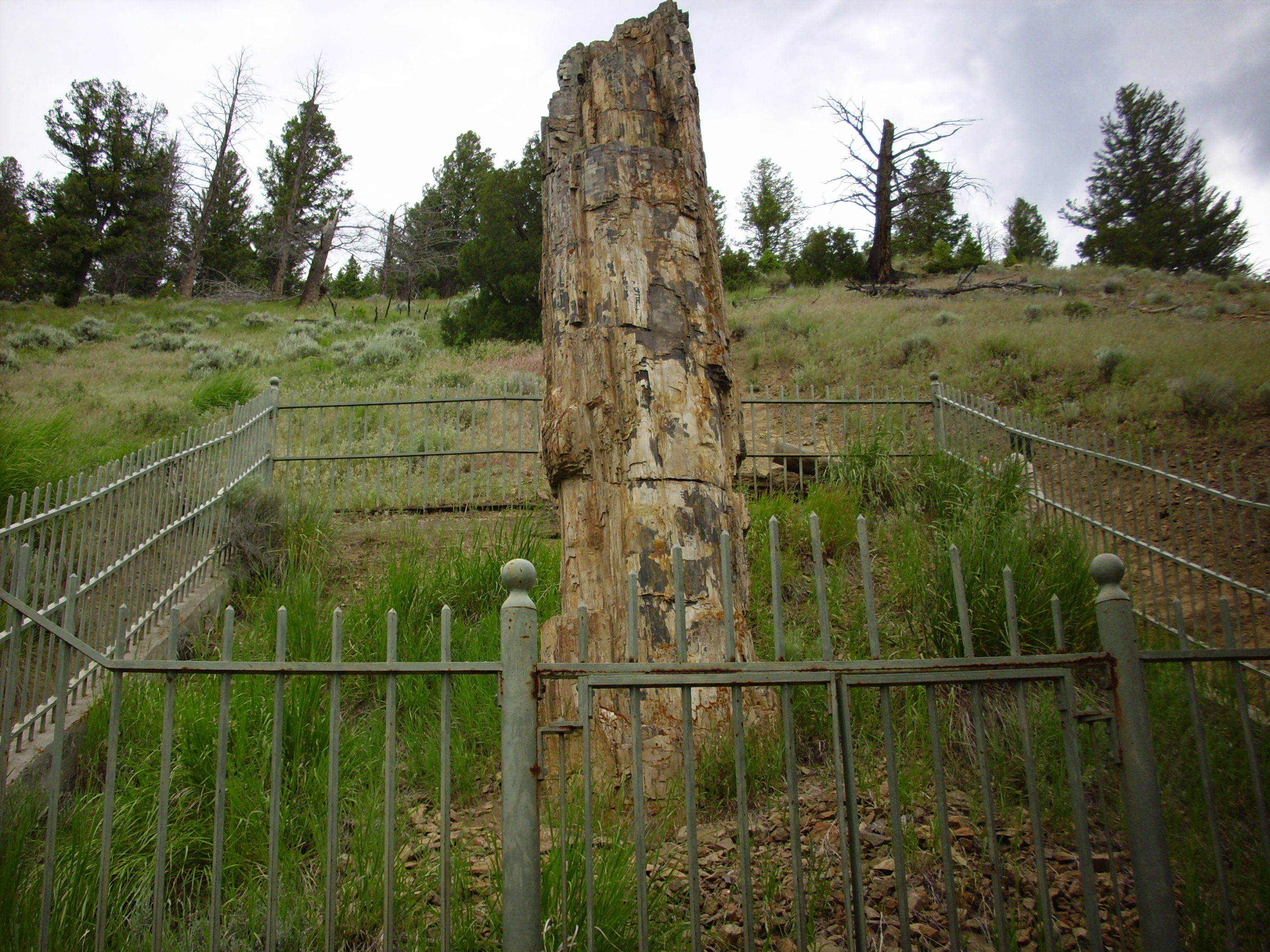
Hard to imagine from just looking that that isn’t just another dead stump. In fact, it’s about 50 million years old. I would love to have taken a closer look with my loupe, but apparently the Park Service does not think this is a happy thought.
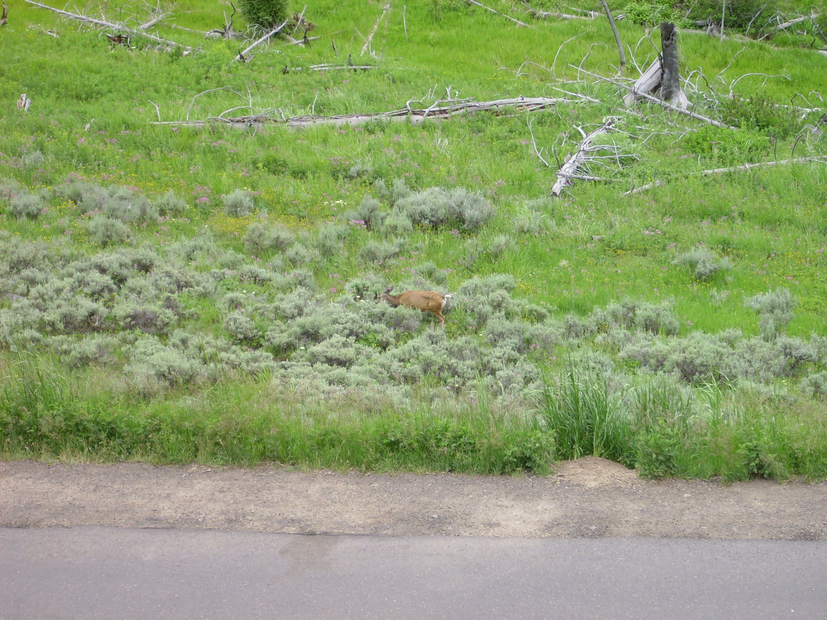
More wildlife!

Approaching Tower Junction, we see the Yellowstone River Narrows and some more impressive rocks. On the west side of the road is the Junction Butte Basalt, a thick flow that has been dated to about 2.2 million years, or just before the first caldera eruption. This is about the same age as the Warm River Basalt some 40 miles to the southwest, at Mesa Falls, which I described and showed a sample of a while back. No samples here.

Bruce was feeling rather tired by now — we were, after all, getting towards the end of a very long day — but I persuaded him that he really had to get out of the car to appreciate all this. I think he decided it was worth the effort.
Geez, a 60+ retired paleontologist and a 52-year-old diabetic physicist killing themselves to see some Yellowstone geology before one or both kicks the bucket … sounds like the premise of a Hollywood movie.
One I’d probably skip.
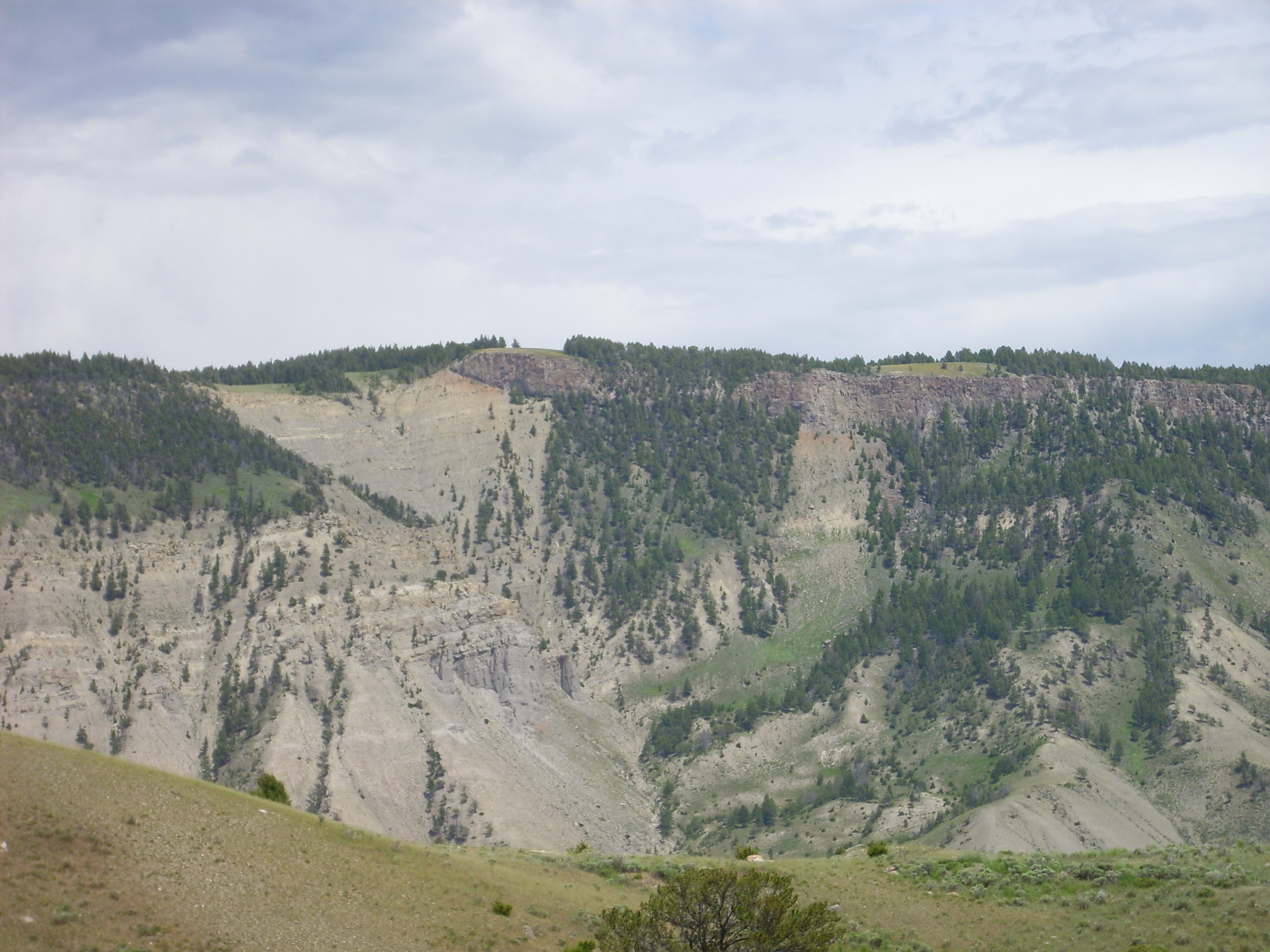
The other side of the road is the Yellowstone Canyon Narrows, and there is cool geology exposed in the far canyon wall.
The bottom of the canyon is Eocene conglomerate, about 50 million years old, likely eroded off the Absaroka volcanoes. The layers of basalt above it, the Basalt of the Narrows, are younger flows, the upper dated to 1.3 million years ago. Both are below the level of the 2.2 million year old Junction Butte basalt. Normally this suggests faulting that has thrown down the younger rock, but in this case both basalts rest on 50-million-year-old conglomerate with no obvious fault. The conclusion is that the Yellowstone River was further west at one point, and the Junction Butte was erupted into its canyon 2.2 million years ago. The river was forced east and continued to erode down, capturing the first Narrows flow, then partially filling with the gravel seen between the two flows, then capturing the second flow 1.3 million years ago, then shifting back west to its current position.
The yellow color of the rocks is from hydrothermal alteration, because we’re heading back south towards the caldera. At this point, we’re still well north of the rim, so you haven’t seen anything yet.
Ahead is Mount Washburn, the highest point on the caldera rim. This is the other peak I would like to have climbed, but it became clear that would not be part of this trip.
Mount Washburn consists largely of conglomerate beds of Absaroka age and composition dipping to the north. This suggests Mount Washburn is merely the northern flank of a large Absaroka volcano that foundered into the Yellowstone volcano on either its first or third caldera eruption.
Absaroka conglomerates:
Here’s a bit of a mystery.
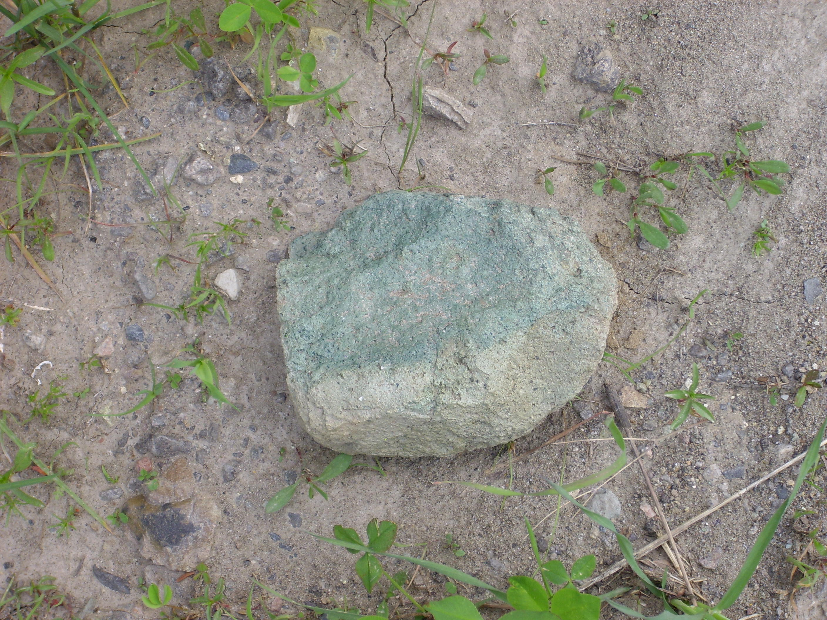
There was a single thin bed with this green color. Unusual iron minerals? Paint from playful tourists or park rangers? Since we couldn’t take away a sample, we may never know.
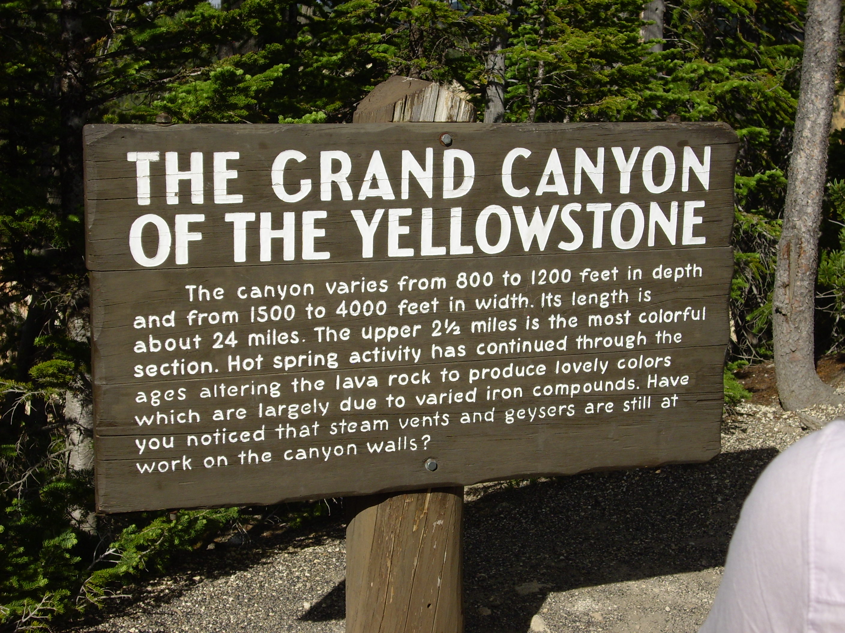
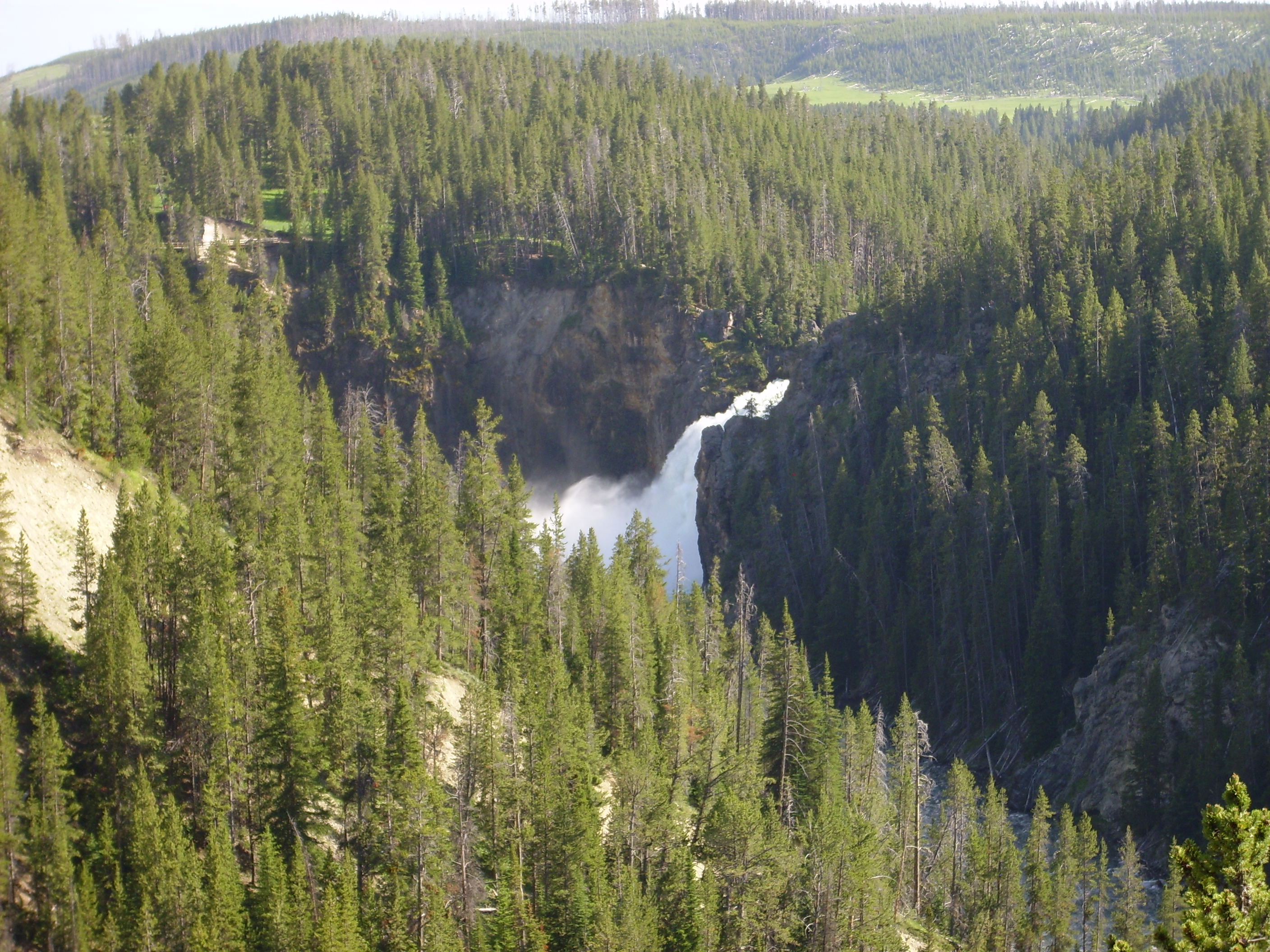
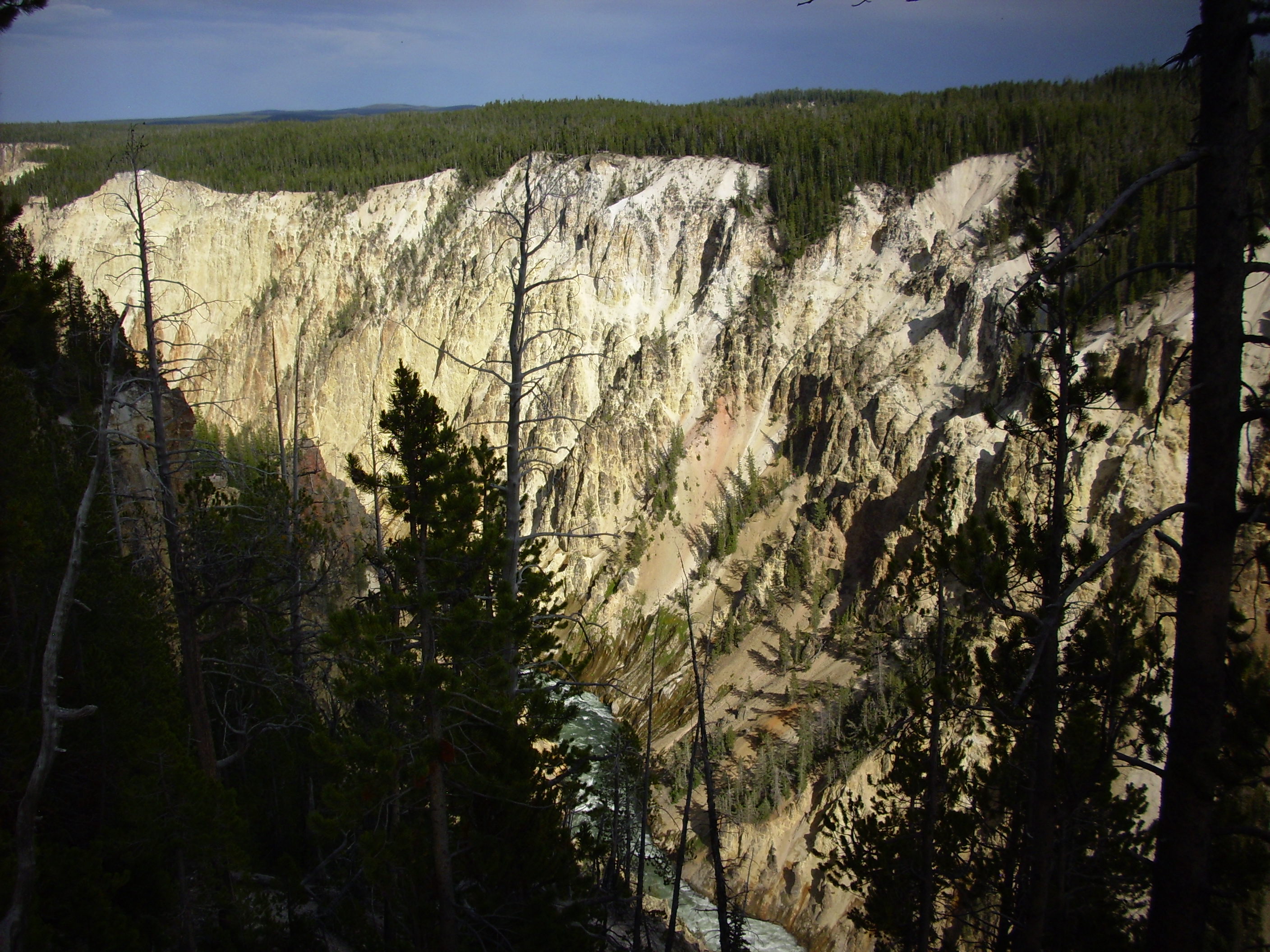
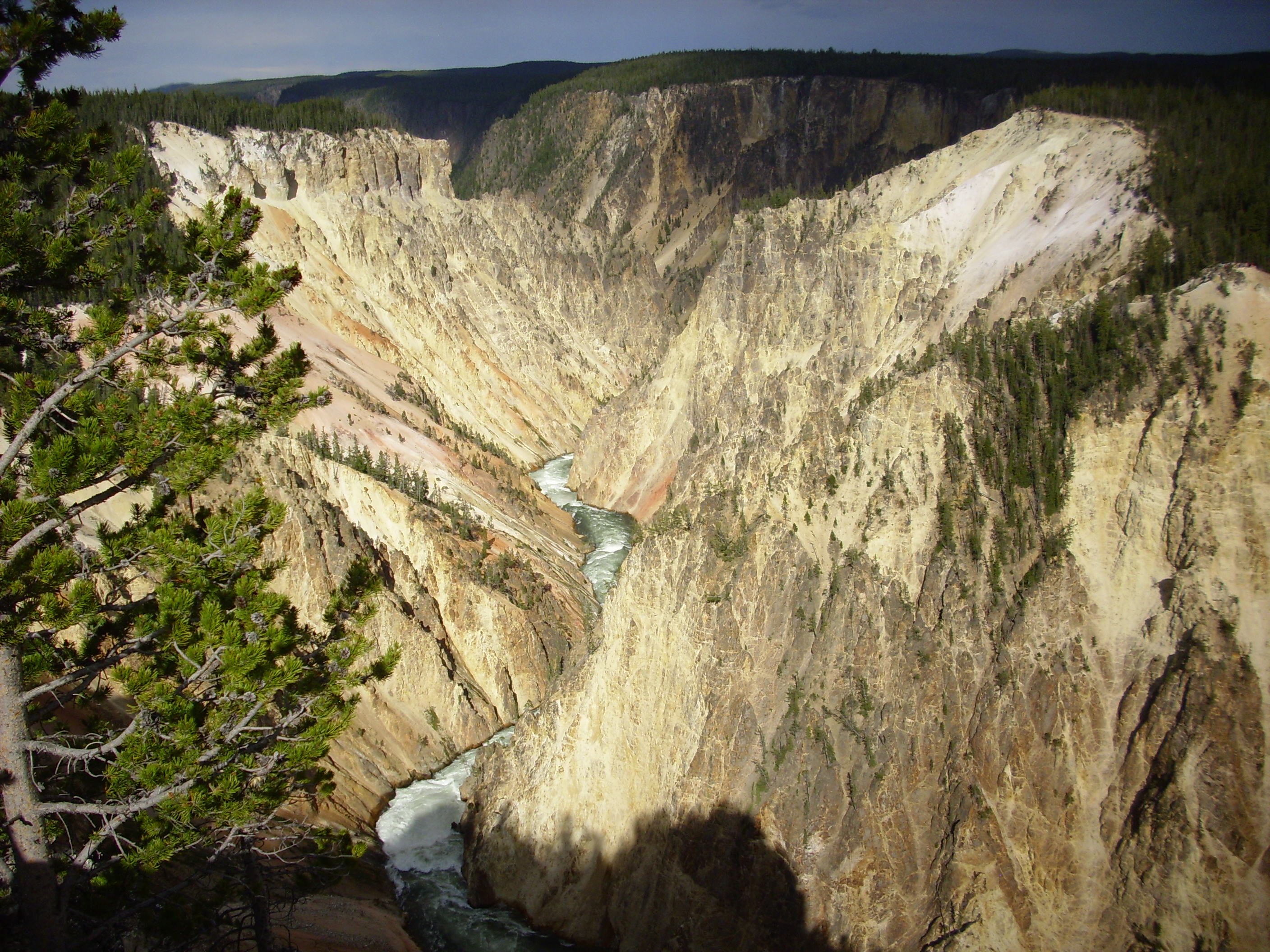
Coming over the mountain, we see the Grand Canyon of the Yellowstone in the distance. Let the pictures speak for themselves.


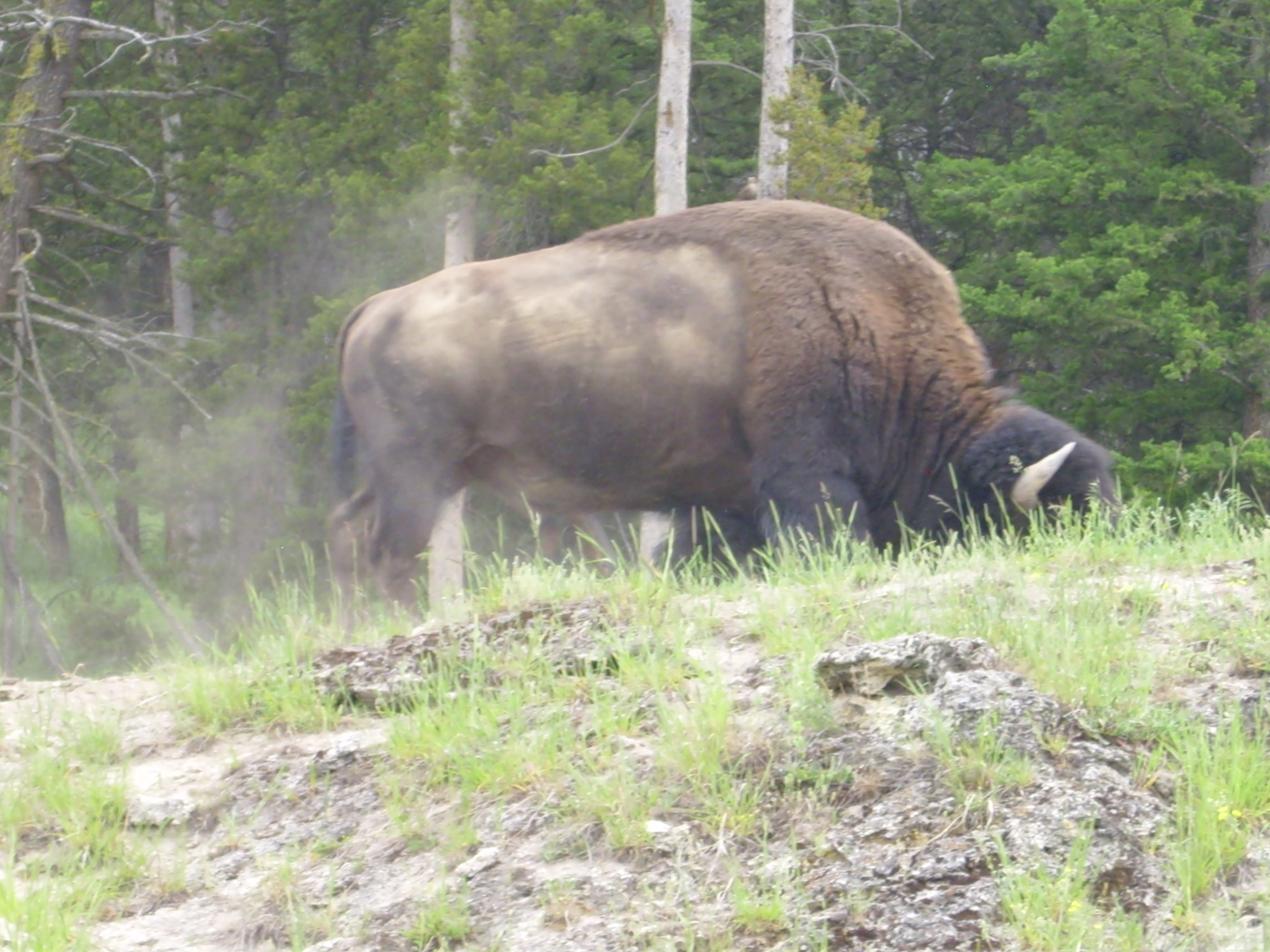
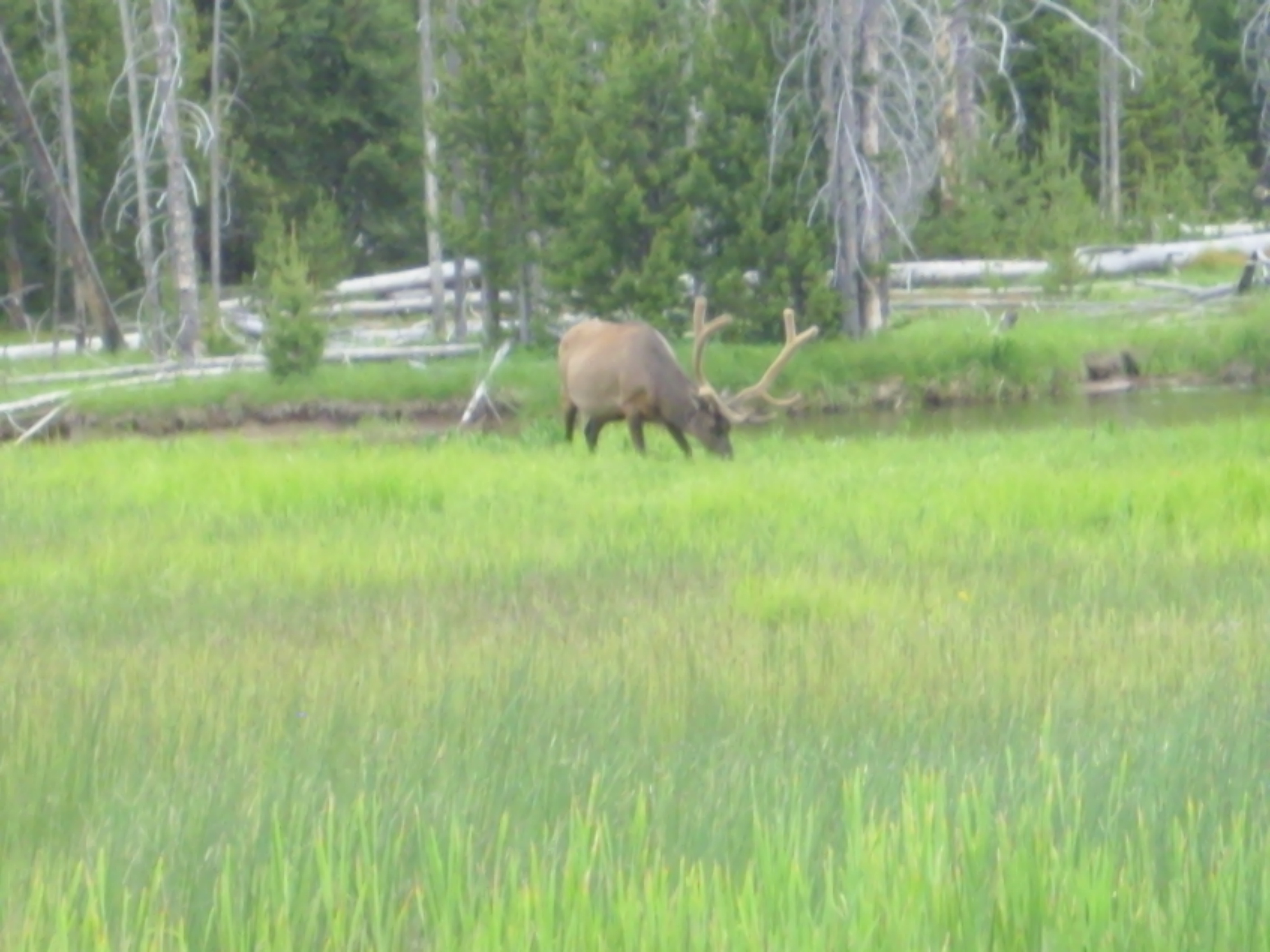
It had been a very long day by this point. We headed home. But on the way: More wildlife!
I got home rather earlier than the previous day; Heaven knows I needed my beauty sleep. (Evil Kent: “No one can sleep that much.”) However, Bruce let me use one of his meal coupons at the Three Bear Lodge for a pretty good prime rib dinner. Then to Island Park, a stop at the local store for ice:
And finally done for the day. I slept rather well. Until the ravens started up again at 5:20 AM …
I’m thinking now that the green color in the one rock may be epidote, produced by hydrothermal alteration.