A fistful of wanderlust
So I got up at 7:30 and checked the weather. Hardly a cloud in the sky. Well then.
I had the usual breakfast; packed up the new camera, spare memory cards, spare batteries, my backpack, my new walking stick, a couple of road logs, my glucose meter, an orange and a diabetic snack bar, some hiking shoes, my hiking hat, and a few other odds and ends; saw to the dog’s morning routine (which involves a great deal of sniffing and a belly rub, among other things); wrote out a flight plan for Cindy, reassuring her that the only time I’d leave the vicinity of the road was on the trails at Cerillos Hills State Park, where there would be other hikers; and headed out.
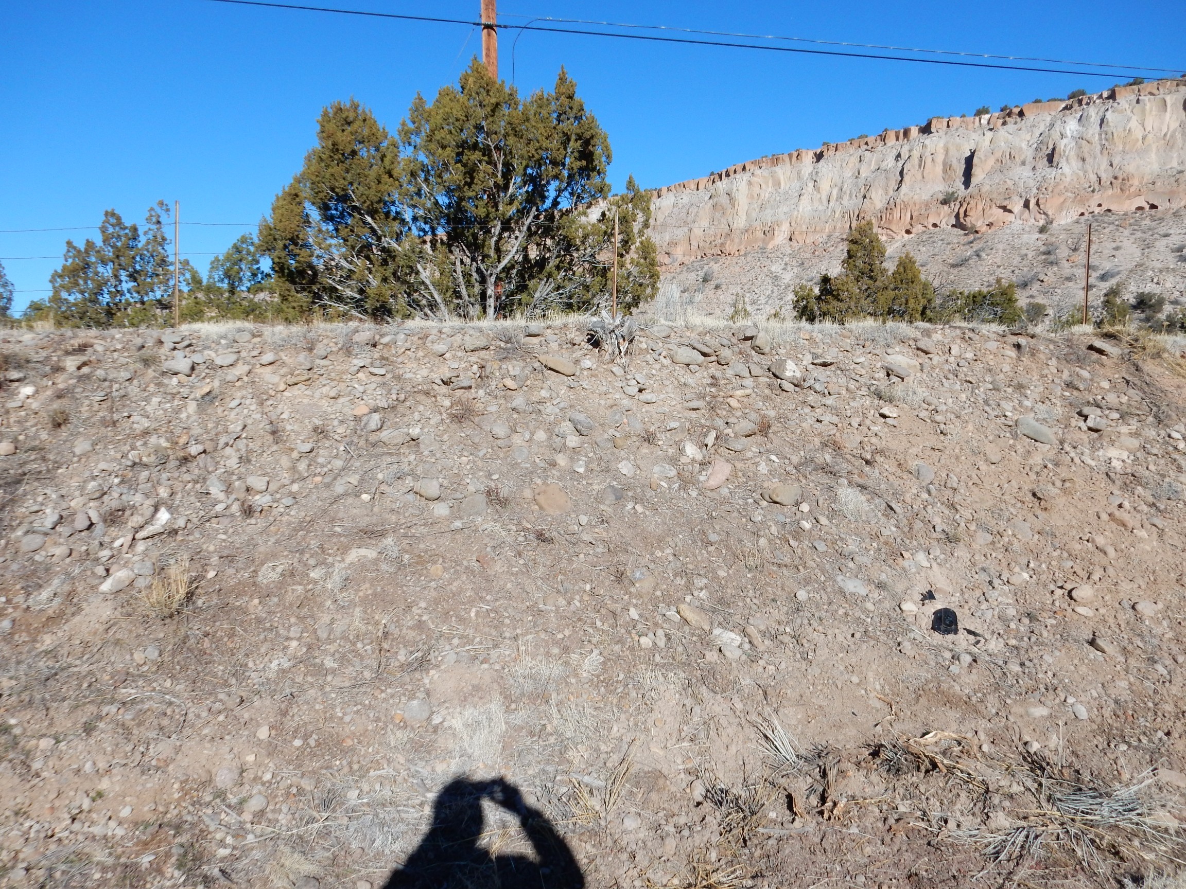
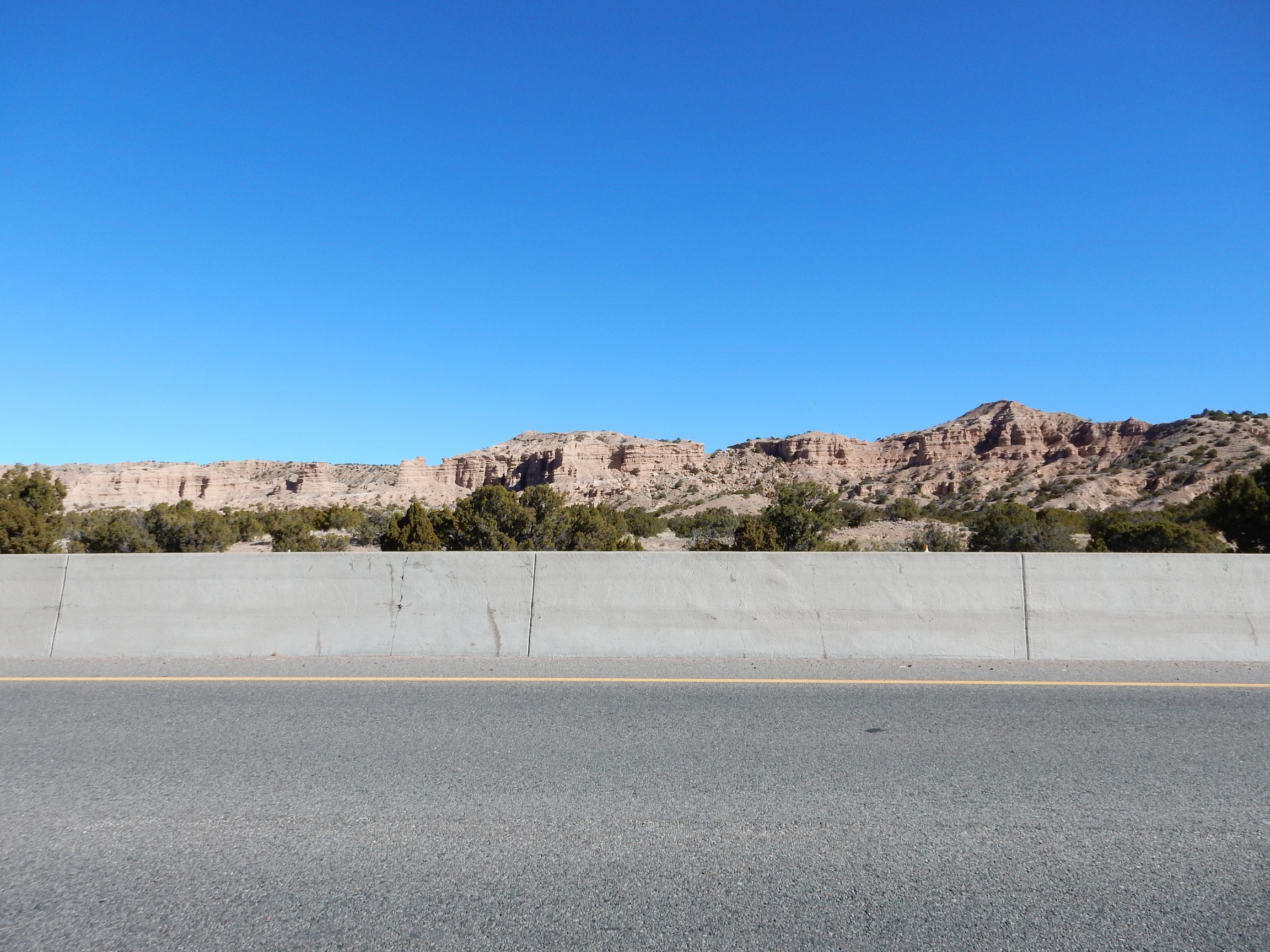
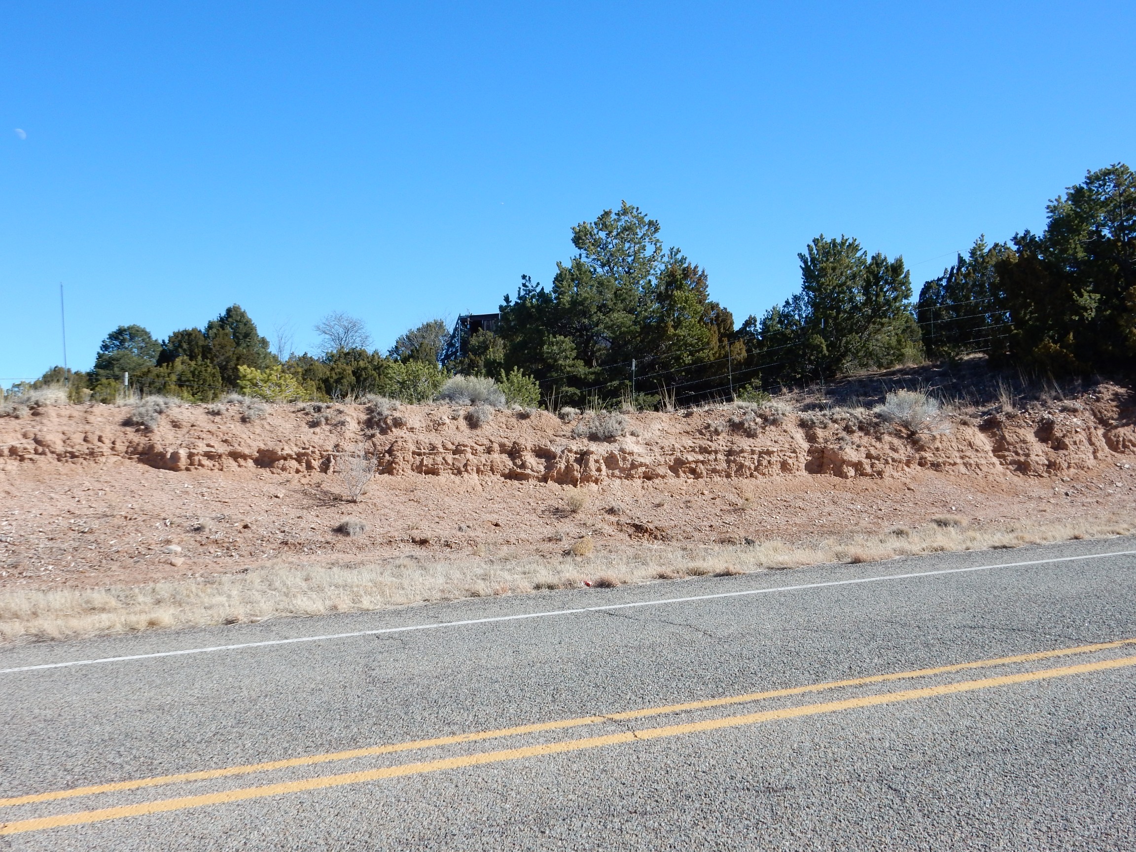
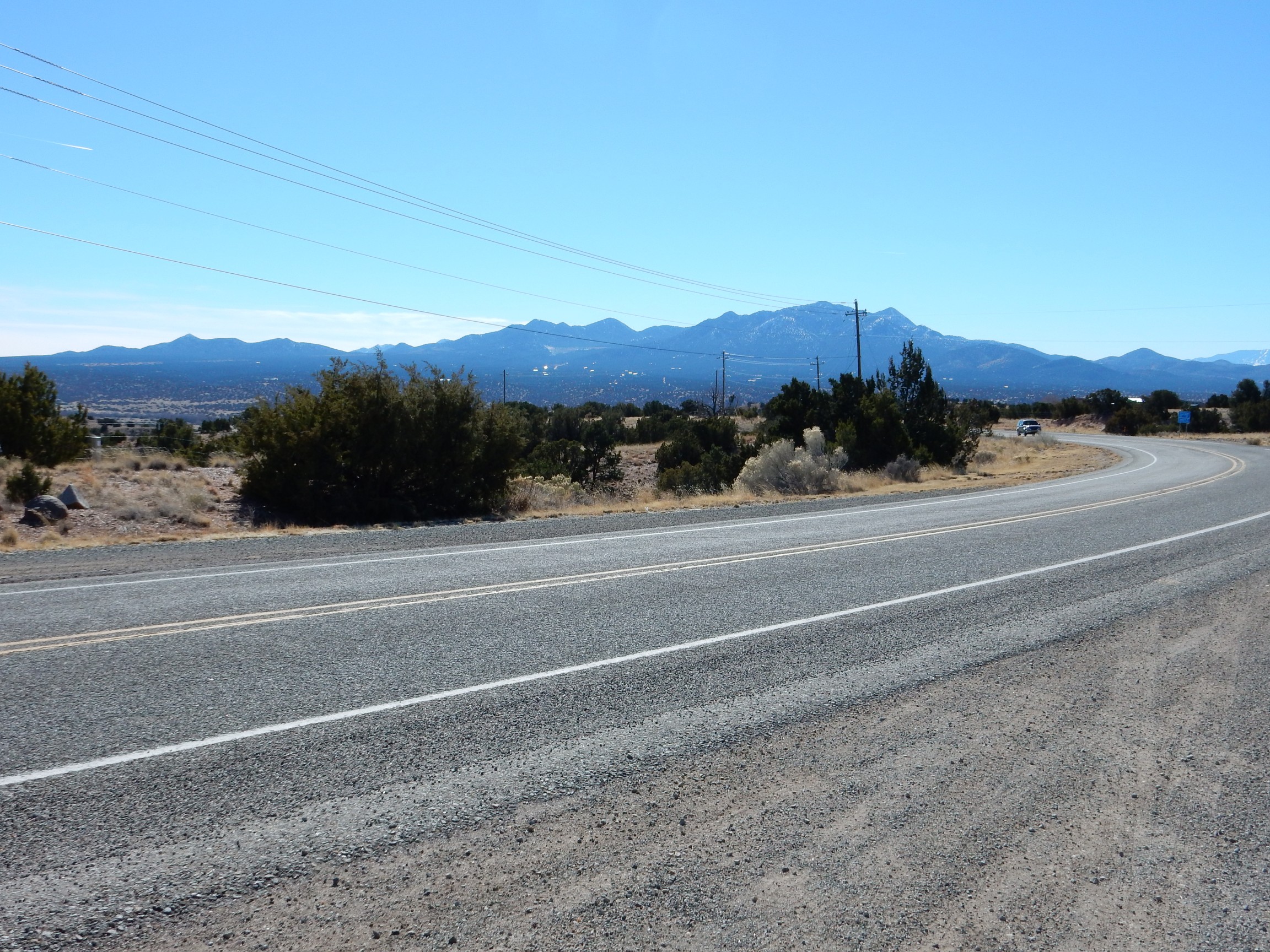
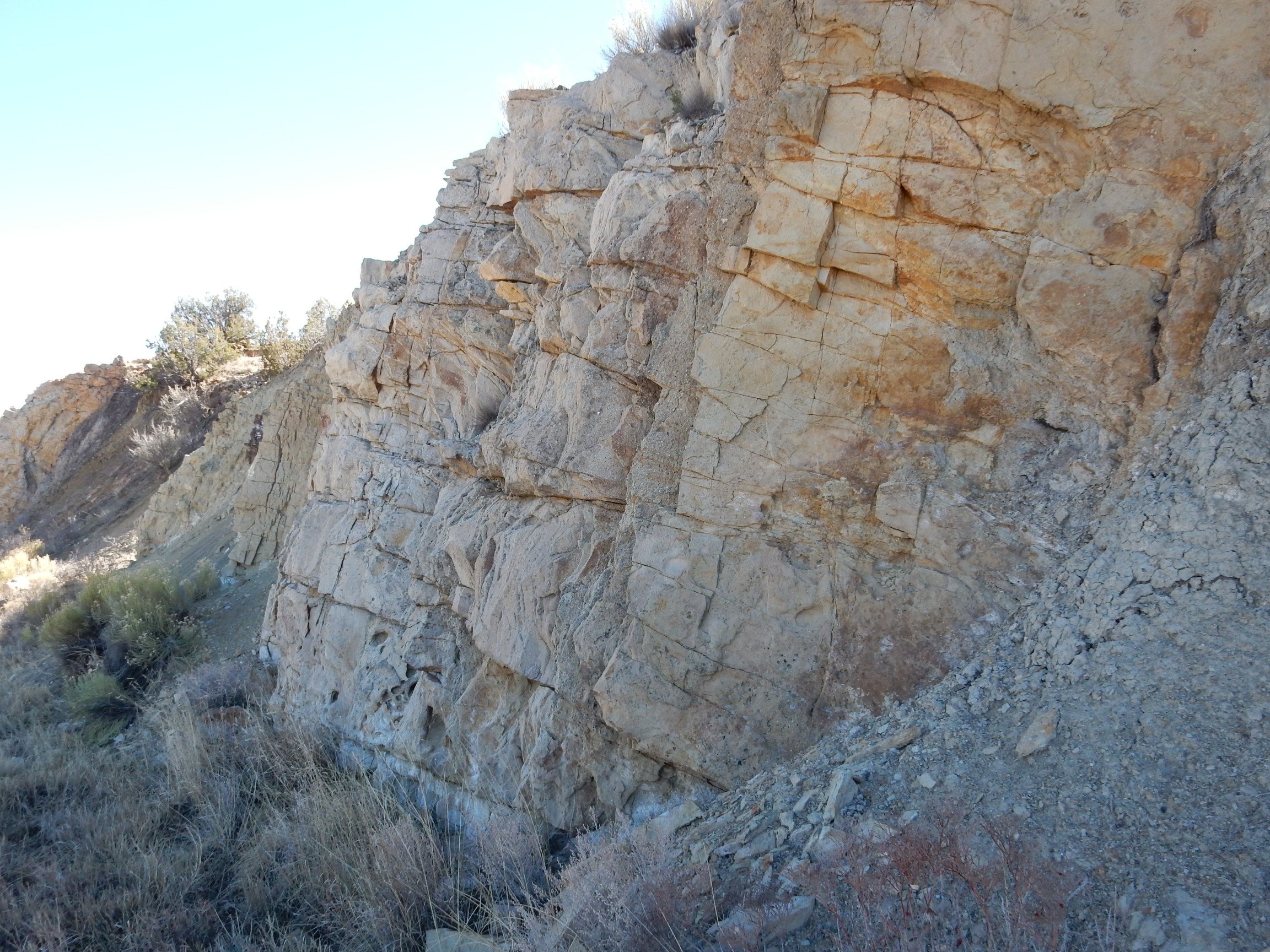
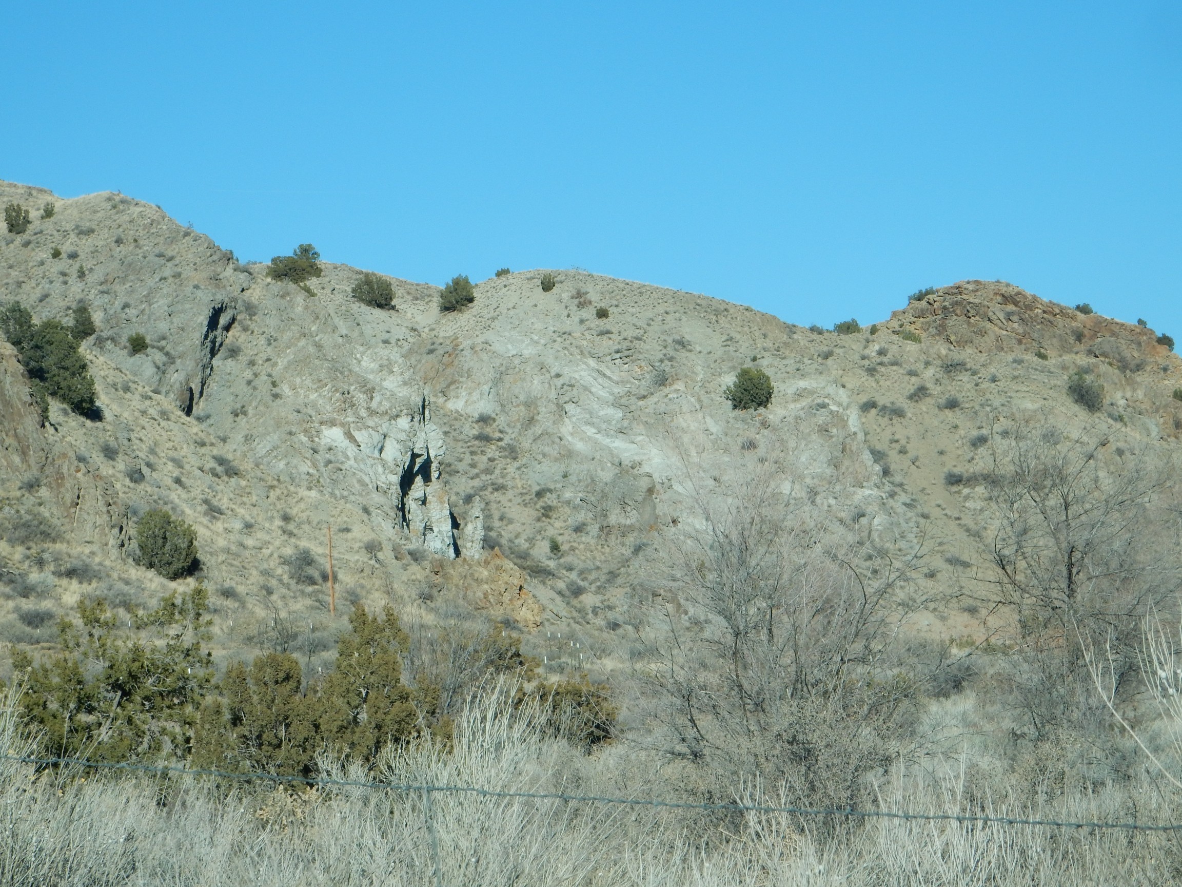
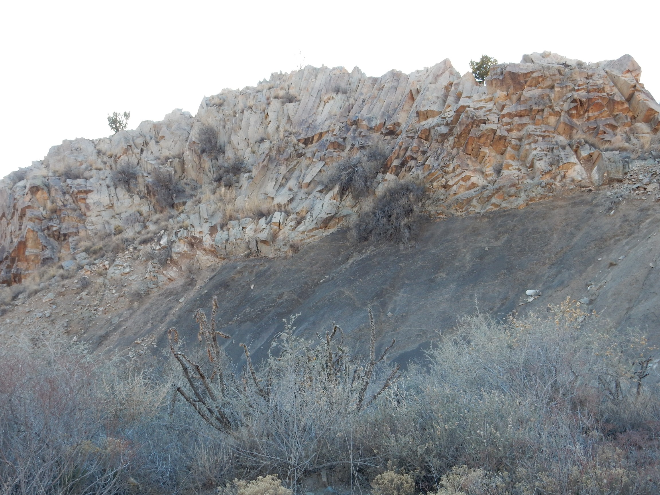
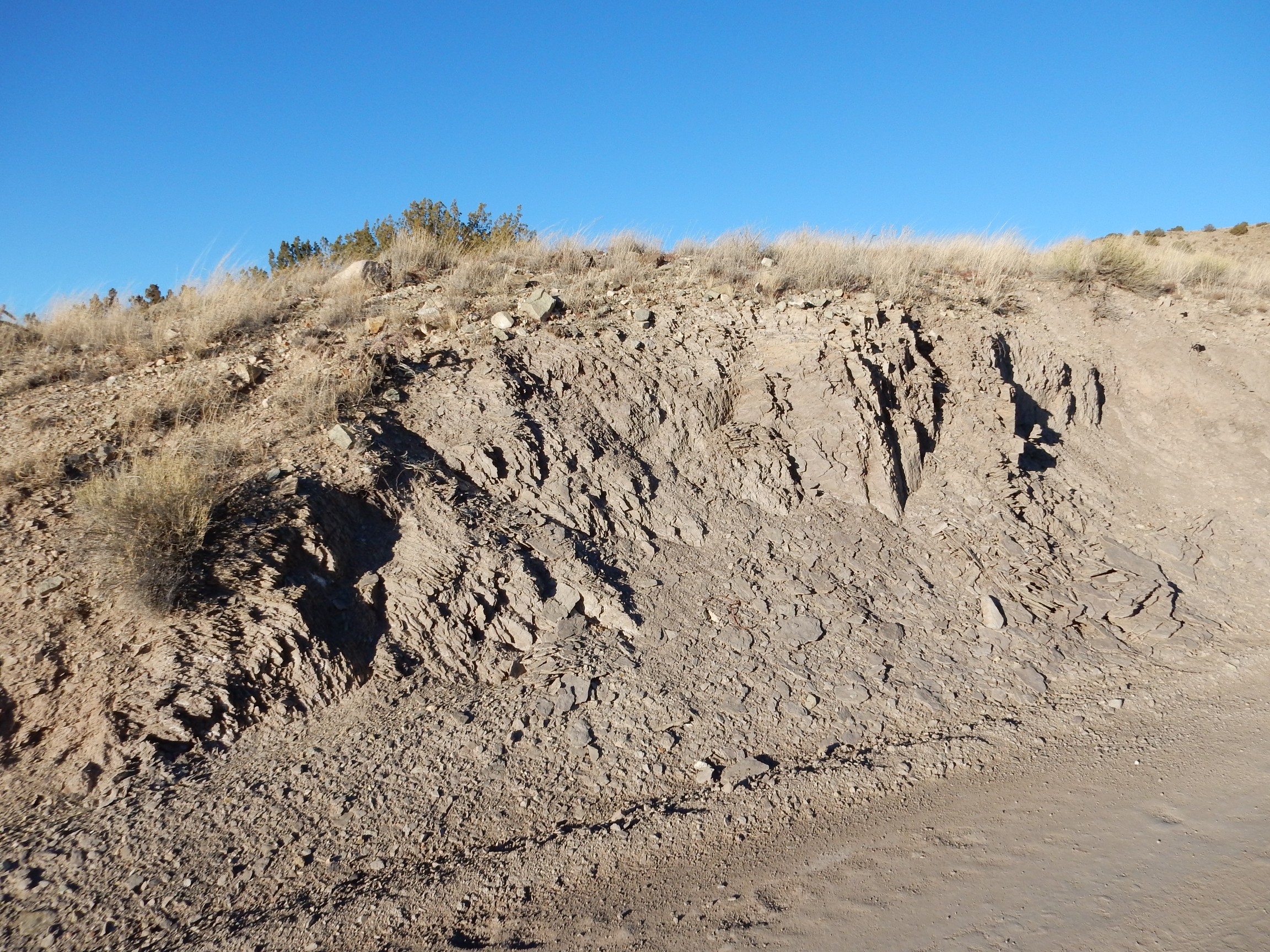
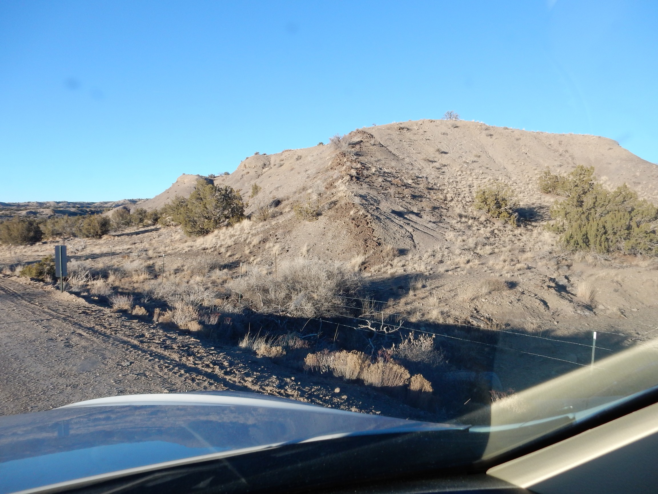
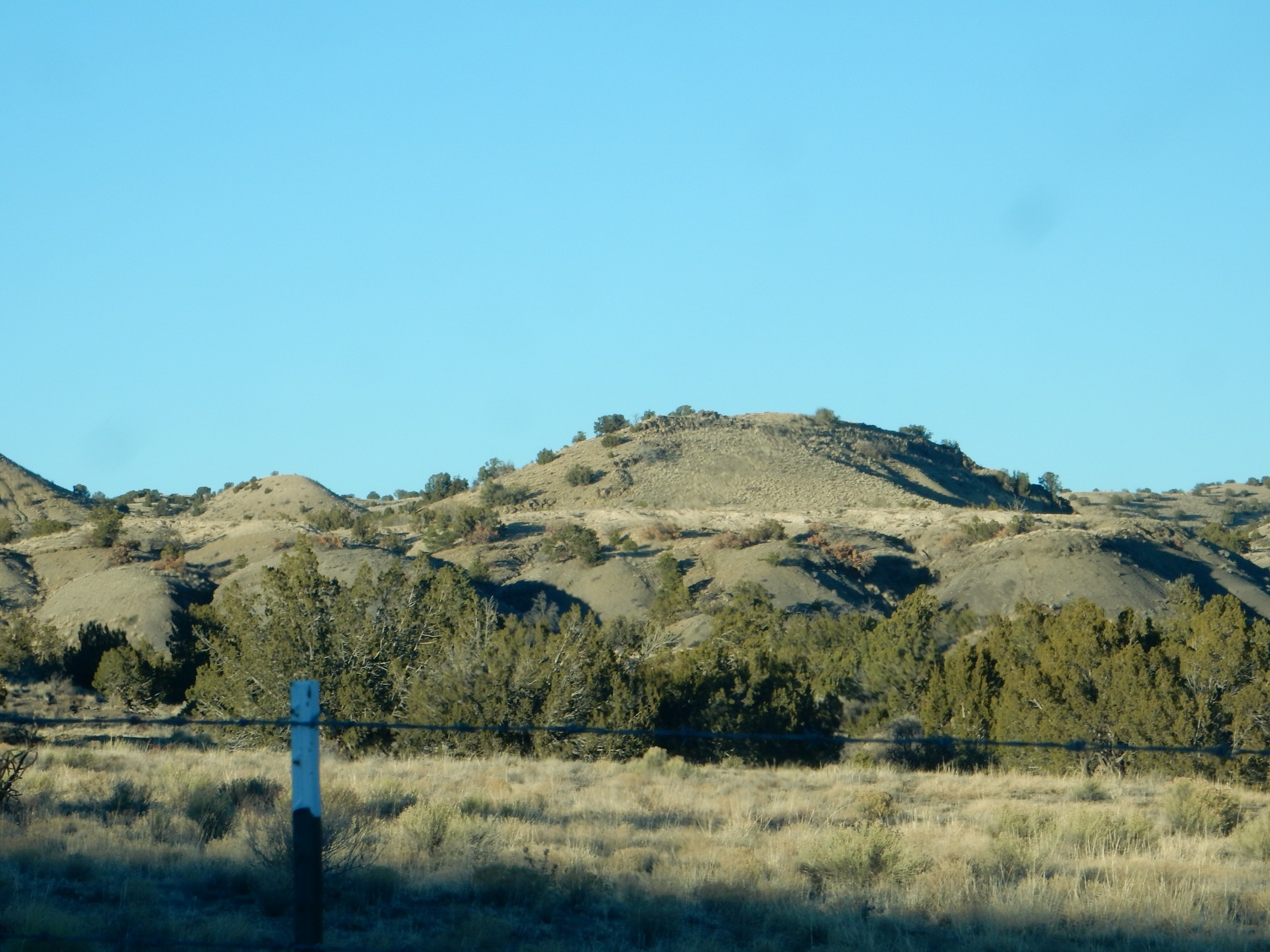
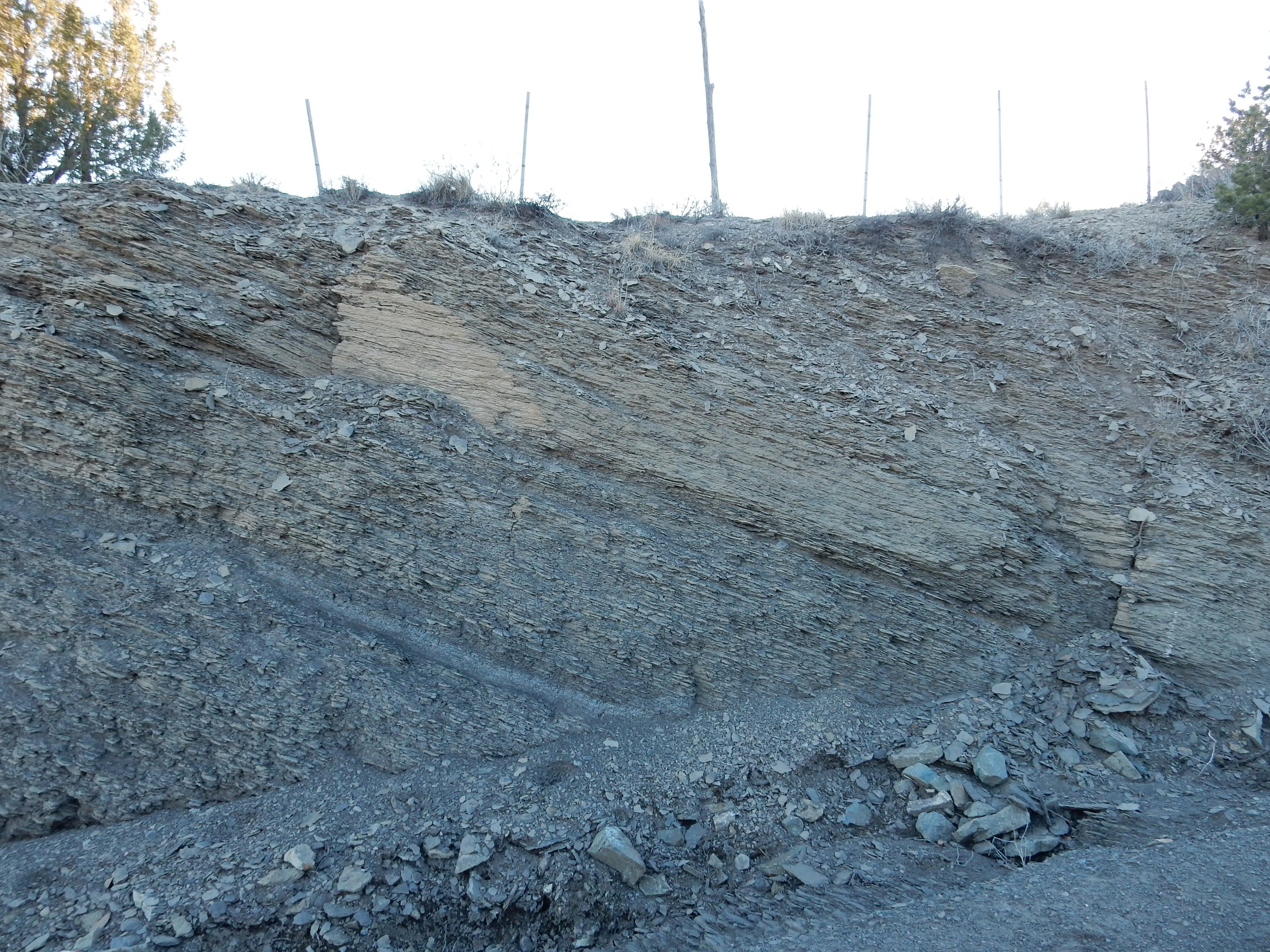
I wanted a photograph of the caveate rooms on the south face of Los Alamos Mesa for the book, so I found a good spot along State Road 4. Alas, there were telephone wires in the way. No problem; I crossed the road to where they were overhead and out of the way. And noticed that the road cut was kind of interesting.
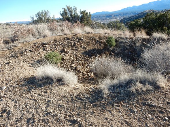
Rather a nice example of alluvial gravel, with many Tschicoma dacite clasts. Alluvial: that means deposited by running water. Clasts: the hifalutin geologic term for bits of rock. Tschicoma dacite: A kind of moderately high-silica volcanic rock that forms most of the mountains west of Los Alamos. Bits of the stuff (clasts) have been washed for miles downstream in the three million years or so since the rock was erupted.
I climbed to the top, and, like the man said, “I shall have been a fool.” Turns out this was not a road cut at all; it was a flood control berm. Hey, it happens. Not one for the book, though the makeup probably is pretty typical of canyon floors in the area. This stuff was probably bulldozed into place from the immediate vicinity.
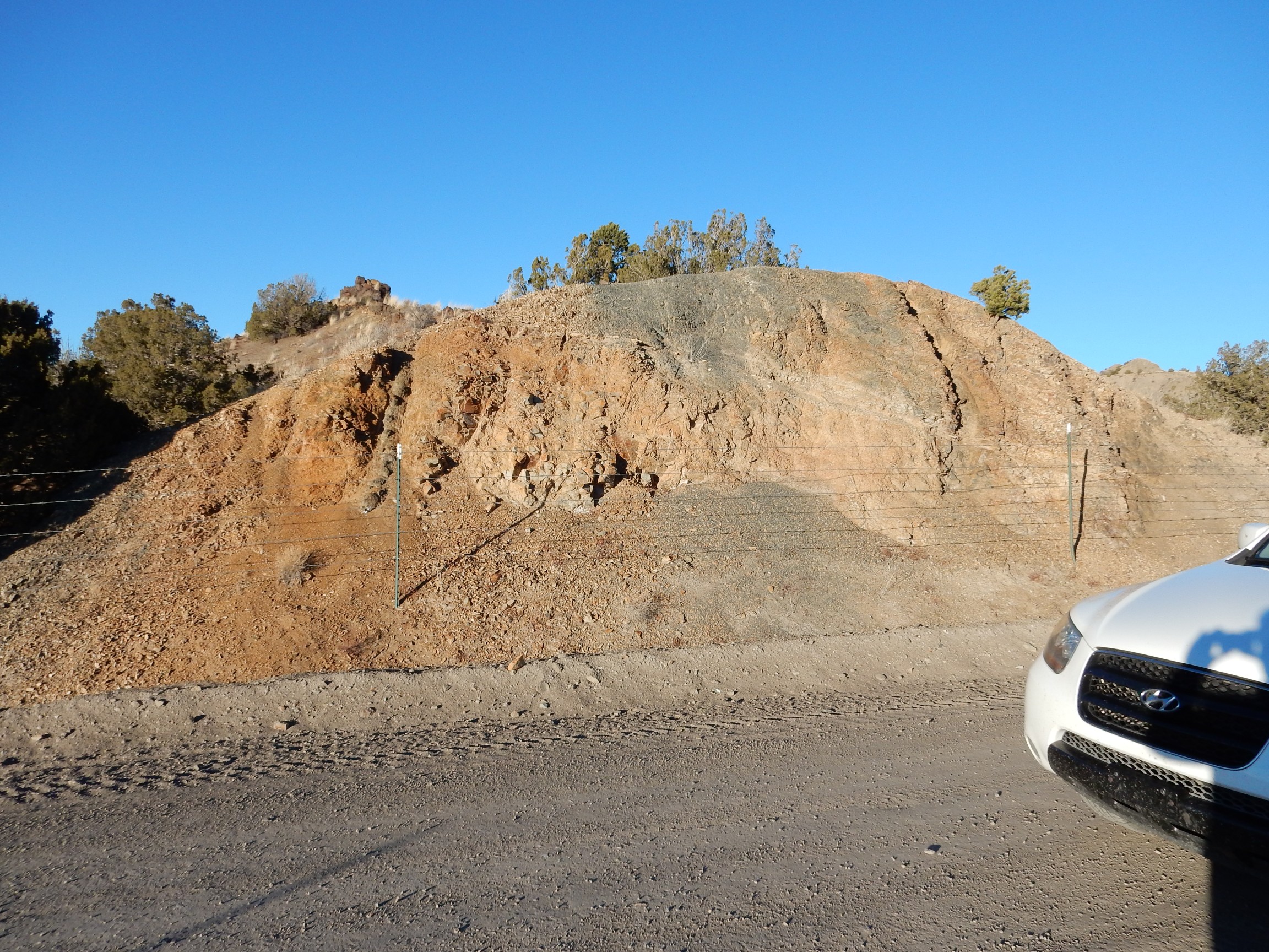
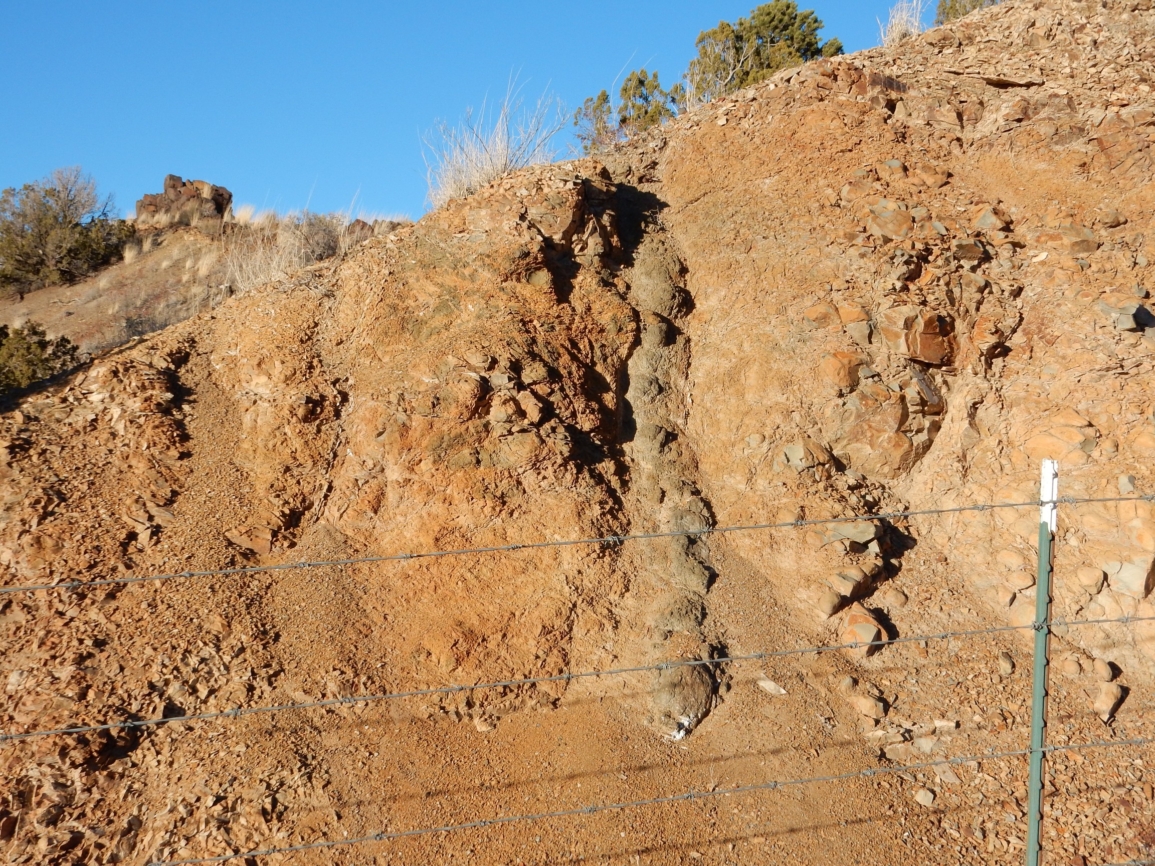
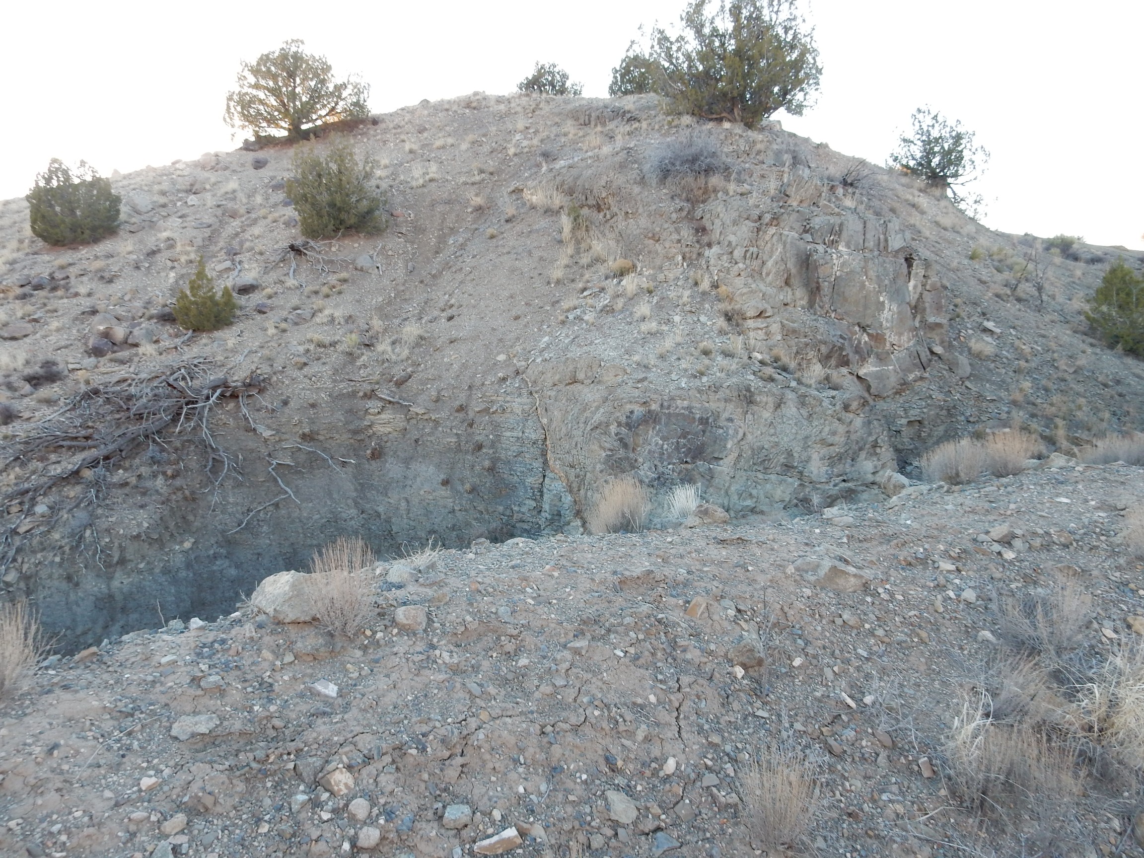
At least the caveate rooms are for real.
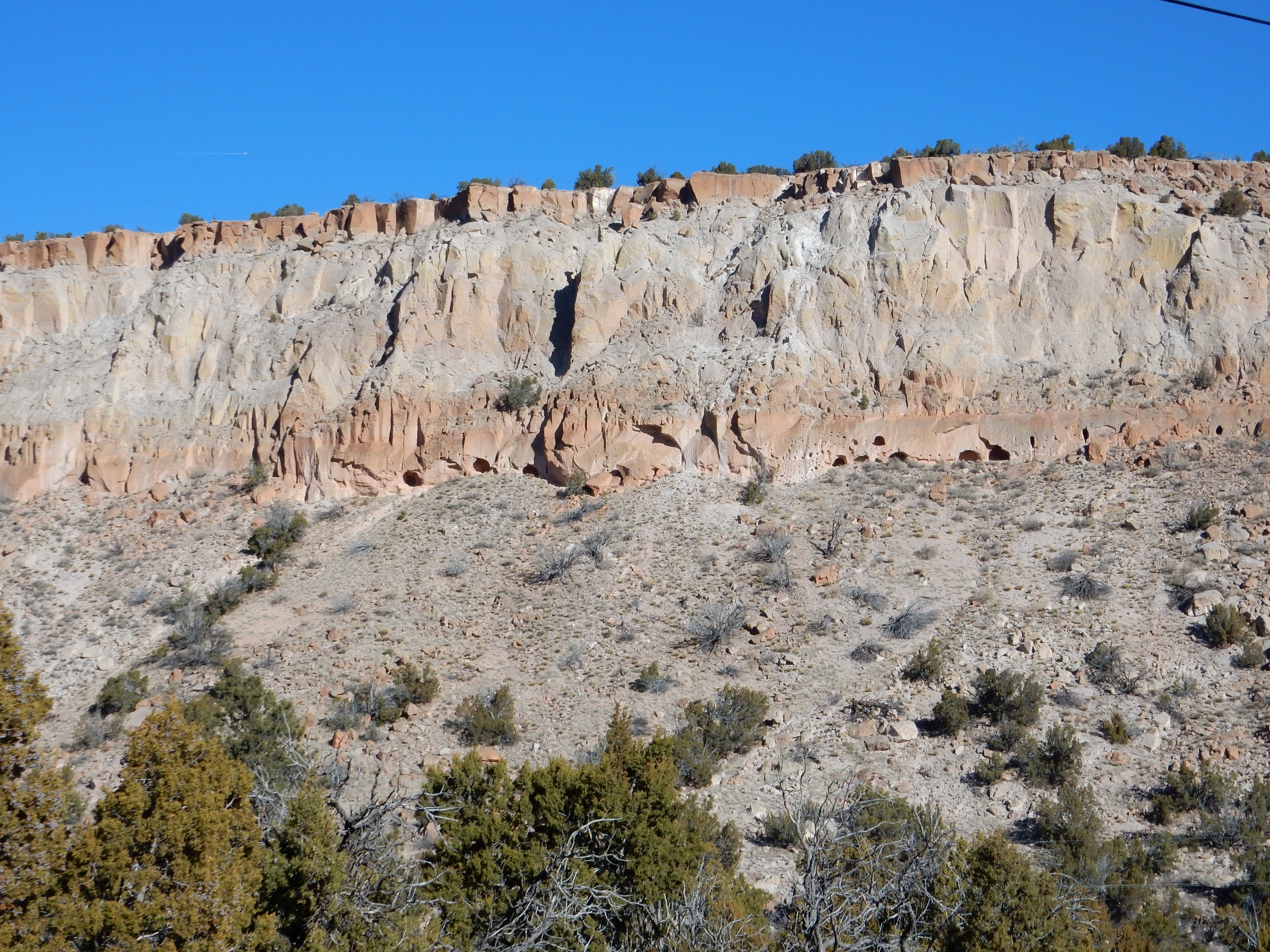
The caveate rooms are located right at the top of the talus slope below the vertical cliffs. They probably started as small natural cavities in the rock, but were greatly enlarged by the Ancestral Pueblo People. There are also what appear to be rows of pits suitable for inserting beams to support a light roof.
Next stop was Jaconita. I took a panorama of the Jemez from here last winter, but wasn’t entirely satisfied how it turned out. It seemed reasonable to try the pan feature on the new camera. On the way up the hill to the view point, I paused to photograph a contact.

Meh, not one for the book. You can barely see that there is fine sandy sediment under a layer of gravel capping the little knoll at center. The fine stuff at bottom is Pojoaque Member, Tesuque Formation, a prominent rift fill sediment formation in this area. The Rio Grande follows a large crack in the Earth’s crust, the Rio Grande Rift, that began opening perhaps thirty million years ago and immediately began to fill with sediments. The whole region has more recently been lifted up by tectonic forces, causing erosion that has now exposed many of these rift fill beds.
The gravel is river gravel from the ancestral Pojoaque River, in the wetter past.
Here’s the panorama. As with most photographs at this site, you can click to enlarge

I think it’s enough improvement over the old one to take its place in the book.
Then some zoom shots. First, the Sierra de los Valles:
This is also one for the book. And Los Barrancos:
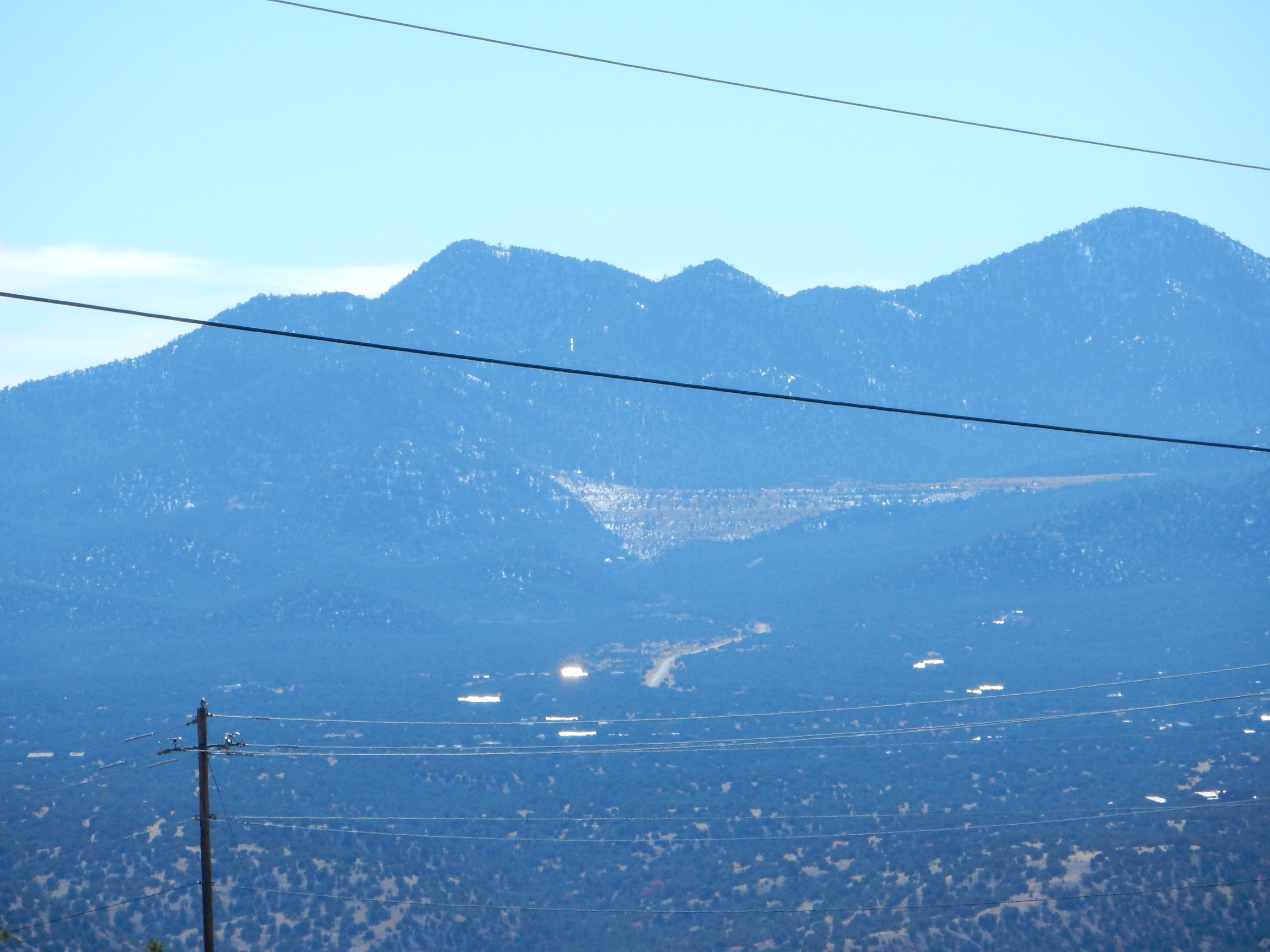
These photos are at moderate zoom. Really cranking it up, here’s Tschicoma Peak:
That’s a pretty deep zoom, but I see no loss of image quality. It’s also a wonderful picture for showing the chief formations in the Los Alamos area: Tschicoma Dacite forming the mountains of the Sierra de los Valles, aged 3 to 5 million years; pink Bandelier Tuff forming the upper surface of the Pajarito Plateau, aged 1.6 to 1.2 million years; under that, the gray Puye Formation, formed from debris eroded off the fresh domes and flows of the Sierra de los Valles and so also around 3 to 5 million years in age; and, finally, the tan to pink beds of the Chamita Formation of the Santa Fe Group at the bottom, five to ten million years in age.
Los Barrancos:

I’m really liking the zoom. I think it’s because the optical zoom was so dismal on my old camera. There was almost never any point to using the zoom, because the quality was so poor you did just as well to blow up the picture digitally. I’m not even talking about the old camera’s digital zoom, where you expect loss of definition.
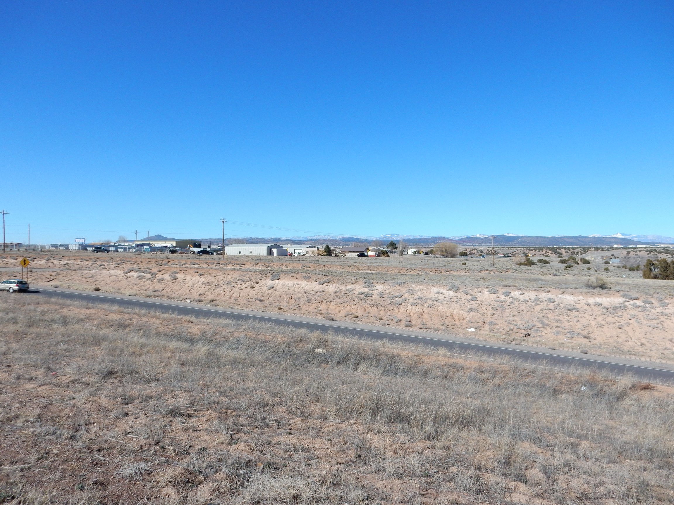
I headed on, stopping in Pojoaque to have the oil changed on the Wandermobile. It turned out to be a somewhat long wait; cars were already starting to stack up when I arrived, and they had run out of some replacement items, such as air filters. Go figure. I decided to wait it out and ended up spending nearly an hour there. I took the opportunity to take a photograph of the hills to the west.
This may possibly be one for the book. It illustrates the upper erosional surface of the Tesuque Formation in this area, though not terribly well. The Tesuque Formation was originally laid down in a basin of the Rio Grande Rift where the basin floor was eroded nearly flat. The whole area has been uplifted since, triggering renewed erosion throughout northern New Mexico, but geologists can still discern level surfaces between arroyos that mark ancient physiographic surfaces. These correspond to base levels set by some feature downstream in the ancient river system, such as a natural dam or a lake into which the river flowed. The river valley then eroded down to the base level. Later the base level dropped abruptly, due to some change in the downstream flow, and erosion began bringing the valley down to the new level, but leaving traces of the old level. There are at least five distinct physiographic surfaces in the areas I visited today.
And, I found myself getting snarky about the infomercial playing nonstop on the television at the lube shop. It probably started with the two gorgeous actresses discussing the danger to your air flow sensor from failing to replace your air filter regularly, then worsened with the preview of the next Smurf movie. (No. I swear I am not making that up.) Peaked with “Many viewers have written and asked us where our show originates … ” Bull. …Well, all right. It’s possible they have actually had two or three viewers (“many”) write and ask about the show, because people latch onto the strangest interests.
Like photographing remnants of a three-million-year-old valley floor outside a lube shop in Pojoaque, New Mexico.
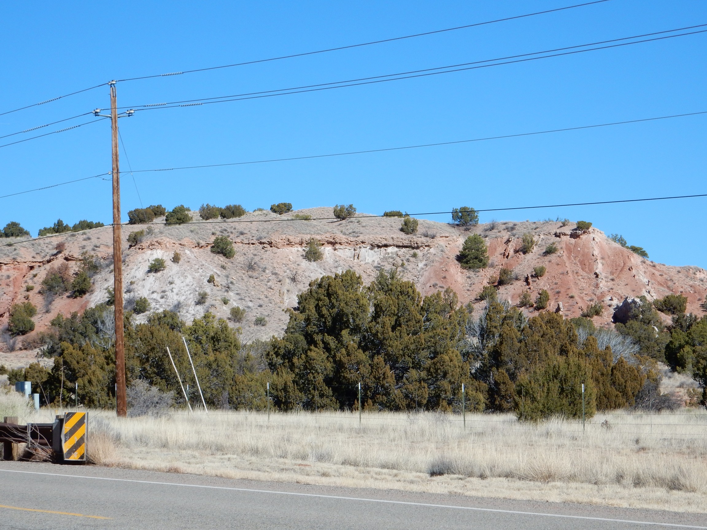
The car was finally finished, and I hurried on. It was already later in the day than I might have wished. I did pause very briefly for a photograph of some dramatic beds of the Skull Ridge Member, Tesuque Formation, near Camel Rock, which I had been meaning to photograph for some time.
The Skull Ridge Member includes some of the older beds of the Tesuque Formation. Normally rock units are named after some notable geographic location in the area where the unit is first recognized. However, I cannot find a Skull Ridge on any map of New Mexico. I suspect the geologists who first characterized the Tesuque Formation in the Pojoaque area, who also did a great deal of fossil digging, named one of their fossil quarries Skull Ridge and then named the member after their quarry, but the name never made it onto an official topographical map.
Cool name, regardless. Kind of has an Indian Jones ring to it (though he was an archaeologist, not a paleontologist.)
I planned to follow a New Mexico Geological Society road log dating back to 1996. I was going to try something that Mentor of the Wanderlust, Bruce Rabe, suggested some time ago. He thought it might be worthwhile for me to retrace some of these older logs, taking photographs at each checkpoint with GPS coordinates, and post these updated and more profusely illustrated versions online. The original logs are in the public domain (like virtually everything published by the New Mexico Geological Society) so copyright was not an issue, and they might be of interest to other amateur rock hounds.
The log for today began at the on ramp of Cerillos Road onto I-25. I didn’t want to drive down Cerillos Road, which is a madhouse on a weekend, so I took the relief route to I-25 and then headed east a mile or so to the Cerillos exit, so I’d start at the right spot. I reset my odometer and took my first picture.

I know: Very exciting.
The road log entry:
Mileage 0.0. From intersection of Cerillos Rd. and I-25 on-ramp, drive south on I-25. We are on the Plains surface, the intermediate level of three Pliocene-Pleistocene(?)-age physiographic surfaces (Spiegel and Baldwin, 1963) that developed on the uppermost Santa Fe Group, mapped in this area as Pliocene-Pleistocene Ancha Formation by Baldwin and Kottlowski (in Spiegel and Baldwin, 1963). The Plains surface forms the inter-arroyo divides to the south. To the north is the Airport surface, the lowest surface, which parallels the Santa Fe River. The highest surface, the Divide surface, forms the low skyline north of Santa Fe. All of these surfaces are partly erosional and partly constructional in origin. Old pumice mines in this vicinity were excavated in Jemez Mountains tephra deposits within the upper part of the Ancha Formation. 1.8
That’s a pretty typical road log entry. Each entry starts with the cumulative mileage from the starting point, usually followed by some navigational reference and a description of whatever interesting geology there may be at that checkpoint, and ends with the mileage to the next checkpoint.
Yeah, there’s a lot of jargon there. Let me try to decode. The author of the log mentions three physiographic surfaces, like the one I described at Pojoaque. (I am fairly certain the surface there is a different surface from any of those described in this log.) Pliocene-Pleistocene is a reference to the age of the surface; the Pliocene Epoch began about 5.33 million years ago and the Pleistocene Epoch about 2.58 million years ago. The Ancha Formation is the youngest of the Santa Fe Group rift fill formations in the Santa Fe region, and covers most of the area south of Santa Fe. It’s basically layers of dirt, sand, and gravel deposited in this section of the Rio Grande Rift from two to five million years ago. “Inter-arroyo divides” means the flat ground between arroyos. “Tephra” is ash, pumice, and volcanic bombs and blocks thrown into the air by a volcanic eruption. Finally, there are references to who the geologists were that determined all this.
You know? It’s tough to follow along in the log while simultaneously driving down the road and taking photographs. It should not surprise you that I eventually gave up on Bruce’s idea; only that I stuck with it as long as I did. It’s not that the idea does not have a lot of merit. It’s just that it would best be done by a crew of three (driver, navigator, photographer) with plenty of time on their hands, rather than a lone driver who already lost an hour getting his car serviced.
1.8 Exit 276. At 1:00 to 3:00, the series of low hills and mesas is part of the Cerros del Rio volcanic field, one of the largest volcanic fields in the Rio Grande rift (300 km2). The present platform of flows contains approximately 60 cinder cones, maars, tuff rings and tuff cones (Aubele, 1978) that range in age from 2.8 to less than 1.4 Ma (Doell et al., 1968; Smith et al., 1970; Bachman and Mehnert, 1978). Basalts are the most abundant composition, but rocks range to latite-andesite (Baldridge, 1979; Duncker, 1988). The flows interfinger with the upper beds of the Ancha Formation on the east side of the field.
About 6 mi to the north the Yates Petroleum No. 2 La Mea Unit oil test was drilled in 1985. Beneath about 40 ft of Ancha beds, the Tesuque Formation is 3926 feet thick, and the underlying late Oligocene-early Miocene Abiquiu Formation/Bishops Lodge strata are 3574 ft thick, above Proterozoic rocks. As noted by Cather (1992), the Abiquiu/Bishops Lodge unit contains a 1950-ft-thick unique basal “La Mesa” sequence of inerbedded lacustrine limestones and vitric volcaniclastics, similar to the fresh-water limestones that crop out near La Bajada, about 15 mi southwest of the oil test. Yet, as we will see 7.5 mi to the south, as the field trip route drops off of the Santa Fe plains into the Galisteo Creek valley, horizontal Ancha Fm beds uncomformably overlie steeply dipping Espinaso and Galisteo strata. No Tesuque or Abiquiu beds are present and a full Mesozoic-Paleozoic sequence underlies the early Tertiary units. These geologic relationships support Cather’s (1992) Eocene Pajarito uplift, postulated local source of the Galisteo Formation, whose southwest-trending southeast edge parallels I-25. This is Cather’s (1992) Santa Ana accommodation (Fig. 3.1) zone which projects northeastward towards the Santa Fe River fault zone. 0.7
I had to pull to the side of the very busy interstate just past the exit to make my photographs for this checkpoint.
Possibly one for the book, since there’s an easily accessible, if somewhat unspectacular, road cut into the Ancha Formation along the frontage road.
Close up of the Cerros del Rio.
This really is one for the book, because it shows the Airport Surface so well. You can see the very level surface at the foot of the Cerros del Rio lining up perfectly with the inter-arroyo divides in the middle distance.
And, I know: The road log for this checkpoint is chock full of jargon. It’s not meaningless jargon, though, like you’d find in certain journals of postmodern cultural studies; it serves the legitimate purpose of jargon, which is to concisely communicate highly specialized information.
Let’s take a crack at unpacking this.
The present platform of flows
refers to the high, flat mesa top of the Cerros del Rio. The lava from this volcanic field was low in silica, making it relatively fluid, so that it spread out for miles in thin layers. These thin flows built up the platform that has now been eroded around the edges to produce the mesa top.
contains approximately 60 cinder cones, maars, tuff rings and tuff cones (Aubele, 1978) that range in age from 2.8 to less than 1.4 Ma (Doell et al., 1968; Smith et al., 1970; Bachman and Mehnert, 1978).
Cinder cones are small volcanoes that erupt fluid lava saturated with gas. The expanding gas blows bits of the lava into the air, which cool to form the cinder that builds up around the vent as a cinder cone. Maars are volcanoes that erupt through sediment saturated with ground water, so that steam explosions produce particularly fine cinder that forms a very shallow, dish-like crater. Tuff rings and tuff cones are the lower parts of maars and cinder cones that have become cemented. The impression you should get is of lots and lots of very small volcanoes in a relatively small area, each volcano erupting only a few times; geologists call this a monogenetic volcanic field.
Ma is a symbol meaning “millions of years before the present.” So the Cerros del Rio formed between 2.8 and 1.4 million years ago.
I can only wish I had as many papers to my credit as this Al guy.*
Basalts are the most abundant composition, but rocks range to latite-andesite (Baldridge, 1979; Duncker, 1988).
Composition of volcanic rocks is of great interest to geologists, because it provides clues to the processes at work deep in the earth. Basalt is a very common kind of volcanic rock that is quite low in silica and usually quite dark in color. It is thought to come more or less directly from the earth’s upper mantle. Latite-andesite is significantly richer in silica than basalt, and also slightly enriched in potassium. If it were more enriched in potassium it would be latite, while if it were not enriched, it would be andesite. Andesite tends to form the higher terrain in the Cerros del Rio because its higher silica content makes it more viscous, so that it tends to accumulate around the source vent rather than flowing freely away, like basalt.
The flows interfinger with the upper beds of the Ancha Formation on the east side of the field.
“Interfingering” means that beds of two formations alternate where the two formations come together. In this case, sediments were steadily accumulating to build up the Ancha Formation, but were occasionally drowned in lava from an eruption in the Cerros del Rio. Sediments then resumed accumulating on top of the lava flow, until the next eruption put another layer of volcanic rock in the sequence. Interfingering demonstrates that the two formations formed during the same time period.
This is particularly important when one formation is sedimentary and one is volcanic. Volcanic rocks can be accurately dated using radiometric methods, based on decay of radioactive atoms in the rock. Sedimentary rocks can’t be dated this way, because they form from a mixture of older rock fragments of various ages. However, sedimentary rocks contain fossils that paleontologists would love to date.** When the sedimentary formation interfingers with a volcanic formation, the age of the sedimentary rock must be the same as the age of the volcanic rock, and that gives you the age of any fossils in it.
About 6 mi to the north the Yates Petroleum No. 2 La Mesa Unit oil test was drilled in 1985.
Geologists love road cuts and oil wells. Both expose the rock beds underlying the surface soil so that they can be studied. Oil wells bring up only rock cuttings, but they go much deeper than any road cut. Under U.S. law, the well logs of oil wells drilled on public lands must be published in a timely manner to promote the advancement of geologic knowledge.
Beneath about 40 ft of Ancha beds, the Tesuque Formation is 3926 feet thick, and the underlying late Oligocene-early Miocene Abiquiu Formation/Bishops Lodge strata are 3574 ft thick, above Proterozoic rocks.
So the earth beneath this area is a thin veneer of relatively young Ancha Formation beds over very thick beds of Tesuque Formation and Abiquiu Formation/Bishops Lodge rift fill sediments. The latter date from the late Oligocene Epoch, which began about 38 million years ago, through the early Miocene Epoch, which began about 23 million years ago. These sedimentary beds go down over a mile and a half before you hit solid “basement rock” of Proterozoic age, over 1.3 billion years old in our area. (At which point the folks drilling the exploratory well are saying “Shucks” because, if you haven’t hit oil by the time you hit the basement, you aren’t going to — you’ve got a dry well.)
As noted by Cather (1992), the Abiquiu/Bishops Lodge unit contains a 1950-ft-thick unique basal “La Mesa” sequence of inerbedded lacustrine limestones and vitric volcaniclastics, similar to the fresh-water limestones that crop out near La Bajada, about 15 mi southwest of the oil test.
Lacustrine limestone is limestone deposited in a freshwater lake. Vitric volcaniclastics are beds of volcanic rock fragments (volcaniclastics) that are glassy, like obsidian (vitric.)
Yet, as we will see 7.5 mi to the south, as the field trip route drops off of the Santa Fe plains into the Galisteo Creek valley, horizontal Ancha Fm beds uncomformably overlie steeply dipping Espinaso and Galisteo strata.
I’ll have a wonderful photograph of this unconformity later in this post. Steeply dipping beds are beds that have been tilted by tectonic forces to where they form a steep angle with the horizontal
No Tesuque or Abiquiu beds are present and a full Mesozoic-Paleozoic sequence underlies the early Tertiary units. These geologic relationships support Cather’s (1992) Eocene Pajarito uplift, postulated local source of the Galisteo Formation, whose southwest-trending southeast edge parallels I-25. This is Cather’s (1992) Santa Ana accommodation (Fig. 3.1) zone which projects northeastward towards the Santa Fe River fault zone. 0.7
This is really kind of interesting. The Pajarito Uplift hypothesis is that the entire area between present-day Los Alamos, Santa Fe, and Espanola was pushed up by tectonic forces during the Eocene Epoch (56 to 34 million years ago) to form a low mountain range. Most of the Mesozoic and Paleozoic beds were eroded off this uplift to form the Galisteo Formation to the south and west, which is why the exploratory well found no Mesozoic or Paleozoic rocks between the Abiquiu beds and the basement. About 30 million years ago, the tectonics changed, and the uplift dropped back down to form the Espanola Basin of the Rio Grande Rift, in which the Abiquiu and younger formations accumulated.
The next checkpoint was succinct:
2.5 Santa Fe Downs Race Track, on the right is built on the Airport geomorphic surface. At 11:00 are the Cerrillos Hills.

I think I was having serious doubts about this whole project at this point.
3.8 Milepost 274. At 3:00 on the skyline are the Jemez Mountains. 1.8
Not going to bother to stop for a picture for this one. A lot of checkpoints in these logs are largely navigational, to help you be sure you’re on the right road and your odometer matches the cumulative mileage. In fact, in rural country, a lot of road log checkpoints simply say “Cattle guard.” I was having some serious doubts about this project at this point, because it was both tedious and a little bit hazardous, and after a few more checkpoints I gave up and just enjoyed following the road log and taking pictures of the cooler stuff.
Next came the cienega of La Cienega.
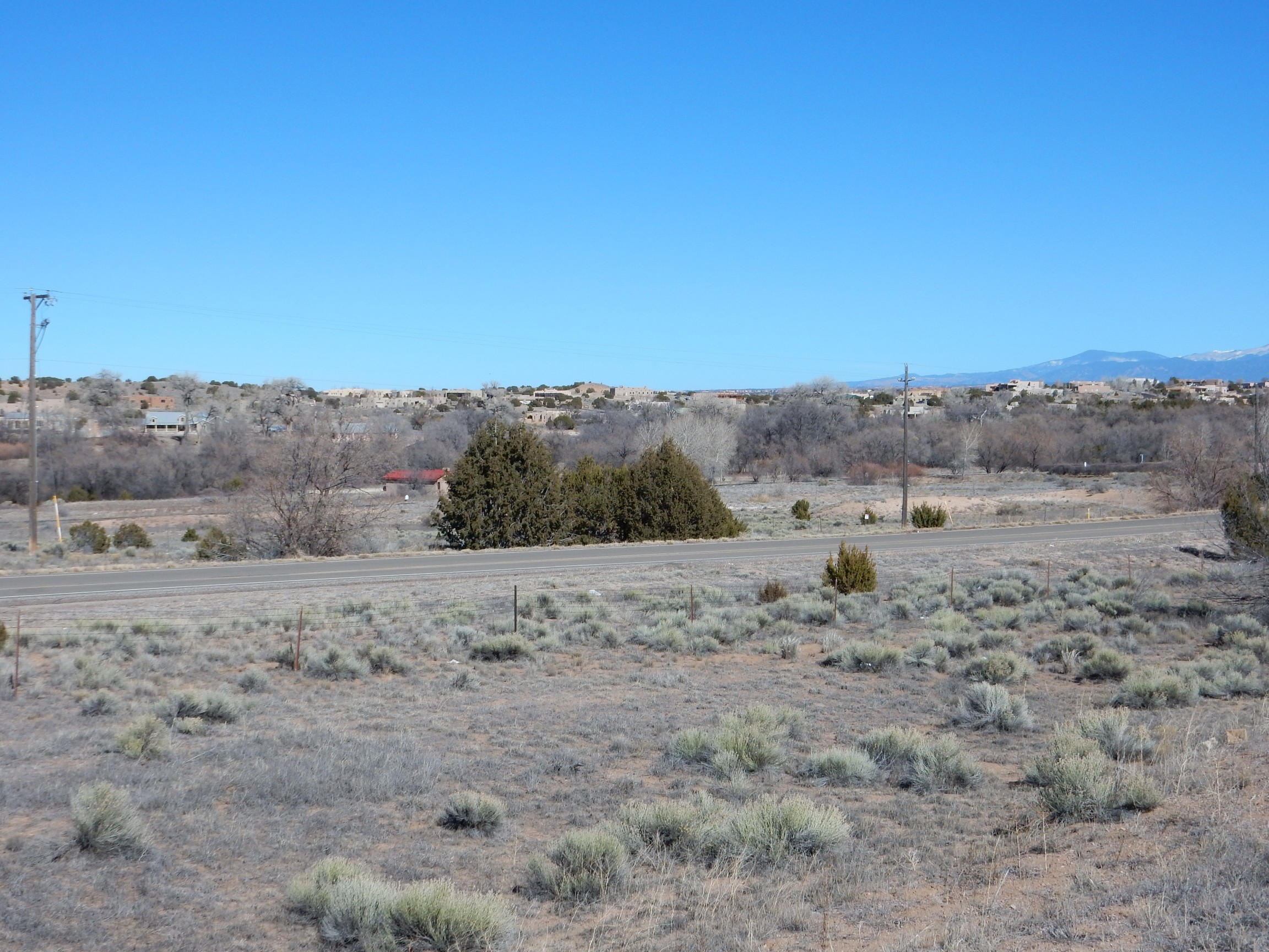
The marshes here show where a permeable zone in the Santa Fe Group beds sits over impermeable shale. This forms a natural water trap. During the Spanish colonial era, La Cienega was the breadbasket of Santa Fe, and a major stop along the royal road from Mexico City to Santa Fe. There is a museum near here, El Rancho de los Golondrinas, that I ought to visit sometime, perhaps when I have family in town. (They are not so much into geology.)
Nearby are exposures of the Cieneguilla Basanite.
The low hill in the middle distance is Cerro Seguro. It is underlain by the Cieneguilla Basanite, an unusual volcanic formation that erupted in small volumes around 25 million years ago. This was about the time the Rio Grande Rift was opening. The lava erupted here was very low in silica and rich in potassium and sodium, producing a rock rich in the minerals nepheline, olivine, clinopyroxene, and magnetite. This contrasts with the much more common basalt, which is composed mostly of feldspar and clinopyroxene, only occasionally containing olivine or much magnetite. I’ve hiked to this hill, and found that the high magnetite content causes the rock to weather to a dark rusty color.
This was my exit. I turned south off I-25. Directly ahead is Bonanza Hill.
According to the road log, this is underlain by augite-biotite syenite trachyte porphyry about 30 million years old. This is a rock with moderate silica content and elevated sodium and potassium that cooled enough while still deep in the earth to contain large feldspar crystals.
I turned right on the frontage road and passed Cerro de Cruz, also known as Cavalry Hill. (I might have expected the English name to be Calvary Hill.)

This is mostly young sediments, but there are a few patches of Cieneguilla Basanite with a very low silica content of 40%. (Most igneous rocks have much more silica.)
I turned left around the hill and headed south. It turns out this is movie country, and the road passes the entrance to Bonanza Creek Ranch, which is a 16,000-acre working ranch that also hosts a movie town.
In the background are the Cerillos Hills, one of my main destinations for the day. These are part of the Ortiz porphyry belt, a north-south chain of volcanic rock around 30 million years old that marks the very earliest stage of rifting in this area. The hills are mostly laccoliths, bodies of magma that pushed up the overlying rocks but did not quite break through to the surface, and cooled underground into visibly crystalline rock. The highest point is Cerro Bonanza, also known as Santa Rosa Mountain, 7088′ tall. It is underlain by augite biotite monzonite, a rock with an intermediate content of both silica and sodium and potassium.
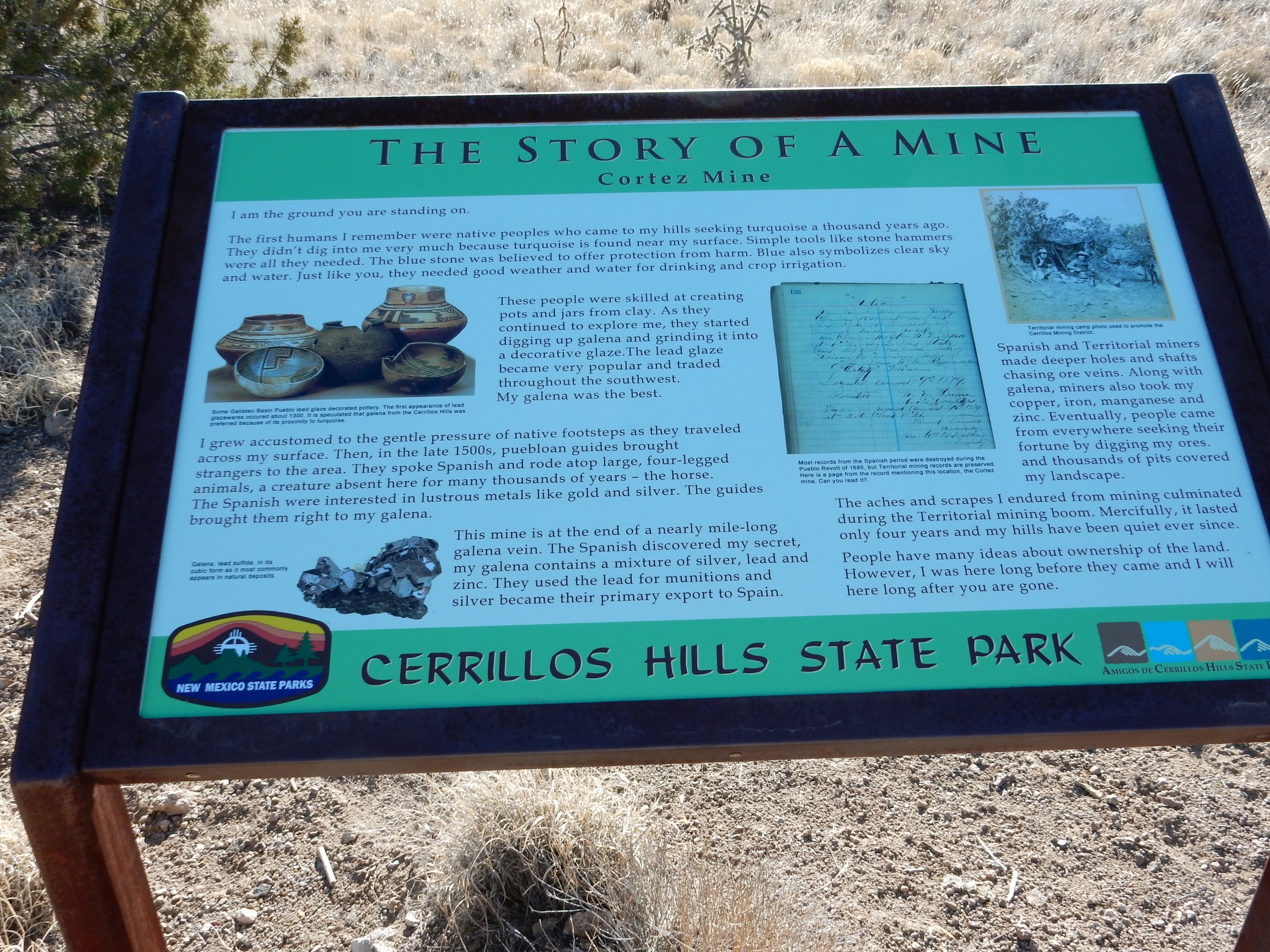
Supposedly you can rid your body of toxins by making yourself sweat. (It’s not really true, unless you mean the modest quantities of urea and salt found in human sweat.) Bodies of magma cooling underground really do “sweat” certain trace elements dissolved in hydrothermal fluids, which penetrate the surrounding rock to deposit valuable metal ores. The Ortiz porphyry belt has numerous old mines and mining claims, and gold was being mined here as recently as the 1970s. But the mineral that has been mined the longest in the Cerillos Hills is turquoise.
Turquoise is a form of copper aluminum phosphate, and the gemstone most closely associated with native American jewelry of the Southwest. It has been mined in the Cerillos Hills since at least 700 A.D., the date of an archaeological site near Mexico City where turquoise has been found that has the chemical fingerprint of Cerillos Hills turquoise. Mount Chalchihuitl in the Cerillos Hills was the largest open pit mine of any kind in North American when the Spanish arrived in 1535. The native Americans mined the deposit by building large bonfires over the ore beds, then dousing the fires with cold water to fracture the rock by heat stress. The rest was done with stone tools. The Spanish subsequently mined small quantities of silver, but the big boom was between 1879 and and 1885 or so. I’ll say more about that later.
A little further down the road I was able to get a good telephoto shot of one of the movie towns.
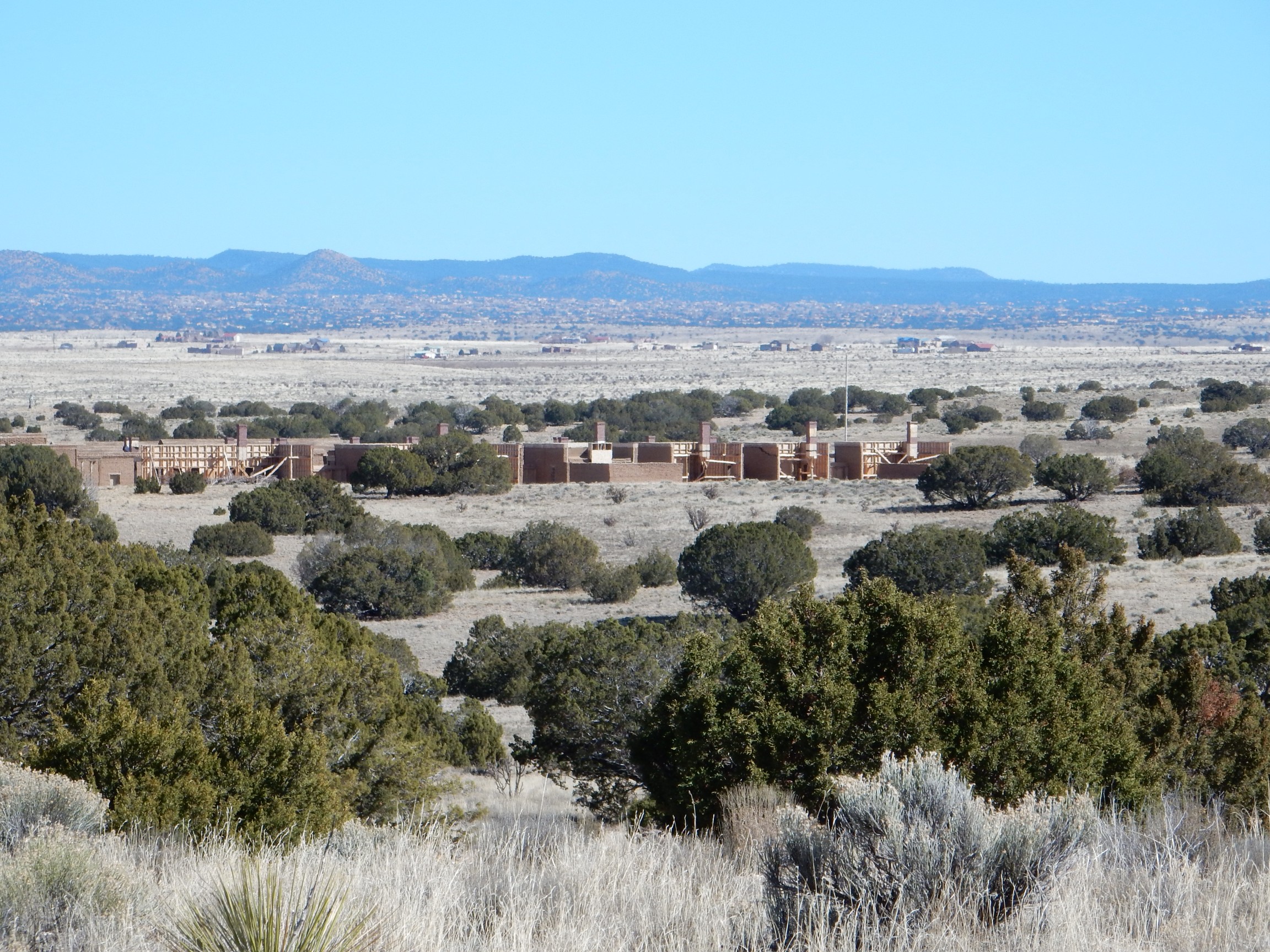
Click for the full image, and you’ll see that practically the entire town is a facade, which we are seeing from the back side. I can’t find this set on Google Maps, which (together with its obviously pristine condition) suggests it is brand-new construction for a movie that either filmed last summer or will be filmed this spring. I’m guessing the latter; I see some hints the sets are still under construction, such as the half-completed brick wall just right of center.
Straight ahead is Cerro de la Cosena.
Lead and zinc were once mined in this area.
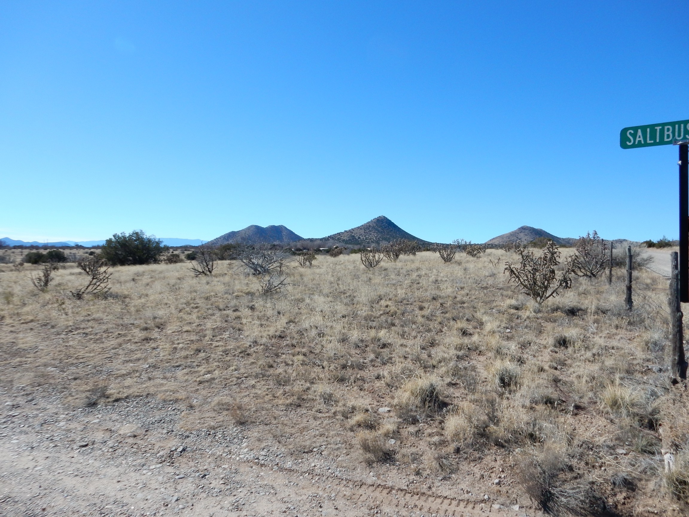
The road turns left and passes the Turquoise Hills.
The geology here is interesting, with monzonite domes pushing up an apron of Cretaceous sediments that have experienced some contact metamorphism from the heat of the magma. However, the hills are (mostly) private land so there was no getting closer than a telephoto shot of the Tiffany Mine on the hill to the right.
Apparently the mine really was owned by Tiffanys of New York from 1890 to 1906, and when the miners were not fighting off sporadic raids by Pueblo Indians asserting an ancestral claim on the place, they were mining about $2 million in turquoise. That’s the value of the raw turquoise in 1900 prices; the finished stones would be far more valuable in today’s dollars.
The turquoise formed after magma intruded into the Cretaceous rocks here and began to cool. The cooling magma sweated hydrothermal fluids rich in copper, which deposited copper sulfides and pyrite in the fractured zone of rock around the intrusion. The sulfides were later oxidized to form turquoise.
The road turned south at a nice spot for a panorama to the northeast.
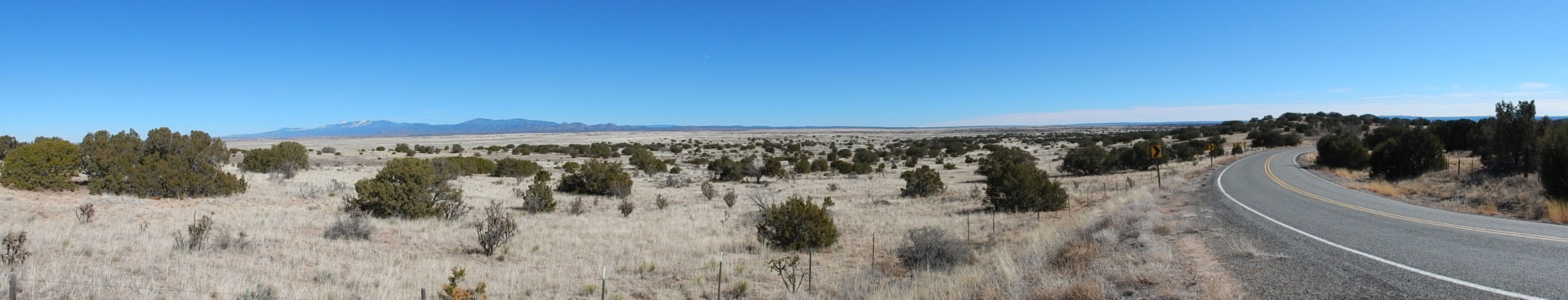
Except my sense of direction was pretty bolloxed by this point. It felt later in the day than it actually was, perhaps because of the low winter sun, and all the directions in the road log were by reference to the orientation of the road rather than points of the compass. So south felt like west and east felt like south. I thought I was looking southeast at this point rather than northeast. Well, no real harm done.
The road south again and began to descend into the Galisteo Valley. To the southwest were the Cerillos Hills.
To the south were the Ortiz and San Pedro Mountains.
Like the Cerillos Hills, the Ortiz Mountains are a cluster of laccoliths. However, the light patch at left marks the location of a volcanic vent where the magma broke through to the surface. The vent became filled with breccia (shattered rock) which was then penetrated by hydrothermal fluids to produce the Cunningham Hill gold mine.
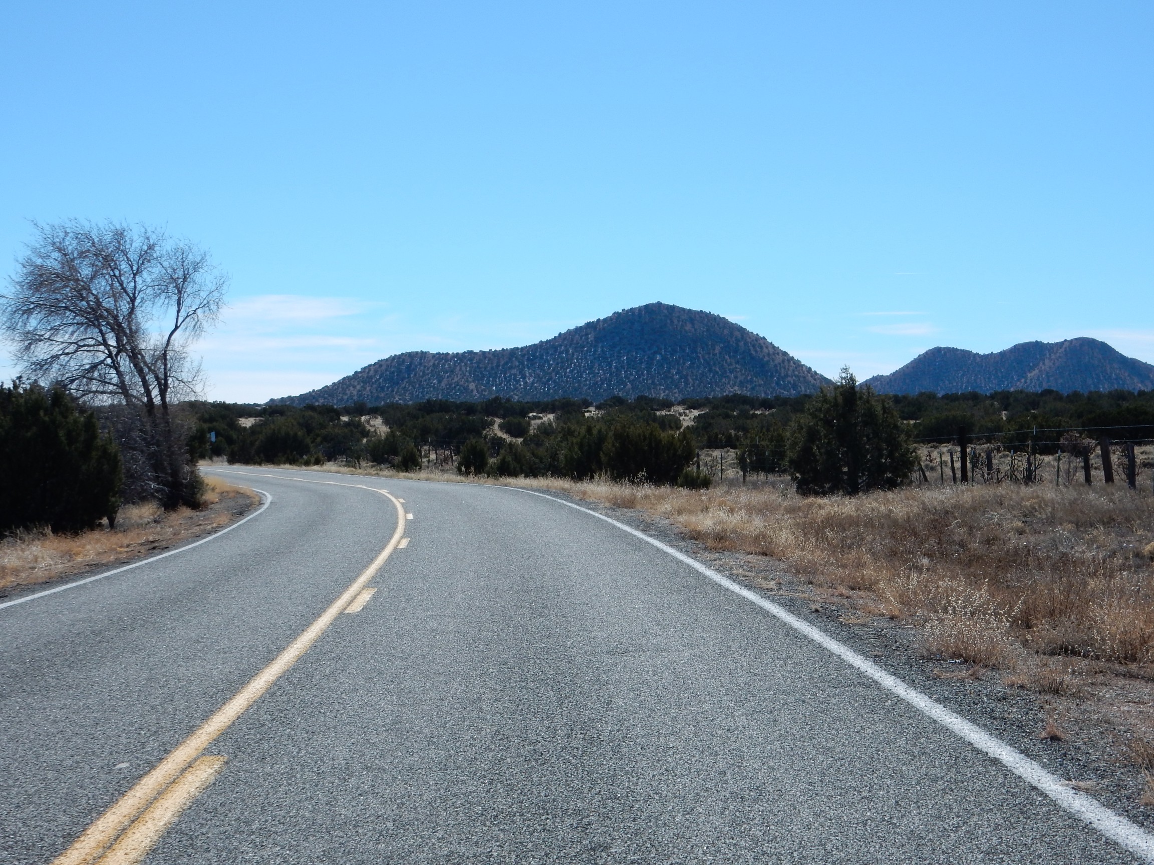
The road turned left again towards a photogenic volcanic knob, known as Picture Rock on current maps, Rocky Butte on older maps, and Lone Butte to the locals.
This is an isolated knob of monzonite. To the south is one of the largest movie studios in this area, the J.W. Eaves Movie Ranch.
Little did I know that my photograph of Picture Rock/Rocky Butte/Lone Butte infringes on someone’s copyright claim!
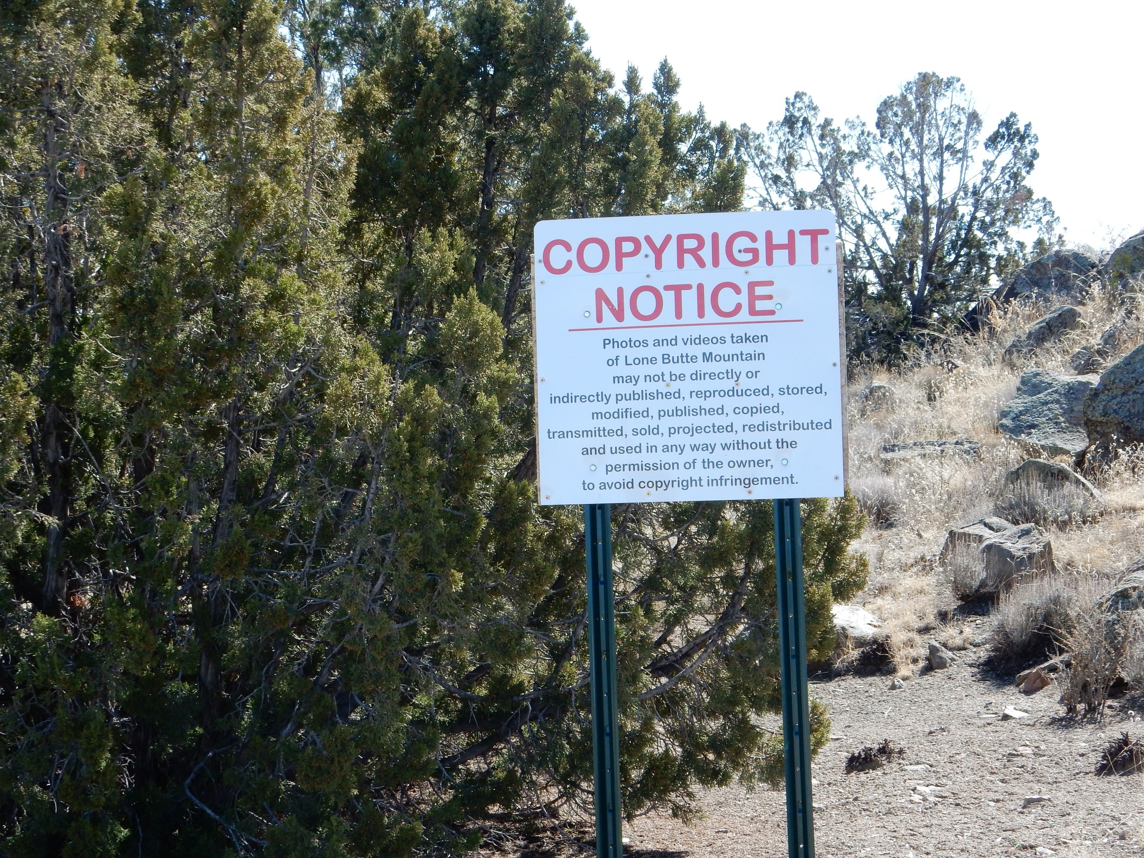
I’m not a lawyer. But I’m pretty certain this is either a sly joke, an exercise in ambiguous wording***, or what it appears to be: Utter bull. You cannot possibly convince any U.S. federal court that I am violating someone else’s copyright to their photographs of a prominent natural feature by taking my own photographs of the prominent natural feature.
I should mail this to my Denver attorney friend who specializes in intellectual property law, just so that I can see him snort coffee out of his nose. He’s done me a favor or two in the past, so giving him a chuckle is the least I can do for him.
Except this one might make him cry.
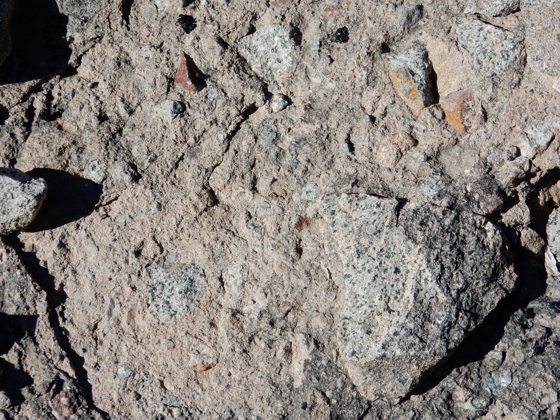
Here’s a close up of the monzonite, which crops out right beside the road.
This is a rock composed of roughly equal quantities of alkali and plagioclase feldspar, with a small amount of quartz and some other accessory minerals. The white flecks are phenocrysts of plagioclase, which formed while the magma was still deep in the earth. The remainder of the magma cooled and solidified more quickly at shallow depth, producing the finer grains of the rest of the rock.
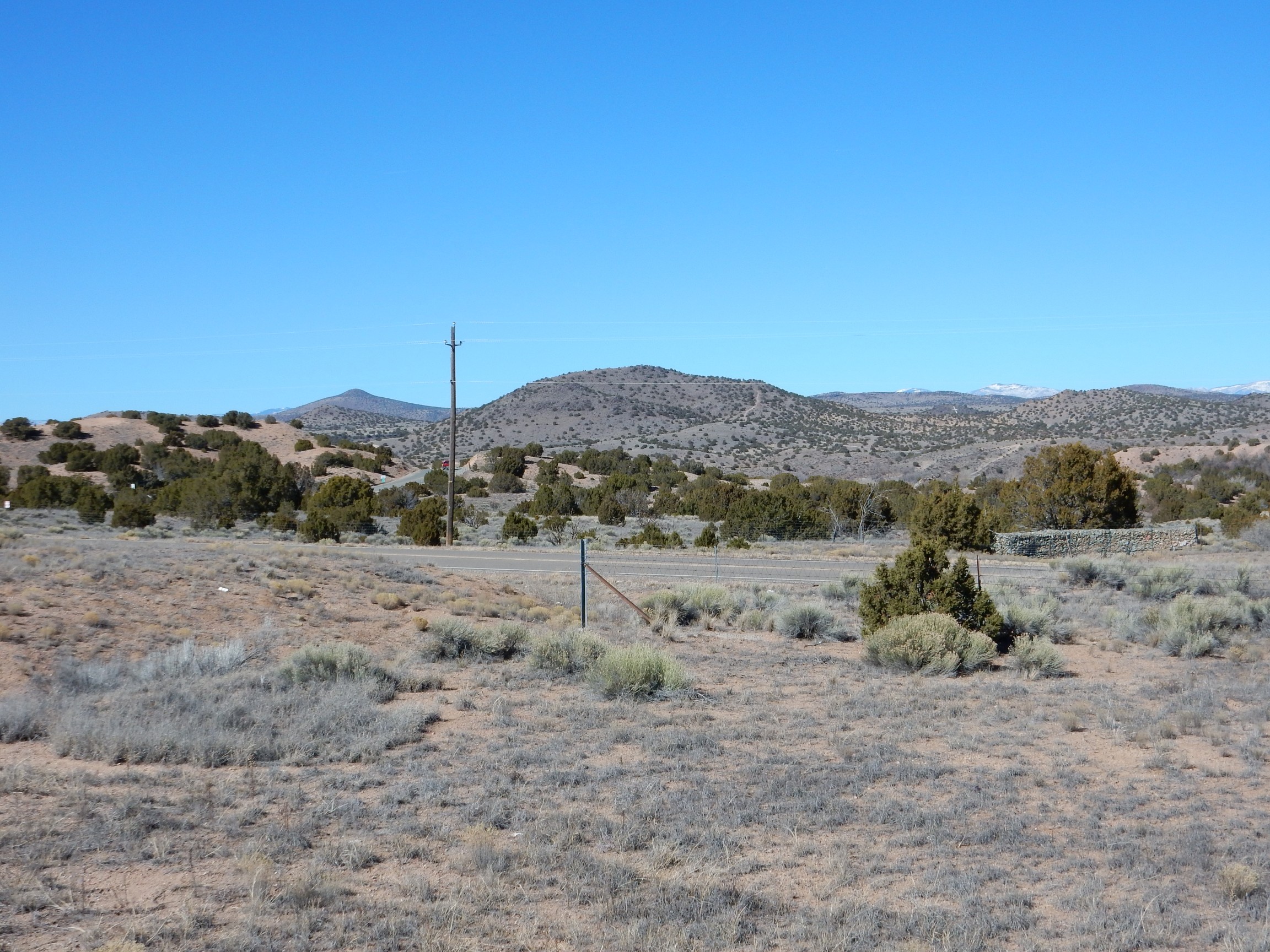
I moved on, finding myself on the road to Los Cerillos. This is country I visited with Bruce Rabe a couple of summers ago. However, there’s always something new to see. My plan was to finish up the road log in this area, then head to Madrid for a gourmet hamburger at The Hollar, and then hike for an hour or so in Cerillos Hills State Park. I had thought of retracing the road to Hagen ghost town, which Bruce and I had visited before but where my photos somehow got munged, or heading out via Galisteo; but time was looking short and I had another road log for Waldo Canyon Road.
The road crossed Arroyo Coyote, where there were exposures of Espinaso Formation. I pulled over and got out for some pictures.

I saw a better exposure across the arroyo, but trees were in the way. There was a gated road passing the exposure. It had the look of private property, but the gate was open (a mail truck had just passed through) and there were no “No Trespassing” signs or anything like that. Well, what the heck. The exposure was really nice:
The Espinaso Formation, known in older papers the Espinaso Volcanics of Stearns, are volcaniclastic beds. These are beds of shattered volcanic rock that eroded off a nearby volcano. The Espinaso Formation is found all around the Ortiz porphyry belt and is made of rock similar in age and chemistry to the Ortiz monzonites, but finer grained. The obvious conclusion is that some of the Ortiz magma made it to the surface and erupted as volcanoes, which were eroded away to form the Espinaso Formation.
Here’s a closer view.
You can see that there are various-sized angular clasts of coarse-grained rock embedded in a dark tan matrix. The clasts are quite interesting in appearance; I would love to have taken a sample. But I was likely standing on private land here, and I was already imposing on the owners simply by being here and taking pictures. Taking a sample would have been a bit too much.
A little further up the road was a nice road cut.
The road log identifies these beds as alluvial deposits, while the geologic map maps them as pediment deposits. The difference is not huge; either way, they’re relatively young deposits along the arroyo. However, alluvial deposits would be deposited by a stream, while pediment deposits are deposited by sheetwash around the feet of nearby mountains.
The road log called for me to turn onto Camino Los Abuelos to visit the Allan Houser art studio. However, the road log was put together for a geology conference; it noted that “We have special permission to visit the workshop today. At any other time, please do not disturb the artists.”
[Evil Kent: “If the artists are any good, they’re probably already disturbed. If they’re of sound mind, they’re probably not any good. Because all the really great art I’ve ever seen was produced by people who were, at the very least, deeply eccentric.”]Because I would not be visiting the studio, I drove down the road only far enough to put the right mileage on my odometer and to see the countryside. The road came over a rise, and there was a nice view of Cerro Pelon.
The road log identifies this as Glorieta Mesa, but that cannot be right; there is a Glorieta Mesa but it’s in almost exactly the opposite direction.The geologic map seems to confirm that this is Cerro Pelon and informs us that it is a diorite laccolith, formed from magma with moderate silica content but not particularly rich in alkali metals.
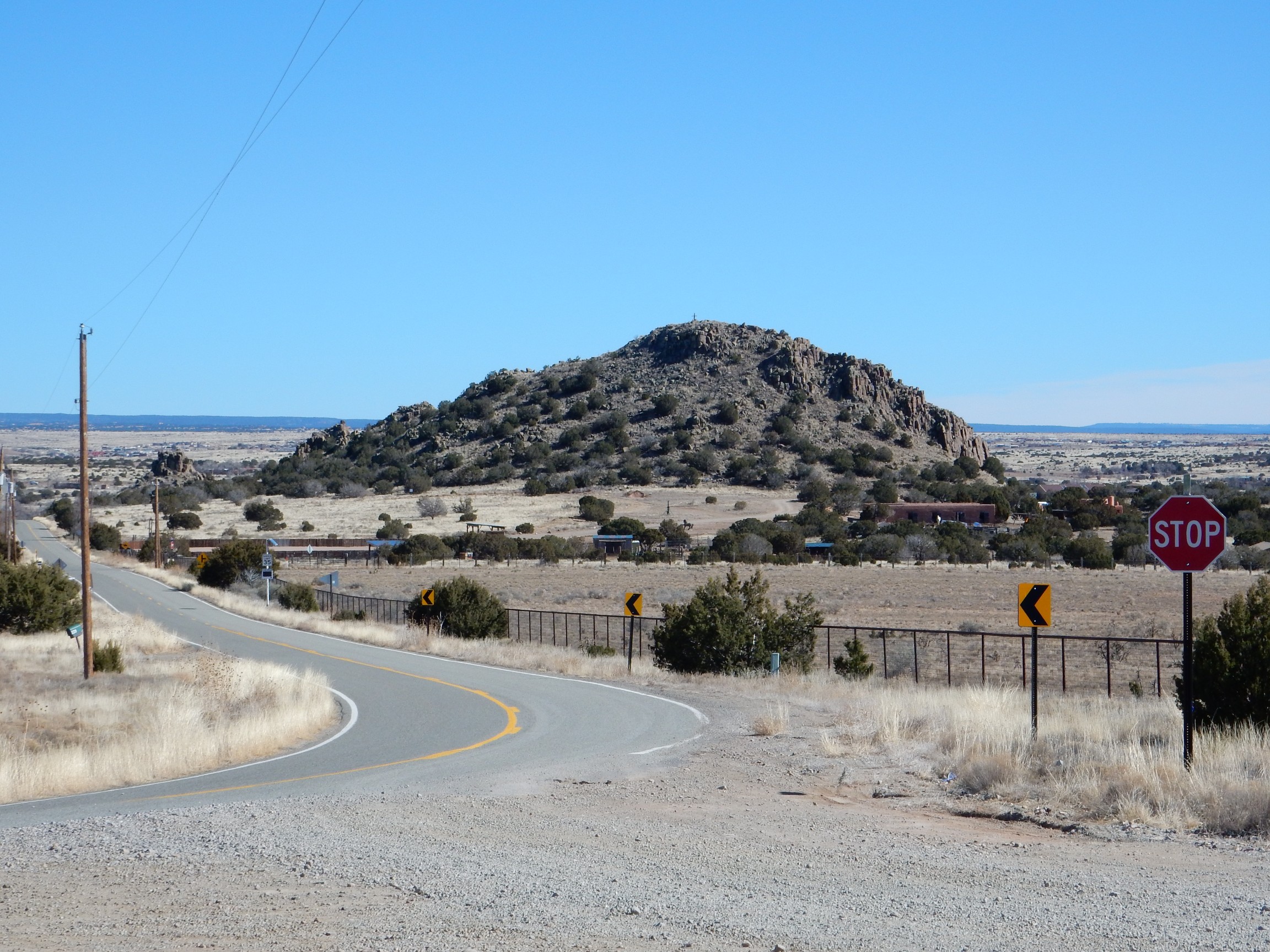
I returned to the main road and headed to Los Cerillos. The Cerillos Hills were straight ahead.
I backtracked slightly to where the main road passed a road cut of Ancha Formation.
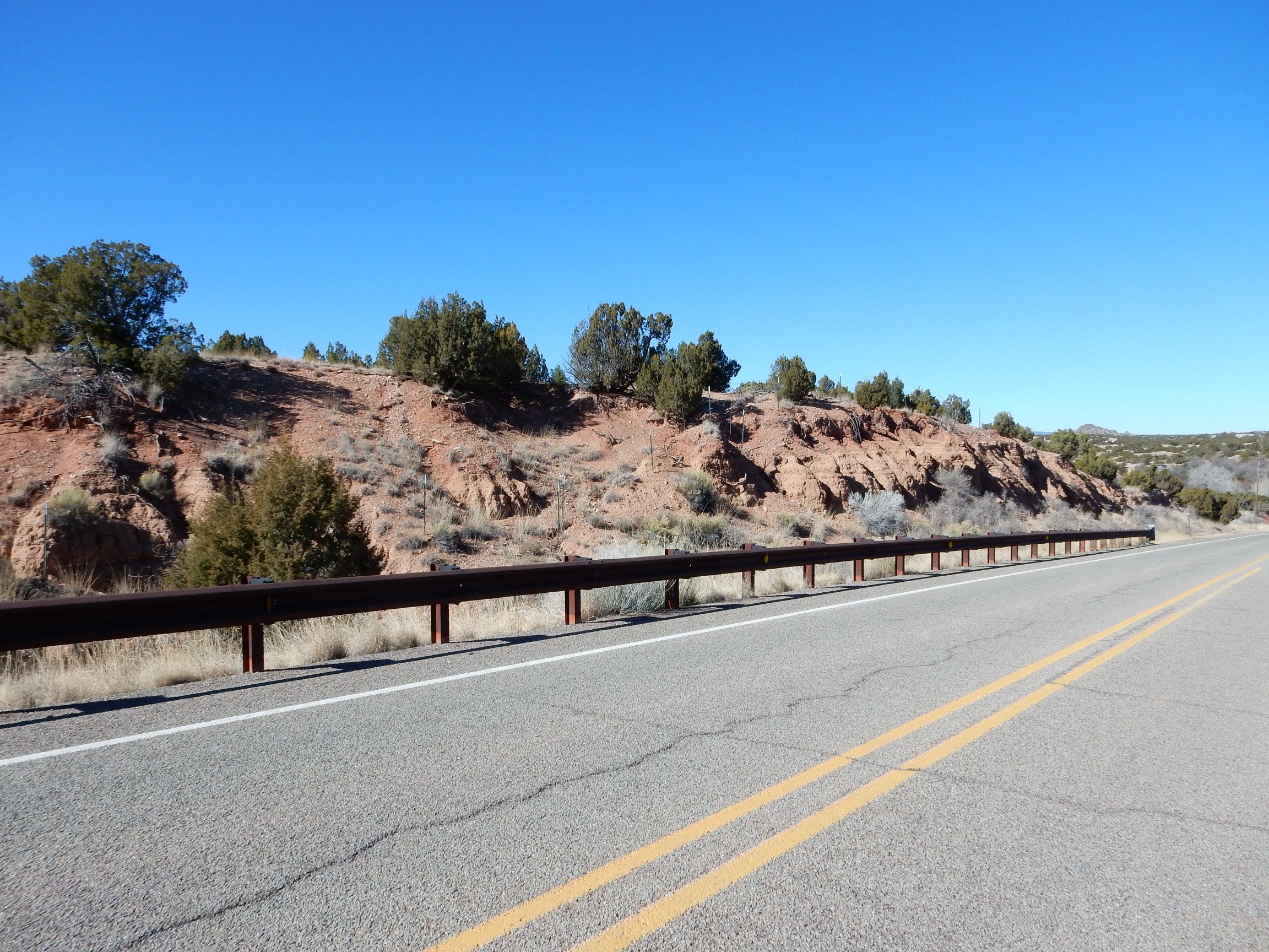
Another one for the book; I haven’t much on Ancha Formation yet.
Ahead are the Ortiz Mountains.
Visible on the flank is the tailings dump from the Cunningham Hill mine.
My road log actually includes a side trip to the mine. Alas, the geology conference had special permission to visit, which I would not have.
A little further down the road is an excellent example of an angular unconformity.
Horizontal beds of Ancha Formation at the top of the hill rest on beds of the Galisteo Formation that have been tilted nearly vertical by the intrusion of magma in the nearby Cerillos Hills. This is the Garden of the Gods area, which Bruce Rabe may remember from our earlier visit.

The large rock wall to the left is a particularly resistant bed of the Galisteo Formation that has been tilted vertical.
My road log recommended a stop further down the road for another view of this formation.
At right, we are looking along tilted beds of the formation. At left, we see the beds face on.
The road cut at left in this panorama cuts through overturned beds of the Cretaceous Menefee Formation, Mesaverde Group. The Mesaverde Group is the source of the coal beds in the Madrid area to the southwest.
This is a quartz arenite composed of medium, moderately rounded, moderately sorted quartz grains, with just a few lithic grains. In other words, a fairly clean sandstone.
And beyond is a monzonite dome intruding the Cretaceous Mancos Formation.
Just past this dome is the village of Los Cerrilos, where my road log ended. It was after 1:00 already, so I headed on to Madrid and The Hollar for a gourmet hamburger. I paused for a photograph of the area at a scenic pullout along the way.
Most of the nearer terrain is underlain by the Diamond Tail Formation. This is an Eocene formation, somewhere in the ballpark of 50 million years old, that lies beneath the Galisteo Formation and was once mapped as part of that formation. (Geologists later recognized a significant period of erosion between the deposition of the two sets of beds, which was enough justification to split them into separate formations.)
Left of center on the skyline are the Cerillos Hills, with the village of Los Cerillos hidden in the valley almost dead center in the panorama. On the far skyline, the Jemez peek out at left and the Sangre de Cristo at right.
Madrid has been thoroughly gentrified, and was swarming with upscale tourists even at this time of year. Even the serving staff at The Hollar were Hollywood pretty; naturally, that meant I should have fit right in. 😉 But of course I’m a left-brained type and the gentry are more the right-brained type. Still, the mushroom and blue cheese burger was good, as was the fried okra I chose as the side dish.
Lunch complete, I headed back to Los Cerrilos. One more close up of the Diamond Tail along the way:
Although the Ortiz Mountains mines are on private land, the road log to that area looked mildly interesting, and on a whim I took the road to that area. I could not go far; I needed enough time to do a little hiking in Cerillos Hills State Park before the sun got too low. I did take time for three photographs.
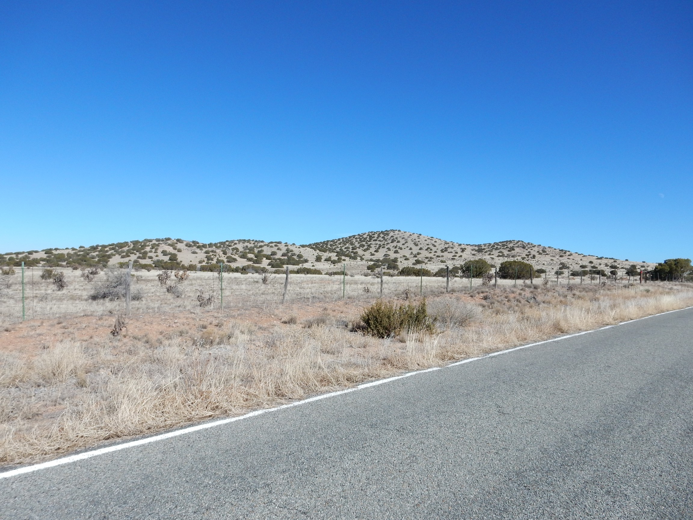
First, of the Ortiz Surface.

I know: Um, yeah? The Ortiz Surface is the flat terrain stretching out into the distance. It is one of the first and best examples (first described in 1905) of a pediment surface, formed where erosion by sheetwash (as opposed to flow confined to river channels) bevels flat the area around a mountain range in an arid region. The Ortiz Surface is underlain by a gravel bed, the Tuerto Gravel, which you can just make out by the side of the road.
Time was short. I turned around, but the descent from the Ortiz Surface was just too pretty not to stop for pictures.
My Ansel Adams moment for the day:
The panorama is not as beautiful, but it does nicely show the Ortiz surface to the east.

The surface is best seen just right of center.
I drove on in to Los Cerillos and to the state park. Some nicely deformed sedimentary beds along the way:
I got to the first parking area, used the self-serve envelope to pay the $5 fee, raced down the main road (because the sun was getting low), found myself at the end of the public part of the road, decided I really needed a map, raced back to the first parking area to get one, raced back yet again to the far end of the road, slathered on sunscreen (yes, I’m paranoid about that since having the skin cancer taken off last fall), grabbed my camera and my walking stick, and headed up the Cortez Mine trail.
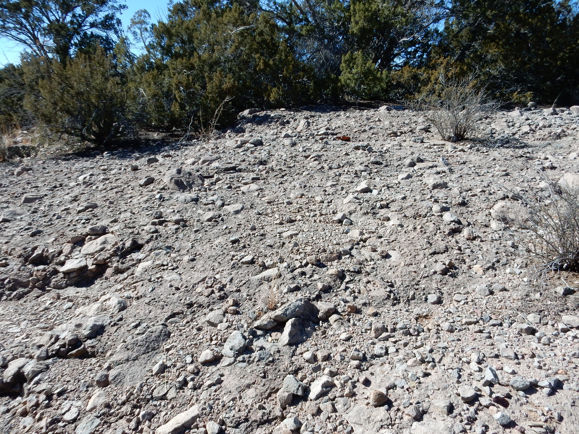
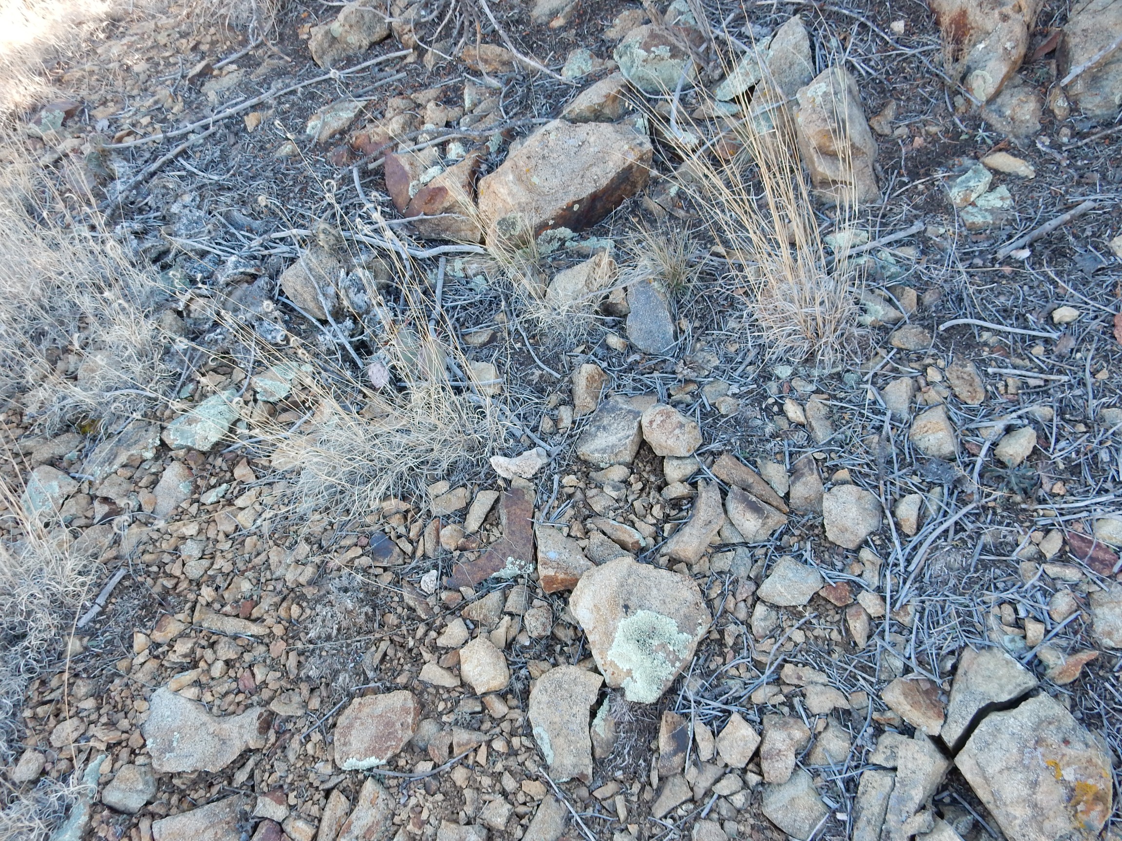
There was some rock here that looked distinctly altered.
It’s the rusty stains of oxidized iron, plus the generally shattered look of the rock. Not far down the trail was the first mine.
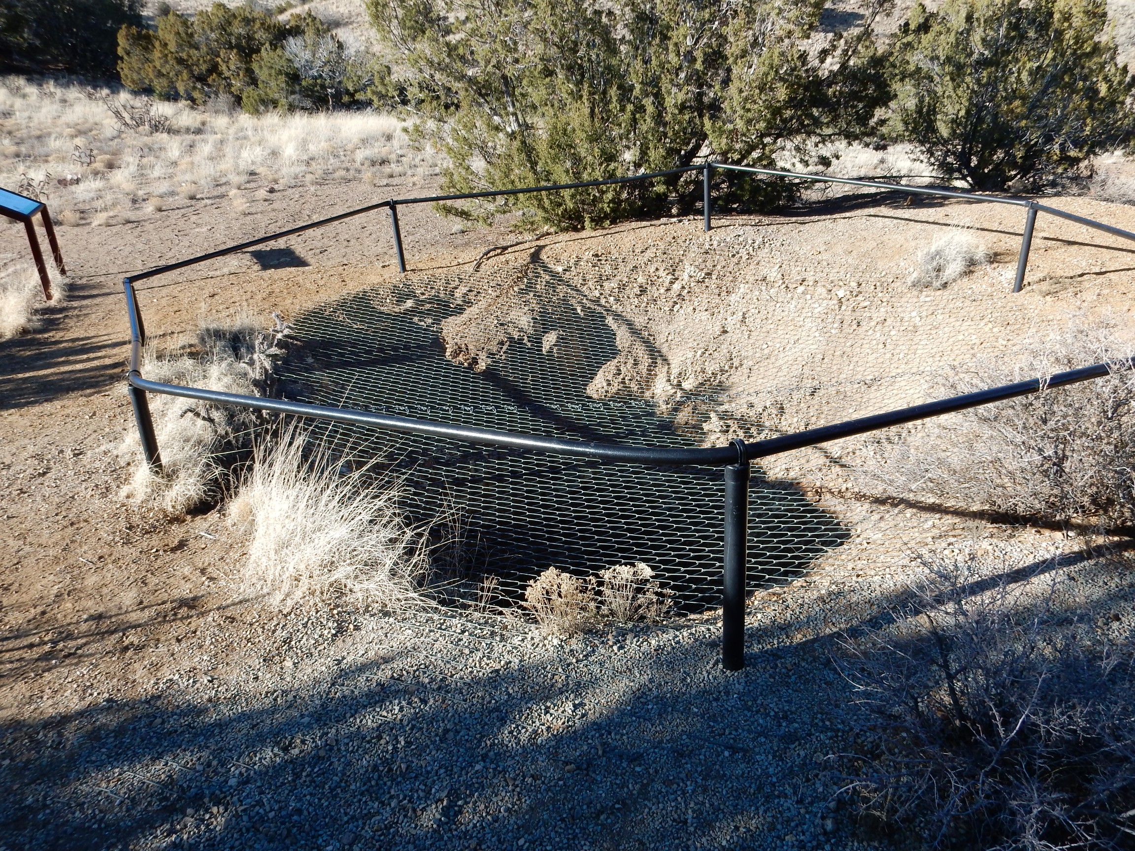
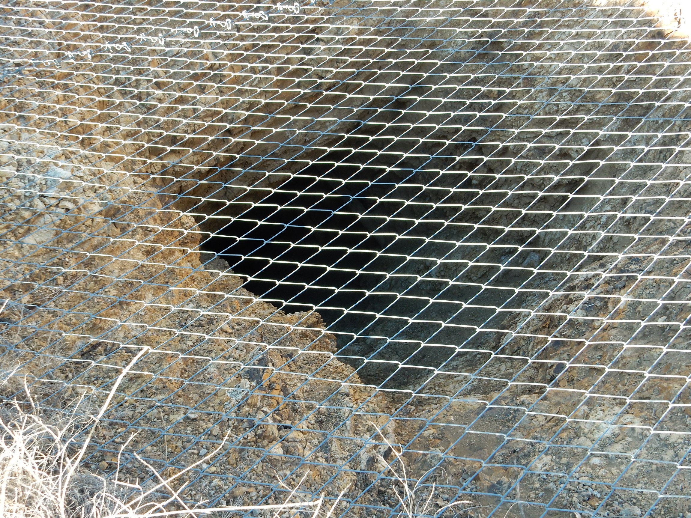
This is the entrance to the Cortez Mine, one of the older, larger, and more successful mines in the Cerillos Hills:
Meh. Anthropomorphizing cute animals seems dubious enough. But whatever floats your boat.
I hiked along until I came across what looked like a fine-grained intrusive rock.
This whole area is mapped as andesite porphry, a rock with a modest silica content and numerous larger crystals of feldspar in a finer matrix. The outcrop here looks to have experienced some hydrothermal alteration.
The next mine is not much to look at.

It’s no larger than some prospect pits I’ve seen. Apparently that was all that was necessary to make money:
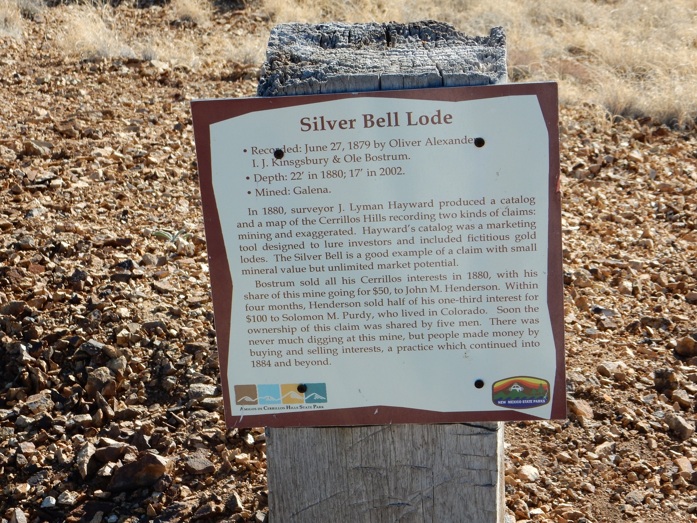
The boom of 1880-1884 was apparently fueled mostly by speculators, with just enough mineral resources in the claims to keep the speculation going. Apparently, many investors bought rights to claims with less thought of profiting from the actual mineral extraction than from reselling the rights to someone else at a profit. This was not at the level of the famous tulip mania in Holland, but the same speculative mindset was involved.
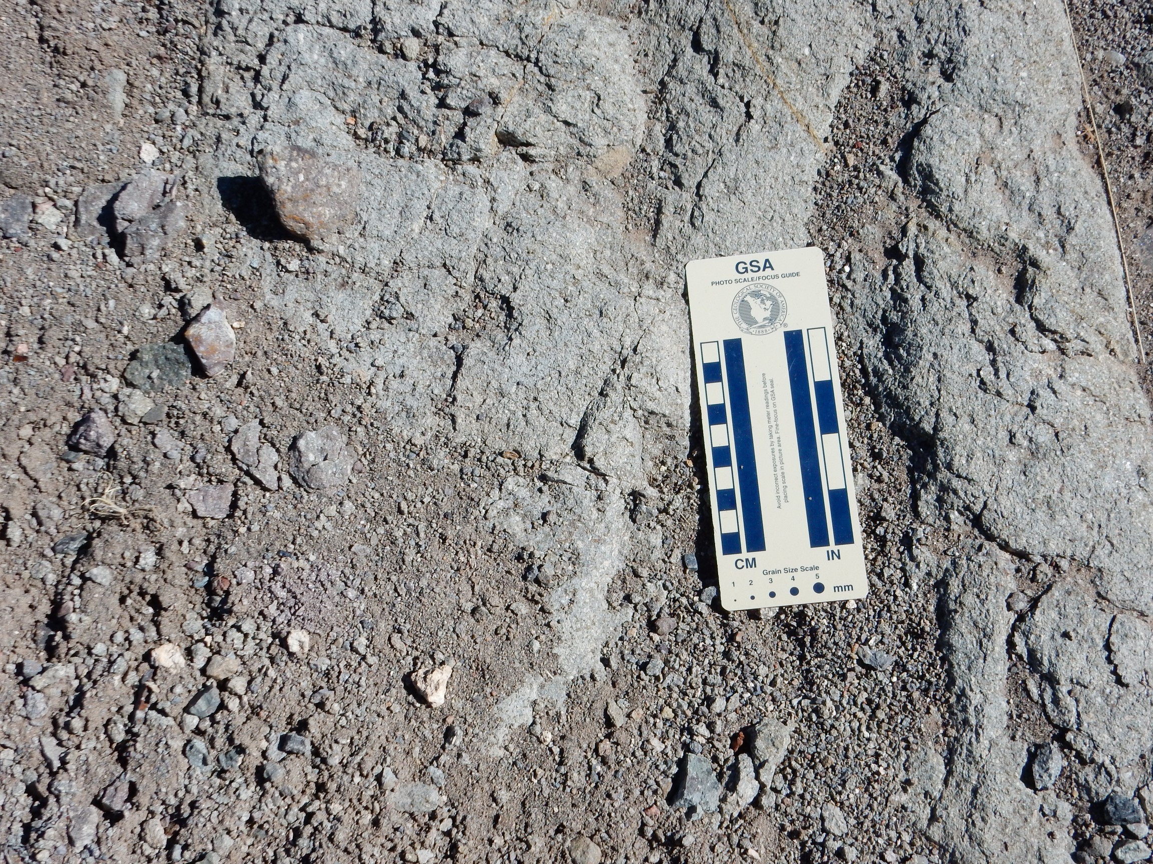
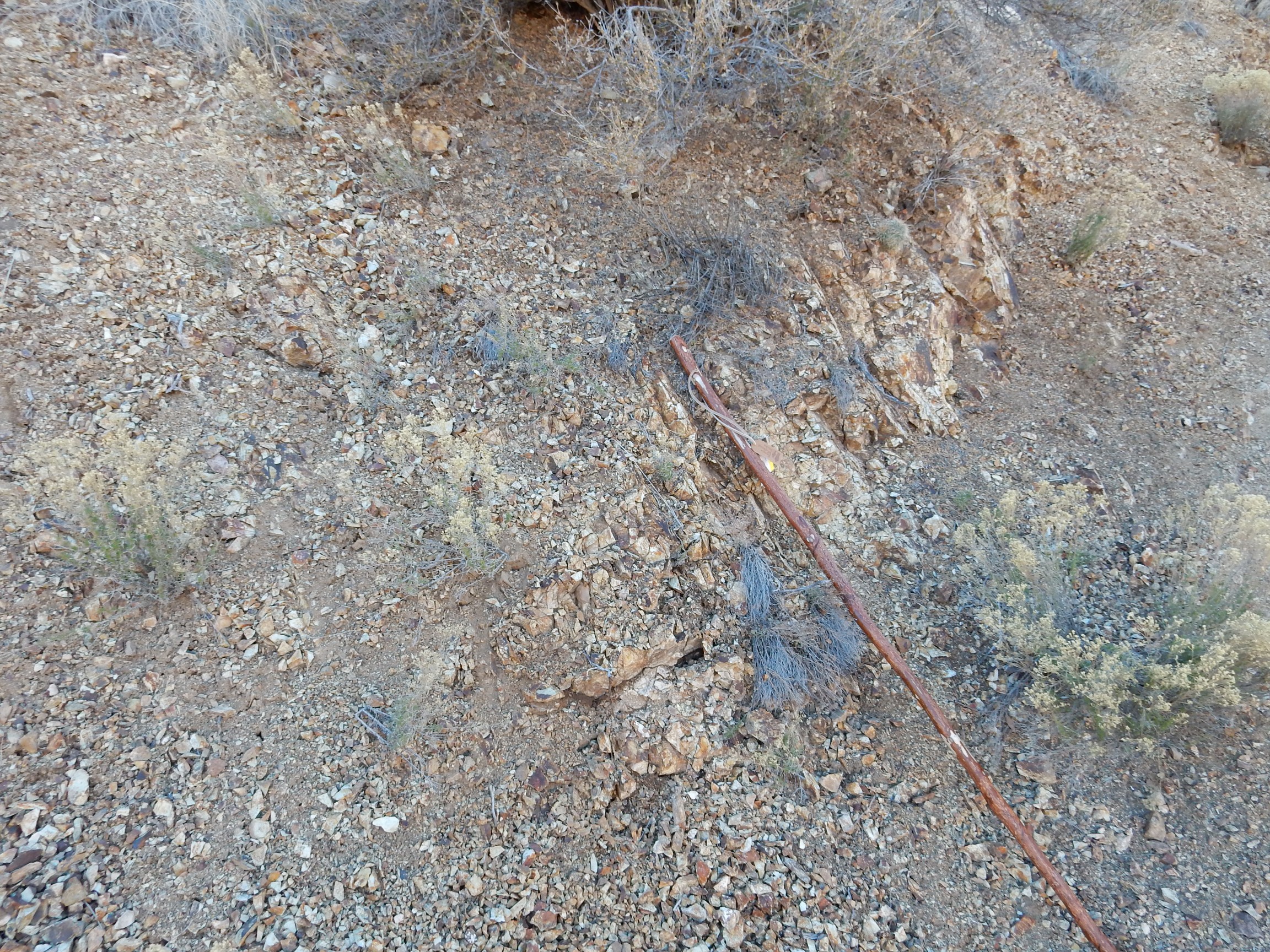
Some more of the local rock:
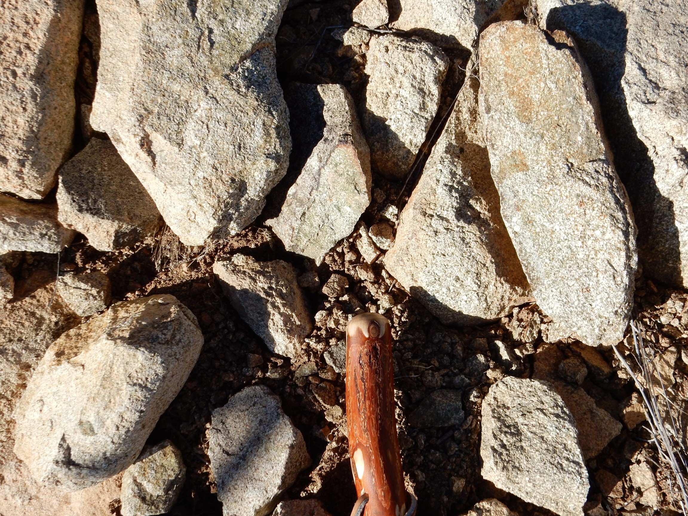
Yes, that’s the head of my new walking stick, for scale.
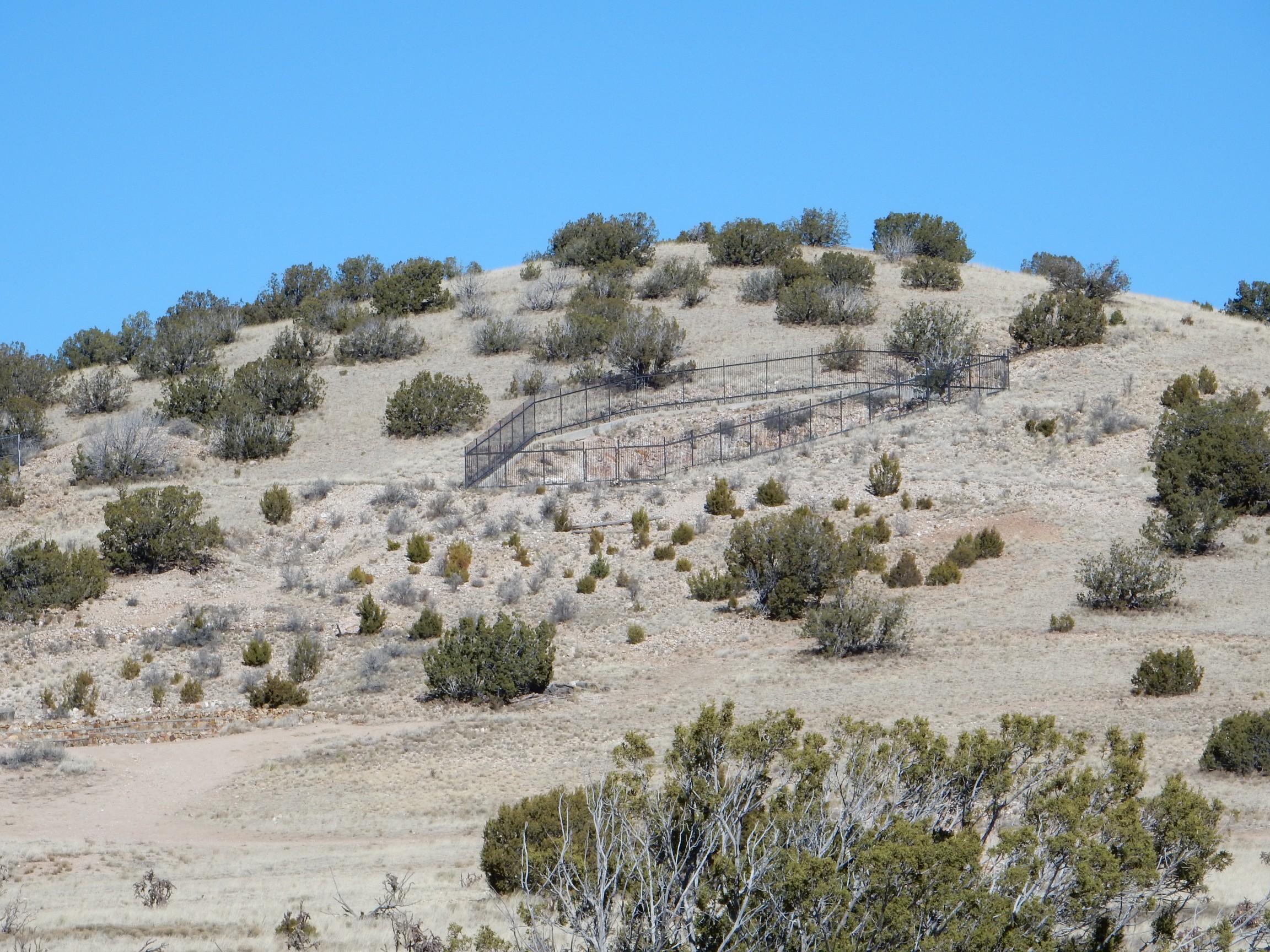
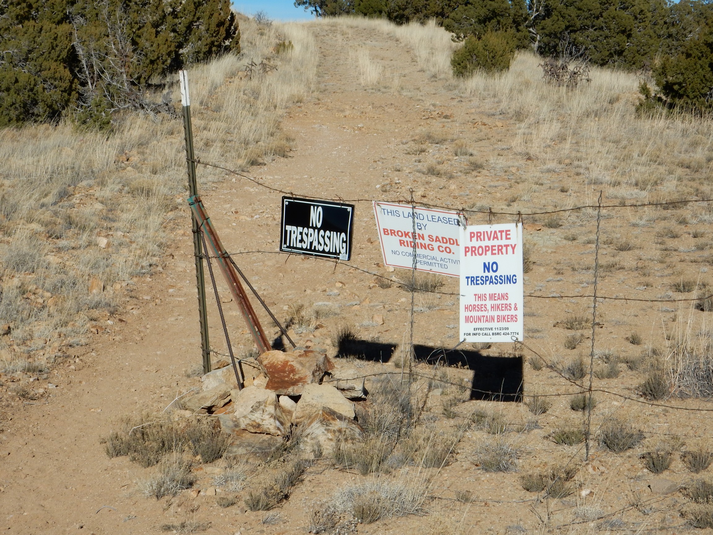
The trail passes a gate with the unwelcome mat out.
And on to the El Mirador Lookout. A nice view of the mountain to the north:
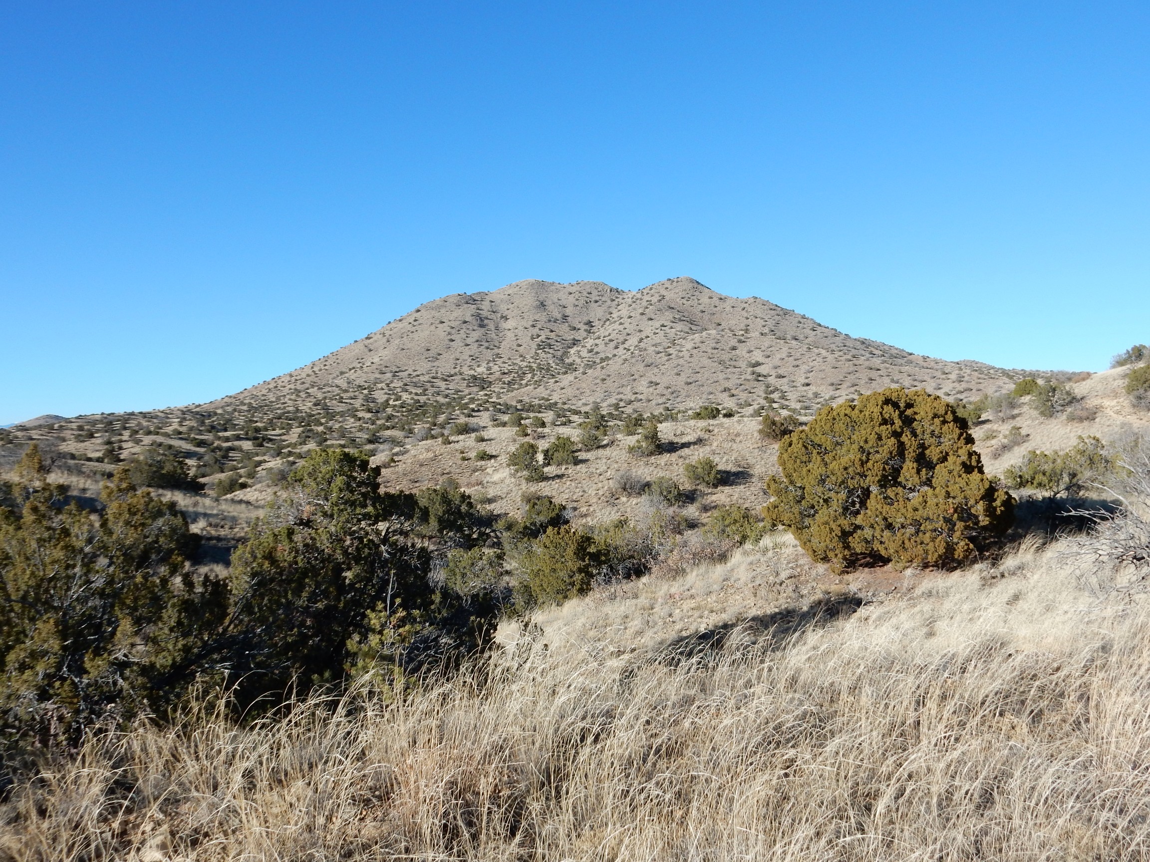
Oddly, this splendid example of a laccolith, which lies at the heart of the Cerillos Hills, is unnamed on both Google Maps and the topographic map for this area.
El Mirador Lookout itself.
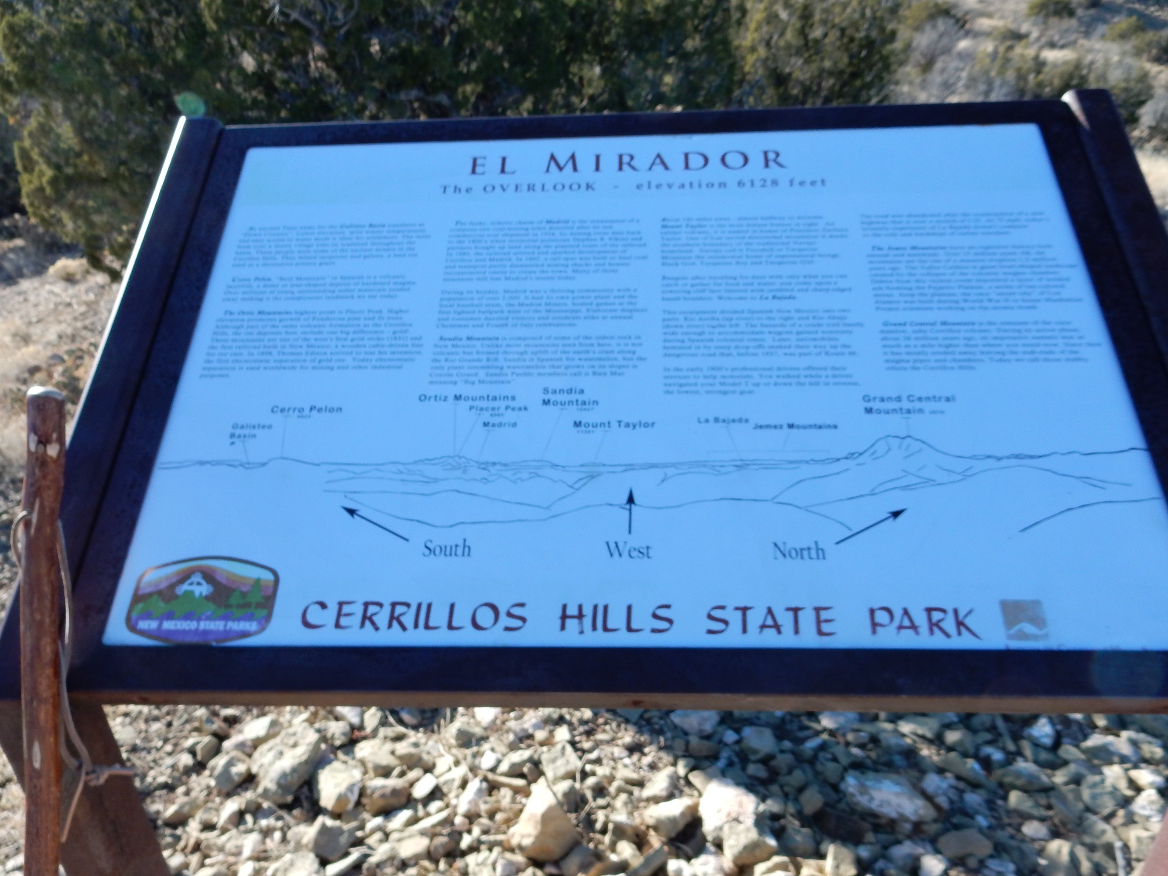
This is somewhat out of focus, alas, but at least it identifies the mountain to the north as Grand Central Mountain.
I took some panoramas, but it was too late in the day for a full 360 degree pan — the sun would have washed it out — and even the 180 degree pans did not turn out great. Still, for whatever it’s worth:

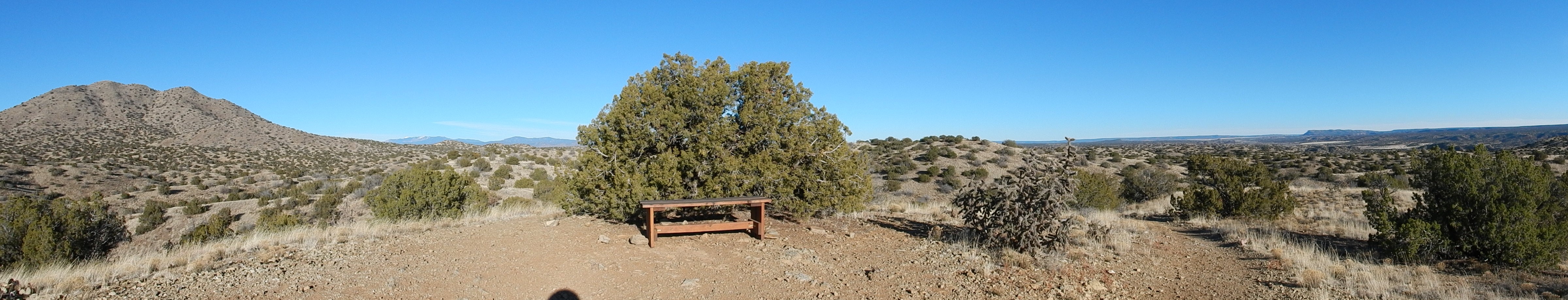
I did get a nice shot of the Ortiz Surface off to the south.

Time to head back, though by a slightly different route. Some signage explaining the speculative boom a little more:
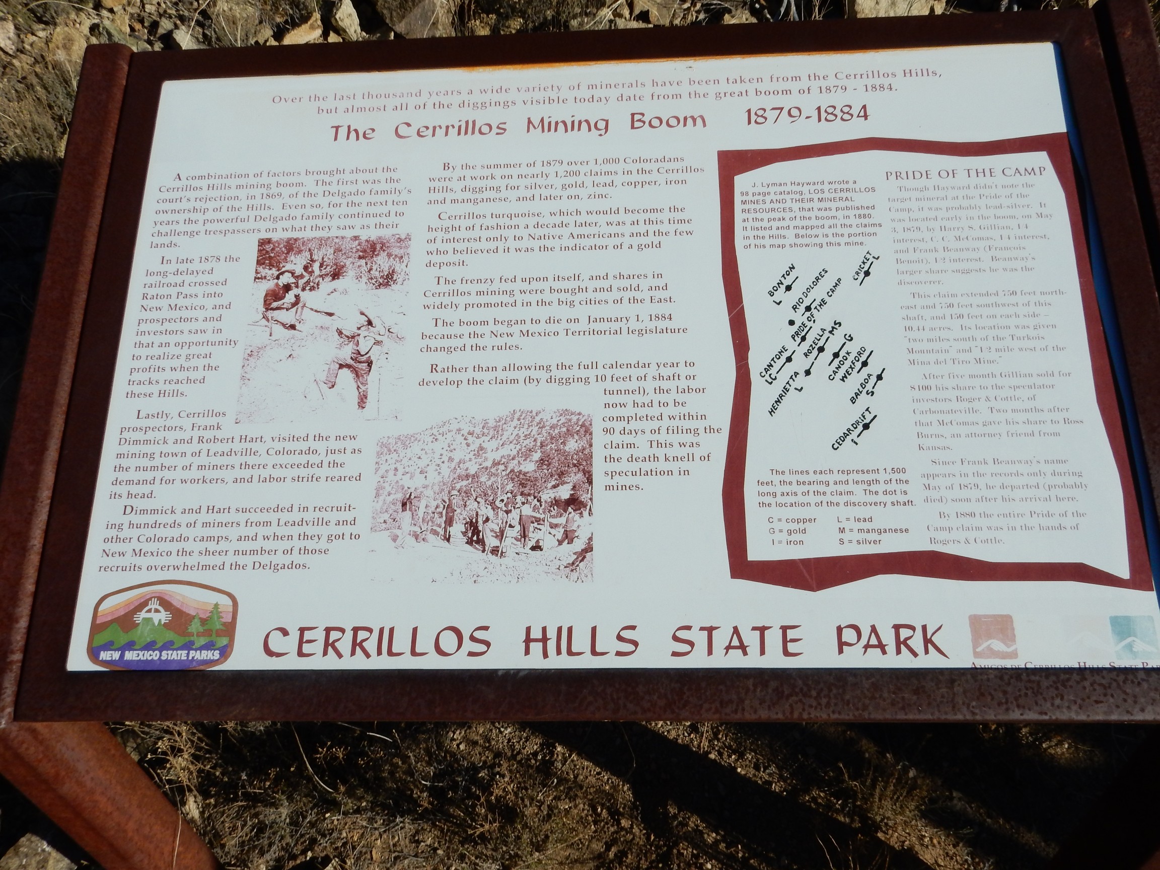
The sign mentions the effects of changes in the law for staking and developing claims. The concept here derives from the economic theories of the Scottish Enlightenment, which strongly influenced the American founders. Under these theories, a person established a property right to previously unclaimed land by mixing his labor with the land, such as by clearing and tilling it for agriculture or excavating it for valuable mineral resources. This philosophy inspired the Homestead Act (which allowed settlers to take possession of public land they successfully cultivated for long enough) and mining claim law. In most American jurisdictions, you could “stake a claim” to public land by literally marking off an area with wooden stakes and filing a claim asserting that there were valuable mineral ores on your claim. You then had exclusive rights to develop the claim and mine the ores. For the claim to remain valid, you had to do a minimum amount of development within a prescribed time frame (thus mixing your labor with the land). Eventually, if you developed the claim well enough, you gained title to the land at a bargain price per acre.
The claim boom in the Cerillos Hills was fueled in part by relatively lax development requirements. You had a full year to dig just ten feet of tunnel. When this changed to a more stringent requirement — three months to dig ten feet of tunnel — the boom collapsed. The speculators weren’t interested in actually digging; they just wanted to trade the mineral rights.
I gather than this is the Pride of the Camp claim.
The next mine was a manganese mine.
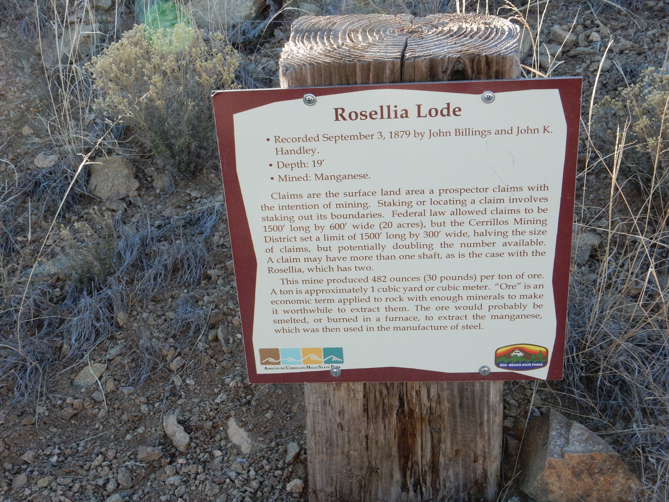

Manganese is still used in steel manufacture today. It is a powerful deoxidizer and desulfuring agent and is almost indispensable for making high-quality steel from low-grade ore.
From there back to my car, and on back to Los Cerillos. I dug out the Waldo Canyon road log, found I had already driven past Waldo Canyon Road, backtracked, and was on my way.
According to some of my online acquaintances, this is the Devil’s Throne.

However, the one I was visiting on this trip is here.
The Devil’s Throne is a plug of hornblende latite porphyry intruded into the surround Cretaceous sedimentary rocks early in the geologic history of the Cerillos Hills. At least, that’s what my road log tells me; the map identifies this as andesitic porphyry. The difference is that latite has a higher concentration of potassium. In this case, I trust the road log more.
The road ascends through the notch on the right of the Devil’s Throne. Here one sees Mancos shale baked by its contact with the hot magma that cooled to form the Throne.

Then the road wound around a smaller plug of nicely jointed latite porphyry.

Around the next turn was a good example of a sill, which is a layer of volcanic rock formed when magma intrudes between existing layers of sedimentary rock. Unfortunately, this was backlit by the setting sun, and it took some tries to get a decent photograph.
Notice the striking columnar jointing, which forms as the rock cools and fractures from heat stress.
I misread my road log at this point, and mistook this for the ghost town of Waldo.

It was only after I got home and more closely perused my photographs that I realized just how wrong I was. This is very nearly my dream home.
Past a nice outcrop of Mancos Shale.
The Mancos Shale formed from clay-rich sediments laid down in a quiet marine environment. The clay particles stacked up in such a way that the rock splits easily into thin layers. The map specifies that this is the Niobrara Member of the Mancos Shale. I was surprised; I was first introduced to the Niobrara as a sandstone. In this area, there is a sandstone lentil dividing the Niobrara Member into two sections, but the rest is all shale.
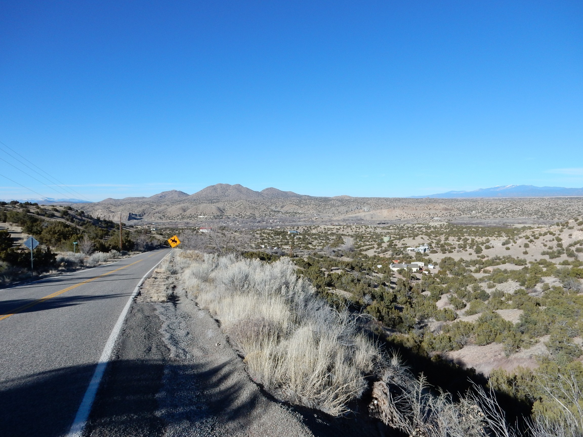
The real ghost town of Waldo.
Not much left but the cottonwoods, but this was once a thriving small village It was located on the junction of the Santa Fe Railroad and the spur to the coal mines of Madrid. Some coal was mined locally and coked in ovens here, and wells in this area supplied Madrid’s entire water supply. (Modern Madrid drinks bottled or filtered water; the groundwater in the Madrid area is reputedly vile-tasting.)
And, thanks to the GPS receiver on my camera, I can now answer, with considerable accuracy, the question that has been puzzled over by millions: Where’s Waldo?
The road turned north and cut through a latite dike radiating from the Cerrilos Hills.
I took a sample, but it’s pretty nondescript uniform black rock.
Another, smaller, dike.
I know: I didn’t even get out of my car for this one. But maybe I should have, for comparison: From the map, it appears this is a north-trending basalt dike associated with the opening of the Rio Grande Rift rather than a latite dike radiating from the Cerillos Hills.
This dike is a little more fun, because the sediments into which it intruded were baked red by the heat of the magma.
Judging from the geologic map, this may be the sandstone lentil dividing the Niobrara Member that I mentioned earlier.
I refer to the white band halfway up the hill. Further down there is a road cut.
This still looks more like shale than sandstone, but the map is pretty clear that this ridge is underlain by the sandstone lentil. I guess these things are relative; the shale here is sandier than in lower or higher beds.
A little further on, I came to a dike called out for particular attention in my road log. I parked and got out for a better look.
I really need to come back when I have more time and, preferably, some company along. This dike forms the core of a ridge extending for miles to east and west. You can see shale beds just left of center in contact with the dike; these include some sandy lenses that are interpreted as storm deposits. According to the road log, there are also some good fossils in the area.
I hurried on, aware of the hour, and soon reached civilization.
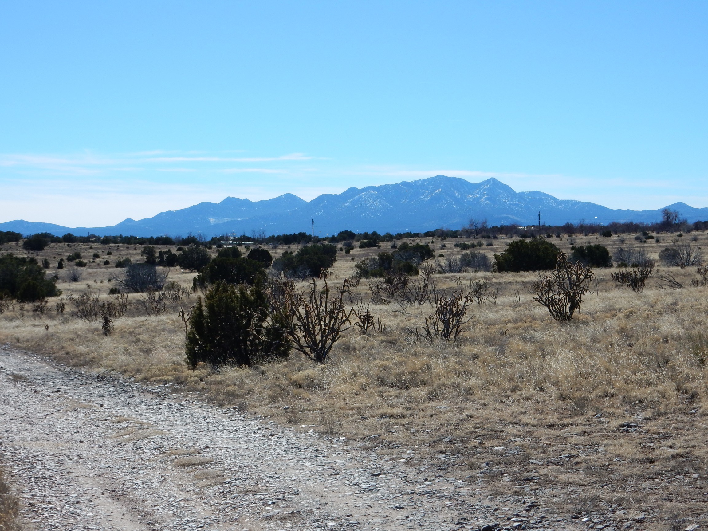
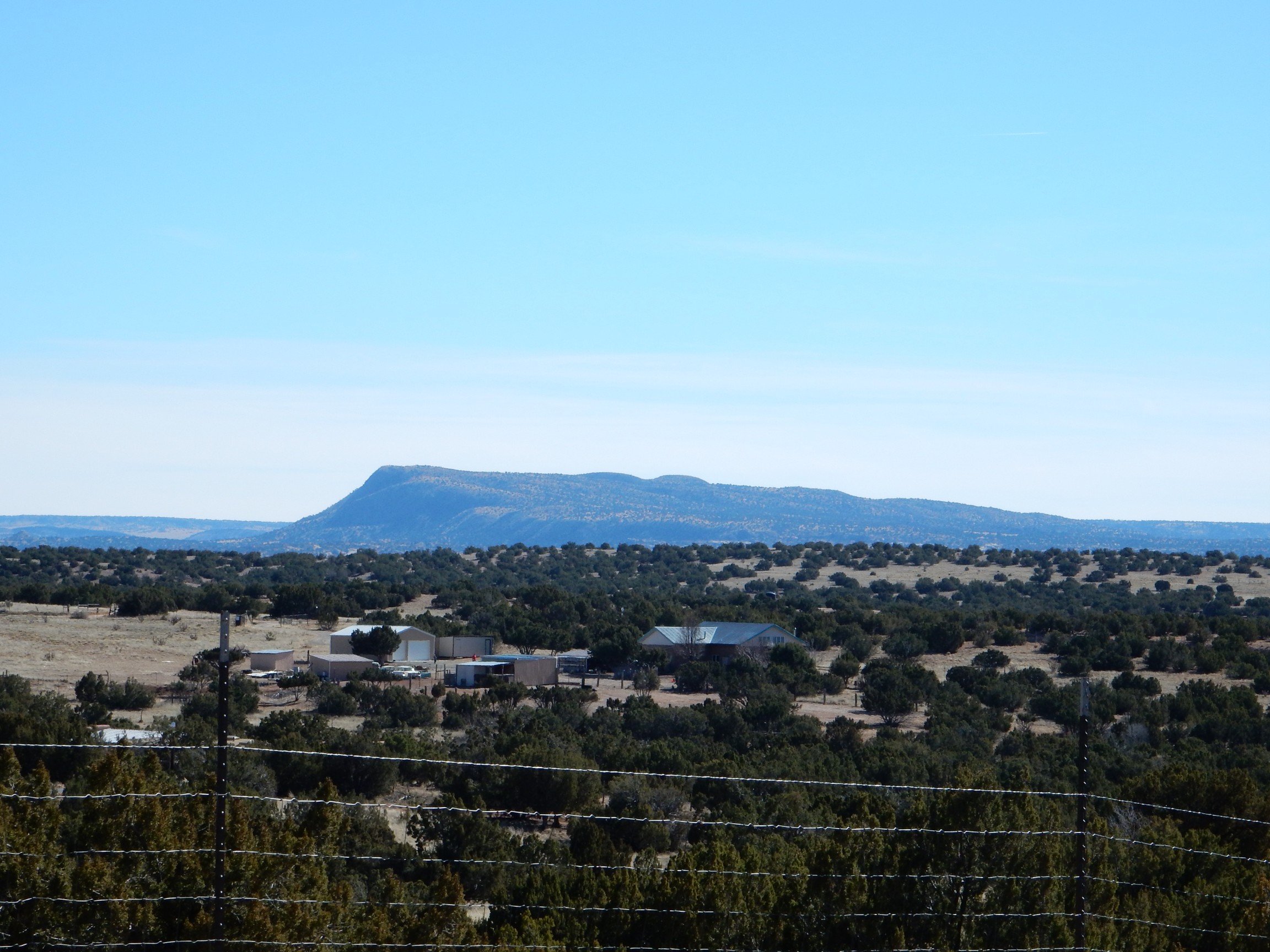
The road climbed onto the mesa just south of I-25, and headed almost straight north, giving me a wonderful view of Tetilla Peak.
This shapely peak, New Mexico’s etymological counterpart to Wyoming’s Grand Tetons, is a dome of dacite superimposed on a broader dome of andesite of the Cerros del Rio Formation. It was erupted in the ballpark of 3 million years ago, and I am ambitious of climbing it when the weather is suitable and I can find a hiking partner.
And, from there, back onto the freeway and home.
*et al.: Latin for “and others”, indicating a long list of authors on the paper of which only the first is named, which is usually enough to identify the specific paper from the bibliography. Yes, road logs have bibliographies, which can make for some interesting further reading.
**What’s the best way to date a fossil bed? I’d try tickets to a rock concert.
***The ambiguity is in the meaning of the word “owner.” It can be taken to mean the owner of the land on which the butte sits, but it can also mean the owner of photographs and videos of the butte, in which case it is perfectly true and completely vapid. I suspect whoever posted the sign meant visitors to take it in the first sense, but would claim it was meant in the second sense if anyone tried to give him grief about it.
Incidentally, I double-checked, and the NMGS road logs are copyrighted after all. Good thing I gave up on that project. I’m going to chalk the brief excepts quoted here to fair use.