Wedding wanderlust, day 2
Day 1 may be found here.
I slept reasonably well, considering, and was up before the crack of dawn to work on breakfast.
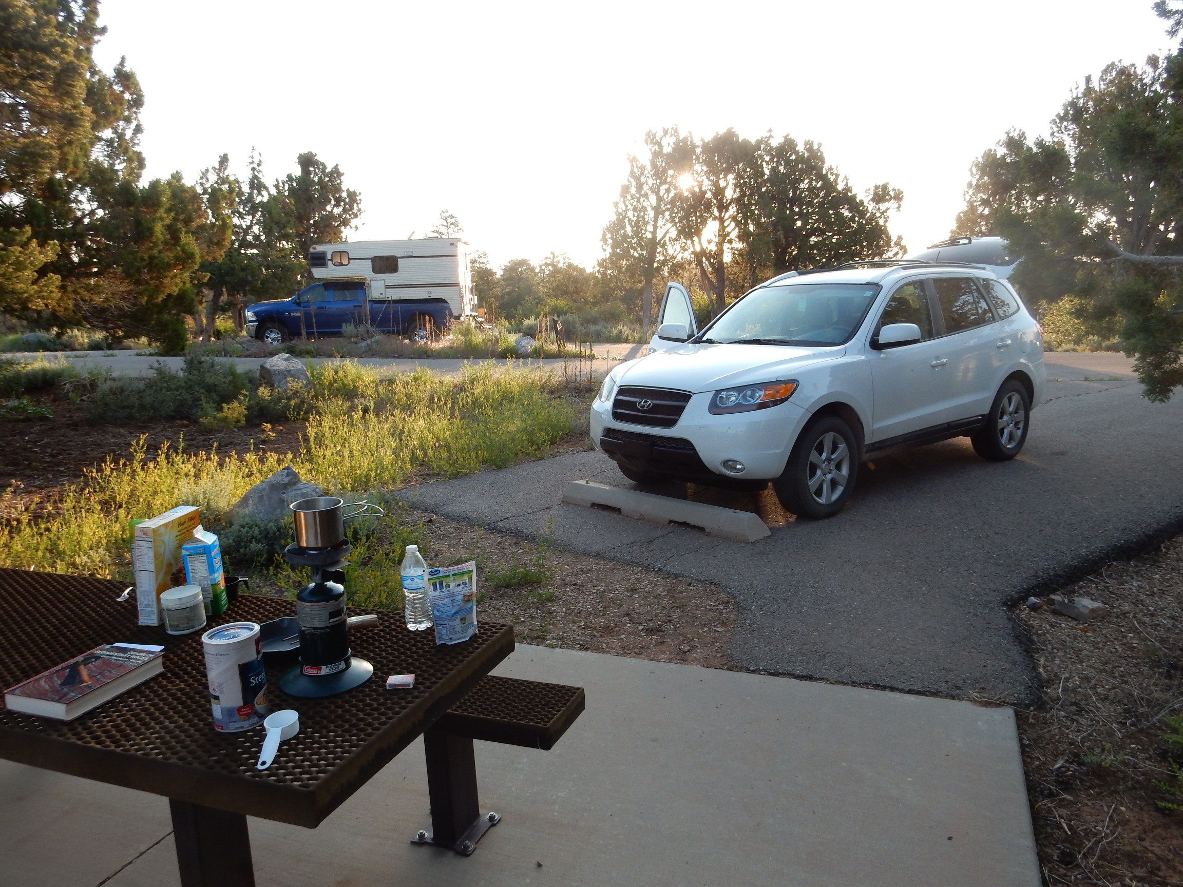
Yeah, I know. There is decidedly some dawn already cracked in that photograph. I had been up some time before taking it, and the tent is already down and packed. Steel-cut oats are boiling over the cookstove, cereal and buttermilk are ready to go, and I’ll shortly be cooking the ham and eggs.
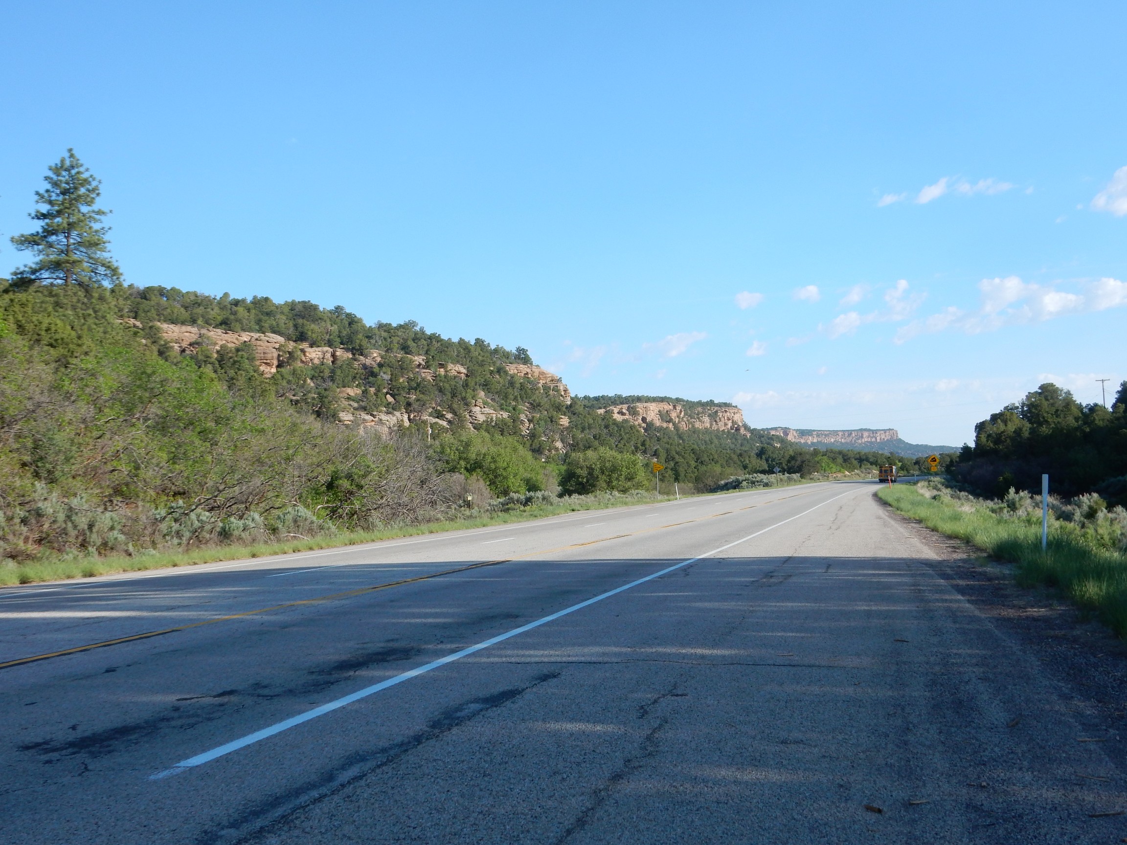
Breakfast complete, I head out for Canyonlands Needles District. The road passes the Abajo Mountains west of Monticello.
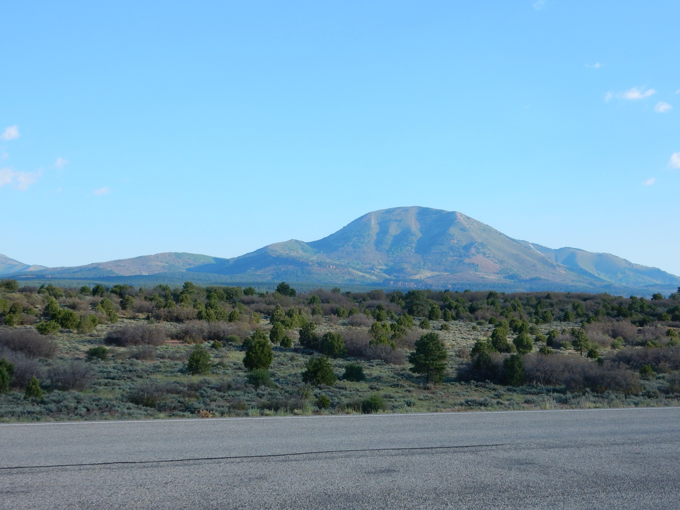
These are laccoliths, magma domes emplaced in the upper crust 25 million years or so ago, and since exposed by erosion.
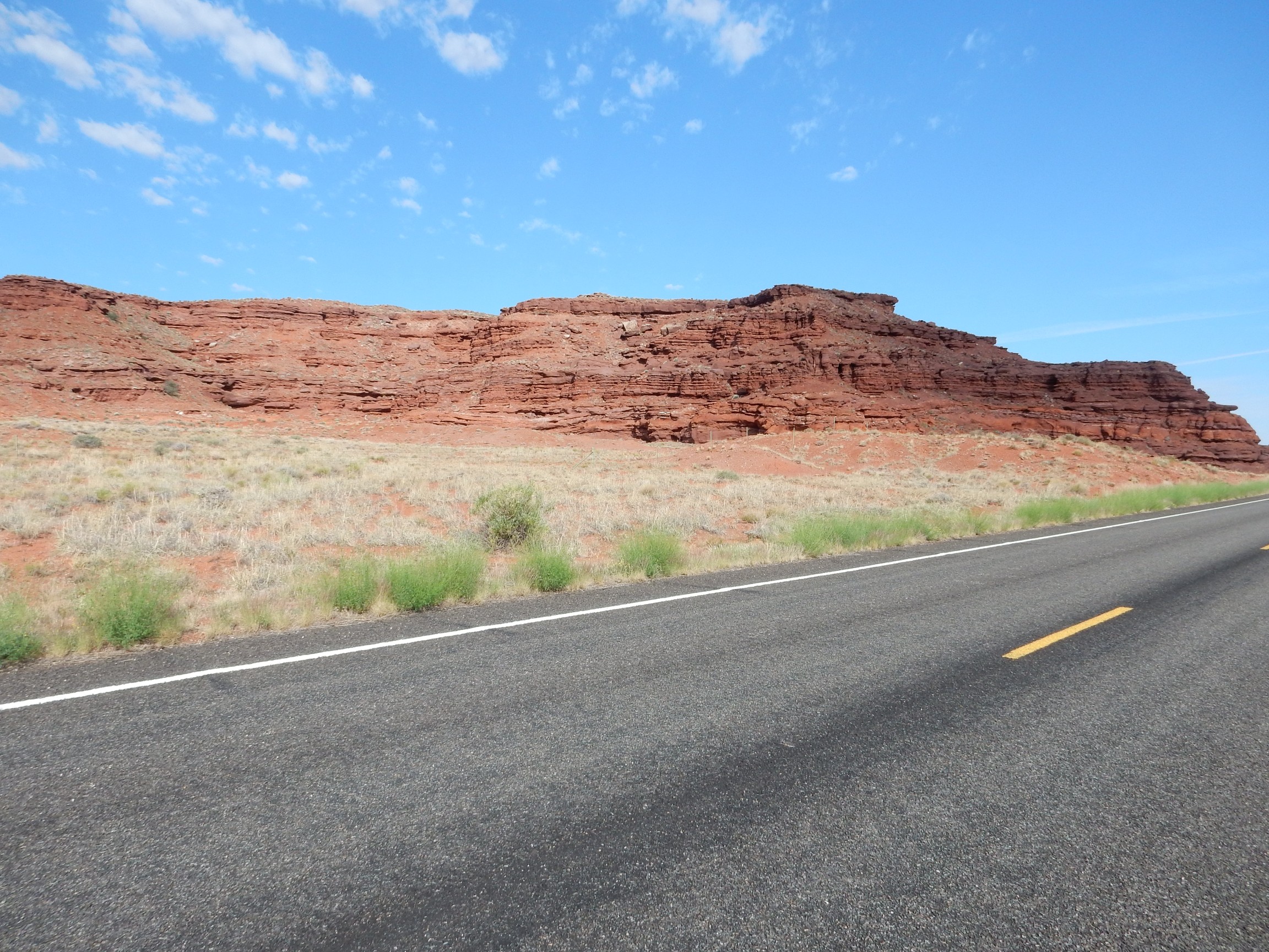
Road cut. Geologists love these things.
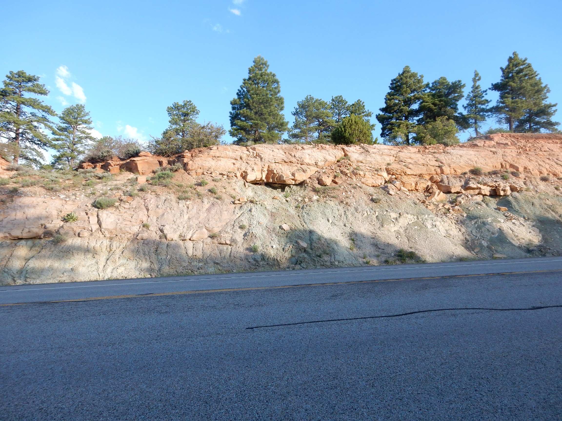
I’m not entirely sure, since I have no detailed geologic map of this area, but I think this is Dakota Formation overlying Burro Canyon Formation. Both are Cretaceous formations deposited in the Western Interior Seaway around 115 to 105 million years ago. This was a time when the center of North American was relatively low ground flooded by the ocean, with mountain chains along west and east coasts.
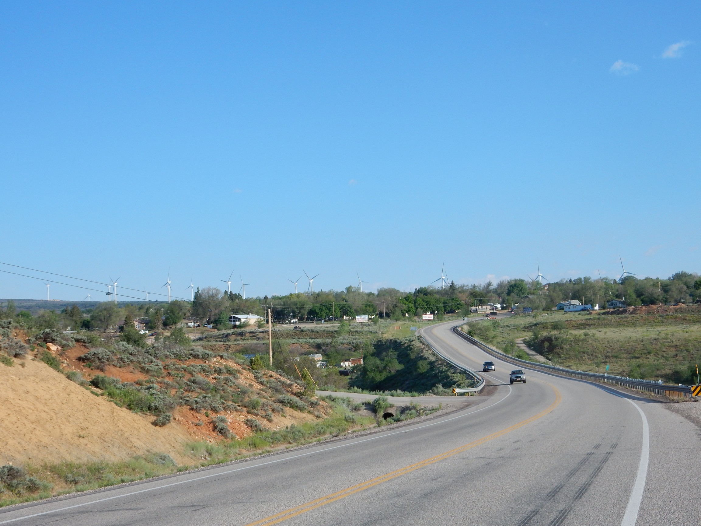
Utahans are, by and large, a pragmatic people, but they occasionally tilt at windmills.
Cliffs north of Monticello, probably Burro Canyon Formation with some remnants of Dakota Formation.
Let me pause here and say a little about the Colorado Plateau. This is a large block of the Earth’s crust and upper mantle (the lithosphere) that has remained unusually undisturbed for the last 300 million years. This has allowed the lithosphere to cool and become relatively rigid, so that the whole block acts like a solid body. The region experienced episodic subsidence from about 300 million to 30 million years ago, accumulating a thick sequence of sedimentary rock beds recording the geologic history of the area. Some 30 million years ago or so, the western part of North America was compressed by a kind of tectonic undertow — for lack of a better word — as the continent drifted close to the East Pacific Rise, part of the mid-ocean ridge system where hot mantle rock slowly creeps towards the surface and partially melts to form new ocean crust.
This time of compression (the Laramide orogeny) crumpled most of western North American into mountain chains, but the Colorado Plateau was spared. Later, when North America rode up onto the East Pacific Rise and the compression turned into tension, pulling the crust back apart, the Colorado Plateau was torn loose as a discrete block. (The eastern tear is the Rio Grande Rift.) The hot mantle under the East Pacific Rise has since elevated the entire region by at least 7000 feet, allowing erosion to kick in and expose the long sedimentary record in valleys and canyons.
Since I don’t have a good map of this area, I’m guessing at formations here. I think this is the combined Morrison and Summerville Formations.
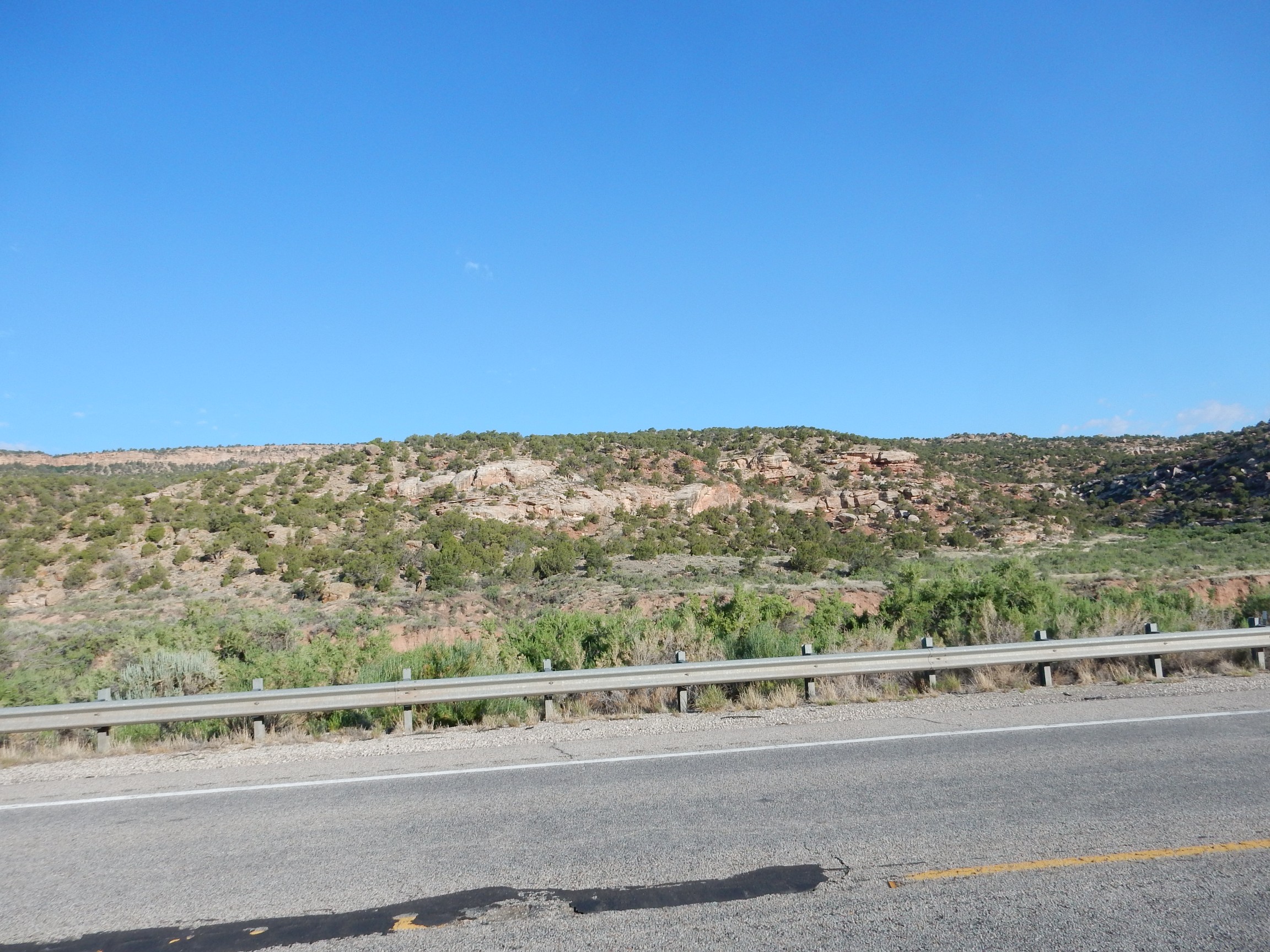
Both are Jurassic formations, between 160 and 150 million years old. A little further on, a very distinctive formation starts coming into view at the base of the cliffs.

My thought was that this had to be the Navajo Sandstone, but I have no geologic map of this area. The next quadrangle over is mapped, and perusing it suggests this is actually Entrada Formation.
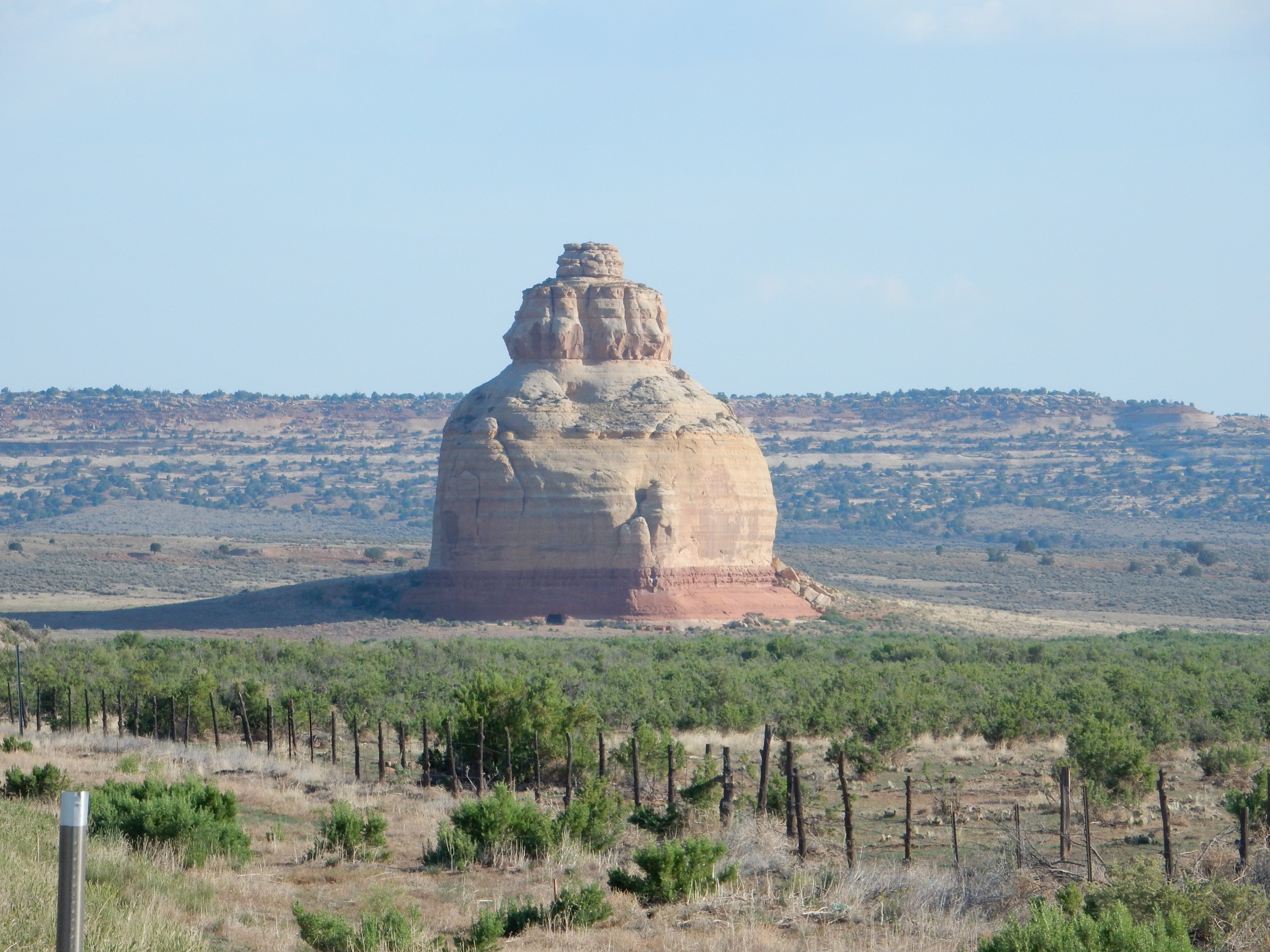
I am surprised to find that there is nothing reliable online on the identity of the formations. My wild guess? Entrada Formation over a thin layer of Carmel Formation. Both Jurassic, around 160 million years old.
And, of course, when we were kids on vacation with our parents, this was the headquarters of the Hidden Rebel Base.
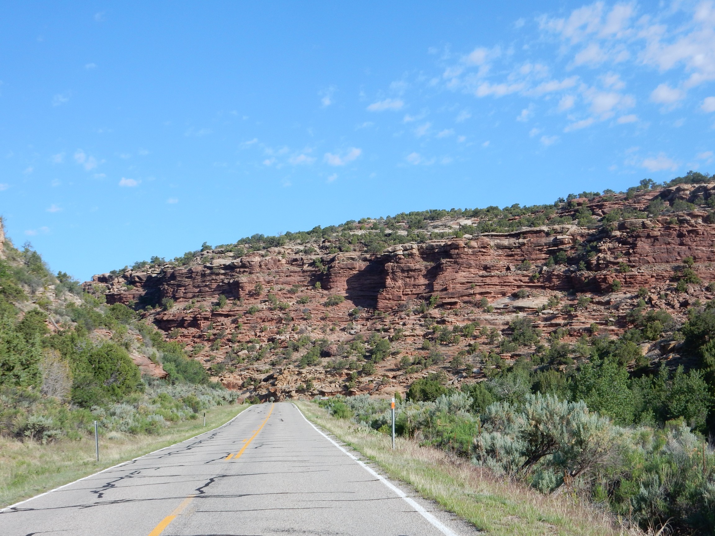
The Entrada Formation was laid down as sand dunes, and the massive beds here certainly fit. But most of the Entrada Formation is more red in color. This could be Navajo Formation, a light-colored eolian (sand dune) formation, but my geologic map suggests otherwise; the Navajo Formation does not start to crop out until you go further west. Which I’m about to do, by taking Route 211 to the Needles District of Canyonlands.
This is pretty dramatic stuff.
I have a geologic map for this area, but not a good one. I think this is Kayenta Formation, with a rim of Navajo Formation. Both are Jurassic.
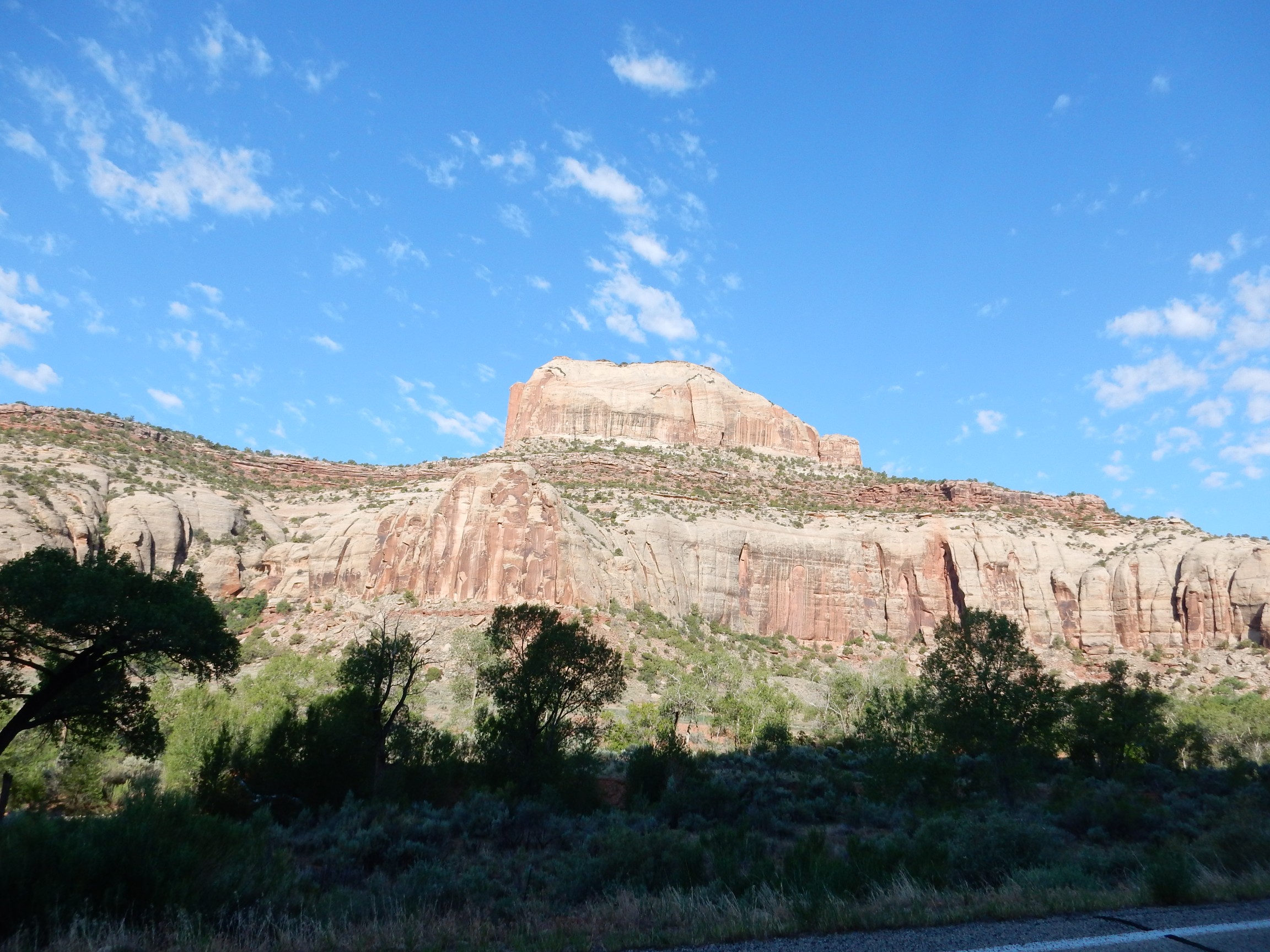
Around the bend is Newspaper Rock. There is a spectacular cliff to the west.
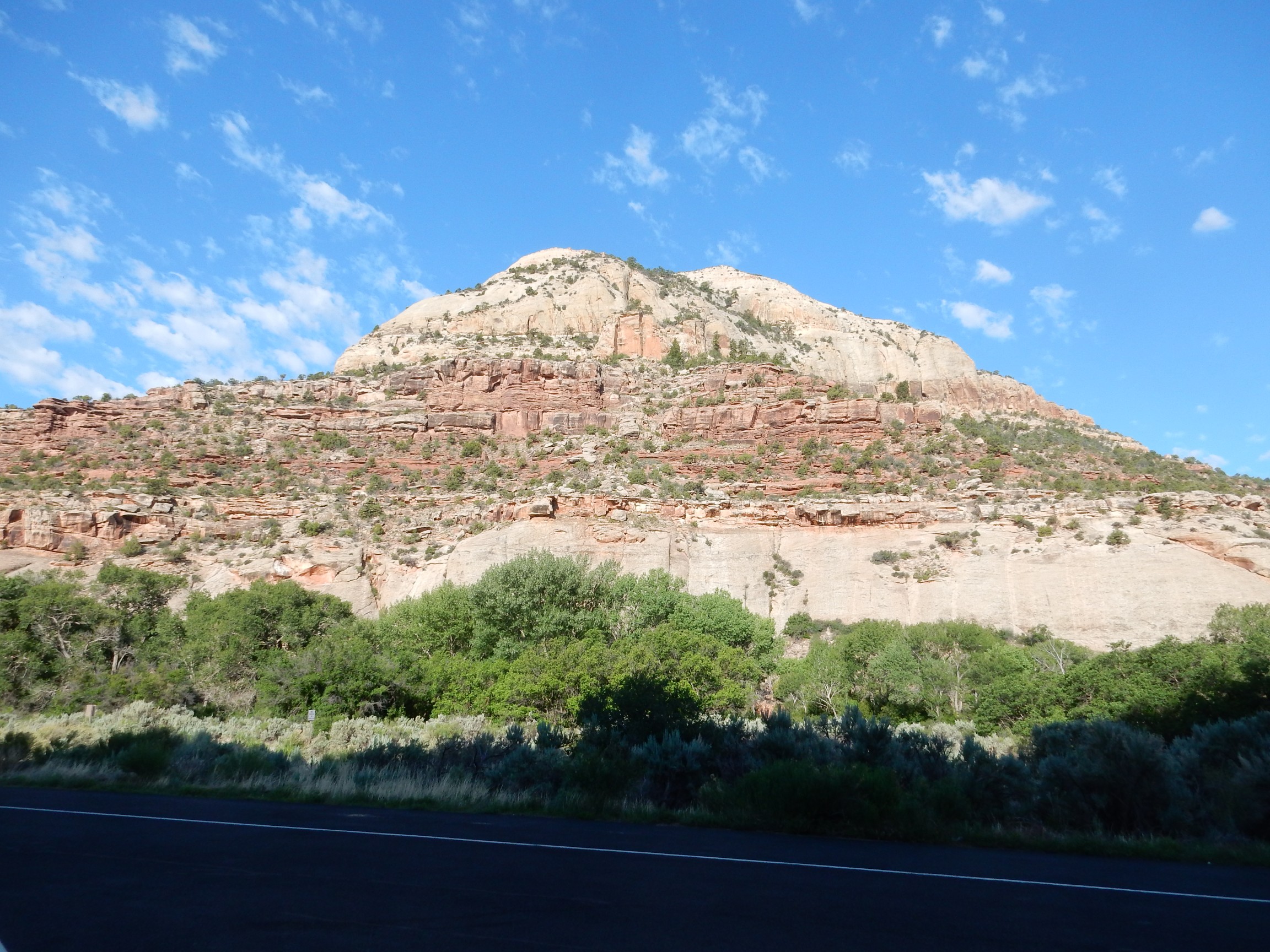
If I’m reading the map correctly, the peak is Navajo Formation, with thinly bedded Kayenta Formation beneath. At the base of the cliff is massive Wingate Sandstone. The Wingate Sandstone is actually brownish in color; however, lichens seem to have a peculiar affinity for it, and its lichen-encrusted surface appears more gray than the bare rock. All are early Jurassic rocks of the Glenn Canyon Group. The Navajo Sandstone and Wingate Sandstone are eolian (sand dune) formations while the Kayenta Formation was laid down by rivers.
So does knowing all the formation names make the rocks any prettier? I think bird watchers get extra satisfaction out of knowing the bird species, and wildflower fanciers get extra satisfaction from knowing the wildflower species and families. Yes, knowing the rock formation names does bring it all a little more alive to me.
Newspaper Rock itself:
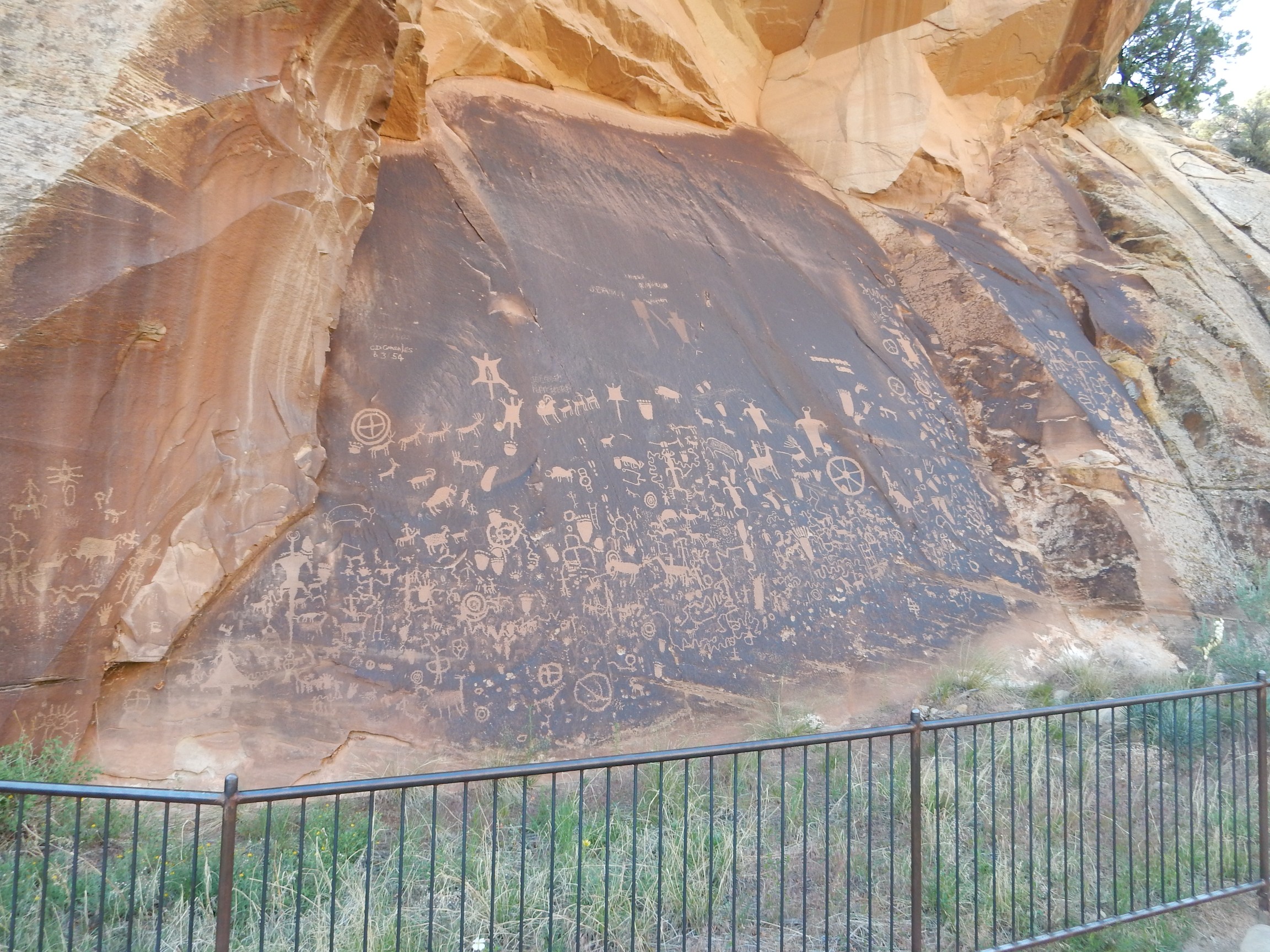
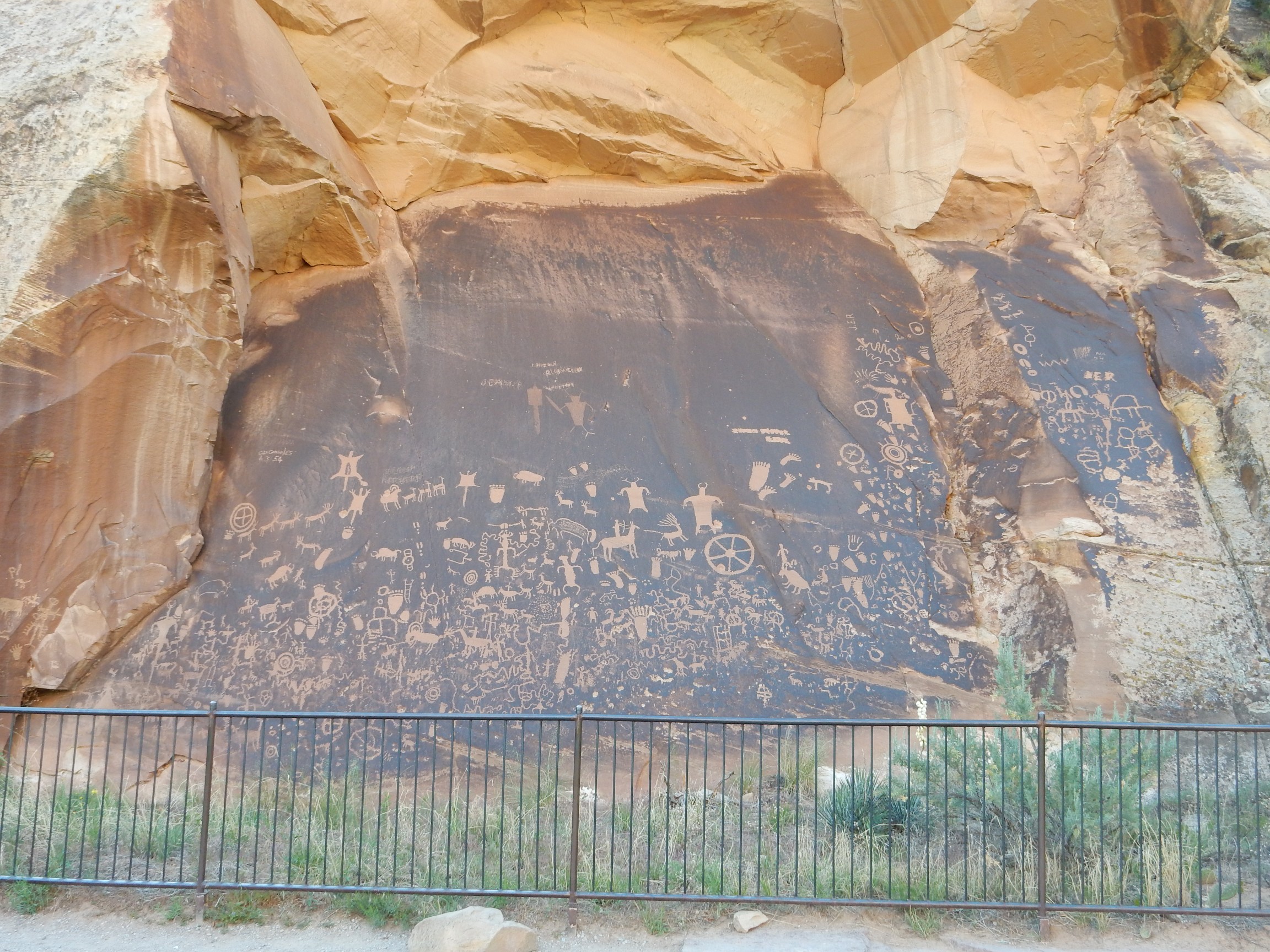
As with most pictographs, we don’t really know what they mean or even what their purpose was. Graffiti? Hunting magic? Travel advice to other travelers? Some are clearly post-European contact, and not just the English graffiti; the pictographs of men on horses and of sheep must postdate the Spanish. The older pictographs seem to be located more towards the bottom of the rock.
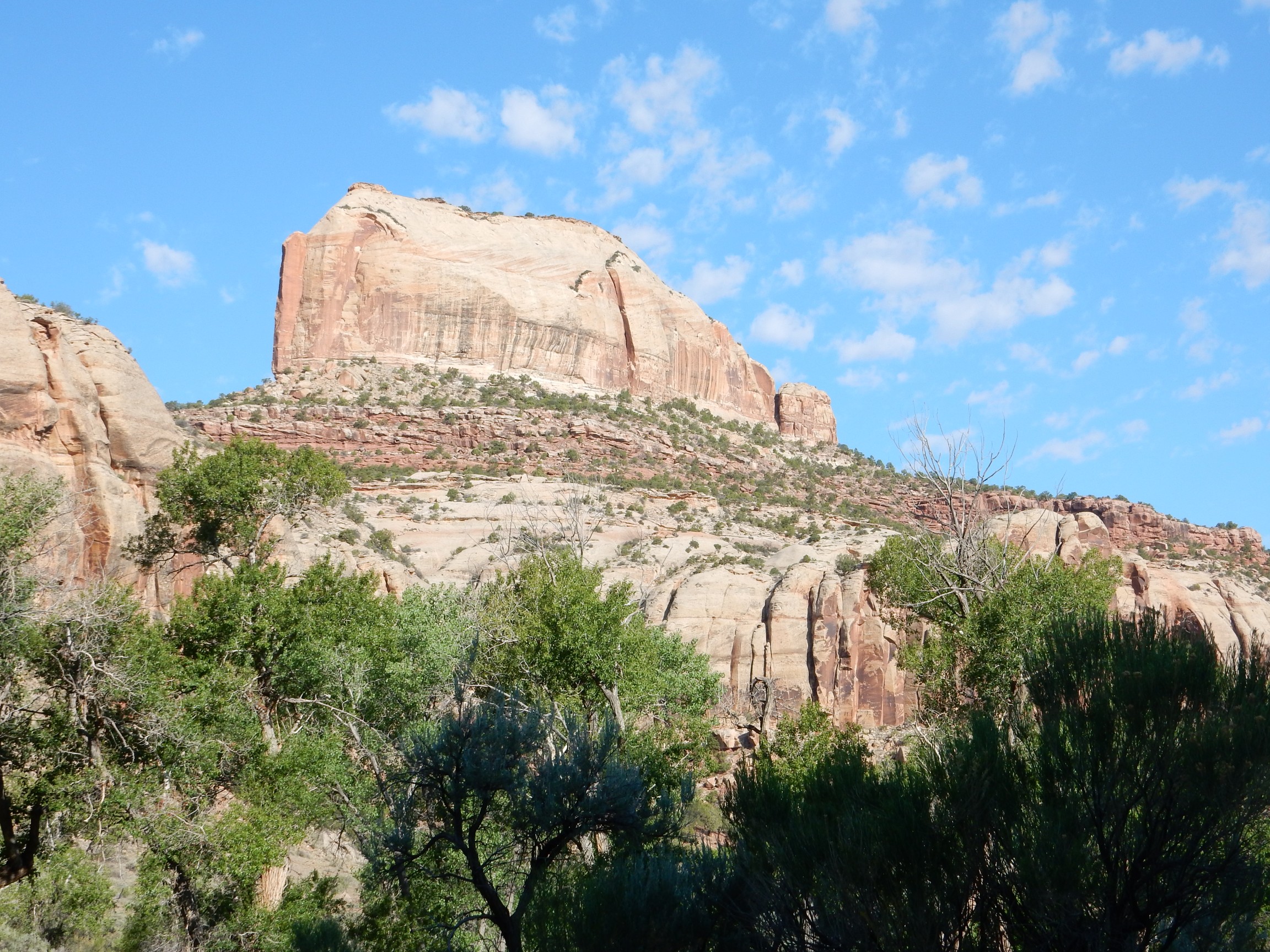
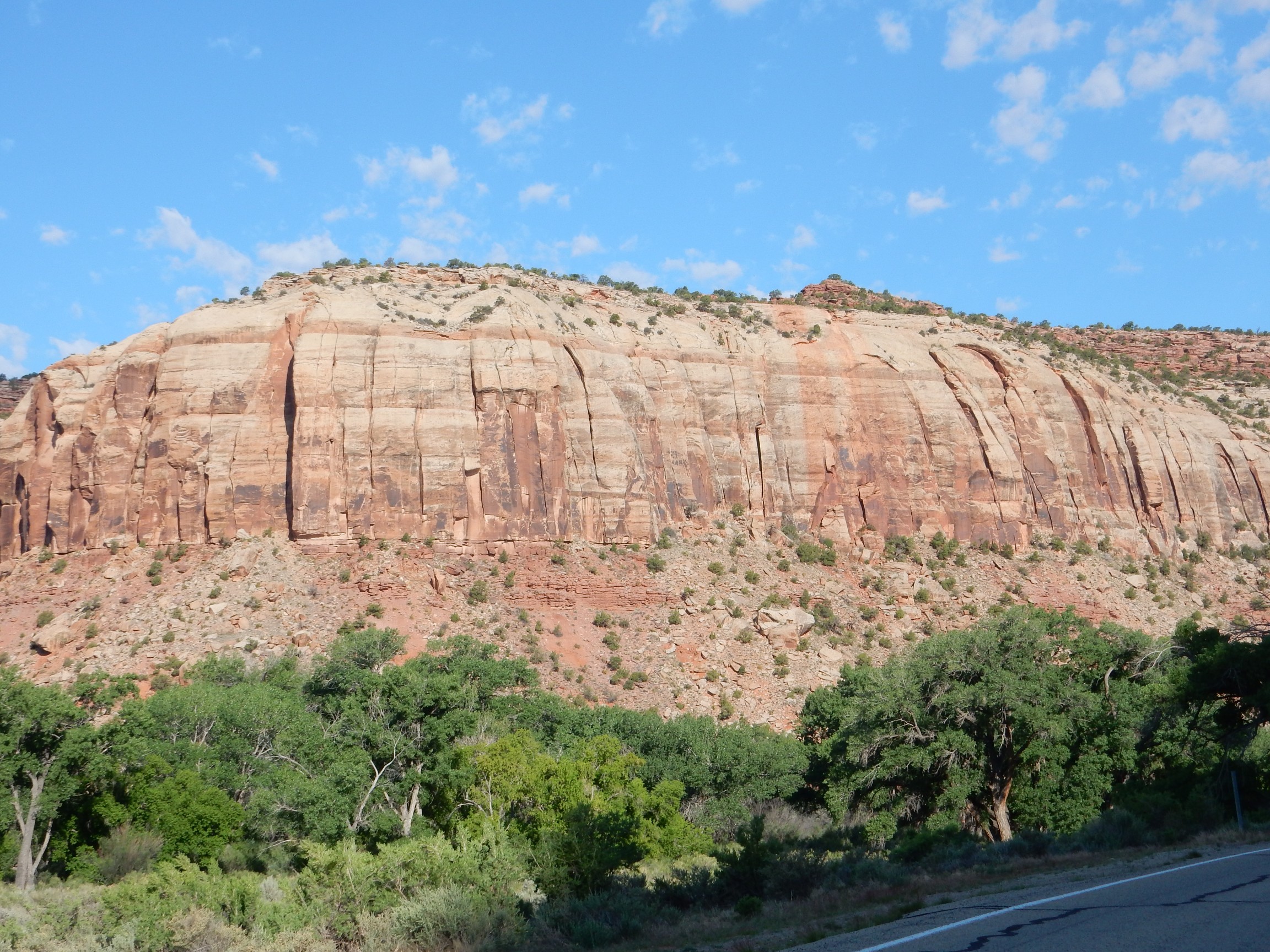
Another upcanyon shot. Same sequence as the last: Navajo Sandstone over Kayenta Formation over Wingate Sandstone.
A little further, and the next older formation emerges beneath the Wingate Sandstone.
The reddish slopes at the base of the cliff are underlain by the Chinle Formation, laid down in a large river valley resembling the modern Mississippi, but extending from the Appalachians to Nevada. (The main channel seems to have passed just north of the Jemez Mountains back home.) It is divided into many members, which are hard to pick out for a novice to the area, but this may be the Church Rock Member. (Different Church Rock; located in Arizona.)
I thought this might be my Ansel Adams moment for the day, but there were some nice pictures later on too. You decide.

A closer view, for science:
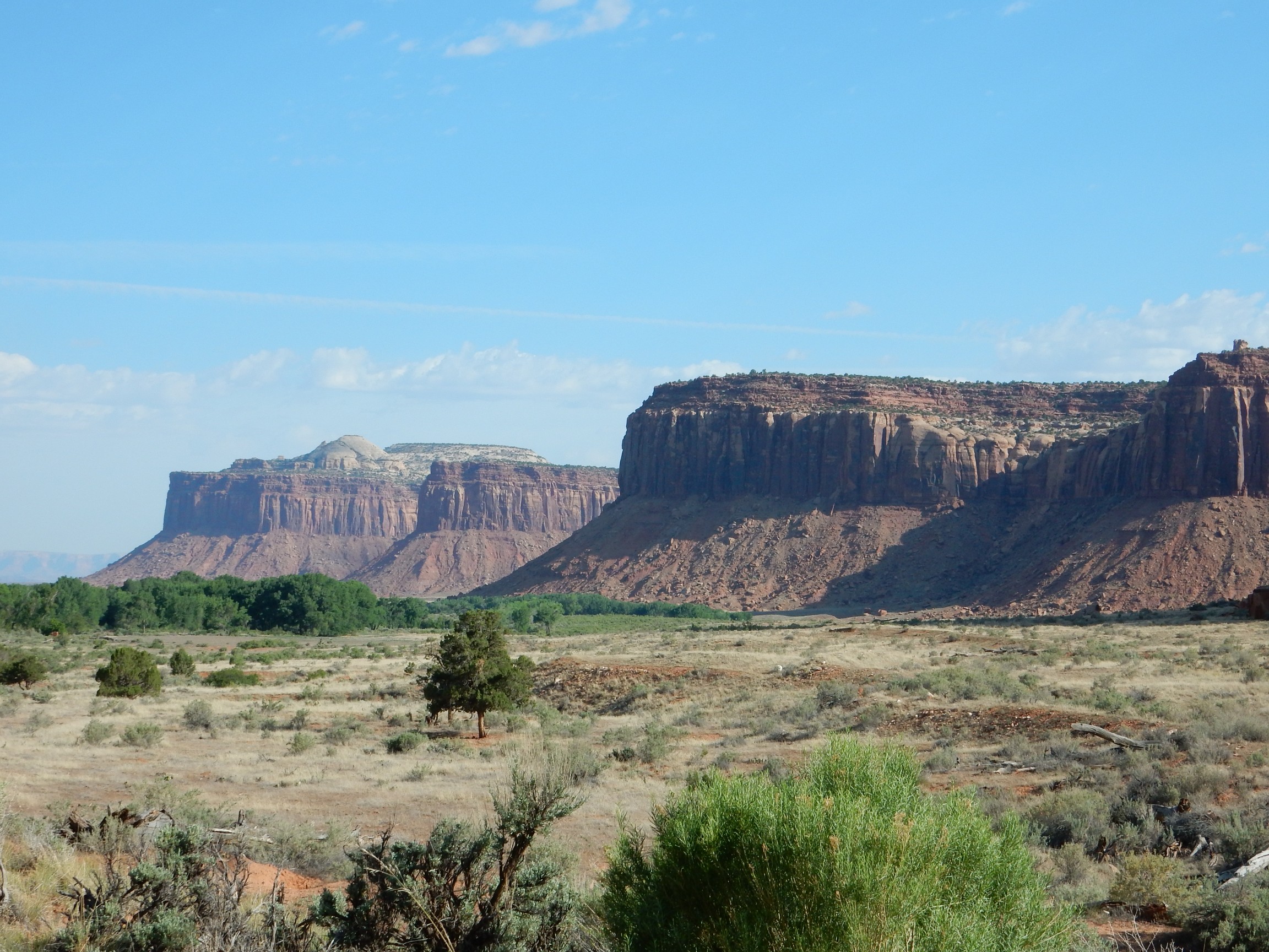
The farthest mesa shows Navajo Sandstone on top, then a cap of Kayenta Formation on all the mesas, then Wingate Sandstone forming imposing cliffs, over slopes of Chinle and Moenkopi Formation. The latter is another Triassic formation, and it can be hard to distinguish from the Chinle; it has a distinctive “chocolate” color but there’s enough gunk on these slopes (the polite geologic term is colluvium) that it’s hard to pick them out.
didn’t help much. The slope is clear but I don’t see a chocolate layer. It may all be Chinle. The geologic maps begin again just west of the bluff here; if I extrapolate, then the slope is all Chinle and the brown beds in the foreground are Moenkopi. The rocky layer between would be the Shinarump Member of the Chinle Formation.
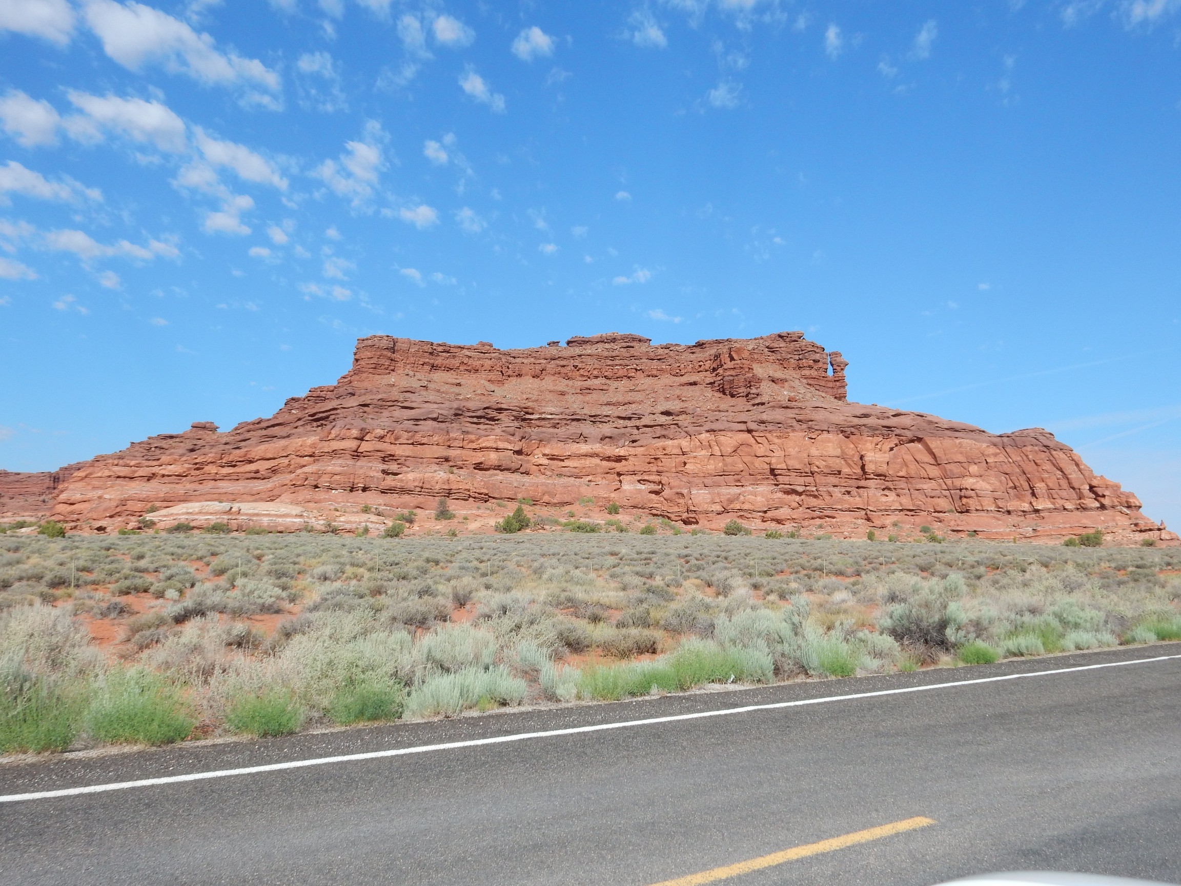
This seems like it could be chocolatey-brown Moenkopi Formation, but I’m back on mapped ground and this is labeled as Organ Rock Shale of the Cutler Group. The Cutler Group is Permian, some 300 million years old, and is sediments eroded off a high mountain range thrown up to the northeast, the Uncompaghre Uplift, which may have extended clear to the Espanola region near home. The Abo Formation and Yeso Group of the Jemez are about the same age and are also sediments eroded off the highlands.
The Uncompaghre Uplift was part of the Ancestral Rocky Mountains, which were thrown up by the collision of North America with Africa during the assembly of Pangaea, the last supercontinent.
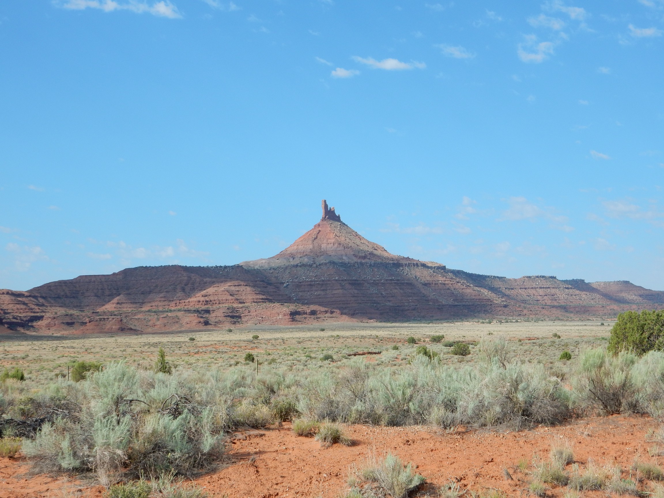
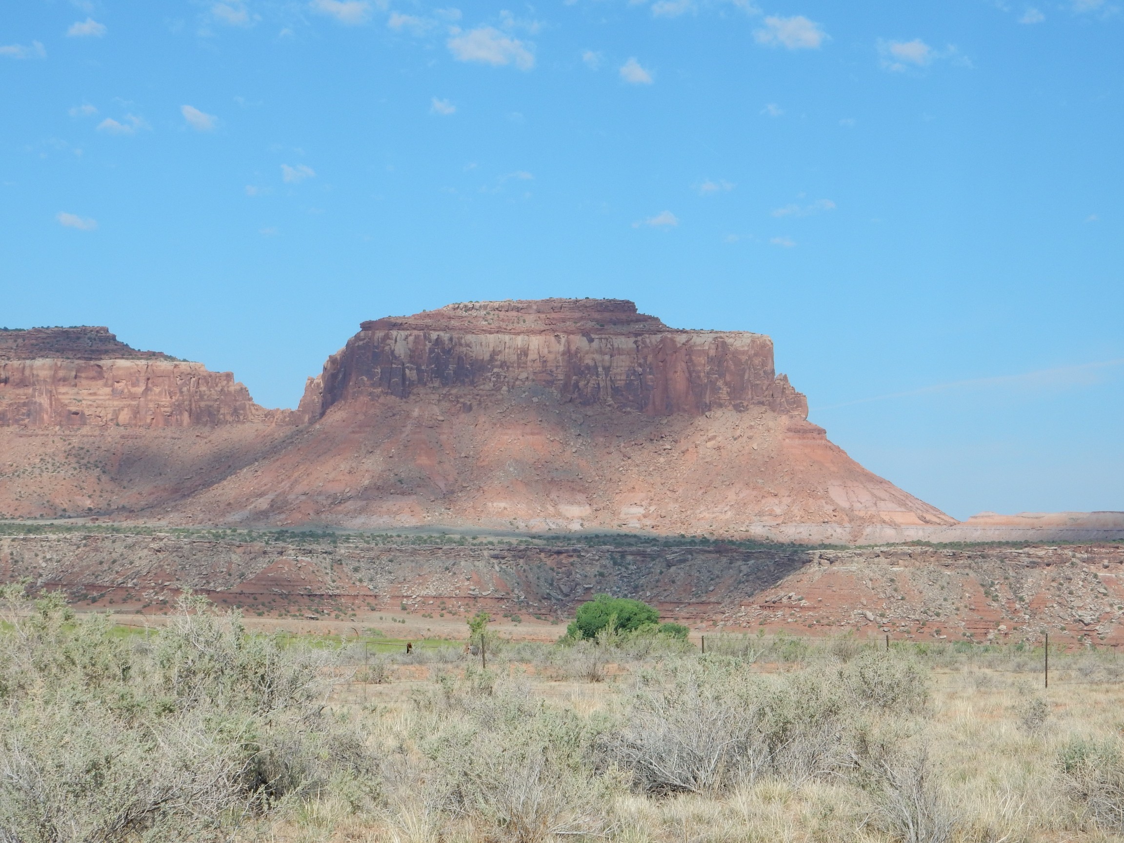
Here at last I feel on solid ground. The tip of the peak is a remnant of Wingate Sandstone, beneath which is a cone of Chinle Formation. The Shinarump Member forms the prominent ledge, and beneath are chocolate beds of the Moenkopi Formation.
A little further on, the next formation comes into view.
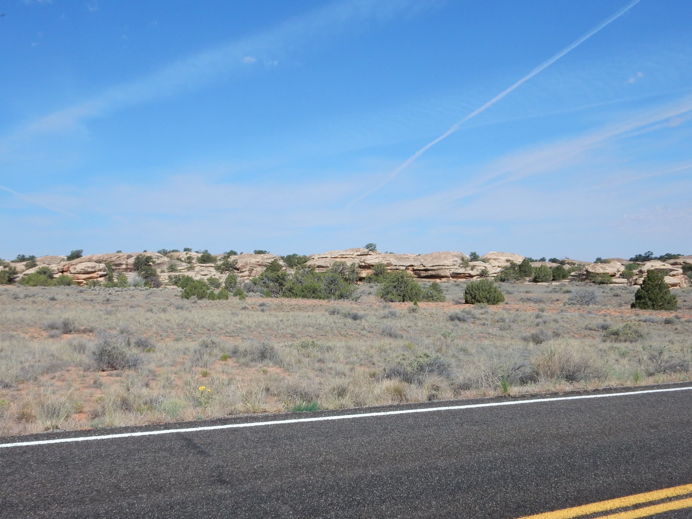
The lighter beds at the base of the bluff are Cedar Mesa Sandstone. We’re gonna see a lot of this shortly.
I reached the local park headquarters, handed my annual pass to the ranger, and she declared that she, too, was from New Mexico. (Albuquerque.) Thus approved, I parked at the visitor’s center, coated myself with more polyphenols, and headed in. There was a really good book on the geology of Utah parks in the bookstore; I purchased one. The ranger suggested a hike across the Cedar Mesa Sandstone that had some nice cliff views and would be about the right length.
The Cedar Mesa Sandstone forms the floor of the plateau in the entire area around the headquarters.
I reached the trailhead, parked, and was met by the local park host.
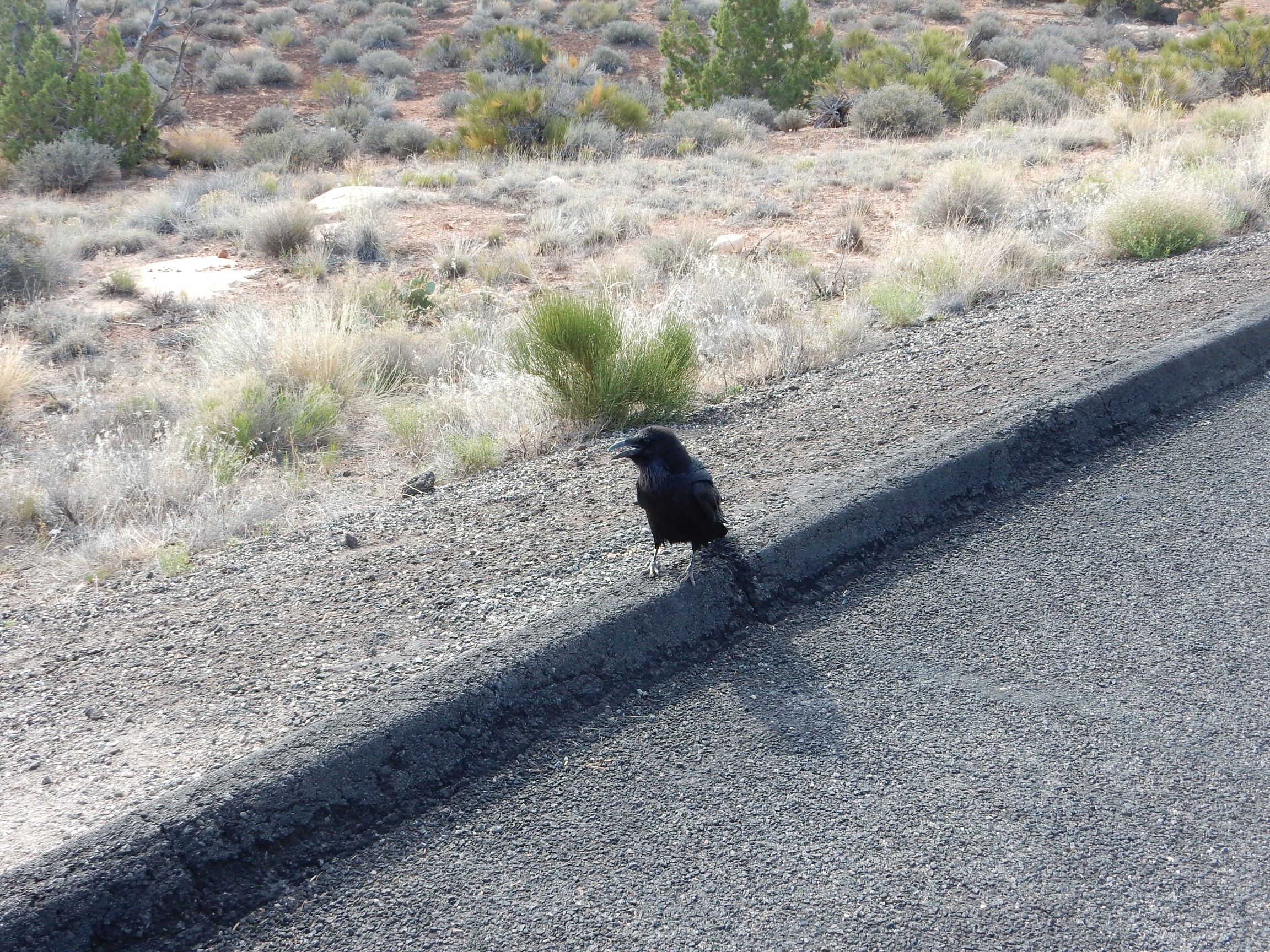
Well, that was unsettling. It was like he had sized me up as his next meal. I jinxed myself further by making a movie.
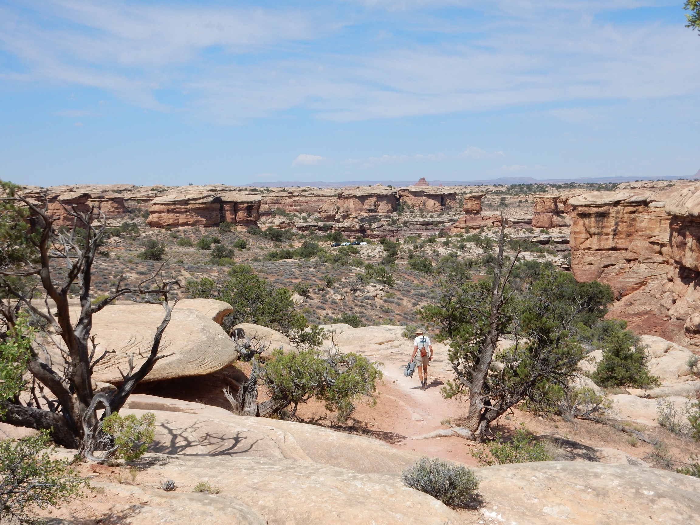
The trail.
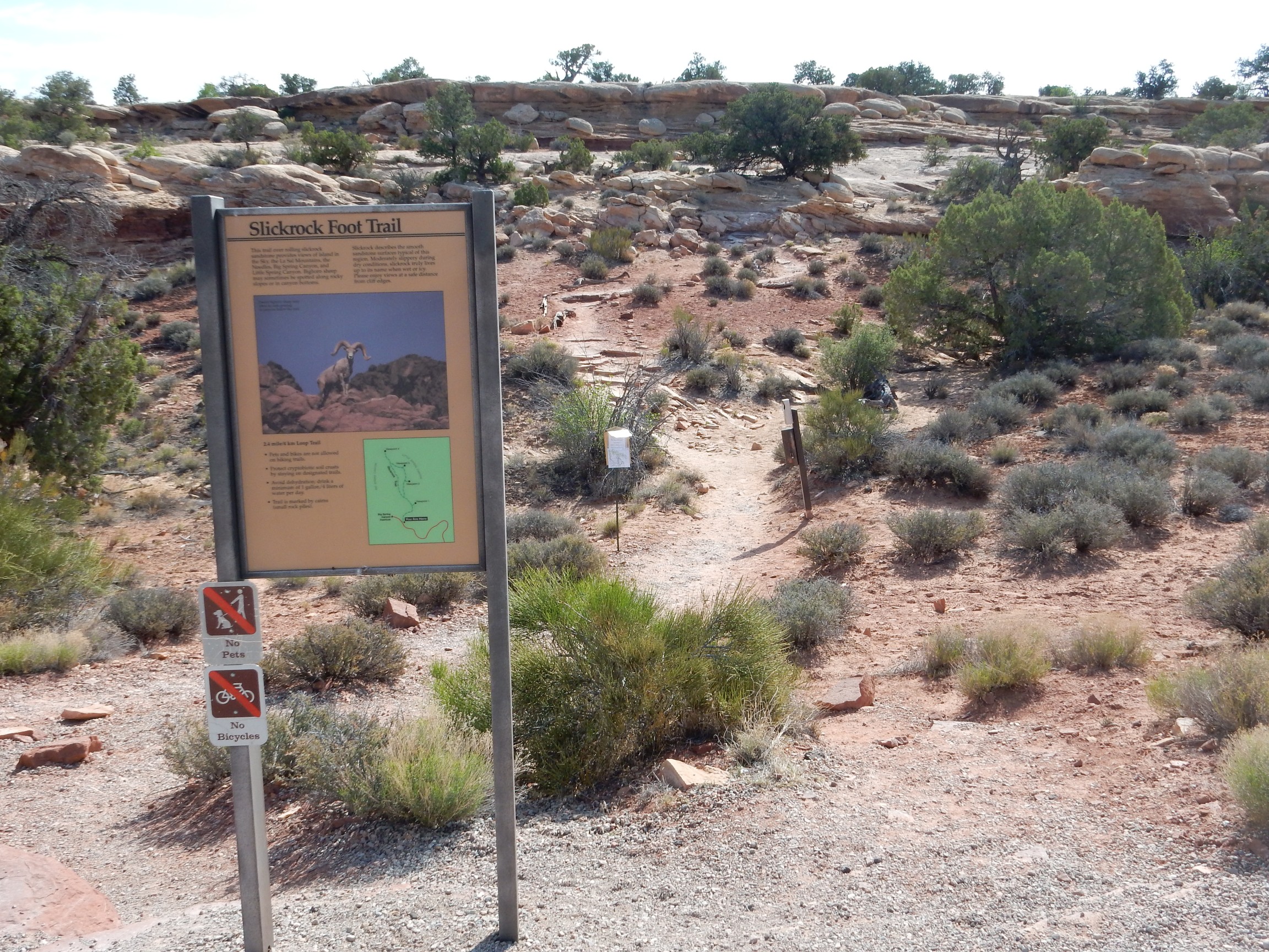
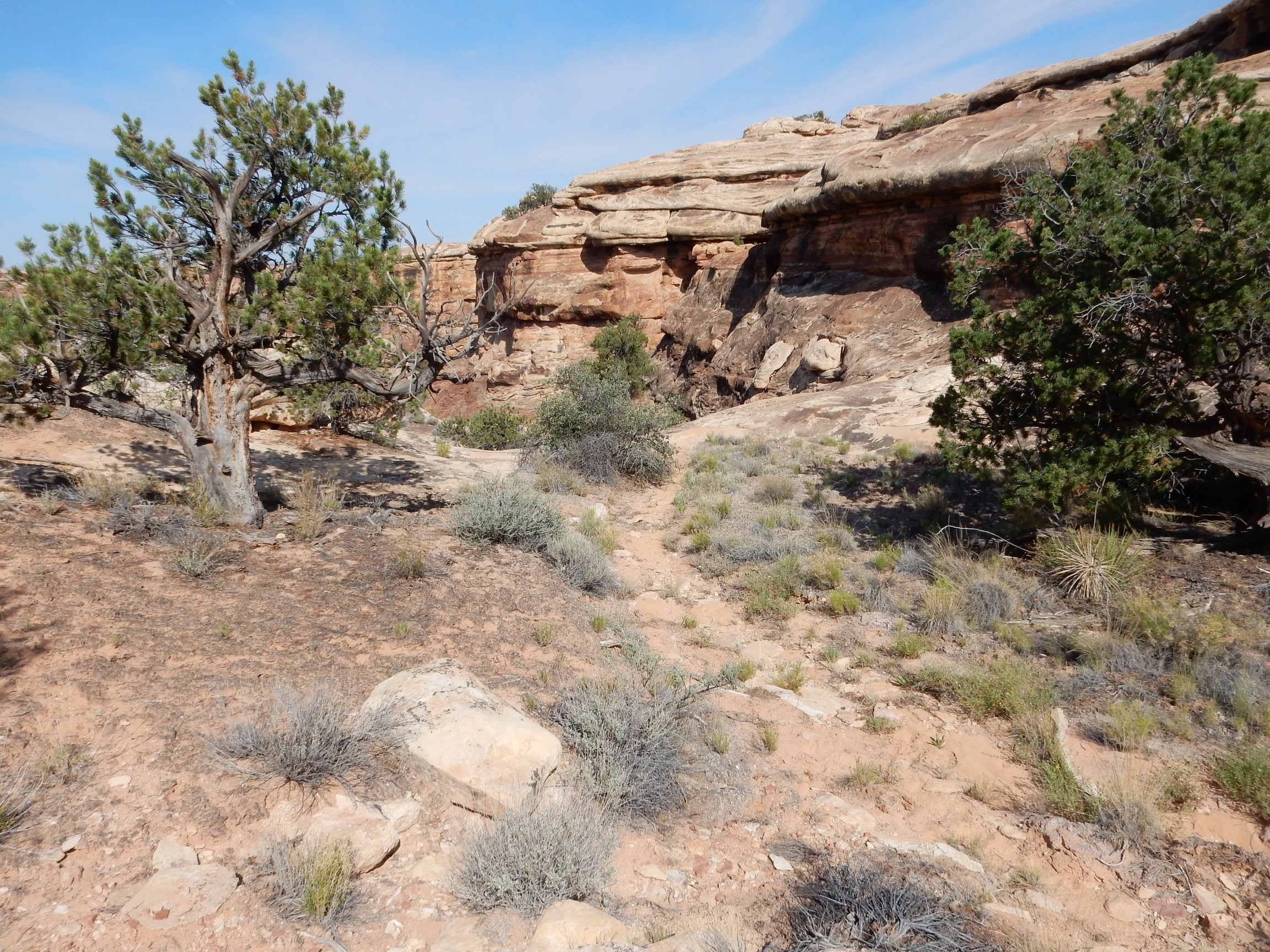
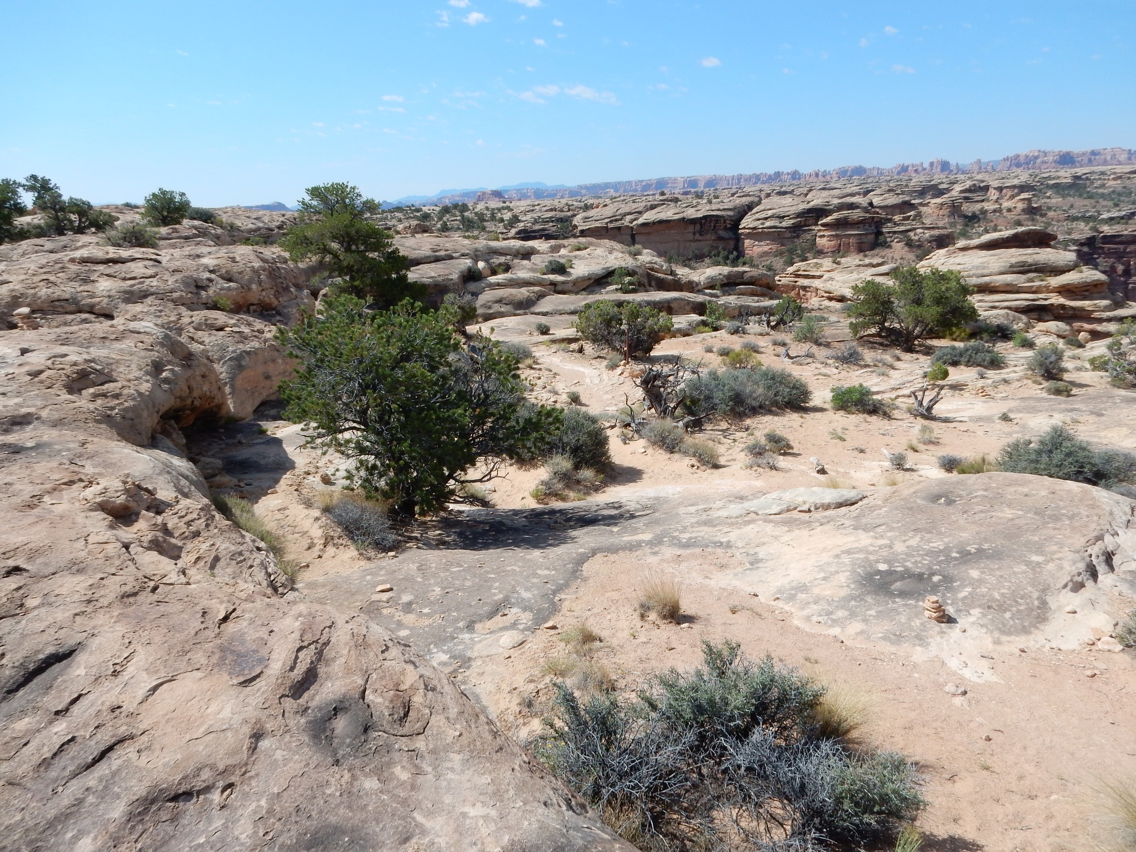
The trail was moderately hot, but not too bad. It was also relatively level. Most of the trail was on the slick upper surface of the Cedar Mesa Sandstone, hence the name. I imagine the trail could indeed get very slippery in freezing weather.
The sandstone across the small canyon shows prominent crossbedding. This is where the rock is composed of thick layers that in turn are composed of thinner layers at an angle to the thick layers. It is typical of sandstone laid down in a steady current — prevailing wind over dunes or a river carrying sand. In the case of the Cedar Mesa Sandstone, some is eolian and some was laid down in a shallow ocean.
I got to a spot where the trail seemed to peter out. There was a cairn halfway up a sandstone ledge, but that didn’t look like a trail. Perhaps this?
No, that “trail” ended on a cliff.
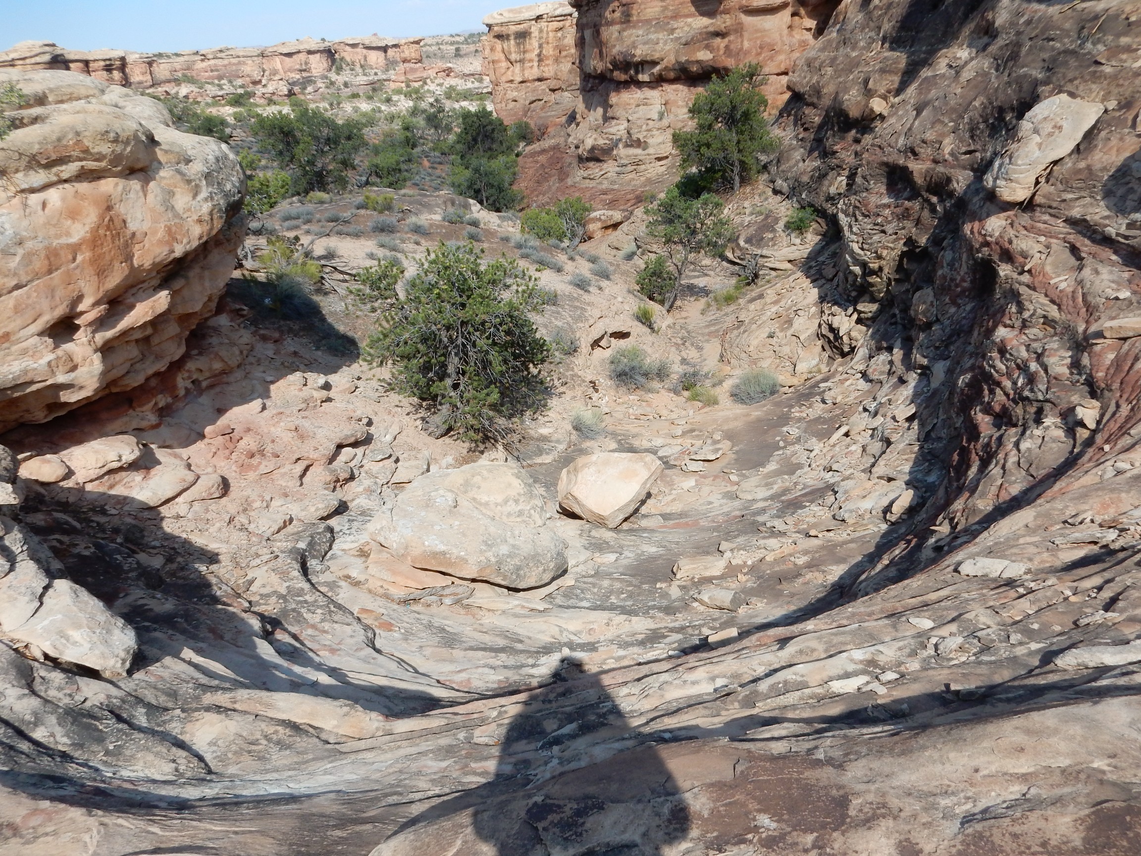
I finally found the path up the ledge by the cairn.
Much of the soil here is cemented with biofilm.

The dark, irregular soil surface is full of fungi and cyanobacteria, almost like a lichen, but in the soil rather than on a rock. This is quite delicate; the claim is that damage from a footprint can take years to repair. So the rangers try to keep you off the stuff.
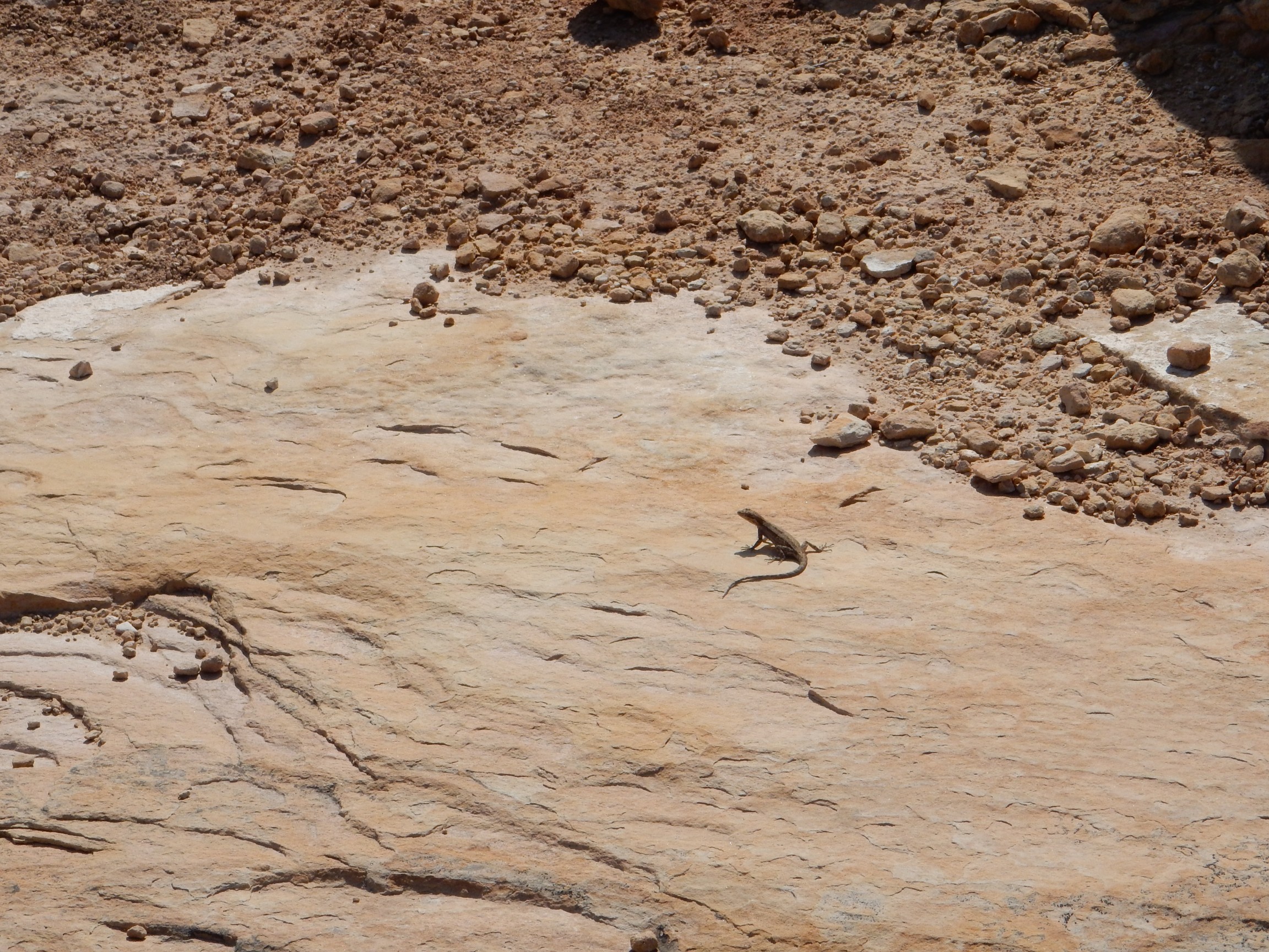
Lizard.
A trail spur led to the first view point. I set up my tripod.
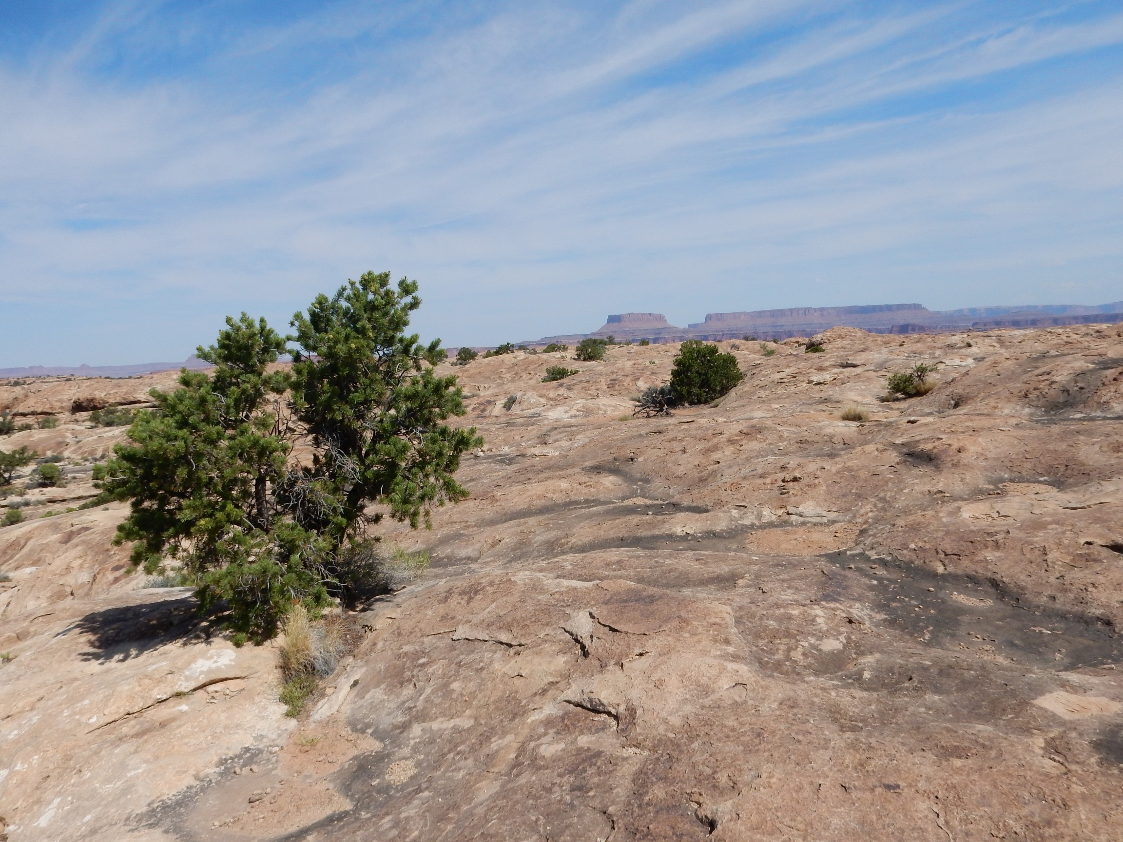
To the north and east:
The distant mesas on the skyline at left are Junction Butte and Island in the Sky in the northern part of the park.
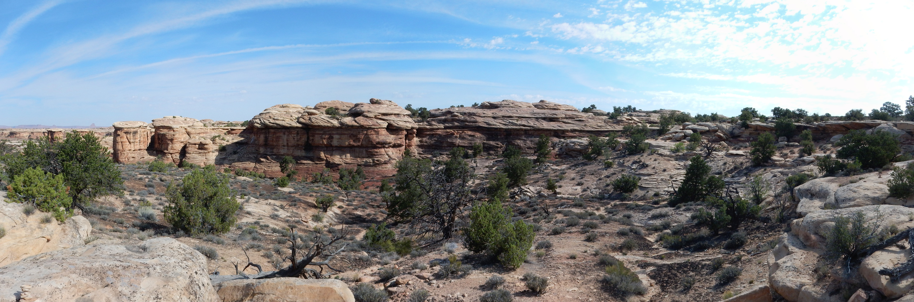
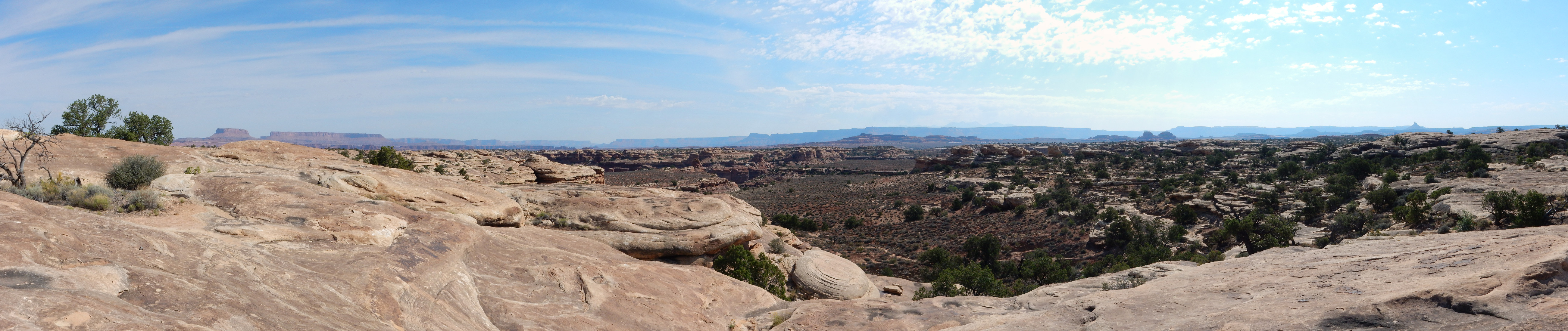
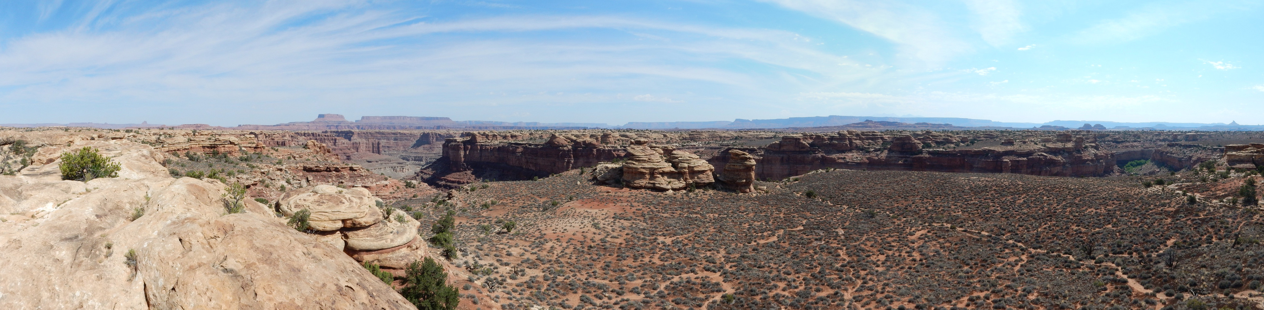
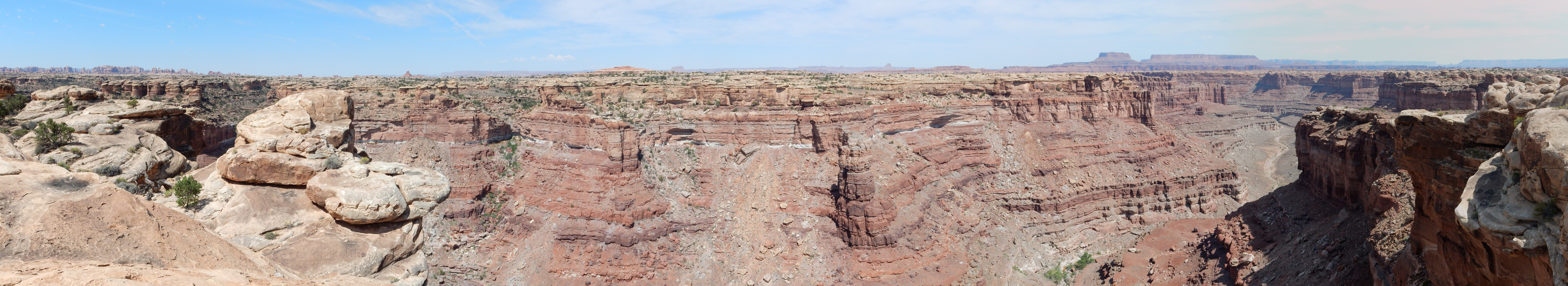
To the south and west:

This is looking into The Needles, where red beds of the Cutler Formation, representing sediments eroded off the Uncompaghre Uplift to the east, interfinger with beds of the Cedar Mesa Sandstone, representing sand brought in from the northwest. You definitely want to click to enlarge this photograph. The needles formed where the rock was fractured vertically as the beds slowly slid northwest towards the Colorado River, lubricated by salt deposits far underground.
Why it is called the Slickrock Trail:
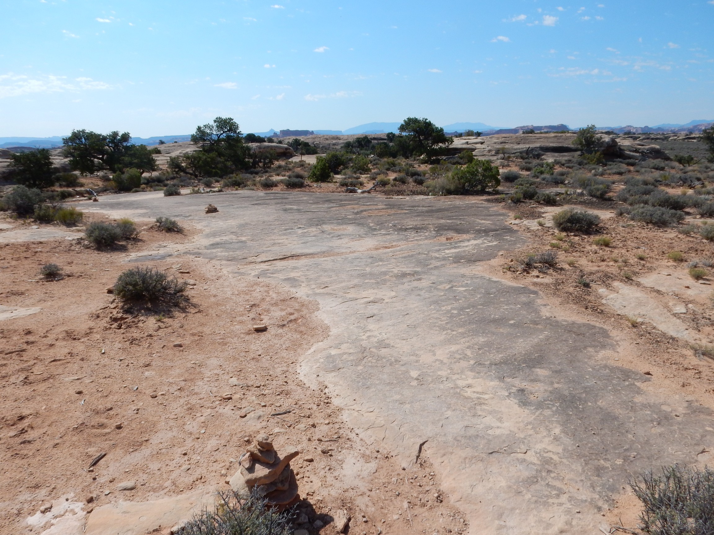
And: “Start of loop”
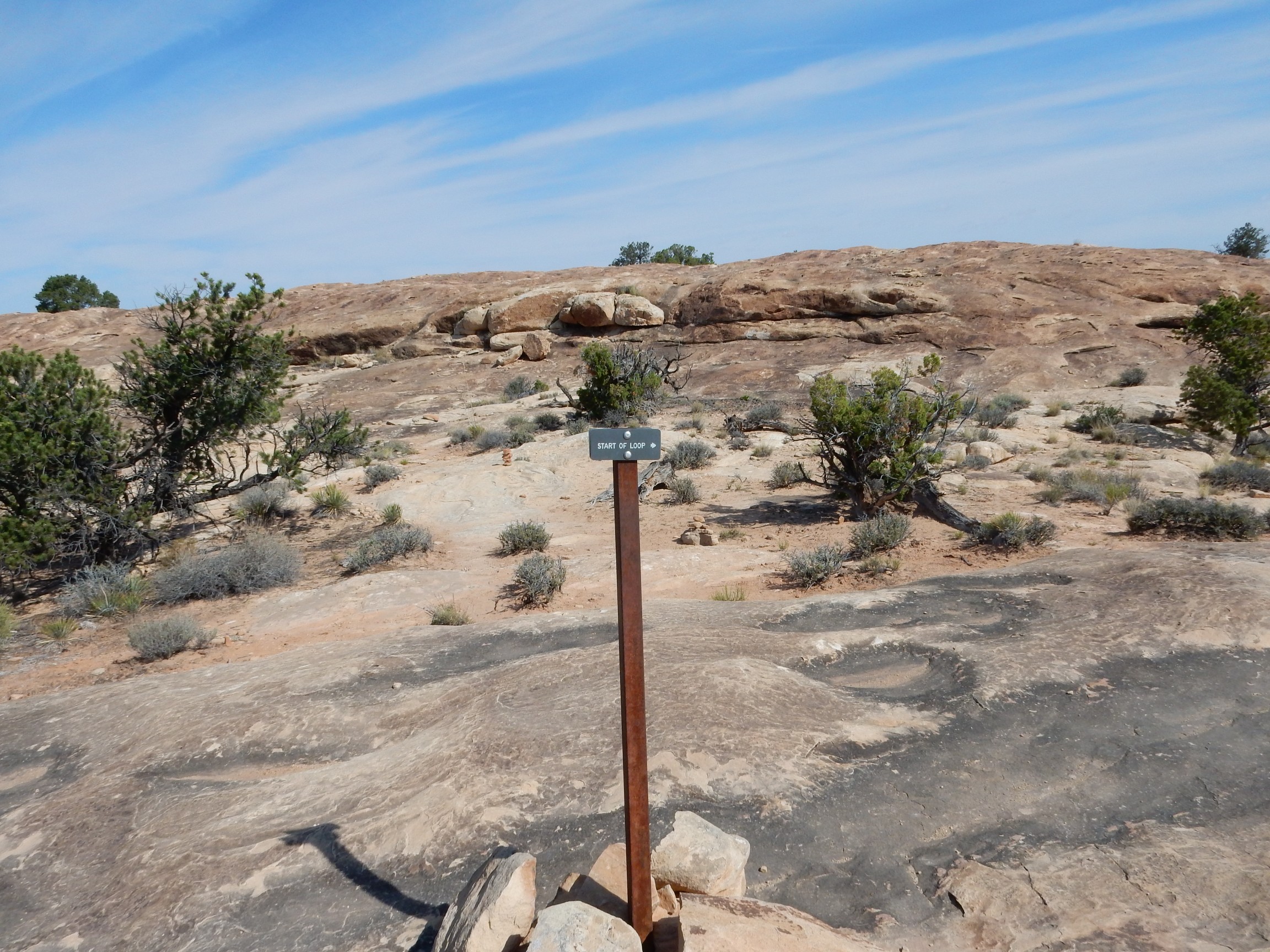
I thought I’d already been hiking a while. I must be getting older.

This turned out to have a somewhat restricted view.

This is looking down into Little Spring Canyon. The canyon bottoms are reputedly inhabited by bighorn sheep, but I saw none this day.
The trail climbed down a ledge and seemed to go both ways.
Go south?
Or north?
Turns out there was a sign. North was the final lookout point. It was also the most spectacular.
But first, near one of the rock cairns: What?
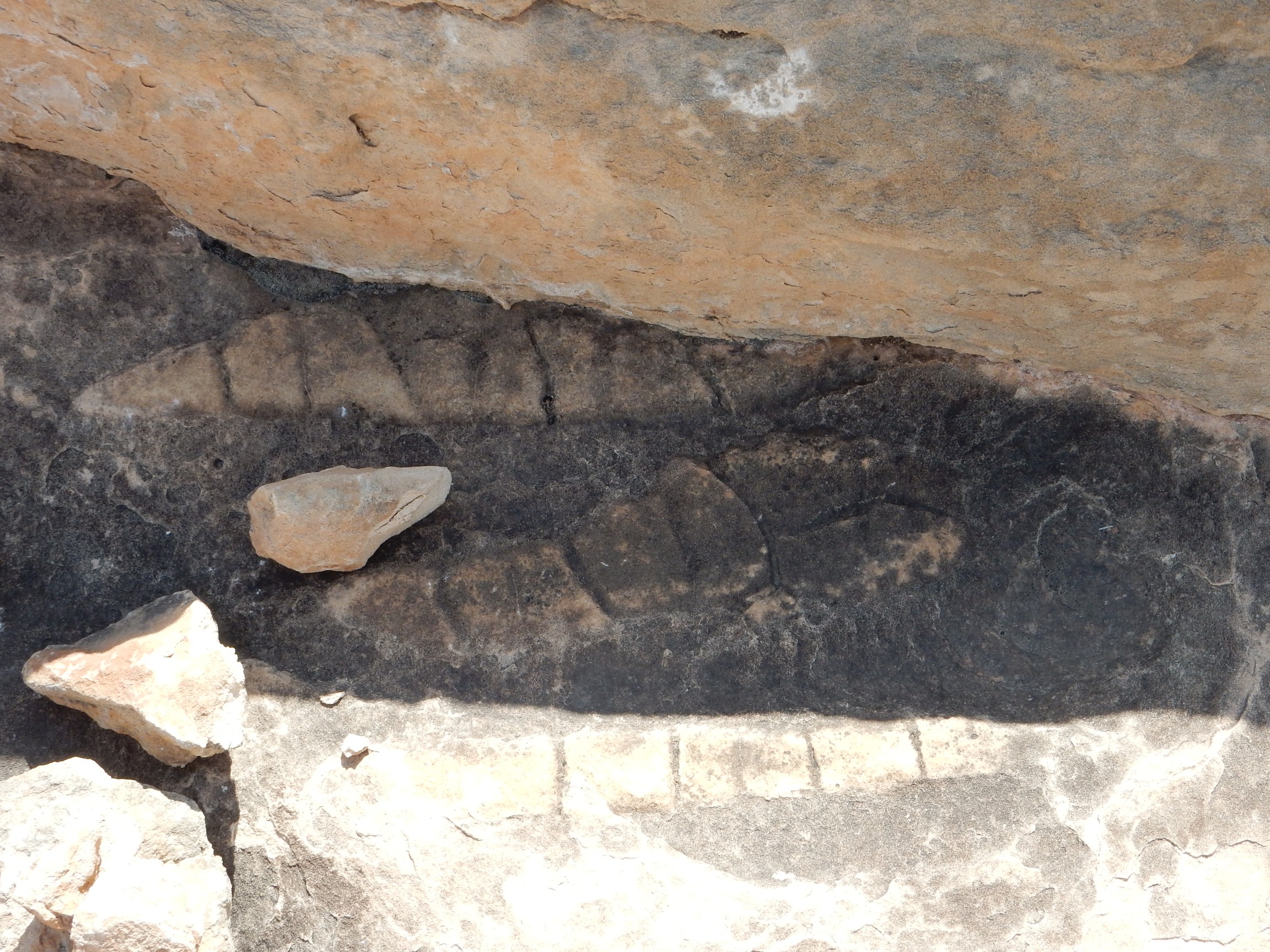
Too perfect to be a dinosaur track or anything spectacular like that. Maybe just some kind of sedimentary structure. Bruce?
The canyon is rimmed with Cedar Mesa Sandstone, while the red beds beneath are likely the Elephant Canyon Formation. The deepest part of the canyon may expose Honaker Trail Formation, which is more gray in color.
Close up of Island in the Sky.

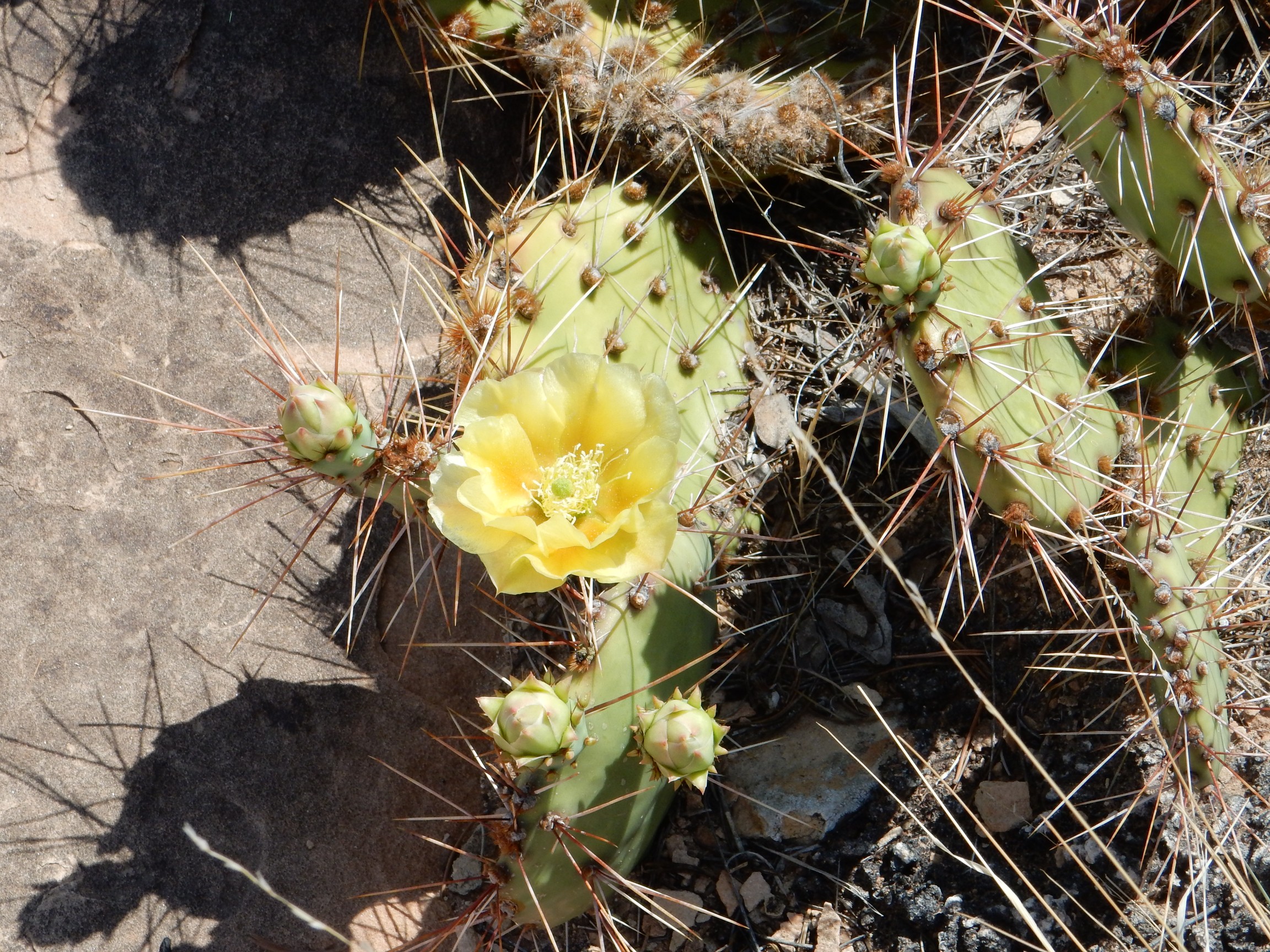
Almost done. I began heading back to the trailhead, pausing for a snack and a photo of cactus.
On the way out, I ran into a couple of German tourists; the wife asked, with mild disgust, “Is it all like this?” I suggested that the lookout points were nice enough to be worth hiking over the boring flat hot sandstone. I hope I didn’t disappoint them.
And back to the car.
I retraced my route to the main highway and headed north to Moab. I would save Arches National Park for another time. I could not resist a few pictures north of Moab, though.

I think we are once again seeing Wingate Sandstone over Chinle Group over Moenkopi Formation, possibly over Cutler Group.
This is probably Morrison Formation, famous for its green reduced beds. The geologic map for the area seems to agree.


Reduced beds: These are beds containing significant organic matter, which has reduced oxygen levels enough to reduce red ferric iron oxide (hematite) to green ferrous iron minerals.
Further north and we’re into the Mancos Shale. This will be with us all the way to Price.
The Mancos Shale was laid down in the shallow Cretaceous Western Interior Seaway. It is another extremely widespread formation, found also in my neck of the woods.
I stopped in Green River for gas, and took a panorama.
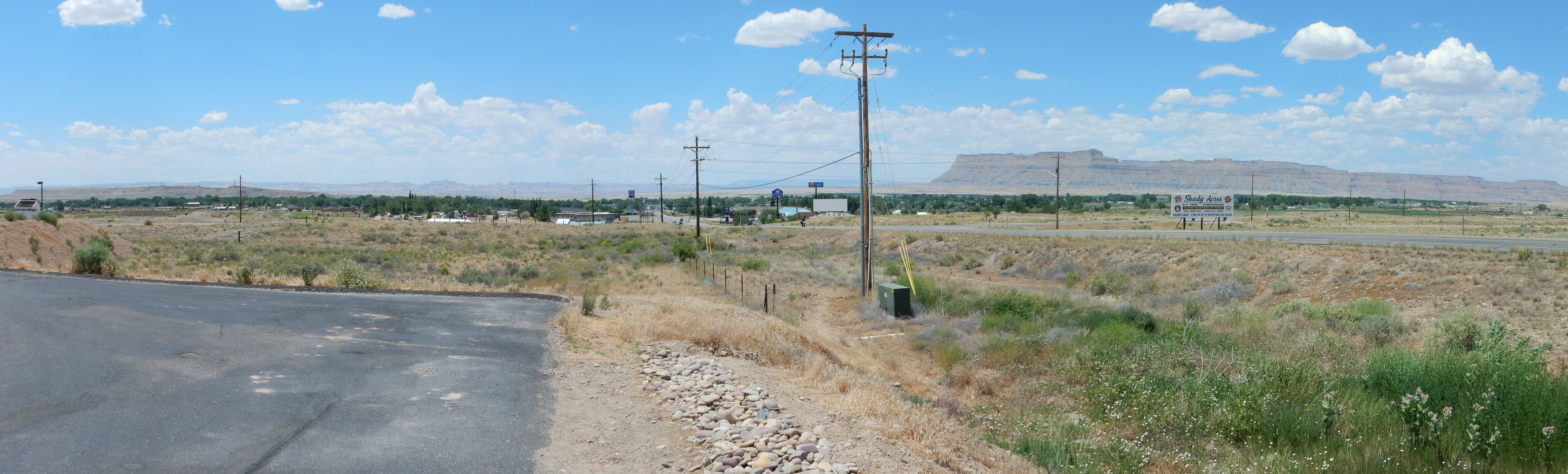
At left, looking west, is the San Rafael Swell on the skyline. This is a broad upwarp in the Earth’s crust that I’ll see a lot more of later in the trip. At right, to the northwest, are the Book Cliffs, capped with Castlegate Formation over Blackhawk Formation, both late Cretaceous.
North of Green River I paused for a telephoto panorama of the San Rafael Swell.
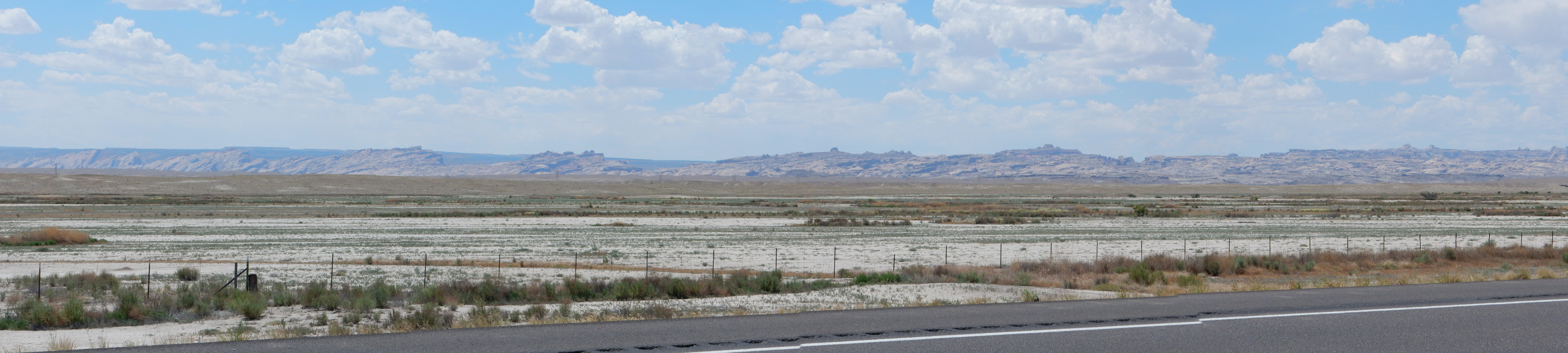
The rock ridge is known as the San Rafael Reef and it is composed of Jurassic Navajo Sandstone, if I’m reading the map right.
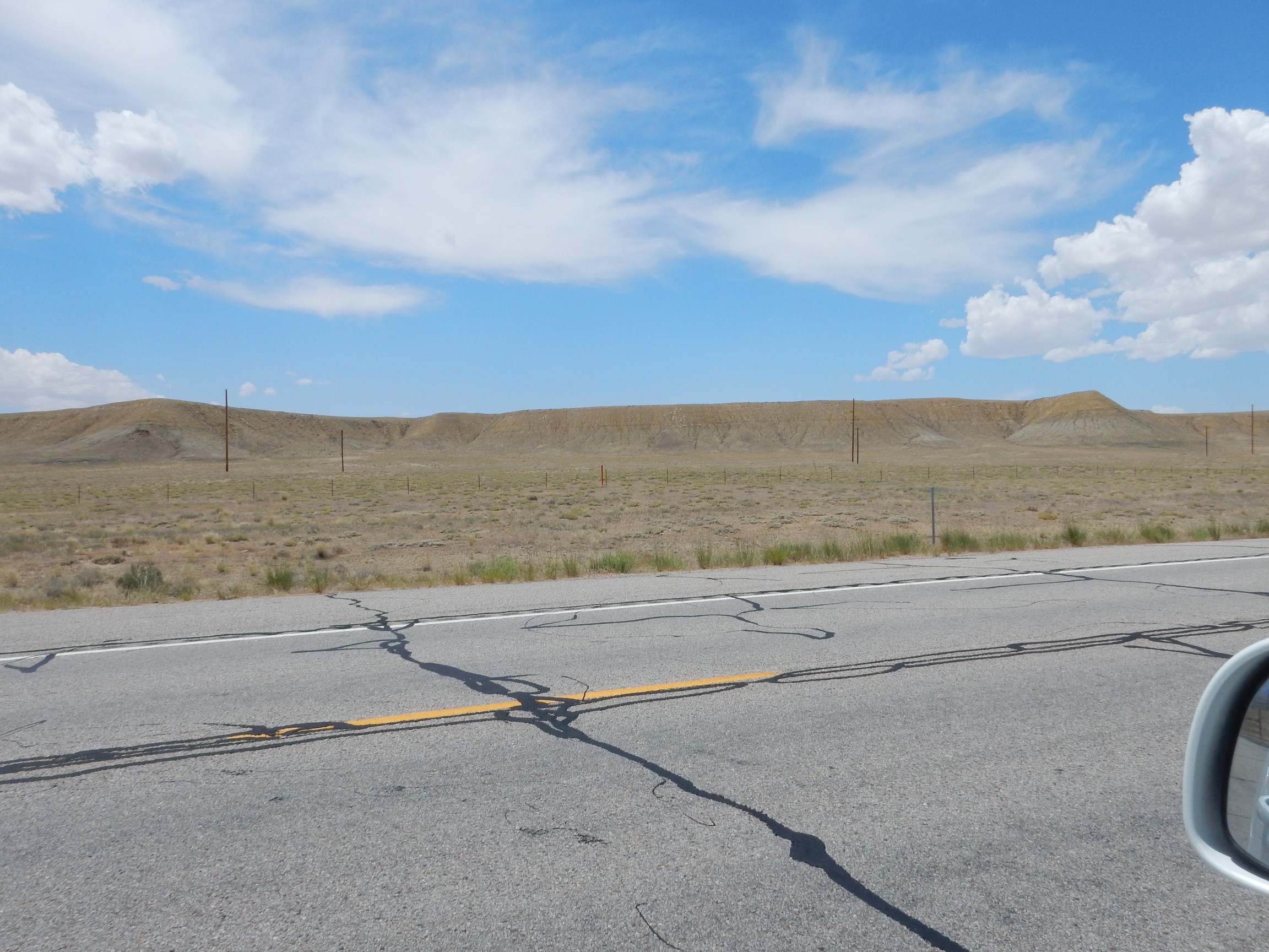
A long drive between Green Rive and Price over rather drab Mancos Shale.
Approaching Castle Gate:
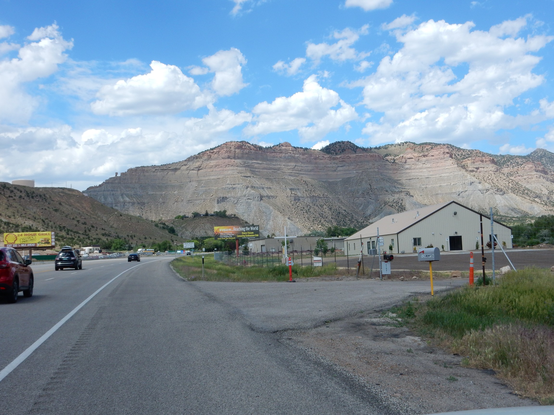
The cliffs are underlain by Cretaceous Black Hawk Formation on top of Star Point Sandstone.
Underlain by Blackhawk Formation.
This is coal country:

The black seams are honest to goodness coal, though too thin to be economical to mine. There is certainly plenty of coal mining nearby.
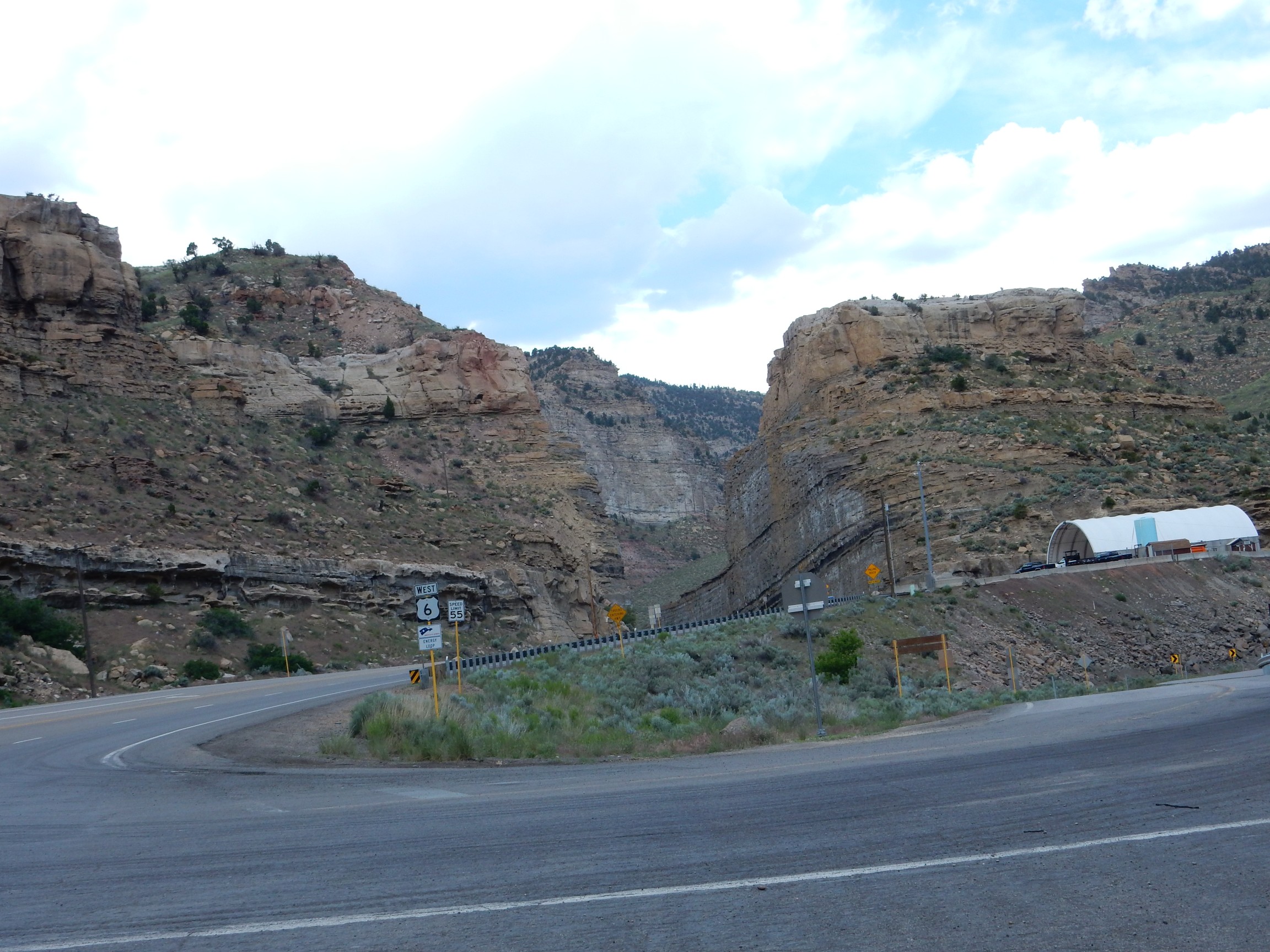
Most of rest of Price Canyon is lush and green, meaning it’s beautiful but there are not that many good exposures of bedrock. However, as one comes into the northern part of the canyon, there are some spectacular road cuts. I found myself zipping past what were very clearly geology students on a summer field trip looking at a very nice road cut.
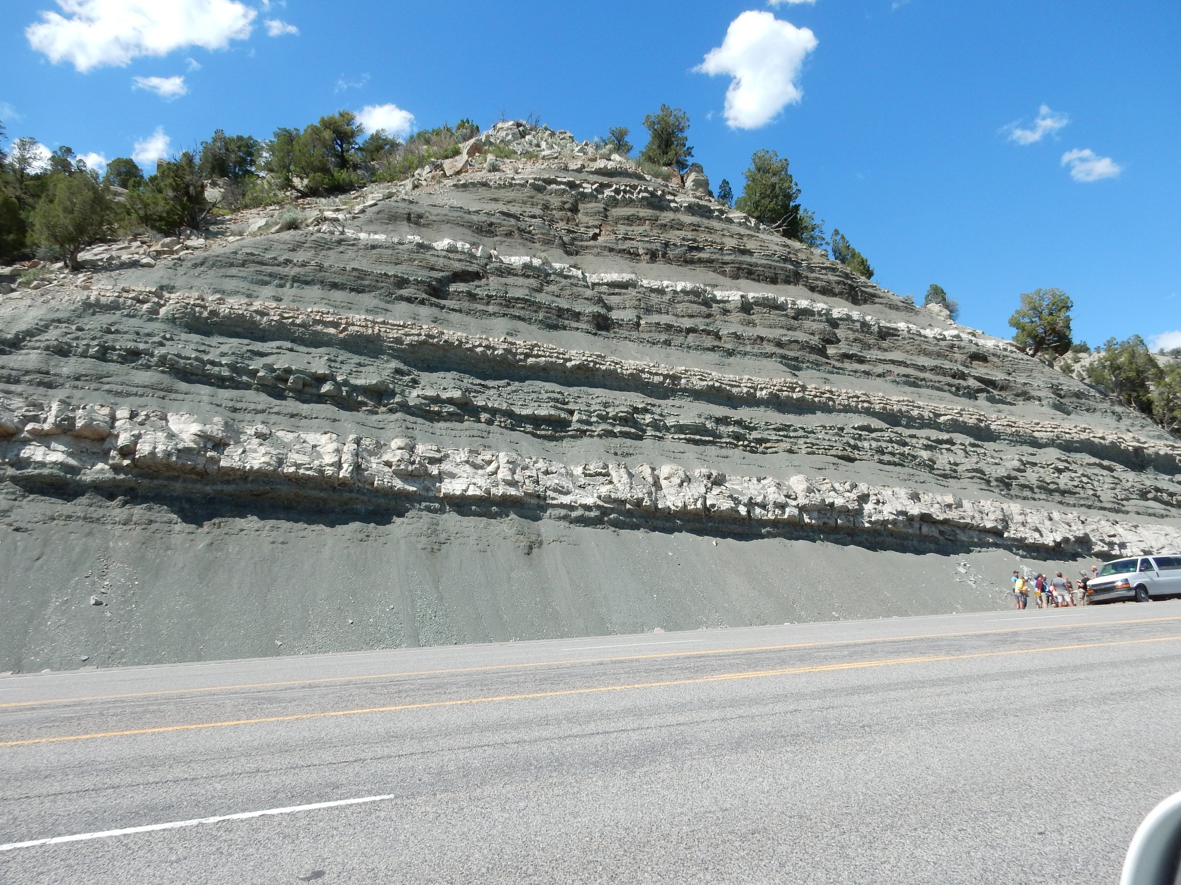
Alas, I don’t have a geologic map for this stretch of road, and I didn’t have the nerve to quietly sneak up behind the students and listen to what their professor was saying.
Further down the canyon are very impressive conglomerates. This area is known as The Red Narrows.
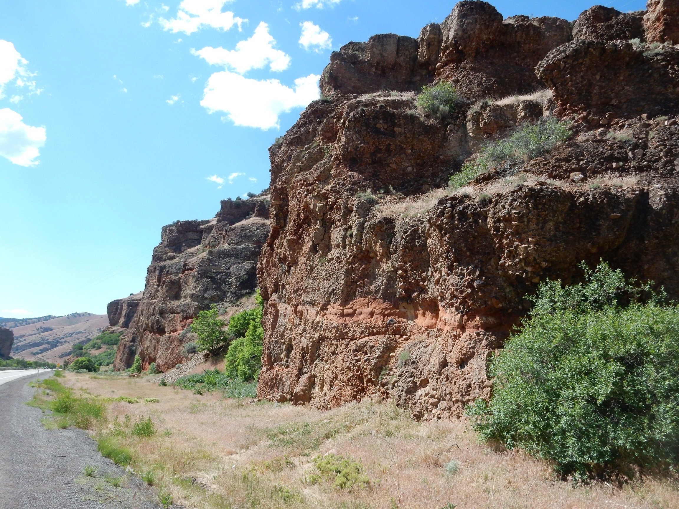
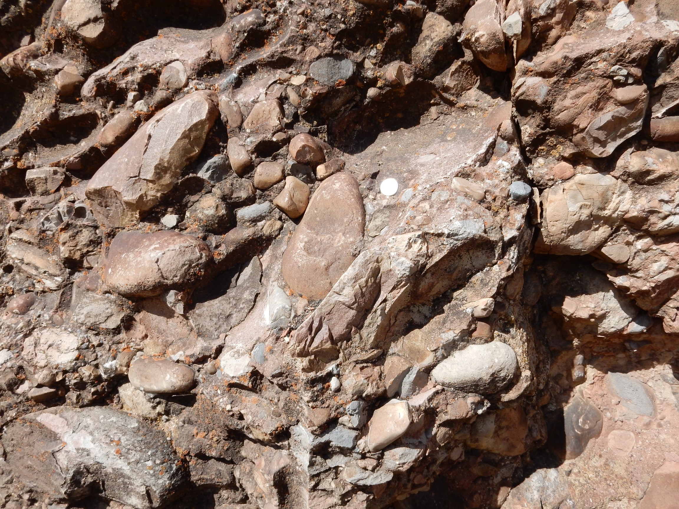
This is the lower member of the North Horn Formation, which is late Cretaceous to Eocene in age. It is apparently a fanglomerate off a mountain range thrown up by the Sevier Orogeny.
And from there to my mother’s place in Provo.

Mommie
Day 3 may be found here.
Pingback: Wedding wanderlust | Wanderlusting the Jemez
Pingback: Wedding wanderlust, day 3 | Wanderlusting the Jemez
Bruce informs me that the weird fossils in the one photograph are probably Calamites, a family of giant horsetails from about the right geologic time period.