Wanderlusting the San Pedro Mine
This was another combined trip with the Los Alamos Geological Society and the Albuquerque Gem and Mineral Club.
It’s now monsoon season in New Mexico, and this means a high probability of rain in high terrain in the afternoon. This in turn means that field trips are best planned as early in the day as possible, and this one began at 6:30 at Sullivan Field. So I had to be up at 5:00 AM to get breakfast, tend to the dog, and be ready to go.
Tending to the dog: Laci is a 13-year-old dachshund, in good health, except that her teeth were getting pretty bad. I understand that, for whatever reason, dachshunds are particularly prone to this. So, after getting two estimates for dental work — both in the $700 to $1100 range, gulp — I took her to the vet yesterday to have the work done. I then headed to Santa Fe to have some warranty work done on Cindy’s car. There was one safety critical warranty inspection (which it passed) and a number of smaller items. I spent the three hours walking around Santa Fe, discovering that the mall there no longer has a bookstore and that its GNC store does not carry inulin, and discovering that the PetsMart does not carry rats. Rats.
I’m not sure Cindy would want me adopting rats, anyway, especially with five cats in the house, but one of my bosses from years ago kept rats and they sounded like surprisingly endearing pets.
I picked up the car and headed back to the vet. Laci had had 23 teeth pulled — the vet figured, old dog, we want this to be her last dental, so pull anything that looks like it will ever need it. Geez, I only have 24 teeth. Dogs apparently have 42, so it’s not quite as awful as it sounds, but bad enough. She has three of her four canines left, and enough others to eat kibble and to not have her tongue perpetually hanging out of her mouth. Still.
I know, long diversion. The point is that getting up at 5:00 was unpleasant, and then I had to feed the dog her pain pills and antibiotics, some soft food (she usually gets kibble) and then feed myself. Fortunately, if I slather a pill with peanut butter, she slurples it right down. I made it to Sullivan Field with plenty of time to spare.
Our convoy headed on down to the rendezvous in Santa Fe with additional members, then to the secondary road that passes the mine. It was a madhouse; the attendance was enormous. It was enormous enough, in fact, to attract the attention of the local sheriff’s deputy, who fortunately was content to give us some safety tips for parking and make sure we were on our way once everyone had arrived.
Somewhere along the line I signed the release for the Los Alamos Geological Society. There was supposed to be a second one for the mine itself, which I never saw. (Don’t tell Patrick Rowe).
Back in convoy, we headed on up the road, took the turnoff to the mine, and passed a large tailings dump.
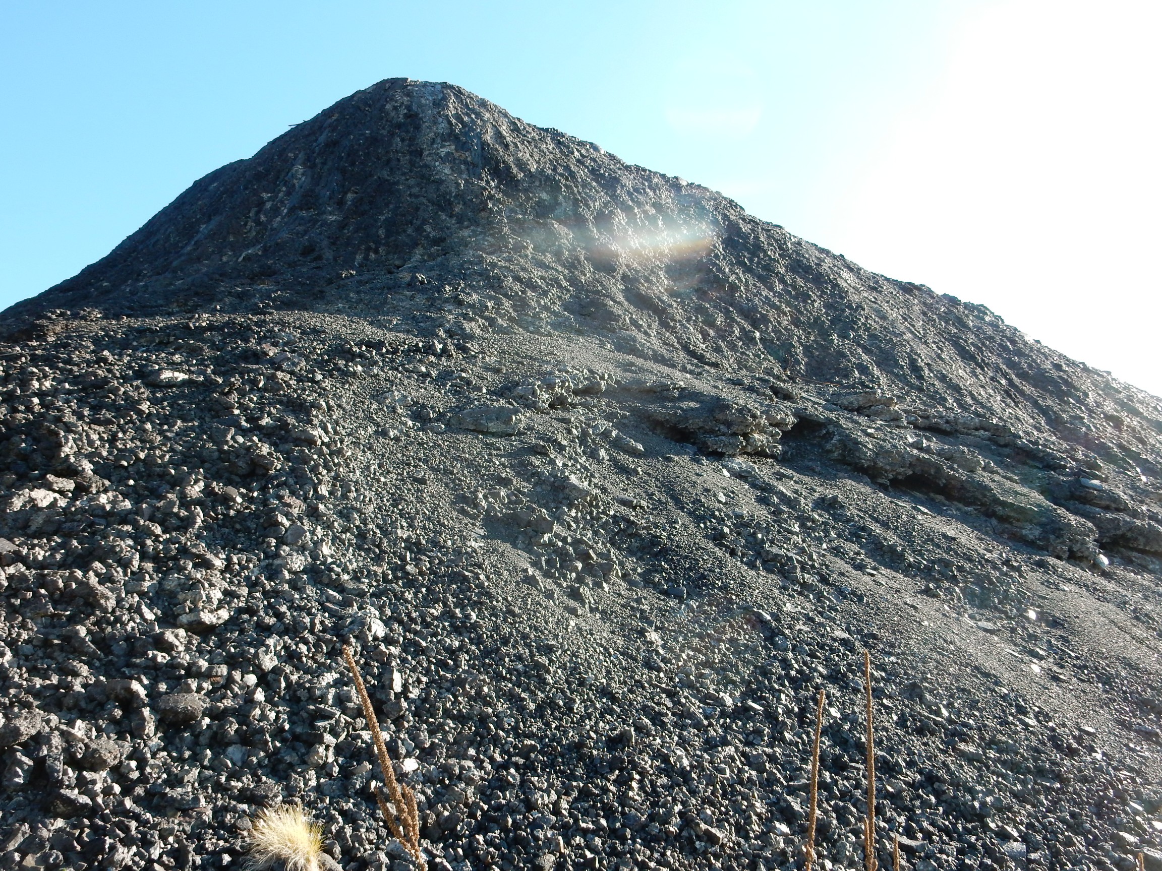
Just past was the parking area.

The mine is all private land; we were there by special arrangement.
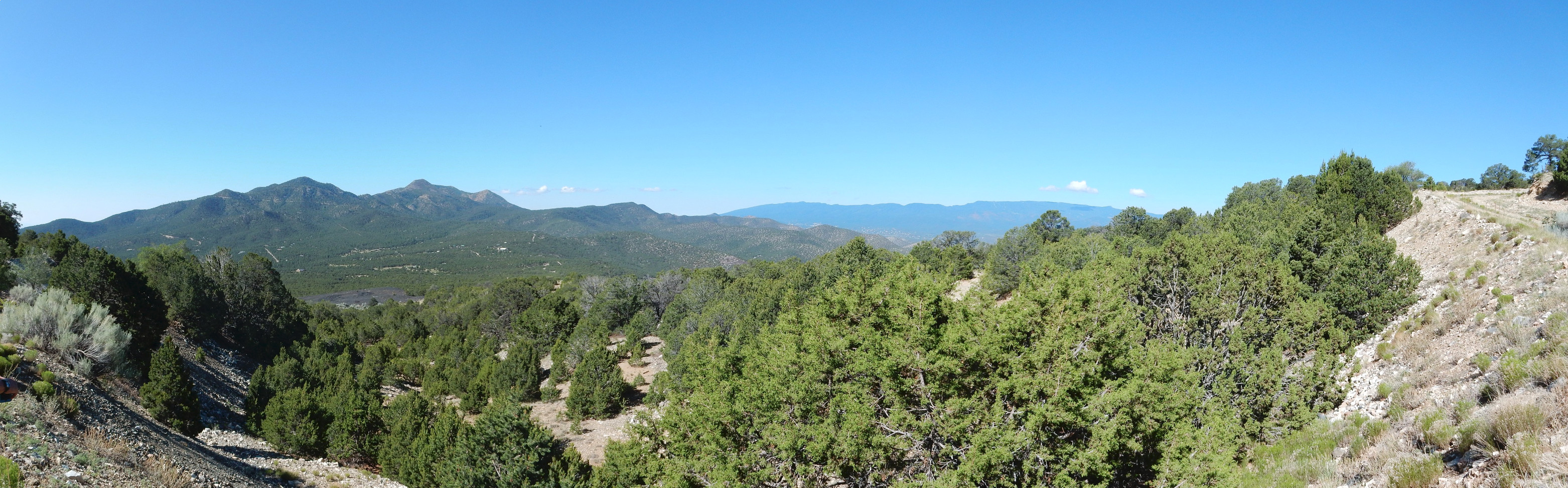
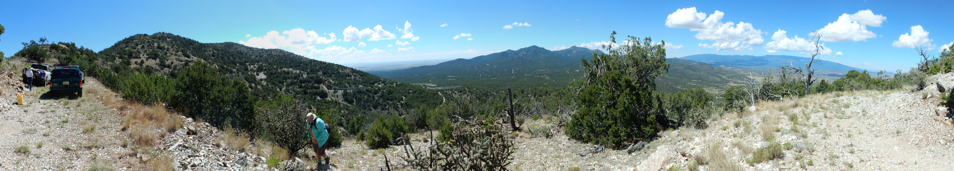
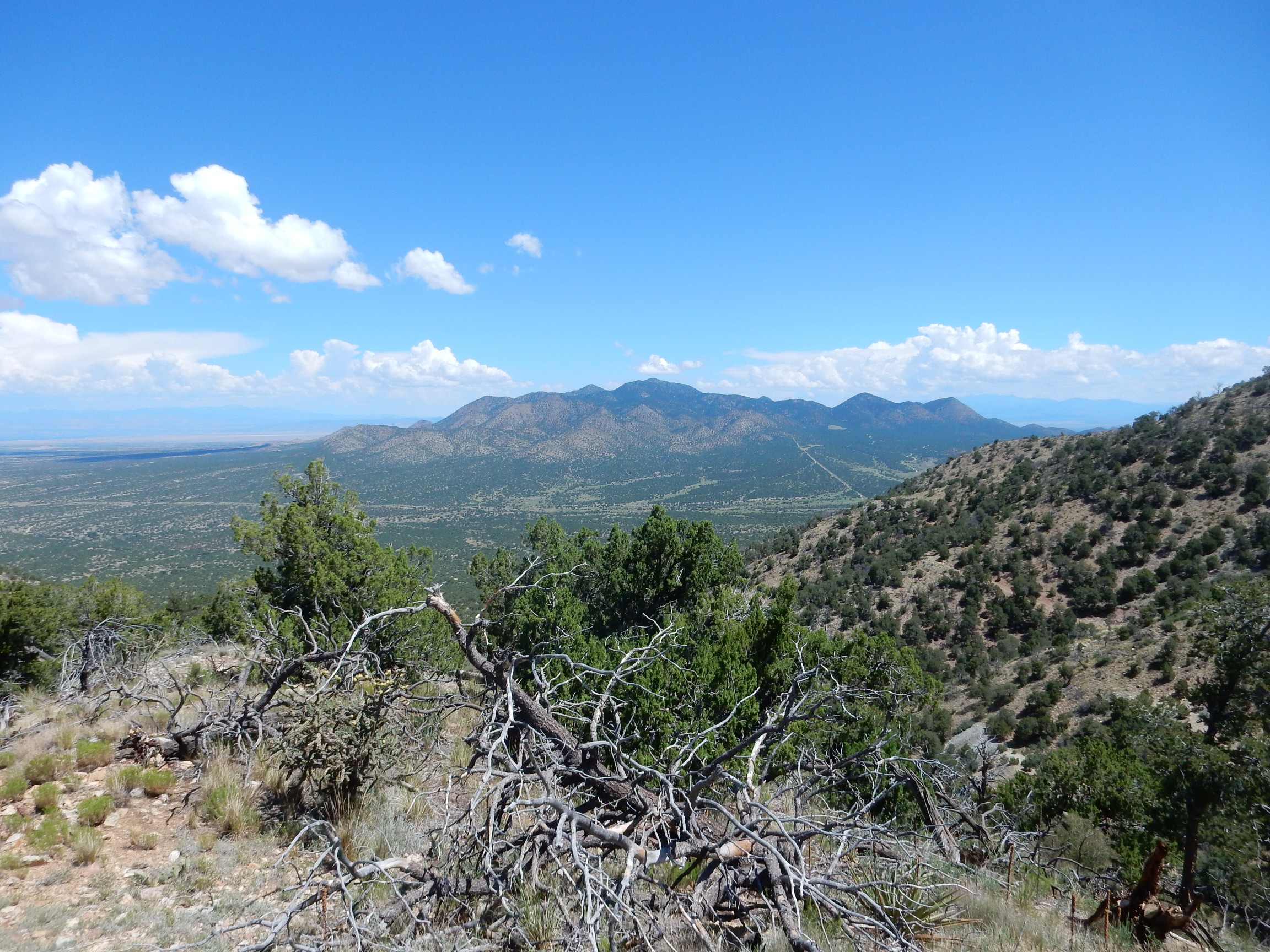
I found a spot for a proper panorama to the south.
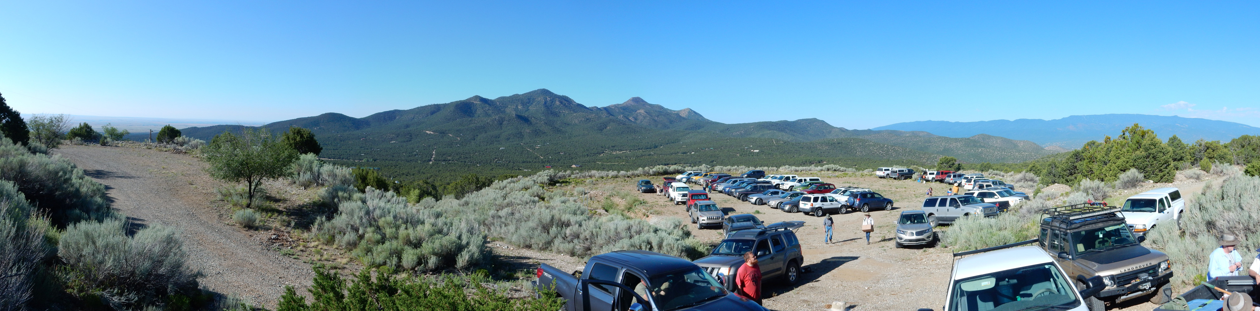
The mountain at center is South Mountain, the southern limit of the Ortiz Porphyry Belt. I am standing here on San Pedro Mountain, also part of the belt, as are the Ortiz Mountains and Cerrillos Hills to the north. To the right in the distance is Sandia Crest, seen from the back side.
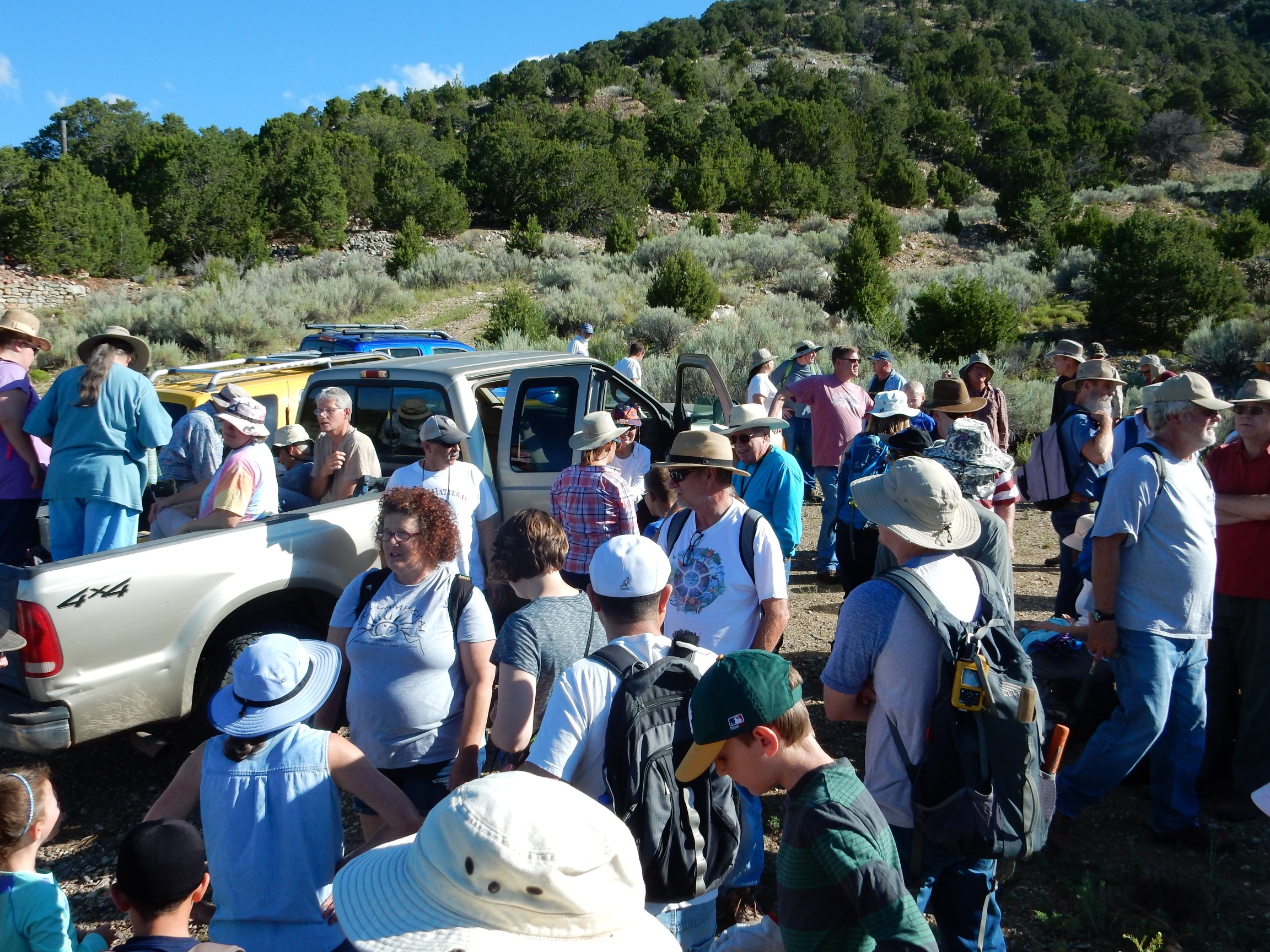
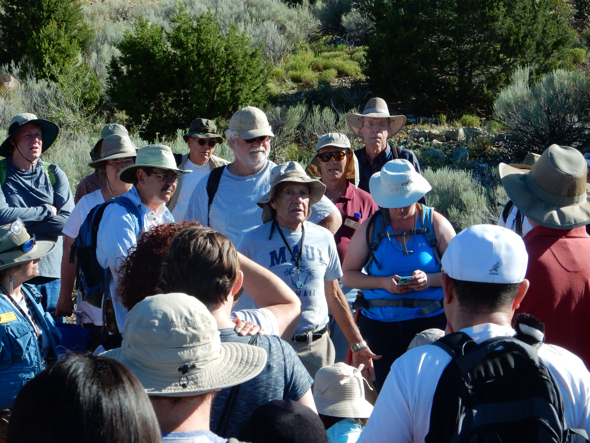
Nearby the crowd gathered for a brief introduction to the mine.
Our host introduces the area.
I missed most of the introduction. The crowd was noisy, in spite of themselves, and it did not help that someone’s radiator loudly blew a hose in the middle of the introduction. But the Ortiz Porphyry Belt was formed around 30 million years ago, in the Oligocene, when magma welled up from deep underground and forced its way between sedimentary rock beds to form laccoliths. These dome-shaped intrusions are a little like blisters in the Earth’s skin, but filled with magma rather than plasma. The very hot magma cooked the overlying sedimentary beds, which were mostly from the Pennsylvanian Madera Formation (limestone) and Permian Abo and Yeso Formations (sandstone). The cooked limestone became marble and the cooked sandstone became hornfels, and they are difficult to tell apart in the field. The intruded magma cooled to form rhyolite and andesite porphyry, but this was only spottily exposed. Most of what we saw was the overlying cooked beds.
To be more precise, the beds were braised; in addition to heat, the magma gave off hydrothermal fluids rich in incompatible elements. These are chemical elements whose ions do not comfortably fit into the structure of the more common silica minerals. They were left behind as the magma cooled and crystallized, becoming concentrated in the hydrothermal fluids. When these fluids helped braise the surrounding rock, they altered its chemical makeup, a process called metasomatism. The result was the formation of unusual minerals, often well crystallized, making this a classical skarn deposit. Hunting for skarn minerals was, in fact, the point of our trip today. Skarn beds are more dense than the sedimentary beds from which they form, and this shrinkage opens up cavities in the rock that can become coated with large crystals. These are called vugs, since geologists love jargon as much as anyone else, and since vug is a lot faster so say than “cavity coated with large crystals.”
I missed almost everything about the mining history, which I gather was fairly juicy, involving some fairly blatant misrepresentation of land grant boundaries to newly arrived American surveyors who were eager to settle land grant disputes. The main product of the mine was copper, with significant gold on the side. Around 1980 or so, an attempt was made to reopen the mine as a gold mine, and about a million dollars in gold was extracted — which, since it cost two million to open and work the mine, was a losing proposition. There was apparently some significant “moonlight prospecting” of the best ore that did not help profitability. Our host seemed to think it served the miners right; they were intent on mining gold for its bullion value, but the gold here included some dendritic specimens worth at least ten times their bullion value to collectors.
The road up to the mine itself was bad enough that the clubs ran a shuttle of four-wheel-drive vehicles. I chose to hike instead, and was rewarded with some early specimens along the road. Fairly well-crystallized garnet was abundant. So were copper minerals.
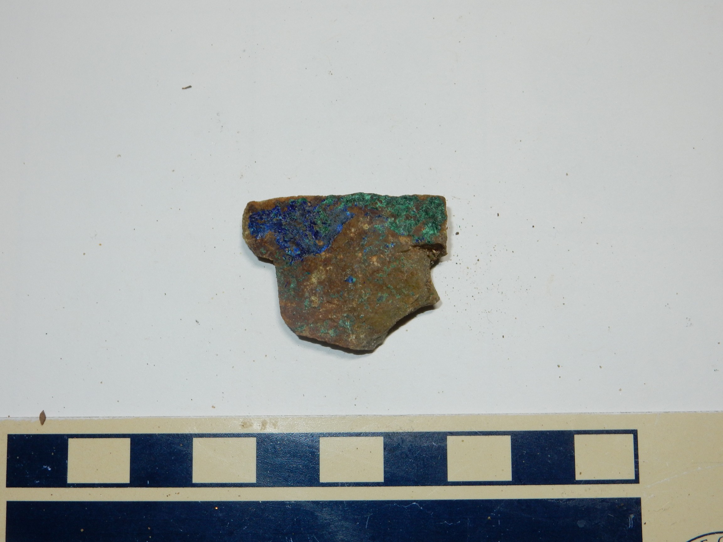
Blue azurite on the left, green malachite on the right.
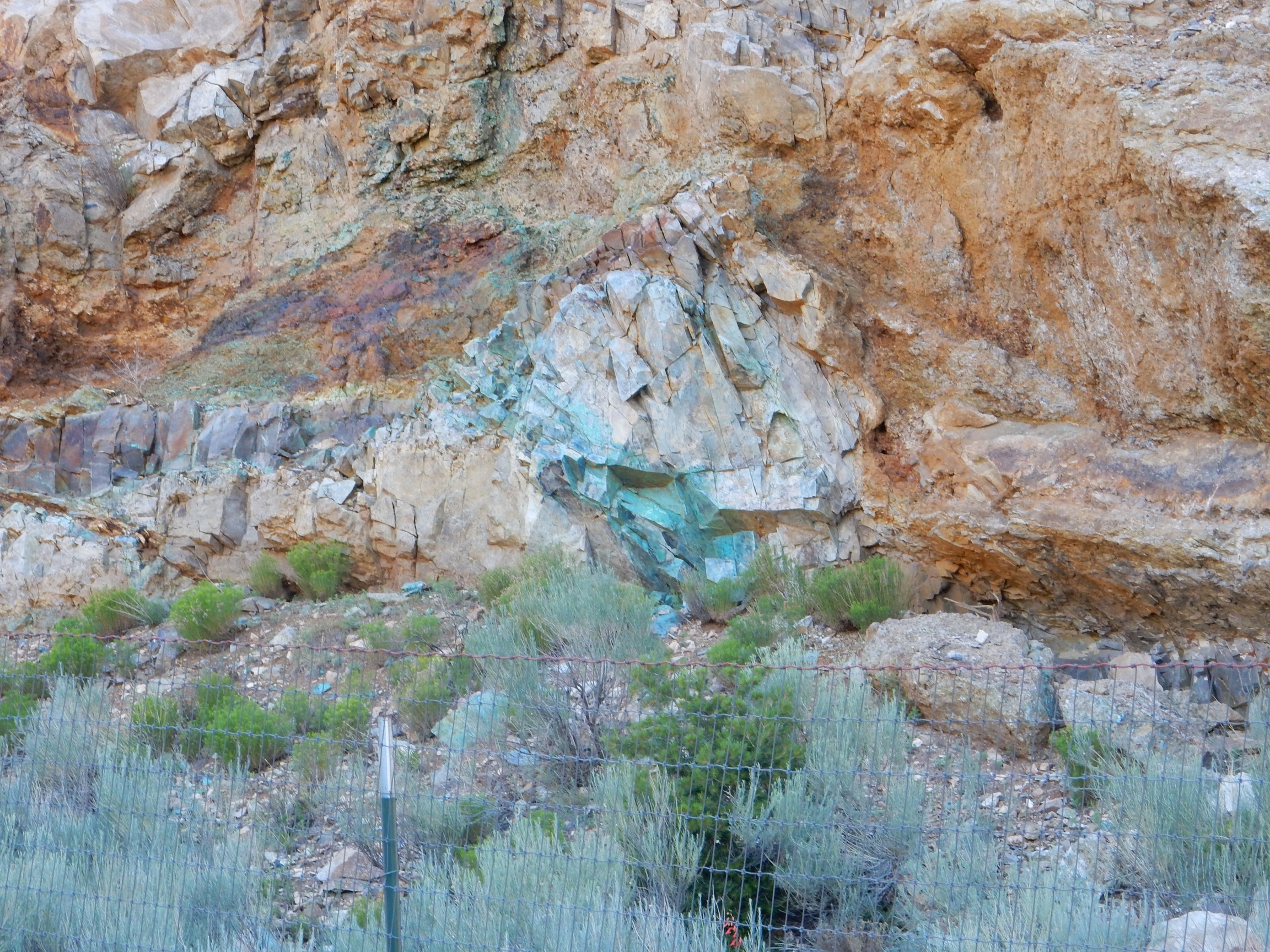
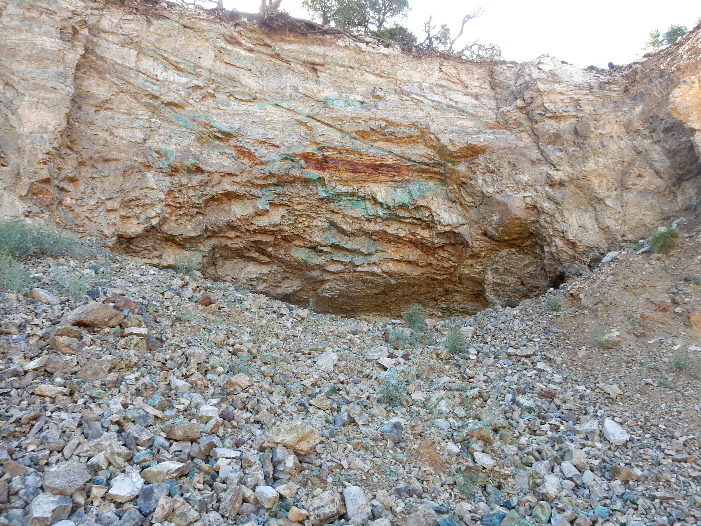
The first outcrop to catch my eye was identified by another participant as the Spanish Cut Mine.

This outcrop was fenced off, so I could not identify the rock types with certainty. Possibly hornfels beneath a sill of rhyolite? There was obvious copper mineralization.
I noticed many places on the mountain where green copper minerals formed a zone around a rust-colored pocket of hematite, like the one to the left here. I’m not sure of the chemistry, but I wonder if the hematite was originally pyrite, which provided a reducing environment to precipitate copper from the hydrothermal fluids or from groundwater.
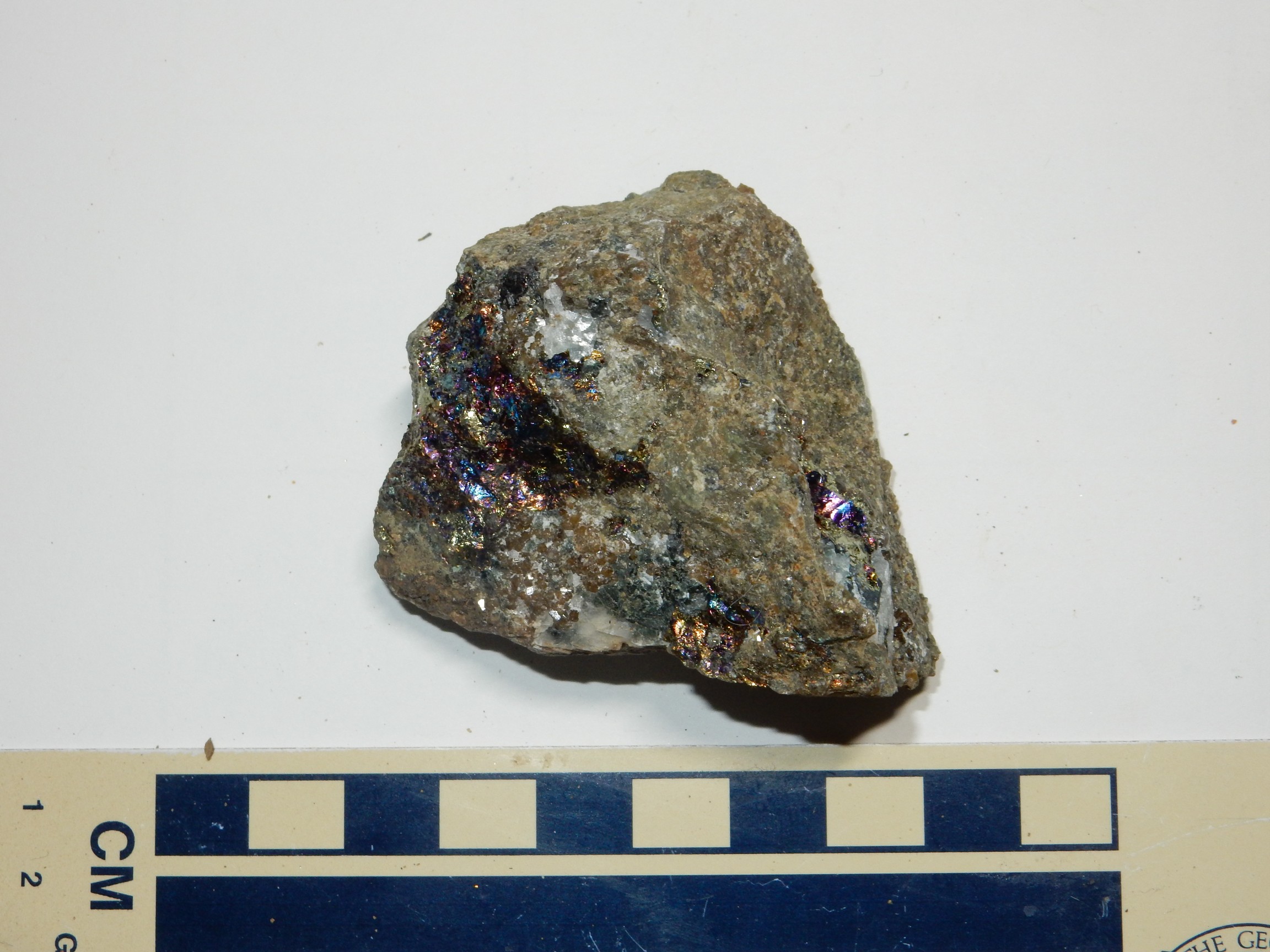
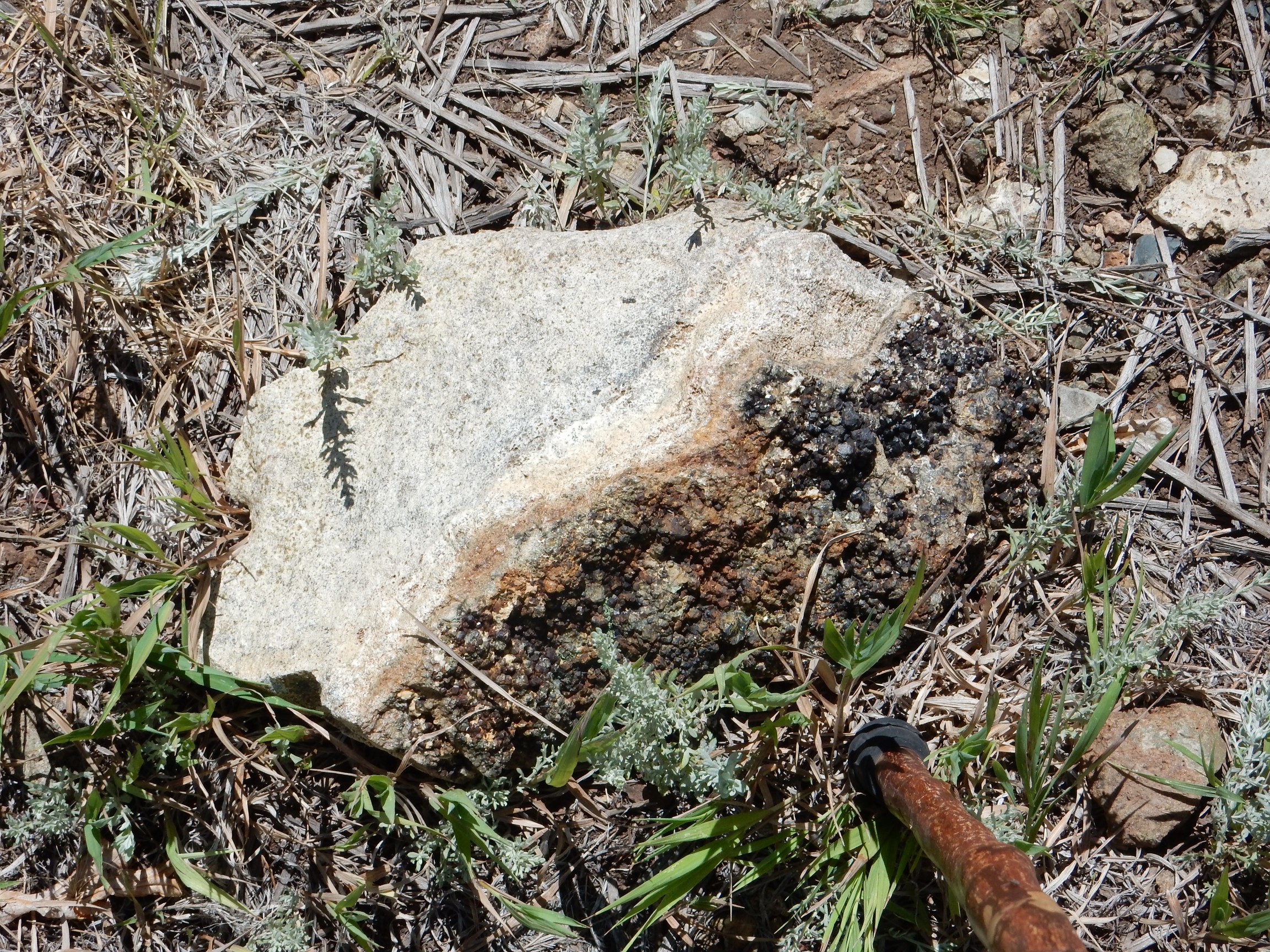
I found my first treasure here. A shiny rock caught my eye, I pried it out of the ground, and saw that it had a lot of bornite, peacock copper, in it. I broke it up, took several samples, and gave the rest to other participants. A sample:
Somewhere along here I struck up a conversation with a regulatory geologist (sorry; I met a lot of really likable folks on this trip, but I’m terrible with names). He ended up being an excellent trail buddy the rest of the way to the top.
I think I picked this up at about this point.
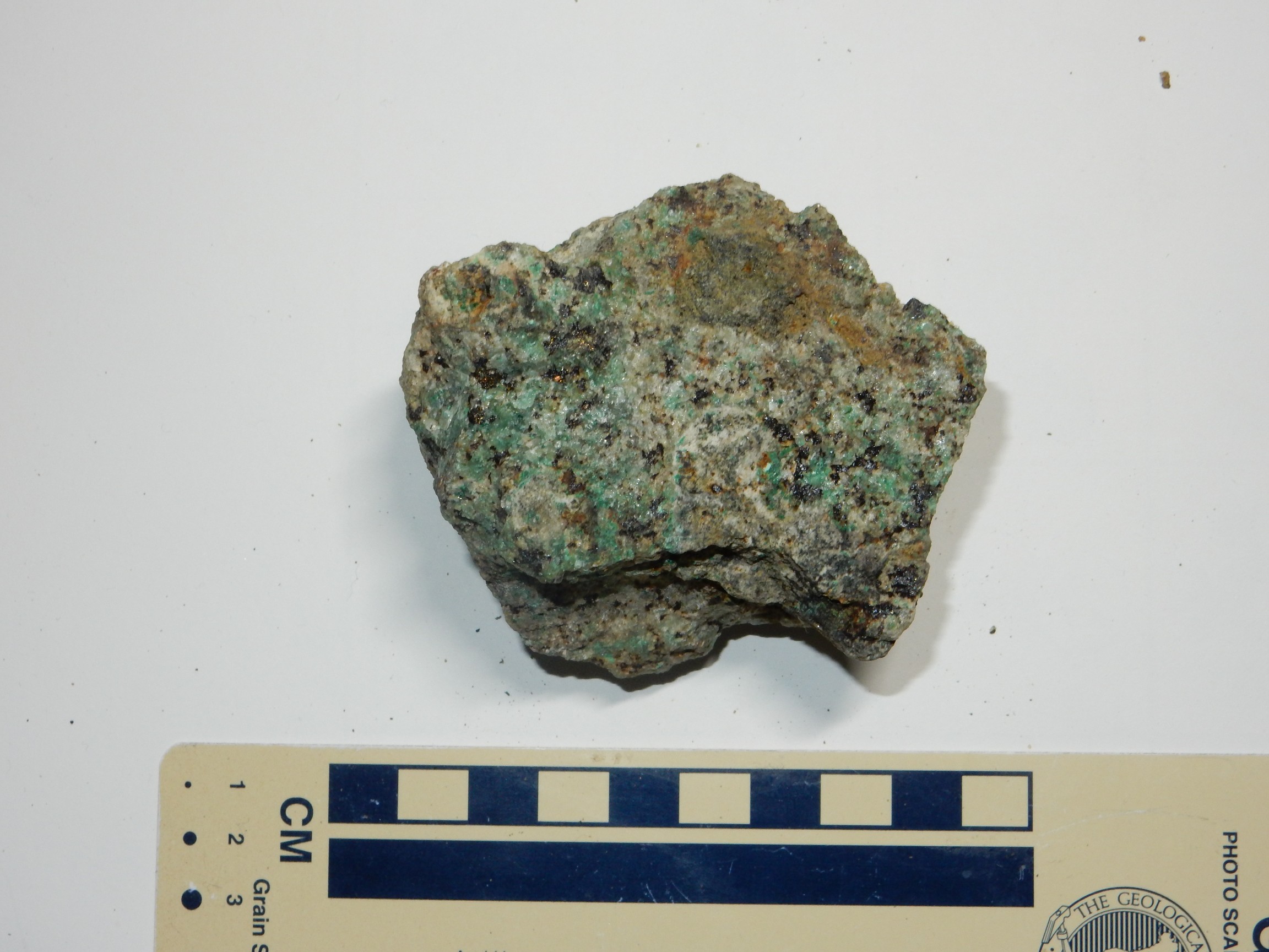
The green is probably malachite, while the black I’m not sure of. Some is certainly more peacock copper, but there were pitch-black grains I was less sure of. Chalcocite? Schorl (iron tourmaline)? Since this is a copper mine and not a pegmatite, I figured it was more likely chalcocite, but since I later spotted an unmistakable crystal of schorl in one of my other samples, I’m not so sure.
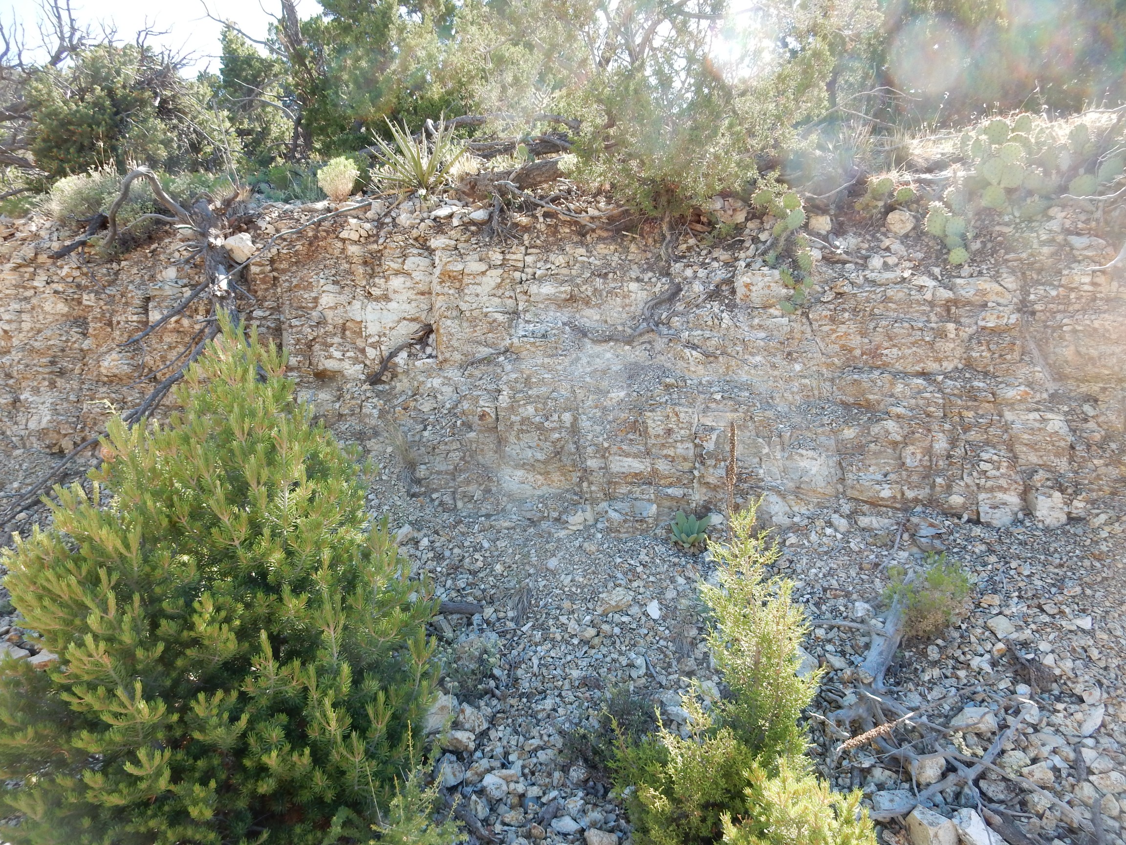
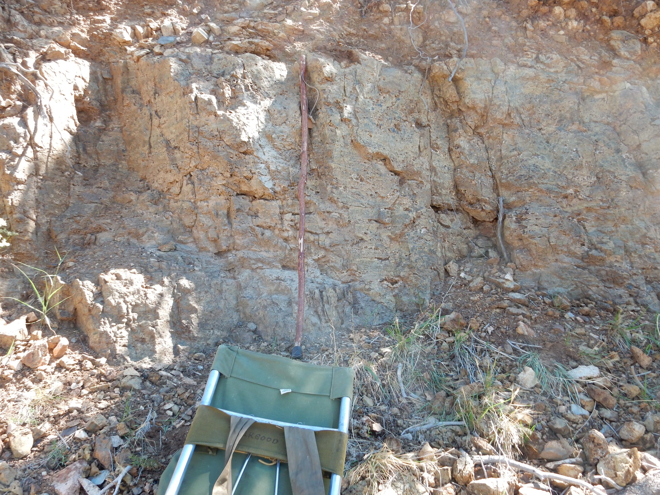
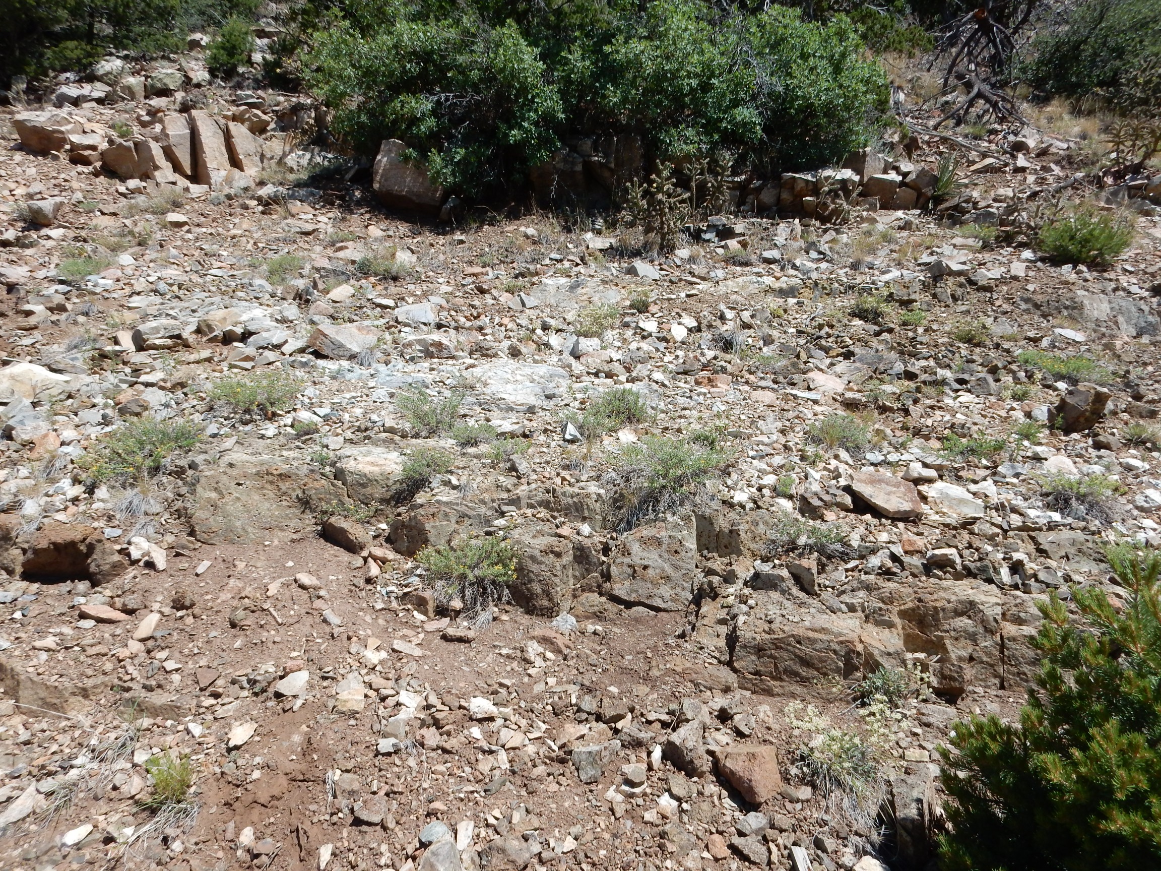
Further along the road was what I took to be Madera limestone.
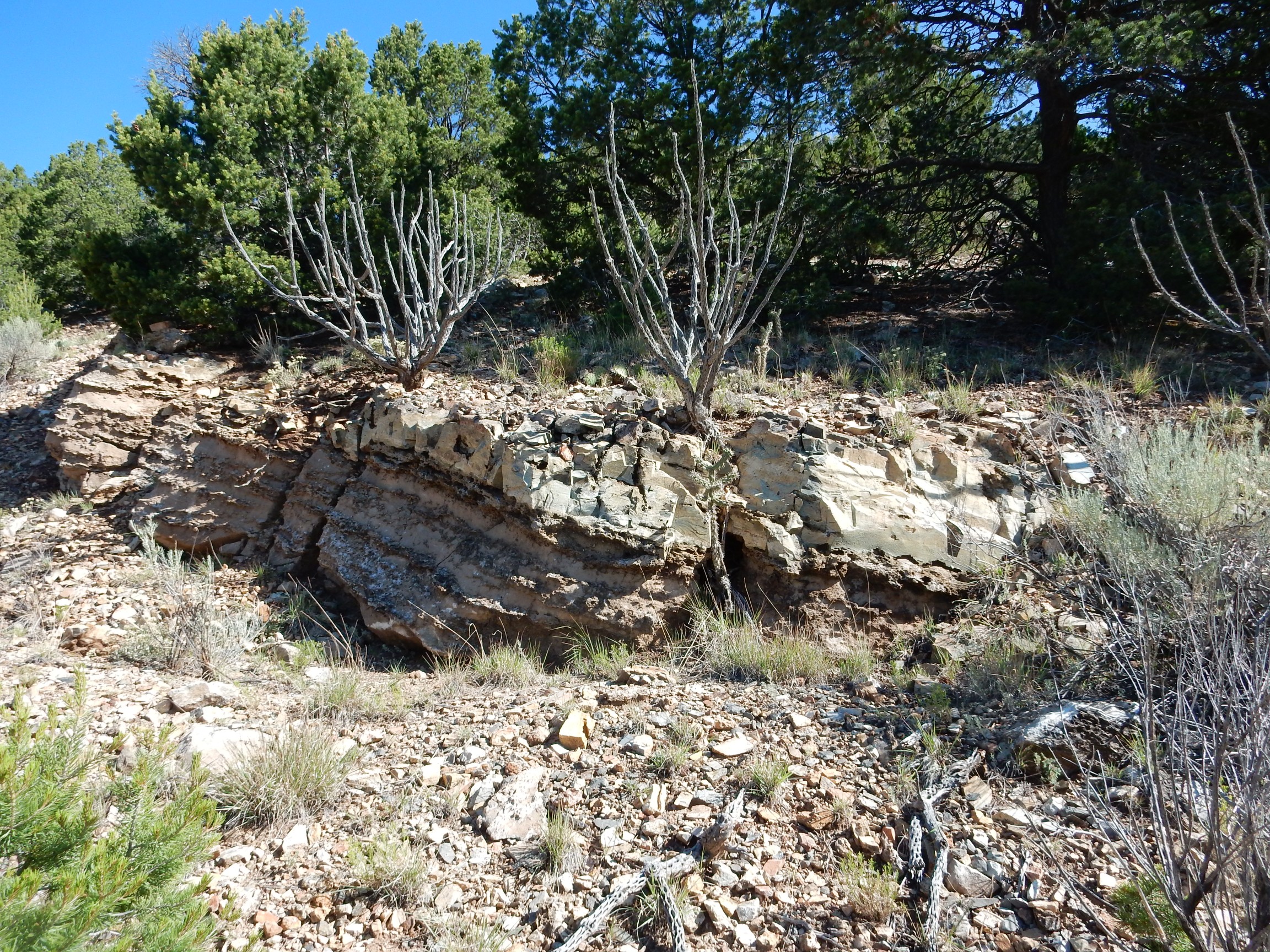
If so, it’s been metasomatized.
One of the old mine adits (horizontal tunnels):
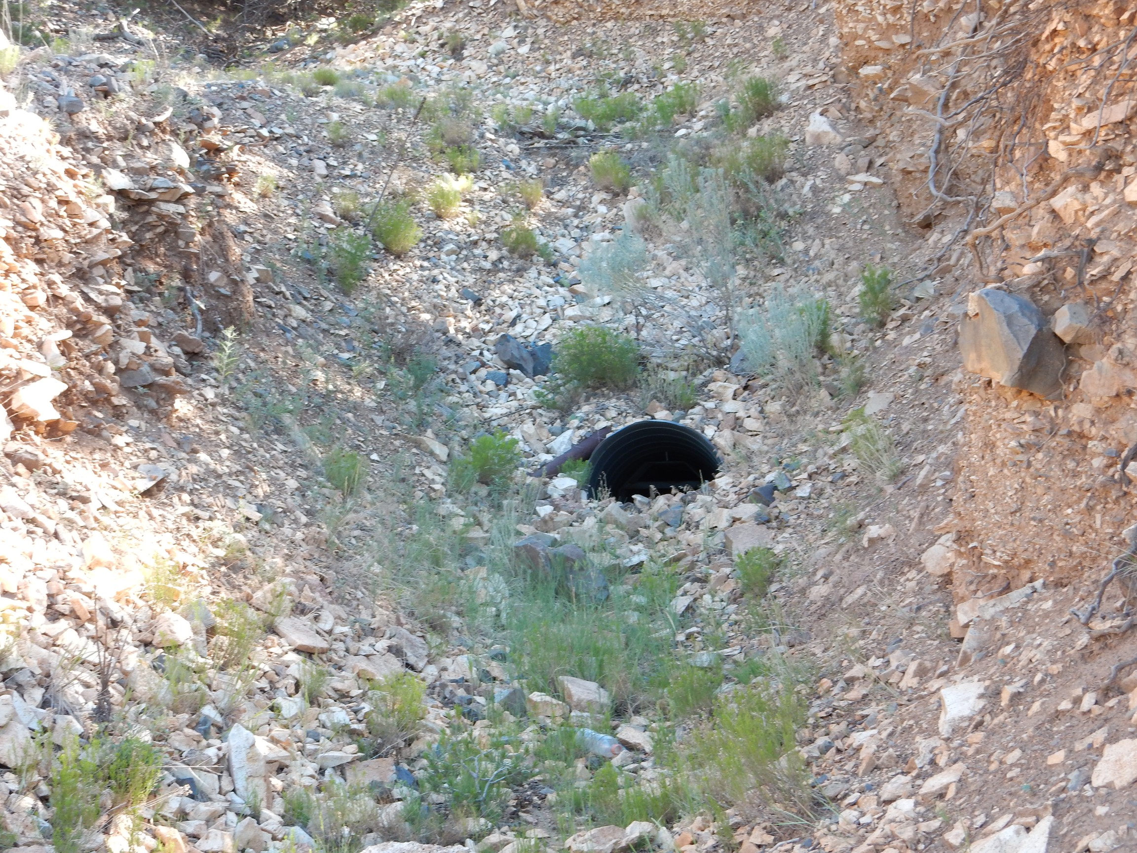
We had strict instructions to stay out of the adits, and in any case, here was plenty to collect in the tailings and along the road cuts.
More Madera group?
Somewhere around here, I picked up what I took to be a bit of the intrusive rock.
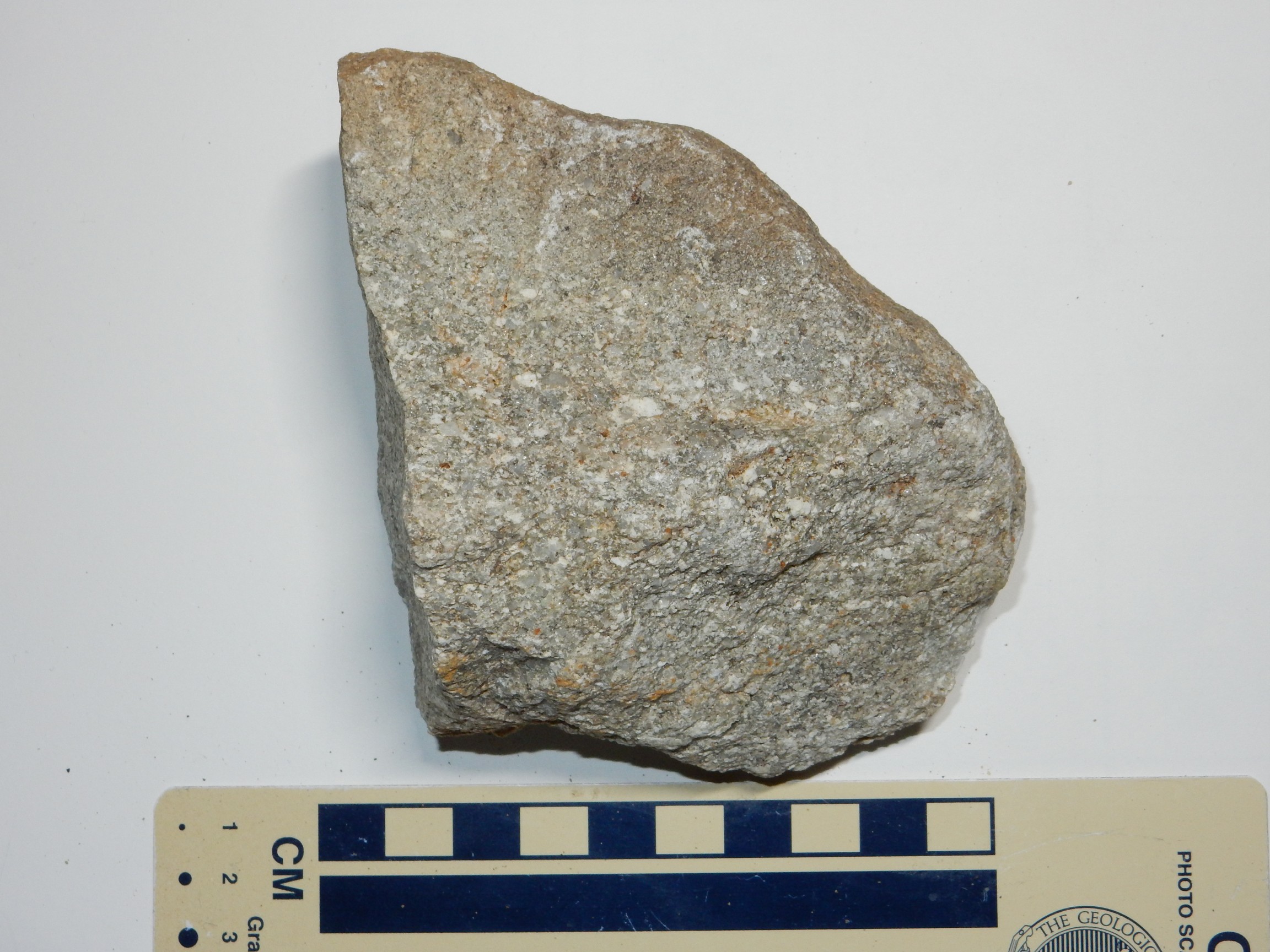
Looks like a monzonite, and does not look like either the marbleized limestone or hornfelsized sandstone seen elsewhere.
Panorama to the south.
A particularly nice bank of what I took to be metasomatized Madera limestone.
I think this is where I picked up some very dense hornfels.
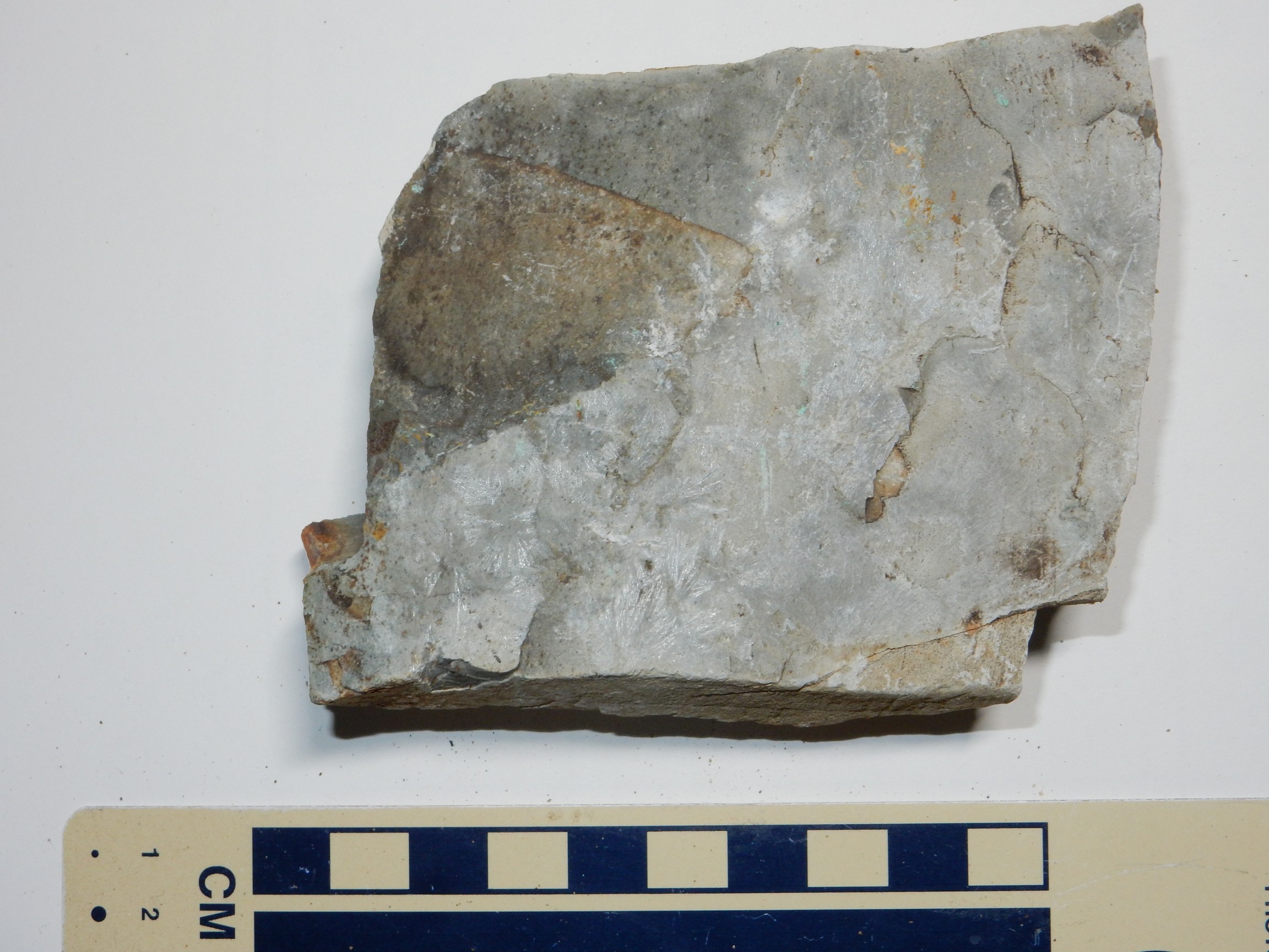
I thought this was marble at first, with very fine dendritic crystals on its face. But then I got thinking that those didn’t look like any calcite crystals I had ever seen, so I dropped some concentrated hydrochloric acid on it. No reaction. Not marble.
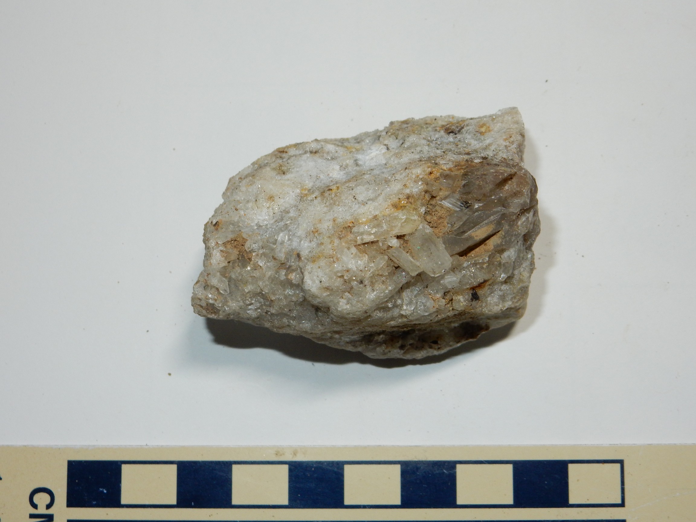
Also some nicely crystallized quartz.
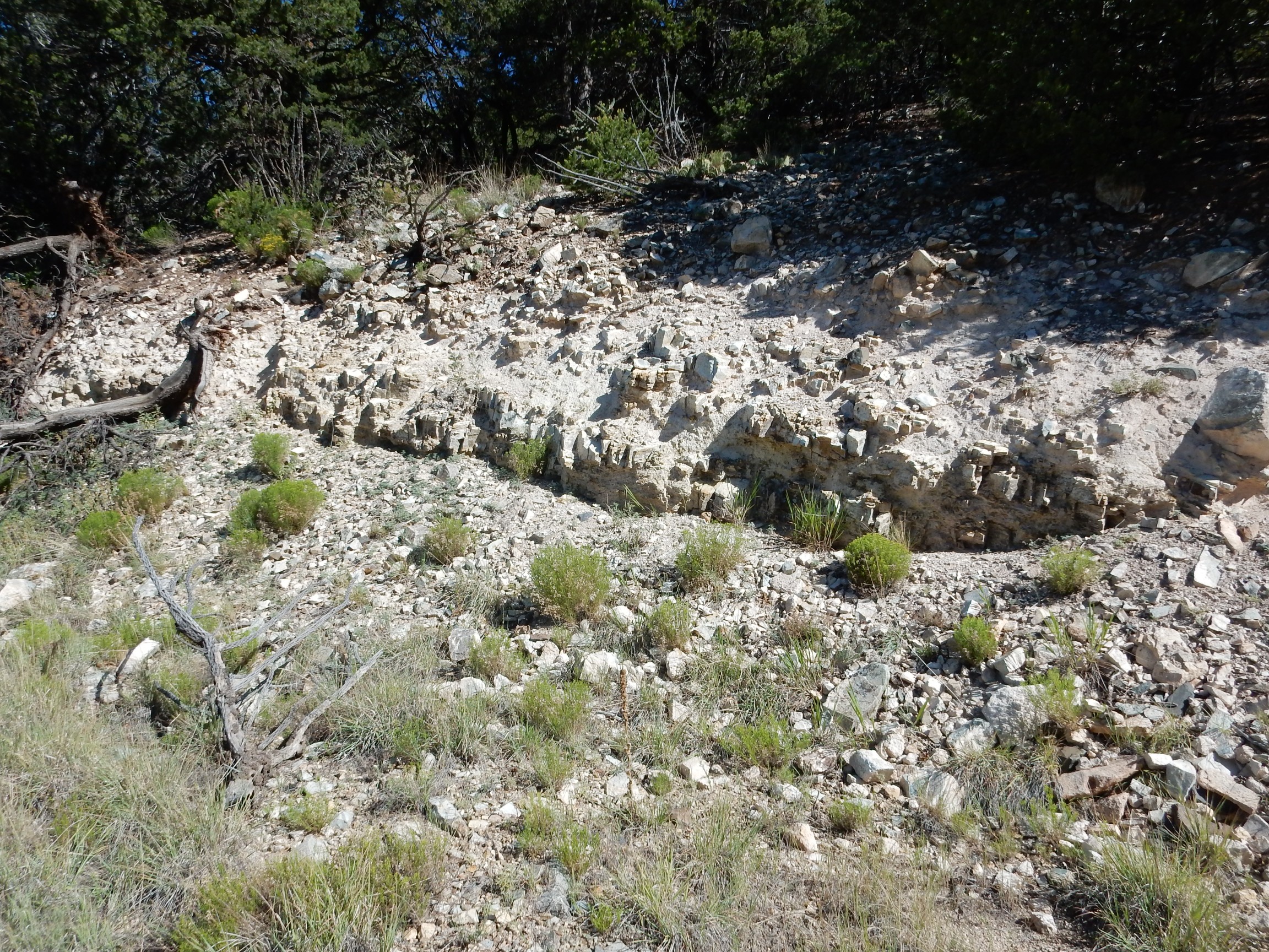
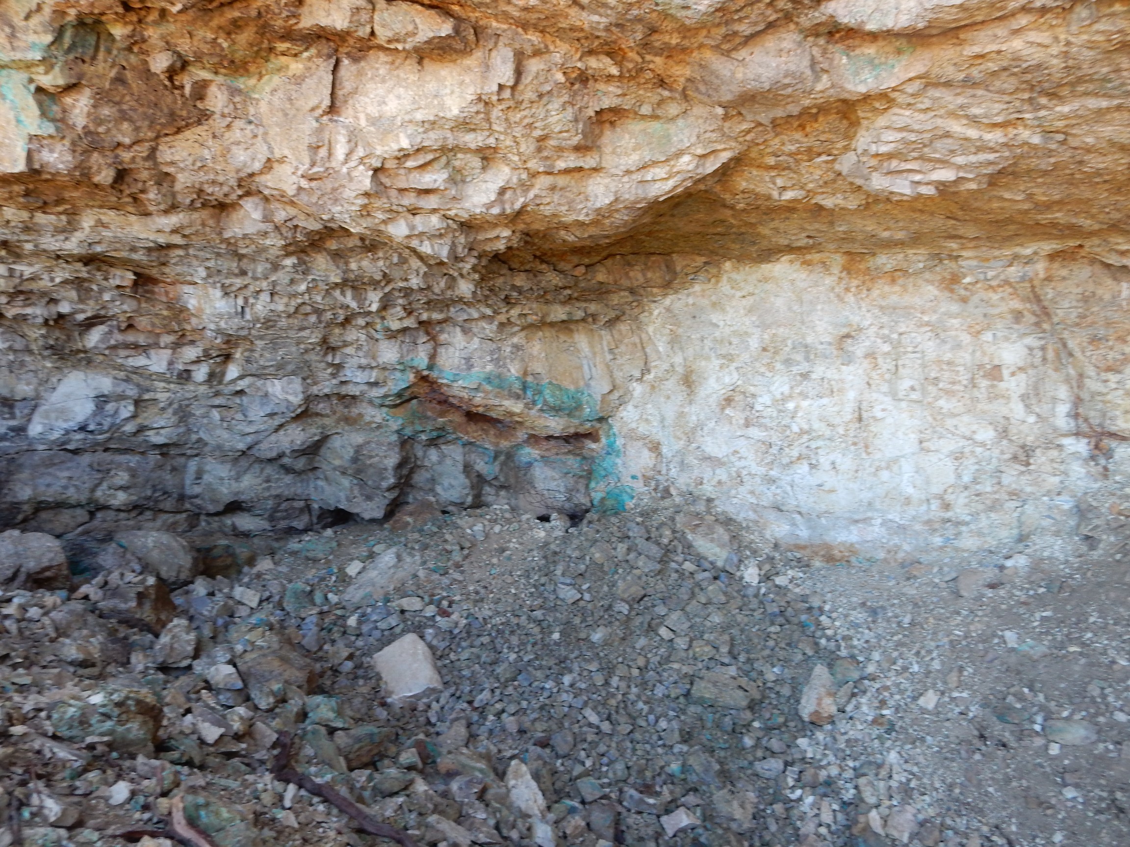
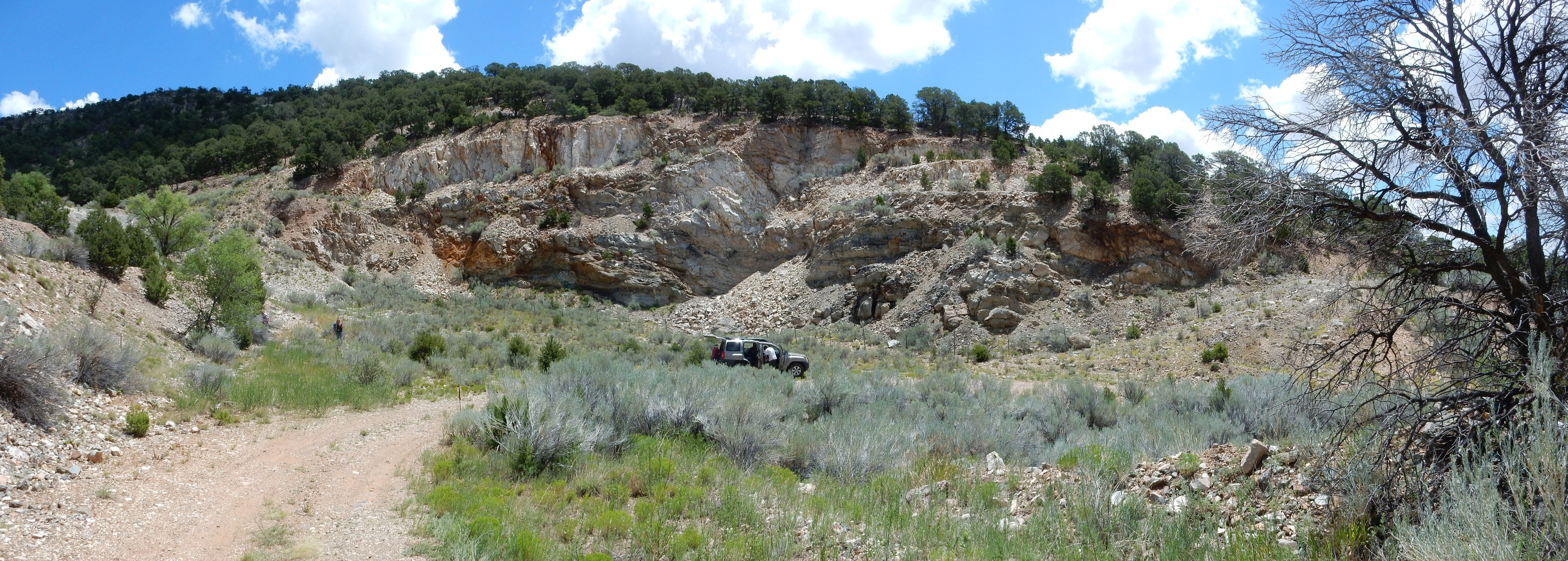
Just north of here was a small mine that provided rich pickings.
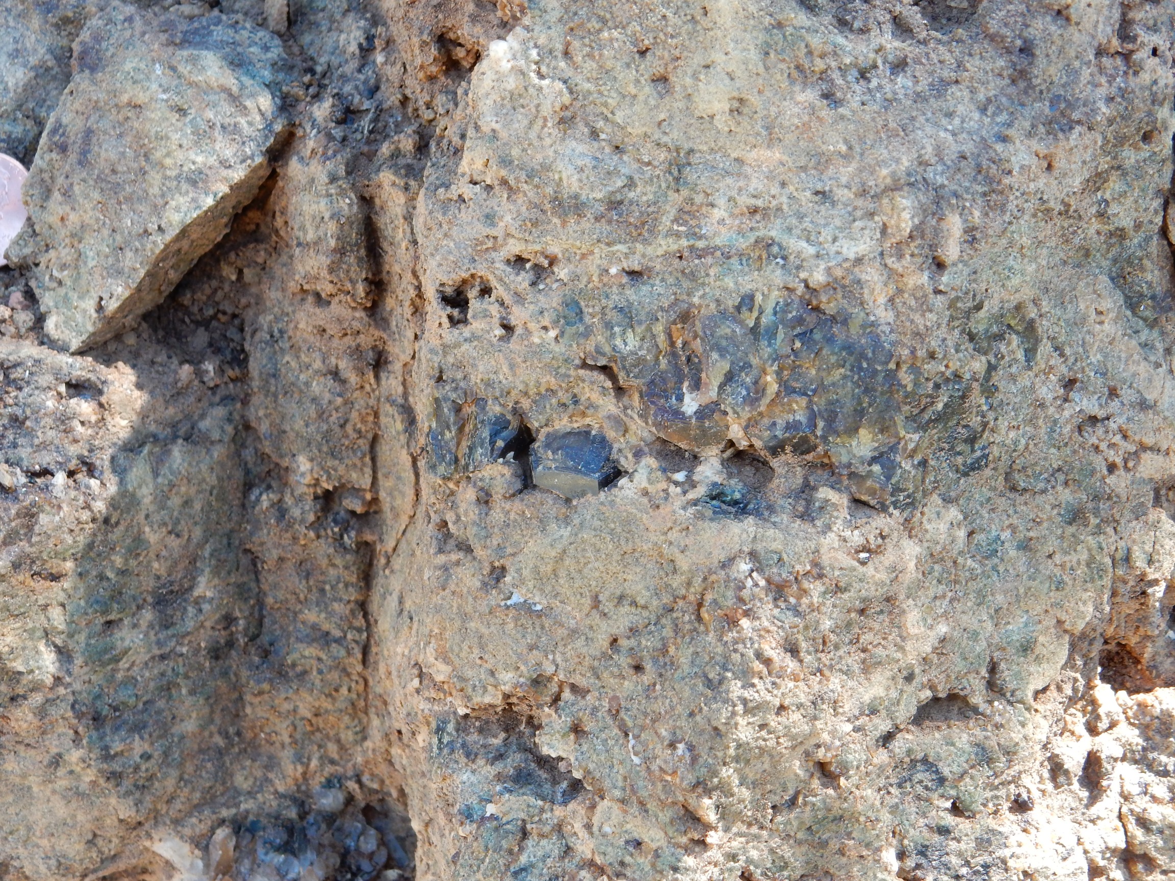
The overhang was treacherous, and we stayed out from under it, even though there was obvious copper mineralization.
My guess is that the darker beds at left are marbleized Madera Formation limestone, and the lighter beds are hornfelsized Abo and Yeso sandstone.
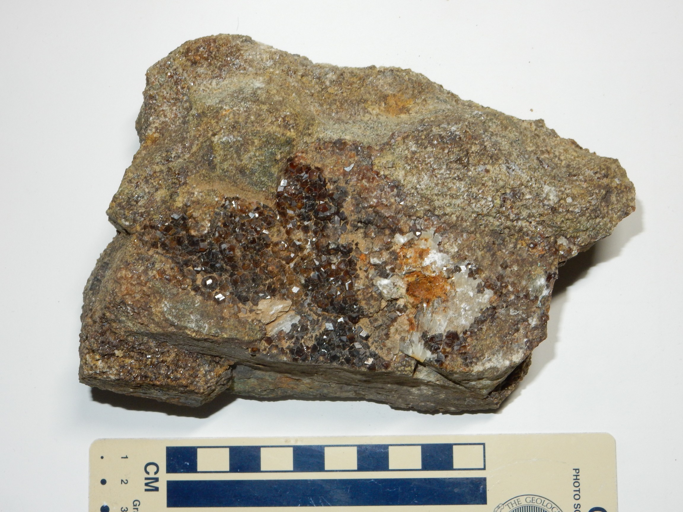
Several of us lingered here. We found one boulder with a very nice crust of garnet; the regulatory geologist and I eventually trimmed this down to some reasonable samples.
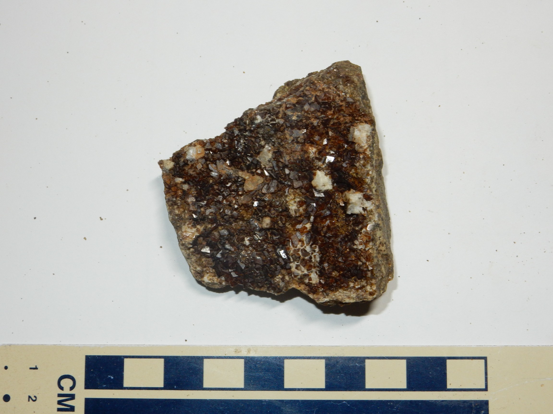
This is andradite, iron-calcium garnet. There was also some grossular, in which much of the iron is replaced by aluminum:
The lower iron content makes for a paler garnet.
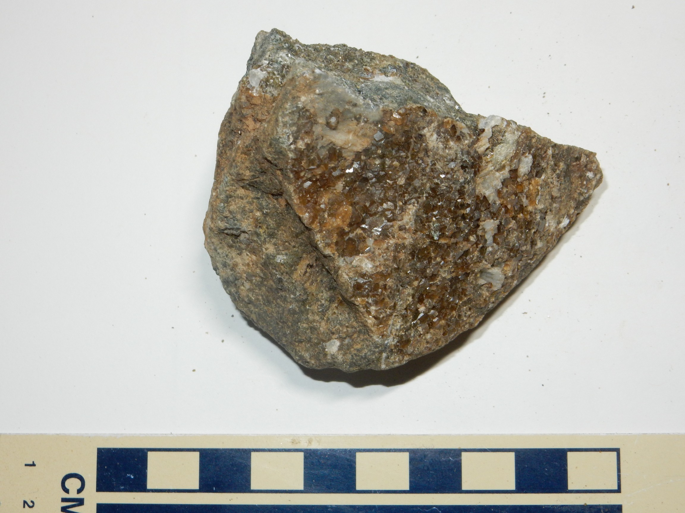
I’m not sure, but I think I picked this up in the same area.
And this is a real keeper.
Iridescent garnet, composed of alternating layers of grossular and andradite that produce the iridescence.
Hematite.

Some of this is crystalline, which is uncommon and interesting for hematite. There was also at least one long crystal that was strongly striated; it had to be schorl, iron tourmaline.
Another prize is this chrysocolla.

Or so an old-timer identified it for me, using a kind of taste test: Chrysocolla apparently sticks to the tongue. It’s a kind of hydrated copper aluminosilicate.
I told him the story of trying to identify the evaporite on a pebble by taste, only to realize that it was actually a very old deer dropping.
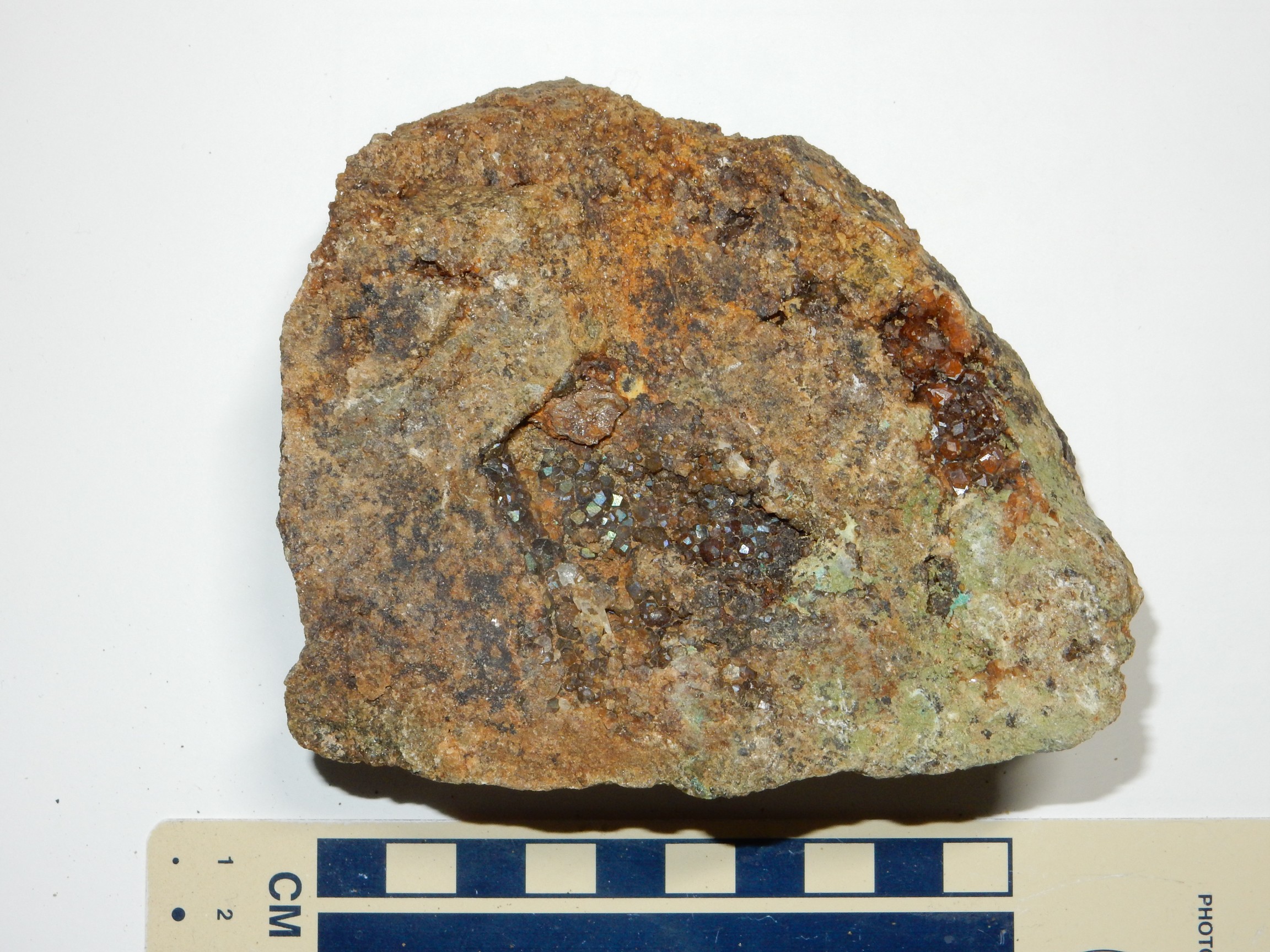
Some of the outcrop was almost solid garnet grains.
Individual garnet grains are very hard, but the aggregate here is easily broken up. This is probably a lot like the stuff that garnet sandpaper is made from.
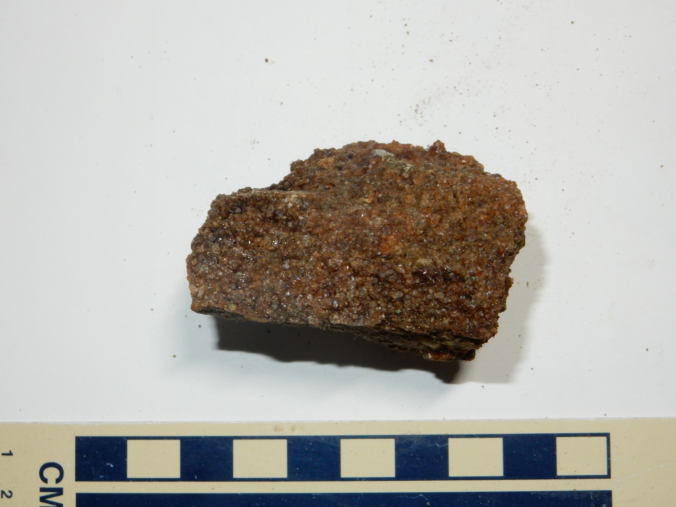
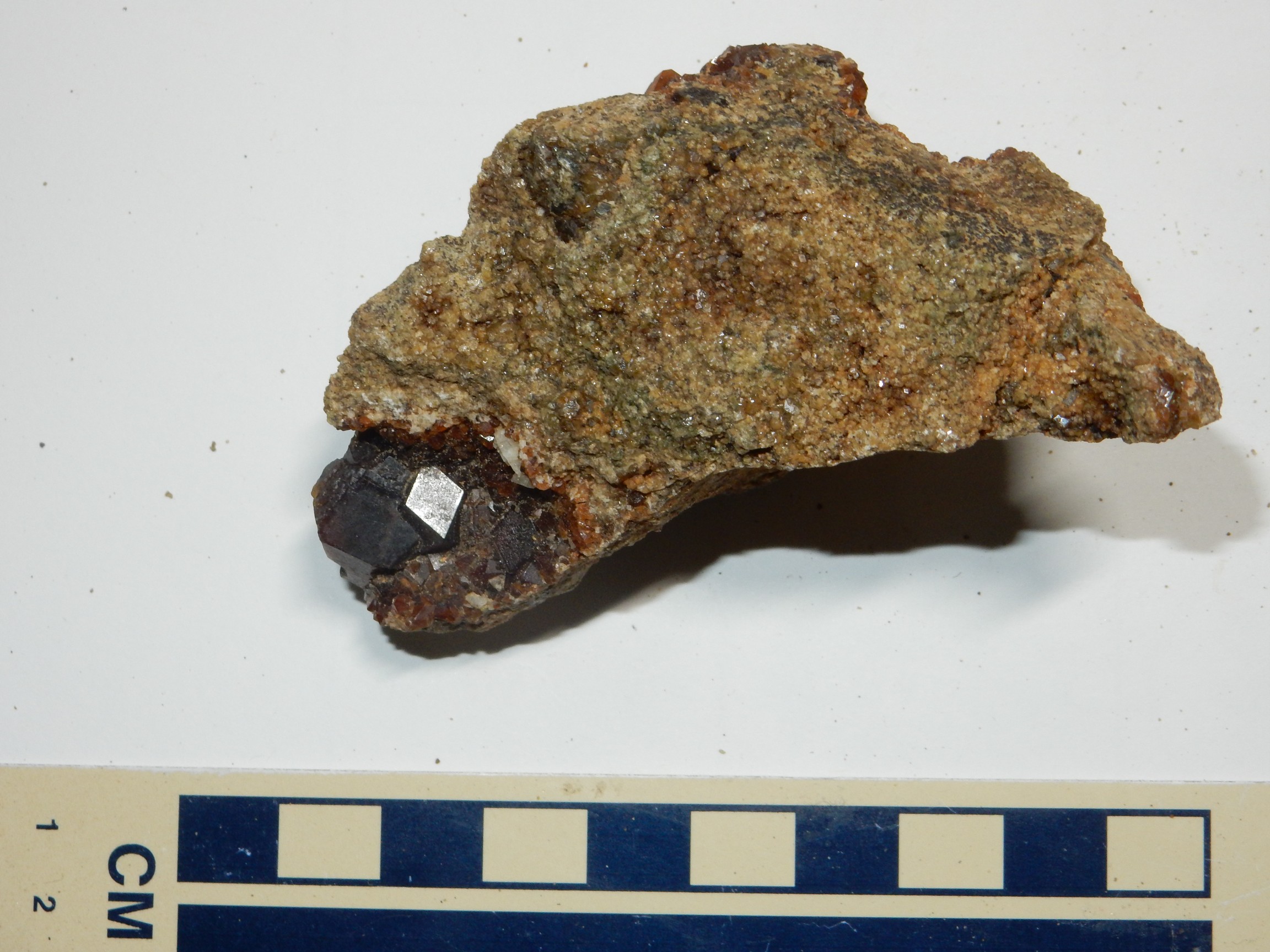
The likelihood that some of the beds were hornfelsified sandstone became clearer further up the road, on the well-named Garnet Ridge, where the road cut exposed beds that looked an awful lot like cooked sandstone and which were rich in garnets.
Old Abe is at extreme upper left, for scale. I took another photo with the penny better centered, buit it did not turn out as well. You can see many dark andradite garnets embedded in the rock. I actually succeeded in hammering out the one at center more or less intact.
Several of us paused here to hunt garnets. If they were exposed in the road cut, there should be some nice ones weathered out in the dirt below, no? I did find some patches of very garnet-y dirt, and searching through these produced a few samples.
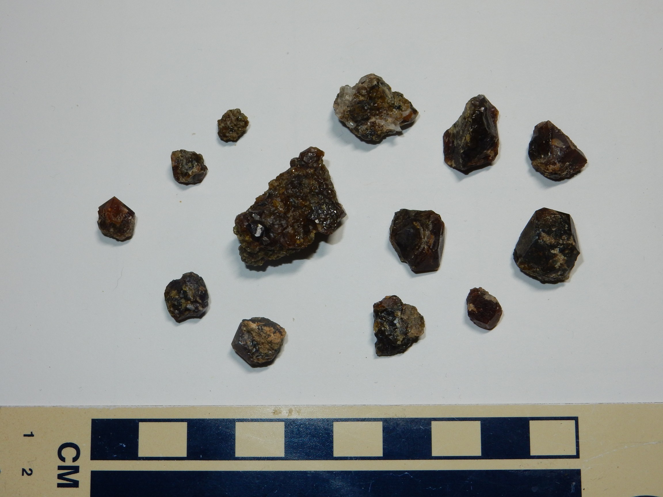
I believe the one at far right is the one I hammered out of the outcrop. The rest were weathered out in the dirt.
A particularly nice garnet still embedded in the hornfels.
A single large crystal of quartz, coated with hematite.

I may try to get the hematite coating off with some kind of acid or rust remover. Should be interesting to see how that works.
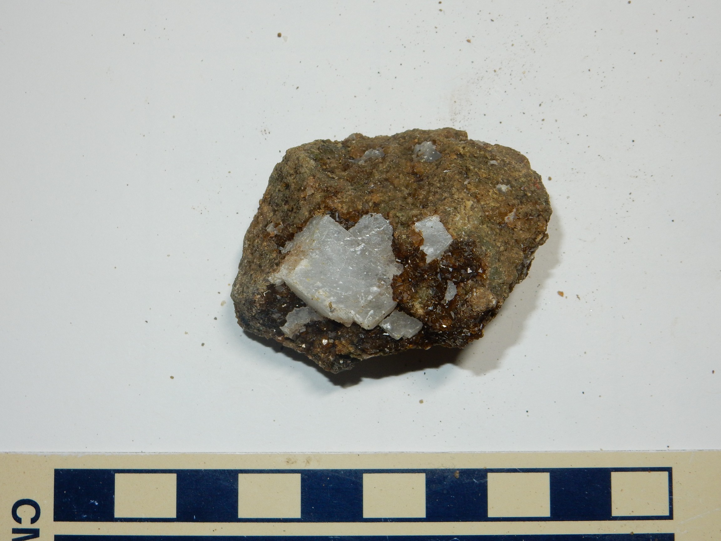
Mixture of garnet and calcite crystals.
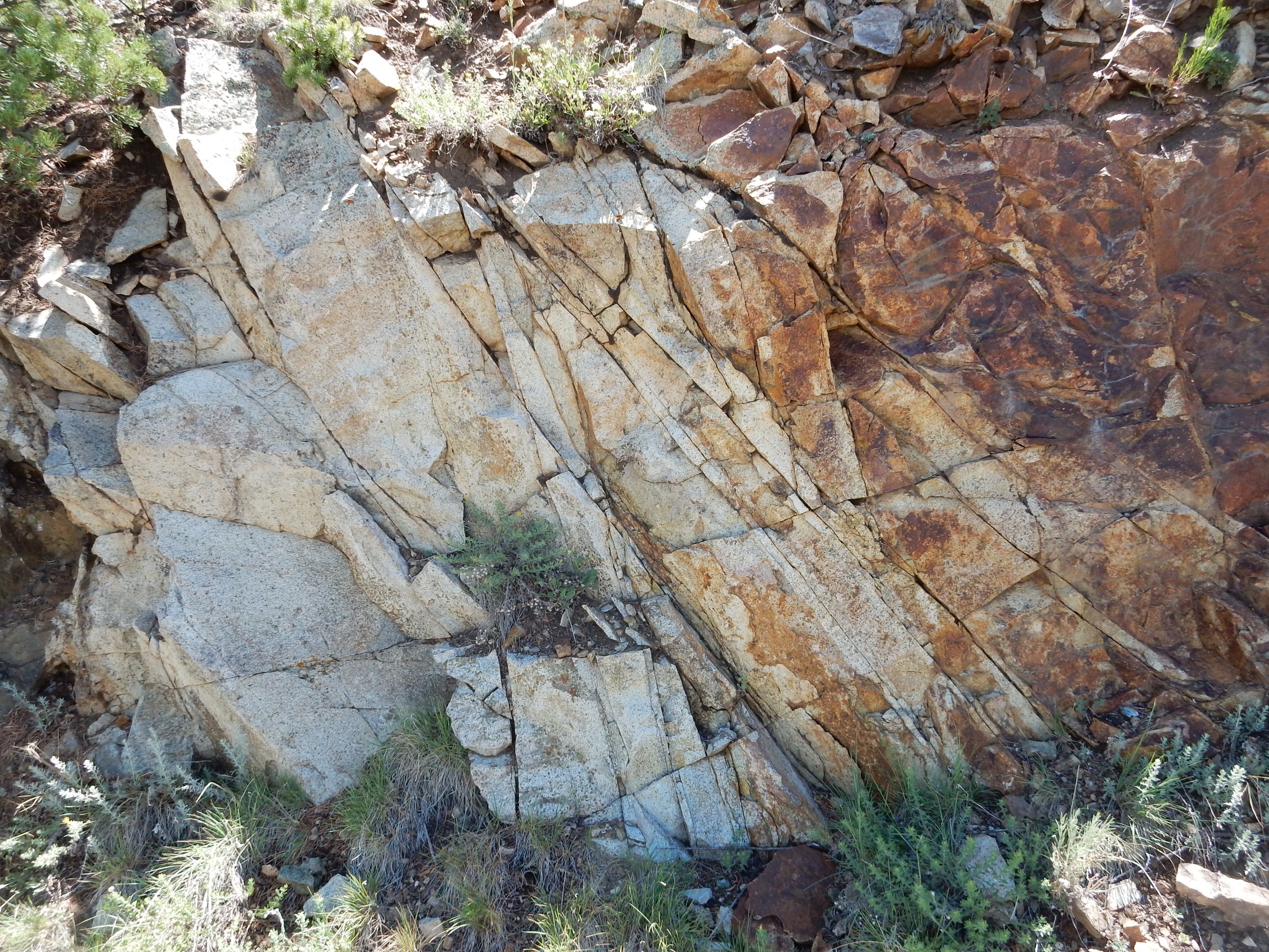
Definite contact here, though I’m not sure what the upper bed is. Possibly rhyolite sill?
A panorama from near the crest of the road.
I was starting to feel rather tired at this point; by now I had rather a lot of rock in my pack. However, I followed the road down the north side far enough to see what looked like an outcrop of the intrusive rock
I should have got a sample, but missed it somehow. The rock has what appears to be needles of hornblende, suggesting an andesite.
Panorama to the north:
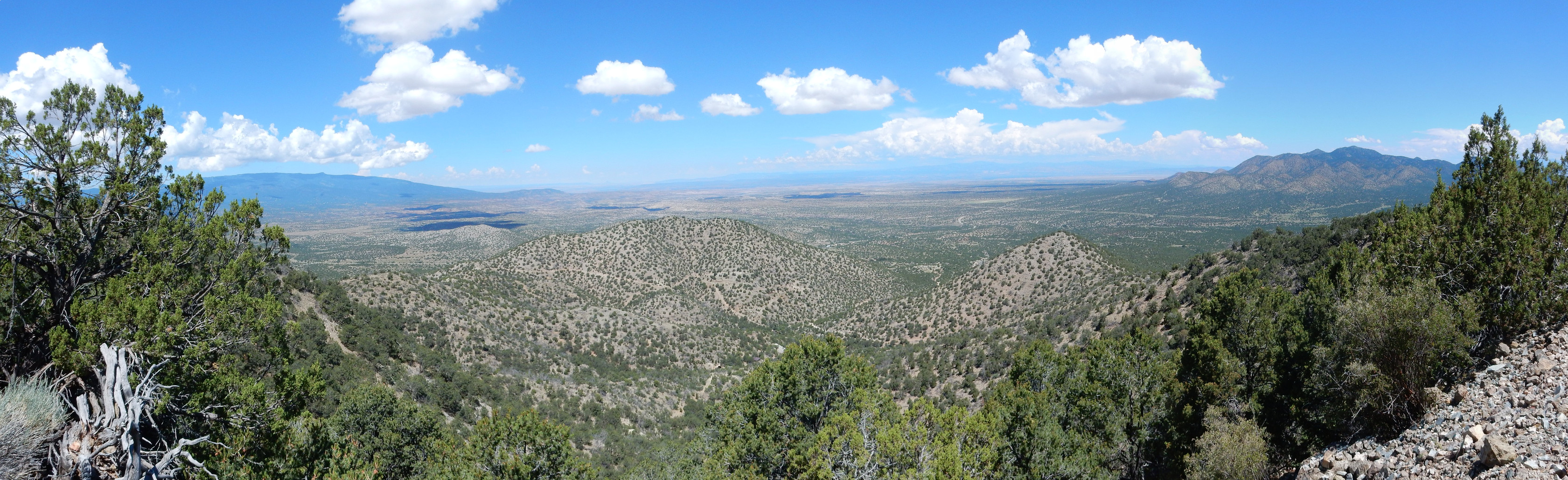
And a little better view of the Ortiz Mountains.
Time to head back. Along the way, a rock fall with some impressive garnet.
By this time, my pack was very heavy, I had hammered enough rocks for one day, and I was a bit jaded, so I left it. As I commented to the regulatory geologist, this was a site where even the leverite* was high grade.
Also, my butt felt wet. Sure enough, a couple of water bottles in my backpack had expired under the battering from the rocks I had picked up. I finished the water that was left in them, noting that it was the Alsup’s bottles that had ruptured while the Kroger bottles had remained intact. Ironically, I probably paid a lot less per bottle for the Kroger.
I was preparing to head down, in company with the regulatory geologist I had met on the trail up, when one of the shuttle drivers offered us a ride. Shucks; I enjoy walking and I need the exercise, but maybe not with forty pounds of rocks on my back. My pack got a ride, for which I’m grateful; I walked while eating lunch out of my tote bag.
Got some more pictures of the Spanish Cut Mine.
And then we were done. I loaded up the Wandermobile and headed pretty much straight home. I toyed with going out via Hagen ghost town, or perhaps Waldo Canyon, but I was awfully tired and there were things needing being done at home. Cindy is taking the two sick kids to the Mayo Clinic in Minnesota to try to get a better diagnosis this week and the preparations needed to be finished up. I’m glad I didn’t detour; as it was, I nearly feel asleep behind the wheel a couple of times.
Next weekend, no Wanderlust, with Cindy out of town. After that, the Great American Eclipse Adventure.
*”Leverite”: A rockhound inside joke. “Leverite” is a rock sample not quite good enough to take home, so you “leave ‘er” there.