
Great American Eclipse wanderlust, day 1
Monday, August 14: I prepare to depart on a trip I’ve been planning now for years. The Moon is going to cross between the Sun and the Earth, as it does roughly twice a year, but this time the narrow path of totality (where the Moon appears to cover the entire disk of the Sun) is within reasonable driving distance of home, for the first time in my lifetime. So I’m off to southeastern Idaho to watch what our selfie culture has dubbed the Great American Eclipse. Naturally, I’ll be looking at some geology as well.
This trip almost didn’t come off. A month ago I got the estimate for cleaning my old dachshund’s teeth: $700 to $1100. Seems they were in pretty bad shape. I can neither bear to see her breath continue deteriorating as she finds it increasingly painful to chew, nor, given her otherwise good health, to put her down. It turned out to be closer to the $1100 end of the range, but her bad teeth get pulled and she does seem a much happier doggie.
Then, just a few days before the trip, I notice a tile coming loose in my shower. I poke at it, and, sure enough, big, soggy chunks of the drywall behind it come loose. So we’re looking at a bathroom remodel. It won’t be cheap. (Latest estimate, $13,000.) And, as I see it, every $1000 on the remodel is another three months until I can retire. I wonder if I can justify a long vacation under the circumstances. Cindy says to go anyway. So do my friends. And since the remodel is going to require breaking into my savings regardless, the roughly $300 I’ll be spending on the eclipse trip is not terribly significant by comparison. Yes, I’ll be keeping it that cheap; I’ll be eating food I prepare myself or have already purchased, and I’ll be sleeping in a tent. I already have reservations for the week before the eclipse at a campground in Island Park: $15 a night. I could not get a reservation for the night after the eclipse, when everything under $1000 a nigh is already booked; my plan is to leave for home immediately after it’s over.
Cindy will not be coming with me, alas. Someone has to stay home with the kids, who are in no shape to travel except for medical treatment. I’ll have a cell phone and will stay in as close touch as that permits.
I’ve got most of my stuff loaded in the car already (I’ll be taking the Wandermobile, naturally) but pack a few final items; perishables and toiletry. I go over my list and make sure it’s all there. In addition to my usual hiking and camping gear, my cell phone, camera, extra battery packs, and charger, I’ve got my 10″ Dobsonian telescope and solar filter taking up the entire back seat of the car. I feel prepared.
The weather, however, is not cooperating well, with low cloud and occasional light rain. Since I will be headed through the Valles caldera, created by a supervolcano eruption 1.25 million years ago, I plan to take some photographs of the south caldera rim for the book. Oddly, I’ve photographed almost every other part of the caldera rim, but not this most traveled portion. I guess some things get taken too much for granted. I stop near the Valles Preserve entrance and take a couple of panoramas. But the clouds leave me wondering if I ought to come back and try again another time.
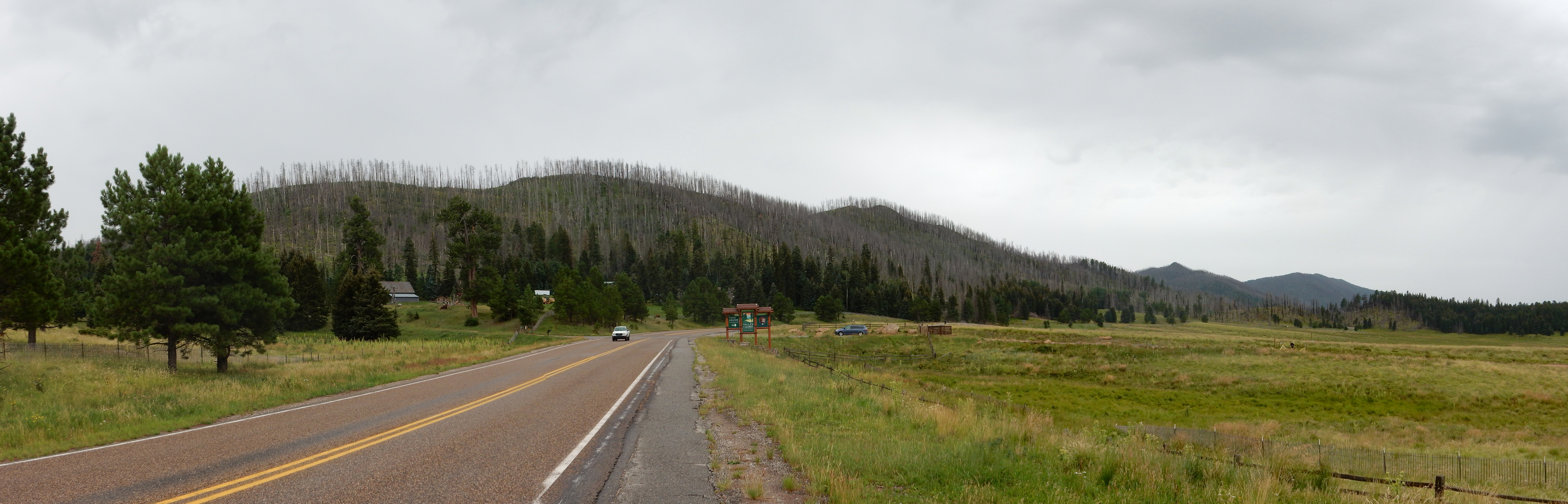
On the other hand, the rim does show perfectly clearly. At left is the northern end of Aspen Ridge, which curves south into the Keres highlands of the southern Jemez. This is volcanic rock laid down from about 14 to 7 million years ago, making it considerably older than the 1.25-million-year-old caldera. The rock was formed from magma lower in silica than the magma of the Valles eruption, and is mostly classified as andesite, whereas the Valles magma mostly produced rhyolite tuff. The significance is that, while andesitic eruptions are hardly gentle affairs, they are much less explosive than rhyolite eruptions and generally do not produce large calderas.
To the right, in the distance, are Las Conchas (the pointy peak) and Los Griegos (the rounder peak to its right). Los Griegos is the highest point in the caldera south rim. Las Conchas is a tempting bushwack I may try sometime, if I can find someone to go with me; the bare peak would be ideal for a spectacular panorama shot of the caldera.
A little further down, I enter the burn scar for the most recent forest fire, just a couple of months ago.
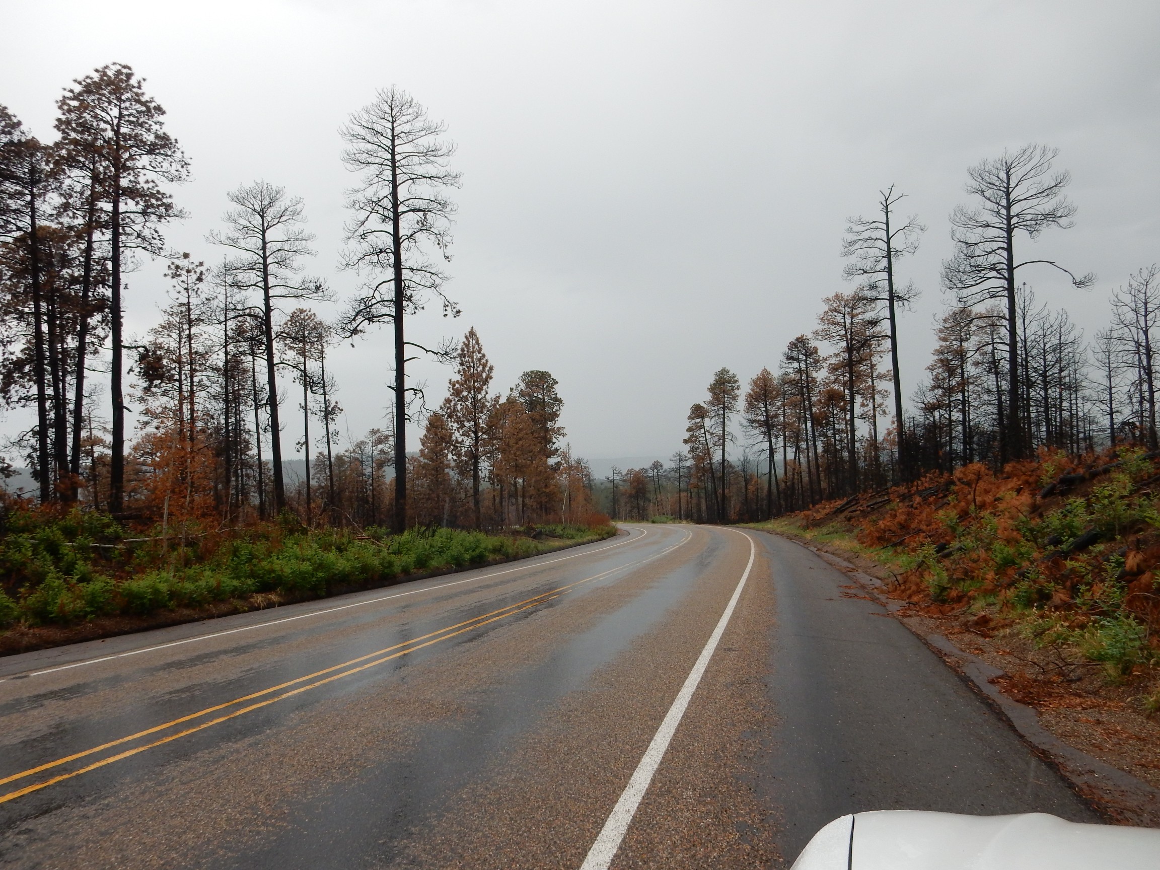
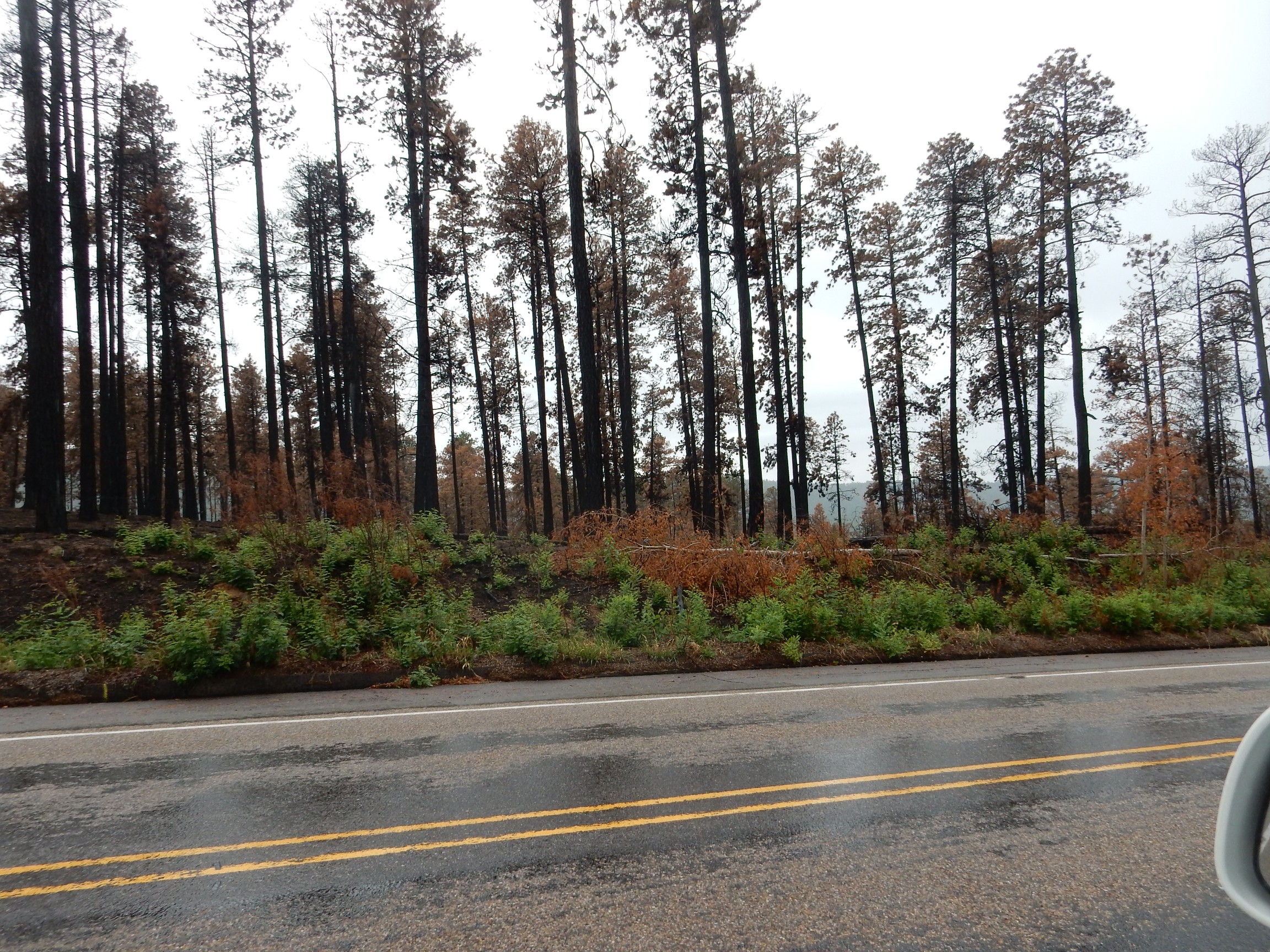
Fires are a necessary and natural part of the ecosystem here, even if many are now caused by man. (This one was the result of a neglected campfire.) This was not a particularly bad fire, with limited crowning (spread of the fire from ground level into the crowns of the trees) and extent. It’s still a dolorous sight.
Just past here is the turnoff to Valle de los Indios, and it occurs to me that this is another stretch of caldera rim I need to photograph. But the rain is now heavy enough to mist the mountains and the road in is a gravel road; I decide this is best saved for another time. I also decide not to take Route 126 through the mountains, as it is partially gravel. I take the longer route through Canon de San Diego and Jemez Springs, which is all paved, instead.
West of San Ysidro, the road passes north of White Mesa.
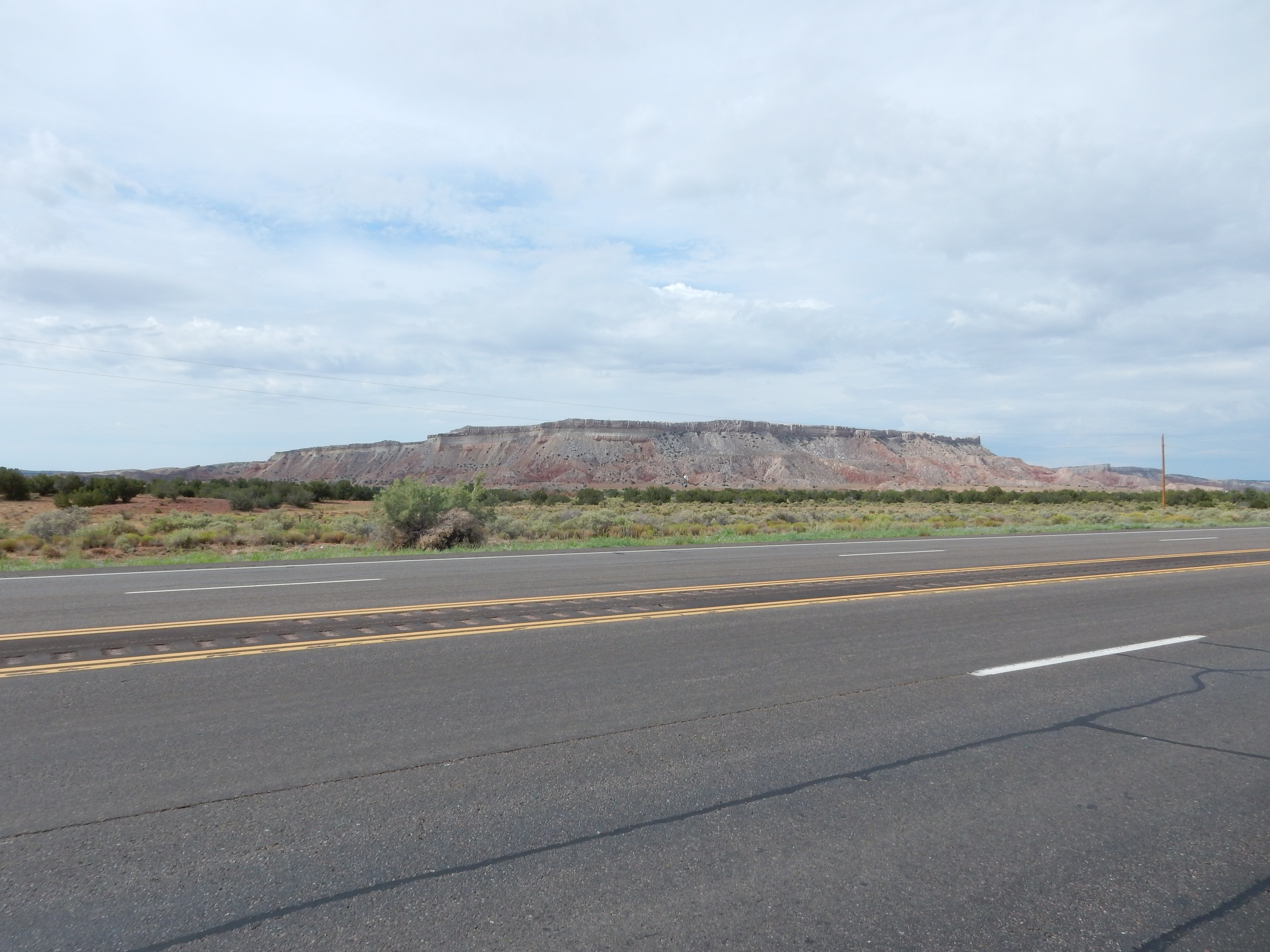
This is the finest example of the numerous mesas in this area, which are capped with gypsum and limestone of the Todilto Formation sitting atop Entrada Formation and Chinle Group beds. The Chinle Group is quite variable but is here mostly red mudstone and siltstone laid down in a large river valley, analogous to the modern Mississippi River valley, but some 230 million years ago. Its uppermost beds include some early dinosaurs, particularly in the Ghost Ranch area. The Entrada Sandstone is Jurassic in age, about 160 million years old, and is mostly sandstone in our area. Both the Chinle and the Entrada are widespread, found throughout the four corner states.
The Todilto Formation is more local, being found mostly in New Mexico and southern Colorado. It is thought to have been deposited in an arm of the sea that was partially cut off by a bar or reef at its mouth. The climate at the time was very hot and arid, and the sea water entering this bay quickly evaporated to deposit gypsum and other evaporite minerals — possibly including halite, rock salt, though any halite beds have since redissolved in groundwater. (In places, the Todilto gypsum beds are distorted in a way that suggests such beds were once present and were dissolved.) There is a gypsum mine on White Mesa whose product is used for plaster of Paris, wallboard, and other purposes.
The lighting was particularly good over Pajarito Peak, and I stopped to try for my Ansel Adams moment of the day.
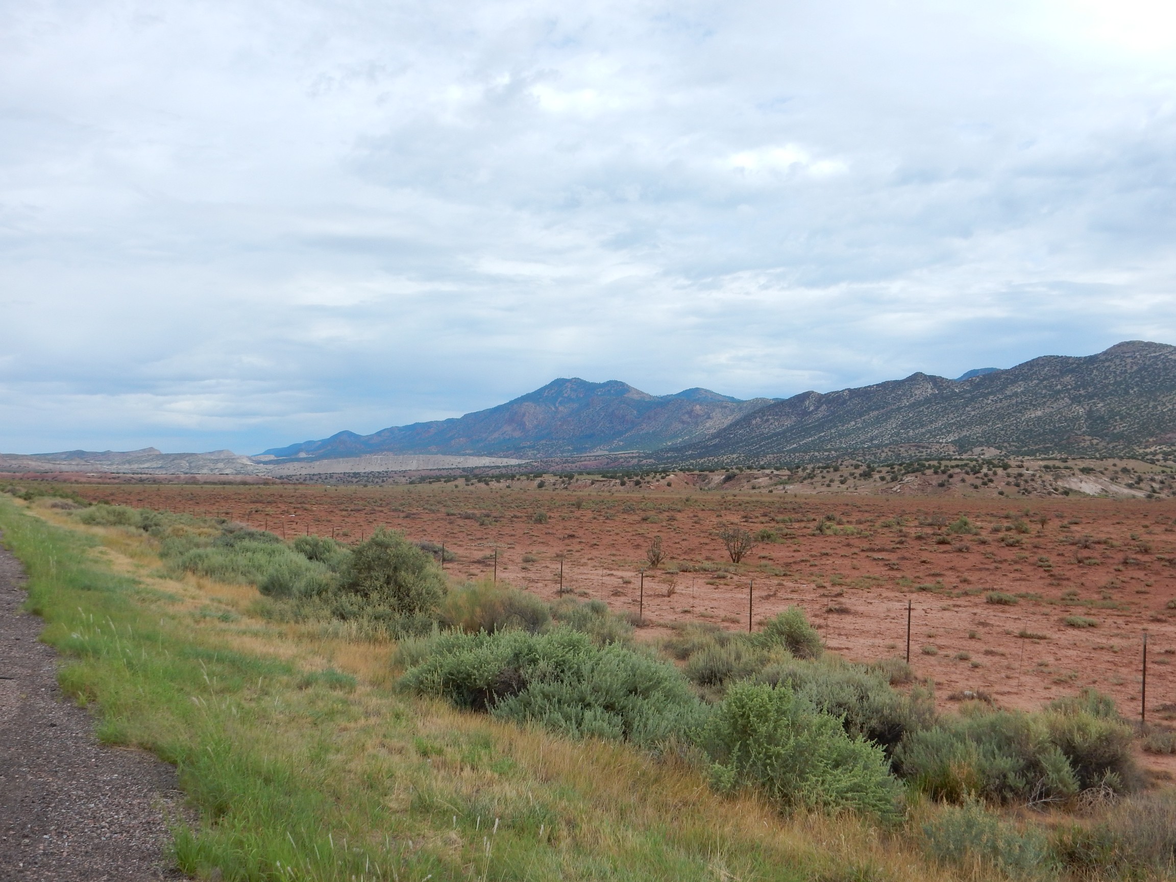
The red flats in the foreground are Chinle Formation mudstones. The mountains to the right are the west face of the Sierra Nacimiento uplift, a block of the Earth’s crust that was thrust upwards 350 million years ago as part of the Ancestral Rocky Mountains, and was thrust up again starting about 50 million years ago as part of the modern Rocky Mountains. The block is probably still slowly rising today. All the younger rocks have been eroded off its heights, exposing Precambrian “basement” rocks that are between 1.4 and 1.75 billion years old. These rocks are highly resistant granites, gneisses, and monzonites, all crystalline rock that formed from molten magma cooling deep in the Earth’s crust or, in the case of the gneisses, from older rocks recrystallizing under heat and pressure. The peak at center is Pajarito Peak. A closer view:
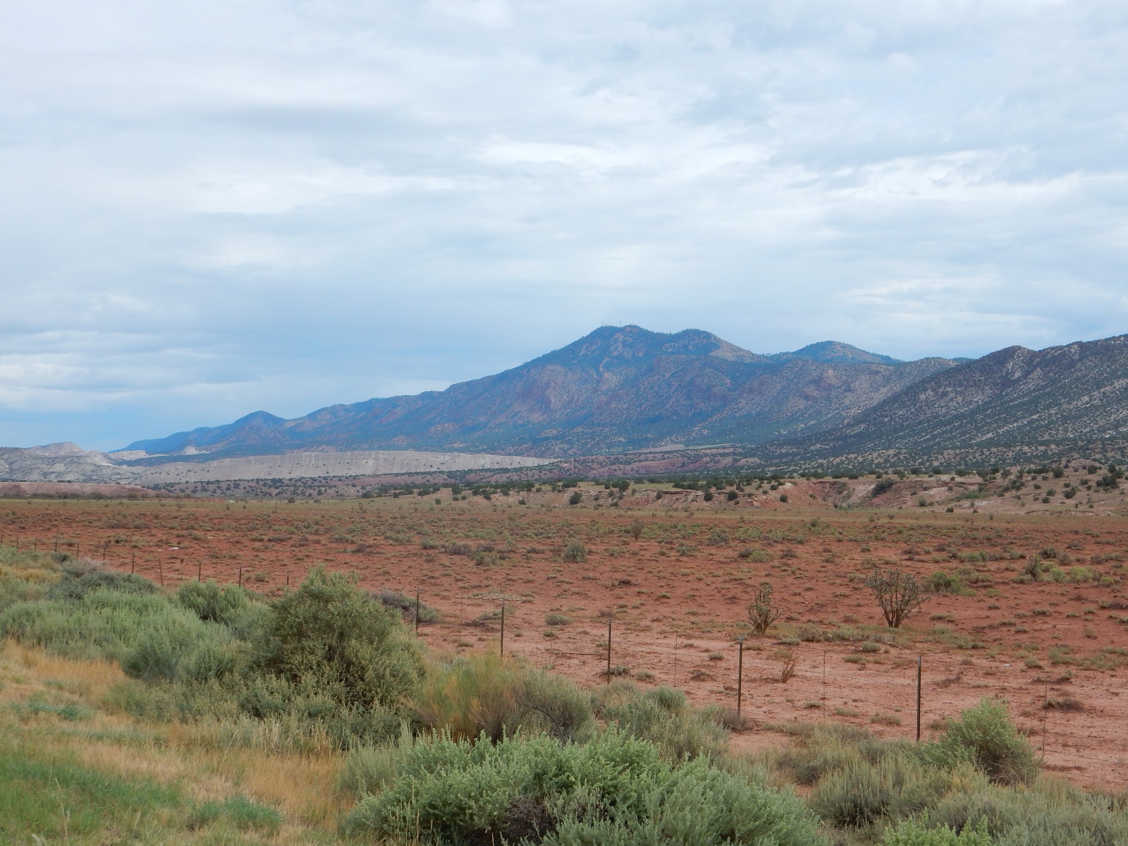
The white ridge at left is Chuchilla Blanca (“White Blade”) Hill. This is a ridge of Todilto Formation over Entrada Formation thrown up by the same forces that raised the Sierra Nacimiento.
Further north, the road passes through an area of Mancos Shale.
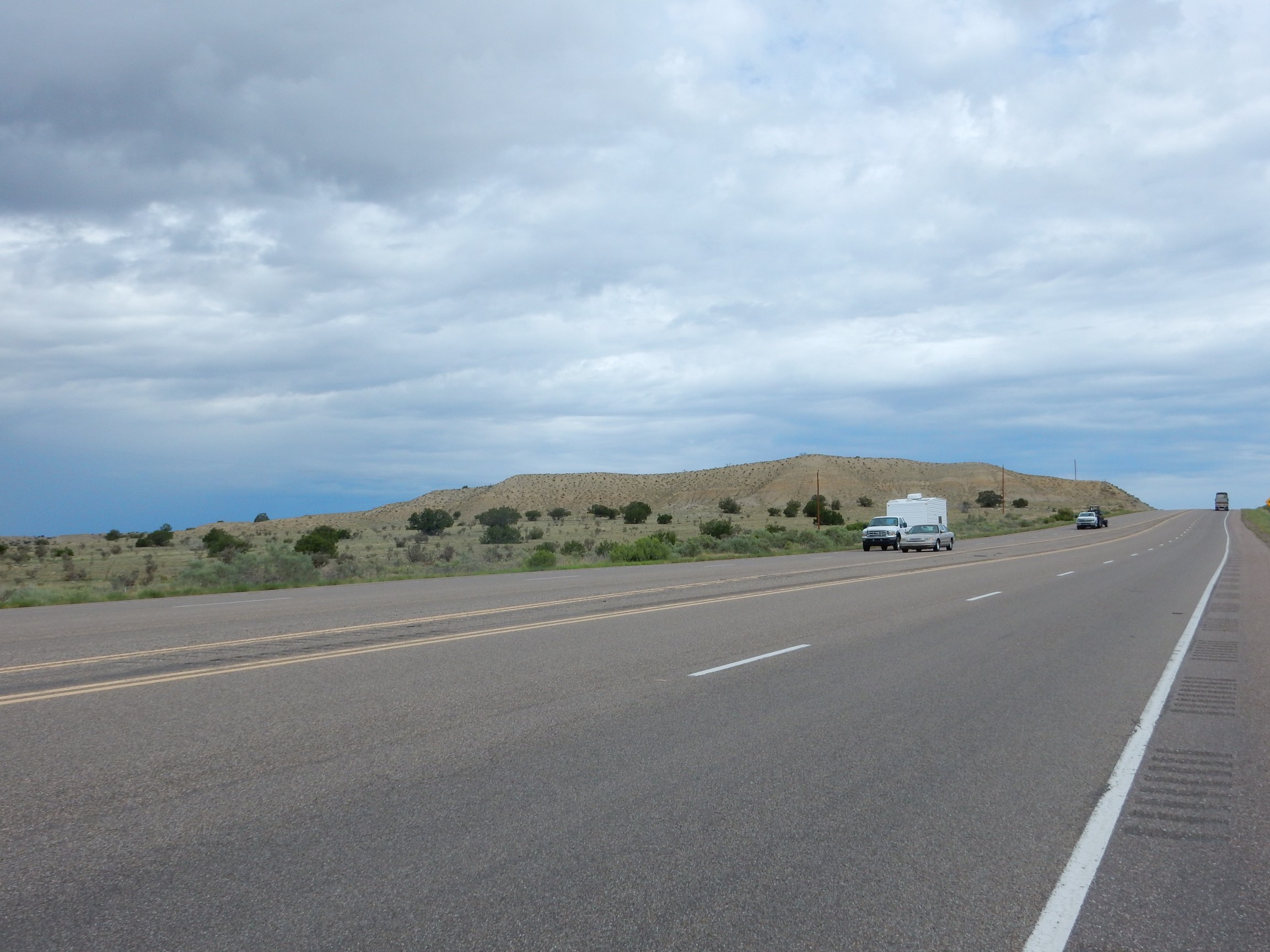
The Mancos Shale is Cretaceous, around 80 million years old, and formed in the Western Interior Seaway, an epicontinental sea that covered much of the area now occupied by the Basin and Range, Rocky Mountains and High Plains areas of North America. An epicontinental sea is a shallow sea that covers continental crust; ocean levels are currently low enough that there are few such seas today (the North Sea is one example) but in Cretaceous times the ocean levels were near their highest in the geological record, and most of the continents were flooded. The Mancos Shale is mostly marine mudstone, rather a bland tan to gray color, and is very widespread. I expect to see lots more of it on this trip.
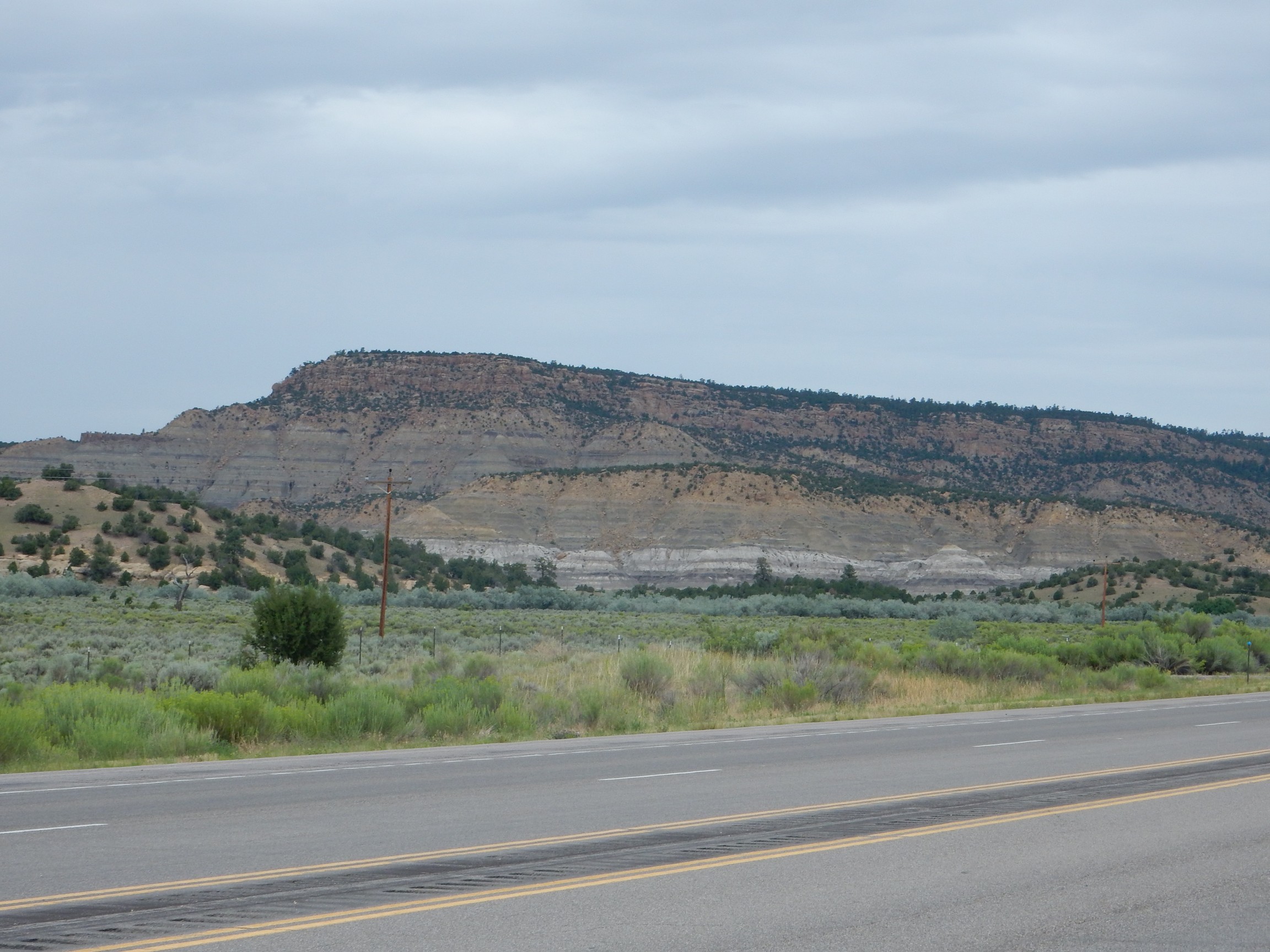
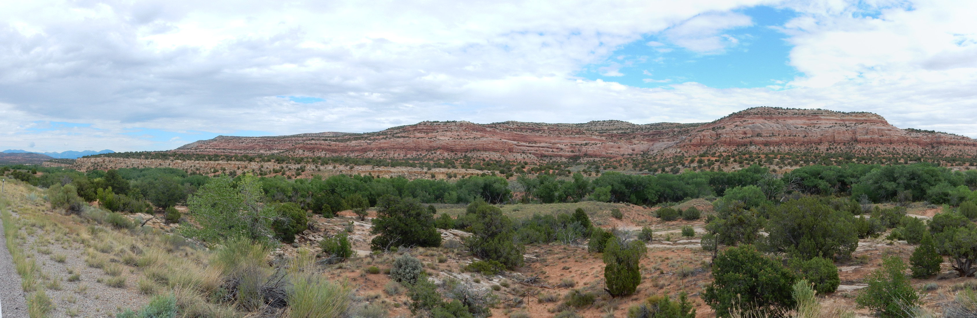
Further north is La Ventana Mesa.
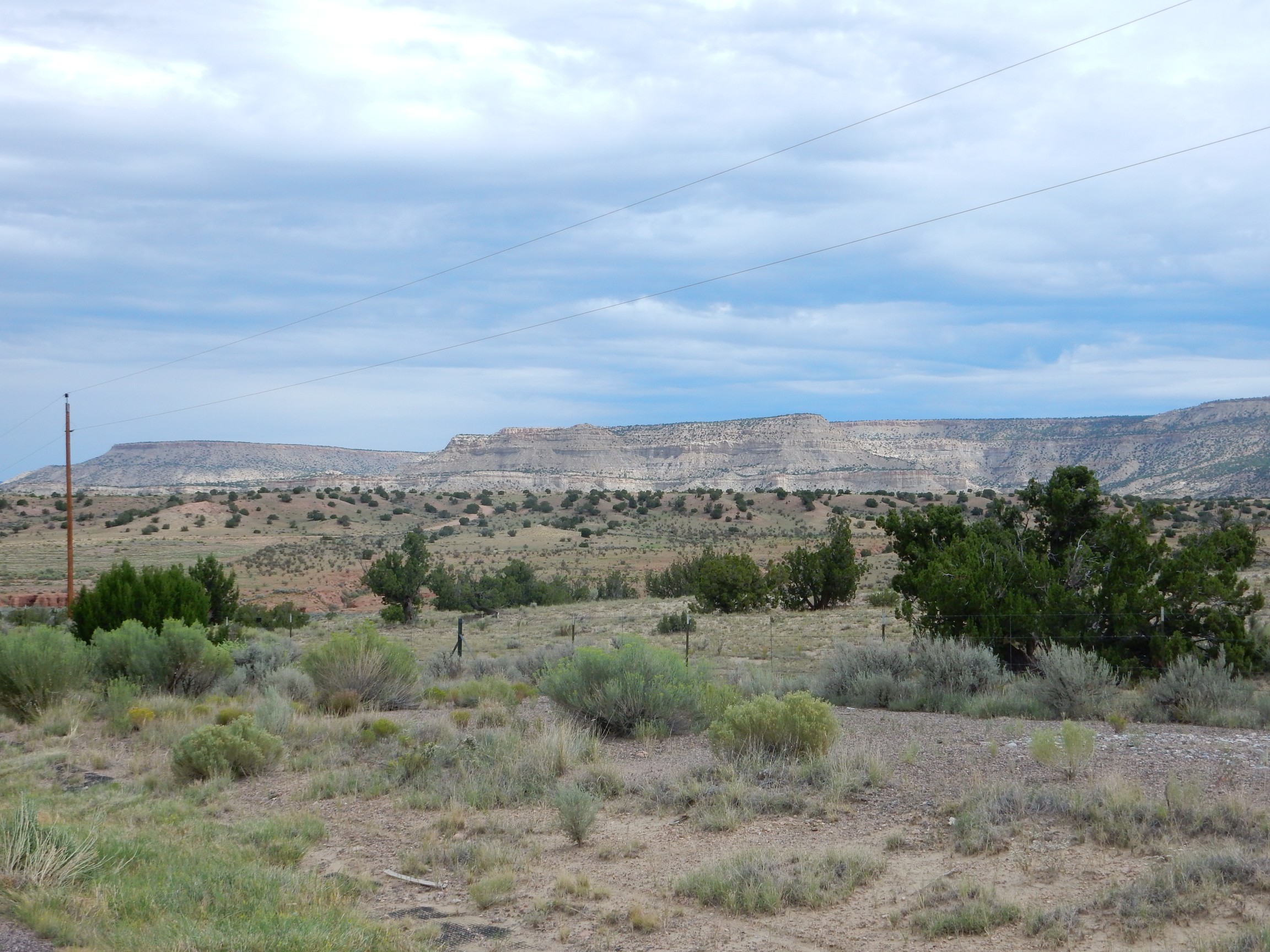
This is underlain by the Mesaverde Group, an interesting collection of formations representing a brief withdrawal (regression) and return (transgression) of the Western Interior Seaway. The withdrawal of the sea left a layer of beach sand (the Lookout Point Formation) and then swamp mud with coal beds (the Menefee Formation) and then another of beach sand with the ocean’s return (the Cliff House Formation). Above this is more marine shale, assigned to the Lewis Formation. The mesas in this photo are topped with beds of the Cliff House Formation, assigned, oddly enough, to the La Ventana Member.
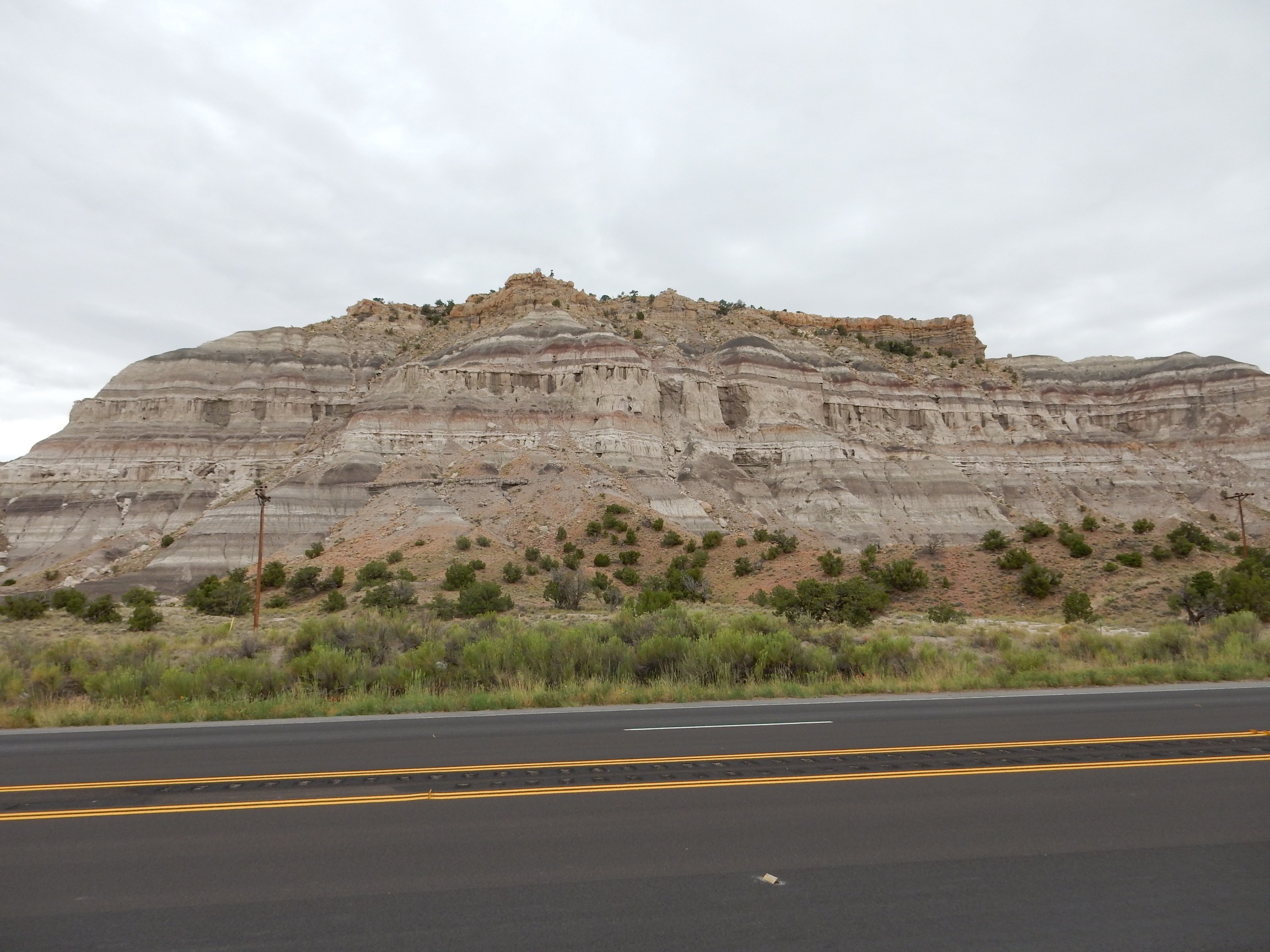
I have decent photographs of every formation in this area except the Pictured Cliffs Sandstone. This is exposed at the base of Mesa Portales. I stopped for a photograph.
Alas, this is not actually Mesa Portales, which is well to the south of where I stopped here. My navigation was off. This is the southern tip of Cuba Mesa, which is capped by San Jose Sandstone over Nacimiento Formation. Both are Tertiary formations, probably Paleocene to Eocene (65 million to around 50 million) years in age. Both were laid down in the San Juan Basin west of the Sierra Nacimiento Uplift. I’ll be spending some time crossing this basin, which extends clear to the Farmington area and beyond.
The whole western half of the basin is occupied by similar mesas of resistant San Jose Sandstone over Nacimiento Formation.
The weather continues to deteriorate. I keep hoping that I will drive through the storm, but this is evidently a major system. Oh, well, time to crank up the Verdi on my CD system to stay awake on the long drive to Farmington. Dies Irae makes it tough to sleep.
Outside Farmington I finally see some new rocks. Which, alas, I cannot identify with certainty, because the GPS receiver in my camera failed to lock on and tag this photograph.

But I think this is probably Ojo Alamo Formation, which extends from the very latest Cretaceous into the Paleocene — around 65 million years old.
I’m hungry and feeling a little self-indulgent. I find a McChinese in Bloomington and fill up at the buffet, coming out afterwards to find that it is drizzling steadily. Well, crep. Not a great start to my vacation. Still, I’ll happily trade lousy weather now for excellent weather a week from now.
Passing Shiprock to the north. I’ve gotten better photographs before, but it has a way of attracting the camera.
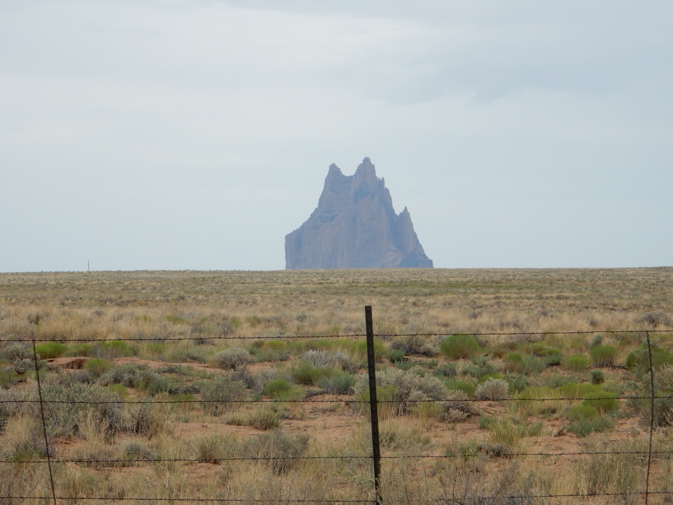
Shiprock is the remains of a volcano that erupted 25 million years ago or so. The softer cinder making up most of the code was rapidly eroded away, leaving a plug of hard lava that cooled in the throat of the volcano. The lava here is unusual in having a very low silica content and a very high potassium content; an alkaline ultramafic lava, in the terminology of geologists. This kind of magma forms when rock in the Earth’s upper mantle melts very slightly, because potassium is “incompatible” with most common mantle minerals and melts out of them at the first opportunity.
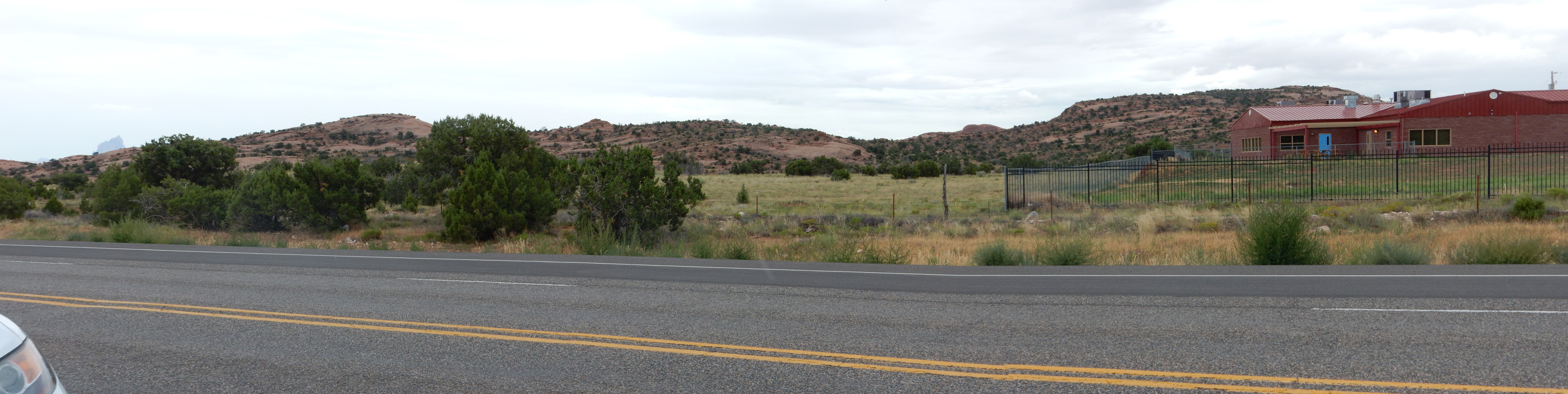
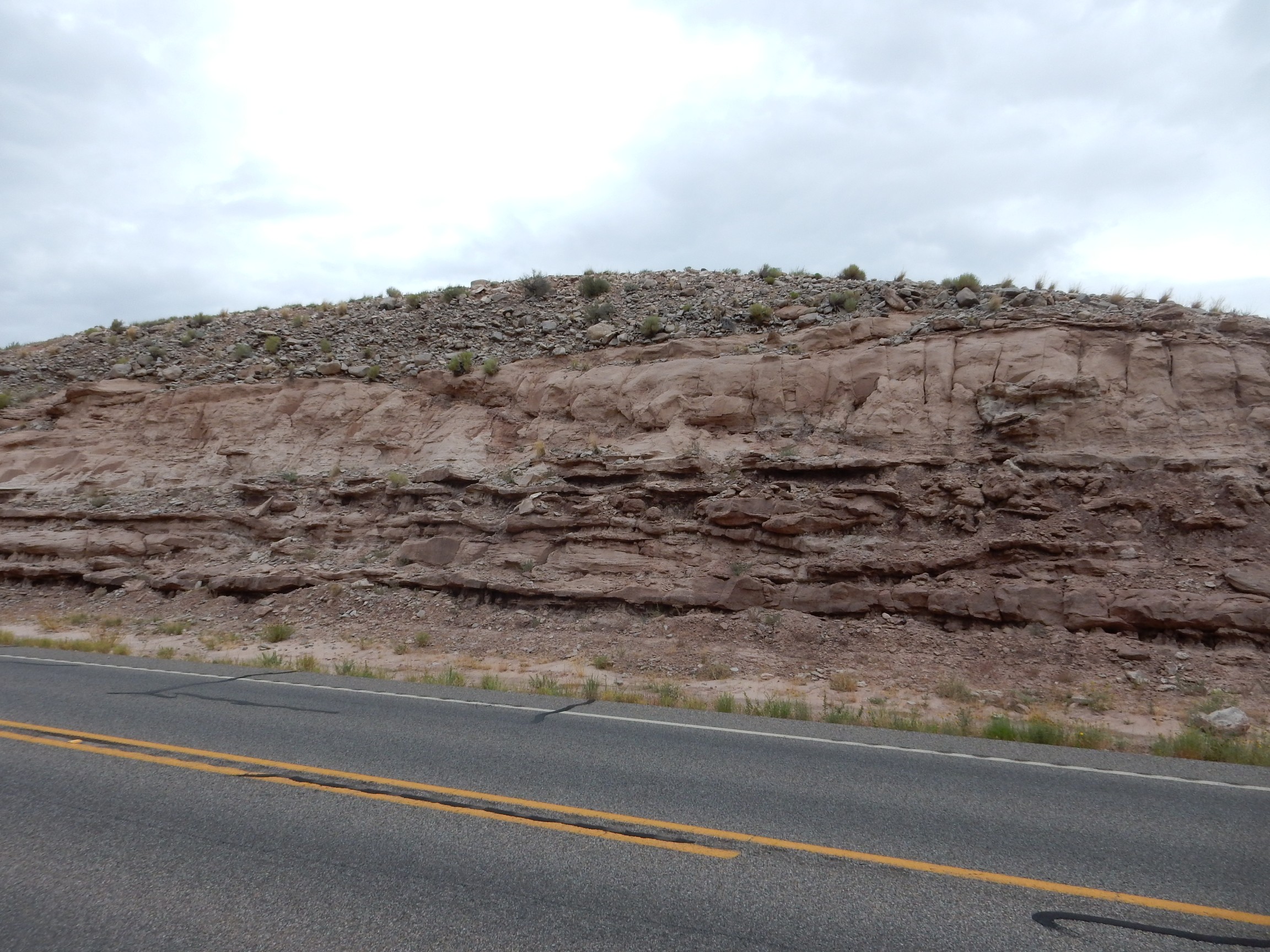
In Navajo country, I descend from a mesa top past an interesting-looking rock bed.
I’m guessing this is a sandstone member of the Mancos Shale. The state geologic map tells me only that this is part of the lower Mancos Formation.
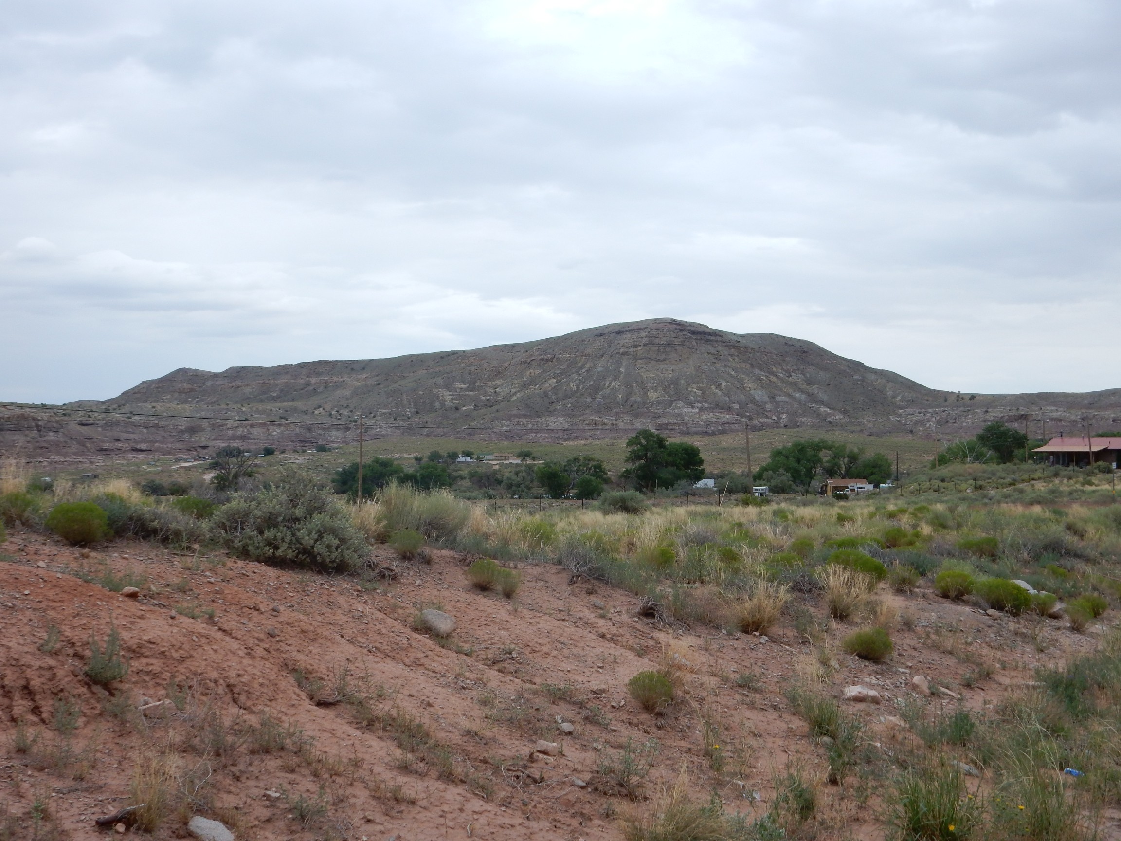
I was a bit shy of much photography the last time I came through here, because the Navajo have a reputation as a very private people. But when you have road signs advertising the geology …

I won’t repeat what’s on the sign, but here’s a panorama of the dome, to the south.
According to my map, the very center of the dome exposes Rock Point Formation of the Chinle Group — and it’s apparently the type section.
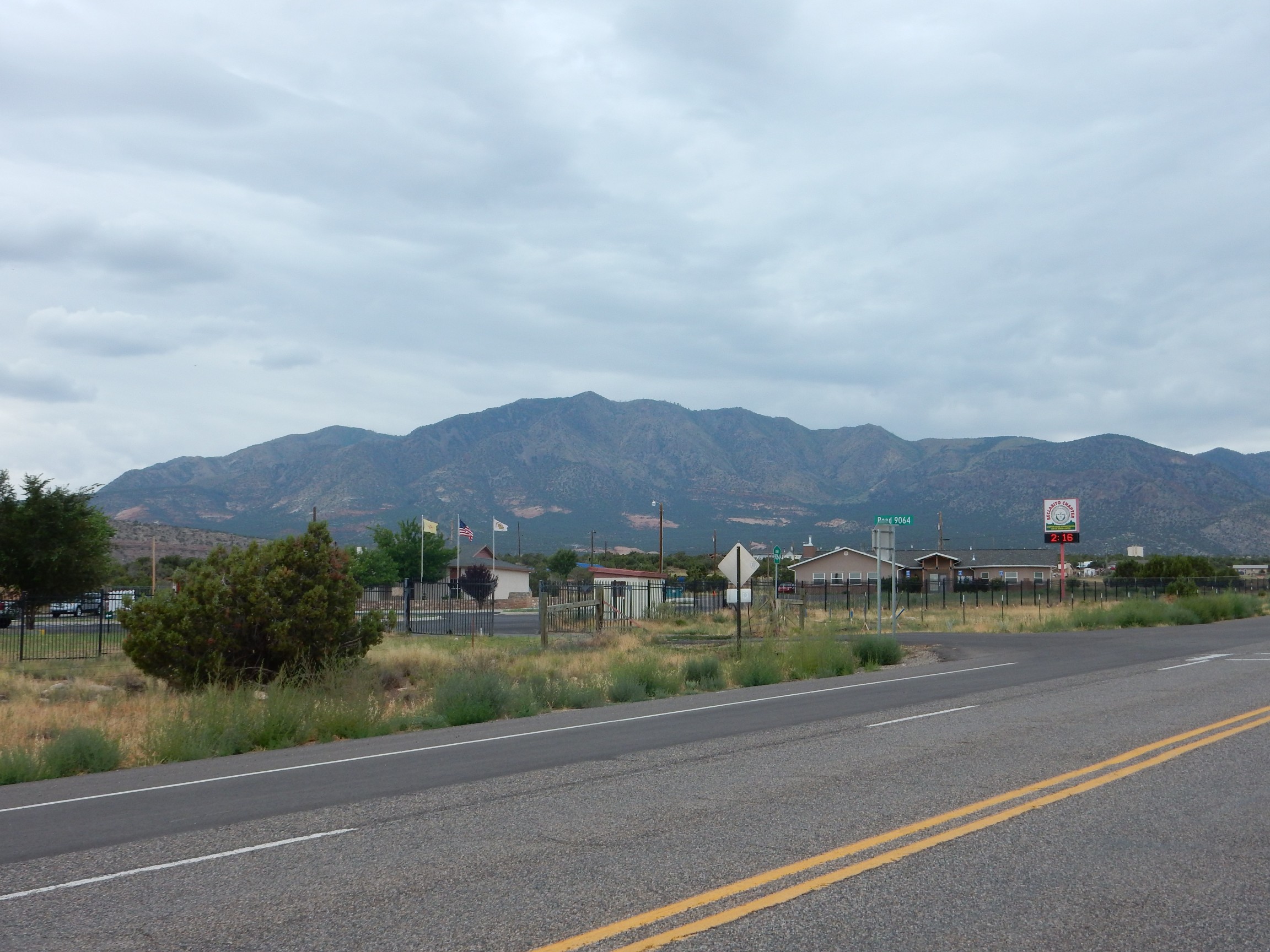
More red beds are exposed in the foothills of the Carrizo Mountains to the southwest.
A little further down is a striking road cut.
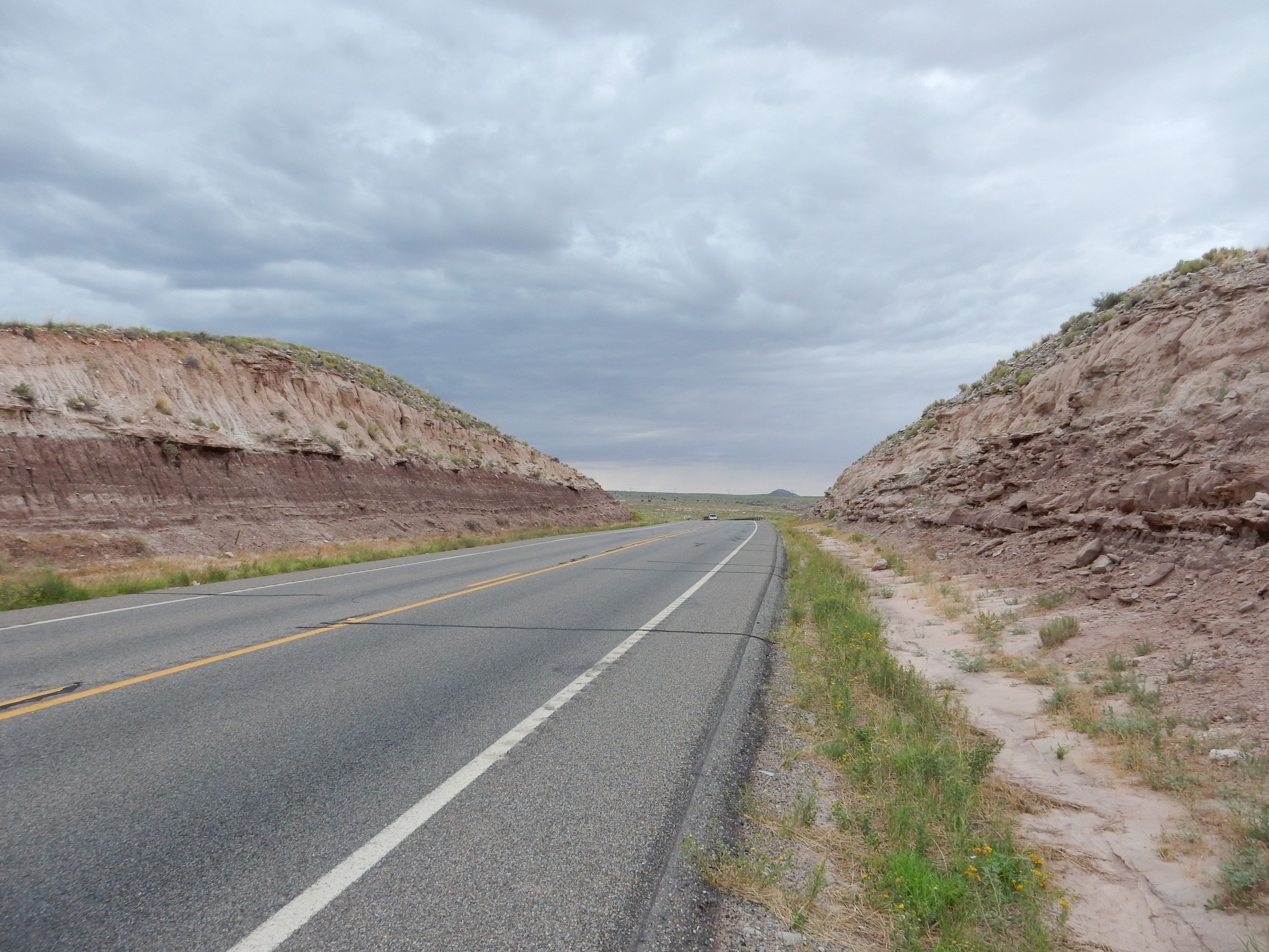
Alas, this is northeastern Arizona, I don’t have any geologic map at all for the area, and I can only guess what these beds are. Perhaps relatively young beds, Tertiary equivalents of the San Jose Sandstone and Nacimiento Formation, but they could be as old as the Jurassic Summerville Formation.
Likewise a nearby hill.
I continue north towards Bluff, and find the panorama irresistible.
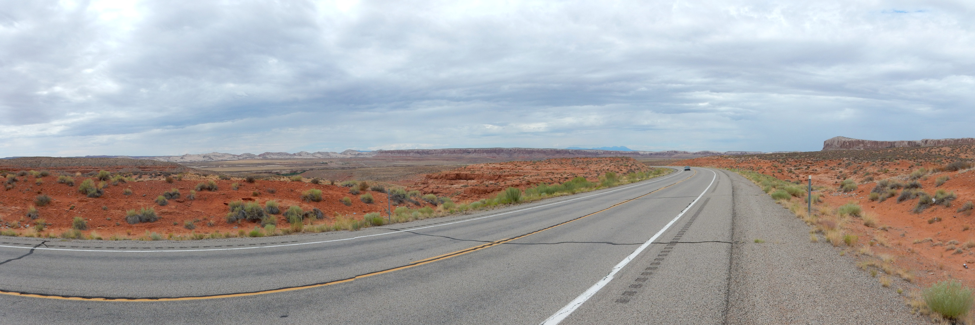
This is not far from the San Juan River crossing. The mesa at center is Tank Mesa, and the (rather dated) geologic map identifies this as being capped with Bluff Sandstone over Summerville and Entrada Formation. The bluff at right is also capped with the massive Bluff Sandstone.
At left is a prominent ridge of Navajo Sandstone. Here’s a better view.

This is Comb Ridge. It extends north for at least twenty miles and is part of a monocline on the eastern edge of the Monument Uplift, a region of upwarped crust. The Navajo Sandstone itself is Jurassic in age, a little younger than the Entrada Sandstone; it is prominent throughout southeastern Utah but was probably never deposited as far east as the Jemez, where the Entrada Sandstone sits directly on the Rock Point Formation of the Chinle Group, with a gap of about 40 million years missing from the rock record.
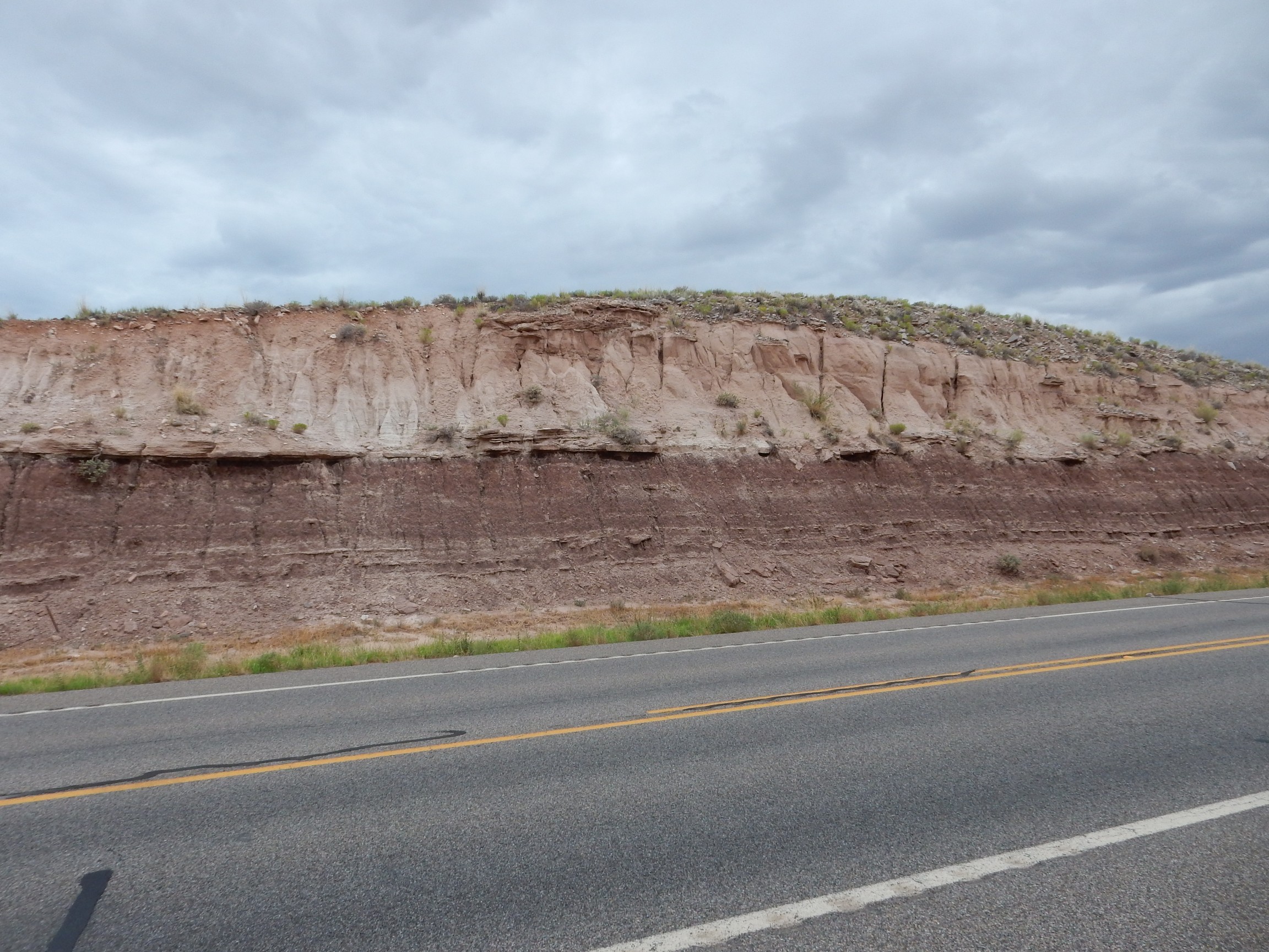
A striking road cut.
Again, I don’t have access to a good map, but the landforms here and my knowledge of nearby geometry strongly suggests Cretaceous Dakota Formation over Burro Canyon Formation. There is a clear erosional surface with a lot of irregularity between the two formations. Both formations date from the earliest days of the Western Interior Seaway, with the Burro Canyon Formation here representing floodplains in front of the advancing sea and the Dakota Formation representing beach sand deposits. Both are found in the Jemez, and the Dakota Sandstone is one of the most widespread formations around, extending clear to (ahem) the Dakotas.
I have some time, the weather is finally improving a bit, and I need some exercise. I decide to drive to Natural Bridges National Monument and hike one of the trails there.

More Dakota Formation, I think.
The road winds down towards Comb Ridge. The Navajo Sandstone here is unmistakable.
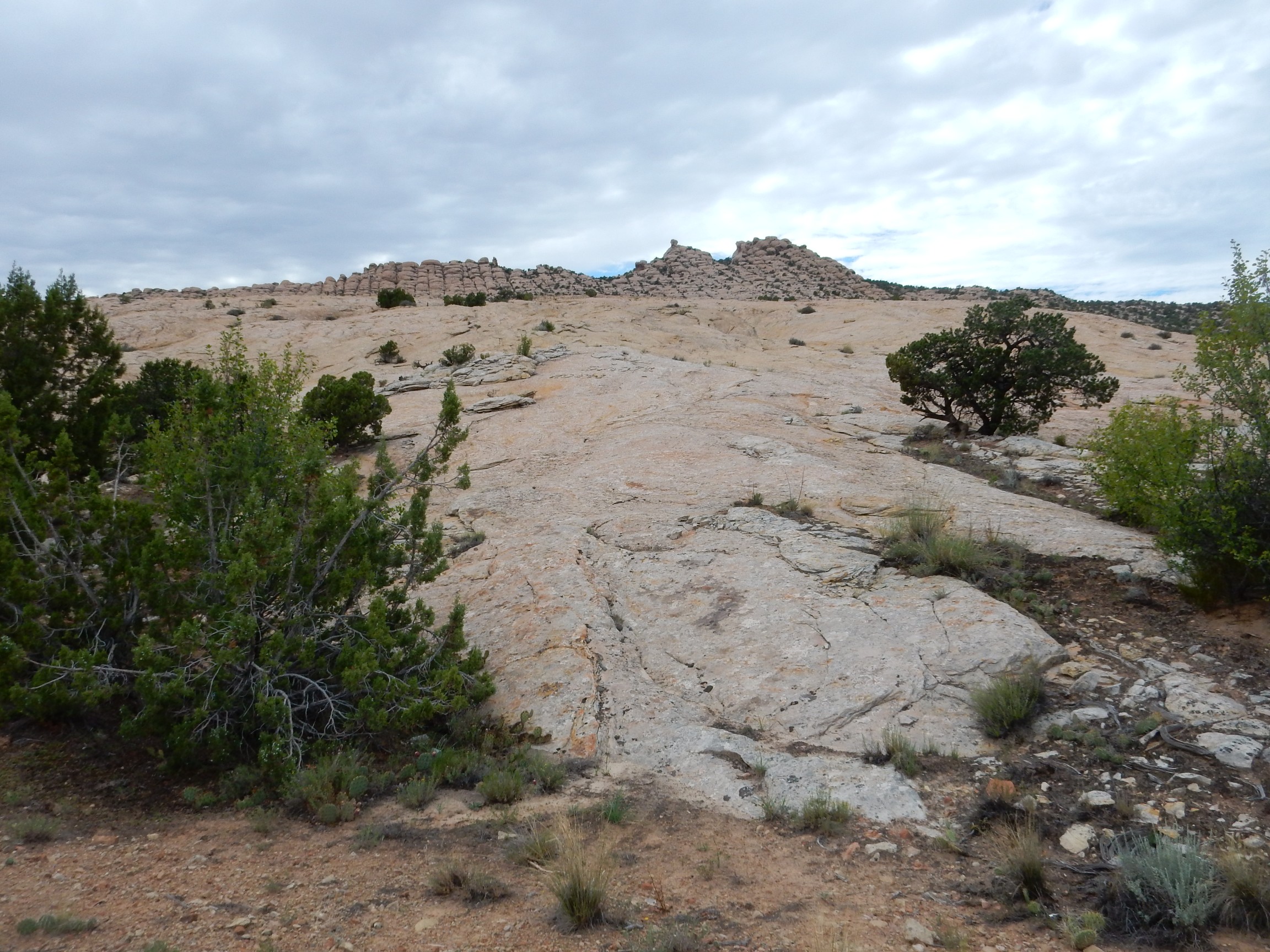
It’s the pure white color and the clean erosional surface, exposing beds showing distinctive cross-bedding. Exposures of Navajo Formation look so clean because the next higher formation, the Carmel Formation, is so easily eroded off the surface. Speaking of which, on the other side of the road:
The geologic map has this as mostly Carmel Formation, though I would have suspected a cap of Entrada Sandstone.
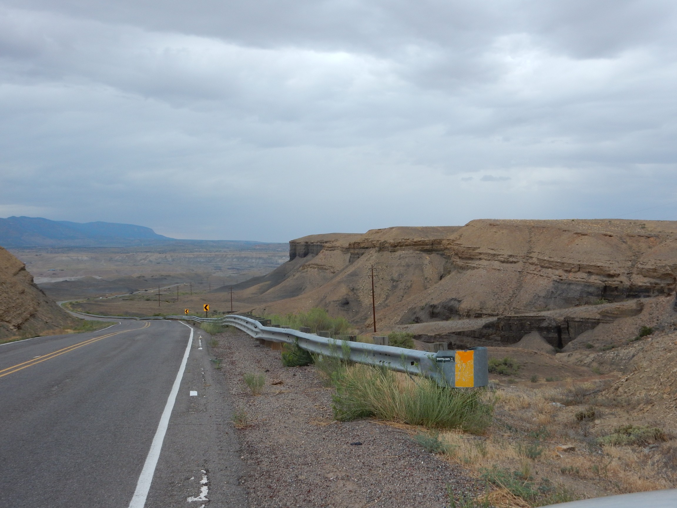
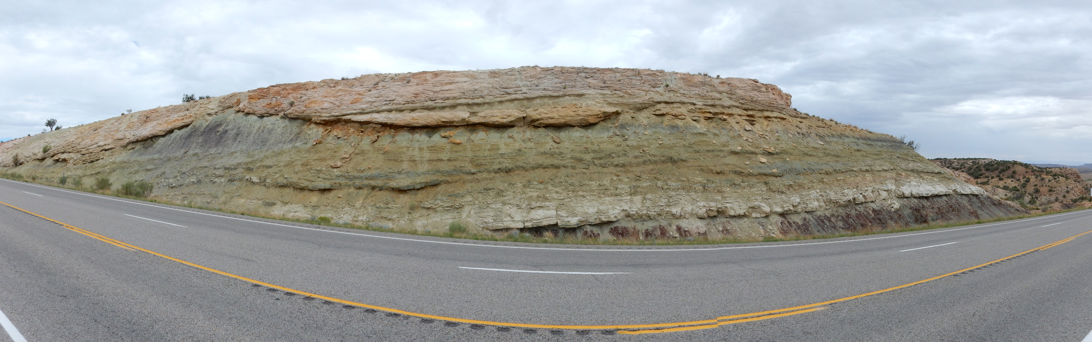
The road passes through a deep cut through the underlying Kayenta Formation and Wingate Sandstone, both Jurassic, into an impressive monocline valley.
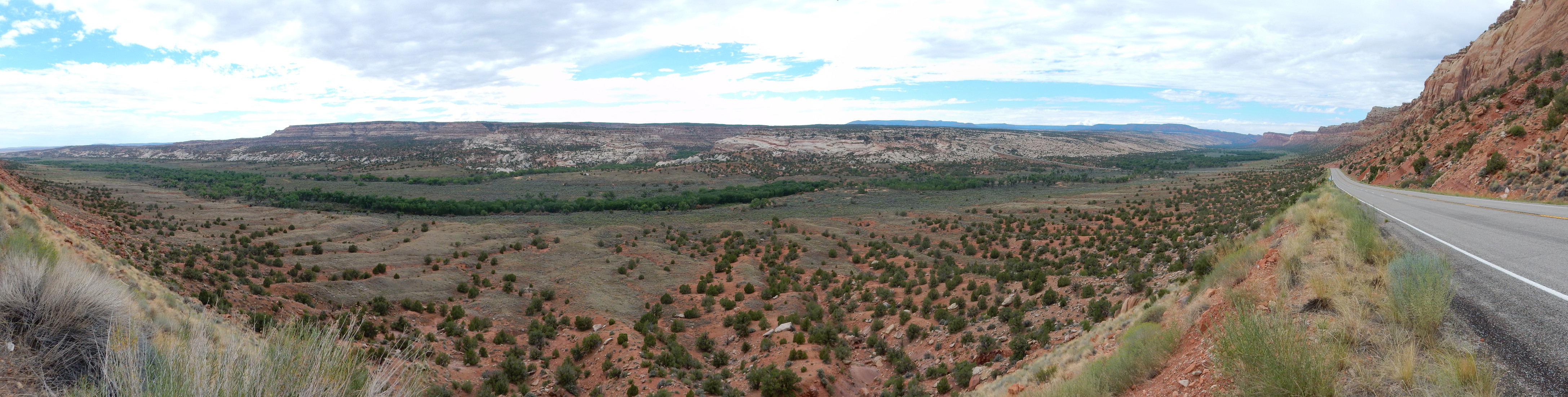
A monocline valley forms where sedimentary beds are dipping steeply into the ground (a monocline). Resistant beds form the walls of the valley, while the valley bottom is eroded out of less resistant beds. In this case. the road I’m standing on is at the base of the resistant Jurassic Wingate Sandstone, the white rock on the far side of the valley is the resistant Permian Cedar Mesa Sandstone, while the lower slopes below my road are less resistant Chinle Formation. The valley floor is likely cut from the lower Chinle Formation and Moenkopi Formation, both Triassic formations.
The view up the valley to the north is a potential Ansel Adams shot.
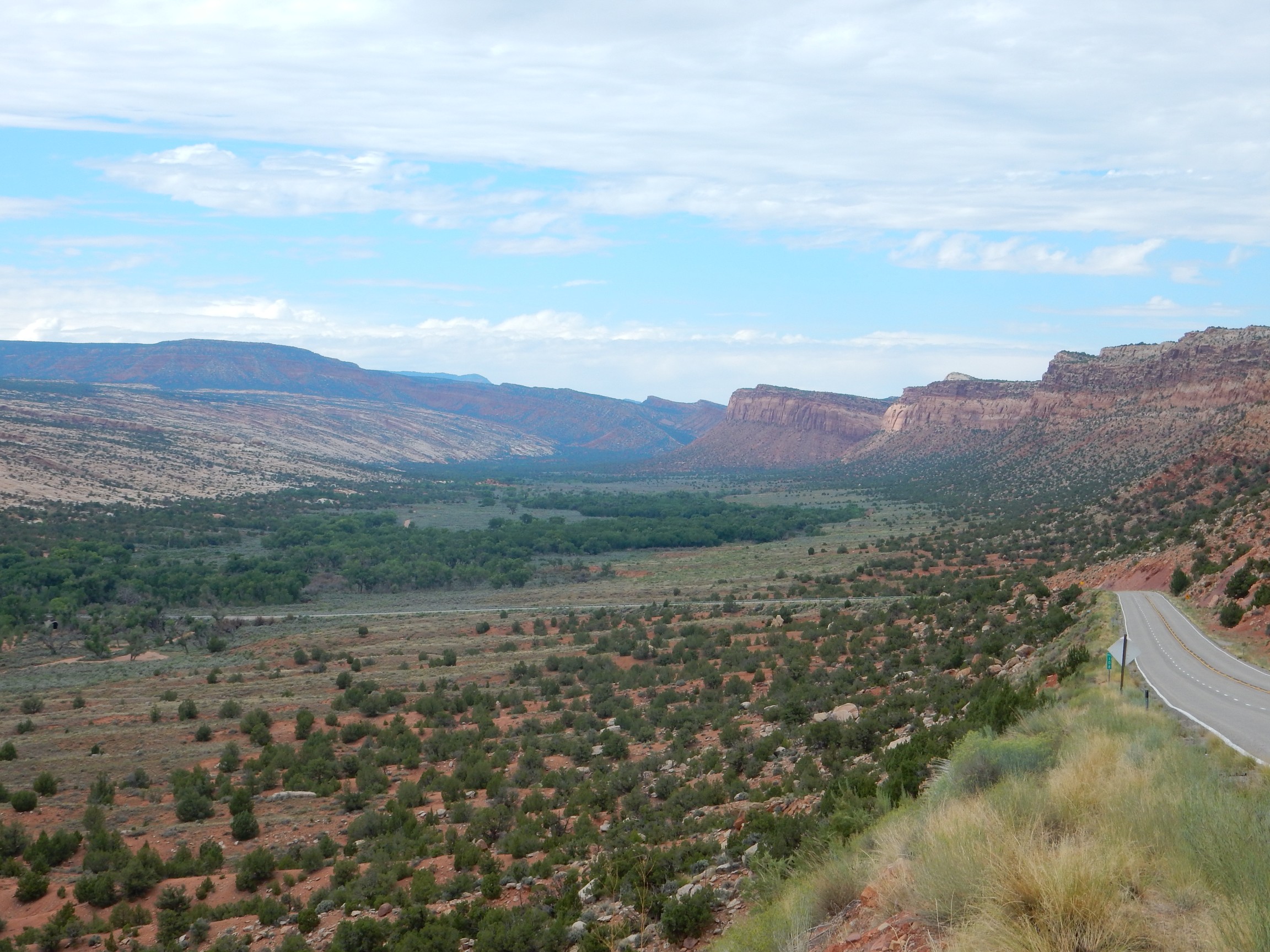
I notice that the weather is finally clearing up.
Looking up at the cliffs of Wingate Sandstone behind me, and the contact with the underlying Chinle Formation:

Incidentally, you may be wondering about Chinle Formation versus Chinle Group. Same thing. In Utah, it’s usually treated as a single formation with several members, varying from place to place. In the Jemez, it’s been promoted to group status and its members to formations. It’s kind of like the Holy Trinity: There’s a reality there, but also a lot of arguing by Christians over how best to describe it.
Apologies if that seems irreverent. Or too religious for a geology blog.
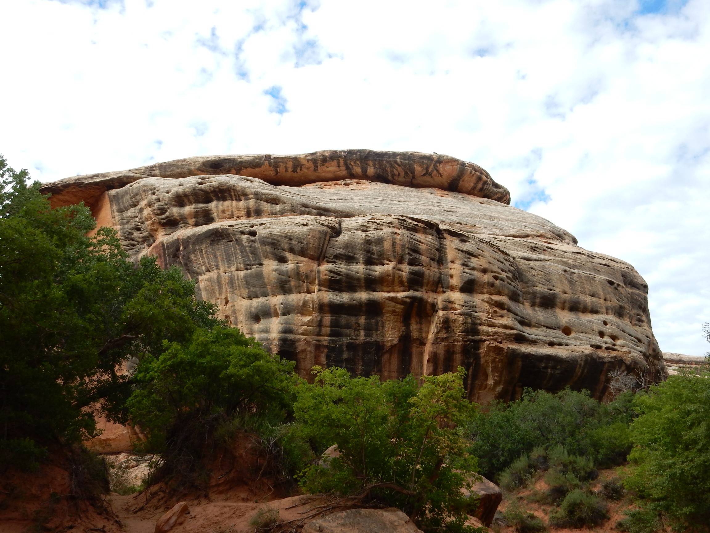
A little ways up the road, I get my first good look (for this trip) at the Cedar Mesa Sandstone.
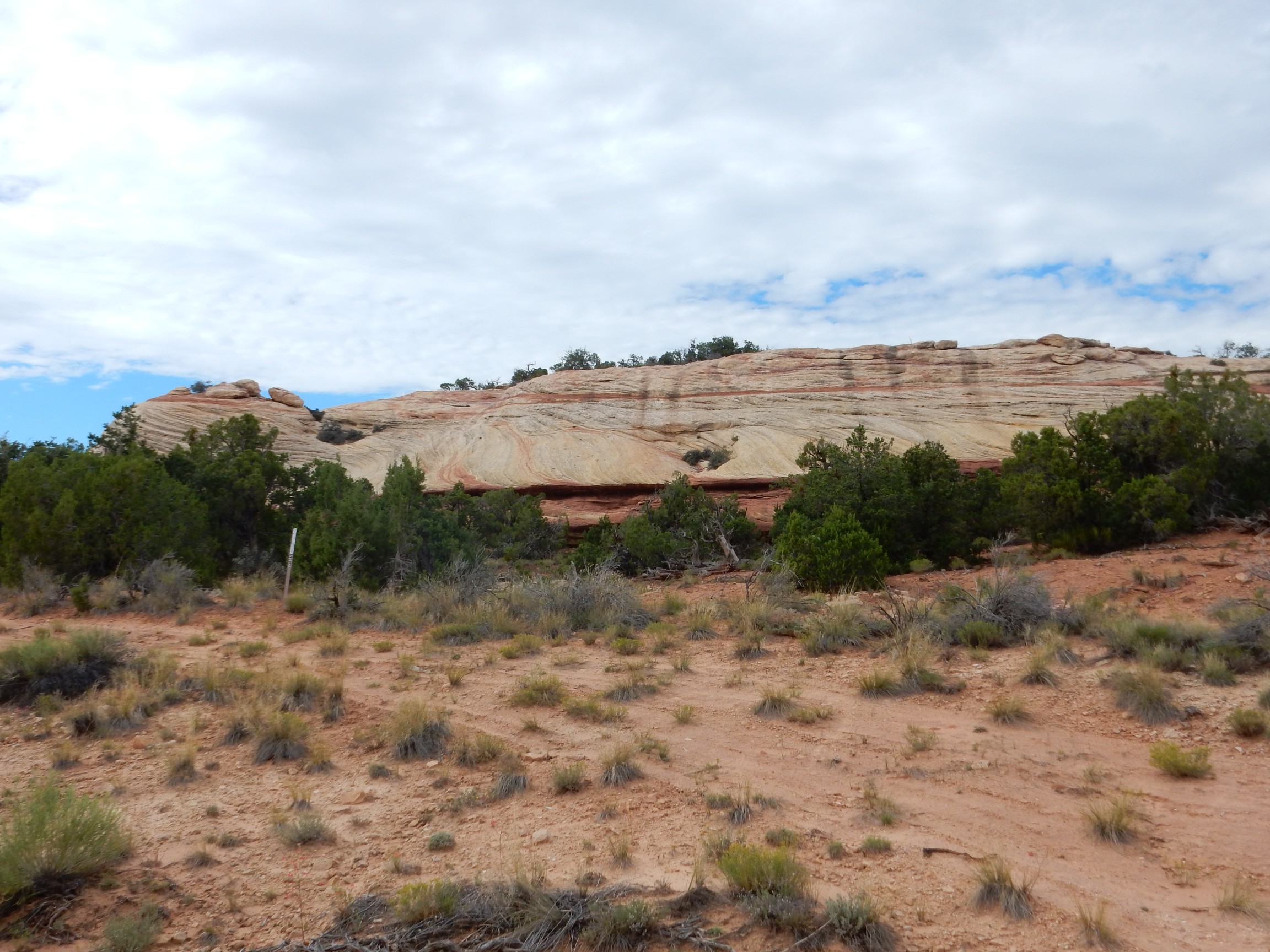
It looks a lot like the Navajo Sandstone, and since neither is particularly rich in fossils, it could be hard to tell the two apart except for their stratigraphic position (location relative to other known rock beds.) However, the Navajo Sandstone is early Jurassic, around 200 million years old, while the Cedar Mesa Sandstone is Permian, somewhere in the ballpark of 280 million years old.
Some impressive mesas ahead, silhouetted against the afternoon sky:

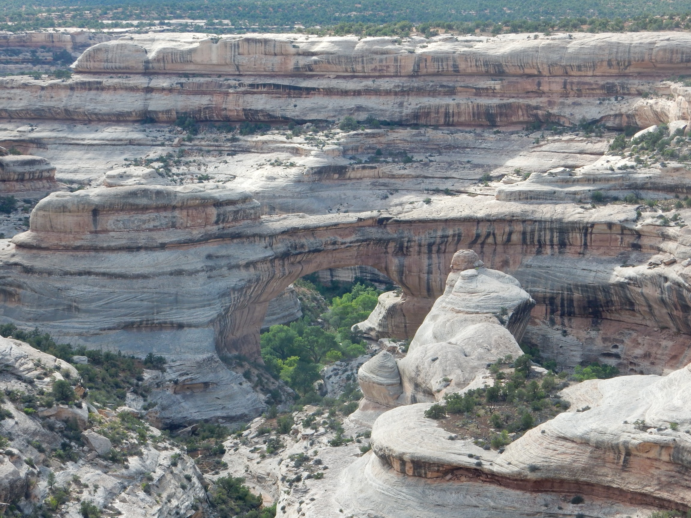
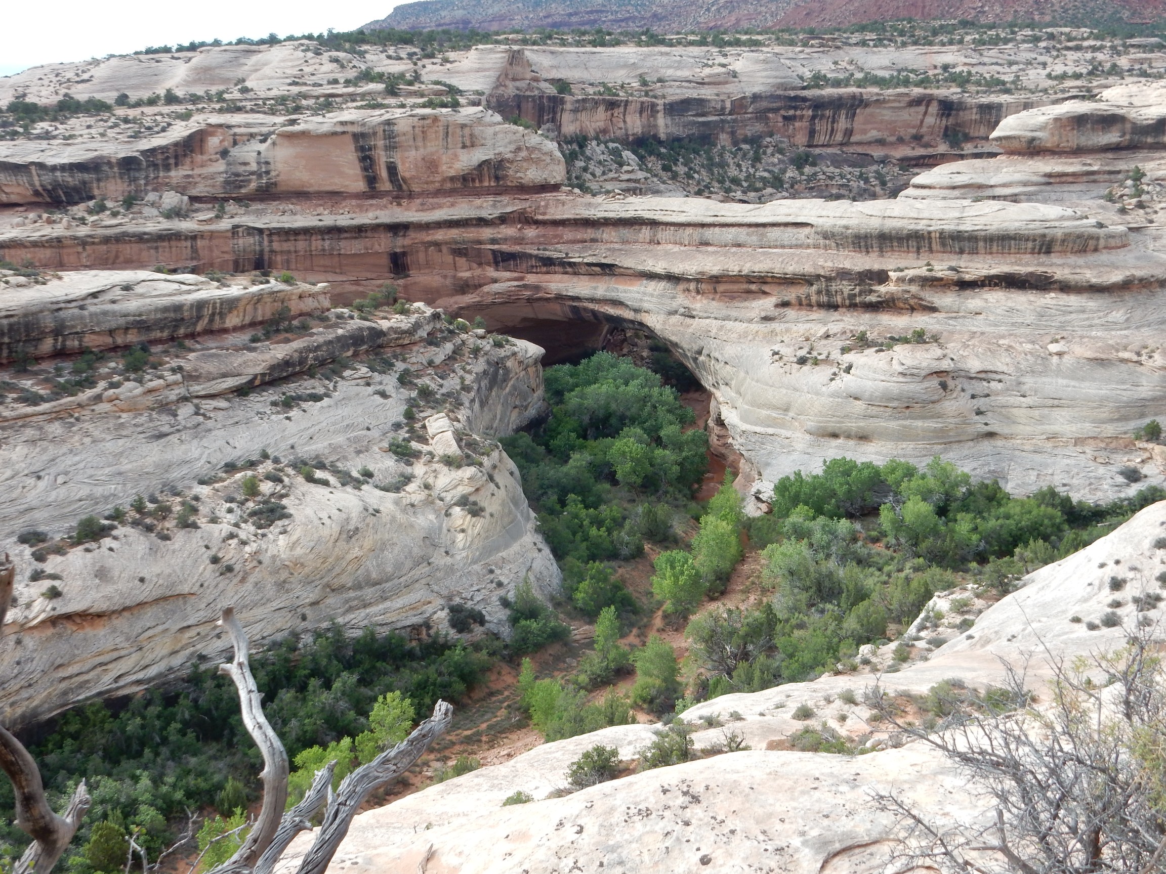
I reach the turnoff to the monument and turn in. There is a small visitor’s center, where I purchase my annual pass (the old one having just expired) and ask about good hiking trails. The ranger suggests Kachina Bridge, because it has pictographs that can only be seen from the trail. Sounds good to me. The road overlooks Sipapu Bridge, one of the other two natural bridges in the area, so I pull over for photographs.
It’s down there somewhere:
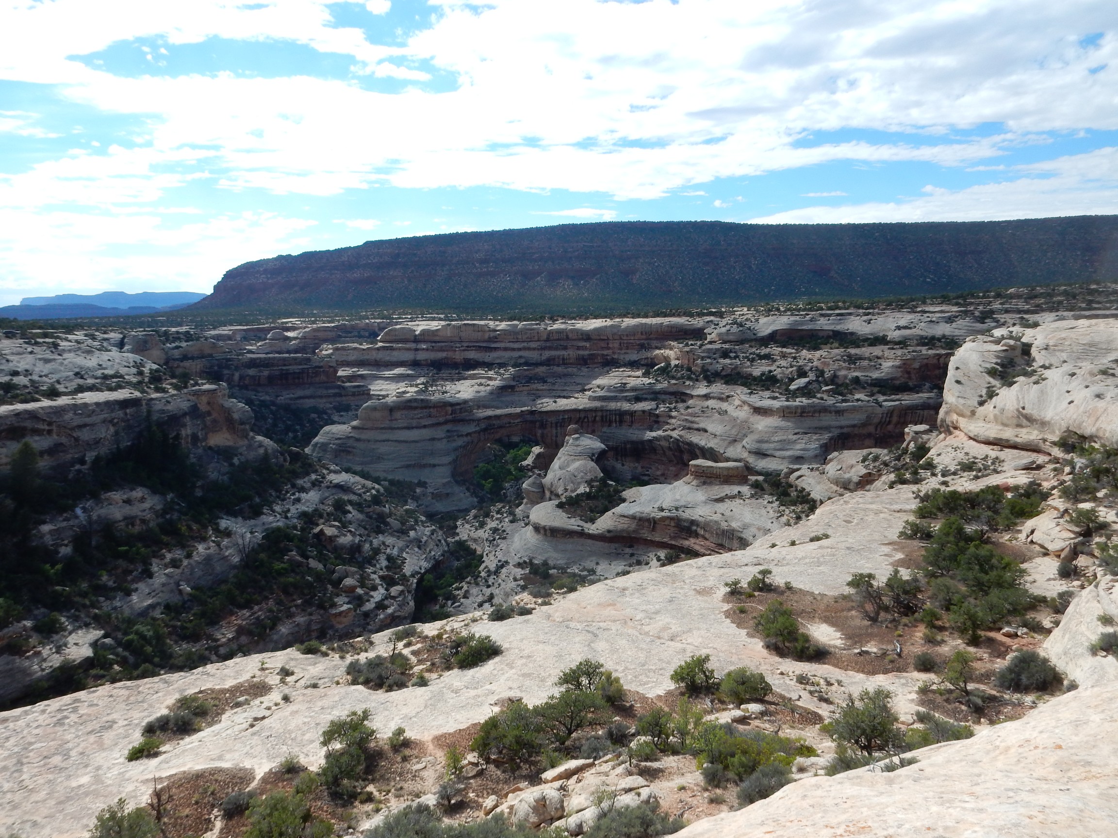
Wait, there it is.
The overhead Google view shows the geography here. Slow-moving rivers tend to meander, because the water velocity, and therefore the rate of erosion, is greatest on the outside of bends. This causes bends to grow. Eventually the bends cut into each other, leaving an oxbow lake if the river is in a level floodplain. Here, where the meandering river is cutting steadily into solid rock, the bends cutting into each other leave a natural bridge over the point where the river breaks through the rock bank.
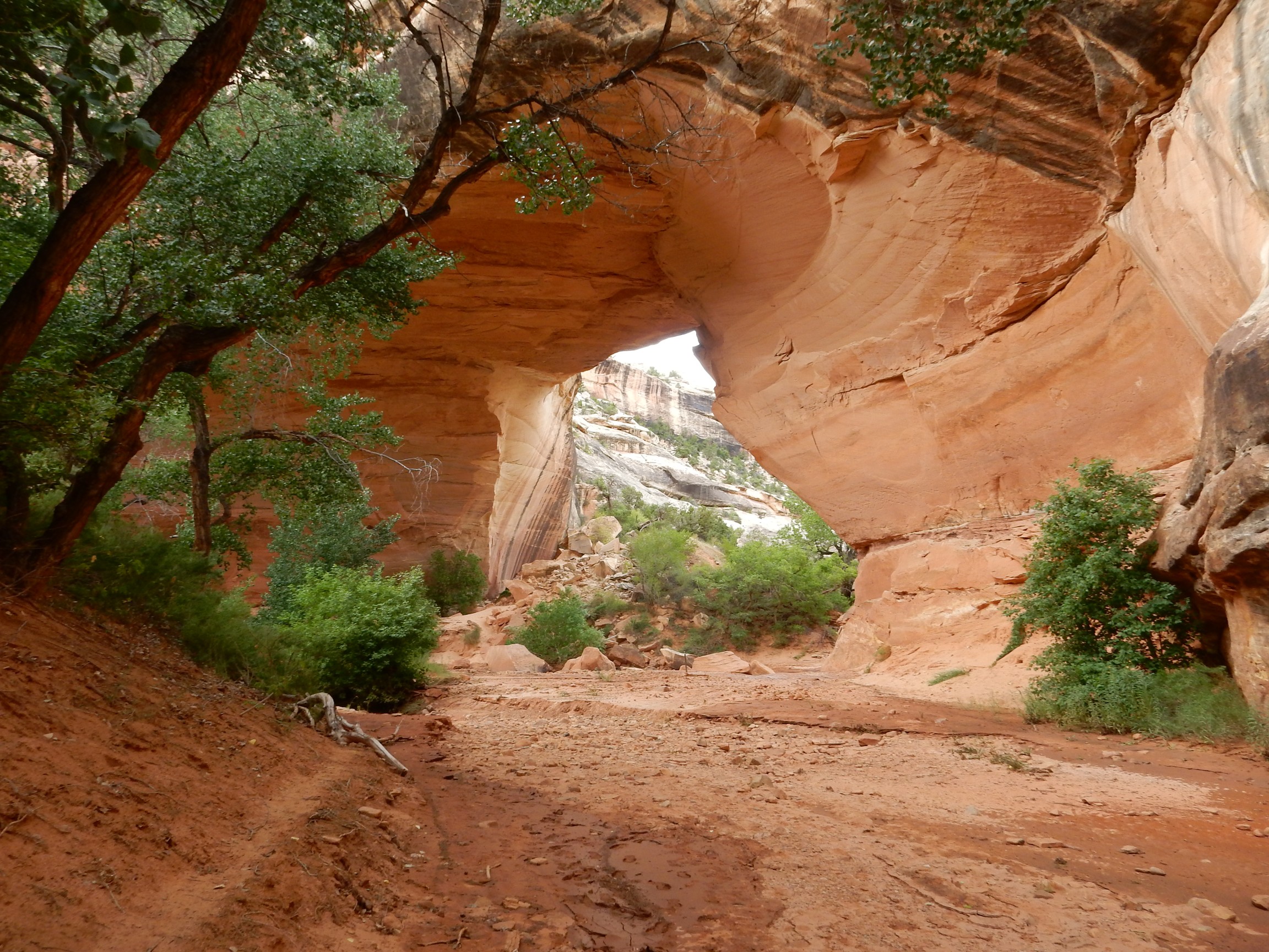
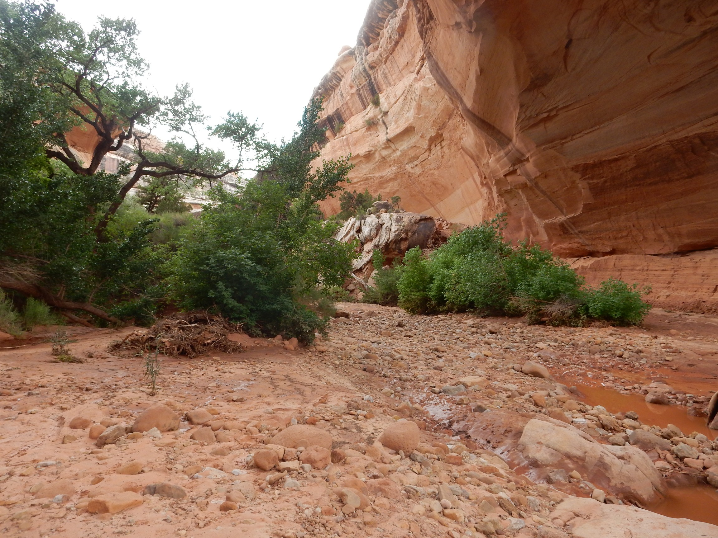
I arrive at Kachina Bridge and begin the hike down. The Cedar Mesa Formation here shows distinctive cross-bedding.
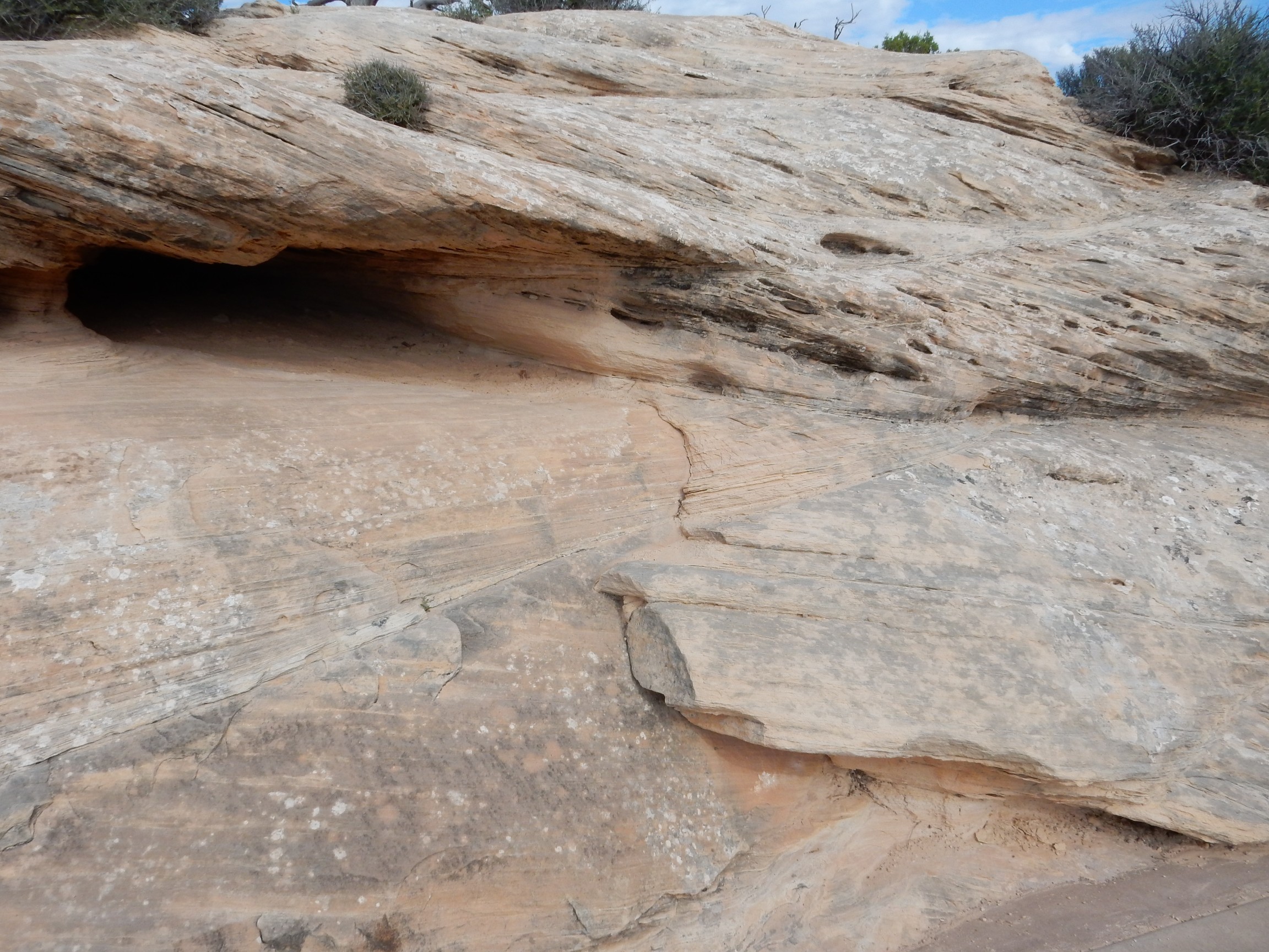
Cross-bedding is where large beds are composed of small cross-beds at a sharp angle to the main bed. They are regarded as an indication that the sandstone was laid down in a strong, steady current — either a river or a dune field with steady prevailing winds. Geologists cannot decide which was the case for the Cedar Mesa Sandstone, and perhaps some portions were laid down underwater in a strong offshore current and some in a dune field behind the beach. Incidentally, don’t be worried by Cedar Mesa Sandstone versus Cedar Mesa Formation; they’re the same thing. Cedar Mesa Formation is more formal, but it is common for formations dominated by a single distinctive rock type to be called by that rock type. Thus, the Bandelier Formation back home is often also called the Bandelier Tuff, which is what almost all of it is composed of.

I have slathered on sunscreen and bug repellent (I am not naturally sufficiently repellent, at least to bugs) and donned my pack; my walking stick comes in handy on steep trails. Not just an affectation. I always wear my hat; one cancerous growth cut out of my ear is enough.
Although it’s the Cedar Mesa Sandstone, there are occasional beds of other rock types — hence the preference for Cedar Mesa Formation as a formal name. This bed is fairly local. Had it extended across the region, it would be an important marker bed; were it both extensive and thicker, it might be formally designated as a member of the Cedar Mesa Formation, with a formal unit name. Alas, this is but a humble local lens of indurated mud.
Along the trail, an itty bitty bridge.
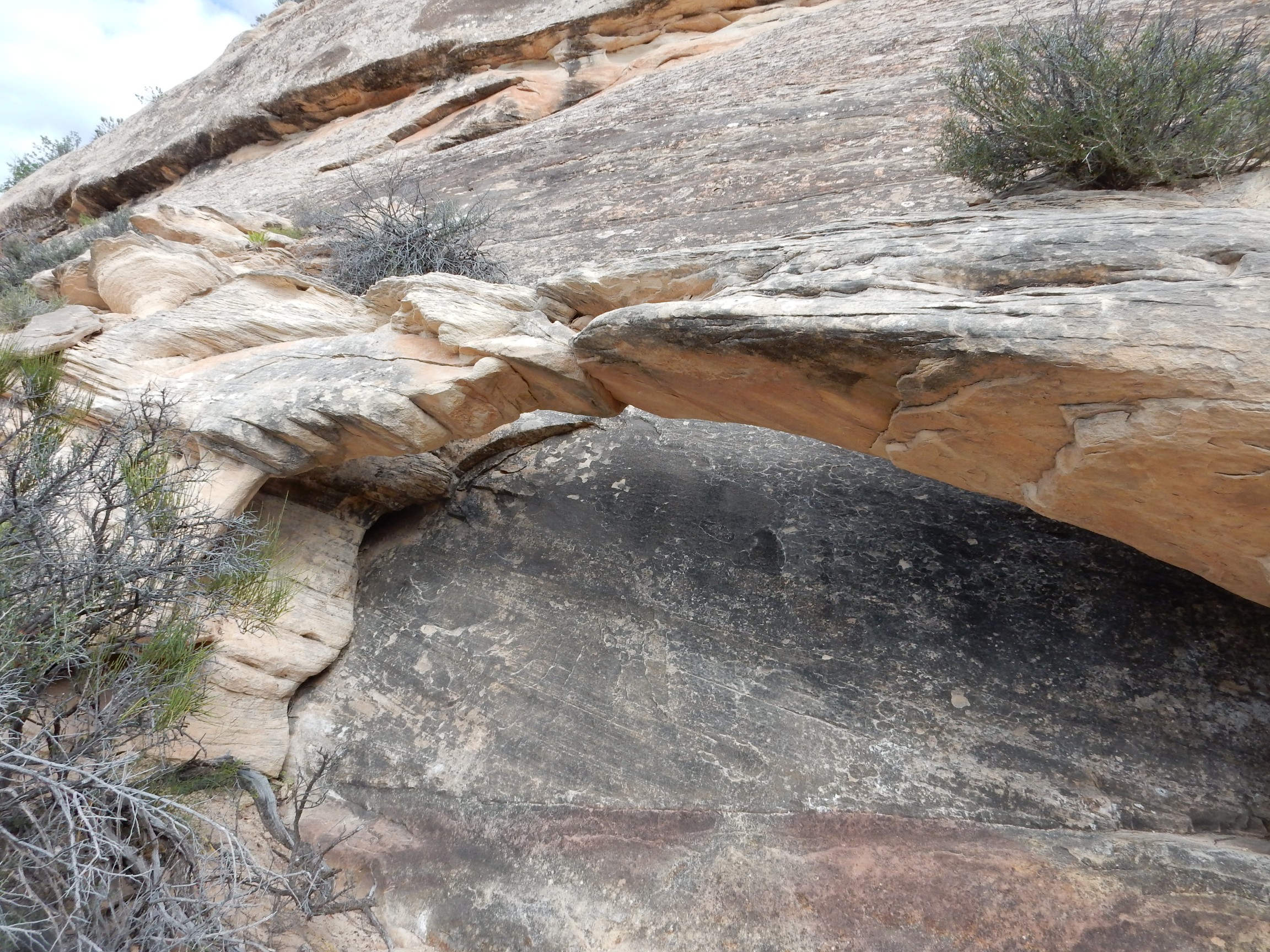
Well, to be more correct, an itty bitty arch. Natural bridges are cut by rivers; natural arches are cut by sand carried by wind. This was probably cut by wind.
Wildflower.
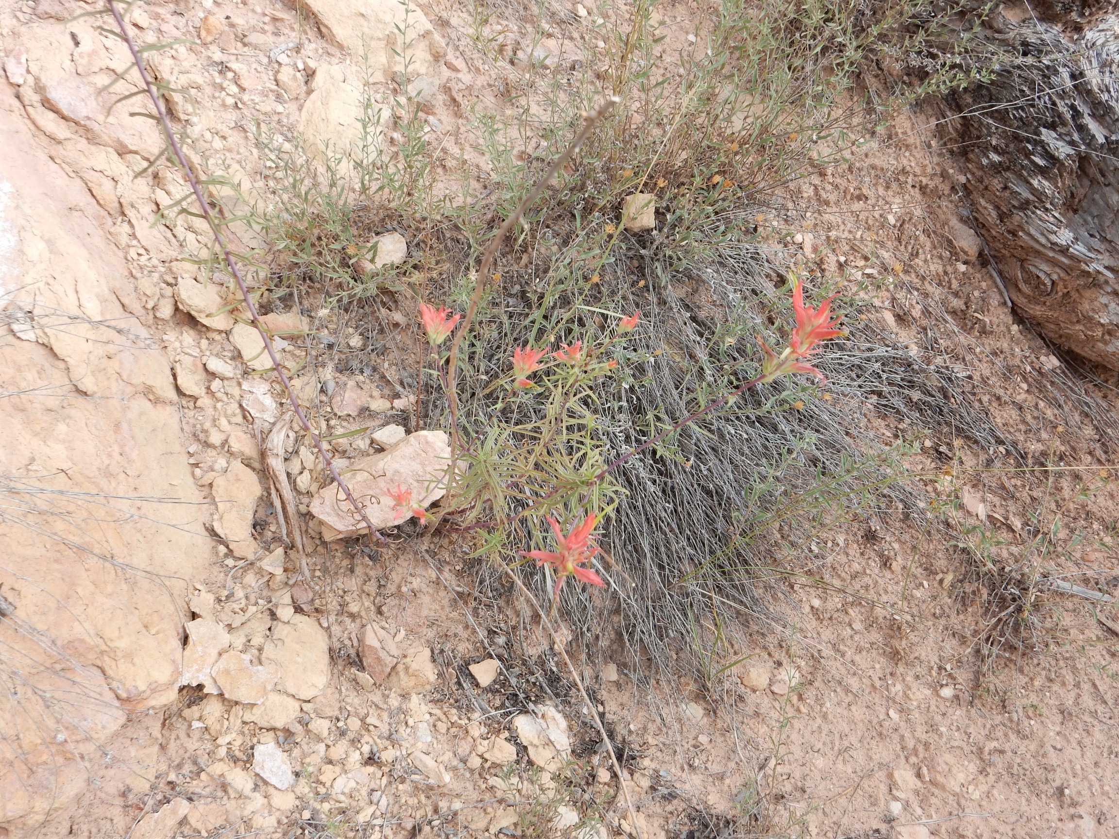
Some kind of Indian paintbrush, I trow.
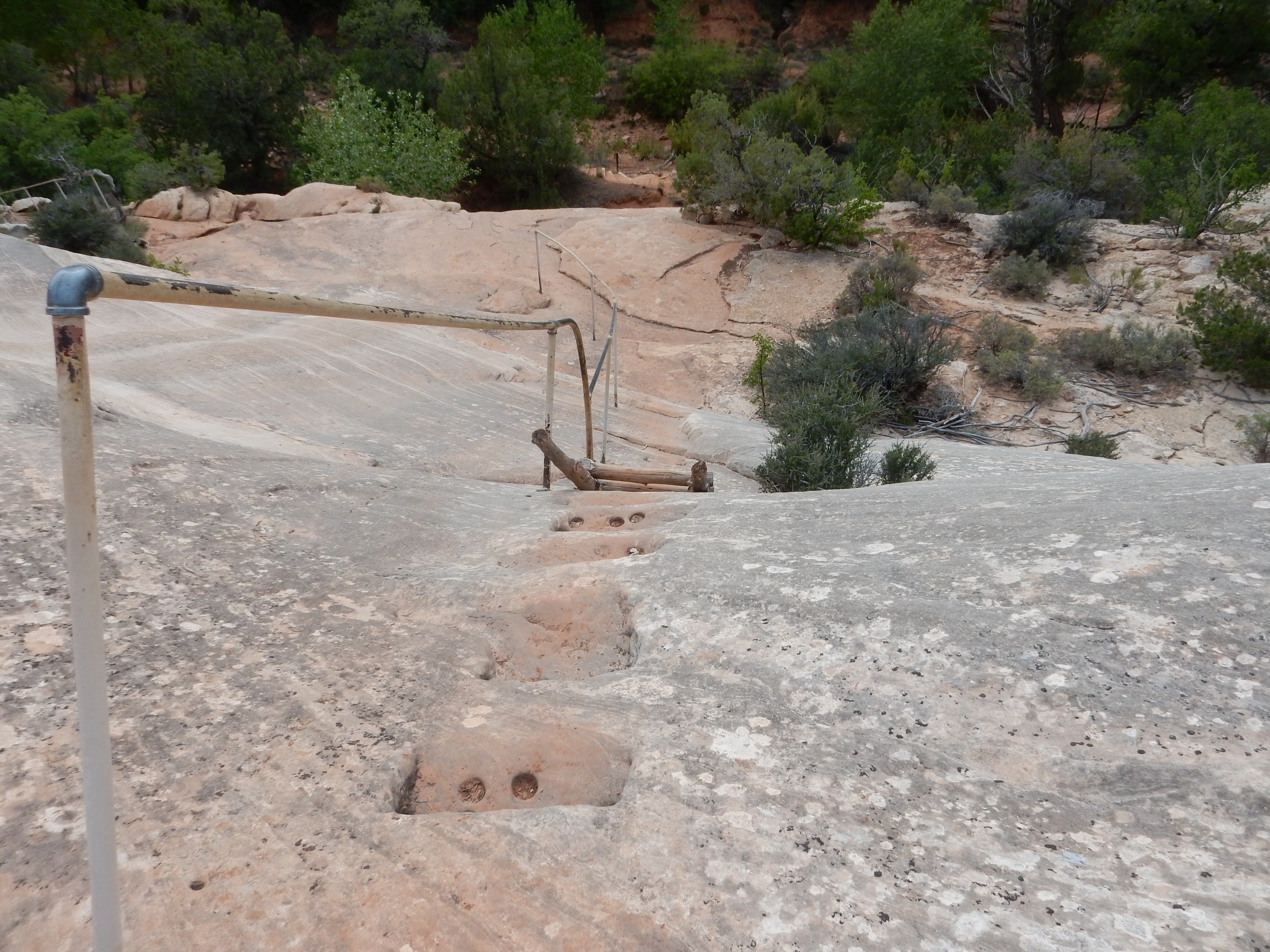
Some fairly formidable steps and a ladder. Hard on my knees.
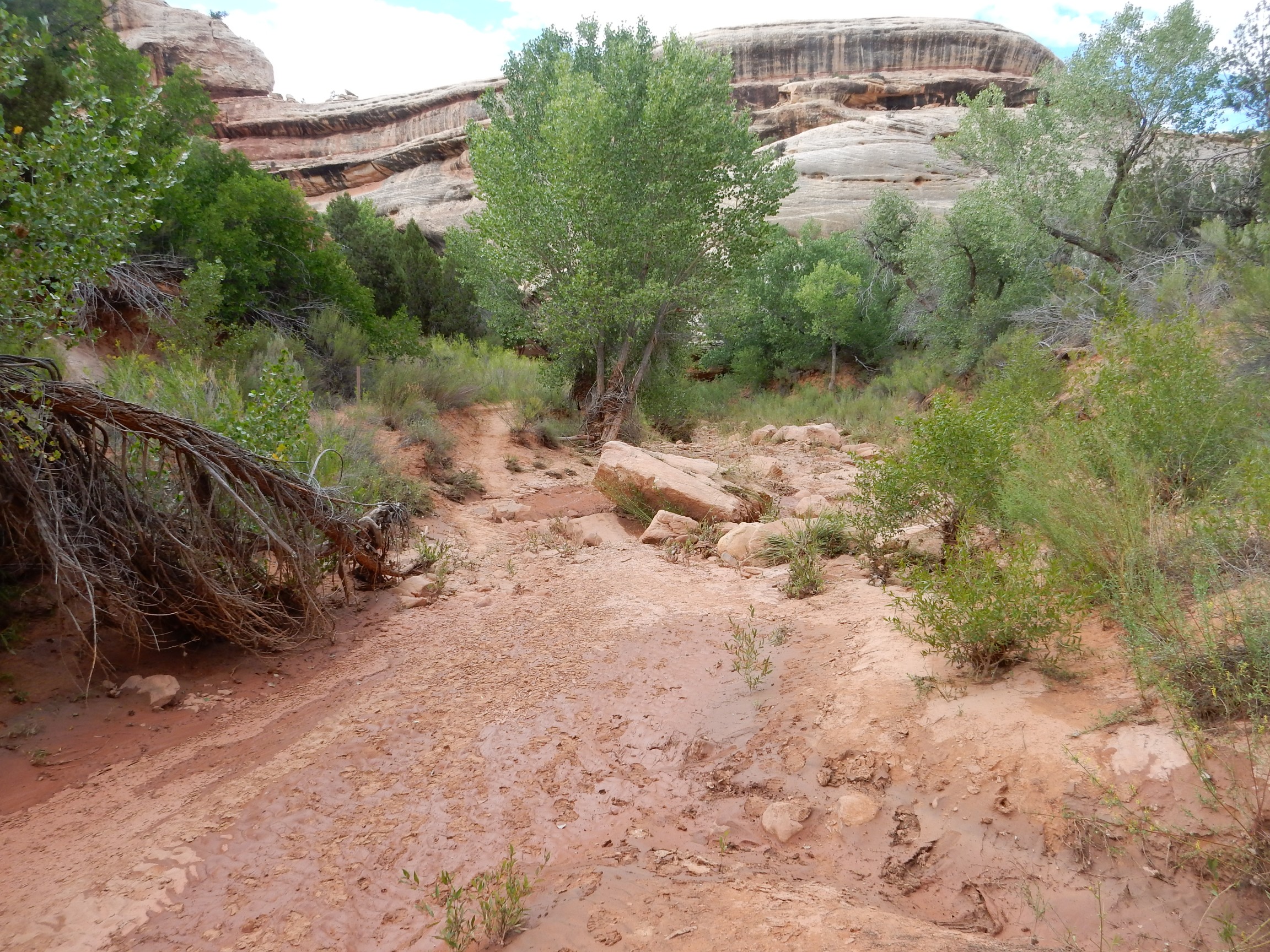
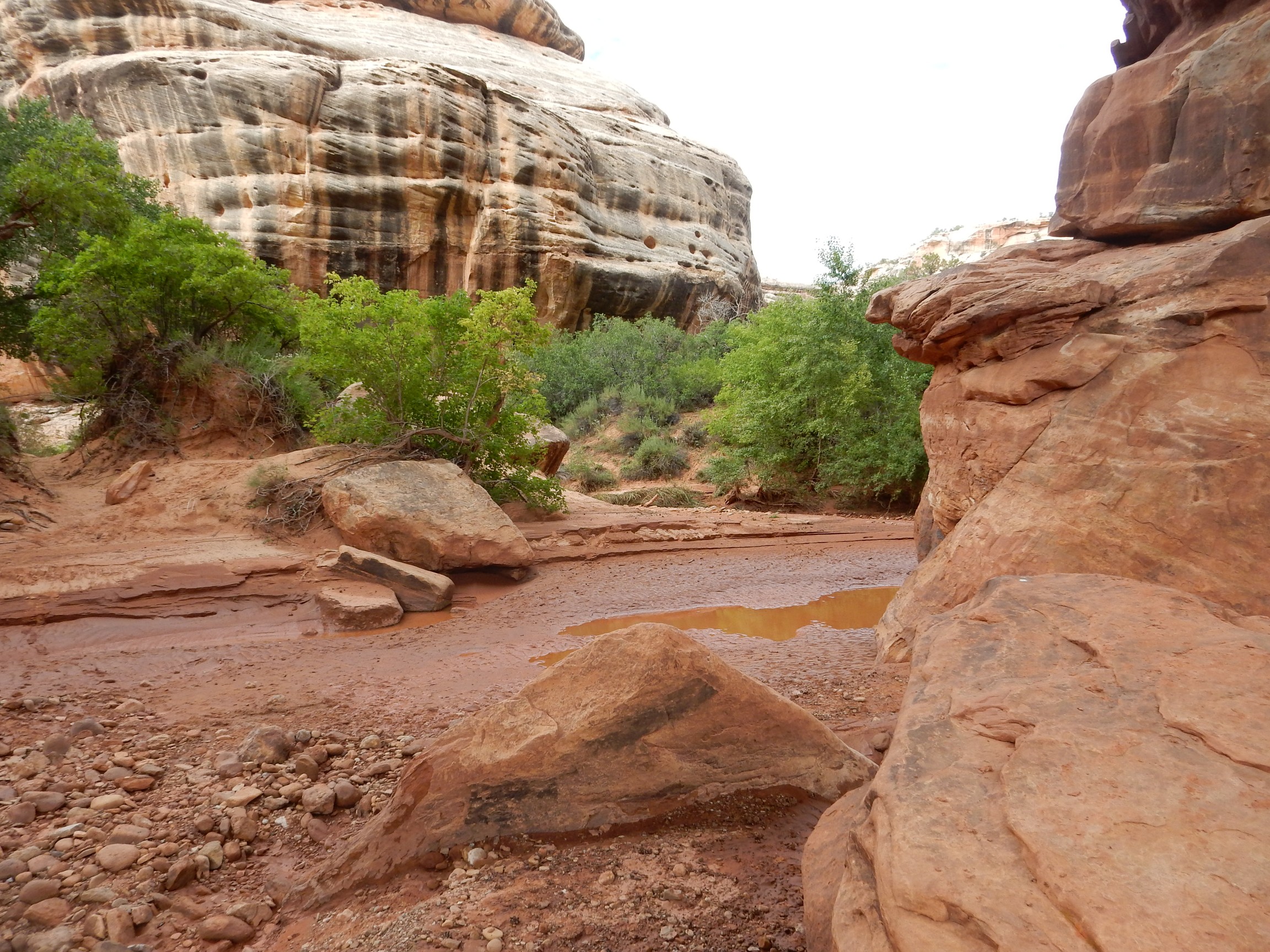
At canyon bottom, a muddy ravine.
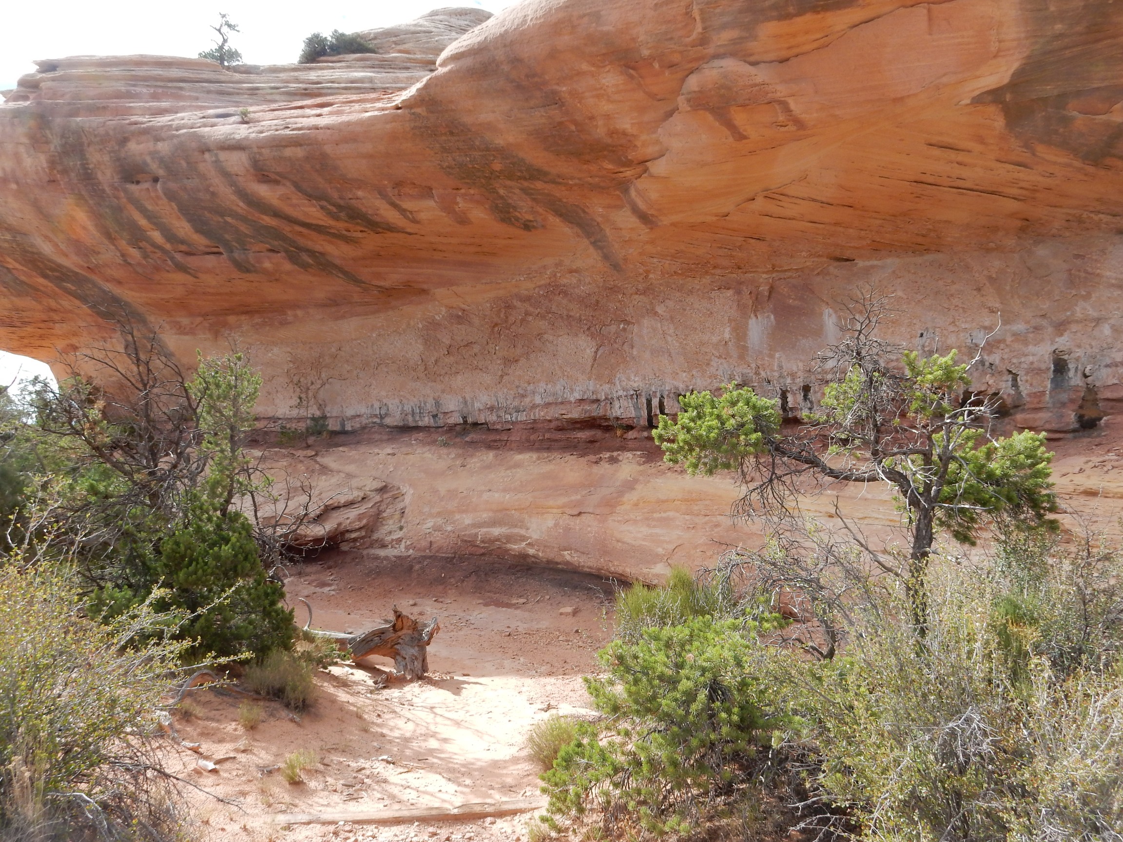
Pictographs on the east side of the bridge. These are far enough above the river bed that I marvel at the acrobatic skill of the artist.

Yes, they’re very faint. Click to enlarge (as you can with most of the photographs at this site.)
I wonder if the river bed was higher centuries ago.
I begin to be puzzled by the geometry here. I expect a river under the bridge, coming from a canyon upstream and departing into a canyon downstream, with a local cutoff loop. But here’s the apparent upstream canyon:
Here’s the downstream canyon:
but, hullo, what’s this? This is the canyon I came in by.
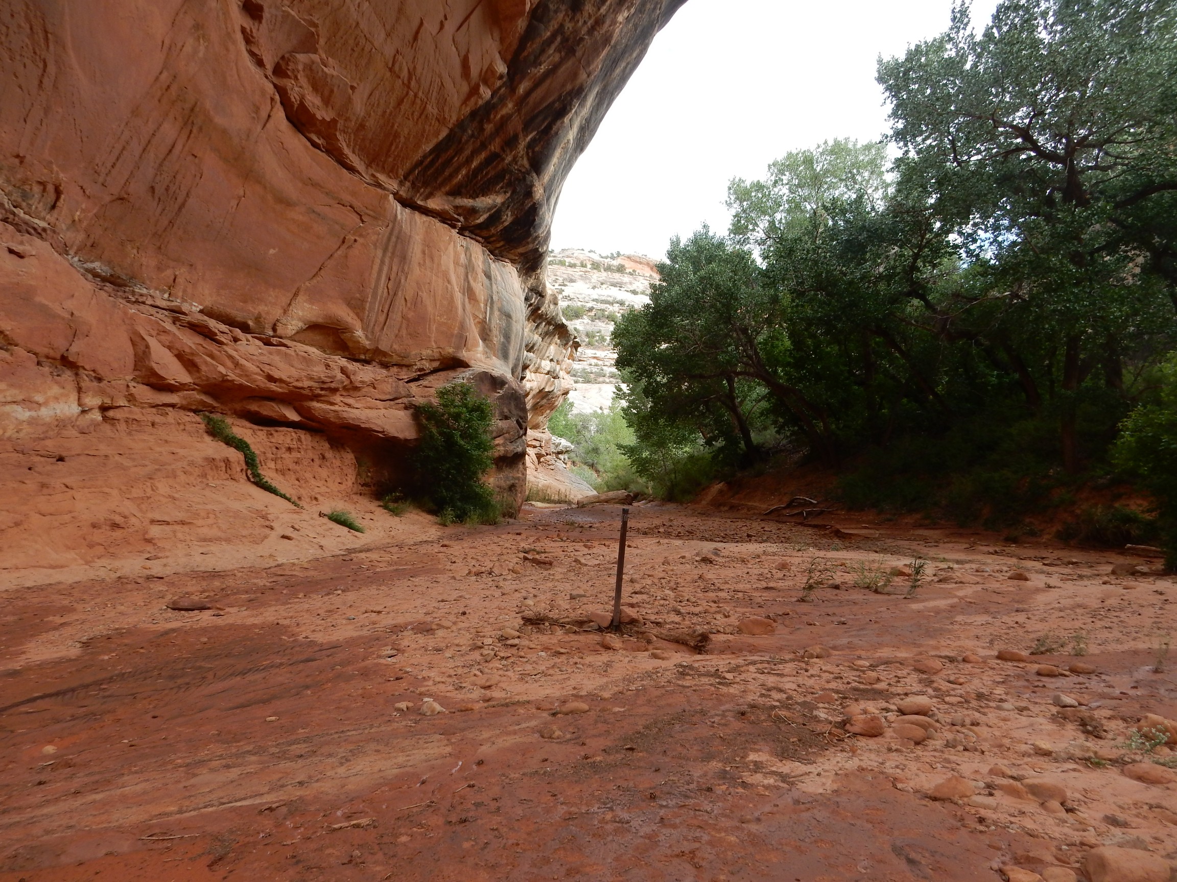
Instead of two canyons meeting here, with a cutoff loop, there appears to be three canyon meeting here. Do not understand.
Anyway, the sandstone in the area is impressively crossbedded.
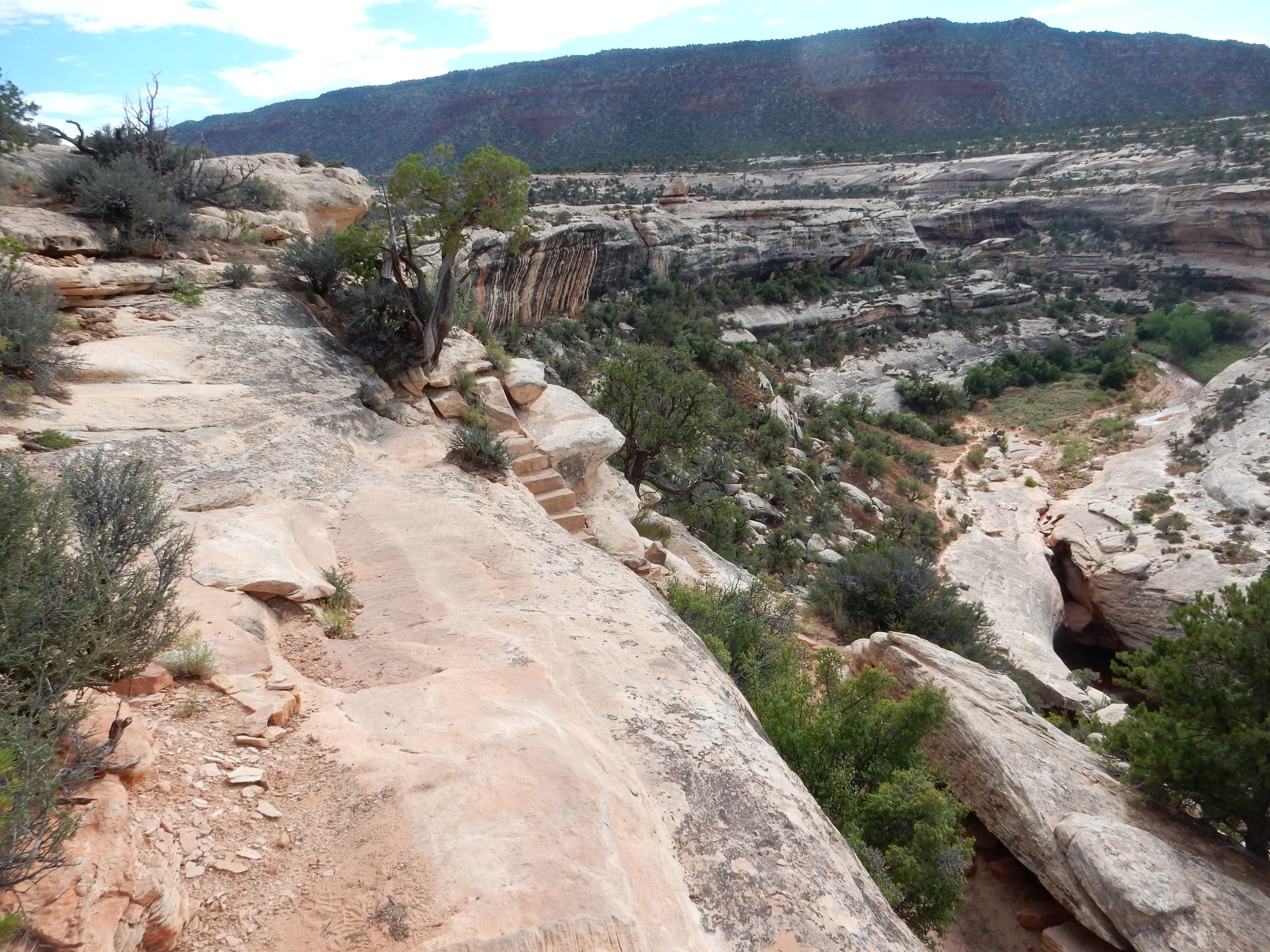
I climb up the canyon wall, and try to figure out the geometry.

Well, there’s the cutoff meander, east of the bridge. But there are still three canyon here. I finally find signage that explains it.
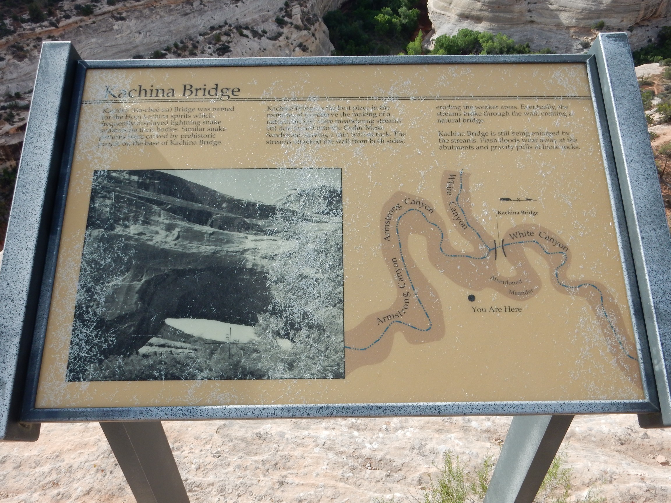
This is not a bridge formed by the cutoff of a meander of a single river. The cutoff meander is right at the confluence of two rivers, which explains why there are three canyons.
Oh.
A better panorama from higher up.
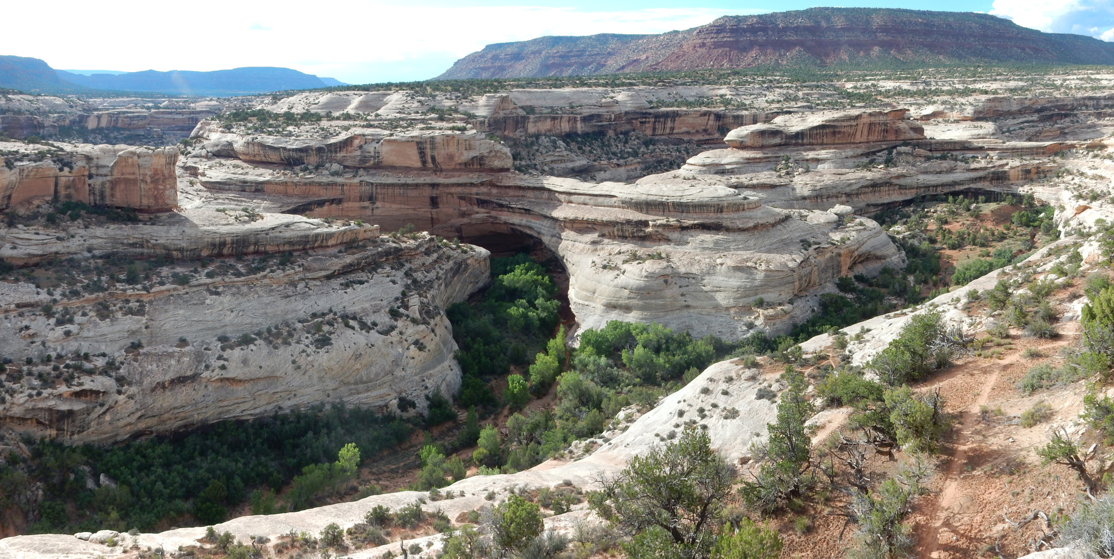
Yeah, I grok it now.
And, yeah, not much river there. It’s clear these bridges formed at a time when there was considerably more runoff — probably during the last glaciation, from about 40,000 to 12,000 years ago. Yesterday, on the geological scale of things.
I head on out of the park, anxious to get to my campsite while there’s still light. However, I pause along the way for a bit more geology.
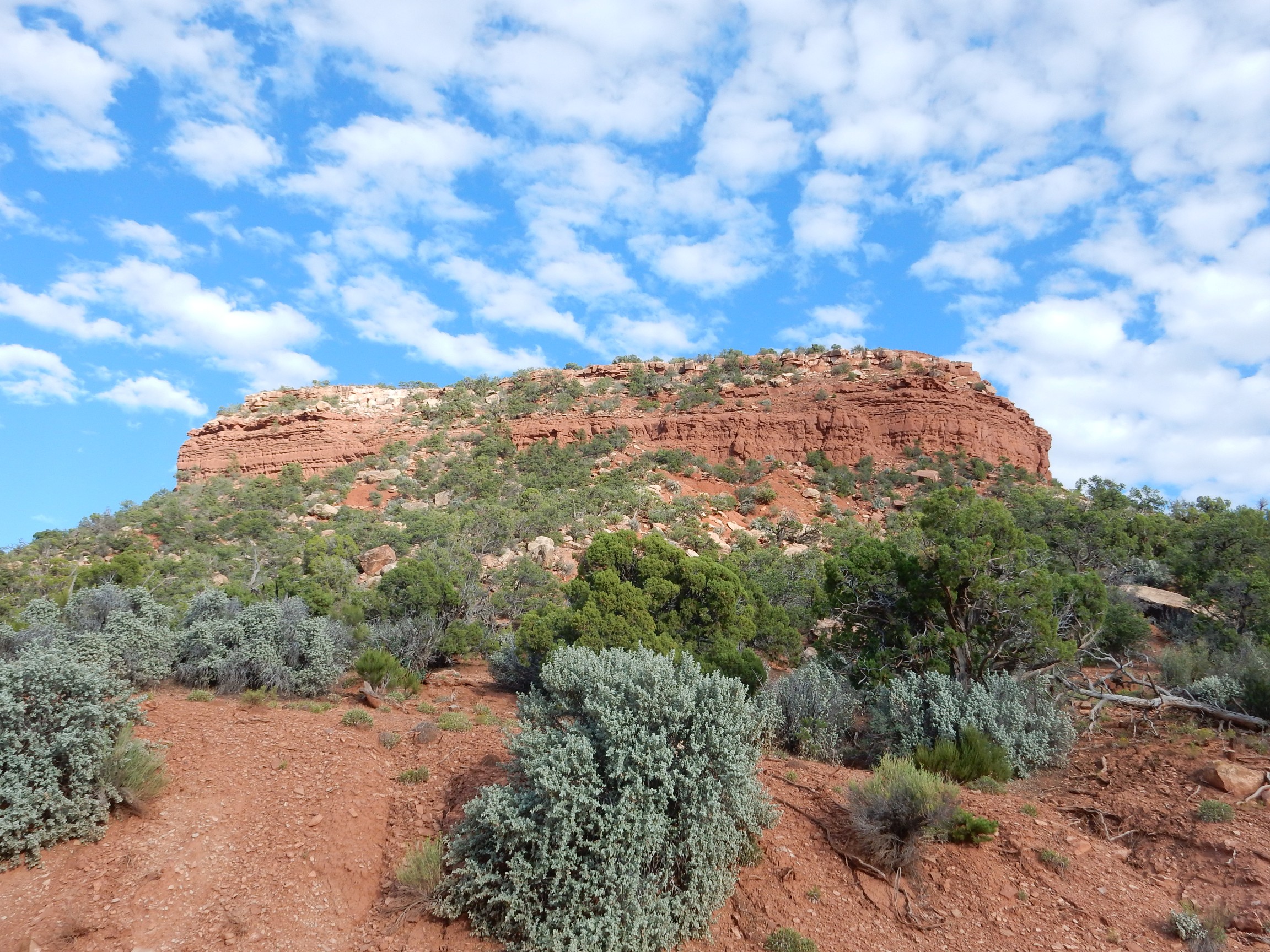
The GPS fails to lock on again, but I figure this must be here. The chocolate brown layers scream “Moenkopi” at me; the geologic map agrees. The Moenkopi Formation was laid down in the early Triassic in an environment of tidal mud flats, and it has that distinctive chocolate color almost everywhere it crops out.
I stop for gas (not the first time, actually) and ice, find my campsite at Devils Canyon Campground, and set up.
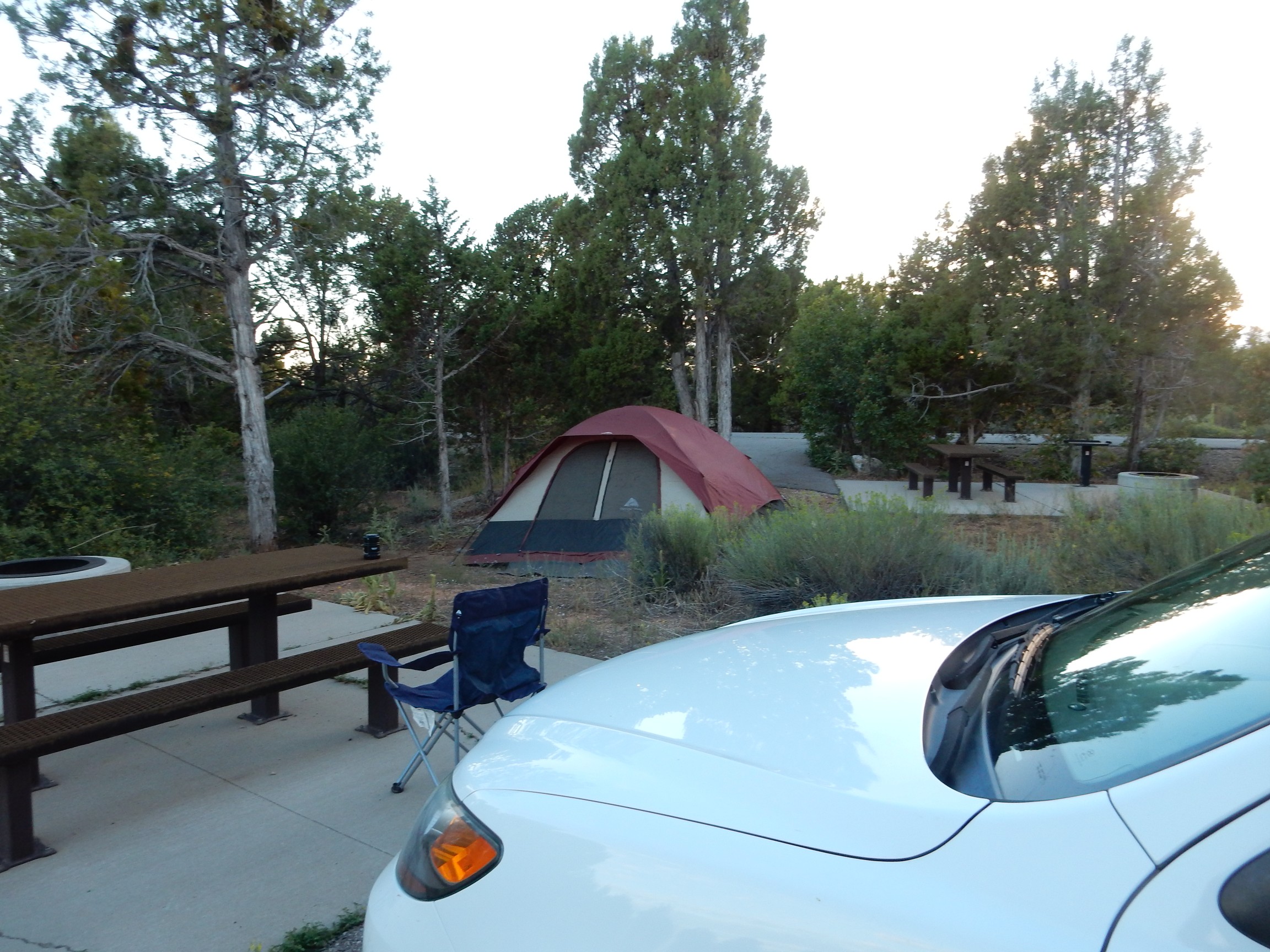
And, after feasting on Atkins bars and other diabetic-friendly food, I turn in for the night.
Coming up: Canyonlands, and a cougar encounter.
I’m only wanting to say that I’m IMMENSELY enjoying this, your eclipse travel journal!
I’ve not taken the time to study geography or petrology in my life, but the subjects hold more than a mild interest for me–probably more of a moderate fascination! I admire your impressive knowledge, and I especially appreciate the photographs with your accompanying explanations! You’re a talented writer, Kent–interesting and concise with a sense of humor.
No reply from you is necessary. I simply want to thank you for the pleasure of the reading. I hope I’m successful at linking up to the promised next leg of your journey to see the eclipse!
Deborah
P.S. Russ and I went with friends to see the eclipse in North Platte, Nebraska. It was a truly memorable experience; not to mention GRAND FUN!
Kent, after reading your “Great American Eclipse Wanderlust: Day 1,” in which, I noted, you were hiking unknown territory without a companion (or a good map), I read “Lenticular Clounds,” which you wrote in February of this year.
In the second piece, you acknowledged Cindy’s loving concern about your hiking alone, and said that, saving it being too late to find a “hiking buddy” for a planned excursion the very next day, you would hike with a buddy in the future.
Hmmm… that means you were again hiking solo six months after calming Cindy’s anxiety by sorta, kinda, more-or-less promising NOT to hike ALONE any more… right? SO…
… WHAT GIVES?!
Deborah
I wasn’t exactly solo in unknown terrain. I was at a national monument with other tourists on a well-marked trail. Cindy is reasonably okay with that.
What troubles her is when I bushwack deep into the Jemez where there is no one else anywhere near. Which is understandable … much as I hate giving it up.
I took some pains in this regard on this trip, actually. You’ll see this mentioned in future installments.
Thank you for your concern, Deborah! Hopefully your reminder will help Kent to take my concerns to heart for safety reasons. It’s one of those Boy Scout rules I taught my Cub Scouts years ago! Never hike alone! The Jemez bushwack is more concerning than busier trails–but still. I can’t help but to worry about it.
Cindy
Pingback: Great American Eclipse wanderlust, day 2 | Wanderlusting the Jemez