Great American Eclipse wanderlust, days 3 and 4
Day 2 may be found here.
If you’ve stayed with me this far, you probably already understand, but: What makes geology so fascinating for me? Isn’t it a little … extreme?
It’s not just geology; I find almost everything interesting. I once saw a tee shirt at a nerd tee shirt store (yes, there are such things, online) that read “I read books and know stuff.” Yes.
There is a scene towards the beginning of Amadeus where Salieri, played brilliantly by F. Murray Abraham (for which he deservedly won the Oscar for Best Actor in 1985), is telling his priest the story of his life. He describes his desire to make beautiful music, a desire so strong that he saw even the sudden death of his own father, who disapproved of his ambition, as a blessing from God rather than a family tragedy. He makes the comment that this desire to make music is like “a lust in the body.”
For me, the desire to learn stuff is like a lust in the body.
I have no other explanation.
I join Mom for church. Hers is a large and vibrant Mormon congregation and I am overwhelmed by the introductions. I’m not actually a person who likes introducing himself, especially when just passing through.
This is followed by a long lazy Sunday afternoon. I visit with Mom, I read, I nap, and I listen to some of Mom’s audio books. Her eyesight has gotten bad enough that she struggles even with large print. My sister Lori is briefly in town, between traveling to see a new grandchild and traveling for her own eclipse adventure. I drive over to her house (it is good that she lives so close to Mom) and we visit for a few minutes, before she has to break away to Skype the parents of her youngest daughter’s fiancee about wedding plans.
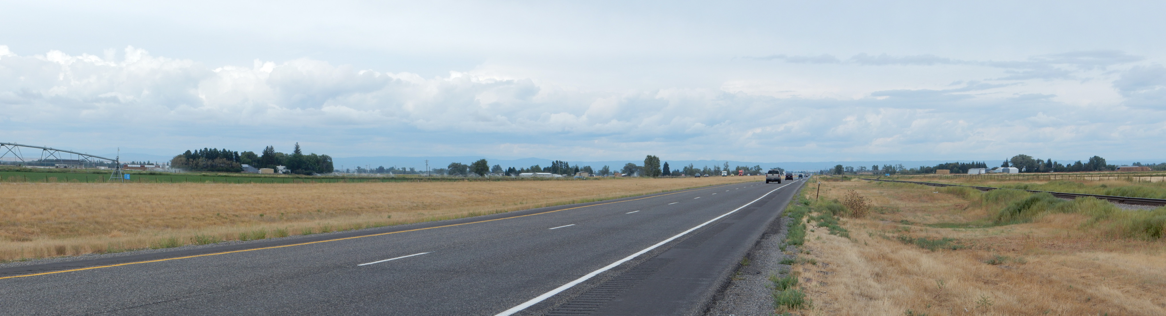
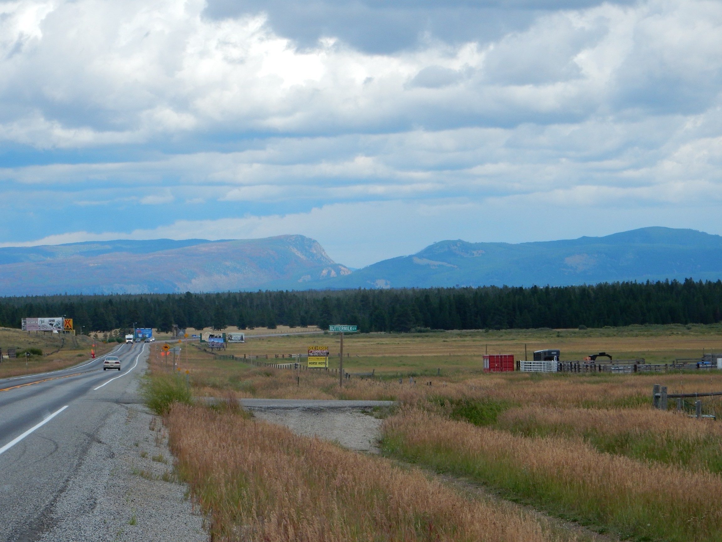
Monday morning and I’m off again. The road from Provo to Island Park passes the Great Salt Lake and the Wasatch Front, with some interesting geology, but I don’t have time to look at much of it. However, this gave me pause:
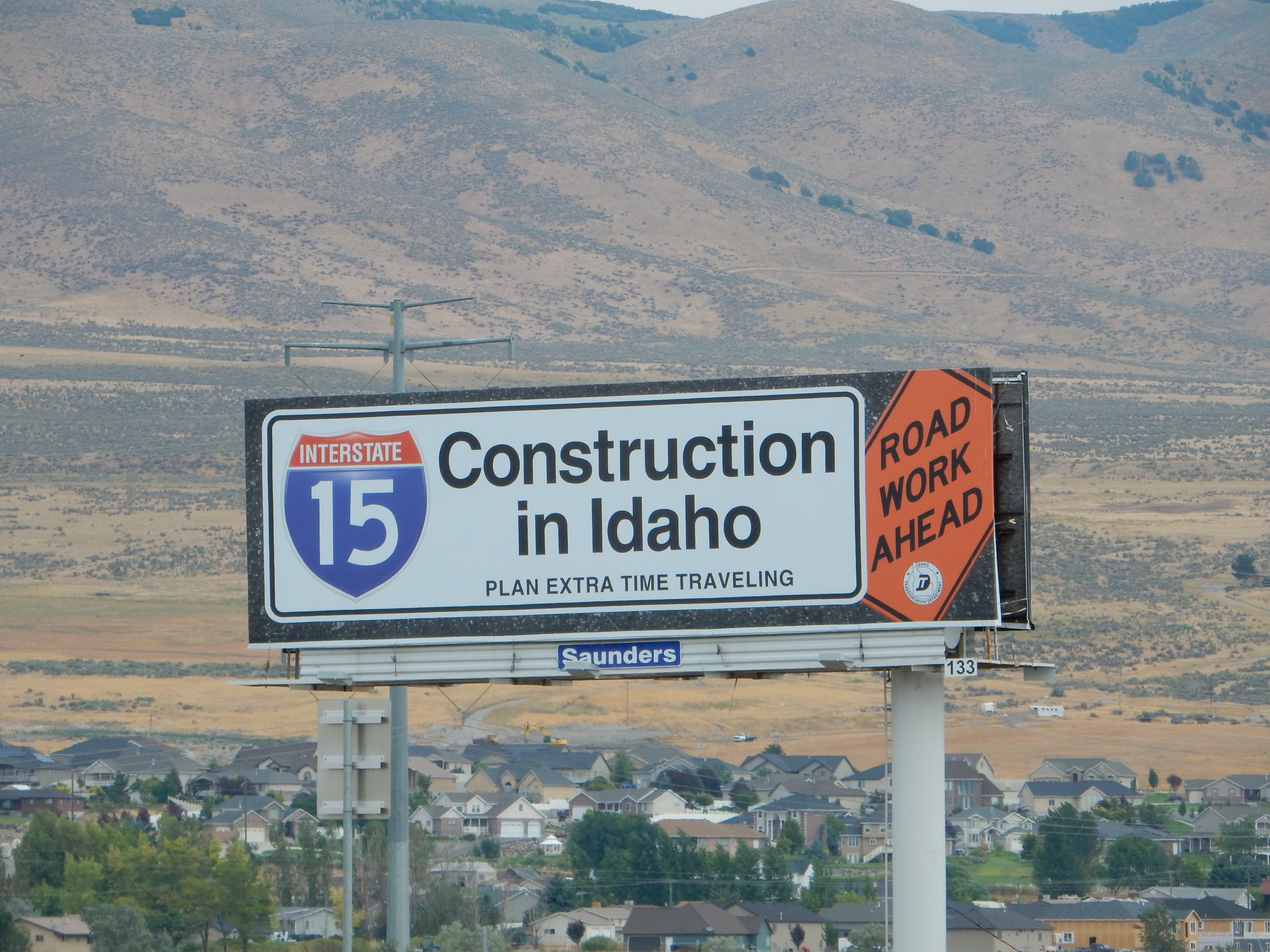
Sorry, did not bring my time machine. Will not be able to do any time traveling.
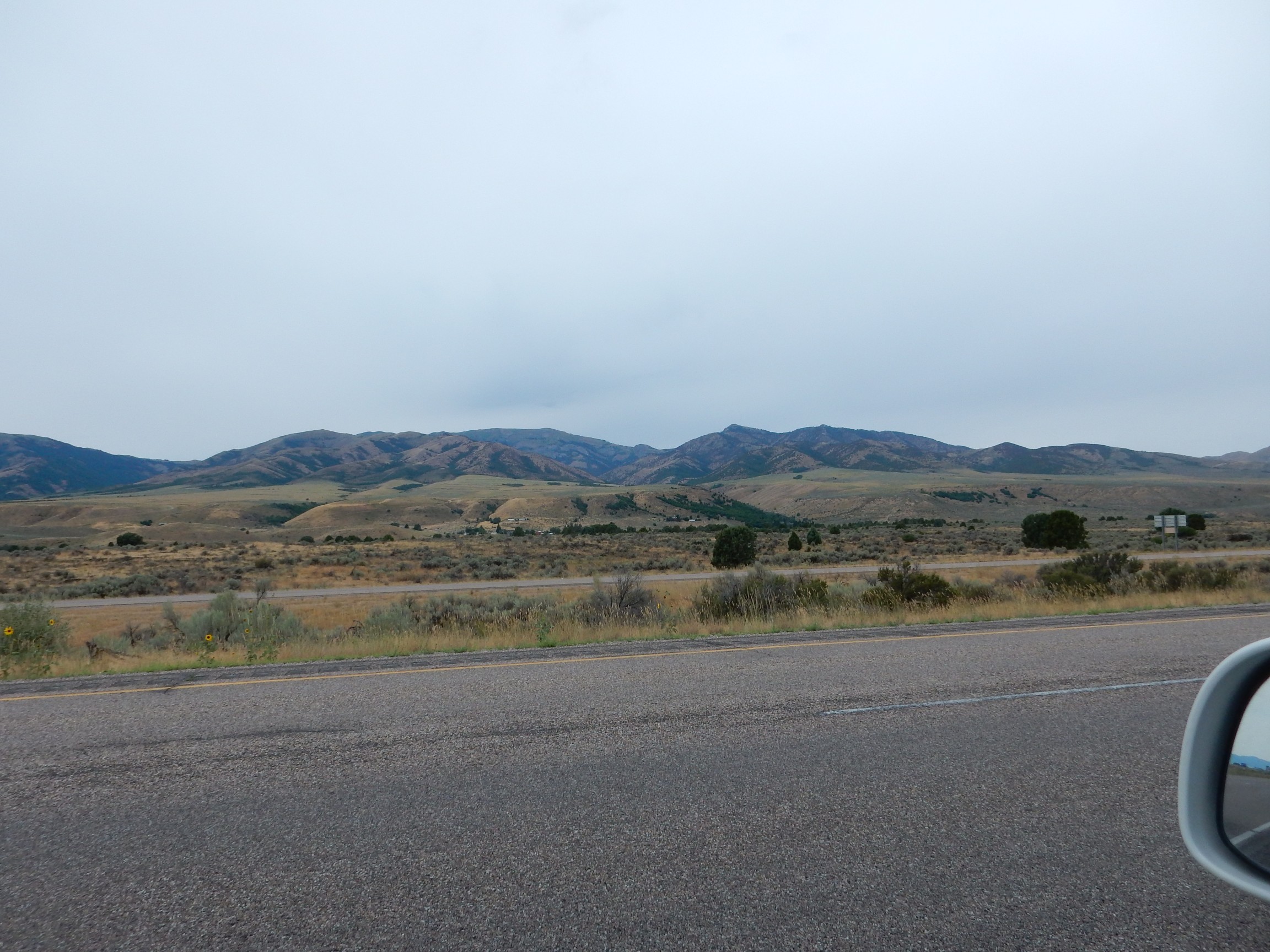
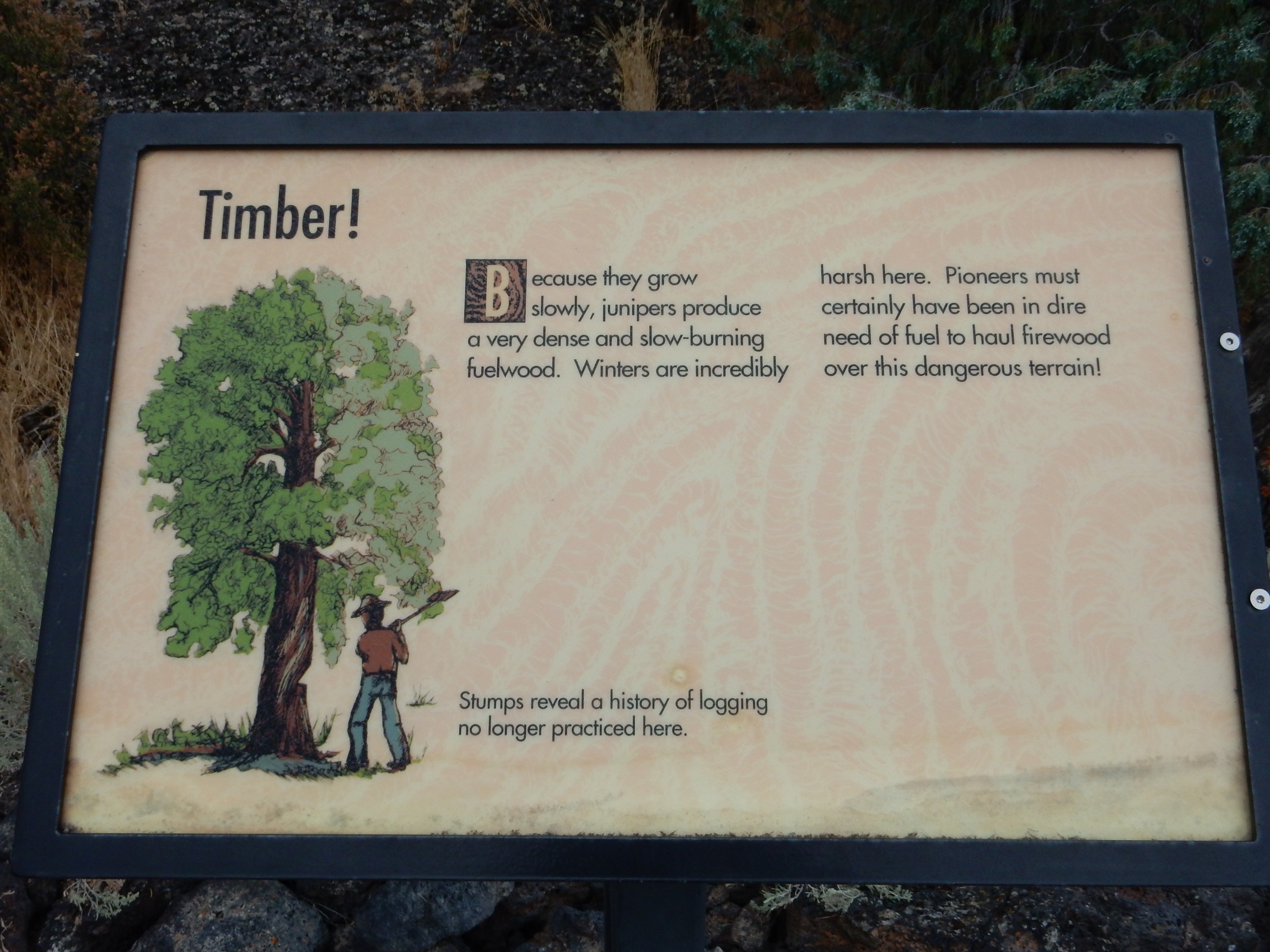
A bit further north, I stop for gas and find the nearby peak interesting. This is Gunsight Peak.

My geologic map is vague: Early Paleozoic, possibly Cambrian or Ordovician. This would be over 500 million years old. The geology here is fairly typical Basin and Range: The range is before you, and the basin underfoot. This geologic province, which covers much of the western United States, from central Utah to California and from Montana to northern Mexico, formed from compression of the Laramide orogeny (starting about 70 million years ago) followed by extension and uplift in the last 30 million years or so.
Orogeny: A mountain-building event. Most are thought to have formed from plate collisions. The most intense are usually collisions of continental plates, but here it was the Farallon Plate, a mostly oceanic plate, sliding under the North American Plate in an unusually “sticky” manner. Geologists speculate that the plate subducted (was drawn into the mantle) at an unusually shallow angle, created strong compressional forces all over western North America. When the Farallon Plate was completely subducted, it sank deep into the mantle, allowing very hot mantle rock to rise in its place, uplifting and stretching the formerly compressed North American Plate. This produced block faulting, with high blocks forming ranges and low blocks forming basins.
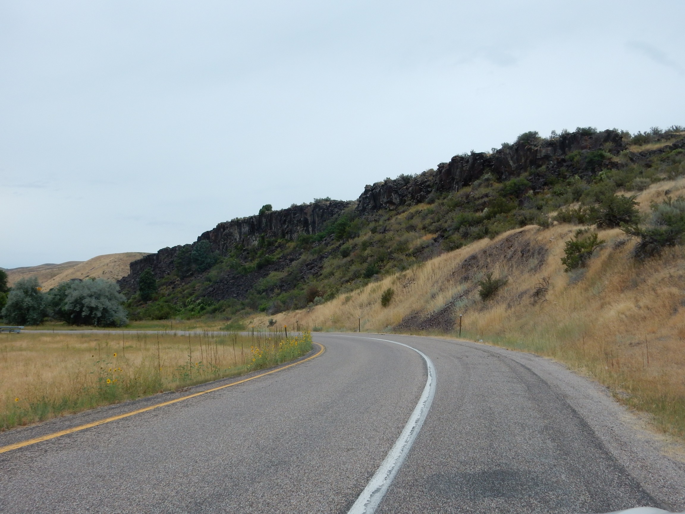
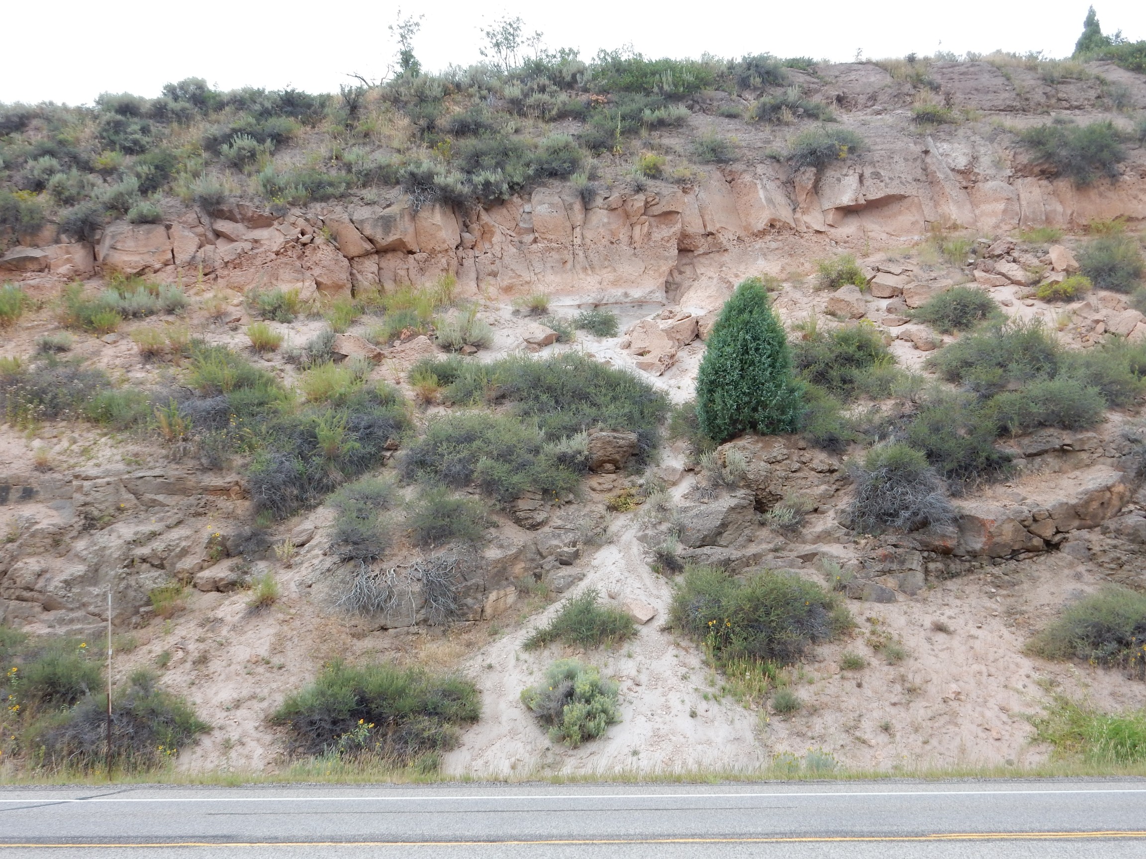
The road crosses to Idaho along the Malad Valley. I finally see some decent rock outcroppings.

My map is no more specific than Cambrian and Ordovician limestone. Well, that’s cool; the entire early Paleozoic is missing in northern New Mexico, which was apparently part of a high patch of ground called the Transcontinental Arch during that time period.
This caught my eye.
Notice the flat plateau across the canyon. I wondered if this was a former shoreline of Lake Bonneville, the ancestor to the Great Salt Lake, but we’re a ways north. My map says “loess deposits”.
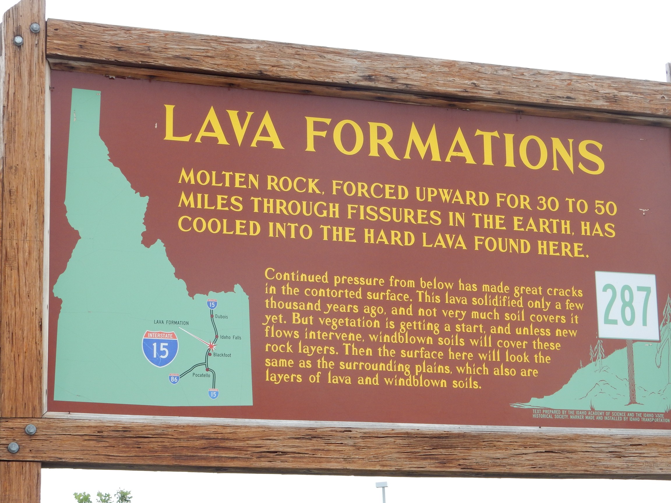
I’m approaching the Snake River Plain, and this is an area of recent volcanic activity.
Pliocene and Pleistocene olivine tholeiite basalt, according to my map. Quite young: The Pliocene goes back about 5.3 million years, the Pleistocene less than 2.6 million years. Olivine tholeiite basalt is a quite silica-poor rock, formed from low-viscosity magma that flows across the surface for great distances to form large flat flows. The lack of silica allows olivine to form in the cooling magma, and a tholeiite is a low-silica magma that is rich in ferrous iron and is thought to have formed relatively deep in the mantle.
There is a beautiful outcrop of basalt columns across the river to the west. Alas, the only good viewpoint is the interstate, and that’s not a safe place to stop.
As good a place as any to pause and ruminate on the Snake River Plain. This is a very flat plain that stretches from the Yellowstone area southwest and past Boise. It’s as if the Almighty took a giant scraper and scraped off all the mountains that dominate the rest of Idaho. Geologists believe that a hot spot rooted in the mantle reached the crust around 16 million years ago, in northeastern Nevada, bringing up hot mantle rock that partially melted as it approached the surface to produce large quantities of magma. These produced both caldera eruptions and basalt flood eruptions, the basalt peaking after the calderas to “pave” the plain with flat basalt flows. During the next sixteen million years, the North American Plate slid over the hot spot, which burned its way northeast to its present location beneath Yellowstone.
The cause of the hot spot is controversial. The spot can be traced using seismic data to about three hundred miles down, but then it’s lost in the noise. Some geologists believe it is much more deeply rooted, perhaps clear down to the outer core, while others believe it is a relatively shallow feature. The source of heat is believed by the first group to be relatively radioactive crust that was long ago subducted and sank clear to the outer core boundary, where the high uranium and potassium content of the crust heated it up. The second group believes the source of heat is local convection at the tip of a “crack” propagating through the crust.
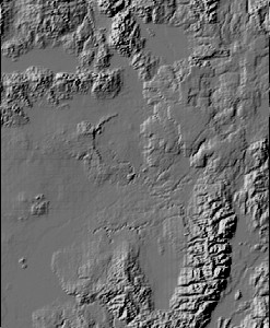
Here’s a relief map.
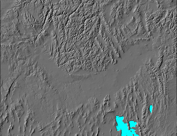
Why, yes, I generated that myself, using NASA satellite data and my own software. I’m just skilled enough to be dangerous at lots of things.
Great Salt Lake and Bear Lake at lower right. Yellowstone area at upper right, at the “tip” of the plain. The flat area curving to the northwest is not actually part of the Snake River Plain, at least geologically; it’s the Boise Graben, and thought to be an unrelated feature. The hot spot started at lower left.
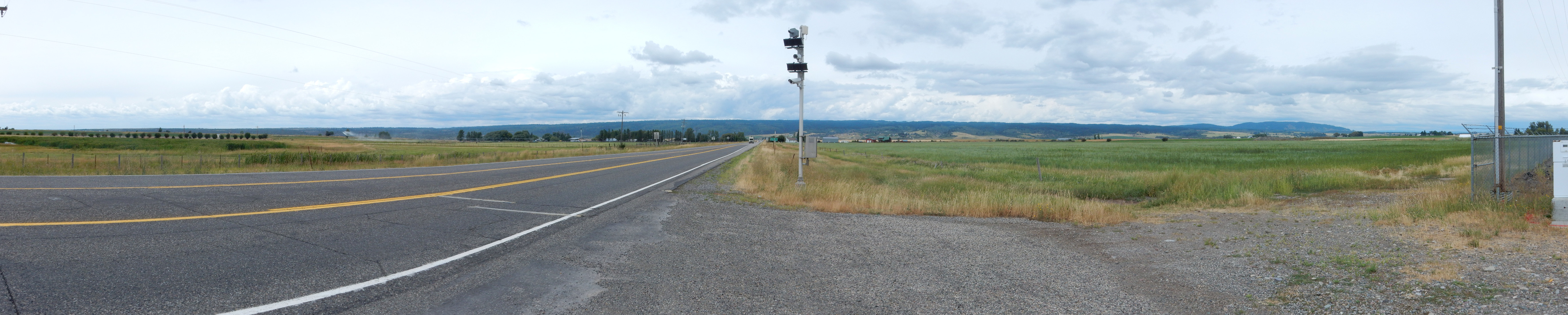
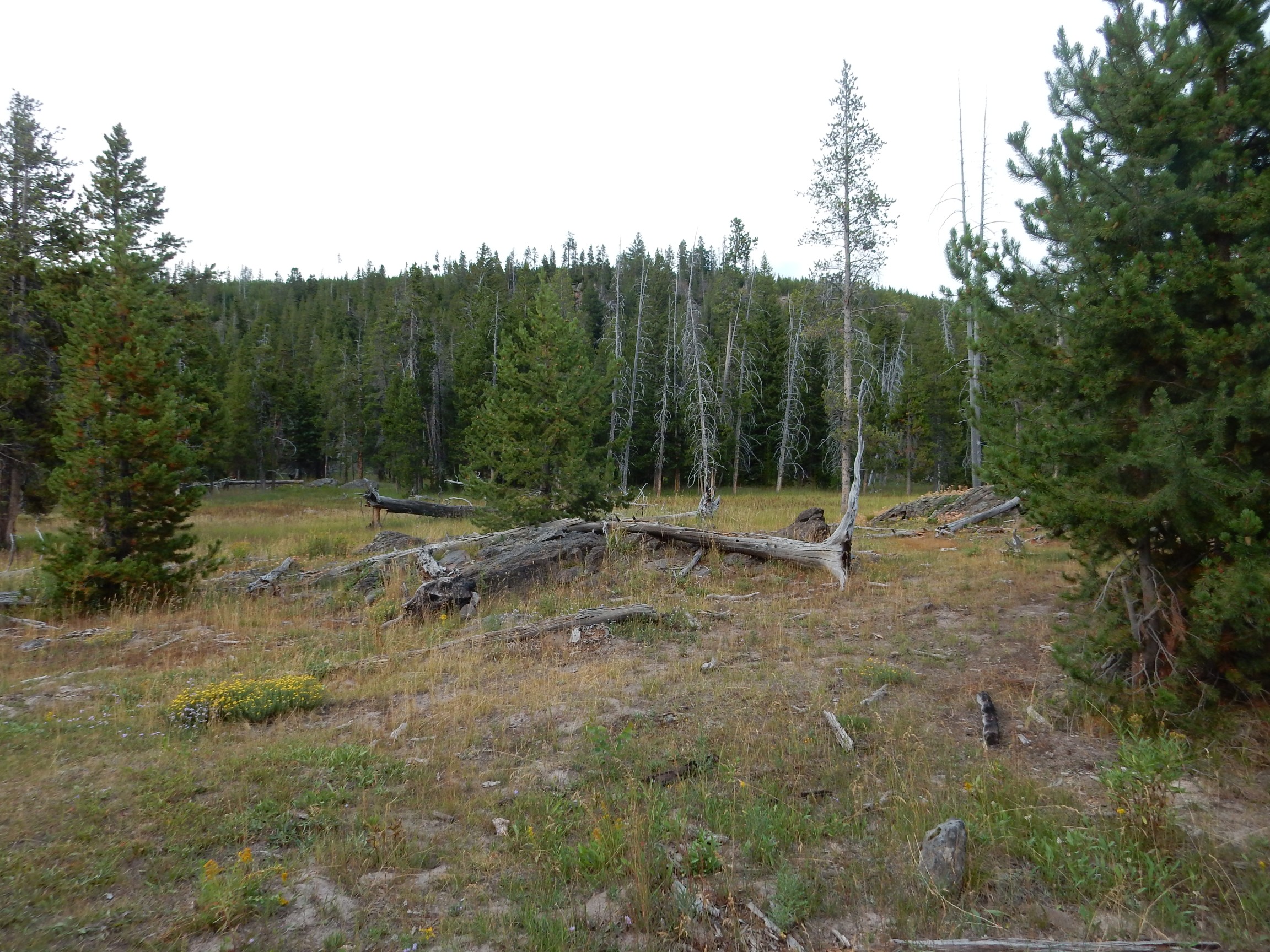
I continue north through Pocatello. The weather is deteriorating, but I stop to stretch my legs at Hell’s Half Acre. This is a rest stop with a nice little park on one of the very youngest lava flows of the Snake River Plain.
I hike down the nature path. The first turn is into a picnic area; here there is a likely pressure ridge.

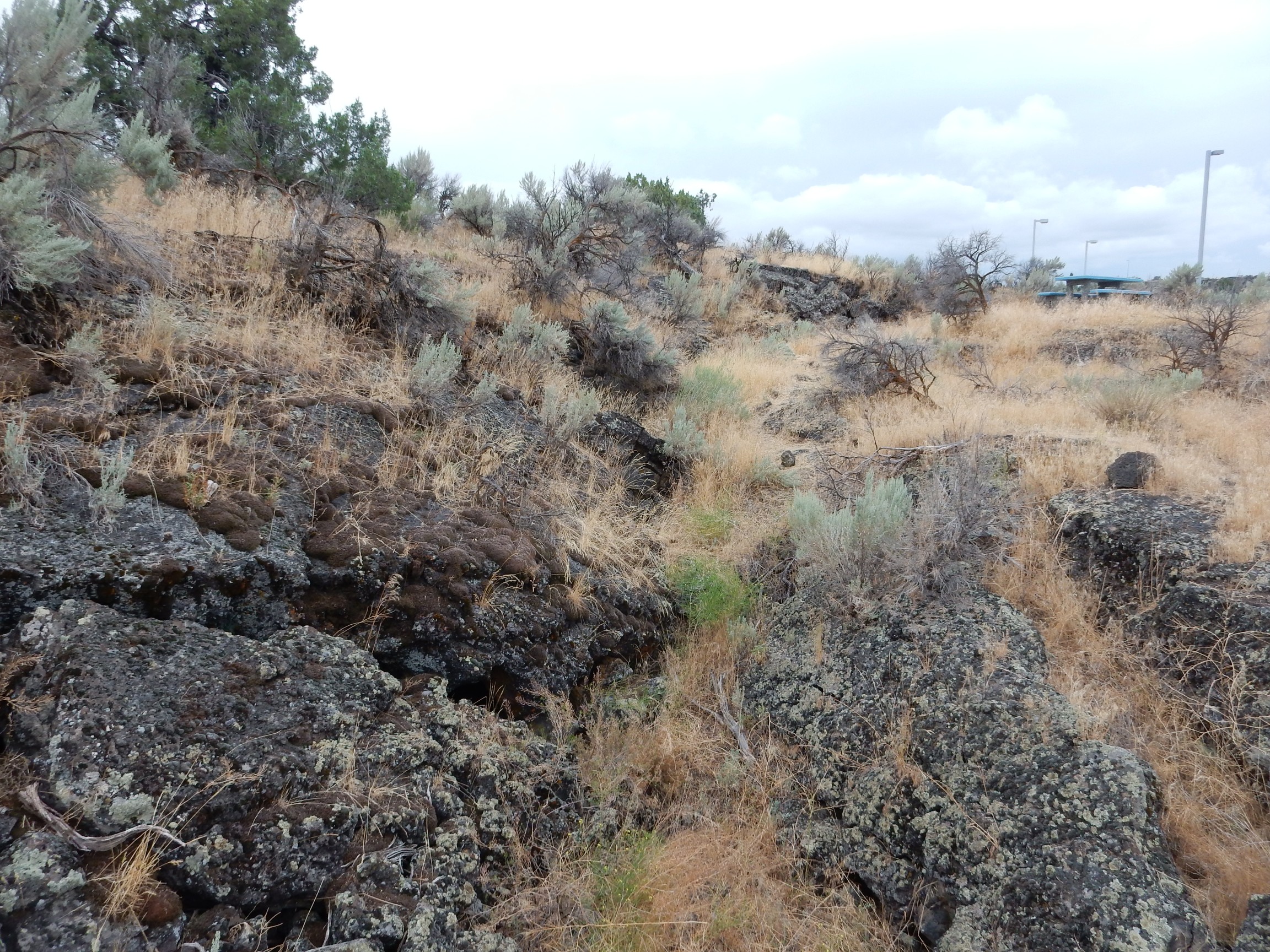
A pressure ridge forms when the surface of the lava solidifies, but there is still liquid lava below. This can push up the surface into long ridges.
There is a very nice example of pahoehoe lava along the trail.
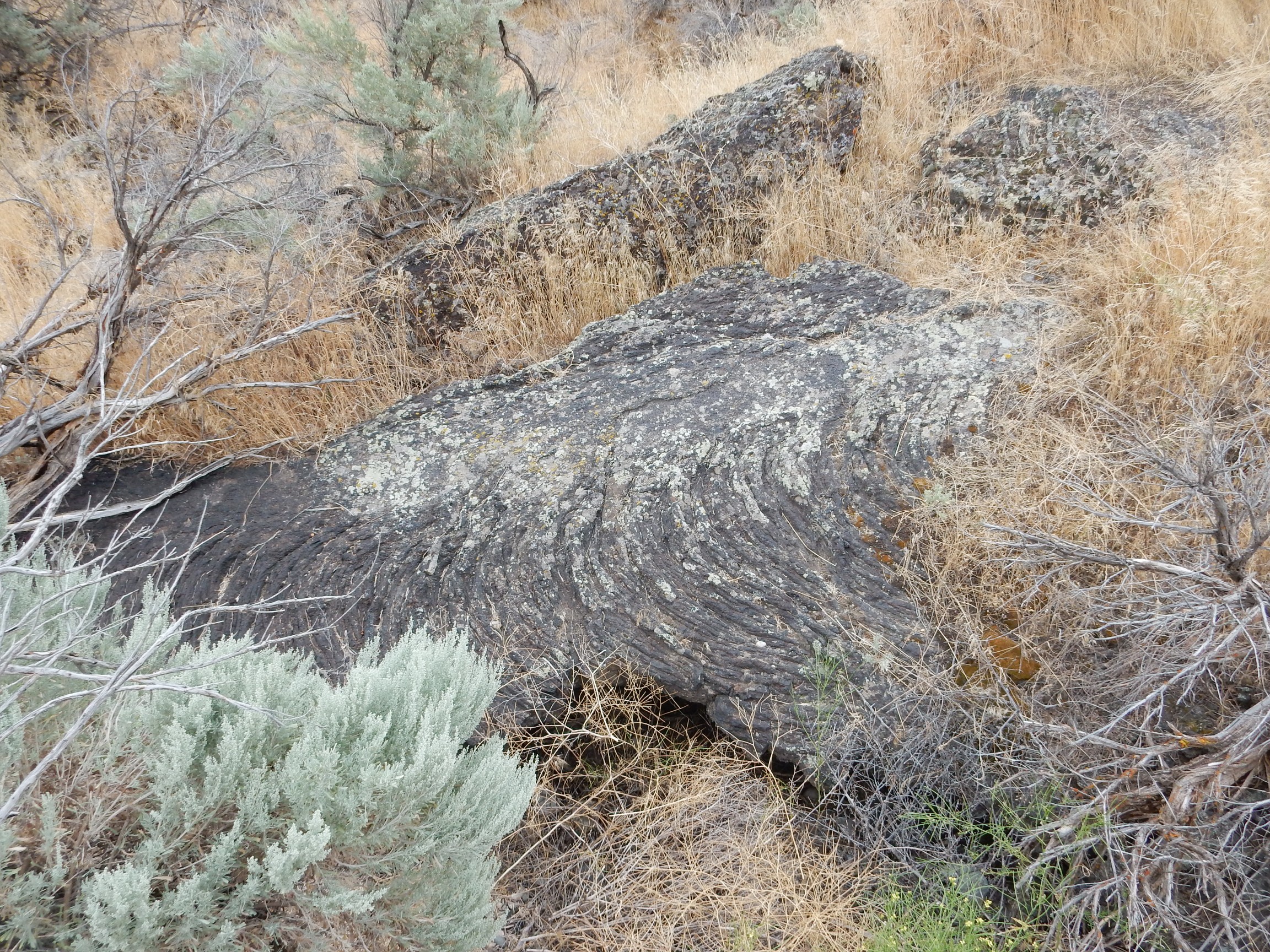
This is a microscopic version of the pressure ridge. Here the skin of solidified lava is very thin, and it produces a series a very small ropy-looking ripples on the surface. This was called pahoehoe by the Hawaiian people, and stands in contrast to very jagged lava called aa. Which, unsurprisingly, is almost always the first entry of any dictionary or encyclopedia of geology.
There’s no escaping technology.

Sometimes cell phone towers are festooned with fake branches and needles. I prefer the honesty of the bare metal.
There are three loops in the trail. I decide I have time to walk all three, and need the exercise. The signage does not terribly impress me.
Written at maybe a fourth-grade level. I have some interest in history, and have read a far number of Army field manuals from World War II; it always impressed me that these were for ordinary draftee soldiers, but were written at at least a 9th-grade level. We’ve lost something.
Since I’ve mainly stopped for exercise, and I’m planning to see younger and better lavas later, I don’t bother with any more photographs.
I decide to look for a decent lunch in Idaho Falls. In the downtown area, I find a Chinese restaurant. The service is glacial — slow and erratic — but the restaurant is clean and the kung pao chicken is pretty good, and I am able to get it on a bed of lo mein noodles, which are not quite as carb-elevating as rice. I eat about half and take the rest with me for dinner.
At Rexburg I turn off the highway at the BYU exit, familiarizing myself with the route to where my parking area will be in a week. Predictions are for pandemonium on the big day, and I figure it is important to be prepared. I have reservations for South Field, a large grassy area (perhaps a soccer field?) and the parking is across the street to the east. There is also a gas station convenient to the highway exit. The wilder predictions are for gas prices to soar and then the supply to run out. There are also wild predictions of the local food supply being exhausted. Well, I have lots of camp food and I plan to keep my gas tank topped off.
Further north, the south rim of the Henrys Fork caldera comes into view.
The blue ridge on the horizon is the south rim of the Henrys Fork caldera, which was formed by the Mesa Falls event 1.3 million years ago. This was the smallest of the three Yellowstone super eruptions, but still huge — roughly the size of the Valles event back home. Here’s the digital relief map.
That’s at the limit of the resolution of the NASA data. The Henrys Fork caldera is near the center, with a clearly discernible circular rim to the west. The east side is drowned under lava from the Yellowstone Plateau in the northeast corner of the image, and the Grand Tetons dominate the southeast corner. The Snake River Plain fills the southwest corner, and Idaho’s more normal mountain terrain is seen to the northwest.
Further north, we get a better view.
The rim is composed of two layers. The older dates from an earlier eruption, the Huckleberry Ridge event, 2.1 million years ago. This was the largest of the Yellowstone supereruptions, and it was mega-colossal. No, really, that’s the official scientific description for a caldera eruption this size. (The Valles event was merely super-colossal.) This first eruption created the Island Park caldera, which reached from here clear to Yellowstone Lake: A hole in the ground 50 by 40 miles wide and perhaps a mile deep. The western rim of this caldera coincided with the rim of the smaller Mesa Falls eruption 1.6 million years ago, which produced the Henrys Fork Caldera. Thus the rim here is composed of beds of the Mesa Falls Tuff over beds of the Huckleberry Ridge Tuff.
The most recent eruption, 630,000 years ago, produced the Yellowstone Caldera and laid down the Lava Creek Tuff. This was slightly smaller than the first eruption, though still mega-colossal, and the west rim of this caldera is buried under lava flows east of the Henrys Fork Caldera.
Here are the beds of the Huckleberry Ridge and Mesa Falls Tuffs, exposed in a road cut through the caldera rim.
The upper beds are Mesa Falls tuff and the lower beds are Huckleberry Ridge tuff. The white layer between is actually two layers, a layer of glacial sediments and a thin layer of air fall ash. The ash was the first part of the Mesa Falls eruption. Later in the eruption, dense pyroclastic flows buried the ash fall.
I continue through the rim. A sign shouts “GEOLOGICAL FEATURE.” Naturally, I turn off the road. But it’s just a somewhat dated sign:
Yellowstone is certainly very active still, with its numerous spectacular geysers, fumaroles, mud pots, and hot springs. But Island Park (the Henrys Caldera) has no hot springs; the area is quite geologically inactive now.
I suppose that will help me sleep easier.
I pause near the center of the caldera for a shot of the inner rim. (A rim shot?)
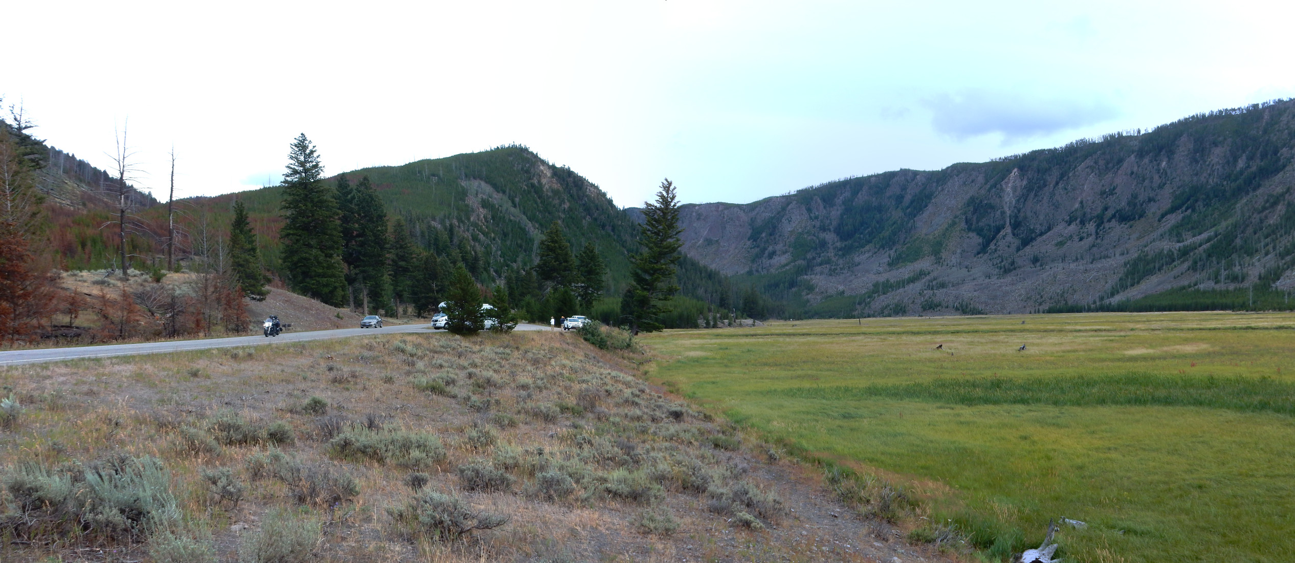
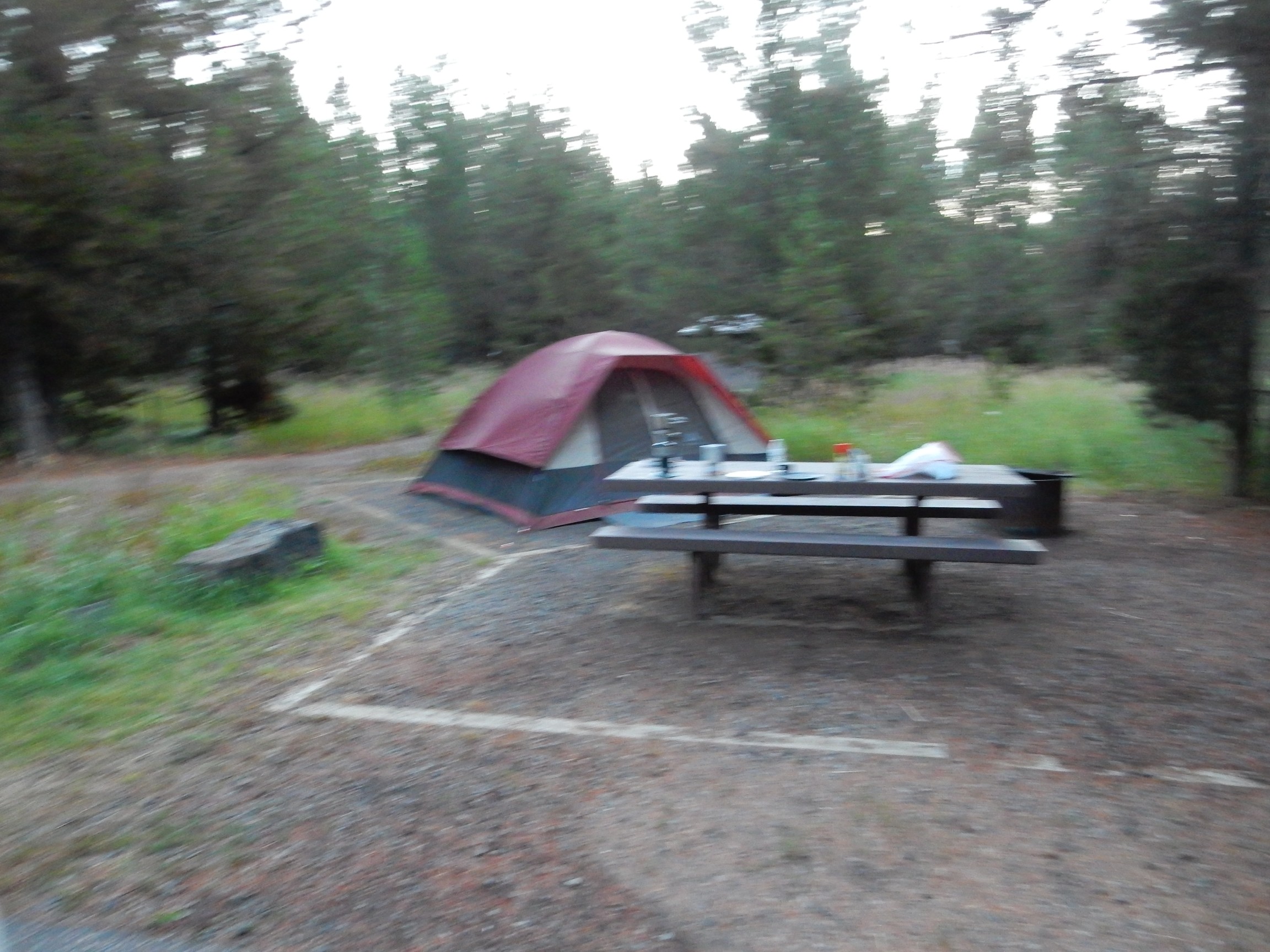
I arrived at Buffalo Campground, found my spot duly reserved under my name (relieving a slight worry), and pitched my tent. It was around 5:00; I had time to visit Yellowstone briefly before sunset.
Approaching West Yellowstone from the west.
The West Yellowstone valley is remarkably flat, as seen on the topographic map. Looking across the valley, we see the Gallatin Range to the left, in the northwest corner of the park. These are a typical Rocky Mountain range, with many peaks sculpted by glaciers. To the right, we see the rim of the Yellowstone caldera and the Madison Plateau, which is formed from very viscous, silica-rich lava that erupted after the caldera collapsed and which mostly filled the caldera.
I will enter the park through the Madison River valley.
At left on the skyline is the north rim of the caldera. The notch at center is the valley of the Madison River, which cuts through the caldera rim. At right, the silica-rich rhyolite flows that erupted after the caldera formed have drowned most of the western caldera rim.
At the park entrance, I rather naively ask how late the entrances are open. “24/7”. Well, in retrospect, duh.
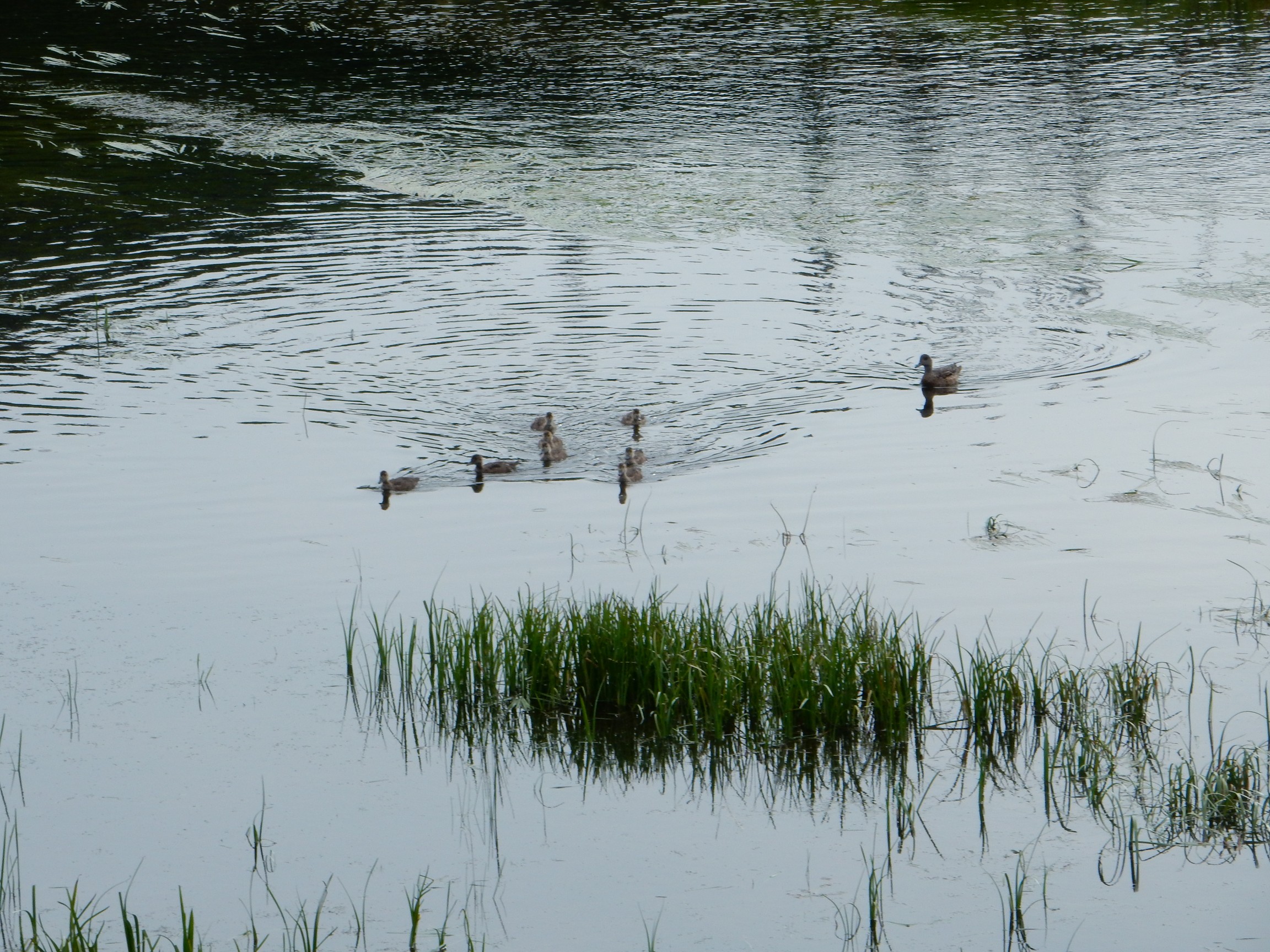
I may be a total nerd over geology, but I like wildlife, too:
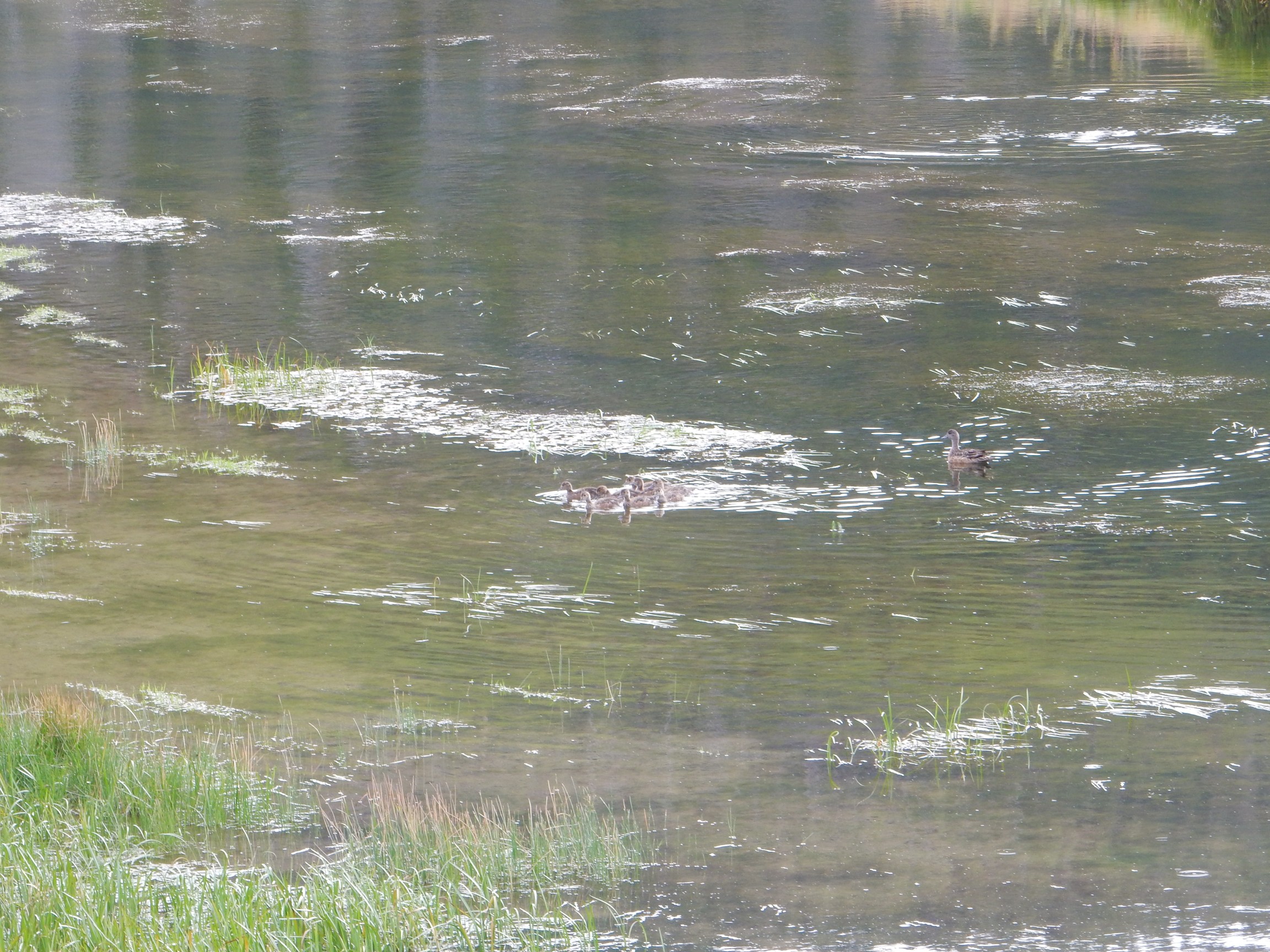
Funny how Momma hangs back and lets her young’uns flock ahead. Time for them to think about moving out and getting jobs of their own?
The dirt here is rich in obsidian grains.
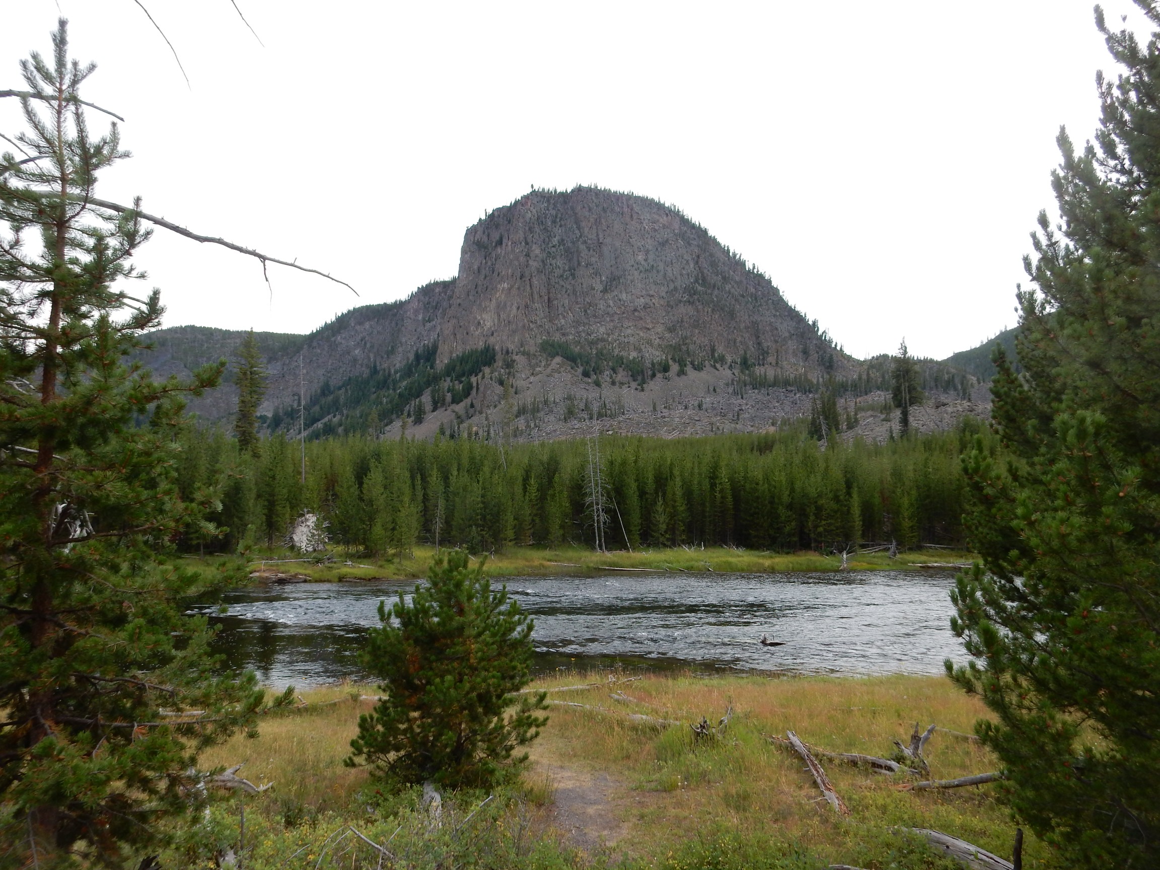
The Madison River valley.
More wildlife.
Mount Haynes, as well as Mount Jackson to the north, are underlain by the Mount Jackson Rhyolite. This is a silica-rich volcanic rock that was erupted shortly before the Lava Creek eruption 630,000 years ago. We know it was erupted earlier because the Lava Creek Tuff lies on top of it in several locations. We know it could not be much earlier, because the glassy top of the flows, where the lava cooled rapidly on exposure to air, did not have time to erode before the Lava Creek Tuff was deposited on them. The Mount Jackson Rhyolite seems to have formed a sizable dome in this area, most of which foundered into the Yellowstone caldera.
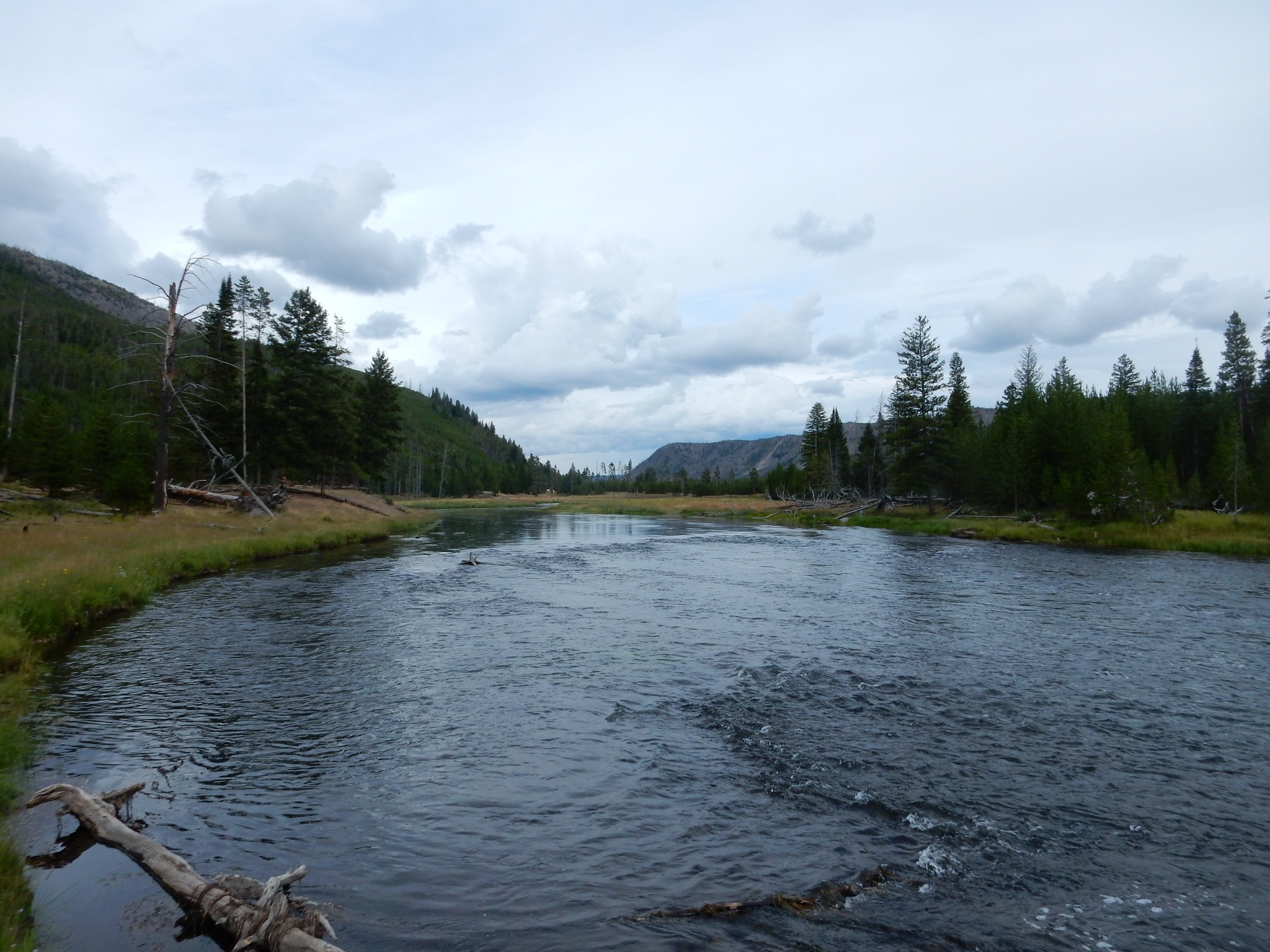
I walk down to the river on the boardwalk, and find myself enjoying the view up Madison Canyon.
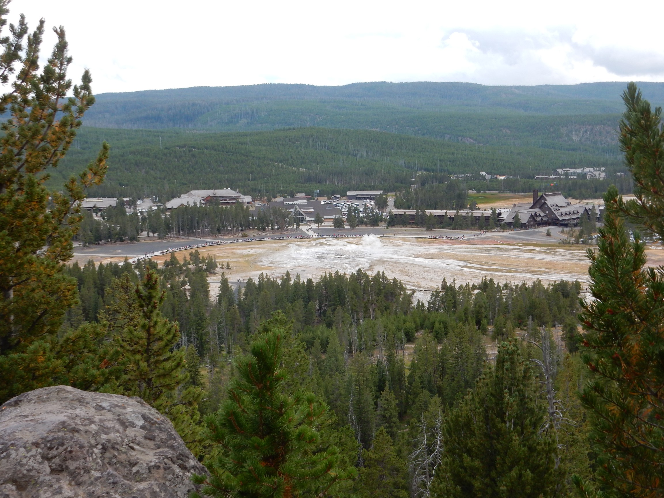
I return to my car and resume the drive west, turning south at Madison Junction towards the many geyser basins along this road. In the cool, damp weather, the steam from the Fountain Paint Pots is unmistakable.
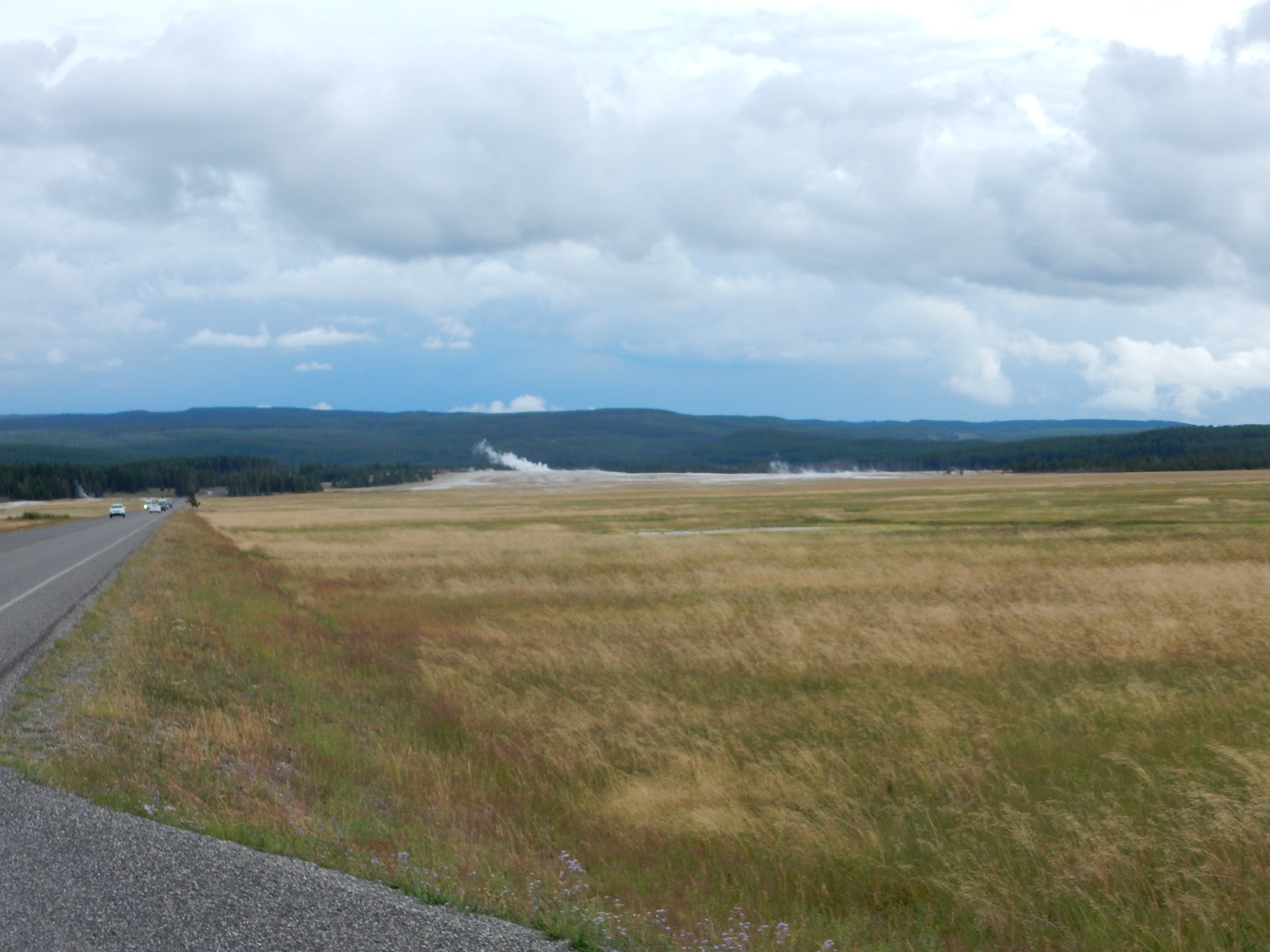
There are many attractions along this road, but with just a little time before dark, and this being my first day in the park, I naturally head towards Upper Geyser Basin and Old Faithful.
My intent is to climb the trail to the lookout point northeast of Old Faithful. This is located on Mallard Lake Dome.
Mallard Lake Dome is one of two resurgent domes in the Yellowstone caldera. These are portions of the caldera floor that have been pushed upward by magma injected into the underlying magma chamber.
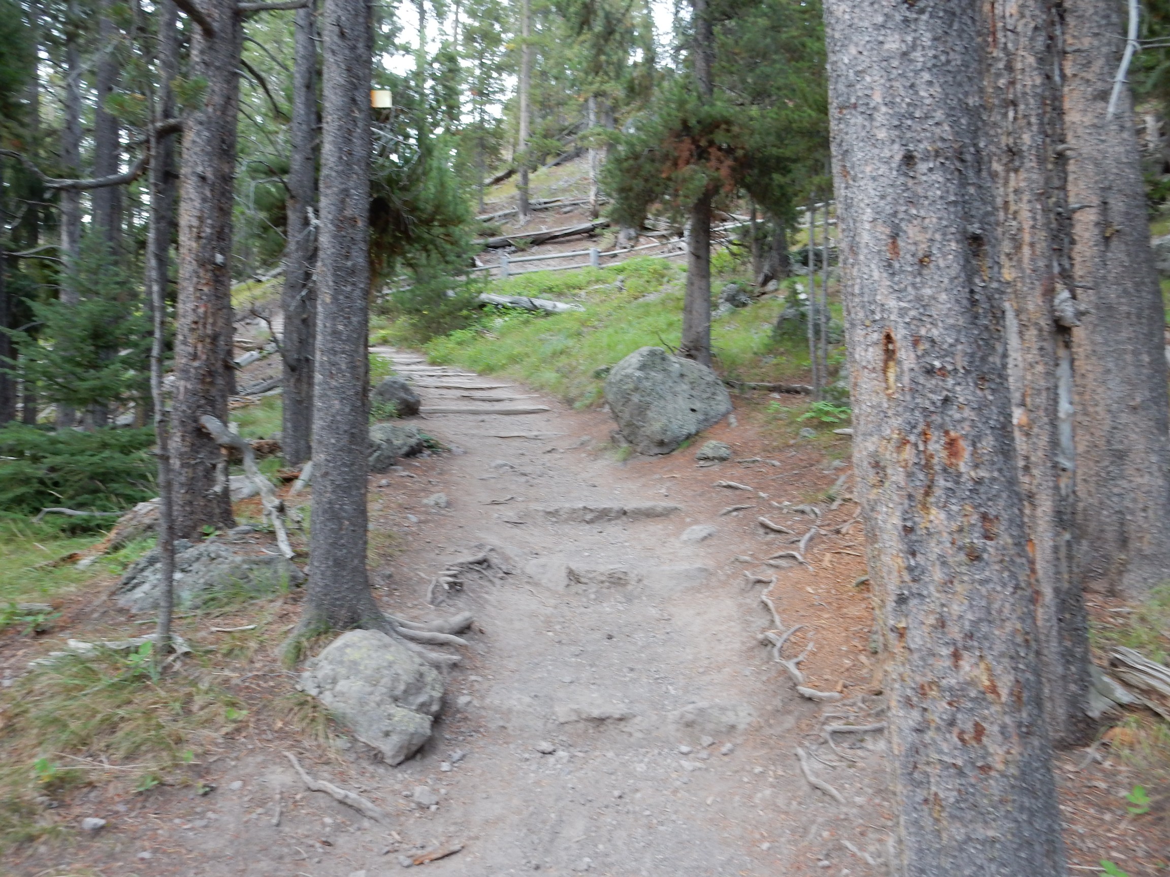
I found myself liking this trail very much. It was far less crowded with tourists than the boardwalks in the geyser basin, but there were still enough tourists on the trail that I did not feel like I was hiking alone.
The trail ascends the dome.
I found that a lot of my pictures this late in the evening came out a bit fuzzy, and some of my attempts at panoramas would not stitch together well. I suppose it’s unsurprising that a handheld camera would struggle in low light, but it’s interesting that low light photographs are markedly worse for panoramas.
I had been given an estimate for when Old Faithful would erupt again, and it looked like I would be early to the lookout point. I also wanted a little more exercise. A fork in the trail suggests an opportunity.
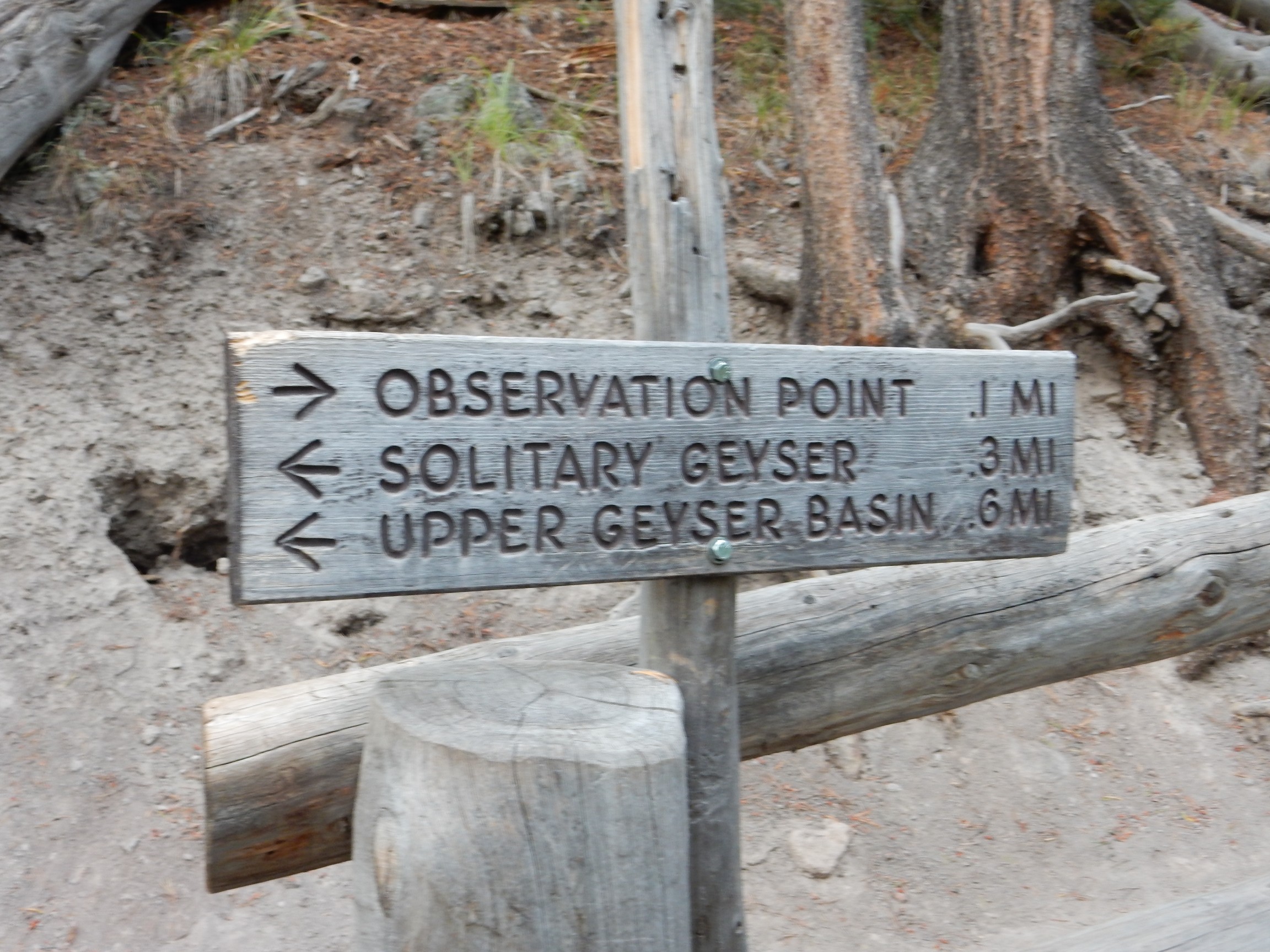
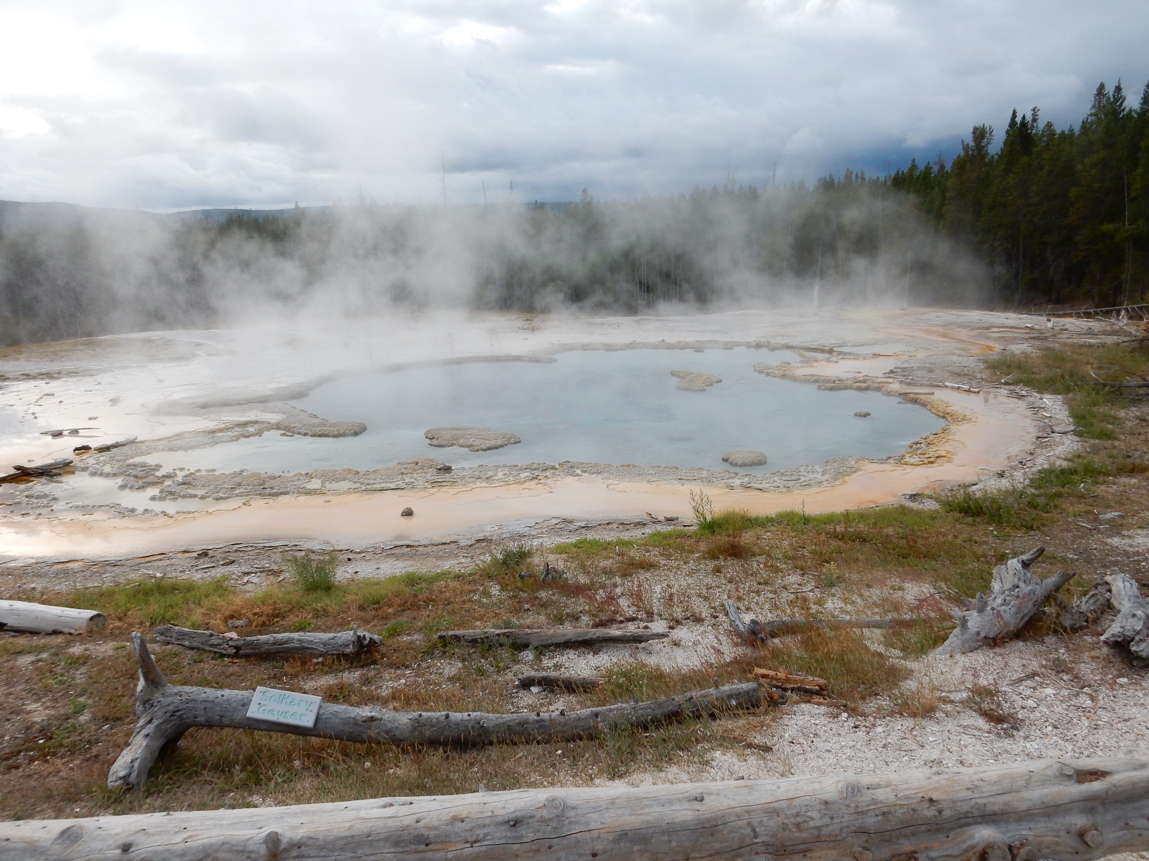
I hike briskly to Solitary Geyser, mindful of the need to be back in time for Old Faithful.
An outcrop of rhyolite along the trail.
(Pine needle at lower left gives scale.) This is the Mallard Lake Member of the Plateau Rhyolite. It was likely erupted very shortly after the Lava Creek super eruption, through fissures in the new formed caldera floor. I find it interesting because it very closely resembles the dome rhyolites in the Valles caldera back home. In fact, I doubt I could tell two samples apart with anything short of laboratory analysis.
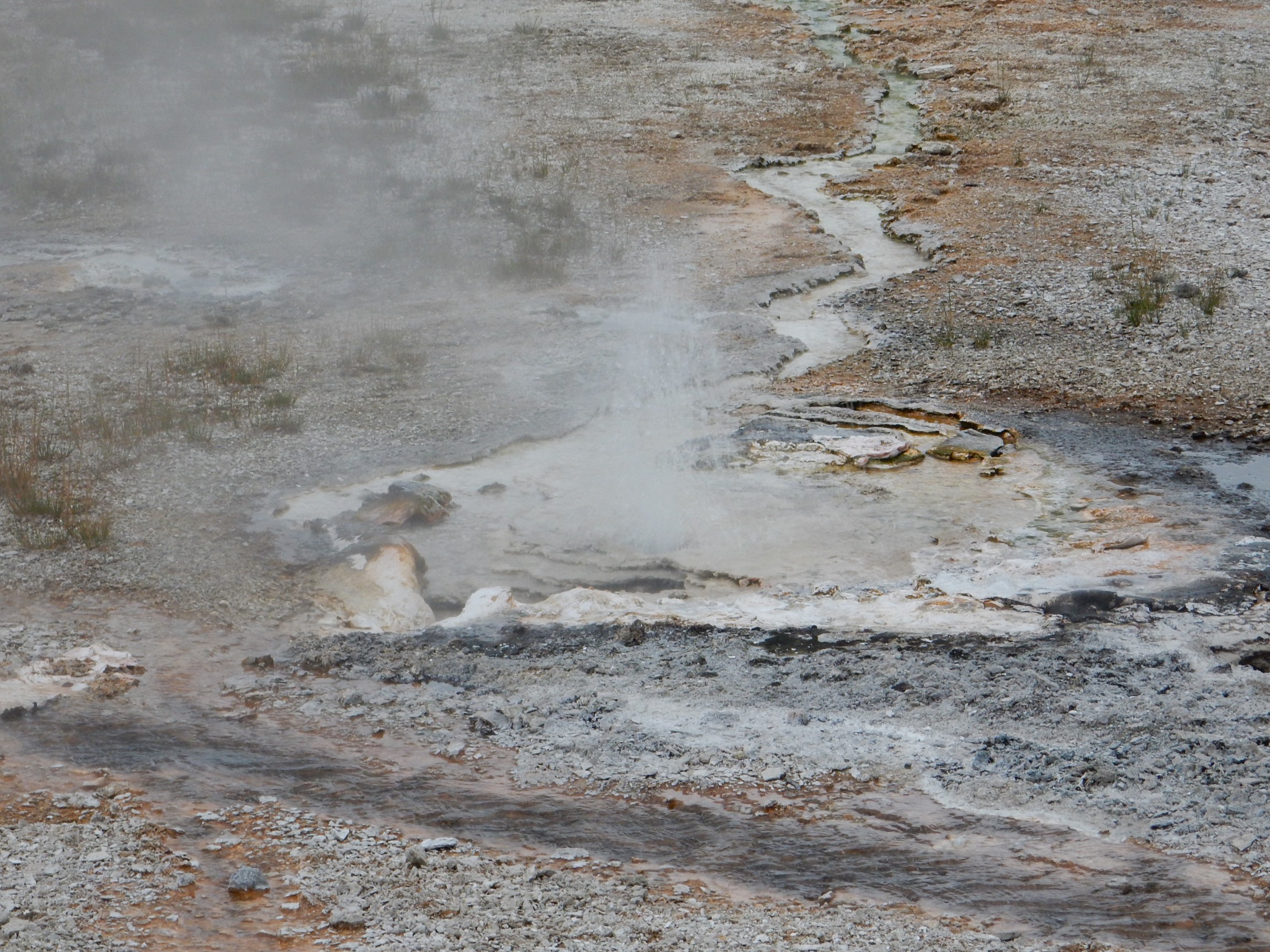
Solitary Geyser is man-made.
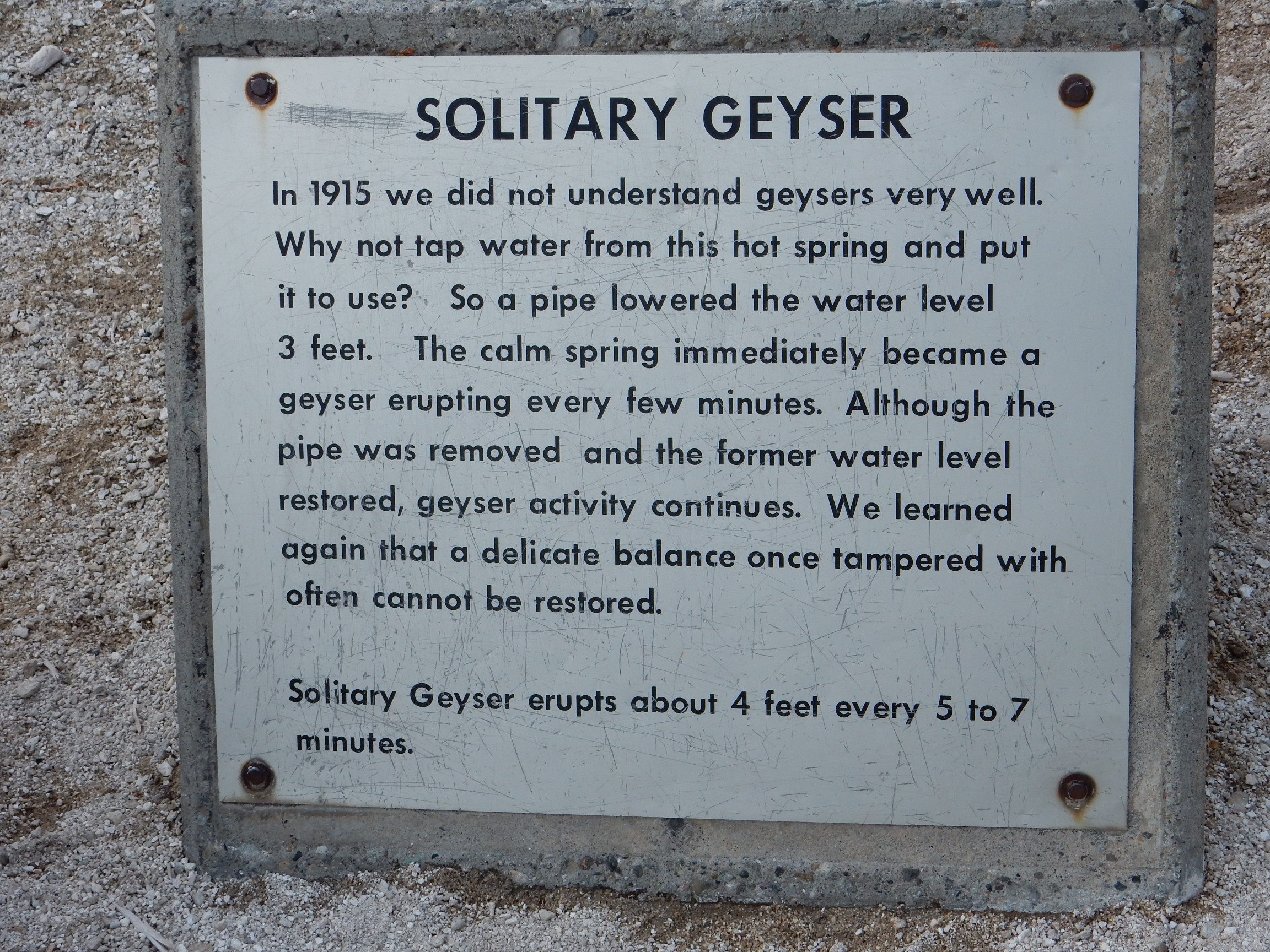
(Evil Kent: “They say it like it’s a bad thing.”)
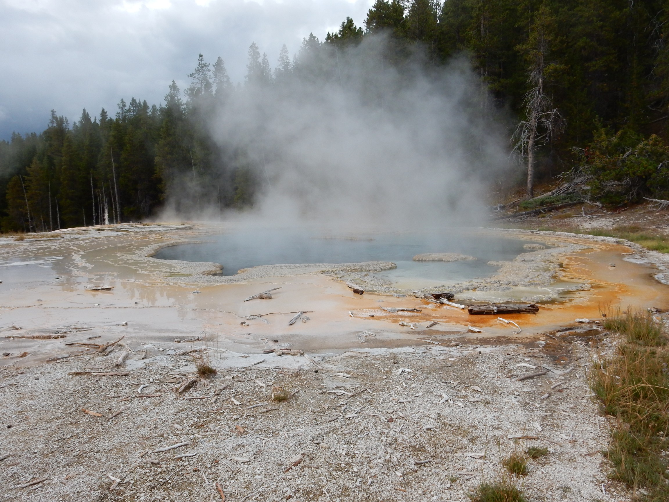
This shows many features of a typical hot spring or geyser. There’s a rim of sinter, amorphous silica dissolved from rocks deep below by very hot water, then redeposited as the water cools and evaporates at the surface. Silica is not terribly soluble in water, even very hot, acid water, so the deposition process is slow. However, it causes hydrothermal features, and even entire geyser basins, to slowly shift and change behavior over time, as sinter clogs old passages and new ones open up.
The yellow coloration is from microbial mats adapted to very hot, acid living conditions. I don’t know a lot about these communities, but some of the microorganisms are photosynthetic bacteria (purple sulfur bacteria, purple and green non-sulfur bacteria) and archaea, which are a third branch of life apart from bacteria and eukaryotes. Like bacteria, archaea are mostly single-celled organisms that lack the complex internal structure of eukaryotic cells, but their biochemistry is in some respects closer to that of eukaryotes than bacteria, and in other respects is different from both bacteria and eukaryotes. For example, whereas our cell membranes contain lipids linked by ester linkages, archaean cell membranes contain lipids linked by ether linkages. This has some advantages for living at high temperature.
Another shot, into the sunset.
When I hike back to the fork in the trail, I find a knot of tourists there. Knots of tourists in Yellowstone usually mean wildlife, and this is no exception: A grumpy rodent is parked on a rock face above the trail, scowling at us.
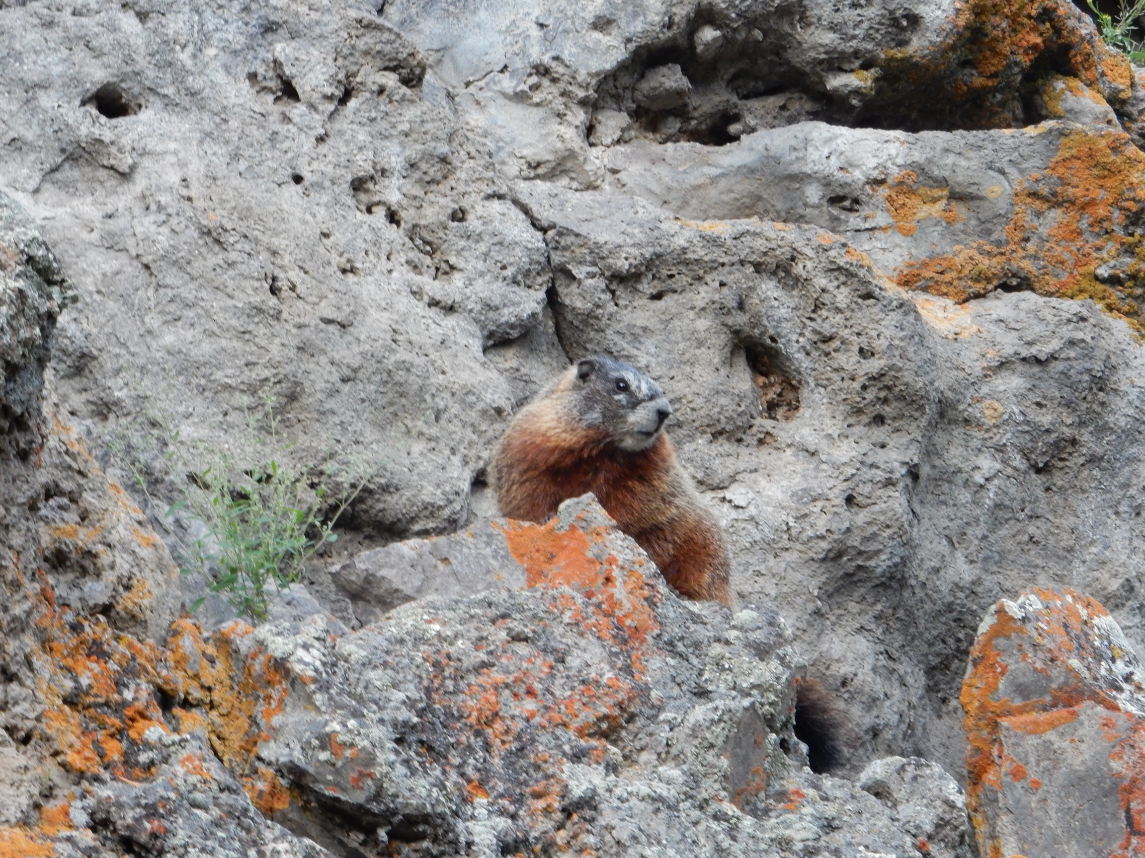
A marmot, I believe. He scurries off after a few moments, and I climb to the lookout point. A number of other tourists have already gathered here.
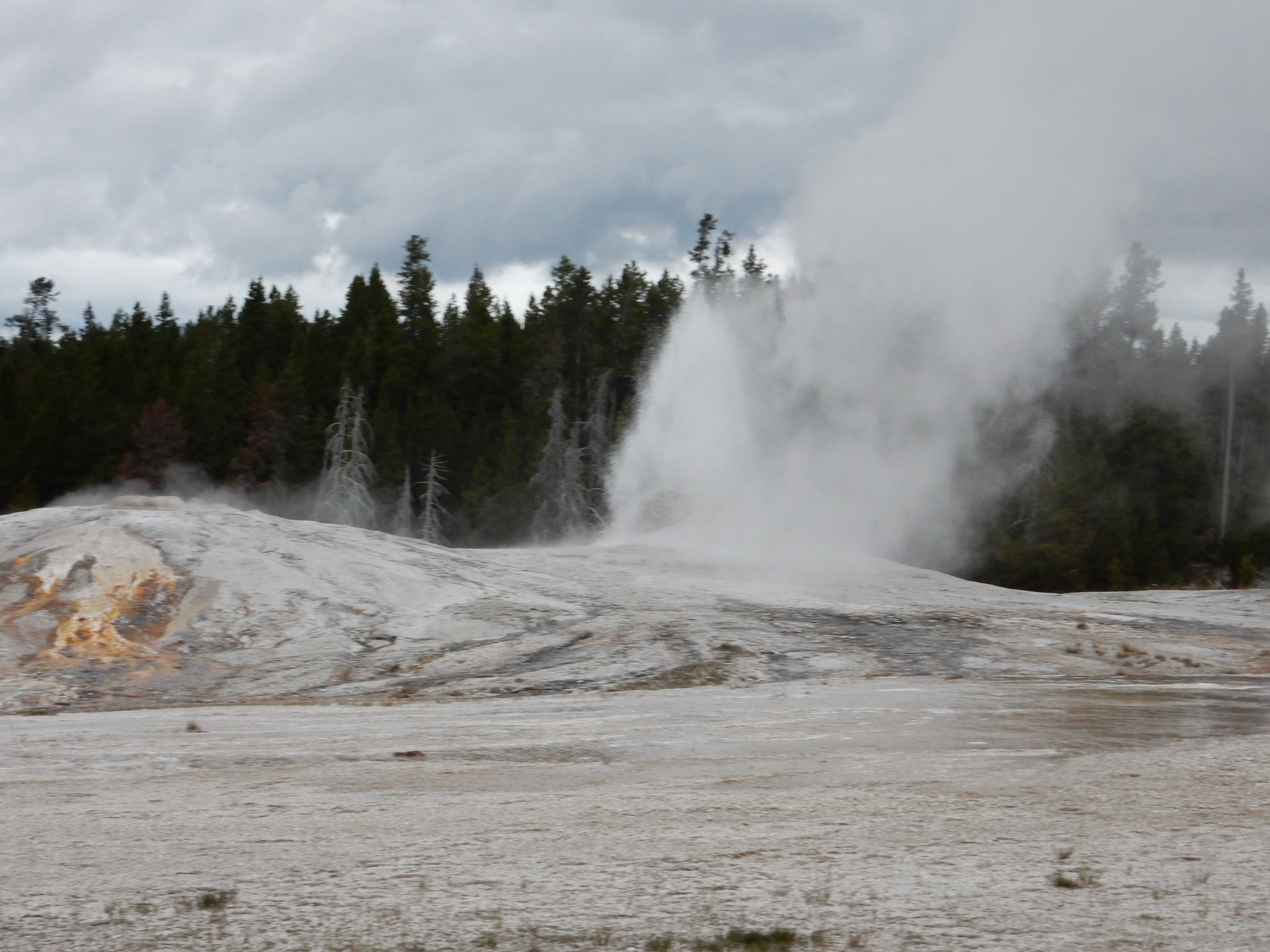
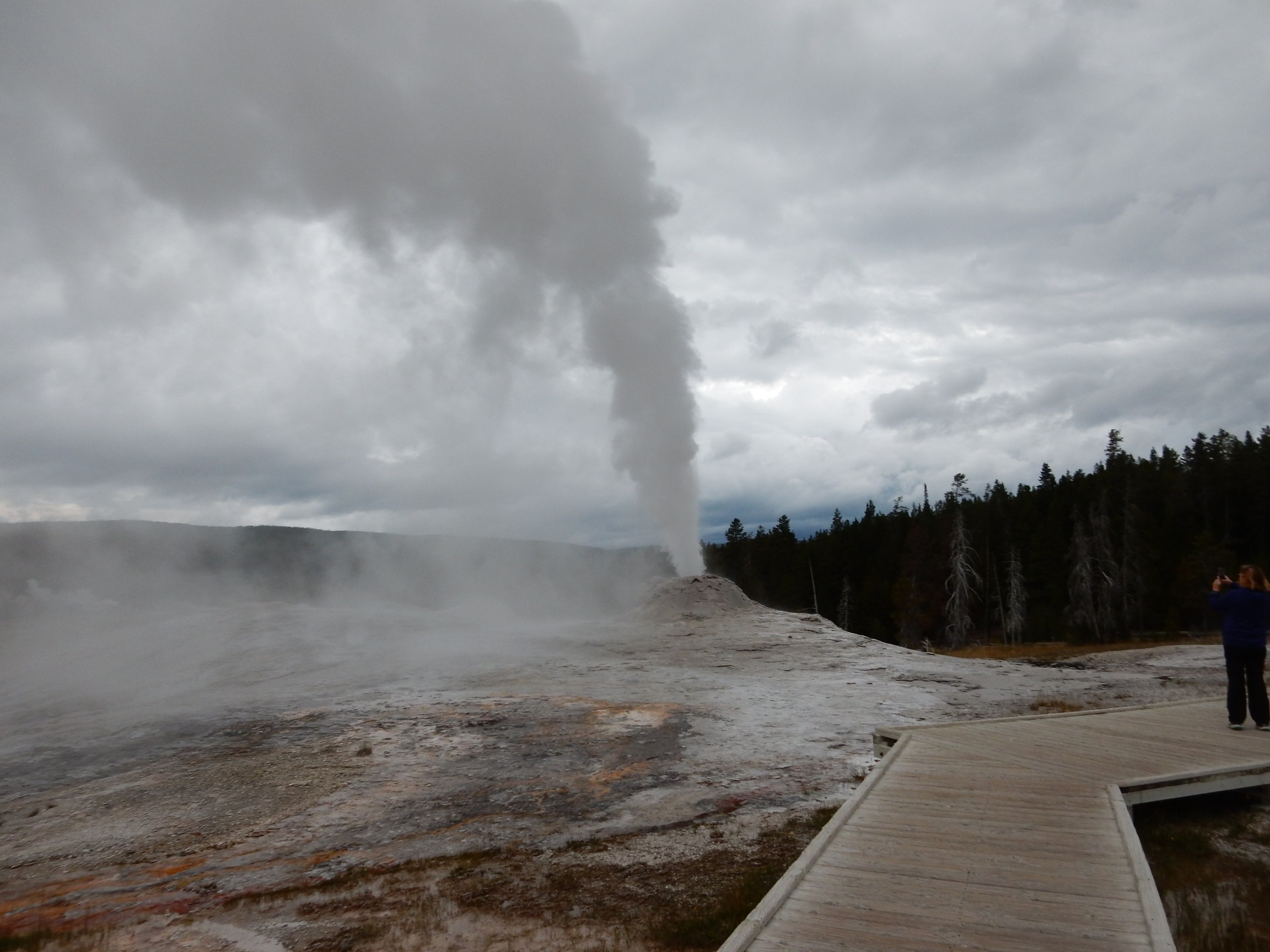
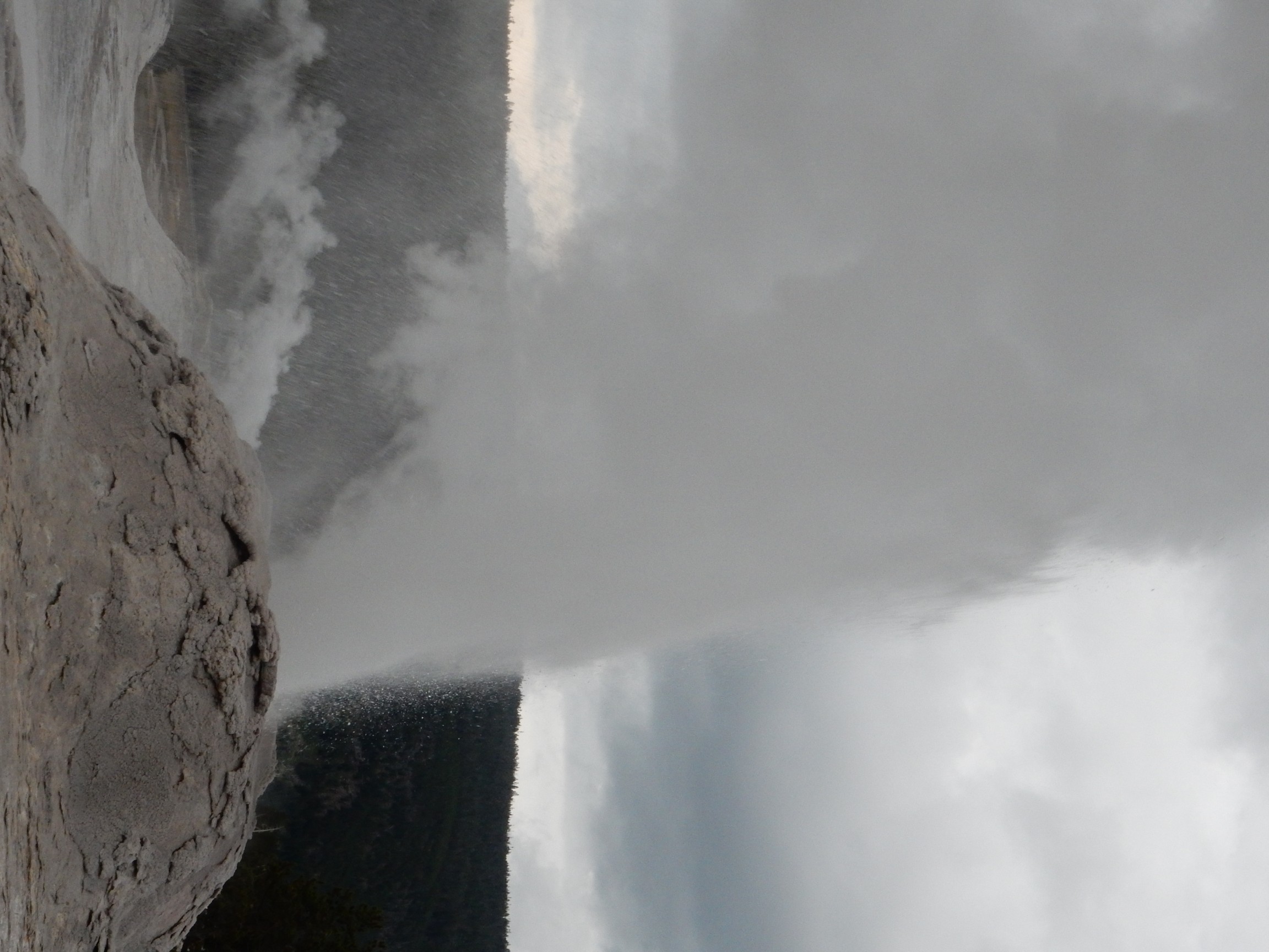
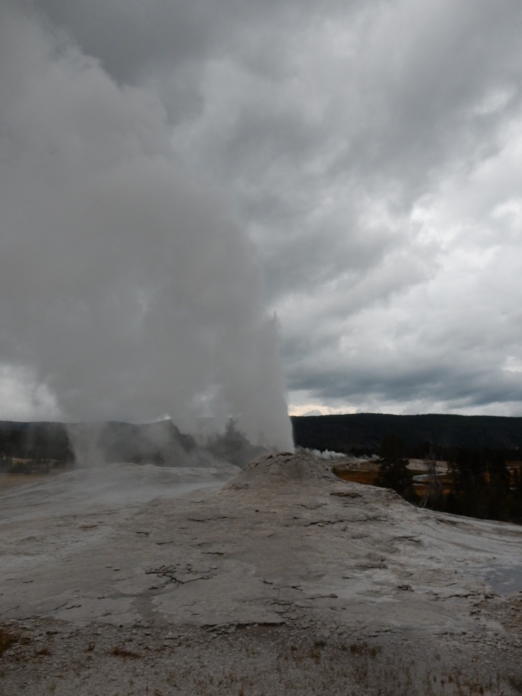
The appointed time comes and goes. The geyser taunts us.
Then it erupts for real.
And the little indicator on my camera informs me my battery is almost discharged. Well, crep. That only took a day, and I have six more until the eclipse. Not to worry; I have a USB adaptor in my car.
(^ ominous foreshadowing)
More rhyolite near the lookout.

This is kind of interesting, because here are so many obsidian grains in the rock. Some younger rhyolites in the Jemez contain obsidian, particularly the Cerro del Medio dome north of Valle Grande, the Rabbit Mountain dome, and the Banco Bonito flow (parts of which are almost pure obsidian), but nothing exactly like this.
I still have a little daylight, and decide to tour some other features of the Upper Geyser Basin. This is, after all, the greatest concentration of geysers in the world.
The Anemone Geysers are old favorites from my last trip. They erupted entertainingly for Bruce Rabe and me, including one eruption that showered me with a few drops of hot water and sinter. This time, I didn’t catch them at the right time.

Not sure which this one is.
But it blorted for me, so a photograph.
This is one of the Lion Geysers, which erupted just as I walked up.

The many geysers, hot springs, fumaroles, and mud pots in Yellowstone are a result of the perfect combination of circumstances. The Yellowstone caldera is still extremely hot, with molten magma only a few miles down. The history of glaciation in the area means that the caldera has thick deposits of glacial debris, which is highly porous, rich in silica, and just about perfect for forming the plumbing for hydrothermal features. And there is ample water from storms coming in from the Snake River Plain and dumping their moisture over the higher Yellowstone Plateau.
Some taxonomy. A geyser is a kind of hot spring that intermittently fountains hot water. They occur when an underground chamber has a source of ground water, is heated by very hot rock, and has a fairly narrow opening. Cooler ground water slowly fills the chamber and becomes very hot; it is prevented from boiling by the pressure of water higher in the chamber. But eventually the water heats and expands enough that some water escapes from the vent. This lowers the pressure in the chamber, allowing part of the water to flash into steam and blow the rest out the vent. Most geysers are somewhat irregular; a few fountain almost continuously, others erupt every few minutes, and a few erupt spectacularly at long intervals, up to several days. Old Faithful is almost unique in being as regular as it is, erupting every 70 minutes, give or take ten minutes.
Hot springs have vents that are wide enough at the top that water is not trapped long enough to overheat and become unstable. Hot water comes out of these springs continuously, sometimes accompanied by large bubbles of steam and carbon dioxide. Mud pots are far enough above the water table that clay, formed by the very hot, acidic water breaking down the surrounding rock, is not washed away efficiently, and builds up in the throat of the spring. Fumaroles are higher still, so that they emit only gases, and no liquid water.
It was now getting too dark for photographs. I drove back to my camp site,
ate the leftover kung pao chicken from lunch, gulped my evening pills (another Metformin, pravastatin for the heart, Co-Q as a charm to keep away the side effects of the pravastatin, and a baby aspirin to ensure I die from bleeding to death rather than from a heart attack) and turn in for the night.
Next: Mount Washburn
Pingback: Great American Eclipse wanderlust, day 5 | Wanderlusting the Jemez