Great American Eclipse wanderlust, day 9
Day 8 may be found here.
Getting very close!

I had originally planned to spend this Saturday driving out to Craters of the Moon to look at some very young basalt flows and other features. However, when I talked with Cindy last night on the cell phone, she was oddly uneasy about me heading that way. She has been passing along stories all week about how grocery stores will be emptied and gas prices will double because of the crowds in southeastern Idaho. We are skeptical; gas prices haven’t changed in the time I’ve been in the area, and I’ve seen tanker trucks parked next to larger gas stations, apparently in anticipation. Still. There seems to be more to her unease that she can’t articulate and I can’t put a finger on. Oddly, we are both more comfortable with the idea of me driving through Yellowstone to the Beartooth Plateau, which I’ve never visited, even though the distance is roughly the same. I change my plans.
She also reports on weather. The forecast sounds very promising for Rexburg on Monday (the big day), and there’s nowhere within a day’s driving distance where the forcast is any better. So I will not be dashing east to Thermopolis or west to Moscow. She advises me that, in any case, according to news reports, eastern Oregon is an absolute madhouse.
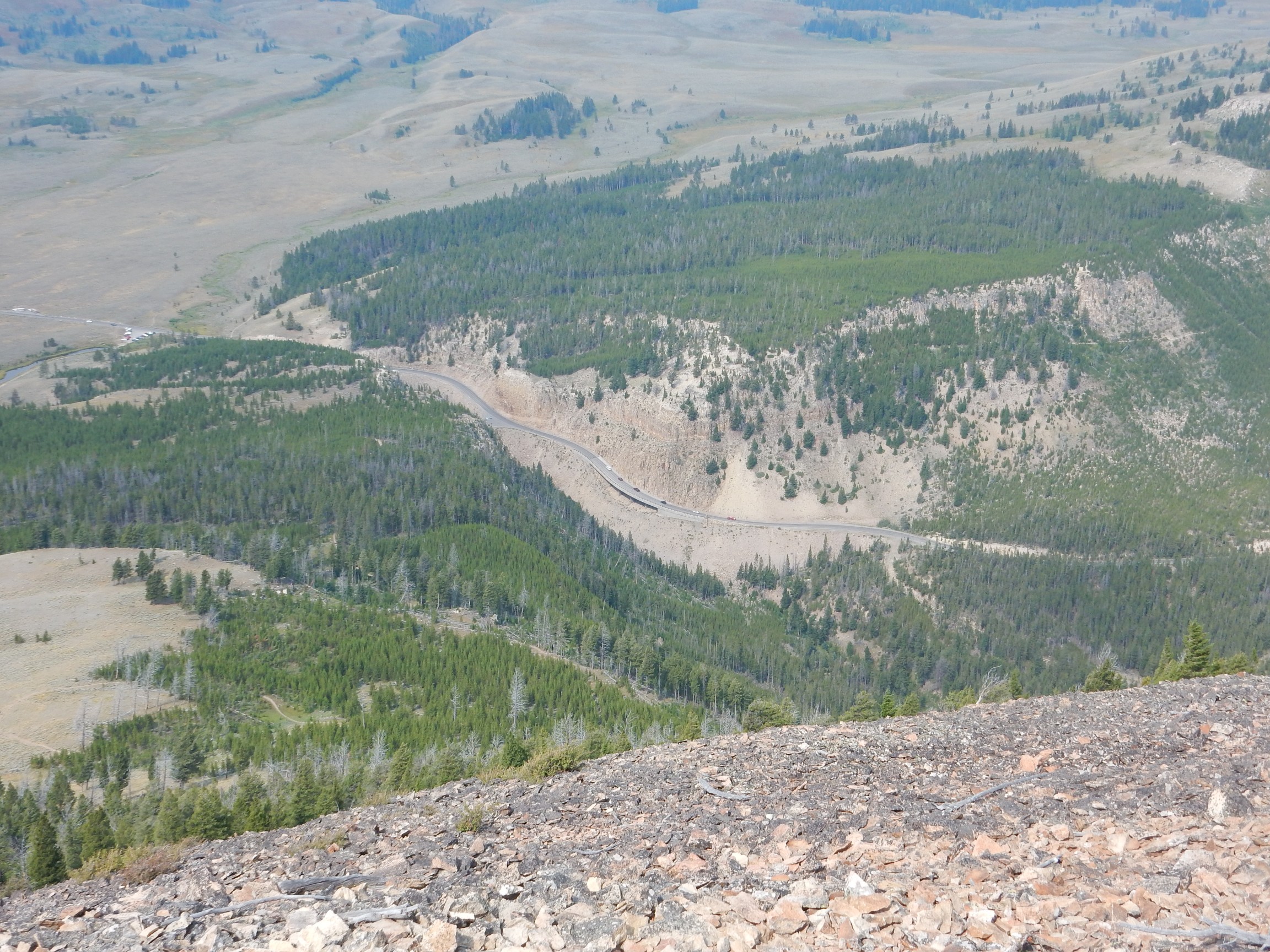
I have perused my hiking map some more, the knee is getting noticeably better, and I decide I will climb Bunsen Peak before heading out to Beartooth Plateau. The road takes me through the construction zone between Norris and Mammoth Springs, but there is little construction activity going on and not much traffic. I pause at Roaring Mountain, which was closed on my earlier trip to Yellowstone.
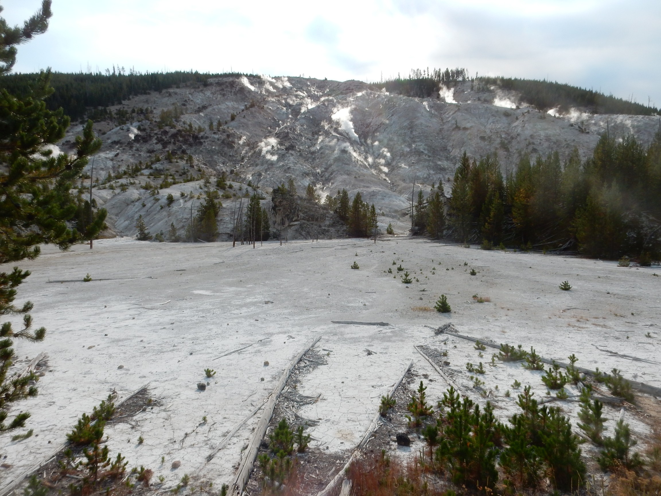
This area is covered with fumaroles, and early explorers reported that these made a roaring sound that could be heard over a mile distant. Nowadays, as some wag put it, it’s not so much a roar as a mumble. Still an interesting sight.
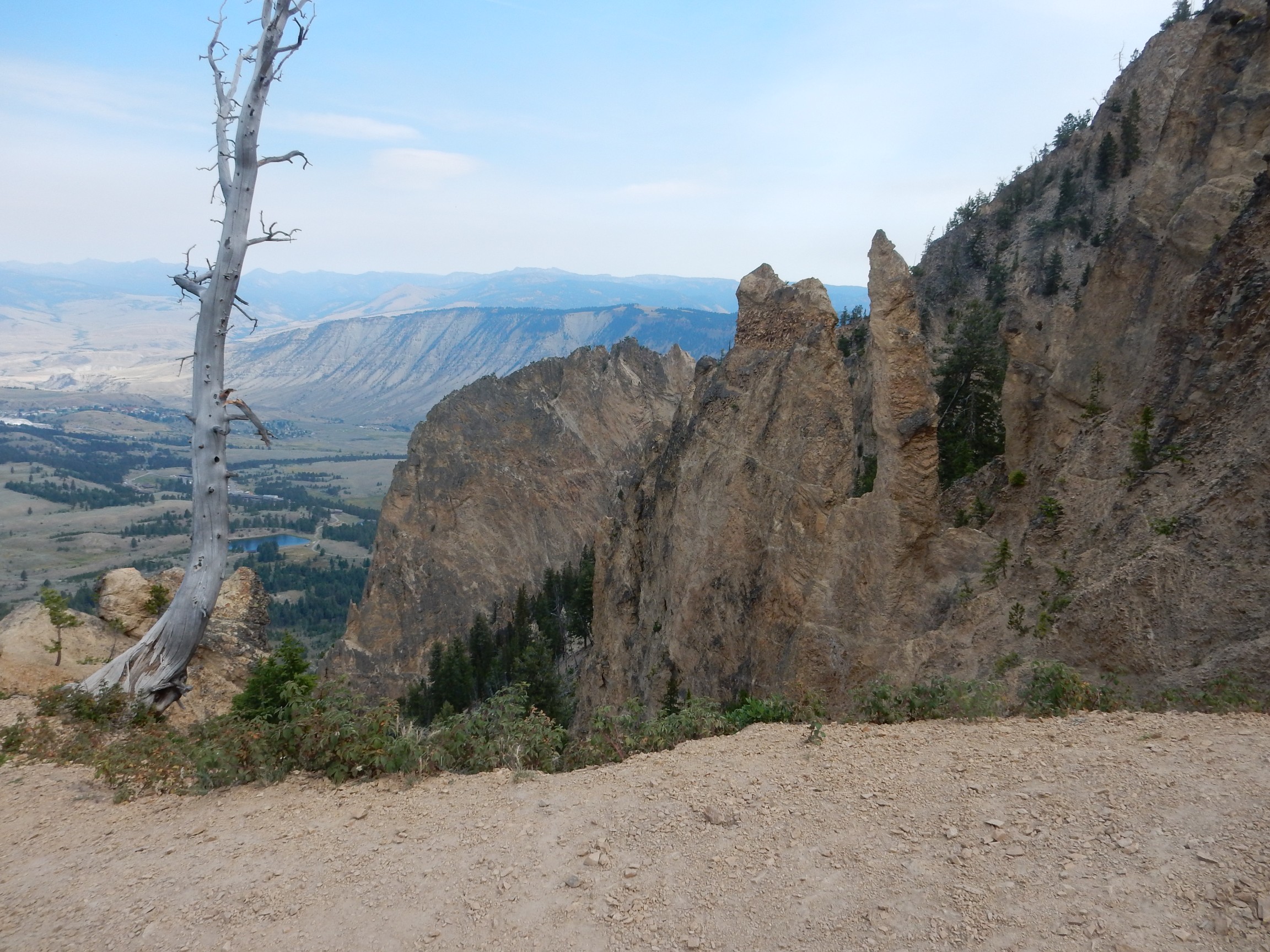
I reach the Bunsen Peak trailhead; a car is pulling out of the otherwise packed parking lot, and I pull in. Once again, there will be plenty of other hikers on the trail. The trail starts out fairly level, in a pleasant wooded area, then climbs the edge of the Golden Gate.
The Golden Gate is eroded through Huckleberry Ridge Tuff from the first and largest Yellowstone super eruption, 2.2 million years ago. In the background is Mount Everts, underlain by Cretaceous sediments capped with more Huckleberry Ridge Tuff.
Northwest of the Golden Gate is a large deposit of travertine from a now-inactive hydrothermal area. At some point in the past, part of this collapsed as a landslide down the face of the mountain.
Up ahead I see a couple of fowl.
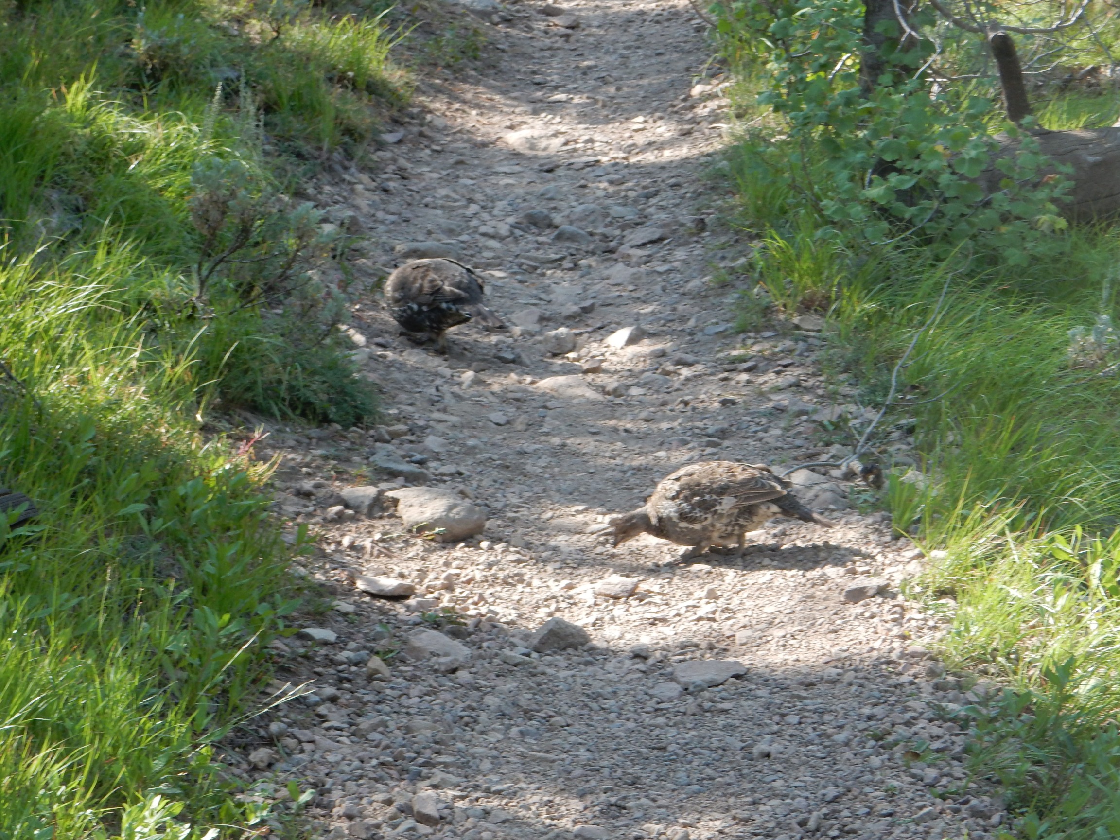
Wild turkeys. As I approach, they head down the trail.
I have noted in the past that deer will move away from the trail when they see you coming, while cows will repeatedly move down the trail before figuring out that they need to move off the trail to avoid you. Apparently deer are smarter than cows. And, it would seem, turkeys.
This little guy is entertaining.

This looks like a great area for some pictures, but I decide to save these for when I come back this way.
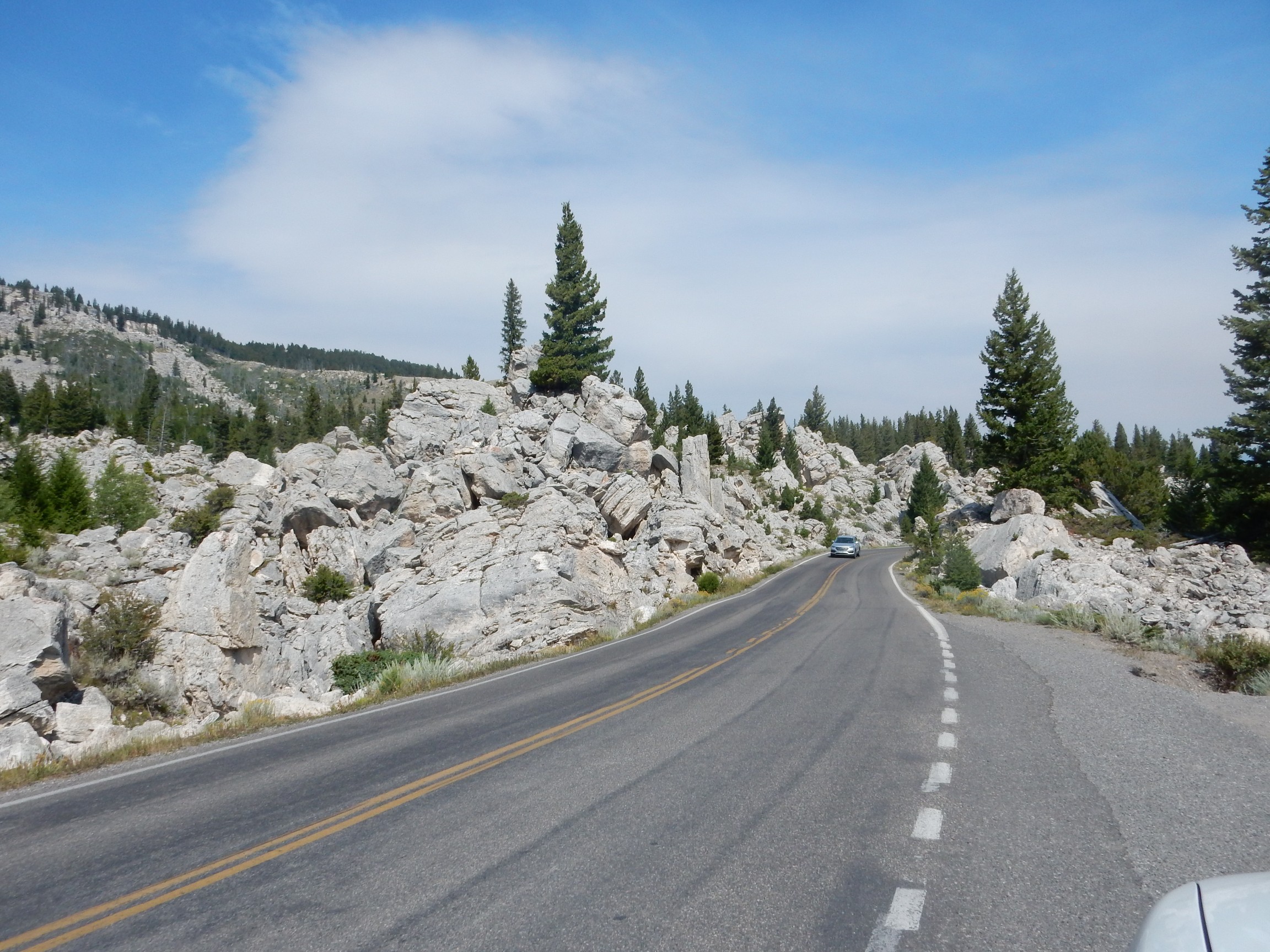
The trail becomes rocky. The rock is clearly from nearby landslides, so it’s Bunsen Peak dacite.
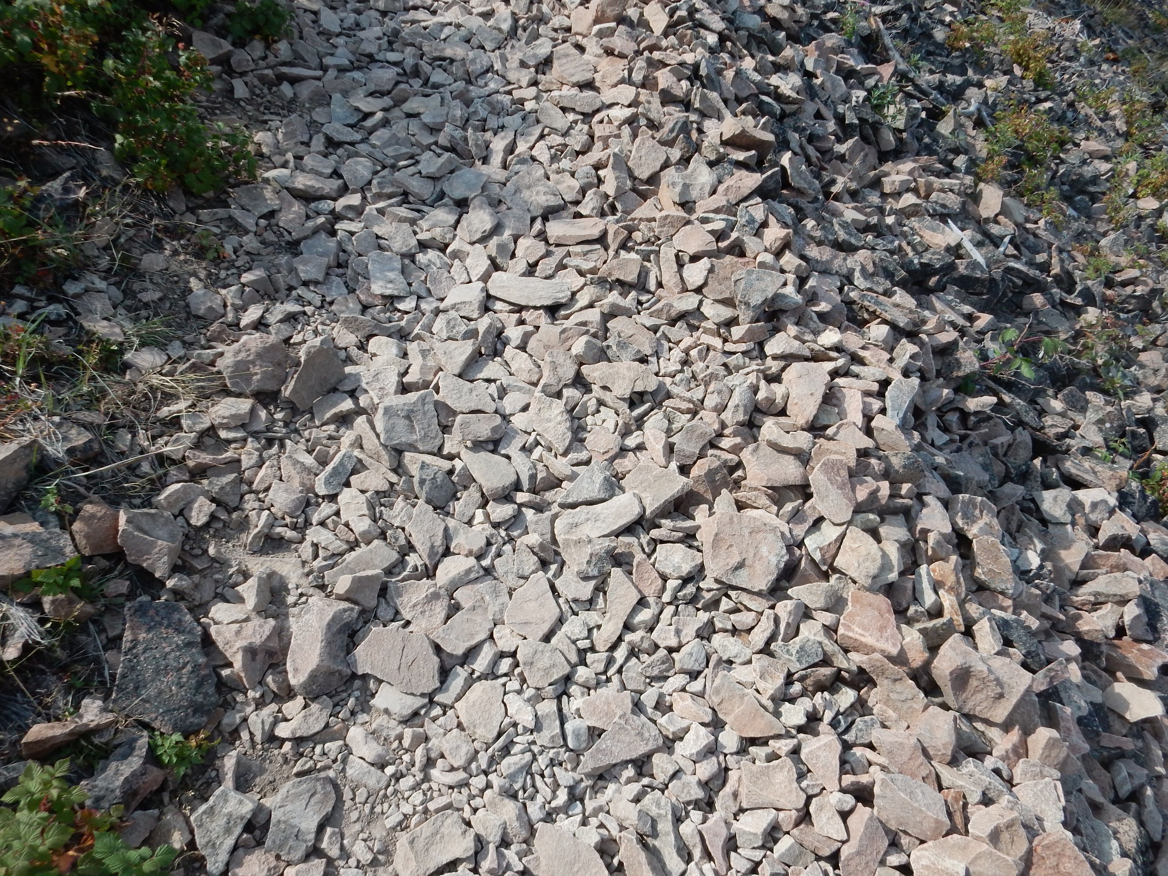
Dacite is an extrusive igneous rock with moderately high silica content but not too much alkali. The dacite of Bunsen Peak has been dated at around 50 million years old, so Bunsen Peak is thought to be the remains of a source vent for the Absaroka Volcanic Supergroup. This dacite is quite uniform and featureless, with no visible phenocrysts (large crystals formed in the magma while still underground). This contrasts with the Tschicoma Formation dacite underlying the Sierra de los Valles west of Los Alamos, which often has spectacular phenocrysts of plagioclase feldspar.

There is a logbook on the side of the old ranger station. I duly sign it: “Kent G. Budge, Los Alamos, New Mexico <– Not actually new; not actually Mexico.”
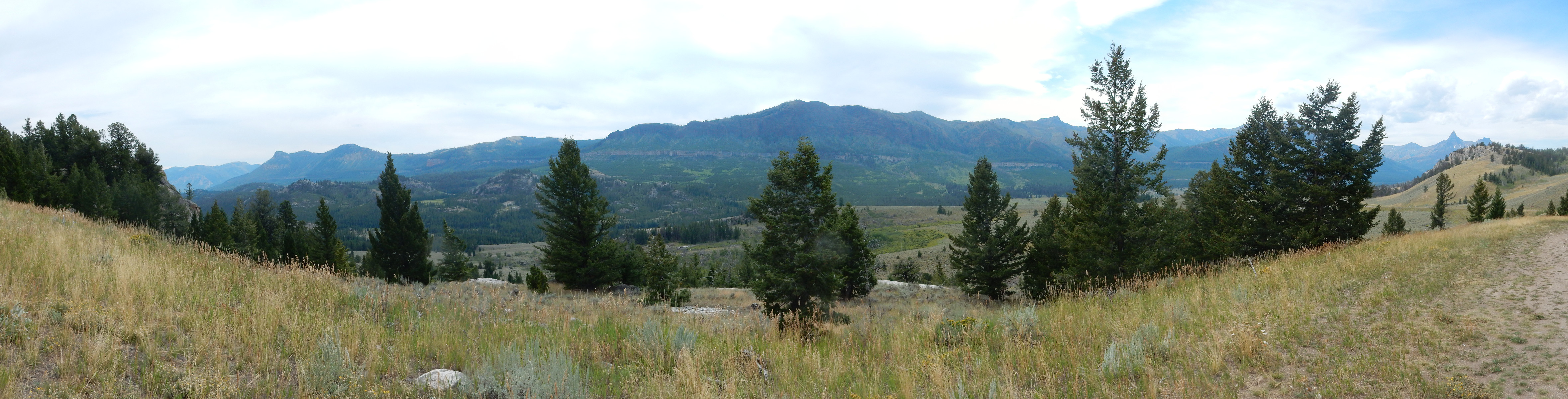
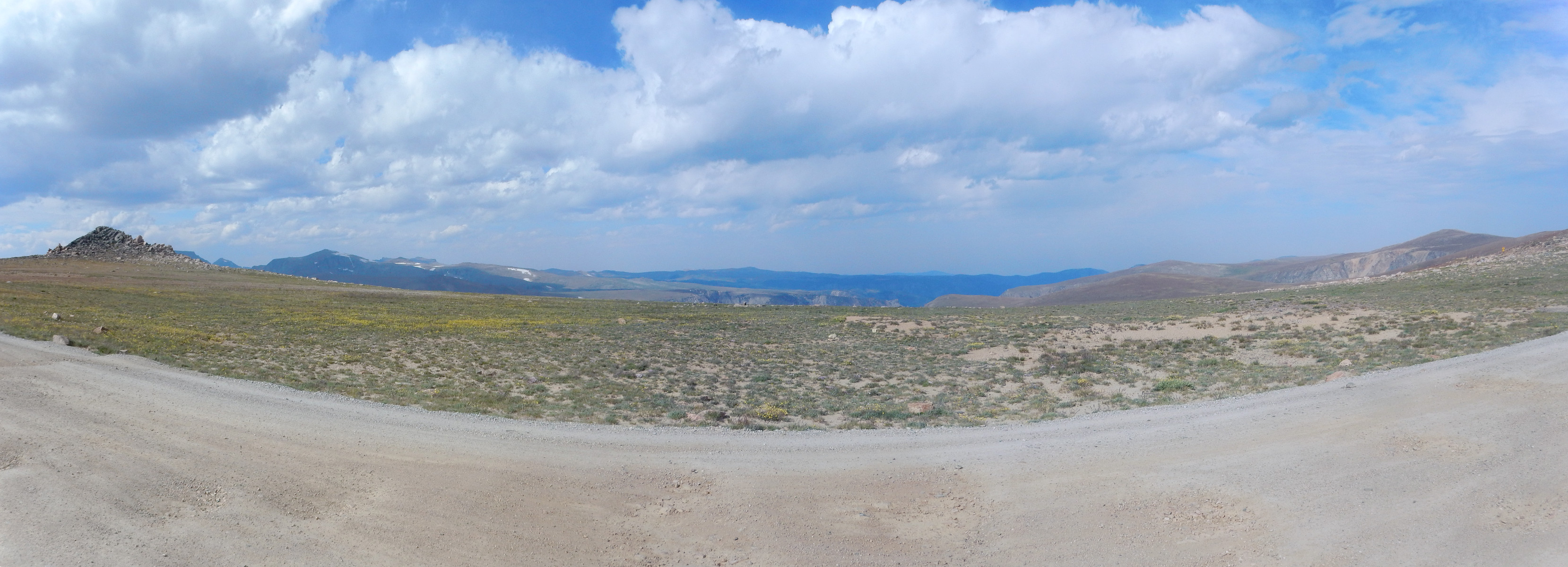
I begin my panoramas. To the west:
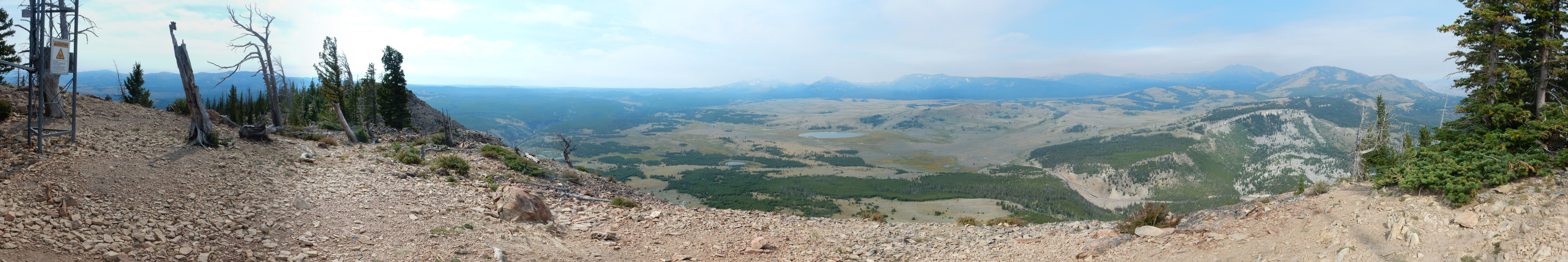
The Gallatin Range is spread out before me on the skyline. Electric Peak at far right, with Sepulcher Peak in front of it. Then Quadrant Mountain, Bannock Peak, Antler Peak, and Mount Holmes. The northern ones are underlain by Paleozoic and Mesozoic sedimentary beds; the ones further south are underlain by Absaroka Supervolcanic Group intrusions.
The sky is overcast and there is a great deal of smoke from wildfires to the west. I am not happy to see this, not two days before the eclipse.
To the northeast:
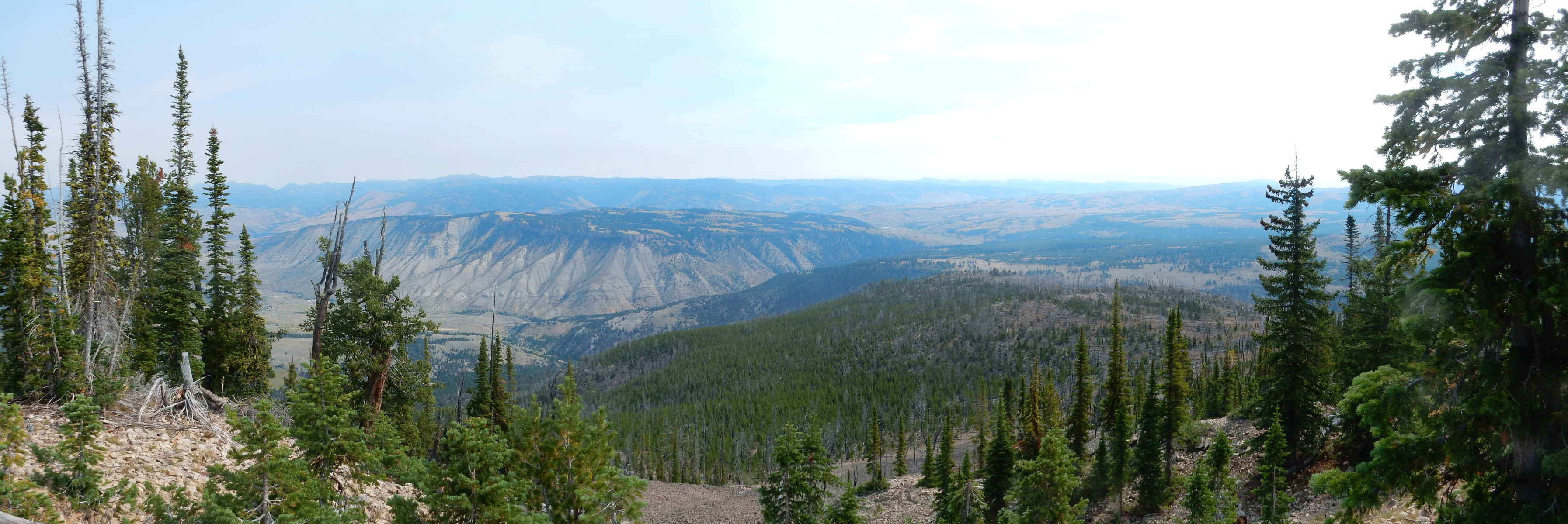
Mount Everts is prominent. On the skyline behind it is the southwestern edge of the Beartooth Plateau and the Black Canyon of the Yellowstone. To the right of Mount Everts is the Blacktail Plateau, underlain mostly by geologically young glacial deposits.
The Beartooth Plateau originally formed in the deeps of time, perhaps 2.5 billion years ago or more. It is composed mostly of granite and granite-like rocks. These were beveled flat sometime between 1.8 billion and 800 million years ago, a time period some geologists call the “Boring Billion” because so little seems to have taken place during that time. The beveled flat granite surface — a peneplain — was subsequently covered by shallow seas that deposited beds of sedimentary rock. During the Laramide Orogeny, sometime between 50 and 20 million years ago, the Beartooth Plateau was thrust upwards and almost all the sedimentary rocks were eroded off by glaciers, which made much less of a dent in the underlying hard granite. This produced the high granite plateau we see today.
I see what looks like a contact between formations halfway up the slope of Mount Everts. However, my geologic map shows the entire mountain (below the tuff cap) as lower Cretaceous sedimentary beds, naming several formations but not distinguishing them.
There are signs warning that all the radio towers up here are under video monitor. This is a slight problem. I climb some distance down from the peak, into a bushy patch, to make another offering to the forest fertility gods. It has been a long morning already.
The climb to the peak is a ways up. I’m hoping that making this climb without any particular difficulty (except the sore knee) proves my heart is still in good shape.
Well, it probably proves my coronary arteries are less than 50% obstructed. Alas, my cardiologist tells me that thin plaque can rupture to cause heart attacks about as easily as thick plaque, and it’s hard to tell how much thin plaque a person has. On the other hand, regular exercise seems to help stabilize plaque, and I’ve been getting regular exercise all along.
I come back to the spot where I saw the entertaining squirrel. Alas, the light is poorer than it would have been earlier to photograph the impressive dikes here.
I think the light was also better earlier for photographing the Golden Gate.

It’s the overcast moving in. I mention this to another hiker, and he chuckles. “If the weather keeps deteriorating, a lot of people around here are going to be having coronaries Monday.” Except me, Bruce, and Jeremy; as mathematically-inclined nerds, we’ll be having corollaries instead.*
Bruce and Jeremy will enter my story by and by.
I reach my car; another waits patiently while I pack my gear and pull out. I pass through the travertine landslide and take a picture.
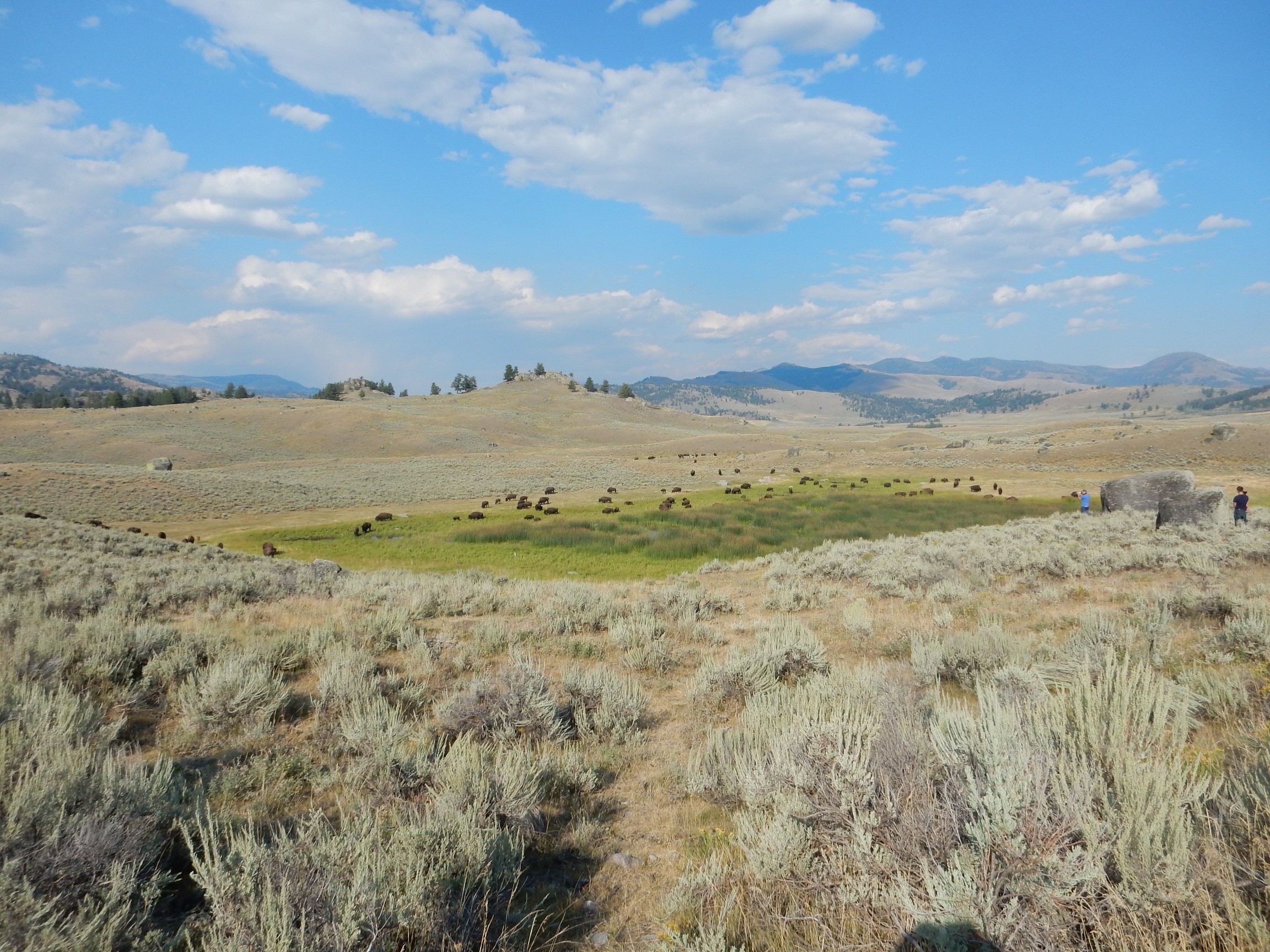
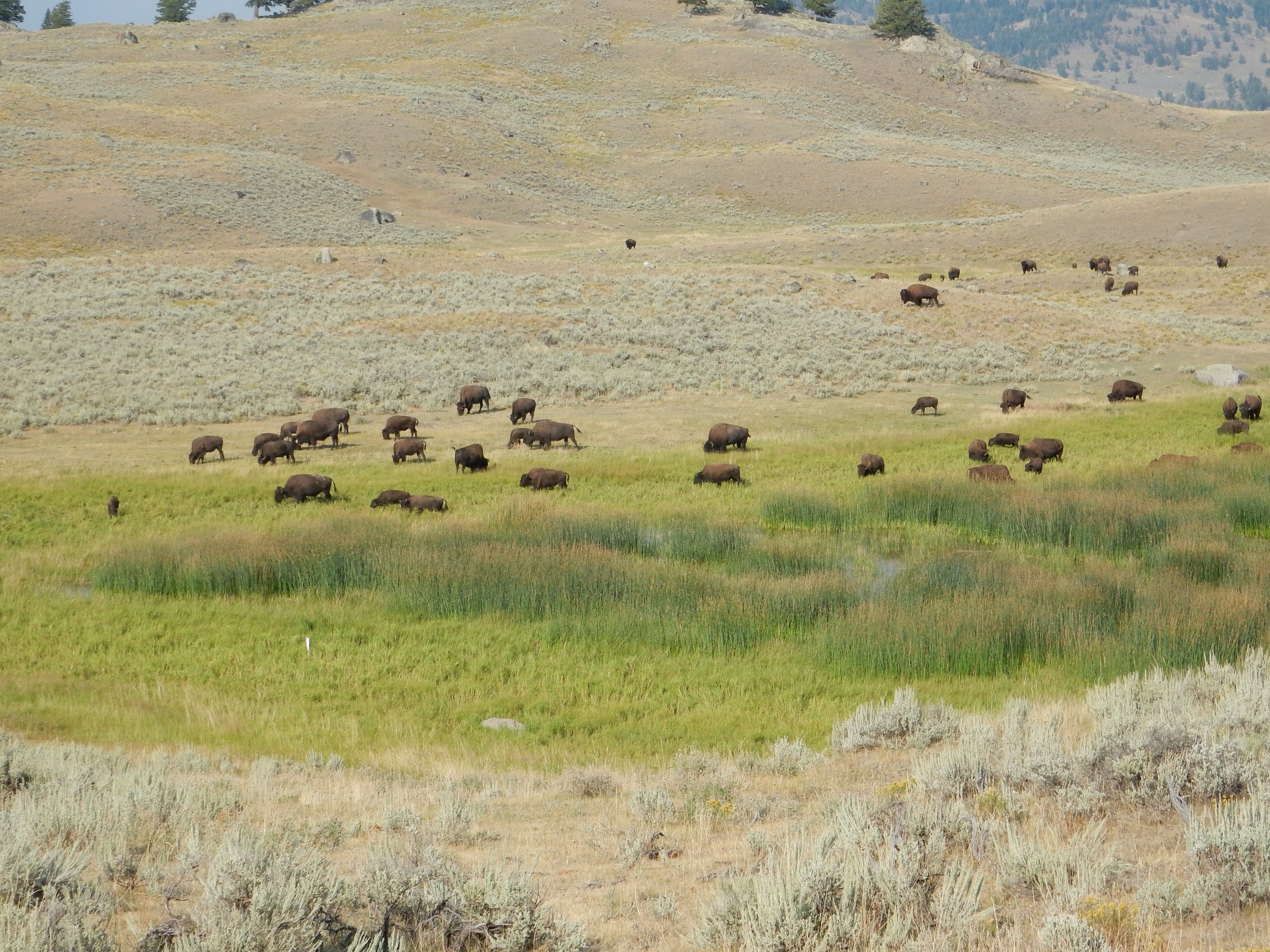
I hurry through Lamar Valley, but this is a hangout for wildlife and I pause for one bison shot.
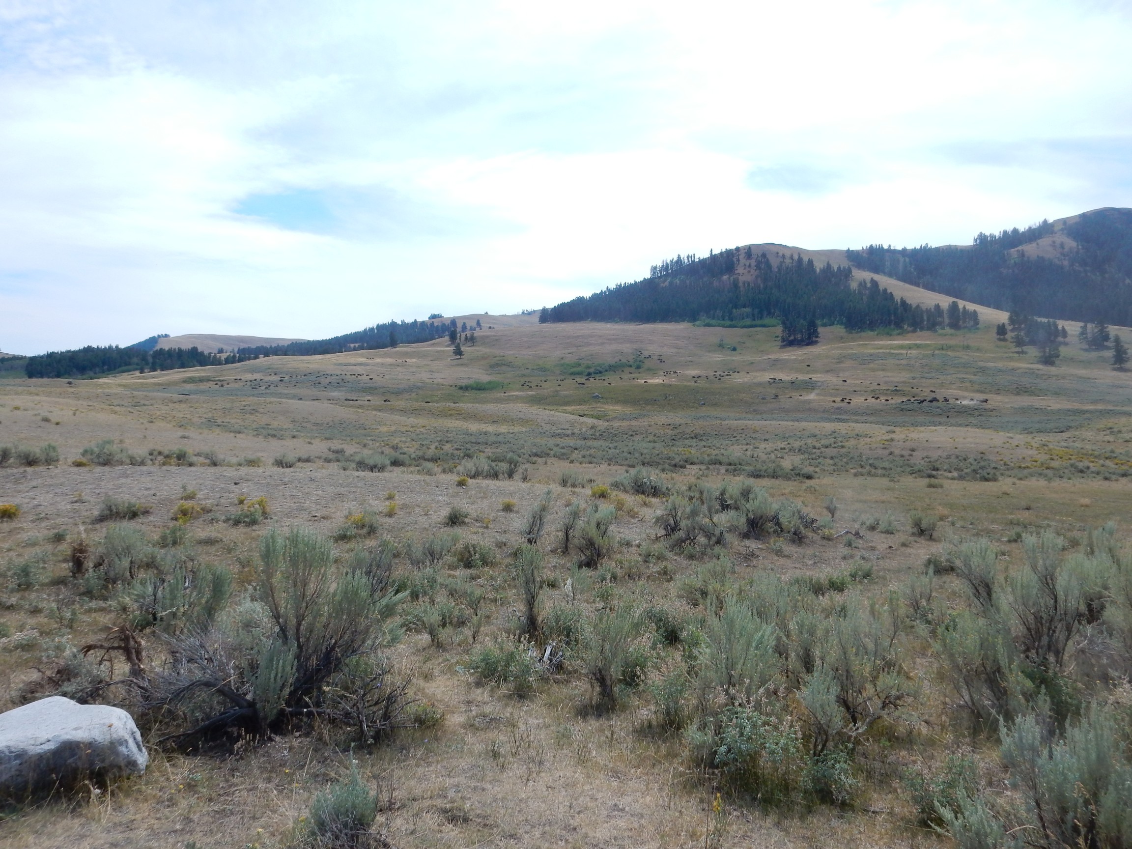
The herd is in the distance, towards the right.
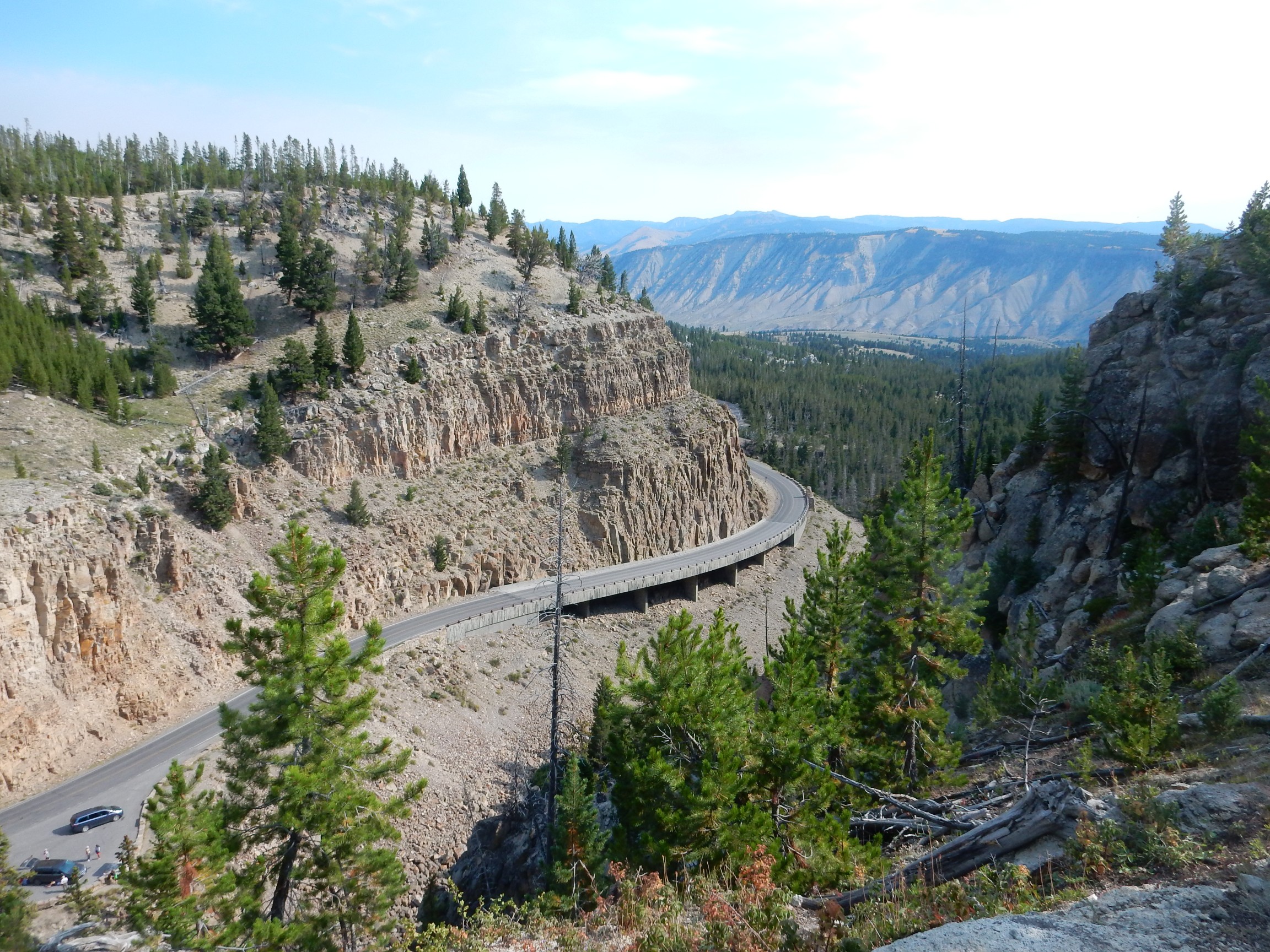
I continue on Soda Butte Creek and out the park northeast entrance and towards Beartooth Pass. A striking outcropping:
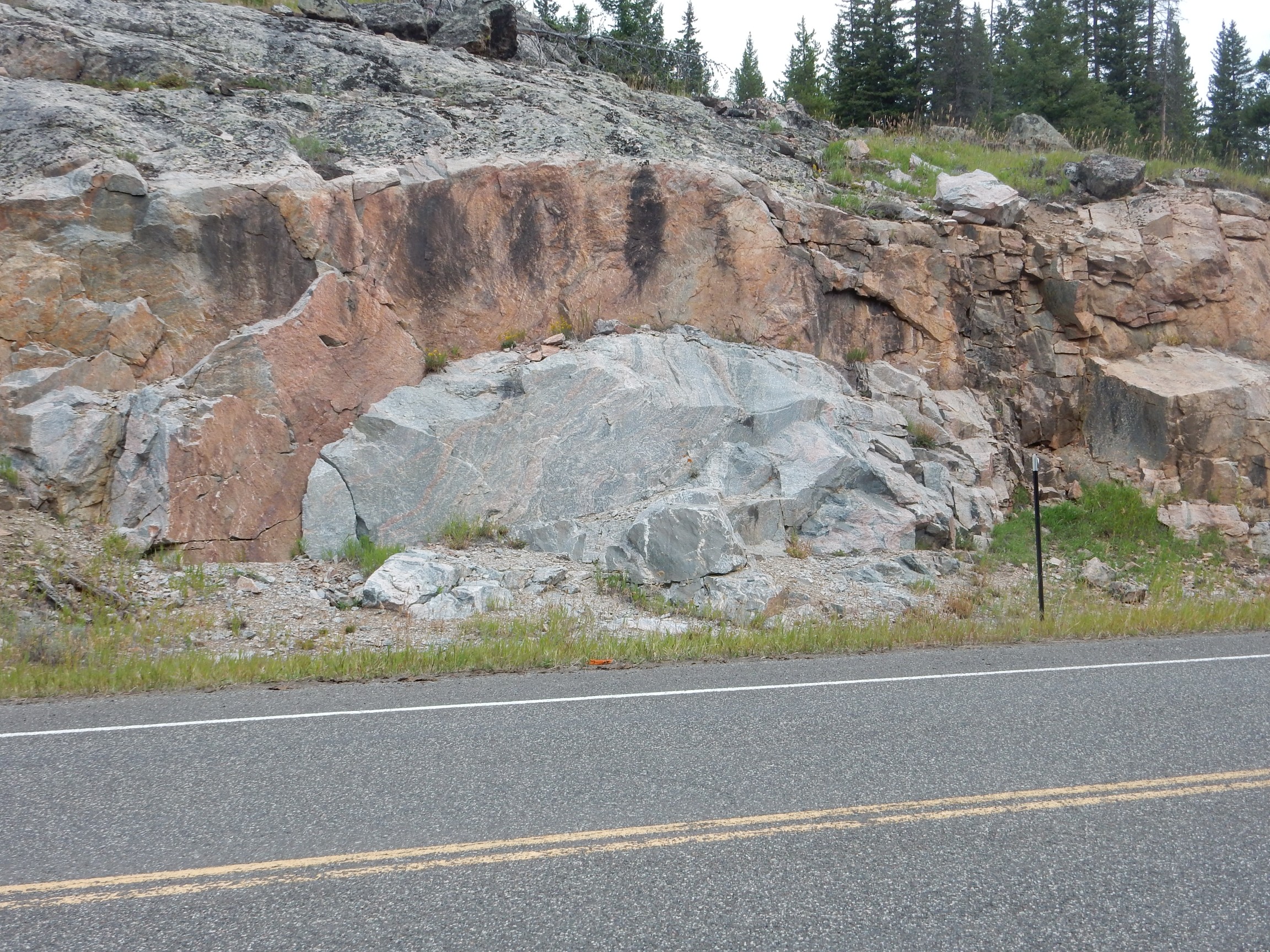
Archean basement rock; a gneiss featuring a mix of pink and gray. Cool enough that I decide to grab a piece, since I’m now outside the park. (Which I do not find in my stuff when I unpack after getting home; crep.)
To the west are Pilot Peak and Index Peak.
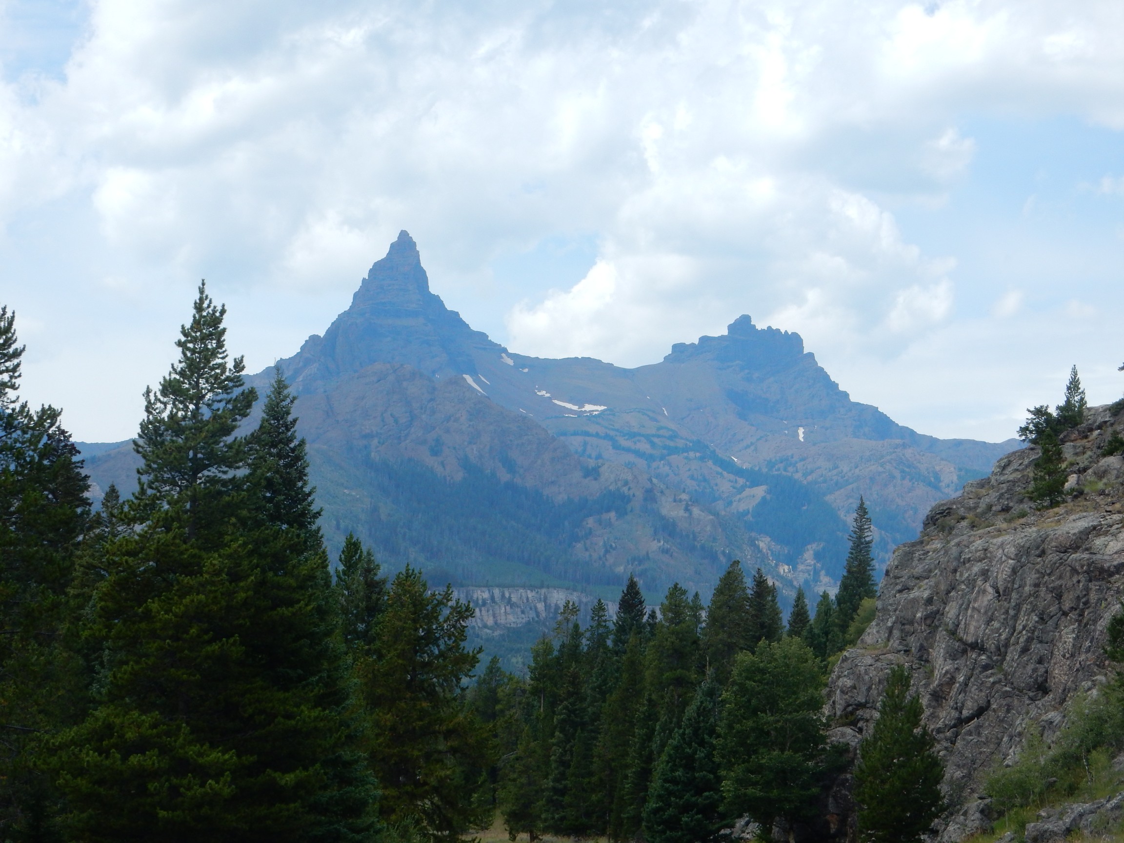
Pilot Peak, at left, is a glacial horn, formed where multiple glaciers flow outward from a central point, carving bowl-shaped cirques whose convergence is the horn. The ridge between the two peaks is an arête, formed where two glaciers flowed side by side to leave a knife-edge ridge between.
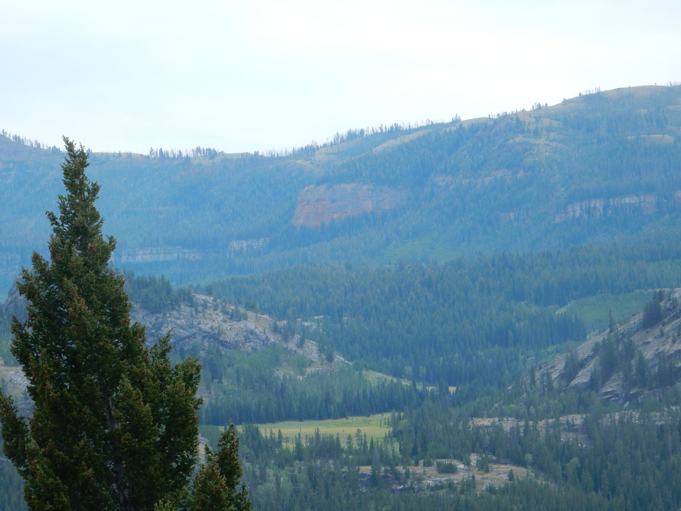
I find a pullout to eat my lunch. In the mountain face to the south I see a rare exposure of the Heart Mountain Detachment.

The prominent limestone beds are Cambrian Pilgrim Formation, which are a useful marker for the detachment. The detachment itself is along a weak bed in the overlying Bighorn Dolomite. It can be seen here as the contact between lower white and upper dark beds above the center of the photograph, showing through a gap in the trees. In most other places, the easily eroded Bighorn Dolomite is covered with debris or vegetation and the detachment is obscured.
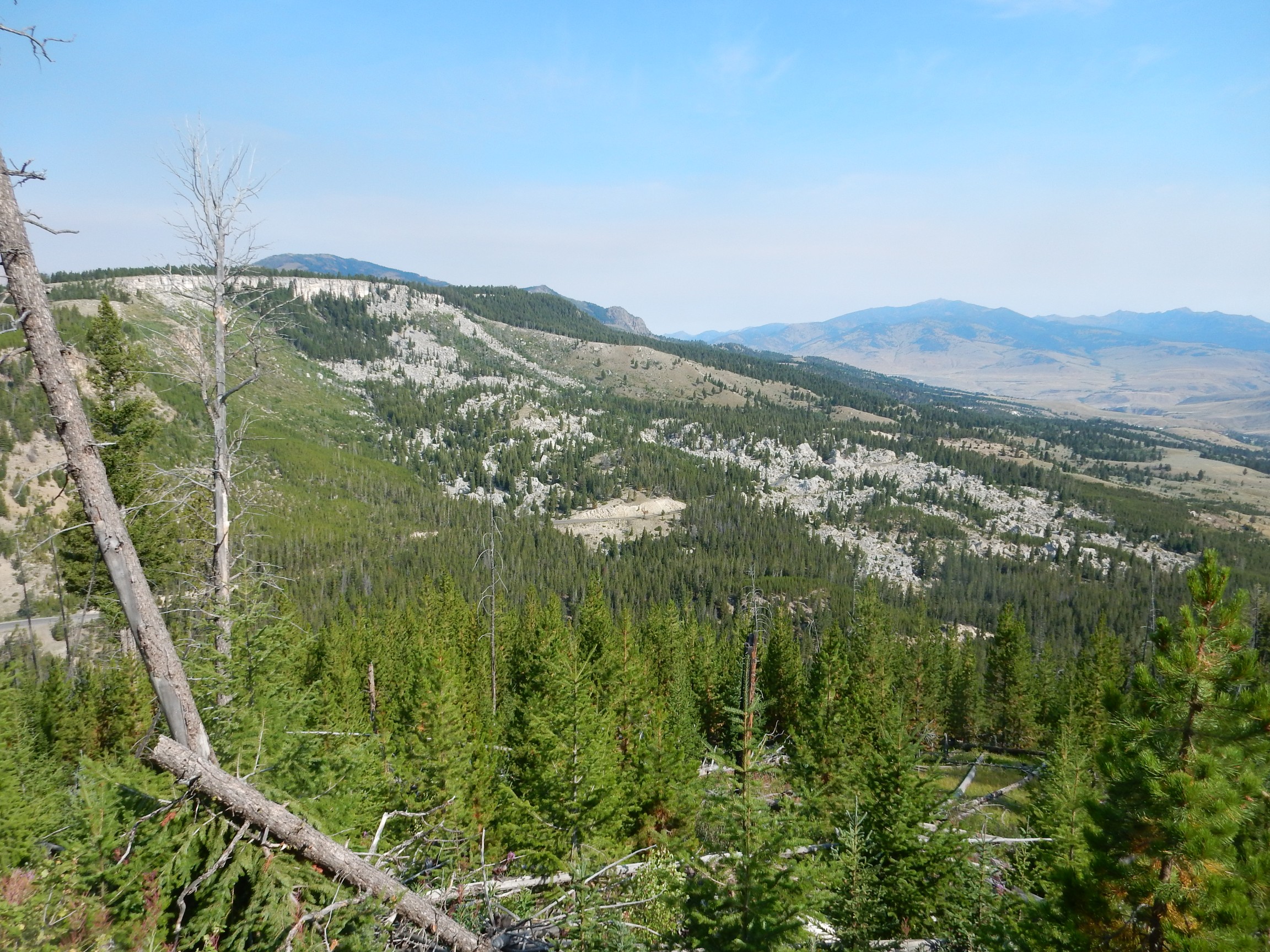
The country to the south is pretty enough for a panorama.
Hullo, what’s this?
This looks like one of the landslide blocks of the Heart Mountain Detachment, come to rest at this point then buried under younger volcanic debris.
My guidebook tells me there is an outcrop with glacial striation a quarter mile north of the rest stop past the fork to Highway 296. That sounds cool. I park in what I take to be the rest stop and limp up the hill to the north. Nuttin’.
To be more precise, the guide book says the rest stop is at the top of the hill past the fork. Maybe here?
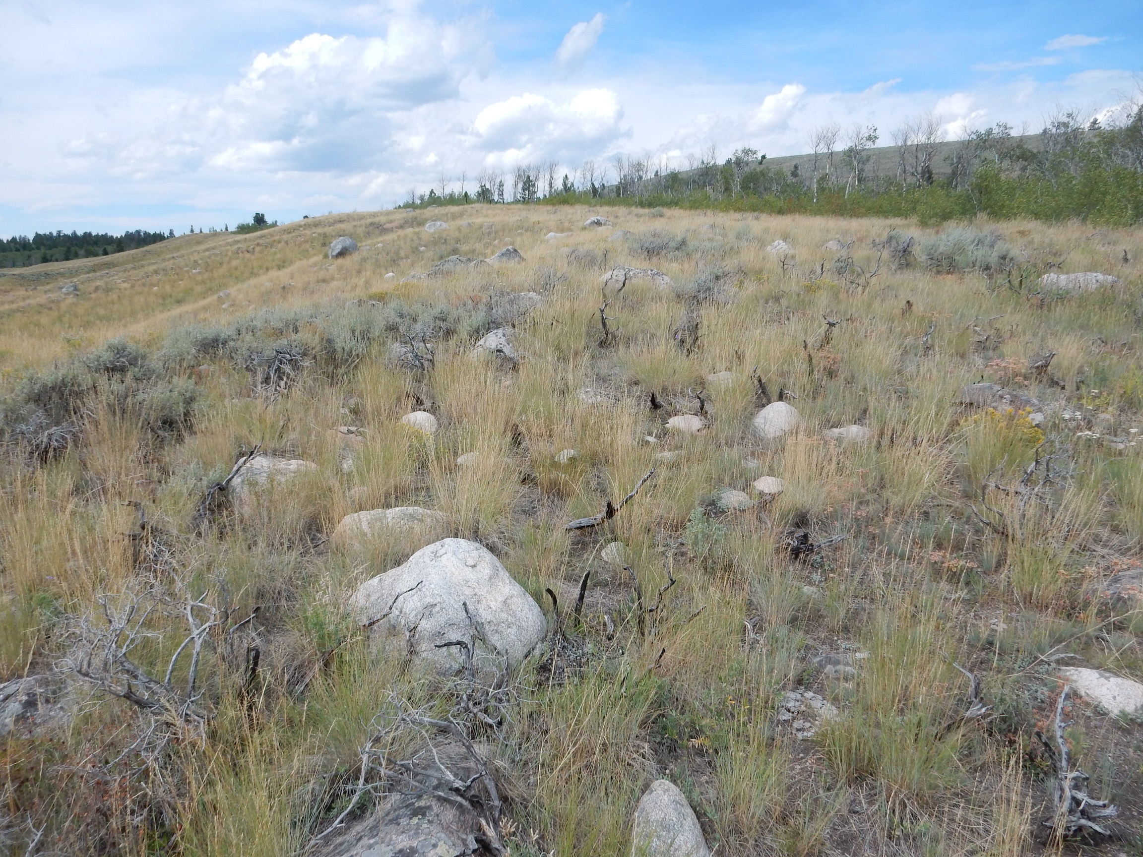
I hike north as far as the dirt road visible on the Google view. Nuttin’ but glacial erratics.
I mutter unkind things about the parentage of the authors of the guide, pick seeds out of my socks, and drive on.
Near as I can tell, the nearest bedrock outcropping is actually here. I’ll bet it has very nice glacial striations, too. I just didn’t hike far enough.
I pause at Beartooth Lake for a view of Beartooth Butte.
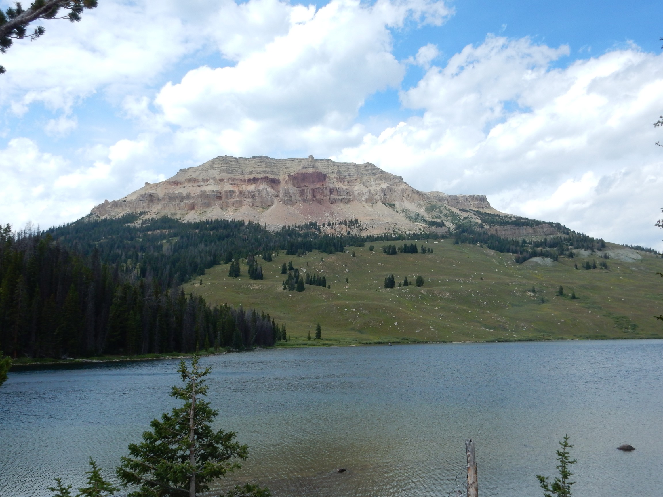
This is a rare erosional remnant of the Paleozoic rocks that covered the Beartooth Plateau before it was scrubbed clean by glaciers. The red patch is the Beartooth Butte Formation, a river channel in the underlying rocks containing numerous fossils. The beds here are middle Cambrian to middle Devonian in age.
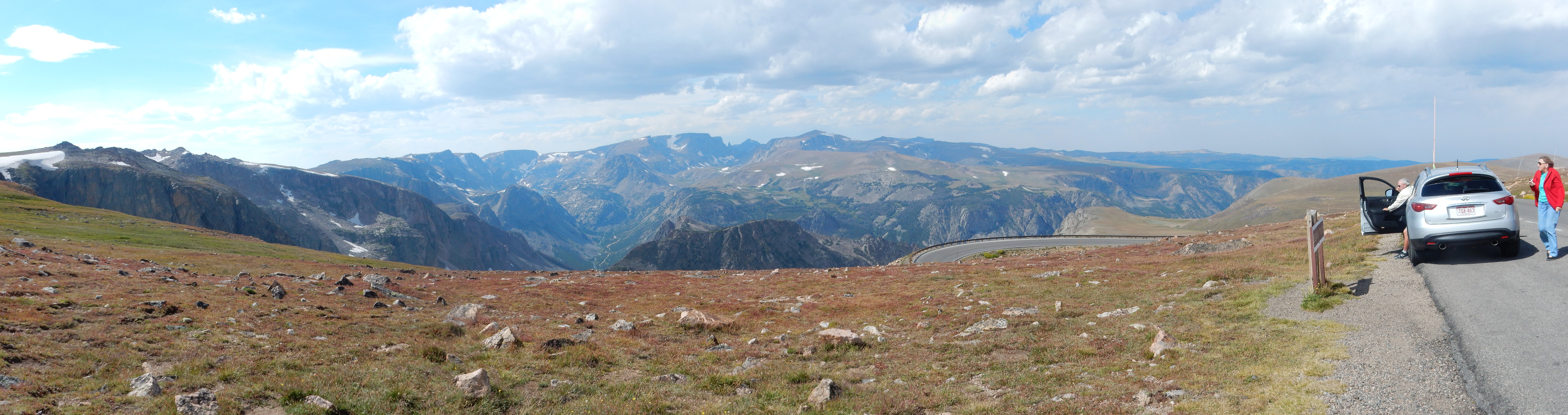
Approaching Beartooth Pass.
Notice the very jagged peaks of the Absaroka Range on the skyline on the left side of the panorama (click to enlarge). These peaks of relatively soft beds of the Absaroka Volcanic Supergroup have been deeply sculpted by glaciers.
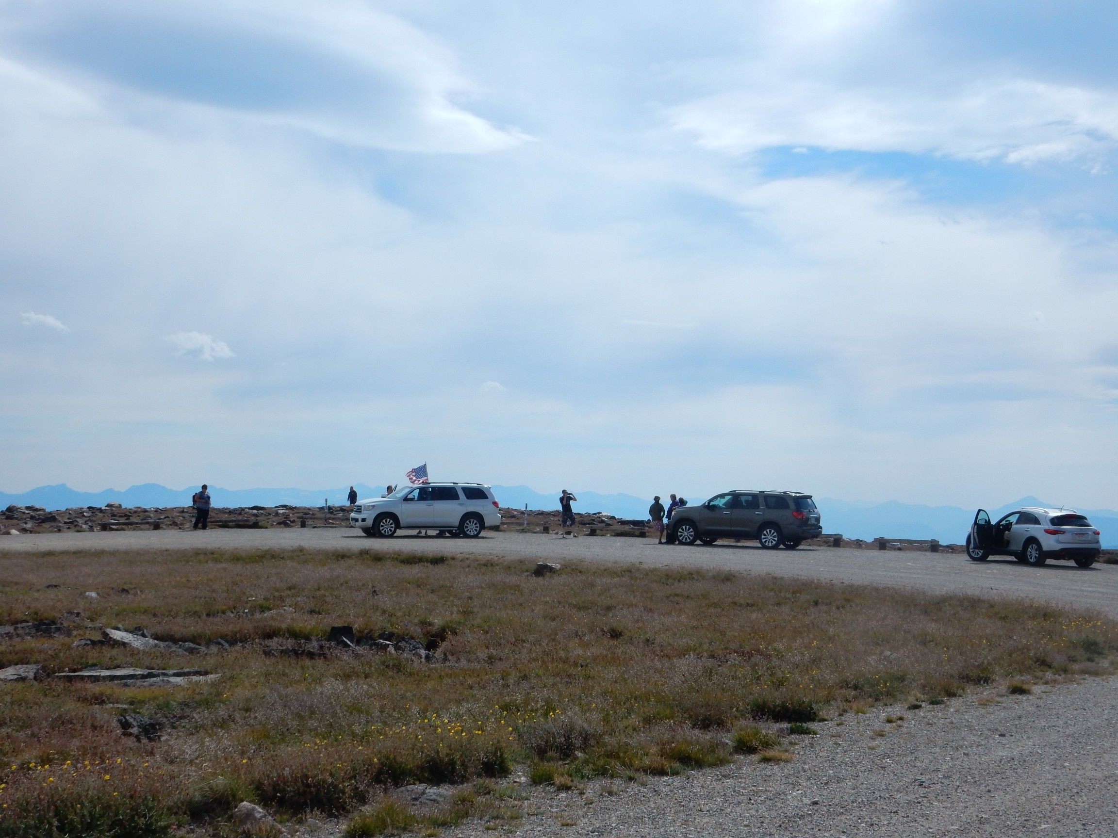
There is a viewpoint at the top of the pass.
Watermelon snow on the nearby peak.
The pink color is a freshwater green alga, Chlamydomonas nivalis, that has adapted to life in the snow. Its red color is from a carotenoid pigment (similar to the orange carotene in carrots) that protects the cells from intense light, including UV, and which also helps warm the cell. The cells have a complex life cycle and are the base of a community of microorganisms living in the snow.
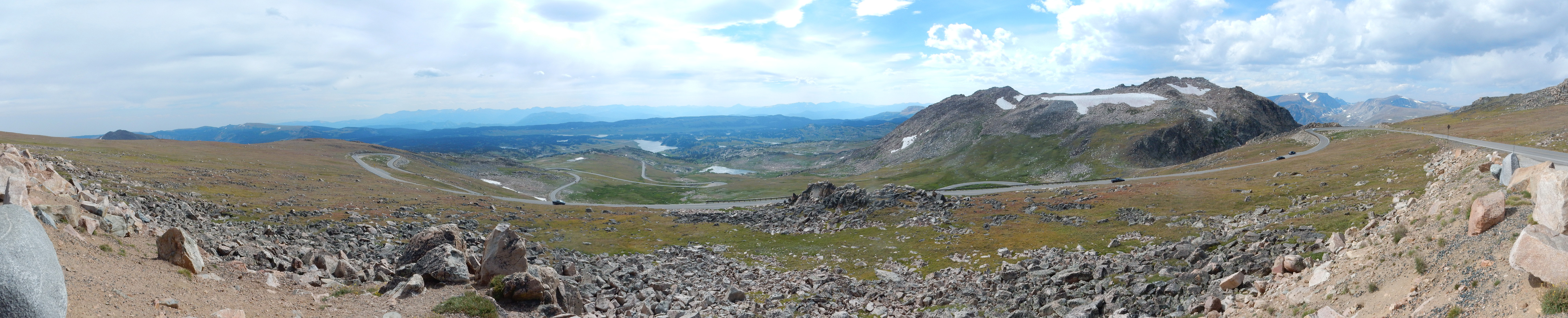
Beartooth Plateau to the north.
Note how flat the plateau is. Unlike the jagged Absaroka Range to the south, the Beartooth Plateau is very hard granite that was already nearly level when uplifted and scrubbed by glaciers.
However, that doesn’t mean the glaciers didn’t put some serious dents in it. This becomes evident when I get part way down the other side of the pass.
Though deeply carved by glaciers, there are abundant remains of what was the nearly level surface of the plateau.
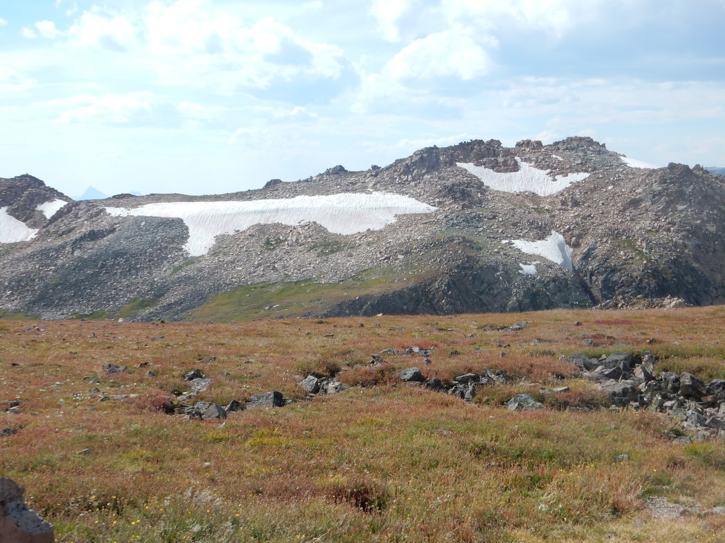
Look closely at center, and you will see the Bear’s Tooth. Here’s a closer view.
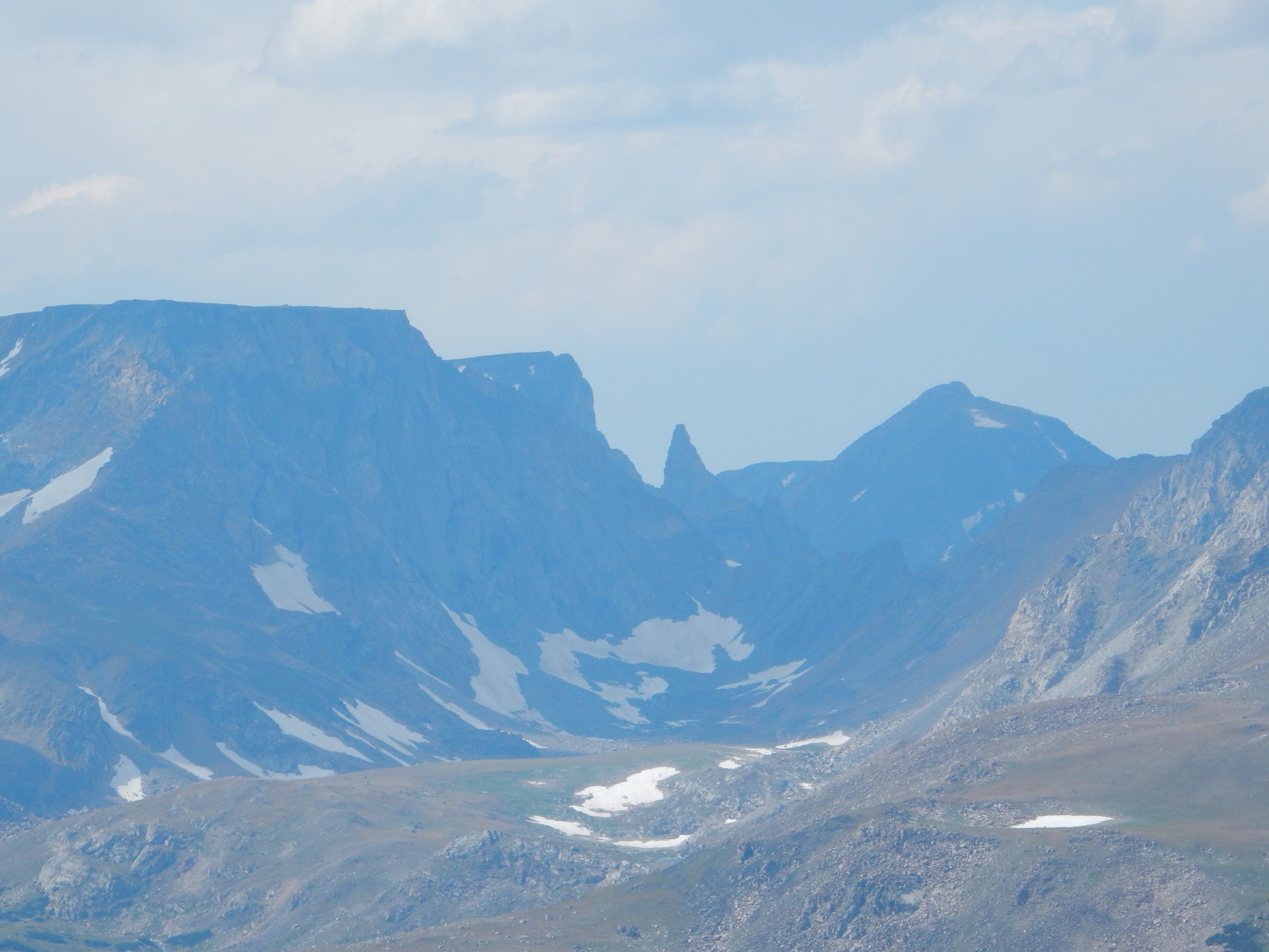
The Bear’s Tooth is a small glacial horn, unusual for the Beartooth Plateau.
It’s late in the afternoon and I have a long drive ahead. I pause briefly east of Cooke City for a shot of the Heart Mountain Detachment.
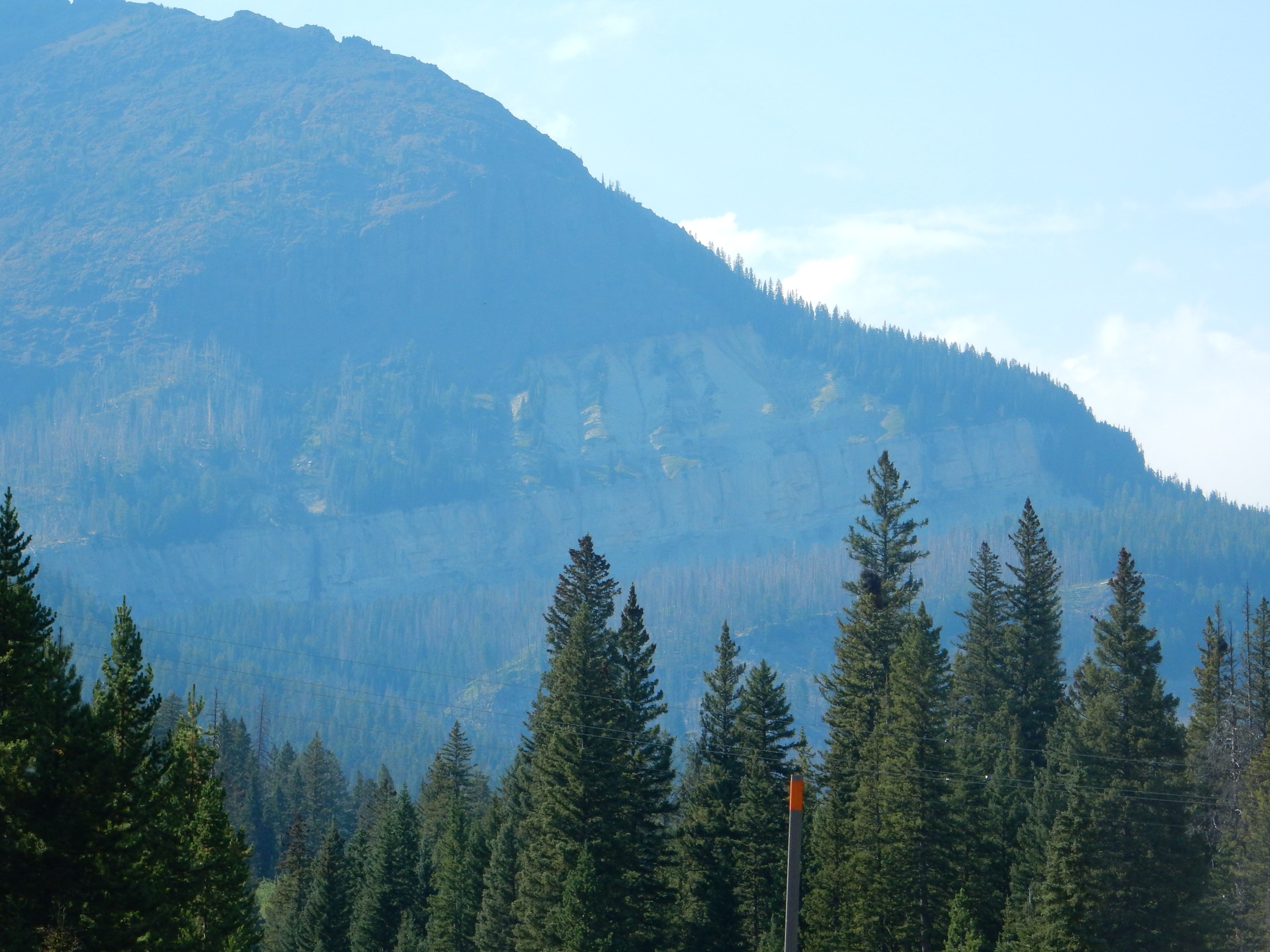
There are the usual prominent cliffs of the Pilgrim Formation towards the bottom of the mountain, but here the overlying beds of the Bighorn Dolomite, often obscured by vegetation or debris, are well exposed. The very flat surface of the Detachment is visible at the top of the Bighorn Dolomite.
Here’s a closer view from further along the road, where trees obscure the lower Pilgrim Formation.

I discussed what the Heart Mountain Detachment is back on Day 6. It’s basically the geological record of a monstrous landslide, of 100 square miles, that took place 50 million years ago.
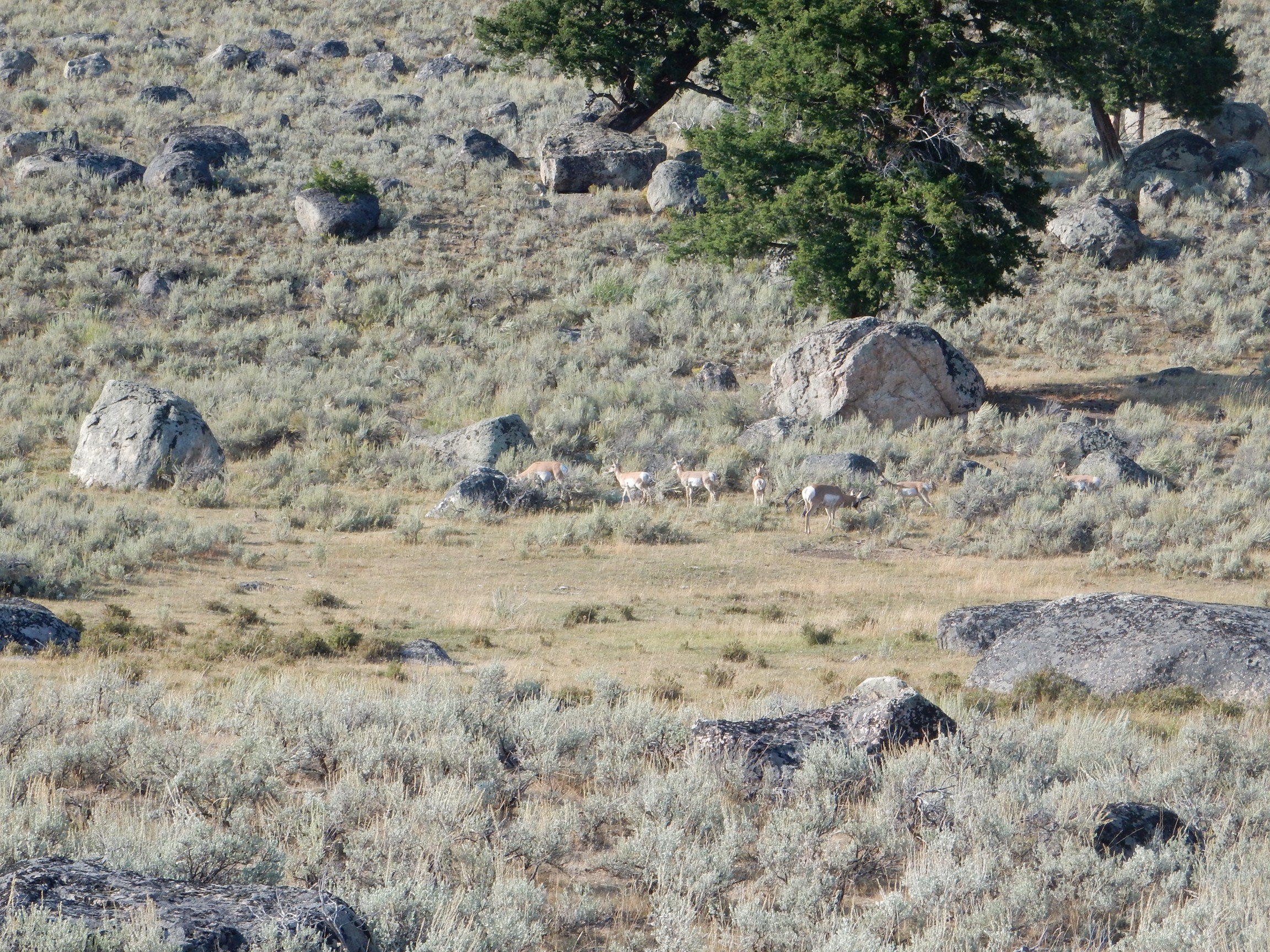
At the west end of Lamar Valley, around the kettle pond I looked at on Day 6, there is a huge knot of tourists. Wildlife, of course.
Bison.


Pronghorn.
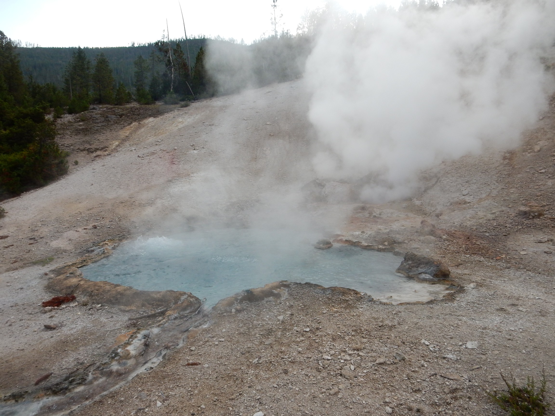
I am feeling a little poignant. These are very likely my last minutes in my last visit to the park; life is short and I doubt I’ll come this way again. I visit one last hydrothermal feature, Beryl Spring.
I stop at Robins Roost in Island Park for a few supplies. I want to clean up for Sunday, among other things, and I have a craving for some sugar-free ice cream. (And I need more ice for my cooler, especially if it’s going to have ice cream in it.) I am a little surprised to find that the prices are pretty reasonable for a small store in an isolated community with lots of tourists. I suppose the locals have to buy somewhere.
I call Cindy. The weather forecast still looks pretty good for Rexburg: Some light overcast clearing by 10:00AM Monday morning. Eastern Oregon is still a madhouse. I haven’t seen any signs of insanity in Island Park so far.
To my surprise, a woman raps on my car door as I am finishing up my conversation. I roll down the window. “We’ve noticed you here by yourself the last couple of days. Would you like to come have some pizza with us?” I hate to turn her down; pizza is one of the worst things for diabetics. But I thank her sincerely for thinking of me. Most people really are pretty decent.
I take a long walk around the campground, since it is still early. Then turn in.
Next: Sabbath in Island Park
* Lame nerd humor. — Wait, you already knew that?
Pingback: Great American Eclipse wanderlust, day 8 | Wanderlusting the Jemez
I think the birds you identify as turkeys are grouse; turkeys are supposed to be rare in the park.
https://en.wikipedia.org/wiki/List_of_birds_of_Yellowstone_National_Park#Partridges.2C_grouse.2C_turkeys_and_quail
They do look like ruffled grouse. But then, female and juvenile ruffled grouse resemble female and juvenile turkeys.
Pingback: Great American Eclipse wanderlust, day 10 | Wanderlusting the Jemez