Young men and old teeth
Yesterday’s wanderlust was a trip out to the San Juan Basin to revisit a couple of fossil sites I was introduced to by the Los Alamos Geological Society.
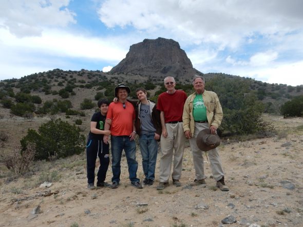
Our group consisted of myself, Gary Stradling, Marc Burnside, and two of Marc’s sons, Aaron and Stephen. Aaron is 18 and Stephen is almost 13. All had expressed interest in doing some fossil hunting.
So I was up at 5:30 AM (on a weekend!) to fix my breakfast, make sure my backpack and bag were in order for the trip, pack a lunch, let the dog out, and otherwise be prepared to head out. Gary picked up the Burnsides first and then came to my place, where we took a few minutes to clean some tree sap off his windshield. We were on the road by 7:30, and we had a reasonably uneventful trip through the Jemez, other than some concern that Stephen might be getting a touch car sick. Gary naturally preferred not to have Stephen evacuate the contents of his stomach inside his Jeep, so we made a couple of stops to stretch our legs, at Battleship Rock and Soda Dam. Stephen was mostly okay the rest of the trip.
We arrived at the turnoff from the main highway to San Luis. Here we entered the San Juan Basin, the southeasternmost basin of the Colorado Plateau.
The Colorado Plateau is a region of unusually stable crust covering most of the Four Corners area. It has been slowly subsiding for at least the last three hundred million years, while sediments have accumulated on it to leave an impressive geologic record of that long span of time. In the San Juan Basin, this record extends roughly from Triassic Chinle Formation rocks, roughly 230 million years old, to San Jose Formation rocks around 50 million years old.
A basin has a particular meaning to a geologist. The San Juan Basin isn’t particularly shaped like a basin. Geologists call it a basin because the rock beds are gently downwarped towards its center. This leaves the youngest rocks exposed in the north-central part of the basin and the oldest around the edges of the basin. Basins are important in part because the deeply buried sedimentary rocks can sometimes be a source of oil and natural gas. Significatn oil and natural gas has been produced in the San Juan Basin.
The area we would be hunting fossils in is underlain primarily by the Mancos Formation, which is between 80 and 95 million years old. That puts this rock in the Cretaceous Period, the last period of the Mesozoic Era, or Age of the Dinosaurs. The Mancos Shale, as it is informally known, was laid down in a shallow sea that geologists call the Western Interior Seaway or the Cretaceous Seaway. This seaway stretched from the Arctic to the Gulf of Mexico and from central Utah to the Great Plains.
The Western Interior Seaway was formed when several small continents (microcontinents) collided with the west coast of North America. This collision helped throw up the Sierra Nevada Mountains, and the weight of these young mountains pushed the crust to the east of the mountains downward, a process called plate flexure. As the crust gradually dropped below sea level, the sea gradually moved inland, an event called a transgression. (As if the sea was being naughty!)
The initial transgression deposited a layer of beach sand that became the Dakota Formation. Later, as the seaway deepened, it accumulated considerable mud and organic matter eroded from the young Sierra Nevada, which became the Mancos Shale.
South of San Luis we left the paved highway.

The unpaved roads here are actually pretty good, except in bad weather. Fortunately the weather started out beautiful and remained reasonably good until we were back on the paved highway.
I had been here just once before. I told Gary to look for a turn to the left along a pipeline road, which I thought was maybe a couple of hundred yards down the main unpaved road. We passed a tank farm that did not seem to lead to a road, then finally found the turnoff; it was closer to a mile down the unpaved road. The pipeline road was not quite as good but was still quite passable. I tracked our location on GPS, but it was not difficult to find the next turnoff.
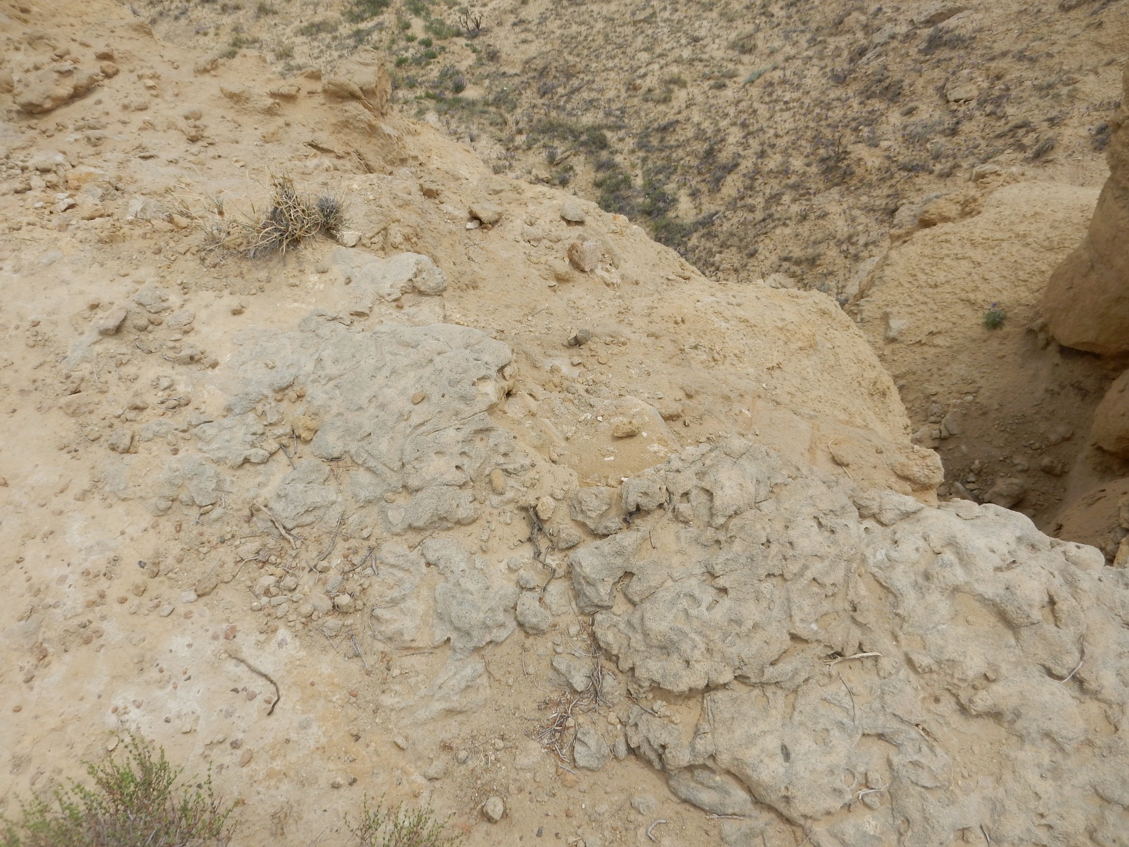
From here it was up the ridge to where we would hunt fossils. On the previous trip, we had gone to the Windmill Site, but the jurisdiction map seems to show this as tribal land so I was not terribly comfortable hunting fossils there. The geologic map showed that the ridge to the north, to which we had driven, was on BLM land and was underlain by the Juana Lopez Member of the Mancos Shale, just like the Windmill Site.
Formations are the basic unit of stratigraphy used by geologists. They are beds formed over a reasonably short interval of geologic time that share a common history. Modest variations within a formation may be identified as members of the formation. The Juana Lopez Member differs from most of the Mancos Formation in that its beds are not soft shale; they are relatively hard sandy limestone rich in fossils. I speculate that this represents a brief interval of drier, hotter climate where the amount of muddy sediment coming into the Western Interior Seaway diminished and lime-forming organisms proliferated in the clearer waters.
The first thing we noticed coming out of the car was the number of violet flowers.
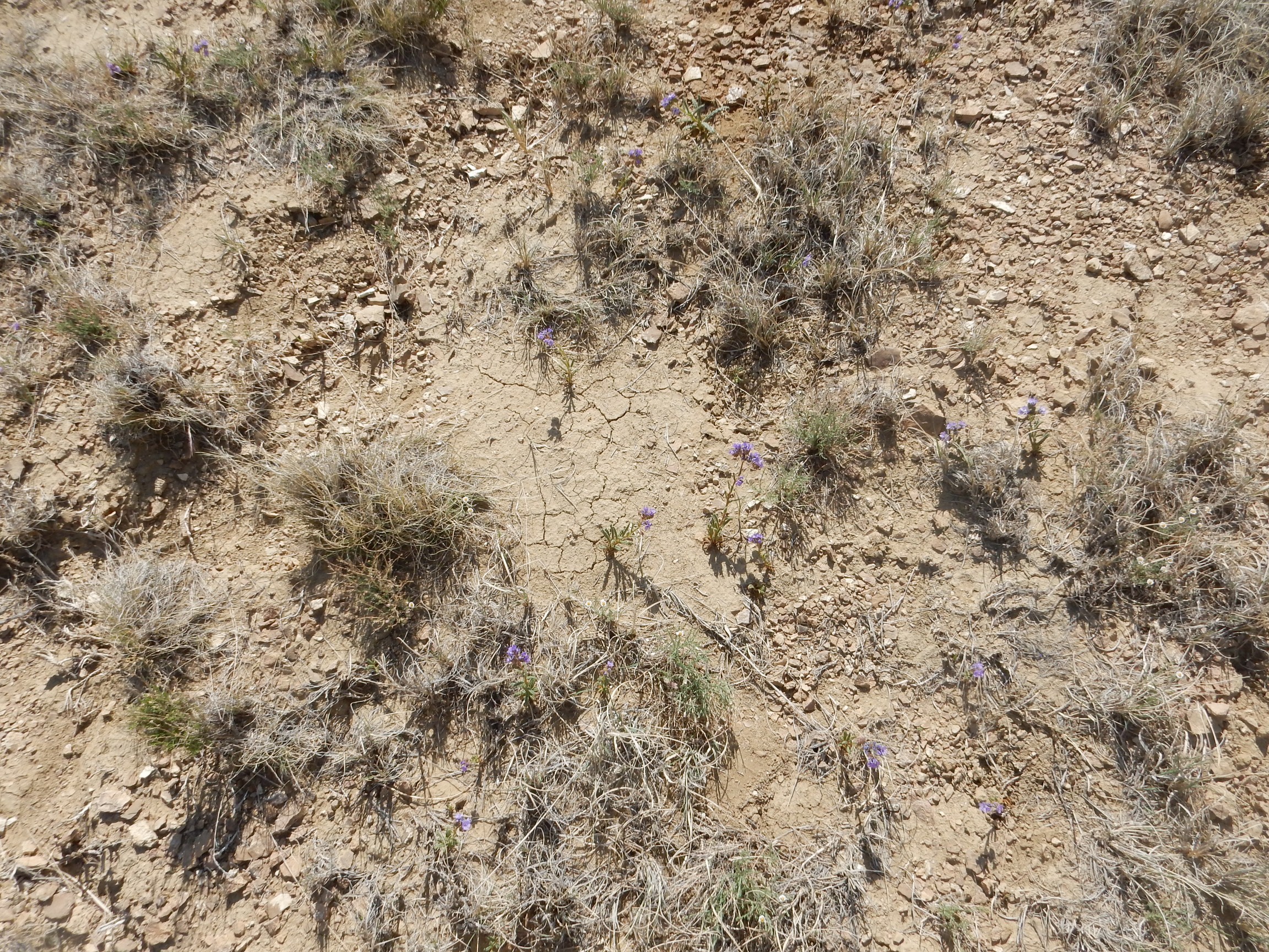
(Click to enlarge.) We found these throughout the area. Possibly Phaecelia coerulia, blue scorpionweed? A member of the forget-me-not family.
Sure enough, Gary almost immediately found some very nice ammonite casts.
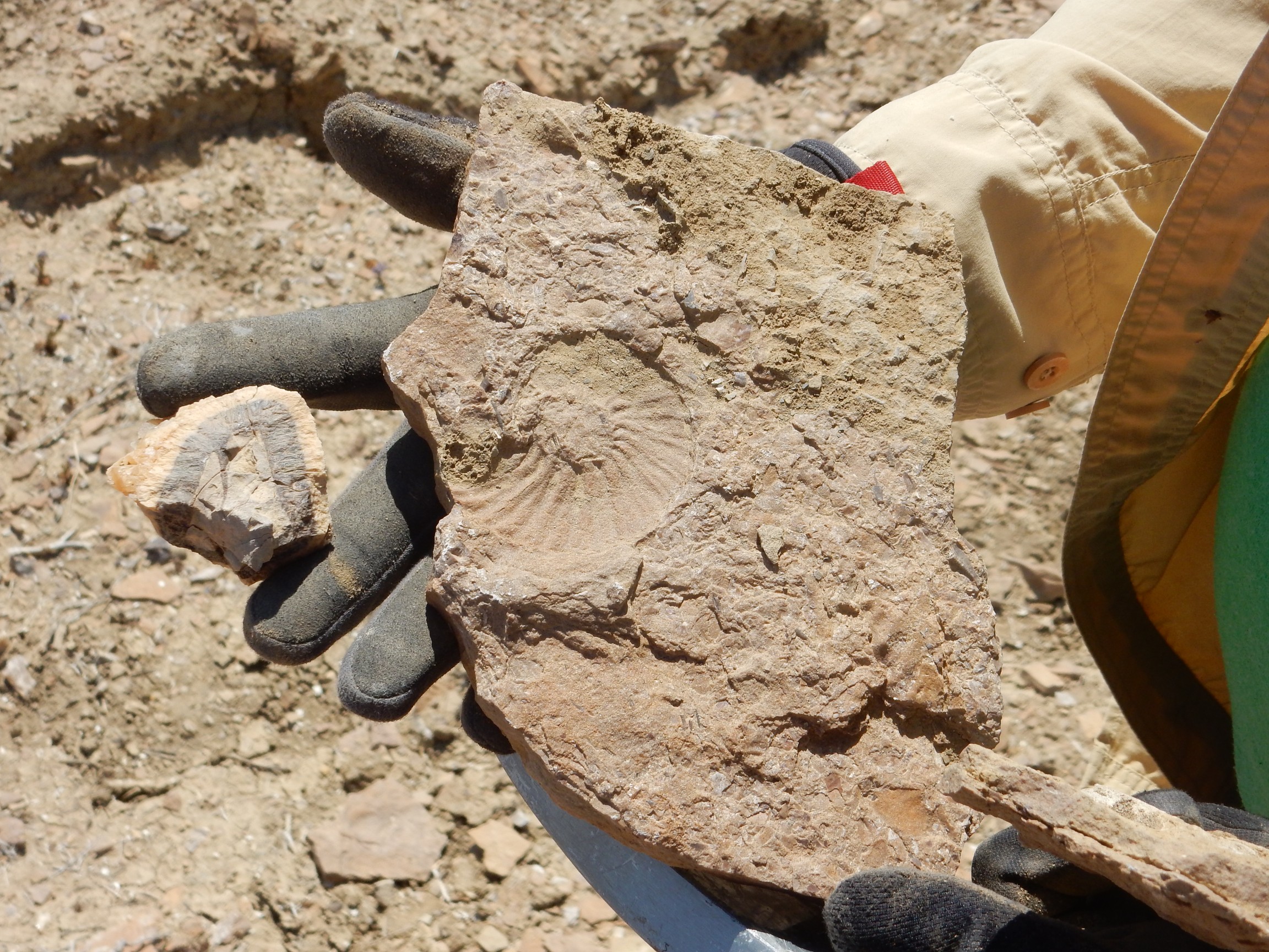
Ammonites are ancient cousins of the modern nautilus, which is something like a shelled squid. The casts show the spiral ridged form of the shells.
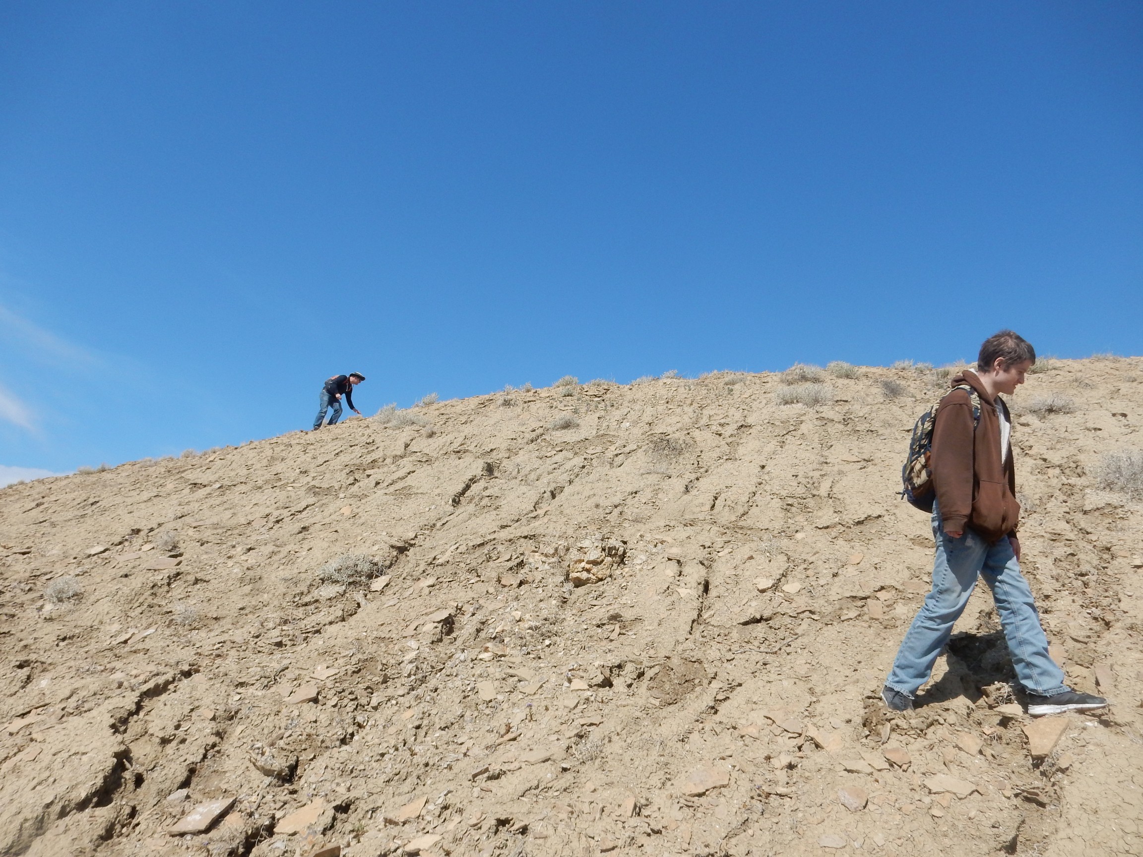
Marc and Aaron working their way along the ridge.
Pretty soon everyone was finding cool stuff. Steve found some large calcite crystals, leading us to some very interesting concretions.
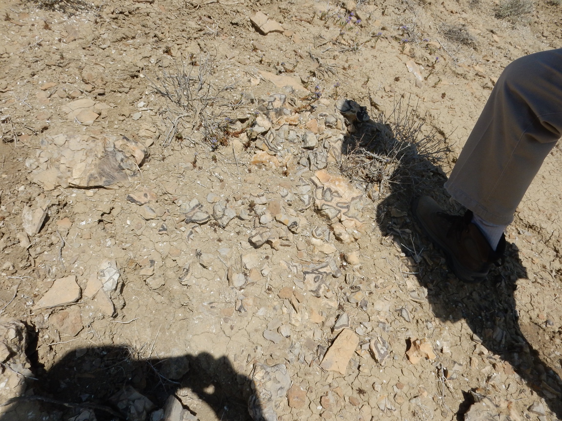
The concretions appear to have a muddy core surrounded by a shell of dark calcite and then the usual limy sandstone characteristic of the Juana Lopez Member. Gary thought they were organic in origin; I’m not so sure.
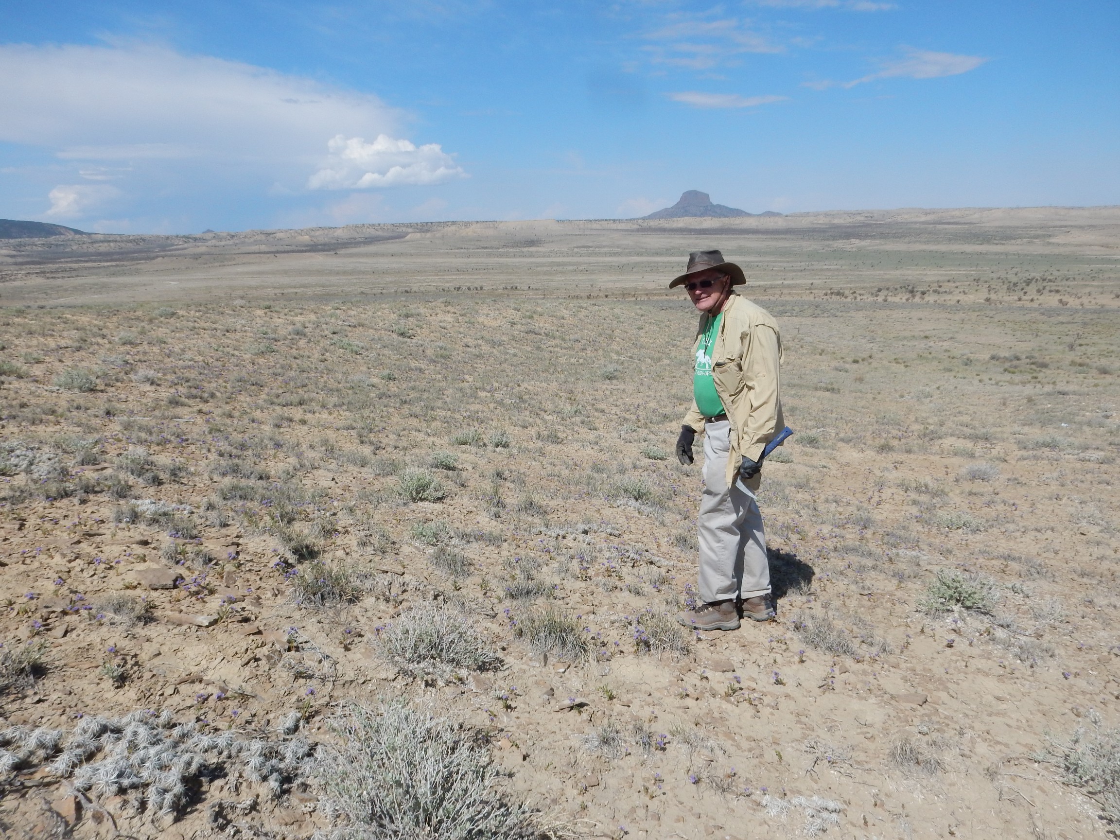
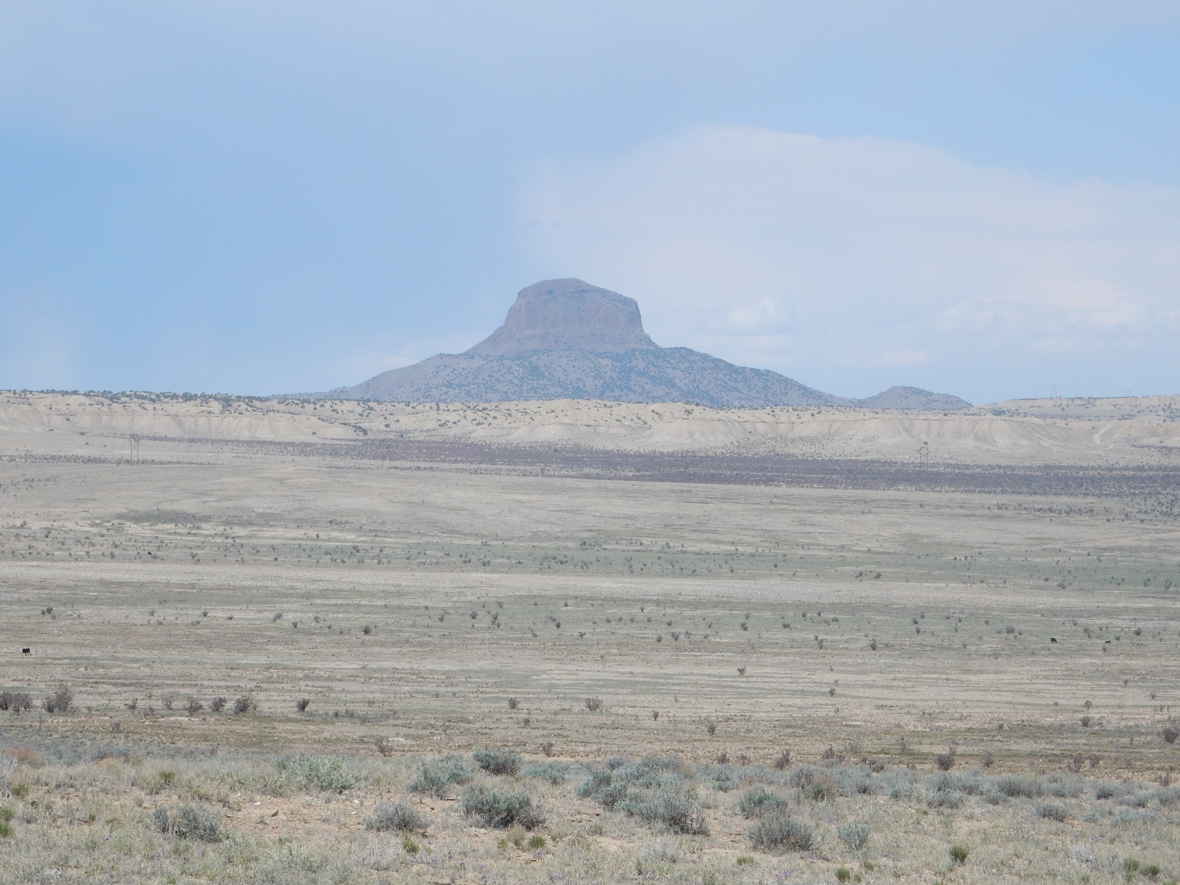
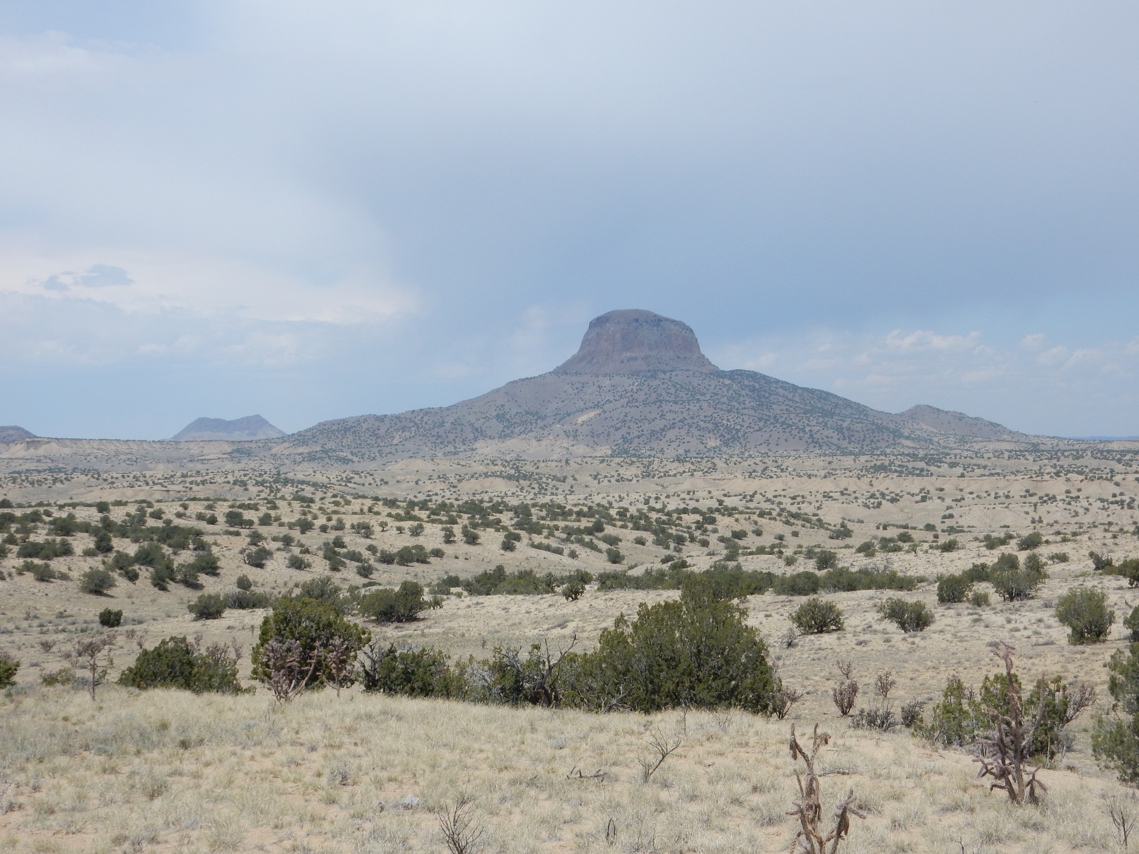
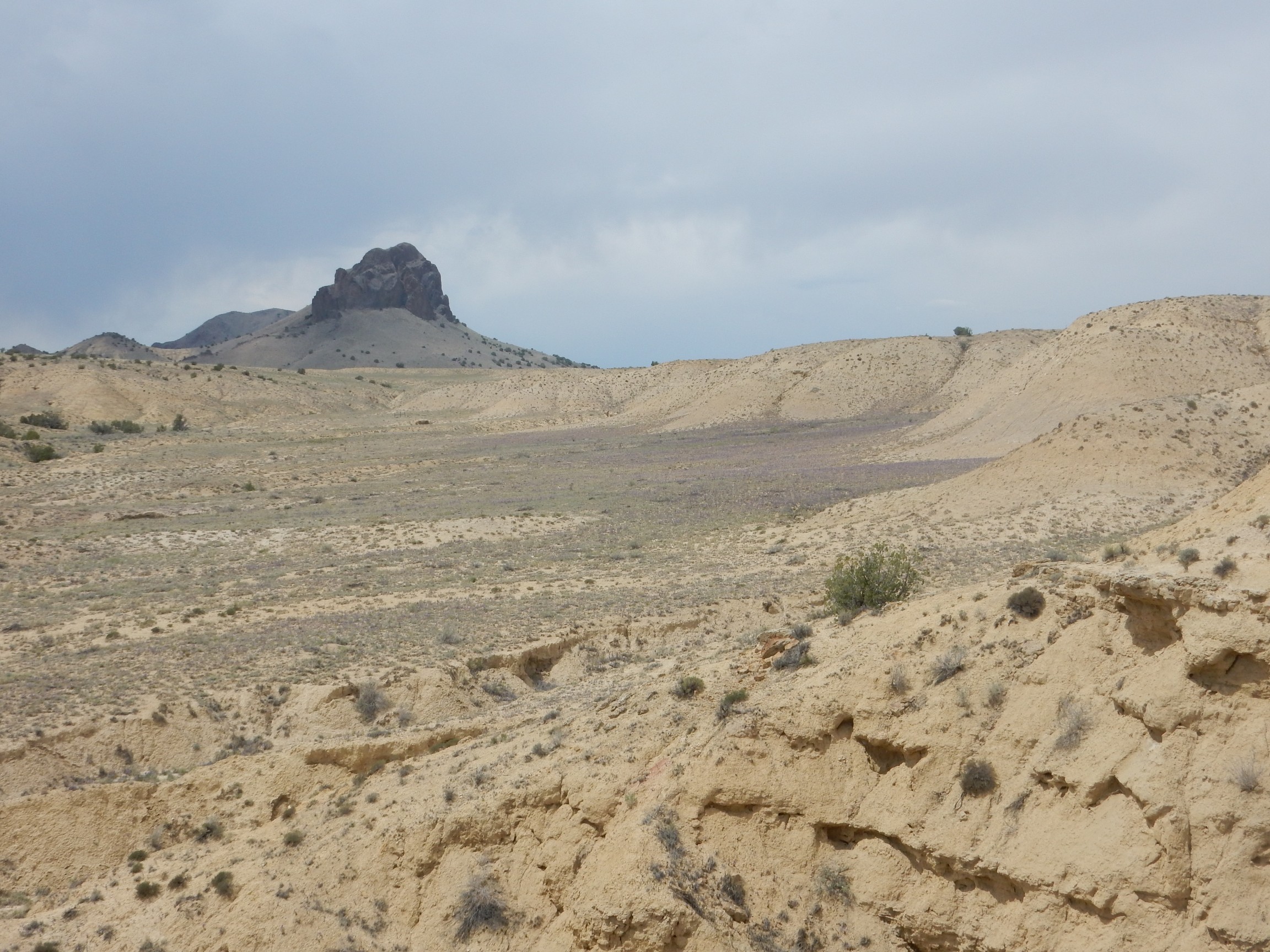
Gary enjoying himself, with Cabezon Peak in the background.
Looking down the ridge towards Mesa Prieta.
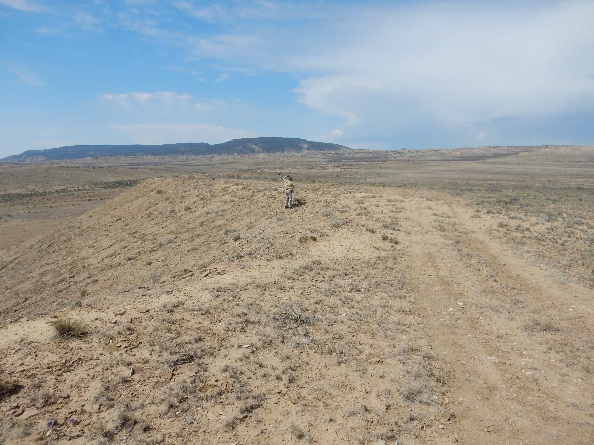
These two features are geologically young, with an estimated age close to three million years. Cabezon Peak and the many similar volcanic necks around it are eroded cores of volcanoes. All that remains after the softer flanks of the volcanoes are eroded away are the solid lava plugs in the throats of the volcanoes. Mesa Prieta was once low ground in which fluid basalt lava accumulated, forming a highly resistant layer when it cooled and solidified. The softer sediments around it later eroded down to leave a high mesa with a basalt cap.
A telephoto shot of Cabezon Peak:
My finds included shells of Inoceramus:
This is a kind of saber-toothed oyster. Well, not precisely an oyster, but a closely related mollusc, and specimens have been found that are three feet across.
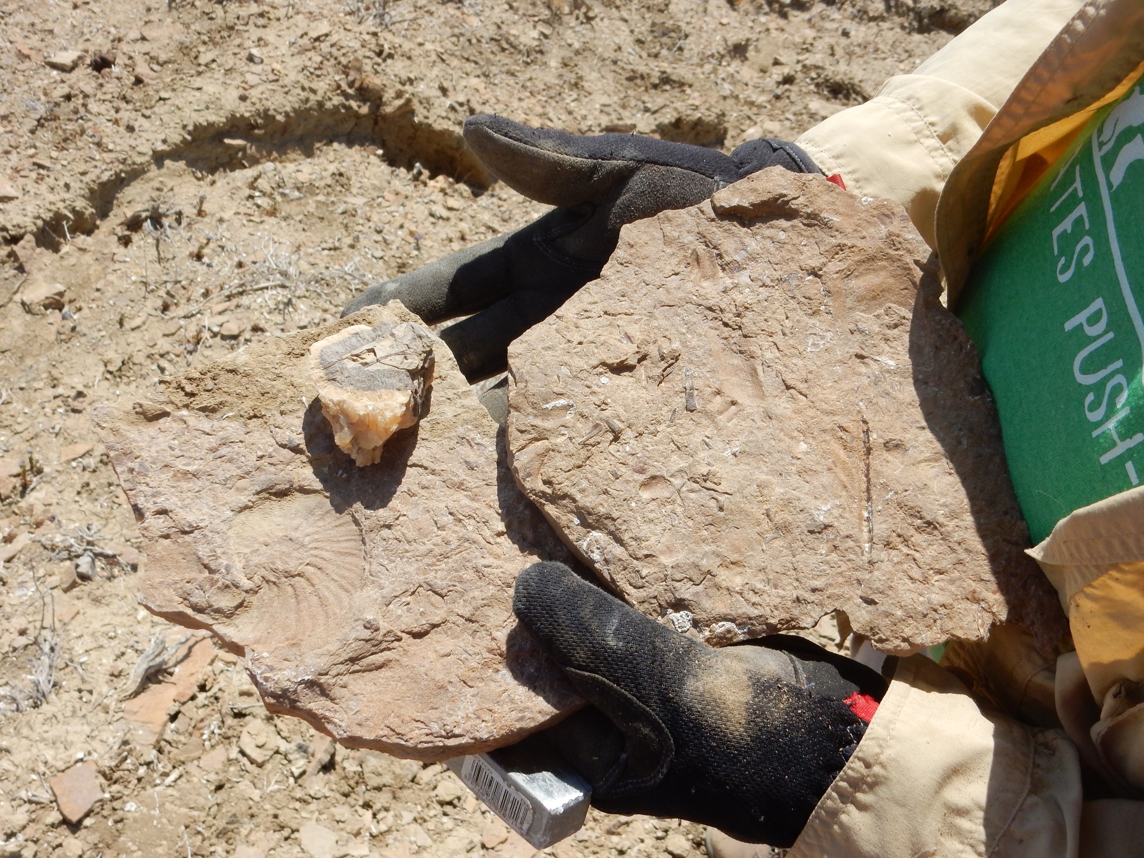
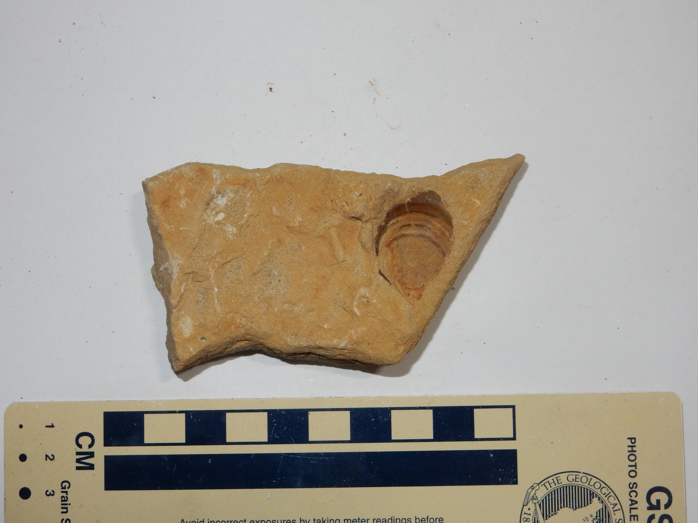
An ammonite cast:
The cast is near the center of the rock. Click to enlarge. Around it are several pieces of likely Inoceramus shell.
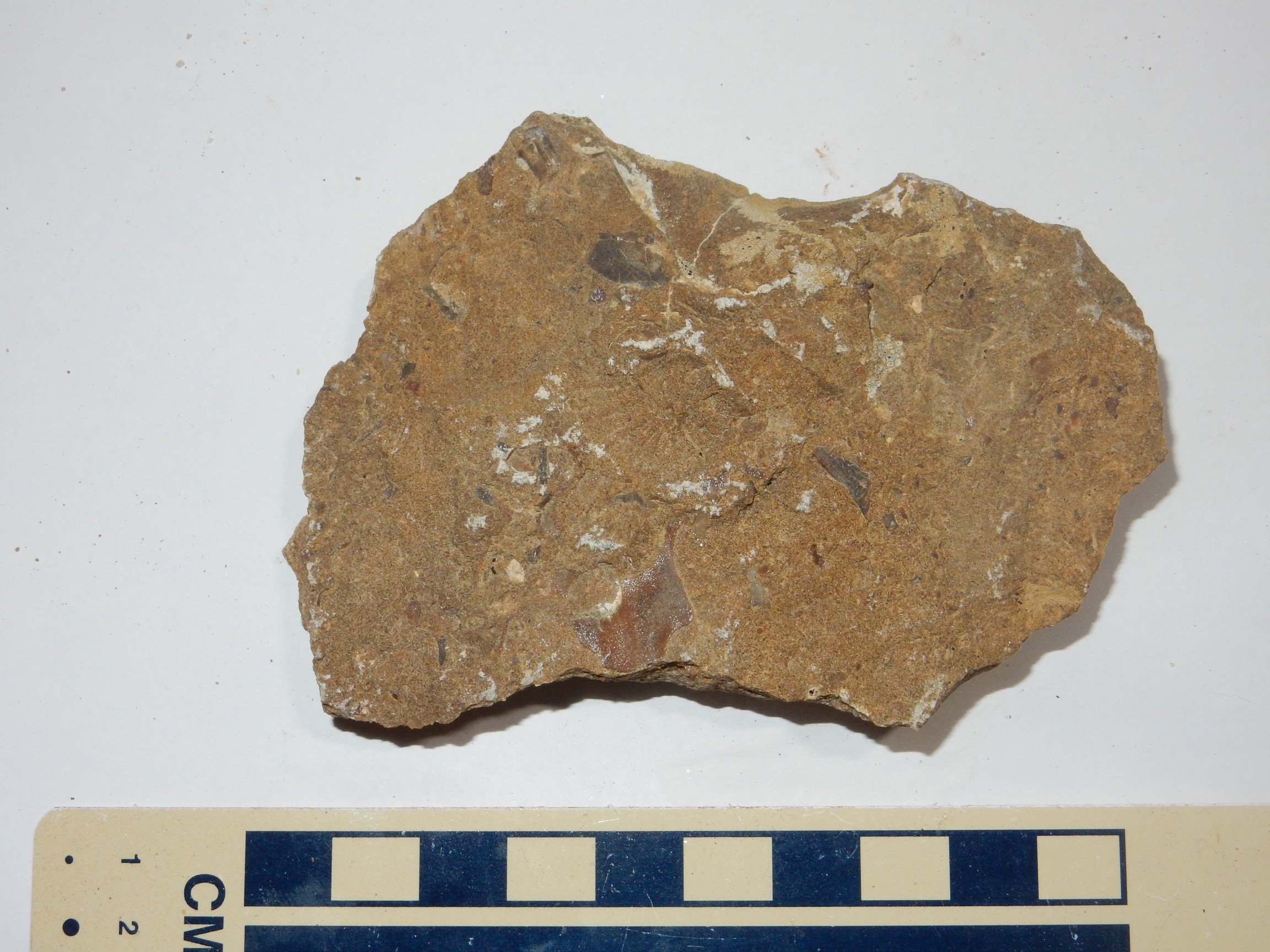
And something I didn’t find on my previous trip: A bryozoan.
The bryozoan is the vaguely leaf-like structure at center. Bryozoans are colonial organisms, like corals, but not closely related. They’re very common in Pennsylvanian rocks, but much less common in Cretaceous rocks. Nevertheless, they’re found almost throughout the fossil record and there are still living species in the present.
After collecting our fill of ammonite casts, Inoceramus shells, calcite crystals, and my bryozoan, we headed off the ridge. Gary had spotted a pond to our south and wanted to eat our lunch there, where there was some shade. We drove down, found the pond well-populated with ducks and garrisoned with cattle, and made our way to a shady spot to stop and eat. Except Aaron; he did not care for the smell of cattle and remained in the car. (I sympathize somewhat.)
After our break, we headed back to the pipeline road and found our turn to Sharktooth Ridge. We stopped at one point on the road for a panorama.
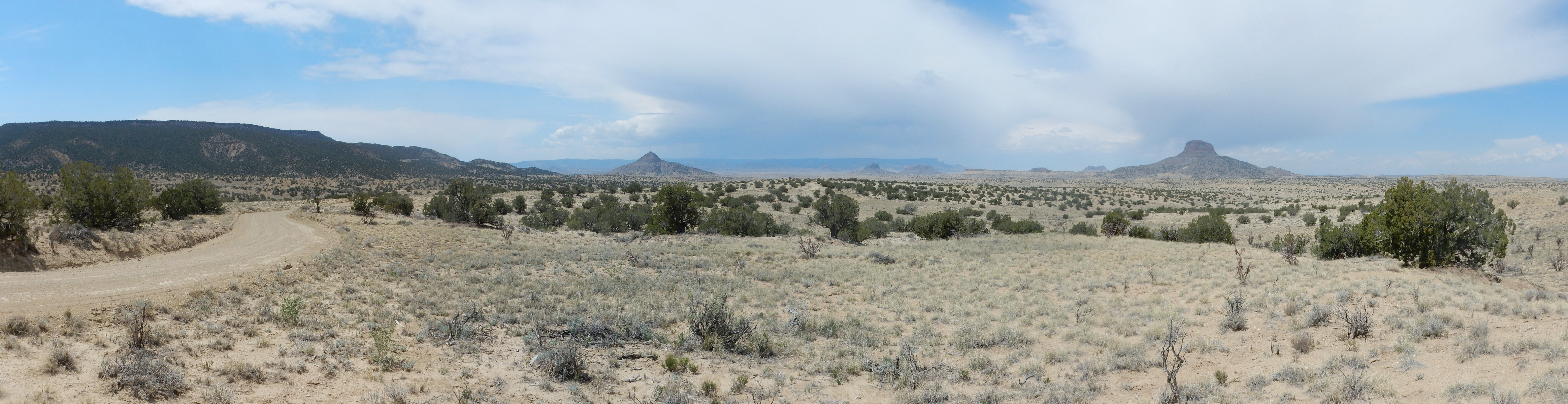
At left is Mesa Prieta. The plug just left of center is Cerro Cochino, “Dirty Hill.” Gary, with a twinkle in his eye, dubbed it Shark Tooth Hill. It is, in fact, very close to Sharktooth Ridge. To its right are Cerro de Guadelupe and Cerro de Santa Clara silhouetted against Mesa Chivato, the basalt-capped plateau northeast of Mount Taylor. Then come Cerro Chato, and Cerro Cuate and finally Cabezon Peak.
The camera loves Cabezon Peak.
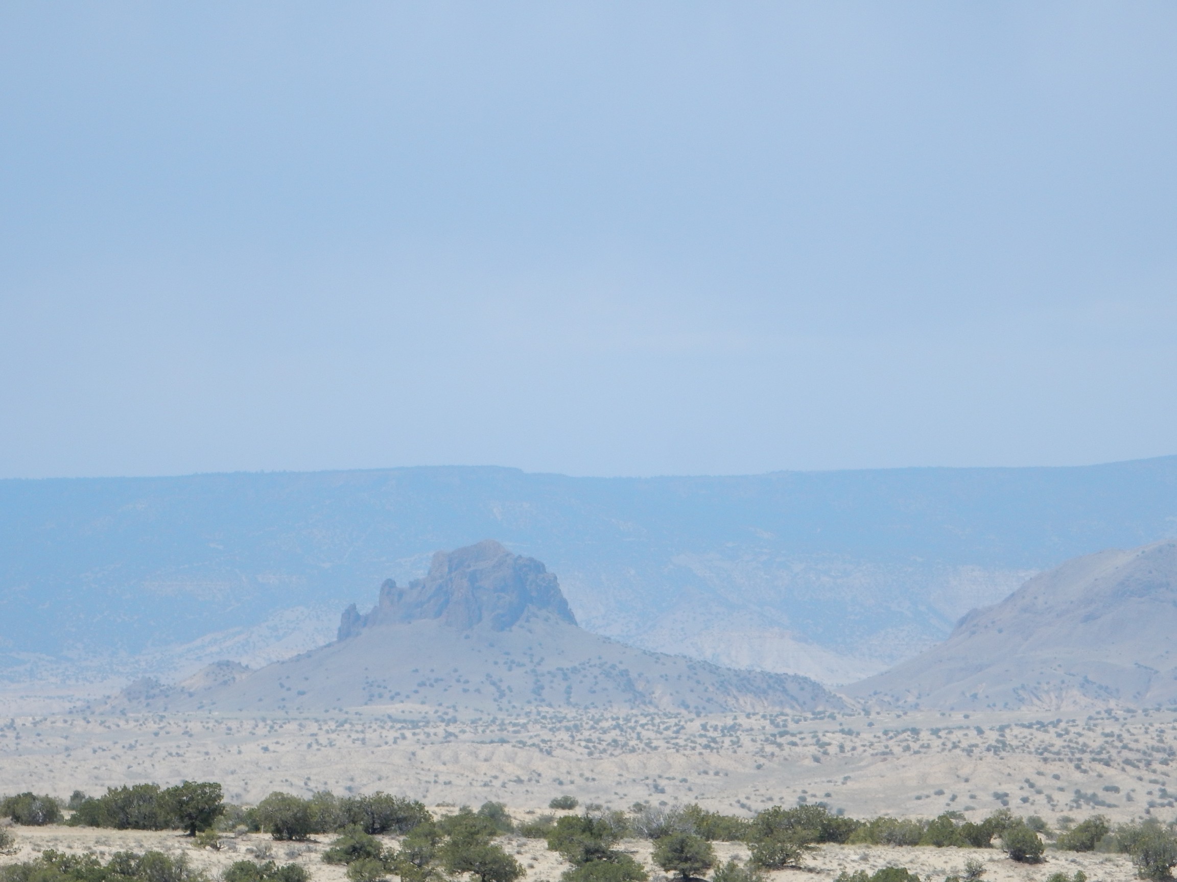
I tried a deep telephoto shot of Cerro de Guadalupe, but had a hard time aiming; the shot was almost directly into the sun.
Here is a chimney rock. We had driven into an area for which I don’t have a detailed geologic map, but the state map shows this as lower Mancos Shale.

Somewhere along the road — here, perhaps — we encountered a barbed wire fence and a closed barbed wire gate. However, the only sign near the gate simply asked us to close the gate behind us. We took that as an invitation to pass through, I scrambled out of the car and (with some effort) opened the gate, Gary drove through, and I closed the gate behind us.
Soon we were at Sharktooth Ridge. The site seems to be very well known; we found a pickup already there and the air ringing with the sound of geologists’ hammers plinking away nearby. We started scouring the area, and within a few minutes Gary had found three small fish teeth. My hunt was unproductive for some time, but then I started spotting teeth — about the time my old eyes began bugging out from squinting at stuff close up. I should have brought my reading glasses.
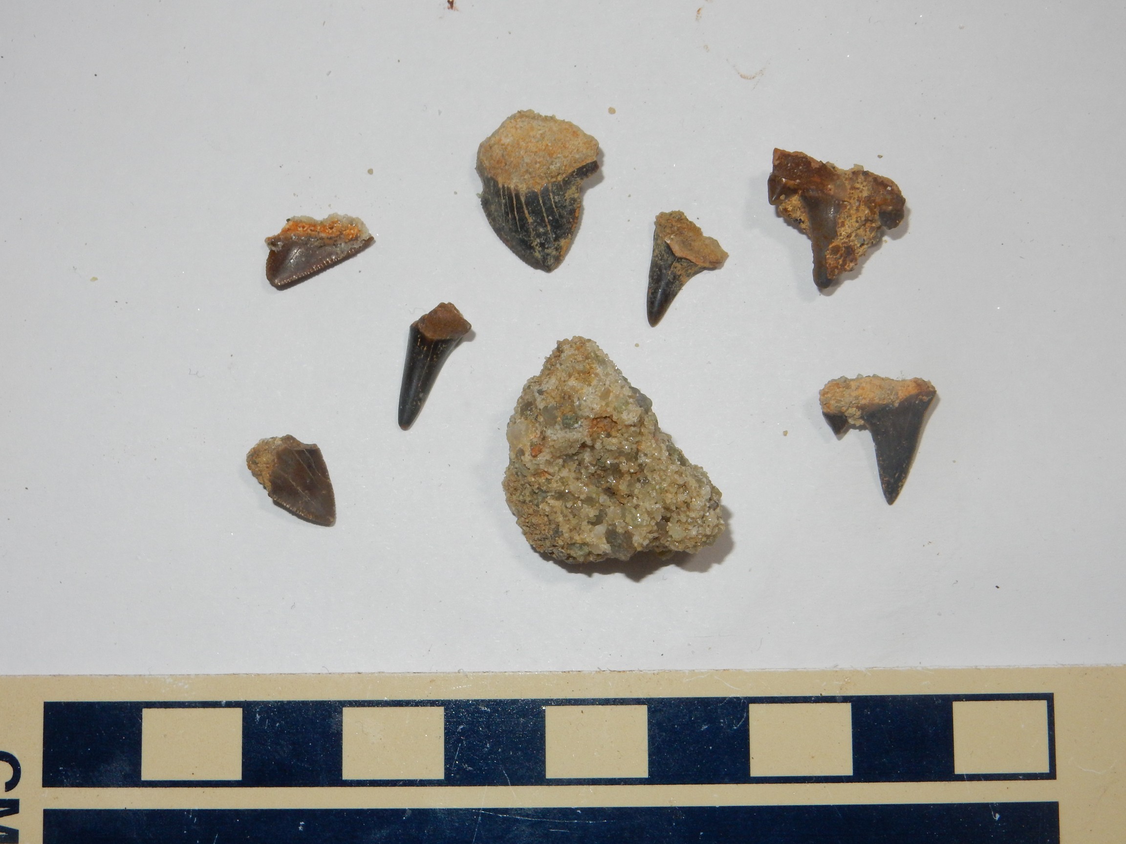
I’m not that great a paleontologist, but I think the wedge-shaped tooth at top, and possibly the tooth at lower left, are actual shark teeth. The others are probably from large bony fish. At center is a small sample of the sandstone itself; it had a small fish tooth in it, but this came loose during the drive home.
The others were finding stuff, too. Gary took an interest in some of the non-tooth sedimentary structures in the beds, wondering if some were more subtle fossils. The boys were having a great time finding various kinds of fish teeth. The teeth are present throughout the sandstone and weather out in the soil on top of the sandstone ledge, which is the best place to look for them.
The ammonite cast and other samples from near the Windmill Site were not better than what I already have in my collection, but I have a nephew and niece who seem to like geology that I plan to give some of these two. The fish and shark teeth were definite improvements over my previous finds, but I collected enough to share a few of these with my young relatives as well.
I got talking to the folks who were there when we arrived, who had a fair haul by this point and were ready to head out. One of the guys was a petroleum geologist from southeastern New Mexico. He had part of the state map for the area and this helped me correct myself: I had thought that Sharktooth Ridge was part of the Point Lookout Formation, a sandstone formation of the Mesaverde Group. The Mesaverde Group records a brief withdrawal and return of the sea to this area (a regression-transgression sequence), and it separates the Mancos Shale from the younger Lewis Shale. The geologists’ map showed that Sharktooth Ridge is actually underlain by Gallup Sandstone, which separates the lower and upper Mancos Shale in this area and represents an earlier regression. The Gallup Sandstone is between 89.8 and 93.9 million years old.
This cleared up a small mystery. I knew that some of the beds around Cabezon Peak were Point Lookout Sandstone; it’s the only area in this quadrangle that is mapped in any detail, and it also shows on the state map. But these appeared stratigraphically higher than the beds we were finding fish teeth in. Learning that these were part of the Gallup Formation resolved the puzzle.
I decided after a while that, if you were looking for unremarkable small fish teeth, digging around in one spot is a reasonable strategy; they’re omnipresent. If you want to find something a little more spectacular, you have to cover a lot more ground than that, and that means walking a considerable distance along the escarpment formed by the Gallup Sandstone and keeping your eyes peeled for teeth eroded out on the surface of the ground. This was, in fact, how I found my largest specimens I found that Steve had tagged along with me, and we found some pretty good stuff before I decided we were a long ways from the car and needed to head back.
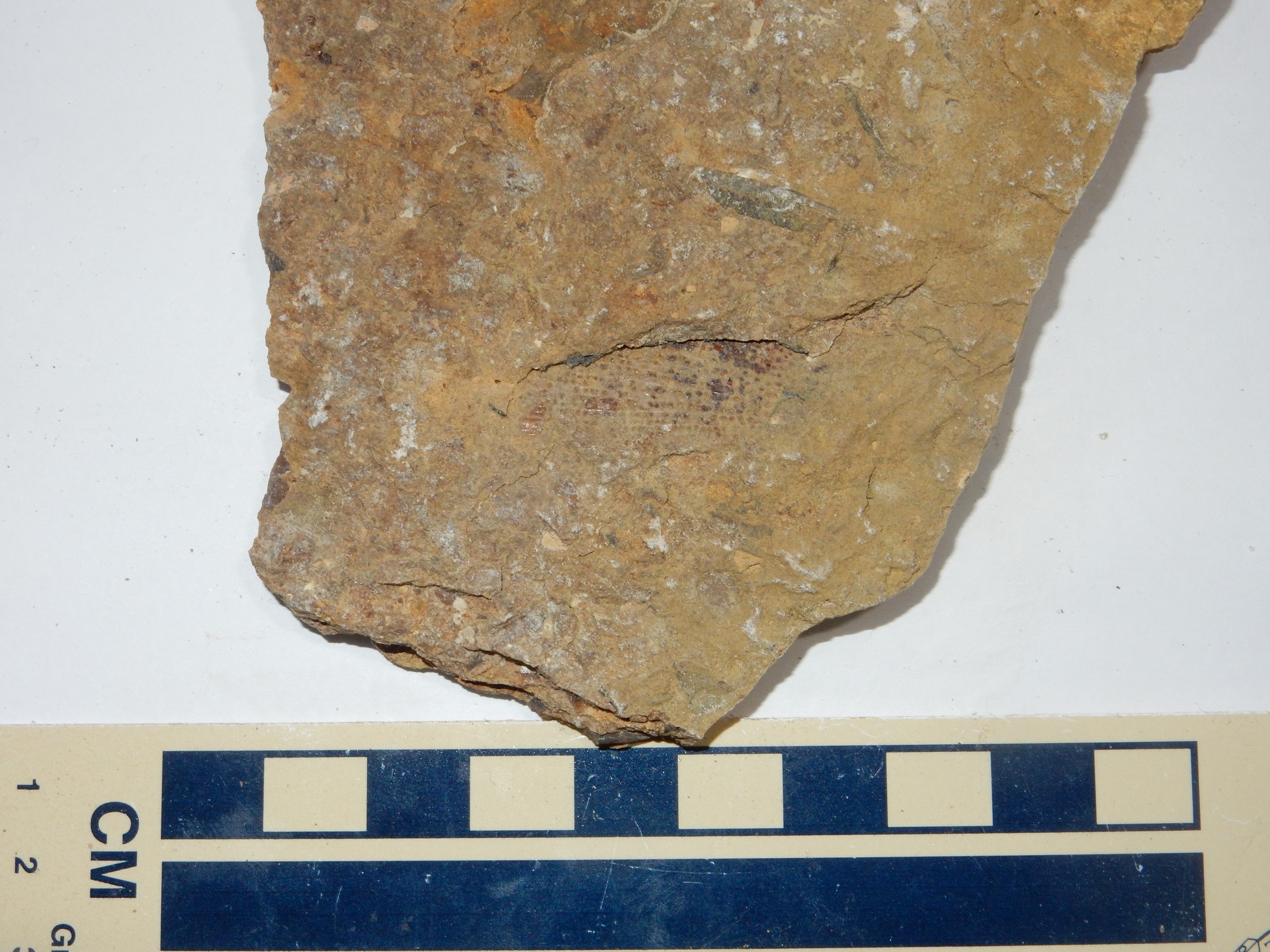
I did see some spectacular bioturbation in the Gallup Sandstone beds.
All the pits and tubes in the rock are from critters tunneling through the sand before it was buried and lithified. Bioturbation is pretty common in the formations associated with the Western Interior Seaway, and in some places they’re more than worm burrows; there are some pretty spectacular dinosaur footprints preserved up in Colorado in beds like these.
The scorpionweed gave a bluish hue to some of the countryside.
The weather was deteriorating, we were all a bit tired, and my eyes were strained from squinting at small things, but we had had a blast finding fossils. It was time to head out. We did pause briefly at Cabezon Peak.
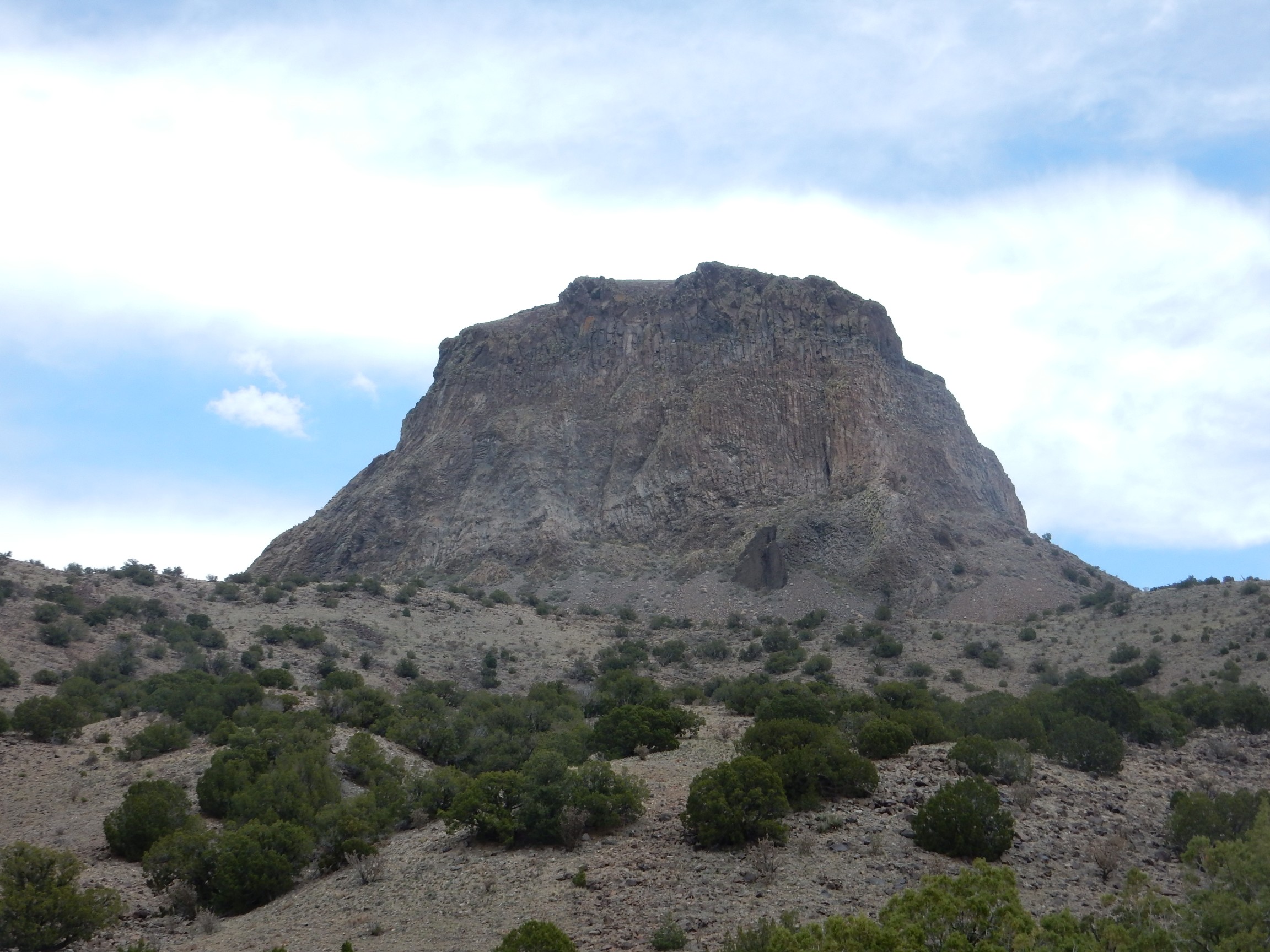
We’re close enough here to see the columnar nature of the basalt. There must have been a large lava lake in the neck of the volcano, which, as it cooled, fractured into characteristic vertical columns. There is a trail up the mountain; I had thought about hiking it but not everyone tired and the weather deteriorating.
Group shots:
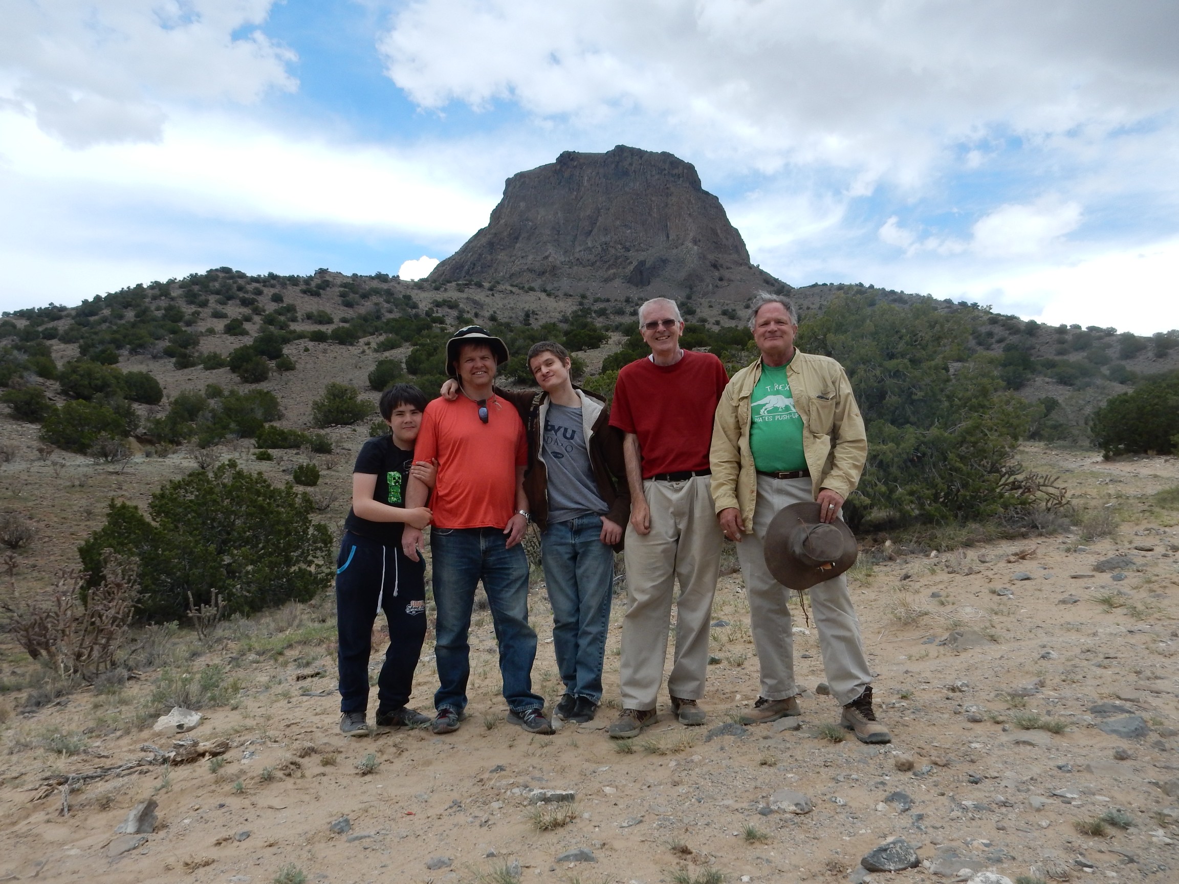
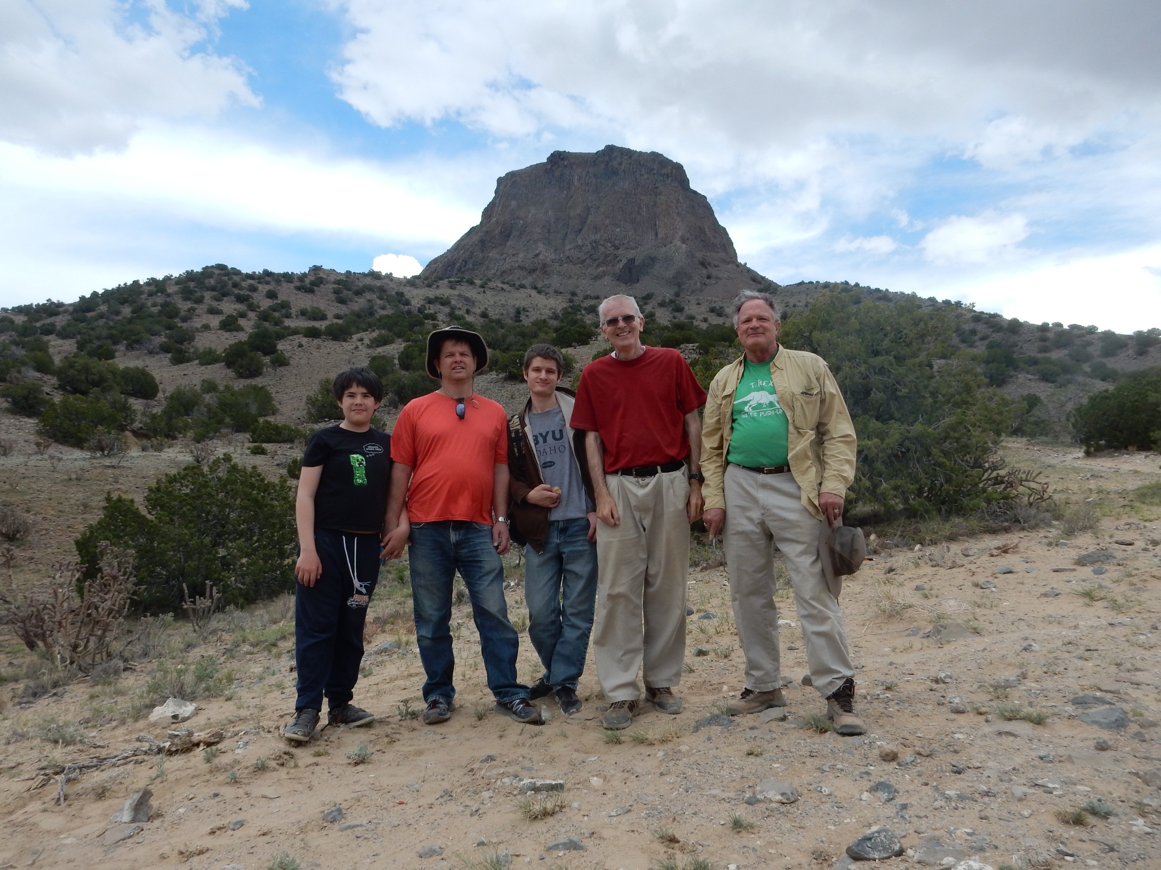
I felt a little dumb. Although I usually bring my camera tripod with me, it took several minutes to figure out how to set the shutter timer. I just haven’t had occasion to use it much before.
As we approached San Ysidro , we encountered a phenomenon not much seen in the Jemez lately: Water from the sky falling on the road. (“What is this ‘rain’ you speak of?”) Yeah, we’re in another bad drought right now. We stopped for refreshments and then headed back through the Jemez.
There were elk in the Valle Grande.
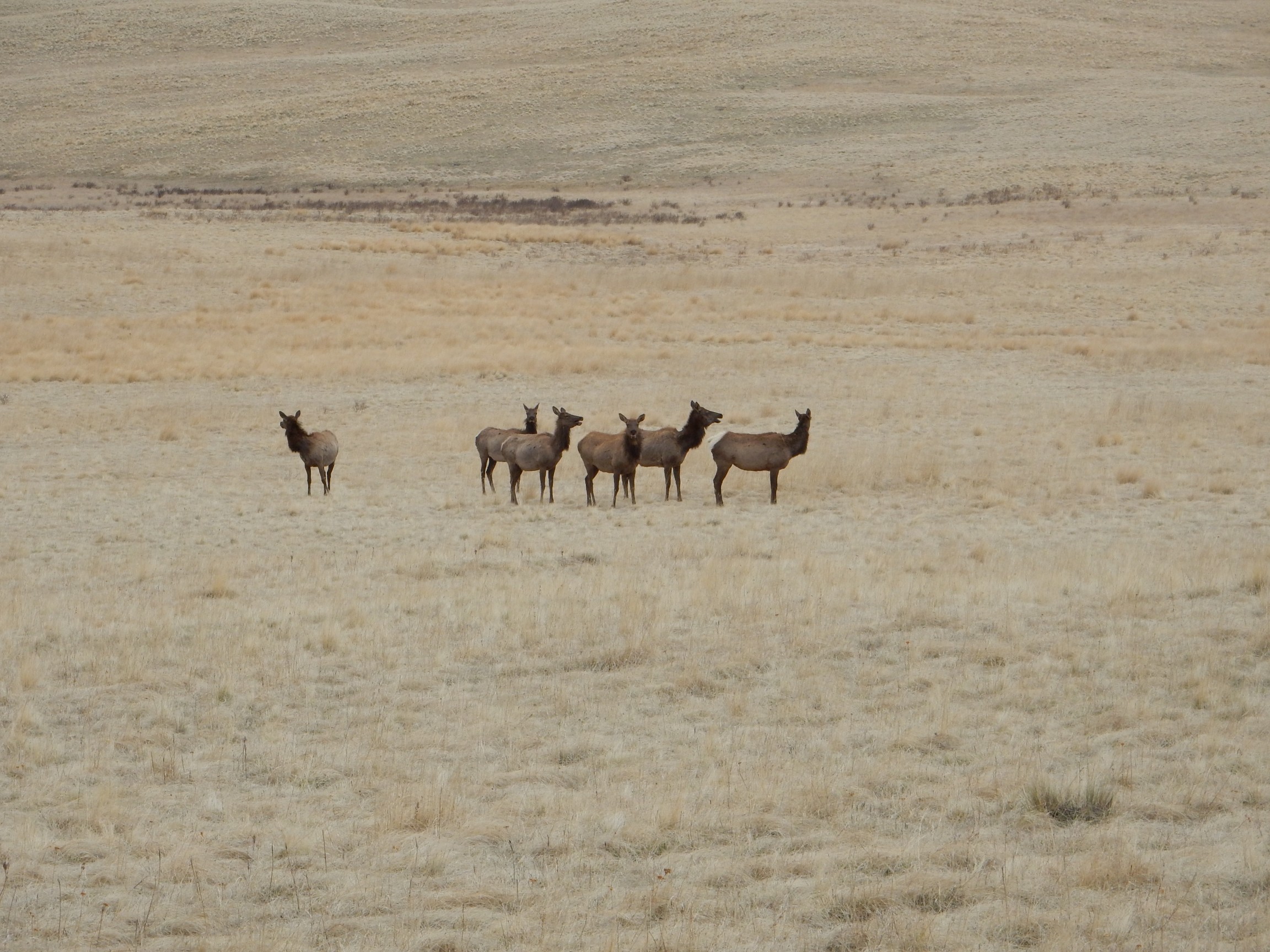
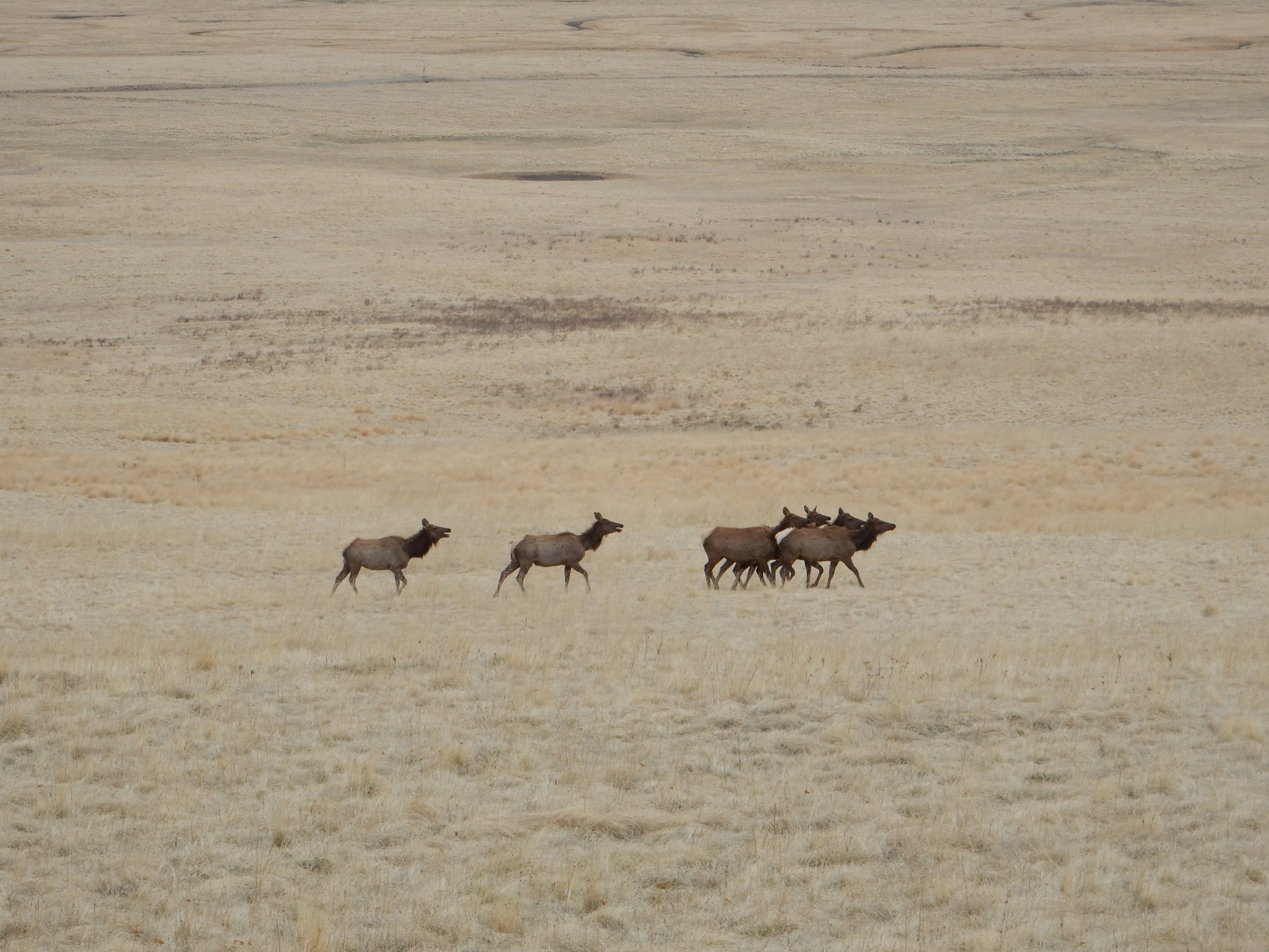
There was another very large herd way out on the valle, beyond camera telephoto range, for which I broke out my big binoculars. I counted about 70 head. Gary has a funny attitude towards elk: “Move along, ladies. I can’t shoot you here.” He’s planning a big hunt next season up around Chama and we may take some wanderlusts up there between now and then. I don’t hunt myself, but I’m not exactly a PETA supporter, either.
I got the report today from Marc’s wife that the boys had a terrific time. Mission accomplished.