A sedimental journey
My nephew is getting married. He’s the first of my father’s grandsons to take the plunge, and I am not going to miss the occasion. He’s chosen April 20 for his wedding date, which is somewhat earlier in the year than I usually take my excellent summer geology adventure, but this could be a positive: Bruce Rabe has been encouraging me for years to get into some serious sedimentary geology, and, in particularly, to visit the Wheeler Formation in western Utah, with its Lagerstätte beds. It’s the Sevier Desert, and early spring may be a pretty good time to visit if I don’t want to broil.
Lagerstätte: I’ll unpack that in due course.
Bruce, alas, will not be able to come. This spring has apparently been a madhouse for him. On the other hand, Gary Stradling has family business of his own in Utah and Idaho and is enthusiastic about a geological excursion. So I won’t have to do this one alone. It would, of course, be delightful to bring Cindy and the kids along, but our children are in too poor of health to travel well (and would probably not be much interested anyway) and one of us needs to be home with them. It’s been this way for years.
So on this Monday, April 15, I arise as early as I can stand to (5:30 AM), fix a good breakfast, pack my final items in the car, and pick up Gary at 7:00 at his house. I have camping equipment for two for six nights, provisions for part of that time in my ice chest, a big Thule bag strapped atop the car with more camping gear in it, travel guides, new (and old) camera, the SPOT messenger, and everything else I can think of. No doubt more will occur to me after I’m on the road. (It does.)
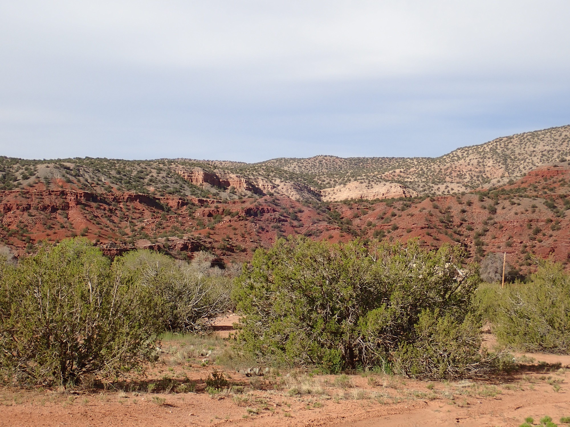
We start out from White Rock and head for the Jemez Mountains. We stop briefly at a road cut at the bottom of Ancho Canyon.
The pinkish bed at the bottom of the photograph is part of the Otowi Member of the Bandelier Tuff. The Bandelier Tuff is a sequence of pyroclastic outflow sheets originating in the central Jemez that were erupted in the last 1.8 million years. The Otowi Member represents probably the largest of the outflow sheets, which was erupted in the Toledo event 1.62 million years ago.
Let’s unpack that. Geologists divide rock beds into units, of which the most fundamental is the formation. A formation represents a more or less continuous process of rock deposition over a limited period of geologic time. Sometimes the deposition process changes slightly during this time period, producing slightly different beds within a formation that allow it to be divided up into members. Thus, the Otowi Member represents the outflow sheet of a single enormous volcanic eruption out of several that have taken place in our area in the last couple of million years.
High-silica magma (molten rock with dissolved gas) is extremely viscous. When a large body of such magma forms underground (a magma chamber), and enough pressure builds to open a vent to the surface, the magma does not pour out of the ground as a lava flow. Instead, as it emerges from the vent, the magma is torn apart by the pressure of its own dissolved gas. It disintegrates into a red-hot mixture of gas and volcanic ash, tiny shards of half-molten volcanic glass formed from the bursting of countless small bubbles. This mixture initially rises vertically from the vent (an eruption column), depositing a blanket of air-fall pumice over the surrounding area.
As the vent widens, it forms a fracture that works its way around the magma body, forming a ring fracture which allows a circular plug of rock to collapse into the magma chamber as it empties. This produces a caldera, a deep depression in the earth’s surface. So much ash and gas is erupted that the mixture becomes heavier than air. The eruption column collapses, and the dense mixture of hot gas and ash flows across the surface of the ground as a pyroclastic flow. In the case of the Toledo event, the magma body was around ten miles across, producing a caldera of about that diameter, and the pyroclastic flows covered the entire area for miles in every direction as an outflow sheet.
What we see in the lower part of the road cut is a rock called ignimbrite or, in older terminology, a tuff, formed when the cloud of ash settled to the surface and consolidated into hard rock. In the case of the Otowi Member, the glass fragments making up the ash had cooled sufficiently that they were mostly solid when they settled onto the surface, forming an unwelded ignimbrite that is full of larger pieces of pumice and rock caught up in the pyroclastic flow.
Above the Otowi Member is a couple of inches of paleosol, soil that accumulated over the next 400,000 years. In other locations, this paleosol is much thicker and includes a great deal of pumice erupted in the aftermath of the Toledo Event, and it is known as the Toledo Formation.
About 1.25 million years ago, the central Jemez erupted again in the Valles event. The Valles caldera closely coincided with the earlier Toledo caldera and is still clearly visible today. The thin white band towards the top of the road cut, above the thin paleosol, is part of the air fall pumice from the start of this eruption. This is known as the Tsankawi Pumice. Above is ignimbrite from the outflow sheet that followed which, together with the Tsankawi Pumice, forms the Tsherige Member of the Bandelier Tuff.
There is a turnout on the south side of Ancho Canyon, and here we pause again and I take a photograph of the beds across the canyon. (I have been here many times before; I am mostly warming up my camera and sharing geology with Gary.)
The beds here are all part of the Tsherige Member. Whereas the Otowi Member is a uniform bed of rock, indicating an eruption that took place in one great pulse (a simple cooling unit), the Tsherige Member was erupted in several pulses closely spaced in time (a compound cooling unit). There is no indication of any soil formation between units, and the prevailing view is that each pulse barely had time to start cooling before the next pulse was erupted. This suggests to most geologists that the entire sequence of pulses took place within hours to weeks of each other. However, there is a minority view that some of the pulses were separated by as much as several years, based on evidence from drilling of rock avalanches within the caldera between pulses.
The photograph shows evidence of such pulses. Gary counted four levels in the beds across the canyon; these are labeled as A, B, C, and D in one geologist’s scheme and as 1g, 1v, 2, and 3 in another’s — geologists are still working it all out! Incredibly, the ledge between the first two levels, which is prominent throughout the Los Alamos area, separates rock that is so alike in composition and texture that some geologists believe the first two layers were a single pulse. The only difference between the two layers is that the microscopic glass shards in the lower level have devitrified, turned to crystalline rock, while the upper level is still glassy. This difference, and the ledge between the two layers, may have developed after the rock settled to the surface. Vapors rising through the rock are thought to be responsible for the change, and represent a form of vapor phase alteration that is still very poorly understood.
Some of these layers were still hot enough when they settled to the surface that the ash was still partially molten. This produces a welded ignimbrite that is more resistant to erosion than unwelded ignimbrite, and the degree of welding is greatest at the center of the flow, which cooled more slowly than the lower part (which was in contact with the cooler upper surface of the previous flow) or the upper part (which was cooled by exposure to air.)
Gary is curious why so much of the ignimbrite weathers to form large cavities in the rock. They almost certainly weren’t there when it first formed, but some outcrops are so full of large holes (inches to feet across) that they look like a sponge. This is called cavernous weathering and apparently it’s combination of case hardening and core softening; the surface of the rock becomes hardened by exposure to the elements, and where the crust is eventually weathered through in spots, the exposed softer interior then rapidly weathers to form cavities.
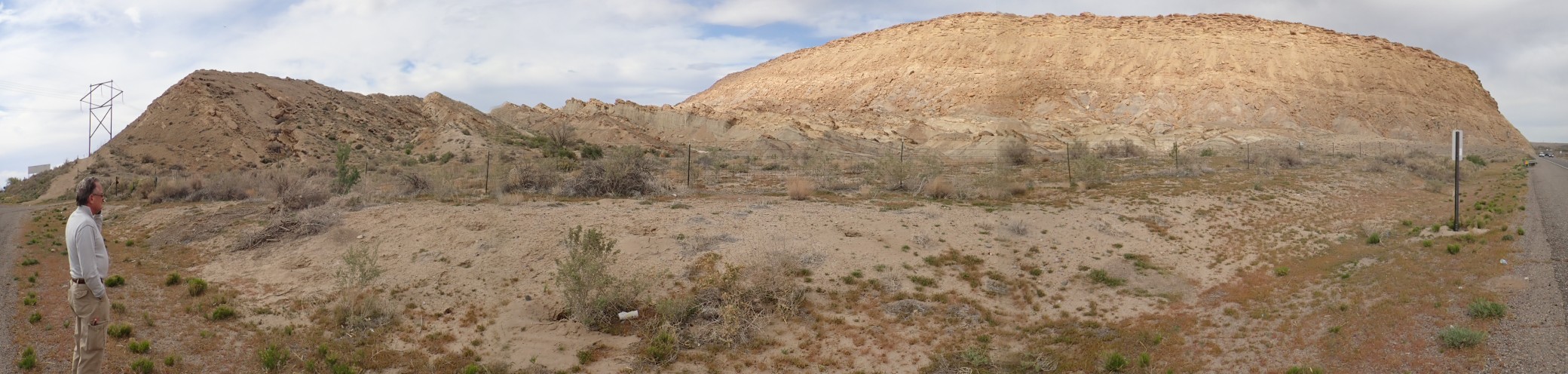
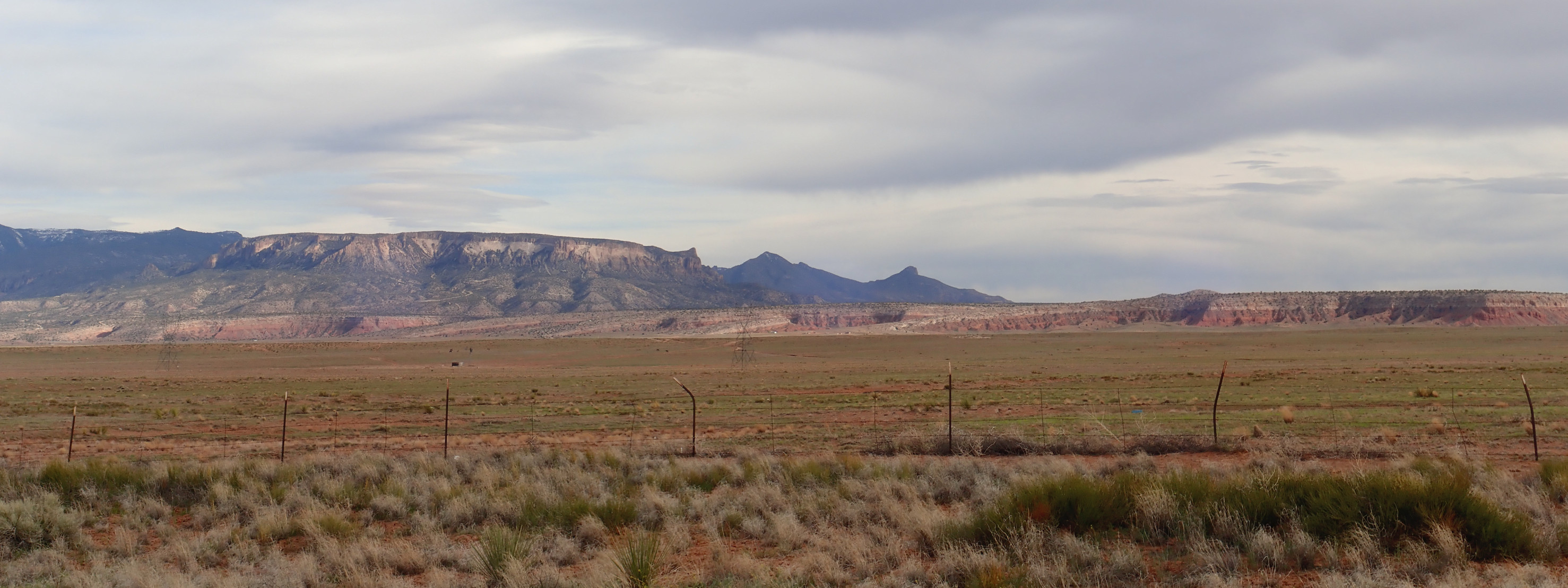
Then on into the caldera. We stop at the overlook and I test the panorama feature of my camera. Somewhat to my alarm, the panorama is awful:

Repeated efforts all fail. I don’t know why. But the GPS lock is reliable (if sometimes slow) and individual image are good. Here’s a panorama stitched from individual frames using Hugin:
Not bad, particularly considering the low sun angle.
At far left, in the foreground, is part of Rabbit Mountain, a ring dome formed over part of the ring fracture of the Toledo caldera. The subsequent Valles caldera obliterated most of this dome, but left the southeast portion as Rabbit Mountain. In the far distance to its right, partly obscured by a tree, is South Mountain. This is a Valles caldera ring dome, as is Cerro Santa Rosa, Cerros del Abrigos, and Cerro del Medio extending from the center of the panorama to the right. The north caldera rim is just visible beyond them, and the east caldera rim forms the mountain wall at far right.
The left part of the panorama shows Redondo Peak and Redondito (the little knob) which are a resurgent dome formed when the caldera floor was pushed back up by fresh magma entering the collapsed magma chamber. This took place very shortly after the Valles event. The Valles caldera is the type specimen of a resurgent caldera, the first recognized for what it is, in the 1960s. The ring domes subsequently formed from magma erupted through the ring fracture.
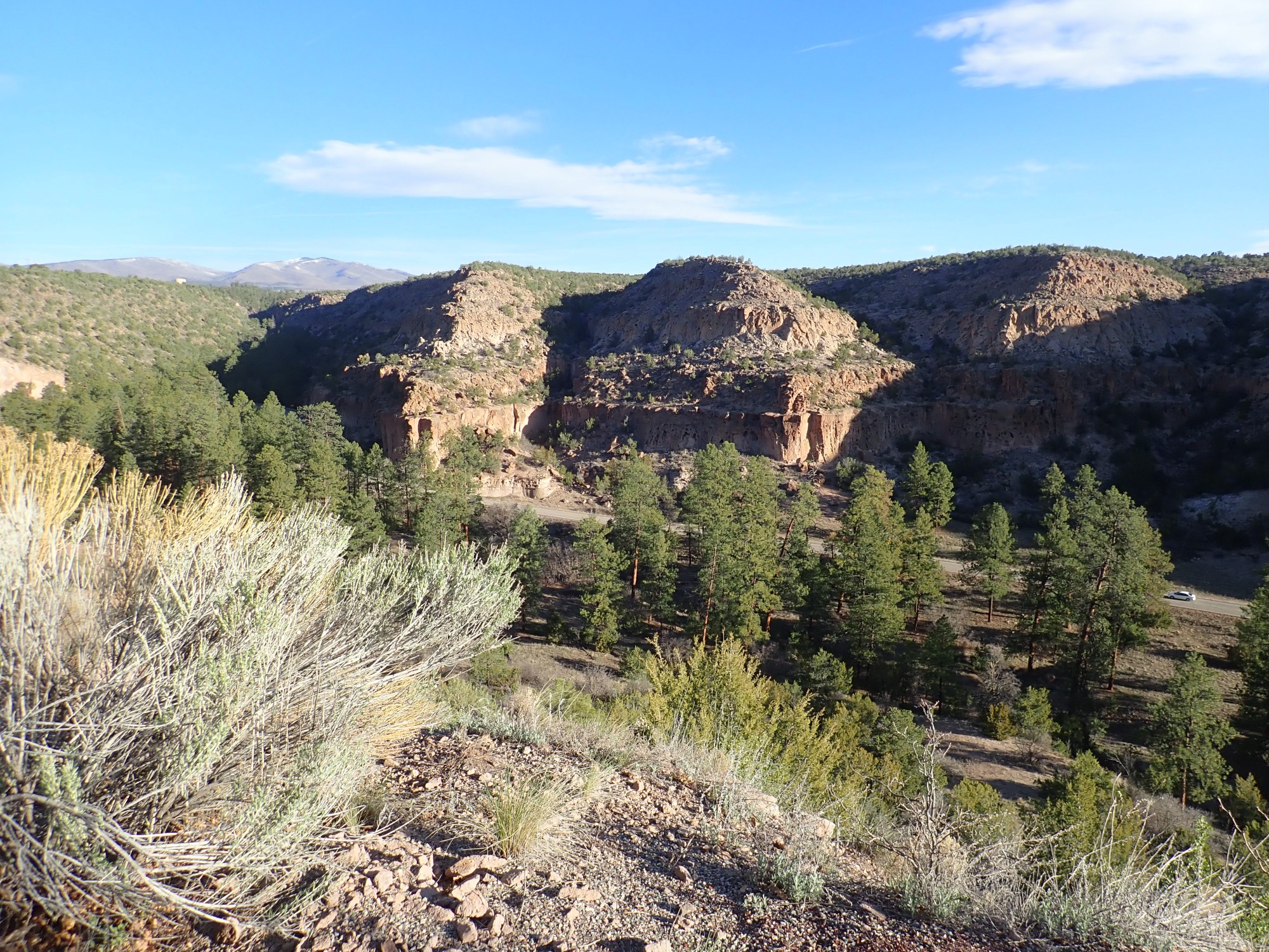
We continue on through the Jemez. Most is very familiar ground and I pause for photographs only outside Jemez Pueblo:
This may be one for the book. The red beds are Permian Abo Formation, not quite 300 million years old. The lighter beds above are outcrops of the Gilson Conglomerate, thought to be about 25 million years old, based on the age of the youngest rock fragments in the formation. These beds are about the same age as the Ritito Conglomerate north of the Jemez and may actually be the same formation, formed from volcanic debris shed from the huge San Juan volcanic field far to the northwest.
We continue on to Cuba. Gary is dozing; I occasionally point out beds when he is awake. We refuel in Cuba and proceed towards Farmington, stopping at one point to admire the distant snow-covered La Plata Mountains in the San Juan Uplift.
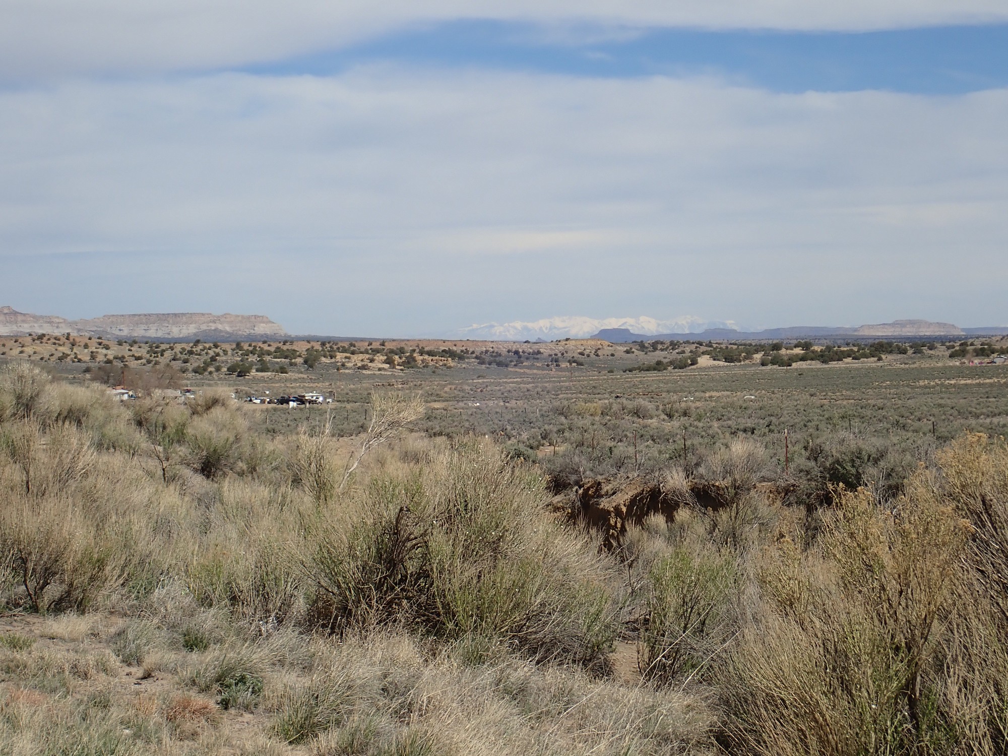
The San Juan Uplift formed around 30 to 25 million years ago and has a core of high mountains formed by volcanic activity, including high-silica volcanic activity that produced several calderas larger than the Valles caldera. “Plata” is Spanish for silver and reflects the mining activity in the mountains, where the volcanism produced local concentrations of silver ore. The San Juan Uplift was part of a burst of high-silica volcanism throughout the western United States, described as an ignimbrite flare-up, thought to be associated with the disintegration of oceanic crust (the Farallon Plate) that had slid under North America (subducted) at a shallow angle.
The mesa in the middle distance at left is capped with San Jose Sandstone, a relatively young formation (Eocene, or around 50 million years old) that forms a durable cap on much softer sediments of the older Nacimiento Formation (55 million years old.)
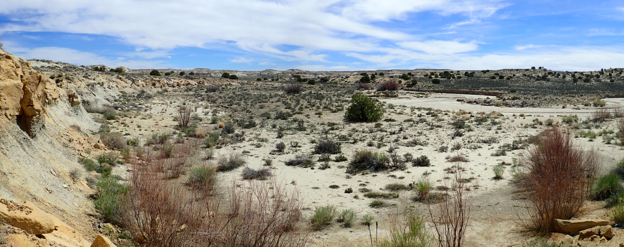
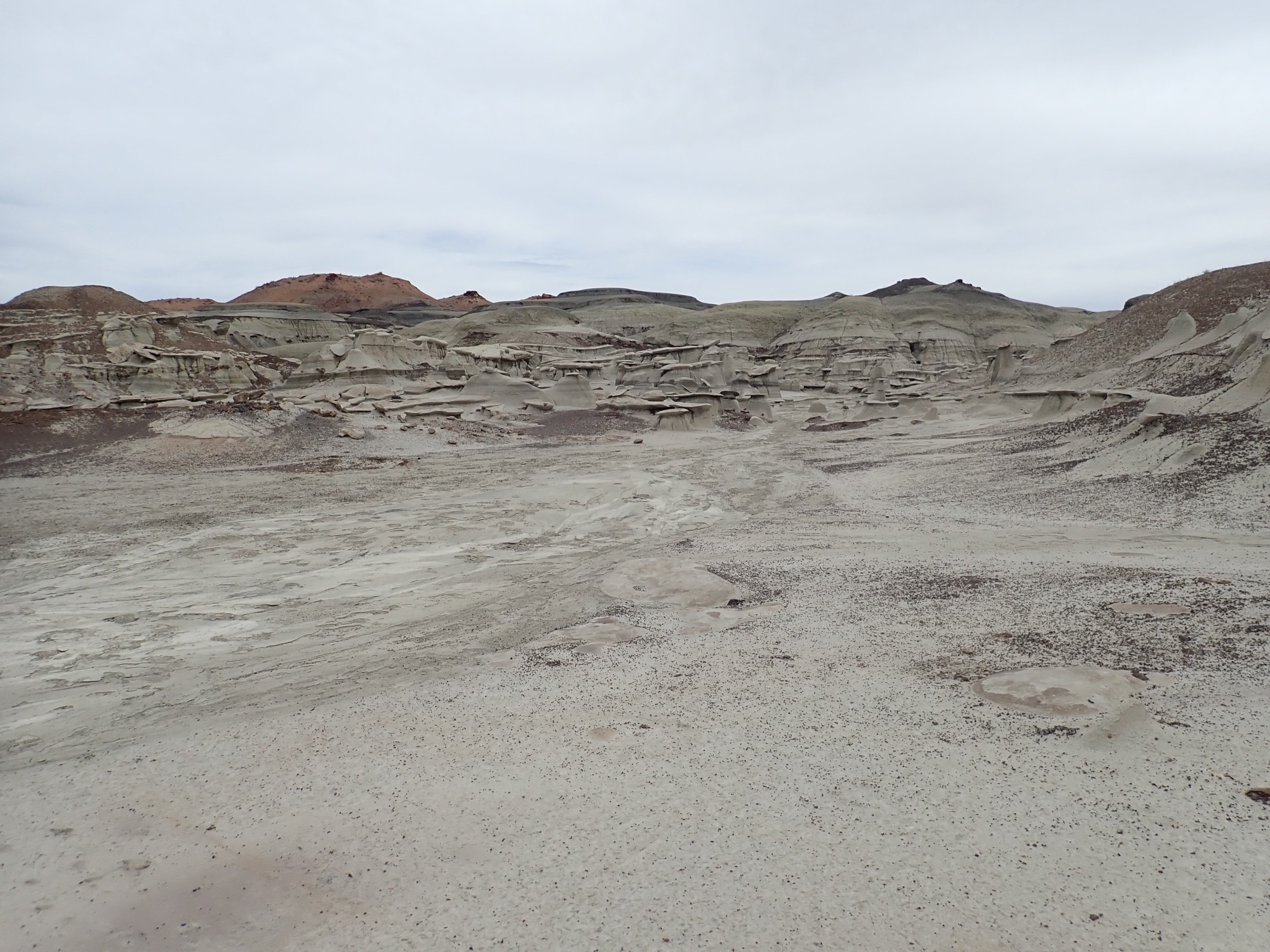
We take the turnoff to the De-na-zin Wilderness and arrive at the trail head.
I activate the SPOT satellite tracker, stuff it in my pack, and we head out. Soon we are at the south rim of the wilderness.
The wilderness is a system of arroyos dissecting a flat plain cut in the Nacimiento Formation. Erosion leveled a large area in the central San Juan Basin at the level of the Nacimiento Formation; then a change in the drainage pattern lowered the base level and caused arroyos to start cutting into the plain. These expose colorful beds of the Nacimiento Formation in this part of the wilderness, which rest on more durable sandstone beds of the Ojo Alamo Formation. Where the arroyos cut through the sandstone, further west, they expose darker beds of the Fruitland and Kirtland Formations, which (like Rosecrans and Guildenstern) are almost indistinguishable to casual observers.
The Ojo Alamo Formation spans the K-T boundary, the moment in time when the Cretaceous Period ended with a bang and a whimper (the bang of an asteroid impact in the Yucatan and the whimper of dying dinosaurs) and the Tertiary Period began. (The latter is now broken into the Paleogene and Neogene Periods, but the old terminology lives on.) Conventional wisdom is that, because the famous iridium layer marking the precise moment of impact is missing from the Ojo Alamo, the impact coincided with a time of erosion in the San Juan Basin. However …
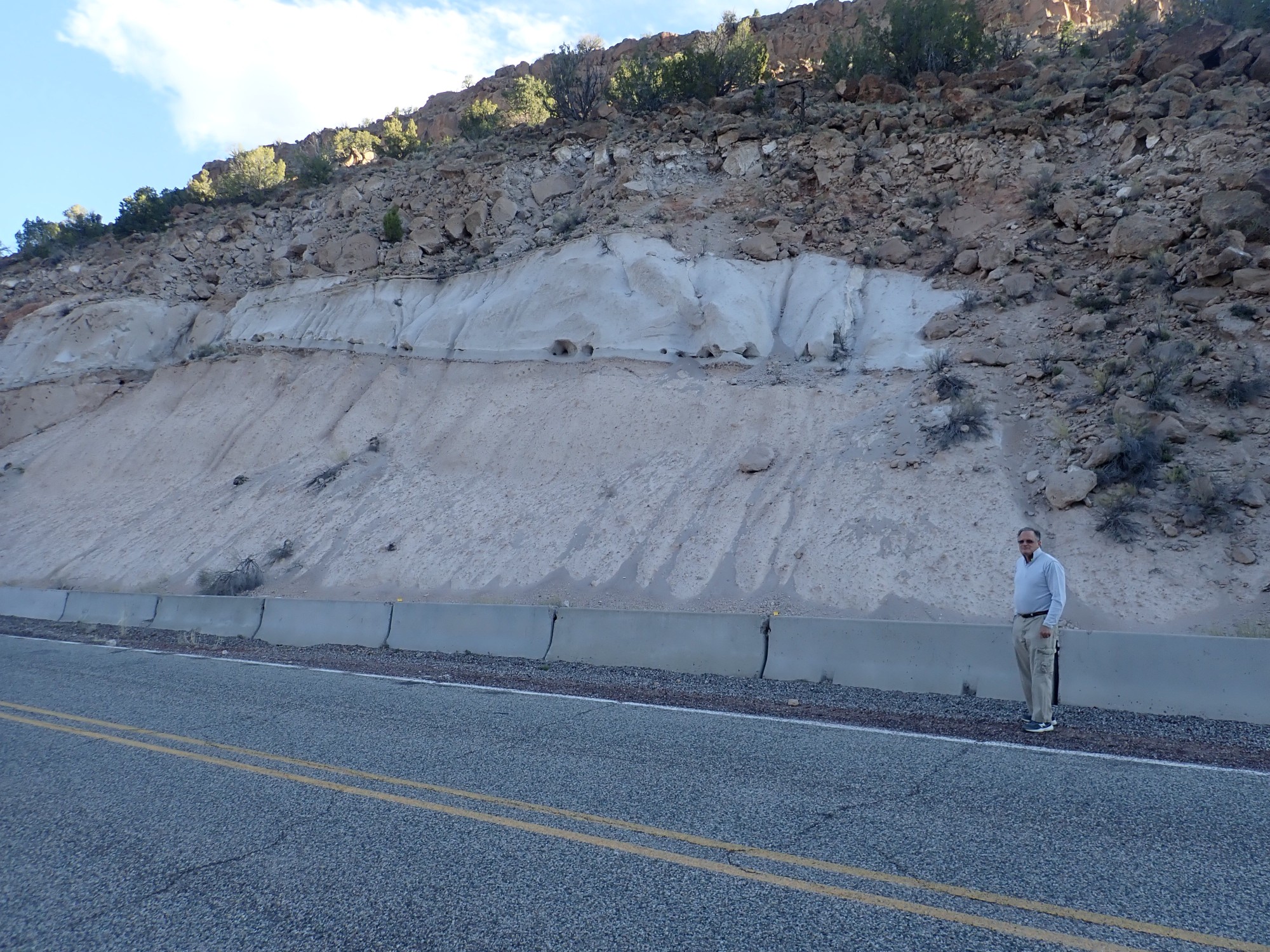
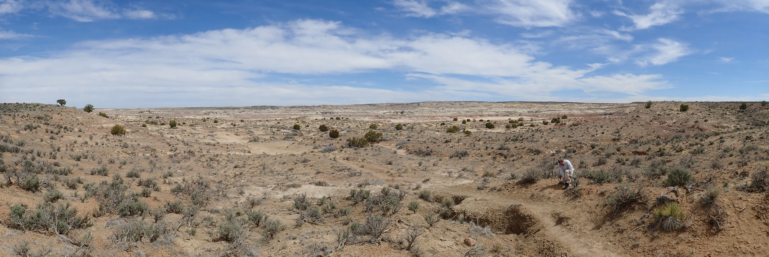
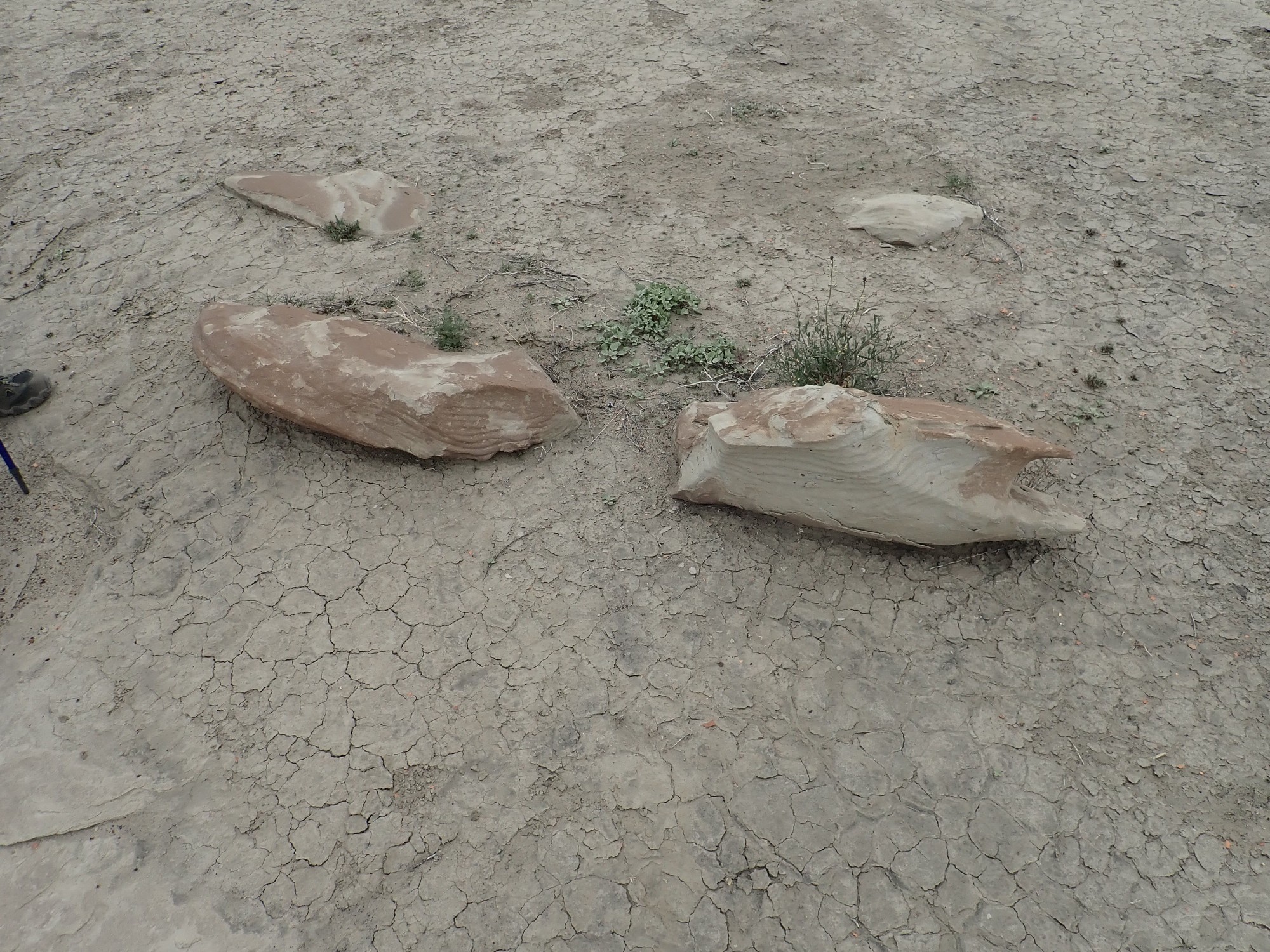
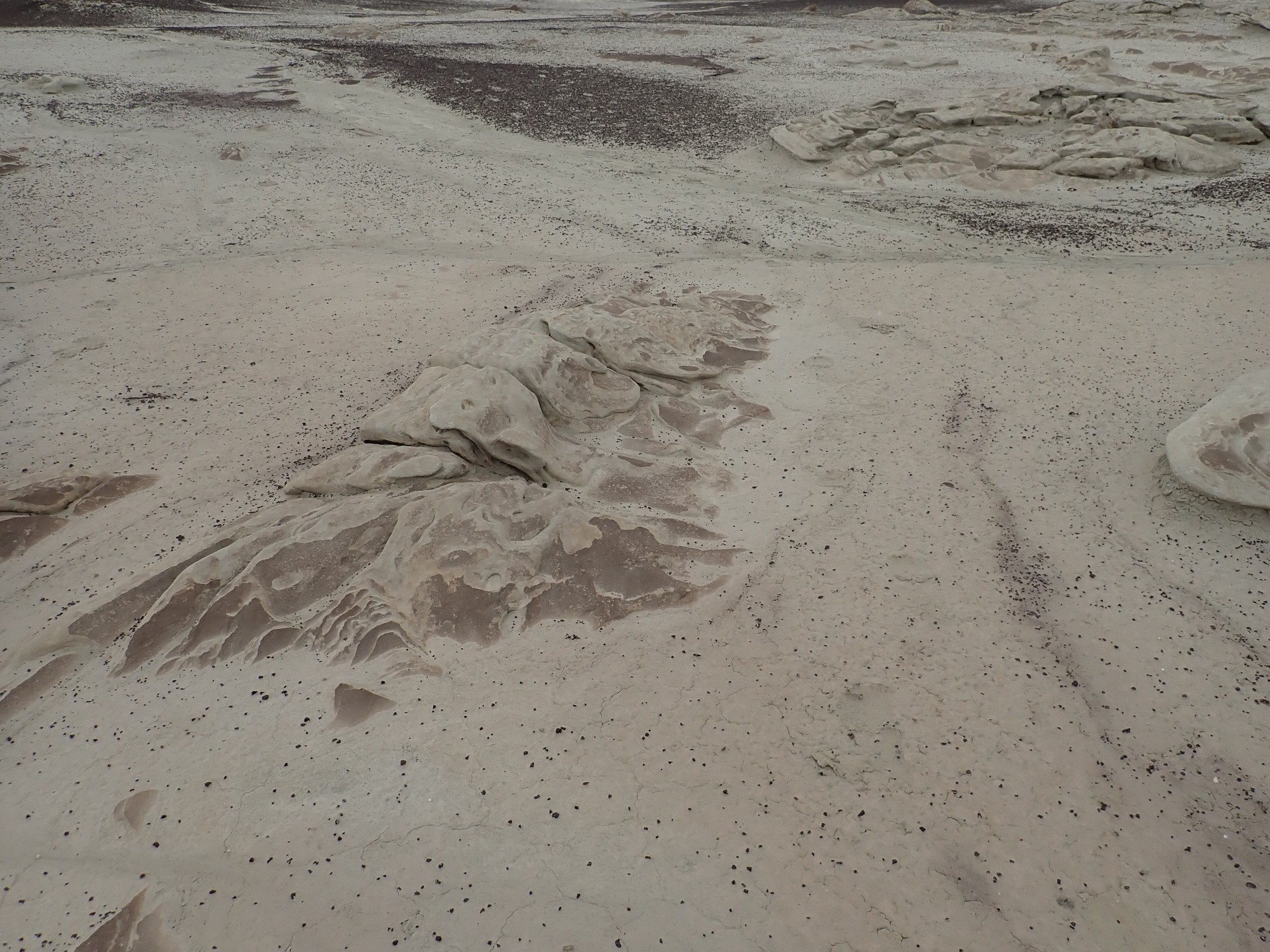
We are here to see a fossilized log jam. But we pause along the trail for Gary to admire some chert boulders.
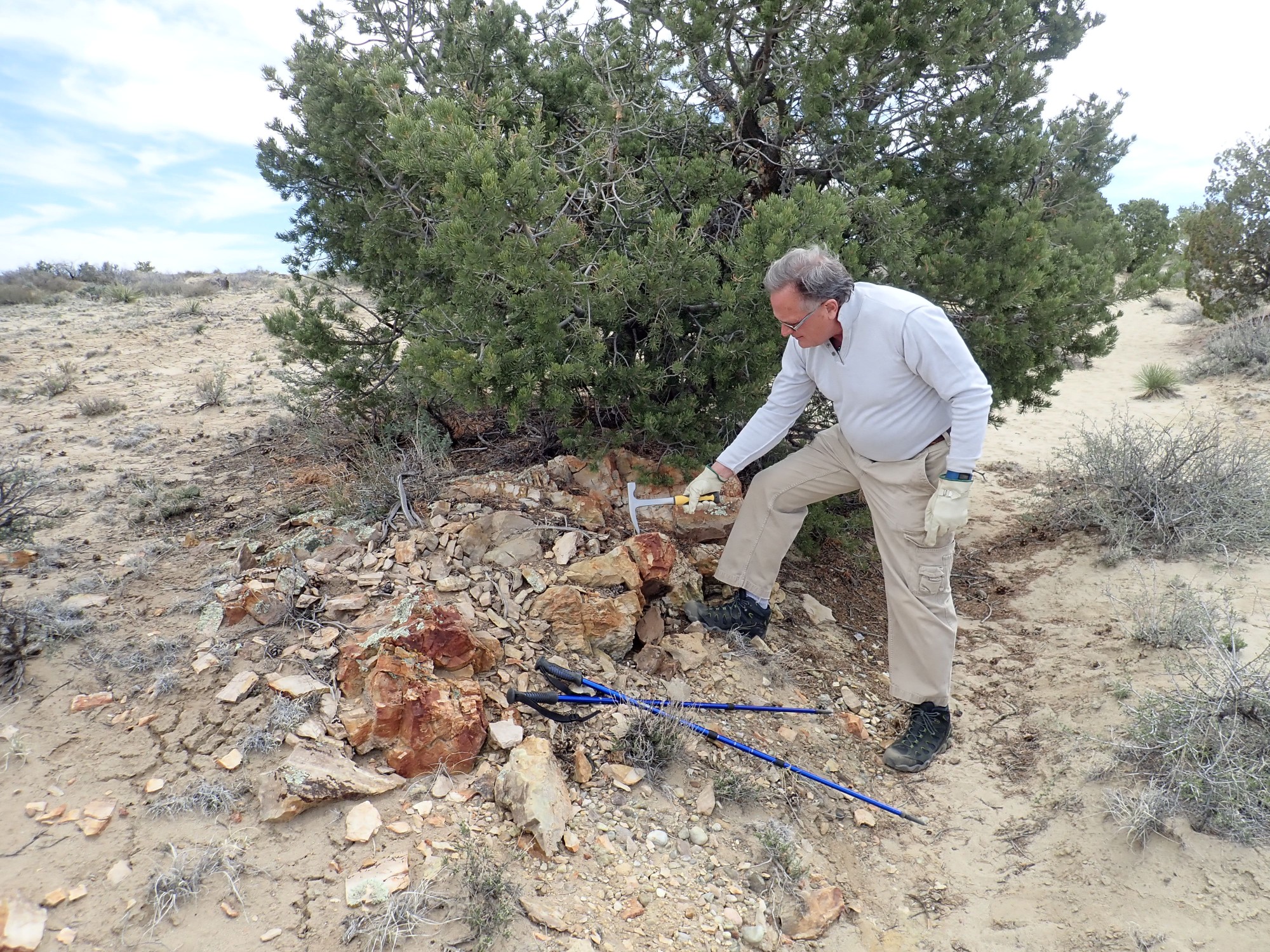
Chert is microcrystalline silica. No one is quite sure how it forms. It’s common in limestone but sometimes occurs in sandstone, as at this location. Some may form from the tiny shells of diatoms or radiolarians, single-celled organisms that secrete silica. This area was far from the ocean 55 million years ago, so if the chert is biological in origin, it came from freshwater diatoms in some long-vanished lake.
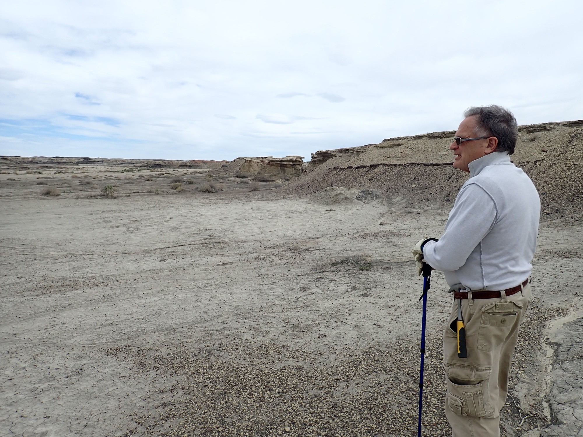
We reach the petrified log jam.
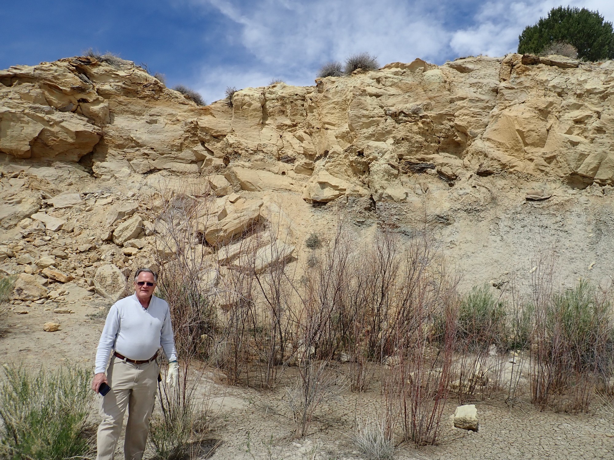
The cliff behind Gary is Ojo Alamo Formation sandstone overlying softer sediments of the Fruitland Formation. The petrified logs appear in a layer of conglomerate (cemented gravel) near the base of the Ojo Alamo … roughly at the level of the Cretaceous-Tertiary boundary.
The odds are very slim that these logs are remnants of a forest destroyed by the Yucatan meteor impact that ended the Cretaceous. But it would be way cool if that turned out to be the case.
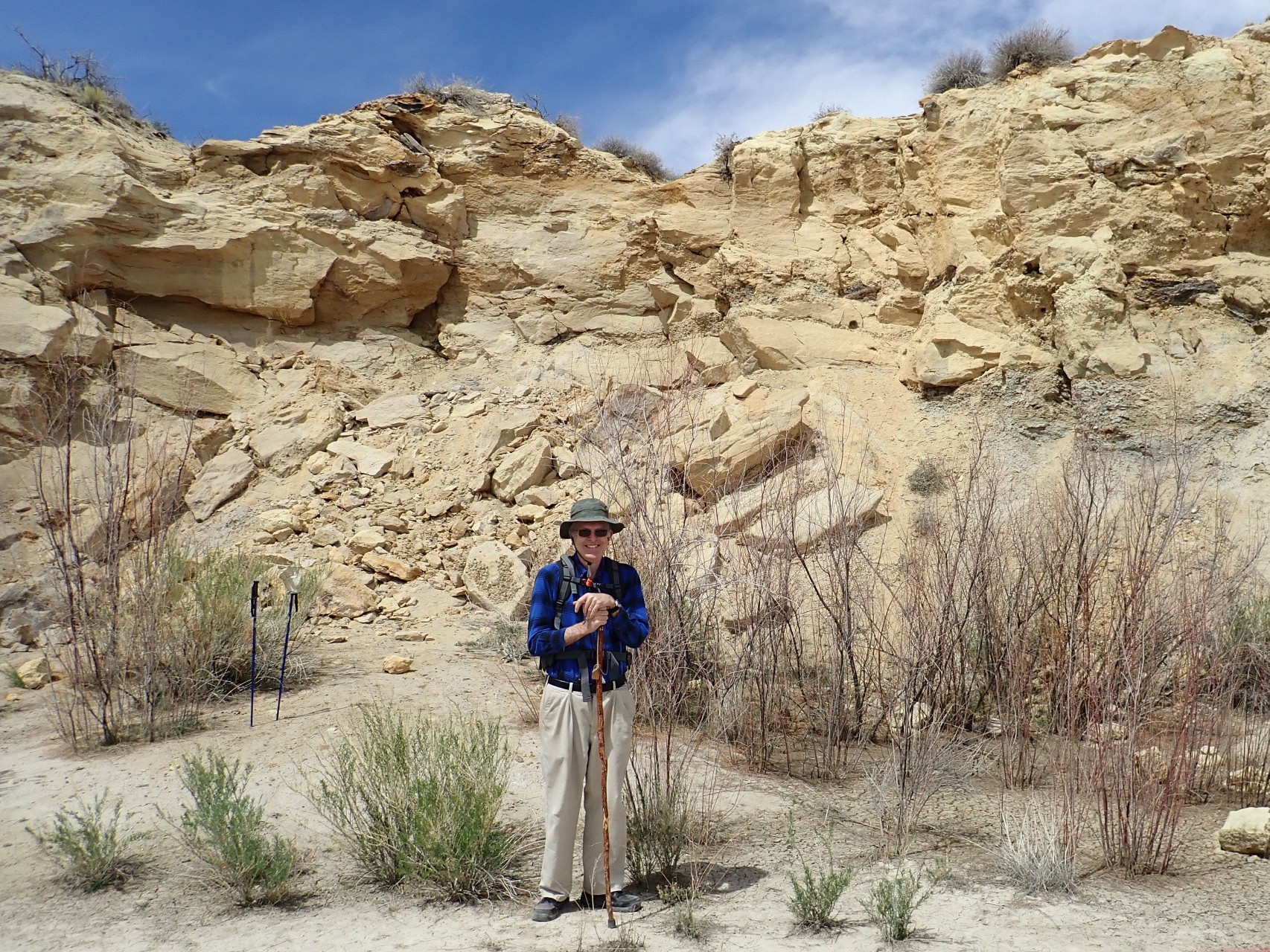
Me in front of the jam.
Rock fall showing the conglomerate bed.

Gary examining the beds close up. Petrified logs are clearly visible right of his head.
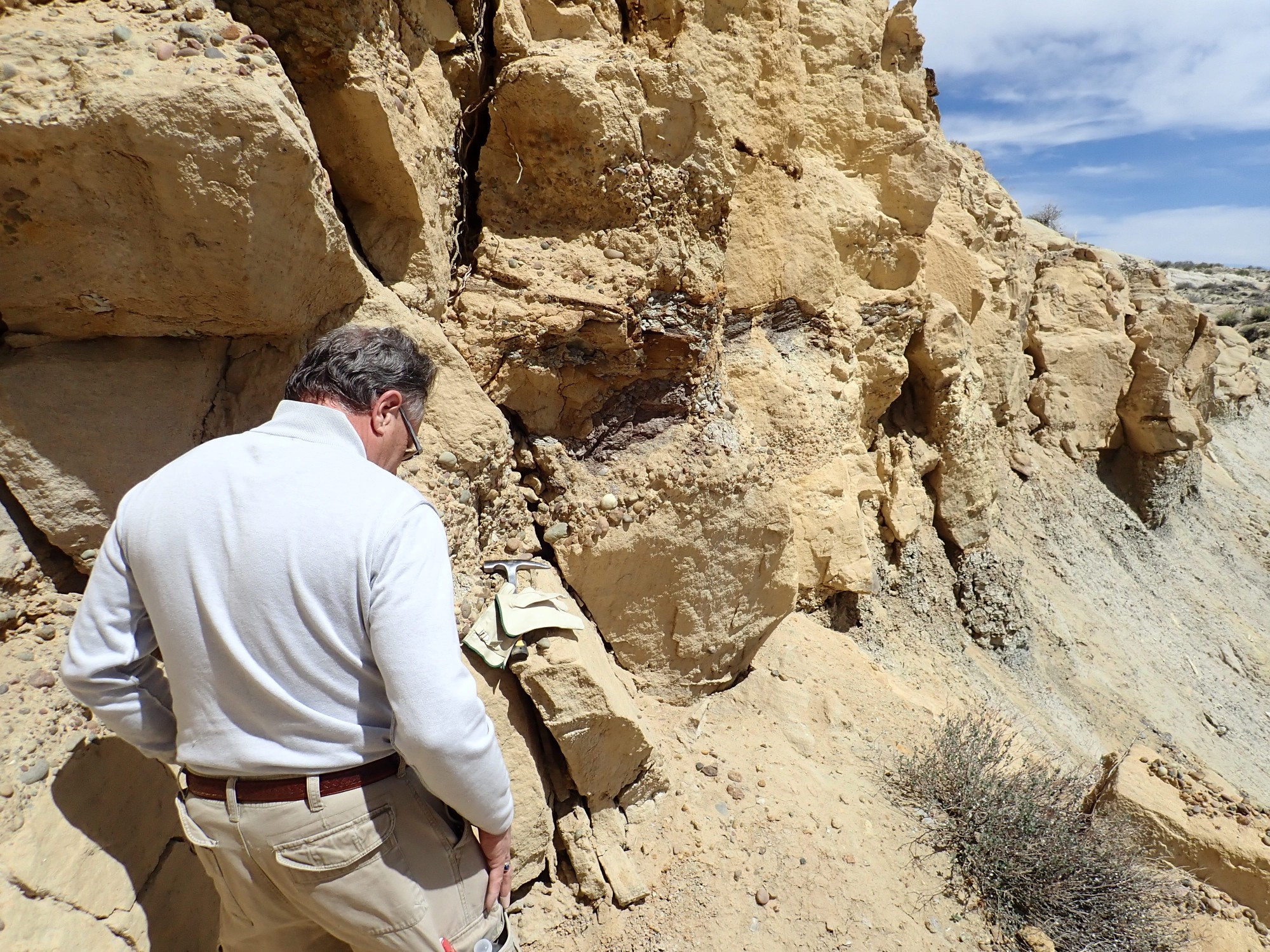
The logs are not well preserved; they easily split into flakes when touched. This suggests that the logs were already partially decomposed when they were buried and petrified. Most likely the gravel here marks the channel of a stream, and the logs accumulated at a point bar where two channels of a braided stream joined. This is a typical location for debris to accumulate.
The surroundings:
Gary notices that there are flakes of white crystalline material in the underlying Nacimiento Formation beds. They look like mica but are not; the only plausible identification is gypsum. That suggests that the Nacimiento Formation beds here formed in a playa, or dry lake bed, that formed in a dry climate in a basin that lacked any drainage. Salts, such as gypsum, tend to accumulate in playas.
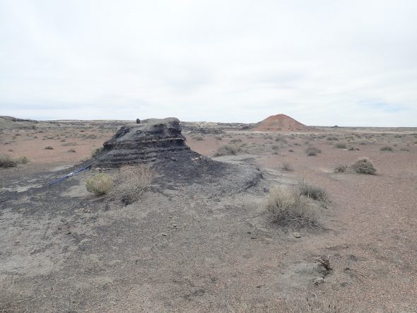
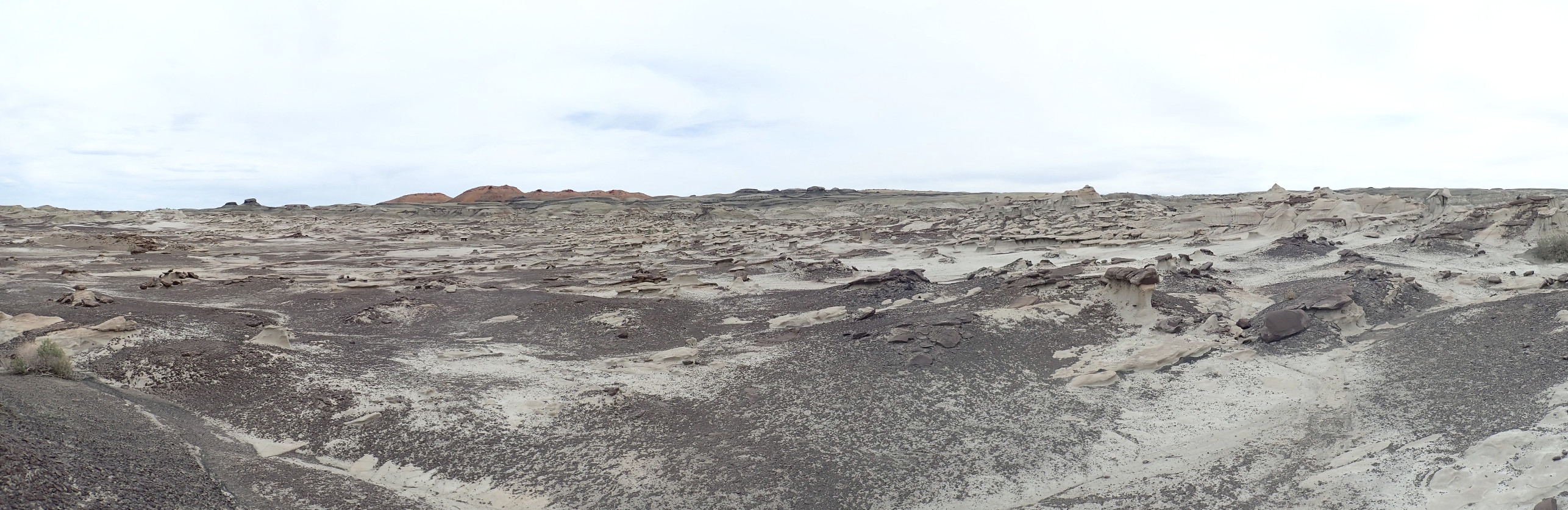
We return to the car, break out the wraps and lunch meat and salad, and then proceed to the other end of this area, the Bisti Wilderness. Here the arroyos have cut completely through the Ojo Alamo, and the Fruitland Formation dominates the landscape. We head out from the trail head, where several other cars are parked: The wilderness is busy today.

The Fruitland Formation is a coal-bearing formation, and thick coal beds are mined in the Farmington area and used to fuel large power plants whose electricity is transmitted to California. It seems to me that it would be more efficient to ship the coal than transmit the electricity, given the high power losses in transmission lines, but doing it this way is a way to export the pollution to our area. California has enough already.
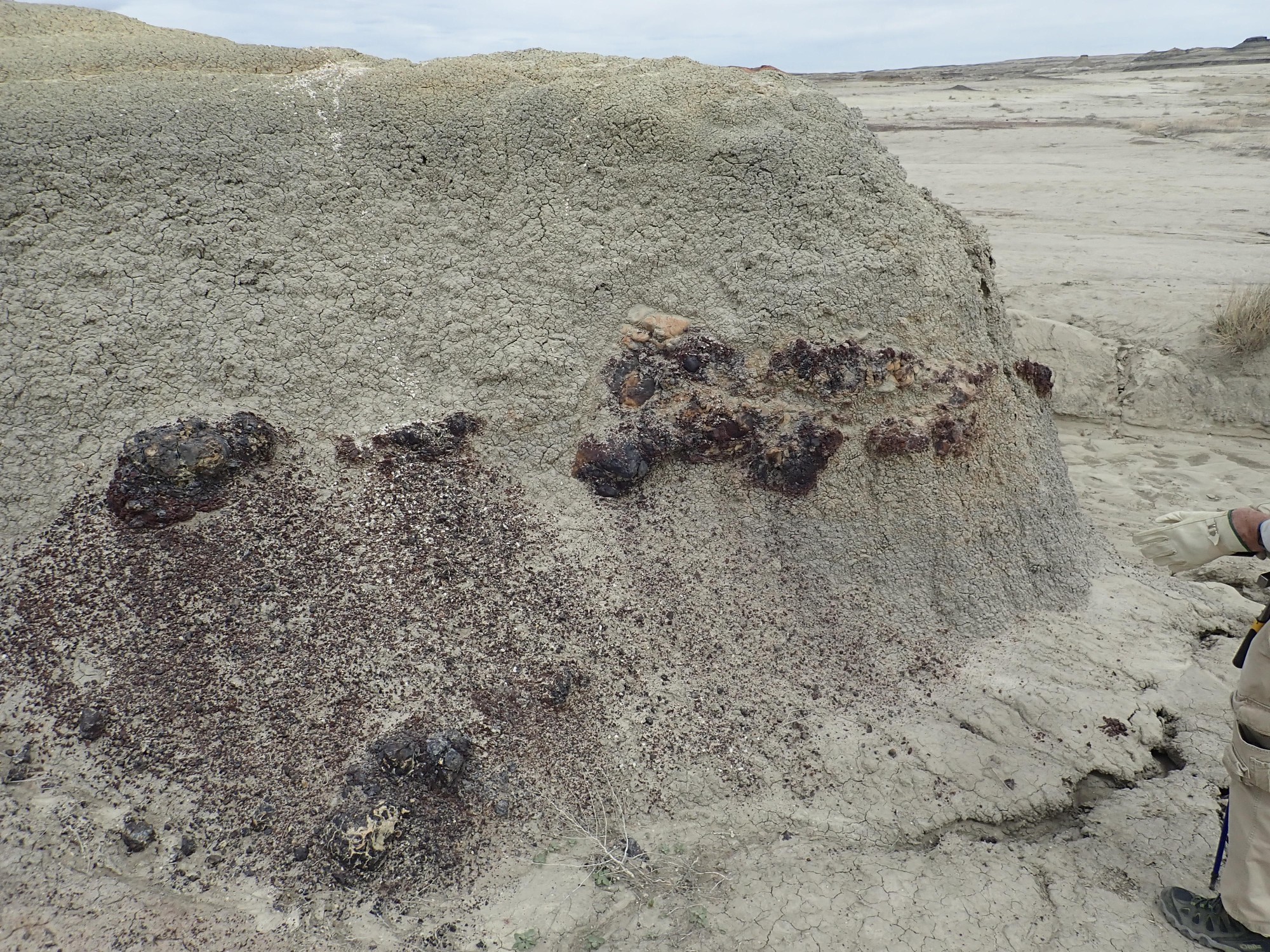
No coal is left in the Bisti Wilderness. The remaining Fruitland Formation beds are sometimes carbon-rich but not of fuel grade. Instead, there are bodies of red cinder showing that, some time in the past, lightning strikes or spontaneous combustion ignited the coal in this area, which smouldered, perhaps for centuries, baking the overlying mudstone beds into hard red rock.
I find myself wondering if the burning out of the coal beds helped shape the modern drainage pattern here.
Gary surveys the scene.
The ridge in the background shows on satellite as an oddly regular linear feature. I interpret it as the course of a stream in Nacimiento time that laid down a bed of sand that became more durable sandstone, capping the softer beds beneath the paleochannel.
Evidently one can, in fact, simply walk into Mordor.
However, spare water is advisable. We chugged a couple of pints each in our relatively short hike.
Goblin bedding in the Fruitland Formation.
Gary finds a concretion.


Note the shell of calcite (?) in the concretion.
Mysterious feature.

Sandstone beds.
By now I am anxiously checking my watch. Time is pressing if we want to get to our camping site at Natural Bridges National Monument at a decent hour. Though we have not yet reached the petrified stump forest that is found at the far end of the arroyo, we abandon the exploration and start back.
Not without some appreciation of the wonders of Mother Nature.

Nearby is a thick chert bed.

Notice the “popcorn” texture of the soil. This is very typical of shale beds rich in bentonite clay, which expands when moistened and shrinks when dried. It’s awful stuff to try to build roads on. Bentonite is typically formed from volcanic ash, indicating boisterous volcanic activity upwind in Nacimiento time — probably from the volcanic arc of the Mogollon Highlands to the southwest, where the Farallon Plate was subducting under North America. The ash likely also supplied the chert for this bed, but left unanswered is why the silica accumulated at this particular level. Was it a bed of organic matter that produced suitable conditions for precipitating silica? The chemistry of chert remains poorly understood.
From the other side of the knoll.
We return to our car and head out towards Farmington and then Shiprock. Between we stop at the Hogback.
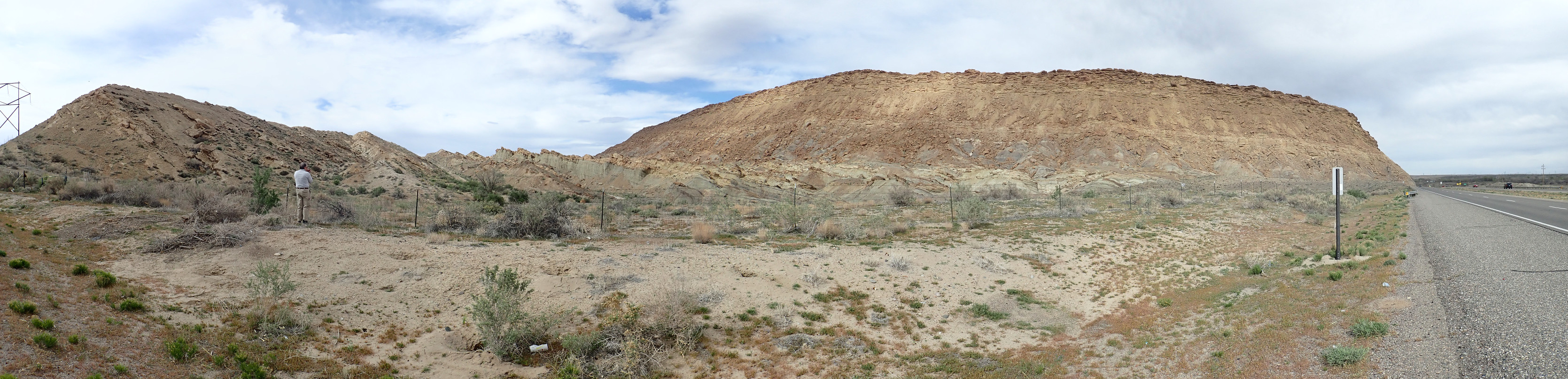
A hogback occurs where steeply tilting beds of a resistant formation are left behind when surrounding softer beds are eroded flat. If there are alternating beds of hard and soft beds, erosion may form a strike valley in the softer beds between ridges of harder beds. Here we are standing in a strike valley looking north along the axis of the hogback. The hard formation at left is the Point Lookout Sandstone; the valley is eroded out of the Menifee Formation; and the bed at right, forming a high ridge, is the Cliff House Formation. All are part of the Mesaverde Group. Further west are soft beds of the Mancos Shale and further east are soft beds of the Lewis Shale, which have eroded flat so that the hogback stands out.
The Mesaverde Group records a regression-transgression sequence. About 80 million years ago, this area lay under a shallow sea, the Western Interior Seaway, that reached from the Arctic to the Gulf of Mexico and lay between the Appalachians to the east and the young Sierra Nevada to the west. Mancos Shale was laid down in the bottom of this rather muddy sea. Around 70 million years ago, the sea briefly retreated. As the coastline receded, it left behind first a layer of beach sand (the Point Lookout Formation), then a mixture of muddy and sandy beds of coastal swamps, making the Menifee Formation a coal-bearing formation. The sea then returned, leaving another layer of beach sand (the Cliff House formation) then resumed depositing mud of the Lewis Shale.
The beds in the hogback dip steeply to the east and are located where the deep crust fractured sometime in the last 50 million years as part of the Laramide orogeny (mountain-building episode.) The deep crust rock was brittle, but the overlying sedimentary beds were ductile enough to drape over the deep fault rather than become faulted themselves. This fault is usually taken to define the northwestern edge of the San Juan Basin, and the hogback extends at least as far south as Newcomb, 30 miles away. It extends north along the southeast margin of Mesa Verde, reaching perhaps as far as the Durango area. It is likely that Mesa Verde was uplifted during the event that produced the hogback.
Good geologic information on the hogback is surprisingly hard to Google up. One site claims it formed 100 million years ago — flatly impossible considering that the Mesaverde Group is just 70 million years old.
I try the panorama feature on my camera again.
It’s better than the earlier panoramas, but I’m still not impressed. You can clearly see where the camera has done a poor job of blending image edges. But then I almost never use this feature; I’ve always taken full-resolution images and used Hugin to blend them into a panorama.
We pass north of Shiprock Mountain.
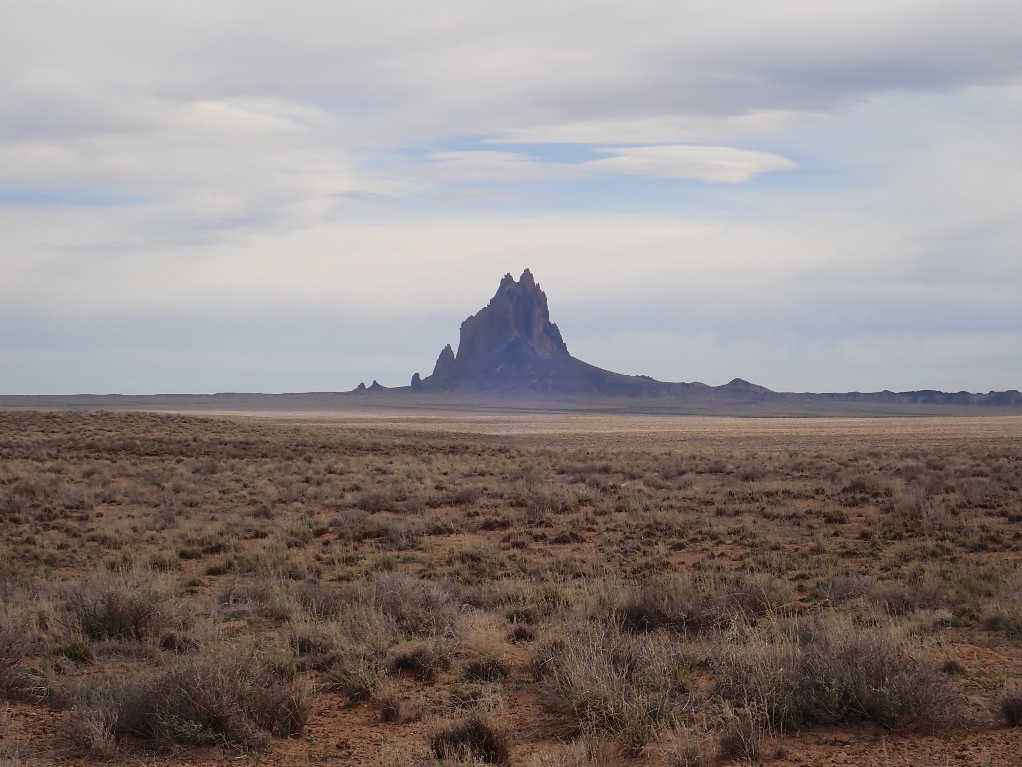
Shiprock is a volcanic neck. Most volcanoes are formed of rather easily eroded beds of cinder and lava. Lava seems like very hard rock, but its minerals are unstable under surface conditions, making it more easily eroded than you might imagine. Cinder is so loose that it erodes almost at once (in geologic terms.) As a result, an isolated volcano like the one that once stood here is eroded away in a geological blink of an eye, leaving only the congealed lava that filled its throat — the volcanic neck.
Dikes radiate away from the neck.
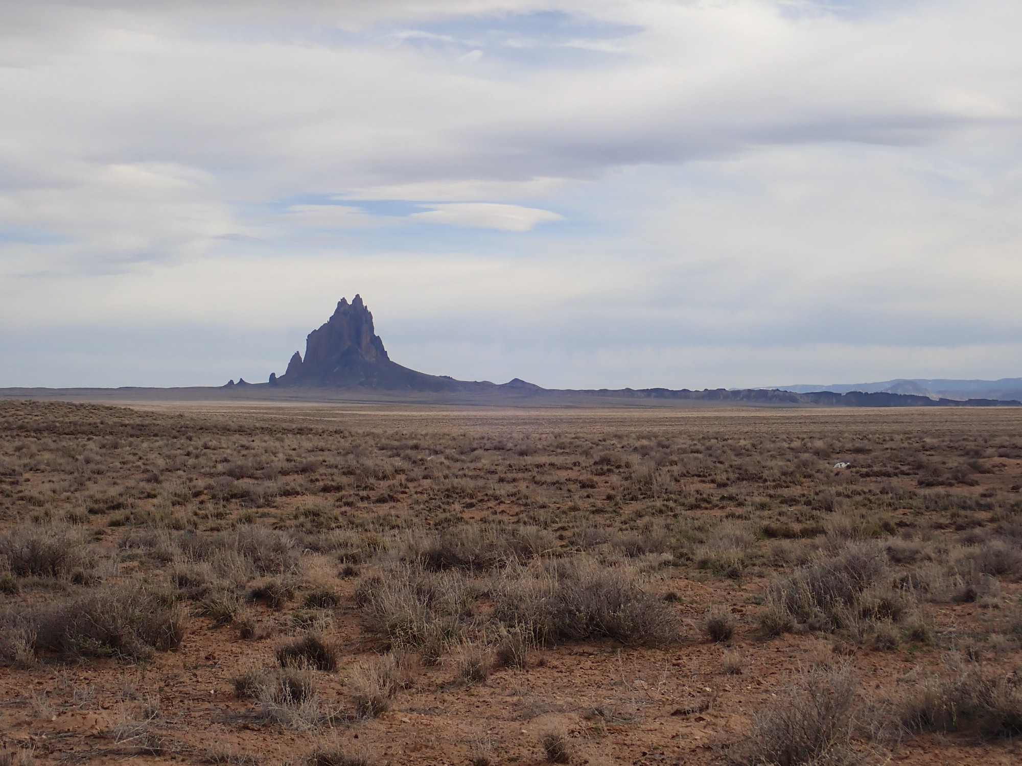
At least three dikes converge on Shiprock. It’s tempting to think the volcano formed first and the dikes worked their way out from it, but it probably went the other way: The dikes formed first, and where they intersected, the freer flow of magma upwards eroded a vent for the overlying volcano. We see this phenomenon in Hawaii, where eruption along a fissure — a “curtain of fire” — soon localizes to a single vent which then forms a small cone.
I am reluctant to take too many photographs while in Navajo country. For one thing, the Navajo Nation requires a permit for commercial photography, and while you’re reading this blog for free, I feel like I’m close to the boundary. For another, the Navajo are a very private people, and I feel the need to be sensitive to this. But Shiprock is irresistible. On this trip, so were these prominent cliffs in the Carizzo Mountains southwest of Red Mesa:
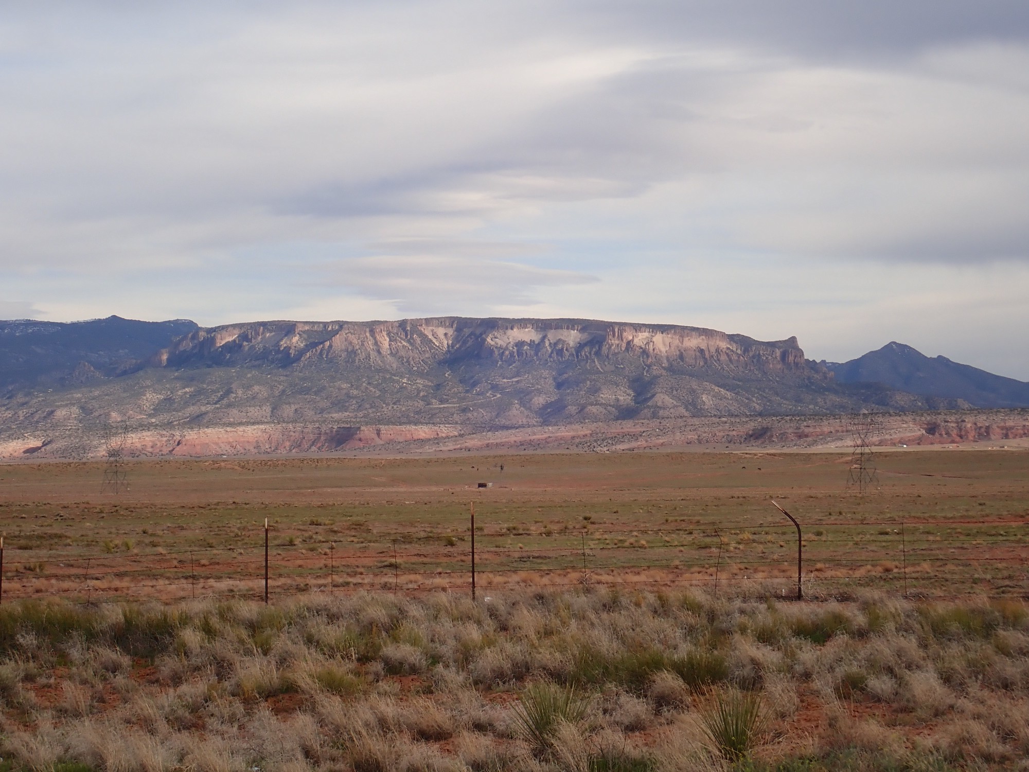
The mesa here, Chezhindeza Mesa, is an outlier of the mountains, curiously circular in shape, and the impression is of basalt over either tuff or hydromagmatic deposits. I Googled up a report indicating that the mesa top is a diorite sill 400′ thick, of Tertiary age, that formed when magma intruded between beds of the Mancos Shale. So the black cap is diorite and the grey material beneath is Mancos Shale. Apparently uranium was once mined here.
No more. Uranium mining on Navajo land has been linked to reproductive cancers in young Navajo women, which apparently is particularly horrifying in Navajo culture. As a result, uranium mining has been banned “permanently” on Navajo lands. I disagree with that decision, but, hey, it’s their land and they have the right. And my impression of the Navajo is that they are working hard, and smart, to build up social capital while remaining Navajo.
Gary points out a beautiful anticline manifest in the beds south of this point.
Note how the beds dip gently to the east and begin to dip gently to the west just at the edge of the photograph. This structure may be part of the Monument Uplift, a large regional upwarp of the rock beds.
We head north into Utah, passing some striking rock beds.
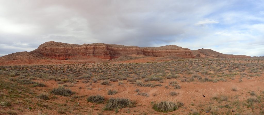
I’m reconstructing from nearby maps, but I believe the bottom formation is the Carmel Formation, or possibly the Entrada Formation. Above are thin beds of the Summerville Formation, then the Bluff Sandstone Member of the Morrison Formation and the Salt Wash Member of the Morrison Formation.
The Bluff Sandstone is a fairly localized member of the Morrison Formation, prominent around Bluff but not elsewhere. These formations all are Jurassic in age, with the Entrada representing dunes in an erg sea and the later formations representing various stages in the development of a coastal plain as the Sundance Sea retreated to the north. The Bluff Sandstone appears to correspond to a small, local dune field.
Notice how crinkled the lower beds are.
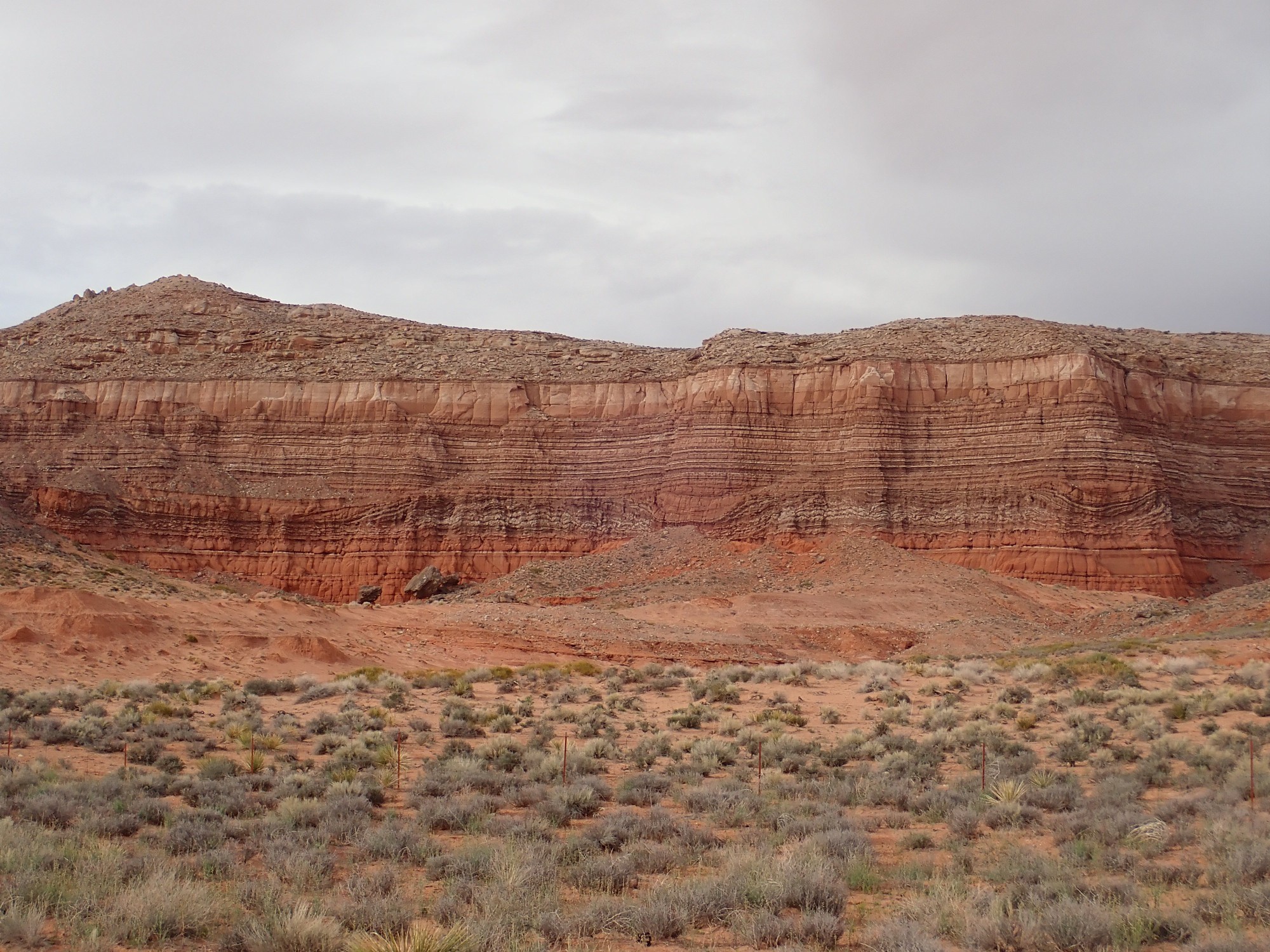
Looking this over, I’m inclined to refine my earlier description: It looks like the thicker, more orange beds at the bottom are Entrada Formation. The lowermost Summerville beds are surprisingly contorted. I am not sure, but these may be a result of soft-sediment deformation — the beds became distorted due to slumping before they were lithified into hard rock.
We arrive in Bland and find a restaurant. The food and service are okay but not memorable. We then double back towards Mexican Hat, but it is already getting dark. I decide we’re done looking at geology and head straight for Natural Bridges National Monument via Route 267. The road includes a set of gravel switchbacks up the face of Cedar Mesa, type section for the Permian Cedar Mesa Formation. The switchbacks might have been great fun in daylight; in the dark, they’re merely slightly nerve-wracking.
From the top we drive north, arrive at Natural Bridges, and find that the campground is full. Snow. I did not expect this so early in the season, and, anyway, the campground doesn’t take reservations. We find a side road on BLM land and a pullout that looks promising; as we are unloading, we realize there is a car and tent further up the pullout. We are not the first here. We pitch camp for the night as clouds roll in.
Next: Swarms of German tourists.