
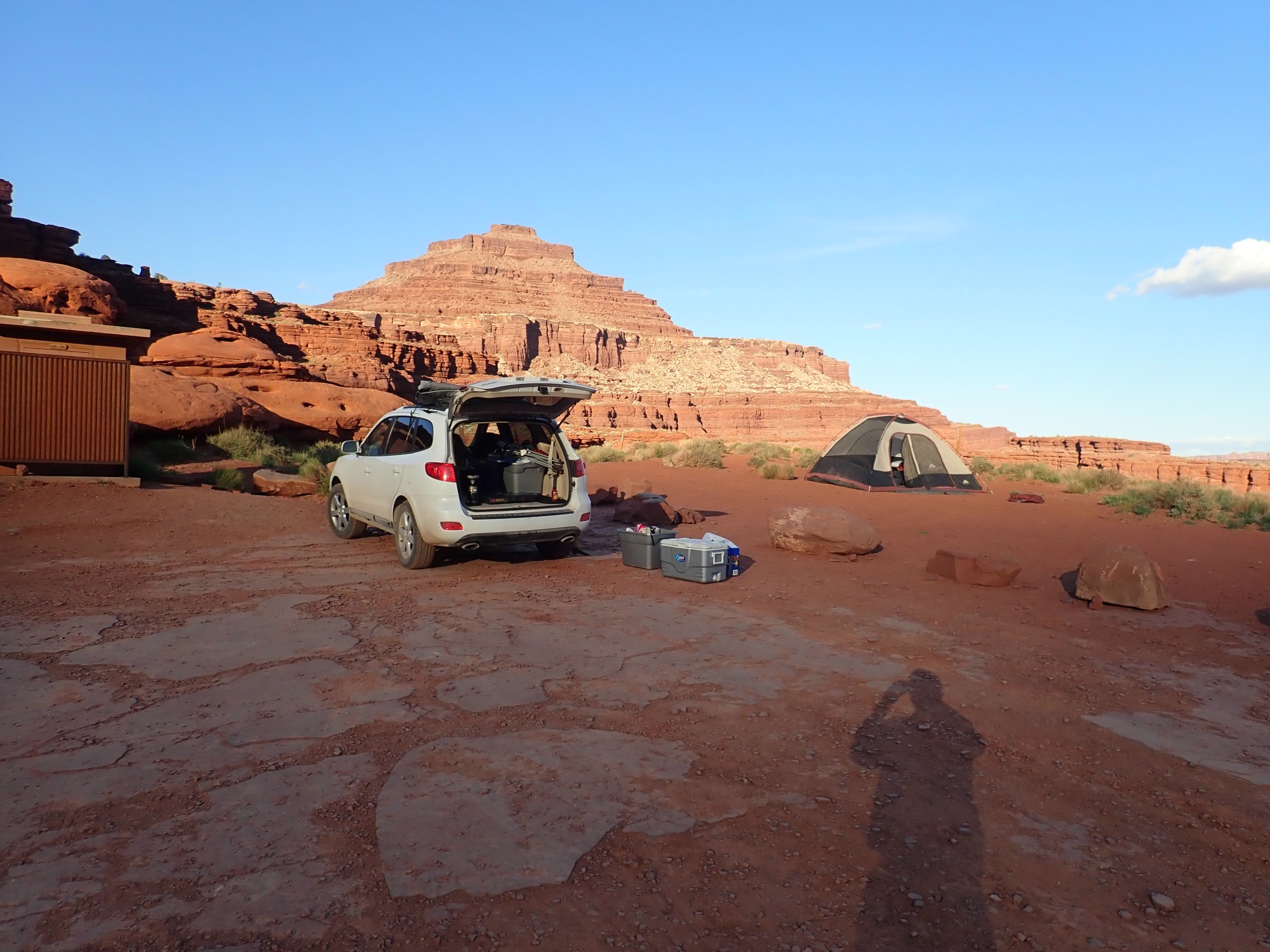
A sedimental journey, day 9
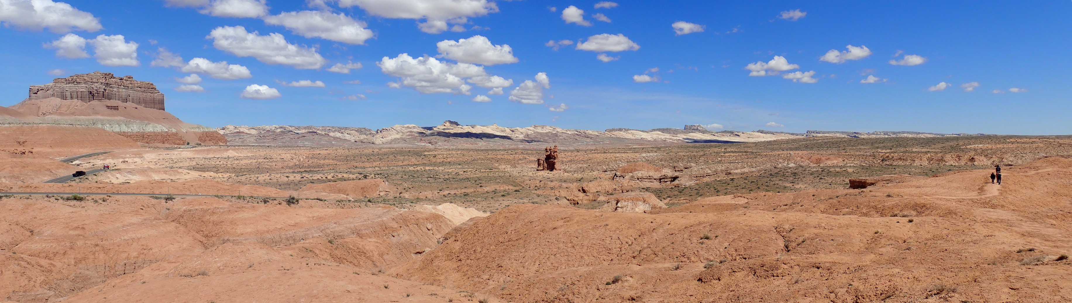
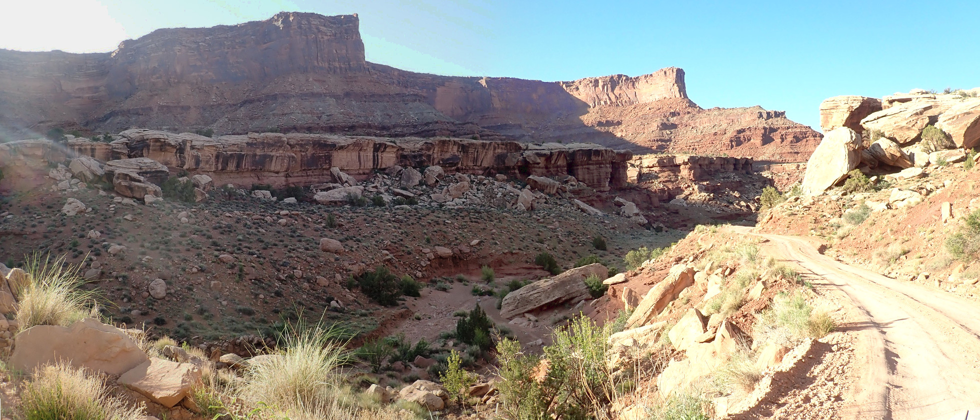
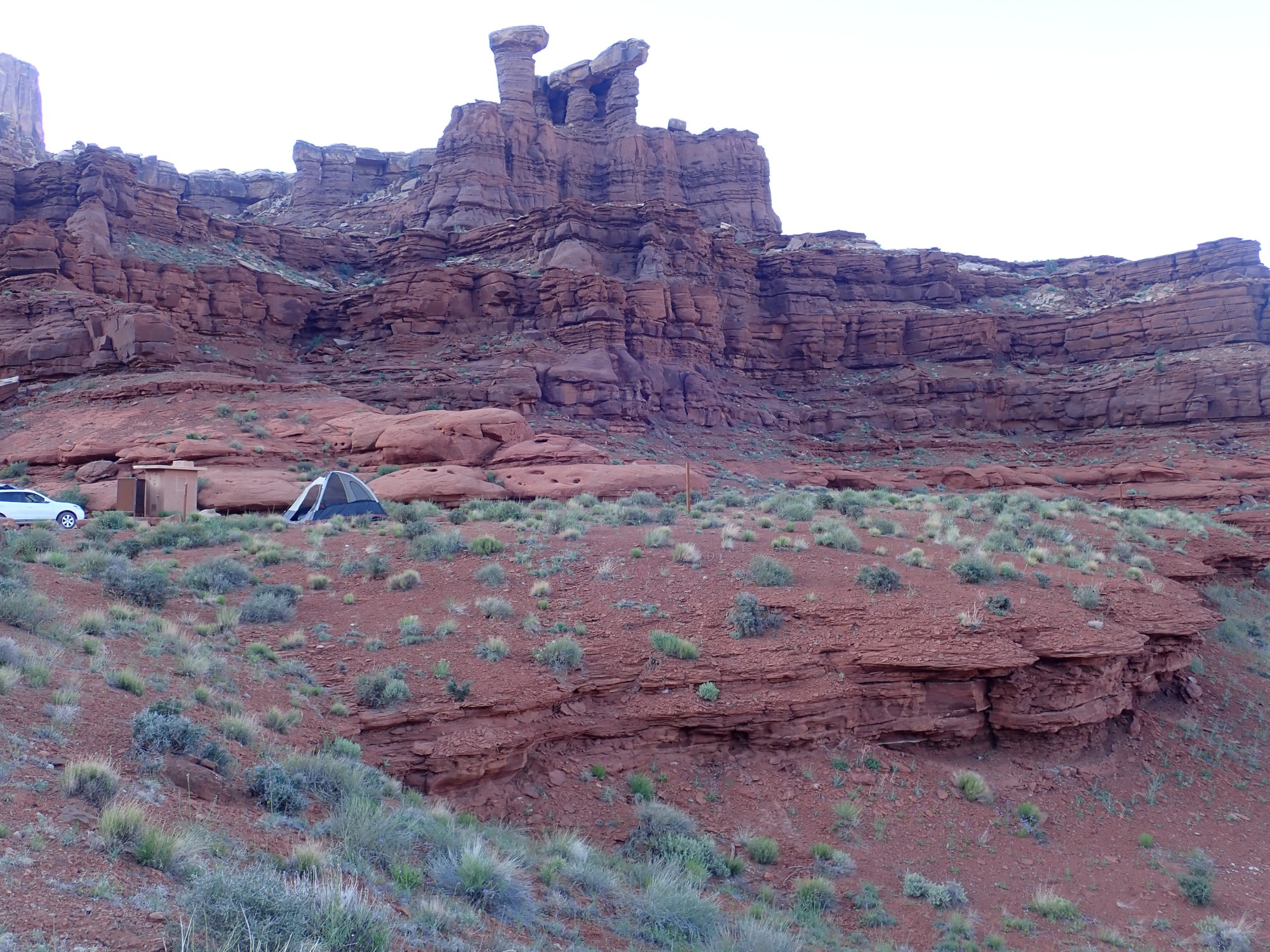
Dawn over the San Rafael Reef.
(As with almost all images at this site, you may click for a full resolution version.)
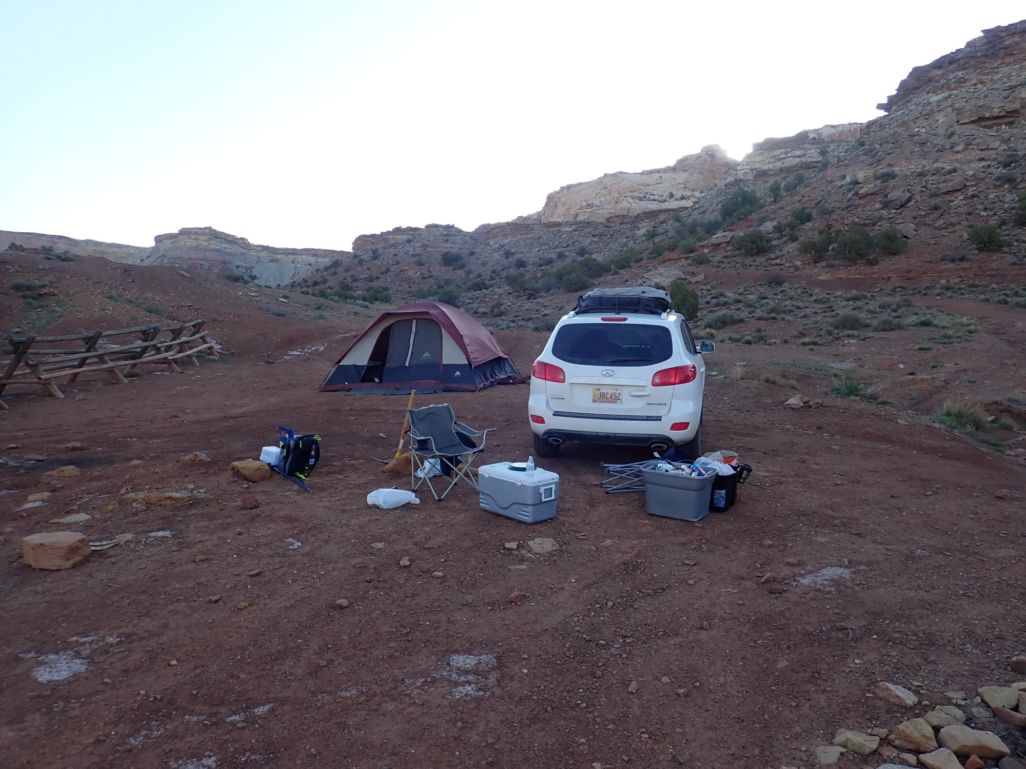
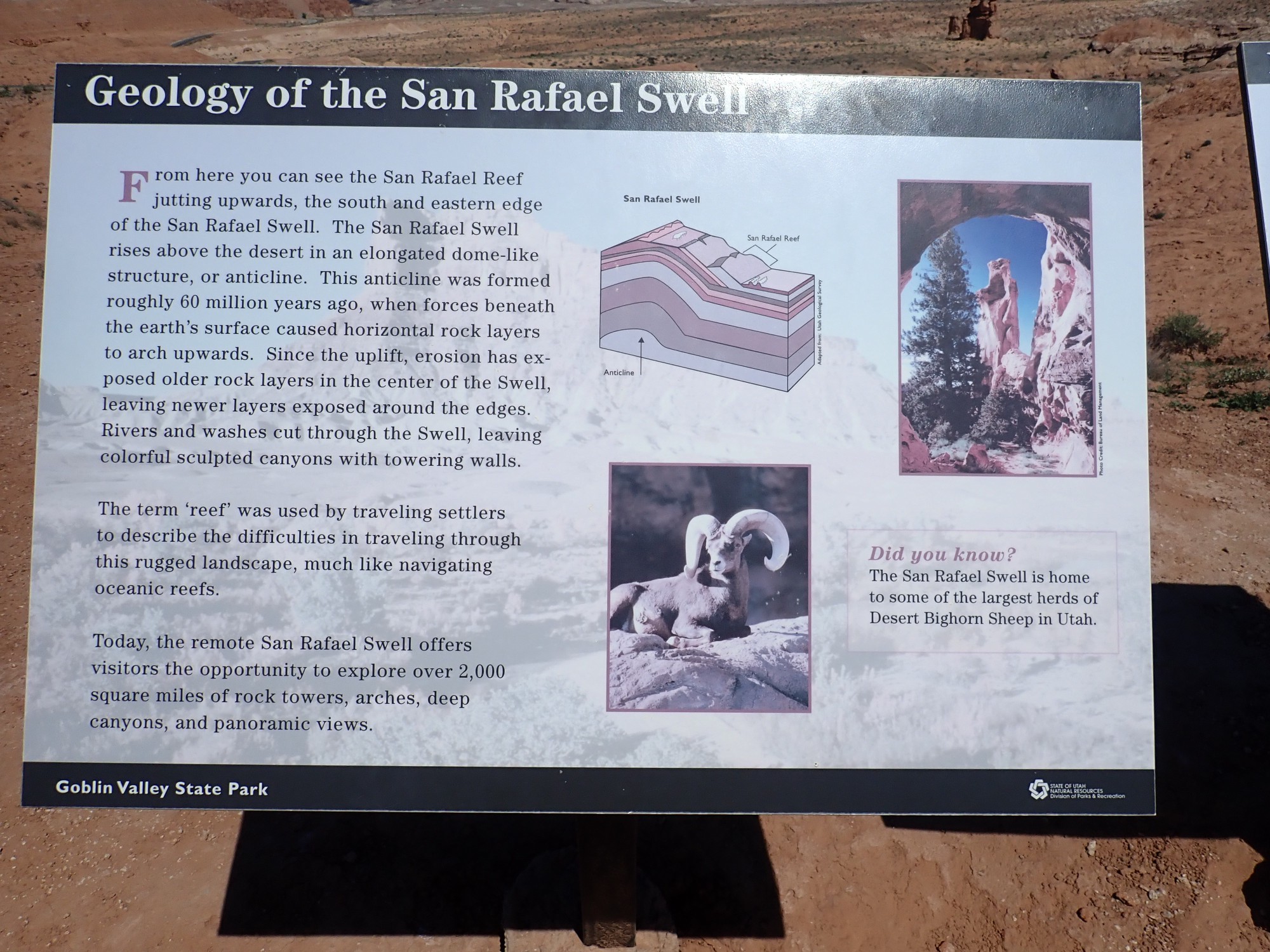
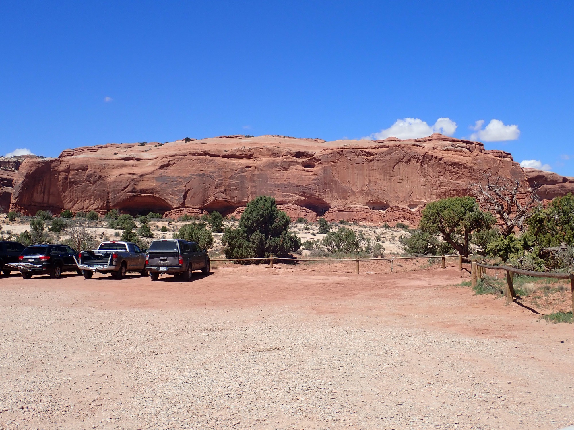
The previous day ended with us crossing the San Rafael Swell and driving south along San Rafael Reef to our camping area, just within the Reef. The San Rafael Swell is an area of upwarped rock beds (an anticline) some sixy miles long and thirty miles wide. Here, sometime during the geologicaly recent mountain-building episode called the Laramide Orogeny, the basement rock of the northwest part of the Colorada Plateau buckled and the overlying softer sedimentary beds were bent. The Reef is the easter boundary of the Swell, where rock beds of the resistant Navajo Sandstone plunge dramatically into the earth at a steep angle to form an imposing wall of white sandstone.
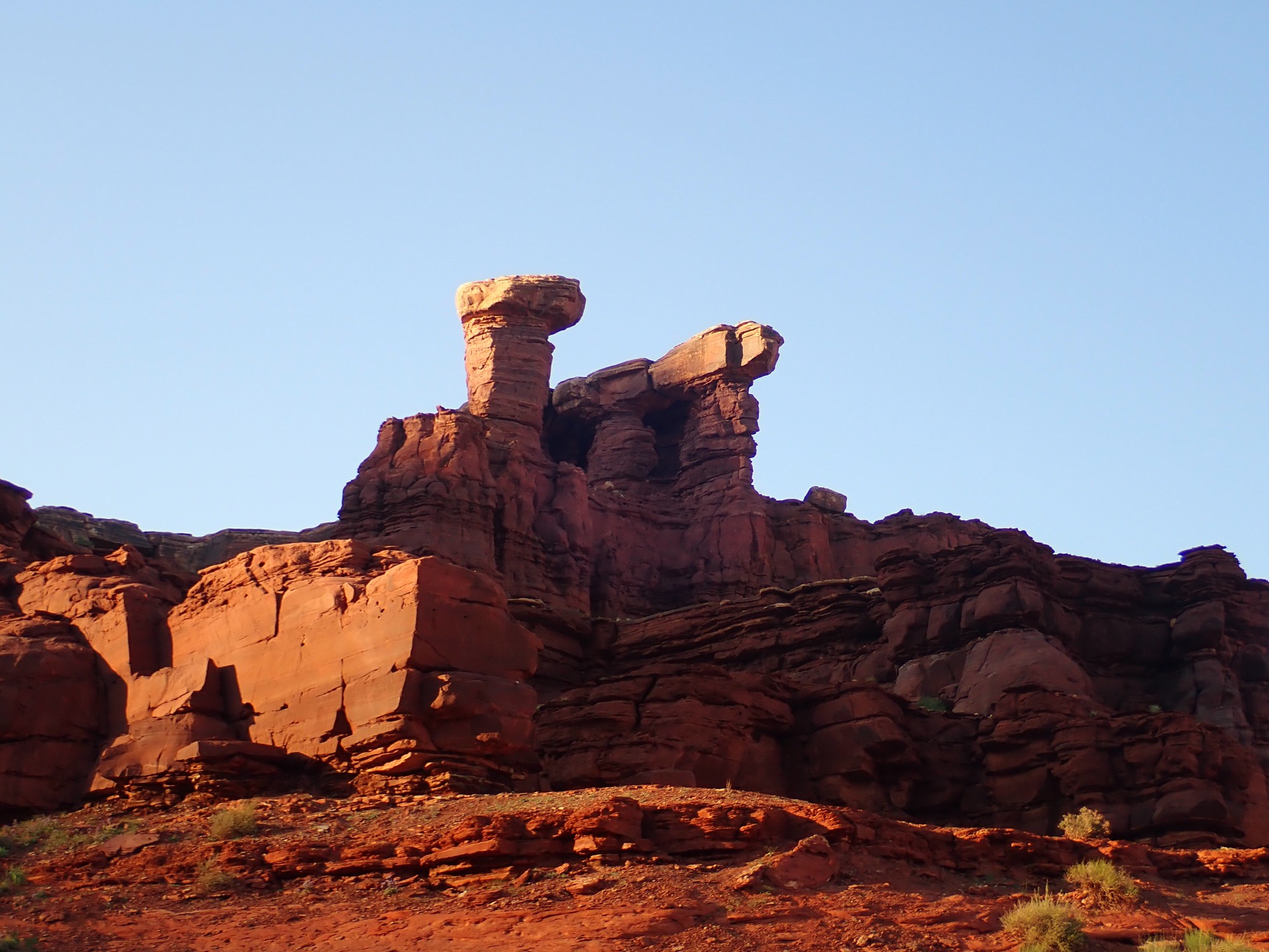
We breakfast and break camp. On the way out, there is a marvelously crossbedded knob of Jurassic Navajo Sandstone.
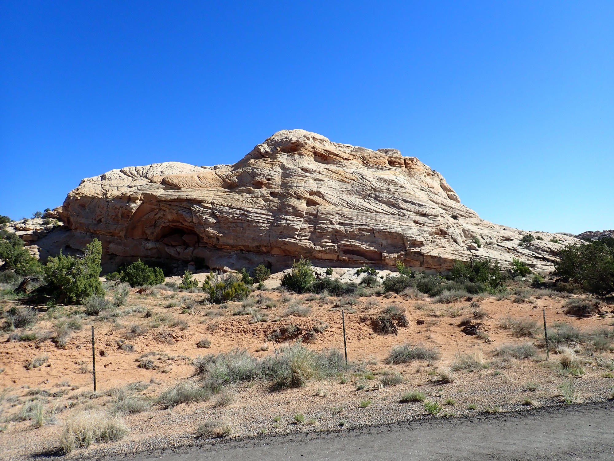
Crossbedding is where a sedimentary formation is made up of larger beds that consist of smaller beds at an angle to the larger beds. They are most characteristic of wind-deposited sandstone, and the Navajo Sandstone is famous for its pervasive crossbedding. These indicate the formation was laid down as a field of sand dunes. Together with the other formations of the Glen Canyon Group, the Kayenta Formation and the Wingate Formation, it is missing back in the Jemez, where Entrada Formation sits directly on the Chinle Group.
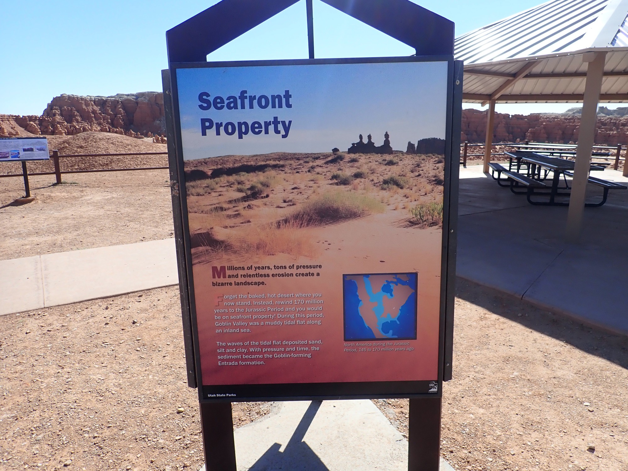
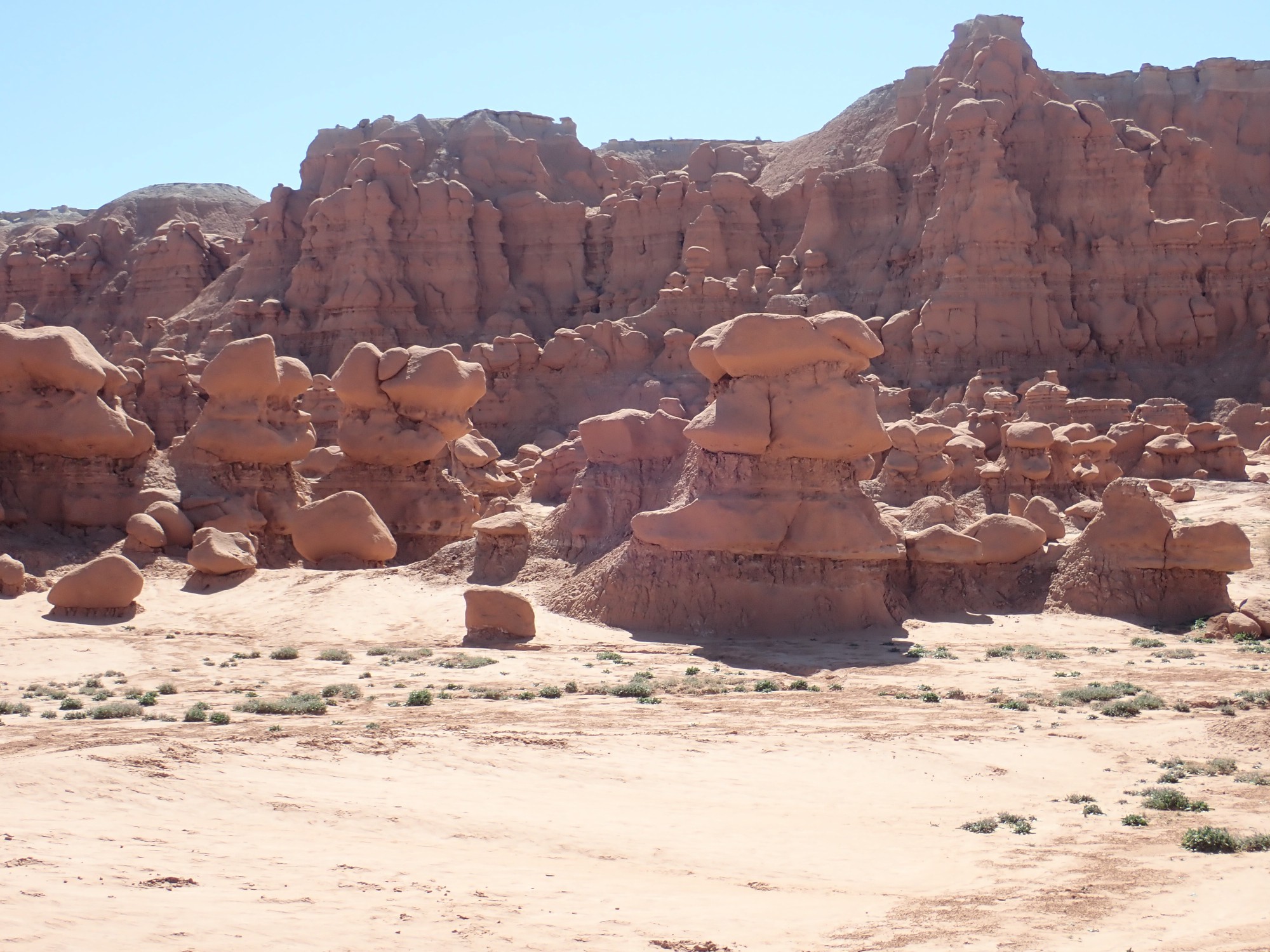
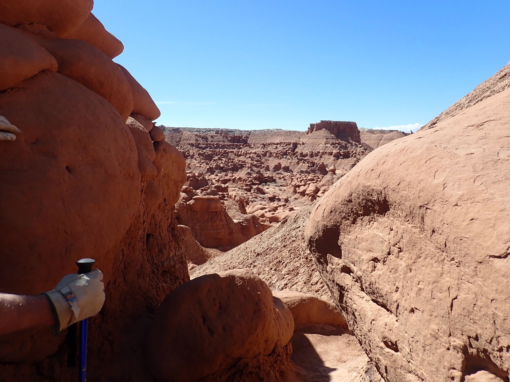
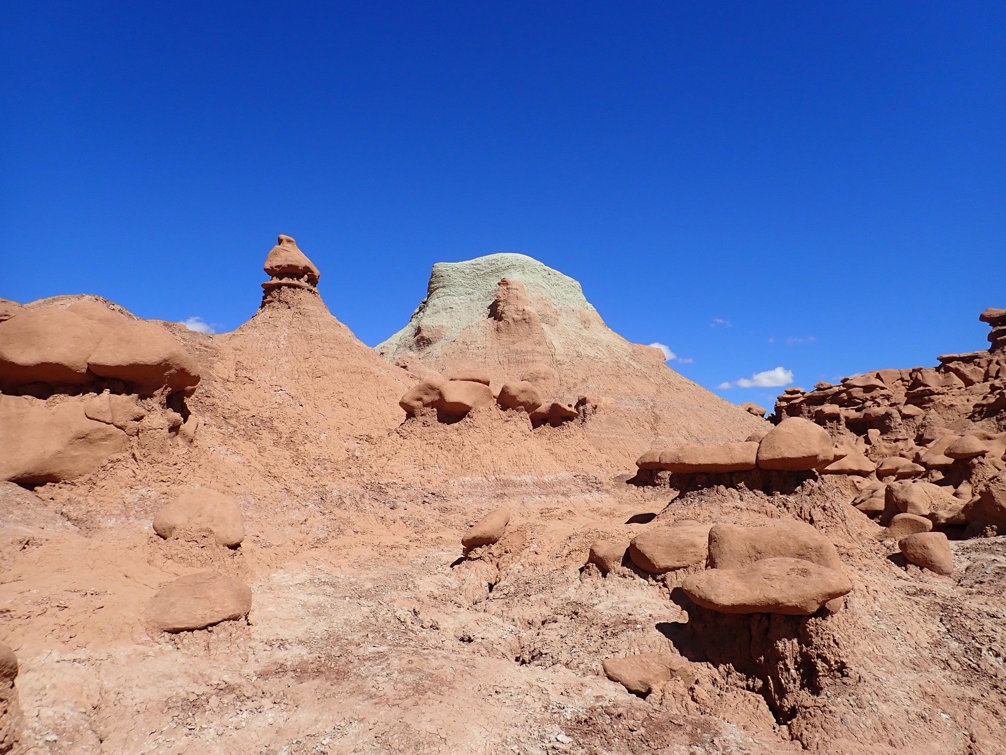
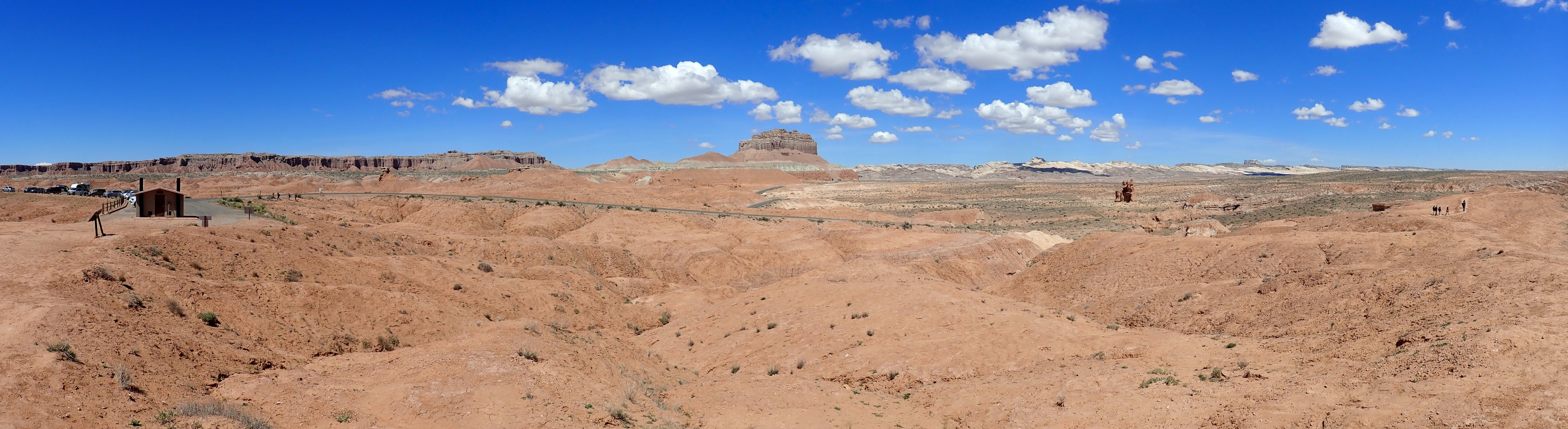
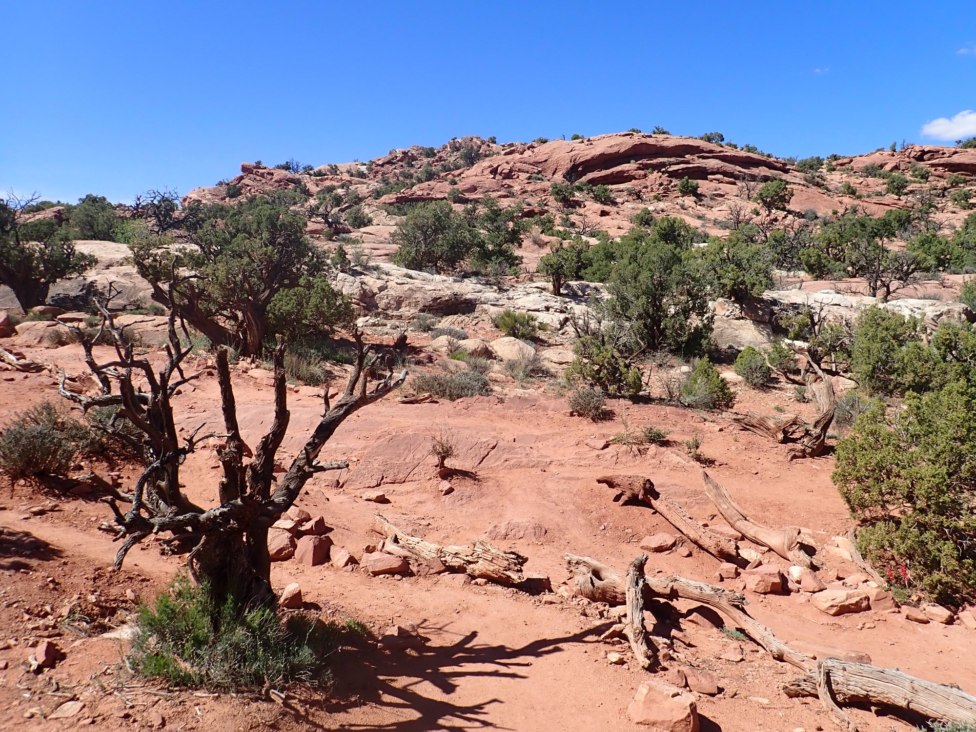
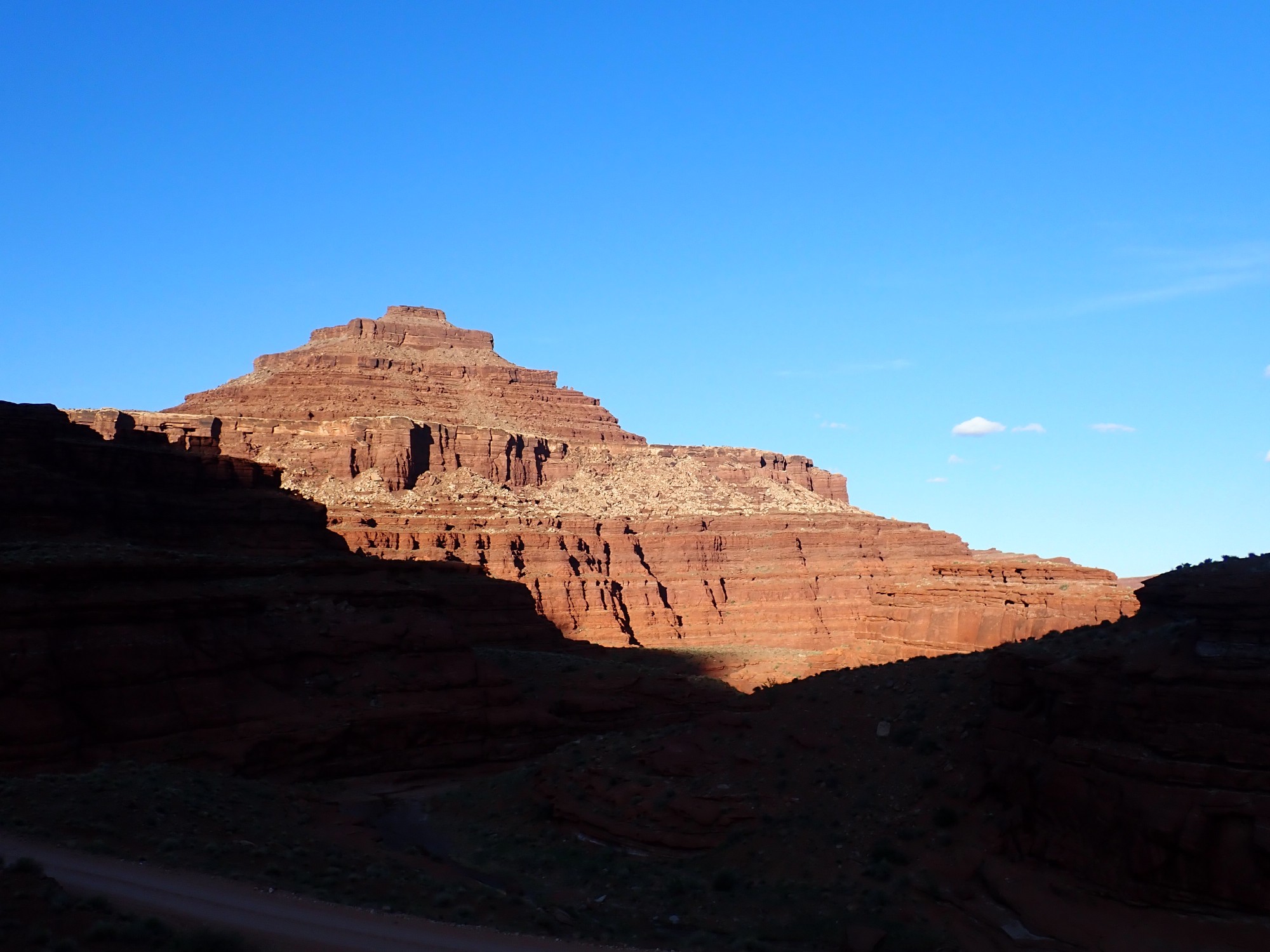
We head towards Goblin Valley State Park. Ahead is Wild Horse Butte.
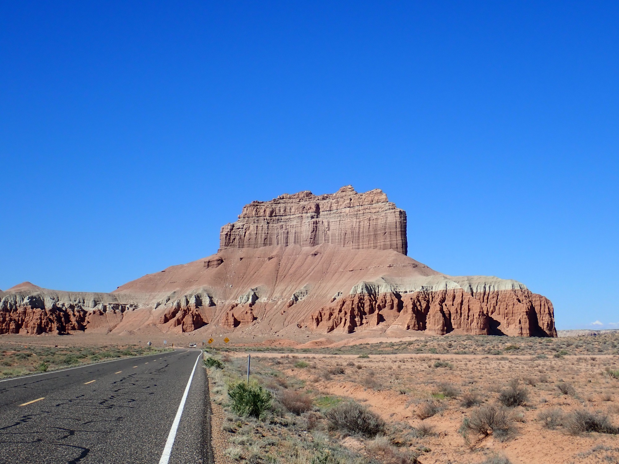
The butte is capped with Morrison Formation, beneath which are thib beds of Summerville Formation. The white layer is Curtis Formation, while the red beds at the base are Entrada Formation. It is in this formation that we will see the goblin army of Goblin Valley.
We see the same sequence back in the northern Jemez, except that the Todilto Formation replaces the Curtis Formation.
The surrounding areas are covered with red windblown sand eroded from the Entrada Formation. This is the San Rafael Desert. Its eastern parts are among the most isolated areas still left in the lower 48 states.
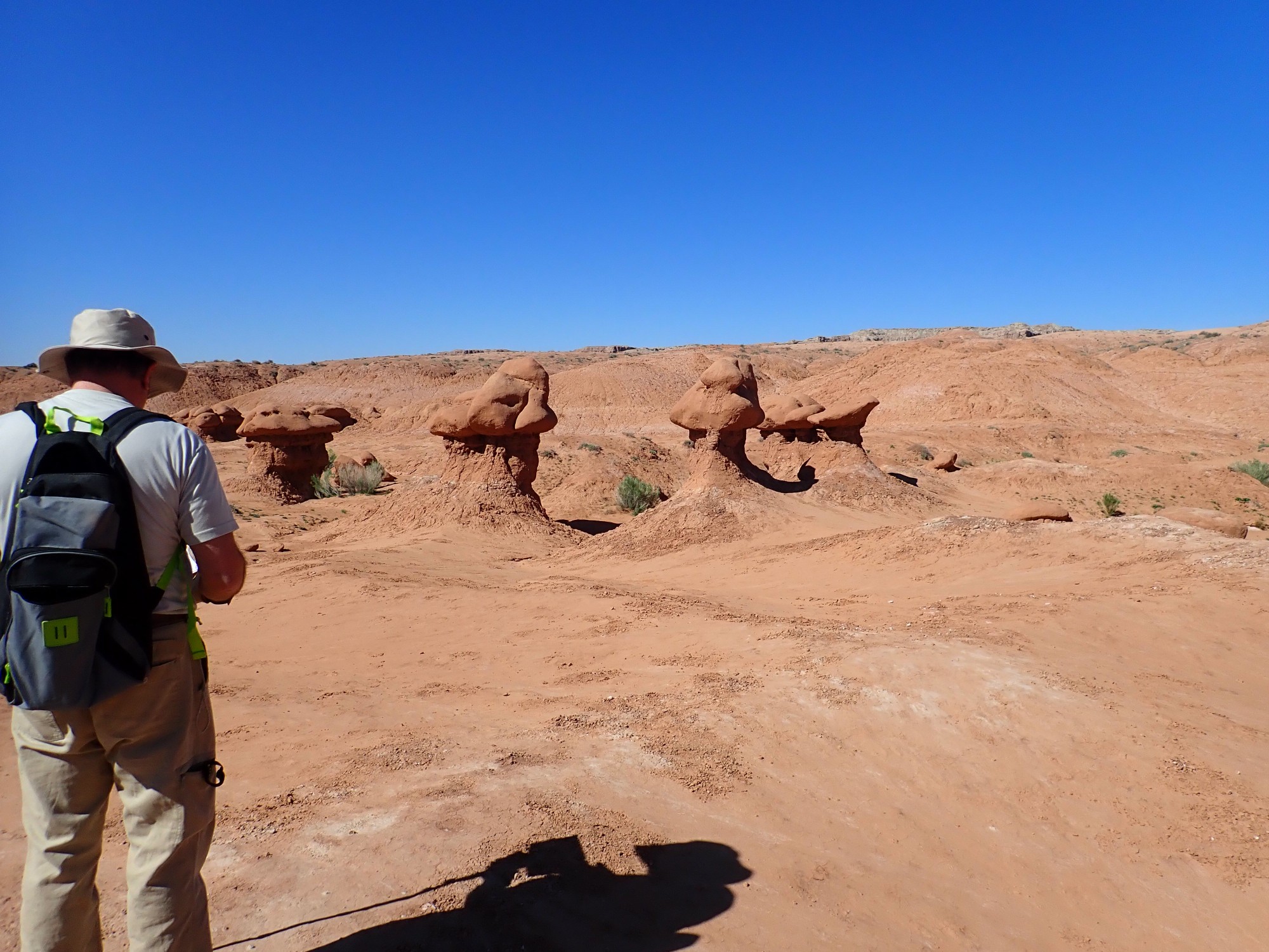
We arrive at the main overlook. There is signage.
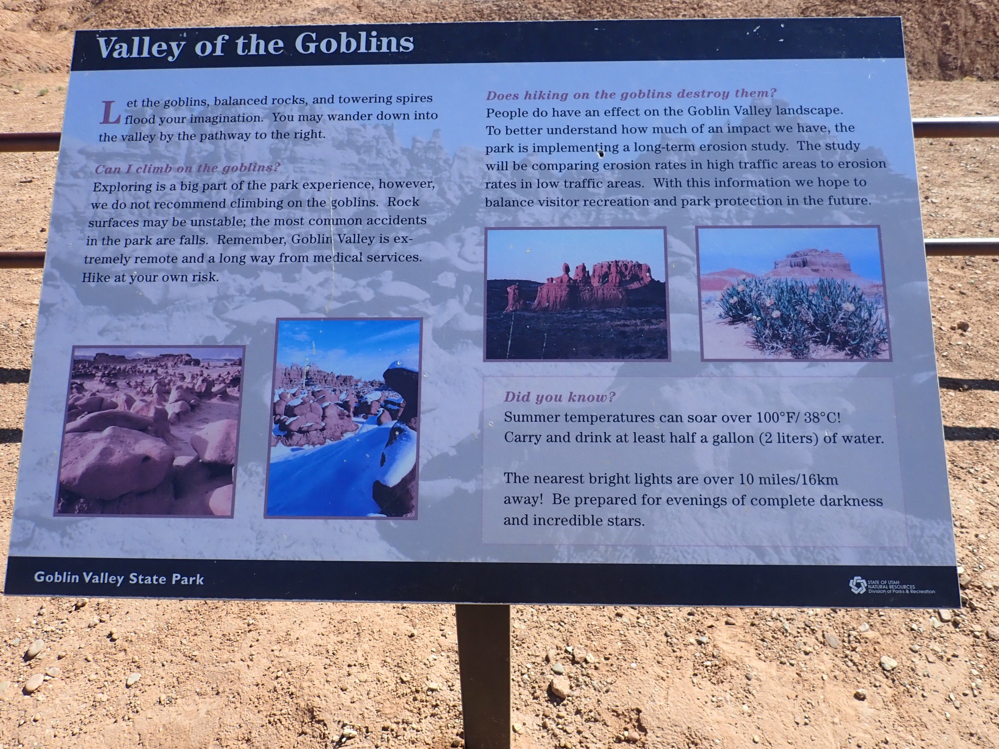
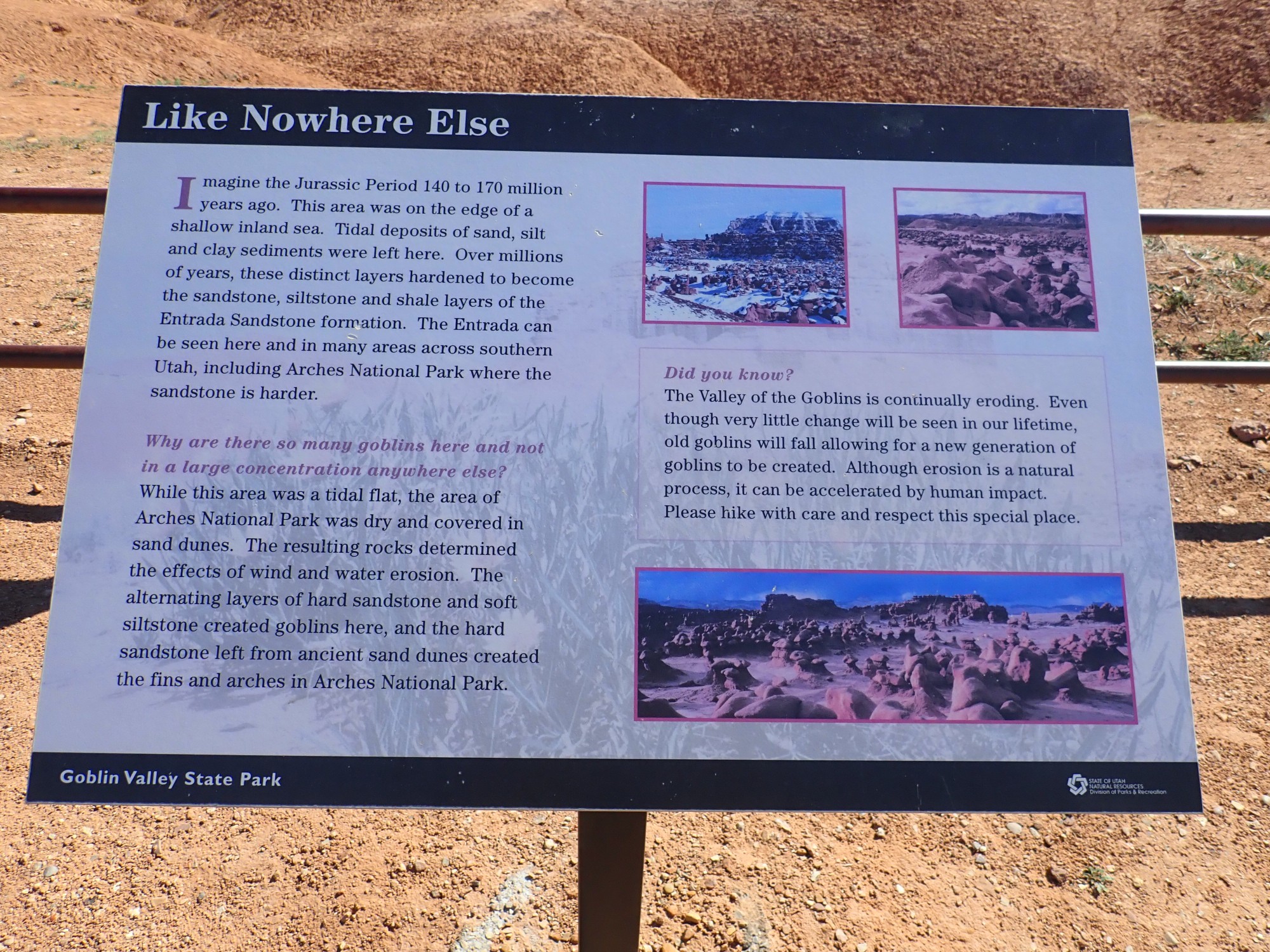
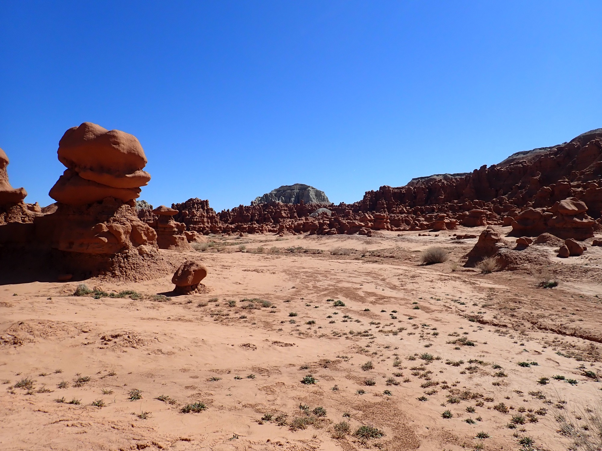
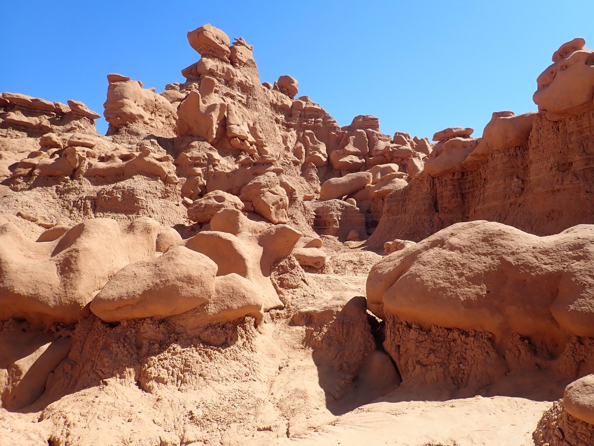
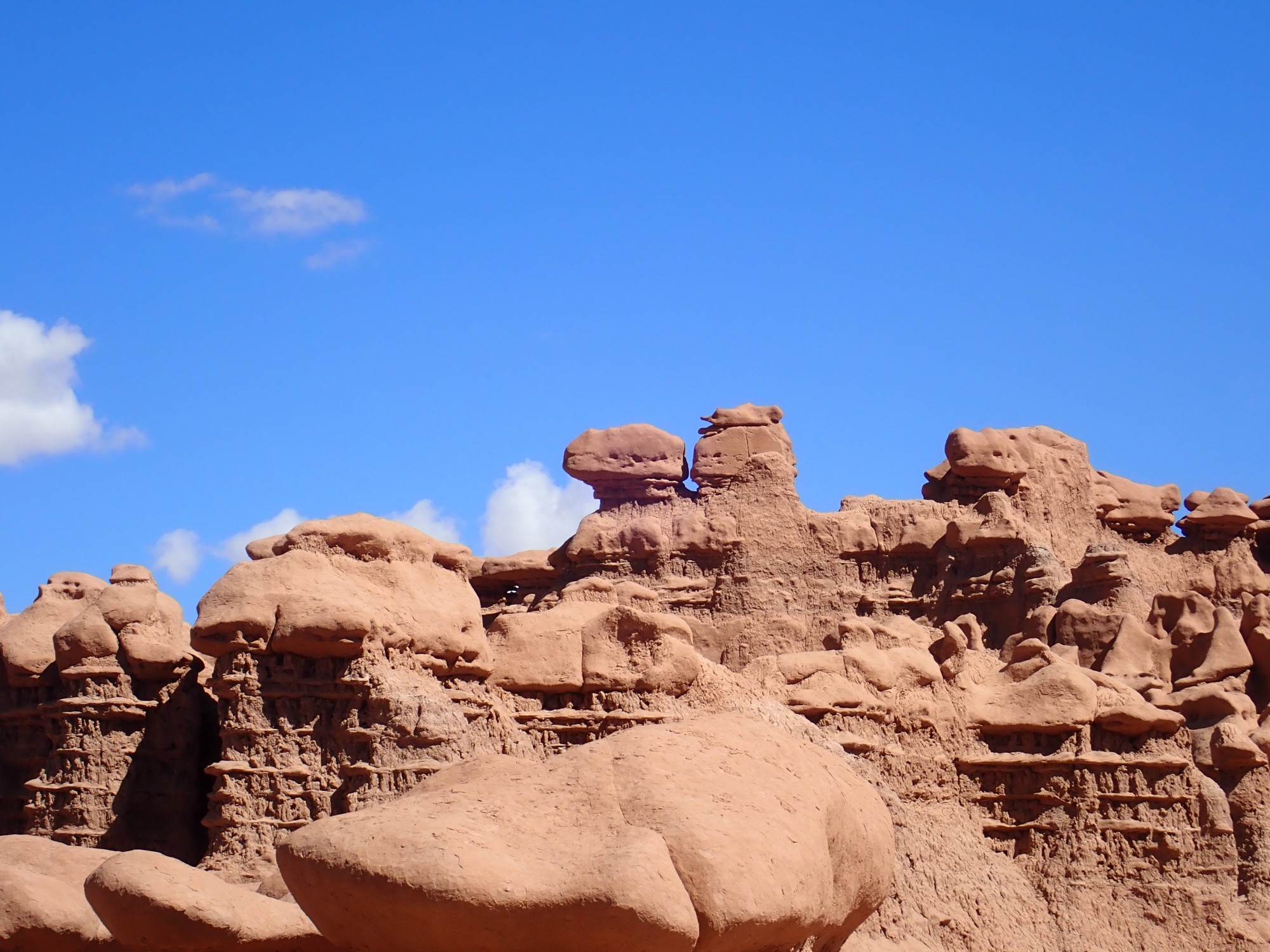
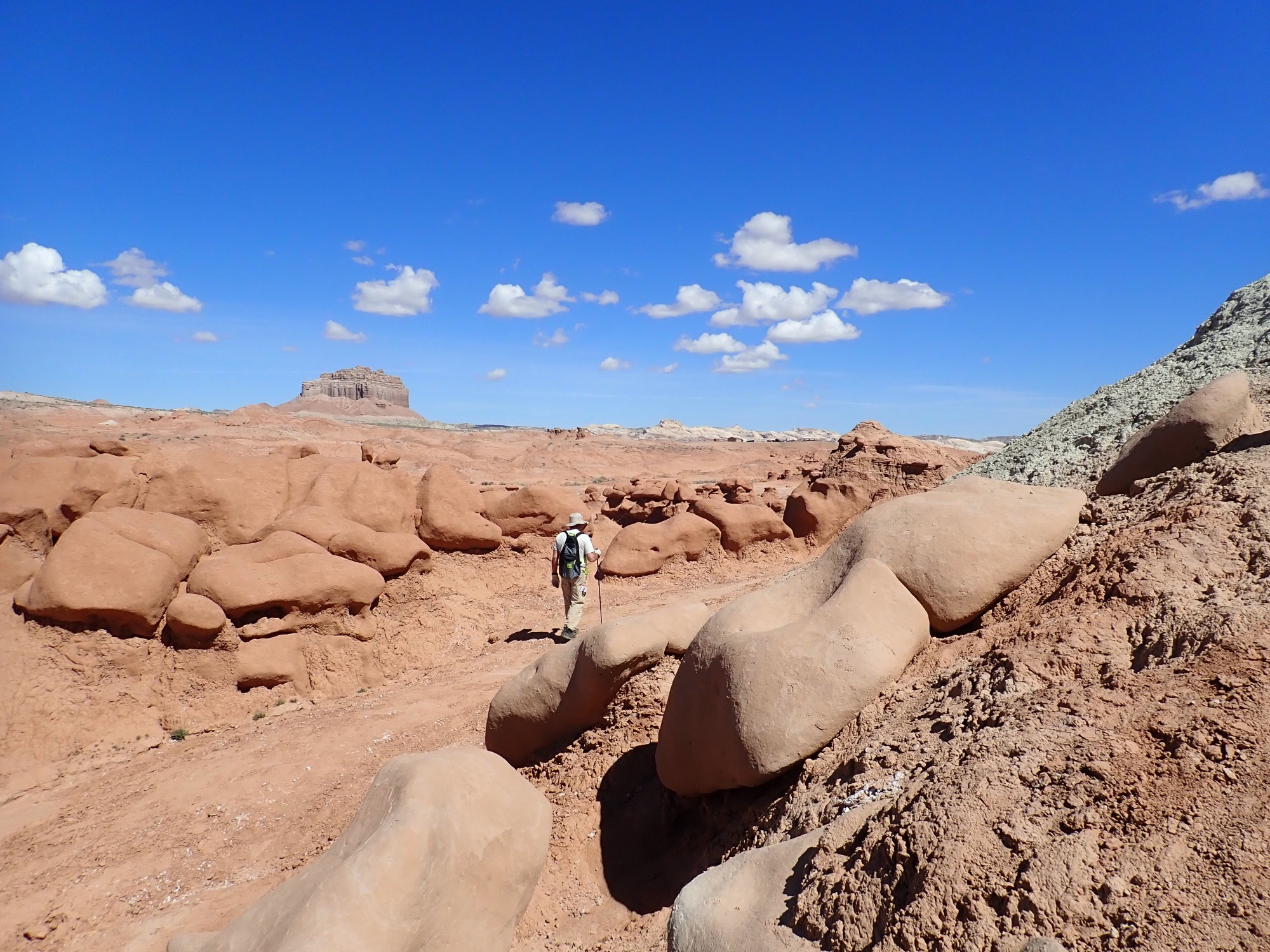
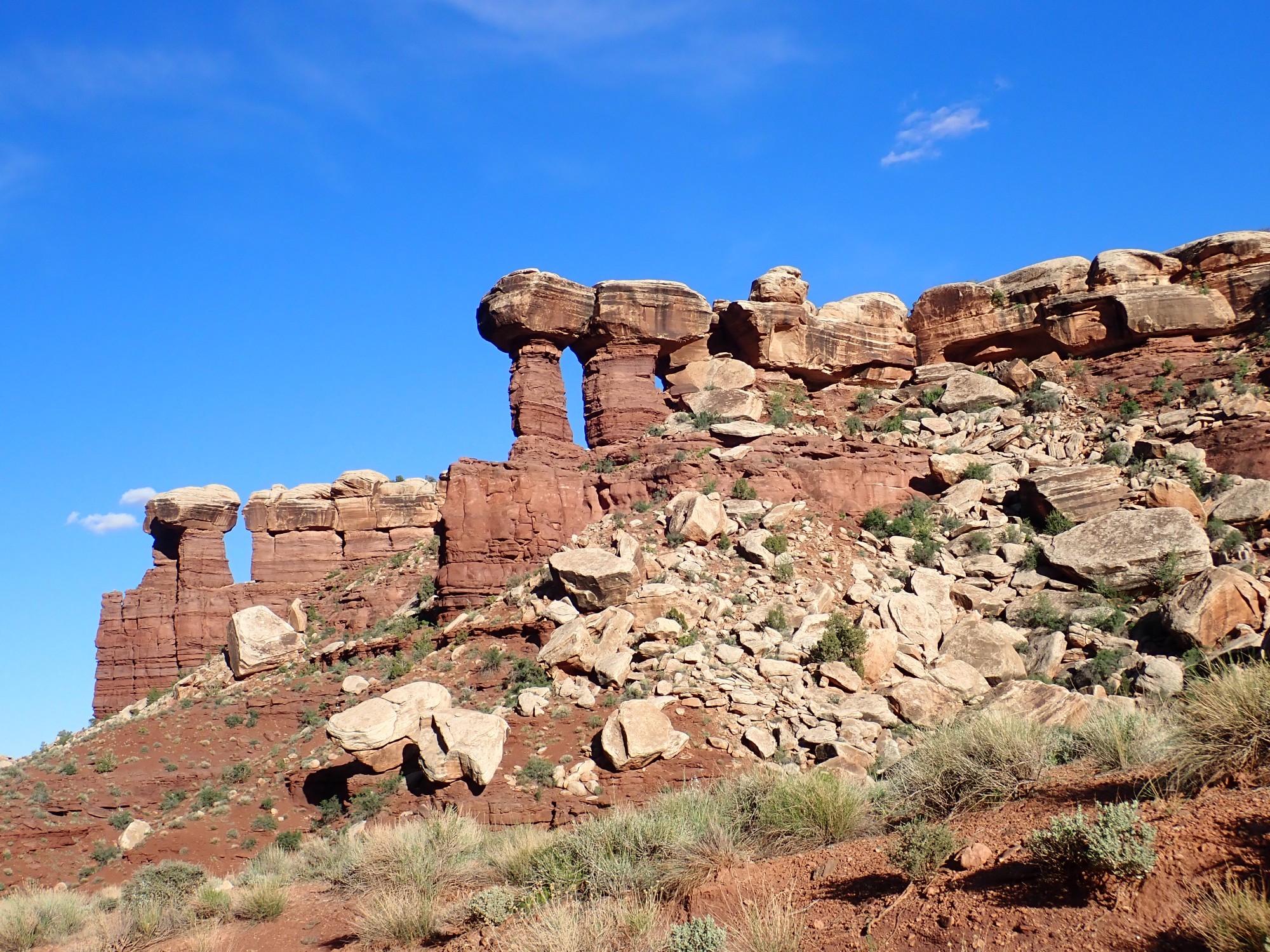
Behold the goblin army!
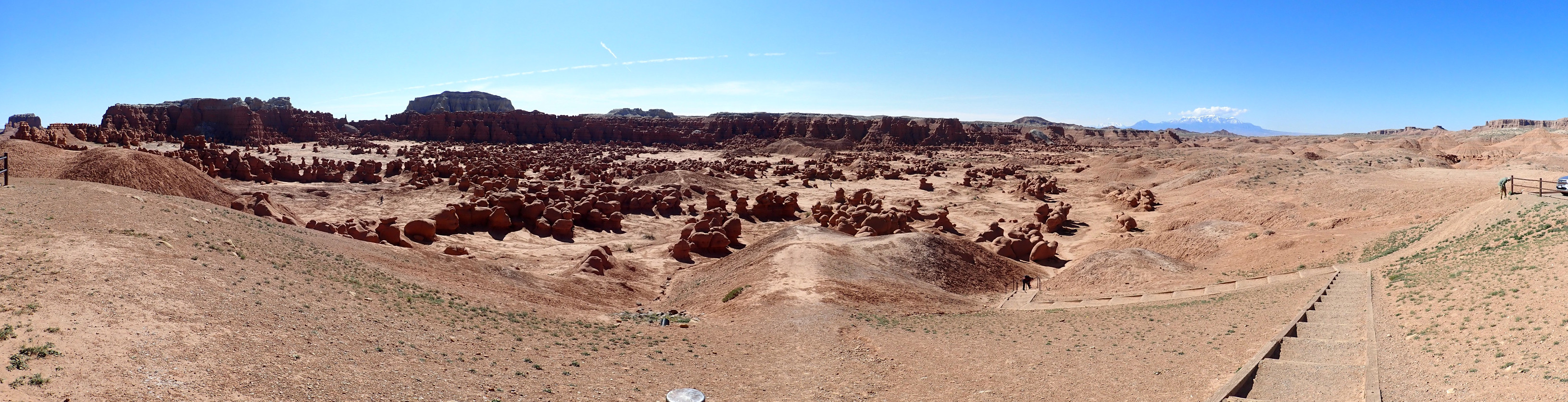
The goblins are boulders eroded out of the Entrada Formation that rest on pillars of softer sediments.
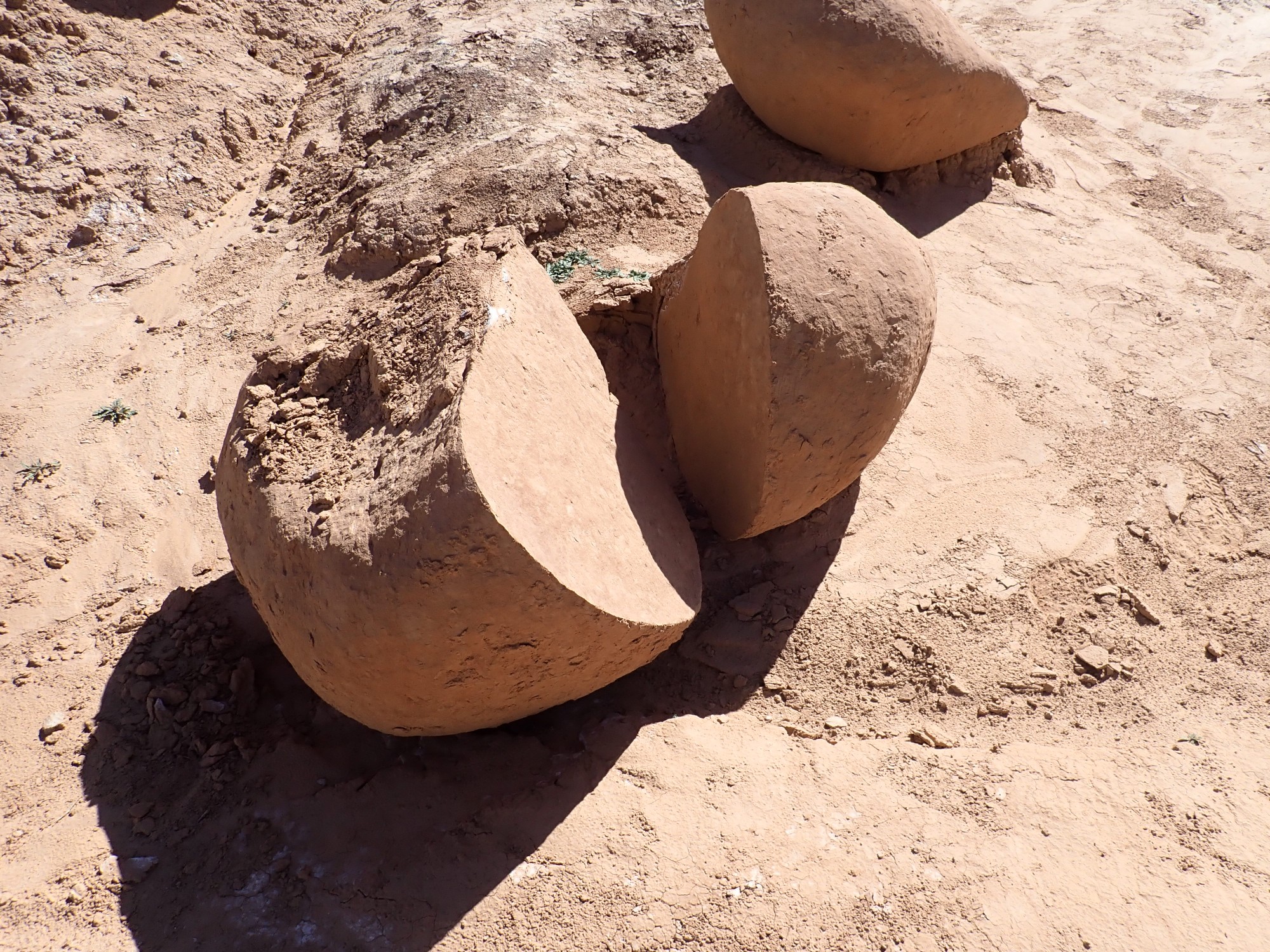
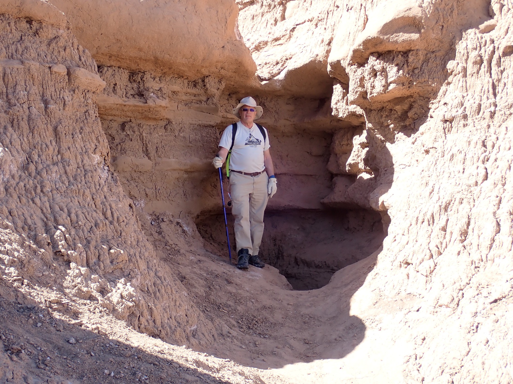
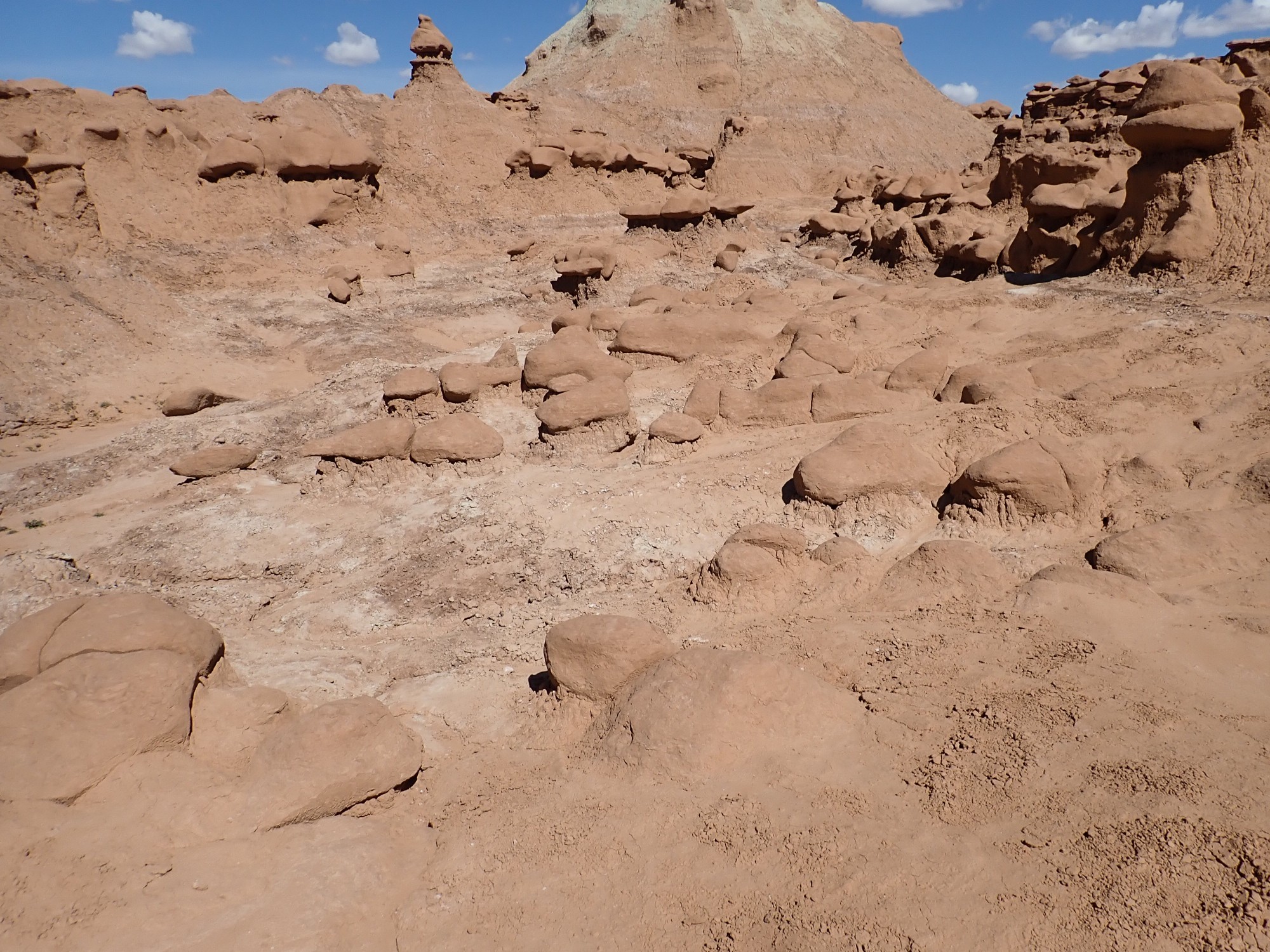
I was curious to see the early stages of the erosion process, which seems almost unique to this area.
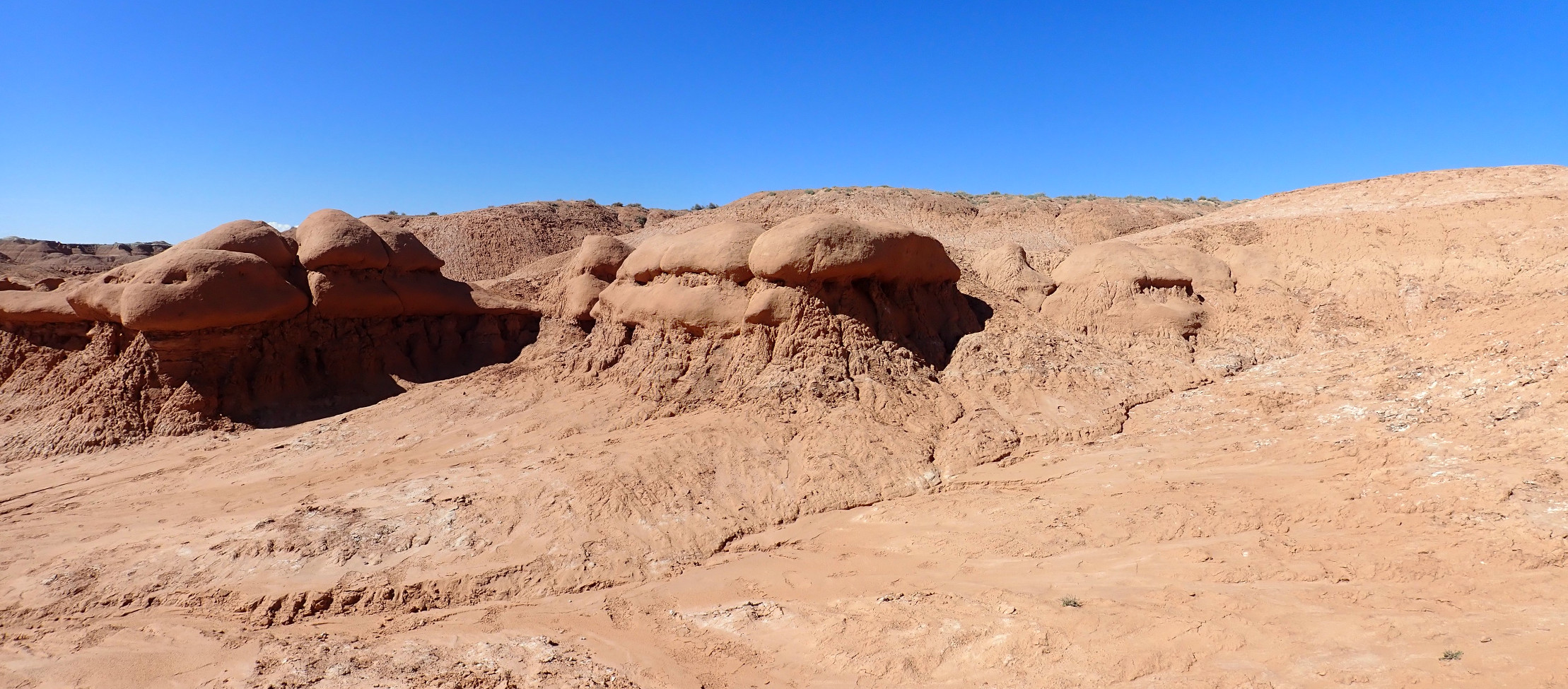
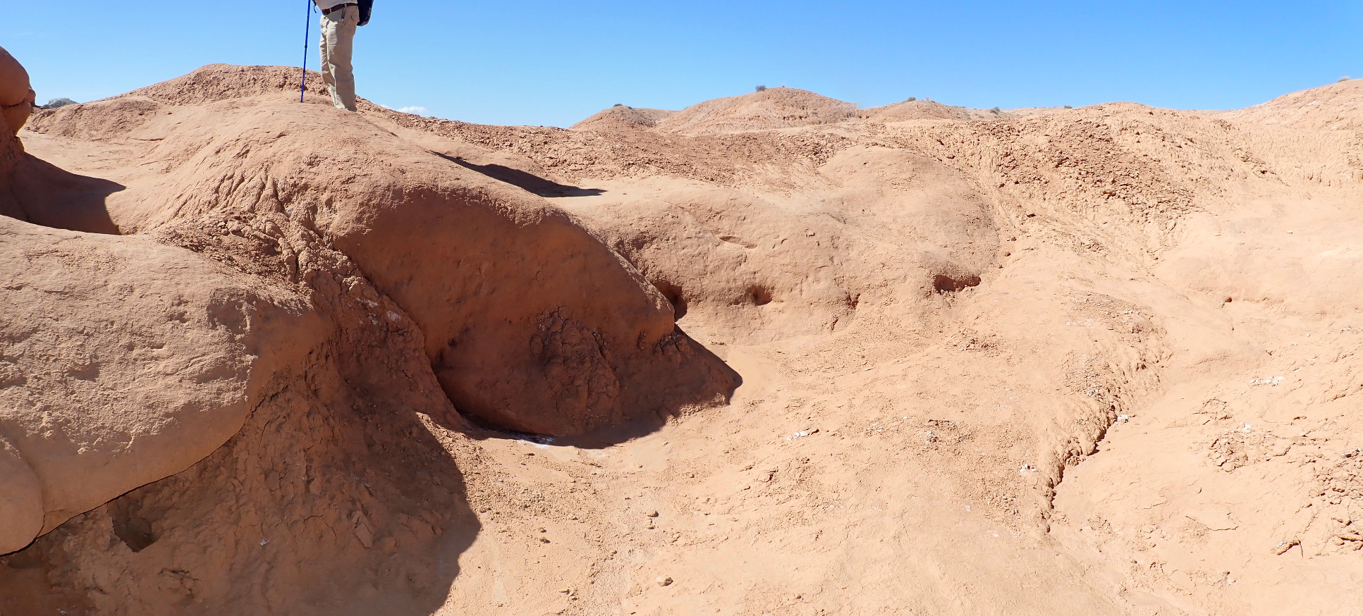
It looks like the boulders are already rounded by erosion when the softer sediments are removed from around them. This is evident here.

where a couple of goblin heads are just beginning to emerge from the earth. Which gets me thinking:
Here it looks a little more like a continuous bed of sandstone.
We are not alone.

The other hikers are apparently high school kids from what I gather is a home schooling science co-op in Colorado. We stop and talk briefly. Gary is better at this than I.
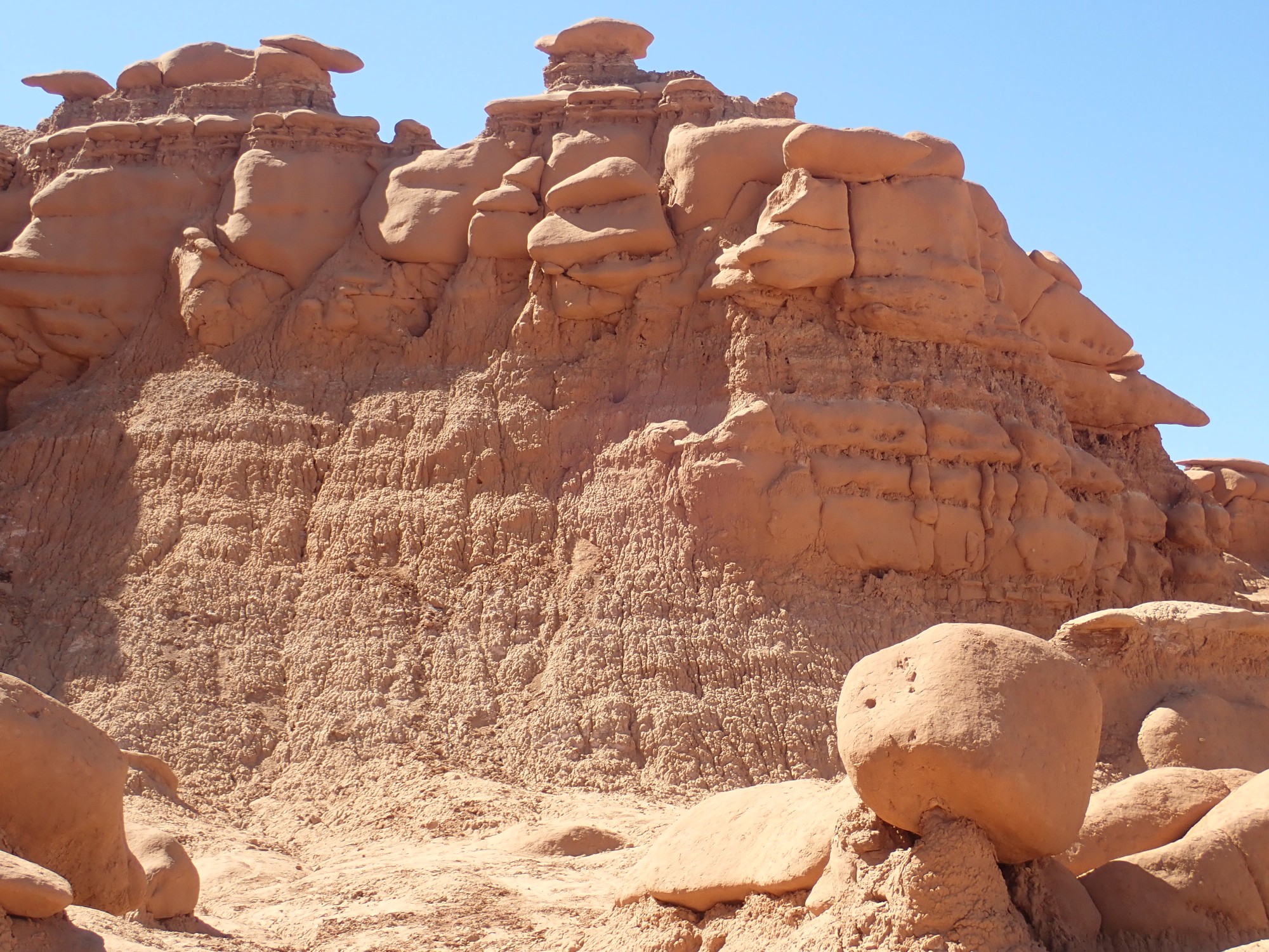
Wild Horse Butte again.
More goblins.
Eastern Orthodox Priest goblin.

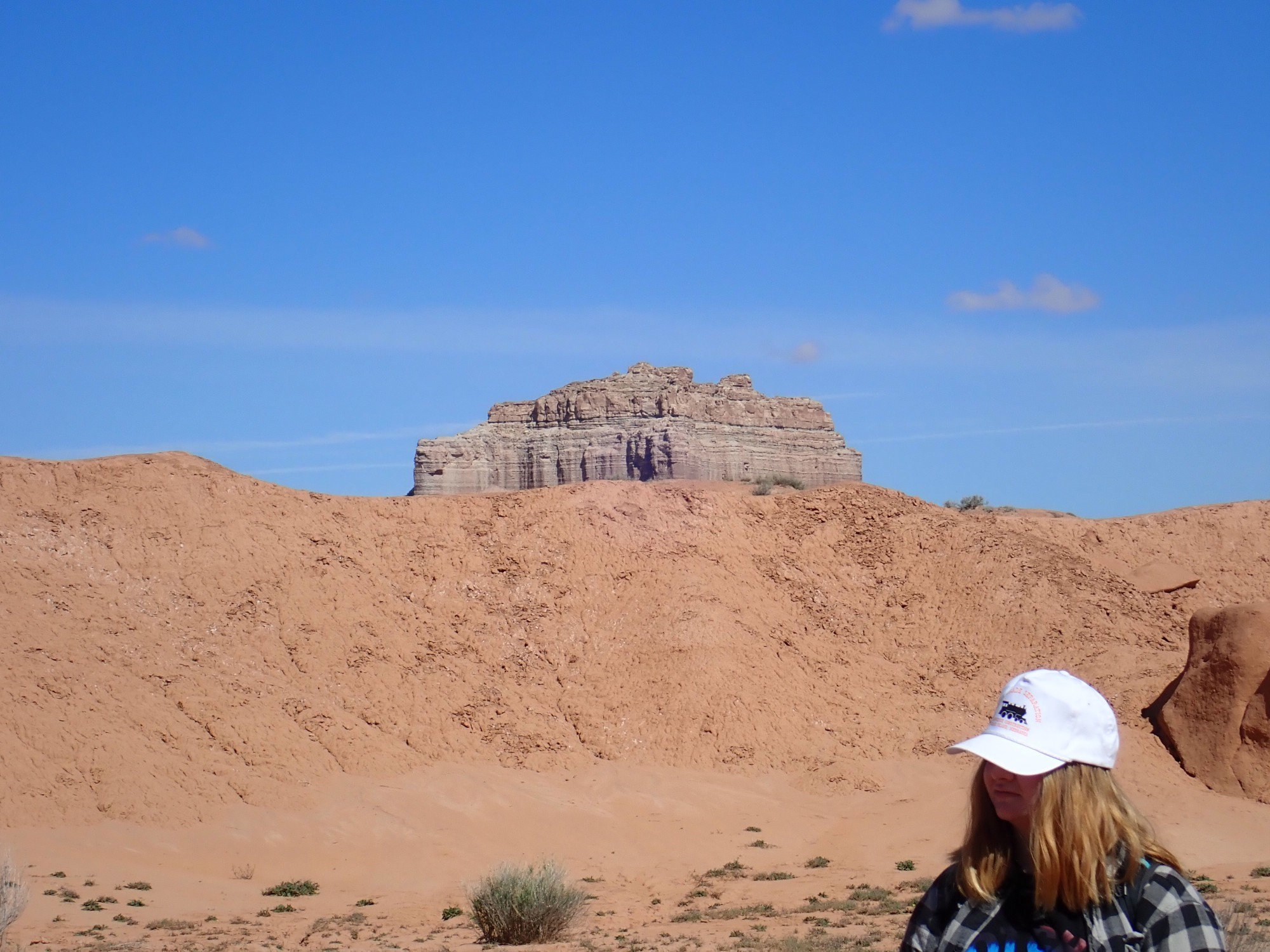
Mollys Castle is a butte to the northeast that just peeks over the valley rim.
The butte is capped with Curtis Formation.
I didn’t do it.
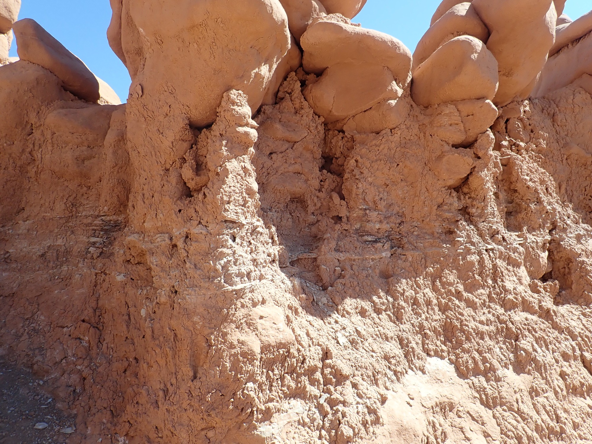
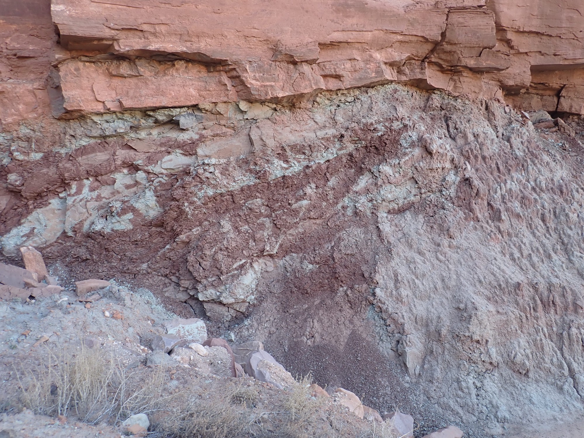
Sediment bank showing popcorn texture.
Popcorn texture is diagnostic of sediments containing clay minerals that shrink when they dry and expand when moistened. Not all clay minerals have the same tendency to shrink or expand (kaolinite shows very little tendency; smectite shows a great tendency.) Bentonite is clay derived from weathering of volcanic ash and it has a high content of smectite and other swelling clay minerals. Thus, popcorn texture in a weathered sediment bed suggests nearby volcanic activity when the bed was laid down. The popcorn texture here is relatively mild, suggesting limited volcanic activity.
These beds seem particularly eroded out. The impression is of more poorly consolidated sediments.
We have hiked past a local hillock of Curtis Formation.
Gary dubbed these Fred and Wilma.
We climb partway up the hillock and have quite a view to the southwest.
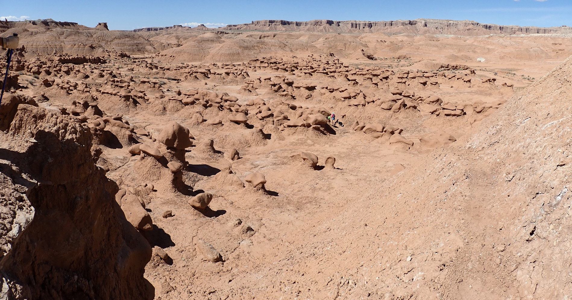
Satellite images confirm the impression here, of goblins in ranks. These likely correspond to parallel fracturing of the original beds.
Continuing around the hill.
The white ridge on the horizon is the San Rafael Reef.
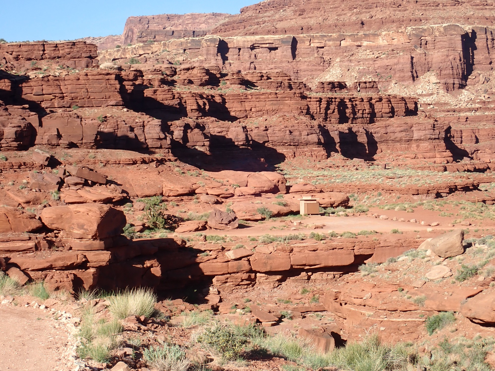
Back at the parking area, I find myself with a few minutes on my hands. I become acquainted with various canines and their owners at the shelter (I love dogs), then hike up past the north end of the parking lot where there is signage.
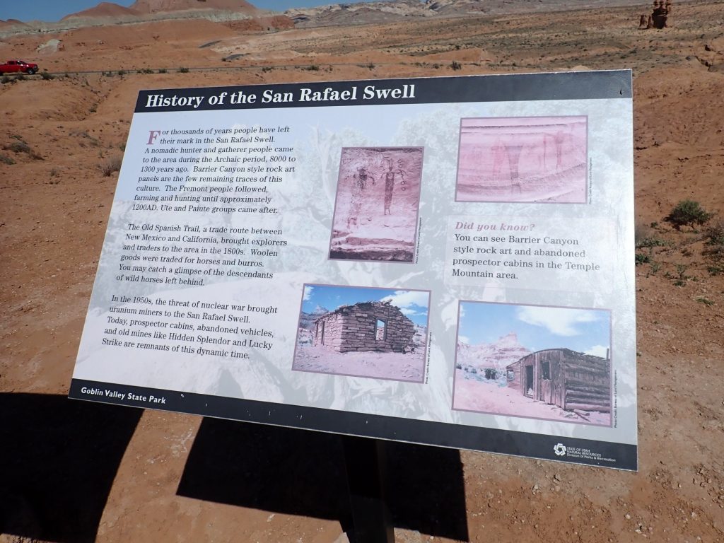
Hmm. Looks like the cabins just north of our camp the previous night may be from the uranium prospector era.
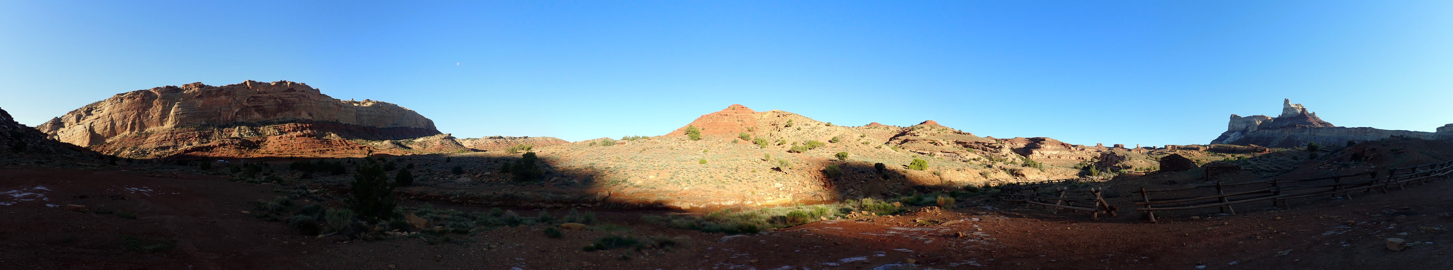
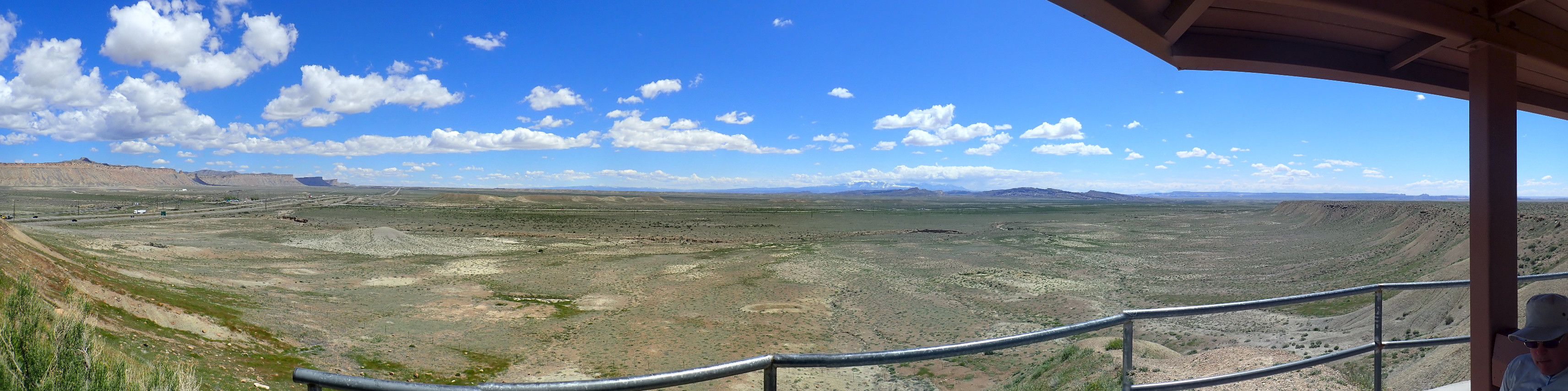
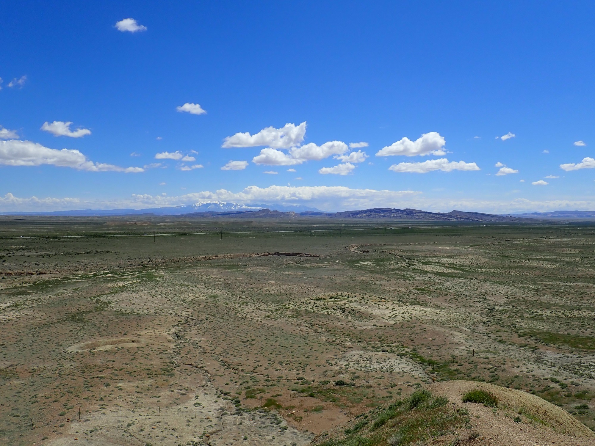
This knoll gives a great panoramic view of the southeast part of the Swell.
At higher zoom:
The white rim of the Swell is Jurassic Navajo Formation. The much darker brown beds at their feet are Carmel Formation, which plunges under the Entrada Formation making up most of the landscape here.
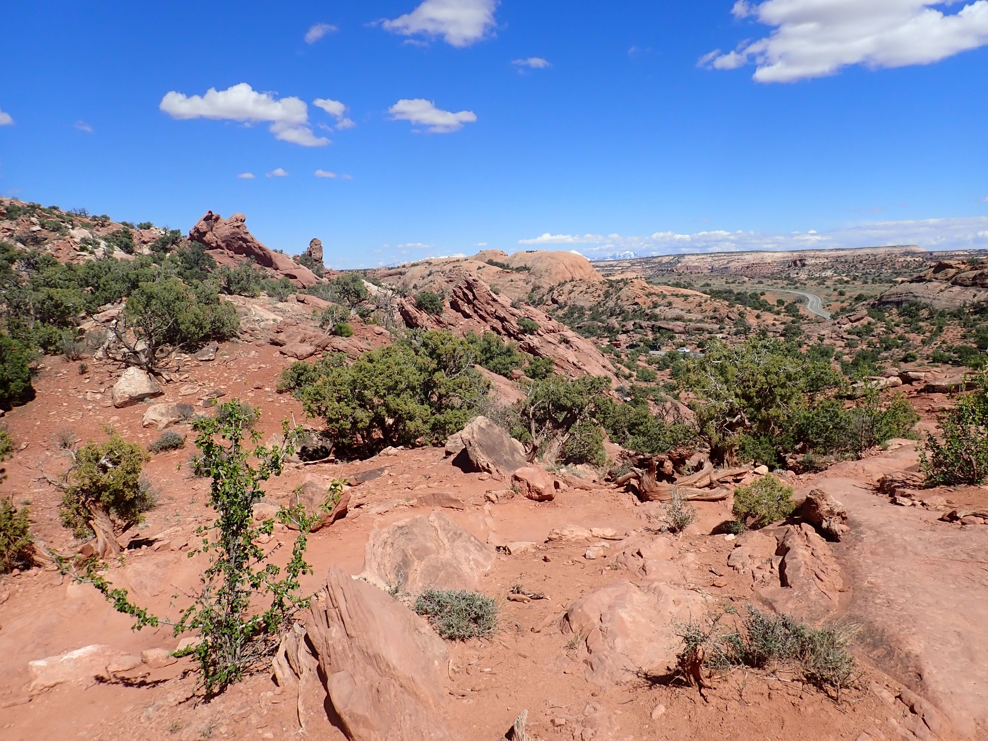
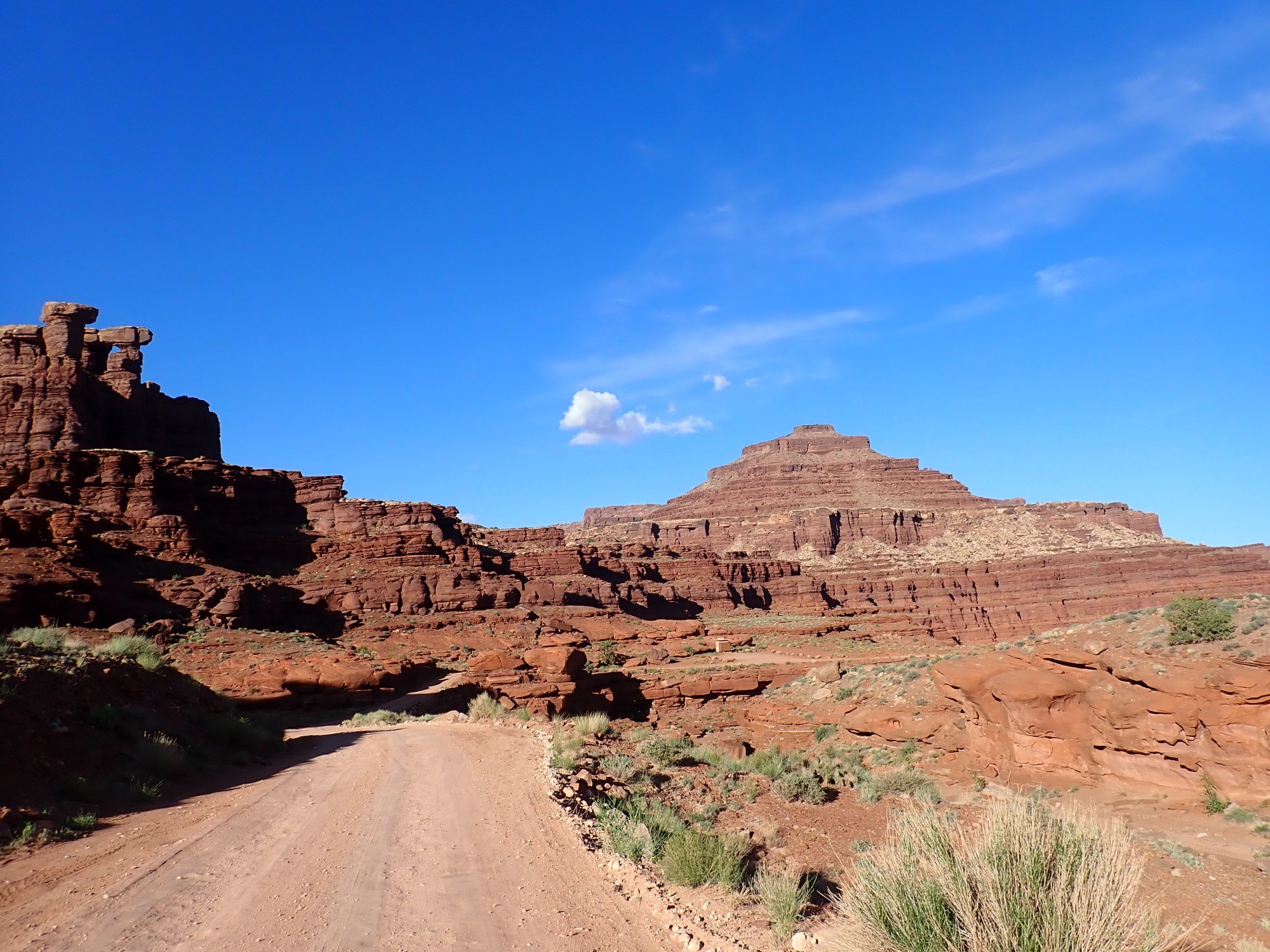
The road out passes a knoll that has a marvelous view in all directions.
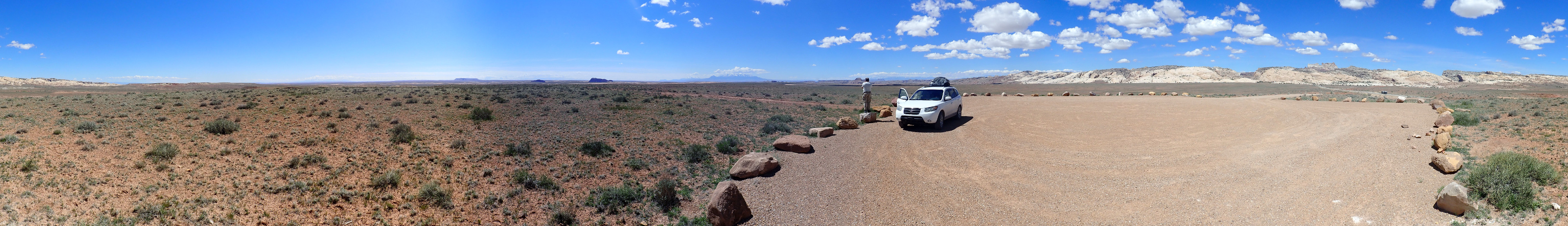
The knoll itself is mapped, unsurprisingly, as a young pediment surface. A pediment is a flat surface eroded at the base of a mountain or escarpment in an arid climate. The surface is typically covered with gravel from the mountain that is cemented together by caliche, calcite deposited by groundwater rising to the surface and evaporating.
The panorama begins to the northeast, along the reef. The low hills are also mapped as pediment surface. To the east, in the very far distance, are the La Sal Mountains, some 77 miles away. Between is the Island in the Sky district of Canyonlands, though this is below the horizon.
The mesa on the horizon at a somewhat shorter distance is is actually three mesas superimposed on the line of sight known collectively as The Flat Tops. All are similar in geology to Wild Horse Mesa, with the same formations, an indication that the beds east of San Rafael Swell are extremely level even after 200 million years. There is a very poor dirt road, 1010, to the mesas and to the Horseshoe Canyon Unit of Canyonlands National Park beyond. This area can fairly be described as one of the most remote still remaining in the contiguous 48 states.
Yeah, I’m itching to go there. But not this trip.
The nearer mesas are Gilson Butte and Little Gilson Butte, capped with Curtis Formation. Then to the south comes the Henry Mountains, then the Goblin State Park area and the San Rafael Reef to the west. Temple Mountain is visible peeking over the reef.
We drive into Green River. There is a man with a “NEED DIESEL” sign at the gas station, next to a rather decrepit-looking bus. Gary has just been reading Mosiah 4:17 to me and he draws a gallon of diesel from the pump for the man. We refuel our own vehicle and go inside for some final provisions. When we come out, a different man is at the same place with the same sign.
Gary reflects. The first man told him that he and his buddy are headed to Portland where they think they have work. The man is missing some fingers from one hand. It probably isn’t diesel they need most, but that’s what they asked for.
I have a vague recollection that I’ve seen that broken down bus every time I’ve come to this gas station, which I pretty much do every time I drive through. But I suppose vague recollections don’t trump the duty to charity.
We head east along the interstate, pulling off just short of Crescent Junction to eat lunch at a view point.
At far left, looking east northeast, are the Book Cliffs. The are capped by Mesaverde Group (Castlegate Formation over Blackhawk Formation) over Blue Gate Member of the Mancos Shale. A second “shelf” of beds above these is not visible from this vantage point.
We saw the Mesaverde Group last week near Capitol Reef and two days ago along the Coal Cliffs west of the San Rafael Swell. The Book Cliffs begin to the northwest near Price and extend all the way to Grand Junction in Colorado, a distance of about 180 miles. The Coal Cliffs are essentially a continuation of the Book Cliffs, adding another 80 miles.
The very distant mountains to the east are the Uncompahgre Uplift. This is a reboot of the ancient Uncompahgre Uplift that was thrown up as part of the Ancestral Rocky Mountains, some 300 million years ago. At the time, the Uplift was a large mountainous island in the midst of a shallow ocean covering the western United States. Sediments from the ancestral Uncompahgre Uplift were deposited on the shores of that ancient sea to become Permian red beds, found from deep below where we are now sitting to the Jemez and beyond.
To their right, the somewhat less distant mountains are the Las Sal Mountains. These are about 25 million years old and consist of laccoliths, domes of intrusive magma that pushed up the overlying sedimentary beds then cooled while still underground. The rock is an somewhat unusual type, trachyte, that is high in both silica and alkali oxides, so that its composition is almost entirely alkali feldspar. This magma erupted through an area with numerous buried salt beds, and it seems likely to me that some of the salt mixed with the magma to give it its unusual alkali content.
In front and slightly to the right of the La Sal Mountains is the northern end of Salt Valley, which leads south into the Arches National Park area. This is an anticline, an upwards fold in the rock beds, caused by a wall of buried salt pushing towards the surface. The salt was laid down at the same time the Ancestral Rocky Mountains were thrown up, in a deep basin at the foot of the mountains that trapped and concentrated ocean water. Salt is less dense than most common sedimentary rocks, and it is ductile over geologic time scales, so it tends to creep towards the surface over millions of years.
In the distance to the right is the Island in the Sky district of Canyonlands, of which we’ll see more shortly. The ridge the view point is located on is called Crescent Bench and is mapped as young pediment gravel.
A closer look at the Salt Valley anticline:
If you click to enlarge, you will see the general upwards bulge in the beds, but you will also see that the center of the anticline has collapsed. This is due to the top of the salt wall that produced it being dissolved out by groundwater. (Hence: Salt Valley.)
Gary spots a critter — it looks like a ground squirrel or prairie dog — way below. We watch for some time as it works its way a considerable distance. I thought they stuck closer to their burrows than that.
We pack up and I go wash my hands. Gary has struck up a conversation with a heavily tattooed woman. “Tell me about your ‘tats.” As we drive off, he explains that he has found that people have stories behind their tattoos that are important to them. Hers, it seems, was heartfelt but somewhat incoherent.
We drive south and turn in to Canyonlands National Park, Island in the Sky district. Gary is impressed with the Carmel Formation and we pull into a campground to admire it.
The massive cliffs are Entrada Sandstone. This area was further from the sea than Goblin Valley, and the formation is less silty and much better cemented here (Slick Rock Member). The Carmel Formation (Dewey Bridge Member) shows a surprisingly regular pattern of very large ripples, many feet across, with caves on each ripple. I don’t know what to make of it.
This view angle does not permit us to see it, but there is a second shelf above the mesa top visible here consisting of Curtis, Summerville, and Morrison Formation beds. We see just a thin rim of Curtis here, at the right.
We arrive at the park headquarters. I ask a volunteer at the information desk about Shafer Trail and Shafer Campground. Yes, the campground is within the park. Almost certainly already reserved. But he directs me to the ranger desk. The ranger also expects it is reserved. “Months in advance typically.” He also notes that BLM does not permit dispersed camping along Potash Road beyond the park boundary, but there are BLM developed campgrounds all along the Colorado. But he checks the computer for reservation status. We are in luck; someone must have canceled and Shafer Campground is available. We get the reservation and the accompanying back country permit. I described the Wandermobile, truthfully, as a front-wheel drive vehicle with moderately high ground clearance; somehow this becomes four wheel drive on the paperwork. I don’t think he misheard me. “If you know what you’re doing, you can pretty much take any vehicle on the Shafer Trail Road in good weather and be fine.” He does not actually give me a wink.
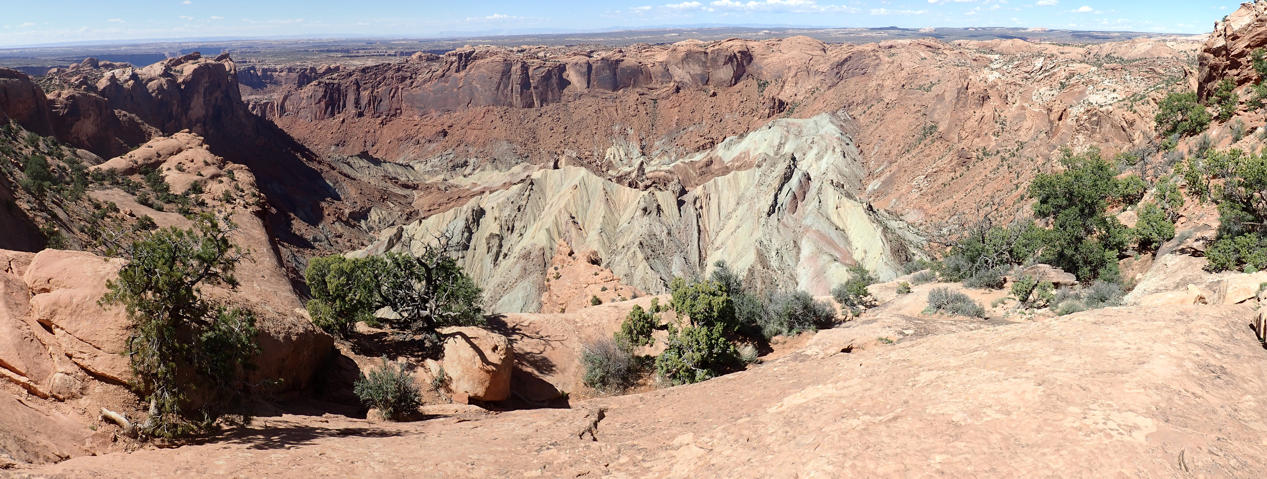
He tells me the road can be safely started down any time before 7:00 PM. Good; that gives Gary and me time to hike to Upheaval Dome. We find a parking spot and head out.
Upheaval Dome is an impact structure dating back not more than 180 million years. Or it’s a pinched-off salt dome. There are careful studies reaching both conclusions. There are indications of shocked quartz and shatter cones at the center of the structure, which would seem to be conclusive proof it is a meteor impact crater. But there are also signs of the beds deforming upwards over geologic time scales, which would seem to be conclusive proof it is a pinched-off salt dome. The lack of salt beneath (as confirmed by geophysical studies) is explained by it all escaping through the dome.
I embrace the healing power of “and.” A meteor impact could have removed enough overburden to trigger formation of a salt dome.
The photograph shows the fork between the Syncline Trail, which encircles the dome, and the overlook trail. The syncline trail is too long for this trip, but the overlook should give us some good hiking time. The outermost ring of displaced beds is in the Navajo Formation; the trail initially follows the next inner ring, in the Kayenta Formation.
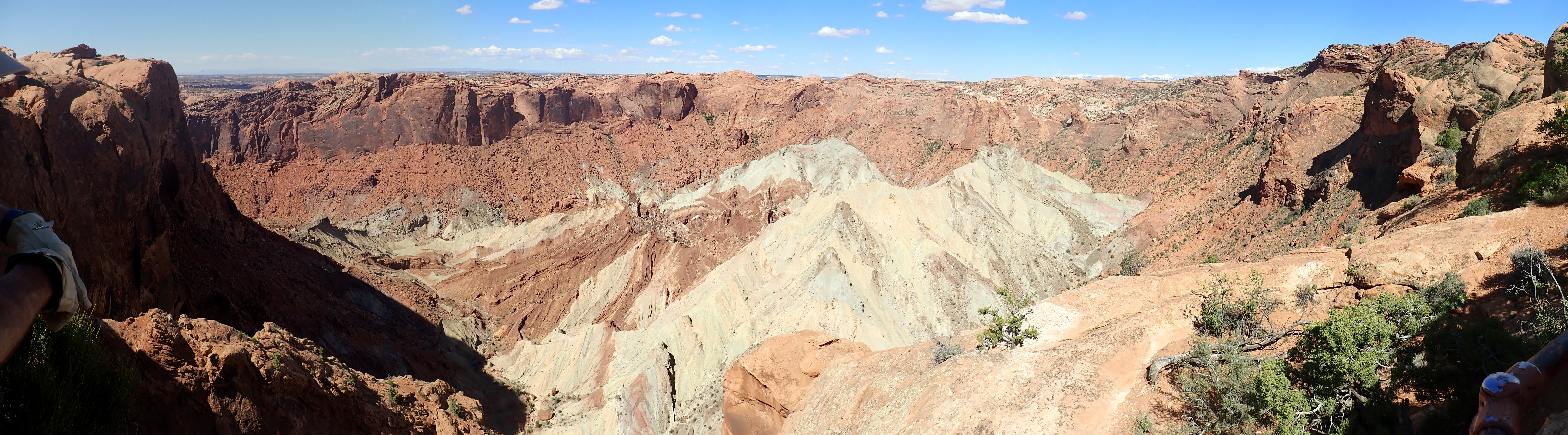
Whale Rock, at center in the distance, is part of the Navajo Formation outer ring. You can see that the thin Kayenta beds in the foreground are tilted sharply up towards the center of the structure, which is to the left.
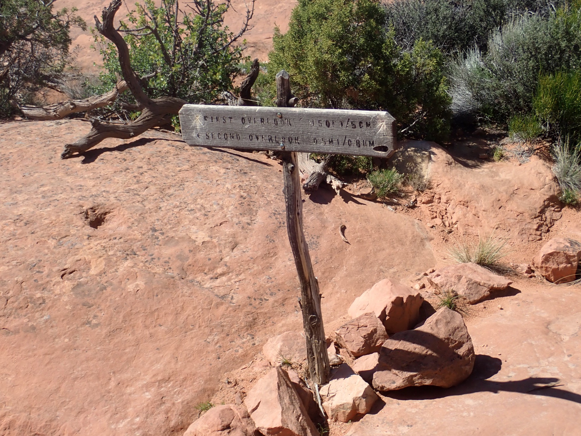
The trail branches for the first and second overlook.
We are now standing atop the Wingate Formation , which forms high cliffs surrounding the core of the structure.
View from the first overlook.
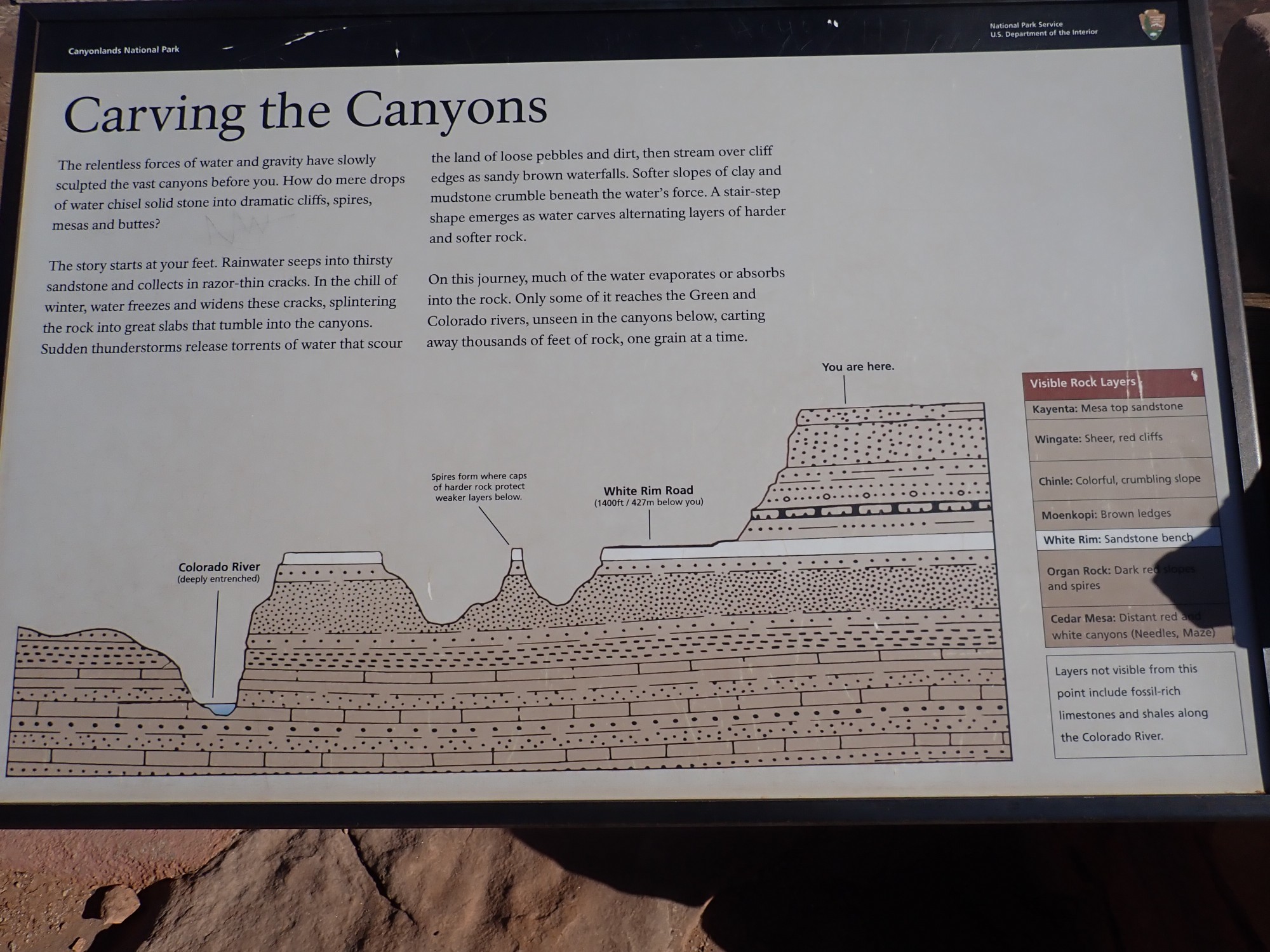
The beds below the Wingate Formation rim are Chinle Formation. The white beds at the center of the structure are highly tilted, deformed beds of Moenkopi Formation, with a central core of White Rim Sandstone. The white color is due to bleaching of the normally chocolate brown rock by petroleum vapors escaping from deep below.
Gary asks how big a meteor produced this. I make a wild guess of the distance across of four or five miles. Gary guesses a couple of miles. He’s right: It’s about two miles across. That would make the meteor around fifty feet across, give or take 25 feet.
We start down the trail to the second observation point.

We will be crossing a considerable amount of slickrock of the Wingate Formation. The ridge to the south (left) is Navajo Formation and the valley between is eroded out of the Kayenta Formation.
As we start back, we see a black stationary object on a nearby knoll that looks a little like an abandoned camera tripod. Gary suggests climbing to it. Just then it moves: It’s a bird watching all the tourists.

Once again, I miss the deep zoom on the old camera.
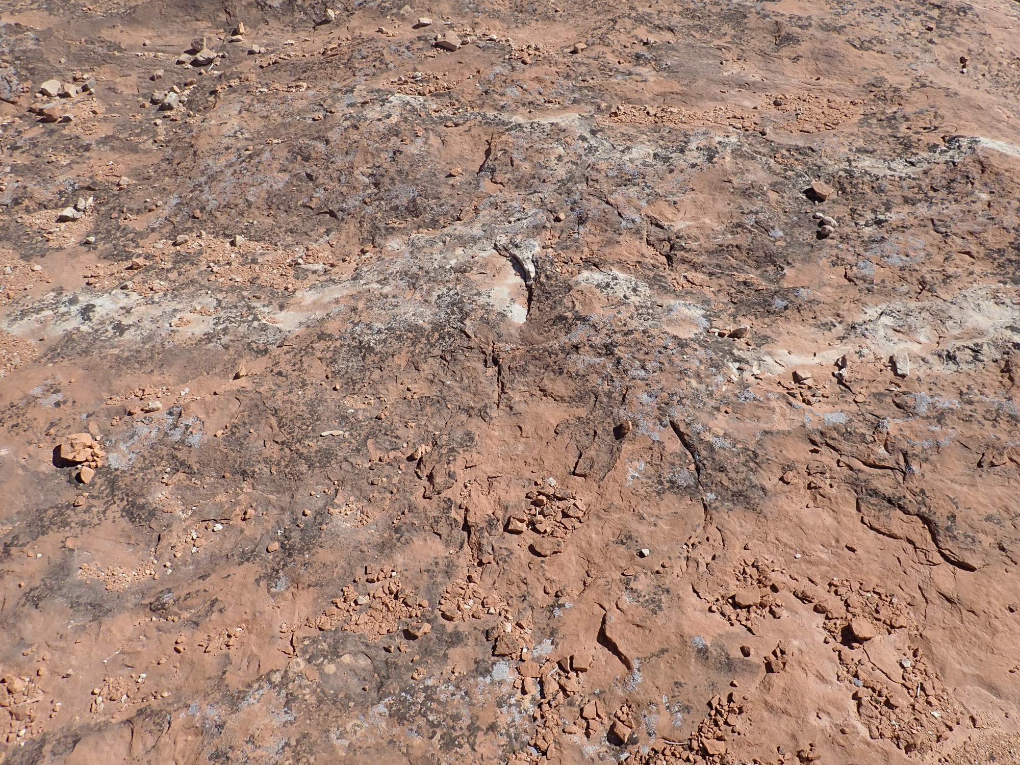
There is a riot of cyanobacteria and lichen colonies on the slickrock.
Also some beautiful wildflowers.
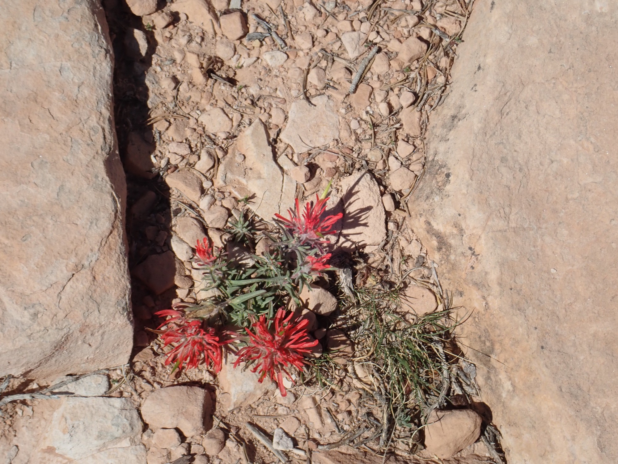
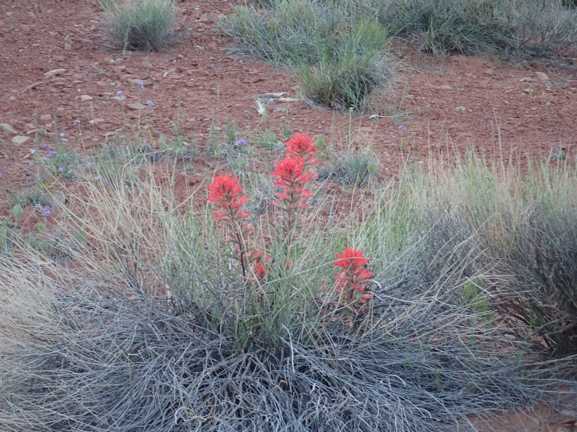
Desert paintbrush, likely. Paintbrushes are part of the broomrape family, which is generally parasitic on other plants, and the paintbrushes have the haustoria or penetrating roots that invade their hosts. However, paintbrushes are relatively mild parasites, and I wonder if this one is even parasitic at all — there’s not much here for it to feed on except the small clump of grass nearby. But perhaps there are roots of nearby shrubs (there are not many trees here) running along the crack between the rocks.
We get back to the car with enough daylight left to head to Grand View Point. The view is well named.
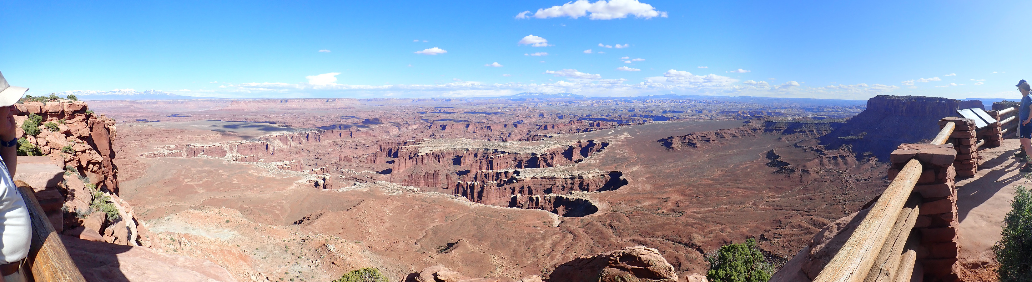
At left in the distance are the La Sal Mountains. The high cliffs in the middle distance are the west rim of the Colorado canyon and have basically the same geology as Island in the Sky — a cap of Kayenta Formation with occasional erosional remnants of Navajo Sandstone, over Wingate Formation, Chinle Formation, Moenkopi Formation, White Rim Sandstone, and Cutler Group.
At left center is Monument Basin. The white rim of the deeper canyon level is the (drum roll) White Rim Sandstone. At far right is Junction Butte.
Far to the south is the Needles district.

At left are the Needles themselves — spires of sandstone with alternating red and white beds. These are interfingering beds of the Cutler Formation, a red continental formation formed from sediments eroded off the ancestral Umcompahgre Uplift, and the Cedar Mesa Sandstone, beach sand from the sea to the west. The shoreline moved back and forth to produce the interfingering. I’ve been in Needles District only once. It was a hasty visit in which I spent almost all my time on a single hike, and I would like to get closer to the needles.
At right are the Grabens — a set of slump blocks, of enormous size, gliding on an underlying bed of salt over geologic time scales into the canyon of the Colorado River. This produces the Cataracts section of the river. I would like to visit there, too.
The valley between Island and the Sky and Junction Butte, just because.

Or possibly prompted by a comment of Gary on how it’s a long ways down.
Signage:
From there we head to Shafer Trail and start down. It’s not a bad gravel road, except for the grade.
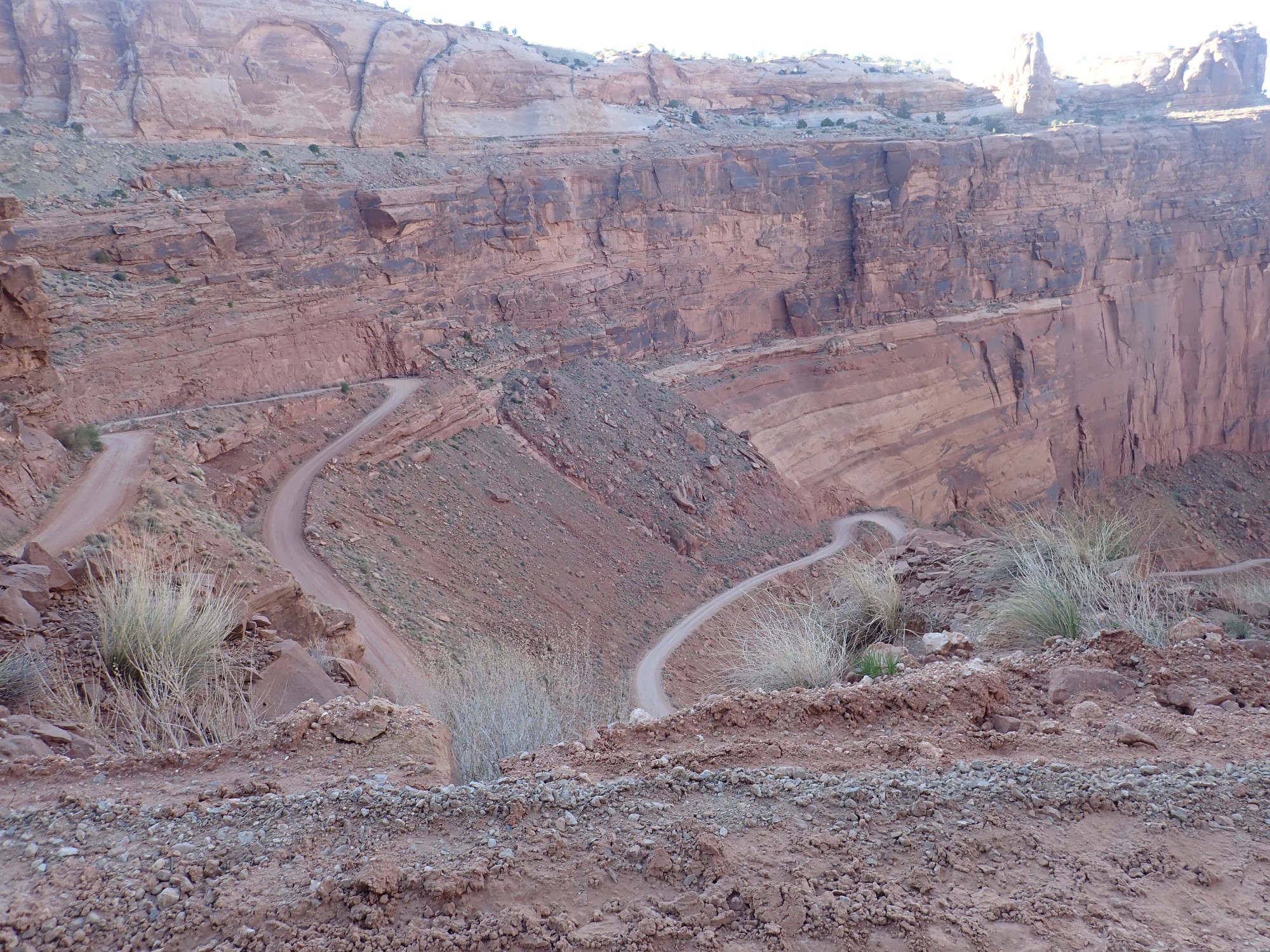
This is a drive for folks with stout hearts and weak minds. Unsurprisingly, my GPS has a hard time getting accurate coordinates in the canyon.

I take it in first or second gear most of the way. I have new front break pads but the back are older and, anyway, even new pads can catch fire if pushed enough.
The Chinle Formation in the road cut.
We arrive at the level of the White Rim Sandstone, just past the fork from the Shafer Trail Road to White Rim Road and Potash Road.
While not part of Monument Valley, the formations are similar:
The geology is resistant White Rim Sandstone over softer Cutler Formation. (Specifically the arkosic facies of the Cutler Formation.) And the GPS is finally getting a good lock.
“Arkosic facies”: A facies is a particular part of a formation laid down in specific local environment. For example, a fluvial formation (laid down by rivers) will have axial facies where the river channels were and overbank facies where silt was deposited by annual floods. Here the origin of this facies is not specified, but it is composed of sandstone with an unusual amount of feldspar; arkosic sandstone.
Approaching Shafer Campground.
The immediate area is all Cutler Formation, arkosic facies, with some bits of White Rim Sandstone at left. The mesa at right is Chinle over Moenkopi.
There are facilities.
I half expected to see someone already there, or to have someone else join us later. But we were all there was. Apparently this is reserved as a group campground for a single group, and we were it. (Could explain the $30 fee.)
Setting up camp.
Ours was a relatively slight penetration of the Canyonlands back country. The full experience is gotten by driving the White Rim Trail, which takes two days and requires a genuine four wheel drive vehicle. I definitely want to do it sometime (when I can talk a friend with 4WD into it.)
Sun going down.

I do a bit of scouting of the area while there is still light (which there will be for some time — the deep canyon means a long twilight after the sun has gone below the rim.)
Grafitti on a boulder.
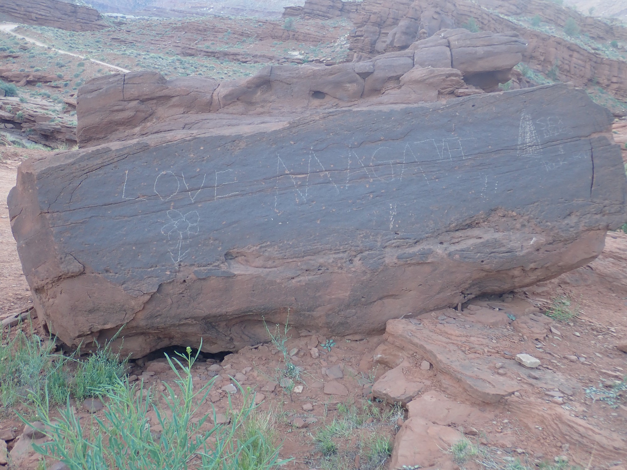
“Love” (with flower). “MAGA”. An unintelligible symbol. “Sex Drugs Rock’n’Roll”.
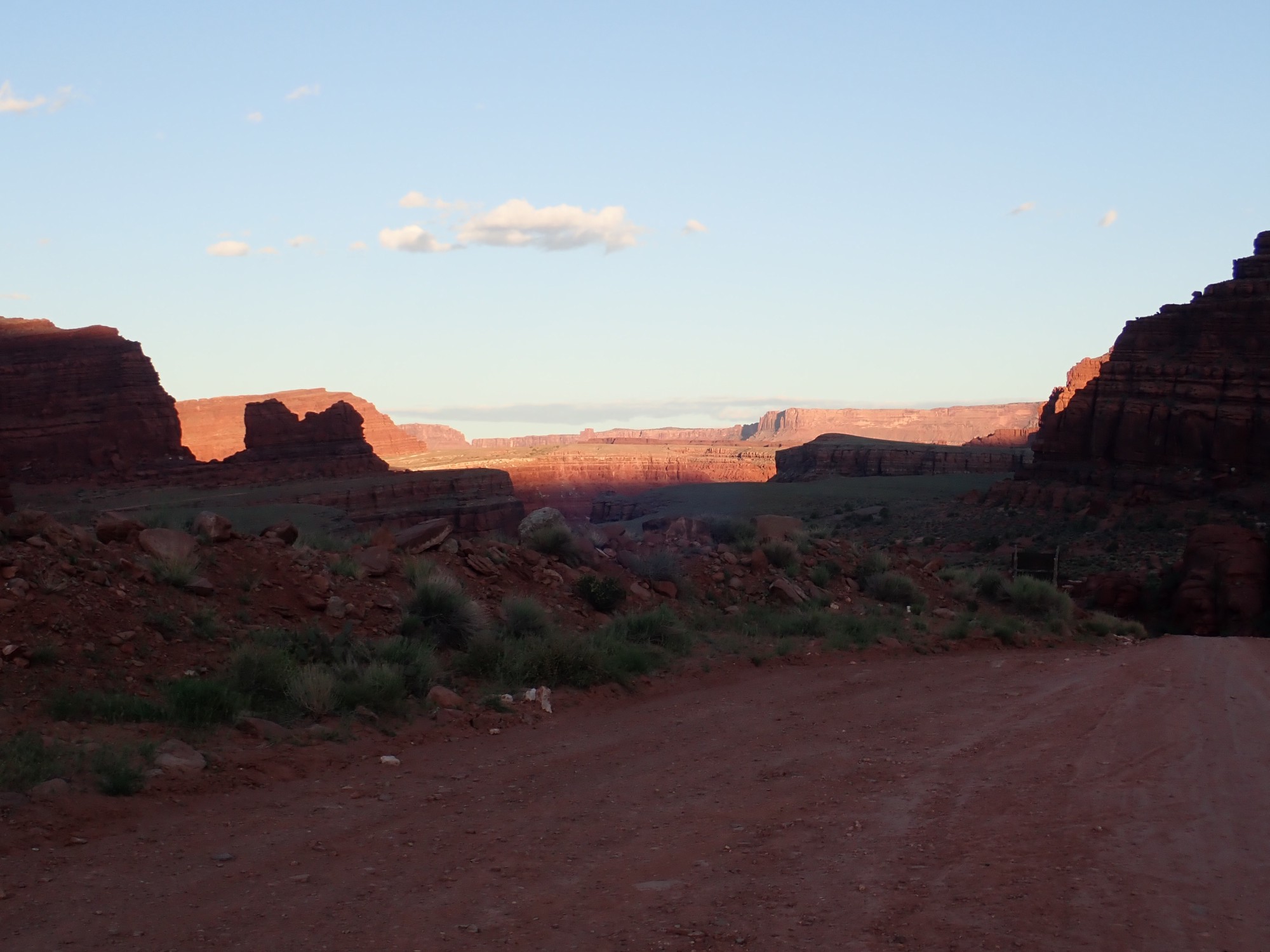
The campground is on a bench, with a parking area surrounded by large boulders. Someone had opened a small gap and driven through recently to one of several flat spots ideal for tents. Gary tries to talk me into doing the same, but I conclude I am not taking my car through the rather narrow gap. From the edge of the bench I can look some distance down the road, and I don’t like what I see. I persuade Gary to come scout ahead with me.
Starting down the road.
Here the road reaches its lowest point, and crosses a (normally dry) stream bed. From a distance, I could see puddles and I was worried if my car could clear them.
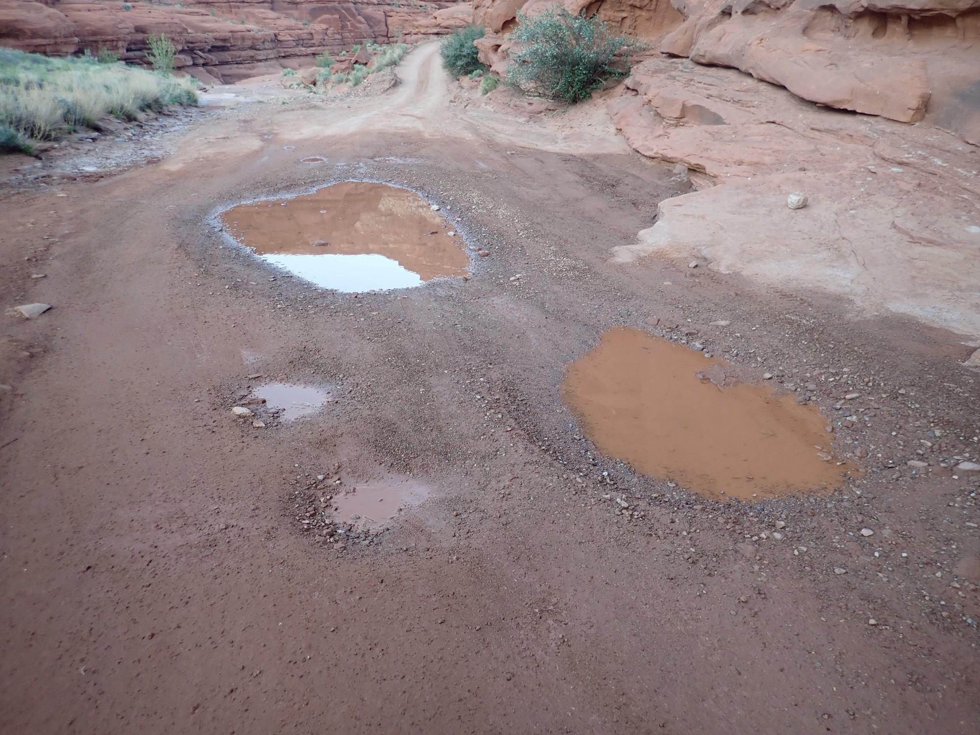
Fortunately, the puddles turned out to be shallow, with rocky bottoms, and anyway I could probably navigate around them. Likewise this one.

It has definitely been wet lately, one reason for my concern. But it makes for some lovely color contrasts.

And here is more desert paintbrush.
We feast on shrimp and cocktail sauce for dinner, then enjoy the evening, which is extraordinarily pleasant. There are just a few bugs around, and soon there are bats nearby, feasting on the bugs. One comes quite close to the car, where we are sitting in our camp chairs. Some other critter is making loud chirping noises somewhere up the canyon. The stars come out and I share my big astronomical binoculars with Gary. We see an occasional headlight up on the rim of the canyon, at Shafer Trail Viewpoint. Then we turn in.
Next: Entrepreneurs