Kent and Bruce Have Another Excellent Adventure
It’s another long story, but the basics of it are that Mom took my sisters on a cruise, then decided she ought to do something for her sons as well, and sent me and Cindy (and my brother and his wife) some money for the express purpose of going somewhere and having a good time there.
The catch is that our sons do not travel well. Michael is autistic, and though he is high functioning, being cooped in a car for hours on end is his counterpart to what being strapped into a chair and compelled to watch Married … With Children would be to me. Nathan is struggling with a sleep disorder, and hotel beds are not a beautiful thing with him. Leaving the boys at home alone for several days is also out of the question. So Cindy and I have to take our vacations in shifts. Kind of a bummer, but there it is.
I had enough fun last year looking at rocks with Bruce Rabe, my retired environmental geologist friend from the Denver area, that I decided to invite him down again for another excellent adventure. This time it would be more local. I needed to limit my use of vacation so that I will still have vacation time to watch the boys while Cindy picks up Kira from college in Idaho and takes her own vacation break.
Bruce arrived on the late afternoon of May 24 and the fun commenced.
Sunday: Running About Los Alamos
We spent the first evening catching up on our respective doings and making plans for the week. Also looking at some local rocks, kind of to get into the swing of it.
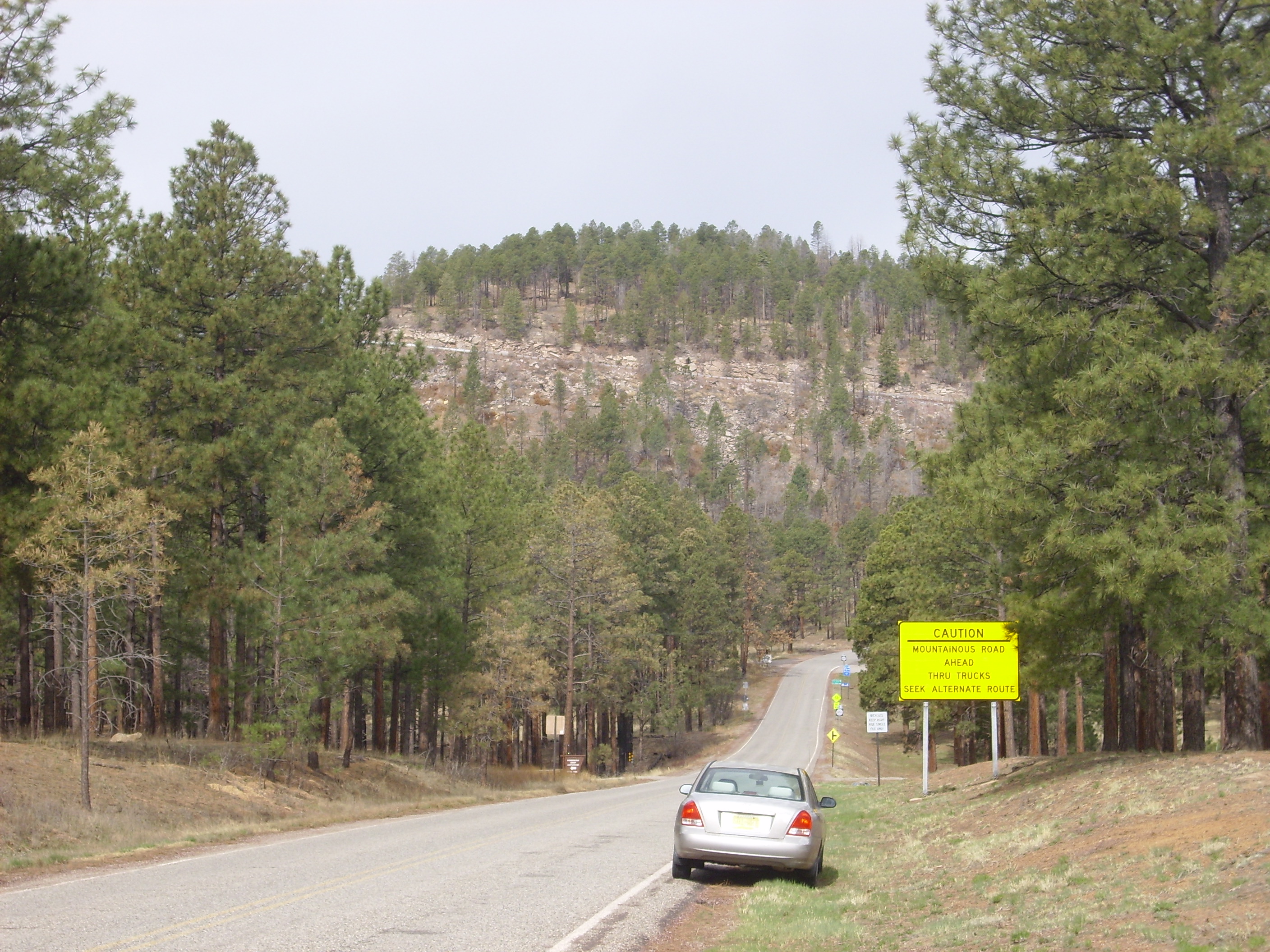
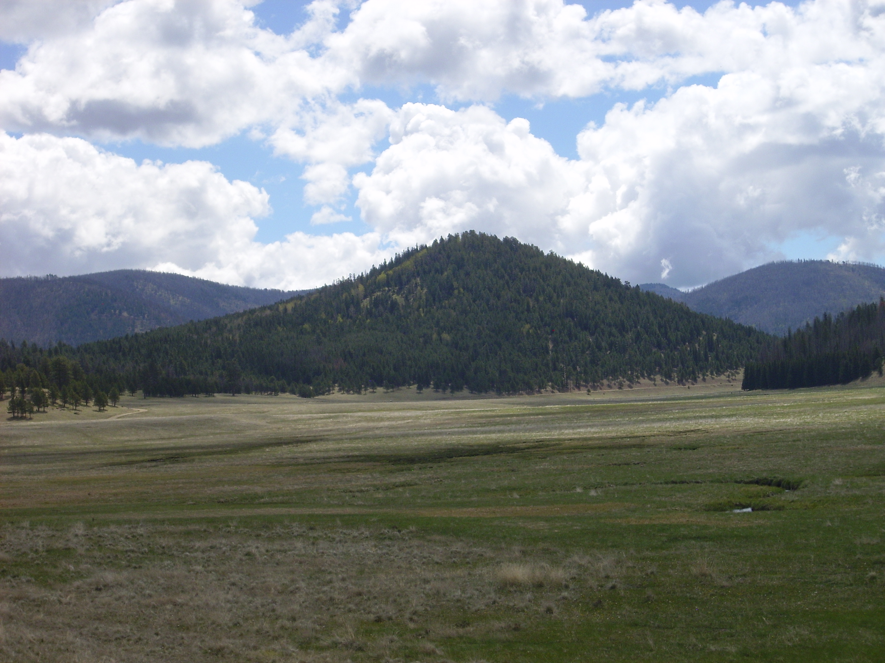
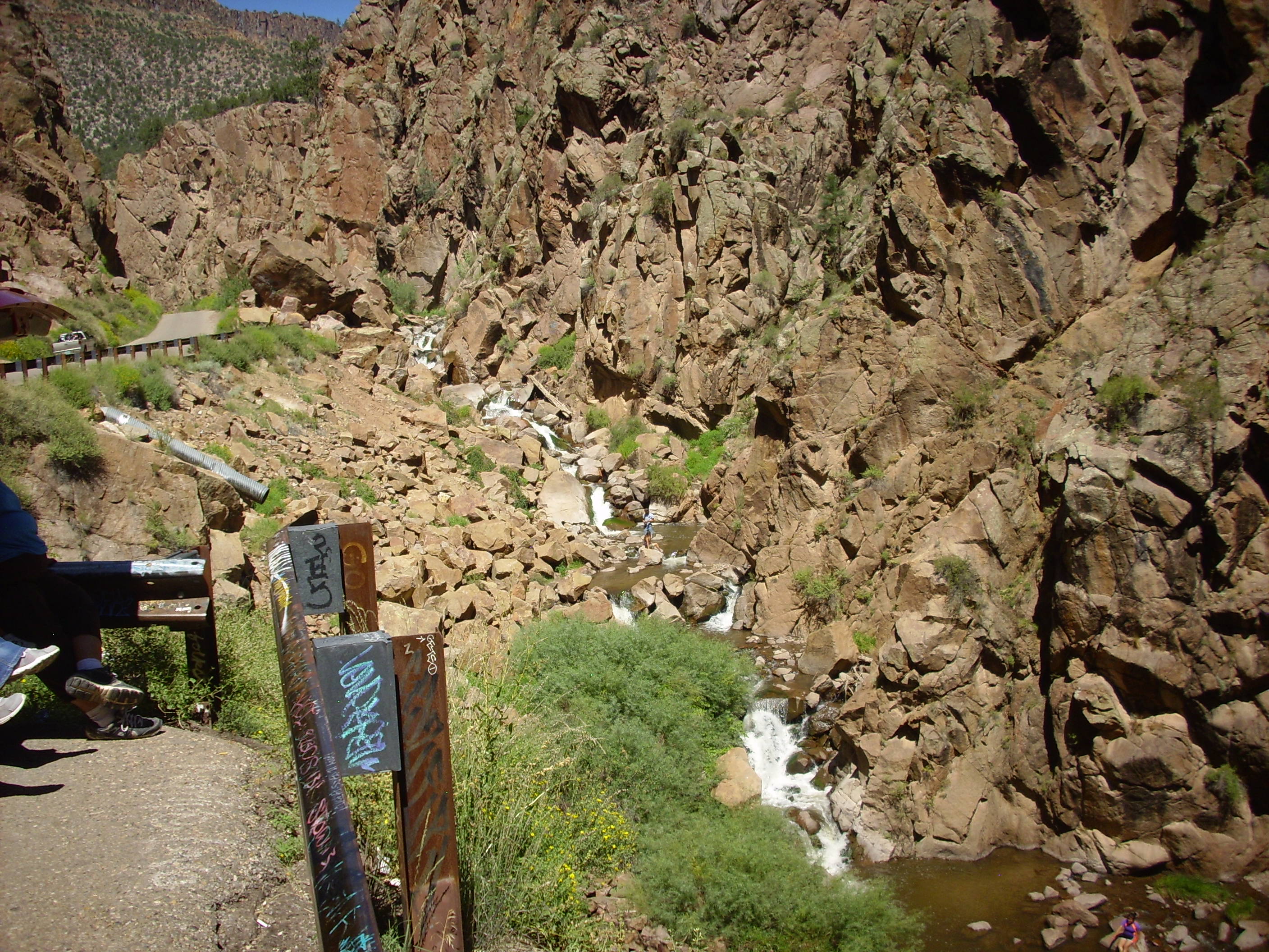
First stop was the Clinton P. Anderson Overlook on the main road to Los Alamos.
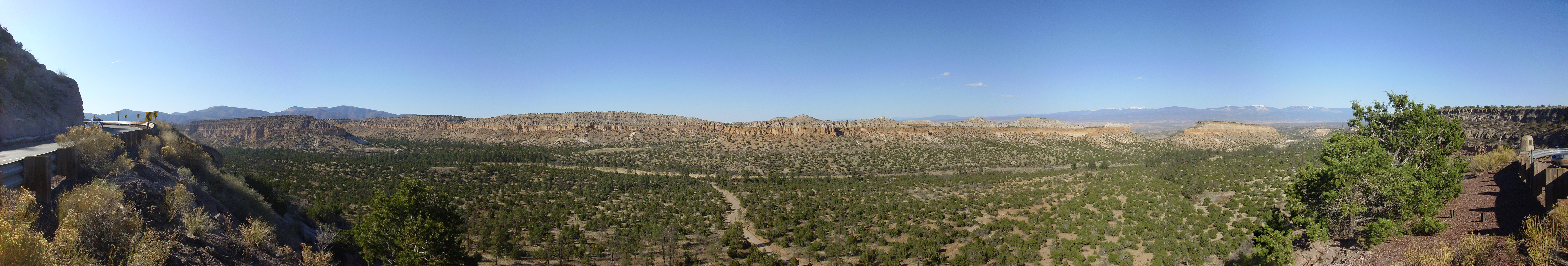
Clinton P. Anderson Scenic Overlook. As with most images at this site, you may click to get a full resolution version of this image. 35 52.391N 106 14.006W
Bruce may be puzzled that he does not remember me pausing to take a panorama. This is a file photograph, so to speak, from one of my favorite time sinks. (My other favorite non-family/non-work/non-church time sink being of a more historical character.) However, the time of day would be about right, though there were more clouds in the sky when I was there with Bruce.
The finger mesas visible here are underlain by the Bandelier Tuff, which was laid down by two great caldera eruptions in the Jemez Mountains 1.6 and 1.2 million years ago. The older eruption produced the Otowi Member of the Bandelier Tuff, while the more recent eruption laid down the Tsherige Member on top of the Otowi Member. In this area, Pueblo Canyon, the Tsherige Member forms the prominent cliffs, while the Otowi Member is largely concealed by the colluvium forming the slopes at the base of the mesas.
Colluvium: That’s the geological term for any kind of sediment that got where it is by falling or slumping from somewhere higher up (“mass wasting.”) I am authoritatively informed (by Bruce) that alluvium likewise is sediment that got where it is through the action of water, while eolium is sediment that got where it is through the action of wind. You can use that to impress friends at parties, or to bore people away you didn’t really talk to anyway, depending on what kinds of friends and parties you have.
From there we headed to the Los Alamos airport, parked in the main parking area, and walked to the canyon rim north of the old incinerator. There are a pair of ramps over the canyon rim from which ashes were once dumped into the canyon.
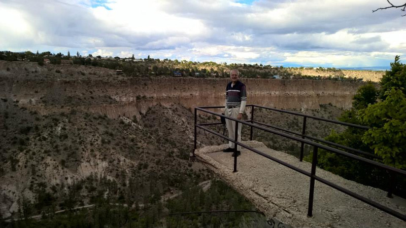
Incinerator dump ramps. 35 52.931N 106 16.539W
In the background is North Mesa looming over Pueblo Canyon. That’s me standing on the ramp.
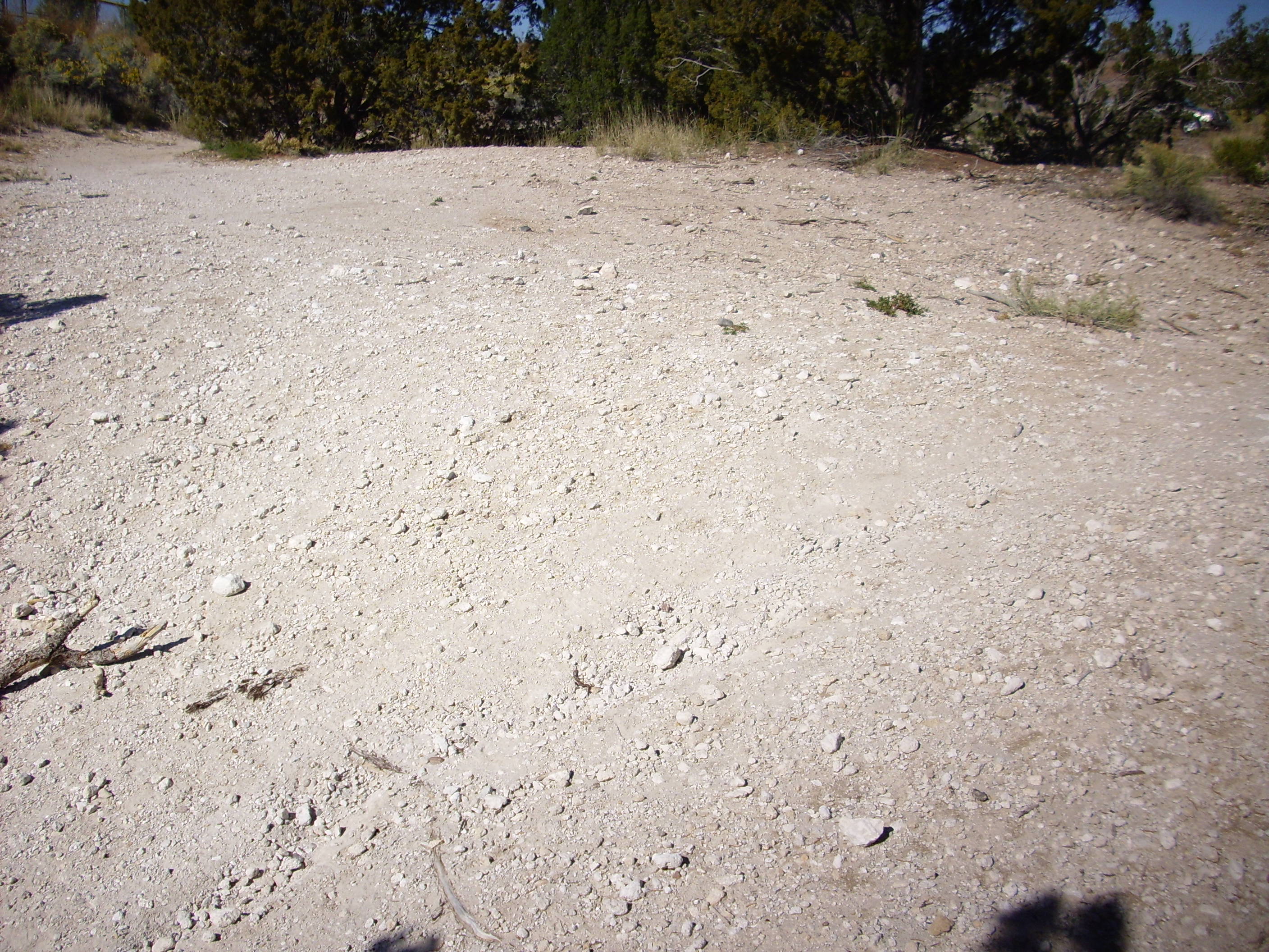
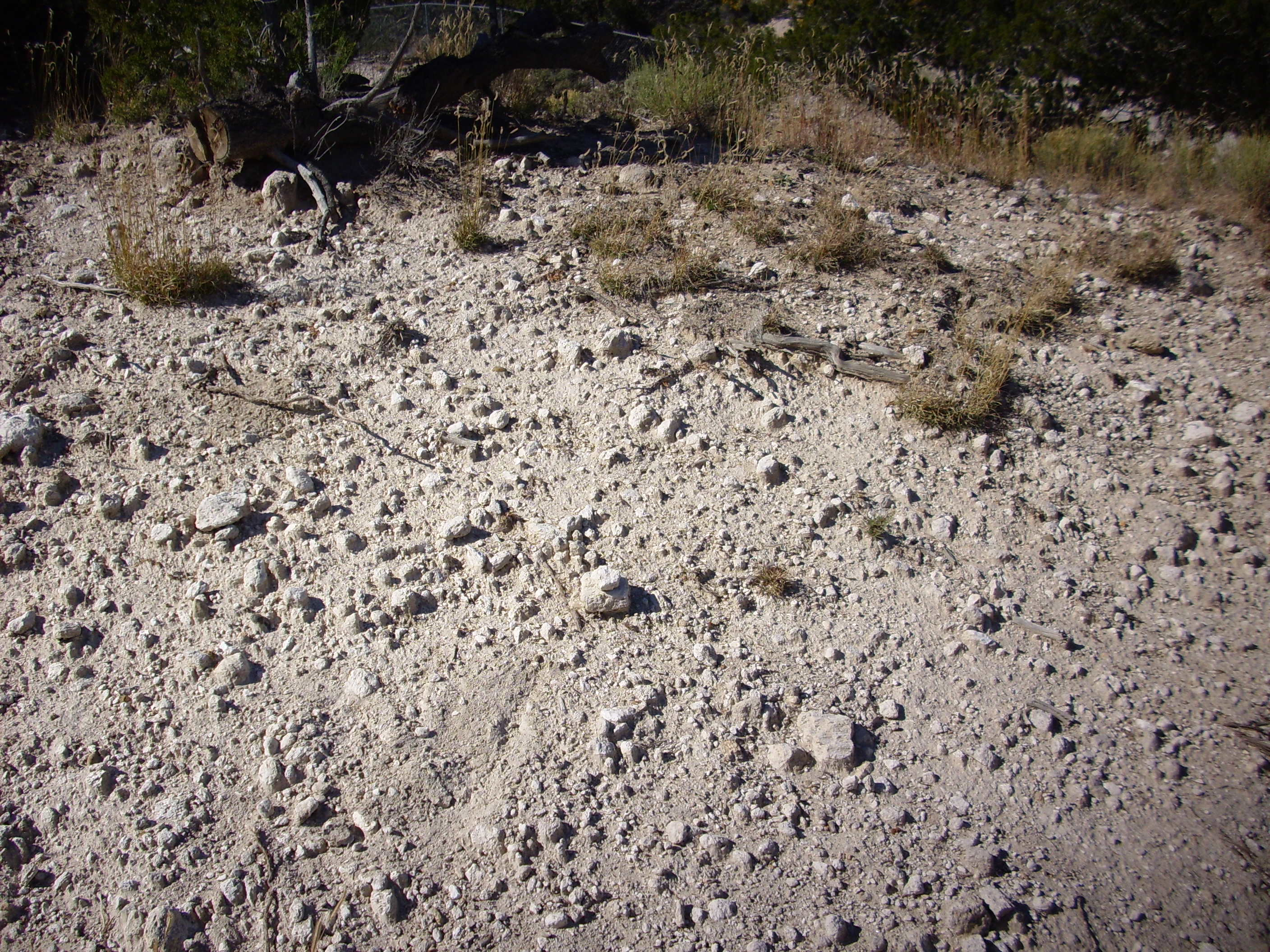
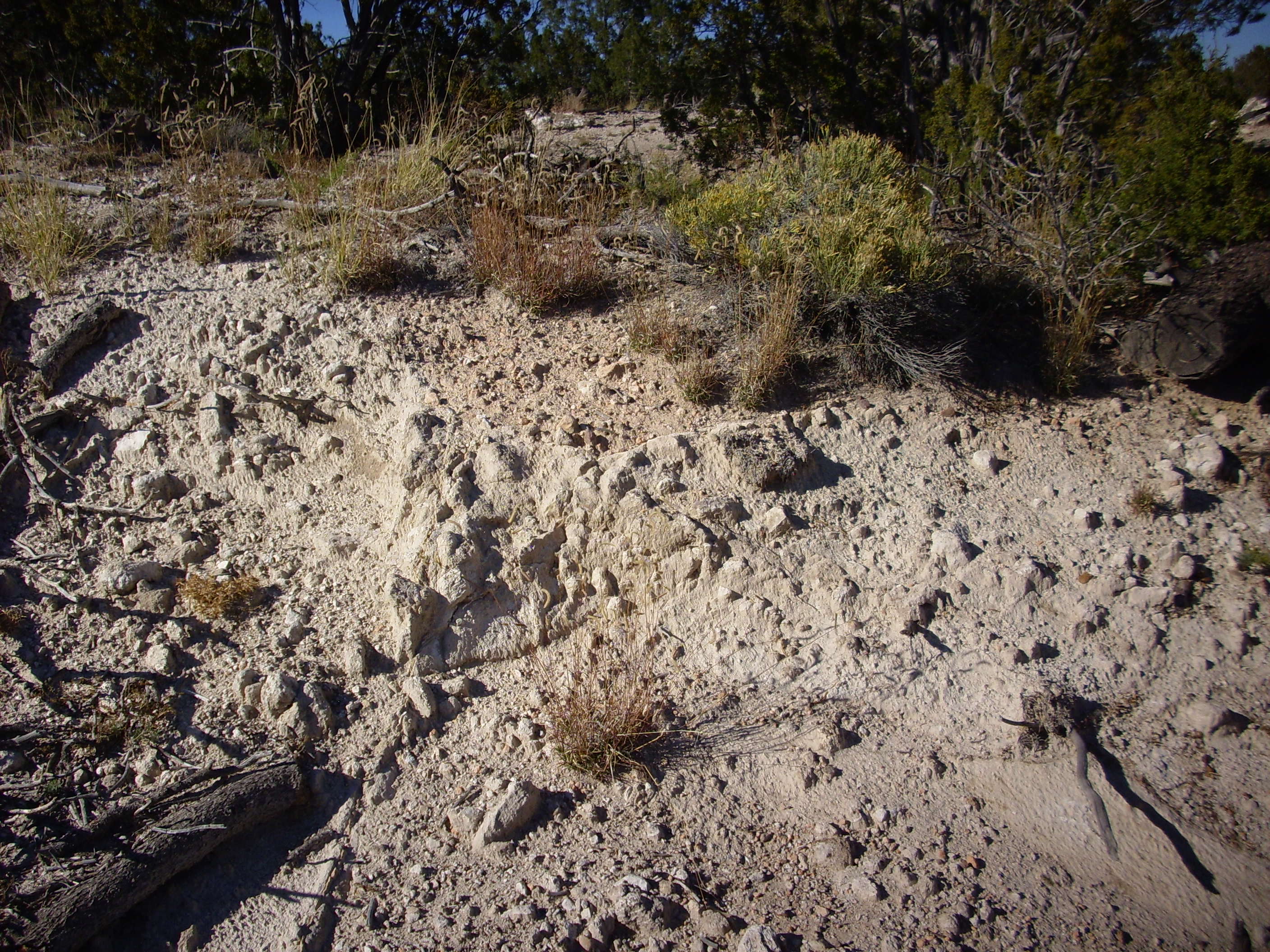
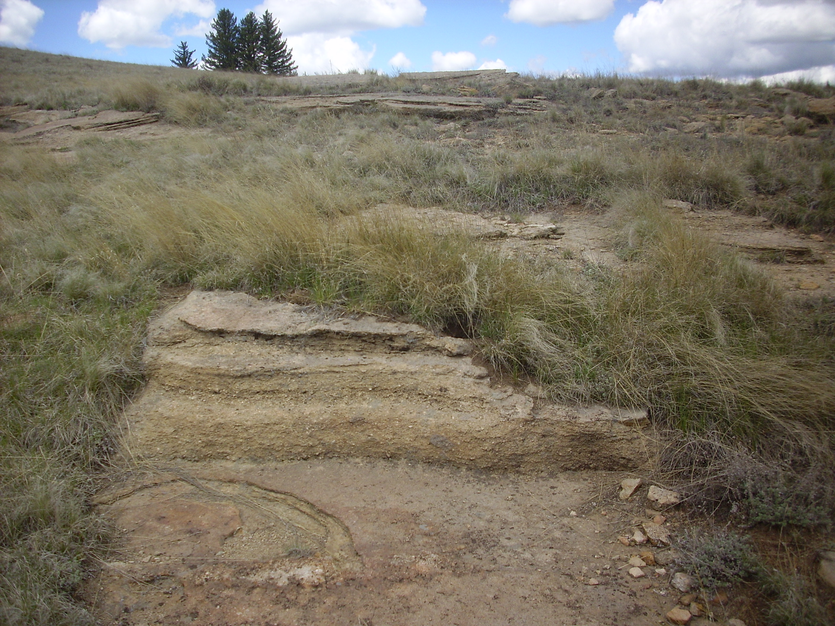
We then headed to Canyon Road and an impressive bank of “older alluvium” exposed in the road cut for an apartment driveway, here. The name is taken from the geological map of the area and is not a formal unit name, but is widely used by geologists who have worked in the area. This is mostly pumice produced by Cerro del Medio in the Valles caldera after the big caldera eruption, which has been reworked by streams that once flowed across the surfaced of the Pajarito Plateau. It’s pretty impressive in this road cut, which also shows some minor faults. Alas, every one of my photographs of this area got munged by my camera. Fortunately, some of Bruce’s pictures fared better.
Old alluvium. 35 52.993N 106 18.659W
Bruce noticed that some trees near the road cut were curved, showing that the alluvium was continuing to slowly slump towards Acid Canyon to the north. (The canyon gets its name from its use as a dump site for acid waste during the early years of Los Alamos.) Again, I took pictures, and, again, my camera munged them.
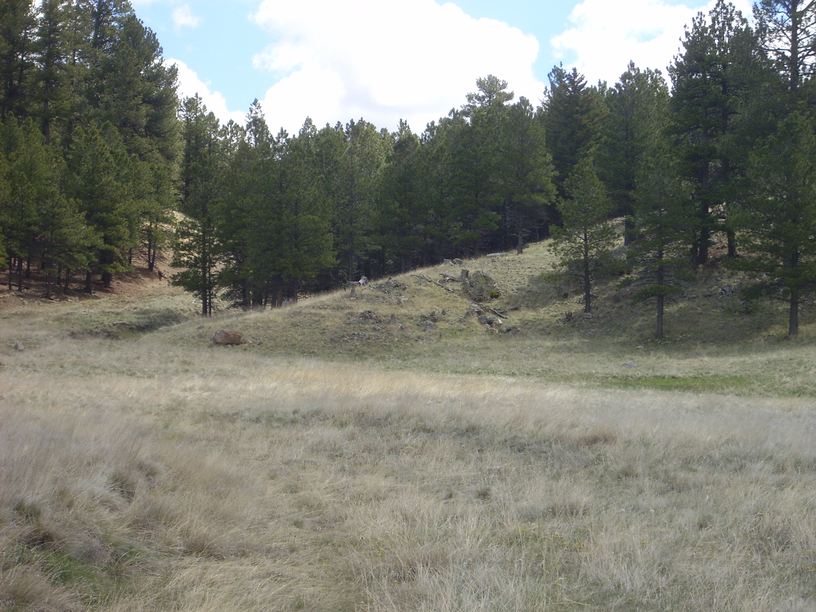
From there we headed into Rendija Canyon to took at the Puye Formation. Ditto on the munged photographs, but I have some file photographs that show what we looked at.
We pick up the trail where San Ildefonso Street in the Barranca Mesa subdivision turns into Rendija Canyon Road:
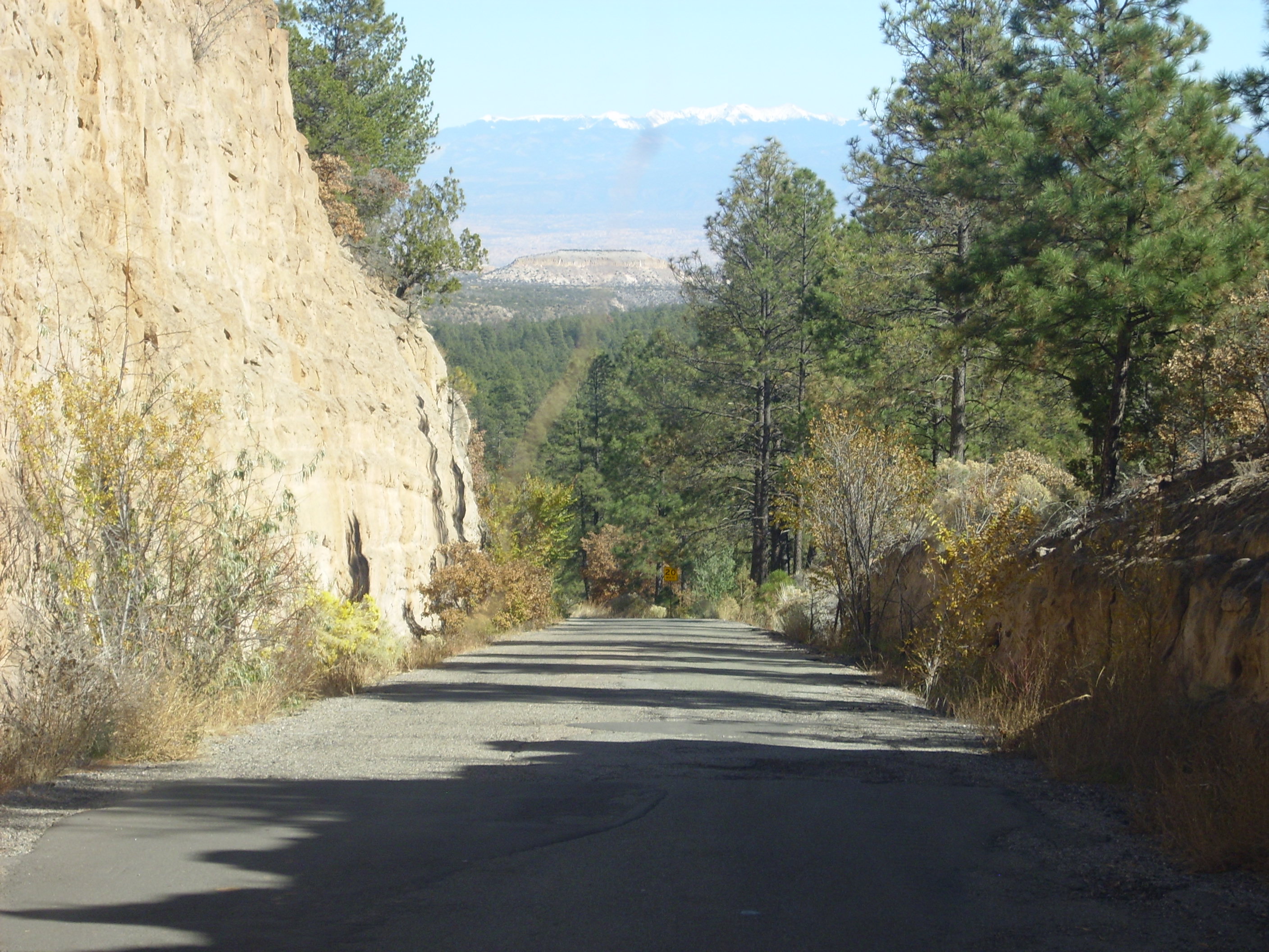
The road descends into Rendija Canyon through a road cut into the ever-present Tsherige Member, Bandelier Formation, Tewa Group. In the middle distance is an impressive mesa of Bandelier Formation, and in the far distance is the Precambrian rocks of the Sangre de Cristo Mountains, forming the far side of the Rio Grande Rift. This photograph was taken earlier in the day than when Bruce and I visited, but it still gives the right idea.
Rendija Canyon has a couple of interesting geological transitions. Near the Sportsman’s Club, which is the county rifle range, we see a transition from the Guaje Member, Tschicoma Formation, Polvadera Group, to Bandelier Formation:
The Bandelier Formation is the lighter rock with near-vertical cliffs to the right. This is sitting on top of Tschicoma Formation to the left, a noticeably darker rock that forms more irregular surfaces. Bandelier Formation is much younger at just over a million years, and it’s a more silica-rich rock. Tschicoma Formation is dacite, a somewhat less silica-rich rock (hence the darker color) and much older at at least 3 million years.
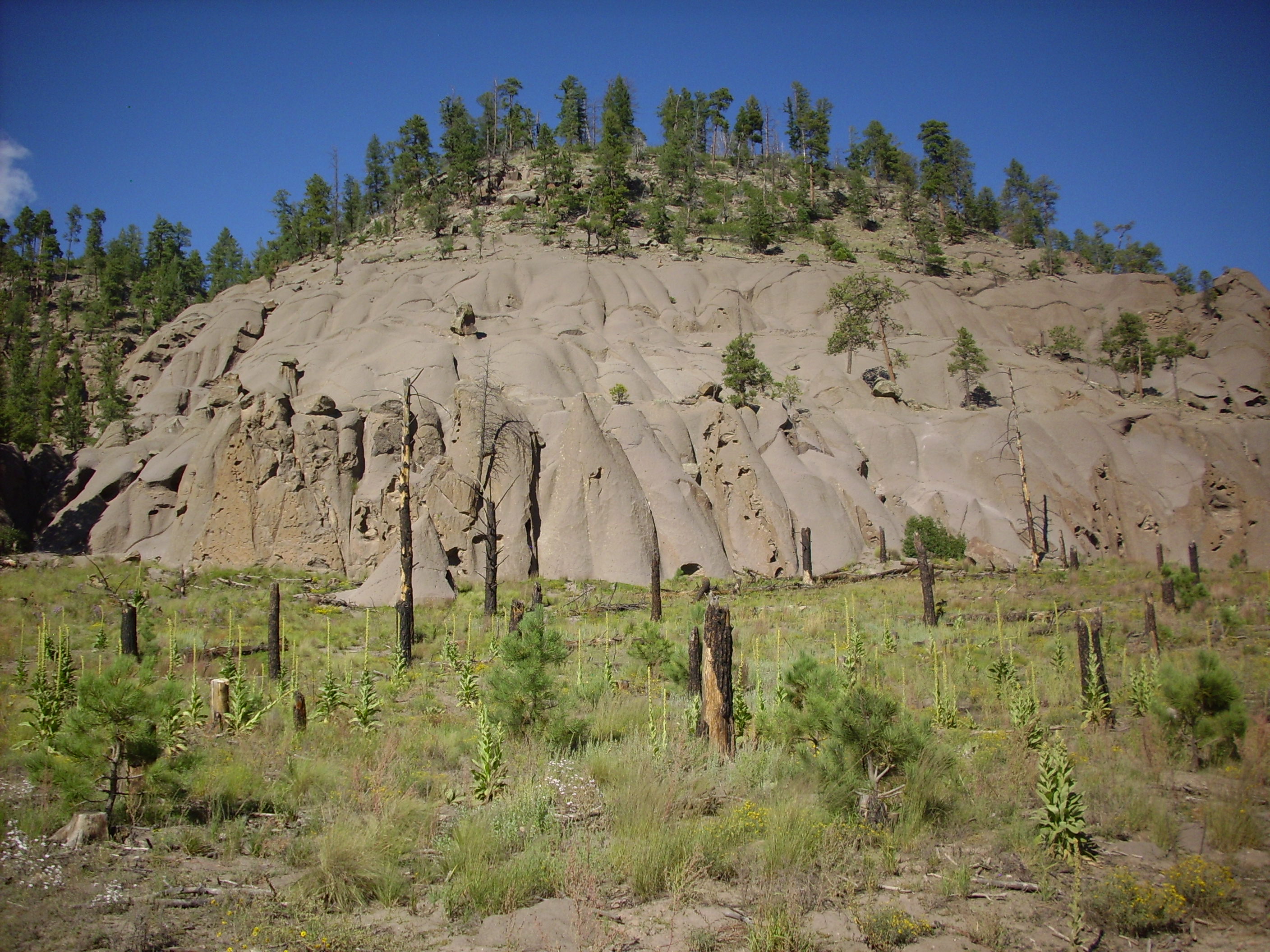
Further down, we reached the Puye Formation:
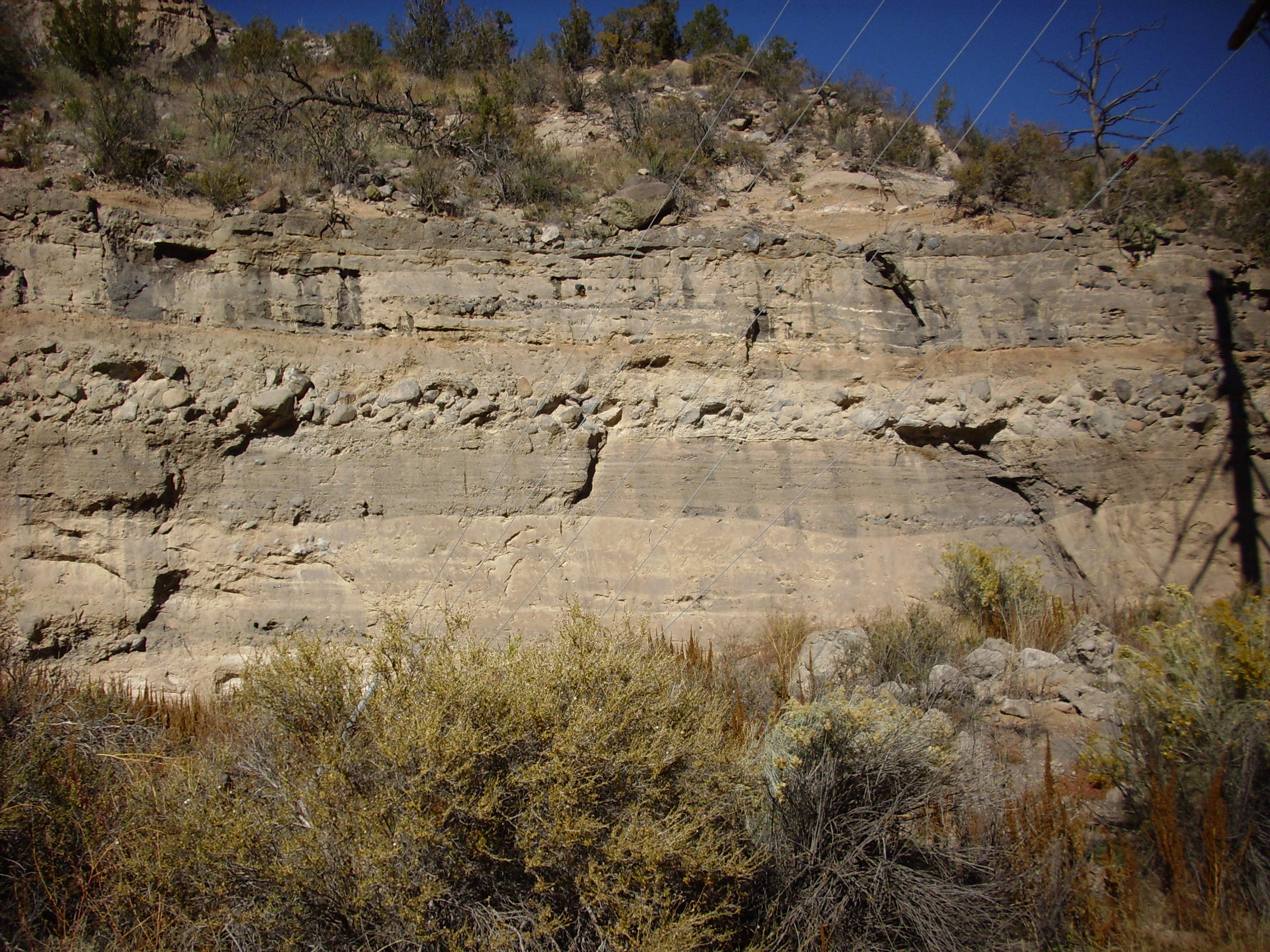
The Puye is a very thick alluvial fan; that is, a thick deposit of rock and dirt washed down from the early Jemez mountains over the last few million years. It is now being eroded in turn and forms some spectacular bluffs on the road from Los Alamos to Espanola.
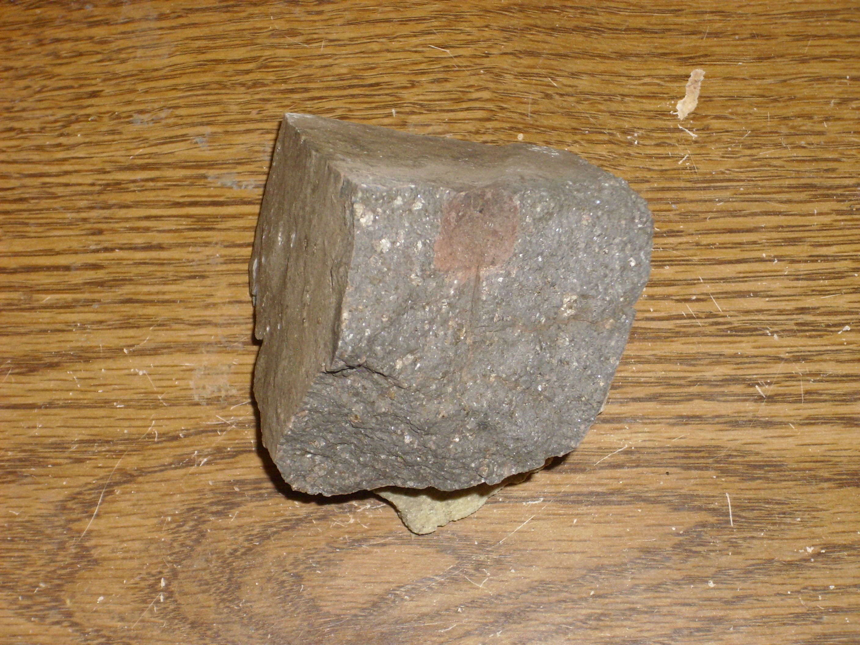
In this photograph, you see various layers of clay, sand, and boulders. The boulder layer must have been deposited by something like a landslide or flood at some point; the individual rocks (clasts) are larger than a man’s head. Bruce and I were watching for a layer that may represent a tuff deposed about 1.85 million years ago, the La Cueva Member of the Bandelier Tuff, that is thought by geologists to represent early leakage from the magma chamber that eventually produced the Toledo and Valles events responsible for the Otowi and Tsherige Member. Again, my photograph got munged. I did at least get a chunk of the rock from a layer that was probably a lahar, or mud flow, from a source somewhere in the Sierra de los Valles west of Los Alamos.
There are some remarkable formations (in the conventional sense of rock features) in the Puye:
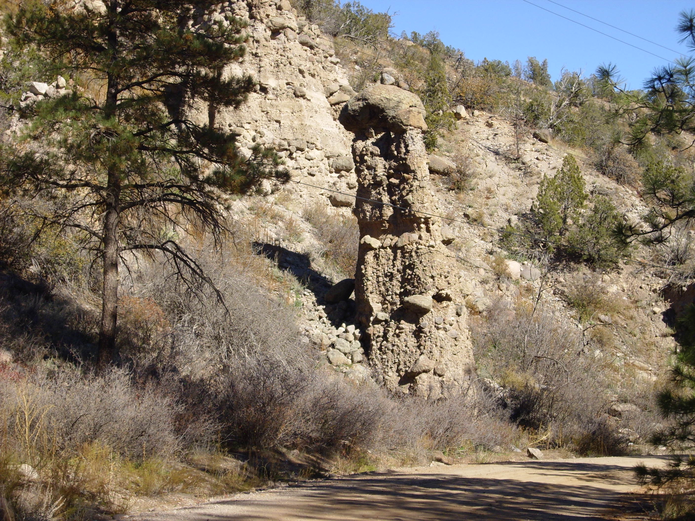
These “hoodoos” are surprisingly strong. Bruce informed me that the big boulder on top compacts the sediments underneath quite effectively. Furthermore, if the hoodoo starts to tip to the side, the rocks there are strengthened by compaction, accounting for the stability over hundreds to thousands of years.
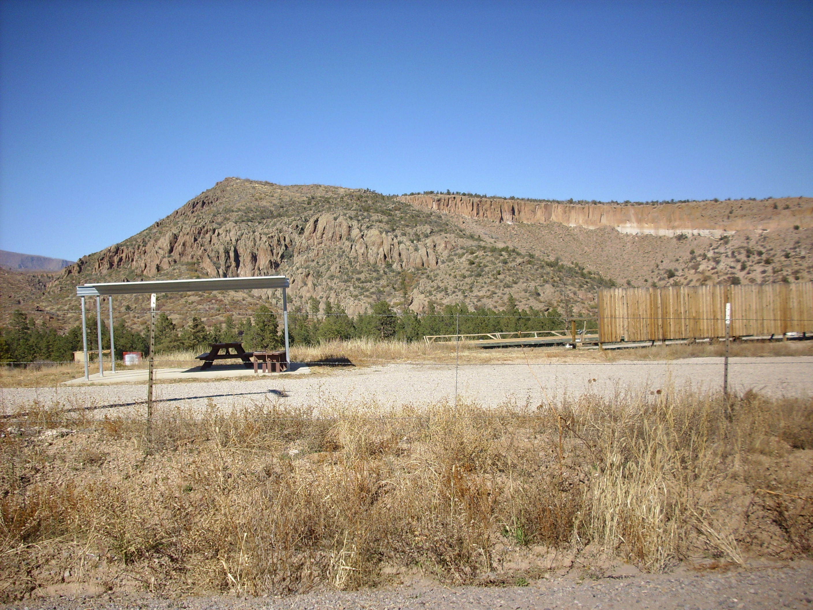
We finished up by looking at the Pajarito Escarpment west of Los Alamos. The Pajarito Escarpment is quite obvious as one approaches it along State Road 4.
Pajarito Escarpment. 35 50.030N 106 21.351W
You can see that the highway winds up the face of the escarpment. Looking north and south from one of the hairpin turns in the road, we get an excellent view of the Pajarito Escarpment in both directions.
Pajarito Escarpment south of hairpin at 35 49.991N 106 21.804W
Pajarito Escarpment north of hairpin at 35 49.991N 106 21.804W
Note that there is a smaller escarpment east of the main escarpment to the south. This is a second strand of the Pajarito Fault.
Again, these are file photos. However, the weather is at least about right.
According to the geologic map, the road cut along the highway here is Tsherige Member, Bandelier Tuff. However, it is darker and more dense than any Bandelier Tuff I have seen before, and I wondered if this was possibly Tschicoma Formation exposed by the road cut. Probably not; it’s Bandelier Tuff erupted so close to the vent that it was very hot when deposited, and from so late in the eruption that it was unusually rich in iron and magnesium minerals. Here’s a sample.
Tsherige Member from near hairpin at 35 49.991N 106 21.804W
Had I run across this without knowing what it was, I would have taken it for an unusually quartz-rich andesite. Bruce suggested that the dark color might actually be from manganese. Okay, I buy that.
It was getting dark, so we called it a day.
Monday: Kashe-Katuwe and Bandelier
Monday was Memorial Day, and Cindy wanted some time to go to Albuquerque and pay respects at her mother’s grave. This limited Bruce and I to short trips in the morning and afternoon, so that I wouldn’t be too far away if the boys needed looking after.
In the morning we headed down to Kashe-Katuwe Tent Rocks National Monument. We first headed towards the Veterans Memorial Overlook, appropriate given the date.
Panorama from Veteran’s Memorial Scenic Overlook. 35 40.398N 106 27.162W
Another file photo. My camera was actually working by this time, but I was disinclined to take a second panorama.
The peak in the middle of the second frame is Bearhead Peak, the type location for the Bearhead Rhyolite. This is a very high-silica rock that erupted through the underlying Paliza Canyon Formation 6-8 million years ago. Bearhead Peak and most of the surrounding hills are underlain by this rock. In the foreground, and making up most of the tent rocks in the main monument area, is the Peralta Tuff. The Peralta Tuff is a sequence of lahars (mudflows), stream deposits, and pyroclastic flows containing rock erupted around Bearhead Peak, and it is considered a member of the Bearhead Formation along with the Bearhead Rhyolite. It is topped with Bandelier Tuff in the third and fourth frames.
We headed back to the main area of the park and hiked the Cave Loop Trail. I did get a photograph of the prominent cliff at the south end of the monument; the last time I was here, it was late in the day and the light was not as ideal.
Peralta Tuff. Looking northwest from 35 39.607N 106 24.546W
You can see the many layers in the Peralta Tuff, each representing a different mudflow, stream deposit, or pyroclastic flow. The darker layers are more likely stream deposits while the lightest layers are more likely pyroclastic flows.
It being Memorial Day, the cave for which Cave Loop Trail is named was swarming with tourists. But fairly nice ones.
Peralta Tuff. Looking northwest from 35 39.607N 106 24.546W
Further down the trail, we ran across another outcrop of the white bed you see just below the cave level here. It was not full of pumice, as I first thought, but of bits of pure white rhyolite. A rhyolite lahar? Bruce and I both thought so. I don’t know why I don’t have a photo; perhaps my camera was still having glitches. Of course I have no sample; National Monument.
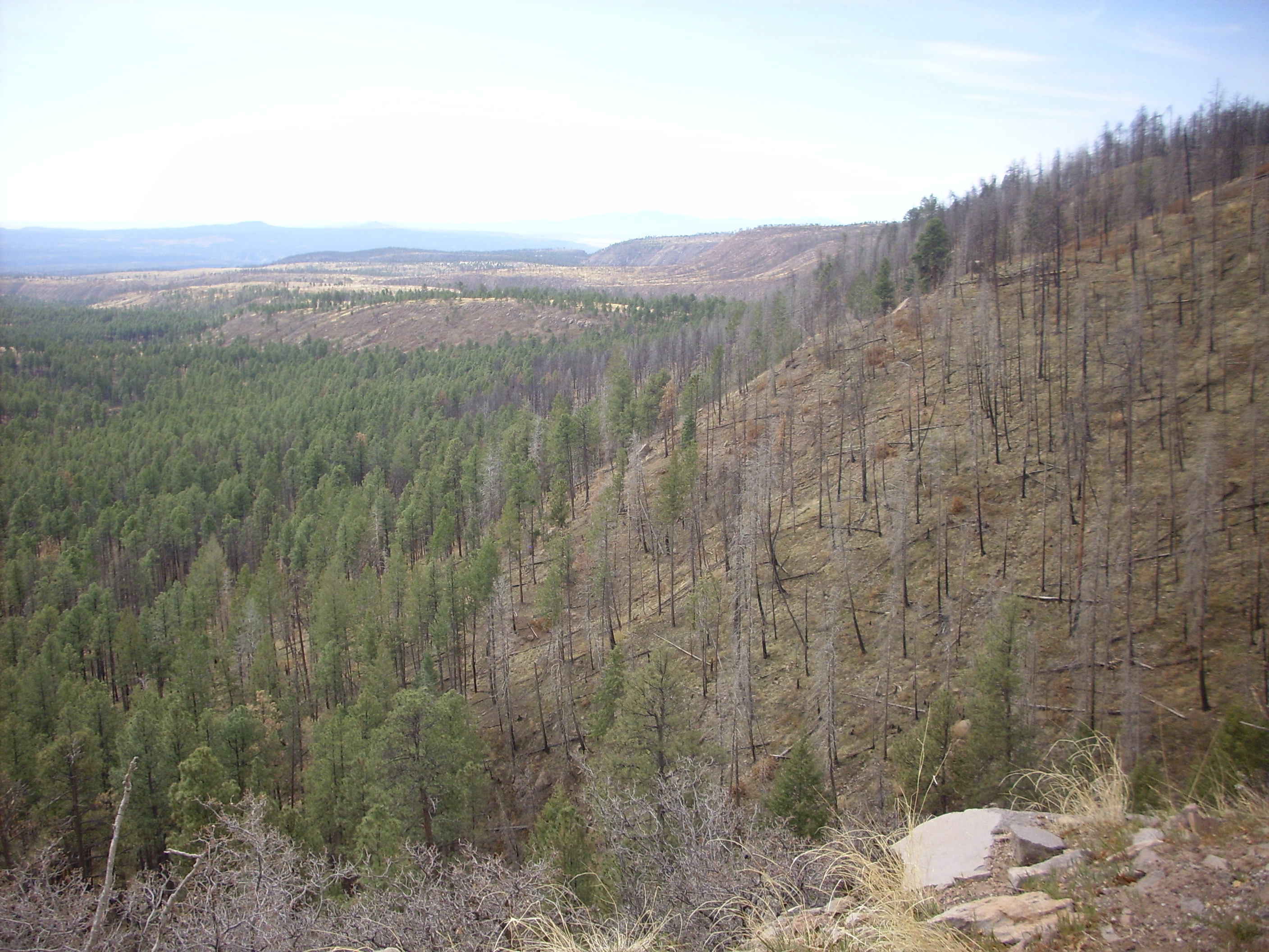
From there we headed back to White Rock to check on the boys. Cindy left a note; they had (uncharacteristically) agreed to go with her to Albuquerque. The rest of the day was in the clear. We headed to Bandelier, taking the shuttle from the visitors center in White Rock, only to find that the last shuttle back out of the park was at 5:00, which left us little time. I wanted to show Bruce the impressive maar beds at Lower Falls, but we couldn’t make it that far before having to turn back; the best we could do was to see some maar deposits upstream of the falls.
Cerros del Rio in lower Frijoles Canyon
Then back to catch the shuttle back to White Rock.
We still had a little time, so I convinced Bruce to make the awkward climb down to the petroglyphs at the mouth of Pajarito Canyon, along the White Rock Canyon rim. Here an intermittent stream has carved a very deep canyon into the thick basalt flows.

The basalt is several hundred feet thick at this location, much thicker than in most of the canyon. Either the confluence by chance has cut into an actual eruption center, or (more likely) the basalt here fills a paleocanyon coincident with the present-day Pajarito Canyon.
There is a very distinct ledge here, formed by the boundary between two successive basalt flows. The boundary is visible in this photograph as a horizontal joint near the top of the cliff to the right of center.
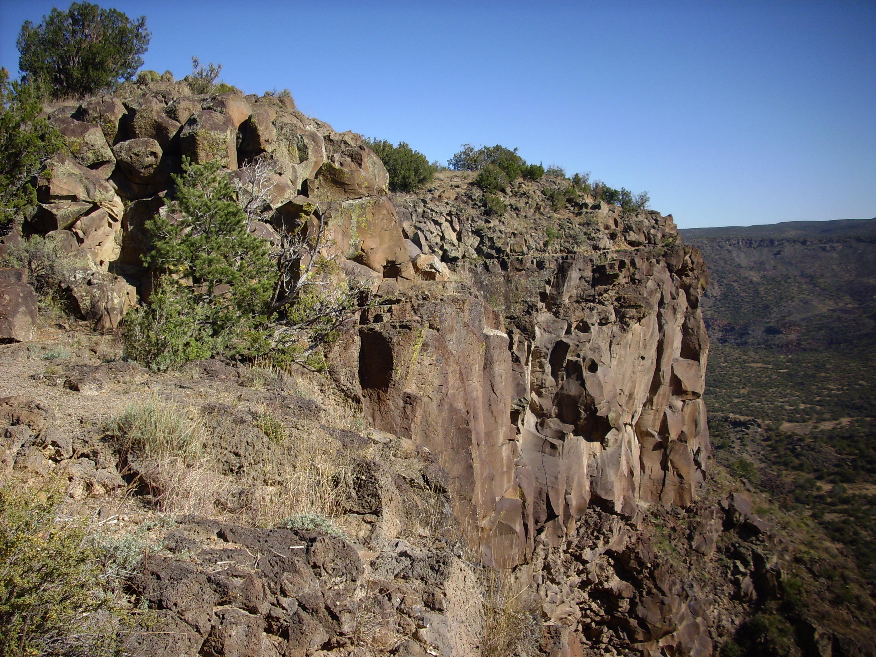
The ledge is formed when the top flow is eroded away to expose the flow underneath, which is apparently slightly more resistant. One can actually see (badly eroded) ropy patterns on the top of the lower flow, typical of pahoehoe flows.
This kind of preservation of an original flow surface is rare in White Rock Canyon, occurring only where relatively recent erosion has exposed a lower flow that was previously protected from the elements by an overlying flow. Here is a close up of the boundary between the upper and lower flows.

This area has some petroglyphs or rock drawings; some likely authentic ancient Native American rock art:
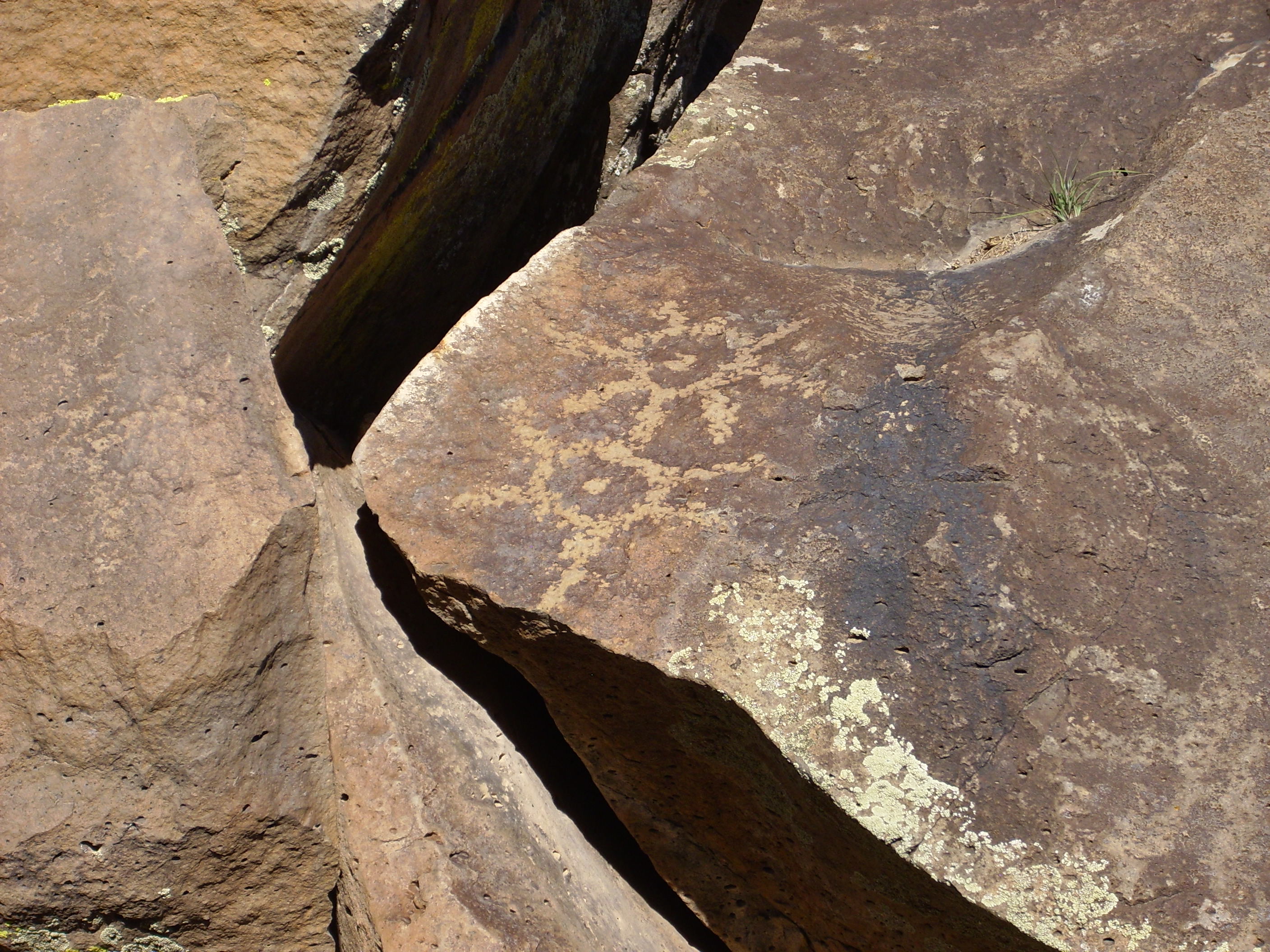
and some not.
The petroglyph in the first photograph not only shows an authentic ancient pattern, but it also shows a thin layer of desert varnish indicating its great age. This is not present on the newer, inauthentic petroglyph. It took me some time to find the petroglyph again, for no particularly good reason other than you can never find the thing right in front of your nose.
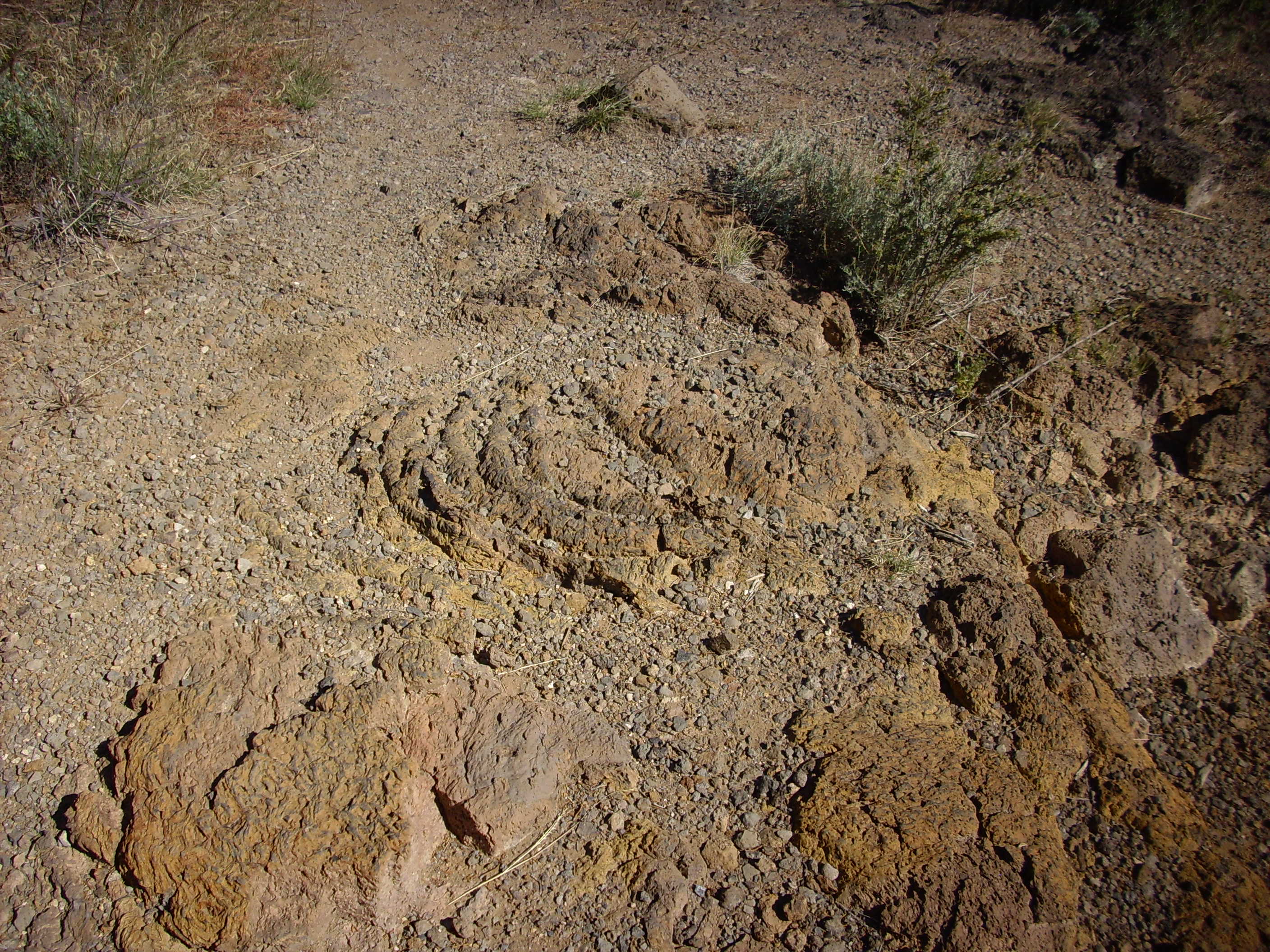
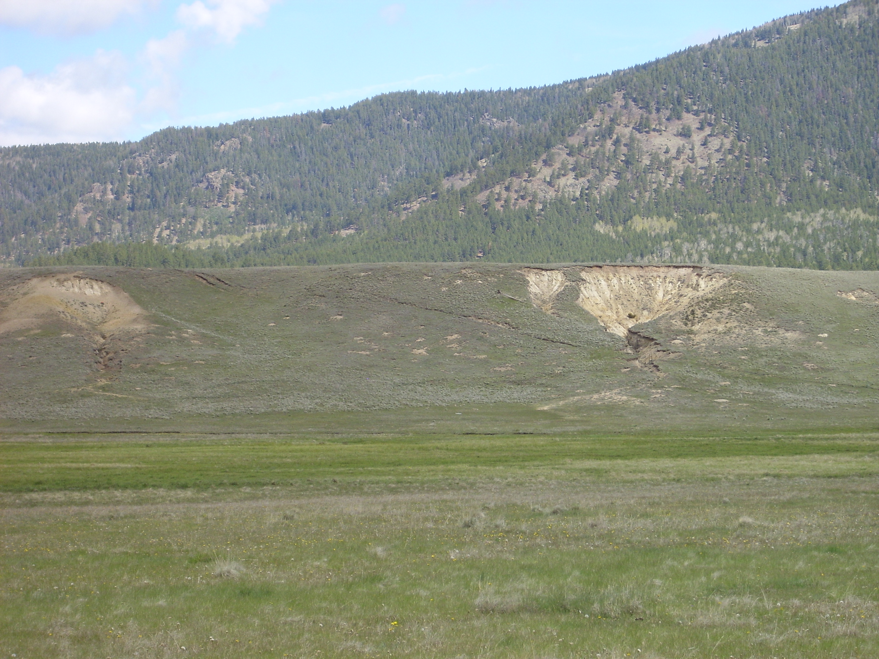
From there we went and looked at alluvium.
A short distance south of the Rim trail head, there are several large banks or hills of coarse gravel.

This gravel is fairly uniform in size and made of well-polished clasts that are obviously not composed of the basalt underlying most of this area. I have wondered if this was gravel trucked in decades ago for the construction of White Rock. However, the volume is great, the gravel is scattered for at least half a mile along the canyon rim to the south, and there is considerable gravel on the first slump block below the canyon rim on the Blue Dot Trail. (Bruce had to take my word for this; the trail is quite difficult and Bruce is a bit older than I.) This suggests that this might a natural gravel bank, possibly a gravel bar associated with the many lakes that have formed over the last five million years as various basalt eruptions in the area dammed the Rio Grand.
There are also extensive pumice banks in the area.
The pumice is poorly sorted and includes clasts up to six inches long. Like the gravel banks, the pumice is not mapped even on the latest geological maps of the area. Also like the gravel banks, the pumice is also found on the slump block below the canyon rim at this point. The pumice deposits are fragile enough that they must be geologically very young, so this is most likely El Cajete pumice erupted from a vent south of Redondo Peak about 50,000 years ago. El Cajete pumice occurs throughout the southern Jemez and as far east as Bandelier National Monument. If this is El Cajete Pumice, it is the furthest deposit from the vent that has been identified. It’s astonishing that there are pieces so large here.
South of the pumice and gravel banks is a broad meadow covered with more gravel. This looks an awful lot like an old gravel dump, complete with vehicle tracks, but the presence of considerable gravel on the slump block below the canyon rim still has me thinking this might be a natural deposit.
At this point, a thunderstorm was about to break over the area, so we packed it in and headed for Chinese food in Los Alamos before calling it a day.
Tuesday: Valles Caldera
We anticipated that this would be a big day, and were not disappointed. Valles Caldera National Preserve has recently been transferred from a public/private trust to the National Park Service, and they have begun allowing a limited quota of vehicles each day to drive around the back roads of the caldera. Bruce had secured a back country pass and, while it did not allow us to go to some of the most choice locations (I am thinking particularly of the Redondo graben), we still had plenty to see. We would be guided by New Mexico Geological Society road logs through most of the day.
We first checked in at the headquarters. On previous visits, they had a rather good selection of books, but with the transfer to the Park Service, these had disappeared. The old trust was okay with running a book store; Park Service prefers to have concessionaires run such businesses, and they hadn’t contracted one yet. So the room was rather bare, rather to Bruce’s disappointment. (He is the most ardent bibliophile I know. By which I mean that he’s the only person I know for whom structural integrity under a massive weight of books is a major consideration when buying a house.)
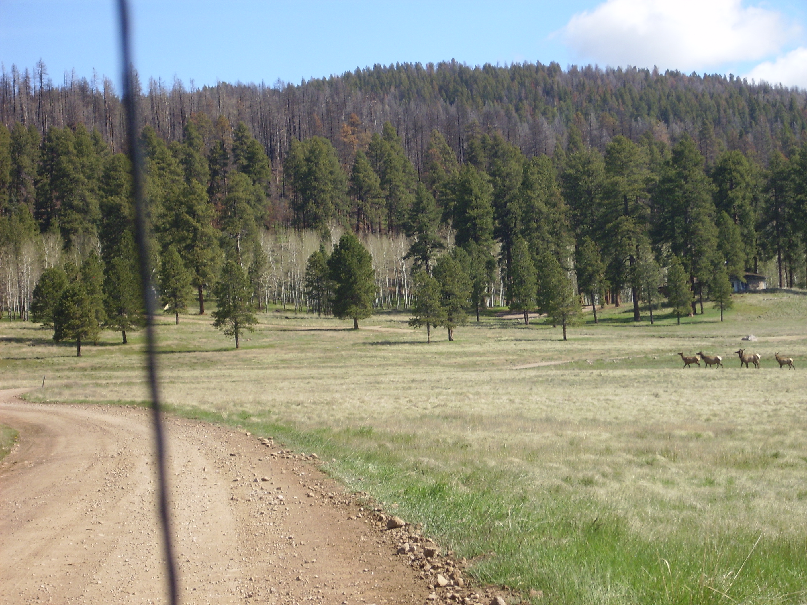
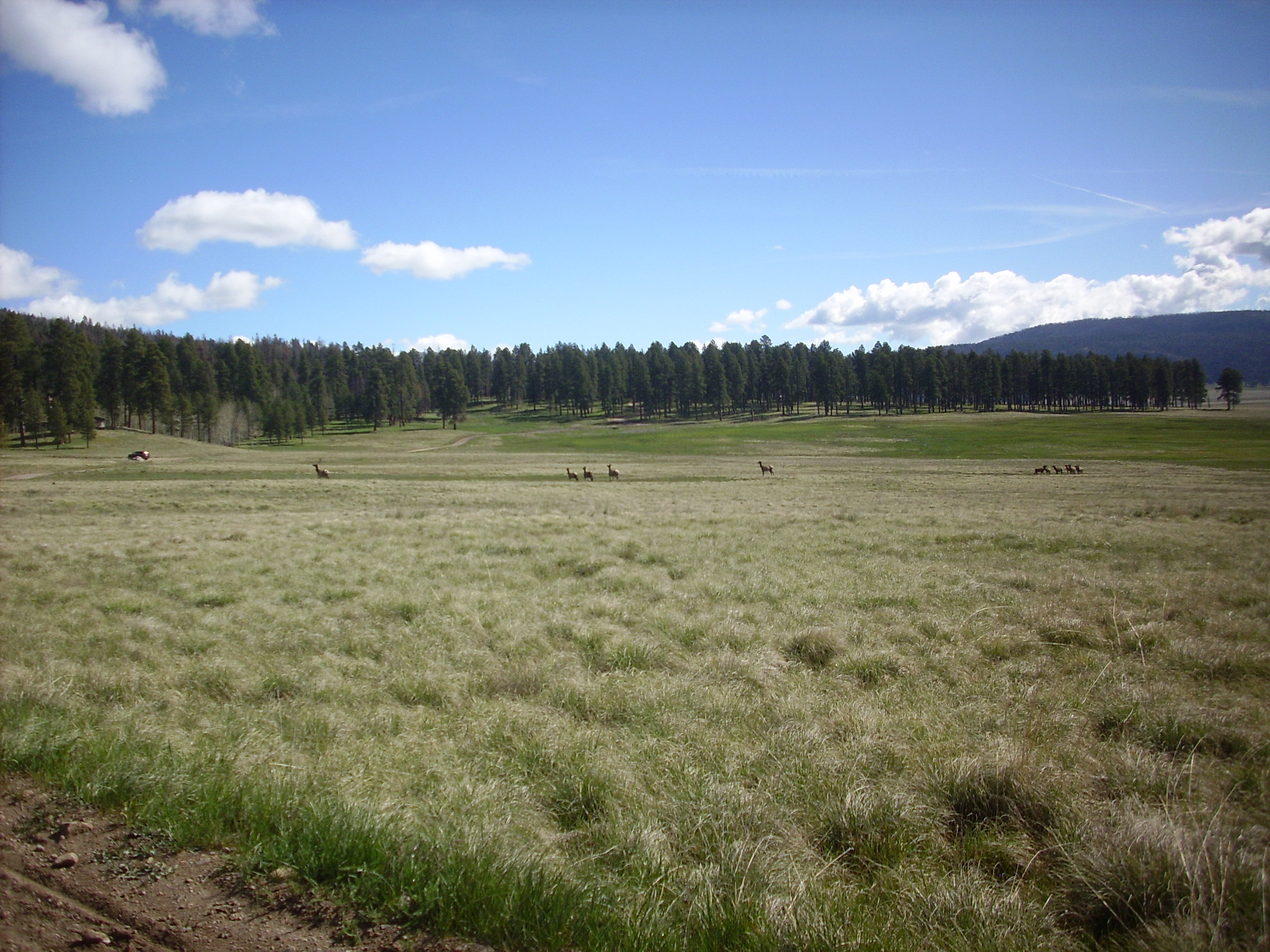
Still, the staff were good and we were soon on our way. We headed north past the old ranch headquarters, and encountered our first large wildlife, a herd of elk.
We continued along the west rim of the Valle Grande and the south side of Cerro Pinon. I can’t find anything specific in the literature on Cerro Pinon, but it has the appearance of a dome, and the geological map show that it is underlain by Bandelier Tuff, Deer Canyon Tuff, and Deer Canyon Rhyolite, with an apron of flow debris on one side. Our attention was caught by this outcropping on the south side:
Deer Canyon Rhyolite. 35 53.379N 106 29.693W
The white rock is a glassy rhyolite, a kind of igneous rock formed from high-silica magma that cools very quickly. Our map suggests that this is Deer Canyon Rhyolite. The much darker rock around it, which has the appearance of a debris flow, could be either Deer Canyon Tuff or Bandelier Tuff; both are mapped in this area. Here’s a closer look at both kinds of rock.

Deer Canyon Rhyolite. 35 53.379N 106 29.693W
Because this was inside the preserve, we were practicing catch-and-release rock hounding; we left the samples close to where we found them.
The Deer Canyon Rhyolite was erupted very shortly after the Valles event. After the roof collapsed into the magma chamber to produce the surface caldera, fresh magma began to fill the chamber within just a few tens of thousands of years. This pushed up a resurgent dome, which we now see as Redondo Peak and Redondo Border. The dome was badly fractured, and a small quantity of magma was forced out of fissures to form the Deer Canyon Rhyolite. Alas, this is a unit I will never add to my collection; there are no exposures outside the Preserve where I might legally collect any.
From here we proceeded north into the valley of the Jaramillo Creek between Redondo Peak and Cerro del Medio. This is an area that was previously inaccessible to private vehicles; we felt duly privileged.

The road to Jaramillo. 35 53.379N 106 29.693W
To the left, in the first three frames, is a toe of Redondo Peak, representing the northeasternmost part of the resurgent dome. Peeking out on the boundary of the third and fourth frames is Cerro del Abrigo. Behind us is Cerro del Medio.
Study of the domes in this area made a major contribution to the revolution in geology in the 1960s that led to the general acceptance of plate tectonics. The domes could be dated from radioisotope studies, and their magnetic polarization could also be measured. This allowed geologists to interpret the stripes of rock with alternating magnetic polarization found in the ocean floors, which was important evidence for continental drift. As our road log pointed out, we were literally on the road to Jaramillo here.
Continuing north, we turn west of Cerro del Abrigo and the Cerro Santa Rosa dome complex and into the valley of Santa Rosa Creek between Cerro Santa Rosa and Cerro San Luis. Incidentally, there seems to be some differences of opinion on the location names: Geologists have almost universally called the dome complex Cerro Santa Rosa, and the small (and much older) small dome to its north Cerro Trasquilar. But the latest topographic maps label the whole complex as Cerro Trasquilar and identify only the middle dome as Cerro Santa Rosa. I’ll stick with the geological names, thank, you.
Across the narrow valley we see an exposure of tuff from Cerro Santa Rosa.
Santa Rosa ignimbrite. Looking west from 35 57.065N 106 31.213W
Santa Rosa erupted between 0.79 and 0.94 million years ago along the main ring fracture of the Valles caldera. The area in the foreground is very boggy.
A little further north is a bar of lake deposits.
San Antonio lake deposits. Looking northwest from 35 57.479N 106 31.134W
The material here was deposited when the eruption of San Antonio Mountain around 0.56 million years ago created a lake. When the lava dam was finally eroded through, the lake drained and further erosion shaped the terraces here.
This seemed like a good place for a panorama, because were were now approaching hte northern moat of the caldera. The moat is the area between the topographic rim of the caldera and the ring of domes along the caldera ring fracture.

The caldera north moat. 35 57.479N 106 31.134W
The panorama starts with the view to the northwest. The first three frames show the north caldera rim, with Cerro de la Garita centered in the second frame. The top of this mountain is porphyritic dacite and andesite of the La Grulla Plateau that is about 7.5 million years old, while most of its slope is Paliza Canyon Formation andesite that is about 8 millon years old. The bald patch on the lower right slope of the mountain contains a dike of Bearhead Rhyolite of uncertain age, but probably around 7.5 million years old also.
At the right of the third frame, the small dome is Cerro Trasquilar, a remnant of the ring domes that likely formed from the earlier Toledo event. Only a few traces of these domes have been identified, but their location tells us that the Valles and Toledo calderas are nearly coincident. The same plug of the earth’s uppermost crust collapsed twice into the underlying magma chamber.
On the left side of the fourth frame, one can see in the distance the Cerro Toledo embayment. This is a somewhat mysterious feature of the geology, but the domes all date to about the time of the Toledo event. Frames 4 to 7 show Cerro Santa Rosa behind us, the eighth frame shows Redondito in the distance, and the eight and ninth frames show Cerro San Luis.
You can see that Bruce is twice the man that I am. Also invited along for the ride was The Disembodied Hand That Strangled People.
Here’s a little closer view of Redondito.

Redondito. Looking south from 35 57.479N 106 31.134W
Redondito is a small peak on the north flank of Redondo. Like Redondo, it is mostly underlain by Bandelier Tuff, and it’s not clear whether there is an actual intrusive dome beneath that has pushed up the Bandelier tuff beds here. Redondito and most of the rest of Redondo Peak is now off-limits as a gesture of respect to native American tribes that consider it sacred ground.
We continued to the junction with Pipeline Road, so called because the main gas line to Los Alamos comes in this way. We pass an outcrop of Bearhead Rhyolite close to the caldera floor.
Bearhead Rhyolite. 35 58.526N 106 31.282W
There are small outcrops of Bearhead Rhyolite throughout the northern moat area. Geologists interpret these as feeder conduits connecting overlying domes and flows (now mostly eroded away) with a vast body of rhyolite underground, the Bearhead Batholith. It’s kind of conjectural that it’s actually down there, but the conjecture is a good one.
During crystallization of a batholith, a great deal of volatiles (water vapor with many different dissolved gases, including acid sulfur oxides) is “sweated” by the solidifying mass of rock. This can do weird and wonderful things to the overlying rock, a process called hydrothermal alteration. A few hundred feet down the road, we came to a good example of this process.
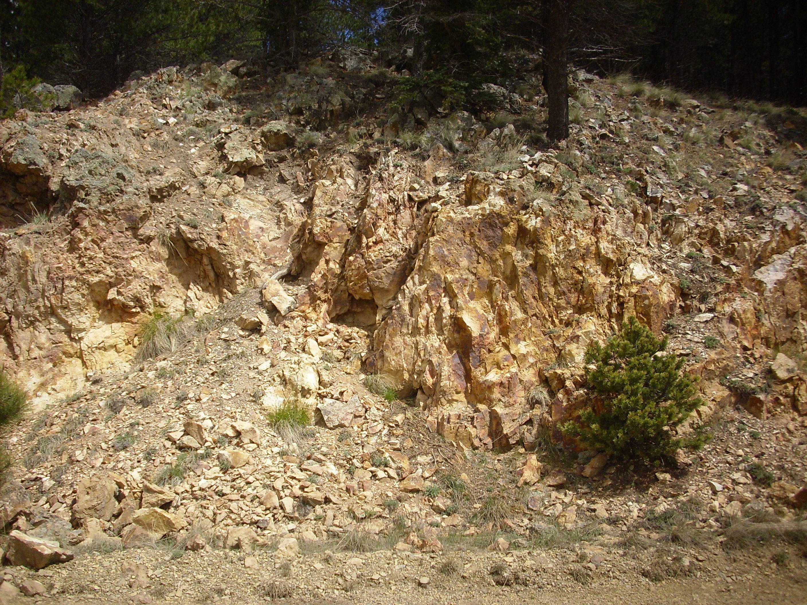
Hydrothermally altered andesite. 35 58.310N 106 31.102W
At first glance, this looks like another local outcrop of the Bearhead Rhyolite, which is a light-colored rock rich in silica. However, closer examination reveals that it was probably originally andesite, a rock type poorer in silica that is usually darker in color. The rock has been altered by hydrothermal processes. A few feet futher along the road, we see some andesite that escaped alteration that shows the contrast.
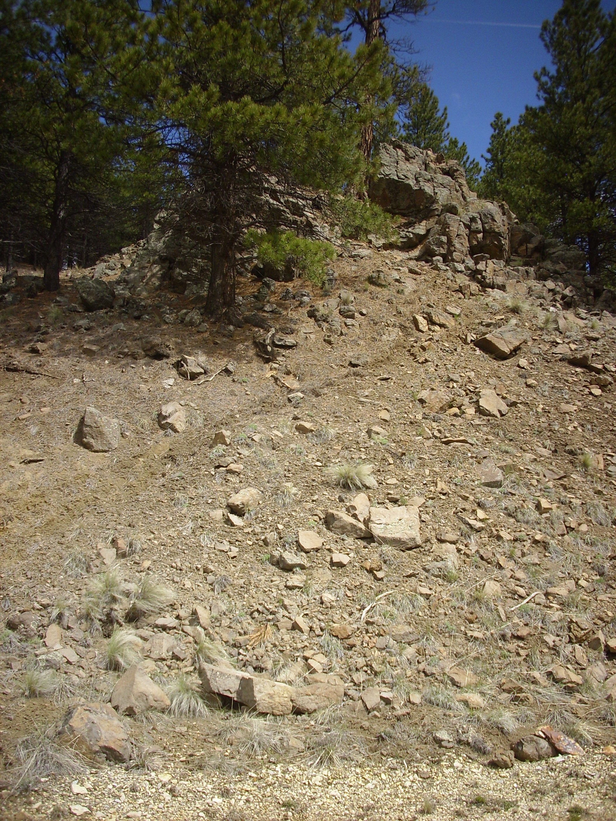
Unaltered versus hydrothermally altered andesite. 35 58.310N 106 31.102W
The dark rock at the top is unaltered andesite, while chunks of altered andesite litter the slope under it. The local nature of the alteration suggests that there was a small fault or other weakness in the rock under the altered andesite that allowed hydrothermal fluids from the underlying batholith to move upwards.
From here we also get a good look at Cerro Trasquilar to the east.
Cerro Trasquilar. From near 35 58.310N 106 31.102W
This small dome is parked right in the middle of the moat, outside the ring of larger domes that mark the Valles ring fracture. Its age from radioisotope dating (1.36 million years) reveals that Cerro Trasquilar is a remnant of one of the domes that likely formed over the ring fracture of the earlier Toledo caldera. Most of these domes foundered into the caldera of the Valles event, leaving just a few remnants around the edge of the caldera that can be identified by their age.
Continuing along Pipeline Road, we stopped here and got out our hiking sticks for a pleasant short hike up the side road (now closed to vehicles), where there is another example of hydrothermally altered rocks.
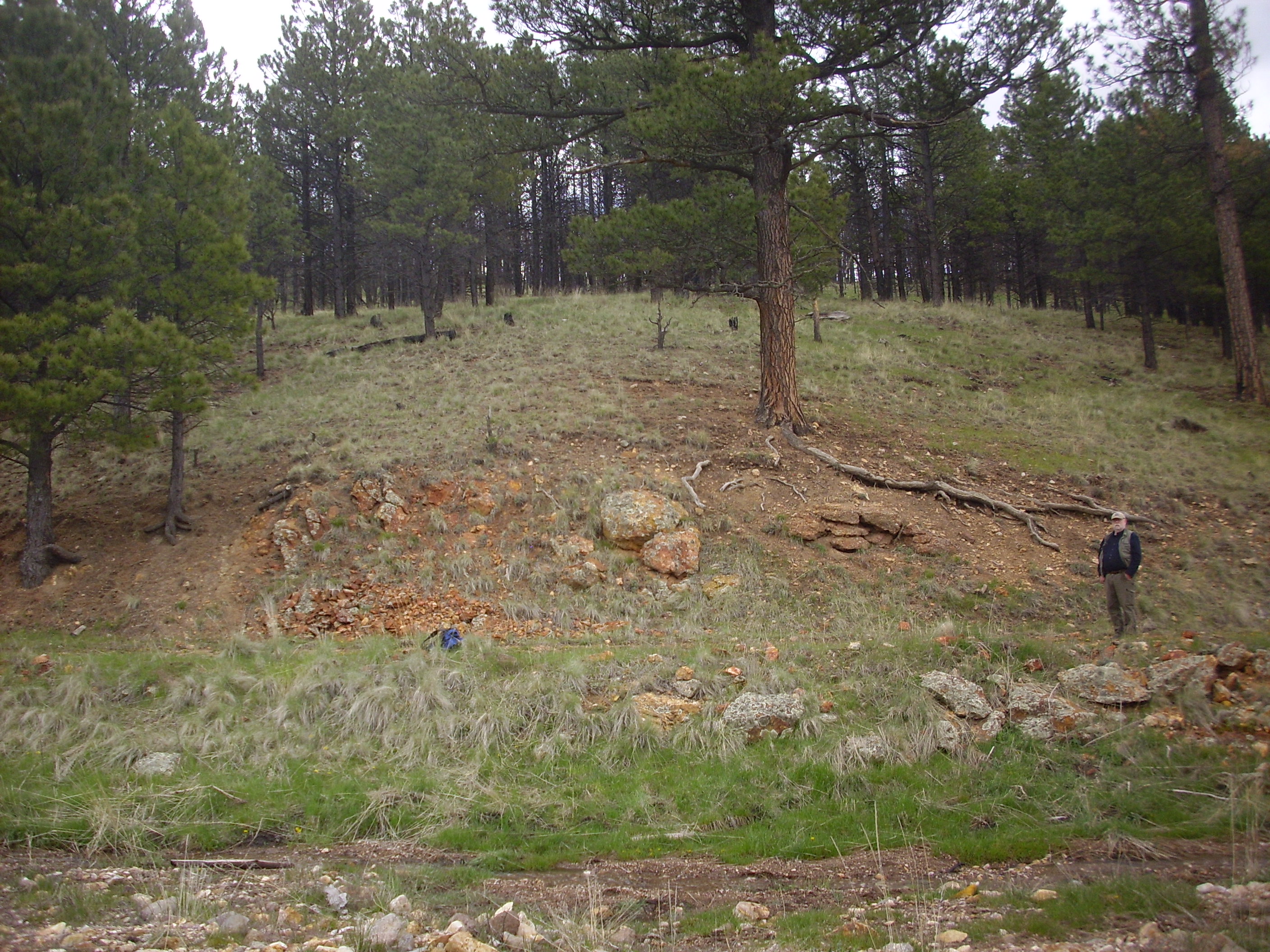
Hydrothermally altered outcrop. 35 58.628N 106 30.334W

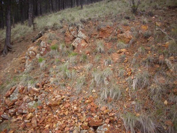
Close up of hydrothermally altered conglomerate. 35 58.628N 106 30.334W
Part of the outcropping is a coarse conglomerate containing angular fragments that cannot have come far from their source. These are embedded in a matrix of equally granular sand grains that are cemented together with silica and hematite. (The hematite, an iron oxide, is responsible for the orange color.) These are likely rift fill sediments, which form thick beds east of this location and north of Cerro Trasquilar. These beds are assigned to the Santa Fe Group and are sediments that had already been deposited in the Rio Grande Rift before the Paliza Canyon Formation, one of the older formations of the Jemez volcanic field at >8 million years, was deposited on top of them. Here the sediments have been hydrothermally altered and cemented by fluids from the Bearhead batholith.
Next to the conglomerate is a knob of volcanic rock so altered that its original type is uncertain. It could be anything from Paliza Canyon andesite to a local intrusion of the Bearhead Rhyolite.
Close up of hydrothermally altered volcanic rock. 35 58.628N 106 30.334W
Another view of Redondito, with Redondo Peak beyond.

Redondito and Redondo. 35 58.628N 106 30.334W
The rise in the foreground is another lake terrace deposit.
Finally, just beyond Serro Trasquilar, we reach the end of Pipeline Road, or at least that part of Pipeline Road we have permission to drive. The road continues on through the Sierra de los Valles to Los Alamos, a drive I’d very much like to take someday. Here is a panorama:

Valle Toledo panorama. 35 57.461N 106 28.890W
The panorama starts at the soutwest, looking towards the Cerro Santa Rosa complex. The dome known by area geologists as Santa Rosa II is prominent in the second frame while Cerro Trasquilar is on the boundary of the second and third frames, with the north caldera wall beyond. The gentle slope in the foreground is underlain by Otowi Member, Bandelier Tuff.
Turkey Ridge forms the skyline across the fourth and fifth ridge. This dome complex occupies the mouth of the Toledo Embayment, an odd feature of the caldera whose interpretation geologists have not been able to agree on. It looks like a pocket in the northeast topographic rim of the calder that is full of rhyolite domes, but it is not clear what would cause this. The two leading theories are that it is a structural feature, formed by deep faulting that connects the Redondo Graben to the Escondido Fault Zone north of Espanola; or that it is an extension of the Toledo caldera to the northeast. The two are not mutually incompatible. The notion that this is the remnants of the caldera from which the Otowi Member was erupted — the Toledo caldera — is no longer accepted, but a few geologists think it may be the caldera from which the Culebra Member of the Bandelier Tuff was erupted 1.8 million year ago. (The Culebra Member is much less voluminous than either the Otowi or Tsherige Members and was originally described as the ignimbrite of San Diego Canyon.)
The dome on the left side of the sixth frame is the nearest dome of Cerros de los Posos, age 1.54 million years, which is thought to be another remnant of the domes of the Toledo ring fracture.
The last few frames show the toe of a landslide in the foreground and Cerros del Medio, from which the landslide originated, in the background.
The big log in the middle of the road marks the limit of where our permit permitted us to drive, so it was back down Pipeline Road past the junction with the road to the preserve headquarters. To the right was the caldera rim, with occasional ancient landslides to the caldera floor.
Some distance west, we came to Warm Springs. Curiously, there are warm springs here, with an old bath house. With dead cow skulls; I suppose as a warning to others.

Warm Springs. 35 58.328N 106 33.631W
The small hill west of the bathhouse is actually a rhyolite dome, albeit a small one. Its radioisotope age is just a hair more than the Tsherige Member of the Bandelier Tuff, 1.26 million years. It’s interpreted as a dome on the Toledo fracture ring that was formed just prior to the Valles event. In the background is Cerro Seco, another Valles ring fracture dome.
The Warm Springs dome is partially buried in hydromagmatic pyroclastic deposits from Cerro Seco. These are beds of small rock fragments produced when lavas from Cerro Seco came into contact with the lake that filled this part of the caldera 0.78 million years ago, with explosive results. The hydromagmatic beds are well exposed on the north part of the dome.
Hydromagmatic beds on north side of Warm Springs dome. 35 58.340N 106 33.702W
Near the top of the dome, this gives way to large broken pieces of rhyolite, presumably from the Warm Springs dome itself.
Warm Springs Dome. 35 58.298N 106 33.728W
Another panorama, from the top of the dome.

Warm Springs. 35 58.298N 106 33.728W
From this point, one can see almost the entire length of the northern moat of the caldera. The panorama begins looking north, with Cerro de la Garita, the high point of the north rim, visible in the second frame. The third frame looks down Pipeline Road and the north moat towards the Toledo Embayment. The third through fifth frames shows the moat domes, from Cerro Santa Rosa through Cerro San Luis to Cerro Seco, which dominates the fifth through seventh frame. San Antonio Mountain just peaks over the shoulder of Cerro Seco in the seventh frame. The eight frame looks down the north moat to the west, and the last two frames are back to the caldera north wall.
Coming down the east side of the dome from the summit, I ran across a number of large rocks that were obviously not rhyolite. They included sandstone, andesite that looked like Paliza Canyon formation, and even a large chunk of quartzite. These are likely remnants of megabreccias. When the caldera formed, its rim was unstable and slumped into the caldera in massive landslides that would have included all the rock strata in the caldera rim. The best examples of this are in Redondo Graben, which, alas, is not included in the vehicle back country permit. You have to hike. Well, I was planning on coming back from time to time anyway.
We resumed the drive west. There are a number of megabreccia landslides here.

Caldera collapse landslide. Looking west from 35 58.357N 106 35.644W
The landslide is the tree-covered are below the caldera rim (which is rather low here, to the northwest.) The sloping hills in front are likely more lake terrace deposits, heavily eroded by San Antonio Creek.
We continued to the end of the road, passing a cattle yard with a fair number of cattle and what looked like a forest restoration project (a large fenced area full of young trees surrounded by rabbit wire.) The end of the road was the Preserve boundary, and the gate was closed by someone determined to make it really really closed; there were even large chunks of metal welded to the cattle guard. We took the hint.
We retraced our steps to the visitors center, pausing to admire the remnants of a rock glacier on Cerros del Abrigo.
Rock glacier. Looking east from 35 55.928N 106 30.163W
Rock glaciers are a mass of rock fragments containing enough ice to allow the rocks to slowly flow like a more conventional glacier. The Jemez were cold enough to support rock glaciers during the recent ice ages, of which our current age is a geologically brief warm period (an interglacial.) There are several suspected rock glaciers in the Jemez, of which the most likely is located on the north slopes of Tschicoma Peak. The one picture above shows up well on Google Maps and certainly resembles photographs of rock glaciers I’ve seen on the Internet.
We also paused along the west side of Cerros del Medio to admire the many thin obsidian flows.
Devitrified obsidian flows. 35 54.655N 106 29.102W
You may be thinking: Isn’t obsidian a shiny black glassy rock? Why, yes. Yes, it is. When still very young. Obsidian devitrifies in geologically short time, turning from glass back to crystalline rock. This part of Cerros del Medio has been radioisotope dated as 1.21 million years old, plenty of time for most of the obsidian to have devitrified.
I took a close up picture of a sample, showing that it contained numerous spherulites — small glassy spheres commonly formed at the edge of obsidian flows. Alas, that photo came out too blurry to be useful.
We stopped by the visitors center, expressed our pleasure at how the day went and made a couple of suggestions (including opening Redondo Graben to vehicles with back country permits) and headed on out of the park. We were headed into the Sierra Nacimiento Mountains west of the Jemez to hunt down an ultramafic roof pendant in the Joaquin batholith, which my maps showed should be about here. This should be a big outcropping of very dark rock in the light grey gneiss of the area. Why so interested? Well, ultramafic rocks are interesting just on general principle (they’re not that common), and there’s just a smidgeon of a chance that this one is a tiny remnant of an ophiolite, or beached ocean crust, left over from the suturing of two Precambrian provinces in the Jemez 1.7 billion years ago.
On the way we stopped to admire the view from the western rim of the caldera.
View east from west caldera rim. 35 52.509N 106 39.871W
The mountain in the first frame is San Antonio Mountain. To its right is the resurgent dome complex, an area of the caldera floor that was pushed up by new injections of magma very shortly after the Valles caldera eruption: The main peak, on the boundary between the second and third frame, is Redondo Peak; to its left is the small knob of Redondito. Just below Redondo/Redondito is a shallow valley, the Rendondo Graben, whose west side (closer to us) is Redondo Border. Then comes the Sulfur Creek valley between Redondo Border and the southern slopes of San Antonio Mountain. The mouth of San Diego Canyon is to the right in the third frame, and the fourth frame is dominated by Cebollita Mesa.
From here we backtracked slightly and took Forest Road 376 towards Guadalupe Canyon. The road passes some very dark Otowi Member, Bandelier Tuff.
Mafic tuff photographed on an earlier visit.
We were racing the sun at this point, hoping to get to the ceiling pendant outcropping by dark, but we missed the turn and ended up driving the length of Guadalupe Canyon. Not a disaster, really; it’s a beautiful drive, and Guadalupe Box is spectacular.
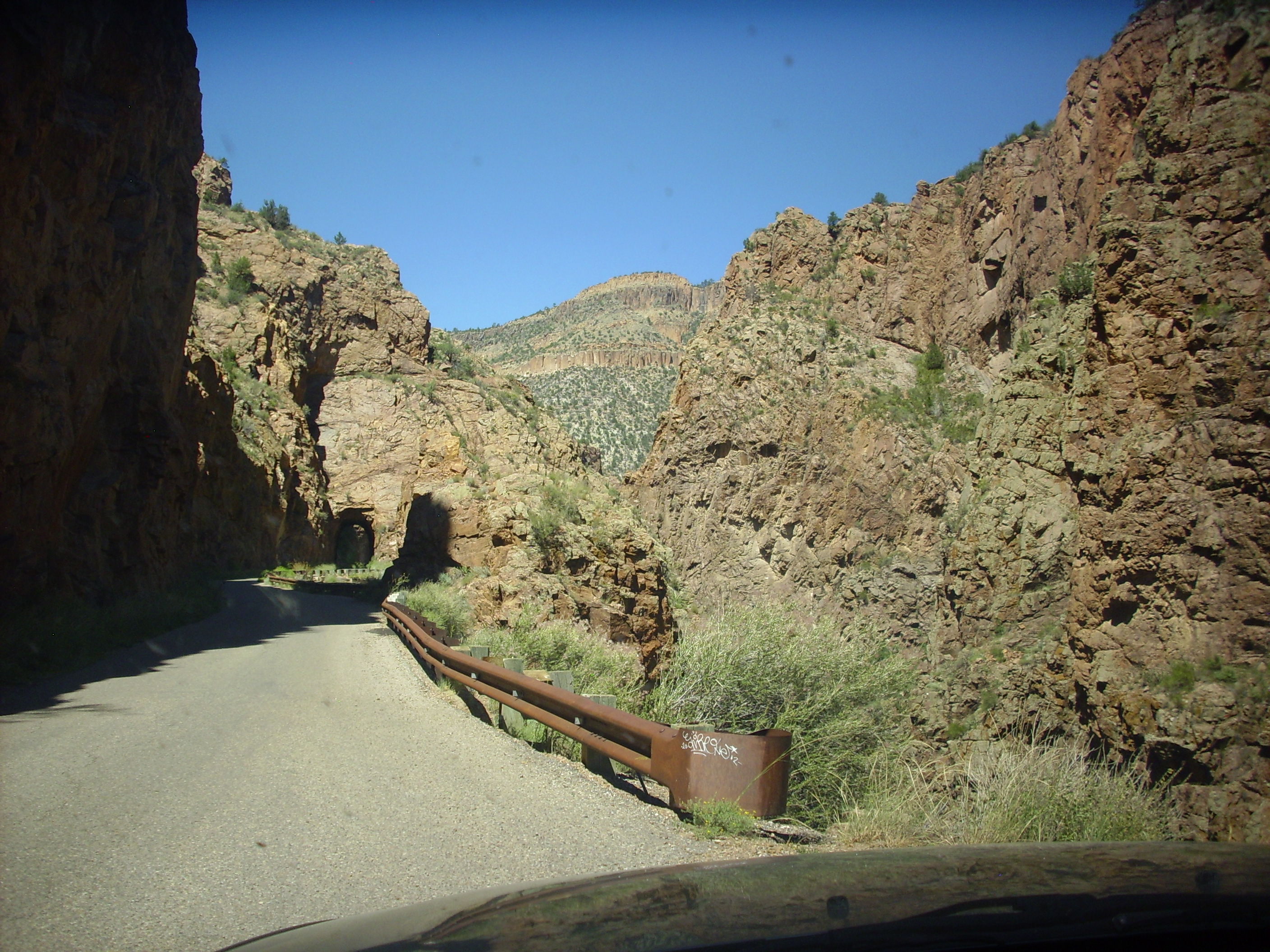
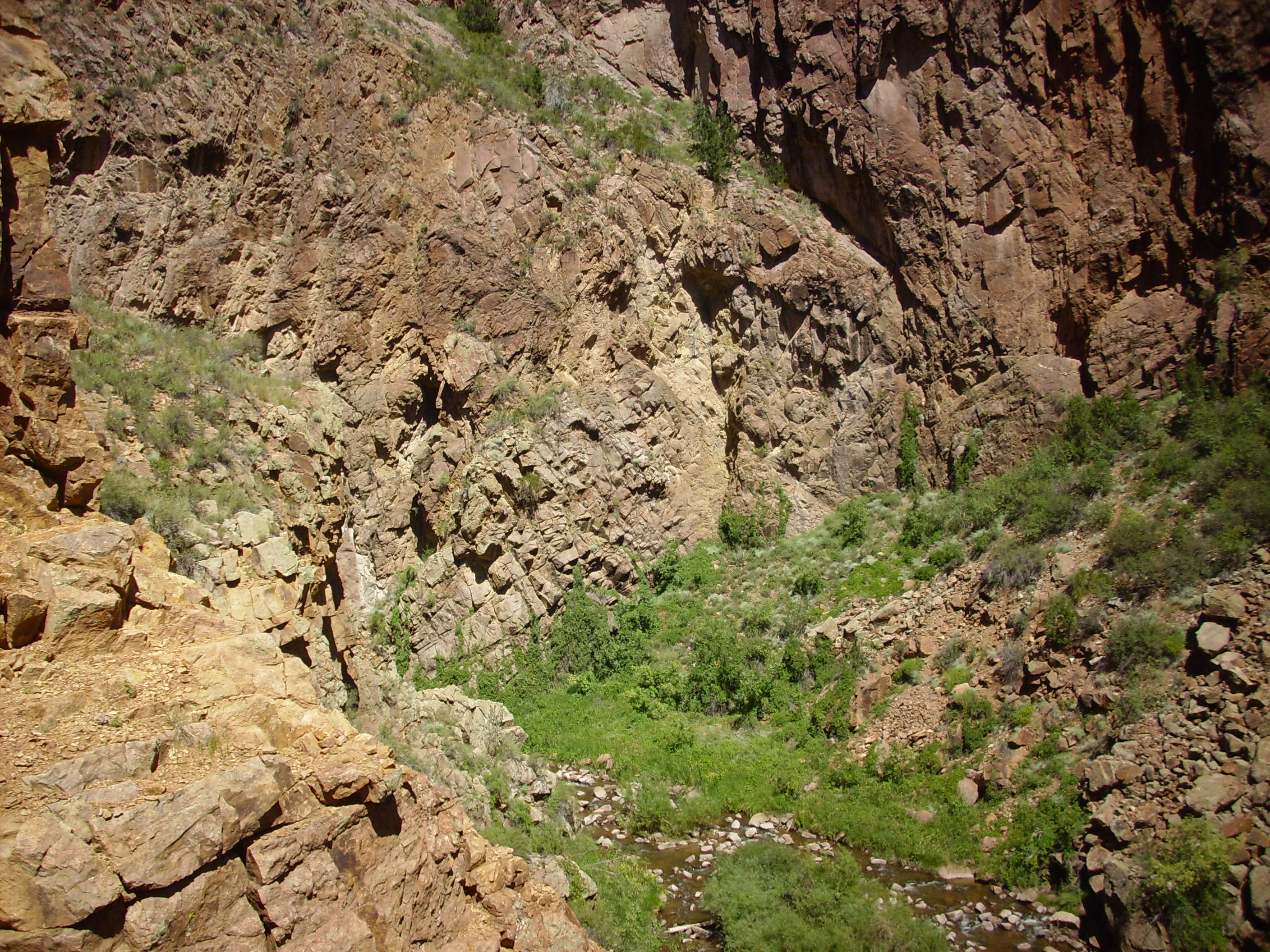
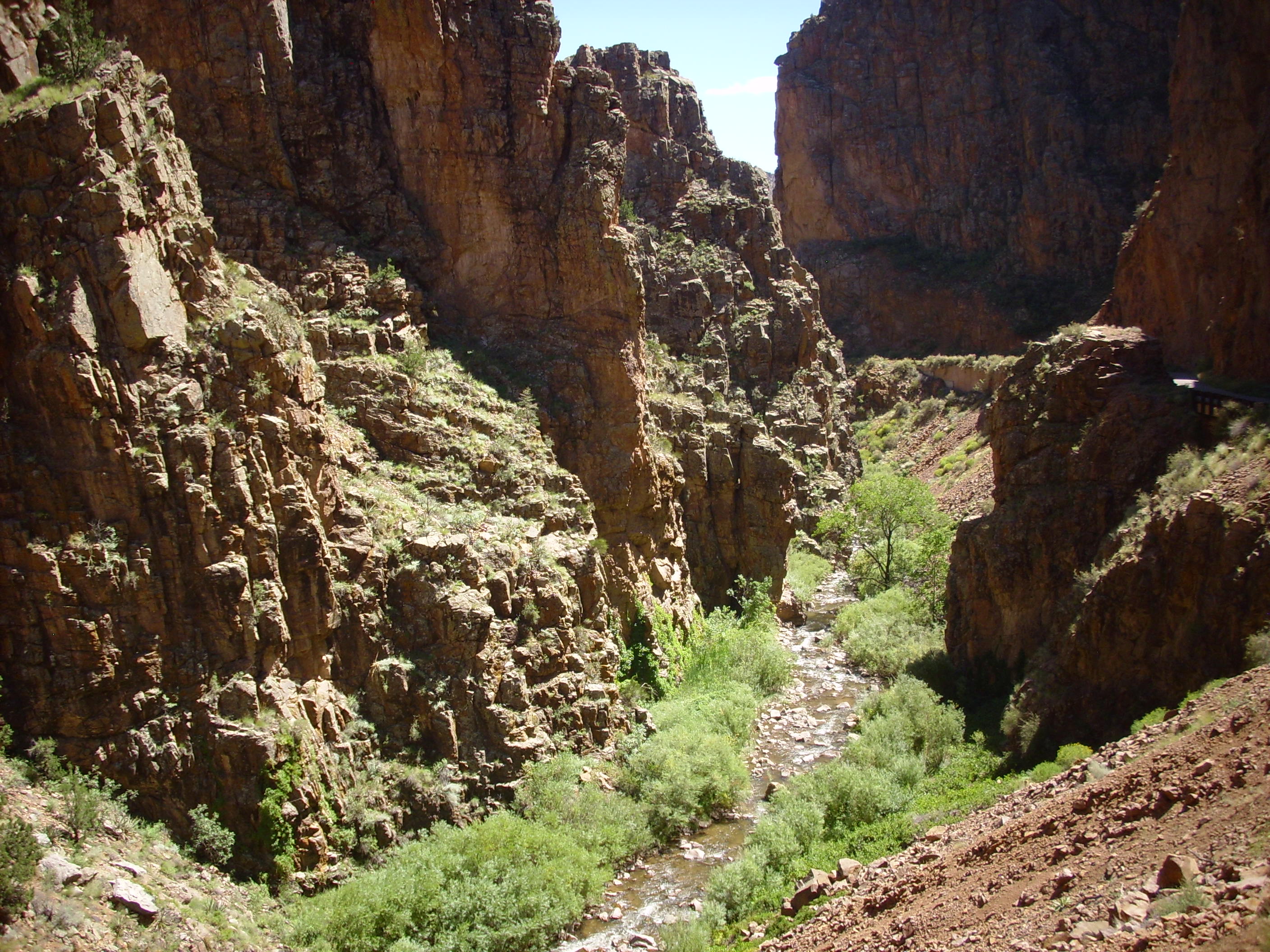
Guadalupe Box. Photos from an earlier visit.
We were pretty tired from a long day at that point and drove back to Los Alamos for Greek food. Yes, they have Greek food in Los Alamos: Greek for the geeks.
Next: Dikes and ghost towns
Copyright ©2014 Kent G. Budge. All rights reserved.