Kent and Bruce Have Another Excellent Adventure, Part 2
Wednesday: Dikes and Ghost Towns
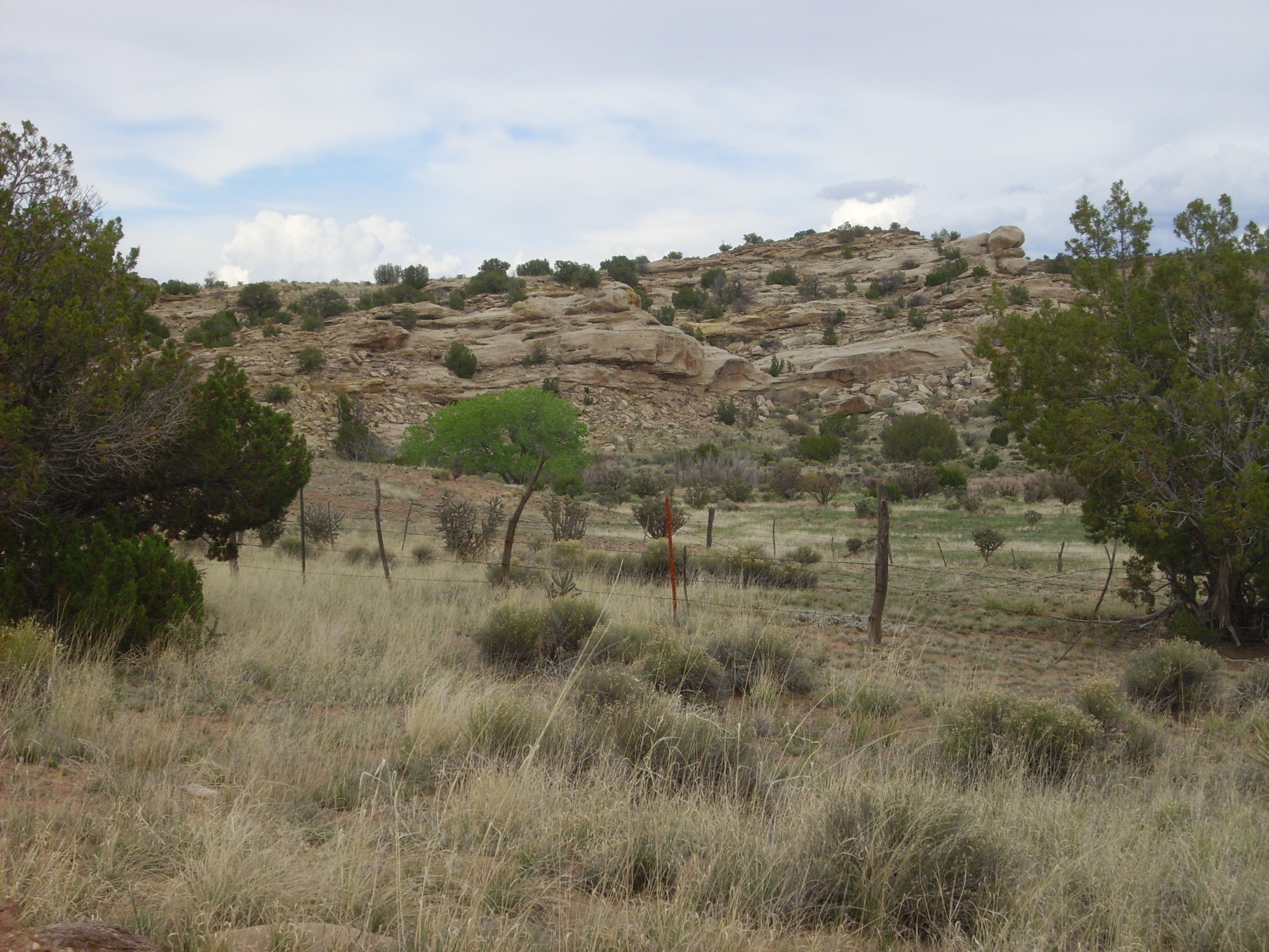
South of Santa Fe has always been kind of a blank spot on my mental map. However, I discovered that there is a fair amount of interesting geology and history in this area, and we had a New Mexico Geological Society road log of the area to follow.
Our route began south of Santa Fe, where we took the I-25 exit to U.S. 285 south. The route here is actually pretty plain; our road log entries for the next few miles amounted to variations on “Gallisteo Formation overlain by Espinaso Formation overlain by Ancha Formation.” These are actually pretty spectacular formations in their best exposures. Alas, those best exposures are nowhere along the road to Lamy.
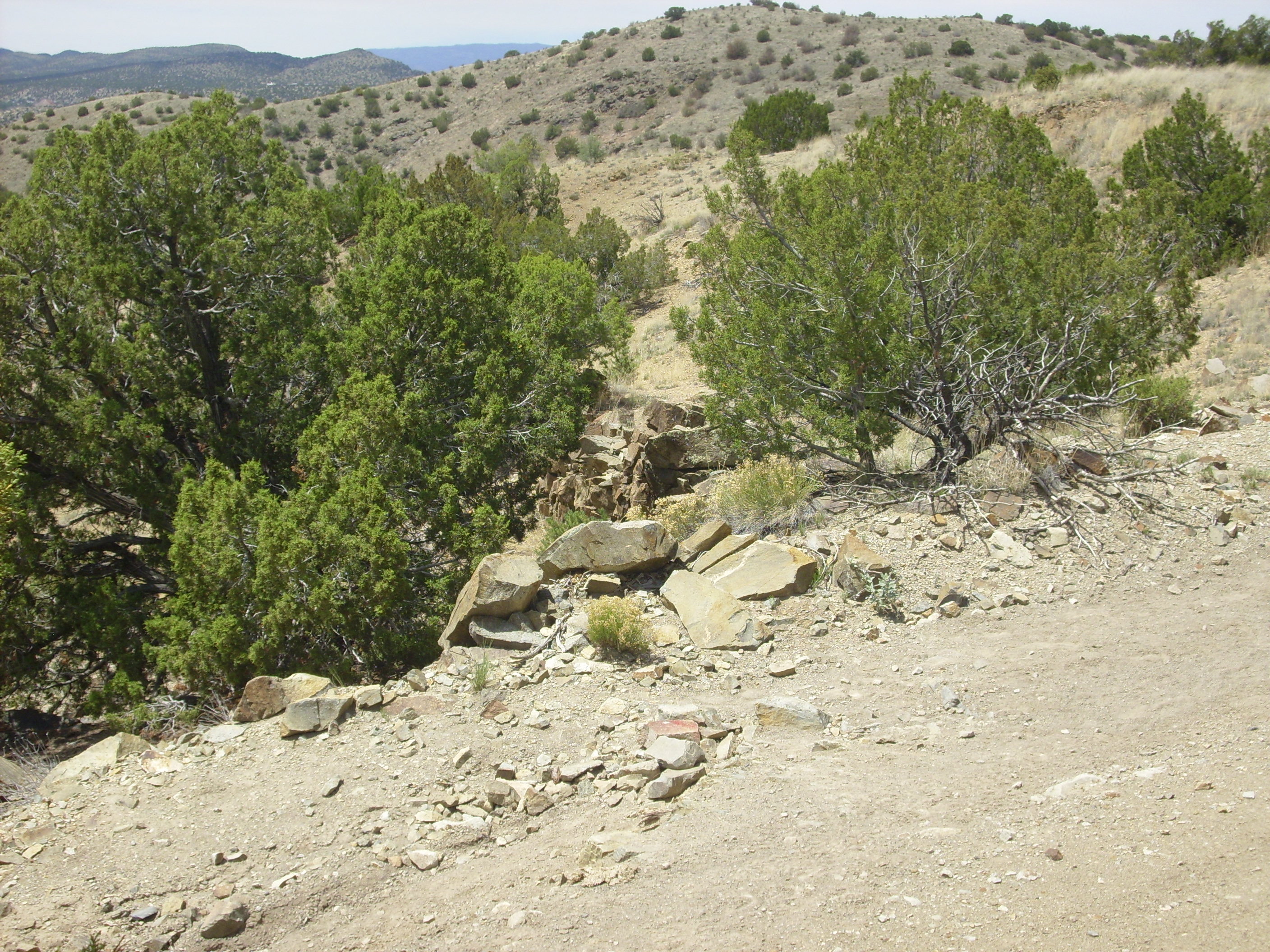
We turned west onto New Mexico 41 here and finally came to something I thought was worth a snapshot.
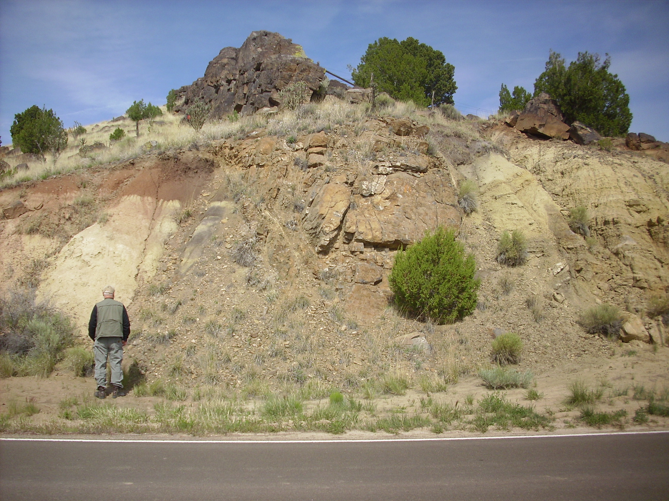
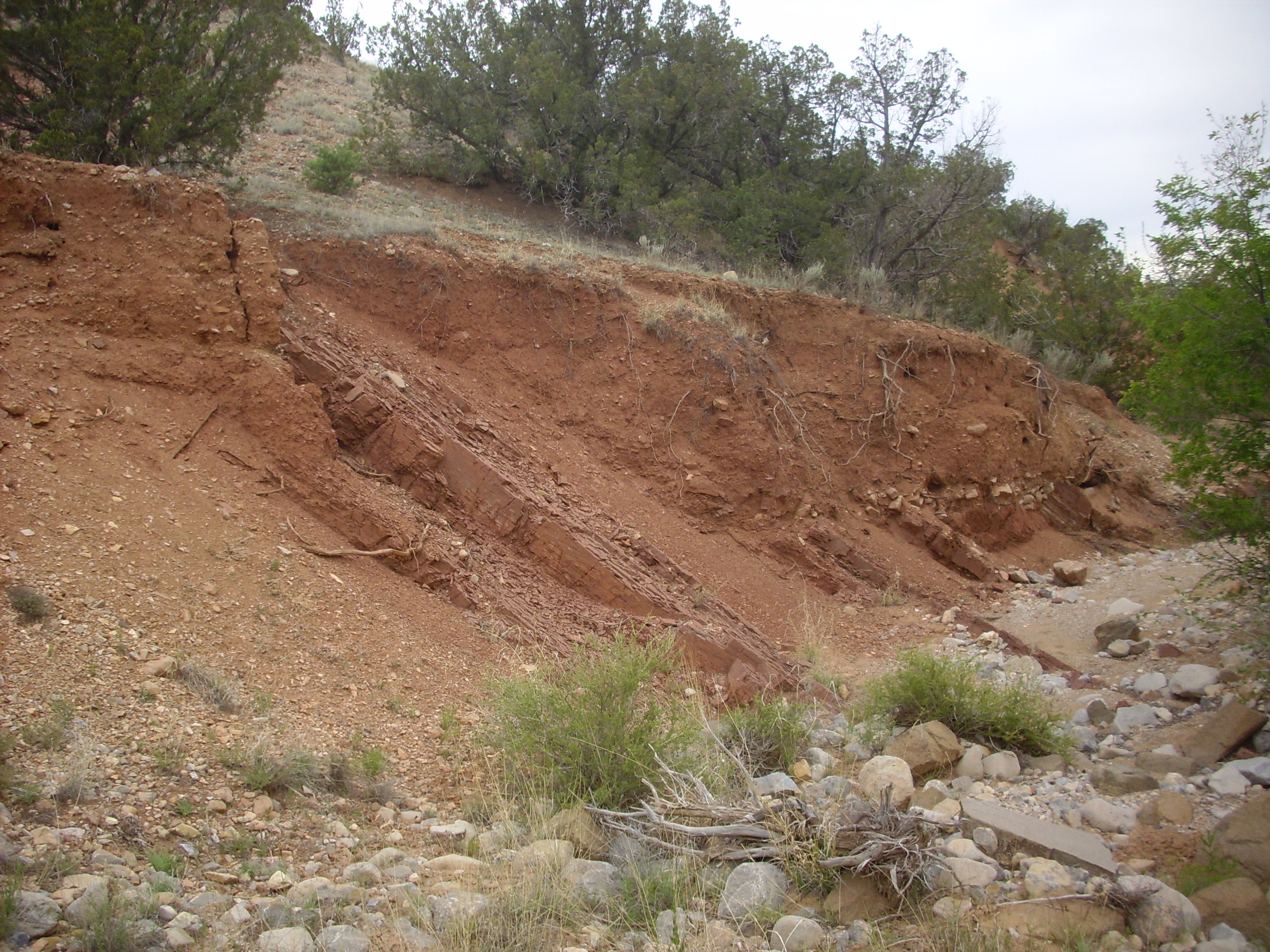
El Creston dike. 35 24.527N 105 56.852W
The road passes close to the east end of one of the segments of the El Creston dike. The dike is a mass of basalt that intruded into the surrounding Gallisteo Formation and cooled and solidified. The basalt is more resistant to erosion than the surrounding sediments, and so it forms the core of a long ridge. There are four segments, almost but not quite in line; each segment is offset very slightly to the right from the next. I don’t have a geological age for this formation, but it must be quite old. It can’t be older than the Gallisteo Formation it intrudes, but the Gallisteo Formation itself is poorly dated; between 50 to 30 million years old is about the best we can do.
The Gallisteo Formation is rather drab here; in many locations, such as along I-25 at the Cochiti exit, it takes the form of spectacular red sandstone beds. It was formed by rivers and streams in a basin south and west of the Pajarito Uplift, an area of high terrain between the present locations of Los Alamos, Santa Fe, and Espanola that was thrown back down to form the Espanola Basin when the Rio Grande Rift began opening 30 million years ago. Such an environment is not particularly good for preserving fossils, and there are few in the Gallisteo Formation with which to date it.
The basalt in the dike showed some cooling joints that appear to have been filled in with white mineral.
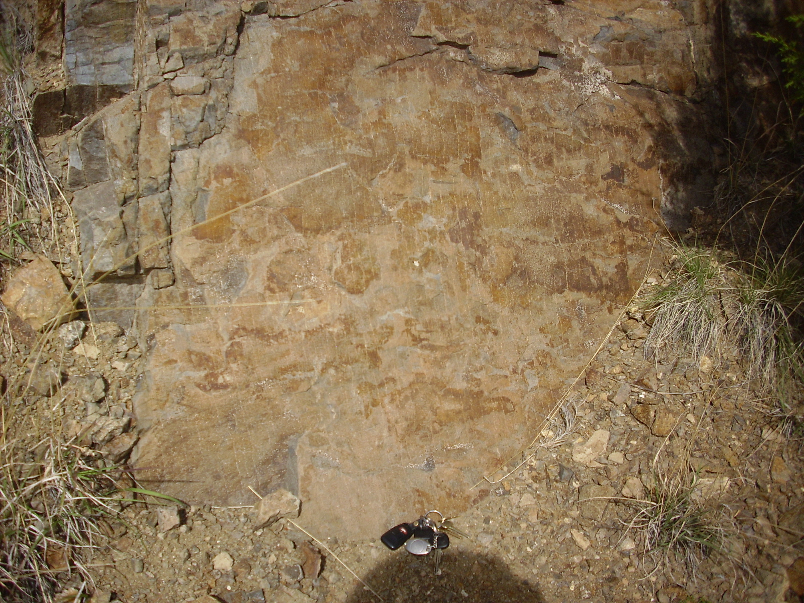
El Creston jointing. 35 24.527N 105 56.852W
The basalt has parallel thin lines across it; click to enlarge if you’re having trouble seeing them. These are parallel to the sides of the dike and evenly spaced, suggesting they are a cooling feature. A drop of acid shows no foaming, so it’s not calcite. Under the loupe, it resembles the plagioclase feldspar present in the surrounding black rock, just concentrated in the zone. Well, go figure.
El Creston is an igneous dike. A few miles down the road, after turning onto County Road 42 at Gallisteo and south on New Mexico 14 here, we reach an area called “Garden of the Gods”, where there are numerous prominent sedimentary dikes.

Garden of the Gods. 35 26.504N 106 4.786W
Well, probably not. A true sedimentary dike is formed by a fault that cuts across the sedimentary beds and provides a path for groundwater to bring in minerals. These cement the pulverized rock in the fault zone so that it become highly resistant to erosion. The “dikes” here are actually beds that were once horizontal, but have been tilted nearly vertical by the volcanism in the nearby Cerrillos Hills. These particular beds belong to the Gallisteo Formation.
Across the road, we see horizontal beds of the Ancha Formation laid down on the nearly vertical beds of the Gallisteo, a spectacular example of an angular unconformity.
Angular unconformity. Looking northeast from 35 26.504N 106 4.786W
You can see that nearly vertical Gallisteo beds past left and right of the hill, but there is a prominent horizontal bed in the hill itself. The Gallisteo beds were first tilted by volcanic activity, then eroded down; then renewed deposition of sediments formed the Ancha Formation, which is now being eroded down in turn due to continuing regional uplift.
Heading west, we soon see the first of the intrusions that were responsible for tilting the Gallisteo beds.
Monzonite intrusion. Near 35 26.143N 106 6.466W
The surrounding sedimentary rock is the Mancos Shale. This is a Cretaceous formation deposited in an inland sea between 95 and 80 million years ago. It is also, I regret to say, about the most boring rock formation imaginable. It contains few fossils. It rapidly weathers in exposures to a nondescript brown mud. Areas underlain by Mancos Shale tend to quickly erode into low relief, sparsely vegetated terrain.
The intrusions of are monzonite, a rock containing little quartz and roughly equal quantities of plagioclase and alkali feldspar. It is the primary rock type of the Ortiz porphyry belt, a zone of intrusive igneous rock that includes most of the mountains and hills stretching from east of the Sandia Mountains to La Cienega southwest of Santa Fe.
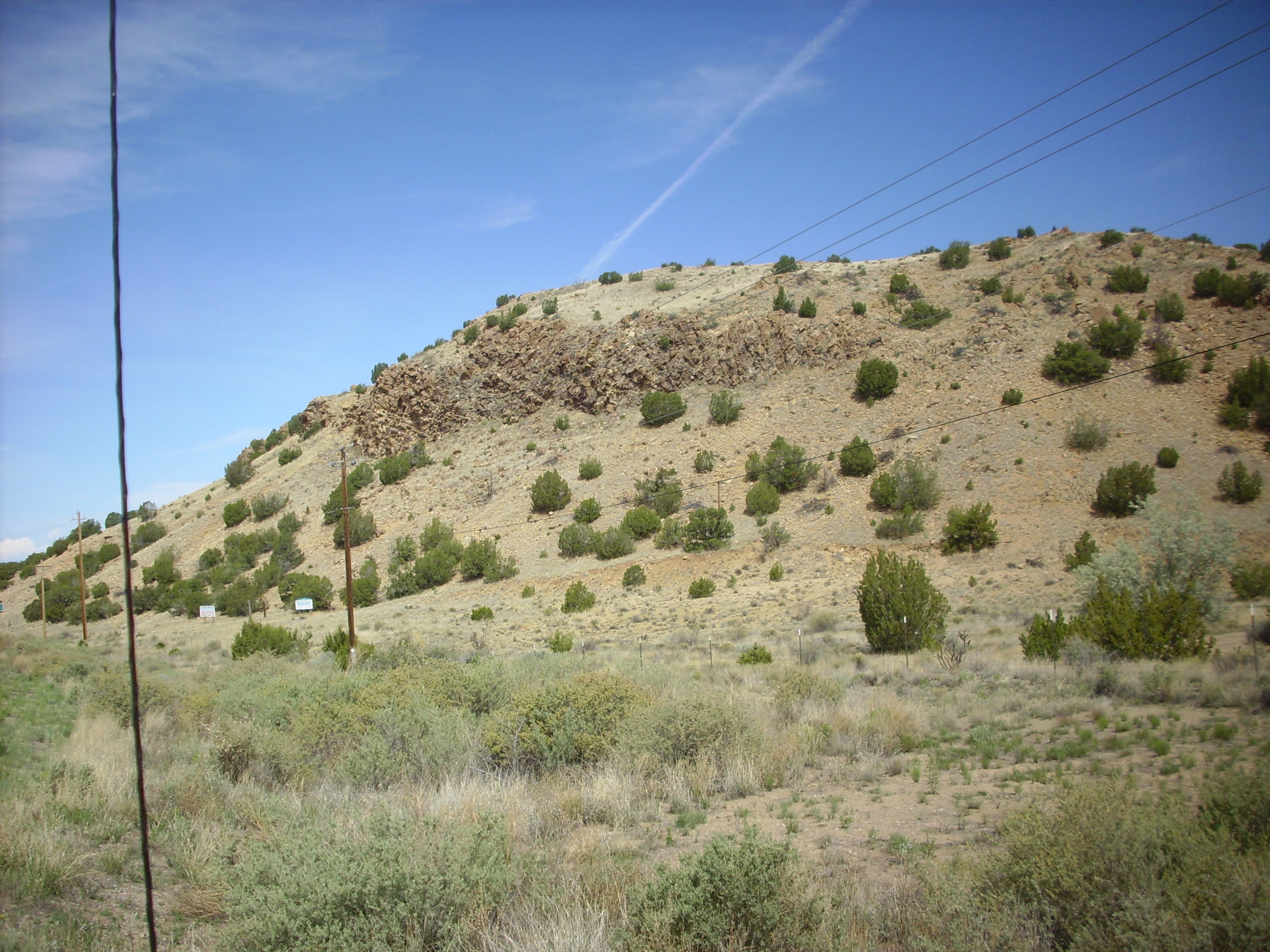
Further down the road, we turned off NM14 into the little town of Cerrillos. Here we found the headquarters for Cerrillos Hills State Park. There was a ranger on duty who told us a little about the park, which was not actually on our (rather old) road log. The headquarters had rock samples and books, including some for sale, and the ranger let us know that there was a little private museum with more of the same.
From there we headed in the Cerrillos Hills themselves. Entry fee was modest; a couple of dollars or so. We parked just south of the Jane Calvin Sanchez Trail trailhead, got out our walking sticks, and set forth.
The Cerrillos Hills are underlain by a monzonite stock, formed when a body of magma solidified underground. As the magma crystallized, it “sweated” large quantities of fluids rich in incompatible elements — elements that do not easily become part of common silicate minerals such as feldspars. These include copper, lead, and precious metals. Some of the copper infiltrated the adjacent sedimentary rock and combined with phosphate to form veins of turquoise, which have been mined in the hills since prehistoric times. I picked up a sample later at the rock shop.
Significant deposits of other metal ores surround the central monzonite stock. These have been mined by Europeans since the time of the Spanish colonists.
The trail begins with a trail guide at what turns out to be the largest spring the the hills.
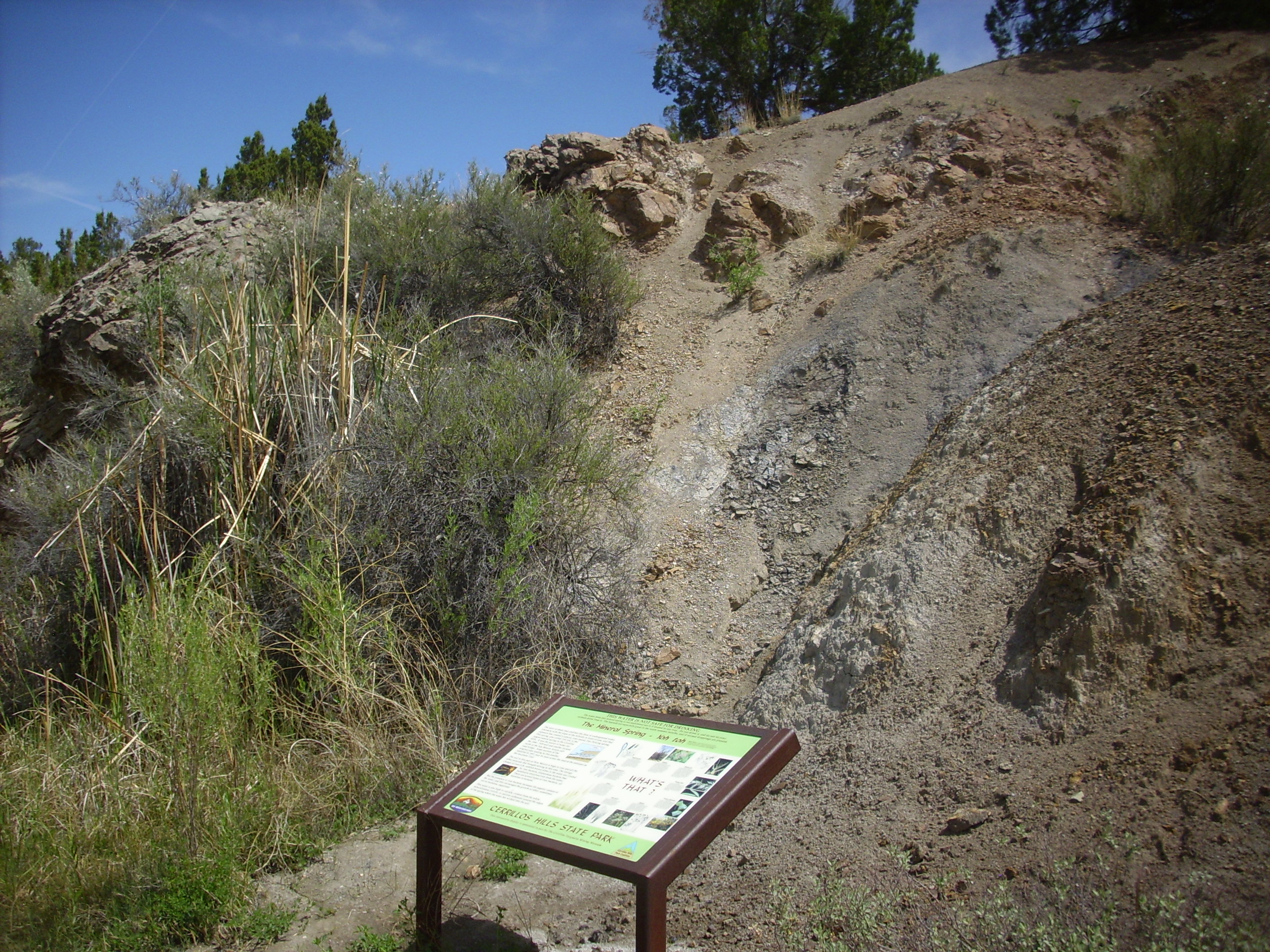
Trail head. 35 27.147N 106 7.345W
The spring is the vegetated area to the left. To the right is Mancos Shale, of which we will see some excellent outcroppings further down the trail. The rocks on the crest of this small hill are monzonite.
We started up the trail. Soon we got to an outcrop of monzonite handy for close perusal.
Monzonite. 35 27.130N 106 7.284W
Here’s a sample showing a newly fracture surface. (Catch and release; we’re on a state park.)

Monzonite. 35 27.130N 106 7.284W
The rock consists of white phenocrysts, probably alkali feldspar in a gray matrix that is probably a mixture of plagioclase and pyroxenes. This rock strongly resembles a decorative rock used around Los Alamos that I have been very curious about, since it’s nothing I’ve heard of in that area. The same rock is used as trail marker here in the park, though the groundsman we encountered told us it wasn’t from the park. We inquired back at the headquarters on our way out and learned that it’s mined in Waldo Canyon; perhaps here.
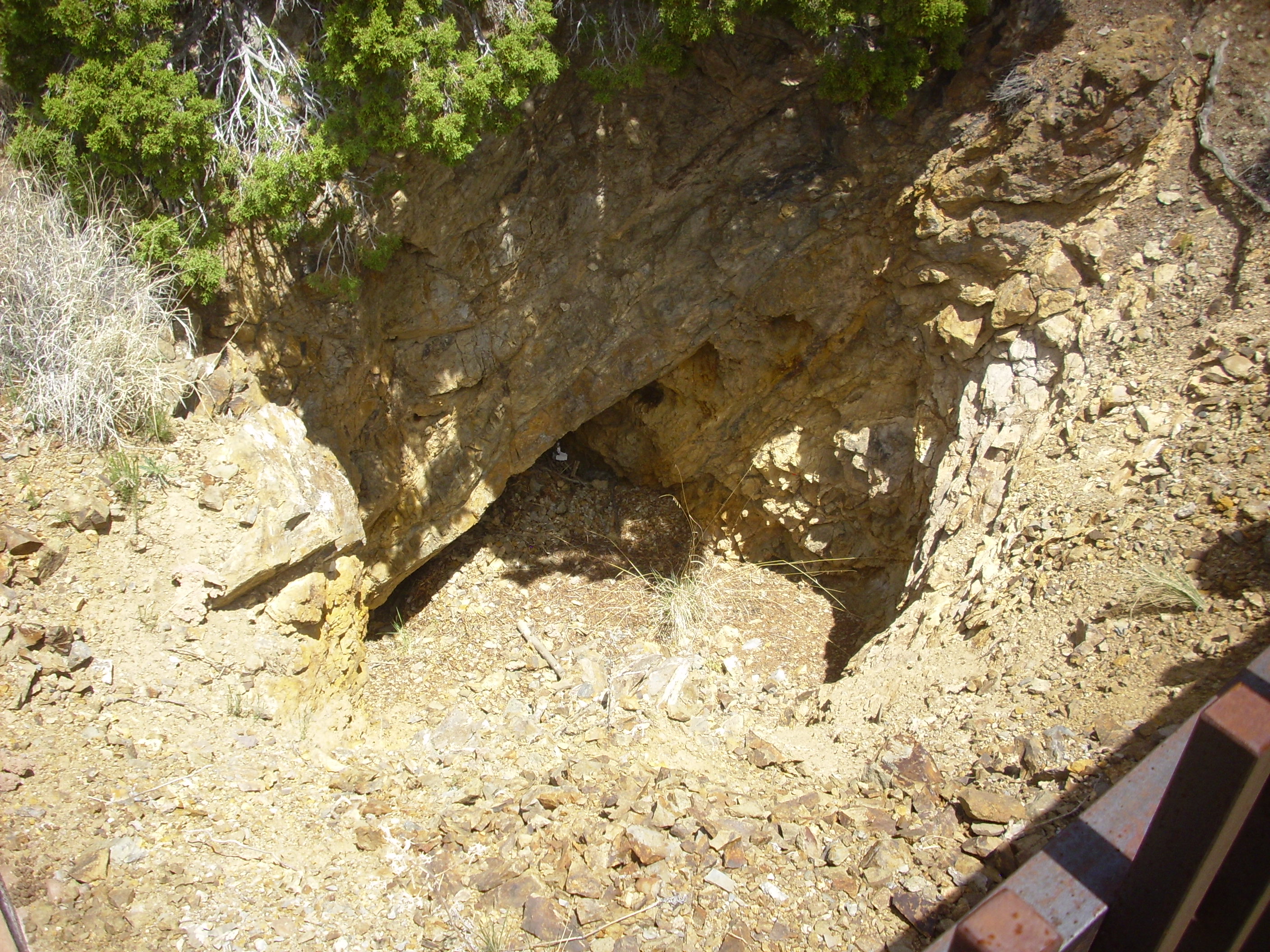
The trail passes several old mines. These are located in the richest part of the district, which is the area around the edges of the central monzonite stock where monzonite dikes rich in incompatible elements have intruded into the surrounding rock. However, the first mine on the trail is, of all things, an iron mine.

Iron mine works at Cerrillos Hills. 35 27.092N 106 7.226W
Iron is not normally considered an incompatible element. My guess is that conditions here were unusually favorable for iron to be deposited as hematite, a particularly easily smelted form of iron ore.
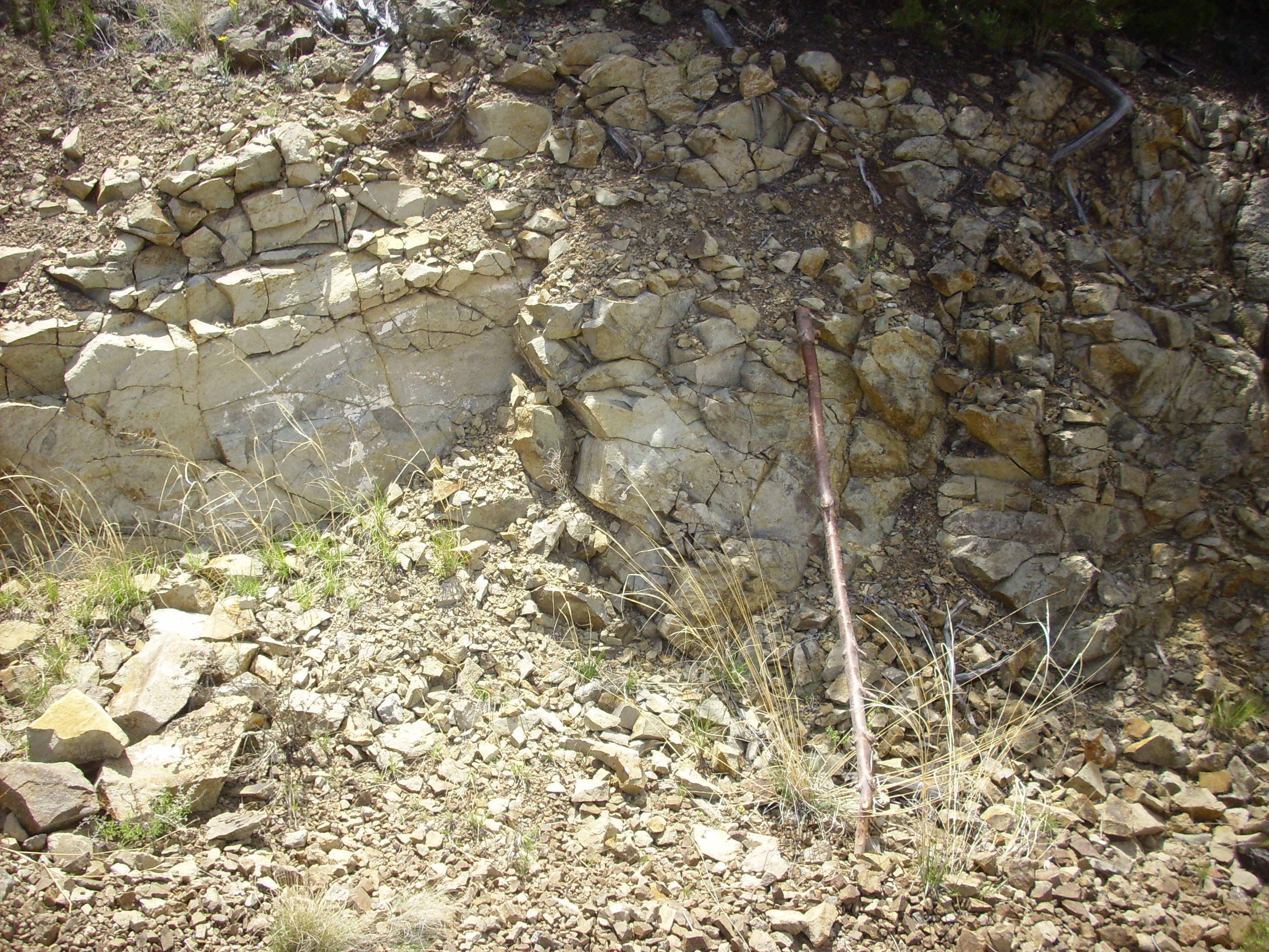
Just down the trail, we saw contrasting rock layers. There’s a white dike of relatively iron-poor rock crossing the trail.

Iron-poor dike in trail. 35 27.092N 106 7.226W
For scale, I’ve put down my walking stick, which is just over five feet high. But just beyond this, and seemingly lined up with the mine works, is very dark rock that looks like it would contain a lot of iron.
The contrast is seen even more clearly in the hillside south of the mine works.
Iron-rich and iron-poor beds in hill. Looking west from 35 27.003N 106 7.222W
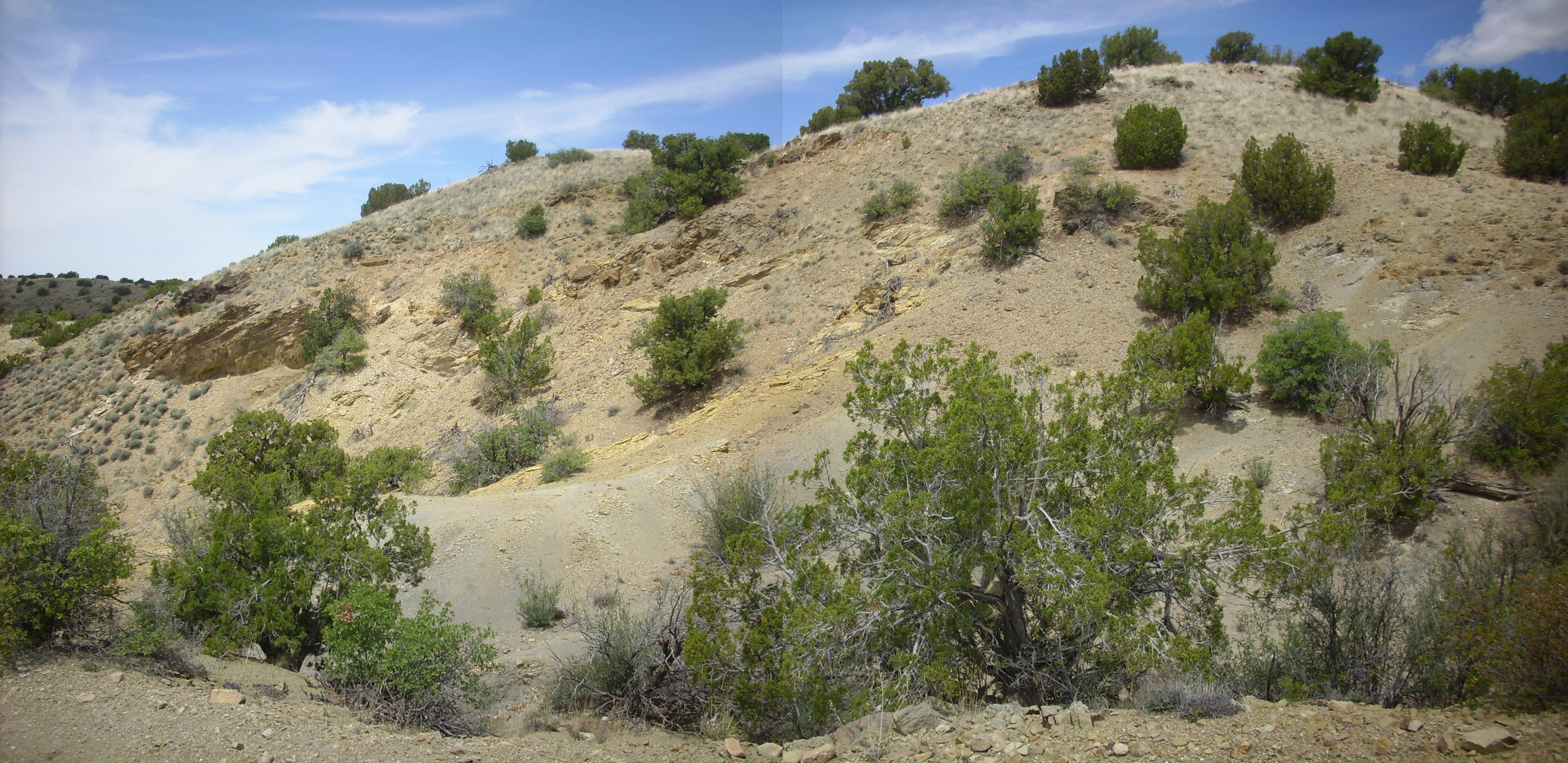
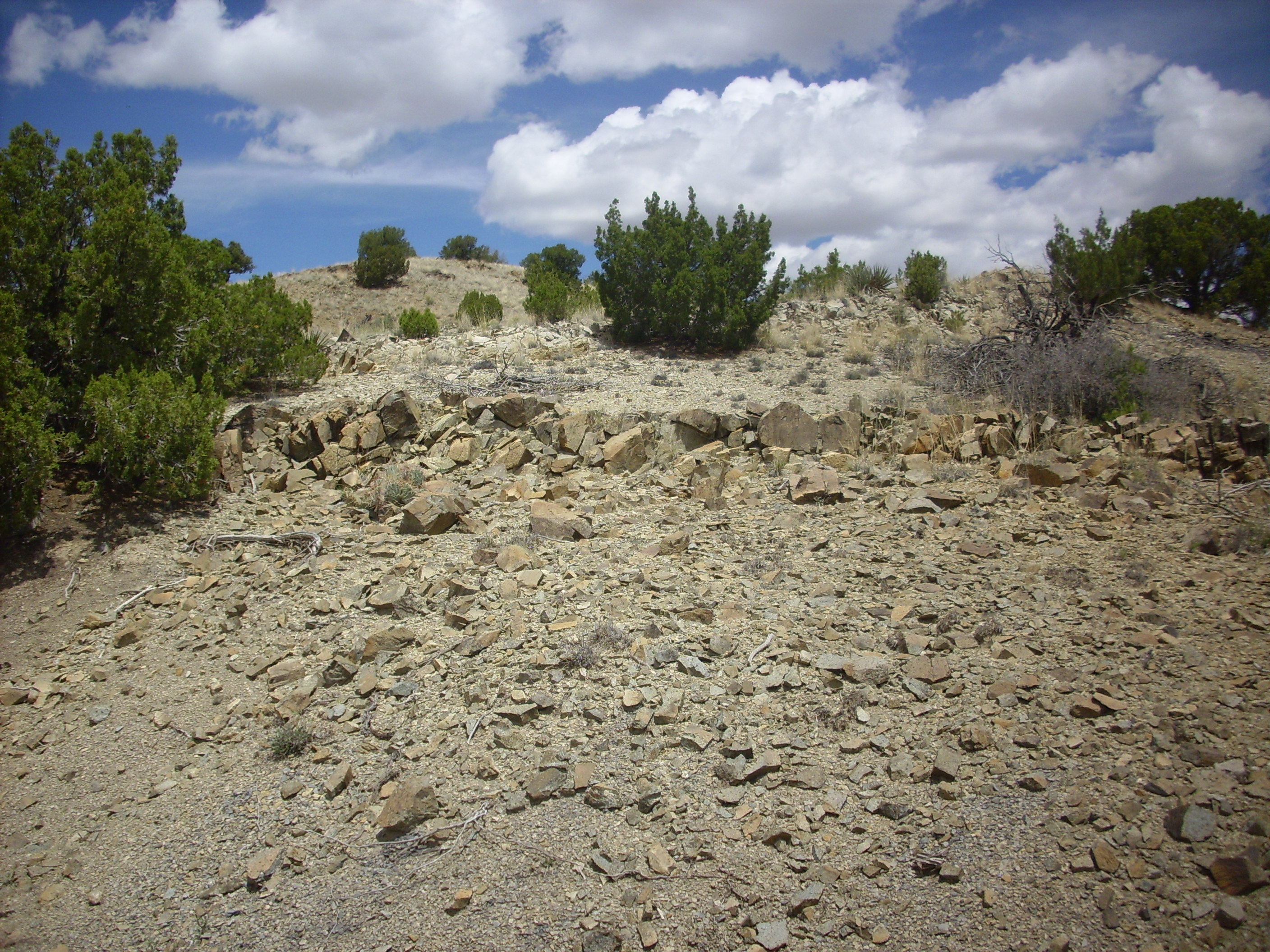
Further down the trail, we reached a feature that we had to look at twice before deciding it was natural, rather than a man made retaining wall:
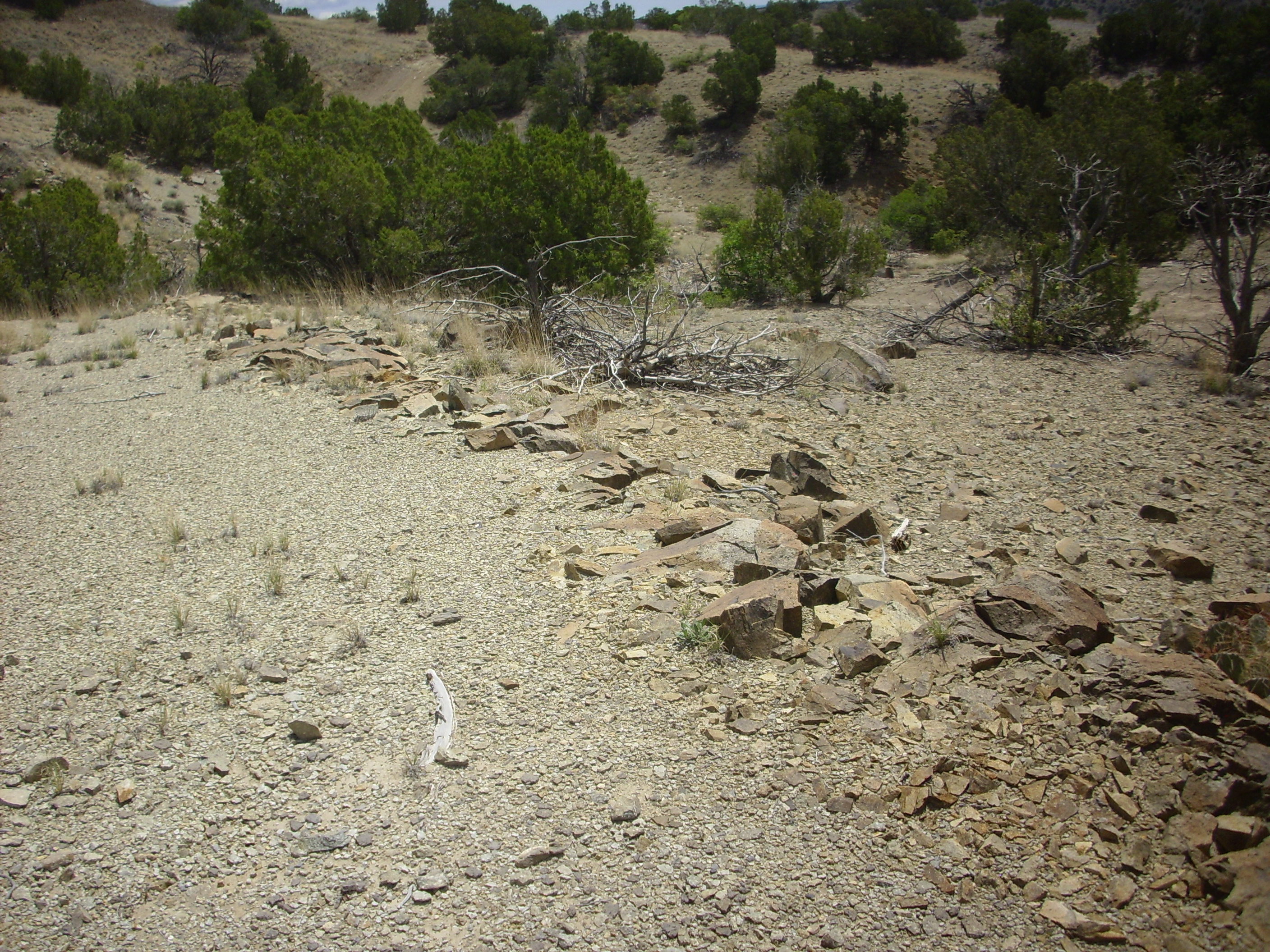
Nature’s retaining wall. 35 26.985N 106 7.224W
The rock looks like this.
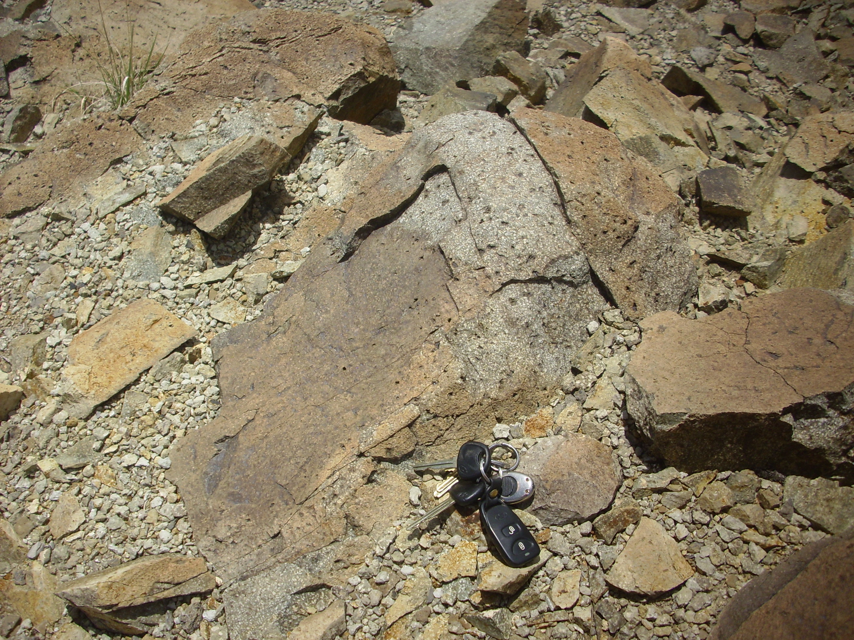
Syenite? 35 26.985N 106 7.224W
My notes identify this rock as syenite, but I can’t recall entirely what I based that on. Perhaps location, since we’re on the outer fringes of the monzonite stock, and the local geological map shows a zone of syenite intrusions here. The map I have doesn’t give precise coordinates — it is in a geological paper and is meant to show the structure, not to guide the tourist — so it’s hard to correlate the two.
Regardless. Syenite is similar to monzonite in being an intrusive rock with moderate silica content. It differs in that most of its feldspar is alkali feldspar rather than plagioclase.
The pits on the weathered surfaces are likely where phenocrysts of a particularly unstable mineral have weathered away. I didn’t think to look for an unfractured surface so I could try to see what mineral it was. Both feldspathoids and olivine occur in the more silica-poor grades of syenite and both are unstable under atmospheric conditions, but I really don’t know.
Or maybe the pits are just gas bubbles.
Here’s a view looking back at the natural retaining wall, which also shows a dike of much lighter rock behind it.
Dikes. 35 26.985N 106 7.224W
We came next to an old lead mine.
Lead mine. 35 27.004N 106 7.155W
Lead is an incompatible element that tends to mix with other incompatible elements and with sulfur to form a sulphide melt. This does not mix with ordinary silicate magma, just as oil does not mix with vinegar, and when the silicate magma crystallizes, the sulphide melt tends to segregate out as veins in the surrounding rocks to form sulphide minerals. These are the classic ores of most such elements. The ore here would have been galena.
The final mine on this trail was a manganese mine.
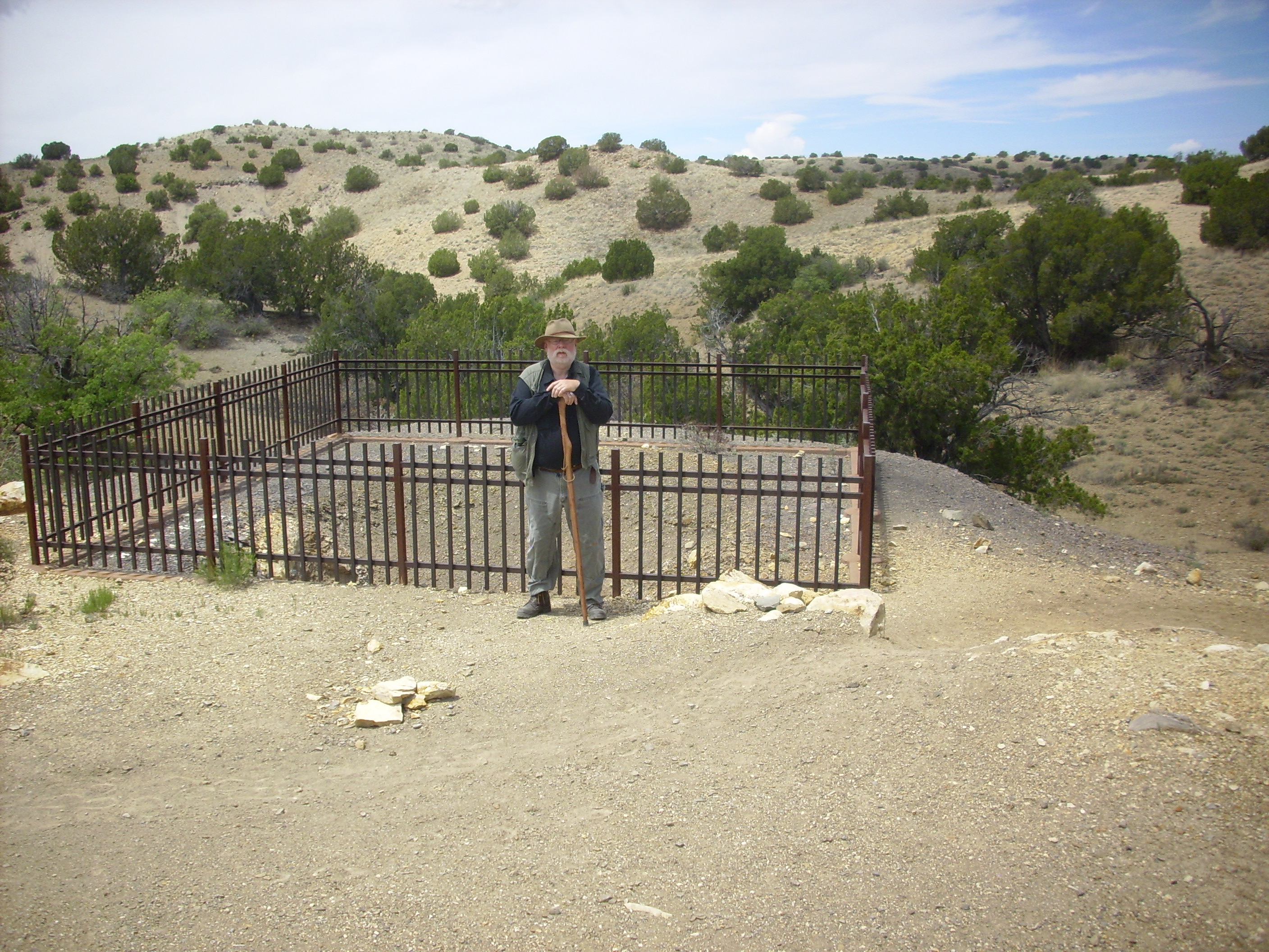
Manganese mine. 35 26.891N 106 7.147W
Bruce suggests the dark purple color of the tailings is typical of manganese. Manganese ore tends to be mixed with iron ore, because of the chemical similarities of the two metals, but the manganese is the more valuable metal in ferromanganese (the usual commercial product). It’s used in steel manufacturing to desulfur the steel.
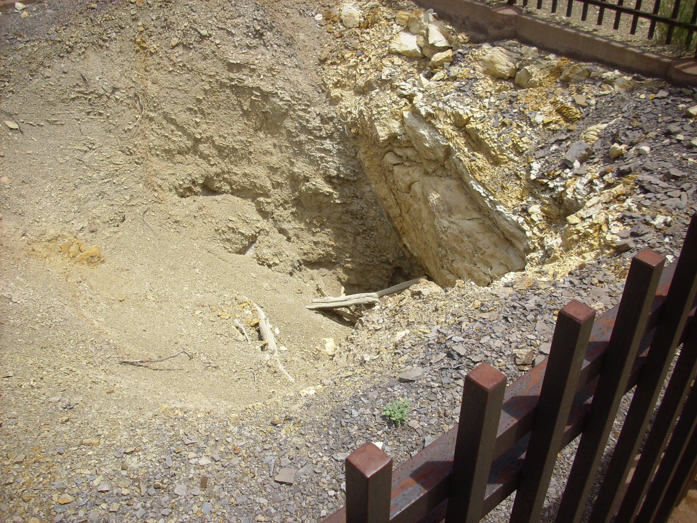
South of this pit along the trail, we cross the dike that this pit was tunneled into.
Dike. 35 26.881N 106 7.153W
This contrasts with the dark Mancos Shale into which the many dikes in this area have intruded, which is also exposed along the trail.
Mancos Shale. 35 26.881N 106 7.153W
Further down the trail, we seem some excellent exposures of Mancos Shale at the sides of the trail.
Mancos Shale. 35 26.881N 106 7.153W
Cindy and her brothers probably find this very familiar-looking, and not necessarily in a happy way. It gets its name from its type location at Mancos, Colorado, and the stuff is all over the place, including the valley outside Pagosa Springs where Cindy’s father has owned a time share on a cabin for decades. Cindy et al. probably skinned a few knees as youngsters on vacation by trying to scramble up slopes of this stuff. It is slippery and crumbly and just made to send you tumbling when you try to walk across it.
And, as I mentioned earlier, exposures tend to weather to nondescript piles of mud in geologically short intervals of time, so it isn’t usually even much to look at.
No, I haven’t got it in for the Mancos Shale. Except maybe that the most boring part of the drive from Los Alamos to central Utah, which our family made at least annually from the time we were kids clear through college, was the stretch between Green River and Price that passed over miles and miles of nondescript muddy Mancos Shale. Yes, it’s clear up to Central Utah, too. It was a big continental sea.
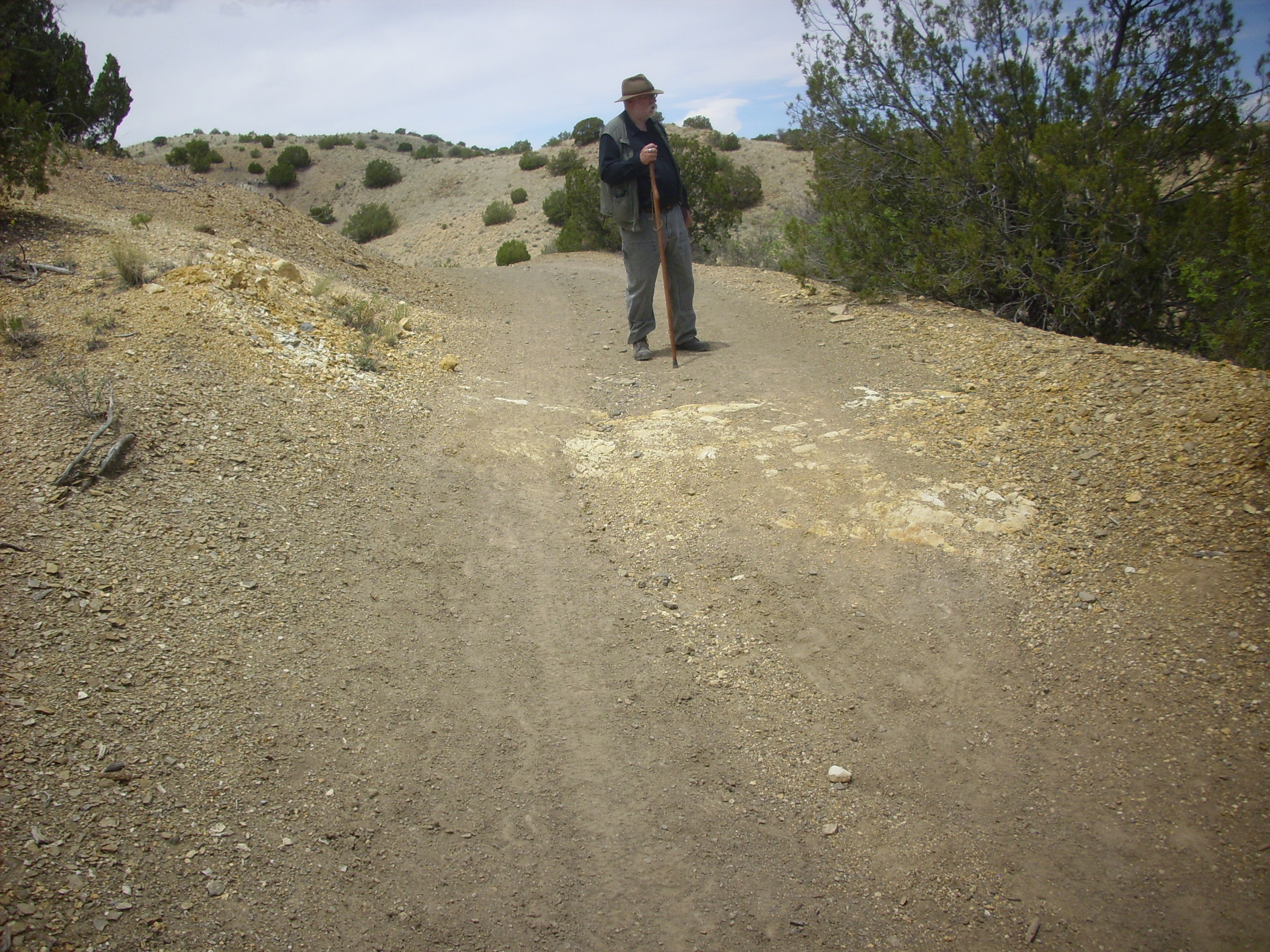
With that, our trail came back out on the main road and we walked back up to the car. We checked in again at the headquarters at Cerrillos to ask a couple of questions (for which they had good answers — good for them) and then to the local private museum. This was one of those small-town museums that charge a few quatloos for some amateurish collections that nonetheless almost always prove worth the time and money — their eccentricities actually lend them considerable charm. We did skip the petting zoo on this one, though, since both Bruce and I have seen goats and doves before. But the rocks for sale were extensive and fascinating, and I finally coughed up for a nice little display piece of turquoise.
Turquoise from Blue Bell Mine. Near 35 28.219N 106 6.751W
Not a gem quality sample, but good enough for my collection. The turquoise here is a thin veneer on a piece of sandstone, not unusual for this mineral. Gem quality turquoise comes from thicker veins and pockets in sedimentary rock near igneous intrusions.
Outside the museum, there was a nice view of some nearby geology. This feature is known as the Devil’s Throne.

Devil’s Throne. 35 28.219N 106 6.751W
We didn’t get close to investigate, but it looks like there is monzonite at the right and steeply tilting sedimentary beds, pushed up by the monzonite intrusion, to the left.
We proceeded to Madrid and at lunch at The Hollar, which specializes in gourmet hamburgers. Madrid is a former coal mining town that has now been thoroughly gentrified.
Still, the old mine works and tailings are visible just outside town.
Madrid coal works. 35 24.231N 106 9.324W
Coal was mined here from the Mesa Verde formation for use by the Atchison, Topeka, and Santa Fa railroad. You can see igneous rocks at the top of the hills. One of the challanges of coal mining in this area is the large number of igneous sills and dikes in the area related to the opening of the Rio Grande Rift and formation of Ortiz porpyry belt.
We continued south on State Road 14 towards the Sandia Mountains, looking for a turn to the west into back country described in our road log. It took a couple of tries to find the turn, since navigational features (in particular, a business right at the turnoff) have changed over the years, and the business at the turnoff has not only closed but been torn down. We did finally find the turnoff to Puertocito Road.
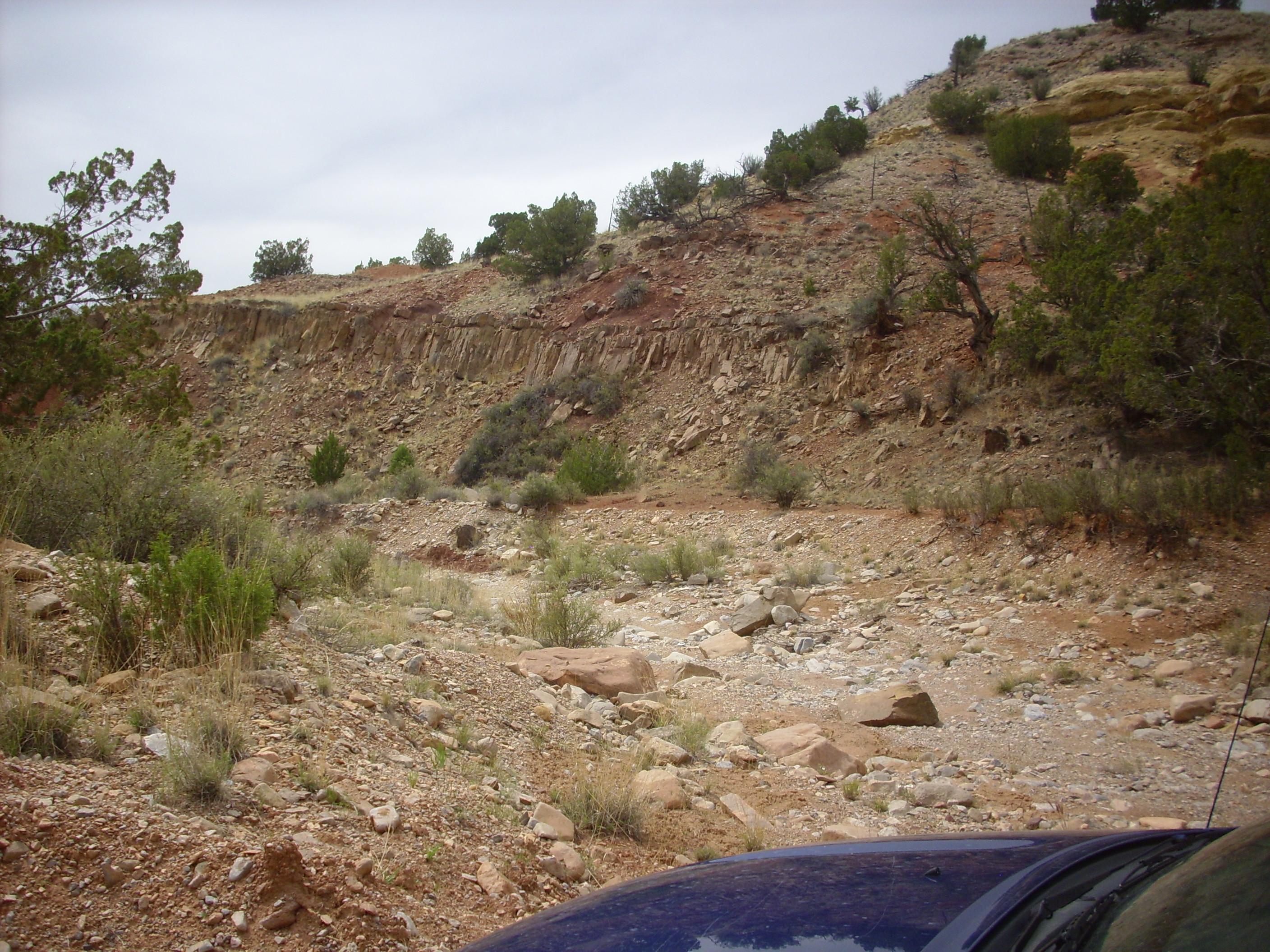
The road crosses fairly nondescript terrain for some distance before descending into an arroyo leading to the settlement of Puertocito. Here we were treated to the sight of a sill intruding the Triassic Chinle Formation.

Sill intruding Chinle Formation. 35 16.503N 106 16.969W
The sill is the brown rock at the top of the hill fractured into vertical columns. These are what geologists call cooling columns, caused when the rock continues to cool after it has solidified, contracts, and fractures from the stresses caused by uneven contraction.
For the nongeologist: A dike is a sheet of igneous rock formed when magma penetrates rock along a fracture that cuts across the existing rock beds. A sill is a sheet of igneous rock formed when magma penetrates between existing rock beds, so that is is more or less aligned with them.
For most geologists in the American Southwest, the name “Chinle” immediately brings to mind red sedimentary beds. In New Mexico, these are typically poorly consolidated; that is, the sediments have not hardened into very hard rock. This is mostly true in this photo; you can see that the sediments are little more than piles of red dirt. However, I spotted some unusually well consolidated Chinle sandstone across the canyon in an arroyo.
Well-consolidated Chinle sandstone. 35 16.503N 106 16.969W
Two things are notable about this. First, as I’ve already mentioned, hard Chinle sandstone is fairly unusual in this area. Second, the beds are dipping rather steeply to the southwest. The beds were almost certainly originally laid down horizontally; their steep dip shows how rock beds in this area have been twisted and tilted by the tectonic forces that produced the Rio Grande Rift.
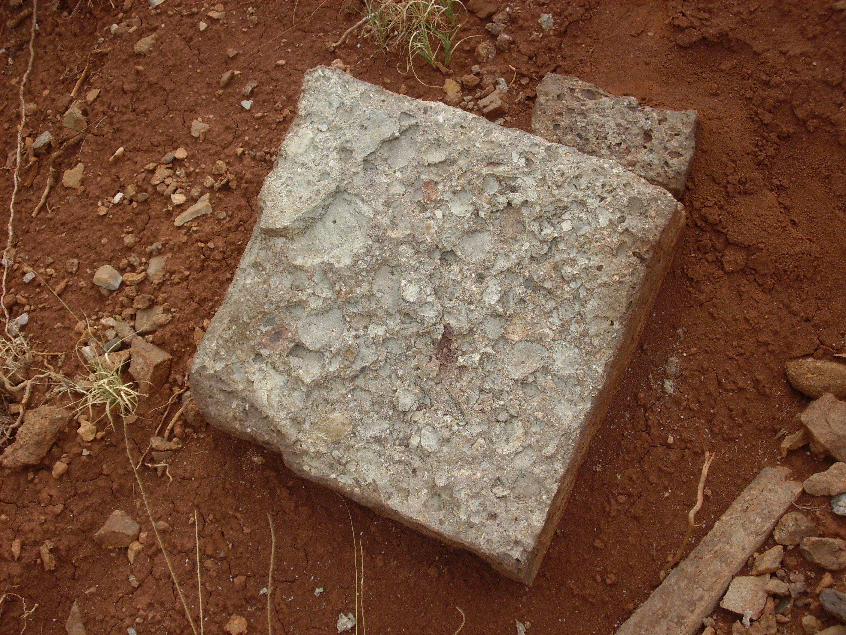
The arroyo at the base of this photograph is full of a variety of rocks from all around the area. One in particular caught my interest: it looked like a chunk of granite, but on closer inspection I concluded that I didn’t know what it was, but it wasn’t a common rock type. These photos are my best attempt to do it justice.
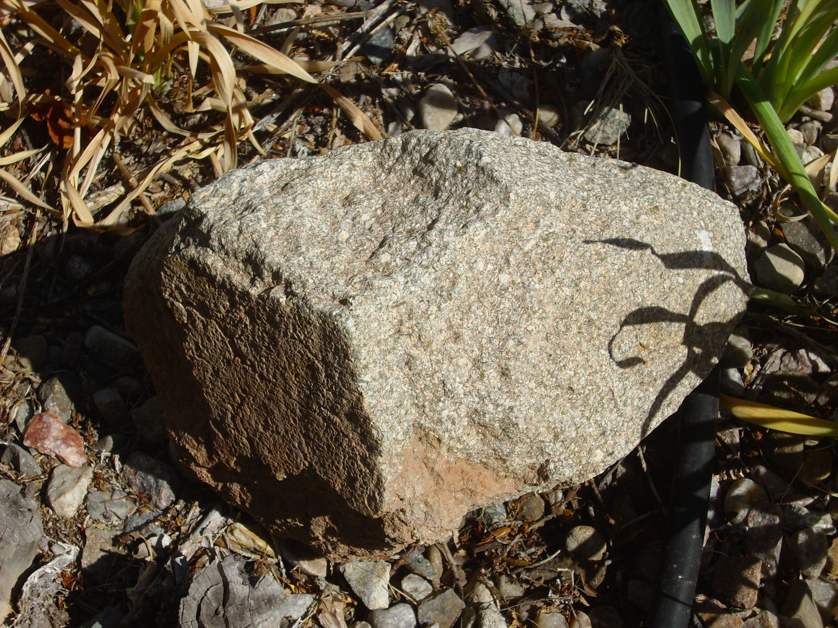
Monzonite? 35 16.503N 106 16.969W
Under the loupe, one sees that about half the rock is pink phenocrysts that look very much like potassium feldspar. The other half is mostly something that looks very much like plagioclase feldspar. The rest is a mixture of long black needly crystals that have to be an amphibole or pyroxene, and rounder coke-bottle-green crystals that certainly look like olivine. No hint of quartz.
That’s a pretty rare combination. But not impossible; I got playing around with some geochemistry programs on my computer, and it’s actually possible for a magma with just the right composition to cool into rock like this. It would be described as a basaltic trachyandesite if it erupted to the surface, but if it cools slowly underground, it becomes a monzonite. So this is probably a monzonite from somewhere in the Ortiz porphyry belt that had unusually low silica that weathered out and was carried into this arroyo.
Of course, I’m largely guessing at the feldspars. I don’t think I’d know a feldspathoid if it clobbered me over the head with a two-by-four, so it’s possible that what I’m taking for feldspar is actually feldspathoid. But probably not; the pink color is so characteristic of potassium feldspar, and this composition of magma is about what you’d look for in a newly opening continental rift.
Cool, huh?
In fact, it was not much further down the road that Bruce suddenly exclaimed, out of the blue: “G-d, this is fun!” I was thinking something similar, though I would have worded it slightly differently.
To each his own.
Just down the canyon from the sill, we came across this.
Jurassic Park. 35 16.504N 106 17.147W
The red Chinle at the bottom is topped by yellow Jurassic Entrada Formation, which is overlain in turn by gray Jurassic Todilto Formation, with a final thin layer of pediment gravel. Pediment gravel: That’s gravel-rich sediment that forms an apron around a mountain range. Most are geologically young; they either erode away, or something buries them and they become consolidated into a conglomerate.
Not looking good for these pediment gravels to achieve conglomeration.
The sill also pokes out again here, more spectacularly.
Sill in Jurassic Park. 35 16.504N 106 17.147W
I got curious enough to climb up the slope and see if this really was a sill rather than a dike. Yeah, it’s a sill. It doesn’t follow a straight like like a dike, but the exposure follows the curved face of the cliff. But I did see this:
A concrete example of Man’s influence. 35 16.504N 106 17.147W
This is, of course, an old concrete block. But here we were seemingly in the middle of nowhere (I didn’t realize that there was a small settlement a quarter mile down the canyon) and halfway up a cliff. It was just not somewhere you expect to see a concrete block, and it was weathered enough to really look like natural conglomerate, except for the nearly square shape…
And here we are, more or less in the settlement of Puertocito.
Puertocito. 35 16.475N 106 17.835W
This is the kind of place of which people say: It’s not the ends of the earth, but you can see them from here. How would you like to grow up somewhere like this?
I’m inclined to think that growing up here would have been a blast. But then I’m a small-town boy at heart.
Note that the Entrada Formation (yellow) pinches out to the left, with Todilto Formation lying directly on top of Chinle Group rocks.
Further down the road, we begin to see Cretaceous rocks.
Cretaceous rocks and sill. Looking north from 35 16.924N 106 19.162W
The mesa is Jurrassic Morrison Formation at the bottom, including the sculpted sandstone beds at the base of the mesa. The rocky cliff halfway up is Cretaceous Dakota Sandstone. The rocky top is another intrusive sill.
We turned right onto La Madera Road here and drove past the mesa. A little further ahead, we came to sandstone beds that my road log describes as distal sandstone of the Dalton-Hosta regressive-transgressive “turn around”. In other words, this is sandstone deposited at the edge of a shallow sea basin at the very point where the sea basin reached its maximum size before retreating again.
Fossilized shoreline of Cretaceous sea. 35 17.569N 106 19.079W
Now, here’s the thing: I think I took this photo at the indicated position. The ground looks right. The location along the road according to the road log looks right. But my geological map has this as Jurassic Morrison Formation, and puts the Cretaceous stuff about a quarter mile further north. Go figure.
A little further down the road, we passed the ghost town of Hagen, which I did not get a picture of. Or it didn’t turn out, or something. I could kick myself. I don’t know when I’ll ever be this way again.
There’s a metaphor for life in there somewhere.
In fact, I took no further pictures on this trip. One reason is that the geology became a bit plainer for awhile, and when it finally got interesting again, we were on the San Felipe Pueblo lands. And the sign at the gate told us to do nothing but proceed along the road — no hiking, no leaving the roadway, and, interestingly, no taking pictures.
My guess? We spotted some petroglyphs along the road. They’re probably considered sacred. But then it may be simply a matter of wanting privacy. As Bruce pointed out, how would I react if a native American came wandering through my back yard taking pictures?
Actually, my back yard includes an arroyo with a hiking trail in it that kids hike on all the time, and for all I know they take pictures. But I do see his point.
Anyway, Hagen is an old railroad town that was abandoned by 1930. Further down the road is Coyote, another ghost town. Right around here we cross into tribal land, and no more photos. Didn’t notice this from the road, which certainly looks like a quarry of some kind. The map shows this as Todilto Formation, so it’s probably a gypsum quarry.
From there to I-25 and back to Los Alamos. We did stop for a break at one of the rest stops, where there were numerous historical plaques about various famous New Mexico women. One was an, ahem, “courtesan” notorious in Santa Fe. Bruce has apparently read a number of books on Western houses of ill repute, and informs me that it’s not actually known for certain if this lady was a prostitute, but it’s fairly clear she ran a gambling house where the house always seemed to win the games, then used her savings to bribe her way into a burial in a respectable church cemetery. Go figure.
Next: Raton
Copyright ©2015 Kent G. Budge. All rights reserved.