Kent and Bruce Have Another Excellent Adventure, Part 3
Thursday: More Ghost Towns and Dikes
Thursday we loaded up and headed out to Raton. Because I would be returning to Los Alamos and Bruce would be returning to the Denver area, we would be making this trip in separate cars, then meeting up in Raton to use his (more rugged) car for our trips in that area.
We detoured off I-25 to Pecos in order to visit the Glorietta Pass battlefield and to see Pecos National Historical Park. The battlefield for the Battle of Glorietta Pass is actually scattered all over Glorietta Pass, but we stopped at the monument marker, and I took a picture of a surviving building from the battle.
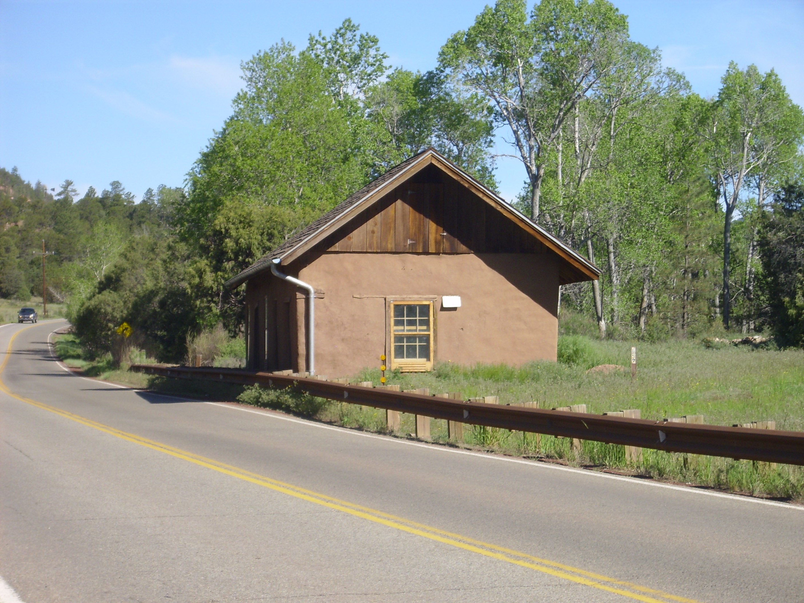
Glorietta Pass battleground. 35 34.280N 105 45.267W
The Battle of Glorietta Pass took place during the Civil War and thwarted Confederate ambitions of seizing control of the West. (So much for this “War of Northern Aggression” nonsense.) The battle lasted three days, and although the Confederates pushed the Union forces out of the pass, their supply train was destroyed and they were forced to evacuate Santa Fe. The building shown above is seen in old photographs of the battle area; it is now the Mountain House Art Gallery.
Glorietta Pass itself has some interesting geology. Near Pecos National Historical Park, we stopped and took some photographs of Glorietta Mesa to the south.
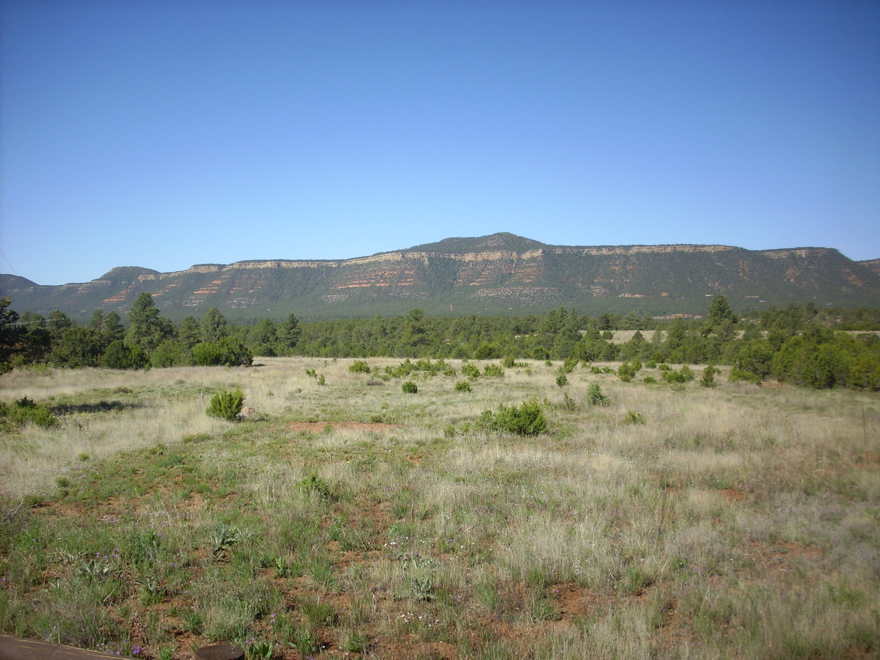
Glorietta Mesa. Looking southwest from 35 33.579N 105 40.887W
The surface we are standing on here, and the base of the mesa, are the late Pennsylvanian-early Permian Sangre de Cristo Formation, which was laid down in a river valley. The orange-red layers making up the middle part of the mesa are Permian Yeso Group, consisting mostly of sandstones deposited in coastal tidal flats. The closest modern analogy are the sabkha tidal flats surrounding the Persian Gulf. The prominent white cliff towards the top is the Permian Glorietta Sandstone, and the knobs above it are the Permian San Andreas Limestone.
The park itself is a partial excavation and reconstruction of a Native American pueblo present when the Spanish arrived. There is also a partially reconstructed church dating back to the Spanish era.
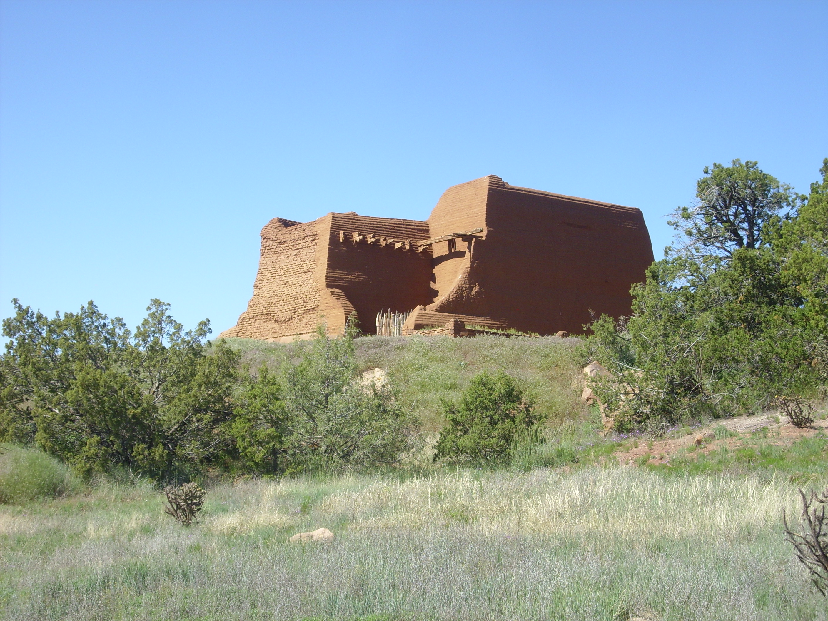
Church ruins at Pecos National Historic Park. 35 33.000N 105 41.347W
And here is Bruce walking along the trail past some reconstructed kivas.
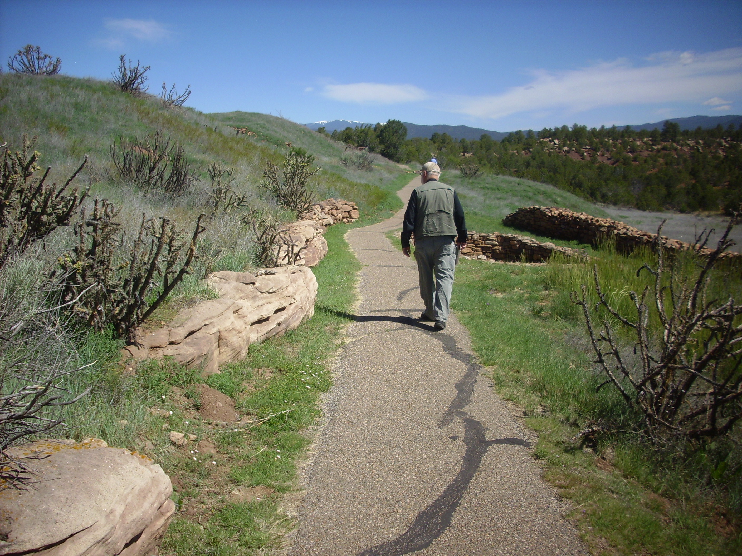
Along the trail at Pecos National Historic Park. 35 33.000N 105 41.347W
The rocks to the left are Sangre de Cristo Formation sandstone in the hill side.
The trail passed a full size mockup of a kiva constructed by the Park Service. You can’t really call it a “kiva” because it isn’t an actual sacred tribal edifice. You can climb a ladder into the mockup and see how a kiva was laid out as a round subterranean room with a ceiling at ground level and a small opening in the ceiling through which a ladder was inserted. Apparently the floor represents this world, the ceiling represents heaven, and a small pit in the floor represents the underworld. The kiva as a model of the Universe is consonant with temple concepts in many other cultures, including Greco-Roman culture and probably the temples at Jerusalem; curiously, mainstream Christianity, whose cathedrals represent a ship (hence the nave of the cathedral) is a prominent exception.
As we were talking about this, an older woman walking her Maltese passed by, perked up an ear, and asked about it. Turns out she walks her dog there frequently. She moved to Santa Fe fifty years ago and only recently moved out to Pecos for the peace and quiet.
The park also includes unexcavated and partially excavated pueblo ruins and the ruins of the complex the Spanish build around the chapel. The original chapel was destroyed during the Pueblo Revolt in 1680 and then rebuilt on a somewhat smaller scale. The whole complex was eventually abandoned, with the few remaining native Americans joining their cousins at Jemez Pueblo.
I know; I should have a lot more pictures. As Bruce later pointed out, I had plenty of transistors in my camera. Just got lazy, I guess.
Bruce spent a lot of time perusing the book store. I think I mentioned earlier how ardent a bibliophile he is. He managed to find about three books he did not already have.
From there we were off to Montezuma. The attractions here are a small college with a castle and some dramatic sedimentary beds tilted vertically by the tectonic forces that shaped the Sangre de Cristo Mountains to the west.
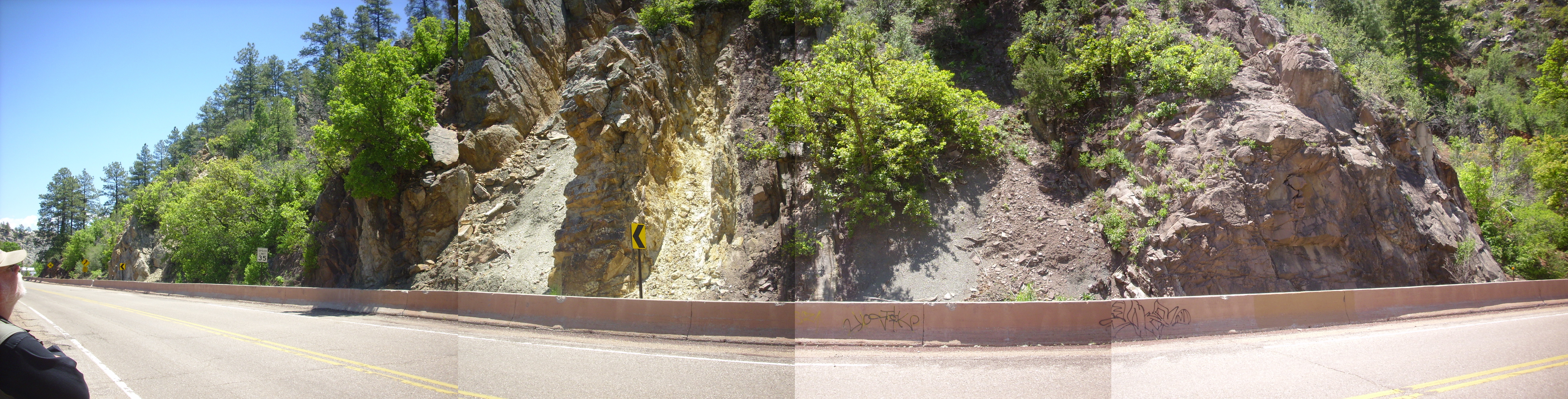
Tilted sedimentary beds. 35 39.122N 105 16.722W
My geologic map is no more specific than to state that the beds here are Triassic to Permian in age, with the older beds on the right. Bruce suggested that the yellowish bed seemed typical of the Jurassic Morrison Formation.
There was also an abandoned building along the road that caught my eye.
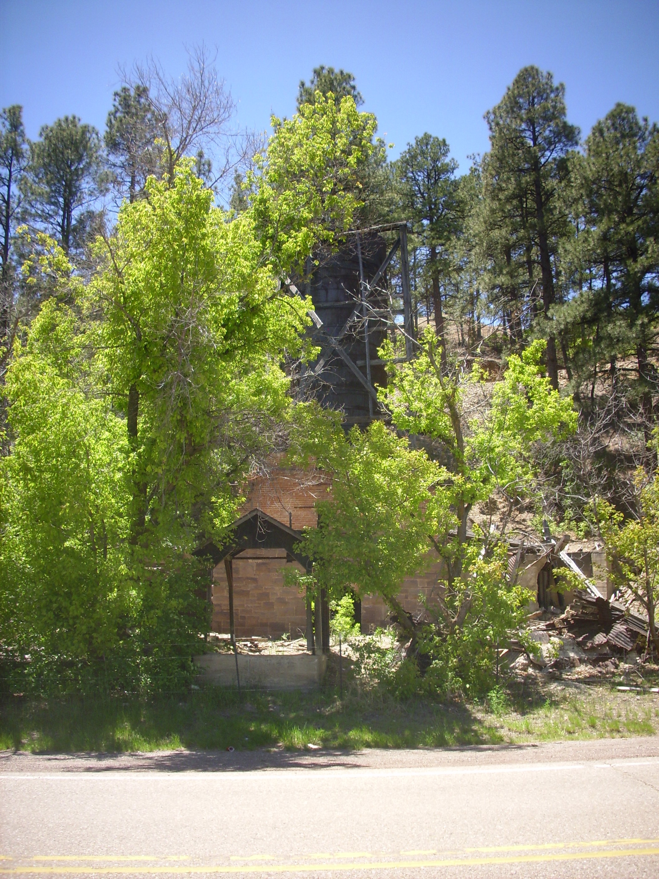
Foundry? 35 39.122N 105 16.848W
The building had a huge chimney and a massive brick base. There was an opening into the front of the base, and back in there we could see a massive bucket tipped over. A smelter or foundry of some kind?
Here’s the castle, from an earlier visit. We didn’t actually get this close on this trip, but we could see it from the road.
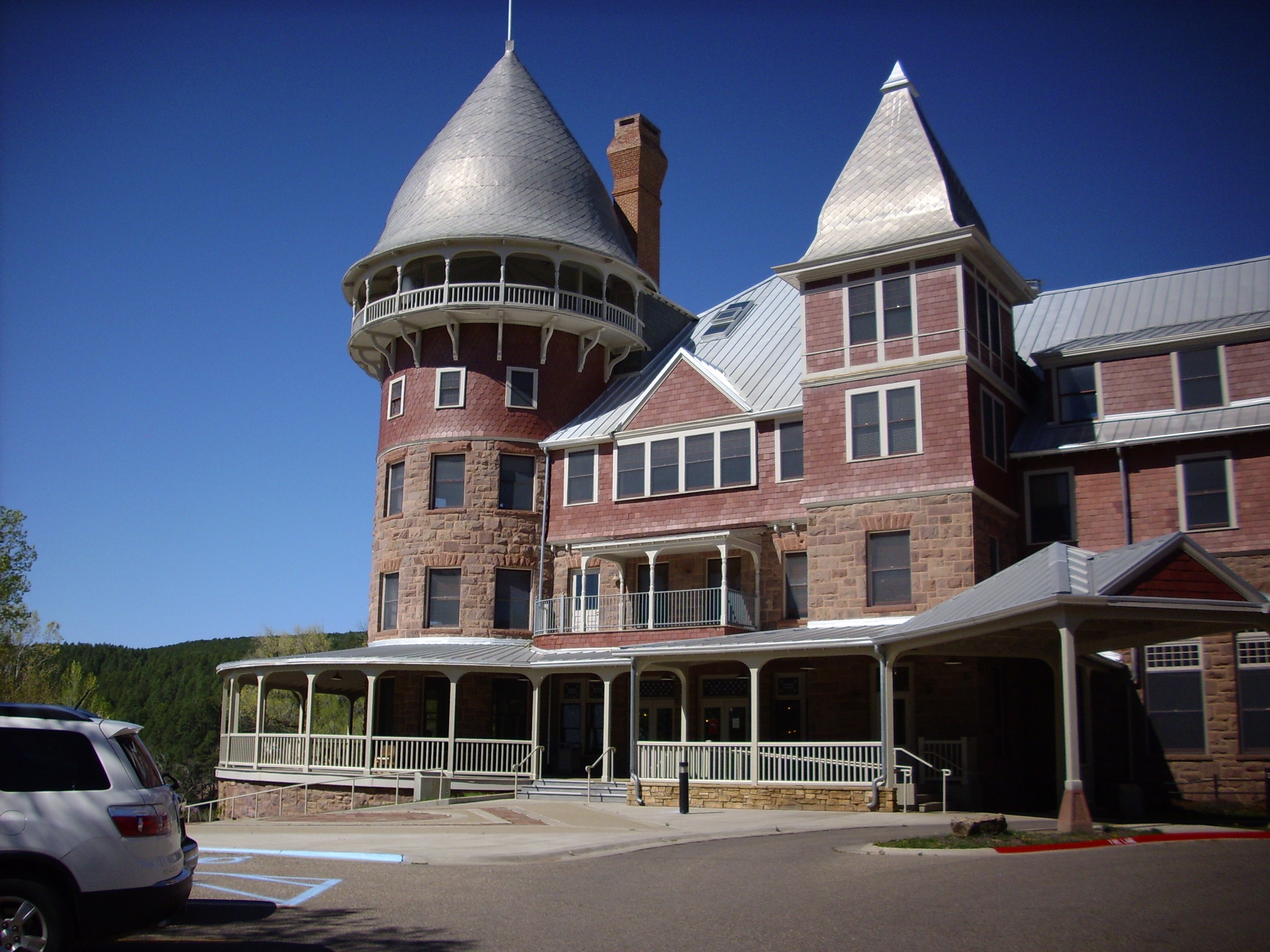
Castle 35 39.122N 105 16.848W
The castle is the main meeting area for the college here, Armand Hammer United World College of the American West. It used to be a fancy hotel before passing through a couple of owners and then being rehabilitated for the college.
We proceeded from there to Storrie Lake. Or, to be precise, to some road cuts northeast of the lake. These are in the Pierre Shale, which is a lot like the Mancos Shale, only more so. It’s about the same age, has similar character and is probably really the same formation, but it’s located east of the present Rocky Mountains whereas the Mancos Shale is located west of the Rocky Mountain front range. We were looking for beds reputed to have some fossils in them.
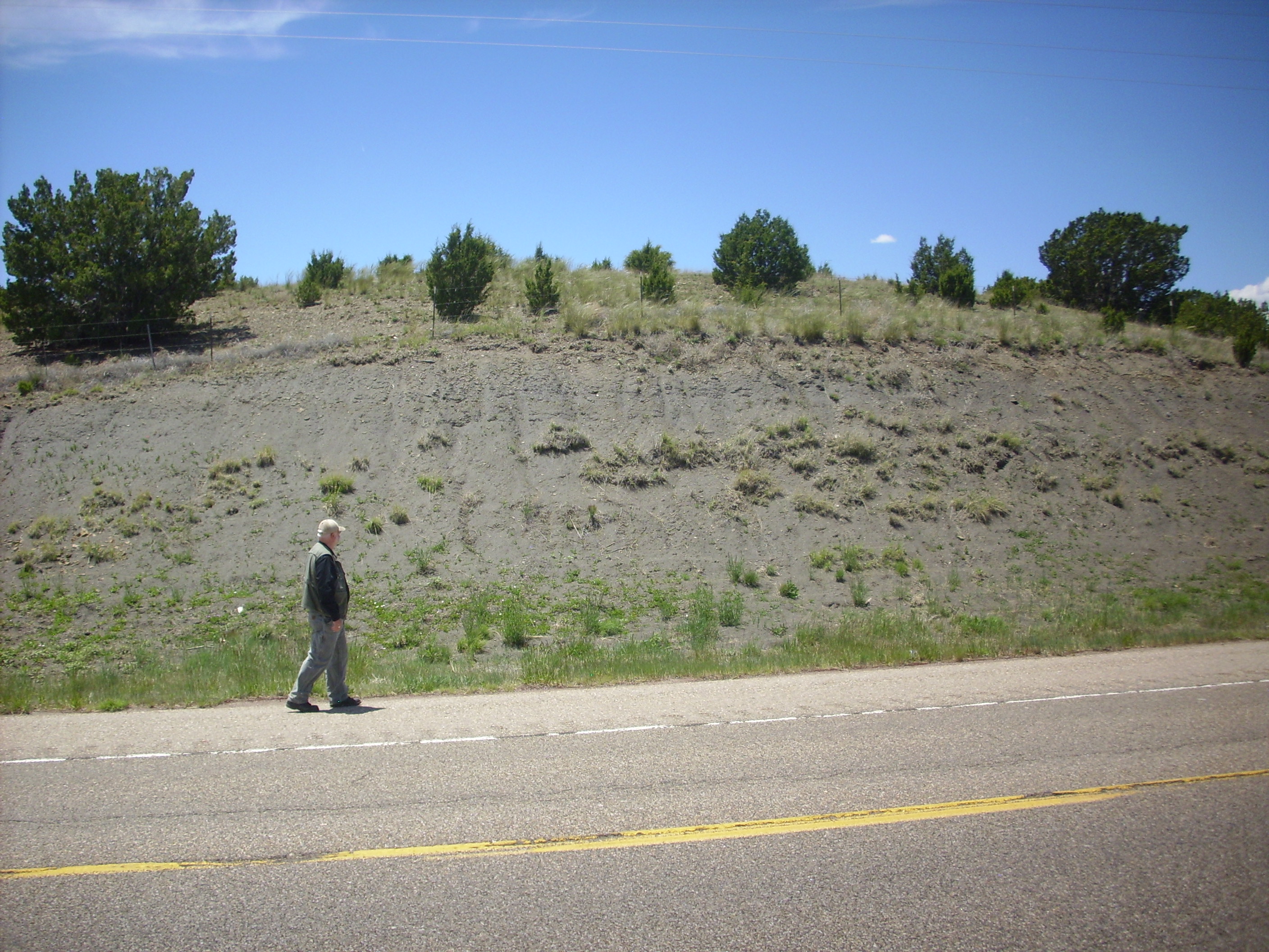
Pierre Shale in roadcut. Somewhere around 35 41.344N 105 13.708W
The coordinates are a guess. I was much too lazy about using the GPS locator. I will be more diligent in the future.
The GPS locator is a long-term loan from our friend Robin Roberts. Not the television broadcaster; a friend from the Denver area who joins us on these trips when he can. Not this one, alas; he had business elsewhere this weekend.
We hunted around a while, and while we didn’t find anything really spectacular, we did find some fossils.
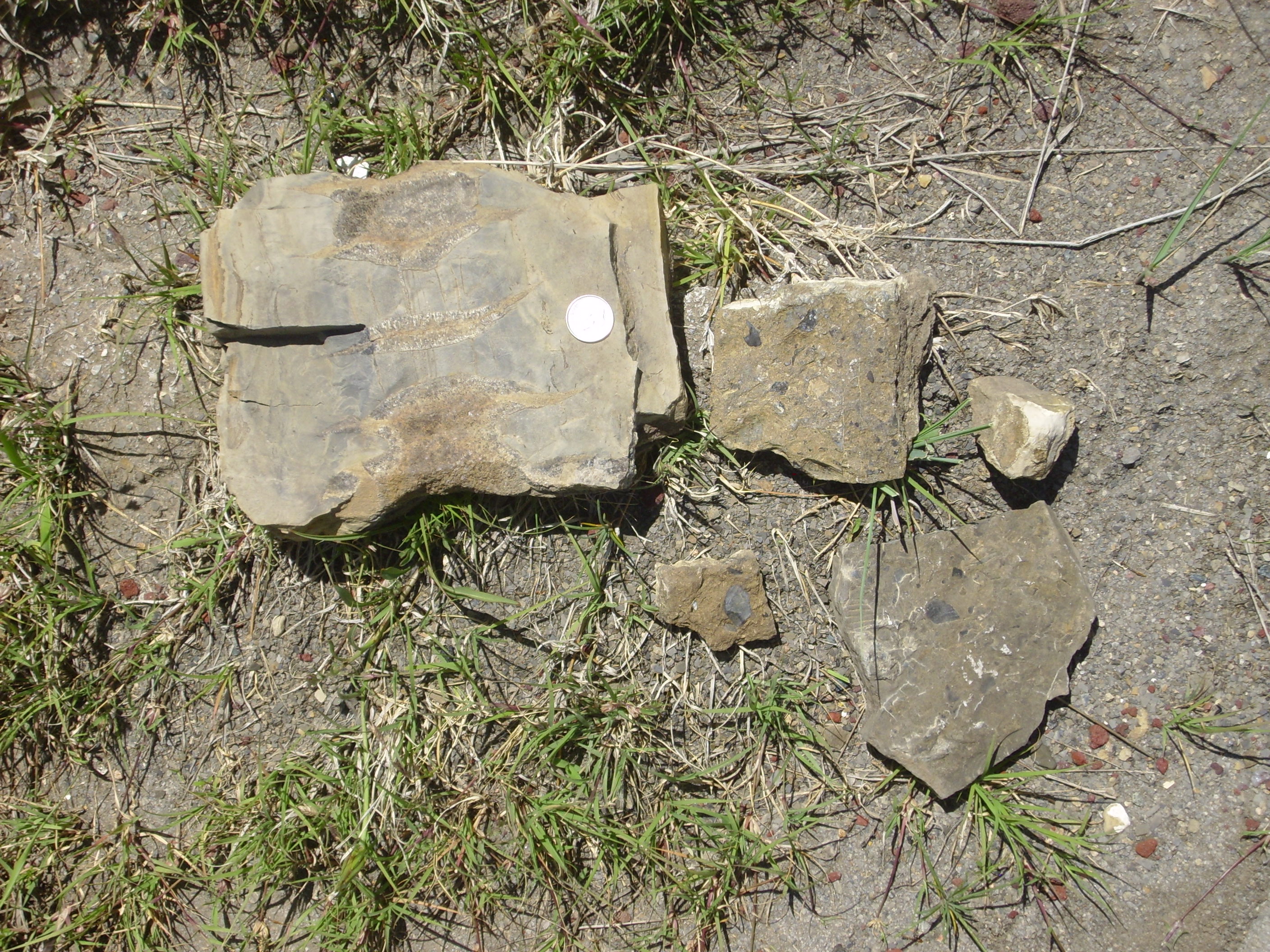
Pierre Shale fossils. Quarter for scale. Somewhere around 35 41.344N 105 13.708W
The black patches are bits of ancient oyster shell, while the odd-shaped patches in the largest rock may possibly be cephalopod fossils, according to Bruce. We left these near where we found them; it turns out some new federal regulations make collecting any kinds of fossils from any kinds of public lands problematic. (Need I add that the new regulations are confusing, ambiguous, and generally nuts?)
We proceeded from there to Fort Union. Or that was the plan; Bruce was in the lead, missed the exit, and there wasn’t another exit until we reached Wagon Mound. And to further dampen our spirits, a big truck blew out a tire on the interstate, leaving a huge scrap of steel-belted rubber, and I didn’t see it in time to avoid hitting it. There were all sorts of weird and wonderful noises from under my car. I pulled over and found that the plastic wheel well had come loose and was rubbing my front right tire. A little jiggering got it back in place, but not happily. At least I was able to catch up with Bruce at a rest stop, we palavered, and decided to head up to Wagon Mound for lunch and then decide whether to turn back.
Alas, the old cafe that Bruce fondly remembered in Wagon Mount was closed. We decided to head on back to Fort Union. I had some sliced chicken, lettuce and lo-carb wraps in a cooler in the car, but I can’t recall whether we made a quick lunch or just skipped. I think maybe we skipped.
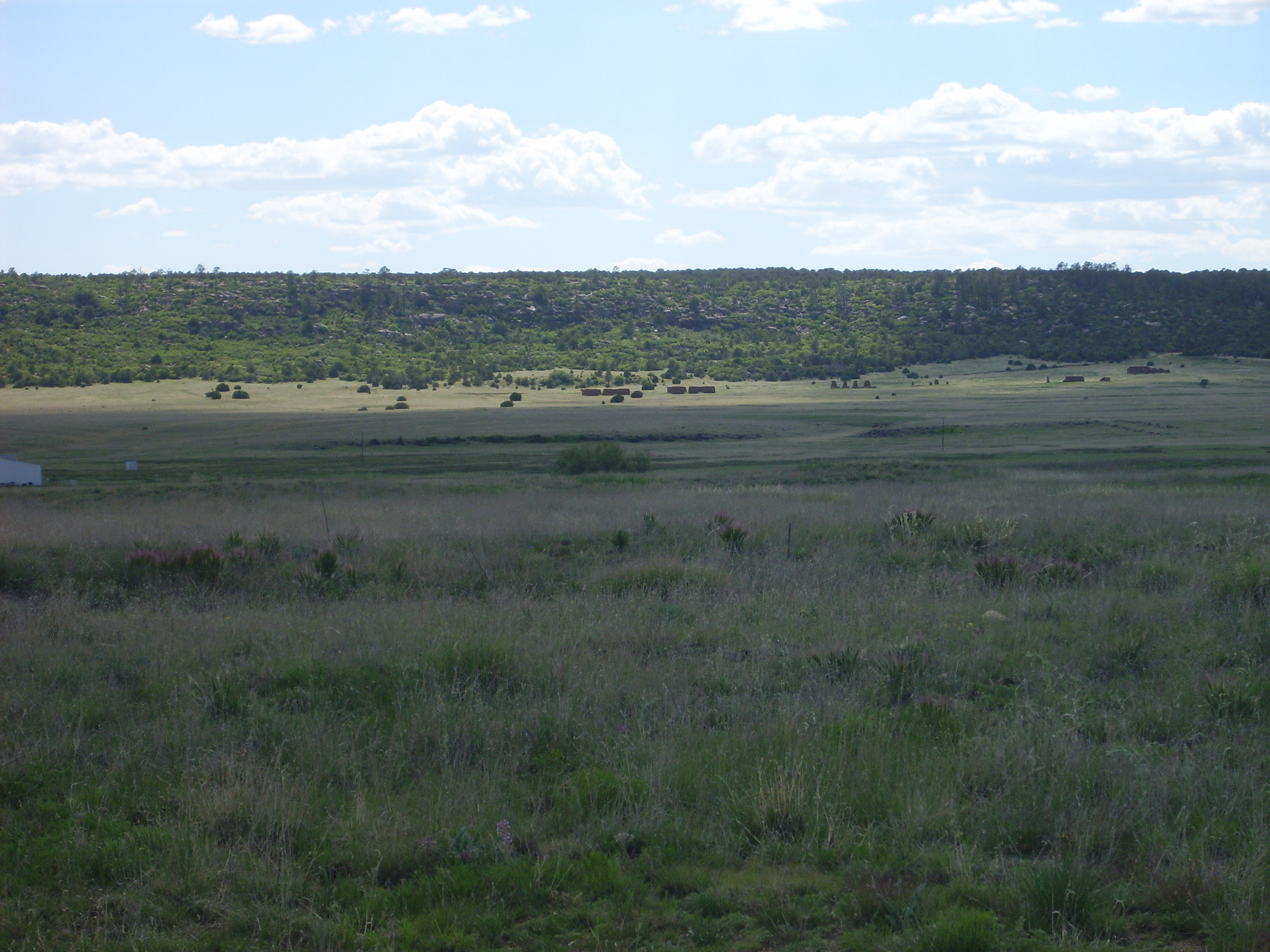
Fort Union was worth the trouble, though. Here’s a panorama from a lookout south of the monument.

Fort Union panorama. 35 50.650N 105 0.078W
The mesa on the near skyline in the first frame is Black Mesa. The mountain in the second frame,directly behind Fort Union, is Cerro Pelon. Both are part of the Mora volcanic field, which is on the same deep weakness in the Earth’s crust (the Jemez Lineament) as the Jemez Mountains. The mountains in the fourth and fifth frame are the Turkey Mountains; these are underlain by Cretaceous and Jurassic sedimentary rocks pushed up by magma rising beneath. The magma apparently never reached the surface, but we know it’s there, because oil prospectors drilled into these mountains hoping there might be oil reservoirs trapped beneath. I can imagine the reaction when they hit solid granite instead.
There are supposed to be younger dikes of an unusual rock type called lamprophyre in these mountains. We didn’t know where and we didn’t have time to look. However, Bruce discovered to our delight that the young ranger at the monument headquarters is finishing up a geology degree at Highlands University in Las Vegas, and she told us the next New Mexico Geological Society field conference will include these mountains in its field tours. I’m really, really tempted, but it’s three days of vacation and a $300 fee. And I have now already taken my vacation break.
The low mountain peeking over the skyline in the last frame is variously known as Baldy Mountain or Maxson Crater. It is a shield volcano whose flows cross I-25 near the rest stop from earlier.
A small irritation: The trail to the lookout point begins here and ends here. I do know know why you are expected to walk parallel to the road so far. Of course, I enjoy walking, but it turned out this was the one place on our trip where there were mosquitoes. Bruce and I each picked up several, and thereafter we resorted to the DEET at regular intervals.
When we arrived at the monument headquarters, a ranger parked in the parking advised us not to be startled by the guest stretched out by the headquarters entrance.
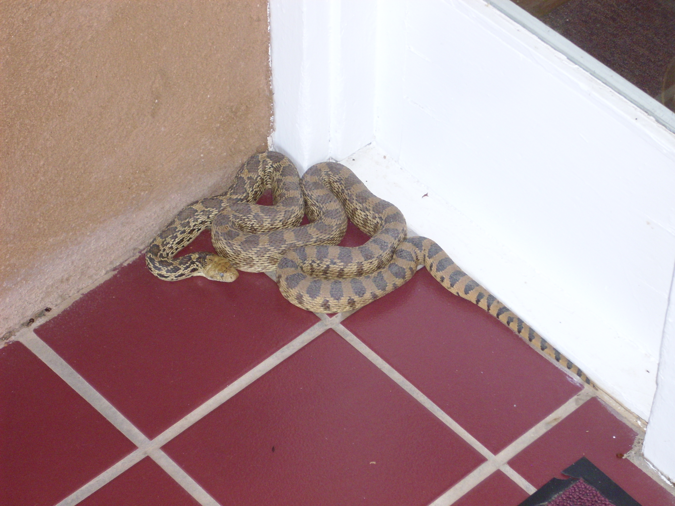
Bullsnake. 35 54.299N 105 0.688W
The coloration is a lot like a rattlesnake, but there’s no rattle and the head lacks the width from venom glands. Just hangin’ in the shade.
We got out onto the trail to the ruins and found ourselves among a very small herd of pronghorn antelope. Most scurried off but one posed for photographs.
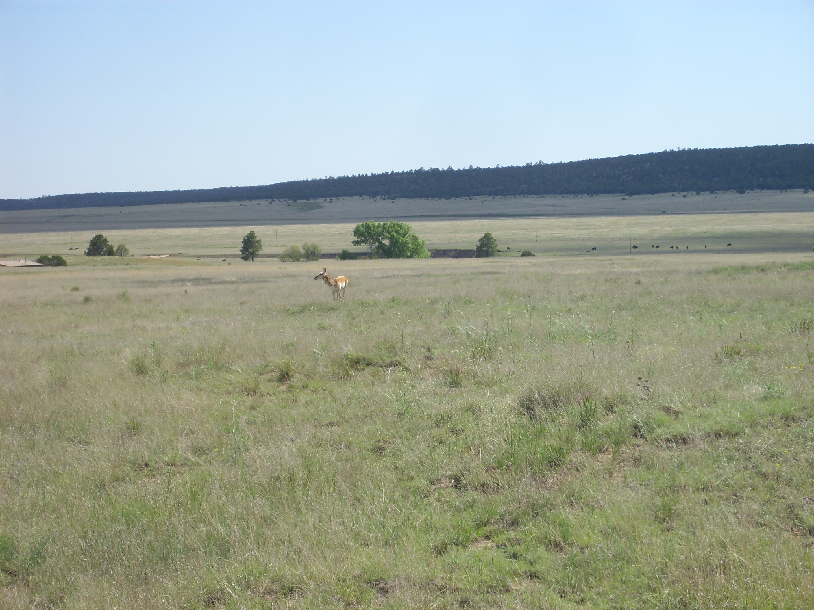
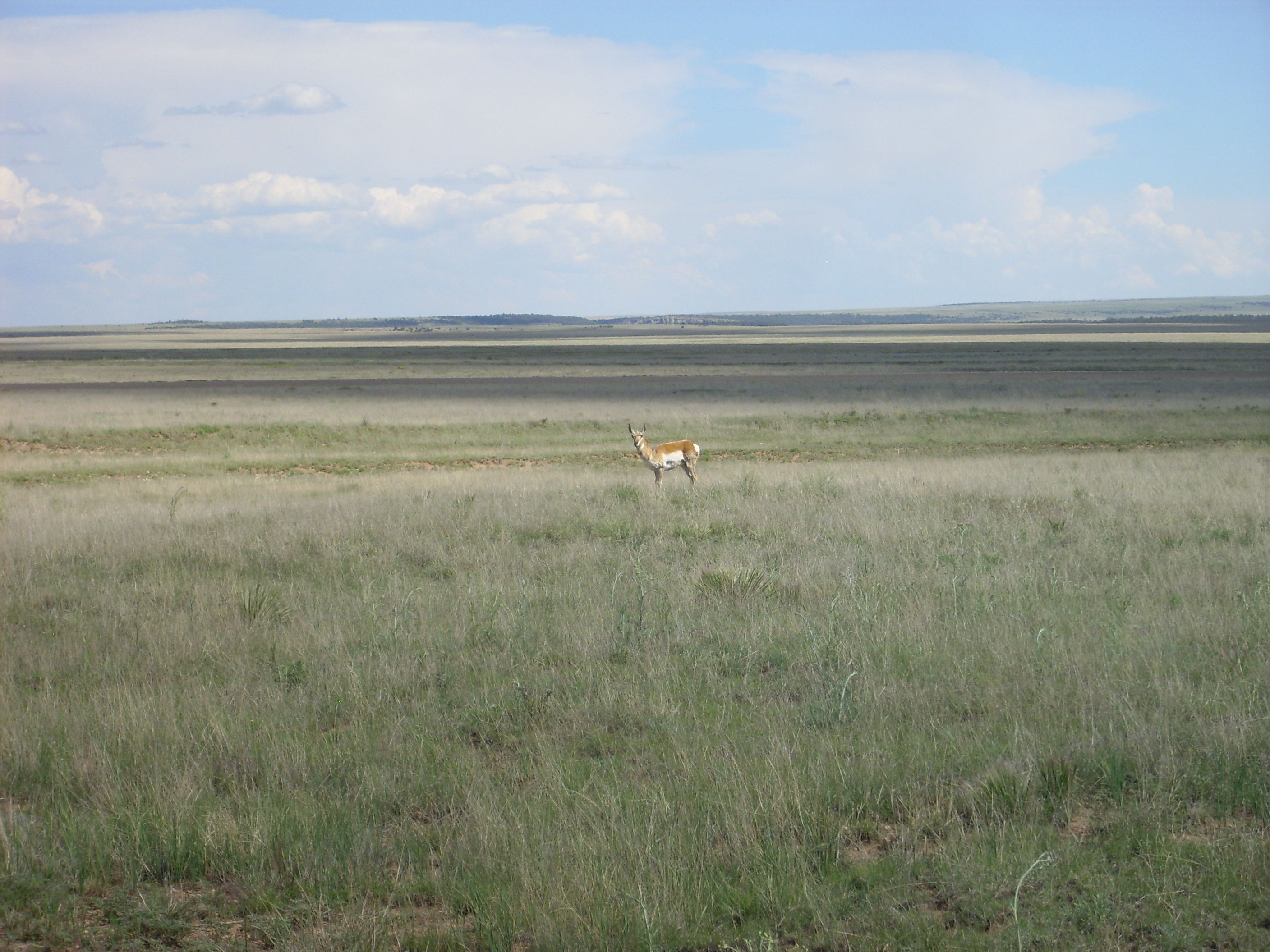
Pronghorn. 35 54.299N 105 0.688W
Bruce tells me that pronghorns are relatives of goats. The Font of All Human Knowage tells me that they are closely related to giraffes, which in turn are related to goats. Fair enough. They do look rather goatlike in these photos, though I can imagine a family resemblance to giraffes as well.
The cacti were blooming.
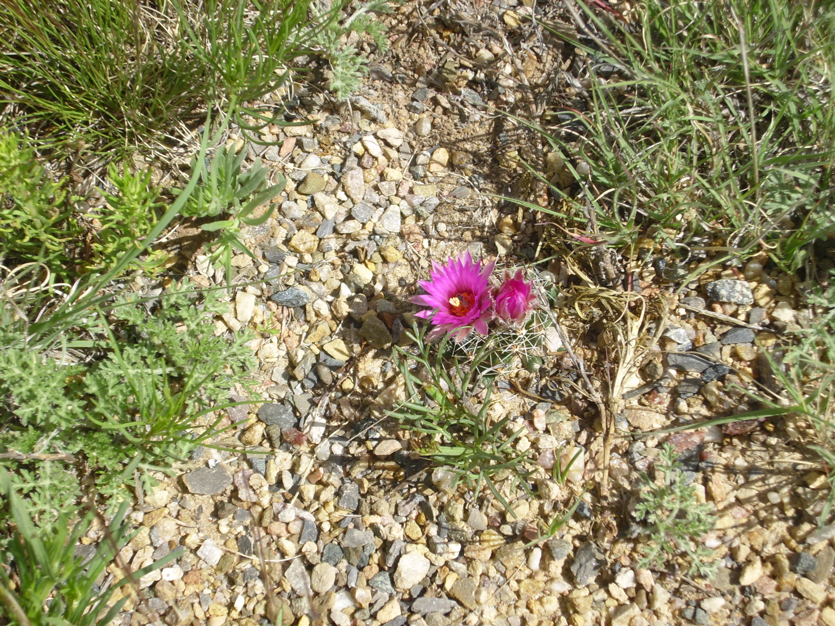
Cactus. 35 54.299N 105 0.688W
Possibly Mammillaria wrightii. I’m no expert on cacti, but pictures online resemble this and the range is correct. Beautiful.
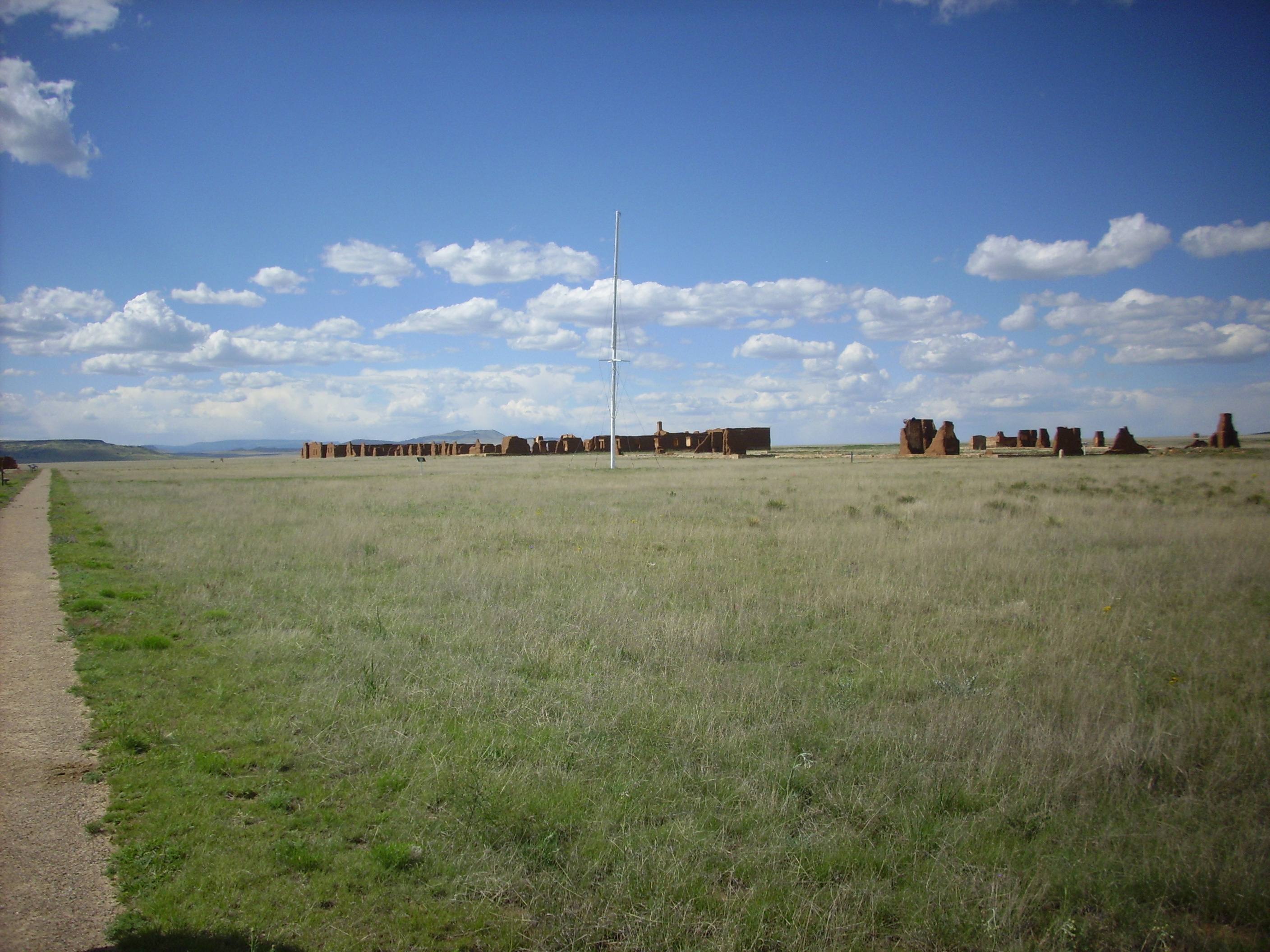
Here we look across the remains of the star fortress that was erected during the Civil War. Fort Union was the main supply depot for Army fortifications throughout the Southwest in 1860 and the threat from the Confederates in Texas was considered serious.
Fort Union star fortress. 35 54.253N 105 0.865W
The fortress was made of earth ramparts, like the one you (barely) see here, behind which canon and riflemen were sited. It shows up better on the satellite photo.
In a few centuries, if the marks are still discernible, they will probably be attributed to space aliens.
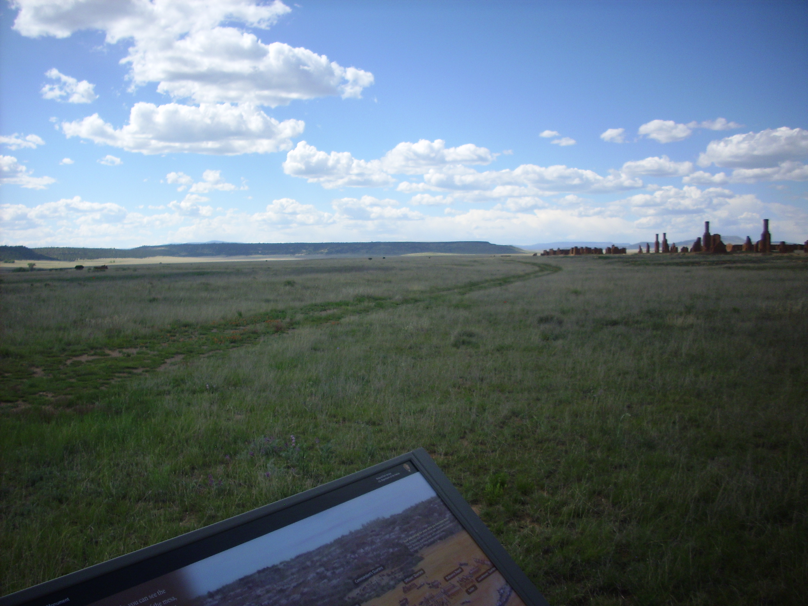
Fort Union. 35 54.275N 105 0.836W
I wanted to believe the track here was an old wagon trail, but it’s probably a modern dirt road. Actual wagon trails are probably easier to spot in satellite than on the ground, and they’re all over the place here. Notice the row of ruins; these were originally adobe barracks with brick chimneys, and only the chimneys were durable enough to stand up to the elements. The tin roofs are long gone, probably because tin is fairly valuable.
Bruce contemplates ruins that are even older than we are. He has visited here several times, and says that there’s something about the place that seems … quiet. I kind of sense what he means.
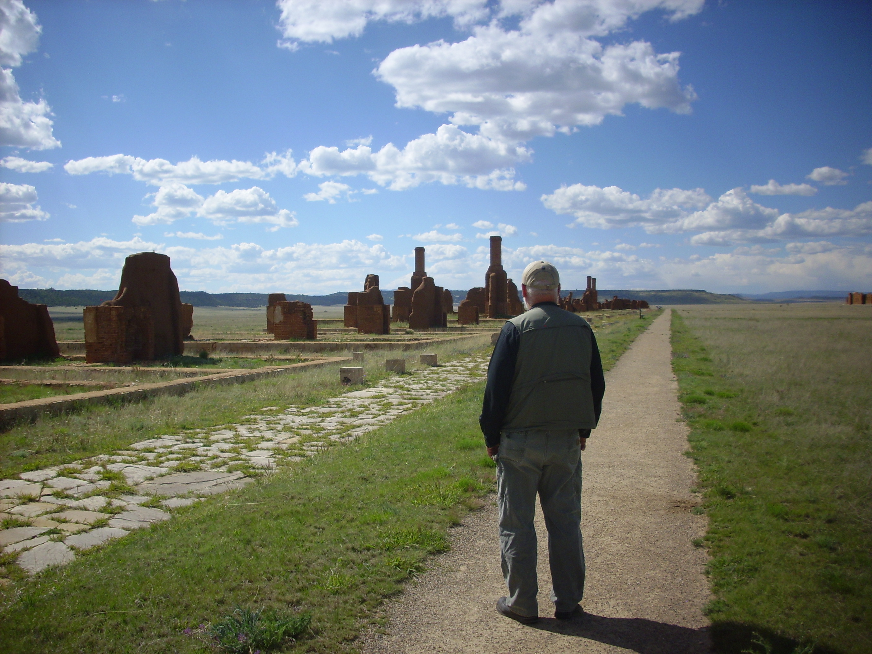
Fort Union. 35 54.391N 105 0.848W
The parade grounds.
Fort Union parade grounds. 35 54.391N 105 0.848W
The hospital (to left) and modern monument headquarters (surrounded by trees).
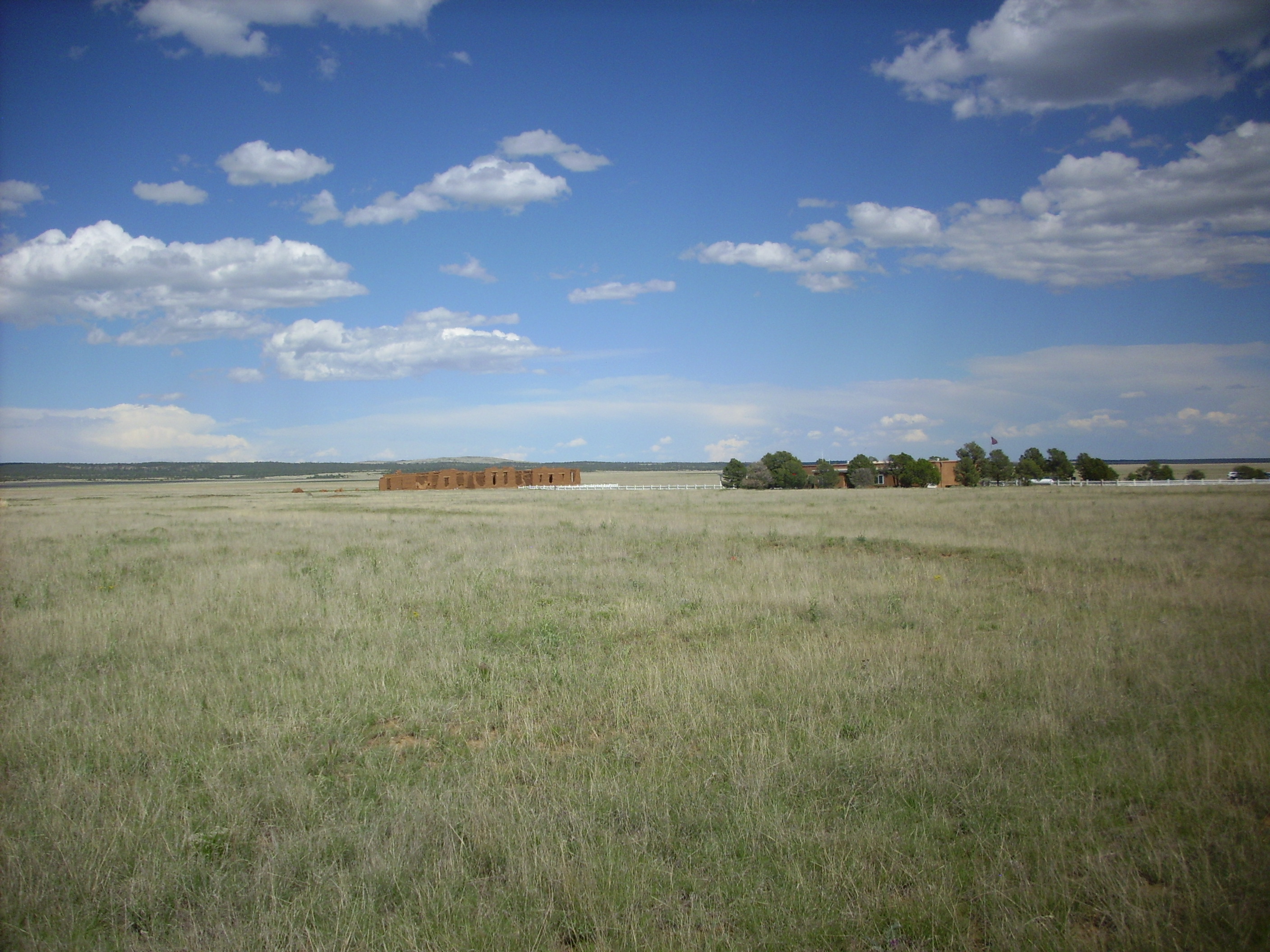
Fort Union hospital and monument headquarters. 35 54.391N 105 0.848W
We headed back to Wagon Mound. This was an important stop on the Santa Fe Trail because of the distinctive bluff over the town.
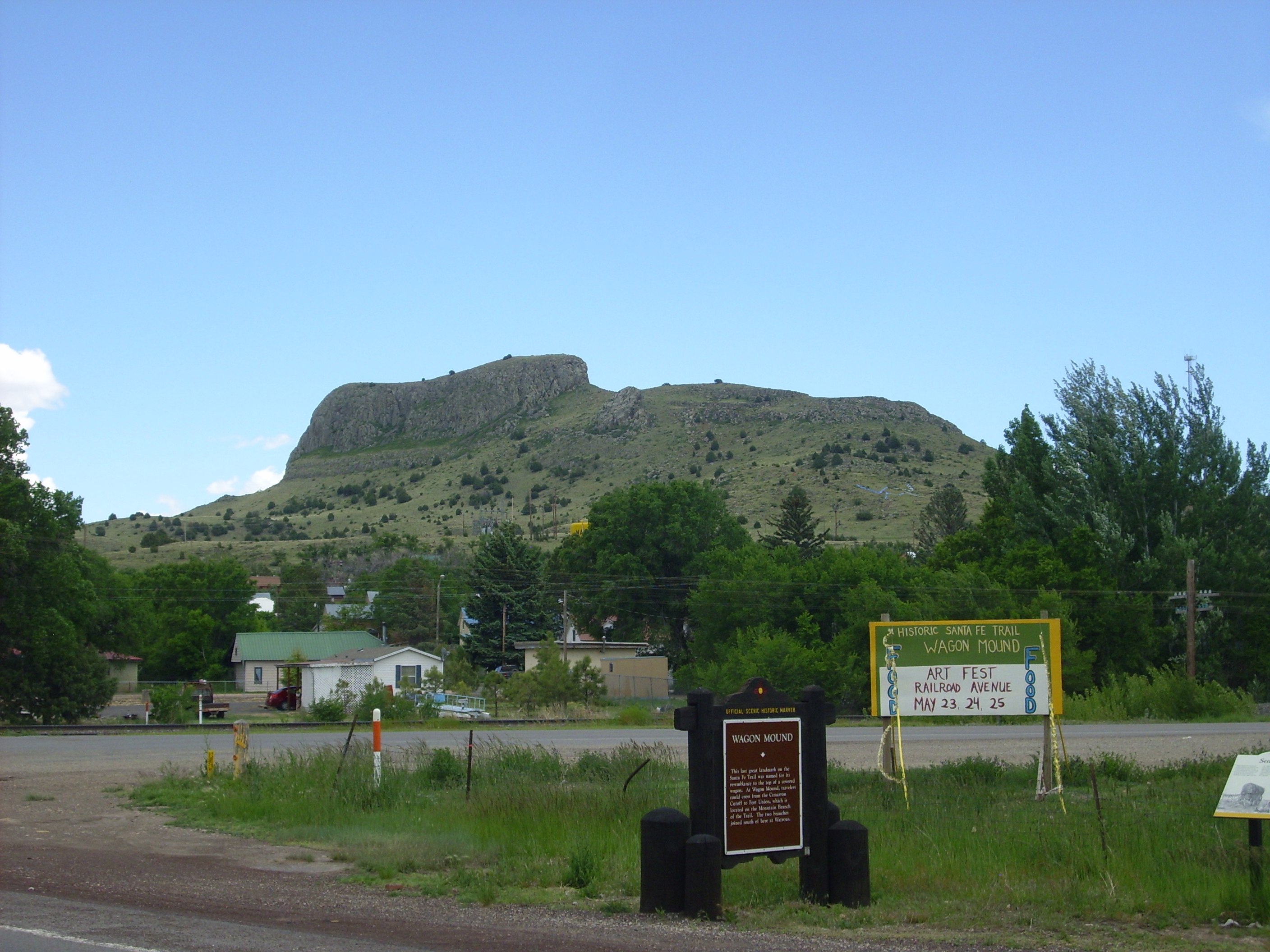
Wagon Mound. Looking southeast from 36 0.695N 104 42.395W
The mount is actually a segment of a basalt dike trending east-west. Another short segment is west of town.
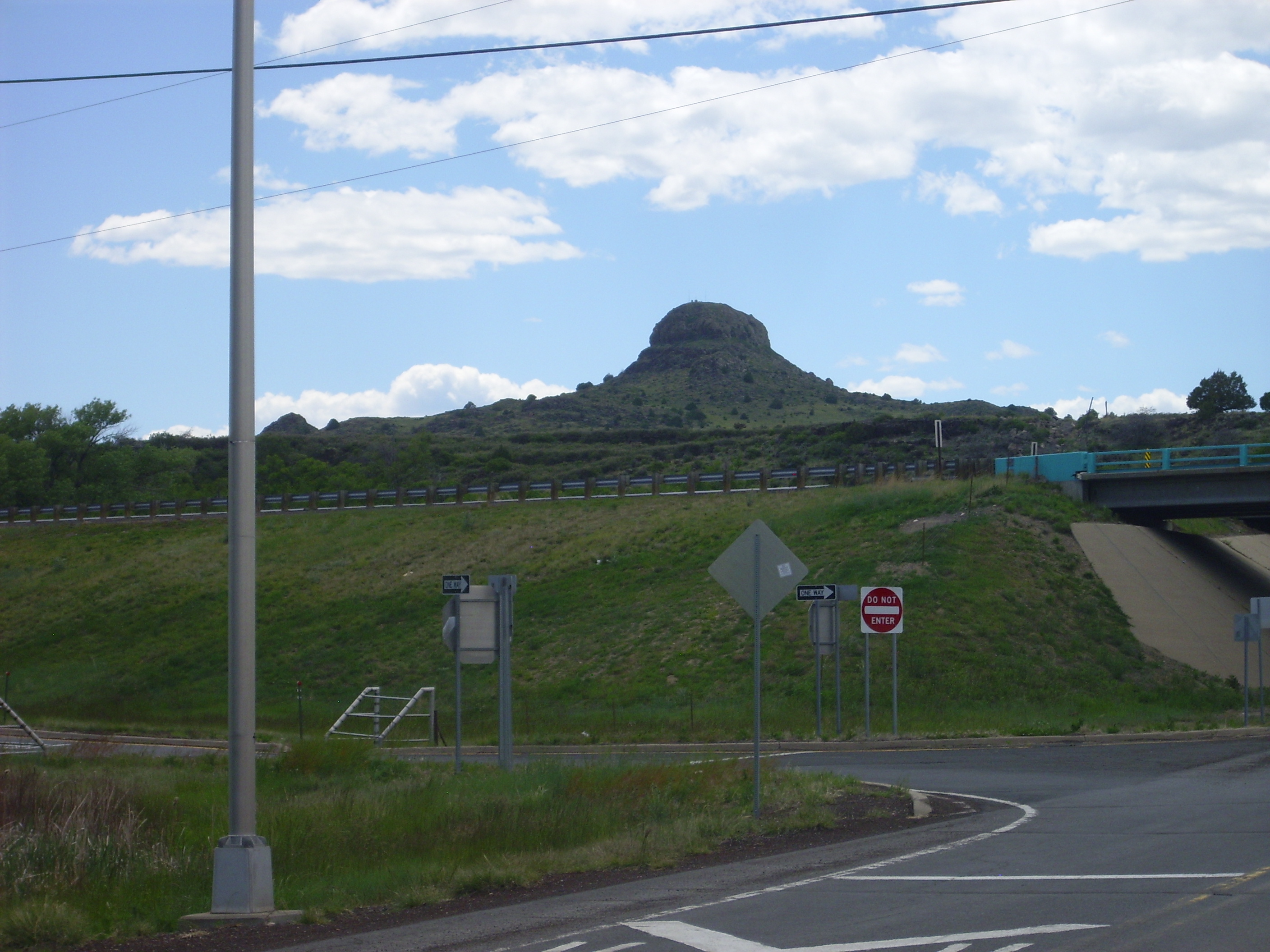
Wagon Mound. Looking west from 36 0.695N 104 42.395W
Most of the dike segments are visible in this view from some miles to the south.
Wagon Mound. Looking northeast from near 35 57.771N 104 45.616W
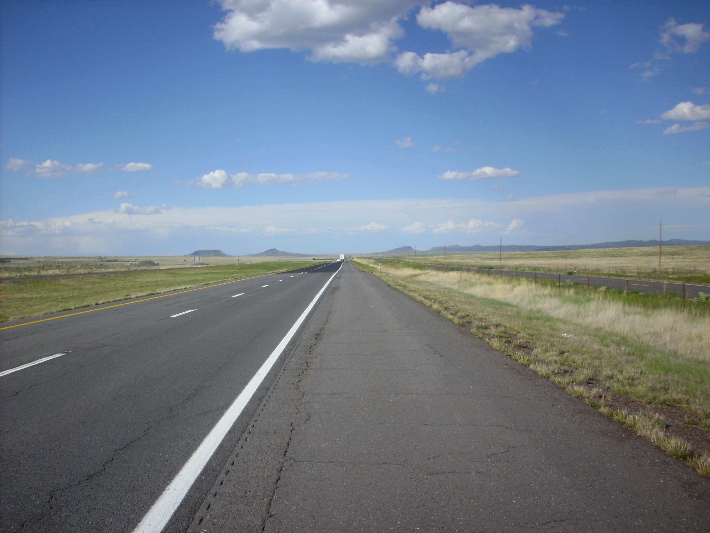
This region is full of dikes, from the tectonic forces that have brought magma to the surface repeatedly over the last 30 million years. Southwest of Eagle Tail Mountain the interstate crosses a really spectacular dike.
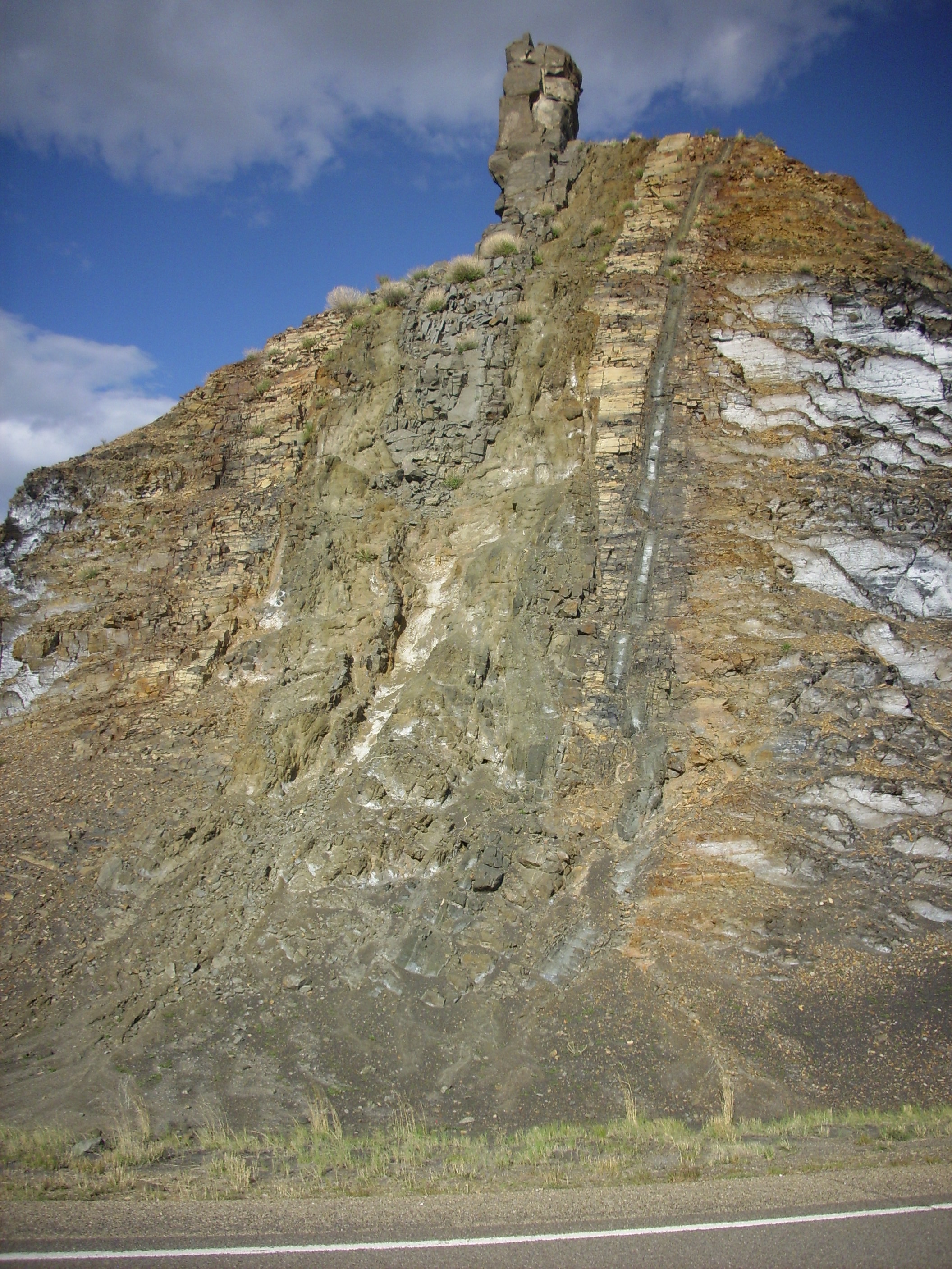
Eagle Tail dike. 36 39.911N 104 29.664W
The dike here shows multiple intrusions, including a separate small intrusion on the right and multiple intrusions through the main dike to the left. The country rock here is Pierre Shale, which has been baked into a much tougher rock called hornfels where it is came close to the heat of the dike. Here are some close up views of various zones in the dike.
The hornfels zone around the rightmost intrusion:
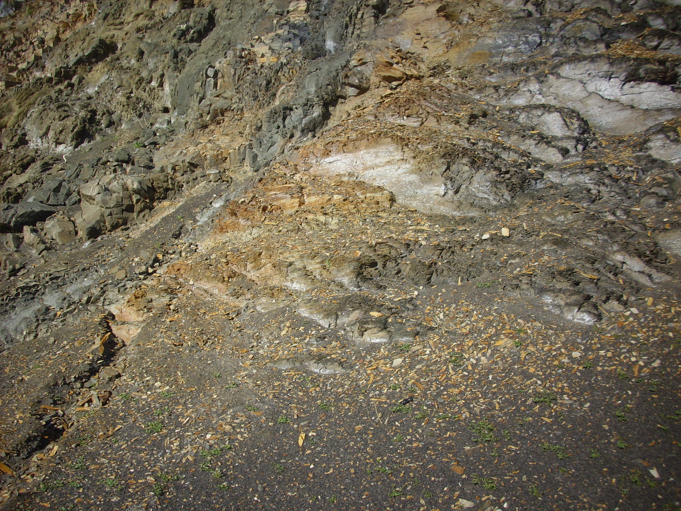
Eagle Tail dike. 36 39.911N 104 29.664W
The shale to the right is almost unaltered, but the shale at center is baked into hornfels and has a light coating of iron oxides. A sample of hornfels.

Eagle Tail dike hornfels. 36 39.911N 104 29.664W
The Pierre shale, which is a soft, flaky rock, has been baked into a very tough rock showing no sign of the original flaky structure.
I have not attempted to play my favorite music on this hornfels.
Here’s a closer view of the small dike, showing details of the hornfels around it.
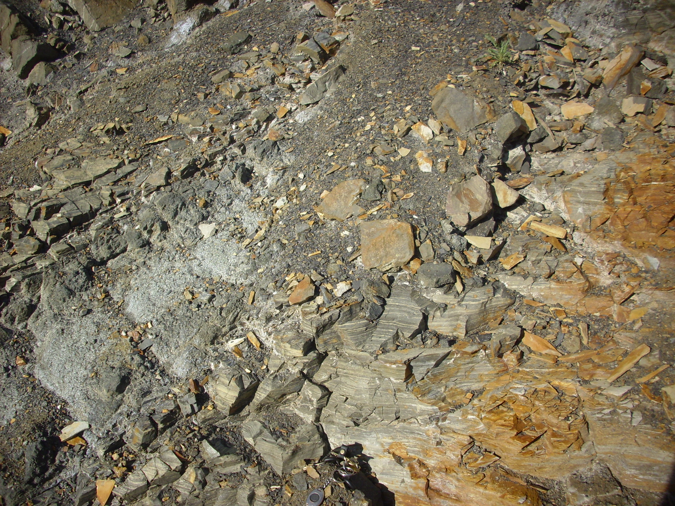
Eagle Tail dike small section. 36 39.911N 104 29.664W
And here’s the main body of the dike, close up:
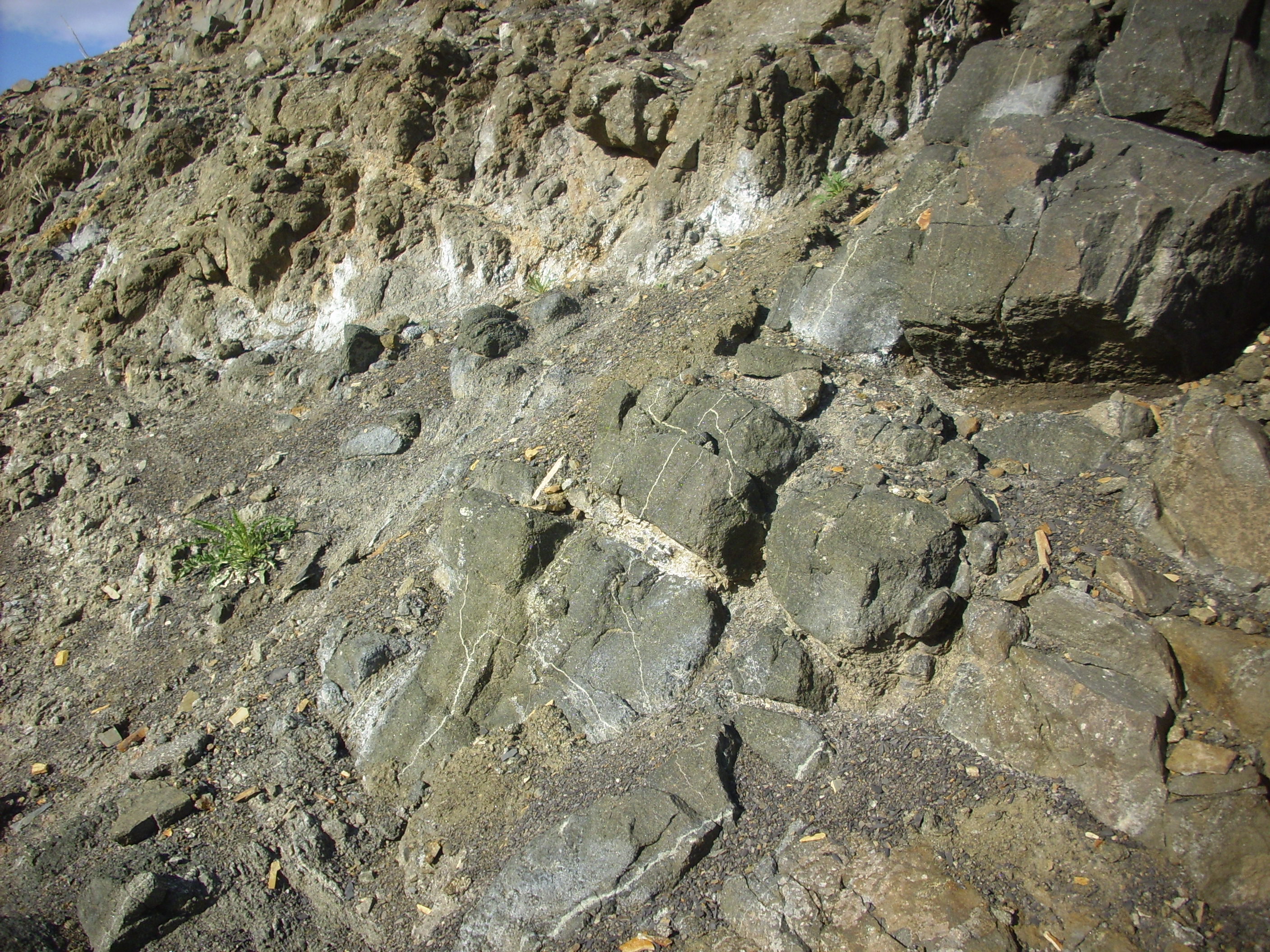
Eagle Tail dike main section. 36 39.911N 104 29.664W
Notice that the rock to the right is rounded by weathering. It’s actually fairly weak rock. Here’s a close up view.
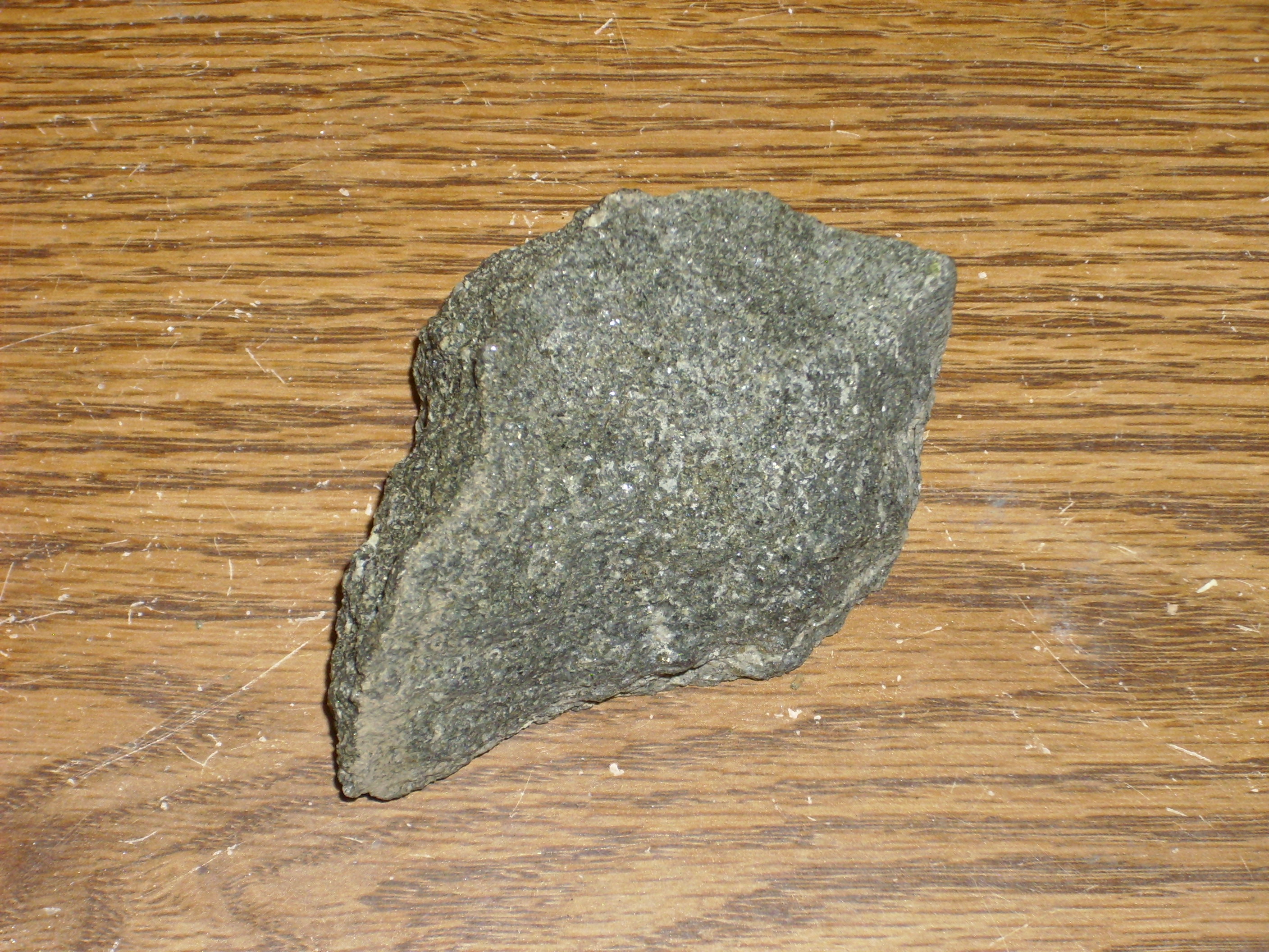
Eagle Tail dike soft center. 36 39.911N 104 29.664W
I’m not quite sure what to make of it. Under the loupe, the rock is mostly black crystals, easily made out, that are probably amphibole or pyroxene. There is a modest quantity of white crystals that are probably plagioclase, a very few flakes of mica, and some crystals with a greenish cast that might be olivine. Mica: That suggests amphiboles rather than pyroxenes. The rock also has some brown “gunk” that could easily be iddingsite, an alteration product of olivine. That would make this rock a picritic gabbro or even a dunite — an ultramafic rock, which is fairly uncommon in an intrusion as young as this one.
Which turns out to be about 28 million years. I looked around the Web, and found this reasonably good paper on this very dike. Turns out the dike is called Eagle Rock, because of the big plug of rock sticking out of the top. This paper confirms that the softer rock is ultramafic, and the authors opine that it could be called a lamprophyre if it was more porphyritic. So, cool. I’ve now seen a kind-of-lamprophyre.
The big plug of rock on top is a local intrusion of a magma that is less rapidly weathered. You can see ribbons of this rock further up in the dike.
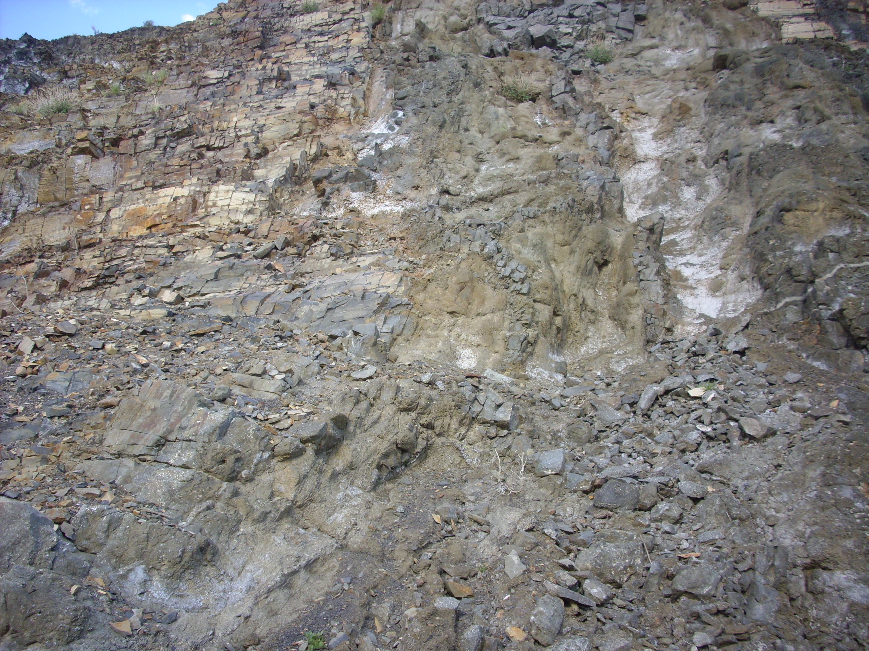
Eagle Tail dike. Note small ribbons of harder black rock in dike zone. 36 39.911N 104 29.664W
I got samples of this harder rock, too.
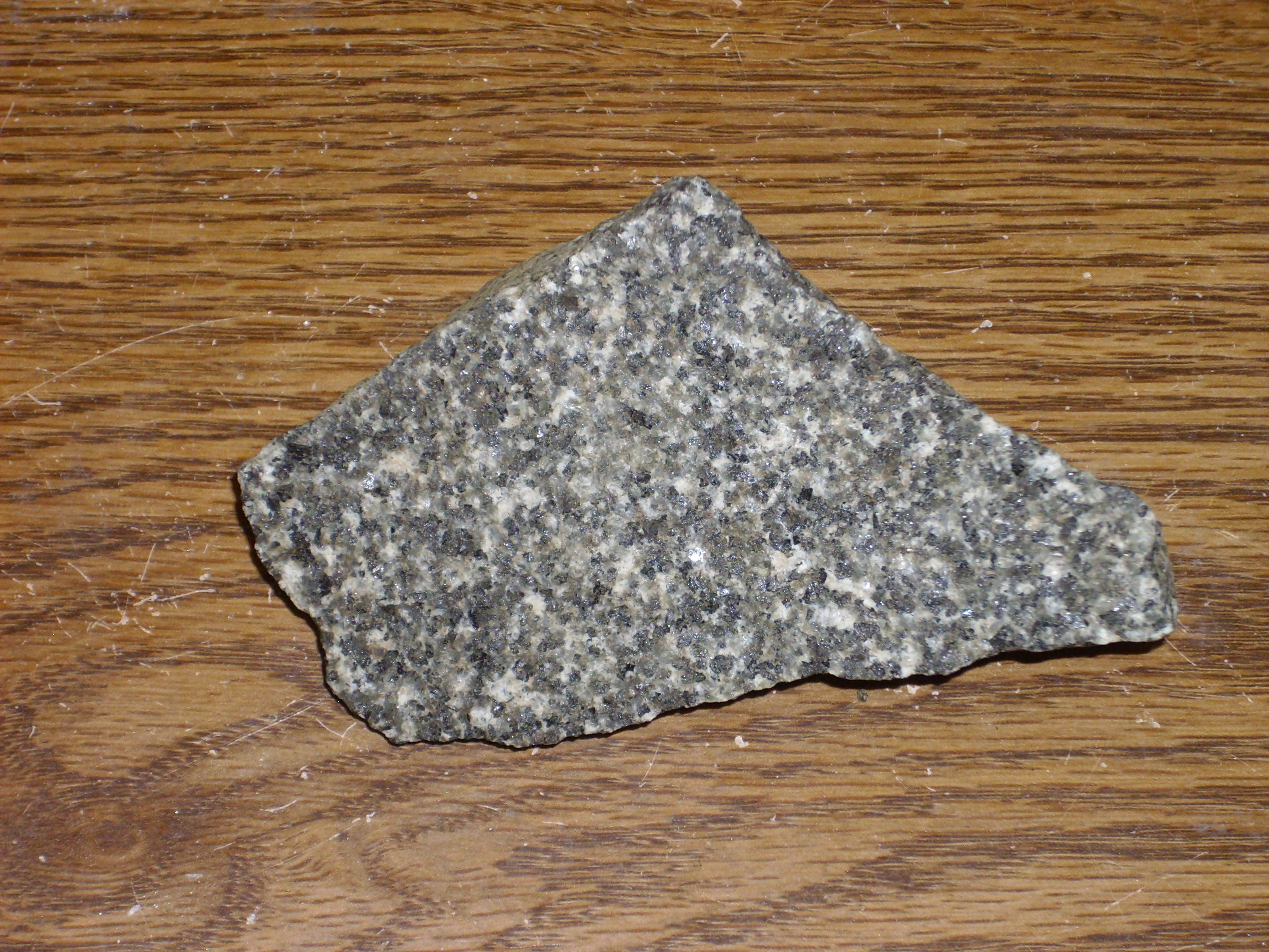
Eagle Tail dike gabbro. 36 39.911N 104 29.664W
This is a mixture of dark crystals of amphibole (or pyroxene), translucent grayish crystals, and white matrix. I’m guessing the matrix is feldspar, and possibly the translucent grayish crystals; or one or the other is a feldspathoid. No sign of quartz but some iddingsite from alteration of olivine. This is consistent with a gabbro.
Eagle Tail dike gabbro. 36 39.911N 104 29.664W
An even coarser sample, with quite a lot of iddingsite. The lighter grains include some translucent ones that are almost bluish in color.
And, finally:

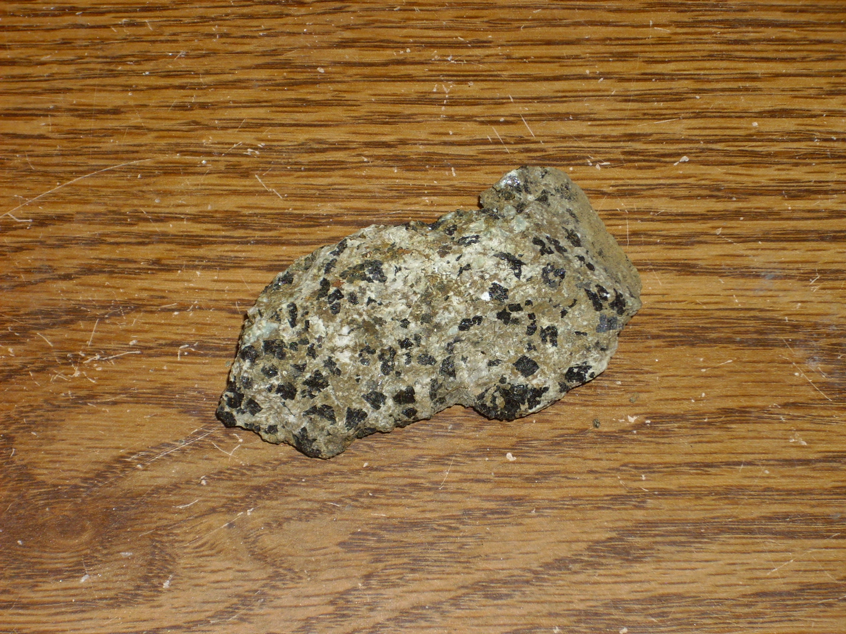
Eagle Tail dike xenolith. 36 39.911N 104 29.664W
Most of this rock resembles the first specimen above: a near-lamprophyre. The large white crystals still puzzle me: They look a little like quartz, and are at least as hard as a steel thumb tack, but waxy rather than glassy. And there should be no quartz in a rock like this. The bit white patch is some kind of xenolith, or fragment of country rock broken off and carried up by the surrounding magma. Except I found some boulders of the stuff later across the road, suggesting it’s a different kind of magma coming up through the fissure. The general appearance is of a monzonite or syenite, because there are obvious crystals of potassium feldspar (I’d know that cleavage anywhere) and even a few bits of quartz. Also more of the blue stuff I can’t identify from the other samples.
Anyway, an ultramafic dike.
With the light starting to fail, I headed on in to Raton, met up with Bruce, and we went out for Chinese food. I then went off on my own just long enough to locate the Cretaceous-Tertiary boundary (Cretaceous-Paleogene boundary, for the purist) marked out on a hill west of Raton. But the light was too poor for photographs, so I planned to visit again later.
My hotel room turned out to stink of tobacco in spite of being labeled a nonsmoking room; to lack any kind of clock or other wake-up device whatsoever (and the automatic wake up call service was out of order); and to have no shampoo in the shower. I should have paid more for a better hotel.
Next: Dry Cimarron
Copyright ©2015 Kent G. Budge. All rights reserved.