Wanderlusting the Cochiti Formation
I’ve been working on the latest draft of the book, and I realized that I had almost certainly mixed up the Cochiti Formation, the Gravel of Lookout Park, eolian deposits, and artificial trail gravel. Fortunately, I had business in Santa Fe Saturday, so it seemed reasonable to head out early, visit the Cochiti area to get my story and photographs straight, and then take care of my business.
I allowed myself to sleep in first — it was the first week of school, and dealing with the boys and school was exhausting for Cindy and me — and headed out a little after noon, after mowing the lawn, changing the water in the fish tank, hauling a new mattress into my son’s bedroom, and getting a quick lunch. (Which was too much on the shoulders; more later.) There was a thunderstorm grumbling to the north, but as it turned out, the weather cooperated pretty well.
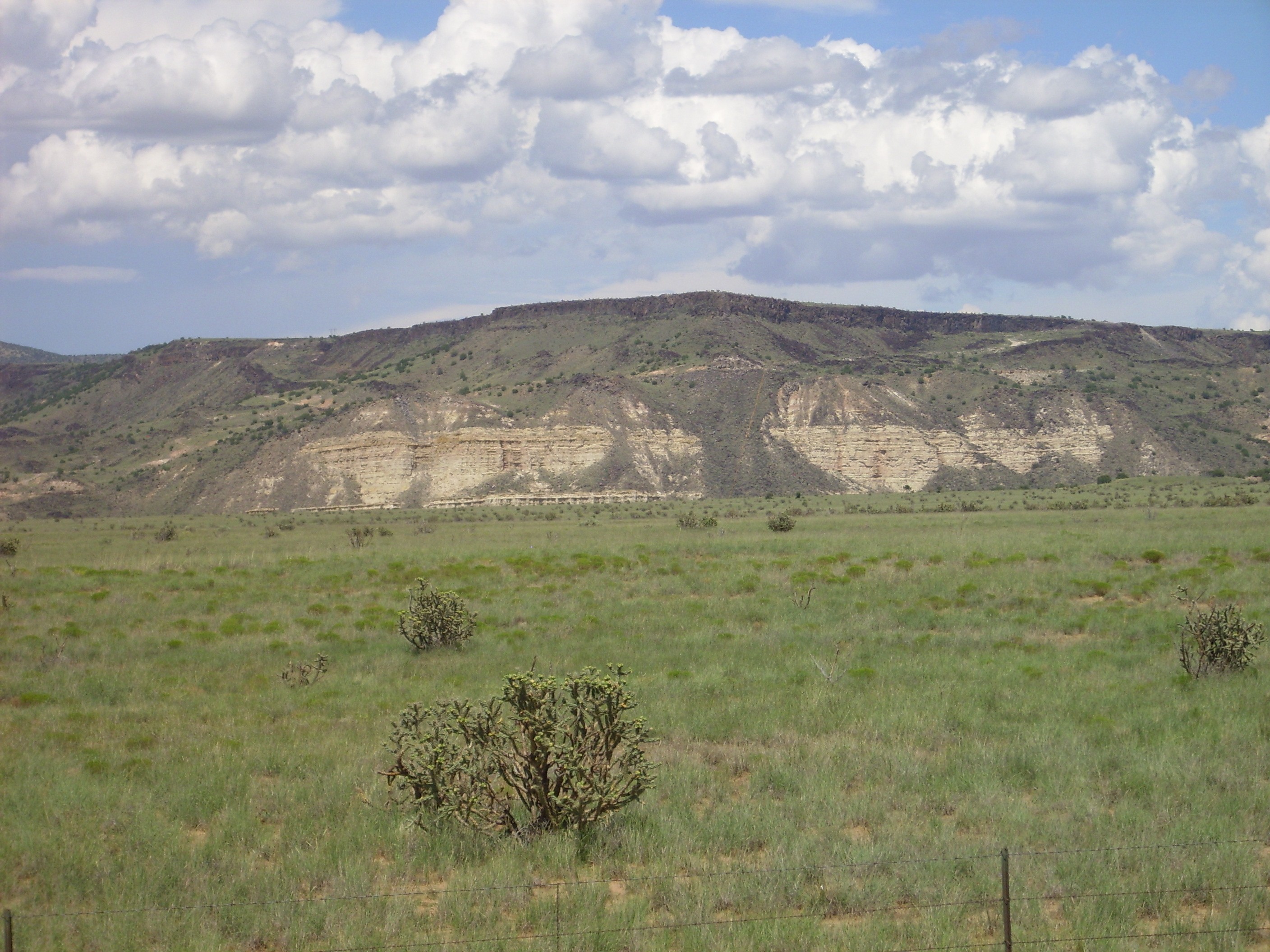
I drove through Santa Fe and onto the interstate, then exited where it crosses La Bajada. La Bajada is a dramatic escarpment, formed in part by lava flows of the Cerros del Rio and in part by a major down to the west fault, unsurprisingly named the La Bajada Fault. I’ve previously photographed the area immediately around the highway exit, which is underlain by Espinazo and Galisteo Formation beds. However, I’ve not previously photographed the dramatic exposure of Abiquiu Formation in the north wall of the Santa Fe River canyon where it cuts through the escarpment.
This is probably the finest exposure of this formation south of the Jemez. The Abiquiu Formation is poorly dated, since it contains few fossils, but is likely around 20-25 million years old. It’s a very early rift fill sediment of the Rio Grande Rift, rich in volcanic ash from the Latir and San Juan volcanic fields to the north, which accumulated in basins that were likely not yet connected by the Rio Grande. It apparently sits on older Paleogene beds of the Espinaso Volcanics (an early rift volcano formation) and Gallisteo Formation (perhaps the earliest rift fill sediment in the Jemez area, which has a distinct reddish color) which are exposed further south around the freeway. If one continues south past the freeway towards Rosario, one encounters Triassic beds of increasing age exposed along the fault zone.
Following La Bajada would make a pretty good wanderlust, except almost all this area is on tribal lands, and the tribes do not even like you to take photographs from their access roads.
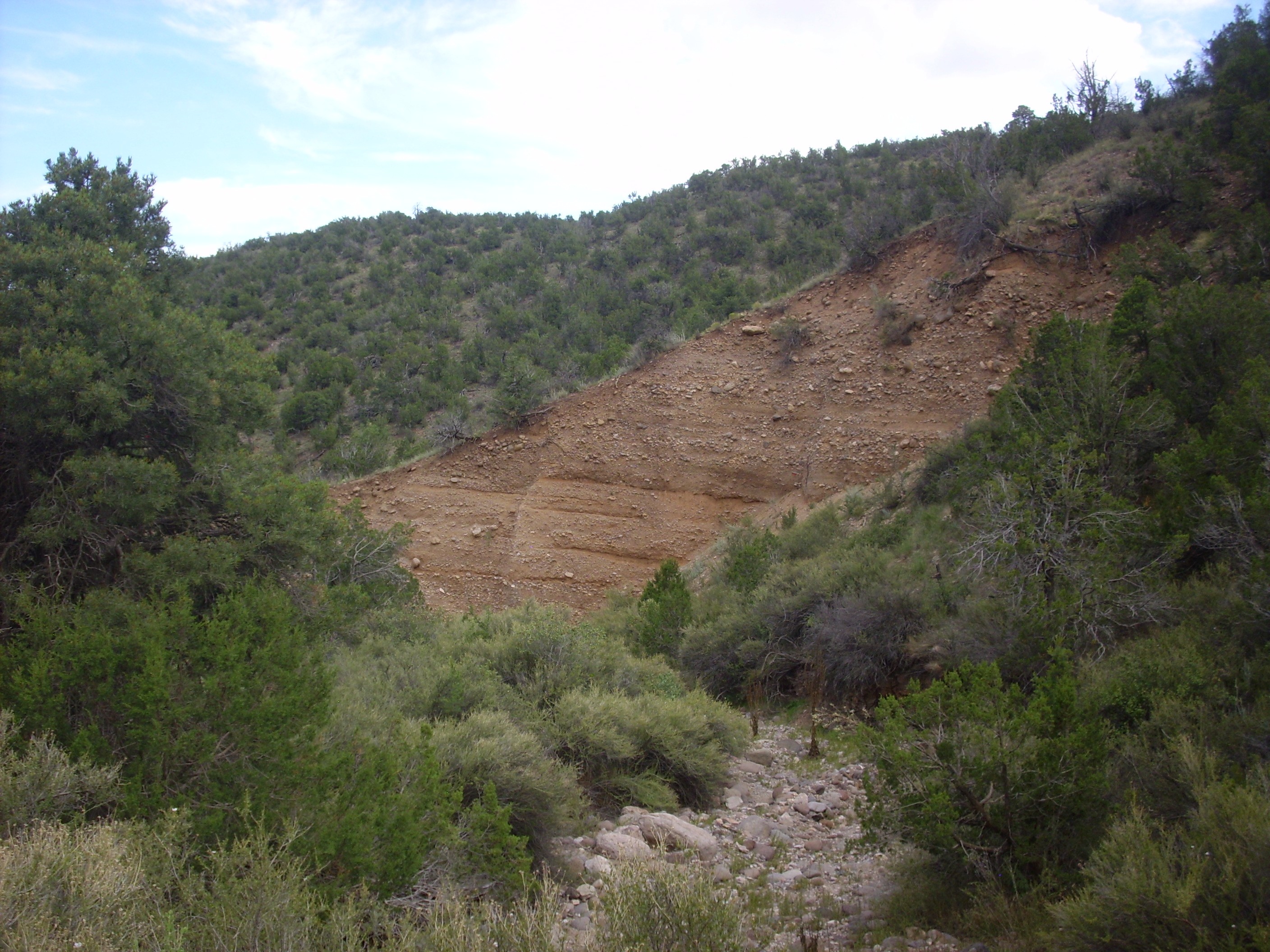
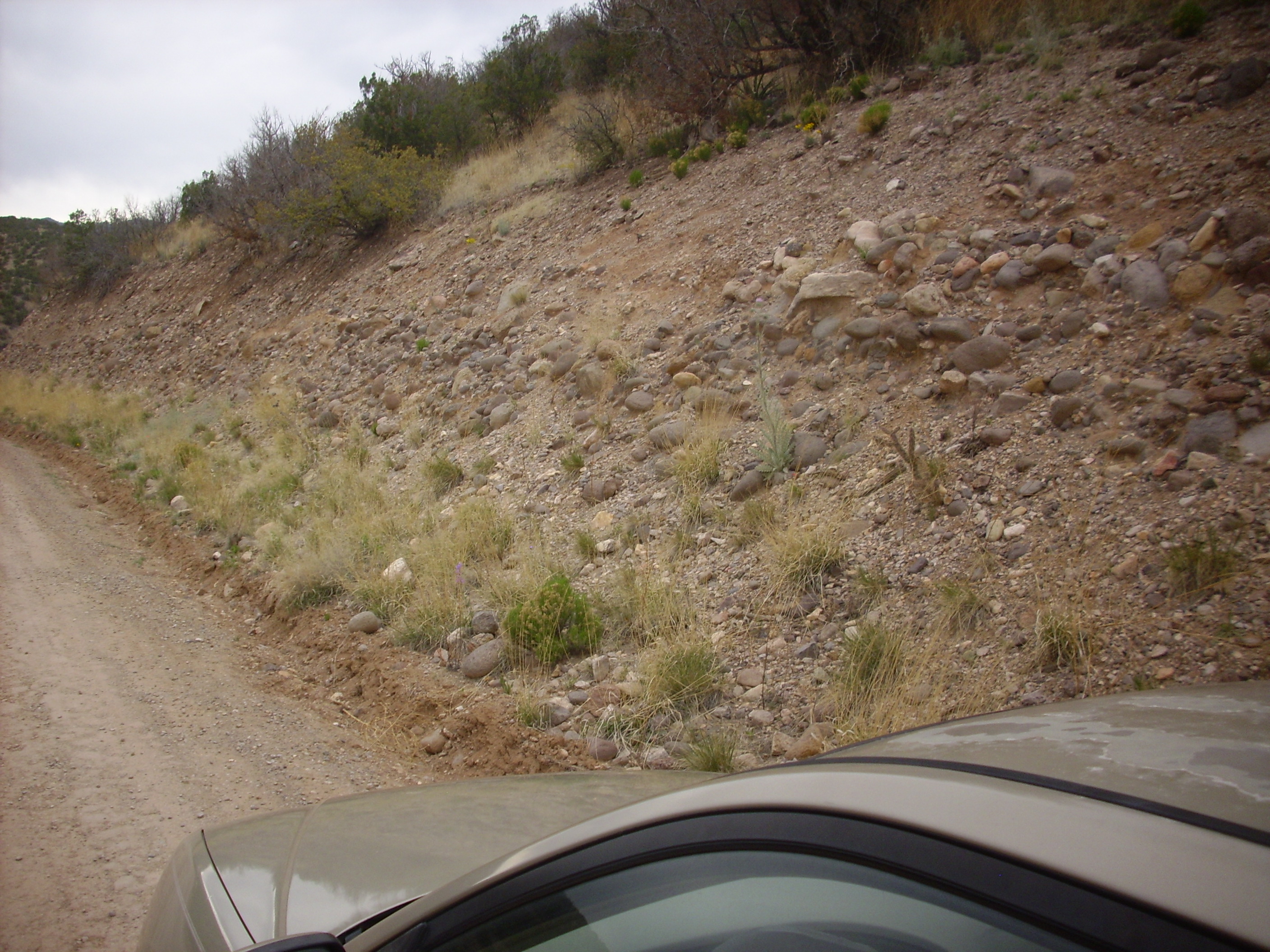
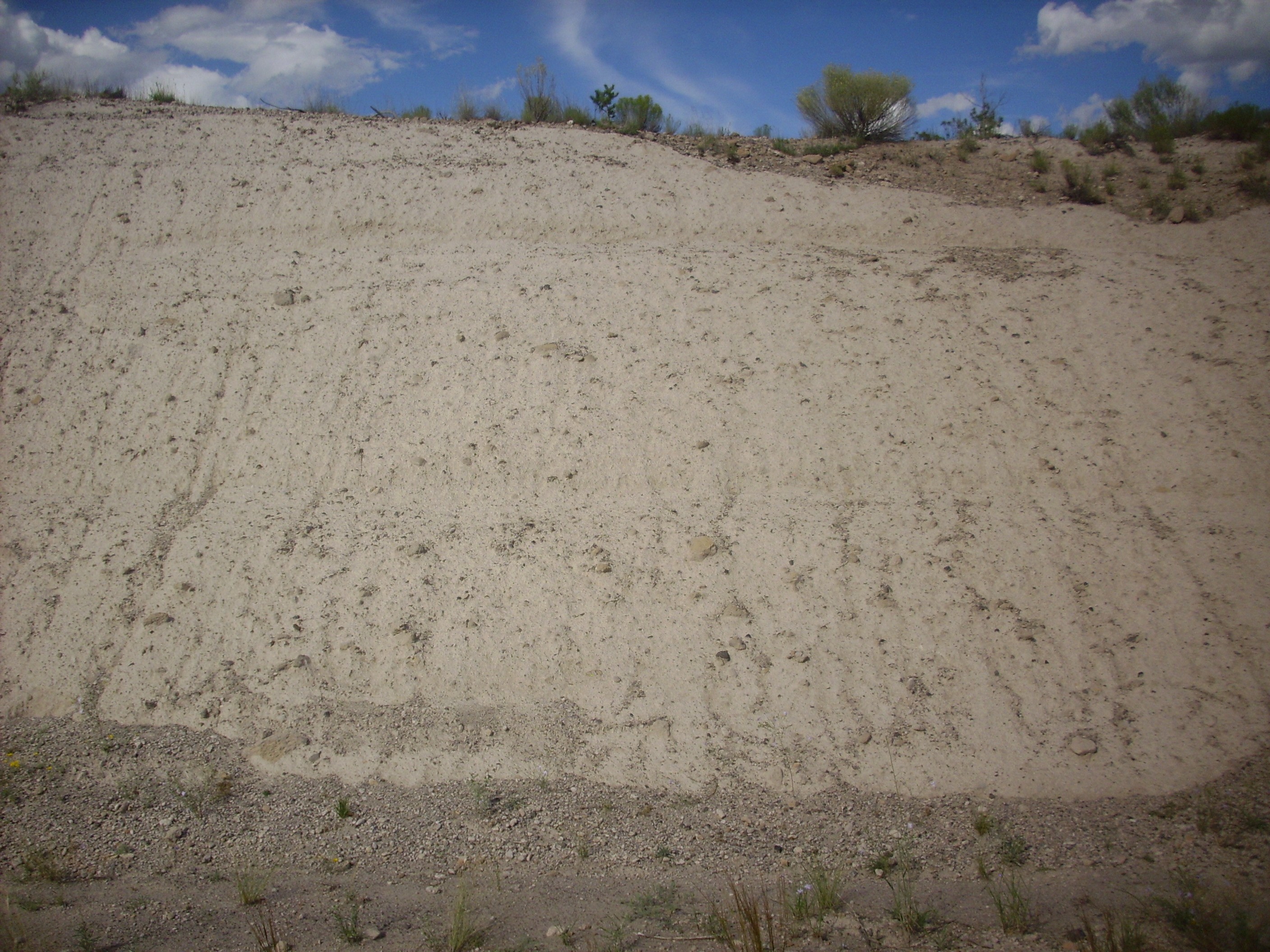
Continuing north, I found myself noticing dramatic gravel beds in the road cuts. These were remarkably well sorted with very distinct upper contacts; my first thought was that they were artificial, placed in the road cuts for erosion control or whatever. It was not until I saw the beds exposed in arroyos well away from the road that I was convinced they were natural. Here‘s an example.
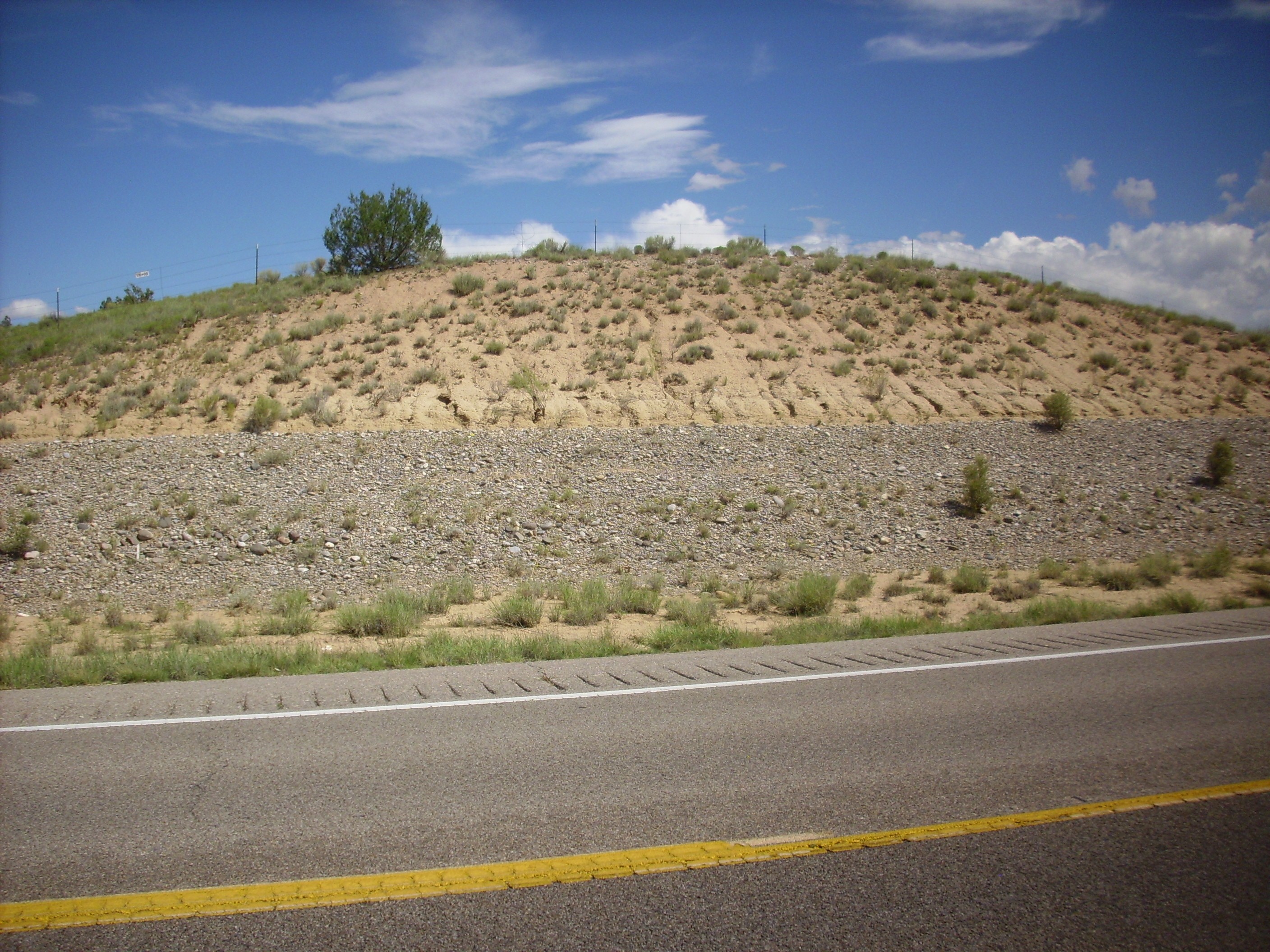
Judging from my GPS coordinates and the geologic map, the gravel here is a terrace gravel deposited by the ancestral Rio Grande. It’s apparently at the fourth of five distinct terrace levels that have been mapped in the area. The silty, tan beds above the gravel are mapped as eolium, which is silt and fine sand brought in largely by the wind.
I continued on past the dam, through Cochiti Pueblo, and on to Kashe-Katuwe Tent Rocks. It’s all either areas I shouldn’t be photographing, or areas I’ve photographed before. I continued on past the tent rocks to the Veteran’s Memorial Overlook. The overlook, too, is something I’ve photographed before. I was after more specific (if less dramatic) game today: the Cochiti Formation.
The Cochiti Formation is the most extensive rift fill sediment bed of the southeastern Jemez. It is exposed from La Bajada west almost as far as Bear Springs Canyon. It extends north into the Jemez Mountains, where it grades into the Paliza Canyon volcaniclastics — the distinction being that the Paliza Canyon volcaniclastics are contemporary with the Paliza Canyon Formation and are rich in volcanic ash, while the Cochiti Formation formed later from sediments eroded off the Jemez and is ash-poor. The distinction is subtle enough that there is some disagreement among geologists where to put the line.
I had actually been driving past outcrops of the Cochiti Formation almost from the time I passed the toll booth for Kashe-Katuwe. However, I wanted to examine it in the area of the Veteran’s Memorial, where it is topped by the Gravel of Lookout Park. Formation names are normally named after geographical locations, but I have never found a Lookout Park on any modern map. I suspect, but cannot confirm, that this is the former name of the Veterans’ Memorial Overlook.
The Veterans’ Memorial Overlook is located atop a mesa that gives a magnificent view of the southern Jemez and, in particular, of exposures of thick beds of the Peralta Tuff that forms the tent rocks of Kashe-Katuwe Tent Rocks National Monument. This mesa is underlain by eolian deposits atop Gravel of Lookout Park atop Cochiti Formation.
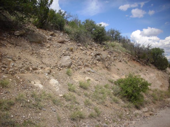
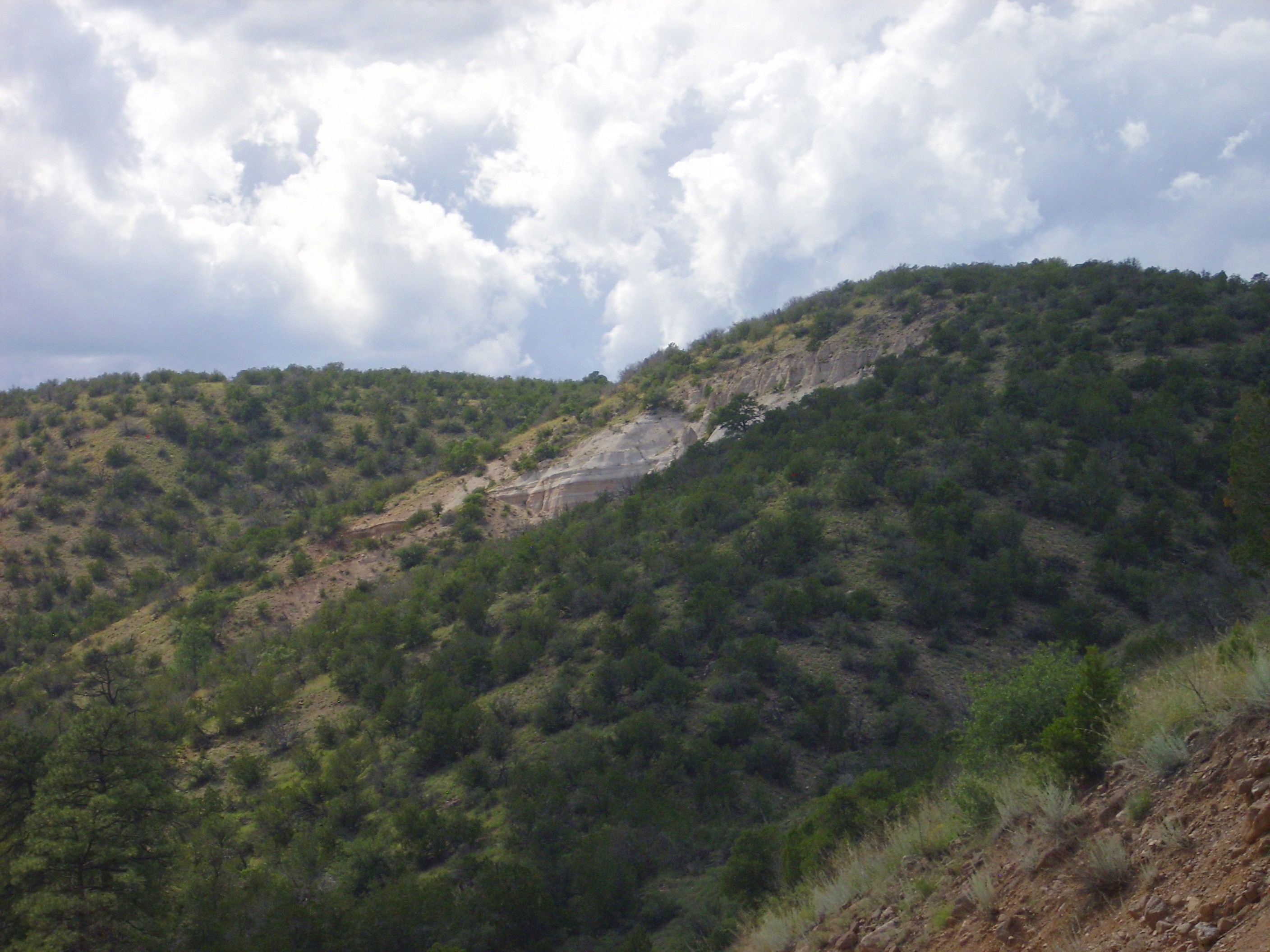
Cochiti Formation is well exposed in many places along the road in the arroyo south of the Overlook. This is as typical an exposure as any:
The lighting makes it look almost handsome here. The usual impression one gets in the field is of nondescript brown dirt. More formally, it is described as poorly-sorted silt, sand, and gravel of up to cobble size in a tan matrix.
The road reaches the end of this unnamed arroyo and makes a hairpin turn up the south face of the mesa. To the northwest are exposures of Peralta Tuff.
The Peralta Tuff is about 7 million years old, and is found beneath beds of the Cochiti Formation in most places. A significant fault crosses just in front of this outcrop, and has thrown down the Cochiti Formation in the foreground relative to the Peralta Tuff.
The road up the mesa exposes the contact between the Cochiti Formation and the overlying Gravel of Lookout Park.
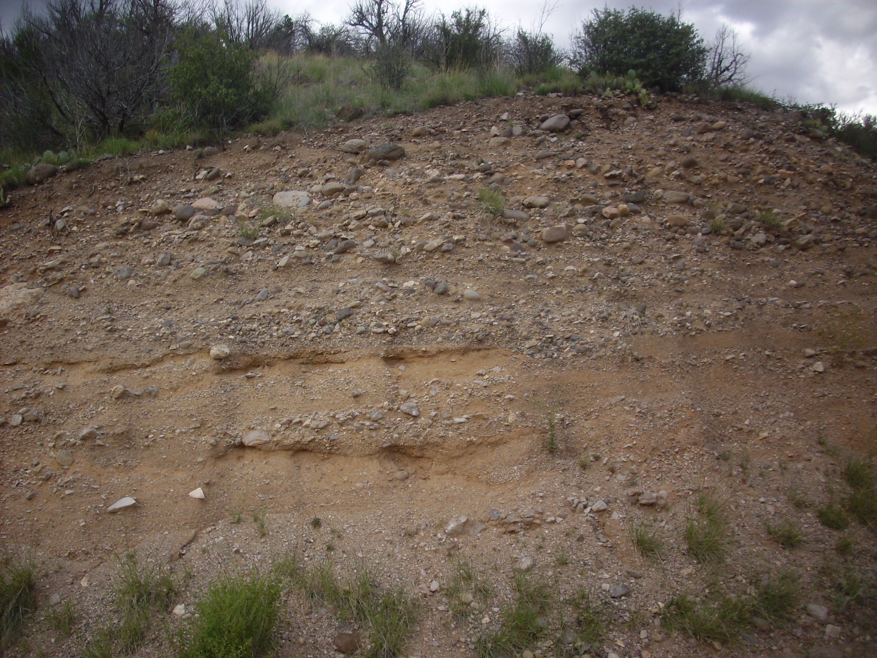
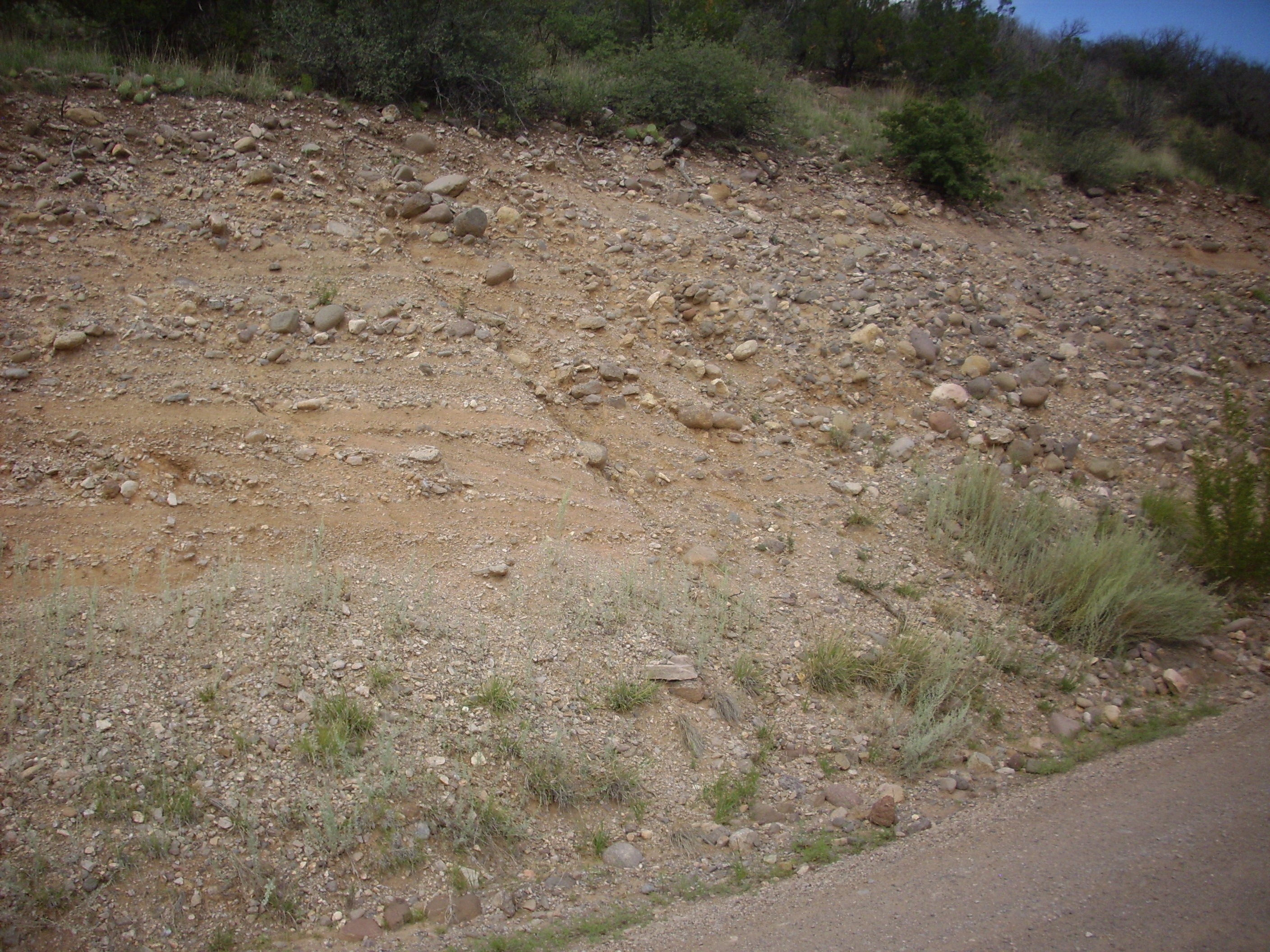
The Cochiti Formation is the sandy beds at the bottom of the photographs. The beds of gravel and cobbles above are the Gravel of Lookout Park. In the second photograph, it looks like a microfault has thrown down the beds of the Gravel of Lookout Park to the right (east).
The transition is not terribly dramatic, though it is more so when seen from a distance. It is no surprise that recent geologic papers tend to describe the Gravel of Lookout Park as the Lookout Park Member of the Cochiti Formation.
Here’s the Gravel of Lookout Park near the top of the mesa, where it becomes very distinctive.
This is an older photograph from an earlier trip; that’s Clownie the Wonder Car in the foreground. I was driving the Wandermobile on this trip.
Atop the mesa, I prepared to hike down the forest road that leaves the lookout area to the west. I was greeted by a sign.
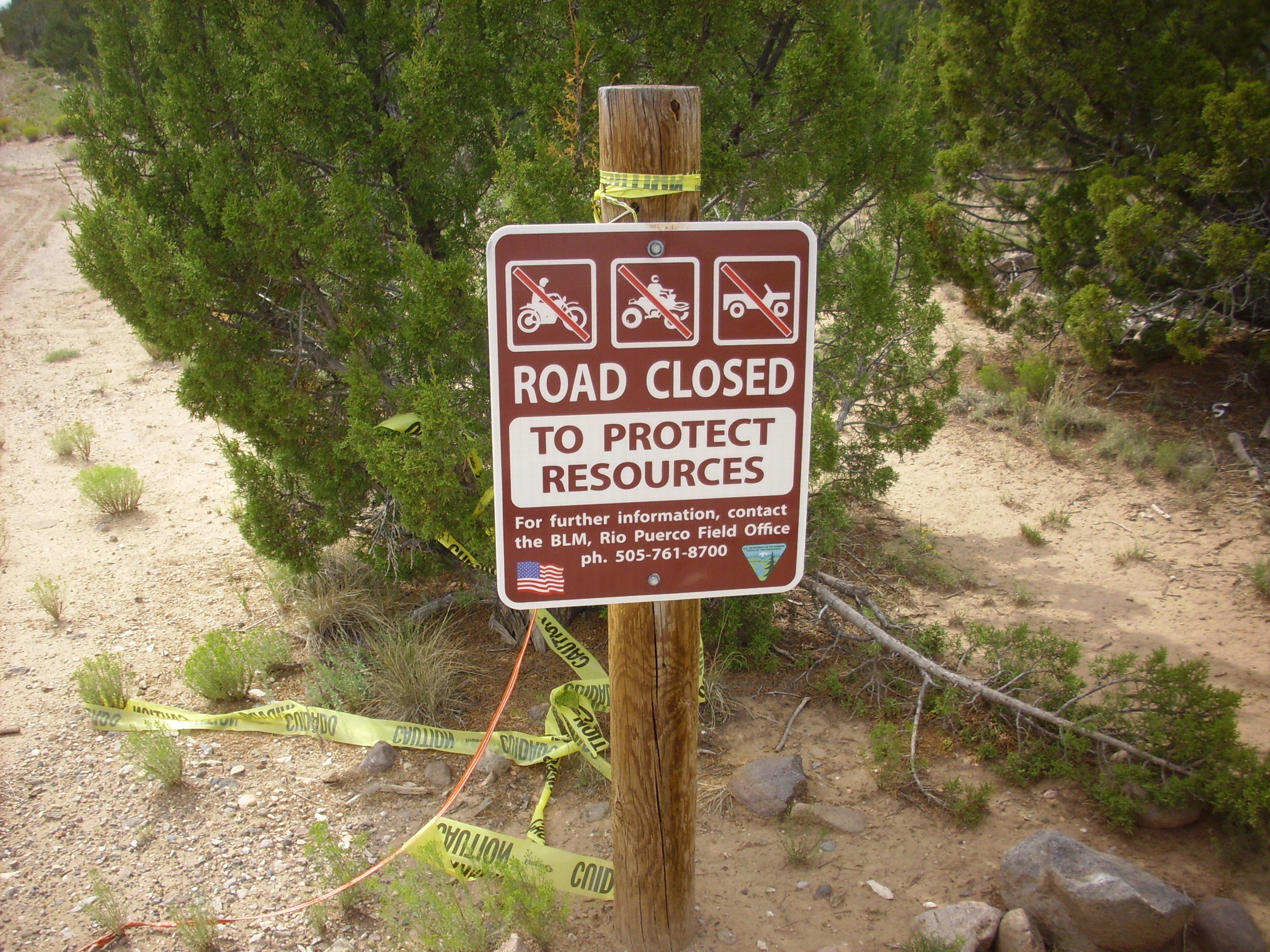
Earlier I had read that the road was closed to motor vehicles. The icons on this sign also are of motor vehicles. I concluded, hopefully correctly, that hikers were another matter, and started down the trail.
Ahead was a fault escarpment of interest.
The mesa is bounded by faults both to the east and west, both part of the same major fault system. We are looking at the fault bounding the west side of the mesa. East of this fault, there are what appear to be thin surge beds of the Tsherige Member, Bandelier Tuff.
West is Gravel of Lookout Park atop Peralta Tuff.

And here, so far as I can tell, is the exact fault trace.

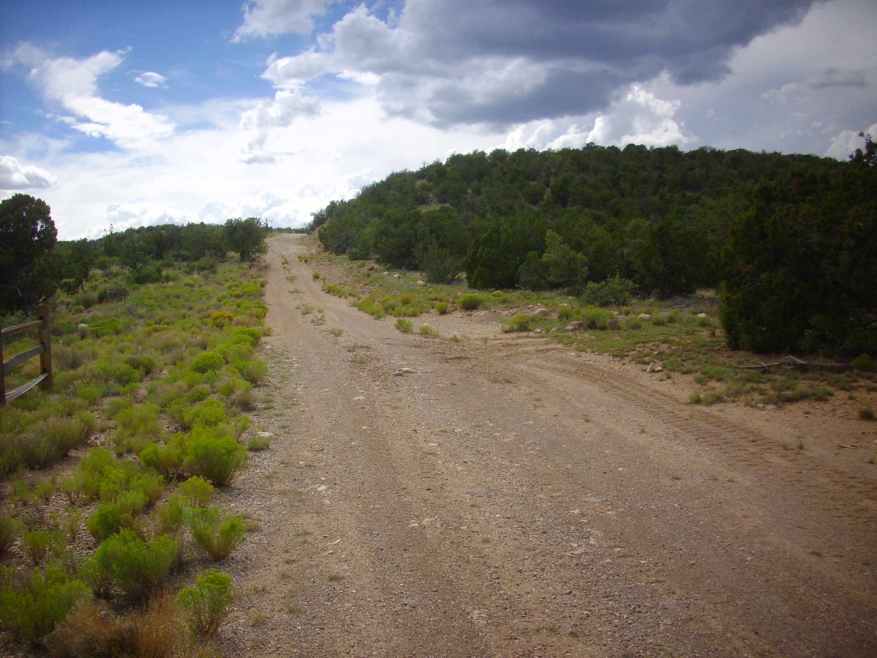
I hiked a ways down the road, finding that there was an excellent lookout point here. However, as the view to the north (while spectacular) was not materially different from the view from the already developed lookout point, I did not bother with a panorama.
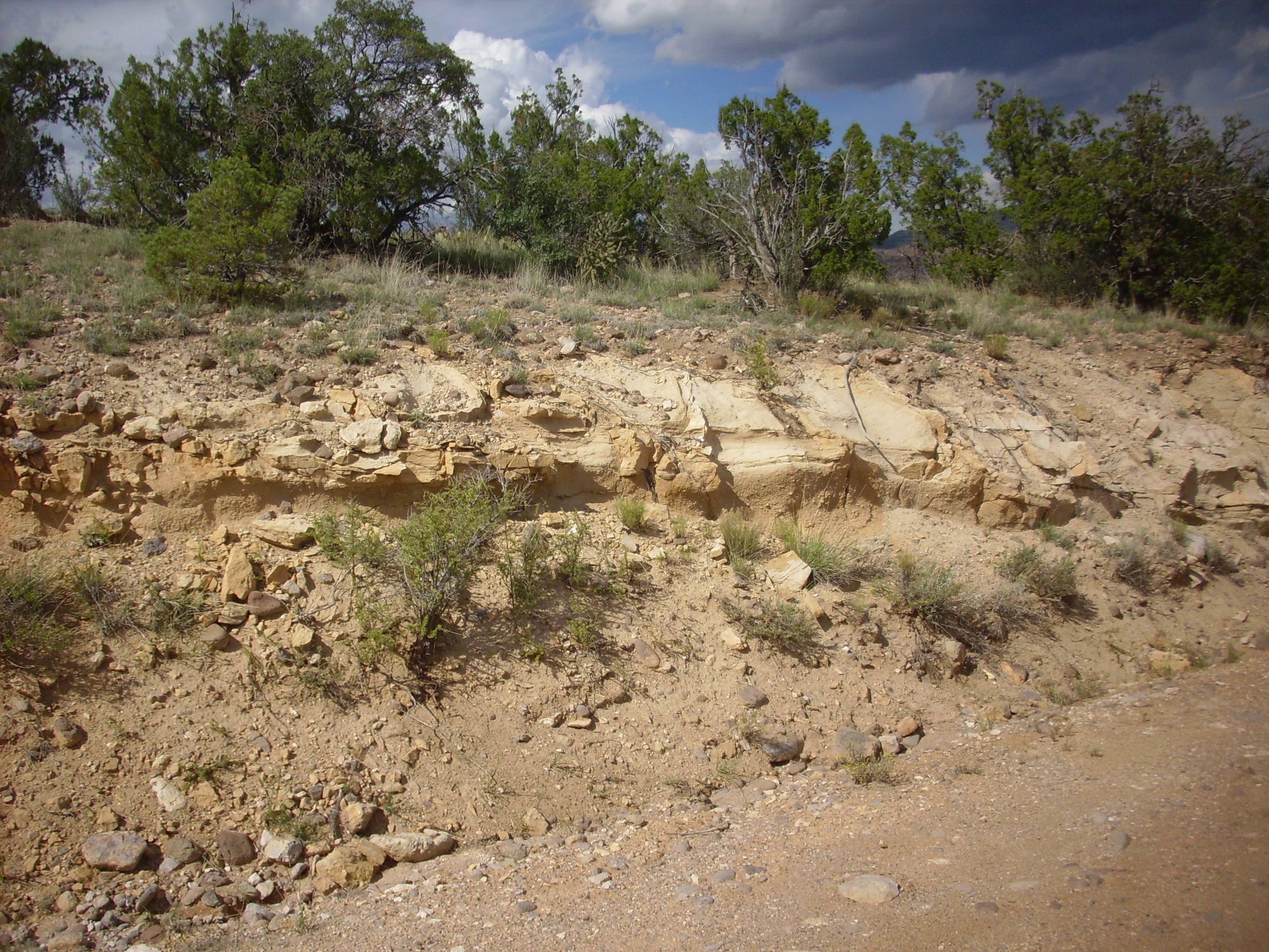
On the way back, I paused to get a panorama of the Lookout Park pediment surface to the south.
Notice how remarkably flat the top of the mesa to the south is. The flat areas further away in the first frame are also part of this flat surface, but have been thrown down by the fault we looked at earlier. There is no resistant bed on the top of these mesas that can explain this. The entire surface visible here, which extends for miles to the west and south (albeit with numerous cross-cutting arroyos), is underlain by Gravel of Lookout Park, with a thin surface layer of eolium.
Look, I’m a hard core nerd. I get excited about the strangest things. Studying the Standard Model of particle physics was very nearly a religious experience for me. But I’m not so clueless that I don’t understand that this seems very strange to the average person, nor am I the kind of arrogant scientist who insists that pursuit of knowledge for its own sake is automatically a great and noble enterprise. I can’t account for why acquiring these odd bits of knowledge gives me so much pleasure. It’s just the way I’m wired. It’s not how most people are wired, and that’s fine; but there it is.
But here is part of the reason why seeing a bunch of flat ground dissected with arroyos is kind of exciting for me. Such a surface doesn’t naturally form in an area undergoing rapid erosion, as almost the entire Rio Grande valley is at this time. This surface is interpreted as an ancient pediment surface. Pediments form in arid climates in regions where the mountain ranges are undergoing rapid erosion, but the valleys between mountain ranges are not. A pediment surface forms at the feet of the mountains, where erosion is wearing back the mountain front. The Gravel of Lookout Park was deposited across a pediment surface in a geologically short period of time, around 2.5 million years ago. Later, river drainage patterns shifted, erosion cut numerous arroyos into this pediment surface, but the surface is still discernible.
I hiked on back to the overlook area, discovering that a small group of, ah, free spirits had decided to pitch tents around the picnic area, although this area is supposed to be for day use only. (I didn’t linger to see what happened when the park rangers came to chase everyone out for the night.) But there is a trail around the top of the mesa, and this crossed some nice exposures of eolium.

Thin beds of eolium, wind-deposited silt, are found on top of the Gravel of Lookout Park over most of the pediment surface.
I headed on out, pausing along the road for a nice shot of the cliffs north of the tent rocks.
The contact between the Cochiti Formation and the underlying Peralta Tuff is obvious. The less easily eroded Peralta Tuff is here a cliff-forming formation, while more easily eroded Cochiti Formation is a slope-forming formation that supports considerably more vegetation.
Well, lookit the time. I headed over to the Cochiti area, where I wanted to take a panorama from the overlook. Here I found a plaque that made me feel old.
Because even the dam and reservoir here are younger than I am.
But I did get the panorama.
The pan begins towards the northeast, looking up the valley of the Rio Grande. At extreme left are the San Miguel Mountains, with mesas of Tsherige Member, Bandelier Tuff, at their feet. La Bajada stretches across the second through fifth frames, with Tetilla Peak just poking over the skyline in the fourth frame. Sandia Crest is on the distant skyline in the fifth frame, and Cochiti Dam crosses the last three frames.
The portion of La Bajada in the third frame is a bit unusual. Close study of the lava flows here shows that one of the flows was erupted recently enough (around 1.14 million years ago by radiometric dating) that La Bajada already existed, and the flow cascaded down the face of the escarpment and pooled on the low ground below.
I was not convinced I had actually found the overlook I had meant to drive to; this seemed too far south. (My instincts were good; my intended destination was actually here.) I drove north but missed my turn, and found myself in a road cut just south of Cochiti Golf Course that looked very much like Otowi Member, Bandelier Tuff.
(Checking the GPS coordinates against the map when I got home confirmed it.)
I was out of time. I drove back to Santa Fe, grabbed a quick meal from El Parasol, and headed to the church where I attended a church conference. After the conference, I headed to Walmart with a grocery list Cindy had given me. There are two in Santa Fe; I meant to go to the newer, larger one, but did not realize it was so far down Cerrilos Road and ended up at the smaller, older one. I had paper bags with me: Santa Fe is a progressive enough city to have adopted the idiocy of mandatory charges for grocery bags. I found all but two items on the list (chicken salad and fudge tracks ice cream) and headed home.
Shoulder update: I did too much with it Saturday, and it was mighty sore by the end of the day. Both shoulders, actually. A little better today, but I’ve kept my stretching exercises on the gentle side.
Next weekend is Labor Day. I have big plans. Or, at least, I plan to have big plans. I may hike deep into Jaramillo Canyon in the Valles, or I may try visiting Lobato Mesa. Much will depend on the weather: Lobato Mesa is about the worst spot in the Jemez for thunderstorms during monsoon season.