Four-Wheeling Wanderlust
Way back before the shoulder surgery, I was joined by friend of the Wanderlust, Steve Painter, on a hike to Sulphur Springs and Alamo Canyon. Steve enjoyed this enough to ask if I would be interested in navigating him to some nice spots in the northeast Jemez via 31 Mile Road. Well, of course.
(Brief interruption for a shoulder update: I had my final follow up with my orthopedic surgeon this week, who pronounced himself pleased with the outcome. I’m pretty happy about it, too. I can now raise my left arm well above my head without much difficulty, and I even had enough strength in the shoulder to replace a balky garage door opener this week. I still have some physical therapy ahead, to get just a little more range on the external rotation and build strength, but I feel like a whole man again.)
So I was up at 6:30 Saturday morning to eat the usual hearty breakfast and make the usual preparations. Well, not quite the usual hearty breakfast; my stock of Fiber-1 pancake mix finally ran out, and they don’t sell it in the local groceries or at Amazon any more. I’m not even sure it’s still made. So I have been trying alternatives, including high-fiber organic pancake mix (passable, but it’s not a complete mix; I have to add an egg, oil, and milk, and that makes three servings, so leftovers) and high-protein mix (complete, but fairly dreadful.) I’ll use these up rather than throw them out, but after that, I think I’ll go with adding inulin powder to a conventional complete pancake mix and see how that goes. The idea is to make a pancake that doesn’t overload my pancreas by dumping too much carbohydrate on it all at once.
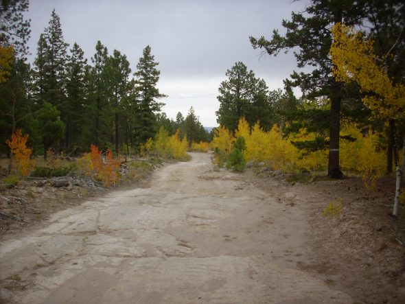
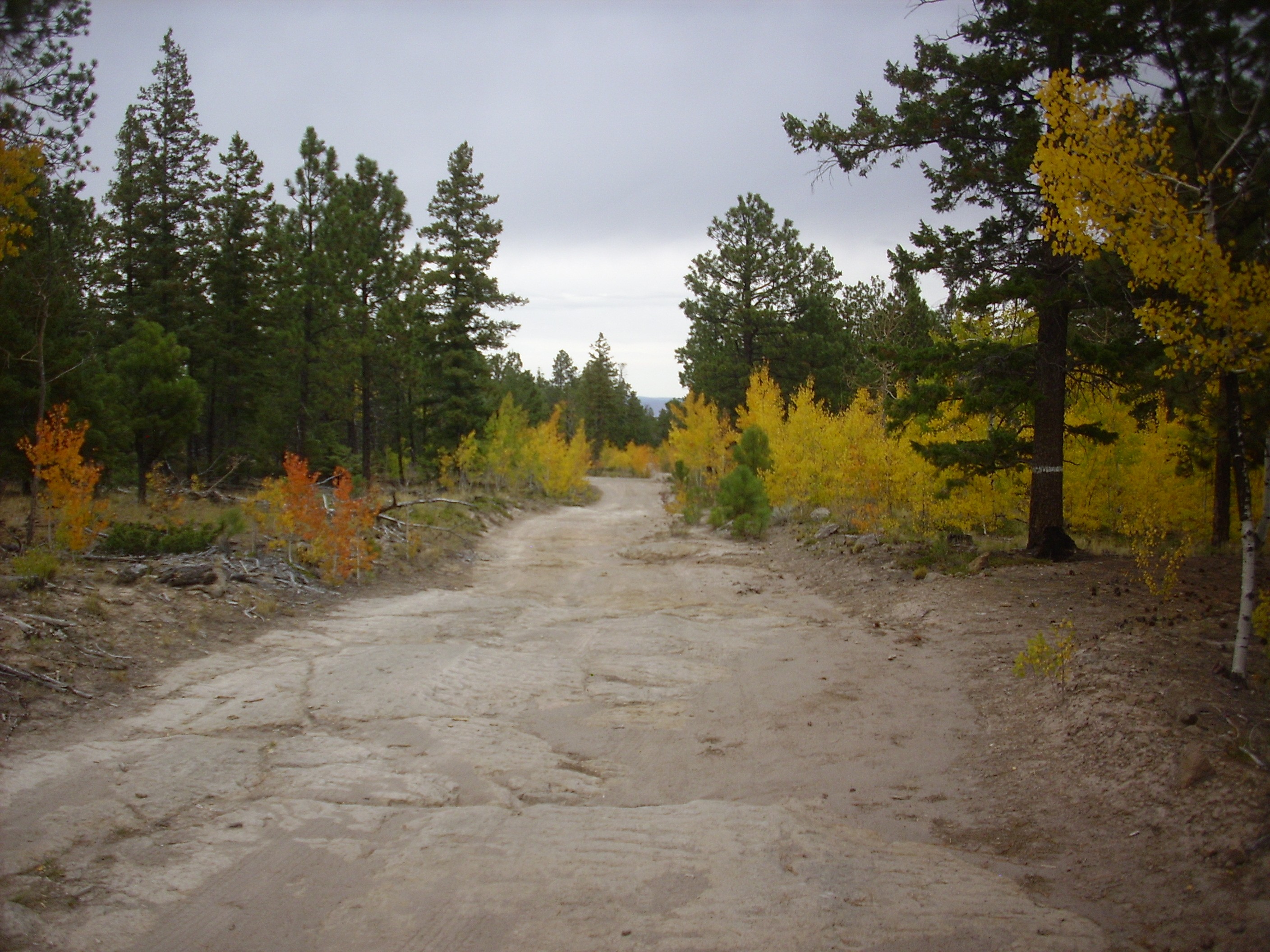
Anyway, Steve picked me up at 8 and we headed towards Espanola. From there, we got onto 31 Mile Road and headed west. This is all reasonably familiar ground to me, so I didn’t take pictures (the ones here are recycled), but I pointed out to Steve some ancient river gravels
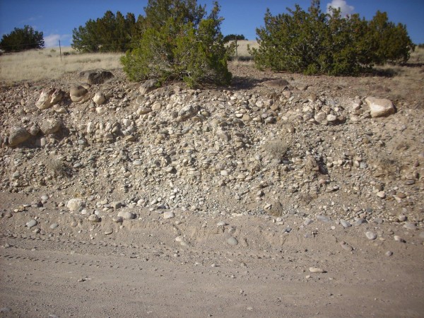
Upper terrace gravel along Thirtyone Mile Road. 36 00.659N 106 07.021W
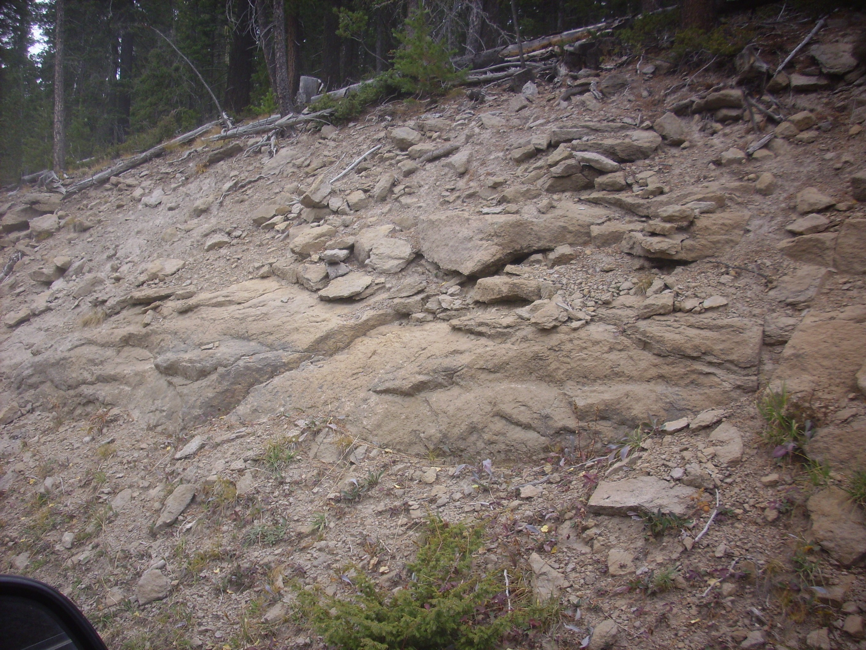
and the contact between the Puye Formation and the underlying Chamita Formation
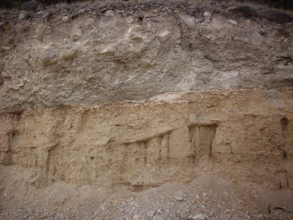
Contact between Puye and Chamita Formations. 36 00.726N 106 08.383W
among other things. We also passed the pumice mine, and I told Steve the story of stopping here once and taking photographs without thinking about the implications of photographing an industrial operation on tribal lands. (A foreman materialized and asked what I was up to. I told him the truth — that I was out on my day off looking at geology — and he remained polite but I took the hint.)
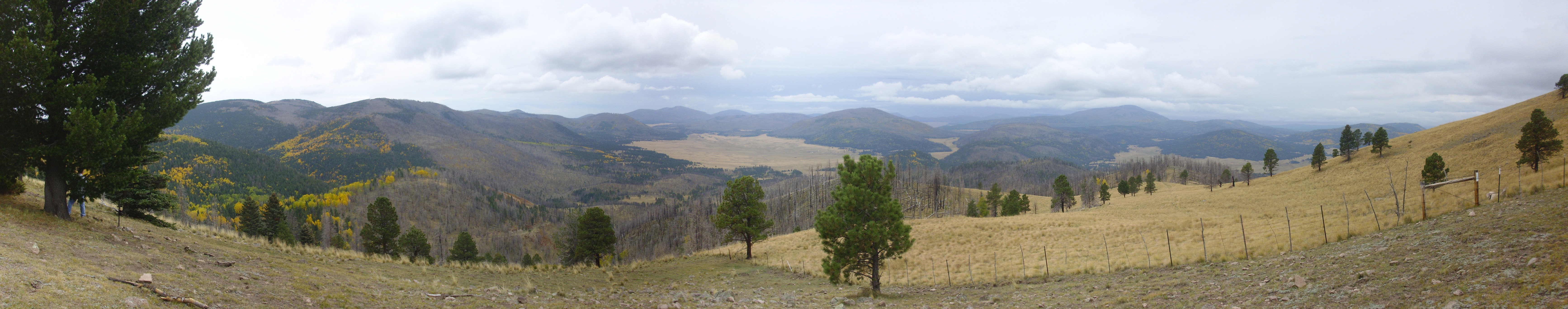
The road then took us up the face of Clara Peak, a 9-million-year-old shield volcano that has been sliced neatly in half by the Santa Clara Fault. Here I had Steve pull over, and I took my first panorama of the day.
I’ve taken a similar panorama from this spot before, but it was late in the day and I wasn’t really happy with it; this seems much better. See what you think.
The pumice mine is on the boundary of the first and second frames. Santa Clara Canyon crosses the panorama and passes up into the Tschicoma Highlands on the boundary of the fourth and fifth frames. Tshicoma Peak itself is centered on the skyline in the fifth frame, and Polvadera Peak is left of center on the skyline in the sixth frame.
The little white plug in the middle distance just below Tschicoma Peak is Penasco Blanco, an isolated mesa of Tsherige Member, Bandelier Tuff.
Steve noticed a sign on a fence below the road level, which we could not make out. Curious, I fetched my giant binoculars; the sign said that the wreck had already been reported. Wreck? Yep, there was a thoroughly wrecked vehicle way down slope from us. I observed that drinking and driving on mountain roads do not mix, then reflected a little more and observed that, on a treacherous mountain road like this one, alcohol was not necessarily required.
We continued along 31 Mile Road towards Mesa de la Gallina. The area below the mesa is a maze of small canyons, but I pointed out for Steve the road to the top of Clara Peak (which I mean to explore sometime) and the road to San Lorenzo. San Lorenzo is a small ghost town of which I have found only the following online:
San Lorenzo is an old Hispanic village located in the Rio del Oso drainage in northern New Mexico. It is off Highway 84, approximately 9 miles southwest of Chili. In the mid 1800s Jicarilla Apache settled into the valley, traded and worked with the settlers. Records show a schoolhouse located there. Probably abandoned in 1930’s or 1940’s.
It turns out Steve’s wife, De Ann, has sufficient interest in ghost towns that the mention of San Lorenzo got Steve’s ear perking up. I may end up hiking with the two of them into that area sometime next year.
We continued up Mesa de la Gallina, which is a single massive flow of Tschicoma Formation dacite erupted from the northeast flank of Tschicoma Mountain. I know just enough Spanish to know that the name means Hen Mesa. As it turns out, Steve once served as a Mormon missionary in Venezuela, and, living in New Mexico, has not entirely lost his Spanish; he was able to provide useful translations of other location names from time to time.
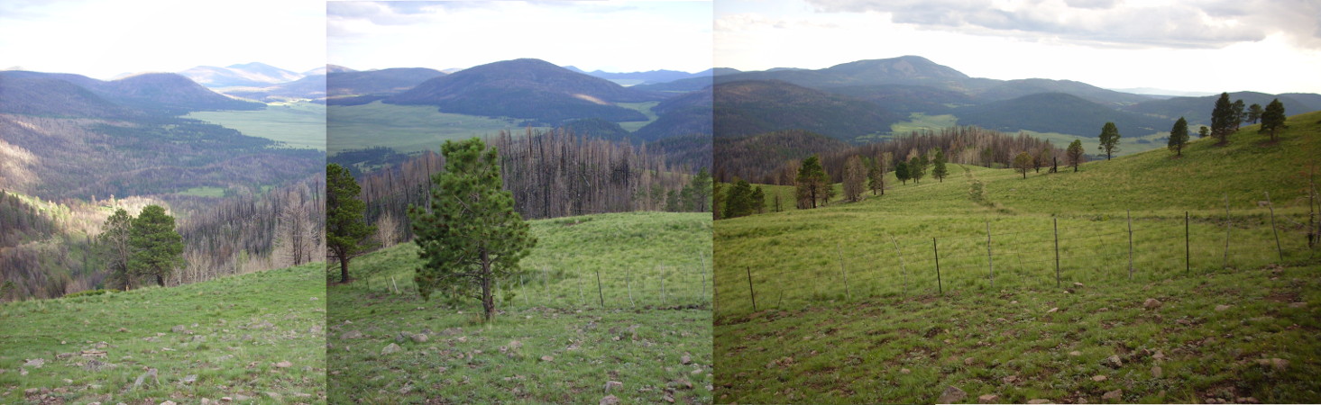
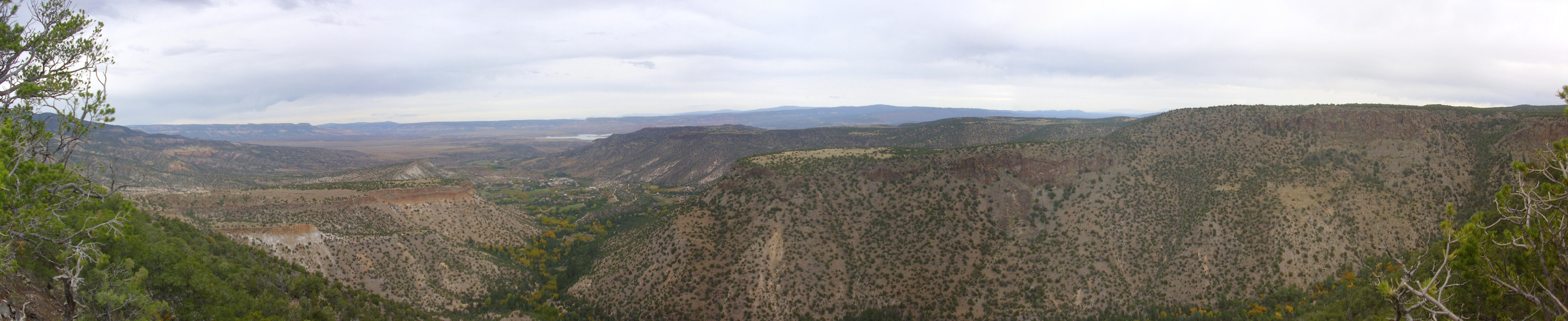
The road winds around the north flank of Tschicoma Mountain. I plan to hike to the summit sometime, but not today. We did pull over to the rim of the Toledo Embayment for the view. Again, I’ve been near here before, but was not entirely satisfied with my panorama. Here’s the new one, resplendent with fall color.
Cerro Toledo is on the boundary of the second and third frames. This dome is underlain by Cerro Toledo Interval rhyolite, which was erupted as viscous silica-rich magma in the interval between the Toledo eruption 1.6 million years ago and the Valles eruption 1.2 million years ago. The bench to the left (east) of Cerro Toledo is underlain by Tsherige Member, Bandelier Tuff, from the Valles eruption. This has been partially eroded away to form upper Santa Clara Canyon at the base of Cerro Toledo. The rim we are standing on is 3-million-year-old Tshicoma Formation dacite, a rock slightly poorer in silica than rhyolite that is distinctive for its many white crystals of feldspar. I cracked open a local rock to show to Steve by banging it on another rock.
Steve: Do you ever bring a geologist’s hammer along to break rocks with?
Kent: As a matter of fact, I have one in my pack in the truck. I’m just too lazy to go get it.
Steve found this hilarious.
We resumed driving along the road, which became a bit rocky in spots. Steve took these fairly slowly as we speculated on whether the Mythbusters show was correct, that rocky roads are best taken with a little bit of speed. Steve seemed reluctant to find out and I trusted his judgment. Anyway, his truck, his driving.
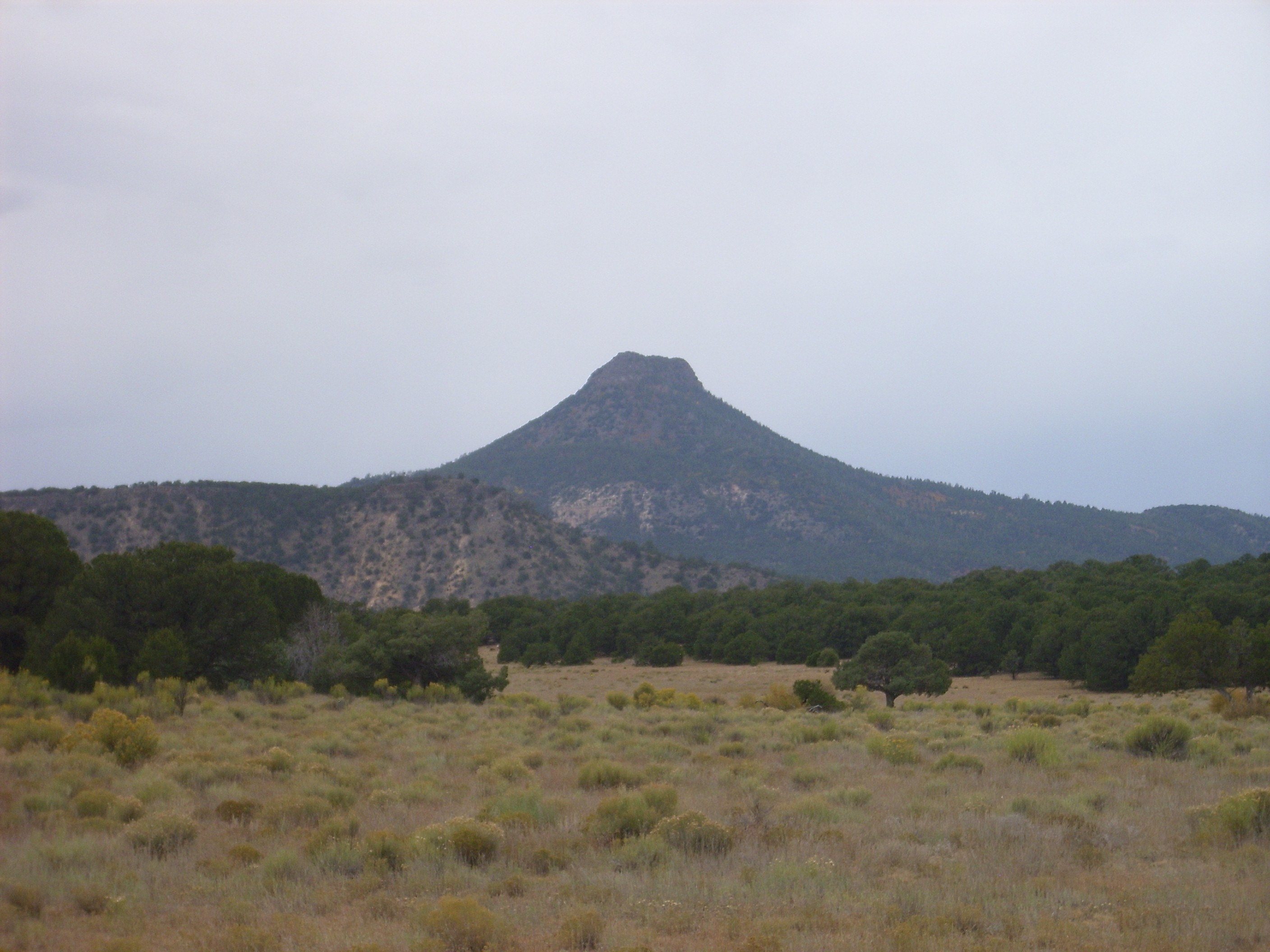
We continued along the rim of the Toledo Embayment. The view to the northwest opened up and gave us a wonderful view of Cerro Pedernal.
I already have many pictures of Cerro Pedernal, but I can’t seem to resist taking more. I sometimes wonder if I’m a distant relative of Georgia O’Keefe.
Except she inherited all the talent.
At this point I admit I was slightly disoriented. You can see in the photographs that heavy cloud was moving in from the south, so my sense of direction was thrown off a bit. We resorted to Steve checking the odometer now and then to estimate when we would get to the side road leading to the caldera rim. However, I recognized it when we got to it; and it turns out it has a signpost, FR 144V, which I had forgotten but which certainly helped. Steve started up the road, which soon became as dreadful as I remembered from my last time here. Steve hopped out, switched his truck into four-wheel drive, and we soldiered on past the trick tank and to the rim.
Steve was curious about the trick tank. I explained that it was just a little like the water dispenser in a gerbil tank, but on a bovine scale. I’m not sure this explanation was helpful. (Or necessarily very accurate.)
But the view from the rim is to die for.
At left is the Toledo Embayment, with Turkey Ridge across the mouth of the embayment on the boundary of the first and second frame. On the boundary of the second and third frames, on the skyline, is Pajarito Mountain and Cerro Grande; we could just make out the radio tower atop Pajarito Mountain. These two mountains form part of the eastern rim of the caldera. In front of them is a thin sliver of the Valle Grande and then Cerro del Medio, which extends into the third frame. In front of Cerro del Medio, at the center of the third frame, is Cerros del Abrigo. Both Cerro del Medio and Cerros del Abrigo are ring domes, formed from magma that came up through the ring fracture around the area that collapsed during the Valles eruption 1.21 million years ago. Cerro del Medio is 1.17 million years old while Cerro del Abrigo is 0.97 million years old.
In front of these two domes is Valle Toledo. If you click to get the full resolution image, you can just make out Pipeline Road running in front of Cerros del Abrigo. This road follows the natural gas pipeline from the Farmington area to the city of Los Alamos.
The mass of hills on the boundary between the third and fourth frames is Cerros de Trasquilar. The main portion is another Valles ring dome, this time aged 0.93 million years. The northernmost knob, just above and right of the foreground tree and with prominent yellow aspen on its top, is a remnant of a ring dome from the Toledo event and is 1.36 million years old. Above the narrow valley between Cerros del Abrigo and Cerros de Trasquilar is another distant view of Valle Grande, and beyond that, the south caldera rim.
Centered in the fourth frame is Redondo Peak. This is a resurgent dome, part of the caldera floor that was pushed back up by fresh magma injected into the collapsed magma chamber after the Valles event. This happened very shortly after the Valles eruption, being essentially complete in a few tens of thousands of years.
On the boundary of the fourth and fifth frame is Cerro San Luis, yet another ring dome with an age of about 0.80 million years. Behind it is Redondo Border, another part of the resurgent dome. Between Redondo Peak and Redondo Border is the Redondo Creek valley, which is a portion of the resurgent dome that collapsed as the dome stretched upwards. To the right of Cerro San Luis is Cerro Seco, also 0.80 million years old. At extreme right, just peeking over Cerro Seco, is San Antonio Mountain, a ring dome 0.56 million years old. You may have noticed that the domes erupted in orderly succession, with the eruptions moving counterclockwise around the ring fracture.
I was disappointed that there was so much cloud moving in. My earlier panorama of this view, taken from almost precisely the same spot, was made very early in my wanderlusting days and I didn’t do a great job of it. However, the weather was marginally better, though the time was too late in the day. This new panorama is technically much better but the weather was less cooperative. Compare and see what you think.
We paused here for lunch and talked a little about the deep things of life. Steve lost a son this summer. I had painful and difficult shoulder surgery. We both had small skin cancers removed. It seems the world can be both lone and dreary and glorious and beautiful.
Then back to the main road, which was easier going downhill than up. Steve optimistically switched the truck back out of four-wheel drive and we headed for Forest Road 27. Along the way, I had Steve pause just a moment while I took a picture for the book.
This is proximal Tsherige Member, Bandelier Tuff. That is, it’s tuff from the Valles eruption that is very close to the north rim.
And then to Forest Road 27. This would be new territory for me. I had never been along Forest Road 27 between 31 Mile Road and El Alto before. Excitement! Adventure! Ambiguous forks in the road where the fork we chose took us into a frikkin’ rock garden!
At least the rocks were of some interest.
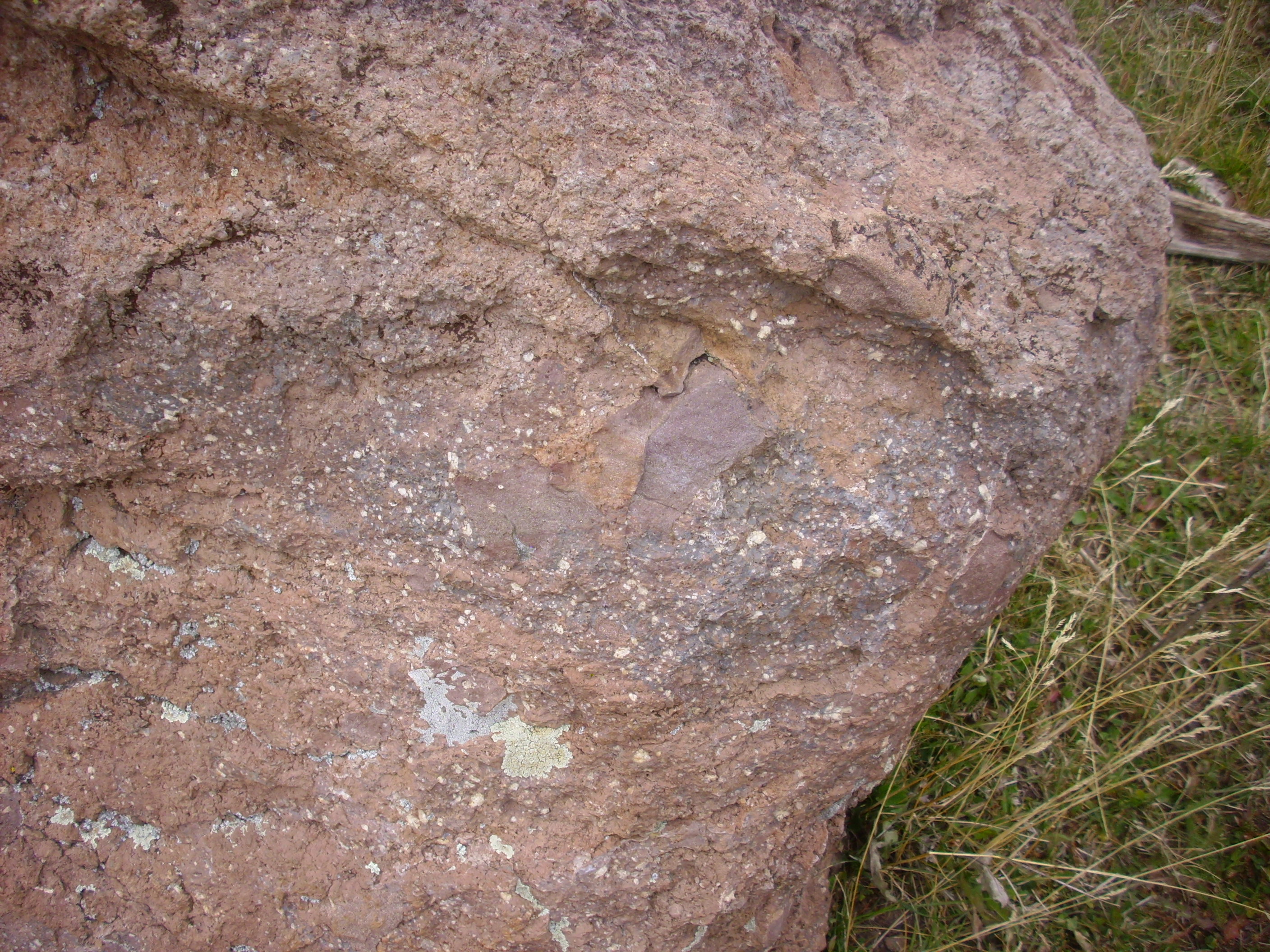
A published road log for this area mentions that the Tschicoma Formation rocks found here often contain mafic inclusions. This photograph shows two blobs of fine-grained darker rock (the mafic inclusions) surrounded by Tschicoma dacite, with its distinctive white plagioclase feldspar crystals. The mafic inclusions are evidence that the Tschicoma eruption, 3 million years ago, may have involve mixing of low-silica basalt magma from the mantle with high-silica melted crust.
I was getting very worried at this point that we were on the wrong road. My Forest Service map didn’t show the fork at all. I was quite disoriented, both because it was now heavily overcast and because the occasional clumps of yellow aspen among the dark green conifers kept telling my internal compass “sunlight this way.” I was quite conscious of both effects but could not entirely shake them off. Finally I turned on the GPS and used its compass to reorient, and compared the lay of the land with my Forest Service map, and things began to come together. Then we saw a “FR 27” signpost. We were on the right road, after all, though it was much more rugged than I had expected. It had been Steve’s call to take the left fork at the crucial point; I’m grateful he was driving and not me.
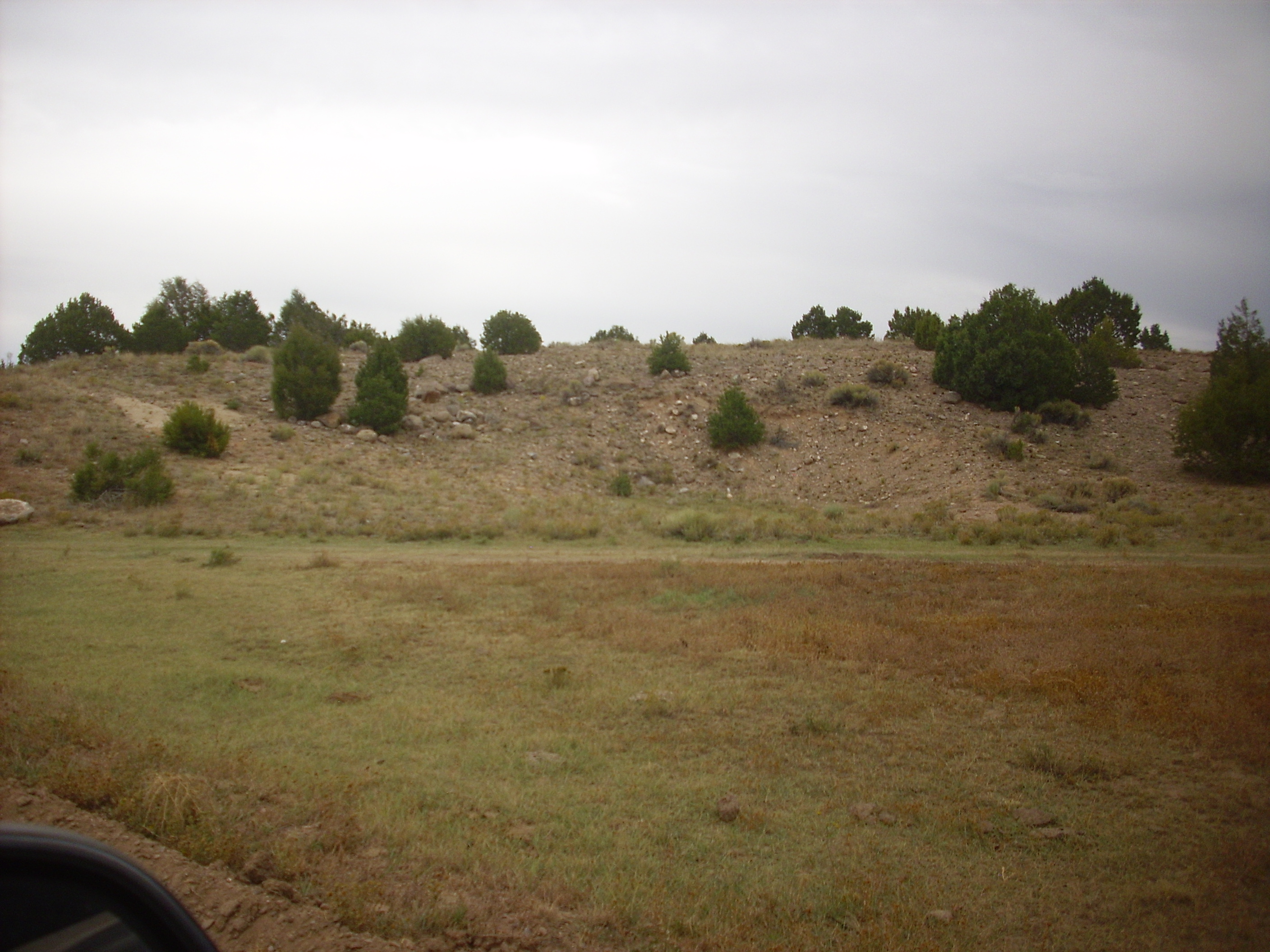
Eventually the road came out on Polvadera Mesa. We both had some liquid we had no further use for that we needed to dump. After making my contribution to the nitrate content of the soil, I took a snapshot of the road.
Doesn’t look bad, but that’s solid Tsherige Member tuff, so when your car hits an irregularity, you feel it. Steve felt prompted for some reason to share a story about a recent houseboat trip where he nearly crashed into a rock.
Further down the forest opened up quite a bit, and there was Cerro Pedernal. Naturally, it was time for another Georgia O’Keefe moment.
The clouds were really rolling in at this point.
I mentioned to Steve that my road log showed a spur heading off to the north rim of Polvadera Mesa, where you could look across a canyon and see an old Ancestral Pueblo People ruin atop a neighboring mesa. We decided to stop at the spur and walk to the rim; we both could use a good stretch after several hours in a truck on a bumpy road.
It was a nice walk and the view from the rim was rewarding.
At left in the middle distance is Pueblo Mesa. Beyond is the sloping ground north of Cerro Pedernal, with the cliffs of Mesa Alta on the skyline. The village of Canones lies in the valley in the center of the second frame, with a glimmer of Abiquiu Reservoir in the distance. Behind and to the right of Canones is Canones Mesa, which merges with the El Alto Plateau at right. The canyon at the bottom of the panorama is Polvadera Canyon.
Pueblo Mesa has the old Ancestral Pueblo People ruins atop it. This appears on the panorama as a tan patch of clear ground on the right side of the first frame. I’m afraid my camera can’t do it justice. Through my giant binoculars, Steve and I could make out piles of stone blocks covering this area, and a low cliff running through the area that appeared to have doors and post holes excavated in it. There were also some ruined walls further south (left), where a trail appeared to come up to the mesa top. We could not make out the shapes of buildings and kivas from this angle that are visible on satellite.
The satellite photo appears to show a single kiva far from the village. I’m not sure what to make of this.
The cliff we were on was rimmed with “basalt”. I grabbed a chunk, since I wasn’t expecting basalt here (I thought the whole mesa was Bandelier Tuff) and we headed back. Later, I consulted the geologic map and found that the rim here is mapped as Lobato Formation andesite. Lobato Formation is fine; it’s a 10- to 8-million-year-old formation that is quite extensive in the northeast Jemez, underlying most of El Alto. But andesite? This dark, fine-grained rock, with no phenocrysts visible, sure looks like basalt. There are even rusty patches suggesting it is an olivine basalt. Go figure.
The road got quite rugged along the stretch passing through a private enclave. It didn’t get much better until we were well onto National Forest land south of Cerro Pelon. Here we saw numerous campers and trailers in the surrounding meadows, and the road became quite good when we crossed onto the Abiquiu land grant. From there we headed on out to Abiquiu, pausing once to let me get a photograph of a Puye Formation outcrop I should have photographed the last time I was here. This has the look of a borrow pit; I explained to Steve that a borrow pit is an open pit where gravel and other unconsolidated material is removed, while a quarry is an open pit where solid rock (rather than any ore it contains) is the desired product. If you’re digging out ore or other specific minerals from solid rock, it’s a mine. At least, I think that’s the right idea.
Anyway, the Puye Formation:
As on the east side of the Jemez, the Puye Formation is layers of debris flows and mud flows off the Tschicoma Highlands. These are located immediately to the south.
From there it was on out Abiquiu Canyon and home, just in time for the rain.