Wanderlusting the Pilar staurolite beds
This week’s wanderlust was a hiking adventure with the Los Alamos Geological Society to an outcrop of superb staurolite-bearing mica schist in the Picuris Mountains east of Pilar.
I have never hunted staurolite before, at least in any serious way, and looked forward immensely to this trip. I was up at 6:30 to get breakfast, take care of the dog, be sure everything was packed, and be on the road at 7:45. I seem to have done all right this time on remembering everything; I remembered my walking stick at the last moment, and otherwise did not find I missed anything while on the hike. With one exception, to be noted in due course.
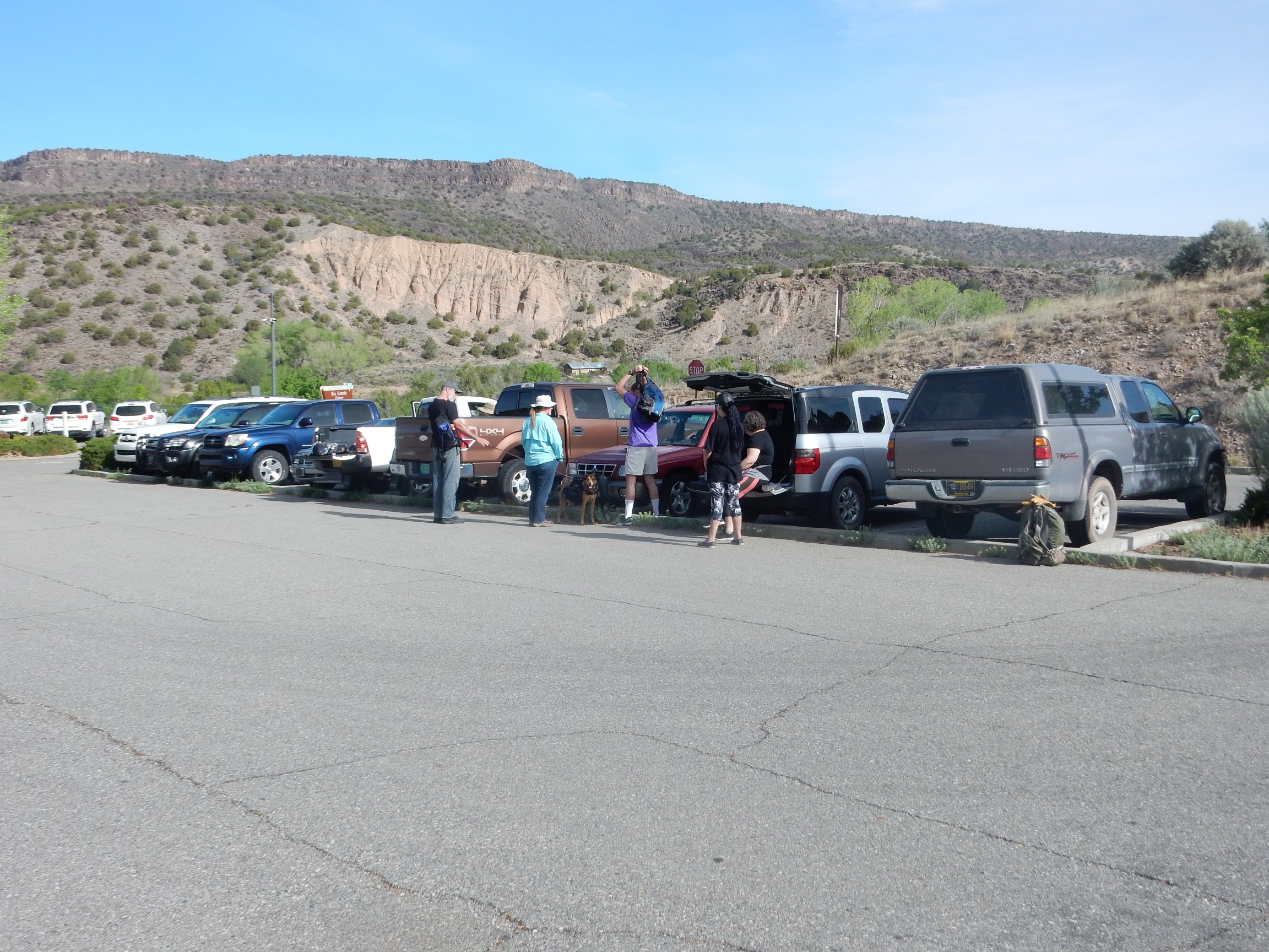
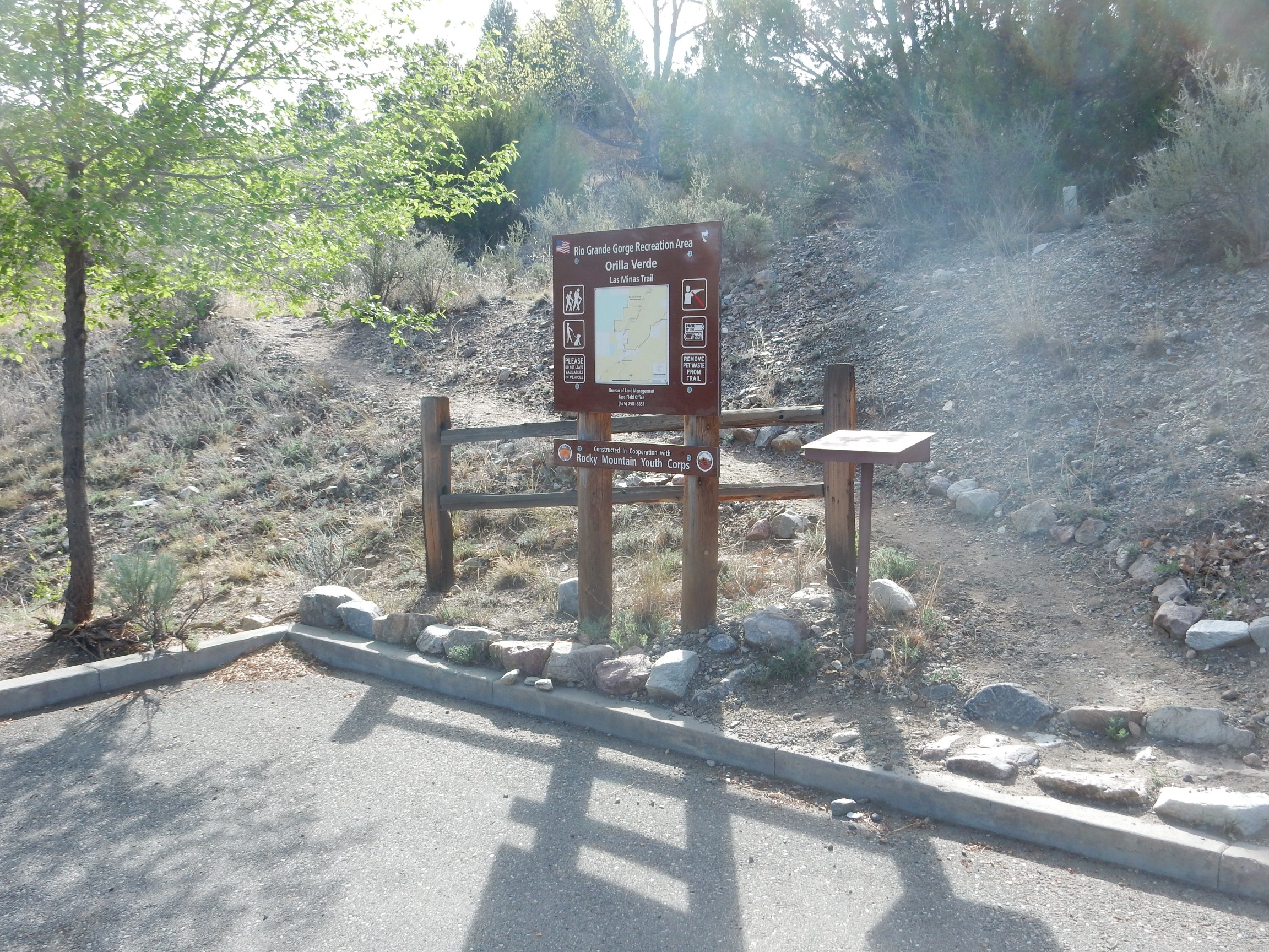
So with pack, camera, tripod, SPOT messenger, water bottles (three pint-plus bottles), giant binoculars, loupe, sunscreen, lunch, hiking boots, and hammer, I headed on my way. The drive from White Rock to Pilar was reasonably uneventful, though it was slow going through the construction zone south of Espanola, and I arrived at the Rio Grande Gorge Visitors Center of the Rio Grande del Norte National Monument at about 8:45. Other members of our group were already there and preparing for the hike.
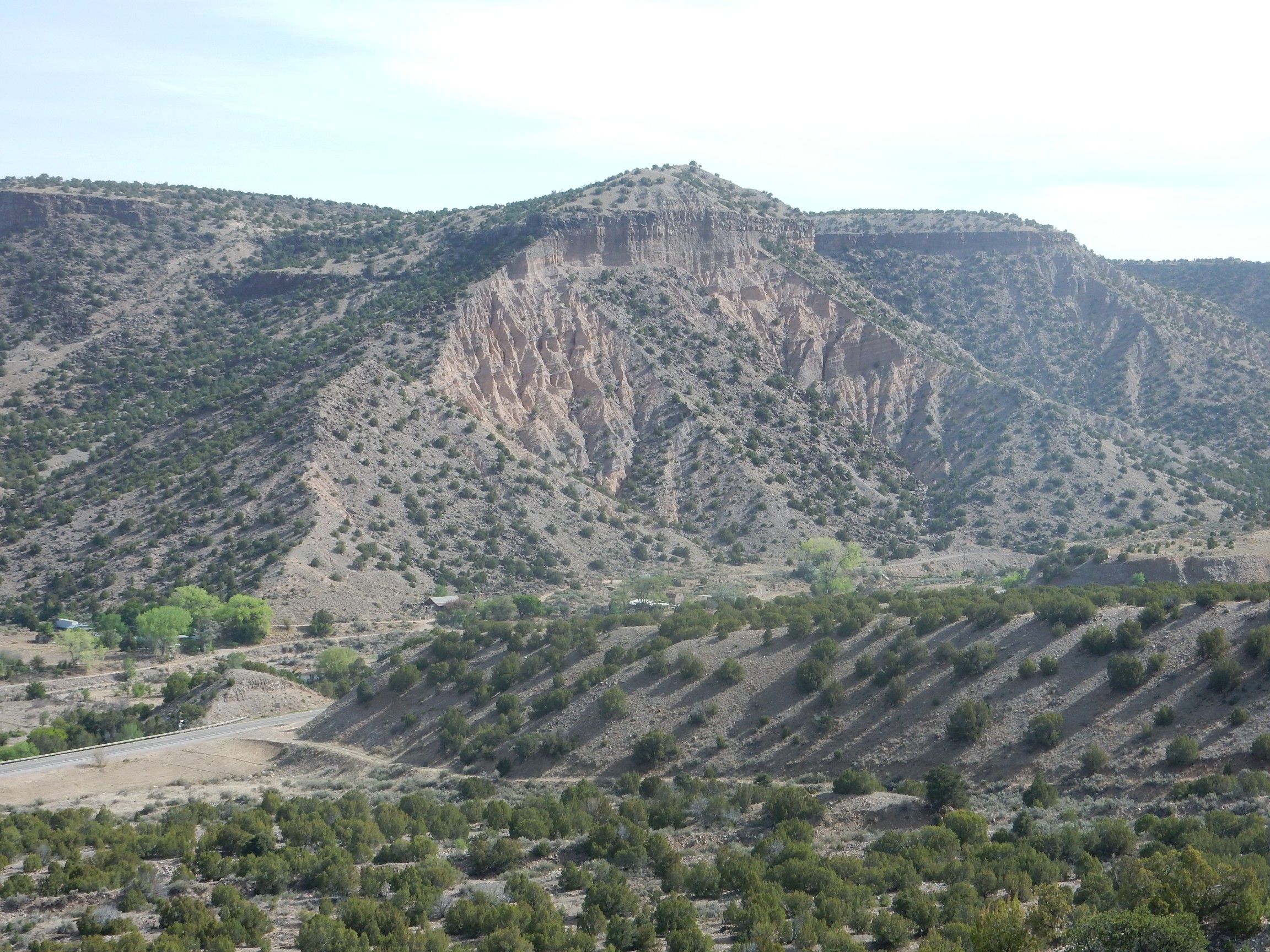
This is looking northwest from the parking lot. The skyline is Servilleta Basalt of the Taos Plateau, an extensive formation mostly dated between 3.5 and 4.5 million years old. It solidified from lava that was quite low in silica, around 50% SiO2 by weight. Since silica gives magma its viscosity, this low-silica magma was also low-viscosity and flowed miles from its source vents to form flat flows rather than cones. Subsequent erosion around the edges of the resistant basalt has produced the Taos Plateau, here cut by the Rio Grande.
The prominent pink exposure in the middle distance is mapped as Chamita Formation of the Santa Fe Group. This formation has had some beds dated very accurately by radioisotope methods at around 13 million years old and some higher beds at around 7 million years old, giving a pretty good minimum age range for the formation. Like the rest of the Santa Fe Group, it is rift-fill sediments, which accumulated in the Rio Grande Rift, the great crack in the Earth’s crust that extends from central Colorado to the El Paso area (where it blends into the Basin and Range block faulting of northern Mexico.) The Chamita Formation is mostly dirty, poorly-consolidated sandstone with some gravel beds, likely laid down in a flood plain of the ancestral Rio Grande.
I switched from sneakers to my hiking boots, checked my pack one more time, doused myself with UV-resistant polyphenols (one skin cancer is enough), and activated the SPOT messenger and hit the track and “at the trailhead” buttons.
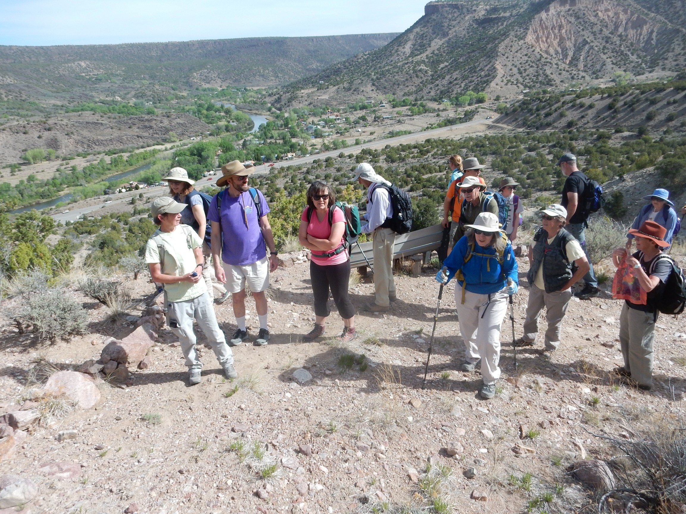
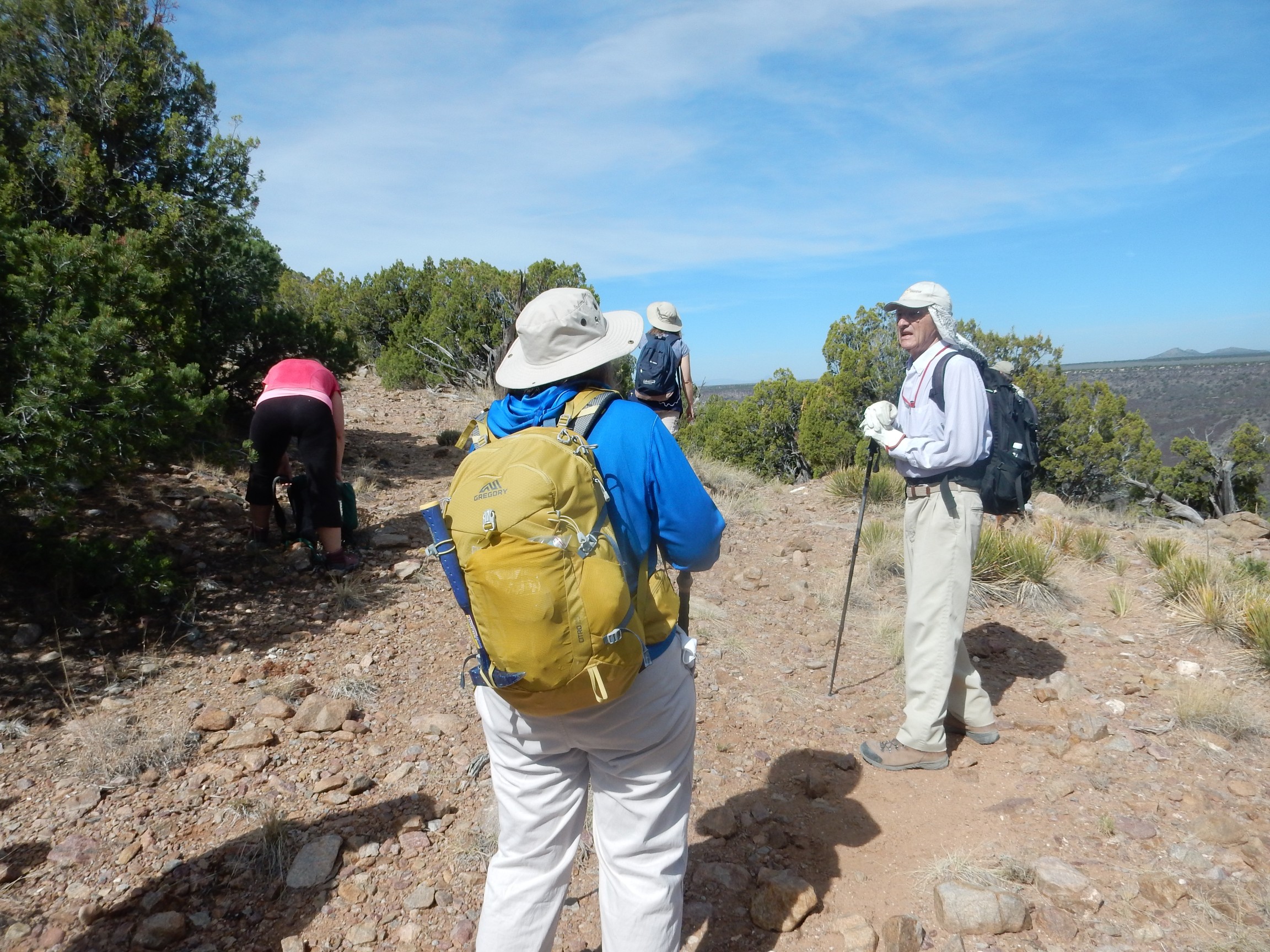
By 9:00 we had a group of 27, including Rick and Shari Kelley, our tour guides for the trip. Also two dogs: Yeso, the Kelley’s trail dog, and another (rather similar) dog I was unacquainted with.
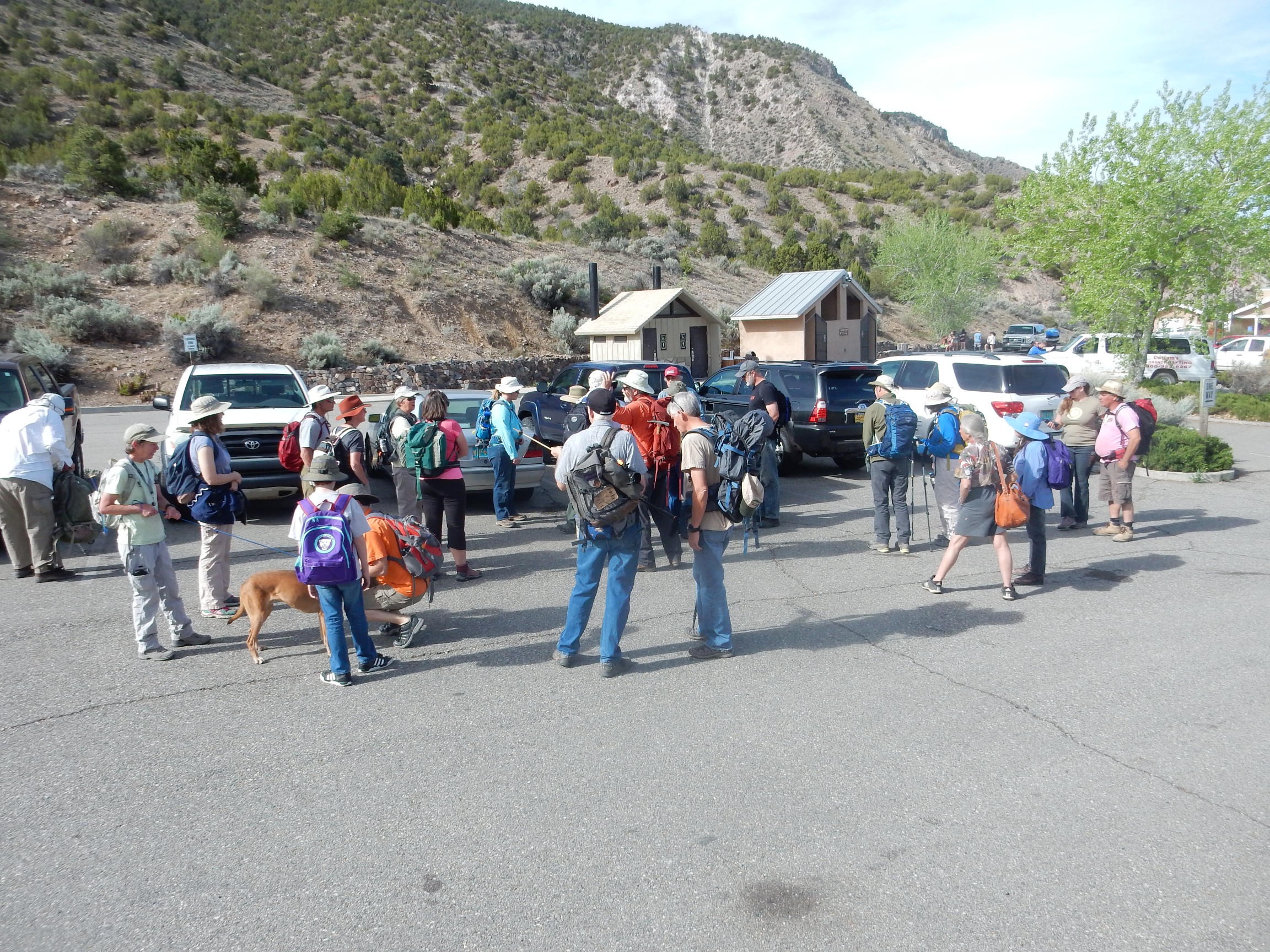
That’s Yeso at left, with Shari at the other end of the leash. The youngster standing in front of Yeso is one of two younger people who participated on the trip. Many of the rest of us were on the sensible side of 50, if that’s any gauge of the difficulty of the hike. (Admittedly, we are probably an unusually fit sample of 50+ persons.) While we were waiting, I finally had the opportunity to meet friend of the Wanderlust, Liz Aicher, in person.
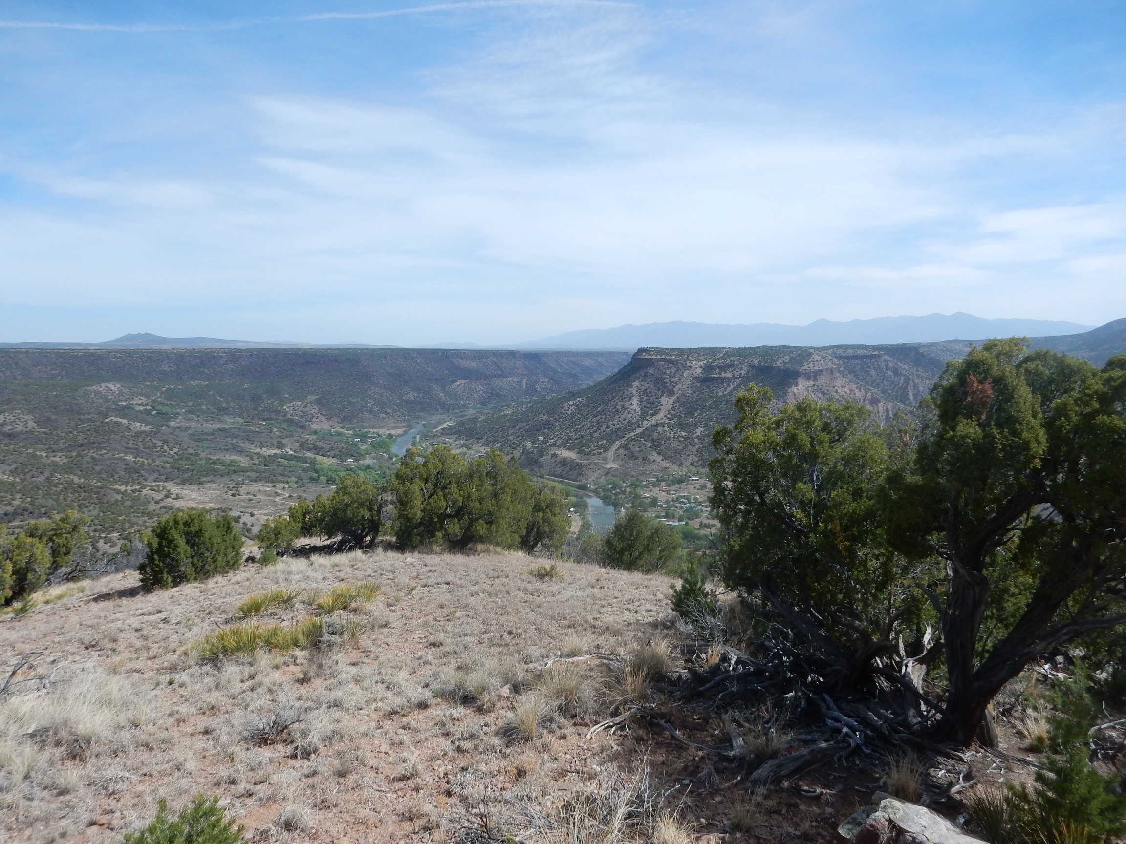
Looking to the southeast, we see the challenge ahead.
Our trail will take us nearly to the crest of the skyline here before crossing the flat plateau on top and descending into a valley where the best staurolite beds are located. Round trip: Just shy of 5 miles. However, the elevation change is about 1600′, making this a fairly challenging hike.
I’m terrible with names, but I believe the woman in the pink blouse introduced herself as Claire and is also from White Rock.
We headed out. Shari and our club president took point, and I followed close behind — not because I had anything to prove, so I told myself, but because I didn’t want to miss any of Shari’s comments on the geology and because I would be stopping for photos and did not want to be left behind by the group. Neither turned out to actually be a problem.
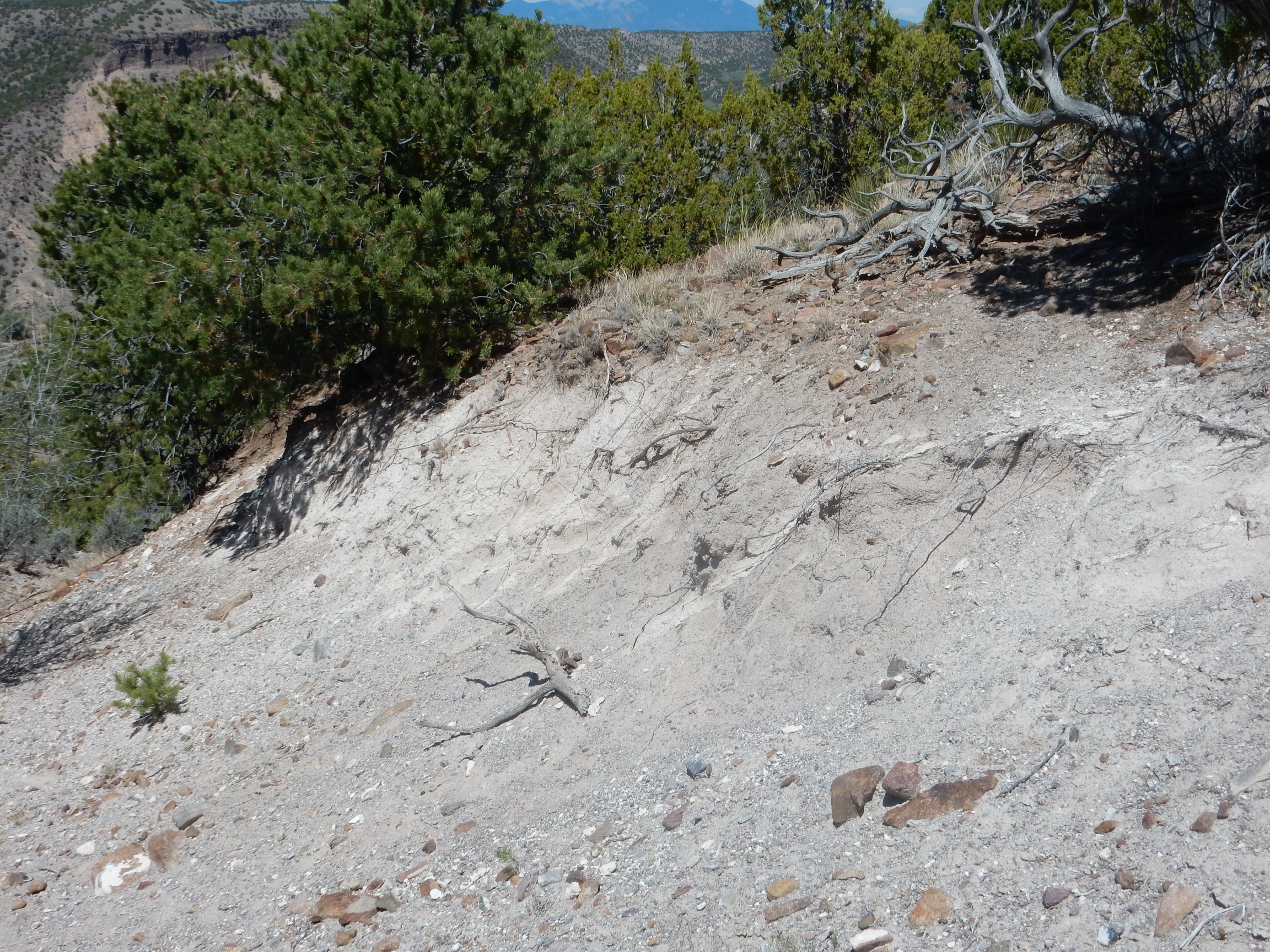
The first part of the trail heading up an alluvial fan..
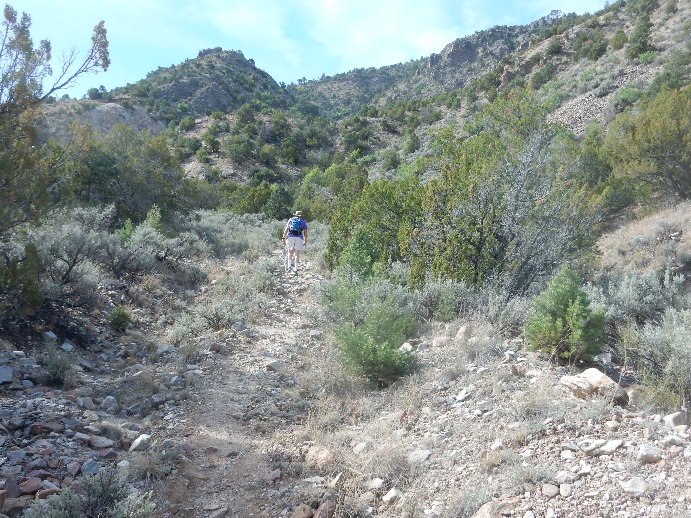
Alluvial fans form at the mouths of canyons from rock debris washed out of the canyon. The visitors’ center is built on the toe of this fan, at a location marked as an old gravel pit on the geologic map.
To the north of the trail are beds mapped as the Gleenwoody Formation of the Vadito Group.
This forms the lower part of the Pilar Cliffs. It’s described as a quartzose schist, meaning it’s got a lot of quartz in it, along with some feldspar and muscovite mica, and the mica crystals are aligned into layers along which the rock is fairly easy to split. Geologists have obtained radiometric dates from zircons in the formation that put it at about 1.7 billion years old. This is a typical age for beds the Vadito Group, which are thought to have been part of an island arc that collided with the southern edge of Laurasia, the ancient core of the North American continent. This accreted island arc became the Yavapai Province of the North American Precambrian basement, which extends from this area to the Wyoming-Colorado border and from Arizona to the American Midwest.
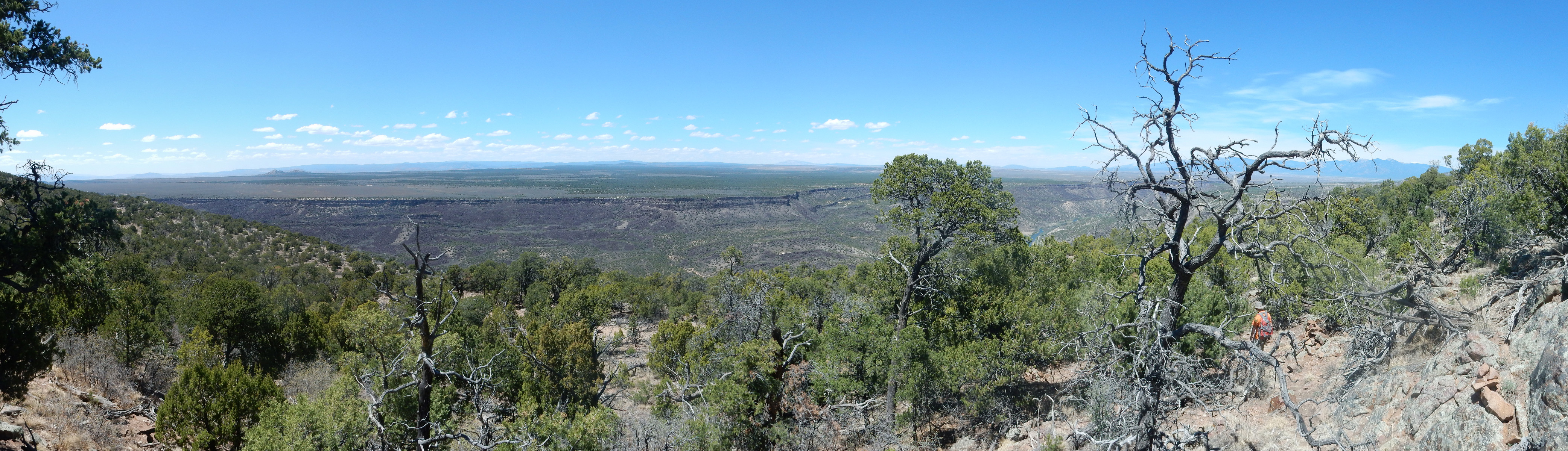
A little further up was a good spot for my first panorama of the day.
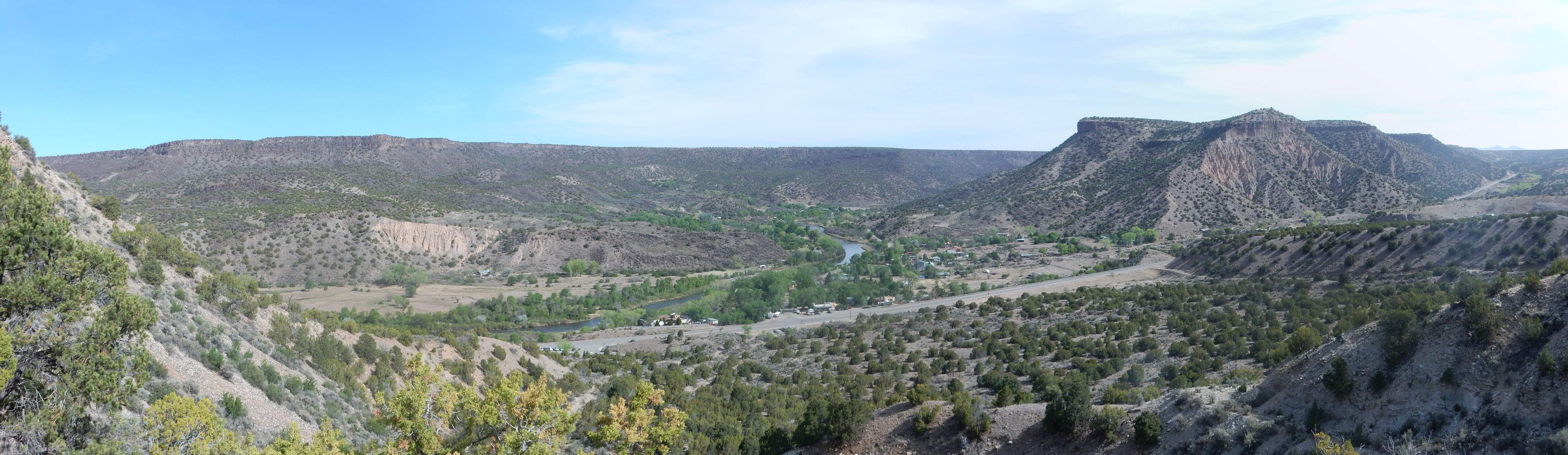
The village of Pilar is at center, where the Rio Grande turns north away from the highway into its gorge. At right is (I believe) Pilar Mesa, which is capped with more Servilleta Basalt. Immediately under the basalt is a thin bed of gray sediment that is mapped as part of an alluvial fan that contains ash beds 1.27 million years old — very nearly the age of the Valles eruption in the Jemez. Beneath, lying at an angle to the overlying beds, is more Chamita Formation. This is a good example of an angular unconformity.
Here’s a closer shot.
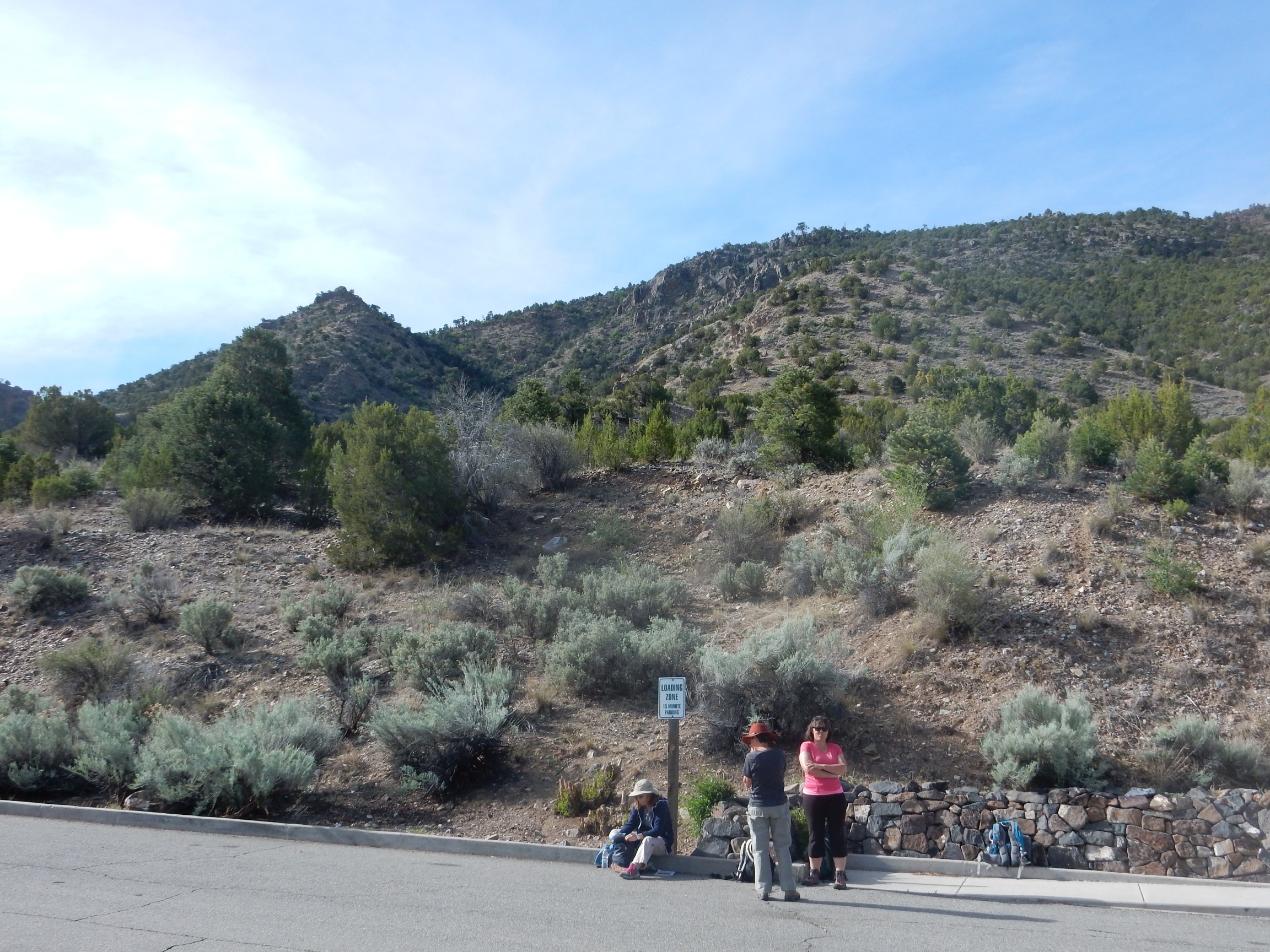
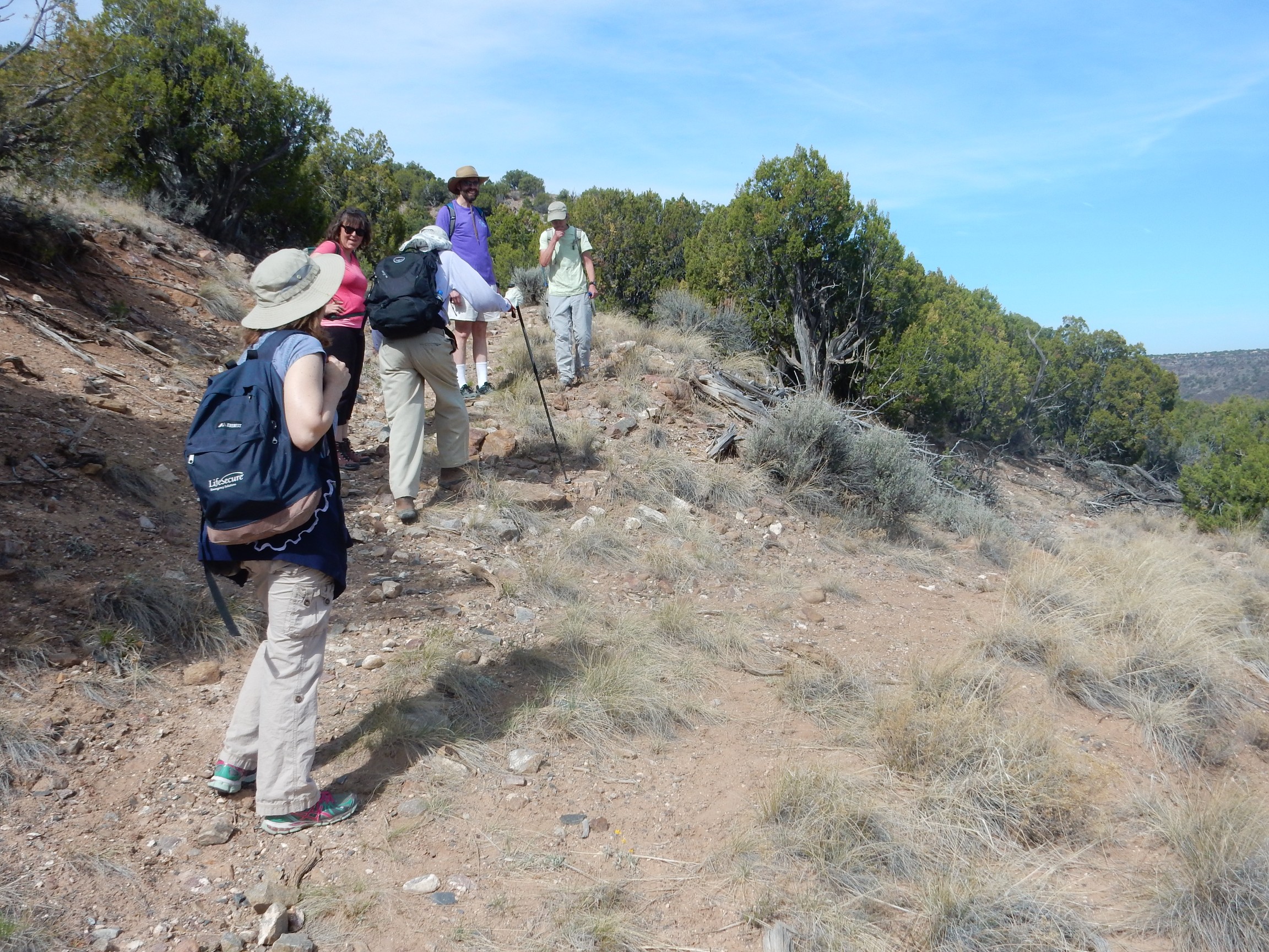
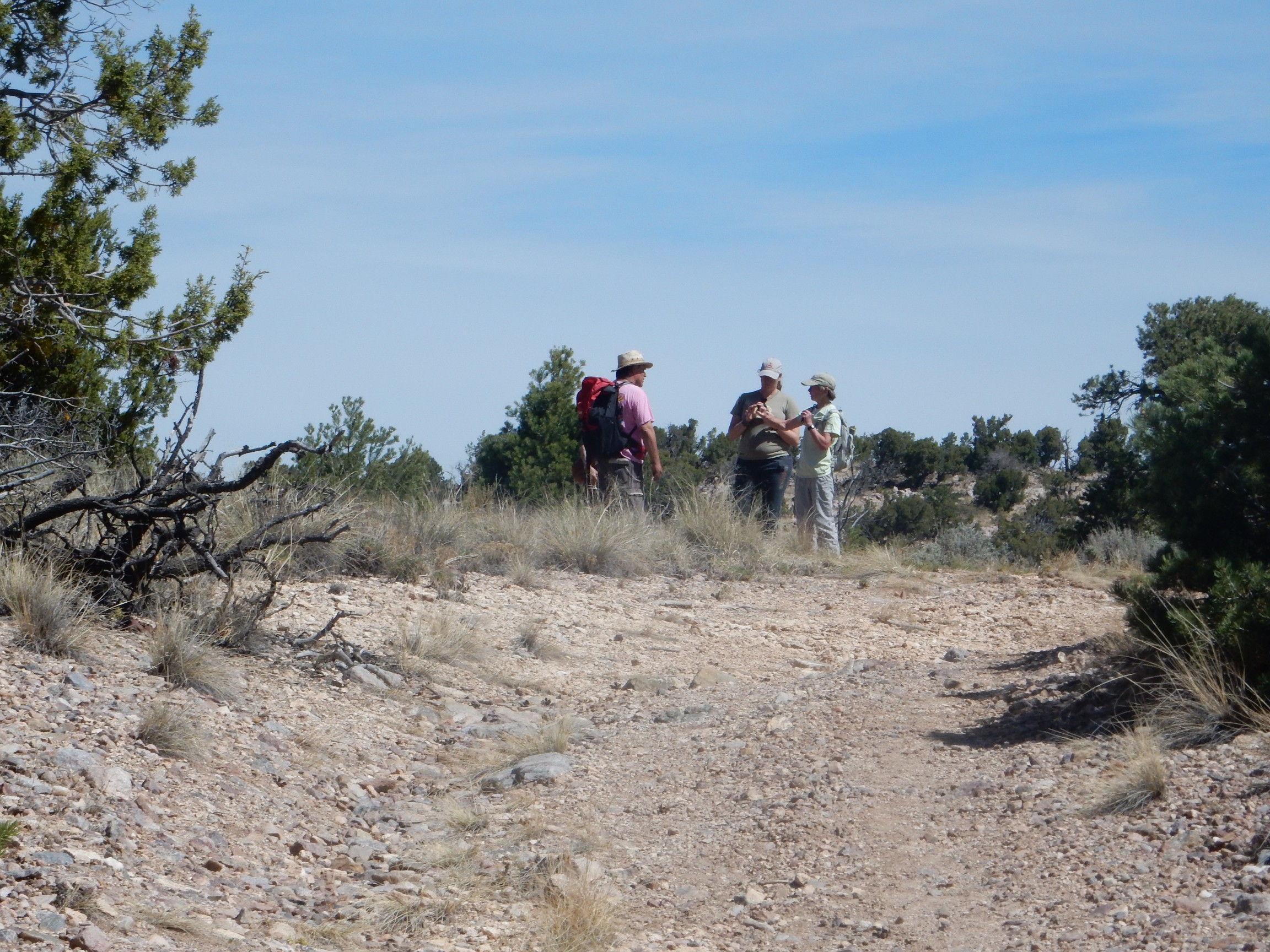
Our group enjoying a park bench along the trail. We had gotten rather strung out and it seemed wise to regroup.
A little further along the trail, Shari pointed out an outcropping of amphibolite.
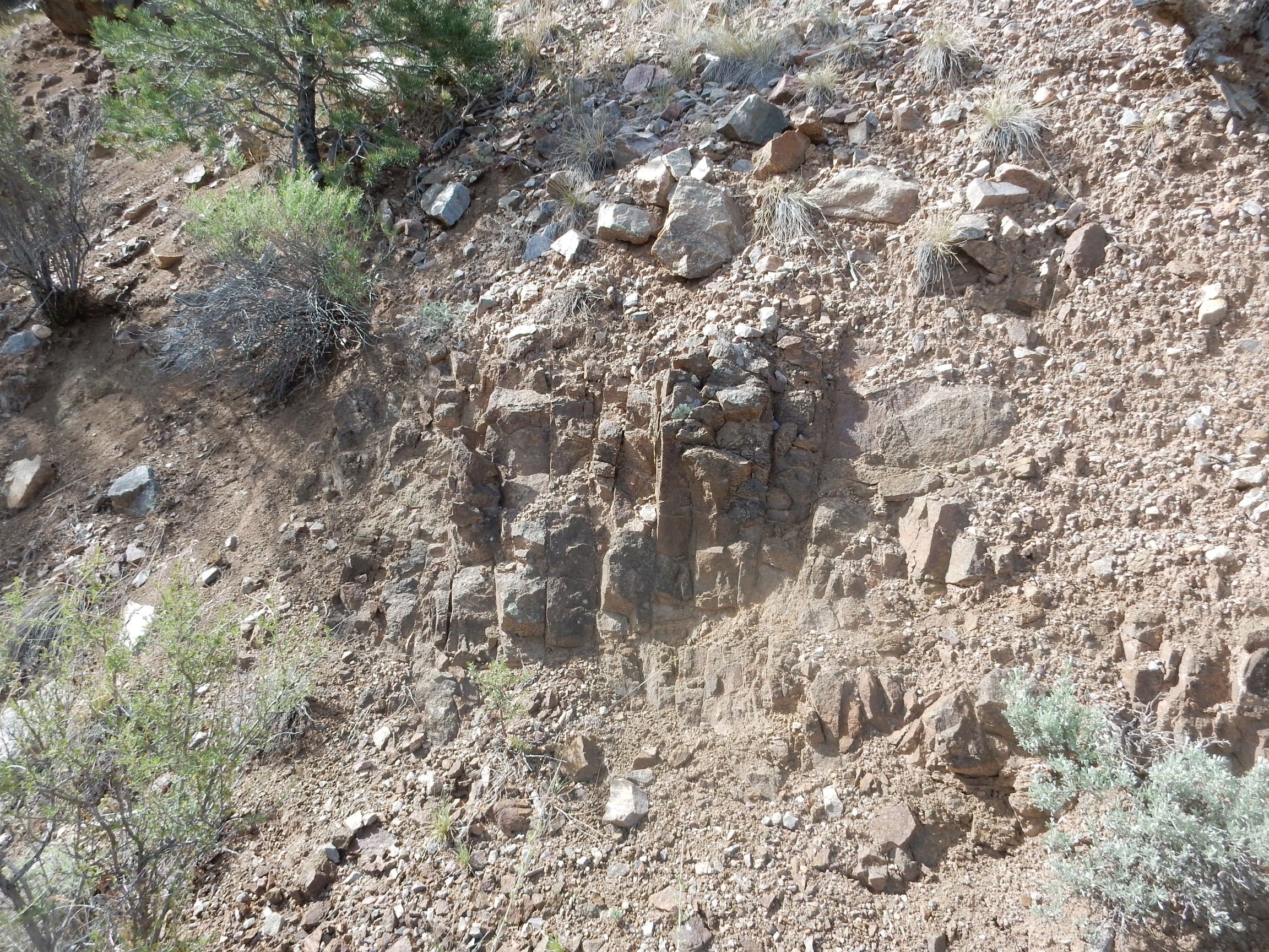
It’s hard to be sure from the geologic map, which shows this general area as a landslide deposit; but this may be a dacite dike that seems to run under the landslide east of here. The geologic report says only that this is either Middle Proterozoic or Tertiary. Well, that’s quite a difference — about 1.7 billion years! Shari seemed to think it was metabasalt from the Proterozoic, and I’m happy to go with that. This would then be part of the volcanism associated with the merger of the Yavapai island arc with Laurentia.
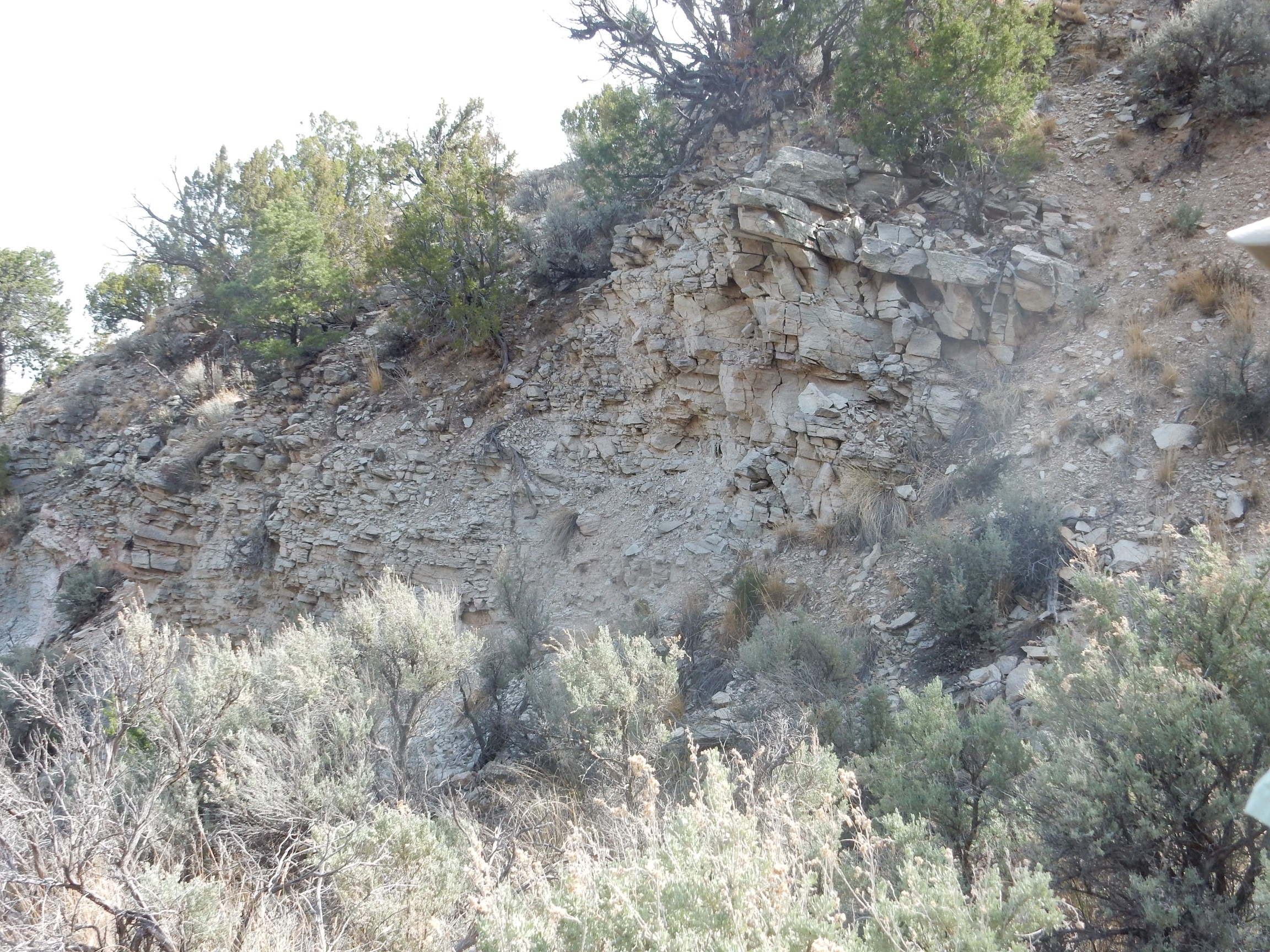
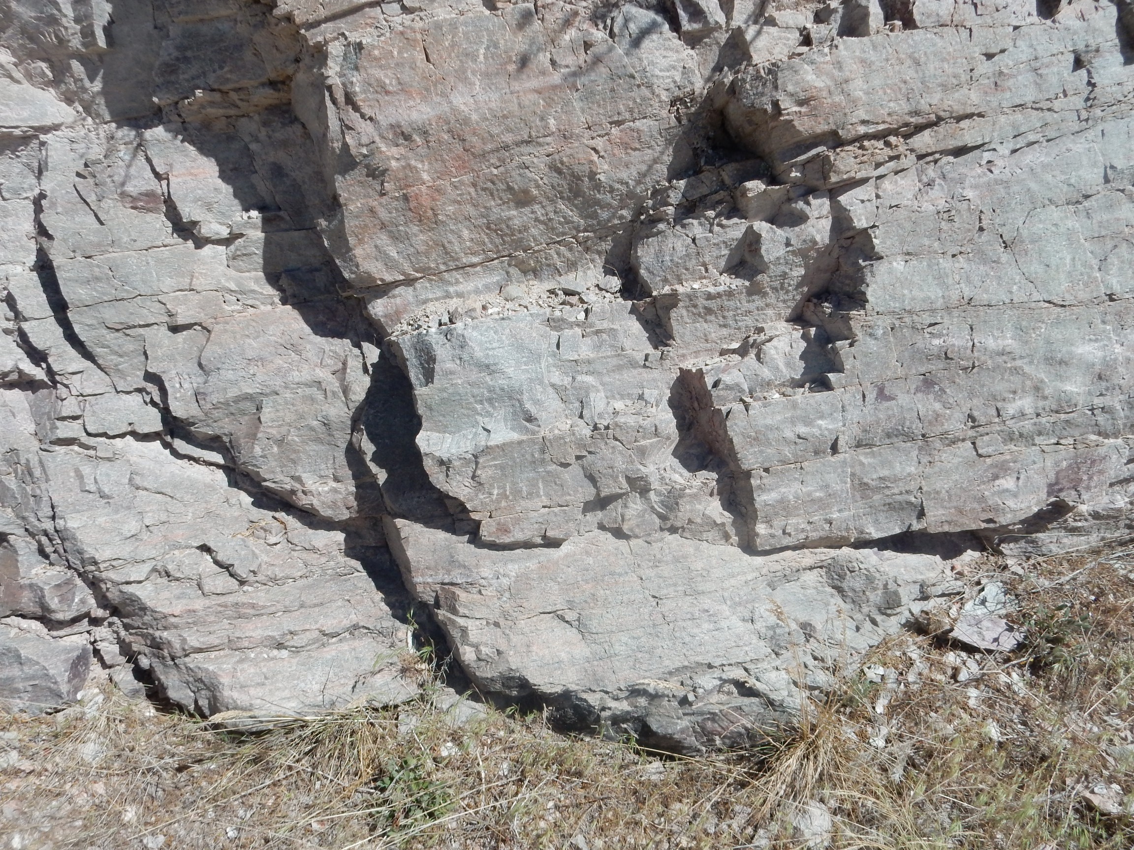
Further on, some really nice banded quartzite.

This is colluvium, material that fell down from further up the slope, but it’s likely Ortega Quartzite, the next youngest formation here after the Glenwoody Formation.
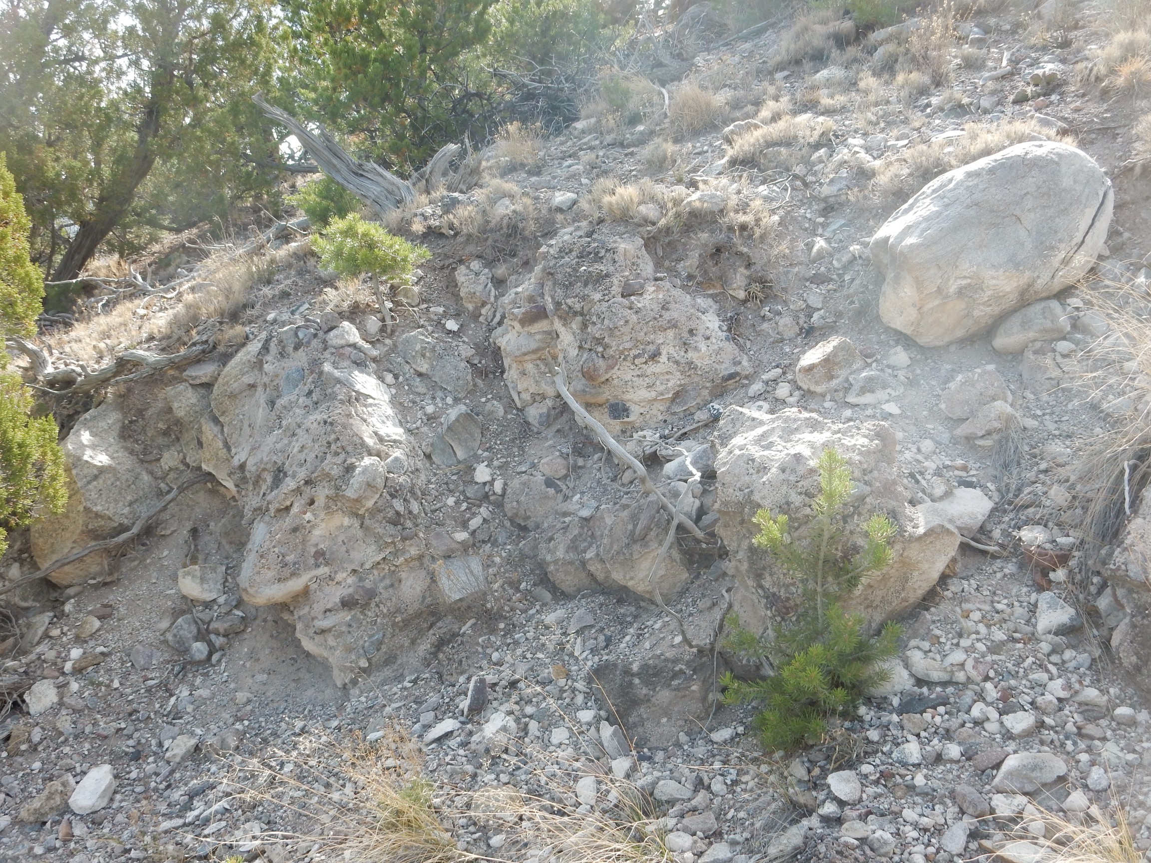
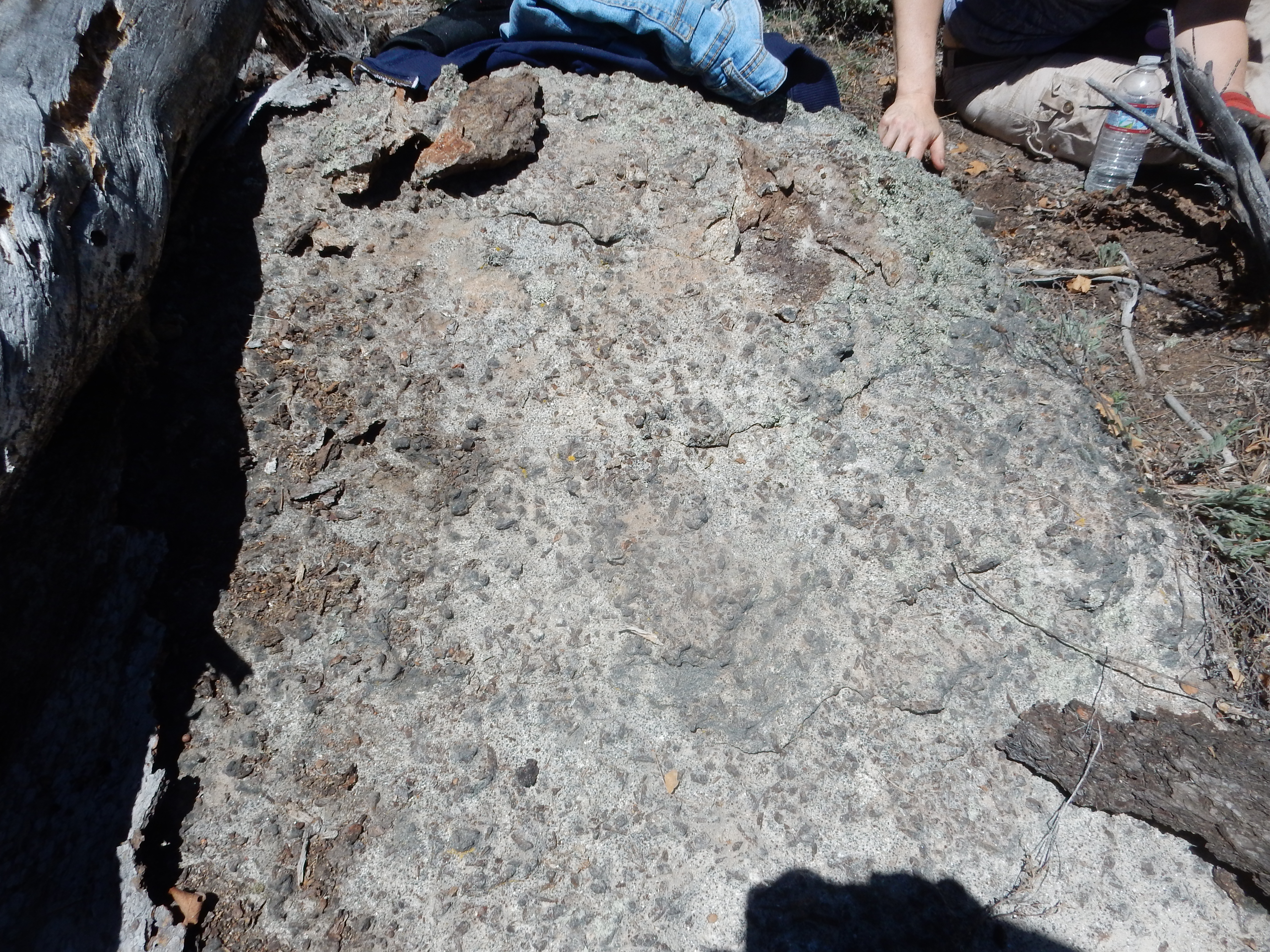
And this we dunno:
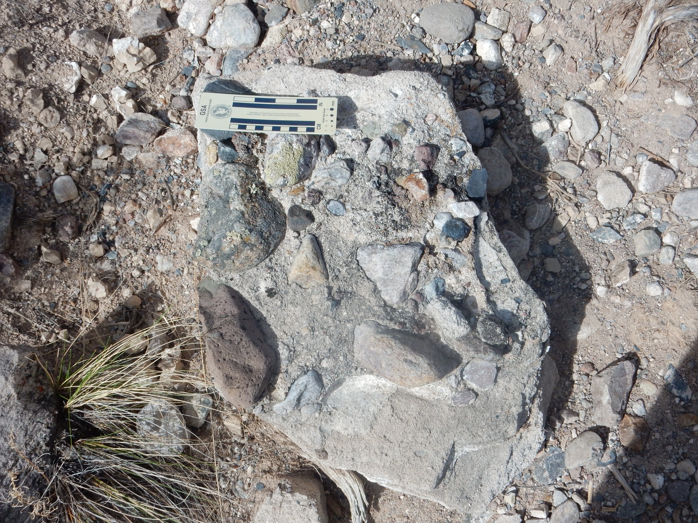
A conglomerate, though I could almost take it for concrete if there was any reason for anyone to have laid concrete up here and if the aggregate was more uniform. I’m guessing this is quite young, since it seems to have basalt clasts in it that look a little like Servilleta Basalt. But it’s another chunk of colluvium, so there’s no telling for sure where it came from originally.
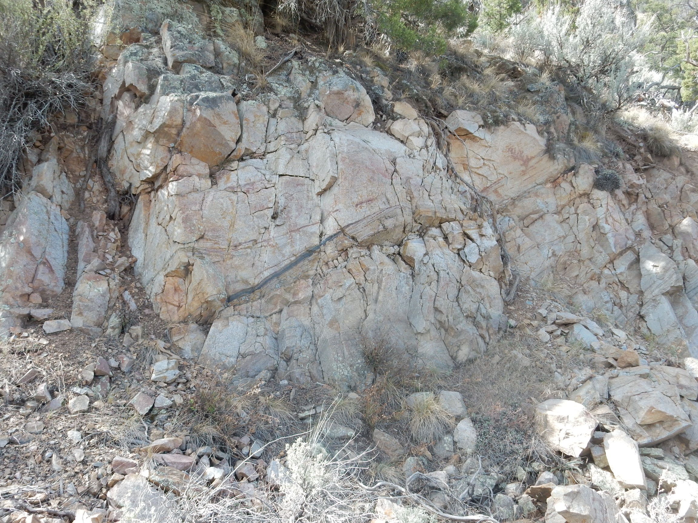
Except here’s what looks like a genuine outcrop just a little further along the trail.
We’re still in an area mapped as colluvium, so this could be highly calicified colluvium, cemented with lime brought in by ground water. Shari suggested another possibility, that this is an erosional remnant of Picuris Formation of the Santa Fe Group. The Picuris Formation is a relatively early Santa Fe Group formation, around 25 million years in age, and it has a lower coarse conglomerate and an upper ash-rich sandstone. We saw some beds further along the trail that were quite light in color and could have been ash-rich.
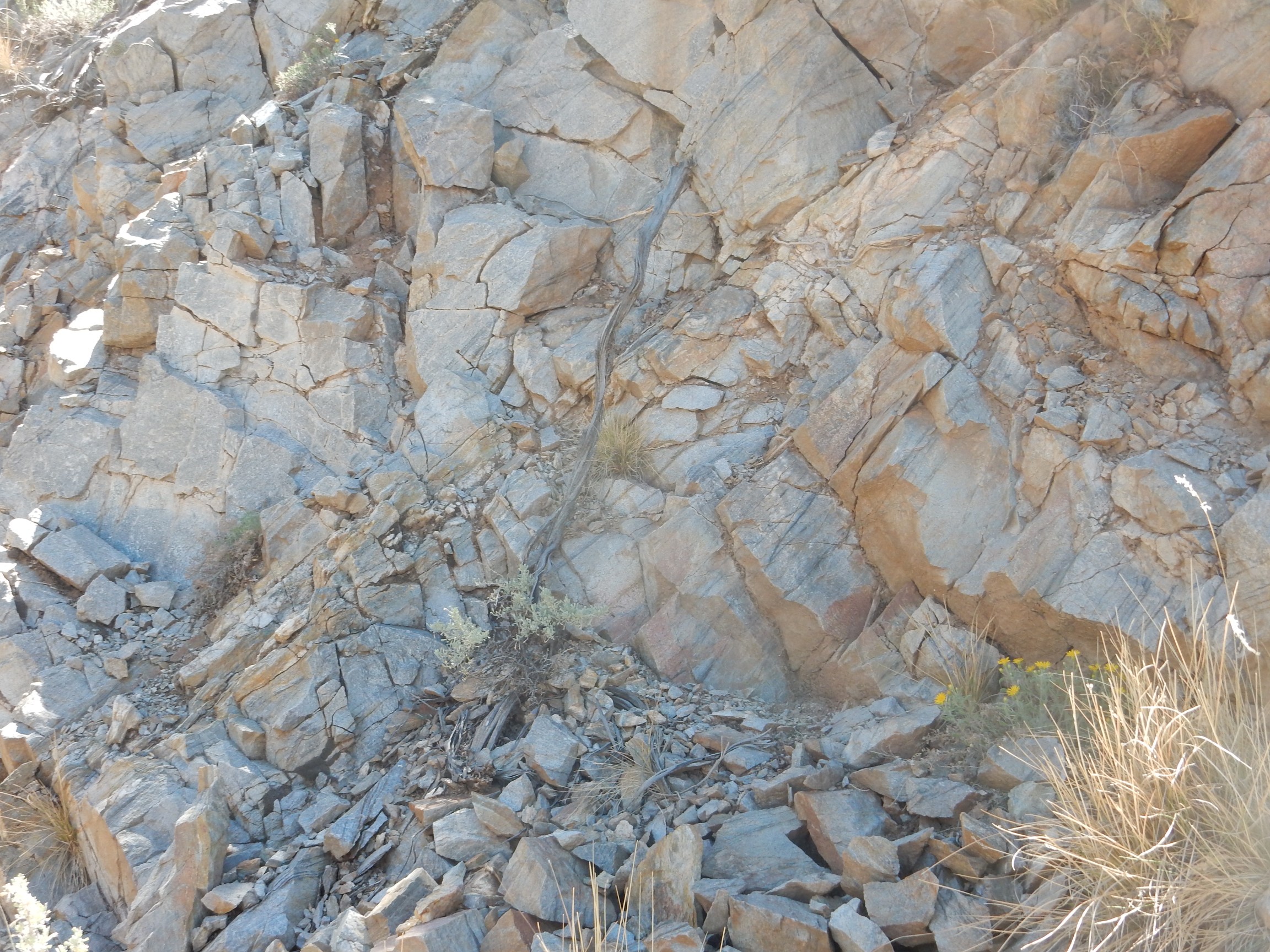
Soon we crossed into an area mapped as Ortega Quartzite. The remaining mapped portion of our hike would be on this formation; further south we cross into the Truchas quadrangle, for which I have no geologic map.
The Ortega Quartzite is a very “clean” quartzite, composed of nearly pure silica. Shari noted that this is a bit of a mystery; the kind of clean sandstone from which such quartzite forms, by metamorphosis, requires repeated cycles of erosion and sedimentation, yet this is thought to have been juvenile crust, making this the first deposition cycle. The quartzite is not completely pure; the dark streaks here are magnetite, which nicely highlights some cross-bedding, and, as we’ll see later, there are occasional beds of sillimanite.
The Ortega Quartzite is assigned to the Hondo Group, which is probably a bit younger than the Vadito Group. Somewhere south of Laurentia, a mid-ocean ridge was producing oceanic crust that subducted under Laurentia at roughly the latitude of the Jemez Mountains. The ebb and flow of subduction briefly pulled a strip of continental crust loose from Laurasia, forming a back-arc basin. (Japan may be a modern example of this process, with the Sea of Japan forming the back-arc basin.) The basin accumulated sediments that later formed the Ortega Quartzite and other formations of the Hondo Group. Then a second island arc collided with Laurentia to form the Mazazatl Province, which reaches from this area south to El Paso and from Arizona to the Midwest. This collision closed the back-arc basin and triggered an episode of metamorphosis of these beds which, among other things, converted the very clean sandstone of the Ortego Formation to quartzite.
It’s not just rocks. I like wildflowers, too.
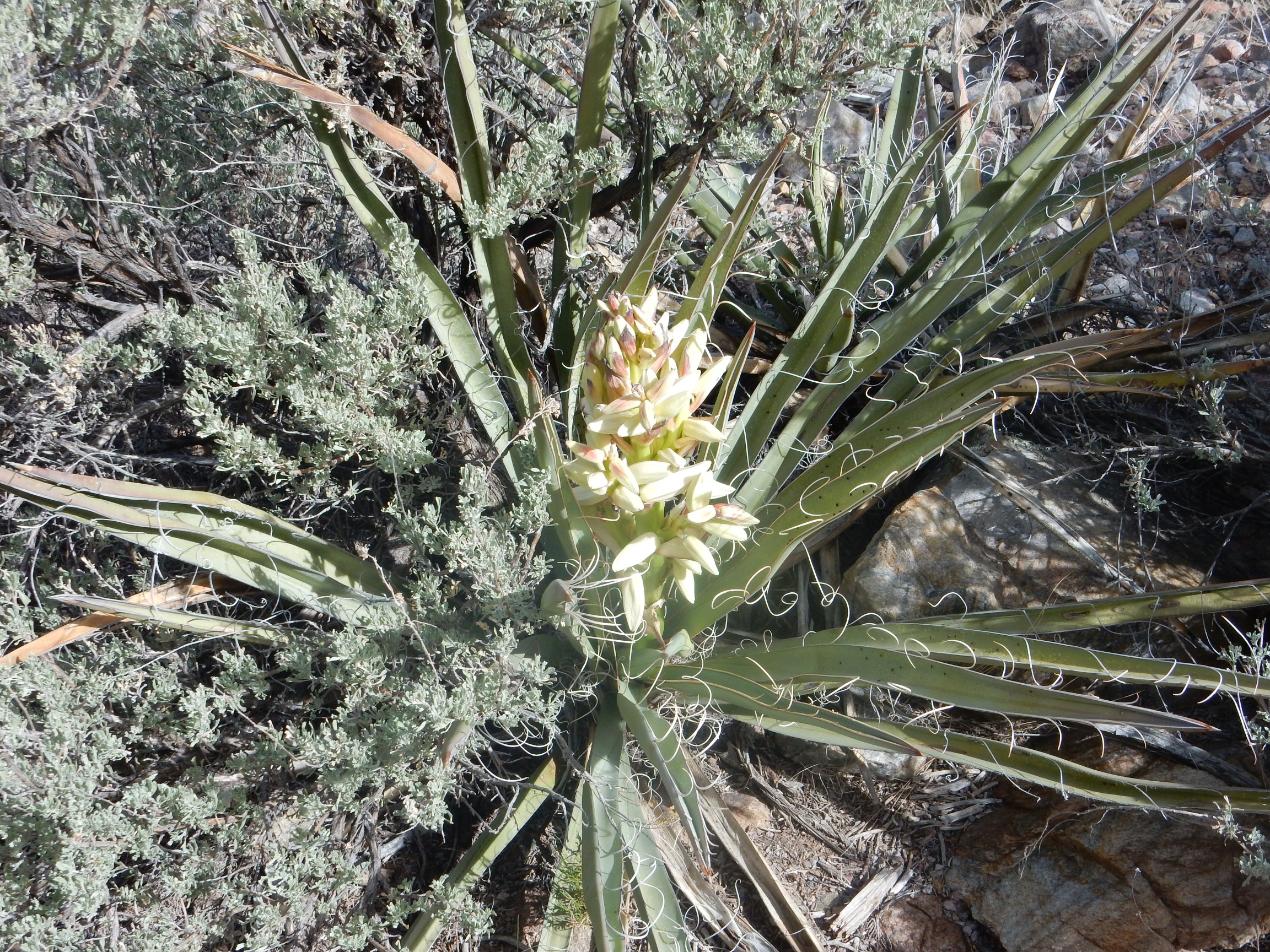
Yucca, of course. Probably Yucca glauca, the Great Plains yucca.
Fork in the trail. We paused to mark off the wrong branch (the one to the right) with branches.
We started seeing some magnificent views; however, the area is forested enough to hinder panoramas. Still, here’s a deep telephoto shot of Cerro Azul.

Cerro Azul is a geologic pecularity. Unlike most clusters of hills of the Taos Plateau, it is not volcanic in origin, but is underlain by Precambrian rocks. It’s an island of ancient rock in a sea of geologically young lava flows, what vulcanologists call a kipuka (a Hawaiian word.) The tectonics are a bit uncertain, but it may be part of the accomodation zone where the deformation of the Rio Grande Rift abruptly shifts east as one goes north from the Espanola area to the Taos area.
Looking up the Rio Grande Gorge:
Notice that we have now hiked nearly to the level of the Taos Plateau. We still have a little more climbing to do.
Another fork in the trail to be marked off.
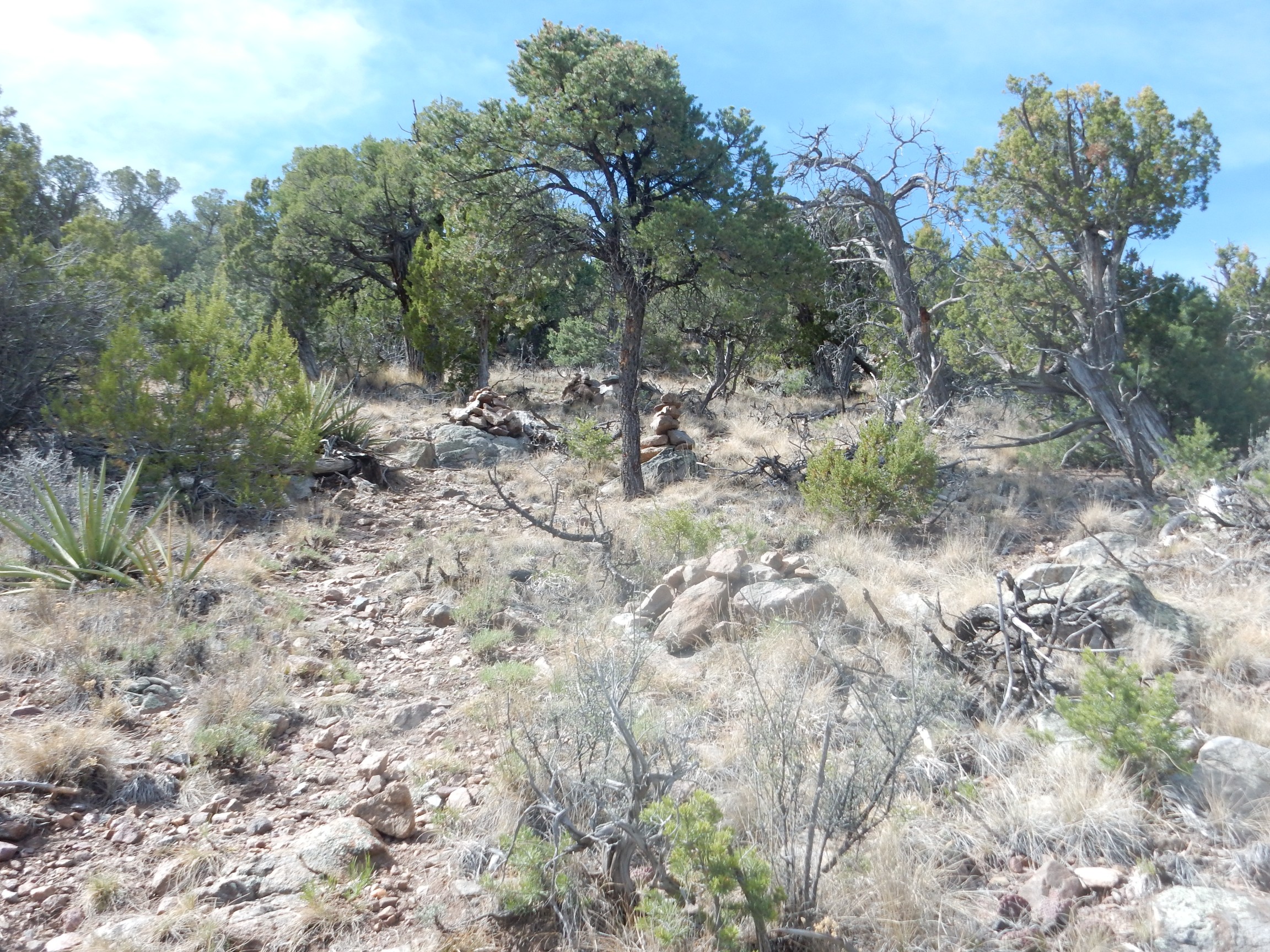
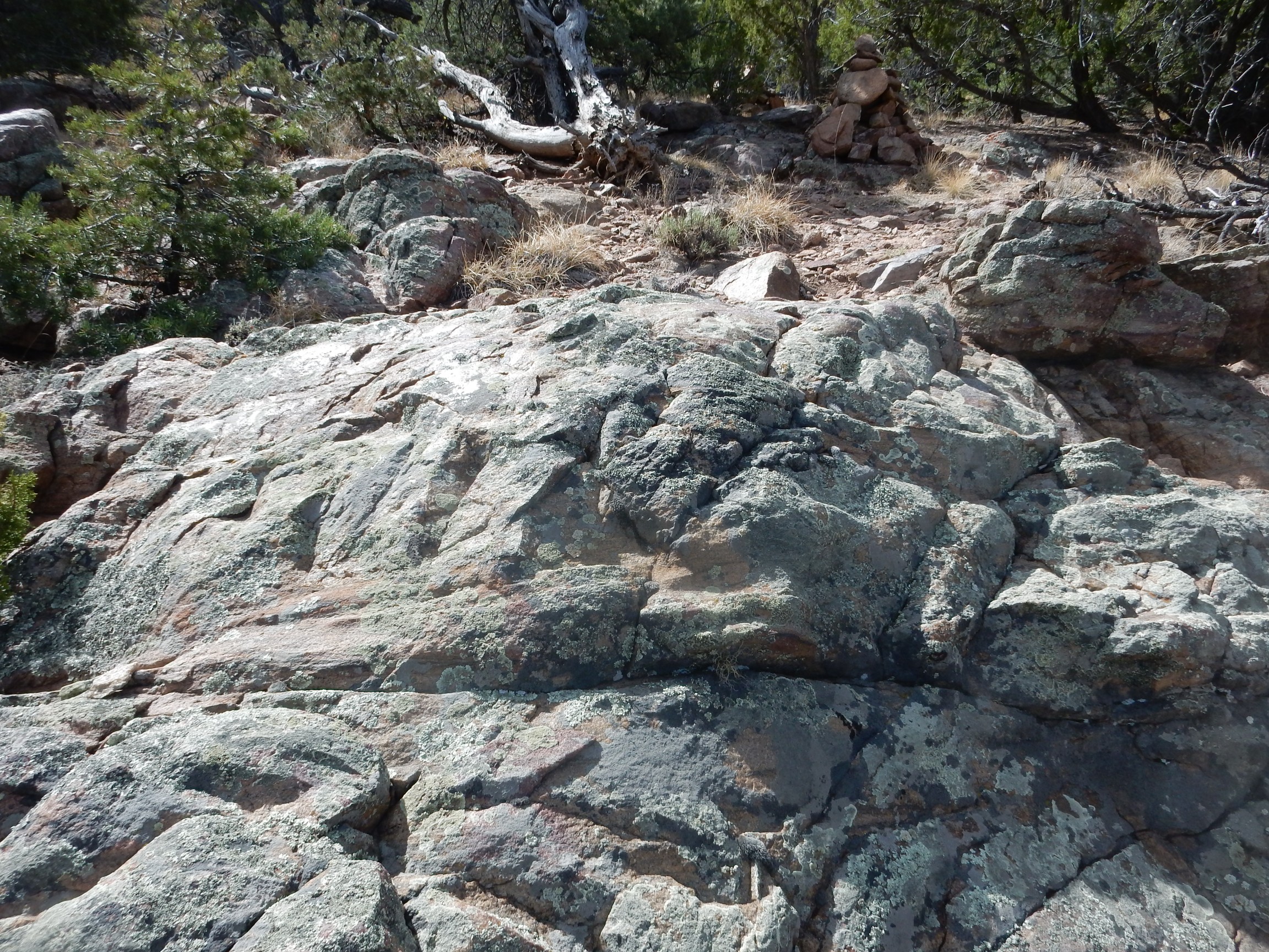
From there the trail goes more or less straight up the remaining slope and is marked by rock cairns.
This is a good thing, as the trail becomes quite indistinct. The whole area is underlain by Ortega Quartzite, which here has weathered to a rusty red from oxidation of the small amounts of magnetite it contains.
Crossbedding in a lichen-encrusted boulder of quartzite.
The next photo is not actually cross bedding.
The beds (marked by magnetite) lie in one direction, while the jointing is nearly perpendicular. Cross bedding, where large beds are composed of smaller beds lying at an angle to the large beds, is a depositional feature, present when the sediments are laid down by fast-moving water or wind. Jointing perpendicular to beds, as in the second photograph, is a product of metamorphism.
Somewhere along here, we paused to let the group catch up, and I realized my heels were very sore. I thought my boots were reasonably well broken in, but I had not done extensive uphill hiking in them before. I had not thought to bring moleskin, and I had left my sneakers in my car rather than bringing them in my pack. Crep. One of the others allowed as how he had some moleskin in his car, 1600′ down the mountain, and I was welcome to run down, grab some, and rejoin with the group. I declined this generous offer.
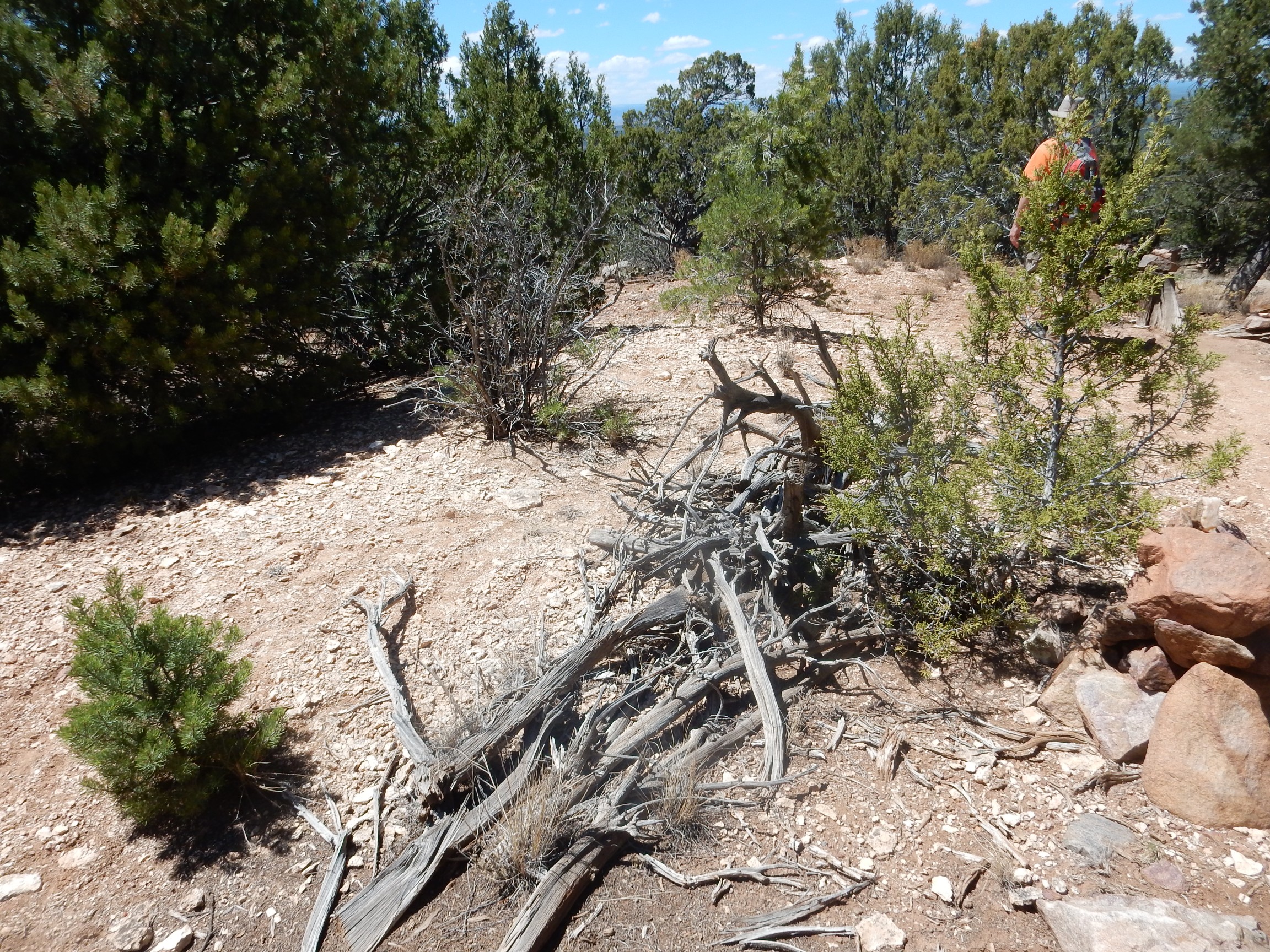
At the top at last.
The road forks and descends into a canyon, and south of the road are the staurolite beds.
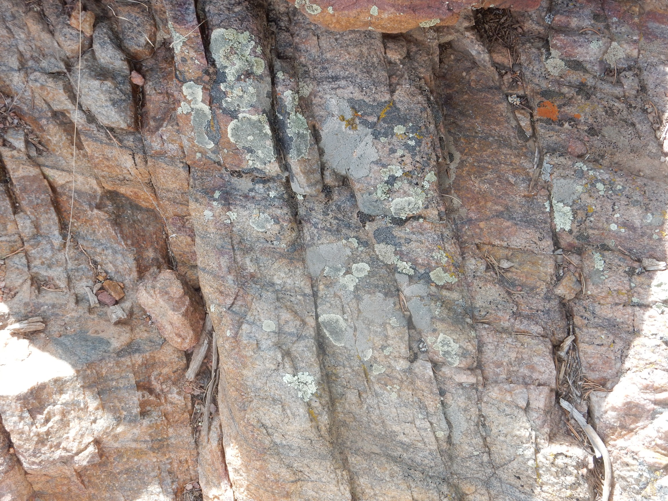
Although I don’t have a good geologic map for this spot, I can extrapolate from the Carson quadrangle and identify this as likely part of the R1-R2 schist member of the Rinconada Formation. The Rinconada Formation is part of the Hondo Group, like the Ortega Quartzite, but is likely slightly younger. It was probably originally mudstone, rich in clay, which was metamorphosed into quartz-muscovite schist. This is a rock rich in muscovite mica, which forms parallel layers along which the rock is fairly easily split.
The bumps visible in the second photograph are staurolite crystals, which in this exposure are somewhat weathered. Staurolite has the composition Fe2Al9O6(SiO4)4(O,OH)2. That is, it is a very aluminum-rich mineral which also contains some silica and reduced iron. Highly weathered clay is rich in alumina (aluminum oxide), and the high aluminum content of staurolite reflects the high clay content of the sediments from which this rock formed. There must also have been a modest amount of iron in the clay.
Staurolite is an index mineral, characteristic of a particular metamorphic environment. The geologist George Barrow first identified distinct zones of increasingly highly metamorphosed mudstone in the Scottish Highlands, now called the Barrovian zones. Each of these zones is marked by the appearance of a new index mineral. The earliest stage of metamorphosis produces chlorite, a mineral similar to mica. Further metamorphosis at increasing pressure and temperature produces biotite mica, then garnet, then staurolite. Later comes kyanite and sillimanite, the last occurring as the rock approaches the melting point at great depth.
Staurolite is fairly uncommon. The staurolite zone represents a narrow range of temperature and pressure, near 580 Centigrade at a depth of about 28 km (17 miles). Outside this zone, staurolite is unstable. A difference of 15 degrees Centigrade in either direction prevents staurolite from crystallizing. In addition, only very aluminum-rich sediments produce staurolite, even when they are in the right temperature and pressure zone. Anything less aluminum-rich produces only garnet. So the Pilar staurolite beds are pretty unusual.
(You may be wondering why, if staurolite is unstable outside a narrow temperature range, we see any in surface rocks. The answer is that both the formation and the destruction of mineral crystals in metamorphic rock is slow even at high temperature, and very slow indeed at low temperature. If the rock is brought rapidly to the surface by tectonic forces, so that the rock is rapidly cooled, unstable minerals can survive for a very long time. But it’s another reason staurolite is uncommon.)
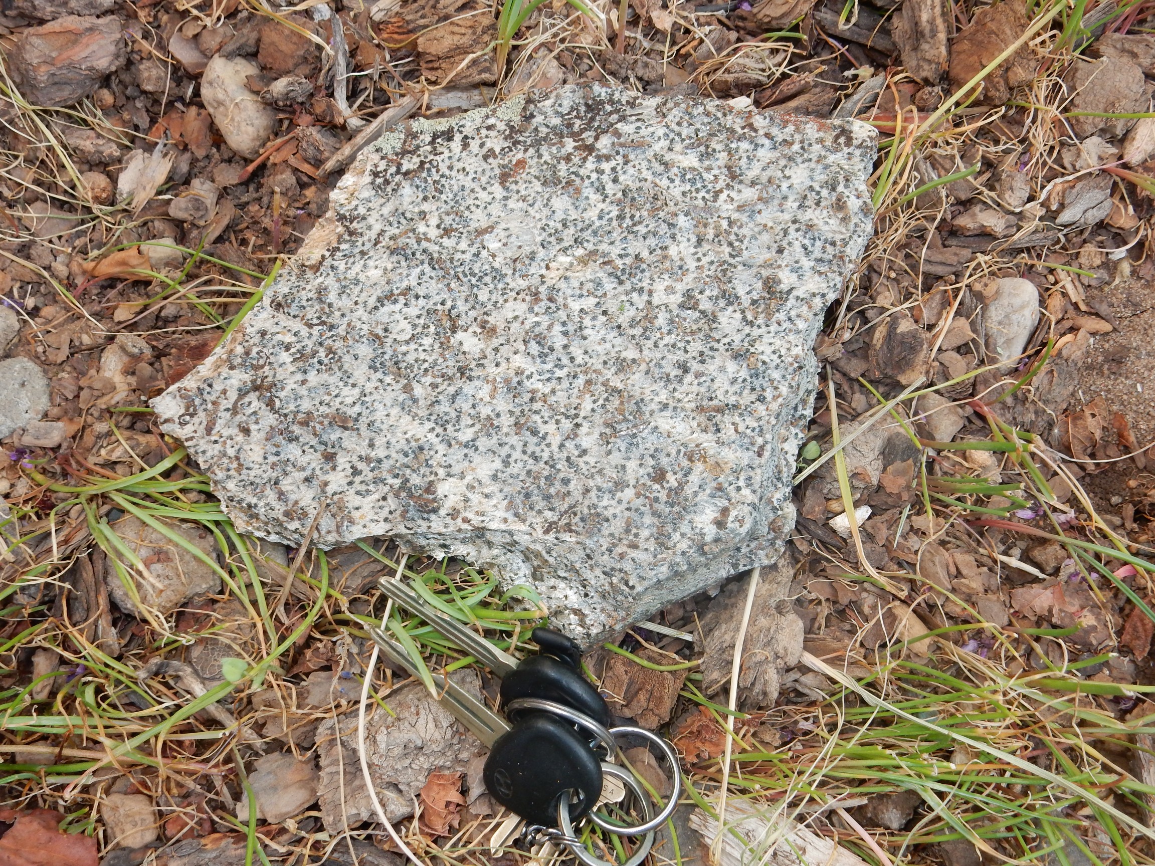
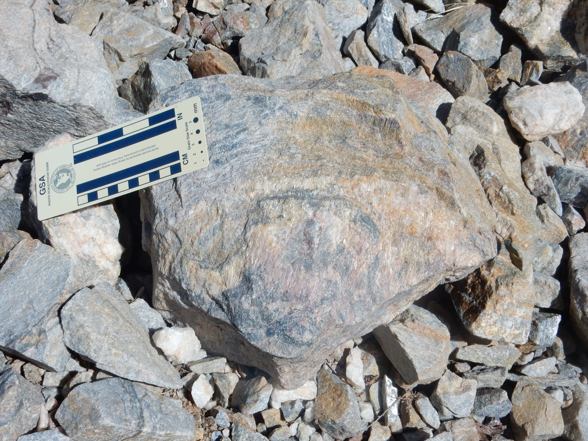
We all started scratching around in the dirt, looking for staurolite crystals weathered out of the rock. I found a small single crystal right away, but then not much else. I took to trying to chisel some crystals out of the rock beds, but this was not particularly fruitful. I usually ended up with small clusters of crystals embedded in schist that were not much to look at. By noon I had worked my way over a fair amount of ground, and the best specimen I had was a large slab of schist in which the crystals were unusually well exposed.

The long black crystals are staurolite. There are also smaller but beautifully shaped garnets. This is actually not a bad specimen, though it could benefit from some preparation to remove the film of iron oxide and better expose the crystals.
Also a couple of samples of some very garnet-rich schist with a few rods of staurolite.
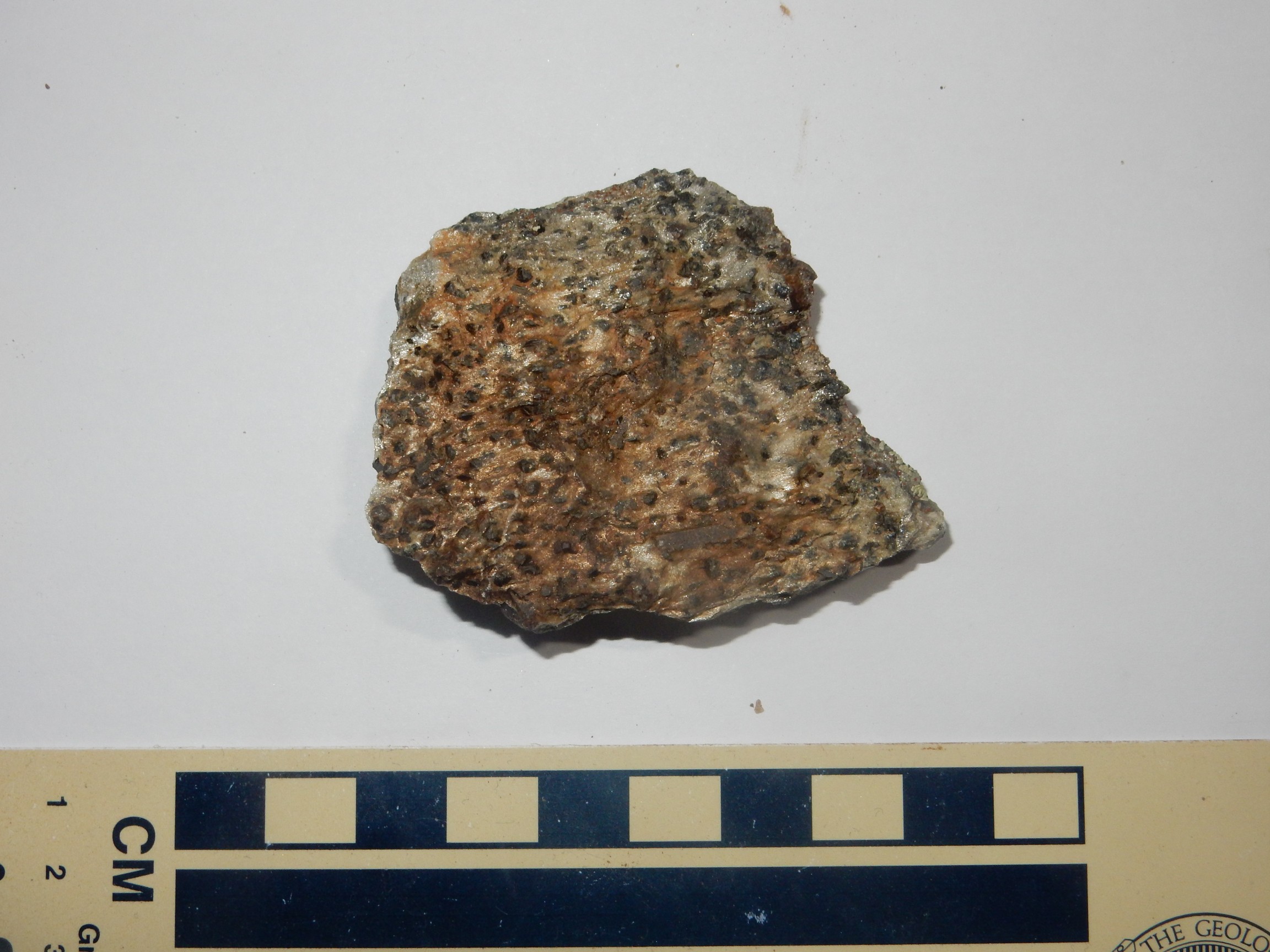
The first specimen is interesting in that one side of the rock is thick with staurolites while the other side shows only garnets. This illustrates how thin the staurolite zone can be. The second and third specimens show mostly garnets, thought a single long crystal of staurolite is visible at the bottom of the third specimen.
These were nice, but I still hadn’t found a single decent large crystal of staurolite weathered out of the rock. It was a little frustrating.
It was noon, and I went back to my pack (which I had shed) for my lunch. I walked along the road a short distance, and met another member of the group who told me he had found a couple of good crystals close to the road. I started scouting around, and within a few minutes had found two or three good crystals. Well, this was more like it. I began working my way up the hill, along a sandy wash where there seemed to be an occasional good crystal, then joined much of the group in a shady spot for lunch.
As I was eating, some other members of the group reported that they had hit the mother lode. As indeed they had:
Almost all the pebbles you see in this photograph are staurolite crystals. (Or deer droppings; unhappily, the deer were numerous in the area and the droppings were about the same size.) One need only scout along the ground, looking for the glint of crystal faces, to find good crystals. I soon had a pocket full and was starting to fill my lunch bag (which, being thin plastic, soon fell apart and started leaking staurolite.)
The beds we had been working earlier were rich in staurolite, but also durable enough that the staurolite did not weather out cleanly. This area showed no exposed beds to speak of; the schist was softer here for some reason, while still being rich in staurolite, and had disintegrated easily under the elements to release their treasures.
It was approaching 1:30, and folks started heading back down the trail. Rick Kelley arrived and announced that they had found a bed further down the road with beautiful crystals still in the rock matrix. I was intrigued, but also very tired, and my heels were very sore from my imperfectly broken-in boots; I did not investigate. Next time.
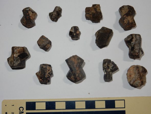
Still, not a bad haul. Here are some of the best:
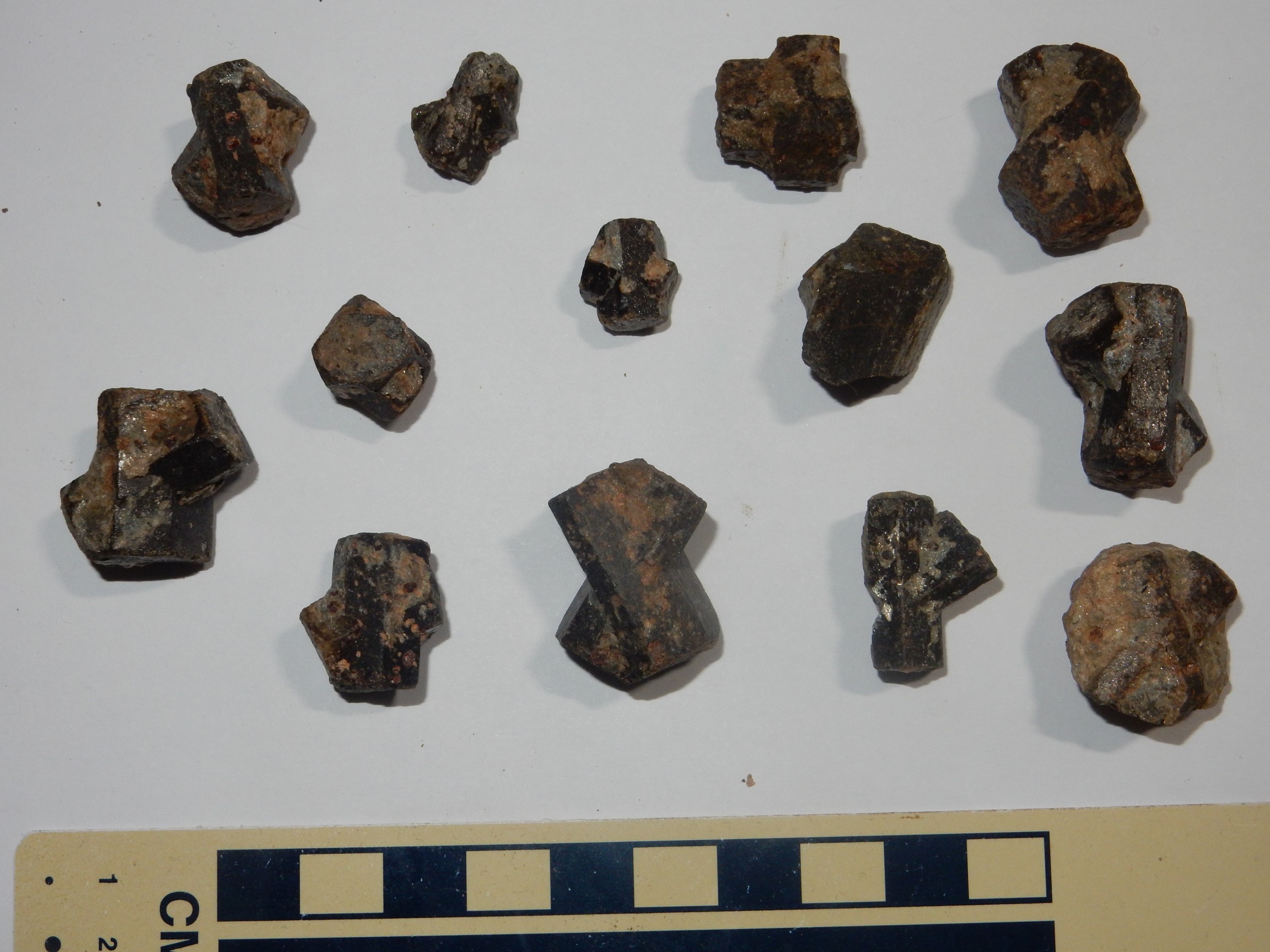
The staurolite crystals more often than not form twins, in which two crystals appear to interpenetrate. This is possible because the crystal has an internal symmetry, such that rotating the crystal through 60 degrees brings the crystal lattice back nearly to its original orientation. There is a similar, less perfect twinning at 90 degrees (two crystals penetrating at right angles) and these are the real treasures. They are sometimes called fairy crosses. They are much rarer than the 60 degree twins, and I only found one, the imperfect one second from the right at the top of the photograph. Individual crystals take the form of hexagonal rods, often flattened into a squashed hexagonal shape; the crystal at middle left has been set on its end to illustrate the hexagonal cross-section.
It was time to leave. I struggled up to the crest, my heels quite sore, but the rest of the hike was somewhat easier as it was all downhill and took the pressure off my heels. I had respectable blisters when I got home.
Looking east into the Picuris Mountains.
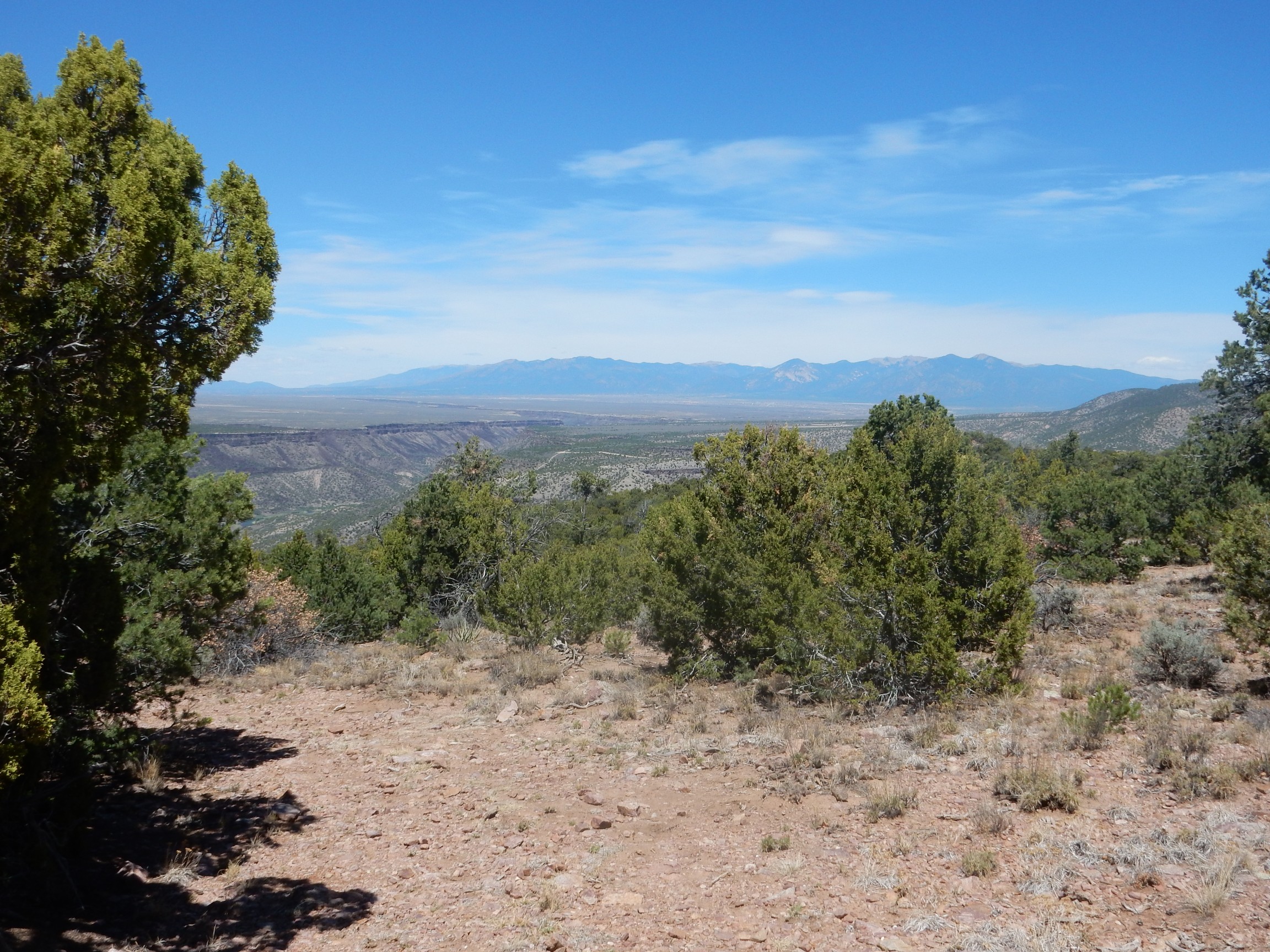
As the trail begins to descend towards Pilar, a magnificent view:
That’s San Antonio Mountain way off in the distance. It’s a large dacite dome, formed from relatively silica-rich magma that erupted less than three million years ago. The much closer cluster of hills to the right are Tres Orejas.
Looking towards Taos and the Sangre de Cristo.
A pile of … what? Calicified soil?
Probably. I thought it might be a local intrusion, but none is mapped here and it does look like caliche, which is accumulated lime cementing the soil together. Even as caliche, it is unusual, as if there was something in the rock beneath that allowed an unusual amount of groundwater into this area.
Finally, a reasonably clear spot for a panorama.
Further on, Rick Kelley called our attention to the view below.

Alas, my GPS failed to lock, and I’m not sure just where this was. Rick noted that there is some spectacular contact metamorphism below, which he was not really interested in taking us to, inasmuch as we would likely slip and kill ourselves.
And a final nice panorama, showing we’re already well down the mountain.

I had mentioned to Rick and Shari that I would love to see some sillimanite in the Ortega Quartzite. Rick obliged not much further down the trail, where the outcrop
contains some nice sillimanite bands.
The sillimanite is the band of long needlelike crystals. It is aluminum silicate, Al2SiO5, which formed from traces of clay in the original sand beds. Sillimanite requires an environment containing little but silica and alumina, since the presence of other elements causes more complex minerals to form. This explains its presence in the Ortega Quartzite, which has the required composition.
Sillimanite is one of three minerals with the same composition of pure aluminum silicate. Geologists call these polymorphs. Each is stable under different conditions of temperature and pressure. Sillimanite is the high temperature form, showing the rock here was heated to better than 500 Centigrade. At lower temperatures, you get kyanite. At moderate temperatures and low pressure, you get andalusite. There is a triple point at around 500 Centigrade and 15 km (9 miles) depth where the three forms can coexist, analogous to the triple point of water at 0.01 Centigrade (by definition!) and 6.1 millibars where ice, water, and water vapor coexist. The Picuris Mountains are famous for rock beds that appear to have metamorphosed near the aluminum silicate triple point, based on the presence of sillimanite, andalusite, and kyanite in close proximity.
One of the youngsters and his father had heard me ask Rick about the sillimanite, and they had tagged along most of the way down the trail. I was happy to crack off a specimen for the son with my hammer. I wish I had more opportunity to teach people, especially young people, about geology, or, for that matter, my other vocations, astronomy and computer science. (I actually have some decent credentials in the latter two.)
The maybe-Upper Picuris Formation ash beds.
Amphibolite at the bottom of the wash that is the final leg to the visitors’ center.

The map interprets this as a dike. There are several mapped in the area. Rick tells me there is some unusual contact metamorphism with cool and rare minerals along these dikes, but unhappily in places very dangerous to get at.
A sample of the dike amphibolite.
Close to the visitors’ center, we found Shari off the trail scrutinizing what turned out to be a pegmatite dike in the Gleenwoody Formation. Alas, it was a simple pegmatite, composed mostly of feldspar, quartz, and muscovite, without the unusual accessory minerals sometimes found in pegmatites.
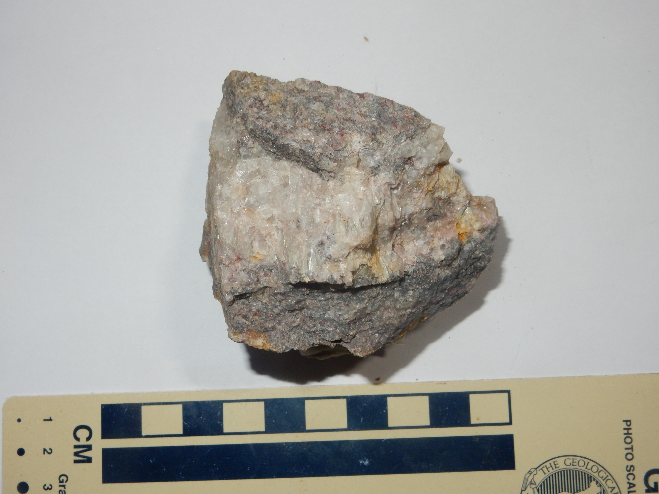
I grabbed a sample of the Gleenwoody Formation here.

A very nice muscovite schist.
I arrived at the trail head. I switched into my sneakers — yes, I had blisters — turned off the SPOT tracker, hit the “safe back at trailhead” button, visited the visitors’ center, turned the SPOT off, then drove a ways down the road to look at the Gleenwoody Formation some more. This is supposed to have an interesting contact with the overlying Ortega Quartzite, with the contact itself being a shear zone and the Gleenwoody Formation beneath having a zone rich in unusual pinkish manganese minerals. I stopped near a road cut:
Gosh, up close, this looked like quartzite with maybe a little mica. And a pegmatite dike at one point.
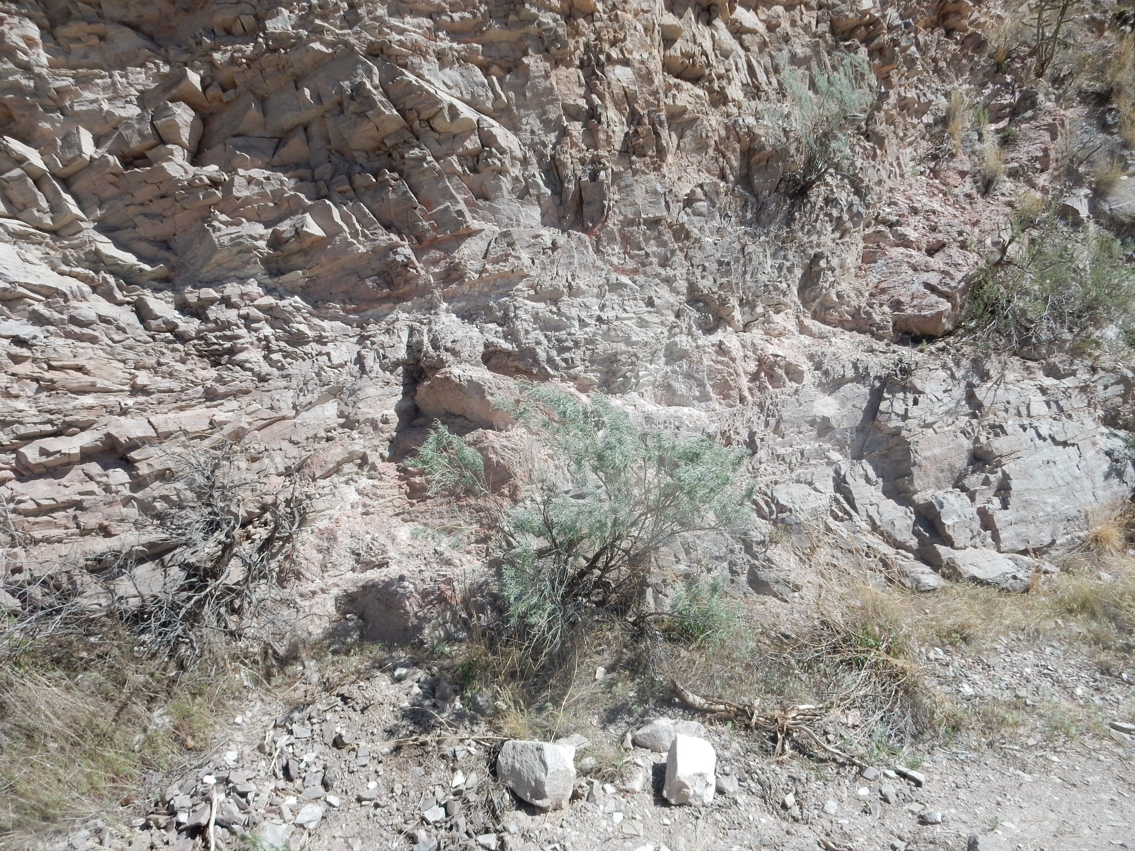
I was puzzled. Ortega Quartzite? But I recalled the geologic map showing Gleenwoody Formation in the lower canyon walls.
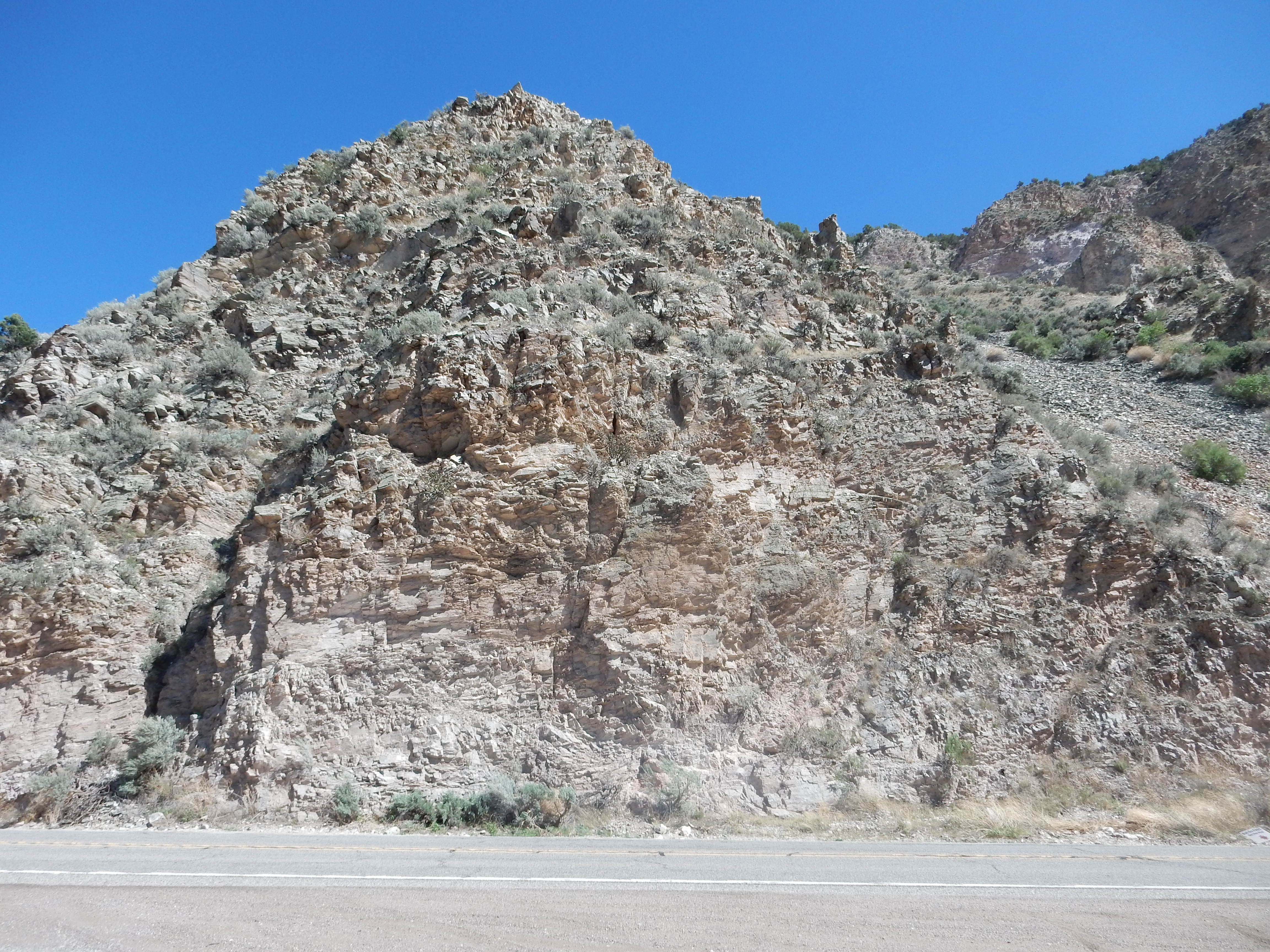
It was only after I got home and checked the map that I convinced myself that this was indeed Gleenwoody Formation quartzose schist. Here it is mostly quartz with very little mica, just enough to produce some thick bedding. Fortunately I got a good photograph of the canyon walls nearby.
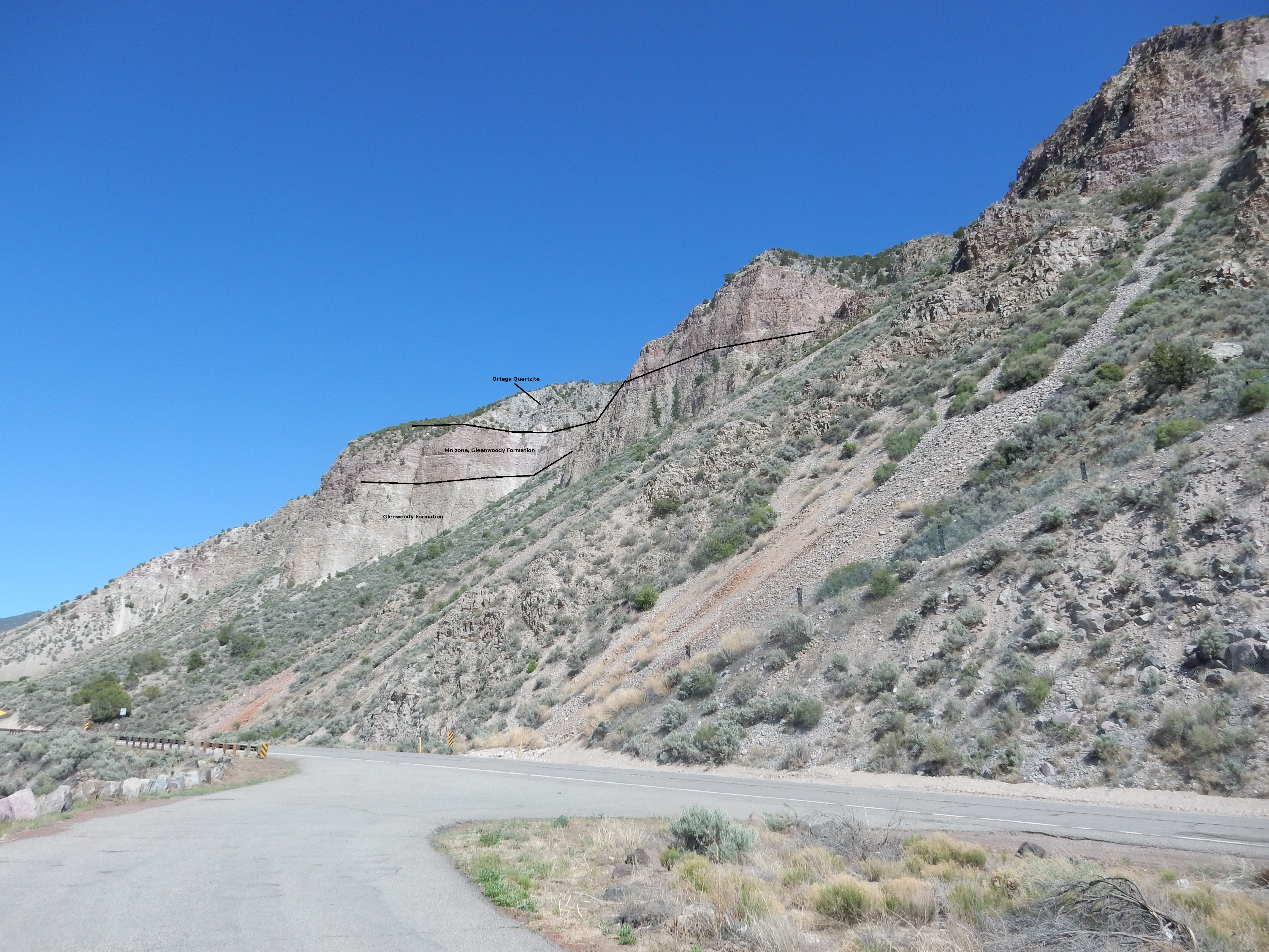
It’s sometimes tricky to be sure of formations in a vertical cliff based on a geologic map, which show the cliff in plan view (from directly above). But I believe the map is telling me that the cliff at left is mostly Glenwoody Formation, with the pinkish manganese-rich layer showing making up the upper half of the cliff and the Ortega Quartzite at the very top. Click for an enlarged version that shows where I think the boundaries are.
Cool, except that the sheer zone is obviously inaccessible for closer inspection here.
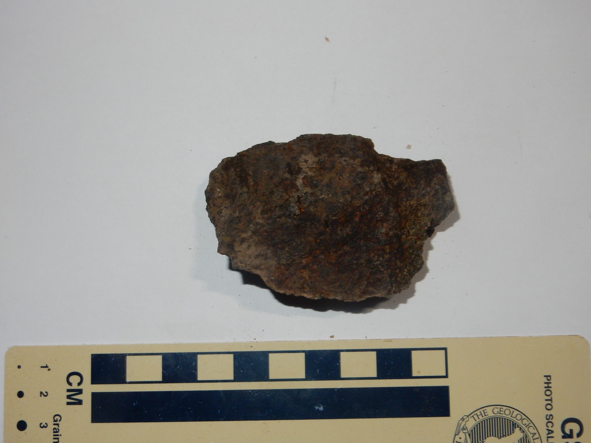
But it may be possible to see something of the manganese zone close up. I visited the rockslide at the center of the photograph, and retrieved a shard of pinkish schist.
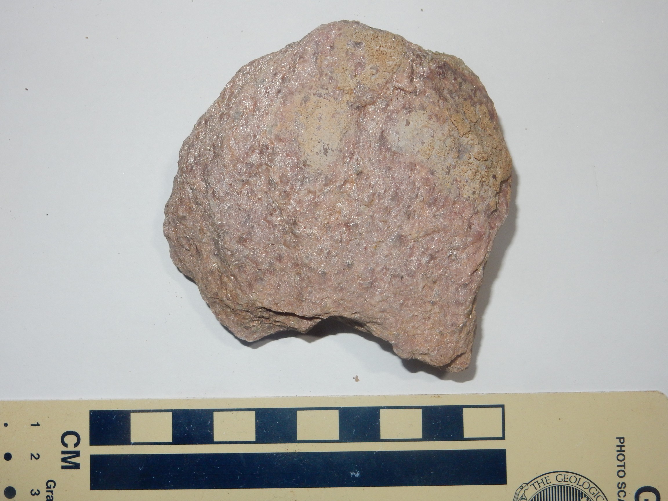
I believe this comes from the manganese-rich zone, though since it’s part of a rockfall rather than taken directly from the outcrop, I can’t be sure.
I headed on home. At Espanola I decided to turn in to Lowe’s; my wife loves live alstroemerias and maybe they have some in a tub. Wold be a nice Mother’s Day gift, since the kids probably won’t think about it.
Then it hit me: I had forgotten to get something for Mom. Crep.
Well, at least Cindy liked the astroemeria and the Black Forest cake I got her. Also a card, which the kids neglected to sign. And I talked with my mom on the phone and apologized; she didn’t seem too upset. Though I probably should have flowers delivered for her birthday Wednesday.
And today Clownie the Wonder Car finally expired. This was my first wanderlusting vehicle, a Hyundai Elantra almost entirely unsuitable for gravel road driving that I took along a lot of gravel roads anyway. I retired her not long ago when Cindy got a new car and I was handed down the Santa Fe, which is a much better if still imperfect gravel road vehicle. We kept Clownie only for driving around town and I didn’t expect her to last long, and today I was pulling out of church when she lurched to a halt, disgorging ball bearings on the roadway. No, really. A friend helped me tow her home; the wreckers prefer to pick up a car at a verifiable address, I suspect so as not to be mistaken for a chop shop. She was a good car and I will miss her, though we no longer really need her.
Just wanted to let you know I thoroughly enjoyed your article
Thanks. It’s always nice to hear from readers.
I have followed your directions and could not seem to find them once I was at the top. The toad goes left or right at the top…do you go right? And how far down the road do you go? It forks again a little further down.
You go right on the road just after reaching the top, here: https://www.google.com/maps/@36.2565242,-105.7934727,116m/data=!3m1!1e3!5m1!1e4
The road goes south and then curves east. When you hit a branch to the right, going south, here:
https://www.google.com/maps/@36.2505962,-105.7937973,138m/data=!3m1!1e3!5m1!1e4
then you take the branch to the right. This descends fairly steeply into a valley, then turns back west: https://www.google.com/maps/@36.2489565,-105.794736,132m/data=!3m1!1e3!5m1!1e4
You can hunt staurolite anywhere along this road or on the slopes to the south of the road.
hello. I tried to find the spot today, with no luck. I got to the spot where you follow the road at the top. do I go down that steep canyon on the right?
It’s a moderately steep canyon with a road down into it.
yay! thank you! we found it. once you turn right and head down that canyon, it’s about 200 yards down in there. I just didn’t go far enough the first time.
Excellent! Glad to hear it.
RIP Clownie
I tried to find the Staurolite beds today and couldn’t from the directions in the post. Taking the Las Minas Trail from the visitors center I followed the cairns up a step section and reached a well traveled forest road and then nothing. I did t k ow whether to turn right or left. Any help is appreciated.
You turn right at the forest road at the top of the steep section. The road curves east and then there is a fork to the right which you take down into a shallow canyon. That’s the staurolite area.
It occurs to me that if you used an iPhone to make your photos, it records GPS information as part of the image recording, thus you could pinpoint exactly where you were when you took them.
I look forward to hunting for staurolites, following in your footsteps, if I can tear myself away from the fishing on the Rio Grande and the Rio Embudo. LOL.
I read the excellent review of the hiking adventure with the Los Alamos Geologic Society to the staurolite bearing mica schist in the Picuris Mts. east of Pilar. I took my grandson who is visiting from New Zealand on the hike to search for the staurolites. We had a great day out hiking but our search was unsuccessful. Are there lats and longs available to direct us to the collection site?
Many thanks
I see that Kent G. Budge has already provided the data, Thanks
Pingback: Staurolite Power - Ronald Davis, Artist | Abstract Illusionist and Geometrician
Hello — May I have permission to use a link to this post of yours about staurolite hunting in a blog post by a Taos artist who uses staurolites in his art making? your post is very informative and aligns with what the artist has learned over decades about staurolite crystals, having lived here 30 years. Thank you in advance for your time!
Yes, that would be fine, Barbara. (From Kent’s widow)
Cindy,
I’m sorry for you your loss. I followed Kent’s directions a few years ago and have been visiting the site since then. It’s quite a hike. I have reread his article to try and identify other rocks that I have found there and he was a gem of information and I’m still learning from his sharing.
If anyone finds my rock pick up there I hope that it brings them luck. The staurolites are very near by.
Thank you, Deb. I’m sure Kent would be thrilled that the information that he posted has been helpful to you.
Cindy Budge
As I read, first my condolences Cindy for your loss. And I would like to thank Kent for this article and his passion for New Mexico geology. I followed the directions and pin drops and found the staurolite beds. I also found someone’s rock hammer they left behind, if anyone is missing it lol
Thank you Neil. I am sure Kent would be happy that you were able to use his directions for geological finds in New Mexico. I hope the person who lost their rock hammer finds it! Happy Thanksgiving everyone.
So very sorry to hear of Kent’s passing; he really knew his geology and shared his passion well.
I was hoping there might be staurolite beds in northern AZ where there are lava deposits and geologic wonders. ( I live in Tucson)
I would have liked to explore Fairy Stone State Park in VA but didn’t get the chance.
Thank you Barbara.
I’ve read this great article and comments with the GPS coordinates, I will be going with my 12 year old tomorrow. We’re used to no-trail hiking on inclines and I’ll try to let you know how it goes to keep this great legacy going.
I went with my 12 year old son on December 30th. I wouldn’t do this in winter without a guide for the full path.
I’m so glad I had the GPS coordinates from this article. We went up the 1/2 mile trail until it tapered out into the hoarfrost. From there we went directly over the ridge for 2000 feet – really steep and rough, one of the hardest 20 minute ascents. From there connecting to the jeep trail was easy, and with the directions and turns we got from the start of the hike to the collection site in two hours.
There was a lot of snow and ice covering most of the hillside, but going up through a washout we found the host rock at 36.247922, -105.794956. There is a sifting screen someone left up there but the ground was frozen. My son chipped off a few chunks of the host rock while I picked up as many bits as we could.
We also tried going across to the other hill across the way – there is no host rock that we could find but it was on the sunny side for warming up. We left at 3 PM.
Getting back we followed the jeep trail to the end then went to the top of the ridge in about 40 mintes… not too bad. Going down to the GPS point again: directly down the ridgeline – one of the toughest hour descents I’ve been through.
Doing the trail on the ice took a lot longer to get back to the car, I kept wiping out.
Overall it was a great place to visit. I wouldn’t take on the ridge in the winter but wait for much better weather and more hikers to see the trail around the ridge rather than attacking it head on.
I want to thank you so much for the information to let my son and myself take on this great adventure. We are both fairly experienced trail hikers from Colorado, and although this was a toughie it was a great time.
Thank you Michael. I’m sure Kent would be happy to know that his posted information was helpful.
Thanks everyone for continuing to enjoy Kent’s contributions to the geology of the Jemez.