Kent and Bruce Have Yet Another Excellent Adventure, Day 8
Days 6 and 7 may be found here.
I am up early, eat breakfast, say goodbye to Lori, and head out. The low pressure light comes on again on my left rear tire; crep. I stop to top off my gas and refill the tire. Well, it took two days for it to get low again after the last time; if I keep an eye on it, perhaps I can get home on it without further difficulty. But I’ll be checking the pressure with my tire gauge at each stop from here out.
The route goes through Provo Canyon to Heber City, then southwest out of the mountains.
While there are some good rock exposures in Provo Canyon, it’s early and the light is poor, and I’ve seen the area before. Beyond that, the country is lush, green, beautiful, and largely devoid of rock exposures. The geologic map says it’s all Oquirrh Formation, which I’ve seen plenty of. However, from this point on until the last day of my trip, I’ll be almost entirely in country I’ve never visited before.
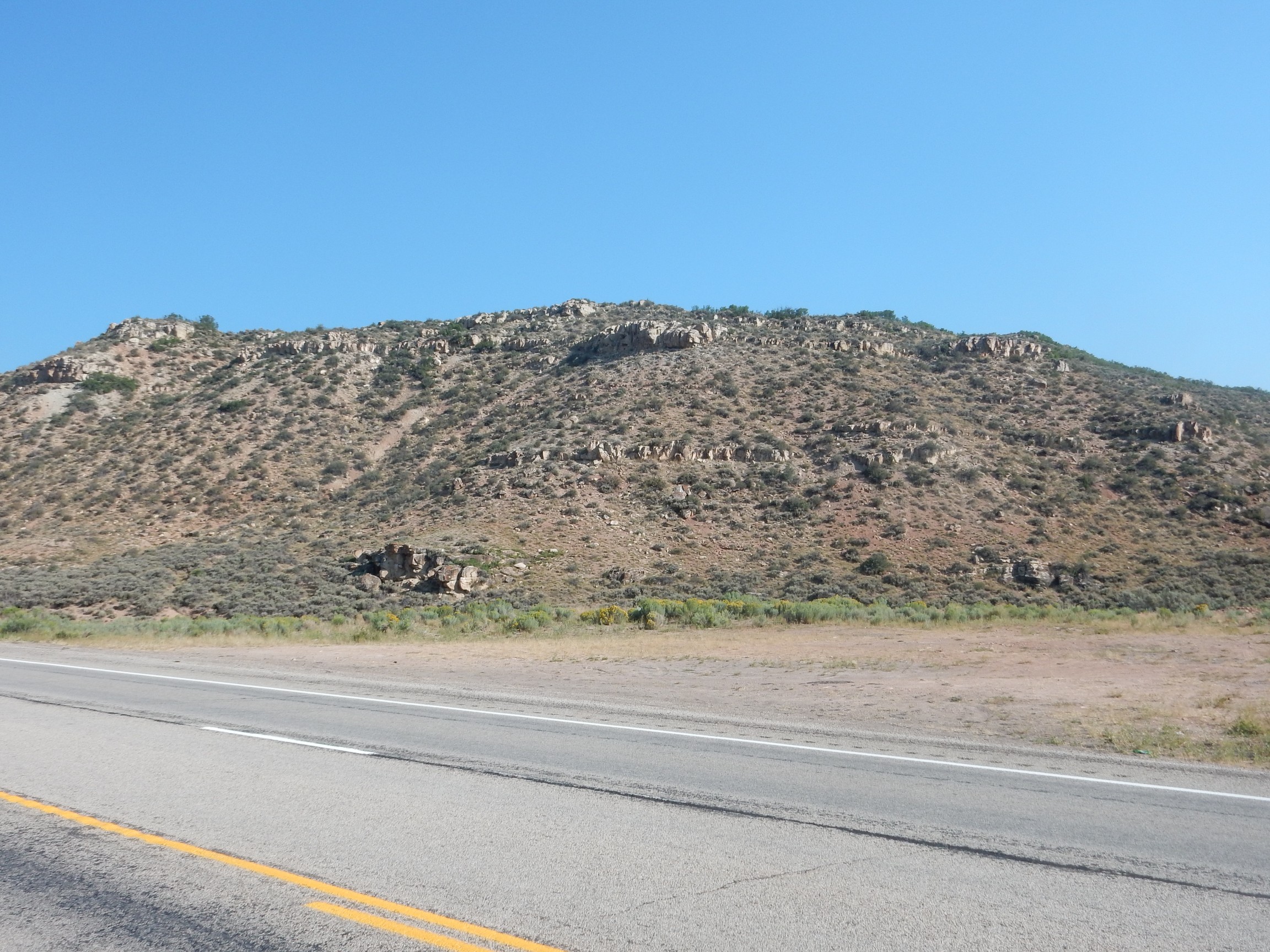
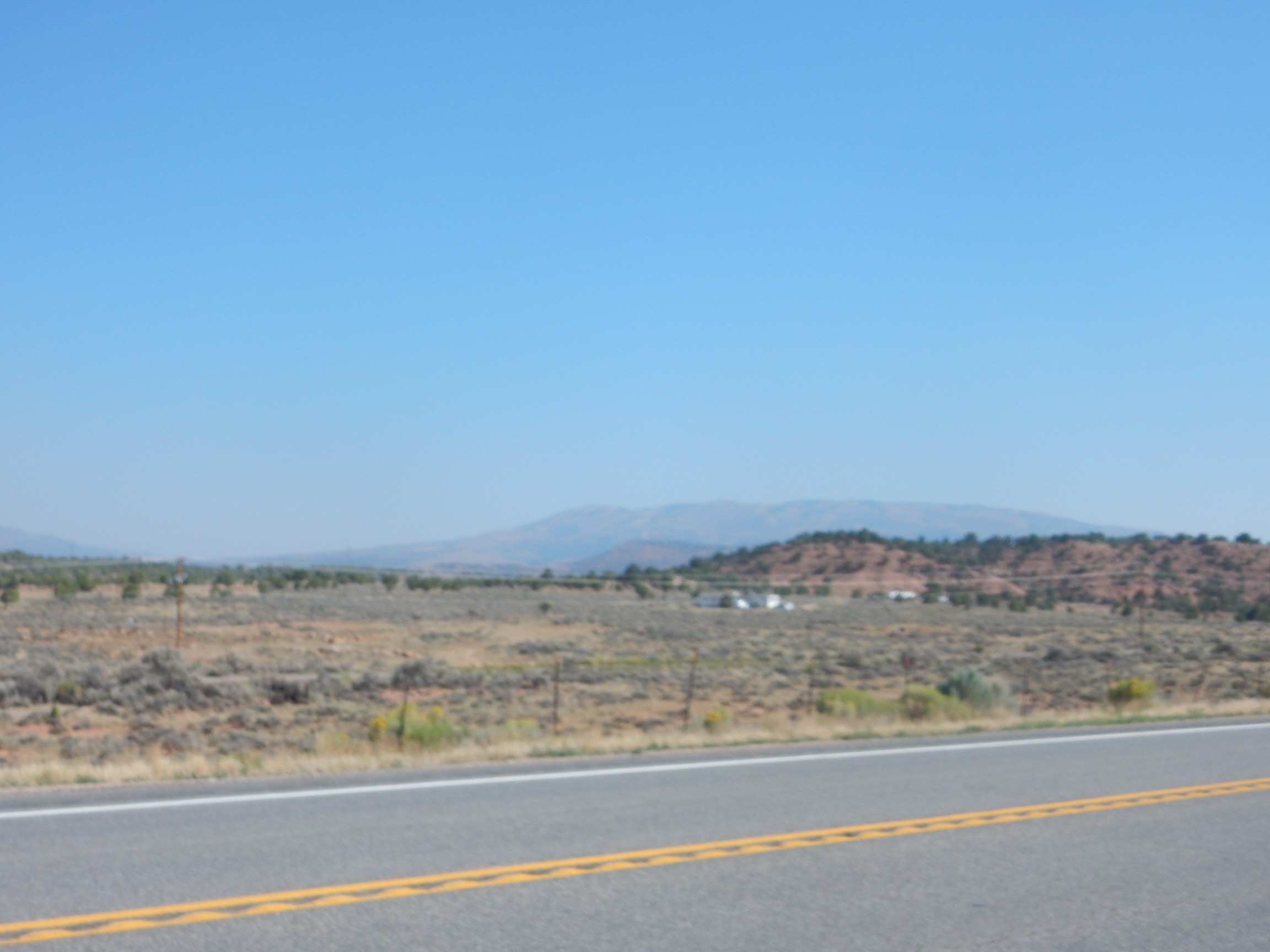
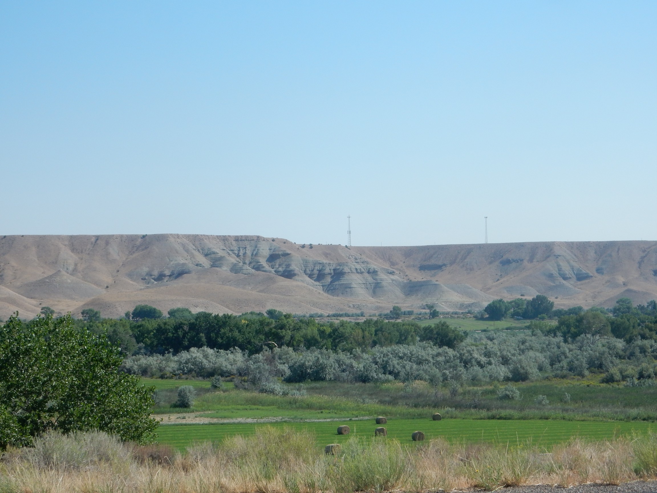
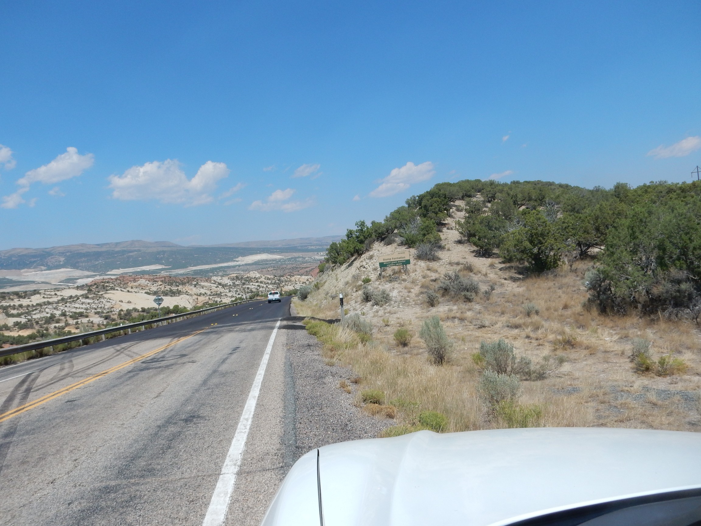
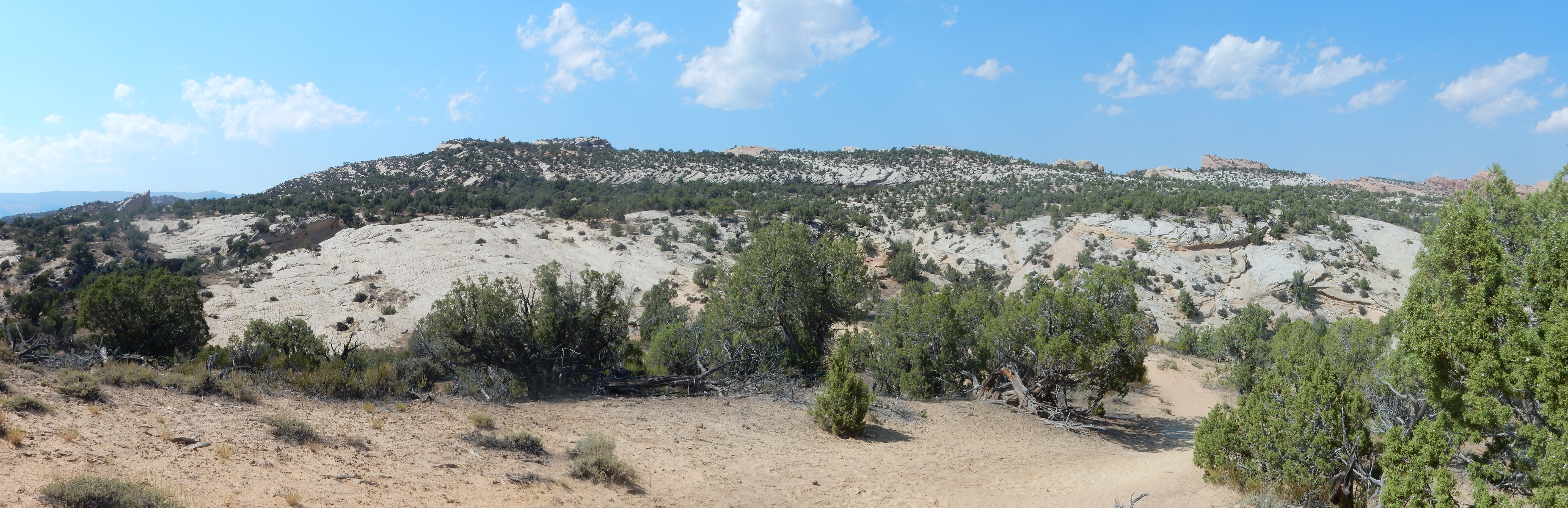
I pause northwest of Strawberry Reservoir to look back at the Wasatch Mountains.
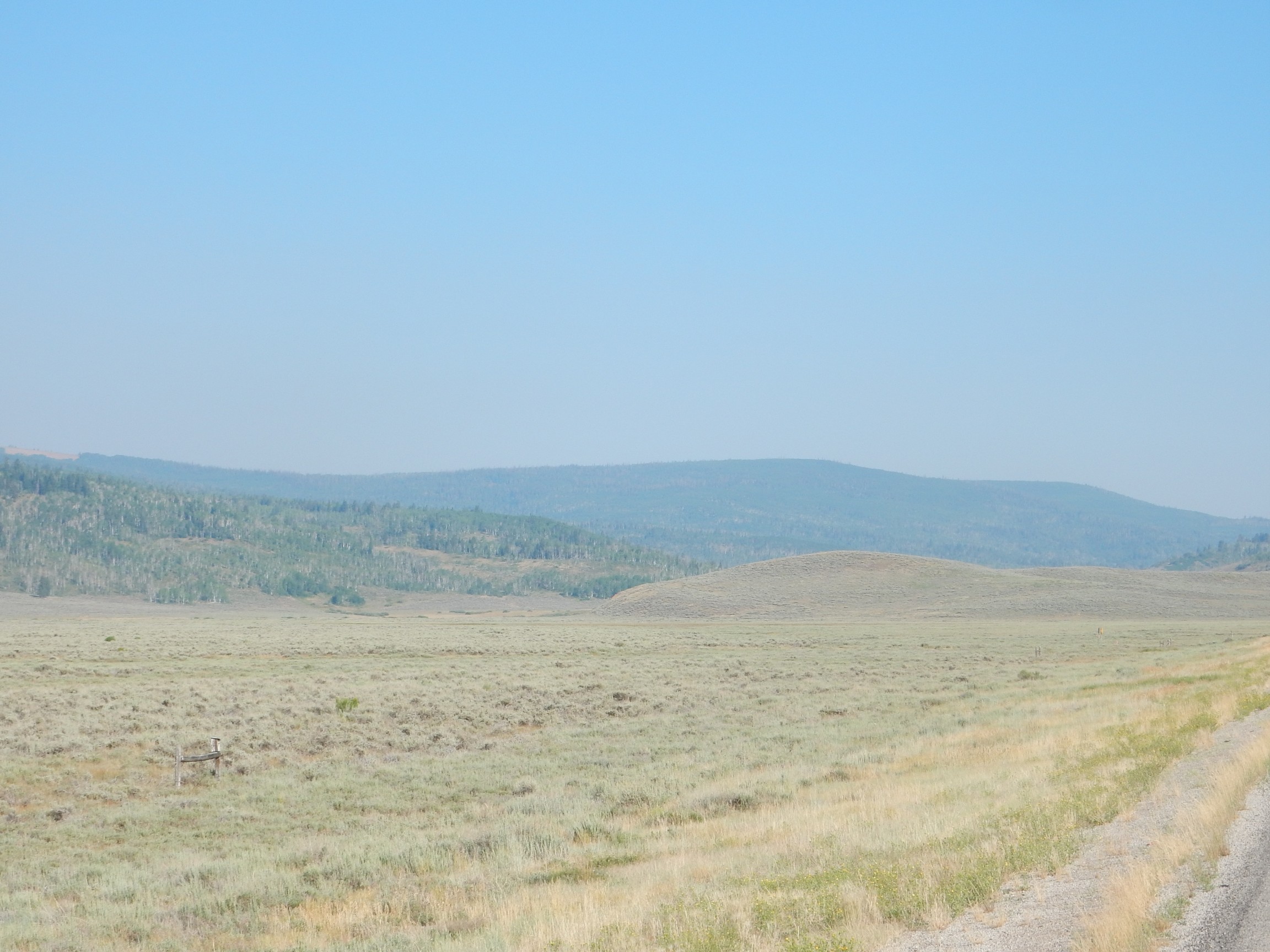
The Wasatch Mountains are more gentle to the east than the west — unsurprising for mountains carved from rock beds tilted to the east. The country here is beautiful, too.
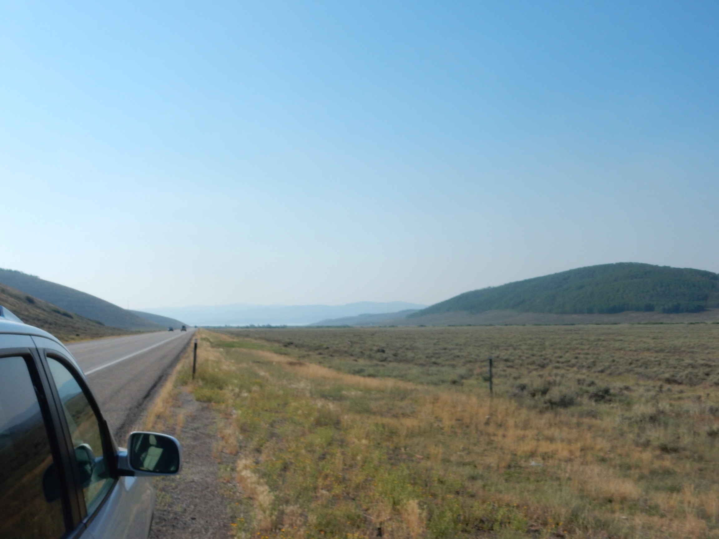
You can just see Strawberry Reservoir in the distance.
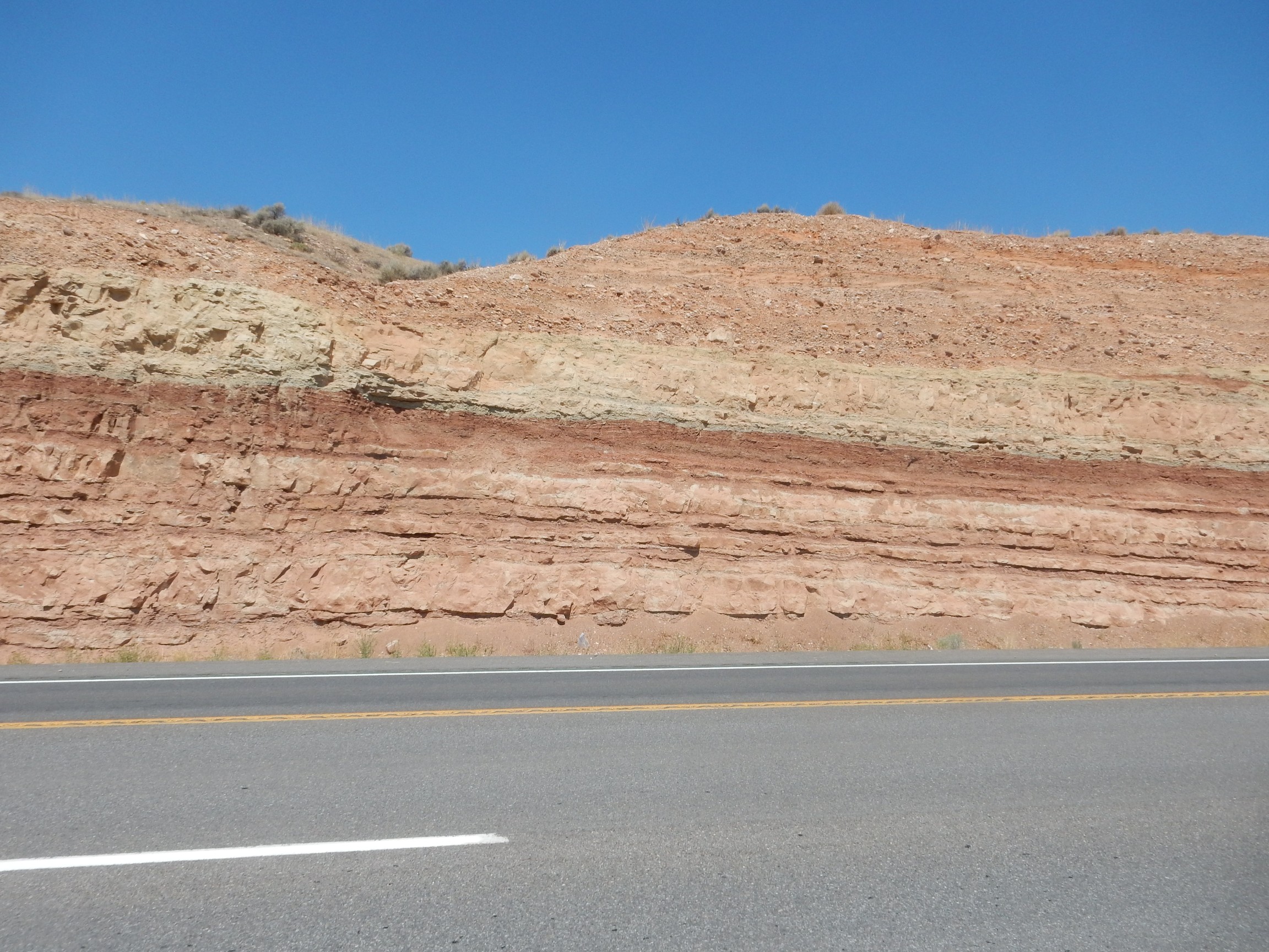
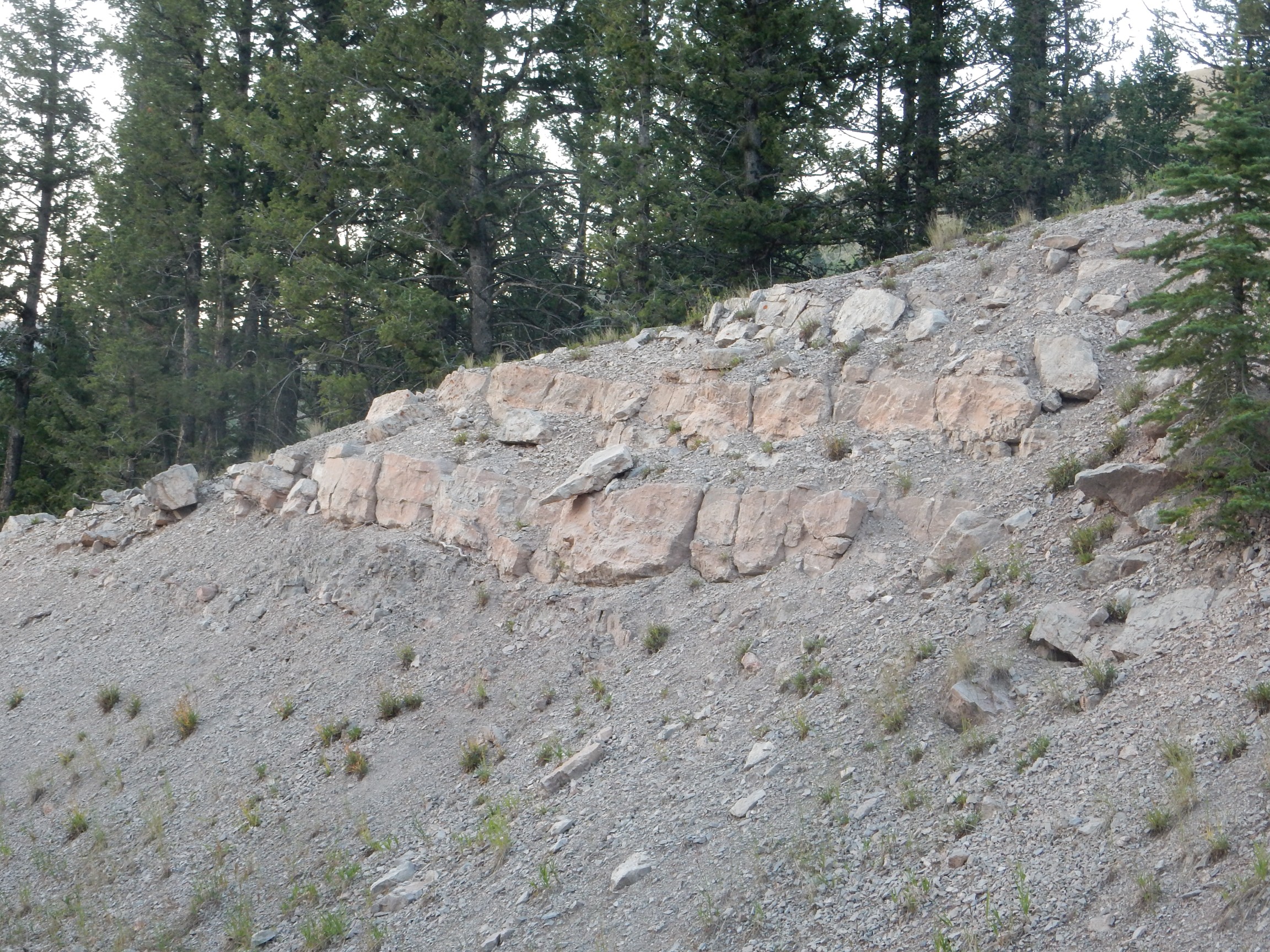
Finally, a road cut.

My guess? Morrison Formation. But no; the geologic map shows it’s Uinta Formation, which is new to me. This is an Eocene formation, presumably eroded off the young Uinta Mountains, which I am approaching on this road. It looks like continental sandstone and mudstone.
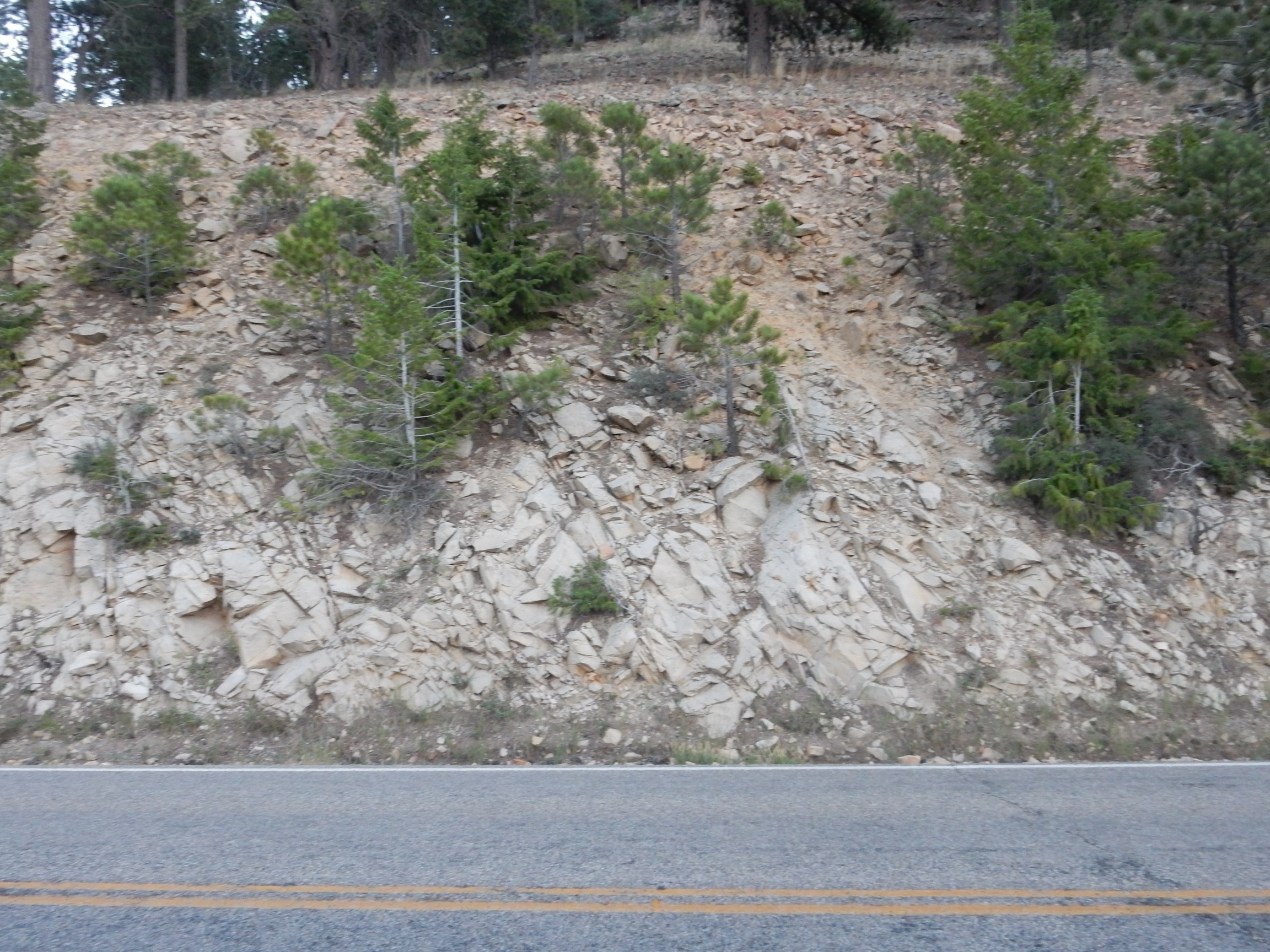
A little further down, I come to something more substantial.
This is the Duchesne River Formation, of Paleocene through Oligocene age — between 65 million to about 25 million years ago. It’s also sediments eroded off the Uintas, and interfingers with the Uinta Formation — meaning the two have some lithological characteristics that distinguish them, and one is mostly here while the other is mostly there, but the two overlap in this area and the beds alternate between the two lithologies.
More of the same.
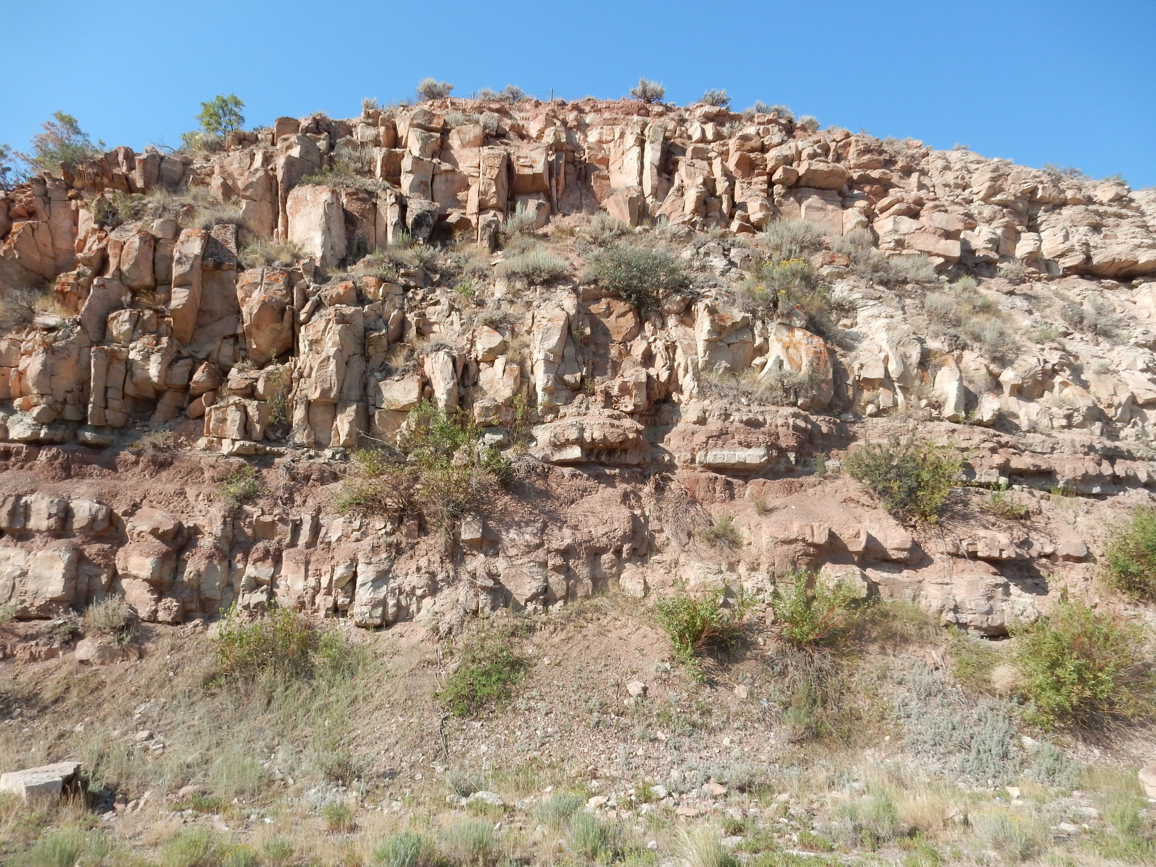
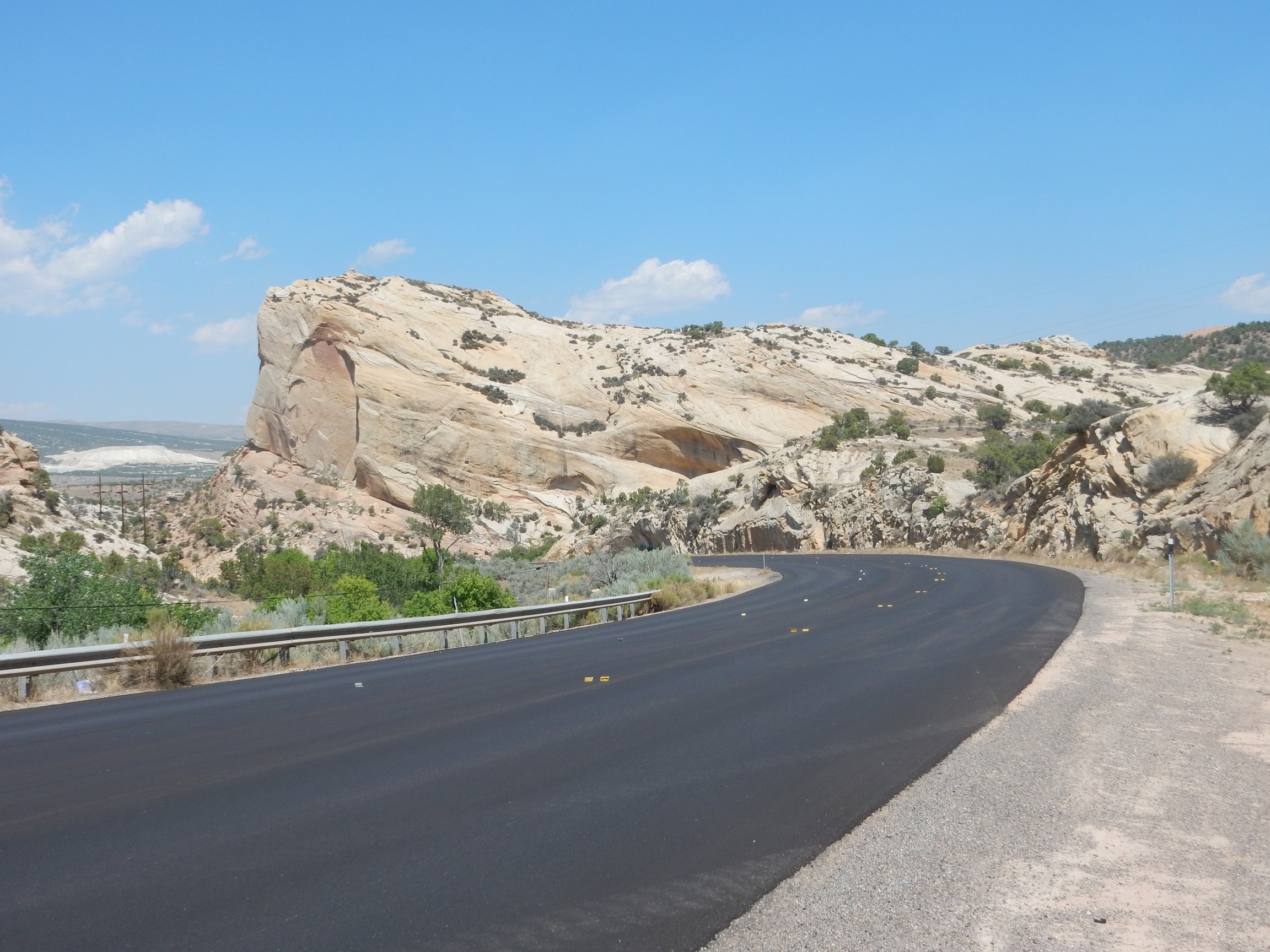
The next road cut is downright spectacular.
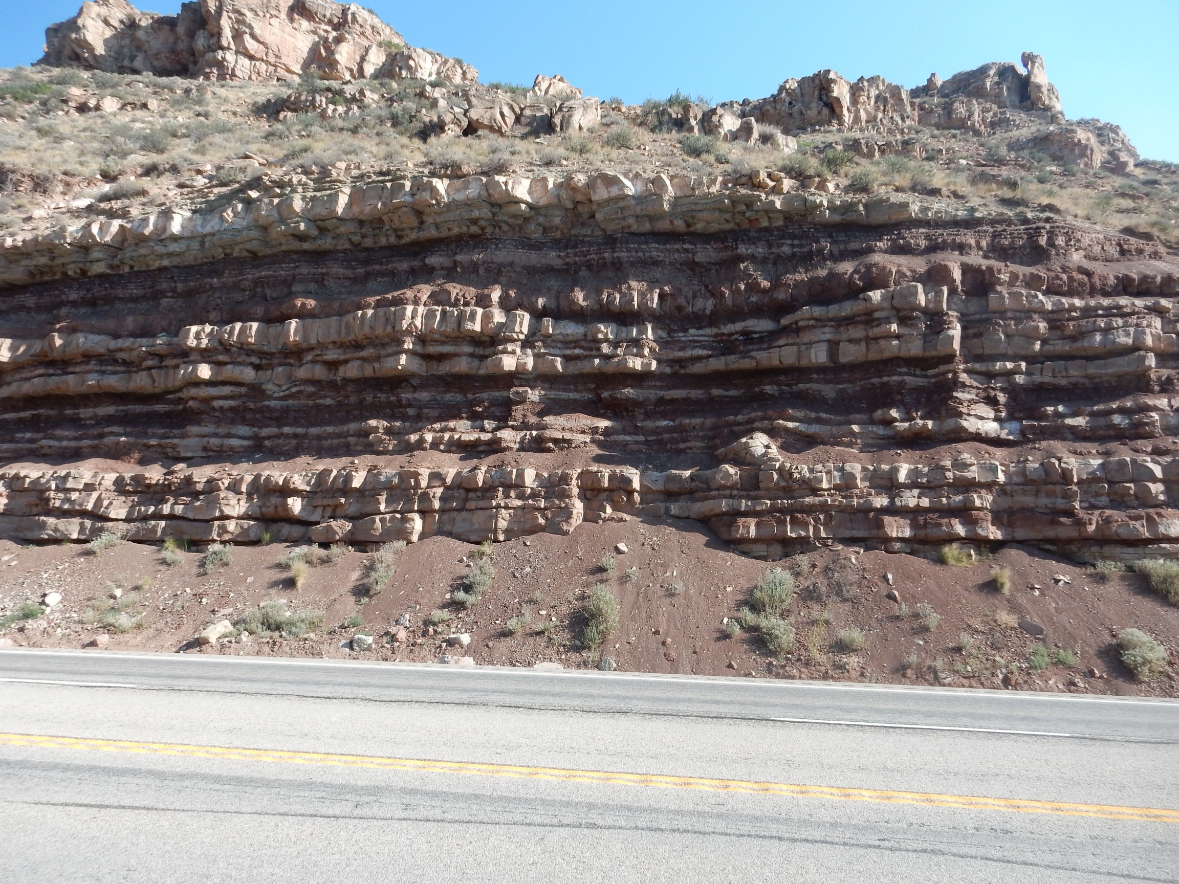
Still mapped as Duchesne Formation.
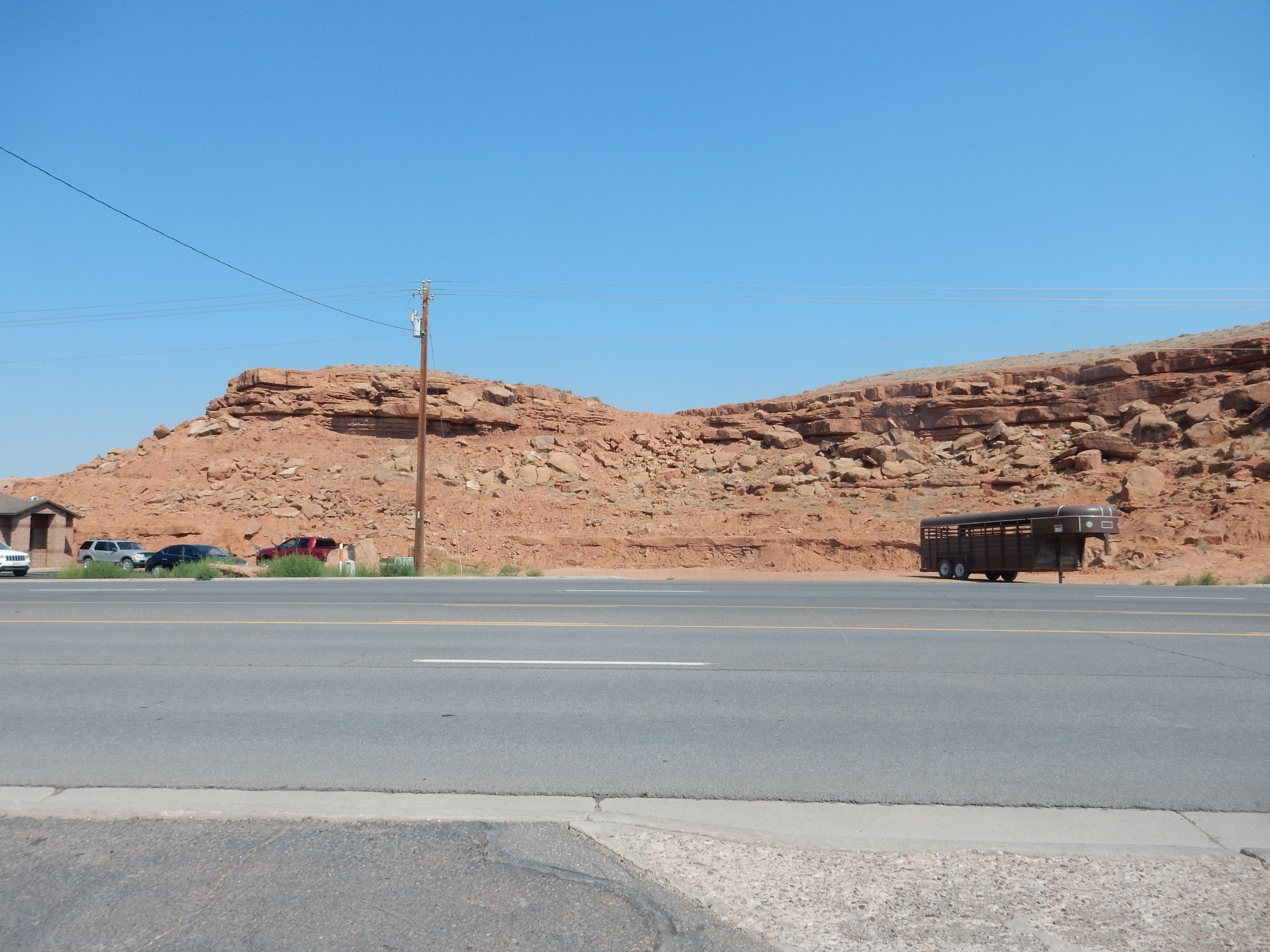
I come to a rest area across from a road cut near Fruitland.
Still Duchesne Formation. I’m beginning to think the geologic map I have was prepared a bit hastily; I’ve seen three sets of beds labeled simply as Duchesne Formation that could plausibly be mapped as individual members of the formation. Overall conclusion: A lot of sediment was eroded off the young Uintas, and there was a substantial basin to their south (which I’ve now entered) that accumulated those sediments.
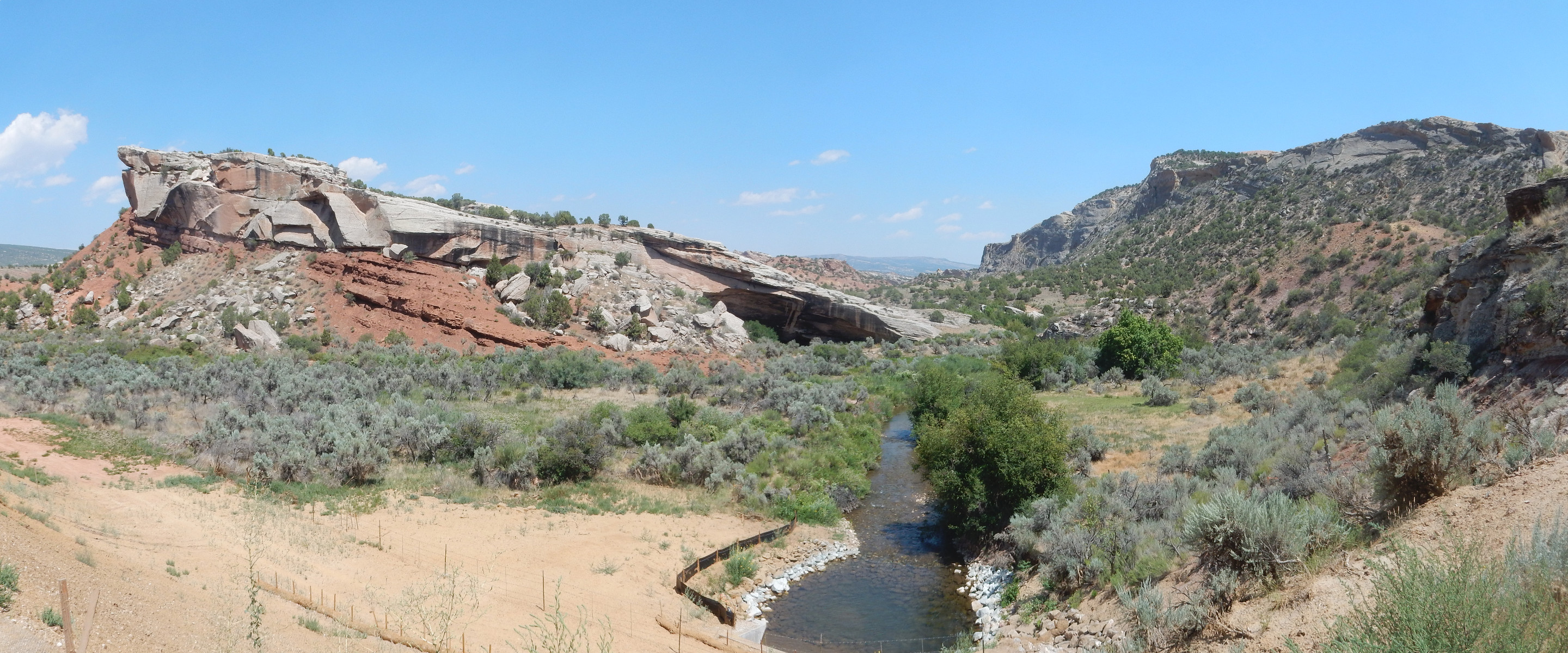
It’s a pretty area here.
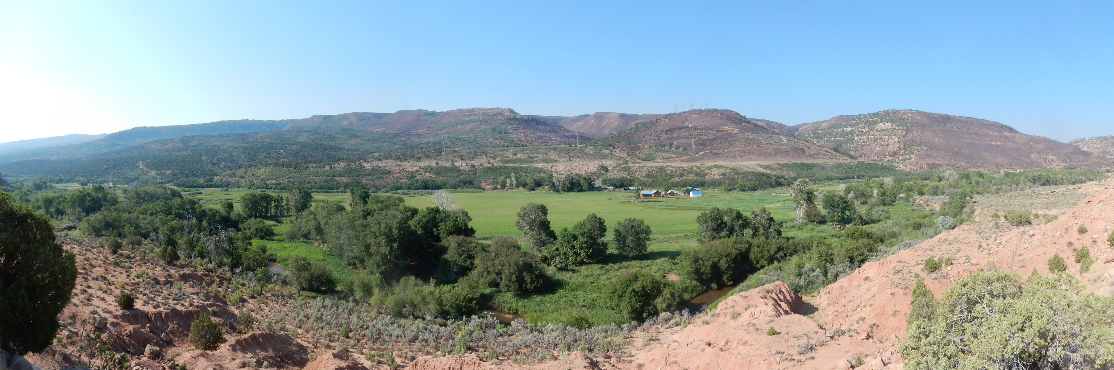
Currant Creek flows through the valley. The hills on the other side are all underlain by Duchesne Formation.
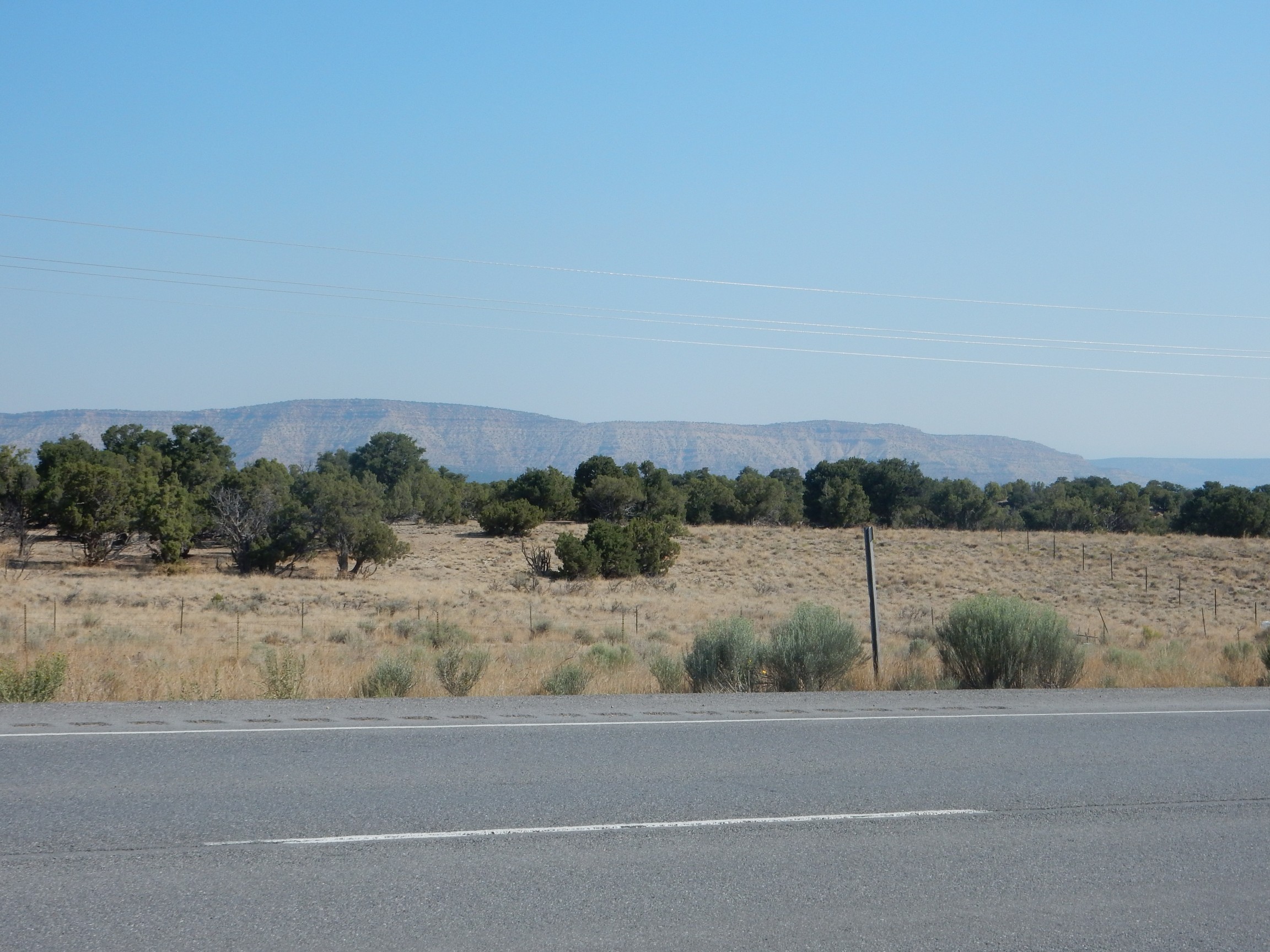
Off to the north, I get a first glimpse of the Unitas.
Tabby Mountain?
The Lost Roadcut:

Because the GPS on my camera cut out here, and I don’t know where this is. It’s either Duchesne Formation or the Eocene Green River Formation.
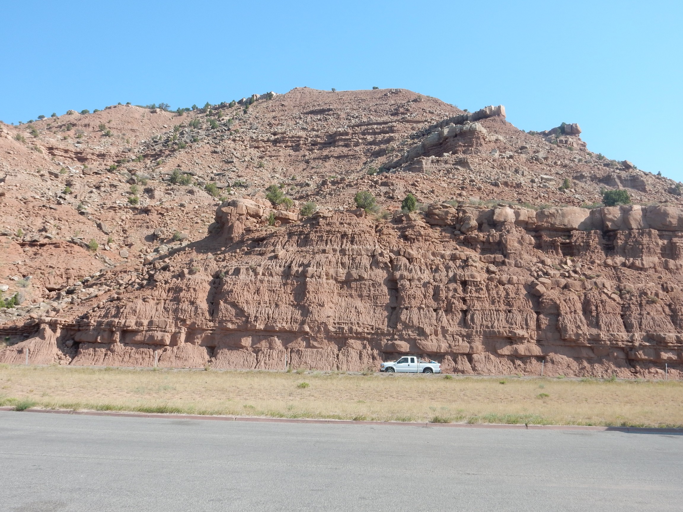
To the north is Blacktail Mountain.
The entire mountain is underlain by — surprise! — Duchesne Formation. This is oil country, and the satellite image shows numerous well pads in this area. There are even some on the mountain. I’ll remain in oil country for much of the next two days.
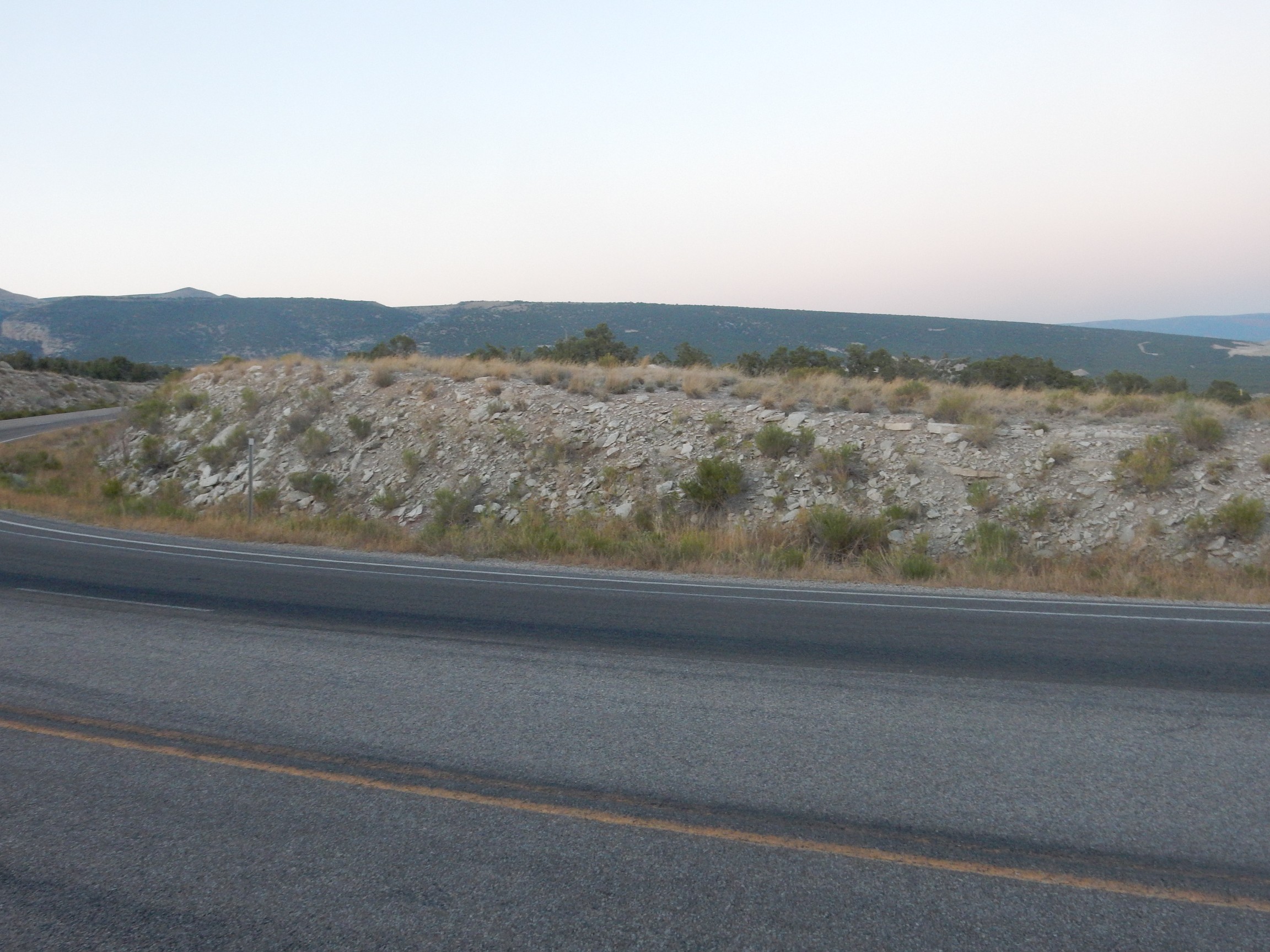
Rest area on Starvation Reservoir.
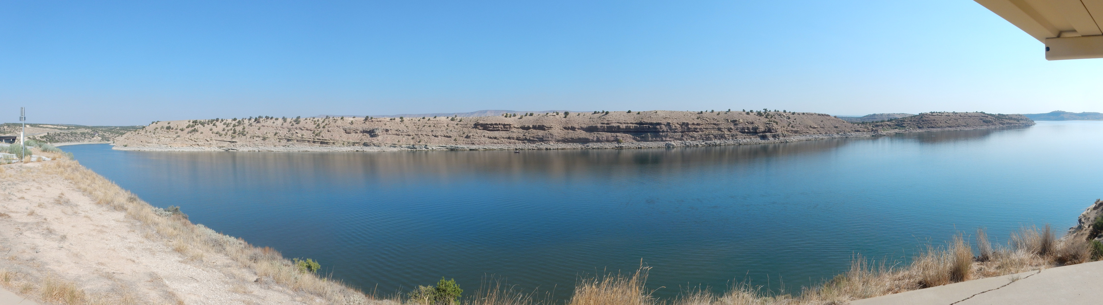
More Duchesne Formation. And it will be with me for a while still.
I pass through the actual town of Duchesne (partially underlain, in an astounding coincidence, with Duchesne Formation) and finally hit a road cut with something different.
Very young river gravel along the Duchesne River; perhaps only a few thousand years old.
More Uinta Formation.
This looks like Mancos Shale, but I will discover when I get home and plot my positions on the geologic map that this is more Uintah Formation.
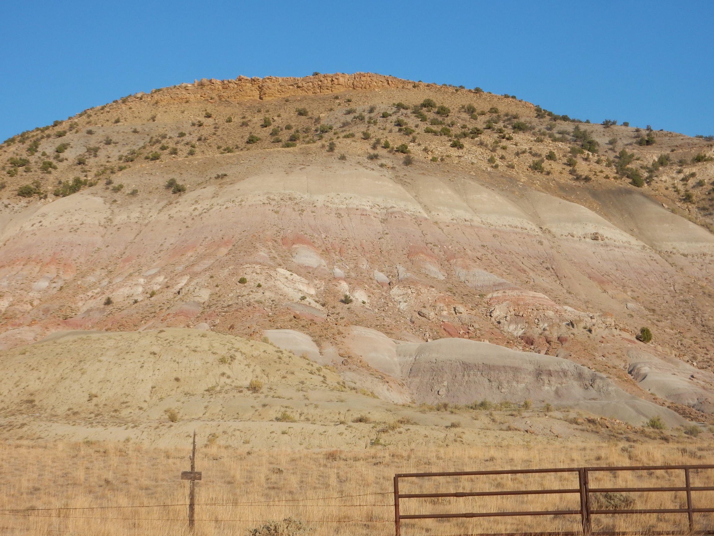
I reach Roosevelt. North of the cemetary is a bluff.
More Duchesne Formation! But after I get home, I plot it on the geologic map, find I’m in a better mapped area, and learn that this is the Brennan Basin Member of the Duchesne Formation.
I’ve now driven most of the length of the high Unitas in the Uinta Basin to its south. The monotony of the formations reflects the nearly level beds here, relatively undisturbed by deformation since the Uinta Mountains were first raised, around 65 million years ago.
This, too, is Brennan Basin Member, but you gotta admit it’s pretty.
The beds are tilted slightly to the north. This is a touch surprising, considering the Uintas are to the north. Beds usually tilt away from uplifts, not towards.
Finally, I arrive in Vernal, where they like their history. In front of the historical museum is a small veteran’s park.
There are memorials to veterans of several conflicts. I am pretty sure, though, that it’s not spelled “Siagon”. The correct spelling, apparently, is “Ho Chi Minh City”. I think I actually prefer “Siagon.”
The history museum is free, and moderately interesting. Of geological note is the display on gilsonite.

“What is gilsonite?” Glad you asked.

It’s basically a very fine grade of asphalt, used in everything from roof tiles to printer’s ink. The stuff is very common in this area, and so is sometimes called unitahite.
I have not heard from Bruce yet. (You knew he had to come into the picture sooner or later.) I locate the dinosaur museum; it’s not free but it turns out to be a first-rate museum for a rural area, well worth the money. Not all my pictures turned out, but here are some that did.
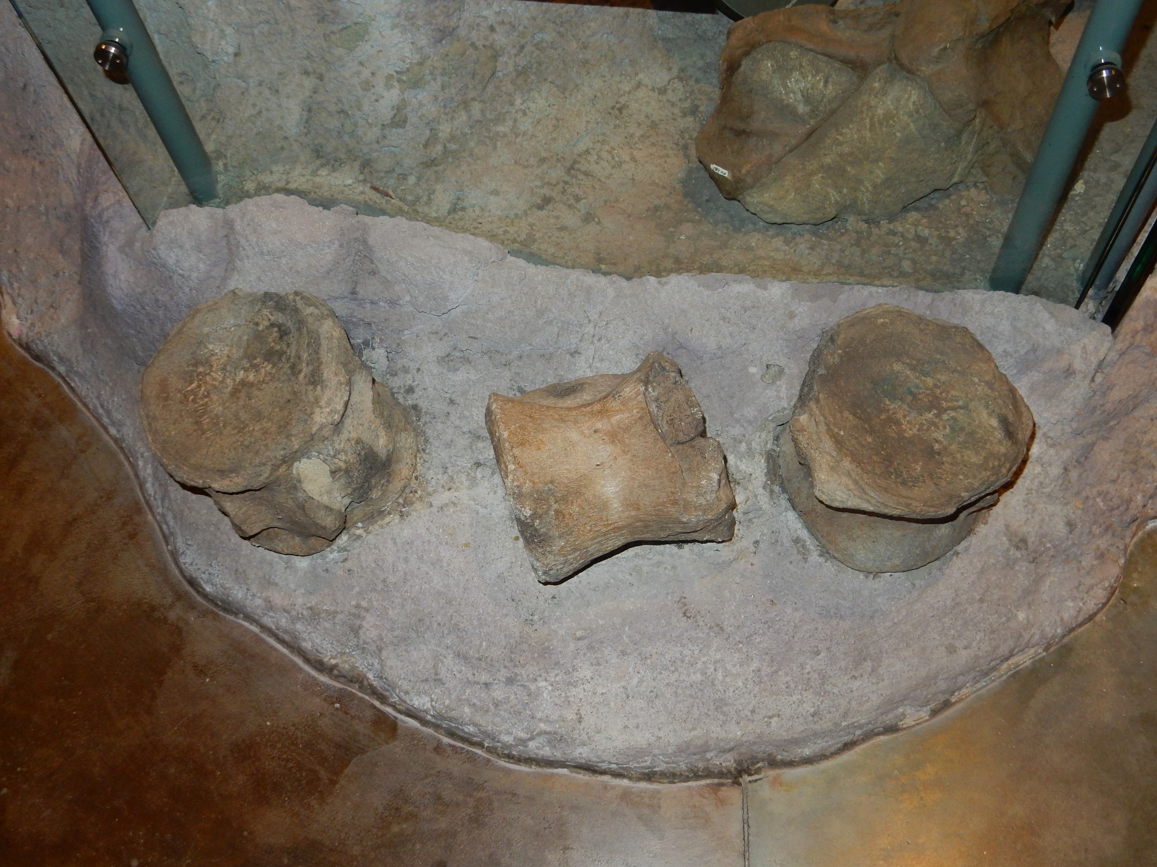
Dinosaur vertebra.
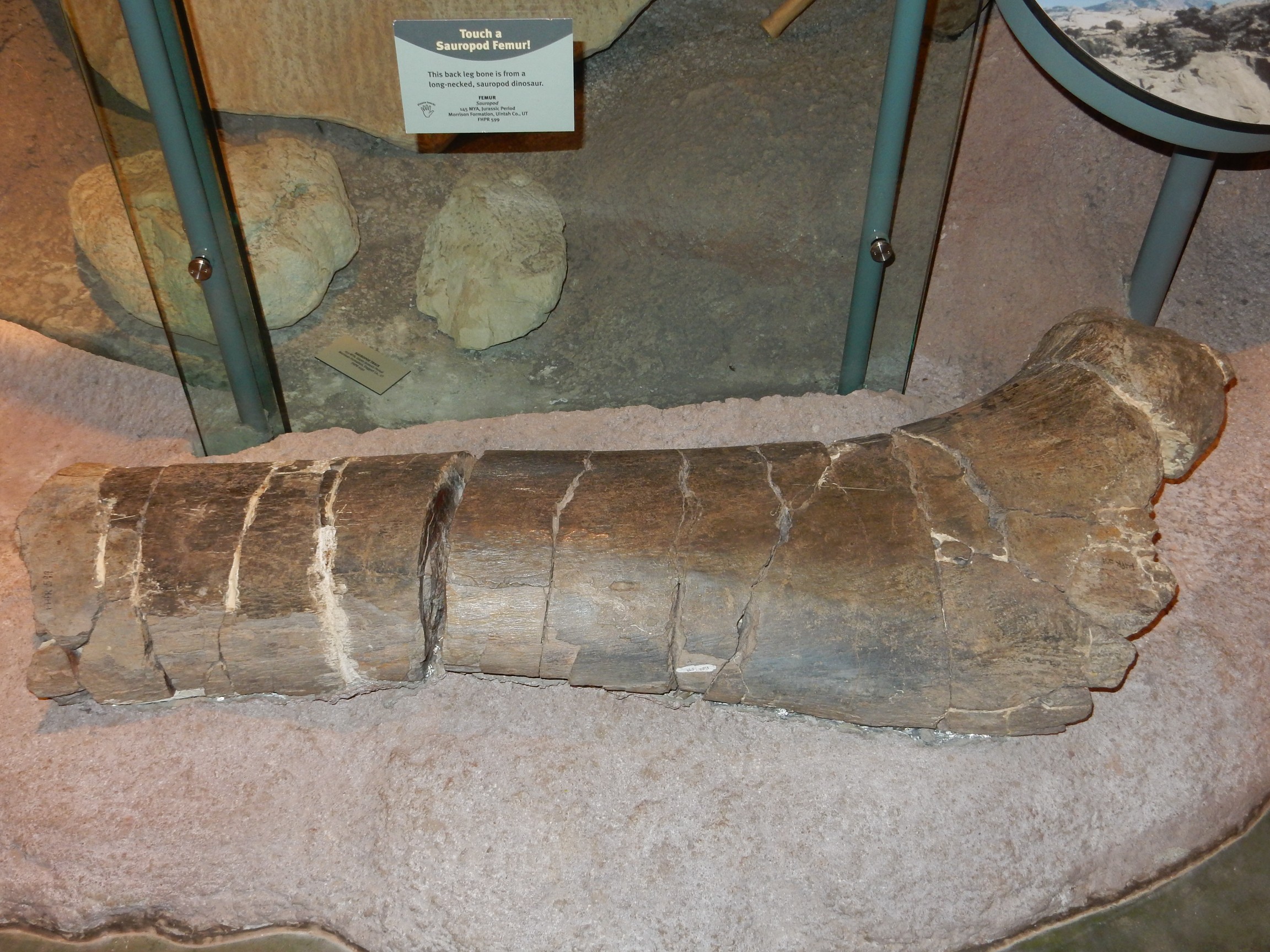
Dinosaur femur.
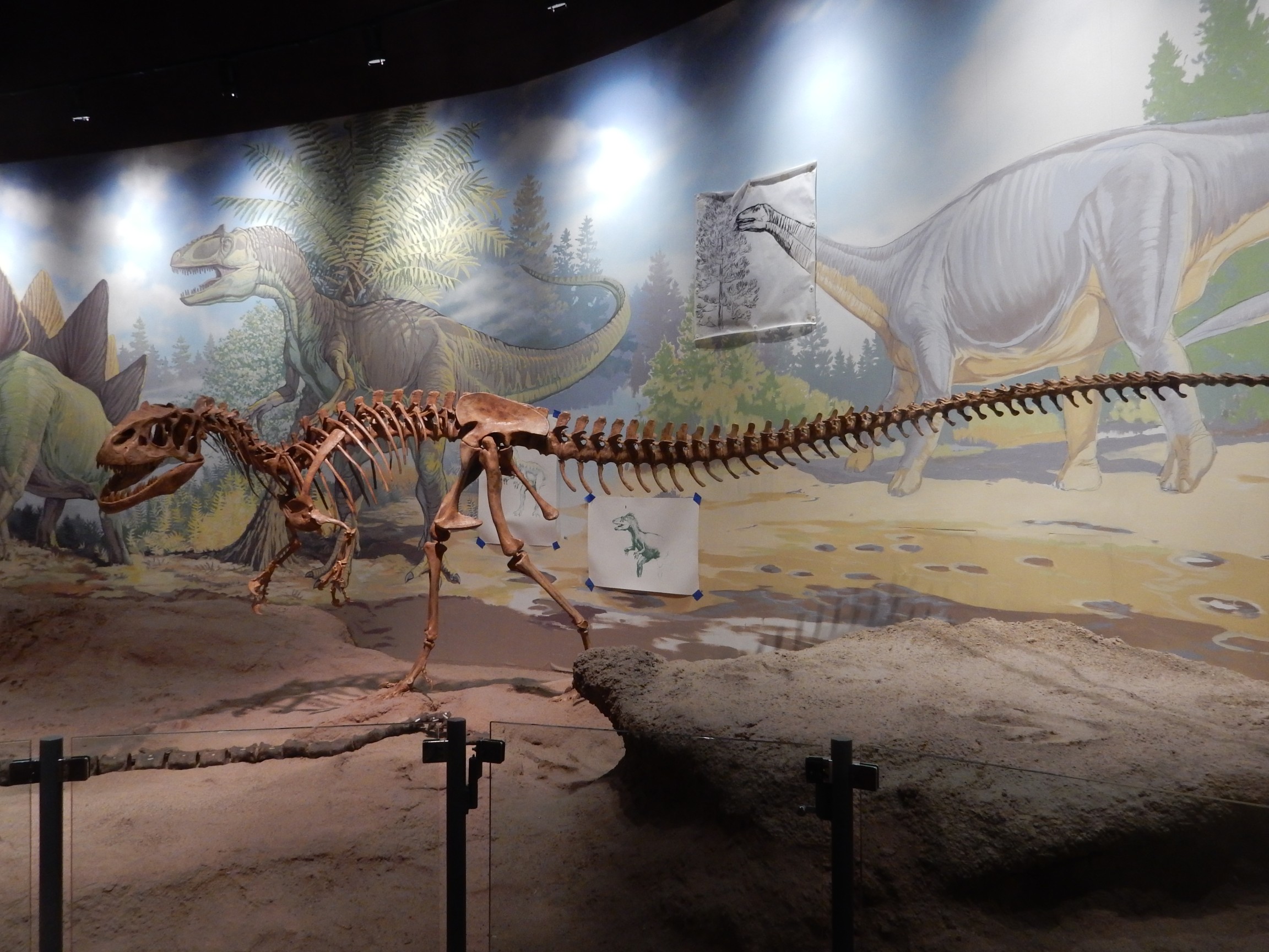
A complete Allosaurus, the most common carnivorous dinosaur of the late Cretaceous.
Dinosaurs may have had tiny brains, but some were once thought to have more than one:
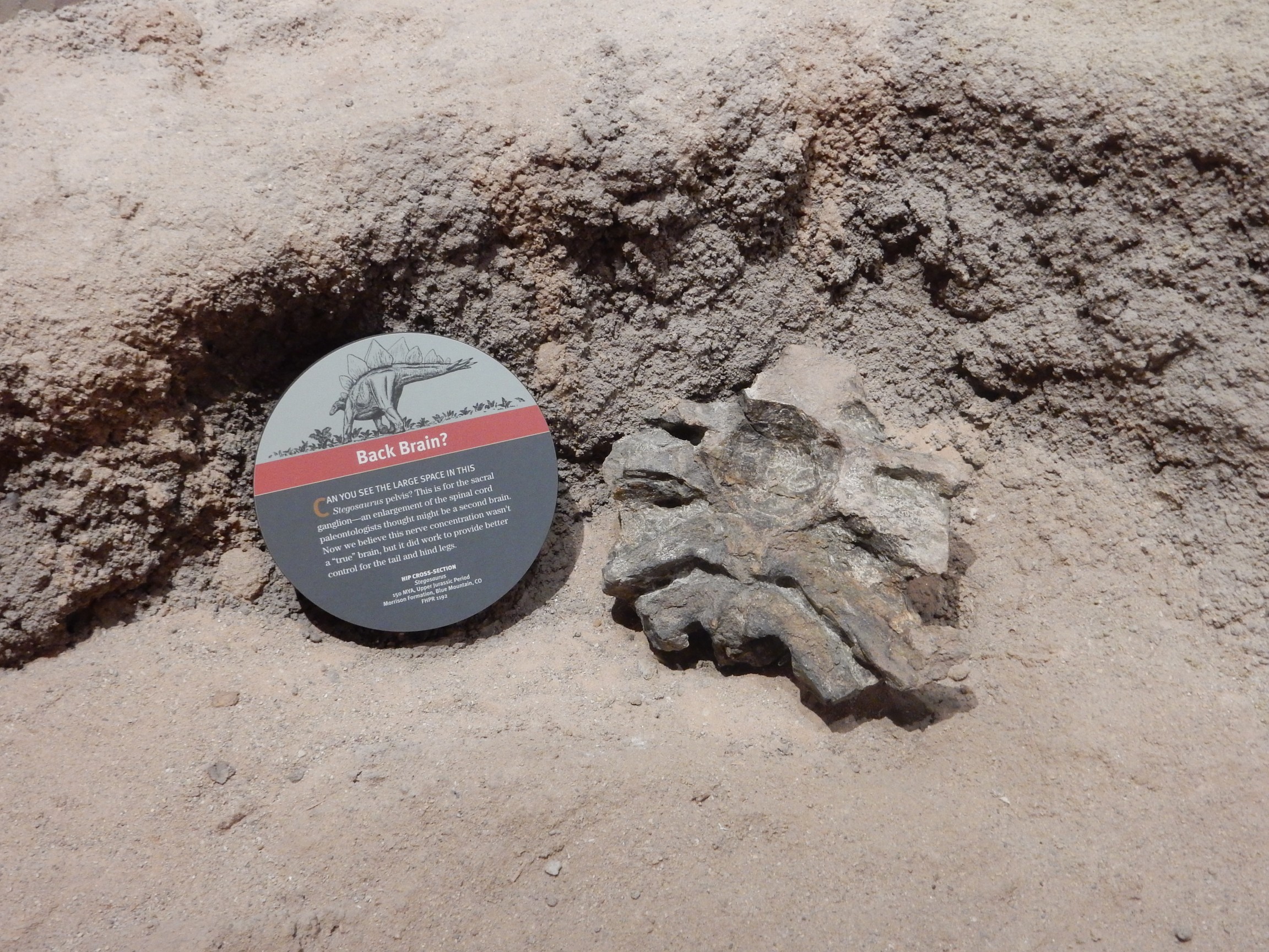
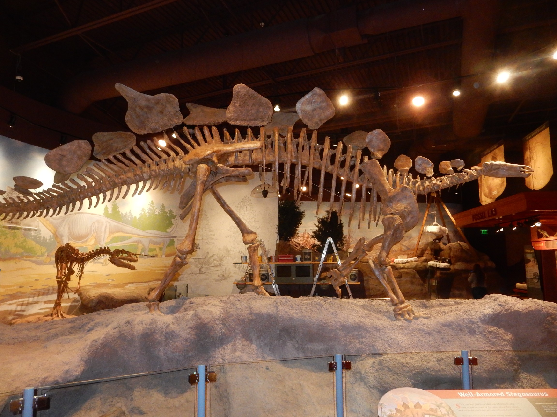
Stegosaurus ribcage and backbone with some of the bony plates still present. The museum claims this fossil was instrumental in settling the question of how the plates were attached (double row? alternating? all in one line?) but Bruce will later suggest the question is not actually fully settled even today.

Not hard to see the museum’s conclusions.
I called this a “dinosaur museum” but it’s actually got a very good Eocene exhibit, from after the extinction of the non-avian dinosaurs.
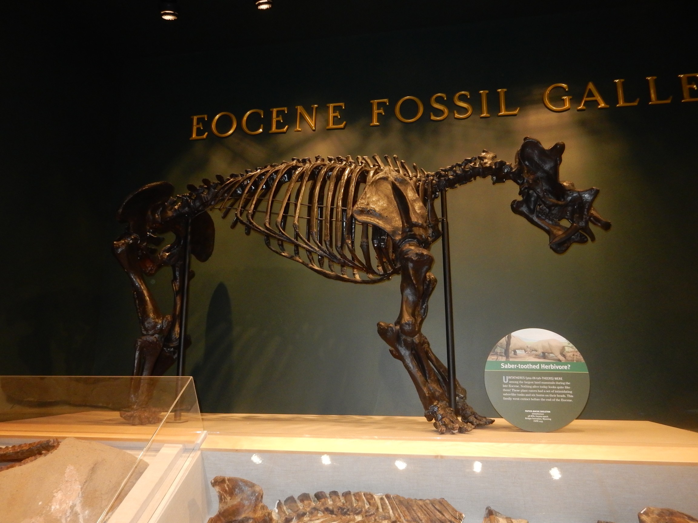
That’s a Uintathere, which can be described, not completely inaccurately, as a saber-toothed cow. There were some mighty odd critters running around back then.
Bruce and I once debated on the merits of a bathroom tiled entirely with Green River Formation fish fossils (which are very often for sale at rock shows as slabs that do, indeed, have roughly the size and thickness of tiles.) It wasn’t much of a debate, since I think we were both arguing the same side, but it seems like we’re not the first:
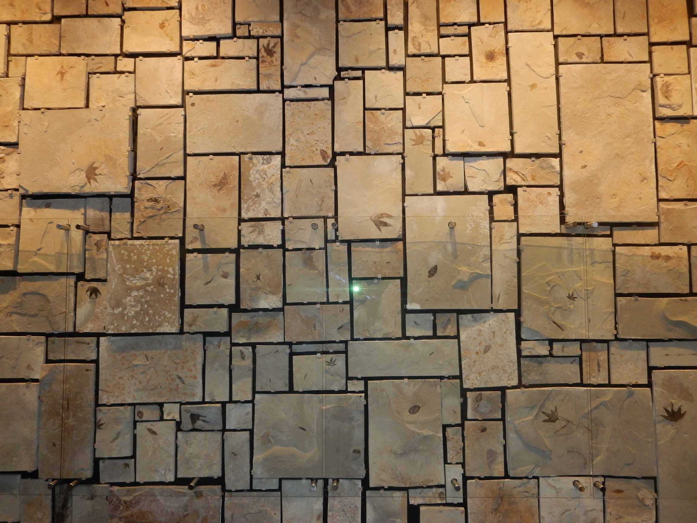
Actually, all but one are leaves of Eocene plants. Only one is a fish. Can you spot it?
Neither could I.
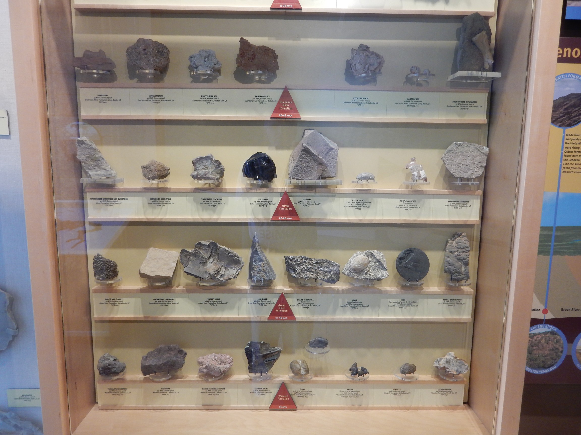
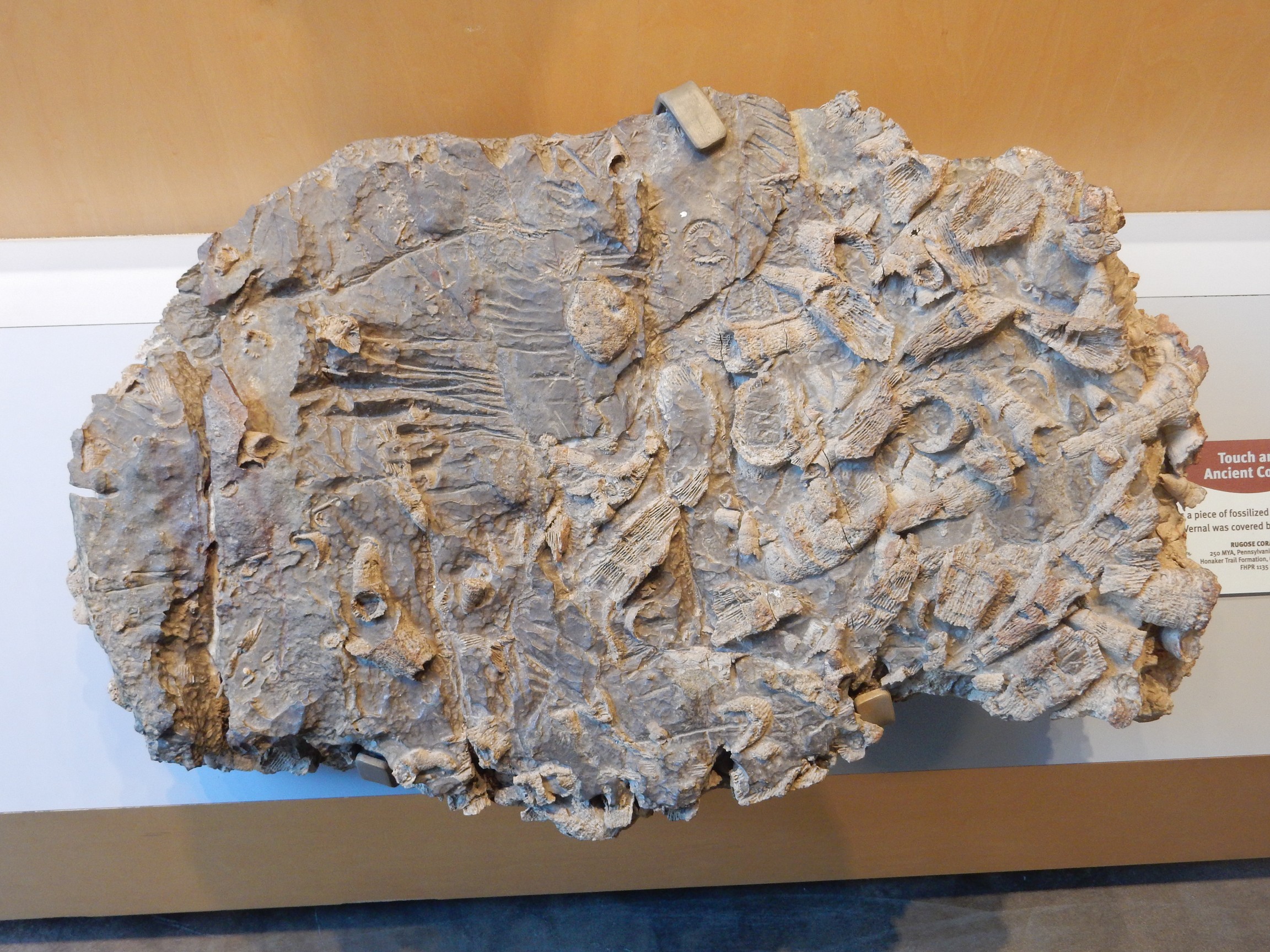
Fossils, and a few rock types.
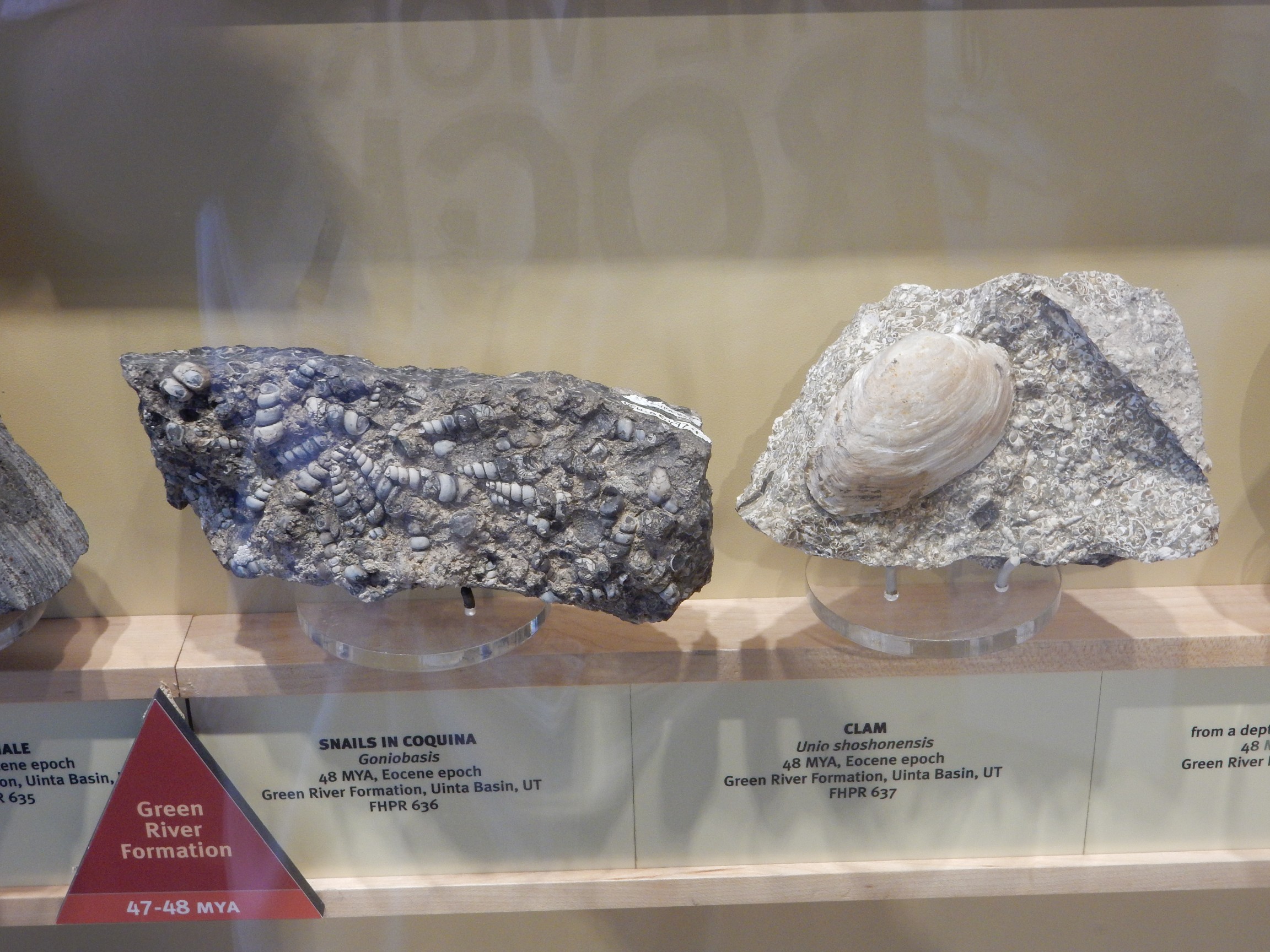
Horn corals.
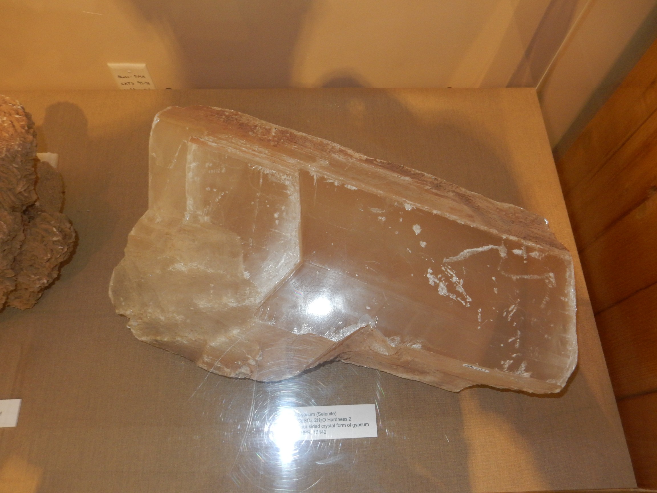
Selenite, a form of gypsum (calcium sulfate):
Just highlights. There is much else to see at the museum.
I find a Chinese restaurant for lunch. It is authentic enough that there is some slight difficulty communicating my order; the bowl of rice is only slightly huge and I get an enormous amount of hot and sour soup. The stuff is healthy for me — the sour actually helps control my blood sugar — but it’s a slight chore to eat it all. But the kung pao chicken is good and I’d say I enjoyed the meal overall.
Then north, on the “Highway into the Ages”, which cuts through successively older beds as it climbs into the Unitas and which has road signs identifying each formation. I still haven’t heard from Bruce, but I figure he will forgive a reconnaissance without him.
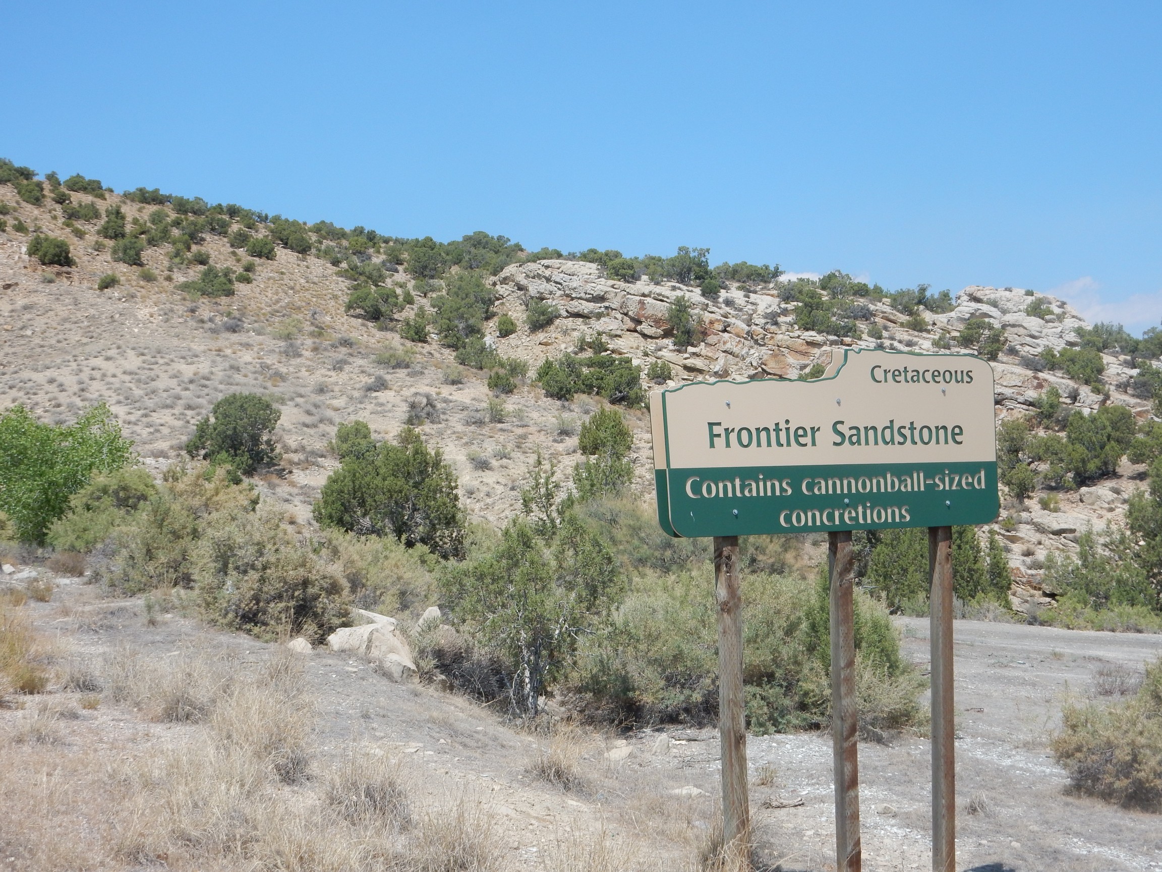
First up: Frontier Formation

And the first geology sign.
It’s tempting to just put up the pictures from here out, since there’s signage, but I’ll add comments anyway.
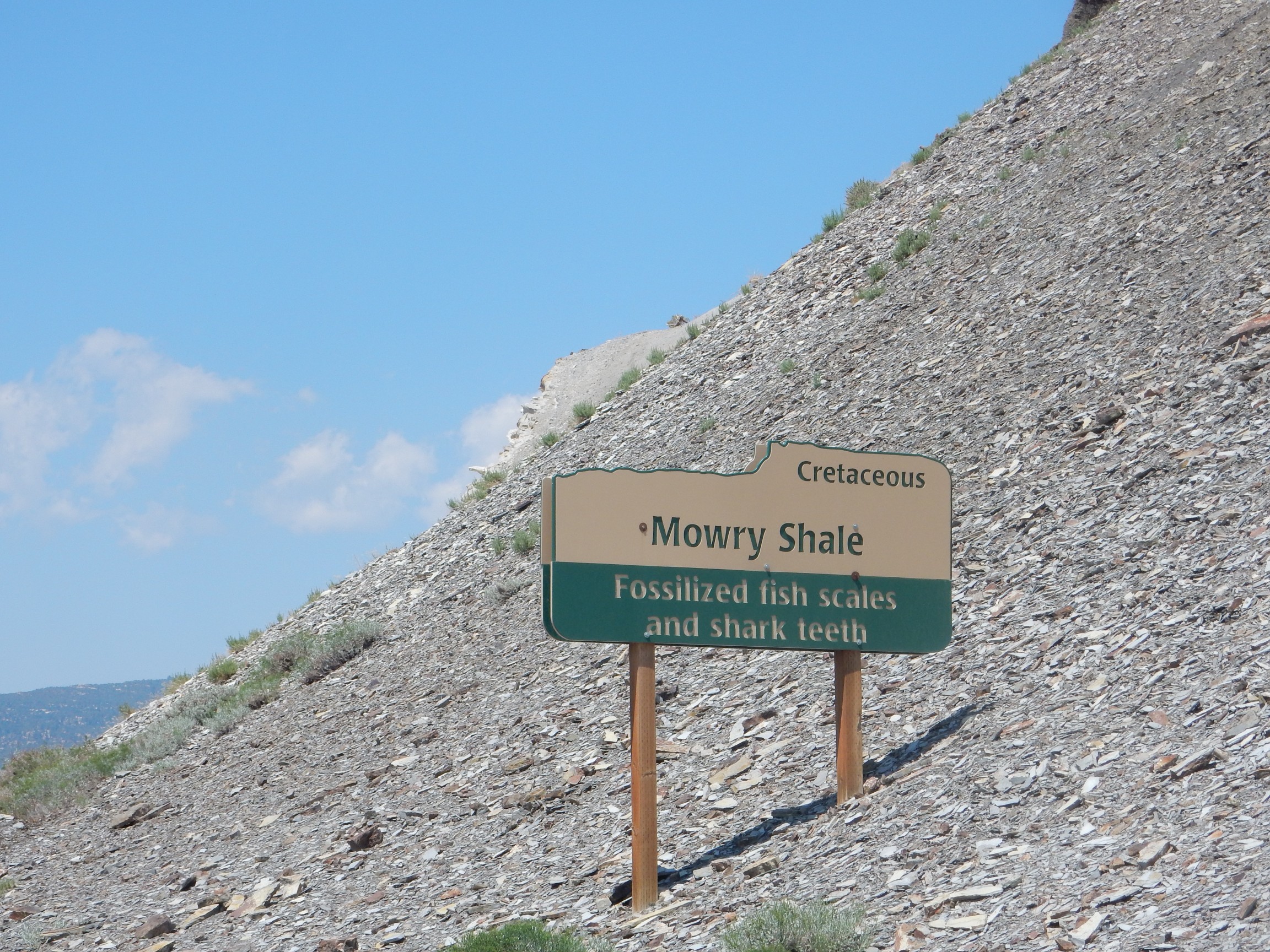
Next are marine beds from the Western Interior Seaway.
It’s a narrow road, but I find a place to pull over and explore.

I already have some shark’s teeth, but there’s always room for more, and I have no fish scale fossils. I hunt.

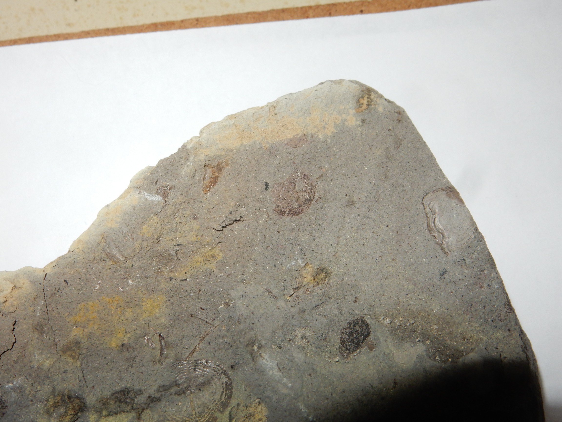
The photo doesn’t do them justice. Some of the scales are beautifully delicate.
Below the Mowry Shale is the Dakota Formation.
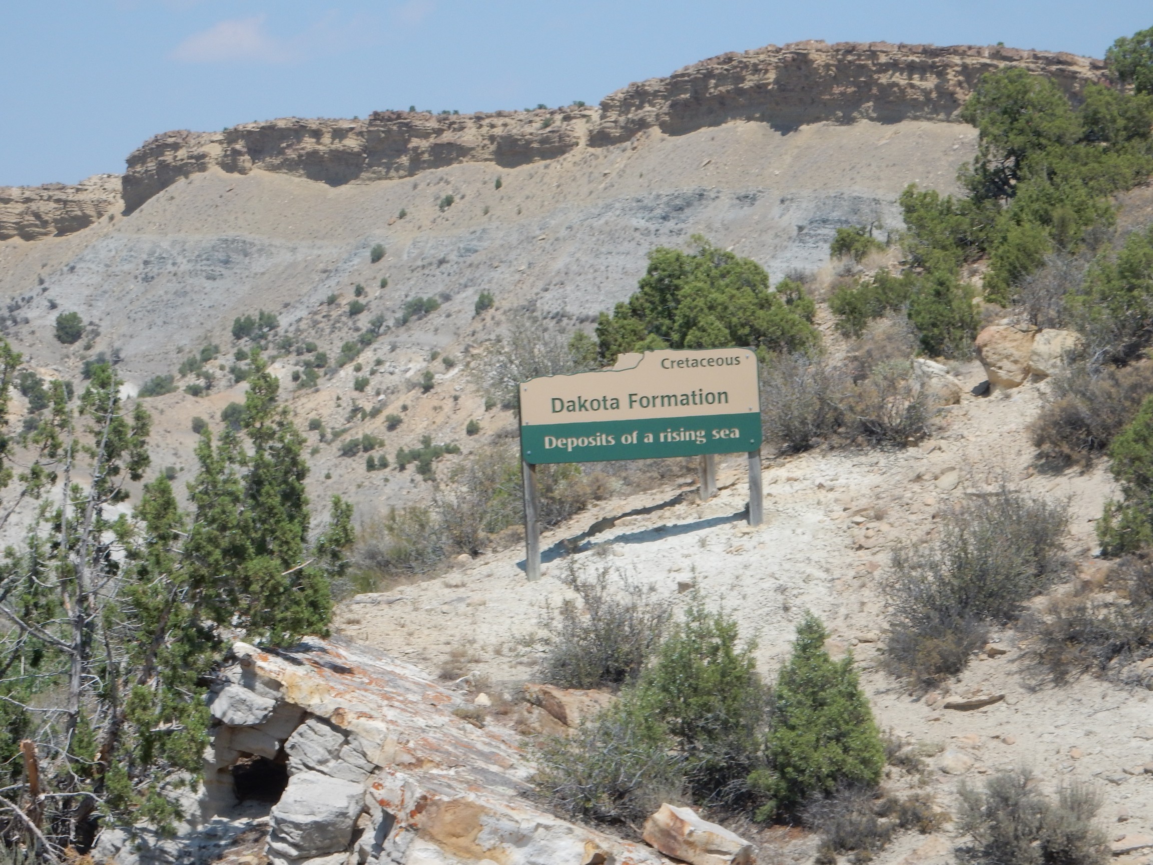
The sign is posted right in the Dakota Formation beds. In the background are cliffs capped with Frontier Formation over Mowry Formation. The Dakota Sandstone marks the beach sand from when the Western Interior Seaway first flooded the continent.
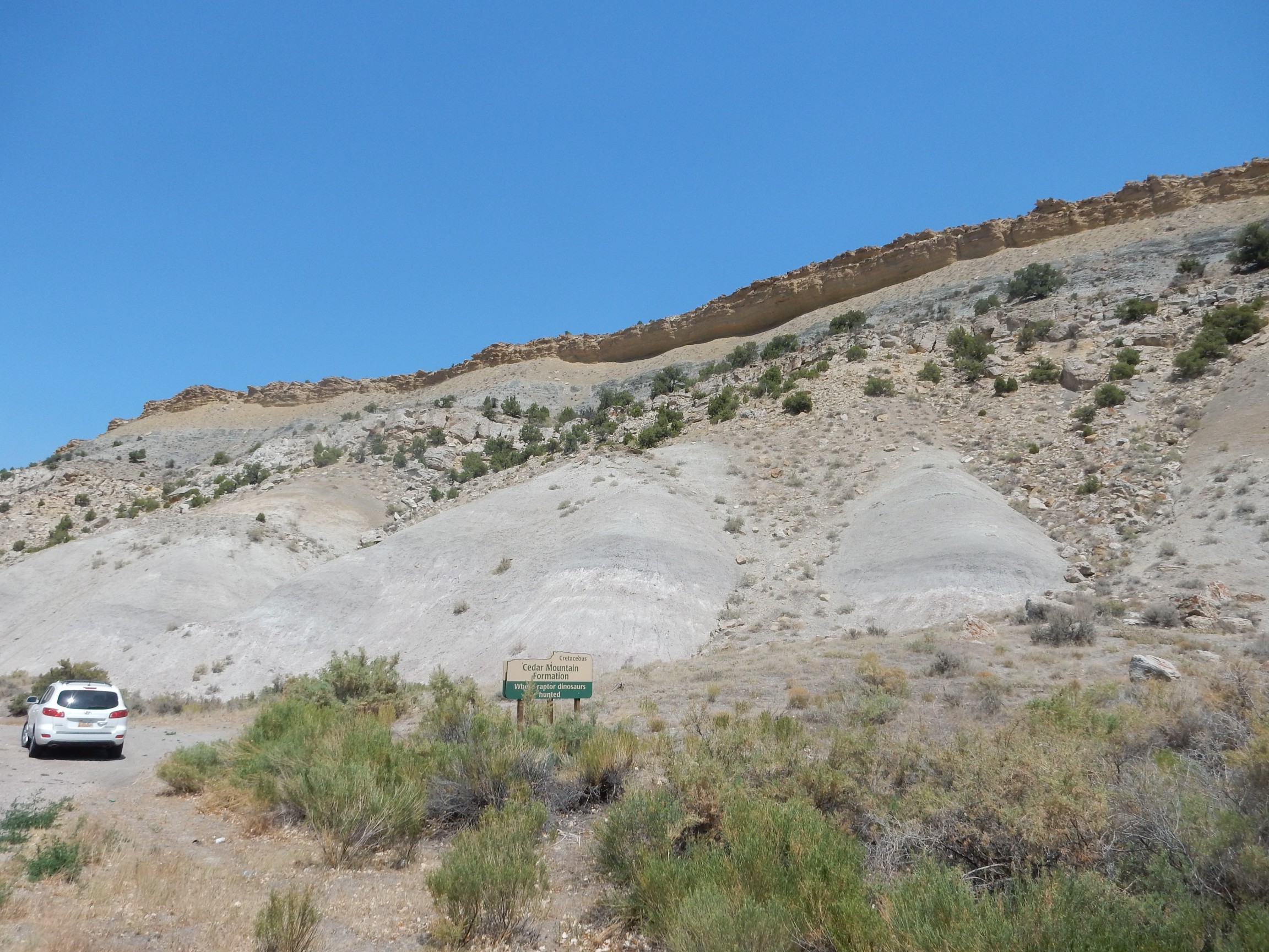
And below that is the Cedar Mountain Formation.

The Dakota Formation is enormous, and it is present (and prominent) back home in the Jemez. However, the formation below the Dakota in the Jemez is mapped as the Burro Canyon Formation rather than the Cedar Mountain Formation. I don’t know how substantial the differences are.
The whole sequence so far:
The sandstone cap of the bluff is Frontier Formation. Below is a dark layer of Mowry Formation shale. Then comes another layer of sandstone of the Dakota Formation. Below all these is a thick layer of Cedar Mountain Formation mudstone. All are Cretaceous in age, spanning a time interval from about 110 million years ago to about 70 million years ago.
The great dinosaur beds of the Uintas are found in the next formation. (Not at this location, to be clear.)
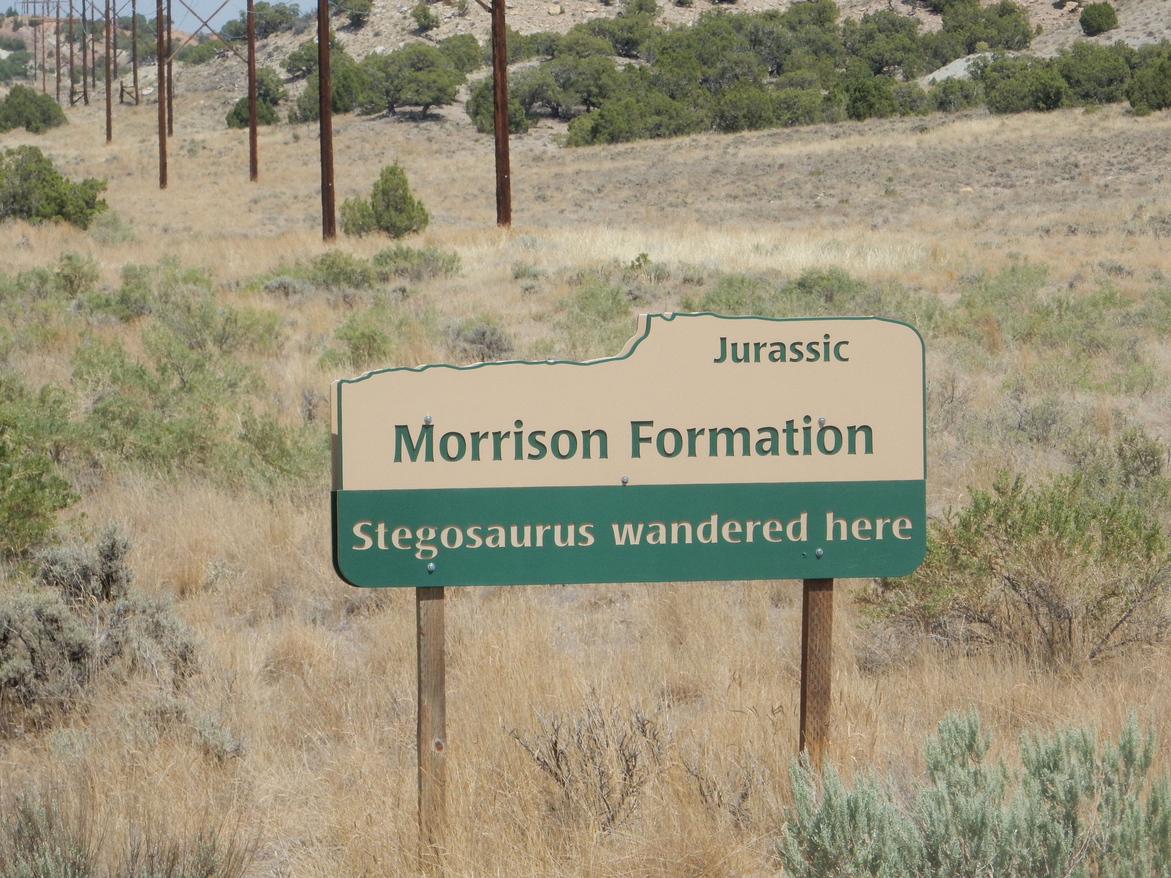
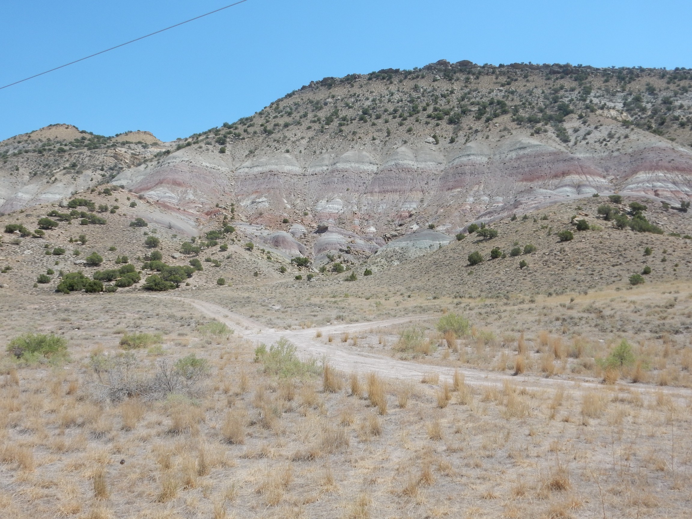
The Jurassic Morrison Formation is the colored beds at the bottom of the slope. The Morrison is extensive and highly variable; I saw a lot of it earlier in this trip.
The next formation is another that is new to me.
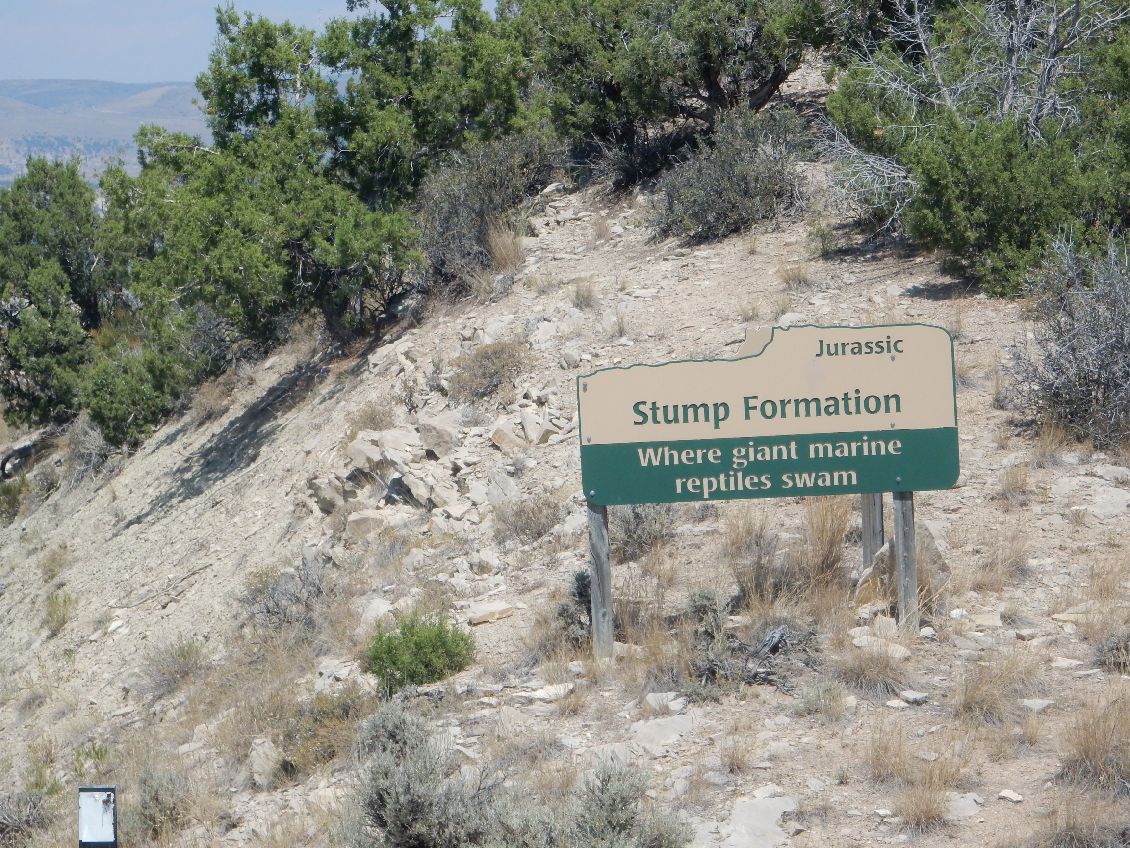
Its stratigraphic position seems to correspond to the Summerville and Todilto Formations back home. The latter is a local formation; I wouldn’t expect it here.
The signs seem to skip the underlying Entrada and Carmel Formations, and I didn’t notice them on the road. Instead:

Yep, same formation as I saw a couple of days ago at the Bear Lake quarry. It’s the same age as the Navajo Sandstone in southeastern Utah and very similar in character. Neither is found back home.
Beneath this is the Triassic Chinle Formation.
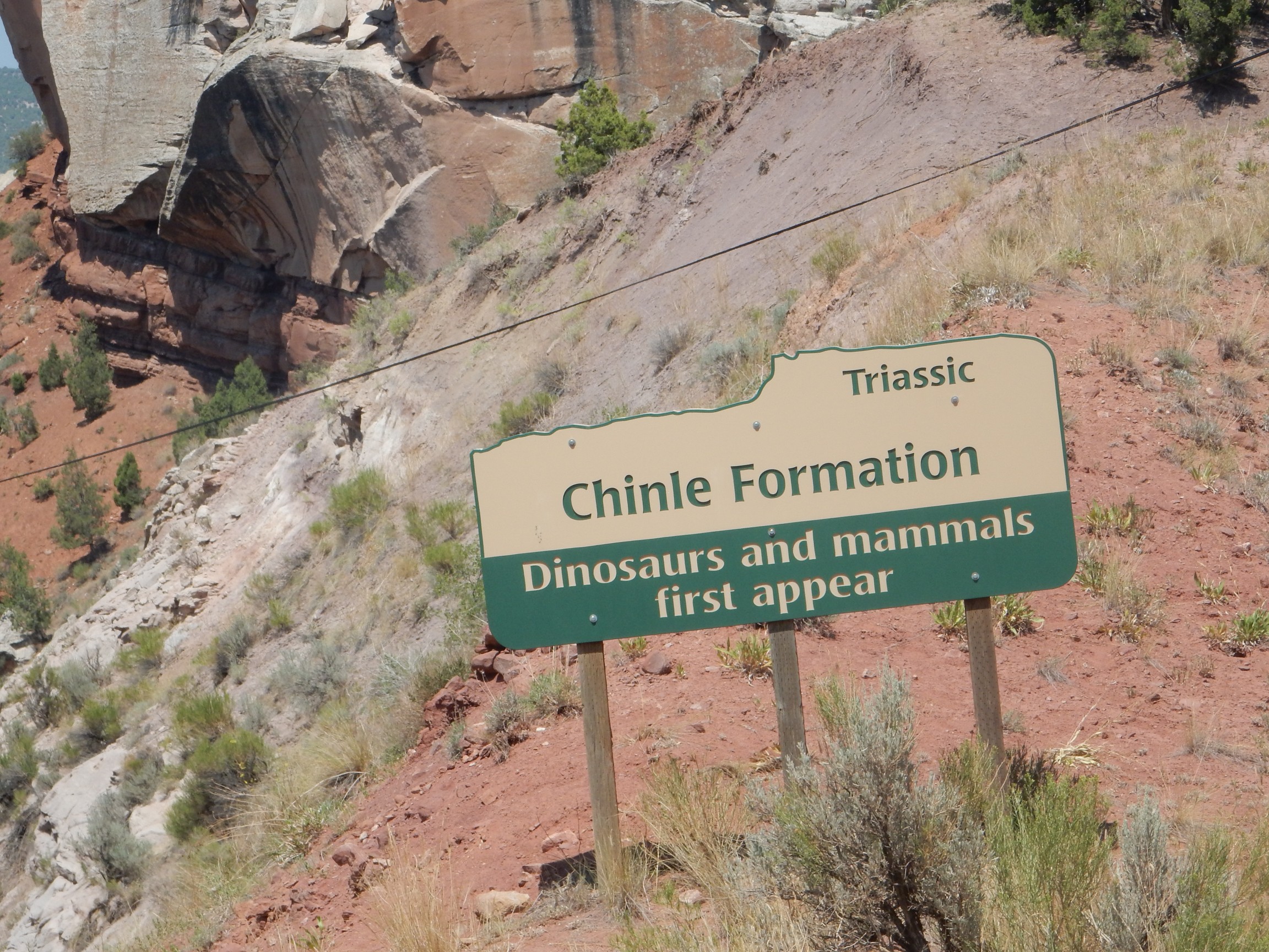
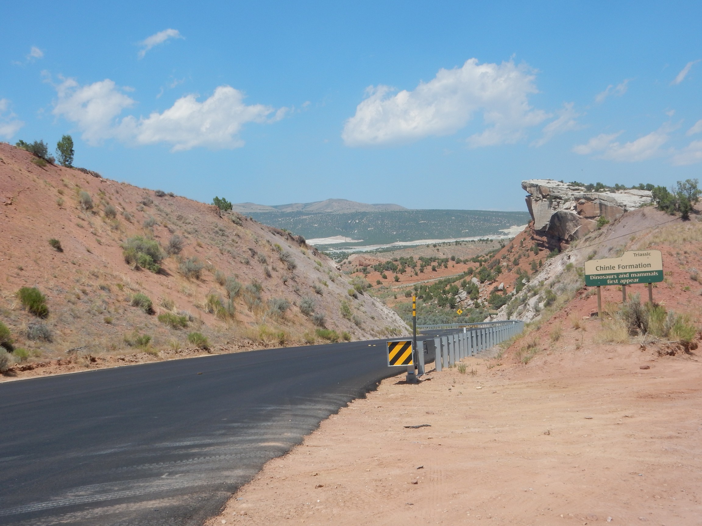
The Chinle is a very exensive and distinctive formation, and geologists throughout the western U.S. tend to think “Chinle” whenever they see loosely cemented red sediments like this.
There is a side road at the bottom of the valley. I park here and start hiking back up the road, where I can get a wonderful panorama.
At right, sandstone beds of the Navajo Formation rest on red beds of the Chinle Formation. It looks to me like a fault running down the canyon has thrown this sequence down on the left side of the picture. (Only after I get home and plot my position on the geologic map will I realize that the formations at left are new ones, not posted with road signs: the sandstone atop the bluff is the Shinarump Member of the Chinle Formation while the red beds beneath are the Moenkopi Formation. Both are present back home.)
I continue up the road and find another sign, not visible when driving northbound.
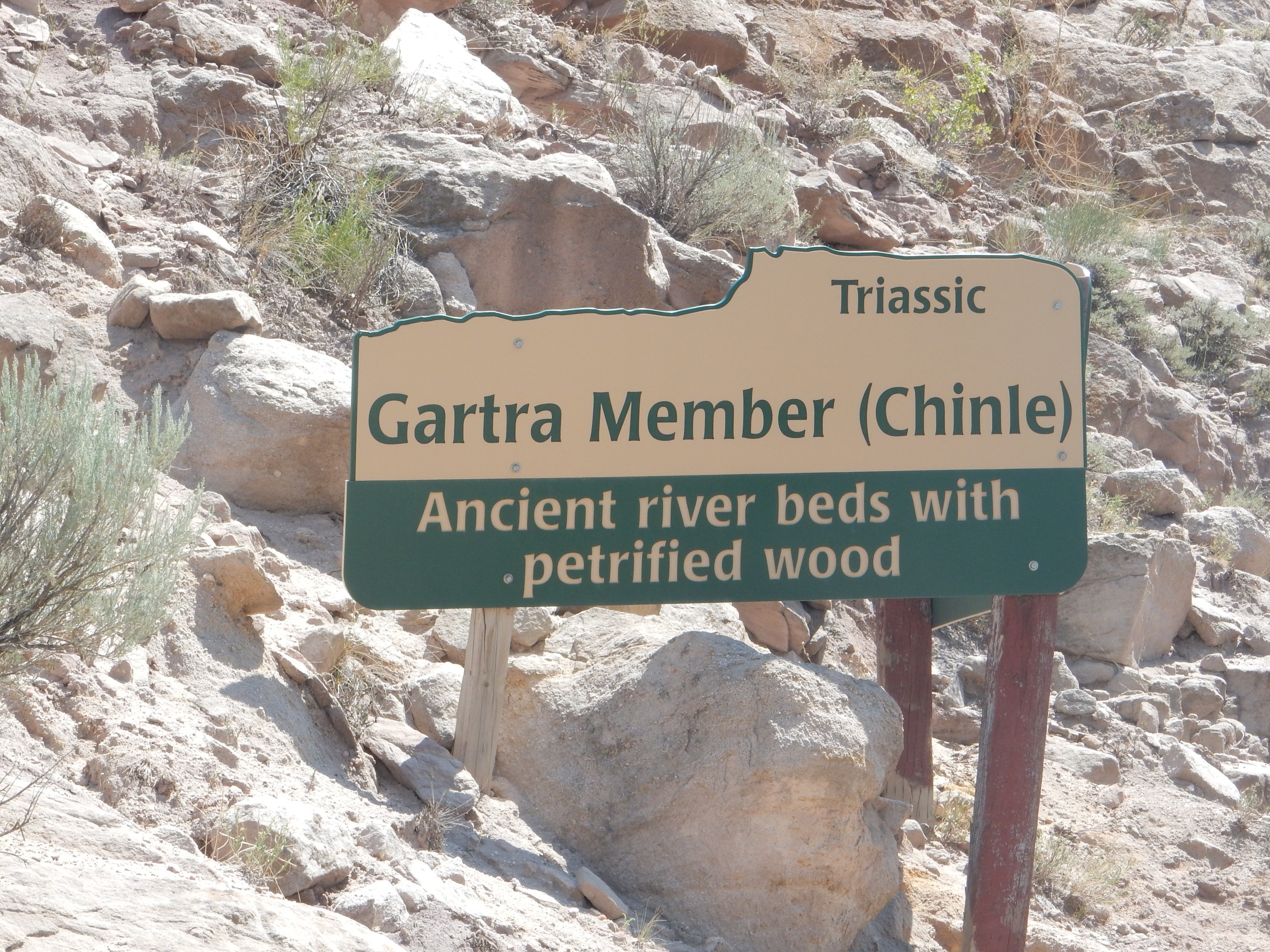
I’m guessing Gartra Member is a local name for the Shinarump. The formation looks quite similar to the Shinarump back home and is at the same stratigraphic position. It’s a coarse sandstone.

And, looky here, right under the sign …
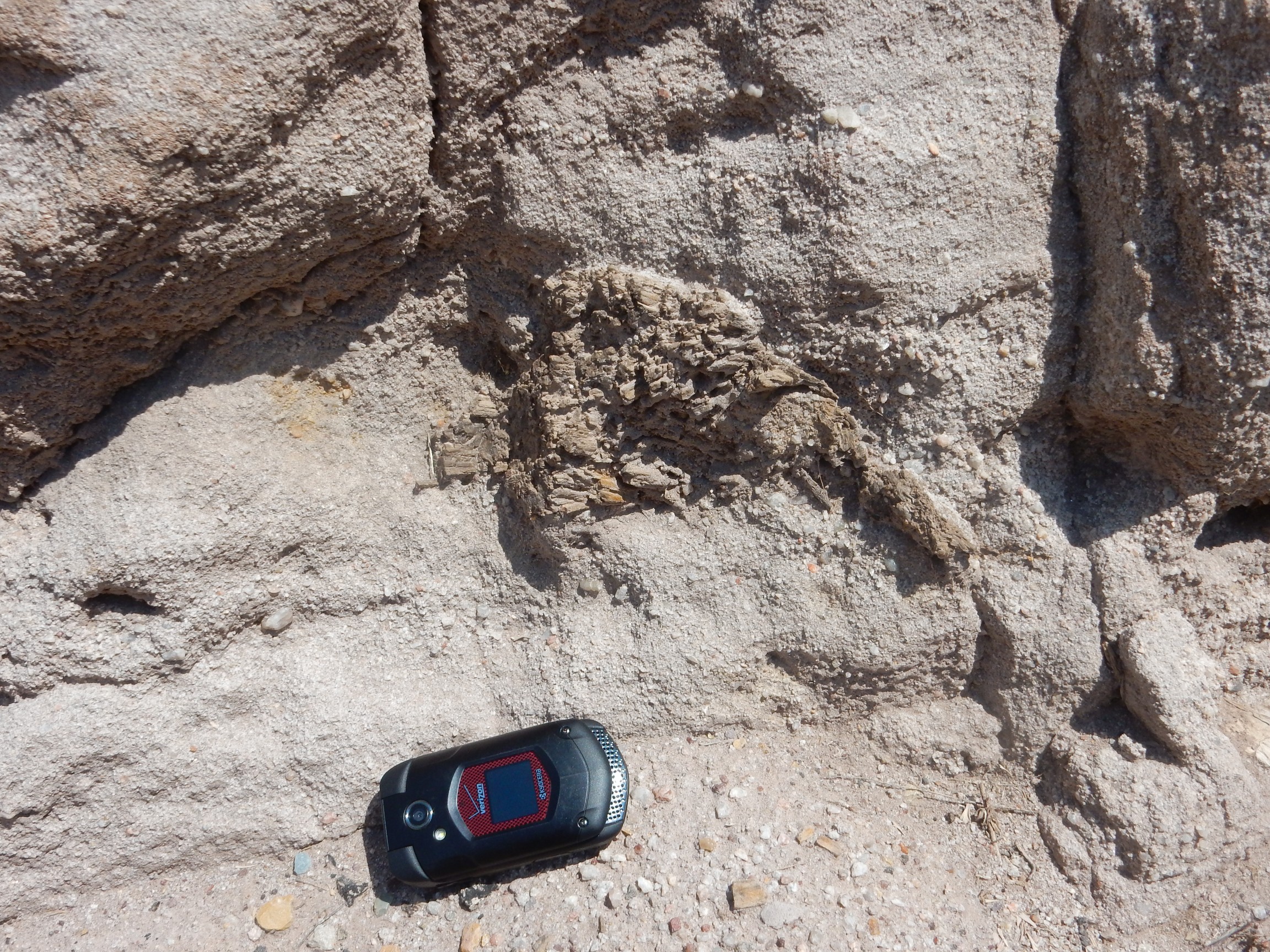
A piece of petrified wood, much better preserved than anything back at the Bisti/De-Na-Zin wilderness my first day. I am sorely tempted to try and take it, but refrain.
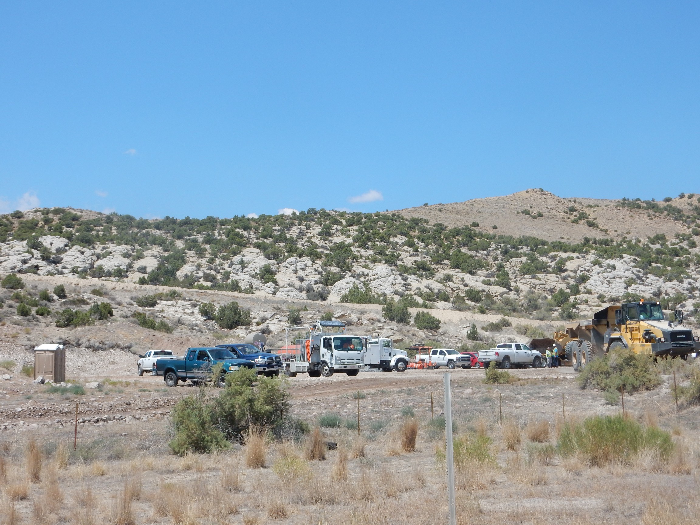
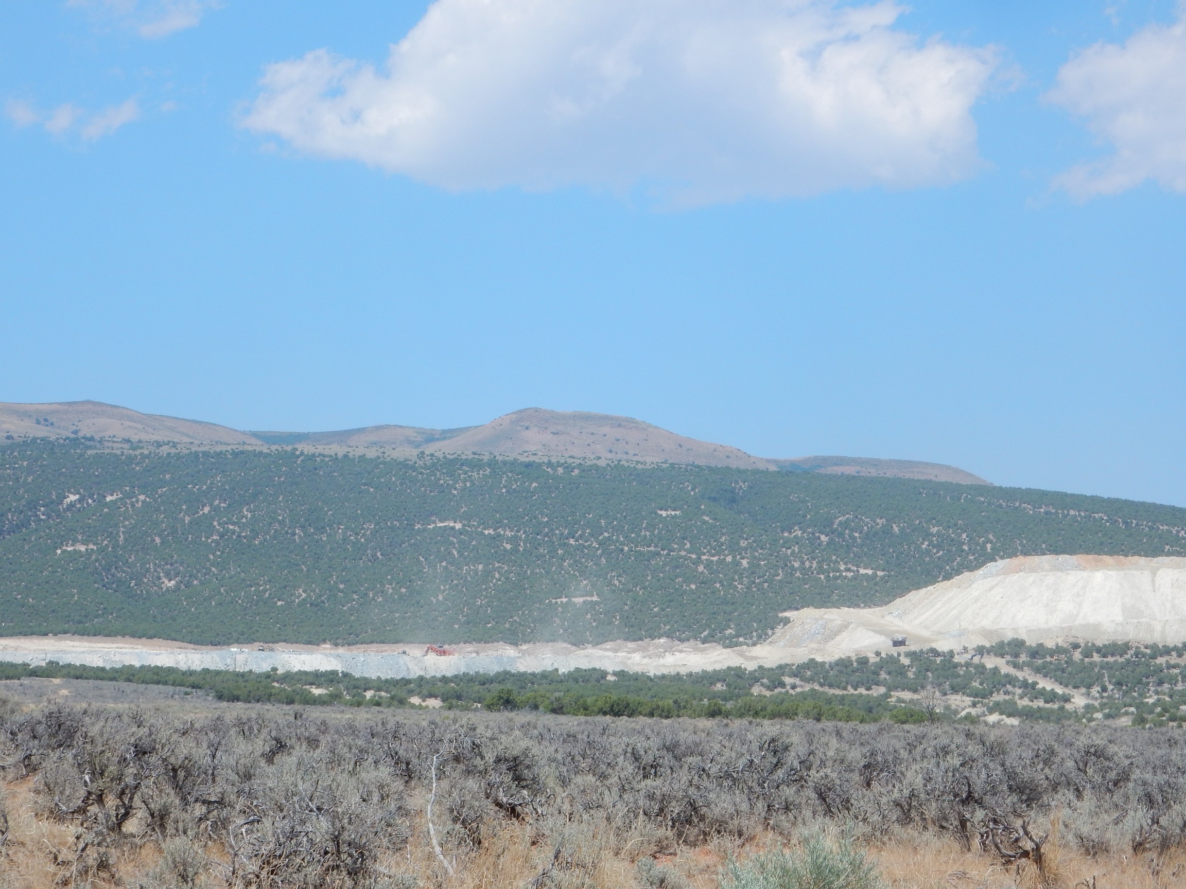
They’re mining something north of here.
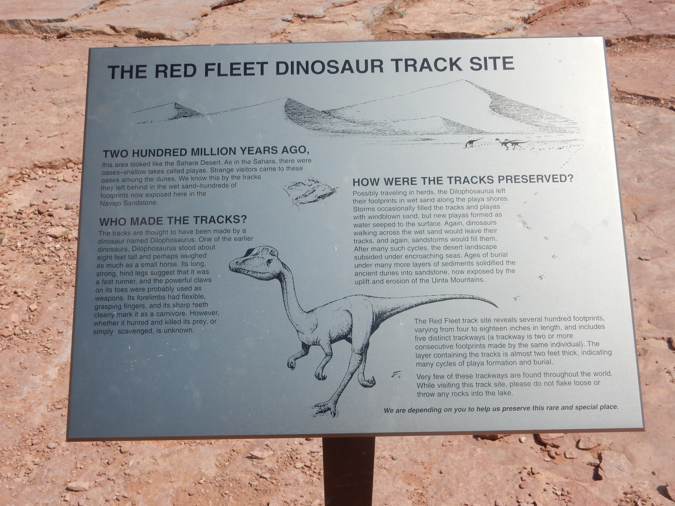
Back to my car. As I continue north, I pass a road that has a large sign about a dinosaur trackway. Well then. I turn and follow it.
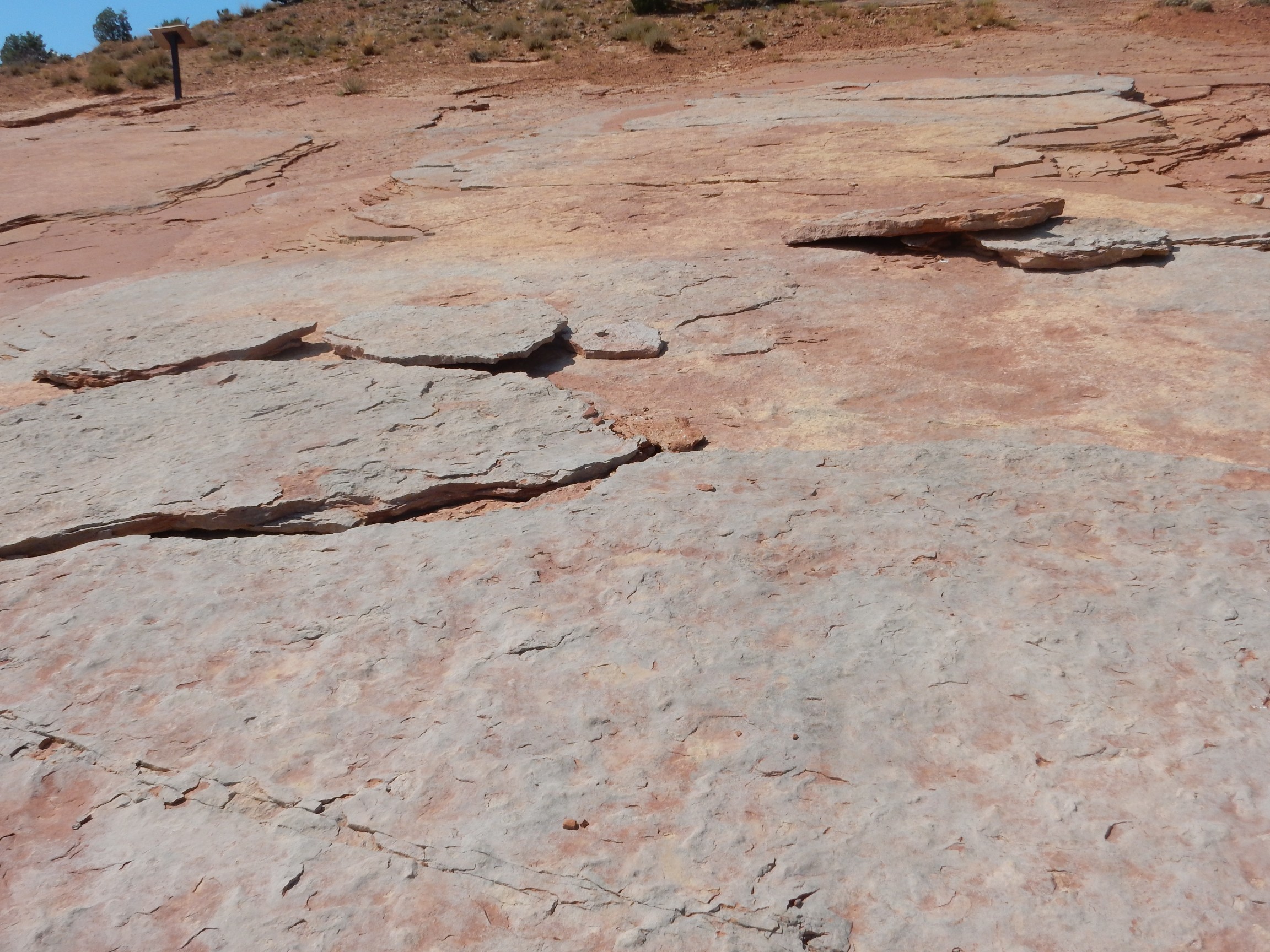
The road loops back to the Nugget Sandstone and there is a parking area with another “Dinosaur Trackway” sign. I pull in and read the signage.
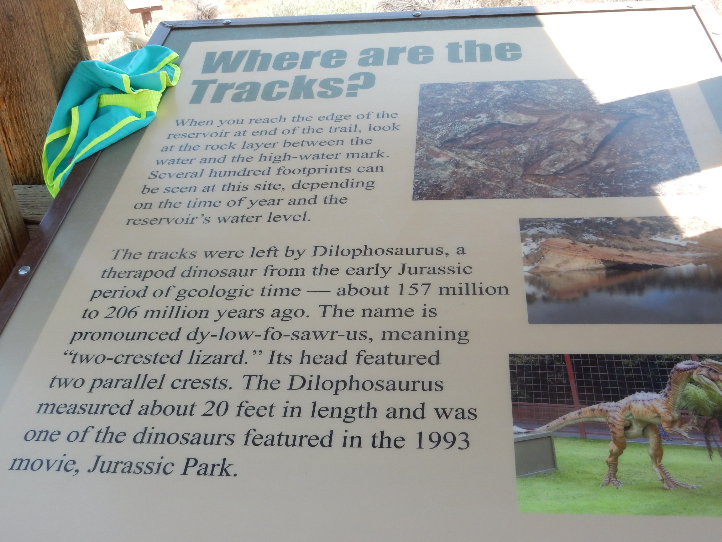
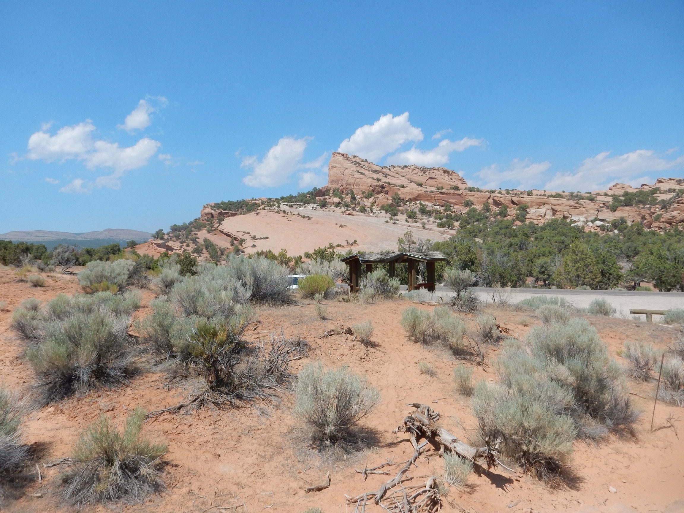
The trail looks to be about a mile and a half each way over slickrock. Perfect. I harness up and head out.
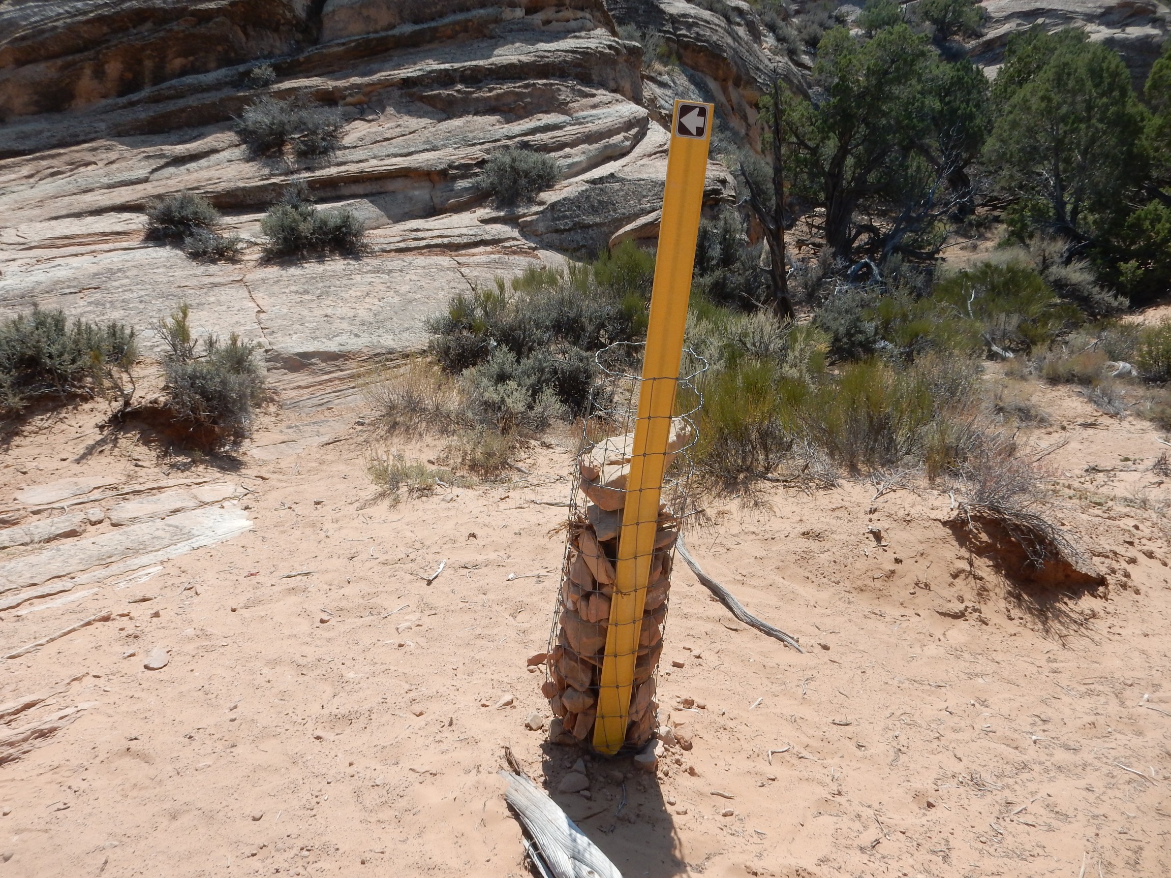
There are marks to guide the hiker over the slickrock of the Nugget Sandstone.
The mark of Arne Rexnussen.
Also cairns with signs.
There is impressive cross bedding here in the Nugget Formation.
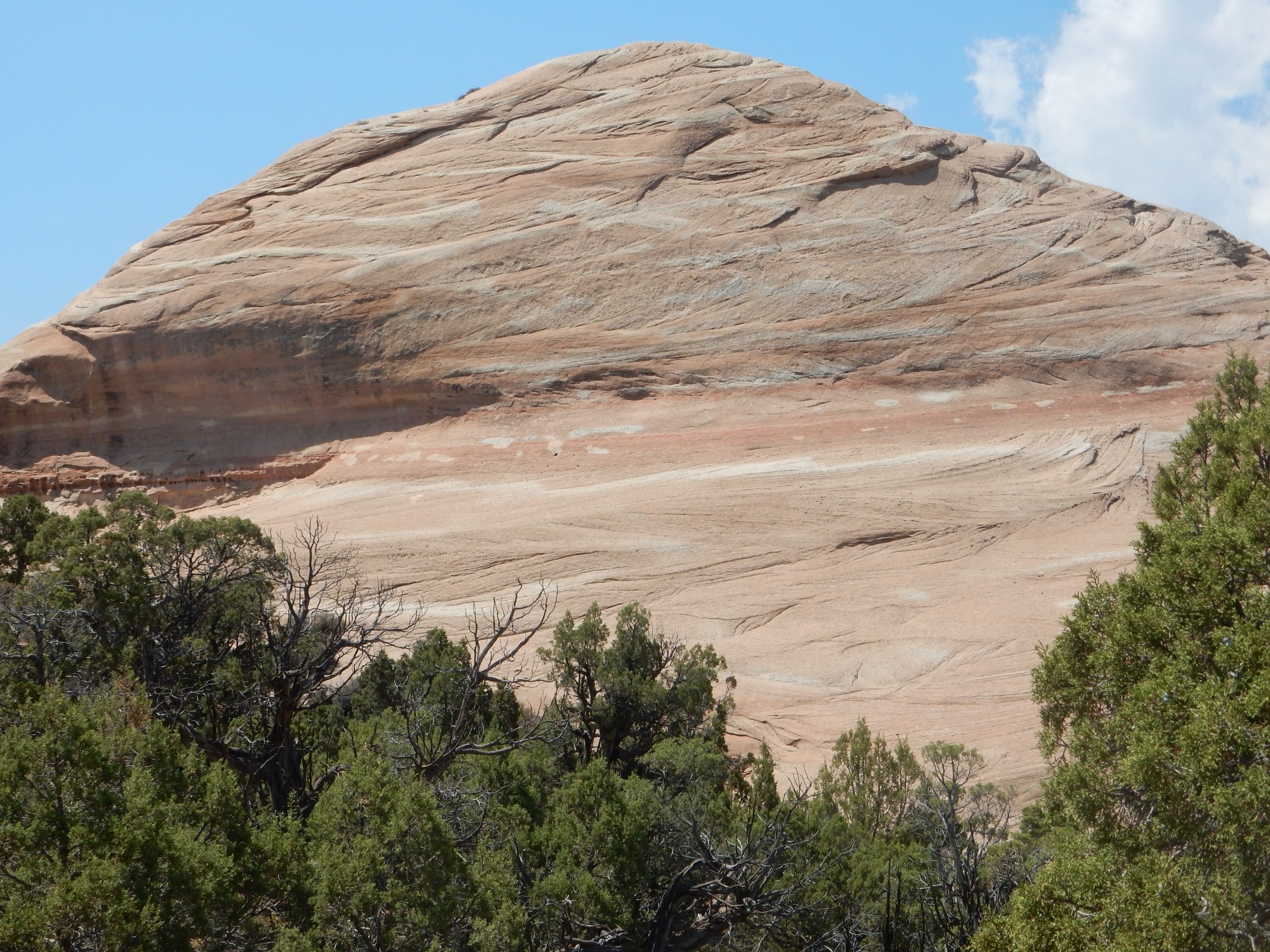
Cross bedding is where thicker beds are composed of thinner beds at an angle to the thick beds. It’s highly characteristic of sediments deposited in a high-energy environment. In this case, we’re looking at ancient sand dunes driven by prevailing winds. It reminds me a lot of the Navajo Sandstone, which is unsurprising, given that the Nugget Sandstone is probably just the northern part of the same dune field whose southern part became the Navajo Sandstone.
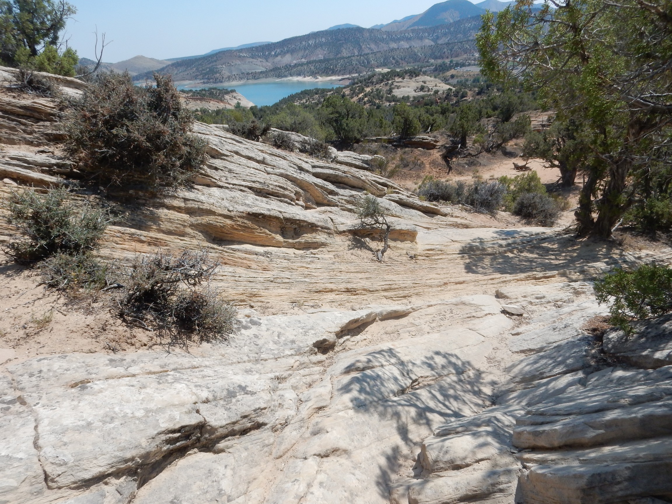
The lake comes into view.
The marks are very helpful.

The lake parking lot. It seems like I’m taking the long route.
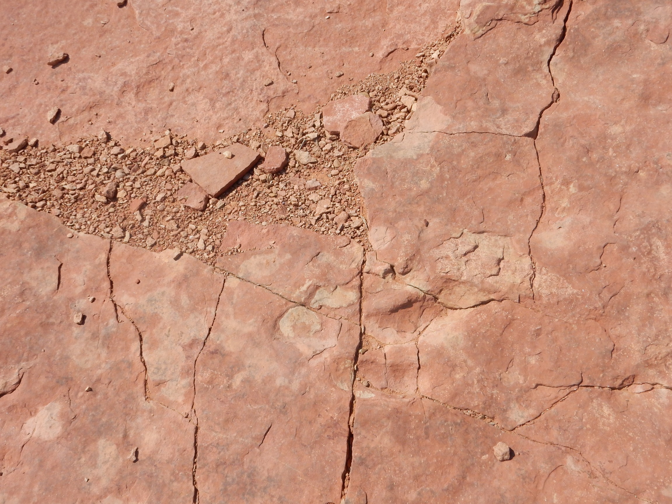
Impressive bedding here.


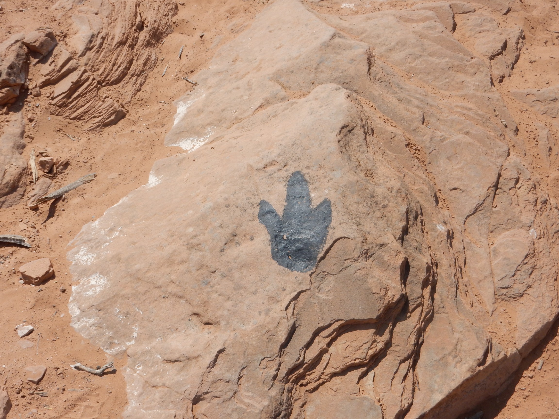
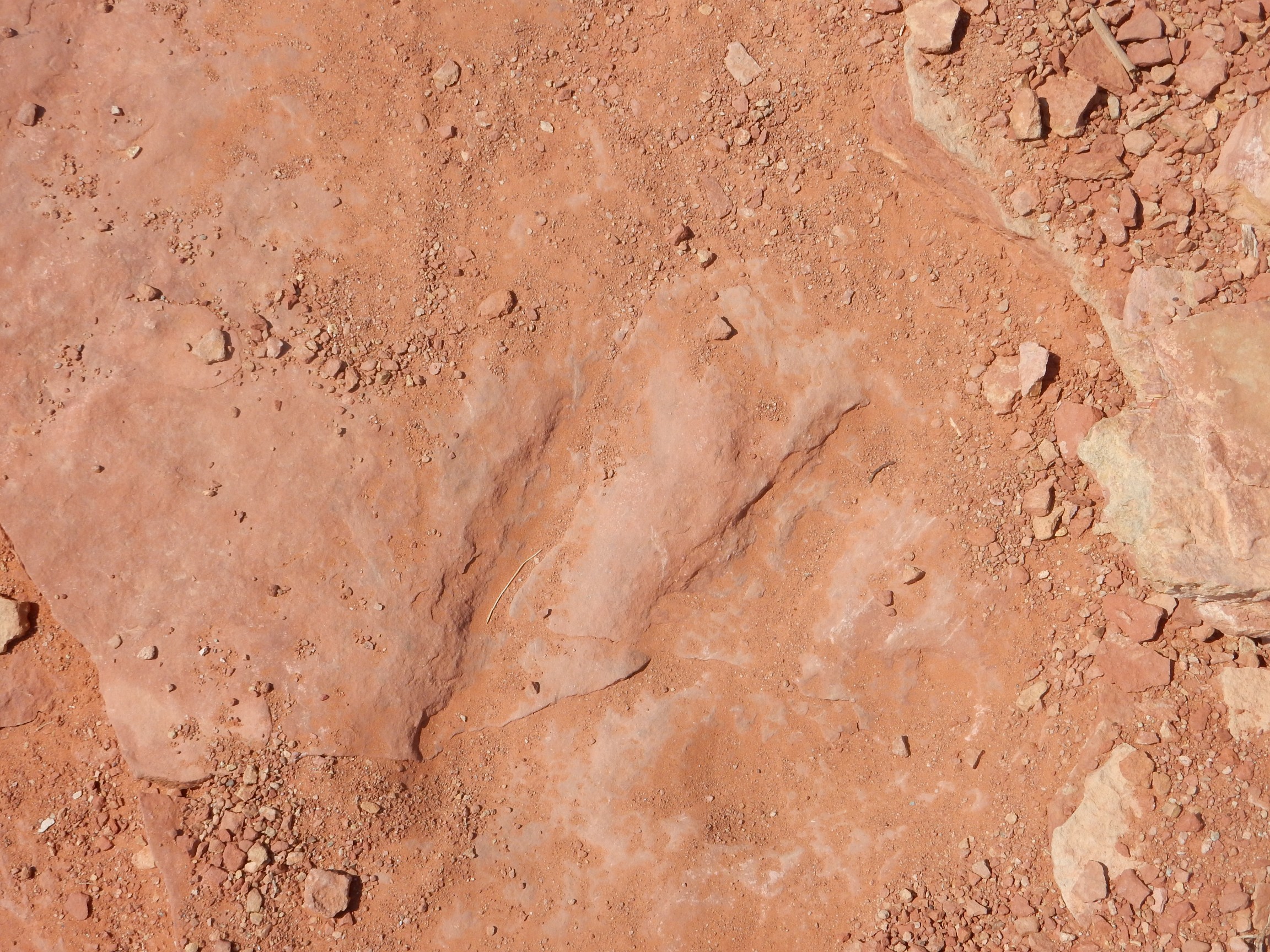
The trail ends at a patch of slickrock at the water’s edge. Turns out there is signage, and a large family of tourists who came by boat.
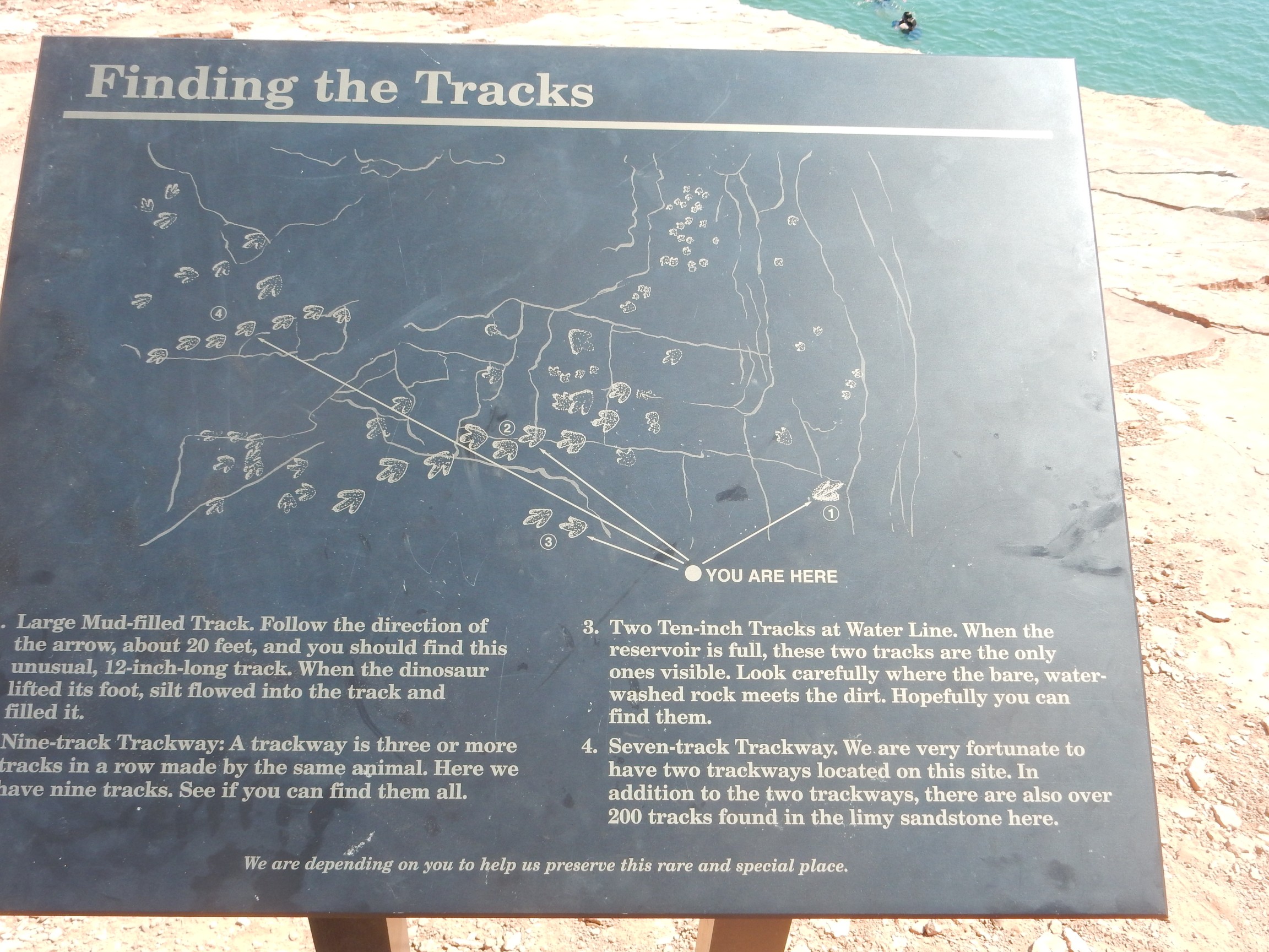
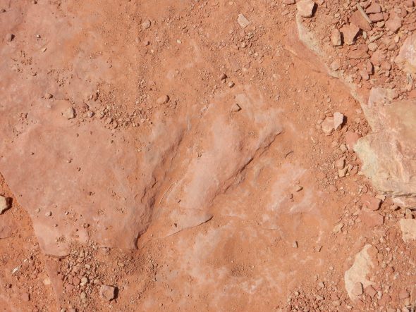
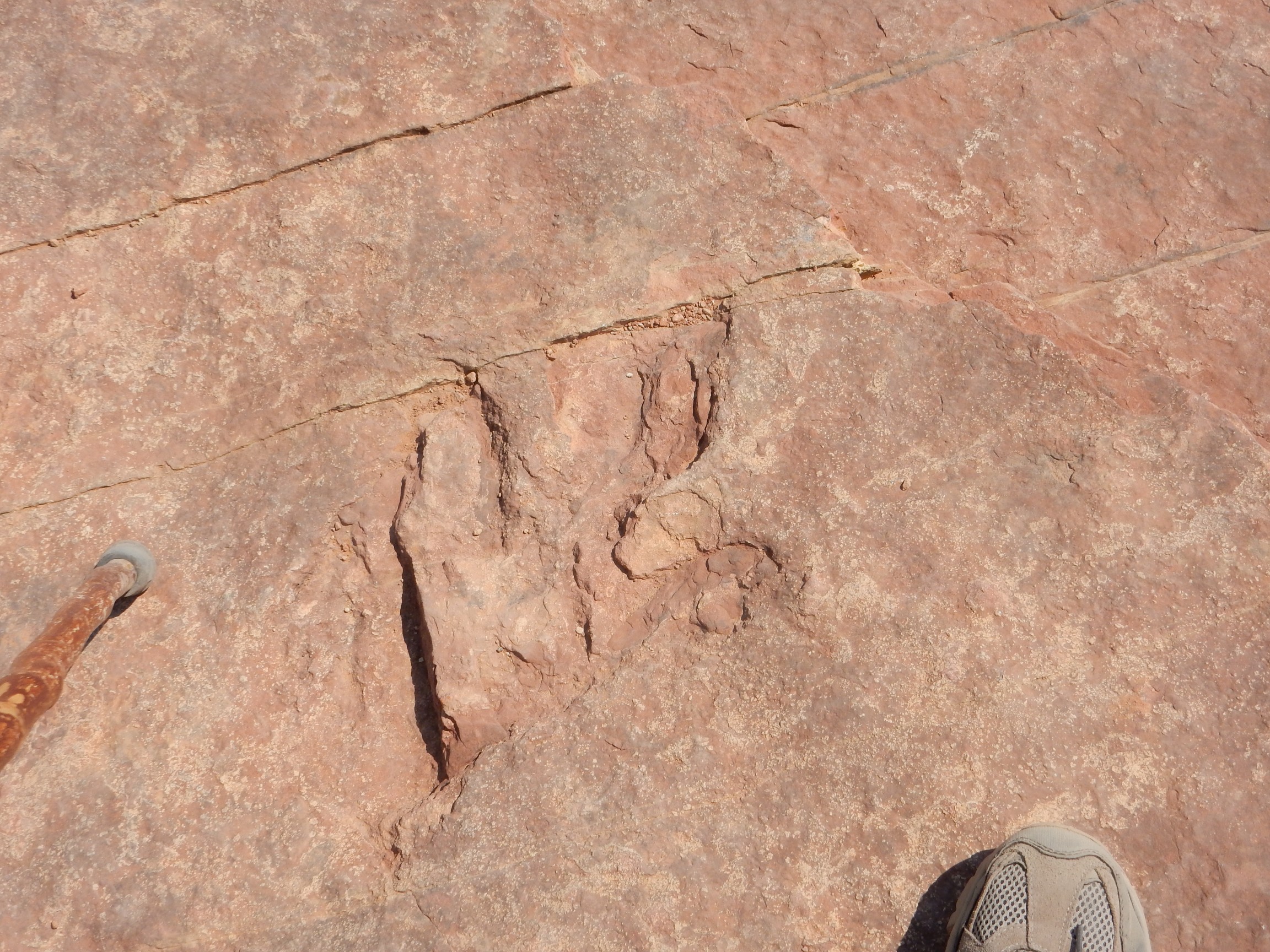
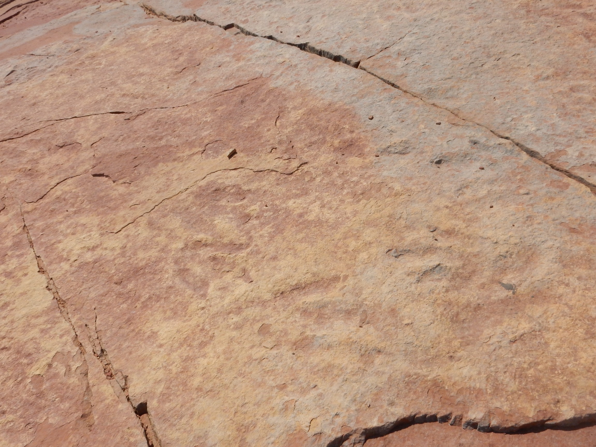
It turns out that part of the charm of the place is that there are several trackways. A single dinosaur footprint is good. Several in succession is terrific, because it gives you information on the stride and gait of the beast.
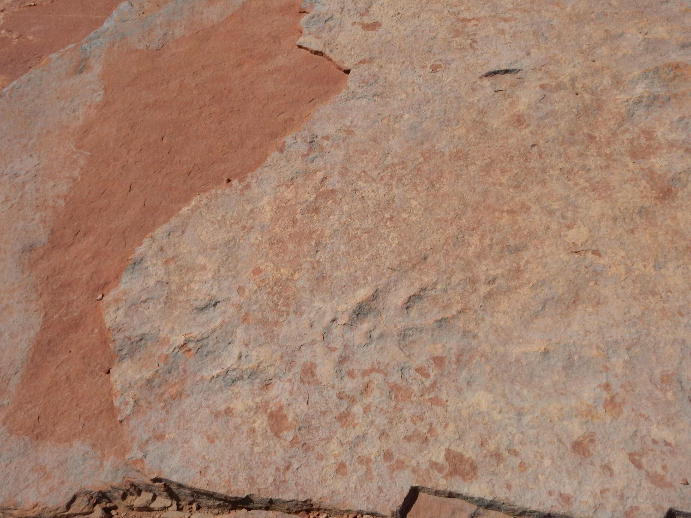
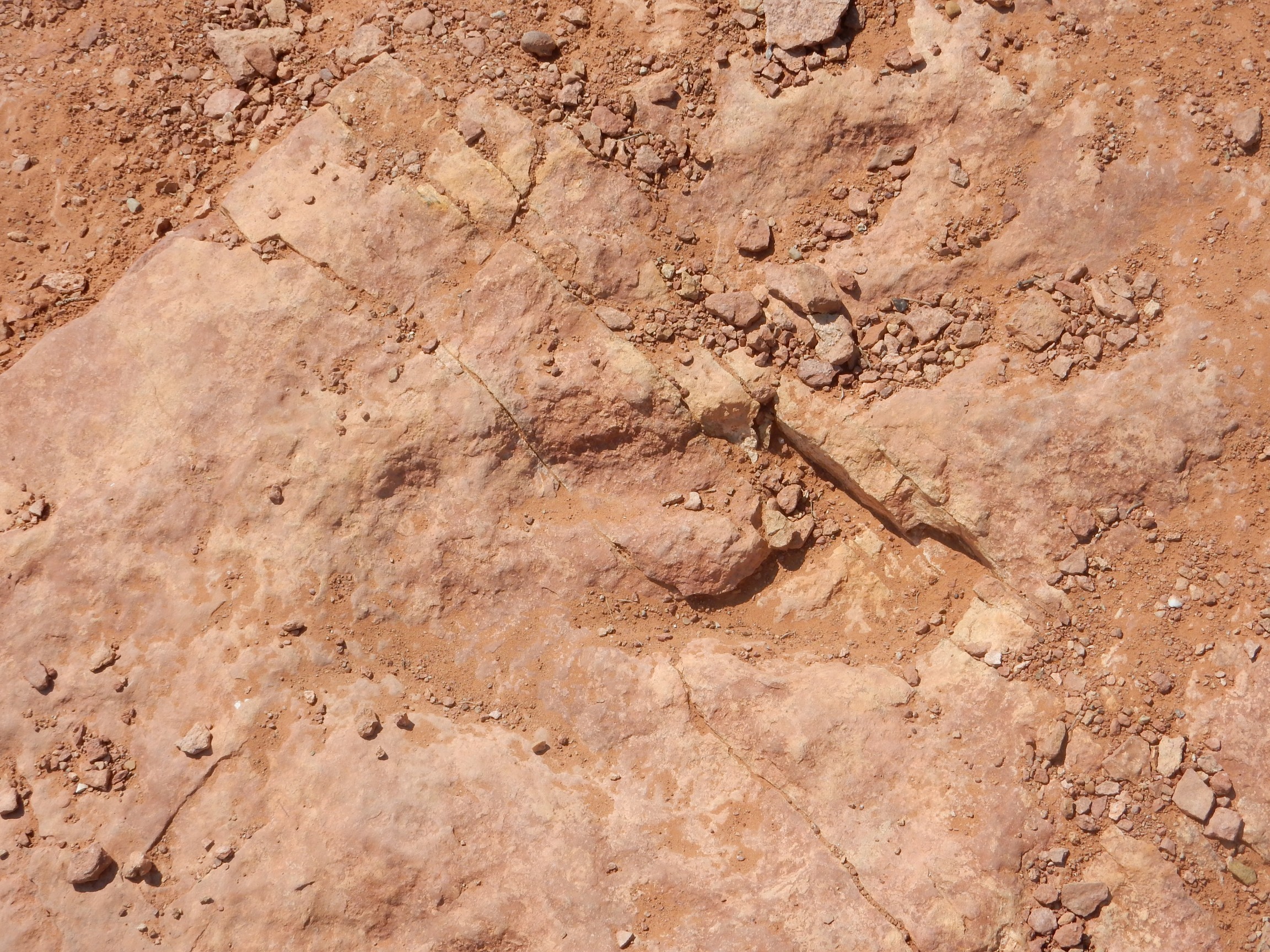
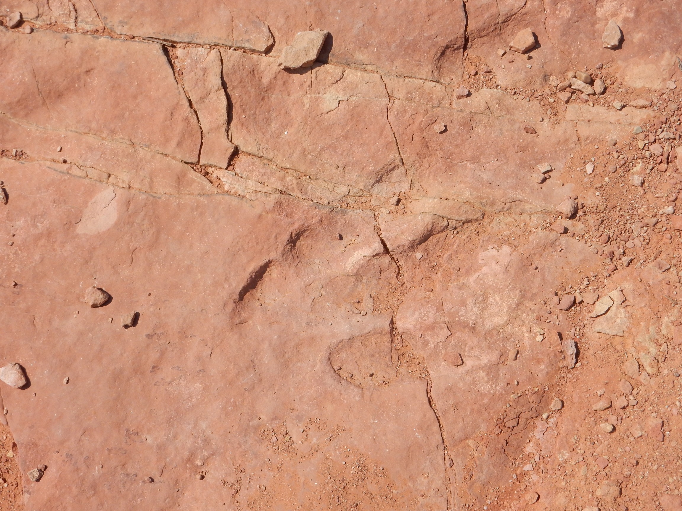
It turns out, though, that the tracks are a bit subtle. I scout around a long time to spot these:
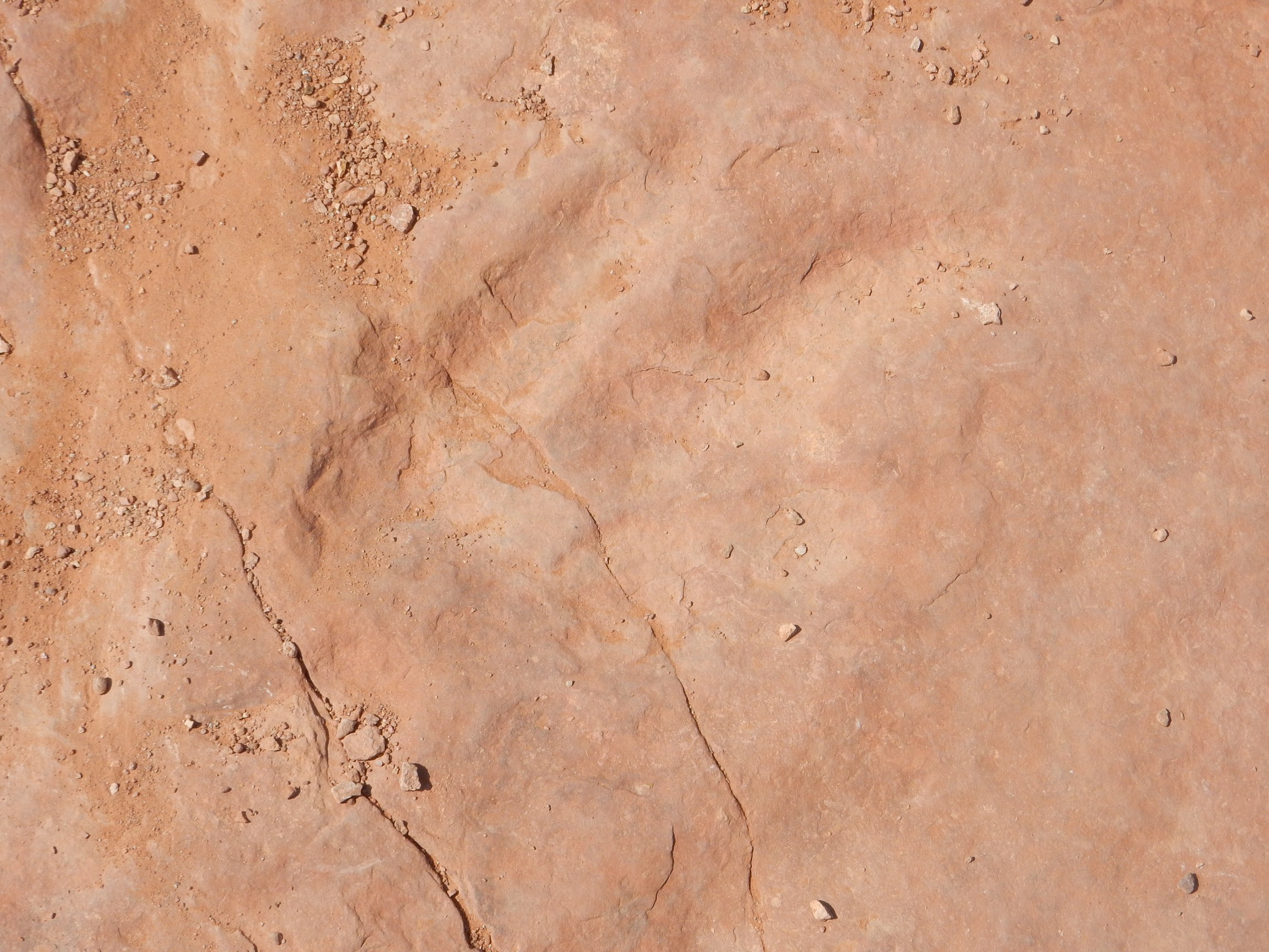
The slickrock is rather delicate and layers can be pried up. I start to wonder if there’s been extensive vandalism/theft here.
I find some more tracks, which are becoming more visible as the angle of the sun decreases.

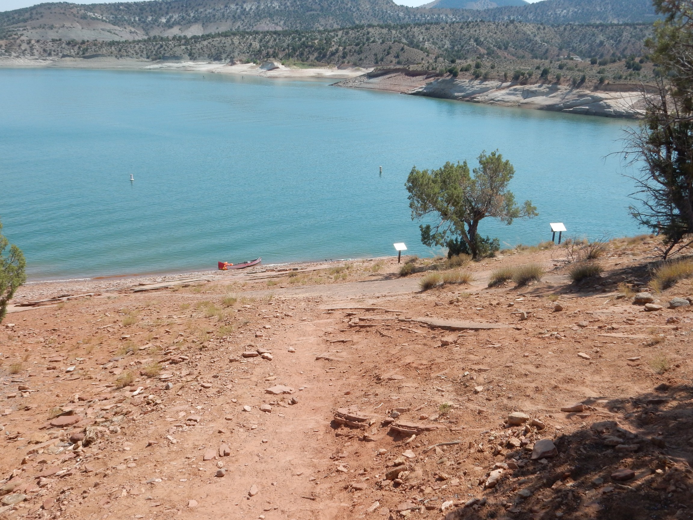
The lake is beautiful.
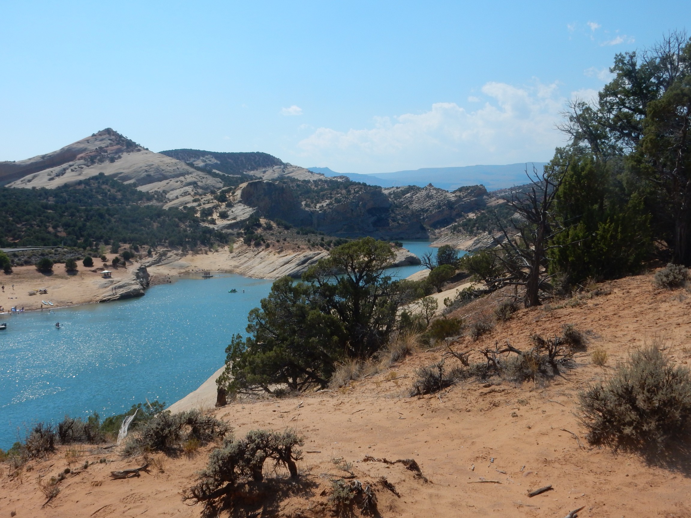
As are the fossilized dune fields to the north.
I return to my car, getting a bit disoriented at one point (but not really lost.)
Am I having loads of fun?
Why, yes, I’m having an absolute blast…
I get a text message from Bruce. (You know he had to come into this sooner or later:)
Starbucks in Grand Junction, Colorado.
Good; I have plenty of time to get back to Vernal. I reply:
OM tgd tpagjmmptg md tdpmaj.
Bruce is puzzled.
Ineresting conversation.
I reply again.
G gatdmt gmt gt dhtpe mu wdt.
Let me explain.
I work in a secured area. Bringing a cell phone in is grounds for an unpleasant character-building experience. So I almost never carry a cell phone. I can’t figure out how to type out a text message on this one; there’s no little keyboard you can slide out, like my wife’s cell phone, and I can’t find a way to put a graphical keyboard on the screen, like my daughter’s, so all I can do is push the number keys. And there’s three letters under each number, which makes this what the cryptologists call a projective cipher. Which loses information.
Yeah. I figure it out eventually: Tap repeatedly to cycle through the keys, then pause or start tapping on a different key. I finally get a coherent message to Bruce to meet me at the dinosaur museum in Vernal.
I get there first and I have a bit of a wait. I kill time by going back in, which I am able to do because I still have my ticket stub from earlier in the day. I wander around a while, and when Bruce texts he has reached Dinosaur, I head back to the parking lot to wait for him. He arrives; we go back into the museum and I get further explanation of everything there from an expert. (Bruce is a paleontologist by training.) It’s like getting my own tour from the curator, only better.
With some hours of daylight left, we decide to go back up the Highway to the Ages. I had only got about halfway before being distracted by the prospect of dinosaur footprints. And the lighting is beautiful when we reach the Morrison again.
Yeah. In this light, I think I can make a pretty good guess where to separate the Morrison from the overlying Cedar Mountain Formation.
Continuing where I left to chase dinosaur footprints, we find that the next formation is variously known as the Park City or as the Phosphoria. It’s what they were mining in my earlier photograph: Phosphate rock.
I don’t start taking pictures until we have reached the crest, turn around, and start back. The first is of a road cut in the Pennsylvanian Morgan Formation.

Which, based on our road log, we thought was Humbug Formation. Well, they’re quite similar. We stop and look for a while, finding some interesting sedimentary structure but no obvious fossils.
Then the Pennsylvanian Round Valley Formation.
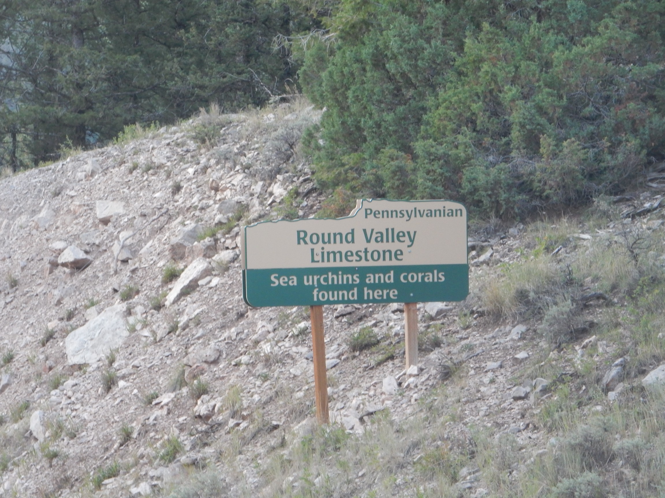
That’s practically an invitation, isn’t it? We get out for photos and some fossil hunting.
It’s a very pretty limestone, but we find practically nothing in the way of fossils.
I try to photograph the phosphate mine as we pass, but it doesn’t turn out. I do get a decent picture of the Phosphoria Formation itself in a road cut.
We get back in town as it’s getting dark. We try a local promising-sounding steak house; they’re already closed. There’s a cafe to the north that I suspect caters to truckers; the food is not terribly good, but it’s cheap and filling. Bruce and I plan our the next day; we’ll meet at the Dinosaur National Monument visitor’s center. My campground is not far away.
But now it’s pitch dark, and I’m not quite sure where the campground is. I follow the most likely route, and get lucky. I’m very tired; it’s a clear, beautiful night, but I don’t pull out the telescope. (Alas, this will turn out to be the last day with anything like decent weather.)
I don’t bother with the fly; I just put up the dome. The tent pad is too small for the tent so I pitch it on the asphalt in front of my car. I inflate my air mattress and get to sleep.
And wake up at 4:00 to find I’ve touched bottom. The air mattress has a slow leak. I take a leak of my own then reinflate it, and it holds till morning.
Next: Dinosaurs ‘R’ Us