Out of focus again
Yesterday I noticed walking home that the ground off the path is getting reasonably dry. I told myself, “Self, if the weather is reasonably dry for another week, we can think about some serious hiking.”
Sure enough, last night a brief but intense snow flurry came through. Cindy and I were shopping and were appalled at the wind blowing huge, wet flakes of snow. But it cleared within an hour, leaving just a dusting of snow. It was dry again by this afternoon. So I decided to try a fairly serious hike, along Powerline Trail. I hiked it last summer and discovered then that my camera’s focus was busted.
The camera was supposedly fixed last fall, but I have had my doubts about it. I decided I’d take it on this hike and put it through its paces. While I was at it, I’d take my backpack and my SPOT and see how everything is working.
A lot of other people had similar ideas.
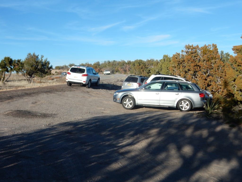
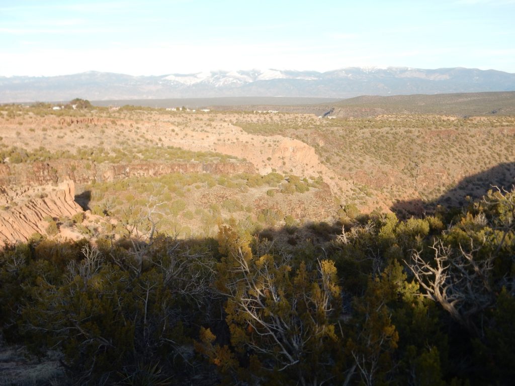
If you look closely, you’ll notice something: The photograph is crisply focused on the right side, but is decidedly off-focus on the left, particularly the upper left.
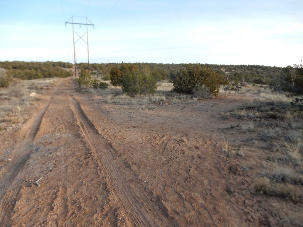
The trail head:
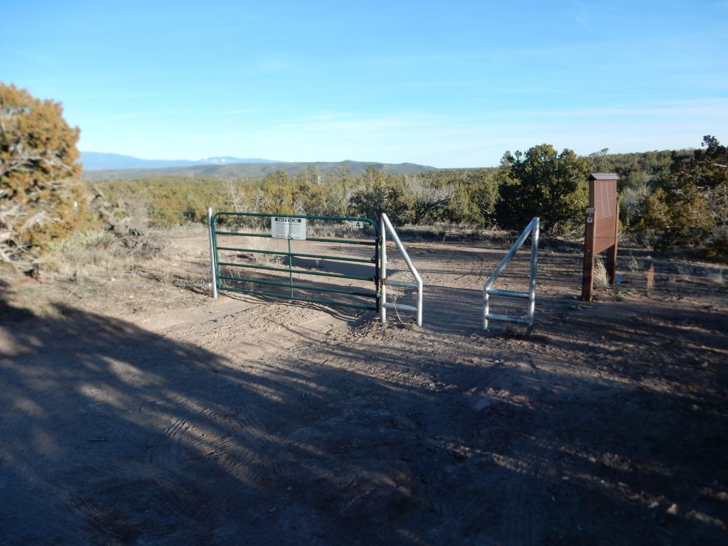
Ditto. The GPS took three tries to lock, but seemed to be right on target once it did lock. On the other hand, the built-in compass is off, and the recalibration feature isn’t working.
As you can see, I started somewhat late in the day.
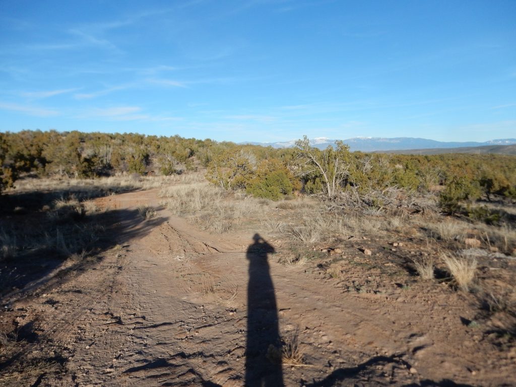
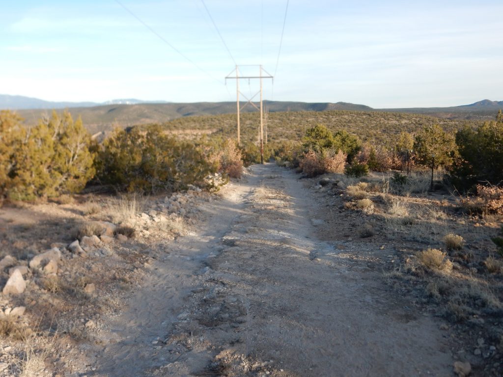
The road heads east, along the power line to White Rock (hence the trail name).
I head north to the canyon rim, to get a shot of the canyon. There is still significant snow here and there.
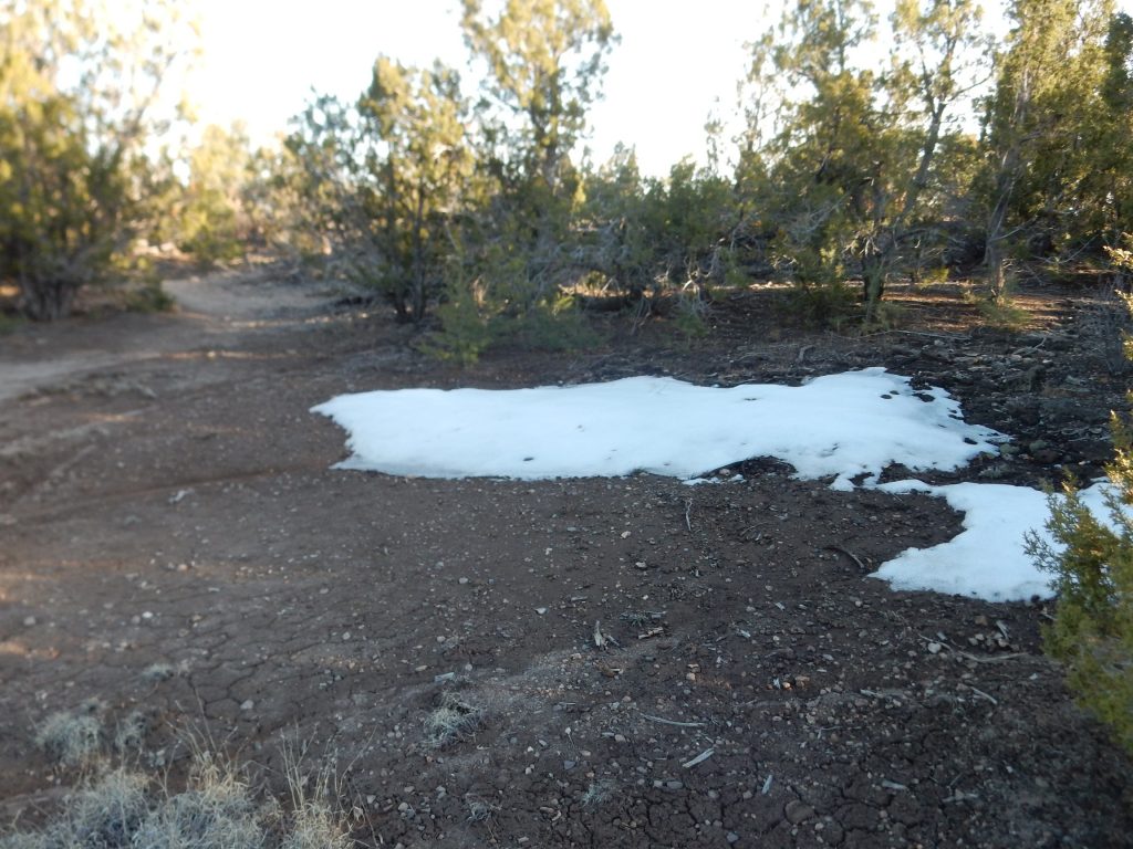
And you can see how poor the focus is in the upper left corner of the frame.
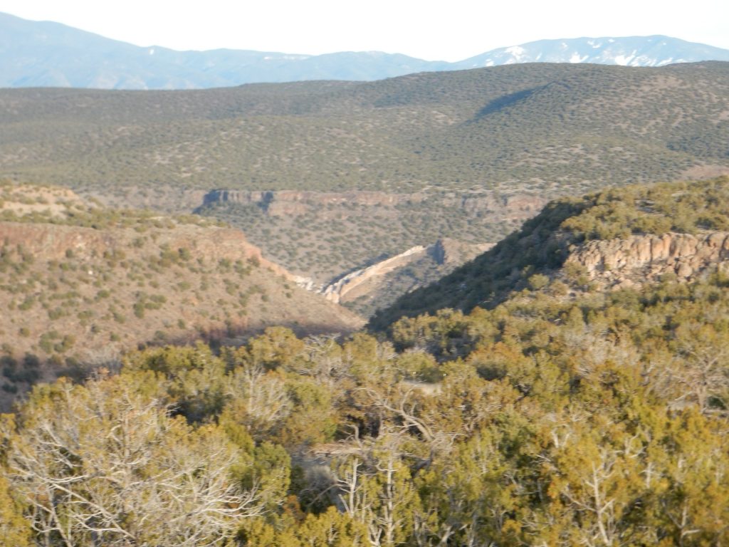
I try to get a panorama of the canyon.
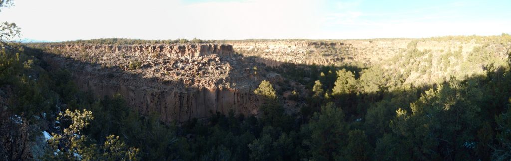
That’s actually pretty good, considering how poor the individual frames were; Hugin worked some real magic here. The poor exposure matching could be an artefact of the time of day, with the low sun angle, but the bad focus can’t be excused away so easily.
I suppose there may have been some good reason to tear up the road this way.
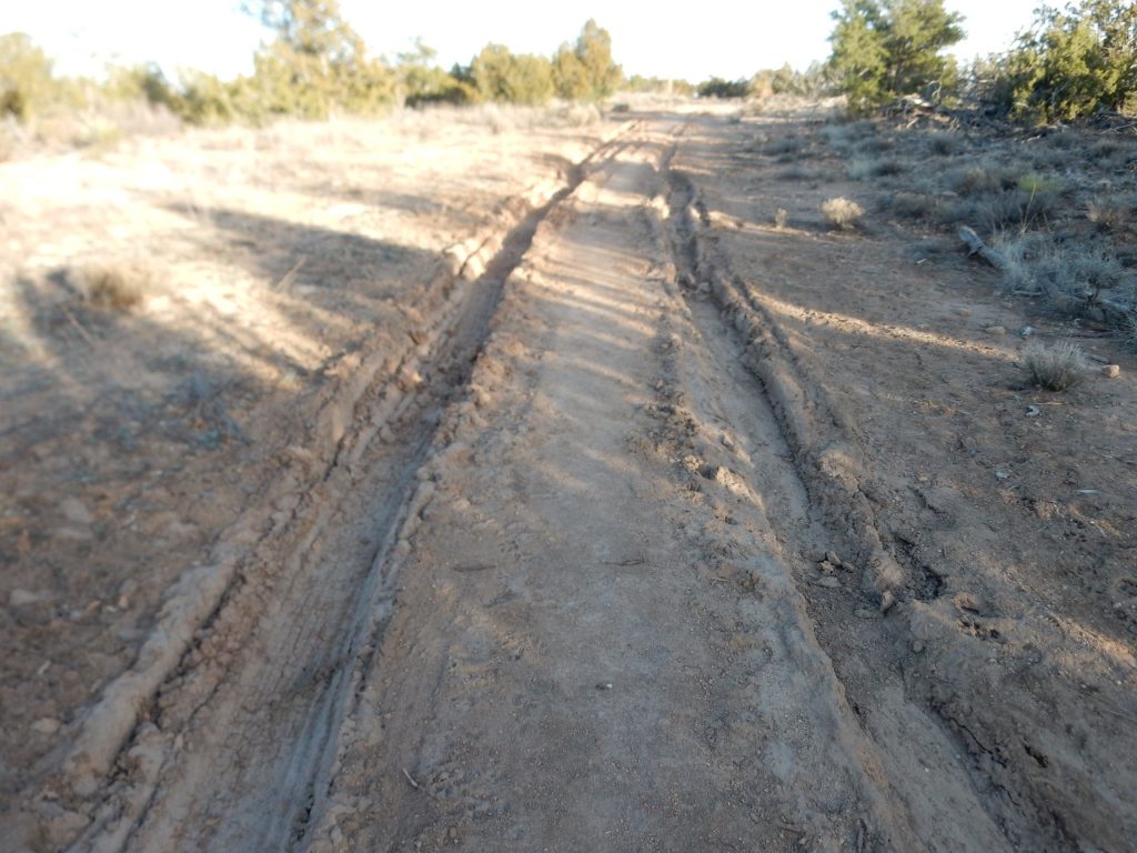
In fact, given that this is a gated road, it pretty much had to be someone with business here. When I see this on forest roads in the spring, I mutter imprecations against the #*(&)%& who wrecked the road by driving along it when it was muddy. Probably not fair, but there it is.
And the problem with the focus is very clear (so to speak) in this photograph.
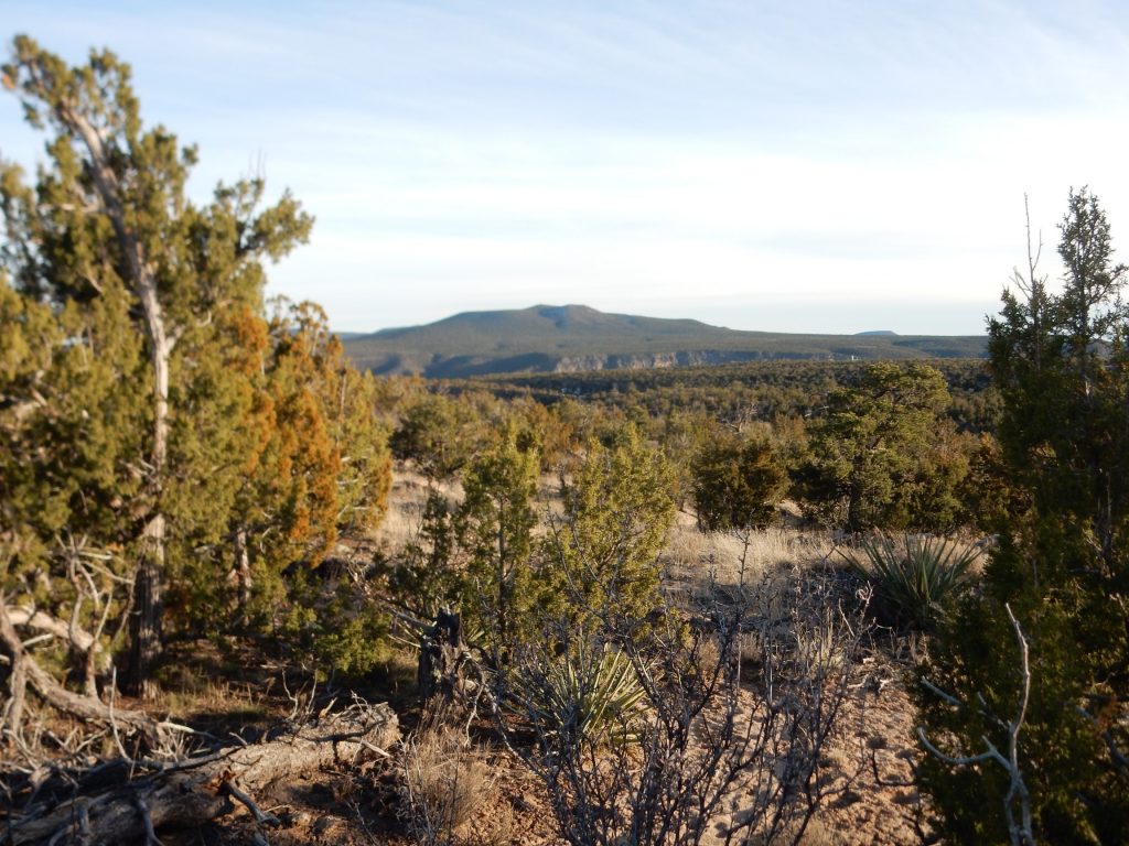
Montoso Peak to the southeast.
I suppose I should say something about geology, but I’m too busy wringing my hands over the camera. The cliffs in the previous panorama are mostly Tsherige Member, Bandelier Tuff, which is an ignimbrite erupted by the Valles caldera 1.25 million years ago. An ignimbrite forms when extremely viscous high-silica magma comes to the surface, and the dissolved gas in the magma bubbles out at once to cause the magma to more or less disintegrate into a cloud of red-hot gas and tiny shards of volcanic glass. This mixture is buoyant and can flow for miles as pyroclastic flows, which, when they settle to the surface and cool, become an ignimbrite. The Valles Calder erupted something like 300 cubic kilometers of magma, covering the ground for many miles in all directions with tens to hundreds of feet of ignimbrite.
Montoso Peak is part of the Cerros del Rio, a plateau southwest of White Rock formed around 3 to 2.5 million years ago by the eruption of magma low in silica and therefore relatively low in viscosity. (Silica makes magma viscous.) This flowed out relatively quietly to form a flat plateau, with occasional low peaks like Montoso Peak around eruptive centers.
The road descends.
It’s clear my camera has a serious problem.
Here is one of the most interesting features visible from this trail. Fortunately, the focus problem does not totally spoil the picture.
The tongue of pink Tsherige Member at center fills a paleocanyon in the older and darker Cerros del Rio Basalt beneath it. This is where the Rio Grande flowed 1.25 million years ago. This ancestral White Rock Canyon was completely choked by the ignimbrite, forcing it to cut a new canyon futher east.
And this caught my eye. Alas, the zoom is not working very well, either.
This is part of a wide loop to the east of the ancestral White Rock Canyon that was also filled with ignimbrite, since partially eroded away. This is perhaps the furthest southeast that the Tsherige Member pyroclastic flows reached.
Alas, by the time I reach the fork to Ancho Springs Trail, I am beginning to run out of daylight and must turn back.
It’s a pity; had I but known, I was almost to the magnificent lookout at the end of the trail. But then the light has already become bad for photographs and I already know the camera is sick.
I don’t see the point of sending it off again to be repaired. The poor focus on part of the frame suggests the CCD itself is warped, or else the main lens is strained. Neither is cheap enough to repair to be worth it. Plus the USB port not working (I’m already reduced to removing batteries to recharge them and the memory card to read it into my computer) and the GPS not up to snuff says this camera is simply worn out. I did buy it used, so I should not be too harsh on it for not lasting me better than a couple of years. It served me well until last summer.
I’m looking at this for a replacement. T’aint cheap, but it’s not terribly expensive for its feature set, either. The reviews praise the quality of its zoom, an important feature for the kind of photography I do, and it has GPS. It appears to be of rugged construction, also important for a hiking camera; the old one, for all its good qualities, always seemed just a touch fragile. The only things lacking are a viewfinder and manual focus.
I do find myself mildly amused by critical reviews that boil down to “I slammed this into a rock while whitewater rafting and, by golly, it broke. What a pansy!” I guess my expectations of its toughness are a little more modest, so I think I’m going to be okay with it.
Assuming I actually get one. Money is a bit tight at the moment; Trump may have cut my taxes, but the IRS cut my withholdings even more, and I owe Uncle Sam more than I expected. But I’d sure like to have the camera in time for the April trip. I have a birthday just before them: maybe Birthday Claus will decide I’ve been a good boy …
Meanwhile Gary Stradling came by this morning to help me haul away the remnants of a couple of juniper trees in my back yard. Apparently a lot of White Rock residents had trees snap under the very heavy snows we’ve had this winter. I had one tree lose three large branches, and another lost of its top. Gary and another friend, Bob Forsyth, came over with chain saws earlier in the week and helped me cut off and cut up the broken limbs. The one tree is still somewhat intact, but the other was quite accurately described by Bob as a Dr. Seuss tree: One long limb with a little poof of gree at the end. Yeah, kind of like this:

But Gary and I were able to haul the branches to the dump this morning. I thanked Gary by cooking him breakfast (Cindy was in Albuquerque for a family wedding) and then we went over the plans for the April trip. It should be a lot of fun, and hopefully I’ll have the means to take some good photographs of it.
What I see in the first photo is the golden juniper pollen. I hate that stuff.
Yeah.