Wanderlusting the Small Fry prospect
This weekend I joined other members of the Los Alamos Geological Society on a field trip to the Small Fry prospect on the highway to El Rito (“The Ritual.”) Here the amateur geologist can find interesting samples of fluorite, calcite, and barite.
A prospect is a location on public lands where someone has found signs of valuable minerals and has filed a mining claim. Not all prospects are developed into commercial mines, and the Small Fry Prospect is an example of an undeveloped prospect. Here fluorite mineralization is found near a fault cutting through a buried volcanic cinder cone. Fluorite is valuable as a source of fluorine for the chemical industry and as a flux for smelting. Very high-quality fluorite crystals also have some specialized uses in optics. Barite, found in small quantities with the fluorite, is a source of barium and is also used “as is” in drilling mud because of its high density and as radiation shielding because the high atomic number of barium makes it opaque to radiation. However, the deposits of fluorite and barite at the Small Fry turned out not to be extensive enough to be economical to exploit, and the mining claim was abandoned, leaving the area open to rock hounds.
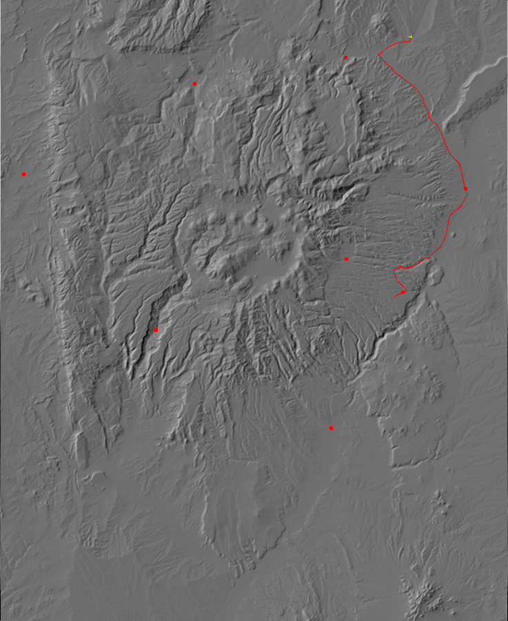
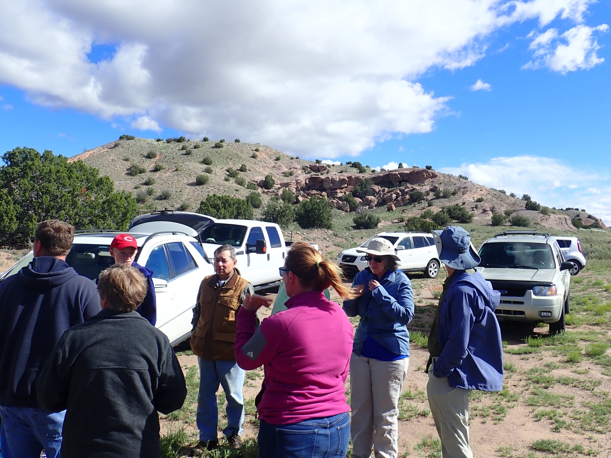
Our group met at the turnoff towards El Rito from the Chama highway, and Lynelle Brode directed us another four miles up the highway to the pullout for the prospect. We gathered for a brief orientation.
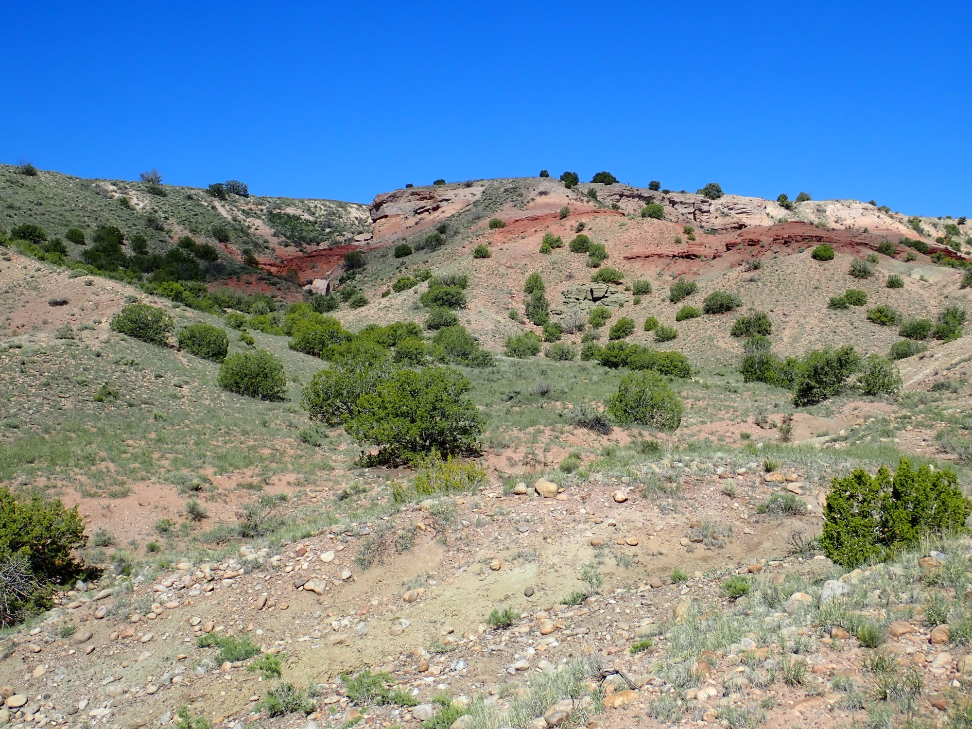
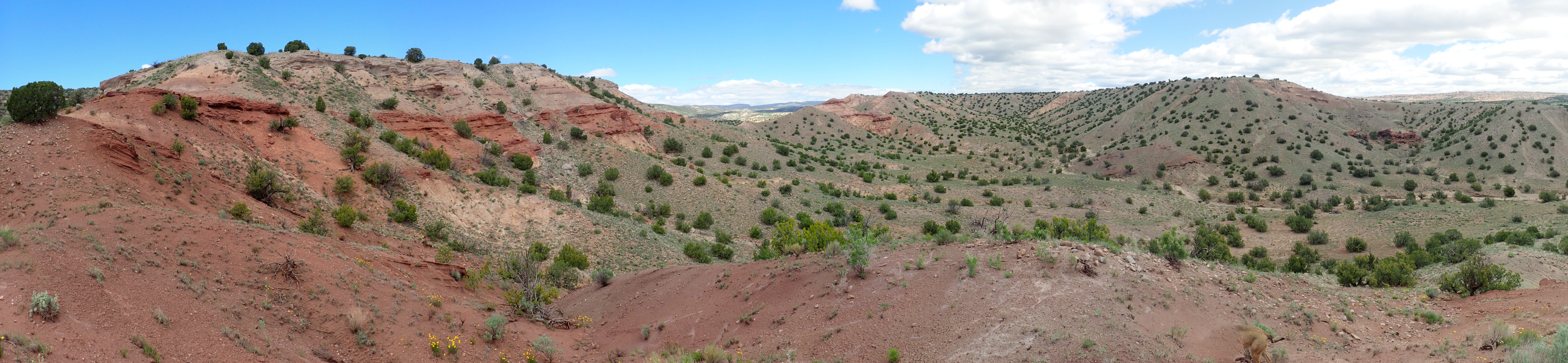
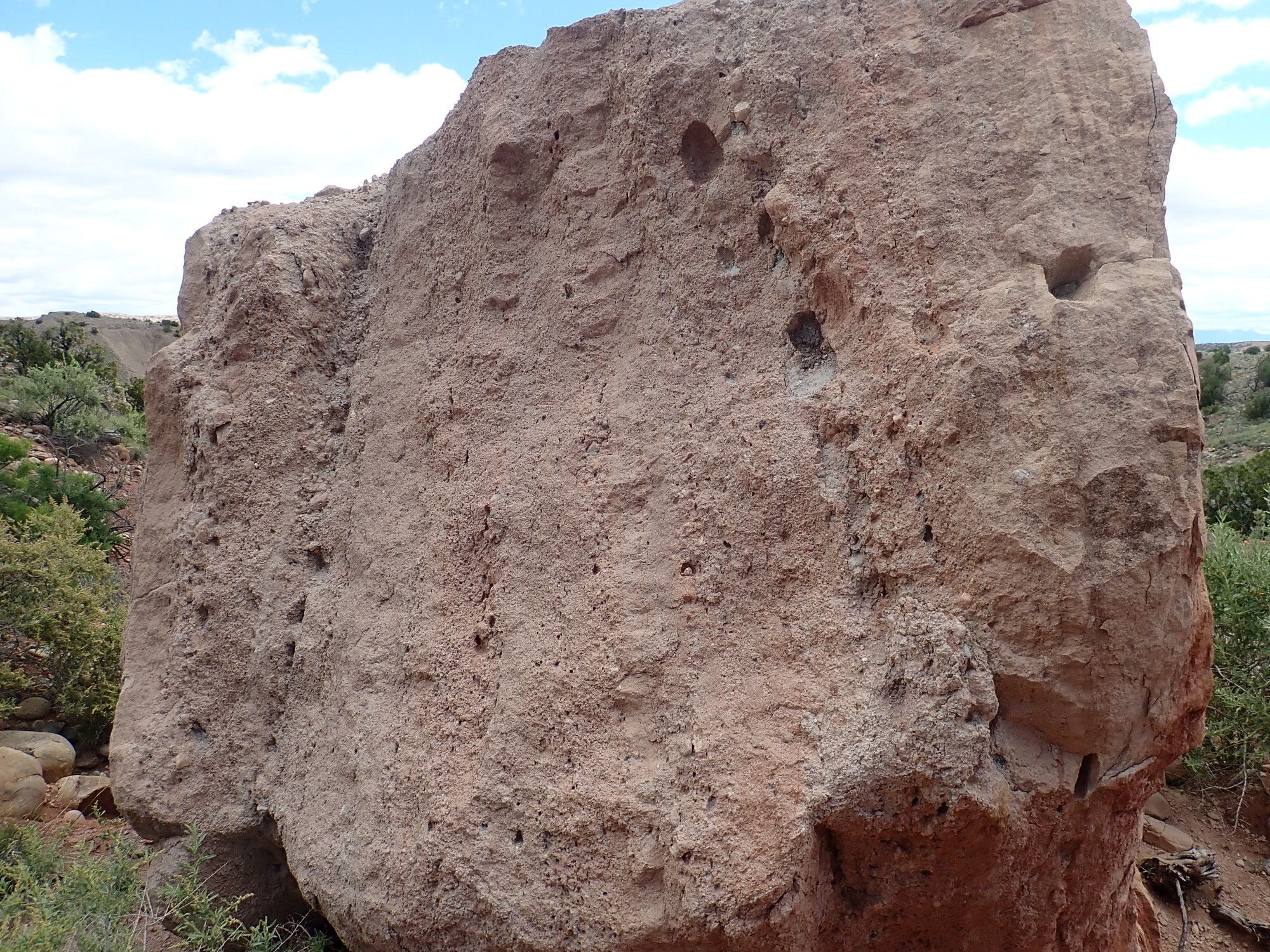
The boulders in the background (click to embiggen, as you can do with almost all images at this site) are particularly well-cemented beds of the Chama-El Rito Member of the Tesuque Formation of the Santa Fe Group, which dominates this area.
Let’s upack that. New Mexico is divided in half by the Rio Grande, which runs north to south through the center of the state. The valley of the Rio Grande coincides with a major rift in the Earth’s crust, called (sensibly enough) the Rio Grande Rift. This is an area where the Earth’s crust is slowly being pulled apart as the Colorado Plateau to the northwest rotates away from the interior of North America under tectonic forces arising in the Earth’s upper mantle. The middle to lower crust is ductile, capable of slowly stretching under tension, a little like taffy. (If you’ve never pulled taffy, you ought to try it some time; it’s loads of fun.) The upper crust is brittle and breaks up along faults that mark the eastern and western boundaries of the Rift at the surface. The Rift itself is low ground, as the broken upper crust drops into the stretched region of lower crust. At the same time, hot mantle rock rises into the stretched region, and this can allow the mantle rock to partially melt into magma that works its way towards the surface. This accounts for the long history of volcanic activity in the Jemez Mountains.
The broken crust within the Rift has dropped as much as 15,000 feet. The reason we don’t see a yawning canyon three miles deep along the Rio Grande is that, during the 30 million years the Rift has been opening, sediments eroded off the surrounding higher terrain have steadily accumulated in the Rift. These sediments are assigned by geologists to the Santa Fe Group, and the chief formation of the Santa Fe Group from Santa Fe to Abiquiu is the Tesuque Formation. This formation can be divided into slightly different sets of rock beds, described as members of the formation. The Chama-El Rito is one of the younger members and is found mostly west of the Rio Grande and north of Espanola. It is characterized by the presence of volcanic rubble eroded off the Tusas and San Juan Mountains to the northwest.
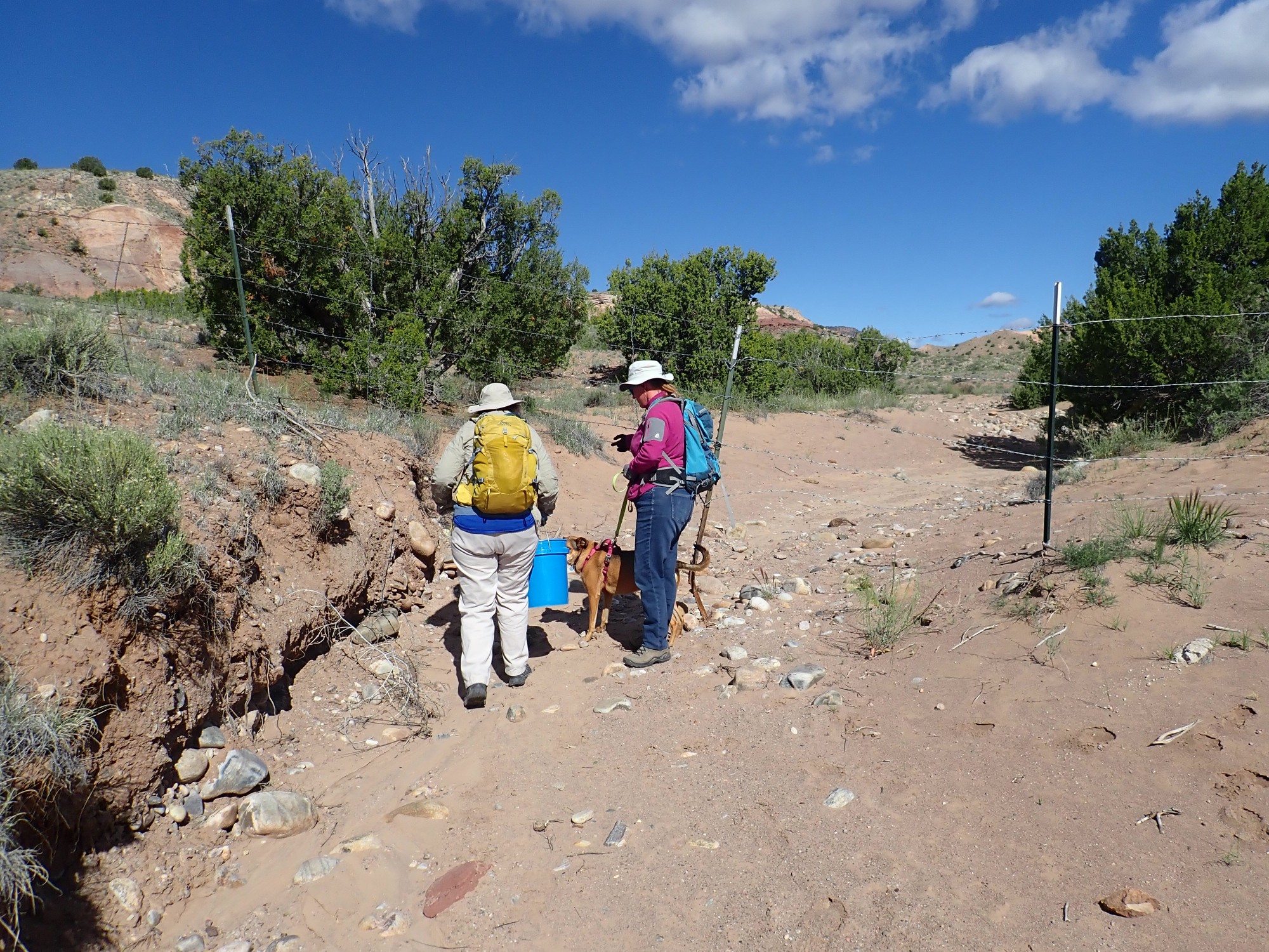
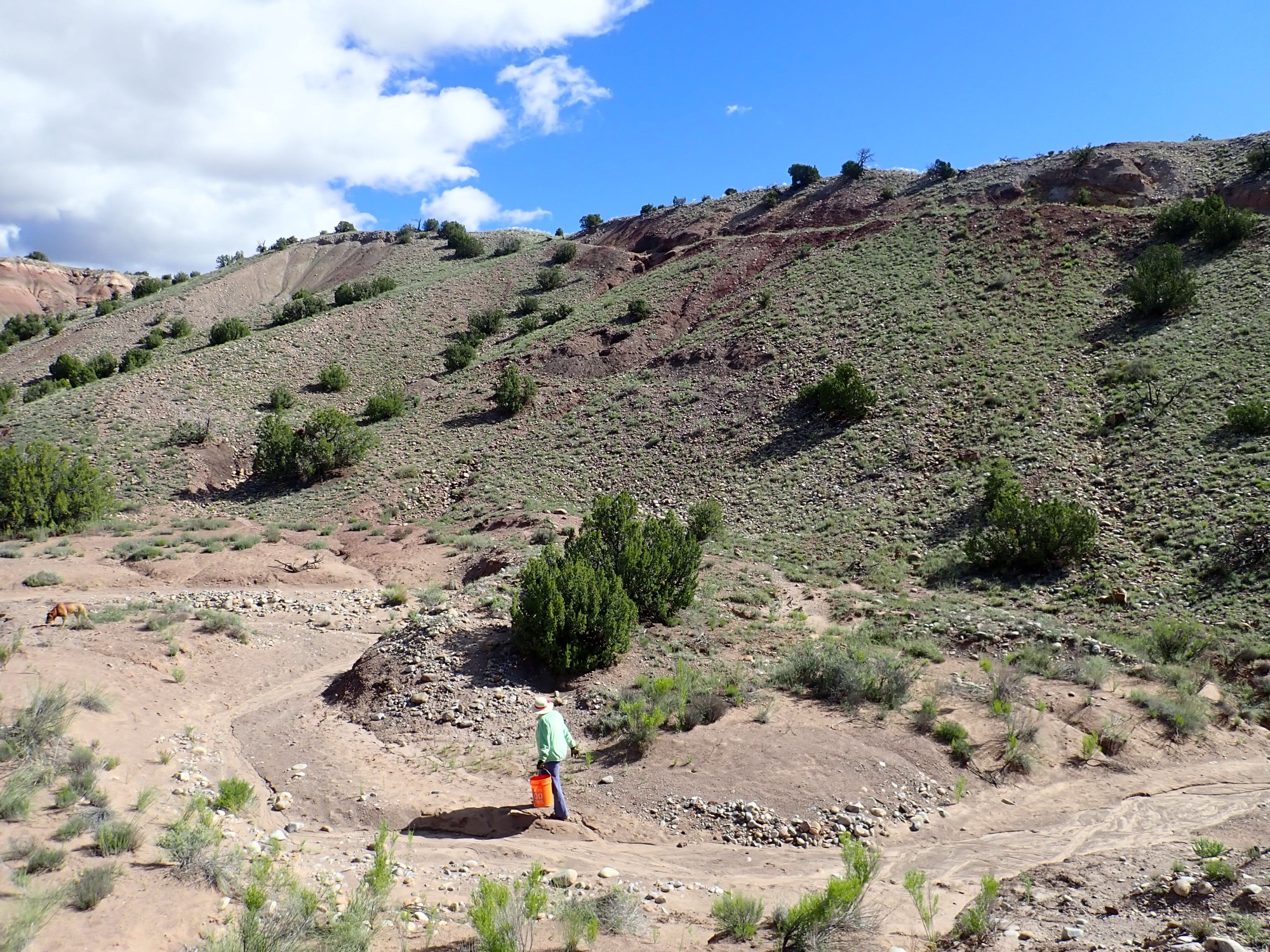
Working our way under the barbed wire fence in the arroyo leading to the prospect. We are on National Forest land just north of the boundary. Lynnelle’s dog is Miss Quinn and has joined us on other trips.
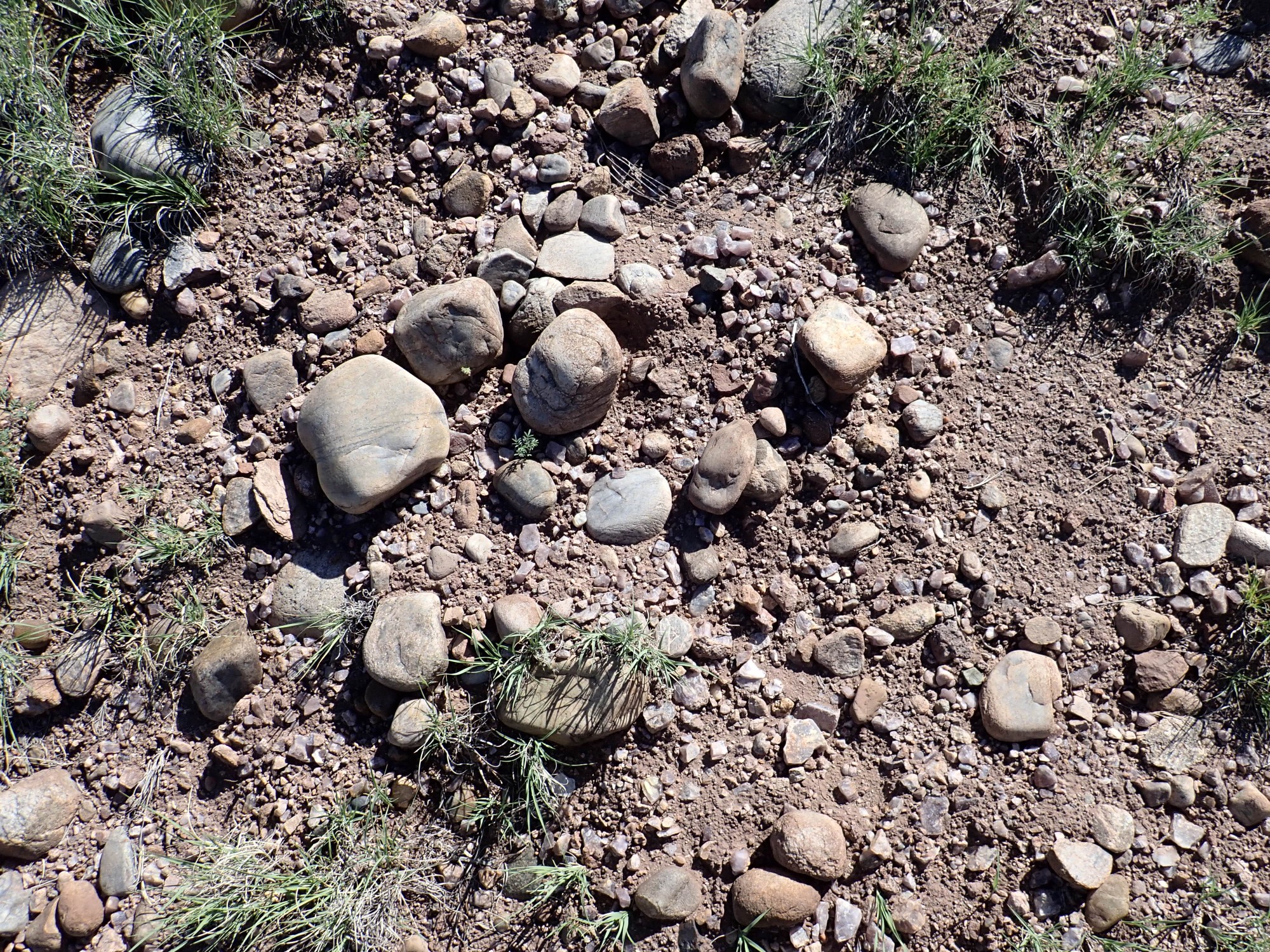
Much of the terrain here is littered with large rounded clasts or rock fragments. These cobbles were washed down from from the tops of the surrounding hills, where they were deposited hundreds of thousands of years ago as a layer of river gravel by the ancestral El Rito Creek.
The cobbles themselves are mostly quartzite, a very hard recrystallized form of sandstone, which is probably from the Ortiz Mountains to the north; and occasional chunks of a hard crystalline tuff, probably the Amalia Tuff from the Taos area.
It’s not far up the arroyo to the start of the collecting area.

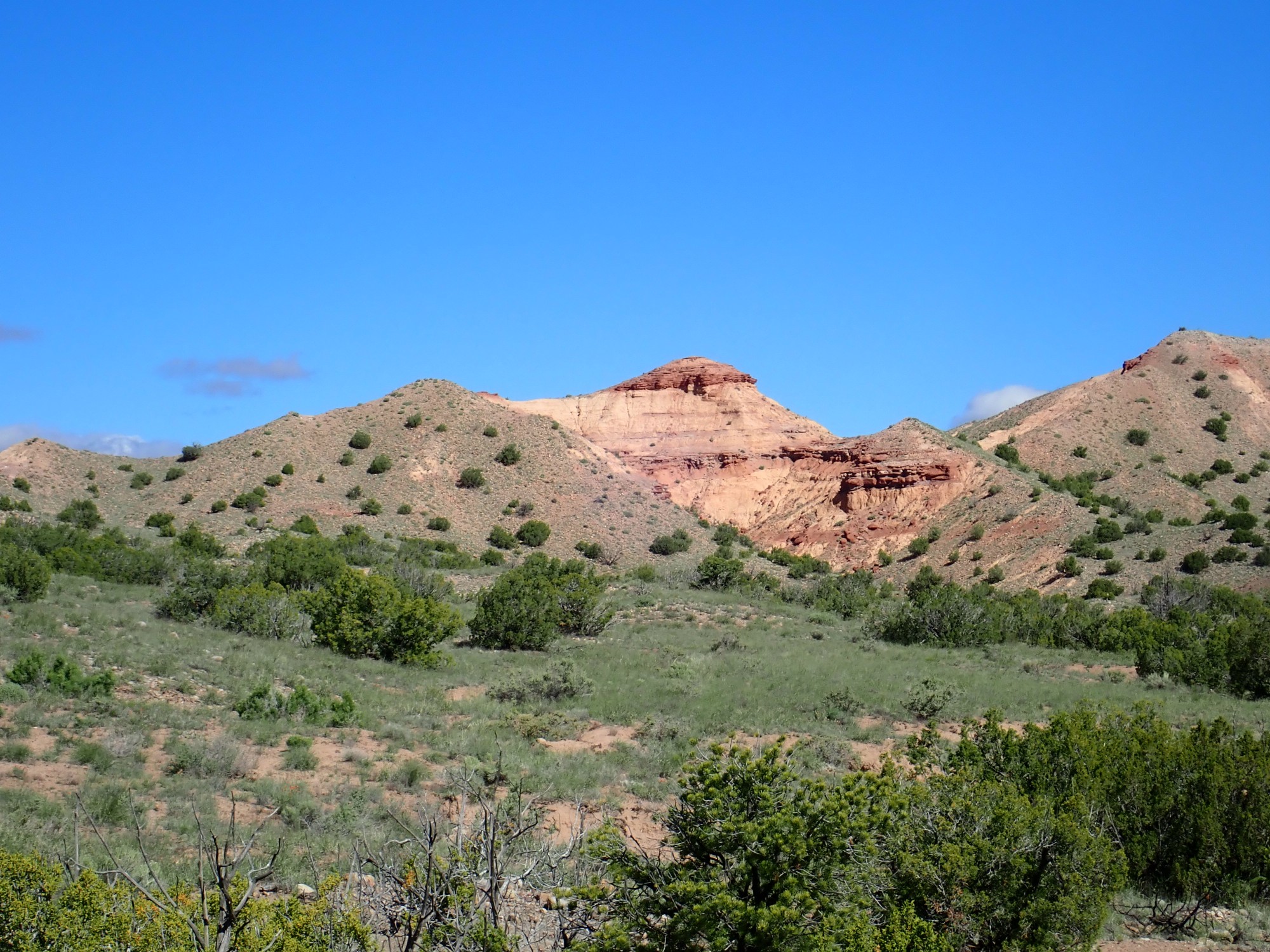
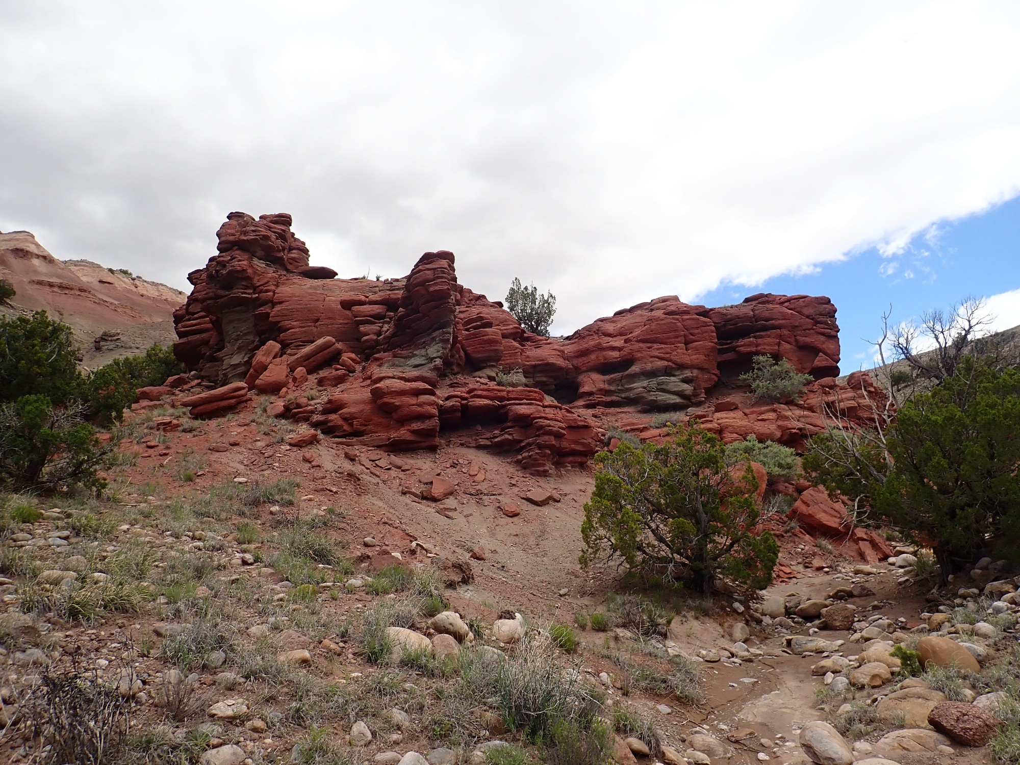
The geologic map shows that this is close to the trace or surface expression of a north-trending fault. Here the rock beds have broken and the beds to the east are displaced downwards some distance. The fault is likely associated with the western margin of the Rio Grande Rift. Faults are a natural pathway for fluids to move through rock beds, and so many valuable mineral deposits are found along faults.
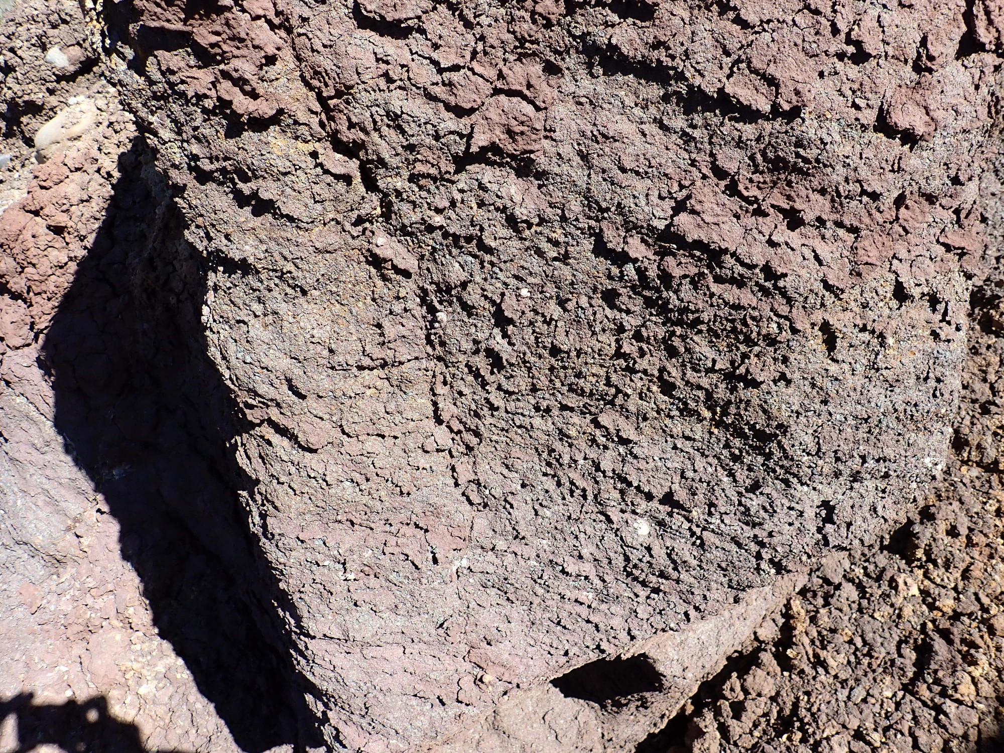
The fluids themselves may be associated with a half-buried spatter cone that produced the very dark beds visible here. We saw some of these dark beds from the highway just before turning into the pullout, and there are more on the other side of El Rito Creek. The beds themselves are a mixture of cinder, bits of lava shot into the air that solidified before landing, and hydromagmatic deposits, bits of rock produced by the steam explosions where the lava came into contact with rock beds saturated with groundwater. The presence of hydromagmatic beds suggests that El Rito Creek or some other tributary of the ancestral Chama River was already present here when the cones erupted.
This would have been about 15.3 million years ago, based on a radiometric (K-Ar) date for a lava bomb from the vent on the east side of the river. Since the vents were erupted on top of Chama-El Rito Member, and subsequently buried under additional Chama-El Rito sediments, this helps establish the age of the Chama-El Rito Member, now thought to have been deposited between 11 and 17 million years ago. The whole region began to be uplifted in the last few million years, causing the Santa Fe Group sediments filling the Rift to begin eroding away and exhuming the buried cinder cones.
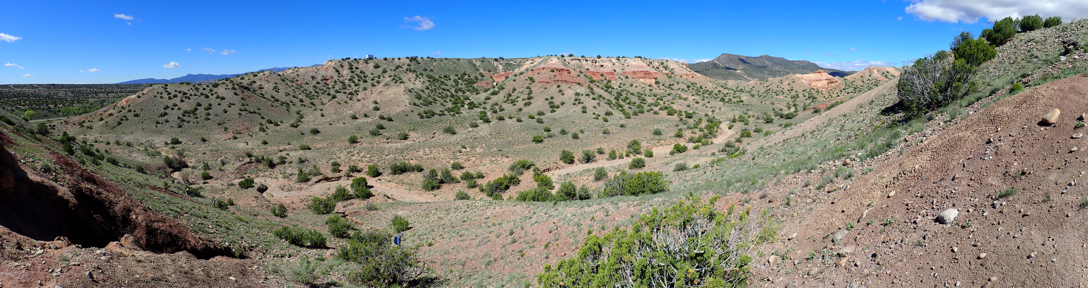
Looking southeast along the mineralized zone.

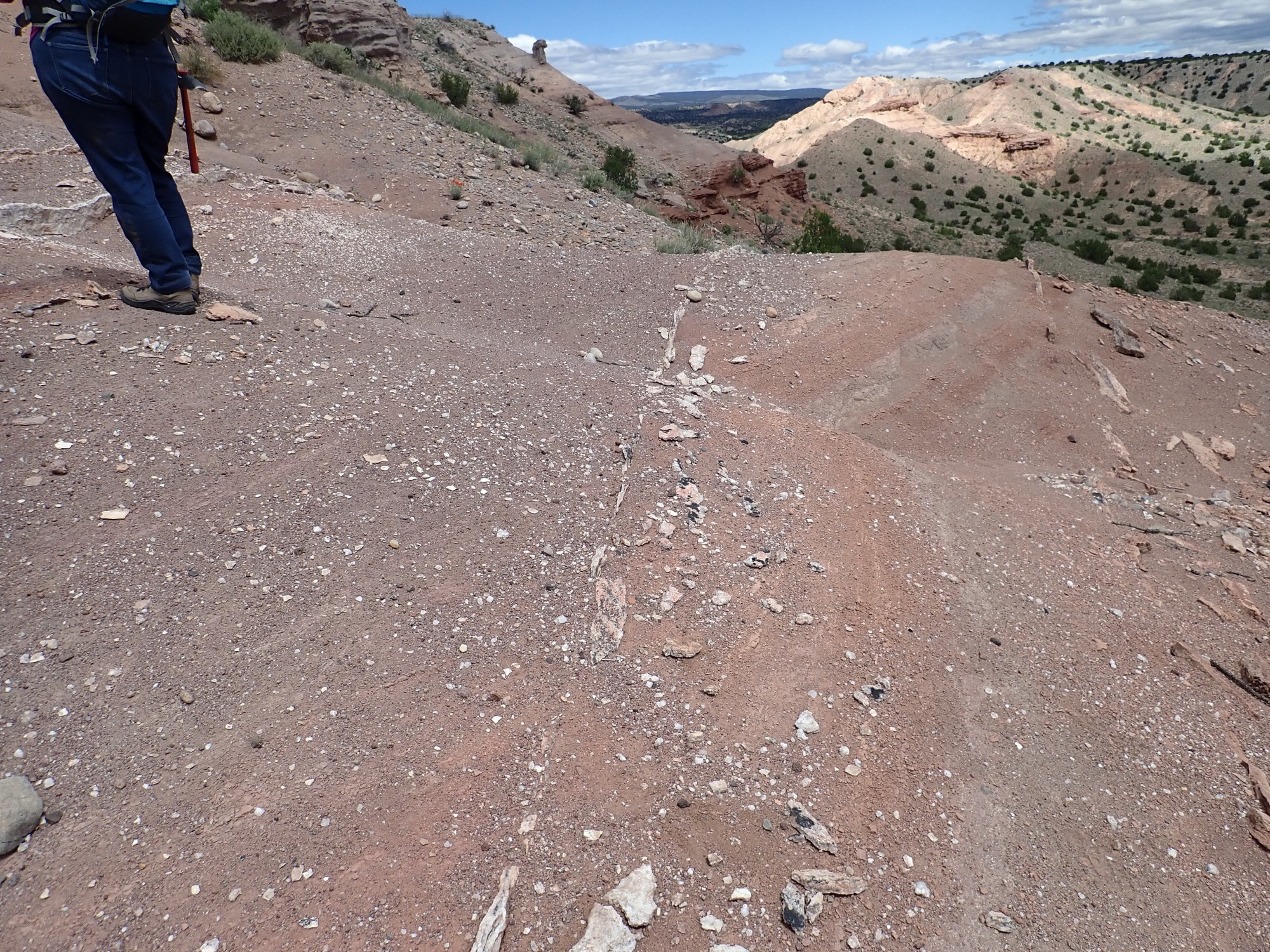
You can see a trench dug along the mineralized zone. I’m standing almost on top of another such trench. And there are indeed fragments of fluorite all over the area. A full panorama:

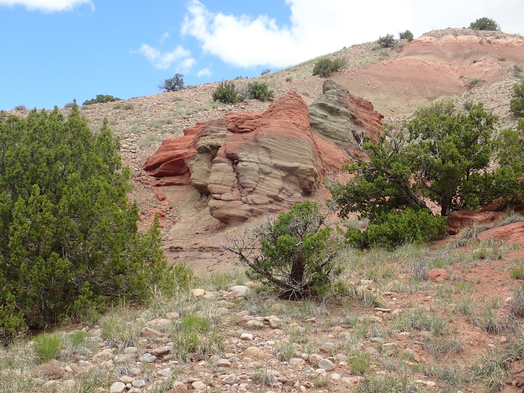
The mineralized zone is at left and parallels the fault, though it seems to be located some distance to its west. (The fault trace is not terribly well exposed and so is not obvious on the ground.) At right are some more dark beds of the exhumed cinder cone. A closer look at the beds:
To the northwest:
Here there seems to be three dark beds interbedded with more typical light beds of the Chama-El Rito Member. This suggests three episodes of eruptive activity around these vents.
The hill north of the arroyo also has fluorite, Lynelle tells us, and I decide I will start my hunt there and work south along the mineralized zone.
The bank I was just standing on:

A significant river channel must have once passed over the knoll, depositing the layer of coarse cobbles. These look like they were subsequently calichified, cemented together with lime from groundwater, to form a slightly resistant layer. It’s a common process in the arid Southwest.
I start up the hill. Fluorite is abundant.
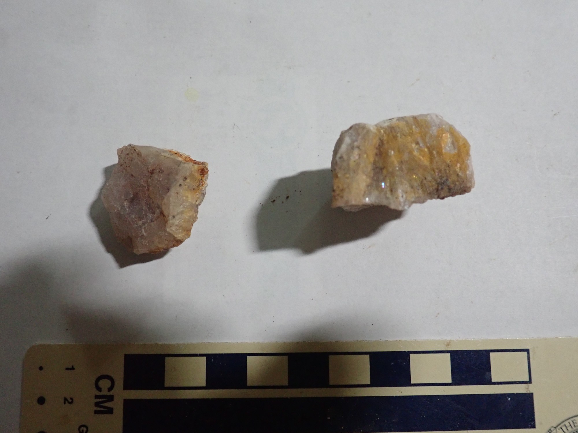
The large cobbles are all Ortiz Quartzite, but if you click to enlarge, you’ll see that many of the smaller pebbles have a slight lavender color typical of fluorite from this area. These all washed down from the mineralized zone above. I start pocketing samples.
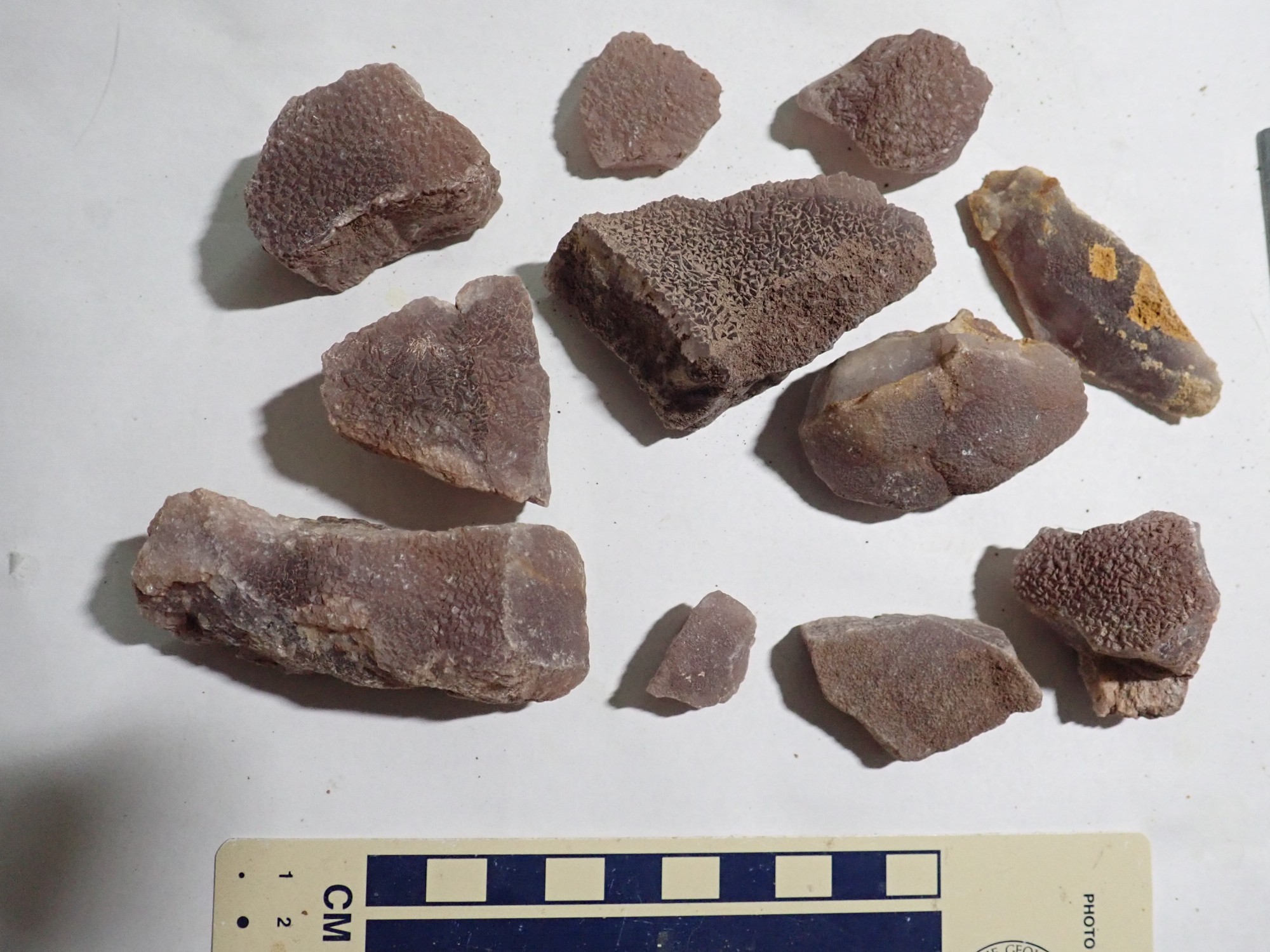
Fluorite is transparent to translucent and can come in almost any color or no color at all, but the fluorite here has a purple tint to it. There are various tests to confirm the identification, but the definitive one is that the fluorite forms masses of cubic crystals. The corners of these crystals are easily seen under a magnifier.
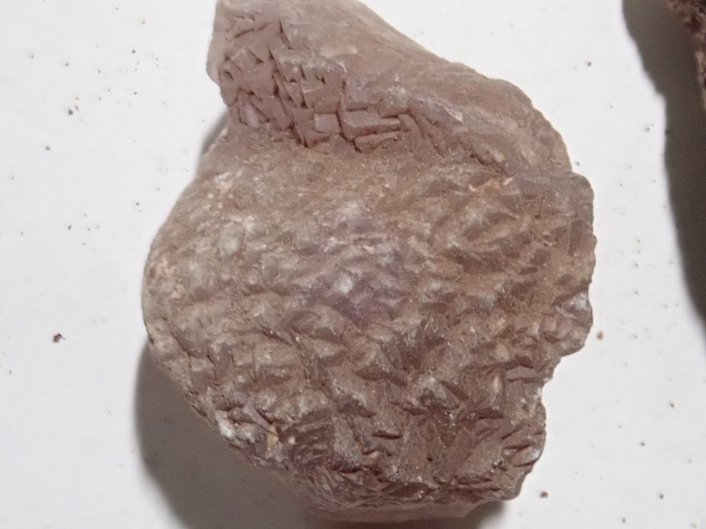

The other indication is the hardness. Fluorite is harder than calcite but softer than feldspar. The combination of cubic crystals, translucency, and moderate hardness pretty much nails fluorite; no other reasonably common mineral combines these properties. Halite is the only thing that comes close, but its solubility and softness distinguish it easily from fluorite.
Fluorescence is not actually a reliable identification for fluorite, even though fluorite is the mineral in which fluorescence was first noticed. Pure calcium fluoride does not fluoresce; it’s the impurities that make some natural fluorite crystals glow under UV light. The samples here were not terribly fluorescent, though some of the fluorite I collected shows a purple glow under long-wave UV light, and a very few samples glowed green under short-wave UV light.
The side of a gully in the hillside.
These have the look of cinder that has been reworked by water. This most likely took place shortly after the eruption.
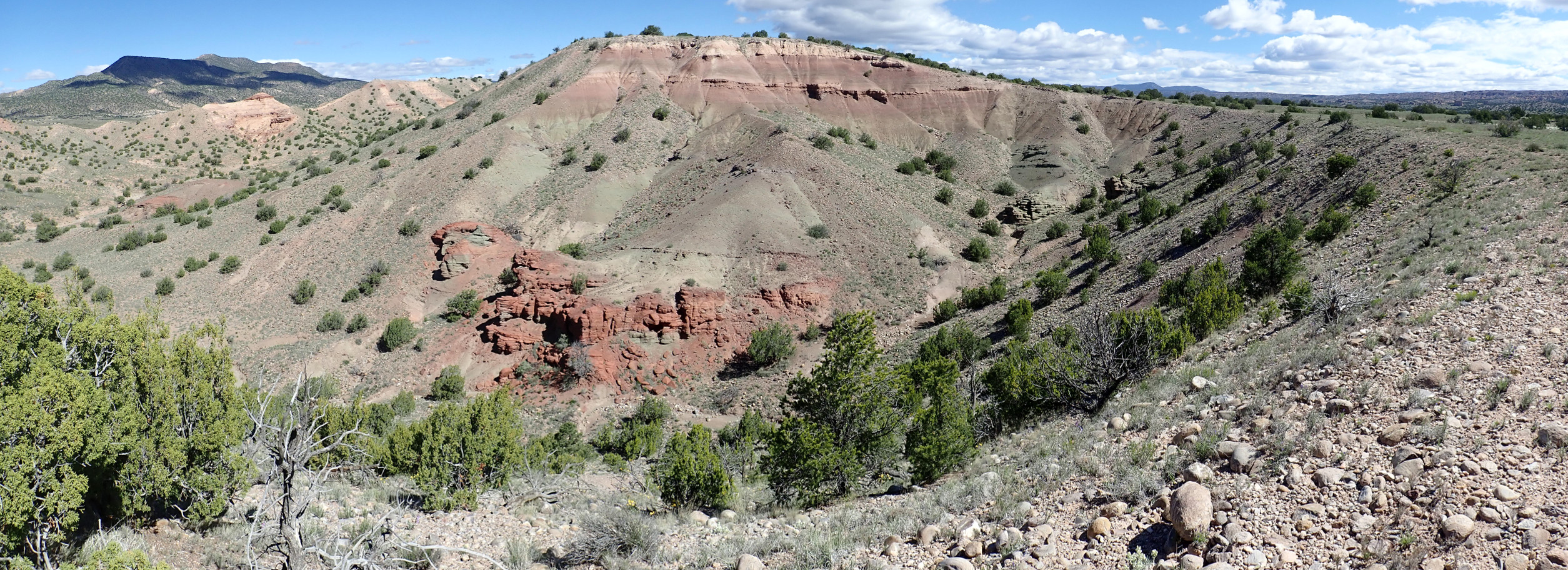
Panorama from near the hill top.
On the skyline at right is Sierra Negra, a small mountain capped with a basalt flow that has been dated at around 4 million years old — relatively young.
The hill turns out to have a level top, which the geologic map identifies with the third terrace level of El Rito Creek. A terrace level represents a former floodplain abandoned by its river when the base level abruptly dropped. Some obstacle downstream, such as a resistant bed of rock, sets the base level of a river valley, and the valley is eroded flat at that level. If the obstacle is removed, such as by being slowly eroded through to softer beds beneath, the base level drops to the next obstacle and the river rapidly cuts down to create a new, lower, flood plain. Parts of the older flood plain are preserved as terraces. Along the Rio Grande and its tributaries, where regional uplift has led to intense erosion, geologists can identify several distinct terrace levels — four for the El Rito alone. The third level is though to be 70,000 to 130,000 years old.
On the far side of the hill, there is a nice view into a spur of the main arroyo.
At left is Sierra Negra again. Beds of cinder are visible across the canyon. The dark color of the cinder extends some distance up the hill side. Cinder cones are very fragile and erode rapidly, leaving only a “tuff ring” of the most resistant beds at the base of the cone. The eroded volcanic debris continued to tint the Chama-El Rito beds being laid down for some time after the eruption.
At right is the distinctive gravel layer marking this terrace level.
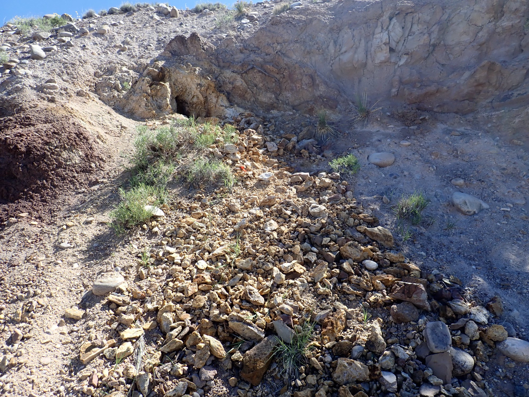
I work my way south along the mineralized zone. There are occasional diggings.

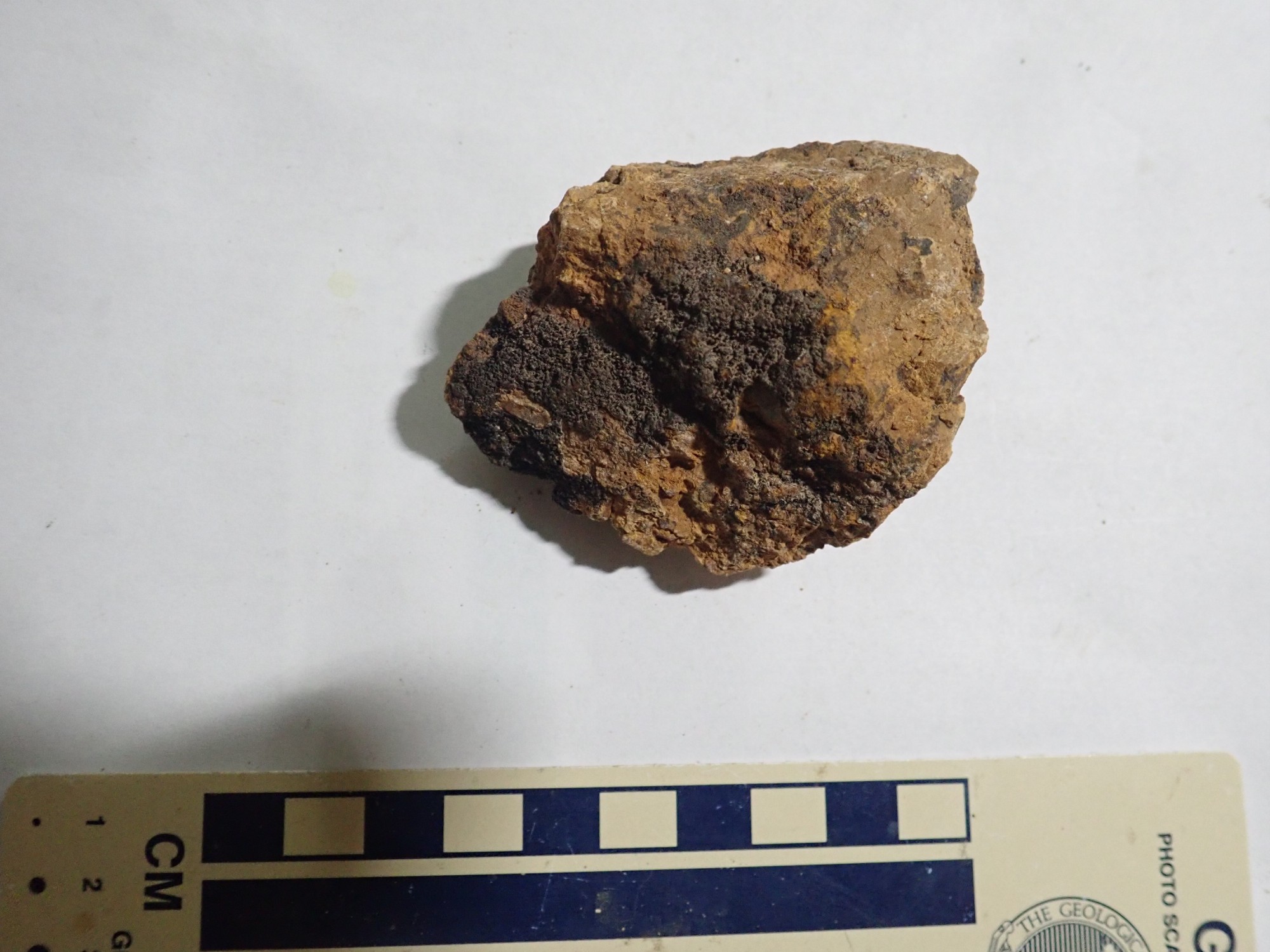
A fluorite vein is exposed at the base of the digging.

The host rock looks a lot like caliche. I suspect it is fine-grained calcite similar to travertine.
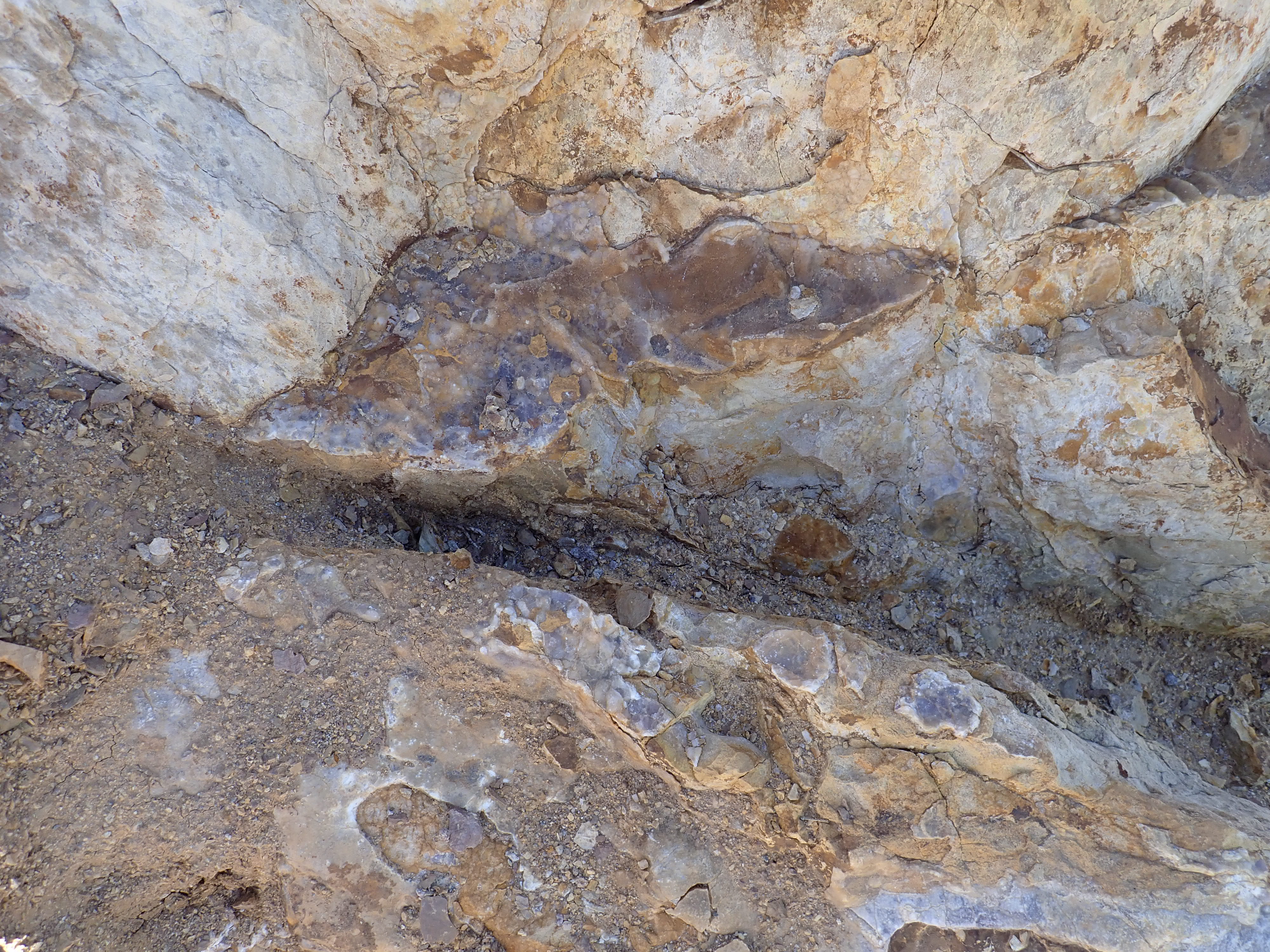
Another digging.
This exposes a vein of fluorite.
I collect several samples, working downslope until I’m back in the arroyo bottom. Some of these are iridescent.
Tourmaline, a boron mineral, is sometimes found with fluorite. I wondered if this might be some.
But it doesn’t look right under the loupe. Tormaline forms long striated crystals, and these don’t match. More likely black calcite.
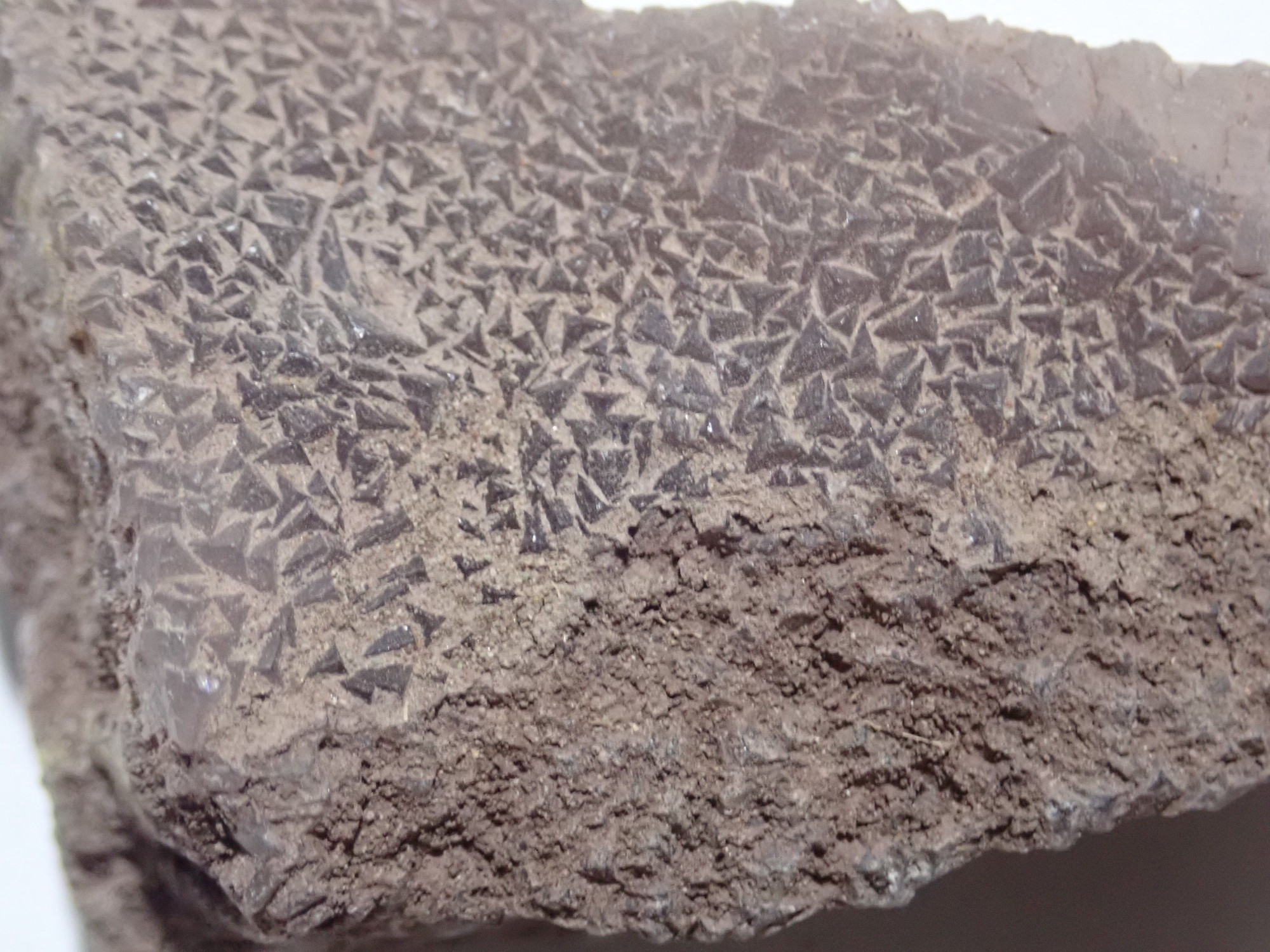
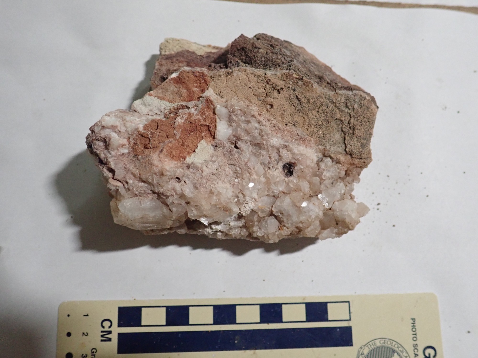
This may be barite.
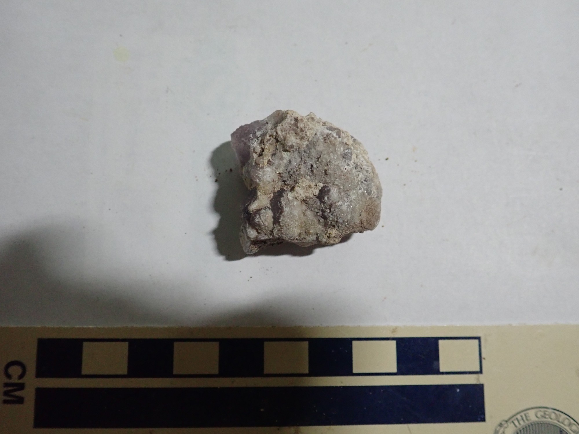
The bulk of the sample is fluorite, but the sugary-looking crystals on top don’t quite look like calcite and match the description of barite from this locale. Under the high-magnification loupe, they’re beautiful little transparent crystals with a tabular shape, which is not typical of calcite or fluorite but matches barite. They’d be right at home in Patrick Rowe’s micro-mineral collection.
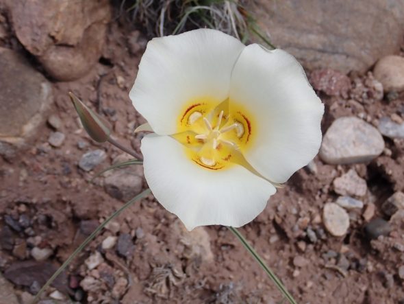
There are spring blossoms here. Sego lily:
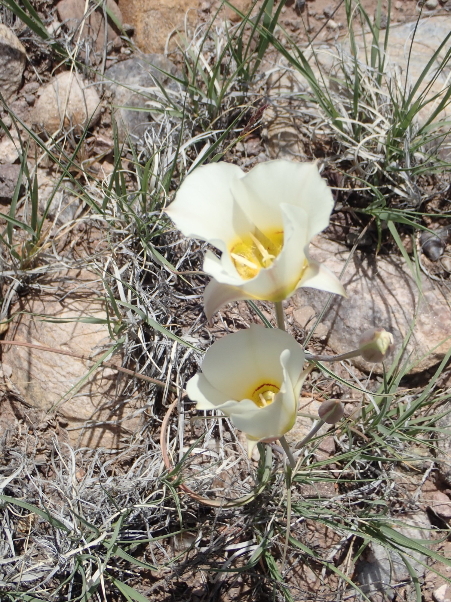

Found throughout the western United States. It is the state flower of Utah; its bulbs are edible and help stave off starvation among Mormon pioneers in the state.
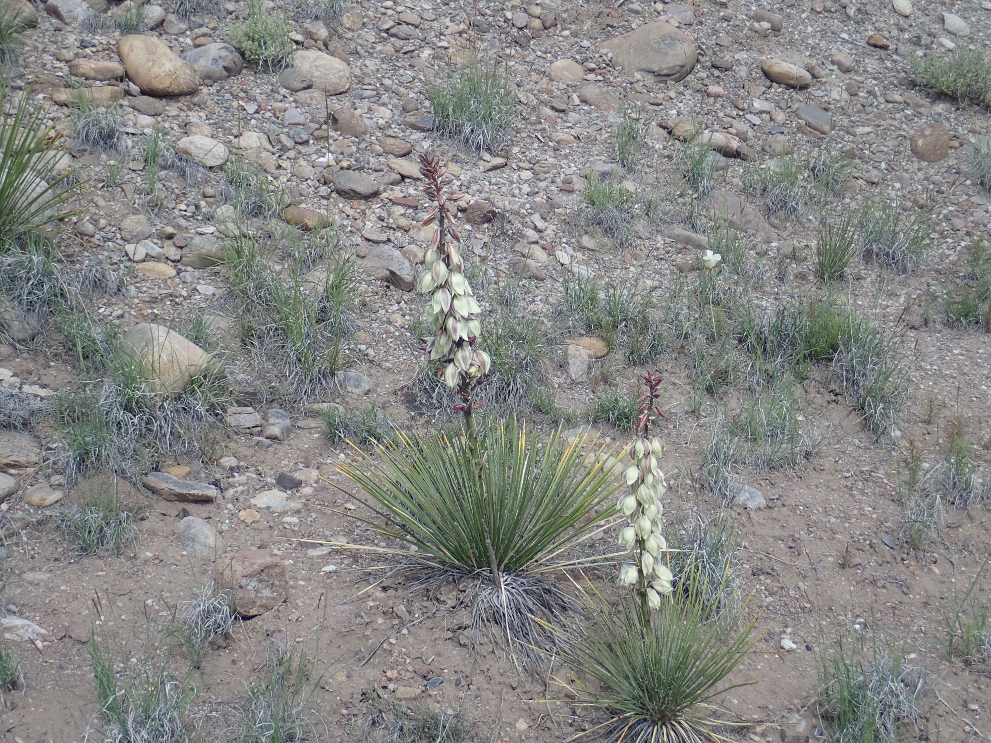
Yucca. Possibly intermediate yucca, though precise species can be hard to tell apart.
I climb the hill to the south, where an enthusiastic youngster tells me there is some good calcite.
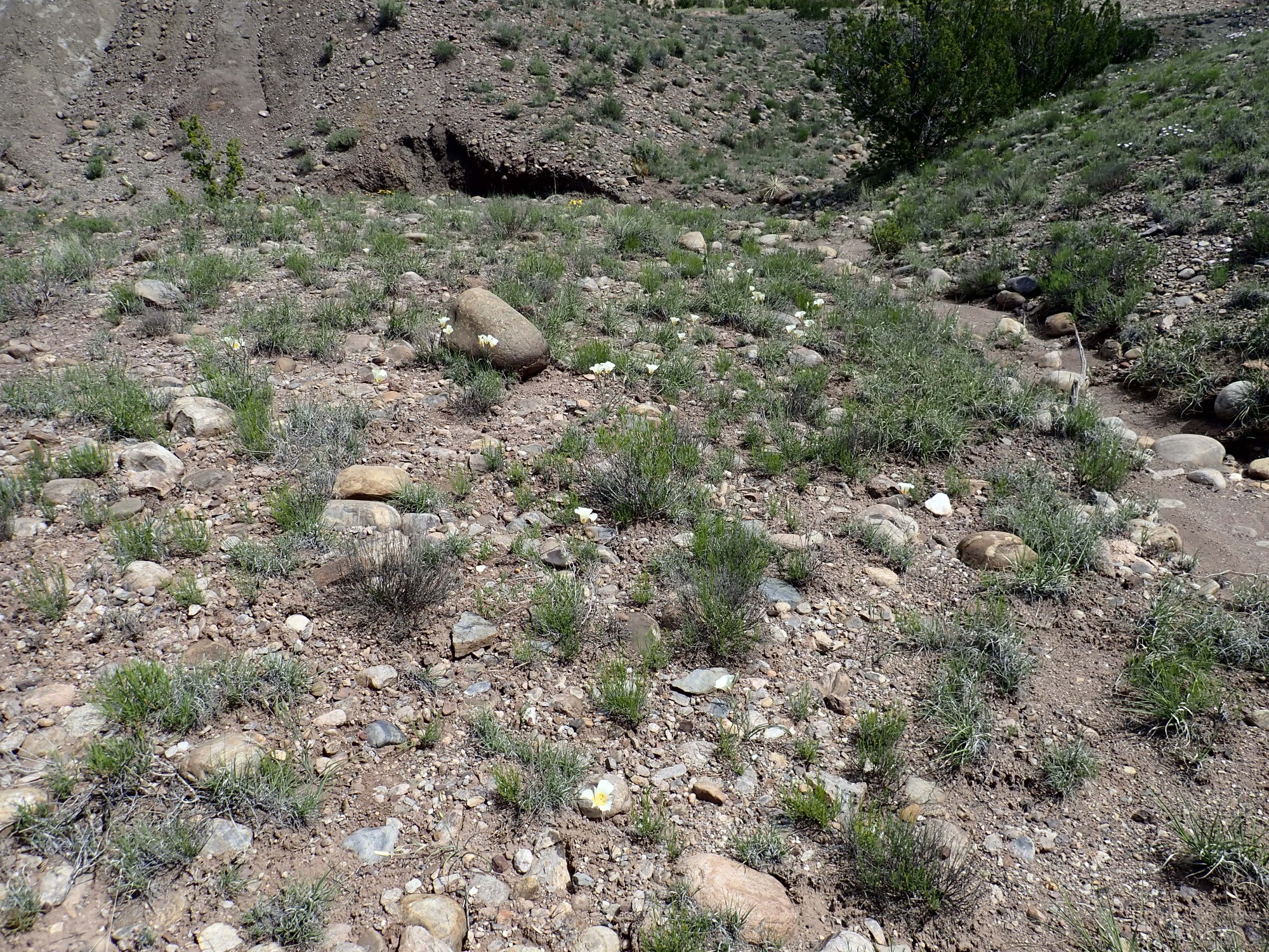
The area is covered with Sego lilies.
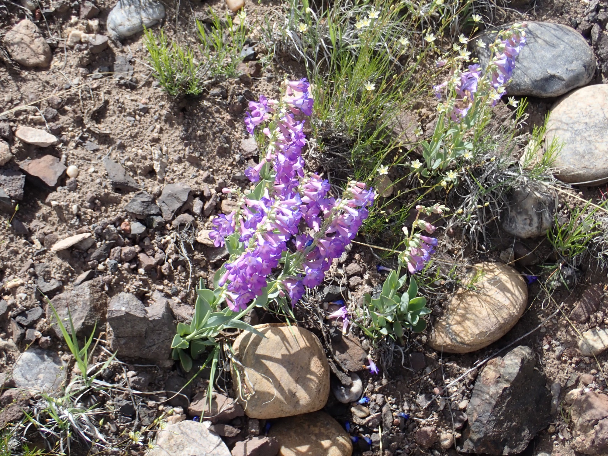
Penstemon, perhaps:
There are indeed some impressive calcite specimens hereabouts.
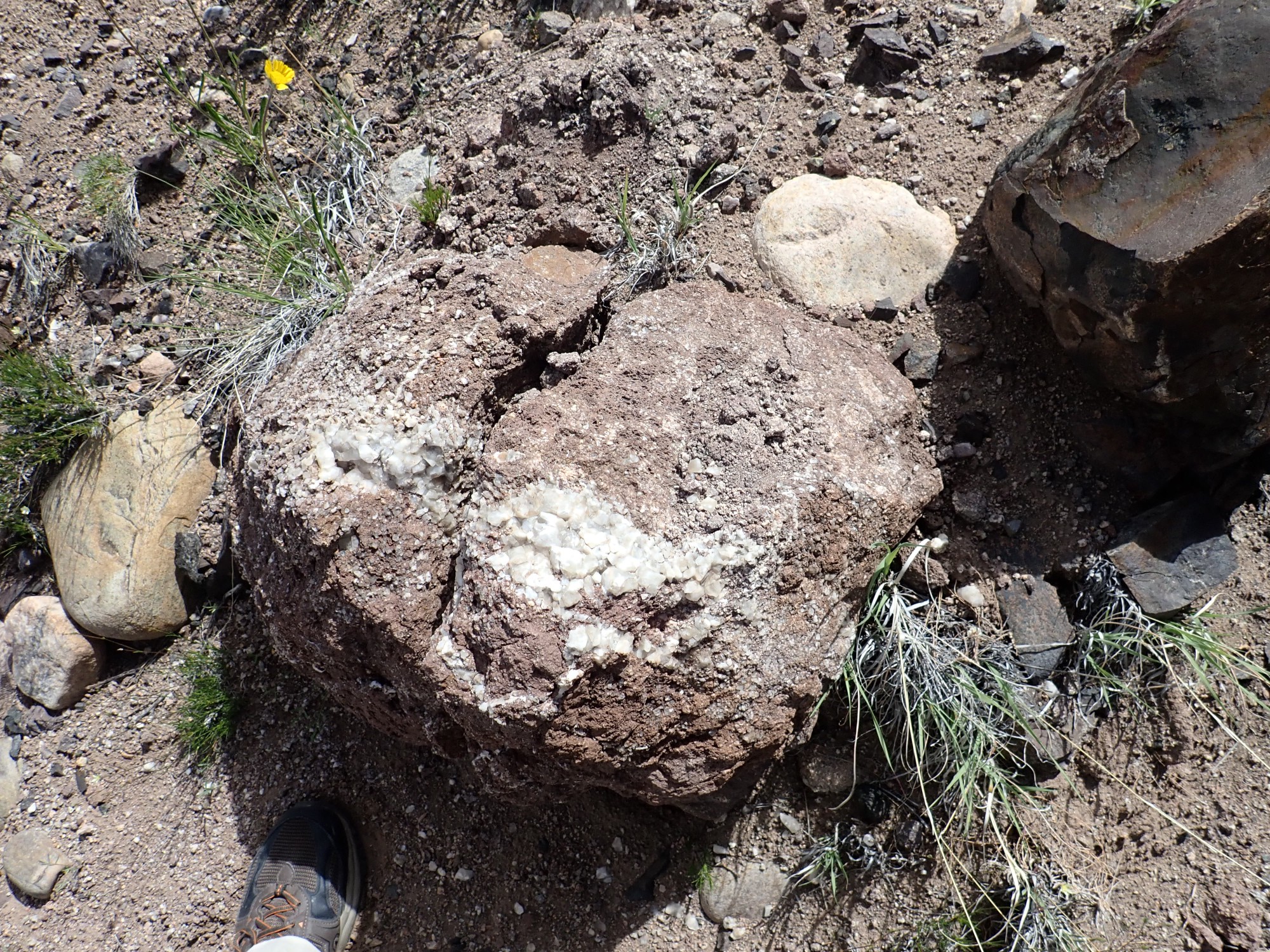
Would make a nice yard rock, but too heavy to haul out, and trying to break off a piece would just shatter the rock.
The nearby hydromagmatic beds.

A mixture of cinder and shattered framents of rock cemented by ash.
I have all the fluorite and calcite I want. I head west towards the cinder beds visible in that direction.
The color contrast intrigues me.

The contact is not completely sharp. My guess is the color change marks the transition from hydromagmatic debris, produced by steam explosions in the wet rock surrounding the vent, to cinder produced directly from the lava.
Panorama from atop the beds.
Near here are some calcite veins.
The veins seem to dip almost vertically into the ground, whereas the beds are nearly level. I’m not sure what to make of it, except that this suggests the calcite was emplaced long after the eruption.
I don’t recall exactly where I got my calcite samples, but it may have been from near here. Calcite vein:
Calcite on a lava bomb:

The latter will make a nice yard rock.
I climb the hill to the southwest. Lynelle mentioned finding pottery shards in the arroyo below, and it seems like that this is the site they came from.
The geologic map uncharacteristically does not show the ruins, and I cannot dredge up anything on the Internet that would let me put a name on them. The ruins are not large. Lynelle photographed a pottery shard; it looks a lot like pottery shards from the nearby Poshuoinge ruins, which would make this early 15th century and ancestral to the Tewa. Of course, I was careful not to disturb the area.
This flat surface is part of the first (uppermost) terrace level of the ancestral El Rito Creek, though to be between 170,000 and 400,000 years old. Sediment sequences much older than that in New Mexico include the Lava Creek ash bed from the Yellowstone eruption 630,000 years ago, and that isn’t present below this terrace level. The cobble layer marking the terrace has had considerable windblown sediments deposited atop it.
I walk to the west edge of this little mesa, where there is a wonderful view to the west.
At far left and far right are the edge of this mesa, composed of beds of the Chama-El Rito Member. At left are the Jemez Mountains, with the El Alto plateau and Cerro Pedernal prominent. The foreground ridge is Chama-El Rito Member uncontaminated with cinder, while the light ridge in the middle distance is underlain by Ojo Caliente Member, the youngest member of the Tesuque Formation, which is relatively pure sandstone recording a dune field that covered this area around 12 million years ago. Sierra Negra is jusr right of center, while to the right we look up Arroyo del Perro del Oeste (“West Dog Arroyo”) towards the Ortiz Mountains.
A little further south along the rim, I get a view of more cinder-contaminated beds.
It’s possible, even likely, that the beds in this area have been tilted by continuing rifting since they were laid down, but I’m trying to estimate where the vent was based on the assumption the beds dip away from the vent. It seems like the vent was located about where El Rito Creek passes east of here.
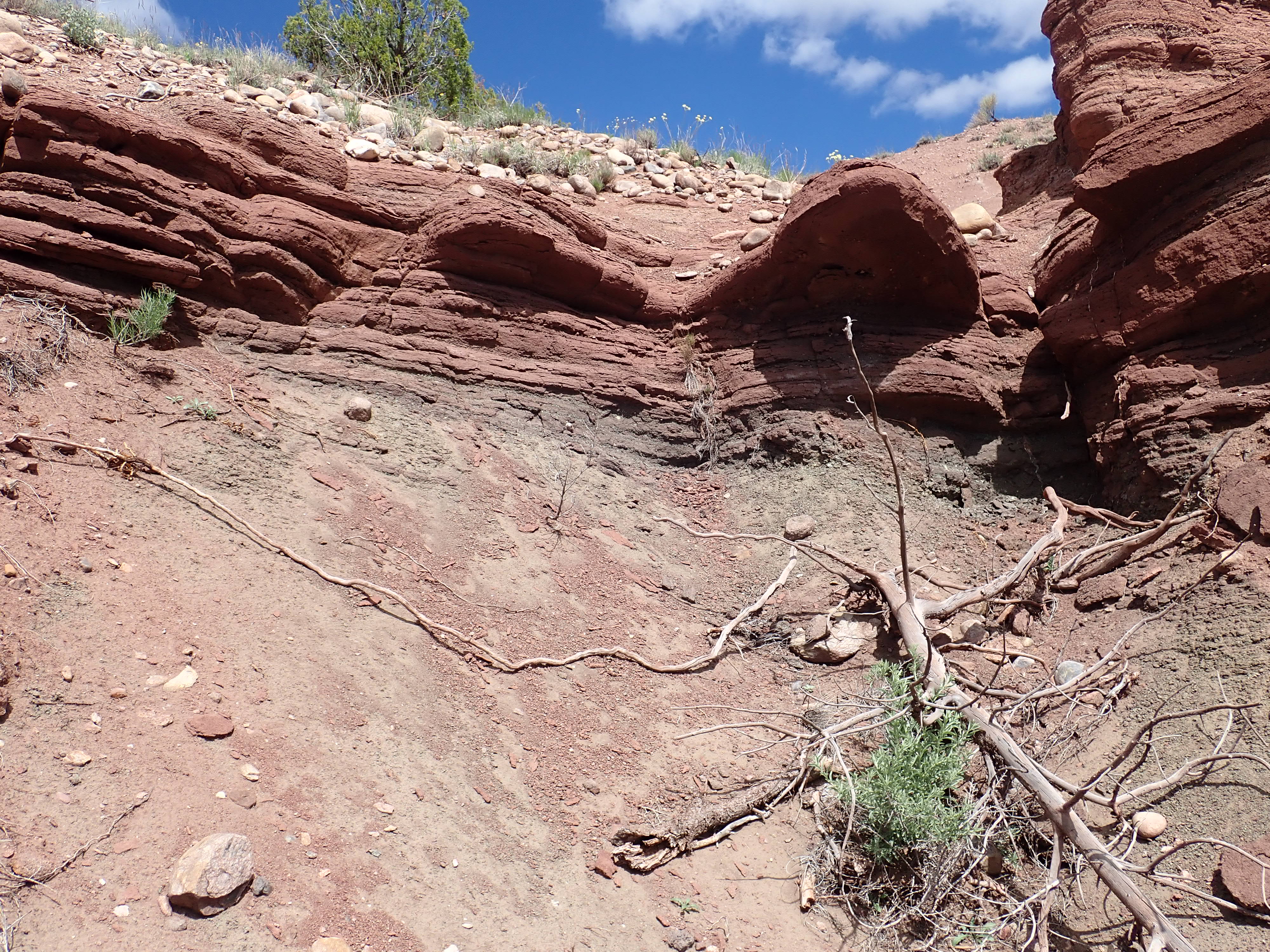
I start back, but a contact catches my eye.
The bed on to is massive, and a block broken from it

proves to be very well-cemented sandstone.
Not well-sorted; that is, the sediments are not all close to the same size, but you see a mix of everything from silt to large pebbles. This rules out this being a tongue of Ojo Caliente Member, which is relatively well-sorted from its dune origins. It may include an unusual amount of volcanic ash, whose silica helps cement sediments together.
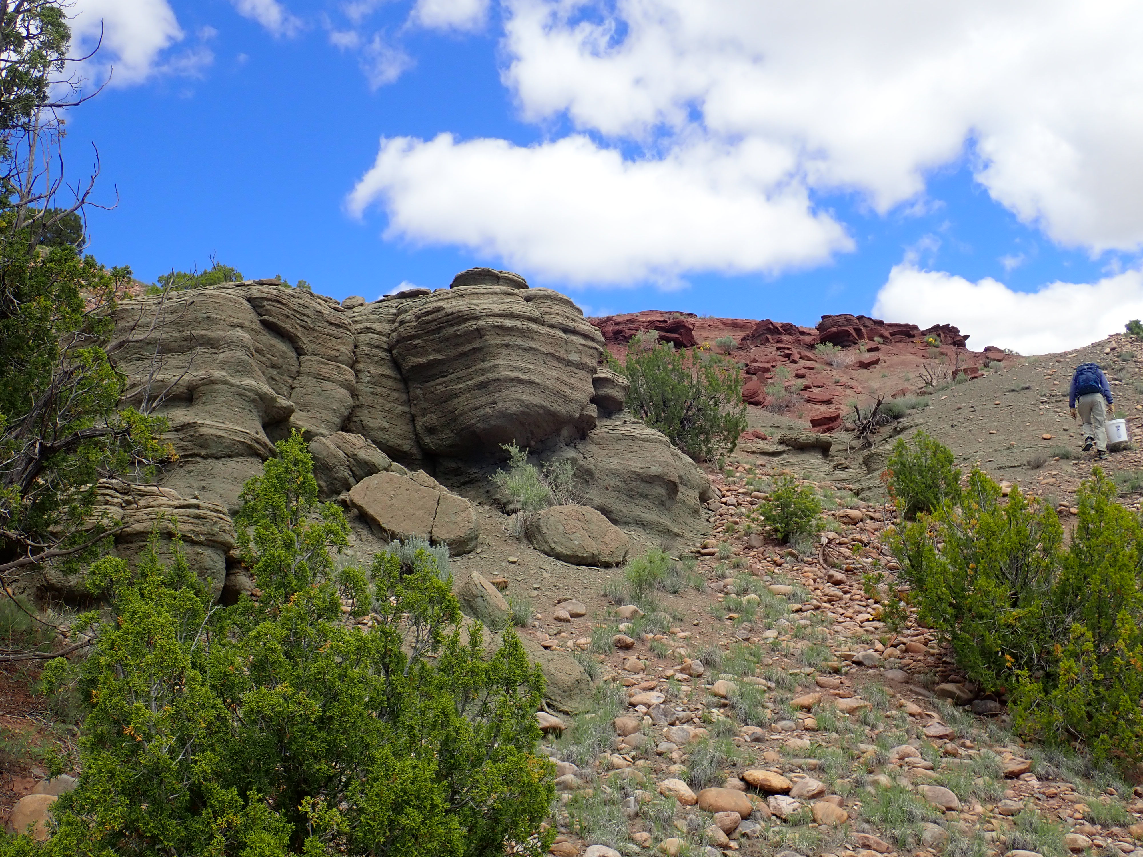
I decide to hike up the spur of the arroyo to the north I photographed earlier. The beds are impressive.
Note how they dip to the northwest.
Again, the whole area may be tilted from continuing rifting, but this again points to the main vent having been somewhere to the southeast.
It’s been a fun Saturday morning and it’s time to sort my booty and head home. Returning to the car, though, I see one last puzzling cultural feature.
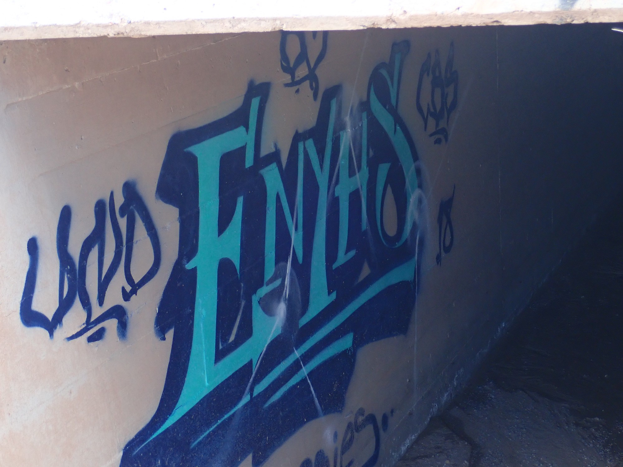
In the culvert under the highway. I’m puzzled why anyone would put the effort into putting such high-quality (comparatively) artwork in such a hidden location so far from anywhere. I can almost imagine some future archaeologist wondering the same thing and deciding this is a ritual center. (And, for all I know, he’s right.)
From there, home.
Nice. Thx for all the info. I live north of Taos, and am wondering if I can get general directions to this area?
Many thx,
Bradley Sleep
I looked again and got directions from the info. you provided, many thx! When we were kids we’d hike up horseshoe canyon for them. This area in Pilar is new to me.
Thank you so much for sharing and for all the detail you’ve put into this. I very much enjoyed reading about your day at Small Fry. I’ll definitely be reading more of your work.