Flows, fluorite, filaments, and faults
This is another grab-bag of a post, with just a little bit of personal update.
Flows
Last Friday was my 9/80 Friday off. For those who may not be familiar with this practice, some employers give their workers the day off every other Friday in return for working slightly longer hours the rest of the time. Hence, 9 hour days on an 80 hour schedule with one Friday off.
I had had my root canal the day before — fear not, I feel no need to go into all the gruesome details, except it seems to have been a success — so I was taking it fairly easy. However, I still feel the need for an hour of brisk walking every day, and spring is creeping up on us, and it was a reasonably beautiful day out. So I drove to the Tsankawi section of Bandelier National Monument to hike the loop trail.
This is one I’ve done before, so I didn’t take an abundance of photographs, except where I noticed something I missed last time or borked the photograph. For example, last time here, I messed up the photo of the sandy parting separating two of the cooling units of the Tsherige Member. This time I did a bit better.
That needs some unpacking, especially for new readers. (I sympathize with long-time readers who find these explanations repetitive.) Most of the Los Alamos/White Rock area is underlain by the Bandelier Tuff, which erupted out of the central Jemez in two separate eruptions 1.61 and 1.25 million years ago. These eruptions formed the prominent Valles Caldera.
The eruptions took the form of pyroclastic flows, which are typical of large eruptions of very high-silica magma. Silica makes molten rock viscous, and the rock that erupted out of the Jemez was so rich in silica (better than 70%) that it could barely flow. Instead, when it got to the surface, it basically disintegrated into microscopic fragments of half-molten volcanic glass under the pressure of its own dissolved gases.
This mixture of tiny glass fragments and red-hot gas formed a highly fluid mixture that flowed away from the caldera in all directions for many miles. It then settled to the surface and hardened into a porous rock called tuff or ignimbrite. The tuff is hundreds of feet thick in some places, including around Bandelier National Monument, and geologists have named it the Bandelier Tuff.
Because the caldera produced two giant eruptions, separated by 400,000 years or so, the Bandelier Tuff has two members in our area. The Otowi Member corresponds to the eruption 1.61 million years ago and is overlain by the Tsherige Member corresponding to the eruption 1.25 million years ago. Between is often found a thin layer of sediments, the Pueblo Canyon Member of the Cerro Toledo Formation.
The Tsherige Member forms the upper part of the many prominent finger mesas around Los Alamos. It was erupted in several pulses closely spaced in time, perhaps within days or hours of each other. Some of these pulses or cooling units are separated by a “sandy parting”, visible as a thin reddish later in the previous photograph.
The mesa top at Tsankawi was defensible (important in the violent days of the Classical Period of 1325 to 1600 AD) and it had ready access to nearby low ground that could be cultivated. As a result, a large pueblo was established here by the Ancestral Puebloans. This has remained largely unexcavated, both out of respect for the modern San Ildefonso Tribe that claims this as the home of their ancestors, and because archeologists have taken to deliberately leaving some sites of well-characterized cultures unexcavated against a future time when better methods of excavation are developed.
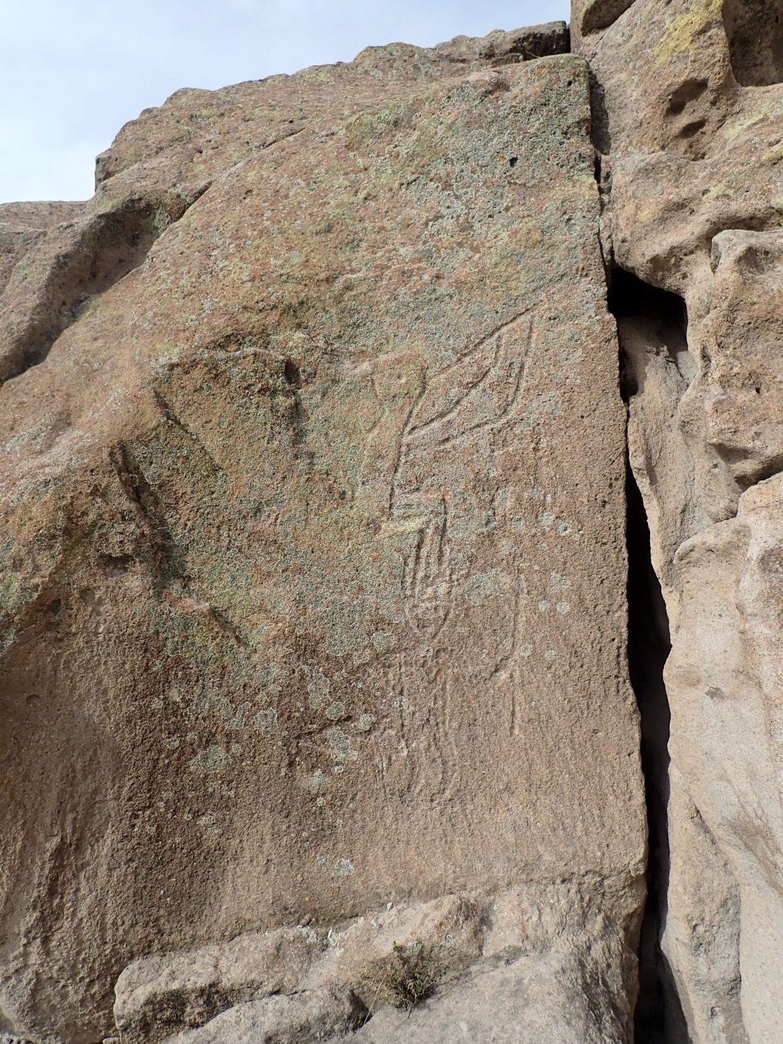
This appears to be a Kokopelli figure above and a ceremonial dancer below. Both figures are heavily encrusted with lichens, proving their authenticity; alas, Kokopelli has become so popularized that one must beware of modern rock art. Kokopelli is interpreted by archaeologists as a fertility deity, and petroglyphs tend to depict him engaged in two activities, one of which is playing the flute.
Another contact between cooling units.
The resistant upper layer is the “C” unit of the Tsherige Member, while the pumice-rich beds below are the upper “B” member. The sandy parting I showed earlier is within the “C” layer and suggests it consisted of multiple flows that are barely distinguishable.
I live in beautiful country.

(As with most images at this site, you may click to embiggen.) If I’m reading the map correctly, we are looking east down Sandia Canyon towards White Rock Canyon and, on the far skyline, the Sangre de Cristo Mountains.
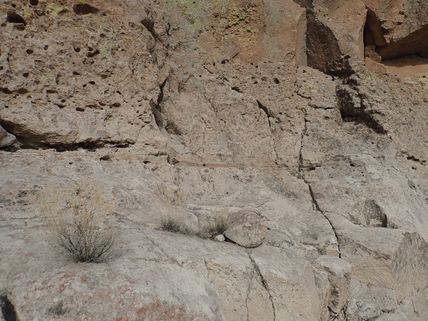
Details of the Tsherige Member.
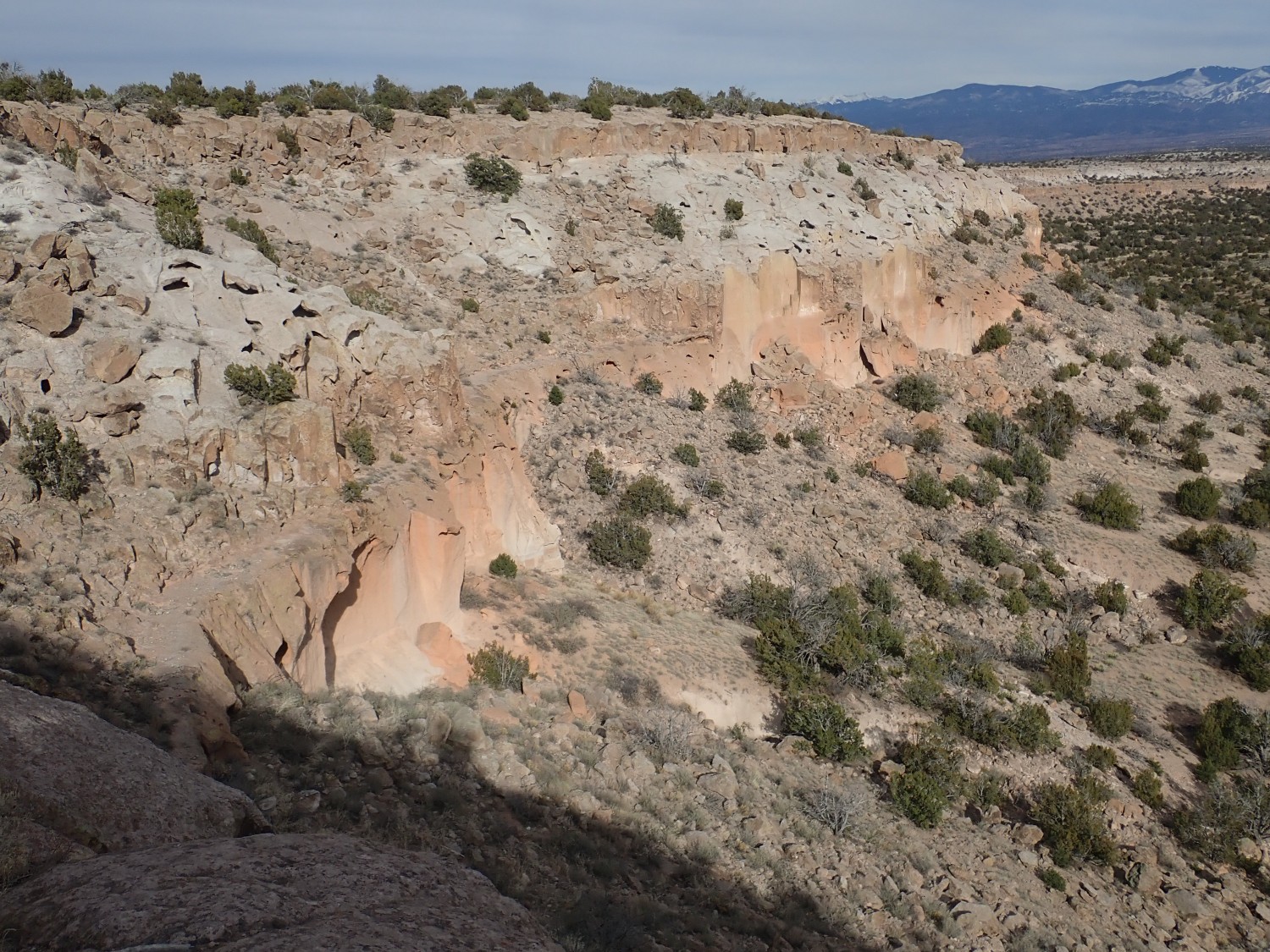
The top of the mesa is the “C” unit, with the lighter and softer (and therefore more slope than cliff) upper “B” unit. The lower “B” unit makes up the upper part of the cliff beneath, separated by the so-called vapor notch from the “A” unit. The vapor notch is one of the most consistent features of the Tsherige Member east of the Jemez Mouintains, but its actual nature is a bit mysterious. It’s not even clear whether it separates different cooling units or is a feature that developed within a single cooling unit as it cooled. At the very bottom of the cliff, just left of center, if you click to enlarge, you will see sediment layers of the Pueblo Canyon Member. The Otowi Member is completely buried under rockfall here.
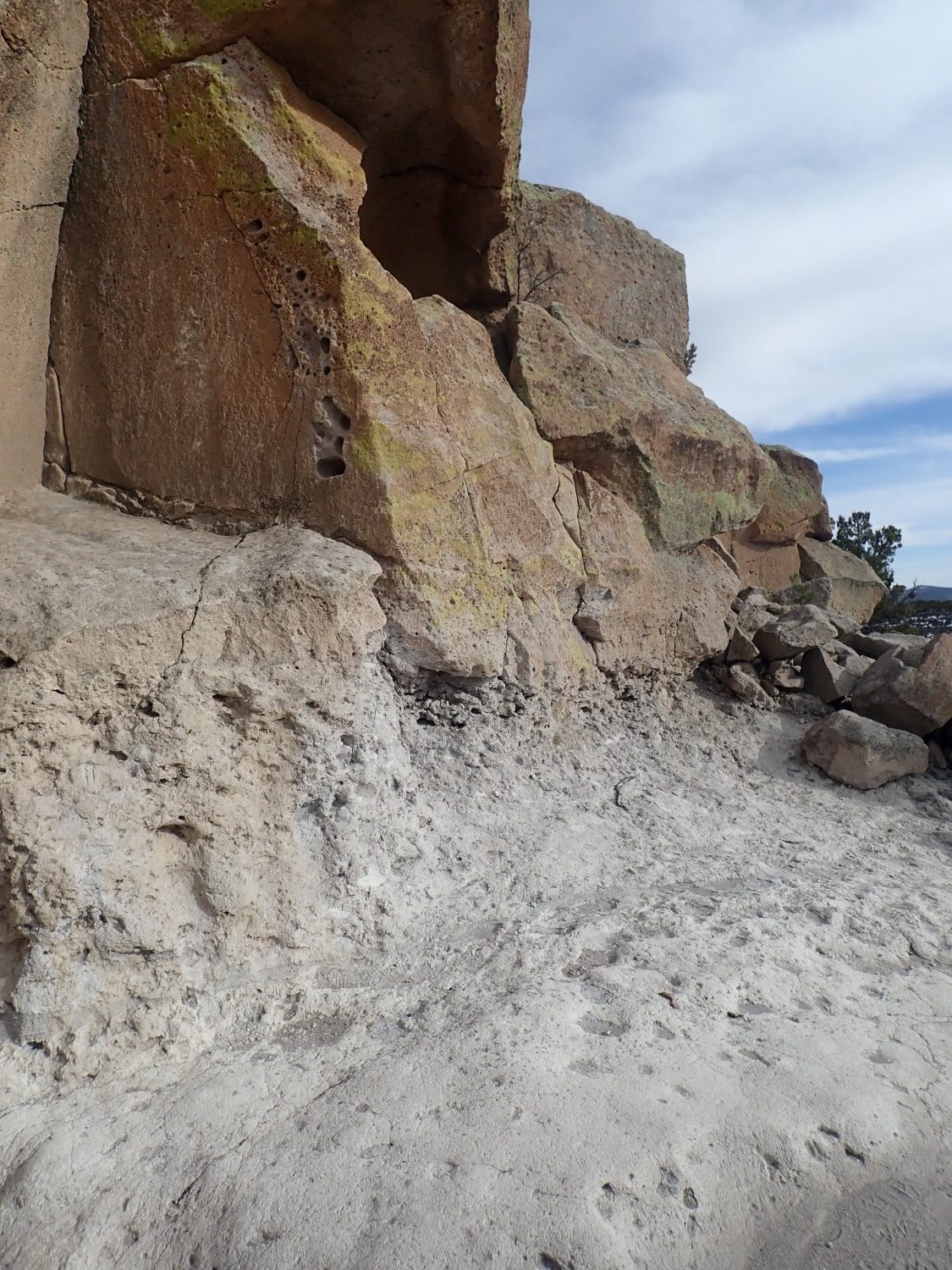
The ruins atop the mesa.
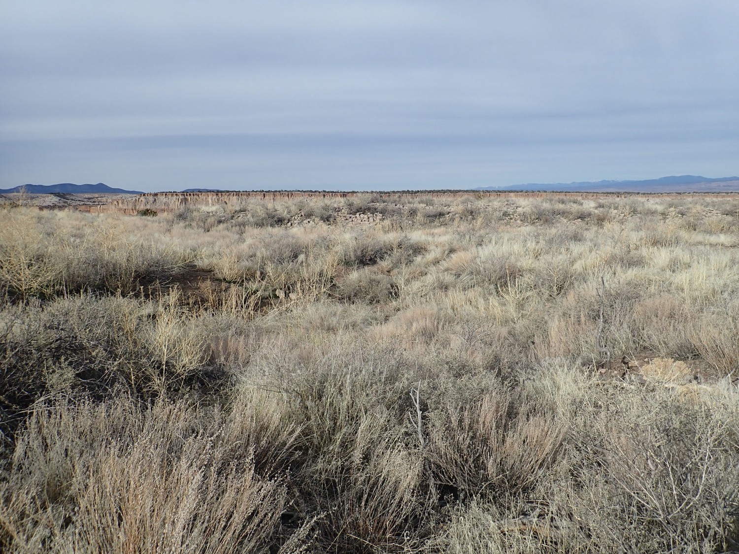
In the foreground is a low depression that is thought to be the remains of a kiva, the underground worship space of the Ancestral Puebloans. Behind are piles of tuff blocks that are collapsed buildings.
I finished the hike with a slight headache. Sudden head motion does that to me, and it’s hard to avoid on a rough trail. Drinking plenty of water helps a lot, but the headaches are not going completely away. Wish me luck with the neurologist on April 2. (Yeah, I must not be in that bad of shape if they couldn’t find time to see me any sooner.)
Fluorite
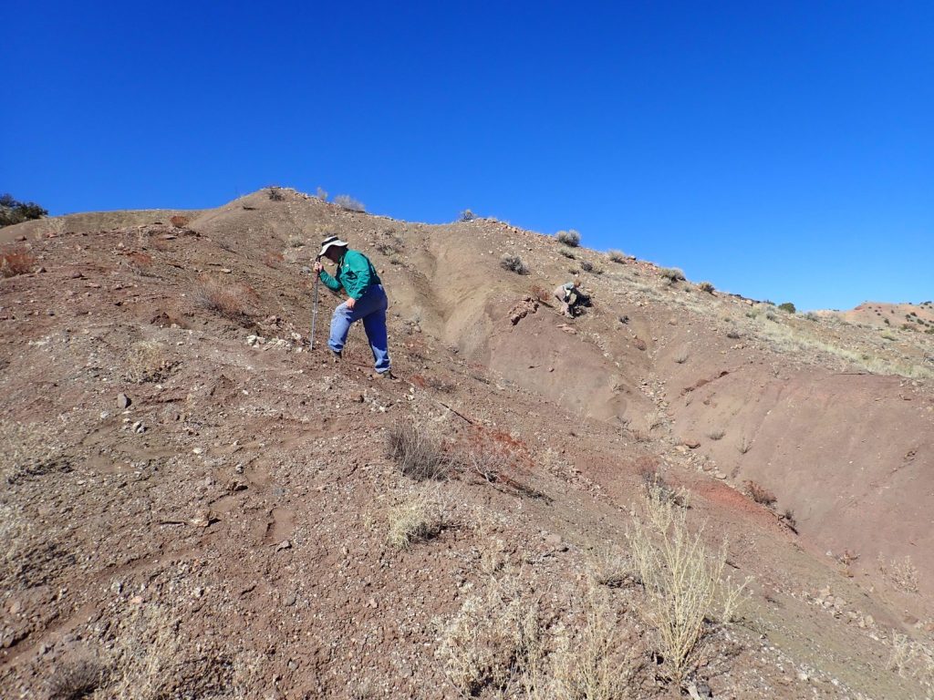
Last Saturday, the Los Alamos Geological Society had a winter field trip to the Small Fry Prospect on the road to El Rito. I had been there before, and got some nice specimens, but my friend, Gary Stradling, had not, and I decided it would be fun to go with him.
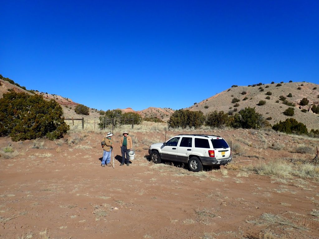
The collection area is just a short distance off the highway, a good thing given that Gary’s doctor wants him taking it fairly easy for a while. At the parking area:

Patrick Rowe and Gary Stradling peparing to head out.
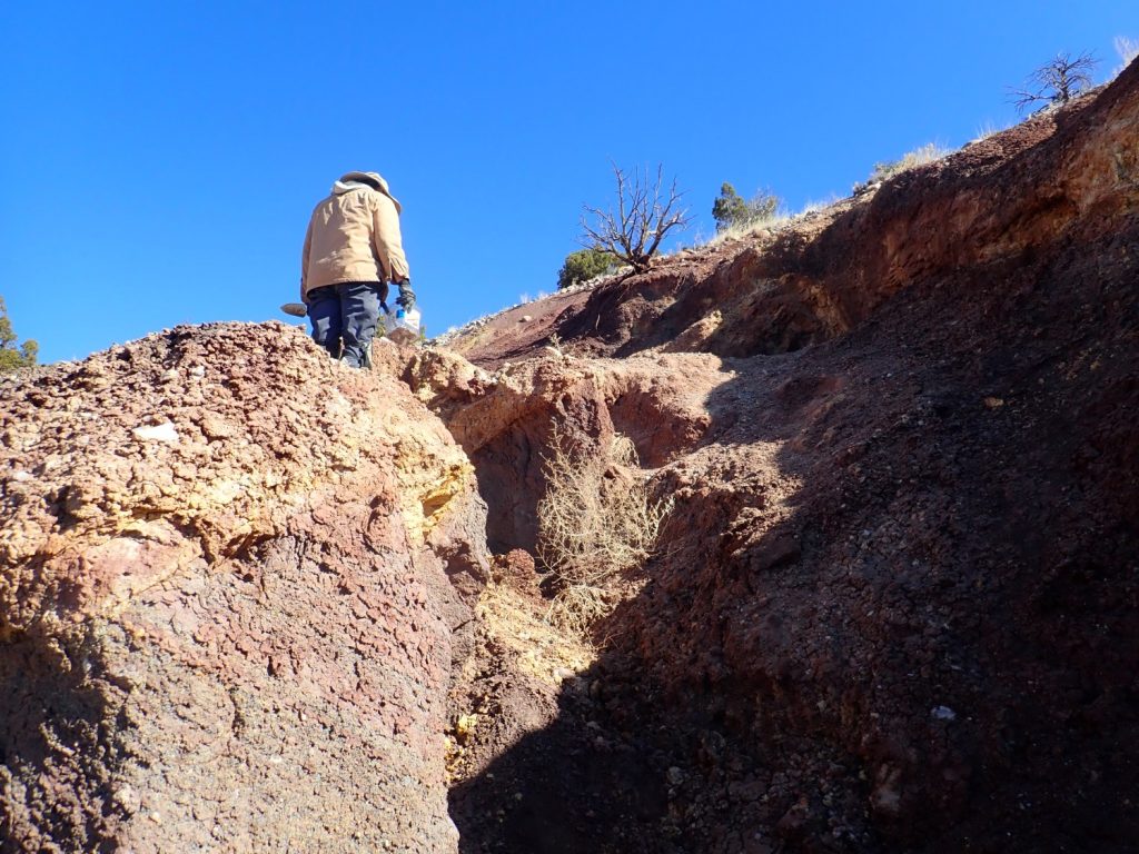
The main deposits closely follow a mapped fault. Here Gary explores for fluorite.
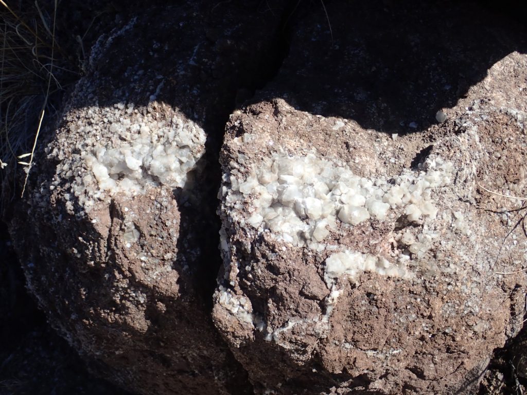
I think he found plenty of good samples, including some iridescent fluorite and some fluorite with small crystals of barite. Enough for himself and grandkids. (Nora, in particular, is seven going on eighteen.)
Gary was mostly occupied with digging. I climbed to the mesa to explore the area and to relieve myself of some of the forced fluids that are helping control my headaches.
It really is a pretty area.
Most of this area is mapped as Tesuque Formation, either Chama-El Rito Member or Plaza Lithosome. The Tesuque Formation is part of the Santa Fe Group, which includes all the sediments filling the Rio Grande Rift. The Rio Grande Rift is the great crack in the earth’s crust reaching from central Colorado to El Paso, coinciding roughly with the Rio Grande Valley, which formed beginning 30 million years ago when the Colorado Plateau began to slowly pull away from the interior of North America.
The Tesuque Formation is the most prominent Santa Fe Group formation in the Espanola Basin. It is divided into several members based on differences in lithology (what kinds of rock debris are present) and fossils. The Chama-El Rito Member contains volcanic debris from the San Juan volcanic field and is though to have been deposited by the ancestral Rio Chama. I’m not familiar with the Plaza Lithosome, but it may be equivalent to what other geologists map as the Duarte Member further east.
(In fact, on the preliminary map I’m using, these beds are labeled in such a way that it looks like they will be identified as Duarte Member in the final published version. There’s been a lot of active mapping in the Jemez area the last few years, which apparently will culminate in the publication of a consistent set of high quality maps at large scale soon.)
The multicolored beds in the photo are remnants of a tuff ring where a small volcanic eruption occurred around 15-16 million years ago. This was subsequently buried under Tesuque Formation sediments, then exhumed as the area began to be deeply eroded in recent geologic time. The tuff here is composed of volcanic cinder quite different in character from the high-silica Bandelier Tuff. The amount of material erupted was far smaller, it was much less rich in silica, and it mostly was deposited immediately around the vents. The vents likely coincided with fissures through which mineral-rich fluids subsequently circulated to deposit calcite, fluorite, and barite.
The badlands to the east.
The distant mountains at left are the Ortega Mountains. These are part of the Tusas uplift and are underlain by ancient quartzite, about 1.7 billion years old. The hills crossing the panorama in the middle distance are underlain by more Plaza lithosome of the Tesuque Formation.
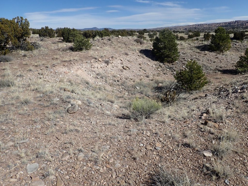
Quite a deep pit, with tailings to the north. It’s roughly aligned with the mineralization in the arroyo below, and there’s a jeep trail to it. Fluorite and barite are both commercially valuable, but the quantities here were not sufficient to economically exploit. It’s become a popular spot for rockhounds, however.
Down slope is an exposed fluorite vein.
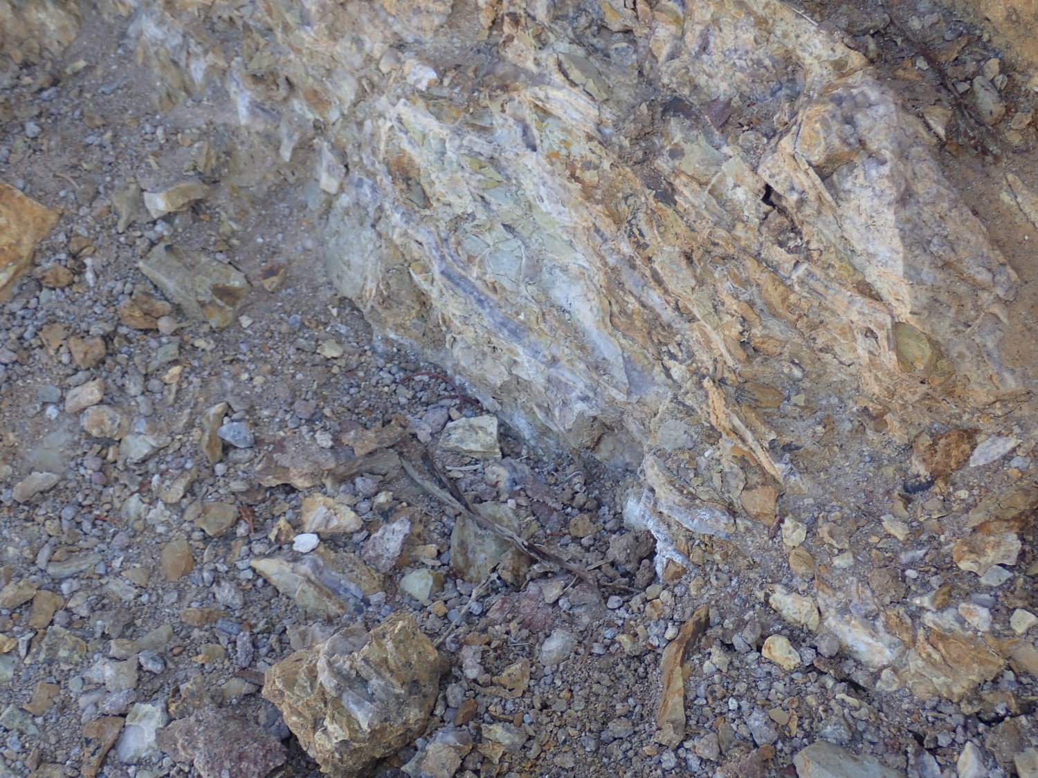
You can see why this must have tantalized a prospector. The bluish vein is clearly visible at center. But it’s a thin vein and there is nowhere it really thickens out enough to be exploitable.
On the south slopes of the arroyo are some angel wing calcite deposits. This is calcite that forms in thin veins, and the result are sheetlike calcite deposits that do, indeed, look like thin feathery wings. Patrick Rowe and others explore the area.
Gary is under strict orders not to overdo it. I collect a few samples for him and his grandkids, then explore a little more, finding some calcite in a boulder.
I think I may have seen this on my last visit. A little too big for a yard rock.
Filaments
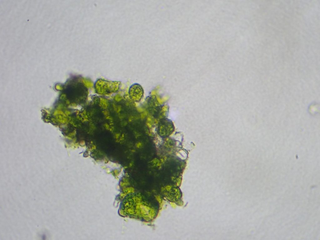
A little microscopy. I am trying to identy some algae for my aquarium site.
This stuff forms brushy green clumps all over my driftwood, making it the one alga in my tank that I have a significant problem controlling. It’s not black brush algae, because it’s got the wrong color of chlorophyll (BBA is a red alga), but a precise identification eludes me. My best guess is Oedogonium but it doesn’t quite fit the description.
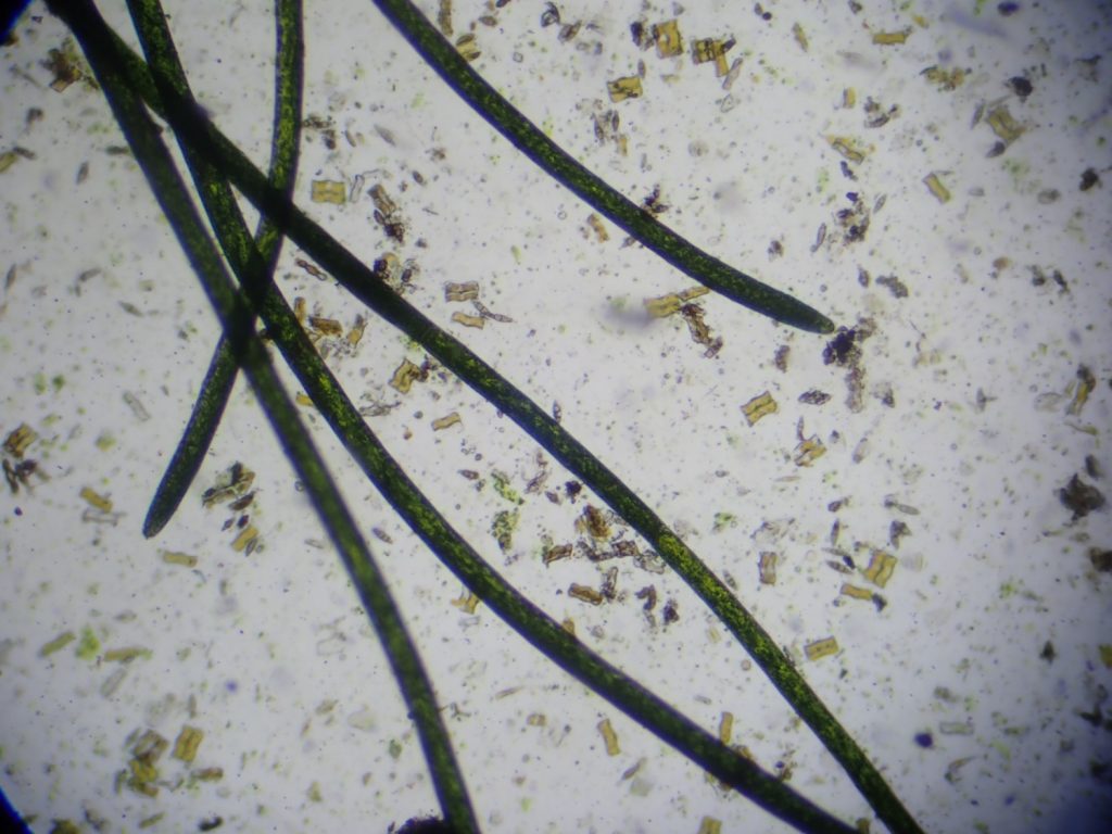
Lots of golden-brown diatoms in there as well.
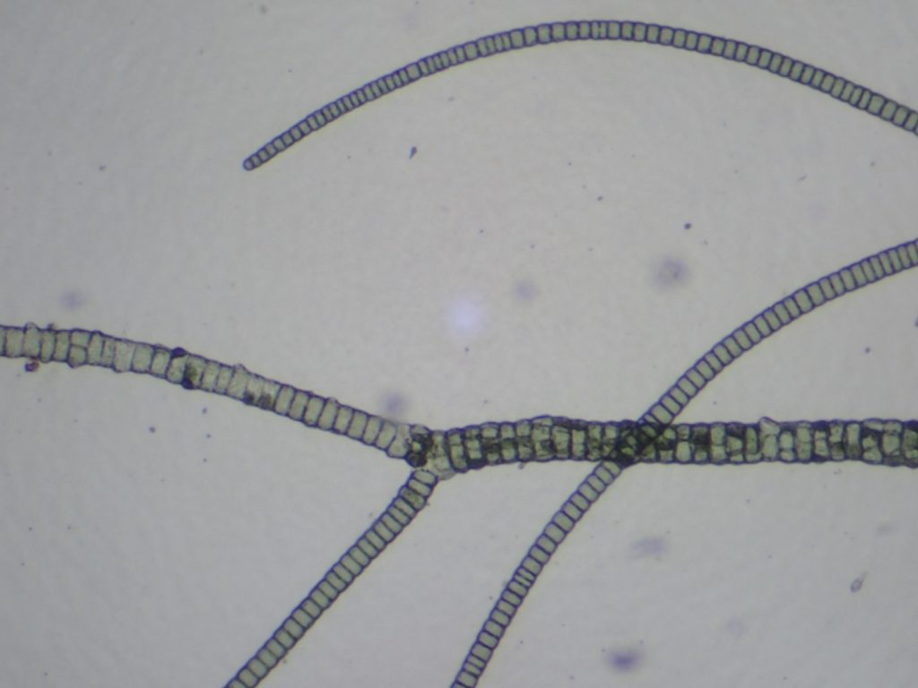
Oscillatoria. This isn’t an alga at all; it’s a cyanobacterium.
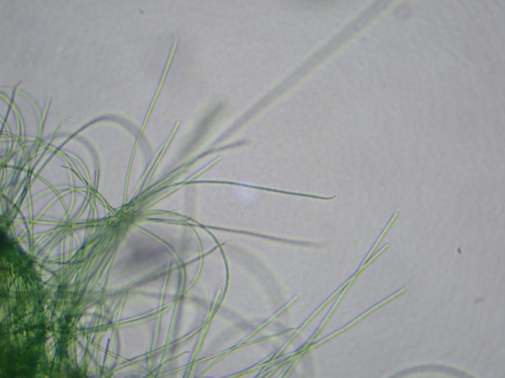
The threads slowly wriggle and glide. Kind of creepy. I don’t actually have much of this in the main display tank; my algae eaters love it. But there is some in my little betta tank.
Green spot alga.
This forms slow-growing green spots on plant leaves and the tank glass. The ancistrus and otos and snails will chew on it, but they can’t get it all. The scraping here kind of messes up the cells and does not show the real geometry of a colony, preventing precise identification. The only hope I have of that is to put a glass slide in the tank and let it be colonized. Which I may in fact try.
This is black brush algae.
High magnification:
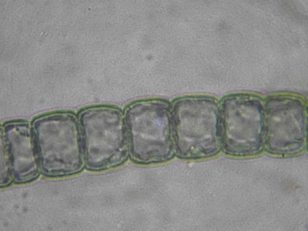
The genus identification is likely Audouinella. The grayish cast is typical of red algae, which are very often black, gray, or grayish-green in color.
This I couldn’t figure out at first.
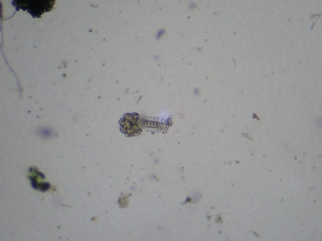
Then I realized it was a colony of Vorticella all curled up and defensive. They apparently did not like being scraped from the side of my tank.
Faults
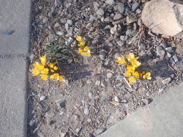
I got looking at the thermometer yesterday afternoon, and saw that it had hit 62 degrees out. There was just some light overcast. It seems spring is knocking at our door. The crocuses have even started blooming.

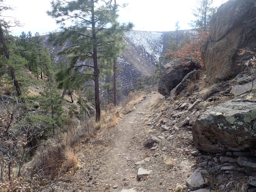
It would be criminal not to take advante of such a beautiful day for hiking, but I didn’t have time for anything lengthy. I packed up and headed out to Ponderosa Campground to look at the Pajarito Fault escarpment.
At the trail head.
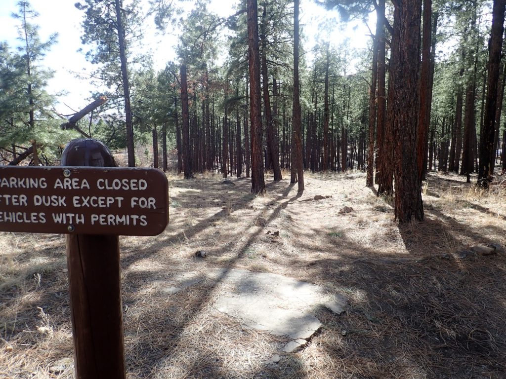
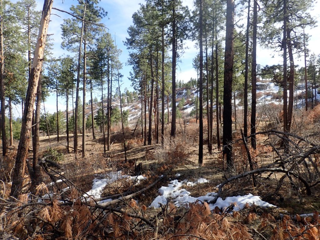
The area is underlain by Tsherige Member, Bandelier Tuff. In fact, this is the only rock type I will see up close this entire hike.

A particularly densely welded boulder.
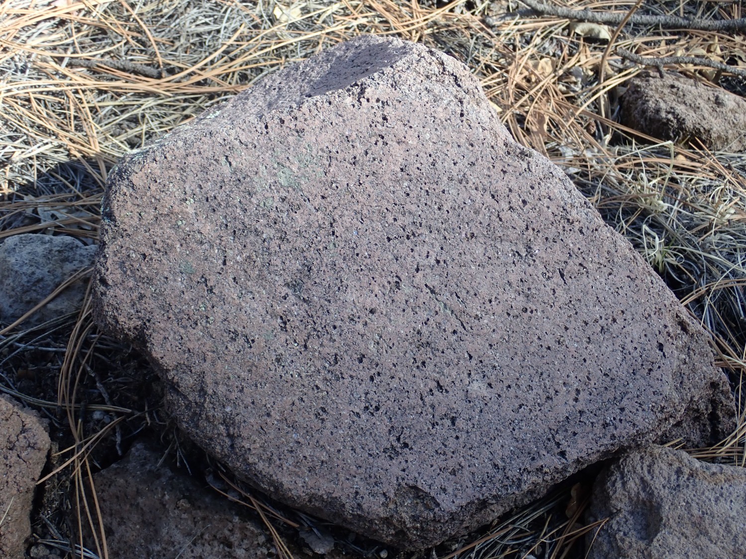
Welding refers to how hot the pyroclastic flow was when it settled onto the surface. Unwelded tuff forms from a flow that is cool enough that individual glass shards are quite solid. The tuff is cemented by residual gases to form a relatively soft rock in which individual pumice clasts are undeformed. At the other extreme, a densely welded tuff forms from a flow so hot that individual glass shards are still quite molten and run together. It tends to form a very dense, hard rock, and individual pumice clasts are squashed flat to form fiamme. This boulder shows no fiamme but it is very hard and it glistens with embedded crystals.
“Clast”: That’s more or less geologist-speak for an individual broken chunk of rock, either loose or cemented into a bed.
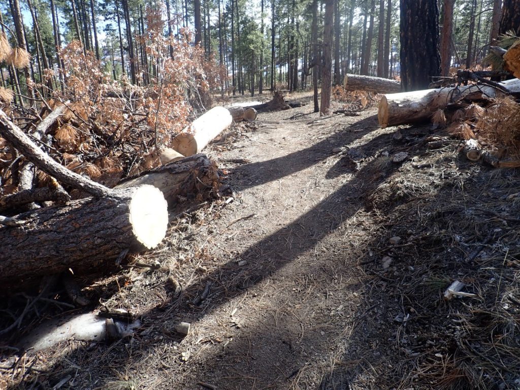
This is a popular and well-maintained trail, but suffers from frequent tree falls due to recent fires in the area. The Park Service is pretty good about clearing these.
The feature I’ve come to see (mostly) is the escarpment of the Pajarito Fault, which is visible through the trees to the west.
The Pajarito Fault is the main strand of a major fault zone, the Parajito Fault Zone, that runs north to south at the feet of the Sierra de los Valles, the range of mountains just west of Los Alamos. It’s presently the zone of most rapid extension along the Rio Grande Rift at this latitude.
It’s also the greatest earthquake risk in our area, though major quakes are very infrequent, occurring only every few thousand years. I suppose this is why LANL was comfortable placing its emergency operations center just a few hundred feet from the main strand of the fault.
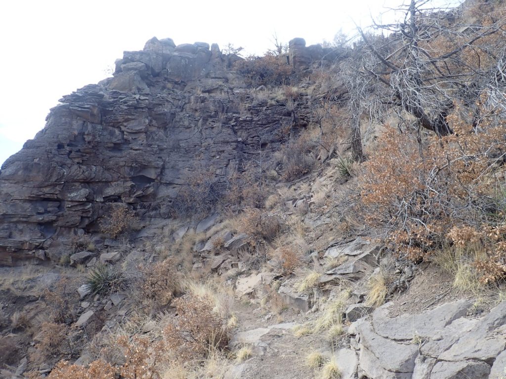
Here a strand of the fault branches off and heads southeast. My trail will actually cross this fault strand and continue south roughly along the main strand.
There is still a fair amount of snow on the ground, but only at one spot was the trail seriously muddy.
Standing roughly on the trace of the smaller fault, looking southeast.
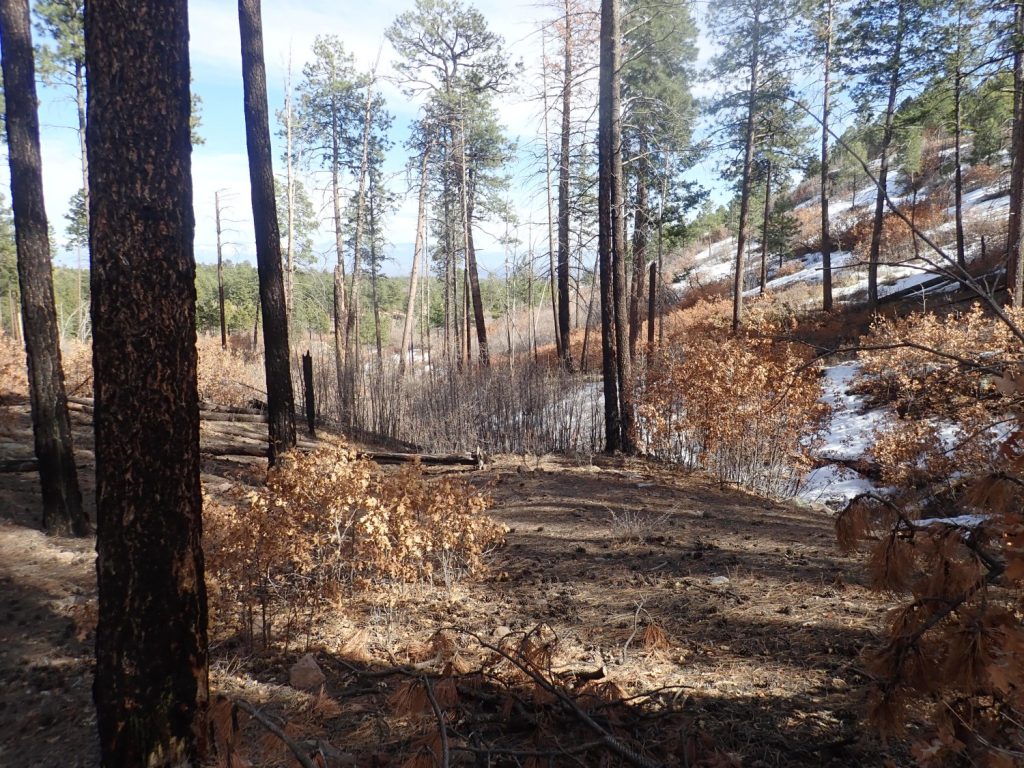
The geologic map confirms that I am just east of where the fault forks.
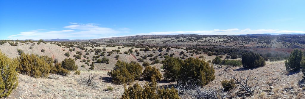
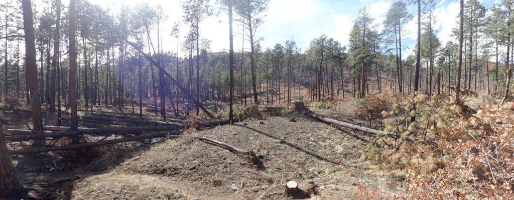
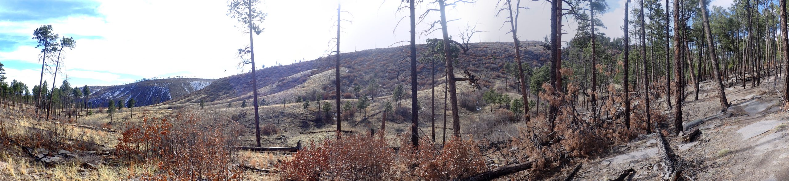
The trees thin out (due to fire damage) and I get an increasingly clear view of the main fault escarpment.
This would be a good one for the book, except it’s too late in the day and the view is almost directly into the sun. I’ll have to come back and redo this some morning.
Still, you can see the escarpment clearly, including where Frijoles Canyon has cut through the escarpment to the south.
Oh.
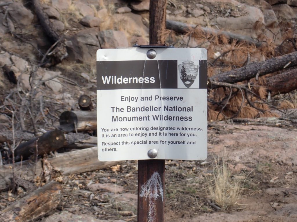
How special.
This is the wilderness boundary. I’ve been on monument land since stepping out of my car.
Approaching the rim of Frijoles Canyon.
I reach a natural alcove in which the Bandelier Tuff, which is mostly massive further east, shows horizontal jointing.
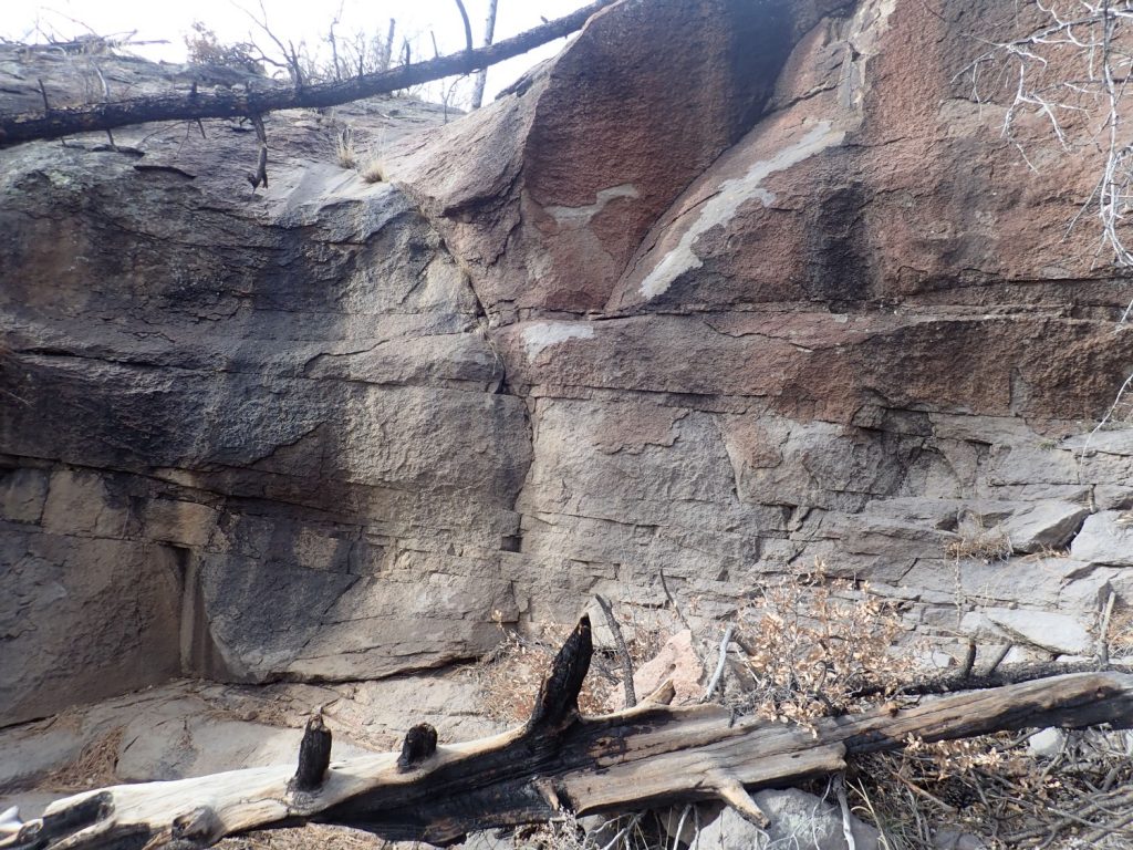
(GPS off slightly in this rugged terrain.)
And further along the trail.
This platy tuff represents the final stages of the eruption, in which the hottest, most iron-rich, most gas-poor, most silica-poor magma from the bottom of the magma chamber was erupted. This being relative; this was still magma high in gas and silica. Just not as much as the earlier pulses.
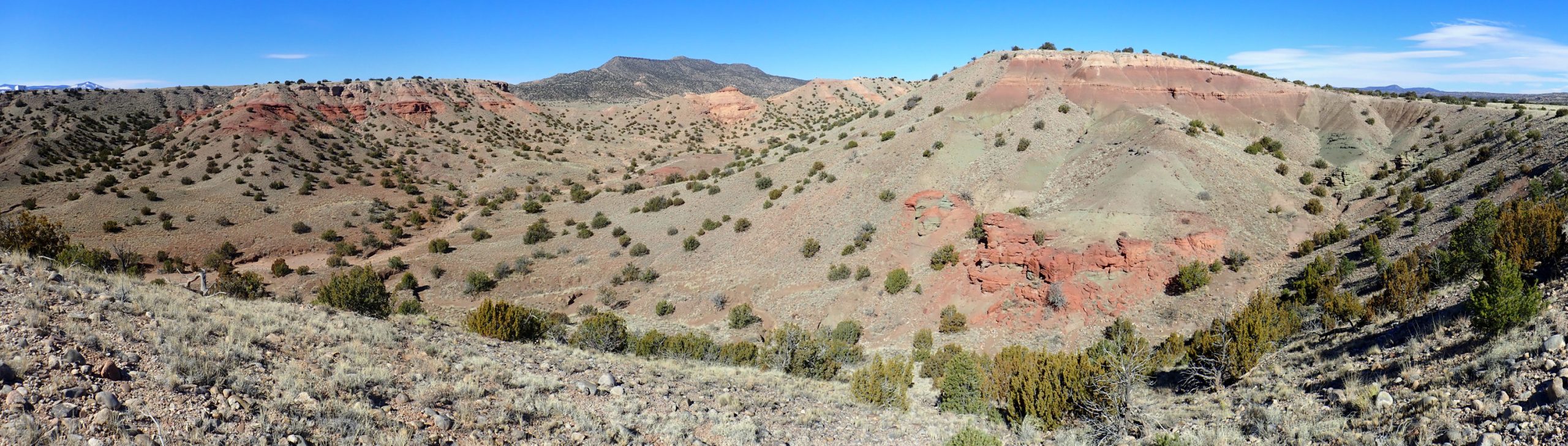
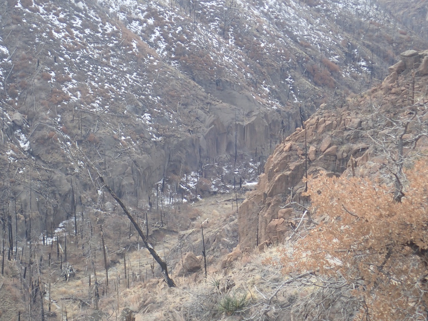
Final panorama from a nice view point.
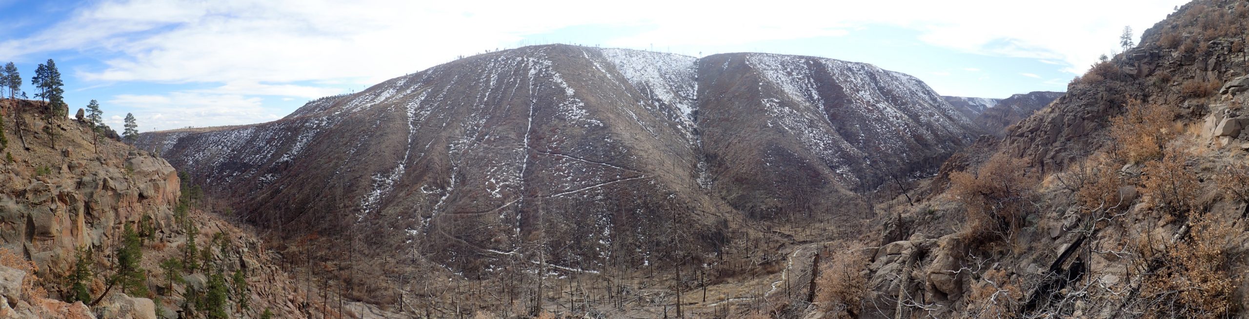
We are looking down into the Upper Crossing area of Frijoles Canyon. Pack trails converge from east, west, and south (you can see the switchbacks on the opposite canyon face) with the trail I am on.
There are some older rocks exposed in the very bottom of the canyon, but I can’t make them out from here. The outcrops at the very bottom of the far canyon wall are apparently just the lowermost part of the Tsherige Member. The foreground ridge of pink Tsherige Member at right is just on the other side of the trace of the main fault strand.
Zoomed view up canyon.
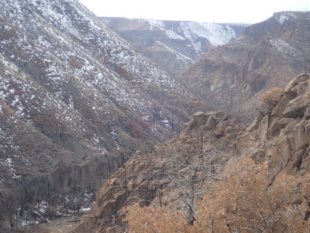
I do not have time to descend into the canyon, and hike back the way I came.