Wanderlusting the Mississippian
But first, a picture of a cat, because pictures of cats seem to be very popular on the Internet.

That’s Stupid, my cat. She’s actually a very sweet cat, but she didn’t like being woken from a sound sleep for a photography session.
I wake up Saturday morning to gorgeous weather. The forecast was that it would go sour around 3:00 in the afternoon, with possibly severe thunderstorms in the area. Well, that’s a pretty typical New Mexico monsoon season forecast. I decide to take a crack at getting out to the Guadalupe Box before the weather goes bad and get some pictures for Wikipedia and the book. The only Mississippian formations in our area are out that way and my current picture set seems inadequate. Mississippian: That’s from about 359 to 323 million years ago. These are the oldest fossil-bearing formations present in northern New Mexico.
And, I know. The book is getting close to done. But there are always more finishing touches, particularly since I haven’t found a publisher yet. Constructive comments and suggestions are always welcome.
Although the invitation was on somewhat short notice, Gary Stradling was game for coming along. We would, of course, be in separate cars, and there would be plenty of disinfecting sunshine on the trail.
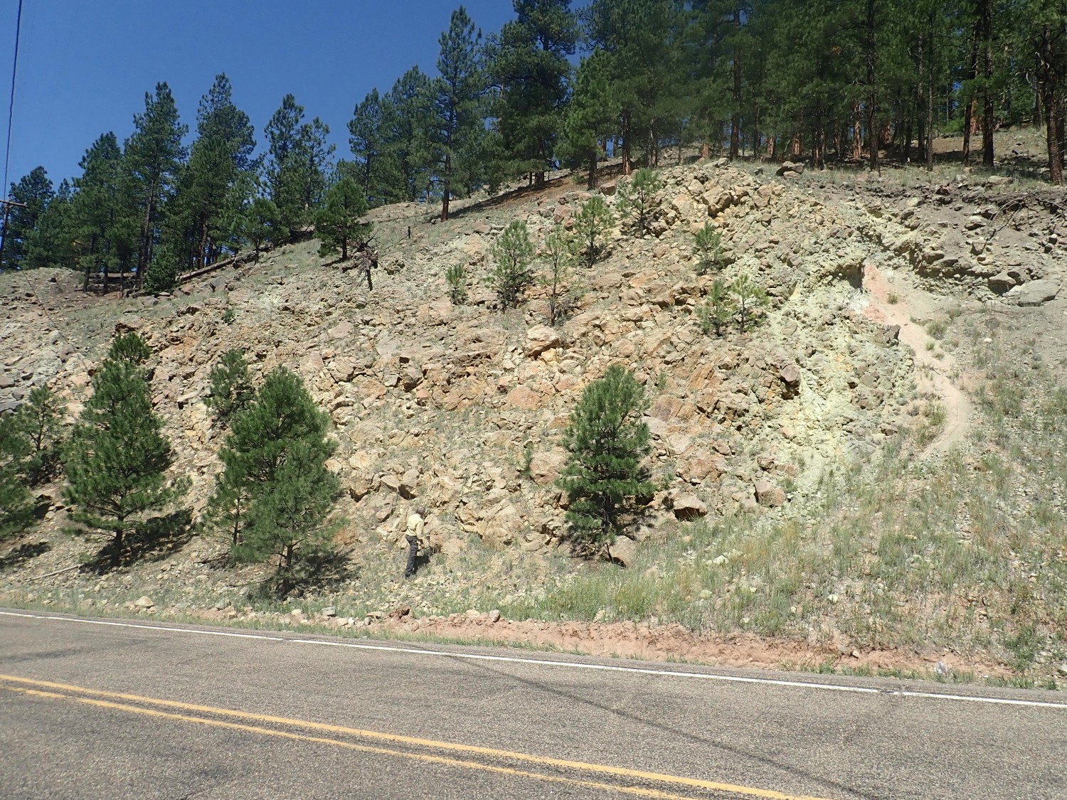
The first stop is a road cut in the Redondo Creek Rhyolite.
For new readers (Welcome!): Almost all photographs at this site can be clicked for a higher-resolution version, and most blue links take you to the location on Google Maps.
This location is near the southwest rim of the Valles Caldera, a depression 13 miles across in the central Jemez Mountains. This formed 1.25 million years ago in a ginormous volcanic eruption that drained a huge magma chamber under the surface of the earth. The roof of the chamber collapsed to leave the depression on the surface, and then additional magma (molten rock) entered the chamber from deeper in the earth. Some of this fresh magma supply leaked through the fractured roof of the magma chamber to form domes and flows assigned by geologists to the Valles Rhyolite. The earliest of these was the Deer Canyon Member, but this was followed shortly after by the Redondo Creek Member. These early flows are scattered all over the caldera floor and none are terribly voluminous. They likely erupted even as the floor of the caldera was pushed back up (a process called resurgence) to form Redondo Peak. This process took just a few tens of thousands of years, a blink of the eye in the long history of the Earth.
Member? Geologists divide up rock beds into formations, which are sets of rock beds having consistent properties you can discern in the field (not requiring laboratory analysis) and which are large enough to be mapped on a geologic map. Formations can sometimes be subdivided into members based on more subtle differences in properties, or combined into groups having some common origin. For example, the Tewa Group is all the high-silica volcanic eruptions of the Jemez Mountains during the last two million years or so, and it is divided into formations such as the Bandelier Tuff or the Valles Rhyolite. The Valles Rhyolite is all the eruptions taking place within the caldera after its formation, and it in turn is divided into members such as the Deer Canyon Member or Redondo Creek Member representing individual eruptive episodes.
Here’s a closer view of the rock.
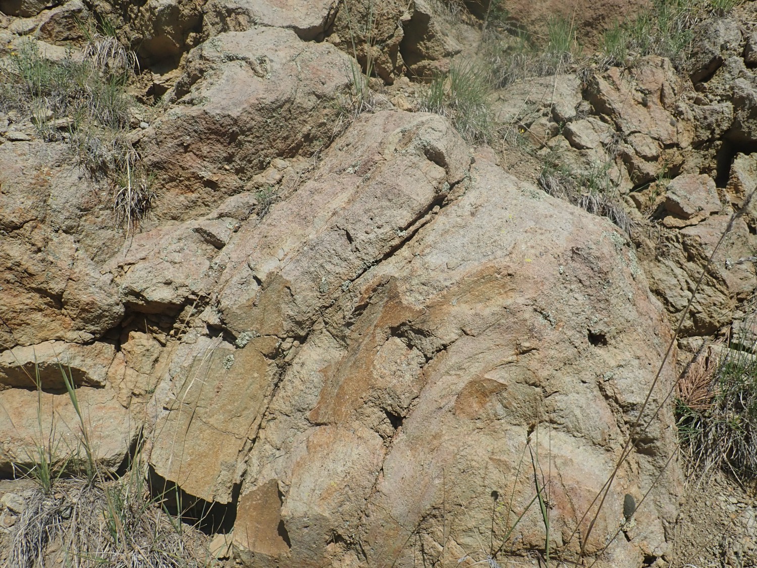
You can see layers where the viscous magma was stretched and deformed while solidifying. If you click for the higher resolution image, you’ll see some small white crystals within the rock. These are called phenocrysts and they crystallized before the rock reached the surface. They’re mostly sanidine, a mineral that forms from potassium, sodium, aluminum and oxygen. It’s one of a family of minerals called feldspars that are extremely common; they make up about 40% of the earth’s crust. The rest of the rock is very fine-grained, or even glassy in some locations.
The Redondo Creek Member likely erupted into a crater lake. For example, this looks like it may be pillow structure, typical of lava erupted into deep water:
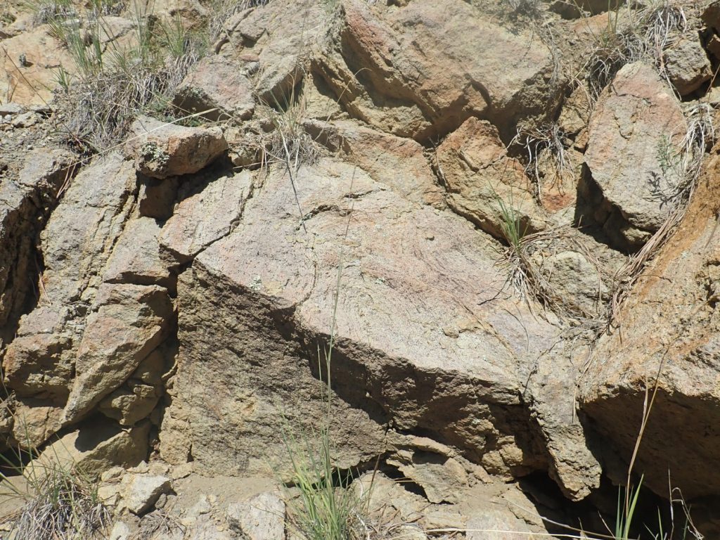
Or it could just be more deformation of the rock as it was at the point of solidifying. But some of the rock here has a yellowish color and spongy texture indicating it was “cooked” by hot, acidic water, such as from a hot spring in a lake bottom.
Gary is enjoying himself.
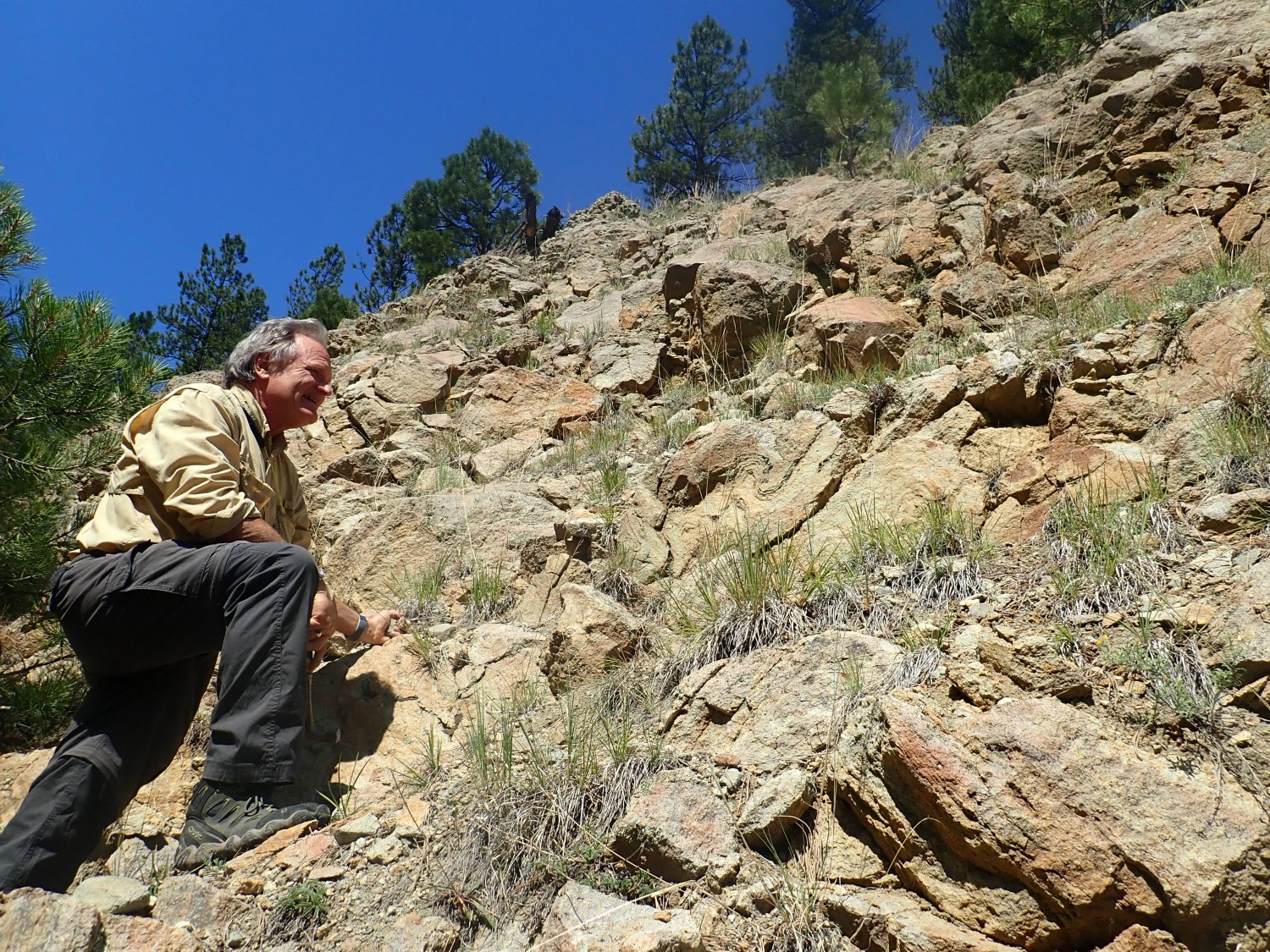
There’s freedom and flexibility in going out by yourself, but on balance I prefer company. It’s safer and I enjoy the conversation.
(I take a satellite messenger device with me when alone, so I’m not being reckless. I leave it in tracking mode, and I can hit the SOS button if I get in any real trouble.)
This turns out to be a repeat of one of the pictures from my last post.
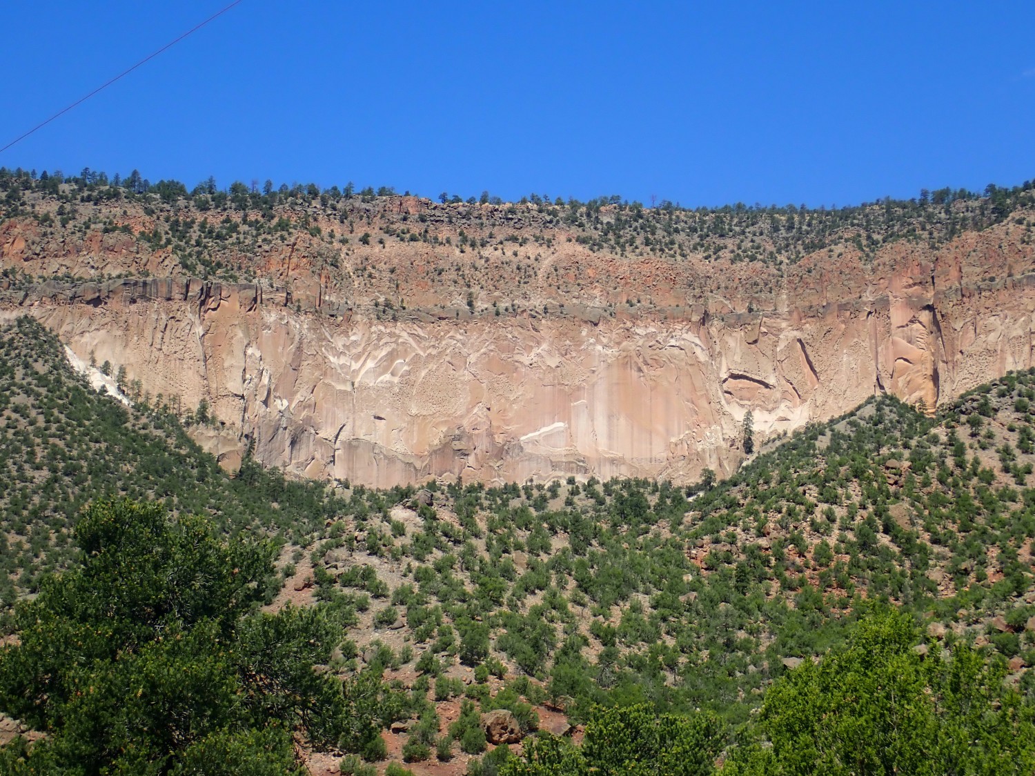
I point out to Gary the three members of the Bandelier Tuff visible here The lowest gray layer is La Cueva member, then comes a featureless section of Otowi Member, then multiple thinner beds of Tshirege Member. These correspond to caldera eruptions in the Jemez at 1.85, 1.62, and 1.25 million years.
Next stop is the Gilman Conglomerate.
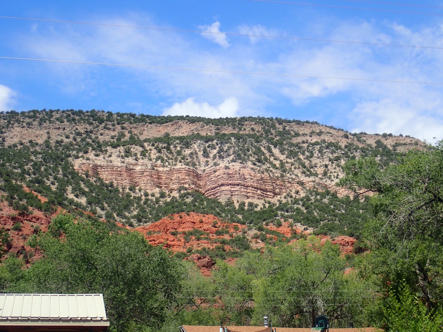
The Gilman Conglomerate is the thin tan beds in the center of the photograph. The red beds below are Yeso Formation, as it turns out, resting on darker red beds of the Abo Formation. Both are much older Permian formations, almost 300 million years old. Above the Gilman Conglomerate is alluvial gravel of uncertain age, then 1.25 million year old Tshirege Member.
The Gilman Conglomerate is a volcaniclastic formation, containing rubble that clearly eroded from a volcanic center and a fair amount of volcanic ash. The youngest rock fragments in the formation are about 25 million years old, making this roughly contemporary with the Abiquiu Formation to the north and the Espinaso Formation to the southeast, which are also rich in volcanic debris. However, there are indications in these beds that the streams that laid down the Gilman Conglomerate came out of the south. This points to a volcanic center now buried under the southern Jemez Mountains or under rift sediments in the northern Santo Domingo Basin.
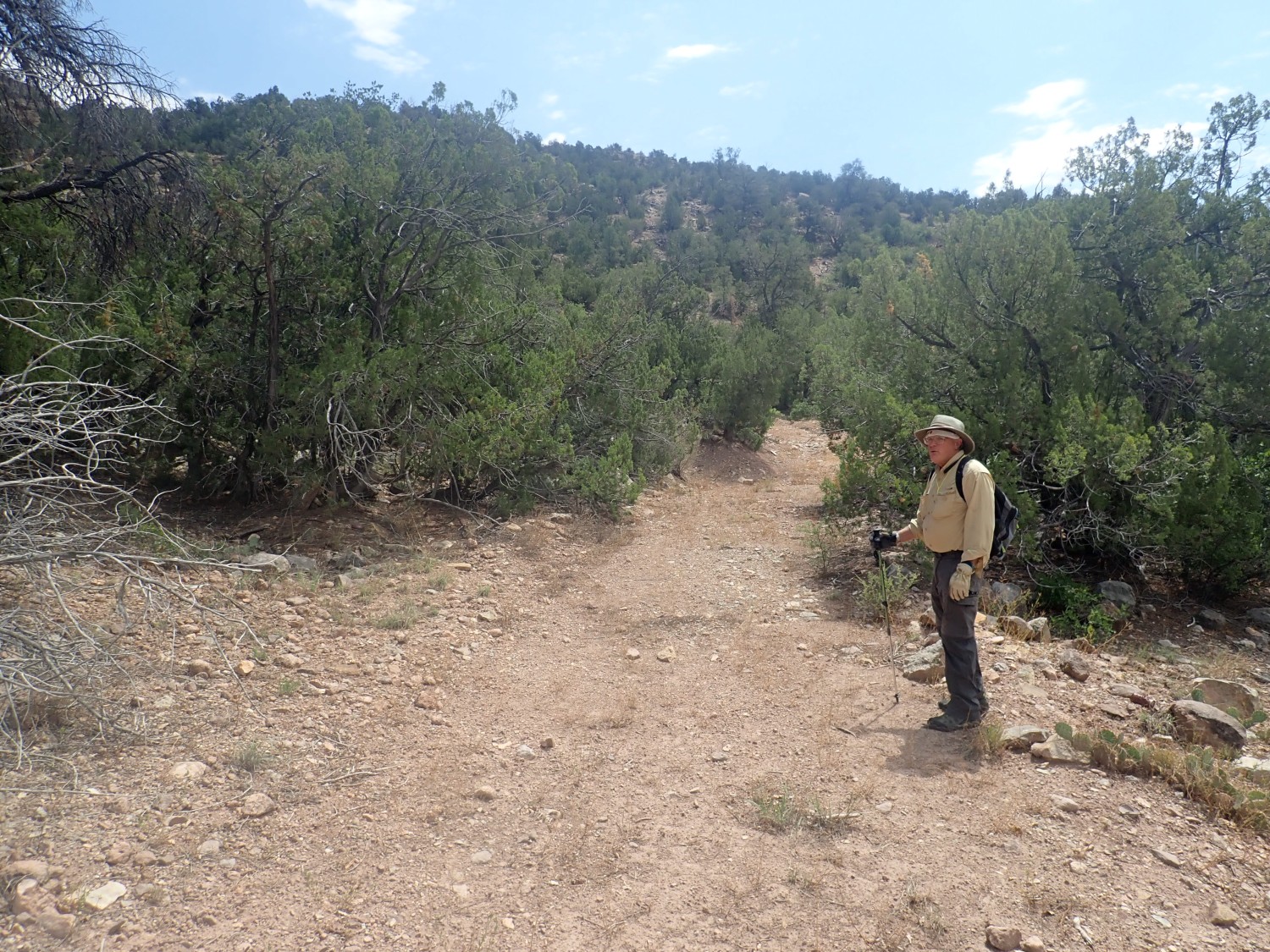
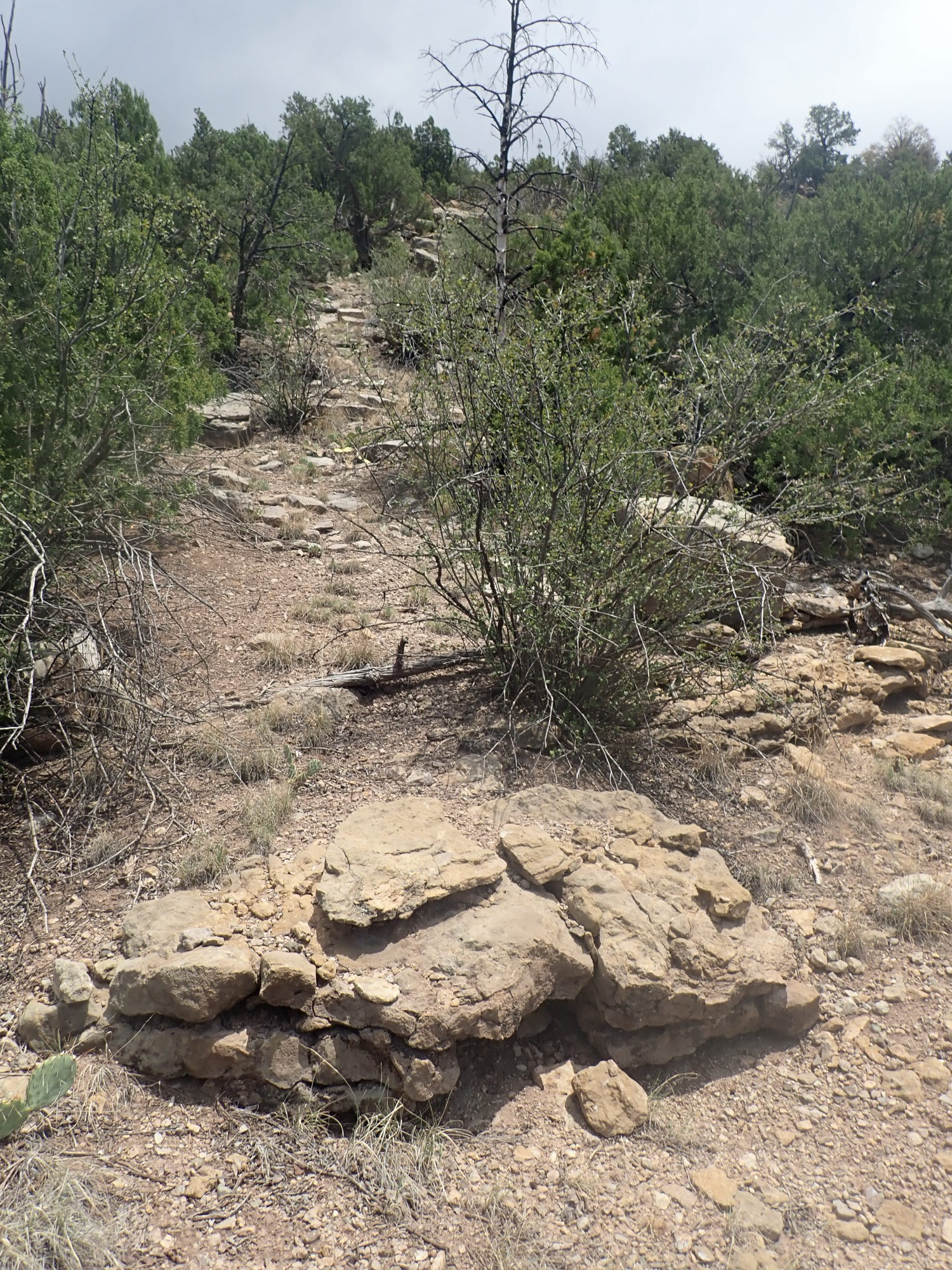
We arrive at Guadelupe Box, find a place to park (there are lots of people here already), and pick our way across the Rio Guadelupe, a fairly substantial creek. Here we pick up an old forest road that will take us to our destination.
My plan is to find the Mississippian beds, take photographs, and look for fossils. Above these beds are slightly younger Pennsylvanian beds that my references describe as “richly fossiliferous”, which sounds promising. If the weather holds long enough, we can then try finding the trail to the brachiopod beds I’ve unsuccessfully hunted for in the past.
The road winds around the knoll and then kind of fades out. Odd; it looked pretty plain on satellite.
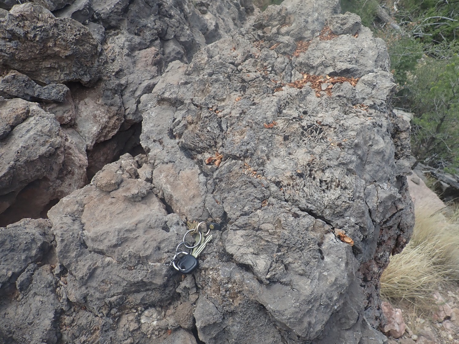
Well, this is interesting.
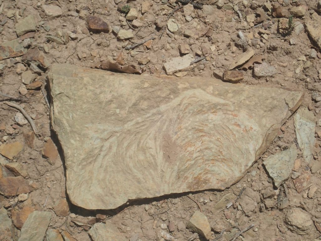
We find several more like it in this area. My thought is that it is a sedimentary structure of some kind, formed as part of the process of depositing and consolidating sediments, but I’ve not seen anything quite like it. Gary is sure it is a fossil of some kind.
This one has me wondering if Gary is right.
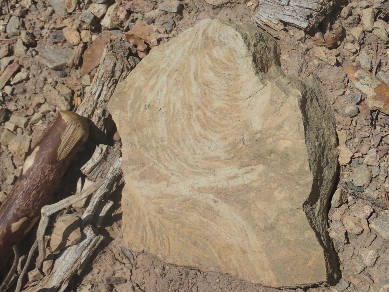
(Head of my walking stick at left for scale.) The formation here is probably Osha Canyon Formation, an earliest Pennsylvanian formation, about 320 million years old (give or take five million).
When I dig up the rock, I find it’s quite thick and heavy. I decide to leave it here to pick up on the way out. Alas, we don’t find it on our return; it’s still up there somewhere.
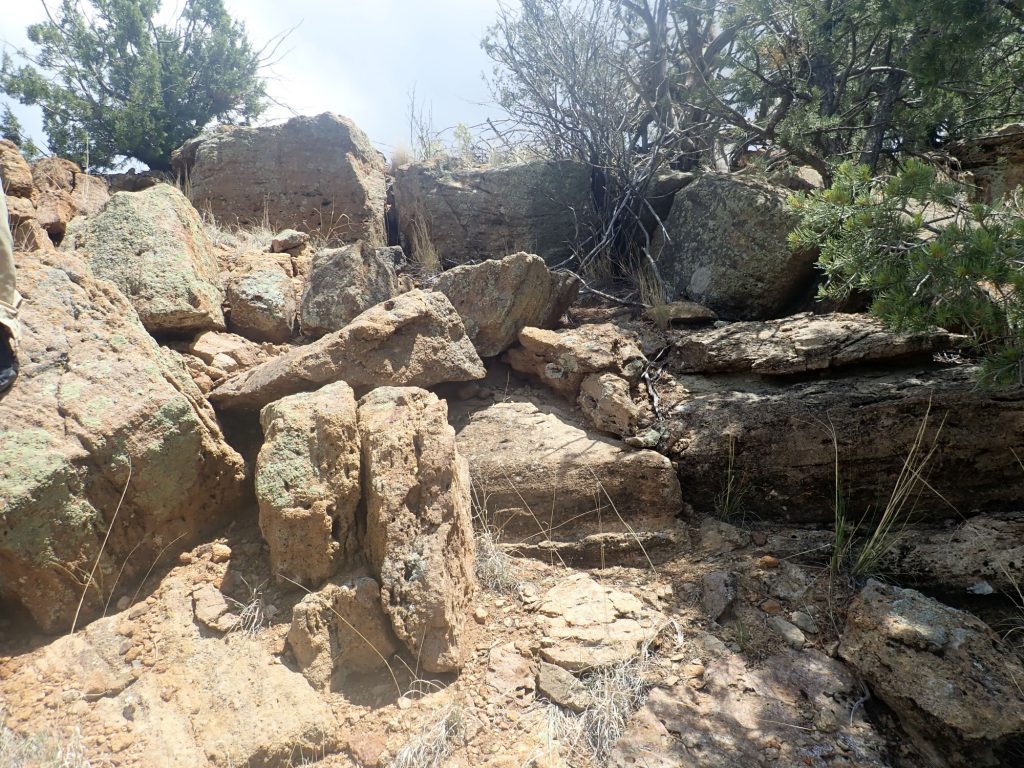
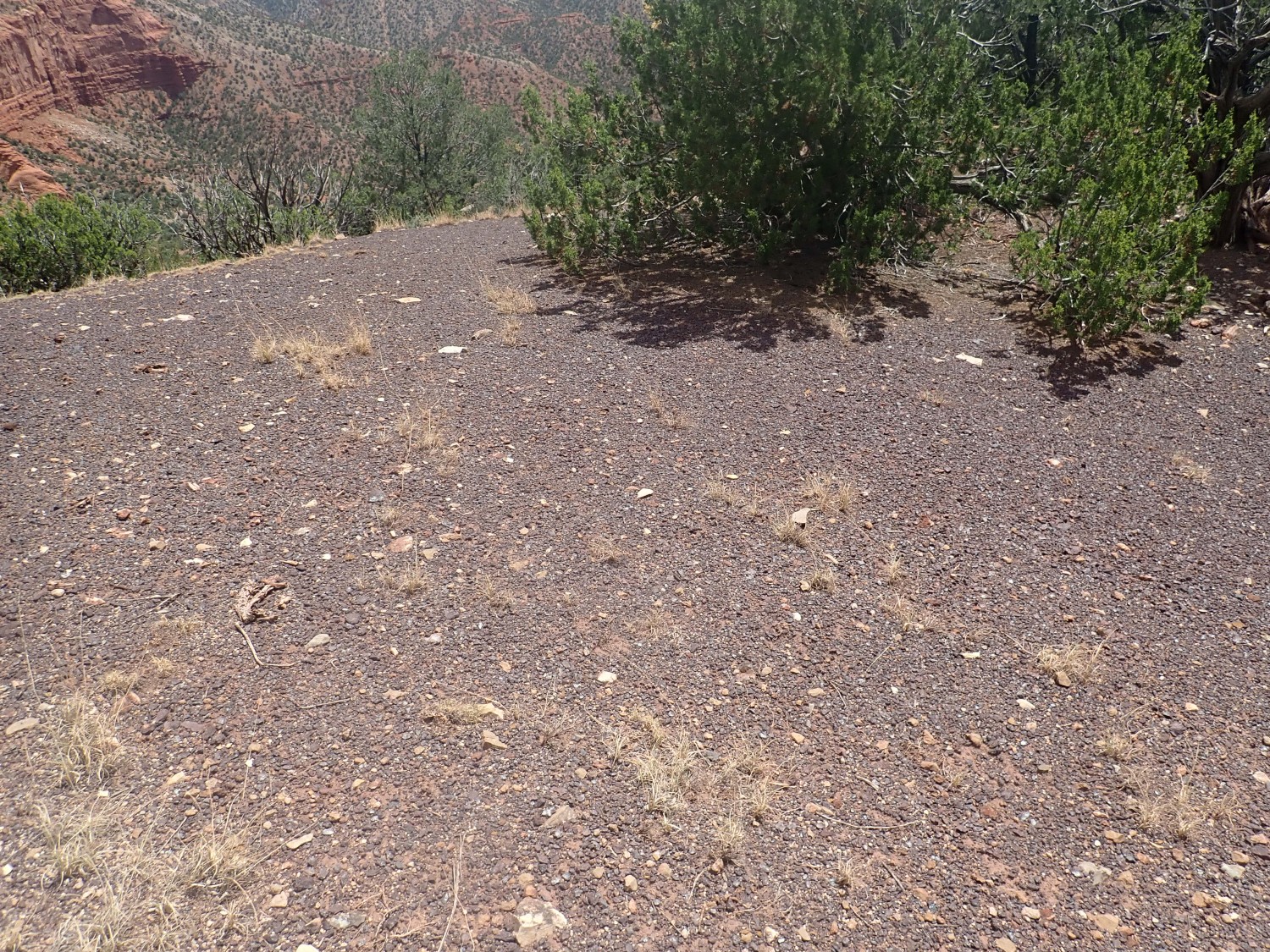
And we need to find the road, because it should take us right to our destination. We decide it must be above us, work our way up the hill, and yeah, here it is.
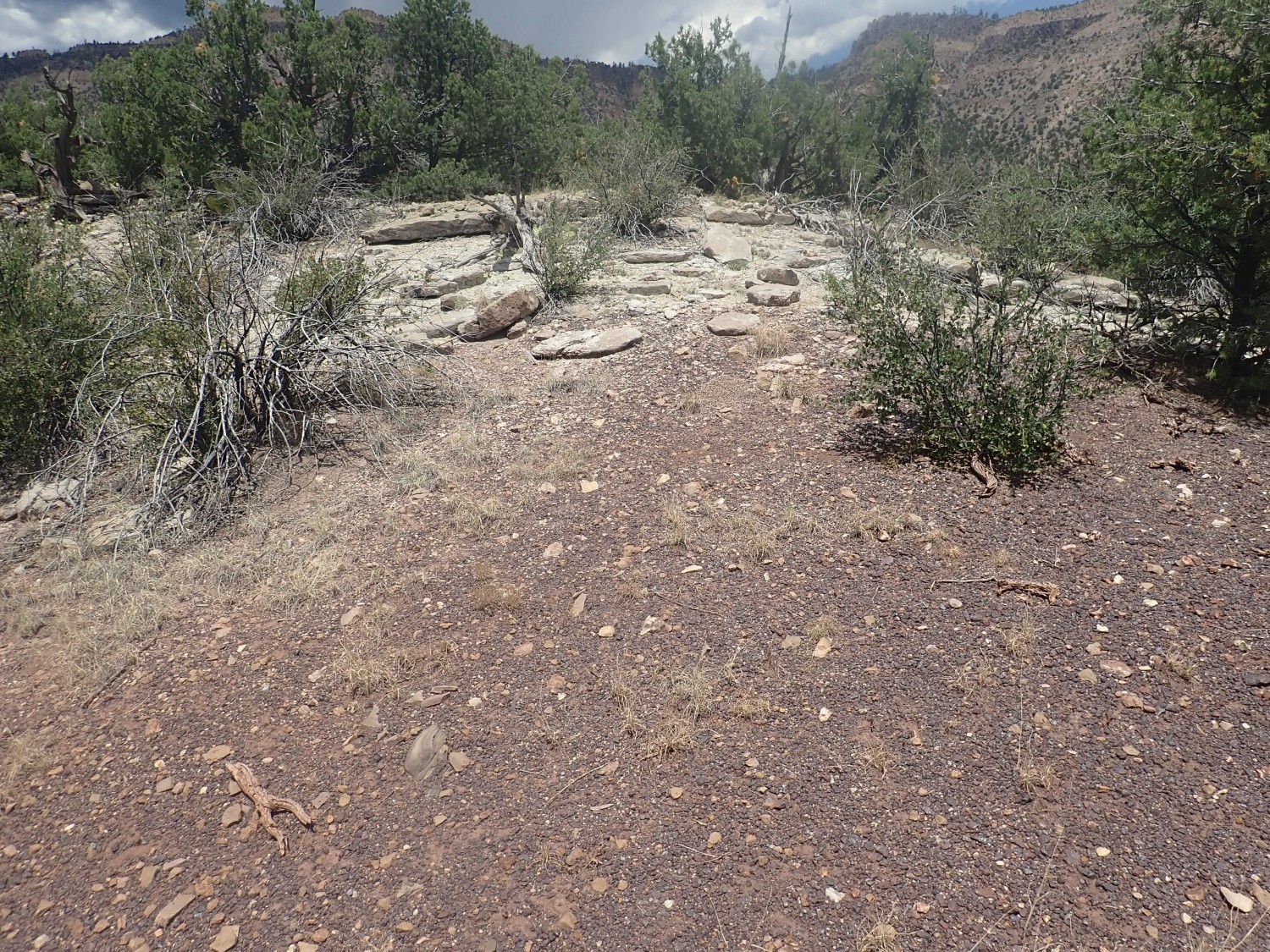
Atop the knoll.
The reddish stones suggest we’re near the Log Springs Formation, but poorly exposed. This is a formation that contains no fossils, so its age is uncertain, but right on the Mississippian-Pennsylvanian time boundary 323 million years ago.
Nearby are a pair of very old picnic benches. We decide we’ll come back this way for lunch, but, again, it turns out we can’t find the spot again when the time comes.
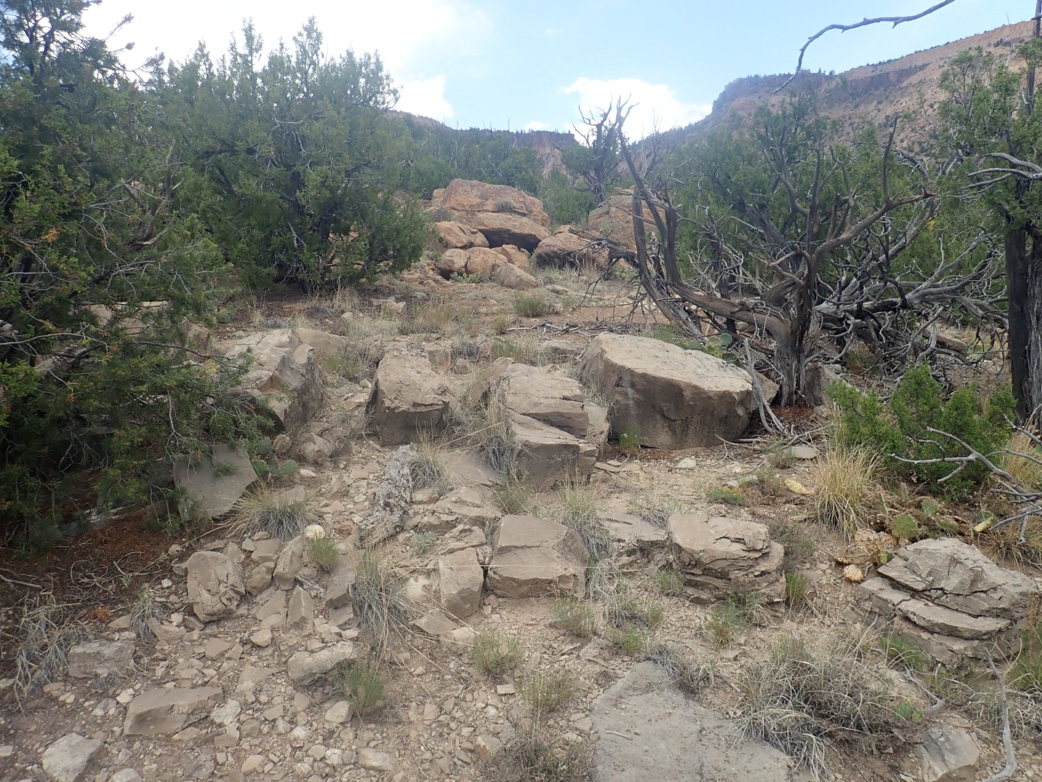
We work our way down the west face of the knoll, towards Guadelupe Box. Here I find some reddish rock fragments suggesting we’re back in the Log Springs Formation again. Its characteristic reddish iron-rich beds make it a useful marker bed to figure out where we are, geologically speaking.
So the slopes below here must be the Mississippian beds, of the Arroyo Penasco Group. There are indeed massive beds of limestone on the canyon rim that undoubtedly belong to the Arroyo Penasco.
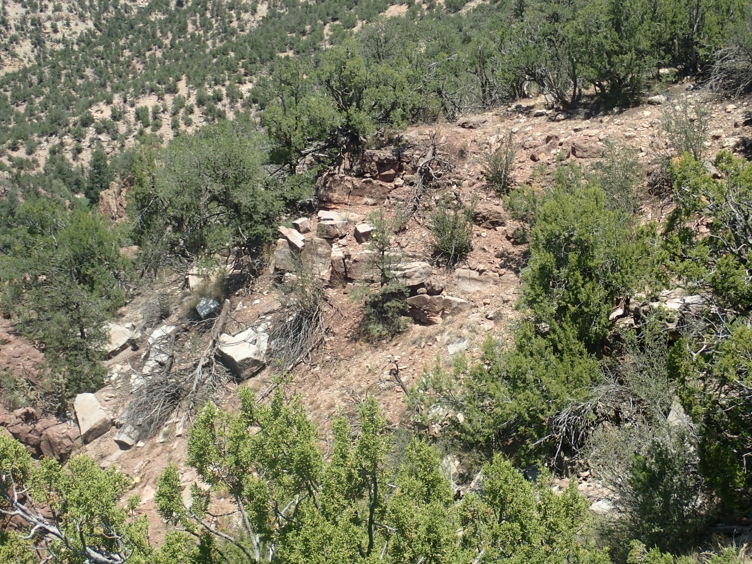
Also visible from here is Joaquin Mesa.

Joaquin Mesa sticks up above the nearby mesas with their cap of Bandelier Tuff, which tells us it is capped with something older. This is the Shinarump Conglomerate, of Triassic age. This is a great sheet of conglomerate and sandstone that covered the entire northern and western Jemez, deposited in the valley of the mighty Chinle River 230 million years ago. The Chinle extended from at least the Ouachita Mountains west to the coastline (then in Nevada) and was comparable with the Mississippi River system of the modern world.
Close up view of some Arroyo Penasco limestone.
A massive gray marine limestone. Alas, I saw no indications of fossils whatsoever here.
A closer view of the massive beds from earlier.
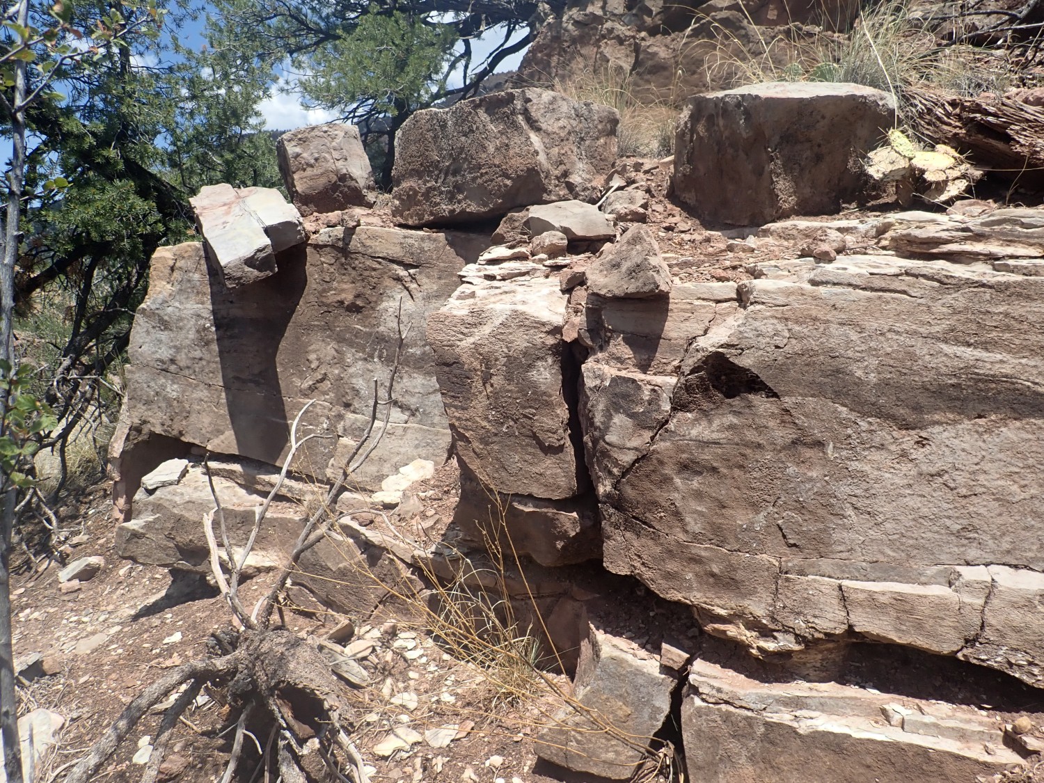
Some of the beds are far more irregular.
I think this is a collapse breccia, formed when the upper part of the formation was heavily eroded. If so, I would further guess that the massive uniform beds below are a thin layer of Espiritu Santo Formation, and the collapse breccia is the base of the overlying Tererro Formation. However, the guidebook says there is no Tererro Formation here, so go figure.
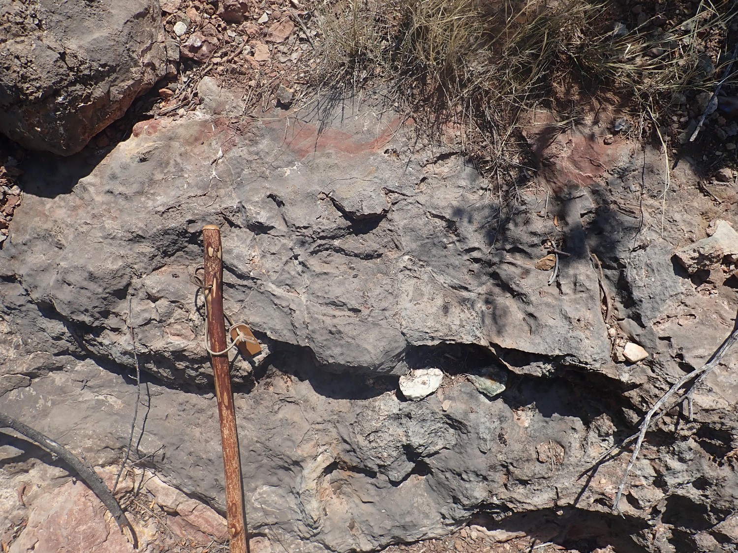
There are some interesting structures atop this rock.
Click to enlarge; you’ll see numerous thin fins of limestone crusting the rock. This is likely karst, formed by the same process of erosion that produced the collapse breccia. Karst can form these kinds of razor-sharp edges.
We start back up the hill, looking for fossils (we find nothing but a few poorly preserved crinoid segments and brachiopod shells) and looking for those picnic benches. We pass the reddish patch of Log Springs formation and are into the Osha Canyon Formation, which my sources claim is richly fossiliferous. Well, we do find a few crinoid stems:

but nothing worth taking home.
A view up the Osha Canyon Formation exposure.
This formation has much less limestone and much more shale than the Arroyo Penasco Group, plus the two are separated by the distinctive red beds of the Log Springs Formation.
We arrive at the top of the knoll, where we find the base of the Sandia Formation.
The base is marked by a transition from calcarous (calcite-rich) fine white sandstone of the upper Osha Canyon Formation to reddish arenacious (feldspar-rich) coarse sandstone of the lower Sandia Formation. Both are Pennsylvanian formations, but the Sandia Formation records the rise of the Ancestral Rocky Mountains. It contains little limestone but a lot of sandstone and shale.
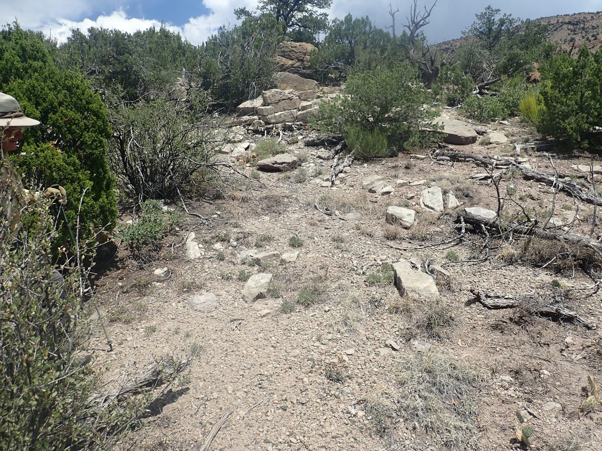
We don’t find our park benches. We descend back to the Osha Canyon Formation, looking for the road we came in on.
We never do find much in the way of fossils here, in spite of the reputation of this unit for being highly fossiliferous. Sometimes you win, sometimes you lose.
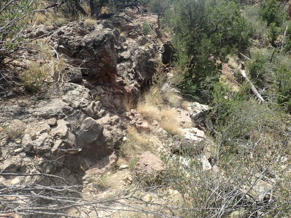
Looking for the road, I come across a really excellent exposure of Log Springs Formation.
The red rock fragments contains so much hematite (iron oxide) that they have a noticeably greater heft than most common rock.
Gary is nearby, taking a break. It’s time for lunch. As we snack, a few drops of rain fall. The sky doesn’t look too bad but I’m thinking it may be time to get off this knoll.
I grab a few final photos. Contact of the Log Springs Formation with the Osha Canyon Formation:
Upper contact of the Osha Canyon Formation with the Sandia Formation.
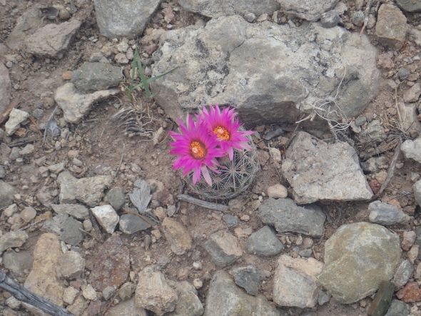
Cactus.

Possibly Arizona rainbow cactus, Echinocereus rigidissimus. But it’s rather late in season for that to be blooming. Perhaps some other species in the genus.
Lovely, regardless.
We continue looking for the road out. Fortunately, you can’t really get lost here; any path north will hit the road eventually. When we finally find it, we realize why we missed it in the way in. A rather large berm has been raised where it forks off the main road which quite effectively conceals it.
Back to the highway. There is not time, alas, for the brachiopod beds. But Gary finds a surprising number of good fossils along the forest road, including a winged brachiopod partially replaced with chert. We cross the Rio Guadelupe again and arrive at our vehicles.
A final shot of the Gilman tunnels on the way out.
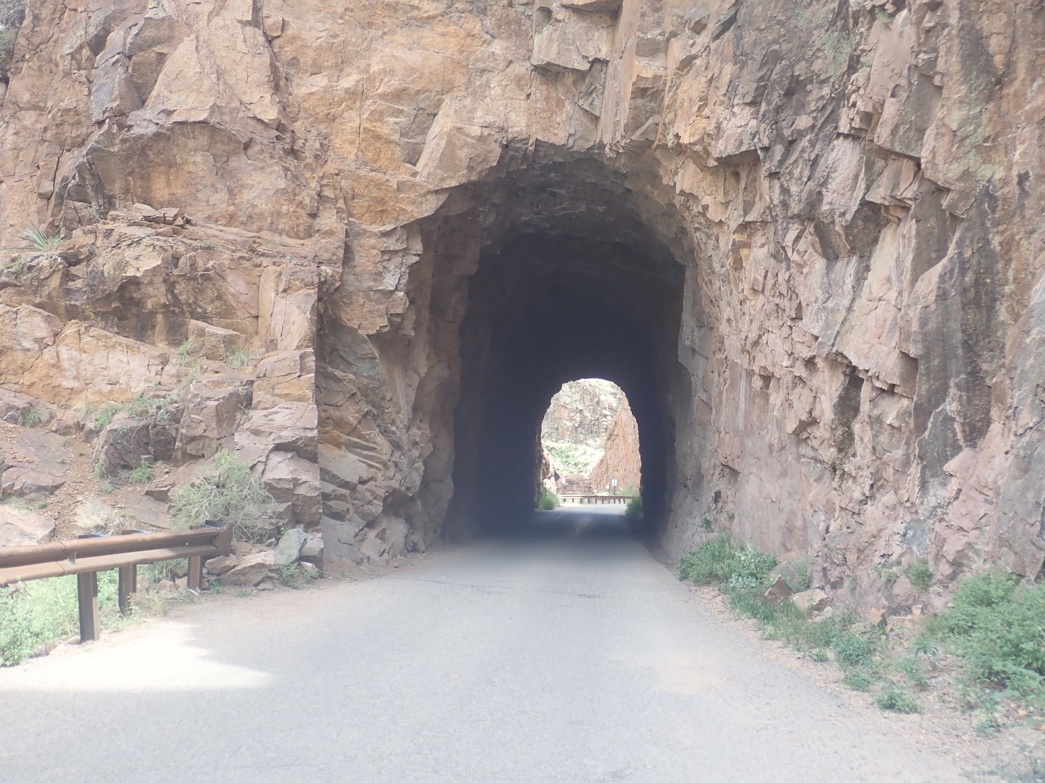
The tunnels were blasted out for a rail line in 1924 for hauling timber out of the area. Alas, this was one of the many casualties of the Great Depression. The rail was eventually replaced by trucks, which were safer and cheaper for hauling timber, then sold back to the Forest Service which converted this to a passenger vehicle road.
And from there, home. There is some rain on the way back, but not too bad. Lots of puddles as we approach home. Cindy tells me they had a brief but intense thunderstorm. Well, glad for the rain.