Coronavirus-Restricted Excellent Adventure
I’ve fallen into the habit of taking one or two trips every year where I make a point of seeing some new geology. Often these are combined with visits to family, for weddings or graduations or just because. And one of the first was with my friend Bruce Rabe, and somehow got dubbed Bruce and Kent’s Excellent Adventure. My once- or twice-yearly extended geology trips have been Excellent Adventures ever since.
I had a really excellent adventure planned for this year, to visit family in Provo, Utah, then drive south to see the geology between there and Payson, Arizona. Highlights were to be a hike partway down the Bright Angel Trail in Grand Canyon, a hike into Navajo Canyon, and exploration of the Payson Ophiolite. Gary Stradling and a couple of other friends thought they might be able to join me. But this was before coronavirus.
I had to reluctantly cancel it all. My employer made it clear that travel out of state was really, really discouraged, and my doctor pretty much told me the same thing. I got refunds back on most (not all) of my reservations.
But being cooped up in my own home just isn’t psychologically healthy. So after some thoughtful risk assessment, Gary and I decided to take a week and hit the geology of southwestern New Mexico — the furthest I could get away from home without actually leaving the state.
Plans were made and then reformulated to account for back country roads I discovered were impassable (for physical or legal reasons.) I planned to camp on public lands in reasonably isolated locations. We wouldn’t have a lot of contact with people, which seemed a good thing given that coronavirus is again surging in the state. (We had over 800 new cases Friday.)
So Monday we did our final packing and headed out. Our first destination was El Malpais National Monument. Gary had driven past here a few months back, and thought the geology was spectacular, and it seemed in keeping with my general trip plans.
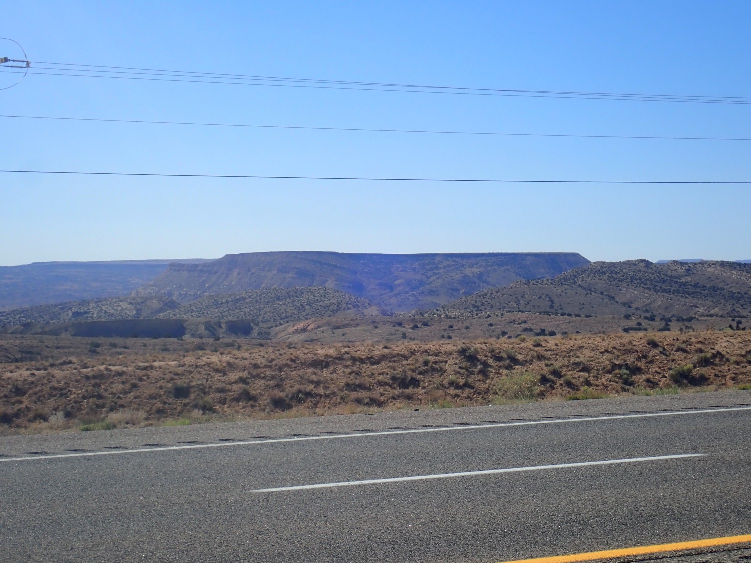
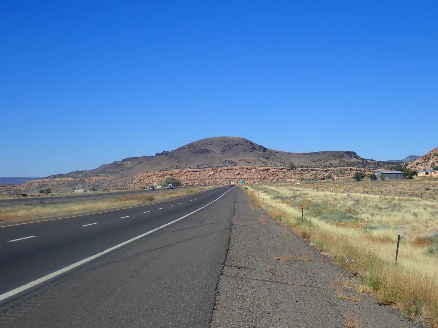
I was in familiar country until we crossed the Rio Puerco valley and the interstate came out on the plateau to the west. Here we stopped at a large road cut. Looking north:

If I’m reading the geologic map right, we are looking at the Bluff Sandstone. This is a unit that has been battled over a bit down the years. It is the lowest member of the Morrison Formation, unless it’s the highest formation of the San Rafael Group, unless it’s actually two beds of sandstone of which one belongs to the Wanakah Formation and the other belongs to the Morrison Formation.
Let me try to sort that out a bit. Beneath this sandstone bed are tidal flat deposits of Jurassic age, about 150 million years old. These are assigned to the Summerville Formation in Utah, Colorado, and most of New Mexico, but in Arizona they tend to be called Wanakah Formation. Regardless of name, they were deposited in a broad, almost perfectly level, coastal plain along the western margin of North America. The shore lay in eastern Nevada; California was not part of the geological Union yet. This was a time when the earth was recovering from the ecological catastrophe of the Permian-Triassic extinction, which wiped out 90% of families of life in the fossil record. The earth was still rather hot and dry, and sluggish rivers crossing the arid coast plain from the east mostly wandered out and died on the flats. Occasional periods of rain produced ephemeral lakes in which shallow wave action spread out accumulated sediments into thin layers that give the Summerville/Wanakah its striking character. (The article’s photo was my contribution, from an earlier adventure in Utah.)
At the end of Summerville/Wanakah time, sand sheets spread across much of the area. This was followed by wetter conditions during which the Morrison Formation was laid down. The debate is all over whether the sand sheets of the Bluff Sandstone were the tail end of Summerville deposition, were the first expression of Morrison deposition, or deserve to be treated as their own formation. I’m not really entitled to an opinion, but I’ll offer mine anyway, which is that the Bluff Sandstone is lithologically distinctive enough and mappable over a huge enough area to qualify as a formation in its own right.
The road cut we’ve stopped at is in a quadrangle for which I don’t have a high-resolution geologic map. The low-resolution state map identifies this only as an area of Jurassic San Rafael Group, in which the map includes Bluff Sandstone. My best extrapolation is that the road cut is also Bluff Sandstone.

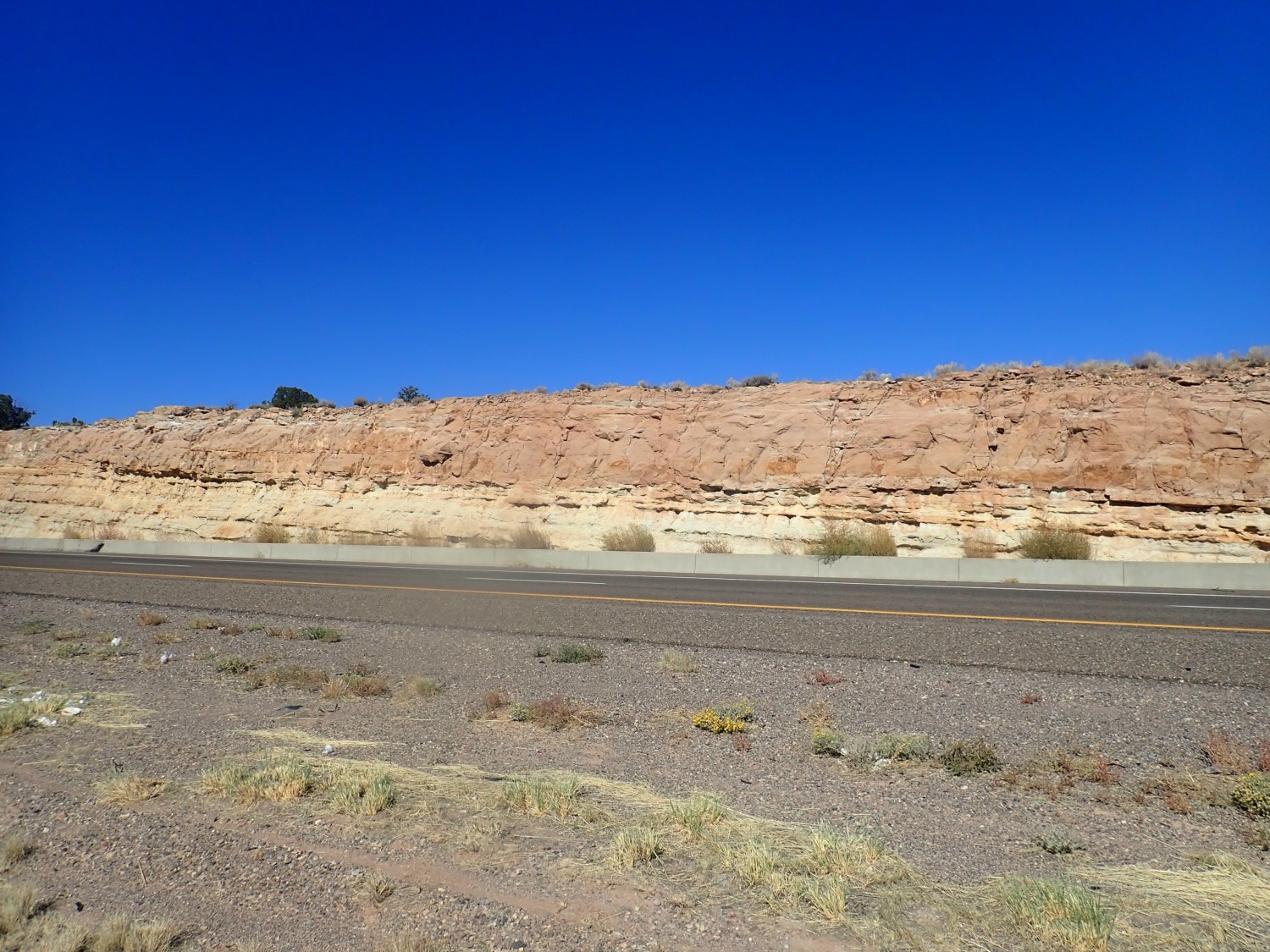
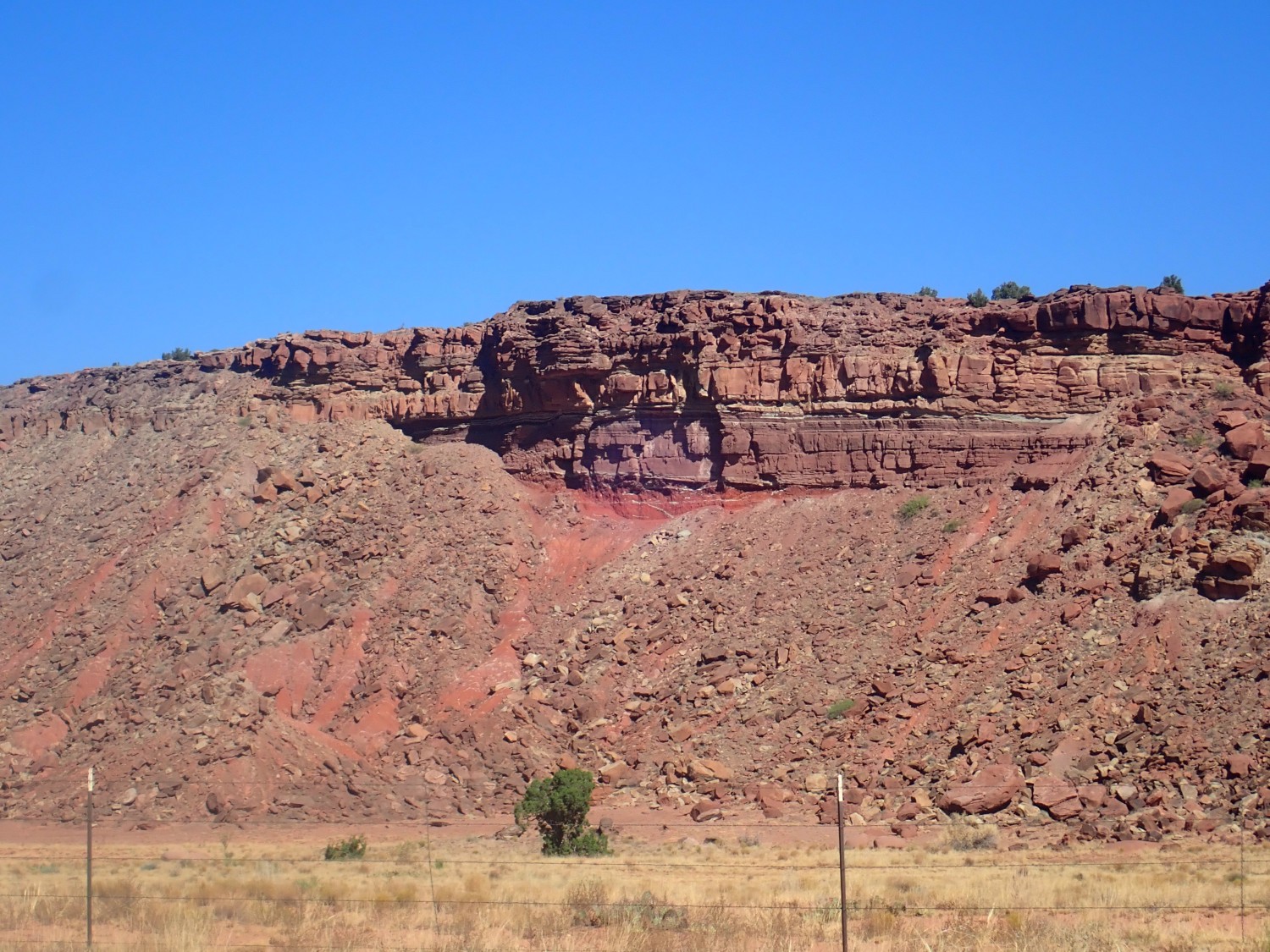
The Bluff Sandstone would be the massive sandstone on top, and beneath are mixed sandstone and mudstone beds of the Summerville Formation.
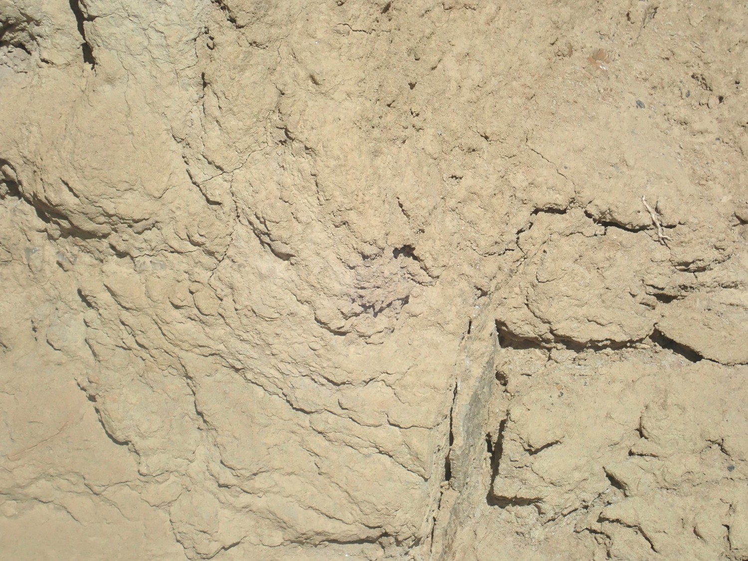
The mudstone beds contain gypsum veins typical of the Summerville.
So, yeah.
Looking south, I see a nice angular unconformity between the basalt flow capping Mesa Lucero and the beds beneath.
The capping flow is young, perhaps in the very rough ballpark of 5 million years old. The beds beneath are Permian to Triassic in age, at least 200 million years old. The older beds are tilted where they meet the very level lava flow. We are looking into the Lucero Uplift, part of the western flank of the Rio Grande Rift, which dips to the west.
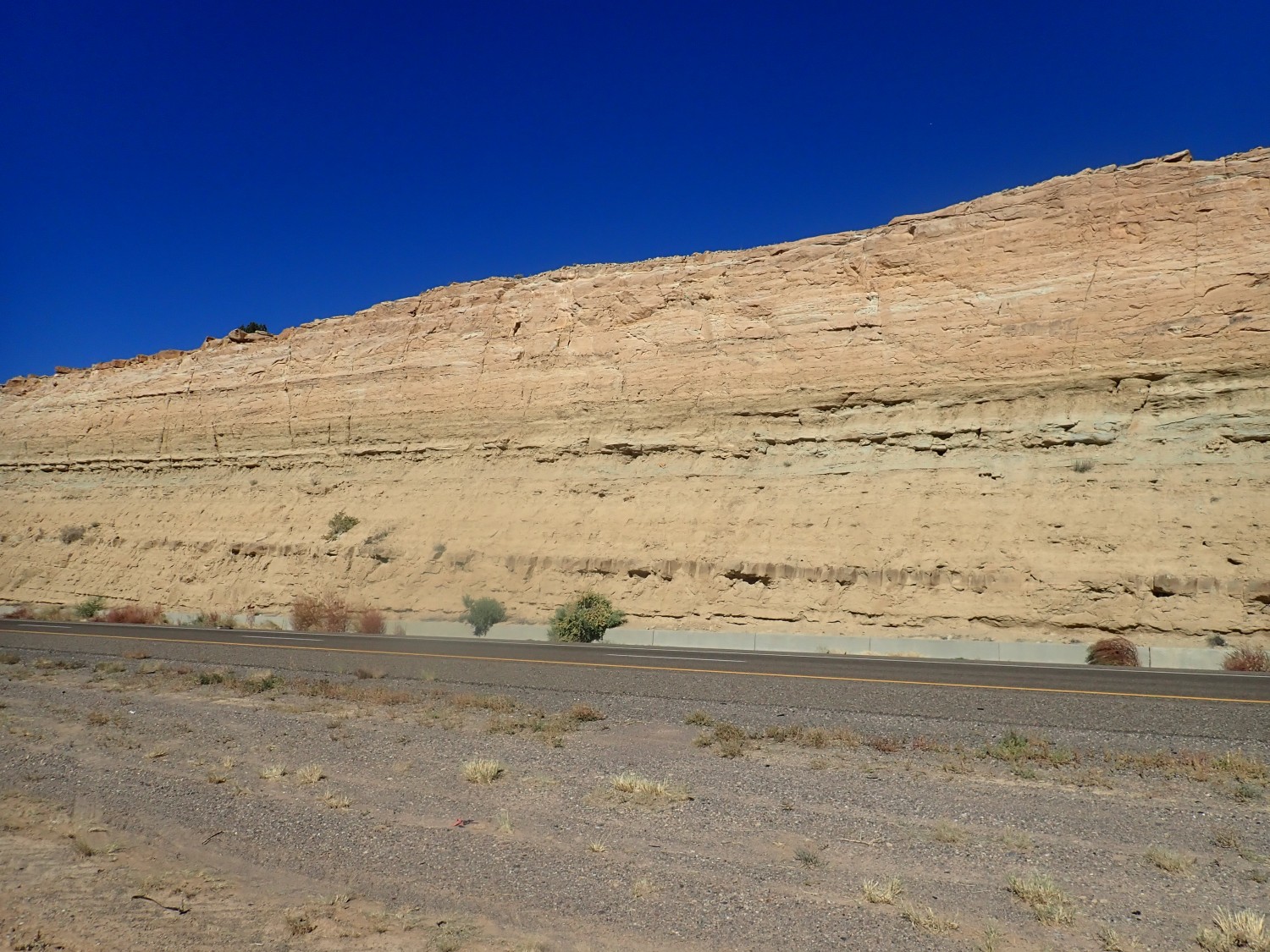
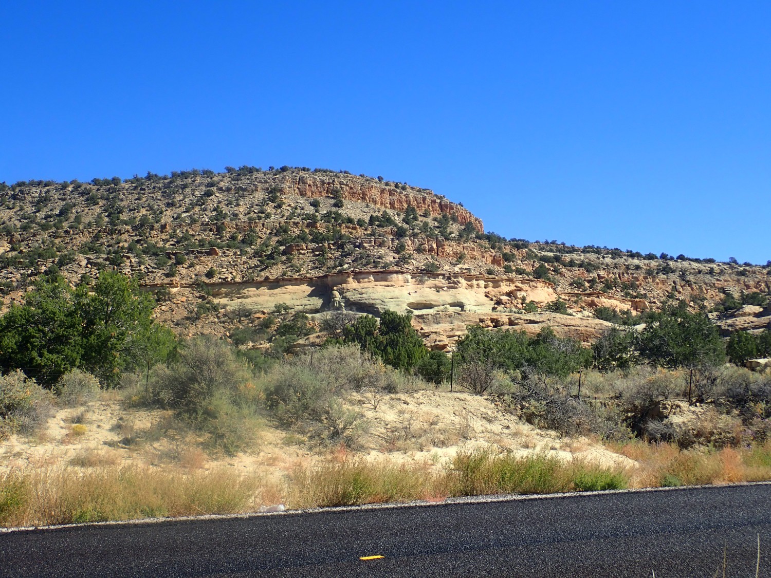
A little further on are some really beautiful beds.
My guess at the time is Entrada Formation over Chinle Formation. Again, I have no high-resolution map for this area, but the state map seems to make it all Chinle Formation, and I extrapolate from the nearest high resolution quadrangle map that the Correo Sandstone Member is at top. This is sediments deposited in the valley of the mighty Chinle River, which flowed from Appalachia west across northern New Mexico on its way to the coast in Nevada, 200 to 230 million years ago.
And this seems unmistakably Todilto Formation, capping the Entrada Formation.

As indeed it is; this area is back on the high-resolution quadrangle maps I have available. Todilto Formation is an evaporite, formed when an arm of the sea evaporated to deposit limestone and gypsum. Possibly also rock salt, though the evaporation may not have proceeded that far, or else the highly soluble rock salt was later dissolved away. The beds above are Summerville Formation, then Bluff Sandstone, same as the road cut.
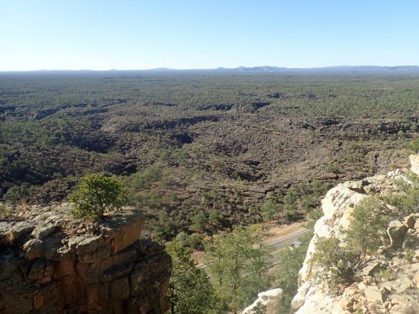
Next stop shows us Mesa Gigante in its full splendor.
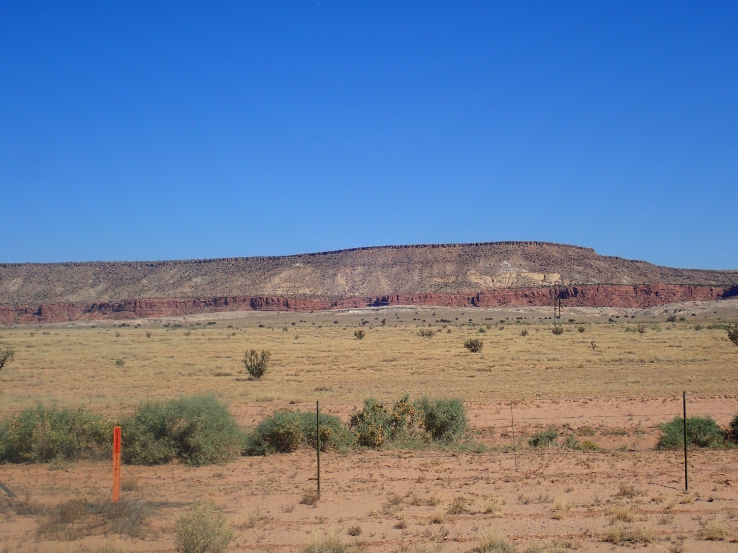
Summerville Formation at the base, capped with Bluff Sandstone. The hard sandstone forms a cliff surface. Above are much softer mixed mudstone and sandstone beds of the Morrison Formation. The lowermost beds are Recapture Member and the bulk is Brushy Basin Member, though I can’t really make the distinction from this distance. The mesa is capped with very resistant sandstone beds of the Dakota Formation.
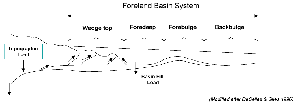
The Morrison Formation accumulated over a huge area east of the Sevier Belt in Utah late in Jurassic time. The Farallon Plate, a kind of precursor of the Pacific Plate, had begun steadily subducting under what is now the Sierra Nevada along the California-Nevada border. Occasionally the subducting plate brought island arcs or microcontinents into collision with the western margin of the continent, assembling California,* and pushing up mountains further east into Utah. The weight of the mountains pushed down the western part of the North American Plate, aided by suction from the subducting Farallon Plate, and produced a huge foreland basin to the east of the mountains.
The basin covered most of the western interior of North America. This was first a trap for sediments, forming the Morrison Formation; then, as subsidence accelerated, the basin was progressively flooded by the sea to form the Western Interior Seaway. The Dakota Formation is basically beach sand deposited during the initial advance of the sea, about 100 million years ago.
Ahead we see volcanic rock of the Mount Taylor field.
This is the curiously named Flower Mountain, a basalt cinder cone. The geological map offers no guess of the age but it can’t be more than a few million years. It looks like it’s worth exploring, or would be if it was on public land. It’s tribal land here.
The foreground beds are Dakota Formation — the capping bed being Cubero Member. Villa de Cubero is just north of the mountain.
Gary has been playing a curious mixture of General Conference talks and a science fiction novel. General Conference is the twice-yearly meeting of the Church of Jesus Christ of Latter-day Saints, of which we are both members. First-rate sermons. The science fiction novel is Leviathan Wakes, the first of the Expanse series, which his son Alden had recommended. We’ll get almost through it by the end of the trip, and it’s first-rate — now I’m going to have to go buy some science fiction books, which I haven’t done in years.
We arrive in Grants and Gary pulls into town to refuel. He also has a loose end to tie up: A report to file with the state for a political group he is part of. He takes some time to get online while we still have a connection, and I go scouting for geology. My recollection is that the Gallup Sandstone has its type section along the interstate here and I’m trying to figure where it is.
As I’m waiting for Gary, I see a car pull away from a nearby Taco Bell. An employee runs out the door and hurls a burrito at the car. Well. I can only imagine what that was about. Gary and I have talked a lot about what distinguishes humans from chimpanzees. It’s more subtle than we sometimes like to think, but it’s terribly important.
Gary is done. We load up and I persuade him to go hunting for the type section. It is only after several minutes that I remember that we are in Grants, not Gallup. Derp.
Then off to the El Malpais National Monument headquaters. There is a single ranger on duty behind a plastic shield and the bookstore is closed. But we have a pleasant chat with the ranger and pick up some brochures before heading out to eat lunch in the adjacent picnic area. There is a lovely young family there: A father from France attending school here (if I heard right), his American wife, and a very young, very cute child. I grab the obligatory photo of the lava flows around the area.
To the northeast is Horace Mesa.
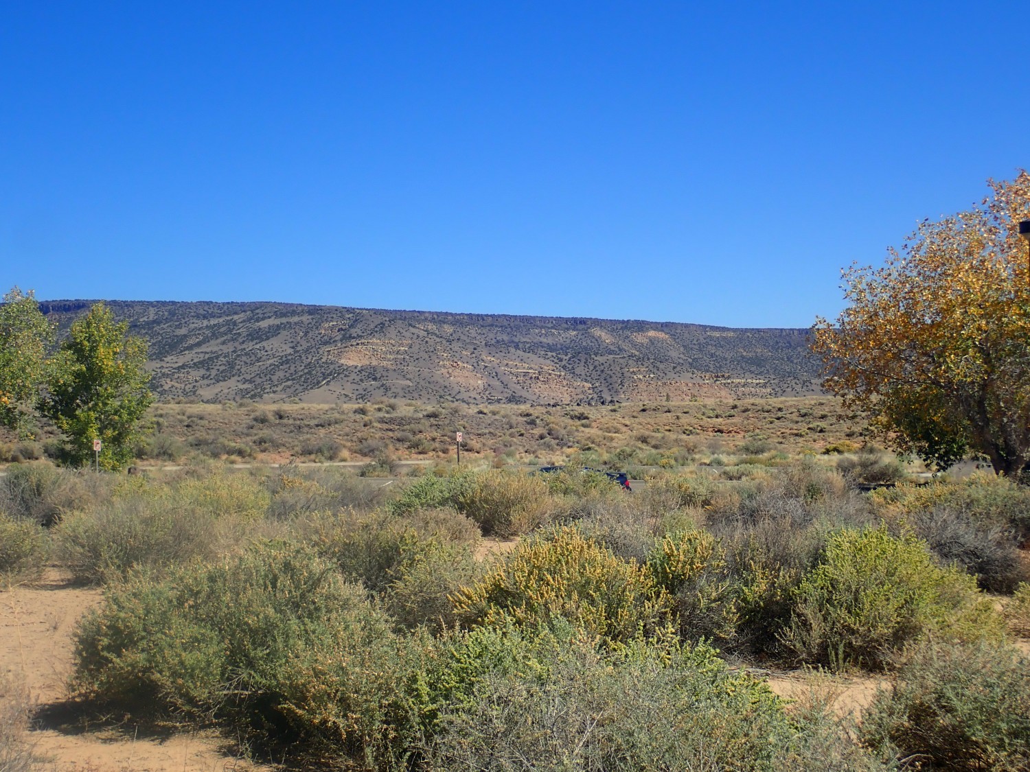
The cap is more young basalt flows, but I guess that the sandstone beds halfway down the mesa side are either Dakota Formation or Mesaverde Group. The state map says Crevasse Canyon Formation of the Mesaverde Group; nailed it. This is a coal-bearing formation and likely historically provided coal for the nearly railroad.
El Malpais is a small volcanic field along the Jemez Lineament, a weakness in the Earth’s lower crust and upper mantle that reaches from Arizona to northeastern New Mexico and includes Mount Taylor and the Jemez volcanic field. It’s thought to be an ancient boundary between two blocks of lithosphere (crust plus upper mantle, the stuff of tectonic plates) that fused to the southern edge of North America 1.7 billion years ago. Rock has a long memory. The youngest flow here, the McCartys flow, is a few thousand years old and thought to be the youngest flow in New Mexico. Pinning down the exact date is apparently a bit difficult. But it is practically unweathered and parts are still glassy. (Volcanic glass eventually devitrifies, and basaltic volcanic glass devitrifies quickly.) There are native American legends that may have their origins in humans witnessing the eruptions.
We consult the map and decide to visit a couple of points along the east edge of the park, which is along our route to the camping site I’ve picked out and which will take us past the sedimentary beds Gary found so intriguing when he drove past a few months ago.
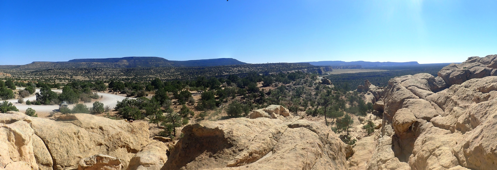
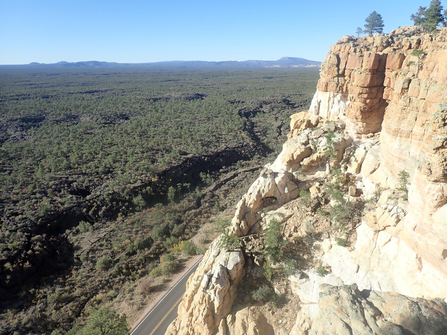
The escarpment east of the flows is dramatic.
My GPS lock failed; somewhere close to here. Dakota Formation regardless.
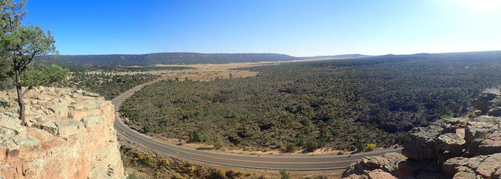
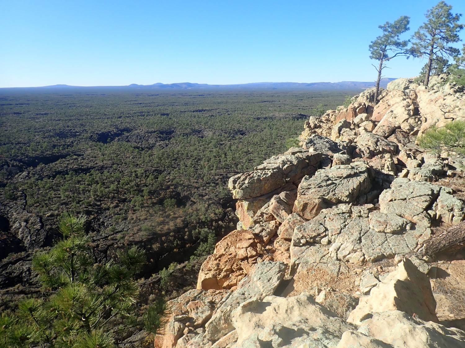
We pull into Sandstone Bluff Overlook to look over the area.
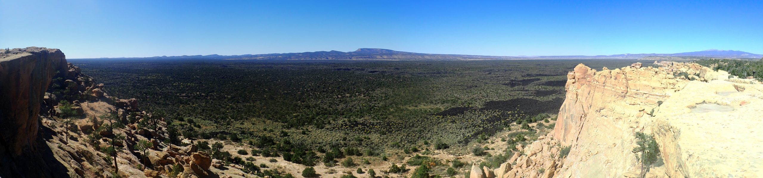
For new readers (Welcome!): almost all images at this blog can be clicked on to get a higher resolution version, and it’s particularly recommended for the panoramas. At full resolution, it’s almost like being there.
It’s late enough in the day that the sun is low enough to make taking good panoramas difficult. But you can see I’m on the edge of a sandstone escarpment looking over the McCartys lava flow. In the distance, we’re looking down the axis of the Zuni uplift, a Laramide upwarp in the Earth’s crust. Laramide: From the episode of mountain building 70 to 30 million years ago that raised most of the Rocky Mountains.
And I’ve forgotten my hat. Gary spots a brand new hat on the ground way, way down below and suggests I go claim that one. Pass.
The Dakota Sandstone is quite massive here.

Gary and I both wonder if the escarpment here is a fault escarpment. According to the state geologic map, yes. A fault runs right along the base of this escarpment.
Really a gorgeous area.
The whole escarpment, including in the distance, is Dakota Formation. The base of the distant cliffs is upper Morrison Formation.

My impression is that Mount Taylor is slightly younger than the Jemez, around 10 million years old, but is both less voluminous and more tightly clustered around a single vent or cluster of vents. And while there is a large central amphitheater, this is not a true caldera like the Jemez caldera; it is more like the amphitheater at Mount St. Helens, caused by a humongous landslide collapse.
Gary and I had planned to attend the New Mexico Geological Society Fall Field Conference about this time, which would have featured Mount Taylor. Postponed due to COVID. Maybe next year.
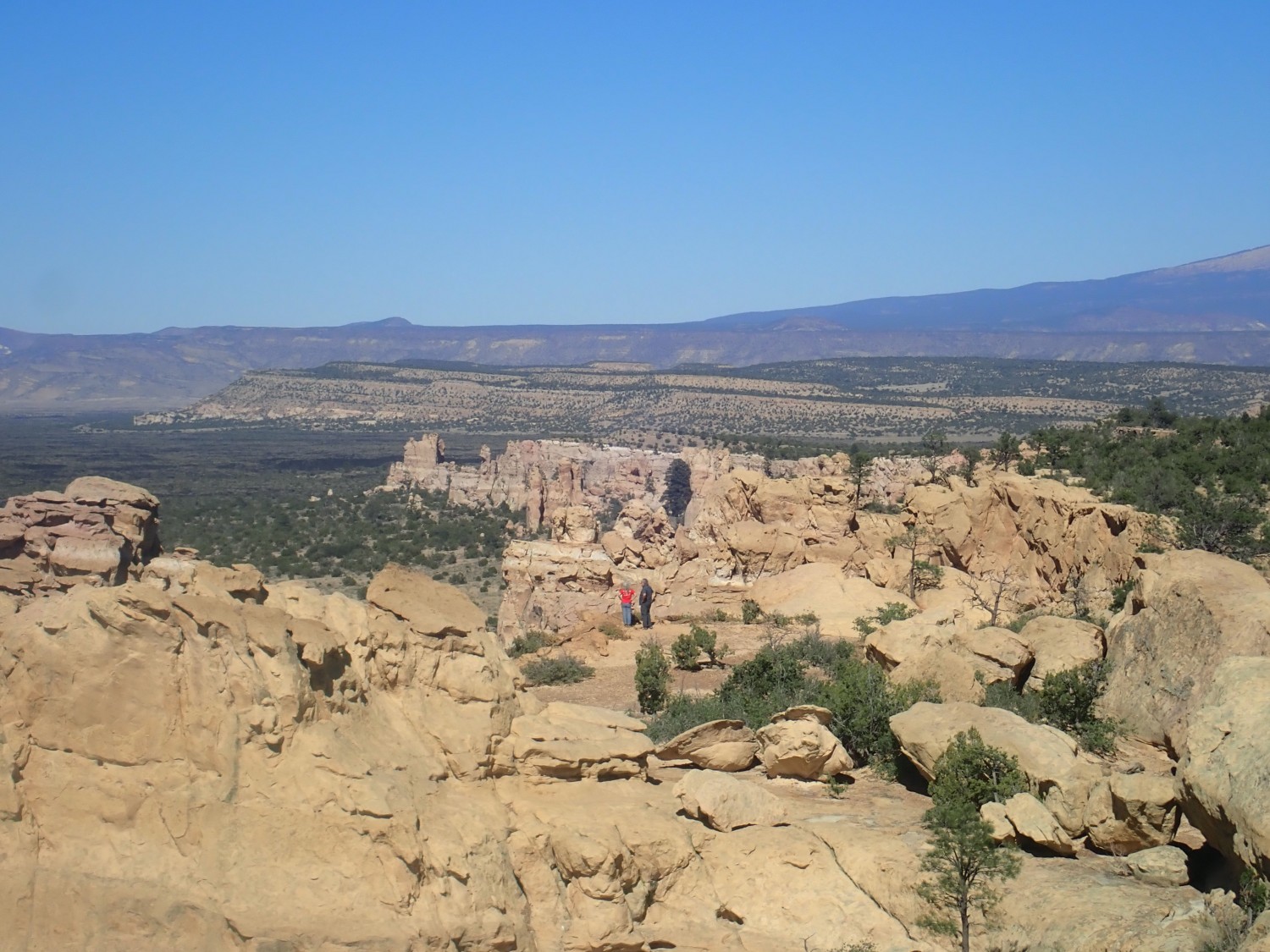
We explore the area. View south:
The lower escarpment is more Dakota Formation. The higher escarpment in the distance is Mancos Formation with a belt of more resistant Gallup Sandstone under a cap of basalt.
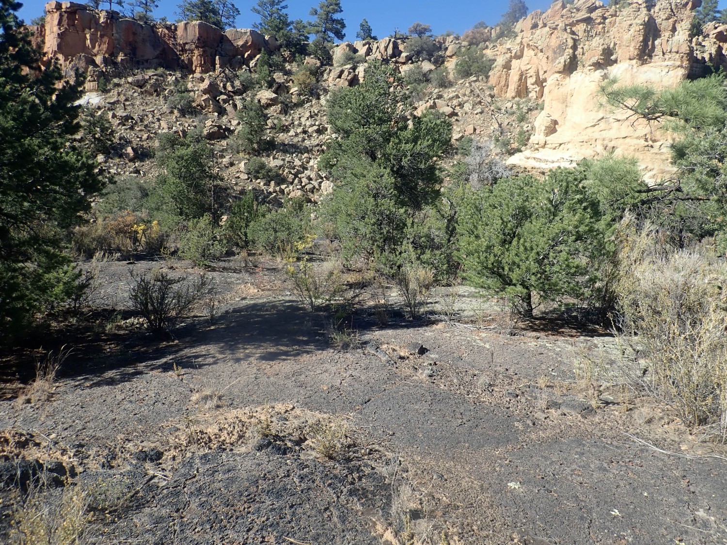
Gary spots an intriguing outcrop. We find ourselves crossing some of the McCartys flow on our way over.
Some cryptobiotic crust, specially for Dorothy Stradling:
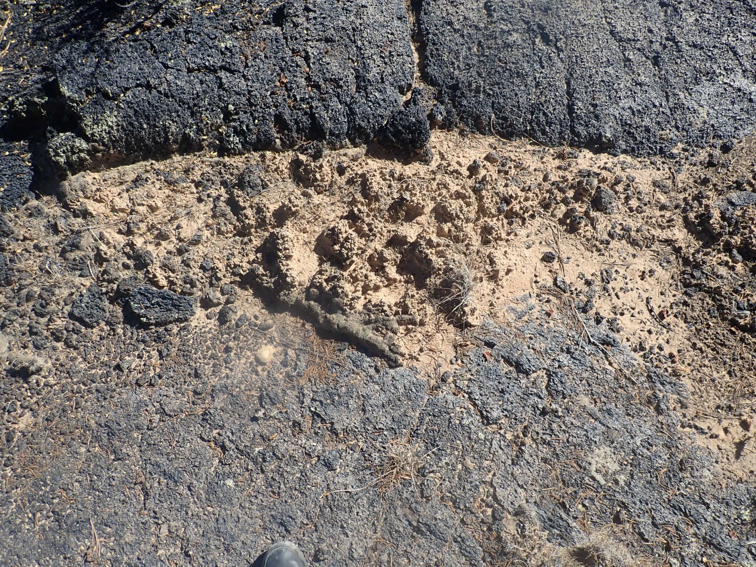
Dorothy, Alden’s wife, did her senior thesis on this stuff. It’s a kind of microbial mat that holds the soil together.
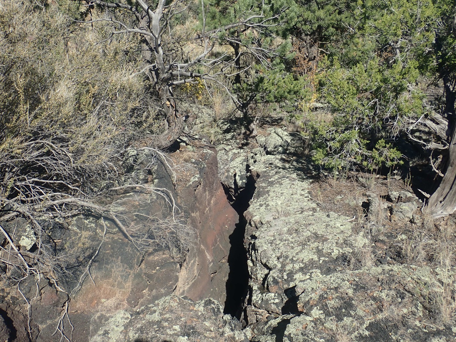
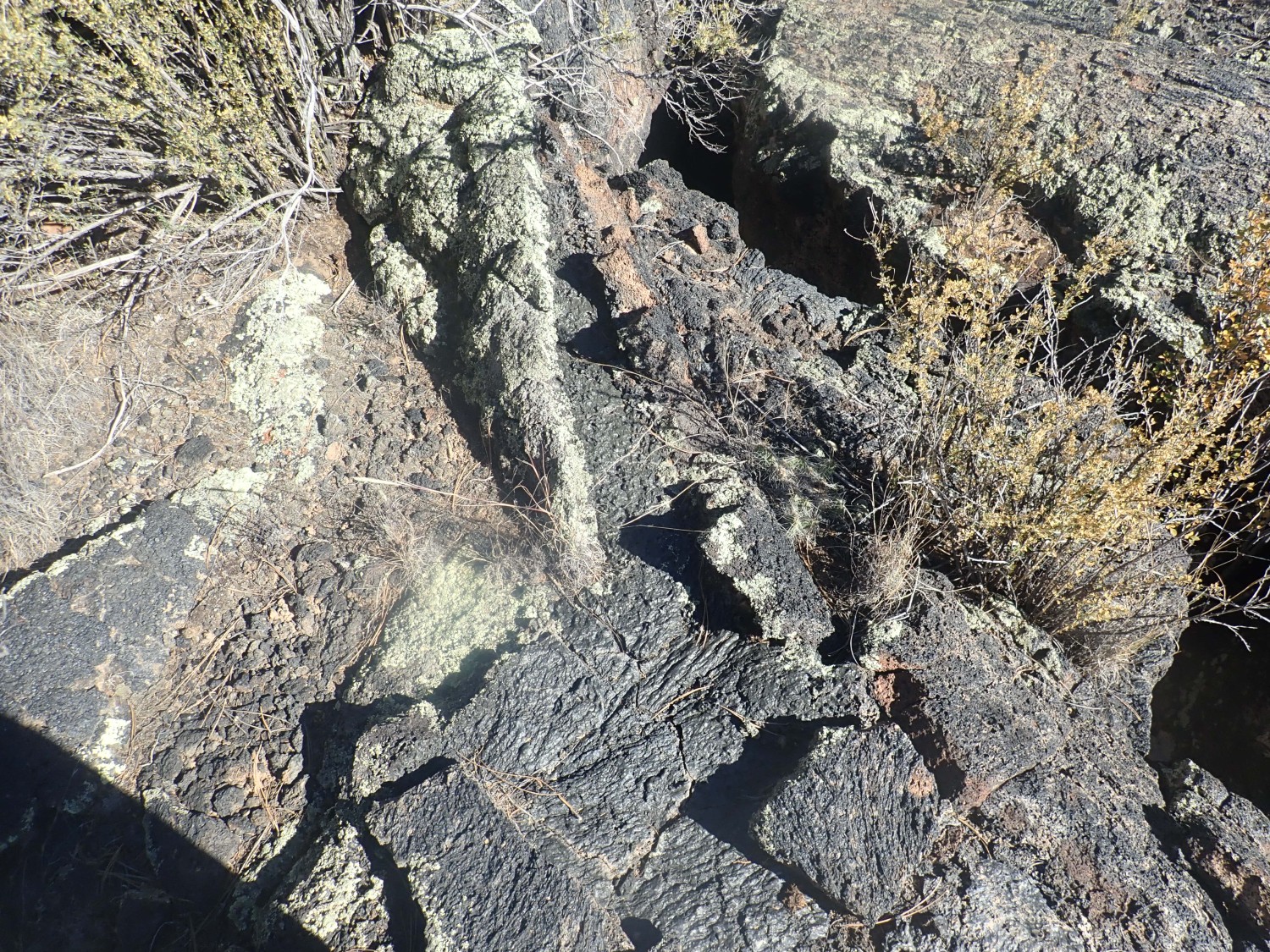
Deep crevice.
Very glassy young flow.
The map shows we are definitely outside the national monument and on BLM land. We collect a couple of yard rocks.
The outcrop Gary spotted.
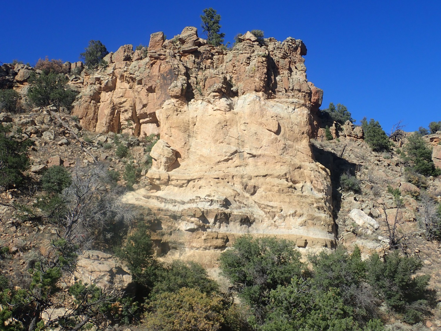
There is some nice cross bedding in the middle layer here. I tentatively interpret this as beach dunes.
Gary calls out that he has found some beautiful pahoehoe roping. He has indeed:

A pahoehoe flow (the term is Hawaiian) is relatively fluid and forms these kinds of ropy structures as it moves forwards. An a’a flow, the other common kind of basalt flow, is more viscous and advances as a mass of red-hot, semi-fluid clinker.
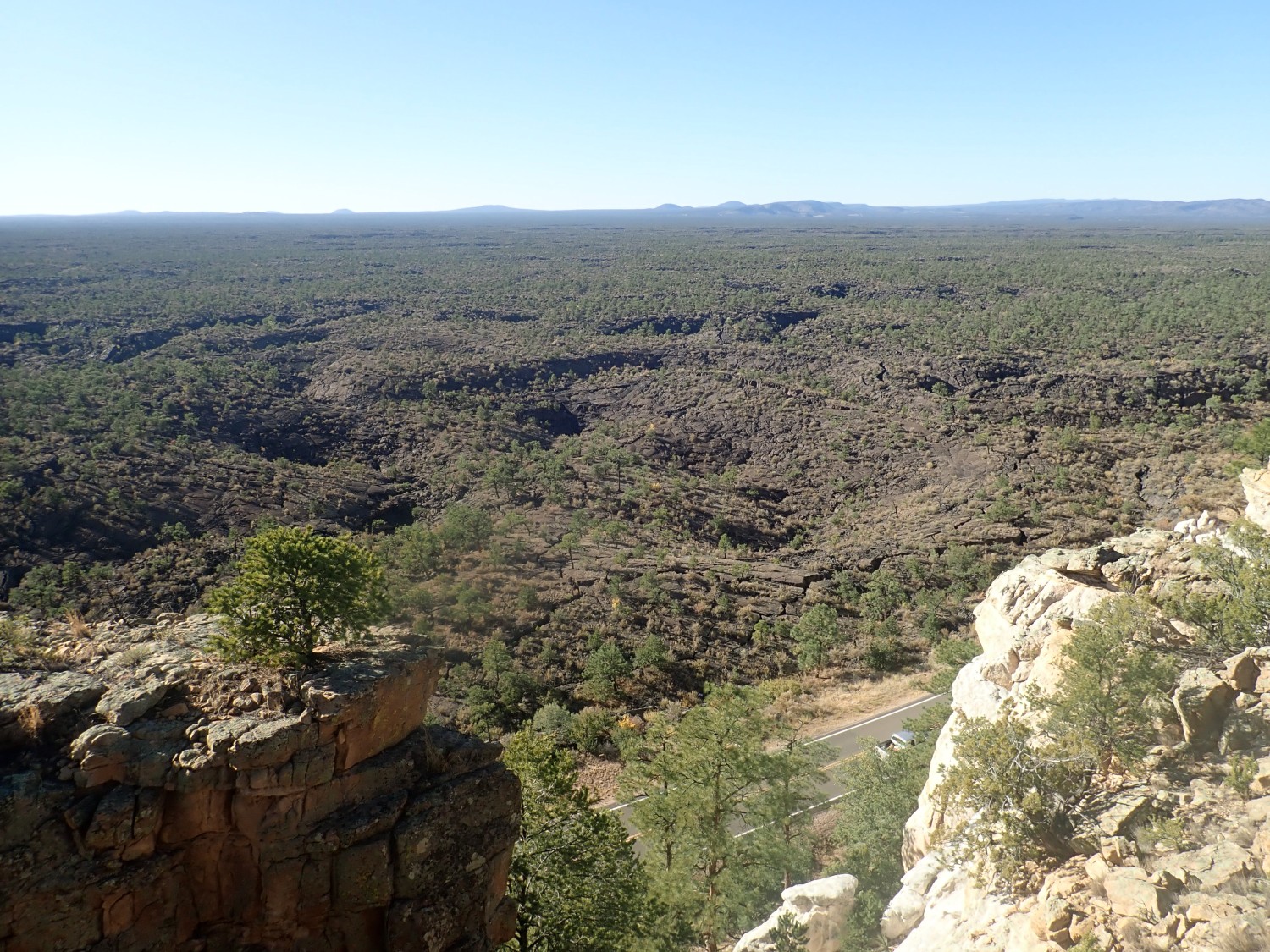
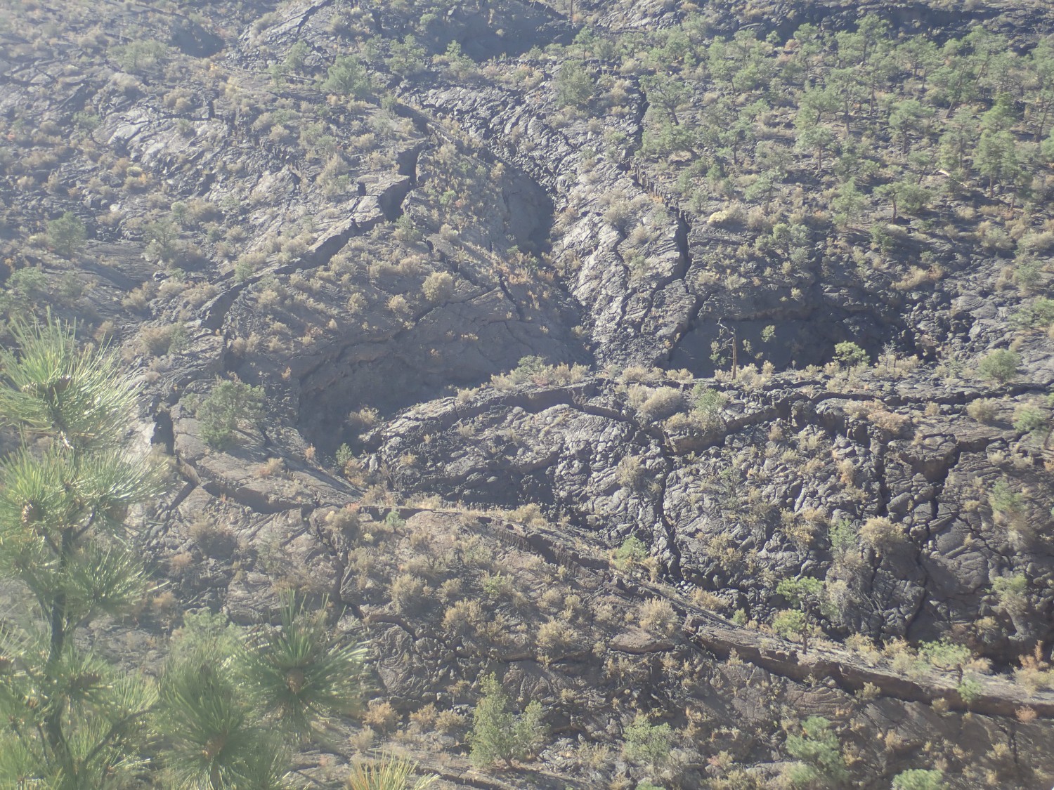
We continue south, realize we’ve missed the escarpment hike we were interested in, turn back, and find it was just south of Gary’s outcrop. The trail is reasonably easy and we soon have a beautiful view of the lava to the west, marred only by the low sun in our eyes.
Nearby are ripple marks in the sandstone.
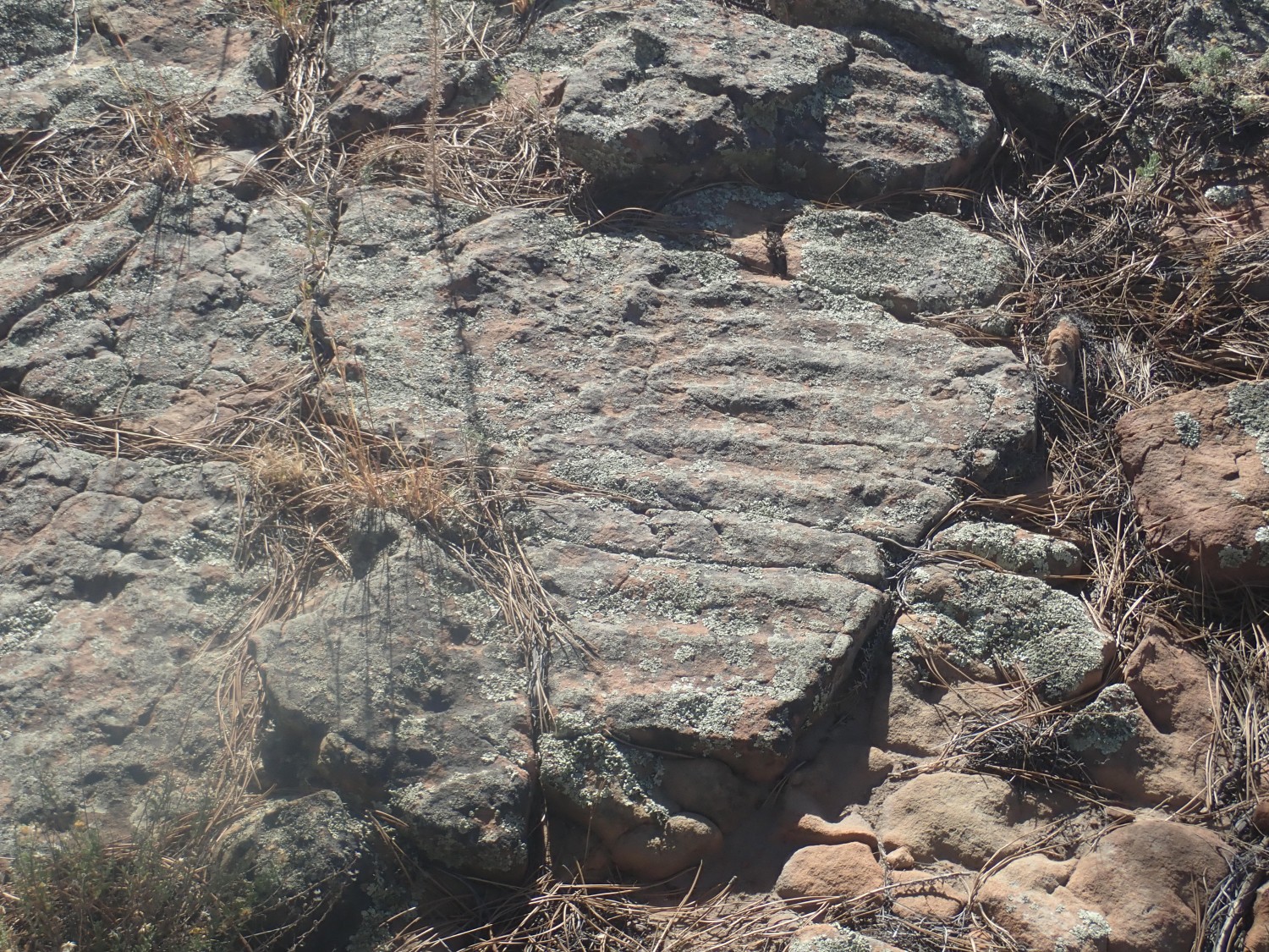
I find several similar examples in the area. All show a flow direction either directly west or directly east. Unfortunately, I am not geologist enough to know which it is.
Both Gary and I looked at the dimples out there, and concluded these must be collapsed lava tubes. It’s lava tubes that allow basalt lava to travel for miles; the tube forms a conduit with insulating rock sides and roof. And it our interpretation was the one accepted by most geologists for many years. But it turns out that the modern interpretation is that these are inflation features, not deflation features (collapsed tubes), with the high ground being where fluid lava was thickest between upper and lower rock crusts. The linked article has more details on the modern thinking.
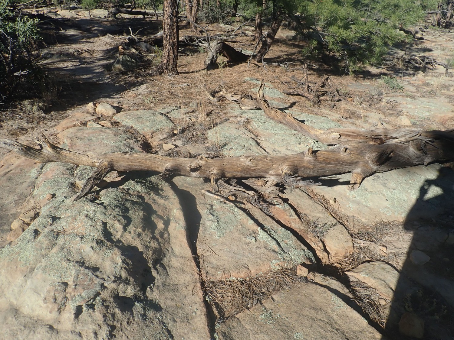
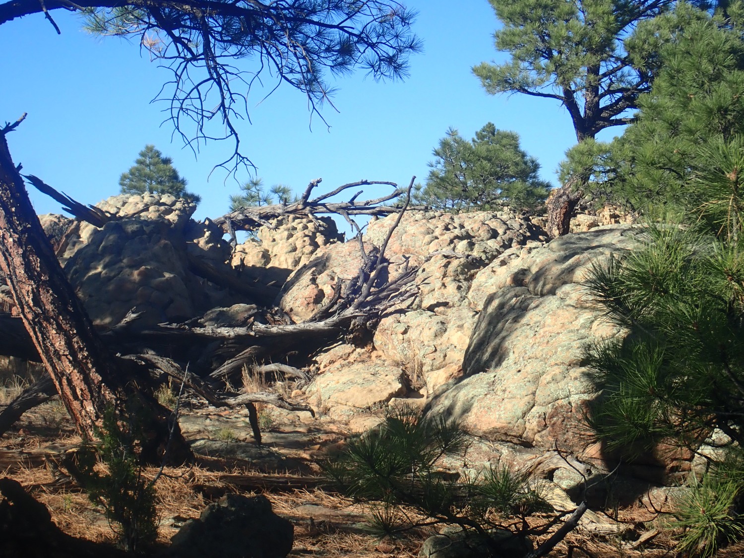
A fallen tree, surprisingly beautiful in death.
I want to go to Heaven, but not just yet. So views straight down, like this one, do make me slightly nervous.

The highway runs right at the foot of the fault escarpment. Beyond is a very nice view of the upper surface of the flow.
Another view of the flow, where I’m trying to avoid photographing into the sun.
And another view.
Concretions in the sandstone.
Gary wants to know how these form. I can’t do better than Wikipedia.
One last view before the sinking sun forces us to turn back.
Then we’re off south. I found some BLM land north of Quemado on the map that looked like promising camping ground. But I doze briefly, snap awake when we reach an intersection, we both misread the sign, and we think we’re there. I direct Gary to the location, and it all looks like land in the process of being turned into cabins in the woods for rich people. Turns out we’re north of Techado, and the jurisdiction map shows that this is indeed mostly private land. Fortunately, we realize our mistake and continue south. Alas, the land I thought would be good for camping is fenced off, even though the jurisdiction map shows it unambiguously as BLM land; go figure. We take another side road, one I remember being into state land, though I’m nervous it is really on private land. We pass a ranch house and a herd of suspicious bovines. We end up on flats covered with rock and weeds, but beyond is an arroyo with flat, clear, not too rocky ground, and we set up there. (The weather is bone-dry; flooding is not an issue)

Turns out it’s state land, so it’s probably just fine to camp here. And it turns out to be a pretty good spot.
The day has been pleasantly warm, but the temperature plummets after sunset. The sky is perfectly clear and moonless (it would be through most of the trip) and the stars are blazing. We eat our dinner; look at the stars, pulling out our binoculars; listen to some Expanse; then turn in. I find that my feet get rather cold, and resolve to use my thermal underwear and get some wool socks for the next night. The air mattress is half deflated by morning, which worries me slightly. (It was probably the cold.)
*John McPhee’s Annals of the Former World is a classic of good nonfiction writing, which I highly recommend even though it has become somewhat dated.
Day 2: Volcaniclastics
Pingback: Wanderlusting Mount Taylor, Day 1 | Wanderlusting the Jemez