90th Birthday Wanderlust, Day 3: Goosenecks and Monument Valley
I awake to a beautiful Sunday morning. I make breakfast, then drive south to Blanding. I plan to attend church services there while recharging my camera batteries, then spend a relatively quiet day driving to Monument Valley and back. No hiking is planned.
I find the church and am early. I find a pew near a power outlet, plug in, and start charging. The service starts and it’s a good service. As is common with LDS services, there are both teenage and adult speakers, and the teenager is impressively thoughtful and intelligent in his remarks. A second ward (congregation) meets in the building, and their bishop introduces himself; I regret having to tell him that I have already attended the earlier service and am just lingering to finish charging batteries.
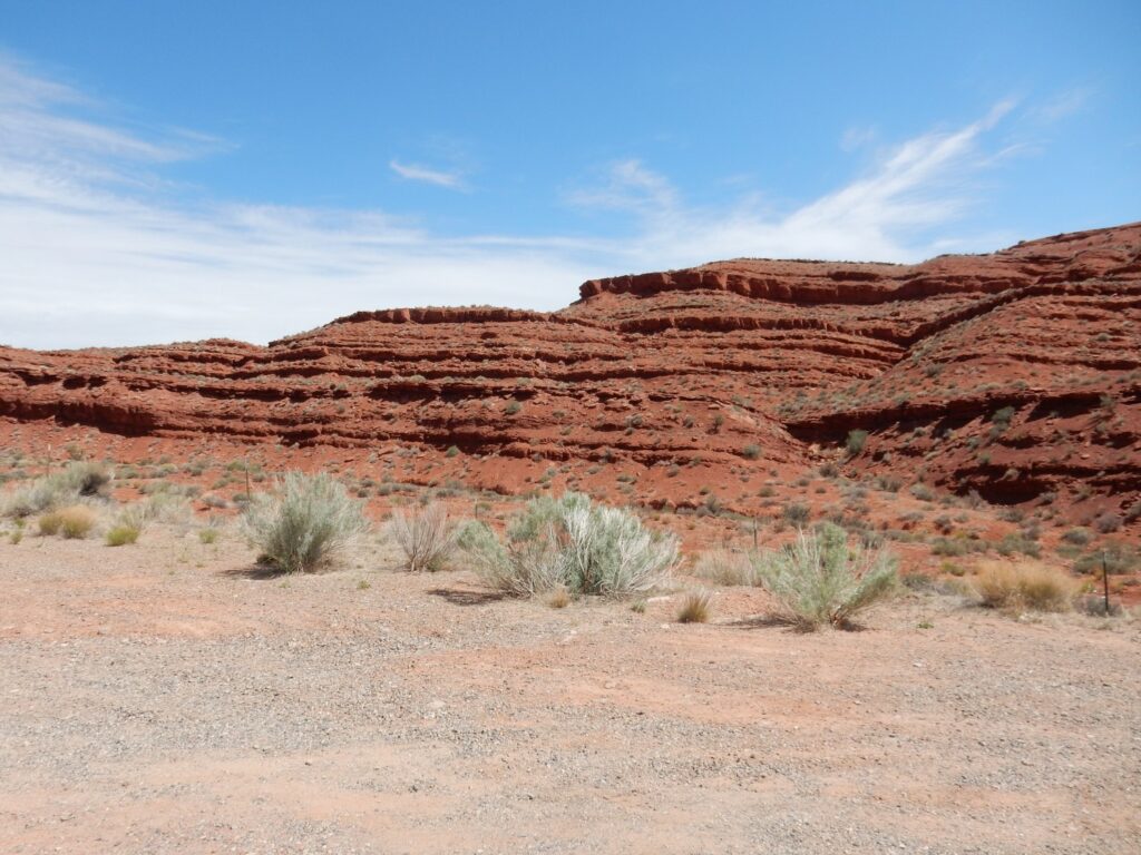
South of Blanding, Comb Ridge comes into view to the west.
Comb Ridge is the distant white ridge to the right. It marks where sedimentary beds dip across a deep fault that marks the eastern edge of the Monument uplift. The beds further west have been raised relative to those to the east, and where the beds cross the fault, they are warped downwards. The prominent line of white bluffs is Navajo Sandstone, a particularly resistant sandstone formation that remains when softer beds around it are eroded away.
We saw some Navajo Sandstone yesterday. The formation is Jurassic in age, about 200 to 195 million years old, and was deposited in a vast dune sea. This area was then squarely in the arid belt north of the Equator and was in the rain shadow of the Sevier Mountains to the west, along the Nevada-Utah border. The Navajo resembles the Wingate Sandstone, which we also saw yesterday, but is separated from the Wingate by the Kayenta Formation, which is thinly bedded mudstone and sandstone deposited by rivers in a brief interval of wetter climate.
The white rock exposures in the middle distance are the rim of Spring Canyon and are composed of the Bluff Sandstone, deposited by yet another dune sea somewhat later in geologic time. The Bluff Sandstone is sometimes included in the Jurassic Morrison Formation and sometimes regarded as a separate formation.
The foreground pink sand could have been eroded from any of these formations or from the reddish Entrada Sandstone, which is a bit less resistant than either the Navajo Sandstone or the Bluff Sandstone and is intermediate in age between the two.
I reach Bluff and drive west through Comb Ridge. This is an area I have visited before, but these beds were just irresistible.
These are sandstone and mudstone red beds of the lower Cutler Group, sometimes assigned to the Halgaito Formation. (There’s some disagreement on the stratigraphy of the lower Cutler Group in southeastern Utah.) The lower Cutler Group records the advance of river deltas from the Uncompahgre uplift to the northeast across the limestone of the underlying Honaker Trail Formation.
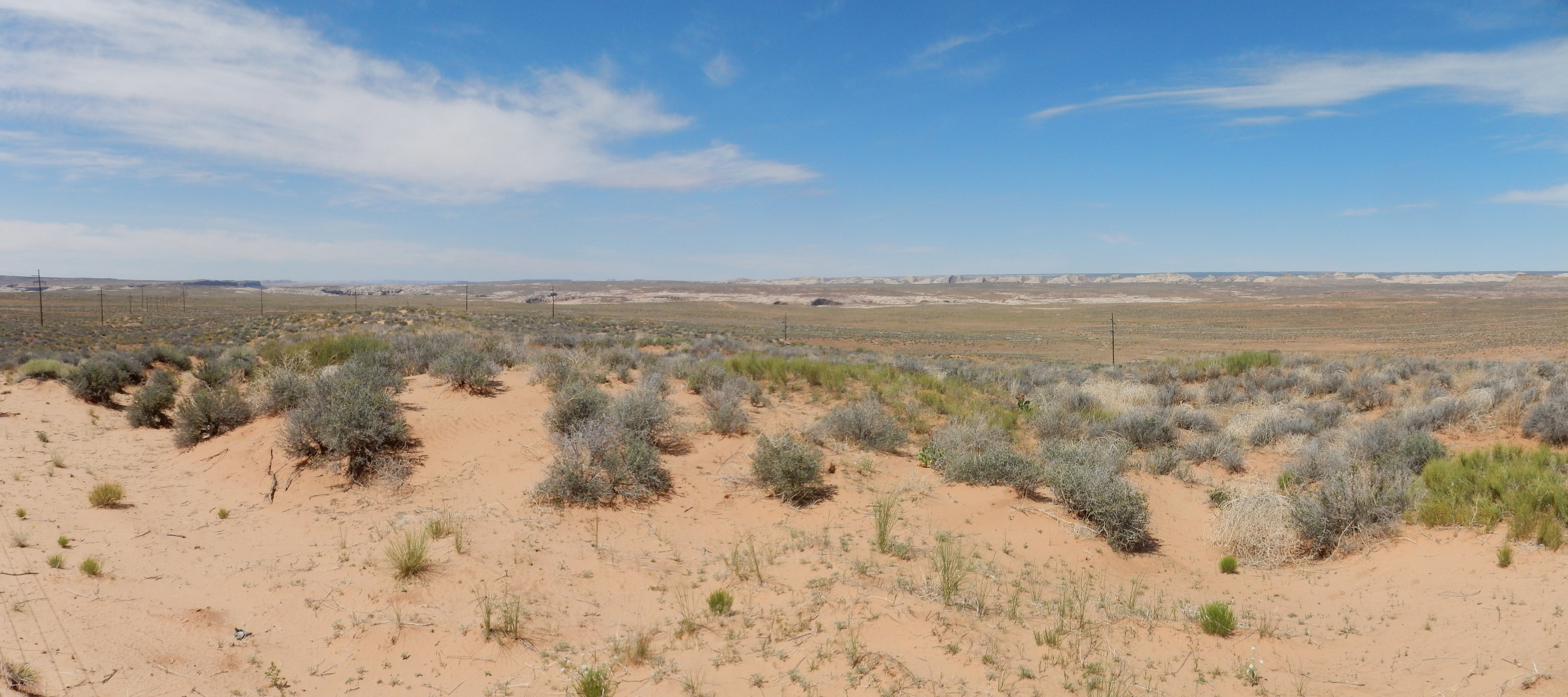
I take the turn west towards Goosenecks State Park, and get a nice panorama of Cedar Mesa.
Here my telephoto capability shines.
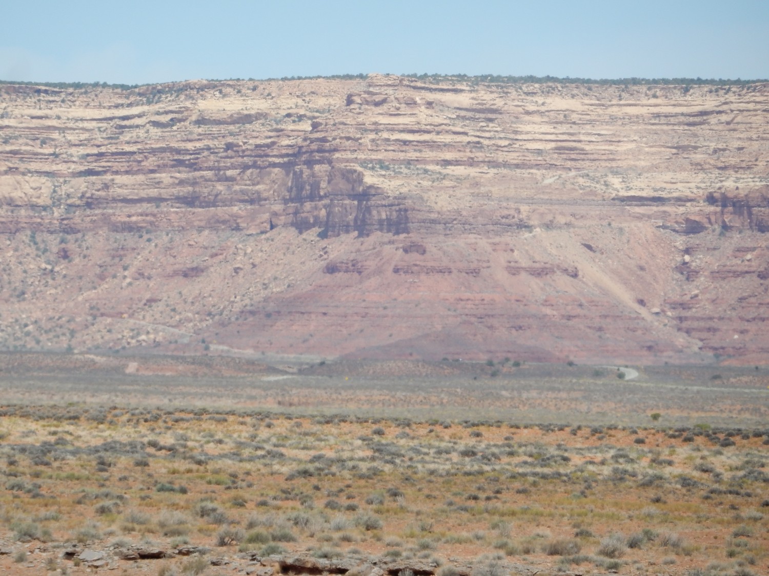
The mesa consists of a cap of Cedar Mesa Sandstone over the red beds of the Halgaito Formation. It, too, is part of the Cutler Group, represents the advance of a sea of sand that drowned the Halgaito river deltas. In a pattern we’ve seen before, the Cedar Mesa sand was carried west by the rivers, then blown east by the wind, over and over, producing very pure and uniform quartz sand. However, the formation was affected by periodic fluctuations in sea level that produced the many layers seen here. This is, unsurprisingly, the type location for the formation.
I drive to the park. There is a toll both; $10, not covered by my parks pass, since it’s a state park. Well, considering how much gas I’ve spent driving here, that’s a small fee. And the view is well worth the money:
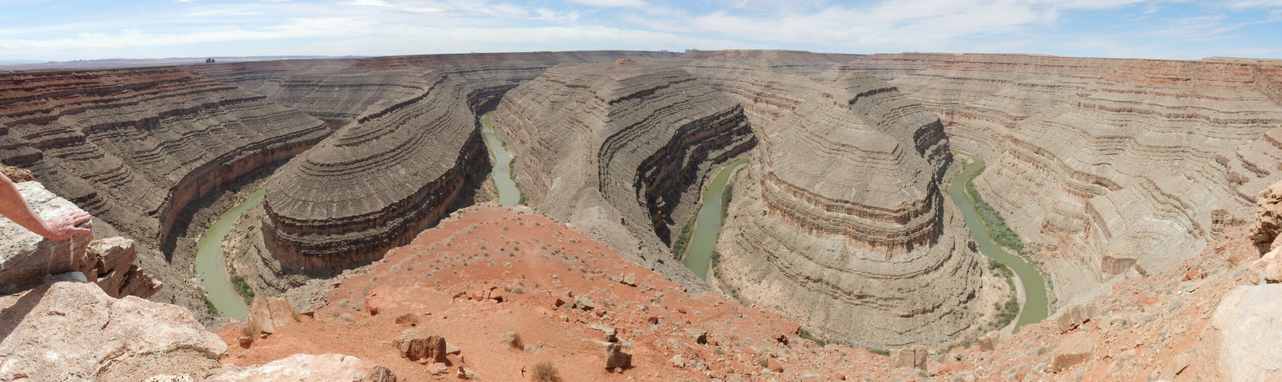
They’re real, and they’re spectacular.
The Goosenecks are a superb example of entrenched meanders. This area was a relatively low-lying, flat floodplain as recently as five million years ago, and the San Juan River meandered gently across this floodplain. When the region was uplifted by tectonic forces, the river cut straight down, entrenching its meanders to form the spectacular canyons here. We’ll see another superb example of an entrenched meander in a couple of weeks.
The lowermost beds in the canyon are assigned to the Paradox Formation, as its carbonate shelf facies. Although evaporites like rock salt and gypsum were deposited in the center of the Paradox Basin, the soutwest margin of the basin was a shallow shelf at high stands of the sea and completely exposed at low stands.As a result, no evaporites are found in the Paradox Formation here. Instread, the formation consists of cycles of limestone characteristic of different depths in the sea. Some of the limestone is fossilized algal mounds, and these form excellent reservoir rock for petroleum, so that the Paradox Formation has been an important target for oil exploration in the Four Corners region.
The uppermost reddish beds are assigned to the Honaker Trail formation.
There is a thick sequence of beds in between that are in dispute. These reach from the base of the upper reddish beds to around the base of the particularly massive limestone beds halfway down the canyon walls. One geologic map of the area assigns these to the Honaker Trail Formation; the other assigns them to the Paradox Formation. I don’t have a strong opinion which one is right.
To the southeast is Alhambra Rock, and I get a good telephoto shot.
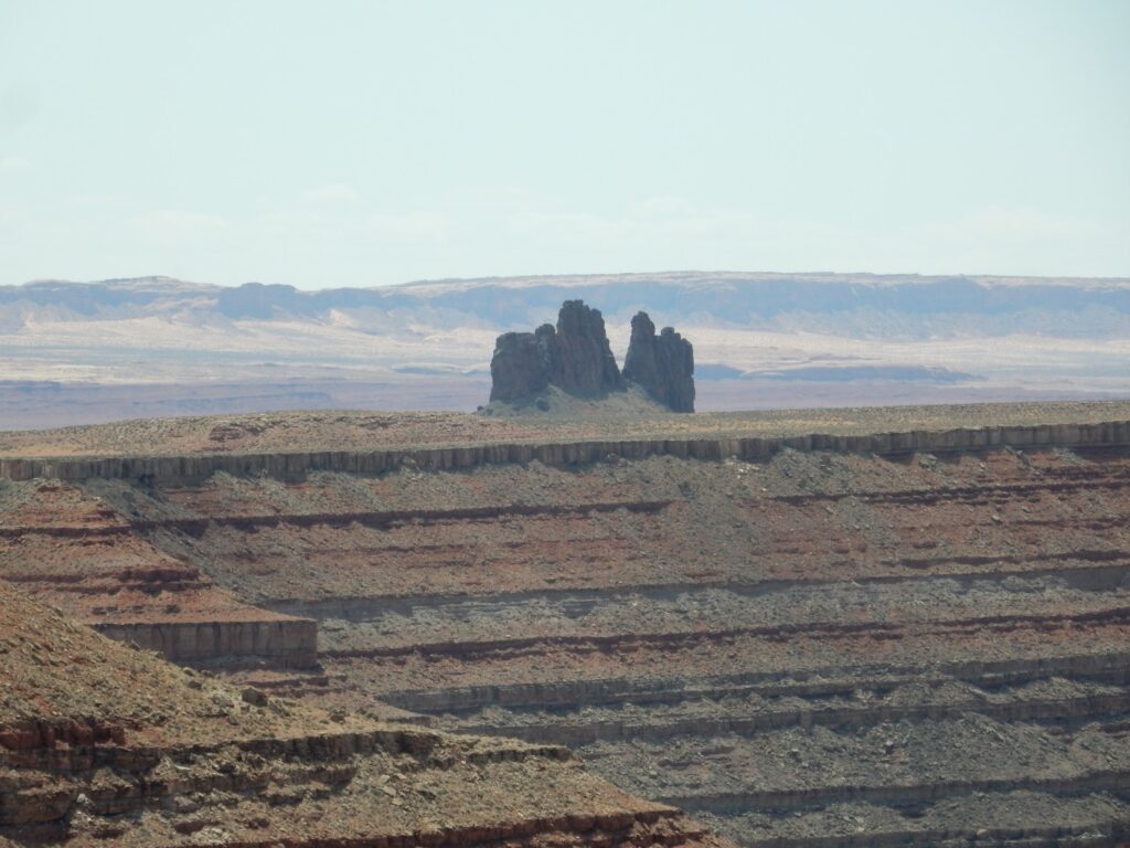
Alhambra Rock is a dike, an intrusion of magma along a fault. The intrusion here is quite local; the fault itself can easily be traced considerable distances north and south, but nowhere else is any igneous rock in evidence. The magma was likely low in silica, to be fluid enough to penetrate the fault zone, but I have no more specific information on its composition. However, my guess is that it was a high-potassium magma typical of similar intrusions throughout this area, all dating back to around 25 million years in age.
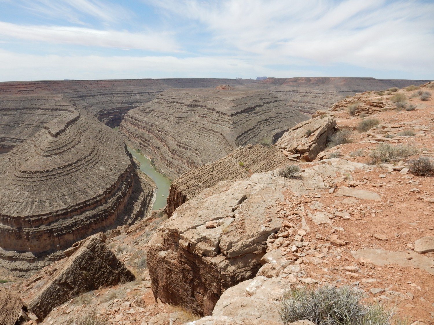
I walk a short distance along the rim for a slightly different view.
Then I return to my car and have a light lunch out of my supplies. There is a vending both set up nearby, with a Navajo woman selling jewelry. There are a pair of earrings with serpentine pendants (“Navajo jade”) that I think Cindy might like, for a reasonable price, and I bite.
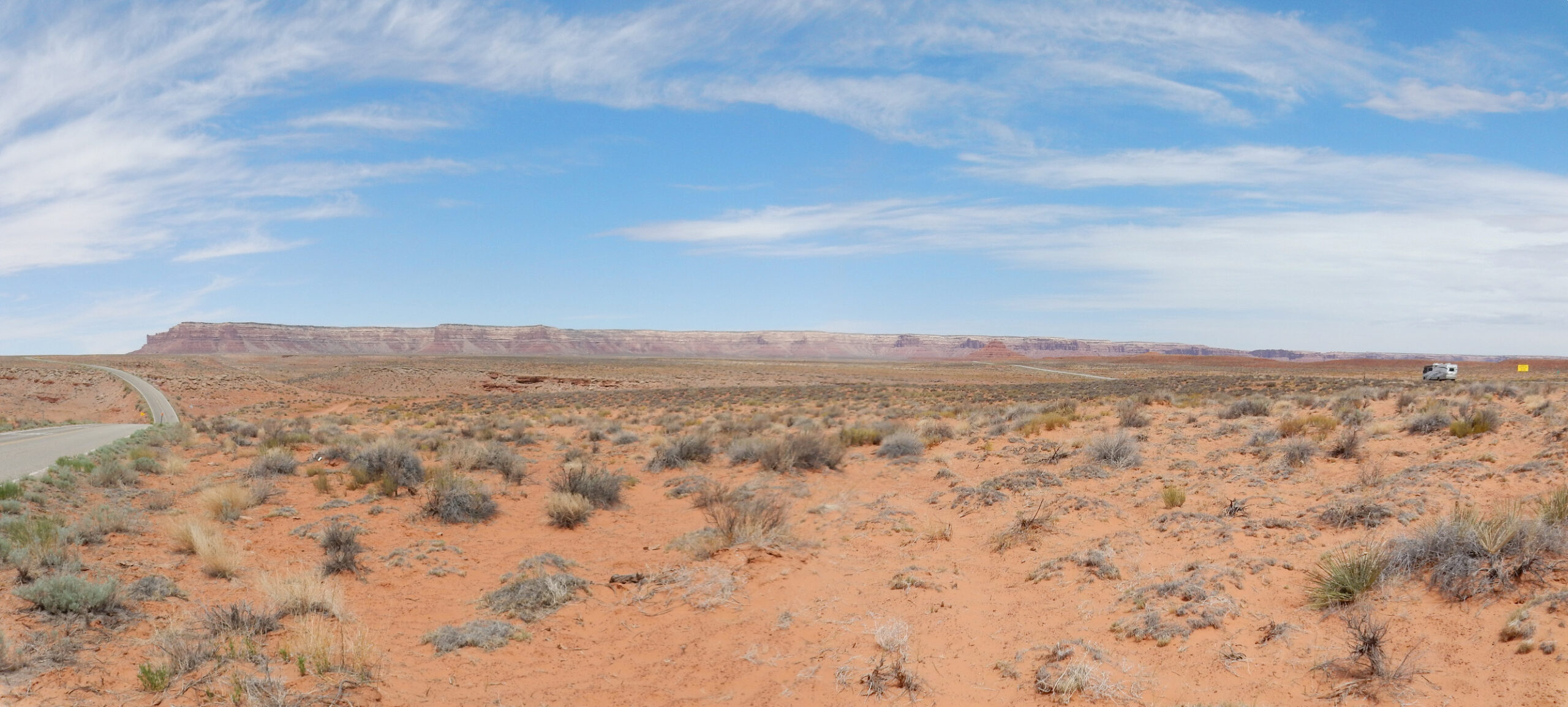
Then on to Monument Valley. The monuments come into view.

Telephoto:
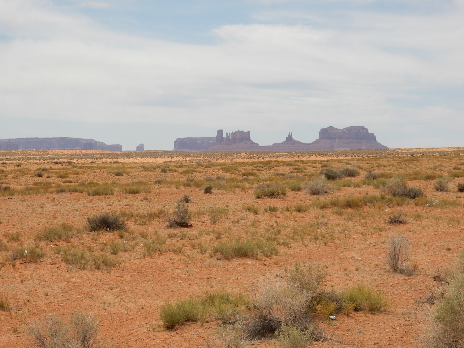
As I comment to another photographer at this pullout, we’ll probably find the next pullout is even better.
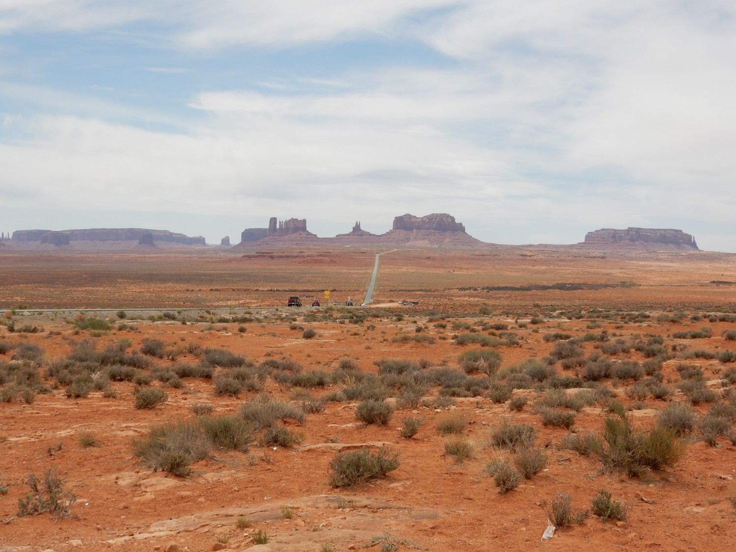
The road passes close, but I decide to save the close up shots for the return leg, when the features will not be backlit.
It turns out the Navajo park is closed. I’m not surprised; native Americans have suffered dreadfully from COVID. I continue on south a short distance. This view to the west catches my eye.
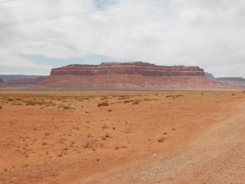
This is Boot Mesa. My geologic map for this area is poor; but the lower beds are likely Cutler Group, the massive cliffs are De Chelly Sandstone, the thin section above is Moenkopi Formation, and the cap is Shinarump Conglomerate. We’ve seen Cutler Group and Shinarump Conglomerate before. These formations extend into New Mexico, though the De Chelly Sandstone is sometimes referred to as the Meseta Blanca Formation in the Jemez area. (That they correlate seems clear; that they are the same formation is slightly less universally accepted.) The Cutler and De Chelly Sandstone are Permian in age, while the Moenkopi and Shinarump are Triassic.
Spectacular features like this occur in this arid climate because the relatively soft beds of the Cutler Formation are easily eroded, undermining the more resistant beds of the higher formations, which break off in great vertical slabs to form the cliffs.
This is Owl Rock.

The flat mesa top on which Owl Rock sits is underlain by the Owl Rock Member of the Chinle Formation. Oddly, Owl Rock itself is composed of the Wingate Sandstone.
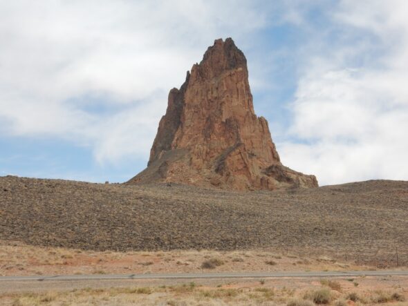
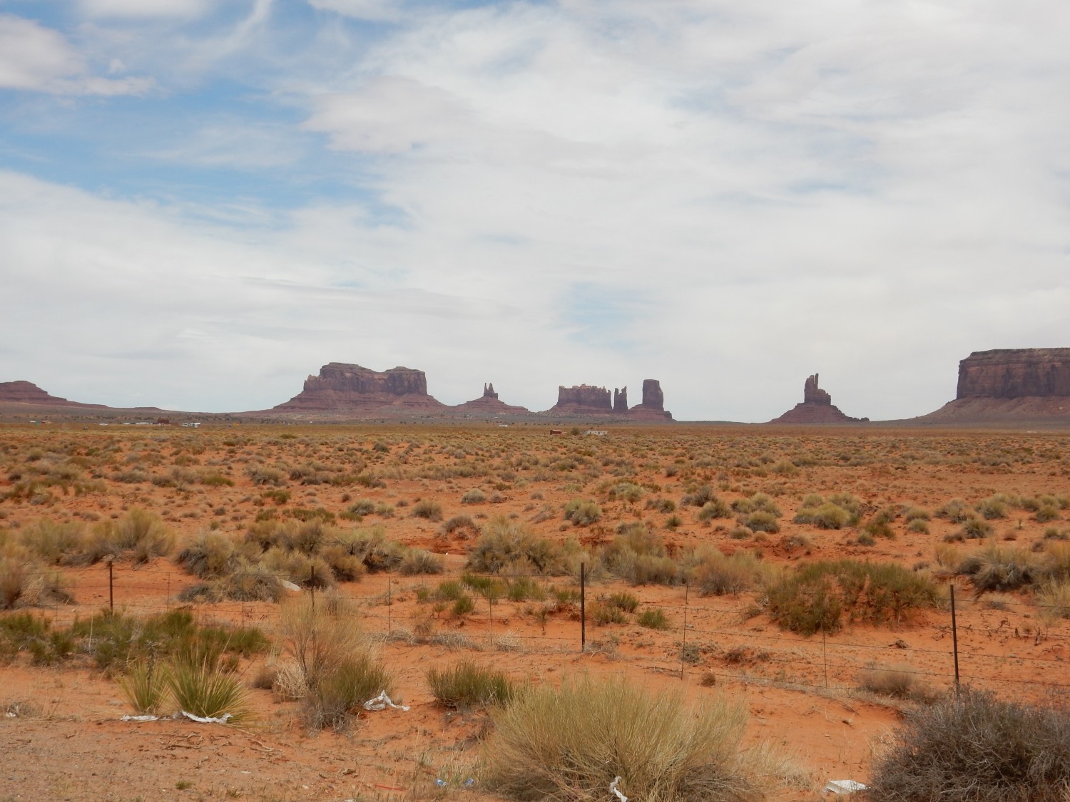
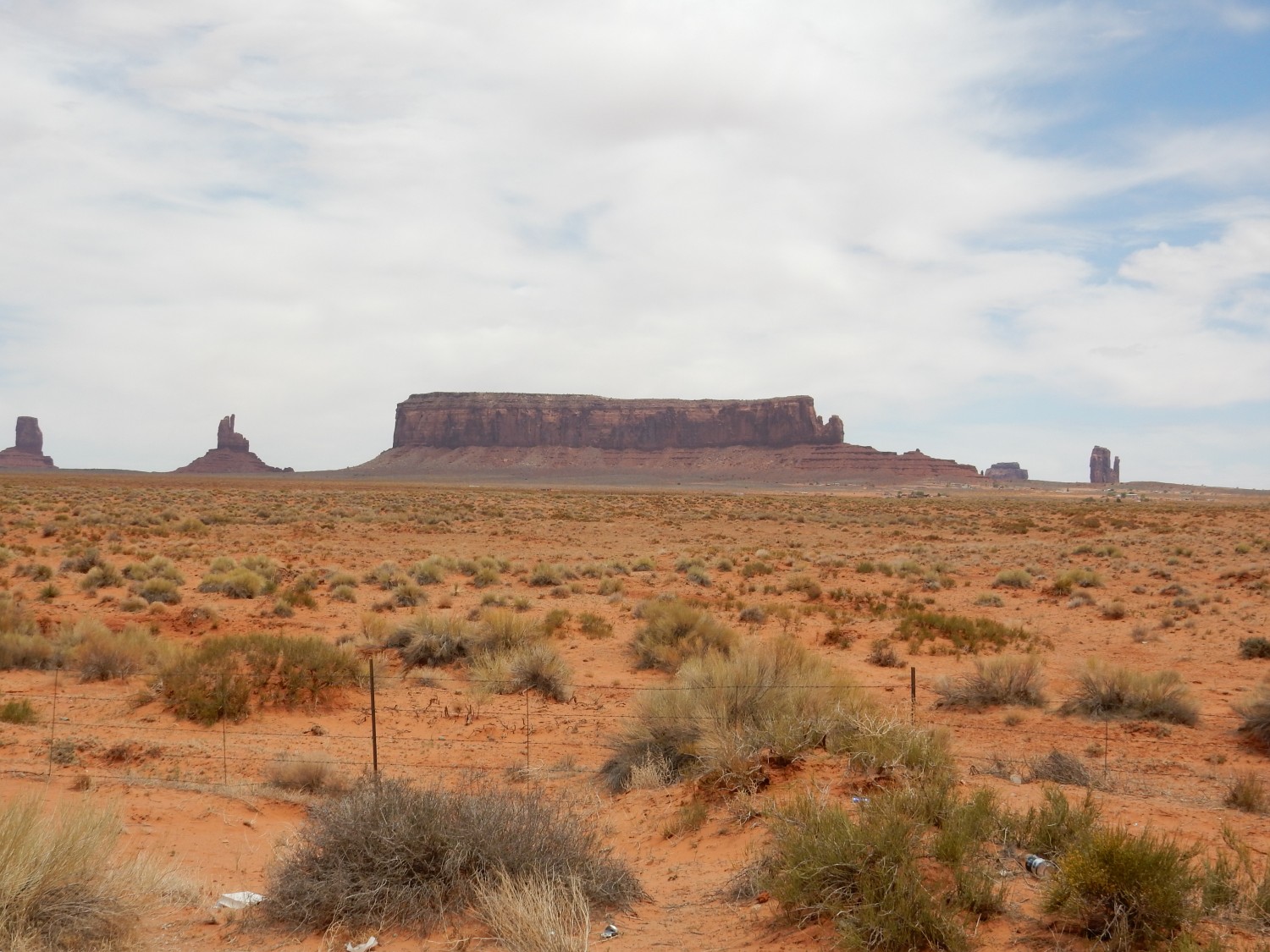
And now, what I’ve come this far south to see: Agathla Peak.
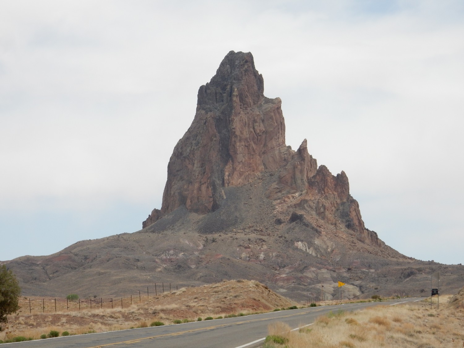
I drive a bit further for a closer view.

If this makes you think of Shiprock in New Mexico, then good for you. The two mountains are of identical age and origin. Both are volcanic plugs, formed 25 million years ago by eruption of low-silica potassium-rich magma that forms a rare kind of volcanic rock called minette. They are part of the Navajo Volcanic Field, which contains many similar plugs scattered across the Four Corners.
I cannot legally take a sample, but I can photograph some rock fragments eroded off the plug.
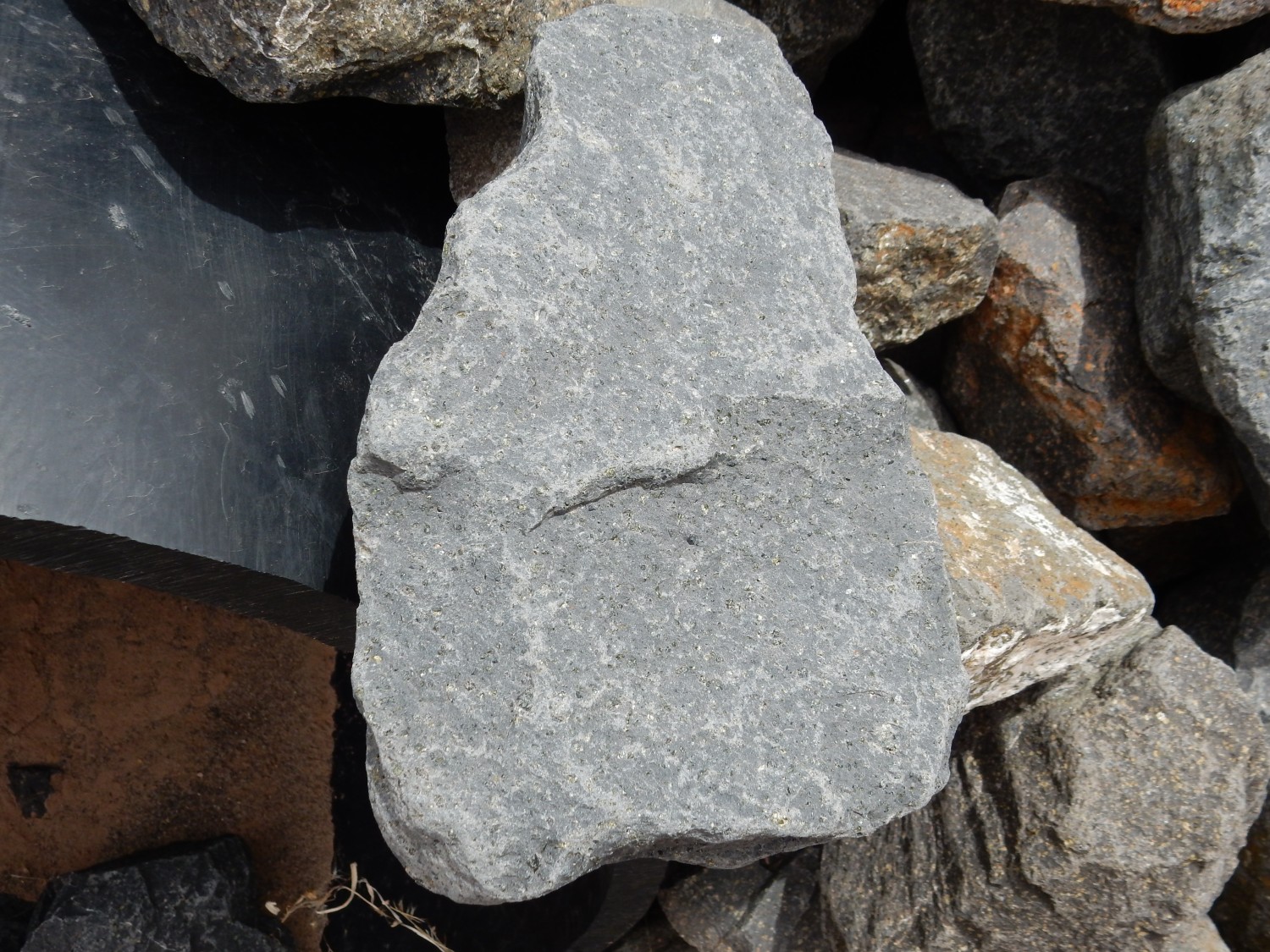

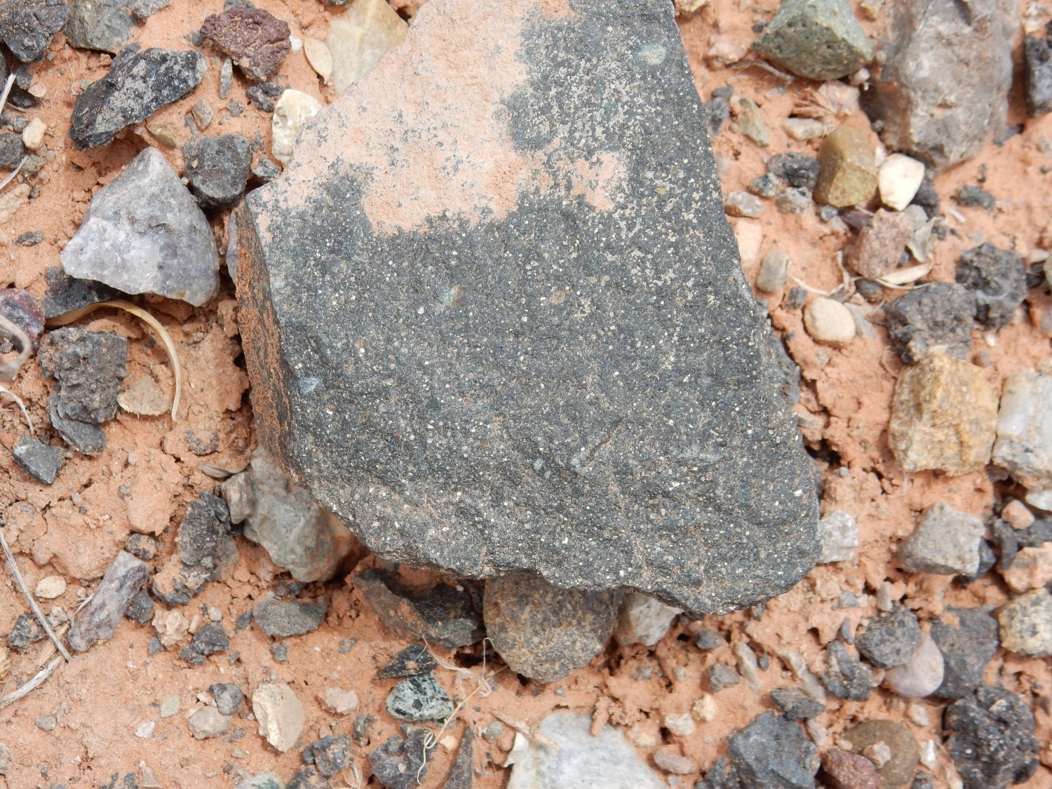
The glistening patches are crystals of biotite (a form of mica). Biotite is not uncommon in igneous rock, but the abundance of flakes in this low-silica rock is quite unusual and identifies this as a lamprophyre. Lamprophyres are low-silica, high-potassium rocks formed when part of the upper mantle just reaches the melting point. Potassium-rich minerals melt first, and if melting goes no further, a lamprophyre magma is produced. Minette also contains potassium feldspar, and I think I see a few grains of olivine in the first sample. Olivine is characteristic of all low-silica volcanic rock regardless of potassium content.
Well, cool. I had considered heading further east, to see the Chinle Formation and the Rock Point Formation at their type areas, but decided not to. That would push my fuel supply and time, and the Rock Point type section is deep in tribal land where I can’t get close enough for a really good photograph. I head back north, pausing to get some photos of the monuments of Monument Valley.

At left, Eagle Mesa, with the small spire of Setting Hen to its right. At right, Brigham’s Tomb.
To the right of Brigham’s Tomb: Stagecoach (the wall of spires), Big Indian (the single spire at right), and Sentinel Mesa at far right.
The rest of Sentinel Mesa, and, at right, The Mittens. As one panorama:

Be sure to click on that one for the full resolution version.
I continue north back to Blanding, thinking to recharge camera batteries one more time. The church is closed. I continue to my camp, make dinner out of my supplies, check with Cindy on my cell phone, and spend the evening quietly reading.