90th Birthday Wanderlust, Day 13: Jurassic National Monument
Based on weather reports, I decide this is the day to head a bit south and check out Jurassic National Monument, which includes the Cleveland-Lloyd dinosaur quarry. I missed it a couple of years ago, when Gary and I drove there and found it was not open that day of the week, and I missed it again a few days ago, when some changes in plan meant we didn’t get to it. Gary found it, enjoyed it, and sent word, so now I’ve just got to see it for myself.
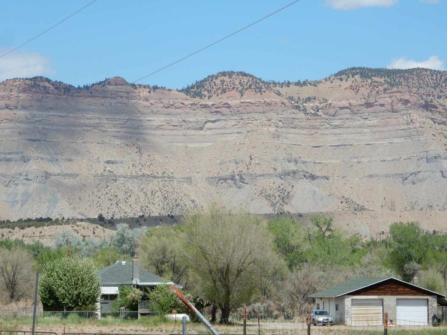
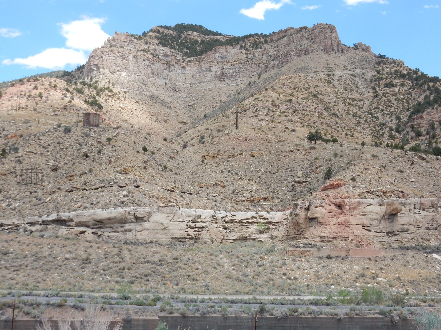
I head south and into Price Canyon. This is well-trodden country for me, but I still can’t resist stopping at the Thistle overlook.
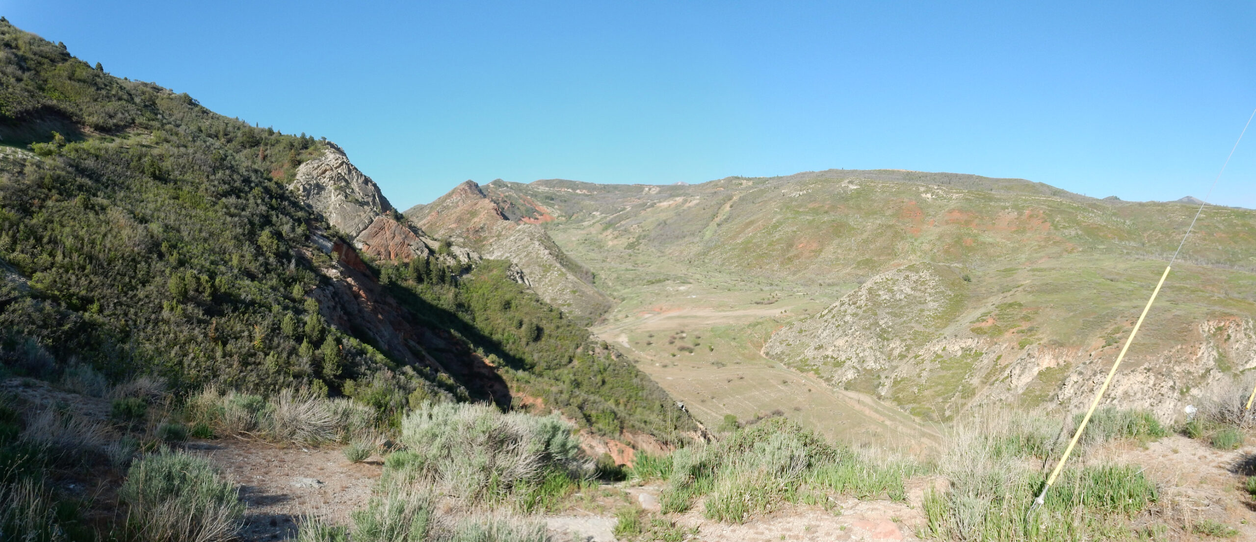
The highway once ran along the bottom of the canyon here. However, in 1983, a large landslide from the mountain at center filled the valley, and the highway had to be reconstructed to pass around it.
The red beds across the valley (which also made up most of the landslide) are of the North Horn and Ankareh Formations. Though similar in appearence, they are quite different in age. The North Horn is Eocene, around 50 million years old, while the Ankareh is Triassic, around 250 to 200 million years old. Both are mudstone that easily weathers and is susceptible to landslides. The white rock at right and left is Jurassic Nugget Sandstone, unless it’s Jurassic Navajo Sandstone. The two are about the same age and may be deposits of the same sand dune sea, but with the Nugget in the north part of the field and the Navajo in the south part. Where the boundary lies depends on which geologist you talk to.
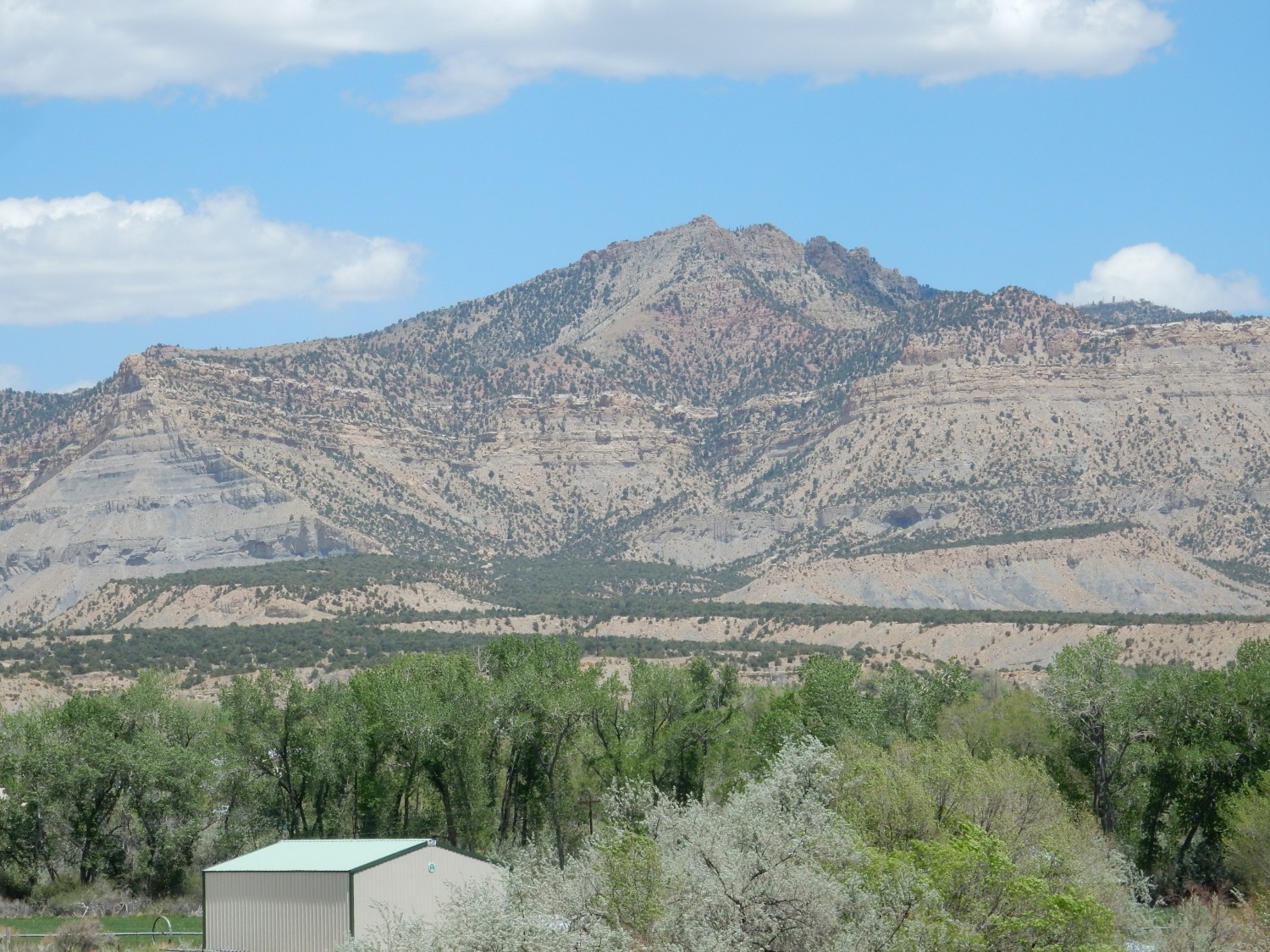
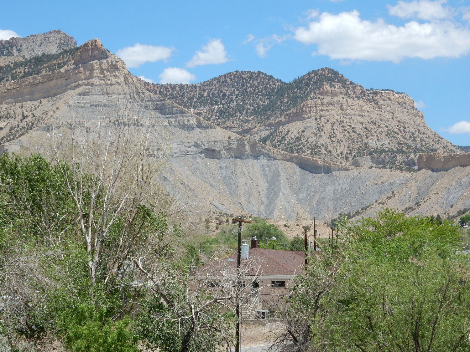
This, also, was just too pretty not to stop at.
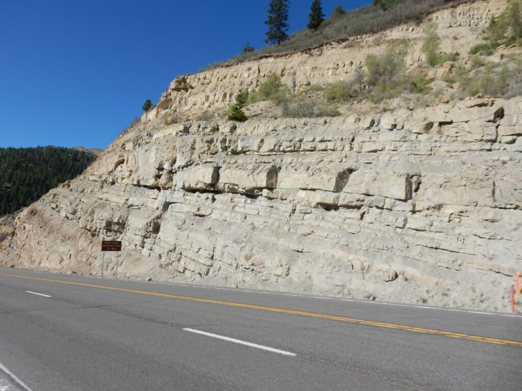
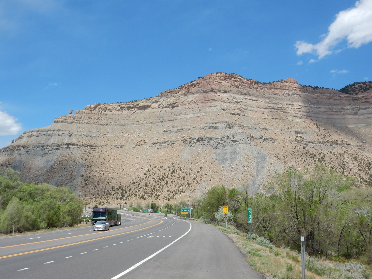
This seems to be Flagstaff Formation, which is spectacularly exposed in many locations in the canyon. The overlying Green River Formation is prominently exposed further up canyon, and I’ve visited there many times before.
The Flagstaff Formation records the first stages of deposition in the large intermontane lakes that formed in this area in the Eocene, around 50 million years ago.
I exit the canyon into the Colorado Plateau country beyond.
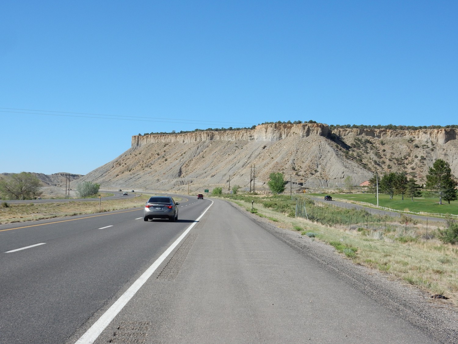
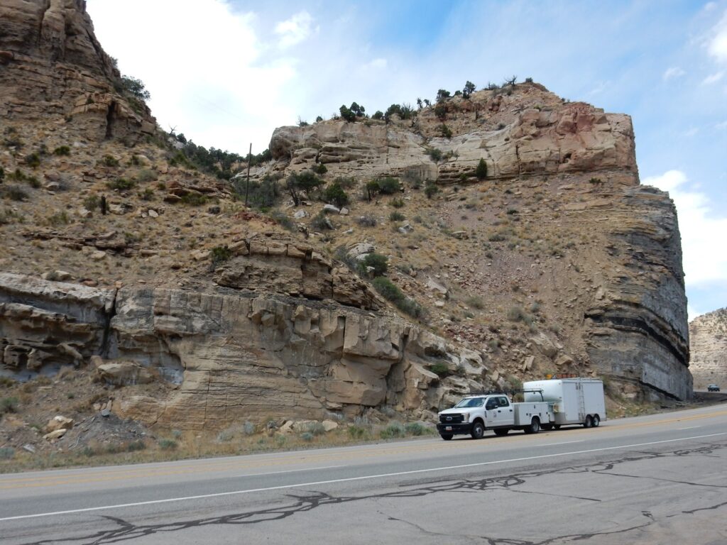
This is Mancos Formation, as we saw the first day of the trip. You’ll recall that this is a very extensive and complex Cretaceous formation deposited in the Western Interior Seaway, the vast geologic basin east of the Sevier Mountains of eastern Nevada and western Utah during the time of the dinosaurs. We’re looking at Bull Mesa, which is capped by the Emery Sandstone Member over beds of the Blue Gate Member. The Blue Gate is typical black organic shale of the Mancos Formation, deposited in deep, stagnant water, while the Emery Sandstone represents a brief retreat of the sea that deposited beach sand.
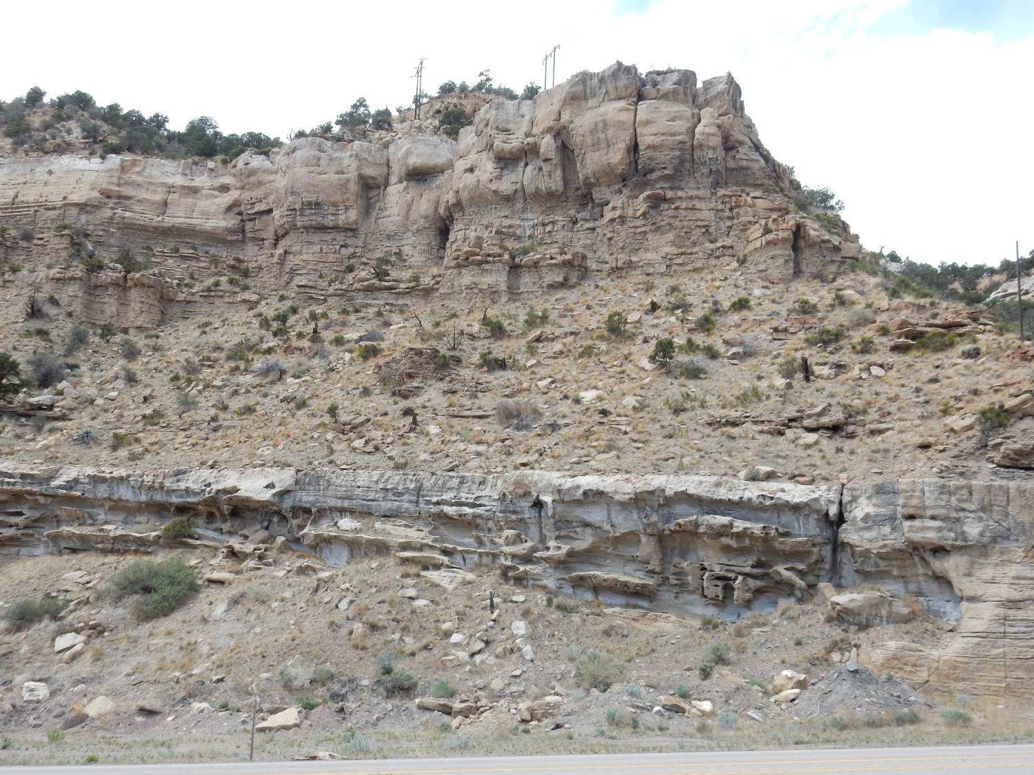
I take the turn to Cleveland and find the exit to the dinosaur quarry. The road turns to gravel. I confess I’m still a bit nervous about how my car will hold up, but there’s a passenger vehicle just ahead of me, so I can hardly wimp out now. And the road has signs identifying all the formations. I’ve photographed these before, but I pay closer attention to the Cedar Mountain Formation this time.
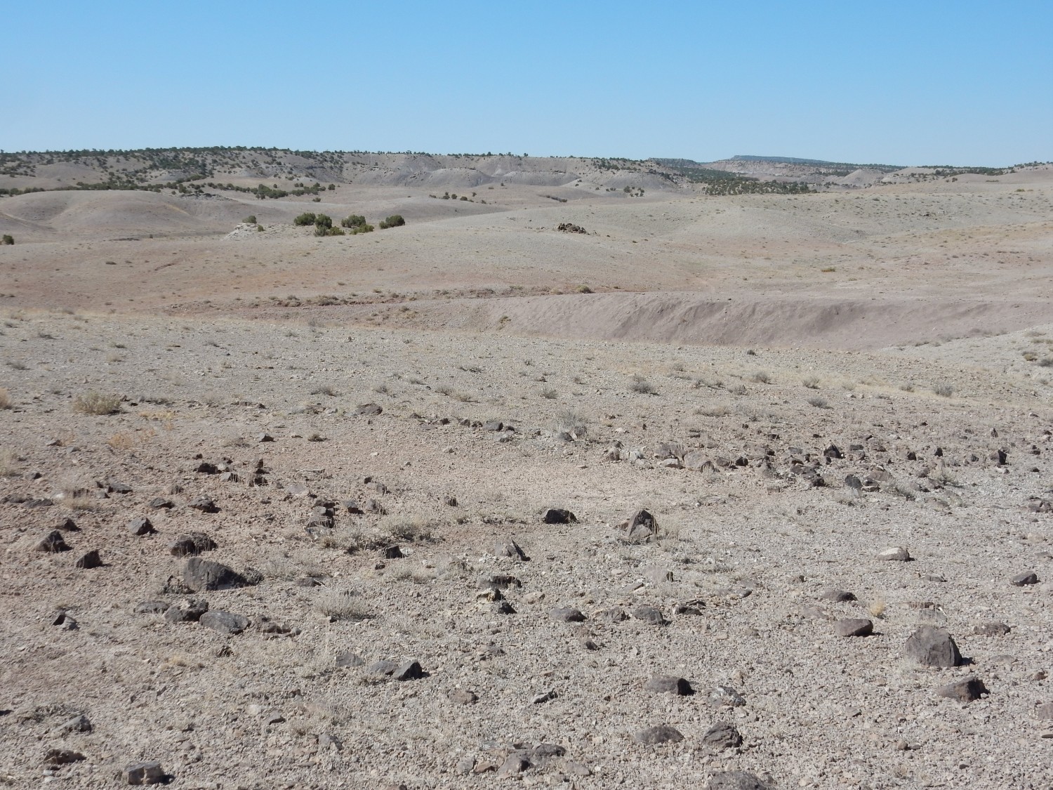
Practically everything here is underlain by Cedar Mountain Formation. I want this picture in case the type section, which is just a few miles south, proves inaccessible by gravel road.
The Cedar Mountain Formation was deposited in the same basin as the Mancos Shale, but before it was flooded by the sea. It’s basically coastal river delta mud. It has also yielded enormous numbers of dinosaur fossils — but elsewhere; the dinosaur quarry I’m headed to is in a different formation.
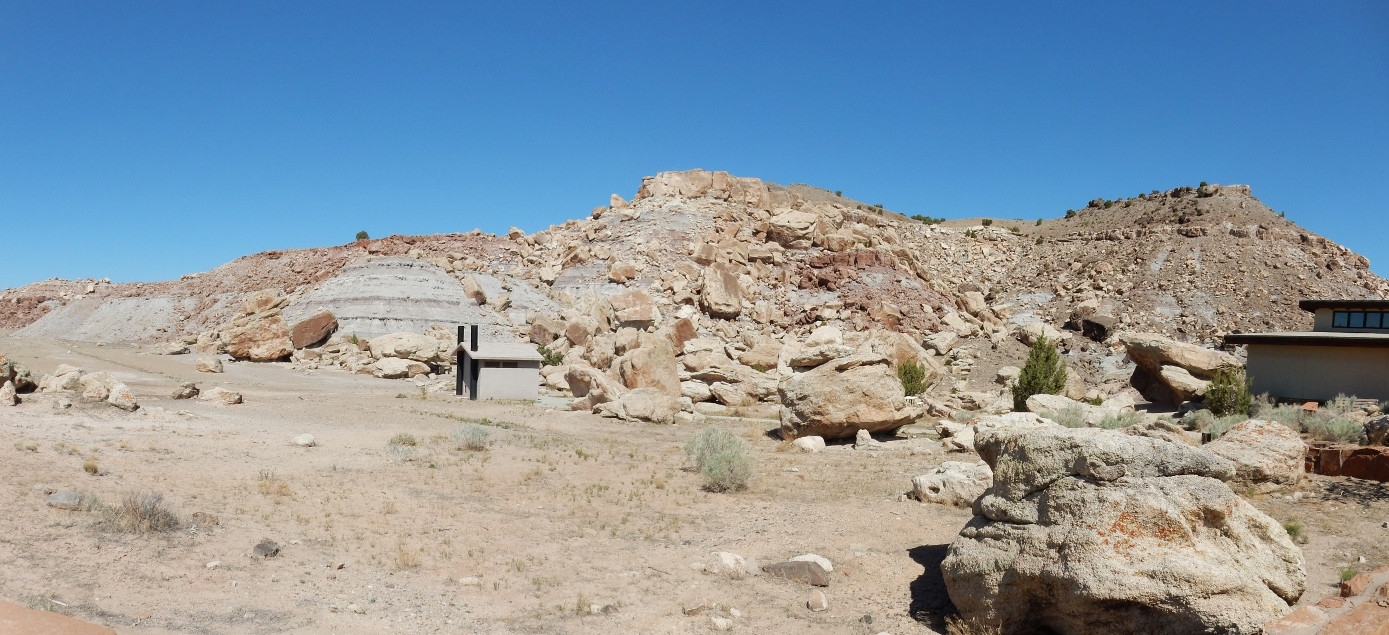
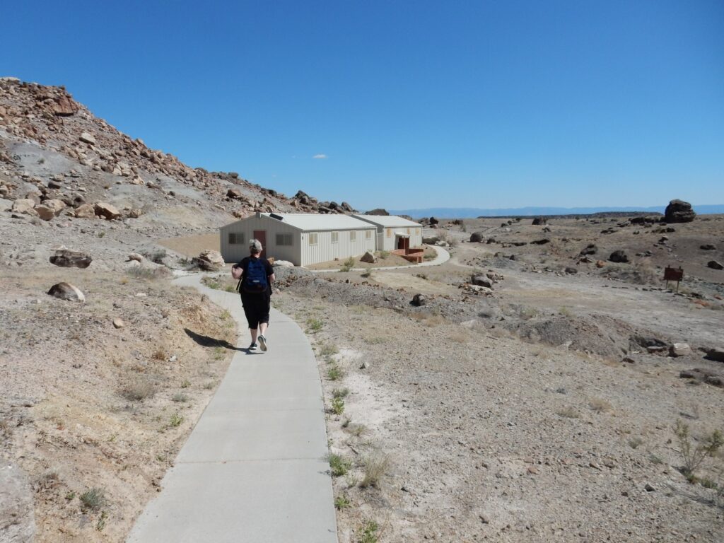
I arrive at the quarry.
I know that the quarry is in the Morrison Formation, but I am not sure which members. I guess that the lower mudstone I’m seeing here is the Tidwell Member and the upper sandstone is the Salt Wash Member. (This turns out not to be right.)
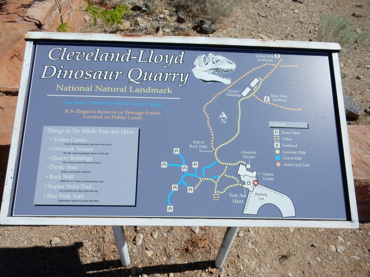
Signage.
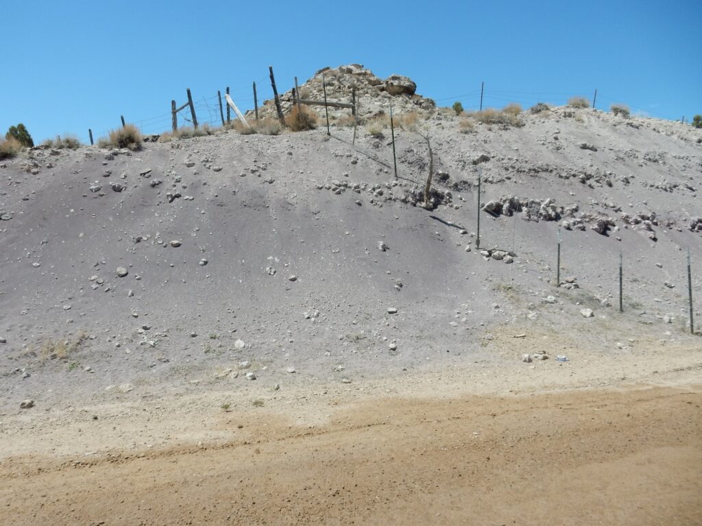
The boulders near the visitor’s center are a conglomerate.
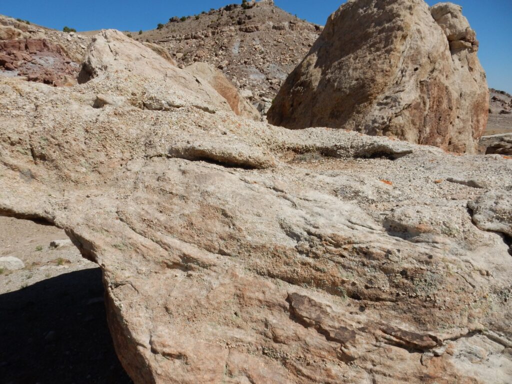
In retrospect, I will identify this as the Buckhorn Conglomerate, the lowermost part of the Cedar Mountain Formation.
I enter the museum and show my annual pass. The fossil quarry here is quite extensive.
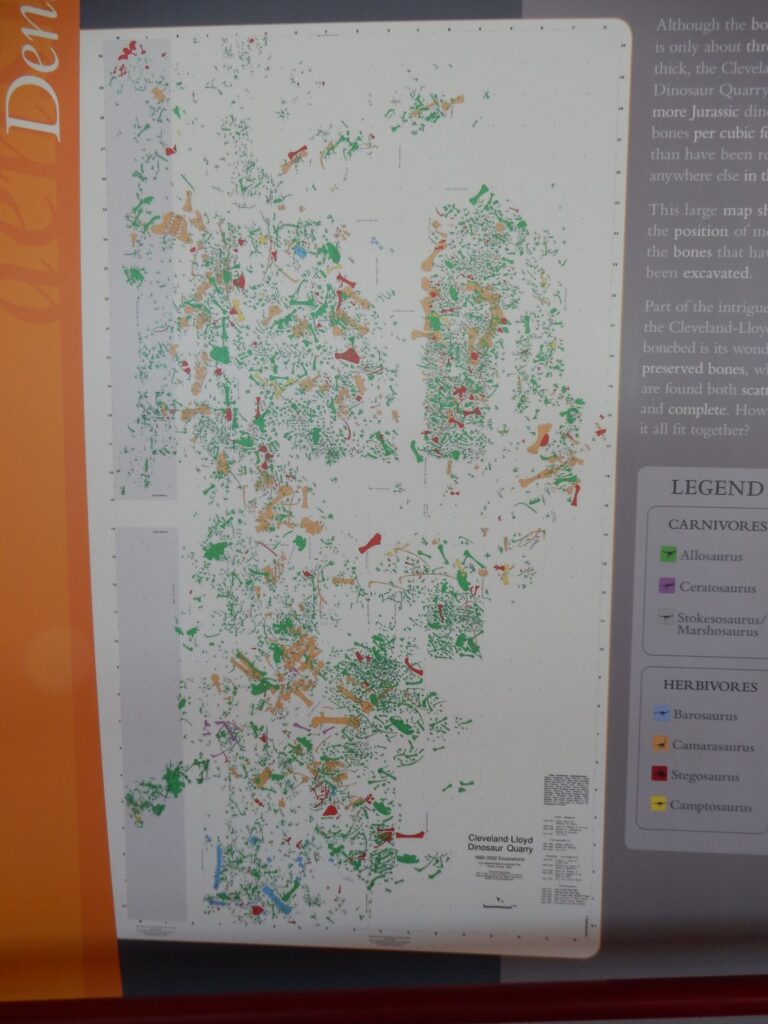
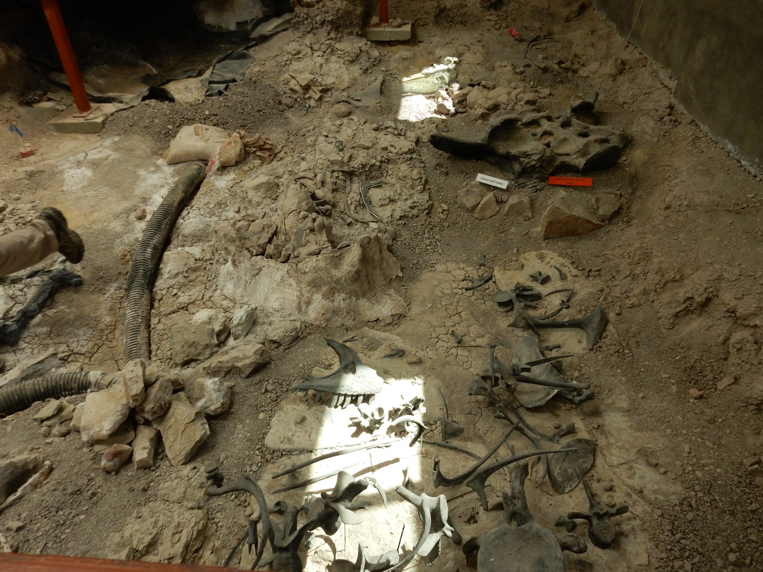
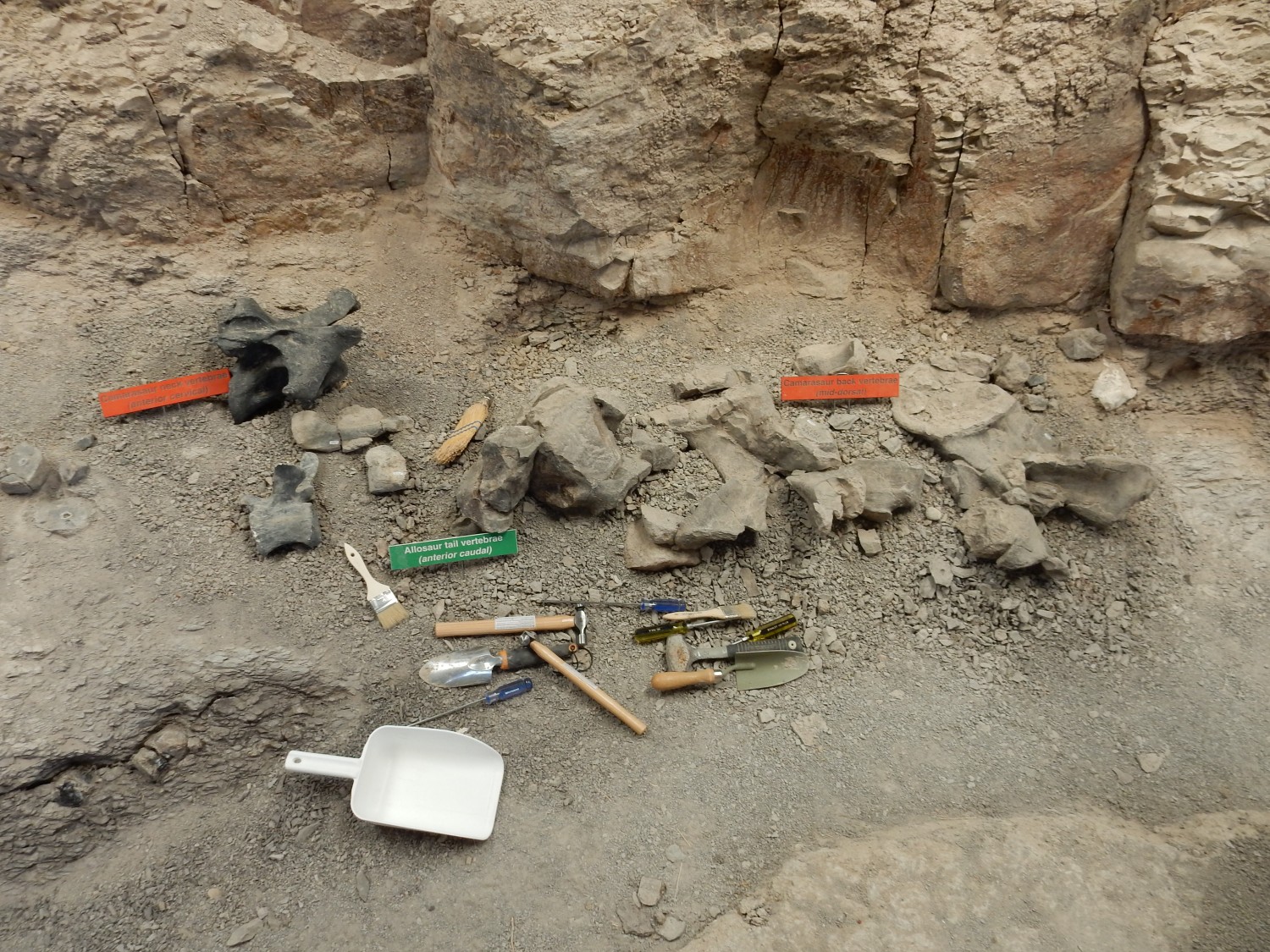
I think the gray rectangles at left represent the current excavation sheds, but I’m not sure of that. Much of the area has been quarried already.
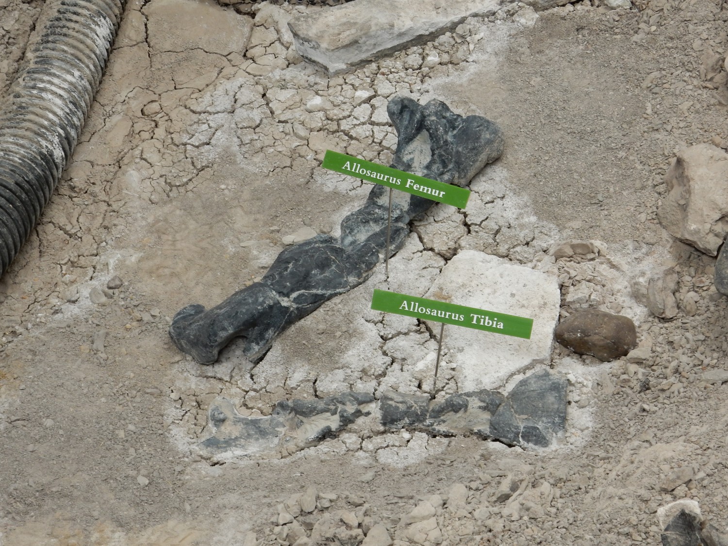
The quarry is top heavy with Allosaurus skeletons (shown in green). Allosaurus was a predator, and this suggests that the quarry was some kind of bog in which sauropod herbivores became trapped, attracting allosaurs, who then also became trapped. But the nature of the beds is not entirely consistent with this. I asked a ranger, and the bottom line is there still isn’t agreement why so many dinosaur bones were preserved here.
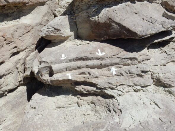
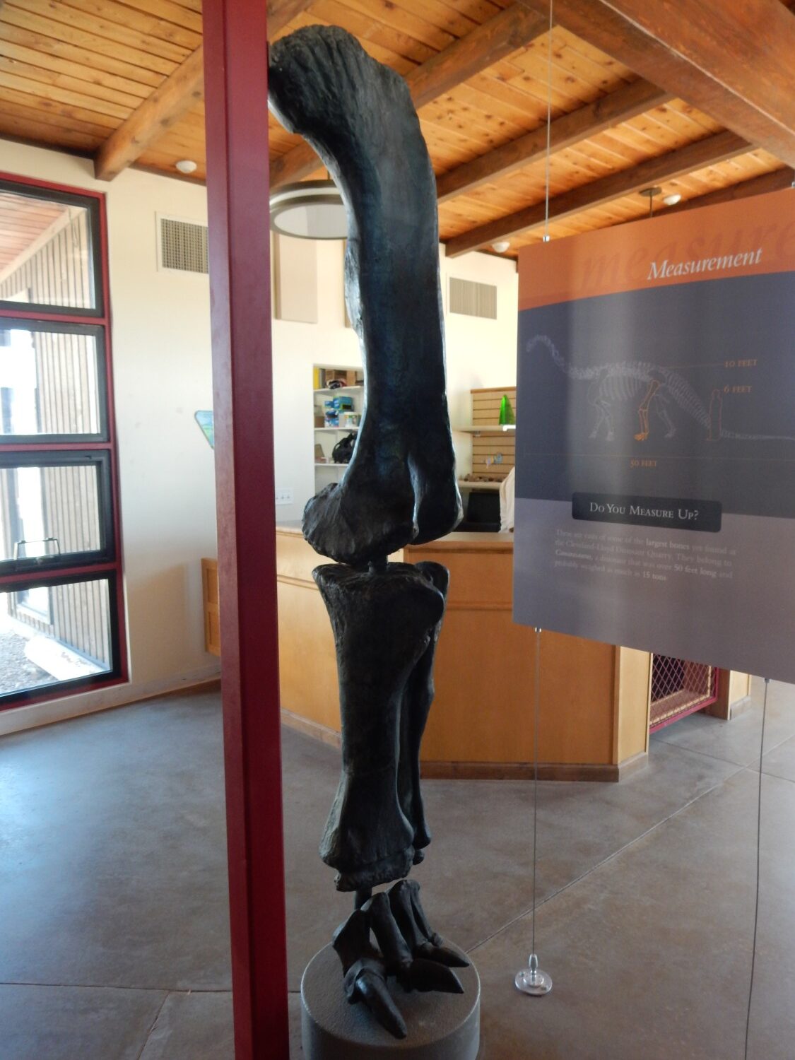
Sauropod leg.
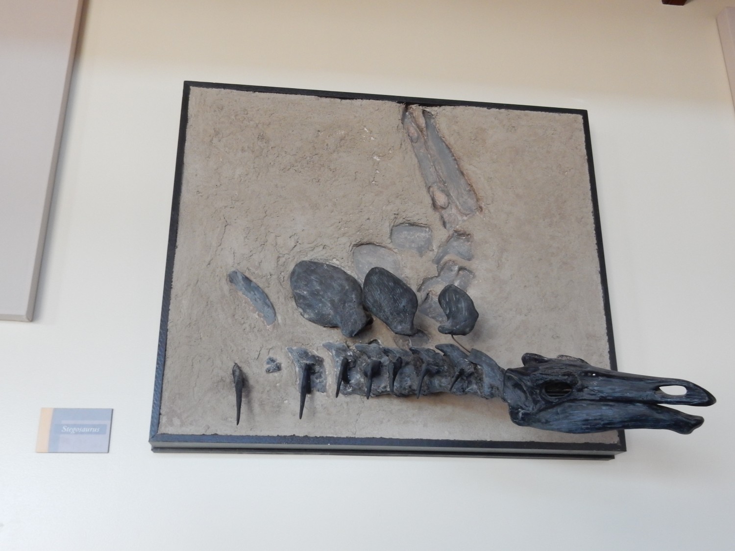
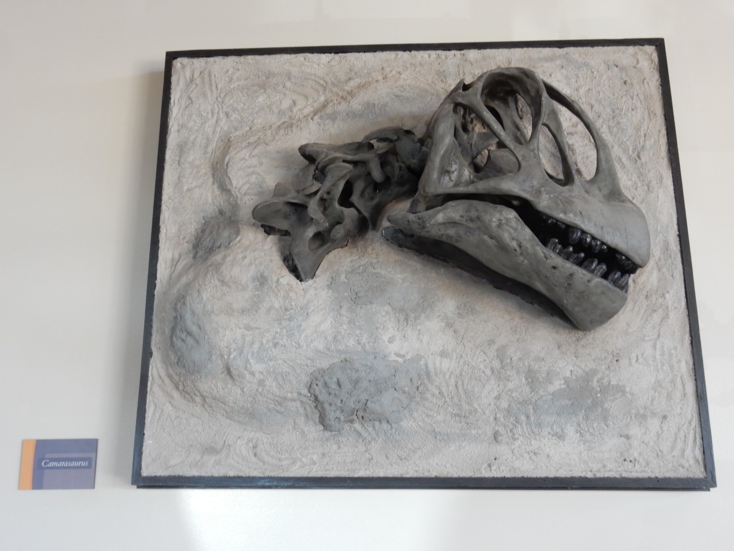
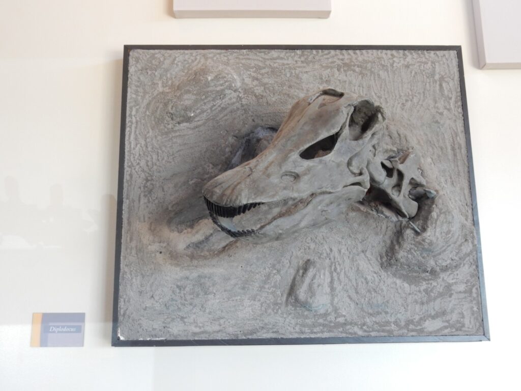
Skulls.

I’m puzzled that the one labeled as a Camarasaurus, the big one, has what look like cutting teeth, though it’s a herbivore. Apparently Camarasaurus browsed on coarser plant material, and these teeth helped chop it up.
Some people keep trophy heads on their walls.

There is a display discussing various possible origins of the fossil cache. Several scenarios are described, along with clues that match them. The viewer is invited to figure out which is right. I go over it … and it turns out there is no match, or so it seems to me. I later ask a ranger about it, and she replies that that’s more or less the point.
“I need a size F.”
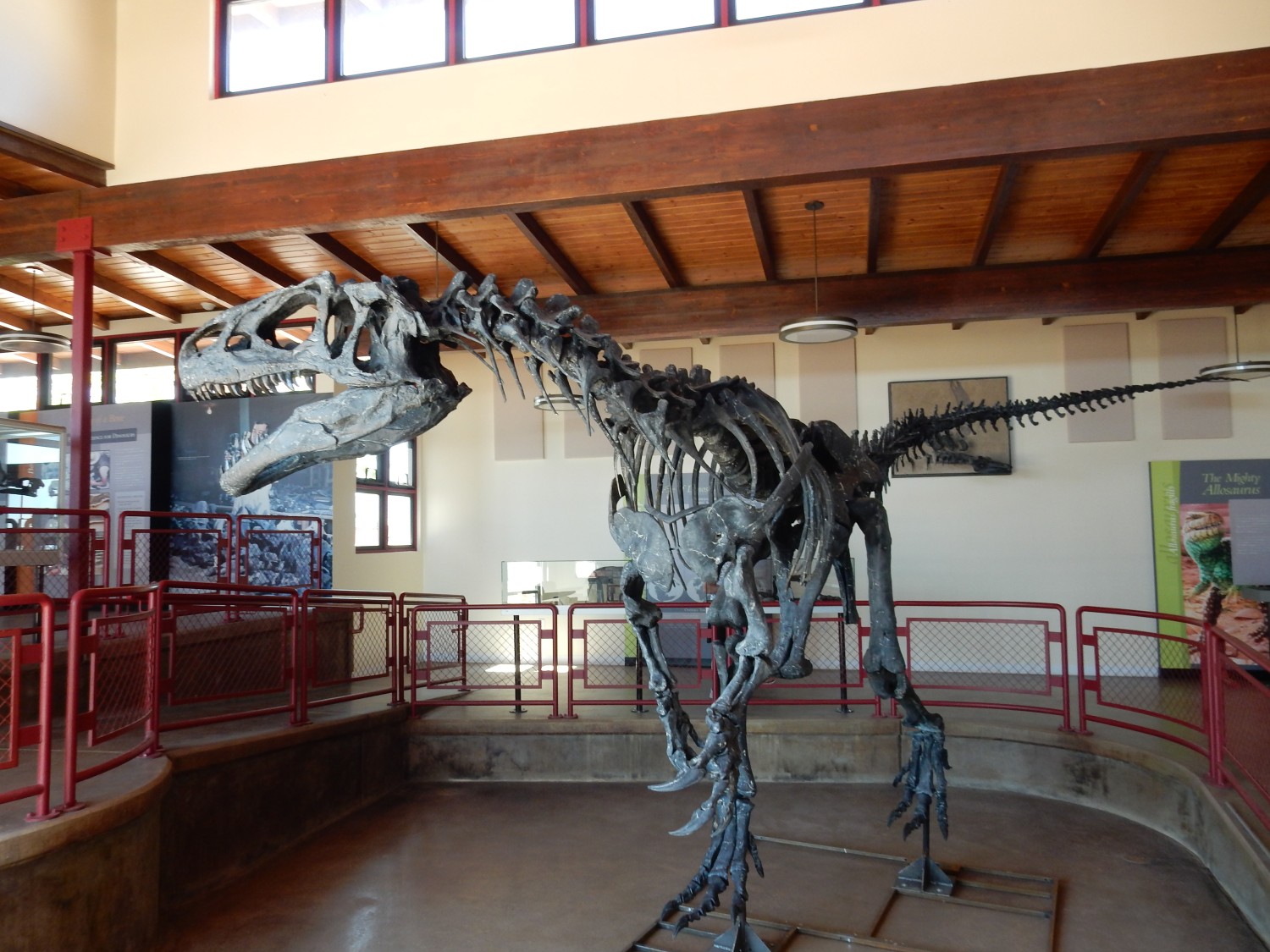
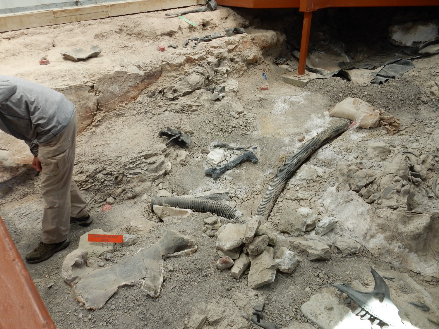
Complete allosaur skeleton.
And to think I let a little bitty cougar spook me when I ran into it in twilight near my home once.
The current excavation sheds.

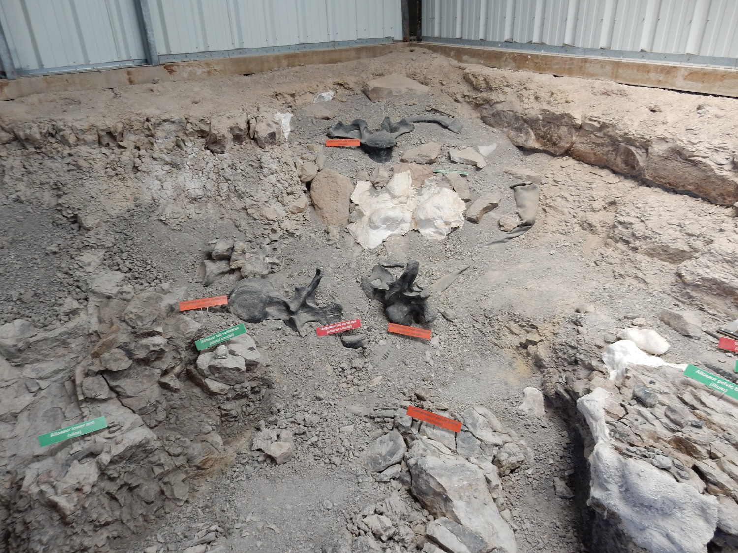
The site is closed much of the week. My guess is that they are indeed actively excavating here, on those days, and then put out the labels for tourists the other days. Only one of the sheds is open to tourists; the other is probably being excavated full time.
A geology summer student intern is being briefed by a ranger. I ask them if this is the Tidwell Member. Blink blink. “No, this is the Brushy Basin Member. The sandstone beds on the rim of the cliff are Cretaceous.” It’s good to have that straight.
Unpacking all that: The Morrison consists, in this area, of a lower muddy Tidwell Member; a middle sandstone Salt Wash Member; and an upper muddy Brushy Basin Member. I guessed the wrong muddy member earlier.
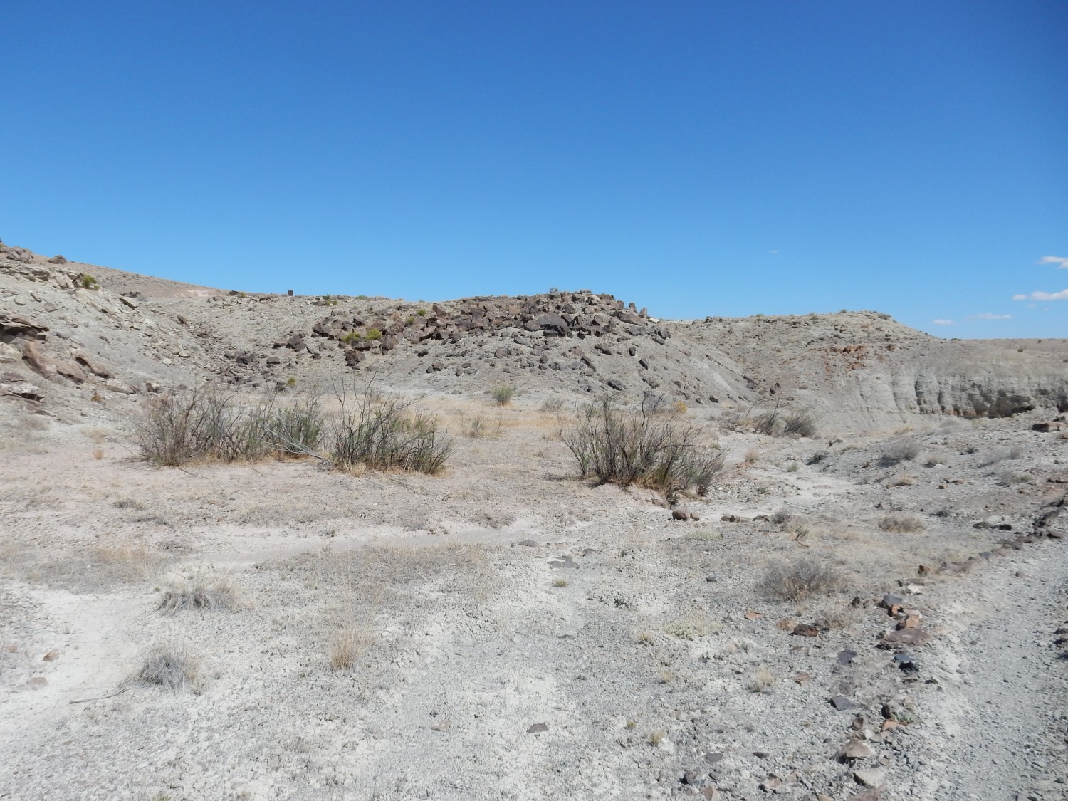
There is a short trail, a little over a mile, that goes over the nearby ground. Perfect.
Start of the trail.
I see a stake, but fail to realize that it has a “2” printed on its top, and so fail to recognize the significance. But about here:

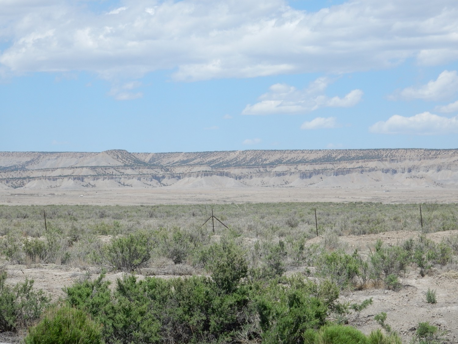
The geologic map does indeed show this entire area as Brushy Basin Member.
I hiked the trail and took numbered photos at each post, but I’ve lost the trail guide, and everywhere pretty much looks like this.
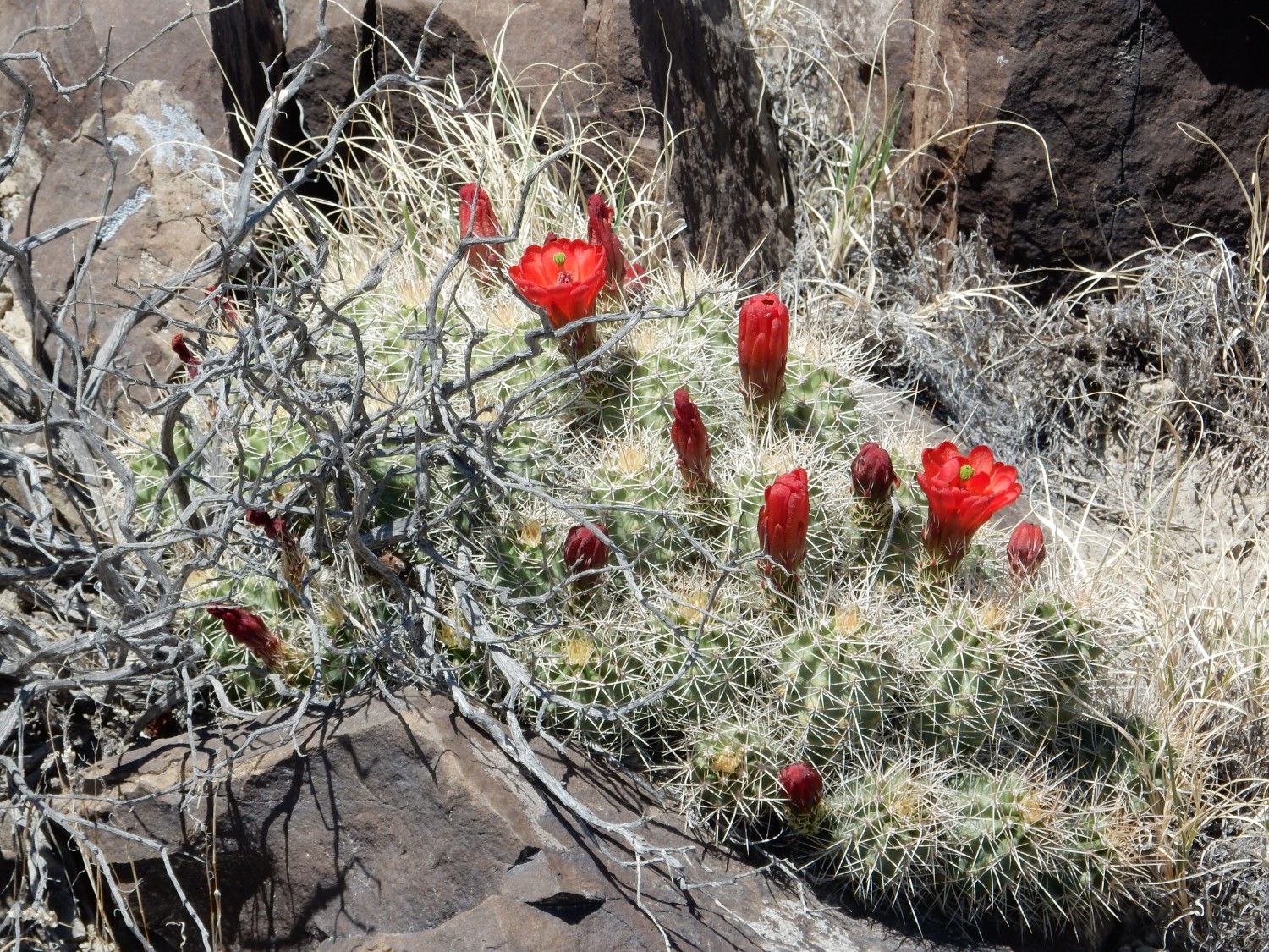
More wildflowers.
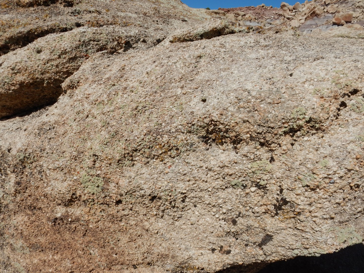
More conglomerate.
I step back into the excavation shed for another shot.
One of the mysteries of this site is that some of the predator bones look crushed, as if they were stepped on by a sauropod.
I return to the museum, pick up a trail guide, and what jumps out at me is that the first stop (which I walked right past) has a dinosaur bone still in outcrop. Well, it’s not far.
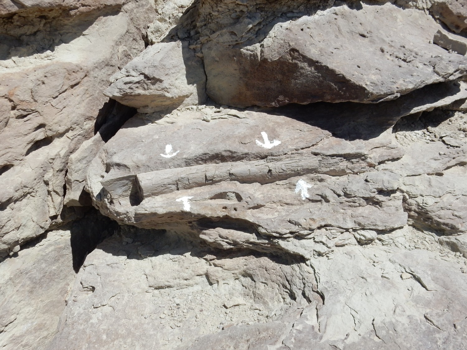
The rib bone here, as an isolated fragment, is not of scientific interest, but it’s a nice thing for visitors to see.
And I’m cynical enough to believe it will disappear someday, people being how they are.
I drive out and take the road to Buckhorn Reservoir, where the type section for the Cedar Mountain Formation is located. Some concretions along the road:

My geologic map tells me that this is the Ferron Sandstone Member, another member of the Mancos Formation, which is indeed known for large rounded concretions.
I reach the type section; the road is much better than I feared. Telephoto shot of the type section of the Cedar Mountain Formation:
That box checked, I drive back out, and find myself passing a good road cut in the formation.
The many limestone concretions, together with the purplish color, are consistent with this being a cut into the Ruby Ranch Member of the Cedar Mountain Formation.
I take a slightly different rout back into Cleveland. The Book Cliffs are prominent to the west.
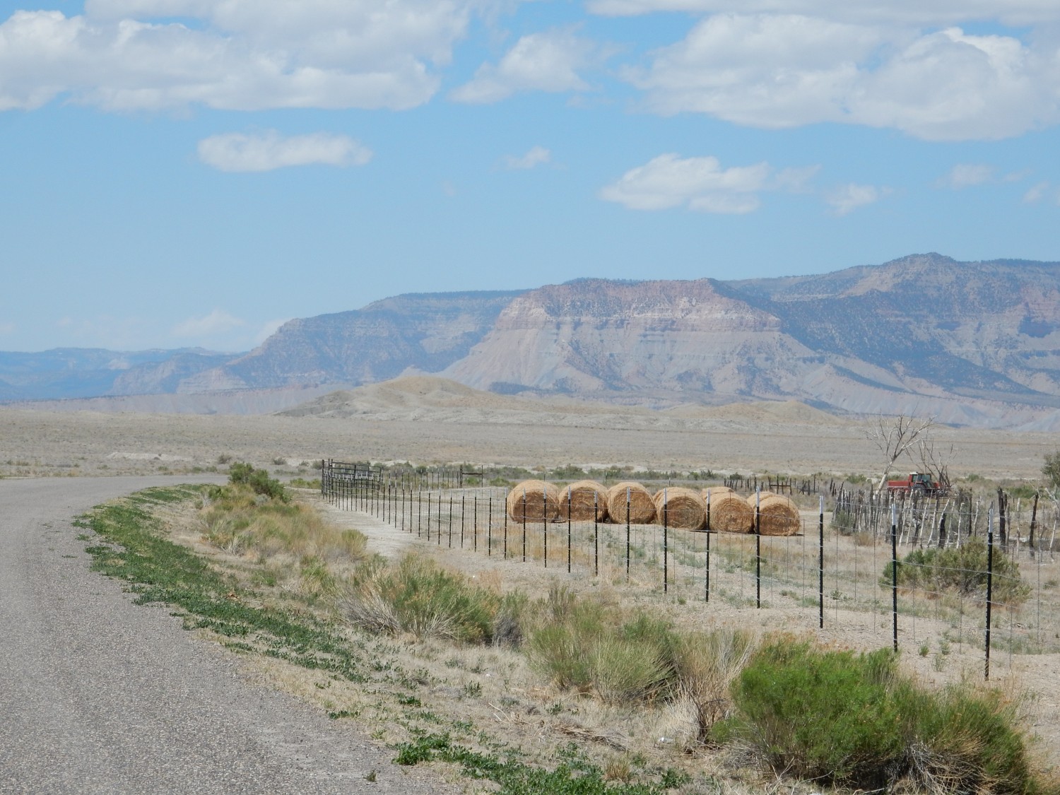
The prominent feature just right of center is Red Point. Its lower slopes are the Masuk Member of the Mancos Shale, which is overlain by a sandstone layer of the Star Point Sandstone. This is capped by Blackhawk Formation, an important coal-bearing formation. The Star Point and Blackhawk represent growth of a delta and inland coal swamps into the Western Interior Seaway, around 80 million years ago.
I find no fast food in Cleveland; shucks. It’s a rather small town. Further north:
The lowest beds here are Blue Gate Member, Mancos Shale. The lower capping layers are Emery Sandstone. The shale above the Emery Sandstone is also Blue Gate Member; the Emery forms a tongue between the shale beds. The layer on top is a geologically young pediment surface, a remnant of a flat plain that became cemented by calicification of the top soil layer. When erosion cut into the plain, the calicified soil resisted erosion to form a cap rock.
I arrive at Price and go hunting for fast food. The best I can do is a McDonald’s where I get a spicy chicken sandwich. Not too bad, but a bit spicy for my tastes.*
North of town are more of the Book Cliffs.
Let’s zoom in a little.
The lowermost uniform dark shale beds are Blue Gate Member. Beginning with the first substantial sandstone ledge, everything above is Blackhawk Formation. The Star Point Sandstone pinched out just to the west of here. That is, its beds thin to a feather edge and disappear.
Here, further east, the Castlegate Sandstone is present above the Blackhawk Formation. I’m not sure I can identify the precise contact; the geologic map seems to put it well above the prominent sandstone bed that seems like a natural marker.
Here the Blue Gate Member and the Blackhawk is very well exposed.
Further up canyon:
Here the Star Point Sandstone is still present, forming the thinly bedded sandstone just above the Blue Gate.
Still further up canyon, near the Castle Gate cut, I stop again. I’ve visited here many times before, but I find it irresistible almost every time. To the east:
Essentially everything here is mapped as Blackhawk Formation. The prominent sandstone bed is indeed within the formation. However, it seems very likely that the Blackhawk Formation has been divided into members here, though my large-scale map doesn’t show them. (Digs around a little) A more recent detailed map actually has the Star Point Sandstone extending much further east in the Book Cliffs, while this bed is possibly the Aberdeen Sandstone Member.
To the south is the cut itself.

That’s honest to goodness coal, though the beds are here too thin to be economical to mine. My recollection is that six feet is a minimum.
So far as I can make it out from my map, the beds that include coal are the mudstone member of the Blackhawk Formation, while the lighter rock at top is the Aberdeen Sandstone Member of the Blackhawk Formation.
Below the gate:
THis shows the Spring Canyon Sandstone Member beneath the mudstone member. Here’s an even clearer view.
You can see Blue Gate Member of the Mancos Shale just peeking out at lower left, then sandstone of the Spring Canyon Sandstone Member of the Blackhawk Formation, then the mudstone member, then the Aberdeen Sandstone Member.
These beds represent successive fluctuations of the coastline of the Western Interior Seaway. The mudstone member, with its many coal beds, records coal swamps behind the coastline. The sandstone is the coastline itself — beach sand.
The other side of the cut.

The muddy character of the mudstone mamber is clear here. But it’s unlike the Blue Gate Member. The Blue Gate is marine mud deposited in deep water, while the mudstones of the Blackhawk are coastal mud from coal swamps.
Looking to the north.

The reddish beds are apparently also Aberdeen Sandstone Member. The mudstone at center, on the distant canyon face, is another unnamed mudstone member. The massive sandstone above this is the Castlegate Sandstone, and this is the actual Castle Gate, according to my topographic map. The very top of the Gate is Price River Formation.
I arrive back in Provo. Lori and Robert take me and Mom to Tucanos Brazilian Grill. This is, unsurprisingly, a meat lover’s restaurant, where waiters bring around various grilled meats for you to help yourself to. I stuff myself silly.
*I know. I just ate a burrito and a couple of chile rellenos, New Mexico style. Spicy is good when it’s good. Otherwise, it’s just spicy, and I don’t really care for it.