Wanderlusting Colorado, day 2
We awake, eat breakfast, and break camp. Gary has a long conversation with a fellow named Gordon who has a rather nice trailer rig across the camping area, complete with solar panel. Gordon is nominally from Texas, is long retired from a successful career as a machinist, and has been solo touring extensively across the United States. I am awed by Gary’s ability to strike up conversations.
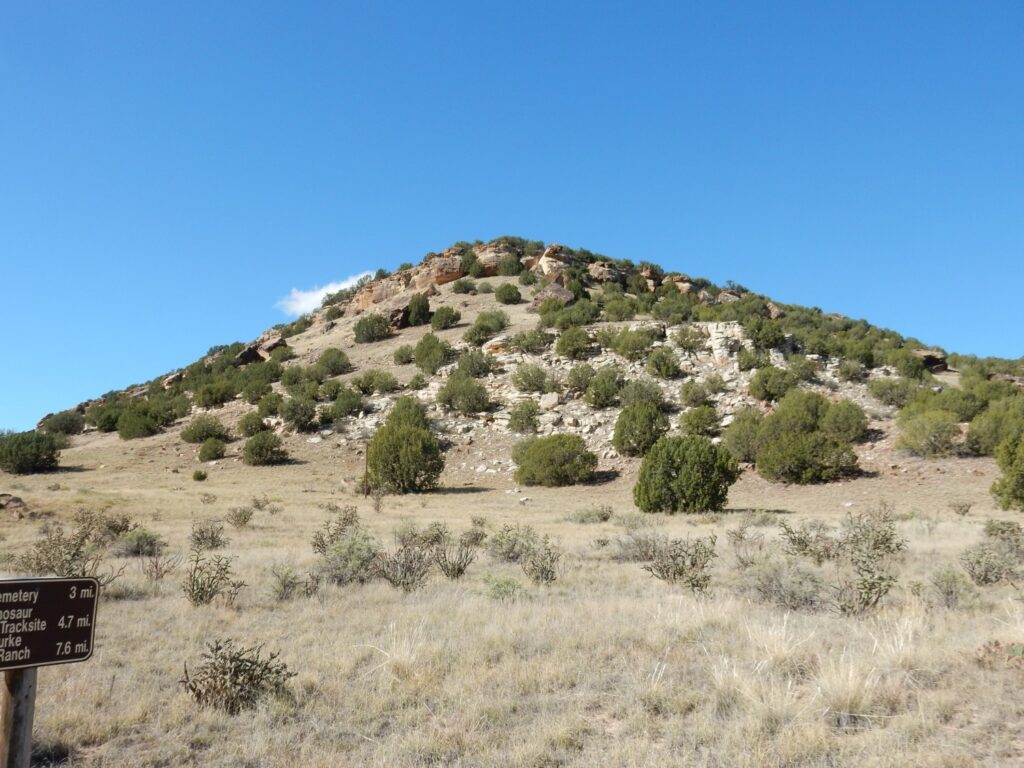
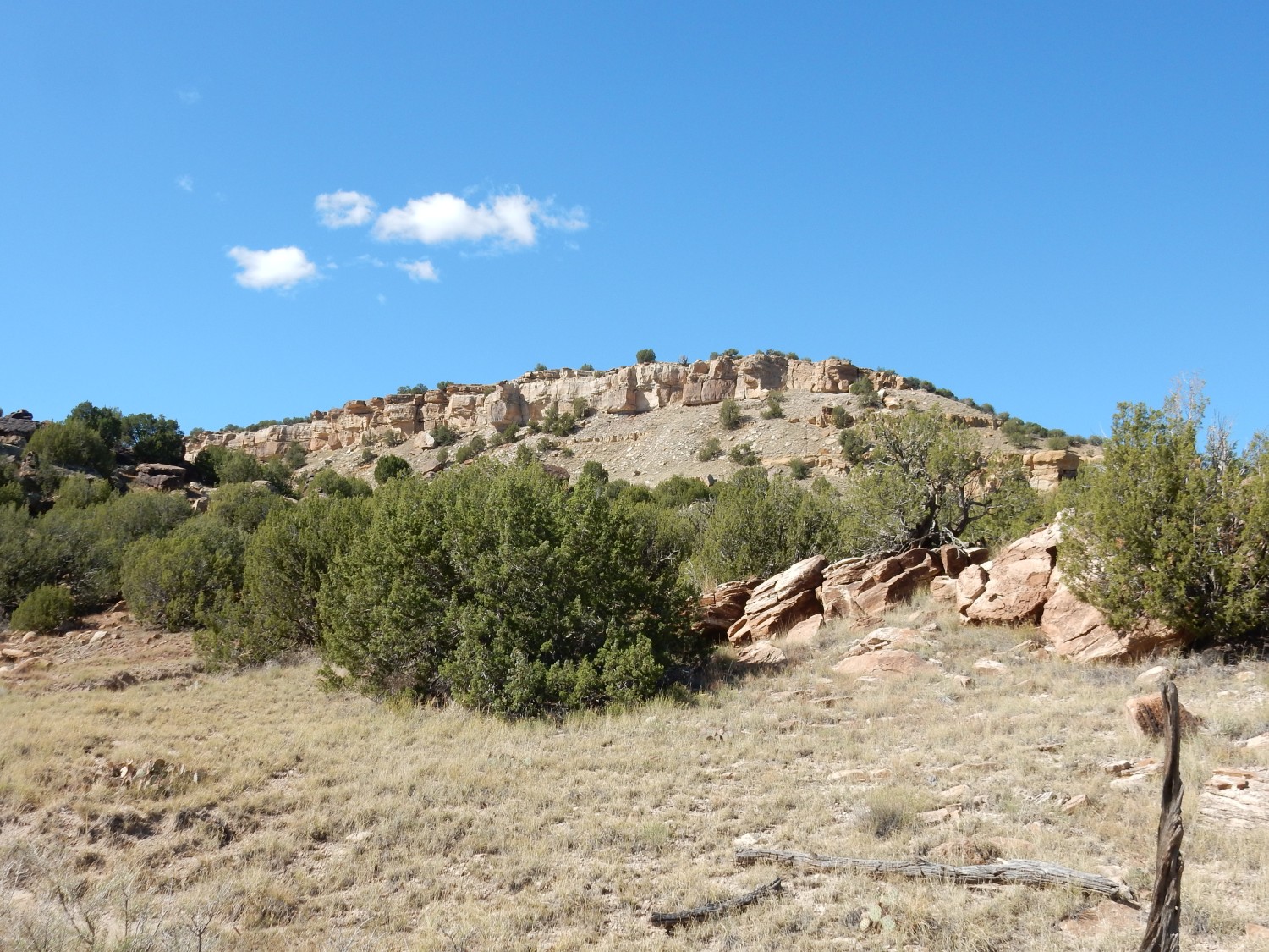
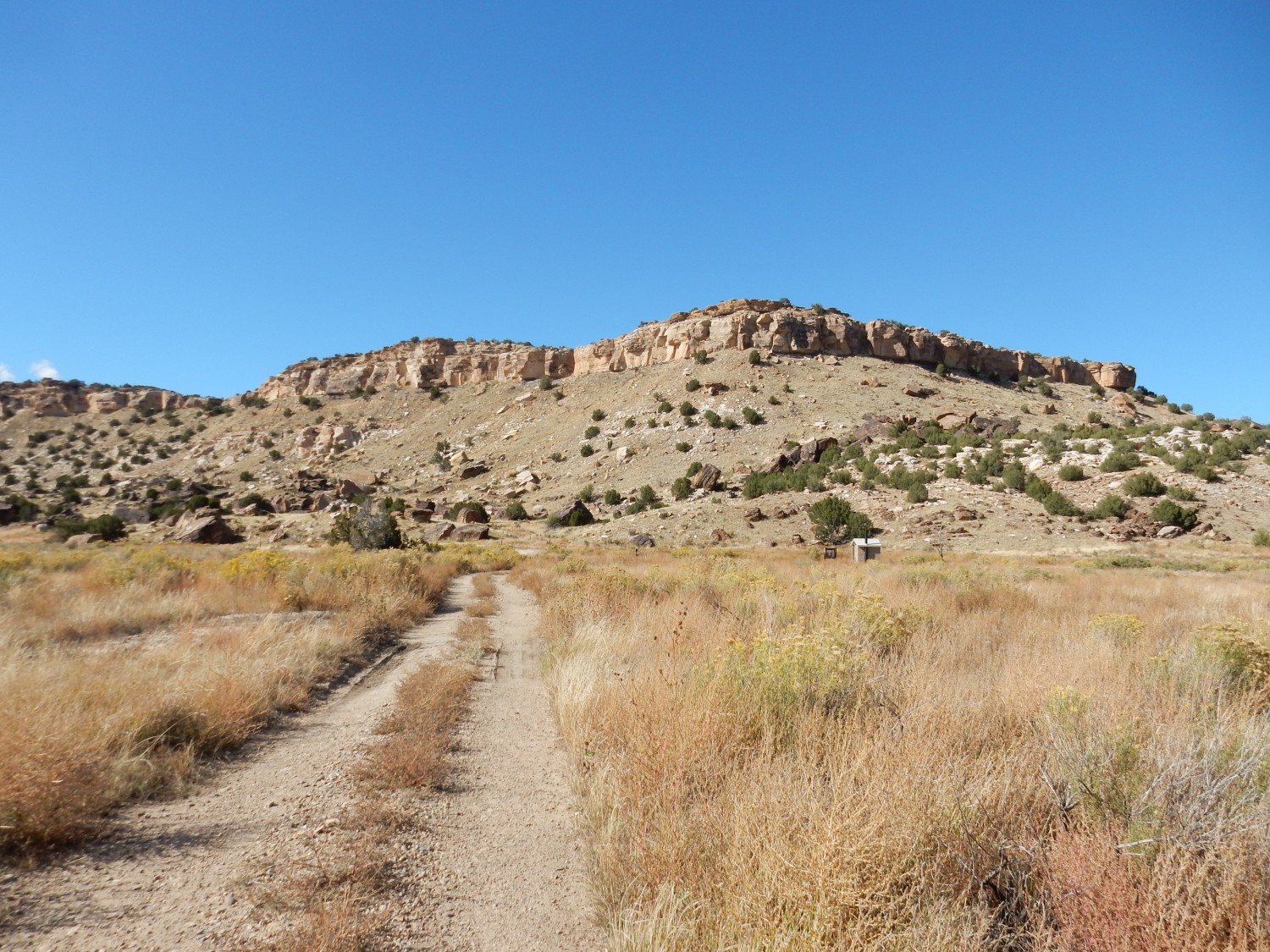
We head for our trail head for the day, which is not far away. The plateau we are driving on is underlain by Dakota Formation sandstone, with occasional bluffs of what must be Carlile Shale capped with Greenhorn Limestone. Alas, my photographs of the bluffs did not turn out. Gary and I contemplate looking for fossils in some of the limestone beds, if we have the stamina after our hike. (We won’t.)
Let me unpack that. The area we will be hiking today is dominated by Jurassic and Cretaceous formations laid down in a great depositional basin. This formed in the western interior of North America as a result of subduction of the Farallon Plate under the western edge of North America. This subduction process build the Sierra Nevada and other mountain ranges, and occasionally a large island arc or small microcontinent would be carried into the edge of North America and accrete onto the continent, raising additional mountain chains. The weight of all the mountains caused the North American Plate to flex downwards, producing a foreland basin that extended from central Utah to Kansas and from the Gulf of Mexico to the Arctic Ocean. This accumulated sediments that were preserved as extensive formations.
Early in the process, the basin was still dry land, and the Morrison Formation was laid down, around 150 million years ago. Dinosaurs roamed the basin, and their bones and footprints were preserved in many locations. Our hike today is to one of the most extensive and impressive sets of dinosaur tracks preserved in the geologic record. Later the sea invaded the region, producing the Western Interior Seaway. This laid down the Purgatoire and Dakota Formations, and as the seaway deepened, the Carlile Shale and the Greenhorn Limestone.
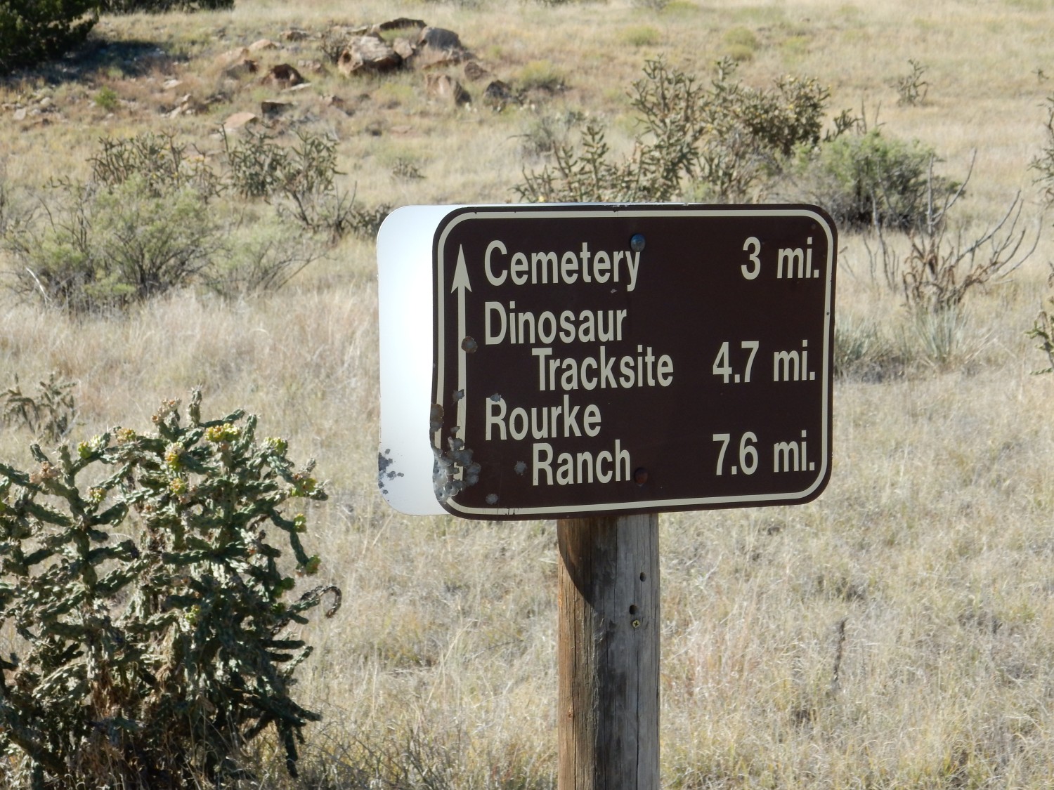
We arrive at our trail head.

It turns out we could have camped here for the night, rather than several miles away. But then we would not have had the chance to meet and talk with Gordon.
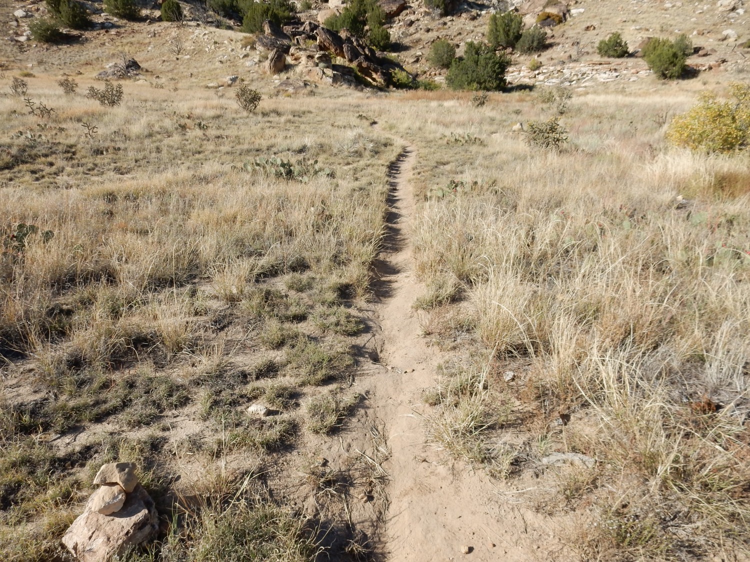
We load up and move out.
Yeah, that’s me in the second photograph. I’ve forgotten my walking stick and hat, so I soak myself pretty thoroughly in sun-screening polyphenols. We both have packs with cameras and (we believe) an ample water supply, along with our lunches, river wading shoes, and various sundries. The hike is a little over ten miles on mostly level ground. Gordon had hiked it the day before and tells us it took him about six hours.
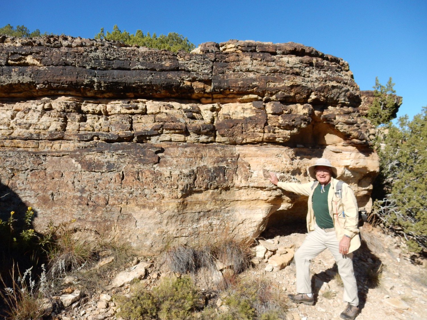
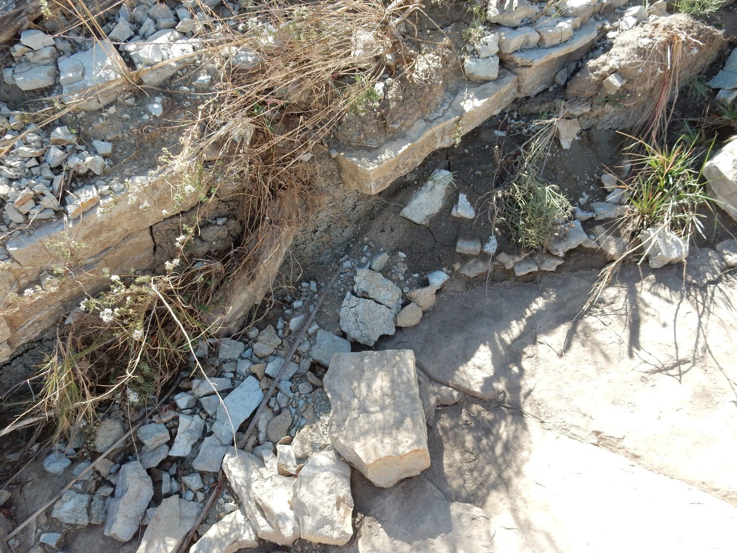
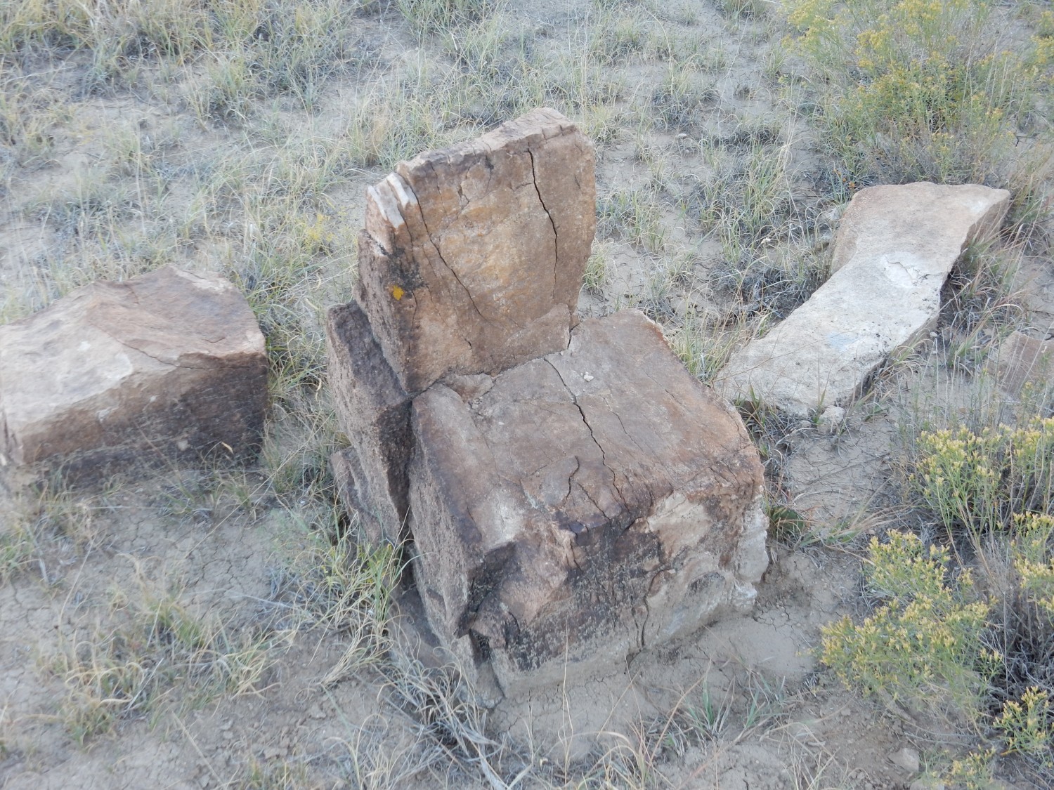
We pass a nice outcrop of Dakota Formation.

The Dakota Formation records the advance of the sea to form the Western Interior Seaway, and in most locations it is one or more sheets of massive sandstone. Coal and shale layers are sometimes found, but they are not present here and are not dominant anywhere. The beds are described as cross-laminated, meaning larger horizontal beds consist of much thinner layers (laminae) at at angle to the main beds. This is typical of sand laid down in a strong current, either of air or water — likely tidal currents here. The sandstone is well-cemented and so tends to form cliffs wherever it is eroded through, including along the valley of the Purgatoire River into which we are about to descend.
Cactus.
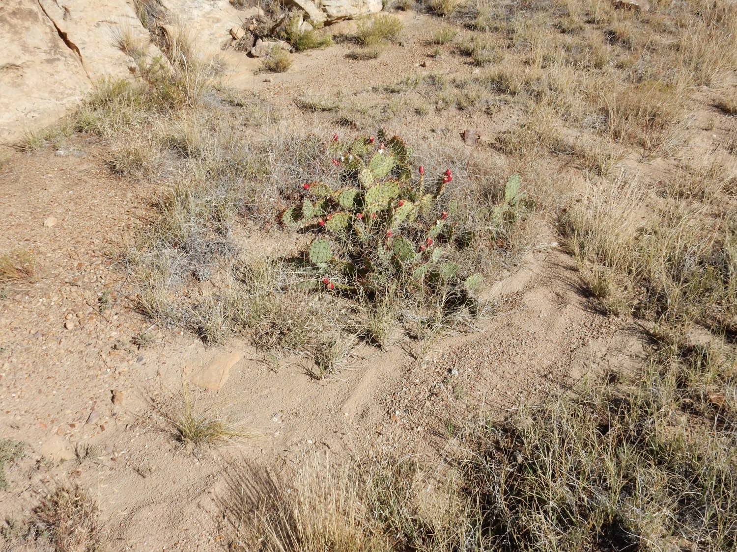
I am not as expert on plants as on rocks, but you don’t need to be much of an expert to recognize prickly pear, Opuntia. This patch sports a large number of prickly pear fruit, which are edible if you can rid them of spines. Or, as Gary will later note, if you are a hungry critter who just doesn’t care about the spines. We will see many deposits of animals that were obviously feasting on the pears.
The Dakota Formation, like most sandstones, rarely contains body fossils, but it is famous for its trace fossils and bioturbation. This looks like an example.
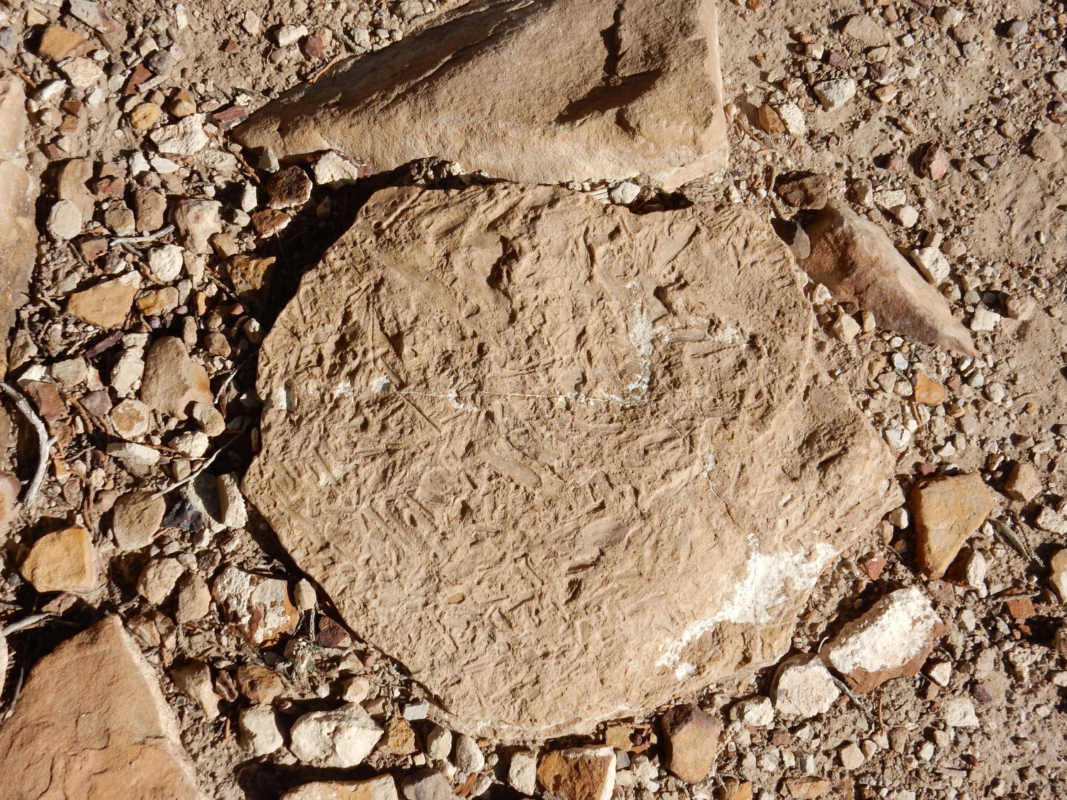
Trace fossils are impressions left by the activities of living organisms that are not the organisms themselves. (Those would be body fossils.) Good examples include dinosaur tracks or worm burrows. Some trace fossils can be connected with the species that produced them, but many cannot (or at least not with any confidence), yet are so distinctive that geologists give them ichnogenus and ichnospecies names. For example, the very beginning of the Cambrian, the first period of the current Phanerozoic Era of widespread fossil remains, is defined by the first appearance of Treptichnus pedum, a trace fossil likely produced by some relative of the velvet worm. I’m not expert enough to identify the trace fossil here, or (frankly) to be absolutely certain this is not some kind of abiogenic sedimentary structure.
Gary enjoying a massive bed of Dakota Formation.
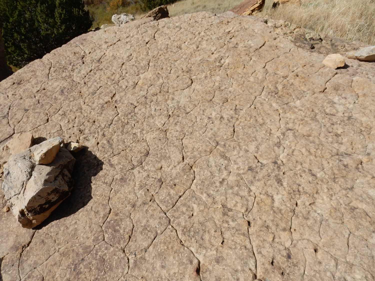
Ripplestone in the Dakota Formation.
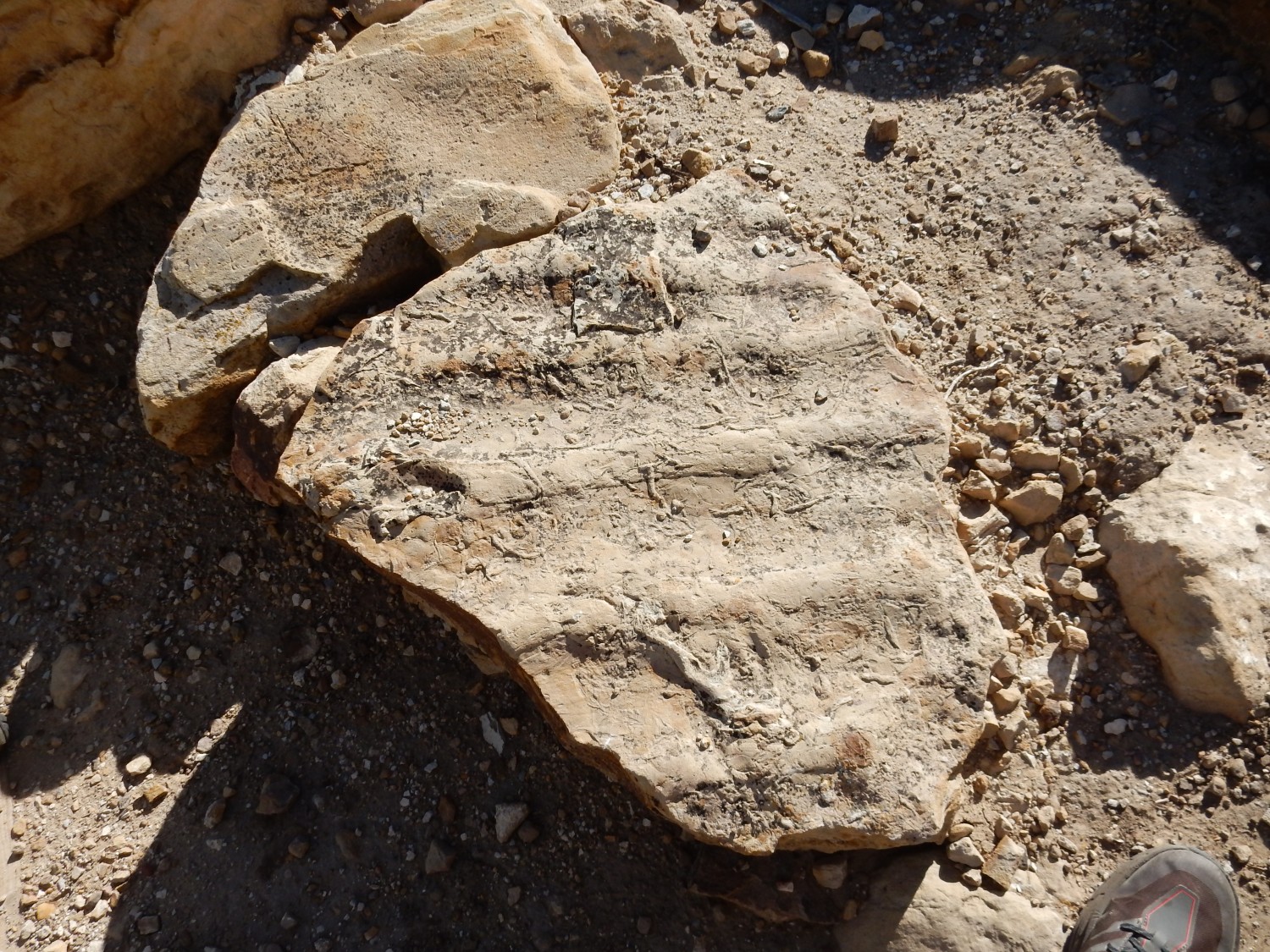
The surface shows ripples from a gentle current of some kind. There is also mild bioturbation in the form of what look like small critter burrows.
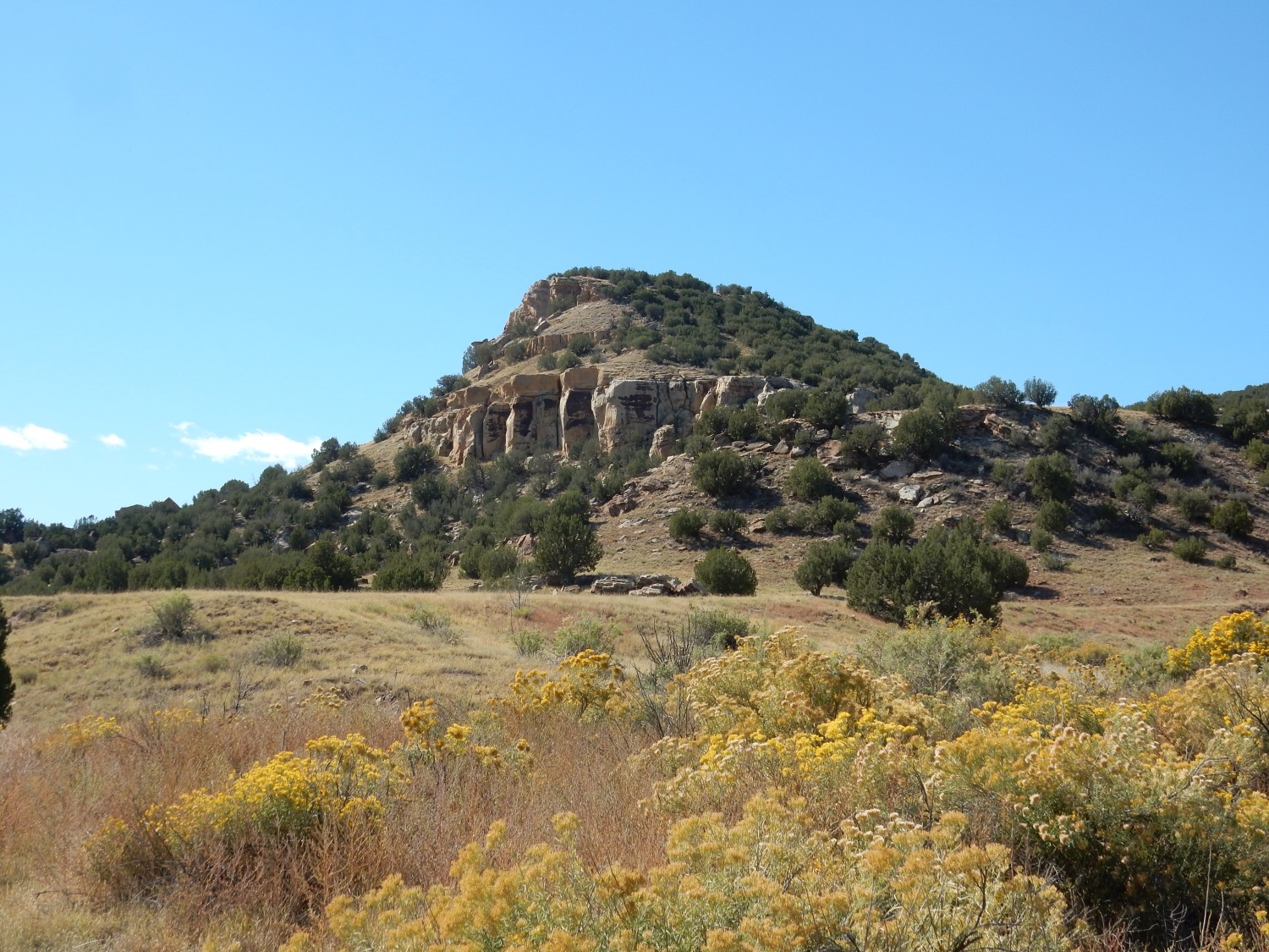
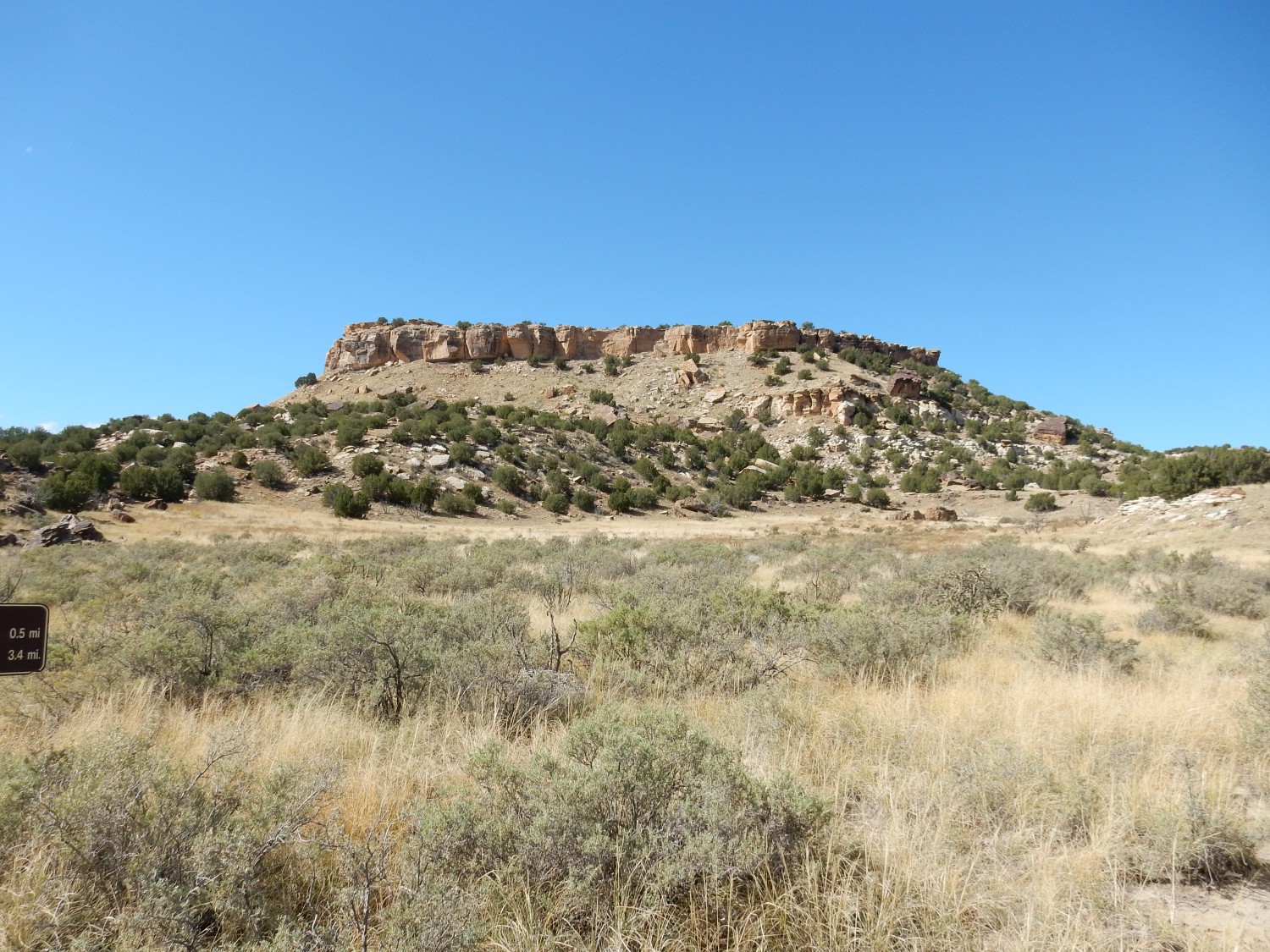
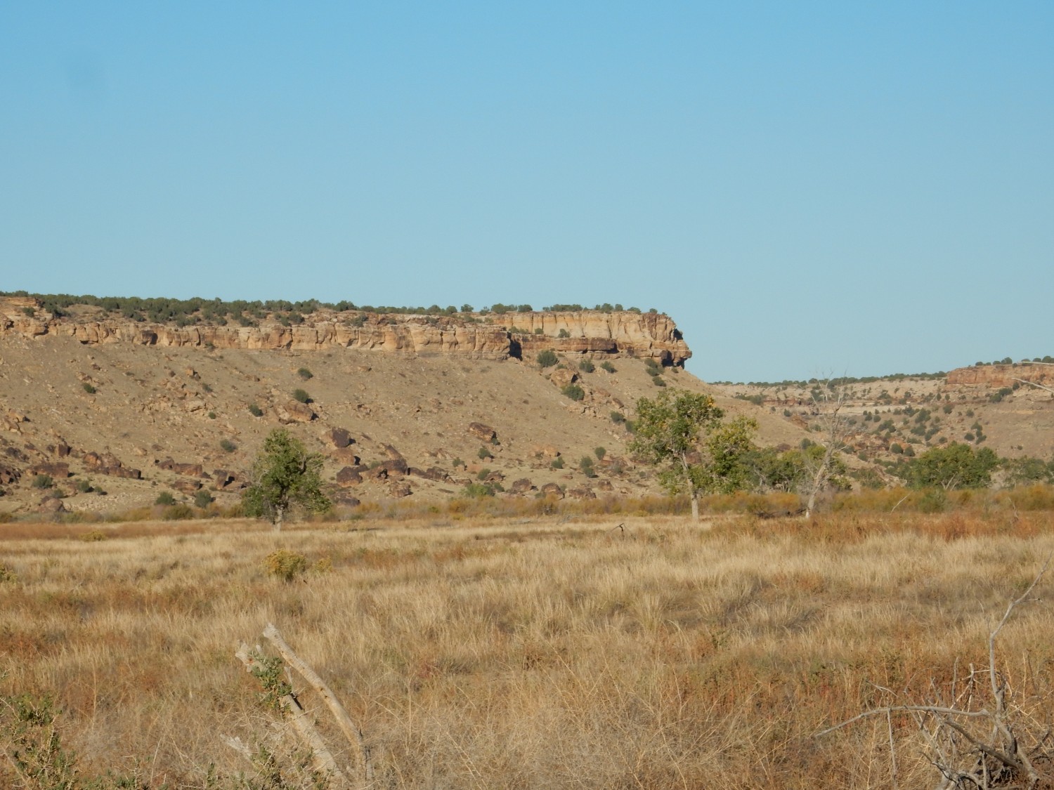
We descend into Withers Canyon.
Since this is my first visit to the area, my identification of the formations is tentative, but the hard layer capping the canyon rim is clearly Dakota Formation. The gray slope beneath is probably the Glencairn Shale Member of the Purgatoire Formation, which is a blend of mudstone and sandstone that reputedly contains fossils. (But recall the lesson from yesterday: Fossiliferous does not necessarily translate to rich in easily found well-preserved fossils.) The fossils are marine, meaning that the ocean had already invaded the area before the sand sheet of the Dakota Formation was laid down. The resistant bed halfway down the cliff likely marks the top of the Lytle Sandstone Member of the Purgatoire Formation, which makes up the lower part of the cliff.
Both are Cretaceous in age. The Dakota is around 100 million years old while the Purgatoire Formation is around 112 million years old.
Another twist: A recommendation was made in 1987 that the Purgatoire Formation be abandoned. (My geologic map is older than that.) Nowadays geologists would likely treat the Glencairn Shale and Lytle Sandstone as formations in their own rights.
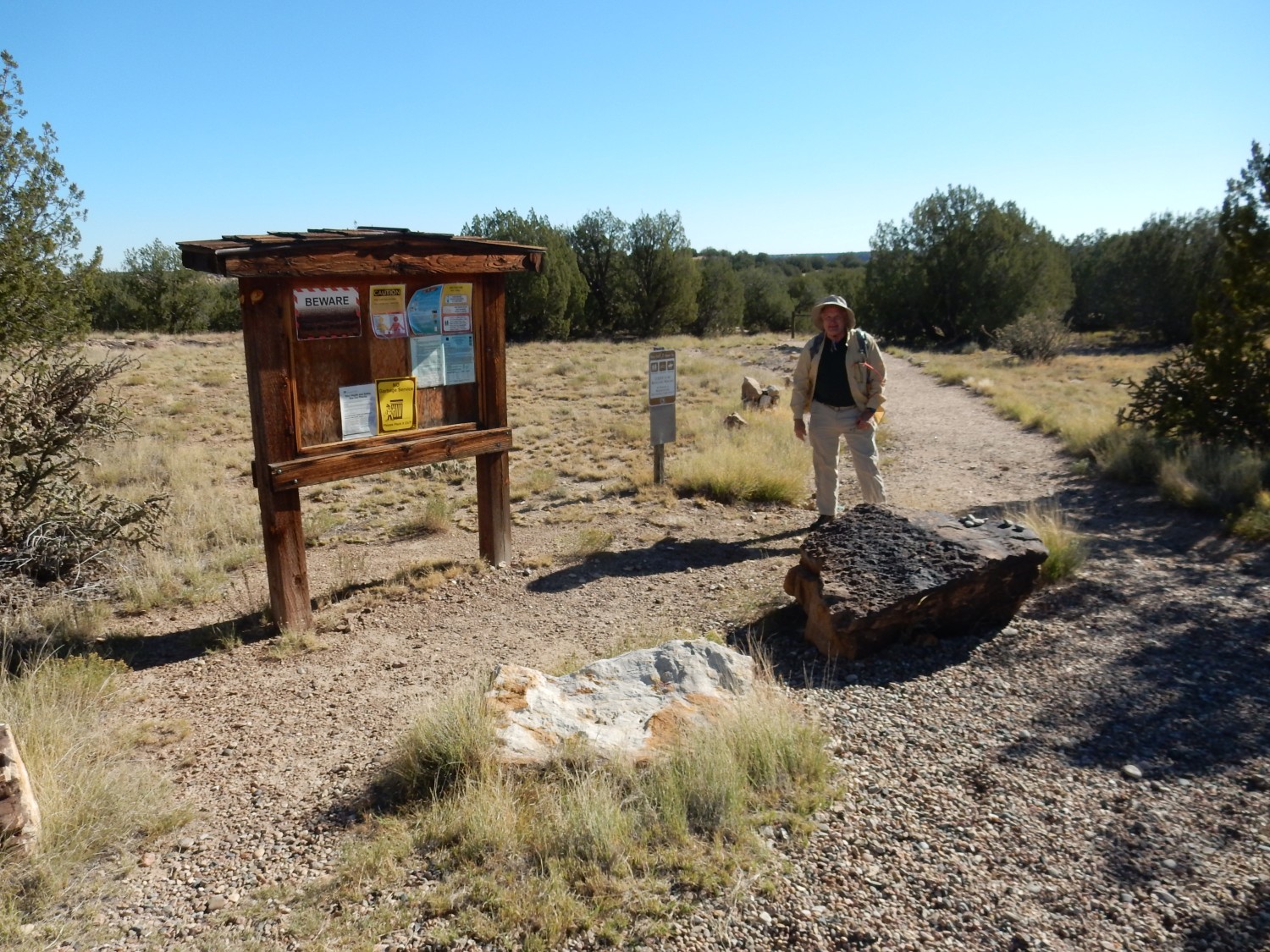
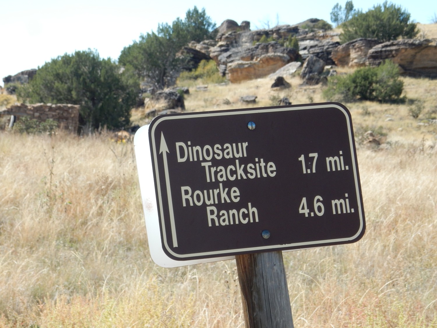
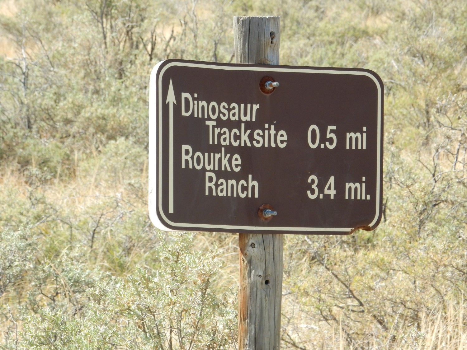
I am surprised that there is extensive and reliable signage along the trail.
Canyon rim above.
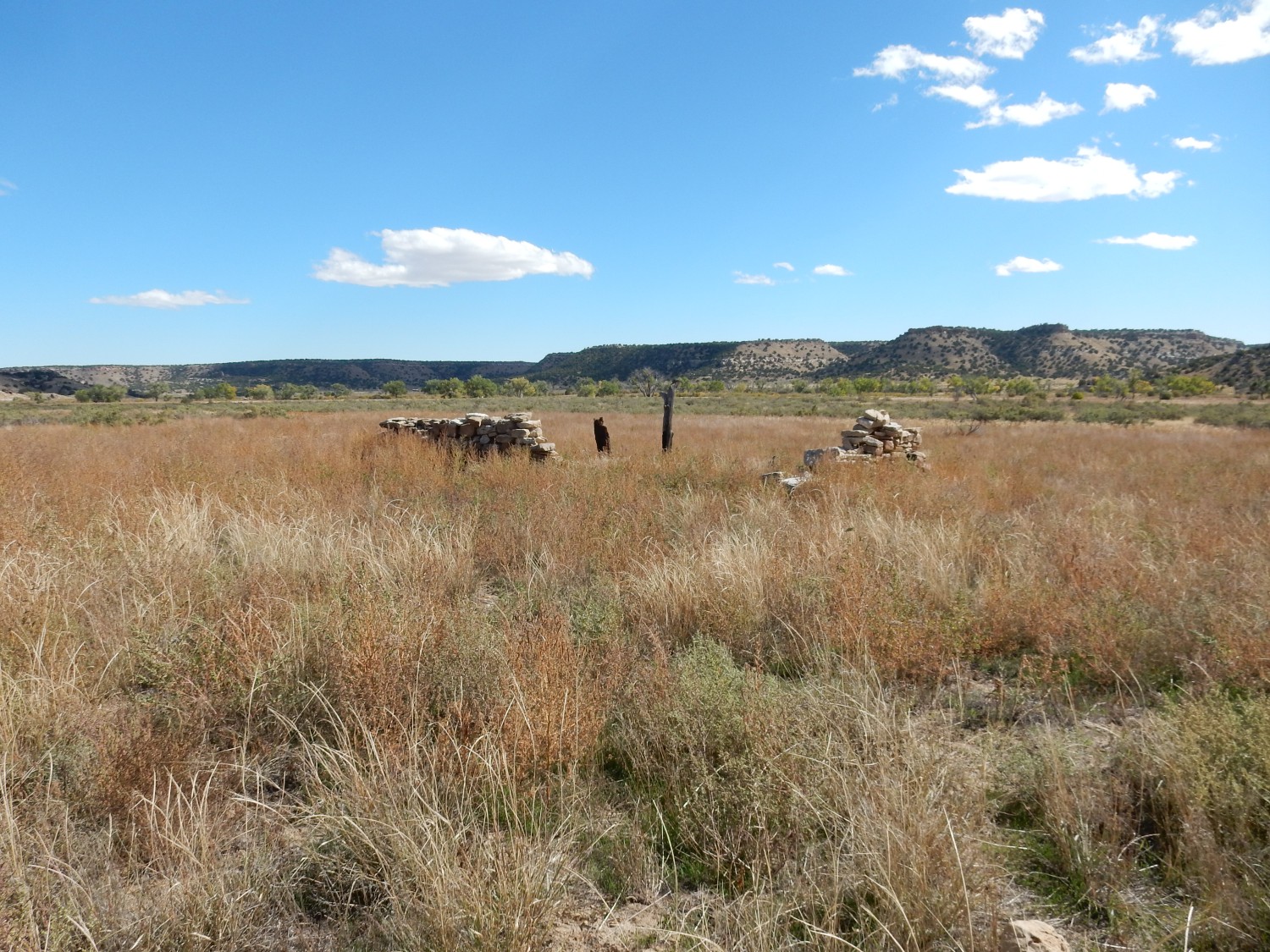
We come to an old homesteader shack.
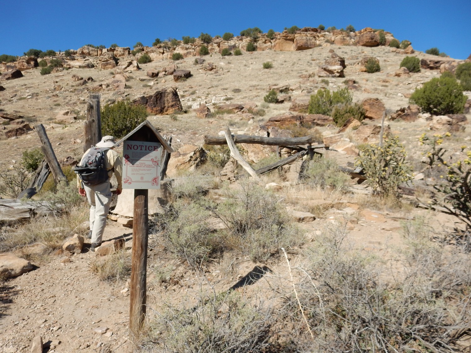
I don’t know a lot about the settler history here, but the permanent Purgatoire River with its reliable water supply had to be attractive. Yet the area is essentially uninhabited today, indicating low productivity. I’m guessing this reflects the quality of the soil, which is likely thin and nutrient-poor. Why do I think so? The soil is mostly formed from marine shale, and that tends to be highly saline. We saw many indications of that along the trail.
Lytle Sandstone in the canyon wall.
Here the contact of the Dakota Formation and Glencairn Shale is well exposed.
More canyon rim.

It’s a pleasant day, not too hot and not terribly windy.
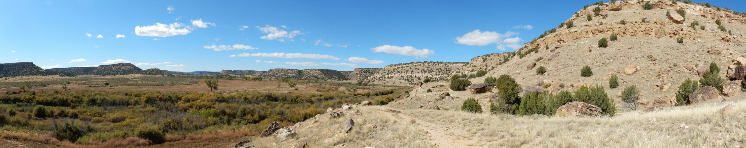
The trail climbs a slight rise, giving a good view of the valley of the Purgatoire River.
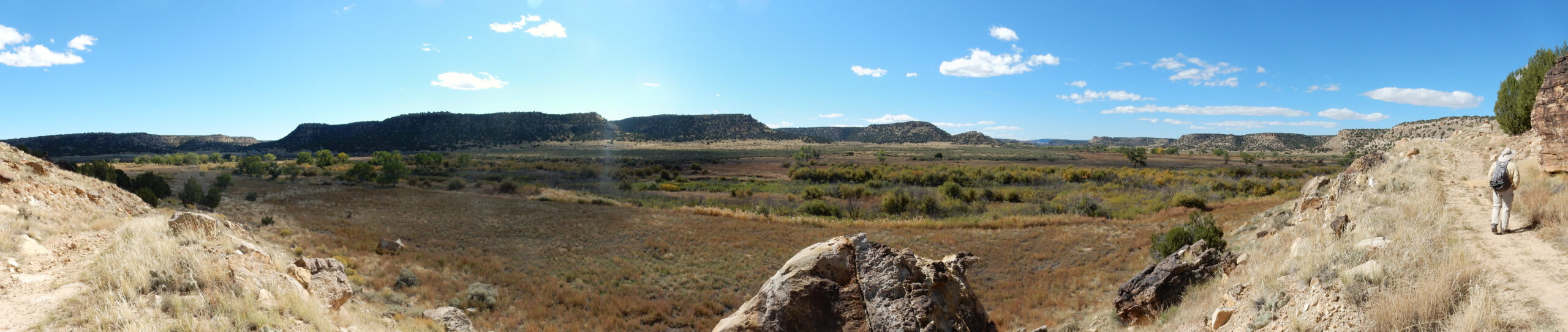
Not an ideal panorama: To the south, near midday, late enough in the year that the sun is low.
Another panorama up canyon.
We have arrived at an abandoned homestead and chapel.
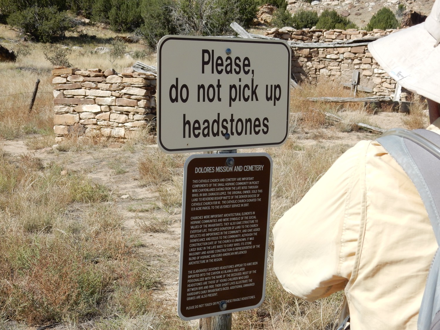
A few headstones remain, apparently mostly of children. The headstones are not local stone; they were probably prefabricated and shipped in, then carved when needed with the specific name.
Hard life.
We find a shady spot nearby for a rest break. I have some rehydrating pills and share with Gary. They have a not entirely pleasant grape taste (“Your horse seems to have kidney trouble”) but they do seem to make the water more refreshing.
I notice something odd about the canyon wall to the southeast. Deep telephoto shot:

The prominent sandstone ledge marking the top of the Lytle Sandstone doesn’t seem to be present. Apparently it pinches out to the south, thinning to a feather edge and disappearing. The Glencairn Shale appears to make up the entire cliff under the Dakota Formation.
The trail cuts through a low ridge exposing popcorn shale. This is shale rich in expanding clays, likely an ancient remnant of volcanic ash from an eruption far to the west 110 million years ago. I neglect to get a picture.
Gary spots a dinosaur bone.
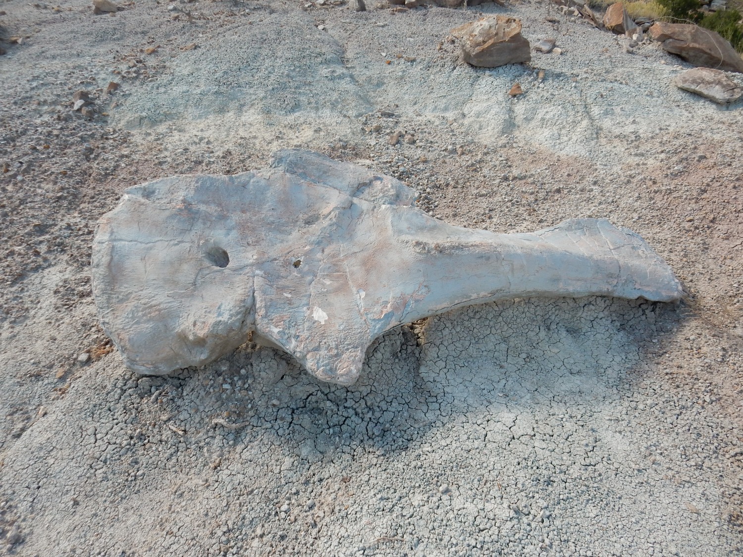
Alas, it’s only a replica.
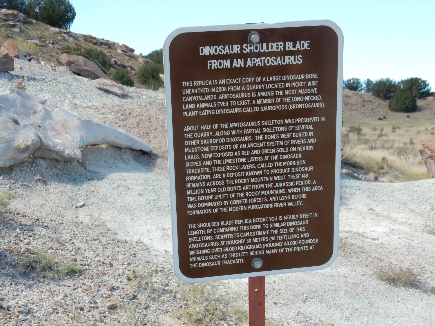
Gary announces that he would be satisfied to own just a dinosaur talon. Well, and maybe part of the wrist. We speculate for a while on where the quarry might have been located and what one might do to find it on Google Maps.
The sign is deliberately coy. Poaching of fossils is a real problem, and at least one quarry in New Mexico was carefully reburied and concealed by geologists after a few decades’ worth of bones were removed. Someday, when the stuff already removed has been fully curated and new excavation techniques are developed, the quarry will be reopened.
It’s a good idea. There was a wealth of fossils removed from the Espanola area decades ago, but the paleontologists were a bit careless about identifying exactly which beds they came from. An entire master’s thesis was written on which beds were likely the source. We’d be more careful about that nowadays.
Getting very close.
I think I can see the vault toilet ahead. An inelegant landmark, but there it is.
Bluff to the north.
By contrast with the view to the southeast, the Glencairn Shale is here quite thin, and the Lytle Sandstone prominent.
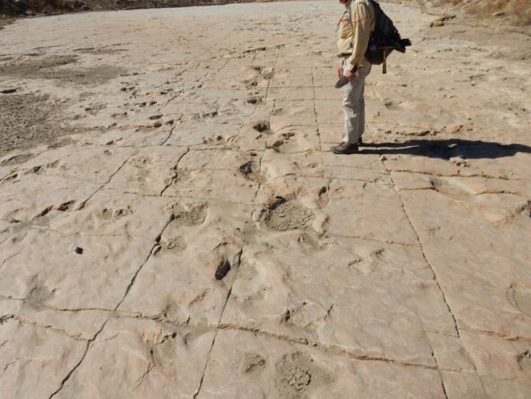
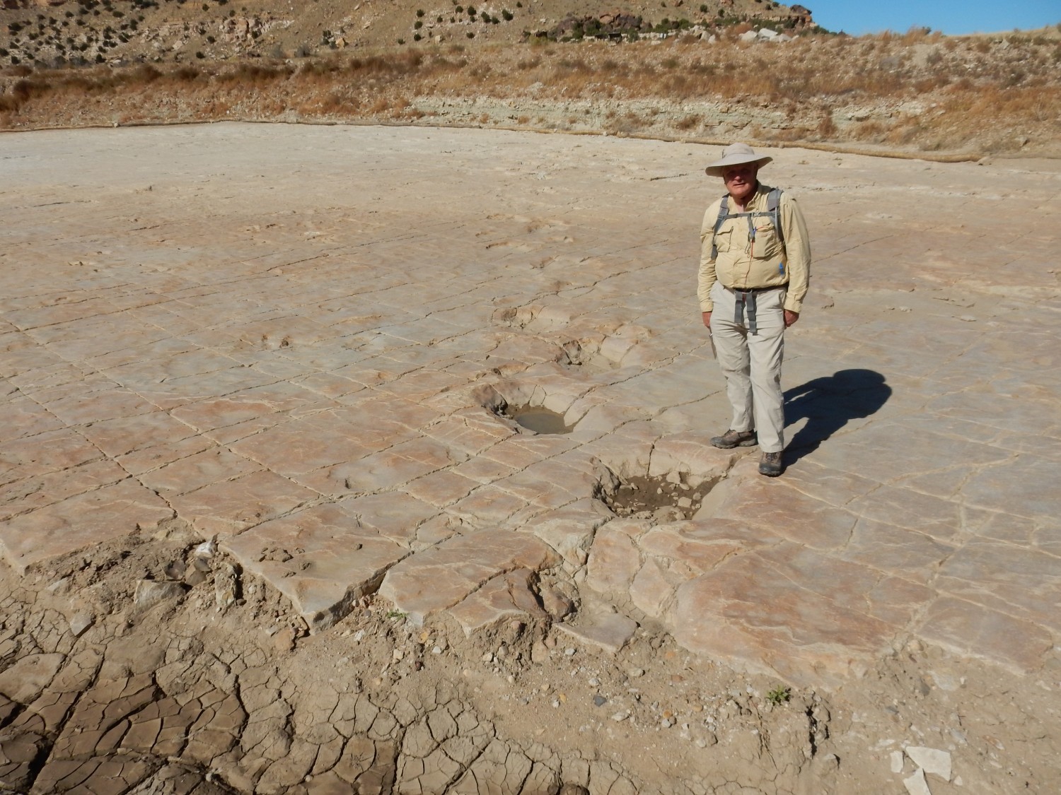
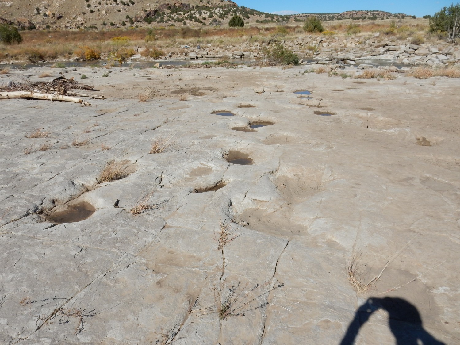
And then we are there.
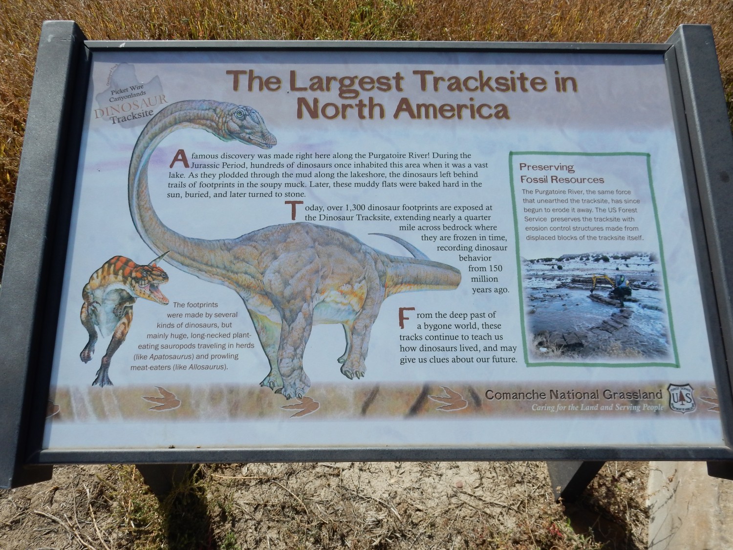

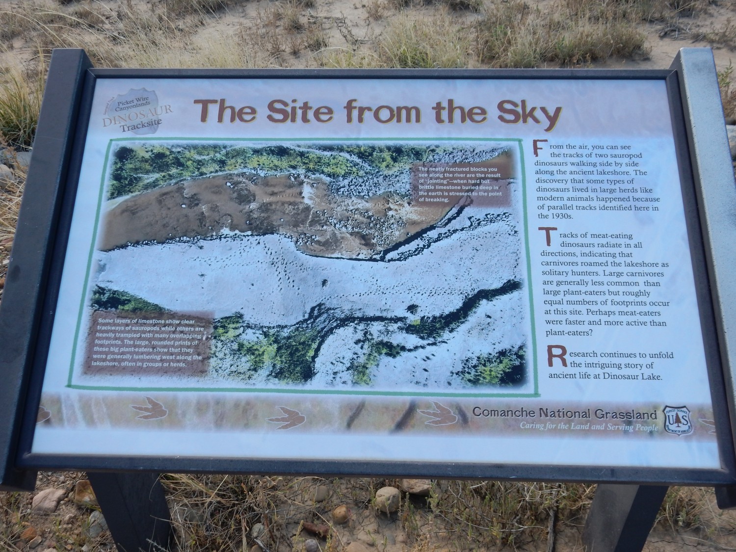
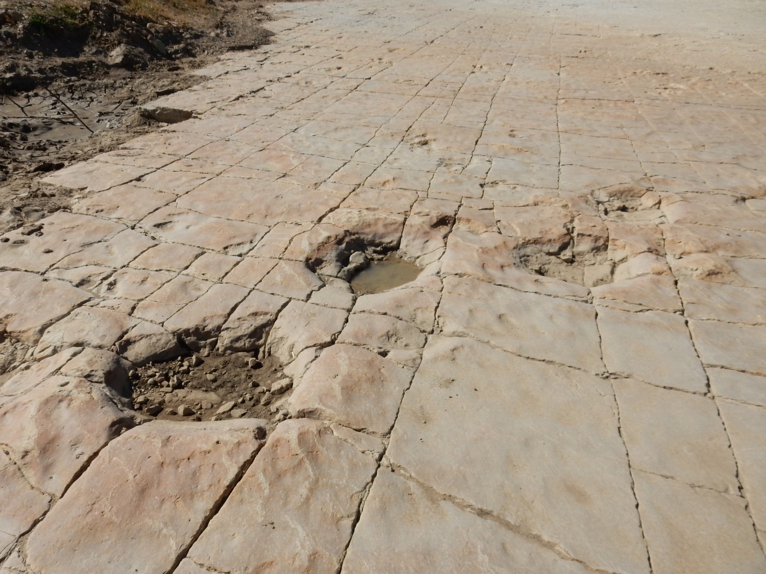
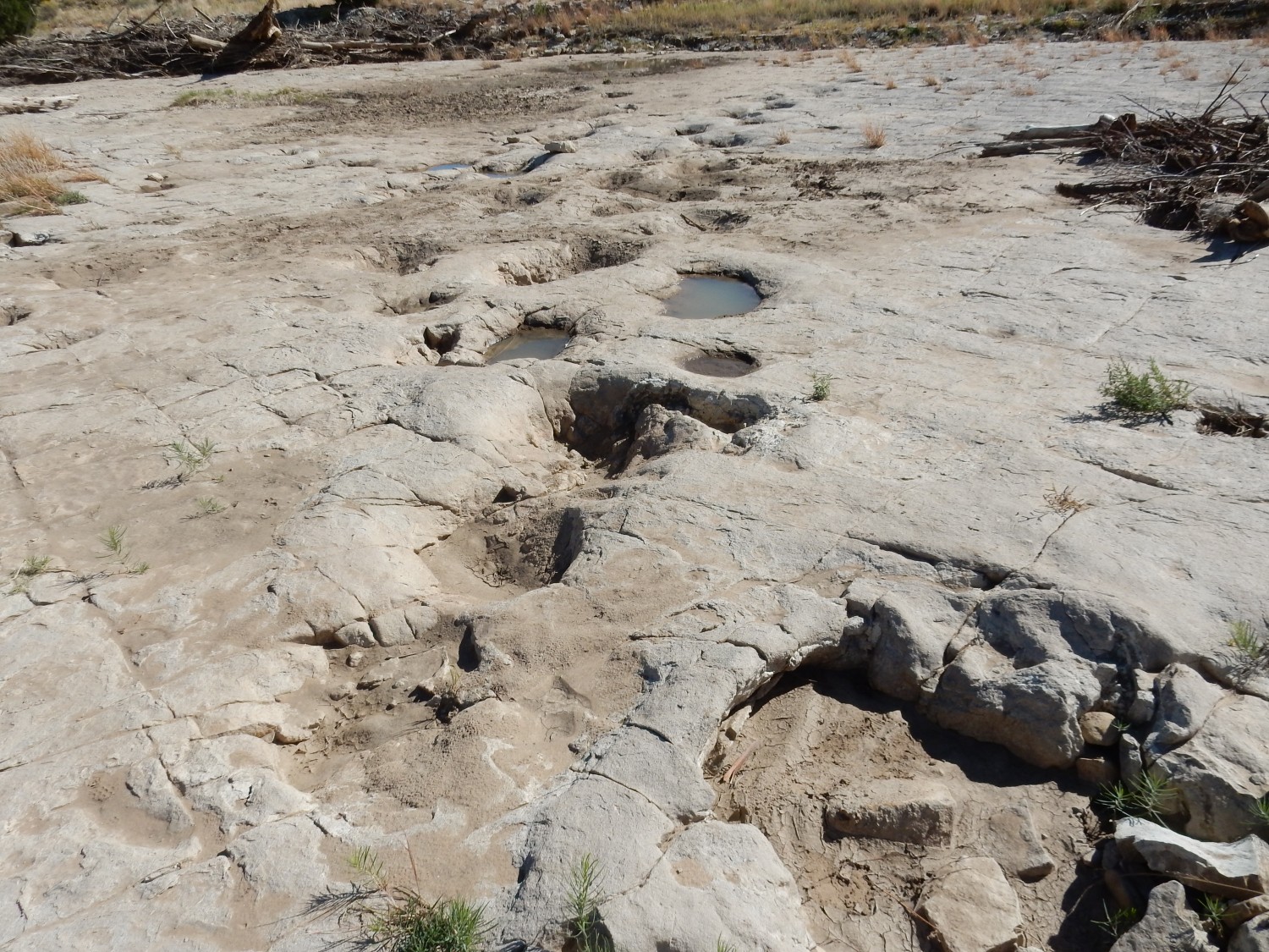
Apparently the area was a brackish lake. How do they know that? Likely from finding salt crystal casts in the rocks. The dinosaurs plodding along the lake margin left footprints that then baked solid under the sun, and were then buried by additional mud.
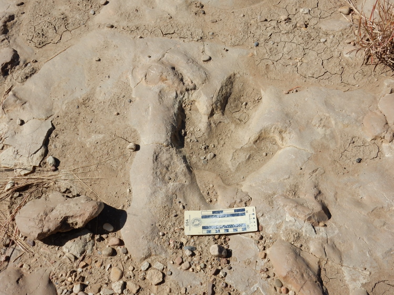
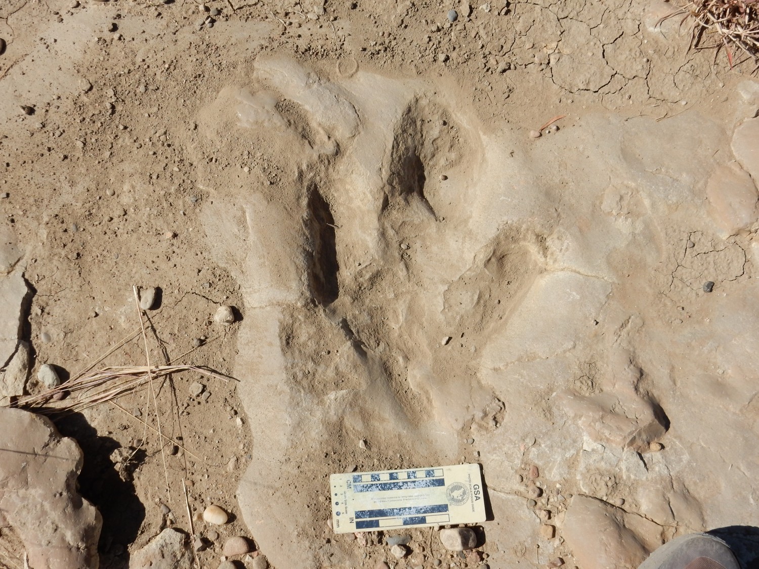
Allosaurus tracks:


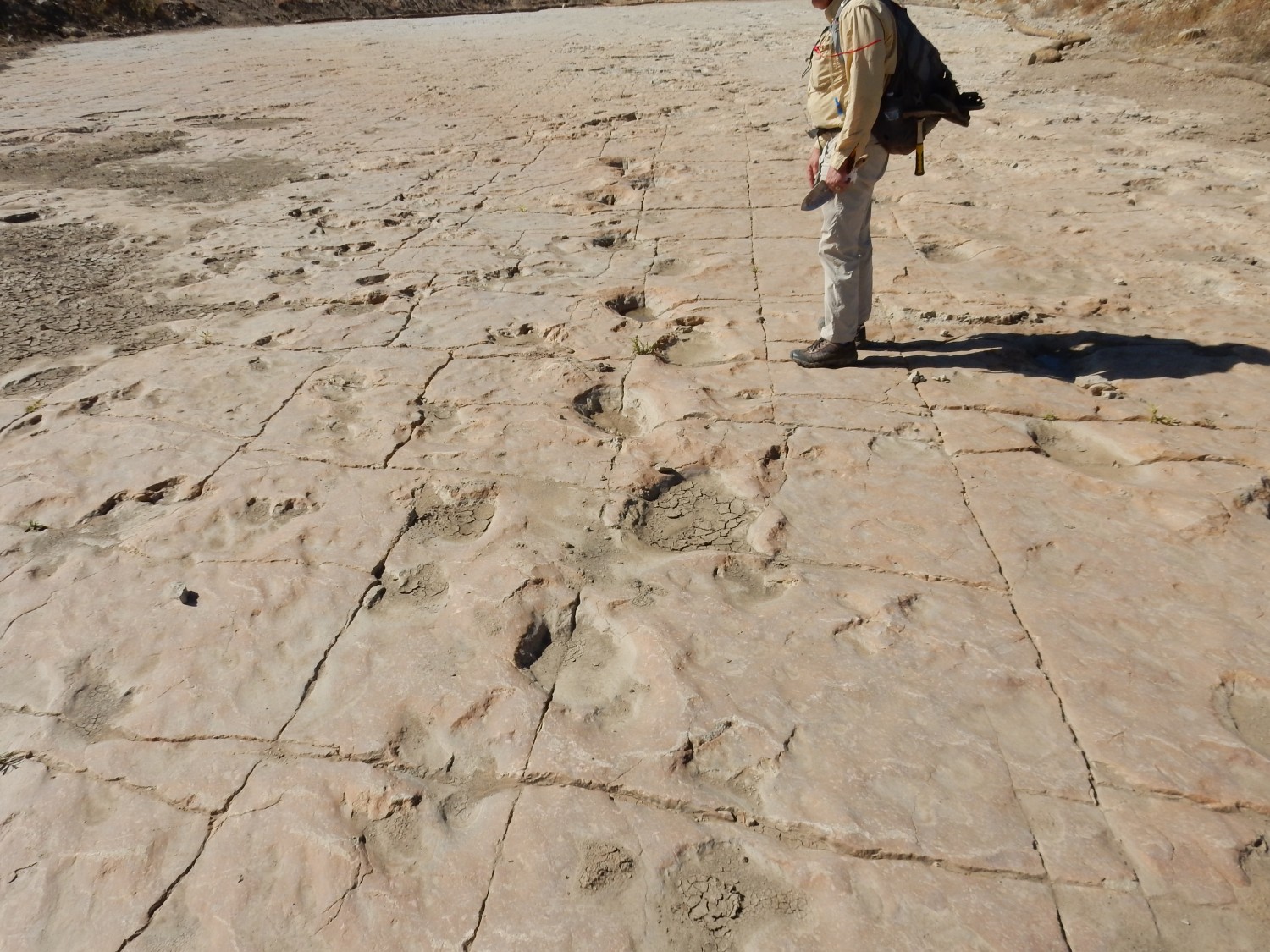
Sauropod trackway.
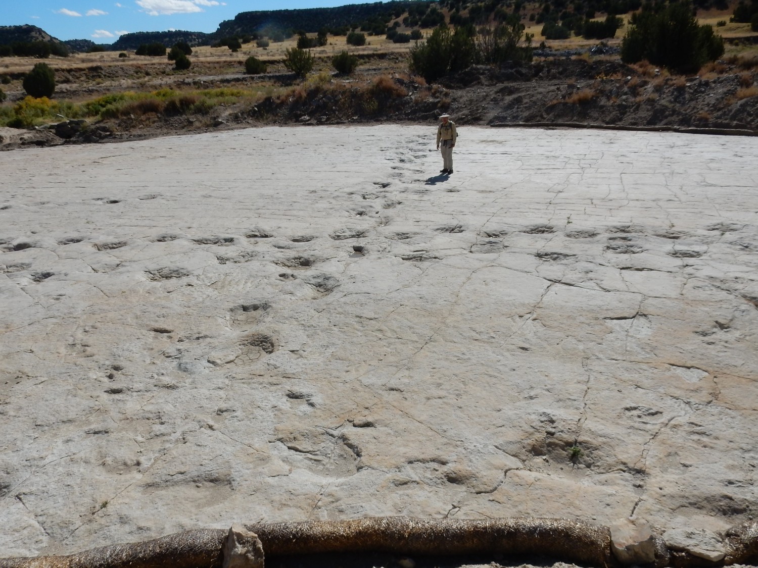

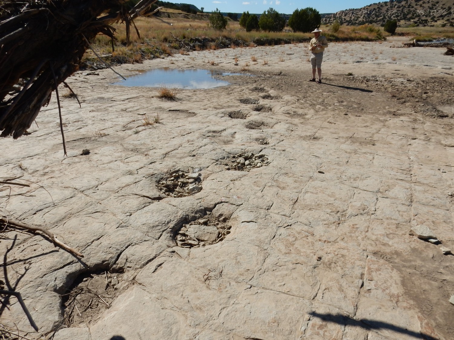
There are more tracks south of the river. We don our wading shoes, find a likely spot, and help each other across. The water is swift, chilly, but not too deep.
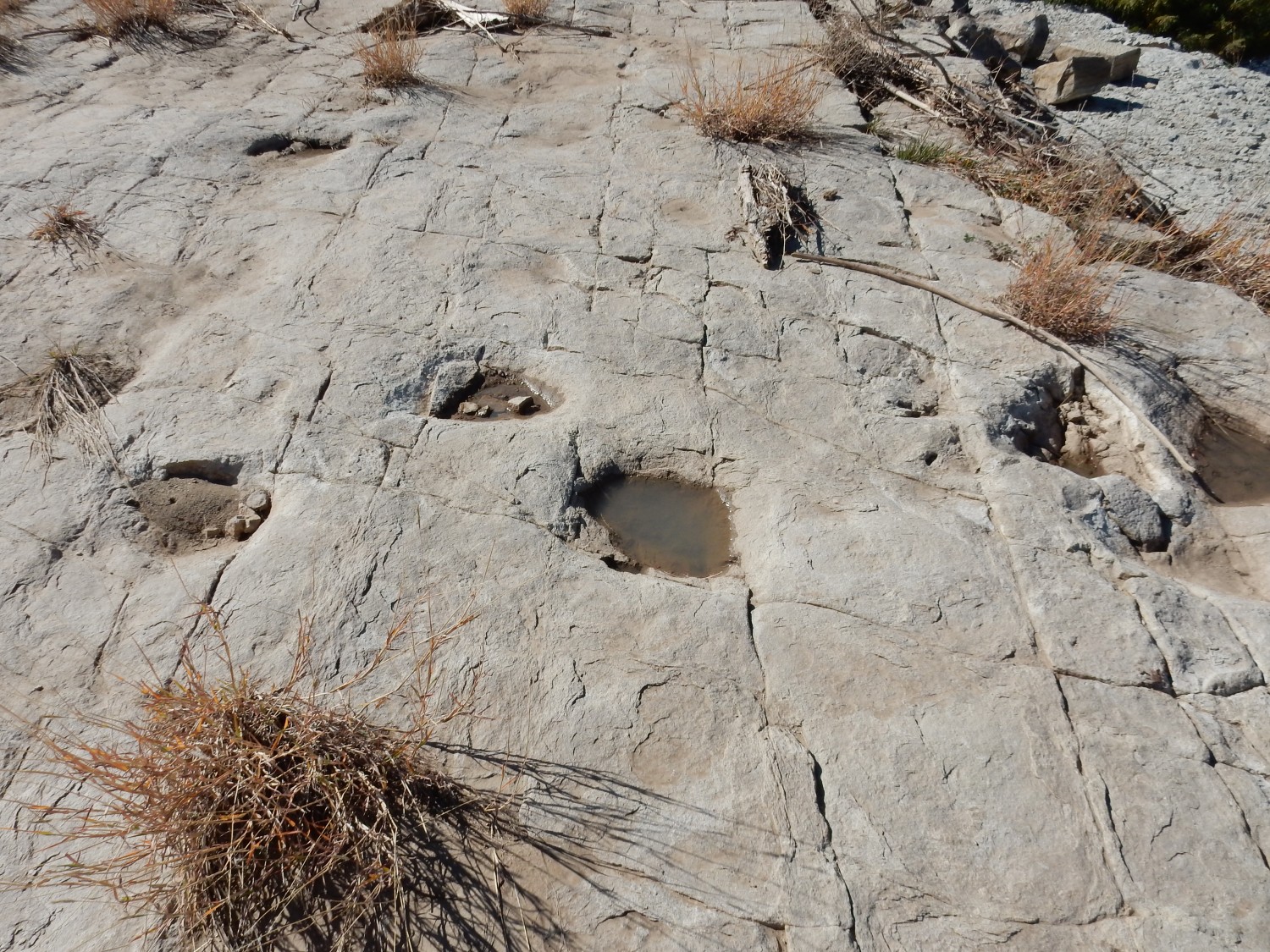
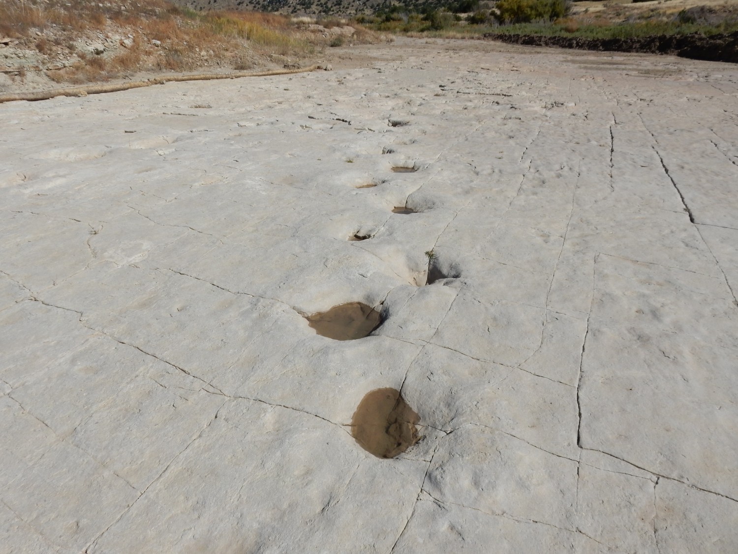
Gary and I talk about the rare sequence of events that produced these tracks. First, there was a muddy lake margin, apparently also rich in sand and silt, judging from the character of the rock. The dinosaurs came through and left tracks. Then the mud was baked hard by a hot sun. But to be preserved, there must have been a flood of fresh sediments to bury and preserve the footprints, and it must have been sufficiently softer material to erode away to leave the prints millions of years later. I examine the edges of the trackway for clues.
There are hints of another very thin hard layer above the tracks, but then a layer of very soft mudstone — in the second photo, there’s no hint the thin hard layer. So a mudflow of some kind buried the tracks very shortly after they dried in the sun, and continuing sedimentation preserved them to our day.
More tracks.
We help each other across the river again, then sit down to dry our feet and eat lunch. Gary thinks there are additional tracks in the riverbed itself.

It sure looks that way, except this bed is definitely lower than the beds on the banks. Either there were two episodes of track laying, or the tracks were quite deep and penetrated a second layer of siltstone. (Or these aren’t actually tracks, though they sure look like it.)
A final shot.

It was a long hike in. Gary is showing signs of blisters on his toes, and my back is aching badly. And we still have the return trip.
Part way back, we spot a side trail, complete with cairns.
Perhaps it leads to petroglyphs. We follow it partway up the canyon wall, and conclude that it might well take us to the canyon rim. I record the position for later checks. Sure enough, this appears to be an informal shortcut into the canyon from an informal trailhead. Had I but known … This cuts the hiking distance to the tracks almost in half, though it looks like scrambling is required.
We hike on. I find a convenient spot for a break.
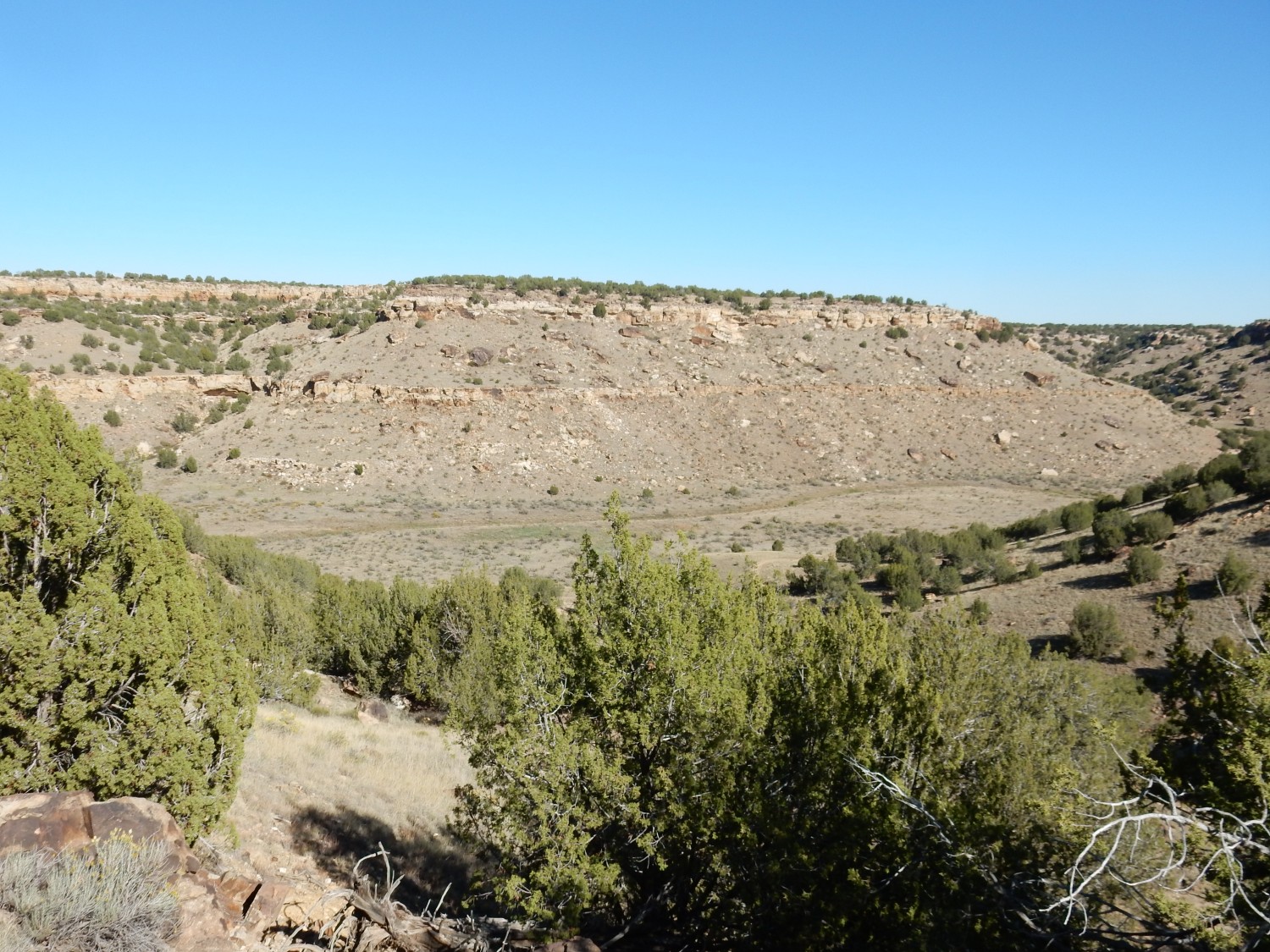
We pass what looks like a river terrace.

River terraces form when a river cuts through a knickpoint (typically a set of resistant rock beds) downstream and the river abandons its old floodplain to cut downwards and begin eroding a new flood plain. Remnants of the older, higher floodplain form the terraces.
A final shot of the canyon.
It’s a slog back out of the canyon. Gary’s feet are really hurting and my back is killing me — like a knife right between my shoulder blades. But we take it slow and make it out.
We had noticed this sign on the way down, but I didn’t photograph it until our return.
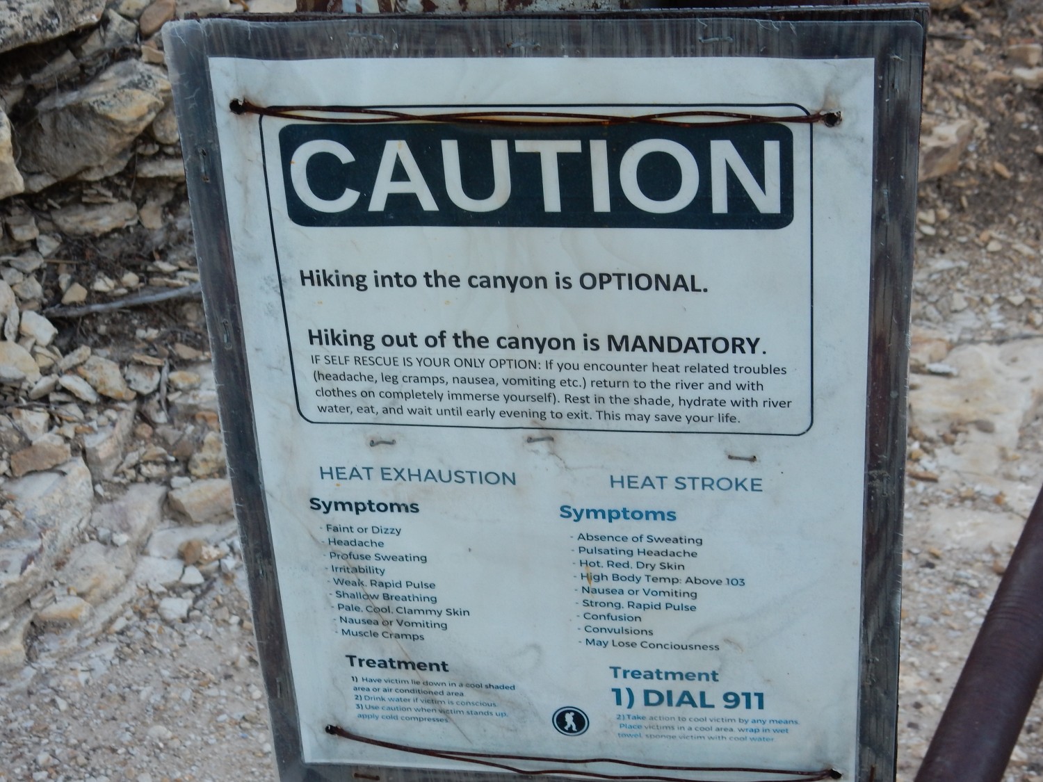
The Forest Service has a quirky sense of humor, but the advice on the sign is good. We had both taken three pints of water on the hike; this proved just adequate for hiking to the tracks on a warm October day. (And we had rehydrating tablets.) You’d need at least five pints on a hotter day. We were sufficiently concerned that we refilled some of our bottles from the Purgatoire River, not intending to use the water unless we were in a bad way. (Giardia is a real risk.) Fortunately that was unnecessary.
We find to our delight that Gordon has parked his rig at the trailhead. We take a few minutes to converse again. And Gary stumbles across a calicified but otherwise excellent complete ammonite fossil, just lying on the ground. It was likely a remnant of the Carlile Shale that was eroded off the Dakota Formation underlying the plateau here.
We’re very tired and ravenously hungry, so we stop at a restaurant in La Junta and have shrimp scampi and onion rings. Not really on my diabetic diet, but I figure my muscles are wide awake and paying attention to my insulin. I find it hurts just to sit.
And we still have a two hour drive to our campsite north of Canon City. Fortunately it’s a relatively warm and calm night, and we are able to set up and turn in for the night quickly once we arrive. There were a few drops of rain just east of the mountains, but it is not raining in Canon City.
From past experience, I suspect this post will have more than the usual traffic. Advice? The tracks are definitely worth the hike, and it’s not a bad hike for older teenagers and healthy adults. I’m almost 60 and Gary is … a bit older. We found it strenuous but doable. If, for you, hiking is simply a means for getting to the tracks, you might consider signing up for the weekend car tour if you have a suitable high-clearance all-wheel-drive vehicle, or you might try your luck with the informal shortcut we stumbled across. Regardless, take plenty of water. Three pints apiece with rehydrating tablets was just adequate for us on a warm October day; I’d recommend at least five pints during warmer times of the year.
But, way awesome.
Great writeup, Kent! Thanks for a great trip!
Gary