Wanderlusting Colorado, Day 1
Because the New Mexico Geological Society Fall Field Conference was postponed this year (due to COVID), I decided to invite my friend, Gary Stradling, to join me for a week in Colorado to look at various geological sites. Why Colorado? Largely because I have been to Florrisant Fossil Beds National Monument twice, enjoyed it both times, but never made it to the private fossil quarry nearby where you can pay for the opportunity to split shale and look for fossils. Gary is very interested in paleontology and it seemed like just the thing.
In the process of planning the trip, I came across numerous other geologic wonders, and it ended up being a really good trip.
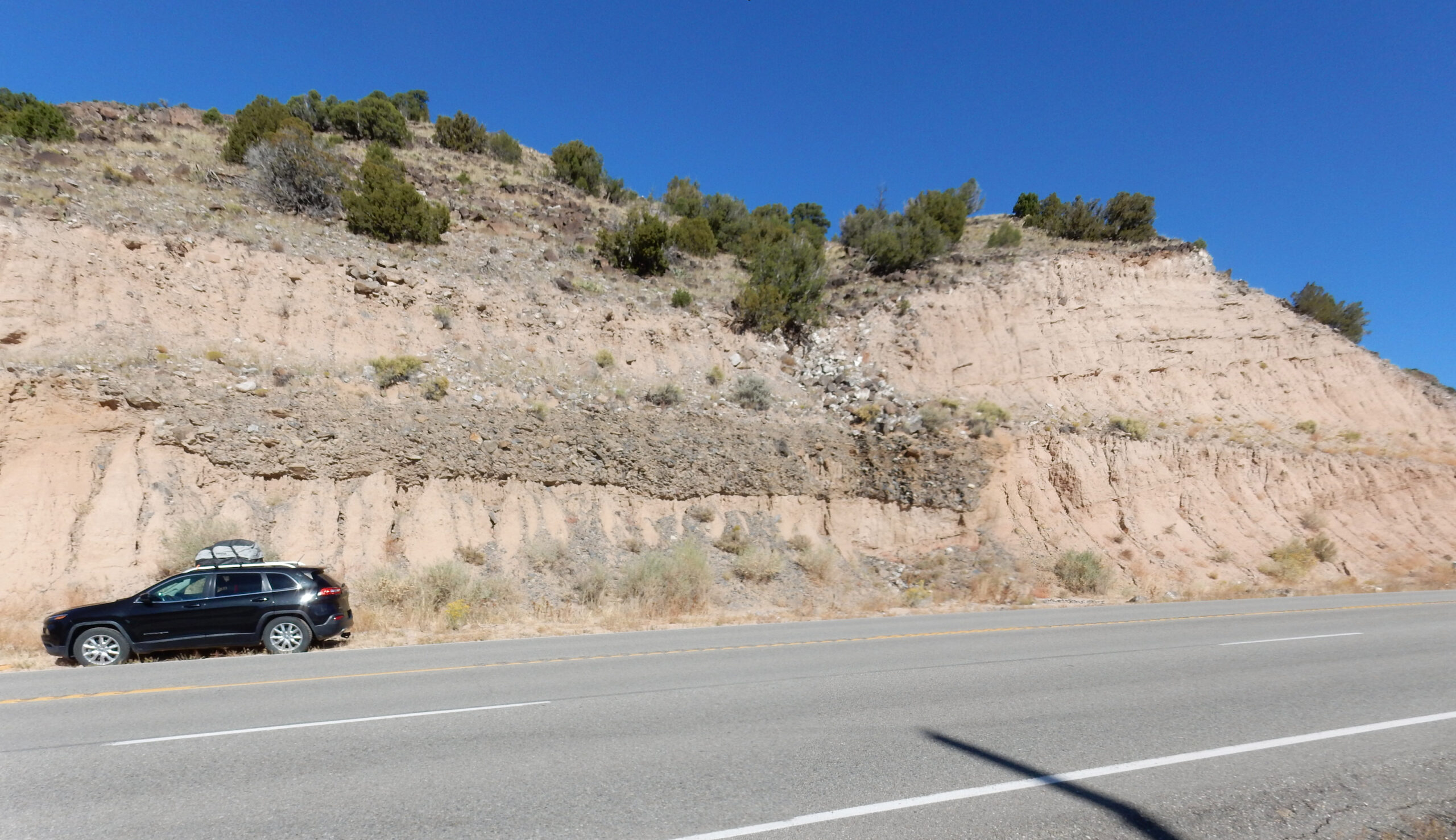
We started out Monday morning and headed from our homes in White Rock towards Fort Garland, Colorado. The first part of the trip was over familiar ground, but we did stop for an outcrop in a road cut that caught Gary’s eye.
For new readers (Welcome!): Most images at this site can be clicked to see a higher resolution version. Blue links generally take you to Google Maps at the location being discussed.
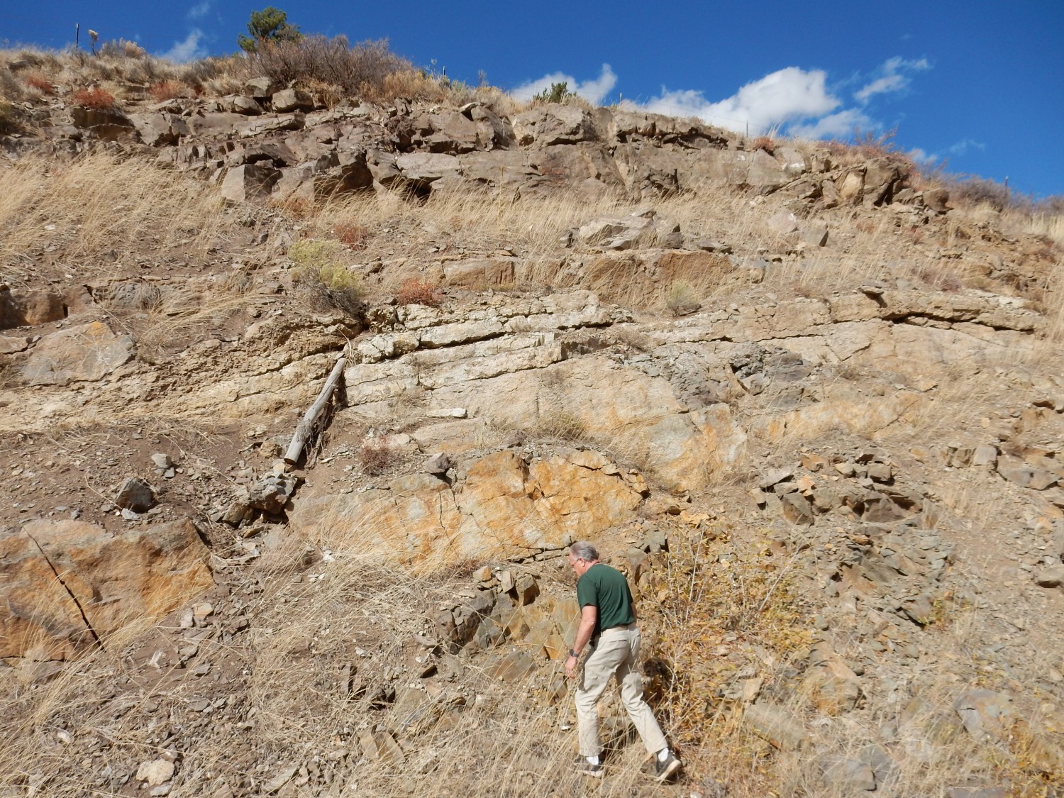
I looked this over some months back, but it was nice to talk about it with Gary. The pink rock making up most of the road cut is a very soft dirty sandstone assigned to the Chamita Formation of the Santa Fe Group. The black layer halfway up the cliff appears to be a debris flow consisting mostly of fragments of Pilar Formation.
Let’s unpack all that. The Santa Fe Group is the name geologists have given to all the sediments that have accumulated in the Rio Grande Rift, a great crack in the Earth’s crust that stretches from central Colorado to the El Paso area and more or less coincides with the valley of the Rio Grande. This rift began opening around 30 million years ago, when the Colorado Plateau began to pull away from the interior of North America. The rifting was caused by western North America drifting onto the East Pacific Rise, a zone of upwelling in the Earth’s mantle, where hot rock from deep in its interior slowly creeps towards the surface as a plastic flow of otherwise solid rock. This upwelling simultaneously stretched and uplifted the overlying crust, forming the Basin and Range Province and opening the Rio Grande Rift.
Within the Santa Fe Group are a number of formations, which is the term geologists use for layers of rock with distinctive physical characteristics that can be traced and mapped over significant distances. The Chamita Formation is one of these Santa Fe Group formations, found in the area from White Rock to the outcrop here.
The dark layer is composed of fragments (clasts) of Pilar Formation carbonaceous slate. Whereas the Chamita Formation is geologically young, around 6 to 13 million years old, the Pilar Formation is ancient, around 1.4 billion years old. It was originally mudstone rich in organic matter that settled to the bottom of a stagnant basin on what was then the southern edge of North America. The sediments were deeply buried, lithified, and compressed and heated by subsequent mountain-building events (orogenies) to become a hard, dense black rock, mostly quartz and mica, but thoroughly permeated with graphite from the organic matter. It’s one of the oldest traces of life in New Mexico.
The Pilar Formation is exposed well to the southeast of this highway, in the Picuris Mountains. This bed appears to be a debris flow of rock fragments carried out of the mountains by a flash flood, perhaps following a forest fire, millions of years ago. The debris flow either cut or filled an existing shallow channel on the surface of the ground — probably the latter, given the very flat bottom of the flow. The channel full of Pilar Formation fragments was subsequently buried by more Chamita Formation sediments. Notice the ledge at about the level of the top of the bed. Either the highway engineers choose to cut a debris trapping ledge at the level of the top of the Pilar bed — not an unreasonable possibility — or the ledge was naturally eroded because the layer here was unusually resistant, marking a pause in deposition of sediments (a hiatus) that promoted calicification, the deposition of calcite just under the ground surface that cements the sediments.
I see no obvious signs of calicification, so my guess is that the highway engineers avoided cutting through the bed of hard slate fragments by placing their ledge just above it.
(And there is a remote chance that this “outcrop” is artificial, though I don’t know what the engineering purpose would be.)
We continue north, and arrive at Fort Garland at about the right time for lunch. We find a small cafe where I get a decent reuben sandwich and Gary gets a sandwich and a slice of homemade pie. The food is adequate, but it’s clear that the cafe is hurting from COVID, with good hired help hard to find. One waiter is just finishing his shift when we get there; he tells us he would rather be a particle physicist but needs tuition money. Well, who wouldn’t?
We head east into the Sangre de Cristo Range at La Veta Pass. I have a guide book that claims there are fossil-bearing beds at a particular milepost, and we stop to look.
What looked like limestone from the road turns out to be a dense sandstone with some conglomerate.
Sandstone generally has very poor preservation potential for body fossils, though it often has good trace fossils. Not this stuff. The geologic map suggests this is Sandia Formation sandstone, a Pennsylvanian formation about 315 million years old.
The Sandia Formation records the rise of the Ancestral Rocky Mountains. A continent — probably Africa — collided with southeastern North America at the same time that oceanic crust was subducting under southwestern North America. This threw up north-south mountain ranges that more or less coincide with much of the present Rocky Mountains, and hence are called the Ancestral Rocky Mountains. The Sandia Formation is coarse sediments eroded off these mountains into shallow seas that filled basins separating the mountain ranges. The geologic map claims there are nearby limestone beds filled with fossils, but we never found them.
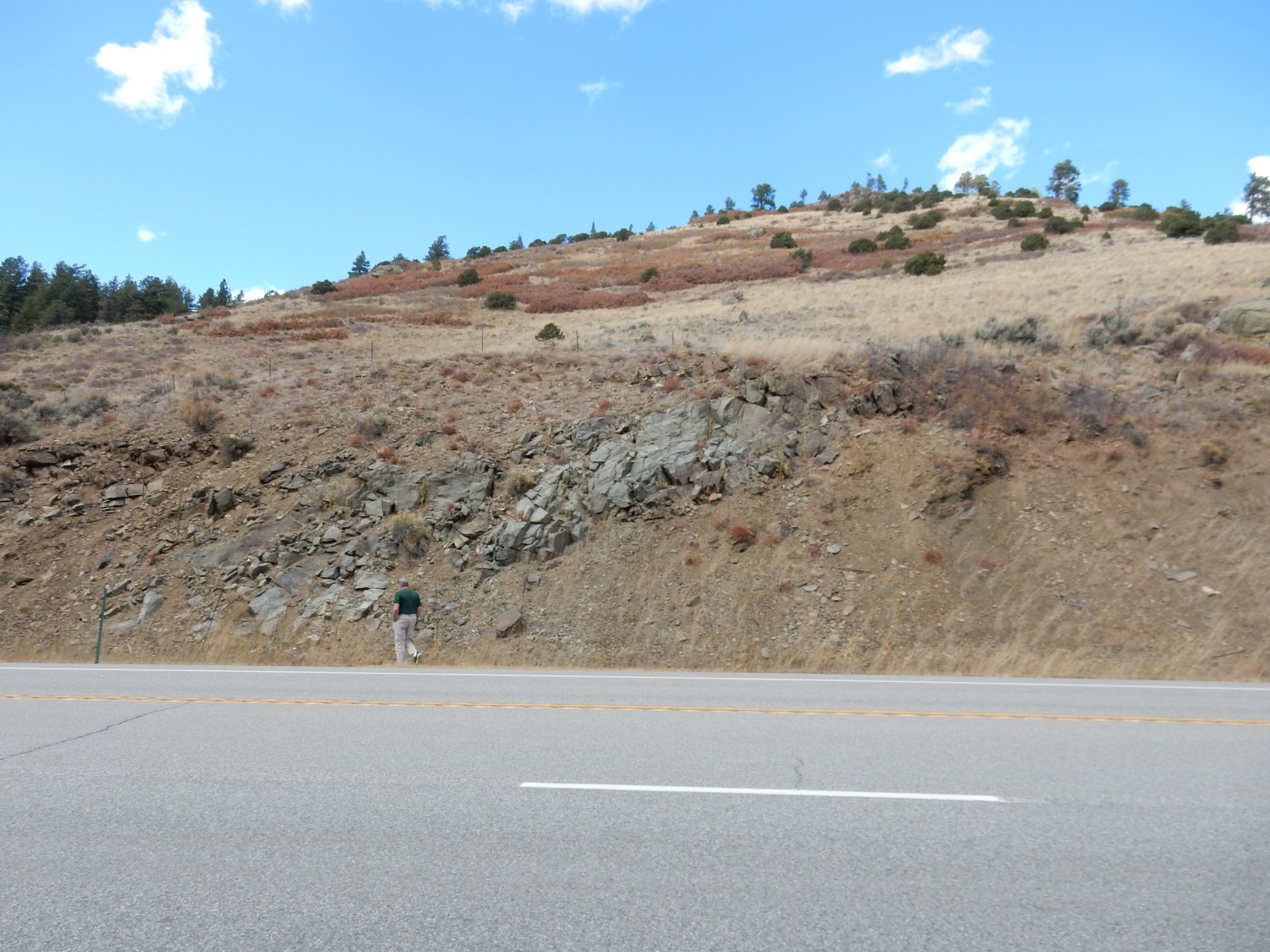
We hiked a short distance along the road to the next outcrop.
This proved to be a calcareous sandstone (sandstone cemented with calcite), likely also Sandia Formation, with very little in the way of likely fossils.
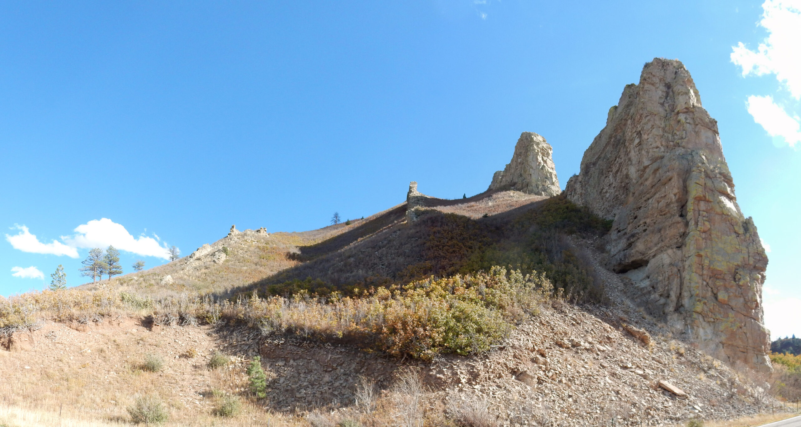
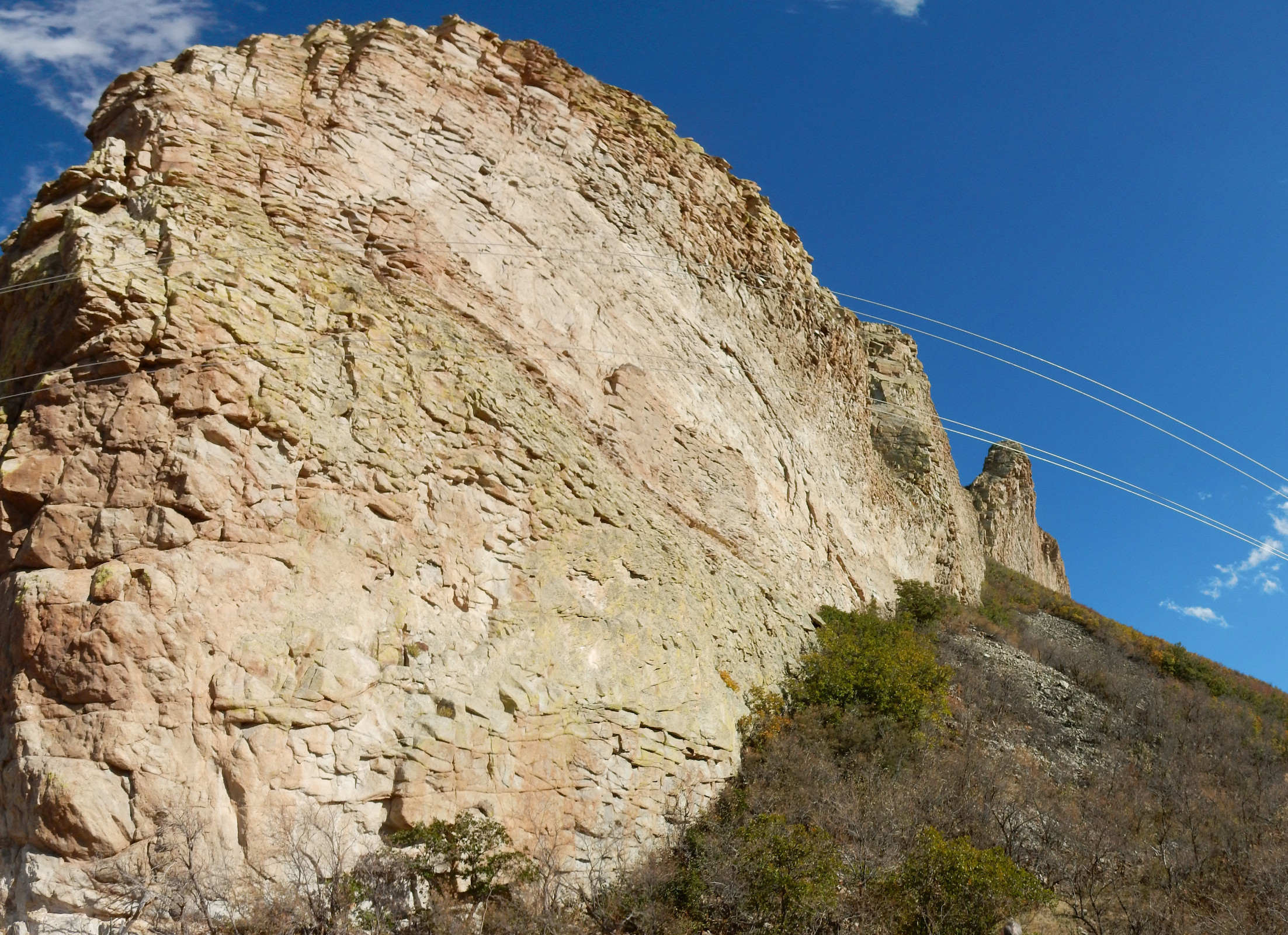
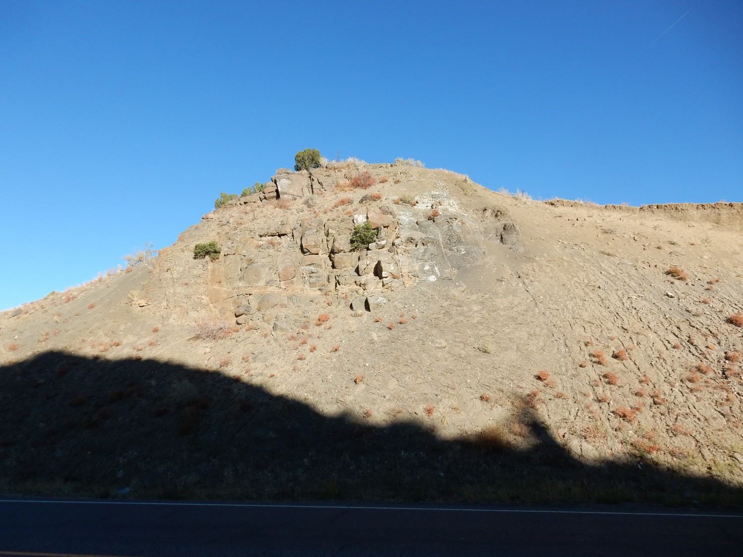
The next stop was not sedimentary rock at all.
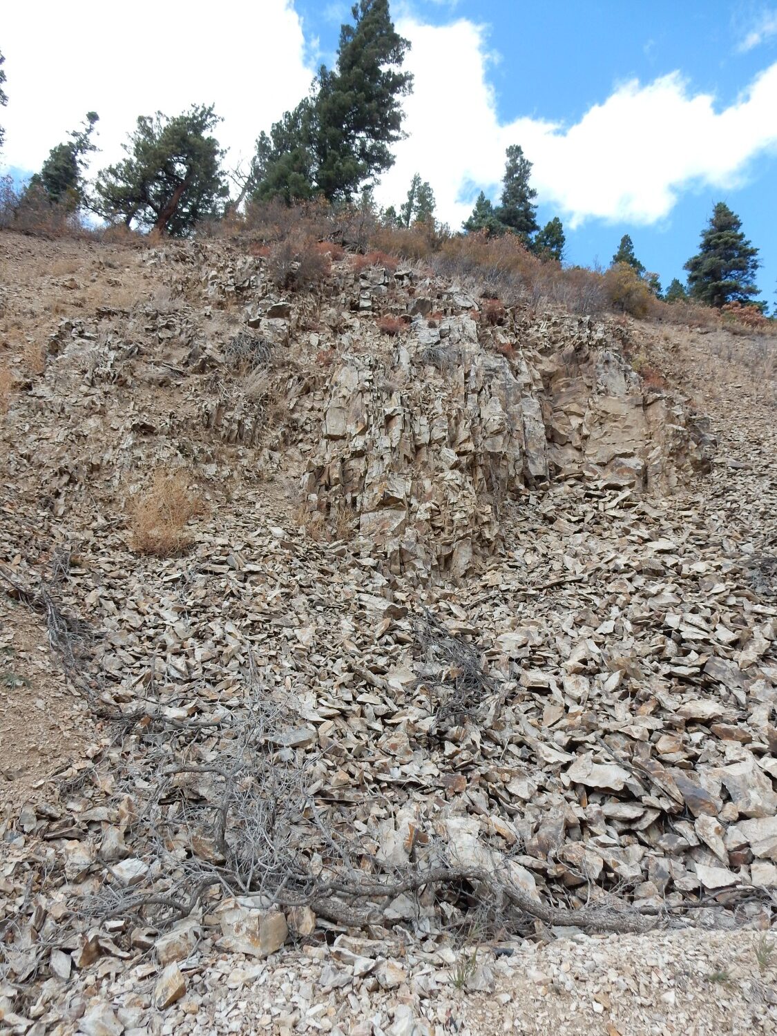
My guess at the time was that we had hit Precambrian basement — the ancient core of the mountains, composed mostly of metamorphic rock like the Pilar Formation. Turns out, from the geologic map, that this is a relatively young plug of rhyolite, a volcanic rock rich in silica. The age is estimated as Oligocene, in the ballpark of 27 million years old — a time of widespread volcanism in New Mexico and Colorado.
A plug is a body of igneous rock just below the surface of the earth that once fed a volcano — a volcanic neck. Some plugs are subsequently exposed by erosion to form prominent features like Shiprock. Here the plug penetrates limestone and sandstone nearly as resistant as the plug rock, so erosion does not make it stand out the same way.
Stopping again:

This looked much more like limestone. However, we found only poorly preserved fossils.

Well, shucks. But is one thing for a limestone to be fossiliferous; it is quite a different thing for the fossils to be well-preserved, and for conditions to be favorable for them to weather out as nifty fossils you can pick up and treasure. So the identification of a rock bed as fossiliferous means only that there is a possibility of good fossil collecting from particularly favorable locations in the bed.
Heading on:
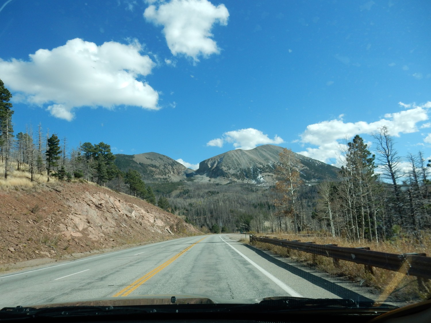
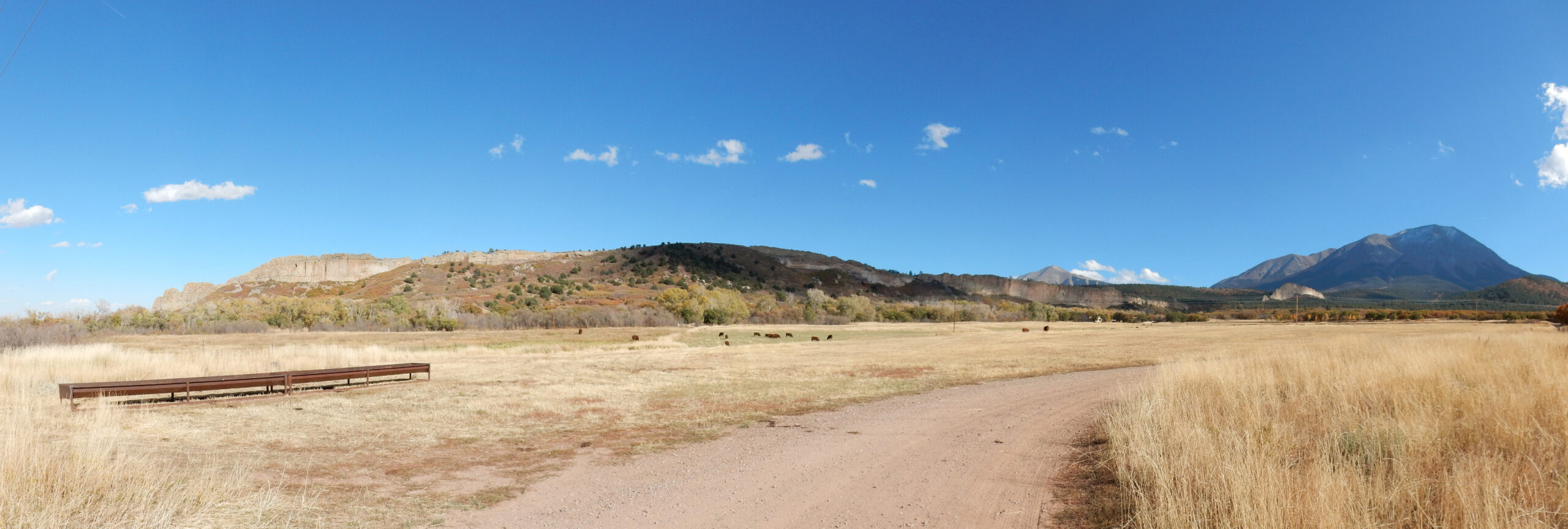
Rough Mountain (left) and Mount Mestas (right). Seen through the windshield. These are something new to me, sole injections of granite that solidified from silica-rich magma that penetrated along the Frontal Thrust Fault of the Sangre de Cristo Mountains.
Starting 80 million years ago, western North America was strongly compressed by shallow subduction of the Farallon Plate under the edge of the continent. Prior to this time, the Farallon Plate, an oceanic plate, had subducted at a fairly steep angle under the edge of the continent, producing a line of volcanoes in California whose roots later became the Sierra Nevada. There are various explanations for why the subduction angle shallowed; perhaps a region of unusually thick and light ocean crust arrived at the edge of the continent; or perhaps the Farallon crust became hotter as North America approached the East Pacific Rise, which would make it lighter; or perhaps the rate of subduction accelerated. The explanations are not mutually exclusive. But as the Farallon Plate began subducting at a much shallower angle, it dragged along the bottom of the North American plate, producing tremendous compressive forces that threw up most of the ranges of the Rocky Mountains we see today. The Sangre de Cristo was among the ranges thrown up at this time, and the block of crust making up the range was actually thrust up and over the younger rock beds to the east. Later, magma penetrated the weak zone of the thrust fault to produce the two mountains here.
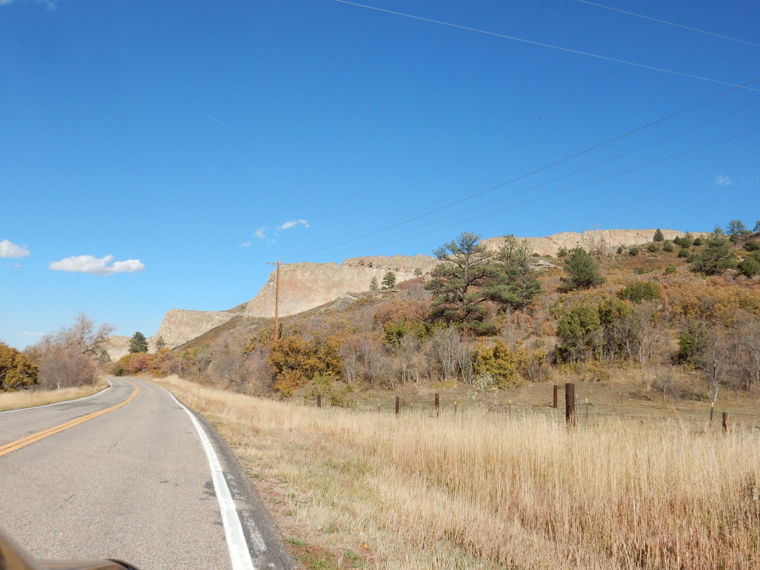
We come down the pass and into sight of the Spanish Peaks.
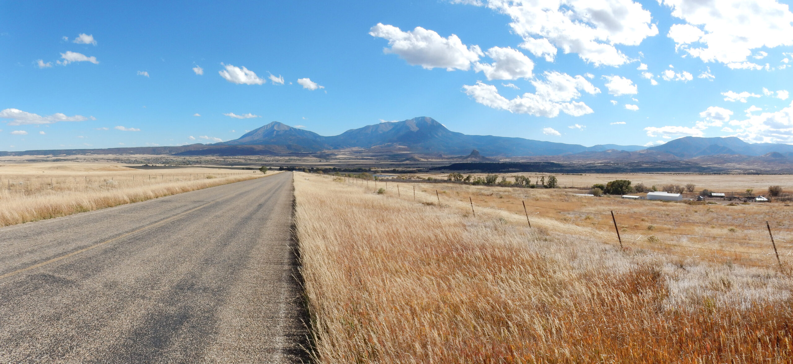
The Spanish Peaks sit well east of the Sangre de Cristo mountain front, as not quite isolated peaks. These are stocks, fairly large bodies of igneous rock formed from magma that did not make it to the surface.
The Spanish Peaks are famous for the associated dikes. Dikes are thin sheets of igneous rock that form where magma fills cracks in the existing rock (the country rock). Often the magma is pressurized and opens the crack further, allowing the magma to penetrate further and extend the crack to great distances. Some dikes of the Spanish Peaks area radiate away from the peaks and were clearly emplaced as part of the same volcanic process. Others cross the area from east to west and have no obvious association. The latter are actually younger dikes, and often have unusual compositions, poor in silica and rich in potassium.
In the foreground is a small plug.
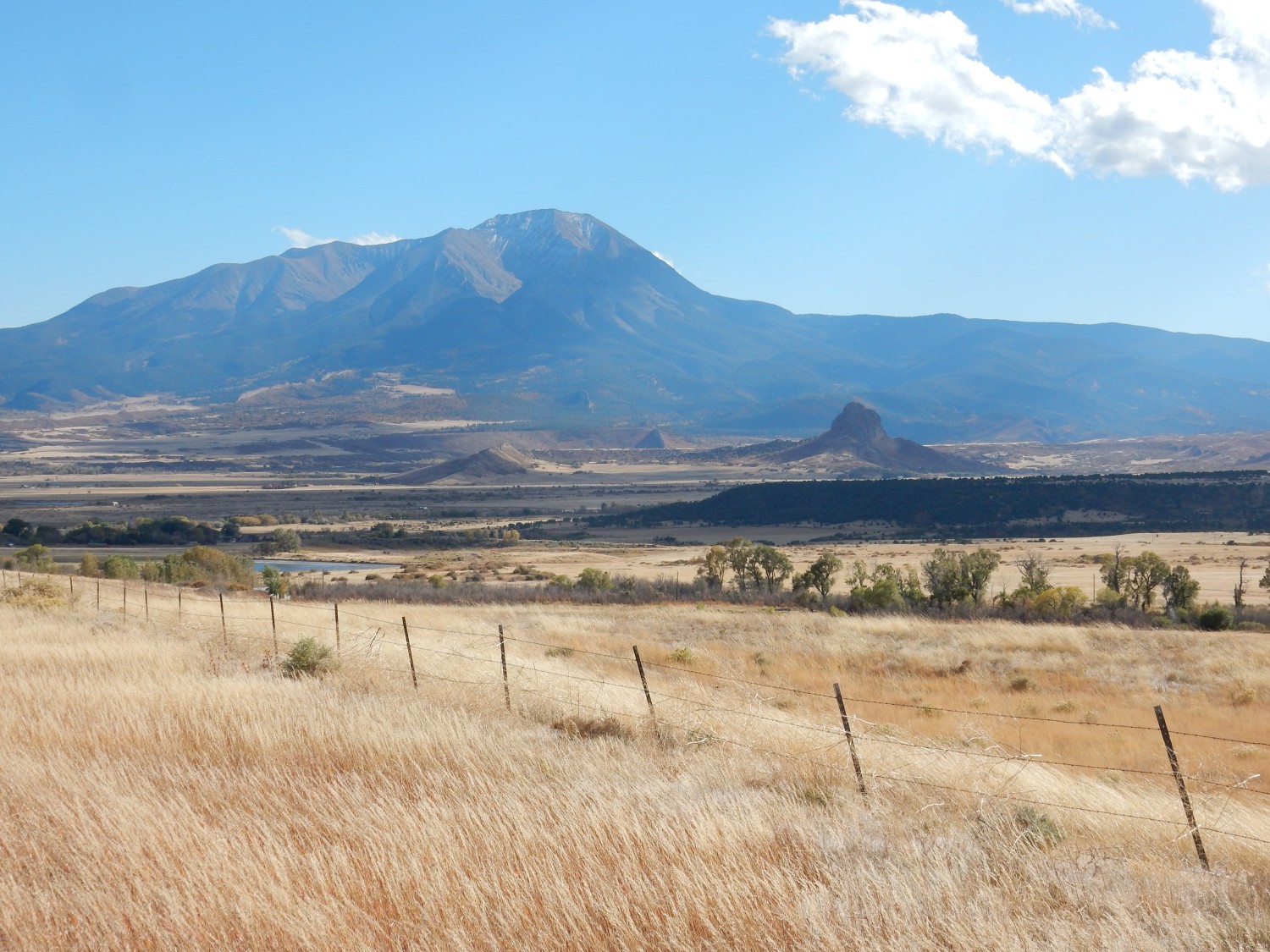
The plug is Goemmer Butte, and is composed of a rock described in a 1968 paper as syenodiorite. Nowadays we would call it monzonite, a not uncommon rock type, composed of a mixture of plagioclase and alkali feldspar with just a few per cent of quartz. Most of West Spanish Peak is composed of this rock type.
We drive south and get a good view of one of the dikes, Profile Dike.
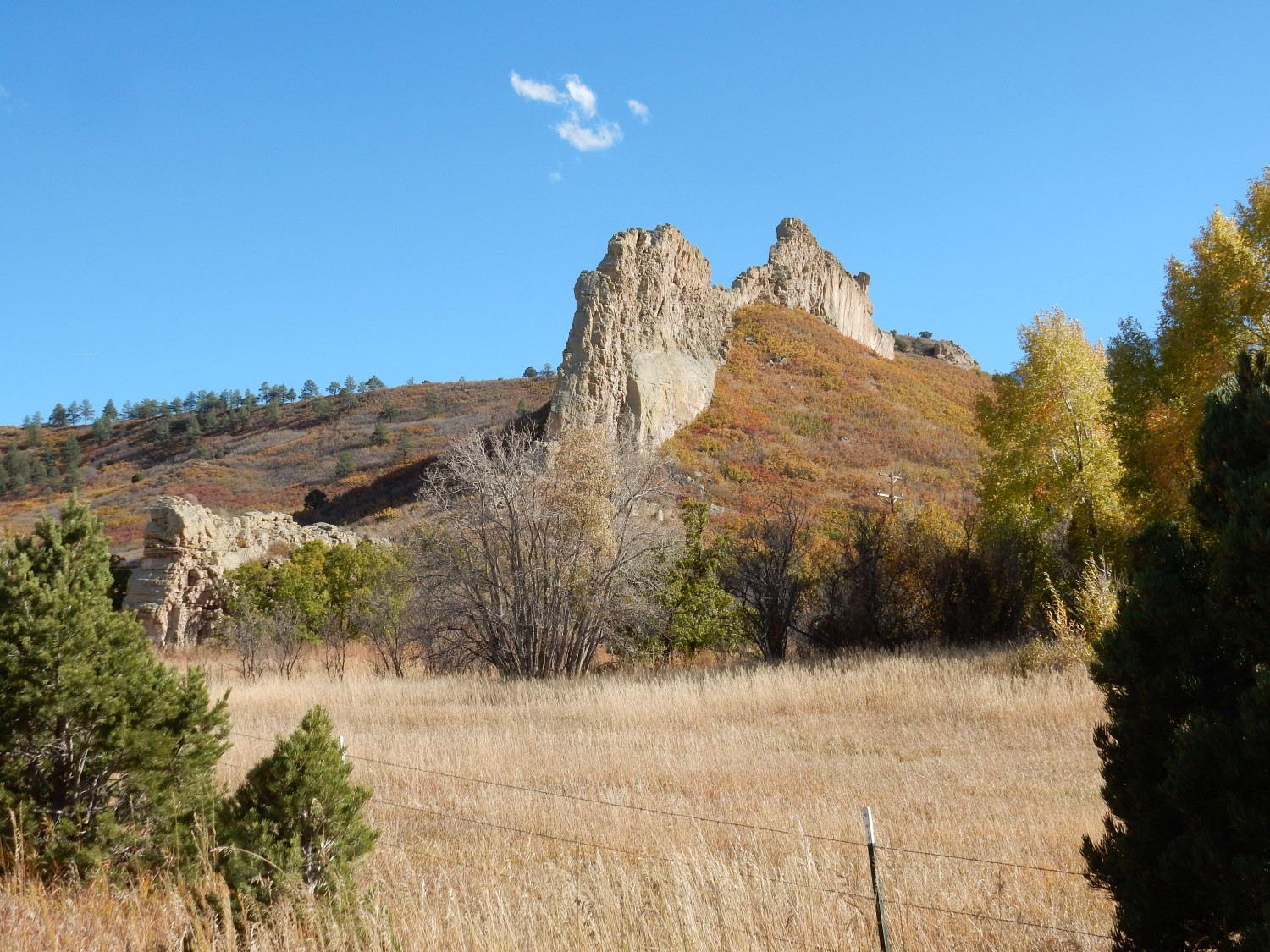
This dike is also composed of monzonite. It penetrated a crack in beds of young sedimentary rock, and the patch of light rock just above center in the photo is probably hornfels — sedimentary rock that has been “cooked” by the heat of the magma that formed the dike and has adhered to the dike.
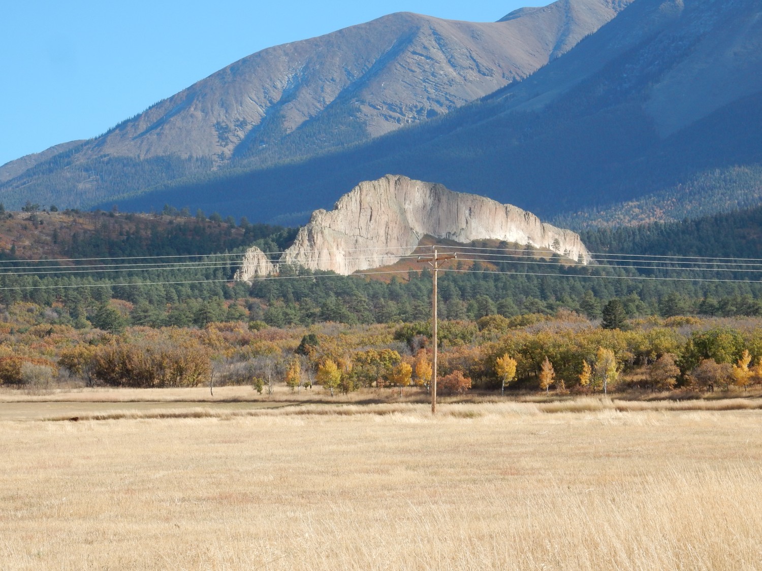
Side view.

The dike radiates a considerable distance from West Spanish Peak.
We drive on to the next system of dikes.
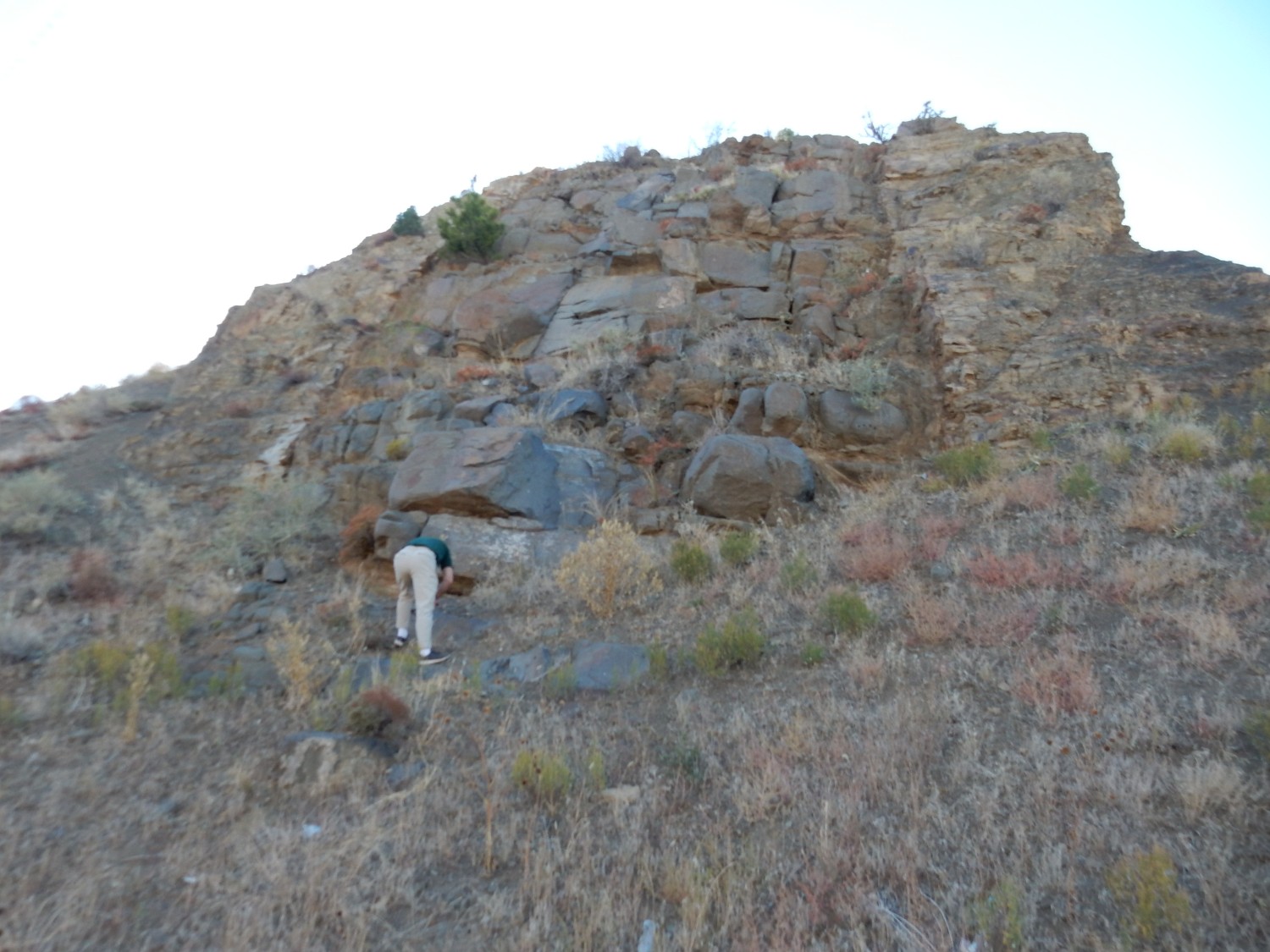
Here we have a large dike with two smaller satellite dikes. The big dike is known a the Devil’s Staircase.

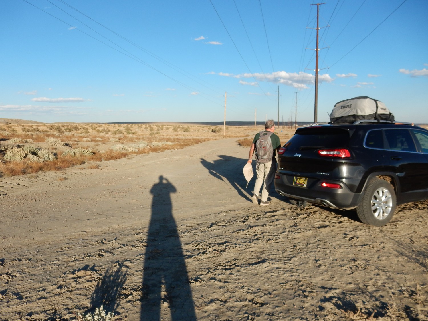
The gentleman is Gary Stradling. I’ve discovered some readers are surprised that I don’t appear more in the photographs; well, I am the photographer. Gary made a point of taking some pictures that included me later in this trip, which seems like a good idea for curious readers.
The dike is immense.
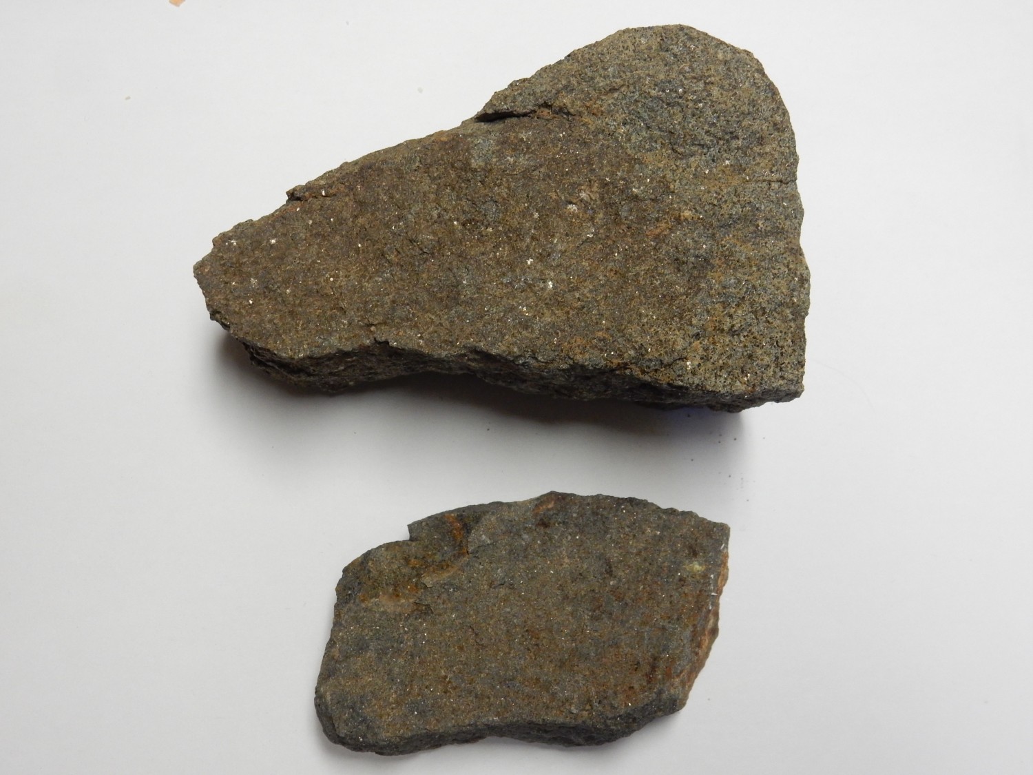
The dike is composed of granite porphry, a high-silica rock consisting mostly of feldspar and quartz. Some of the feldspar is relatively large crystals (phenocrysts) while the quartz and remaining feldspar form a much finer-grained groundmass; this texture is what makes this a porphyry.
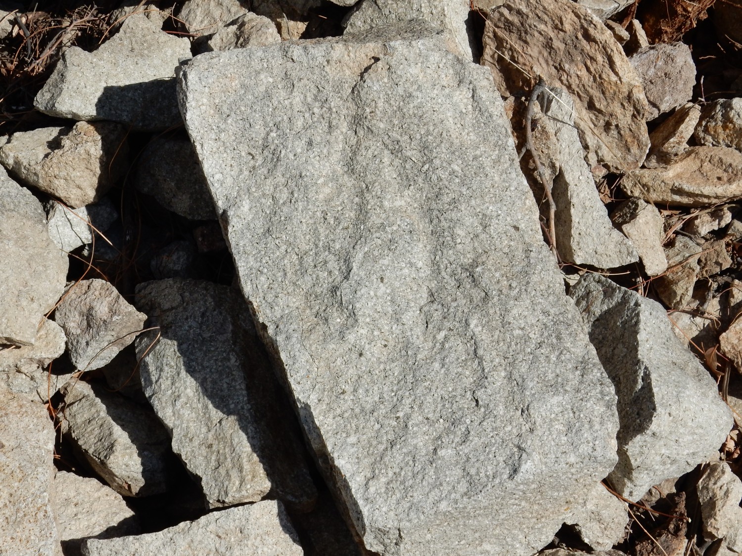
So why is this rock gray when the dike is pinkish? This is a freshly factured, unweathered surface. As the rock weathers, iron minerals oxidize to produce the pinkish discoloration.
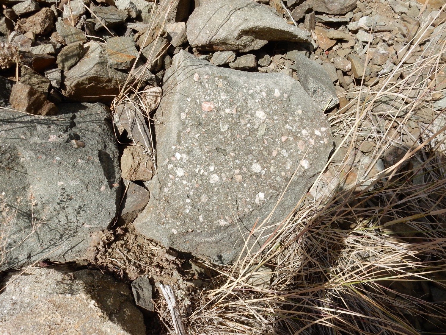
Here is some of the sedimentary rock penetrated by the dike, which has been cooked into harder rock.
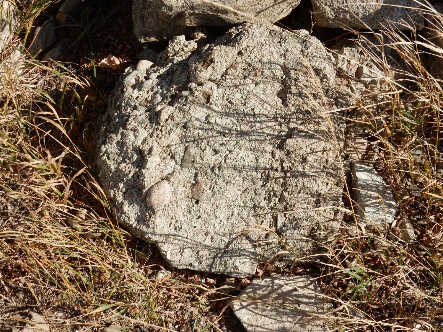
This is a metaconglomerate, likely representing coarse sediments eroded off the nearby Sangre de Cristo Mountains.
The granite composition is quite unusual for a dike. Granite magma is normally extremely viscous, so that it has a very difficult time penetrating a crack in existing rock. Most dikes were formed from much more fluid low-silica magma. Either the granite here was unusually hot or rich in volatiles that lowered its viscosity, or it had a very long time to penetrate the crack — the latter is normally limited by the cooling rate of the magma.
Down the road for one last dike.

This dike is composed of monzonite.
Then back for a more distant view of the Devil’s Staircase.
The staircase shape suggests separate layers in the dike — not something normally seen. But since this is a weird granitic dike, perhaps repeated injections were at increasingly high levels.
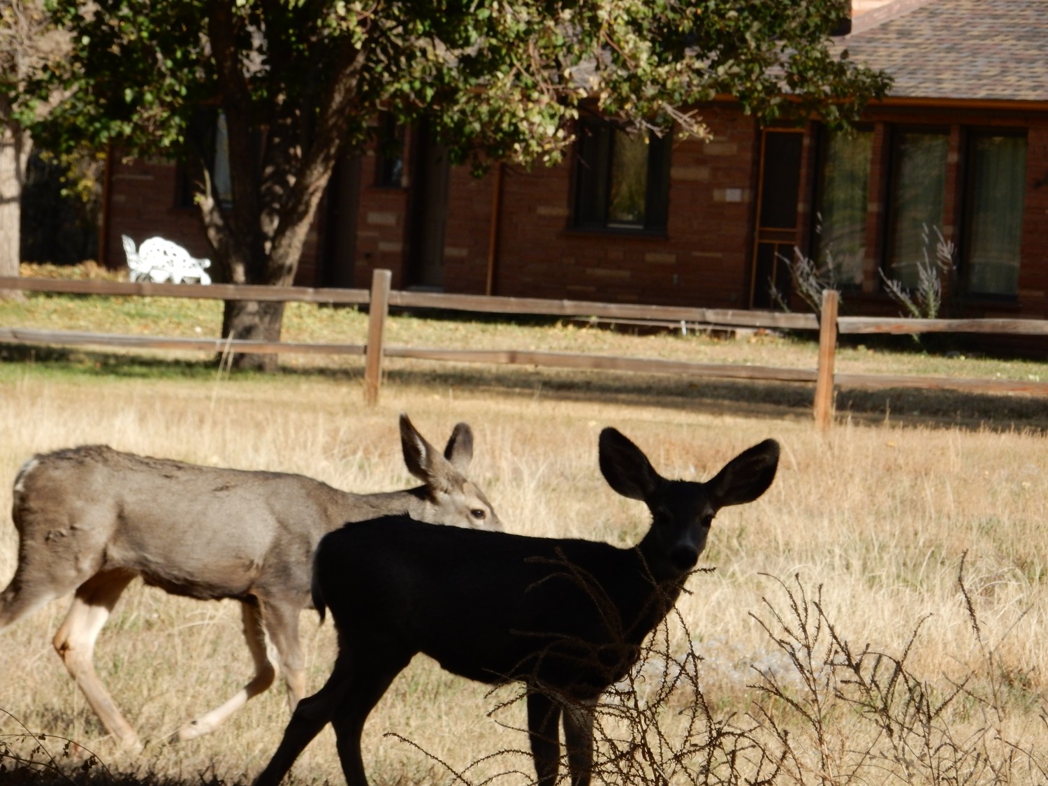
We must hurry on if we are to collect baculite fossils before nightfall. But we pass some photogenic fauna.
I decide we’ll have to skip another pair of dikes of rare composition, which would require a drive down a long dirt road. But we divert north of Walsenburg to visit the Walsenburg dike, which is right on our route.
This dike does not stand out quite as much, because it is formed of minette, a rock that is less resistant to erosion. Minette is an unusual rock, very low in silica and rich in potassium — a lamprophyre. Such rocks are never voluminous and seem to form from magma produced by a low degree of partial melting. The mantle rock deep in the earth from which these magmas come melts only very slightly, so that only the lowest-melting minerals enter the magma. These are very rich in potassium and poor in silica.
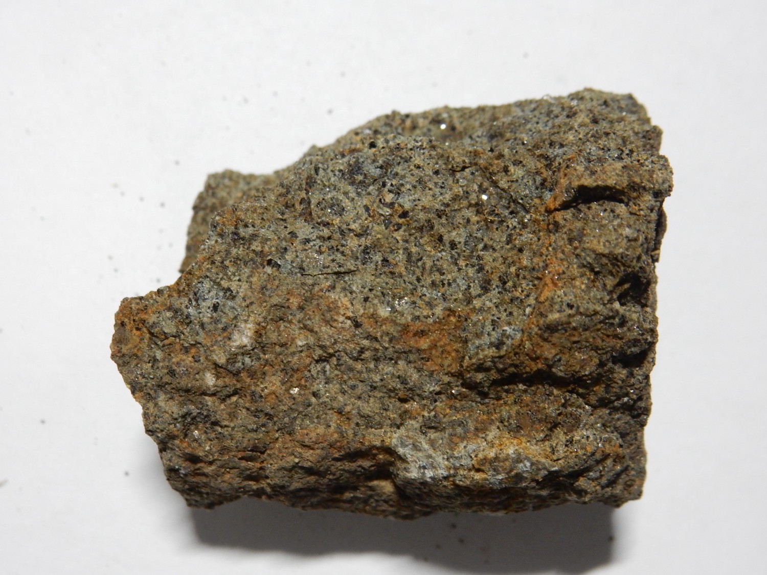
It’s a somewhat rare rock type, and every outcrop I’ve visited before was where I couldn’t take a sample. I take one here:
The rock is chock full of biotite mica crystals, which produce the sparkle. Much of the rest is orthoclase. Both are potassium-rich minerals. The remainder of the rock is silica-poor minerals such as hornblende, olivine, or feldspathoids.
Then it’s a race to Baculite Mesa before sunset. We get permission from the land owner, who directs us to a favorable site.
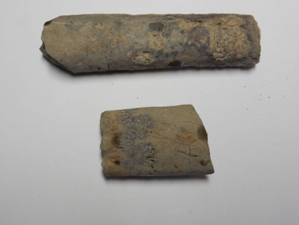
Here baculite fossils have weathered out of the Pierre Shale of the mesa to the north and can be found on the surface. Or I think so. Here’s what we found:

Baculites are relatives of ammonites, which in turn are relatives of squids and octopuses that have retained an external shell. The external shell of a baculite is straight, looking a little like an animal’s horn, while ammonites have tightly coiled shells. We’re seeing broken segments of these shells. I might think these were concretions if it were not for their very consistent form. But this photograph removes all doubts; the lower fragment has a very distinctive suture (the curvy line) typical of ammonite and baculite shells.
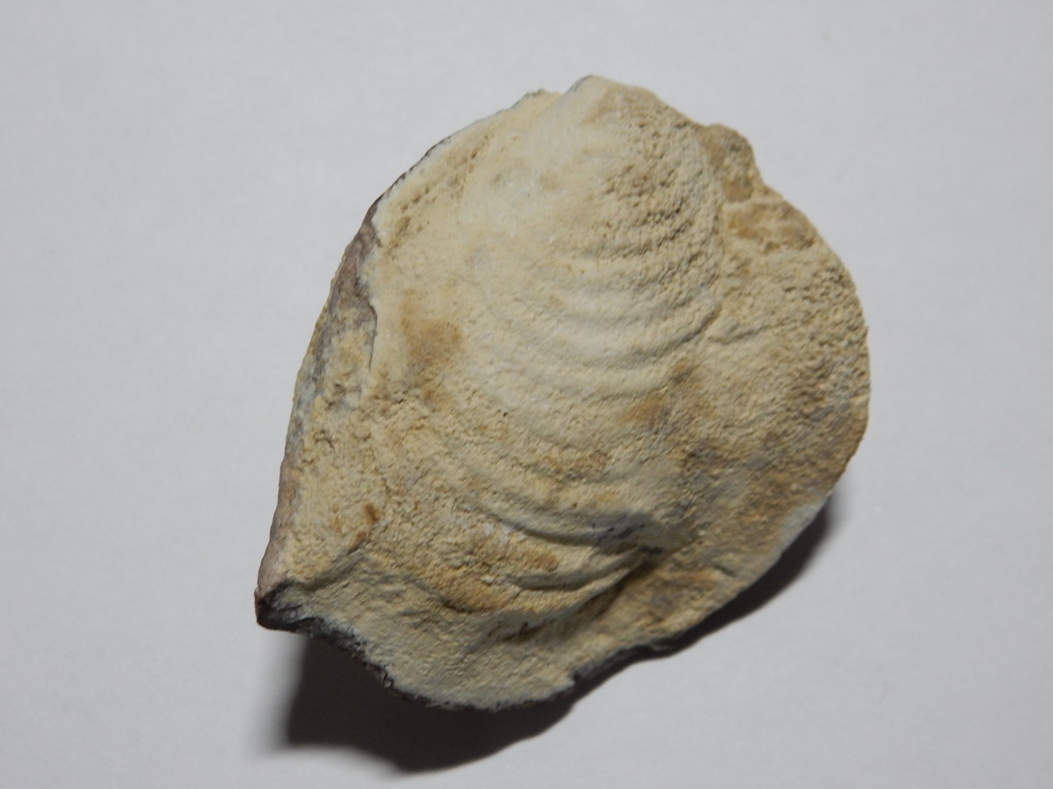
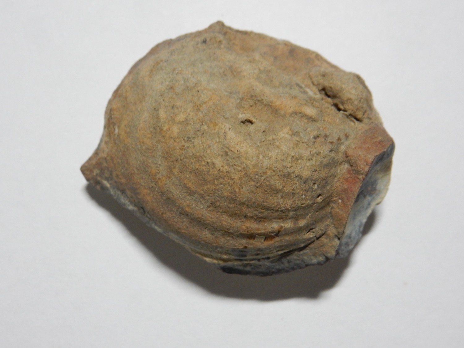
We hunt fossils for a good hour, and to my surprise, I come up with a very nice oyster fossil.
The light fails, and we make the long drive to La Junta, then south to our campsite at Vogel Canyon, where we make camp in a mild breeze (tricky with my dome tent) and turn in for the night. I have brought a new air mattress and three blankets to go with my sleeping bag; I sleep quite comfortably in spite of the brisk October weather. Gary uses a hammock and similar layering of blankets but finds the wind troublesome. He will make adjustments subsequent nights that work a bit better.
Great write up and wonderful trip! Thanks Kent!