Wanderlusting Colorado, day 4
It’s a chill morning, but not quite freezing. We eat breakfast, then break camp. I try the spray laquer on my Florissant fossils; alas, the one with the peeling leaf is destroyed in my attempts. The others did okay, as you saw in yesterday’s images.
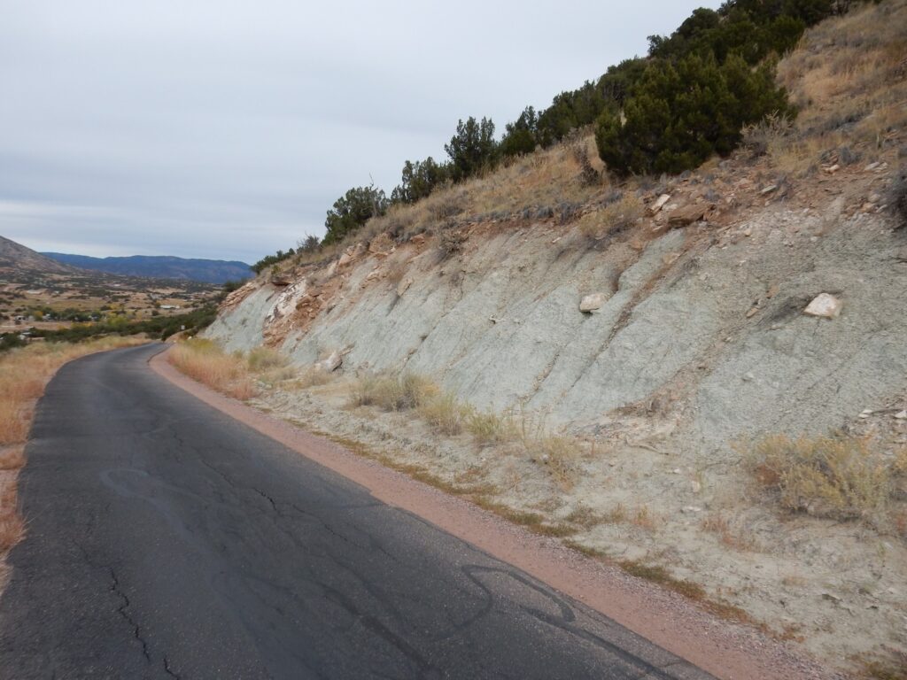
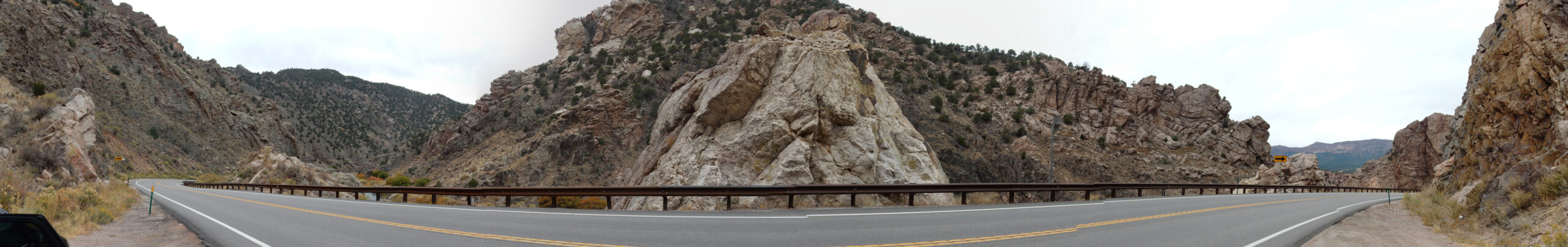
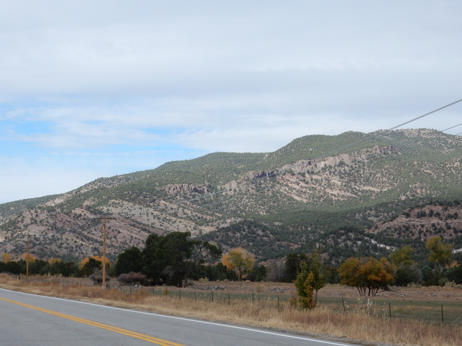
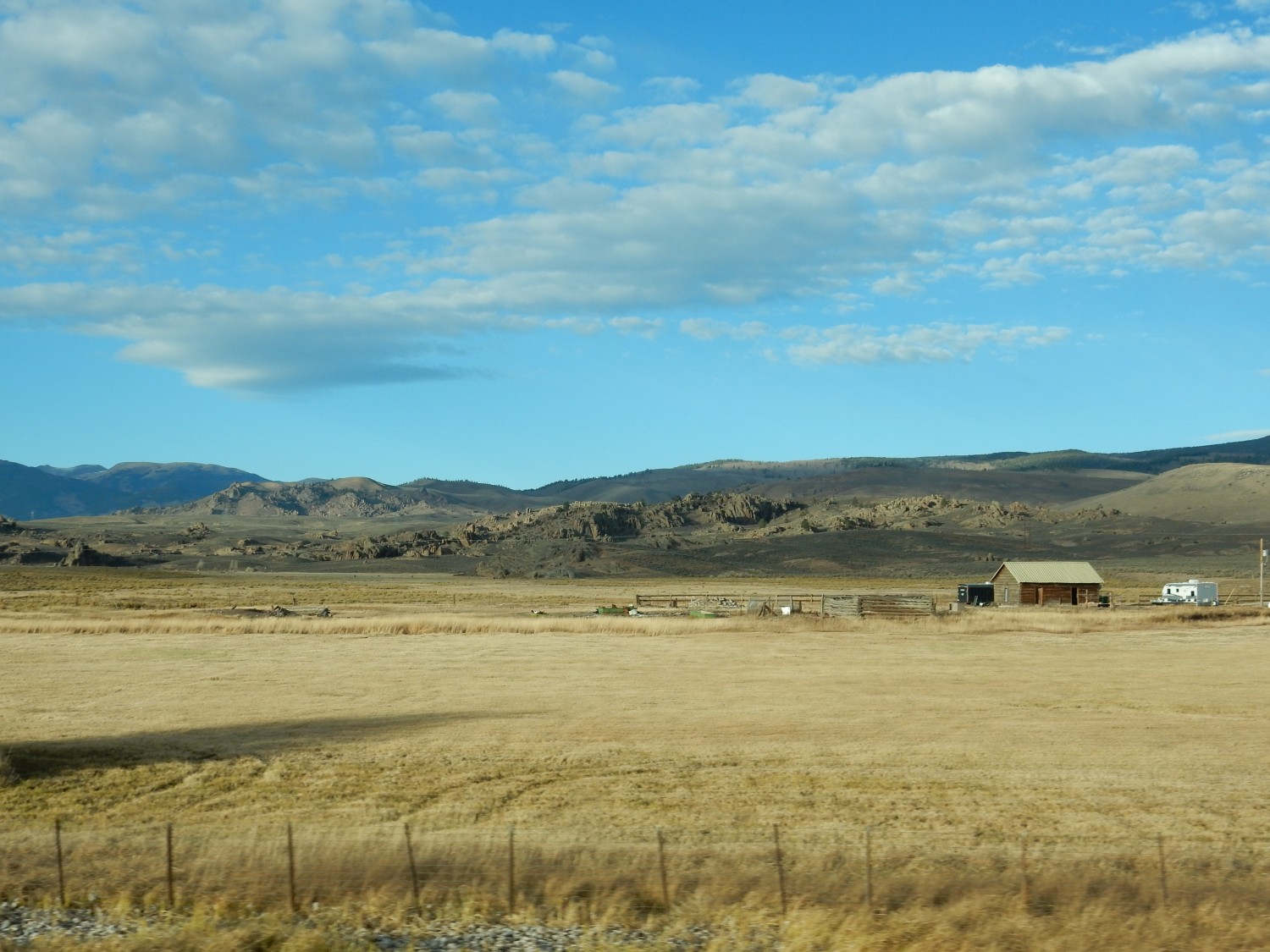
On the road to Canon City, we stop a second time to admire the hogback.
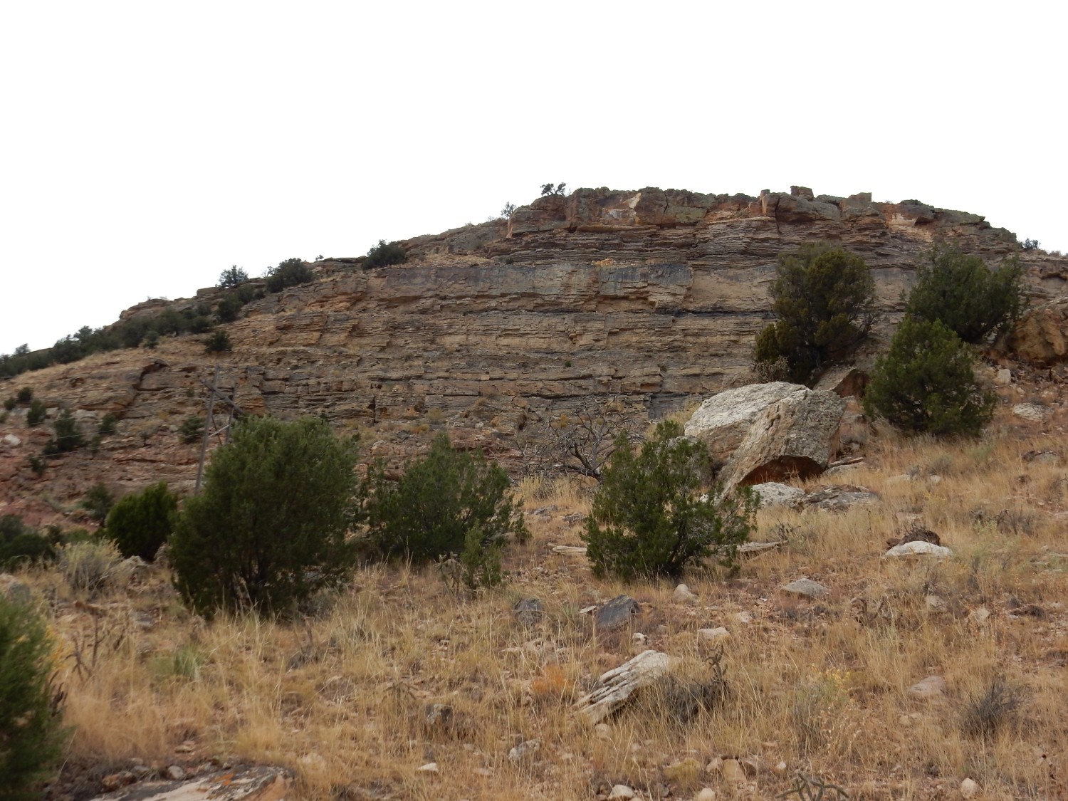
I’m not familiar enough with the area to be sure, but this is likely Dakota Formation over Purgatoire Formation.
Panorama:
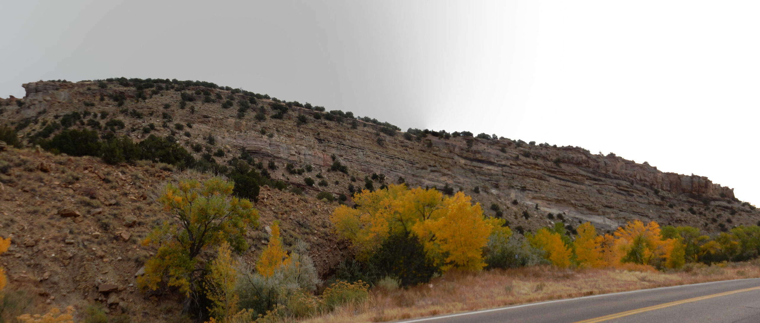
You can see that it is somewhat muddy weather this morning; the only really muddy weather of this trip. Fortunately, it mostly burned off by afternoon.
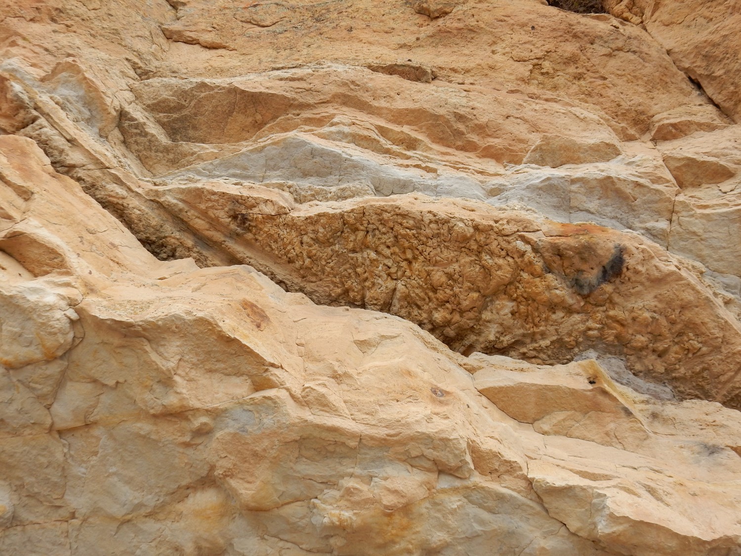
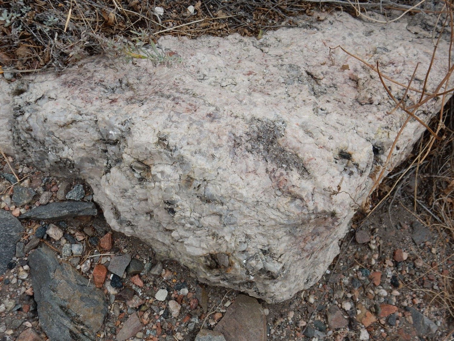
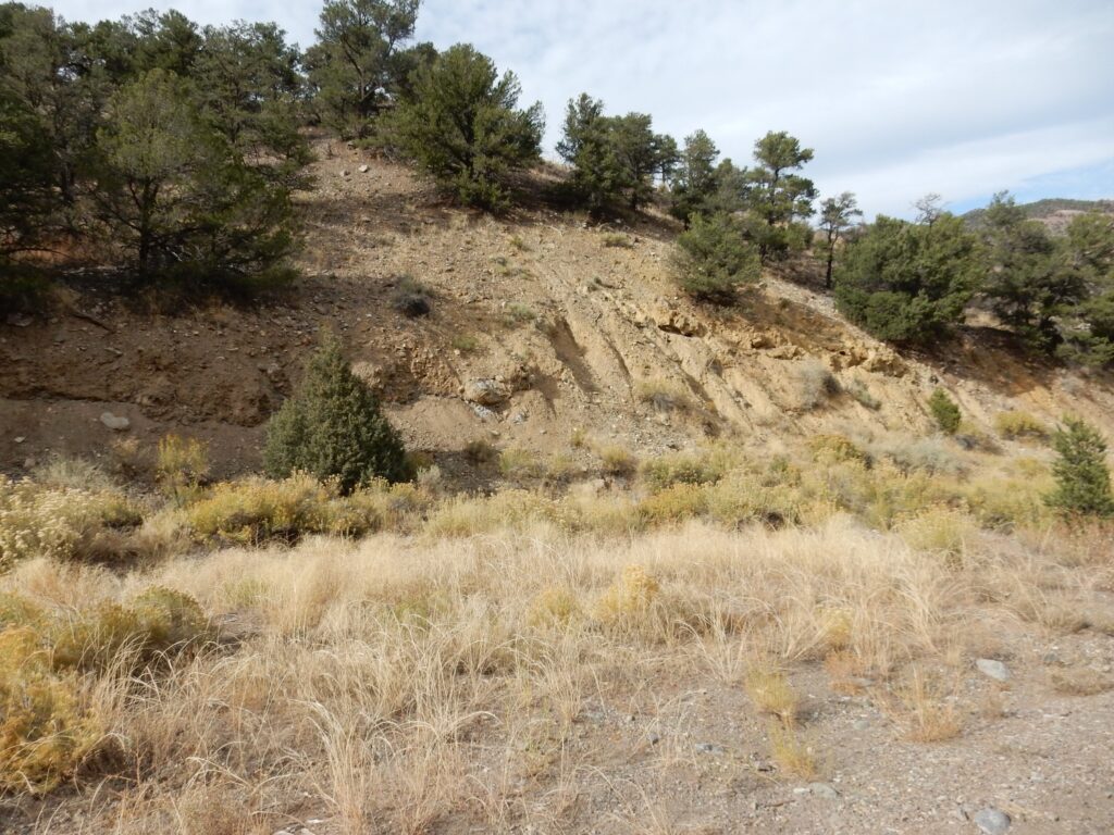
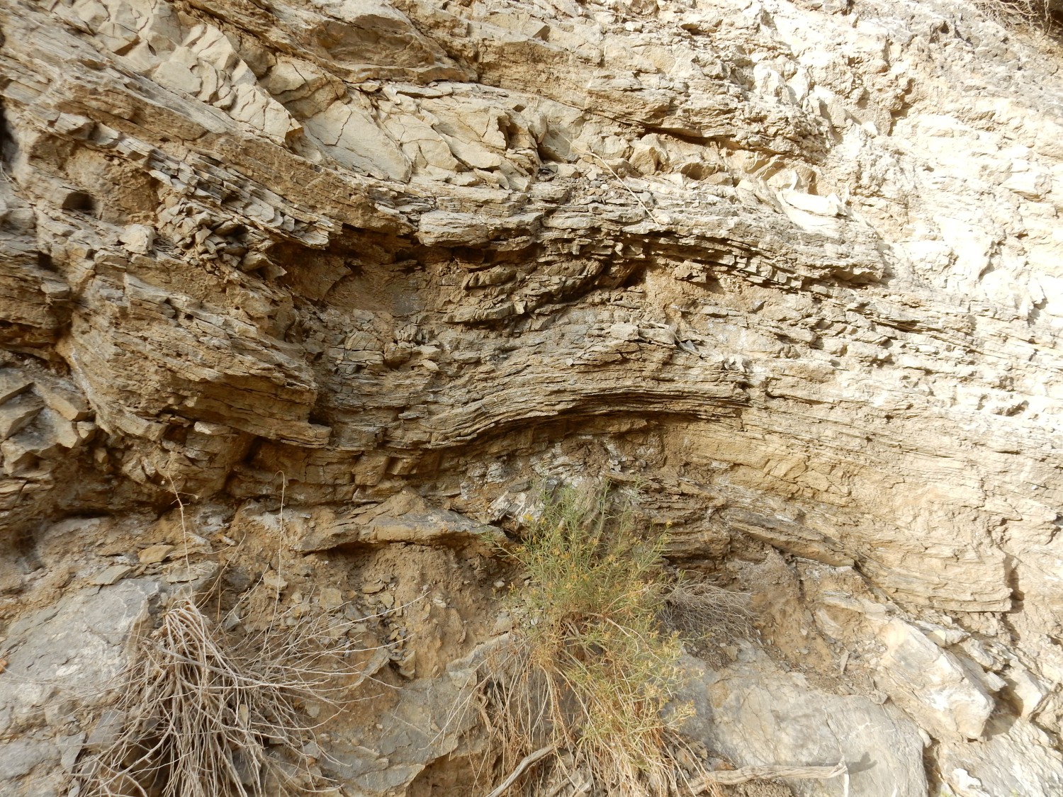
Close up.
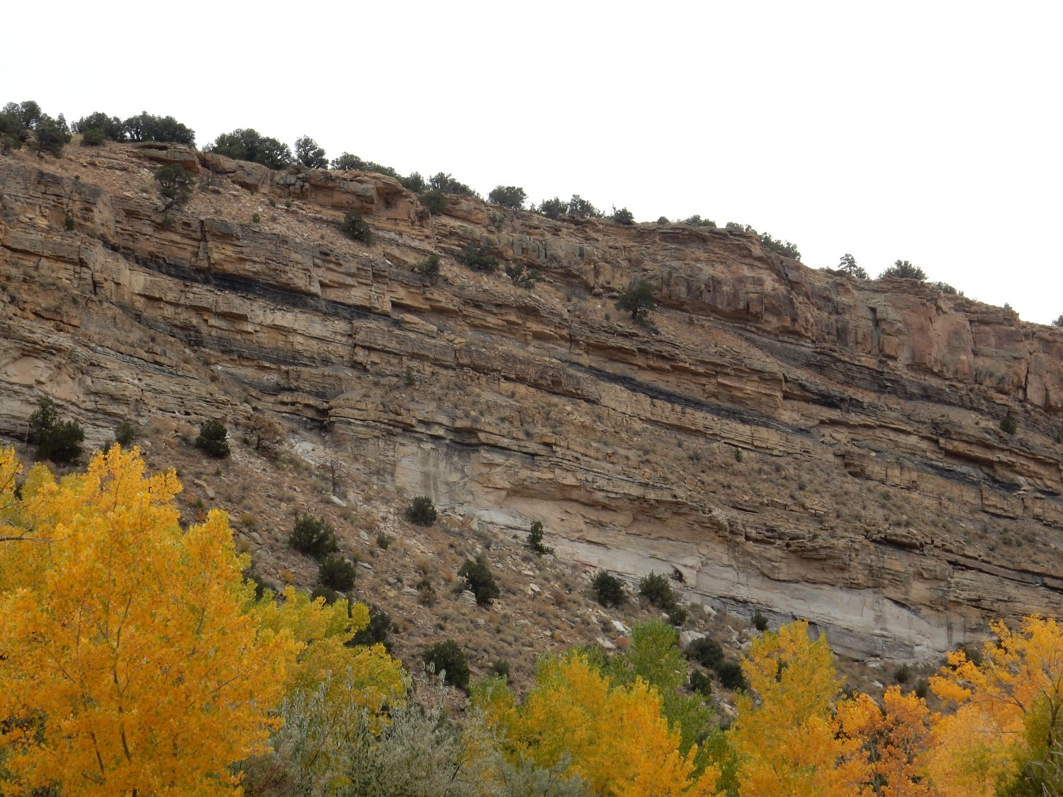
You can see thin black lenses of carbonaceous mudstone; not quite coal. Thin coal beds are sometimes found in the Dakota Formation, but it’s not really a significant coal-bearing formation.
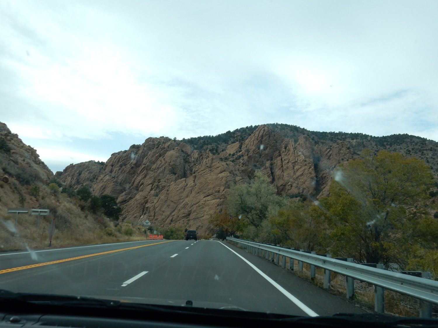
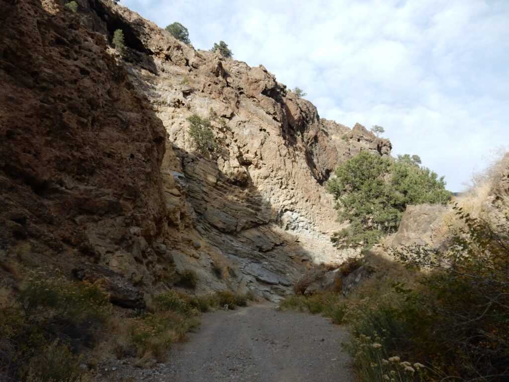
We drive into town, refuel and top off tire pressure, then head for Skyline Drive. My road log suggests it has a nice view. But, as sometimes happens on trips like this, we are surprised to stumble across something really cool.
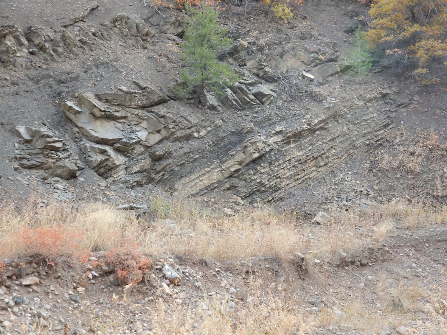
Skyline Drive climbs the Dakota hogback where it bends back south and passes west of Canon City. It was apparently constructed by convicts from the nearby Colorado Territorial Correction Facility.
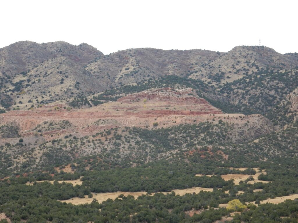
The road is paved but narrow and one-way. Panorama from halfway up, looking west:
We are looking at more Ordovician beds to the west, in which a couple of quarries are located. At far right is Skyline Drive coming up the mountain.
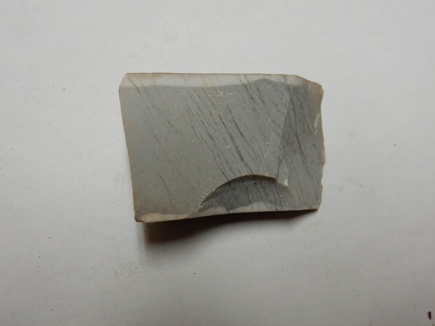
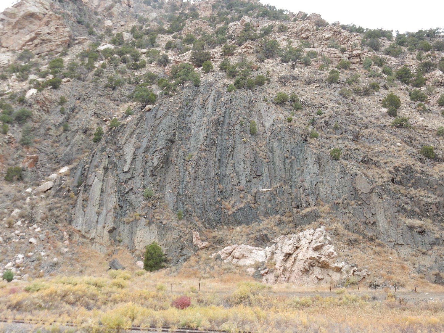
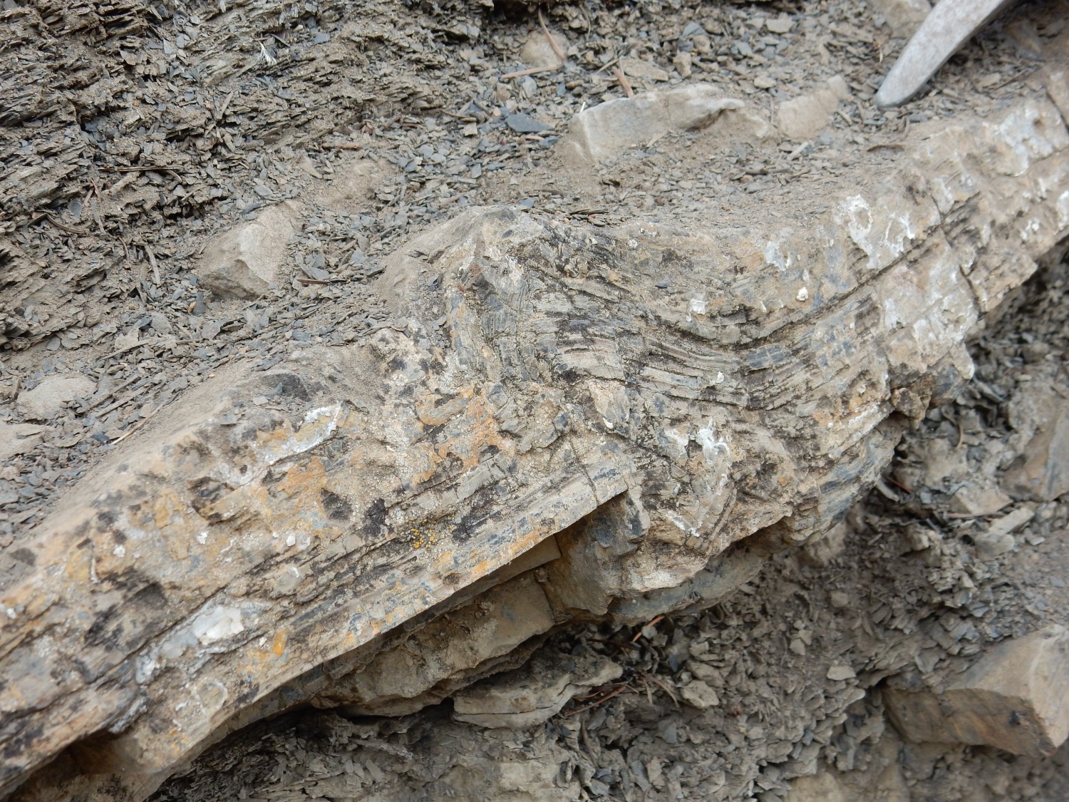
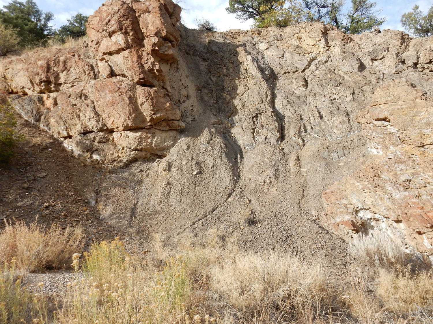
Nearby the road cuts through Morrison Formation.
This is typical mudstone of the Morrison Formation. Its pale gray color reflects an initial high organic carbon content. The carbon reacted with ferric iron (Fe3+) and converted it to ferrous iron (Fe2+). Whereas ferric iron forms red or brown insoluble minerals, ferrous iron is relatively soluble and leached from the rock to leave behind the gray clay seen here.
Telephoto shot of one of the quarries to the west.
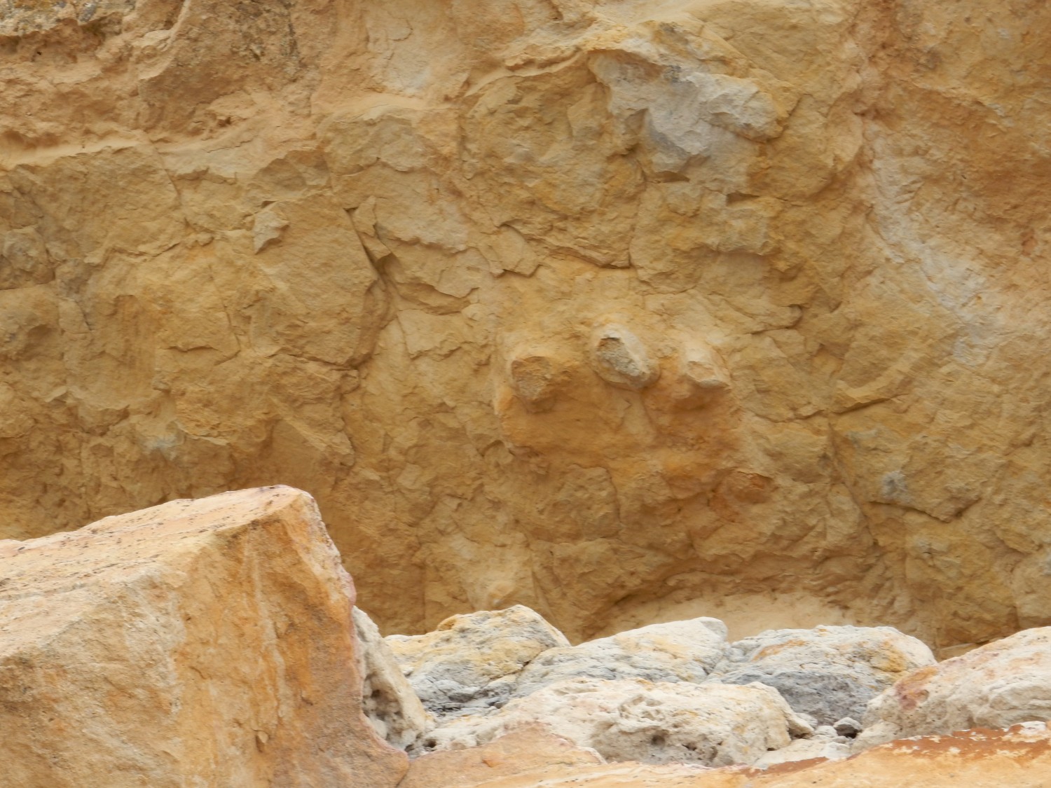
And then, to my surprise and delight:
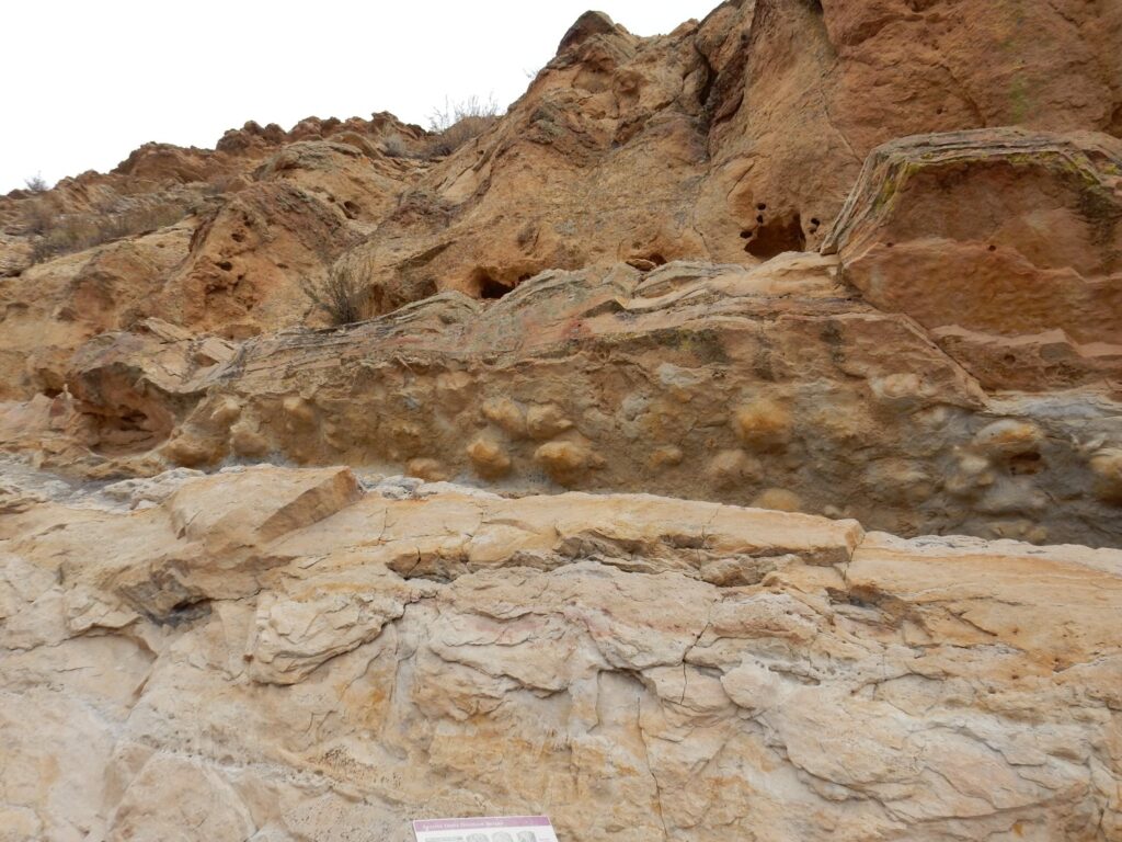
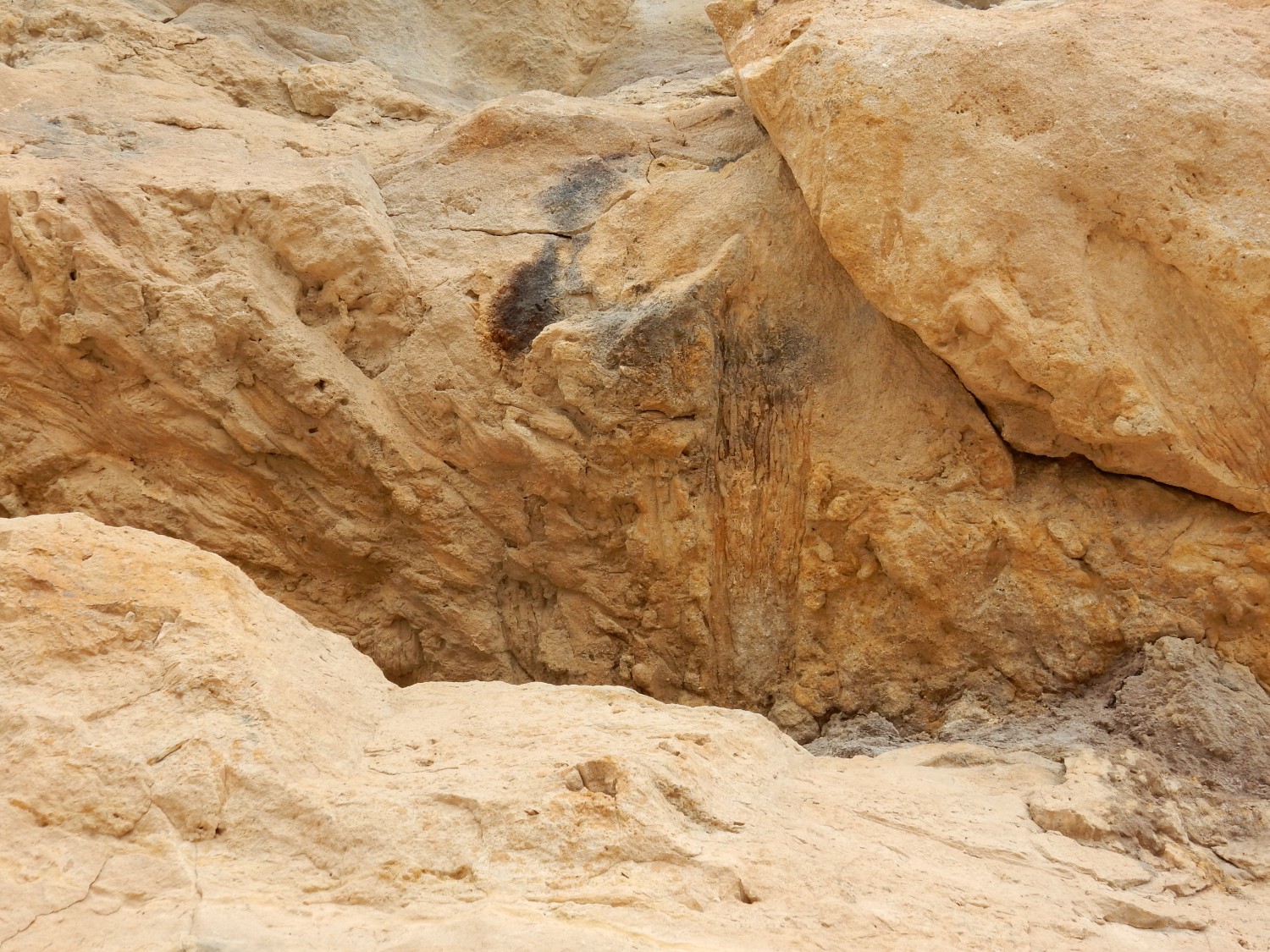
Dinosaur tracks as casts on the undersurface of a rock overhang. These were mostly Anklyosaurus and their kin.

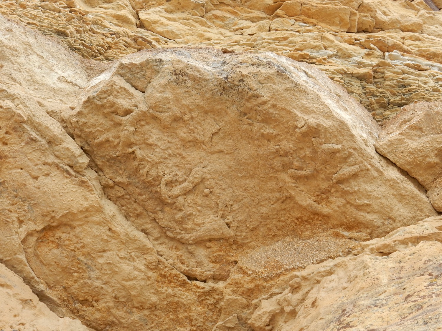
More tracks.
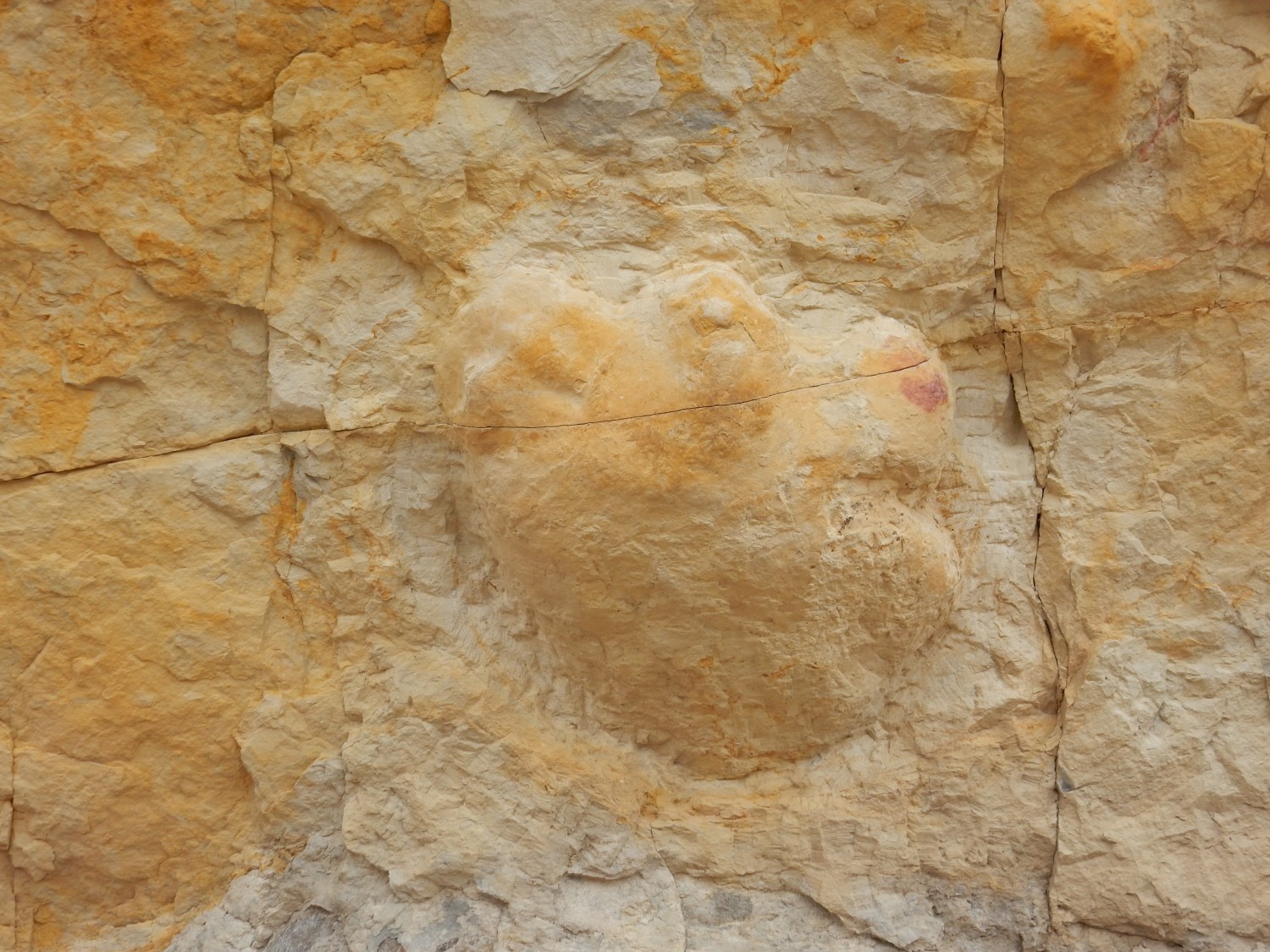
Closer view.
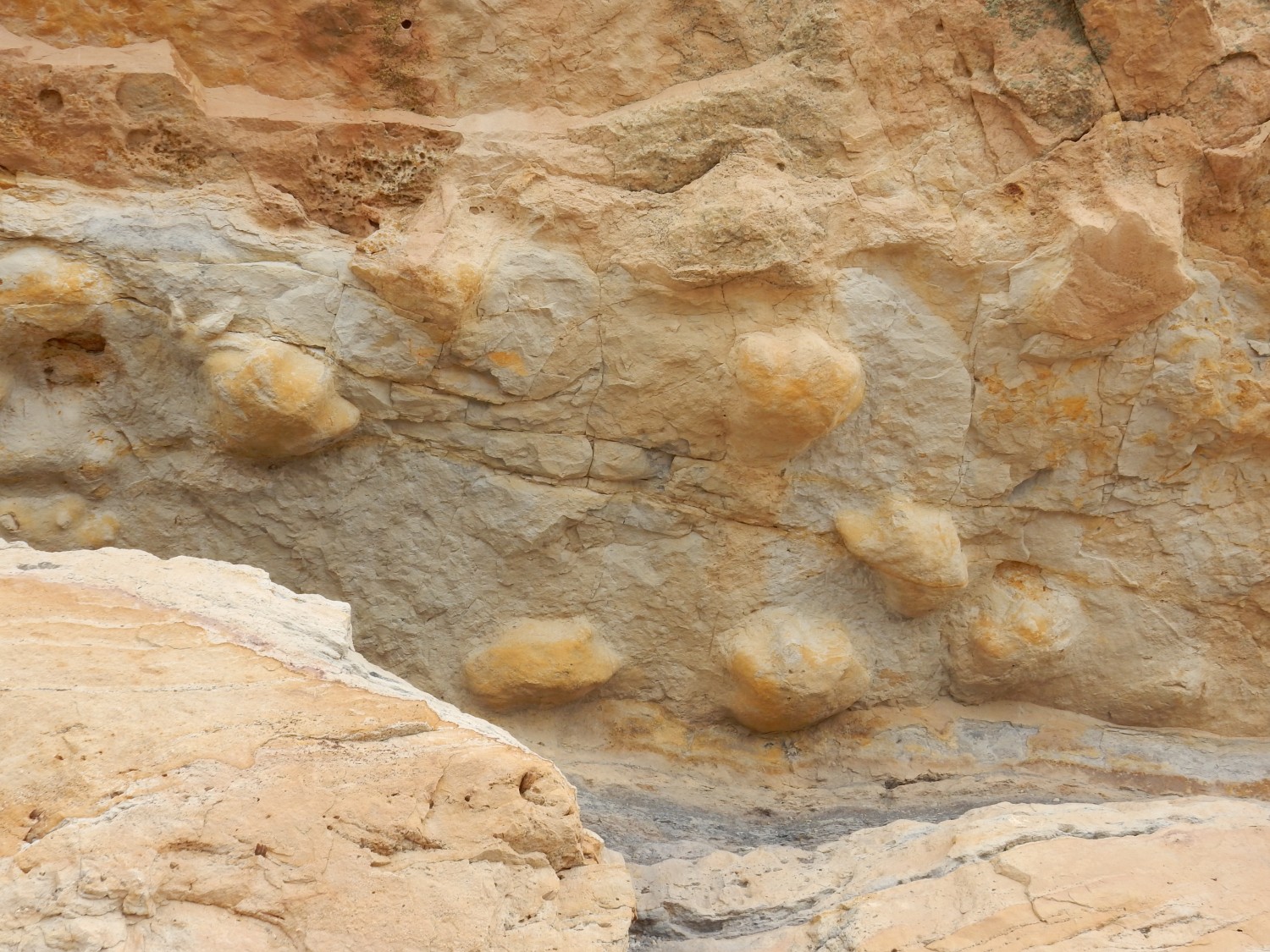
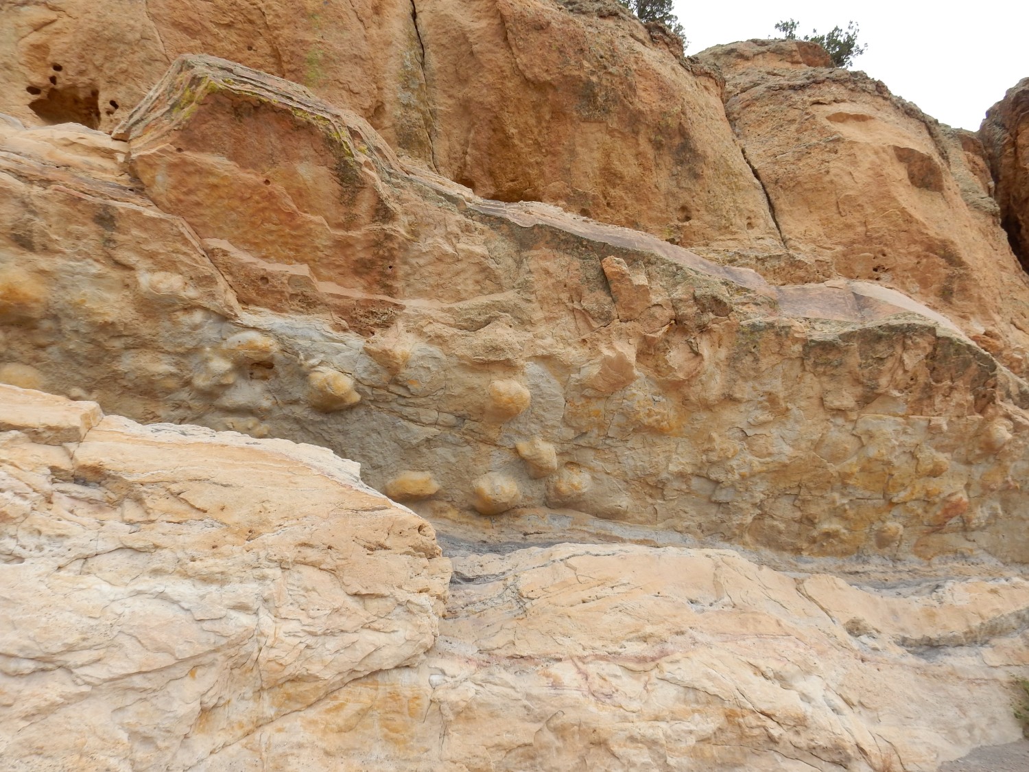
The anklyosaurids had big stumpy feet with three blunt claws. But there was another species here, which left the slender three-toed print at far left.
Another closeup.
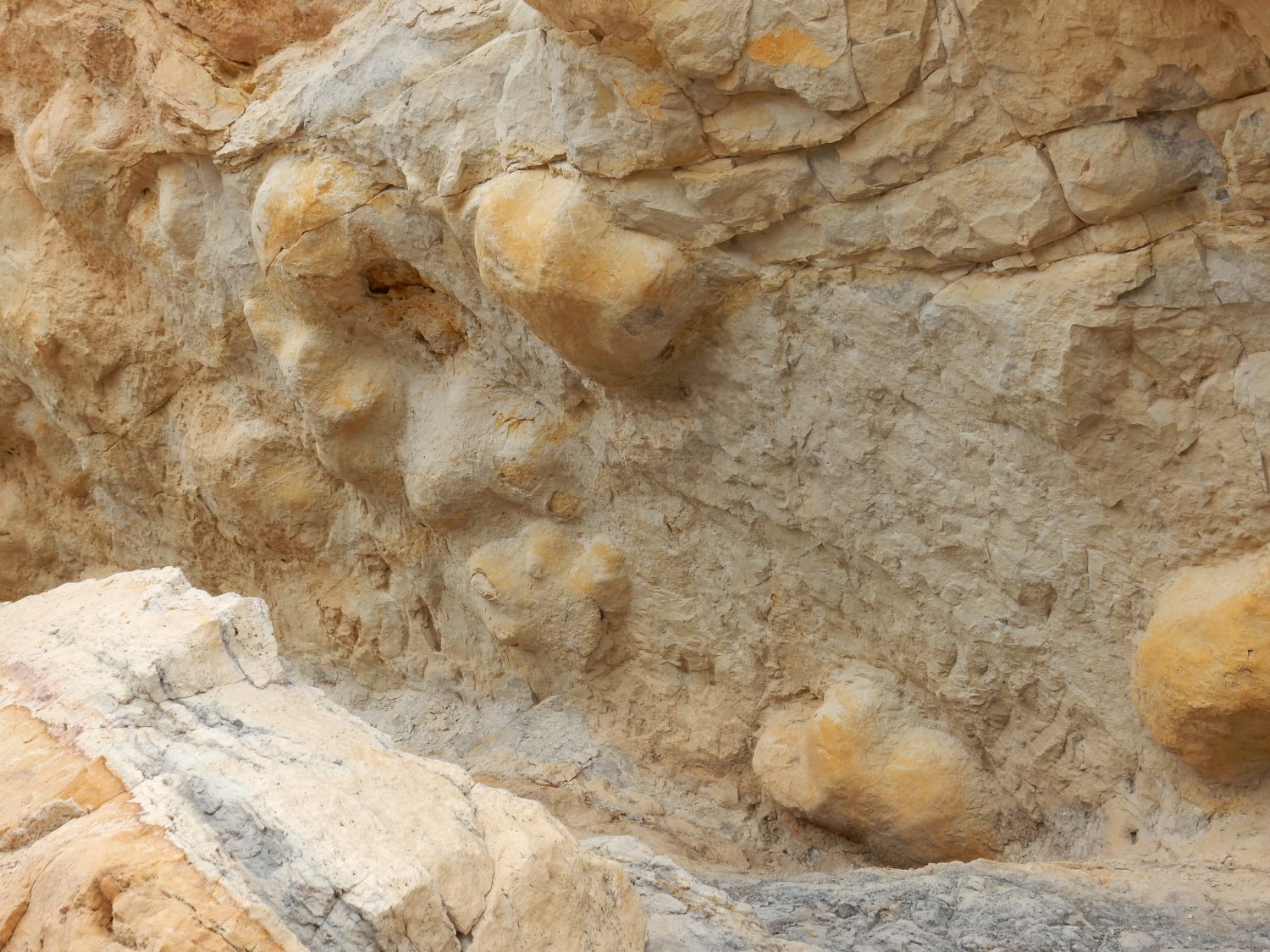
Very close view of a single footprint.
It looks almost like there was a kind of thumb at right.
The signage was frustrating; it didn’t identify the age of the prints.
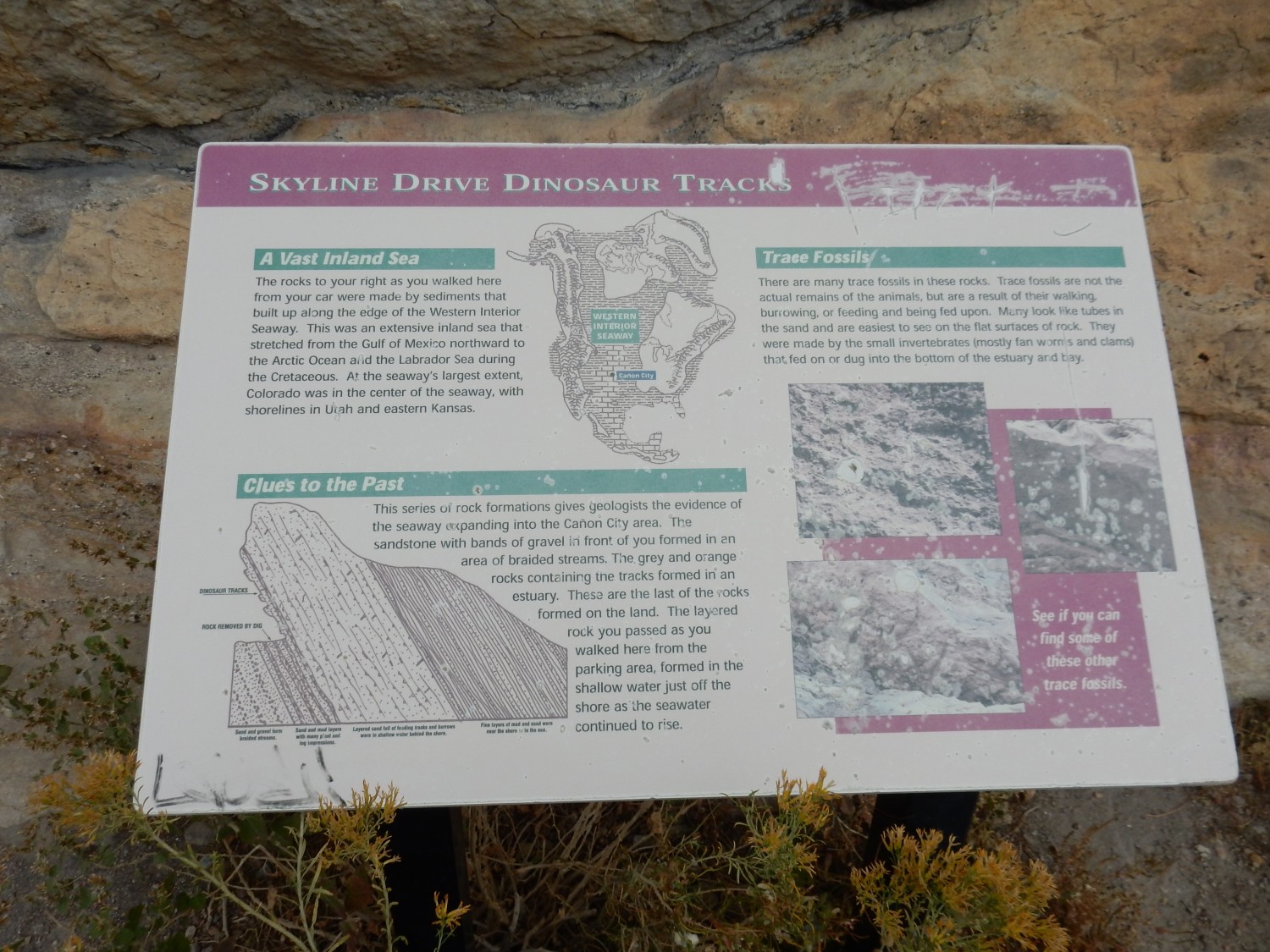
About this time a guided tour came through. The tour guide announced these tracks as 117 million years old. That would make this the Dakota Formation. Gary asked a couple of questions, but the tour guide somewhat brusquely invited Gary to take the tour sometime and headed on. Well, it’s his living.
There are other traces than dinosaur tracks. Here’s a ferociously bioturbated layer.
Something was chewing enthusiastically on these sediments. THere’s also a cast of a piece of wood at left.
In fact, there were a lot of such casts.
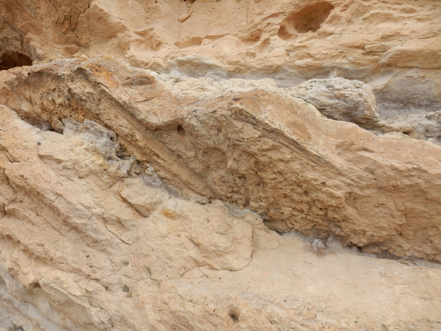
Such accumulations of woody material are typical of point bars, which form along meanders of a river. The sign says all this was laid down in an estuary environment, which is consistent.
Closeup of the smaller footprints.
The smaller tracks are suggestive of a predator. However, the anklyosaurids were armored all over; a difficult mouthful for a predator.
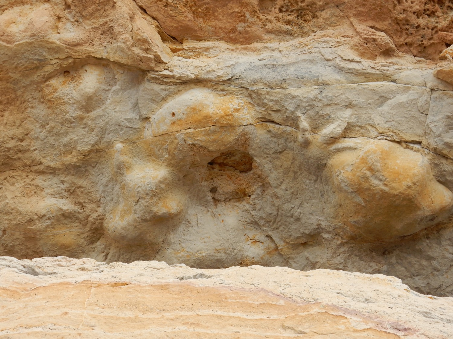
Not sure what to make of this.
Or this.
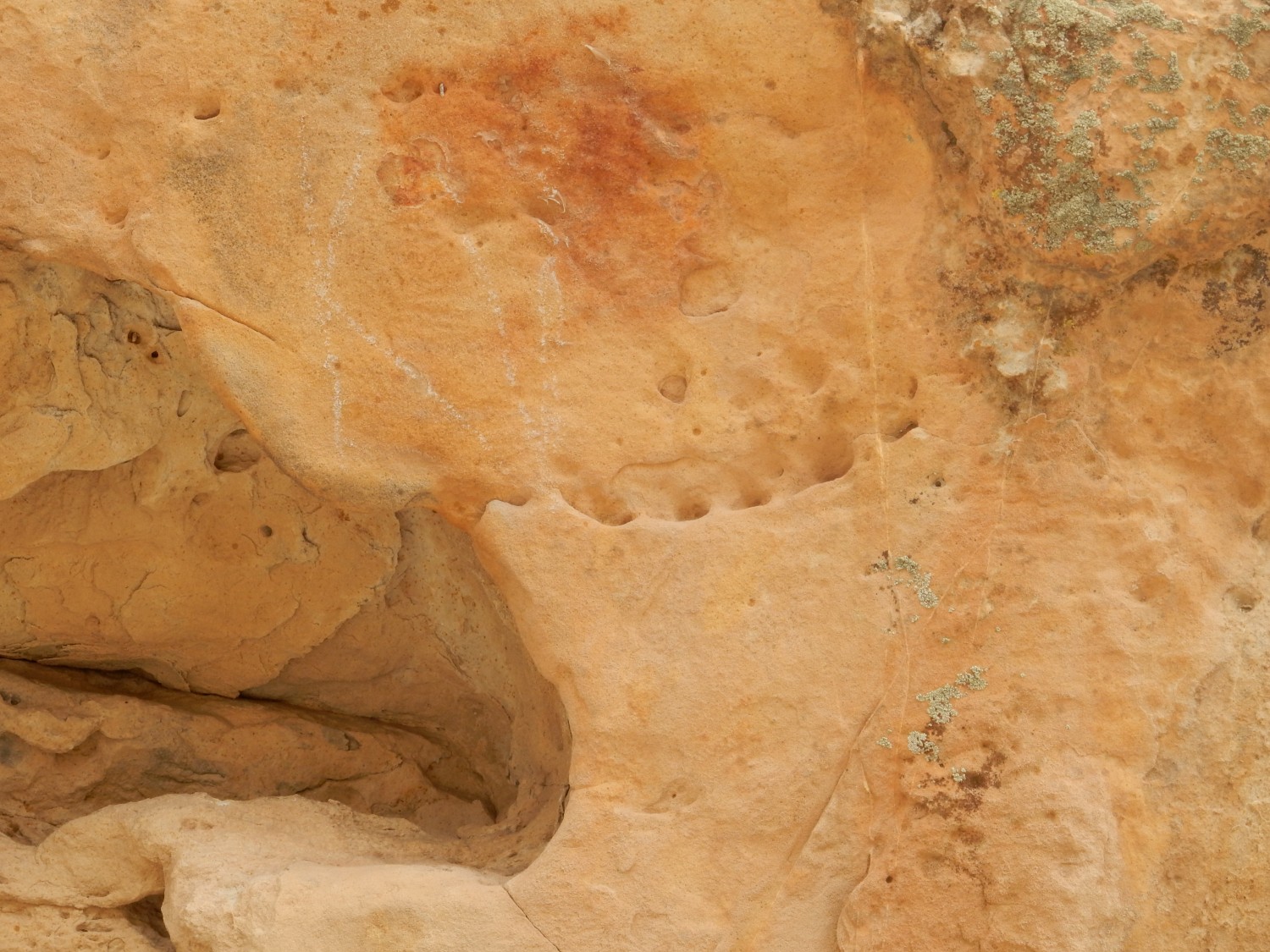
Perhaps a pseudofossil — a structure left by physical processes that looks like a fossil trace.
More wood casts.
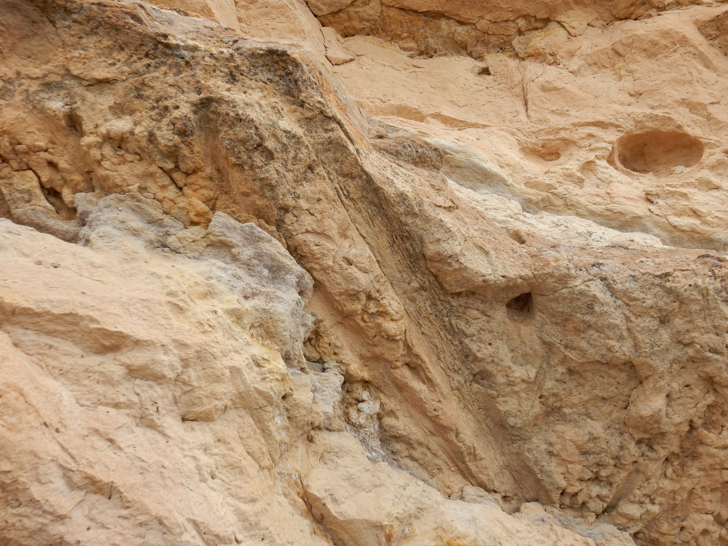
Worm burrows?
This was way cool. And we didn’t have to hike ten miles to see it. (But the other tracks were still worth the effort.)
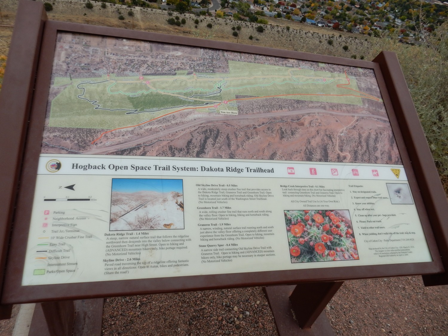
There is a trail at the ridge top. Looking south along the hogback:

You can see how the beds are angled nearly 45 degrees out of the ground. Canon City sits on a block of crust that has dropped along faults in the hard basement rock, and the more ductile sedimentary beds now dip into the dropped area across the fault lines.
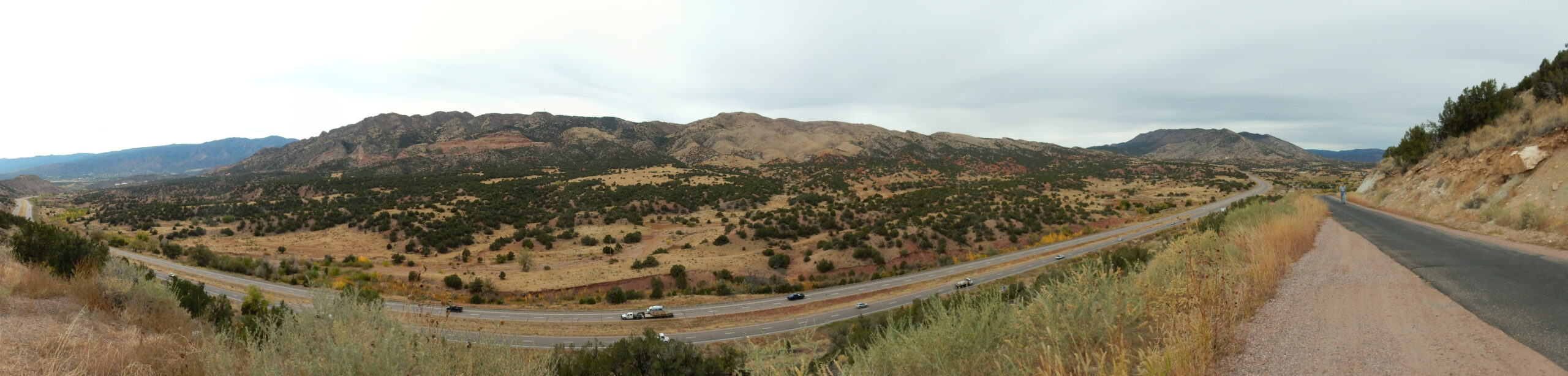
Panorama to the east:
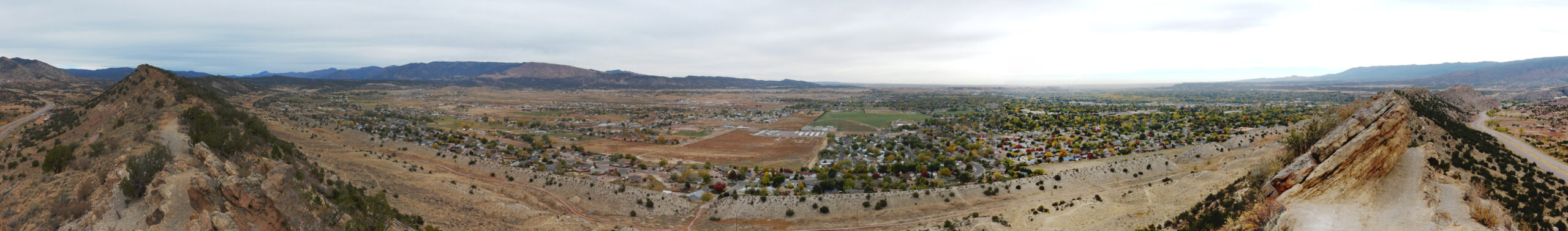
Though the Dakota Formation is the highest part of the hogback — being the most resistant to erosion — you can see a second hogback and then, if you look closely, a very small ridge in the valley between. A valley between hogbacks is called a strike valley and corresponds to more easily eroded beds. The west side of the valley is Graneros Shale; the very low ridge is Greenhorn Limestone; the east side of the valley is Carlile Shale; and the hogback beyond is Niobrara Limestone. The city itself sits on Pierre Shale, which is very poorly exposed here.
Signage.
My plan was to briefly visit nearby Royal Gorge. However, we get distracted:
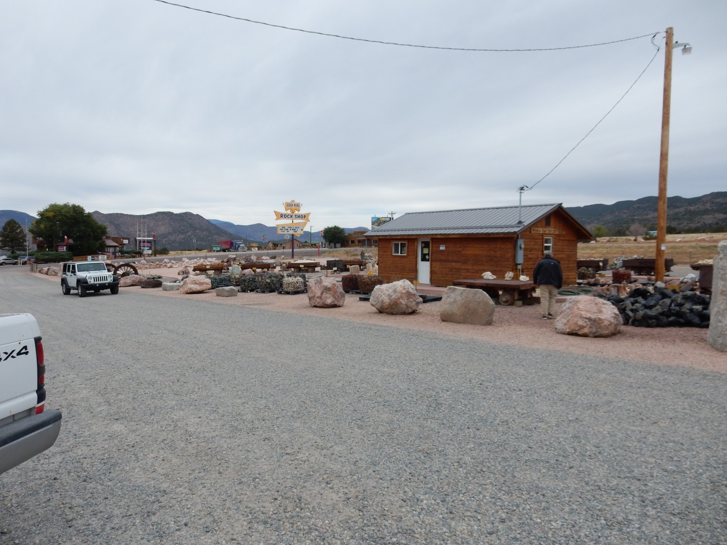
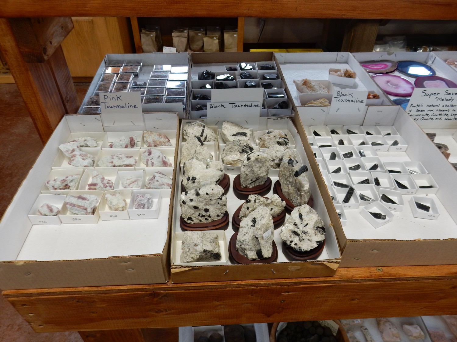
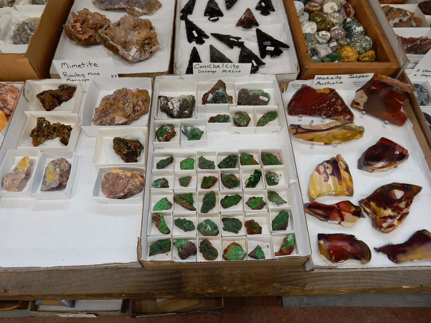
Rock shop. We end up spending quite a lot of time (and money) here.
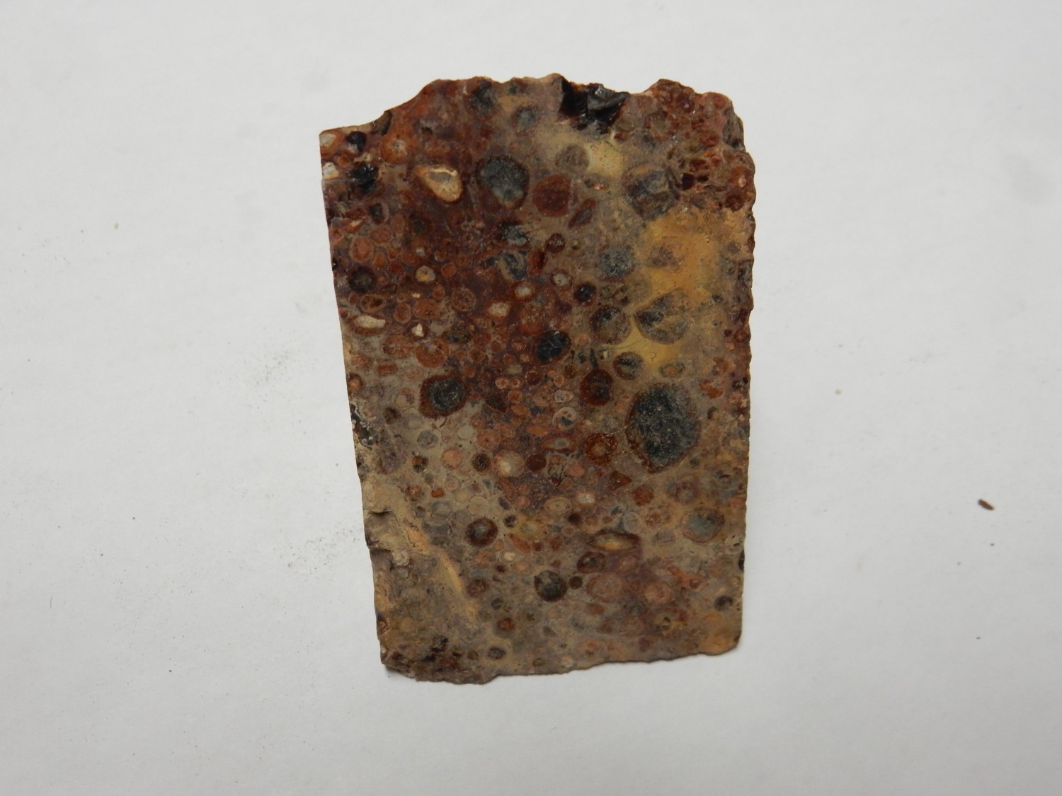
Dalmatian jasper.
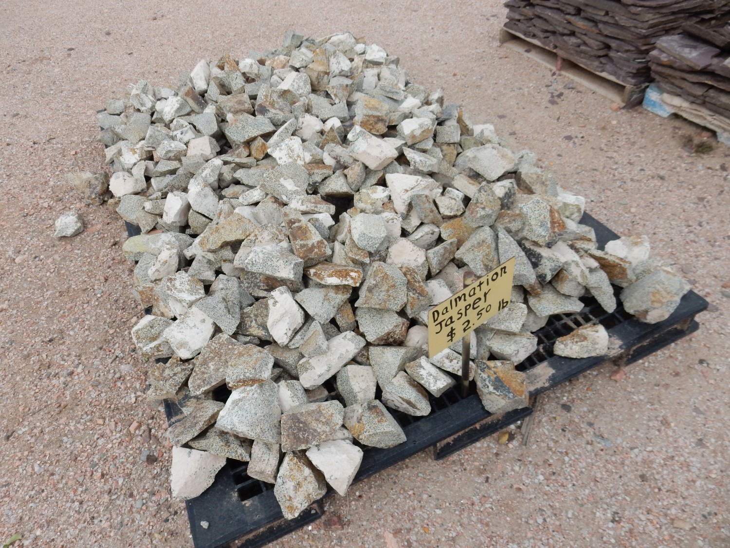
I can’t find much reliable information on this; about the best I can do is that this rock is a peralkaline granite, rich in perthitic alkali feldspar, with quartz and large amphibole crystals. Unpacking that: The sodium and potassium in the feldspar have separated into very thin layers, giving a characteristic texture. Quartz is a familiar commonn mineral. Amphibole is a common silica-poor mineral which, in this case, takes up the extra sodium in this sodium-rich rock.
I don’t believe either of us bought any.
Ginormous selenite crystals.
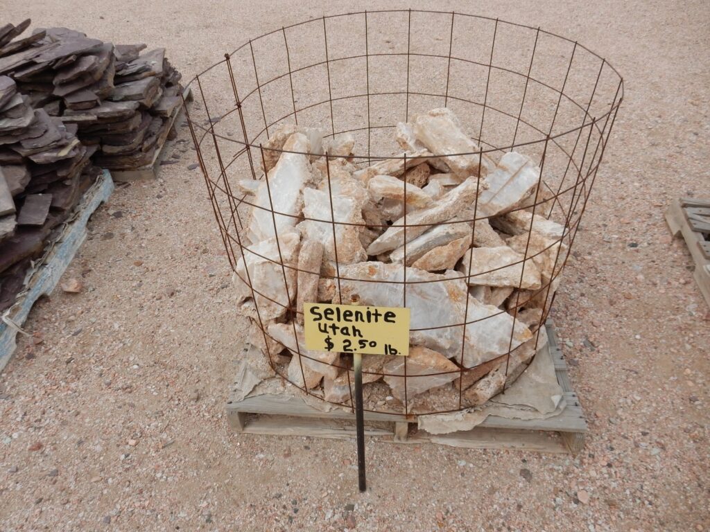
Selenite is coarsely crystallized gypsum, calcium sulfate. I was tempted, but didn’t get any of this, either; the stuff is soluble and soft, and about all it’s good for is carving, and I don’t carve.
Septarian nodules.
I put a fair amount of effort into having a septarian nodule from the Nacimiento Mine sawed in half and then polishing it up. Turned out very nice. Didn’t need another one, though these are quite nice.
Beats me.
Basically chalcedony, cryptocrystalline quarts. At $3 a pound, you’d be spending hundreds for one.
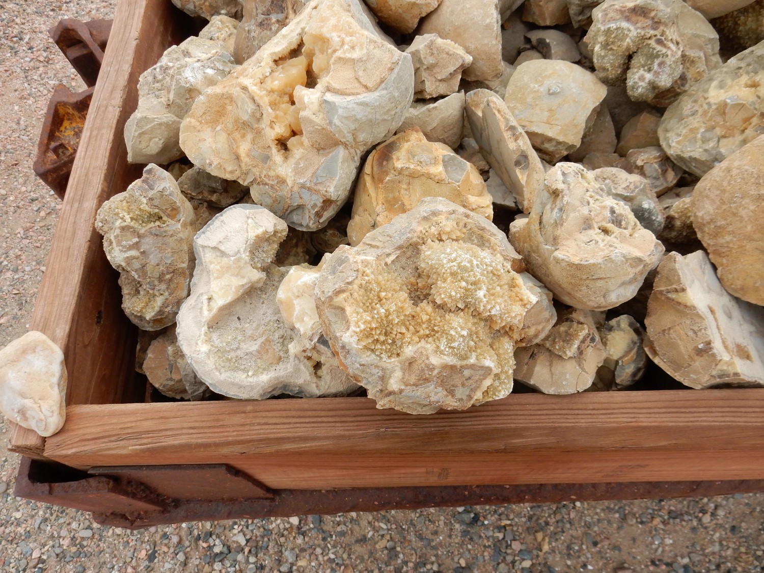
Okay, this I was very, very tempted.
Very nice fossil coral. I looked for a smaller chunk of similar quality but did not find one. I think Gary bought a chunk, though. I confess I’m not 100% certain it’s actually fossil, rather than merely dead coral of recent vintange, but still very striking.
Calcite.
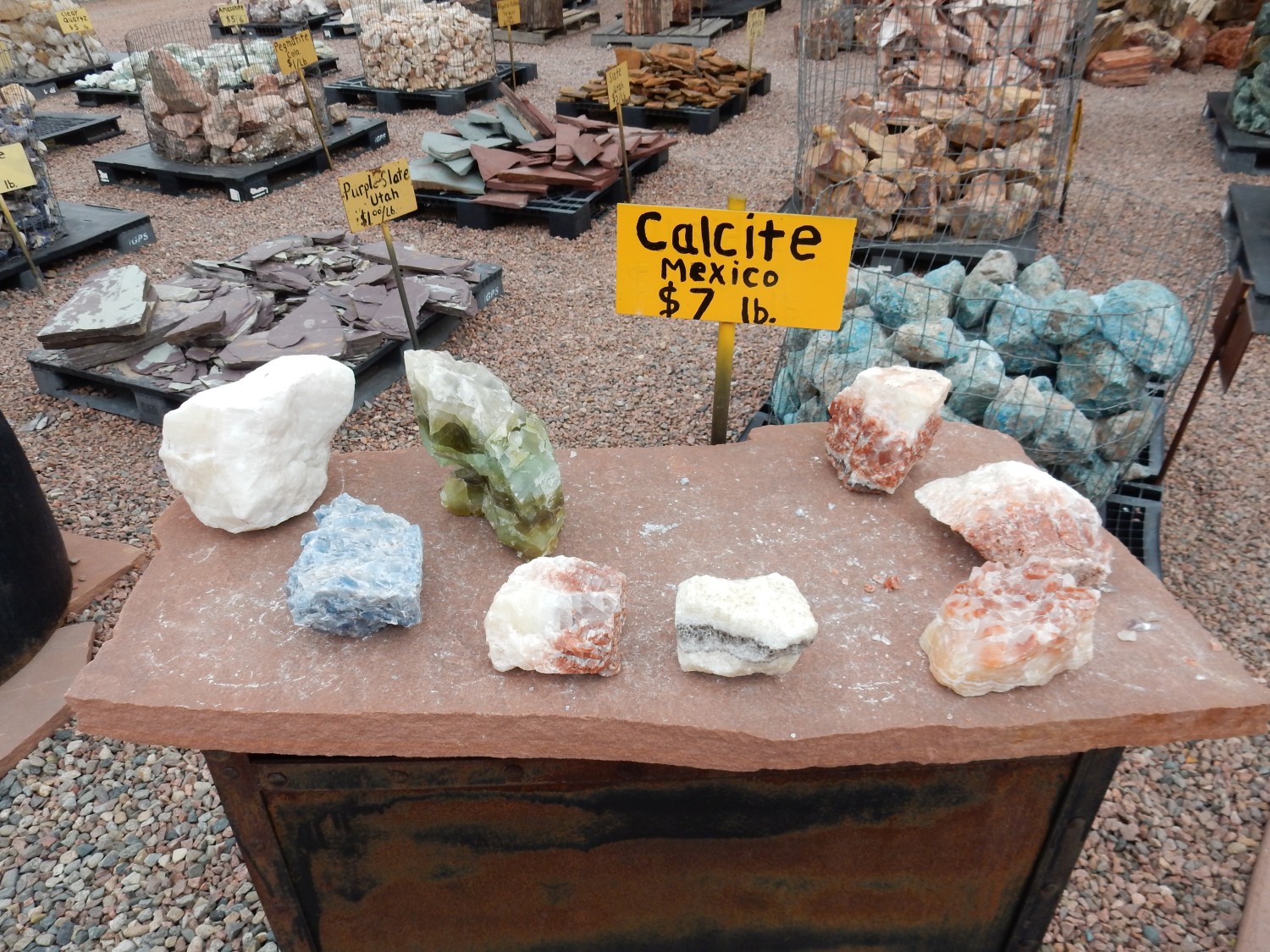
This is obviously all raw material. The processed stuff was inside, and some of it was very nice.
Zircon crystals.
Gary bought this one. Very impressive.
Malachite.

Ruby zoisite.
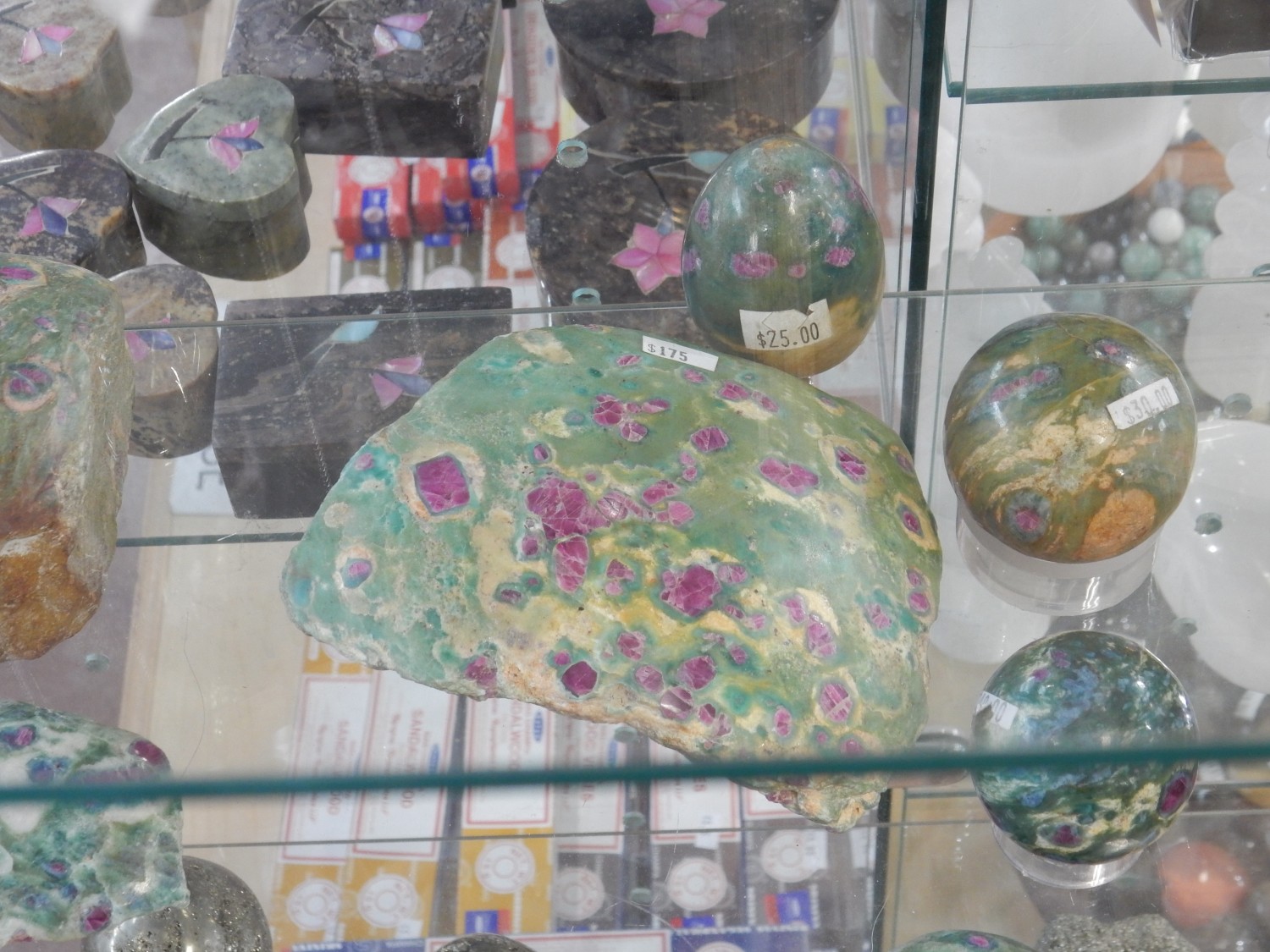
Gary picked up both some raw material and a finished piece.
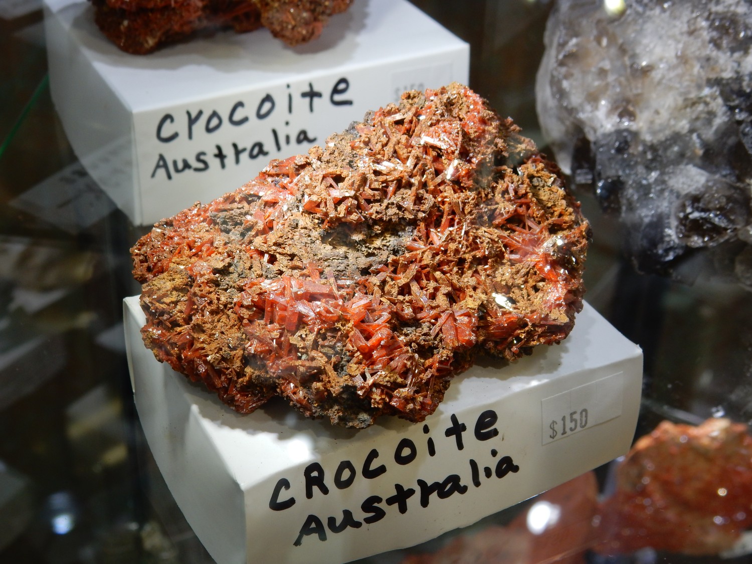
Crocoite.
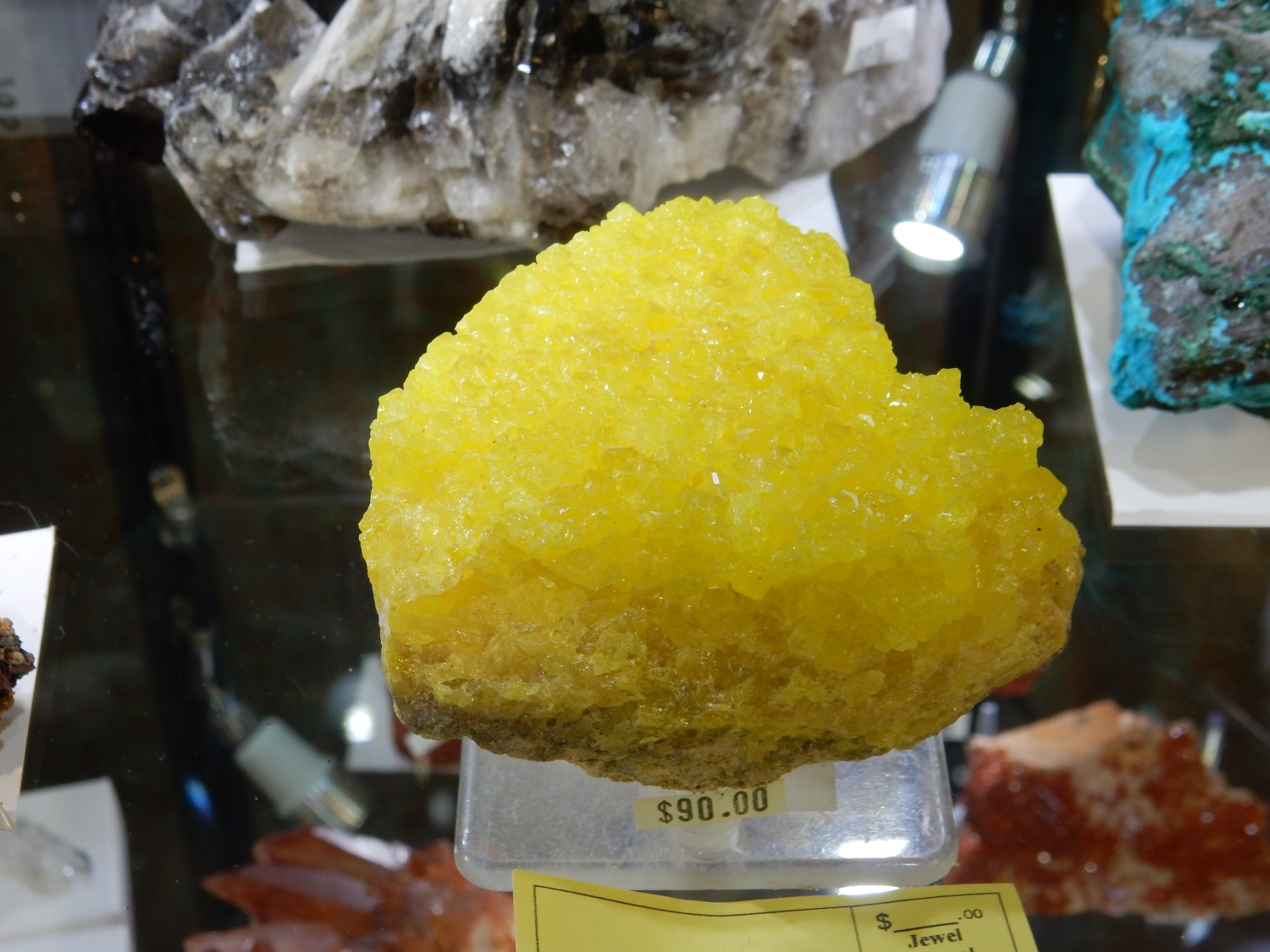
Native sulfur.
I spent some money here. My purchases:
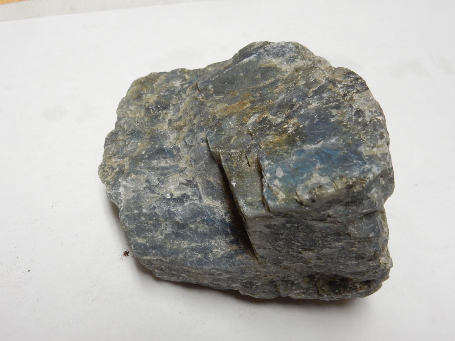
Labradorite.
There’s more to it than this. Let me try to get the lighting angle right.
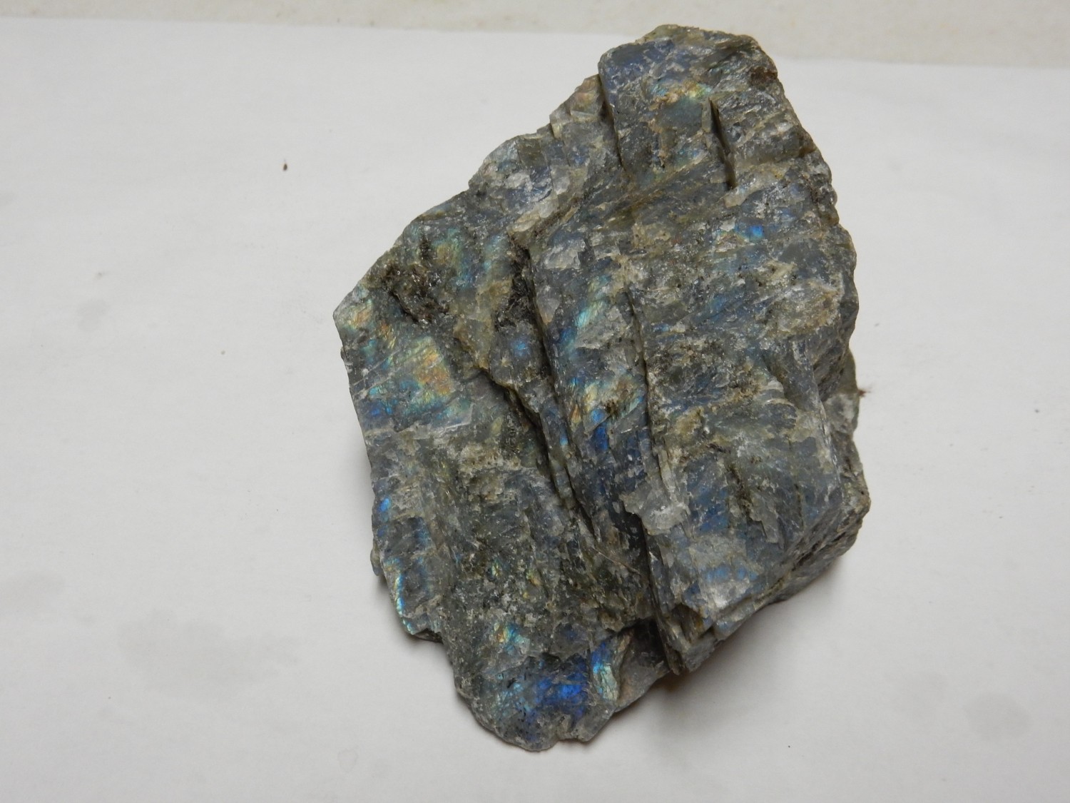
Yeah. Better still:
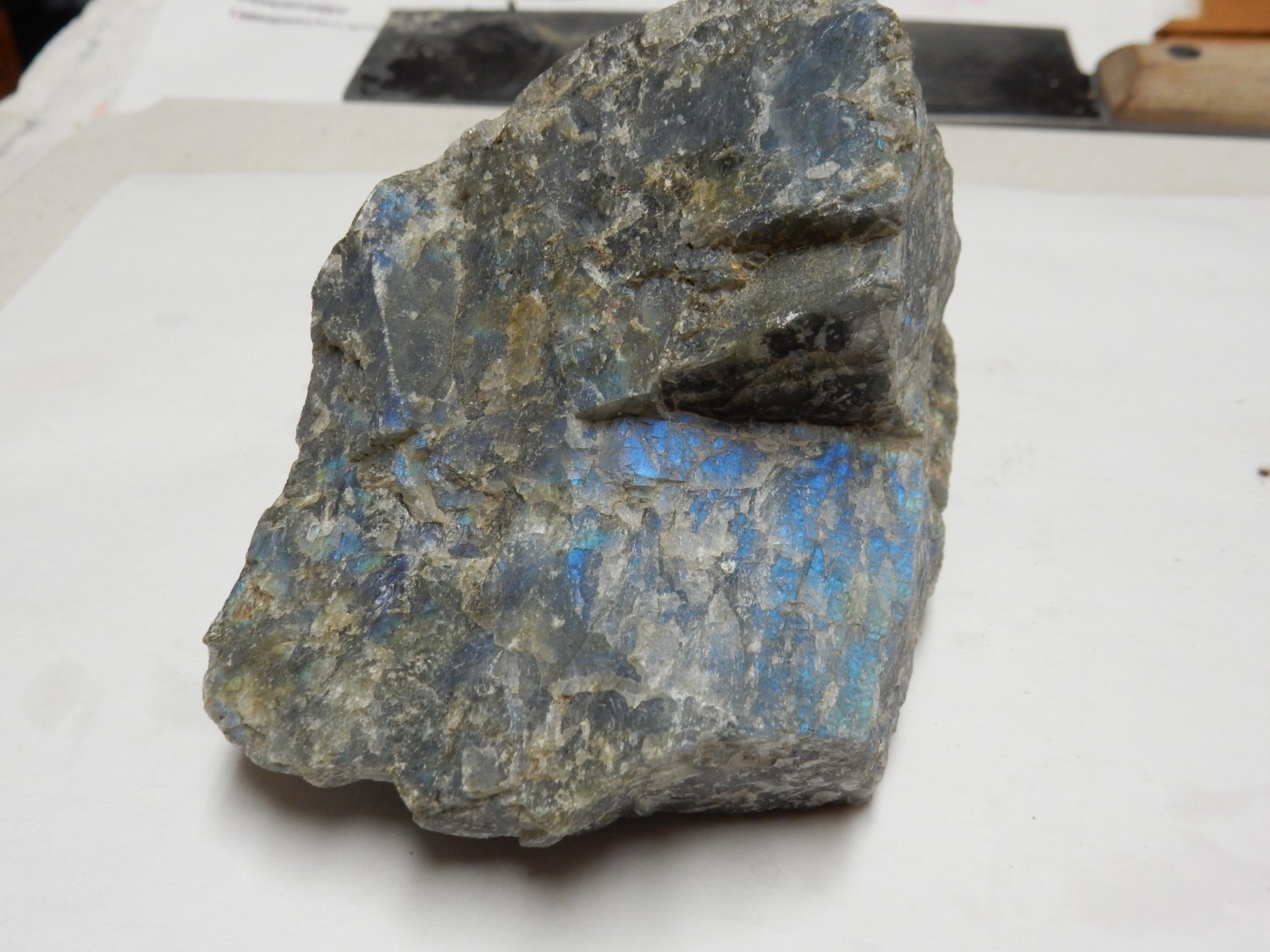
Okay, that starts to do it justice. Labradorite is a form of feldspar, and feldspar is literally as common as dirt. It’s the most common mineral in the Earth’s crust. But labradorite is a little less common. It is a form of plagioclase, sodium-calcium feldspar, in which calcium takes up about 50% to 70% of the sodium-calcium sites in the crystal, and which has been crystallized under the right conditions of slow cooling.
It turns out that a sodium ion is about the same size as a calcium ion, and an aluminum ion is not much larger than a silicon ion; so sodium-silicon and calcium-aluminum pairs freely substitute for each other in the crystal structure at high temperature. However, if the feldspar cools very slowly when just below its melting point, the calcium and sodium will tend to separate out into very thin layers. These produce the striking blue iridescence, because the layers have just the right thickness to strongly reflect blue light if it strikes the crystal at the right angle. Couldn’t resist purchasing this; the rock is relatively inexpensive and the iridescence is really cool.
Lapidarists will cut up a chunk of this raw material either as slabs to be polished (which requires carefully choosing the cut angle to best bring out the iridescence) or simply as chunks to tumble to polish them (which requires no particular skill but produces a less valuable product.) I’m probably going to keep this sample raw, since I have neither a lapidary saw nor a tumbler and like the raw stuff.
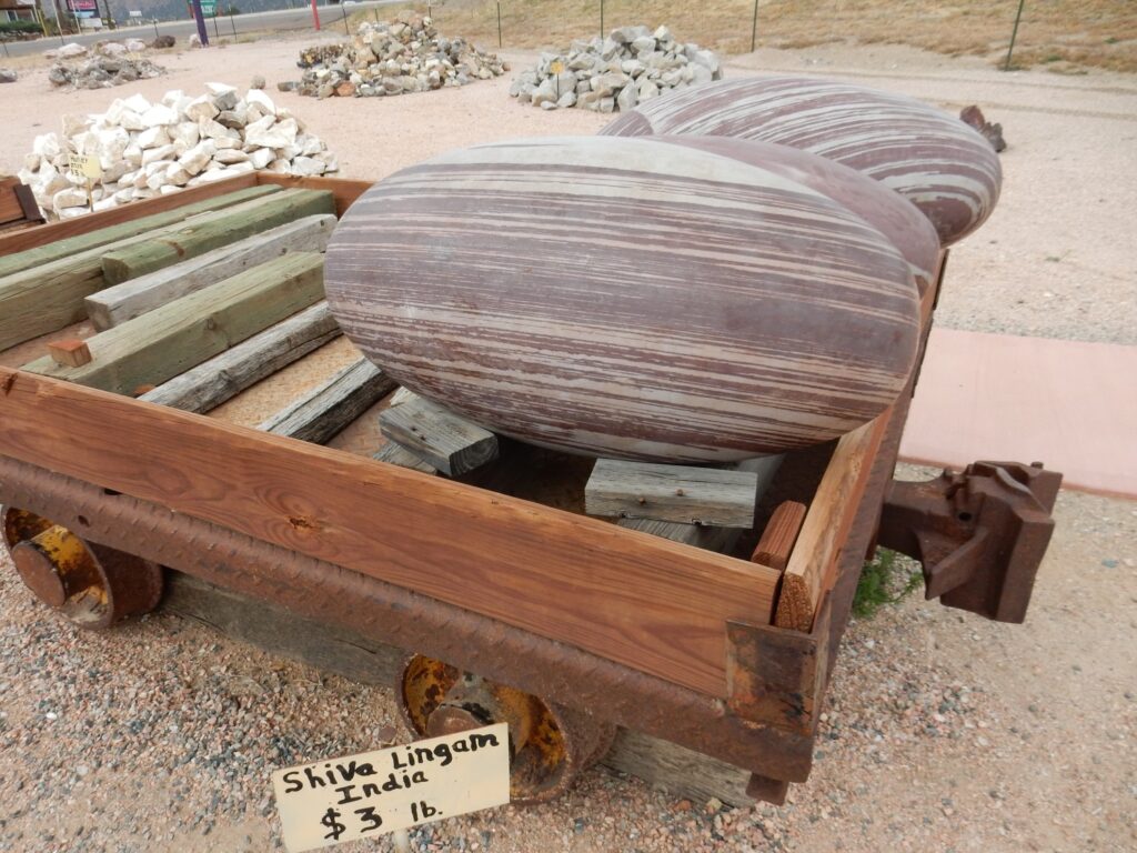
“Tiger iron”.
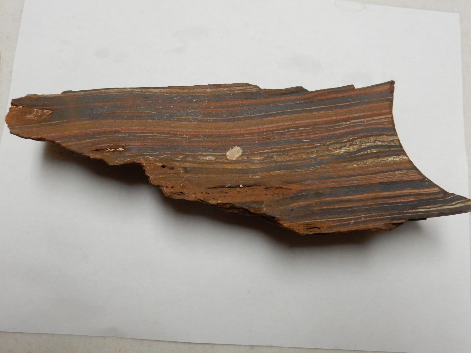
Labradorite is a term used by both geologists and lapidarists to refer to pretty much the same material. However, a lot of lapidary terms don’t closely correspond to geological nomenclature. Digging around on the Internet tells me that tiger iron is likely what I immediately took it for — banded iron formation. However, this particular variety of banded iron formation has undergone alteration that has converted some of the chert layers to tiger eye chalcedony.
Let’s unpack that. Banded iron formation, affectionately called BIF by geologists who study it, is one of the oldest rocks on Earth. None is younger than about 550 million years old, and there’s very little that young. Most is over 1.8 billion years old. Just how it forms is still being debated, but there’s generally agreement it required conditions of an anoxic ocean combined with the early oxygenation of the Earth’s atmosphere. Oxygen generated in the upper part of the ocean (probably by cyanobacteria, blue-green algae, though that’s one of the things debated) converted dissolved ferrous iron to insoluble ferric iron, which settled to the bottom, along with silica gel, to form the banded sediments here. The black stuff is a mixture of magnetite and hematite, both iron oxides, while the red stuff is chert containing traces of hematite.
BIF is the most important iron ore in the world. Huge quantities were deposited in the great iron districts of the world, including the Lake Superior region, Australia, South America, and other locations. It weathers to more or less pure hematite, a superb iron ore, but this is now mostly exhausted, and the unaltered BIF is now mined. It has to be ground up, the magnetite separated using powerful magnets, and the silica discarded. The hematite is pretty much lost, but most of the iron in most unaltered BIF is magnetite.
“Tiger iron” has been mildly metamorphosed, converting some of the very fine-grained chert into more coarsely crystalline quarts that contains fibers of hematite. This is the form of quartz called tiger’s eye, which is an inexpensive but popular stone for tumbling. Gary bought a larger chunk, and his has some striking tiger’s eye layers. I was mostly interested in it as BIF, but mine has some attractive tiger’s eye in it as well.
Amber.
Fossilized tree sap. Which is not the same as petrified tree sap; the sap has not been replaced by inorganic minerals. Rather, the tree sap has polymerized under heat and pressure from burial. It’s a natural thermosetting resin.
Gary plans to cut his amber up and polish it, with the off-chance there will be insect fossils within. It happens. I may do the same; this stuff is soft and lightweight, easy to work with, so I probably have the means to cut and polish slices.
Novaculite.
Yep, the stuff high-quality knife sharpening stones are made of. I suspect that’s what most of the raw stuff is used for. I simply like the very pure chert it represents, probably deposited as silica-rich tests (shells) of microorganisms in a coastal lagoon, then metamorphosed just right to form a very fine-grained, uniform silica rock.
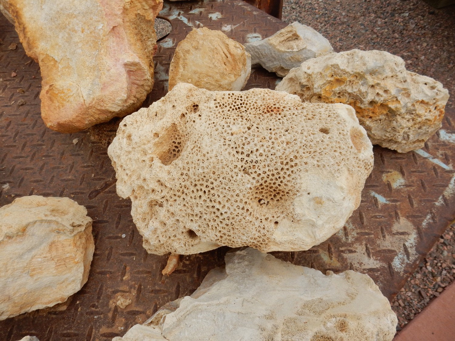
Gryphea.

An early lineage of sort-of oyster, from the early Jurassic. About 180 million years ago. Popularly known as “devil’s toenails.”
Bauxite.
Aluminum ore. Everyone likes to have precious metal ores in their collection, or brightly colored base metal ores. But aluminum is probably second only to iron in its importance to our civilization.
Bauxite is essentially clay that has been subject to prolonged leaching in a hot climate — a tropical rain forest. The leaching removes everything but the aluminum oxides and some residual silica and iron hydroxides. Ancient deposits of bauxite, such as those of Arkansas and France, tell you where the equator once ran.
Speaking of brightly colored base metal ores:
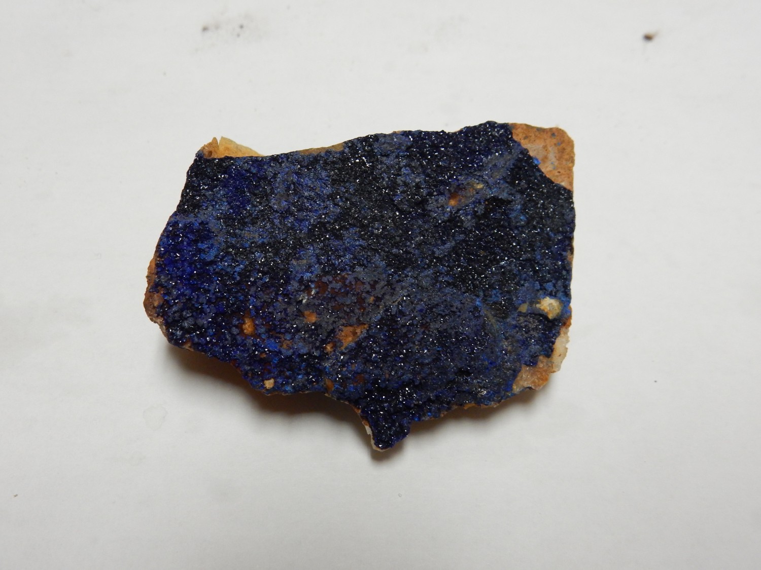
Azurite. A form of basic copper carbonate. Often found with bright green malachite, also a basic copper carbonate. My favorite, so I saved it for last. Hey, I kept my purchases under $100, which is not unreasonable considering other expenses for the trip.
Basic copper carbonate? That means it ‘s a mixture of straight-up copper carbonate and copper hydroxide. Beautifully crystallized.
Over geologic time scales, azurite converts to malachite. I’m assured by a former curator at the Smithsonian Institution that this does not noticeably happen to samples in collections subject to ordinary conditions of storage. However, azurite pigment in paintings can start turning green after centuries, which is particularly noticeable in old paintings of the Virgin Mary, whose cloak is traditionally deep blue.
As I’m preparing to load rock into the car, Gary suggests I get a photo of the walls of the rock shop. It’s a good suggestion:
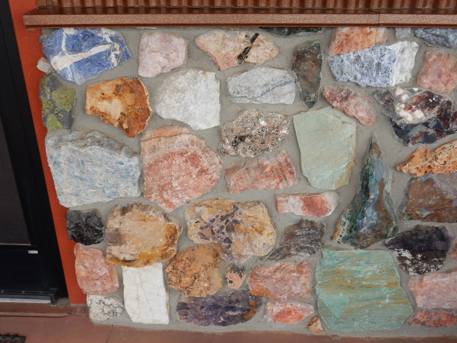
It’s an expensive wall compared with brick. The blue stuff at upper left is sodalite, of which I have a nice sample in my collection already — a birthday gift from Cindy. Below it is black basalt with inclusions of green peridotite, rock from the Earth’s mantle brought up with the basalt lava. Big chunk of mica-rich granite near the center of the photo. Some malachite at lower right. Nothing else particularly jumps out at me, but it’s a pretty wall.
We have no time now for Royal Gorge, but neither of us regrets that much.
We have a long drive west, through some wild country.
Canyon of the Arkansas River. The dark rock in the background is migmatitic gneiss, formed from mostly volcanic rock and sediments that were deeply buried brought very close to the melting point. It is probably around 1.8 billion years old. The white rock forming the outcrop at center, across the canyon at right, and on the near side of the road (far left and far right) is pegmatite that has been dated at 1.45 billion years old. Gary and I get out to take a look at it — it’s a pretty enough rock we grab samples. It’s composed of coarse quartz, albite (sodium feldspar), perthite (sodium-potassium feldspar) and lesser amounts of mica. Pretty typical alkaline granite composition, common in a pegmatite. (It’s the coarse grains that make a pegmatite a pegmatite.) The mica is what catches my eye. This is a two-mica granite — it has both muscovite (potassium feldspar) and biotite (iron feldspar). Two-mica granites are rich in both potassium and aluminum, suggesting an origin as deeply buried shale that was subsequently melted to form the granite.
Close up:
This is interesting:
It looks like a dike seen sideways. Or perhaps it’s just a rail cut in dark beds that has nicely exposed their jointing. The geologic map offers no clues and it’s on the wrong side of the river.
This caught our eyes.
The striking outcrops are granodiorite, composed of mostly plagioclase feldspar and quarts, that is probably around 1.72 billion years old.
We emerge from the Precambrian core of this mountainous area to a region of sedimentary beds.
The tilted beds are Permian to Pennsylvanian beds of the Sangre de Cristo Formation, about 300 million years old. These are similar to the Abo Formation back home or the Fountain Formation seen earlier in the week — red beds composed of sediments eroded off the Ancestral Rocky Mountains. They’re capped with a later of Waugh Mountain andesite, undated on my map but probably Miocene in age — 5 to 20 million years old. Andesite is a volcanic rock with an intermediate silica content, and andesitic lava has about the viscosity of smooth peanut butter. It’s the rock that forms classical volcanic cones (stratovolcanoes) because it is thin enough to get out of the ground without too much explosive activity but thick enough to pile up around the vent as a mountain.
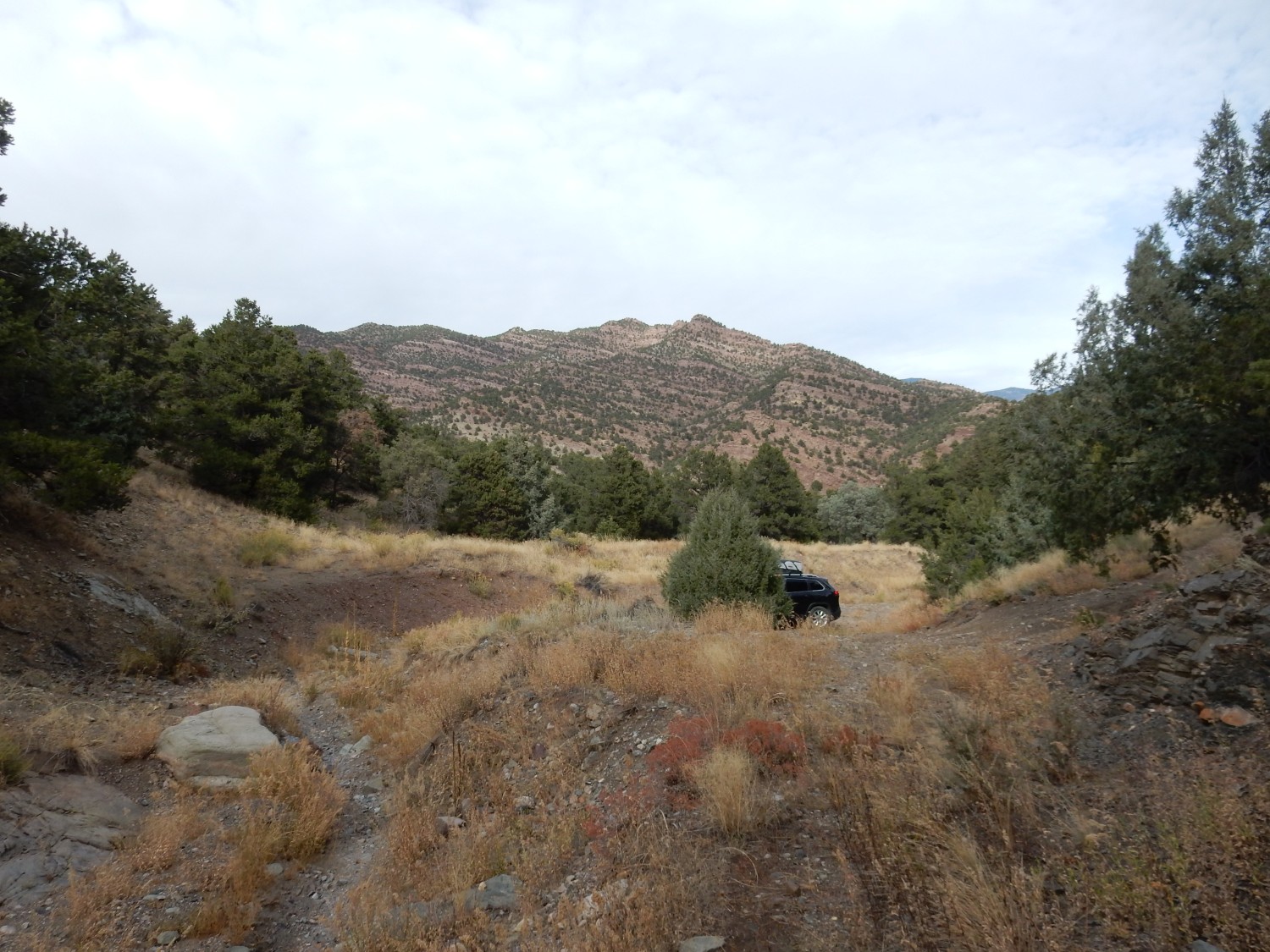
I am looking for the entrance to Box Canyon, where a forest road goes into an area that reportedly has numerous easily-found fossils. My first guess:
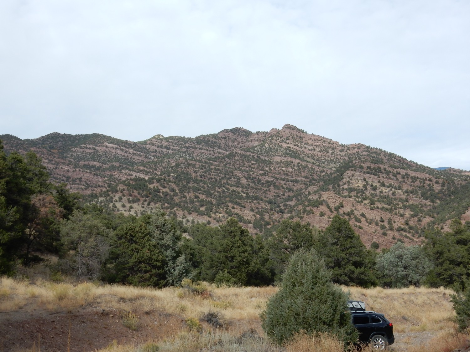
It has a forest road, but this quickly turns into ruts. Also, I expected a turn west on the forest road. Yeah, it’s one canyon too early. The rock here is Minturn Formation, which is Pennsylvanian age (the age I’m looking for), but is mostly continental sediments devoid of fossils. But at the time I don’t know that, and we explore a bit more. This was striking:
Thinly bedded limestone, with shale and sandstone. The geologic map says the limestone has some marine fossils, but we scrutinized it for some time without finding any.

There was some interesting sedimentary structure in the beds.
Across the river from the canyon’s mouth is more Sangre de Cristo Formation. This rests on Minturn Formation that is just visible as whiter rock near the base of the cliffs.
The limestone beds rest on well-cemented sandstone, possibly Belden Formation.
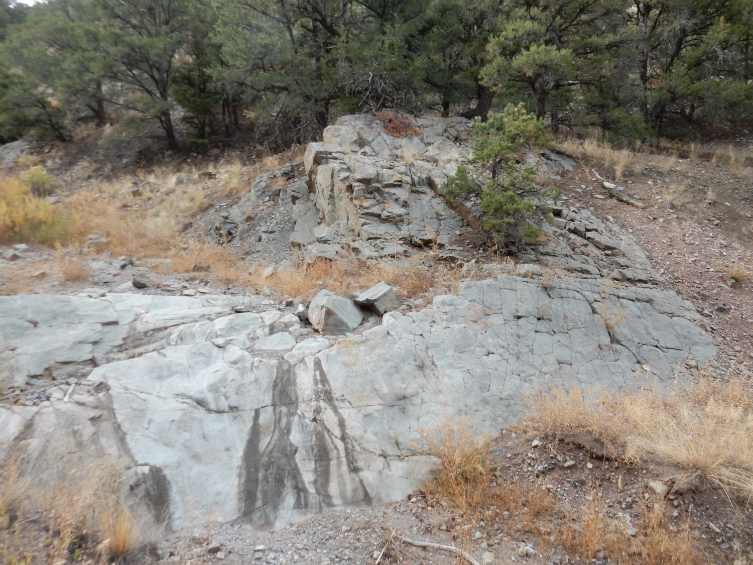
I found myself thinking this was Precambrian rock that had experienced some metamorphism. (It’s Mississippian, considerably younger.) This seemed like the wrong canyon and we moved on.
Next canyon:
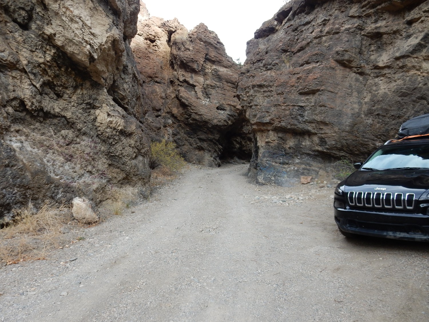
This is the right one, all right. My map only distinguishes the rock here as Devonian through Mississippian rock. That’s about 120 million years of Earth history, and there are about five different formations in that time interval in this area — none of which I’m familiar with and none of which are mentioned on the map as fossiliferous. But we don’t know that at the time, and explore up the road.
Thinly bedded brown carbonate rock:
Chaffee Formation (upper Devonian, about 380 million years old) seems to most closely match the description. Not promising rock for fossils.
Tilted beds of probably the same stuff.
Shaly rock.
We dig around in the weathered shale, but find no fossils.
We’re out of time. Looking at my camera coordinates after getting home, it looks like it’s definitely the right canyon, but from the geologic map, the fossil-bearing formation is probably a good half mile further up the canyon. Maybe another day.
We hurry past Monarch Pass towards Gunnison. We’re racing daylight now. (And, though we didn’t realize it at the time, we’re racing a road closure.)
This stood out, so to speak.
Tomichi Dome. a mass of topaz rhyolite probably associated with the Rio Grande Rift (which we have just crossed from east to west.) There’s debate whether this is a plug or a laccolith. It would be fun to hunt topaz here sometime, if we can get a good tip on where to hunt.
Last photo in the fading light:
This is the Granite of Wood Gulch. The map labels it Precambrian, without any better age estimate. Granite has a way of weathering into spectacular rounded outcrops (sometimes called tors) and these are good examples.
We reach Gunnison and stop at the Sherpa Cafe. The food is excellent.
It’s getting very dark by the time we’re done, so we miss the spectacular tuff beds north of Blue Mesa Reservoir. And we discover the road west is under construction, and closes at 7:00 PM. It’s 6:30. We just make it.
From there we drive through the dark to Black Canyon of the Gunnison. I’m slightyly worried about finding a camping spot, but I needn’t be; it’s late in the season and we have no difficulty finding one. We set up camp in the dark — we’re getting proficient at this — and turn in for the night.