Wanderlusting Abo Pass
I recently turned 60. That seems like a sufficient milestone that I decided to take a long weekend this week, beginning with driving down to Abo Pass to look at some geology, I thought I might do some camping as well, but with the weather forecast a bit dodgy, I didn’t make any firm plans.
So Thursday morning I packed up the usual supplies, threw in some blankets in case I decided to do some car camping (it was pretty halfhearted preparation; the forecast for tonight is rain) and headed out.
I had not attended the Latter-day Saint temple in Albuquerque for a long time, due to COVID, so that kept me occupied until about 10:30. Though it was a bit early in the day for a big meal, I headed to my favorite local buffet. It was my first time to get the senior discount. Would that every other aspect of turning 60 were as positive …
And then on to Abo Pass.
My first photo stop was to admire Isleta Volcano and the associated lava flows.

Isleta sits square in the middle of the Rio Grande Rift, in the southern part of the Albuquerque Basin. For new visitors to the blog (Welcome!), the Rio Grande Rift is a great crack in the Earth’s crust reaching from central Colorado to the El Paso area. It is where the Colorado Plateau is pulling away from the interior of North America, likely due to the same shearing forces that have created the San Andreas Fault in California. The rift takes the form of a series of basins, areas where the Earth’s crust has subsided as it is stretched and thinned, of which the Albuquerque Basin is the largest. The stretching and fracturing of the crust opens pathways for small amounts of magma (molten rock with dissolved gases and suspended crystals) to erupt at the surface as lava.
Isleta Volcano is the oldest of the Cat Hills volcanic field, with an age of 2.78 million years. That’s very recent by geologic standards. More precisely, it’s two hours and forty minutes ago, on a time scale adjusted so that the entire history of the Earth is represented by a single year. The lava erupted here first encountered beds of sediments saturated with groundwater, resulting in steam explosions that produced a maar, a kind of very shallow crater whose rim is composed of a mixture of very fine country rock fragments and bits of solidified lava. (“Country rock” does not refer here to the music genre; it means the existing rock beds through which the magma erupted.) Maar beds were visible from the highway further down, but there was not a really convenient place to stop on this busy interstate for photos. Maybe next time.
Later eruptions produced a more conventional cinder cone and lava flows that covered the nearby ground. The lava here was alkali olivine basalt, perhaps the most silica-poor lava that is at all common. Since silica makes lava viscous, the lack of it makes for relatively “runny” lava that easily spreads out to form extensive flows. The lava was also somewhat enriched in the alkali metals, sodium and potassium. Such lava tends to contain visible crystals of olivine, a mineral rich in iron and magnesium and somewhat poor in silica, with the chemical formula (Mg,Fe)2SiO4. Visible crystals in an otherwise fine-grained rock like basalt are called phenocrysts.
A bit further down the highway, I got a decent photograph of the Isleta volcano from the other side
and the Los Lunas volcano to the south.

Las Lunas volcano is also part of the Cat Hills field, but is around 1.2 million years old. It is composed mostly of a rock called andesite, which is richer in silica than basalt and so does not flow as easily from the vent. The result is a steeper cone like you see here. The cone sits on the flat mesa surface, and slops over the edge of the mesa along the inner Rio Grande valley, in such a way that we know the mesa and its escarpment (the Ceja surface) already existed 1.2 million years ago.
The youngest volcanoes of this field are the Cat Hills themselves, to the west. They’re quite interesting, but they’re also on Isleta Pueblo land where they are not generally accessible to the public.
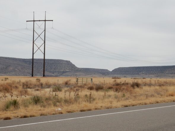
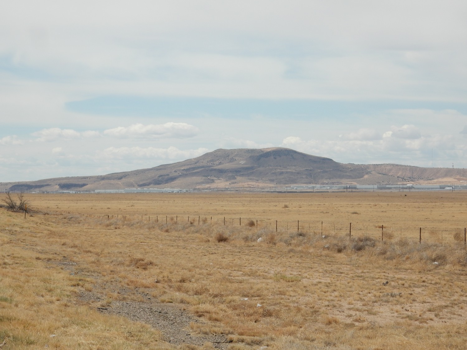
Manzano Mountains to the east.

A bit of a muddy day for pictures, unfortunately. The approaching storm. Abo Pass divides the Manzano Mountains to the north from the Los Pinos Mountains to the south; both ranges are block faulted ranges, likely formed by the opening of the Rio Grande Rift. The east edge of the Rift is at the feet of the mountains, where there is a large fault along which the rocks of the Rift subsided while those just east of the fault rebounded upwards to form these ranges.
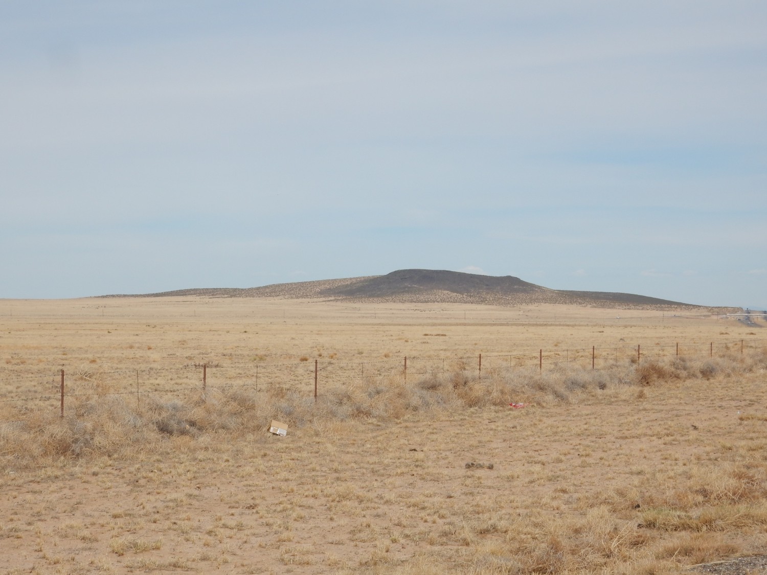
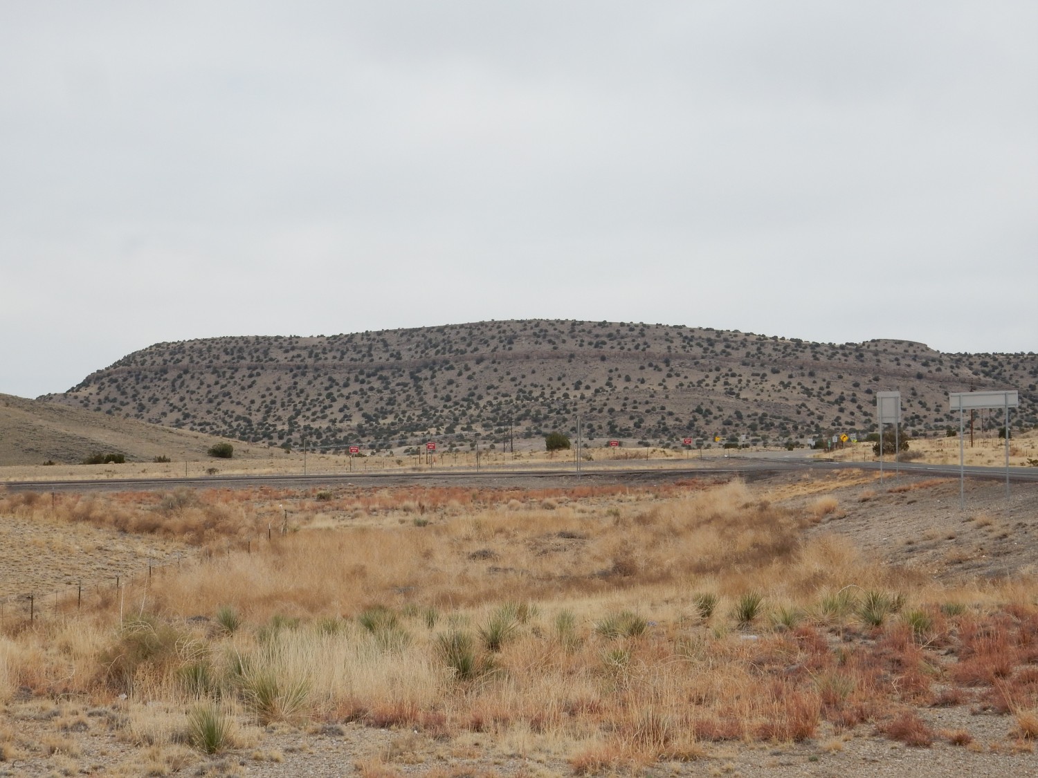
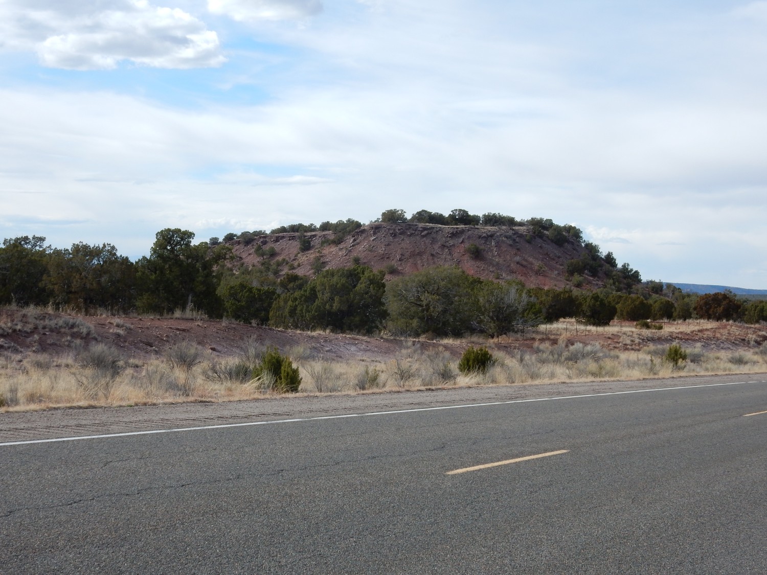
Abo Pass has just come into view.
The pass is the low spot between mountain ranges in the center of the photograph.
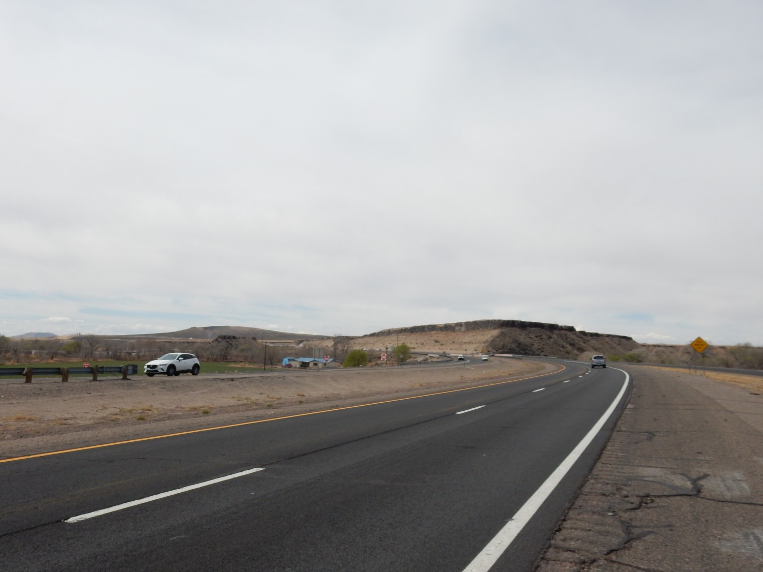
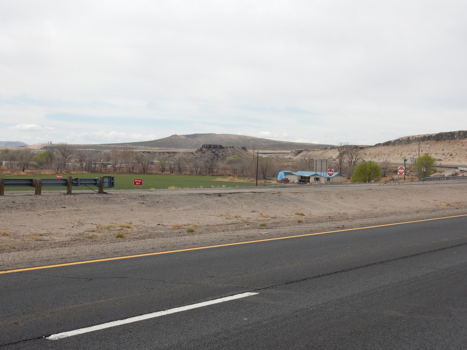
I exit at Belen, turn east at Reinken Avenue, then south onto State Road 47. This heads more or less straight to the pass over empty country.
View of the pass.

The horizontal beds capping the mesas belong to the Wild Cow Formation, which is Pennsylvanian in age (about 305 million years old). That would be around December 7th on the geologic year I described earlier. If I’m reading the map right, the hills below them are underlain by Sandia Formation, which is slightly older. Both formations sometimes contain marine fossils, but I’m not really hunting fossils today (and I don’t know the best places to look anyway).
To the northeast, the Manzano Mountains.
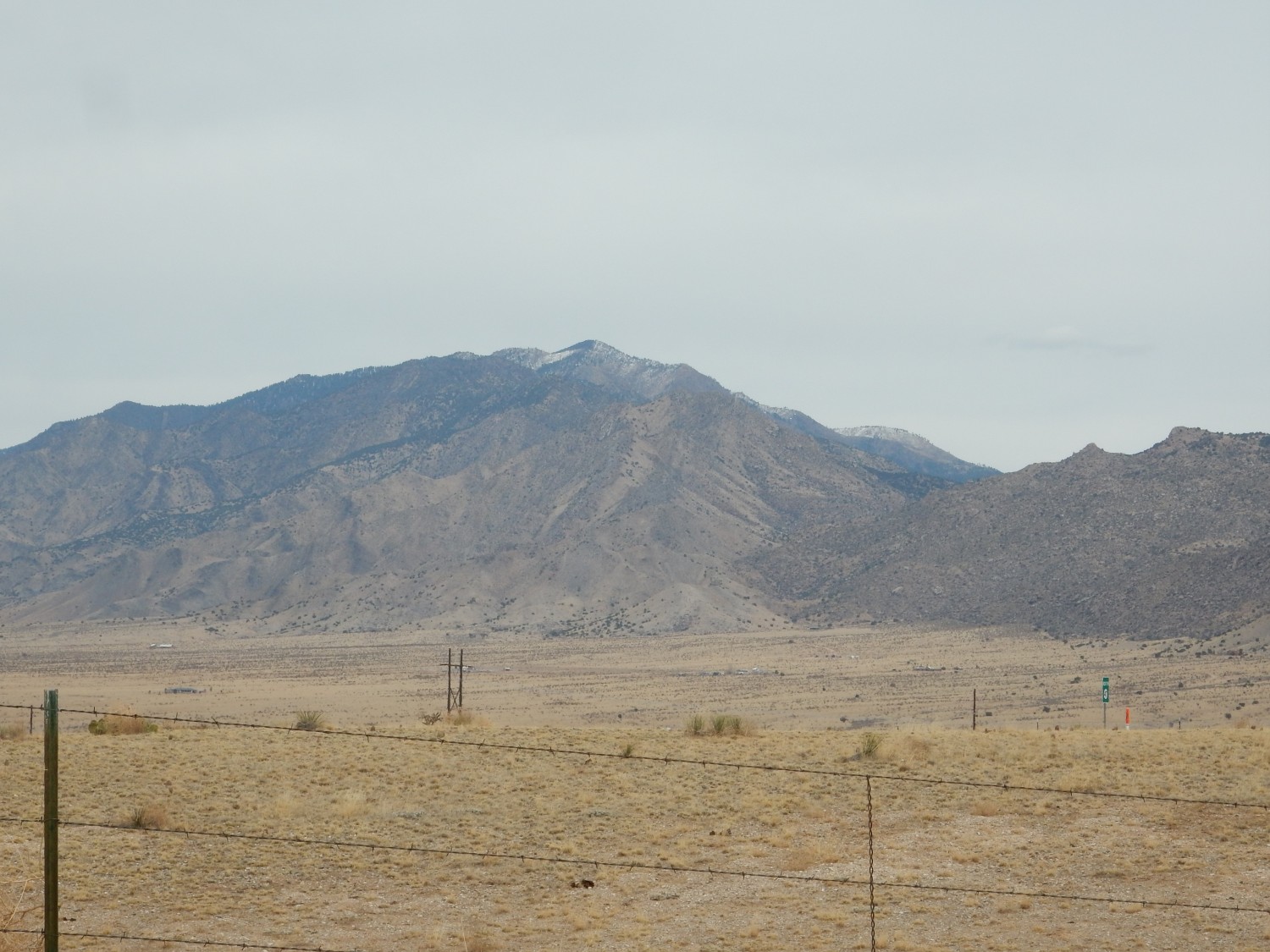
One cannot pick out specific formations at this distance, at least not if one has not spent some time in the area. But the rock at left and center is various metamorphic beds around 1.7 billion years old, while the rock at right is an intrusion of granite around 1.4 billion years old. That would be around mid-August for the older rocks or late September for the younger. And the older are not much younger than the oldest rocks in New Mexico: New Mexico assembled relatively late in the Earth’s history.
The older rocks are part of the Mazatzal province, which was likely volcanic island arcs something like modern Indonesia. This collided with what was then the southern coast of Laurentia, the ancient core of North America. Later a second collision with a small continent (the Granite-Rhyolite province) severely deformed the rock beds of the Mazatzal province and intruded magma which formed the granite. Or at least that’s the current theory; Precambian geology (geology of times greater than 540 million years ago) is still uncertain. Not a lot of evidence survives.
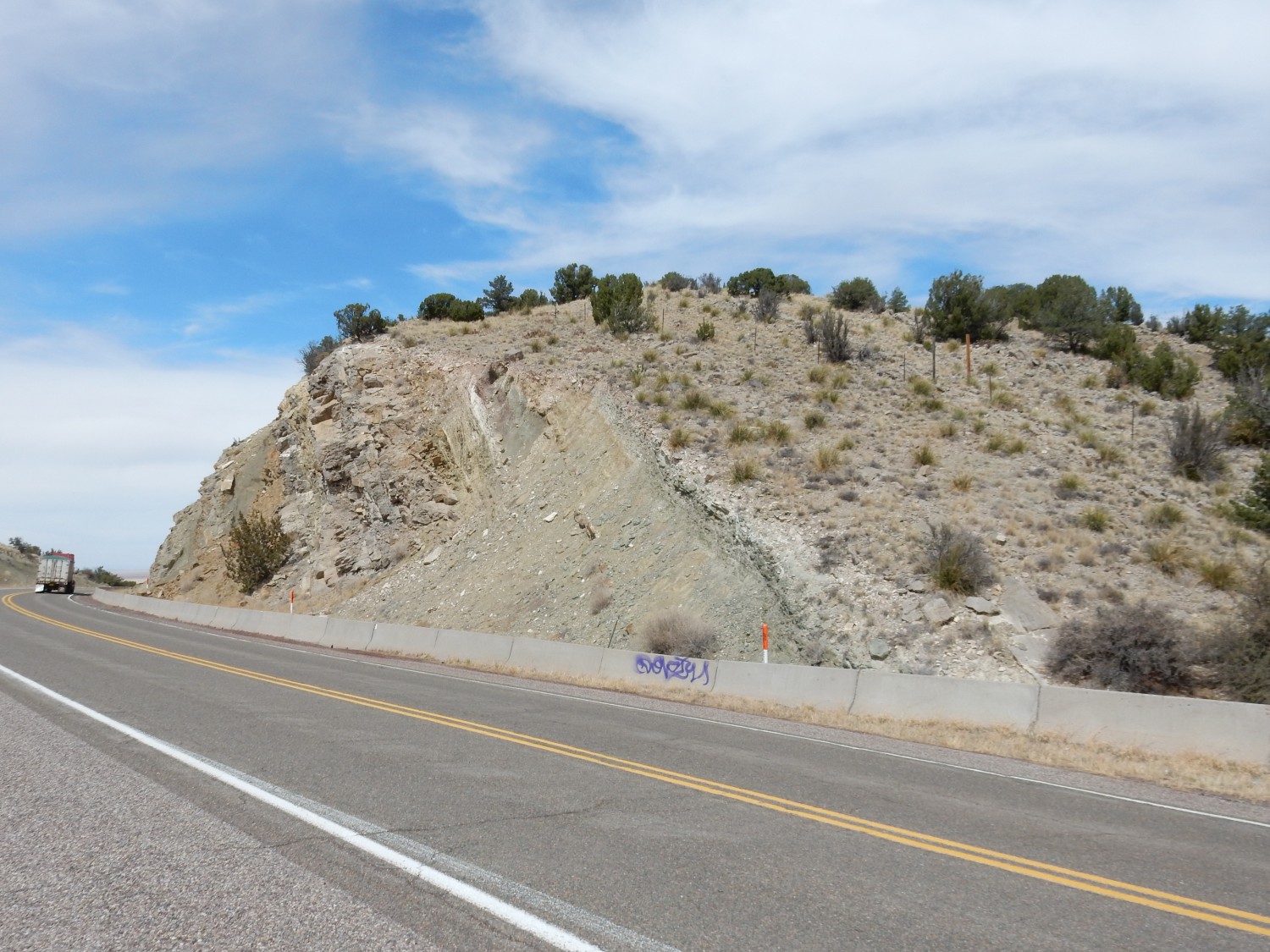
Strictly speaking, Abo Pass is where Abo Canyon debouches from the mountain front, and I will not actually be exploring this area. The railroad goes through here and the railroad right of way pretty much restricts access. However, there is a second pass south of the canyon through which the highway runs, and there is interesting geology here.
The highway joins up with U.S. 60, the highway through the pass. Just west of the junction is a convenient pullout. From here I take a look around.
To the east, the mesa between the two passes.
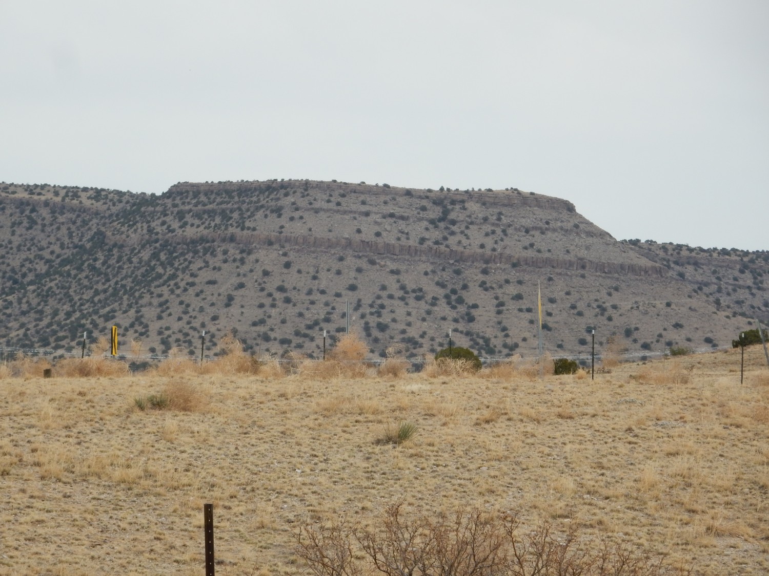
Since I’m not terribly familiar with the area, take my identifications with a grain of salt. I’m reasonably confident the entire mesa is Wild Cow Formation of the Madera Group. Some stratigraphers (those geologists who love to argue about rock unit names) would assign these nowadays to the Atrasado Formation. Either way, there’s agreement this formation belongs to the Madera Group, which is a thick sequence of marine limestone that crops out all over New Mexico. It’s Pennsylvanian in age, as I noted earlier, and corresponds to the rise of the Ancestral Rocky Mountains. It turns out that it is rather common for the rise of mountains in one location to result in the subsidence of basins nearby, and New Mexico in the Pennsylvanian became a shallow sea studded with rocky islands. The Madera Group was deposited in these shallow seas and it is sometimes locally very rich in fossils, as in the western Jemez (my favorite fossil collecting site). I don’t know if there are any good sites here and that’s not my objective for the day.
I think the cliff halfway up the mesa is the top of the Sol se Mete Member of the Wild Cow Formation. Above that is the Pine Shadow Member, which ends at the much thinner cliff three-quarters of hte way up the slope. Above that is the La Casa Member. The cliffs are all massive limestone, while the slopes between are a mix of thinly bedded limestone, siltstone, and sandstone.
Looking a bit further south:
Basically the same sequence of beds. Except the ledge at the very base of the cliff is the same beds as the top of the cliff; there is a fault that has thrown these down. And the very bottom of the mesa is a major thrust fault, the Montosa Fault. Here the entire block of crust to the east has been thrust over the rock to the west. This kind of faulting is associated with compression of the crust rather than the kind of tension that opened the Rio Grande Rift. It shows that these mountains likely existed prior to the opening of the Rift, and were originally formed during the Laramide Orogeny.
The Laramide Orogeny started in the late Cretaceous, around 70 million years ago, and was mostly done by around 30 million years ago. Geologists still debate its precise cause, but most agree that it was a result of the Farallon Plate subducting (sliding under) the North America Plate from the west at a very shallow angle. This put enormous compression on western North America and raised the Rocky Mountains. Some weird tectonics followed, with the upshot being that western North America is now being sheared to the north (the San Andreas Fault being the most famous expression of this shearing), uplifted by rising mantle rock beneath (possibly associated with the disintegration of the subducted Farallon Plate), and stretched out again. This sequence of events helped open the Rio Grande Rift, and the opening of the rift further uplifted the existing mountains on its flanks.
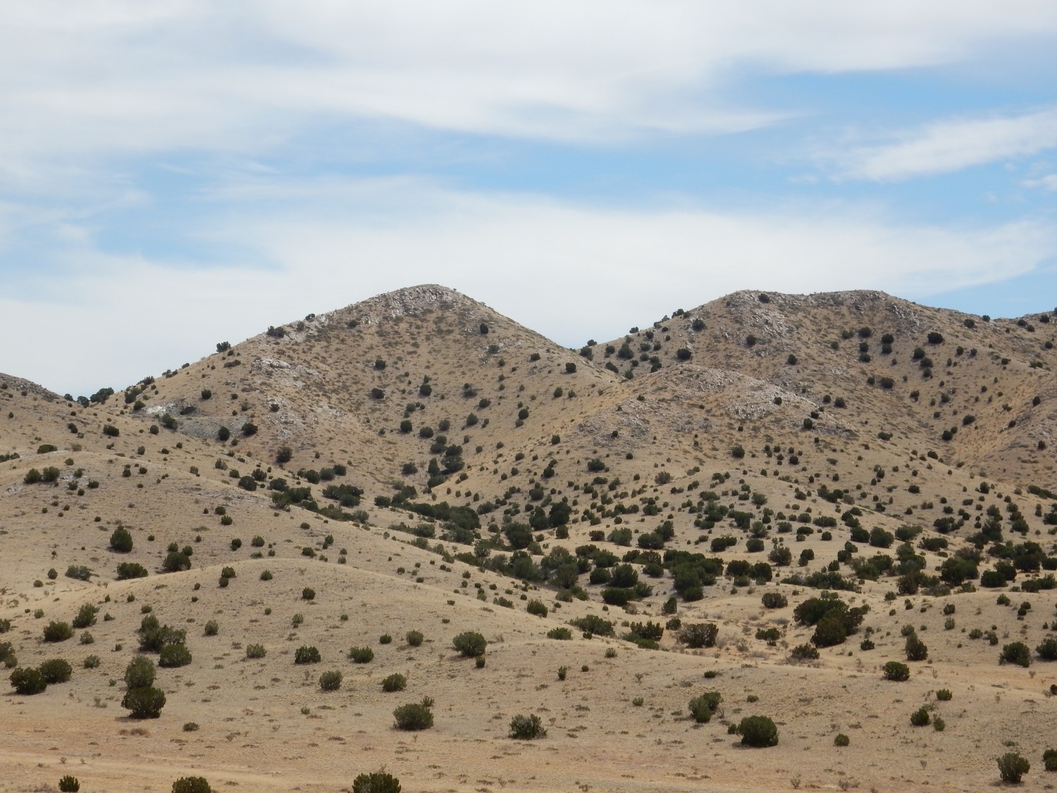
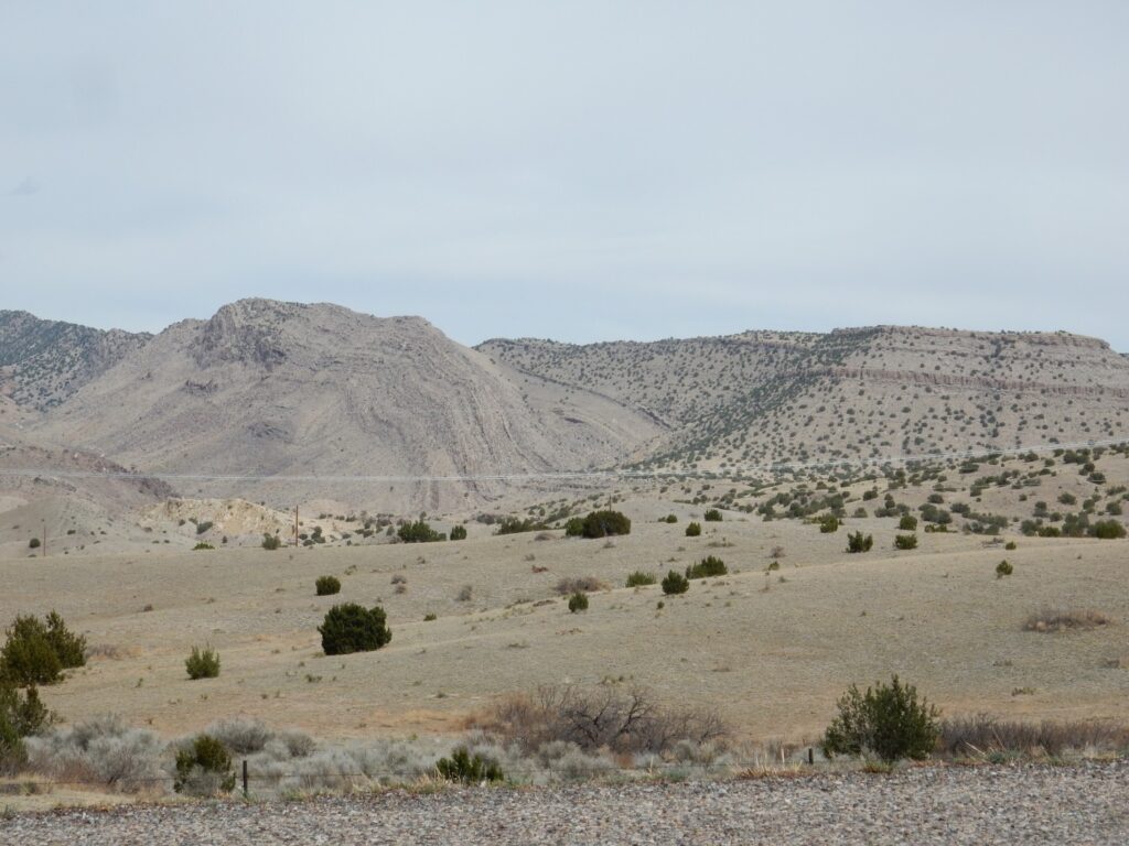
Looking west at Ladron Peak.
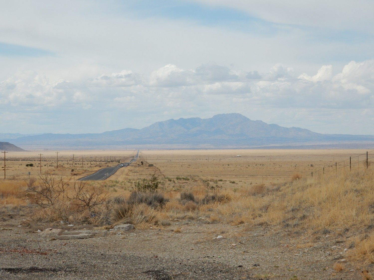
Ladron Peak sits in splendid isolation on the west side of the Rift. If you wonder if it’s a large volcano, I don’t blame you — but it’s another Laramide mountain, cored with Precambrian rock. The presence of a Precambrian core is very typical of mountain ranges raised by the Laramide Orogeny, which tended to produce very deep faults that brought up rock from far below the surface. Geologists described this as thick-skinned deformation. And, yes, there is such as thing as thin-skinned deformation, but it won’t come into our story today.
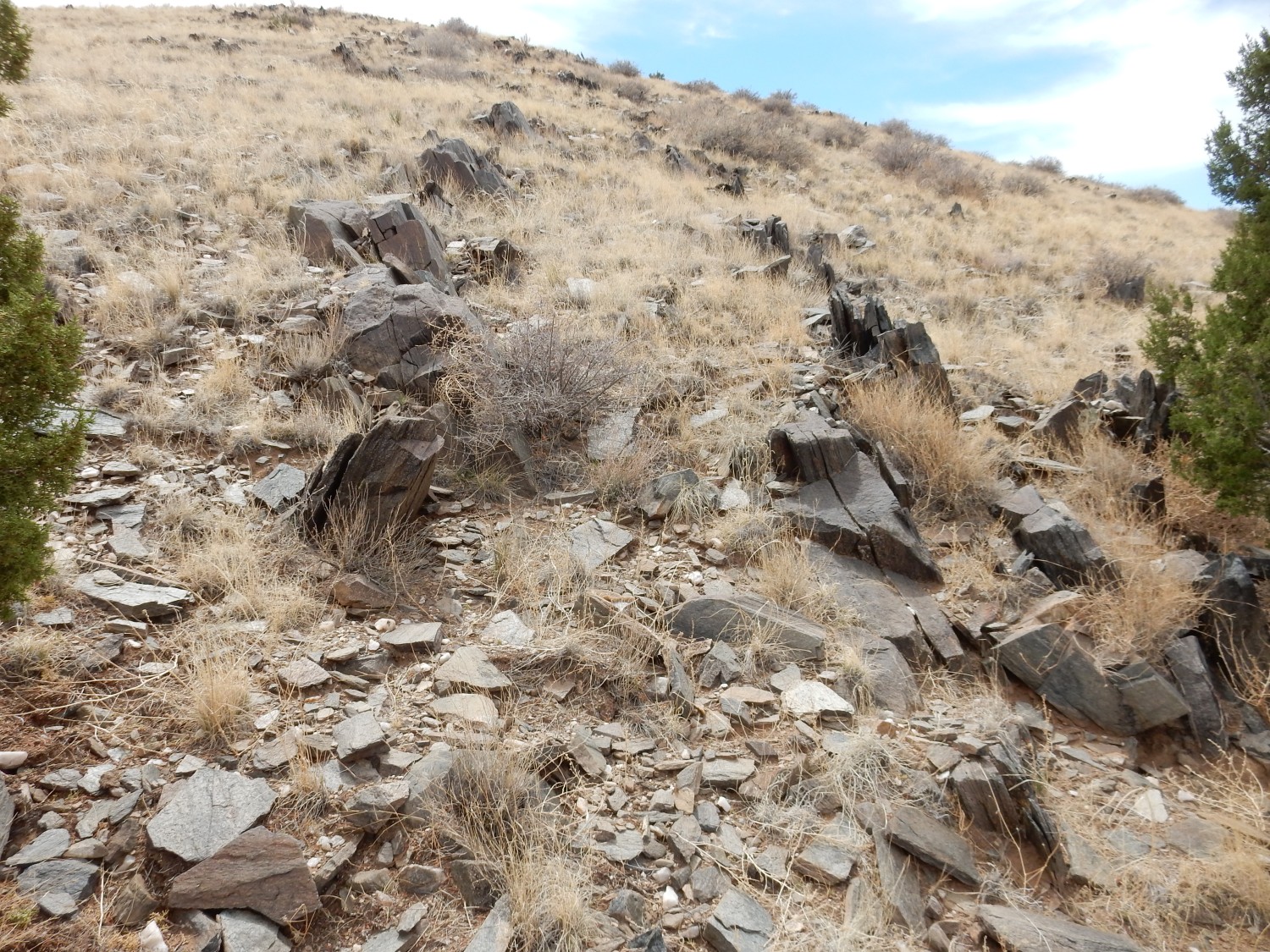
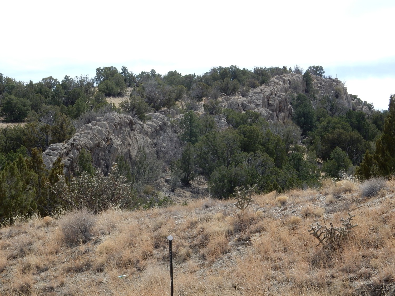
My first objective of the day is a knoll just south of the intersection.
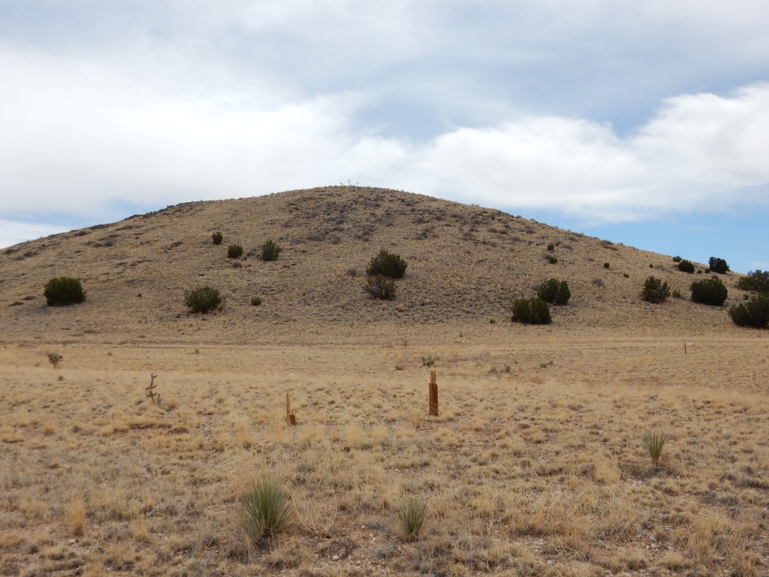
I am slightly vague on property boundaries today. I know that most of the Los Pinos Mountains are part of the Sevilleta Wildlife Refuge, therefore public lands. But there is some private land hereabouts as well, and there’s a barbed wire fence south of the highway. I scout along this for some distance but see no “No Trespassing” signs or, for that matter, any signage at all. The fence looks like it may be there mostly to keep in cattle — there is, in fact, a beaten path along the inside of the fence typical of cattle pasturage. I decide I’m probably okay crossing the fence as long as I’m polite and behave myself on the other side.
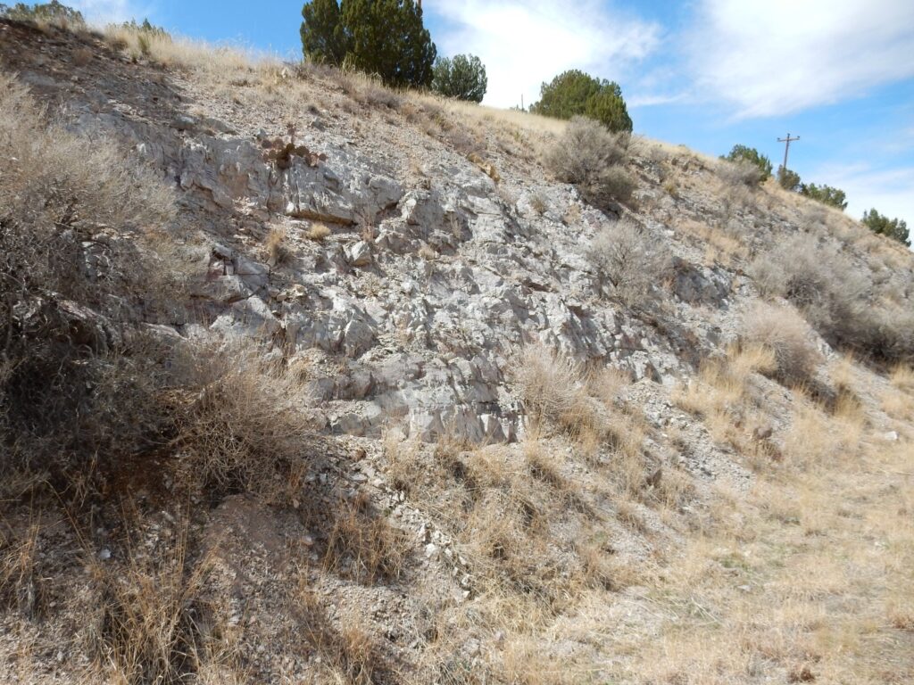
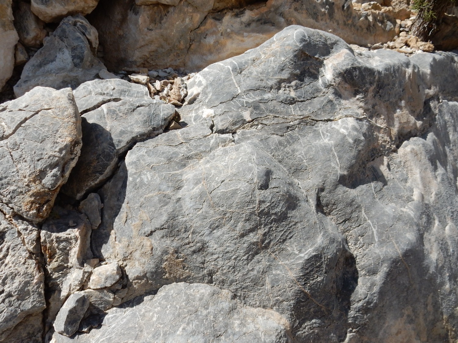
The lower slopes are all covered with a distinctive schist.
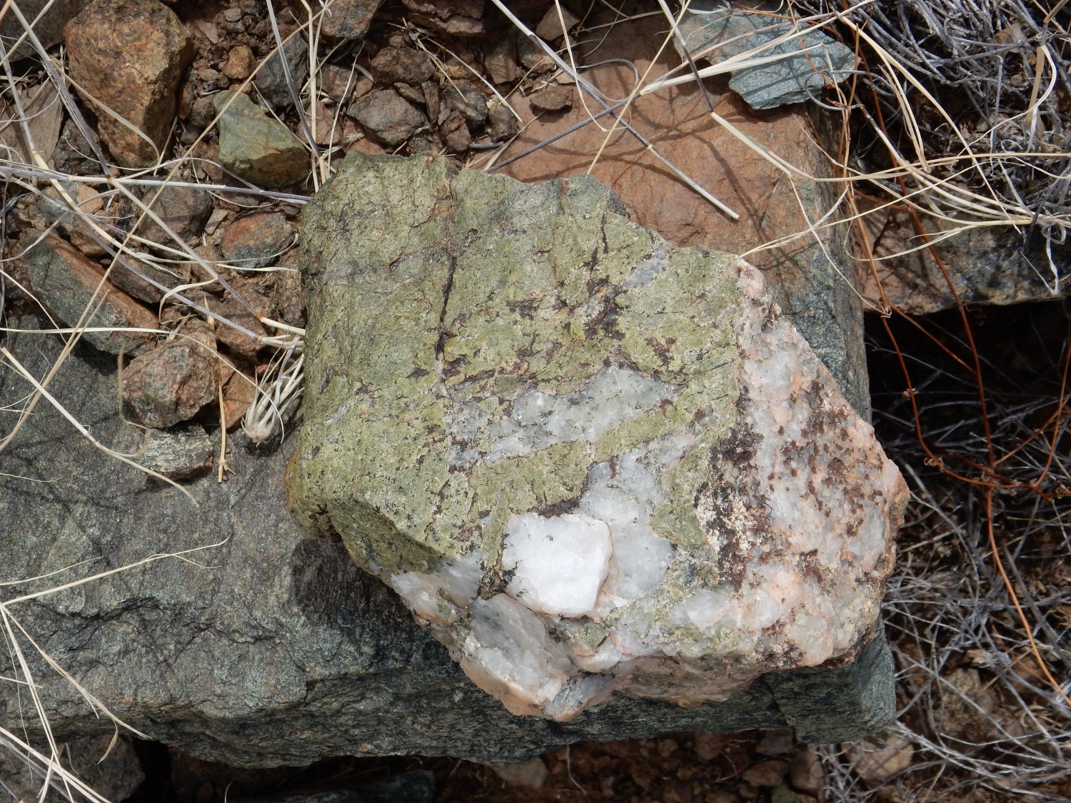
I identify this as Sevilleta Metarhyolite, and my camera coordinates on returning home confirm it. Its age is fairly well constrained to about 1.665 billion years (August 19 pf the geologic year). It’s not quite the oldest rock in central New Mexico, but fairly close.
The rock is described as a metarhyolite because it can be fairly unambiguously identified as rhyolite that has undergone medium-grade metamorphosis. It tells us that, 1.665 billion years ago, giant calderas like those of the Jemez were erupting ash flow tuff like that of the Bandelier Tuff in this area. These ash flow tuffs have the composition of rhyolite, a volcanic rock very high in its silica content and often rich in alkali metals.
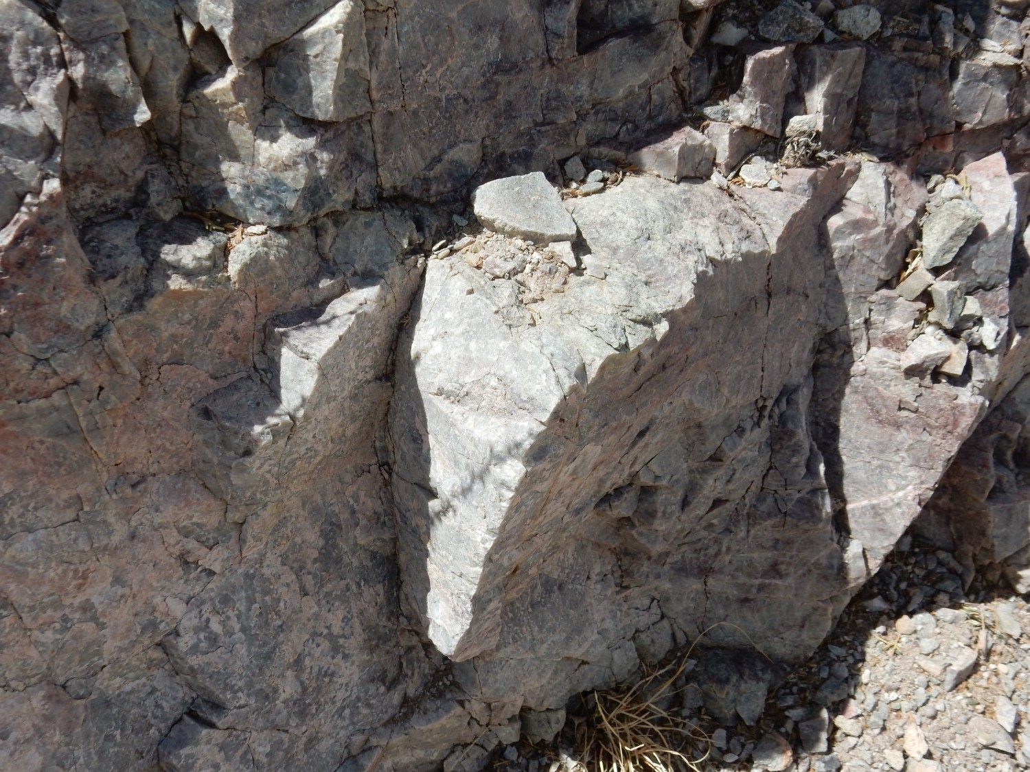
The rock contains porphyroblasts of quartz and feldspar.
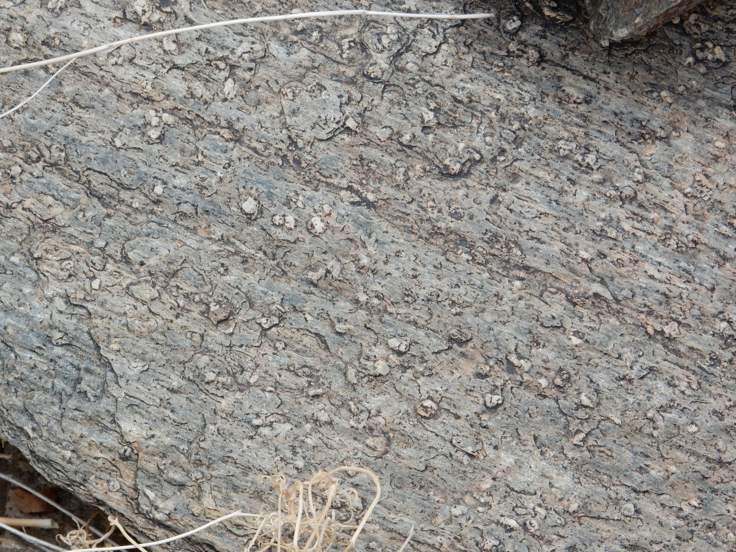
Porphyroblasts are oversized crystals that grow in otherwise fine-grained metamorphic rock. The particular kind of porphyroblasts identifies this as probably the upper metarhyolite member of the Sevilleta Metarhyolite.
I climb up the hill to get just the right picture for Wikipedia. Perhaps this one.
Or maybe this one.
The first, I think. There’s really nowhere where the exposures are spectacular. Jumping ahead a bit, I get some nice shots further east, but they’re less typical beds.
Looking west again.
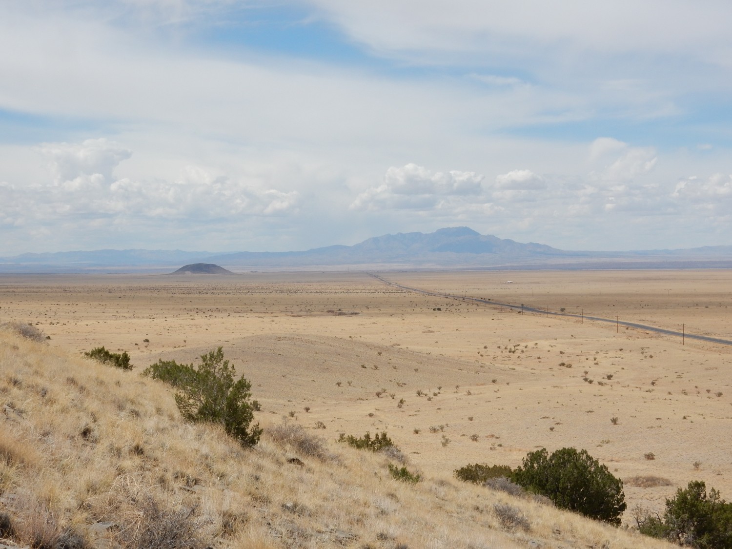
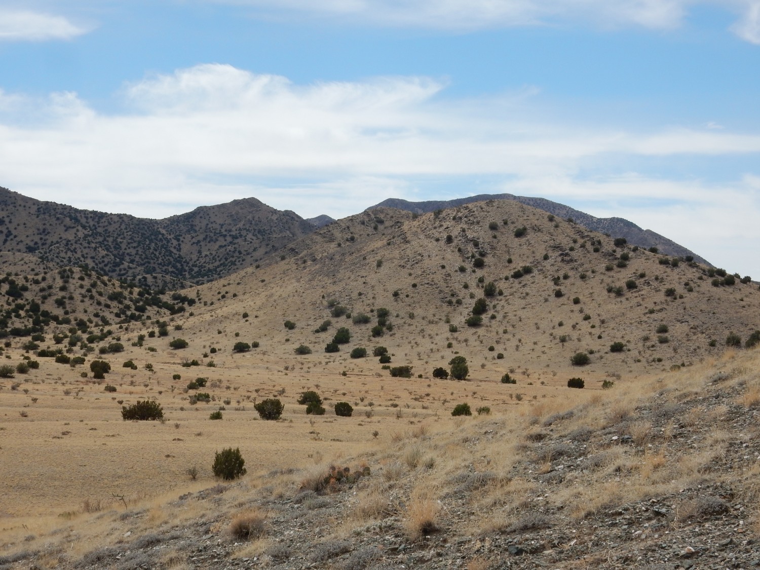
Ladron Peak again, but at left in the middle distance is Black Butte (Turututu) which I assumed was a young cinder cone. No; this is actually part of the Mogollon-Datil volcanic field, which is at least as old as the Rio Grande Rift. It’s kind of an oddity sitting out here, though such inselbergs of older rock are found here and there a long the rift, usually where rifting shifts to the right along the rift to form a new basin. And we are indeed close to such an accommodation zone here. We’re at the southern limit of the Albuquerque basin, and south of us rifting shifts to the right to form the Socorro Basin.
The butte is apparently capped with La Jara Peak Andesite, around 28 million years old (6 PM on December 28) resting on Vicks Peak (28.4 Mya), La Jencia (28.7 Mya), and Hells Mesa Tuffs (32 Mya). That’s “million years ago”. These tuffs all came boiling out of various giant calderas of the Mogollon-Datil field: Vicks Peak from the Nogales caldera (located about here), the La Jencia from Sawmill Canyon caldera (located about here), and the Hell Mesa from the Socorro caldera (located about here). And, no; here is no obvious surface expression of these calderas left. They’ve been essentially eroded flat, and their outlines can only be traced by careful geologic mapping. Which makes this little erosional remnant out in the basin all the more remarkable.
Would be interesting to visit. (Checks jurisdiction map.) Huh. Just north of the wildlife refuge on private land. If it’s not posted, it may be worth another polite visit.
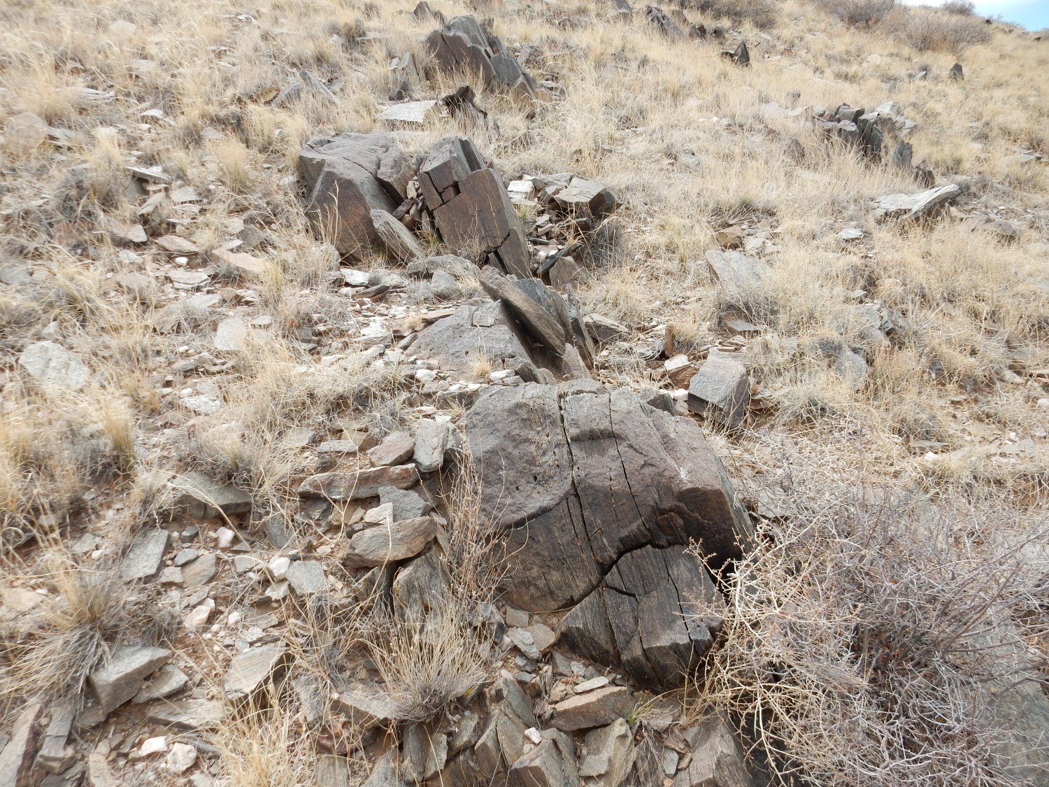
I head east to see what I can see. Huh, what’s this?
A chunk of pegmatite (very coarse granite) that must have intruded the metarhyolite and altered it. The green color is probably from chlorite, a common product of alteration of iron-rich rock. The map tells me I’m crossing a big flow of basalt interbedded with the original rhyolite that was later metamorphosed to hornblende schist. So the caldera eruptions were accompanied with basalt flows — a pattern we see in the more recent Jemez.
Spectacular outcropping (but too backlit and too atypical for Wikipedia):
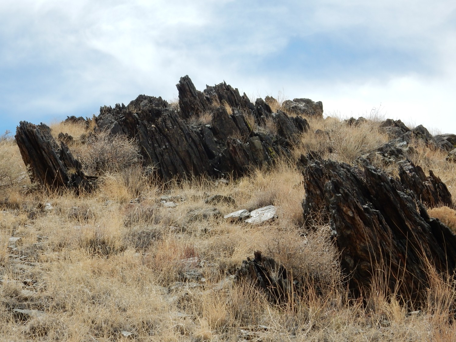

Notice how the foliation of the beds is nearly vertical. That almost certainly isn’t the direction of bedding of the original flows; it reflects deformation during metamorphism. Almost all the really deformed metamorphic rock I’ve seen is vertically oriented. When the rock is compressed horizontally, it really has nowhere to go but up.
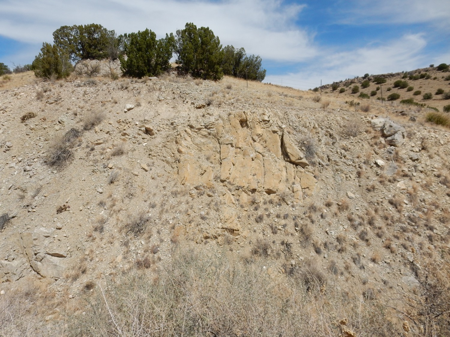
East of the knoll is a valley, then a ridge capped with white rock.
I identify this as either White Ridge Quartzite or Sais Quartzite; the two are hard to tell apart and are separated by a thin bed of shale that would be hard to spot here. If I’m now reading the map right, this is Sais Quartzite.
The formation contains zircons which can be radiometrically dated. These are as young as 1670 million years, which is thus also the maximum possible age of the formation.Since the next formation up (the Blue Springs Formation) is radiometrically dated as 1588 million years old, we have pretty good brackets on its age.
I think that one’s also for Wikipedia.
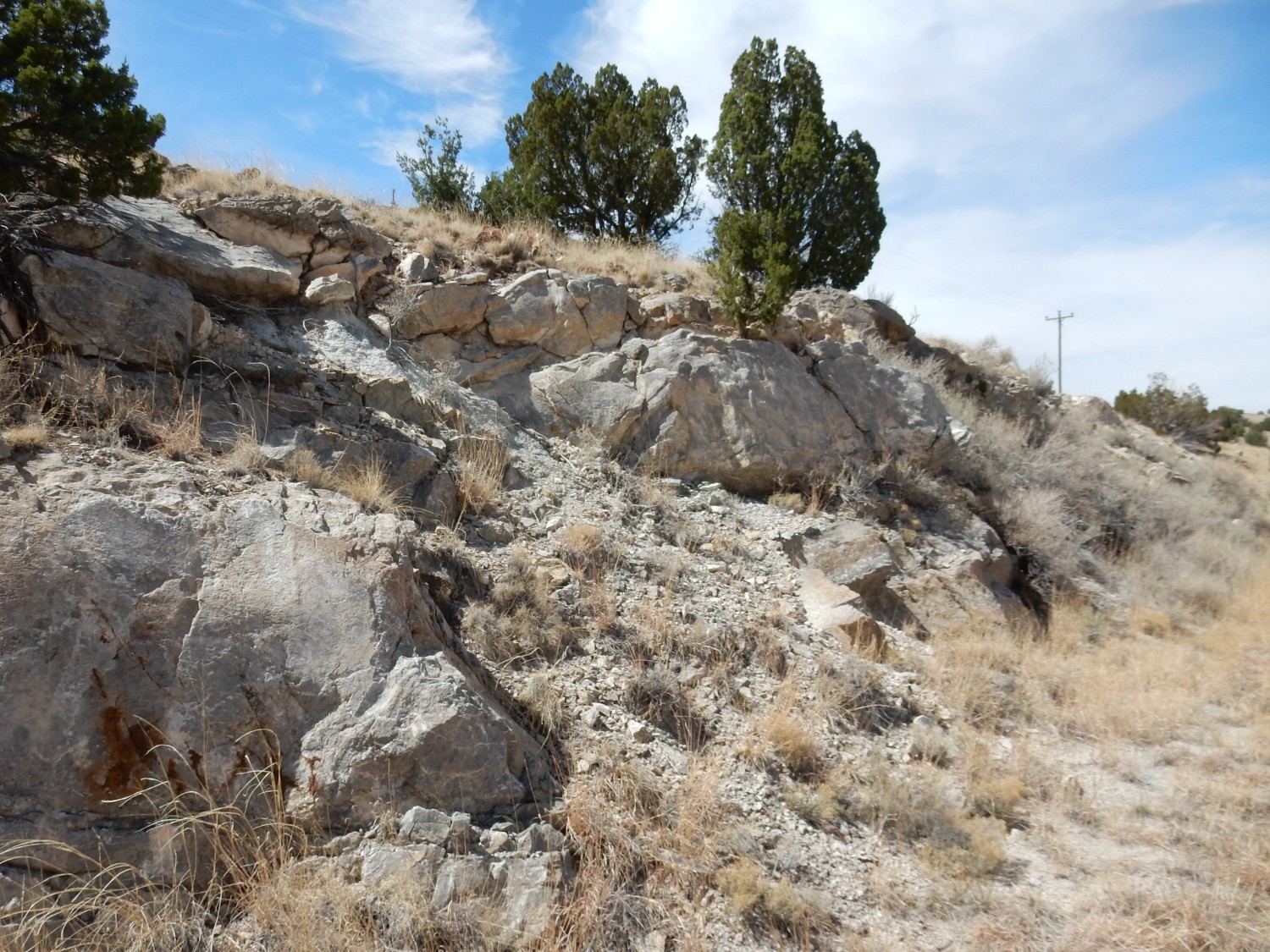
Looking south into the mountains. This is all Sevilleta Metarhyolite.
I consider hiking across the valley and up into the Sais Quartzite, but think better of it. On the way back to the highway, I find my first blooming cactus of the spring.
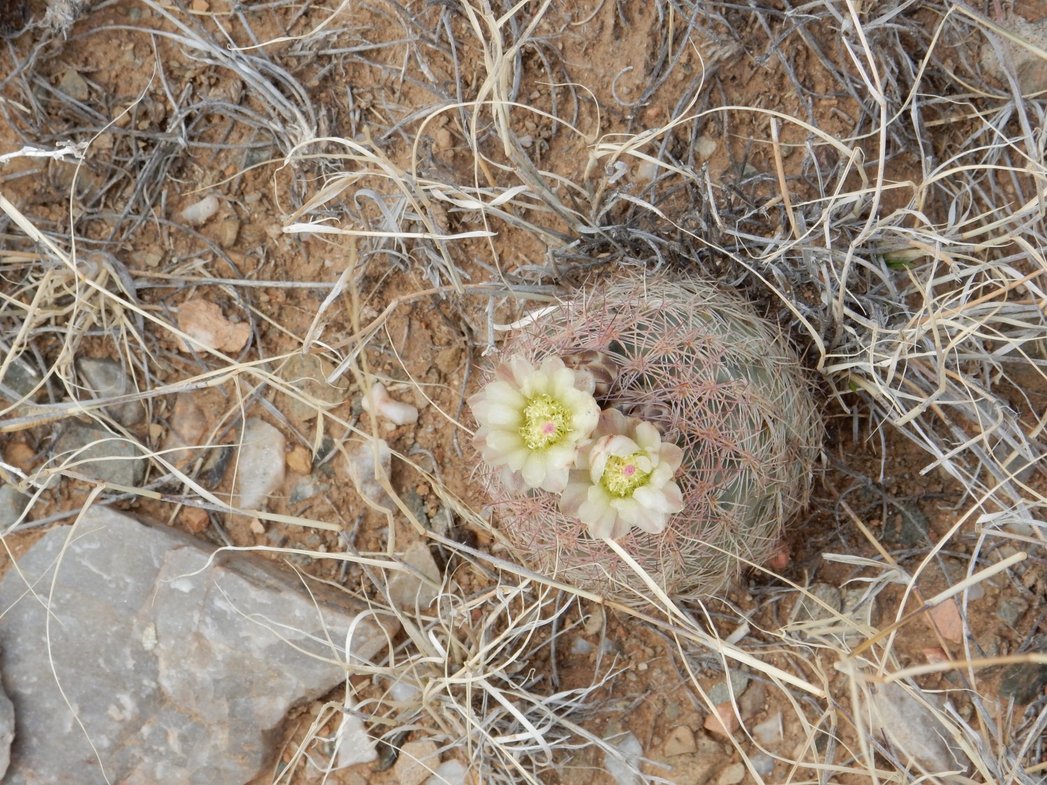
Mammillaria of some kind, is my guess. Possibly the little nipple cactus, Mammillaria heyderi? Supposed to be an early bloomer.
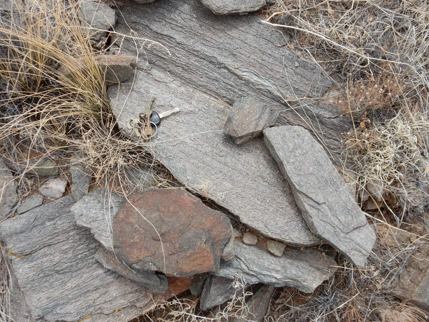
I come to a beautiful road cut in what I take to be Sevilleta Metarhyolite.

I did not collect any samples in the fenced area; I was not sure of the land ownership and I tend to be a bit scrupulous about such things. But I have no qualms about grabbing a rock fragment on the ground at a road cut, and grab a sample.
It turns out this is a new formation, the Abajo Formation. The rock here is described as a lithic arenite, a kind of dirty sandstone (since metamorphosed); and, under the loupe, it does appear to be rich in quartz grains, but embedded in a finer matrix of (I’m guessing) feldspar and mica.
I think that first picture is the one for Wikipedia.
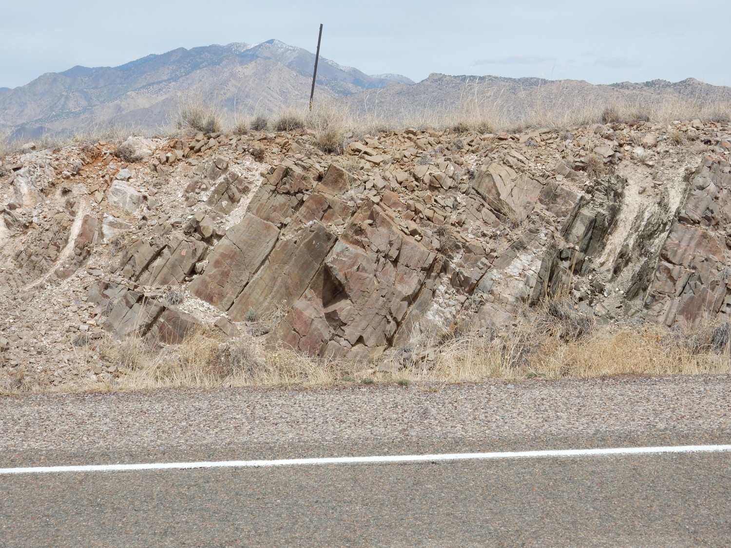
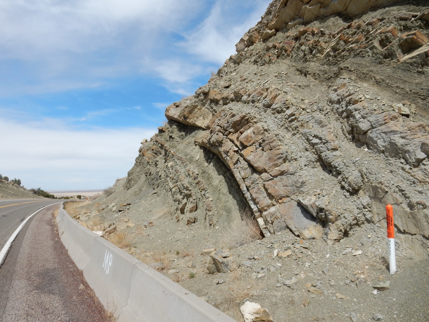
Striking deformation to the northeast.
The rocks at left are Precambrian rocks like those we have been lookint at. At right are nearly level beds of Wild Cow Formation. The boundary between, easily picked out even at this distance, is the trace of the Montosa thrust fault.
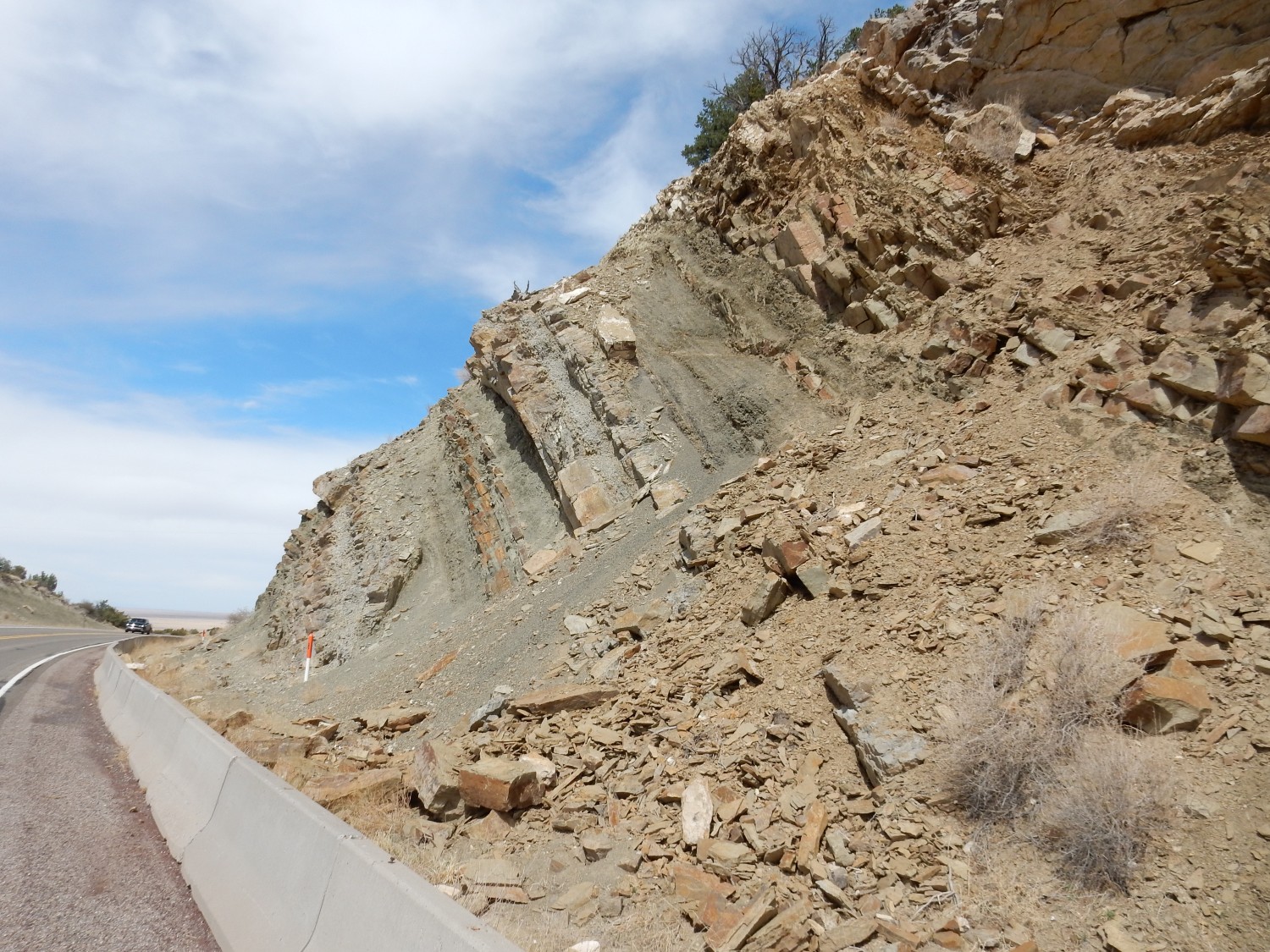
Continuing down the highway into the pass: Borrow pit.

Or at least it’s too large to be a prospect and there are no valuable minerals here to mine. Probably excavated for gravel for construction.
This location is Blue Springs, and there is a Blue Springs Schist. But it’s poorly exposed. I consider some outcrops across the valley
I think I’m overshooting, though. This is likely Wild Cow Formation on the far side of the Montosa thrust. The low ridge to left is likely the Blue Springs, and it’s on private ground. I’m loathe to disturb the privacy of the people here.
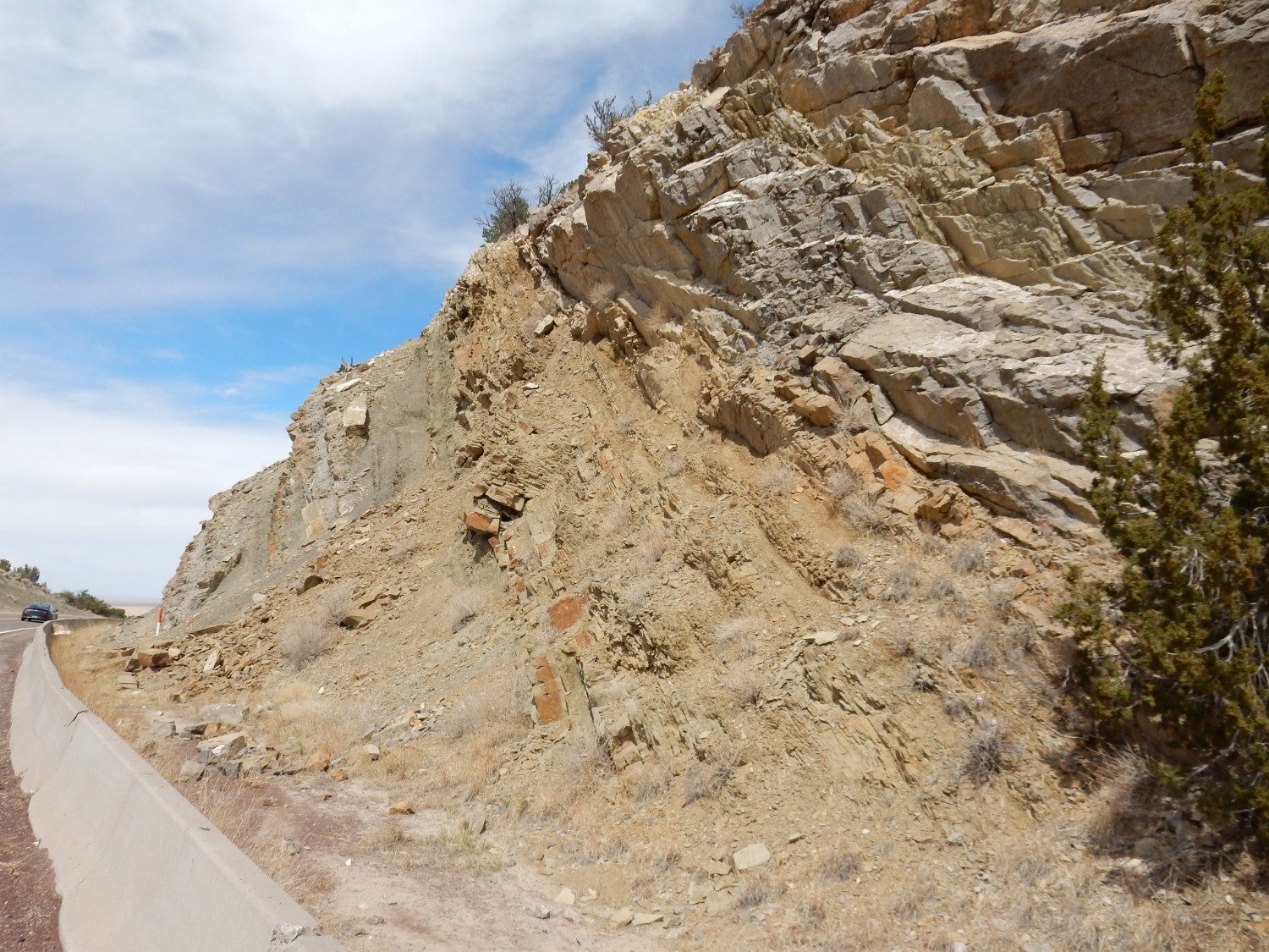
But I soon reach a road cut in the Sais Quartzite and get a close look.
Some surfaces look polished, including a surface of a fragment I pick up. The Montosa thrust is only a very short distance to the east; we could well be seeing slickensides, polished and grooved rock faces associated with fault movement, here.
So far as I can make out from the map, the very face of the fault is here:
There’s a deep gully I don’t really want to cross to get a closer look.
The fault trace is poorly exposed along the highway. But I know I’ve crossed it here:
because I’m now looking at massive limestone of the Wild Cow Formation.
Devoid of fossils, alas. Gary Stradling and I scrutinized nearby road cuts and never found anything while coming back from Kilbourne Hole.
The last time here, I was in a rush. Now I take some more careful photographs of where the highway cuts through the Wild Cow.
Lots of distortion from the thrusting along the Montano thrust.
It’s a beautiful set of beds.
I had a vague notion, perhaps from an older map, that a fault ran along here:
But there’s not an obvious fault trace and the map shows none. Across the road is al imestone ridge.
I drive a little further into the pass, trying to decide what to do next. There is a sign “DO NOT PICK UP ROCK FROM ROAD CUT”. Well then. I am disinclined to try camping after seeing all the snow on the peaks, and I know the geology beyond the pass (it’s all Abo and Yeso which I know well from the Jemez.) I decide to head home via Tijeras Pass and, to add new ground, Clines Corners to Santa Fe.
The ground is mostly familiar. Where it starts to be interesting, east of Tijeras Canyon, the interstate is crazy busy and it’s just not safe to stop for photos, alas. It’s not till I get north of Clines Corners that I pause for another photograph.

Looking west at the mountains of the Ortiz Porphry Belt. The flat terrain is the top of the Chinle Group, according to one map. No details. Well, exposures are lousy anyway.
I pause to rehydrate with some electrolytes. My head has been doing pretty good this trip, thanks to ample fluids, including caffeinated.
Final shot:
This does look like Chinle — a formation (or group of formations, depending on whose stratigraphy you like) of Triassic age, about 230 million years old. But there are no detailed maps for this area; all I can say is that it is Chinle.
From there, home. Cindy is mildly surprised to see me home so early. I’m not through with the long weekend; I’ll do a modest hike this afternoon. Leaving now for it, in fact.