Wanderlusting the Tusas
This trip was to the Tusas Mountains of northern New Mexico. These mountains lie more or less directly north of my home in White Rock and have one of the two closest exposures of Precambrian rocks to the Jemez Mountains.
I used my Friday off to take care of my weekend chores, took a little time Saturday to put a second coat of plaster on some wall repairs, then loaded up my car and headed out. The first part of the trip was over very familiar territory, since my wife and I shop in Espanola a couple of times a month, but I paused for some pictures that I thought might come in handy for my Ebook on the geology of the Jemez Mountains.
White Rock lies on the edge of the Pajarito Plateau, which is the easternmost part of the Jemez Mountains. The rocks in my back yard are mostly tholeiitic basalt flows from the Cerros del Rio Formation, which is about 2.5 million years old. These lie on top of Puye Formation conglomerates, eroded off the Jemez Mountains around 2.5 to 5 million years ago, which lie on top of the Santa Fe Group, which are rift fill sediments of the Rio Grande Rift going back 8 to 17 million years. My neighborhood is dominated by spectacular mesas of the Bandelier Formation, erupted 1.6 and 1.2 million years ago in caldera supereruptions.
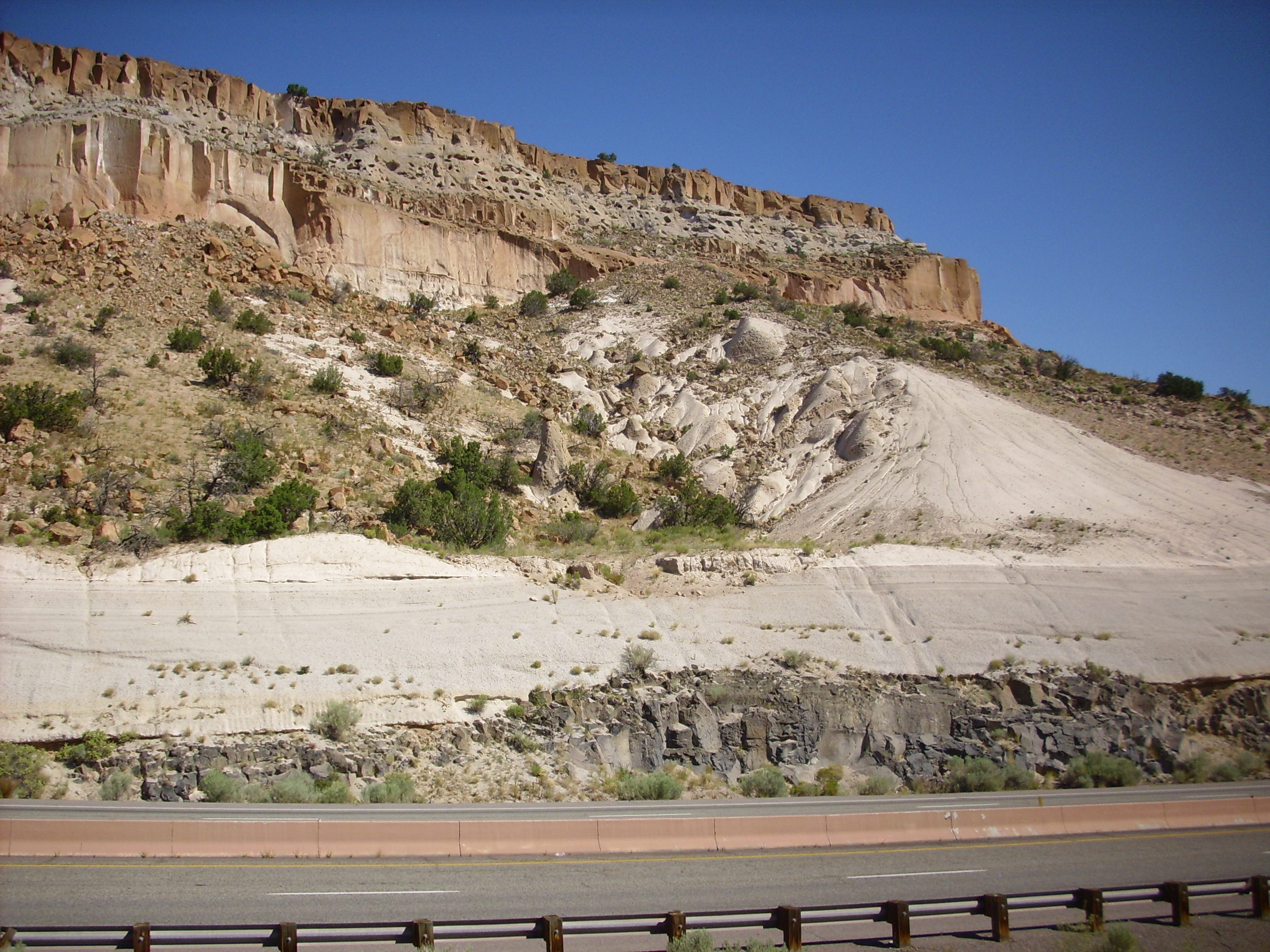
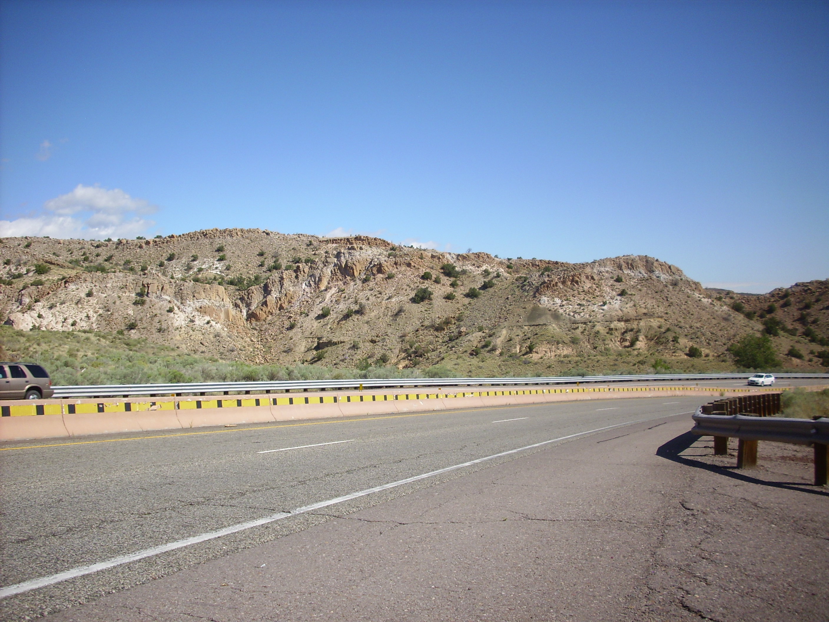
Bandelier Formation sitting on top of Cerros del Rio Formation on State Road 502 west of Totavi
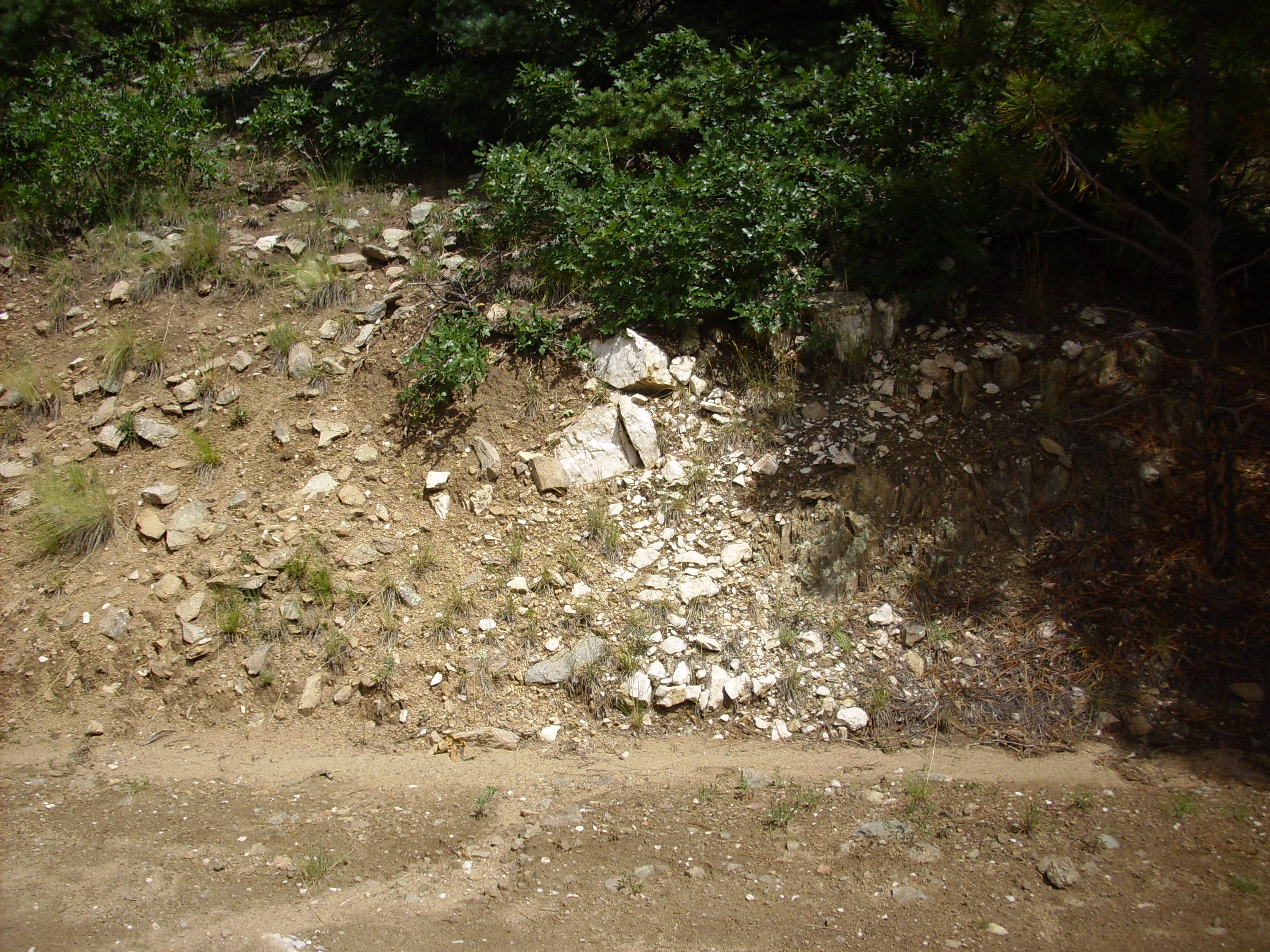
This particular road cut is iconic. You will see it in almost every decent book on Jemez geology. At the bottom is a layer of dark basalt of the Cerros del Rio Formation, which apparently erupted from a center somewhere to the west (left in this photograph). On top of the basalt is a very thin layer of sediment that I always assumed was a paleosoil, but may in fact be lake bottom sediments. There have been a number of lakes north of White Rock Canyon as a result of volcanic eruptions damming the Rio Grande River.
On top of the basalt and sediment is a thick layer of Guaje pumice, which is air-fall pumice from the start of the first Bandelier caldera supereruption (the Toledo event), which took place about 1.6 million years ago. This is overlain by ignimbrite of the Otowi Member of the Bandelier Formation from later in the eruption. The Otowi Member is unwelded here and has been heavily eroded, leaving behind a number of tent rocks and a single hoodoo (just left of center of the picture.) The Otowi Member shows a number of other tent rock formations throughout the canyon west of here.
Just visible at the base of the cliffs, above and to the left of the center of the photograph, is a layer of pumice and ash of the Cerro Toledo Rhyolite, which erupted from domes within the Toledo caldera between the two Bandelier supereruptions. At the top of this layer is a few inches of Tsankawi Pumice, which is is air-fall pumice from the start of the second Bandelier caldera supereruption (the Valles event), which took place about 1.2 million years ago. This is overlain by two cooling units of ignimbrite of the Tsherige Member of the Bandelier Formation. These are moderately welded, making them a cliff-forming unit. Further up the canyon to the west, as many as five cooling units can be seen in the Tsherige Member.
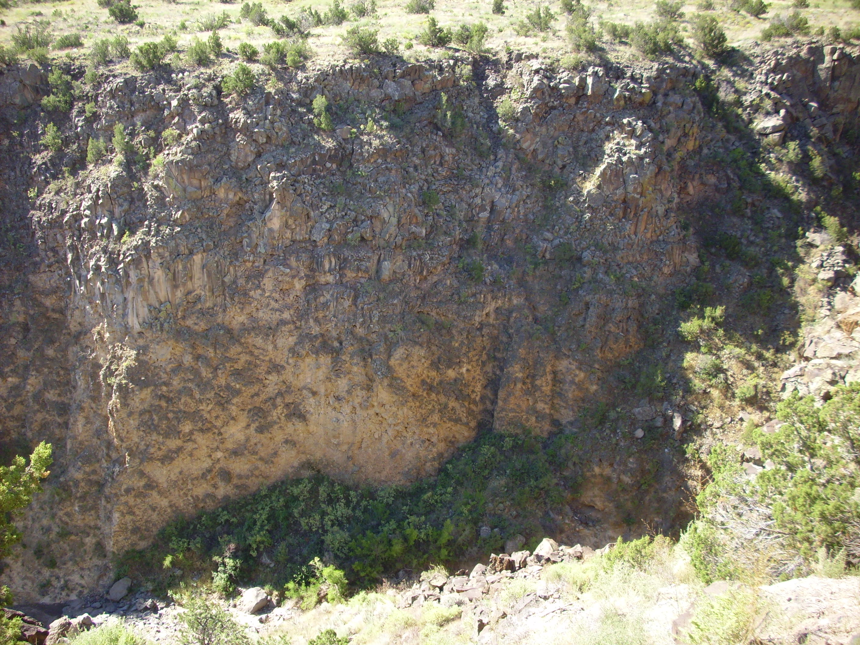
Opposite this road cut is a deep canyon in the Cerros del Rio. At this point, the Cerros del Rio is very thick.
Cerros del Rio on opposite side of canyon from previous photograph
It’s rare to see this great a thickness of Cerros del Rio Basalt, and in fact we see a sloping contact further down the canyon with Santa Fe Formation sediments that bring the Cerros del Rio to a more typical thickness.
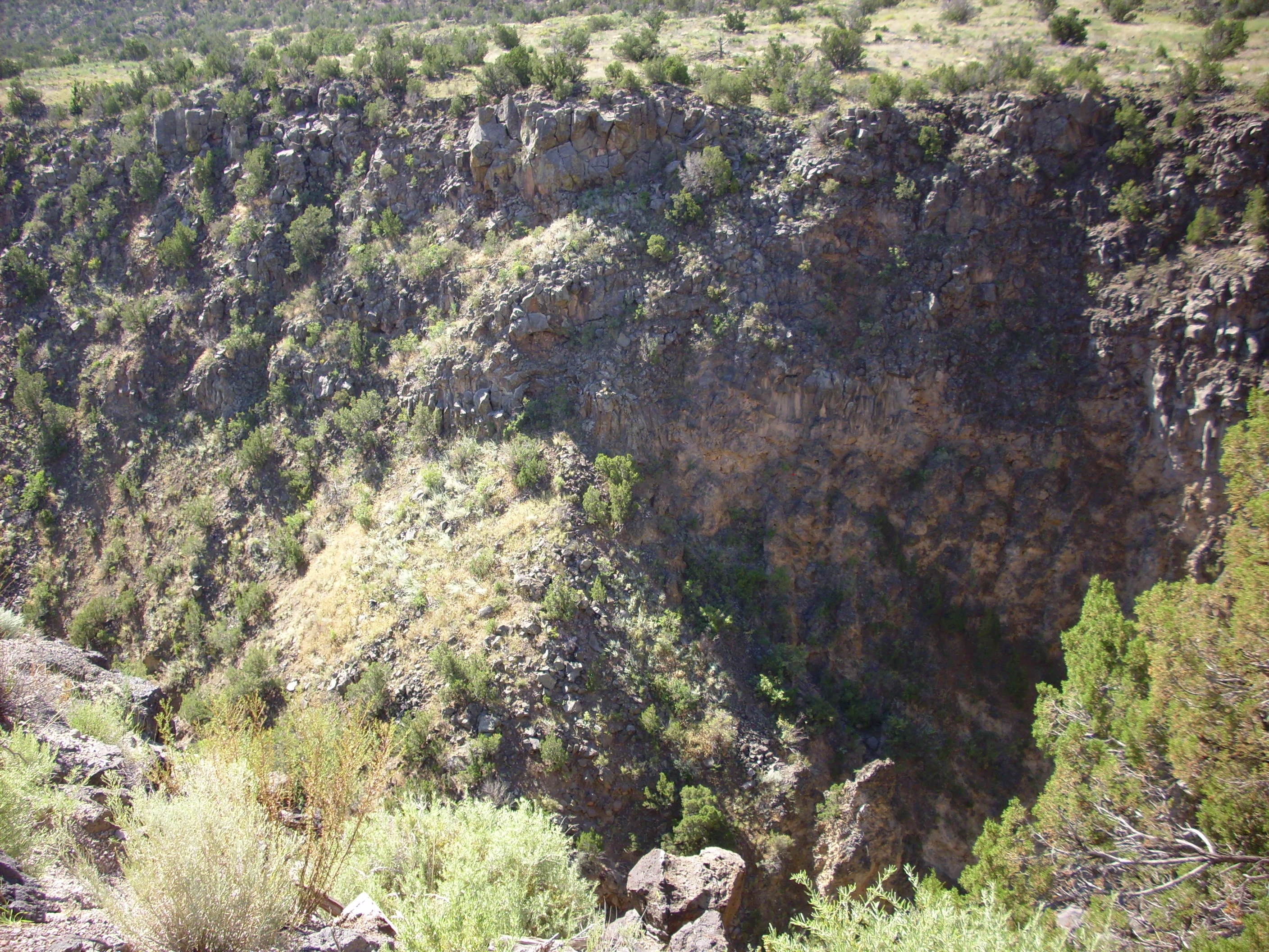
Cerros del Rio in contact with Santa Fe Group to east of previous photo. Contact indicated by white lines.
It’s possible that the deep portion of the flow is the actual vent from which the lava erupted, but it’s also possible that we are seeing where the lava pooled in a deep paleocanyon.
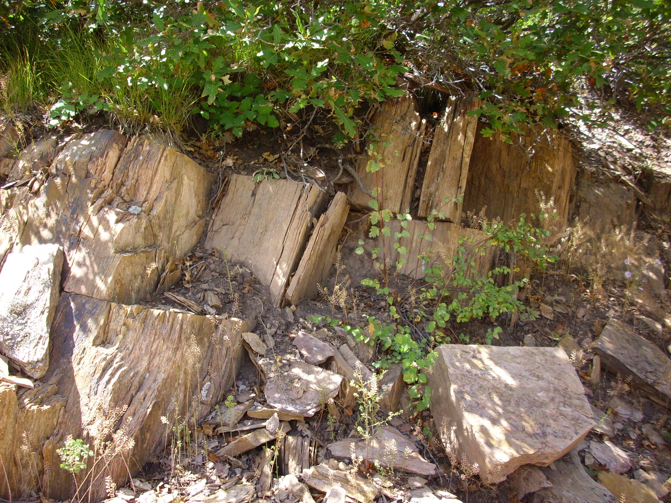
Further down the road, we see some rather uneven layers of Bandelier Tuff on top of conglomerates of the Puye Formation.
Bandelier Tuff slide blocks on Puye formation
These are most likely slide blocks. The ledge to the right, about halfway down the hillside, may be a zeolitized layer at the level of one of the lakes that formed when White Rock Canyon was blocked by an eruption or landslide.
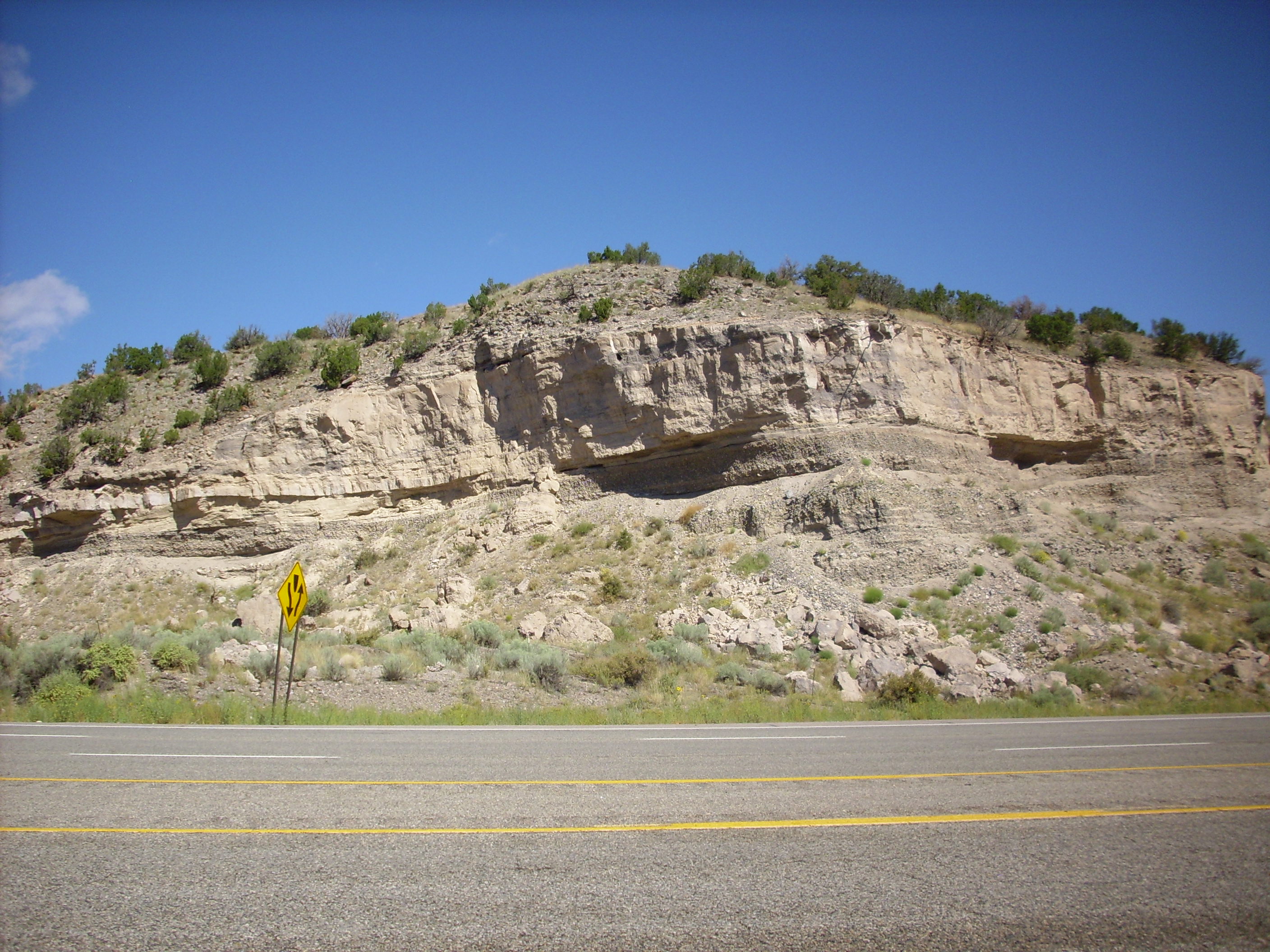
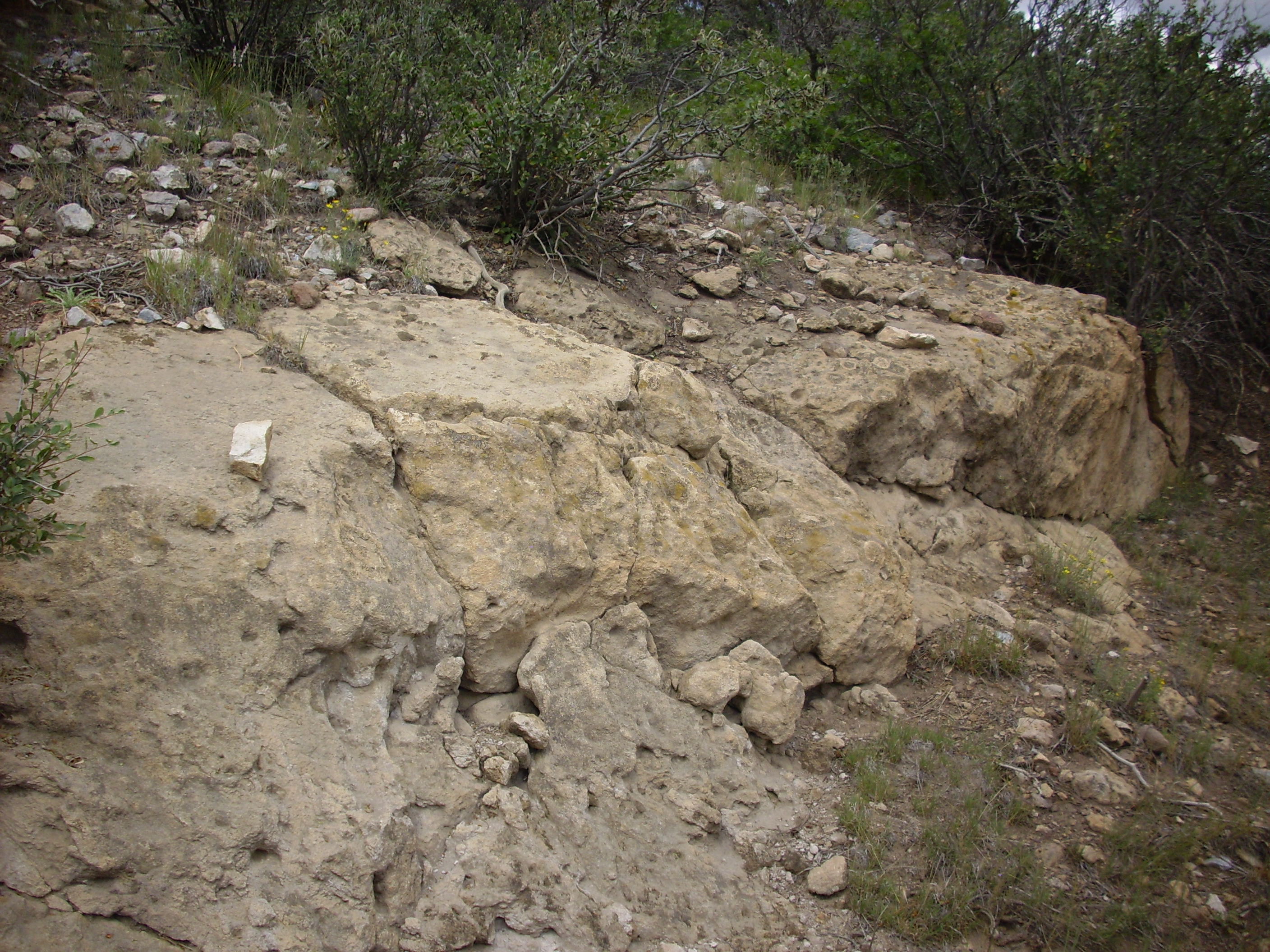
Here’s a good look at the Puye Formation about a quarter mile west of Totavi Station.
Puye Formation west of Totavi Station
Here we see a thick layer of grayish gravel, a layer of what looks like volcanic ash, and another layer of gravel. The ash is likely from one of the eruptions that formed the Tschicoma Formation, which makes up the mountains just west of Los Alamos.
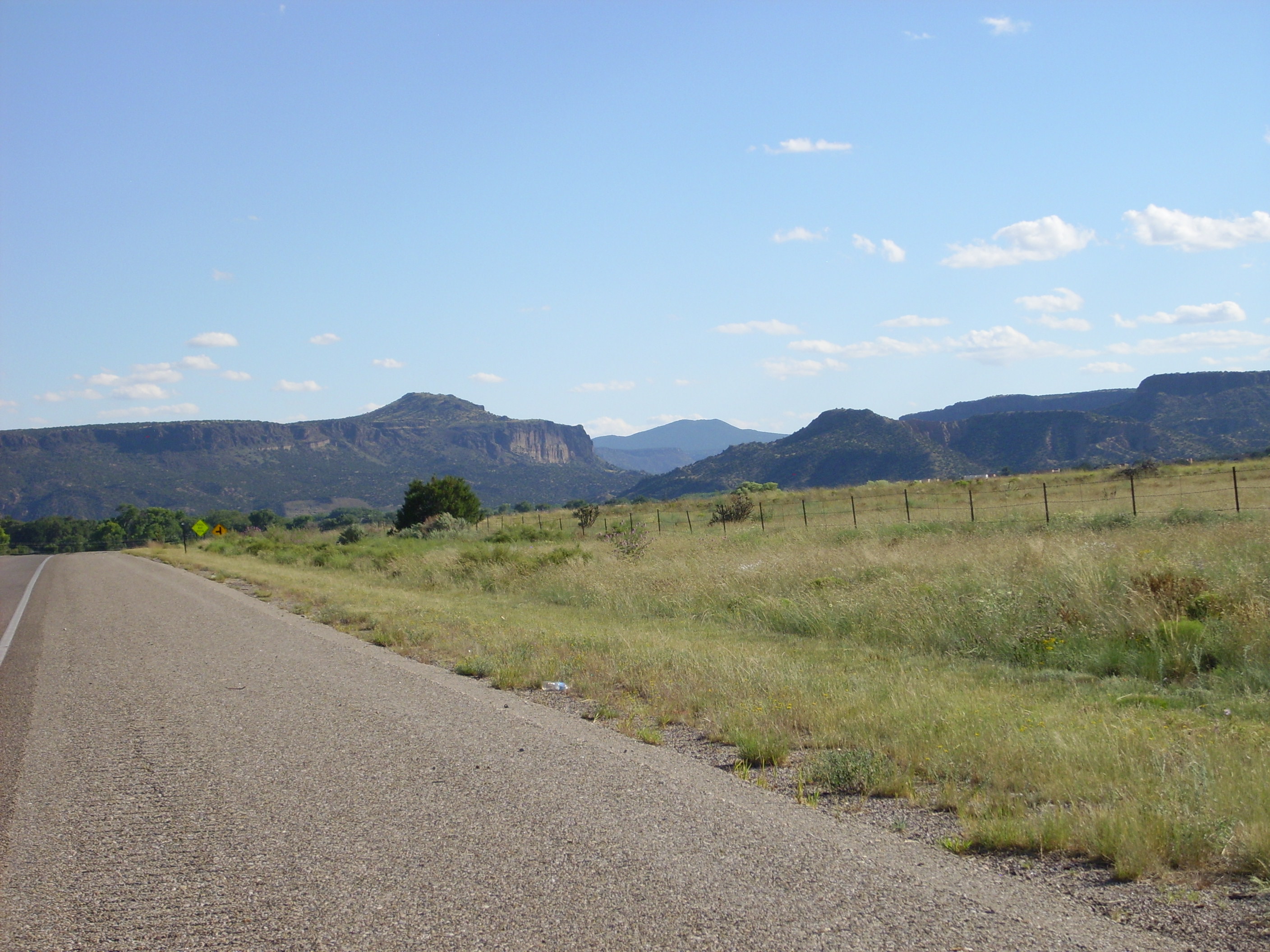
Turning towards Espanola, we skirt the eastern rim of the Pajarito Plateau. There are impressive mesas of Puye Formation atop Santa Fe Group to the west.
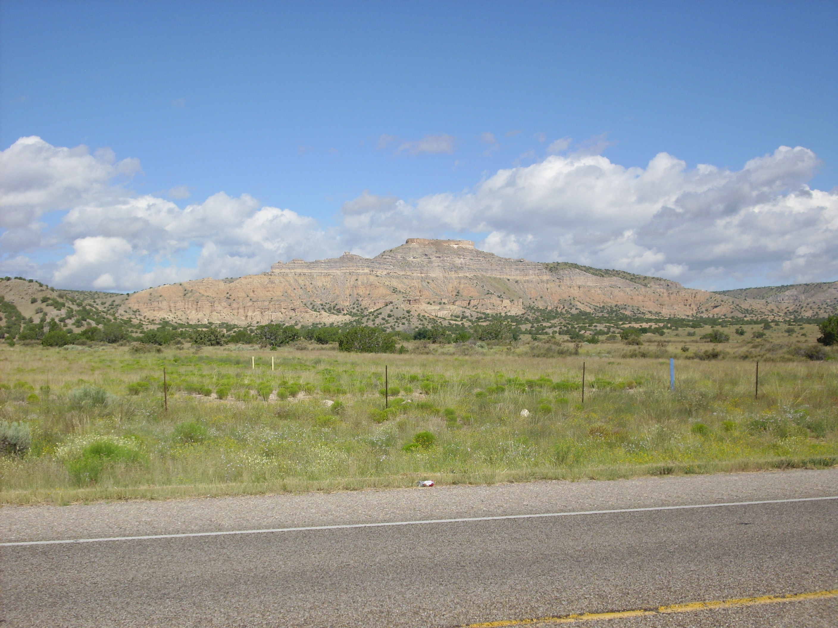
East rim of Pajarito Plateau
You can clearly see the contact between the grayish Puye Formation and the reddish Santa Fe Group beneath. There also appears to be a small cap of Bandelier Tuff on the very top of the mesa. The mesas go on for miles like this.
North of Espanola is Black Mesa, a very large mesa capped with Servilleta Basalt of the Taos Volcanic Field. Here’s a panorama.
Black Mesa north of Espanola
A major system of faults runs along the visible south face of this mesa, which offsets the Rio Grande Rift north of Espanola. The Espanola Basin is thus west of the Taos Basin, and the Tusas Mountains form the west side of the Taos Basin.
Here’s one for my friend Bruce Rabe. My route took me along the north side of Black Mesa, and there’s a sedimentary dike.

Cerrito de la Baca, a sedimentary dike north of Black Mesa
This formed along a northeast trending fault, typical of this area, which allowed silica-rich water to penetrate through loosely consolidated Santa Fe Group sandstone and indurate it.
Further up the road, we see Cerros Colorado.

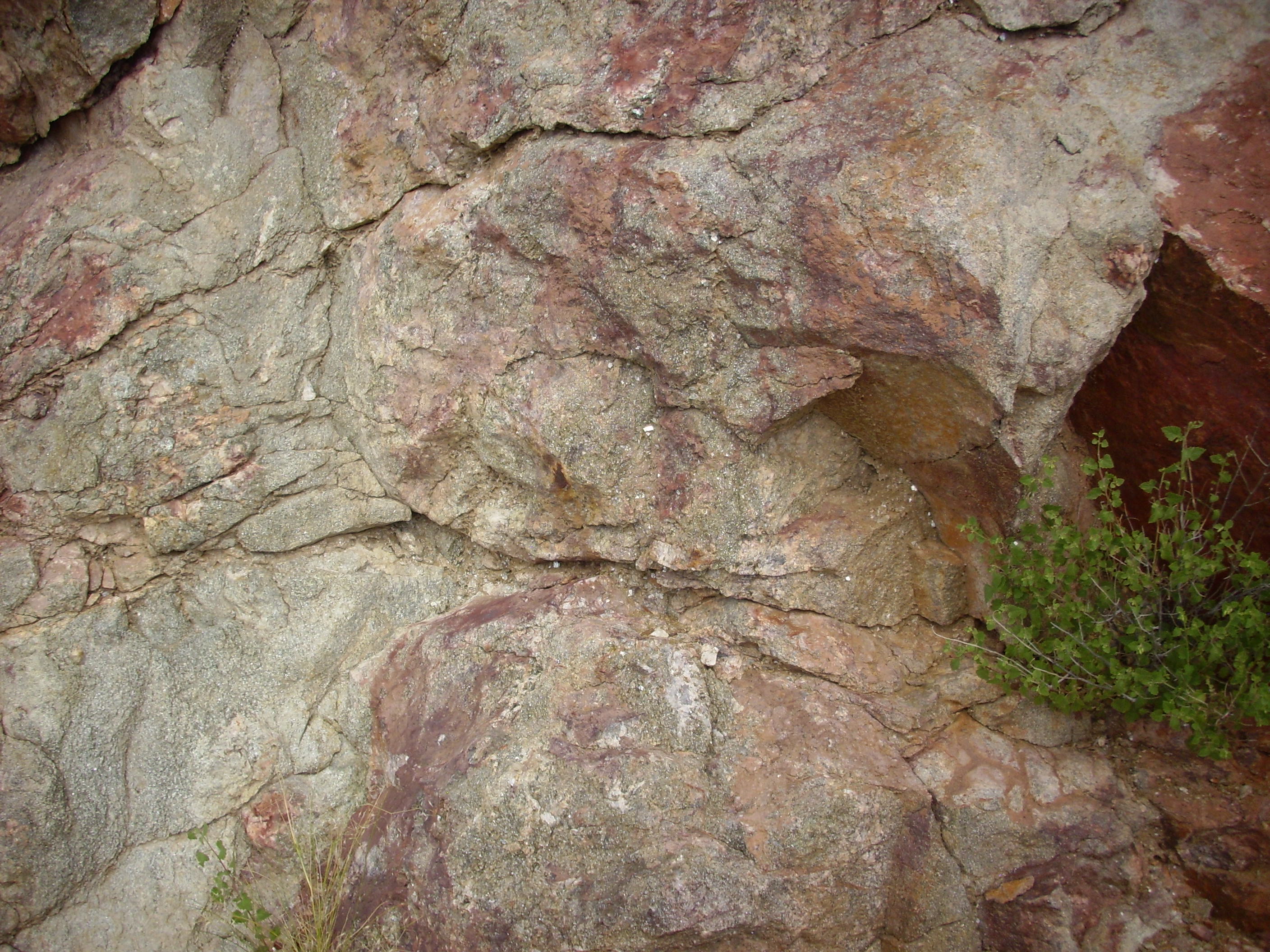
Cerros Colorado, northwest of Ojo Caliente
Cerros Colorado is the southernmost Precambrian mountain of the Tusas Range. It is a metaryhodacite dating back perhaps 1.7 billion years. We’ll see more of this later in the trip.
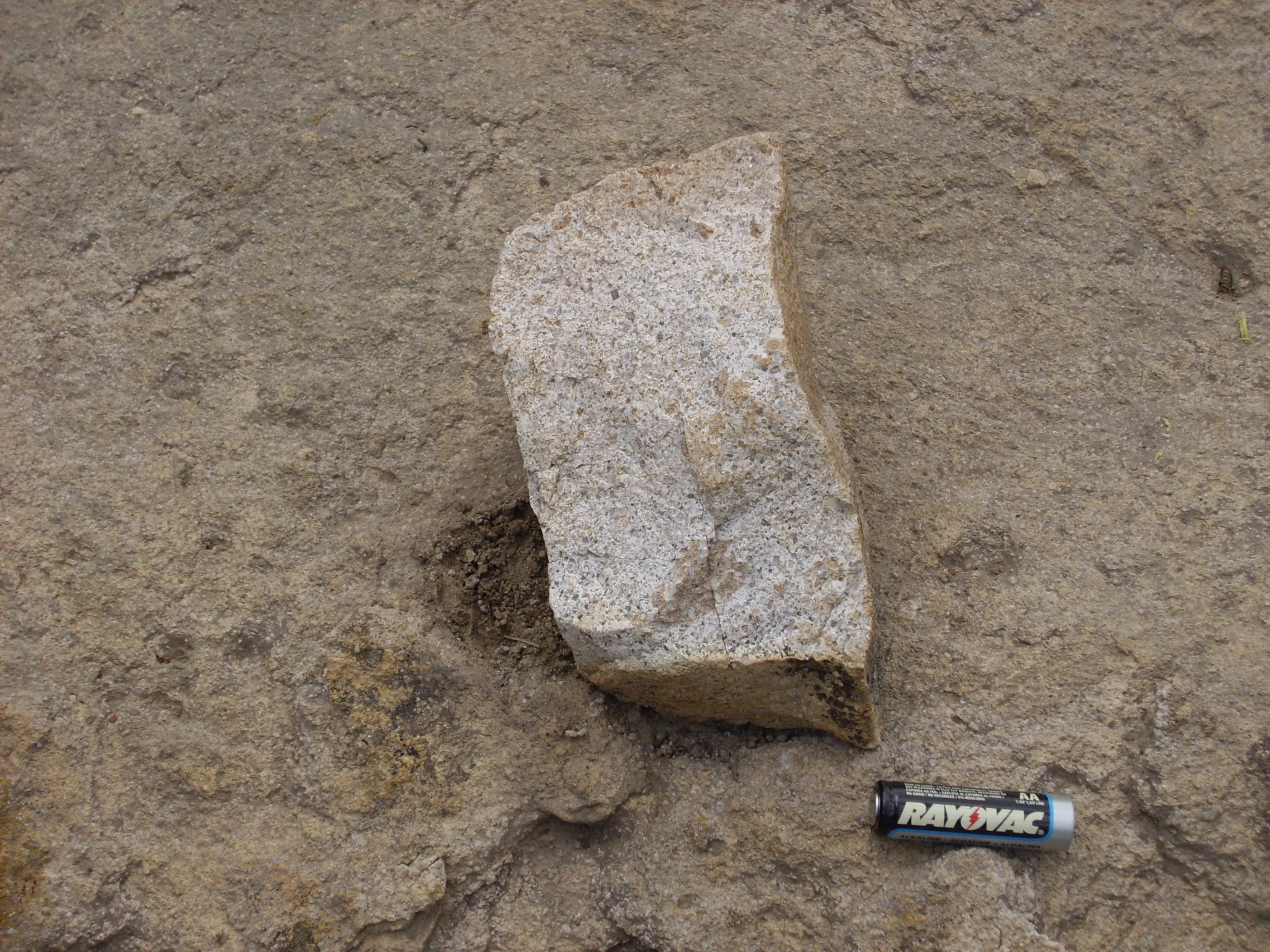
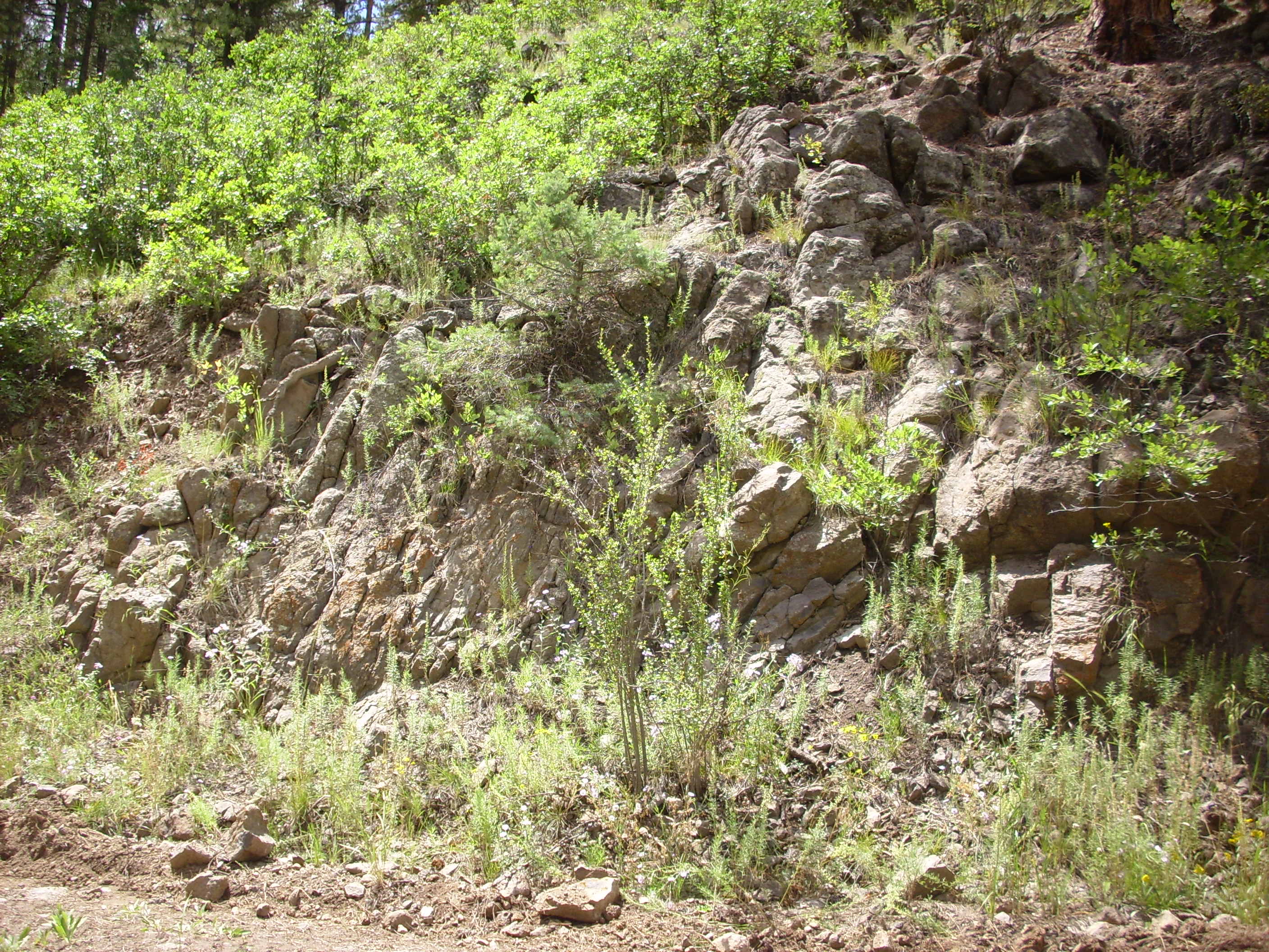
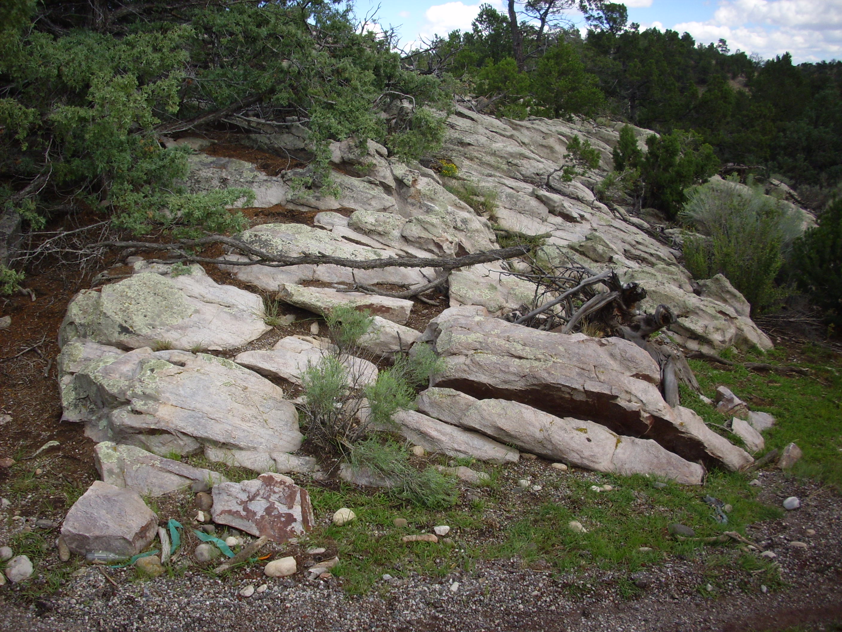
From there it is a pleasant but geologically unremarkable drive until one reaches Tres Piedras. Here there are several large outcroppings of Tres Piedras Granite, which was intruded about 1.6 billion years ago. At one roadcut, just west of Tres Piedras, I spotted a contact between Tres Piedras Granite and what has to be a local exposure of Moppin Metavolcanic Series schist.
Contact between Moppin Series (left) and Tres Piedras Granite (right)
Here are some close ups of rocks from either side of the contact.
 Moppin Series schist |
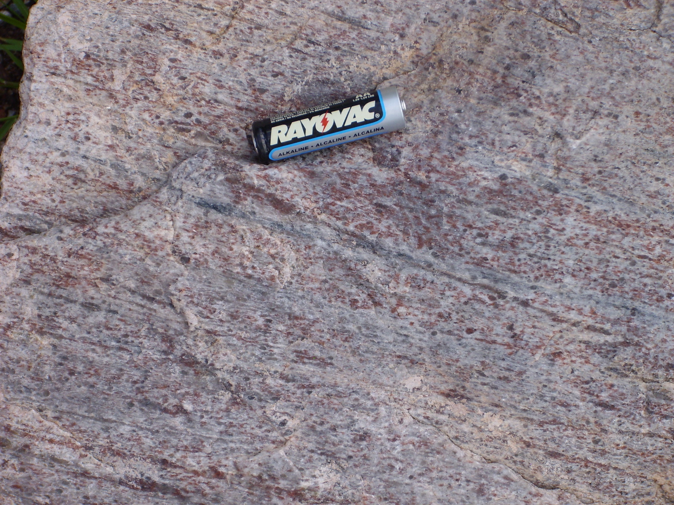
 Tres Piedras granite |
Under the loupe, the schist appears to be mostly black amphibole with a scattering of white feldspar and an occasional dark garnet. The granite is a mixture of quartz and feldspar with the occasional flake of mica.
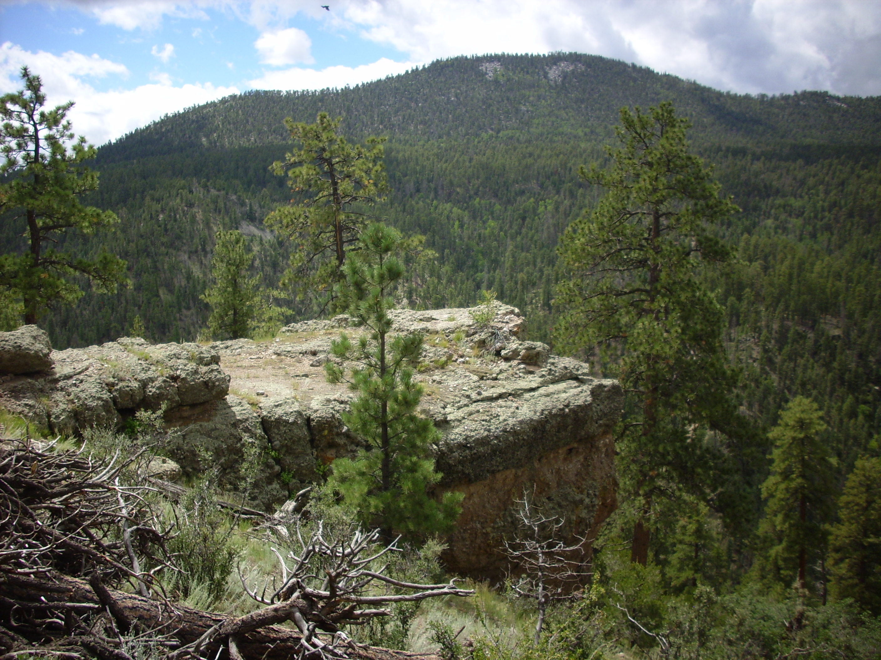
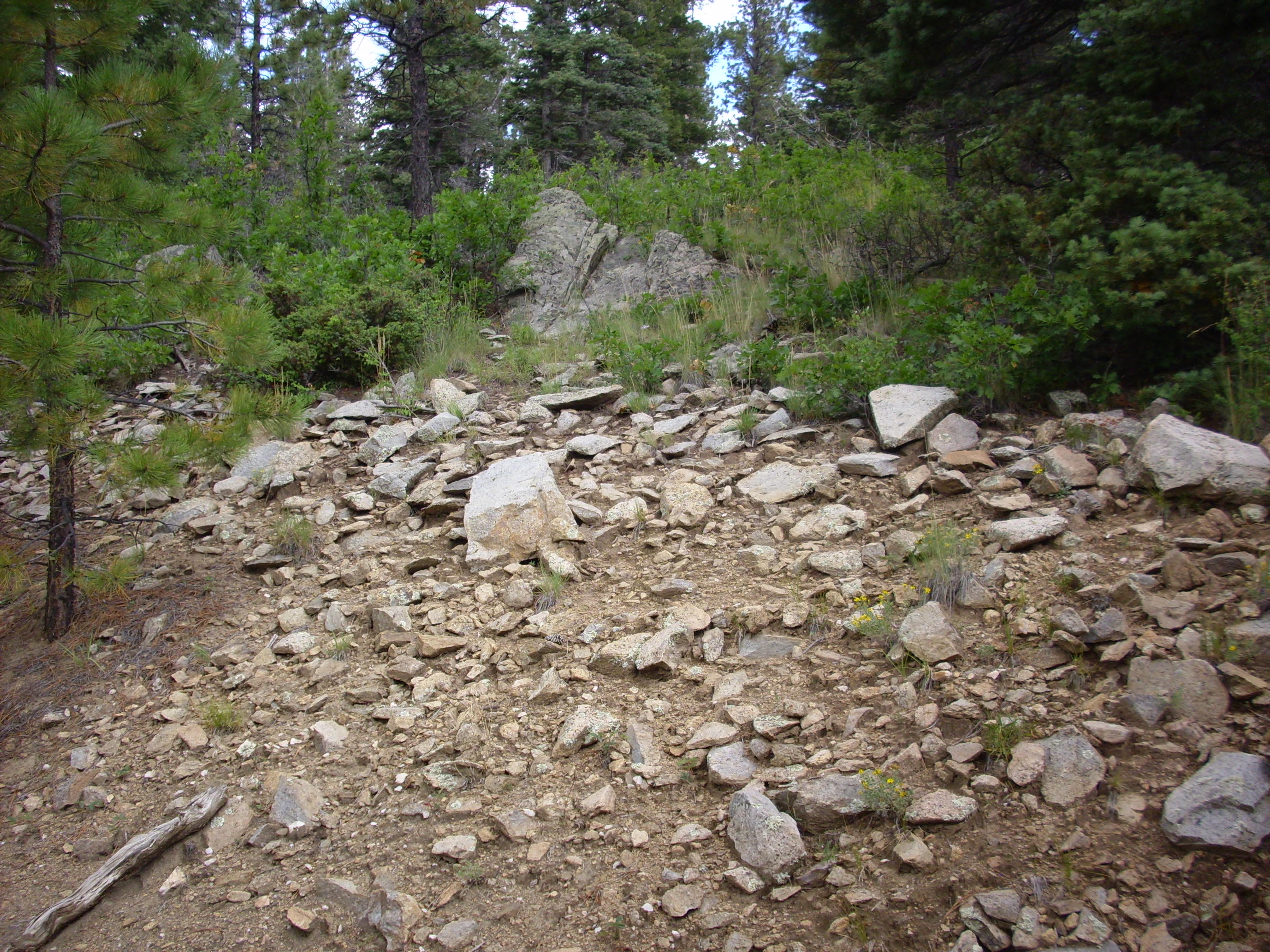
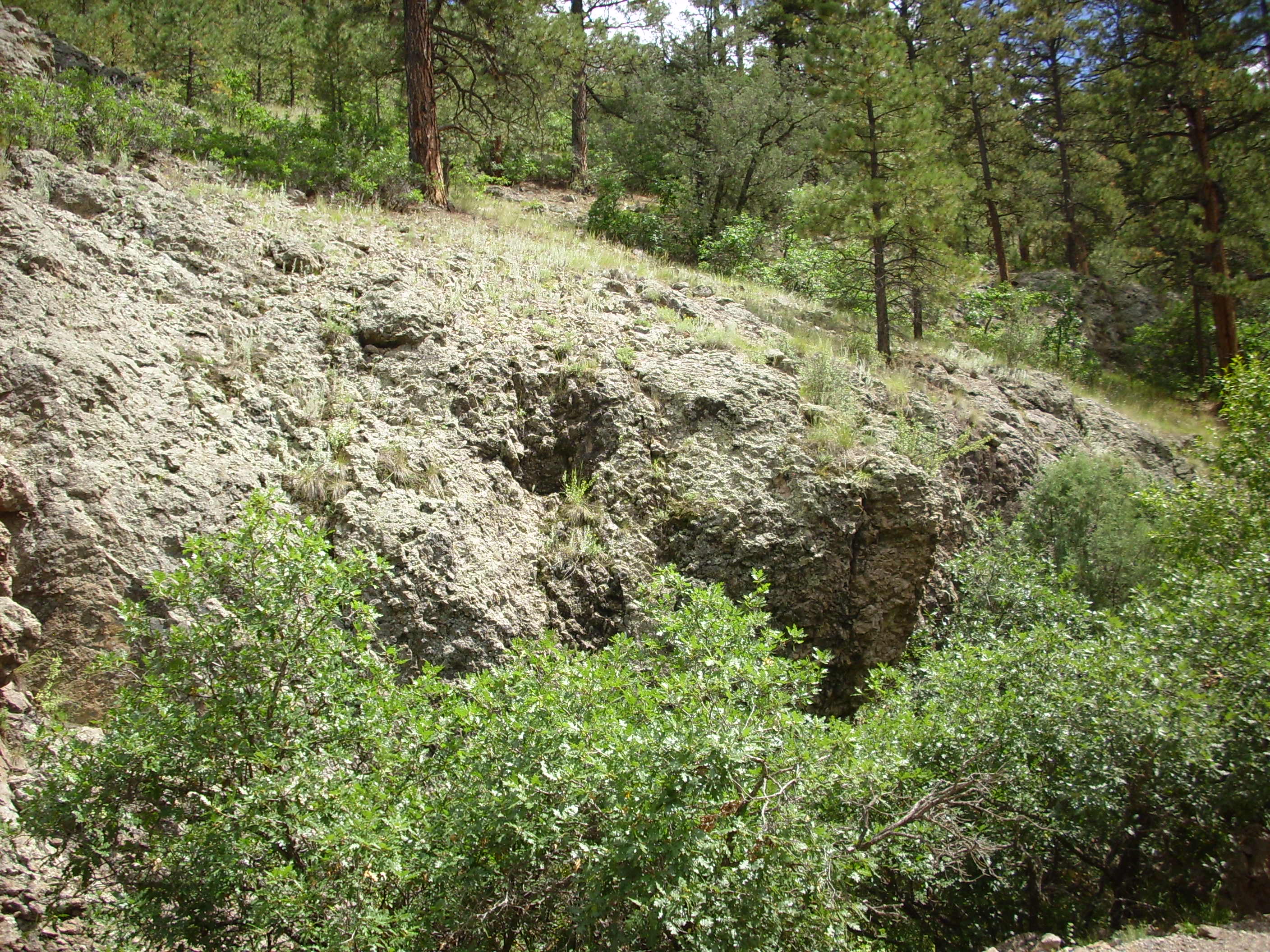
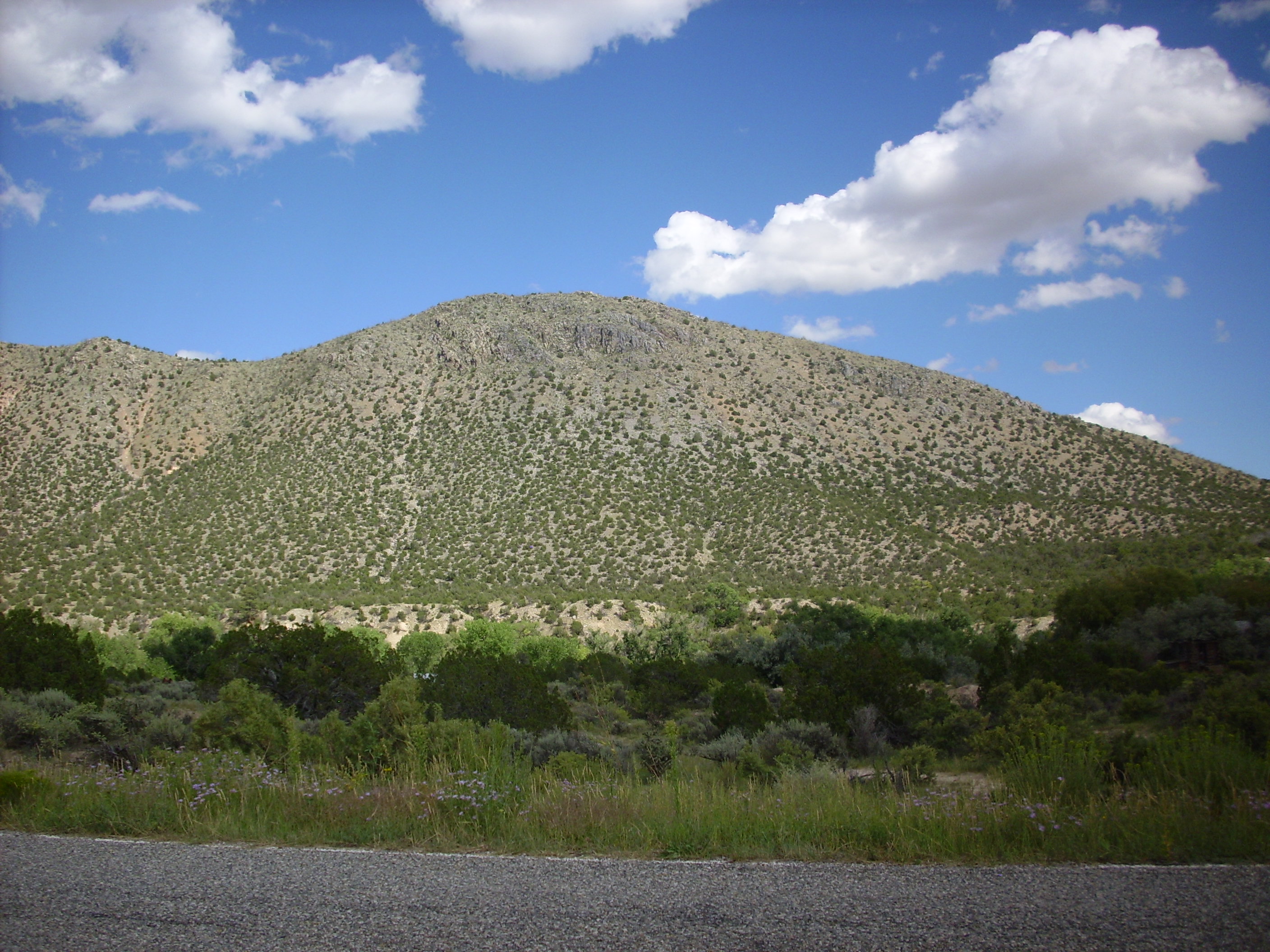
Futher up the road, we come into the Tusas Valley. To the left is Kiowa Mountain, which is underlain by a thick bed of quartzite.

Kiowa Mountain
In general, the Tusas consists of a layer of bimodal volcanics (the Moppin Series) overlain by thick beds of quartzite (the Ortega Quartzite) that are interpreted as having formed in a back arc basin that opened and then closed again. In other words, this area was once the lower edge of Laurentia, the early core of North America, and oceanic crust was subducting under the area and pulling the crust apart. This rift was slammed back together again, presumably, when a large chunk of crust collided with Laurentia and became southern New Mexico. The whole is intruded by granite, most of which is about 1.6 billion years old and was probably formed during the collision, but a small part of which was intruded 200 million years later and apparently not as part of a continental collision. All but the latter show signs of intense metamorphism.
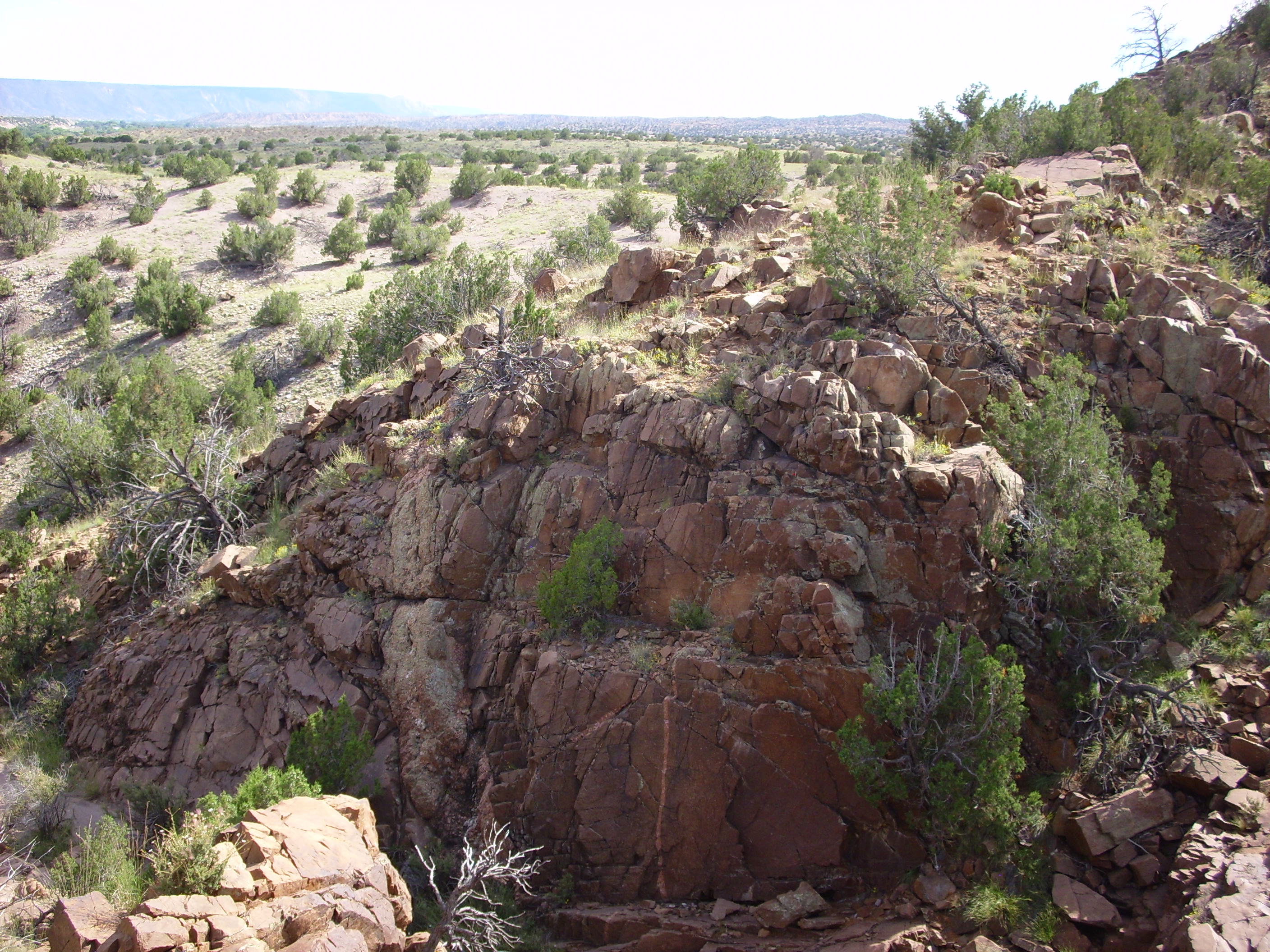
I turned down a forest road that was not too bad (slightly scary in perhaps a couple of spots) and reached the rim of Spring Canyon.

Spring Canyon, looking east and west
I noticed a conglomerate bed on the canyon rim. It turned out to be extremely well consolidated, very old conglomerate, likely of the Ortega Quartzite.

Precambrian conglomerate on the north rim of Spring Canyon
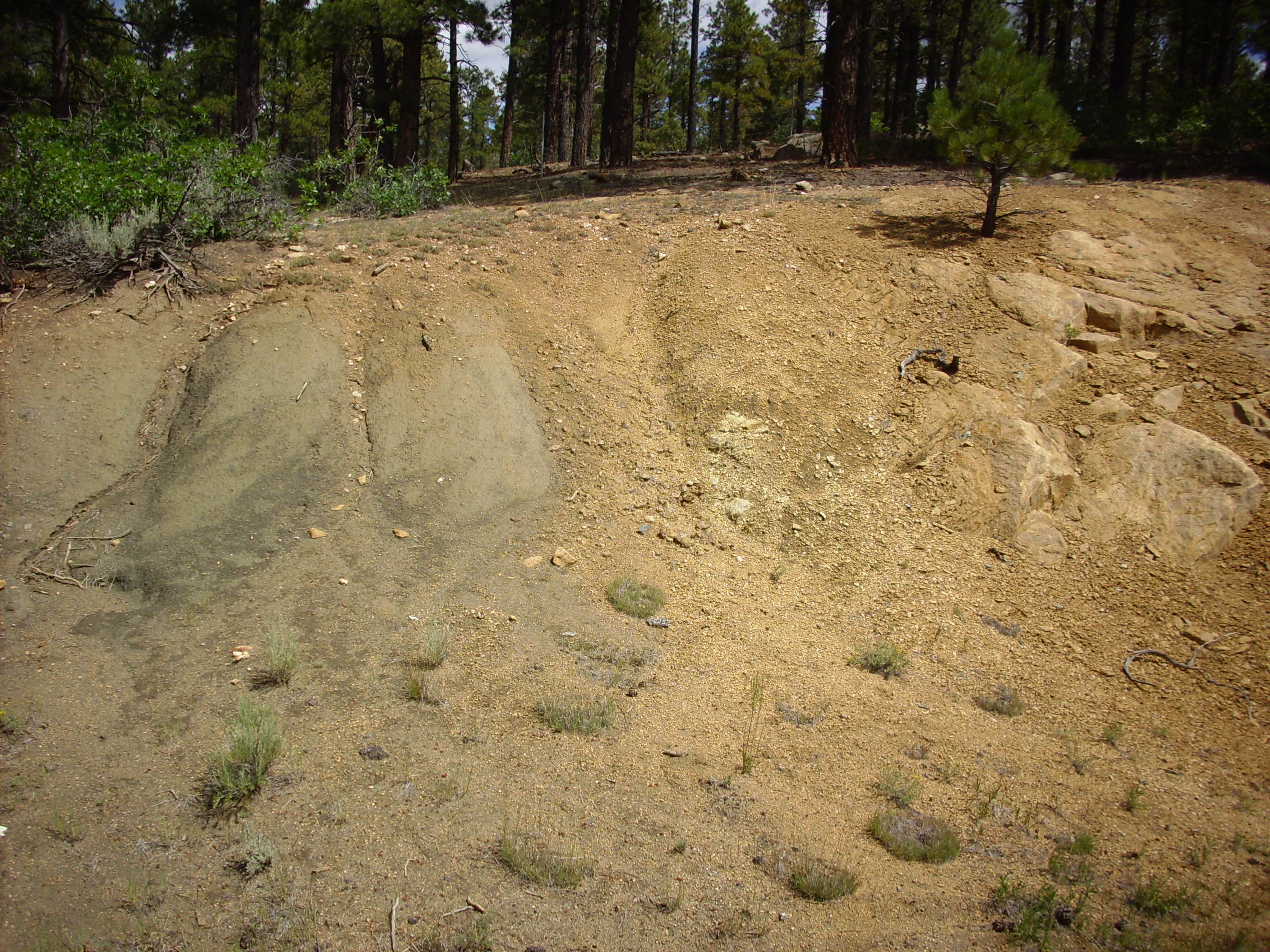
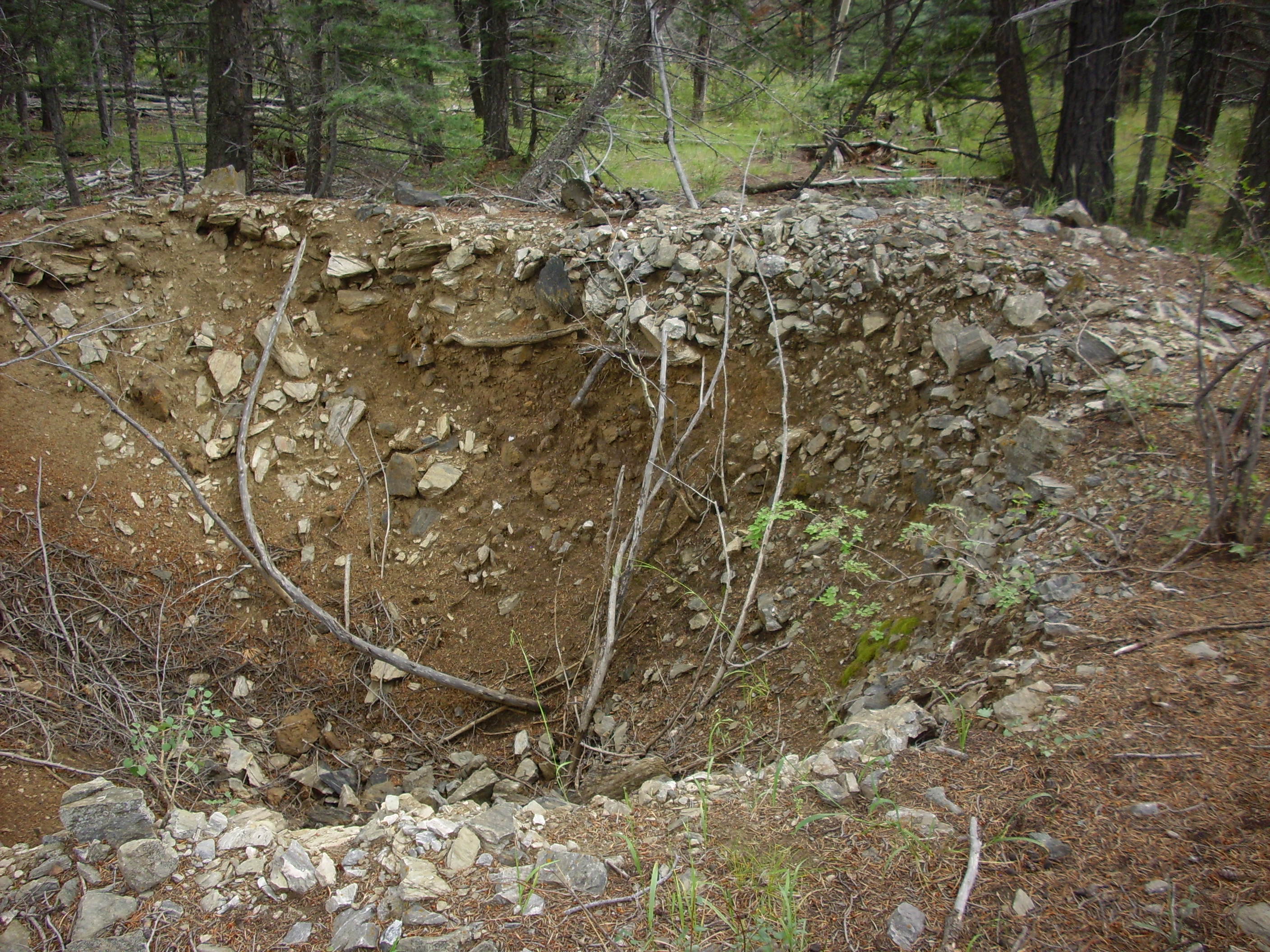
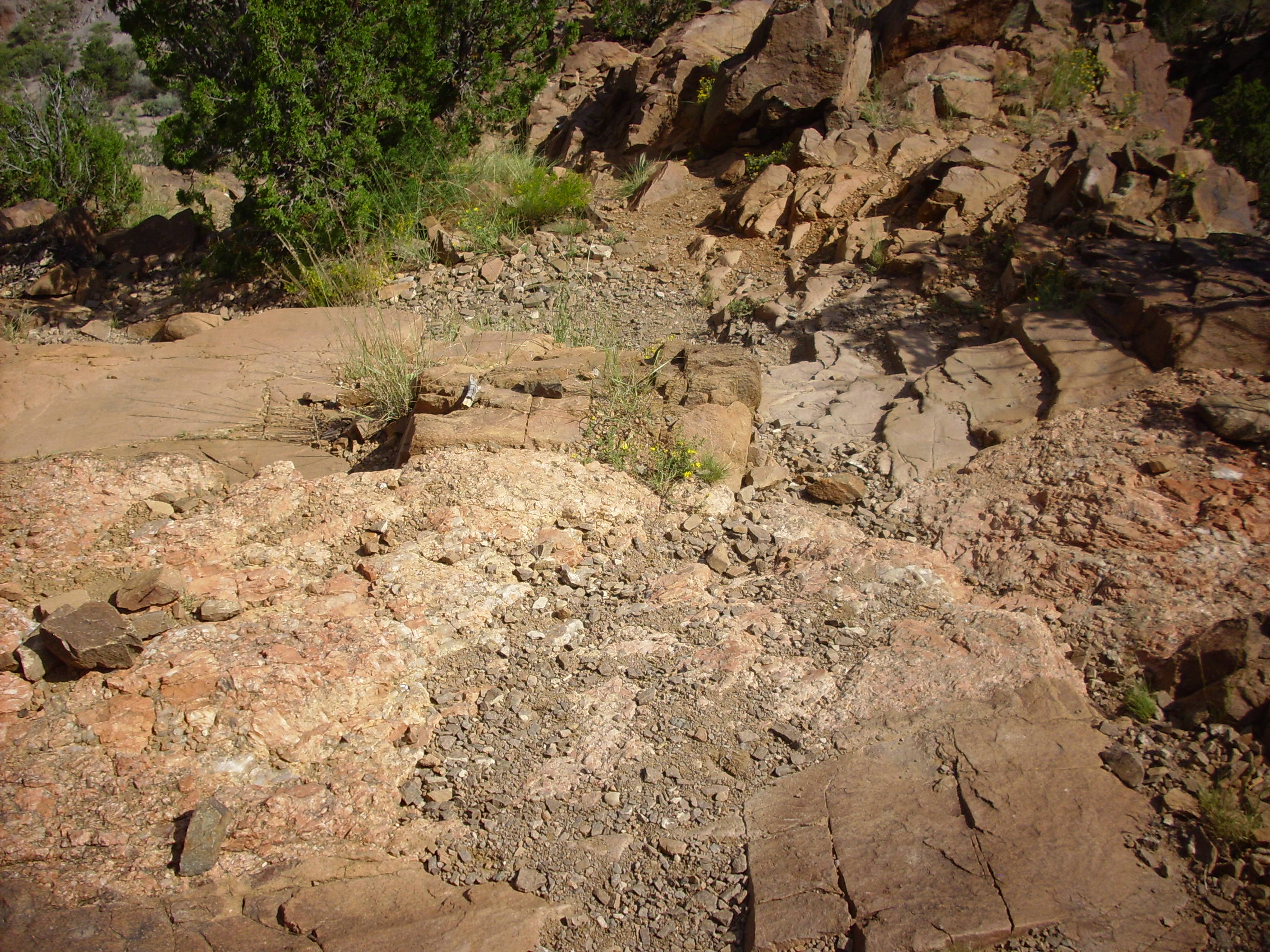
Then off on a side road, which turned out to be just within my car’s limits, to try to find an outcropping of banded iron formation reported in this area. My coordinates were good; I soon found the prospecting pit. (Or perhaps not. Looking back at Google, my coordinates were actually here, and if I had found the right spot, I might have some even better photos than you’re about to see.)
The prospecting pit. Not much to look at in this photo.
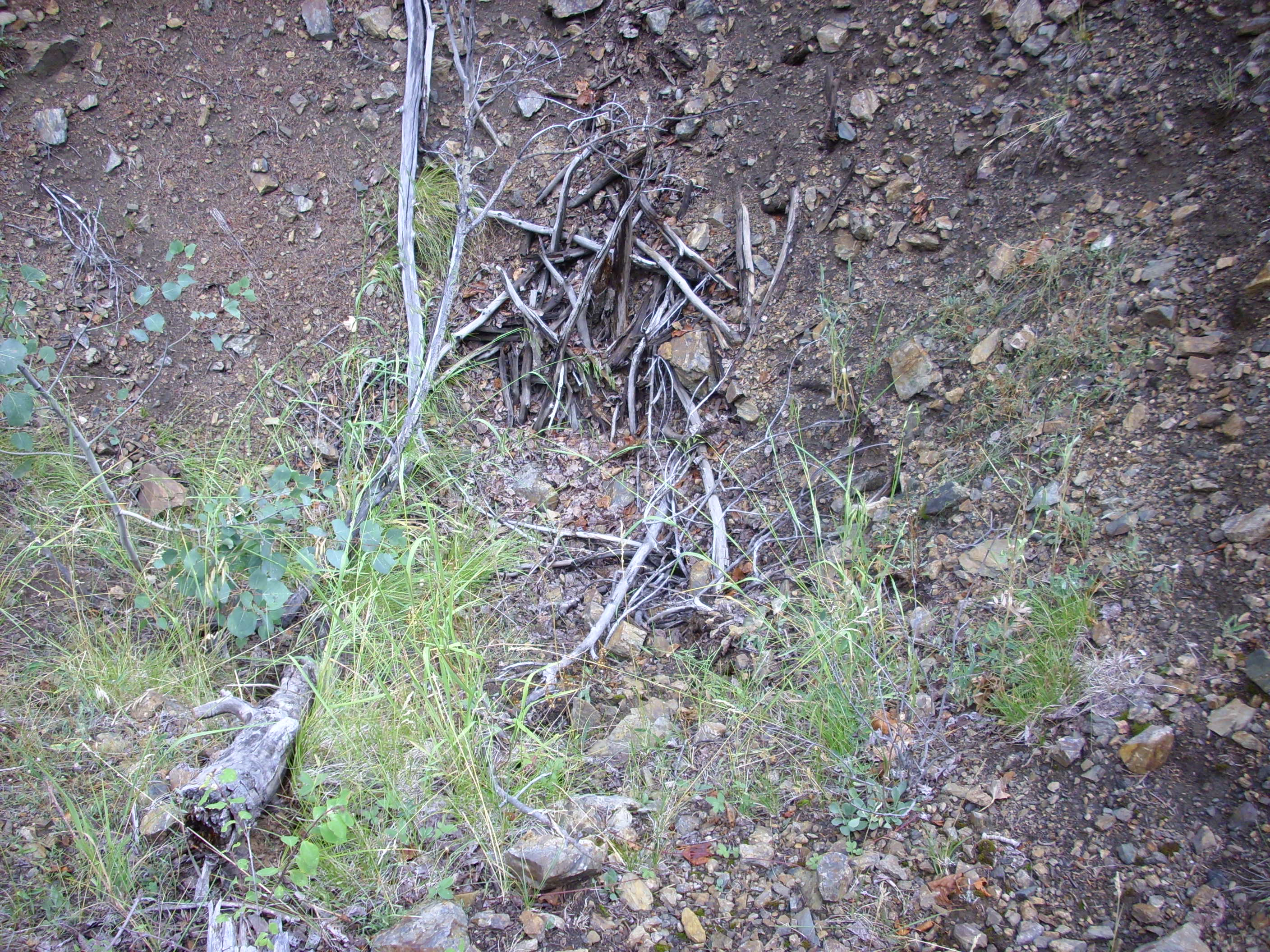
Iron prospecting pit
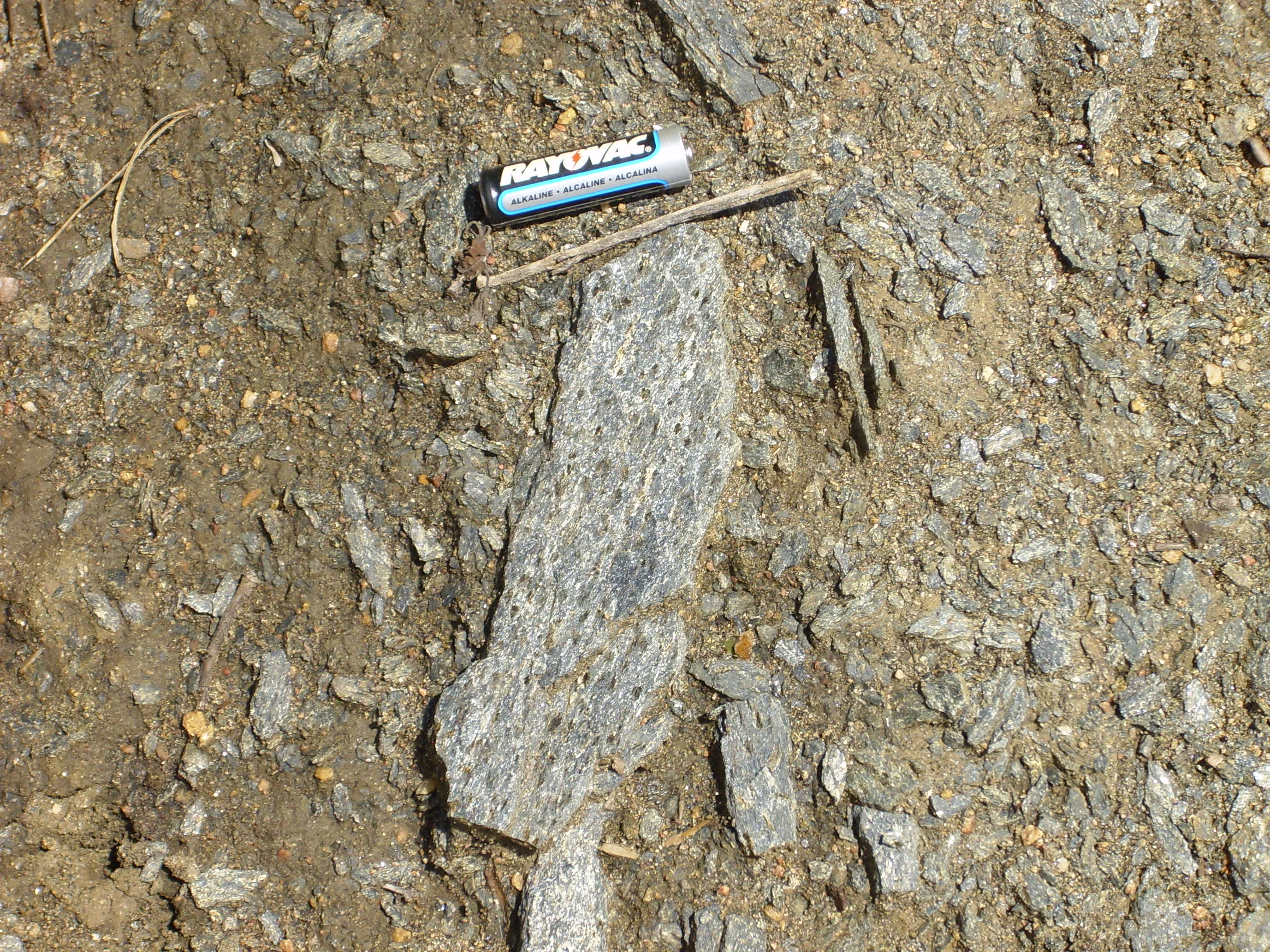
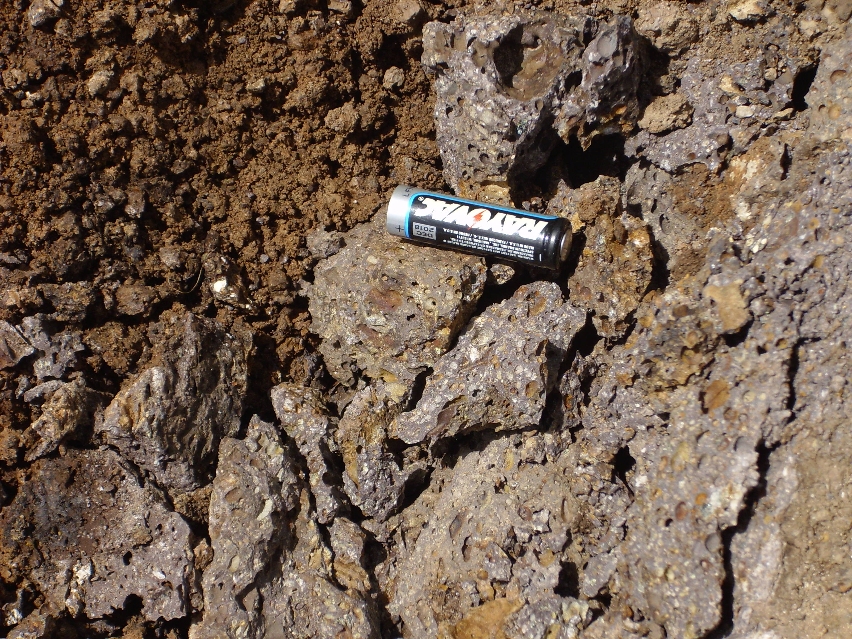
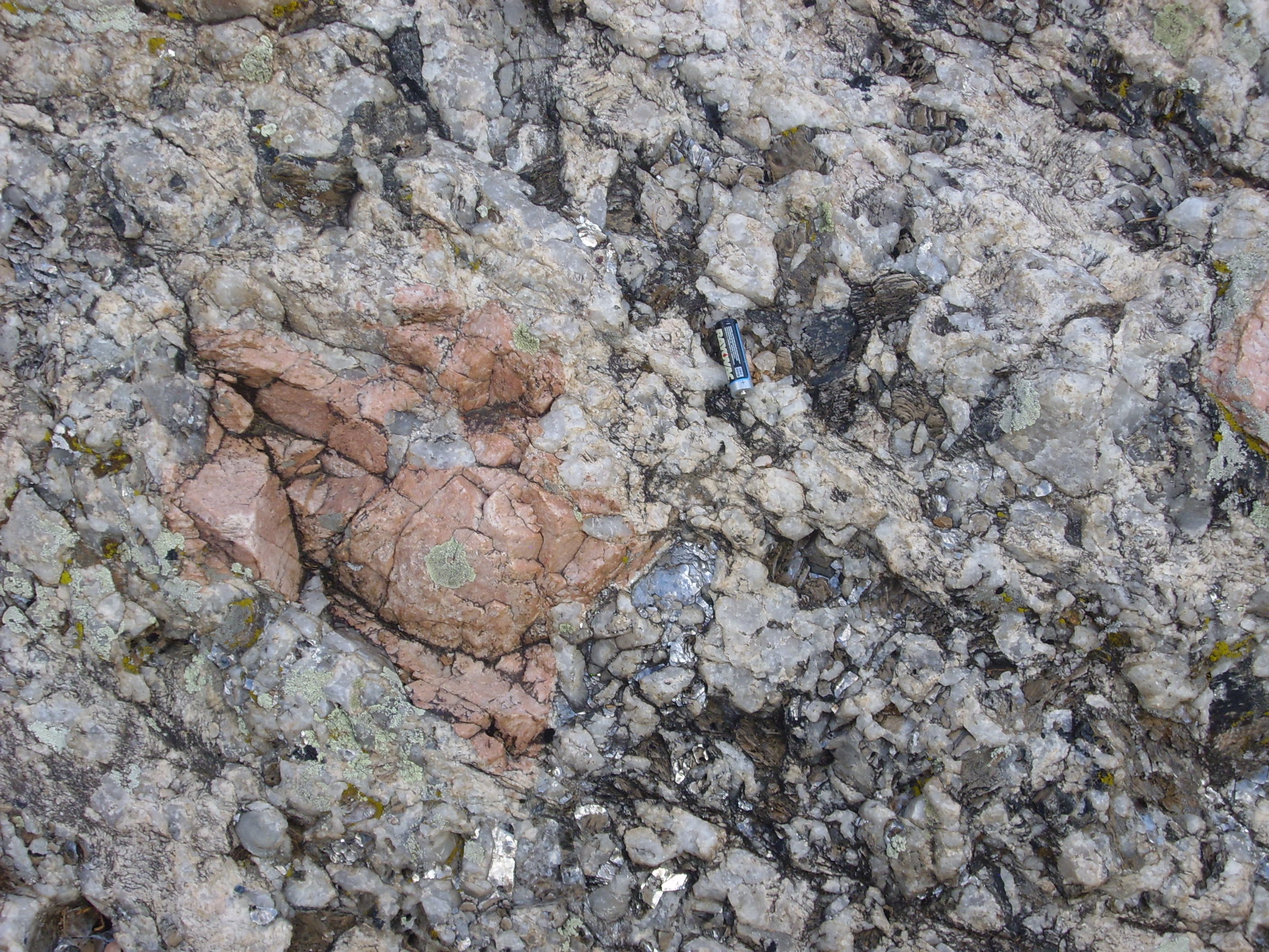
And here is some of the banded iron.
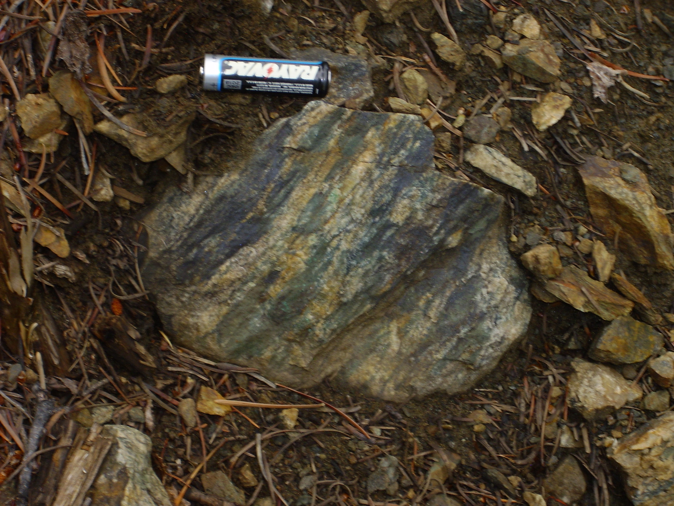
Magnetite schist
Banded iron formation in its pristine form is pretty spectacular rock, with bright red bands of chert interlayed with dark layers of magnetite. This stuff has been heavily metamorphosed into magnetite schist, but you can still see the iron bands. Here’s a close up of a sample I brought home.
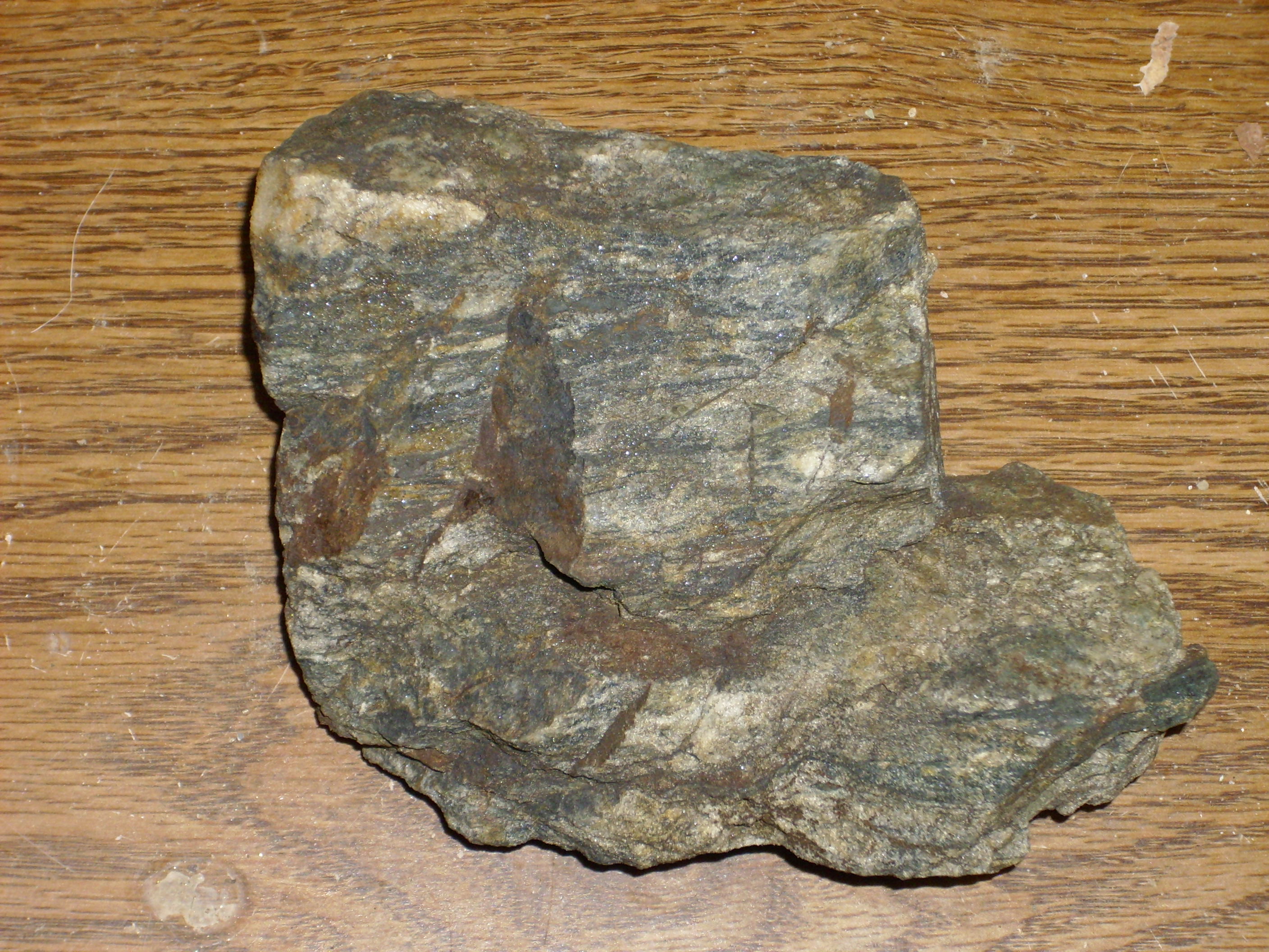
More magnetite schist
But it’s magnetite schist, all right; not only does the rock weather to the rusty red you see here, but the biggest, thickest patches of black definitely attract a magnet. And it most likely was once a banded iron formation, deposited when the Earth’s atmosphere first began to be oxygenated by photosynthetic bacteria, over 1.8 billion years ago. Dang, now I’m wishing I hadn’t been two hundred yards off on my coordinates.
The geology in this area is rather confused, unsurprising considering that it’s heavily folded Precambrian rocks. At one point there is a lot of quartz on the road, probably from a pegmatite dike.
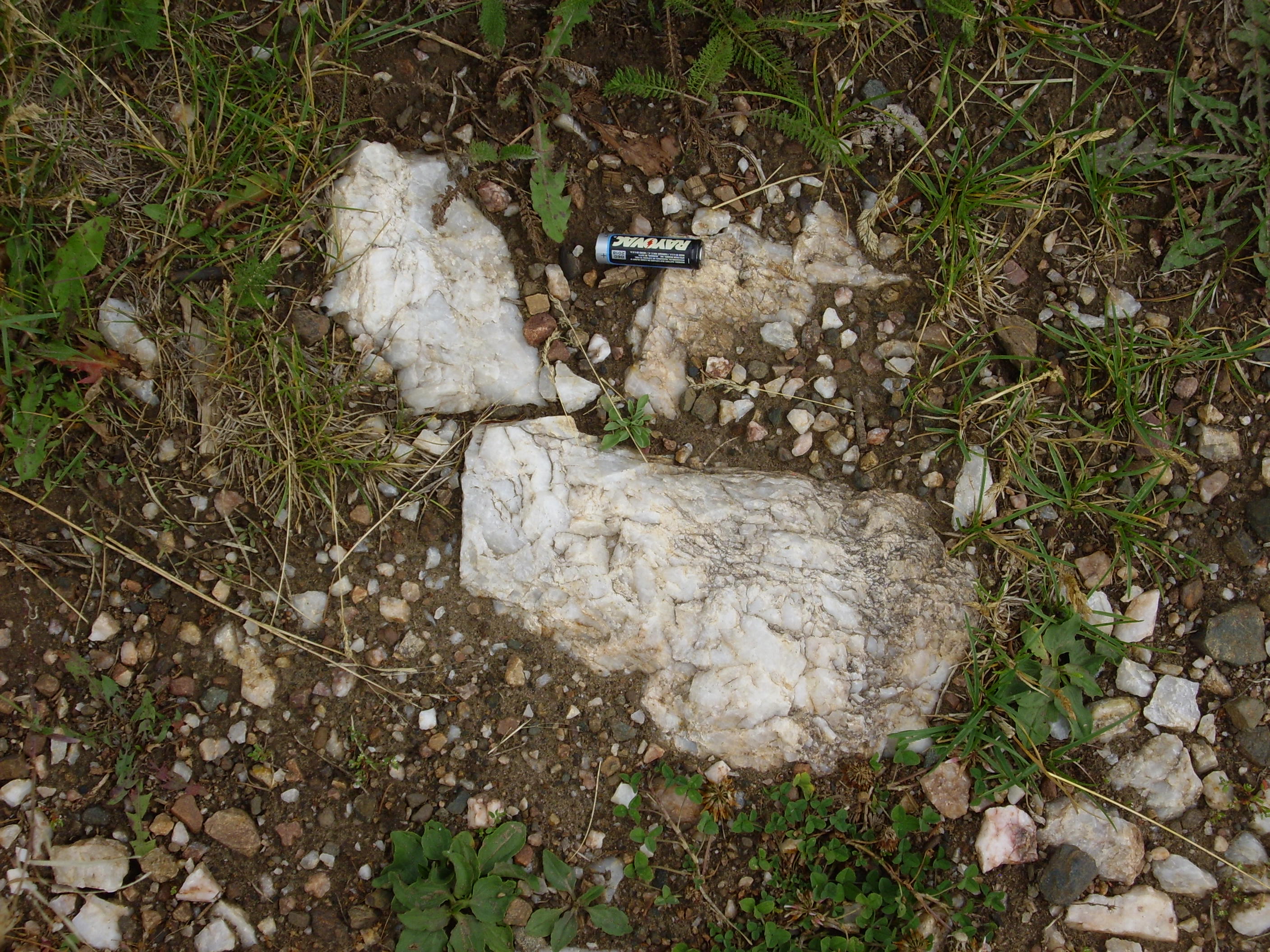
Massive quartz
Nearby is another prospecting pit, perhaps trying to trace the pegmatite and look for valuable minerals.
Another prospecting pit
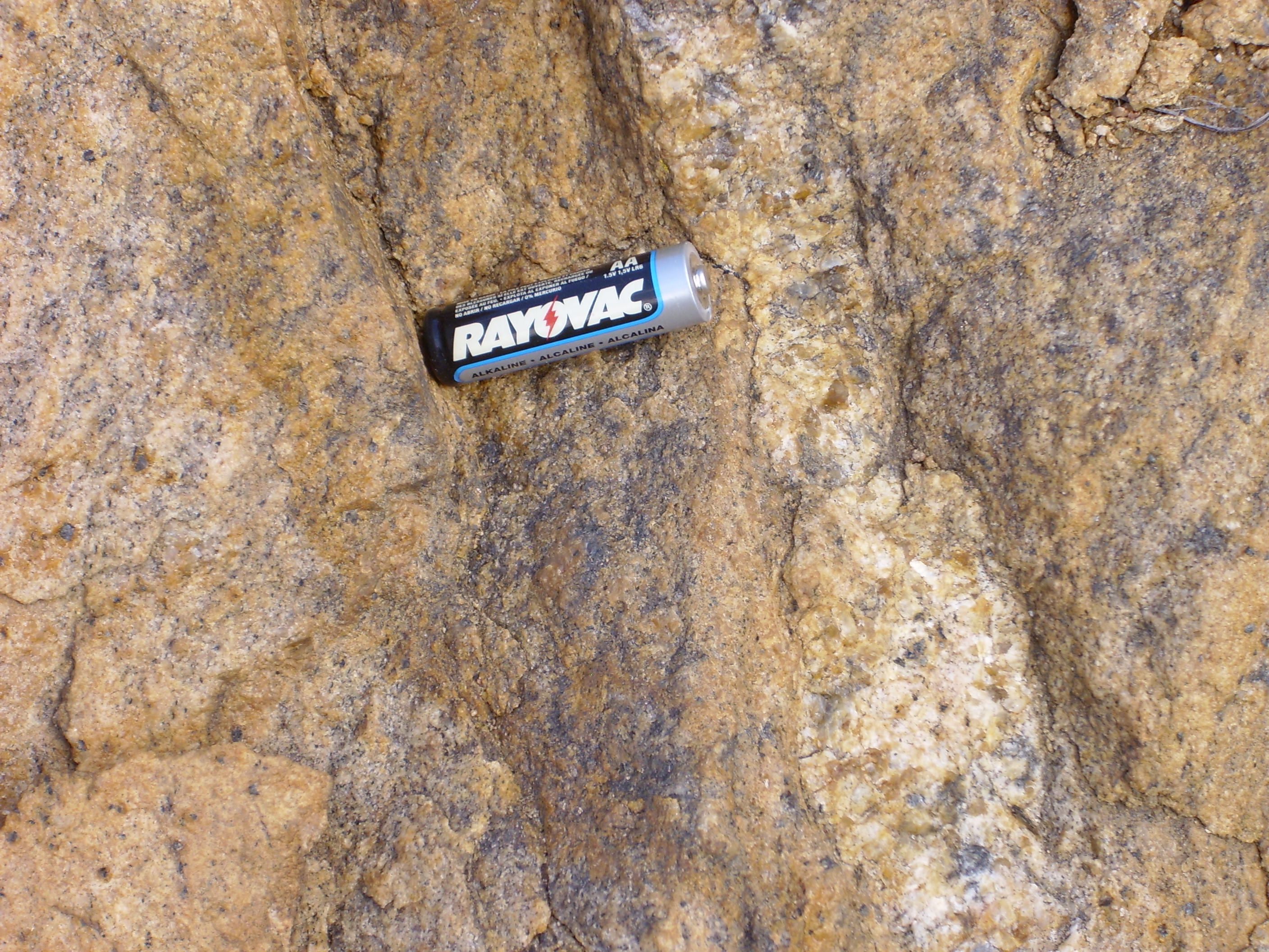
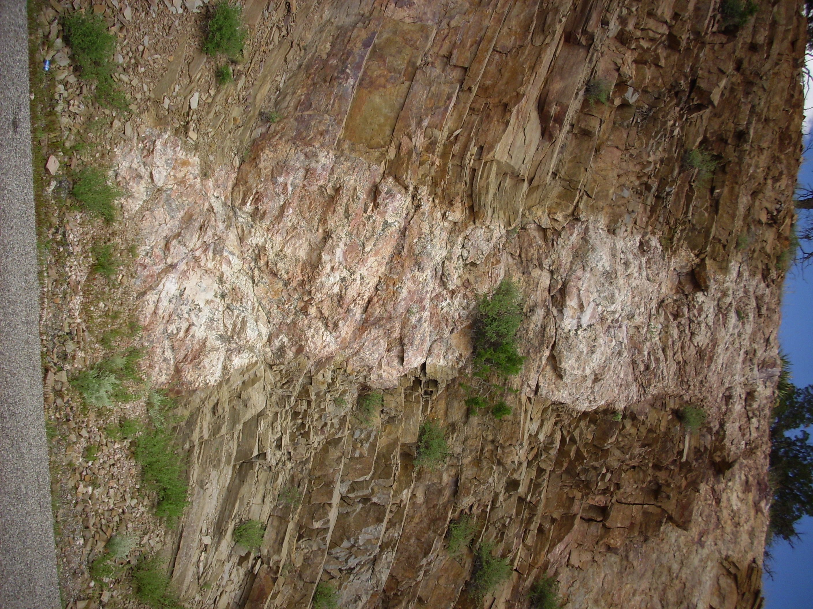
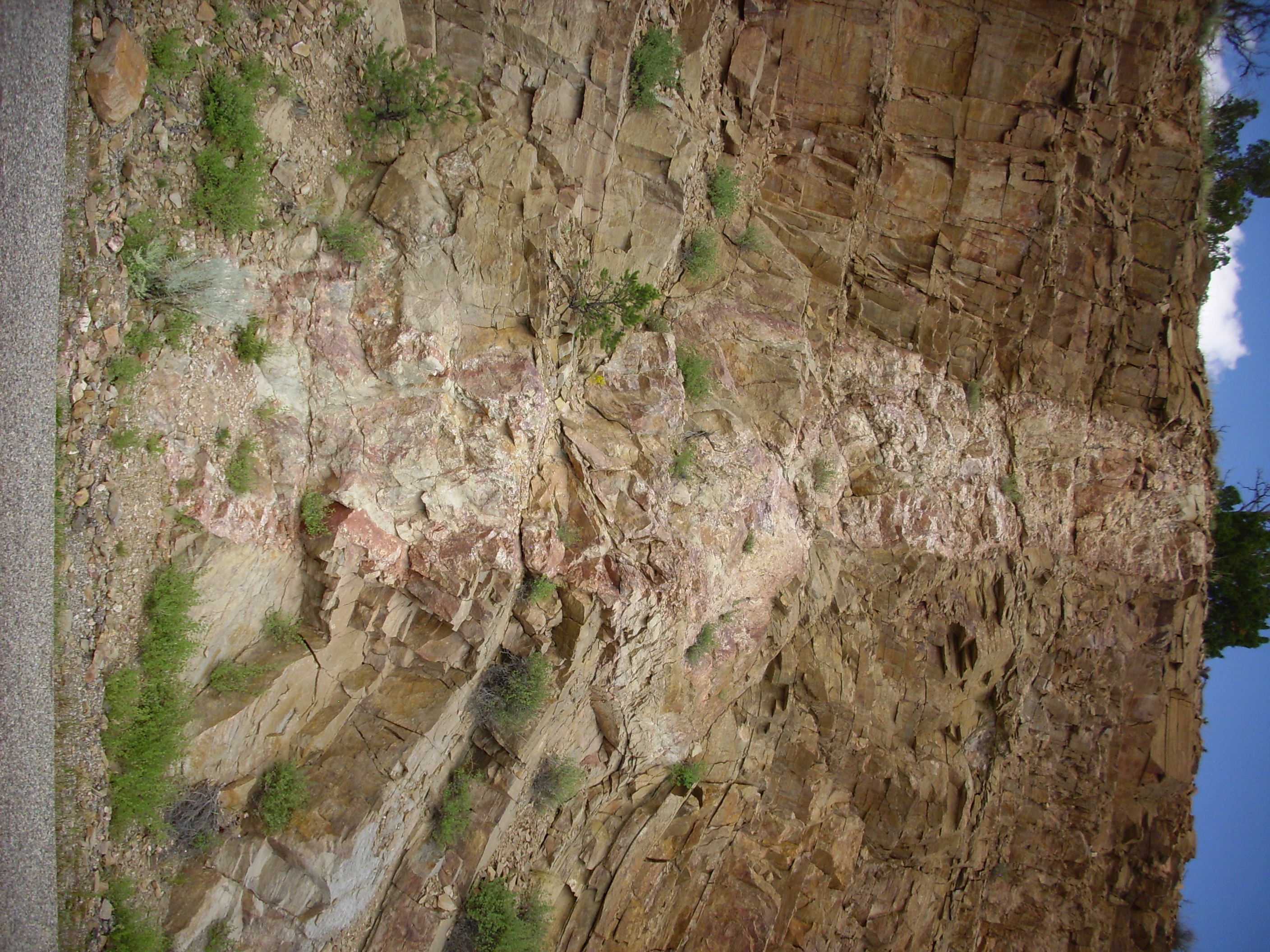
This is an outcropping of what I take to be the Marquinita Granodiorite.
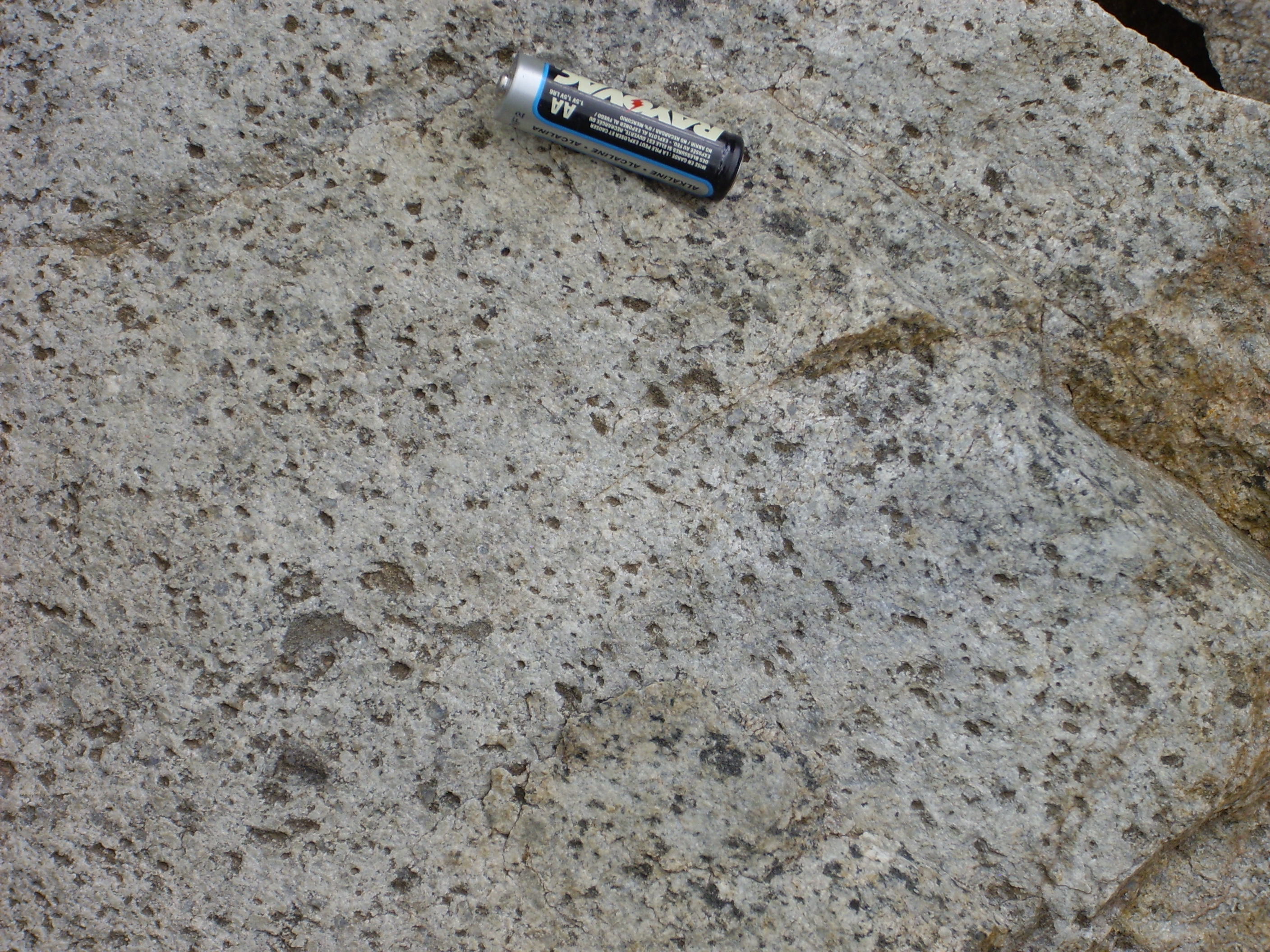
Marquinita Granodiorite
Because it sure looks like what I imagine a granodiorite should look like, particularly in a freshly broken surface under the loupe, and this formation is mapped intruding in this approximate area.
A large vein of nearly pure quartz, obvious in the road cut.
Large quartz vein
And then this:

Granite gneiss
A nice outcropping of granite gneiss, representing the felsic mode of the bimodal Moppin Series. This probably started life as a tuff or rhyolite, erupted from a volcano 1.8 billion years ago and subsequently buried and heavily metamorphosed.
My primary task accomplished, I retraced my steps, mostly. I diverted through the southern Tusas Mountains following a New Mexico Geological Society road log very kindly loaned to me by Bruce Rabe. (Who may be very slightly miffed I didn’t wait until he could come with me …)
Here is an outcropping of Amalia Tuff.
Amalia Tuff
Quite a pretty tuff, full of crystals; I haven’t seen anything quite like it outside of Yellowstone. It originated in the Questa caldera. Note that those points are about 25 miles apart. Yes, Questa was a supervolcano, active about 30 million years ago.

Fortunately this was a side road, and not my route.
Underneath the Amalia Tuff are Hinsdale Formation basalts.
Hinsdale Basalt
A vesicular (bubbly) basalt with some large crystals of feldspar and a few dark crystals of hornblende. It is interbedded with the Tertiary sediments in this area that eroded off the San Juan Mountains to the northwest and the Sangre de Cristo Mountains to the east.
Further down, a local volcanic center producing andesite.
Andesitic breccia
Andesite
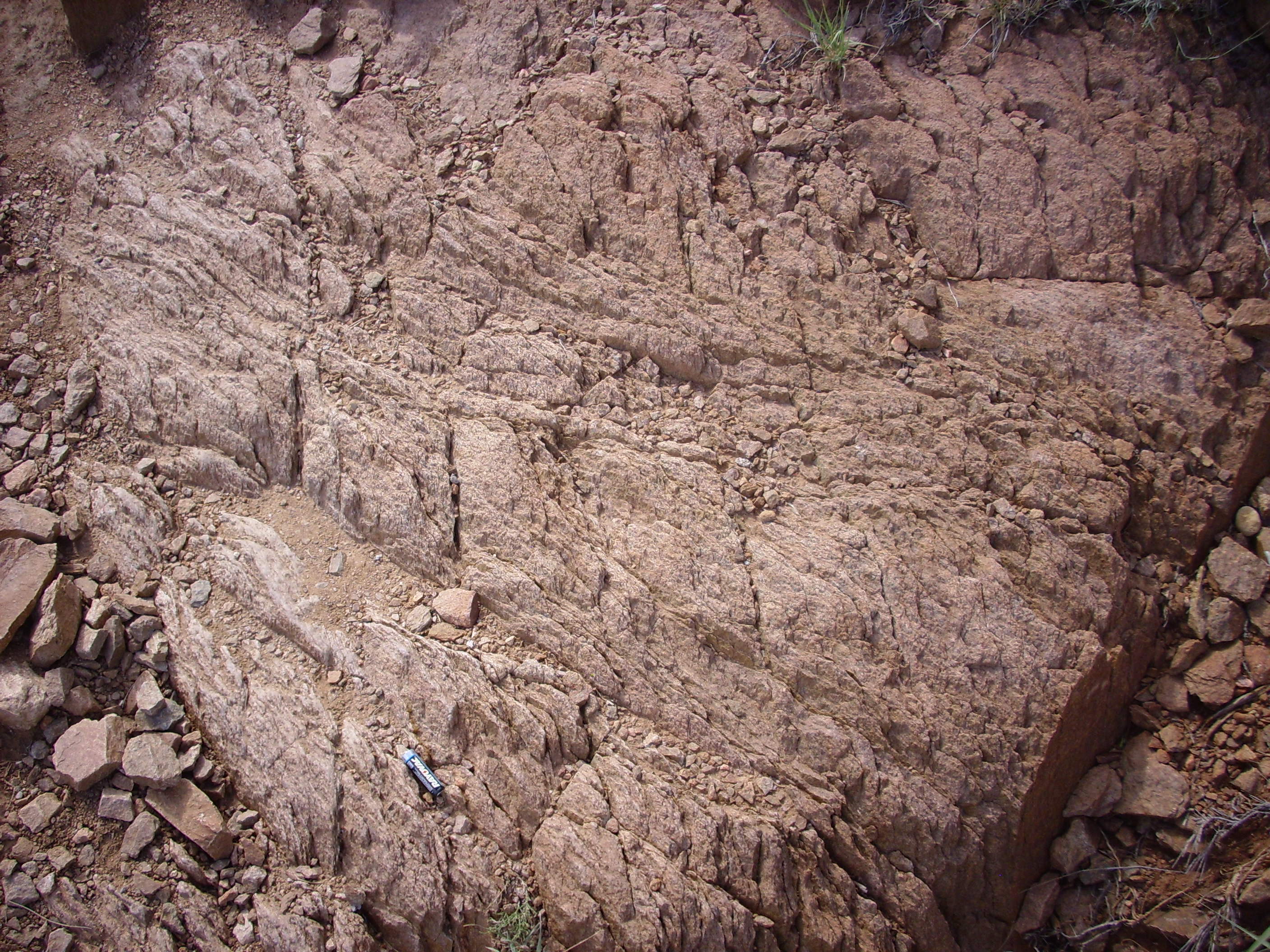
At this point it was late, I was getting a bit tired, and I was still a ways from home, but I had to stop for some Precambrian muscovitic quartzite.
Muscovite quartzite
Under the loupe, this stuff does indeed look like almost pure quartz, with just a few flakes of light mica. Presumably this outcropping correlates with the Ortega Quartzite found further north in the Tusas and to the east in the Picuris Mountains.
At one point along the road, the road cut reveals what looks like a metarhyolite into which a couple of very impressive pegmatite dikes have intruded.

Pegmatite dikes
Pegmatites are thought to be formed from the very last part of a magma body to crystallize. This magma is rich in silica and light elements as well as volatile such as water. This allows the magma to crystallize very slowly to produce very large crystals, often of unusual minerals. There are many mines in this area that mine these minerals from pegmatite dikes.
These two dikes are mostly quartz and feldspar, typical for most pegmatites, with impressive large crystals of muscovite mica, also common in pegmatites. You can see some of these in the last photograph. I didn’t see any other accessory minerals I recognized, though there were a couple of patches of green that might have been either apatite or beryl. Neither was high-grade enough to bring home, though I did get some samples of the impressive muscovite.
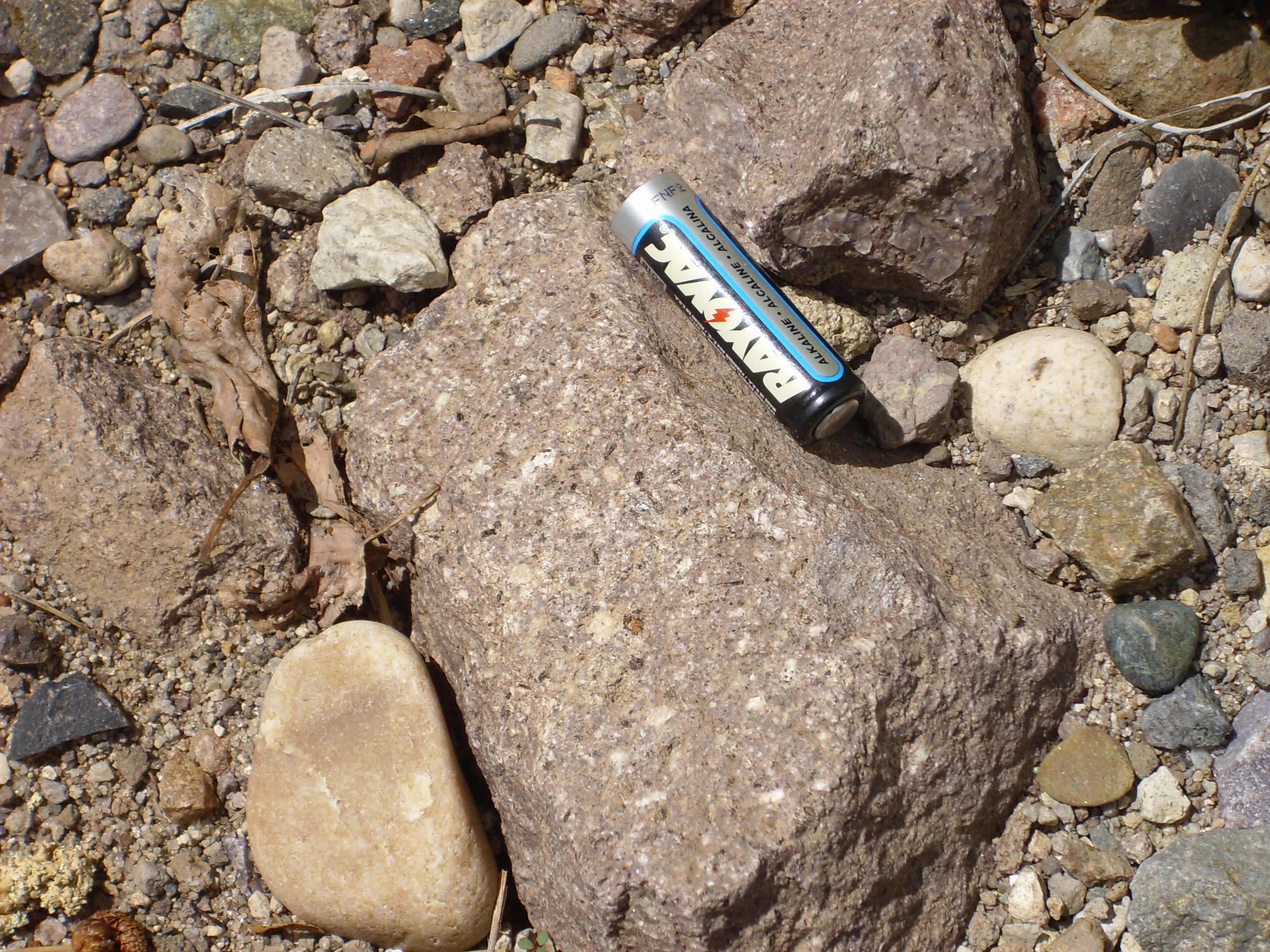
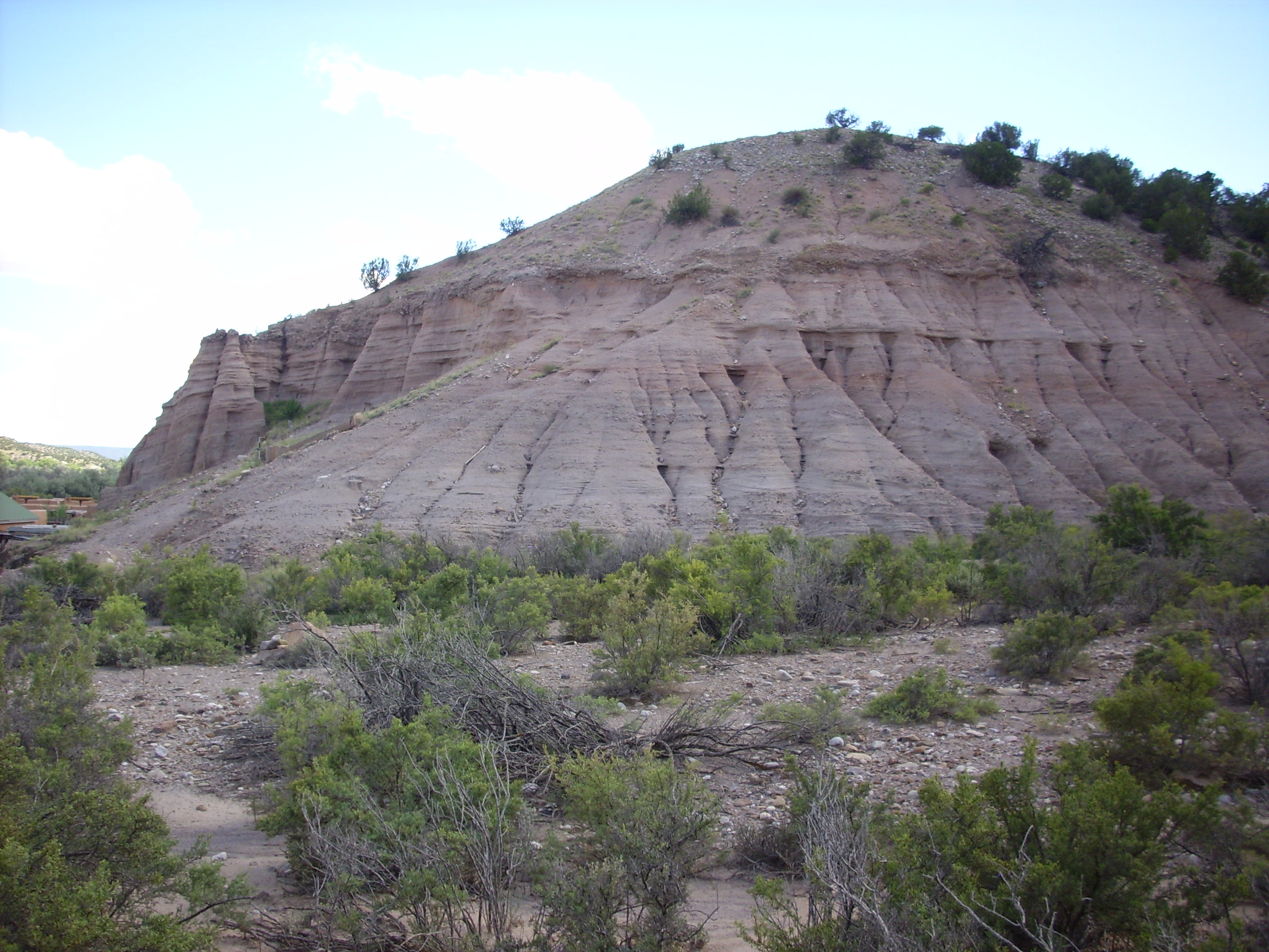
La Madera Mountain is a block of quartzite.
La Madera Mountain
I had one more stop to make on the way home, at Ojo Caliente. The southernmost exposures of Precambrian rocks in the Tusas Mountains are here. There is also is a hot springs resort frequented by the hoi polloi from Santa Fe. The geology is Precambrian rhyolite mantled with Tertiary sediments and intruded by the occasional pegmatite dike.
Immediately west of the bath houses are some sedimentary beds of the Los Pinos Formation. This is the primary sedimentary formation of the Tusas, consisting of interfingered sediments from the San Juan volcanic field to the northwest and the Sangre de Cristo Mountains to the east. The age is estimated at between 25 million and 35 million years.
Los Pinos Formation, Ojo de Caliente
There is a trail head and some decent hiking in the area, so I geared up and headed out. The trail climbs a ridge of Precambrian metarhyolite.

Precambrian metarhyolite ridge west of Ojo Caliente
In places, the rocks here look an awful lot like the “granite” exposed at Soda Dam in the southwest Jemez. The ages are roughly the same as well. However, the distance makes the correlation uncertain. Here’s a close up of an exposure on the trail.
Metarhyolite
At the crest of the ridge, there was a prominent pegmatite dike.
Pegmatite dike
I got wondering if this was the core of the ridge and accounted for its resistance to erosion. Sure enough, it was visible across the gully.
Continuation of dike across the gully, at lower left.
Well, it was clearly not running down the axis of the ridge. Looking at my geological maps later on, I saw that a fault is identified on the east face of this ridge, which probably provides the warm groundwater for the baths. So this ridge is a product of faulting.
Hiking around the west side of the ridge, I came across a quite large lens of pegmatite.
Pegmatite lens
This looks a lot like the pegmatite in the road cut back to the north. It’s almost certainly part of the same intrusion event, which I’m wildly guessing took place 1.4 billion years ago, the same time as the Tusas Peak intrusion event. The pegmatite is unmetamorphosed and may be much younger than that.
The trail kind of petered out after a while; it looked like I could either descent into an arroyo or head up the hill. Up the hill it was. I found a couple of piles of white quartz that seemed to be trail markers, but they didn’t actually go anywhere. What the heck; I headed towards the top of the hill. On the way, I spotted a large mafic xenolith in the metarhyolite.
Xenolith
“Mafic xenolith” means “dark patch of rock what don’t seem to belong there.” It is probably a chunk of the magma chamber roof that got torn off and erupted with the rhyolite.
Halfway up the hill, yet another dike.

Dike
I can see why this is good mining country.
At the top of the hill, I took a panorama.
Ojo Calienta panorama. North is approximately at the left boundary of the last image in the mosaic.
Just a couple more.
Hoodoos in the Ojo Caliente Sandstone, Santa Fe Formation, on the north slopes of Black Mesa.
Hoodoos
The other Black Mesa, or at least that’s one local name for it. Bruce Rabe notes that there are Black Mesas all over the western United States, since mesas of light felsic sediments capped with black basalt are such a common feature of the American West. This one is sacred to the local Native American tribes so all you can do is take pictures from a distance. It’s the northernmost outlier of the Cerros del Rio volcanic field.
The other Black Mesa
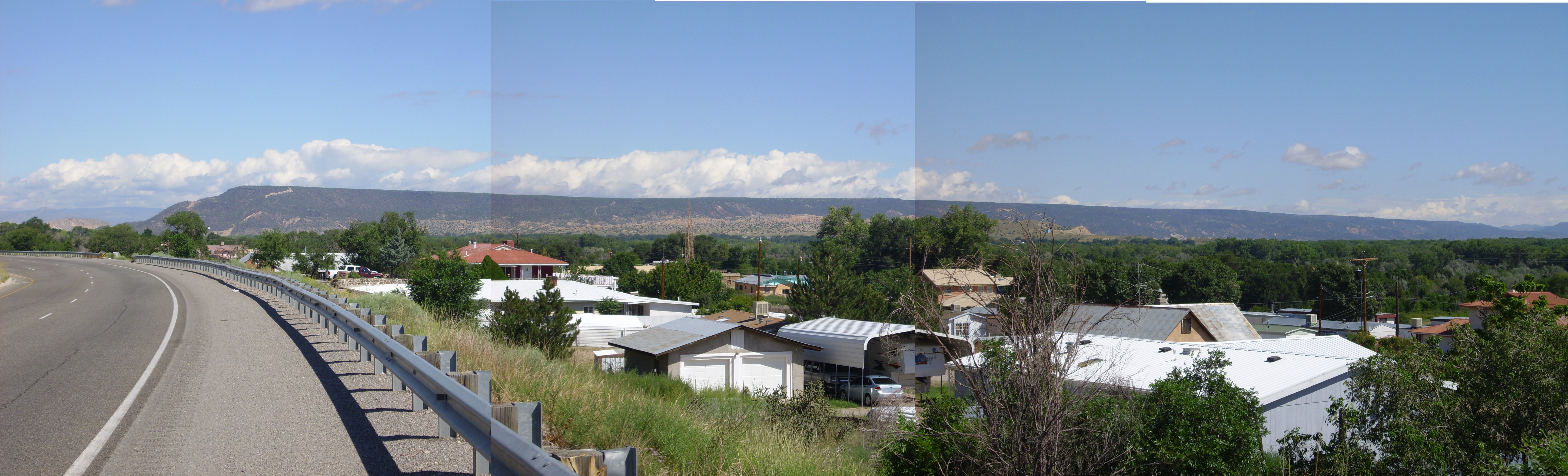
Finally, the northern mouth of White Rock Canyon.
White Rock Canyon northern mouth
And home.
Copyright ©2014 Kent G. Budge. All rights reserved.