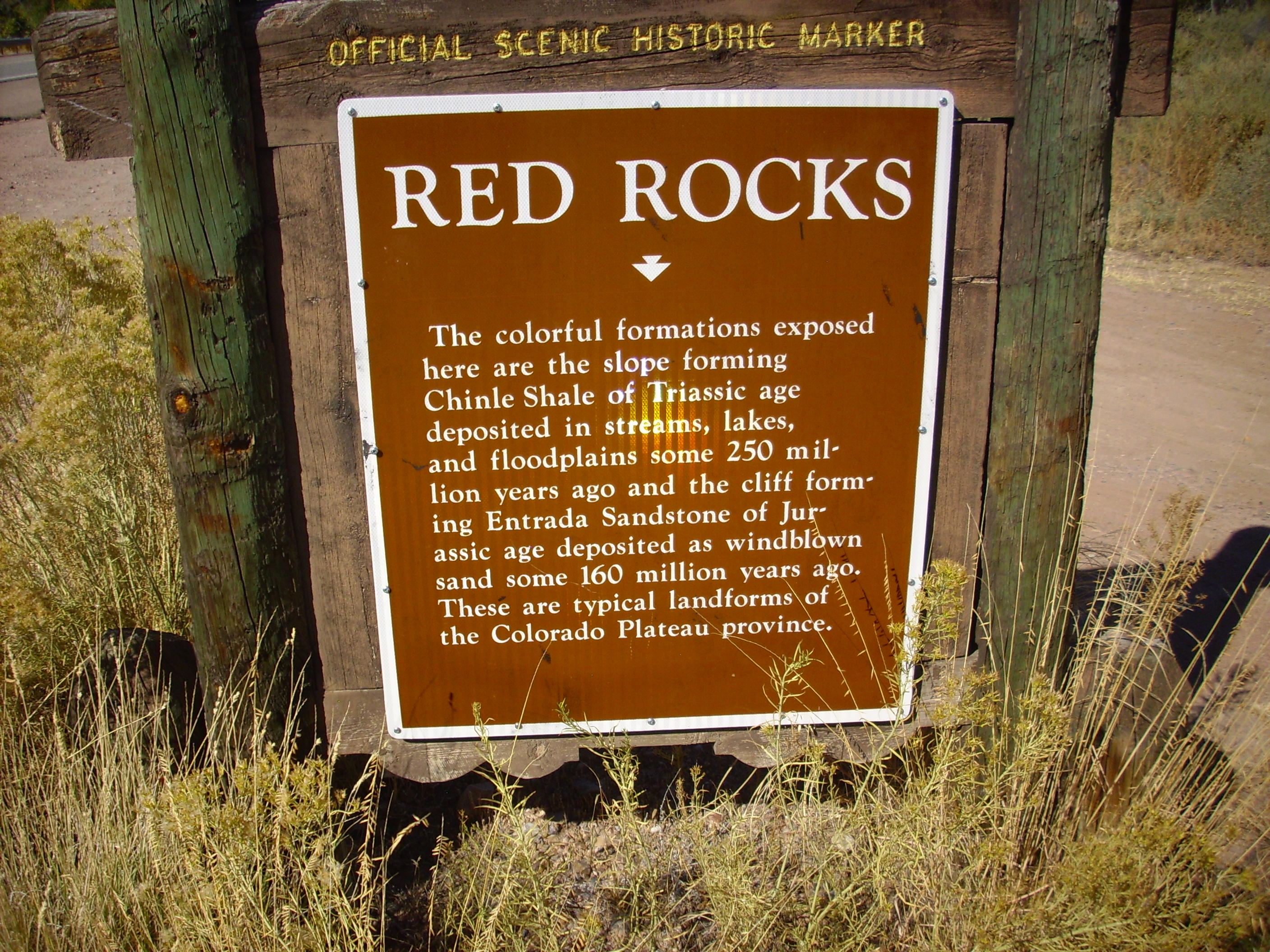
Wanderlusting the Northeast Jemez

This trip was to the Abiquiu Embaymant and northeast Jemez, mostly to see some of the Mesozoic and late Paleozoic rocks exposed along the southeastern boundary of the Colorado Plateau.
After packing up the usual supplies — a backback with binoculars, a lunch, camera, cell phone, geologist’s hammer, loupe, water bottles, sunscreen and bug spray, spare batteries for the camera (it eats them like candy), and sundry, I headed out at about 10:00 in the morning. Departing from my home in White Rock, I drove along the familiar road to Espanola, not bothering to stop much for photographs or rock samples. This is all old territory.
From here north I started paying closer attention to the geology. This is not unfamiliar ground — I’ve been to all of today’s locations before — but I know a little more about the geology than the last time I was here, I have a good road log from the New Mexico Geological Society to tell me more, and I’m out for samples. I’m particularly interested in the older rocks, but not exclusively.
Espanola sits on the Chamita Formation of the Santa Fe Group. The Santa Fe Group is rift fill, sediments washed down into the Rio Grande Rift as it was pulled apart over the last thirty million years. The Chamita Formation consists mostly of sediments deposited by the ancestral Rio Grande and its tributaries. These include the Hernandez Member (ancestral Rio Chama), Vallito Member (ancestral Rio Grande) and Cejita Member (from an ancient river flowing into the ancestral Rio Grande from the northeast).
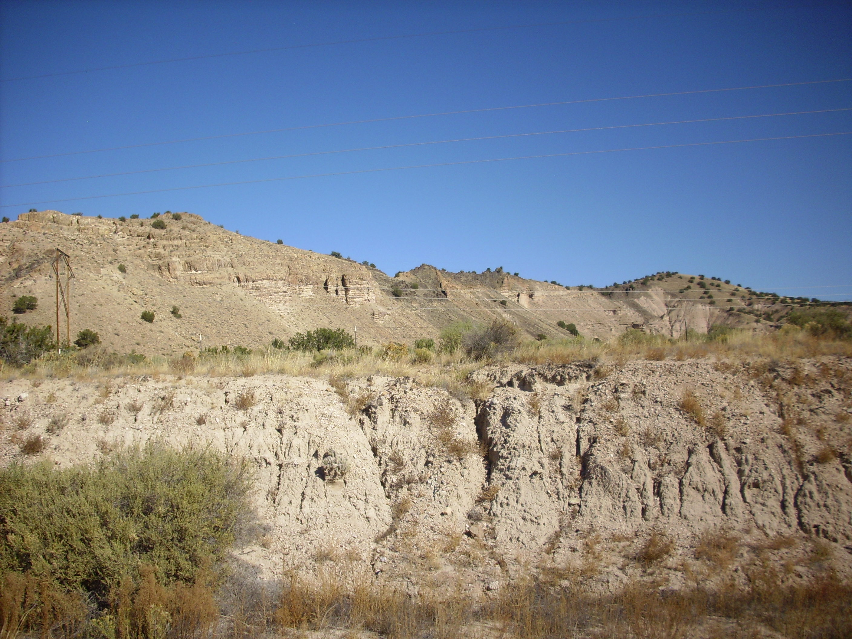
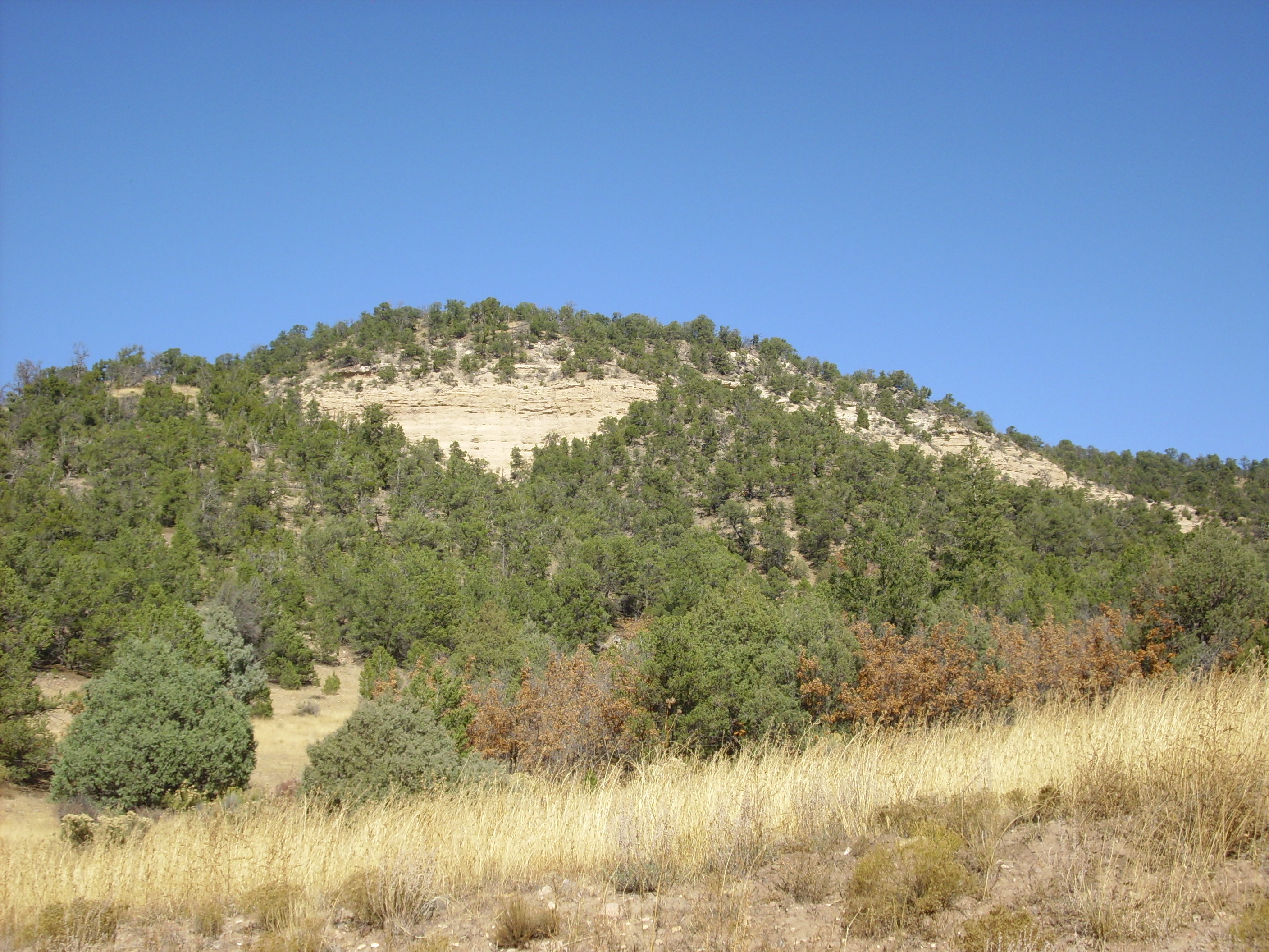
Northwest of the village of Hernandez one begins to see mesas of the Chamita Formation topped by Lobato Formation basalt.
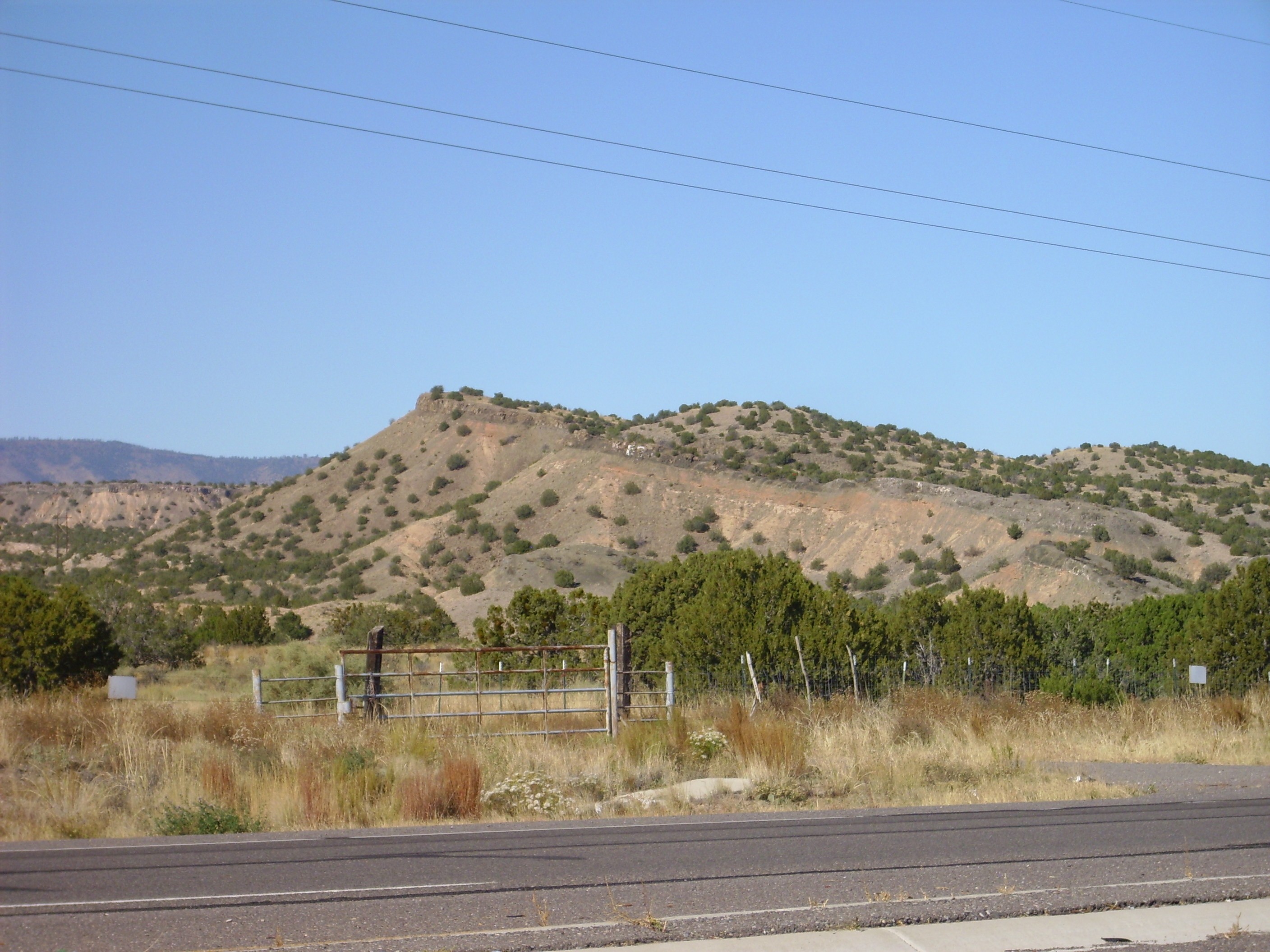
Lobato Mesa Formation basalt flows atop a mesa of Chamita Formation northwest of Hernandez
The Lobato Mesa Formation is the earliest formation unambiguously identified with the northwest Jemez Mountains, dating back 9-10 million years. These particular beds were probably nearly level when laid down, and have been tilted to the northeast by continuing rifting in the Rio Grande Rift. The bottom of the flows has irregularities showing that the Chamita Formation had already begun to erode due to regional uplift when it was drowned in lava.
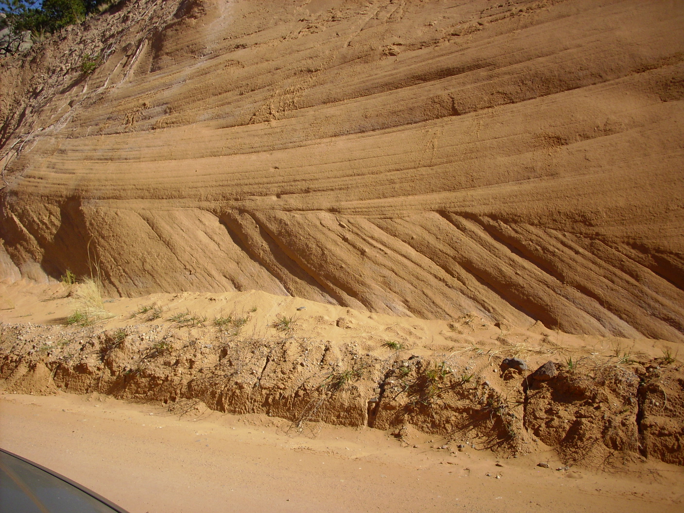
Past Medanales one one sees a ridge of the Ojo Caliente Member of the Tesuque Formation of the Santa Fe Group. This is also Rio Grande Rift fill, but it is eolian sandstone, laid down as windblown sand dunes between 15 and 10 million years ago. This sedimentary bed is found throughout the Abiquiu area.
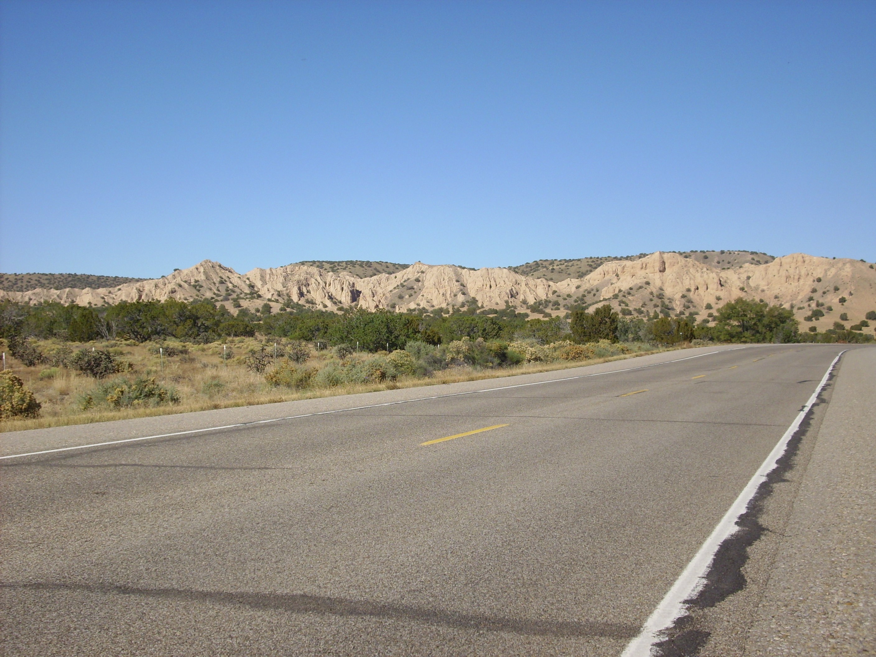
Ridge of Ojo Calienta Sandstone of the Tesuque Formation.
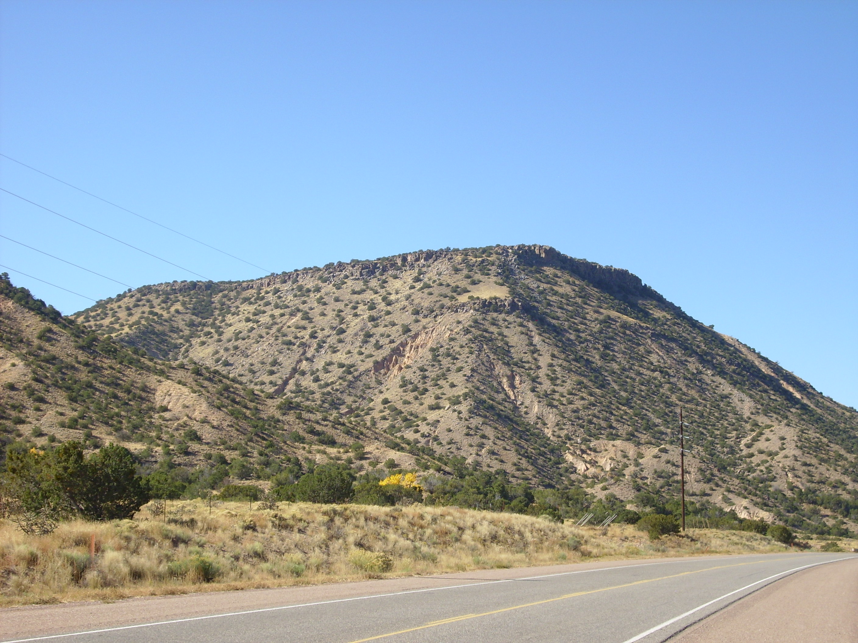
The approach to Abiquiu is dominated by Sierra Negra to the north.
The mountain is upper Abiquiu Formation to the west and Chama-El Rito Member of the Tesuque Formation to the east, separated by a fault and with a cap of 4.4 million year old basalt. This is our first glimpse of the Abiquiu Formation, which was deposited between 26 million and 18 million years ago. The lower part of the Abiquiu Formation is a conglomerate, the Ritito Conglomerate, which is found on top of the El Rito Formation or directly on older Mesozoic rocks. The upper Abiquiu Formation is composed largely of reworked volcanic ash, probably from the Lahir volcanic field north of Taos. The Abiquiu Formation is nearly a pure white in color and stands out sharply from other nearby formations.
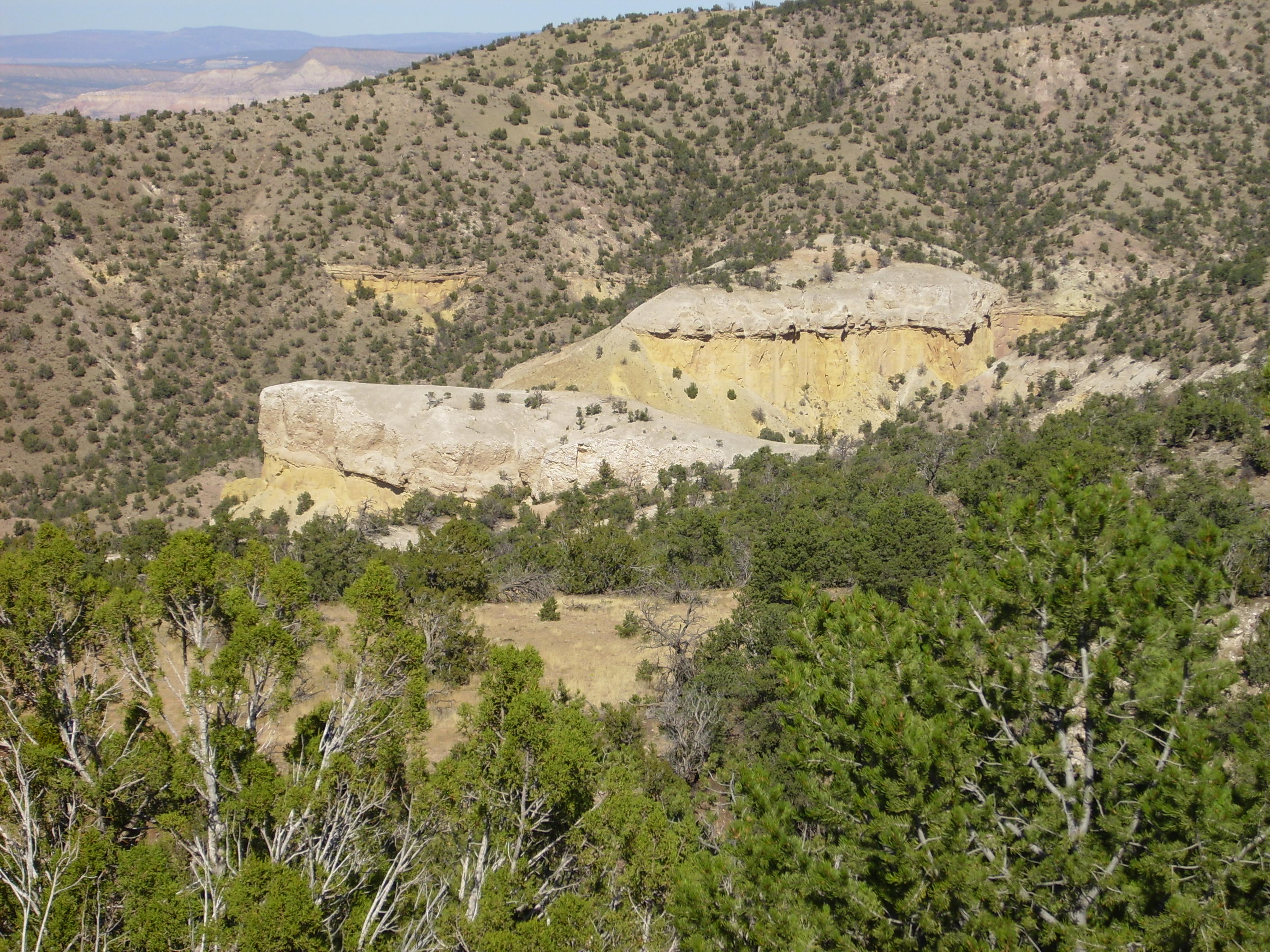
The Abiquiu Formation is particularly exposed in Plaza Blanca Canyon north of Abiquiu.
Plaza Blanca Canyon
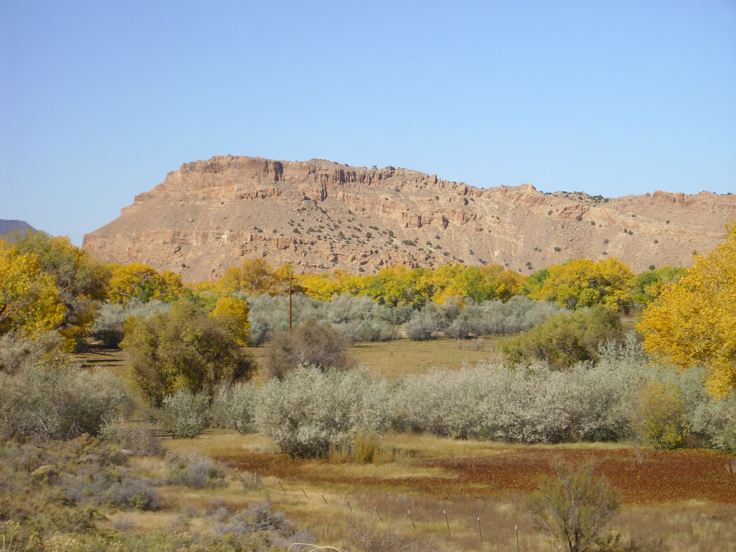
Most of the high terrain south of Abiquiu is topped by 8-million-year-old Lobato Formation basalt, but Abiquiu Mesa is topped by the much younger El Alto Basalt.
Abiquiu Mesa
The El Alto Basalt is around 3 million years old, about as old as the Cerros del Rio Basalt my house is built on in White Rock. However, the amount of basalt erupted in the northeast Jemez during this time period was much less than the voluminous Cerros del Rio.
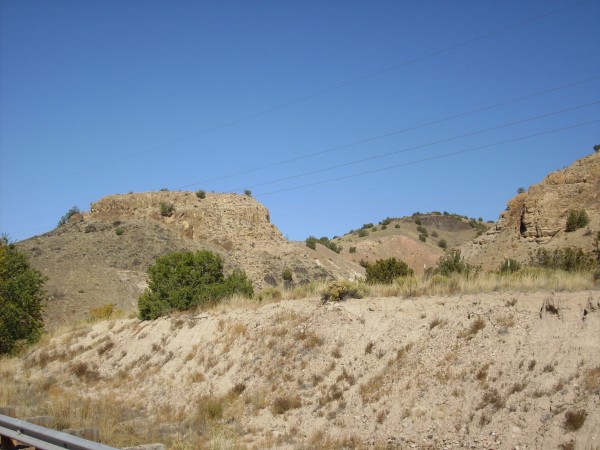
To the west is Canones Mesa, which is Abiquiu Formation topped by thick flows of andesite, a rock whose silica content (~57%) is higher than that of basalt (~50%). The higher silica content makes the andesite more viscous than basalt, so andesite flows are thicker and steeper than the thin basalt flows we have seen so far.
Canones Mesa in the distance
The andesite on top of Canones Mesa was originally mapped as part of the Tshicoma Formation, which was produced by voluminous eruptions of mostly dacite and rhyodacite between 7 and 3 million years ago. These eruptions produced most of the skyline west and northwest of Los Alamos. Dacite is quite rich in silica (~65%) and forms very steep flows, so the andesite atop Canones Mesa is poorer in silica than most of the Tshicoma Formation. It erupted just prior to the El Alto Basalt, three million years ago, and may bridge the period between the last of the silica-rich Tschicoma volcanism and the start of the silica-poor El Alto eruptions.
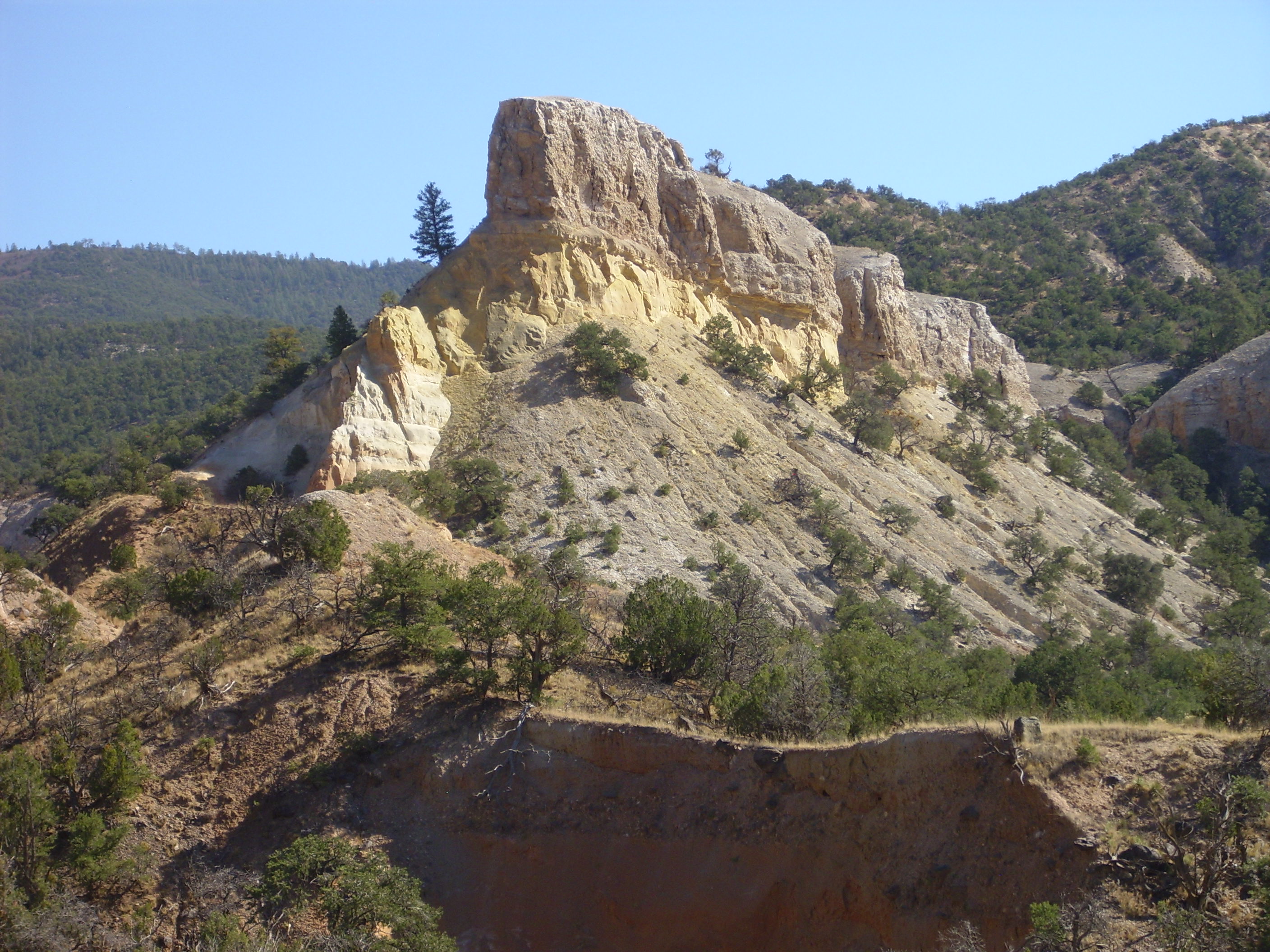
Just northwest of Abiquiu is Cerrito Blanco.
Cerrito Blanco
Cerrito Blanco is a large ridge of Tesuque Formation sandstone thrown up by a fault on its west side. Fluid flow along the fault has hardened the sandstone to the point where it is highly resistant to erosion, forming a sedimentary dike.

West side of Cerrito Blanco showing fault offset of Tesuque and Abiquiu Formations
The fault has thrown down the rock layers to the right, towards the axis of the Rio Grande Rift, as shown by the fact that the white Abiquiu Formation beds to the left are now in contact with younger tan Tesuque Formation beds to the right. This show that this fault is part of the system of faults marking the west edge of the Rio Grande Rift. We are rapidly approaching the transition zone to the Colorado Plateau to the northwest.
A more close-up view of Canones Mesa with its cap of andesite.
Canones
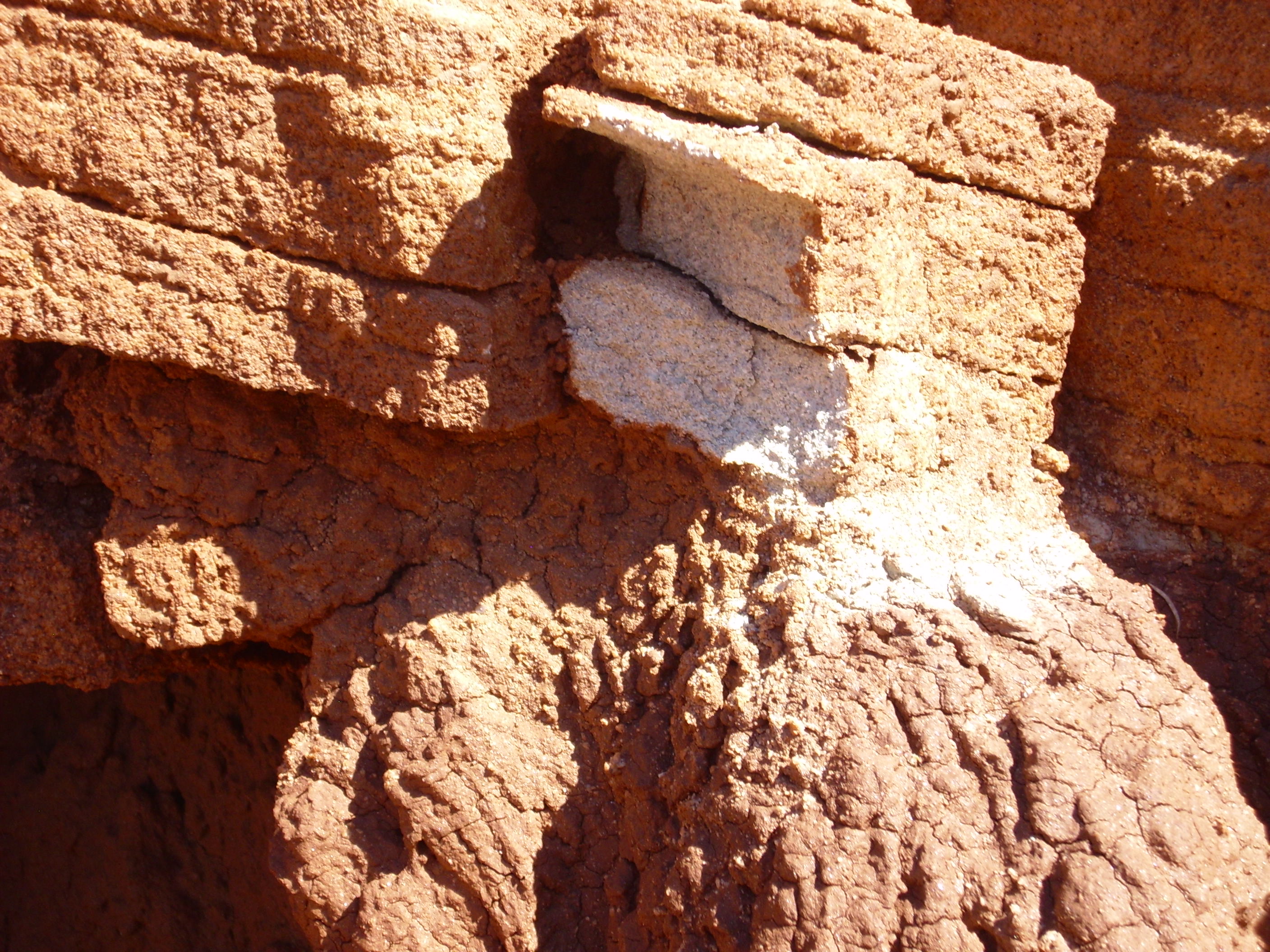
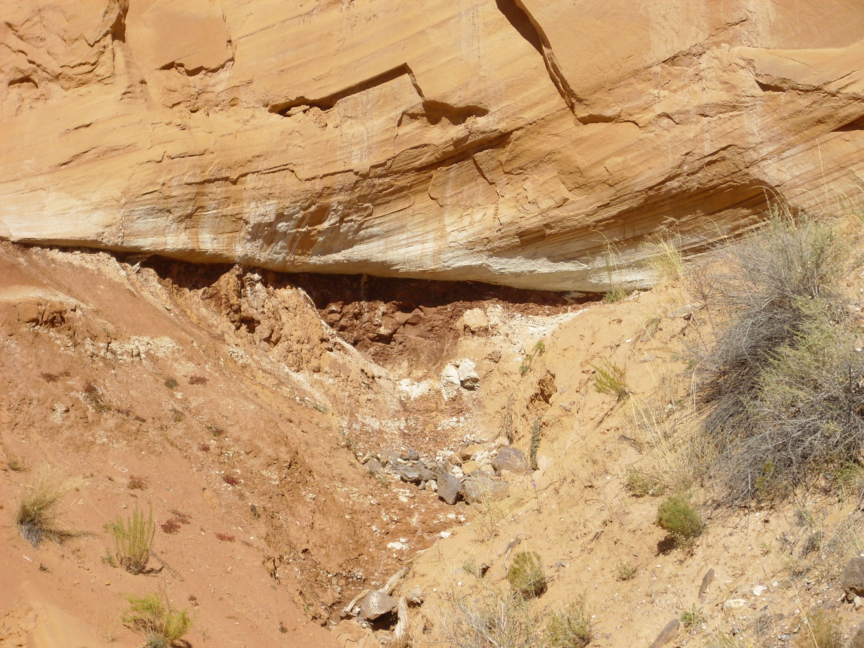
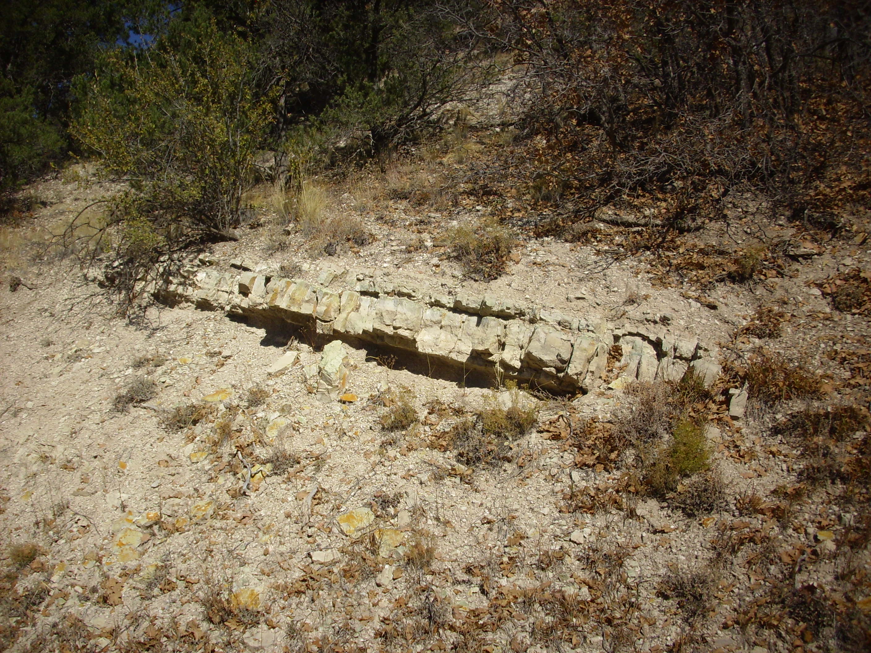
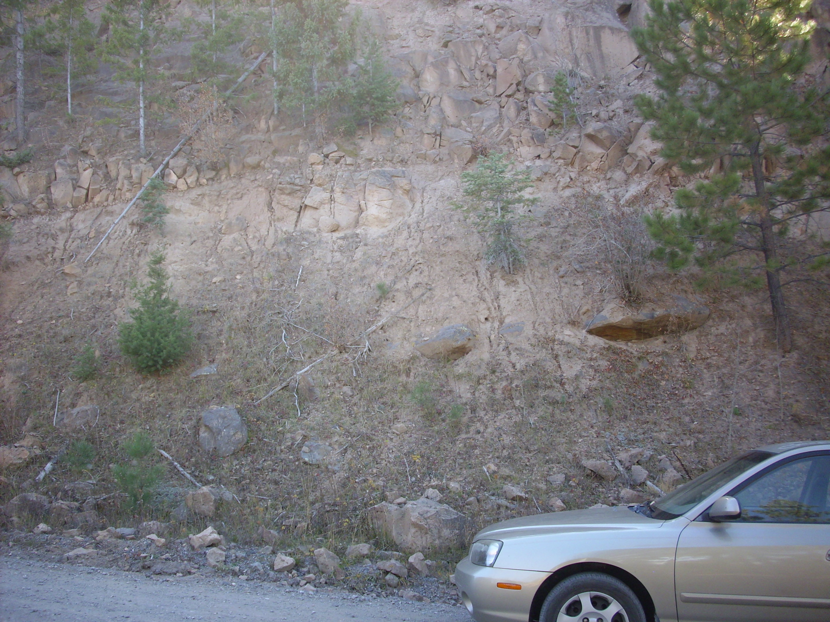
At this point the highway crosses a basalt dike intruded into the Abiquiu Formation.
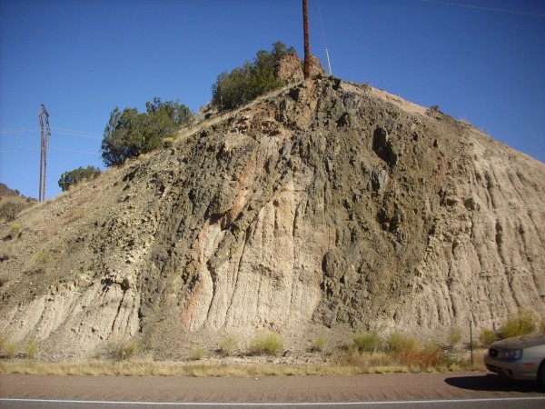
Basalt dike of the Cerrito de la Venata dike system
This dike is part of the Cerrito de la Ventana dike system, which parallels the Cerrito de la Ventana Fault in this area. The basalt in the dike is about 20 million years old, making it part of an episode of volcanic activity predating the current Jemez volcanic field. You can see a band of the surrounding Abiquiu baked red by the heat of the dike though, curiously, only on one side of one part of the dike.

Basalt dike with baked zone in country rock
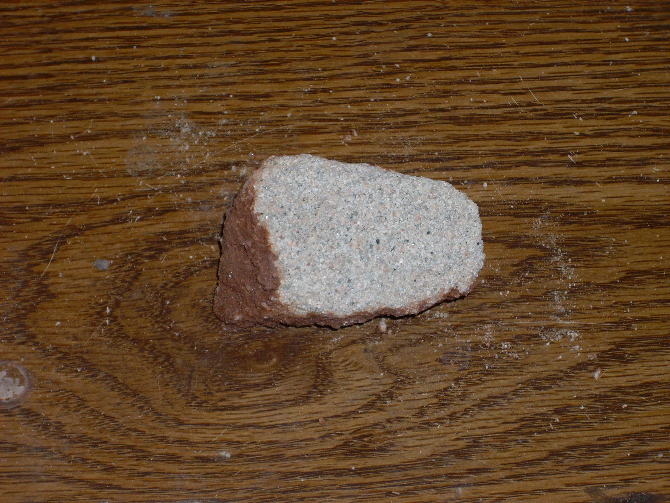
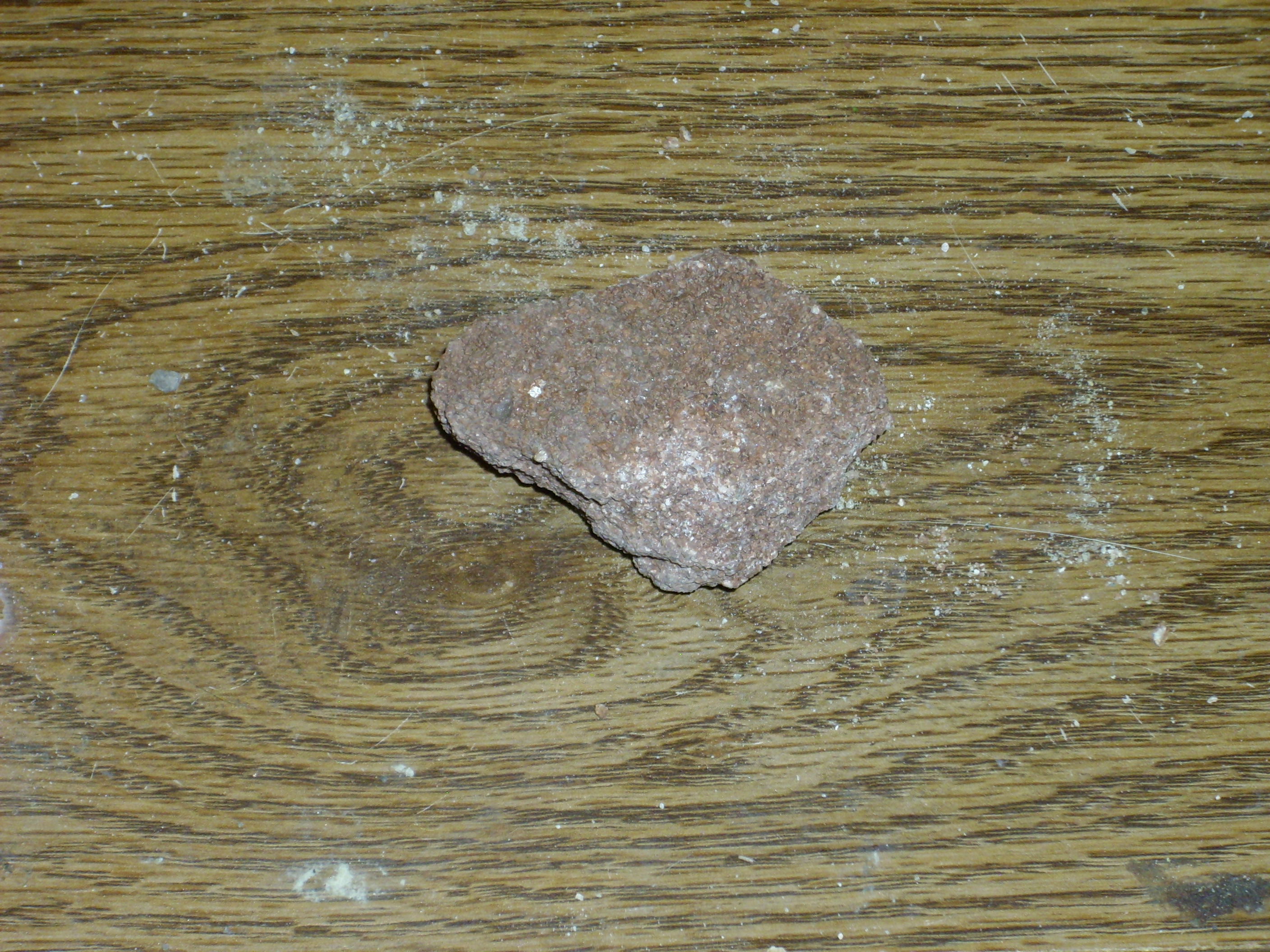
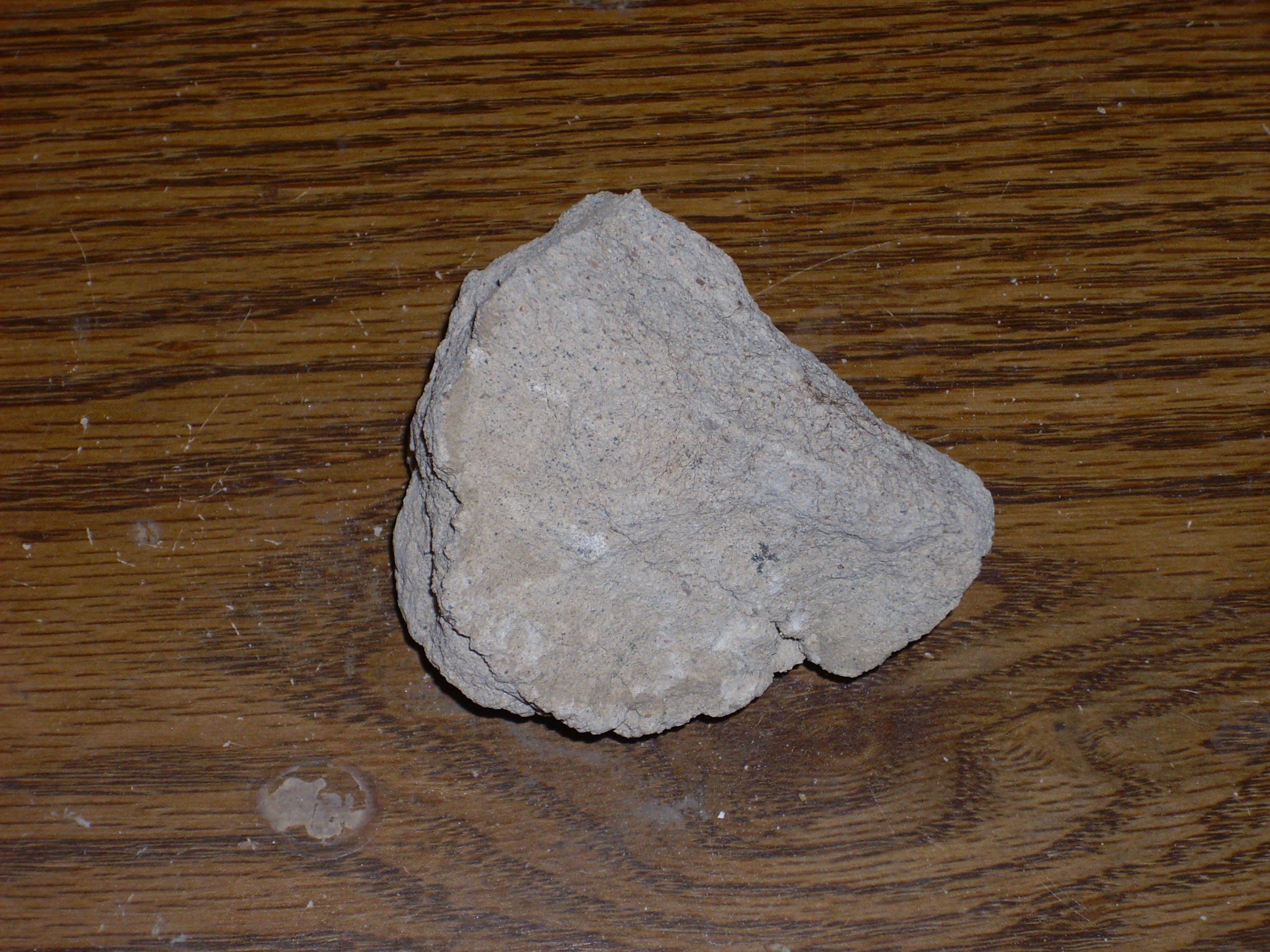
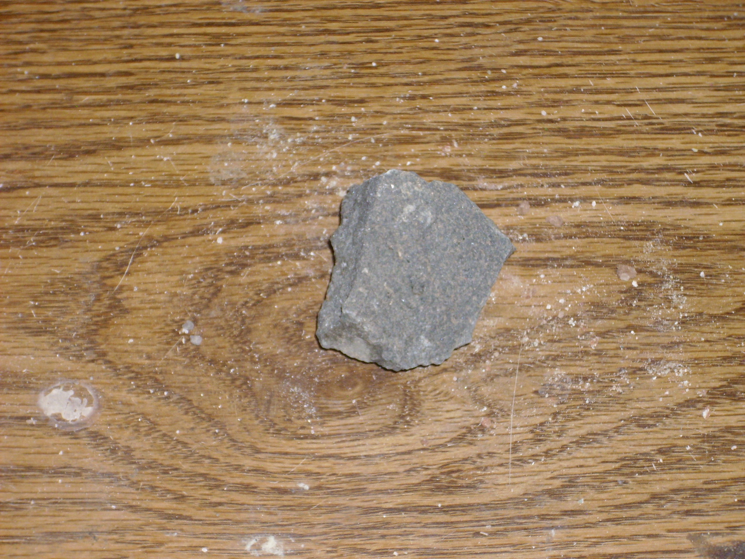
The basalt is a dense black rock with occasional veins of almost pure quartz that must have been emplaced much later.
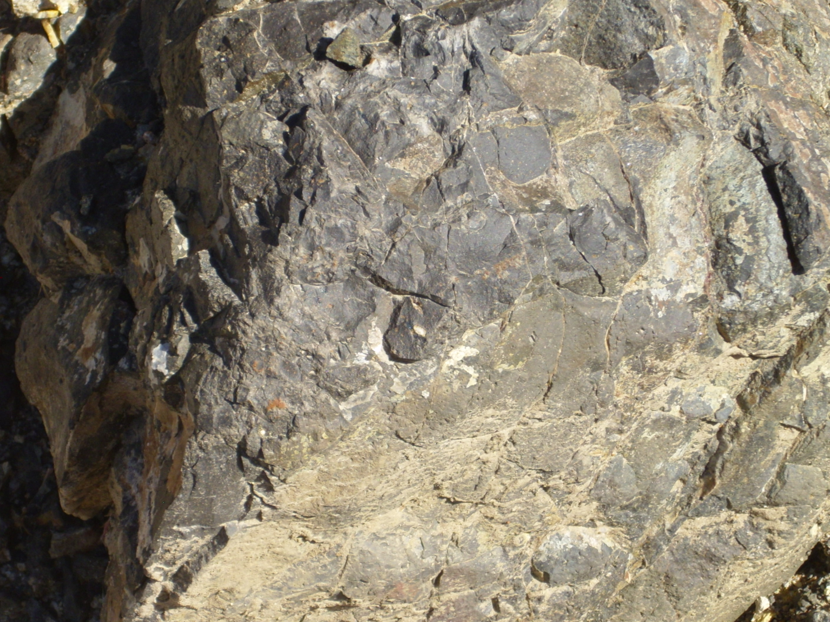
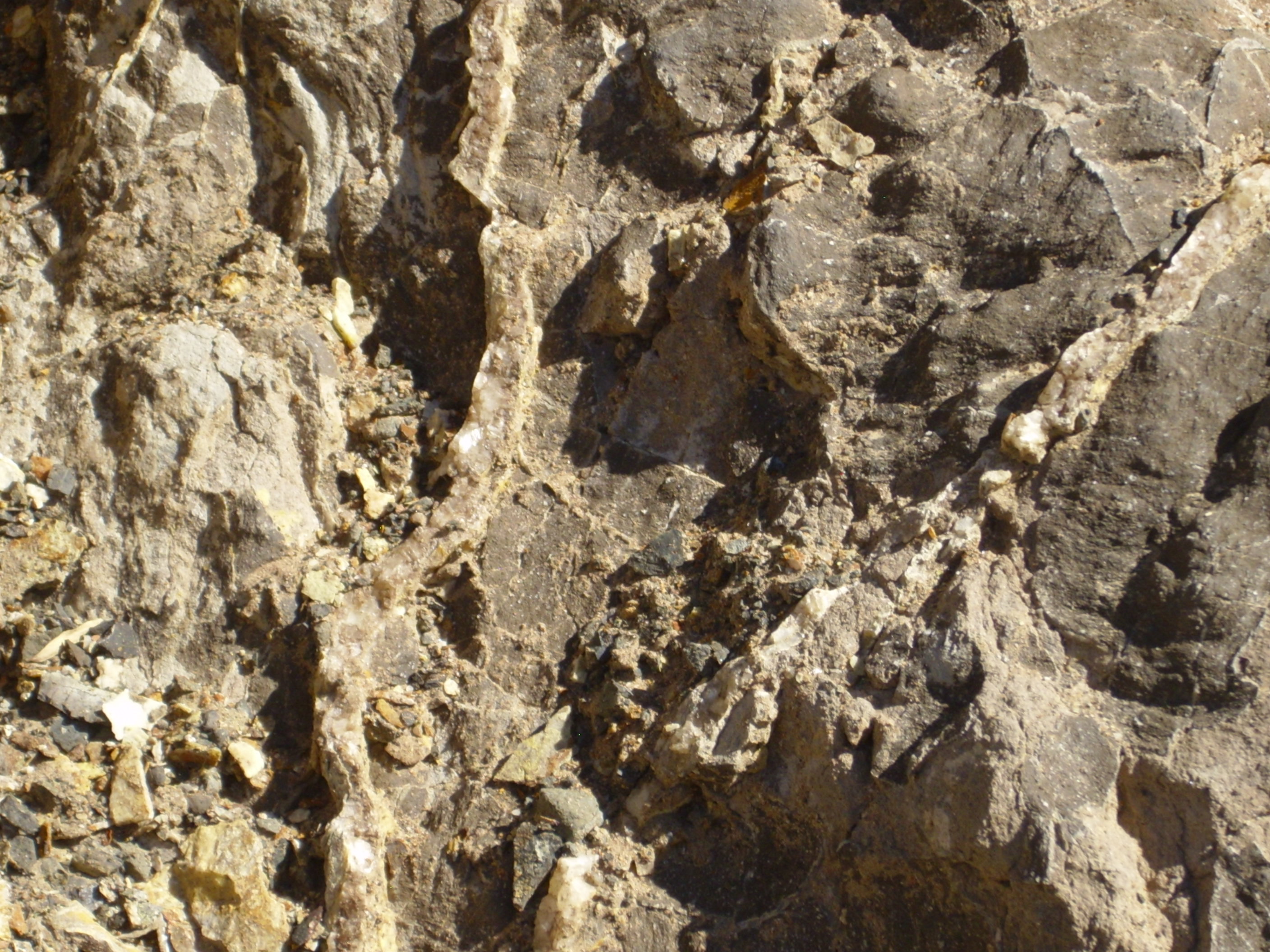
Close up of basalt with quartz veins
Basalt is quite low in silica, while quartz is more or less pure silica. The quartz must have been injected long after the basalt cooled, probably as a solution in water formed in the very last part of the underlying magma chamber to cool.
A handy summary of the next bit of geology.
At this point, we are approaching the Canones Fault, a major fault zone that separates the Abiquiu Embayment of the Rio Grande Rift from the Colorado Plateau. We are about to cross the boundary between two major geological provinces.
The fault has thrown up the contact between the Morrison Formation and the El Rito Formation. The Morrison Formation is of Jurassic age, about 150 million years old. Here it takes the form of fluvial sandstone, deposited in a river valley all that time ago. All the rocks above the Morrison Formation were eroded away at this location, the buried again under the El Rito Formation some 50 to 30 million years ago, prior to the opening of the Rio Grande Rift.
A geological discontinuity between Jurassic and Tertiary beds
The contact is clearly visible near the top of the cliff, where the beds in the two formations lie at an angle to each other. This is a good example of what geologists call an unconformity. The contact is important for another reason: Here the Tertiary El Rito Formation lies directly on Jurrasic Morrison Formation rocks, while further west, across the Canones fault, the El Rito lies on top of much younger sedimentary beds. This tells us that the Canones Fault existed at least thirty million years ago, and that at that time it was the west side of the fault that was thrown down. Geologists believe the Canones Fault was part of the Laramide orogeny, or episode of mountain building, that took place from 80 to 30 million years ago. It has been reactivated by the opening of the Rio Grande Rift, this time with the east side being thrown down.
Here is a close up of the point of contact, where it comes close to the road level.
Contact between El Rito Formation and Morrison Formation.
This contact represents a gap in the geological record of at least 100 million years.
Note that the lower part of the El Rito Formation is full of “clasts” or rocks and boulders embedded in the sandstone. These are mostly chunks of quartzite, of the type found in the Tusas Mountains to the north. This suggests that there was already an ancestral Tusas Range 50 million years ago and that the El Rito Formation is alluvial fans eroded off the ancestral Tusas Mountains.
Close ups of some samples of both rocks.
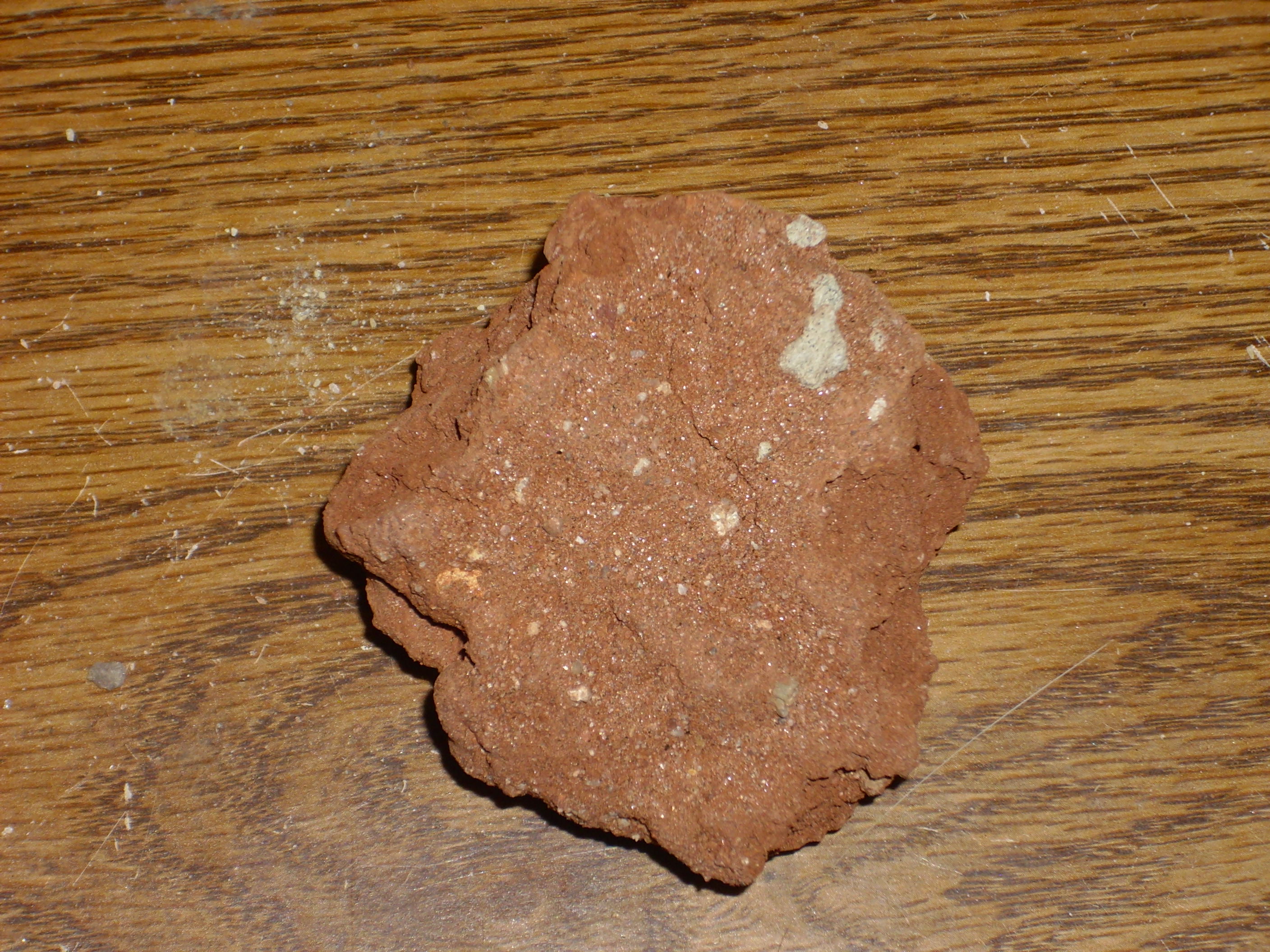
Morrison Formation
El Rito Formation
Notice that there is a quartzite pebble embedded in this sample. This was taken from near the bottom of the bed.
You may be wondering: Is the El Rito Formation the same thing as the Chama-El Rito Member of the Tesuque Formation? I’m not 100% sure myself, because geologists are constantly revising their nomenclature for rock formations; but I think the answer is no. The El Rito Formation is an older Tertiary formation predating the Rio Grande Rift and formed from alluvial fans from mountain building, whereas the Chama-El Rito Member is Rio Grande Rift fill sediments dating from later in geological time.
I suppose there are only so many place names to go around, and geologists have begun recycling.
The Morrison Formation is famous for its fossils, and, sure enough, there are biological traces in this outcropping.
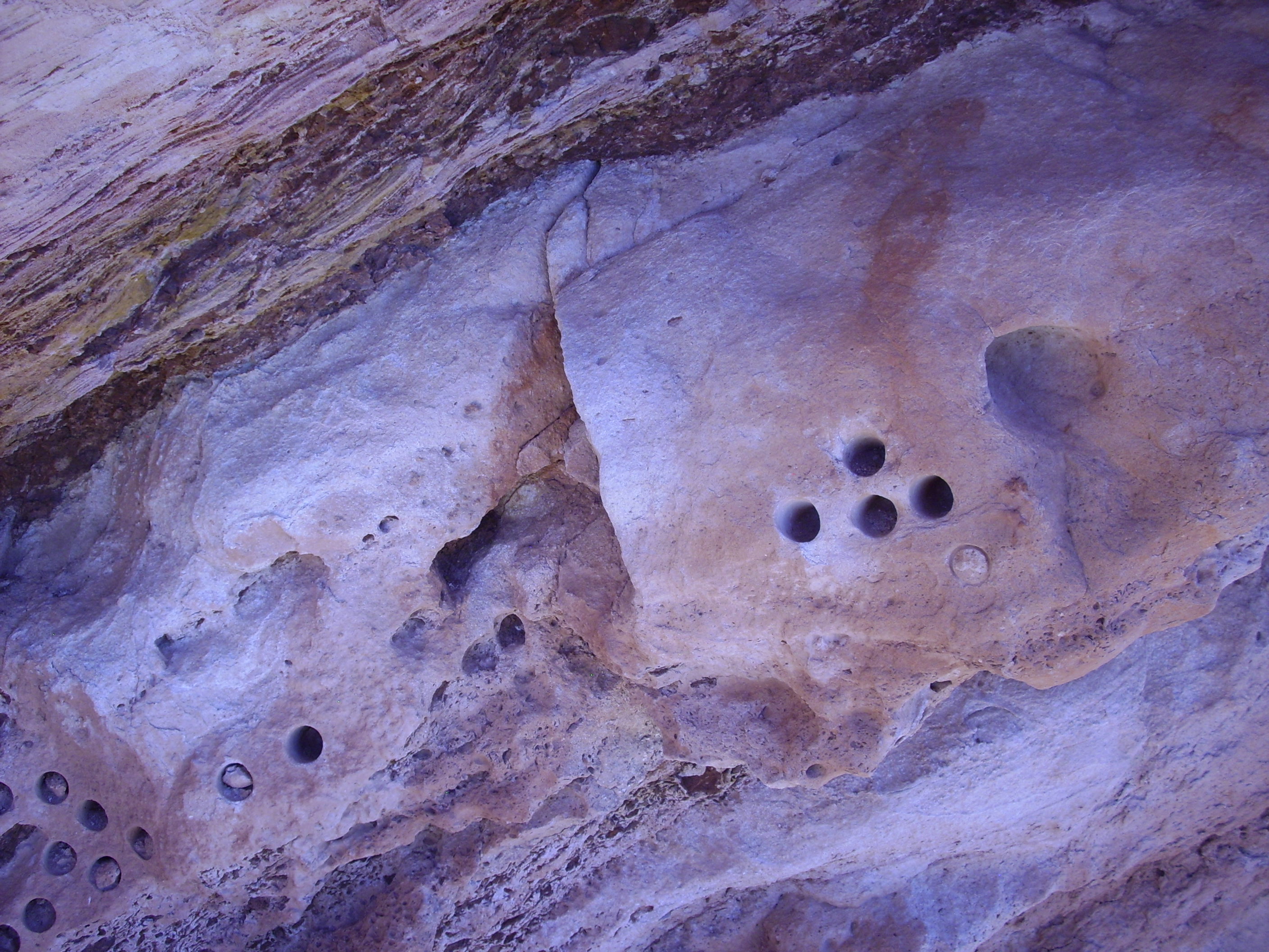
Boreholes
While I’m no expert on ancient life, I believe these are characteristic boreholes gouged by Doctoris aspiraticus var. geologicus, a late Holocene species.
[/tongue in cheek]More seriously, here is a close up of the uppermost part of the Morrison Formation, showing some very thin bedding.
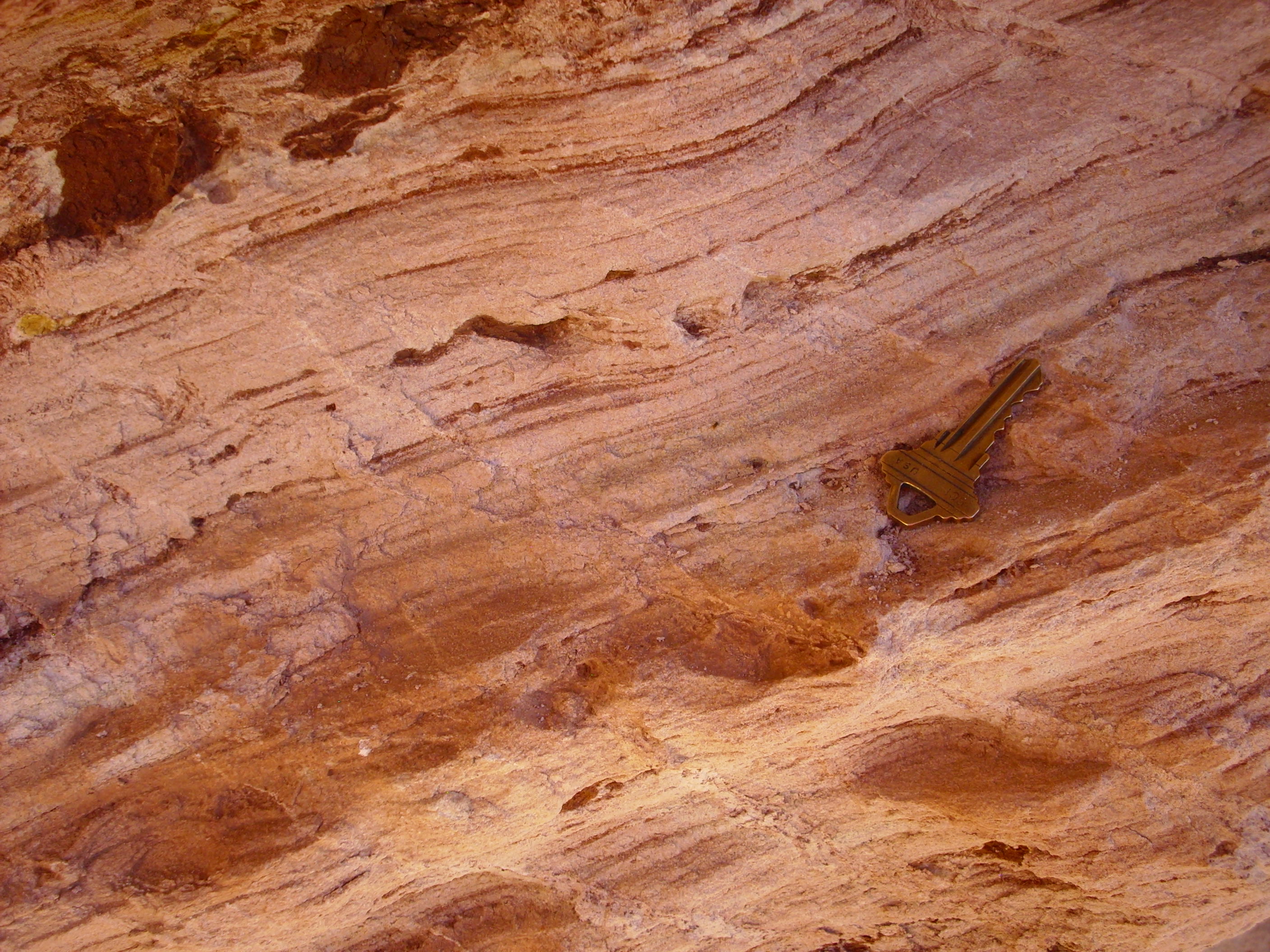
Thin bedding in Morrison Formation. House key for scale.
Further down the road, we encounter the Canones Fault, and older rocks of the Colorado Plateau.
Beds exposed by the Canones Fault
The Canones Fault runs approximately along the arroyo in front of the cliff here. The exposed units are clearer just up the road.

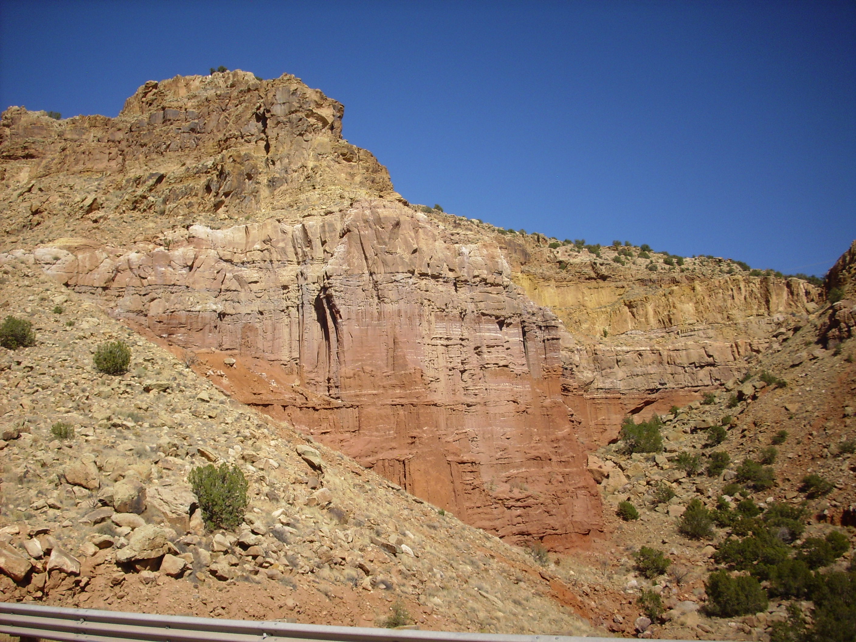
Permian and Triassic sedimentary beds. As with all photos here, click to enlarge.
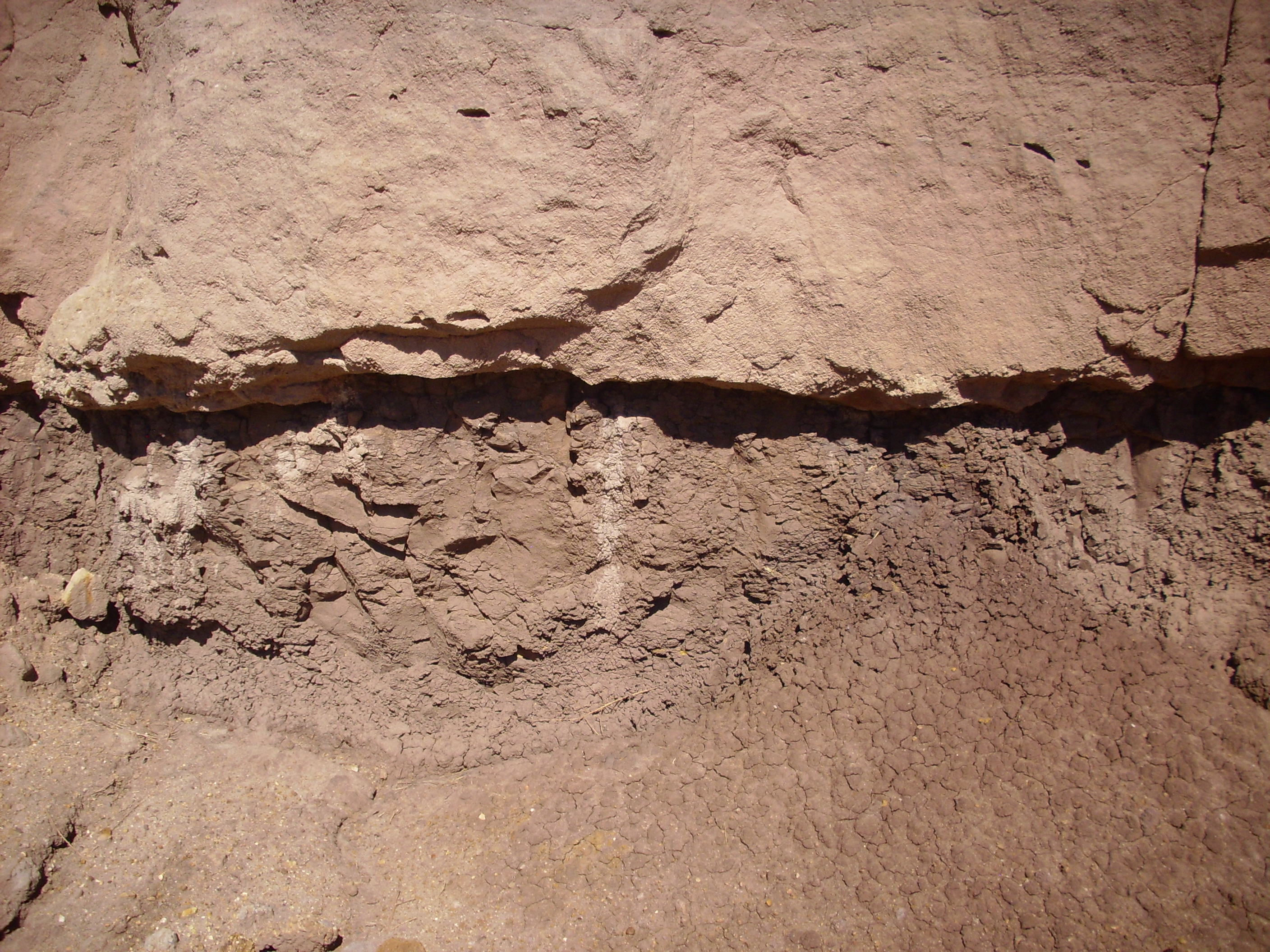
The lowermost red rocks, with the many layers and the column-like structures, belong to the Arroyo del Agua Formation of the Cutler Group. This is an early Permian formation, dating back about 280 million years or so. It is composed of alternating mudstone and sandstone; we’ll take a close look in a moment. Sitting on top of the Arroyo del Agua Formation is the Shanarump Formation of the Triassic Chinle Group, which was laid down about 230 million years ago. Thus the contact between the two beds, where the beds are at the same angle and the contact is not necessarily obvious, is a good example of a discomformity. There is a gap of over 50 million years between the two beds.
Most of the Arroyo del Agua Formation is soft mudstone, deep red in color due to oxidized iron, but with occasional thin beds of sandsone. Here’s a close up shot.
Arroyo del Agua Formation, Cutler Group
Notice the white color of the fresh fracture surface (where I hammered off a sample). The old surface is coated with a thin layer of red mud from higher up in the formation. However, some of the sandstone beds do contain red minerals. Here are close ups of some samples.
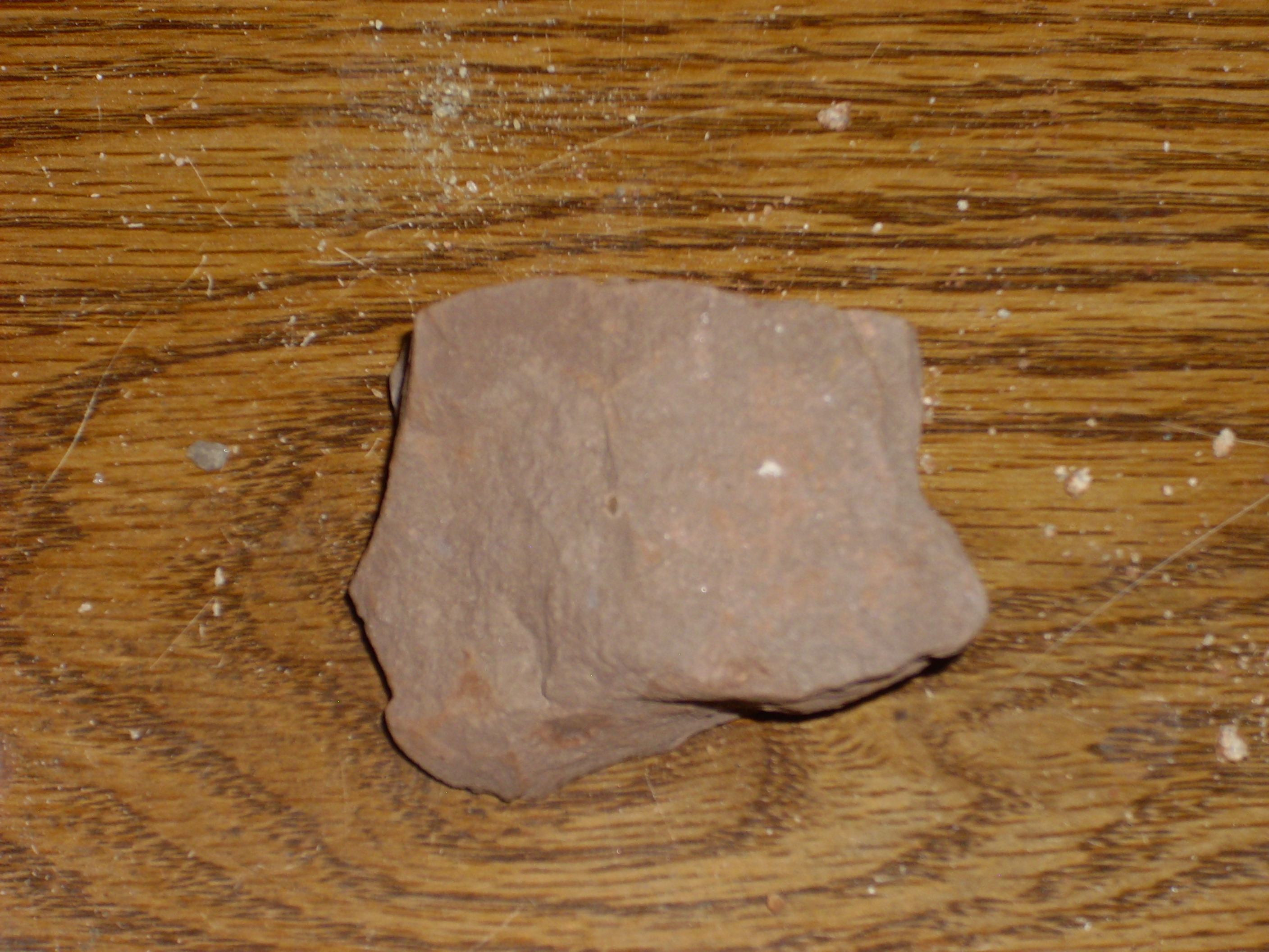
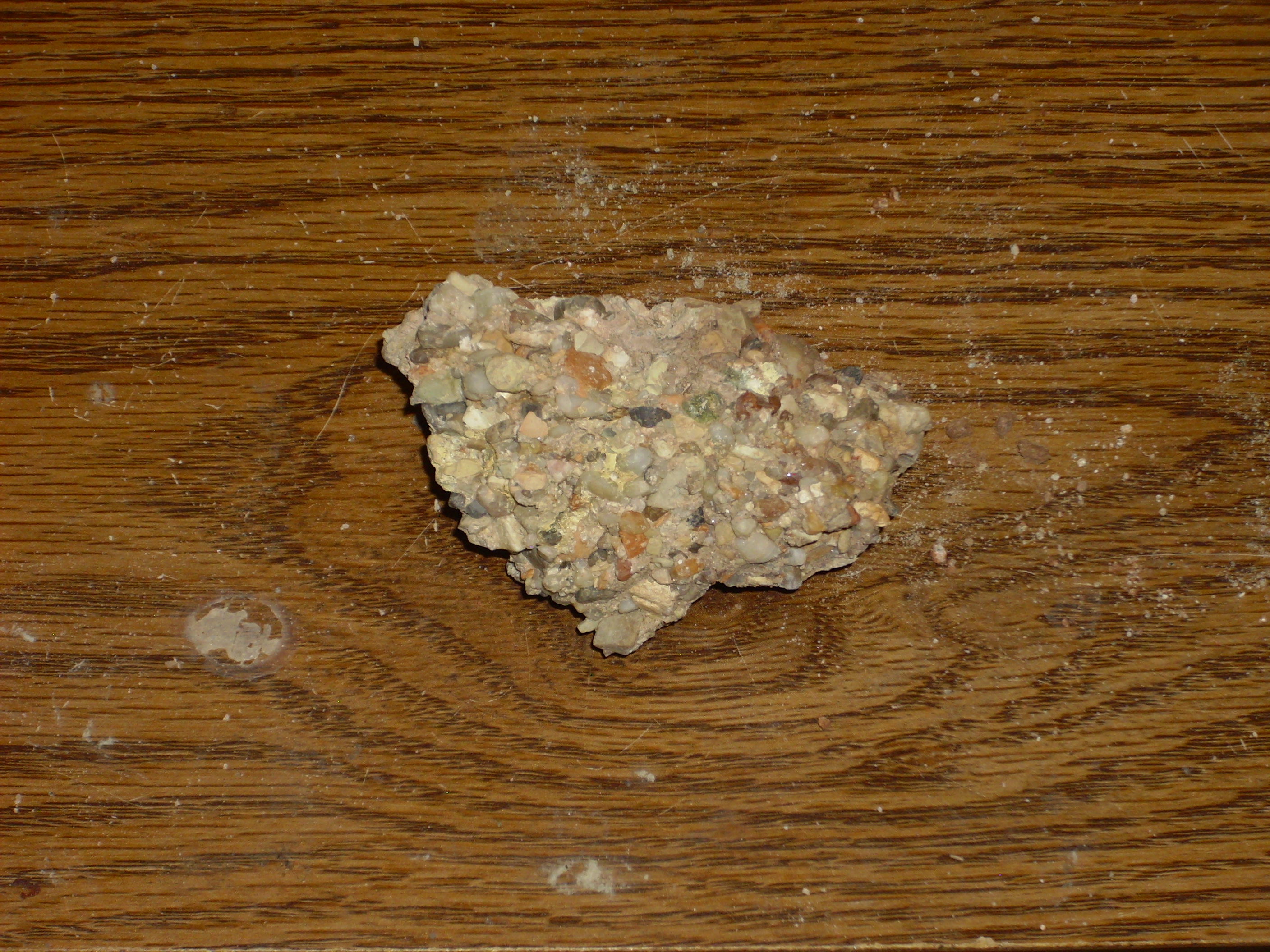
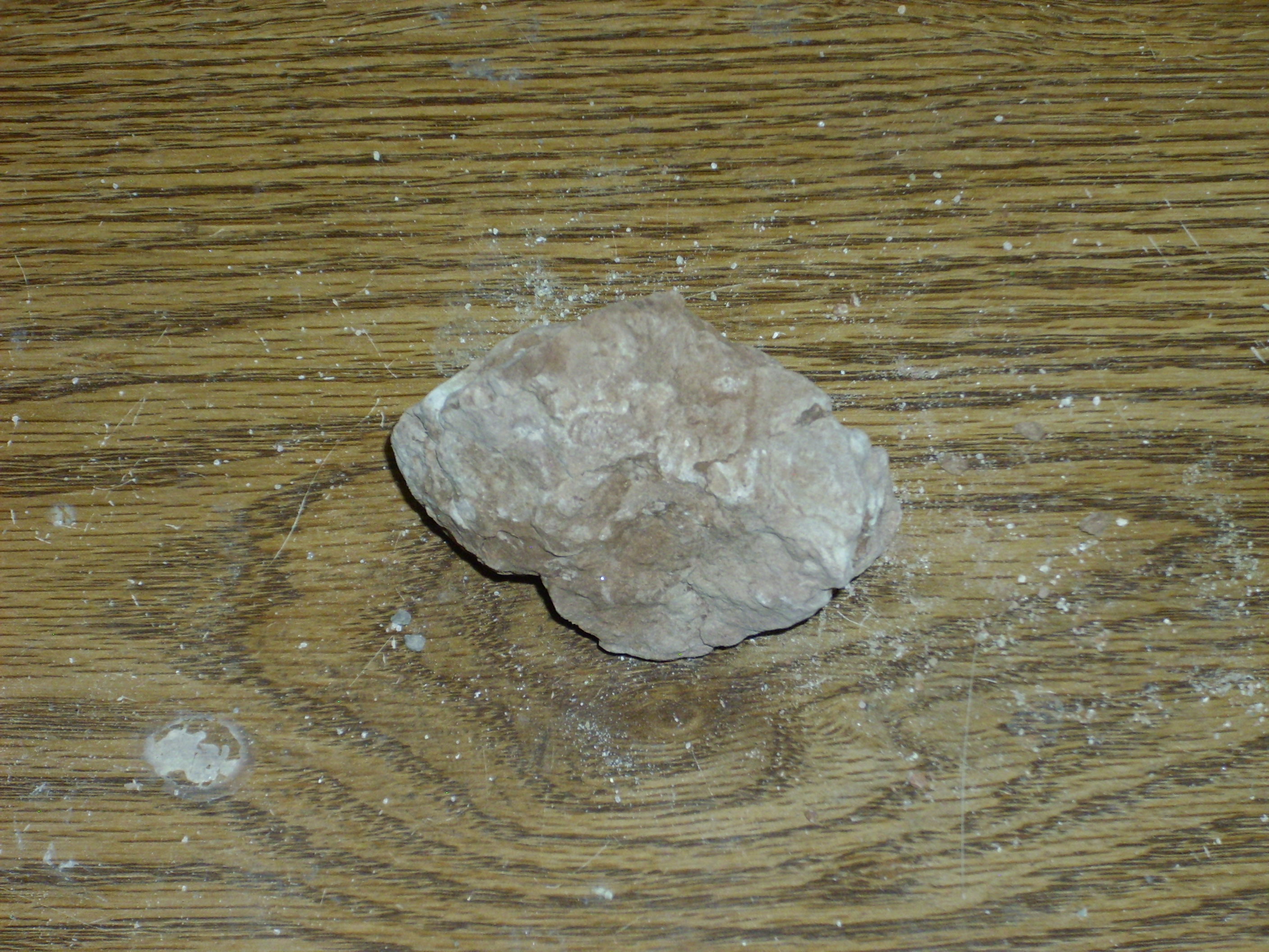
This is a sample of the relatively soft mudstone making up most of the formation. There is a fair amount of sand mixed in with the mud.
Arroyo del Agua mudstone
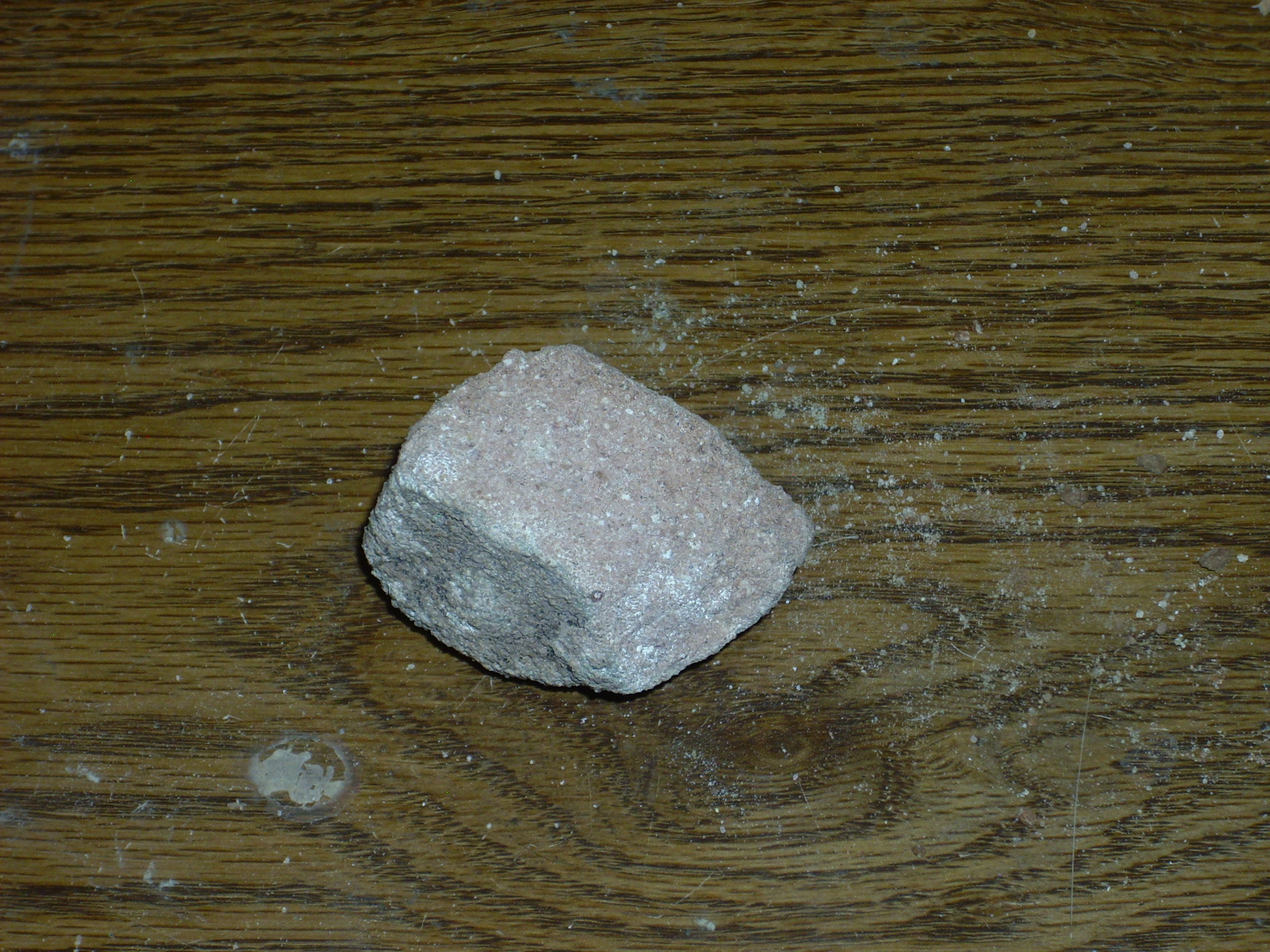
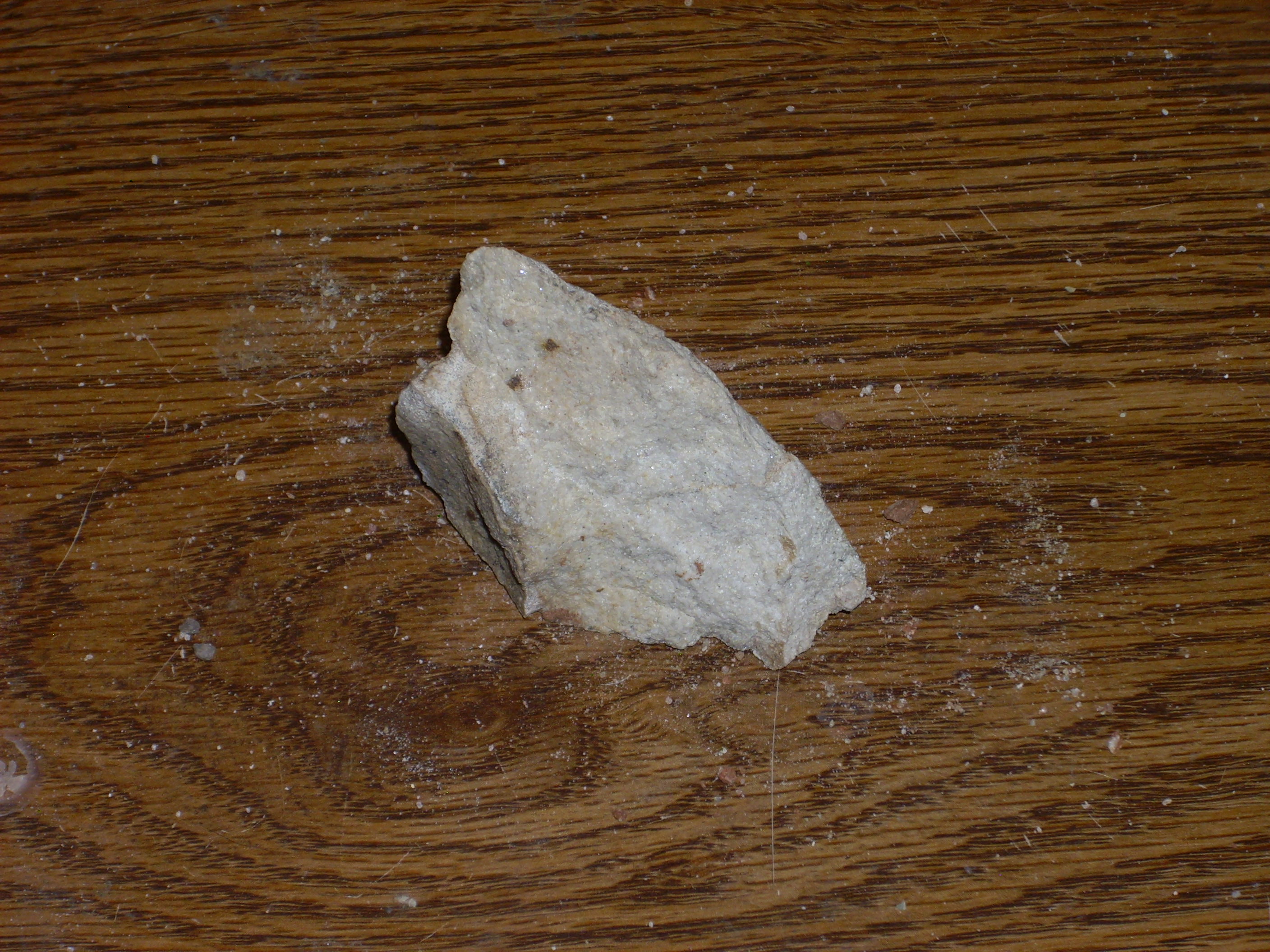
This sample is from the thin beds of sandstone between the layers of mudstone.
Arroyo del Agua sandstone
This is harder stone that stands out of the softer mudstone. In this sample, the sandstone is relatively clean of oxidized iron. Generally speaking, the Cutler Group represents sediments deposited by rivers approaching a shallow sea south of what is now the Jemez area. The sandstone layers were deposited within the river channel itself, where the sand was washed clean of finer sediments. The preponderance of mudstone in the Arroyo del Agua Formation suggests that the climate had started to dry out at about this time.
Not all the sand was washed clean, however.
Arroyo del Agua sandstone containing oxidized iron
Some of the Arroyo del Agua mudstone becomes quite hard towards the top of the formation. Here is the contact with the Shinarump close up:
Permian-Triassic discomformity
And here’s a sample of the very hard mudstone just under the discomformity.
Arroyo del Agua Formation mudstone from just below the contact with the Shinarump.
The overlying Shinarump Formation is mostly a thick bed of sandstone.
Shinarump Formation sandstone
This stands out clearly in the outcrop photographs earlier. Just above the thick sandstone is an impressive bed of conglomerate.
Shinarump Formation conglomerate
I originally took this for Salitral Formation, since my road log told me that the Salitral was found just above the Shinarump. However, the geology papers I’ve dredged up credits the Shinarump with some conglomerate beds, while the Salitral is mudstone. So this is probably Shinarump conglomerate, and I didn’t get a sample of Salitral Formation. My road log indicated that the Salitral is very thin here, so perhaps I shouldn’t feel bad that I missed it.
The Shinarump/Salitral Formations are thought to represent development of river deltas from rivers flowing from Texas towards Nevada, with the sandstone and conglomerate of the Shinarump being deposited first and the mudstone of the Salitral later as the river valley filled and the river slowed.
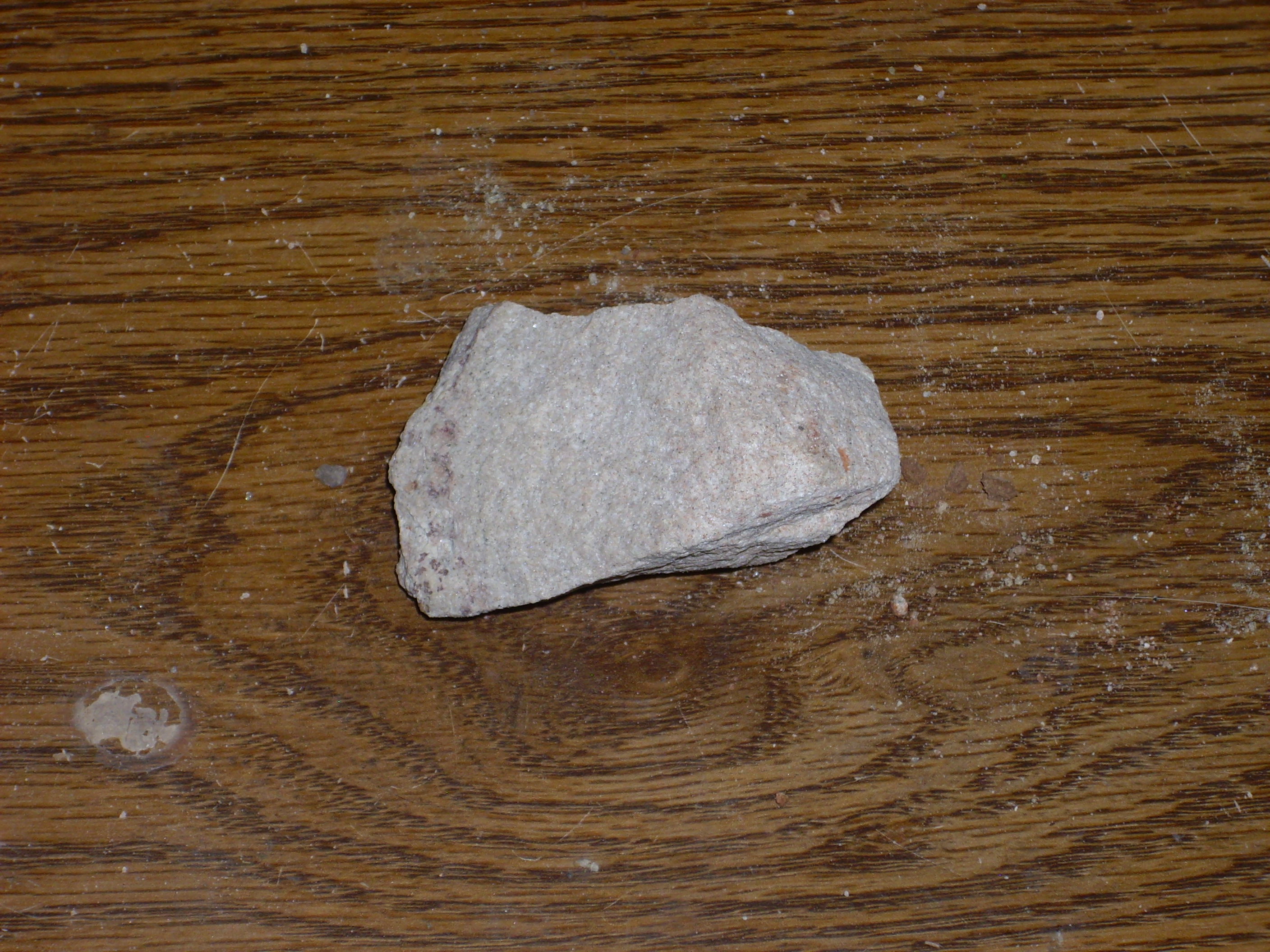
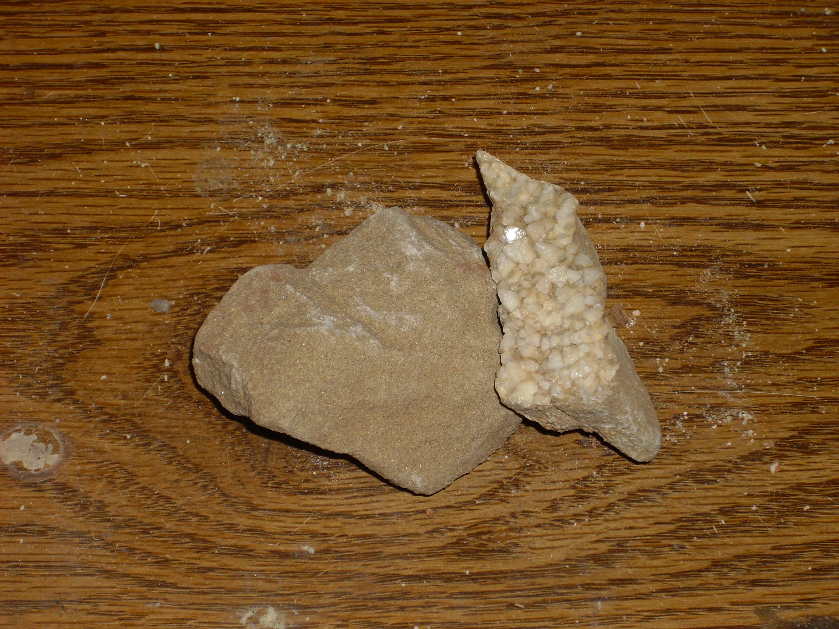
Above these is the Poleo Formation, which is a very prominent formation visible all over the area. The Poleo Sandstone is particularly thick around Abiquiu Dam. Here’s a sample from a bench not far past the road cut.
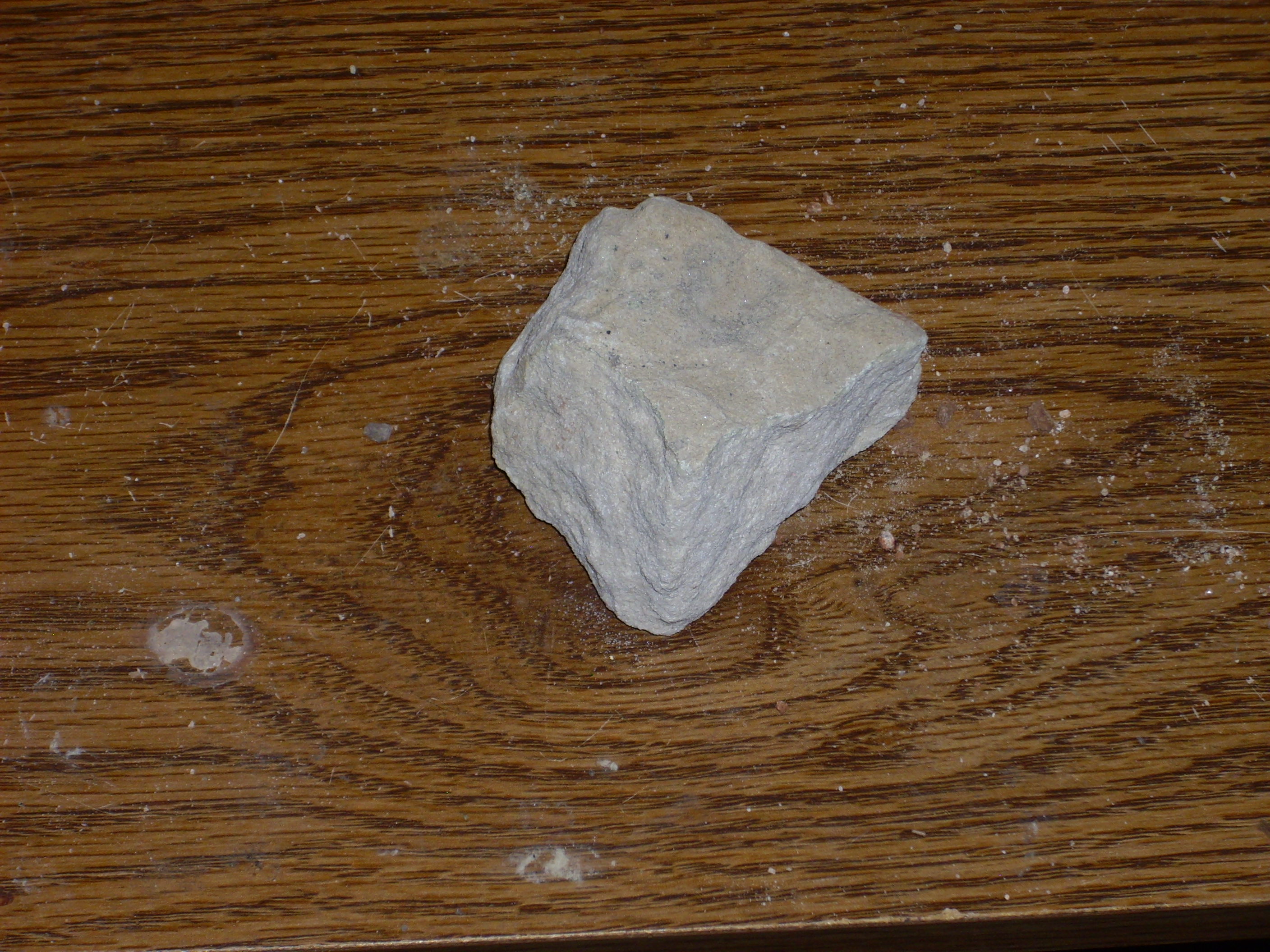
Poleo Sandstone
A second splay of the Canones Fault is found just west of the main fault and puts the bottom of the Paleo Formation to the west against the middle of the Paleo Formation to the east.
Trace of a Canones Fault splay.
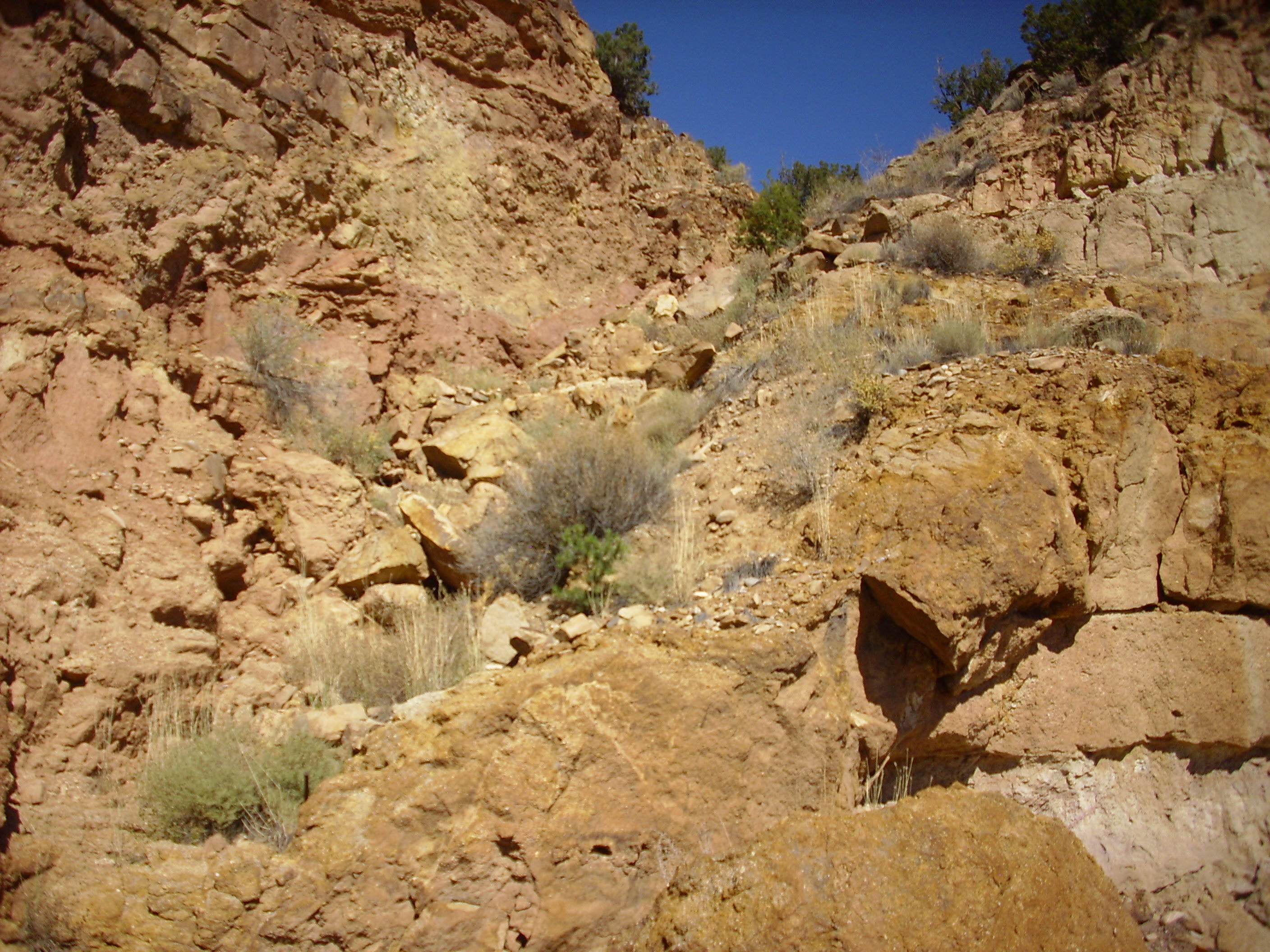
In a few places along this road cut, the Poleo Sandstone overhangs enough to provide a nice nesting spot for desert swallows.
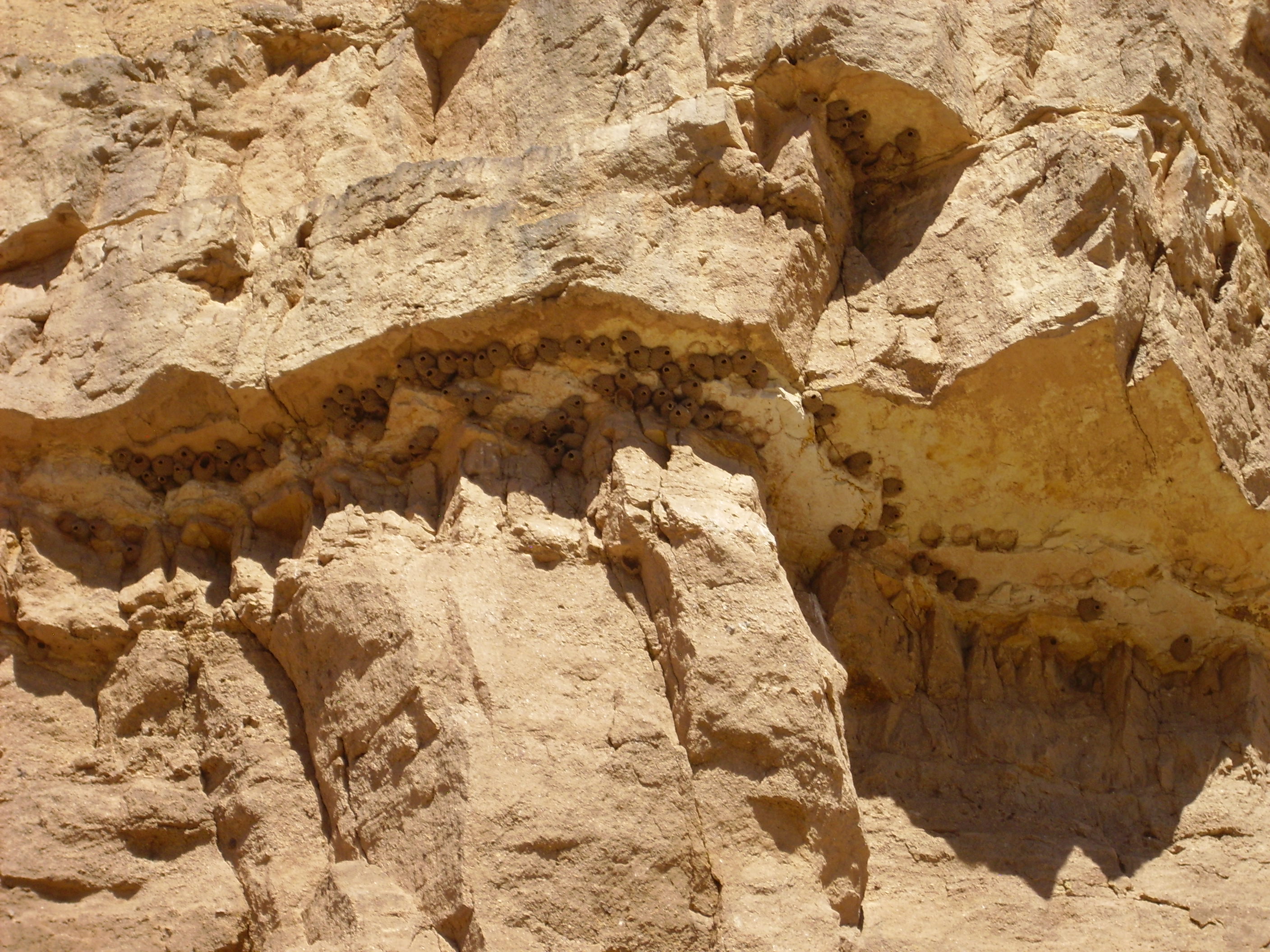
Desert swallow nests sheltered under overhang of Poleo Sandstone
A little further down the road, there is a turnoff to a gravel road leading to the aforementioned bench of Poleo Sandstone. The view takes in rocks of very different ages.
Panorama looking south along Canones fault zone. Click to enlarge.
Lots of features here. At the left, the Rio Chama winds around a mesa of Poleo Sandstone. The reddish area in the drainage to the south is the Painted Desert Member of the Petrified Forest Formation of the Chinle Group, which sits atop the Poleo Formation. To the right is more Poleo Formation. There is a splay of the Canones Fault on the west (right) side of the drainage that has dropped the Petrified Forest Formation down on the east. The mesa on the skyline is Canones Mesa.
The finger of Canones Mesa to the southwest shows a fault displacement from yet another splay of the Canones Fault.
Canones Mesa showing fault displacement. Click to enlarge.
There is a distinctive contact in the sedimentary beds near the top of the mesa at the right, with red Jurassic Entrada Formation beneath white Jurassic Summerville Formation. Towards the center of the photograph, the same contact is visible, but much lower down the slope. (It may help to click on the image to get the full size image.) This is due to displacement down to the east on the fault splay, which runs through the middle of this mesa. Note that the fault has not displaced the lava beds on top, showing that it has not been active in eight million years.
The zone of faulting and deformation along the southeast margin of the Colorado Plateau has been traced as far west as Coyote.
The road continues a few miles and then one turns west towards Abiquiu Reservoir. The terrain is mostly Poleo Sandstone overlain in places with Painted Desert Member. Here one sees a roadcut through the Painted Desert Member.
Painted Desert Member, Petrified Forest Formation
The Painted Desert Member is a distinctive red from all the oxidized iron it contains. It is mostly clay with some sand, and it is almost nowhere very well consolidated. The outcropping here is basically red dirt, and my sample has already almost crumbled away:
At Abiquiu Dam itself, the Poleo Sandstone is particularly thick.
Poleo Formation at Abiquiu Dam
One of the geology papers I’ve come across mentions that the Poleo Formation grades into the overlying Painted Desert Member, without a very sharp transition. We see this just south of the dam, where the sandstone beds of the Poleo Formation begin to be interbedded with red mudstone.
South of Abiquiu Dam
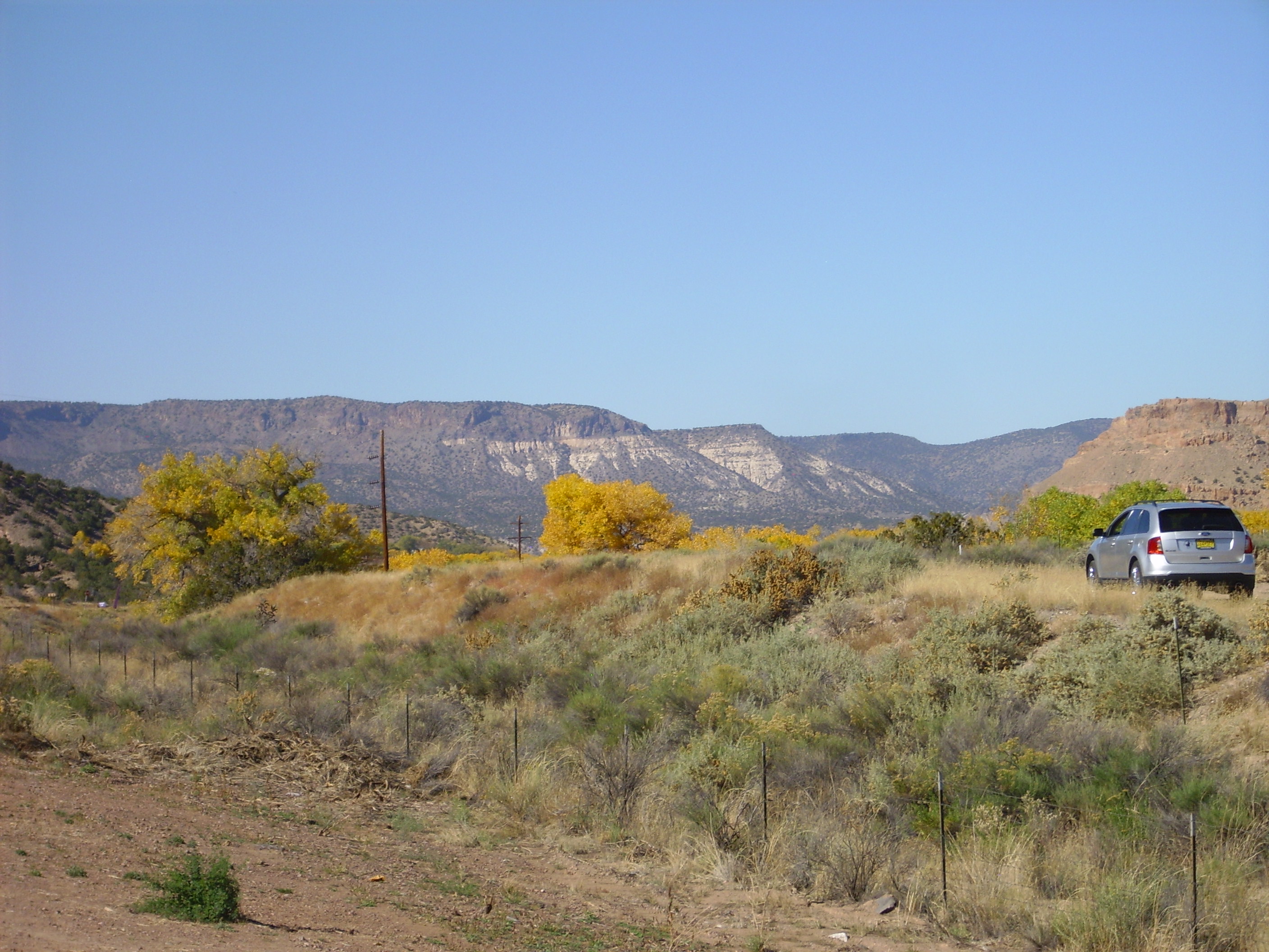
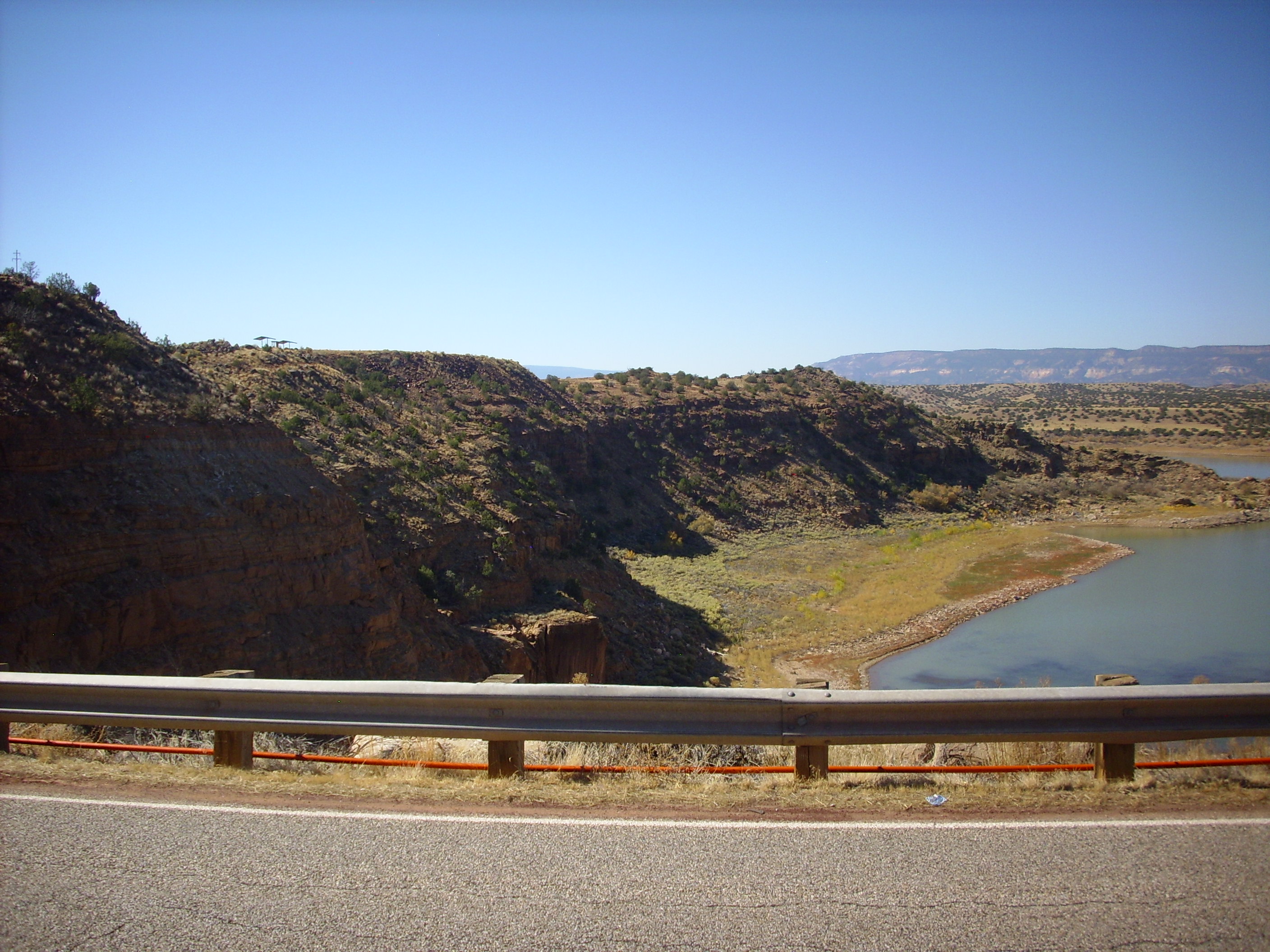
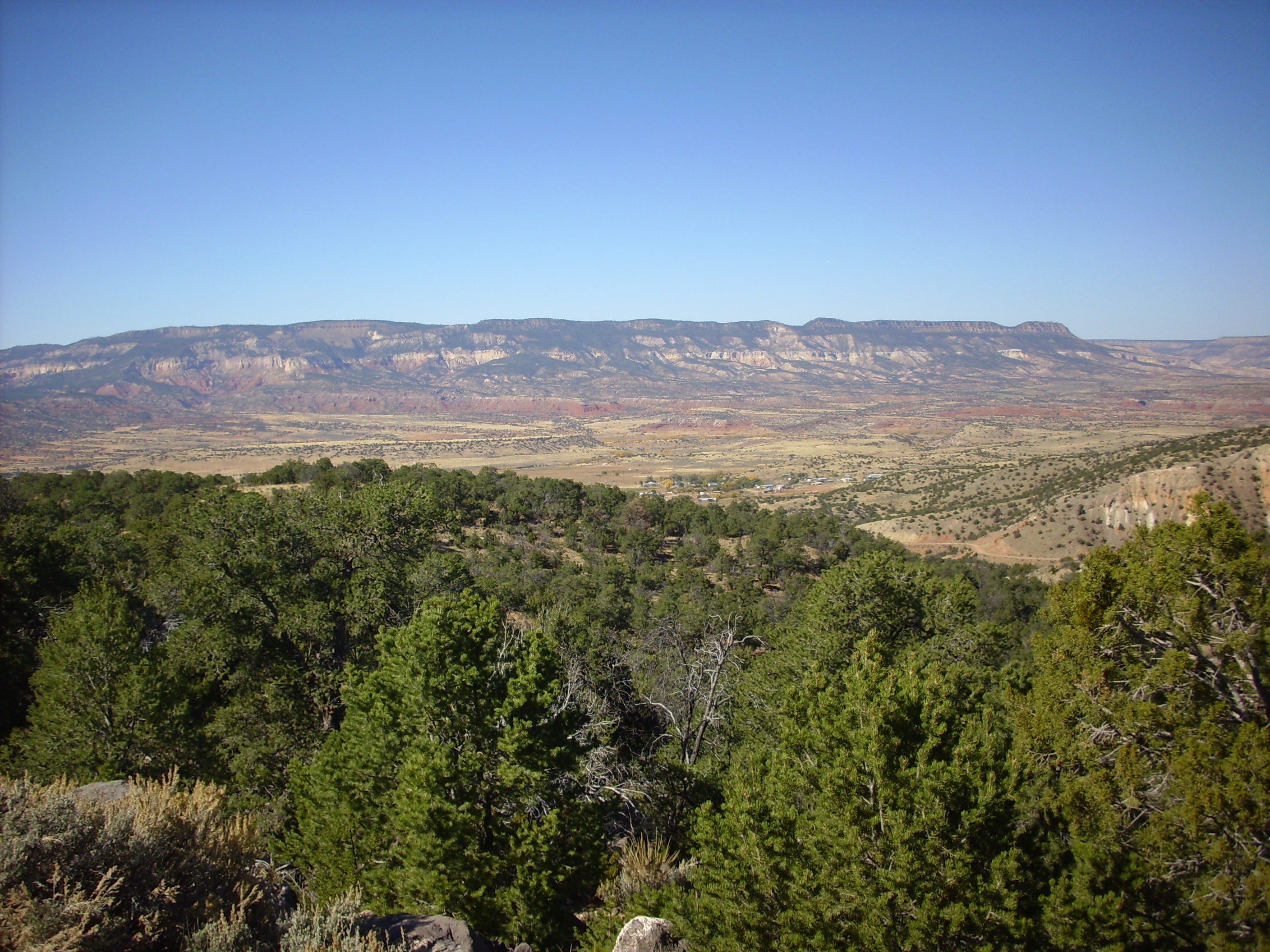
From here one has a nice view of the Abiquiu Reservoir.
Abiquiu Reservoir
In the distance are cliffs of Paleozoic and Mesozoic rocks of the Colorado Plateau. I won’t venture a guess which formations at this distance. In the middle distance is the reservoir, whose shores are mostly Paleo Formation under rounded hills of Painted Desert Member. In the foreground, dark boulders are probably Lobato Formation basalt. The Painted Desert Member and other formations underlying the Lobato Mesa Formation basalt flows to the south lack strength, and this makes for landslides. A large landslide appears to cover the entire area immediately south and east of this point.
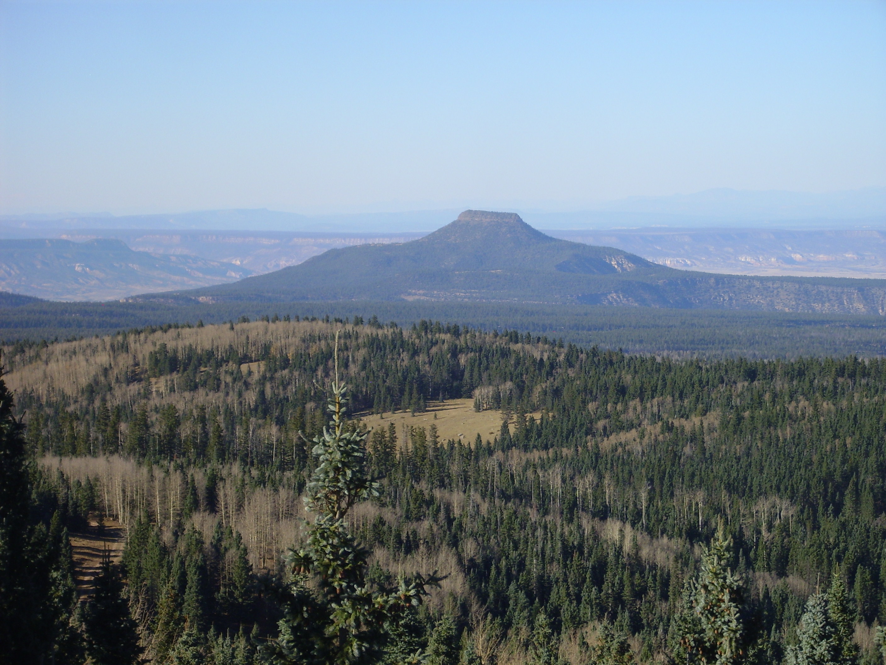
Further west the road crosses a prominent and obvious fault escarpment. In the background Cerro Pedernal is visible.
Fault scarp
In some places, there is a thin bed of the Mesa Montosa Member of the Petrified Forest Formation underlying the Painted Desert Member. The road cuts through such a bed here.

Roadcut in Mesa Montosa Member
In this location, at least, the Mesa Montosa Member is much better consolidated than the overlying Painted Desert Member. There are numerous veins lined with calcite crystals through this bed. I picked up a particularly pretty example.

Calcite veins
Mesa Montosa Member showing calcite crystals
To the south, Cerro Pedernal towers over the landscape. This prominent, isolated peak featured in much of Georgia O’Keefe’s art. It is capped with basalt from the La Grulla vents (of which we will see more later) and is underlain by a nice sequence of sedimentary rocks — which, unfortunately, are shadowed this time of day. I need to come up here very early in the morning sometime for a better picture.
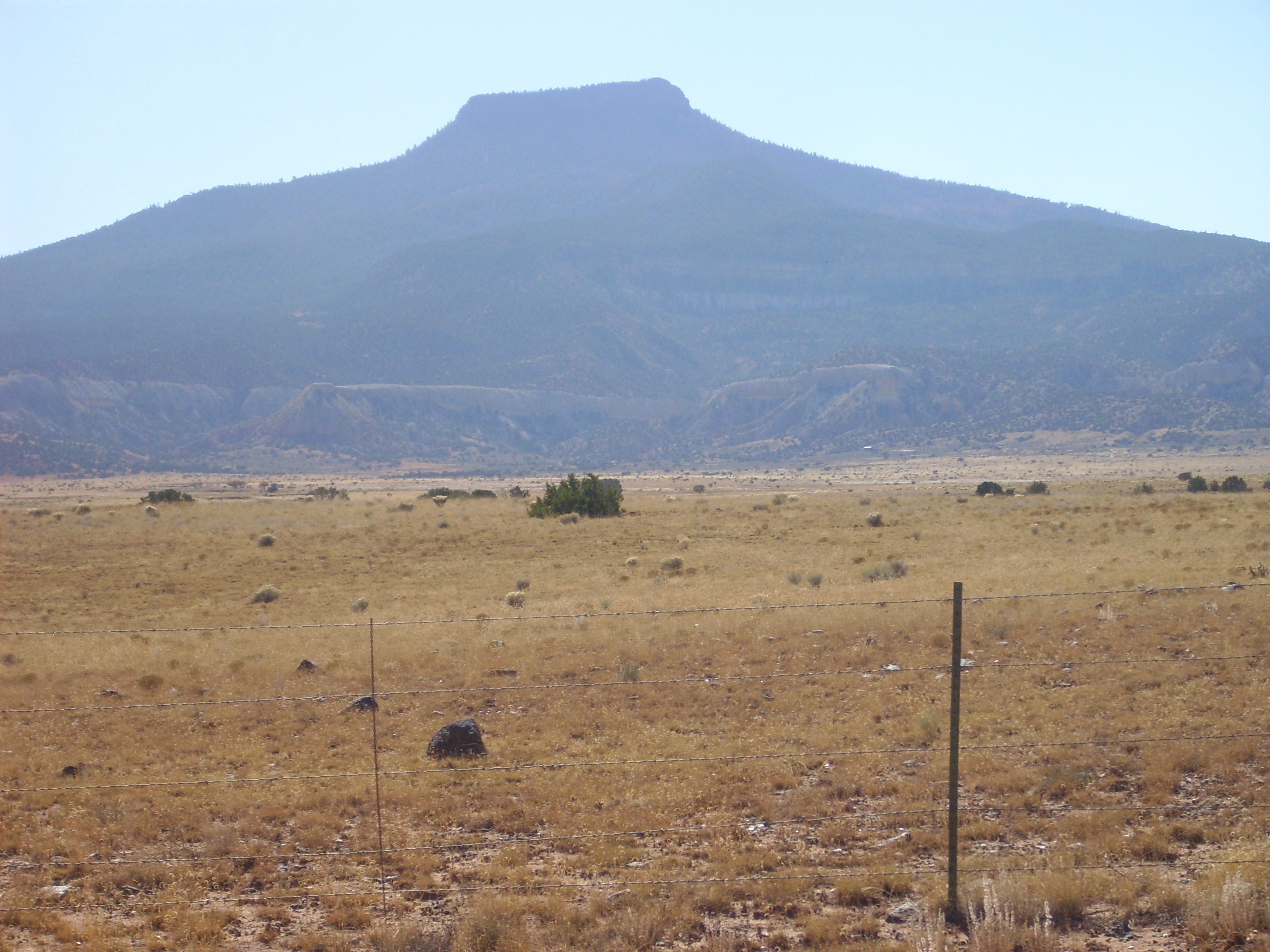
Cerro Pedernal
I felt a twinge of nostalgia driving along this road. I’ve been here just twice before. Once was a couple of years back with Bruce Rabe and the same road log I’m using today, and it was memorably great fun, but not long enough ago to twinge my nostalgia. The other time was when I was in my early teens, and we were returning from a family trip to Utah, and my father decided to take the rather obscure road from the Farmington area through Coyote to White Rock. It was a snowy day and I think he was a bit concerned about the roads in the higher terrain through the Jemez, but I also think my dad sometimes got the wanderlust himself.
To the east, Mesa Prieta is becoming prominent.

Mesa Prieta
Just before Youngsville I turn south onto Forest Road 100. To the west is Mesa Naranja

Mesa Naranja
The lower red portion of Mesa Naranja is Arroyo del Agua Formation, and the thin white band near the top is the Shinarump Formation. Above this is soft shale of the Salitral Formation on which rest fractured beds of the Poleo Formation. This is the same sequence we saw back at the Canones road cut, but here the Salitral is much thicker.
The road winds south into the mountains, past landslide deposits and outcroppings of the Painted Desert and Rock Point Formations. Ahead is Cerro Pedernal, now viewed from the northwest, and the mouth of “Mushroom Canyon”.
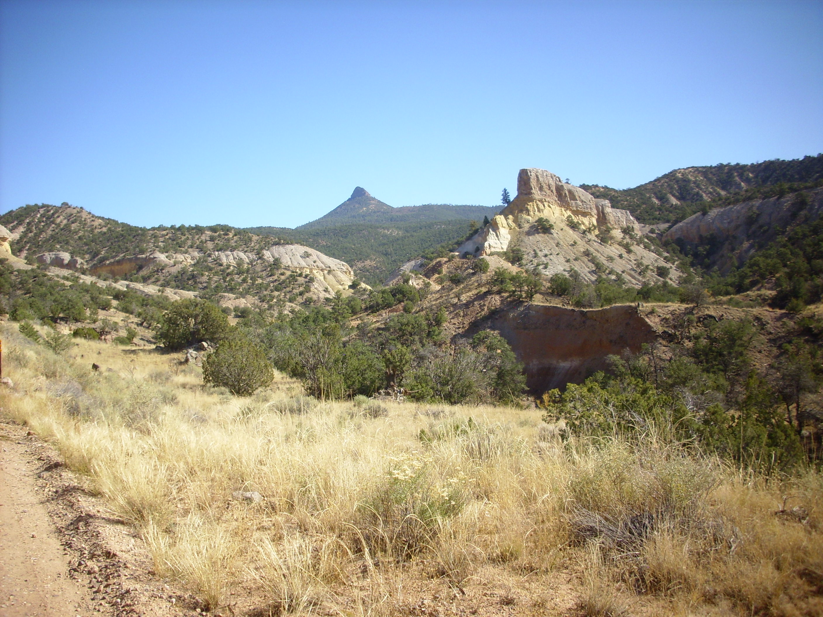
Entrance to Mushroom Canyon
The lowest formation exposed here is the Rock Point Formation of the Chinle Group, which sits on the Petrified Forest Formation. At this point the contact between the Rock Point Formation and the Jurassic Entrada Sandstone is exposed.
Triassic-Jurassic contact
The Rock Point Formation is the uppermost formation in the Triassic Chinle Group, aged about 205 million years. The overlying Jurassic Entrada Sandstone has an age of about 160 million years. The intervening 45 million years are missing from the geological record here.
The Rock Point Formation is fairly hard shale at this location.
Rock Point Formation
The Entrada Sandstone is so soft in this location that it easily crumbles when touched. I don’t care much for loose sand so I took no sample.
Here’s a close up up of that isolated outcropping three images back.
Jurassic Park?
The red bank in the foreground is Rocky Point Formation. The yellowish slopes and walls of the hill just beyond is Entrada Formation, which, because it is so soft, is responsible for the overhanging cliffs of the Todilto Formation here and in other parts of “Mushroom Canyon.” According to my NMGS road log, the entire canyon is owned by a conservancy group, so I did not try to get a sample of the Todilto here. The skyline to the right is Jurassic Summerville Formation.
The road turns between two banks of soft Entrada Sandstone here. Cross bedding is obvious. There is also quite a lot of grafitti scratched into the Entrada Sandstone in and around this road cut.
Entrada Sandstone
The road climbs a hill to the contact between the Entrada Sandstone and the Mesa Luciano Member of the Todilto Formation, a hard limestone.

Approximate contact between Entrada and Todilto Formations
Mesa Luciano Member, Todilto Formation
A respectable hard, crystalline limestone; foams like crazy when acid is dripped on it. Um, because I was having just a little difficulty sorting out my samples after I got home and I wanted to double check which was limestone…
Much of the Todilto Formation is gypsum, but this is so easily dissolved that it is missing in many places, leaving only the limestone.
At the top of the hill one gets a nice view back at “Mushroom Canyon”.
Mushroom Canyon
Also a very nice view across the Colorado Plateau to the north.
Looking north
The road now heads south into the narrow canyon of the Rio Encino as it works its way towards the La Grulla Plateau. As the road ascends, it passes Cretaceous rocks of the Burro Canyon and Dakota Formations. At this point the Paguate Sandstone of the Dakota Formation towers over the road.
Paguate Sandstone
Paguate Sandstone
There are numerous other members of the Dakota Formation in the area, but neither they nor the underlying Burro Canyon Formation were readily accessible from the road, alas.
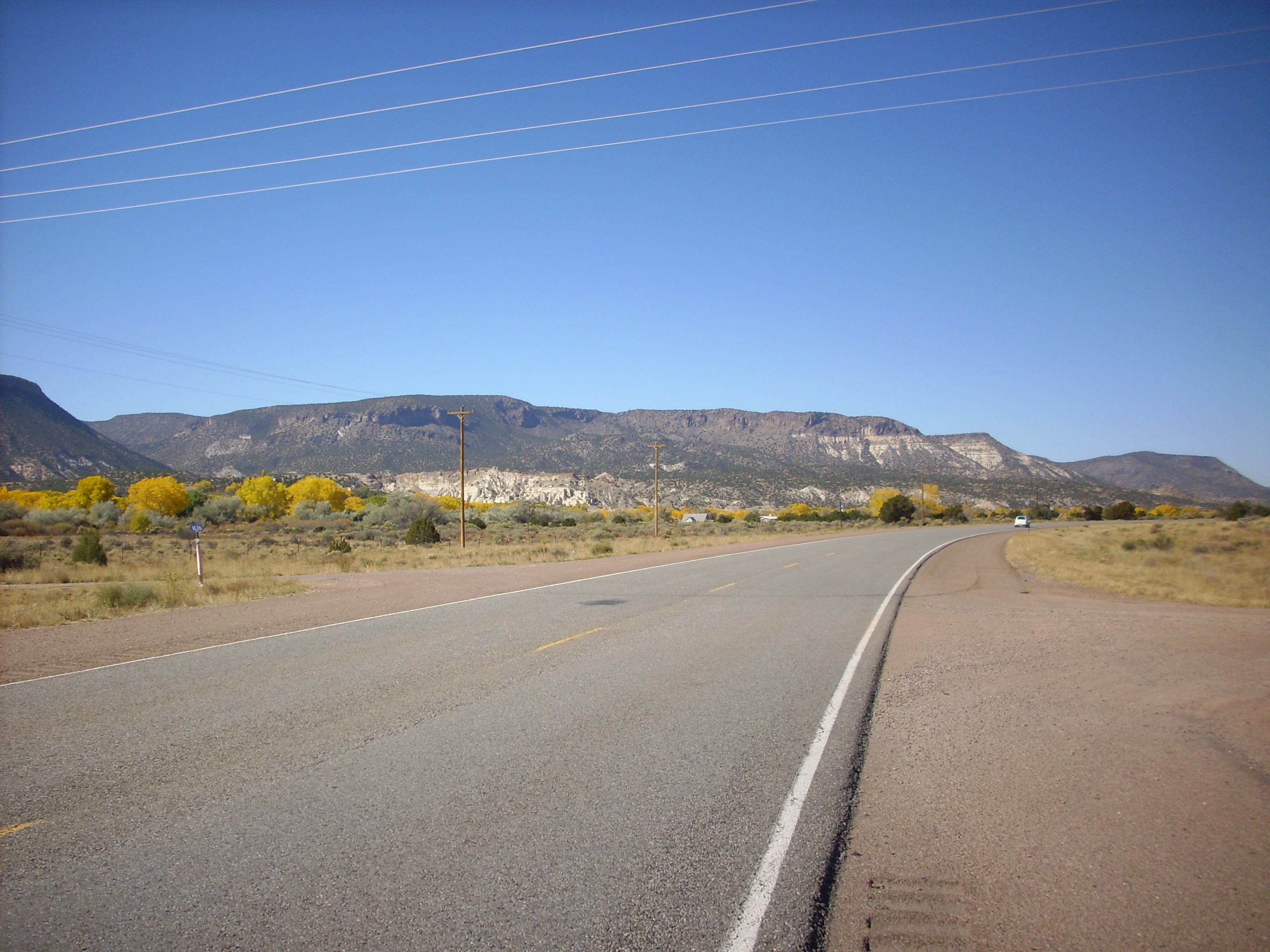
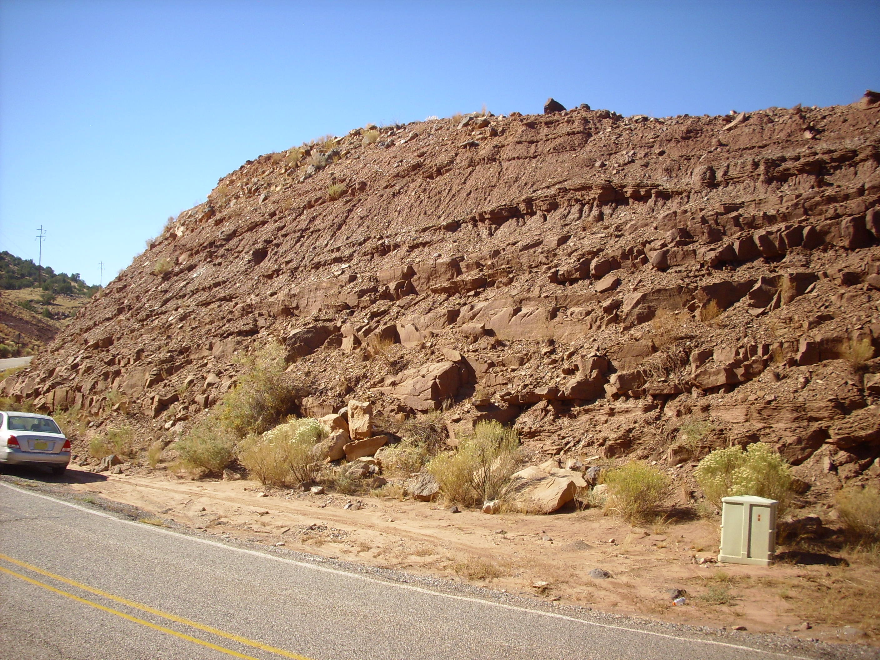
Further down the road there are poor exposures of El Rito Formation, and cliffs of Abiquiu Formation are prominent to the east.
Abiquiu Formation
At this point, the road cuts through Abiquiu Formation.
More Abiquiu Formation
When last we saw the Abiquiu Formation, it was at the bottom of the Chama River Valley at Abiquiu. Here it is high in the Jemez Mountains. This shows just how much vertical displacement downwards there is to the east as one crosses the western boundary of the Rio Grande Rift in the Canones Fault Zone.
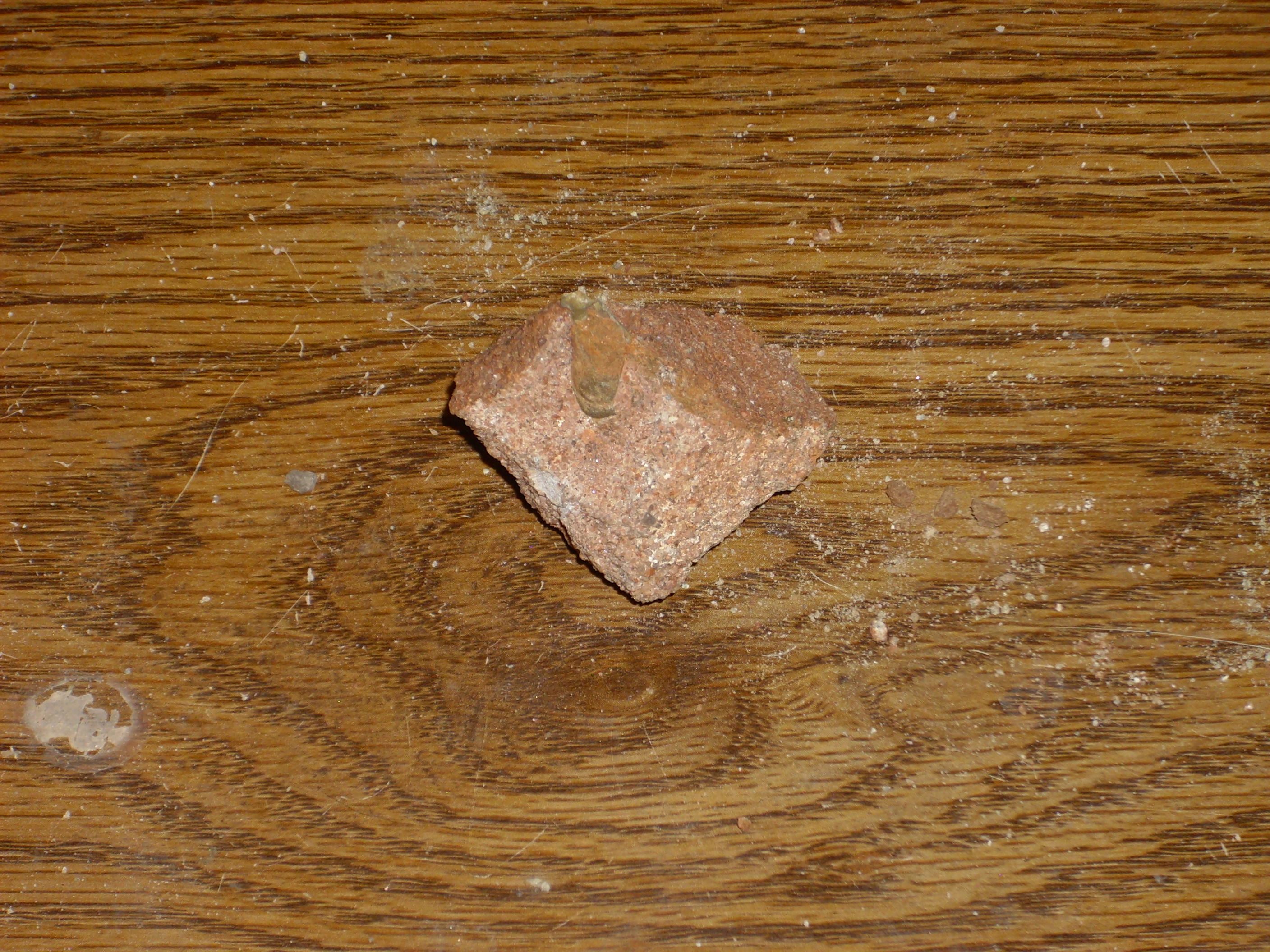
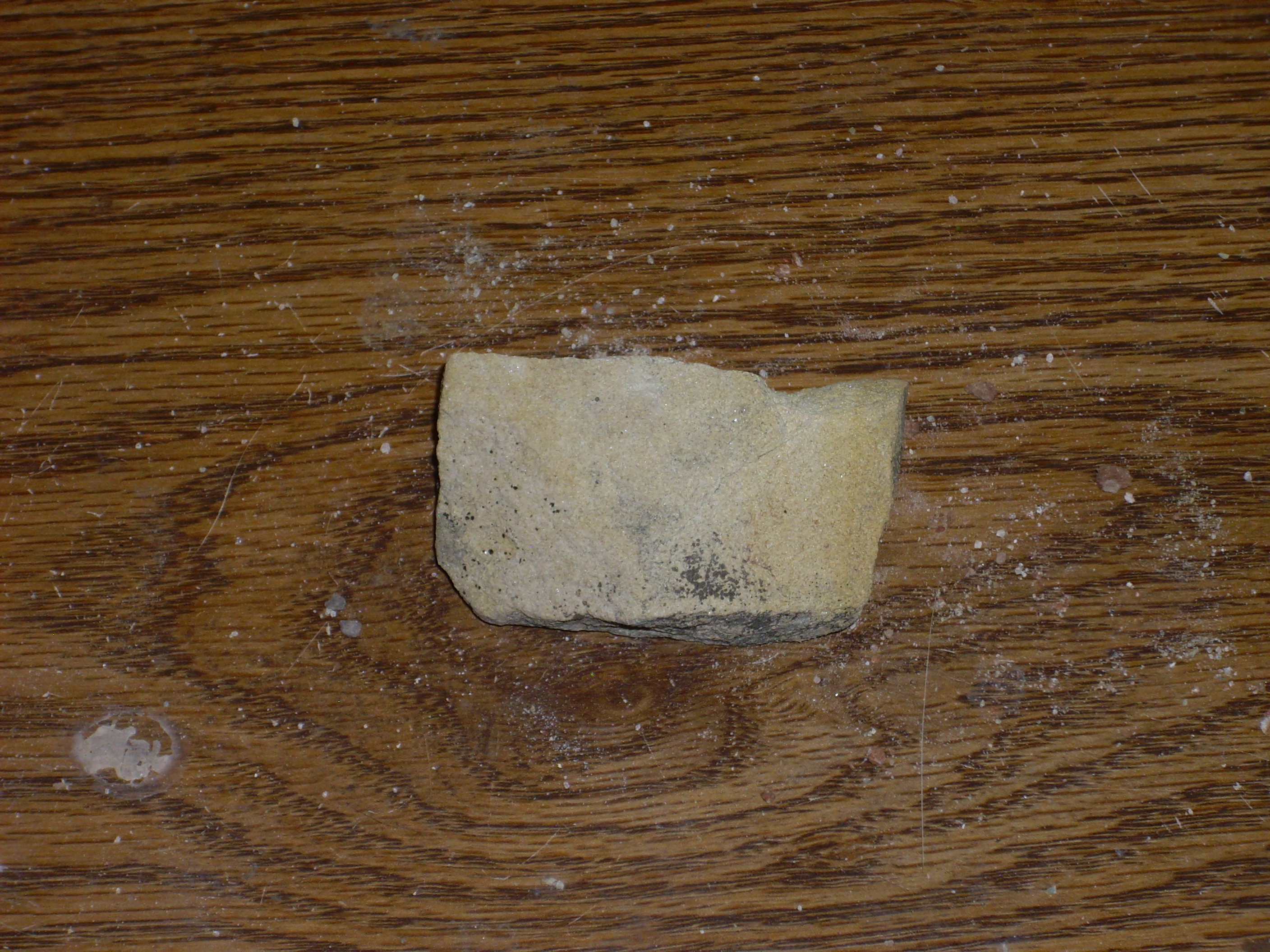
I didn’t pick up a sample of Abiquiu Formation here. I already have one, from the southern Jemez:
Abiquiu Formation volcaniclastic sandstone
The formation is found there at a similar altitude.
This is a good place to pause and recap. The oldest formation I looked at on this trip was the Arroyo del Agua Formation of the Permian Cutler Group. This was overlain by the Shinarump, Salitral, Poleo, Petrified Forest, and Rocky Point Formations of the Triassic Chinle Group. These two groups were visible both at the road cut in the Canones fault zone and on Mesa Naranja. Overlying these groups were the Jurassic Entrada, Todilto, Summerville, and Morrison Formations. Above these were the Cretaceous Burro Canyon and Dakota Formations, which in turn were overlain by the El Rito and Abiquiu Formations of the early Tertiary, before the Rio Grande Rift opened. Finally, early in the trip, I saw various formations of the Santa Fe Group, laid down as the rift opened, in the Espanola area.
Not bad for a day’s rockhounding.
At this point, I had accomplished my main objectives for the trip, but I was so close to Encino Point that I just had to go take a look. From there I could either retrace my steps or head on across the Tschicoma Highlands, deep into the Jemez, to get back to Espanola.
The road up to the La Grulla Plateau gives a beautiful view across Canones Canyon towards Polvadera Peak to the southeast.
Polvadera panorama
The mesa across Canones Canyon is Mesa del Medio. To the left one sees the mesa underlain by Santa Fe Group with a cap of Bandelier Tuff. To the right this gives way to basalt flows of the La Grulla volcanic center. Polvadera Peak is right of center and Cerro Pelon is the smaller peak just left of center. Both are dacite domes of the Tschicoma Formation.
Nearby the road began cutting through andesites of the La Grulla Plateau. These were long lumped together with the Lobato Mesa Formation to the east, but geologists now think these were separate pulses of volcanic activity, with the La Grulla eruptions occurring a bit later, about 8 million years ago.
La Grulla andesite
La Grulla andesite
The La Grulla Plateau is a subalpine plateau formed from an area that was flooded with basalt and andesite lava about 8 million years ago. The hard lava protected the area from erosion, and subsequent faulting to the east and west left the plateau standing more or less by itself except on the south, where it was buried under Tschicoma lava that now forms the Valles Caldera north rim. The plateau has low rolling hills and long meadows marking faults, mostly trending north or northeast. It’s a wonderful place to camp if you dare take a camper up there on the gravel roads.
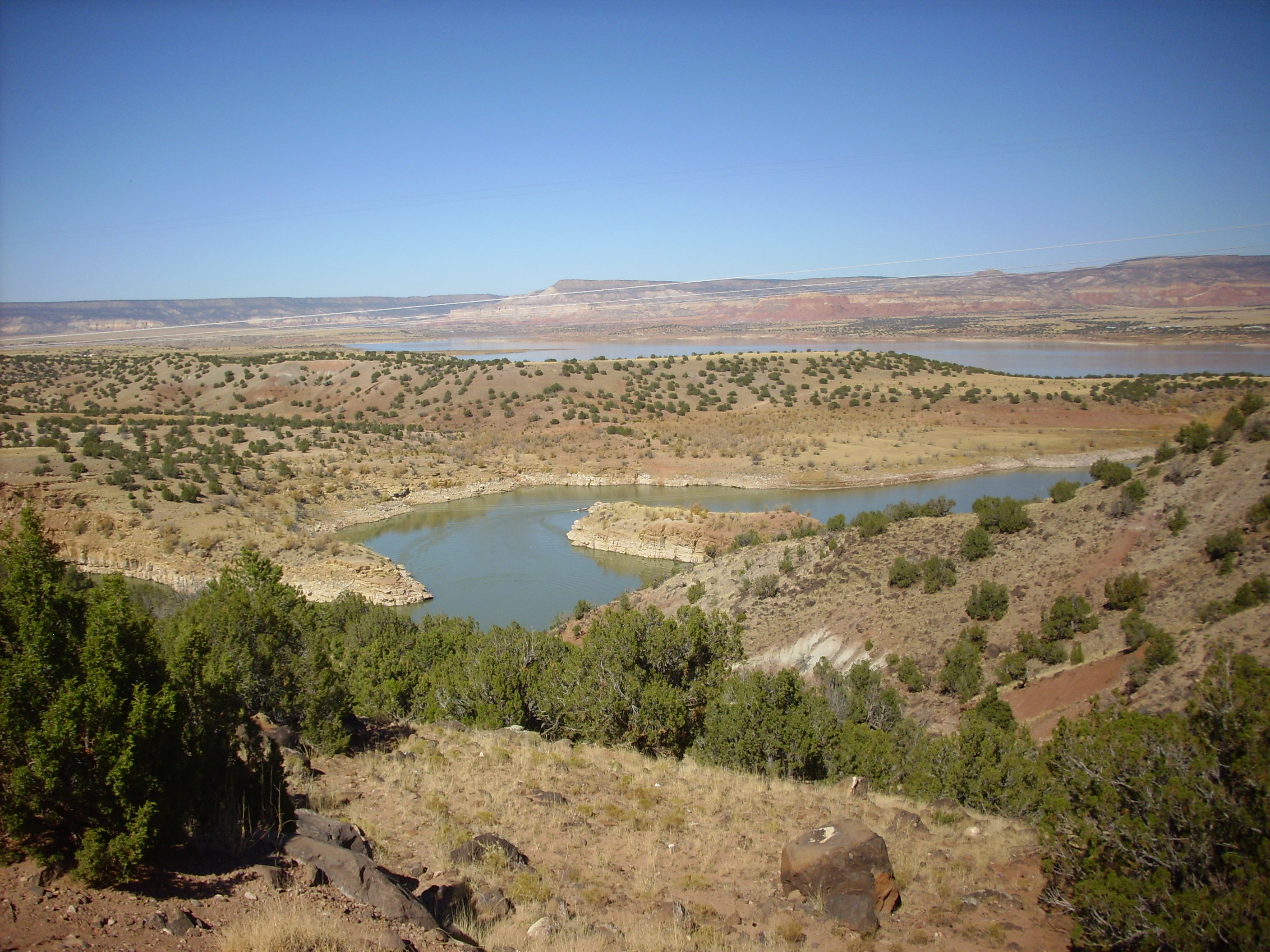
Here is a fault valley with a small lake.
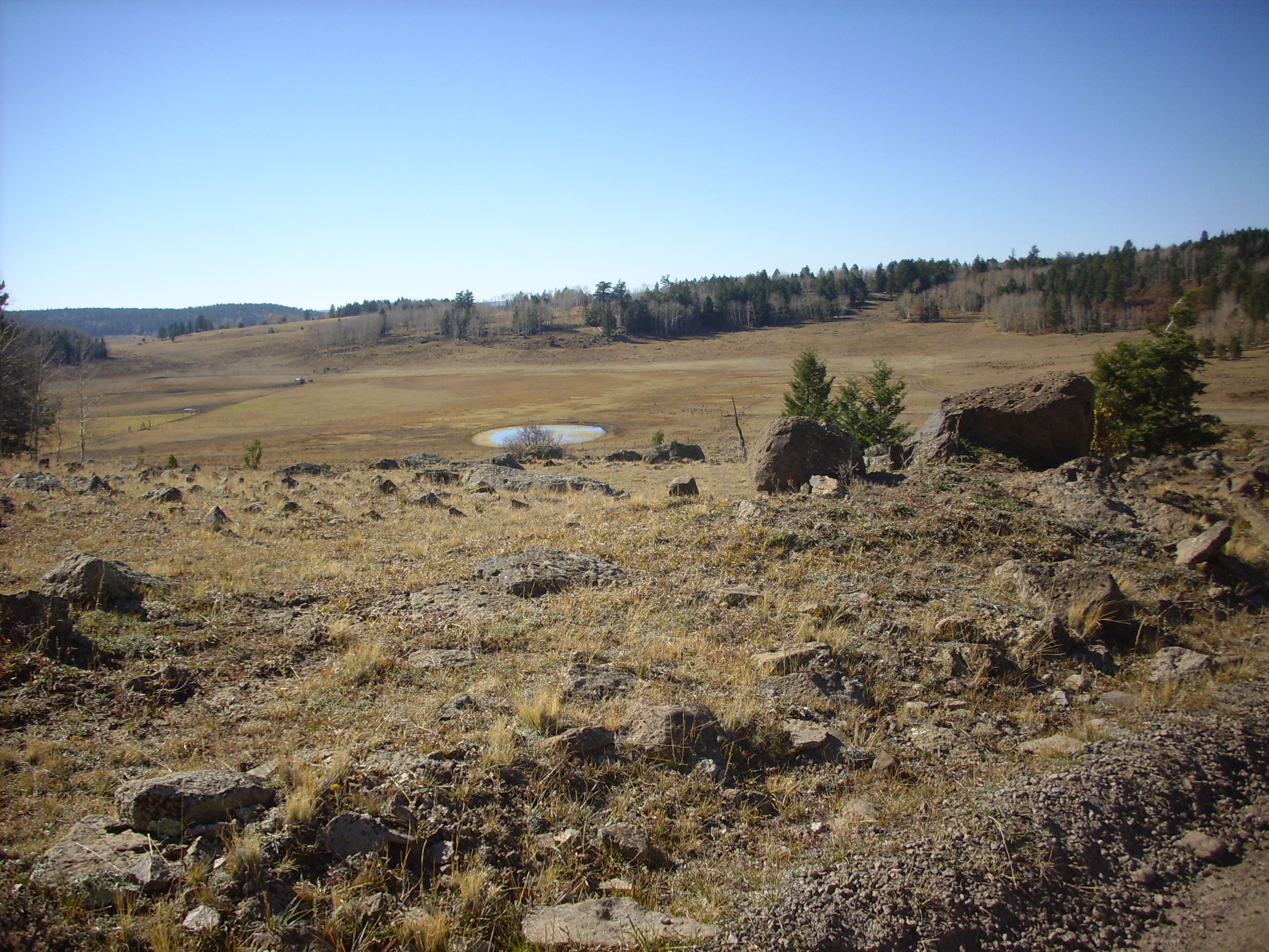
Fault valley on the La Grulla Plateau
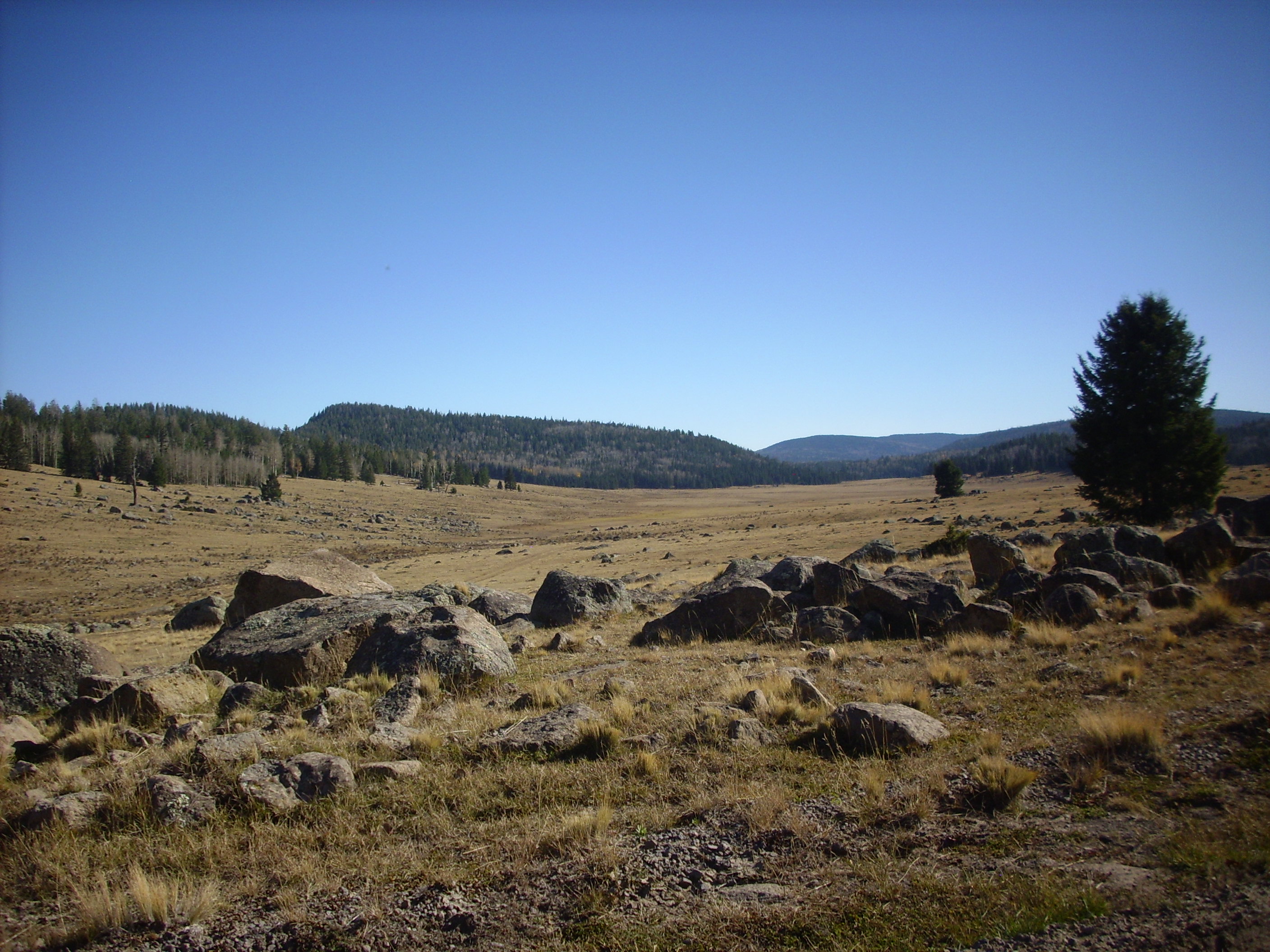
And here is a photo looking along a fault meadow.

Looking northeast along a fault trace
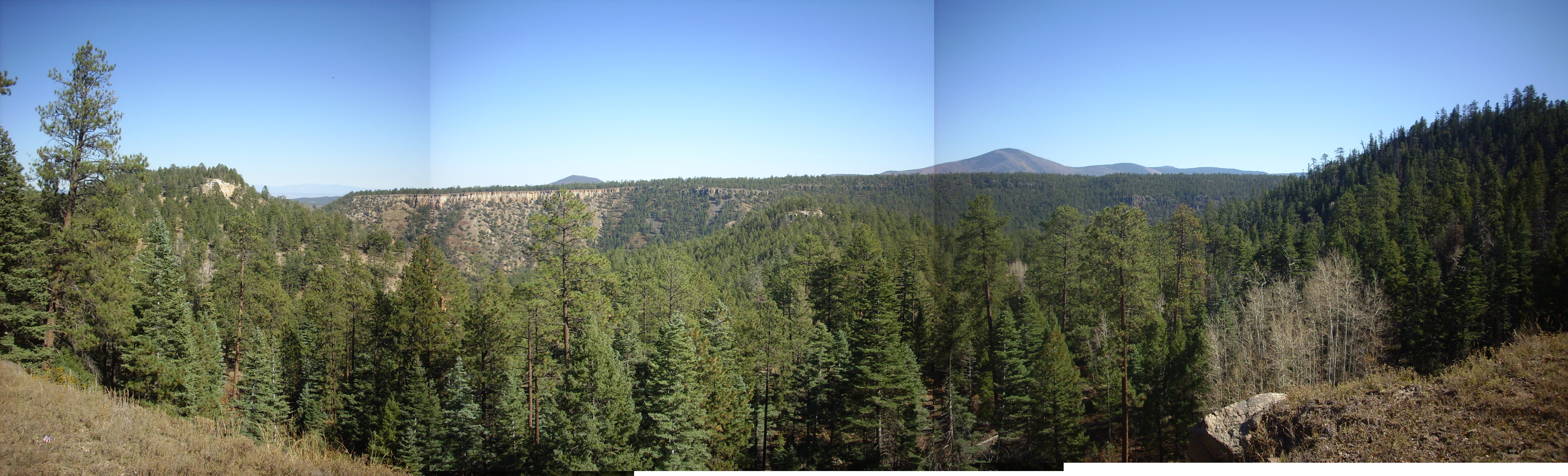
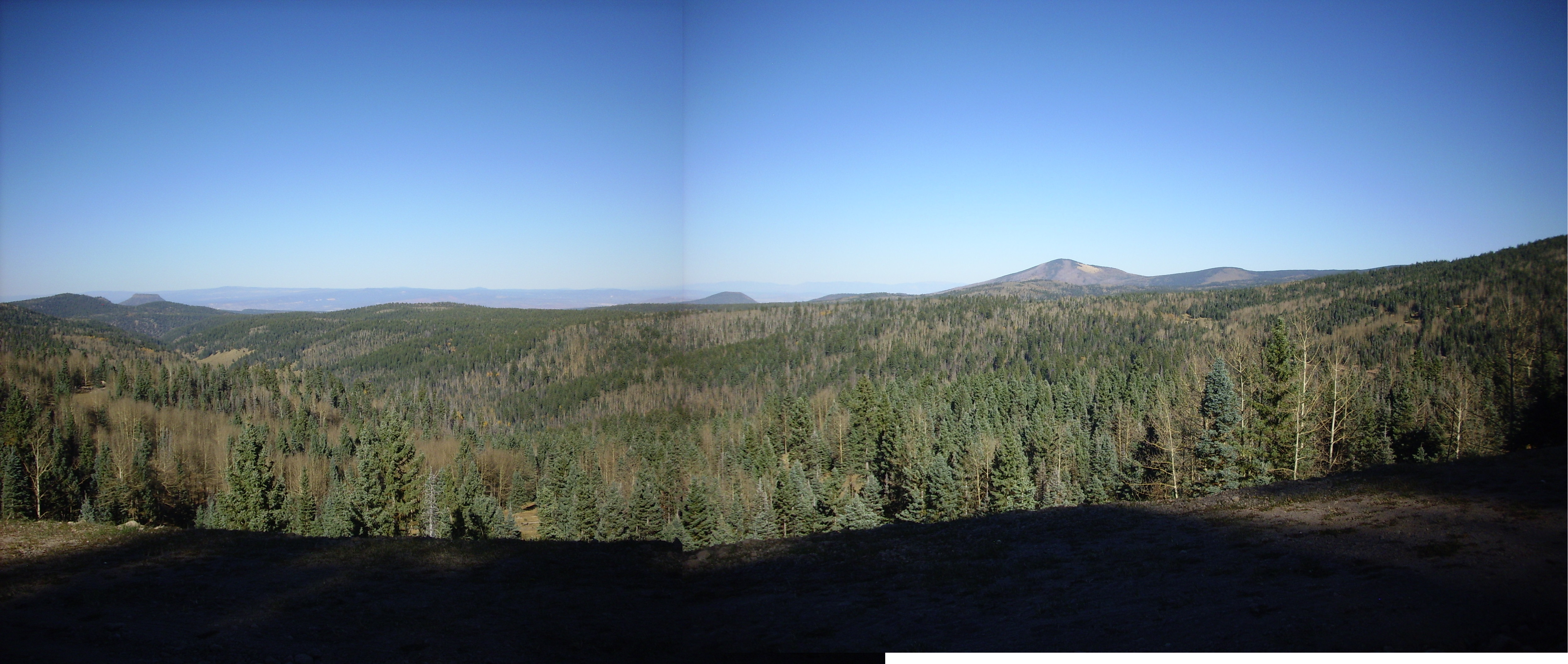
I was running rather short of time and could not explore Encino Point as well as I would like. Sometime I’m going to have to go earlier in the day and hike around the area. But here is a nice panorama from near the point.

Panorama from Encino Point
The rugged terrain in the center was mapped as landslide by early geologists, but it is now recognized as the faulted and deeply eroded center of an ancient volcano. Beyond is the Sierra Nacimiento Mountains, where a huge block of crust has been thrust up by tectonic forces. Mesa Naranja is visible to the right, and above it on the skyline is Mesa Alta.
My time was up. I had to decide whether to take the road back the way I had come — a sure route, but one already traveled this trip — or try the road on through the Jemez to Espanola. From my road log, it looked like it was a wash either way for time, assuming the road was okay. I decided to give the road through the Jemez a try. Bruce Rabe and I had been along it once before and I didn’t remember it being too awful.
My memory must be getting old.
On the way out, the road passes another mountain meadow strewn with andesite boulders.
La Grulla Plateau
From here I drove along the road like a madman to get home on time. I think I managed 35 MPH most of the way, but some spots did not permit it. In fact, some spots were pretty marginal for a passenger vehicle. I was proud of my Korean clown car; it didn’t wimper once.
I skipped the road to the caldera rim. It’s a wonderful view, but the road … well, it’s not so much that the road has gullies as that the gully has some road in it.
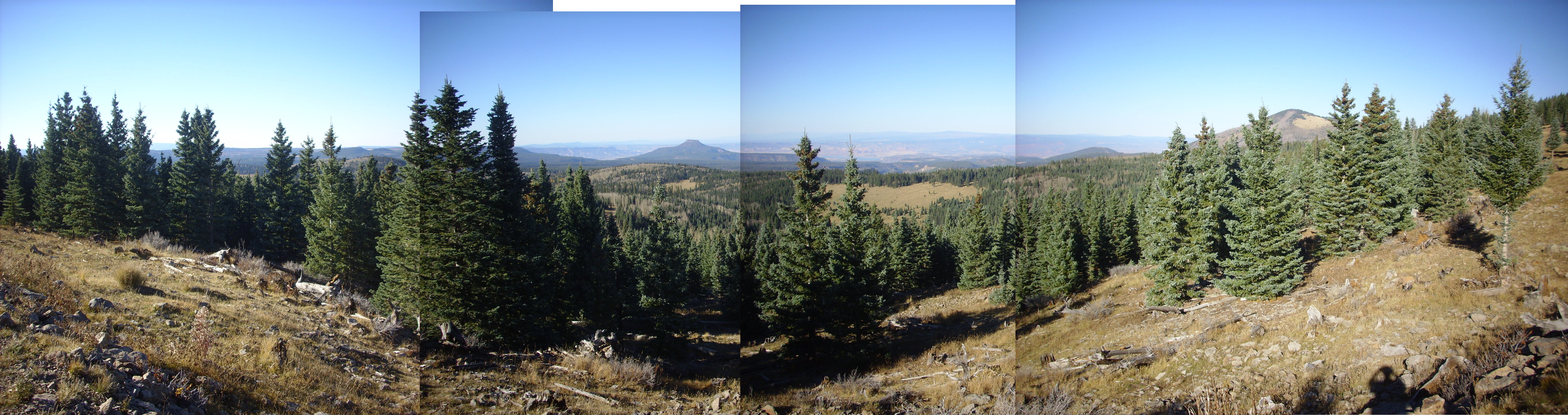
The vista from near the head of Canones Creek, somewhere near here:
Looking northeast
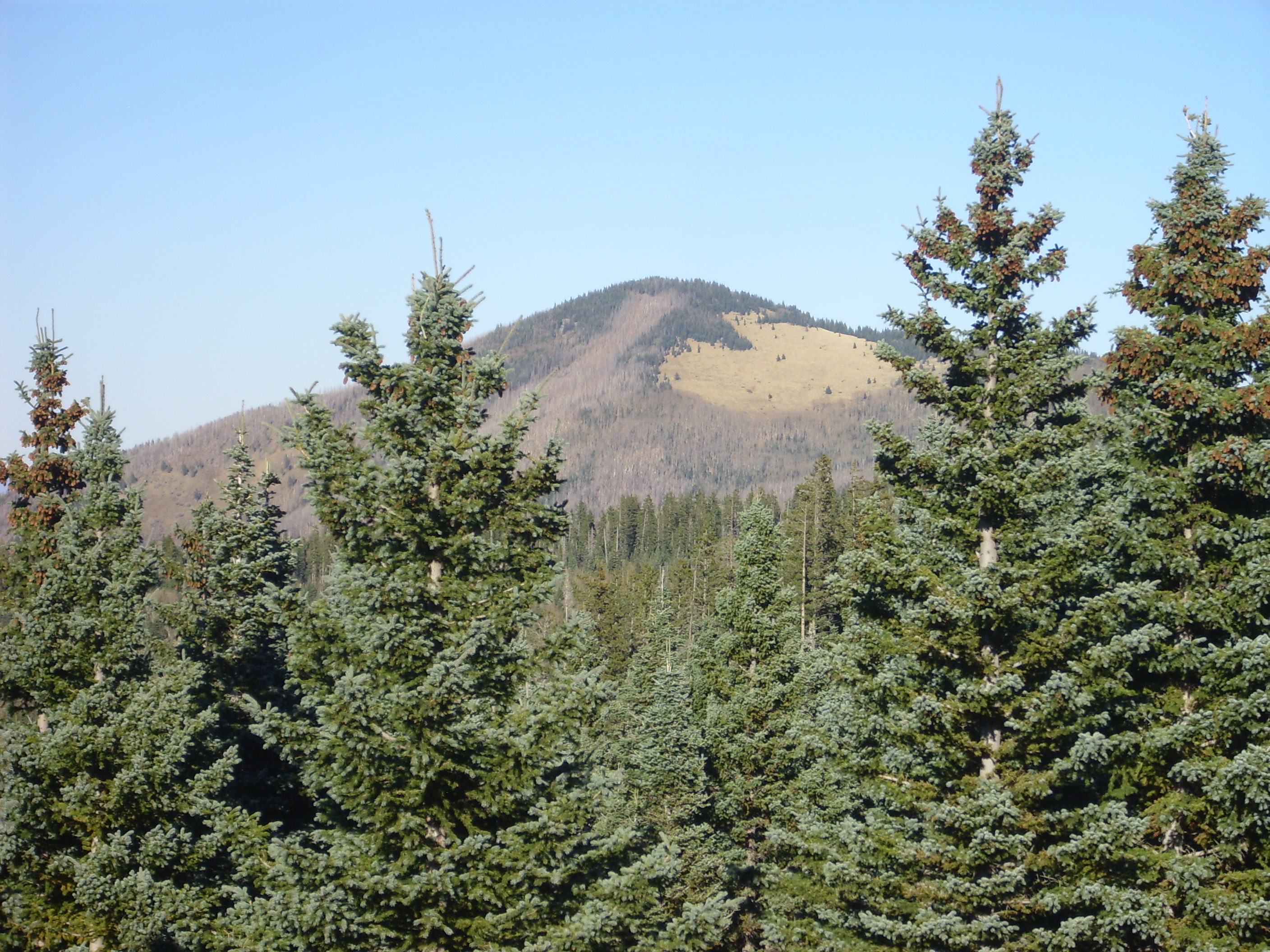
The vista from the headwaters of Polvadera Creek, near here:
Polvadera Creek overlook
That’s Cerro Pedernal again in the center, and Polvadera Peak off to the right.
Closer up:
Cerro Pedernal from the south
Polvadera Peak from the southeast
The road also passes a good spot for a panorama shot into the Cerro Toledo embayment.
Cerro Toledo Embayment
The valley in the foreground is the uppermost Santa Clara Canyon. The large mountain is Cerro Toledo. This whole area was once thought to be a caldera, responsible for the Otowi Member of the Bandelier Tuff, but smaller, older, and displaced to the northeast relative to the Valles Caldera that produced the Tsherige Member of the Bandelier Tuff. More recent geological studies have convinced geologists that the Toledo Caldera had very nearly the same size, shape, and location as the Valles Caldera, and the Toledo Embayment is a bit of a geological mystery. It may represent a fault zone buried under later volcanic activity, but no evidence for the fault traces has been found.
The road comes out on Gallina Mesa, which is a single massive flow of dacite lava that emerged from the northwest flank of Tshichoma Mountain three million years ago. Here the view looks out over Lobato Mesa and the high plateau to its west, an area I would like to explore in some future trip into the mountains.
Gallina Mesa
The flat, meadowed area in the center distance is Lobato Mesa, a basalt plateau similar to La Grulla Plateau, but somewhat lower in altitude and geologically a bit older. The parallel ridges trending north are fault blocks. The Lobato Mesa basalt is about 8-10 million years old and represents some of the earliest volcanic activity in the Jemez area. It is roughly contemporaneous with the Paliza Canyon Formation in the southern Jemez and may be part of the same pulse of volcanic activity.
The Gallina Mesa in the immediate foreground is composed of a nice porphyritic dacite.
Gallina Mesa Unit, Tschicoma Formation
This is fairly typical rock of the Tschicoma Formation, which forms most of the skyline west and northwest of Los Alamos. Tschicoma dacite almost always contains numerous large crystals of plagioclase feldspar, a distinctive feature that lets you identify Tschicoma outcroppings at a glance while hiking around the eastern Jemez. Some outcroppings (not the one here) also contain some quartz crystals, and are then classified as rhyodacite.
To the east is the Clara Peak volcanic center, considered part of the Lobato Mesa Formation. Clara Peak itself is a shield volcano, formed from successive eruptions of low-viscosity basalt, and the Santa Clara Fault has dropped the south flank of the volcano and exposed the interior of the volcano. One can see numerous thin basalt flows separated by breccia in the road cut here.
Clara Peak basalt flows
The view from here is spectacular.
Clara Peak panorama
That’s Santa Clara Canyon in the foreground and extending up into the Tschicoma highlands at right. Tschicoma Peak itself is almost washed out by the sun, but you can see Polvadera Peak at extreme right.
Incidentally, I think I’ve figured out why the panoramas aren’t always perfect. Aside from different exposure levels at the image edges — which I could probably Photoshop, if I wasn’t too cheap to buy Photoshop — the scale is slightly different on different images. I think I can fix that in the future by locking the zoom and focus of my camera on the first photograph.
Just two more pictures, of where the very heart of the volcano has been exposed by erosion.
Gabbro intrusion in the heart of Clara Peak
At this spot, we see basalt on the left, which is slightly reddish in color. The gray mass to the right is gabbro, which has the same composition as basalt, but cooled slowly enough to form visible crystals. This is presumable the top of the magma chamber within the volcano, which cooled very slowly after the final eruptions.
Other side of gabbro intrusion
And here we see the other side of the magma chamber.
Okay, I lied. Two more pictures:

Diabase from the Lobato Formation, Clara Peak

Gabbro from the Lobato Formation, Clara Peak
Diabase is a common term for relatively fine-grained gabbro. Most of the intrusion could be classified as diabase, but there are conspicuous veins of more crystalline gabbro here and there. These were presumably the last bits of liquid magma in the chamber, which were probably unusually rich in water which helps silicate minerals crystallize into larger crystals.
From here down the remainder of 31 Mile Road to Espanola.
And home.
Copyright ©2014 Kent G. Budge. All rights reserved.
This is a really interesting site, with some great geology. Good job!
I’d like to share some thoughts, though, on a few of the photos because I think that I can refine your IDs. I’ve been a geologist for 47 years and teach undergraduate geology.
The photo labeled “basalt dike” puzzles me because I don’t think that the surrounding tuff would be competent enough to not be completely pushed aside by the basalt. Also, dikes tend to narrow towards the surface.
This would explain why the baked gravel is only on one side. Baked gravel usually underlies a basalt flow. I think that these two pictures might show vertically tilted alternating layers of tuff and basalt.
The next couple of pictures, labeled basalt with quartz veins, are more likely gray limestone with calcite veins. This would explain the sort of “salt block” irregular, somewhat wavy weathering on the surface. If I’m right, both the rock and the veins should react to acid.
Thank you for sharing all the great photos and your observations. It sounds like you had a great day.