Two Easy Wanderlusts
Not all my rockhounding takes the form of big day-long trips. Particularly at this time of year, when things get busy, days are short, and weather is unreliable, I’m more inclined to take frequent short trips than occasional long trips.
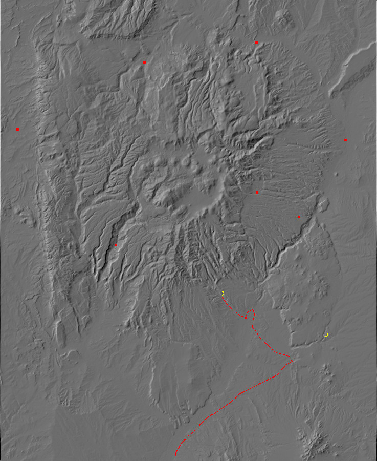
I’ll be showing photographs here from two relatively short trips, both of which were made as side trips while returning from visiting Albuquerque. The first is to Kasha-Katuwe Tent Rocks and the second to La Cienega.
Kasha-Katuwe Tent Rocks
This is a relatively new national monument, established as almost one of the last acts of President Clinton in office. It is located in the southwest Jemez north of Cochiti Pueblo, and one must drive through the pueblo to reach it. The monument itself is on BLM land and is administered by BLM, a break with the usual rule for national parks and monuments.
The local geology seems straightfoward enough. Volcanism in the southern Jemez began perhaps 12 million years ago with basalt flows from fissures associated with the Rio Grande Rift. The basaltic volcanism reached its peak about 10 million years ago, forming the Paliza Canyon Formation that crops out throughout the southern Jemez. This low-silica volcanism gave way to high-silica volcanism of the Bearhead Rhyolite, which reached its peak around 7 million years ago. This switch from low-silica to high-silica volcanism is a common pattern. The heat of the magma gradually melts some of the silica-rich country rock, which mixes with the magma and raises its silica content. At the same time, the magma is cooling, and as it begins to crystallize, silica-poor minerals crystallize first and leave the magma further enriched with silica.
High-silica volcanism is violent, because the magma tends to be viscous and saturated with dissolved gas. Such volcanism is responsible for the Valles caldera and the Bandelier Tuff that dominates the Los Alamos area. However, no caldera has been identified in the southern Jemez, and geologists speculate that the rapid widening of the Rio Grande Rift (which peaked in this area around 12 million years ago) tended to open fissures through which the magma was able to erupt before enough pressure build up for a caldera eruption. The eruption was still violent enough to produce ash and pumice falls and pyroclastic flows. Pyroclastic flows consist of of a mixture of red-hot gas and particles of magma that can travel great distances from the eruptive vent before settling to the ground and solidifying into tuff.
The area around Kashe-Katuwe Tent Rocks is underlain by two formations, the Peralta Tuff of the Bearhead Rhyolite and the Cochiti Formation. The Peralta Tuff is mostly ash and pumice falls, but with a number of pyroclastic beds (my source says 14) and some sedimentary beds of volcanic sediments reworked by floods and streams. Some of the pyroclastic beds likely originated at Bearhead Peak, a major eruptive center from which the Bearhead Rhyolite gets its name.
As the high-silica eruptions began to die out, around 6 million years ago, erosion of the eruptive centers produced large amounts of rhyolite debris that was deposited on top of the Peralta Tuff. This is the Cochiti Formation.
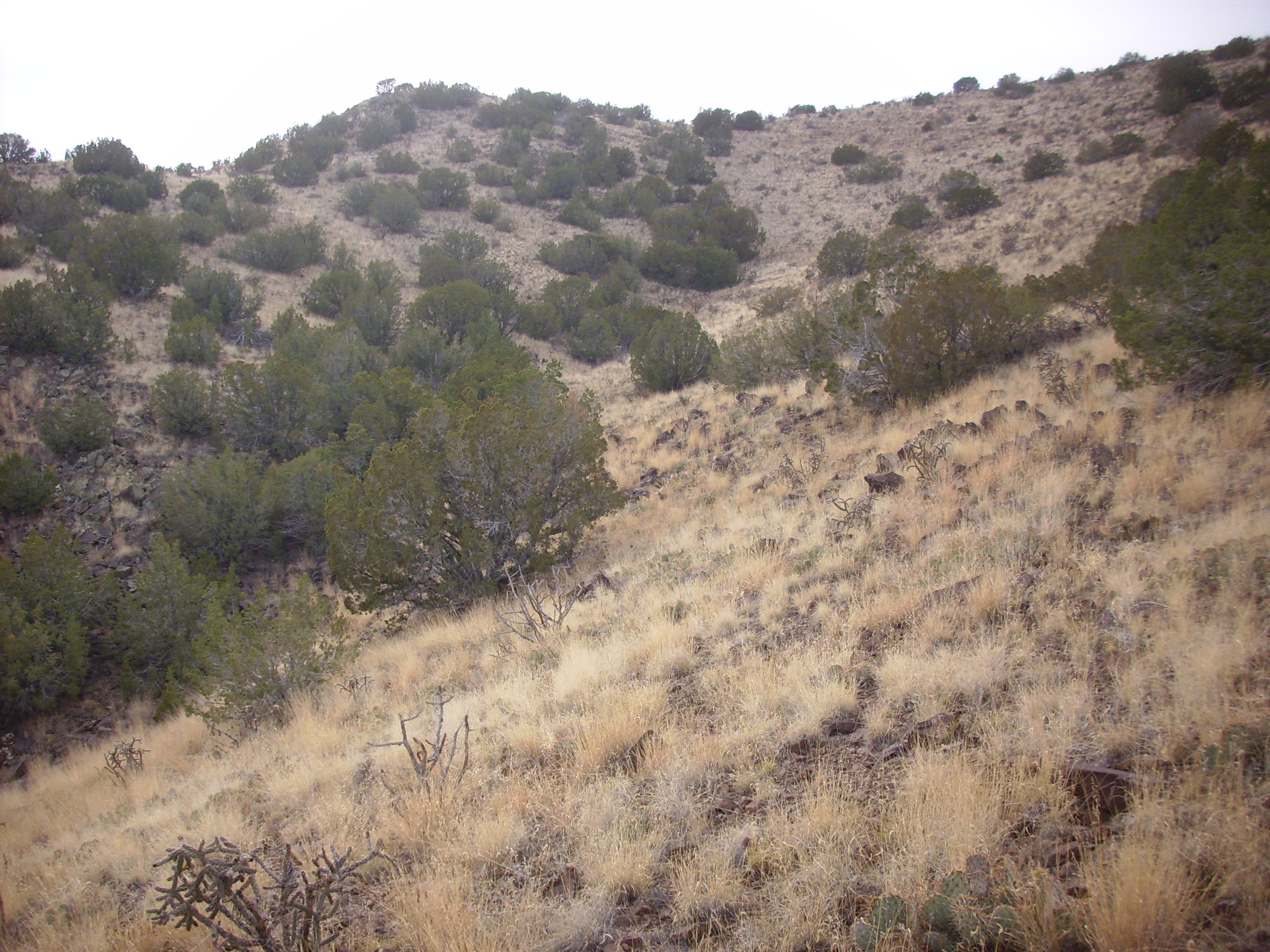
The rockhounding part of my trip begins near Bernalilo, where one has a magnificent view of the northern Sandia Mountains.
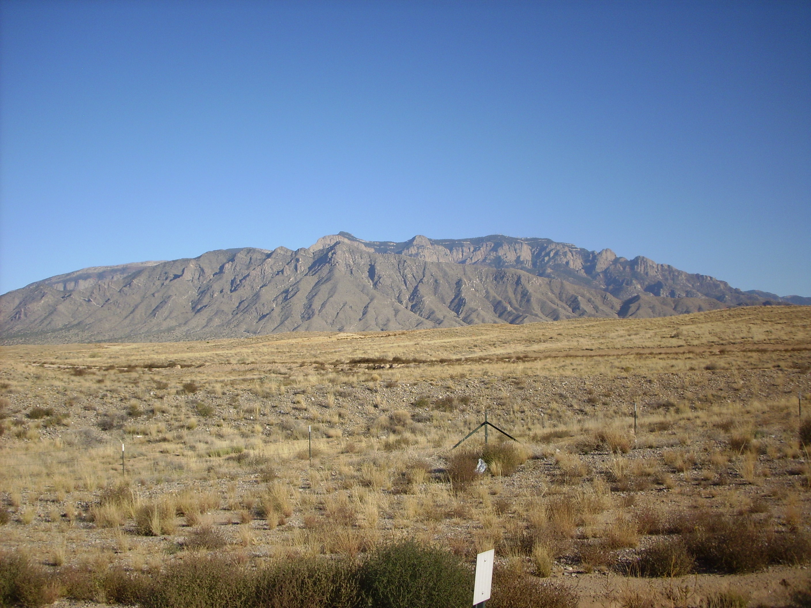
This is a very familiar sight to New Mexico residents. Most of the mountain is Precambrian granite intruded with pegmatite dikes (visible as lighter bands across the rock face) but there is a rind of Paleozoic rock at the top. The mountains have been thrust up by the same tectonic forces that have opened the Rio Grande Rift.
Looking north from here, we see a superb example of a shield volcano in the San Felipe volcanic field south of the Jemez.

This volcano is around 2.5 million years old, making it roughly the same age as the Cerros del Rio around White Rock. Both volcanic fields primarily erupted low-silica basalt, which is low in viscosity and easily spreads away from its eruptive vents. Repeated eruptions from a single vent produce a gently sloping mountain that early geologists fancifully likened to a Hawaiian warrior’s shield laid flat on the ground.
Past San Felipe, and just before we reaches the La Bajada escarpment, we exit the interstate highway to take the road to Cochiti. I paused here to photograph the picturesque red rocks of the area, which I supposed were Permian redbeds of the kind so prominent in the southwestern Jemez.

It was only later that I discovered that this is mapped as Gallisteo Formation, which was deposited just before the Rio Grande Rift began to open and is between 50 million and 38 million years old — much younger than the 300-million-year-old Permian redbeds of the southwest Jemez. The resemblance reflects the similar depositional environment of both formations, albeit separated in time by hundreds of millions of years.
The road passes Cochiti Dam:

and passes through Cochiti Pueblo to the monument.
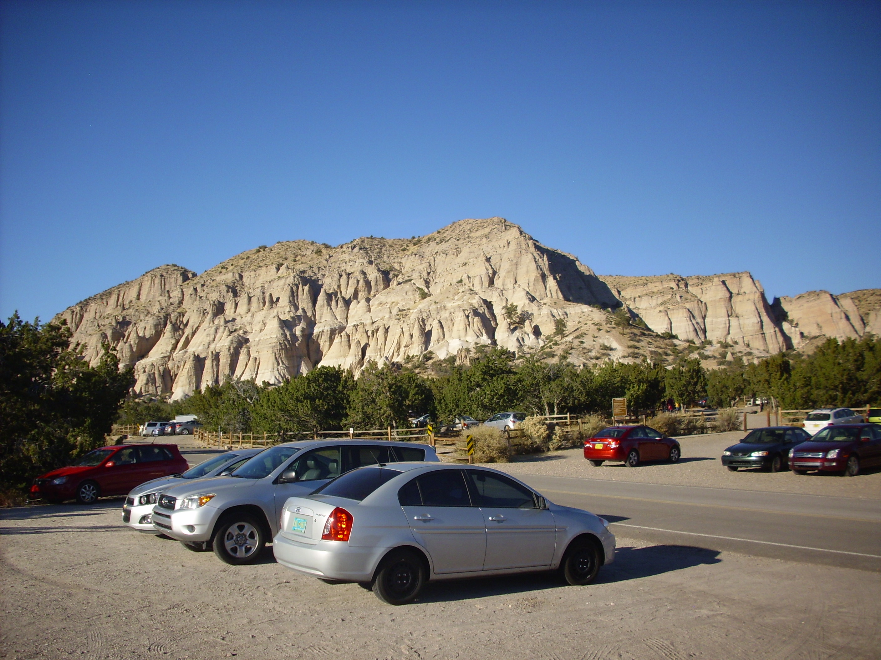
The tent rocks are eroded out of the Peralta Tuff. The Cochiti Formation is the thin darker layer on top.
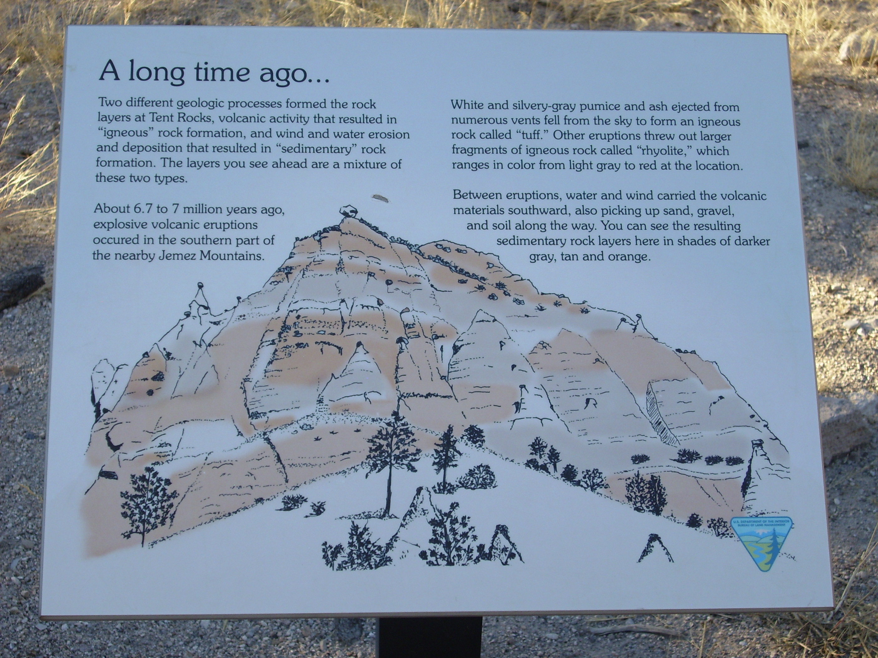
Some helpful signage.

As with almost all images at my site, you may click to enlarge.
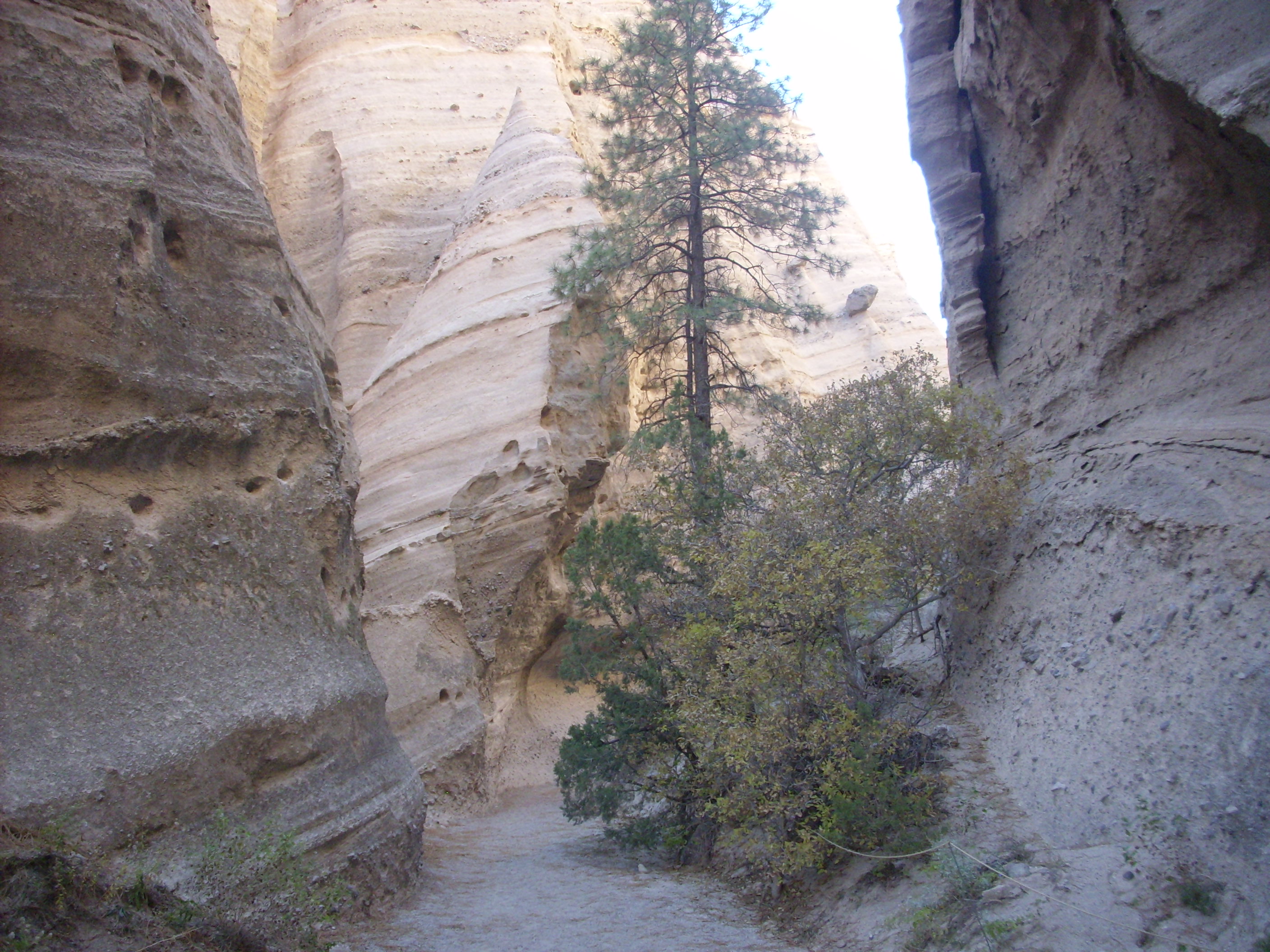
With the time I had available, I took the hike through the slot canyon that has been eroded into the Peralta Tuff. The trail first passes south of a magnificent exposure I wish I had been able to photograph earlier in the day.
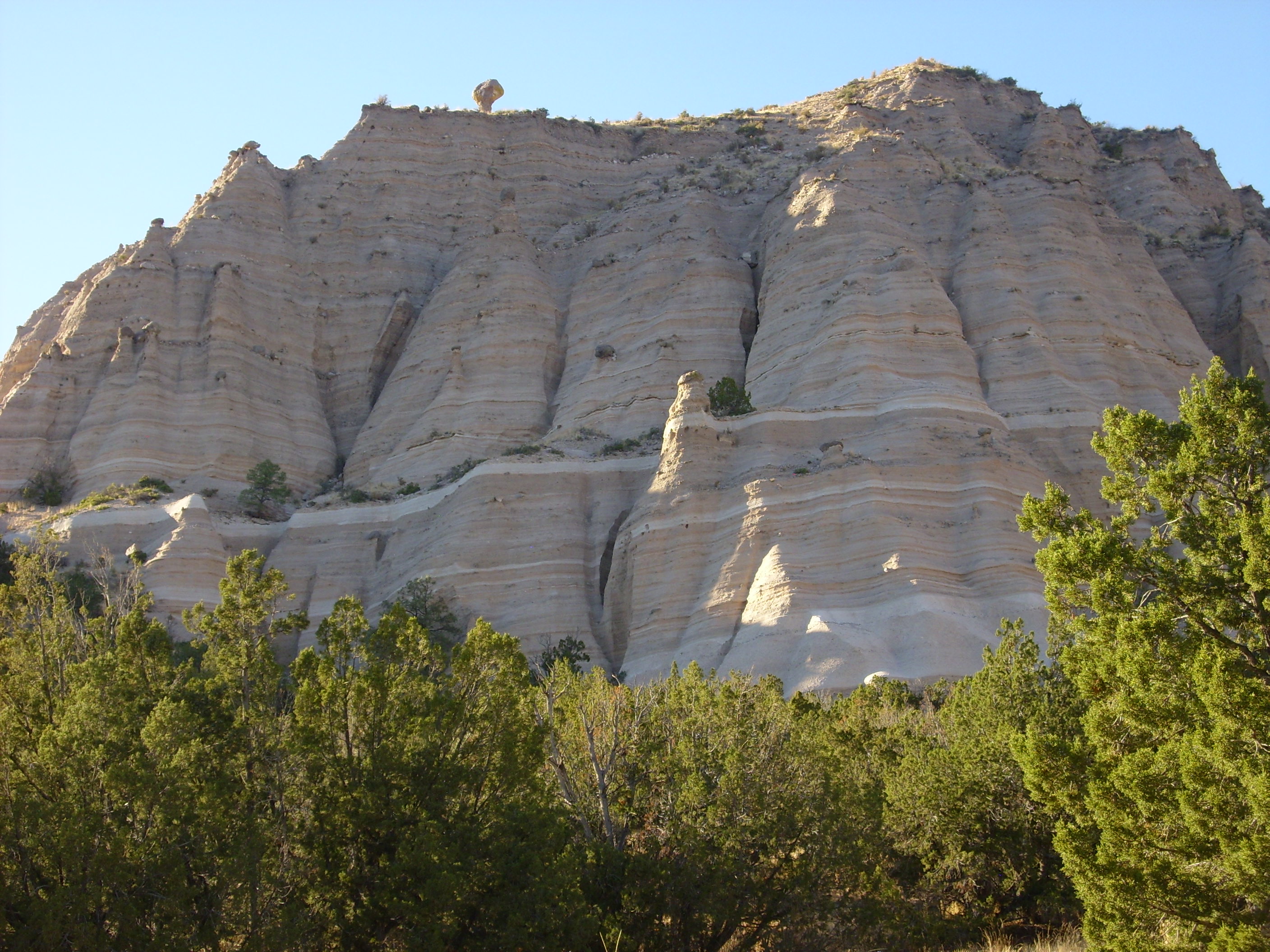
Note the hoodoo atop the cliff, left of center, and the second hoodoo halfway down the cliff. These form when a boulder protects the softer beds immediately underneath from erosion. The darker bands are probably reworked beds with considerable soil mixed in, while the purer white bands may be individual pyroclastic flows or ash fall beds.
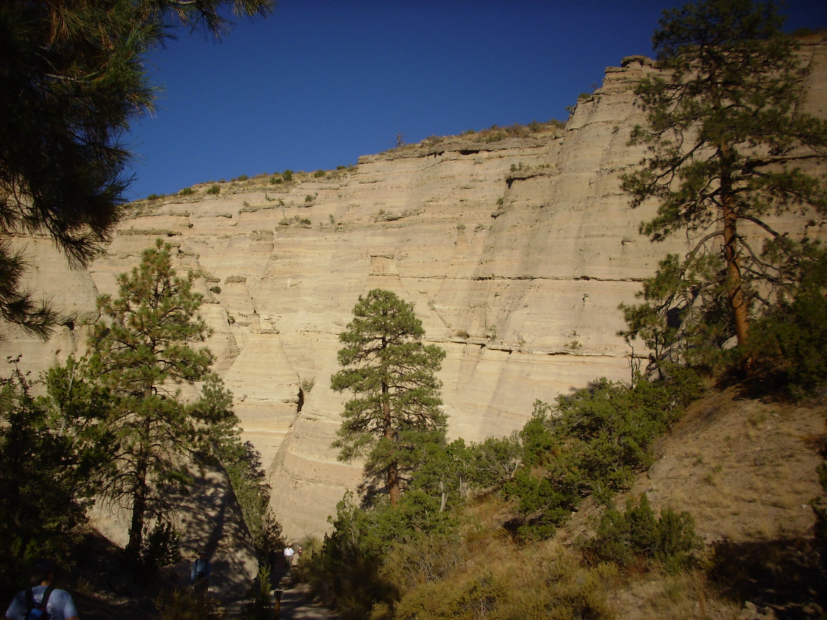
Here one enters the slot canyon.
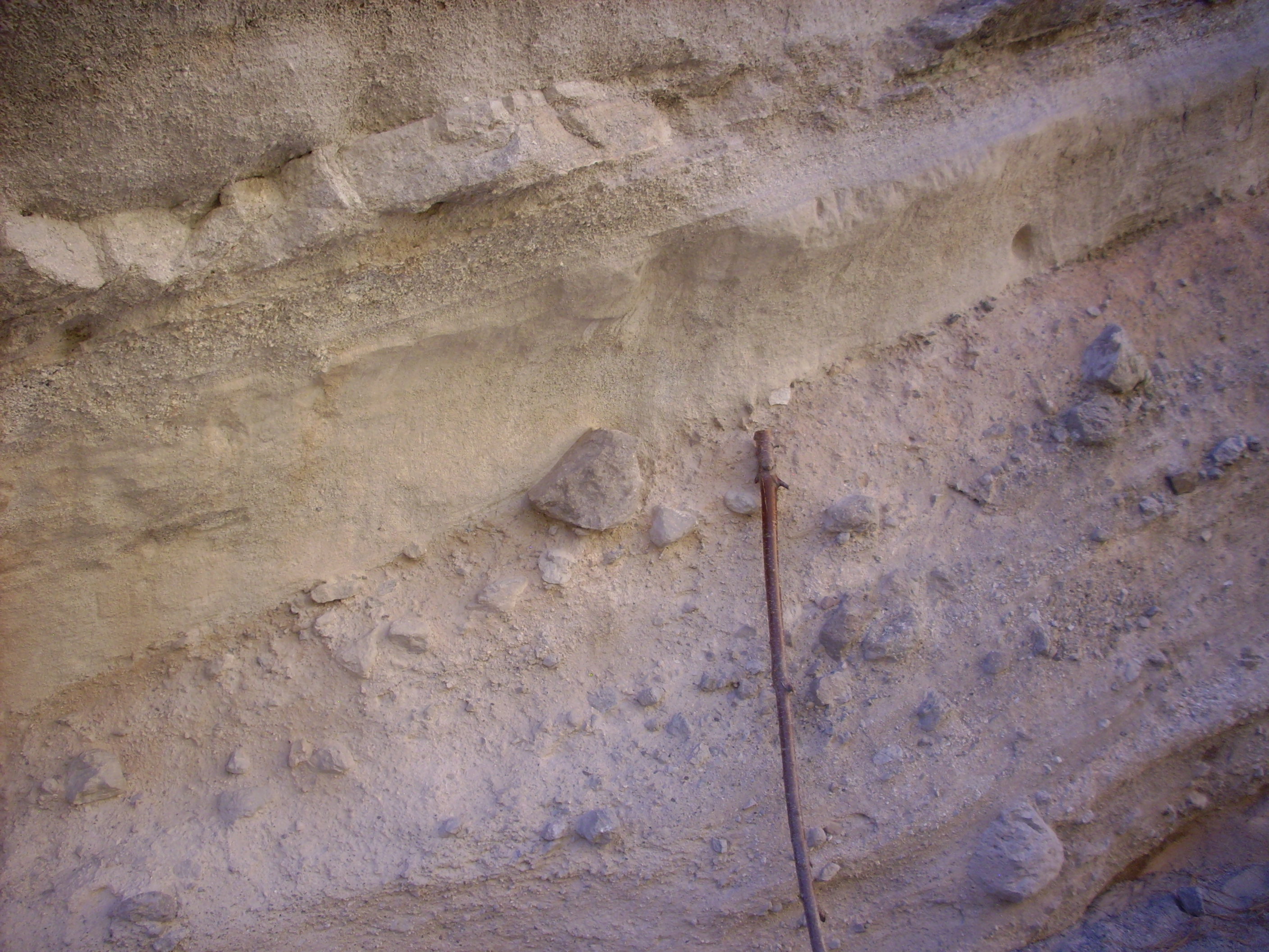
This closeup shows the varying texture of the beds, which are sometimes very fine grained and sometimes contain quite large clasts. The walking stick for scale is about five feet tall.
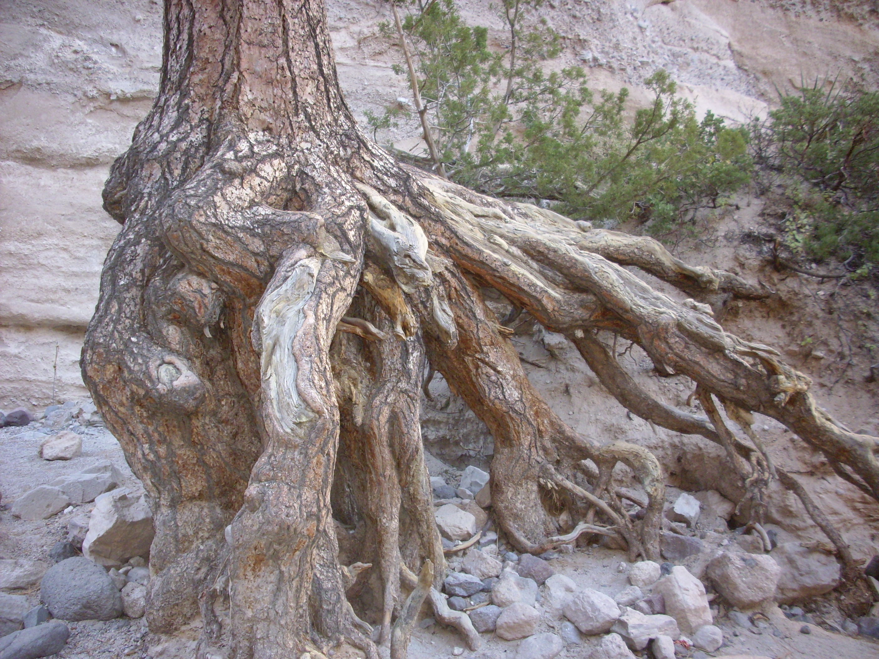
This large tree looks very much as if flash floods have eroded away several feet of soil from around the roots. I don’t know the actual history.
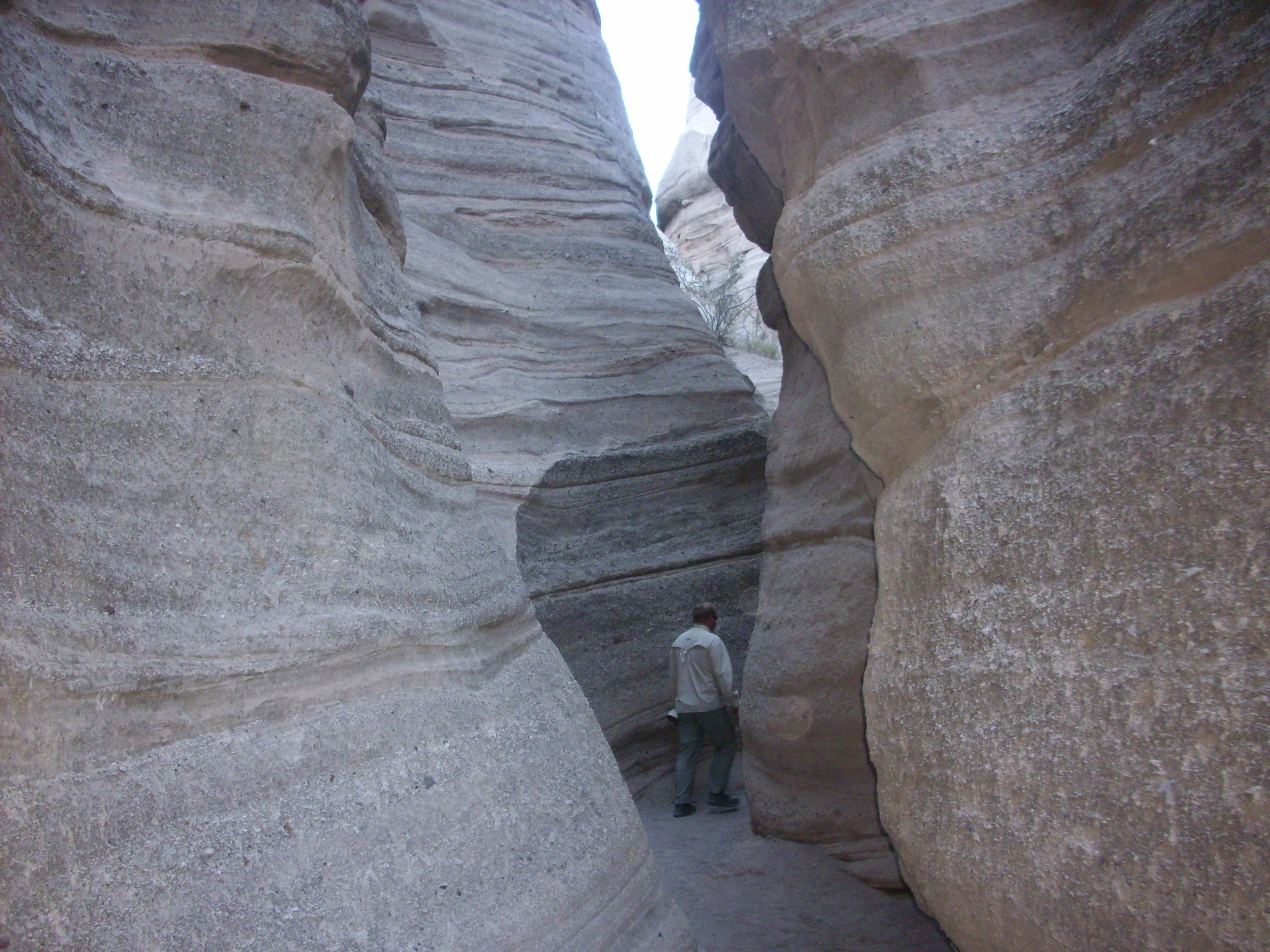
The slot canyon has a magnificent, eerie beauty.
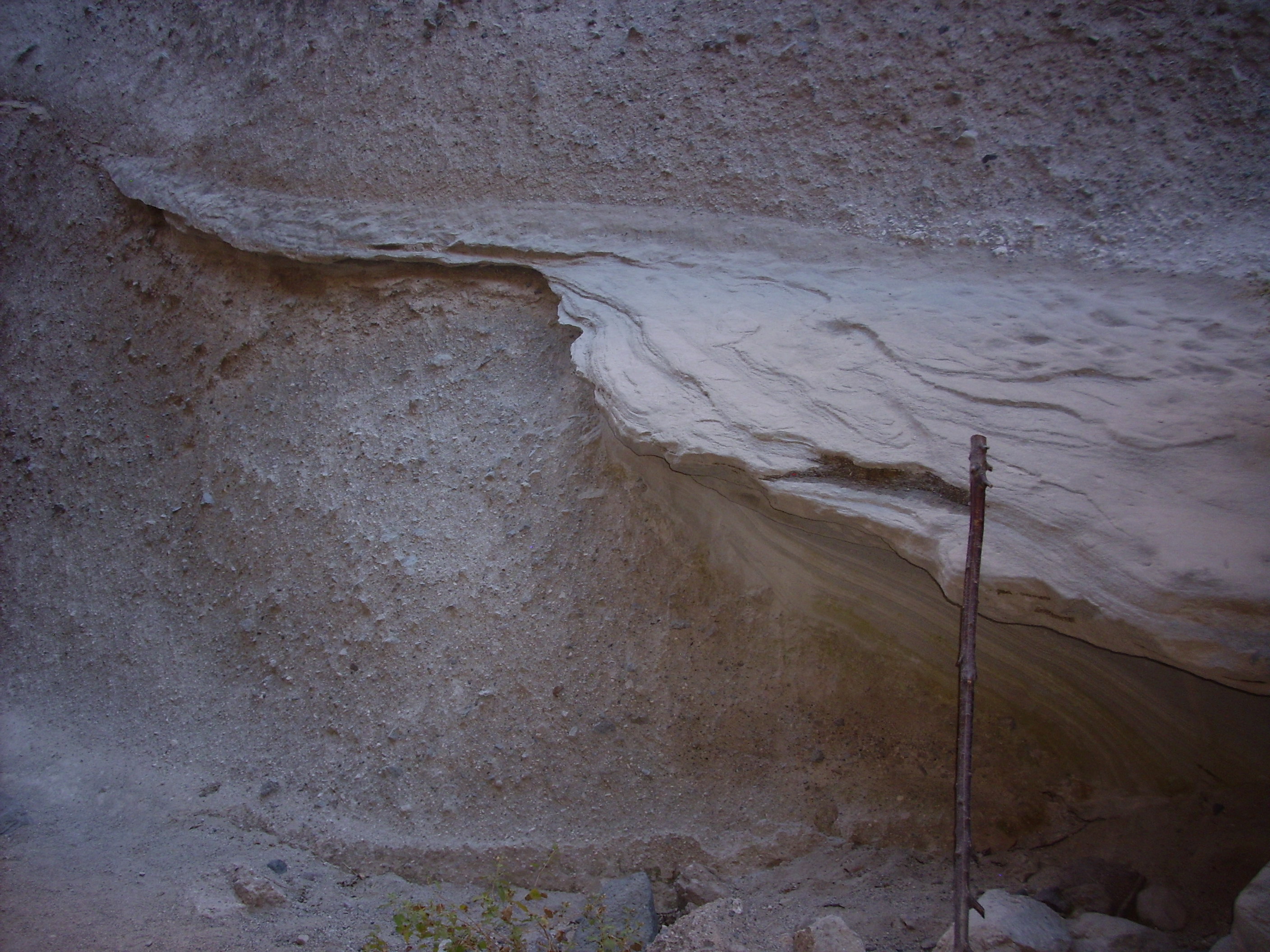
Here there is a resistant layer that has eroded out of the softer beds above and below. My guess is that this layer is particularly rich in volcanic ash, which provides a source of silica for cementing the grains tightly together. Note again my walking stick for scale.
Here is a “mushroom” consisting of a resistant silica-rich pumice bed above less resistent sediments. Much larger examples are found in the monument among the tent rocks, but it was interesting to see this one up close.

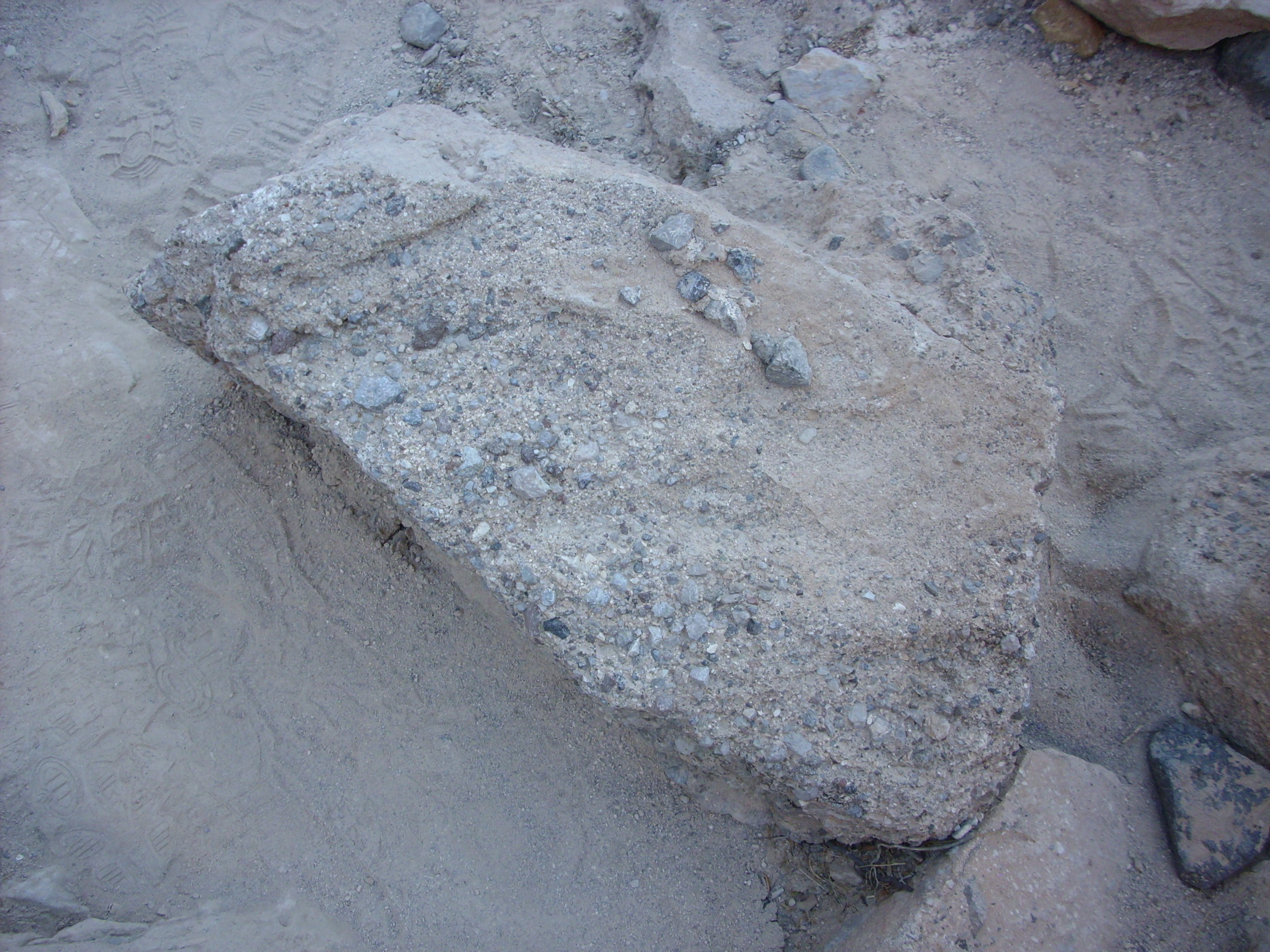
Some slabs of conglomerate on the canyon floor looked for all the world like concrete. Concrete is, after all, artificial conglomerate.
Some slabs are so heavily opalized (cemented together with amorphous silica) that they are glossy in luster, and nearly as hard as quartzite.
Alas, I had arrived late in the day, and the ranger chased us all out of the slot cave at about this time. I had seen most of it, but not all. I look forward to returning to see the rest of the trail and to visit the Veterans Memorial Overlook that looks north towards Bearhead Peak.
La Cienega
This is one of the named locations along the Santa Fe – Albuquerque highway that I have driven past a hundred times but never stopped to visit. Until now, because some geological papers pointed me at the fact that this is a geologically interesting area. It is also one of the beautifully scenic areas that seem to be well-kept secrets that New Mexico abounds in. Regrettably, I was pressed enough for time that I only got a taste of the geological charms.
The La Cienega exit takes us through the village of La Cienega and across Cienega Creek to the hilly country north. The creek valley here cuts through 25-million-year-old volcaniclastic beds of the Espinaso Formation into the Gallisteo Formation beneath. However, the hills to the north are underlain by monzonite intrusive rocks of the Ortiz Mountain stock, whose erosion fragments formed the Espinaso Formation. Monzonite: This is rock composed equally of alkaline and calcium feldspar with little quartz or mafic minerals. It superficially resembles granite, but true granite contains considerable quartz.
About 25 million years ago, very early in the opening of the Rio Grande Rift, a fault in this area penetrated deeply enough to permit very silica-poor magma from the crust-mantle boundary to reach the surface as a series of low-volume eruptions. These ultramafic magmas produced a rare kind of igneous rock called basanite that is so silica-poor that it contains little feldspar. Instead, it is composed of olivine, magnetite, nepheline and clinopyroxene. Such rock is described as silica-undersaturated. Basanite, or really any kind of ultramafic extrusive rock, is rare enough to be worth a trip.
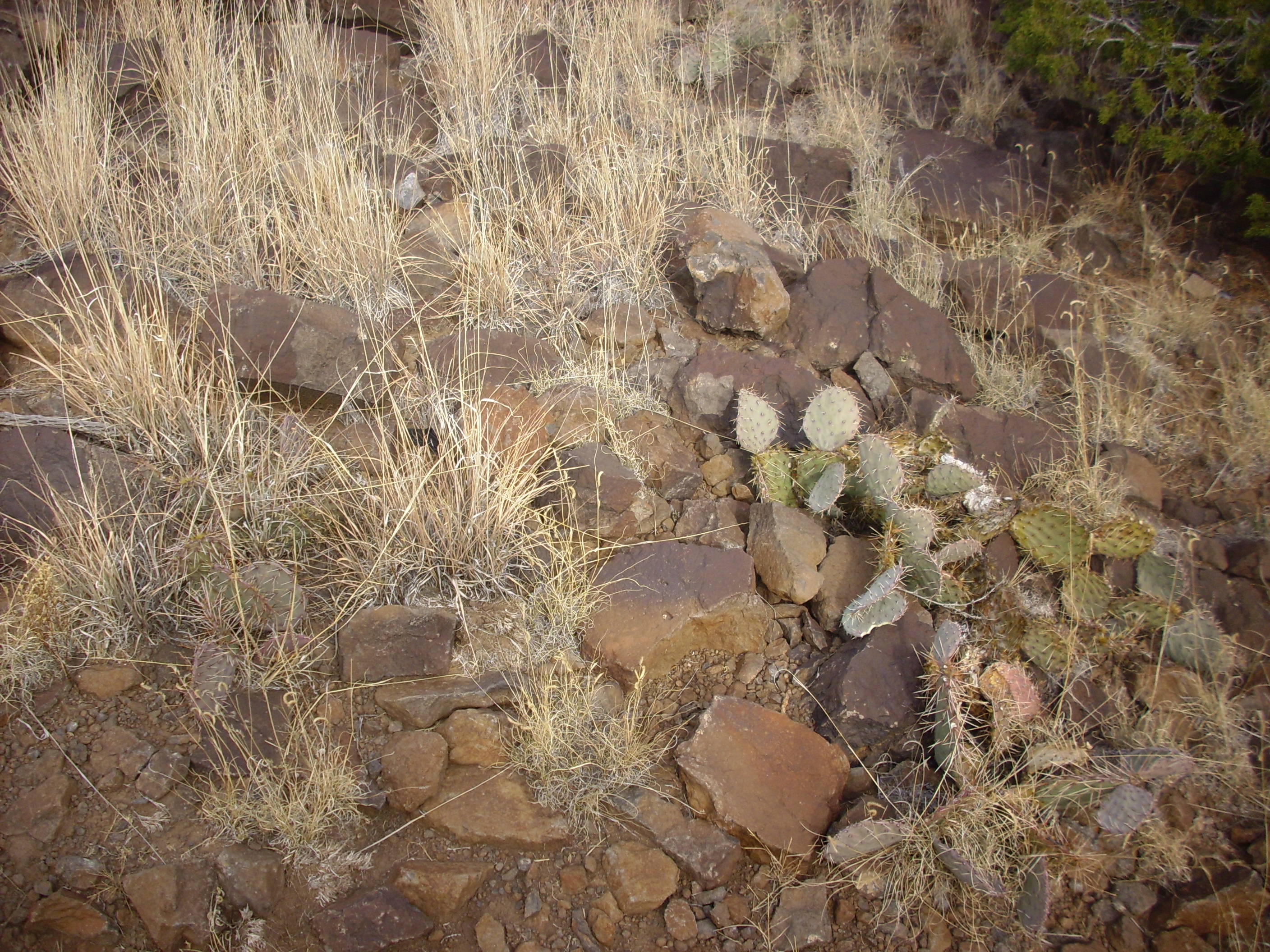
The road winds north and becomes a dirt road, which then forks a branch down to the Santa Fe River valley. This is apparently state trust land, with a trail head and a modest system of trails. These are not heavily traveled and not always distinct; I ended up doing a fair amount of cross-country hiking to get to where I wanted to go, which was Cerro Seguro, the best exposed eruptive center for the basanite flows.
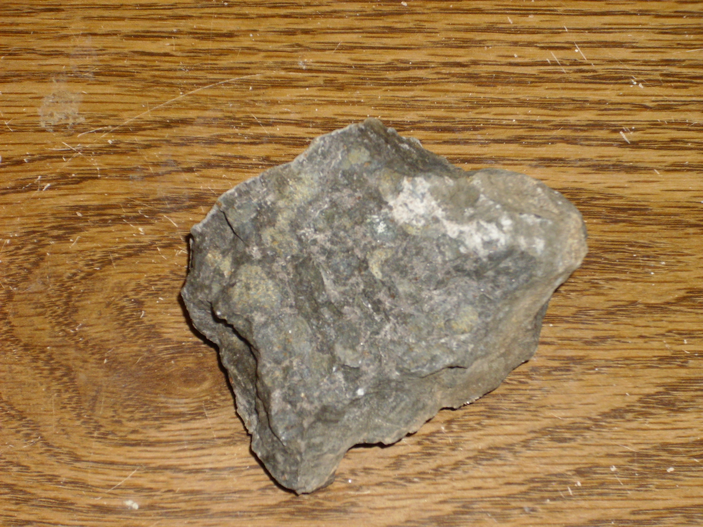
Not far down the trail, I picked up a beautiful sample of monzonite.
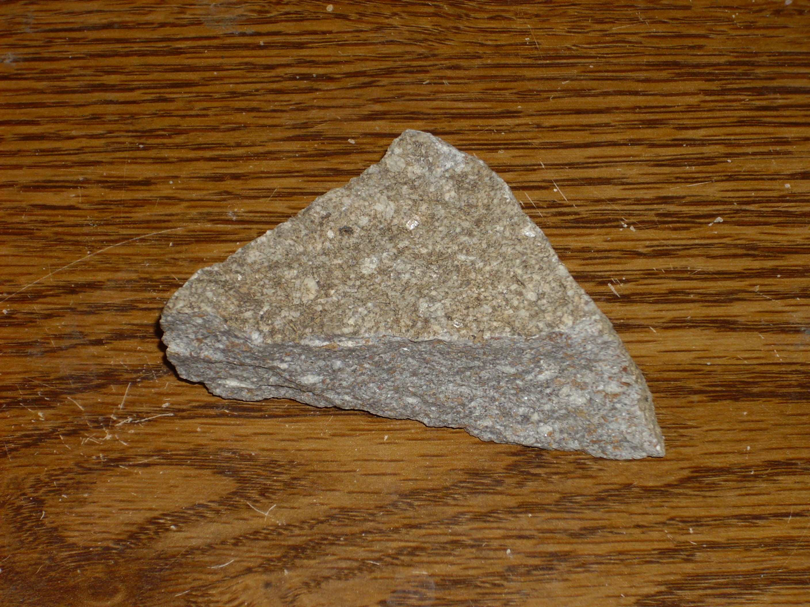
My photo doesn’t do it justice. It’s slightly lavender on fresh surfaces under sunlight, with a beautiful pattern of interlocking crystals. There are larger striated crystals, possibly albite, in a matrix of much finer crystals that are white and grey — probably two varieties of feldspar. There are also some large rusty grains that are probably weathered hornblende.
The trail winds around a hill and joins an old dirt road, which loses itself in a gully to the west. I knew where I wanted to go, and cut across country towards the cinder cone. Along the way were some interesting outcroppings of monzonite, here:
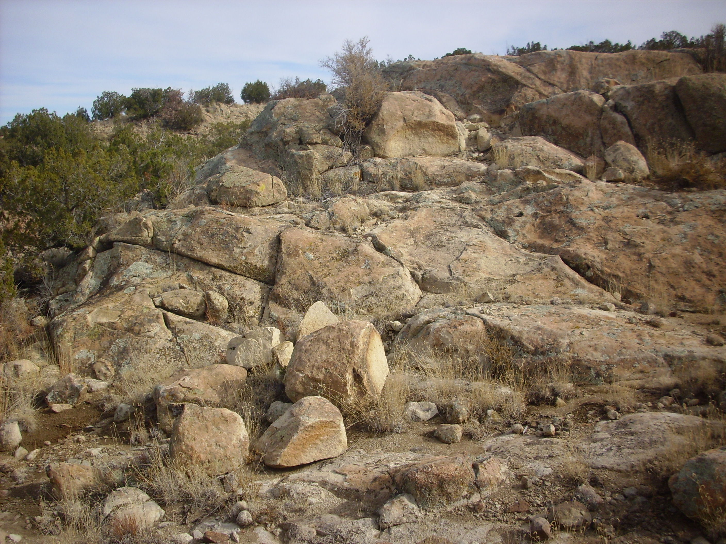
and here. That’s my walking stick again for scale.
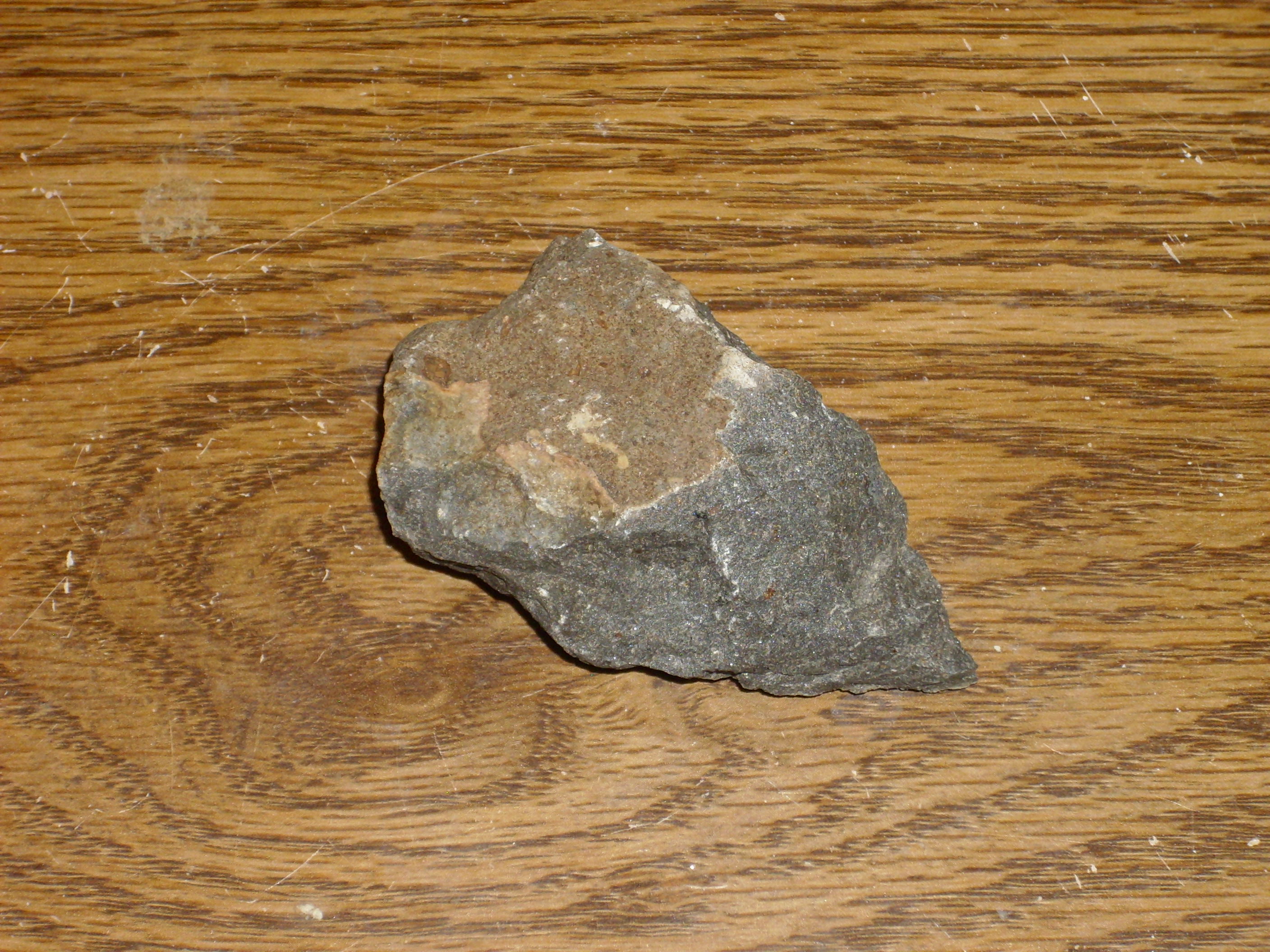
The stuff does weather a bit like granite, unsurprising considering that it’s mostly feldspar and it’s mostly feldspar that makes granite weather the way granite weathers. The rock here looks a bit different from the earlier sample:
Like the first sample, this rock is mostly feldspar, but the texture and color is different. There is no gray feldspar, just large grains (they look like plagioclase) in a white groundmass, with numerous small flecks of biotite and hornblende. Again, no quartz. This sample seems more typical of the area around Cerro Seguro than the first sample.
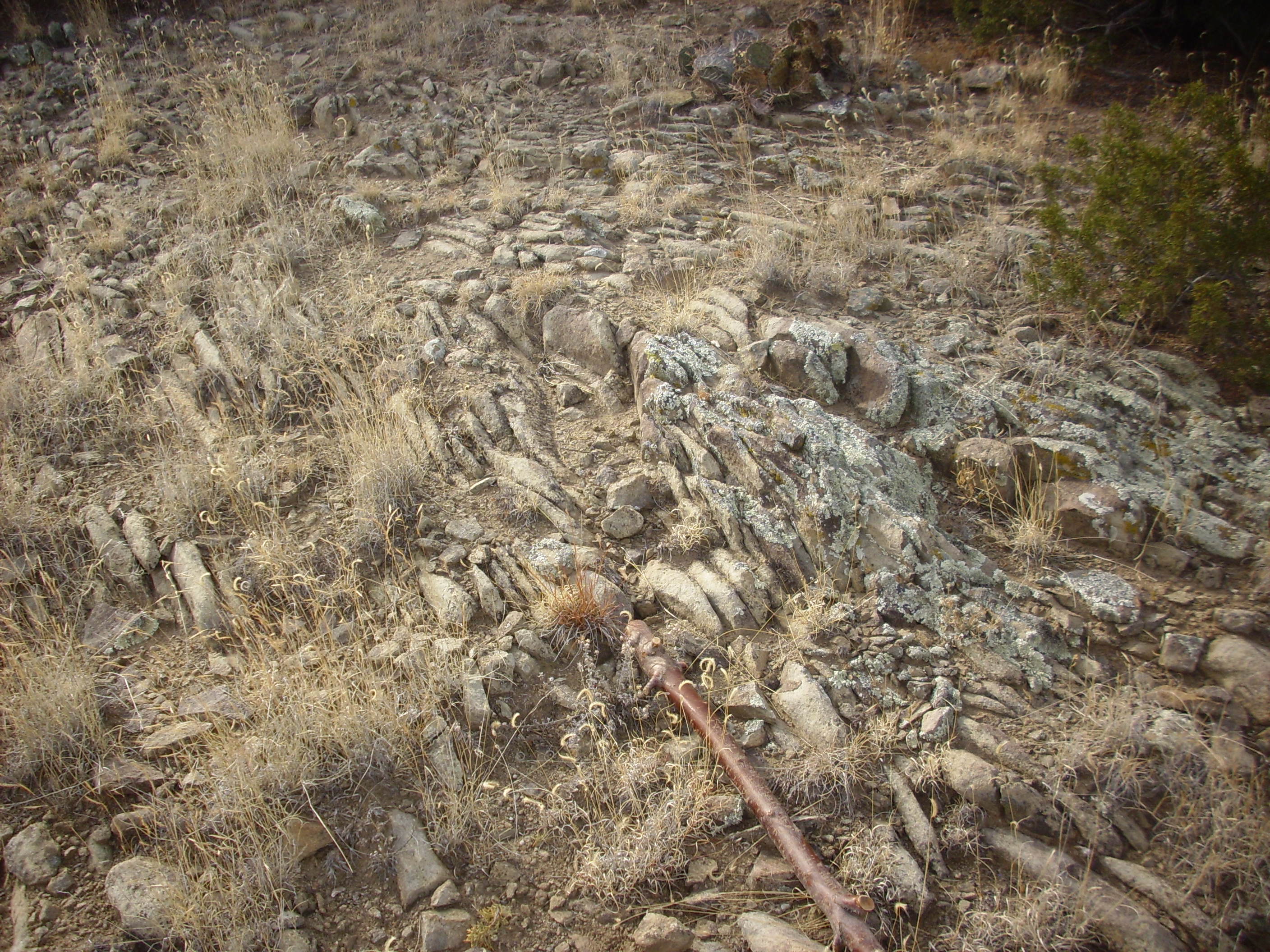
As we approach the cone, the ground begins to be covered with numerous small clasts of basanite. The underlying rock remains monzonite, however.
The cone looms above us.
Here the trail meets a steep dirt road that goes almost to the summit. The view from the top:
The panorama begins with a view to the southwest, towards Sandia Crest (washed out but just visible in the distance.) The hills in front are not named on my map, but lie just north of a bend in Interstate 25. The canyon crossing much of the panorama and disappearing into the horizon in the second frame is the canyon of the Santa Fe River. The hills in the third and fourth frame are underlain by Ortiz monzonite, which rises like islands out of the much younger Cerros del Rio Basalt on the other side of the Santa Fe River. The peak in the fourth frame is La Tetilla, New Mexico’s etymological answer to Grand Teton in Wyoming, and to its right you see highly weathered mozonite exposed in the far side of the canyon.
The seventh and eighth frames show the Sangre de Cristo mountains east of Santa Fe, while the ninth through eleventh frames show the village of La Cienega. The cluster of hills in the middle distance are the Ortiz Mountains, of which the hills around La Cienega are geologically the northern outposts.
I collected my samples of basanite. The basanite at the top of the hill is described as “agglomerated” in the geological paper on this area, which confirms we are on the rim of a cone. Agglomerated lava is what forms when blobs of semimolten magma are thrown out of the vent and pile up around it.
The rock does indeed look like individual blogs of magma tightly welded together. The rock is very black, very dense, and very fine-grained, but even with a loupe I doubt I would have recognized it as different from very dark basalt. It takes laboratory analysis to detect the lack of feldspar and the low (44%) silica fraction.
Further down the hill, a pile of basanite boulders shown a distinctive red weathering.
The magnetite in the basanite slowly converts to red hematite under atmospheric oxygen. Basalt sometimes gets a reddish patina, so this is not necessarily diagnostic for basanite, but there is a difference in degree. I took a sample here as well, which was more massive than the rock from the top of the cone.
Halfway down the hill, the underlying monzonite begins poking through the basanite.
This confirms the impression one gets from the satellite photos and from hiking the area, which is that the monzonite hills have been relatively unchanged for the 25 million years since the eruption of the basanite, which here erupted pretty much out of the side of a monzonite hill. A final photograph looks into the heart of the cone, which seems to have been broached to the southeast by erosion.
Then home in something of a rush to meet my son’s school bus.
Incidentally, “easy” may not be quite the word. It is a fairly strenuous hike to the top of Cerro Seguro, and on the way back I managed to slip and go down hard. Fortunately I landed on dirt covered with scrub and suffered nothing worse than a very slightly sprained wrist. That’s why I carry a cell phone; if I fall and kill myself, I will be able to call home and tell them where to find my body.
Copyright ©2014 Kent G. Budge. All rights reserved.