Wanderlusting White Rock Canyon
Not all my rockhounding takes the form of big day-long trips. Particularly at this time of year, when things get busy, days are short, and weather is unreliable, I’m more inclined to take frequent short trips than occasional long trips.
I’ll be showing photographs here from several recent short hikes in White Rock Canyon. I hike here often because I can drive to the trail heads in five minutes from my house. In fact, I live on the rim of a tributary canyon, Pajarito Canyon, though the part passing through my back yard is more of a gully on steroids than a canyon.
Rim Trail
This is one reason I love living in White Rock.


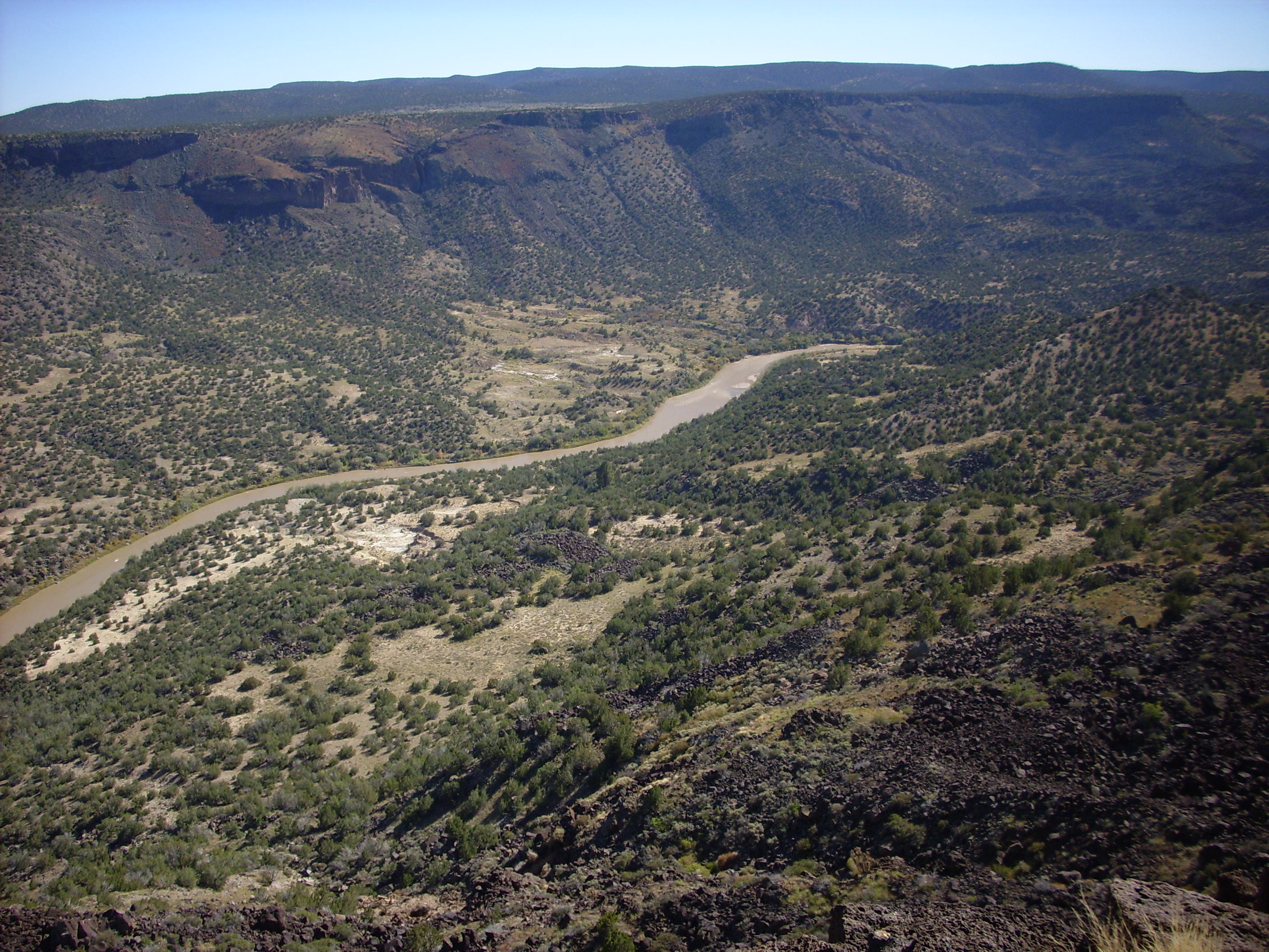
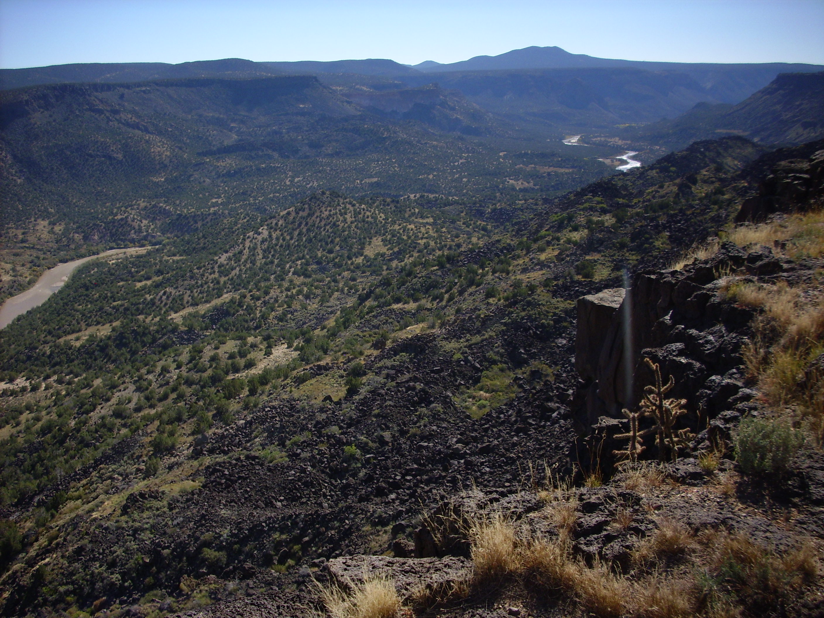
These pictures are from over a year ago, before I got in the habit of deliberately taking a series of panorama shots to stitch together. However, they pretty much cover the view from northeast to south from a point on the canyon rim.
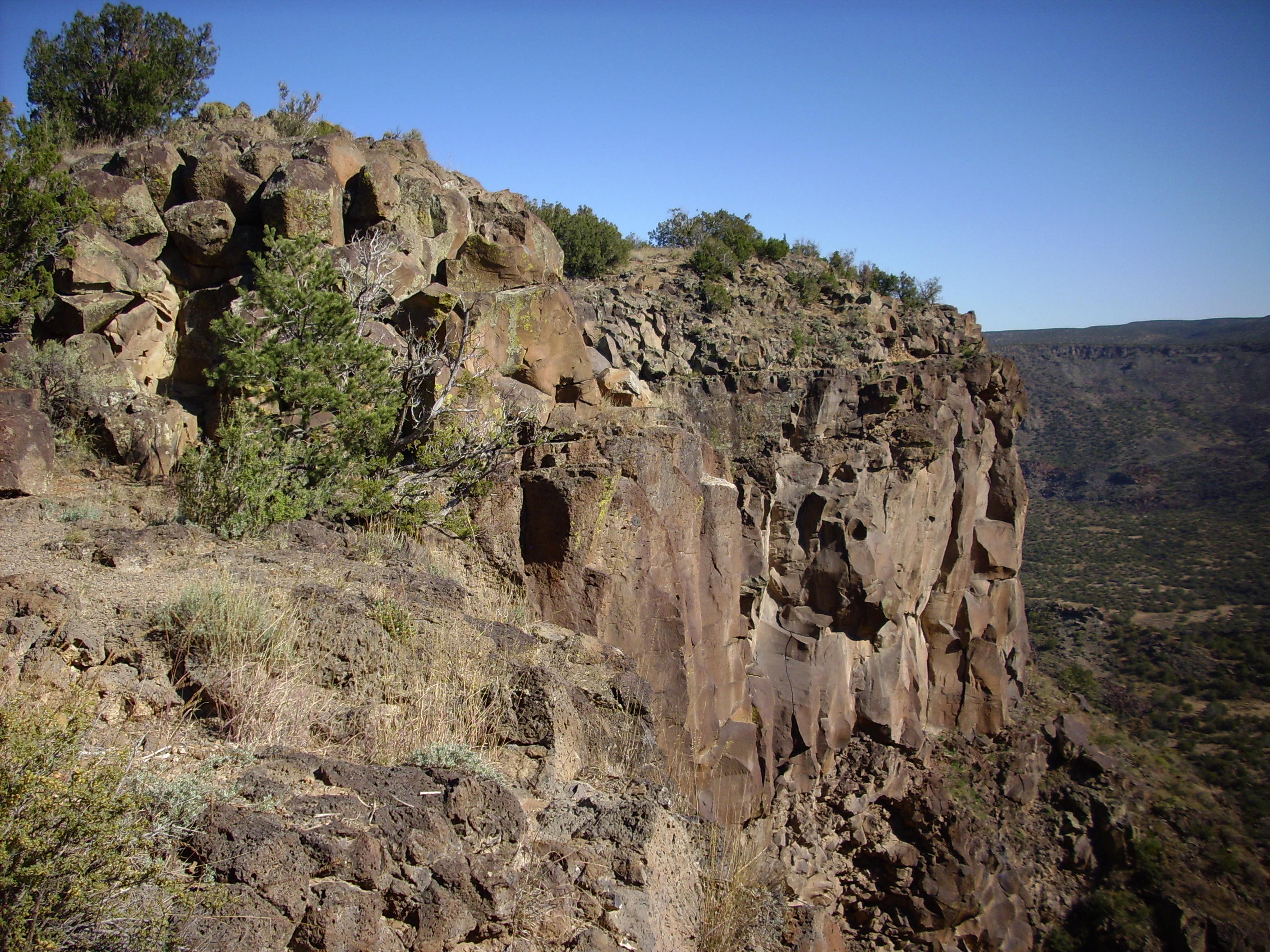
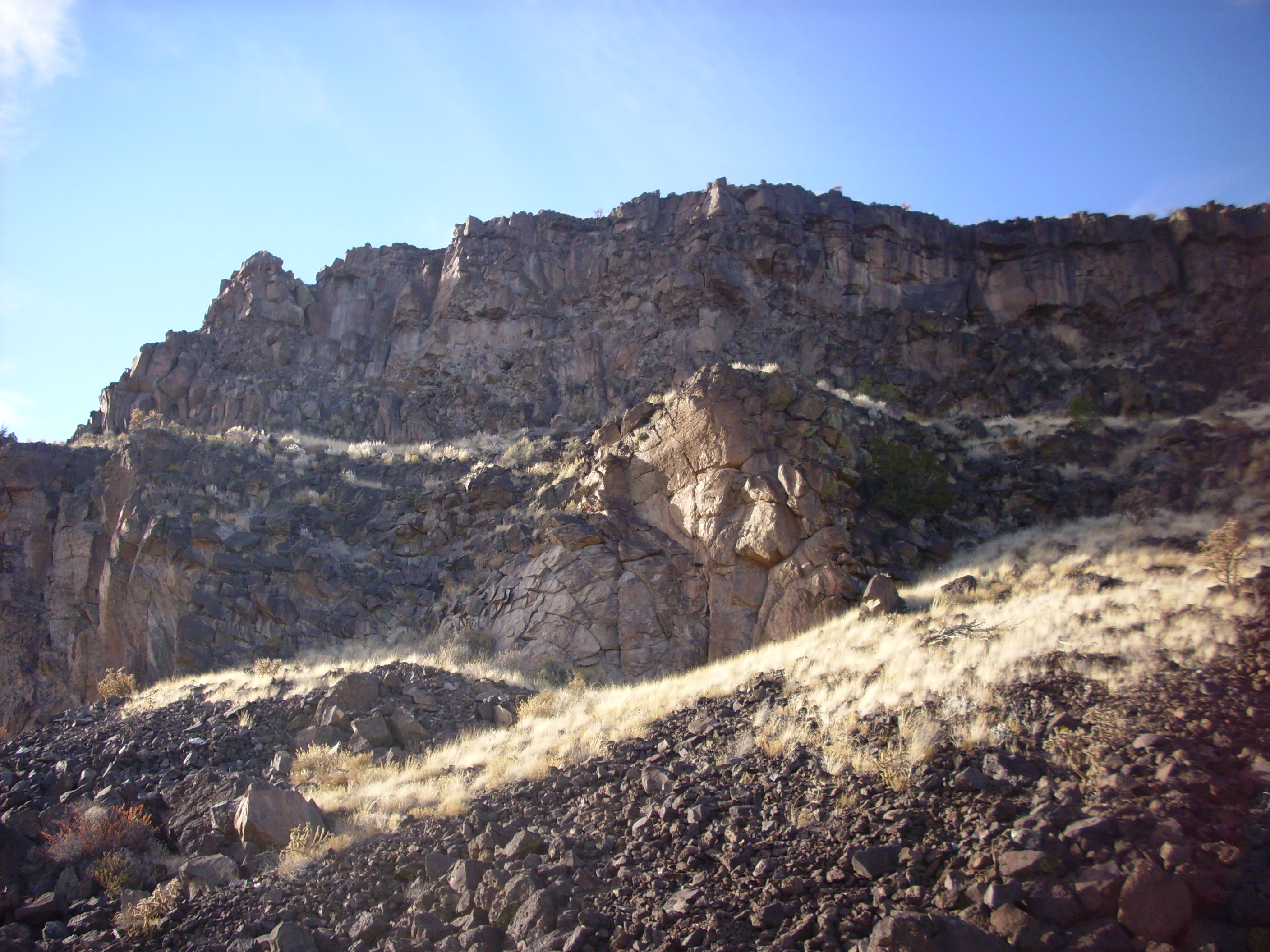
White Rock Canyon is part of the valley of the Rio Grande River, which flows south from Colorado to Texas and the Gulf of Mexico. In this area, the river has cut through a plateau of hard basalt, the Cerros del Rio, into softer sediments beneath. This produces spectacular cliffs and large landslides where parts of the basalt plateau have broken loose and slid down into the canyon.
Geologically, this is all fairly young terrain. The great thicknesses of sediment visible beneath the basalt, particularly in the second and third photographs, are part of the Tesuque Formation of the Santa Fe Group. This is sediment that accumulated in the Rio Grande Rift, a great crack in the Earth’s crust that first began opening perhaps 30 million years ago. The sediments, which consist of material eroded off the mountains surrounding the rift, were deposited between 30 million and 3 million years ago but are now being eroded away due to continuing regional uplift. The Cerros del Rio basalt on top of the Santa Fe Group sediments ranges in age from 3.9 to 1.7 million years old.
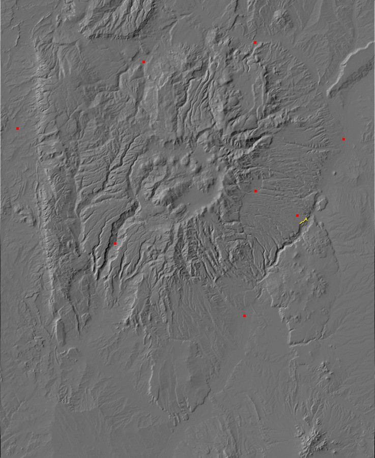
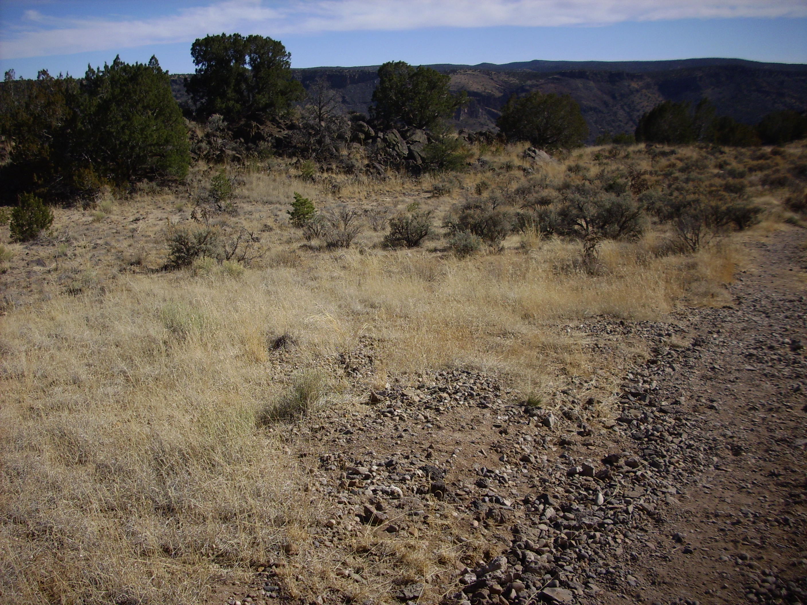
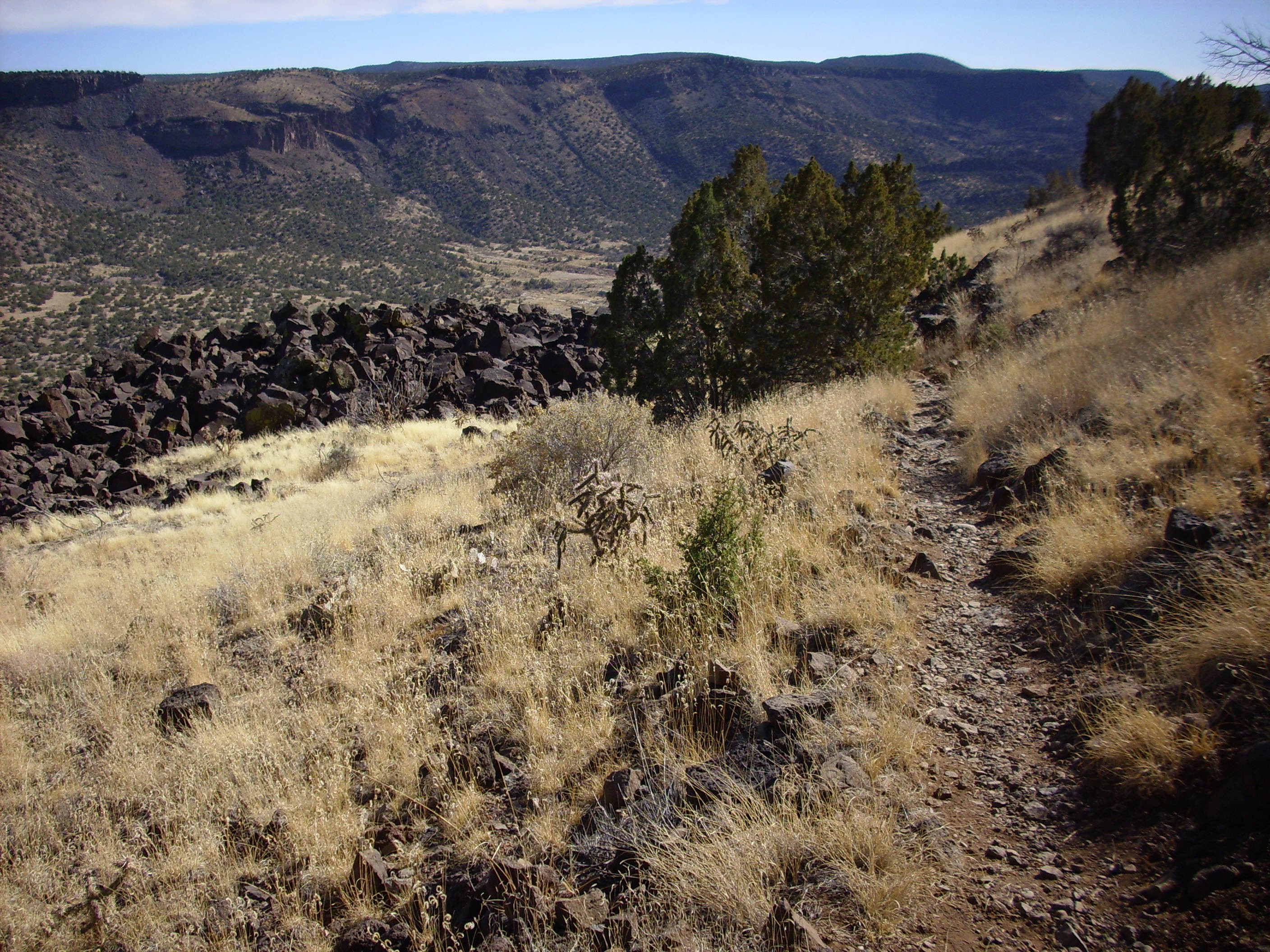
There are a number of trails in the area, but the ones I have hiked recently are various branches of the Rim Trail and the Blue Dot Trail. The two trails meet just east of the White Rock dog park, where there is a parking lot and a kiosk with a map. The Rim Trail has several branches, but you can’t really get lost, since there is canyon to one side and residential areas to the other.
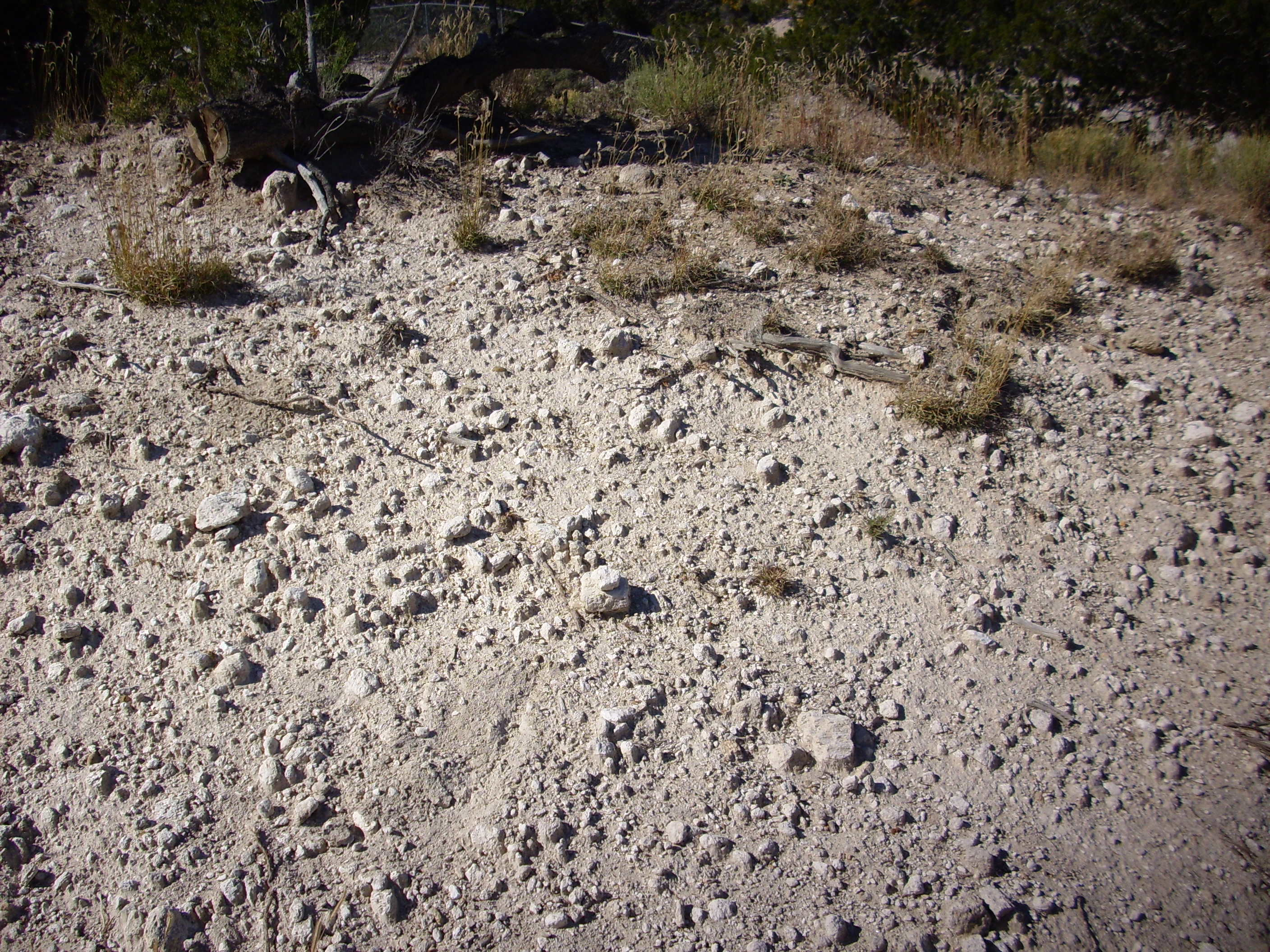
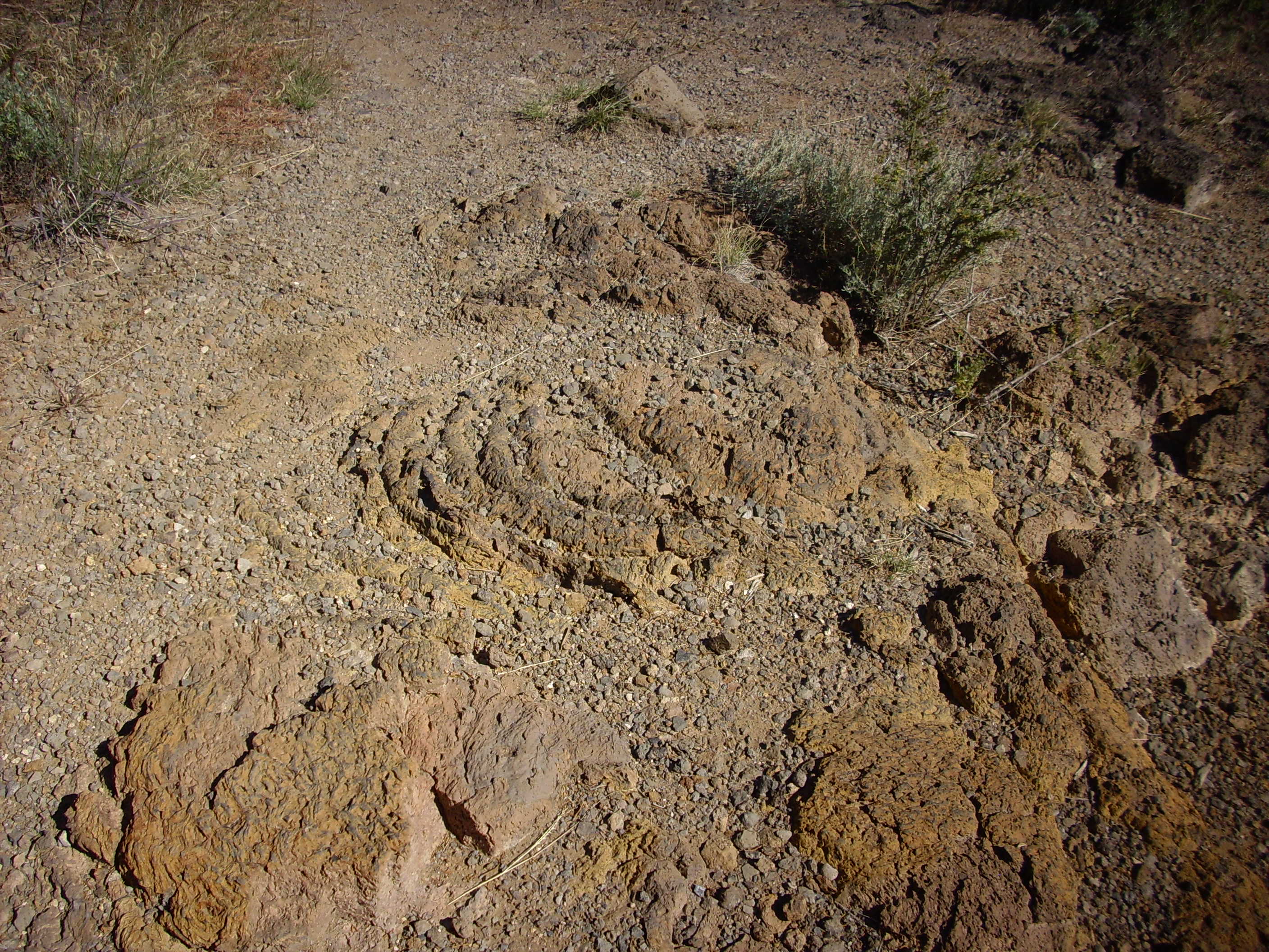
The geology here has some interesting features I’ve never seen explained in any papers on Jemez geology. For example, a short distance south of the Rim trail head, there are several large banks or hills of coarse gravel.

This gravel is fairly uniform in size and made of well-polished clasts that are obviously not composed of the basalt underlying most of this area. I have wondered if this was gravel trucked in decades ago for the construction of White Rock. However, the volume is great, the gravel is scattered for at least half a mile along the canyon rim to the south, and there is considerable gravel on the first slump block below the canyon rim on the Blue Dot Trail — I’ll say more about this later. This suggests that this might a natural gravel bank, possibly a gravel bar associated with the many lakes that have formed over the last five million years as various basalt eruptions in the area dammed the Rio Grand.
There are also extensive pumice banks in the area.
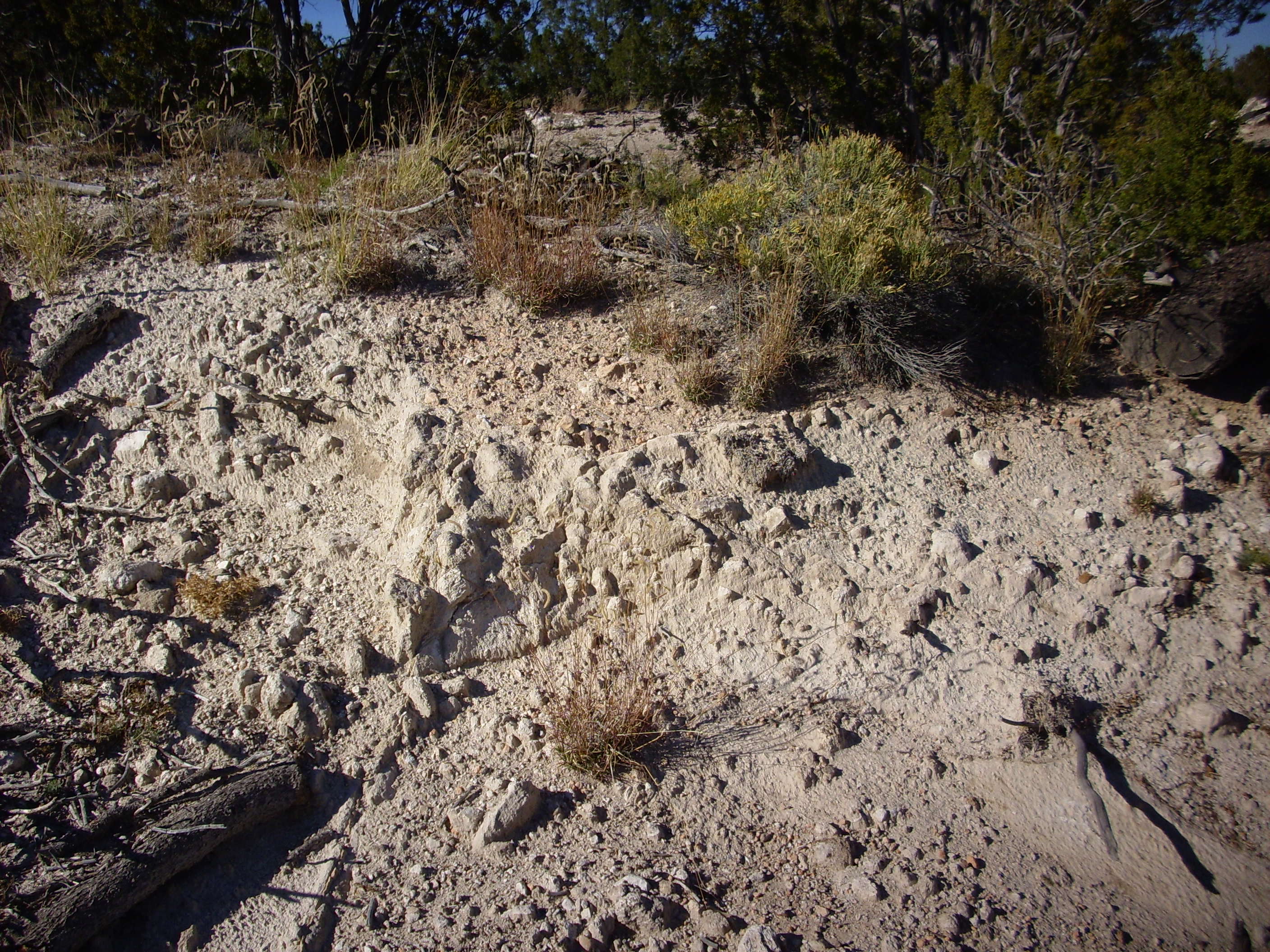
The pumice is poorly sorted and includes clasts up to six inches long. Like the gravel banks, the pumice is not mapped even on the latest geological maps of the area. Also like the gravel banks, the pumice is also found on the slump block below the canyon rim at this point. The pumice deposits are fragile enough that they must be geologically very young, so this is most likely El Cajete pumice erupted from a vent south of Redondo Peak about 50,000 years ago. El Cajete pumice occurs throughout the southern Jemez and as far east as Bandelier National Monument. If this is El Cajete Pumice, it is the furthest deposit from the vent that has been identified.
South of the pumice and gravel banks is a broad meadow covered with more gravel. This looks an awful lot like an old gravel dump, complete with vehicle tracks, but the presence of considerable gravel on the slump block below the canyon rim still has me thinking this might be a natural deposit.
The sheer cliffs forming the rim of White Rock Canyon are ideal for rappelling, and one finds rope anchors at scattered points along the rim.
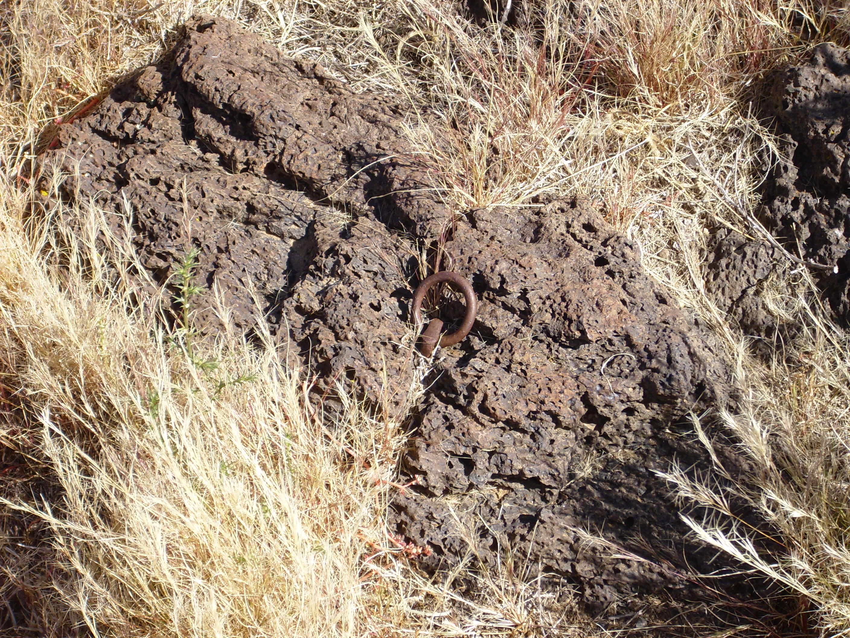
The rock into which this anchor has been sunk is described in the most recent paper on the Cerros del Rio as hawaiite. This is a sodic trachybasalt found throughout the Cerros del Rio. Okay, jargon: A basalt is a rock formed from magma that erupted onto the Earth’s surface, so that it cooled quickly and is fine-grained, and which is relatively low in silica. A trachybasalt is a basalt that is high in sodium and potassium, and a sodic trachybasalt has more sodium than potassium.
“Basalt” works fine in casual company.
Much of the basalt in White Rock Canyon is calichified. This means it is encrusted with light-colored calcium minerals that contrast sharply with the dark basalt. Caliche forms in arid climates, where ground water saturated with calcium evaporates at or below the ground surface to deposit its load of minerals.
However, at one point along the trail, the deposits on the basalt look more like sediments deposited by standing water than like caliche.
If y’all haven’t heard me say so before: I’m just a simple country astrophysicist, not a real geologist. Maybe this is just an old soil horizon that has not quite eroded away. Or perhaps it’s the last remnants of a deposit of Bandelier Formation atop the basalt that has not quite eroded away. But I wonder if this is associated with the gravel bars and shows that, yes, there was a lake here not all that long ago (in geological terms.)
Much of the canyon rim is covered with a beautiful desert pavement made of clasts of basalt.
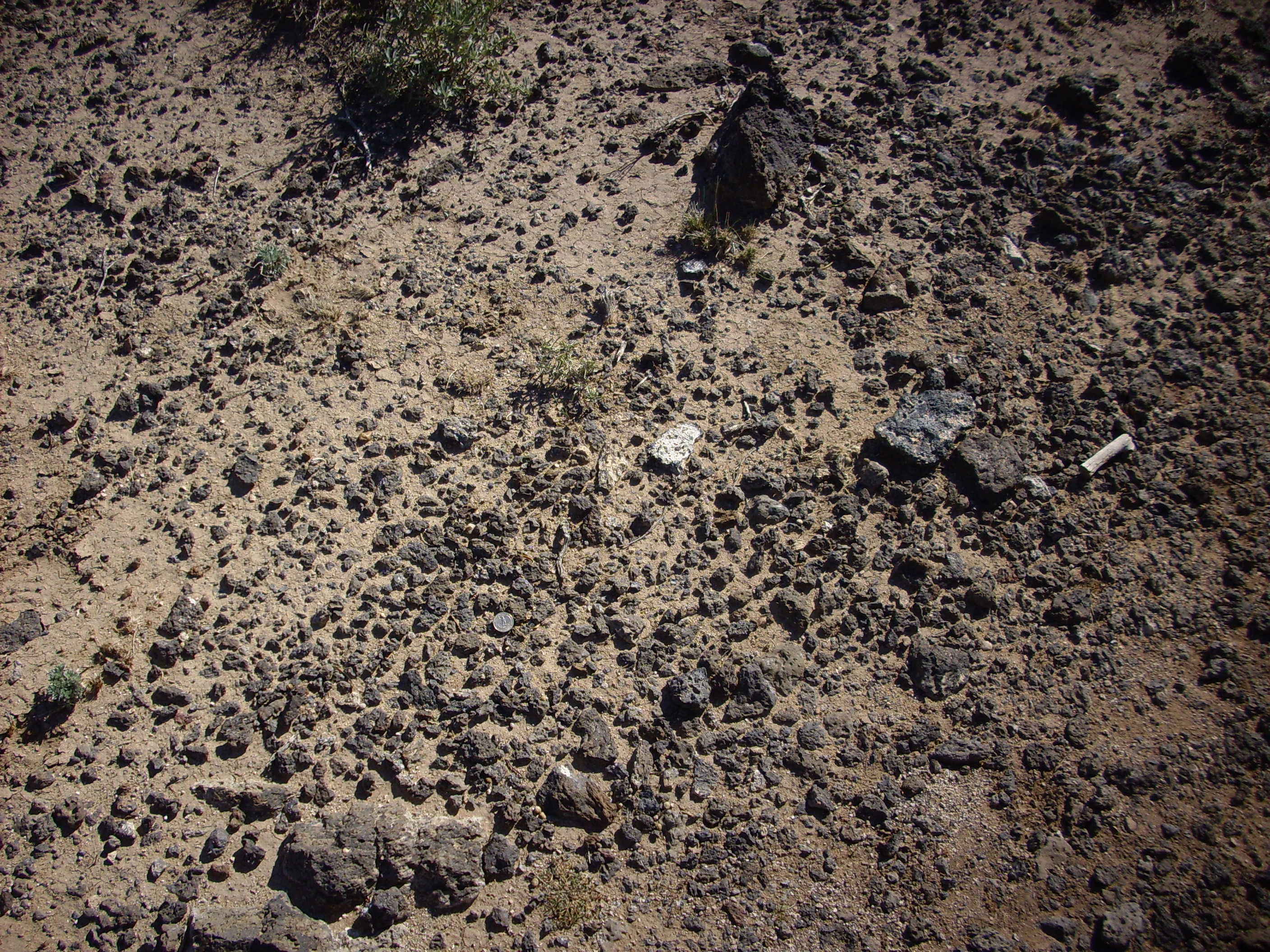
This is pretty delicate terrain, and I’m sorry to say that the popularity of the Rim Trail pretty much guarantees it will eventually be pounded into oblivion. But I also can’t bring myself to tell people to stay away; this is beauty I can’t resist sharing. I’m proud of my home.
Even if there are creepy-crawlies along the trail.
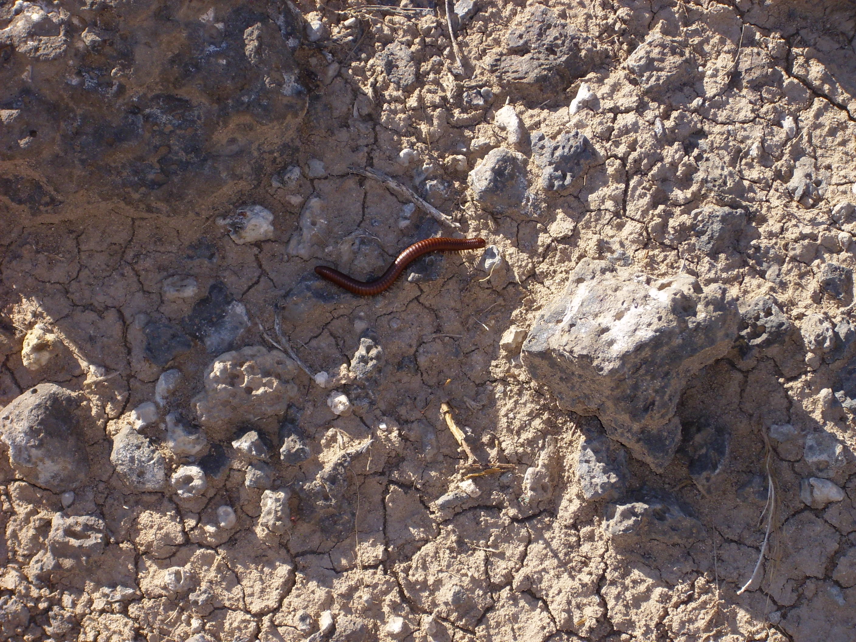
This is likely Orthoporus ornatus, the desert millipede.
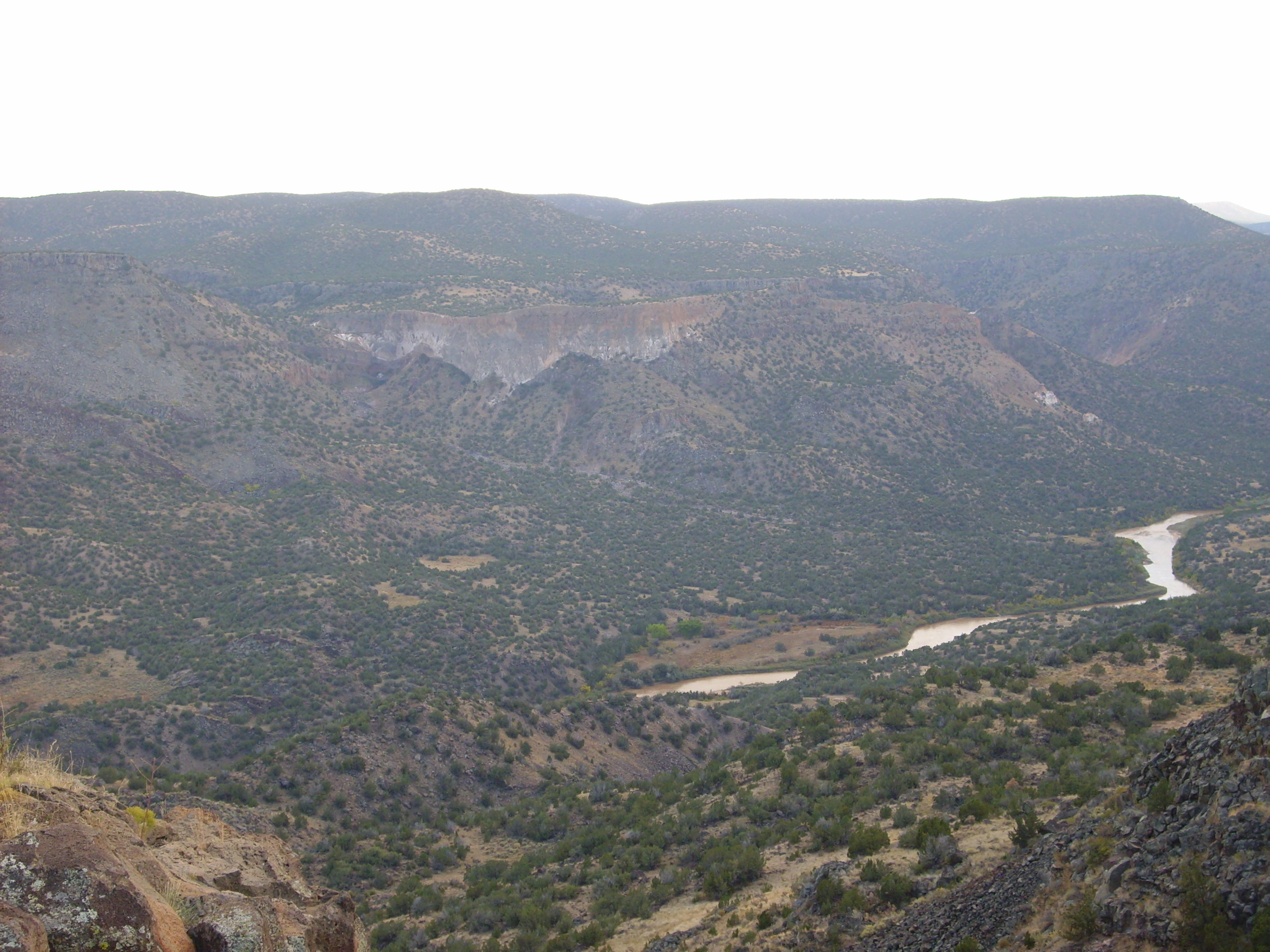
From this point one has a beautiful view of one of the most impressive slump blocks to be found below the canyon rim. The Google satellite image doesn’t do it justice; try switching to Map Terrain view, although this also doesn’t quite do it justice. Fortunately, it’s highly photogenic.

The broad meadow is a slice of basalt canyon rim that has broken loose and slumped partway down the canyon wall. You can see that the far end of the meadow is nearly at the level of the canyon rim, and the nearer end has slumped a greater distance, almost as if the block was hinged at the far end. There is a trail down the slump block that affords some nice views of cross sections of the basalt flows making up the canyon rim. I’ve hiked this trail a couple of times but apparently I took no pictures.
The slump block gives us a nice view from high above of hexagonal fracturing of the lava flow.
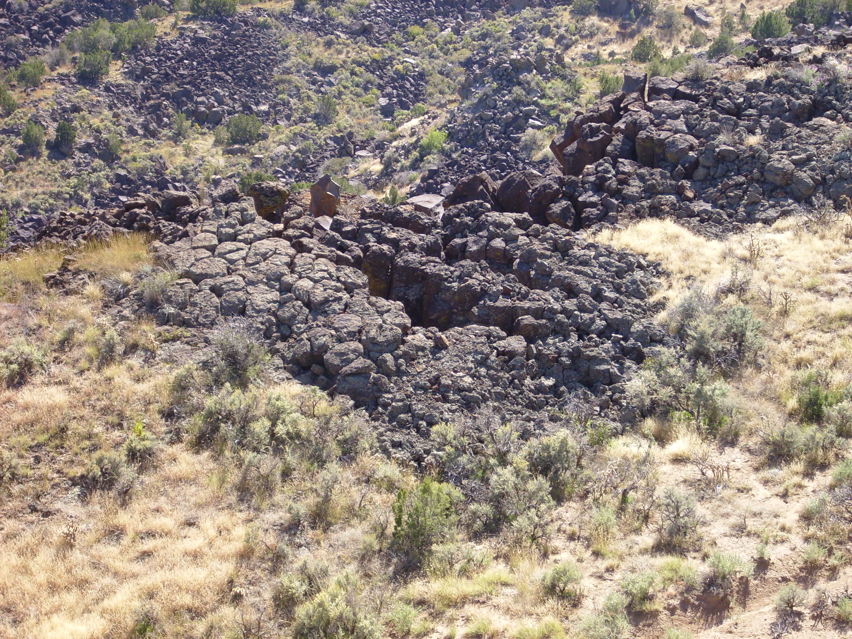
It is very common for a thick basalt flow, as cools and contracts, to fracture into roughly hexagonal columns. You can see the tops of such columns in this photograph.
This is also a pretty good point from which to view an outcropping of Bandelier Tuff across the canyon. This is the furthest eastern extent of the Bandelier Tuff in this area, and urban legend is that this outcropping is also the “white rock” from which the canyon gets its name.
Further south along the trail, near another trail head, a branch of the trail affords a view into the confluence of Pajarito Canyon and White Rock Canyon. Here an intermittent stream has carved a very deep canyon into the thick basalt flows.

The basalt is several hundred feet thick at this location, much thicker than in most of the canyon. Either the confluence by chance has cut into an actual eruption center, or (more likely) the basalt here fills a paleocanyon coincident with the present-day Pajarito Canyon.
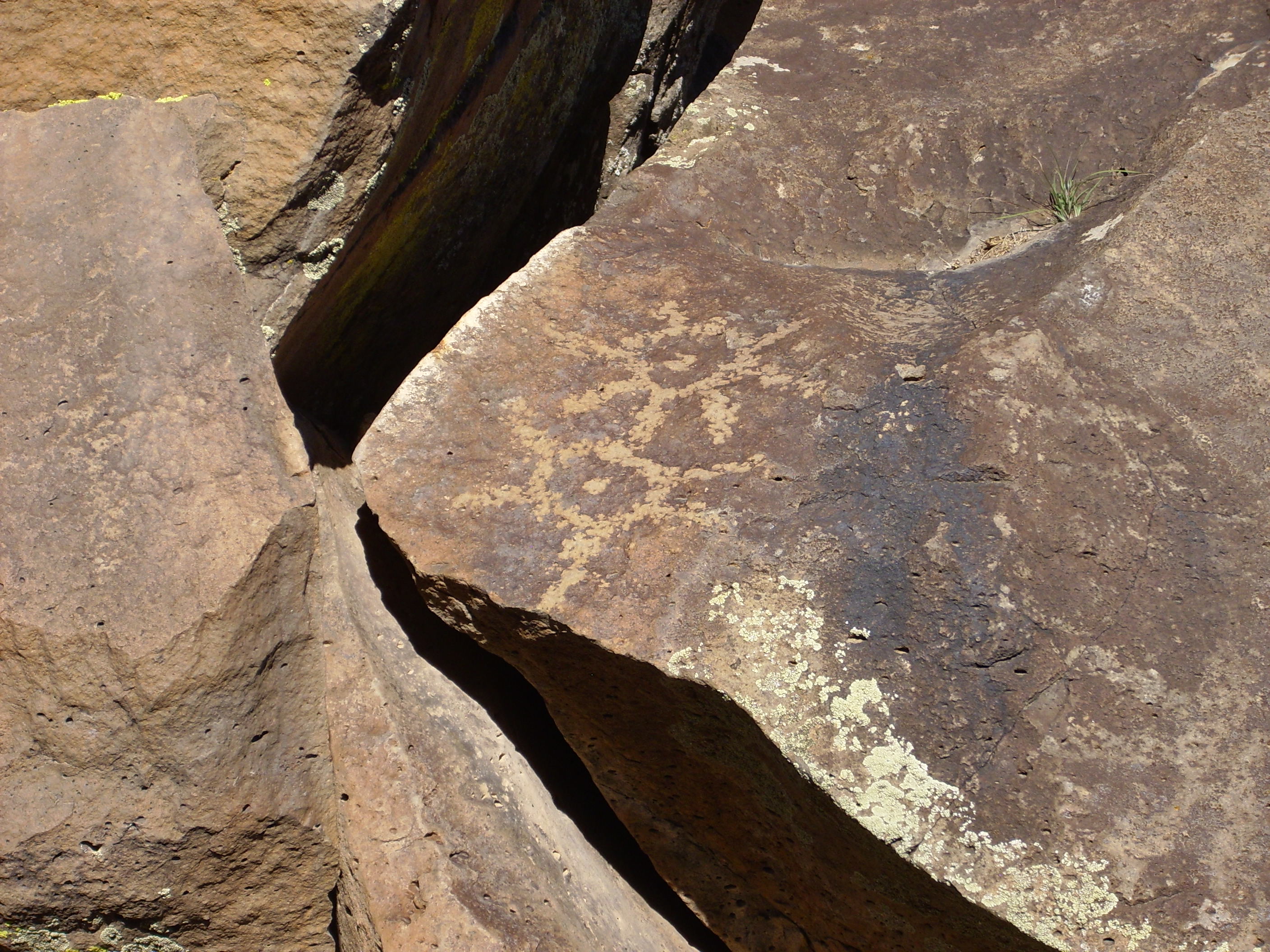
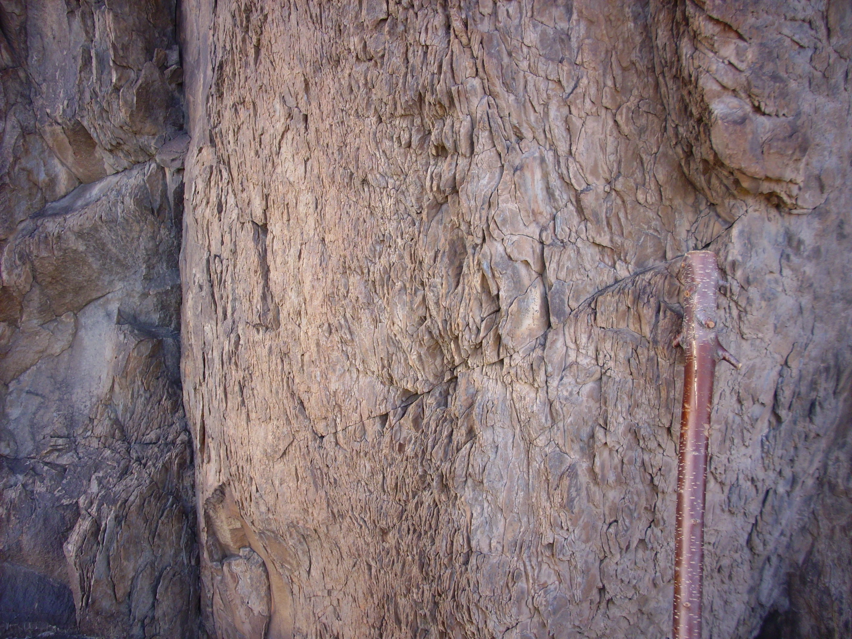
There is a very distinct ledge here, formed by the boundary between two successive basalt flows. The boundary is visible in this photograph as a horizontal joint near the top of the cliff to the right of center.
The ledge is formed when the top flow is eroded away to expose the flow underneath, which is apparently slightly more resistant. One can actually see (badly eroded) ropy patterns on the top of the lower flow, typical of pahoehoe flows.
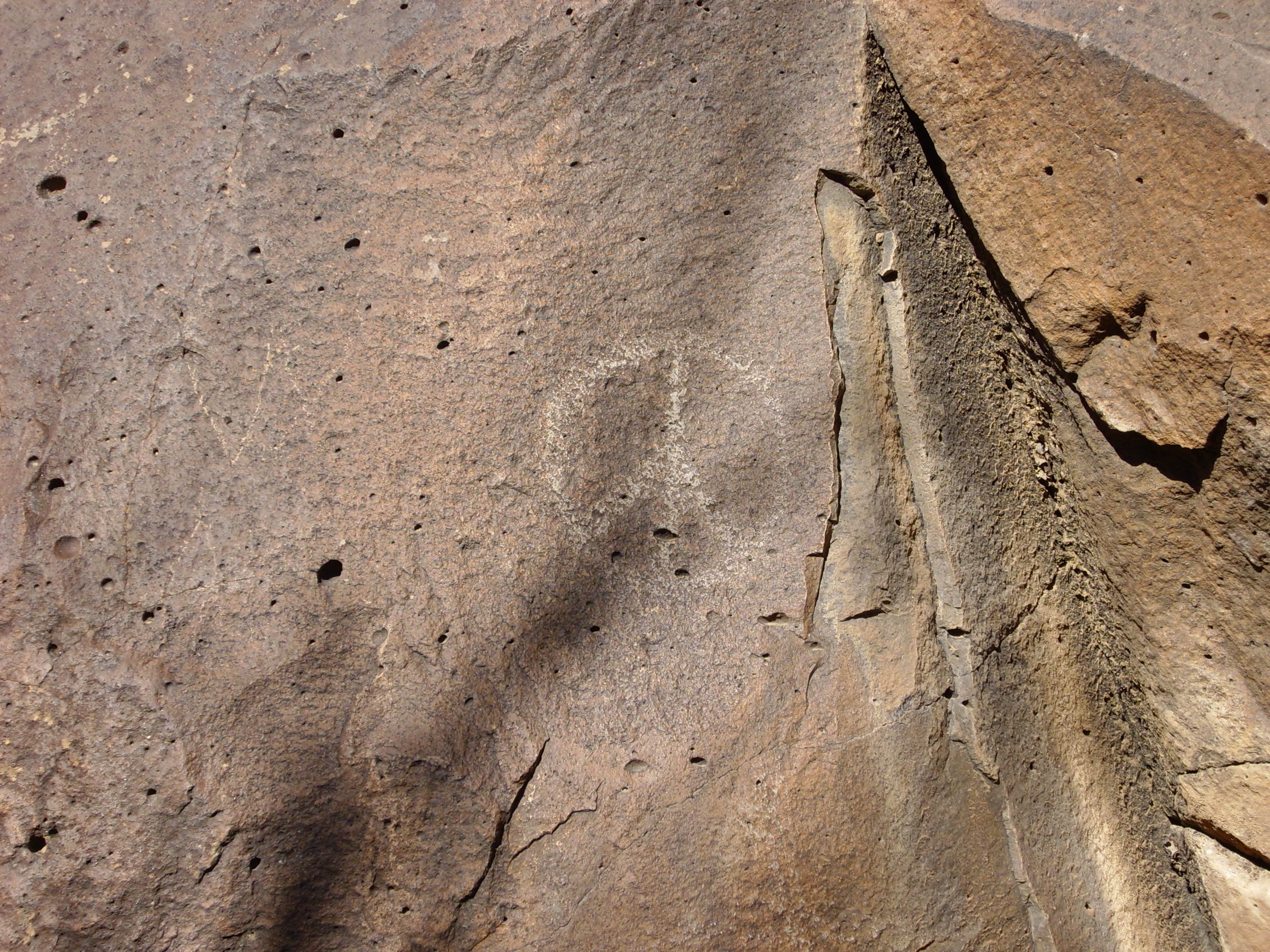
This kind of preservation of an original flow surface is rare in White Rock Canyon, occurring only where relatively recent erosion has exposed a lower flow that was previously protected from the elements by an overlying flow. Here is a close up of the boundary between the upper and lower flows.

This area has some petroglyphs or rock drawings; some likely authentic ancient Native American rock art:
and some not.
The petroglyph in the first photograph not only shows an authentic ancient pattern, but it also shows a thin layer of desert varnish indicating its great age. This is not present on the newer, inauthentic petroglyph.
Blue Dot Trail
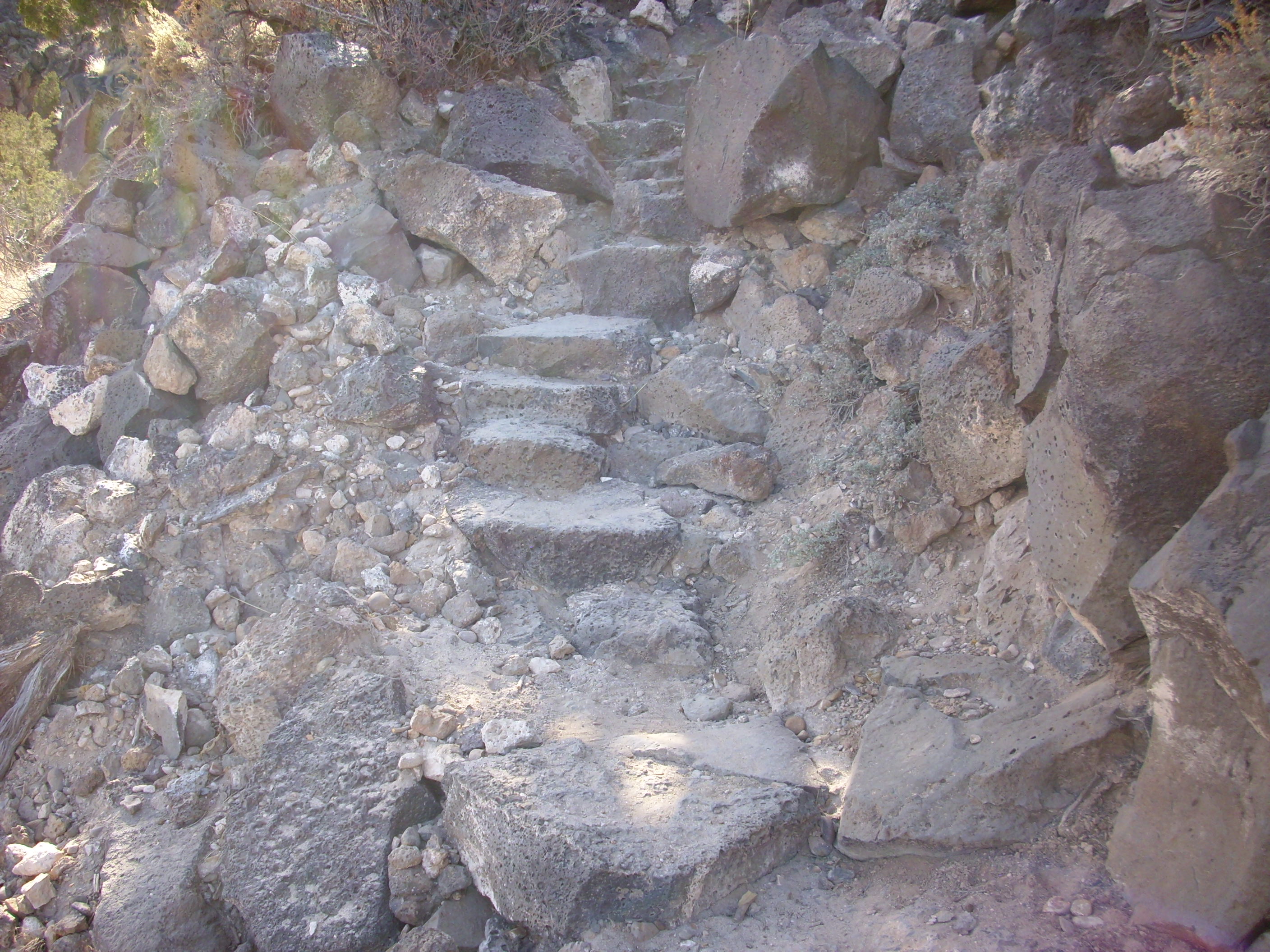
This is a fairly steep trail from the canyon rim down to the level of the Rio Grande. It is also well maintained, with such features as rock steps.
Achh, ssss, it’s the only way yes Precious …
After the initial descent down the basalt cliffs, the trail comes out on a slump block, somewhat smaller than the one described in the previous section. The landslides in the area unfortunately conceal the contact between the Cerros del Rio Basalt and the underlying Santa Fe Group, but the presence of large amounts of tan sediments in the landslides shows that this slump block is already below the level of the contact.
The terrain here is level enough to set up camp, and I have actually camped overnight with my son’s Boy Scout troop here, at roughly the spot shown in the center of the photograph. Note the considerable amount of well-rounded clasts along the trail; these match a similar gravel bank on top of the rim adjacent to this point and may represent a gravel bar from one of the lakes formed when eruptions in the Cerros del Rio dammed the ancestral Rio Grande River.
If one detours well off the trail, continuing south along the slump block, one sees what looks very much like an eruptive center, underlying the gravel mesa described in the previous section. This cannot be spotted from above, but is only visible from the slump block well off the trail.
Why do I think this is an eruptive center? Well, for one thing, the rock here is much lighter than the surrounding rock, and close examination suggests that this is because it is more coarsely grained than the surrounding basalt — almost like a diabase.

For another, the rock is foliated in a way that looks like a subsurface dome. I’m not sure these photographs do it justice.
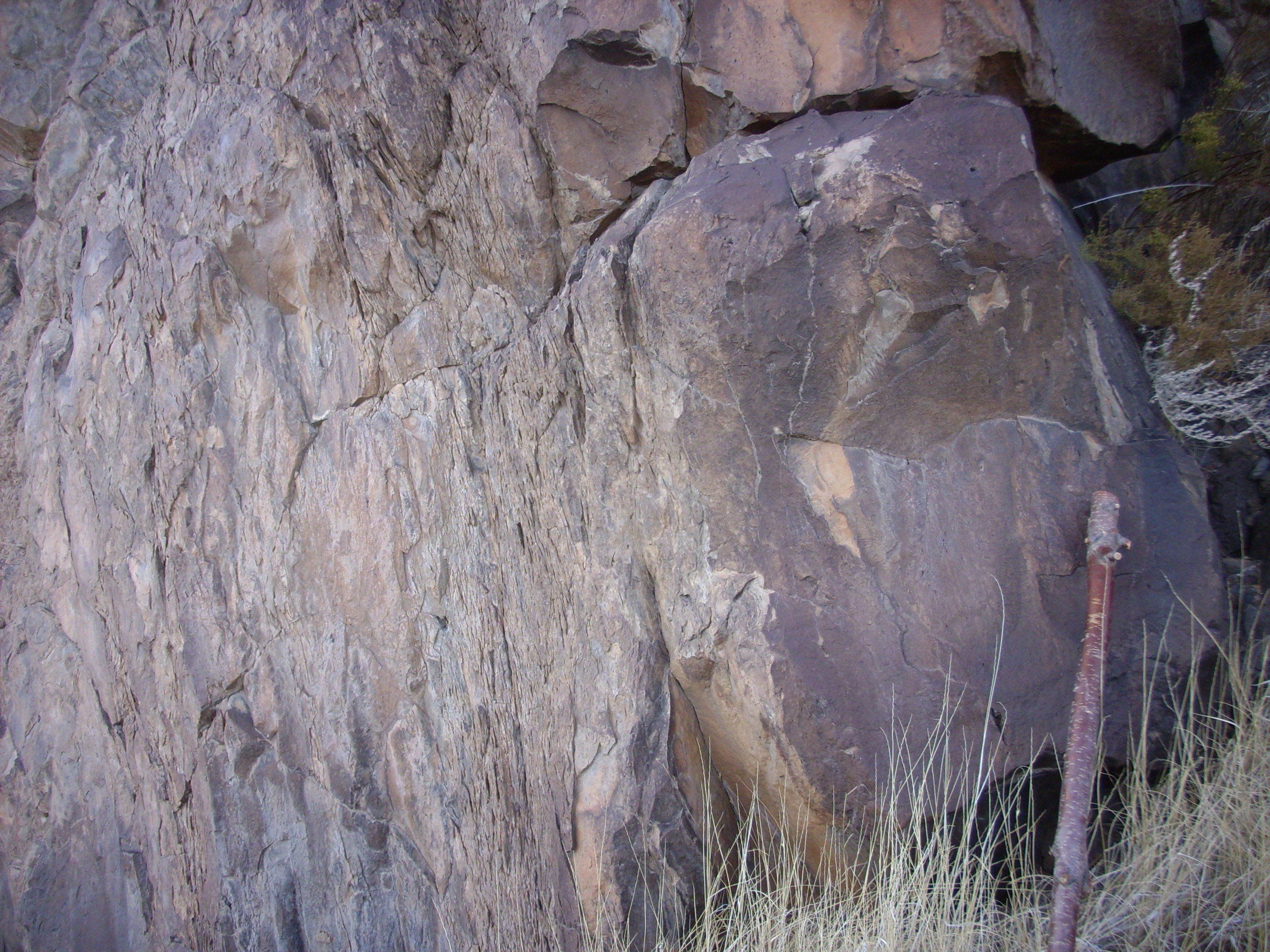
It’s a bit of a subtle thing, but the texture of the rock is different here from anything I’ve seen anywhere else in the canyon.
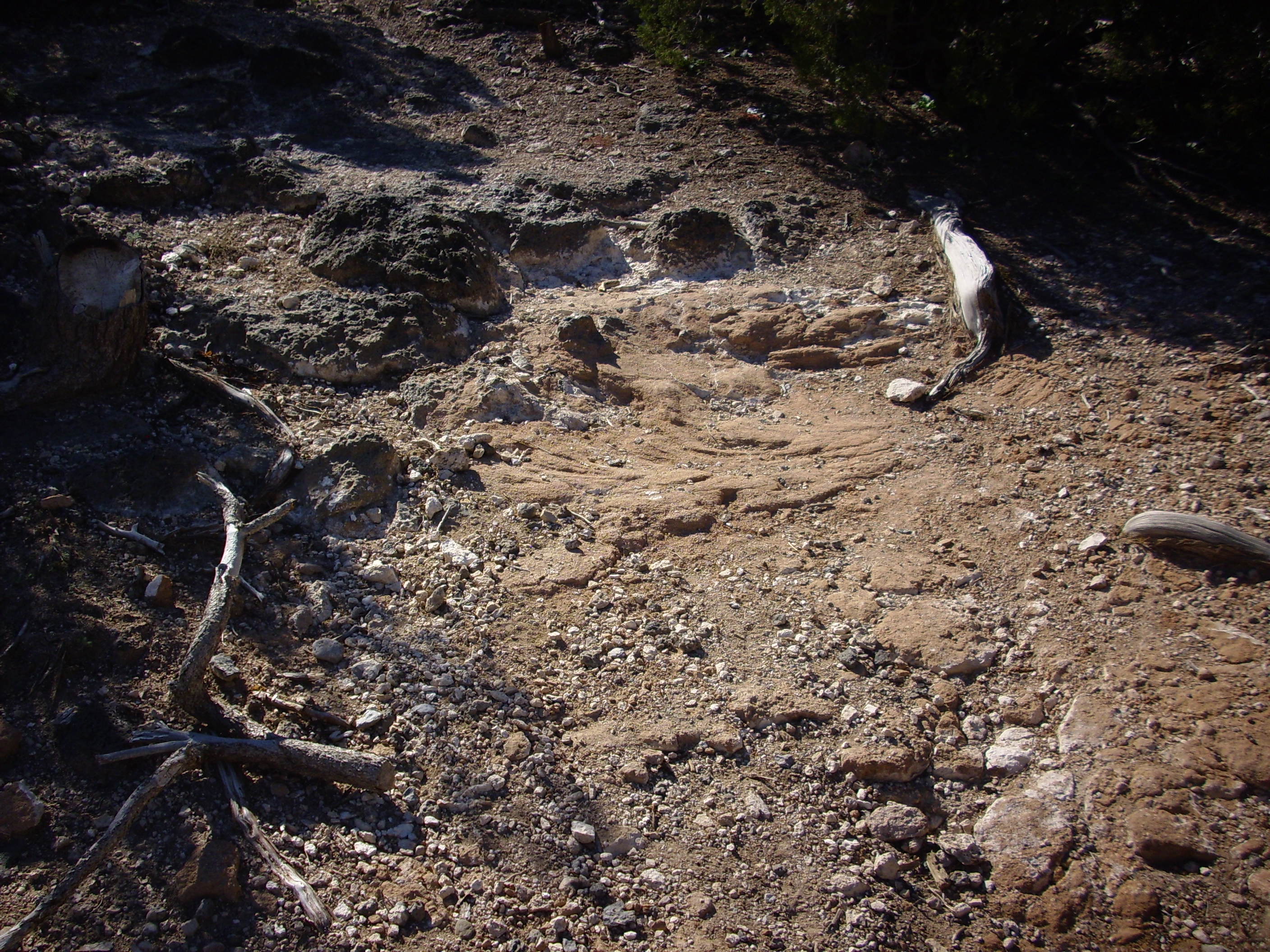
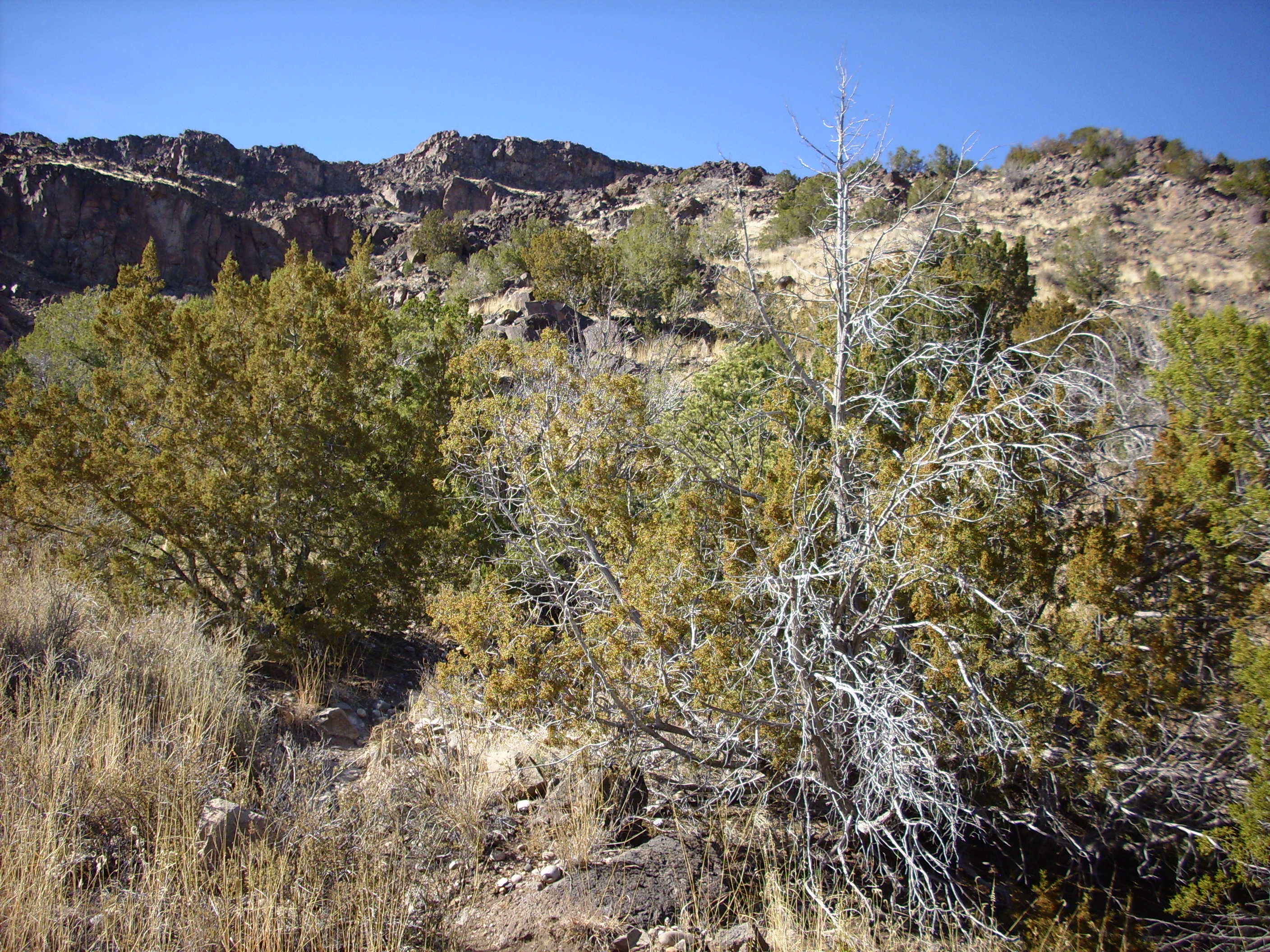
Additional small terraces from slumping are found below this point on the trail.
Near this point one finally sees outcroppings of the Santa Fe Group that have not been buried by landslide deposits. Here a small intermittent stream has eroded through to the original canyon walls.
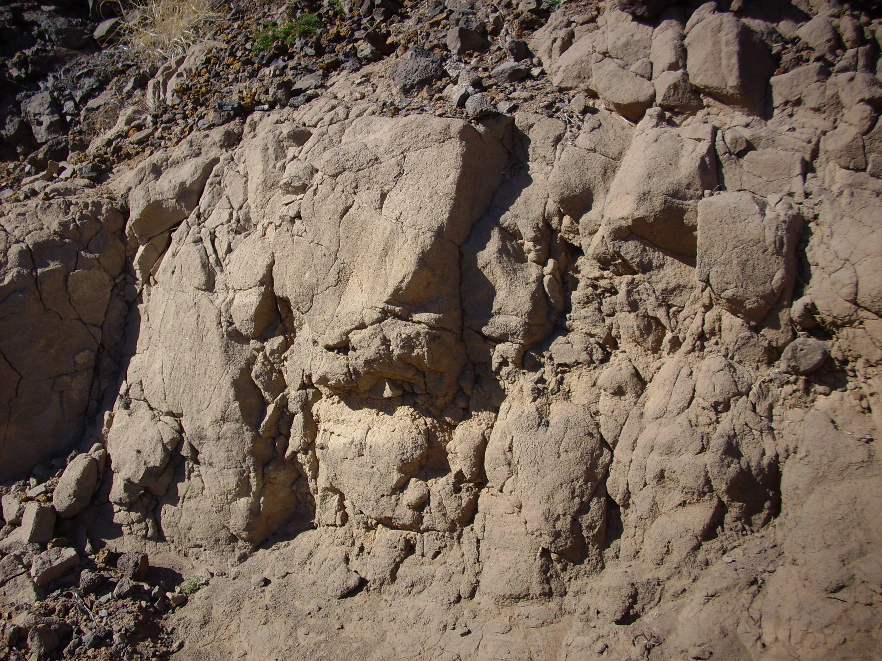
The outcropping is a very muddy sandstone that is moderately well indurated. A short distance further down the trail one encounters very large rounded clasts.
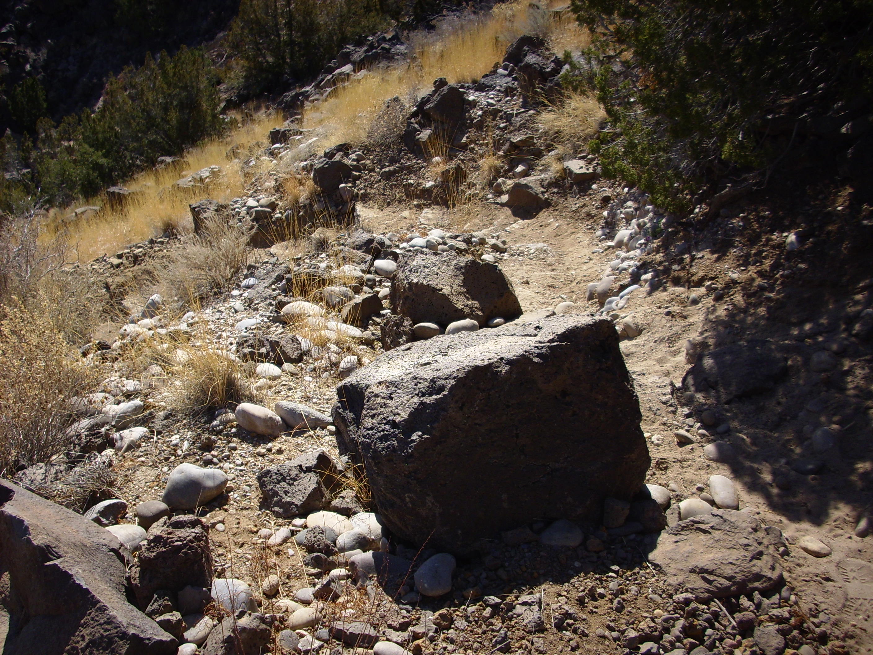
My guess is that this is the bed of a paleoriver that entered the ancestral Rio Grande near this point over 3 million years ago. The clasts are poorly sorted but weakly imbricated; that is, they are not very uniform in size, but the oval clasts show some tendency to lie back to back, like bricks in a wall. This is a further indication that this was probably a river channel.
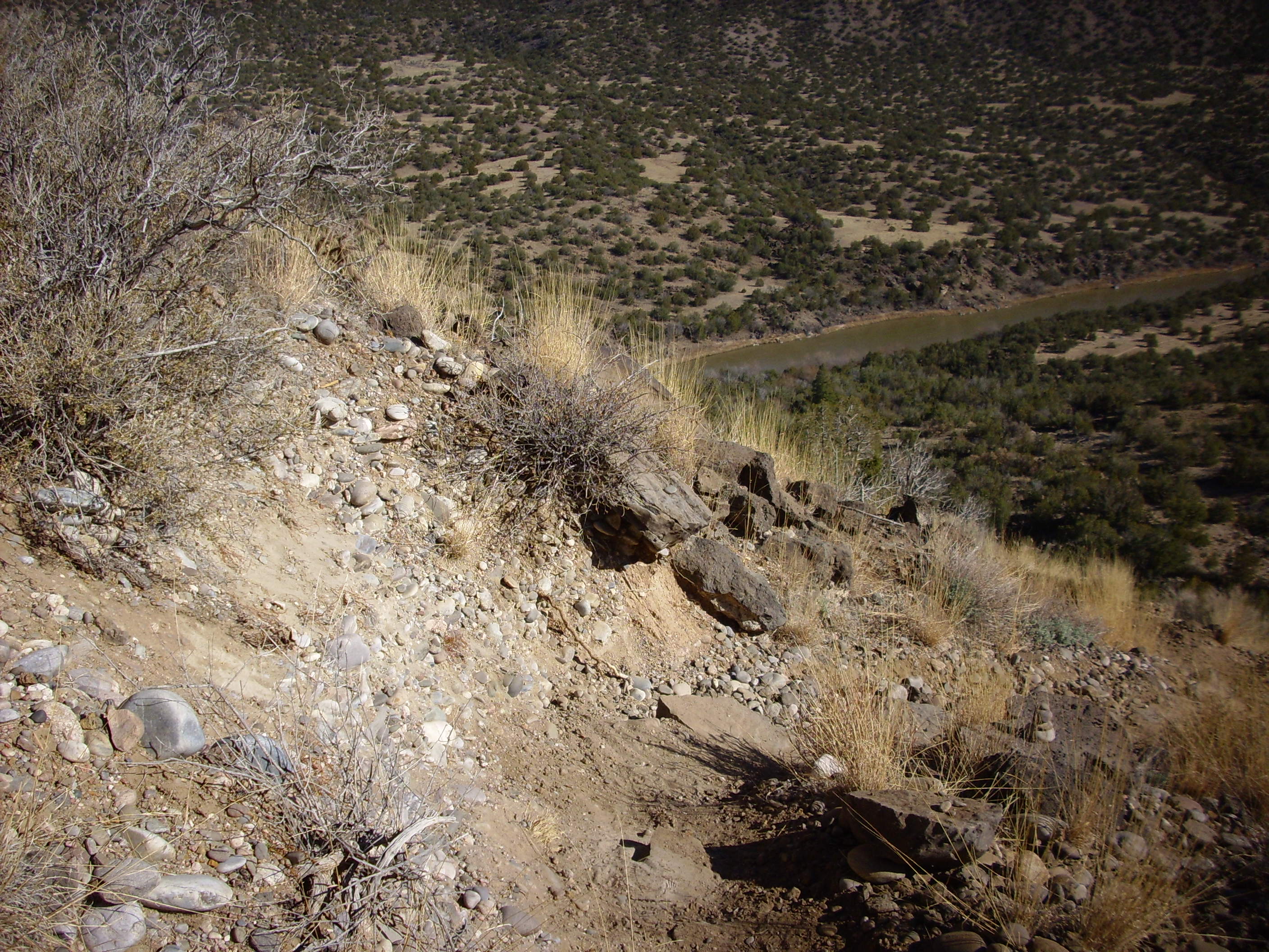
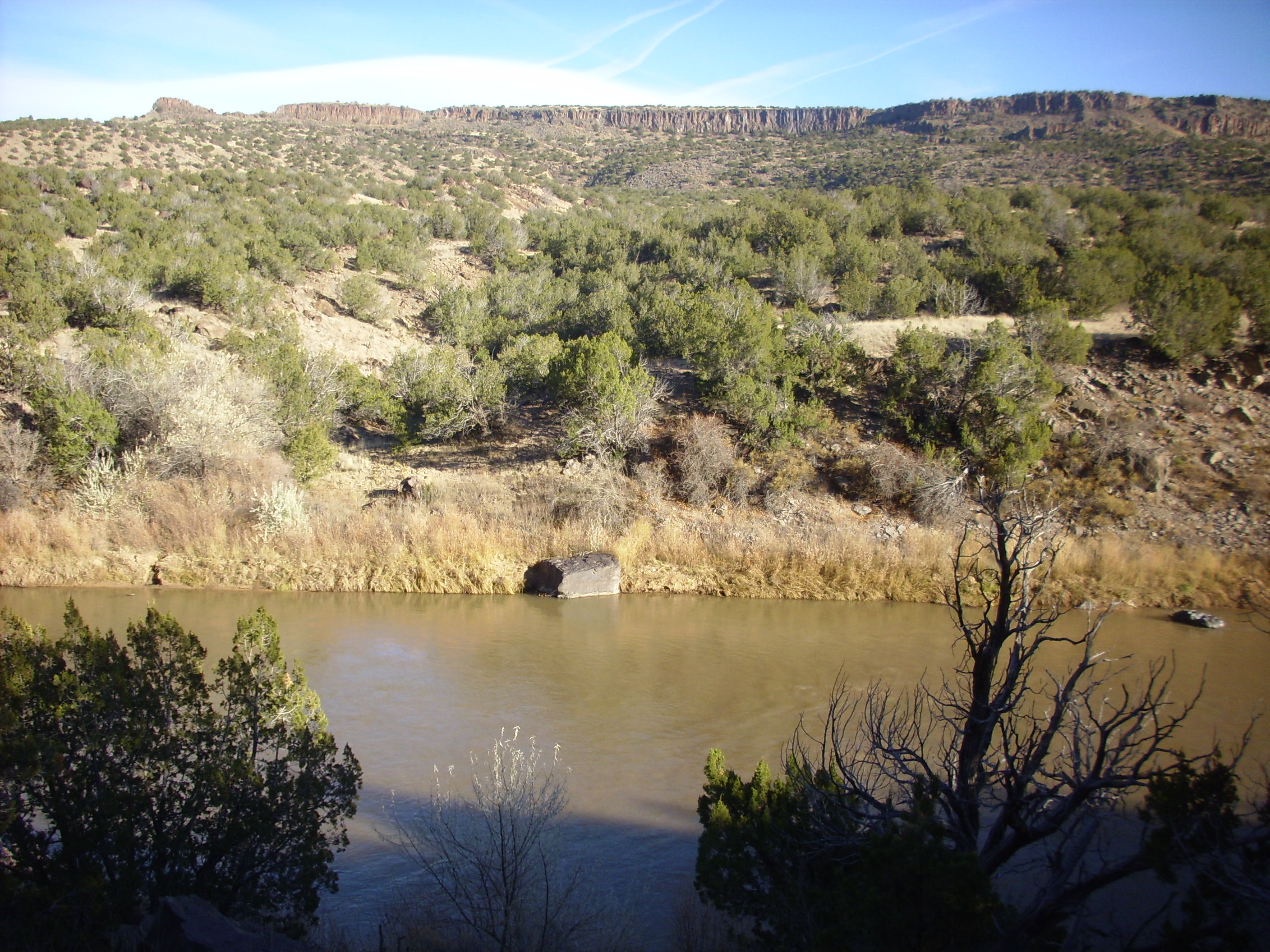
We’re now a long way below the canyon rim.
And we soon reach the principal agent of erosion in the canyon, the Rio Grande itself.
Copyright ©2014 Kent G. Budge. All rights reserved.