Wanderlusting Guadelupe Canyon
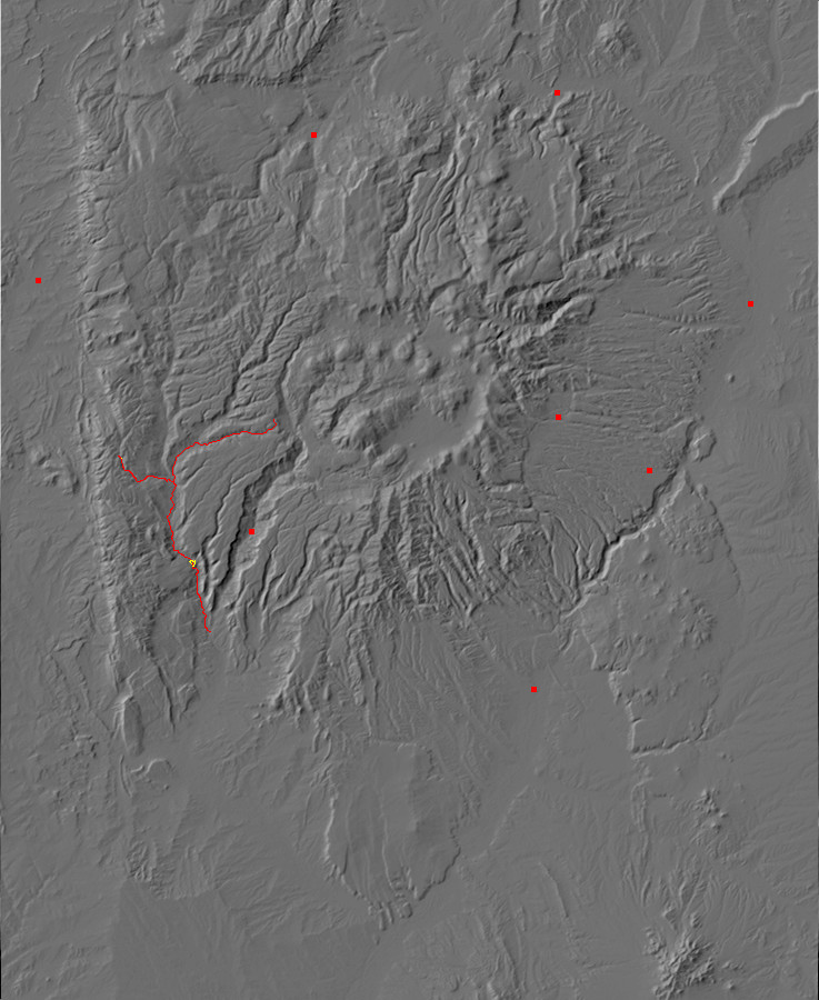
I have been itching for some time to take a closer look at the Precambrian rocks of the Sierra Nacimiento Mountains and the Carboniferous rocks of the southwest Jemez. Well, why not both in one trip? So I packed my backpack, put together a lunch, grabbed my camera and GPS, left here’s-where-to-find-the-body instructions with Cindy, and headed out west.
Sierra Nacimiento
My first destination was a mysterious local outcrop of hornblendite in the San Miguel Gneiss, which underlies the area around (you may have guessed) San Miguel Mountain. I had taken a crack at it earlier this summer with Bruce Rabe, but I was a bit off in my directions and we didn’t find the right road. This time I took a map and GPS and better recollections of what I had seen on Google Maps, and had better luck.
My route took me from White Rock along State Road 4 past Bandelier and the Valle Grande to the junction with State Road 126 at La Cueva. Turning onto SR 126, I continued to the west caldera rim to the intersection with Forest Road 376. FR 376 is a fairy good gravel road that leads into Lake Fork Canyon and Cebolla Canyon.
Near the confluence of Lake Fork Canyon and Cebolla Canyon, my attention was caught by some obvious limestone beds in the road cut.

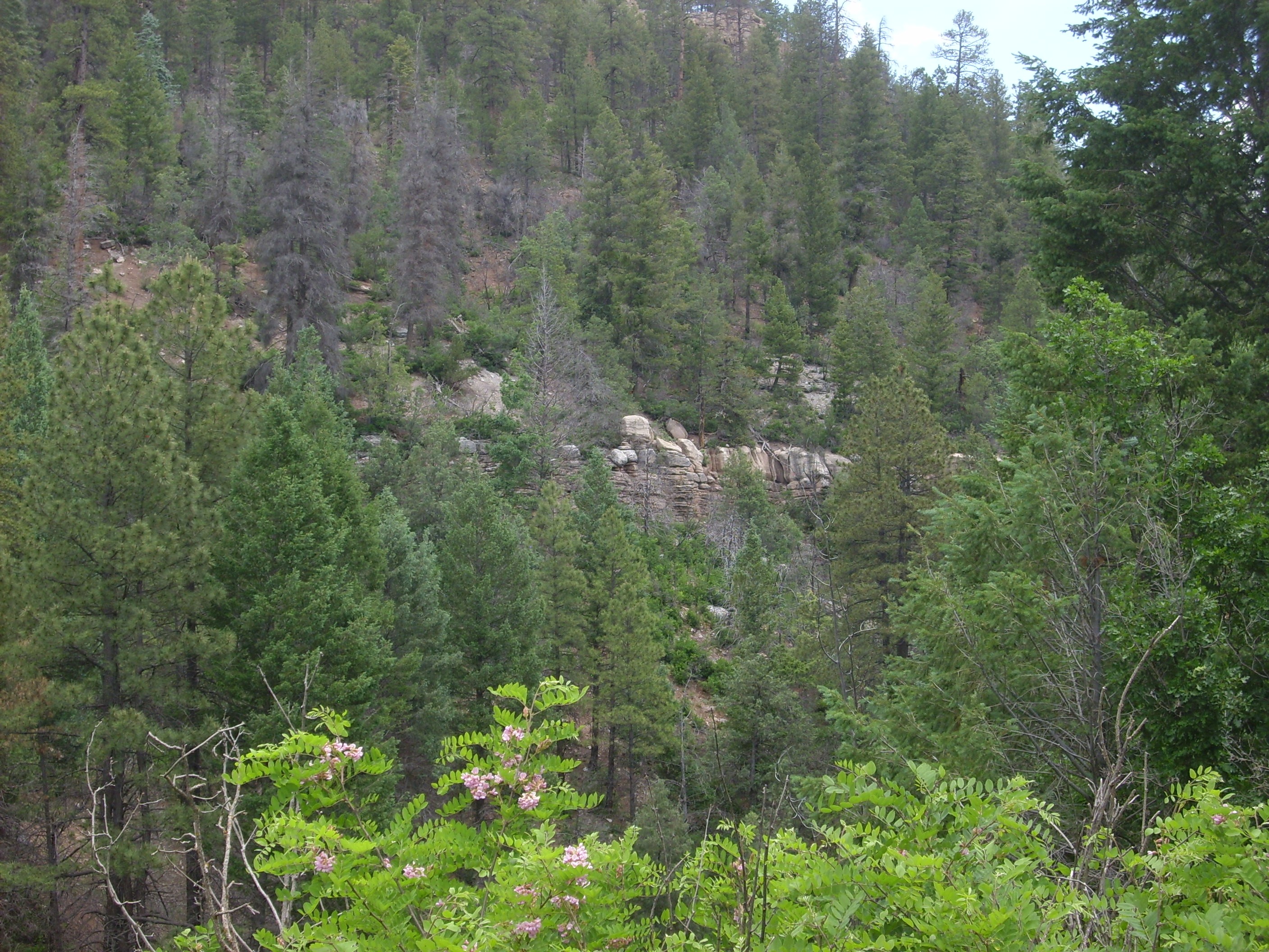
Madera Formation in northern Cebolla Canyon. 35 51.424N 106 45.595W
This turns out to be an outcropping of the Madera Formation, the chief Pennsylvanian formation in the Jemez area. It’s 300-million-year-old limestone from when this area lay under a shallow sea near the equator. In some places the Madera Formation is rich in fossils, but I saw none here. (I didn’t actually look that hard; I was after other game.) The top bed here is the top bed of the Madera Formation in this locale; everything above it is mapped as Abo Formation.
My geological ruminations were interrupted by a foul-tempered rodent sounding the alarm.
Ground squirrel making a racket. 35 51.424N 106 45.595W
Amazing that something that small can make that much noise. I suppose this means that one does not simply walk into Cebolla Canyon.
A little further down the road, the road cut shows massive beds of the Abo Formation.
Abo Formation. 35 51.282N 106 45.843W
These are a bit more massive than usual for the Abo. A close look reveals that the sandstone here is also unusually coarse, grading into conglomerate.
Abo Formation. 35 51.282N 106 45.843W
Since I already have numerous bits of pieces of Madera and Abo Formations littering my work room, I declined to take any further samples.
My route continued south to the bridge across the Rio de las Vacas. Appropriately, there was a sizable herd of cows nearby gazing at me with that vacant cow gaze. Just across the bridge, I turned right onto a side road not named on Google Maps, then left onto what I assume can be called Bales Canyon Road. Up till now, the road had been first-quality gravel road; here it became just a bit rocky, though still suitable for a passenger vehicle in good weather.
Past Bales Canyon the road hit another fork; it’s not hard to know to stay left, since right is a fairly crummy logging road. But I got a bit confused at the next fork, near Rito la Cueva Spring, since the fork right was steep and rocky and the fork left was a bit grassy. I guessed left; wrong. It soon became clear this was just another logging road. I turned back, took the right fork, endured a short stretch of steep, rocky road, and then the road got better and I felt better.
The rocks here were mostly Madera Formation, but poorly exposed. I could not find the exact contact between Madera Formation and Joaquin Granite because of the poor exposure, but it has to be somewhere between here:
Madera clasts in road cut. 35 49.295N 106 50.054W
and here:
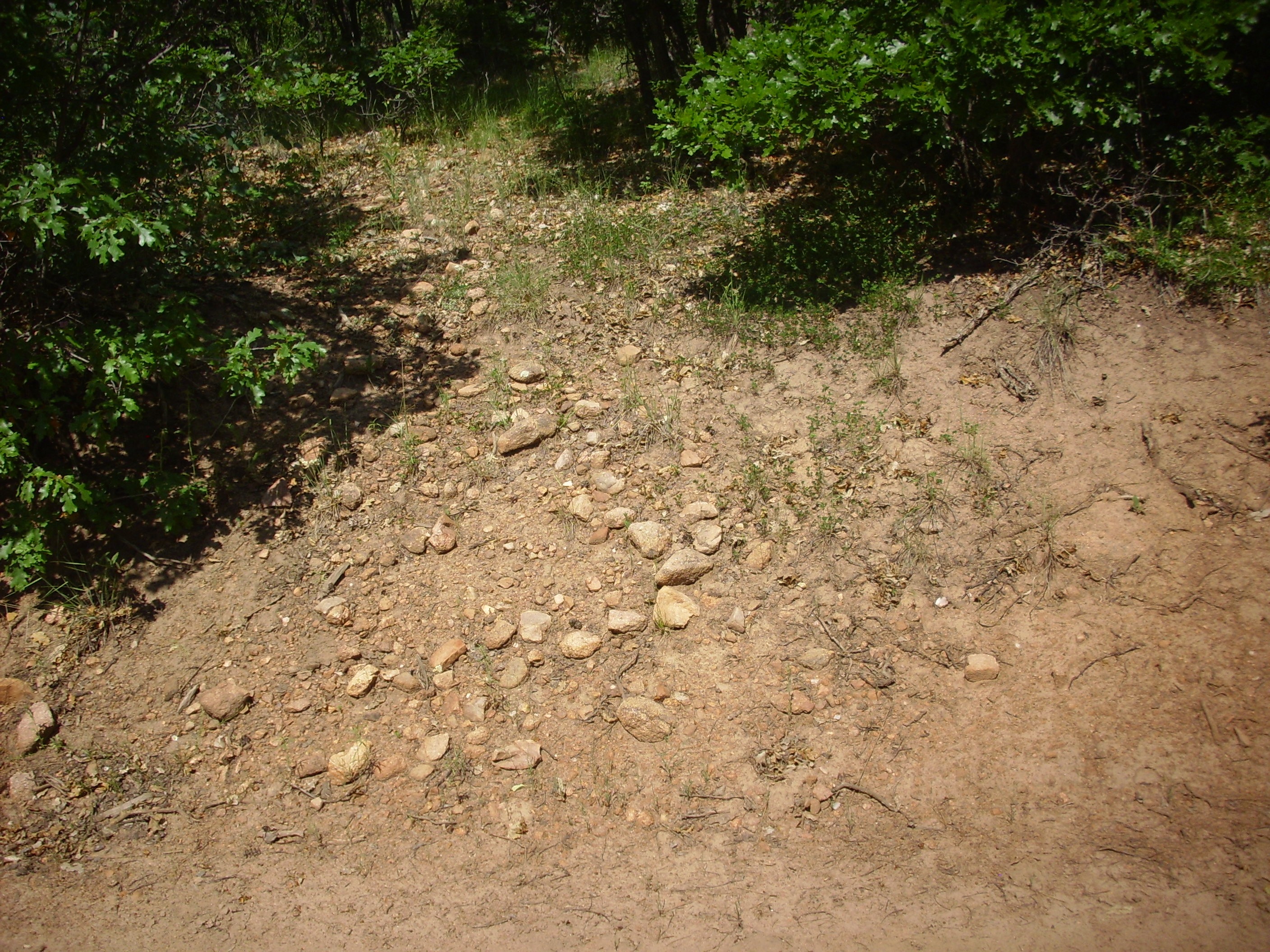
Joaquin Granite clasts in road cut. 35 49.295N 106 50.054W
where the boulders in the road cut shift from predominantly Madera limestone to predominantly Joaquin Granite. The Joaquin Granite is the most common Precambrian rock of the southern Sierra Nacimiento Mountains; it forms a batholith, or huge crustal outcrop, of granite that has been dated to about 1.4 billion years old. This is a time period when there was a burst of magmatic activity all over the western United States, whose cause has not yet been definitely established.
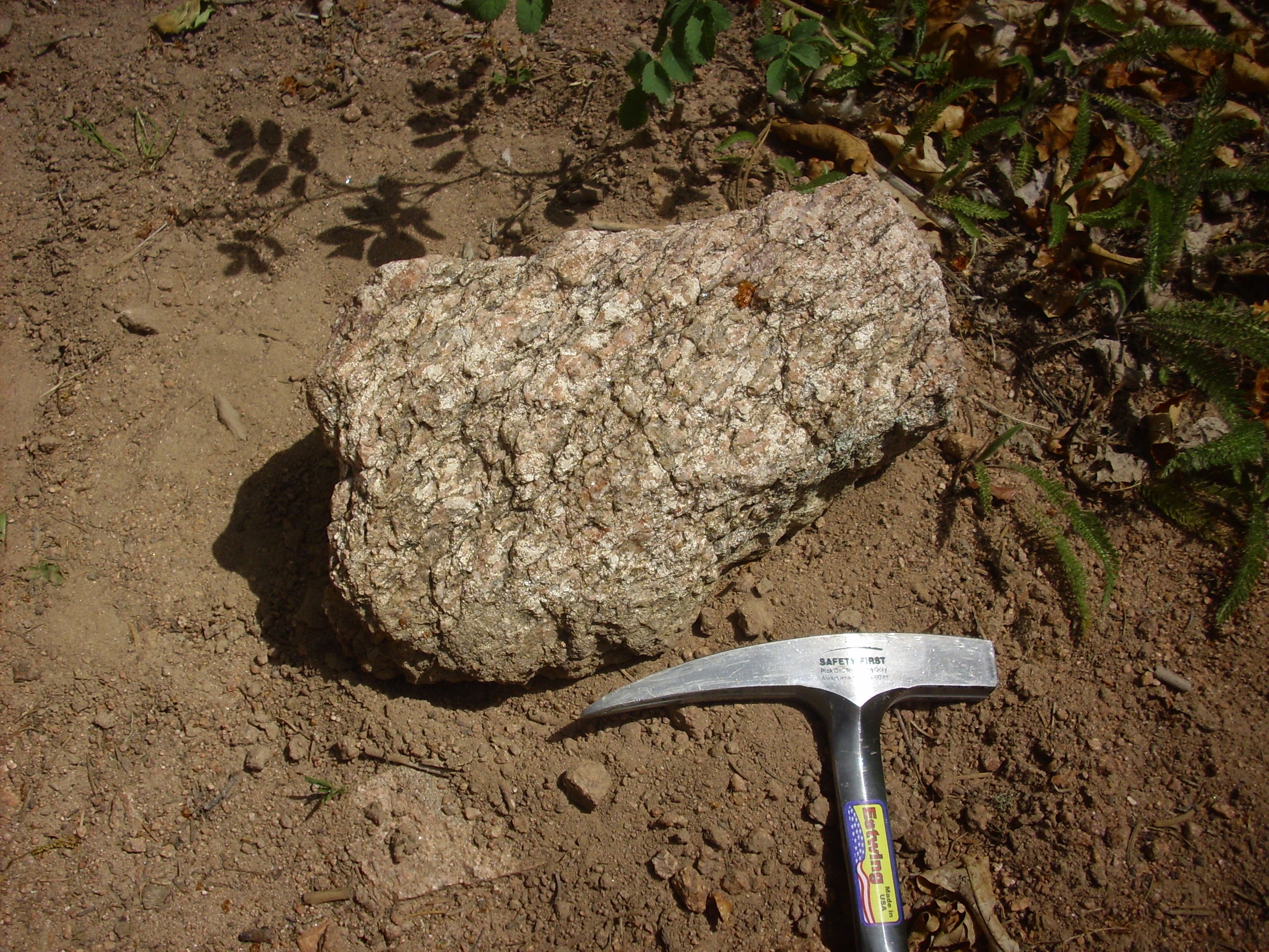
There is no question about this next outcrop being Joaquin Granite.

Joaquin Granite. 35 49.459N 106 50.160W
Again, I’ve already got a bit of Joaquin Granite in my collection, so no sample today.
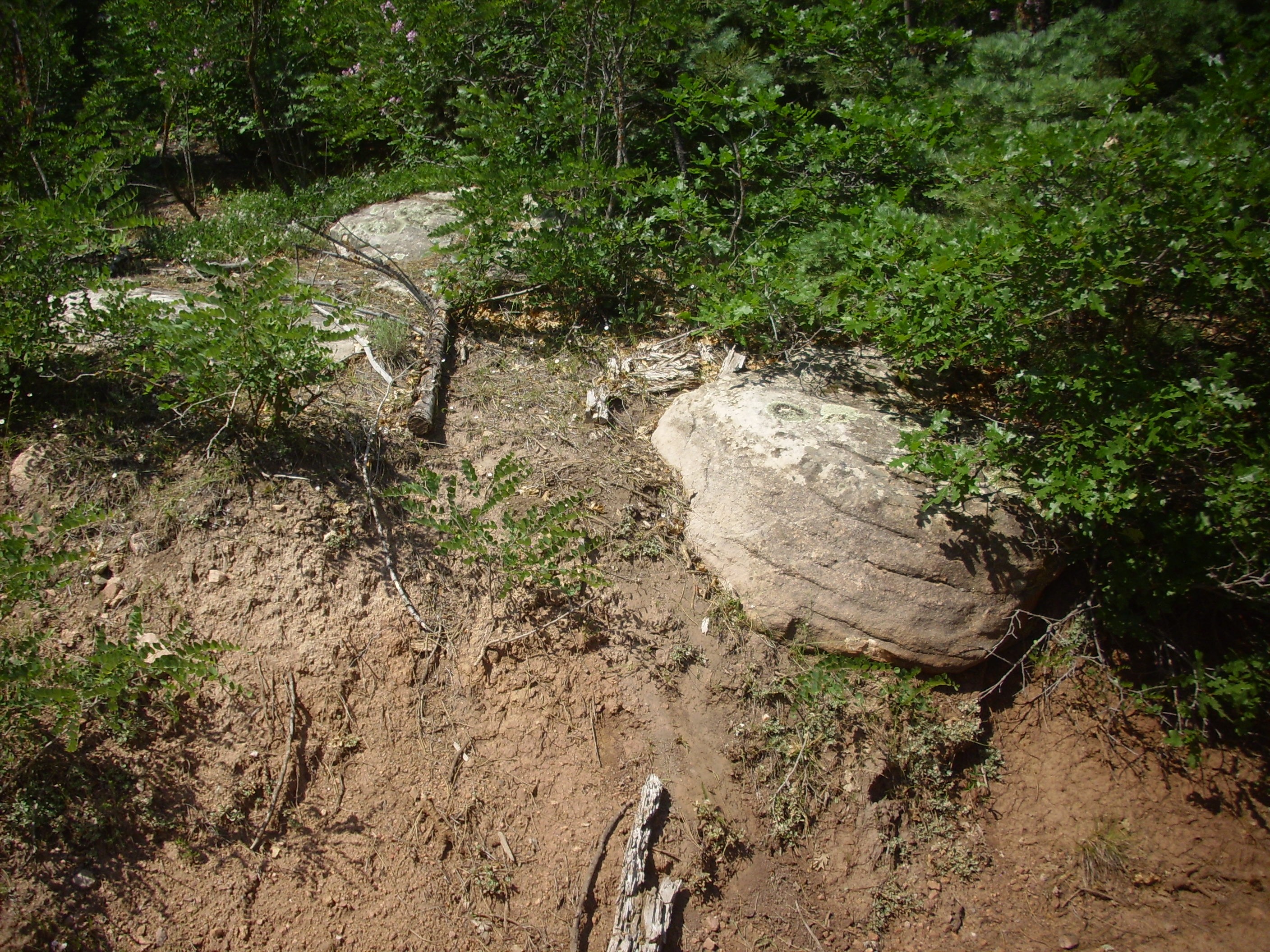
The next contact was between Joaquin Granite and San Miguel Gneiss, and, again, it was impossible to locate with any confidence without climbing higher off the road than I was inclined to this day. But it had to be somewhere around where I found my first substantial bit of gneiss:
San Miguel Gneiss near contact with Joaquin Granite. 35 49.831N 106 50.900W
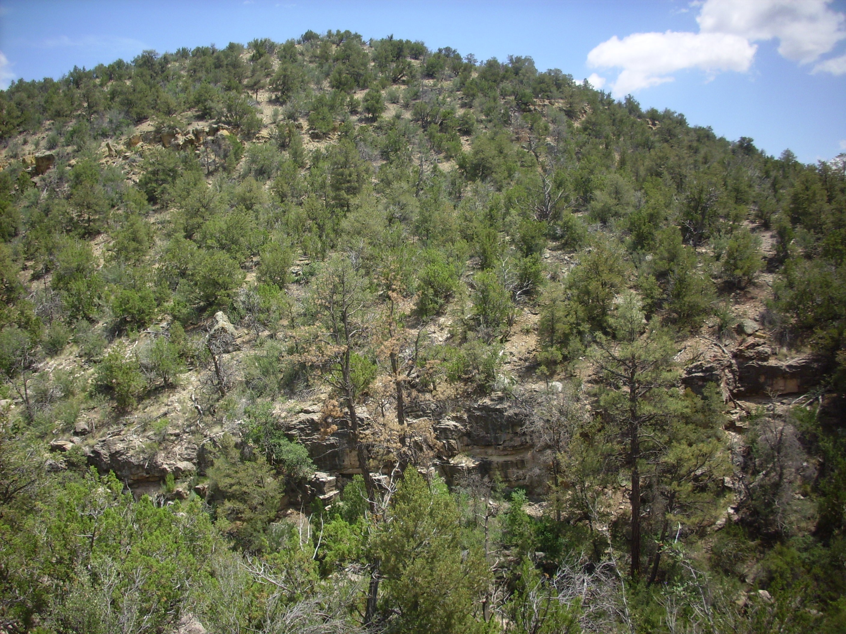
I suppose I should also mention at some point that this is a really beautiful area of deep canyons in high mountain country. Must be a bear for a geologist to map, though.
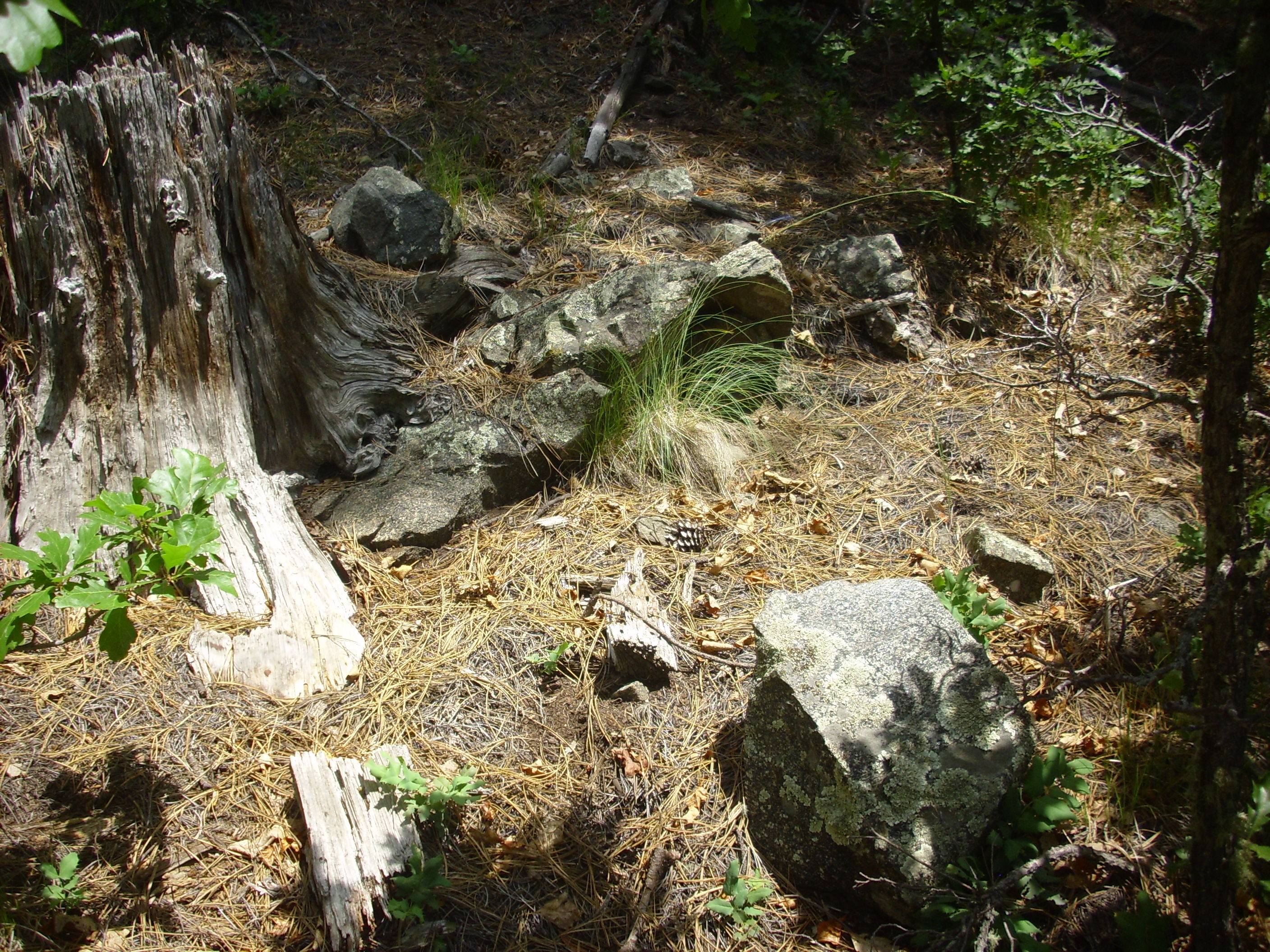
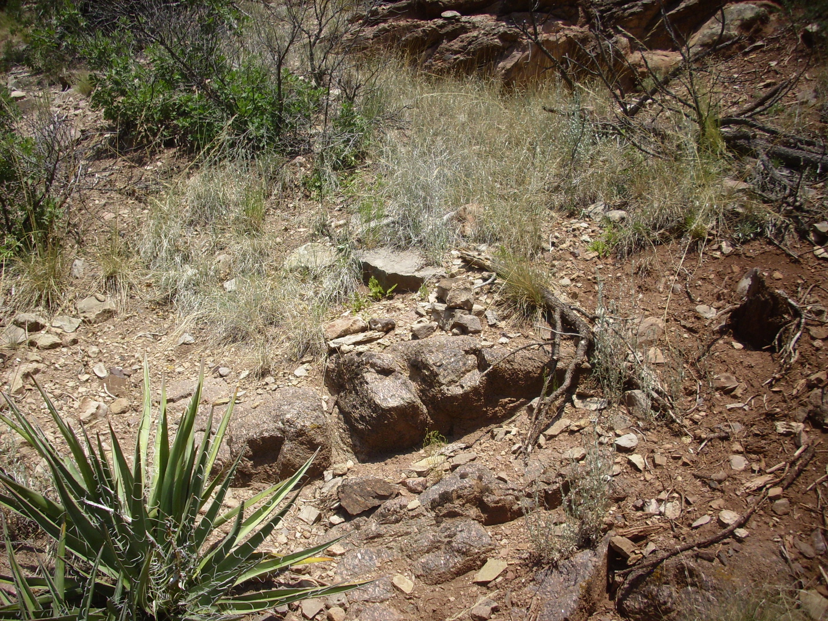
I had a vague notion that I was getting close to the local outcrop of hornblendite, but when I got to a curve in the road that looked like it might be the right spot, I decided to push on just a little further. If I was in the right place, there should be a road junction just a little further on. Sure enough; and there was an outcrop of San Miguel Gneiss nice enough to photograph and sample.
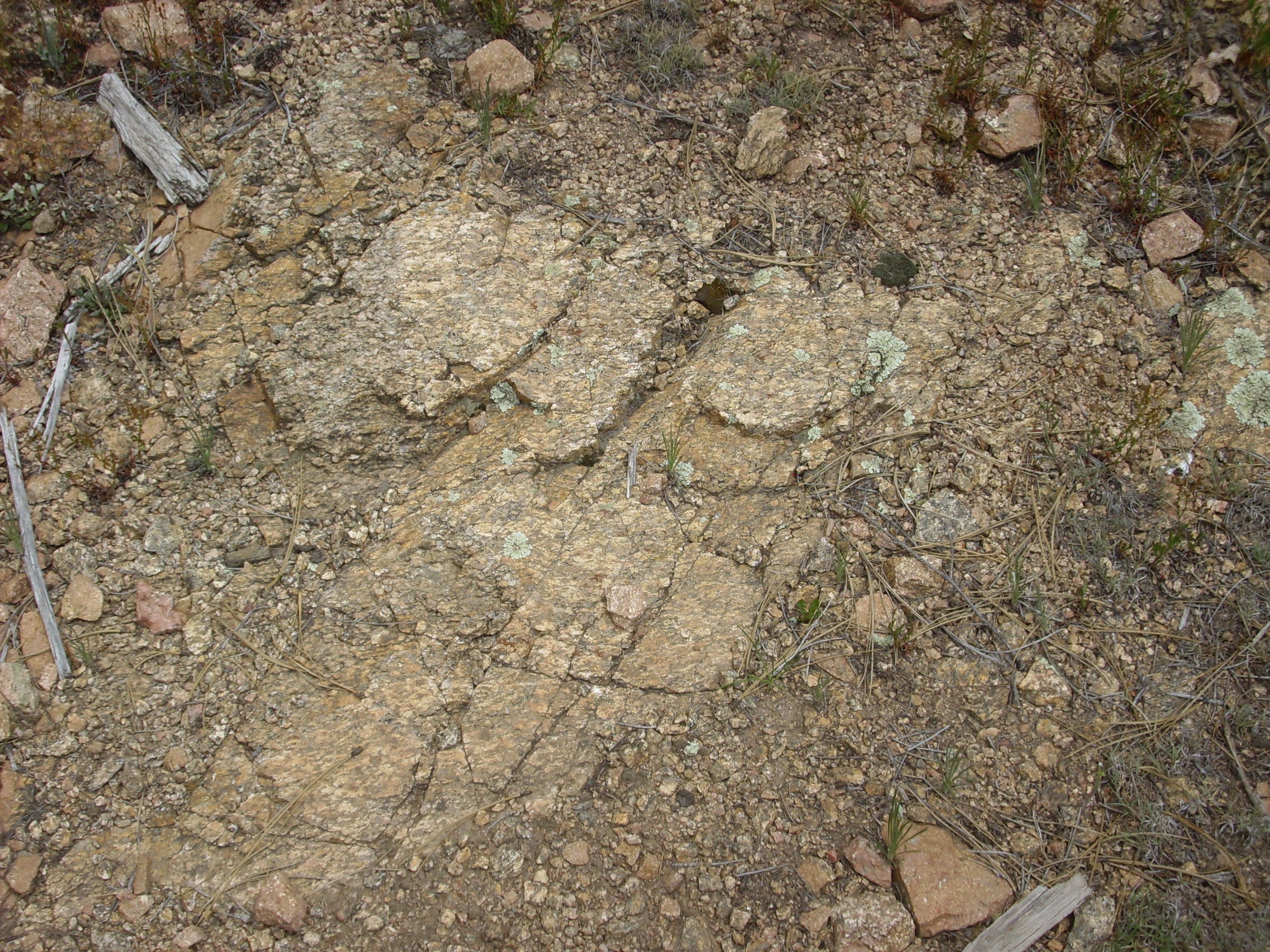

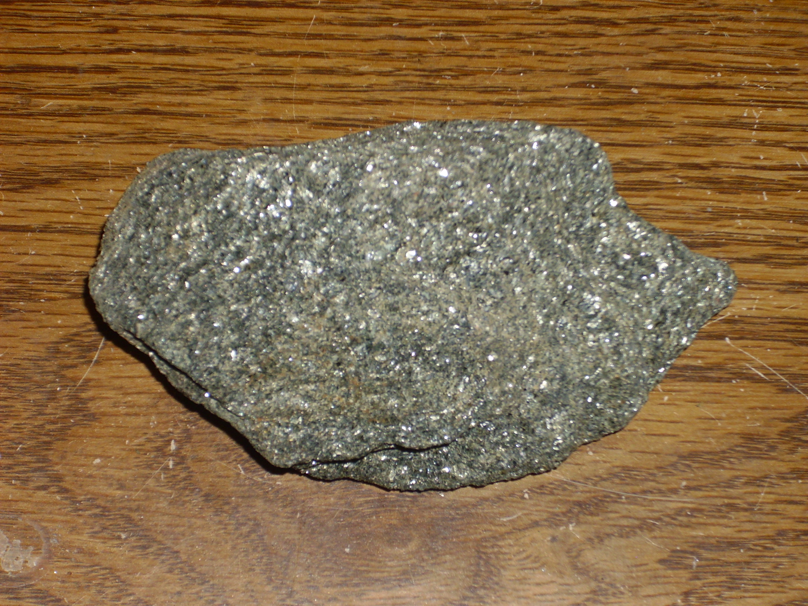
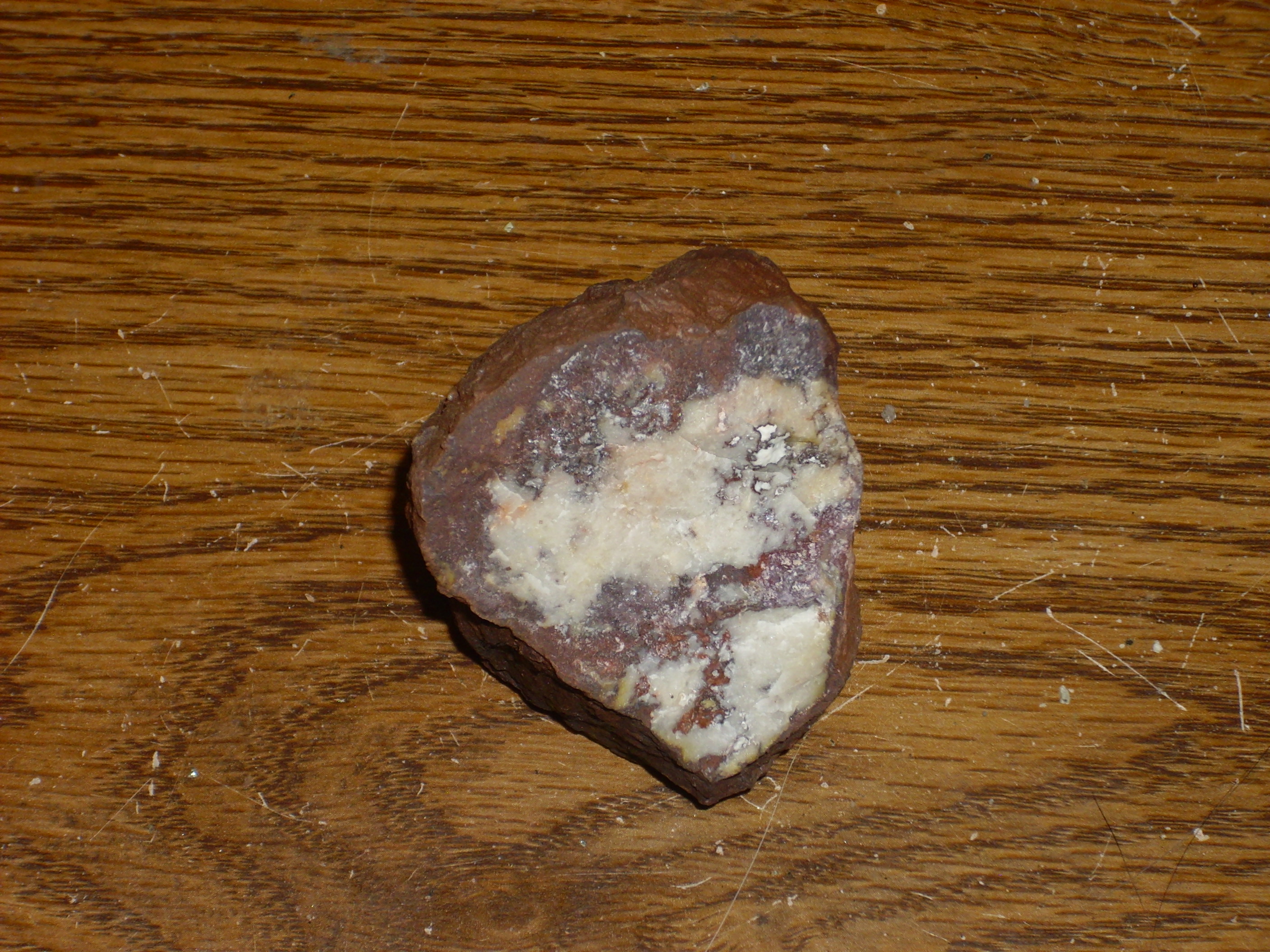
San Miguel Gneiss. 35 50.677N 106 51.340W
All puns aside, this really is a nice rock. It has roughly the same composition as granite, with lots of white quartz and pink potassium feldspar, and streaks of hornblende and mica with the foliation one expects to see in a gneiss. This rock formed about 1.695 billion years ago, based on radiocarbon dates, and that may be the time that it was crushed in the collision that sutured southern New Mexico (Mazatzal province) to northern New Mexico (Yavapai province). In fact, this area is very nearly directly on the suture. That’s why the hornblendite outcrop is of such interest. It may be metamorphosed oceanic crust caught in the collision.
So I headed back to the curve on the road that my map says should be just south of a hillside full of hornblendite, and began hiking up the hillside. No trail, of course, and a fair amount of undergrowth until I got under the taller trees. And there it was.
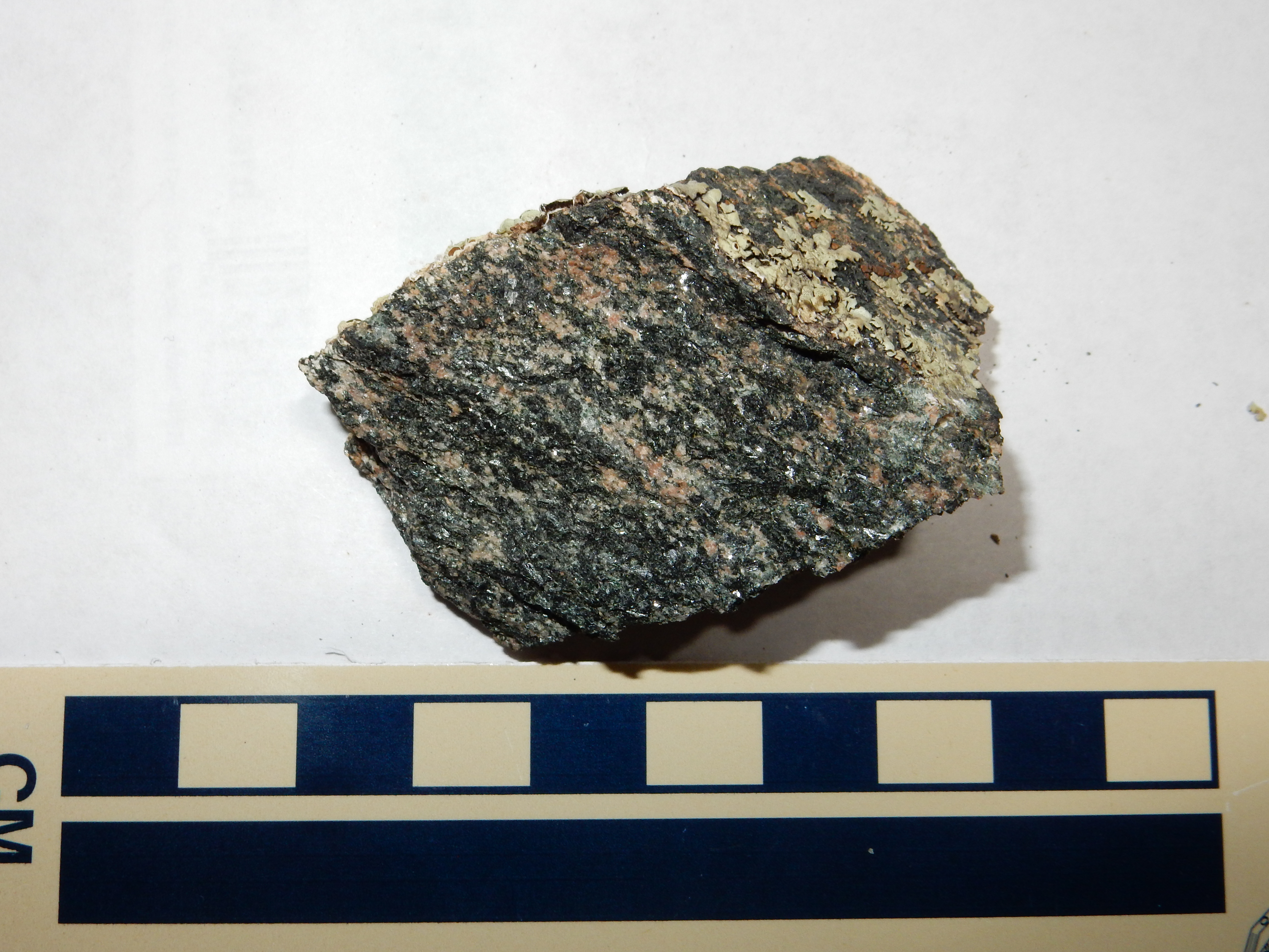
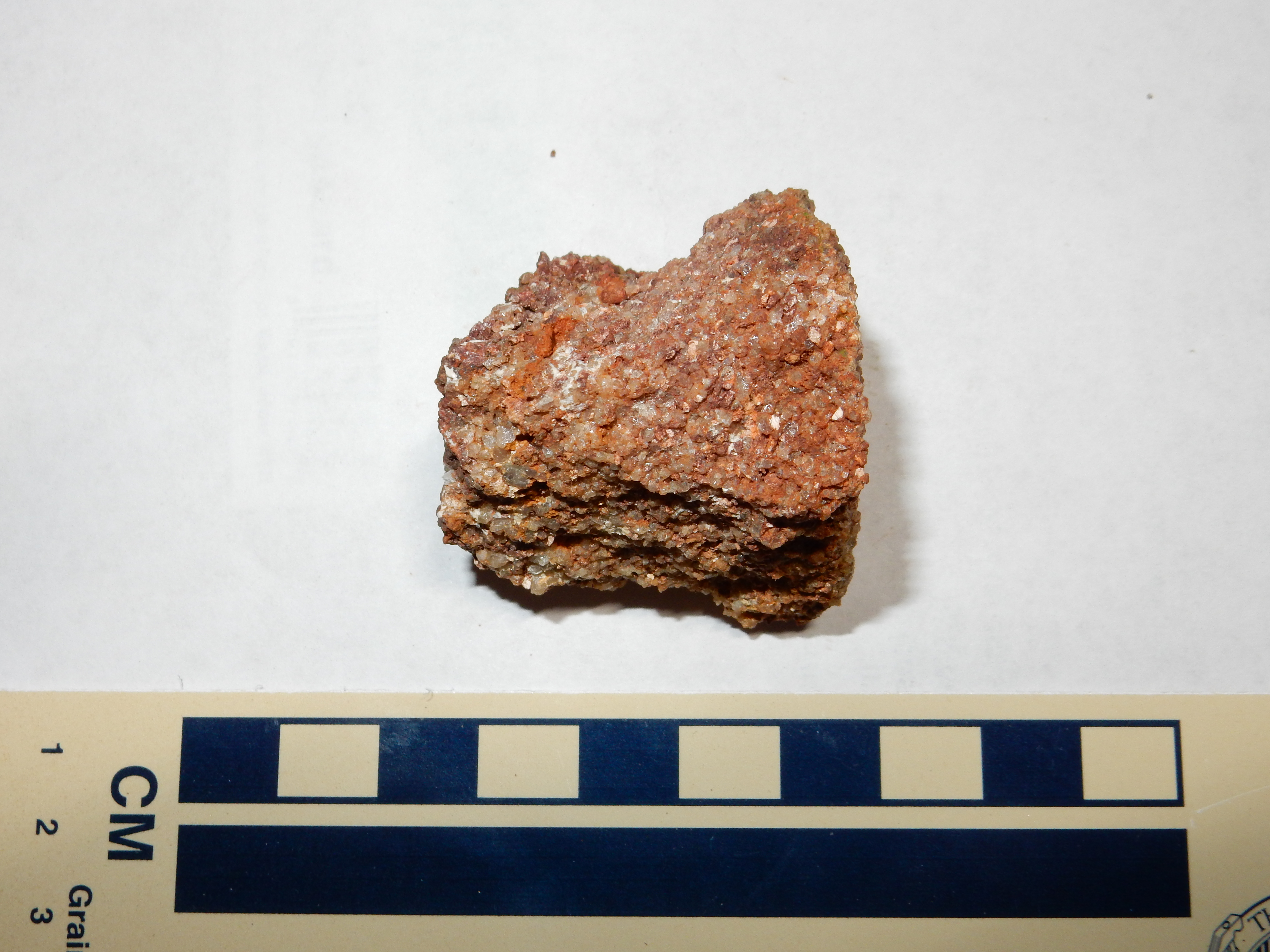
Hornblendite outrcop in the San Miguel Gneiss.. 35 50.530N 106 51.110W
The outcrop area is perhaps a couple of hundred feet across, and the first photograph is taken near its lower edge. The rocks are heavily encrusted with lichen, but are obviously much darker than the surrounding gneiss. The sample shows that the rock is mostly hornblende (hence the name) with a small amount of what looks like potassium feldspar. That’s a bit odd: hornblende is poor in silica and rich in magnesium, iron, and calcium, and one normally does not expect such a rock to have much potassium. Well, there’s no way to be sure of the mineralogy short of making a thin section and examining it under a microscope; and since I possess neither a rock saw, a grinder, nor a petrographic microscope, nor do I have a few thousand quatloos to spend on such, I’ll just have to keep guessing.
As I said, a good guess is that this is a bit of ocean floor trapped in the collision of two plates long, long ago.
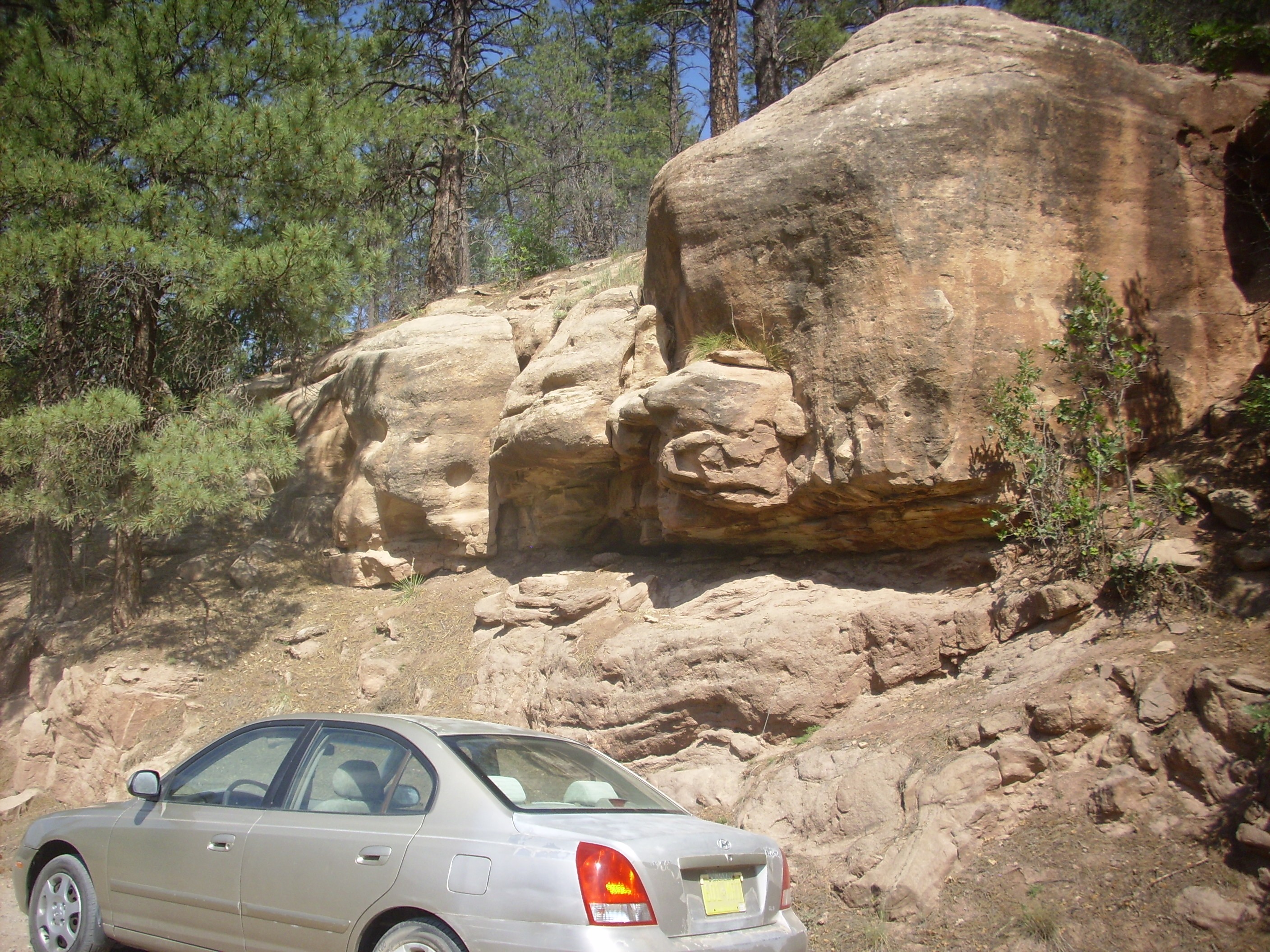
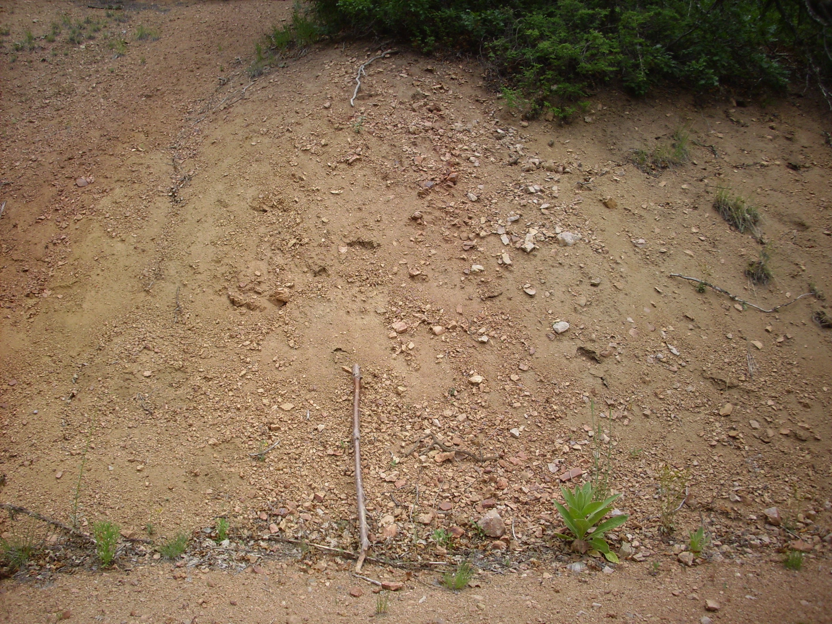
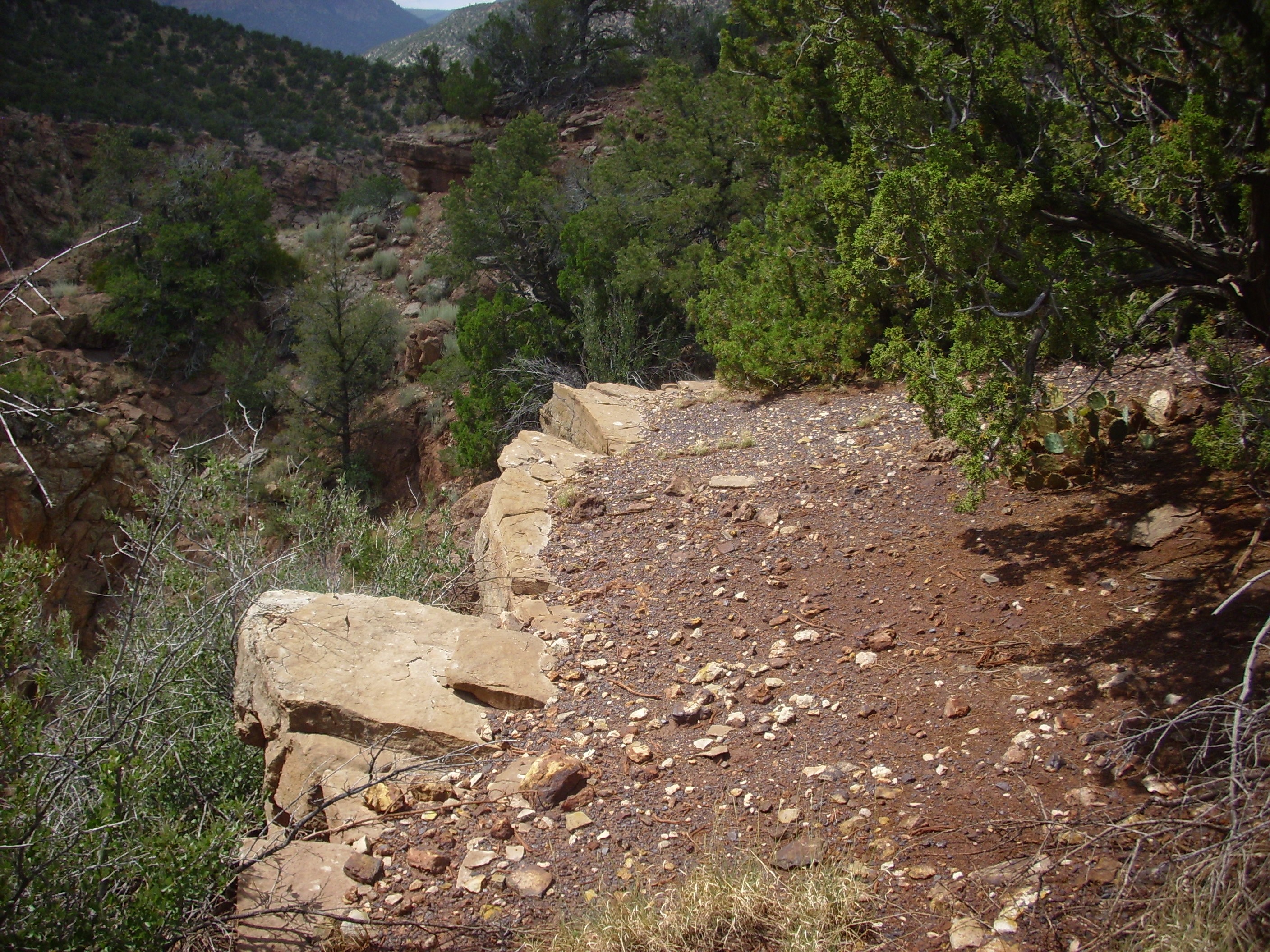
My map showed a pegmatite lens not far away. Pegmatites are fairly cool, so I headed that way. The road fast became awful, so I stopped and hiked the rest of the way. Turns out the pegmatite lens is very poorly exposed.

Pegmatite in the San Miguel Gneiss.. 35 50.581N 106 51.543W
Still, there were bits of pegmatite for the taking. This sample shows a fairly uninteresting pegmatite, without many exotic accessory minerals, composed mostly of quartz and potassium feldspar. Not even much mica in it.
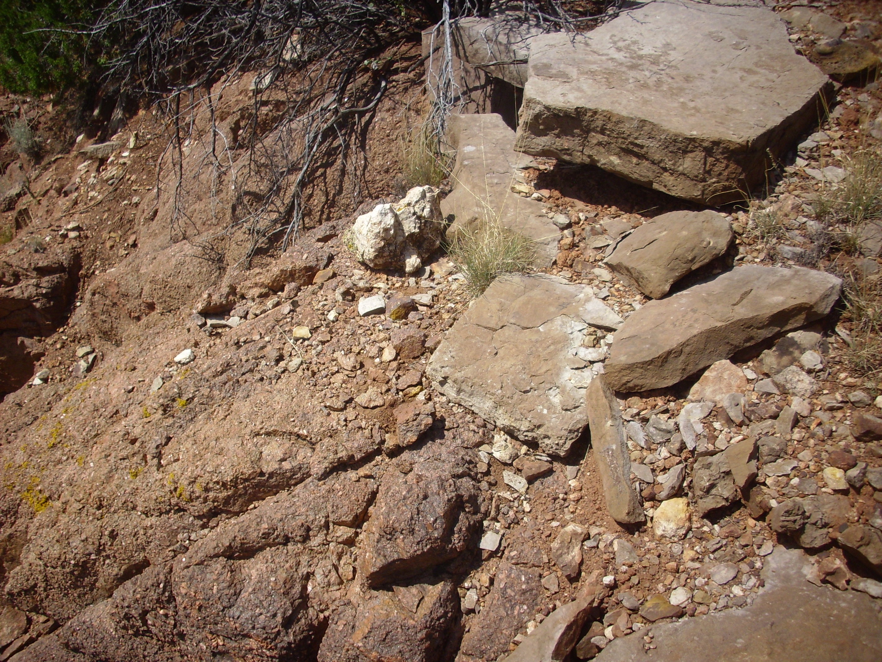
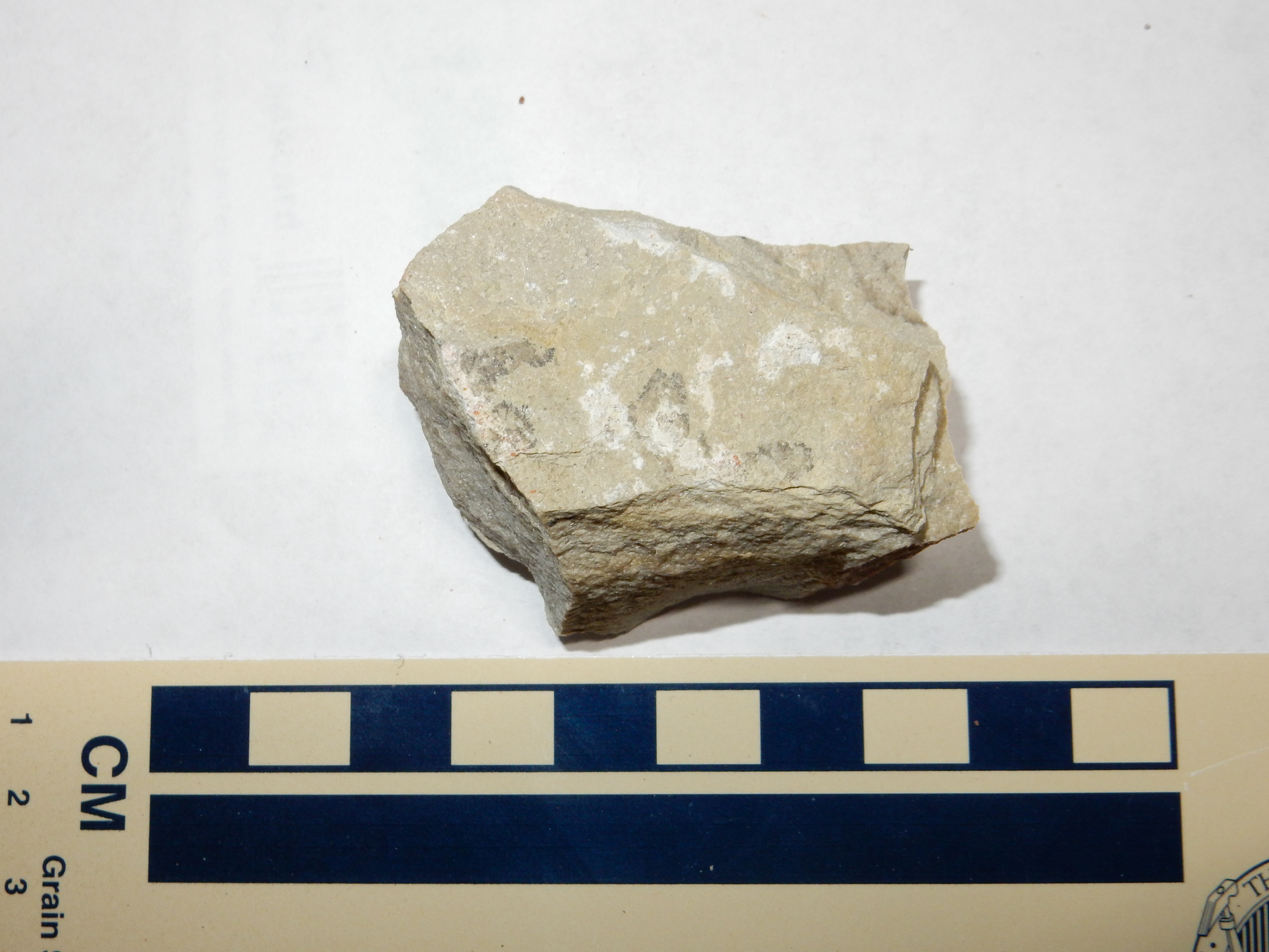
However, there was a more interesting outcrop a hundred feet away not indicated on my map.
Mafic outcrop in the San Miguel Gneiss.. 35 50.574N 106 51.527W
Looks like a metamorphosed basalt dike. But the sample looks to be nearly pure hornblende with some biotite; almost no traces of any kind of feldspar. A metamorphosed ultramafic dike? Part of a deep ocean floor? Would be nice to run a ICP-MS analysis of its composition, but see previous comments regarding lack of equipment and quatloos. Being an amateur has its drawbacks.
I made a halfhearted venture at this point to drive to the peak of San Miguel Mountain, where I could probably take an impressive panorama photograph. Alas, the road was too much for my Korean clown car, or at least that’s what I told myself when I chickened out. Then again, I was deep in the middle of nowhere by myself in a 15-year-old vehicle with laughably low ground clearance, so I was already taking enough chances, thank you.
On the way out, my attention was grabbed by some fairly nice exposures of Madera Limestone on the north side of Bales Canyon.
Madera Formation in north rim of Bale Canyon. View to the north-northeast from 35 49.441N 106 49.144W
The stuff is everywhere around here.
I returned to Forest Road 376 and headed on south. There are some beautiful views of Joaquin Mesa from along the road, but always a pesky tree or two in the way to make me decide to drive just a little further for a clearer photograph … sure enough, I ran out of views of Joaquin Mesa before I ran out of pesky trees. Some other time.
Finally I arrived at Guadelupe Box. It’s a beautiful area that I have already photographed thoroughly, but I was interested in climbing both west and east rims to look at the overlying Carboniferous rocks. It being a weekend, there were lots of other people in the area, but I was going to be hiking off the beaten path. So I kept my cell phone handy; that way, if I fell off a cliff and killed myself, I would be able to call Cindy and tell her where to find my corpse.
No, it’s not as bad as all that. The trails I was planning to take were well-marked, if not frequently traveled, and I had left an itinerary with Cindy. The worst danger was that I would keel over from a heart attack, which is likely going to happen someday anyway. (It’s a fact of life for diabetics.)
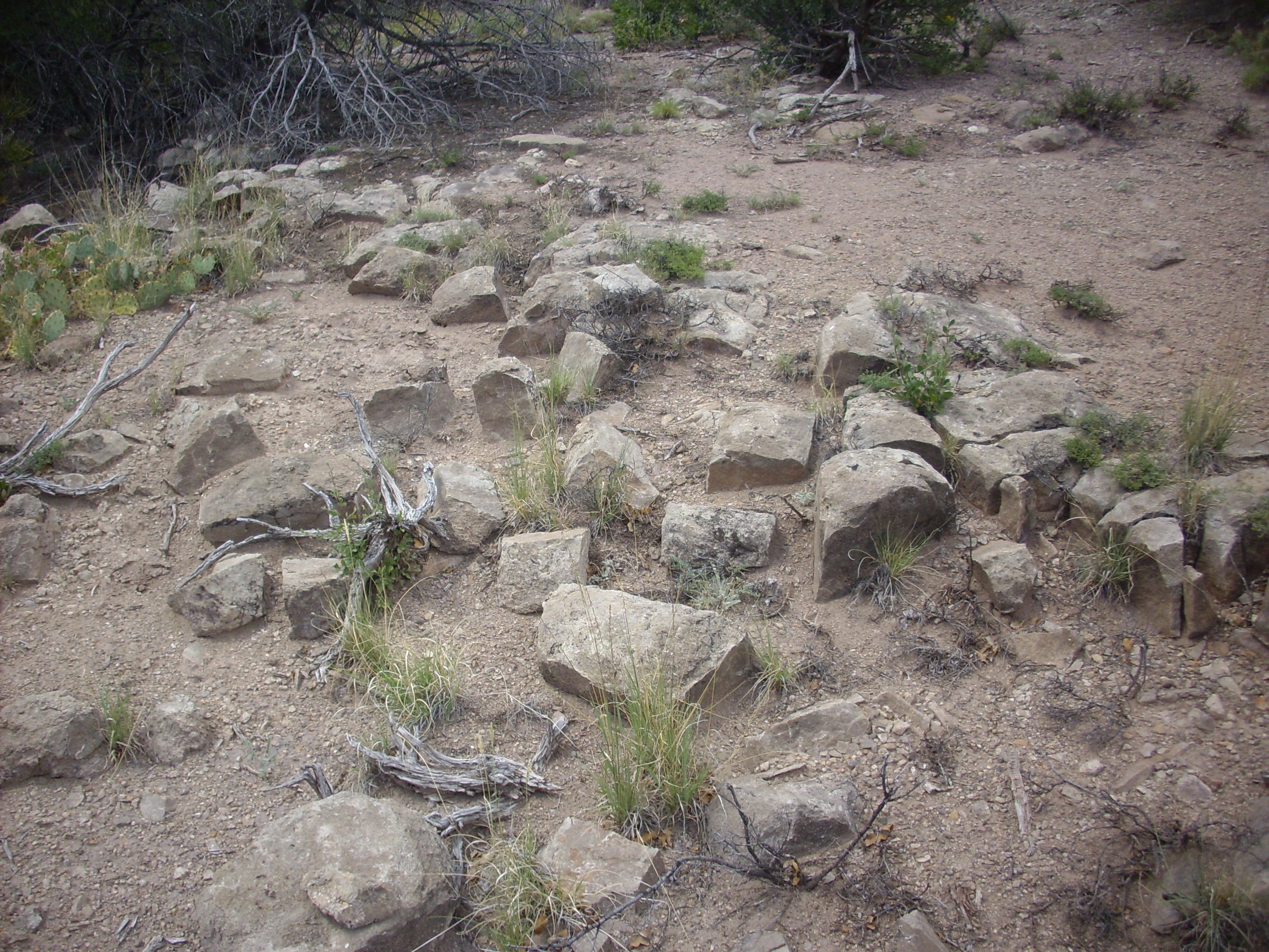
The first trail forks west off the highway around here, and winds up the west rim of Guadelupe Box. It’s an old fire road, with berms here and there obviously left by a bulldozer. Near the top, there is a clearing that obviously has frequent campers, and a terrific view east.
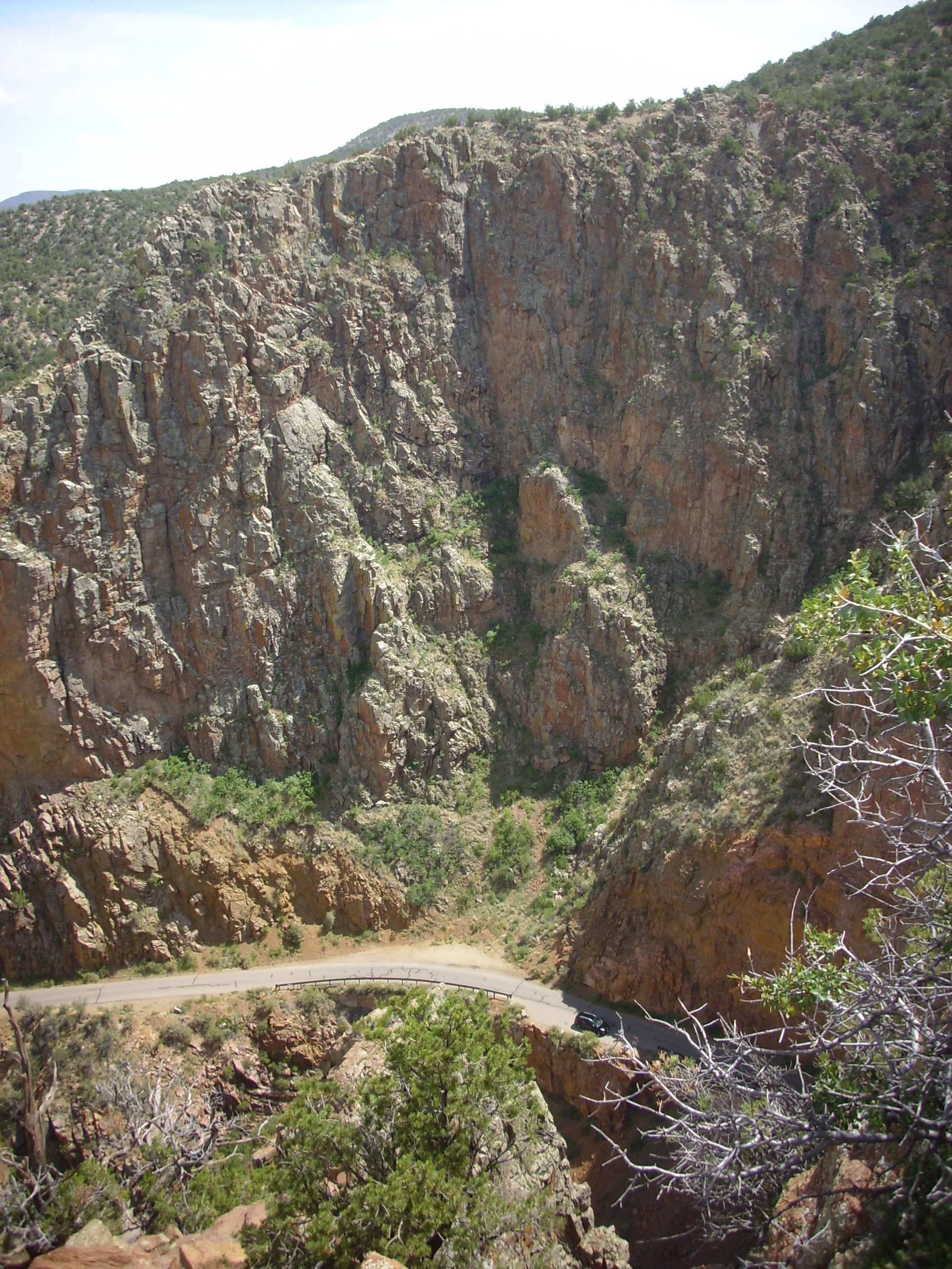
The Carboniferous at Guadalupe Box.. Looking east from 35 44.162N 106 45.954W
Yeah. It’s pretty much what I live for these days.
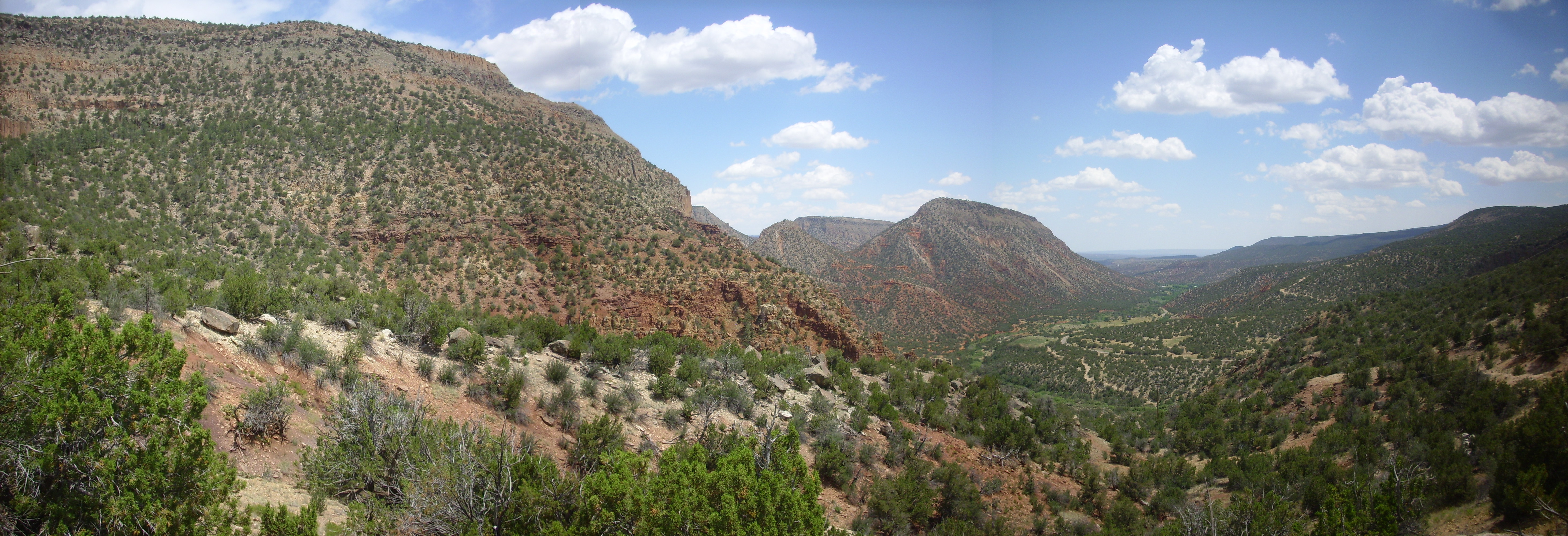
To the right is the mouth of Guadalupe Box, with Mesa Garcia in the distance. Tall cliffs of Precambrian gneiss form the Box. Atop the gneiss are Mississippian beds of the Arroyo Peñasco Group, forming a thin layer that dips with the gneiss to the north (left in photograph) to pinch out in the third frame. Atop this is a spotty layer of red sediment of the Log Springs Formation, then a a thick layer of Osha Canyon Formation, whose topmost hard bed forms the rise near the boundary of the third and fourth frame. On top of the Osha Canyon Formation is the Sandia Formation, which forms the knob in the second frame.
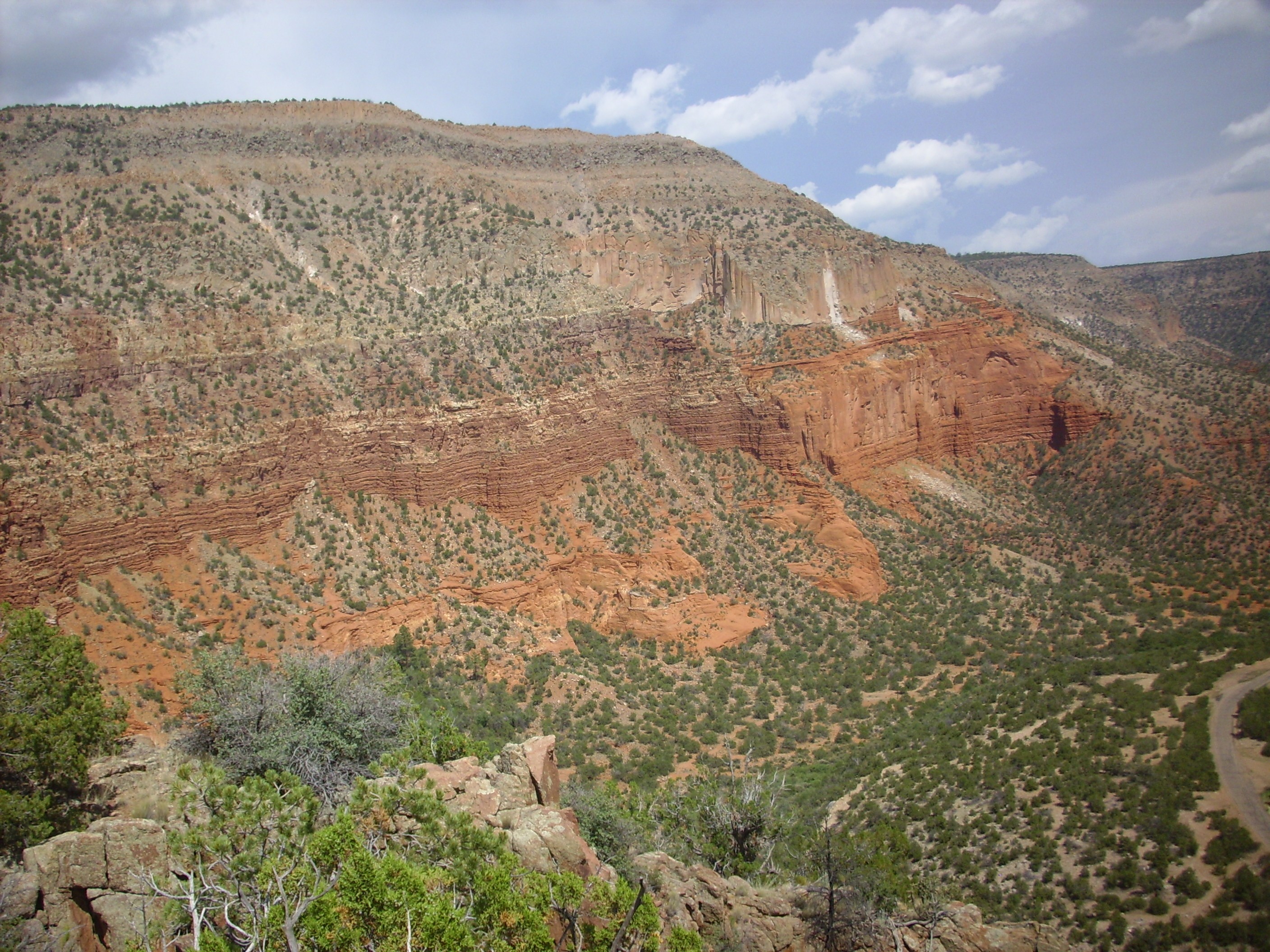
The first frame shows Osha Canyon descending from the north end of Guadalupita Mesa into the valley of the Rio Guadalupe. More Osha Canyon Formation is visible in the wall of canyon below center in the first frame, overlain by more Sandia Formation. Sandia Formation also underlies the lower part of Guadalupita Mesa on the skyline. Above the Sandia Formation on the slopes of Guadalupita Mesa, and below the cap of Bandelier Tuff, are white slopes of the Madera Formation.
On the way back down, I took a shot of the Madera Formation exposed in the mesa further north.
Madera Formation in west side of Holiday Mesa. View to the northwest from 35 44.307N 106 46.040W
Sandia Formation forms the tan beds at the base of the mesa, and the mesa is capped with Bandelier Tuff. Almost everything between is Madera Formation, which is hundreds of feet thick here. This area is reputed to be a paleontologist’s playground, with some areas covered with a gravel of fossilized molluscs and brachiopods. However, the Rio Guadelupe is a bit of a hassle to cross, and the climb up to the fossil beds is strenuous. Yeah, I’ve tried.
Today I was planning to venture across the Rio Guadelupe again, but not to head north and collect fossils. Instead, I was going to follow the fire road south onto the high plateau east of Guadelupe Box showcasing most of the oldest Carboniferous units in this area.
First trick: Get across the river. There are no bridges and the river is surprisingly steep and fast-running. Fortunately, there were lots of families picnicking in the area, and one had obviously found a way across. Admittedly, they were in swim suits, whereas I loathe getting my feet wet; but I gamely pulled off my socks and shoes and put them in my pack, and gingerly waded across the fast-moving waters.
Much to the amusement of the family there. Beautiful young family; father, mother, son and daughter, the kids somewhere between 8 and 14 in age. I had asked the parents how they got across, got helpless shrugs, and then the kids answered. Because they were the ones that spoke English. Funny world.
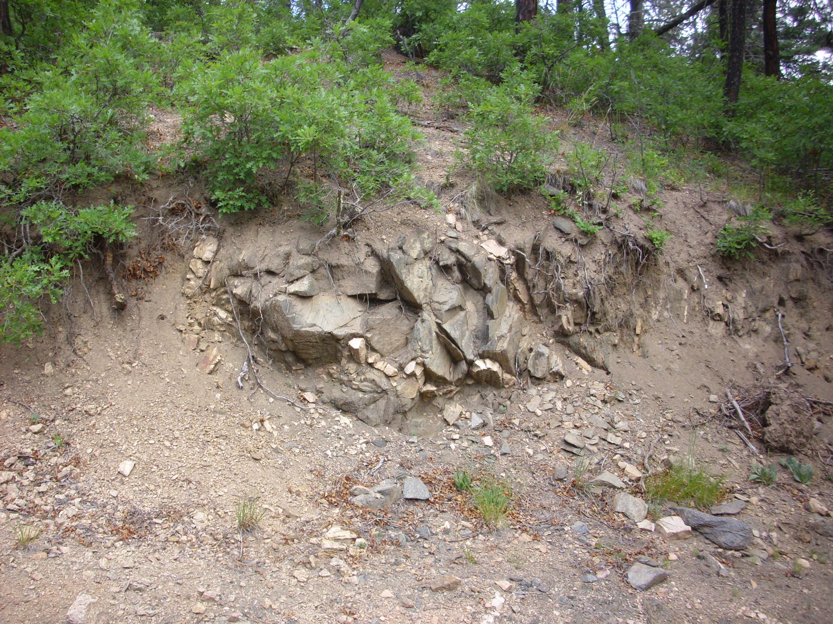
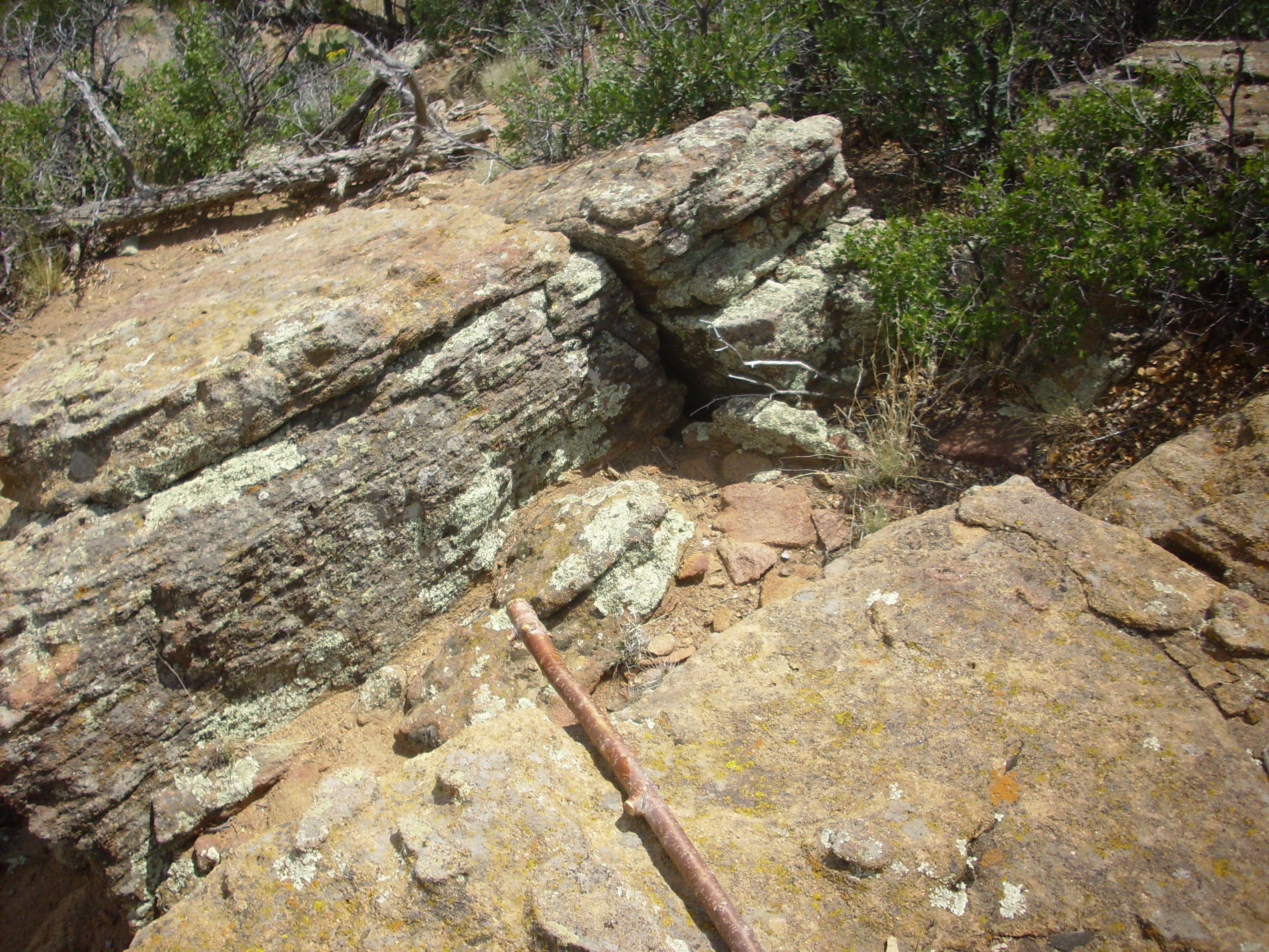
I hiked south from there, which turned out to be the wrong way to get to the fire road, but in the process I got a good look at where the Carboniferous rocks (possibly Arroyo Penasco Group and Log Springs Formation) lay on top of the Precambrian gneiss. This contact is famous around the world as the Great Unconformity.
Great Unconformity north of Guadelupe Box. 35 44.353N 106 45.937W
The weathered surface of the gneiss shows its content of large feldspar crystals.
Precambrian gneiss north of Guadelupe Box. 35 44.353N 106 45.937W
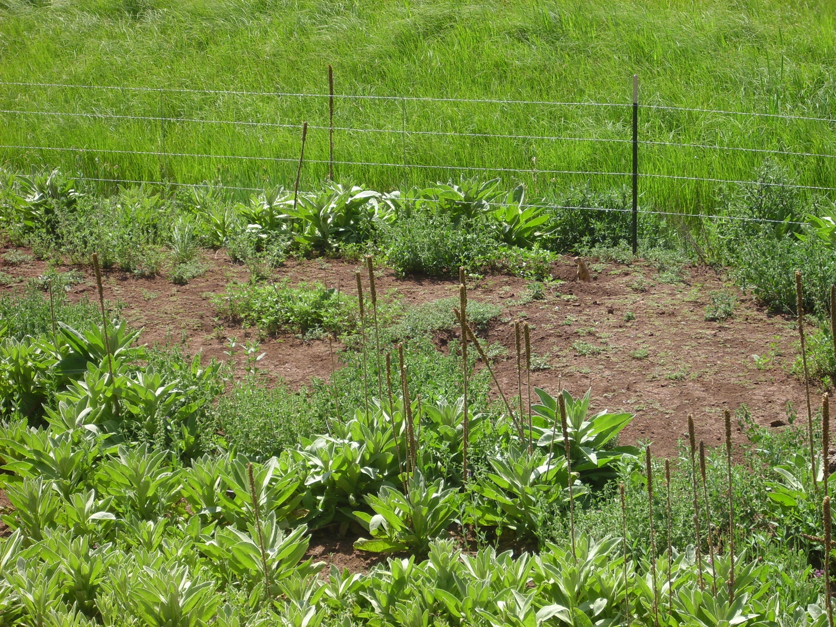
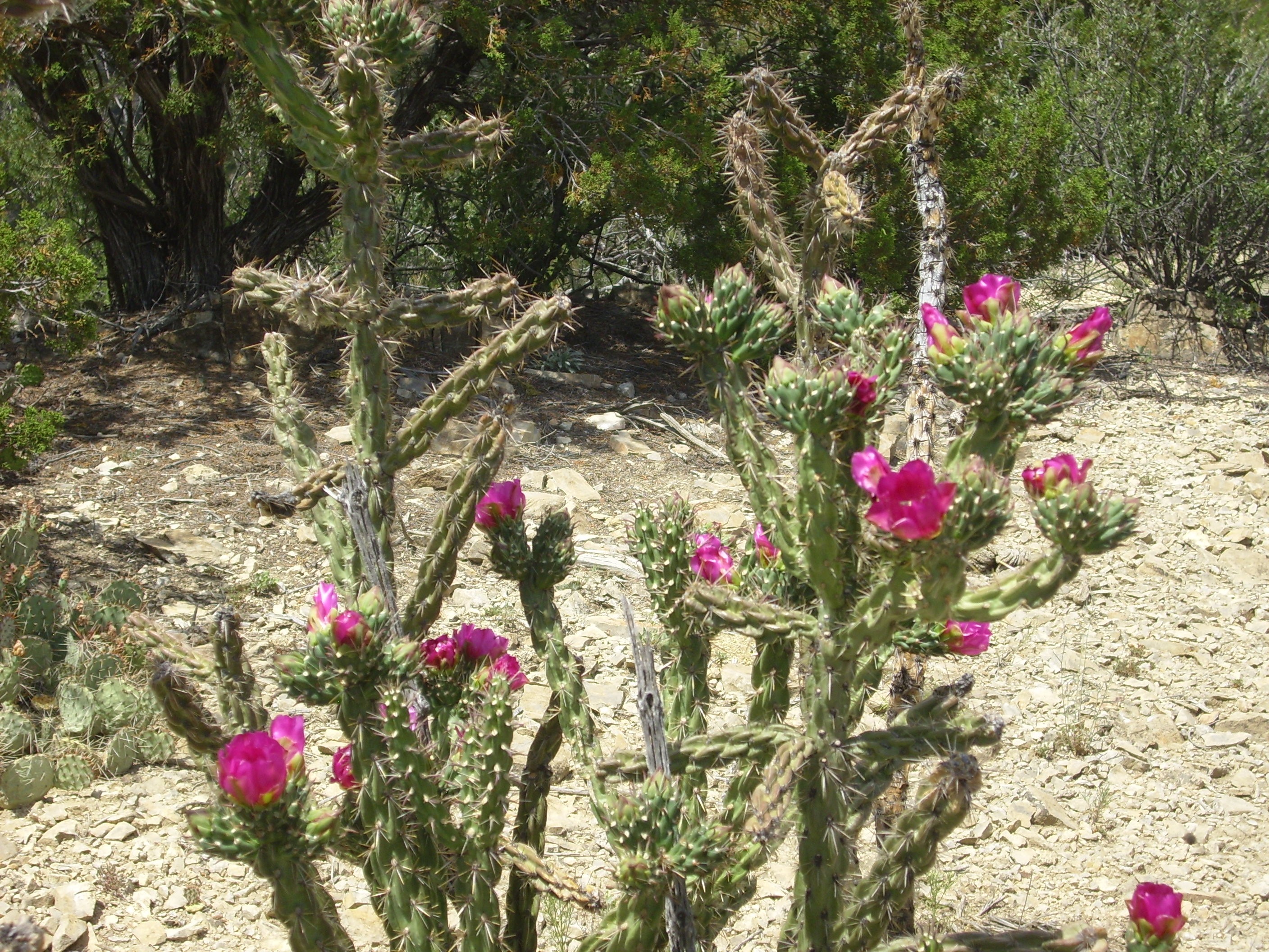
It became clear that I was not going to scramble directly up to the fire road from here. I had to loop around north to get to the road. Along the way was some flowering cactus.
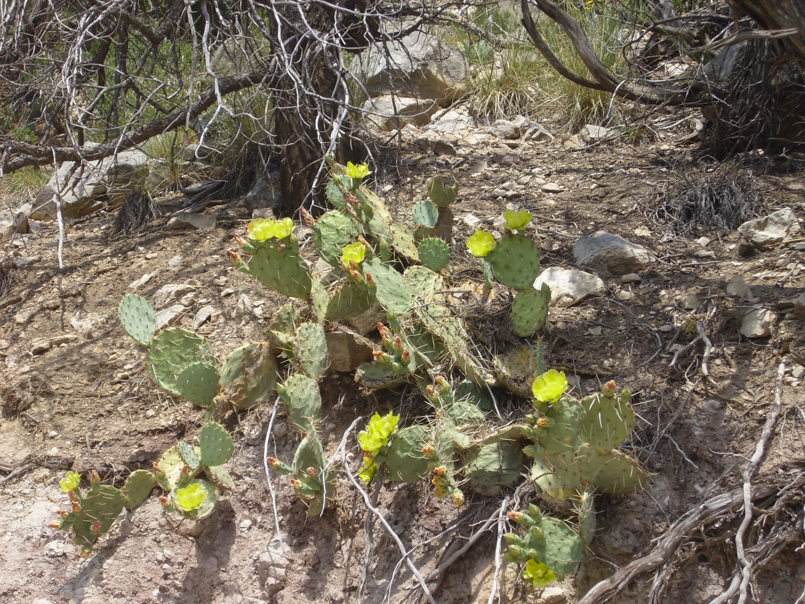
Flowering cactus. 35 44.358N 106 45.907W
Now on the road, which made for easier hiking, I paused to get a photograph of Joaquin Mesa to the north. Alas, this did not turn out too well. I really need a camera with a decent telephoto lens. See previous: equipment, quatloos.
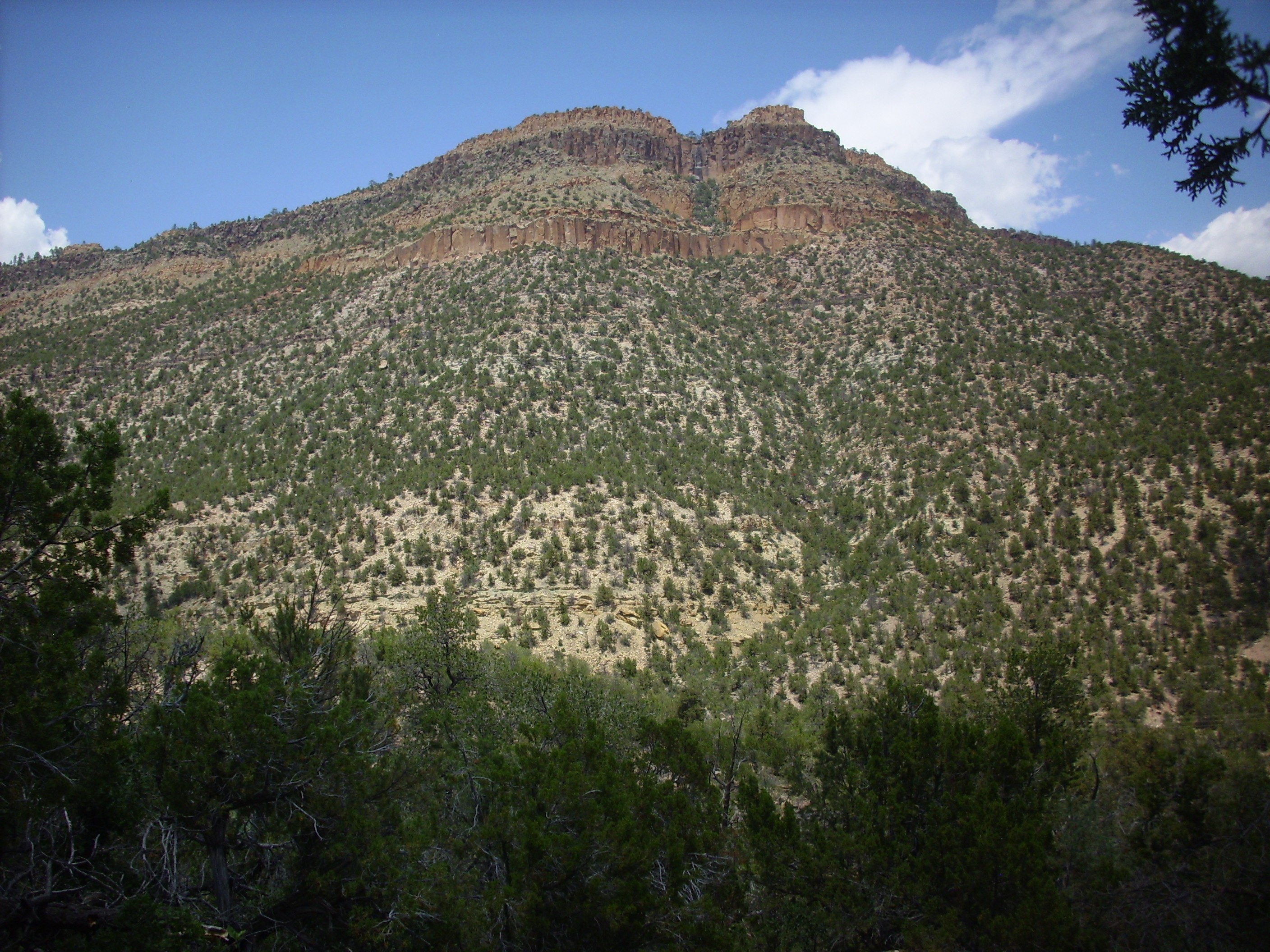
Joaquin Mesa. Looking northwest from 35 44.358N 106 45.907W
Joaquin Mesa, so? It turns out to be about the only mesa in these parts that was a mesa before the Bandelier Tuff erupted. The cap is not Bandelier Tuff, but Agua Zarca sandstone. Kind of unique to this area.
The road follows the north rim of Osha Canyon.
Osha Canyon Formation. Looking south from 35 44.285N 106 45.830W
Here we see Osha Canyon Formation forming the south rim of Osha Canyon, with overlying Sandia Formation forming the hill in the background.
The road passes coarse sandstone at the base of the Sandia Formation, then comes to a bend with a beautiful view to the south.
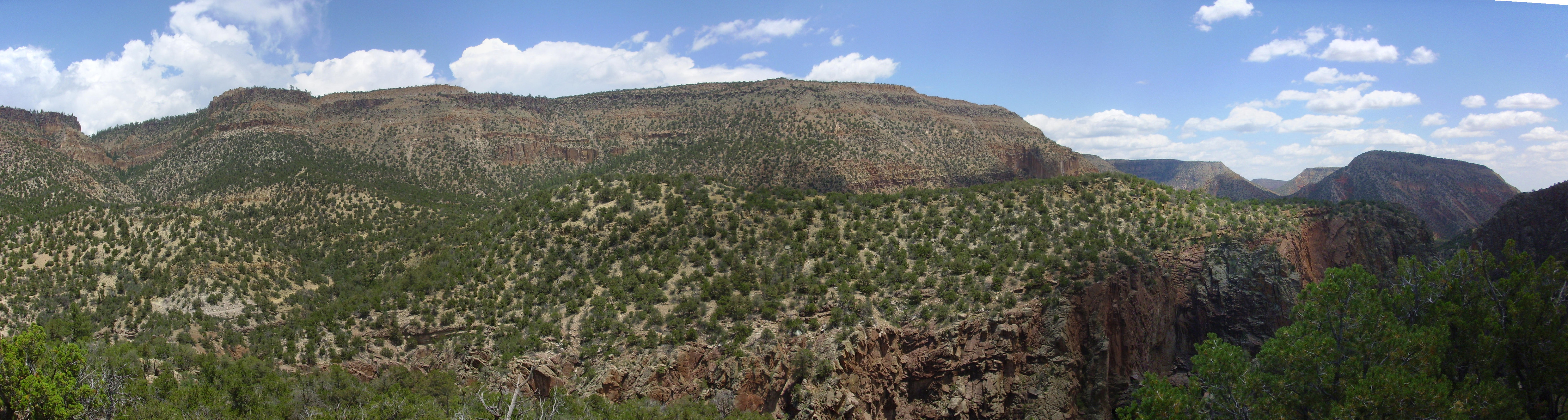
Panorama looking south from 35 44.296N 106 45.636W
Yeah. Worth the hike.
If you are unfamiliar with this area: No, it isn’t usually this green. We’ve had an unusually wet spring and summer this year, which is always welcome in our desert climate. But, yes, the sky is very often this blue and the sun this bright and the scenery this beautiful.
Part of me thinks it’s just as well this area is so little-known; it’d be crawling with tourists otherwise. But another part of me thinks, “This is my home. I grew up here. I’m proud of it. Of course I want to show it off.”
Anyway, that’s Gaudelupita Mesa to the left and Garcia Mesa at the center, with Mesa de Guadelupe beyond.
I paused a little further on for a photograph of a blooming cholla cactus.
Blooming cholla.
This was near the summit of the plateau, which is underlain by Sandia Formation. Walking south would take me systematically down the rock column.
Sandia Formation:
Sandia Formation. 35 44.068N 106 45.776W
The multicolored patches on the rock are lichens, which are communities of fungi and algae that are among the oldest and most resilient forms of life. There is an excellent chance that their lineage is older than the rocks they are encrusting here.
Sandia Formation sandstone. 35 44.068N 106 45.776W
The base of the Sandia Formation is a very coarse sandstone. The individual grains are obvious even to the naked eye. Under the loupe, these appear to be angular bits of yellowish quartz, all roughly the same size, with occasional fragments of feldspar. There is some hematite between the grains, giving the rock its reddish to tan color, but the grains are not cemented primarily with hematite. The acid test shows no calcite present, and the rock is quite tough, so the grains are most likely cemented with silica. There is considerable pore space; this rock would make an excellent aquifer or reservoir rock for petroleum. Such a rock is described as a quartz arenite.
Our sample is not particularly well-sorted for a sandstone. It is otherwise typical of sandstones that form deep in the interior of stable continents, where well-weathered sediments can accumulate slowly over long periods of time. Most likely this sandstone was deposited in a beach environment during a marine transgression, with the large size and angular character of the grains suggesting they weathered from nearby granitic highlands — probably the Uncompahgre Uplift, part of the Ancestral Rocky Mountains.
Beneath the Sandia Formation is the Osha Canyon Formation, the lowest Pennsylvanian formation in the Jemez.
Osha Canyon formation on the east rim of Guadelupe Box. 35 44.034N 106 45.793W
The formation was originally identified and described close to this point.
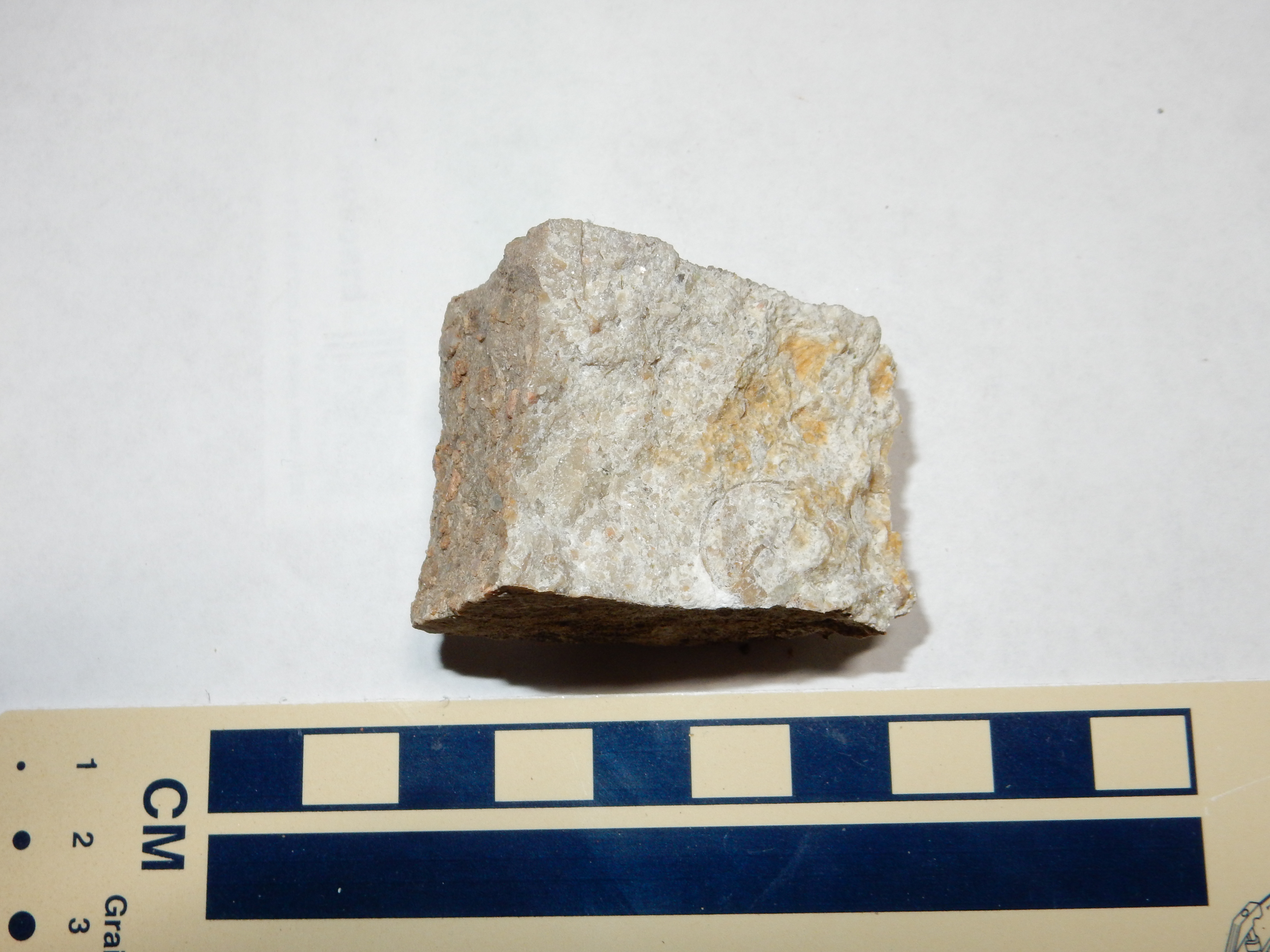
Limestone of the Osha Canyon formation. 35 44.034N 106 45.793W
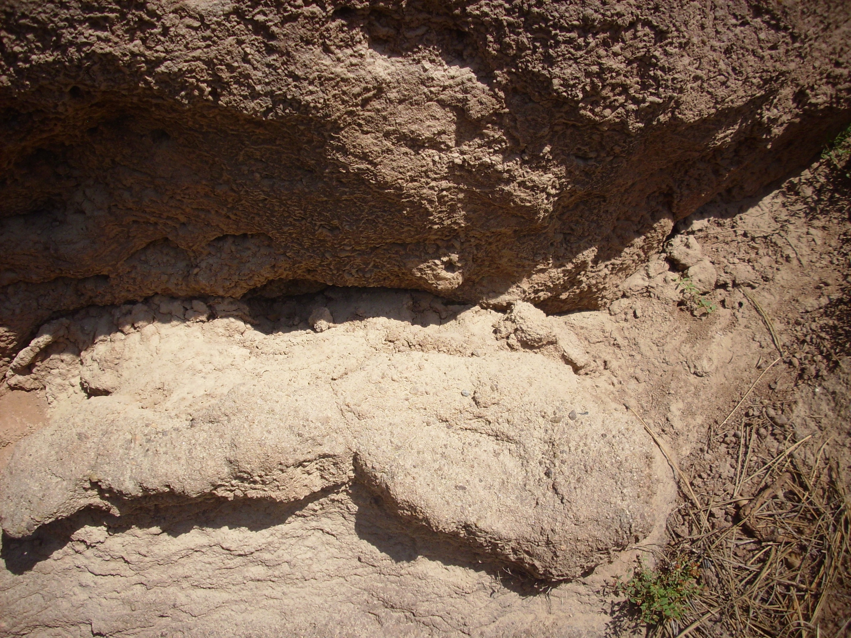
Beneath the Osha Canyon Formation are thin, spotty beds of the Log Springs Formation. This formed from sediment eroded off the Uncompaghre Uplift. The deposition of the Log Springs Formation also coincided with the brief lowering of sea levels that separates the Mississippian from the Pennsylvanian. During this time, the unerlying Arroyo Peñasco Group was heavily eroded, forming what geologists call a karst topography. Because limestone is soluble in slightly acid water, when it is exposed at the surface, rainwater (which is slightly acid from dissolved carbon dioxide even in the absence of industrial pollution) cuts deep sinkholes and caverns in the limestone. The Log Springs Formation originally developed as a deep red soil over this karst terrain, so that the formation is described as a paleosoil or fossil soil. It tends to fill in the sinkholes in the underlying Arroyo Peñasco Group. Similar red sediments (usually assigned to the Molas Formation) form a thin red bed at the Mississippian-Pennsylvanian boundary throughout the western United States.
320 million years ago, the Jemez area was located almost exactly on the Earth’s equator, and it seems likely that the Log Springs Formation started out as a laterite, a deep red iron-rich soil common in today’s tropical regions. The preserved formation at Guadalupe Box is rich in hematite, Fe2O3, which often forms a thick coating on limestone clasts likely derived from the underlying Arroyo Peñasco Group.
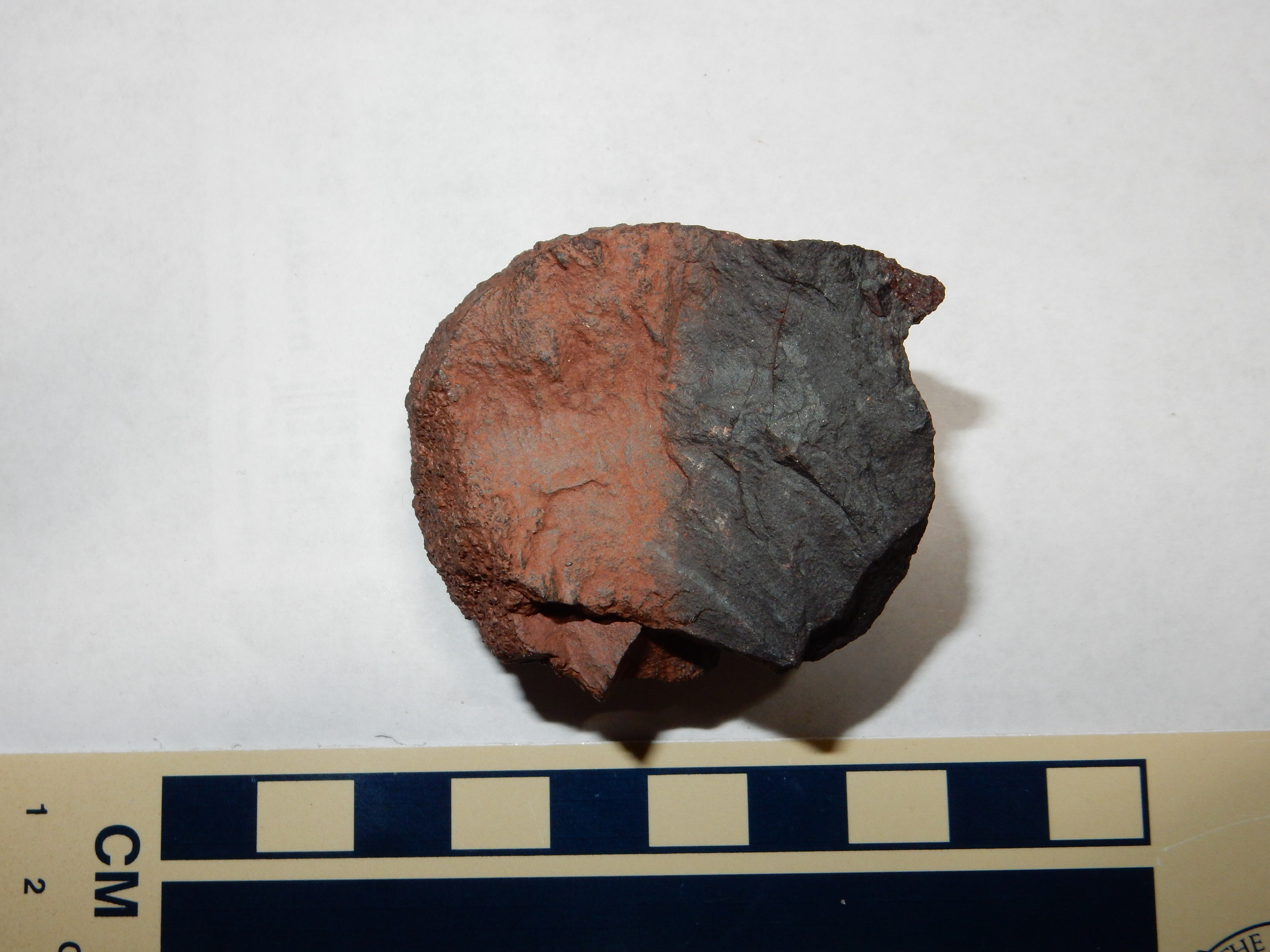
Hematite-coated nodule from Log Springs Formation. 35 43.988N 106 45.793W
This sample is shows the bright red color of hematite on the left, and somewhat darker color on the right where the nodule was partially buried. It has a high density, suggesting that there is more hematite coating than nodule. Hematite makes an excellent iron ore, but the beds here have are neither rich enough nor extensive enough for economical exploitation.
Log Springs Formation nodule split in half to show calcite interior.. 35 43.988N 106 45.793W
The second sample is a somewhat larger nodule that had a significantly lower density. Split open, it showed a highly crystalline limestone interior; the reflective patches in the photograph are faces of large calcite crystals, as confirmed with the acid test.
Below the Log Springs Formation is the Arroyo Penasco Group.
Log Springs Formation and Arroyo Peñasco Group on east rim of Guadalupe Box. 35 43.988N 106 45.793W
This photograph shows a thick bed of limestone of the Arroyo Peñasco Group overlain by a thin layer of Log Springs Formation. These beds lie directly on top of Precambrian gneiss of Guadelupe Box.
The Great Unconformity, up close and personal. 35 43.988N 106 45.793W
Limestone of the Arroyo Peñasco Group. 35 43.988N 106 45.793W
From this point, one has a dizzying view into Guadelupe Box to the west.

Guadelupe Box. 35 43.988N 106 45.793W
The thick cliffs of Precambrian gneiss have a thin cap of Sandia Formation on top. The point across the canyon is very close to where I took the panorama earlier in the afternoon.
Looking south into the entrance to Guadelupe Box:
Looking south into Guadelupe Canyon. 35 43.963N 106 45.795W
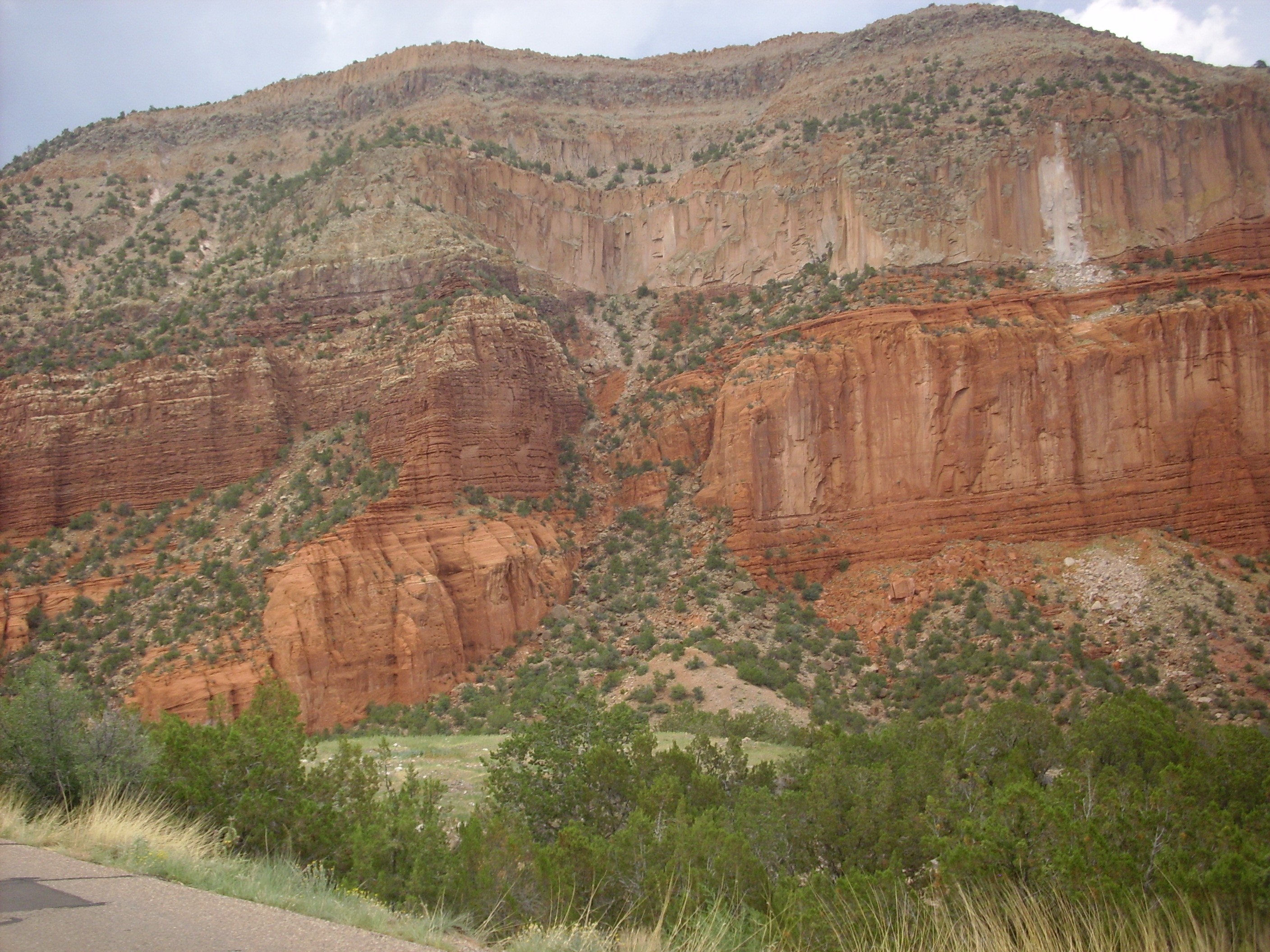
Looking southeast towards Gaudelupita Mesa:
Permian red beds on the west side of Guadelupita Mesa. Looking southeast from 35 43.963N 106 45.795W
At right, at the base of the mesa, there are thin beds of the Permian Abo Formation. Above these are thick beds of the Meseta Blanca Formation, Yeso Group. To the left, a fault has thrown the Meseta Blanca Formation down by a good hundred feet or so, and thin beds of San Ysidro Formation, Yeso Group, are visible above. Then comes a thin lighter layer of Glorietta Sandstone, then more red beds of the Bernal Formation.
The Bernal Formation is the youngest Permian formation present anywhere in the southern Jemez, and the only exposure I am familiar with is here, halfway up the sheer side of Guadelupita Mesa. You must forgive me for not having a sample to show. I’m 53 years old, and ambitious of making it to 54 years old.
Above the Bernal Formation, and just below the cap of Bandelier Tuff, is a light sandstone formation, the Triassic Agua Zarca Formation. This is the same formation that caps Joaquin Mesa, but it is at a much lower elevation on this side of Guadelupe Box due to extensive faulting in the area.
It was now getting late and clouds were building overhead, not a happy thought when one is high on an exposed plateau. I retraced my steps back down the fire road. I had not thought to wear my hiking shoes on this trip, a regrettable oversight; my everyday sneakers were a bit worn, and this hike was too much for them. They were falling apart by the time I got to the Rio Guadelupe, so I didn’t bother taking them off; I waded across the river in my sneakers and socks, got loaded back into my car, and headed south through Guadelupe Box and towards home. I did stop for one last picture of that fault in the last photograph, head on:
Looking northeast from 35 43.742N 106 45.493W
Note that the fault does not displace the cap of Bandelier Tuff. This means the fault has not shifted in at least 1.6 million years. On the other hand, you can see a recent rockfall from the cliff to the right. Geology is not static, as anyone from earthquake country could tell you.
I got about as far as Jemez Springs when the storm broke. A wedding had just got out of the local church, and people were scurrying everywhere. The rain poured down, accompanied by considerable lightning, and I did not get out of the storm until I was halfway across Valle Grande. But from there to home was reasonably uneventful.
Copyright ©2015 Kent G. Budge. All rights reserved.