A labor of wanderlust
I have discovered, somewhat to my surprise, that there are actually people who read my wanderlusts. So this one is dedicated to Angela, who informs me that she likes to read about my hikes to places she will never hike to.
Angela has spina bifida and has been confined to a wheelchair all her life. I’d point to this as a reason to count your blessings, except that Angela seems to have had a blessed life regardless.

Labor Day was my first four-day weekend in some time, because a quirk of the calendar had not placed one of my Fridays off end to end with a Monday holiday in a long time. So I spent Friday getting some lesions frozen off my face and scalp by my doctor (I know; TMI) and running to Albuquerque for some errands, and Saturday doing my usual weekend chores, and Sunday spending time at church and with the family and looking at the beautiful weather and hoping it would hold another day.
Which it did, more or less. There was some low cloud over the Jemez when I arose early and broke fast, but not like heavy rain was imminent or anything.
I planned to head into the northern Jemez, to fill in the next gap in the book I’m working on by getting some better photos and samples of the Jurassic and Cretaceous beds in the area. Which got me thinking: Why wasn’t the sequel to Jurassic Park named Cretaceous Park?
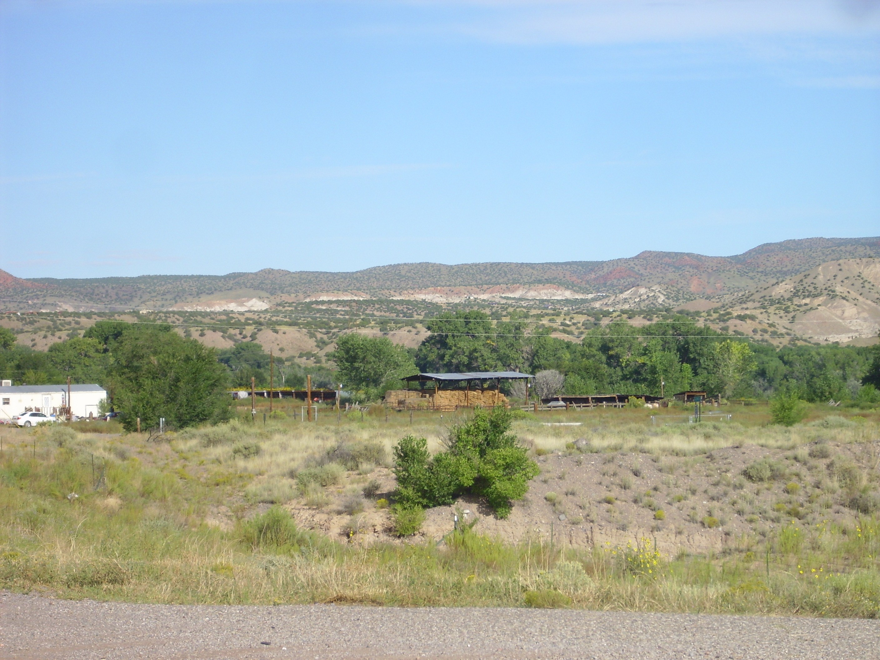
My route took me from White Rock through Espanola towards Abiquiu. Just west of Black Mesa, I arrived at my first stop, a lava flow in the road cut.
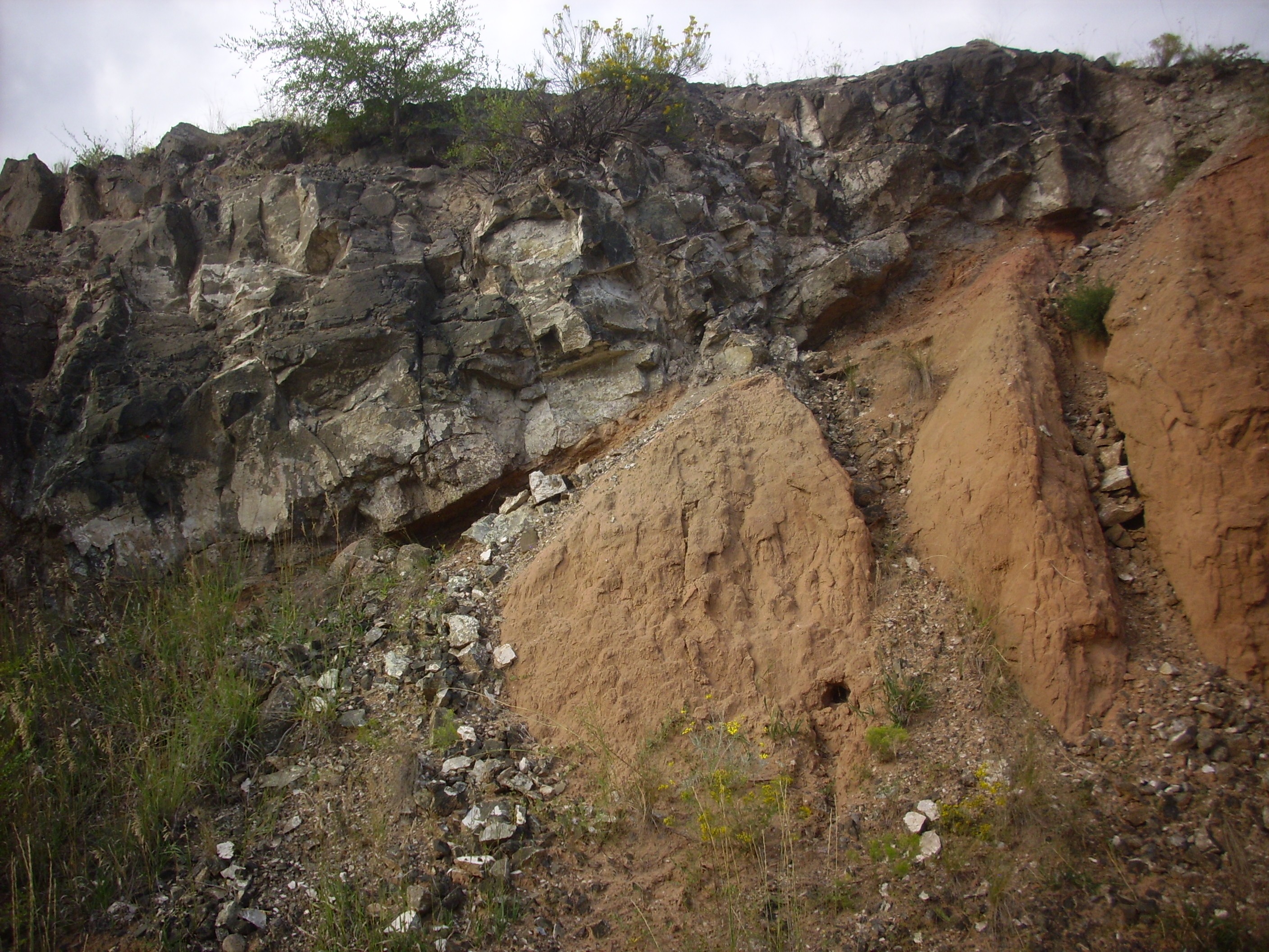
Early Lobato Basalt flow. 36 5.958N 106 8.391W
This is early Lobato Basalt, dated to about 9.6 to 10 million years old. You can see some indications that it has baked the uppermost part of Chamita Formation of the Santa Fe Group where the lava came in contact with the sediments. The baked zone is the slightly redder area just under the flow. Here’s a close up of a sample of the flow.

Early Lobato Basalt flow. 36 5.958N 106 8.391W
Under the loupe, the rock shows visible phenocrysts of (probably) augite and plagioclase, with oxidized spots that were probably olivine. The very dark color suggests to me that this is a low-silica olivine basalt, or perhaps even a basanite. It’s impossible to be sure without a laboratory analysis, though.
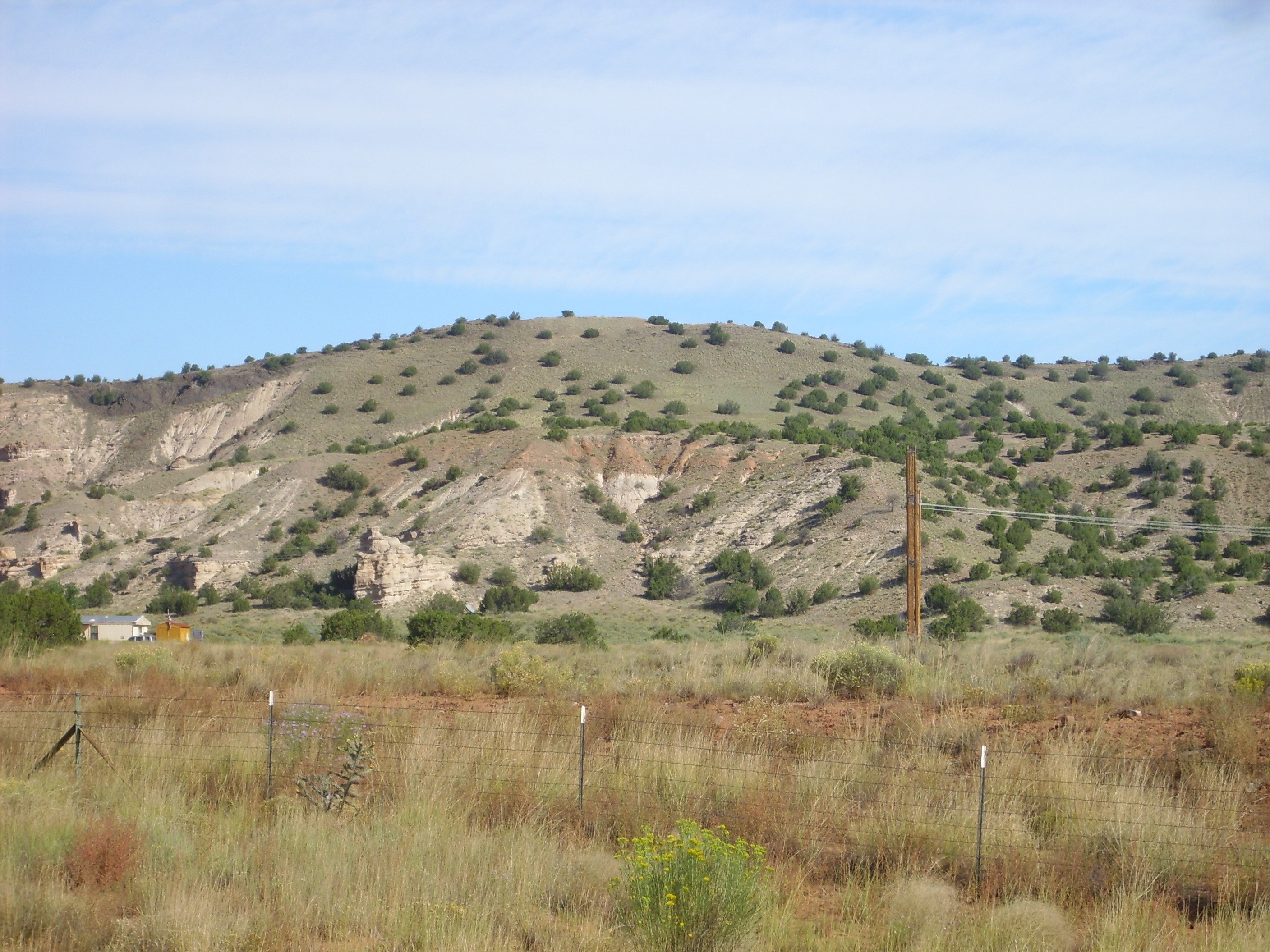
I hadn’t planned any further stops until I got to the north Jemez south of Youngsville, but darned if the lighting wasn’t just about perfect for some outcrops I’ve photographed before under less ideal conditions. The first was Sierra Negra northeast of Abiquiu.
Sierra Negra. Looking north from 36 11.809N 106 14.396W
The white cliffs halfway down the left side of the mountain are Abiquiu Formation. There is a fault cutting right through the mountain, at about the location of the right side of the Abiquiu outcrop. To the east (right) are much younger beds of the Santa Fe Group, and the top of the mountain east of the fault is capped by a small basalt lava flow.
The hill I’m standing on is underlain by relatively young river terrace gravels from when the bed of the Rio Chama had not yet cut down to its current location. What the heck; I took a picture.
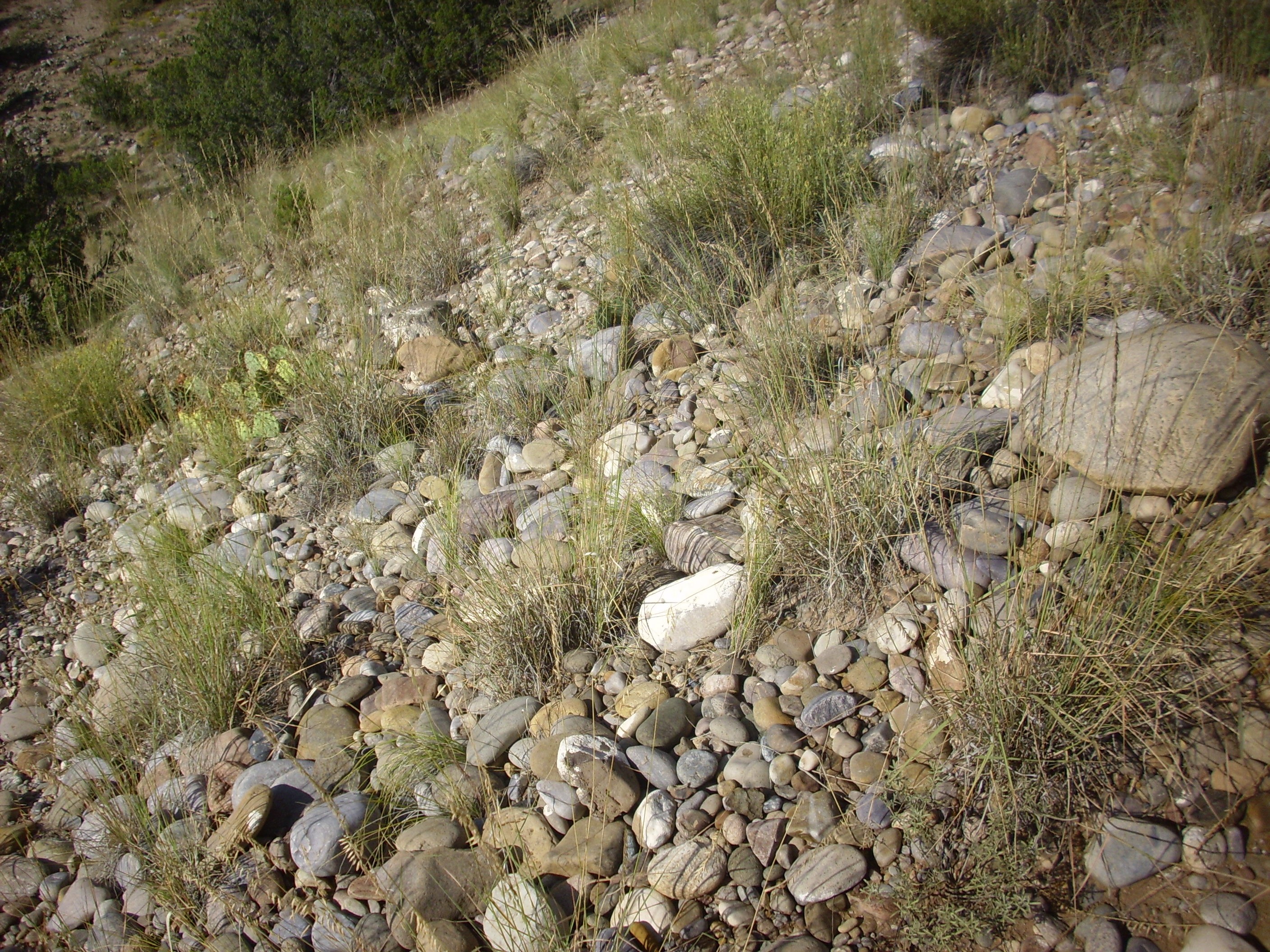
Terrace gravel. 36 11.809N 106 14.396W
I know: The mind boggles at the kinds of things geologists get interested in. But these gravels are geologically very young, having been deposited in the last couple of million years or less, and everyone likes babies.
Just north of where I took these pictures, there is an orange cross planted in the gravel with a name and a date. This was probably the location of a highway death. I find touching the emphasis in the Hispanic culture of nothern New Mexico on sacred remembrance.
A couple of miles further down the road, I was struck by the contrast between the white Abiquiu Formation and the overlying terrace gravels to the north.
Abiquiu Formation under terrace gravels. Looking northwest from 36 12.625N 106 15.223W
The Abiquiu Formation is the white beds at the base of the distant cliffs. These are overlain by terrace gravels eroded off the higher ground on the skyline. This higher ground is Ritito Conglomerate, which is actually an older formation than the Abiquiu. There is a fault zone that throws down the younger beds to the southeast, into the Rio Grande Rift.
Down the road, we get a close up view of these terrace gravels deposited on the Abiquiu Formation.
Terrace gravel on Abiquiu Formation. Looking northwest from 36 12.751N 106 20.507W
The terrace gravel is the red bed about halfway up the hill side. The white beds beneath and in back are Abiquiu Formation. The terrace gravel thus is perched on the side of the hill, at what was the level of a side channel of the ancestral Rio Chama.
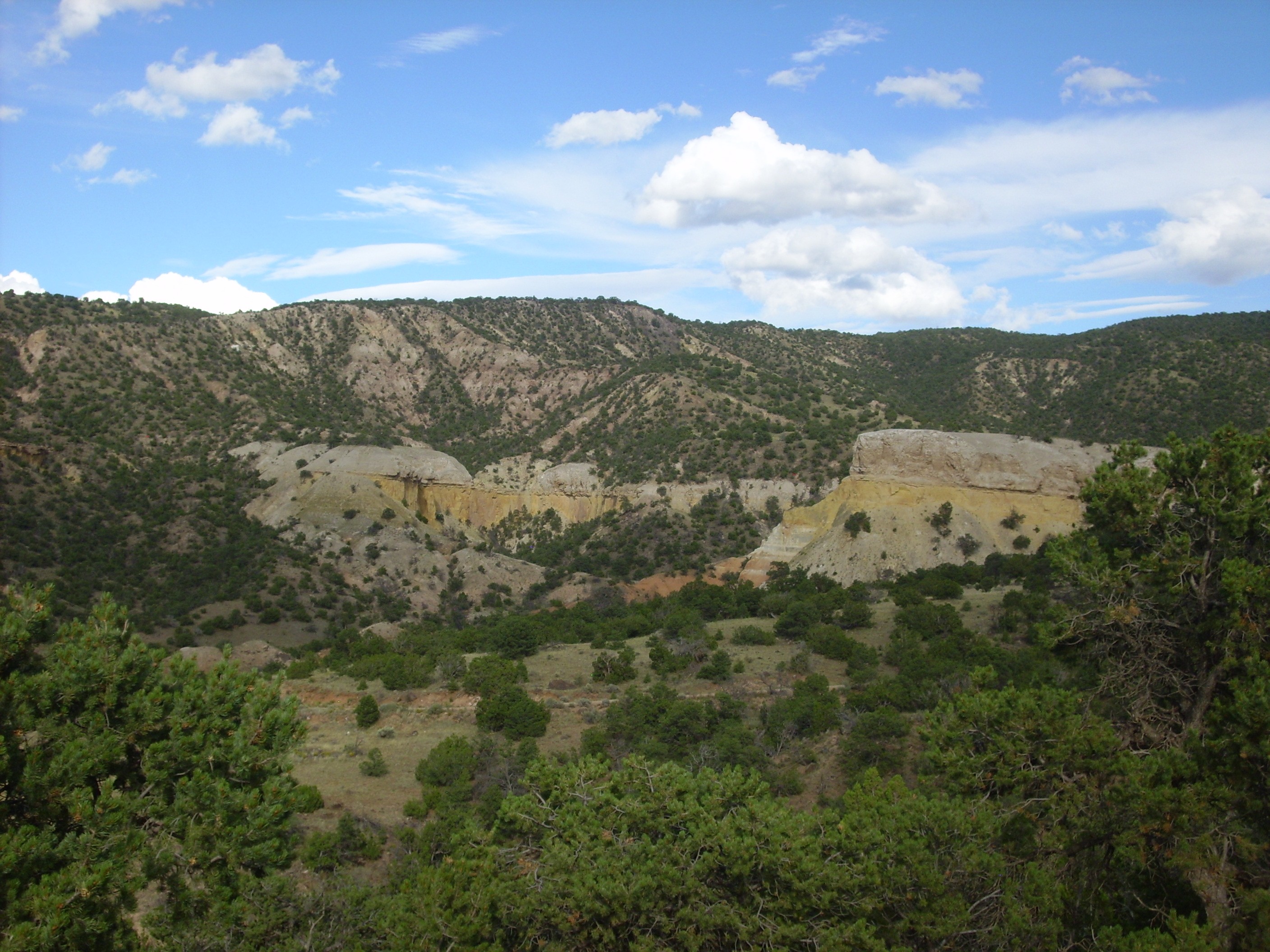
Further west is the northernmost tongue of Canones Mesa. A strand of the Canones Fault dramatically offsets exposures of the Jurassic Entrada and Todilto Formations on the north end of the mesa.
Entrada and Todilto Formation offset by fault through Canones Mesa. Looking southwest from 36 14.149N 106 24.029W
Red and white beds of the Entrada Formation, capped with a thin bed of Todilto Formation, crop out on either side of a landslide down the north face of the mesa. On the east (left) the beds are thrown down at least 70 meters (200 feet) by the fault passing between the two outcrops. This fault does not displace the lava on top of the mesa, showing that this particular strand of the Canones Fault Zone has not been active in at least three million years.
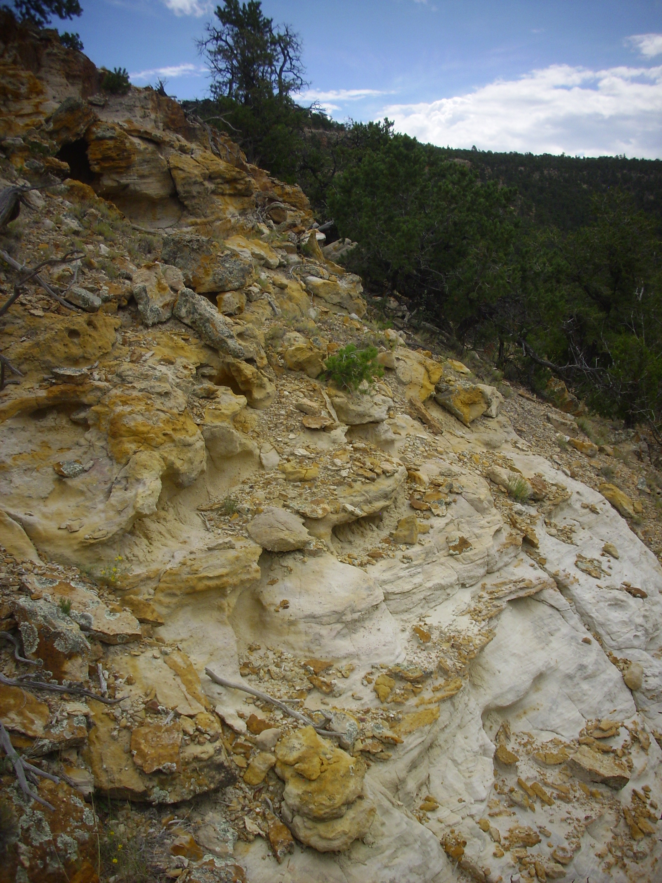
I took the road west across Abiquiu Dam towards Youngsville. Just across the dam is a spectacular road cut through a thick section of the Painted Desert Member, Mesa Verde Formation, Chinle Group.
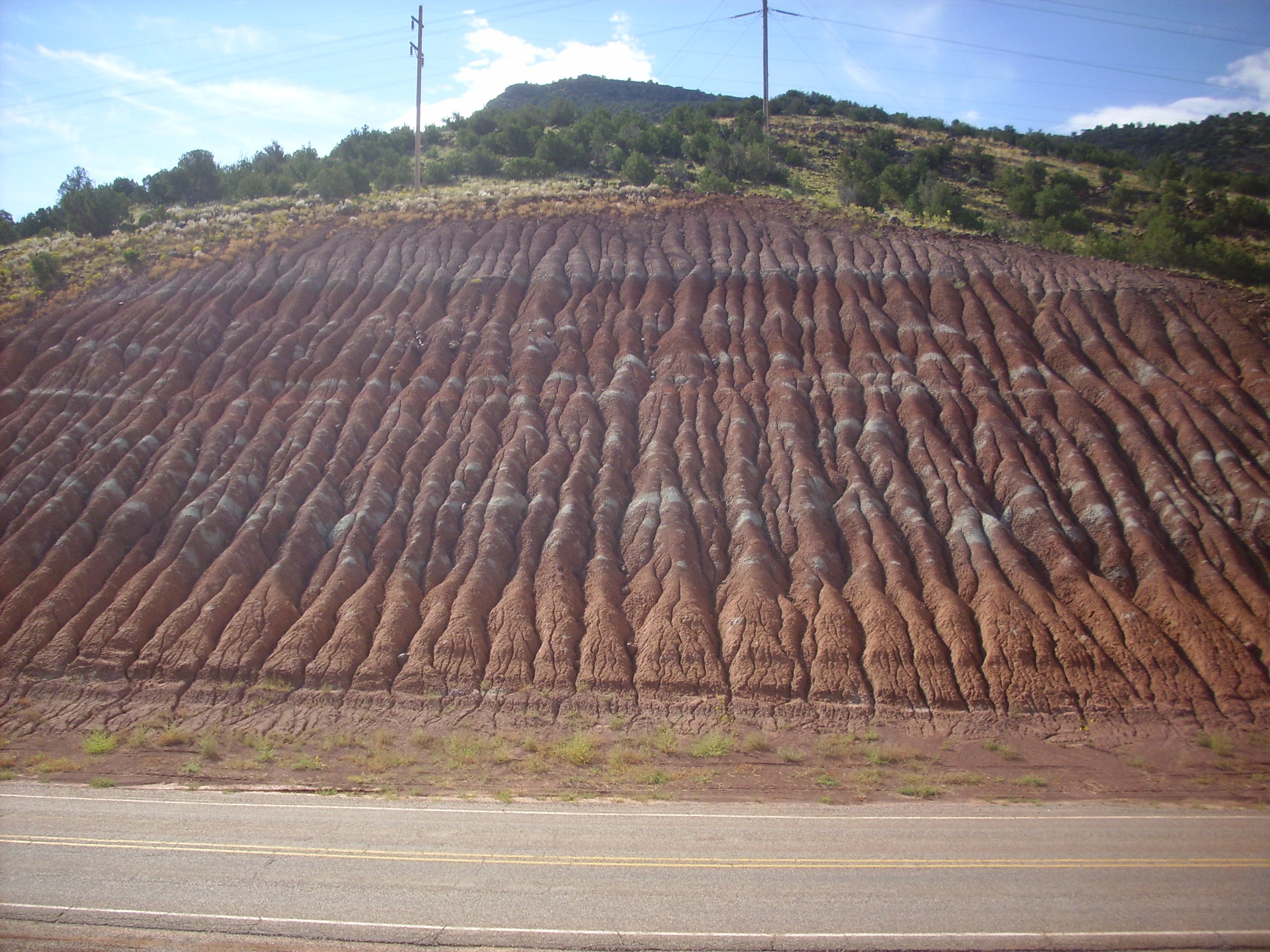
Painted Desert Member in roadcut south of Abiquiu Dam. 36 14.046N 106 25.824W
The formation is easily eroded into a gullied surface. The gray-green layers are most likely beds that were laid down under conditions of low oxygen, so that the red ferric iron was partially reduced to greenish ferrous iron.
The Chinle Group represents sediments deposited in a major river valley, that of the Chinle River, which flowed from west Texas to the Pacific Ocean some 230 million years ago. It includes the Rock Point Formation, which preserves large numbers of fossil Coelophysis dinosaur skeletons near Ghost Ranch.
Here is a close up view of the formation, showing that it is a thinly bedded red shale that easily weathers into red mud.

Painted Desert Member in roadcut south of Abiquiu Dam. 36 14.046N 106 25.824W
The Mesa Verde Formation consists of two members, the upper being the Painted Desert Formation we’ve been looking at, and the lower being the Mesa Montosa Member, which is a harder sandstone. There are outcrops of the Mesa Montosa Member along my route, but I had visited them before and didn’t stop this trip.
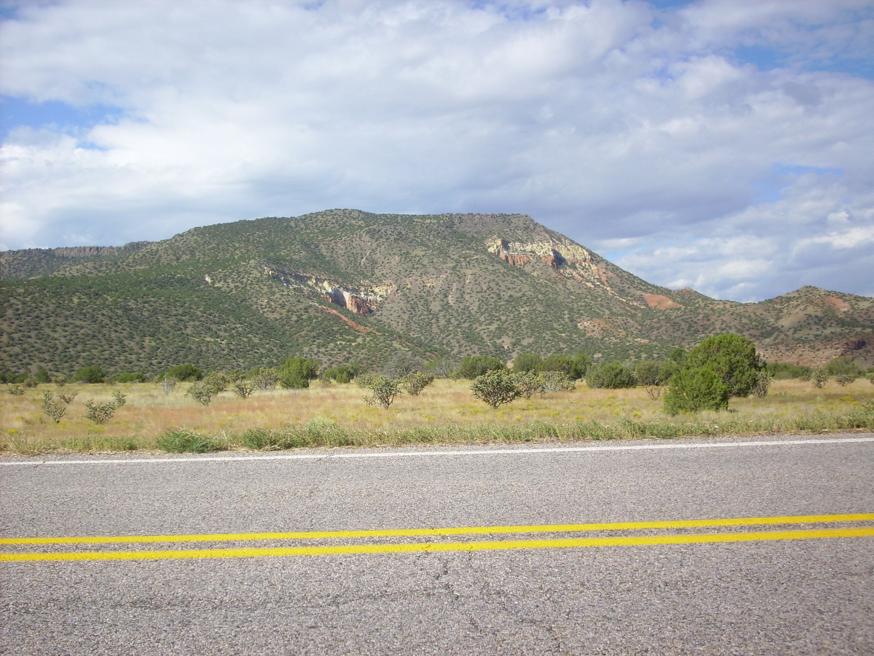
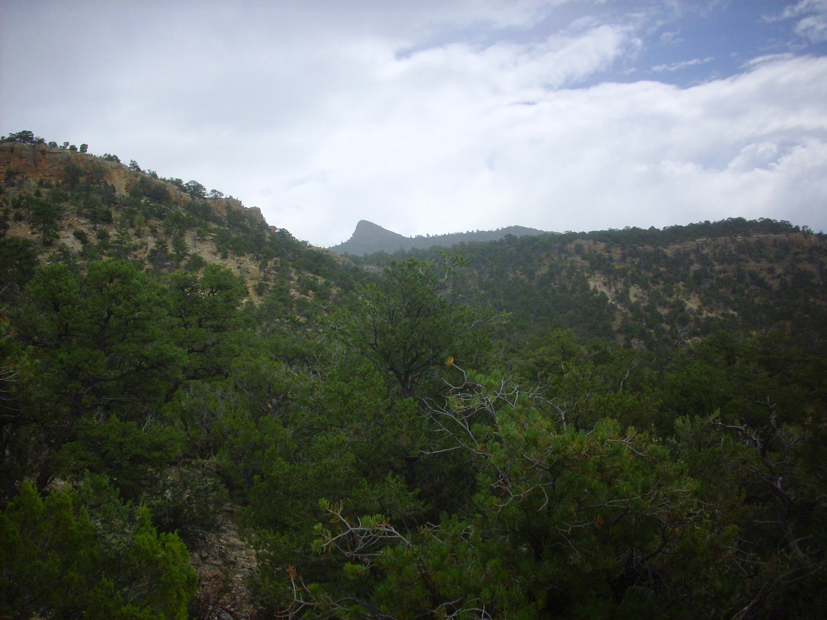
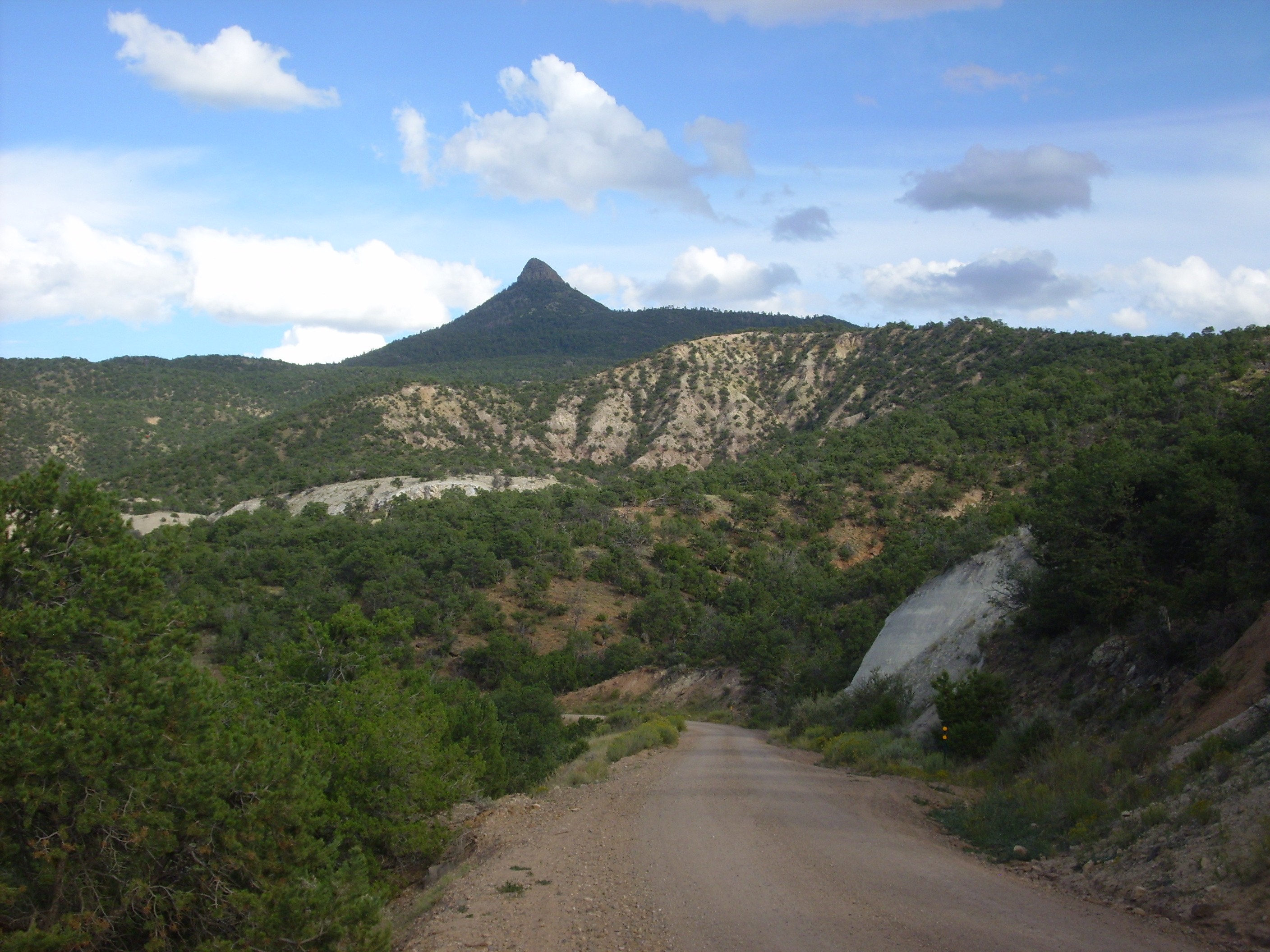
The iconic feature of the northern Jemez is Cerro Pedernal. This featured in much of the art of Georgia O’Keeffe.
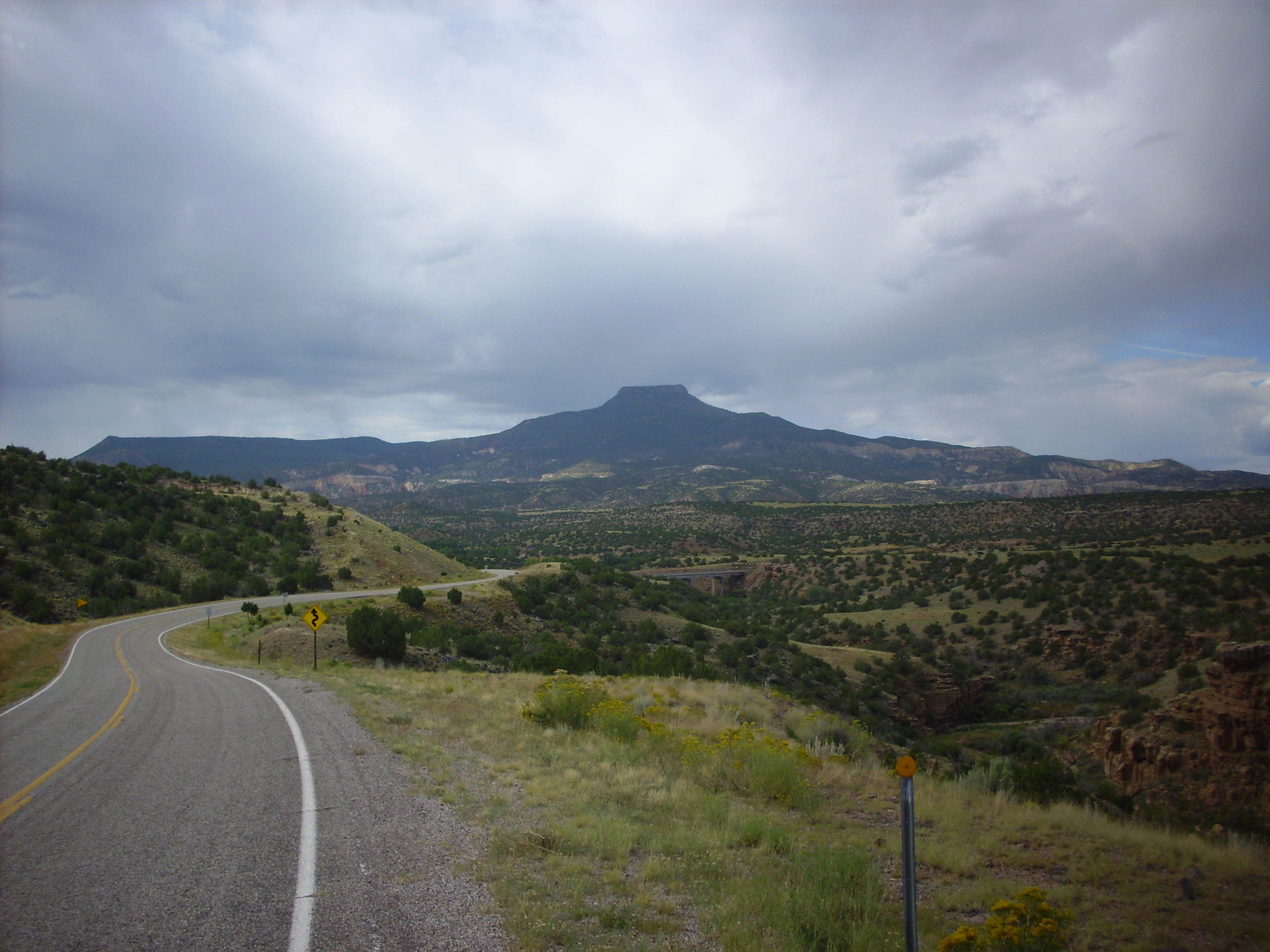
Cerro Pedernal. Looking southwest from near 36 13.709N 106 26.688W

Cerro Pedernal. Looking south from near 36 13.928N 106 28.797W
Cerro Pedernal is a mesa capped with La Grulla basalt and andesite flows, beneath which is a fairly complete rock column for this area. Immediately under the basalt cap is Santa Fe Formation, whose soft sediments form the slope immediately under the cap. Beneath this is Abiquiu Formation, and beneath this is the exposed white cliffs of Cretaceous Mancos, Dakota, and Burro Canyon Formations. The slopes below these cliffs are soft sediments of the Jurassic Morrison and Summerville Formations, while the cliffs at the base of the mountain are Jurassic Entrada Sandstone capped with Todilto Formation. We’ll see more, much more, of these formations later in the day.
Here’s a close up of the terrain northwest of the mountain.

Jurassic formations. Looking south from near 36 12.682N 106 31.554W
The hill to the right is Chinle Group, probably Mesa Verde Formation. To its left (east) are red and yellow beds of Entrada Formation overlain by a thin gray cap of Todilto Formation, with Summerville Formation making up the rest of the skyline.
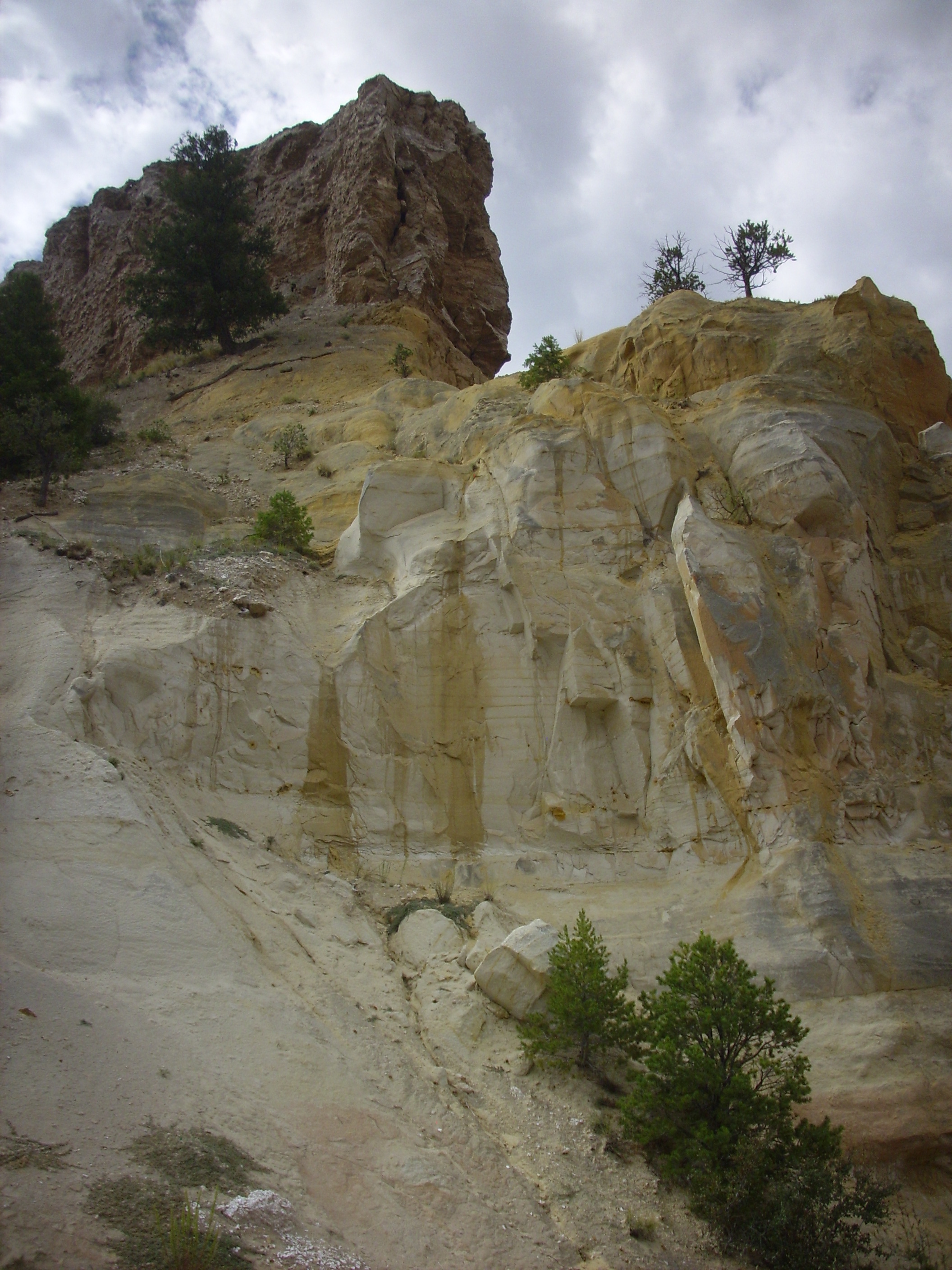
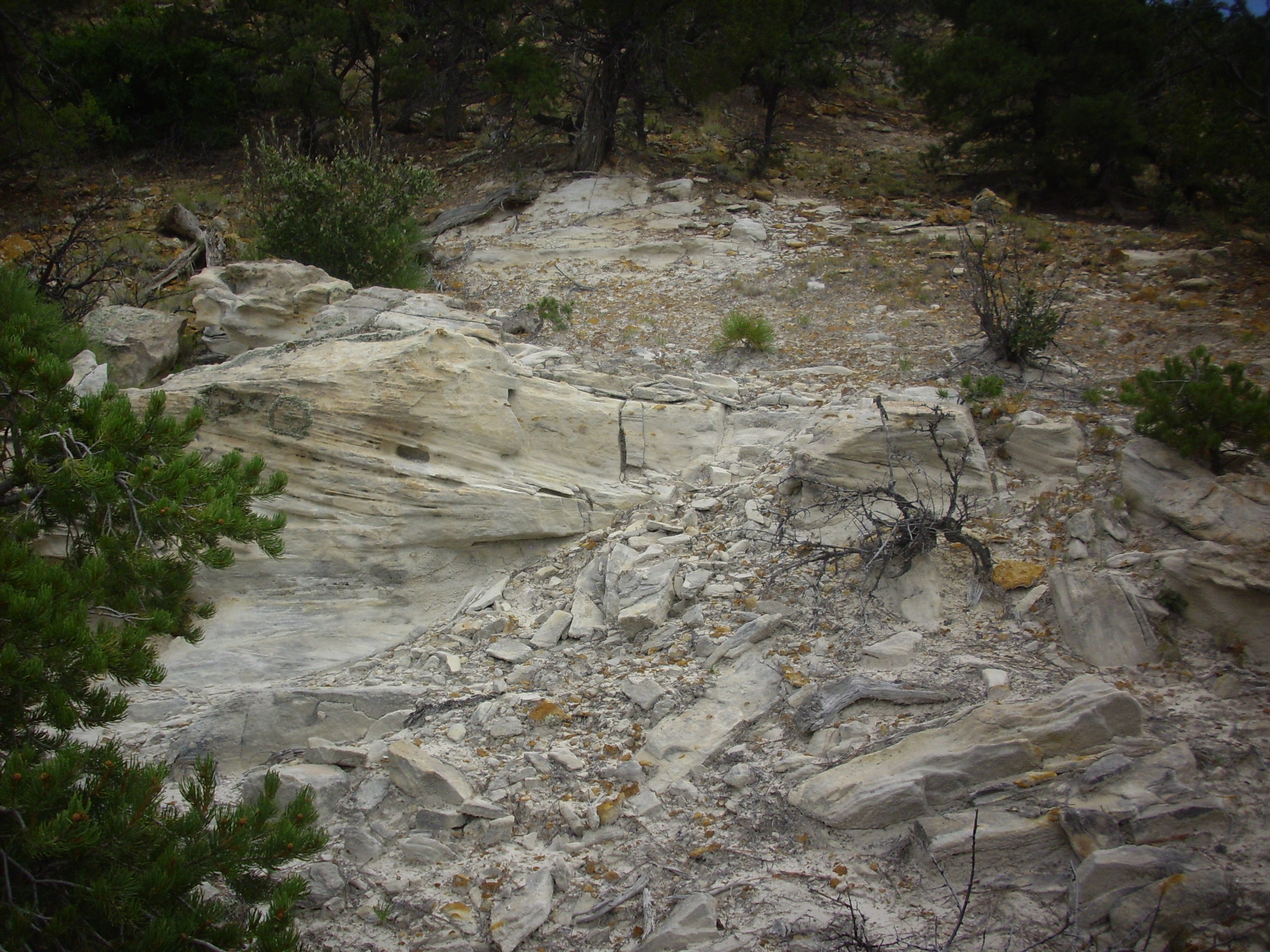
I took the turn south on Forest Road 100 into the north Jemez and Mushroom Canyon. This is an area where the Jurassic beds are well exposed. I parked at a convenient point, slathered on the sunscreen and bug spray, and began hiking in towards the most prominent feature of the area, a small butte capped with Toldilto Formation over Entrada Formation. Scrambling up a low ridge that runs north and east of the bluff, I found myself in a good spot for photography.
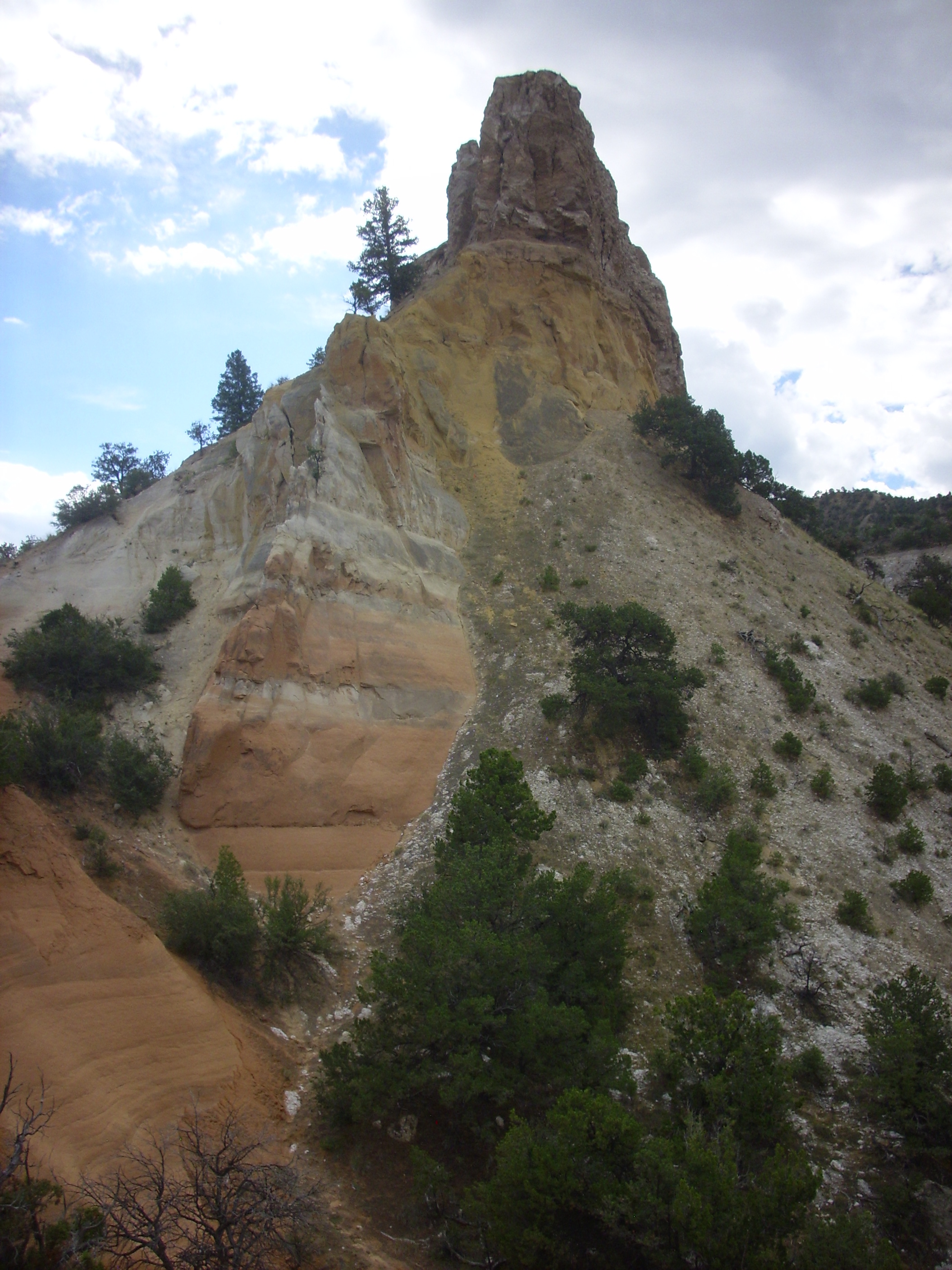
Entrada Sandstone. 36 10.730N 106 32.615W
The main lower beds of the Entrada Sandstone are pink. Above this is a white bed, then a nearly mustard-yellow bed beneath the cap of Todilto Formation. The white stuff covering the slope to the right is gypsum and shale weathered off the capstone.
Looking east gives another view of this sequence of beds.

Entrada Sandstone. Looking east from 36 10.730N 106 32.615W
The soil cover and vegetation partially obscures the underlying beds, but you can make out the lower pink, middle white, and upper yellow beds of the Entrada Sandstone, the latter well exposed under a cap of grey Todilto Formation. The slopes above the Todilto forming the skyline are underlain by Summerville Formation.
I climbed up to the very foot of the yellow Entrada cliffs on the bluff, and found the ground covered with bits of shale and gypsum weathered off the Toldilto Formation cap.
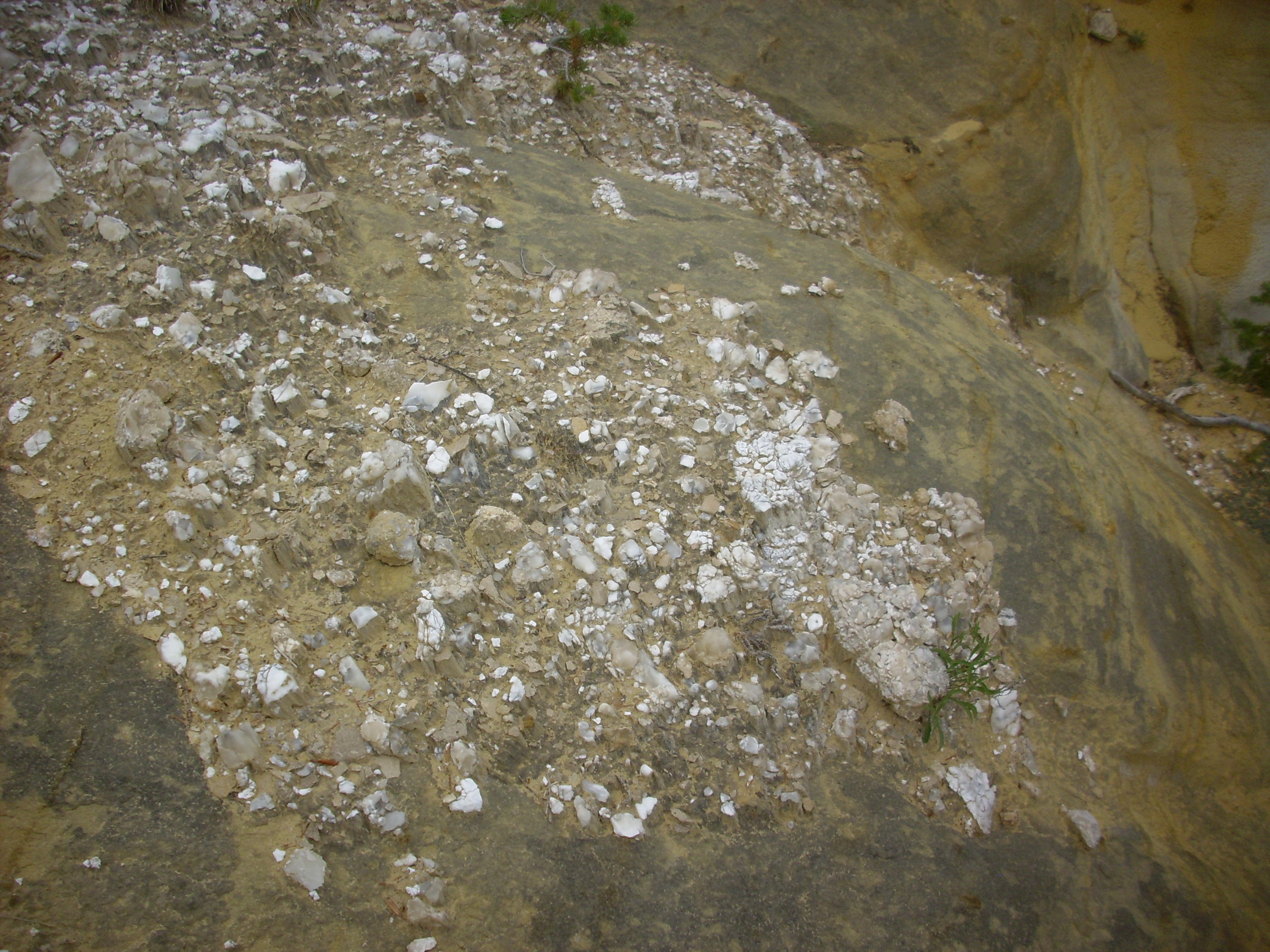
Shale and gypsum weathered off the Todilto Formation
Here’s a closer look at a nodule.
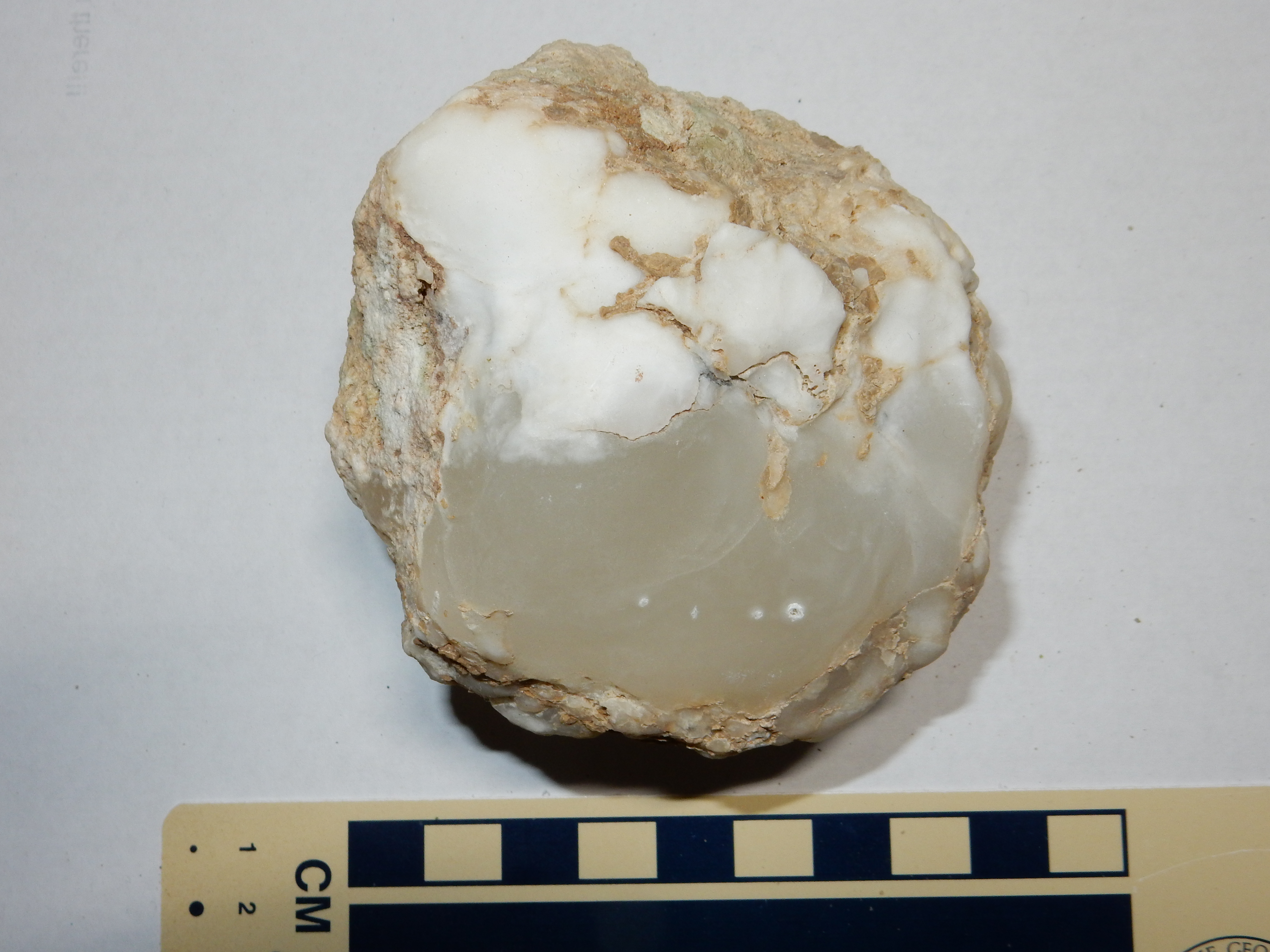
Evaporite nodule weathered from the Todilto Formation
The translucent part of this nodule is easily carved with a knife, but does not foam under acid; the only plausible mineral identification is gypsum, CaSO4·2H2O. The more opaque sections are both harder and foam under acid; this identifies them as calcite. Both minerals formed in an ancient sea, the Todilto Sea, which was cut off from the ocean and evaporated to deposit its mineral load as the Todilto Formation.
It turns out that the western half of Mushroom Canyon is located on private land, apparently belonging to a nature conservancy. Only the eastern half is on Forest Service land, with a barbed wire fence marking the boundary. I was careful to collect this nodule from the Forest Service side.
Looking up at the butte:
Entrada Sandstone and Todilto Formation. Looking more or less straight up from 36 10.730N 106 32.615W
There really wasn’t anywhere else to go from there; besides, this was the private side of the canyon, where collecting was not a good idea. I headed back to my car, walked a short distance east along the road, and started into the east side of the canyon. Yup, there was a barbed wire fence about where my map showed the National Forest boundary. Not in good shape; easy to cross. From here I looked back at the butte one more time.
Entrada Sandstone and Todilto Formation. Looking southwest from 36 10.807N 106 32.533W
I was striking out for another yellow cliff of Entrada Sandstone capped with Todilto, hoping to get a sample of each. The best I could do was a precarious perch from which I took this picture:
Contact of Todilto and Entrada Formation. 36 10.819N 106 32.497W
The yellowish topmost beds of the Entrada Formation are visible to lower left. Above this is the basal calcareous shale of the Mesa Luciano Member. The thick cap on top, with a more irregular texture and visible nodules of gypsum, is the Tonque Arroyo Member.
Here’s a sample of the Mesa Luciano Member.
Mesa Luciano Member, Todilto Formation. 36 10.819N 106 32.497W
I could go no further without taking unjustifiable risks. I am 53, and ambitious of making it to 54.
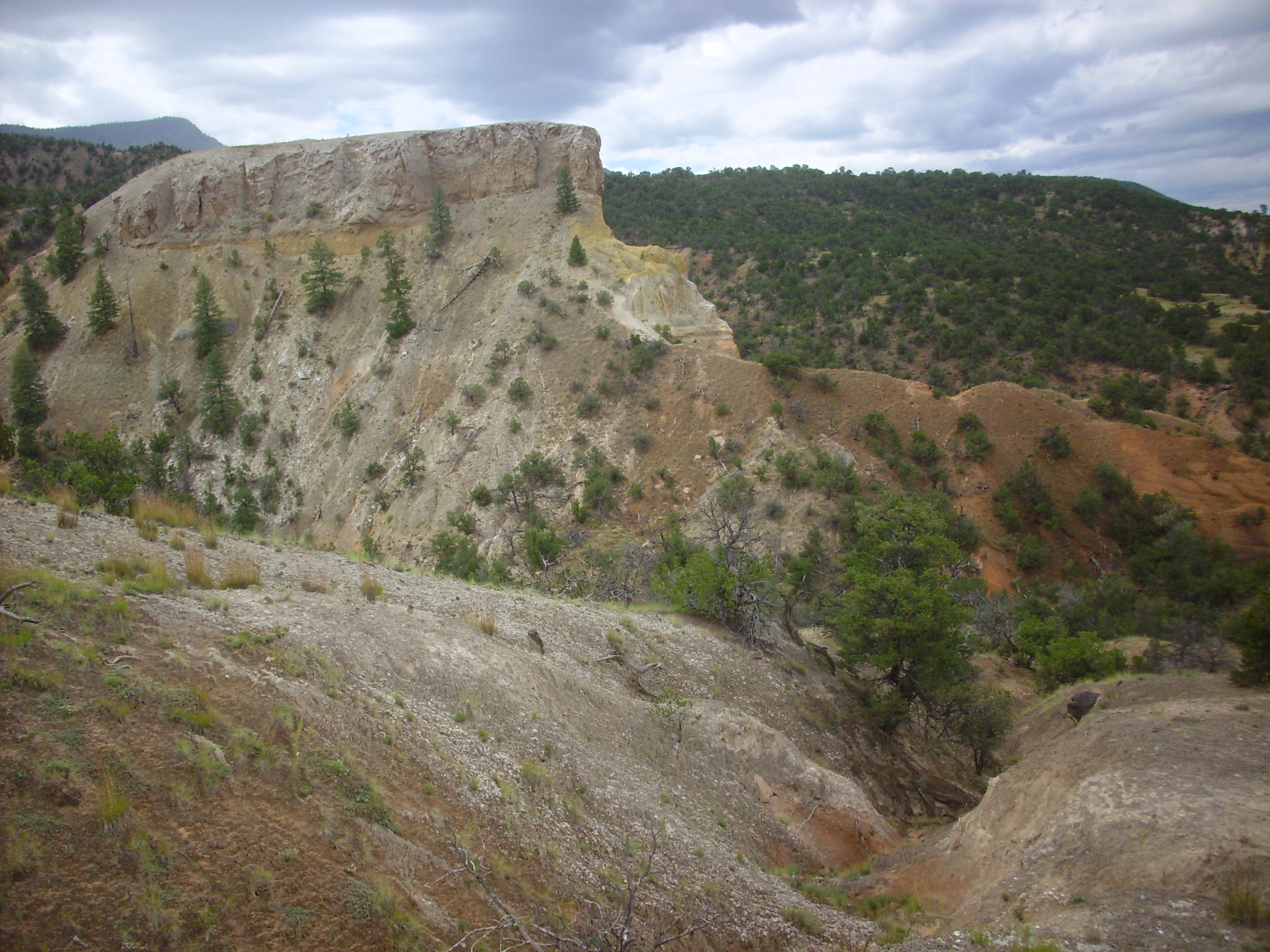
I backtracked and tried to work my way around the cliffs to the south. The rocks here are pretty spectacular.
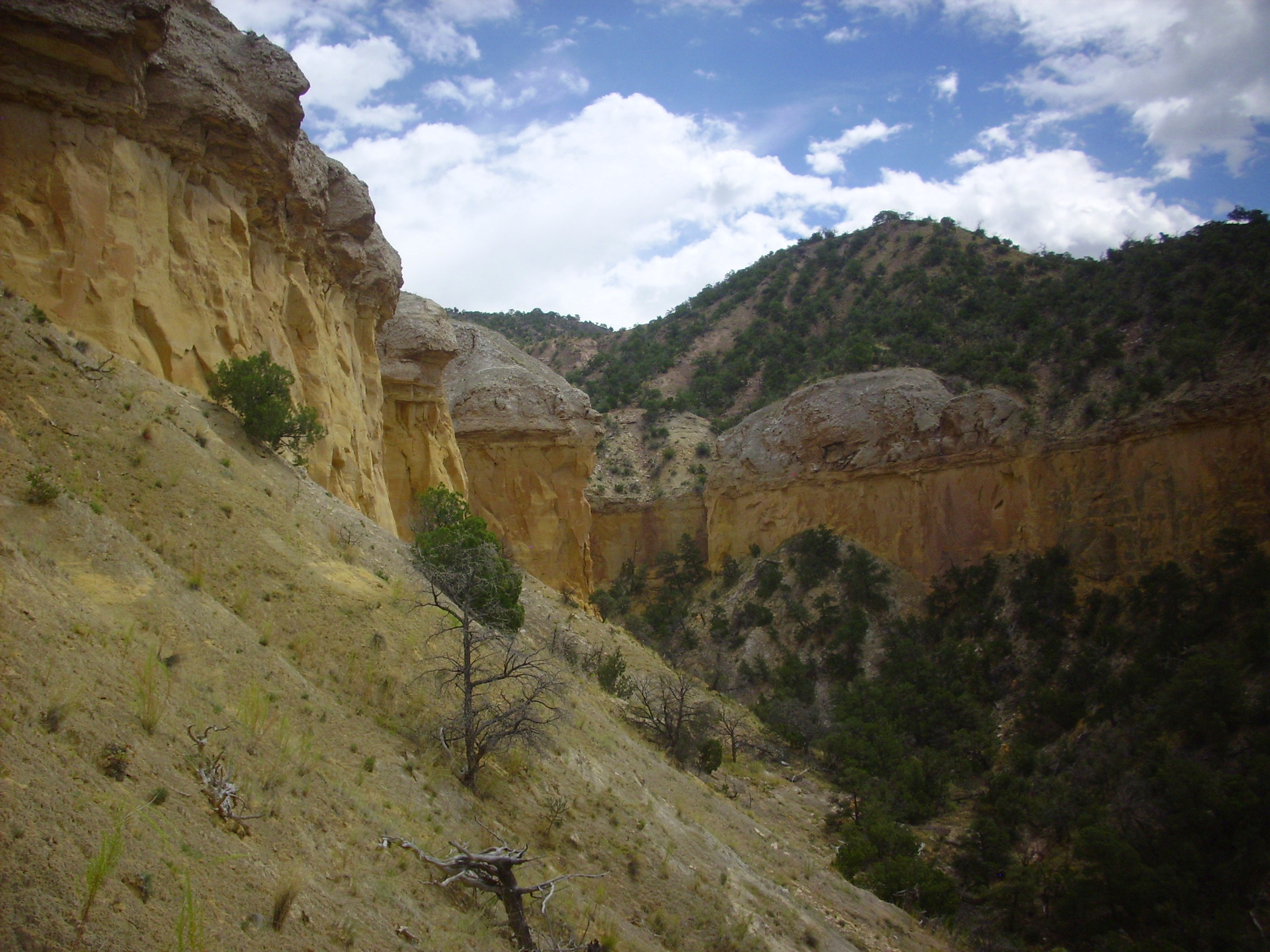
Mushroom Canyon at its finest. Looking east from 36 10.798N 106 32.509W
This, my friends, is why Mushroom Canyon gets its name.
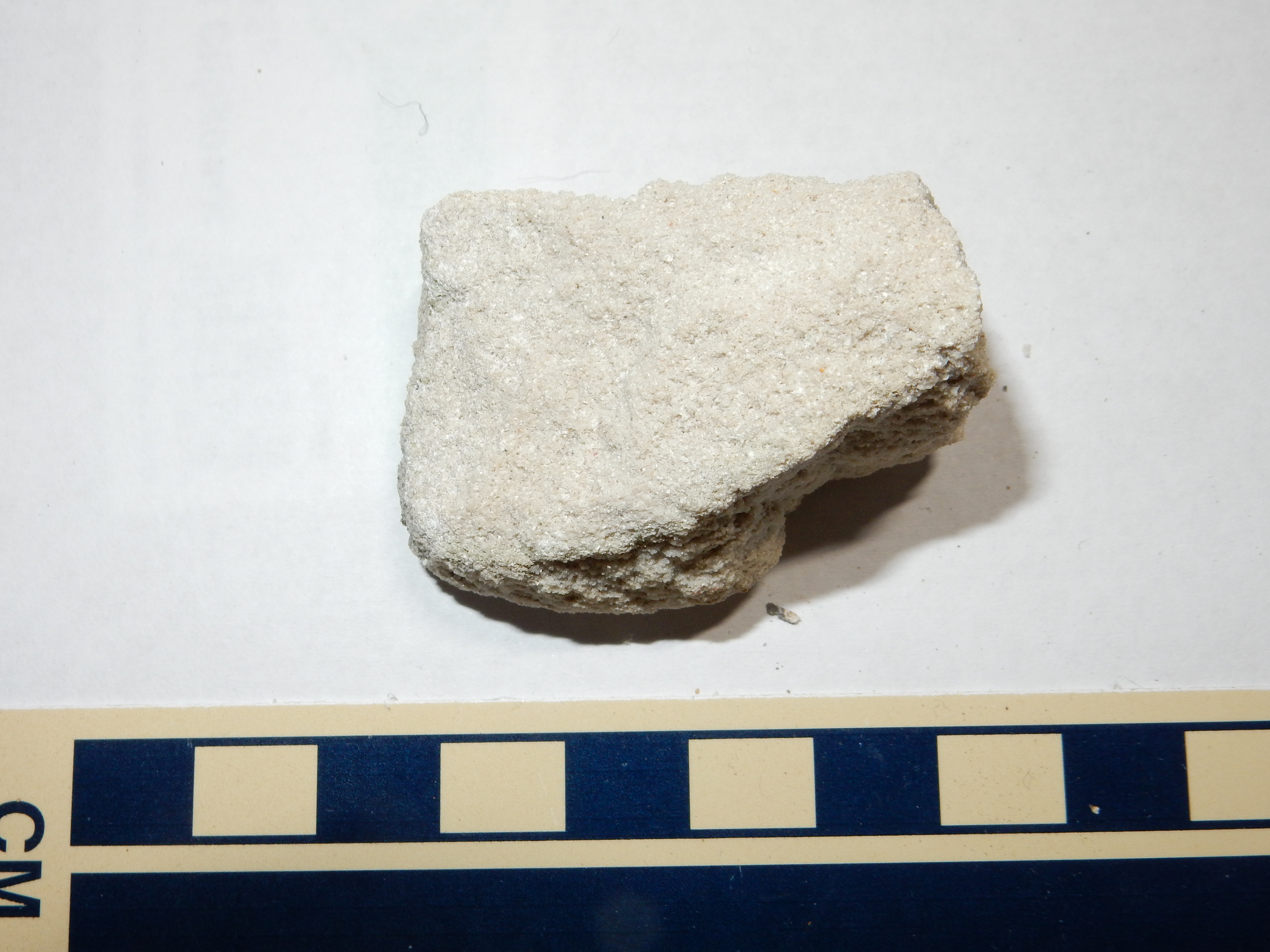
The lower red beds of the Entrada Sandstone are present in the arroyo at the bottom of the canyon, and here I took a moderately fresh, well-indurated specimen from a recent rock fall.
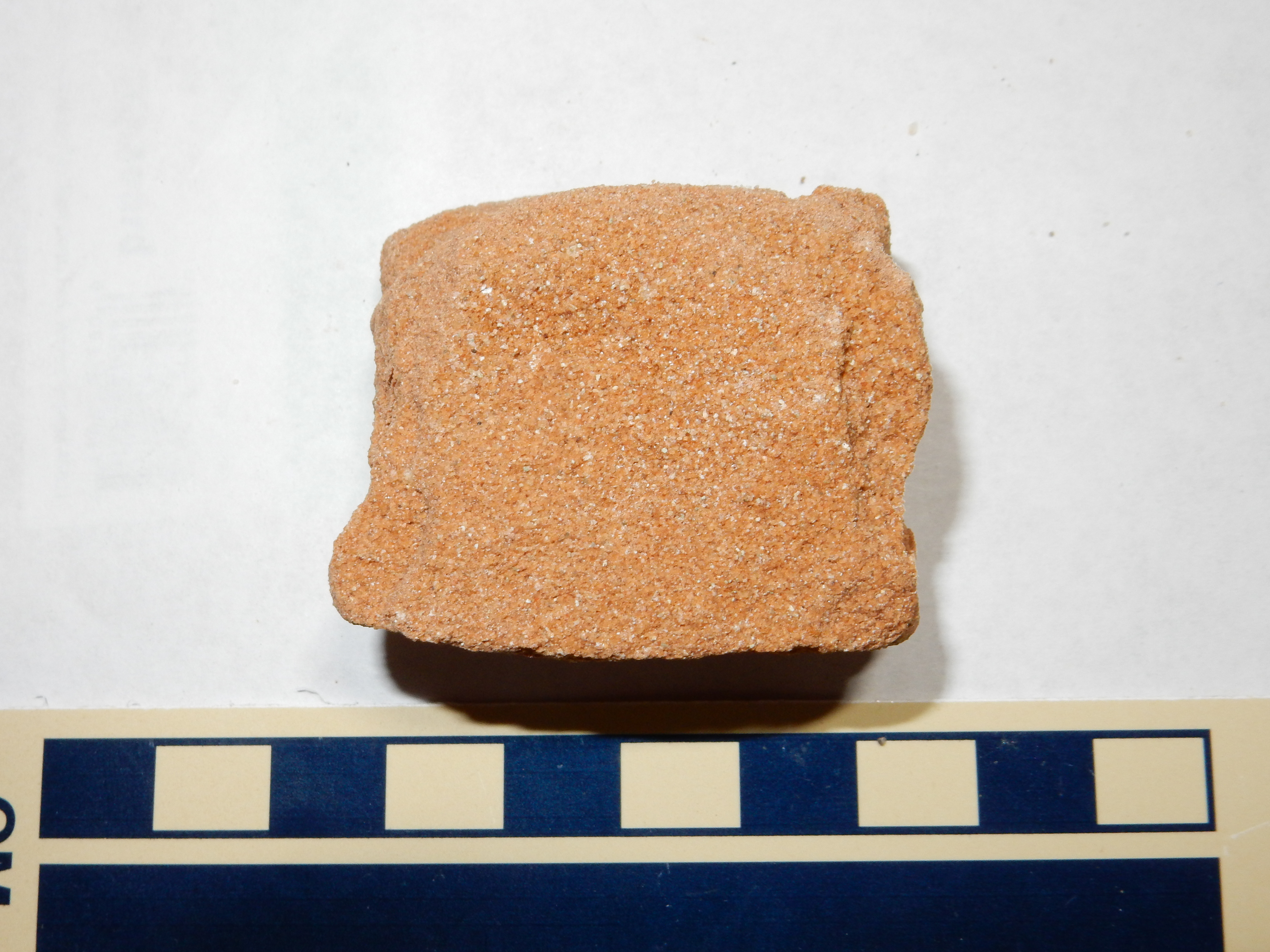
Entrada Sandstone. 36 10.784N 106 32.481W
This is a well-sorted sandstone with considerable calcareous cement between the grains, which appear to be mostly quartz but with significant lithic fragments. Okay: In non-geek terms, this is a dirty sandstone with lots of lime in it.
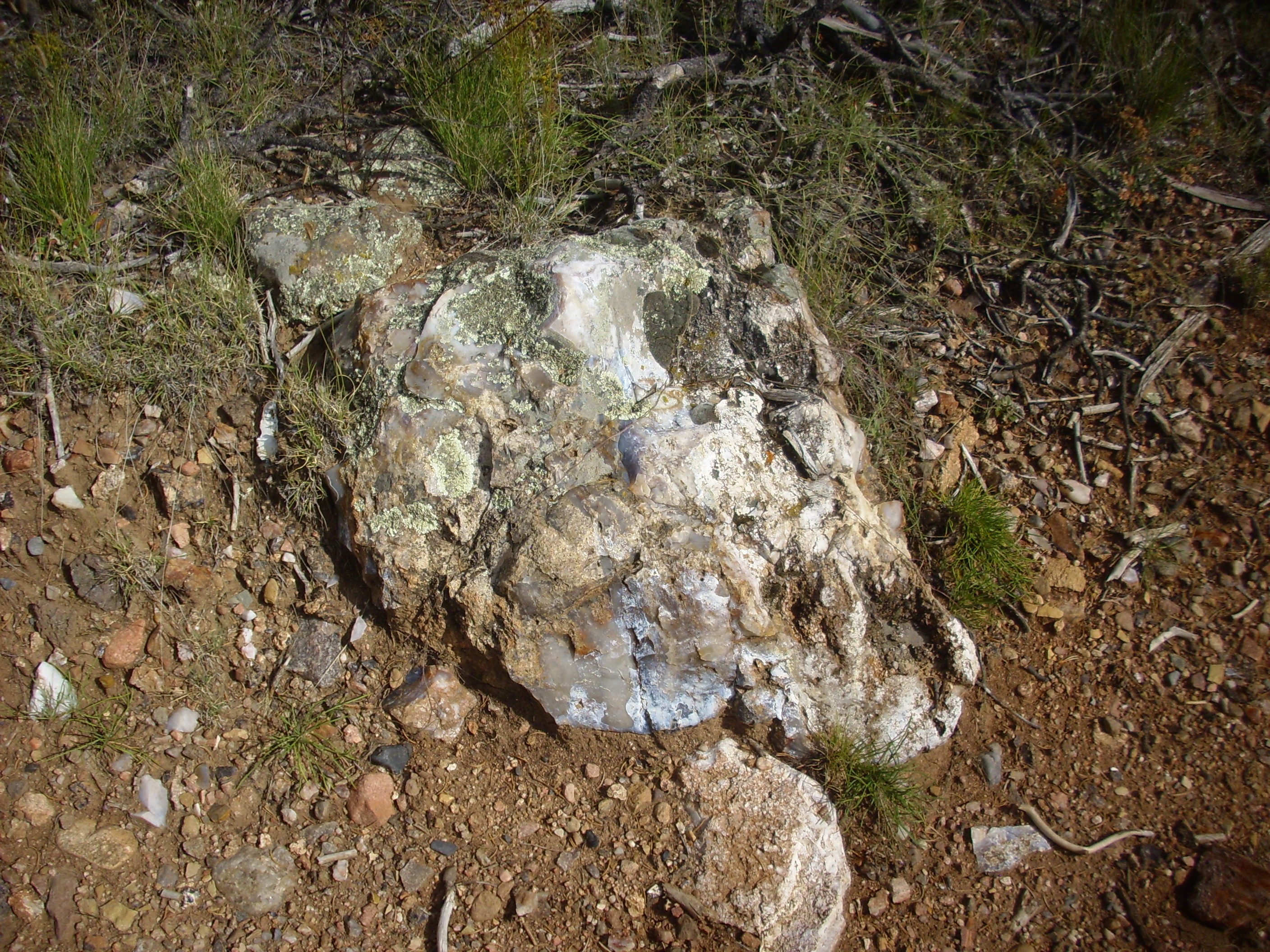
Nearby was a large gypsum lens.
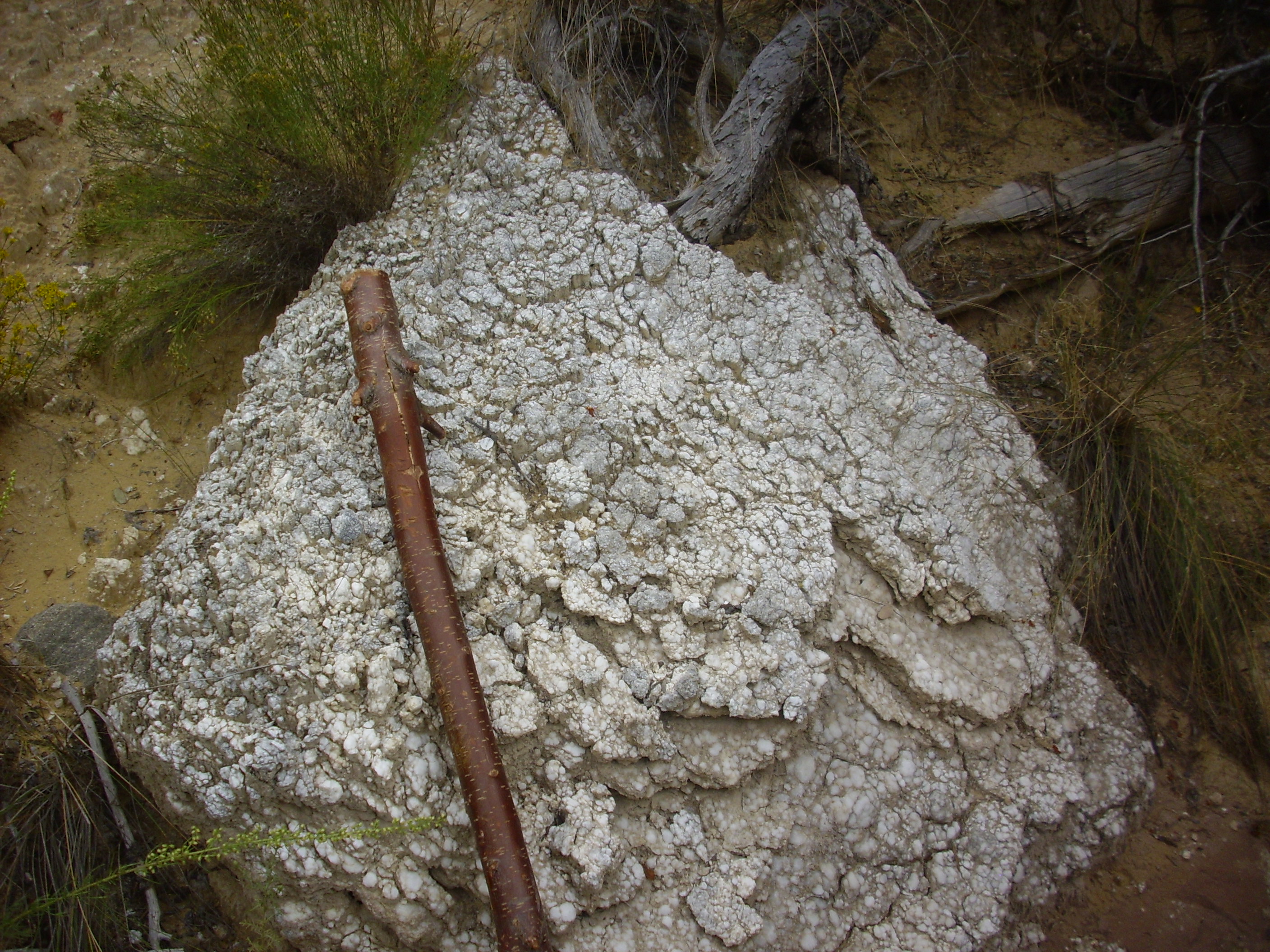
Gympsum lens weathered from Todilto Formation. 36 10.784N 106 32.481W
Note the head of my walking stick, for scale. This large gypsum lens weathered from the Todilto Formation and is located in the arroyo beneath.
The gypsum weathered from the Todilto is slightly soluble in water, and repeated wetting and drying cycles in a dry climate in loose, sandy soil with abundant gypsum produces a distinctive texture.
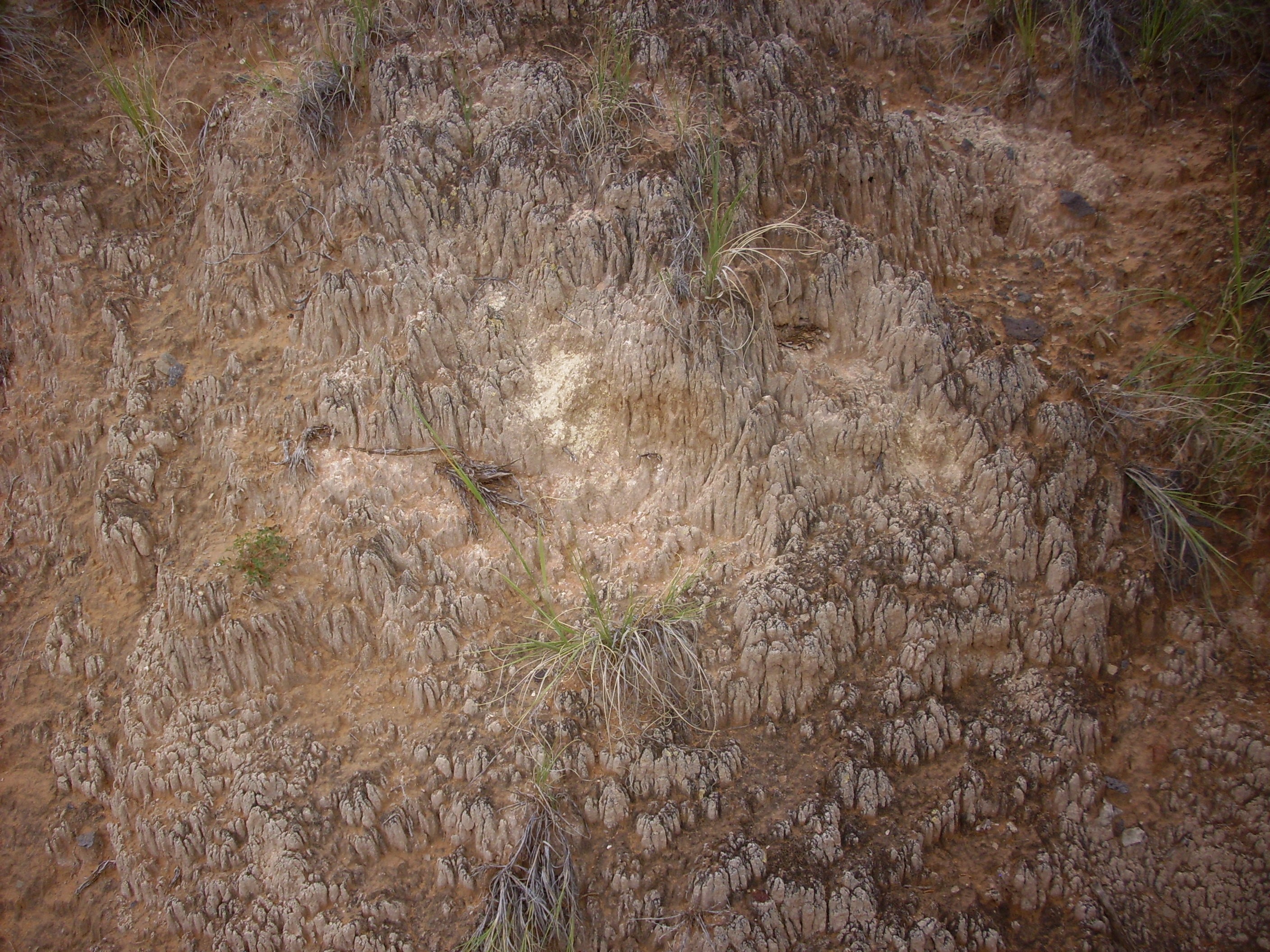
Funky ground texture from repeated wetting and drying of gypsiferous soil. Near 36 10.784N 106 32.481W
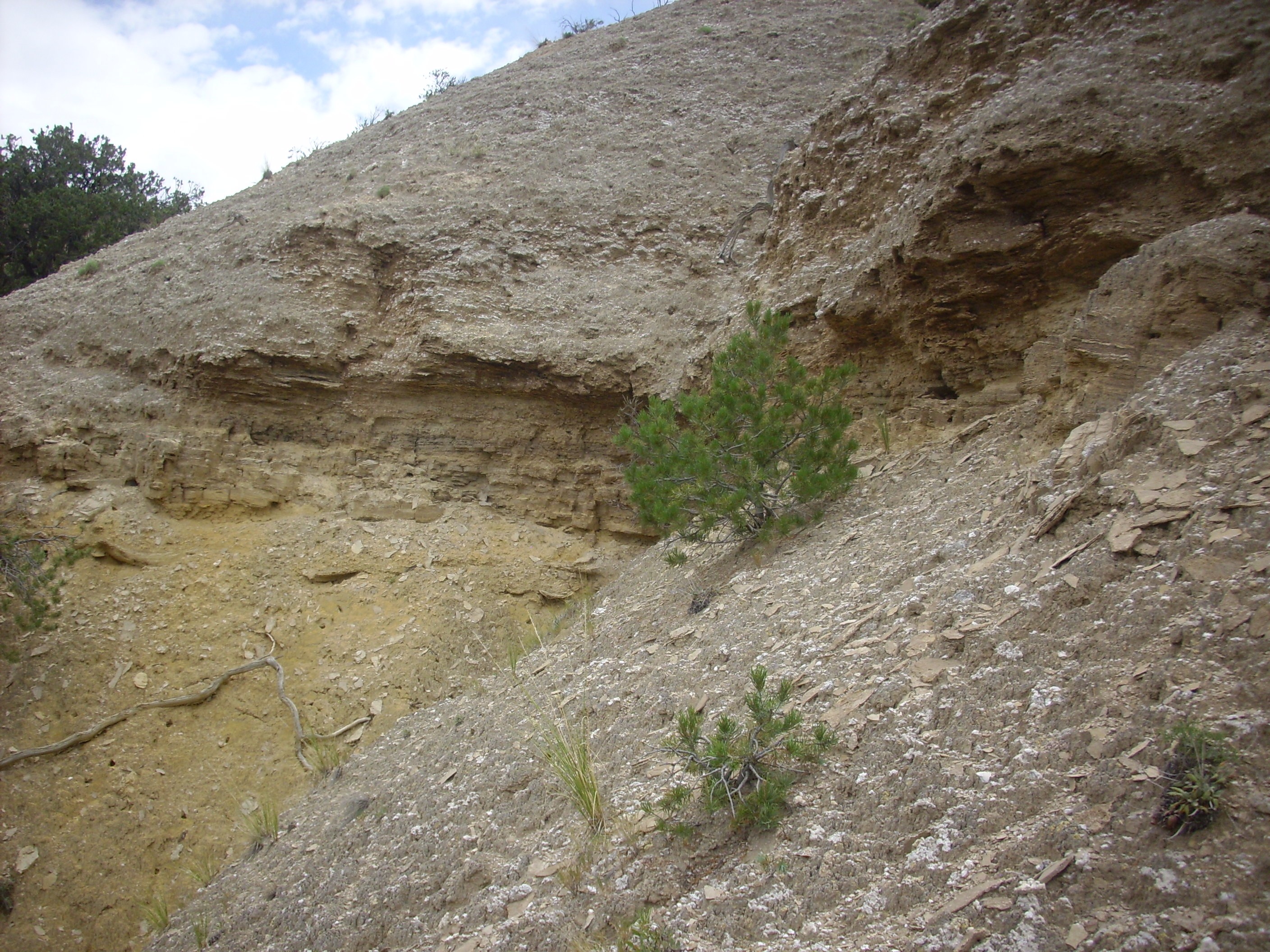
It began to rain lightly, and I was standing in an arroyo. It seemed prudent to get to higher ground, and it didn’t look like I was going to be able to get at the Summerville or Morrison Formations from where I was standing, so I headed back to my car and drove south along Forest Road 100.
This goes into the canyon of the Rio Encino River. The canyon is rimmed with Cretaceous beds.
Cretaceous exposes in Rio Encino canyon. Looking east from 36 9.813N 106 31.990W
That’s Cerro Pedernal on the skyline. The foreground cliffs are rimmed with Dakota Formation, and the slopes beneath are exposures of Burro Canyon Formation. Above the cliff, on the plateau, is Mancos Formation and Tertiary El Rito Formation.
The Burro Canyon and Dakota Formations formed along the shores of an inland sea that covered much of what is now the western United States. Logically enough, geologists have dubbed this this the Western Interior Seaway.
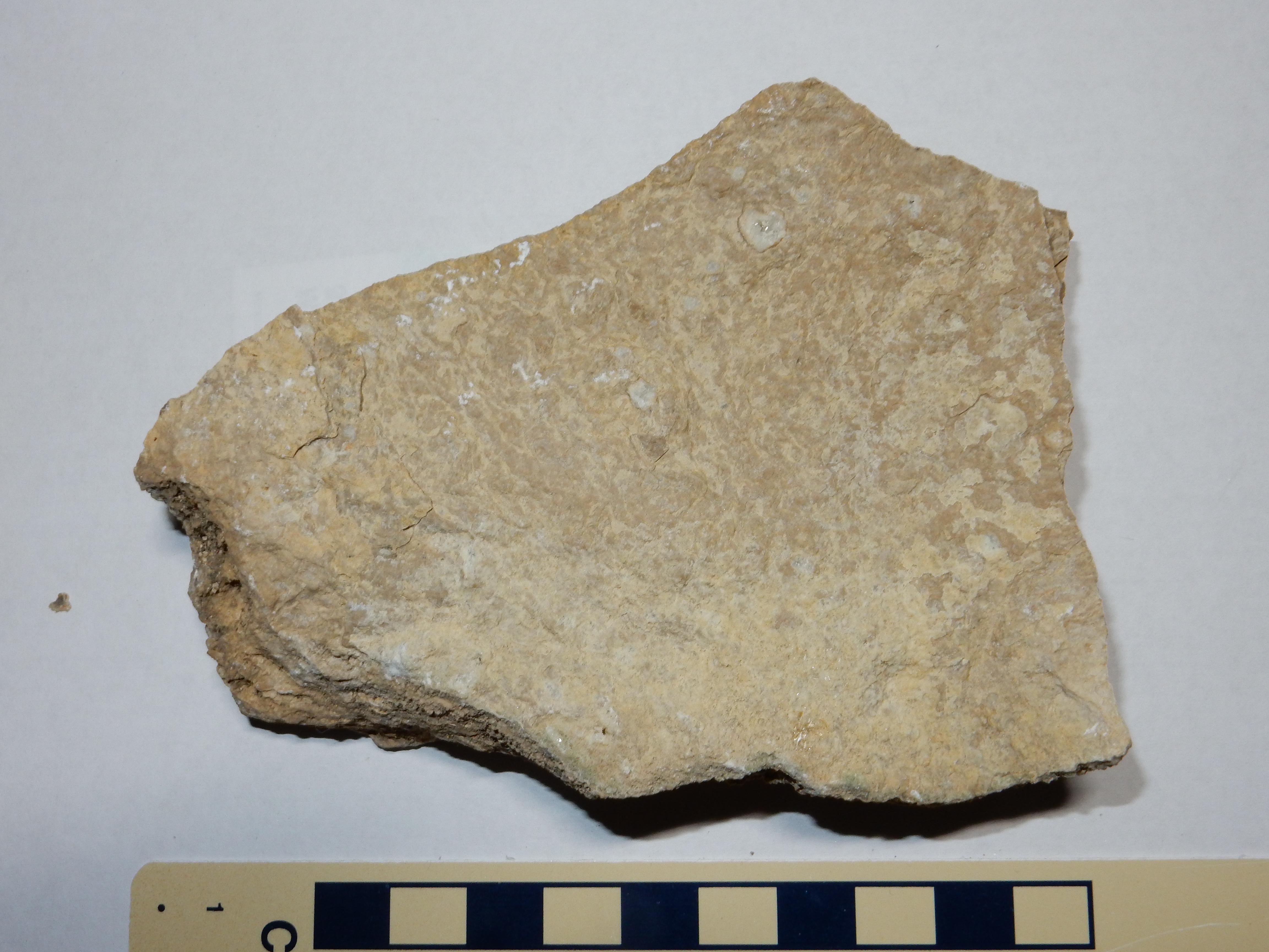
I worked my wall up the hill, and came across my first outcropping of what I presume is Burro Canyon Formation. The Burro Canyon Formation was formed by braided streams along the coastal plain of the Western Interior Seaway around 120 million years ago.
Burro Canyon Formation. 36 9.833N 106 31.876W
A sample:
Burro Canyon Formation. 36 9.833N 106 31.876W
Under the loupe, this is revealed as a well-sorted sandstone composed almost entirely of angular quartz grains, with significant calciferous cement in the pore spaces — though not enough to make it a wacke. A nice, clean, fairly mature quartz arenite.
Nearby is another outcropping.
Burro Canyon Formation. 36 9.829N 106 31.878W
This outcrop reveals thin conglomerate beds, which seem to be characteristic of the Burro Canyon Formation.
Further up, I found myself on a small knoll that was ideal for a panorama shot.
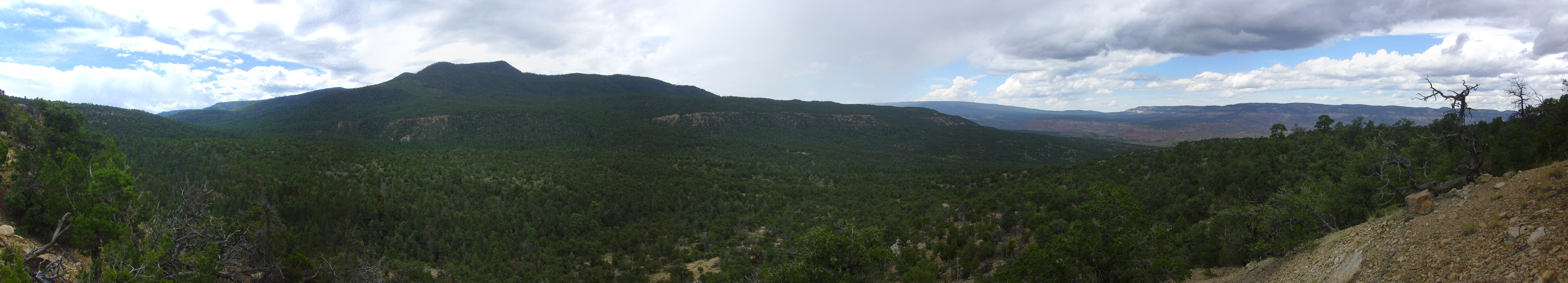
Panorama of Rio Encino canyon. 36 9.829N 106 31.878W
The heights in the first through third frame are the northern edge of the La Grulla Plateau. The distant mountain on the boundary of the third and fourth frame is San Pedro Mountain, in the Sierra Nacimiento. Mesa Montosa and Alta Mesa dominate the final frames. The Dakota Sandstone forms the rim visible across the entire panorama, including the distant mesas in the final frames.
Well, cool.
From here I scrambled up the remaining slope to the foot of the cliff capping the ridge. This is the Paguate Sandstone of the Dakota Formation.
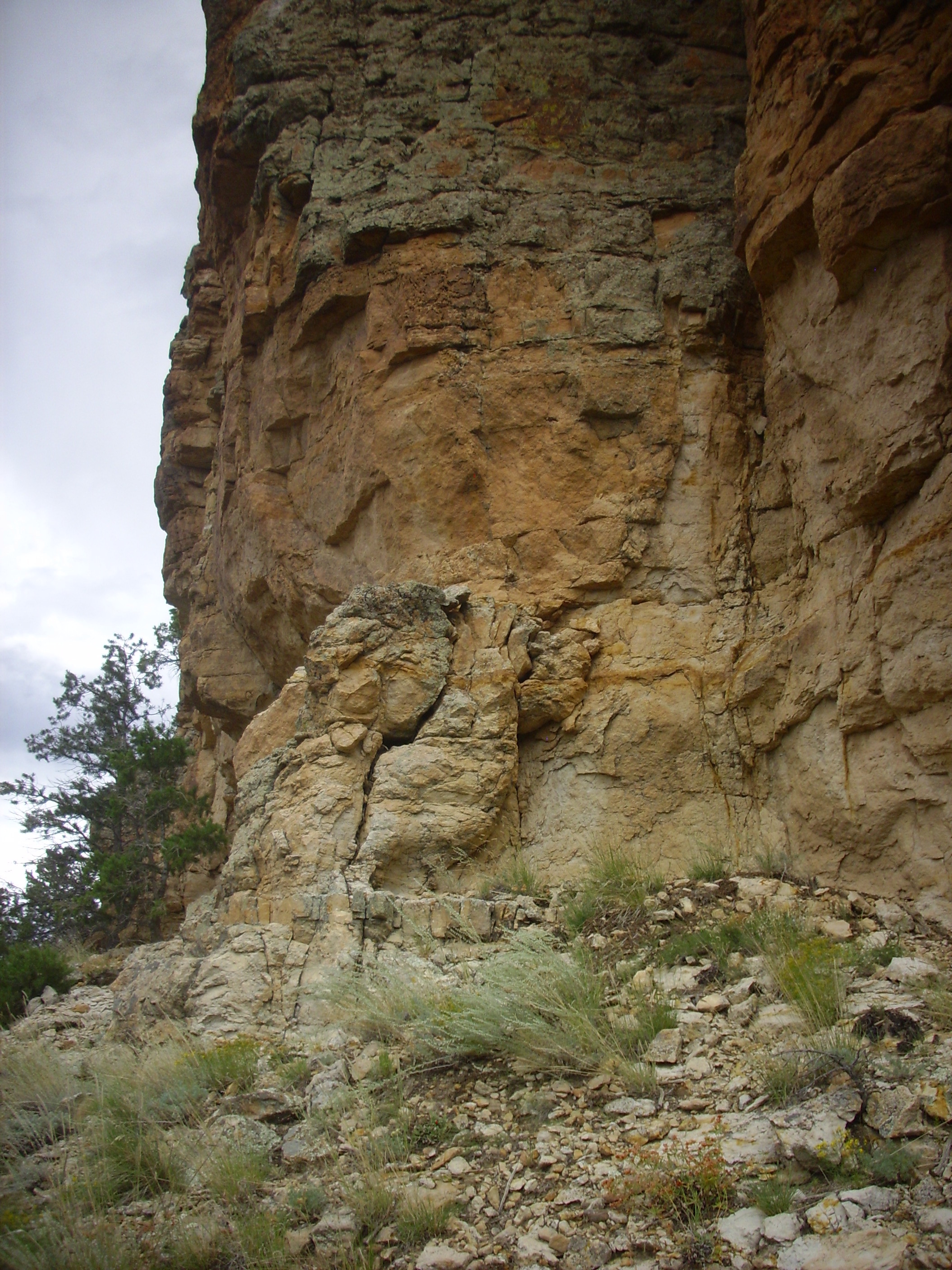
Paguate Sandstone, Dakota Formation. 36 9.859N 106 31.839W
This is an extremely well-indurated sandstone, accounting for its resistance and tendency to form cliffs. “Well-indurated”: That’s geologist-speak for a sedimentary rock that is really hard. Here’s a sample.
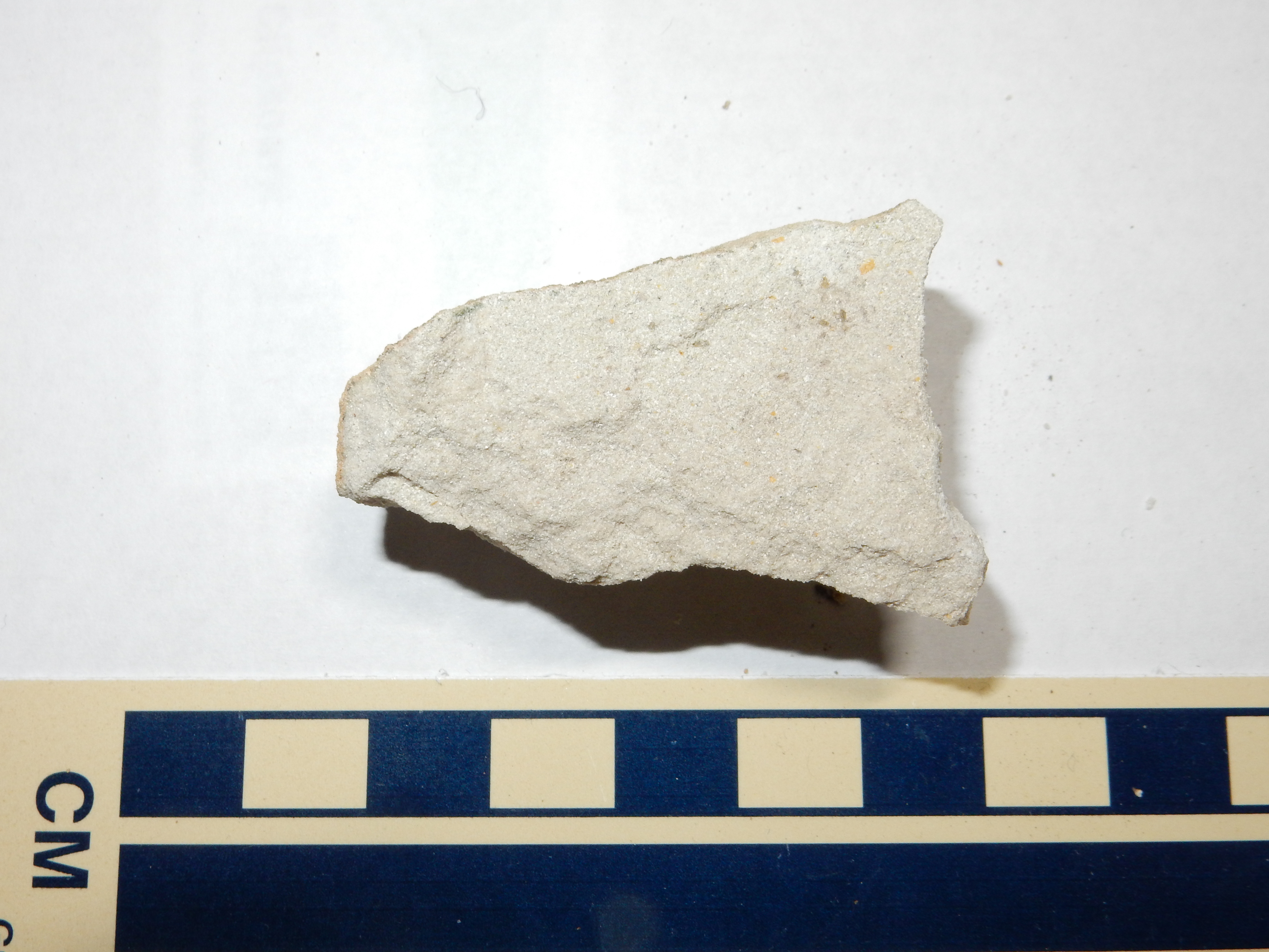
Paguate Sandstone, Dakota Formatin. 36 9.859N 106 31.839W
This is similar to the Burro Canyon Formation, but the grains are smaller, better rounded, and more strongly cemented together.
The Paguate Sandstone shows significant cross bedding.
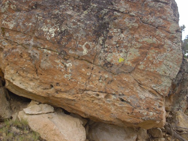
Cross bedding in Paguate Sandstone, Dakota Formation. Click to enlarge. 36 9.859N 106 31.839W
The cross bedding is evident towards the bottom of this boulder. It’s the term for when large beds lying at one angle are composed of much smaller beds lying at a different angle. Cross-bedding occurs when sediments are deposited somewhere where there’s a strong current of some kind, such as wind blowing sand or moving water depositing sand.
Like many sandstones, the Paguate Sandstone also preserves some fossils.
Ichnofossils in Paguate Sandstone, Dakota Formation. Click to enlarge. 36 9.859N 106 31.839W
Given that I don’t know everything about geology (yet), it’s possible these are abiogenic features, but my guess is that we are looking at ichnofossils, or trace fossils. These are fossil traces of living organisms that are not the organisms themselves. Obvious examples are dinosaur footprints (which have been found in Dakota formation beds, just not here.) My guess is that we are looking at some kind of worm burrow or crustacean track.
This is one of those times I really wish Bruce Rabe had come along, though in this case the hike would have been rather tough for him and this rock would have been a burden for me to carry all the way down the hill. I mean, it’s quite a haul:

Little lonely car. Click to enlarge, then squint.
I wanted to get on top of the cliff, but I had to scout along it for some time before finding a spot I thought I could go up. This I finally did, but I dropped my pack first. (And, as I scrambled up, the smarter part of my mind was thinking Going down is always harder…)
Here is what greeted me at the top.
Mud. Yellowish-gray mud, mantled with basalt debris from the La Grulla beds.
Badly weathered Mancos Shale in the northern Jemez. 36 9.859N 106 31.839W
It’s more exciting than it looks, at least a little. This is a badly-weathered exposure of the Mancos Shale, the next youngest Cretaceous formation in this area. It’s basically muddy sea bottom deposited between 95 and 80 million years ago. It goes back to mud at the least provocation, as it has done pretty much everywhere it’s exposed in the northern Jemez.
Still. Another formation to check off my “been there, done that” list.
Of course, now I had the task of getting back down. (Cat. Tree. You get the picture.) I scouted further along the cliff, found a better route down than the one I came up, got down more or less intact (one barked shin), and worked my way back along the foot of the cliff to my pack.
You may ask: Why didn’t I scout a little further along this cliff and go up this way? Isn’t it a tad foolish to go up somewhere it’s going to be hard to get back down instead of finding a spot you are sure you can get back down? Answer: We are smart, but we are not so smart.
And the clouds had largely burned off. I got a second panorama of the valley under bright sunlight.
Panorama of Rio Encino canyon. From near 36 9.829N 106 31.878W
From an artistic perspective, this is much better than the previous panorama. However, the bright sunlight actually washes out the Cretaceous cliffs a bit. I’ve found that lighting makes a big difference in how well a photo highlights geological features, but just what lighting works best can be hard to predict.
Since Man needs both Science and Art, I’m pleased to present both panoramas.
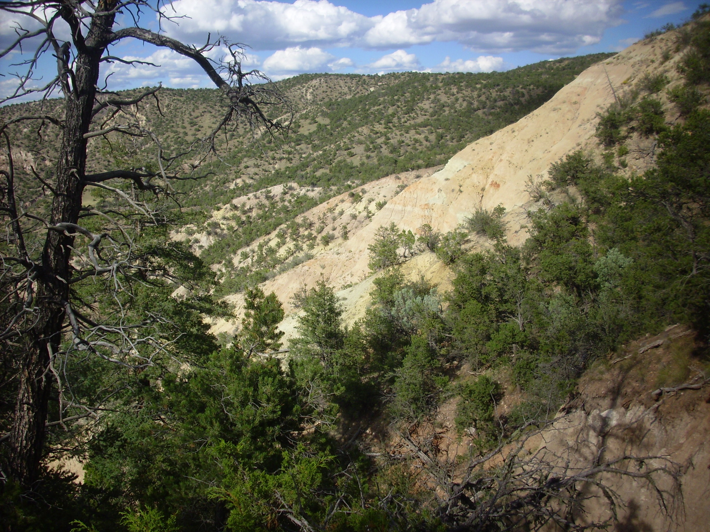
From here I drove up onto the La Grulla Plateau and to Encino Lookout. I have been here a couple of times before, but never with enough time to properly explore. I was particularly interested in hiking to the south of the lookout, where one can look back and see an endogenous dome exposed in cross section under the lookout; and to the north, where one can find hydromagmatic beds.
First south. One follows the road from the locked gate here to the old fire lookout here. I found the area already occupied.

A mooving sight.
A mixed herd of cows and steers. All gave me their undivided attention, which is vaguely unnerving. One very large cow was standing close to the road and staring at me with what almost looked like hostility. At a loss, I raised my hand, palm forward, and gravely intoned “I come in peace.” It seemed to work; the cow regarded me for another moment, then dropped her head and started munching grass again.
While hunting for the trail, I spotted a herd (flock? stupor?) of wild turkeys in a nearby meadow. They spotted me at about the same time, alas, and had already melted into the forest before I could get my camera ready. There is a hill south of here called Cerro Pavo, “Turkey Hill”; now I know why.
I eventually picked up the trail, hiked a ways south, and came out on an escarpment looking north back towards the overlook. I worked my way onto a point on the escarpment from which to take pictures.

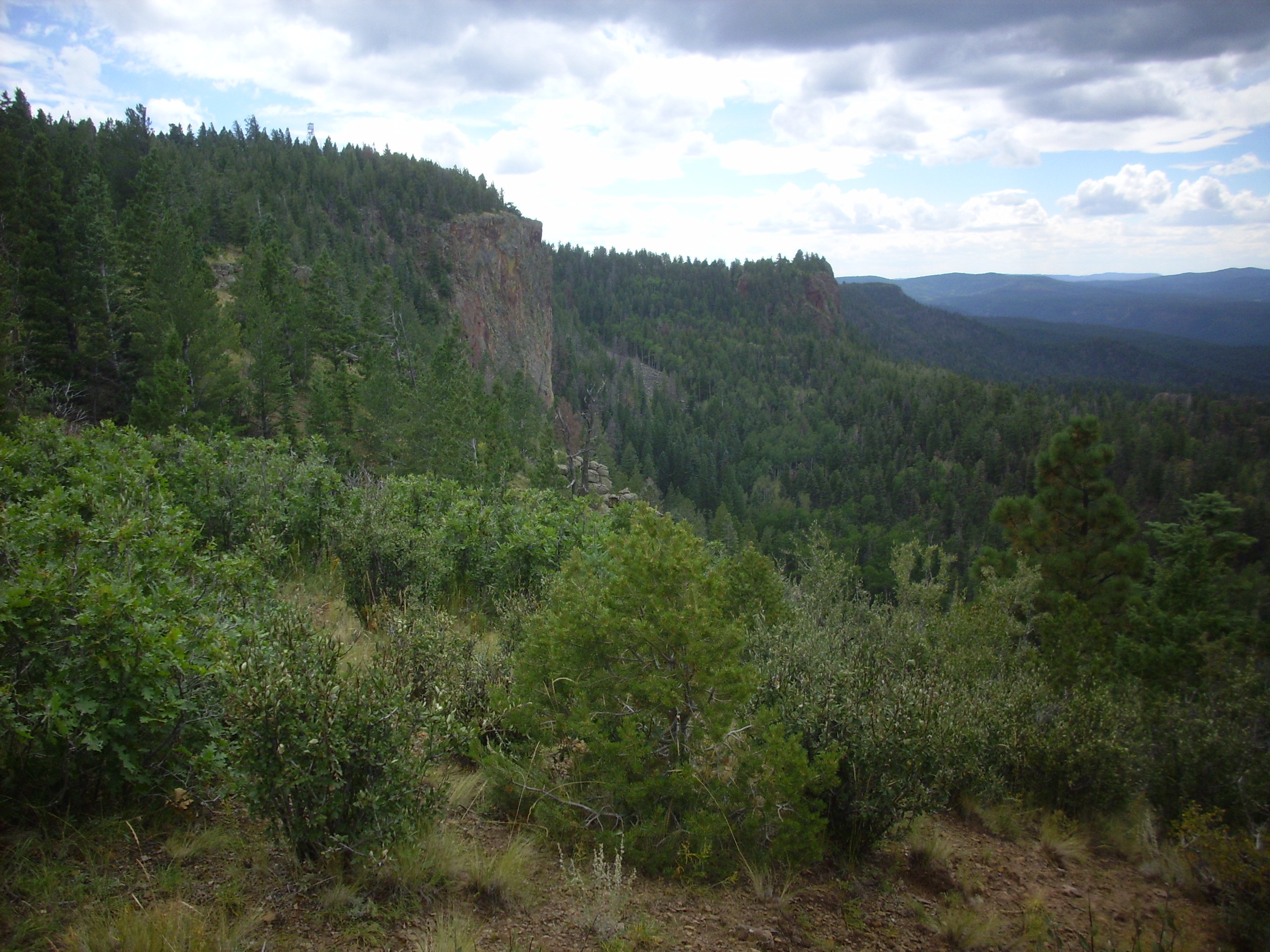
Encino dome. Looking north from 36 7.197N 106 33.495W
Looking northwest, one sees the basalt dikes of Los Barrancos, the rugged area below the escarpment. This was long thought to be a landslide area, but we now know that the slabs of hardened lava are actually dikes rooted in the earth and that this area was a volcanic center that was broken up by faulting and eroded to its current form.
Encino barrancos. Looking northwest from 36 7.197N 106 33.495W
I retraced my steps, found the cows uninterested in me on the second pass, and now headed north towards alleged hydromagmatic deposits. I was not 100% sure of the location and tried working along the escarpment; this proved unsettlingly precarious, but at least I got a nice picture of the Encino dome from the north.
Encino dome. Looking south from near near 36 7.649N 106 33.134W
The dome is to the left. The next protruding bit of cliff is where I took the previous dome picture from.
Finding myself on a narrow ledge over the precipice, with no obvious way forward, I concluded this could not be right and worked back to where I could move inland. Sure enough, I stumbled across the correct trail, and followed it north. Some nice views along the way:
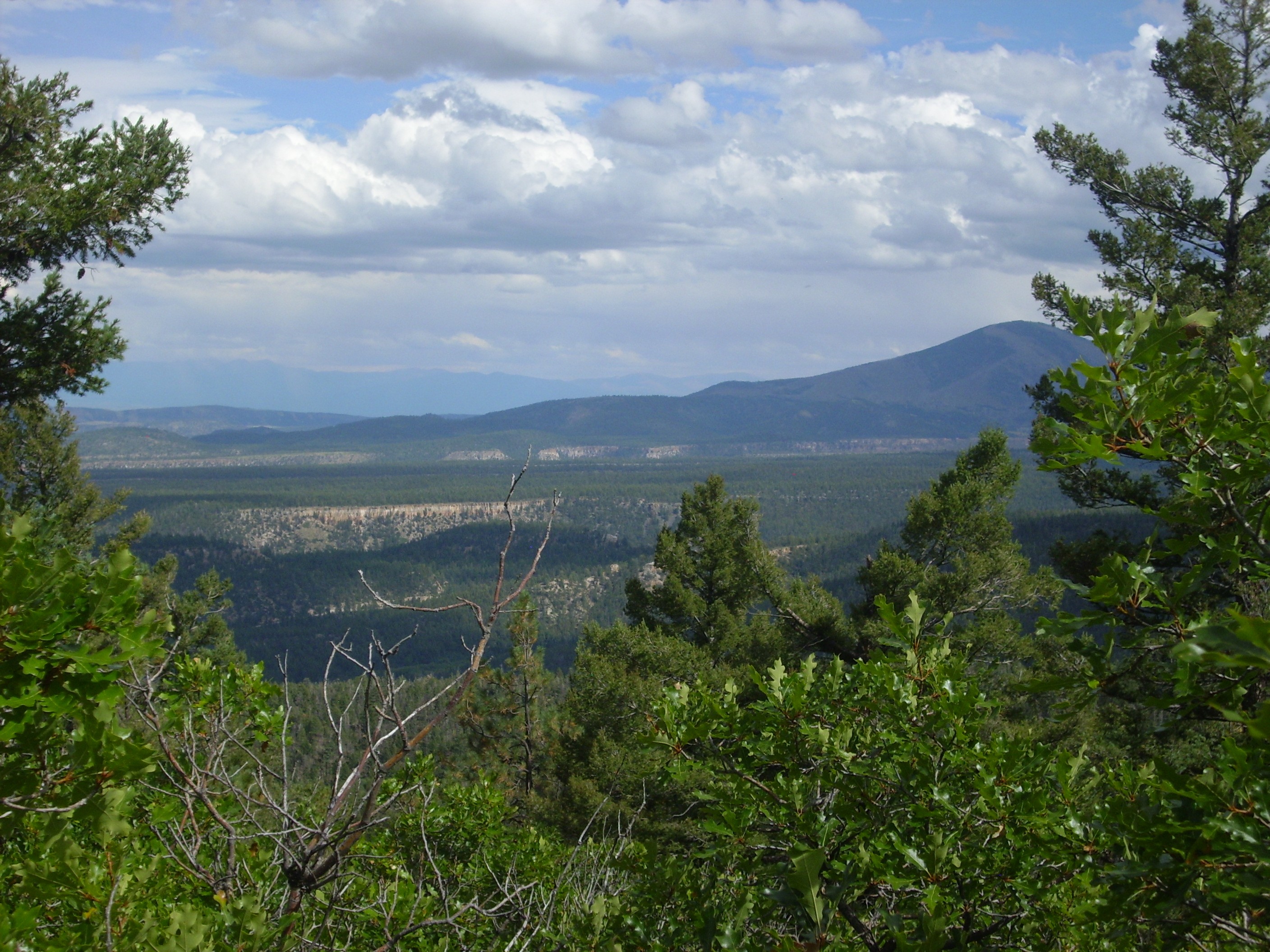
Bandelier Tuff below Polvadera Peak. Looking east from near 36 7.883N 106 32.745W

Youngsville area. Looking north from near 36 7.883N 106 32.745W
And then I came to the hydromagmatic deposits, just as I was about to decide I was running short of time and turn back.
Hydromagmatic deposits are produced by magma intruding rock that is saturated with water. The magma and rock explode under steam pressure (a phreatomagmatic eruption) and leave large chunks of country rock embedded in a matrix of cinders.
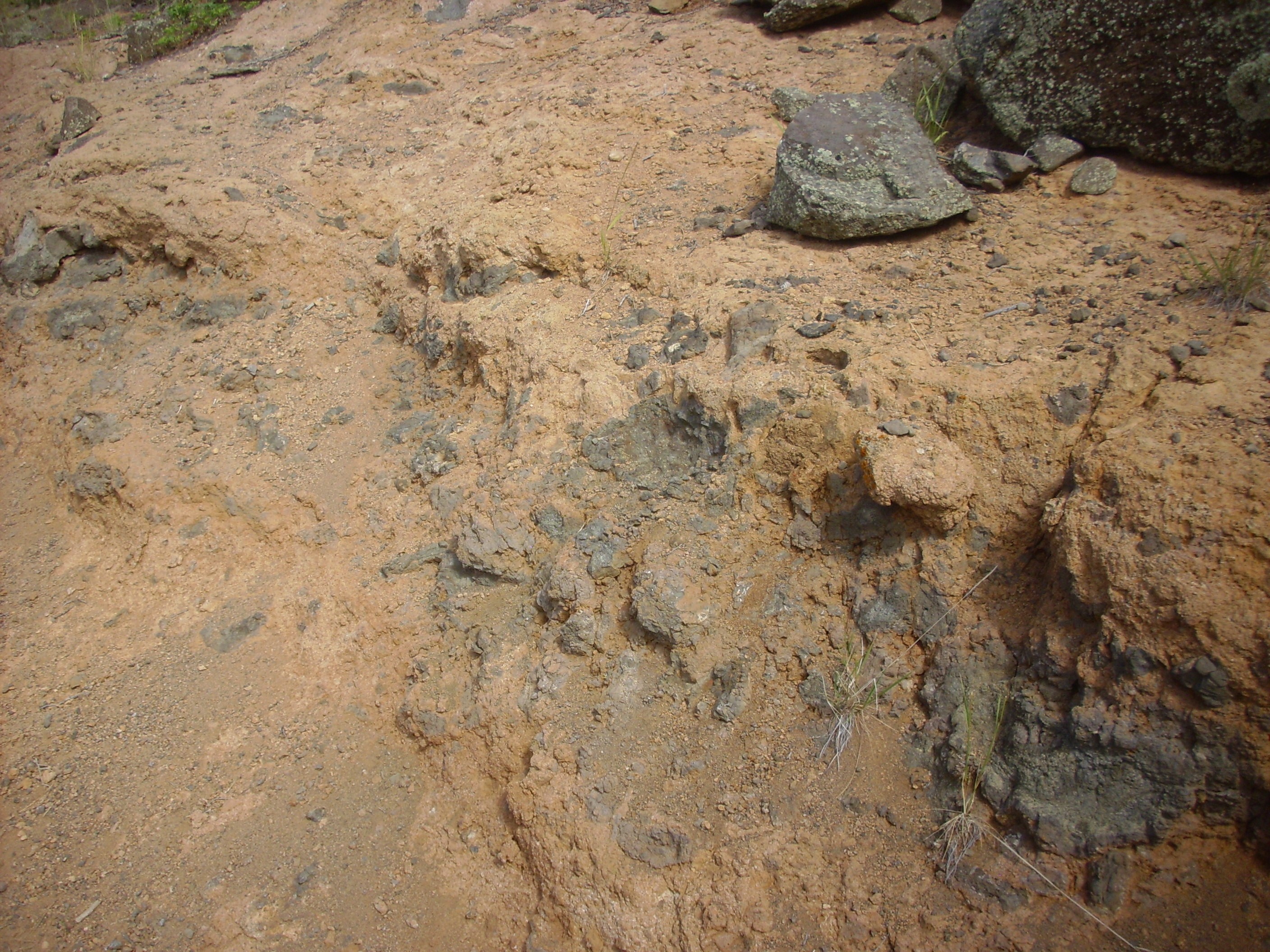
Hydromagmatic deposits. Near 36 07.924N 106 32.712W
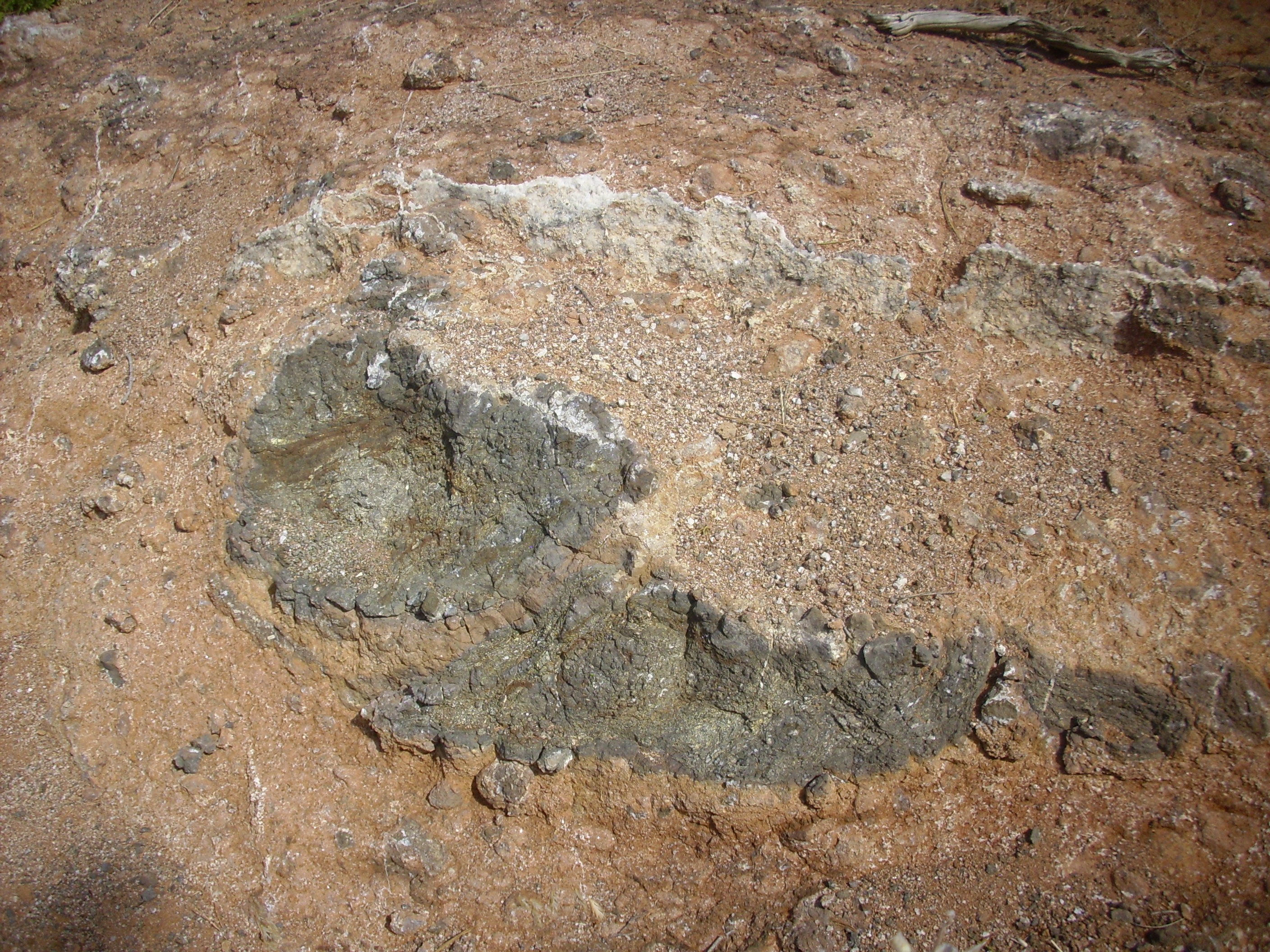
Hydromagmatic deposits. Near 36 07.924N 106 32.712W

Hydromagmatic deposits. Near 36 07.924N 106 32.712W
The continuing heat from the eruption and steam from groundwater tend to bake the whole mess together; in this case, the cement is largely calcite, which forms occasional large crystals.
Well, cool. Time to get going; it was growing late in the afternoon. I hiked back to Clownie the Wonder Car and headed back off the plateau, stopping at a trail that (purportedly) would take me to an exposure of Morrison Formation. Along the trail, I ran into several large chunks of chert, amorphous silica, which I identified as Pedernal Chert, seeing as how I was practically at the foot of Cerro Pedernal.
Pedernal Chert. Near 36 10.227N 106 32.176W
Using a GPS receiver, I worked my way to the exposure, only to find (as is too often the case!) that I was on a high ledge from which there was simply no safe way to get closer. I reminded myself that I am 53 and aspire to reach 54, and settled for a photograph of the Morrison Formation.
Morrison Formation in upper Mushroom Canyon. Looking east from 36 10.282N 106 32.116W
The Morrison Formation is a fluvial sandstone about 150 million years old. Here the Morrison Formation is easily eroded multihued sandstone.
I made one final attempt to get at the Summerville and Morrison Formations, by climbing over a ridge to the north rim of Mushroom Canyon. However, there just wasn’t enough time. I settled for a couple of photographs coming back into Mushroom Canyon.
Summerville Formation in Mushroom Canyon. Looking southeast from 36 10.662N 106 32.947W
The gray beds to the left, just peeking over the foreground ridge, are Todilto Formation. Above are the pinkish tan beds of the Summerville Formation. The very top of the ridge is a thin bed of Morrison Formation. The gray bed in the roadcut is Entrada Sandstone while Cerro Pedernal looms on the skyline.
Summerville Formation is also exposed on the north rim of the canyon.
Summerville Formation in Mushroom Canyon. Looking southeast from 36 10.662N 106 32.947W
The entire skyline here is Summerville Formation. You can see that it dips slightly to the east (right), as do the underlying beds of Todilto Formation and Entrada Formation.
Those photographs are going to have to do. I’ve been here three times already and there is so much else to visit that I don’t plan to come back again, unless it’s with visitors.
On the way back home, I took a few photographs of stuff I had already photographed, in case the lighting turned out to be better for highlighting interesting features. (In general: No.) I did get one nice shot of Polvadera Peak from the northwest, around the Canones area, with bluffs of Bandelier Tuff in the foreground. I’ll finish with that.
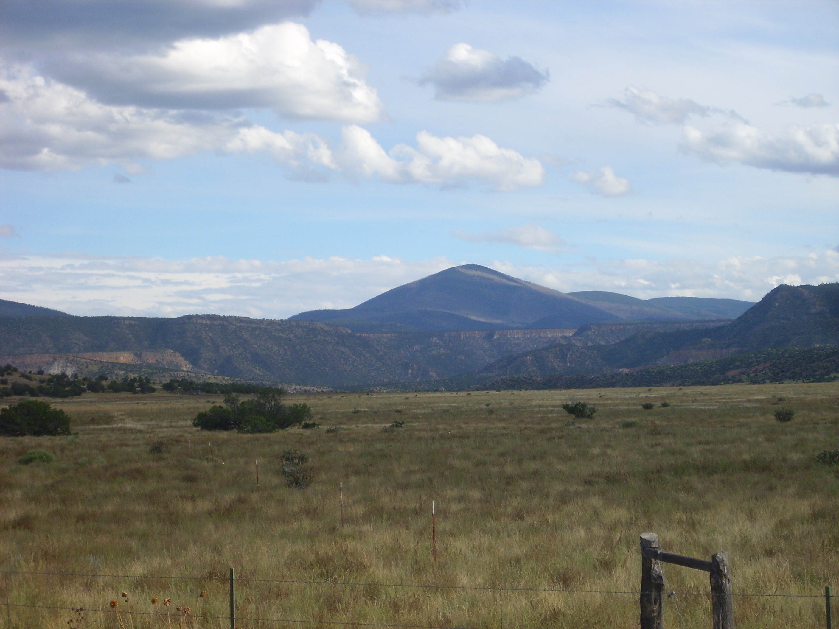
Bandelier Tuff below Polvadera Peak. Looking SSE from 36 13.931N 106 28.821W
I love living here.
Copyright ©2015 Kent G. Budge. All rights reserved.