Ticket to wanderlust
This is going to be a twofer.
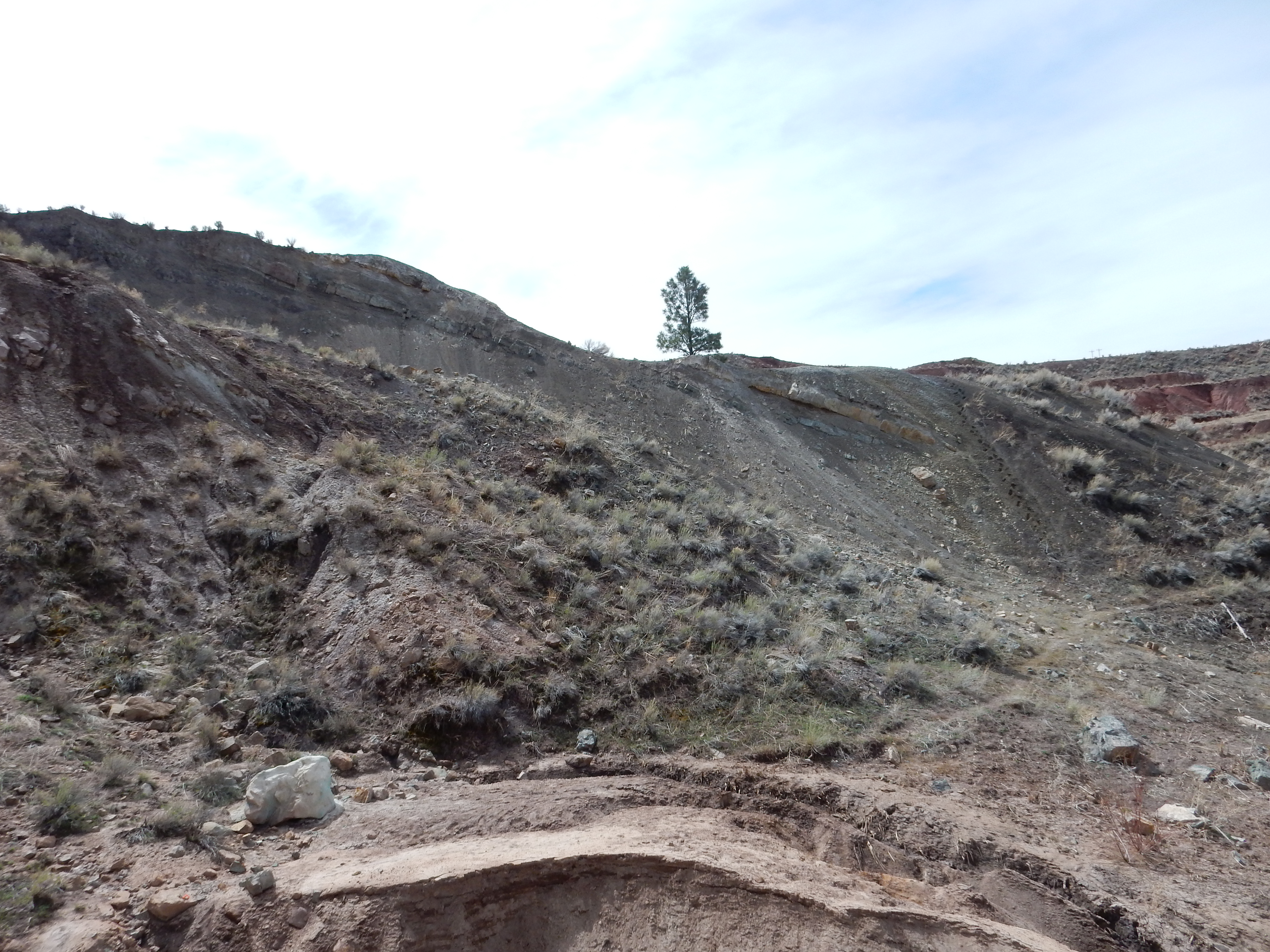
I was going to take Thursday the 30th off for my birthday, but my department scheduled a meeting with guests from out of town that I couldn’t get out of. Friday the 31st, my actual birthday, I had off already on my 9/80 work schedule, and I had a very nice adventure that day, thank you. I took Monday off to just putter around and relax, but my relaxing ended up including a short trip to Los Alamos for some car work, and on the way I stopped to hike the short trail to the ruins of the Duchess Castle on the Tsankawi section of Bandelier National Monument.
This trail begins south of the parking area along State Road 4. There is no proper gate, just a section of fence easily crawled under. Don’t cross into the Department of Energy land to the west by mistake, and don’t take your dog. (There are large signs on the fence warning of a $100 fine for doing so.) However, the trail itself is fairly clear.
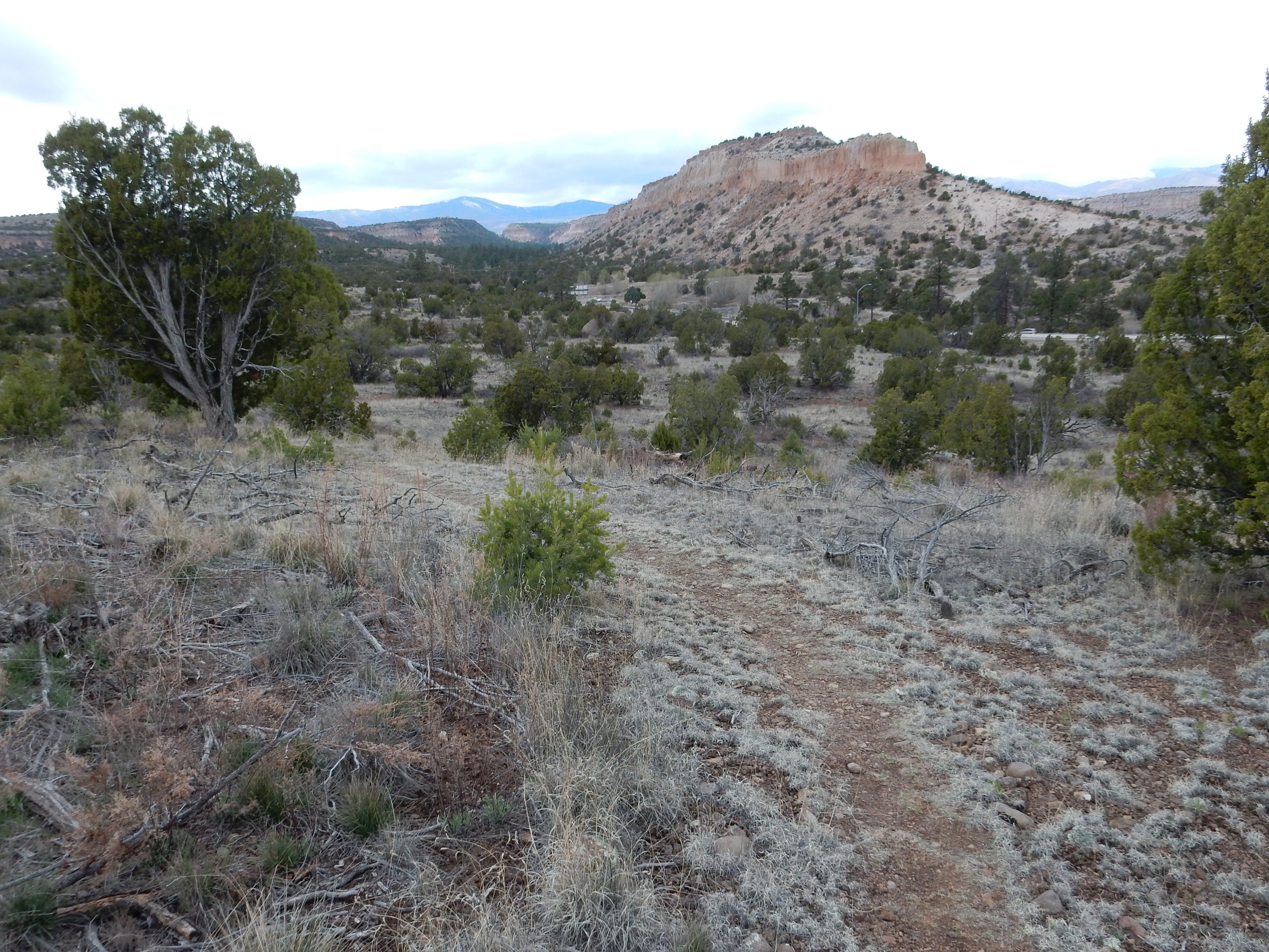
It is not a great distance to the ruins.
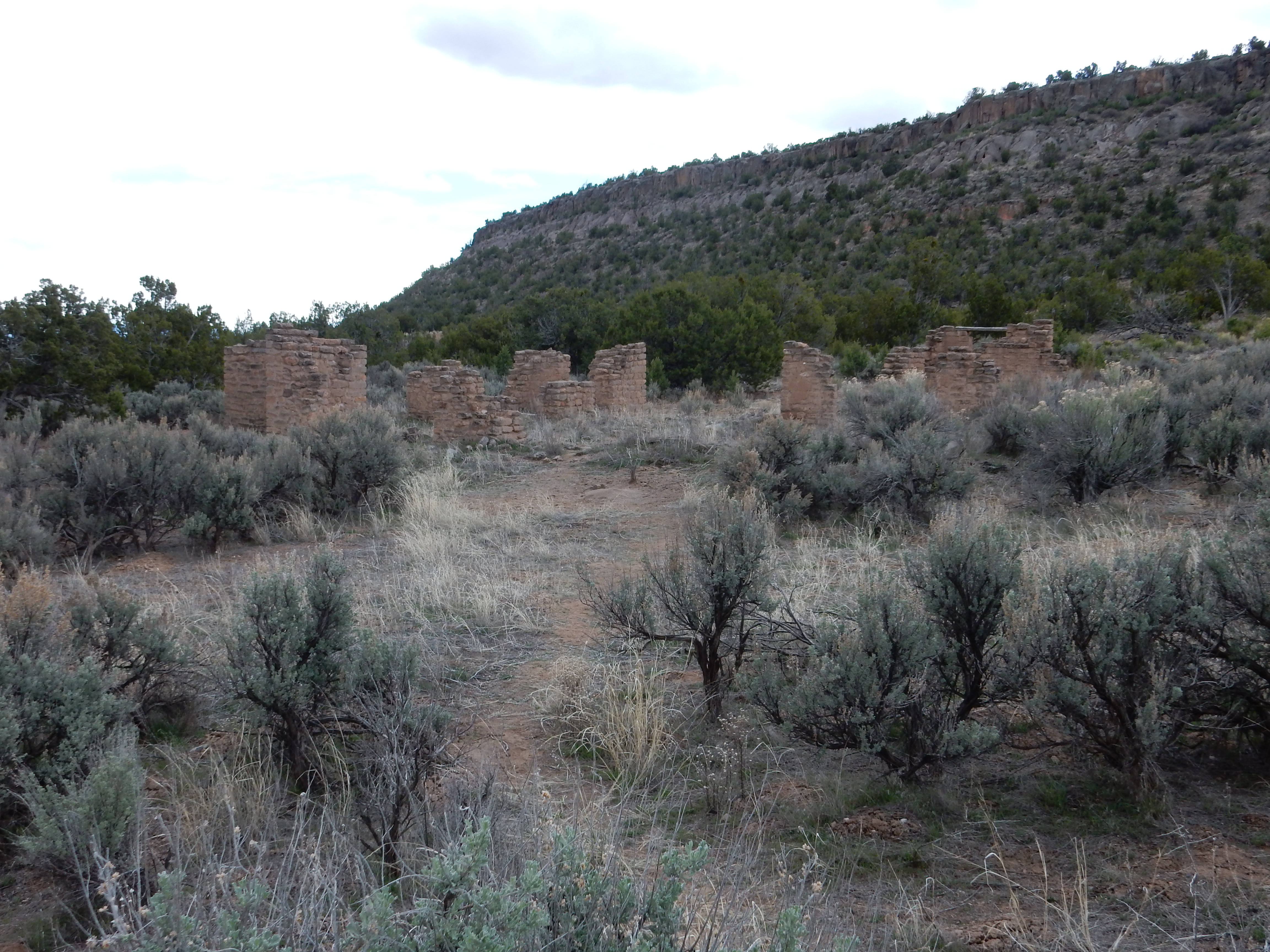
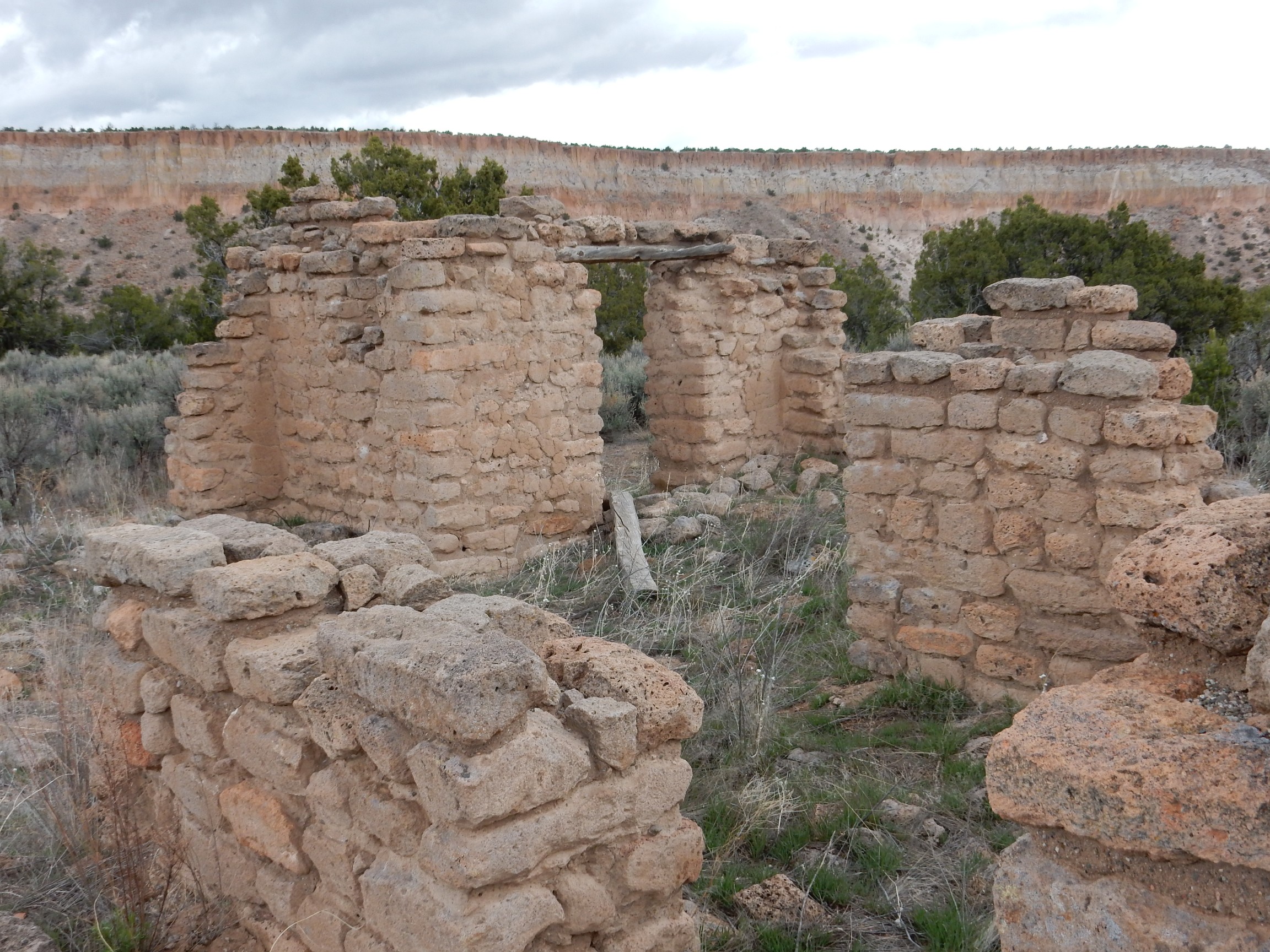
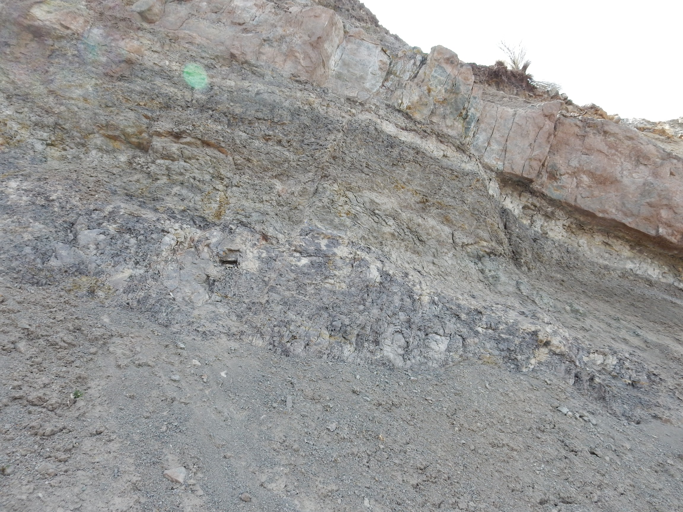
The Duchess Castle was constructed for Vera von Blumenthal and her friend Rose Dougan in 1918. (Vera was actually a baroness, not a duchess, but the name has stuck.) The “castle” was actually living quarters and a school, built to educate the local Pueblo peoples in how to refine their pottery techniques to increase their commercial value and help lift the pueblos out of poverty.
It’s a reminder of the high idealism of Western culture that was devastated, along with much of Europe, in the First World War.
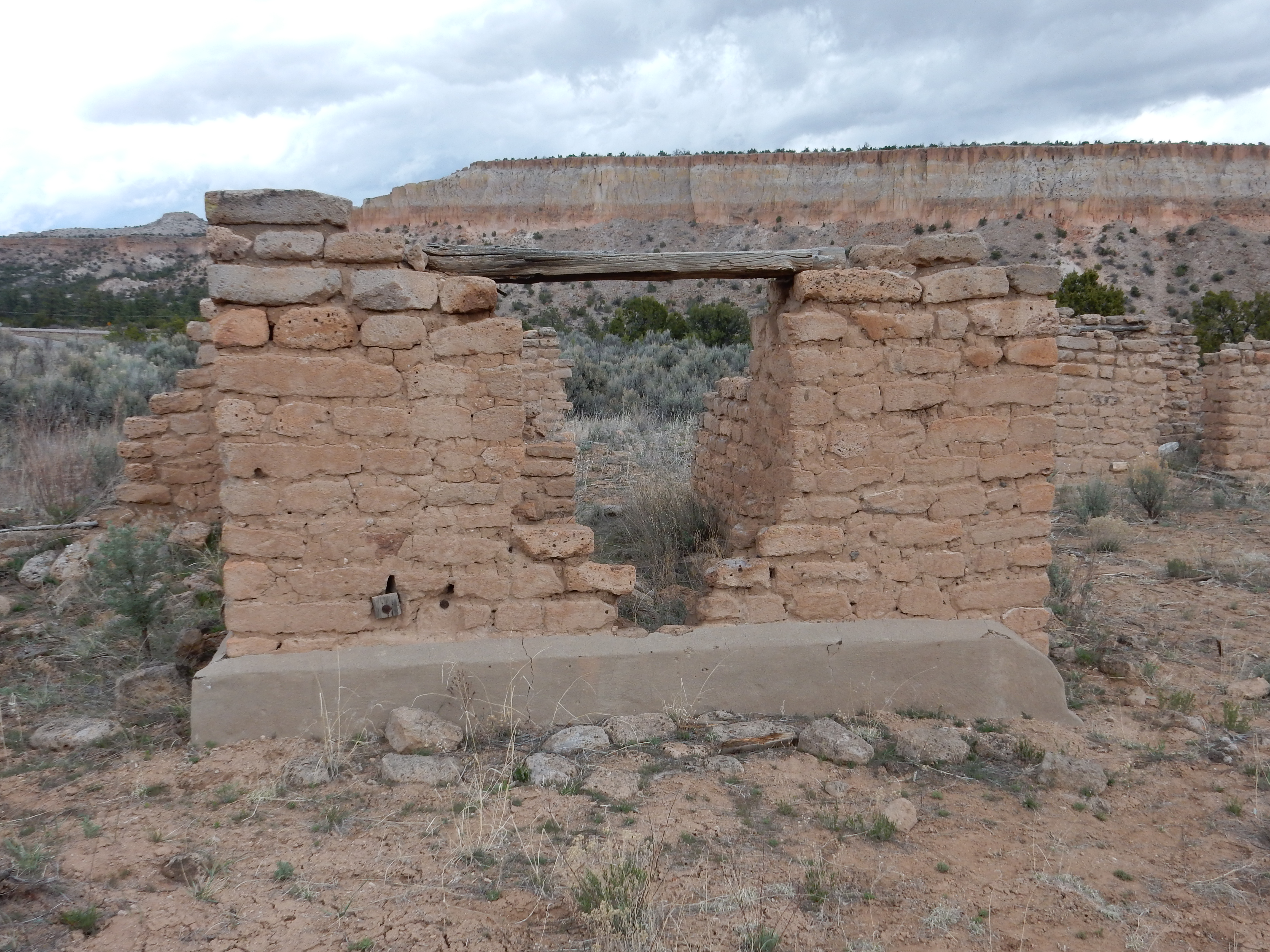
The construction is shaped tuff blocks with mud mortar and some wood beams. The concrete at the base of the walls looks new and was almost certainly added for better preservation by the Park Service.
A nice little hour side trip.
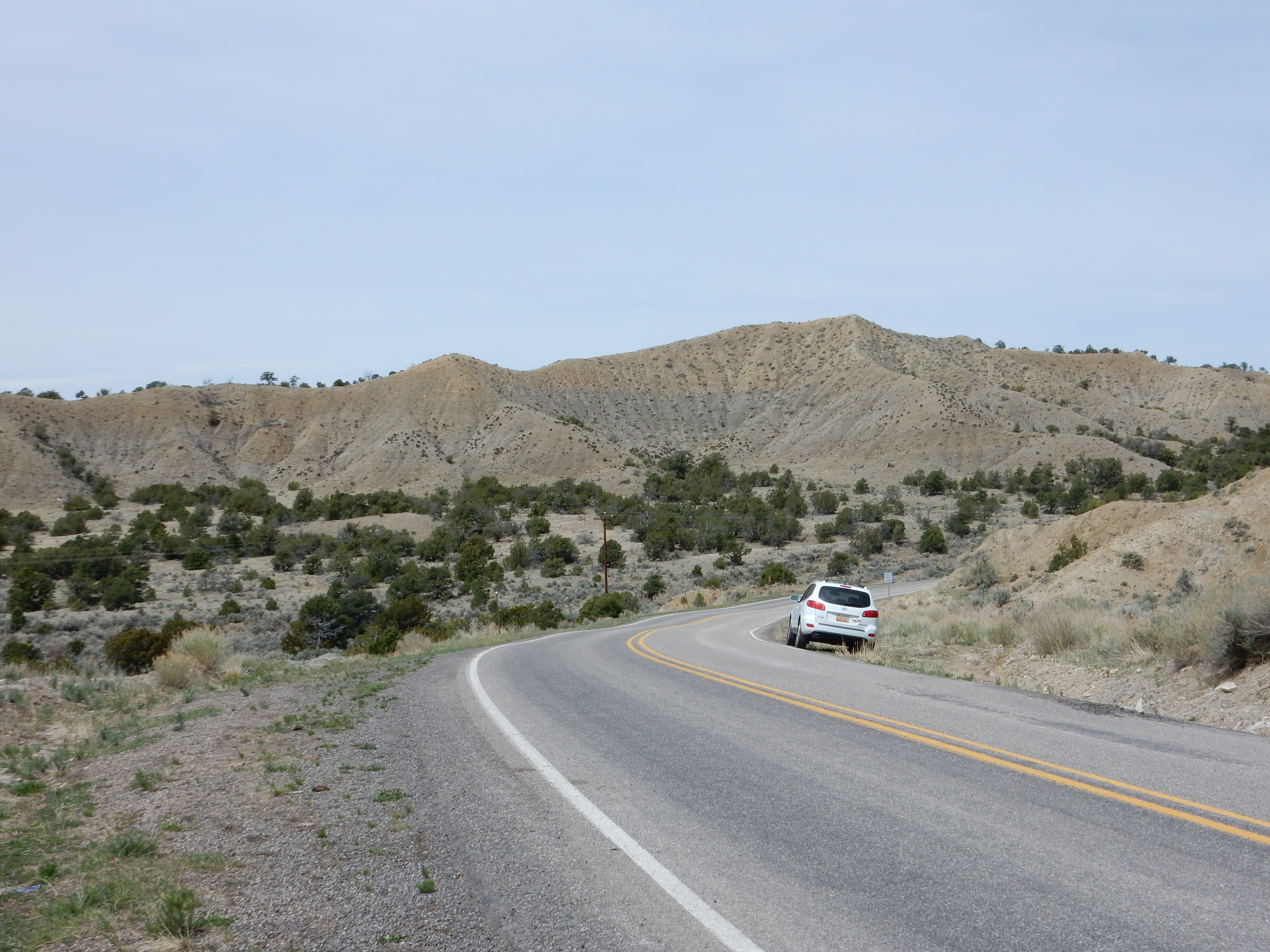
Yesterday I took another trip to visit the Nacimiento Mine with the Los Alamos Geological Society. This would be my second visit. (The first is recounted here.) This got off to a fairly rotten start when I missed seeing a couple of speed limit signs on State Road 4 in Canyon de San Diego and roared into Jemez Pueblo doing better than 50 MPH — right in front of the local police officer.
It’s easy to get lost in the scenery there, but when I found myself in the middle of the pueblo I wondered if I had missed a speed limit change. About then I saw the flashing lights in my rear view mirror. Yup, seems so. All things considered, he was fairly easy on me, but I felt pretty rotten, as I probably deserved to. First speeding ticket I’ve gotten in 38 years.
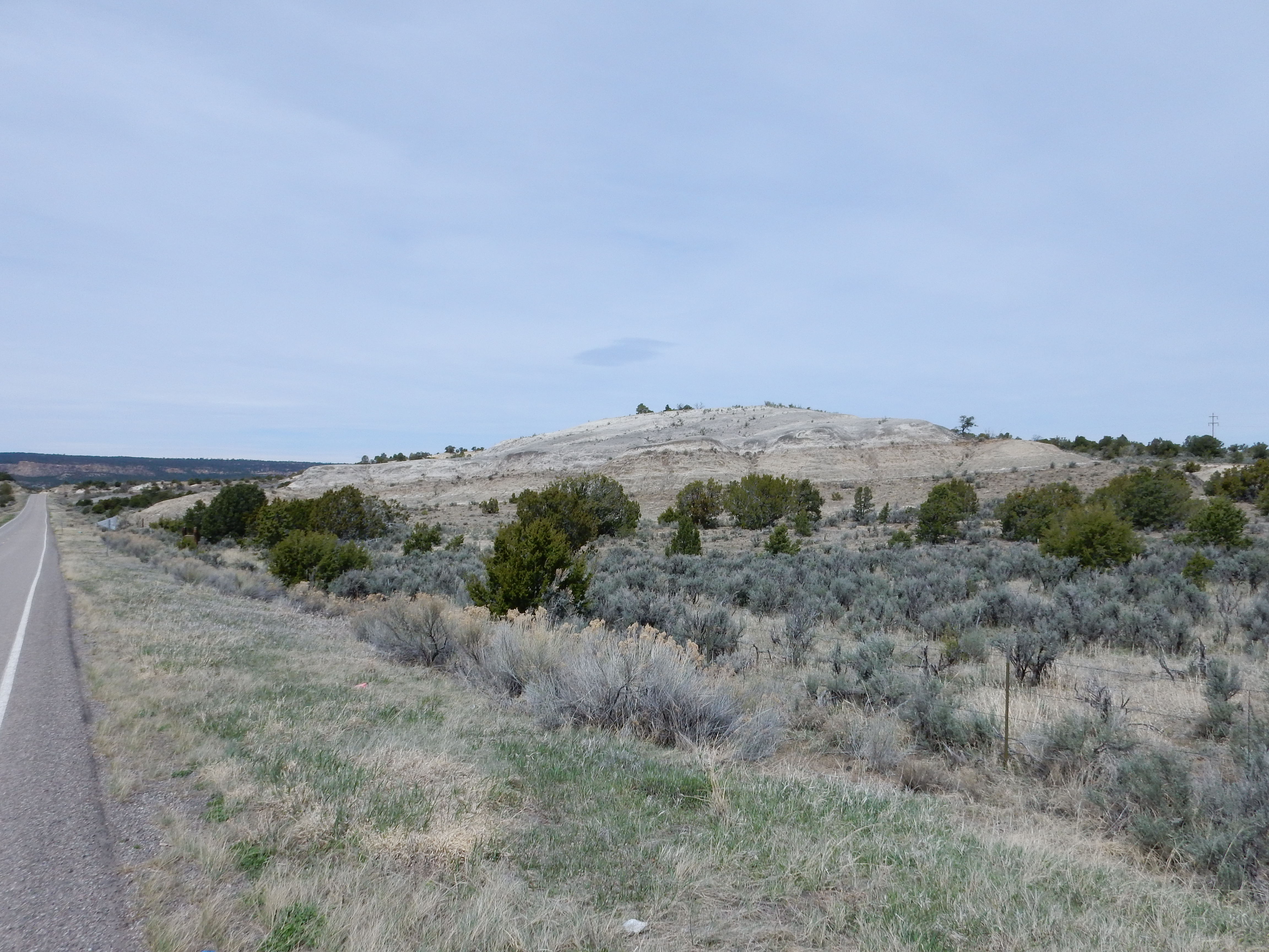
I felt pretty subdued the rest of the drive to Cuba, which was territory I’ve explored before in any case. My first photograph was just south of Cuba, where Mesa De Cuba came into view.
The mesa is underlain by San Jose Formation sandstones and conglomerates forming a cap over softer shales of the Nacimiento Formation. Both are Paleogene in age, between 64 and 61 million years ago for the Nacimiento and the San Jose somewhat younger.
I was a bit late, but caught most of Patrick Rowe’s introduction to mineral collecting at the mine. He mentioned something I don’t recall from the last time: Part of the reason the mine was closed was that a small earthquake in 1973 caused part of the slope east of the open pit to collapse, and stabilizing the remaining slope would have been prohibitively expensive. Other reasons I already knew about included the drop in copper prices due to rich deposits being mined in Chile, and the cost of continuing to pump out ground water that was seeping into the pit.
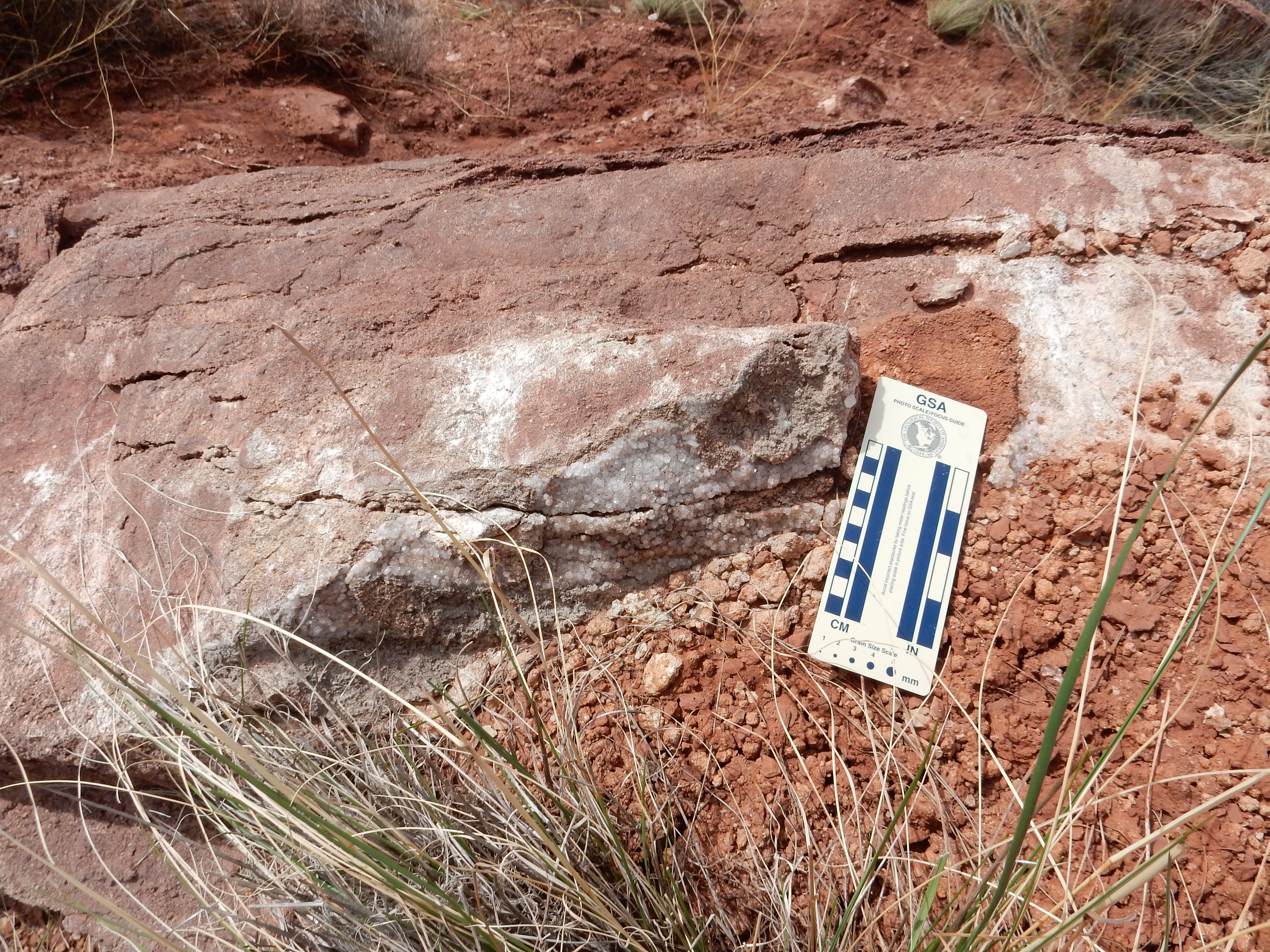
My day didn’t get much better right away. Following Patrick’s directions, I headed towards some shale beds (probably Salitral Formation) where one might, if lucky, find pyrite concretions. I stepped onto what looked like a solid, sandy stream bed and discovered it was very wet clay, into which I sank up to my ankle. I uttered some trenchant comments on the situation, clambered up the shale beds, and scouted around. I never found a pyrite concretion, but at least I saw some interesting sedimentary structures in the Shinarump Formation sandstone beds.
This I’m not sure what is.
Possibly raindrop impressions.
I tagged along after Patrick Rowe, and found myself in an area rich in blueberry concretions.
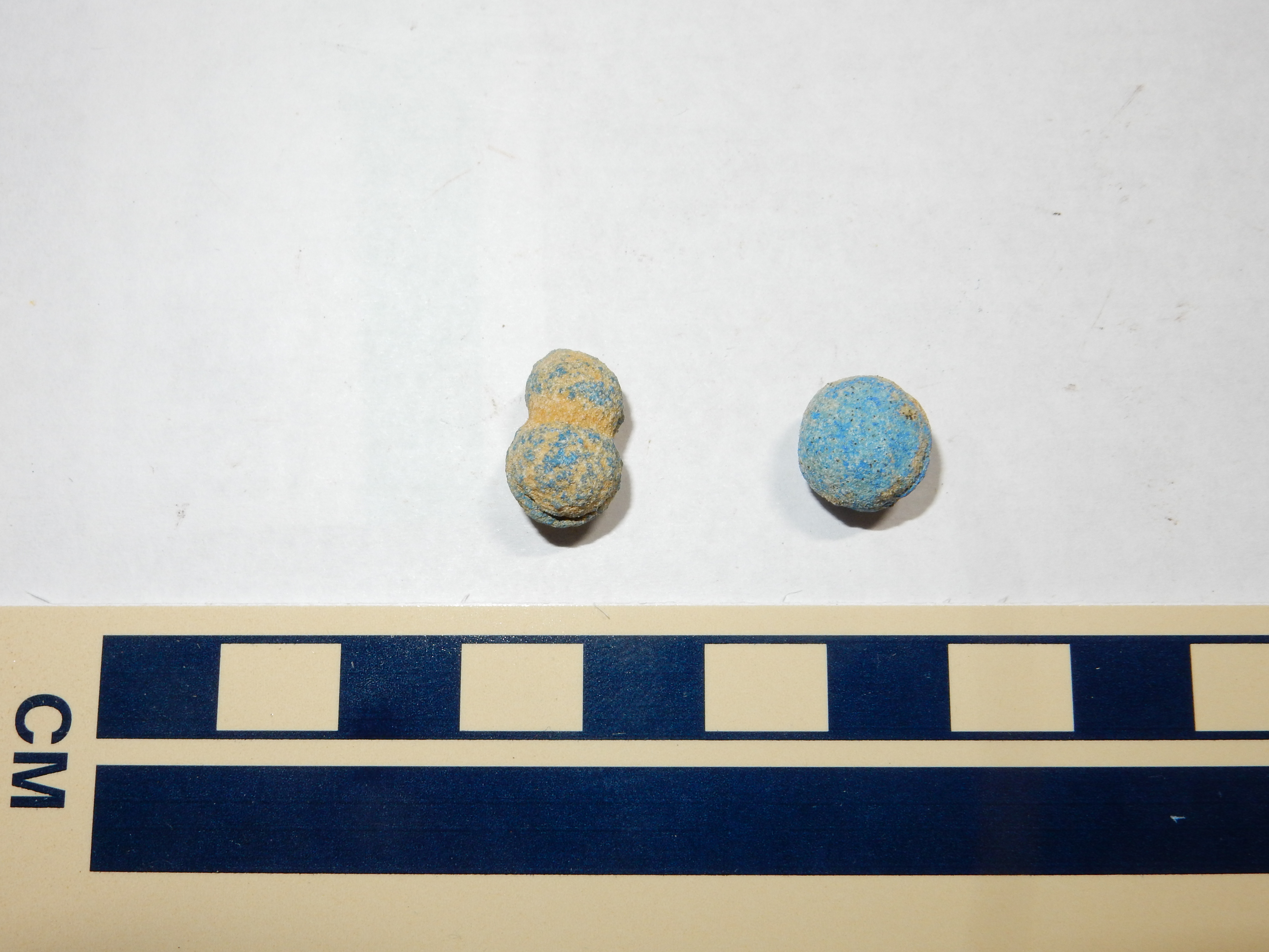
These are concretions colored by azurite, a secondary copper carbonate mineral. These likely formed very recently, in the rock disturbed by the mining operations. They are therefore, in some sense, not “natural” minerals. However, they can form in areas disturbed by natural processes, and have famously been found on Mars by robotic explorers.
Nearby Patrick pointed out the stakes marking the corners of a mining claim. My original reason for tagging along with him was to learn what a properly staked claim looks like, so that I would recognize it (and not inadvertently “jump” it by collecting rock specimens) if I ever came across one on one of my wanderlusts.
Not far away was a slab of sandstone with a crust of clear crystals.

I’m not 100% sure what this is. My first assumption was calcite, but a nearby rockhound commented that I’d found some nice quartz, and that made me wonder. The crystal seems willing to be scratched by a knife (making it too soft for quartz) but it didn’t foam when vinegar was poured on it. My guess is this is in fact calcite (nailhead spar) and my vinegar bottle is getting a little superannuated.
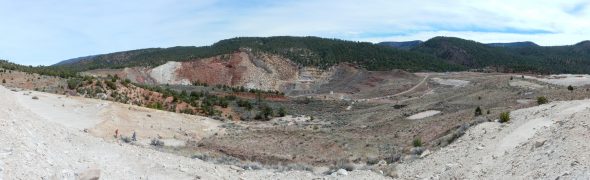
Nearby was a nice spot for a panorama of the mine.

At left is some of the rubble from the collapse following the 1973 earthquake. The red area in the right foreground is Permian Yeso and Abo Formation beds uncovered when the mining operations stripped the overlying Shinarump Formation, the principle ore-bearing formation of the mine. The red beds across the open pit (now filled with groundwater) are probably Painted Desert Formation.
Most of the ore formed by replacement of buried woody debris by chalcocite, a copper sulfide mineral. Some of this was later oxidized to form the beautiful green and blue copper carbonate minerals (malachite and azurite) sought by collectors. I’ve posted pictures of these from my first trip to the mine.
A layer of unusually coarse conglomerate in the Shinarump Formation.
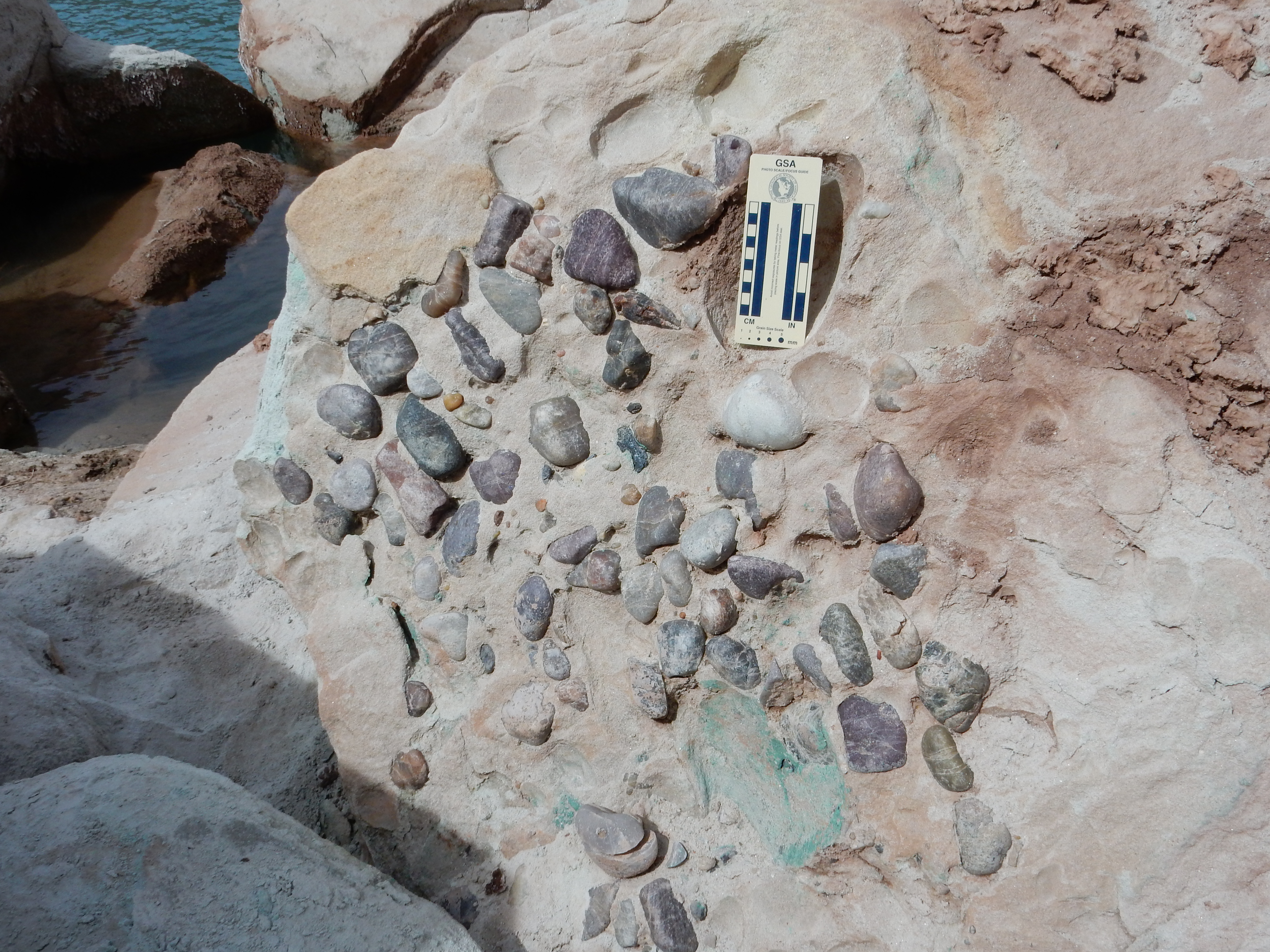
The rounded clasts (pebbles) were probably eroded off the Uncompahgre Uplift, which stood to the north some 230 million years ago. The Uncompahgre Uplift was subsequently eroded flat; bits of rock like these are the only remaining trace of this ancient highland. Note the green stains of malachite towards the bottom.
These may be flute casts.
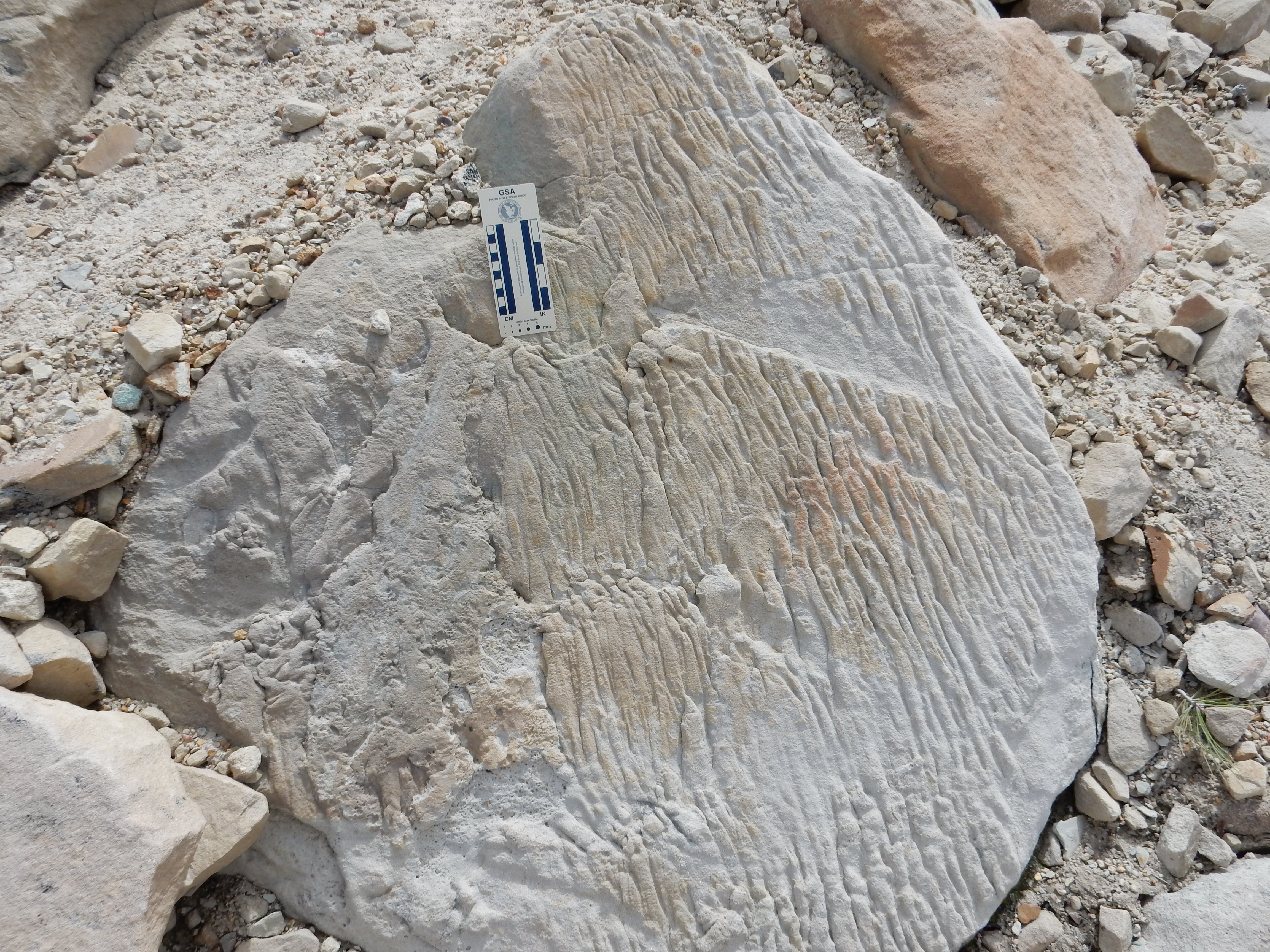
Flute casts are a form of sole mark, formed by water flowing over the surface of a mud bed and eroding channels in the mud. These are then filled in with sand or silt. If these are flute casts, then the face of the boulder here was once at the bottom of the bed and the flow was towards what is now the bottom of the boulder. However, the boulder has obviously been disturbed (it is part of the landslide area) so it’s not possible to reconstruct the original orientation and flow direction from this example.
I keep saying “if” because I’ve never seen flute casts before. I’m still learning a lot about geology.
South is the area where I looked in vain for pyrite concretions. The beds here are a very weak shale, probably of the Salitral Formation.
There were lots of roundish structures in this bed, but they all proved to be nothing but clay when I picked at them.
Atop the beds was what was left of a petrified log.

Most of the broken bits at the center of this photograph are bits of petrified wood, like these:
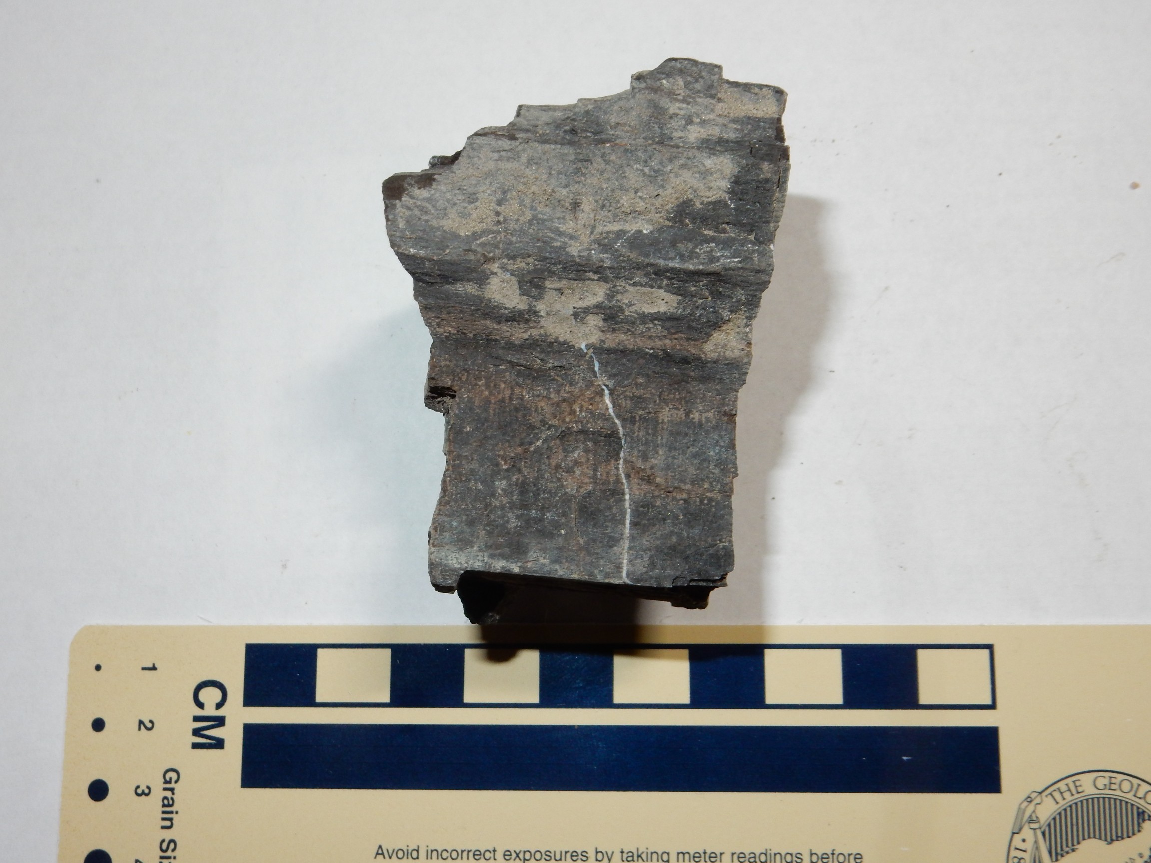
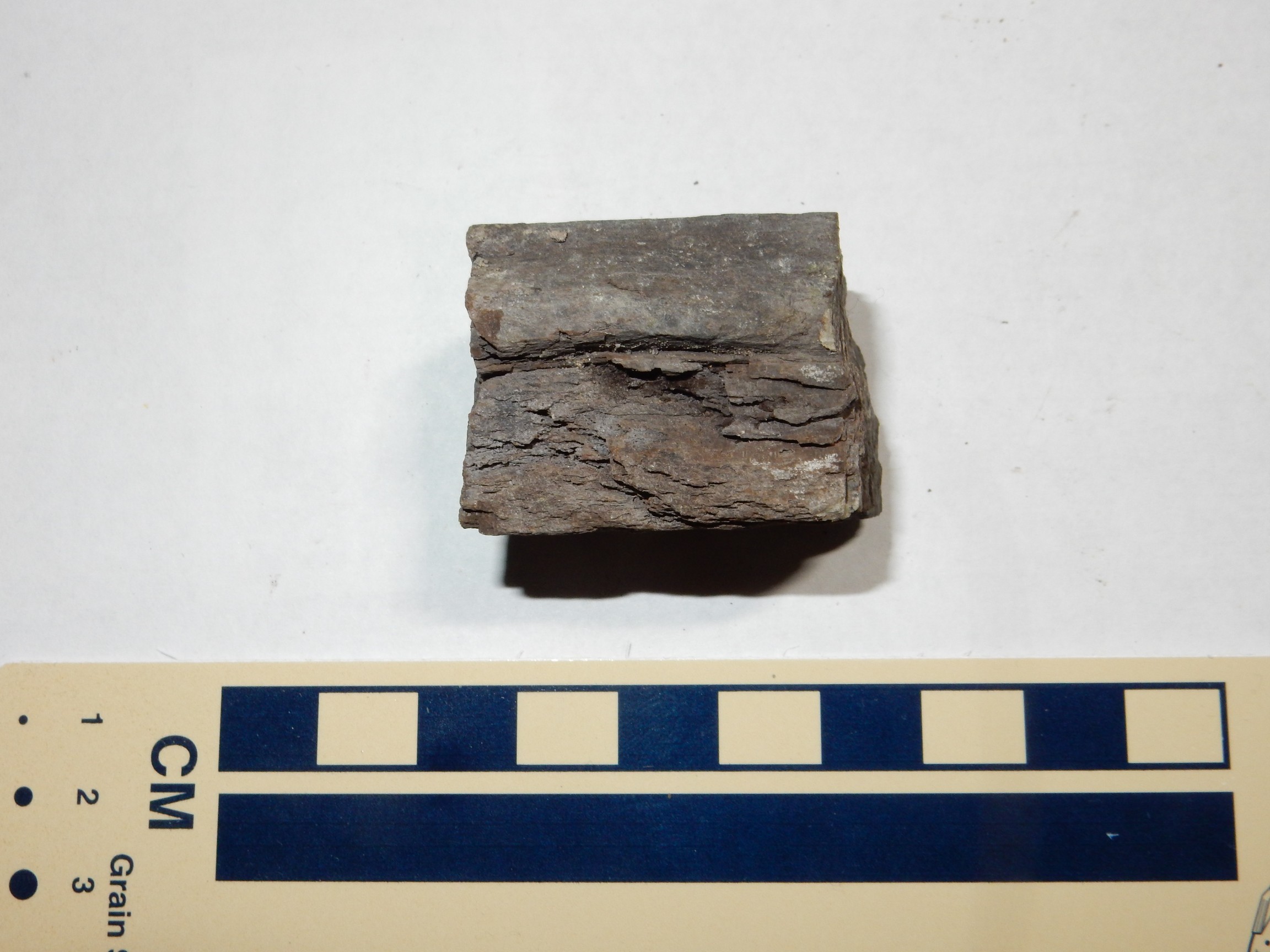
Patrick Rowe expressed disgust when I mentioned this to him. Apparently this was once a fairly impressive petrified log, which someone smashed up because it was too heavy to take out intact. I got the impression that Patrick thought he knew who had done it, too. Rockhounding seems to be a vocation where the more avid practitioners all know each other and you rapidly acquire a reputation.
I headed back to my car, dropped off the rocks I’d collected so far, and headed west, to one of the tailings piles I didn’t visit my first time here. There was a big chunk of sandstone with blueberries on its face.
Pretty, but not one to take home.
From atop the tailings pile, there was a wonderful view to the west.
And to the east, across the mine area.
Before leaving, I decided to take a careful panorama, with the tripod, of the immediate mine area from a particularly good vantage.

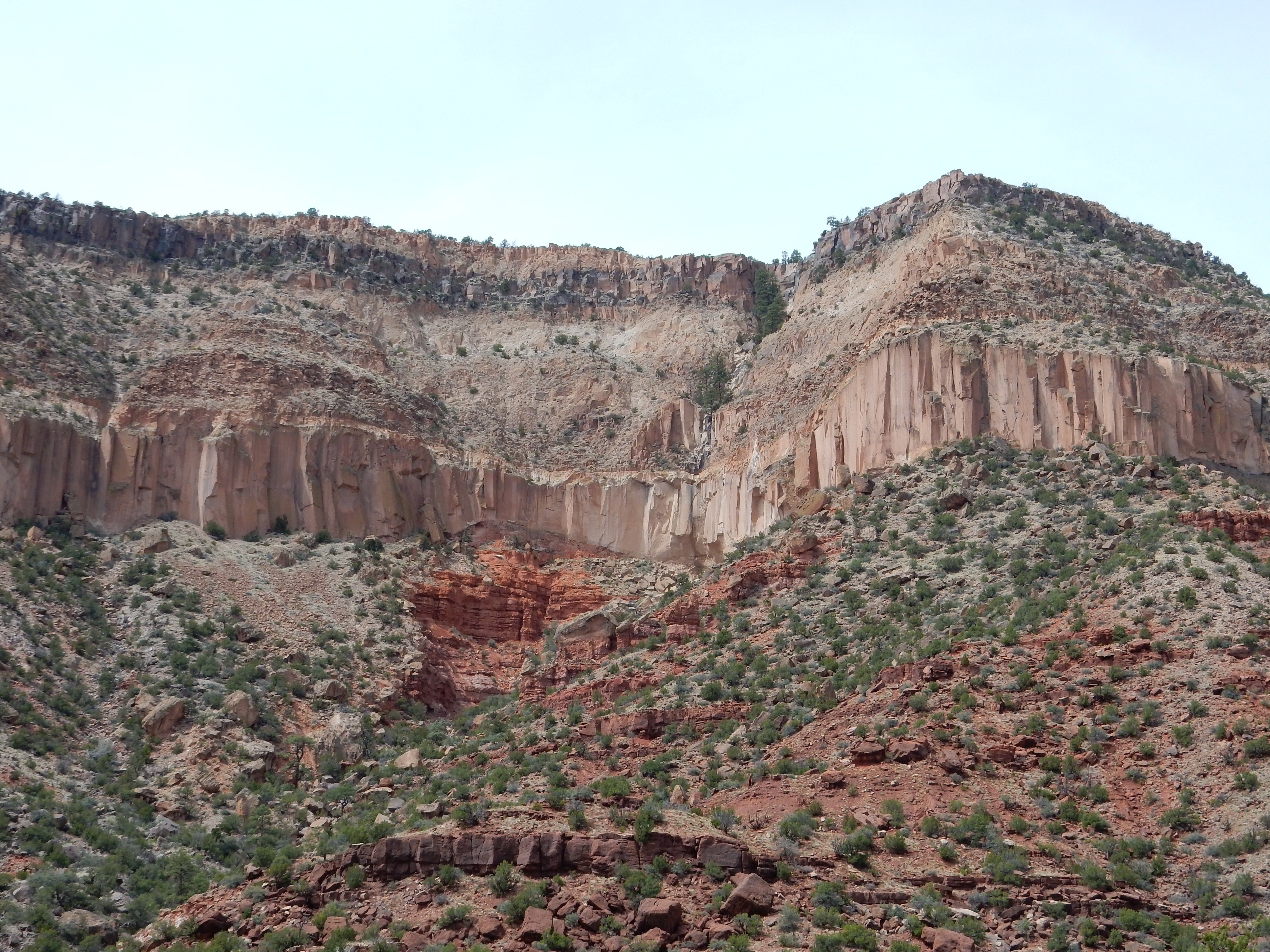
It was time to head back. I stopped along the road to Cuba at a particularly nice road cut.
To the right is Menefee Formation, which in some locations includes thick coal beds. Here the carbonaceous beds are thin and not very pure. At left is the La Ventana Member of the Cliff House Formation. Both formations are Cretaceous in age. The Cliff House is the younger formation; deformation along the Nacimiento Fault, a major fault to the east, has deformed the beds so much that they are slightly overturned here.
To the west are bluffs of the Lewis Formation, a Cretaceous marine shale formation.
I am sometimes pretty down on marine shales, which tend to form low, drab hills that turn into mud at the least excuse, but darned if the beds here aren’t almost pretty.
The next stop was at a knoll of Kirtland/Fruitland Formation.
These are the youngest Cretaceous formations in the San Juan Basin. They’re lumped together on the geologic map of this area which, as you might guess, means they’re hard to tell apart in the field. I don’t know which is which here.
You may have noticed the rocks getting progressively younger as I head towards Cuba from the Nacimiento mine. This is a consequence of the tectonic deformation along the Nacimiento Fault, which brings older beds to the surface closer to the fault.
I grabbed some Alleged Chicken McNuggets and gasoline at Cuba and headed on back through the Jemez, watching my speed quite carefully. Darned if, now that I was looking carefully for them, the speed limit signs weren’t more elusive than ever. I found myself with cars backed up behind me a few times as I erred on the side of slower speed. (I also pulled over to let them by periodically.)
Virgin Mesa was looking particularly good.
The dark red beds at bottom are lower Permian Abo Formation, deposited in a river flood plain. The orange beds near center are slightly younger Yeso Group; my map does not distinguish the two formations of this group, San Ysidro and Mesita Blanca, but the thin beds suggest Mesita Blanca, which is another fluvial (river-deposited) formation. The thick columnar pink bed is the Otowi Member, Bandelier Tuff, from the Toledo eruption 1.61 million years ago, while the beds at top are Tsherige Member, Bandelier Tuff, from the Valles eruption 1.25 million years ago.
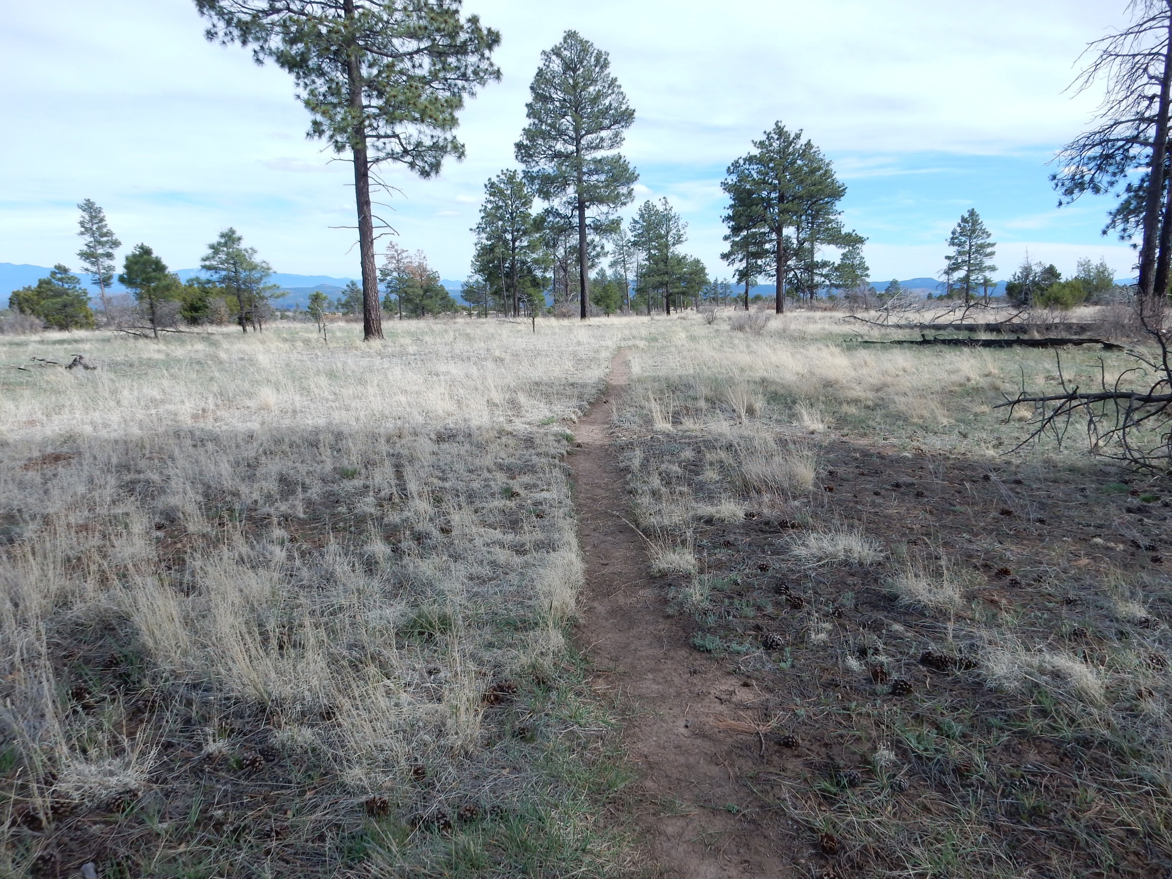
I had been driving much of the day and felt like I needed to do some walking. I had noticed that the geologic map for Frijoles quadrangle shows a very large number of archaeological sites, not known to the average visitor to Bandelier, and some were close to the Burnt Mesa Trail. This looked like about the right length of hike, so I parked at the trail head and headed out.
Based on my recollections of the map, I wondered if this was the first archaeological site.
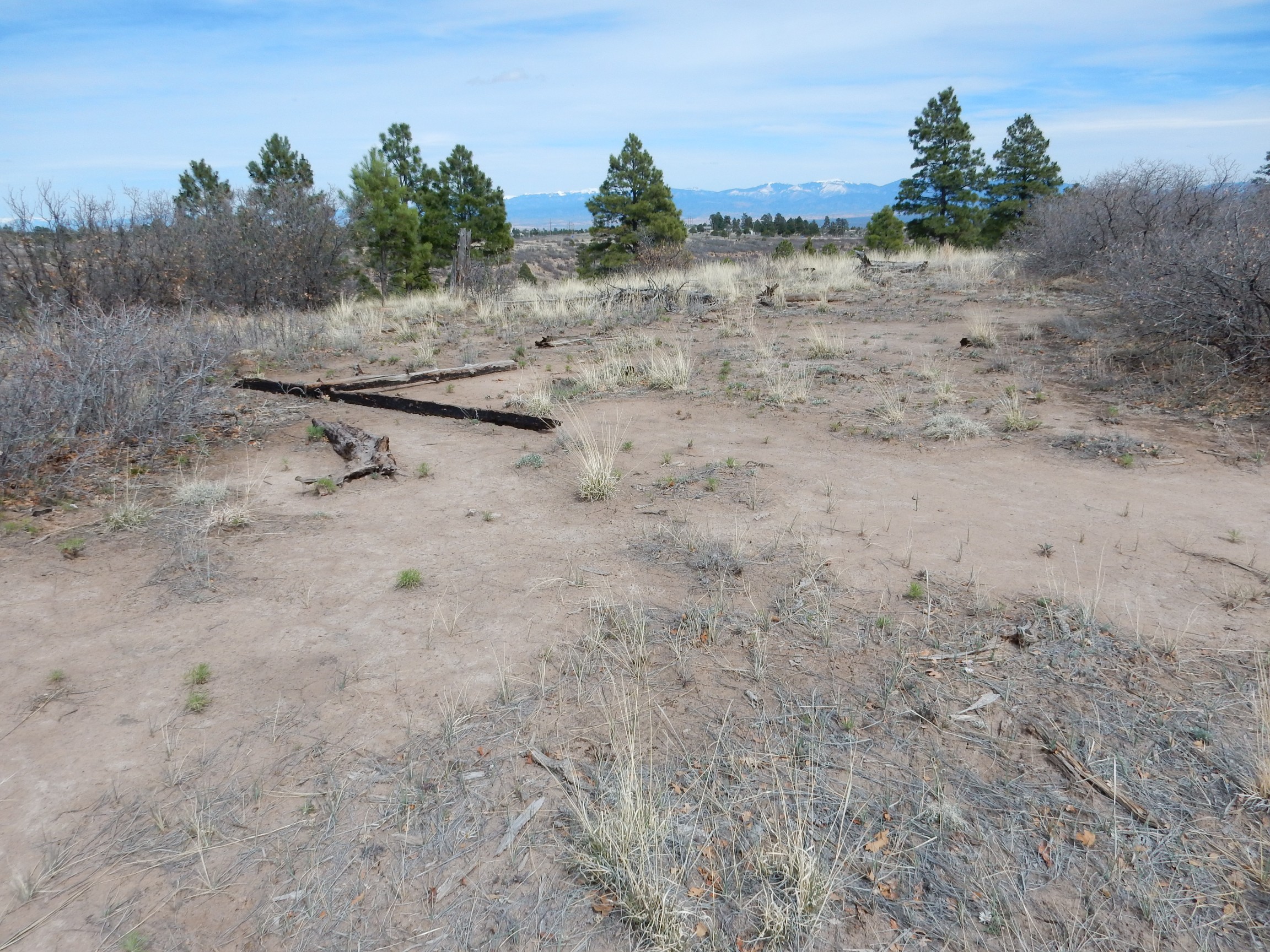
The location turns out to be about right, but I saw no obvious signs of ruins. There was a pile of broken tuff nearby:
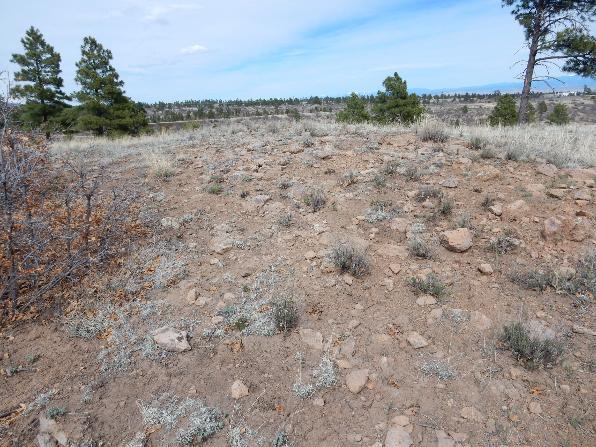
but none of the tuff boulders appeared to have been shaped. Still, the pile of tuff here is distinctive enough that I’m guessing this is the archaeological site.
There’s no doubt about this one, though.
This was just off the trail, but I doubt I would have noticed it if I hadn’t been looking. I approached, being careful to not so much as kick over a rock close to ruins protected by the Antiquities Act.
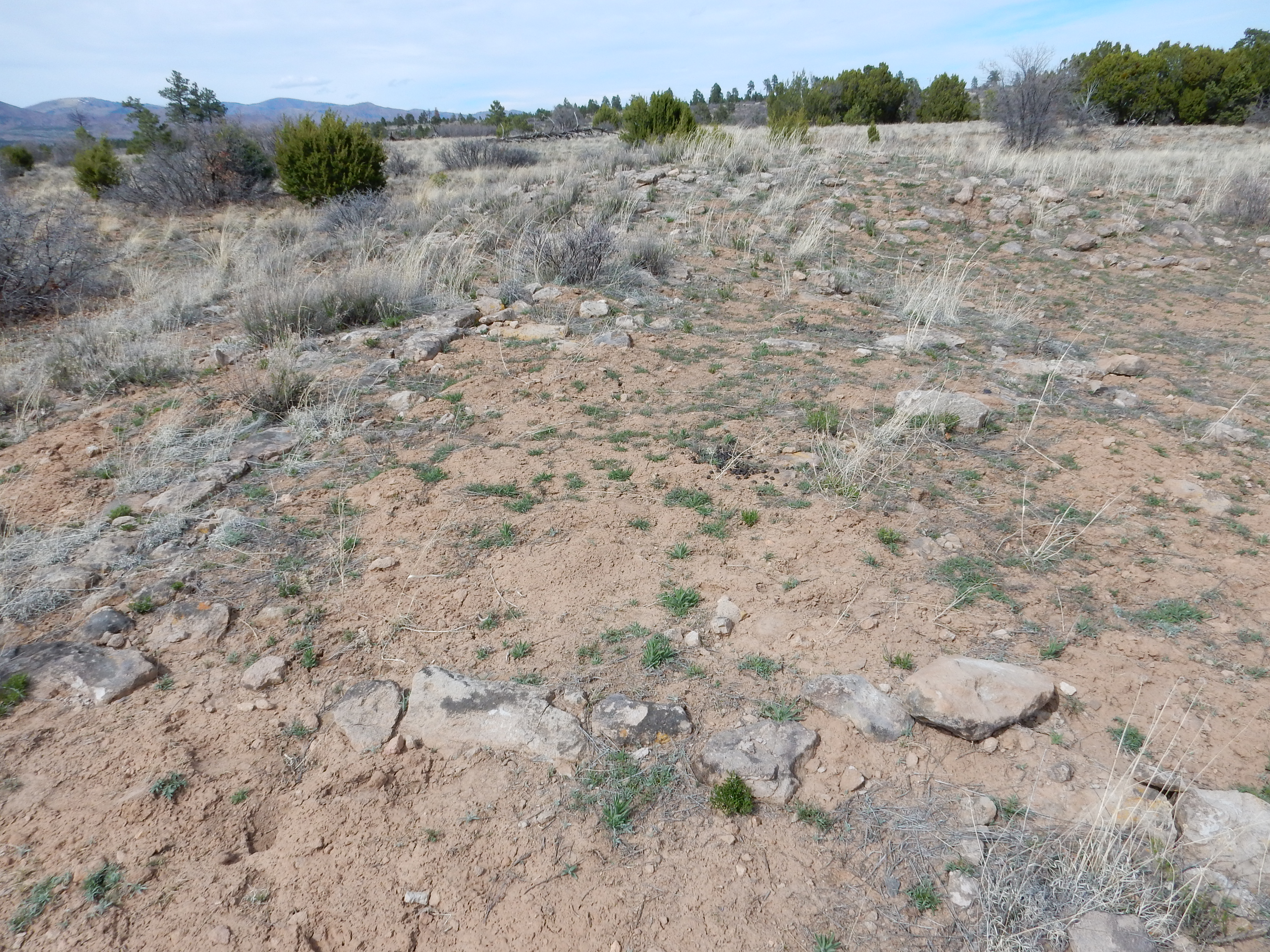
You can see the tuff blocks arranged in squares. The site looks a little large for a field house, but small for a village. I would like to have lingered and explored more, but I was anxious not to disturb the site.
Field house: This is a two- or three-room structure holding a single family and thought to be located right next to the ground they farmed. This is the earliest form of settlement found on the Pajarito Plateau, but field houses likely remained in use even after much of the population gathered into large pueblos like Tyuonyi in Frijoles Canyon. The mesa top is covered with patches of El Cajete pumice that helped hold water and nutrients: It is striking how known archaeological sites are concentrated on the mapped beds of El Cajete Pumice. The climate was likely also somewhat wetter in the 14th century, when the Tyuonyi culture was at its peak.
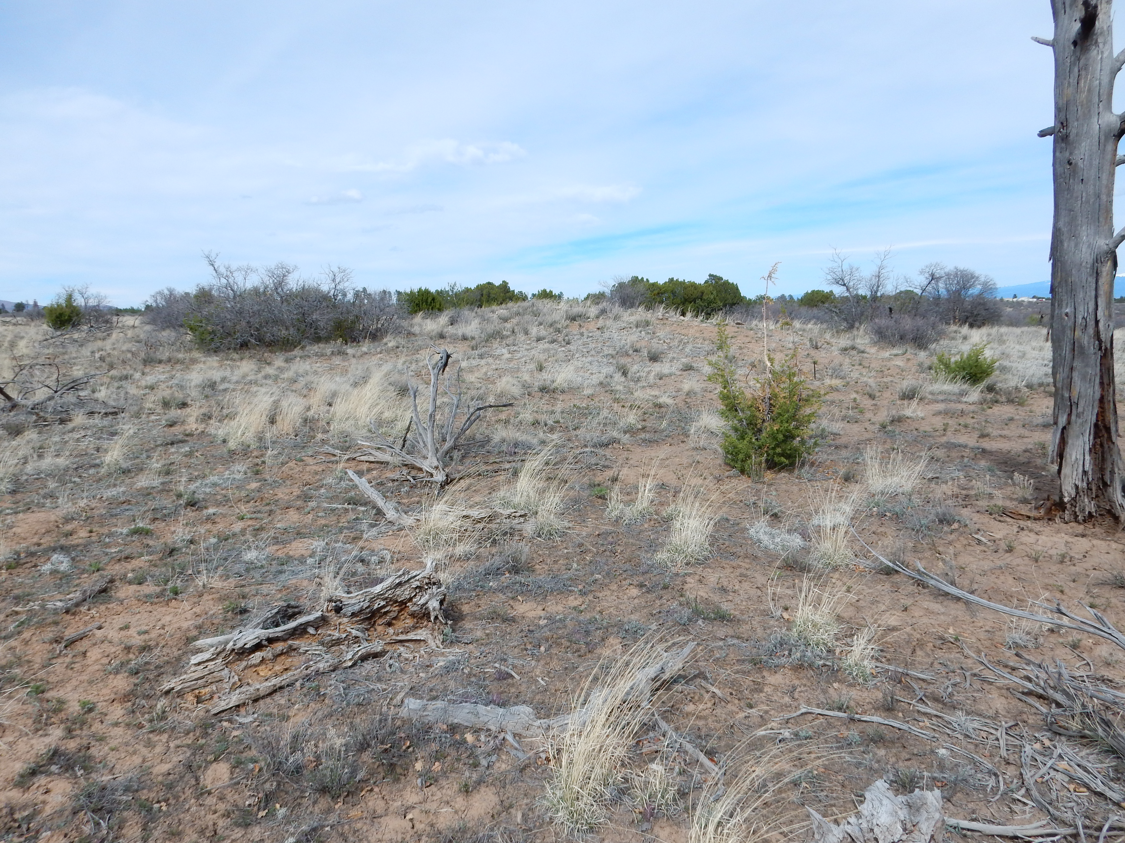
There was still trail ahead
as well as four more ruins (according to the geologic map) but I was out of time. I hiked back and headed home.
Pingback: Wedding wanderlust | Wanderlusting the Jemez