Wedding wanderlust
My niece, Jenni, got married this week in Logan, Utah. This is my brother Scott’s first child to get married, and I thought it was important to attend. Cindy could not come along (the usual difficulty with one of us needing to be here for the sick kids) so it would be a solo trip. And, while the wedding truly was the important thing, I figured that it was reasonable to do some wanderlusting along the way, inasmuch as I’d be driving through some of the most scenic areas of the country.
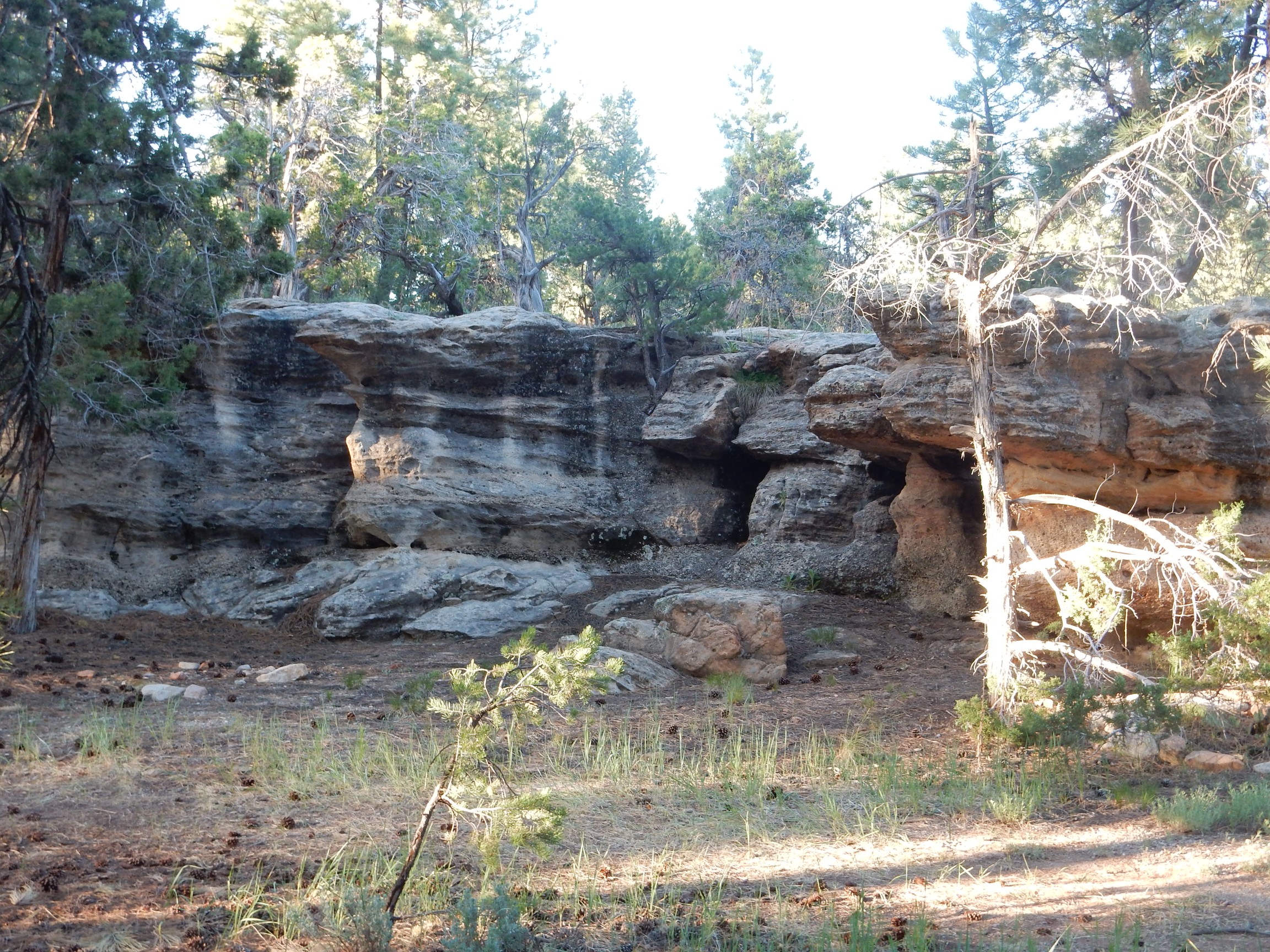
So I got up early Monday, packed everything I could think of that I had not already packed, and headed on out. I took the route through the Jemez to Cuba along Route 126; familiar country. The road is not paved over its entire extent but it is a good gravel road.
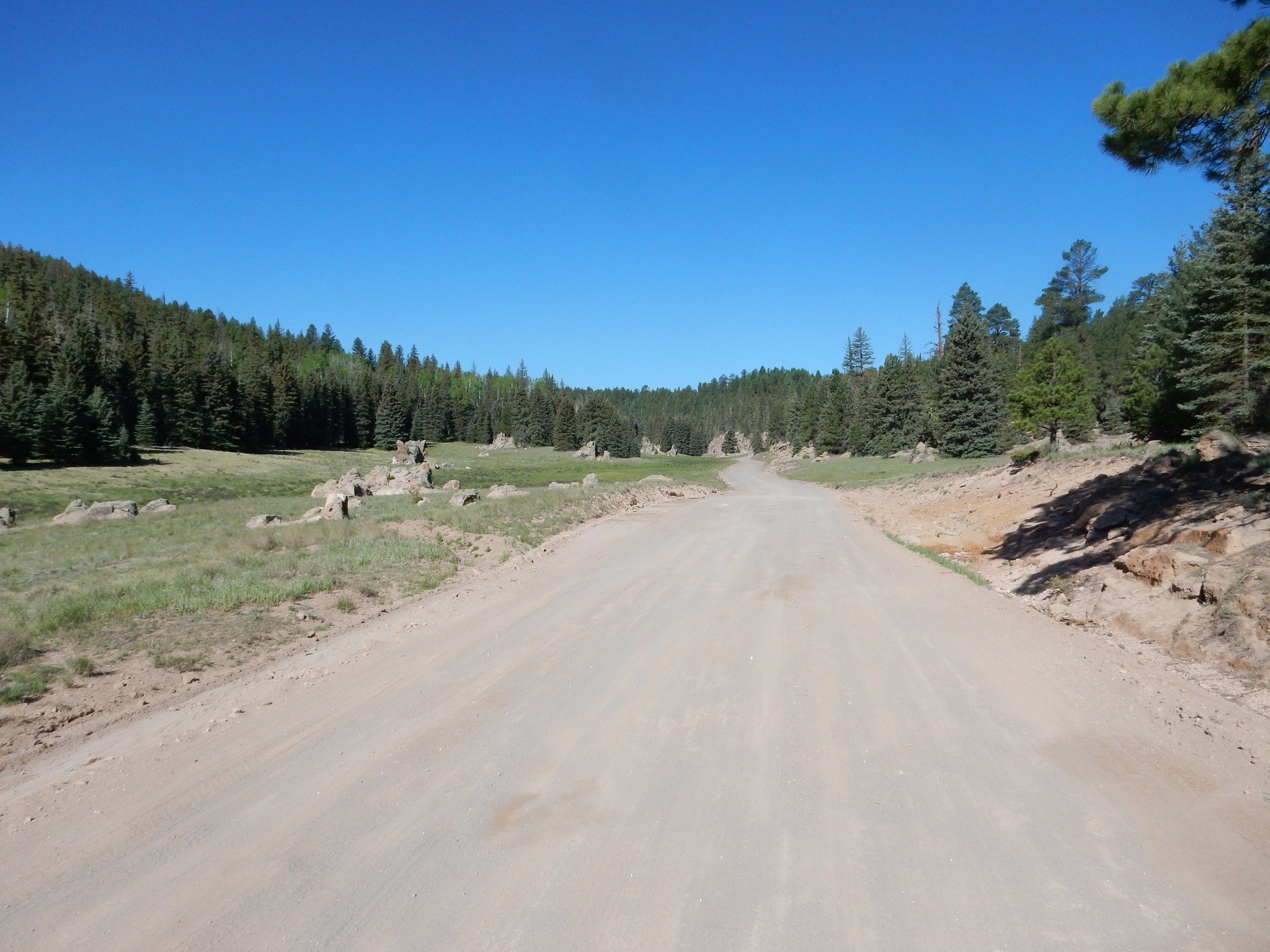
The rock outcroppings here are the Otowi Member of the Bandelier Tuff, formed by the Toledo eruption 1.62 million years ago. The surrounding ridges are capped by the Tsherige Member, formed by the Valles eruption 1.25 million years ago. Both eruptions laid down extensive outflow sheets, as geologists call them, of volcanic ash consolidated into a rock called ignimbrite. These layers of ash extend for many miles away from the central Jemez. The ash was erupted as a mixture of red-hot gas and ash particles that flowed along the ground almost like a liquid, which geologists call pyroclastic flows.
Ignimbrites are also commonly called tuffs (hence Bandelier Tuff) but tuffs also include ash beds formed from volcanic ash reworked by water. The term ignimbrite is more specifically tuffs formed from pyroclastic flows.
Further down, the road descends below the level of the Bandelier Tuff to the much older underlying beds of the Abo Formation.
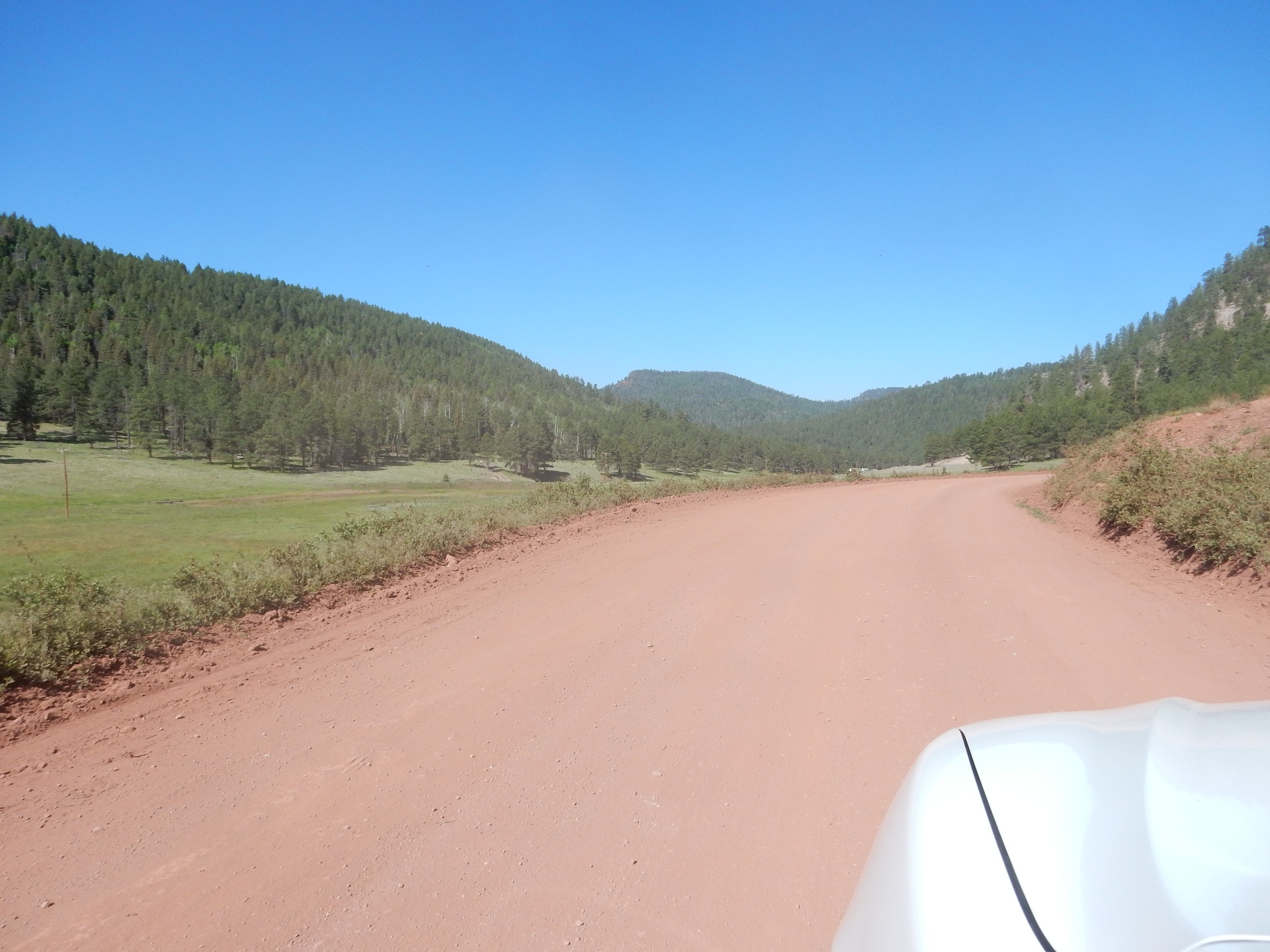
The Abo Formation is 300-million-year-old red beds. These are layers of siltstone and sandstone rich in bright red hematite, which colors the road bed here.
The road becomes paved again a little further down, and begins descending from the mountains towards Cuba. Here there was a little surprise.

Why, yes. An actual cattle drive with actual cowboys. Northern New Mexico Hispanics have been grazing their cattle in the Jemez Mountains for at least three hundred years now.
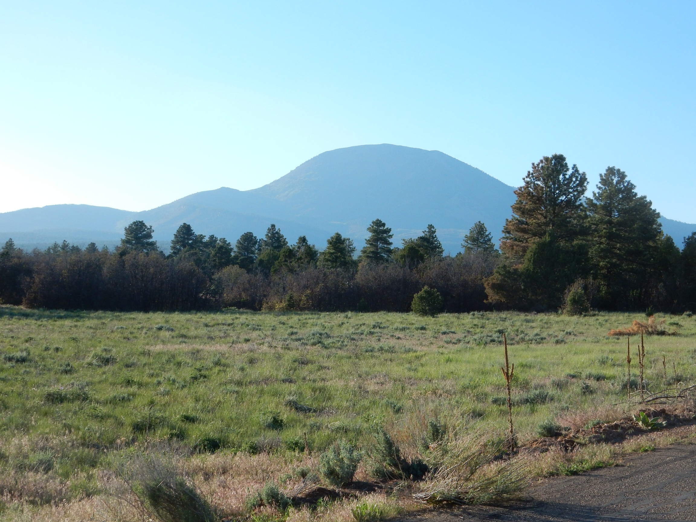
Here‘s one possibly for the book.

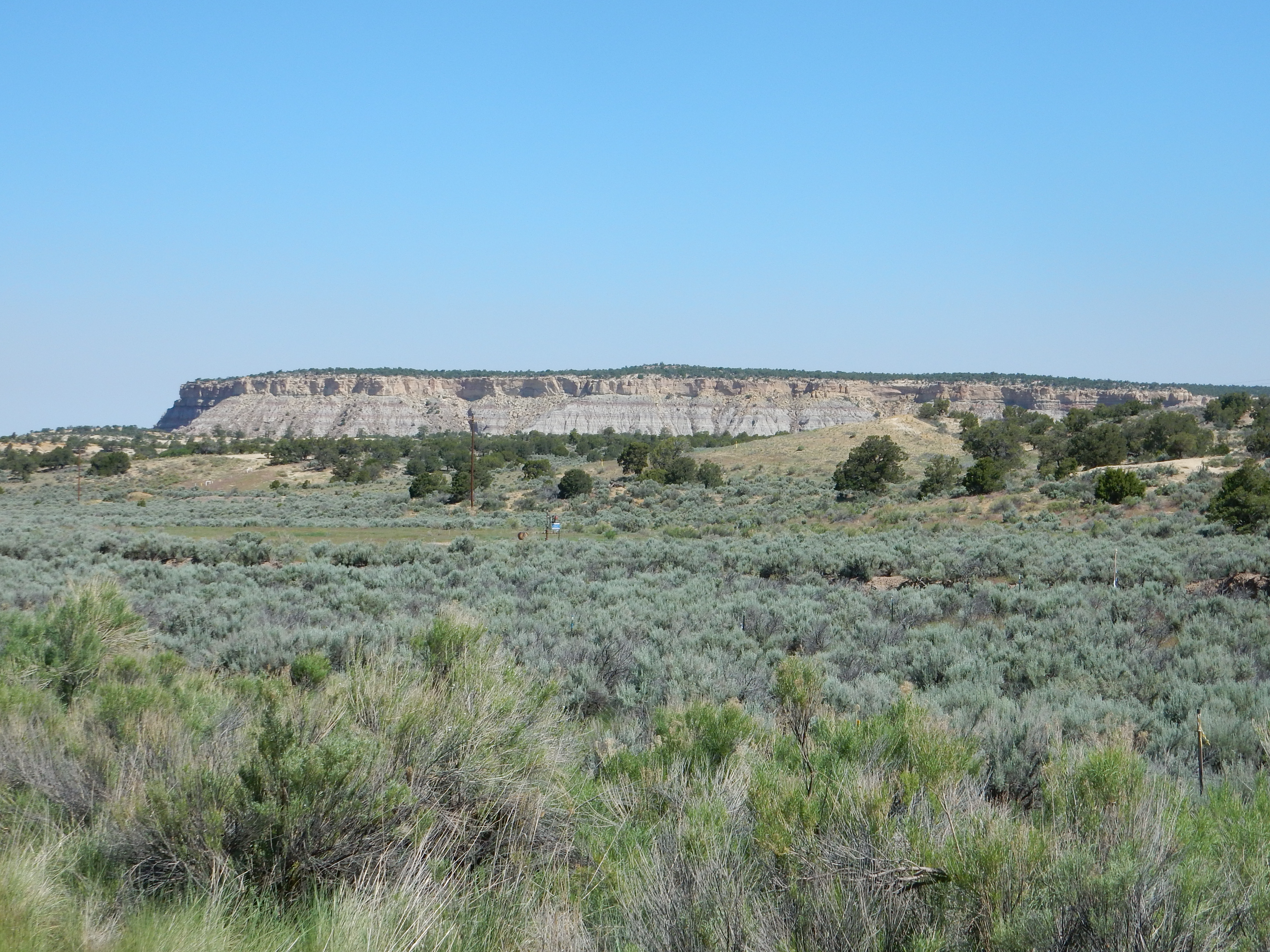
This is the southwestern end of Eureka Mesa, not far from the Nacimiento Mine. The lower red beds at the curve of the road, below the line of trees near the center of the photograph, is Abo Formation. The red beds above the line of trees is Yeso Group, another Permian unit slightly younger than the Abo Formation. The Abo Formation was formed in a river valley environment; the Yeso Group is more likely wind-deposited.
The rim of the canyon is capped by Shinarump Formation sandstone of the Chinle Group, laid down by the Chinle River in the Triassic, some 230 million years ago. The Chinle River was a very large and long-lived river system, somewhat like the modern Mississippi, but reaching from the Appalachians west to Nevada (which was the western shore of North America at the time.)
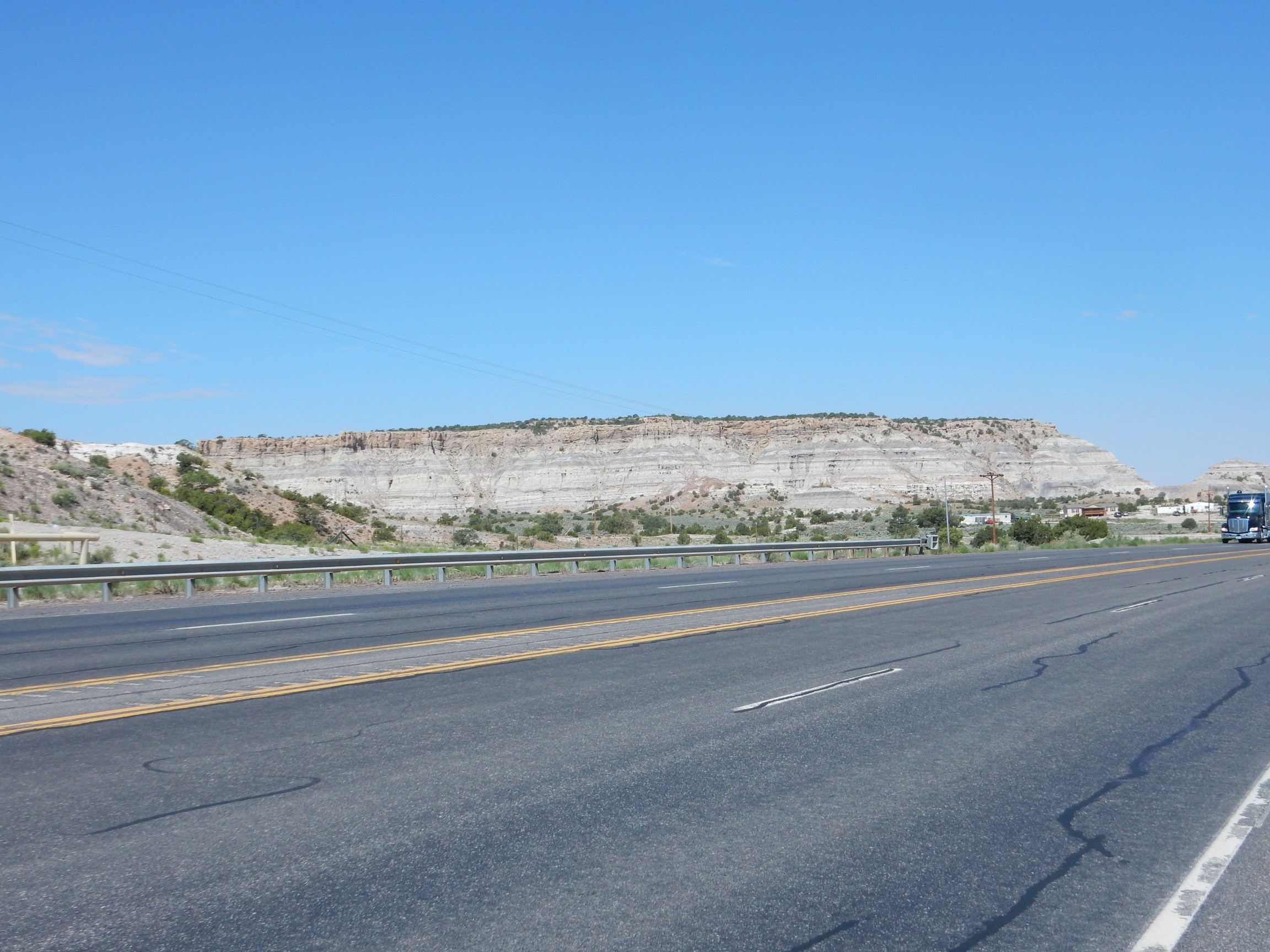
From there through Cuba to Farmington. Just northwest of the town is a nice outcrop of San Jose Formation over Nacimiento Formation.

The San Jose Formation is the sandstone cliffs, while the slope-forming sedimentary beds beneath the cliffs are Nacimiento Formation. Both are Paleocene, between 65 and 34 million years in age, making them relatively young (but older than the Jemez Mountains.)
The San Juan Basin northwest of Cuba is oil-producing country.

I know something about the chemistry of oil refineries, but I couldn’t reliably identify the equipment here. Possibly some distilling stacks (used to separate petroleum fractions by molecular weight) and cracking towers (used to convert longer hydrocarbon chains into shorter chains and cyclic hydrocarbons.) Not a large refinery in any case. It serves the Escrito Oil Field.
The area is surrounded by mesas capped with San Jose Formation and lower slopes of Nacimiento Formation.
Now this is a little weird:
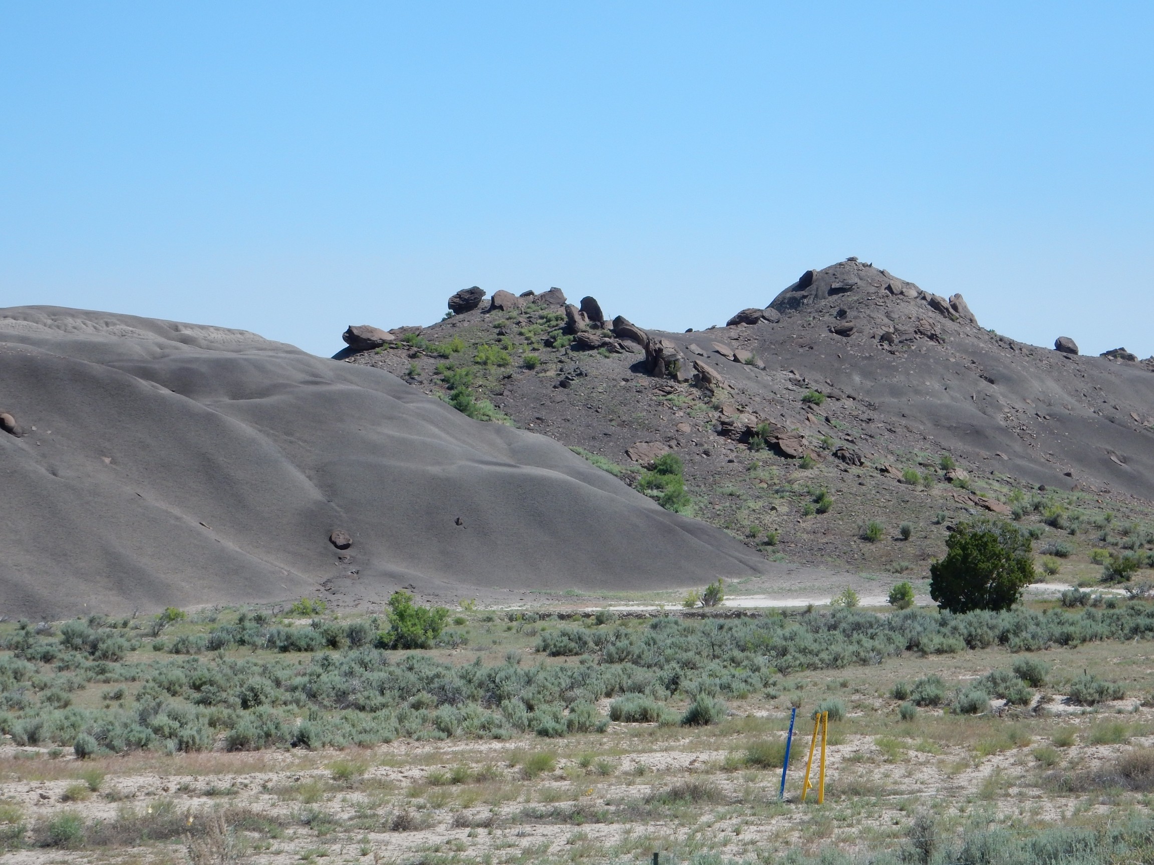
The black beds are particularly carbon-rich beds of the Nacimiento Formation, but scattered across them are large “wheels” of about the same size. Looking north, it appears that these come from a particularly local bed of the overlying San Jose Formation.

Click to enlarge, then look at the very rim of the mesa for a few “wheels” still in place. I’m not quite sure what to make of it.
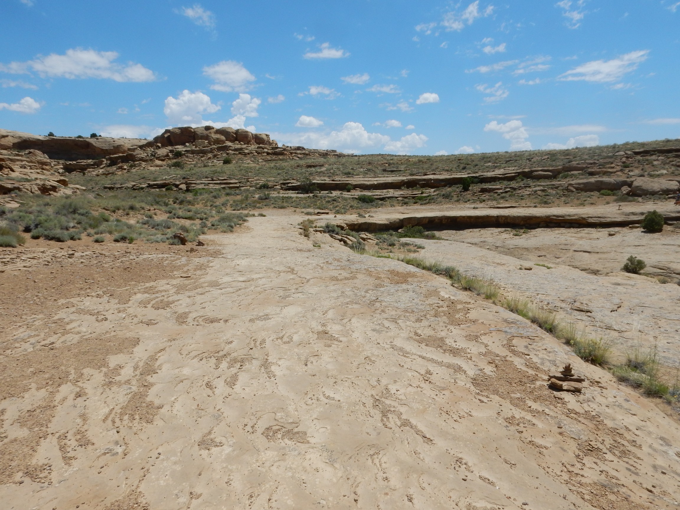
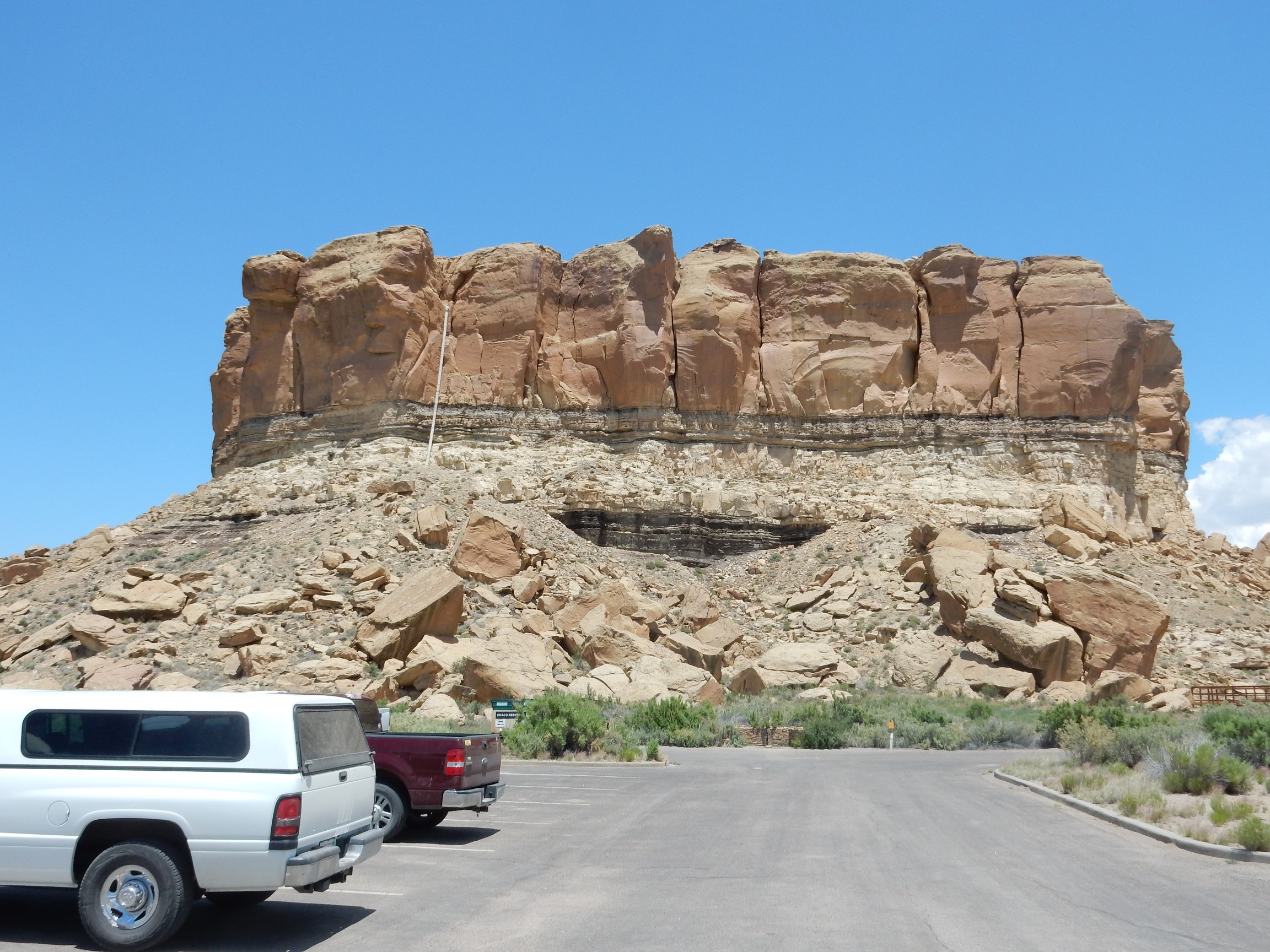
I soon reached the turn for my first side trip, to Chaco Canyon Historical Park. When I was a kid, the road was a little further west at Nageezi and was gravel all the way. The current route is now paved part of the way.
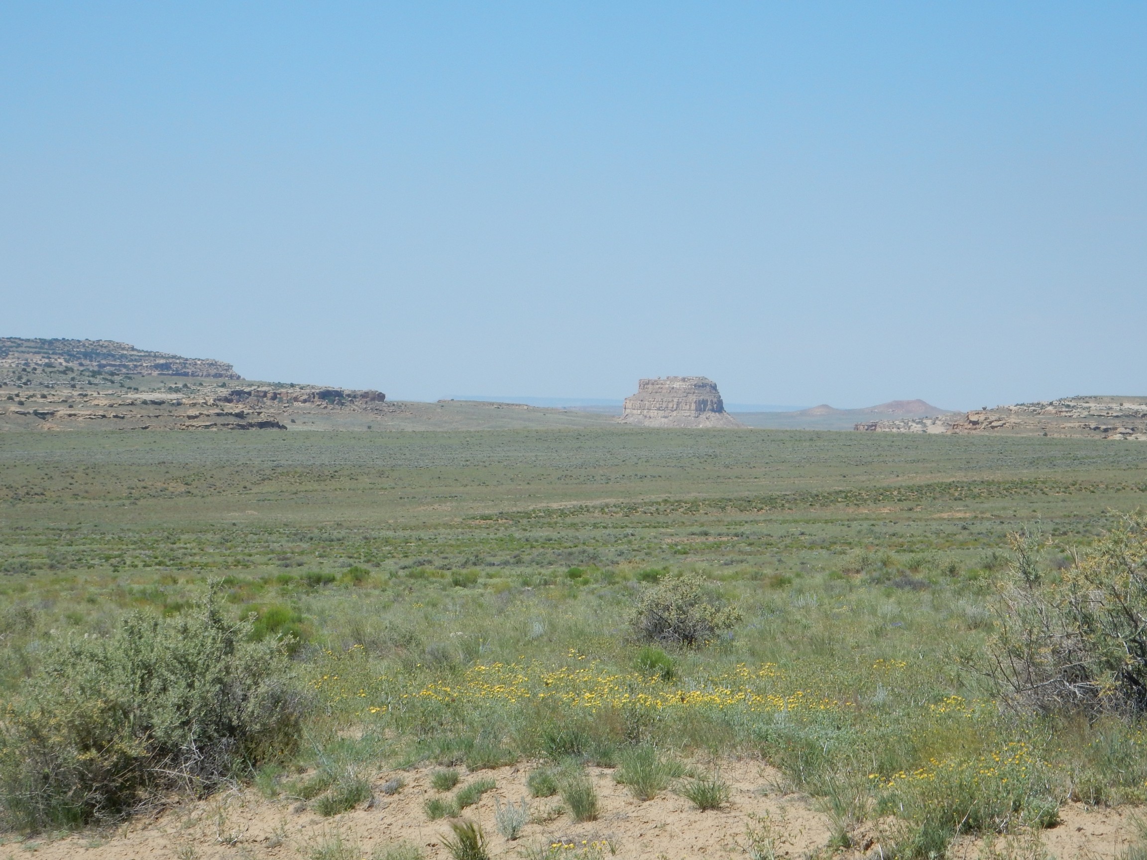
Approaching the park:
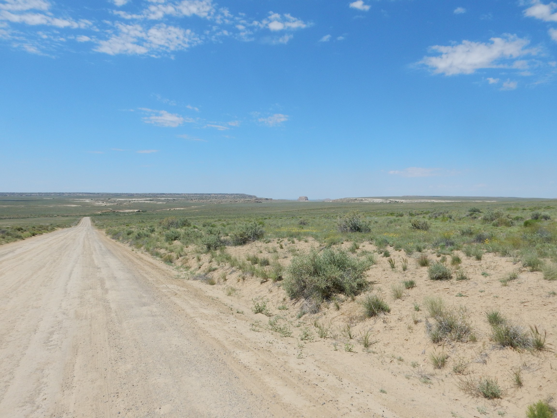
That’s Fajada Butte, in the middle of Chaco Canyon, in the distance.
There were numerous wildflowers blooming along the road.
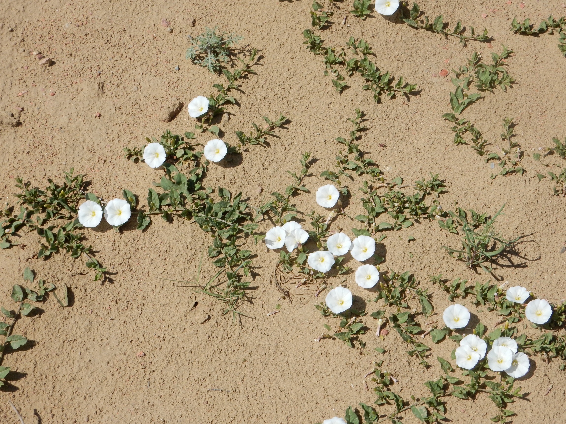
Some species of morning glory.
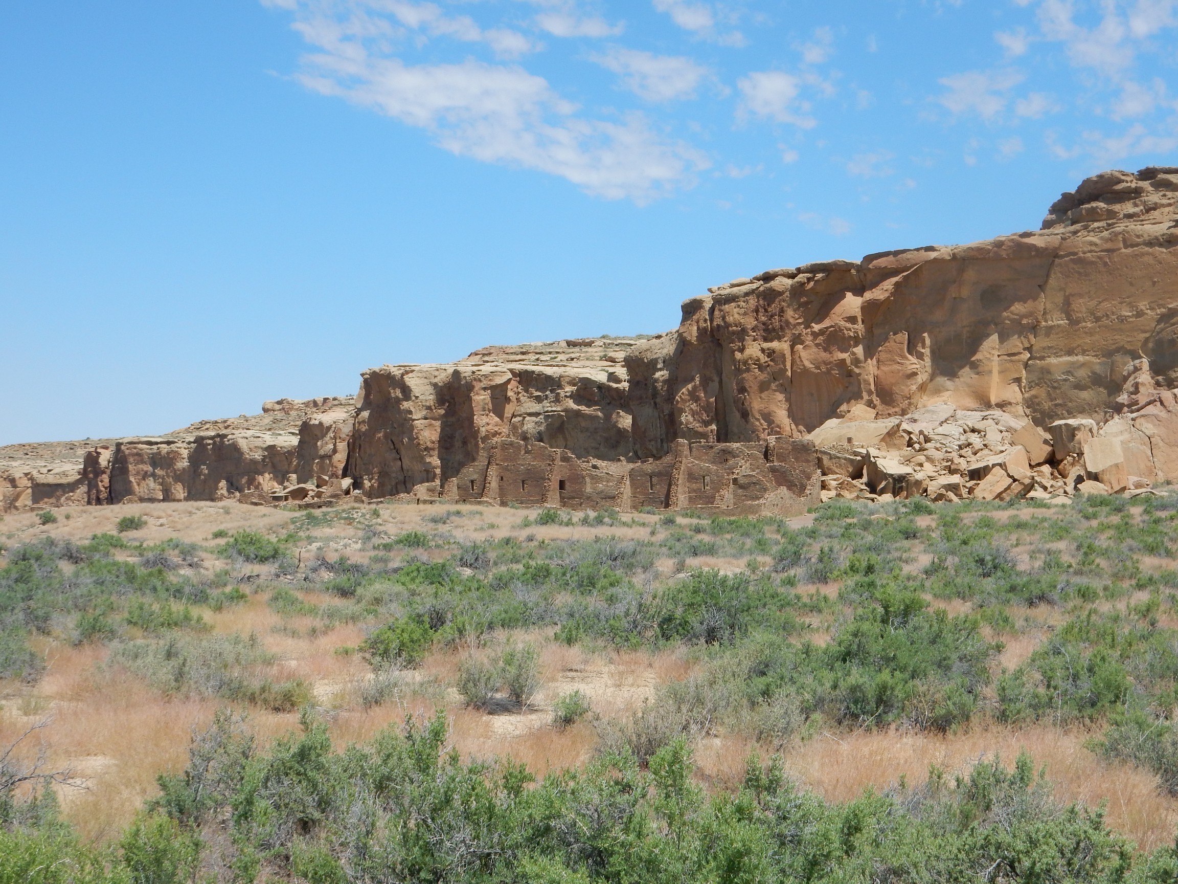
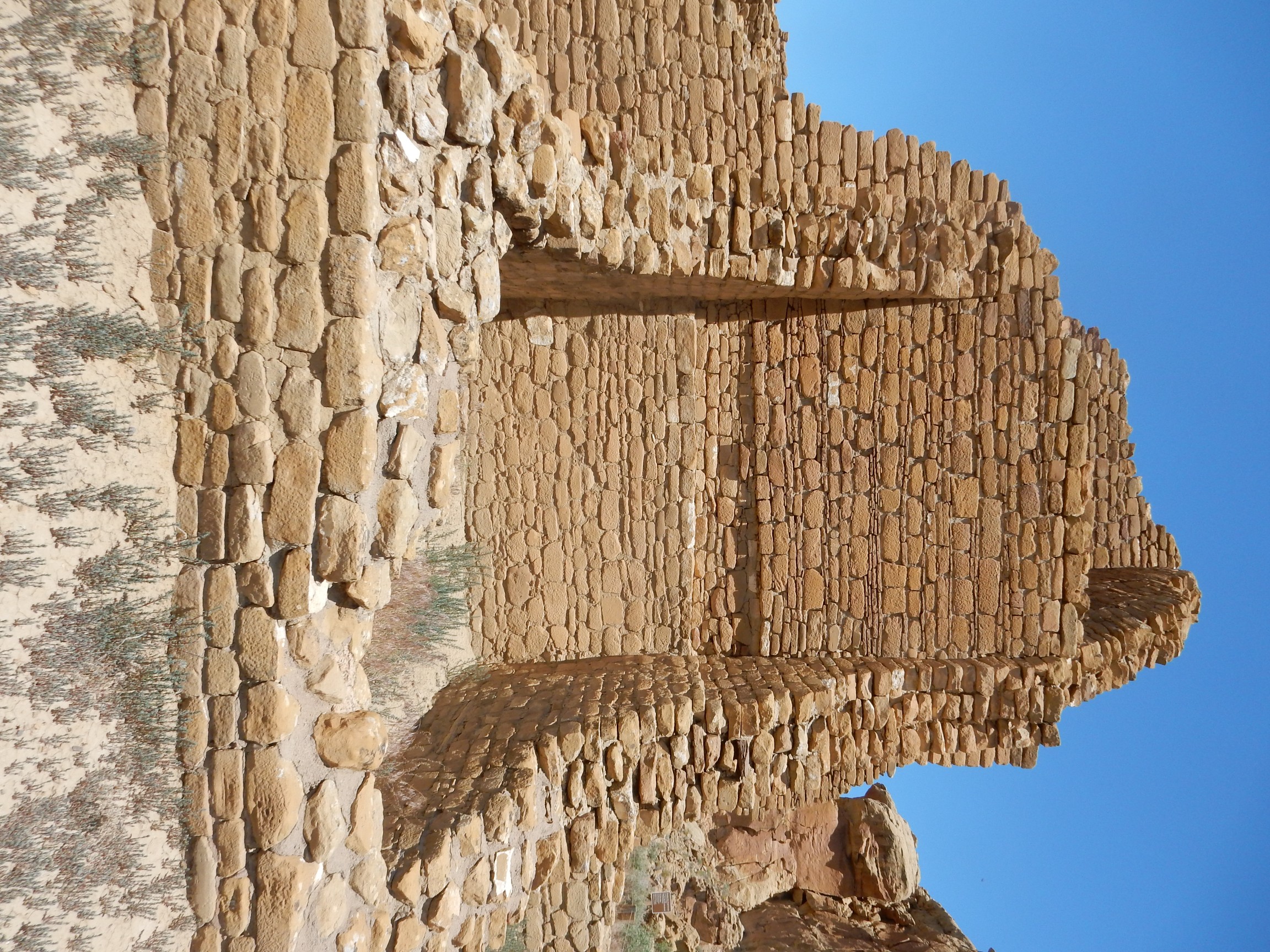
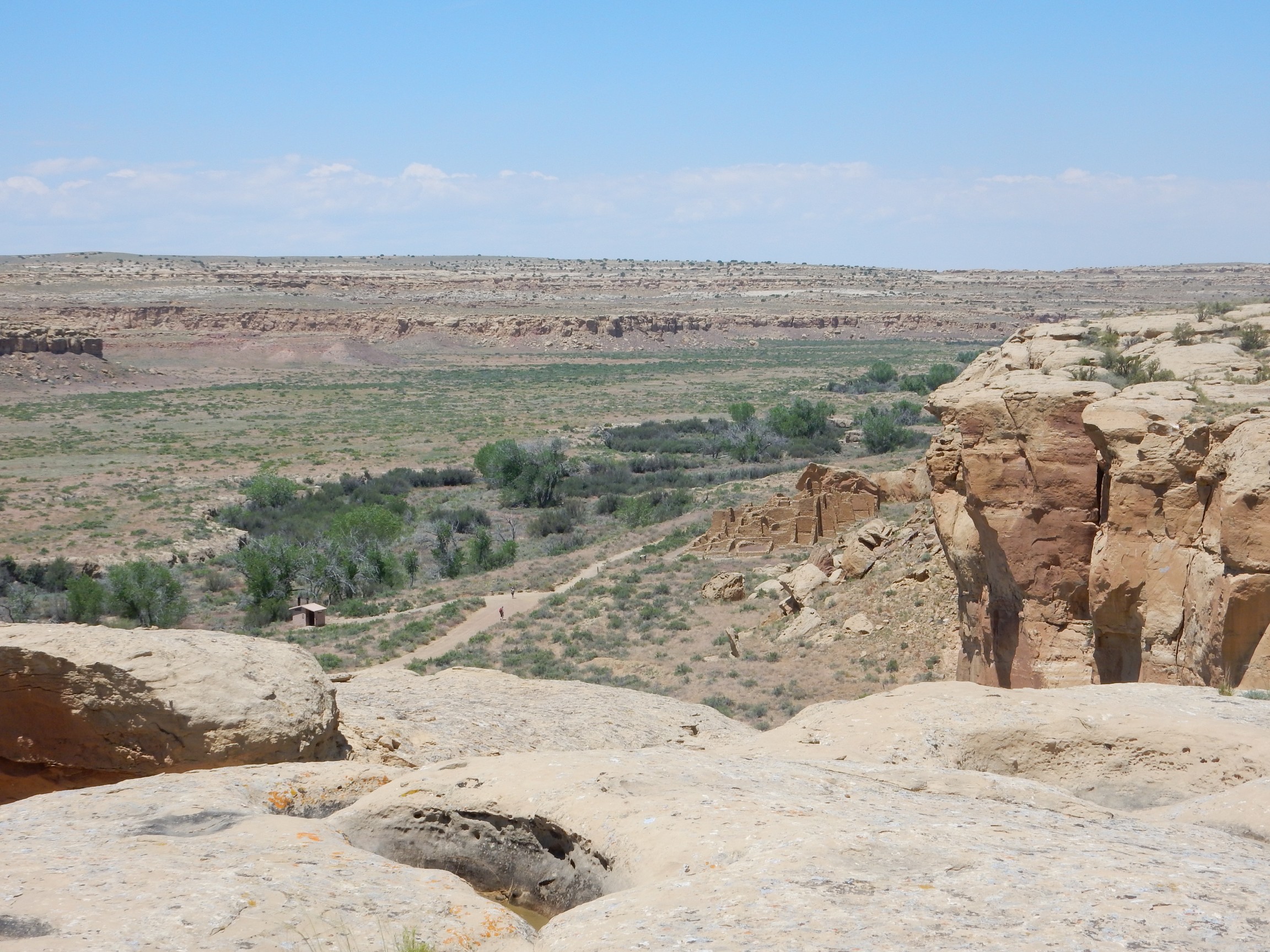
Chaco Canyon was the center of a native American culture that reached a high level of development by the 13th century or so. Here is the Chetro Ketl ruin.

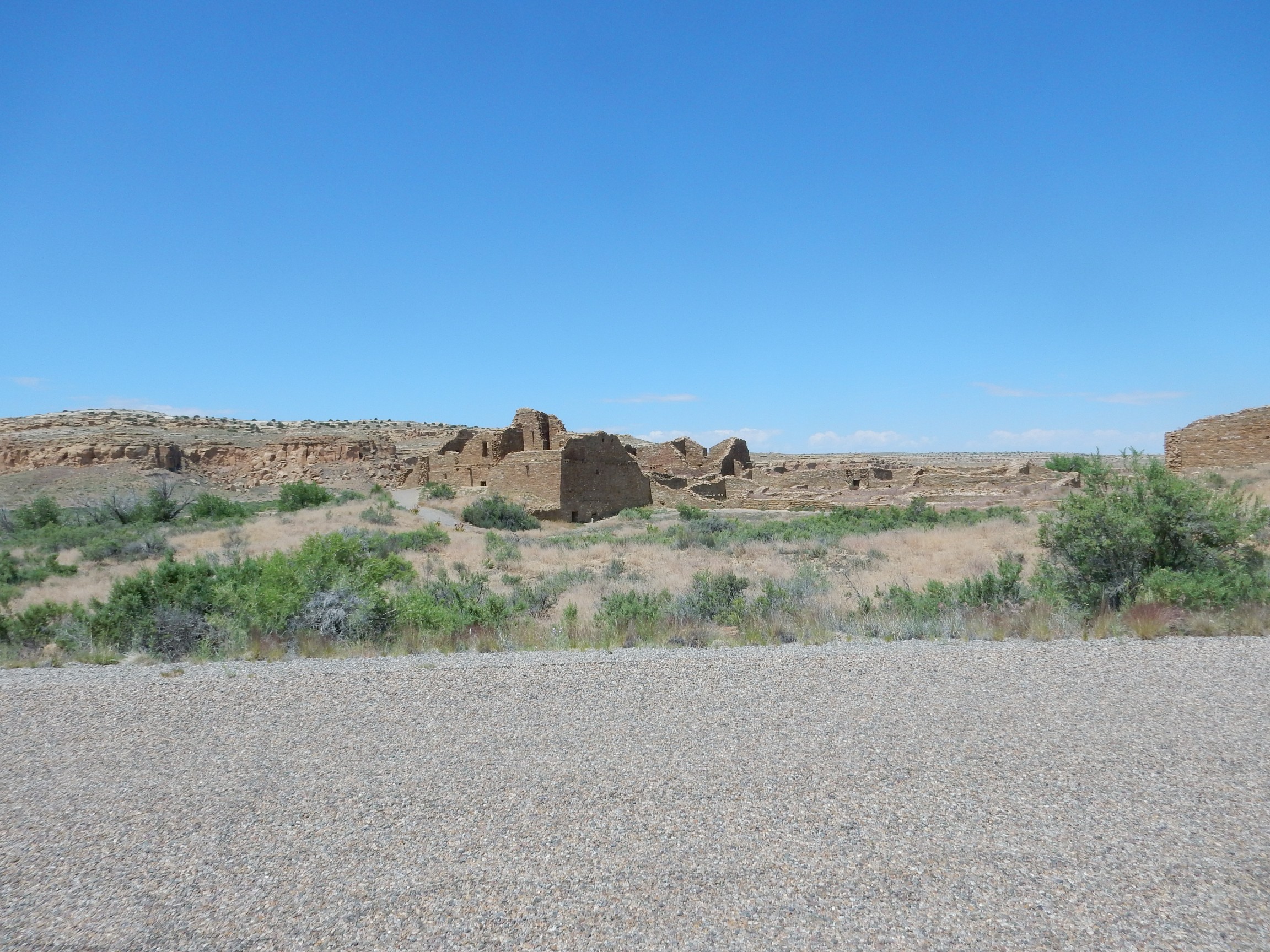
To its west is Pueblo Bonito, the most famous and best-preserved ruin in the canyon.
Based on the recommendation of a park ranger, I would be hiking to the rim of the cliff behind Pueblo Bonito for a nice panorama.
Another ruin along the road, Pueblo del Arroyo:
I reached the trailhead; coated myself in UV-absorbing polyphenols; packed some water bottles in my pack and grabbed my walking stick; walked some distance down the trail to find a kiosk where you were expected to fill out a back-country permit; realized I did not remember the Wandermobile’s license number (I’ve only had it for a couple of years); walked back to get the number; returned to the kiosk and filled out the permit and took my copies; realized one copy was supposed to go in my car; went back a second time; and finally got fair on my way.
The trail passes Kin Kletso (“Yellow House).
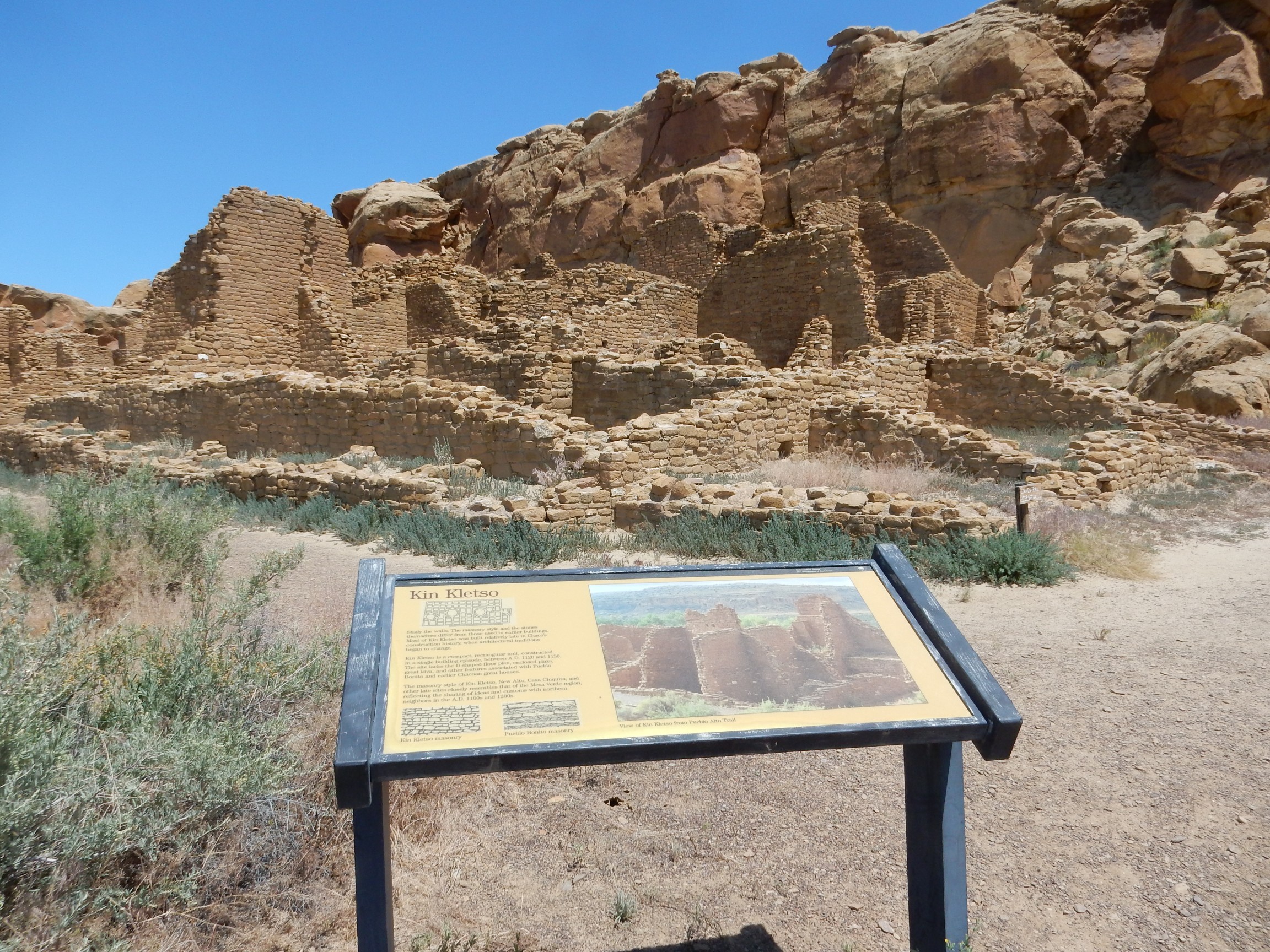
This is one of the later constructions, thought to be influenced by the Mesa Verde culture to the north.
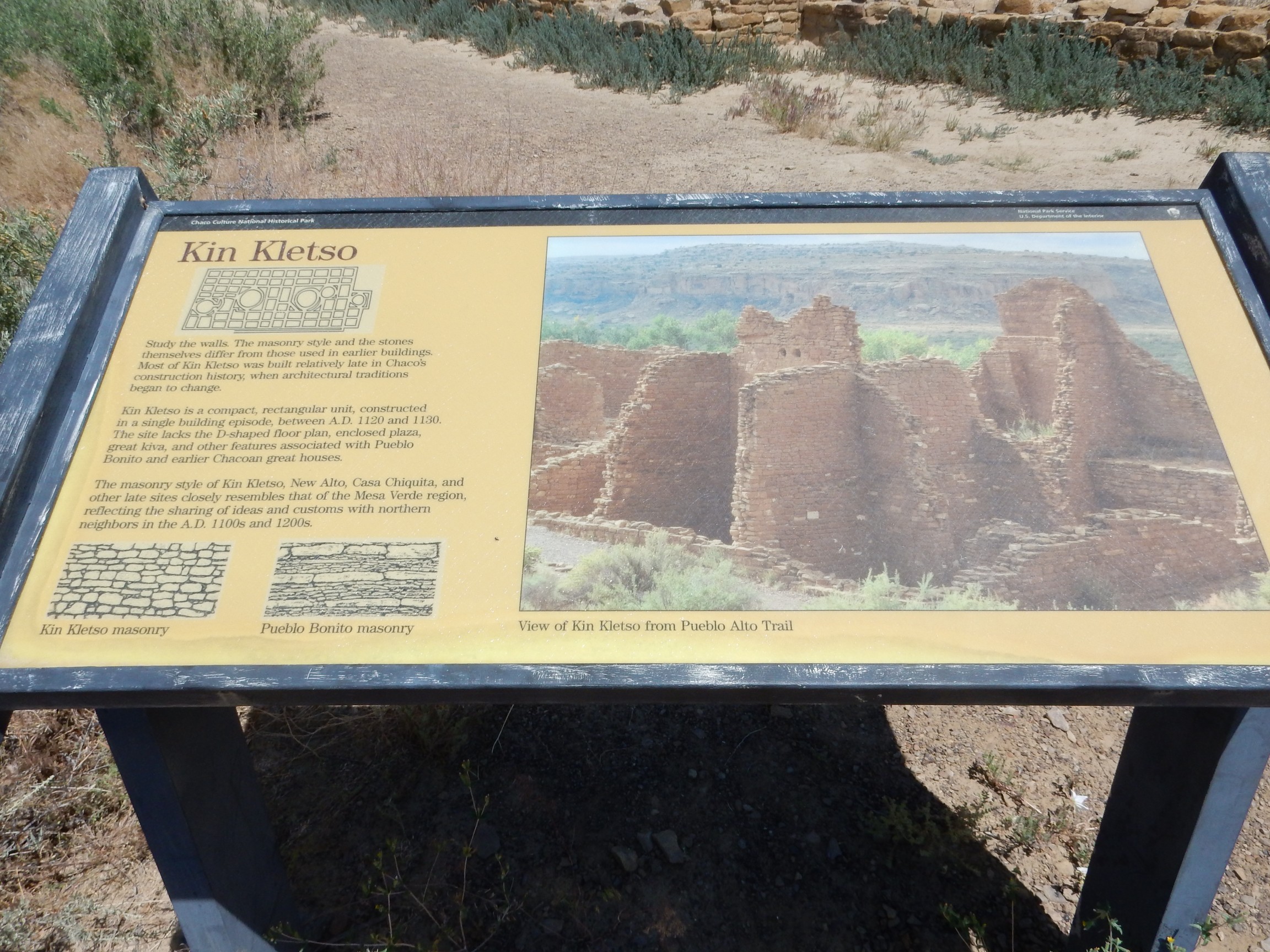

The quality of construction is impressive, as good as any Spanish mission I’ve seen.

This is well before the survivors of Chaco settled on the Pajarito Plateau and in the Bandelier area, and long before any known contact with the Old World. Of course, the Chaco builders had better stone to work with than the soft tuff of Bandelier.
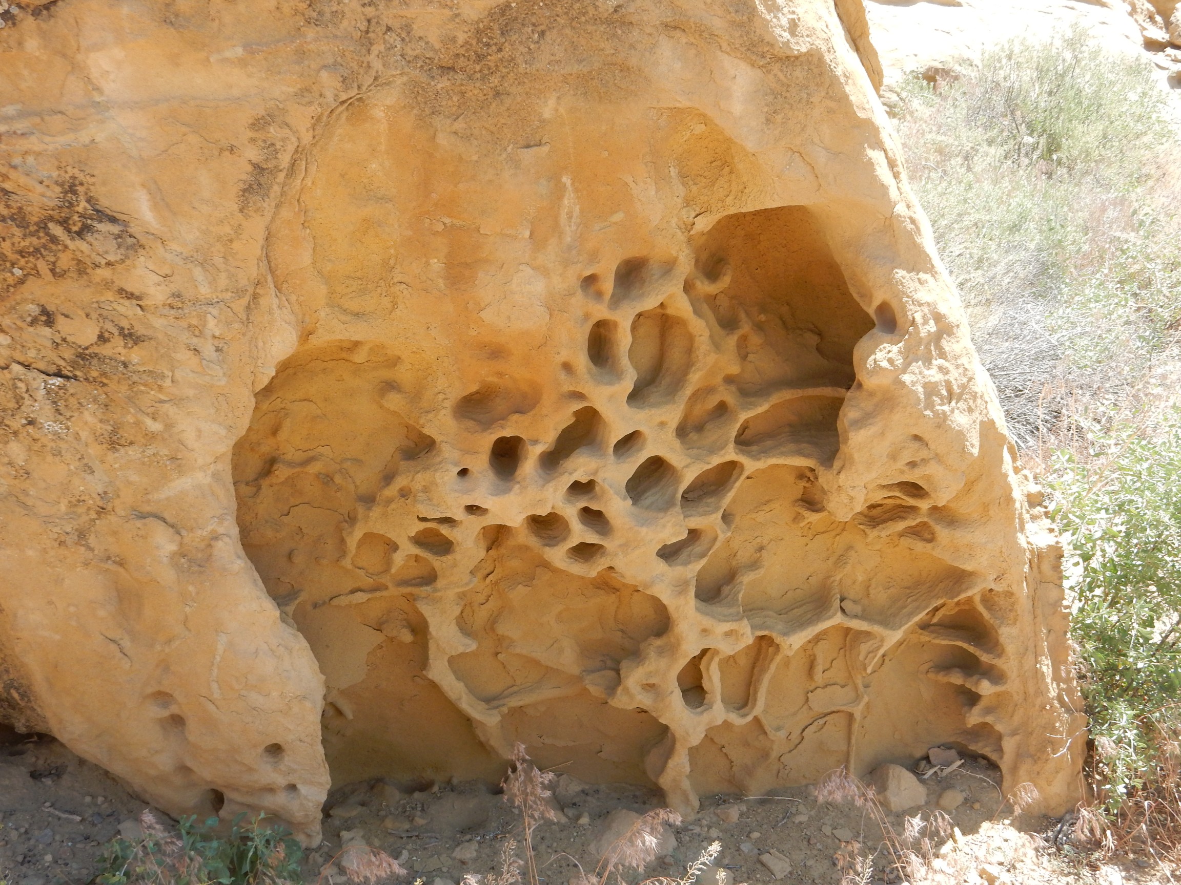
Sedimentary structures along the trail.
The trail goes up this narrow fissure.
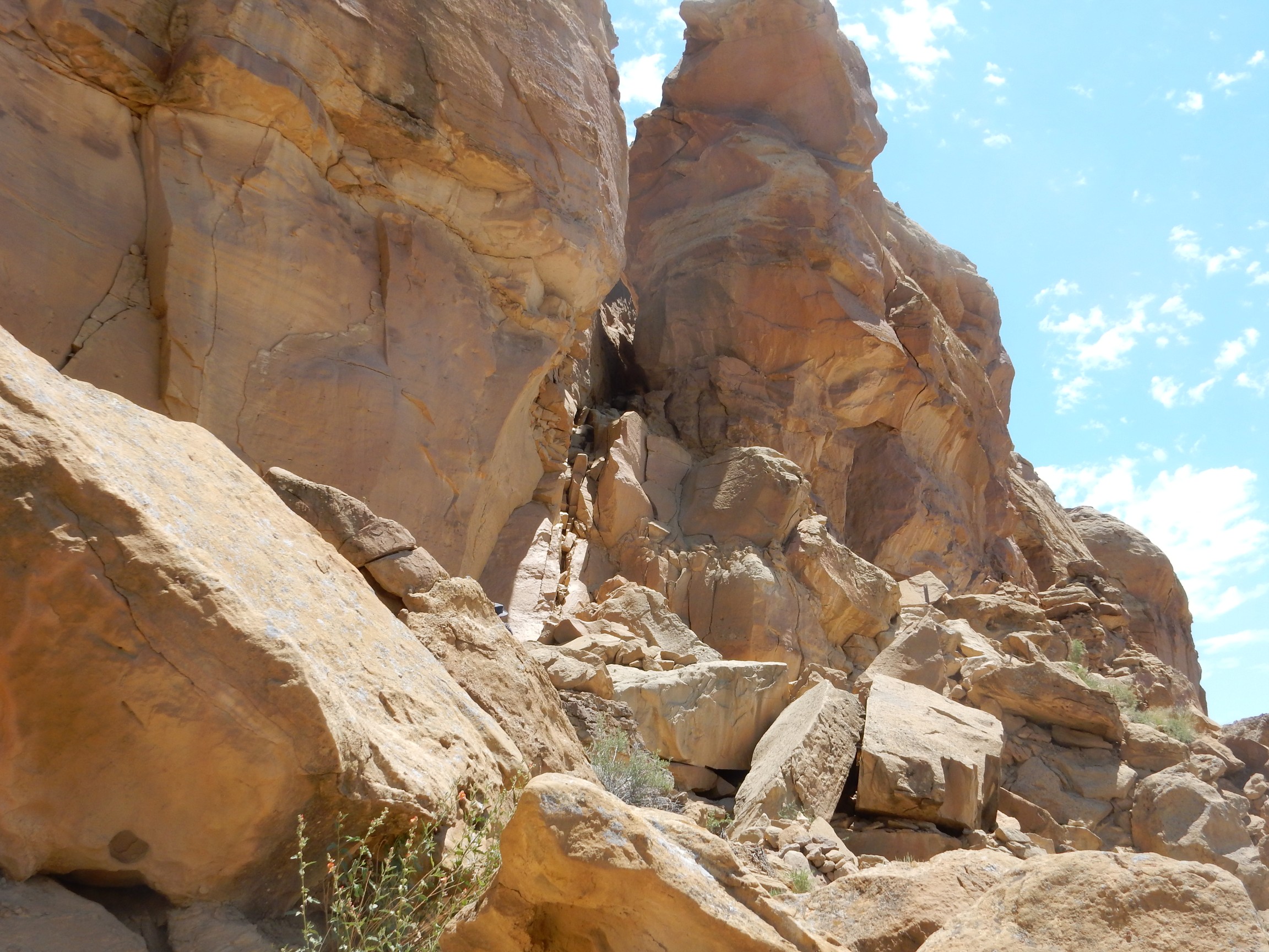
I’m guessing that climbing this trail for the first time would be a major milestone for a Chaco child. Assuming there were any; more on that in a moment. I found it decidedly hard on my knees. The walking stick helped.
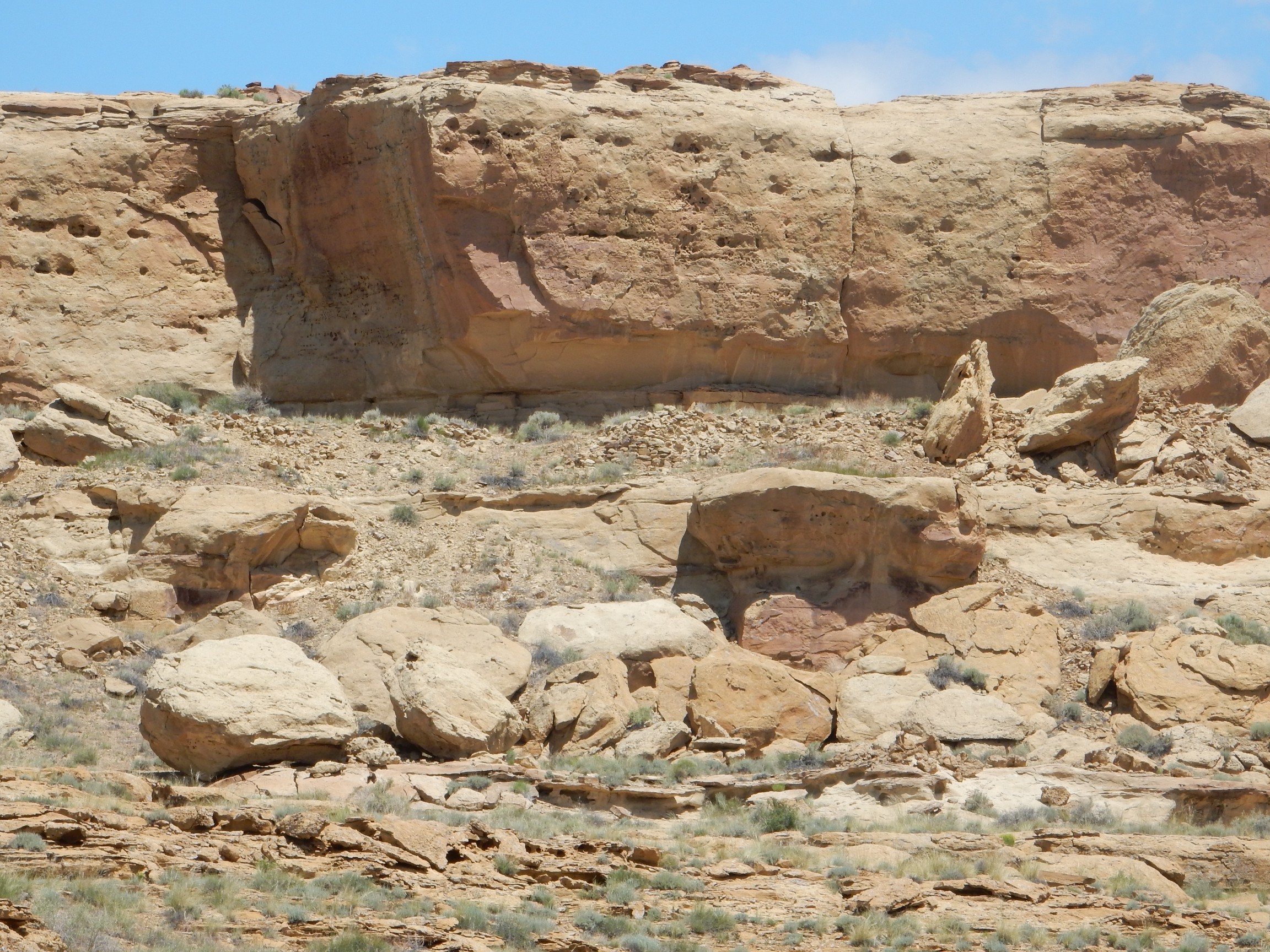
The cliffs are Cretaceous Cliff House Formation of the Mesaverde Group. This formation includes some clam fossils.
“Acchhh, ssssss, it’s the only way”
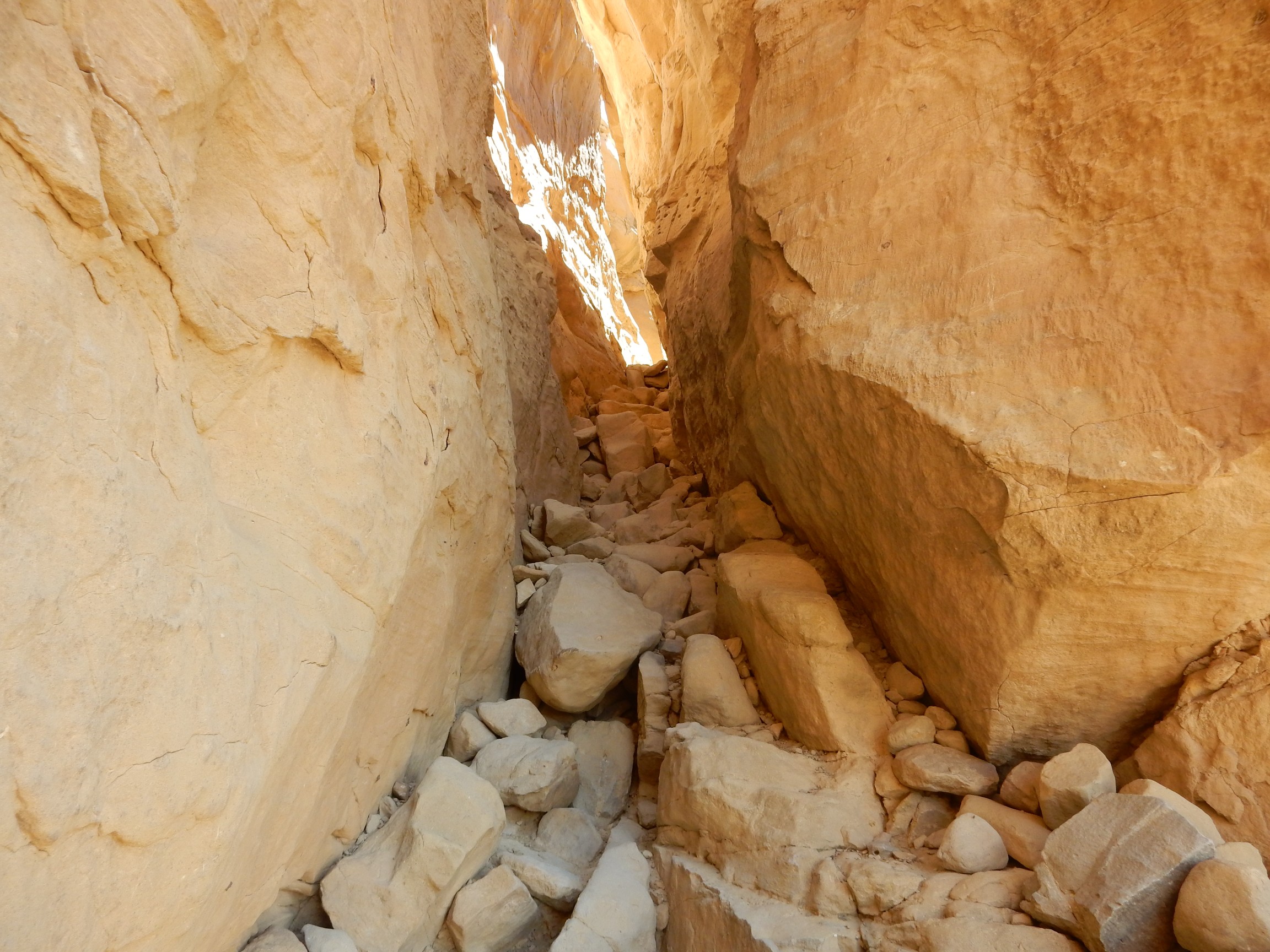
This part was actually not too bad going up.
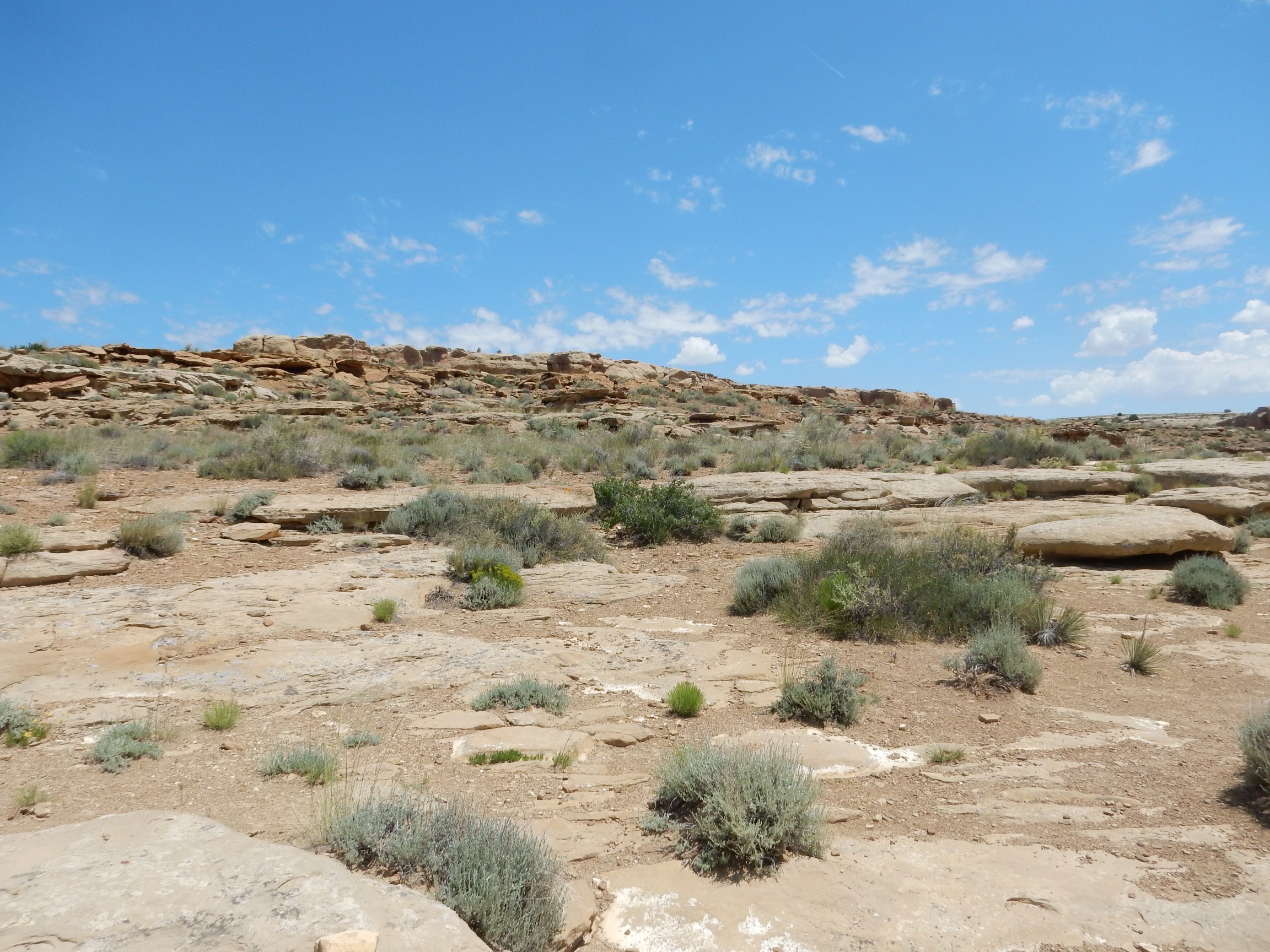
Onto the mesa top.
A common trace fossil in this formation is shrimp burrows, typically filled with hematite concretion.
The trail is marked by cairns.
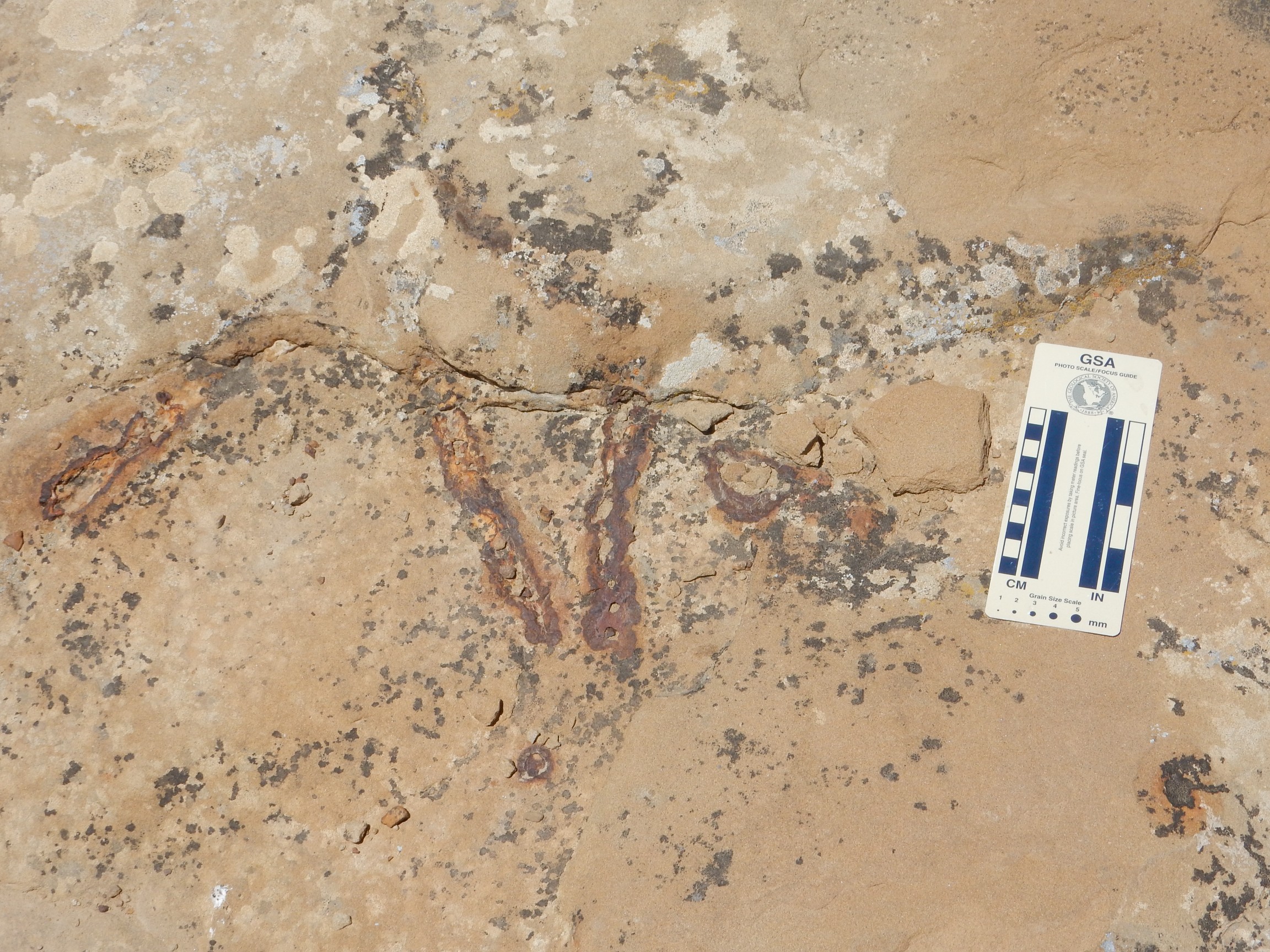
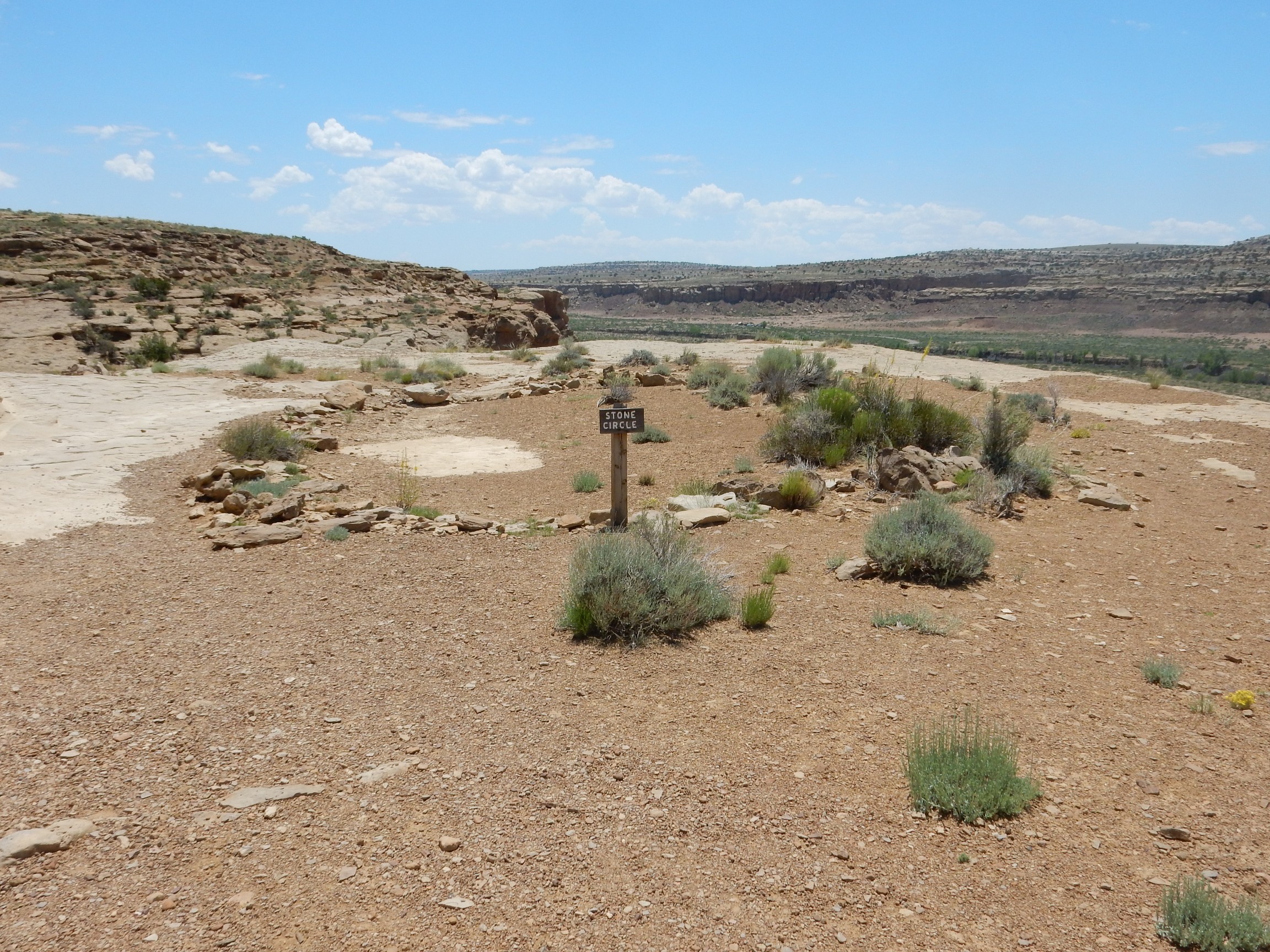
There are a number of pecked basins along the trail, hammered into the rock by the Chacoans, almost certainly to hold religious offerings. Turquoise fragments have been found in some of the bowls.
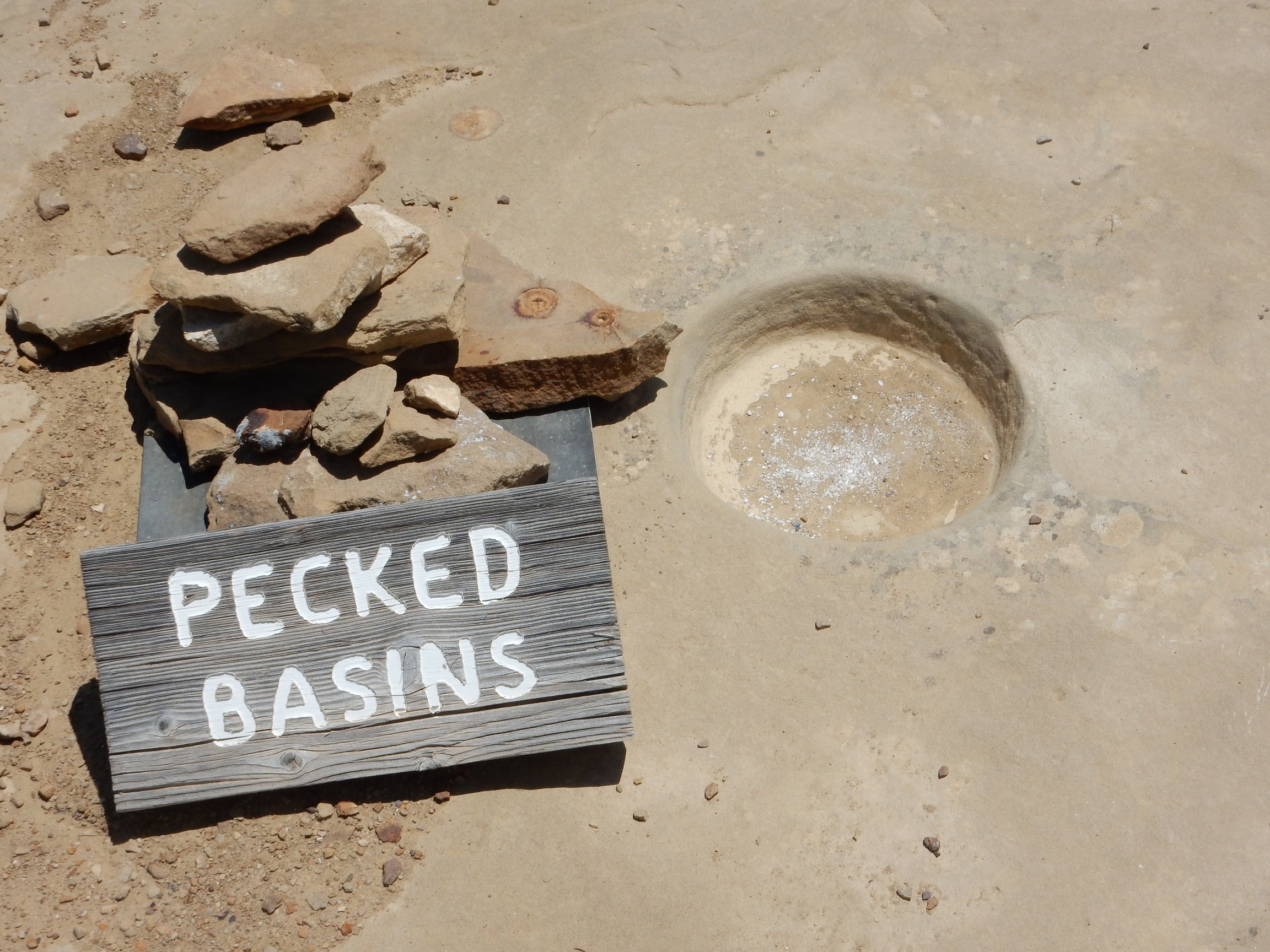
Bruce Rabe has sometimes snarked to me that “ritual object” is the stock explanation for any artifact an archaeologist can’t figure out. But, in this case, the entire Chaco complex may have been a genuine ritual center.
There is a second set of low cliffs to the north. There are remnants of a dry set wall (no mortar used in its construction) stretching for miles along the base of this terrace.
There are different theories (unsurprisingly) of what this was about. One is that the walls were for erosion control; another is that they are related to the extensive network of roads around the complex, which are also dry set stone.
From the size of these colonies, they could easily be as old as the ruins below.
Kin Kletso from above.
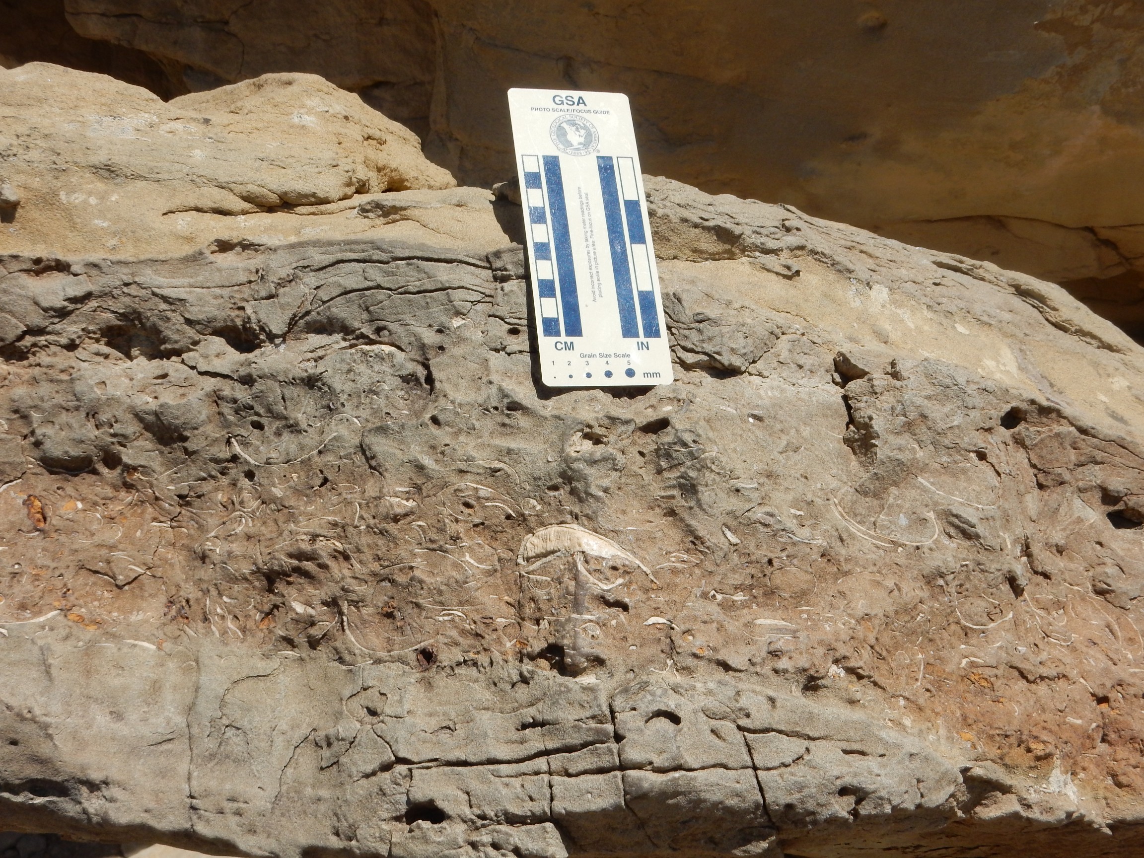
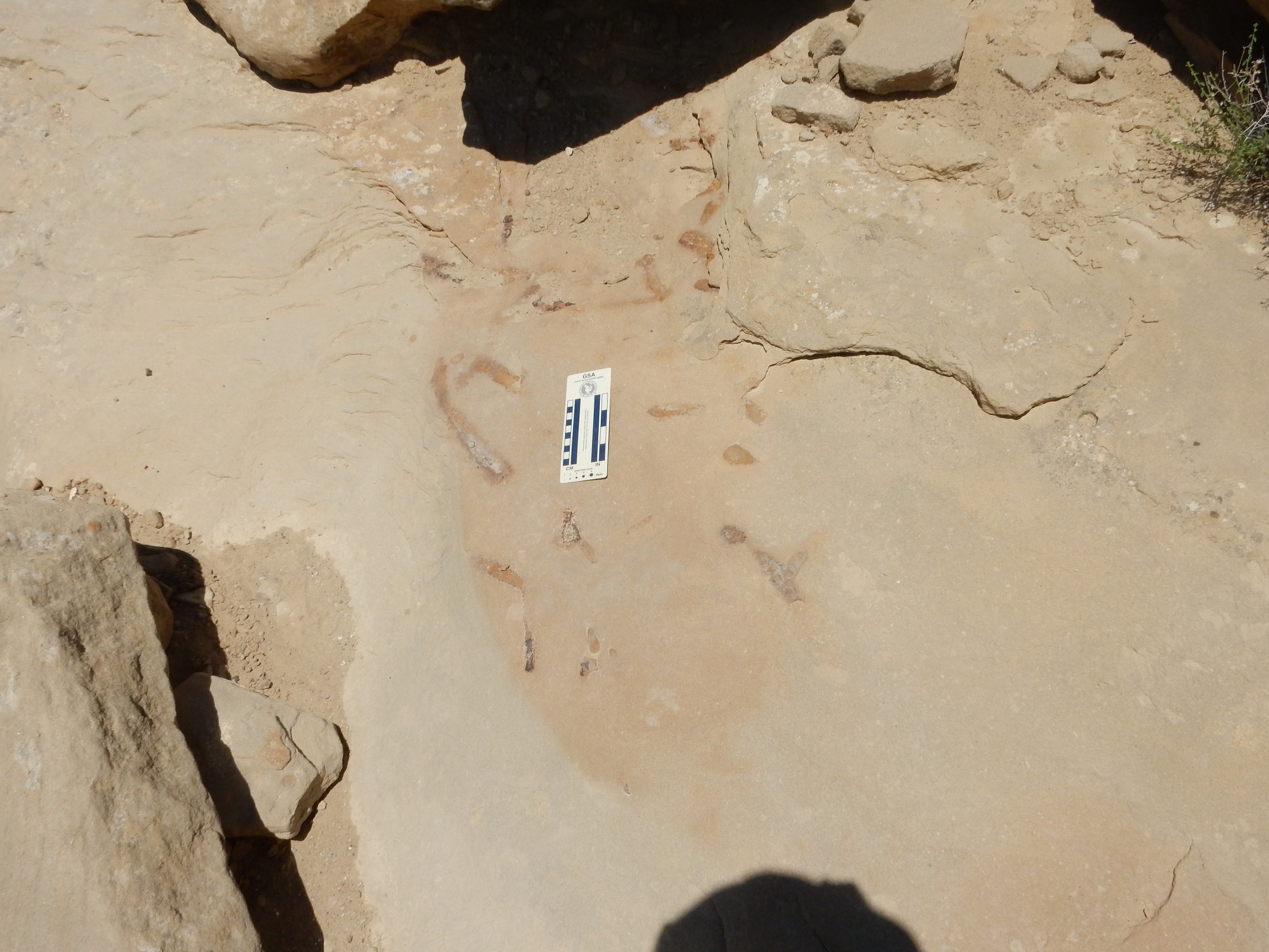
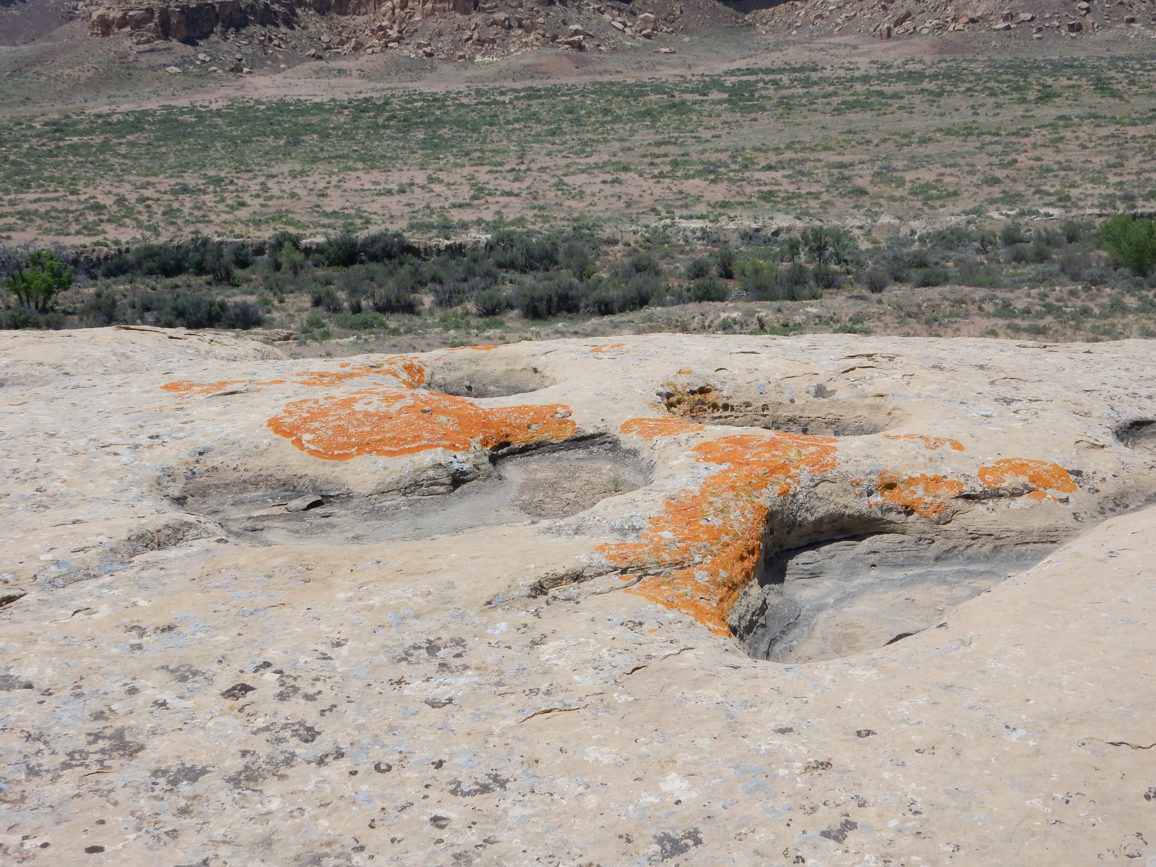
Some particularly nice shrimp burrows.
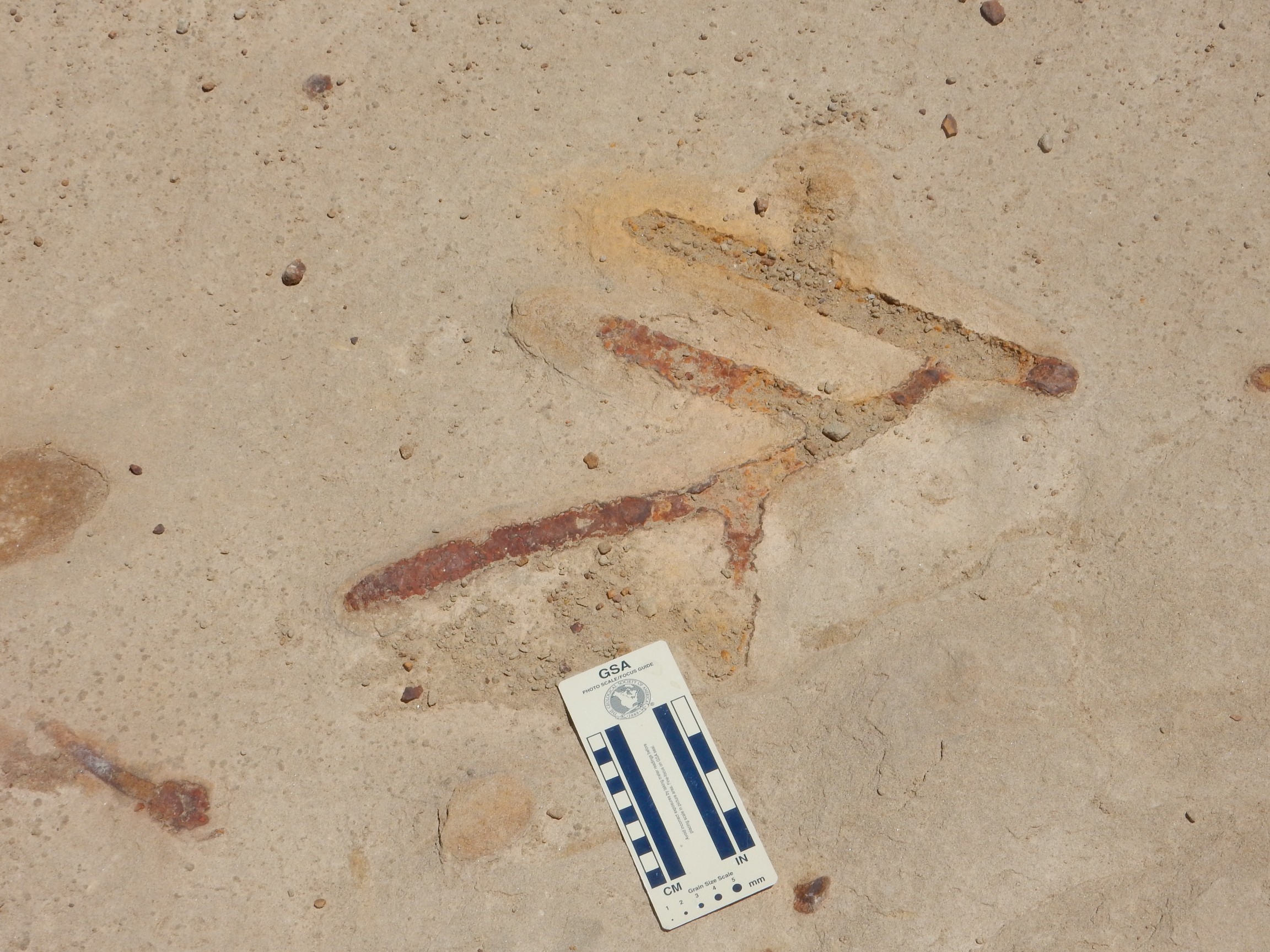
This boulder is covered with particularly well-preserved shrimp burrows.
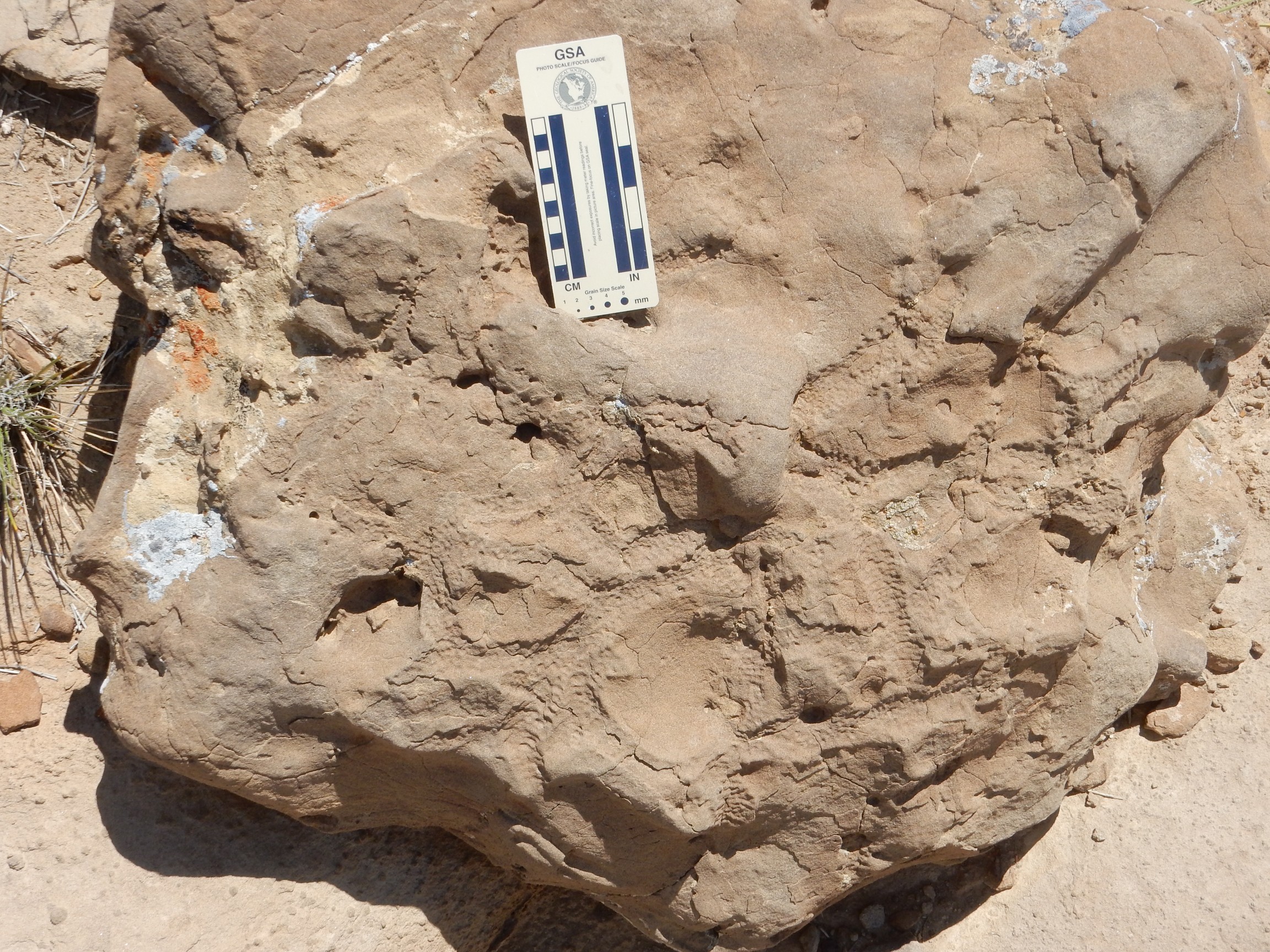
These apparently were filled in with fine sediment rather than hematite and show much detail in the burrow walls. Incidentally, trace fossils such as these, produced by a living organism but not part of the living organism itself, have their own genus and species names; these shrimp burrow are more properly known as Ophiomorpha from their resemblance to snake skins.
More wildflowers.

Possibly Stanleya pinnata, desert plume.
And, finally, the overlook.
There seems to be a fair amount of agreement that Pueblo Bonita was the center of the Chaco culture, and that it was not an ordinary inhabited city. Whether it was a religious complex housing priests, or (in effect) a palace for a royal family, is disputed. Even the population is uncertain. We know from studying rat middens (old rat nests) that the climate here was significantly wetter and cooler in the 12th century, with ponderosa forest in the canyon and plateau, but the carrying capacity of the land was not great even then. Estimates go as low as 70 permanent inhabitants in this complex, which was slowly developed over about 300 years. There are remarkably few graves in the area, few of the rooms have the hearths typical of pueblo living spaces, and the number of infant graves is small compared with outlying pueblos. My guess is a ritual center inhabited by a few priests.
I whipped out my tripod for a panorama.
The far cliffs are also capped with Cliff House Formation sandstone, but the lower portions of these cliffs are Menefee Formation, the chief coal-bearing formation of the San Juan Basin. (Not much coal in this area.)
Retraced my steps, and down the chute:

And, yeah, harder going down. Rough on the knees. And I stumbled at one point and put a good ding in my left knee. The risk of crippling myself on the trail is why I carry a ritual object known as a “cell phone.”
More wildflowers:
Sphaeralcea ambigua, desert globe mallow, I think.
Got back to the car. Guzzled water and ate some lunch. I thought about visiting Pueblo Bonita up close, but I was already past it on a long one-way loop and it was getting past noon.
Fajada Butte up close:
Capped with Cliff House Formation with lower slopes of Menefee Formation. Likewise north of the visitor’s center:
The contact between the Menefee and the Cliff House is very obvious. You can also see some carbonaceous beds, though not amounting to actual coal here.
I headed back to the main highway. It turns out this crosses a large arroyo that is dangerous in rainy season.

I suppose this is the literalist nerd filter. I entered the park anyway, in spite of having several quarts of bottled water in my car.
I can imagine this experiencing some daunting flash floods. But the weather was beautiful, as it would remain throughout my trip (except for some high winds towards the end of the week.)
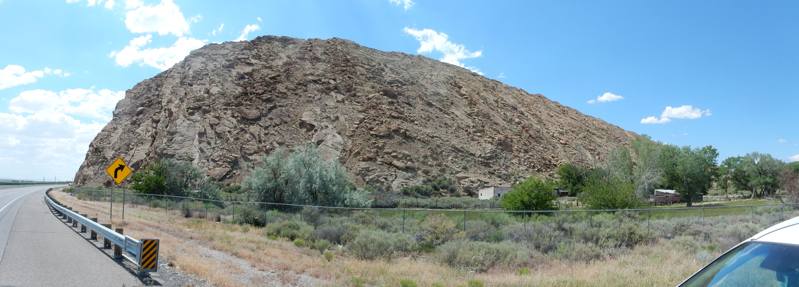
Back on the main highway. Mesa Huerfano:
A small outlier of the San Jose Formation. Hence, “Orphan Mesa”.
Into the Bloomfield area. This caught my eye.

This is a beautiful example of a terrace gravel deposited on a terrace cut into the underlying Ojito Arroyo Formation. The gravel goes on for miles north of the San Juan River and marks a higher stand of the river. However, I have only a state map of this area which does not show fine details so I don’t know the age.
The Ojito Arroyo Formation is a bit controversial. It’s generally dated as very oldest Paleocene, but there are dinosaur fossils in its lowest beds. These would be post-Cretaceous dinosaurs, but the non-avian dinosaur families were supposed to all be killed at the Cretaceous-Tertiary boundary at the start of the Paleocene. The thinking now seems to be that the K-T boundary is somewhere in the lower beds of the Ojito Arroyo Formation, above the dinosaur beds, but the actual clay layer marking the exact boundary is missing as part of a subtle discontinuity (gap in the rock record.) Geologists seem to love to argue about such things.
It’s a shame. It would be cool to have a photo of the K-T boundary in the Jemez region if it wasn’t missing.
The Farmington hogback:
This extends for a great distance north and south.
The east side is Cliff House Formation. Immediately to the west is low ground cut in the Menefee Formation, then a low ridge of Point Lookout Sandstone. The Menefee Formation has some really impressive coal beds in this area, and there are several large strip mines east of the hogback where the overburden of Cliff House Formation is stripped away to expose the coal beds of the upper Menefee Formation for use in the Four Corners Power Plant.
From there to Shiprock. And I mean to Shiprock.
I had originally planned to skip Chaco and spend my time deep in Navajo country looking at diatremes, explosive volcanic vents that sometimes bring up mantle rock. I knew I couldn’t collect samples on Navajo land without permission, but it would be fun to take photographs. I had a route mapped out that would go into some real back country, coming out at Canyon de Chelly National Monument, and then I’d drive north to my campsite at Monticello.
Something about this plan didn’t feel right.
I think it was the fact I’d be going really, really deep into Navajo country, and the Navajo are a very private people. You can hire a native guide and do some great tours, but something about striking out on my own began to feel intrusive. And the Navajo Nation web site says you need a photography permit to photograph for commercial purposes on Navajo land. Is this blog for commercial purposes? Well, you ain’t paying to read this, are you? So probably not. But any picture for the book would be. This chilled my enthusiasm, and I reluctantly dropped my plans to visit the Chuksas diatremes.
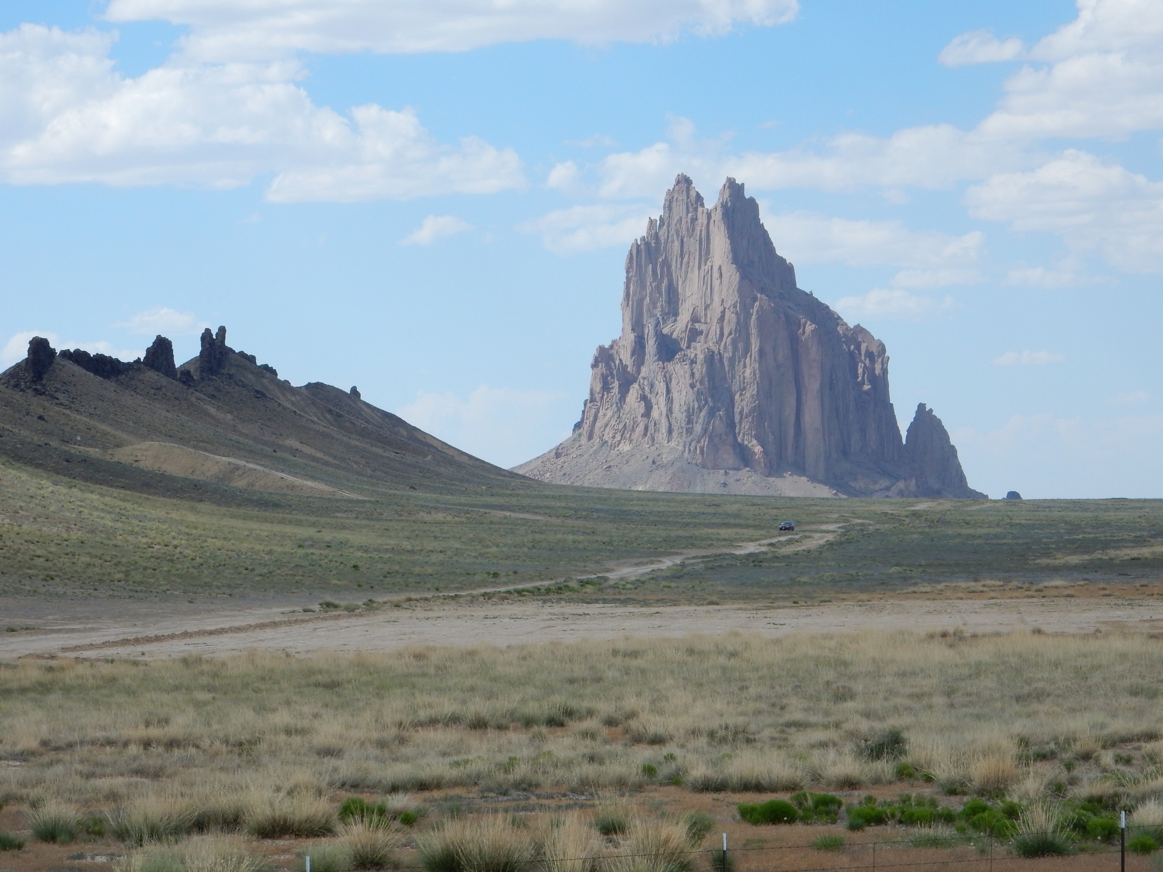
But I could not resist photographing Shiprock from the nearby highway.
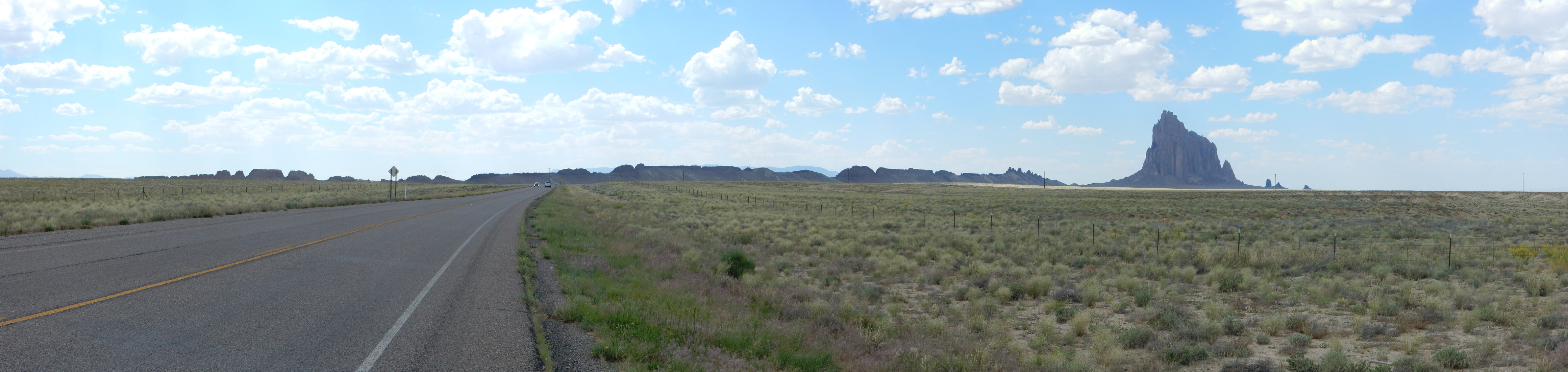
Shiprock is sacred to the Navajo, and one does not approach more closely. But the camera loves this mountain.

Shiprock is a volcanic plug, a neck of solid lava that was the central vent of a volcano composed mostly of softer cinder and ash. The cinder and ash have long eroded away, leaving the neck and the dikes radiating from it.
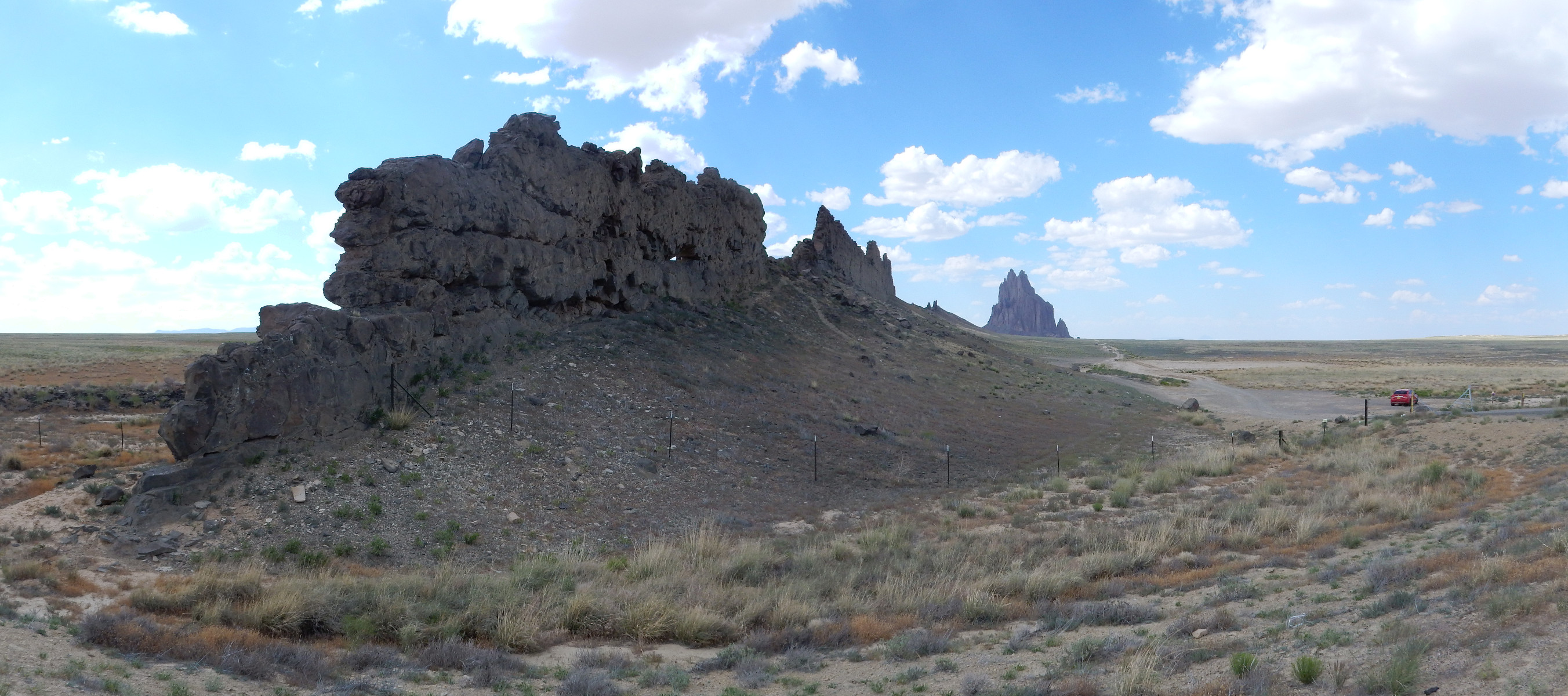
I suppose I should not be at all surprised to find that geologists had been here before.

I understand the temptation. The rock is 27 million years old and an example of a rare rock type called minette. This is formed from magma that is very high in potassium and low in silica, and the resulting rock is rich in biotite and orthoclase, which is fairly unusual for a silica-poor extrusive rock. Minette is thought to form from a very low degree of partial melting of the mantle. Just enough rock melts to be able to make it to the surface, and this magma is very heavily enriched in potassium. My close up, alas, came out blurry.
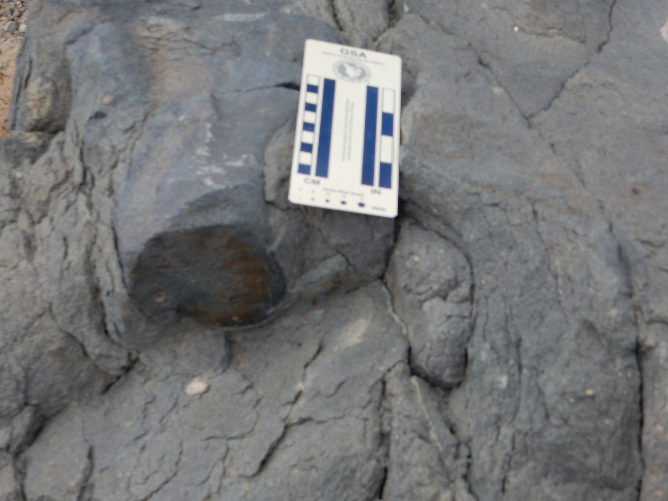
Although neither I nor the previous geologists ventured beyond the highway right-of-way, I took no samples, and I hope the geologists who did had secured permission first. I disturbed the area as little as possible, apart from laying my focus card on the rock briefly. The Navajo really do hold everything having to do with Shiprock sacred.
The rock did indeed have numerous flecks of biotite. Alas, the area was swarming with flies, for some reason, so I did not linger long. But I stayed long enough for my Ansel Adams moment for the day.
I returned to the town of Shiprock and proceeded west towards Tec Nos Pos and my turn north to Monticello. This was also Navajo country, and while it included some interesting geology (including the Beclabito Dome and the northern Chuksas Mountains) I took no further photographs. I felt vaguely like I already had my quota of upskirt shots for the day.
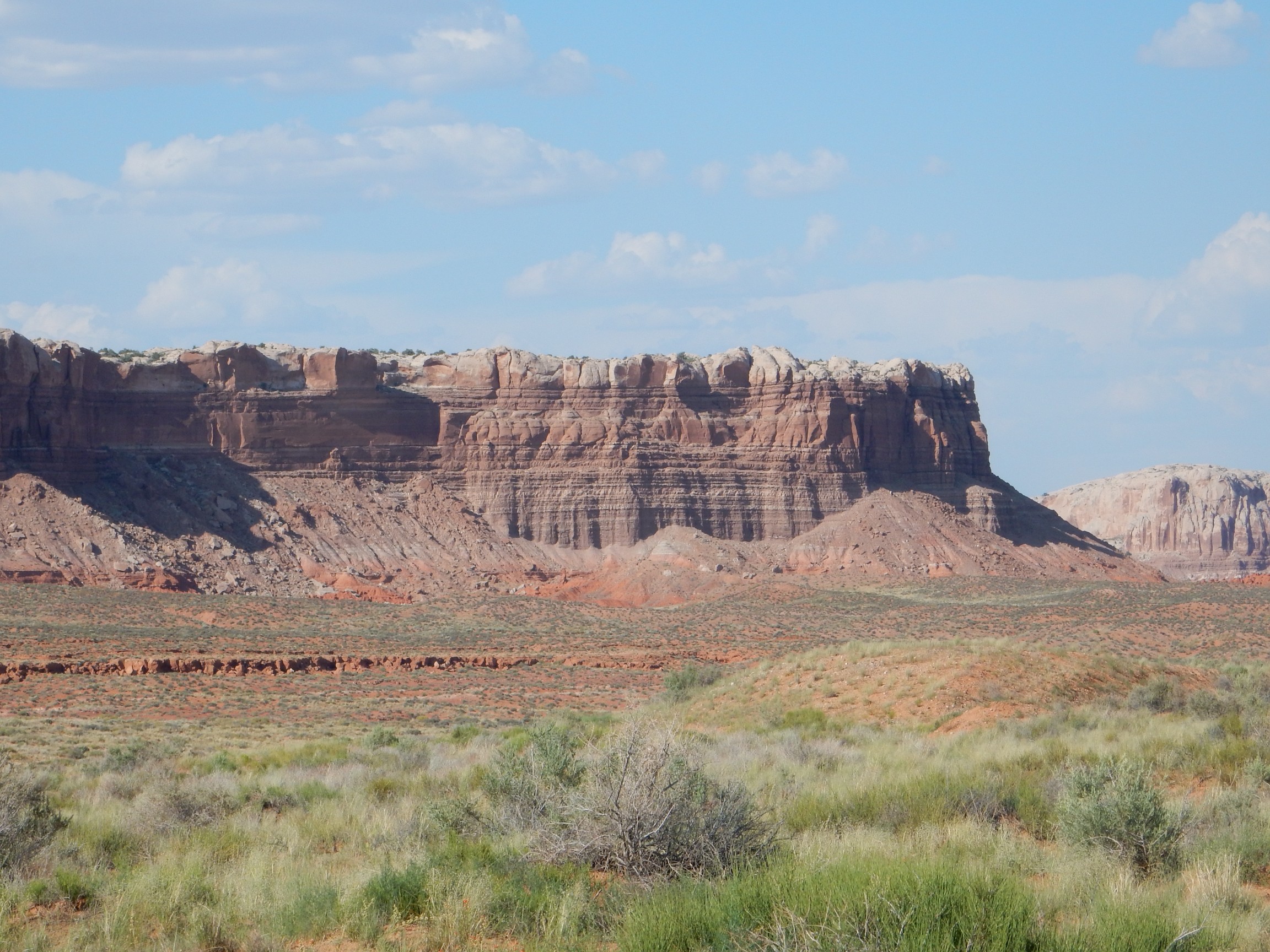
I emerged from Navajo country crossing the San Juan River near Bluff. Here there were some cliffs worth photographing.
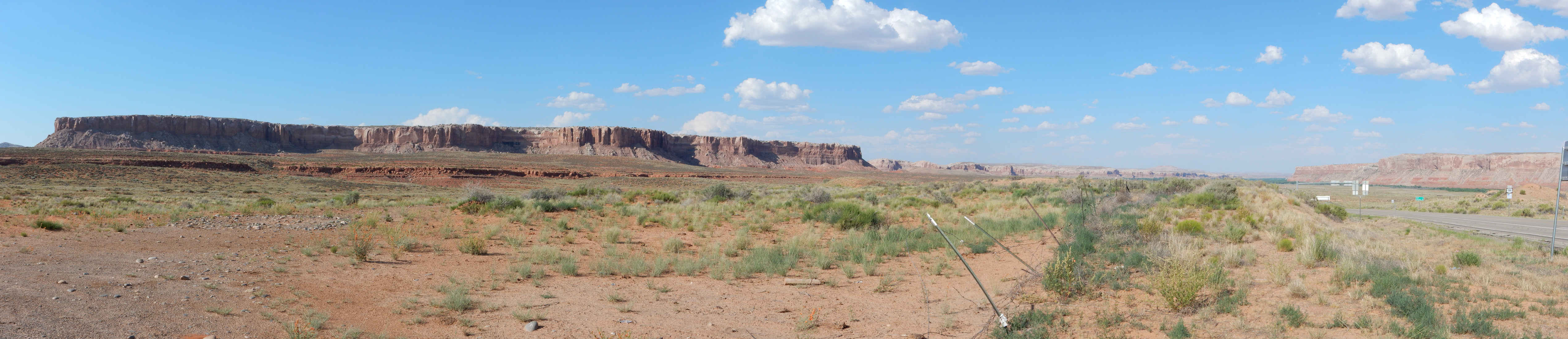
This is Tank Mesa; and if I’m reading the geologic map correctly, the cap is Bluff Sandstone, the next layer down is Summerville Formation, and the reddish layers towards the bottom are Entrada Sandstone. We’ll see a lot more Entrada Sandstone this trip. All are Jurassic formations.
A closer look.
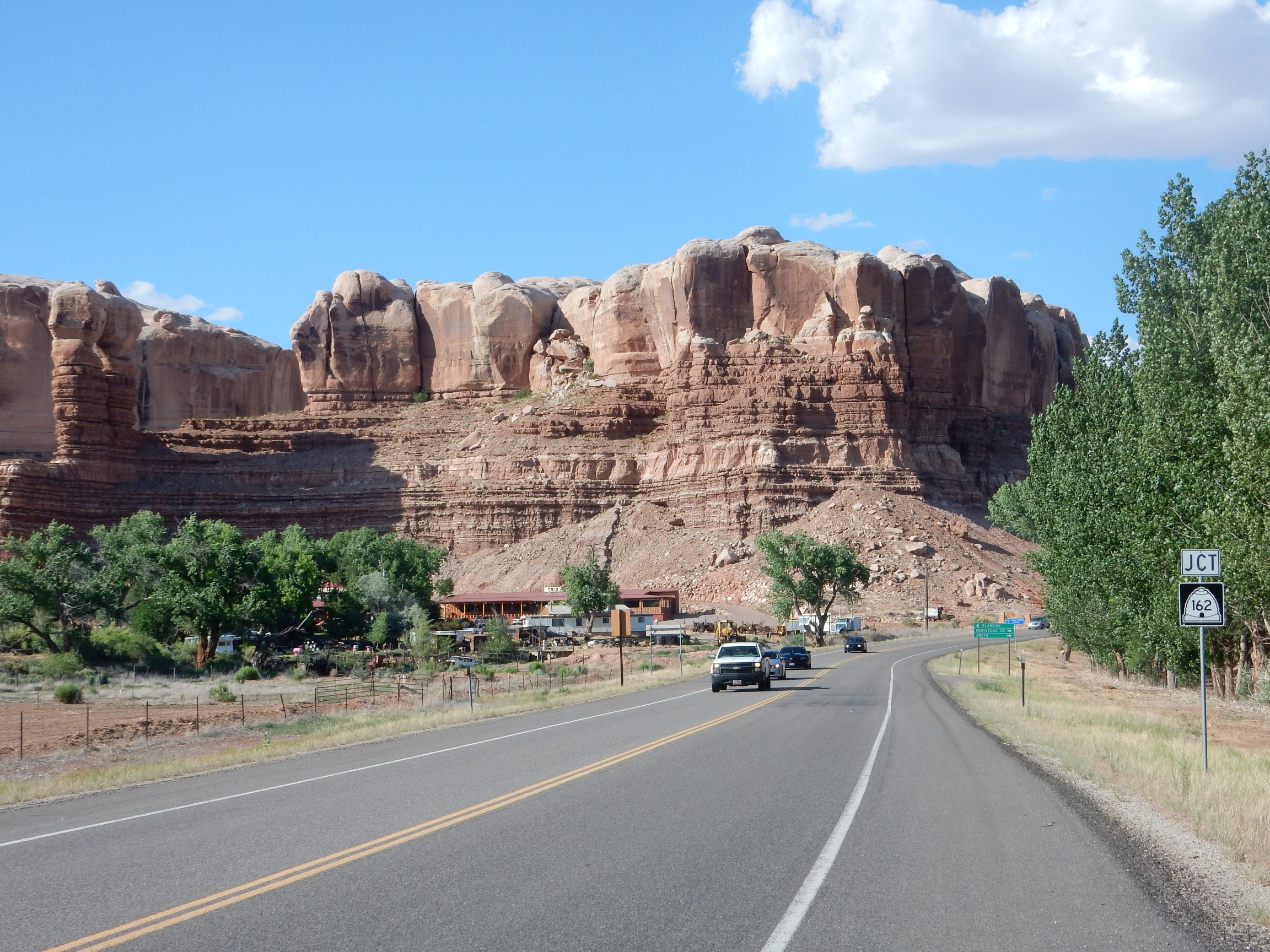
Just north of the town of Bluff:
From there, north to my campsite at Devil’s Canyon Campground. To the northwest are the Blue Mountains.
Time to set up camp. I had some trouble with my big dome tent, which is tricky for one man, and which I haven’t used in about three years. The fellow from next door materialized: “I know you usually do this all by yourself, but you seem to need a hand.” I admit I needed the help. He looked over my tent and commented that it seemed like a lot of tent for one person. I replied, truthfully, that I had more than one in mind when I bought it but the family turned out not to like camping. His own rig was an enormous trailer which he appeared to be sharing with a very small terrier; I bit my tongue. The trailer flew a Gadsden flag and he even looked a little like Bruce Dern.
I took a short walk around the camp area. I appeared to be well below the median age. And there was geology.
Probably the Cretaceous Dakota Formation. One of the most extensive formations in North America, laid down as near-shore dune and beach deposits in the Western Interior Seaway, the flooded middle section of the continent, around 105 million years ago.
Unless it’s Burro Canyon Formation, the next older Cretaceous formation. My money is on Dakota.
And, with that, my first day on the road came to a close.
Day 2 may be found here.
Thanks for sharing Kent….Really enjoyed
Pingback: Wedding wanderlust, day 2 | Wanderlusting the Jemez
Pingback: Wanderlusting Mount Taylor, Day 4 | Wanderlusting the Jemez