Kent and Bruce Have Yet Another Excellent Adventure, Day 10
Day 9 may be found here.
Up at the crack of dawn again.
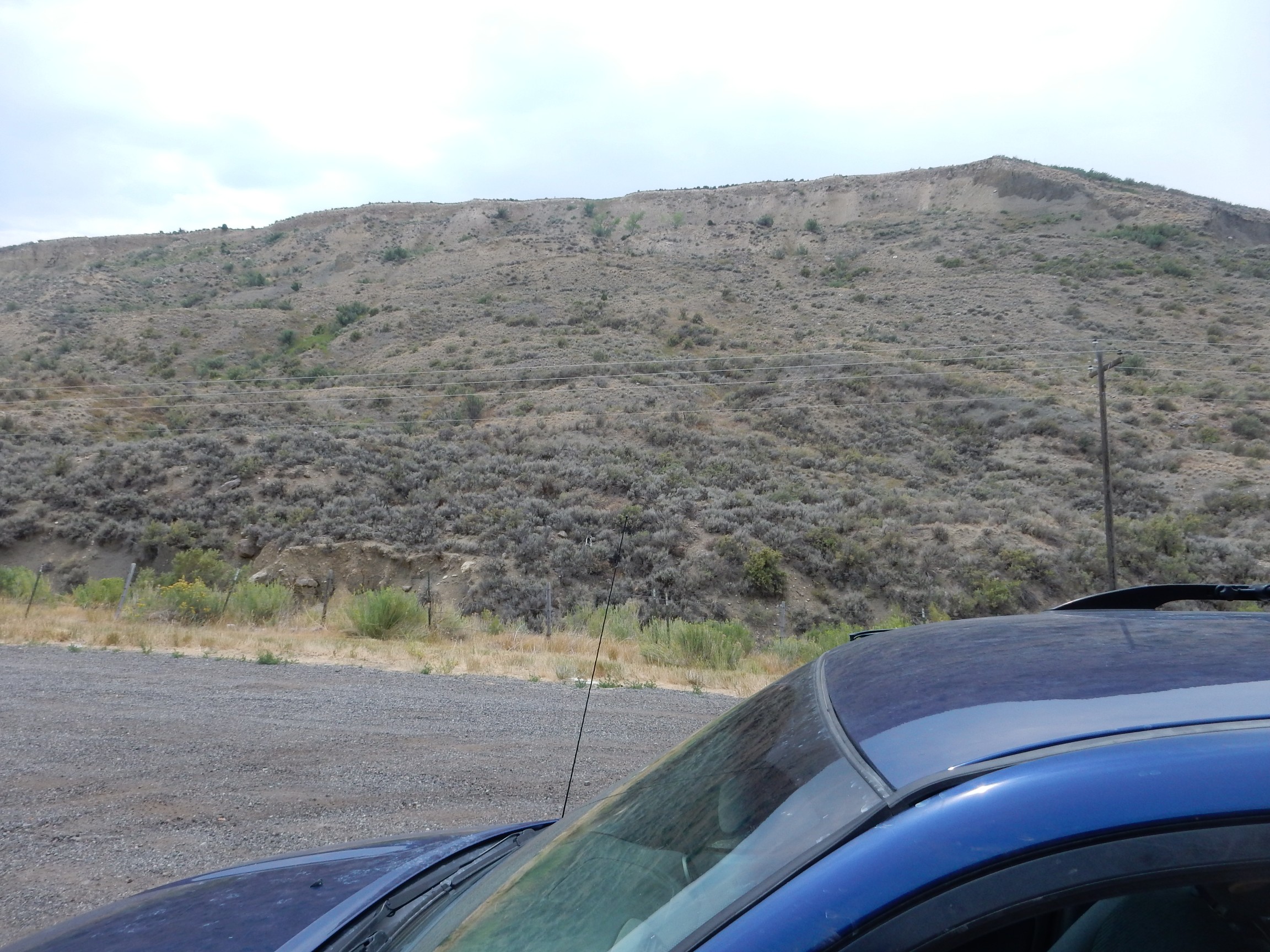
I eat breakfast, break camp, pack up, and start out. The low tire light comes on again. Crep. I check with my gauge; it’s quite low (though far from riding on the rims; I can make it to town.)
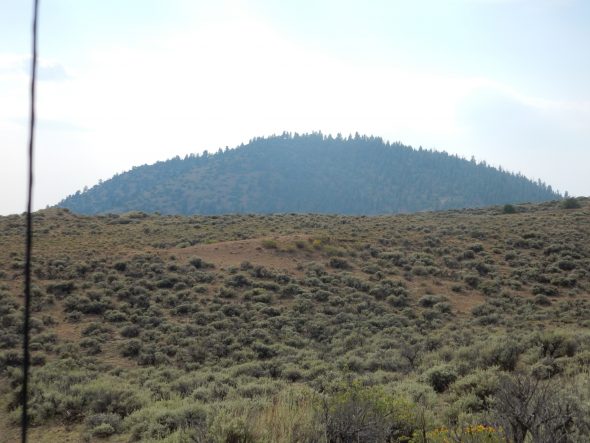
Land of many uses.
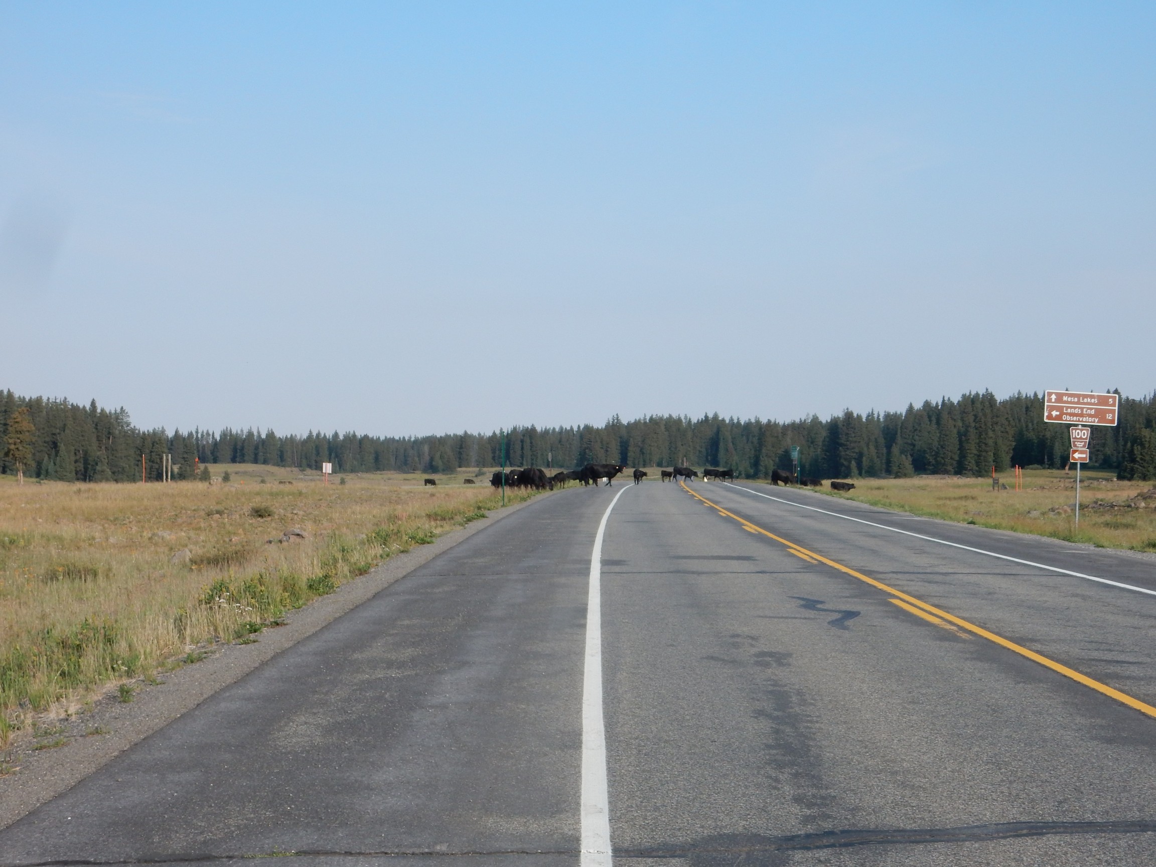
Cattle are paradoxical creatures. On the one hand, in my experience, they’re as curious as cats. Stop near a herd, and they’ll come over to see what’s up. We normally associate curiosity with intelligence. But, based on other experience, they’re dumb as stumps. Go figure.
I move along, arrive at Cedaredge, find a gas station/grocery, and pump the tire up. I also top off gas, then go in and ask if they have any eggs. (I’ve run out.) “I don’t sell eggs. …That would mean dealing with a whole ‘nother inspector.” “I understand completely.” But it’s a bummer I’m still out of eggs.
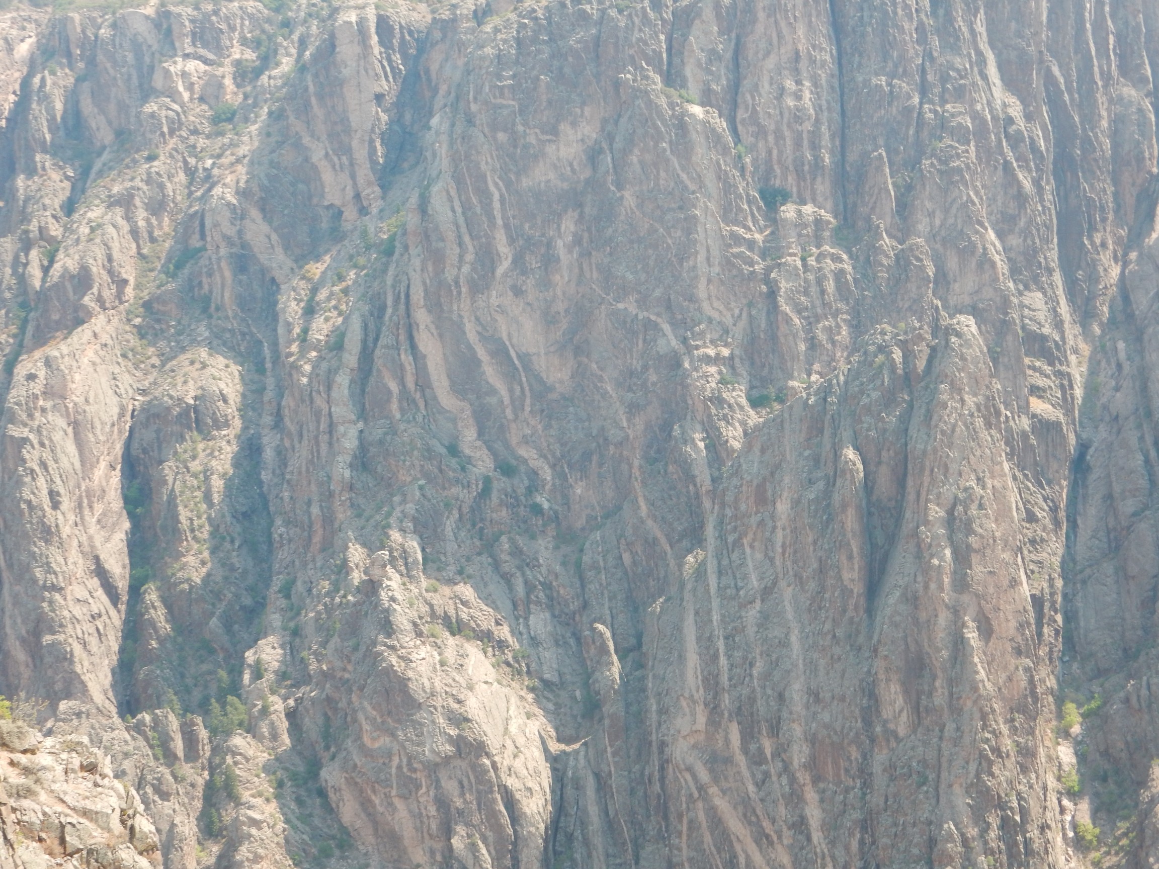
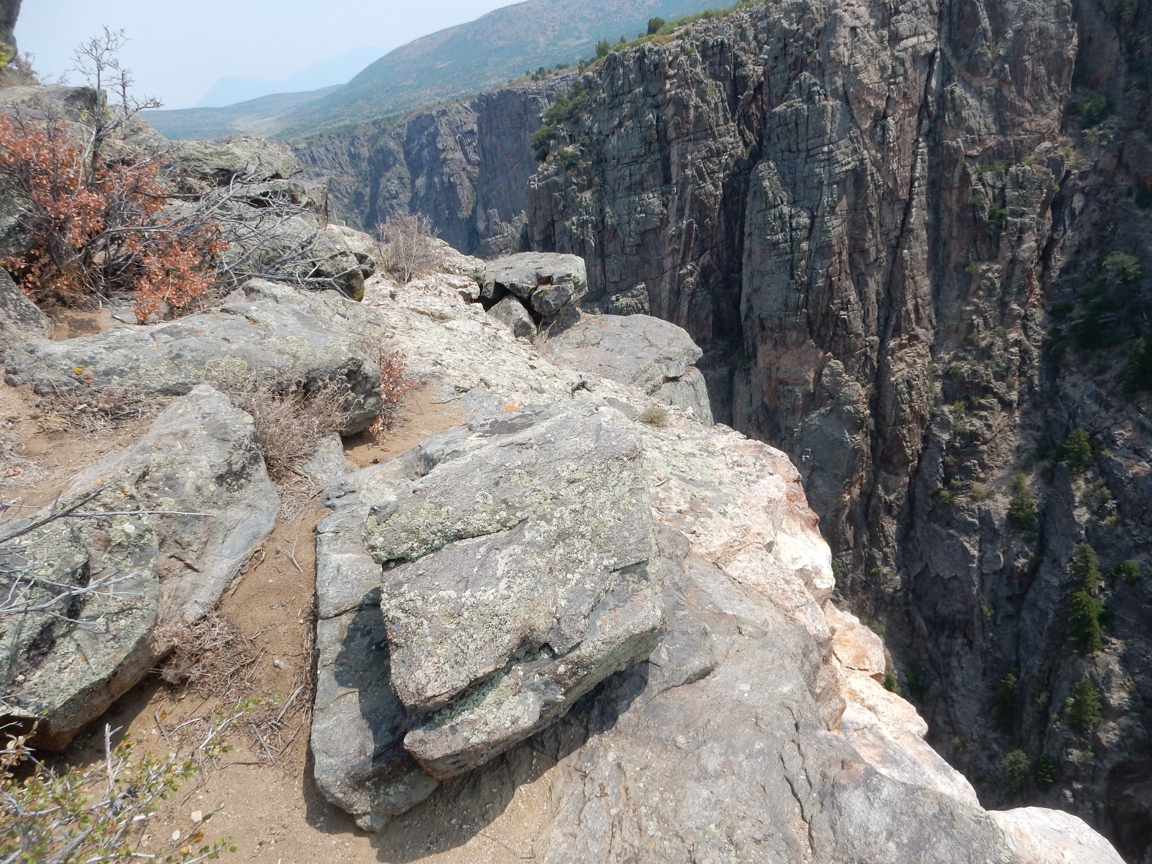
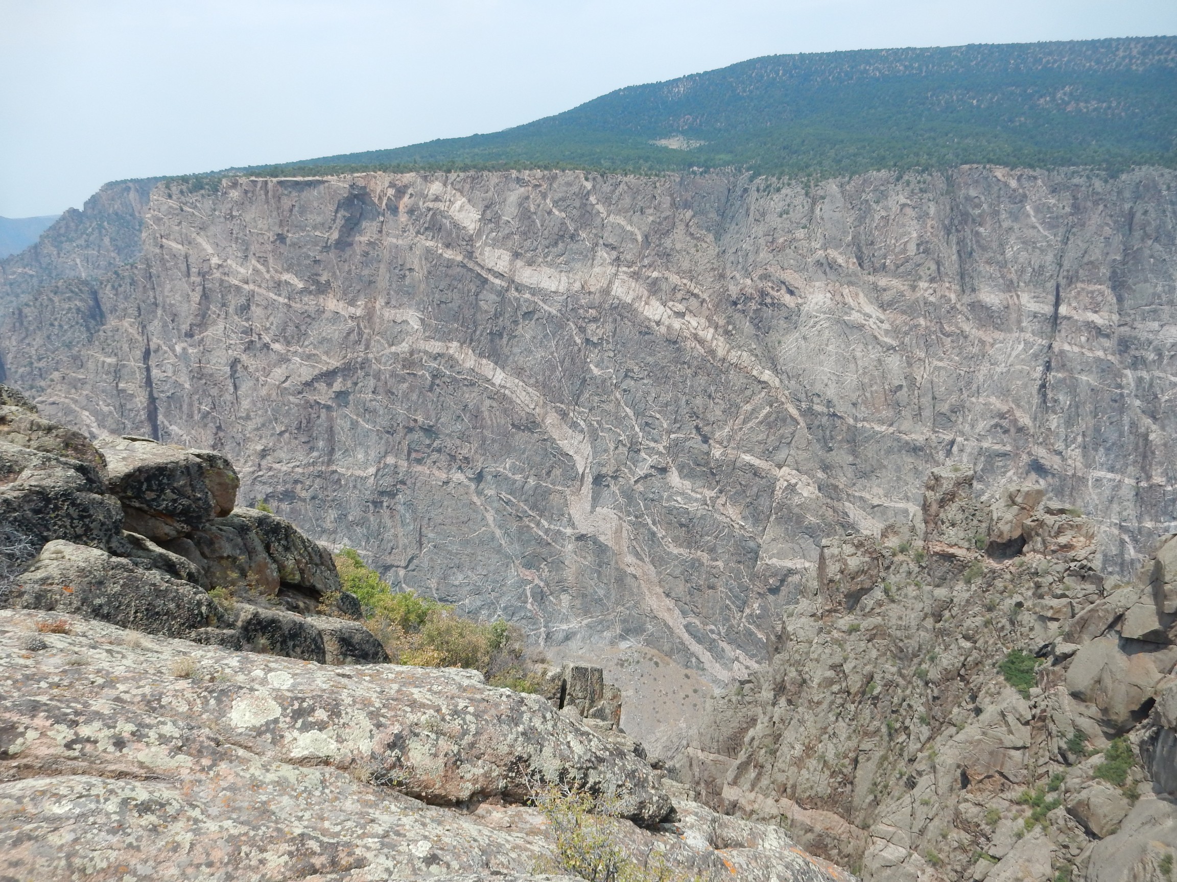
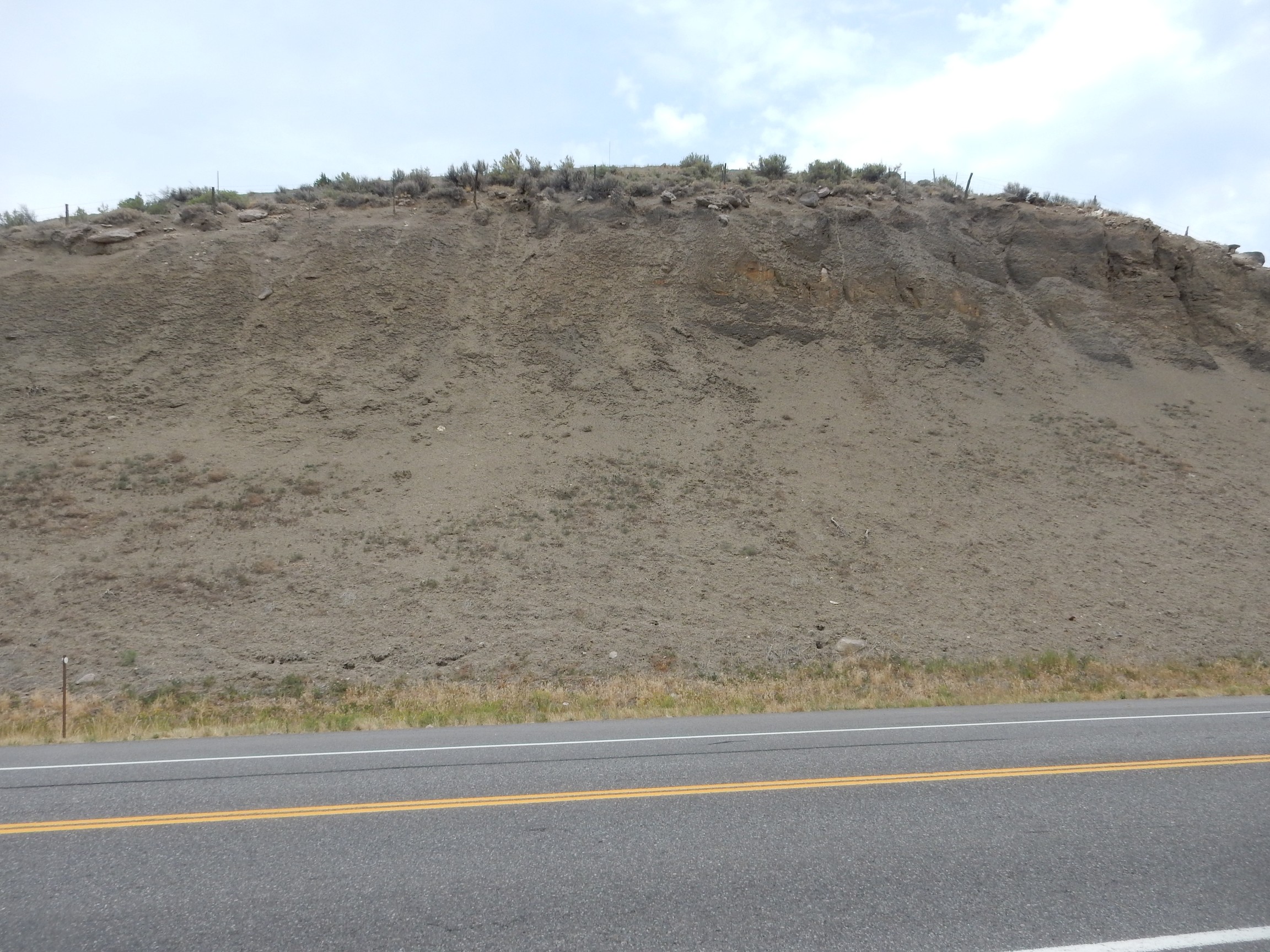
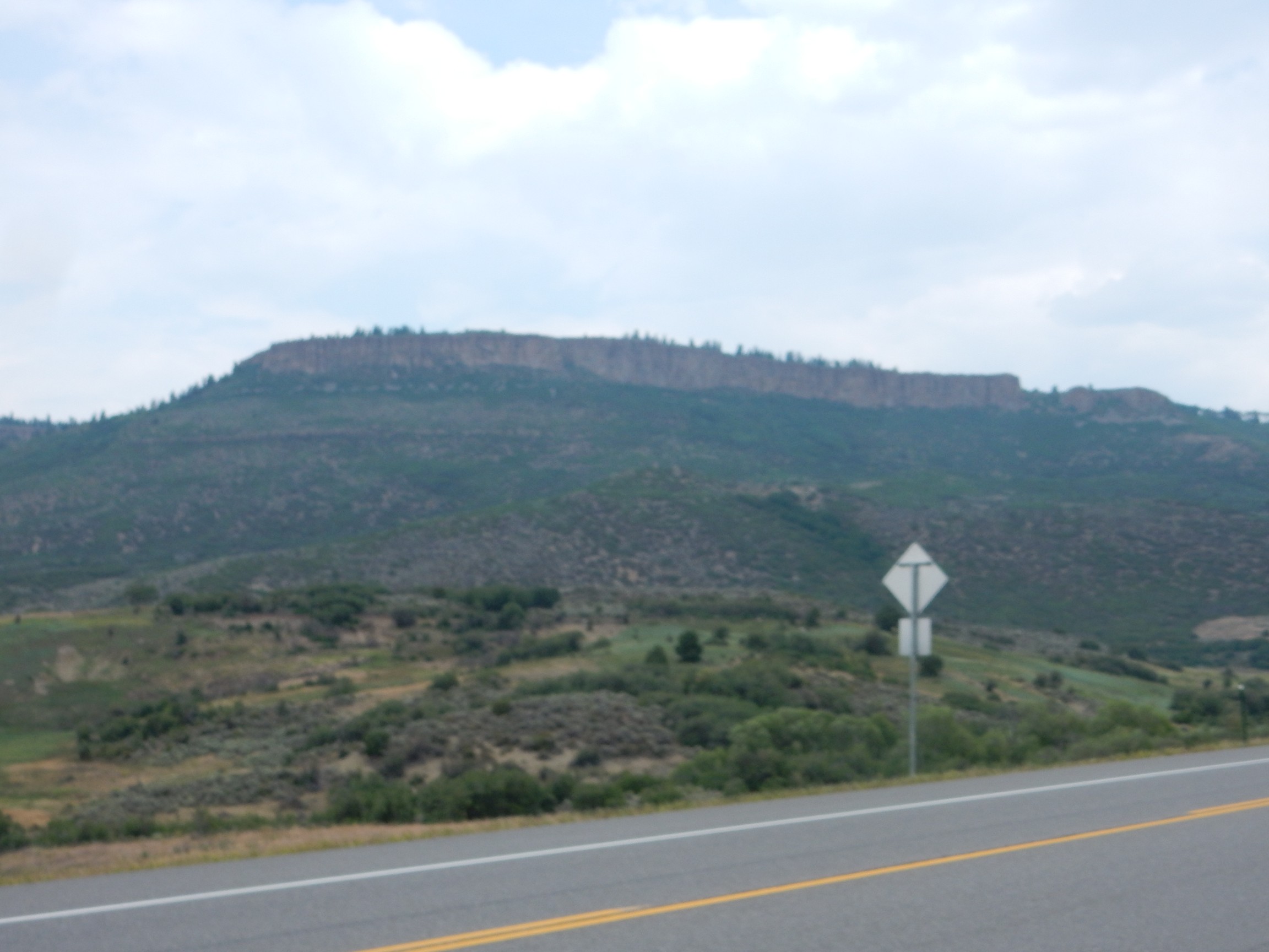
I meet up with Bruce and we head out. I am again in the lead with the road log. There is not that much to see — just lots of Mancos Shale — until we arrive at Black Canyon of the Gunnison. It’s spectactular.

As Bruce notes, it comes up at you out of nowhere. You’re driving on a flat plateau with a fairly gentle slope and pow!
The rock here is mapped as a Precambrian layered quartzitic gneiss. No age is reported, but another nearby unit has a radiometric age of 1.7 billion years. That’s fairly typical for the Yavapai Province, which is the ancient basement rock stretching from the Wyoming border to about the latitude of the Jemez and from Arizona to the Midwest. It’s though to be a series of island arcs that accreted onto the edge of Laurentia, the ancient core of North America, when algae ruled the earth.
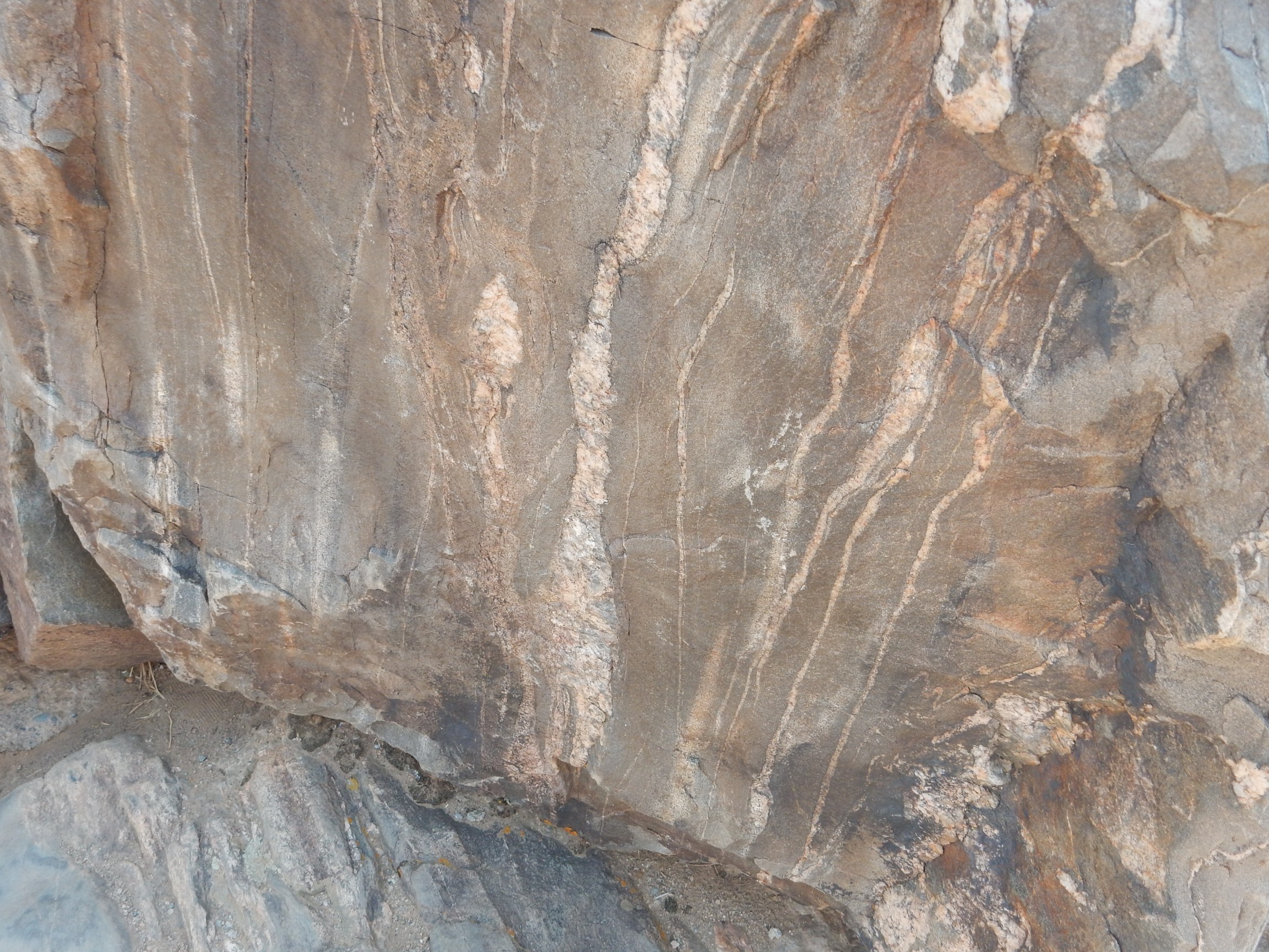
Here’s the rock.
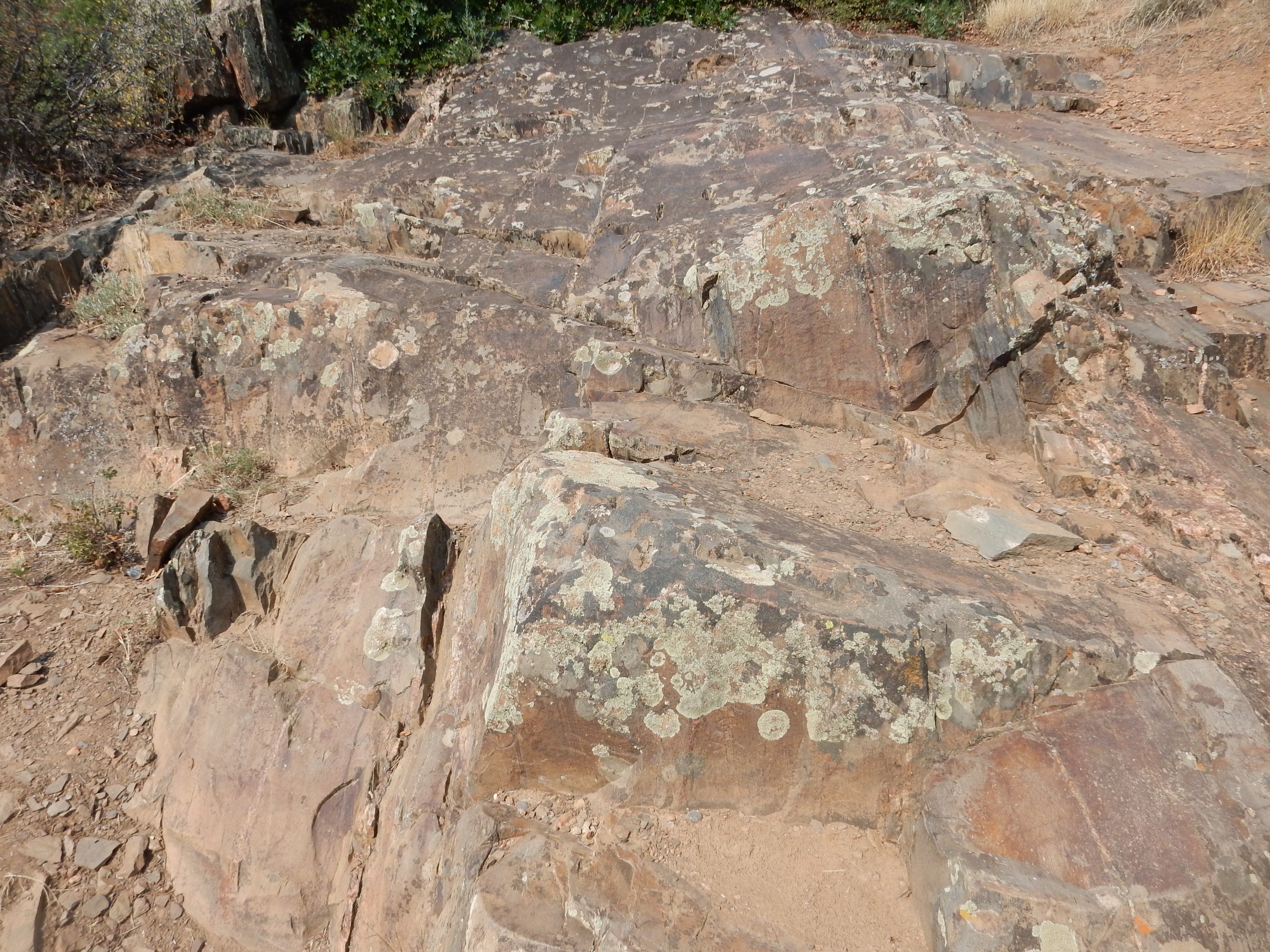
It has some thin pegmatite (coarsely crystalline granite) veins. I’m admiring these when a ranger happens by. I explain that I’m admiring the pegmatite. He notes that my tee-shirt says “JUST ONE MORE ROCK, I PROMISE”, kind of chuckles, and says I’ll see much better further up the canyon.
We continue up to the visitor’s center. It takes some creativity for Bruce and me to find parking spots, but we manage. There is a park volunteer with a solar telescope with an H-alpha filter; I look and the sun is very quiet. Solar activity has been abnormally low for over a decade now. We encounter another amateur astronomer on the trail to Gunnison Point; we talk, and agree that the smoky weather is a disappointment. Out to the point:
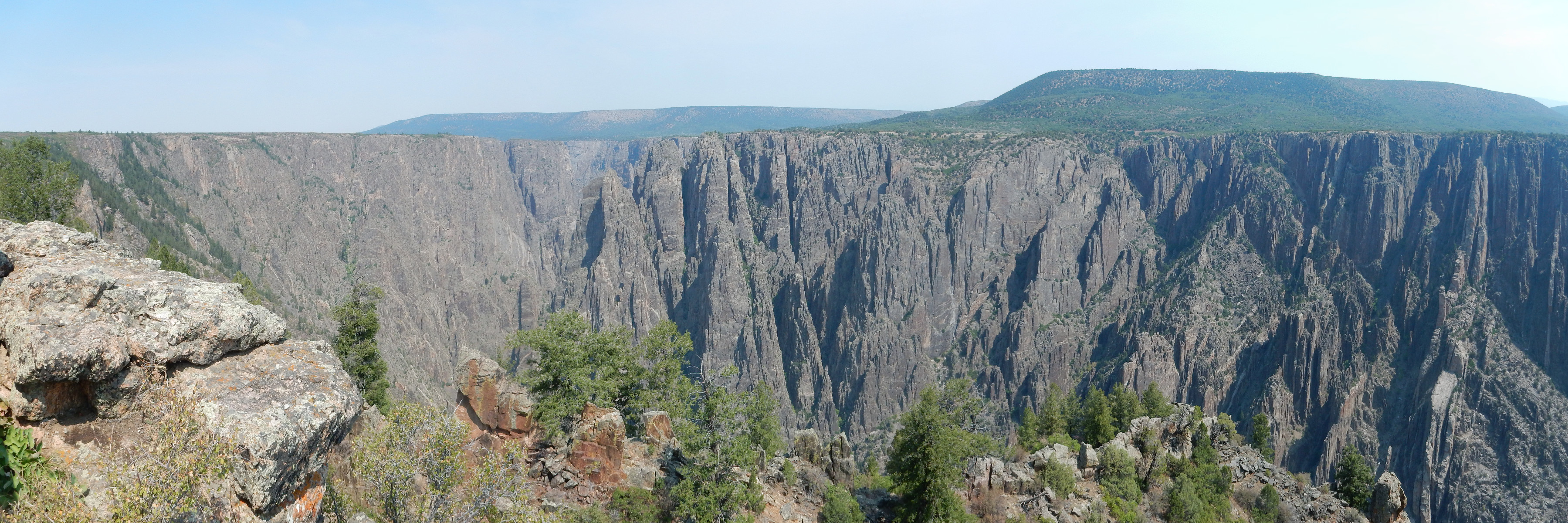
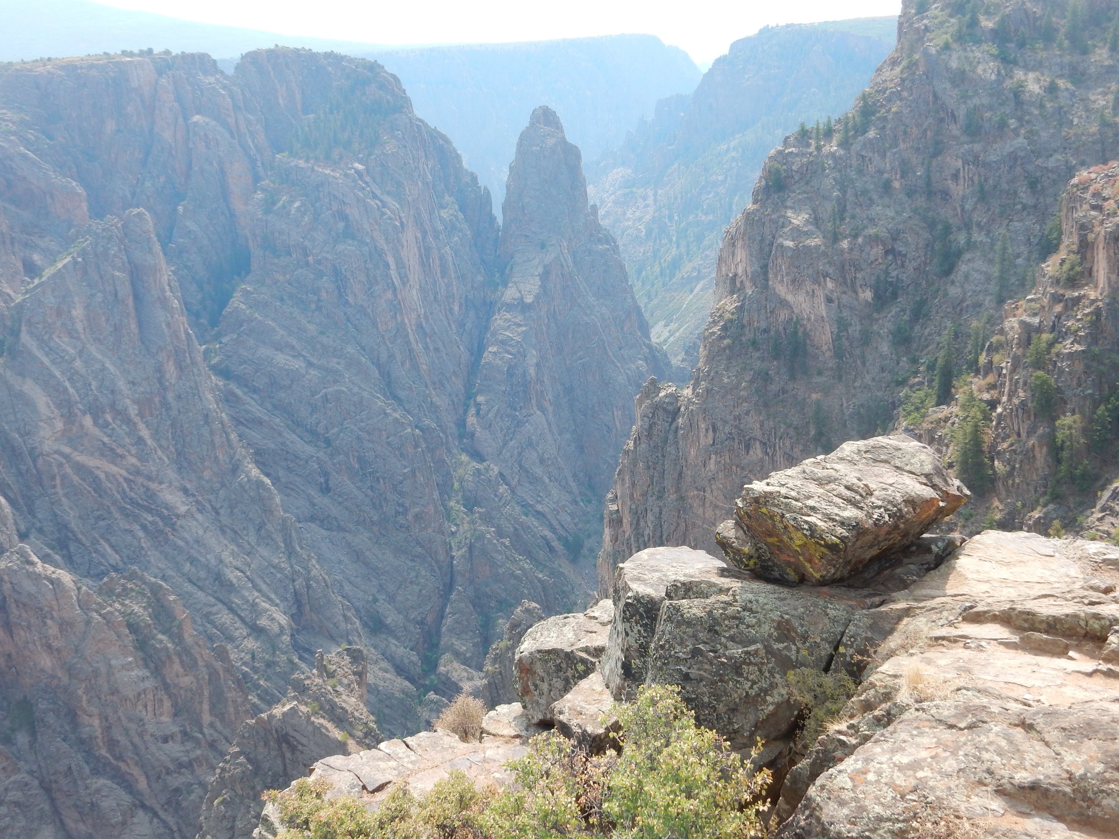
You may have noticed that the canyon rim is remarkably level. This is a very ancient surface preserved in the resistant basement rock here. This surface is seen throughout the Southwest and represents an ancient peneplain, where, sometime between 1.3 billion years ago and 600 million years ago, the surface was eroded practically flat across the Southwest. When sedimentary rock beds began to be deposited again, there was a gap between the oldest sedimentary beds and the youngest basement rock beneath that has been dubbed the Great Uncomformity. The gap varies from place to place; deposition resumed as early as 1.2 billion years ago in some parts of Arizona, but did not resume in northern New Mexico until about 330 million years ago.
The Gunnison River cut more or less straight down into this peneplain, forming the spectacular canyon we see here today.
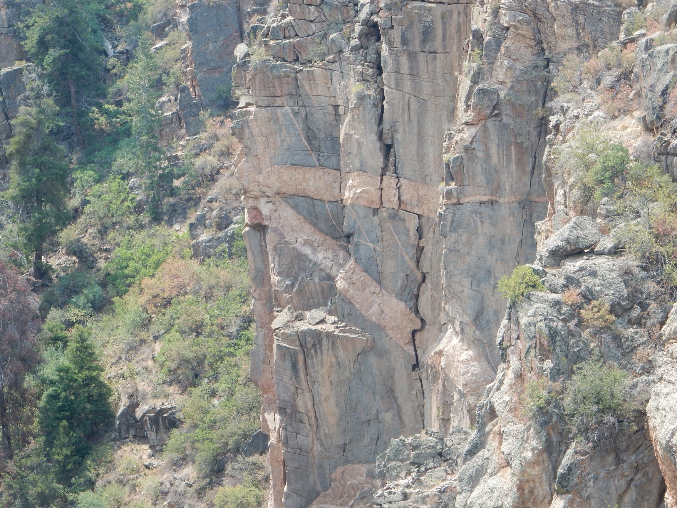
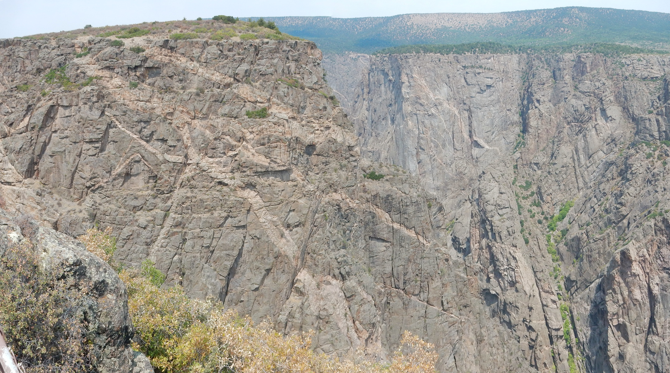
There is a large dike of pale rock across the canyon.
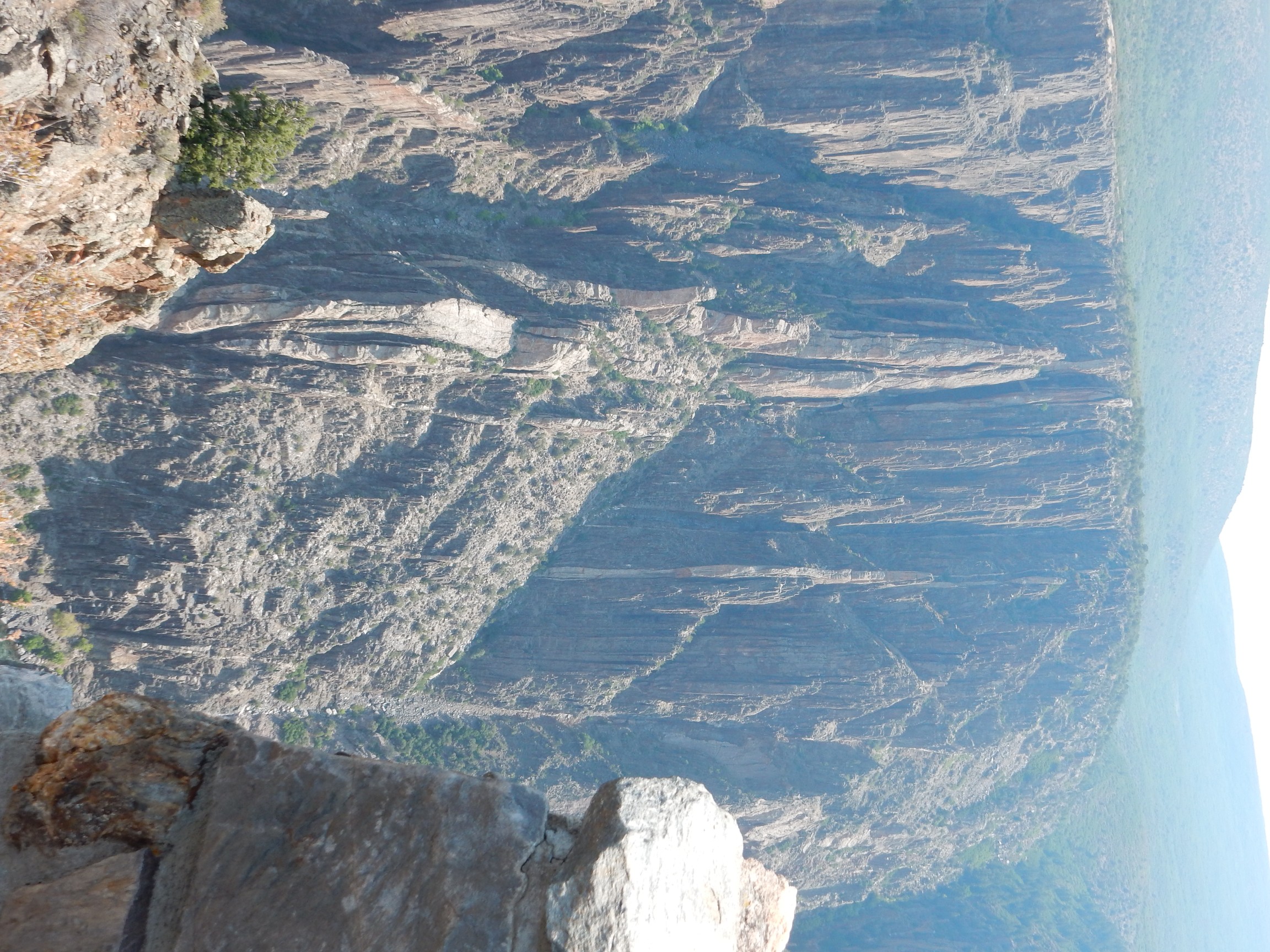
More than one, actually. There are numerous pegmatite dikes in this part of the canyon, formed of relatively high-silica rock (hence the pale color) and all trending west-southwest to east-northeast. This is approximately the strike of the Yavapai Province, likely not a coincidence. This rock is highly resistant and so stands out with erosion. There are also parallel dikes of amphibolite, a low-silica rock that is not very resistant, that forms slots in the canyon walls. The effect is pretty spectacular.
One of the dikes has been dated at 1.36 billion years old. This corresponds with an “anorogenic heating event” at about 1.3 to 1.4 billion years that emplaced batholiths (large bodies of granite) and dikes throughout the Southwest. However, the report notes that there is probably considerable variation in age.
It’s a long ways down.
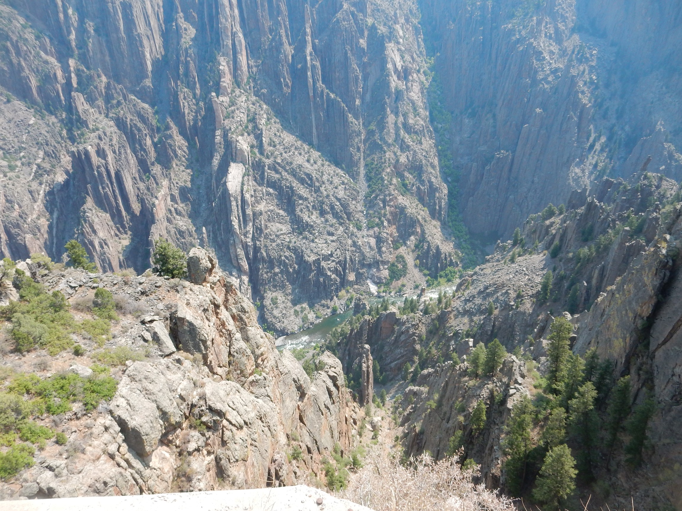
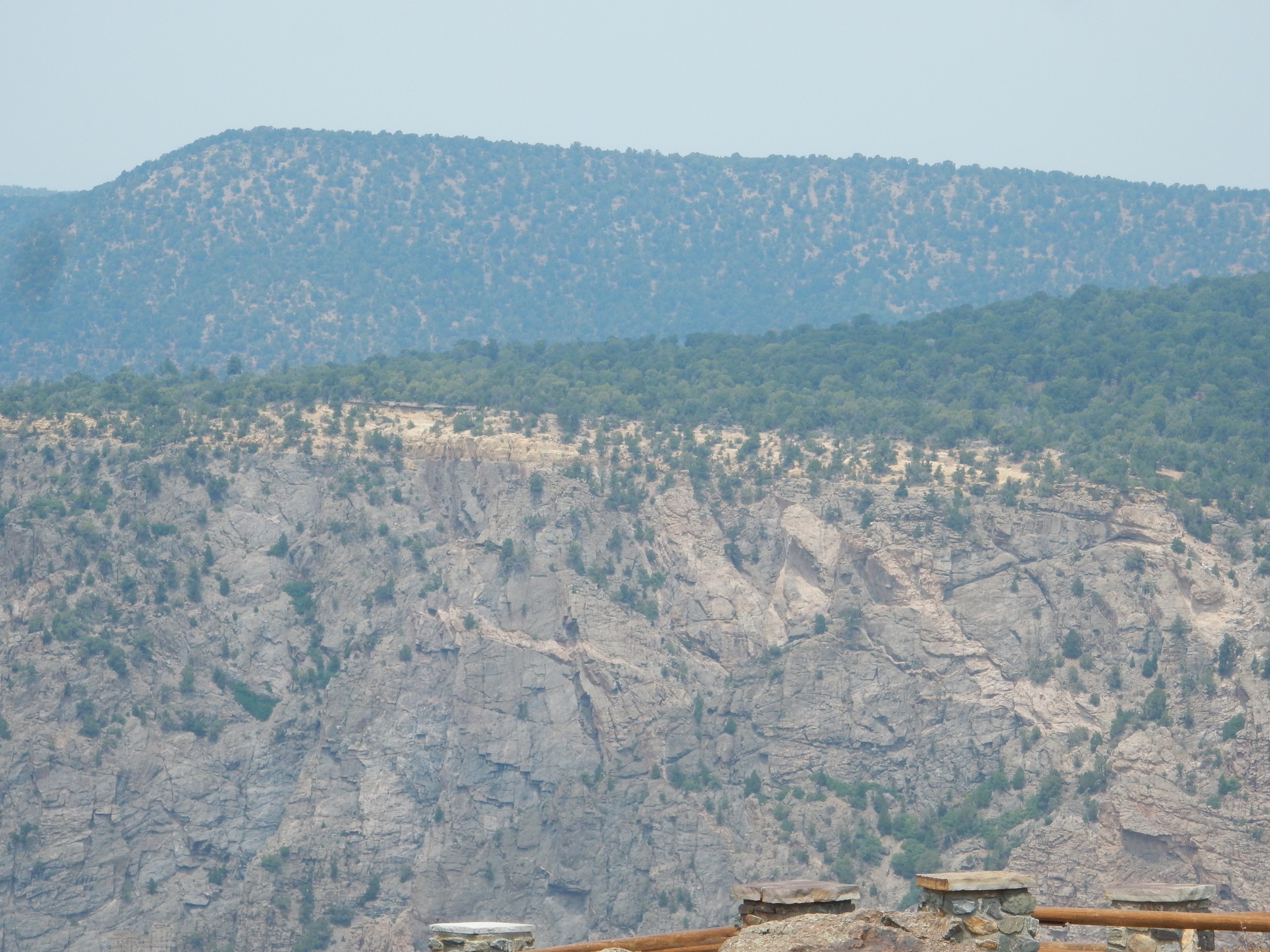
Next stop is Pulpit Rock.
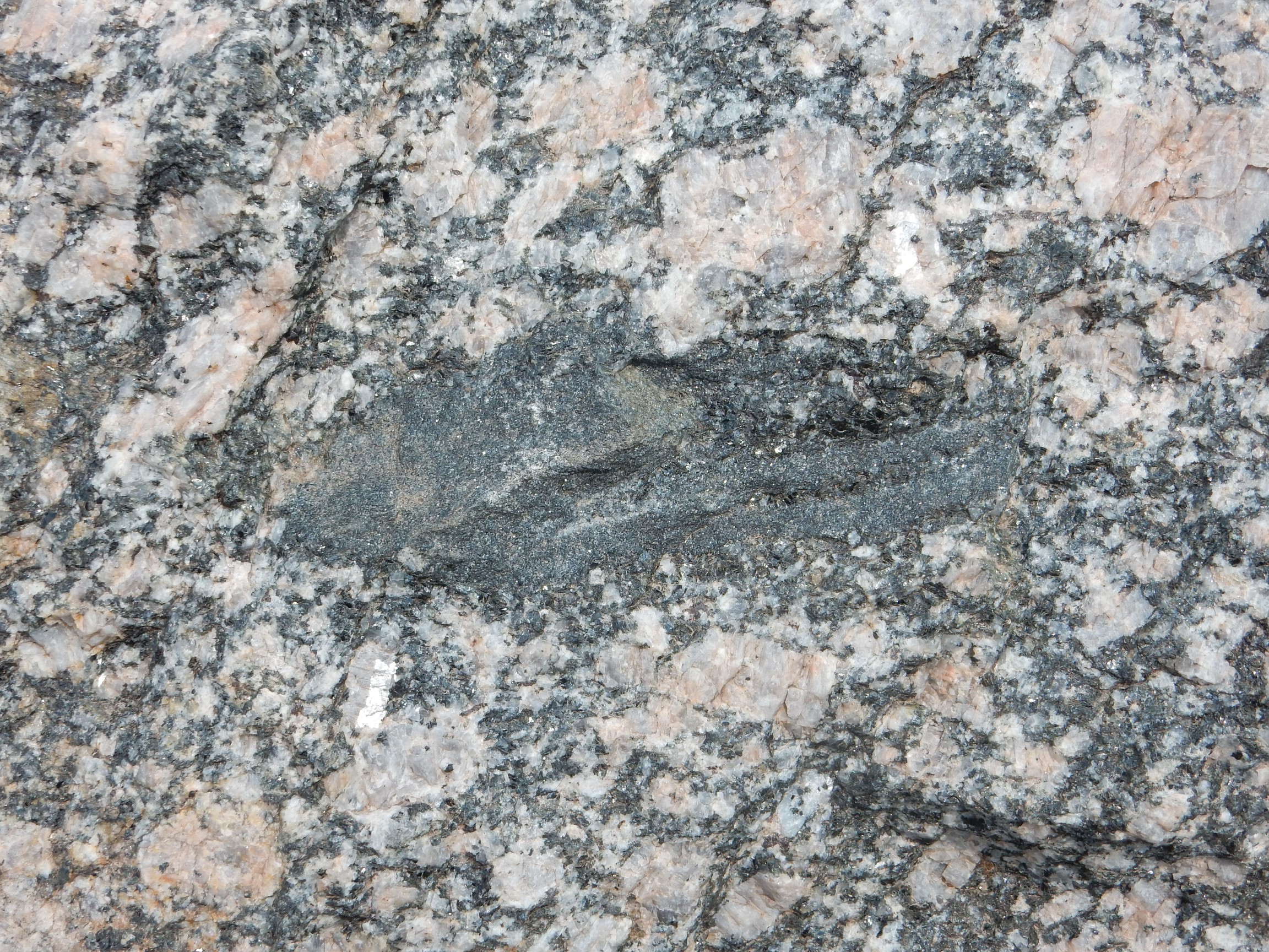
The rock underfoot here is mapped as Precambrian migmatitic gneiss. This is the unit that was dated as 1.7 billion years old. A migmatite is a body of rock that reached a temperature at which it just began to melt, so that there are ribbons of lighter rock (the leucosome) within the darker parent rock (the melanosome or restite) where liquid rock began to separate from the solid parent rock, and later resolidified. These ribbons are qualitatively different from ordinary pegmatite veins in the rock, formed by injection of magma from elsewhere along fractures in the rock.
This, students, is why we try to remember to include familiar objects for scale in photographs:
The first photograph is across the canyon. The second is of an outcrop perhaps two feet away from the camera. You can get scale from the pine trees in the first phograph, and the pine needles in the pocket at lower left in the second photograph, but still. It’s remarkable the resemblance at these very different scales. Fractal geology?
This unit is also intruded by the younger pegmatite dikes, and they have the same orientation as the previous unit.
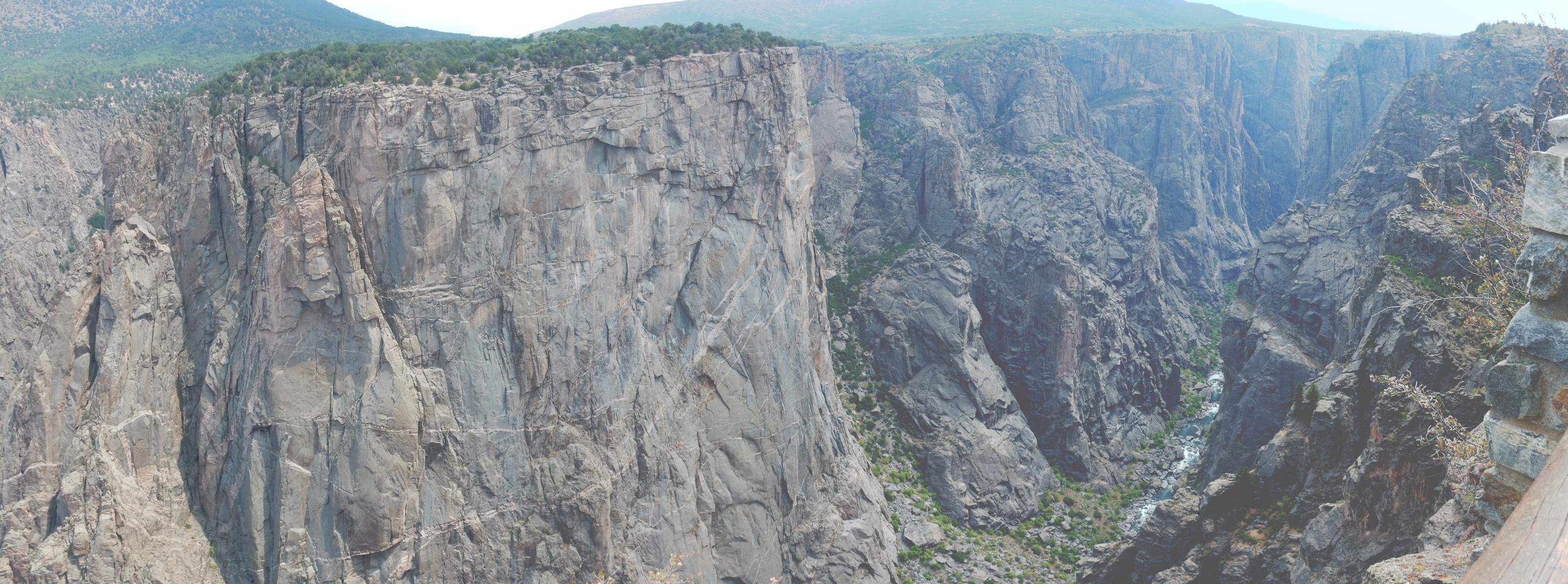
Next is the Cross Fissures View.
There are numerous fissures parallel to the dikes throughout the canyon, which seems unsurprising. But in this area, there is a second set of fissure almost perpendicular to both the dikes the the other set of fissures; hence, cross-fissures. I don’t know the geologic significance.
Next is Devil’s Lookout.
The rock underfoot here is the Vernal Mesa Quartz Monzonite, dated at 1.48 billion years old. The dikes cutting across it no longer have the regular ENE-WSW orientation; they’re not vertical, but are more irregular, tending to have a significant dip to the northeast.
Quartz monzonite is intrusive rock containing 5 to 15 percent quartz and roughly the same amount of alkali and plagioclase feldspar. The rock here is a relatively quartz-rich, alkali-poor quartz monzonite. It’s actually a very common rock type; in my experience, the most common granite-like rock and quite a bit more common that true granite.
My search for a nearby dike was not in vein.
Here you can see how the dikes dip to the northeast.
The country rock is quite broken up in places.

On to Chasm View.
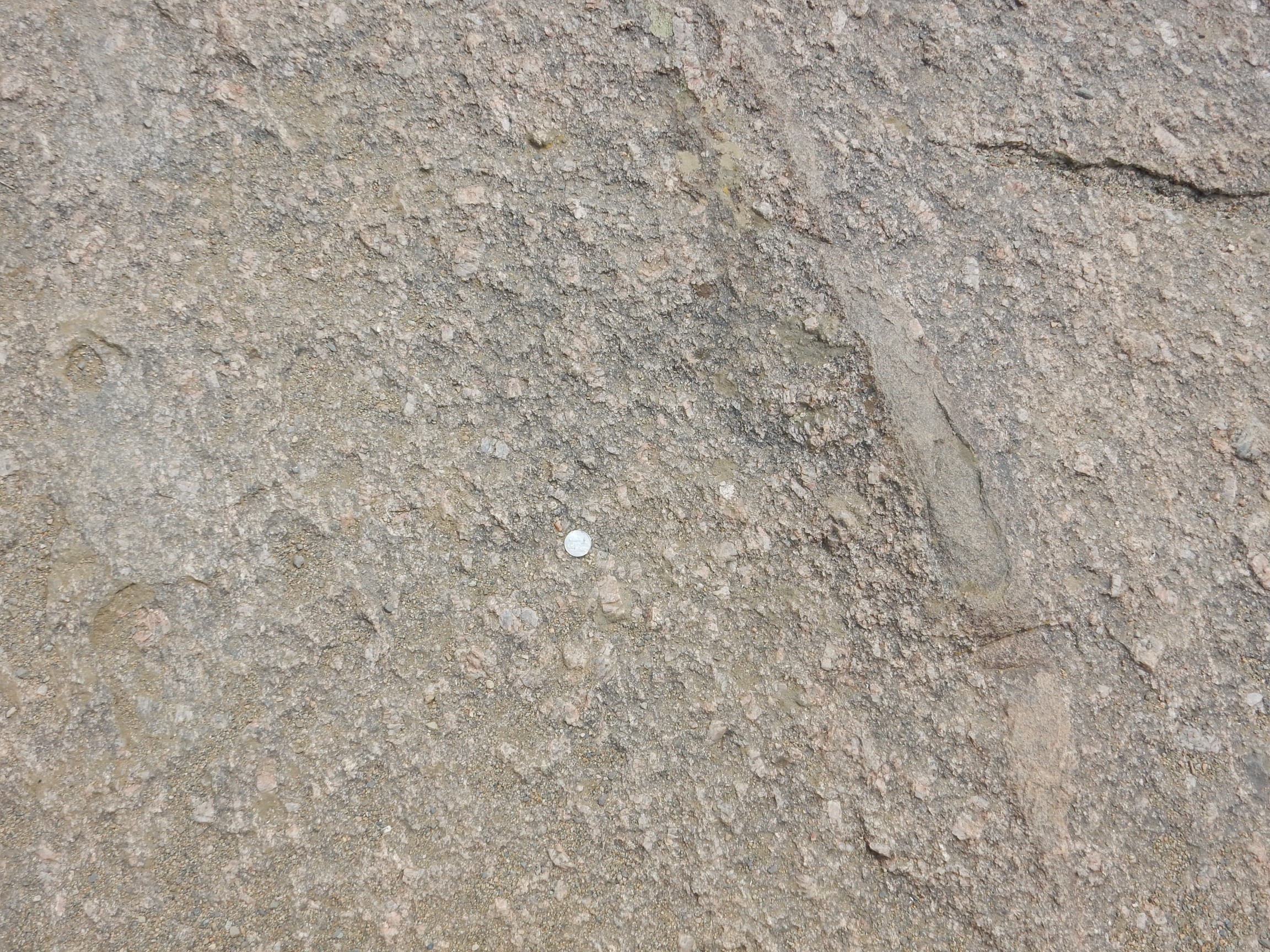
The rock here is still Vernal Mesa Quartz Monzonite, now shown close up with a quarter dollar for scale. The big honkin’ angular feldspar crystals are very typical of granites sensu lato. (“Granite” is a handy term for any high-silica intrusive rock, but granite sensu stricto is a rock with at least 15% quartz and a predominance of alkali over plagioclase feldspar.)
Next stop is … something we inadvertentlly bushwacked. We thought we were headed to Dragon Point, but took a wrong turn somewhere. Regardless:
This is the Painted Wall, and it’s located back in the migmatitic gneiss. But the dikes are not back to their orientation from the previous migmatitic gneiss; odd. Perhaps a distinct body of migmatitic gneiss? Regardless, this shows that the Vernal Mesa Quartz Monzonite is a pluton of limited size intruding older rocks.
Last stop. I admire a xenolith in a boulder by the parking lot.
A xenolith is a bit of solid rock caught up in a body of magma that does not quite melt. Here the magma was a very pretty granite magma and the xenolith looks like a silica-poor bit of lower crust. We’re still in the area mapped as Vernal Mesa Quartz Monzonite, so the boulder itself is an erratic, a chunk of rock far from its home that has been transported a long distance. Natural erratics are usually the result of transport by glaciers, but I suspect this erratic is anthropogenic.
Across the canyon is a good exposure of rim rock.
The light-colored rim is Jurassic Entrada Formation. The hill behind is Jurassic Morrison Formation capped by Cretaceous Burro Canyon and Dakota Formations. Looking at the geologic map, I see that it’s the Entrada Formation sitting on top of the Great Unconformity everywhere in this area. That pretty much pins down when the Precambrian peneplain of the Gunnison Uplift was finally buried in sediments — about 165 million years ago.
Signage.

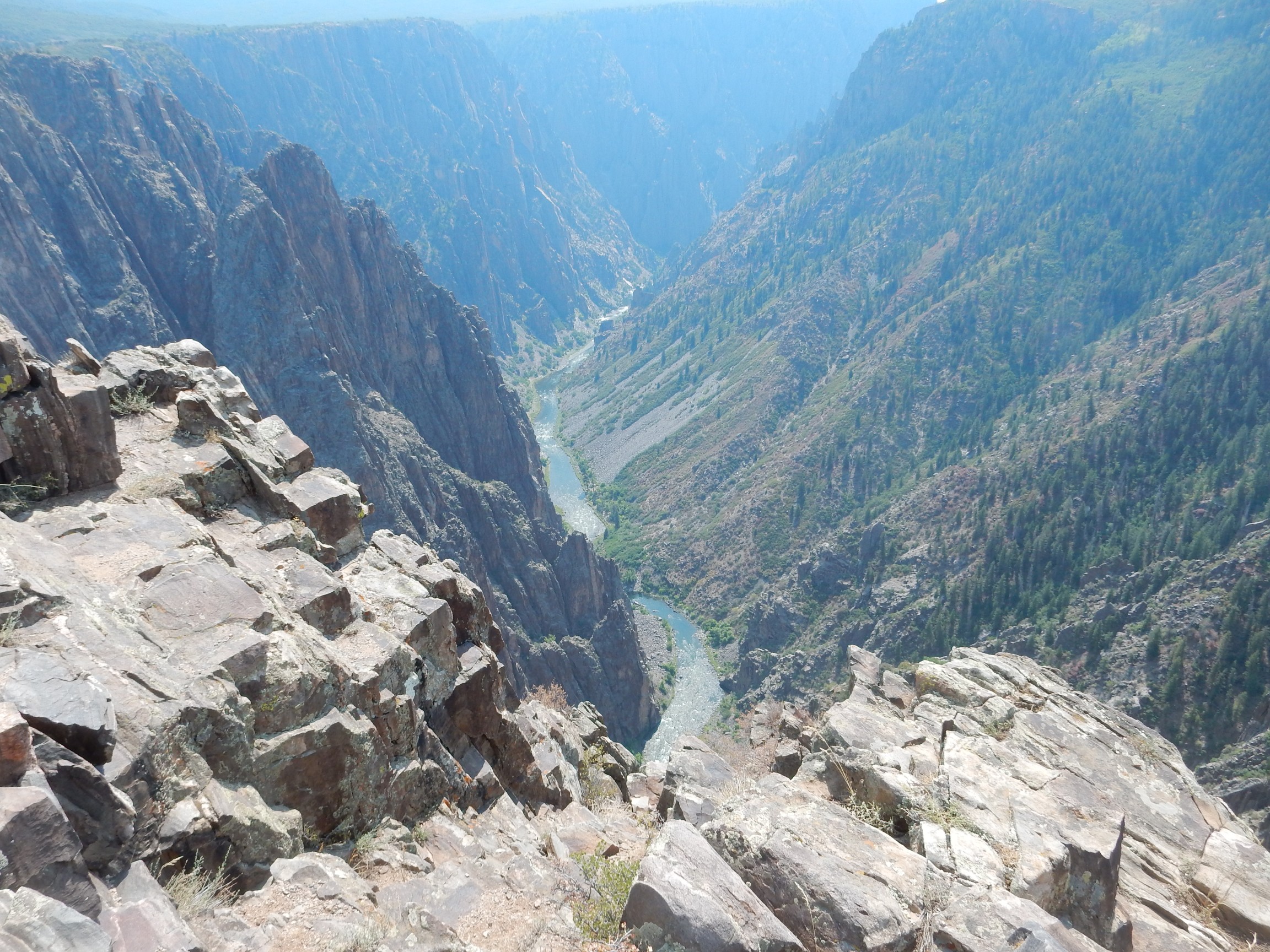
The view down the canyon.
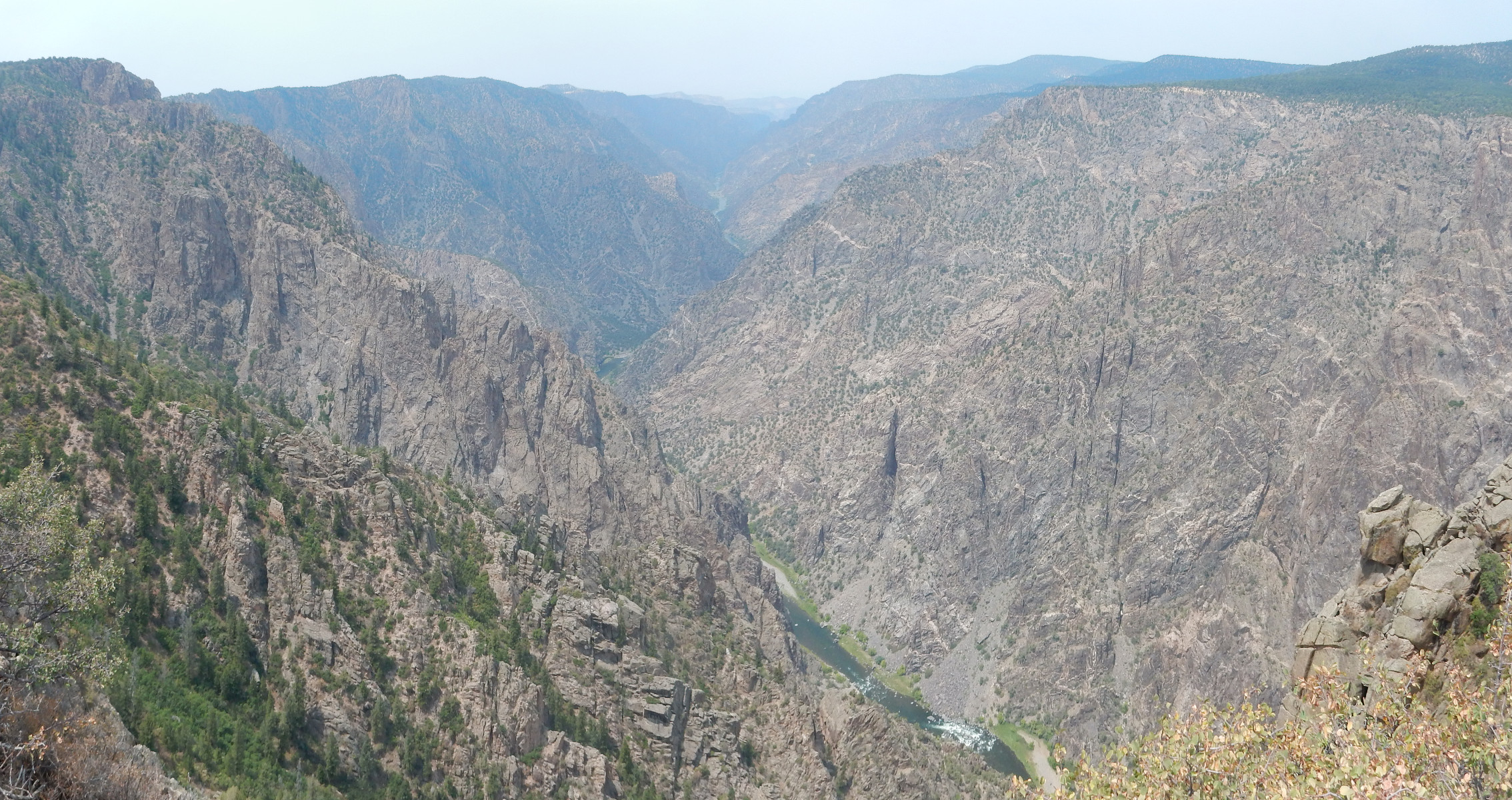
The wildfire smoke is mostly loathsome, but here at least it lends a better sense of distance.
The dark streaks in the canyon wall are fissures, from the cross-cutting system, with which our angle of view is nearly aligned here.
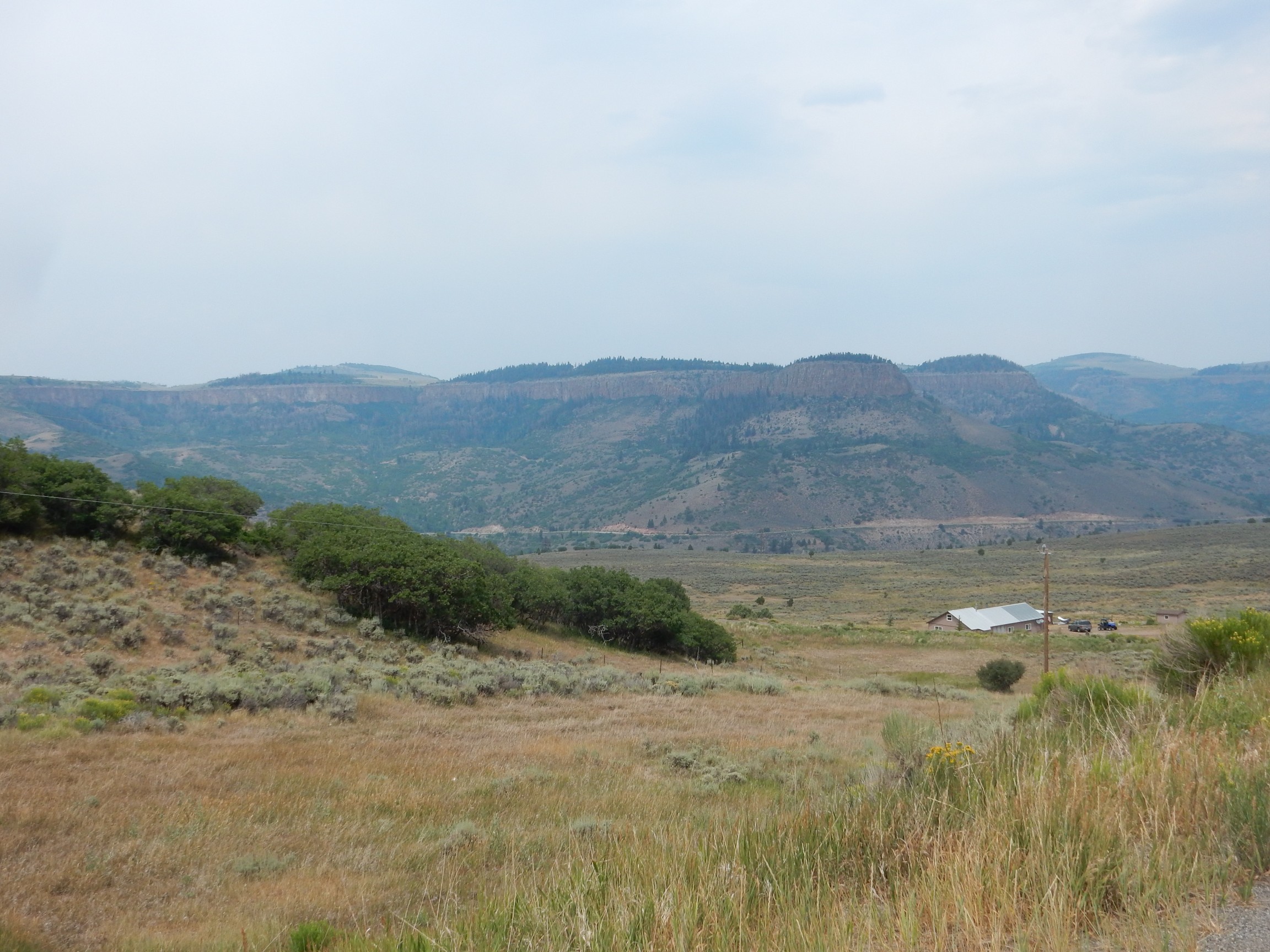
We’re done here. We retrace our way back to the main highway and head towards Gunnison. I am again in the lead with the road log, and the first stop seems almost boring after the Black Canyon.
The slumped terrain was caused by irrigation on the mesa beyond, Squaw Mesa, which saturated the soft Mancos Shale rock beds. But then, there are landslide deposits throughout this area, showing that Nature didn’t need much nudging. Across the road is a cut in this formation.
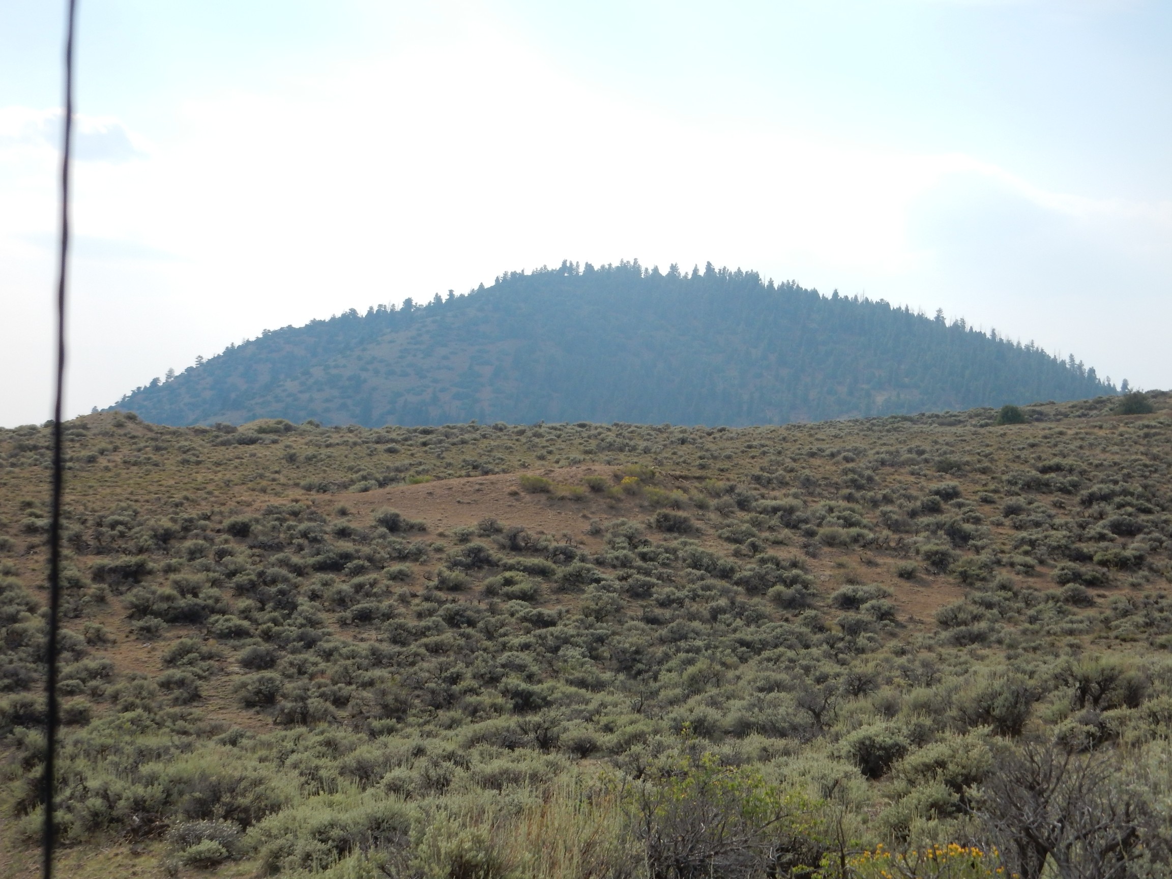
View of Sheep Knob.
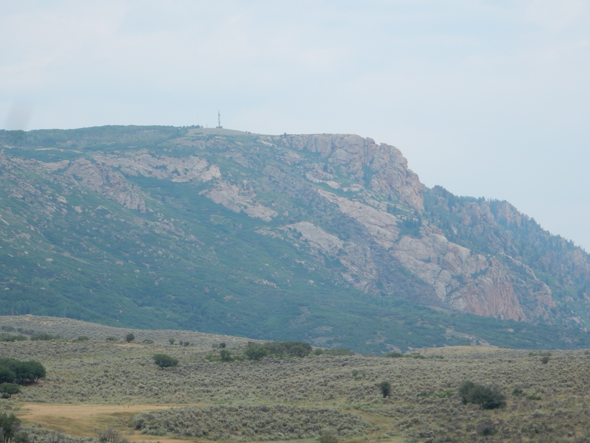
This is mostly a knob of Precambrian pegmatite. The Cimarron Fault runs along the foot of this escarpment and is the southern boundary of the Gunnison Uplift.
We pass through the town of Cimarron, then look back at the fault trace.
The fault trace is pretty clear here. It is where the light tan beds of Mancos Shale end quite abruptly against darker Precambrian rock at the foot of the escarpment.
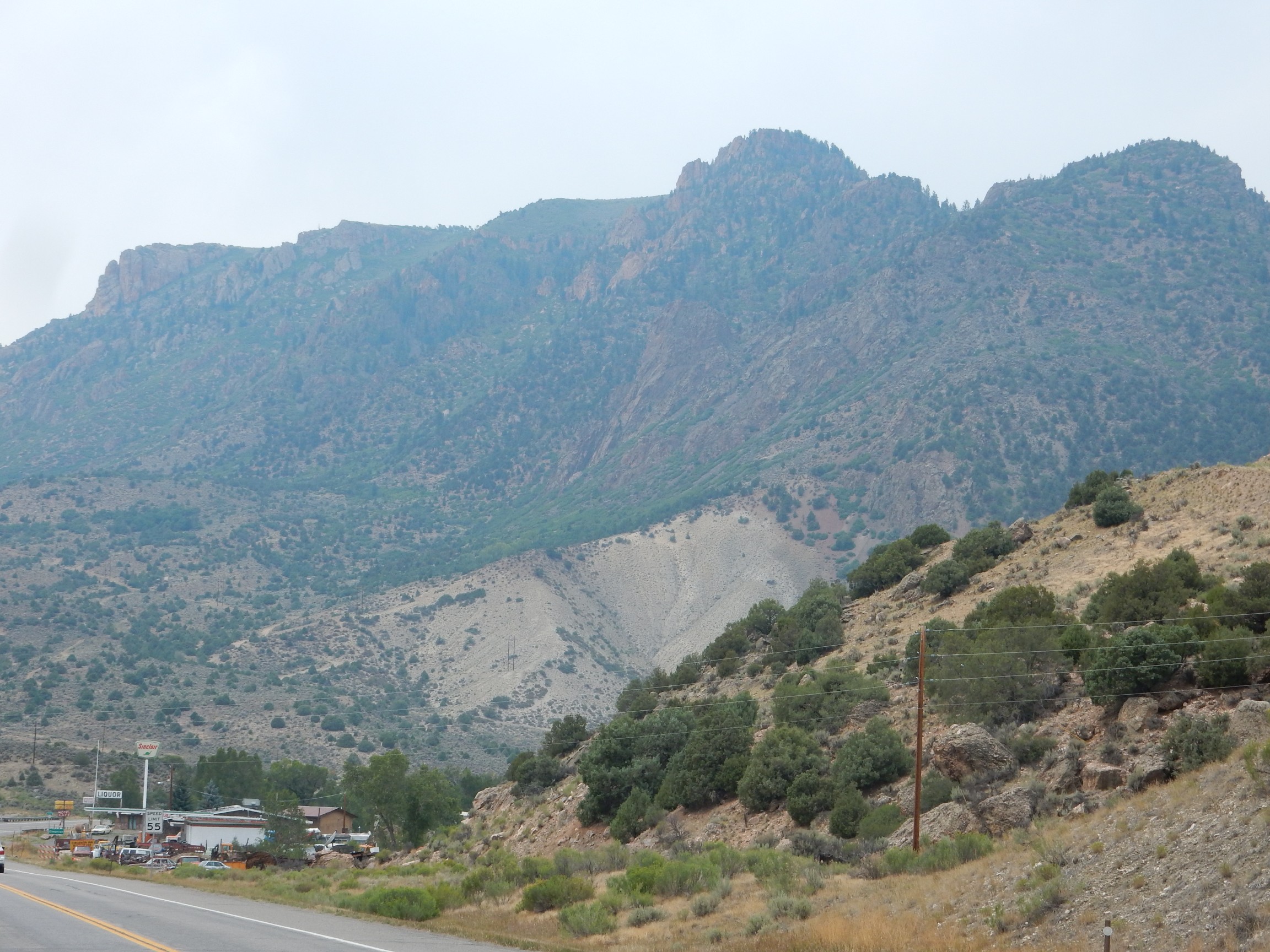
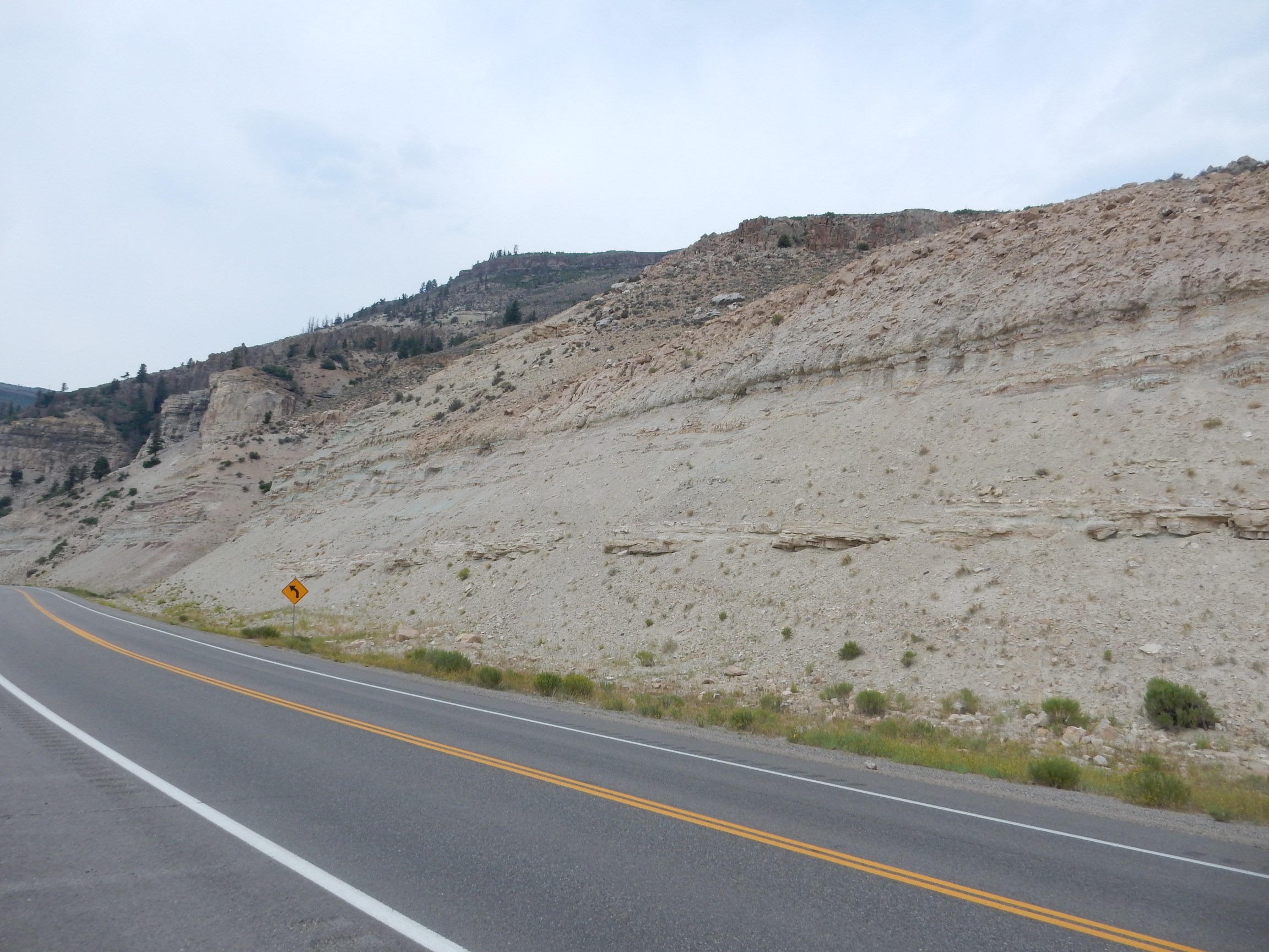
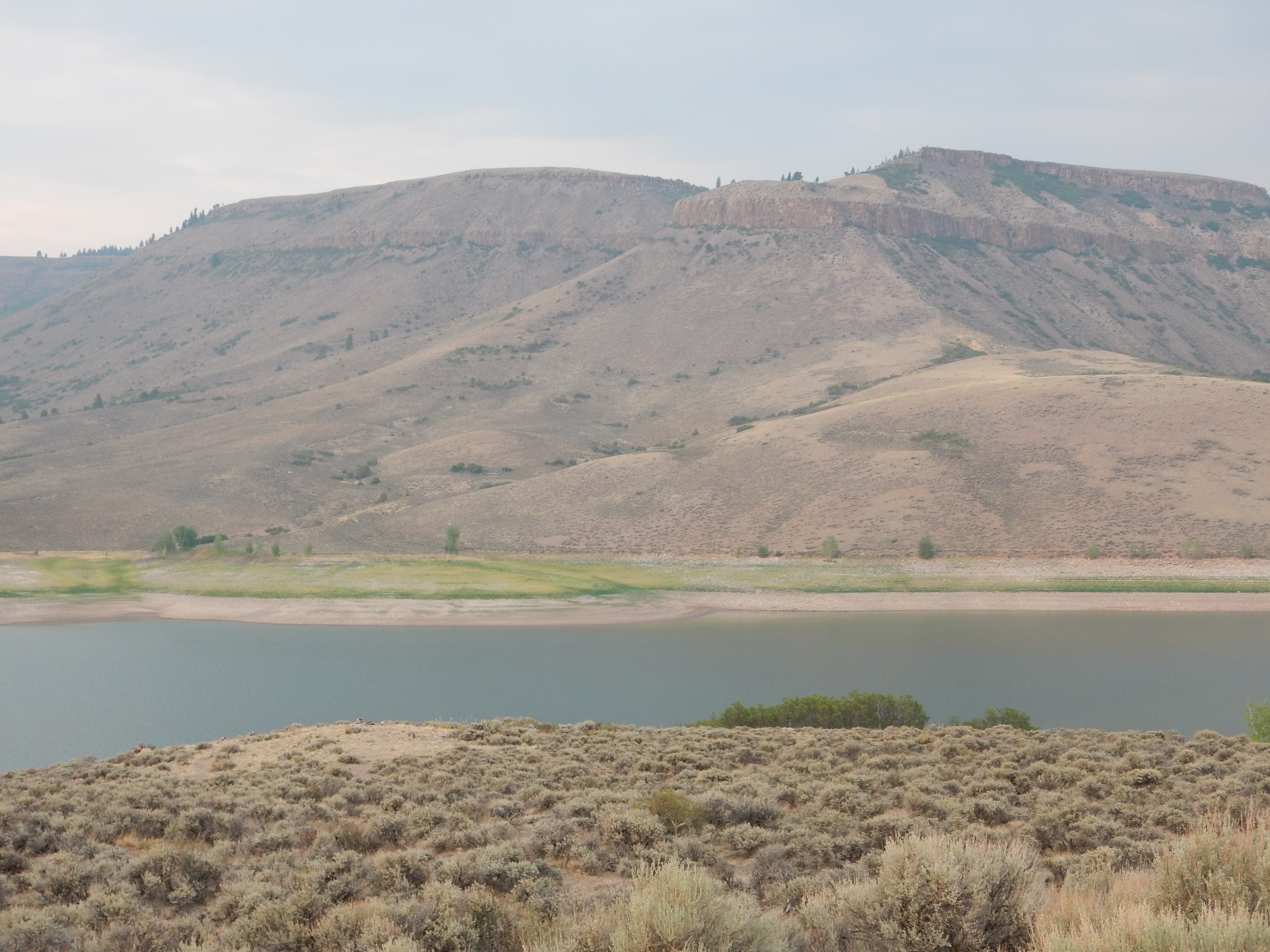
Our first glimpse of San Juan Mountains tuff.
And I bork the photo, apparently having accidentally bumped the selector switch to “bridal.” Cindy always finds it hilarious when I do this. But the cap of the mesa is Blue Mesa Tuff, emplaced by the eruption of the Lost Lake caldera, about 28 million years ago.
Here’s a little better view from further up the valley.
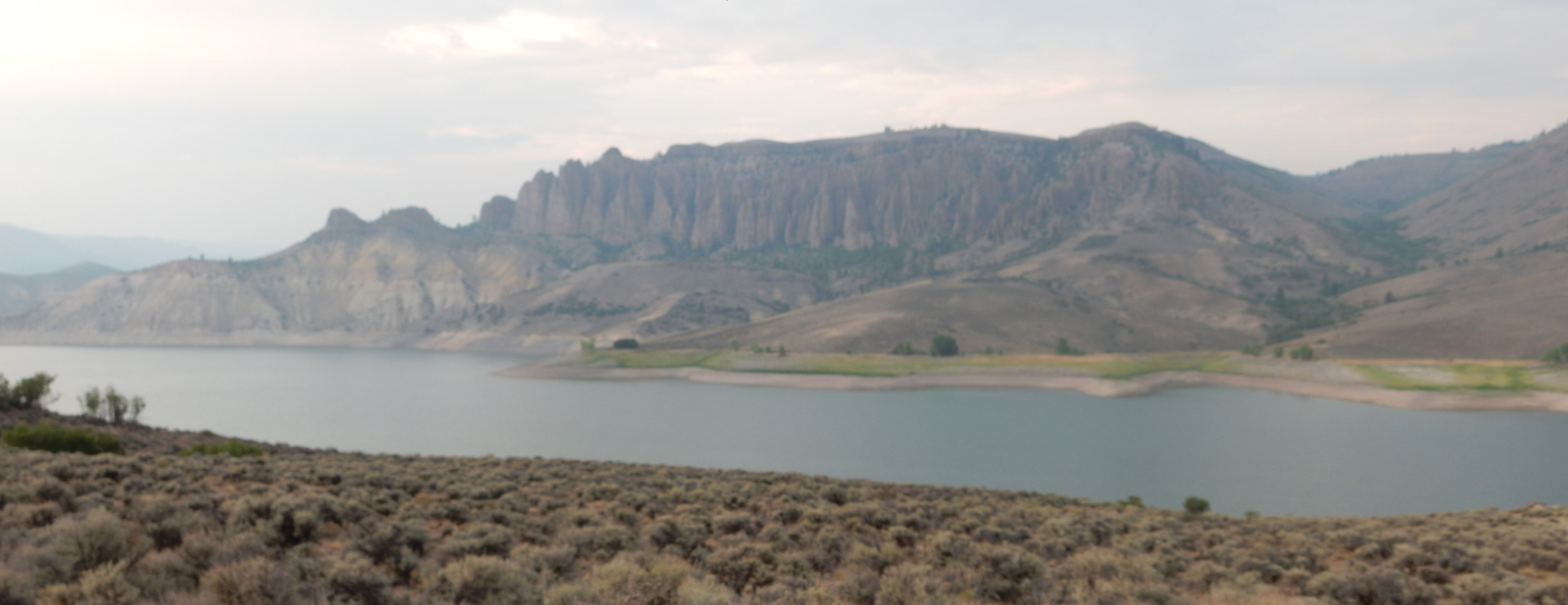
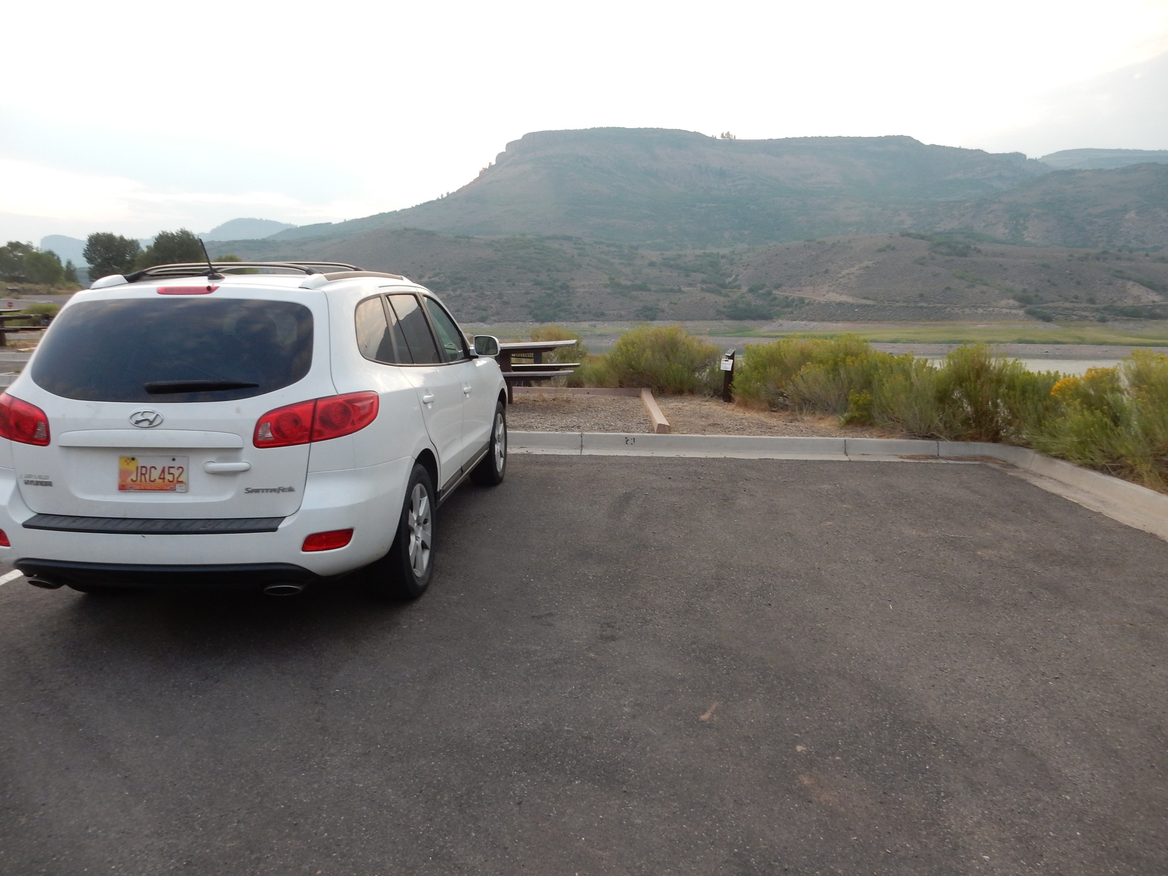
We reach Blue Mesa Reservoir and drive past the campsite where I have my reservation tonight. The road cuts through some colorful beds.
I run over to Bruce’s car. “Guess what that is?” Bruce must be tired. “I have no idea.” Morrison Formation. We’ve seen so much colored mudstone of the Morrison Formation over the last three days that I thought it would be an inside joke by now.
We arrive in Gunnison, find Bruce’s hotel, and he checks in. There is still daylight, and we are both quite interested in a nearby geologic feature: The best example of a carbonatite complex in the United States, Iron Hill.
Carbonatite is a rare and peculiar kind of igneous rock, consisting of better than 50% carbonate minerals. Only one volcano is known in the world to erupt carbonatite today, namely, Ol Doinyo Lengai in Tanzania, Africa. Carbonatites seem to always be associated with continental rifting. The one we will be looking at today formed about 570 million years ago, which is slightly puzzling, since I don’t know of any significant rifting within the North American continent at that time.
The origin of the unusual carbonate-rich magma is still uncertain. Possibilities include a very low degree of partial melting of the upper mantle; separation of a carbonate phase from a more normal magma; or unusual differentiation of a magma (the magma partially crystallizes and the crystals settle out.) Whatever the process, it must be quite atypical since carbonatites are so rare. One clue is that carbonatites are associated with alkali-rich volcanic rocks, but I’m not sure what this tells us.
Carbonatites are also interesting because of their unusual mineral content. The Iron Hill carbonatite is rich in titanium and rare earth elements, enough so that it has been investigated repeatedly for its mineral potential and may yet be exploited commercially. These are incompatible elements, elements whose ions do not fit comfortably into the more common silicate minerals and so are concentrated in the residual liquid from nearly-solidified magma. This may be another clue to the origin of carbonatites.
We pile into Bruce’s car this time (since we don’t know how bad the roads will be and he has four-wheel drive) and head back the way we came, then turn south across the reservoir towards Powderhorn. We leave the paved road and head in. I am navigating from a somewhat rough map and Bruce’s odometer is broken; I am not ashamed to admit my navigation was a bit iffy.
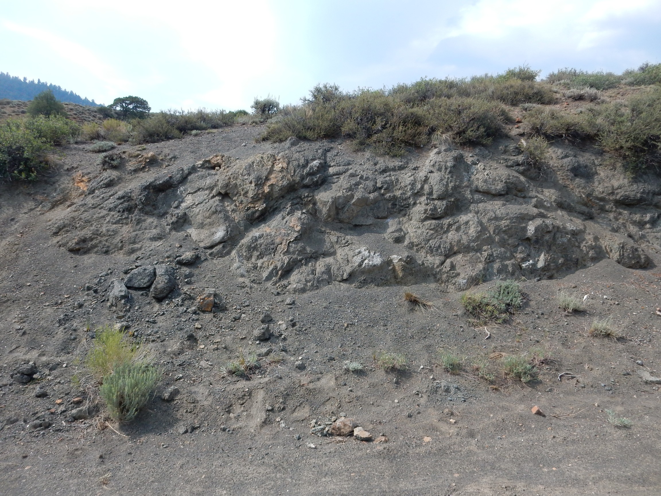
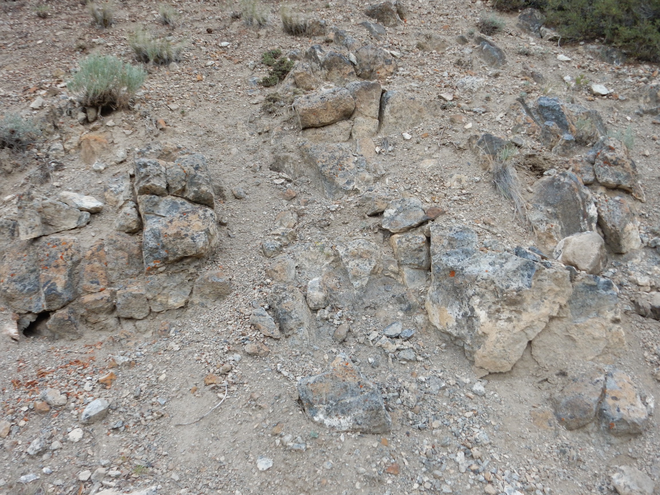
We turn at what I figure is the north side of Iron Hill, but after some confusion, we realize we are further south than I thought and are driving along Beaver Creek on the south side of Iron Hill. We find a carbonatite outcrop north of the road.
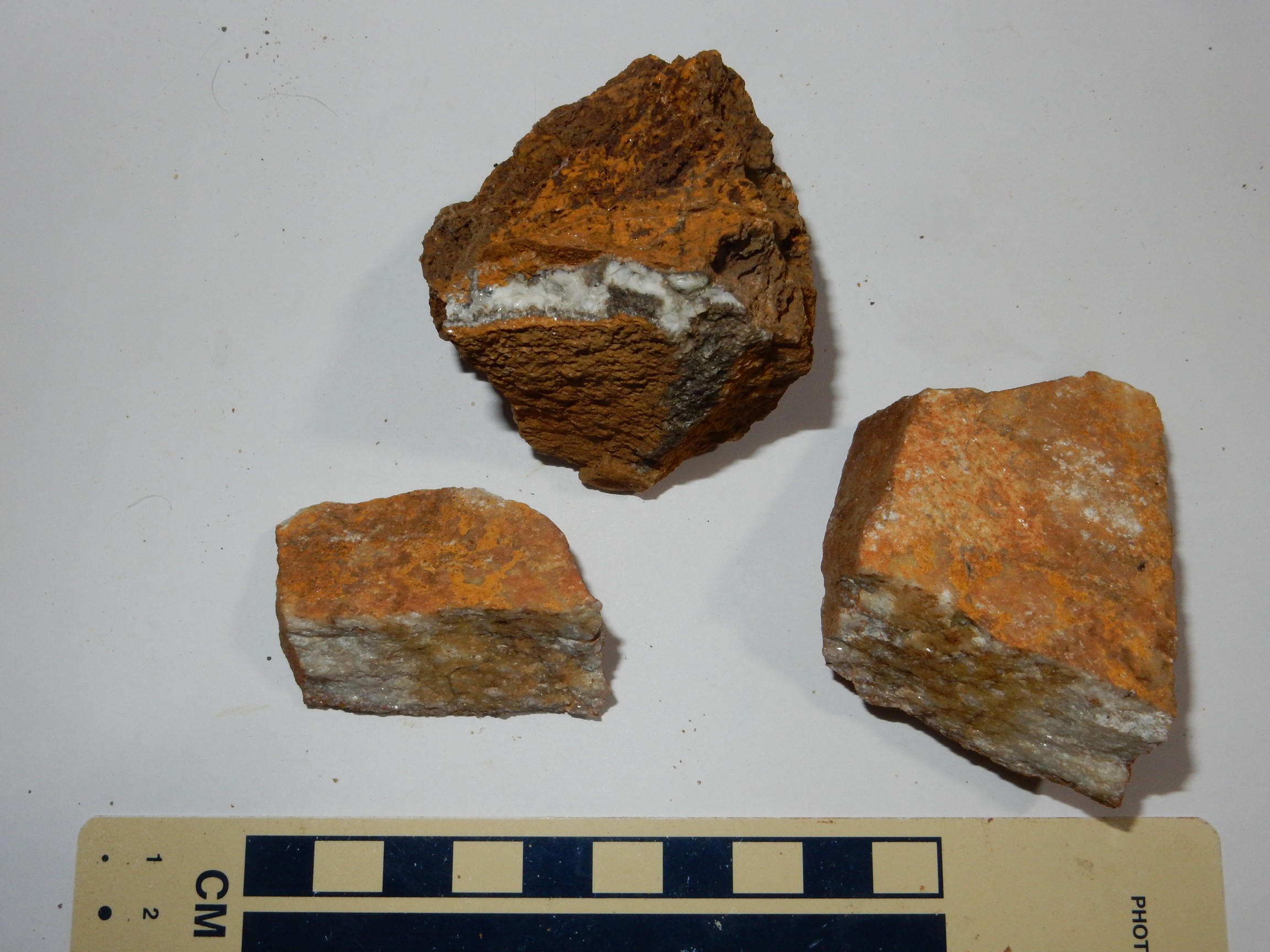
The bulk of the outcrop resembles marble, with coarse crystals of dolomite and some iron staining from traces of iron carbonate. The sample at top appears to be much richer in iron and probably contains titanium and rare earth elements as well. Oddly, the rocks are not fluorescent; most calcite samples I’ve tested are, but I’ve had less experience with dolomite.
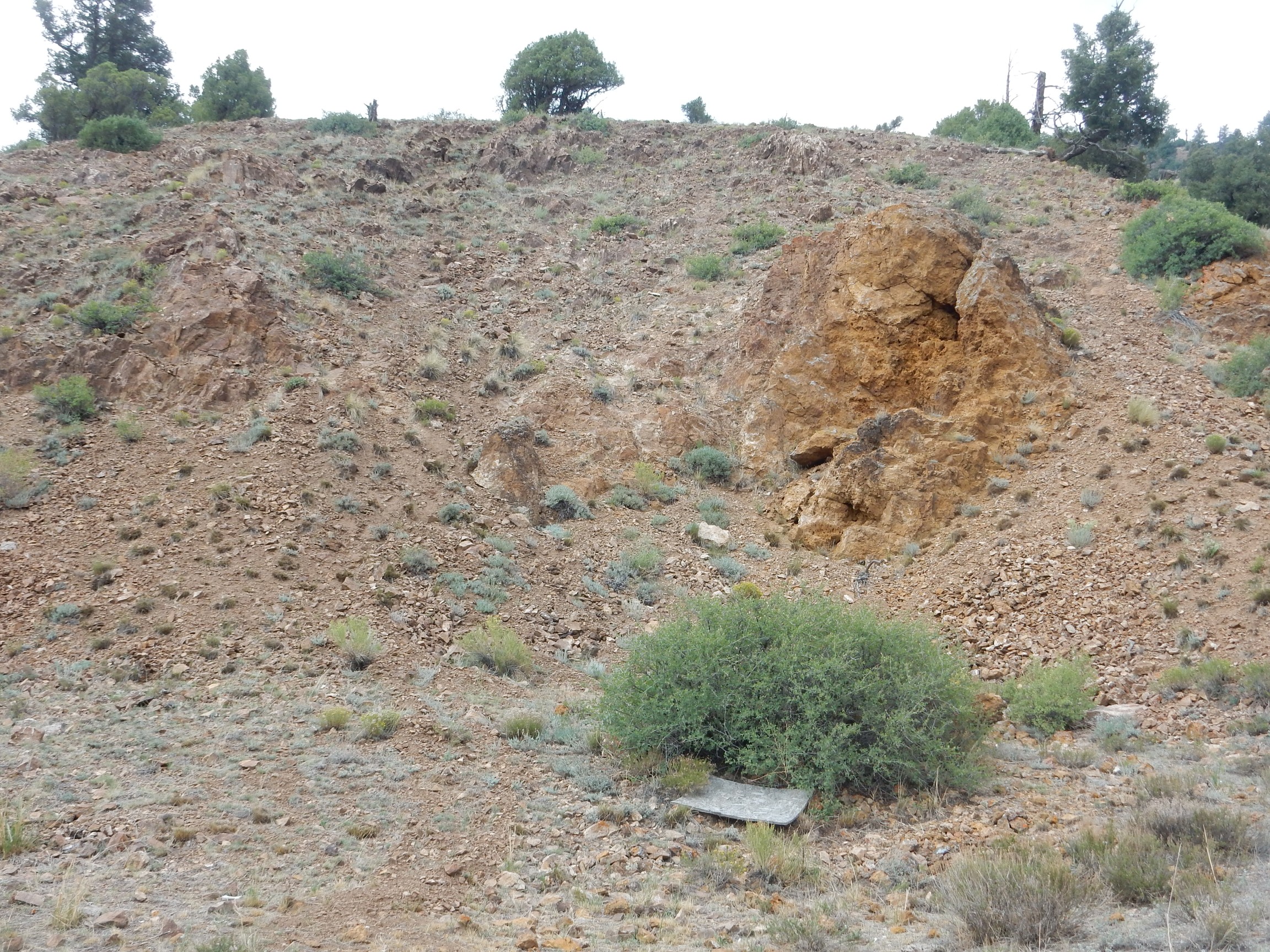
We continue navigating by the seat of my pants*, gradually get our bearings. I guess right at one point and we find ourselves next to a pyroxenite outcrop. (When I plot our position after getting home, I discover that we drove right past outcrops of uncompahgrite — but poorly exposed and we didn’t know what we were looking for.)
The outcrop is deeply weathered and crumbles to the touch. This is not unusual for exposures of ancient silica-poor rocks. It takes me some time to get intact samples, which Bruce kindly lets me store in some spare plastic bags he was using for trail mix.
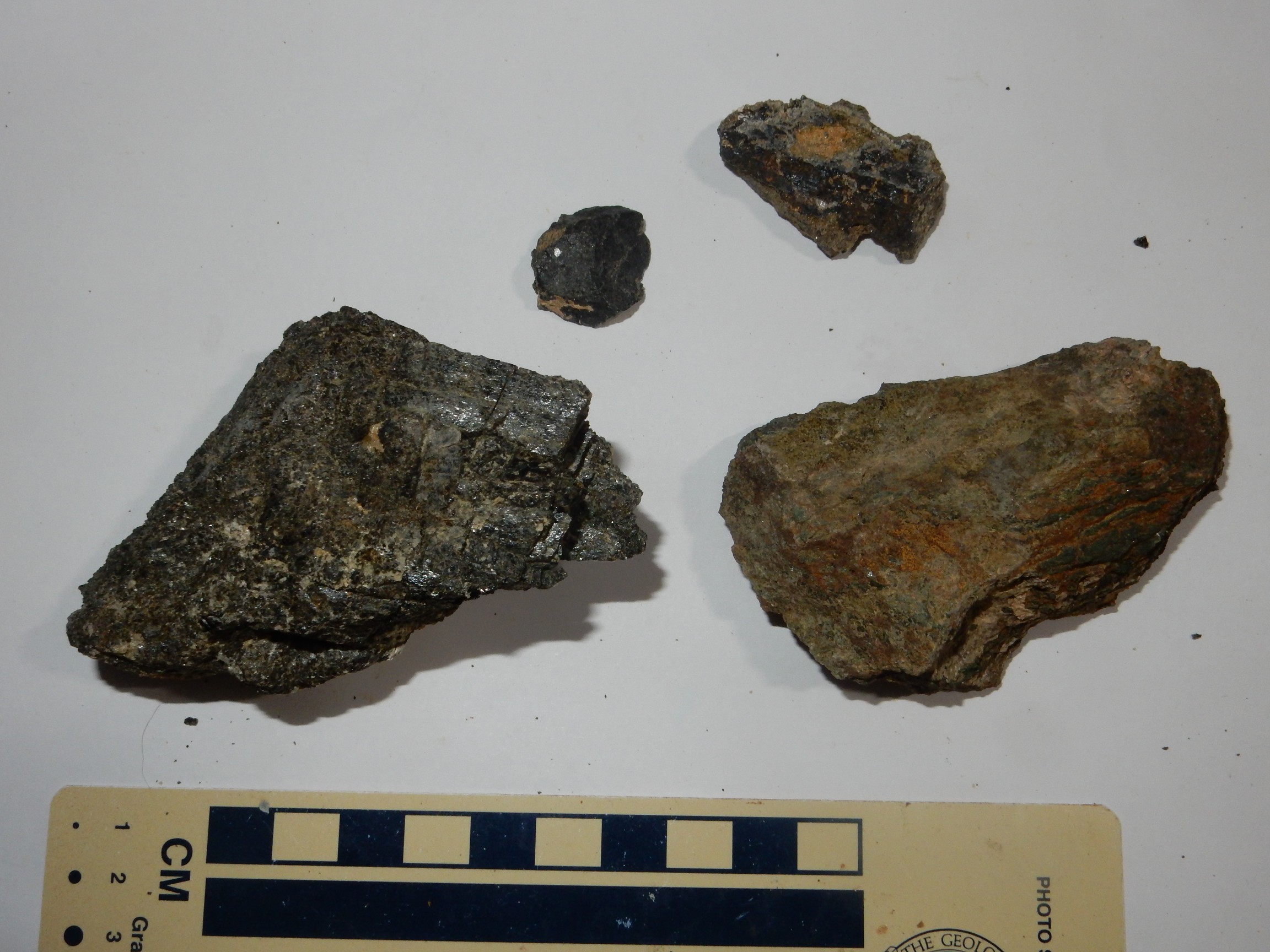
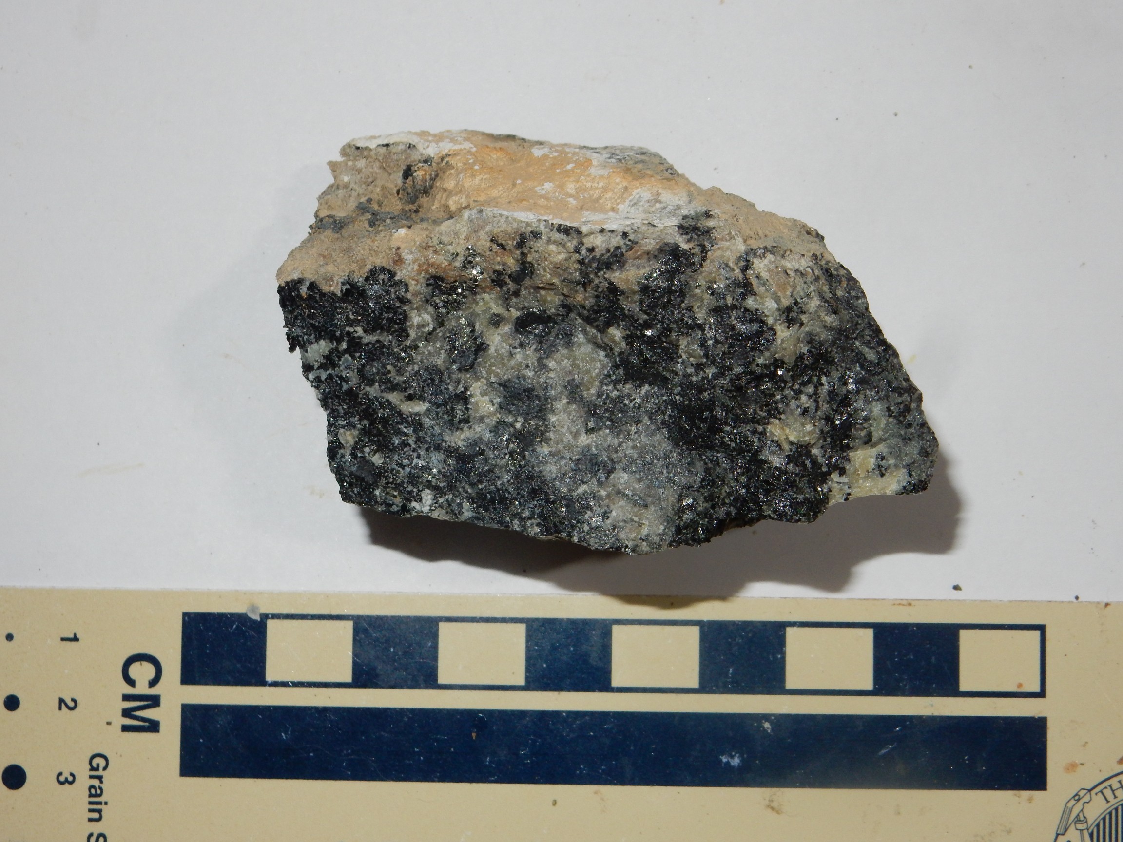
The large sample at left is the predominant rock here. It’s composed of very large striated black crystals, presumably pyroxene, a silica-poor, iron- and magnesium-rich silicate mineral. It has a high specific gravity (heft) consistent with its iron and, apparently, titanium content. However, it does not attract a magnet.
The sample at right is I don’t know what. It’s thinly laminated dark layers that look a bit like pyroxene but seem sturdier, and light layers of what looks like an iron oxide. Also heavy but does not attract a magnet. I’d guess ilmenite (a titanium-iron ore) but ilmenite is supposed to be weakly magnetic.
The small sample at upper left is heavy for its size and does not look like pyroxenite. The other small sample may be the same material, but with inclusions I originally took to be olivine, but looking again, I’m not so sure. Both strongly attract a magnet, suggesting titaniferous magnetite
I think I’m going to have fun stumping my geology club with these. (Unless they actually read my blog and know where I’ve been.)
We find that the area east of here is a maze of forest roads, and navigation is uncertain; but there seem to be some unusual rock types south along a fairly identifiable creek. We head that way, and soon find ourselves here.

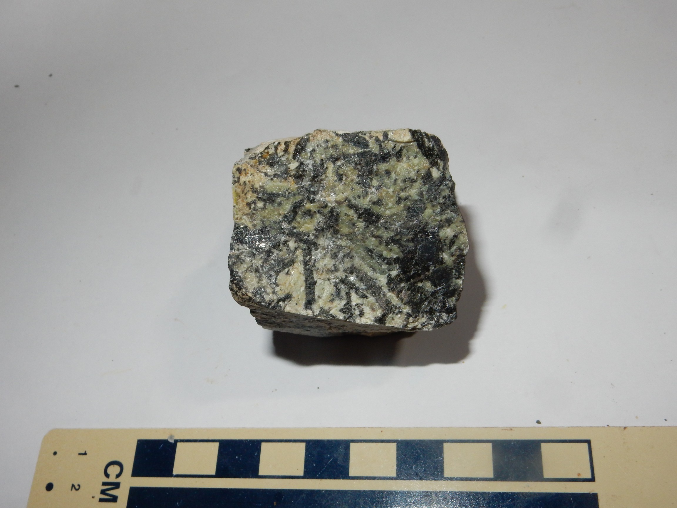
If I’ve been navigating correctly, this is an outcropping of ijolite. (I wasn’t. My navigation wasn’t bad, but it put us just beyond a small outcropping of ijolite. This is uncompahgrite, a rare igneous rock composed of melilite [the green stuff] and clinopyroxene and magnetite [the black stuff.] Melilite is itself an uncommon mineral, with a highly variable composition, but typically a calcium-magnesium silicate with some sodium, iron, and aluminum. Clinopyroxene and magnetite are fairly common but not in this particular combination with melilite. I try a magnet on it; some black patches strongly attract a magnet and some do not. Clinched.
The stuff is also tough as nails. It took a lot of work to get samples out of the outcropping, and I gave up trying to trim down the sample above before photographing it.)
We continue south to the next outcropping.
Hmm. That looks a lot like the last sample. (Because it is.) To be sure, the rock types ijolite and uncompahgrite are similar, but still.
There are some other unusual rock types in the area, but our navigation is still uncertain and the outcrops appear to be a short hike off the dirt roads. And Bruce is already tired. (I’m feeling a little peaked myself). Still, this has been very cool, and I have at least three rare rock types in my bag now. The place has been reconnoitered and I may have occasion to come back again.
(Almost certainly, now that I have my bearings better. I want some ijolite, and some nepheline syenite. Perhaps as a weekend trip with Gary Stradling, or next year with Bruce.)
Incidentally, our journey was backwards in time. The nepheline syenite we didn’t see is an alkaline rock that is thought to have been emplaced first. Then came the uncompahgrite and ijolite, then the pyroxenite, and finally the carbonatite core.
Iron Hill silhouetted against the dusk.
It’s comforting to know that, if the Chinese ever did embargo rare earths to the U.S., we have some reserves of our own.
Bruce drives us back to Gunniston for dinner. We find an alleged Tibet-Nepal-India restaurant; the proprietors appear to be Caucasian males in their twenties, but the food is probably the best we have this trip. Dal is reasonably tasty and has a low glycemic index; good carbs for a diabetic. The tikka masala is good but could be just a touch spicier. I try my first Tibetan dish, momo, which is tasty enough but I suspect not something I can safely eat in large quantities.
We head back to Bruce’s hotel and I pick up my car. I check the tire; it’s still at full pressure. I find a gas station, top off, get some ice, go find a place that has eggs, spot some sugar-free ice cream and grab a pint, and head for my campsite. On the way, there are some spectacular cliffs north of the reservoir that I somehow missed driving in.
The Dillon Cliffs, underlain (remarkably) by the Dillon Mesa Tuff. Except I bumped the selector again and got the soft-focus bridal setting. Crep.
Somehow the tuff beds immediately to the east were focused correctly.
The lower slopes are all volcaniclastics of Oligocene age. The lower set of cliffs are Blue Mesa Tuff, then a slope of less resistant Dillon Mesa Tuff, then a second set of cliffs of Sapinero Mesa Tuff. The difference seems to be that the Blue Mesa Tuff and Sapinero Mesa Tuff are welded tuffs while the Dillon Mesa Tuff is unwelded to lightly welded.
I cannot find a geologic map for the Dillon Cliffs. I don’t know what formation the spires are eroded in. Wild guess: the volcaniclastic beds. We have some similar spired cliffs south of Saint Peters Dome back home in volcaniclastic beds of the Paliza Canyon Formation.
It took me a while to find because this time there really were two loops, separated by a marina. And no tent pad; but the parking slot had room to set up on asphalt again. The sky is clouding up, so I conclude I have to set up my rain fly as well. I then walk down towards the dam, because I’ve been in a car all day and feel the need for exercise. It’s further than it looks. I get back and turn in for the night, finding it difficult to sleep because of a stiff breeze (bad with a fly that I can’t stake out because I’m on asphalt) and the imminent threat of rain.
I do eventually drift off.
Next: Calder-O-Rama
Pingback: Mount Taylor Wanderlust, Day 4, Postconference | Wanderlusting the Jemez