
Kent and Bruce Have Yet Another Excellent Adventure, Day 11
Day 10 may be found here.
The crack of dawn finds me already making breakfast.
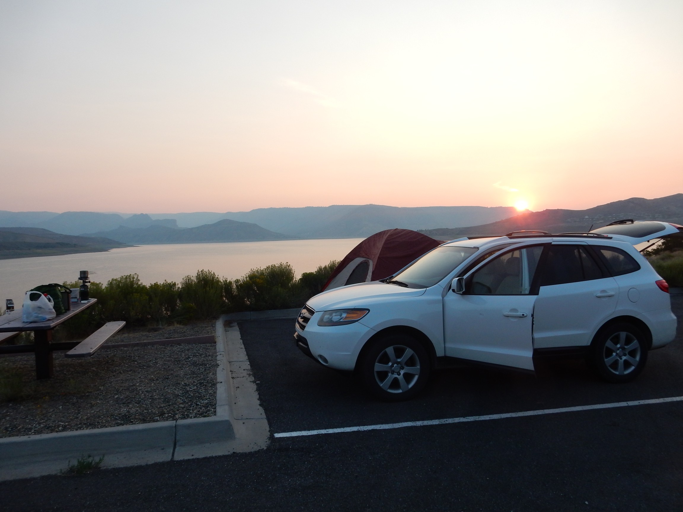
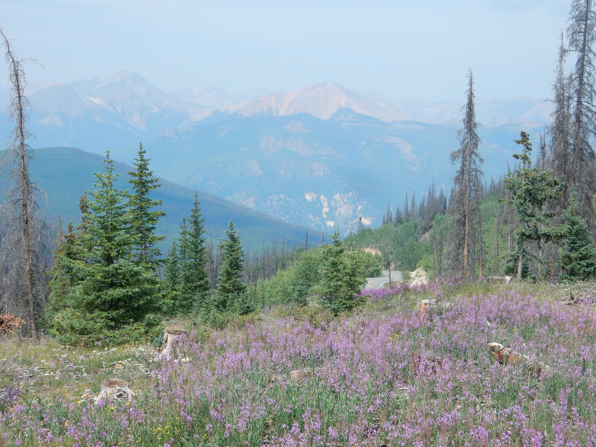
I break camp and head out to redezvous with Bruce at the turnoff to Powderhorn, which will take us on to the heart of the San Juan Mountains. The next two days will be a grand exploration of caldera magmatism.
Around 28 million years ago, there was a great flareup of high-silica magmatism across much of what is now the western United States, triggered (we think) by the disintegration of the Farallon Plate, which was subducted under North America at a shallow angle as North America drifted onto the East Pacific Rise.
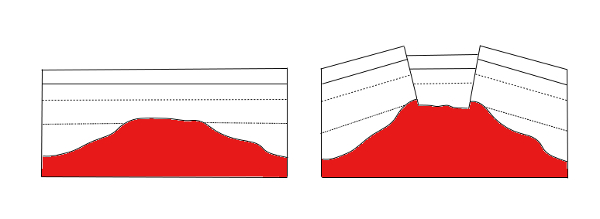
One center of volcanism was southwestern Colorado, which experienced a succession of eruptions in which huge magma chambers full of volatile-rich, silica-rich magma broke through to the surface. The magma exploded into a mixture of tiny particles of volcanic ash and red-hot gas that flowed outward for many miles (pyroclastic flows), finally settling to the surface to form great outflow sheets of a kind of rock called ignimbrite or, less formally, tuff. The roof of the now-empty magma chamber then collapsed to form a caldera or giant crater, dropping a plug of rock miles across inside a ring fracture. In most cases, additional magma soon entered the collapsed magma chamber to force part of the caldera floor back up in a resurgent dome, and some magma escaped along the ring fracture to form ring fracture domes.
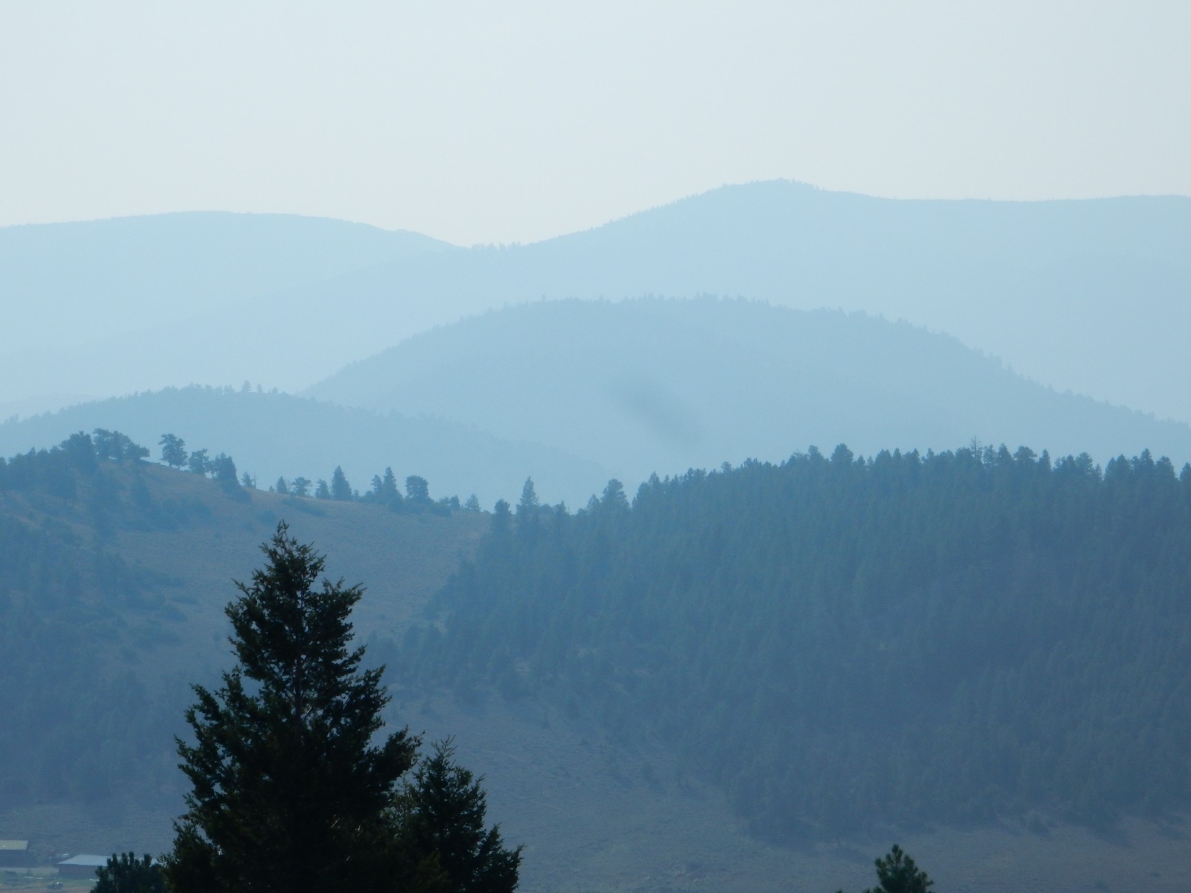
One of the best geologically young examples of this process is the Valles caldera back home, but the much older calderas of the San Juan Mountains have been deeply eroded to reveal the secrets of their deep plumbing.
The reservoir is manned by a flotilla this morning.

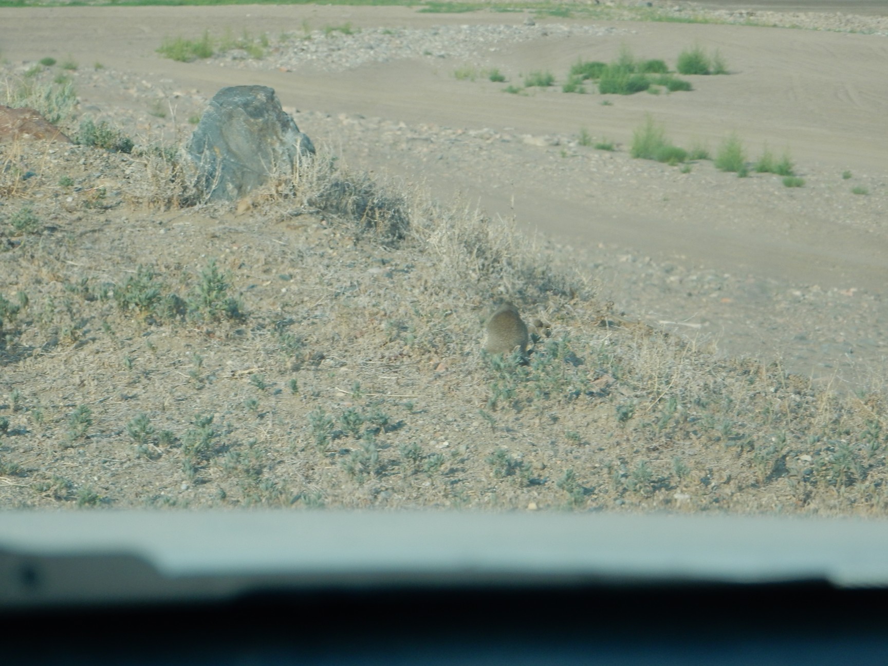
While I wait for Bruce, I read through some of the road logs I have for this area, and am entertained by prairie dogs. This one insists on showing me his politician end.
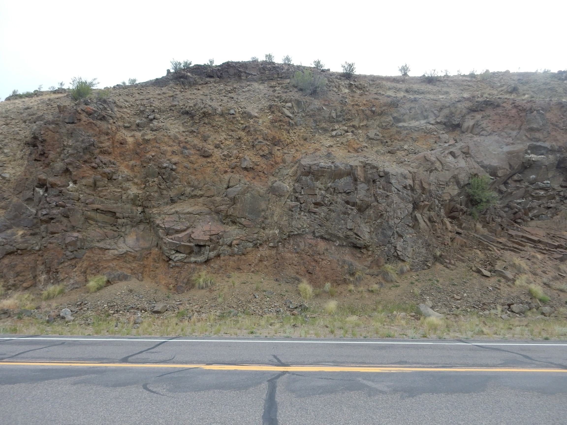
Bruce arrives, and again I take the lead with the road log. This looks like a good one, with milepost references in addition to odometer references. That makes things easier. Our first stop is in a road cut through a flow.
Hinsdale Basalt. It’s about 12.5 million years in age, making it considerably younger than the San Juan caldera cluster.
We pass Iron Hill and I get another photograph, just becuase it’s such a cool area.
I’d like to have gotten this a bit closer and from a better angle, but here just wasn’t anywhere along the main highway where it was safe to pull over.
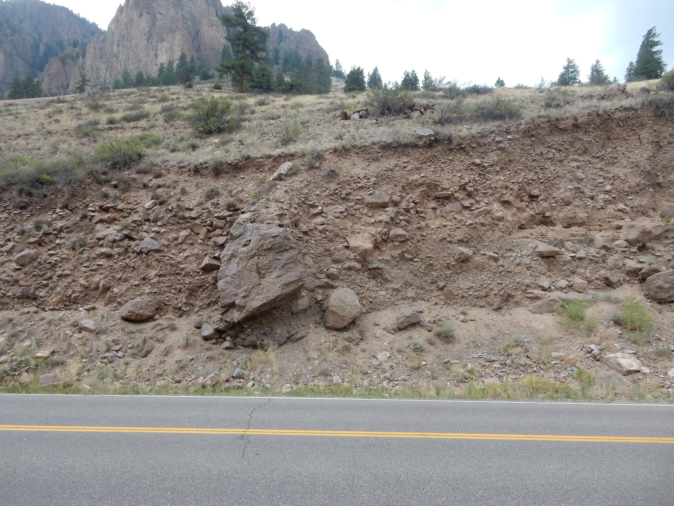
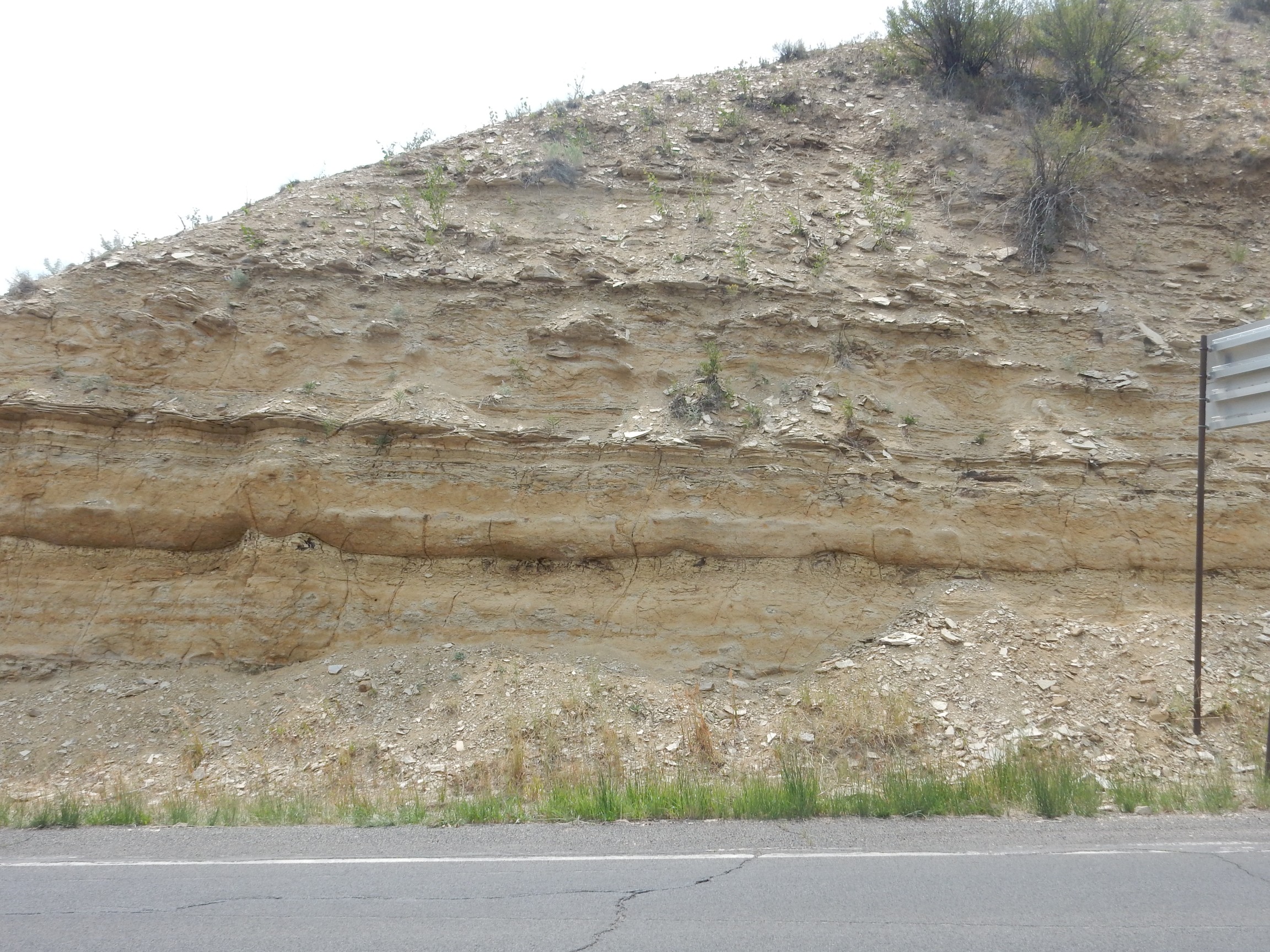
But here be road cuts.
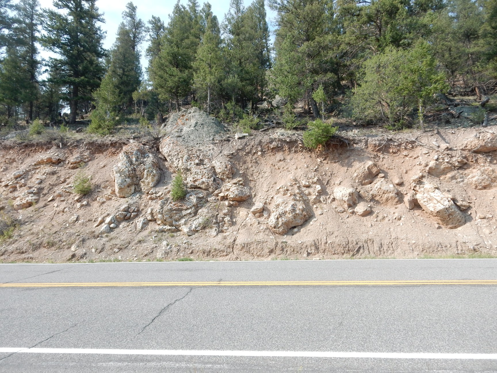
The tuff here is the Sapinero Mesa Tuff, emplaced by the Uncompahgre-San Juan caldera eruption 27.8 to 28.4 million years ago. This was a ginormous eruption, emplacing better than 250 cubic miles of tuff. The source was a pair of calderas, the Uncompahgre and San Juan calderas, each better than 20 miles across. These calderas are so eroded and partially covered over by later eruptions that the calderas are not discernible without geologic mapping, but they were located roughly here and here.
Just up the road is another layer of tuff.
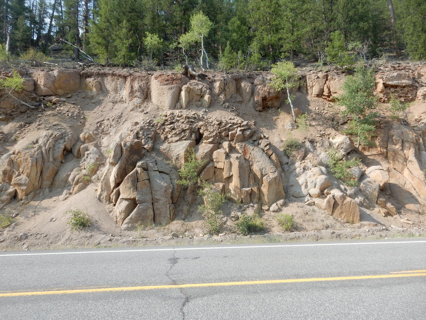
This is the Fish Canyon Tuff. It is the most extensive tuff bed in the San Juan Mountains, for the excellent reason that the caldera eruption that emplaced it, the La Garita event 27.75 million years ago, is a serious contender for the largest single high-silica eruption known from the geologic record. (The high-silica qualifier is needed because low-silica flood basalt eruptions have plated over sizable parts of entire continents.) La Garita erupted around 1200 cubic miles of pyroclastic flows to leave a caldera roughly 40 miles across. By comparison, the Valles caldera back home erupted a realatively puny 150 cubic miles of tuff and left a caldera 14 miles across. The La Garita caldera is also so eroded it cannot be traced except by geologic mapping, but its center was about here.
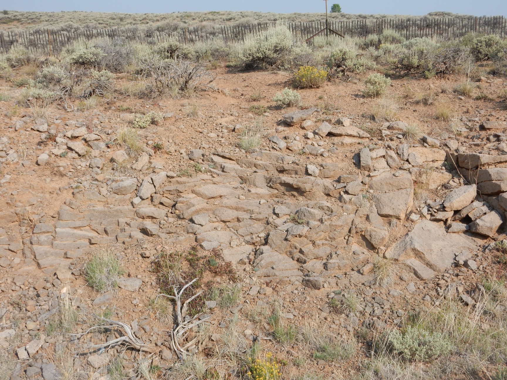
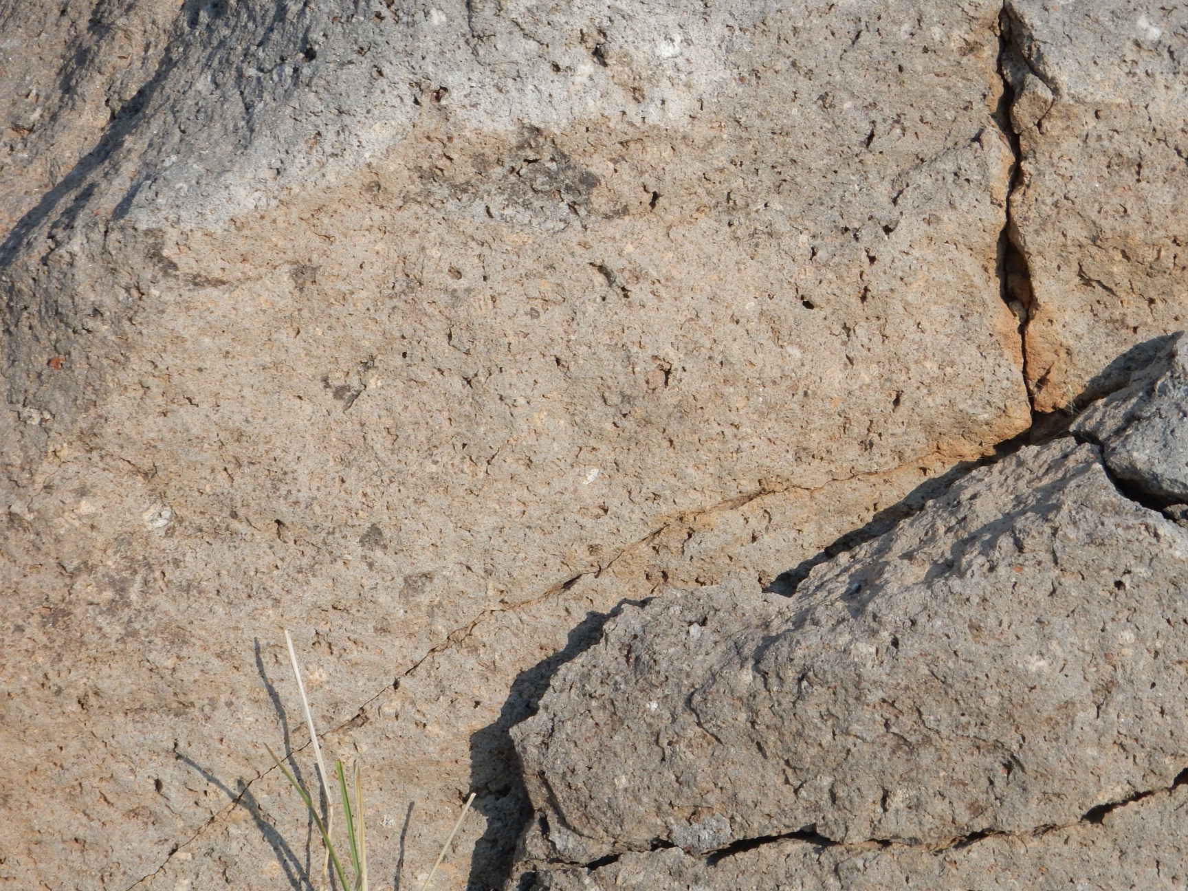
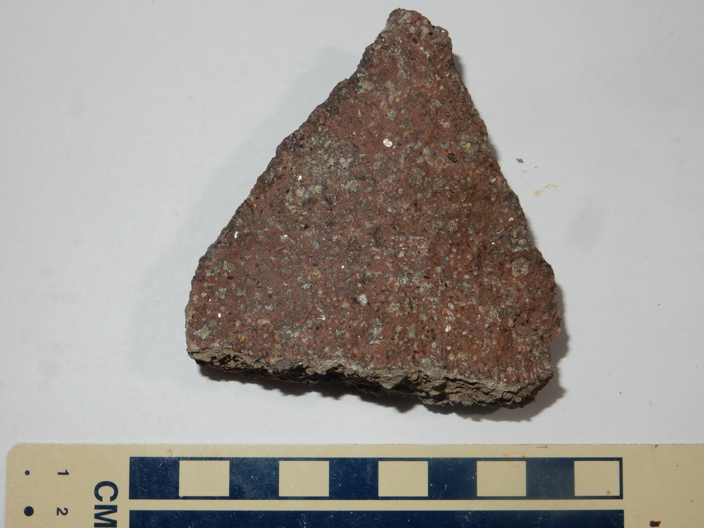
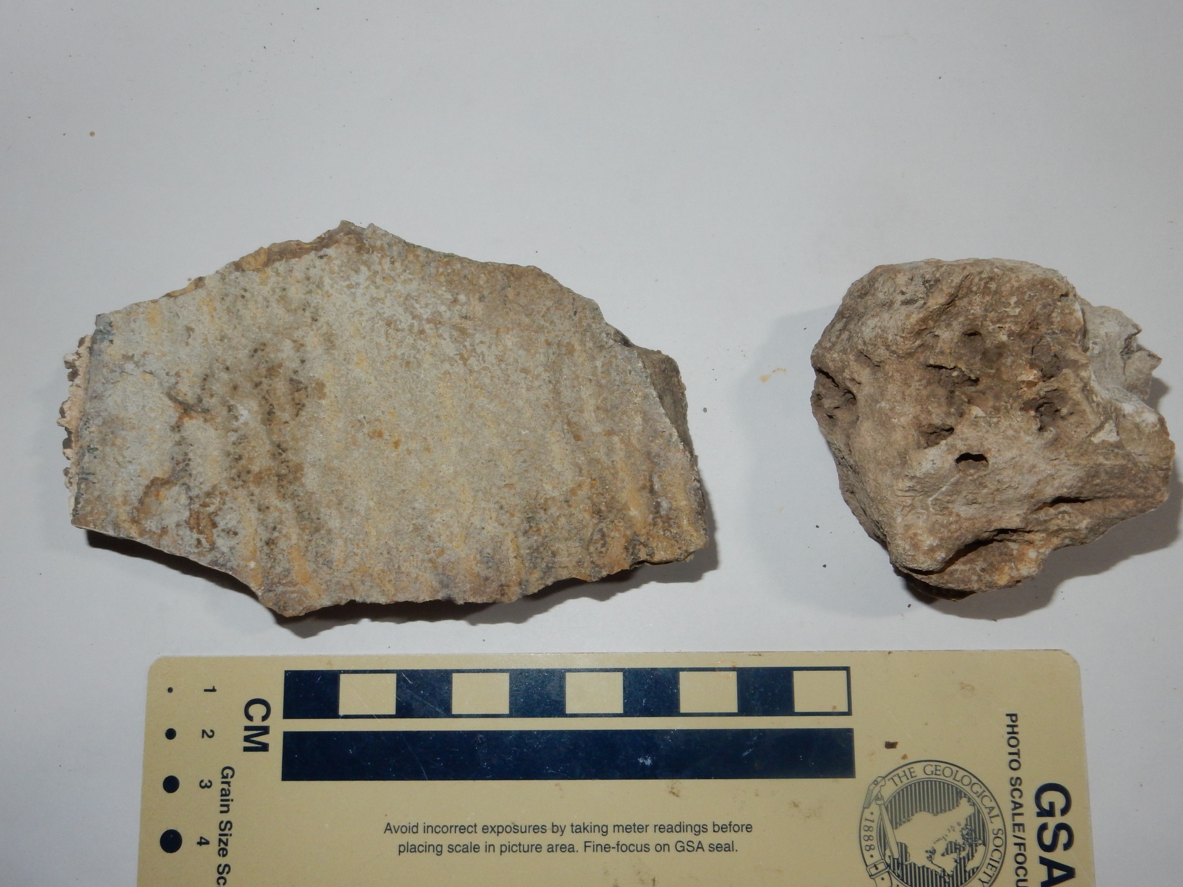
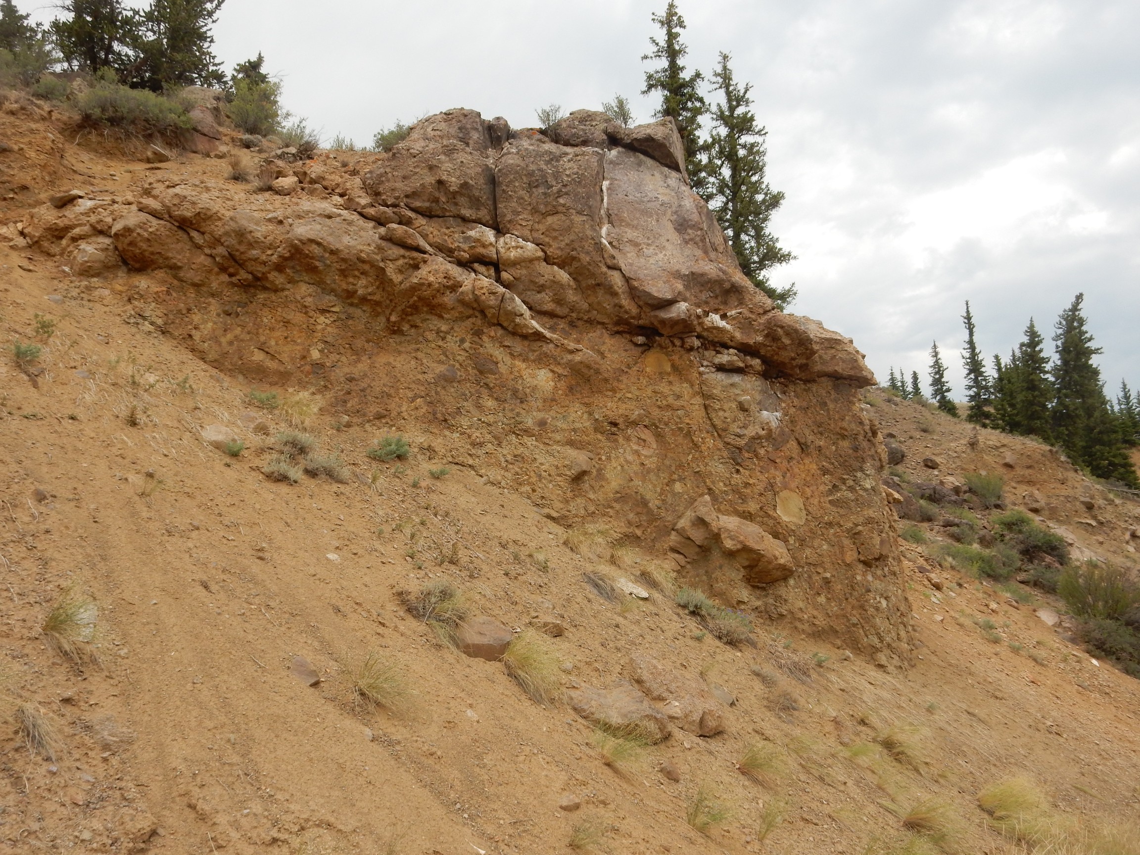
Up until now, I haven’t been taking many rock samples; only those rocks that are inherently interesting, such as my Archean rocks from Centerville, some rocks with fossils, or rare carbonatite complex rocks. But this tuff turns out to be a very pretty tuff.
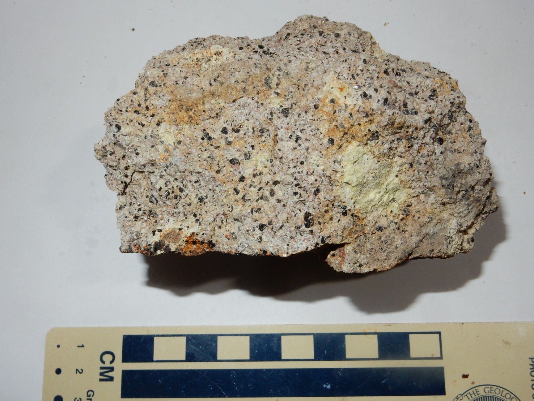
Lookit at those black specks. This stuff is full of black crystals of biotite (iron mica) and hornblende. It’s also chock-full of light crystals of feldspar (plagioclase and sanidine) and quartz.
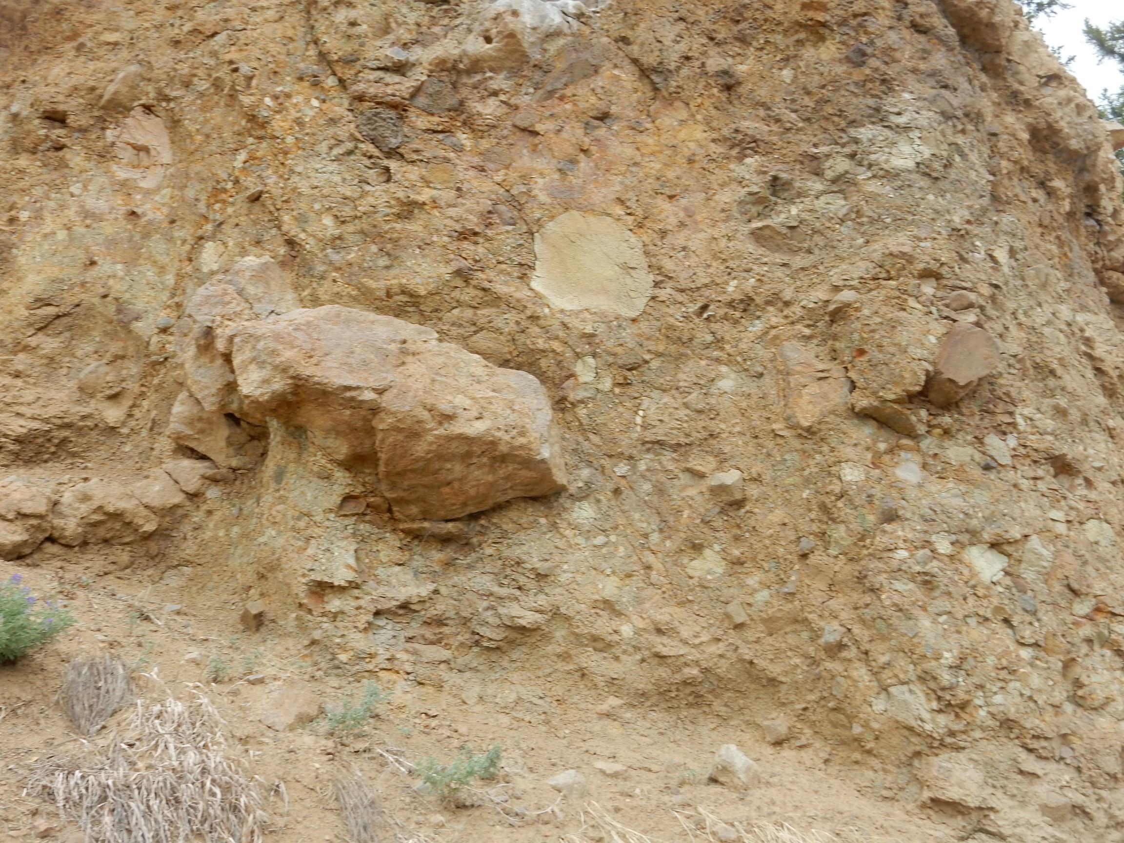
The geologic map reports that it “Typically weathers to rounded, pedestal, and beehive forms.”

Yup.
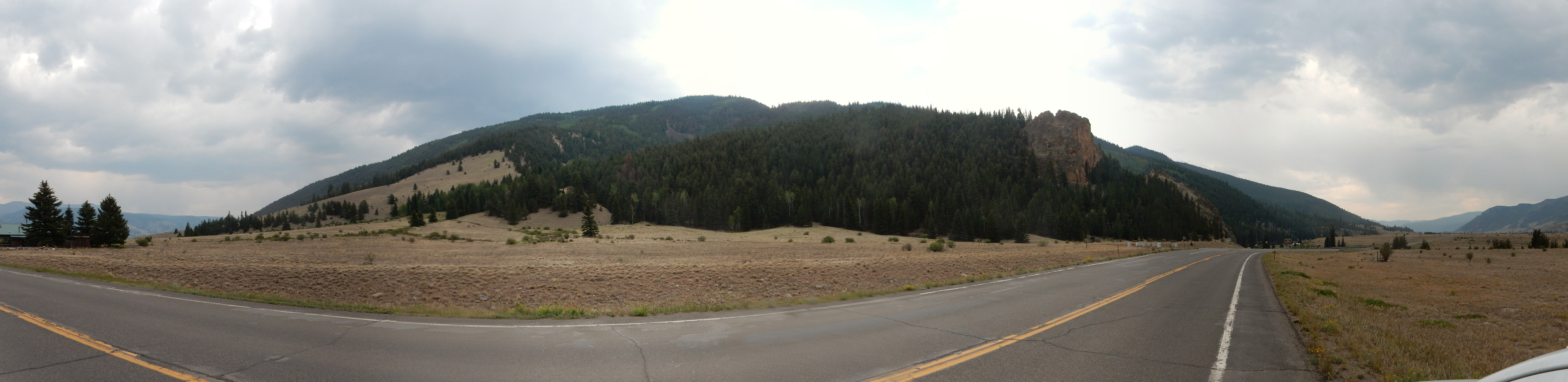
We arrive at Lake Fork River.
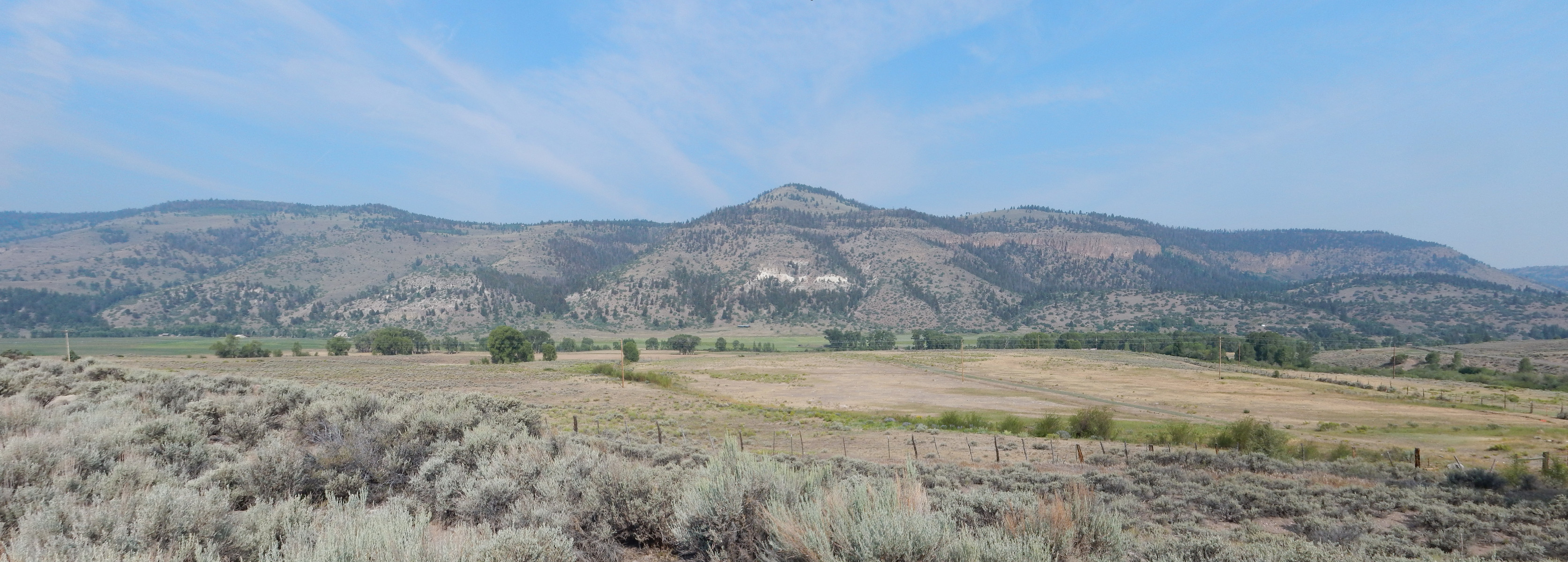
The peak is Round Mountain. Below it is exposed the entire column for this area (not necessarily well-exposed.) Here’s my best effort to match units with what’s in the panorama (click to enlarge): The cap of the hill is Hinsdale Basalt like the flow we examined earlier. The knob beneath is Carpenter Ridge Tuff from the Bachelor caldera, which erupted 27.35 million years ago and emplaced at least 250 cubic miles of tuff. (The center was roughly here.) Below that, and forming darks cliffs at the rim of the canyon immediately to the right of the knob, is Fish Canyon Tuff. The slope beneath is Sapinero Mesa Tuff.
The very thick beds that are especially prominent to the right are Blue Mesa Tuff (described in the geologic map as “massive, cliff-forming”). This was erupted my map doesn’t say, but obviously before 28.4 million years ago (the oldest age for the overlying Sapinero Mesa Tuff) but likely not much before. The Blue Mesa Tuff was erupted from the Lost Lake caldera, one of the last to be identified by geologist (since it is deeply eroded, partially buried by younger formations, and kind of in the middle of nowhere), which put out perhaps 100 cubic miles of tuff.
Beneath the Blue Mesa Tuff are various members of the Lake Fork Formation. These are all volcaniclastic beds, formed by erosion of soft volcanic rock from stratovolcanoes that predated the caldera eruptions. It seems to be typical for calderas to form in areas of longstanding andesitic volcanism, volcanism that produces the classical cone-shaped volcanoes composed of rock that is intermediate in silica content. The light colored beds are apparently a pumice-rich tuff, though without closer examination I can’t say if it’s a primary tuff (an ignimbrite, formed directly from a pyroclastic flow) or reworked tuff (eroded from primary beds and deposited as sedimentary beds.)
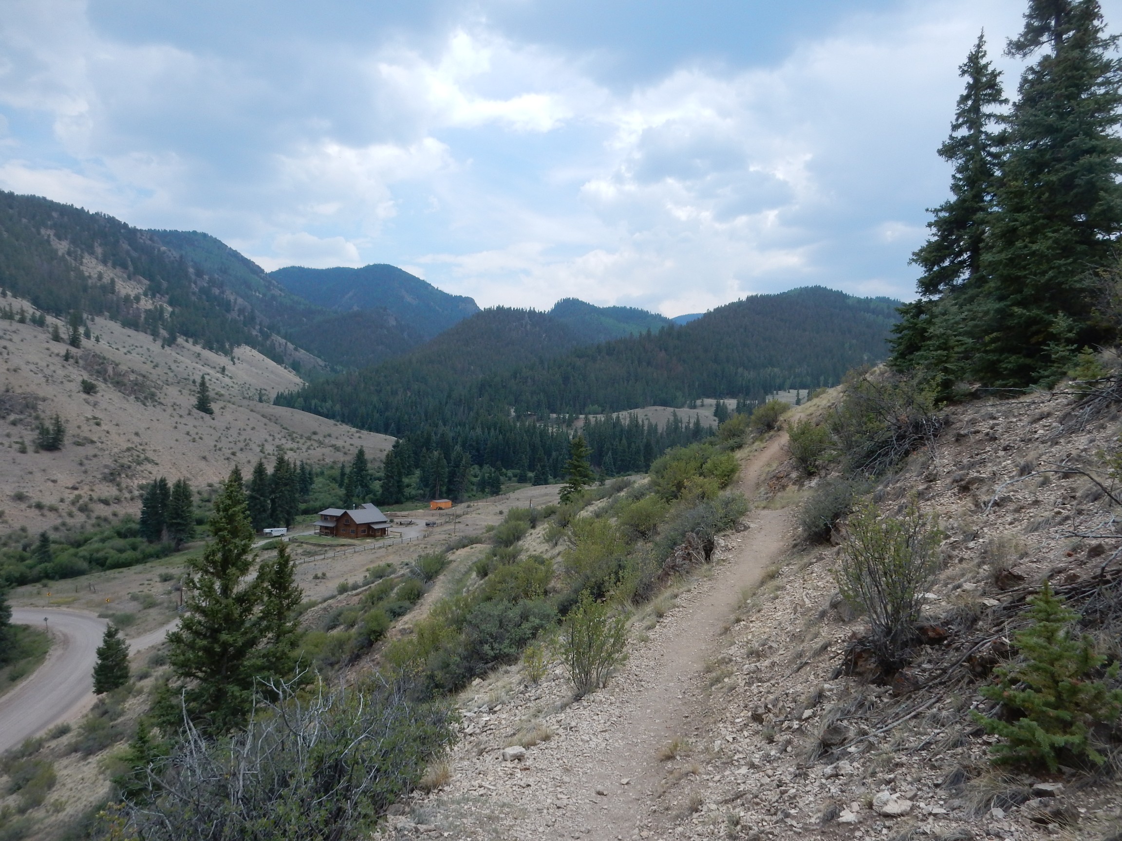
It’s beautiful country, only enhanced by its geological wonders.
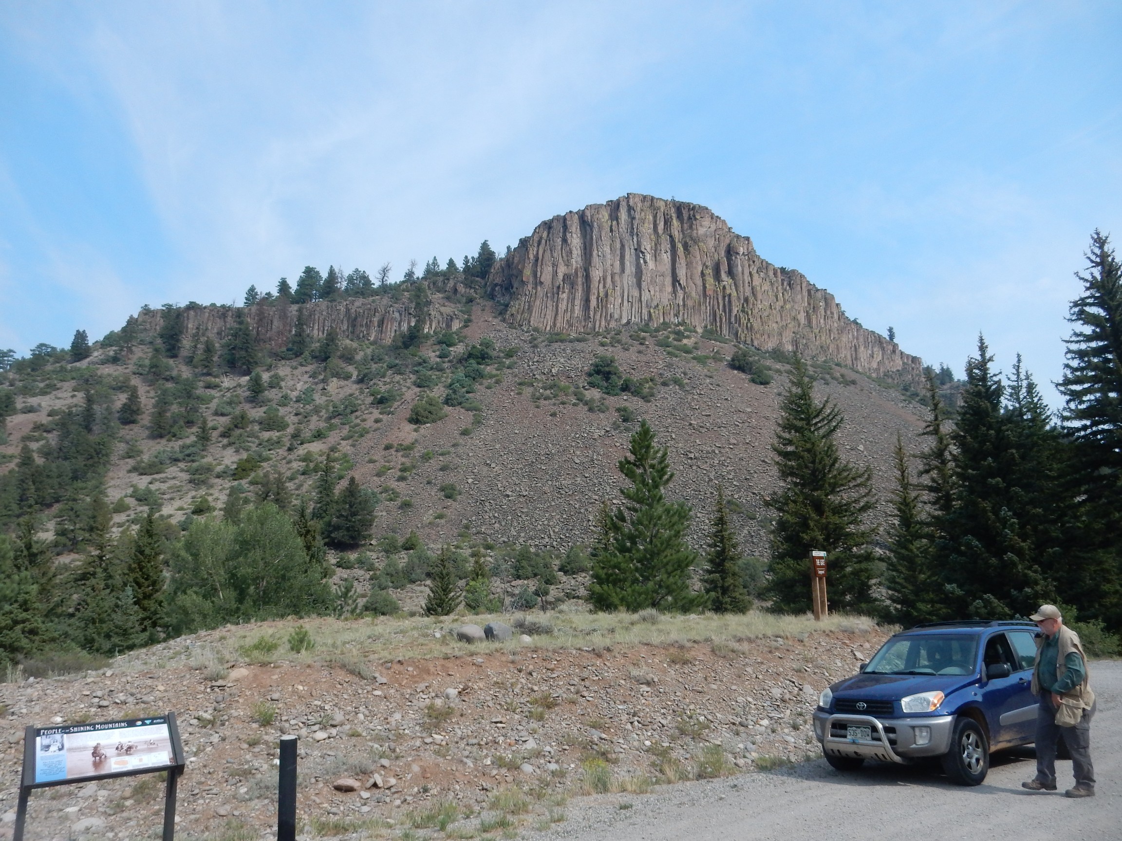
This is The Gate. I can’t find a geologic map for this area and I don’t recall what the road log said; but my guess is this is Blue Mesa Tuff.
The signage boils down to “white man bad, Indian good.” I find it tiresome.
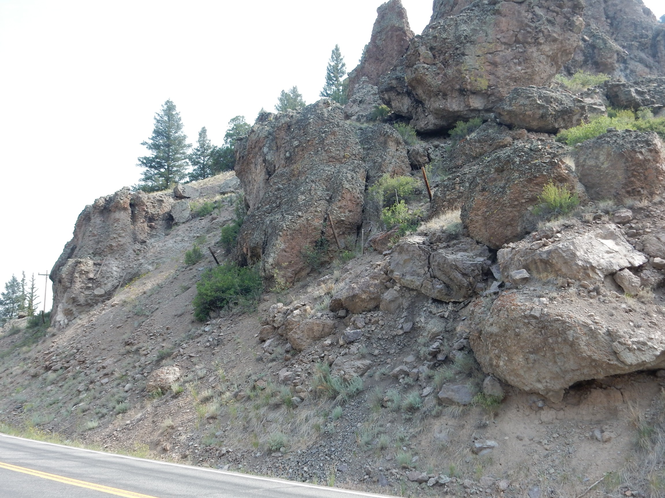
Some impressive conglomerate beds of the Lake Fork Formation.
The Lake Fork River has carved a nice little canyon here.

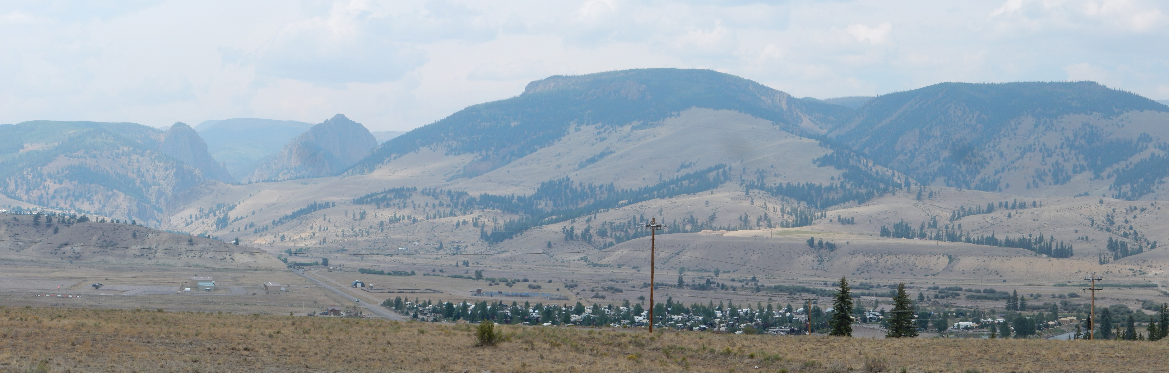
We arrive at Lake City, having decided to drive clear through to Bruce’s hotel at South Fork and then work our way back with a road log. The road contines up towards the wonderfully-named Slumgullion Pass.
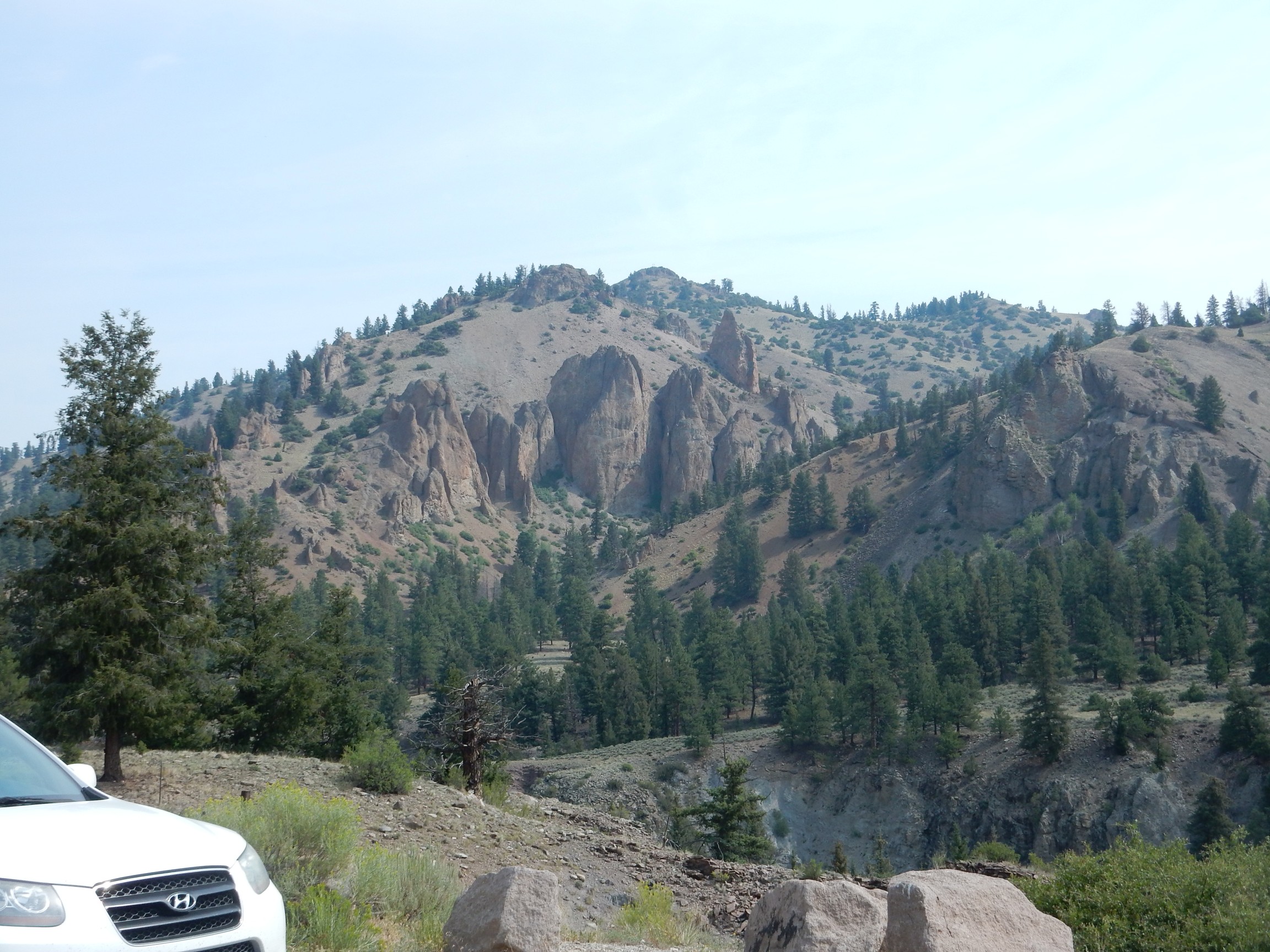
Panorama of the Lake City resurgent dome:

The Lake City caldera formed 23.1 million years ago, making it the youngest of all the calderas of the San Juan Mountains. The eruption emplaced about 80 square miles of Sunshine Peak Tuff. In most caldera eruptions, a sizable fraction of the erupted ash settles on the floor of the caldera, and this seems particularly the case with the Sunshine Peak Tuff. When the floor of the caldera was pushed up by new magma entering the magma chamber, the resurgent dome so formed will be underlain by this tuff.
In the case of the Lake City Caldera, the cluster of mountains here is the resurgent dome, most of which is underlain by Sunshine Peak Tuff. However, the part of the dome just right of center, as seen from this point, is a ring fracture dome, composed of quartz latite erupted through the ring fracture. (Quartz latite is a volcanic rock containing roughly equal amounts of alkali and plagioclase feldspar along with about 10% quartz.) This late eruption involved hydrothermal activity, which deposited valuable silver and gold ores around the dome that were mined in the Golden Fleece Mine.
The valley nearly encircling the dome, drained by Lake Fork to the south (left) and Henson Creek to the north (right), roughly corresponds to the “moat” that formed between the resurgent dome and the caldera rim. The ring fracture is actually located within the valley, so that it crops out on the sides of the modern topographic dome.
We stop at a rest area near the summit. There is a spectacular view back towards the dome, framed by wildflowers.
If it weren’t for the accursed wildfire smoke, and if I had moved slightly to hide the highway, this might have been an Ansel Adams moment.
Up and over the pass. The scenery is magnificent but we make no stops; we’re planning to come back. However, I can’t resist this.

I am out of my reckoning; I thought this might be the resurgent dome for the Creede caldera. But no; when Bruce and I consult the map, we realize we are in the Clear Creek Graben, a block of downthrown crust. This may have coincided with part of the southwestern margin of the massive La Garita Caldera. The mountains across the valley are underlain mostly by Fish Canyon Tuff from the La Garita caldera, with thin beds of younger tuff on top. But perhaps I’m doing better than I thought: We’re also looking into the heart of the Lost Lake caldera, the one that took so long to recognize.
We pass through Creede and on to South Fork, where we fail to find Bruce’s hotel. It turns out the name had changed; Bruce finally recognizes it from the photo at the web site. We also find a Mexican restaurant that is decent by Colorado standards; pretty poor by Santa Fe standards. We’re not having a lot of luck with eating on this trip.
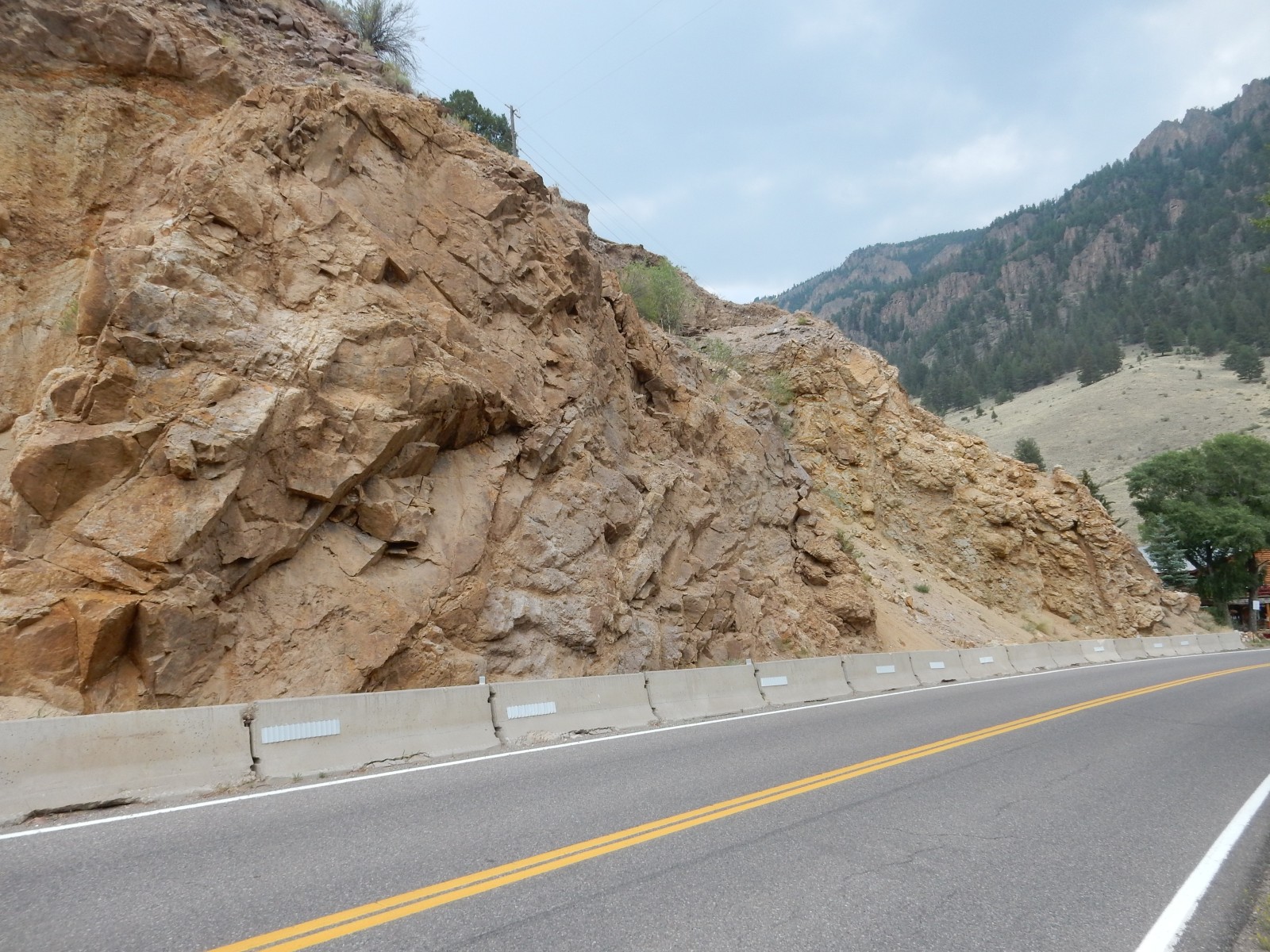
Since we will be on paved roads today, we decide to take my car. Back up the canyon, following a road log, our first stop:
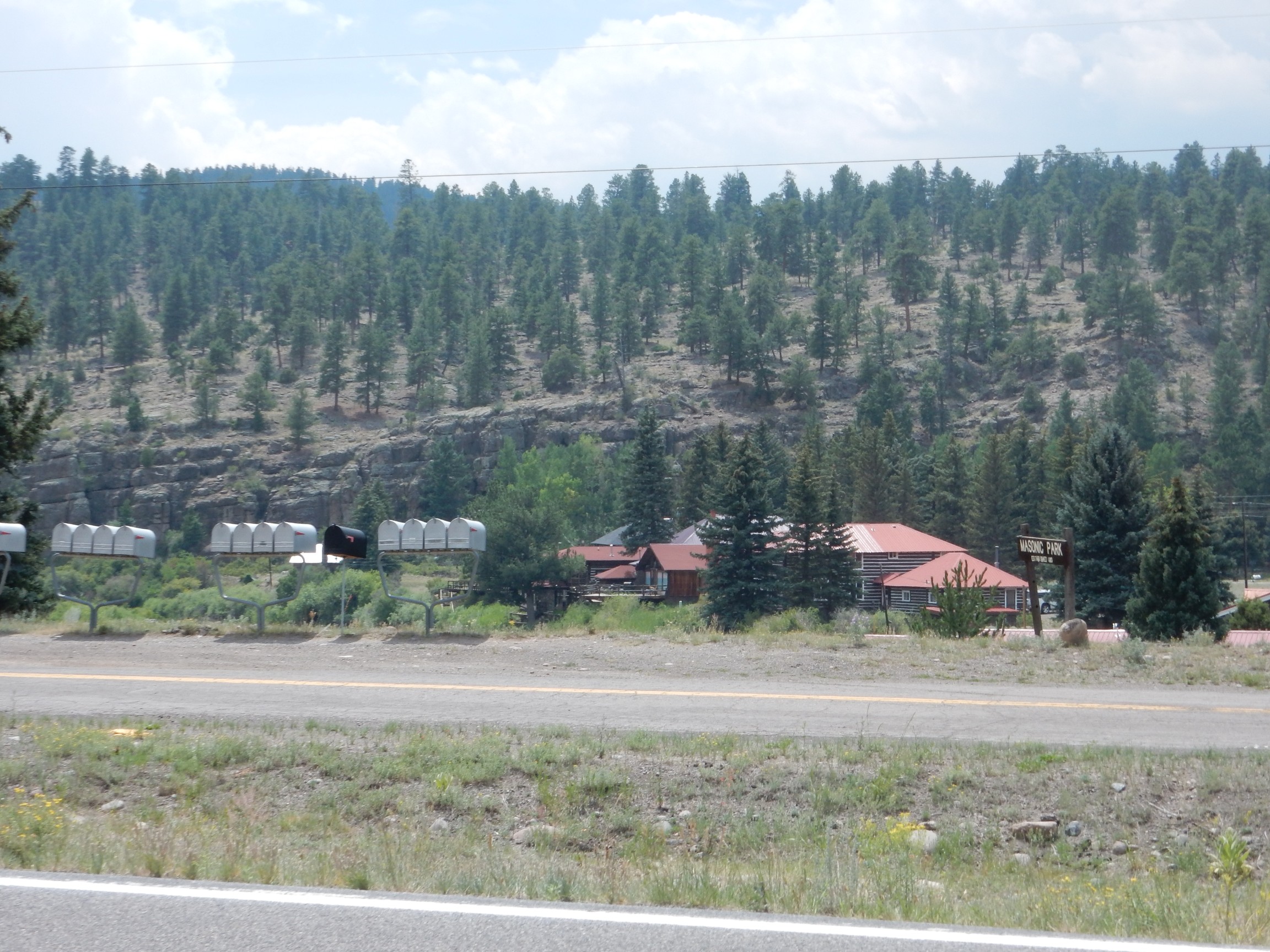
This area is called Masonic Park and we learn, to our surprise, that it is underlain with Masonic Park Tuff. This was erupted from the Mount Hope caldera to the south 28.4 million years ago. Around 200 cubic miles of tuff were emplaced.
Next is a view of the east wall of the La Garita caldera.
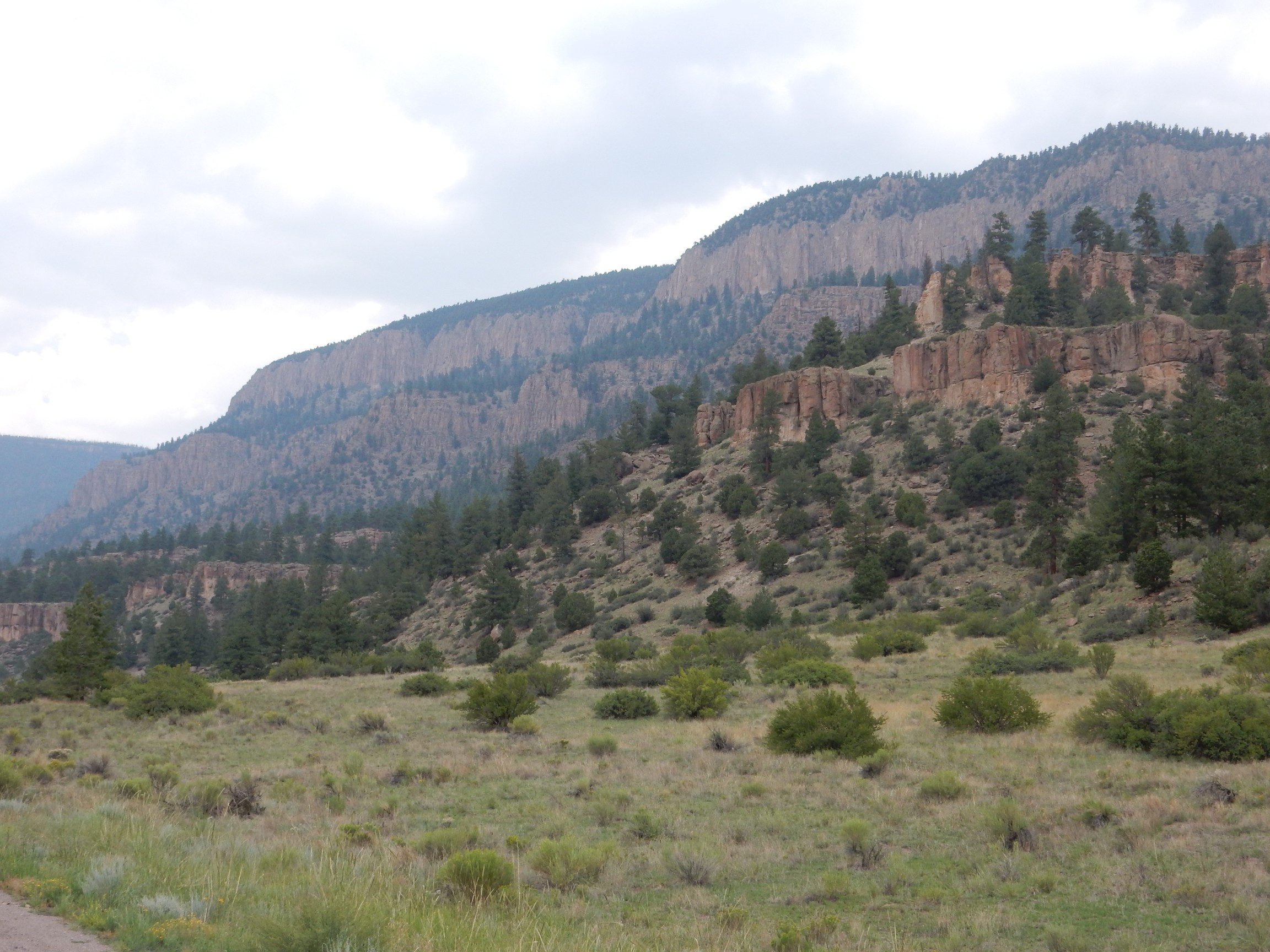
The cliffs at the top of the further ridge are Fish Canyon Tuff, 27.8 million years old, from the La Garita Caldera immediately to the north. The second set of distant cliffs are Masonic Park Tuff.
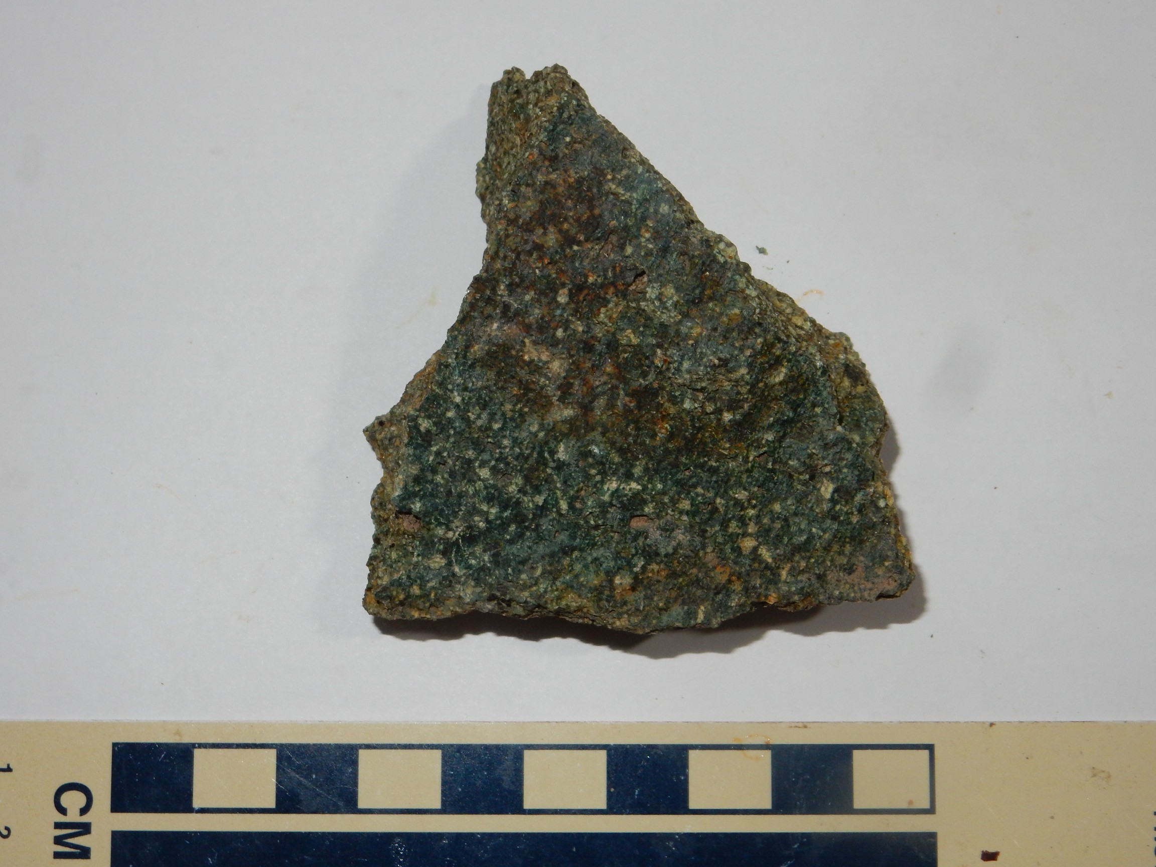
We stop at a road cut in the Masonic Park Tuff.
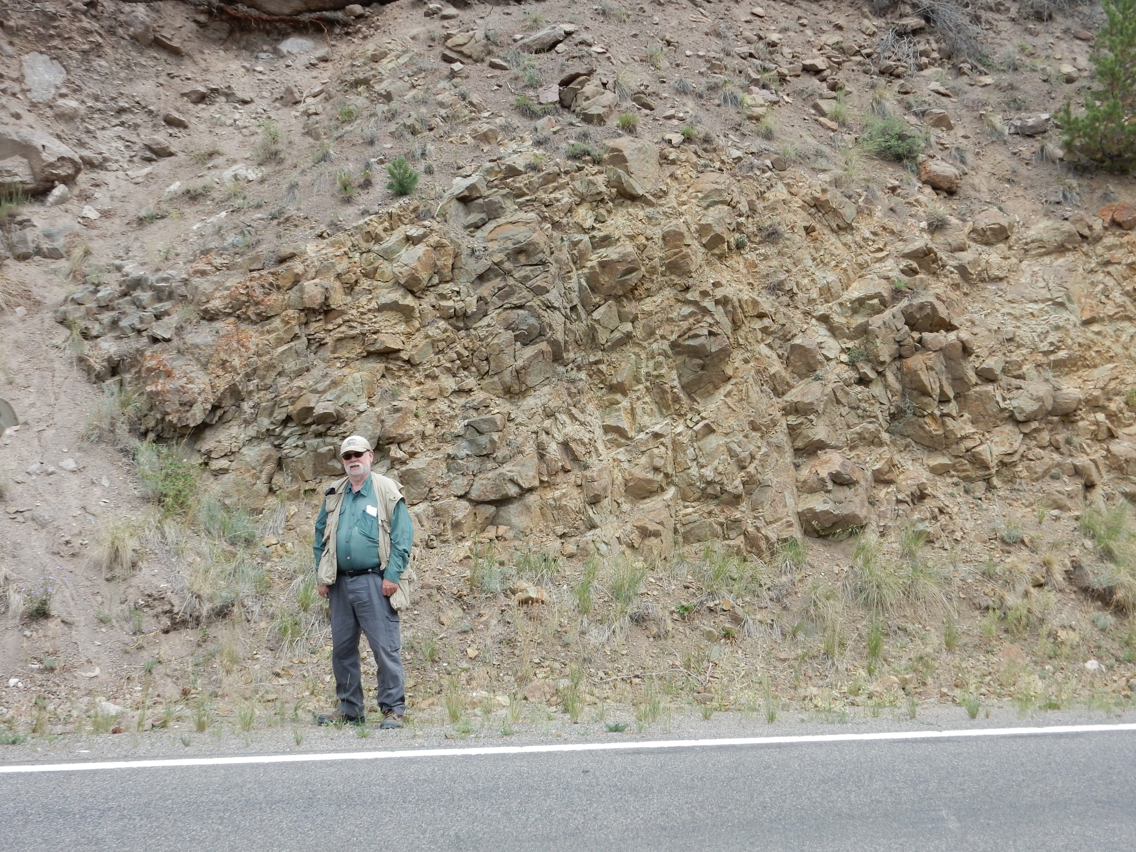
The stuff weathers brown, but fresh surfaces are deep green, startling enough to me to take a specimen. In fact, at this point, I began routinely taking specimens — not that I can keep the more ordinary ones straight now …
But certainly this one:
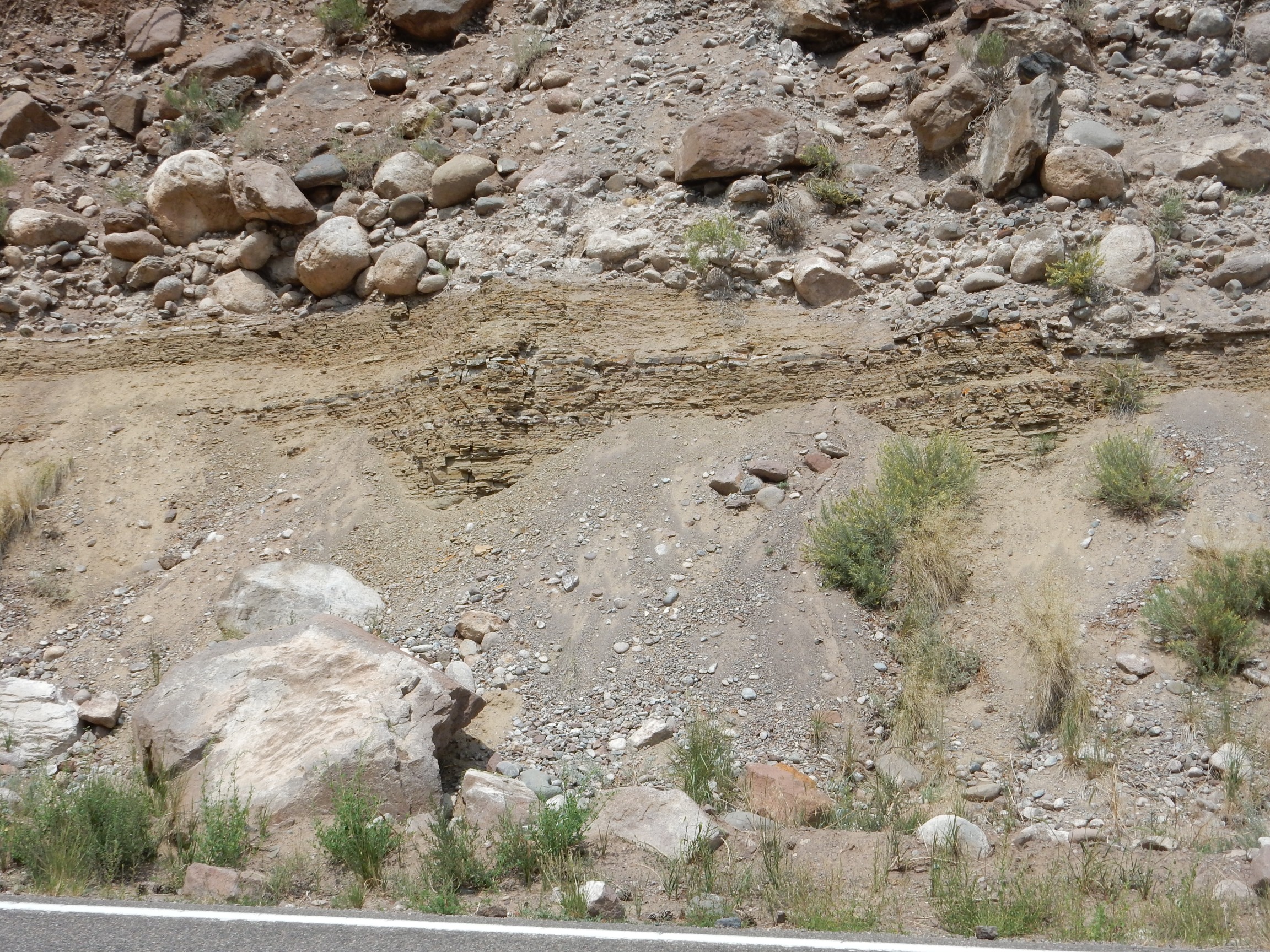
We drive on, looking for a road cut with lake bed sediments described in the road log. Is this it?

Nope. A landslide deposit.
There are fragments of another kind of tuff at th base of the cliff. Based on the road log, we conclude that these are likely Mammoth Mountain Member of the Carpenter Ridge Tuff,
But, looking at the latest geologic map, it looks like this must be Blue Creek Tuff. The map is much newer than my road log, and it states that the Blue Creek Tuff caldera has not been identified. I’m guessing this is a new finding, with what was mapped as Mammoth Mountain Member now being assigned to this new caldera cycle.
We drive a little further and find the lake beds.
I seem to now be in collecting mode.
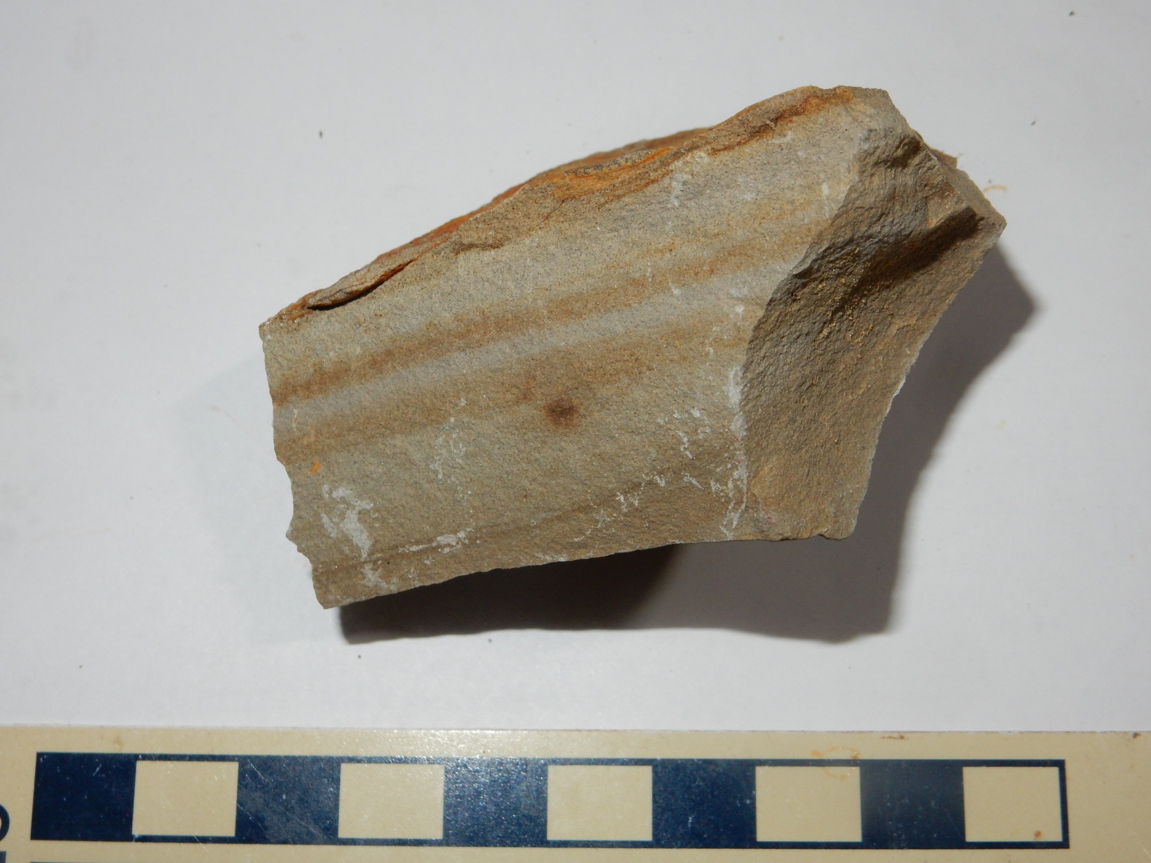
The sample is a wacke, a sandstone in which there is so much fine matrix between the sand grains that the grains do not actually touch each other. It’s quite well cemented, actually, which is not common for wackes, but then there was likely abundant silica around to do the cementing. These lake beds are thought to have formed in the moat of the La Garita Caldera.
I should probably explain that the multiple calderas were formed in this area, with younger ones overlapping older ones and spoiling their traces. At least three calderas (La Garita, Bachelor, and Creede) had margins close to the spot I’m at now.
It’s hard to find a safe spot to pull over for the next outcrop, and I end up running back down the road while Bruce waits.
Debris flow deposits from one or another caldera rim.
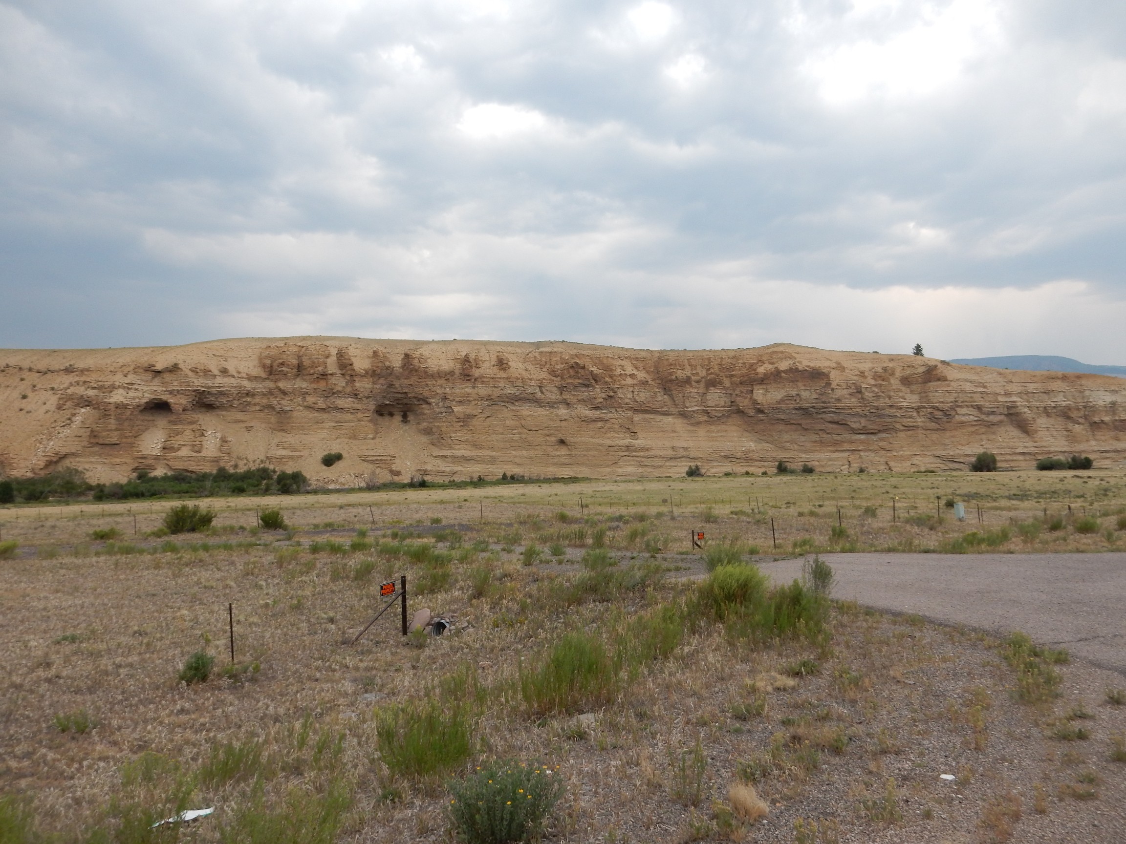
This area is known as Wagon Wheel Gap and, if we were in a position to hike around the area, we would find some interesting geology. Blue Creek runs north from this area and the Rio Grande runs east and west. The road runs practically on top of the margin of a reentrant of the Creede Caldera; that is, a place where the caldera margin takes a jog inwards. As a result, the road (and the Rio Grande, which the road parallels) run east-west here between the Creede caldera margin to the south and a Creede ring fracture dome to the north (the Wagon Wheel dome). Meanwhile, the Blue Creek valley lies between the Wagon Wheel Gap dome and the Creede and Bachelor margins to the east.
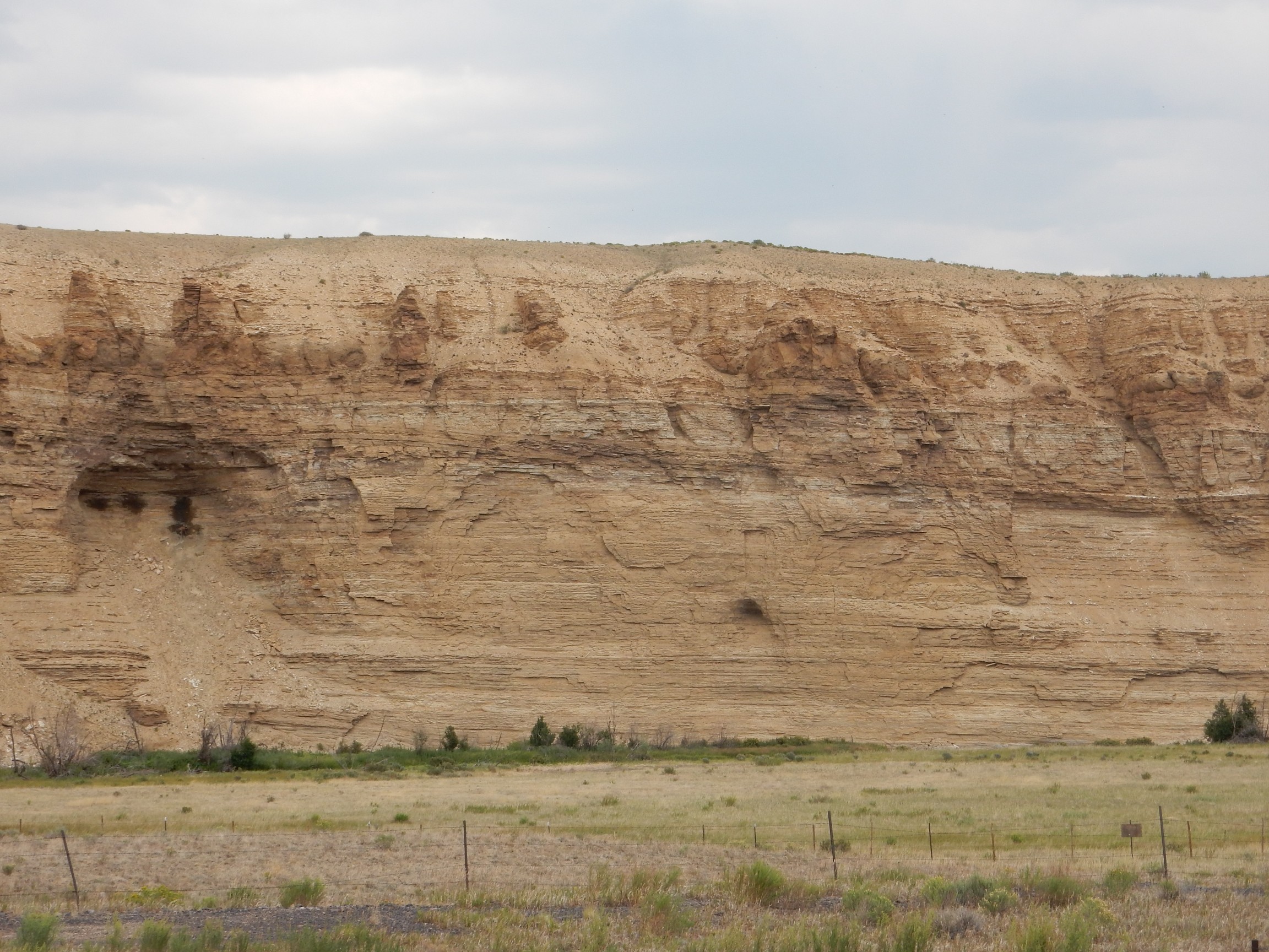
This roadcut
is mapped as Wagon Wheel Gap Breccia Member. If so, it’s a megabreccia, rock that slid from a newly collapsed coldera rim as more or less a coherent block. Some megabreccias can include blocks a mile long. In the background is Blue Creek Canyon, and the far wall more or less corresponds to the margin of the Bachelor caldera. The cliffs are the Palisades section of the Mammoth Mountain Member, ponded in the moat of the La Garita Caldera. Except, according to the newer map, they’re Blue Creek Tuff from an unidentified caldera.
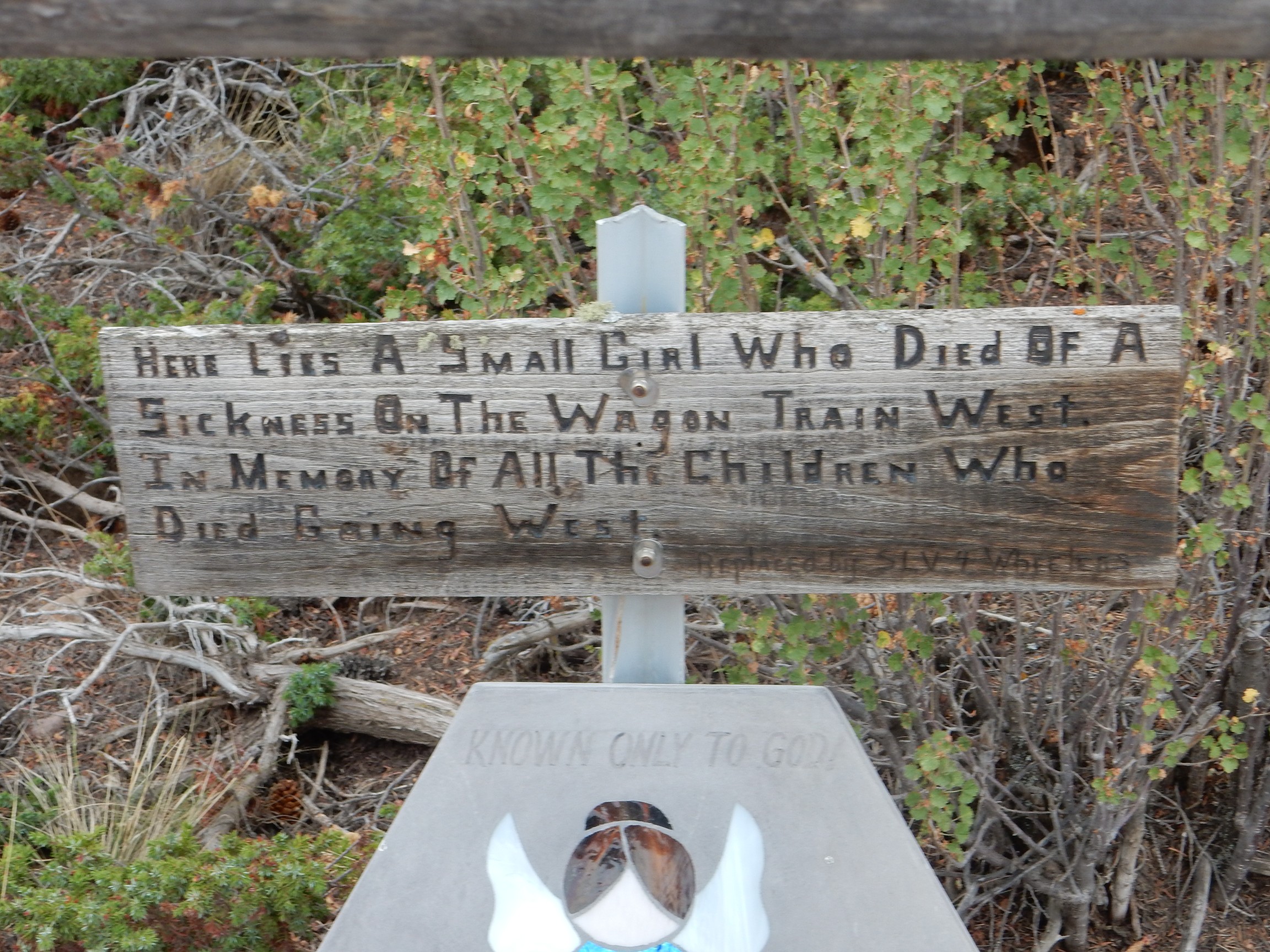
Following the road log, we divert off the main road and follow a good gravel road onto the resurgent dome. There is a small pioneer cemetery here.
Looking north from here:
The entire escarpment is part of the north rim of the Creede caldera, which collapsed the southern part of the resurgent dome from the Bachelor caldera. At left, the crags frame Willow Creek, which runs roughly along a medial graben of the Bachelor resurgent dome. A medial graben is where part of the caldera floor splits and drops as the floor is pushed up.
Willow Creek is also the focus of the historical mining activity in this area. Hydrothermal activity emplaced rich silver ores in the faults along the graben.
The hill here is described as a knob of travertine deposited by hydrothermal activity when the caldera was young. I hike a short distance up the dome, and yeah.

Notice the ripple marks on the left sample.
Just east is a valley up into the Creede resurgent dome.
This is part of a well-defined north-south medial graben in the dome, the Deep Creek Graben.
We drive north past another lake sediment outcropping.
These beds are assigned to the Creede Formation.
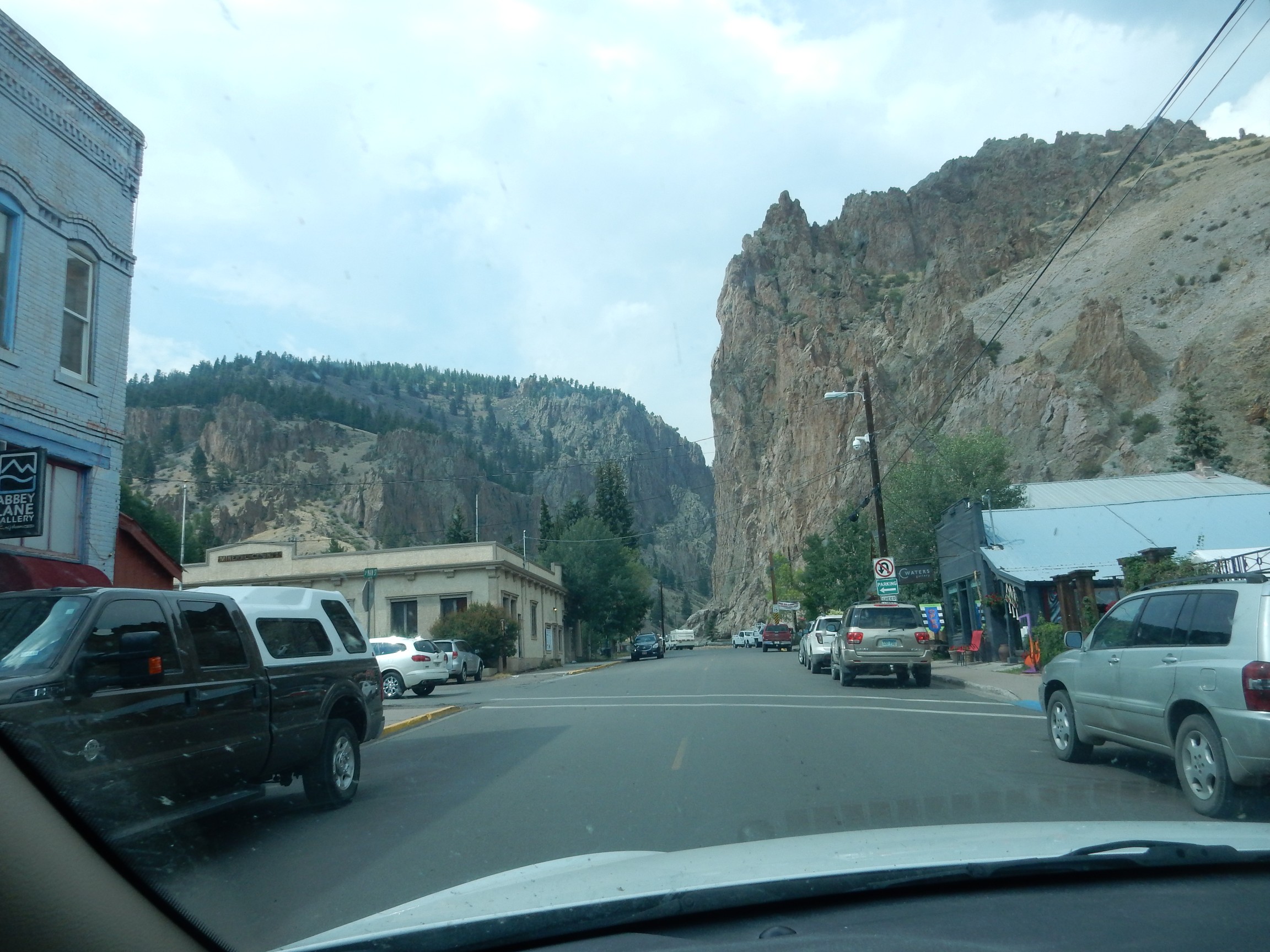
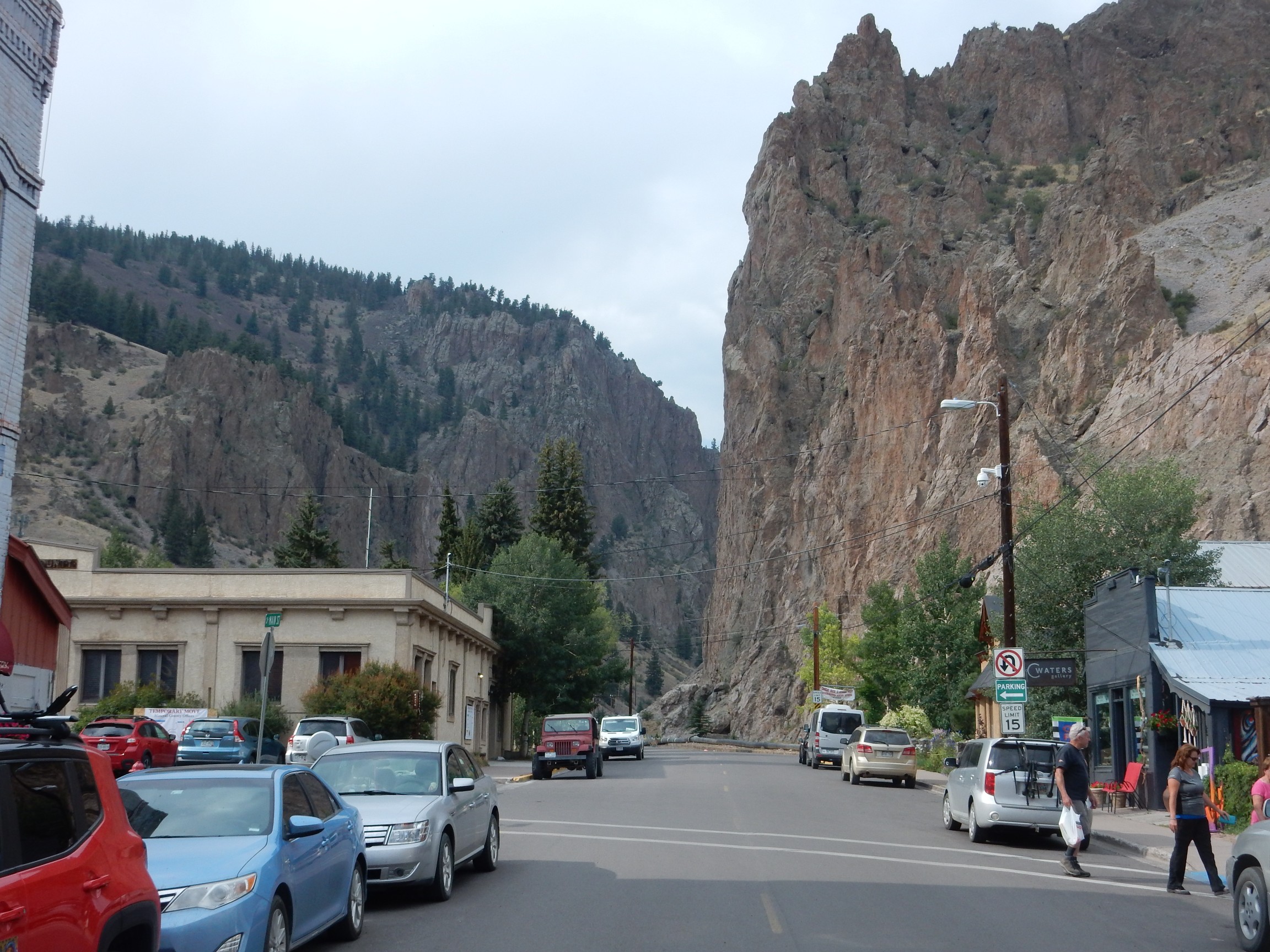
Main street in Creede.
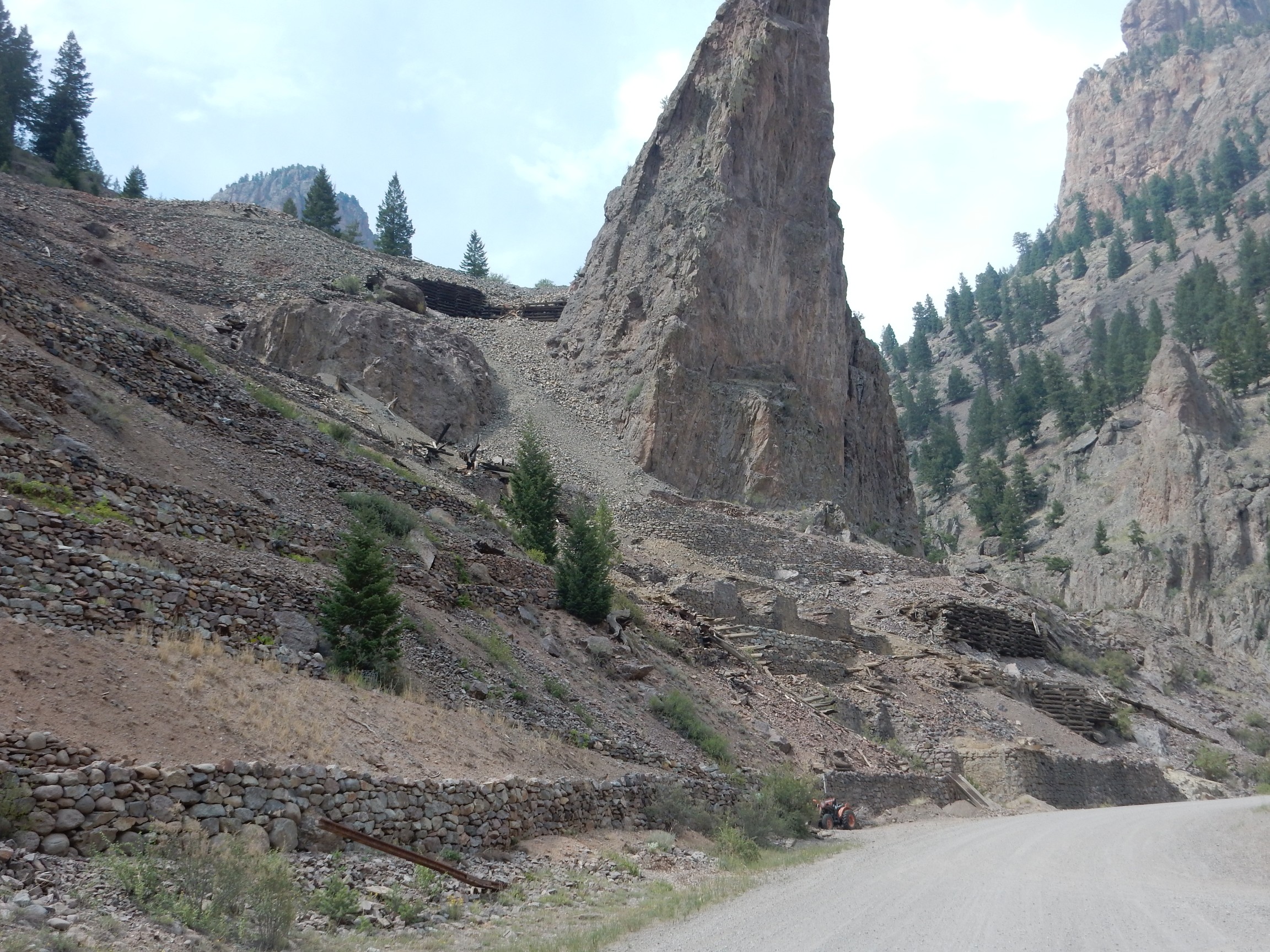
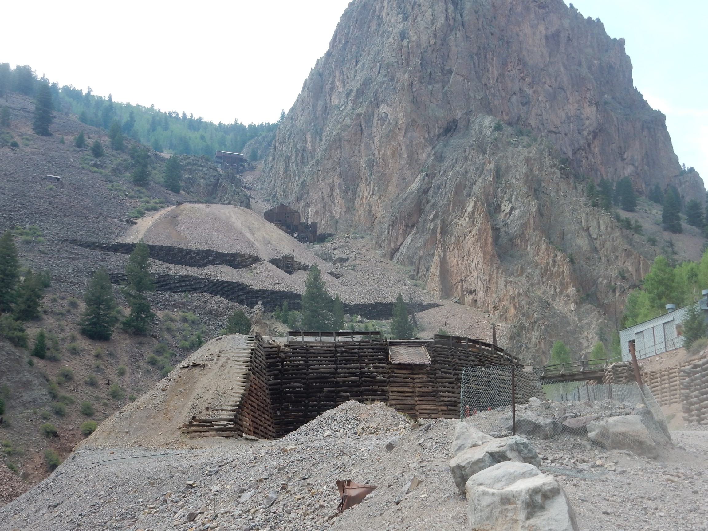
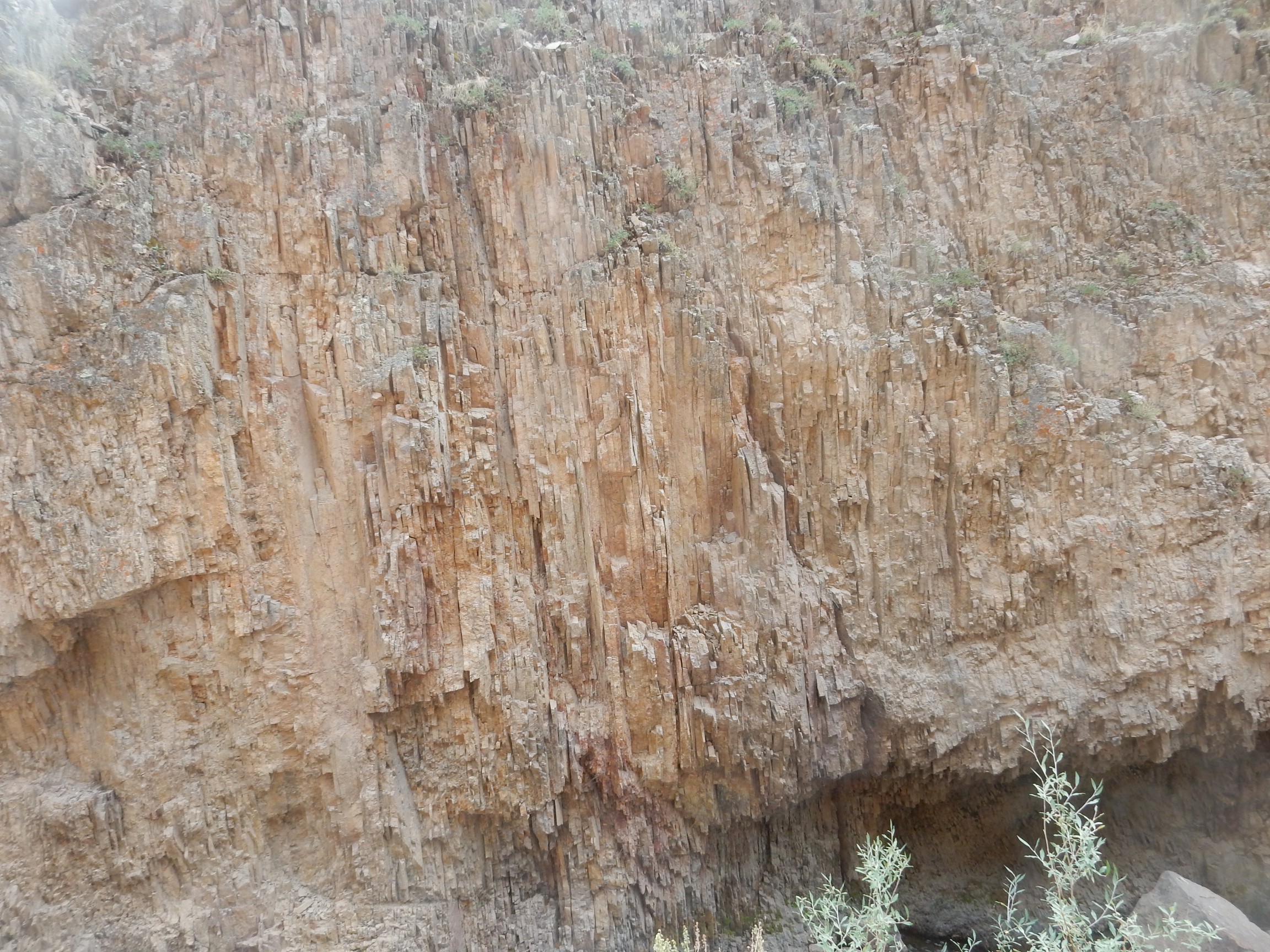
We drive up the chasm to investigate the old mines beyond. There is signage and printed guides to the old mines. Our attention is called to some highly foliated tuff.

The Amethyst workings.
The Amethyst fault was created during resurgence of the Bachelor dome 27.4 million years ago. Roughly 2.5 million years later, the fault was reactived with the Creede caldera eruption, and hydrothermal activity deposited rich silver-lead-zinc veins.
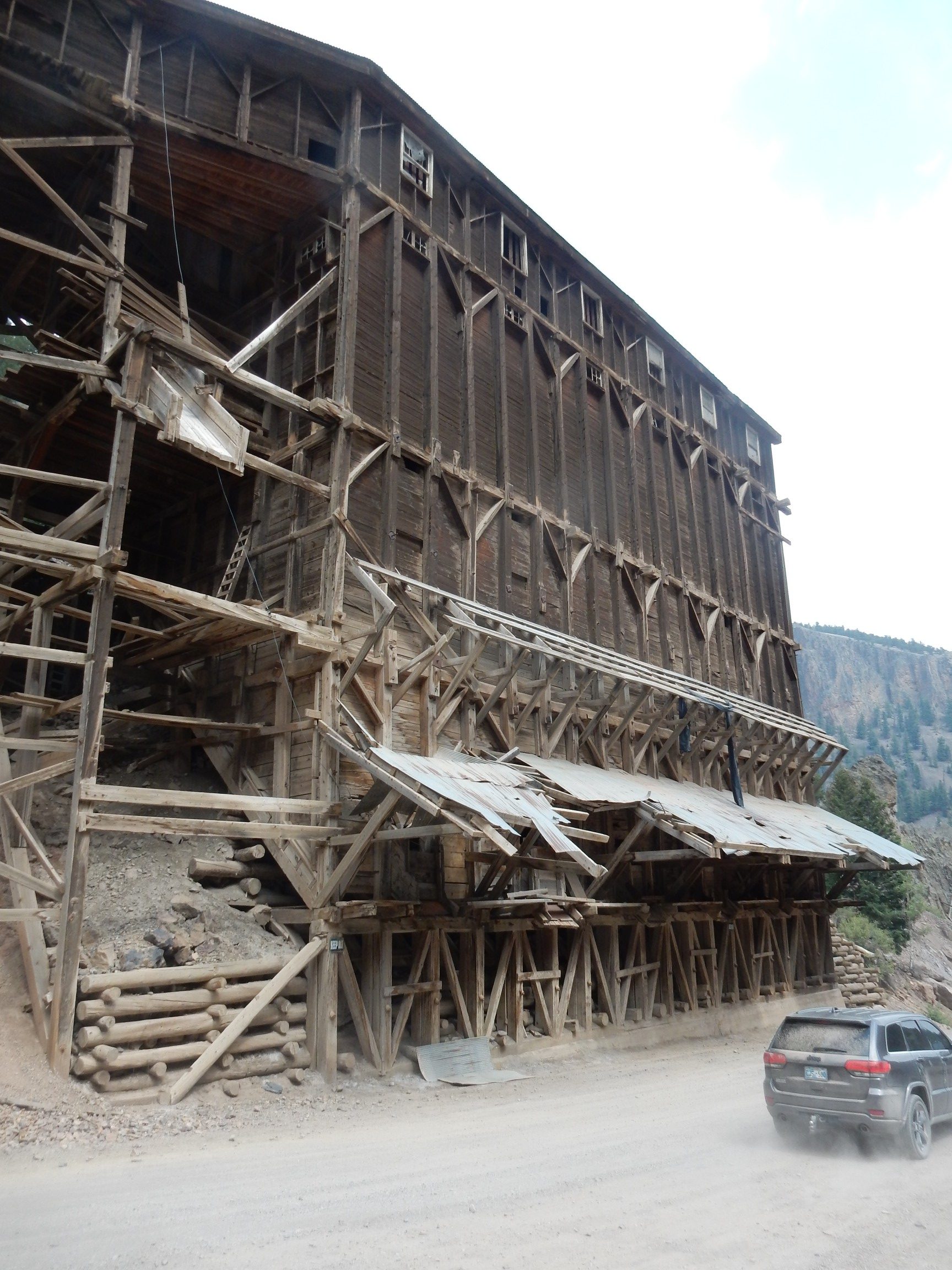
The old mill.
A closer look at the workings.
Acid mine waste.
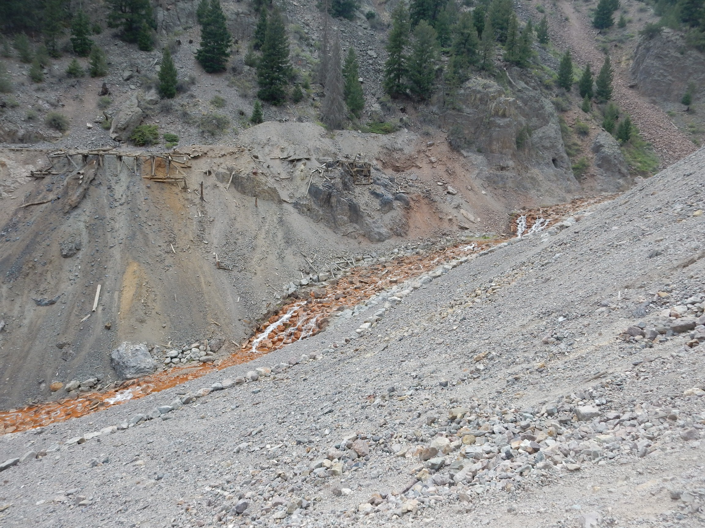
The metal ore here takes the form of metal sulfides. On exposure to air, and aided by sulfur bacteria, the sulfides slowly oxidize to sulphate, which is quite acid. Aside from being unpleasant in itself, the acid waste dissolves heavy metals in toxic concentrations.
Some strikingly foliated tuff.
The road log directs us back to the fork in Willow Creek and we try the other fork. Somewhere in the process, we get out of sync on the odometer, and we’re soon disoriented.
This looks like more foliation.

We are looking for a landslide breccia mentioned in the road log; we never find it. We then looks for potassium metasomatism at Nelson Creek, except we can’t find Nelson Creek on the map. At least we can find Campbell Mountain.
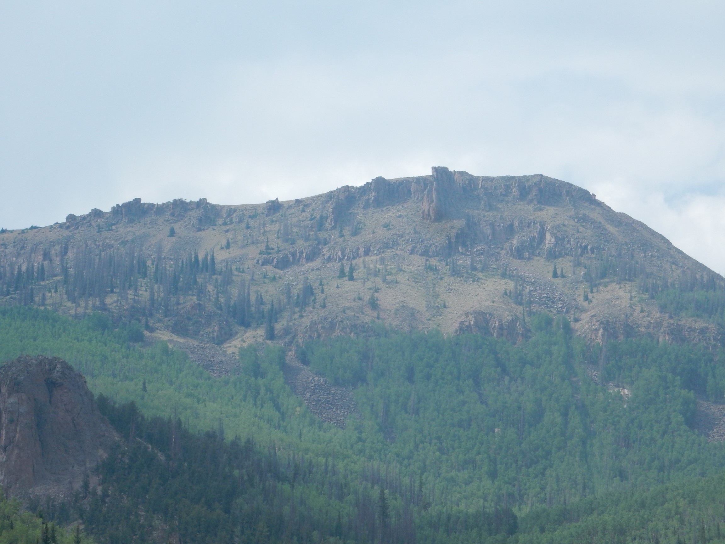
Topped with a distinctive member of the Carpenter Ridge Tuff, known as the Campbell Mountain Welding Zone. I don’t think we know this.
I give up about here and turn around. Looking at the rest of the road by satellite after I get home, I’m thinking that was a very wise decision. Turns out the Nelson Creek crossing is here.
We turn back and head into Creede. I get a better picture of the main street going out.
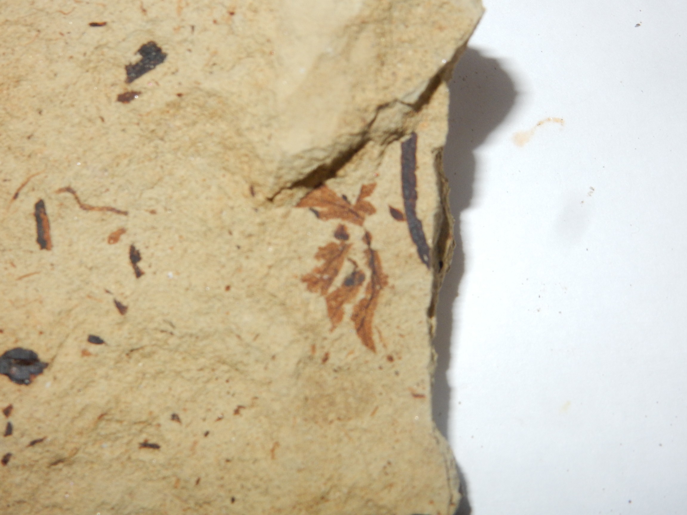
We pass the Creede Formation lake beds just south of town again. There are three vans with university plates parked off the road, and a swarm of hammer-wielding college-age people led by a graybeard. Obviously a summer geology class. We pull over and join the fun; Bruce has a pleasant conversation with the professor while I join the students in vandalizing the outcrop. Turns out to be well worth the effort.
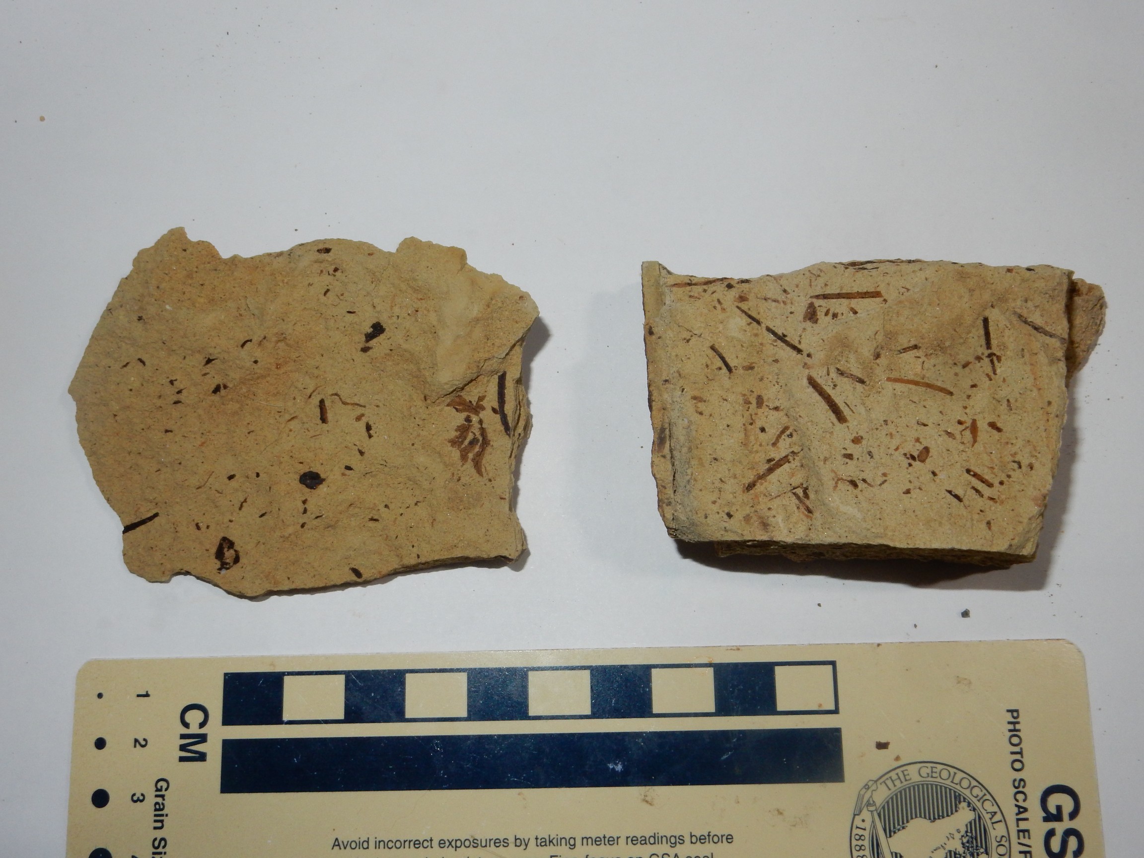
Fossilized pine needs and leaves. The leaf fossil is beautifully delicate.
We continue west, to admire some of the best exposures of Creede Formation.
The Creede resurgent dome viewed from the west.
The rocks at right center are the Point of Rocks lava dome, the only silica-rich rhyolite erupted from the resurgent dome, according to the road log.
Next is an exposure of caldera-margin breccia.
This is interpreted as debris flows from the unstable caldera rim soon after caldera formation.
Our final stop for the day is an outcrop of Huerco Formation.
This stuff is apparently andesite erupted towards the end of the La Garita caldera eruption cycle. Its presence here shows that we have reached a remnant of the southwest rim of the Bachelor caldera.
It’s getting late, and it’s a long drive back to South Fork. Bruce and I eat at what passes for the fancy local restaurant; we’re unimpressed. I get back to my car and find the pressure in that left rear tire quite low. It’s raining but I brave the rain to pump up the tire and top off gas. I also purchase a bag of ice, which I then forget to actually pull out of the outdoor freezer and put in my car. Yeah, it’s rapidly becoming that kind of evening.
Back to Marshal Park Campground. I have trouble finding the entrance road. I first turn on 123, find it goes up into the resurgent dome, and conclude that can’t be right. A couple of tries and I finally find the badly-marked entrance. Then I have to find my reserved spot, which isn’t too hard, but then I have to set up my tent in the dark. I need the fly as well, given that the weather has turned rainy. But I sleep reasonably well. It rains, but not when I get up for what is becoming the early morning ritual of attending to leaks.
Next: More Calderas’R’Us.