
A mystery resolved?
A couple of months ago I went hunting for xenoliths in the Cieneguilla Basanite, and came across a somewhat puzzling dike in a road cut. So Friday I took time while returning from Albuquerque to visit the area again and take a longer look.
First, some background. Don’t worry; the pictures are coming.
The Cieneguilla Basanite is one of three formations in the area of La Cienega that record an episode of volcanism in north-central New Mexico from about 37 million to 20 million years ago. This was part of a widespread period of volcanism across what is now the western United States, known to geologists as the Mid-Tertiary ignimbrite flare-up.
According to one theory, some 80 million years ago, a plume of magma rose to the ocean floor at a triple junction — a point where three tectonic plates meet — under the Pacific Ocean. This produced a plateau of volcanic rock in the middle of the ocean, something like Iceland today. The plateau split into three sections, each moving with one of the three plates. One is thought to have collided with southern Mexico. Another is still present on the Pacific ocean floor off Japan, where it is known as the Shatsky Rise. The third was carried by the Farallon Plate into the west coast of North America.
Normally, oceanic crust that collides with a continent subducts, or dives under the lighter continental crust, at an angle of about 45 degrees. This process is far from quiet, being responsible for the chains of volcanoes that circle the Pacific and for some of the most powerful earthquakes recorded. These include the Boxing Day Earthquake of 2004 that killed a quarter of a million people in Indonesia and the Tohoku earthquake of 2011 that killed nearly 20,000 Japanese and wrecked the nuclear power station at Fukushima.
The thickened ocean crust of the triple junction plateau caused subduction to become much more shallow and even more violent, with its tectonic effects felt far inland. The compression caused by shallow subduction is thought to be responsible for the Laramide Orogeny, or period of mountain building, that raised most of the mountain ranges we see today in the western United States. Laramide mountain building reached its peak around 50 million years ago. The Farallon Plate then began to return to a more normal angle of subduction, allowing hot mantle rock to rise beneath the compressed and faulted crust and produce widespread volcanism between 40 and 25 million years ago.
The manifestation of this in New Mexico was the Ortiz porphyry belt, a chain of mountains reaching from South Mountain east of Sandia Crest to north of La Cienega, the area I will be exploring today.
The geologic map shows the general nature of the rocks here.
A geologic map of this kind is produced by taking a conventional contour map and superimposing colors and formation symbols. The village of La Cienega is just off the map to the lower right. The canyon of the Santa Fe River enters at top right and exits at bottom center; the canyon floor is colored bright yellow and marked Qal. Other areas underlain by different rock types are colored accordingly and marked with equally cryptic formation symbols. Fortunately, all geologic maps have a prominent legend that explains the meaning of each symbol. Qal means Quaternary alluvium, that is, loose sediments transported by water in the last 2.5 million years — exactly what you would expect in a canyon bottom.
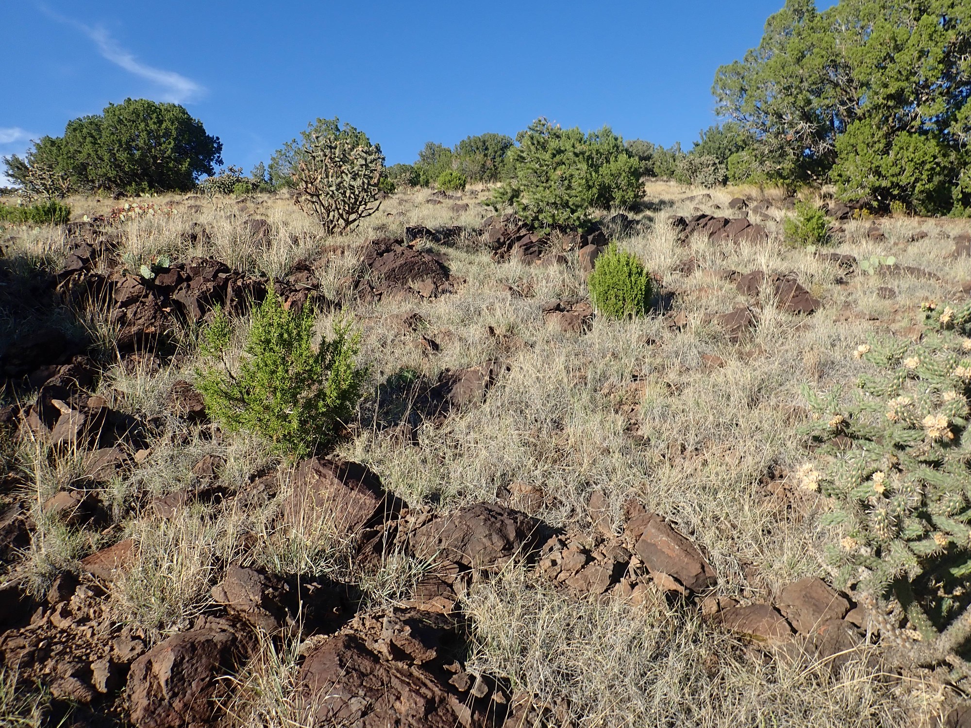
I will be examining the rocks along a gravel road that follows a small valley down to the Santa Fe River at the little settlement of Cañon, which is really no more than a cluster of four or five buildings. The geologic map shows four formations in this area: the Ortiz Monzonite, colored light red and marked Tmi; the Espinaso Formation, colored reddish-pink and labeled Te; the Cieneguilla Basanite, colored gray and marked Tc; and Quarternary colluvium, colored light yellow and marked Qc. The maps shows Espinaso Formation in the bottom of the east end of the small valley, with hills of Cieneguilla Basanite to the north and of Ortiz Monzonite to the south. In the western end of the valley, where it approaches the river, the valley bottom becomes covered with Quaternary colluvium.
This is about as much detail as you have a right to expect on a geologic map at this scale. As we’ll find today, there some pretty interesting details at a scale too small to map.
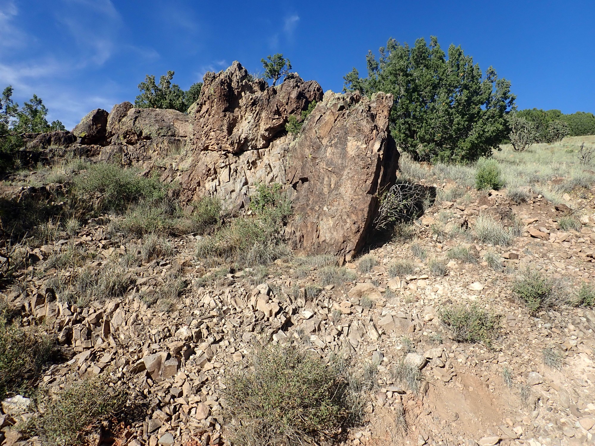
I park at a trail head near the east end of the valley and start down. The road cut to the north exposes Espinaso Formation.

This is not a particularly good exposure; there are far better exposures just north of La Cienega. So this is not one for the book. But it’s pretty typical of this formation, which consists mainly of brown brecciated andesite.
Andesite: this is a volcanic rock with an intermediate silica content, around 60% by weight. It’s a very common volcanic rock, and its silica content makes it viscous enough that it typically forms volcanic mountains rather than spreading out to form the flat plateaus so typical of low-viscosity basalt. Andesite is the usual rock type found in stratovolcanoes, the classic cone-shaped mountains like Mount Fuji or the Cascade volcanoes.
Brecciated: It is not at all unusual to find andesite beds that consist of broken fragments of andesite rather than solid rock. As the andesite cools, it forms a thick crust that fractures under the stresses produced by the still-liquid interior.
The Espinaso Formation is interpreted as volcaniclastics, shattered rock, produced from andesitic magma erupted between 27 and 34 million years ago. The ages are based on radiometric dating of the rock, which measures the content of radioactive potassium and the argon it produces as it decays to estimate the time since the rock was last hot enough for argon to escape. (Argon is an inert gas that makes up about 1% of the air we breathe.) It can be distinguished in the field by its dark brown color, which is also evident on fresh fracture surfaces.
I continue down the road towards the dike I found on my earlier visit, pausing at an outcrop I identified earlier as massive Espinaso Formation.
Today I can take the time to examine this closely. I climb up and explore the entire outcrop. Some samples:
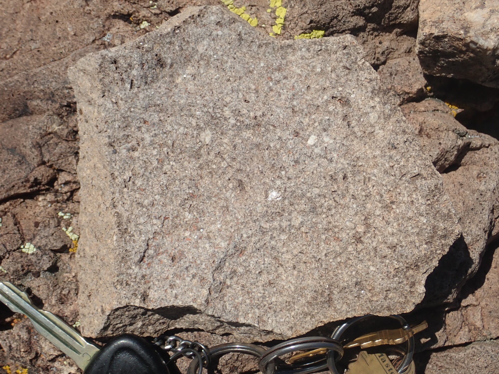

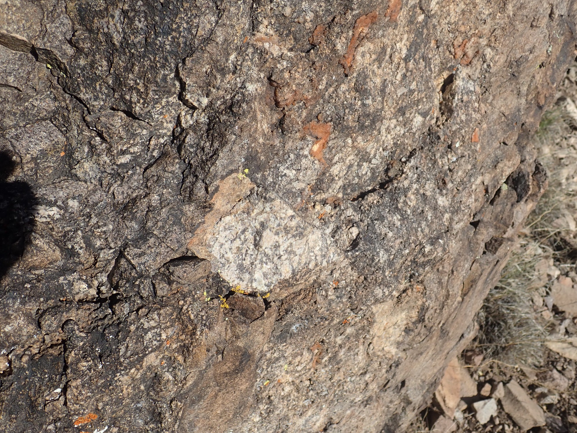
The first sample is fine-grained monzonite very similar to what is seen in the Cerrillos Hills to the south. The second sample includes some very coarse-grained material. I find that the big plug is cored with this stuff.
Some samples photographed back home under better conditions:
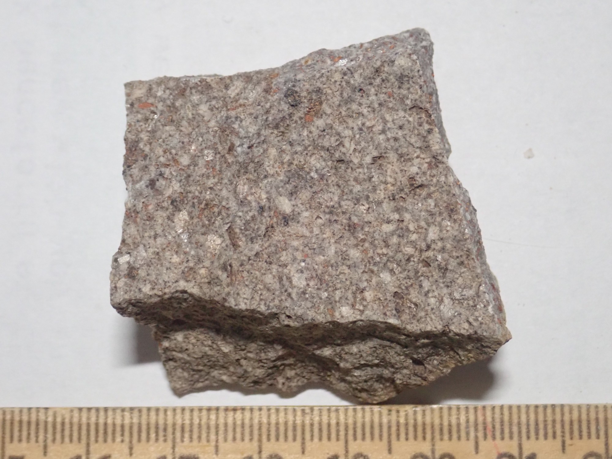
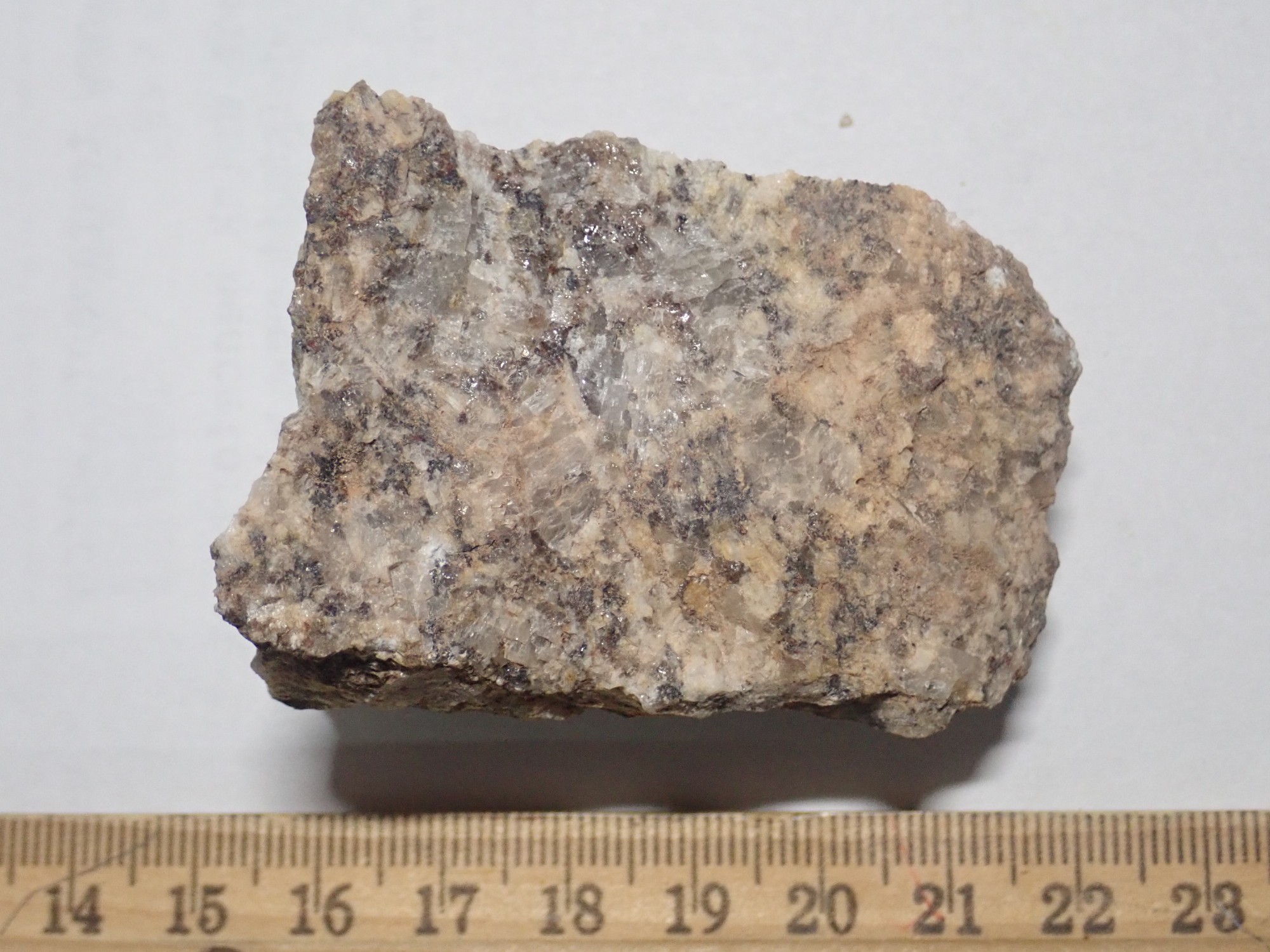
The composition of the two samples is likely very similar, with the difference being purely in texture. The coarse sample is almost entirely large crystals of feldspar, with just a scattering of dark iron-rich minerals. The feldspar seems to be two varieties, the coarser kind being translucent and having no striations typical of plagioclase feldspar and the finer kind being less transparent, more white in color, and not having clear enough faces to detect any striations. I don’t spot any obvious quartz. Diagnosis: monzonite, but somewhat on the alkaline side. Monzonite is a granite-like rock composed almost entirely of a roughly equal mixture of alkali feldspar and plagioclase feldspar (and the two are not always easy to tell apart.)
So although the map shows Espinaso Formation here, I’m seeing Ortiz Monzonite. To be sure, Espinaso Formation andesite has almost the same composition as Ortiz Monzonite; the difference is that andesite is erupted to the surface and cools quickly to form almost microscopic crystals, while monzonite cools slowly underground to form obvious crystals.
And the two formations are probably related. Ortiz Monzonite shows radiometric dates of 31 to 34 million years old, so it overlaps with the oldest Espinaso Formation beds. One interpretation is that the Ortiz Monzonite is the magma chambers of volcanoes whose surface eruption is the Espinaso Formation.
Just be sure I’m recognizing the finer-grained monzonite correctly, I hike some distance off the road to the south, well up the hillside mapped as monzonite. The rock here all looks just like the finer-grained stuff in the road outcrop, so I’m pretty confident in the identification. And I get a nice view of what lies above the roadside outcrop. This will be important later.
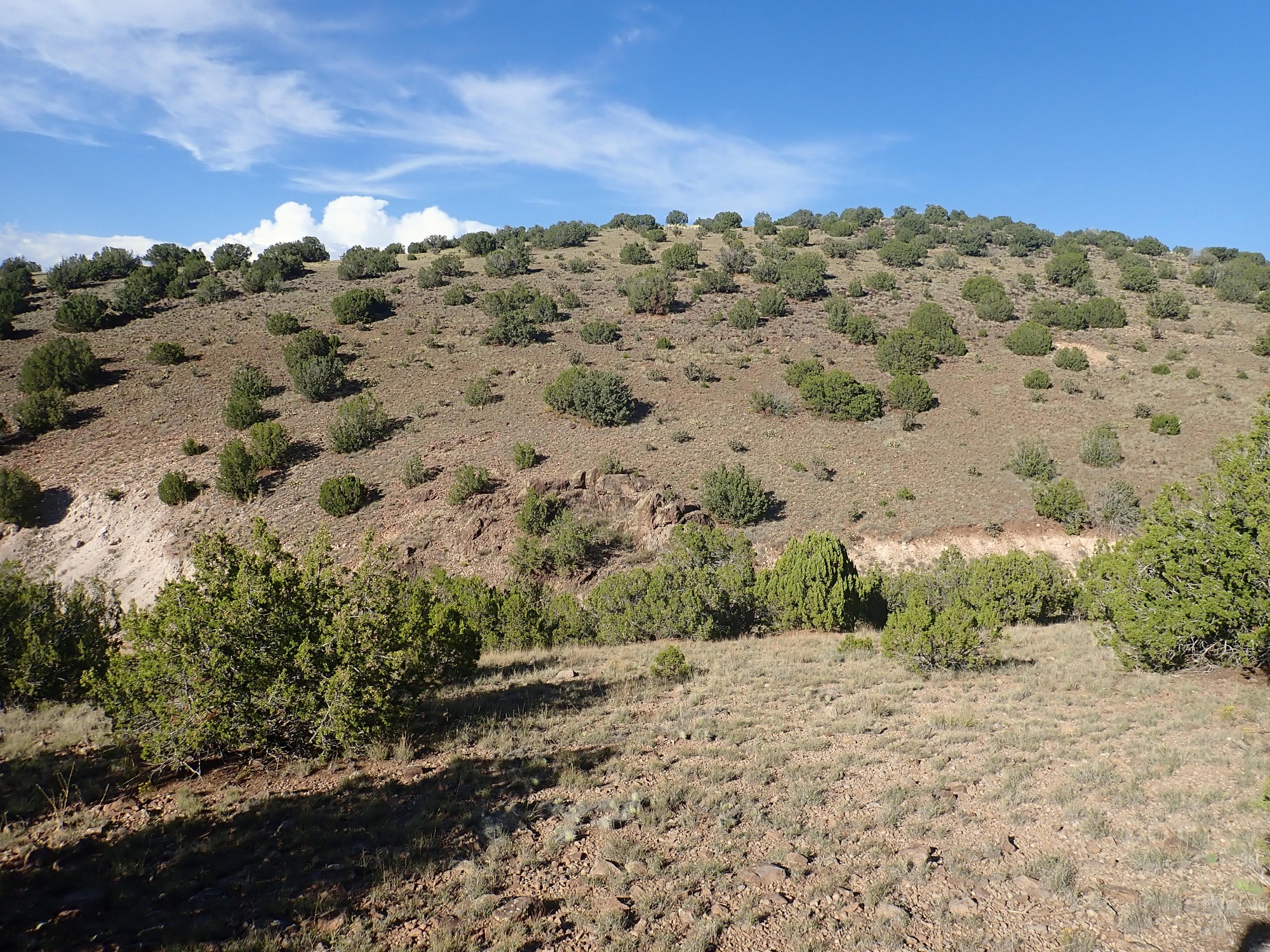
As with almost all images at this site, you can click for a higher-resolution version. The roadside monzonite outcrop is at center. Above is a smooth slope that I believe is underlain by more easily eroded Espinaso Formation. About halfway up the hill, just visible in this photograph, is a thin bed that I’ll get a better look at later; it will turn out to be a thin latite flow. (I’ll explain all that later in the post.) Above that, the top of the hill is covered with dark boulders of Cieneguilla basanite.
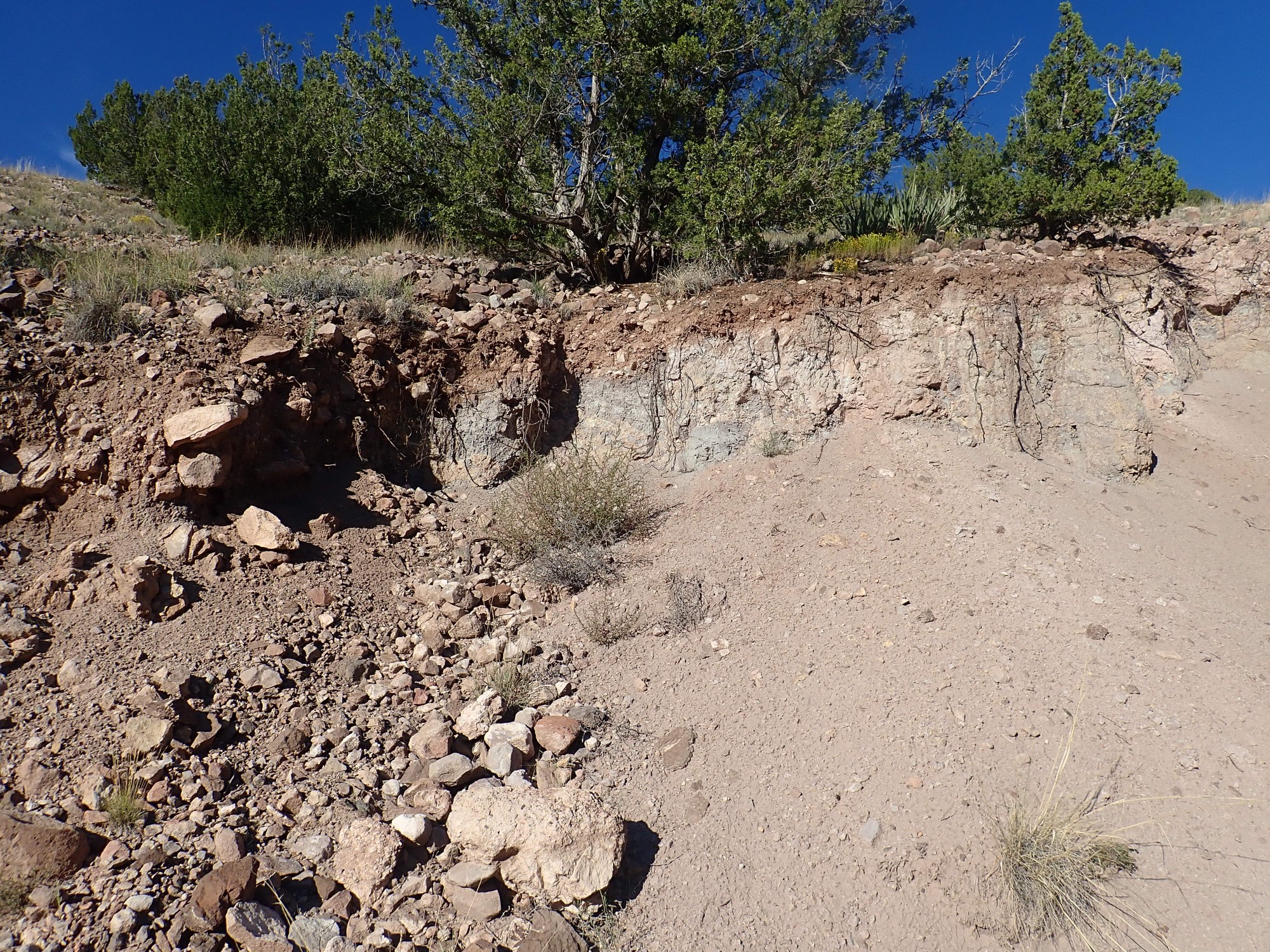
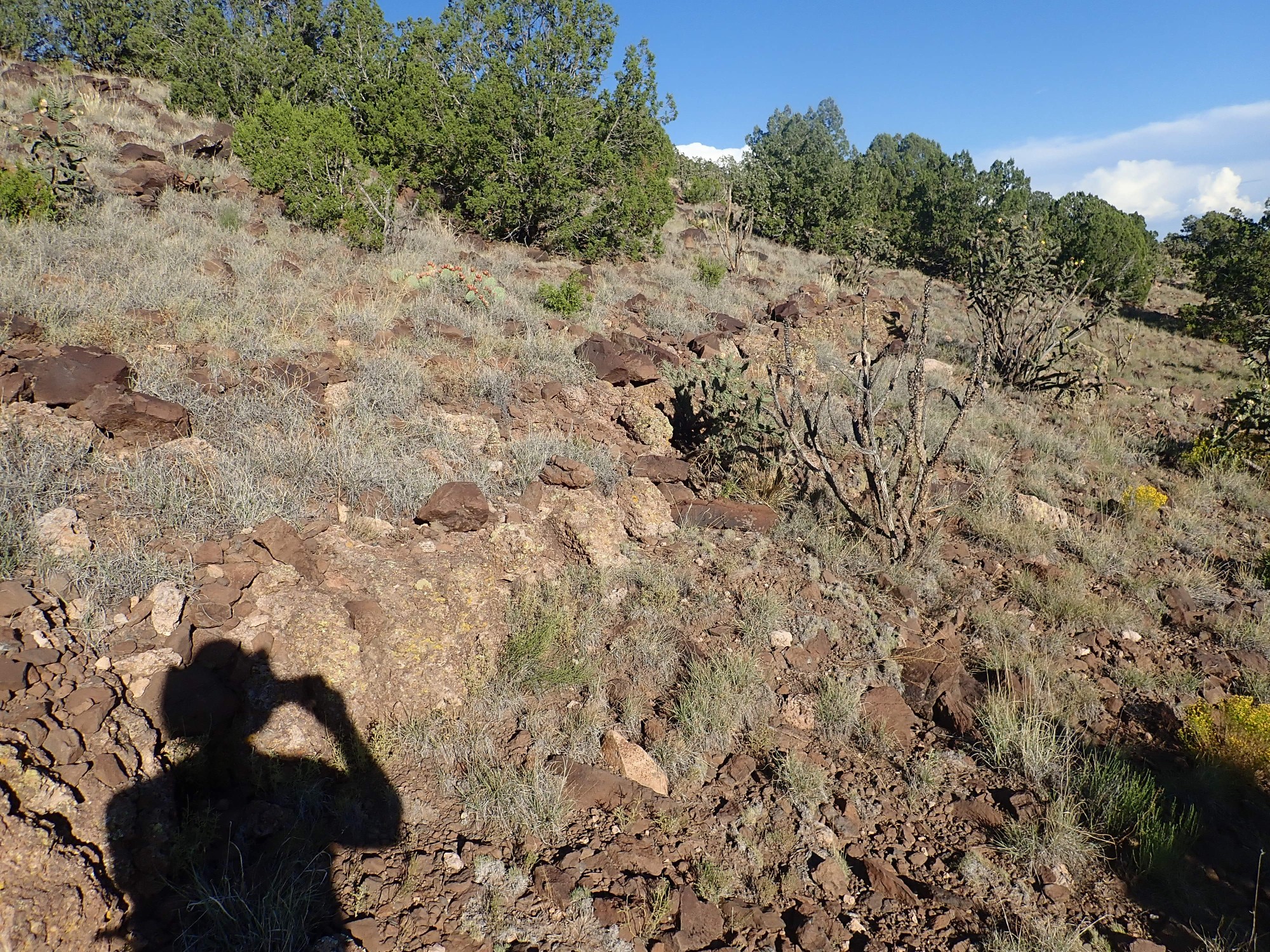
It’s always harder going down. I scrambled up the hill okay, but I am disinclined to try scrambling directly back down. I follow a very old dirt track on the side of the hill that will take me back to the main road more safely. As I’m doing so, I notice a very coarse conglomerate in the hillside.

This looks like young colluvium, but I find that it’s actually fairly well cemented together. I hammer apart one of the clasts (rock fragments); it’s monzonite. The entire bed is cemented clasts of monzonite. This may be a lot older than it looks.
Which is about to become very relevant to resolving a mystery from my last visit.
Looking back north, I see that there are thick beds of similar conglomerate in the road cut.
I examined these on my last visit, found them virtually uncemented, and concluded they were very young colluvium. I’m starting to rethink that.
I get back to road level, some distance west, and there is basanite in the road cut.
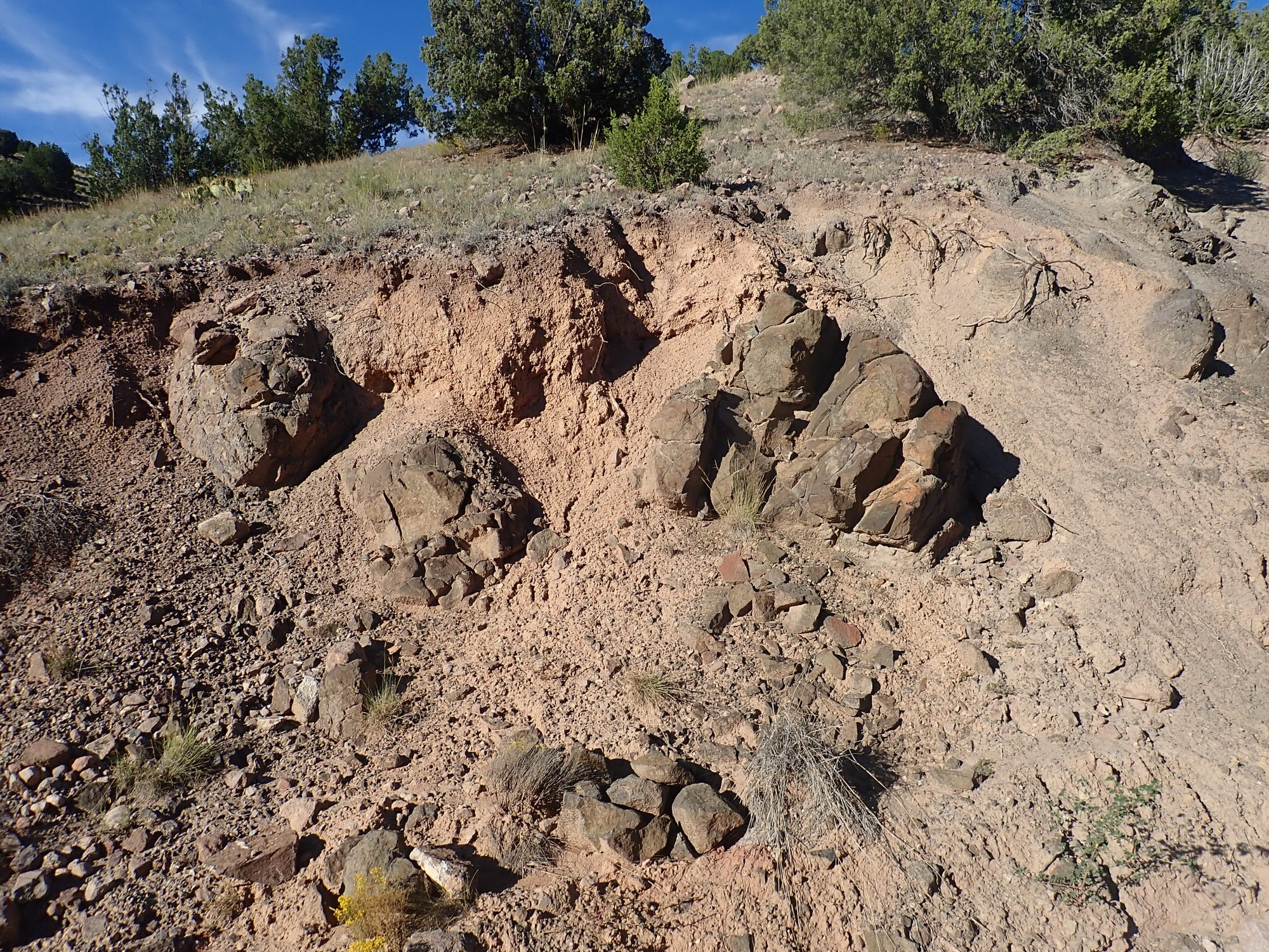
I crack open a sample to confirm its identity. Yep, basanite.
Basanite can be distinguished in the field from Espinaso andesite by its very dark gray color, versus the dark brown color of the andesite. Basanite is also heavier. Whereas andesite is a very common rock type, basanite is quite uncommon; the Cieneguilla Basanite is the only basanite within a hundred miles of the Jemez Mountains. It’s a very low-silica volcanic rock, around 45% by weight, and somewhat enriched in alkali metals. As a result, some of the feldspar in the rock (NaAlSi3O8) is replaced with nepheline (NaAlSiO4) with its lower silica content. Of course, you can’t tell that in the field; it takes laboratory analysis. But the very dark color and very massive, fine-grained texture are characteristic, as is the tendency for the basanite to “rust” due to oxidation of its high iron content.
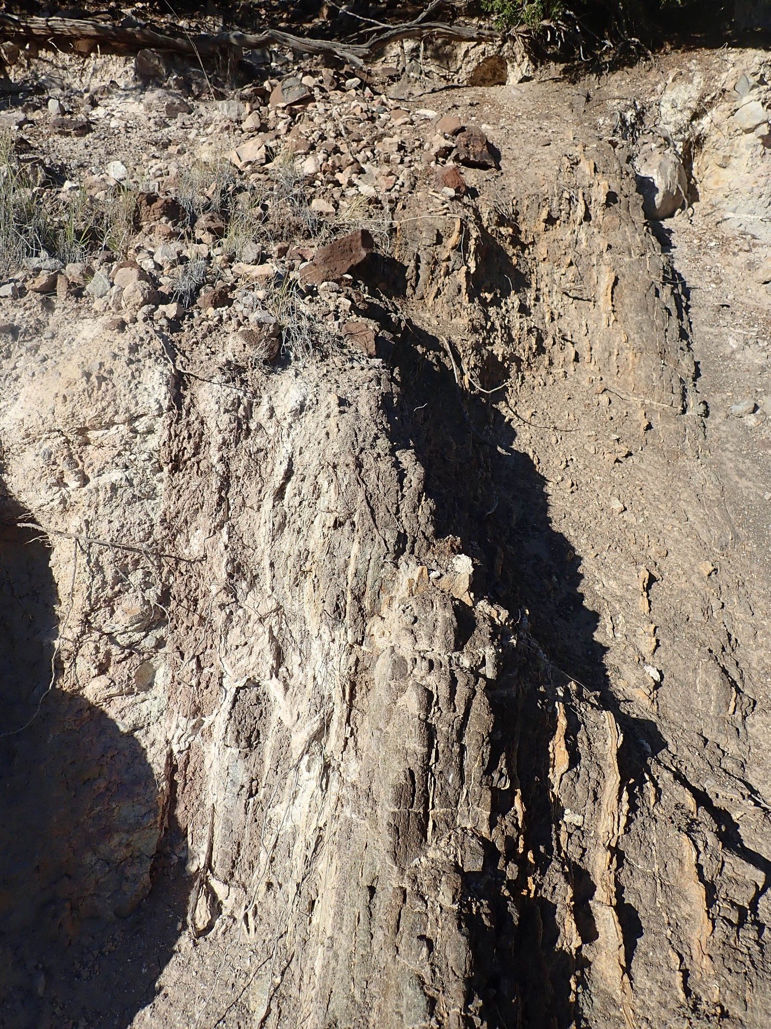
I start back up the road. Here are hydrothermal beds I noticed on my last visit.
These appear to be fragmented Espinaso Formation andesite that has been entirely transformed into soft clay minerals. Only prolonged hydrothermal alteration (exposure to very hot fluids produced by a heat source below) can “cook” rock this way.
And then I’m back at the dike.
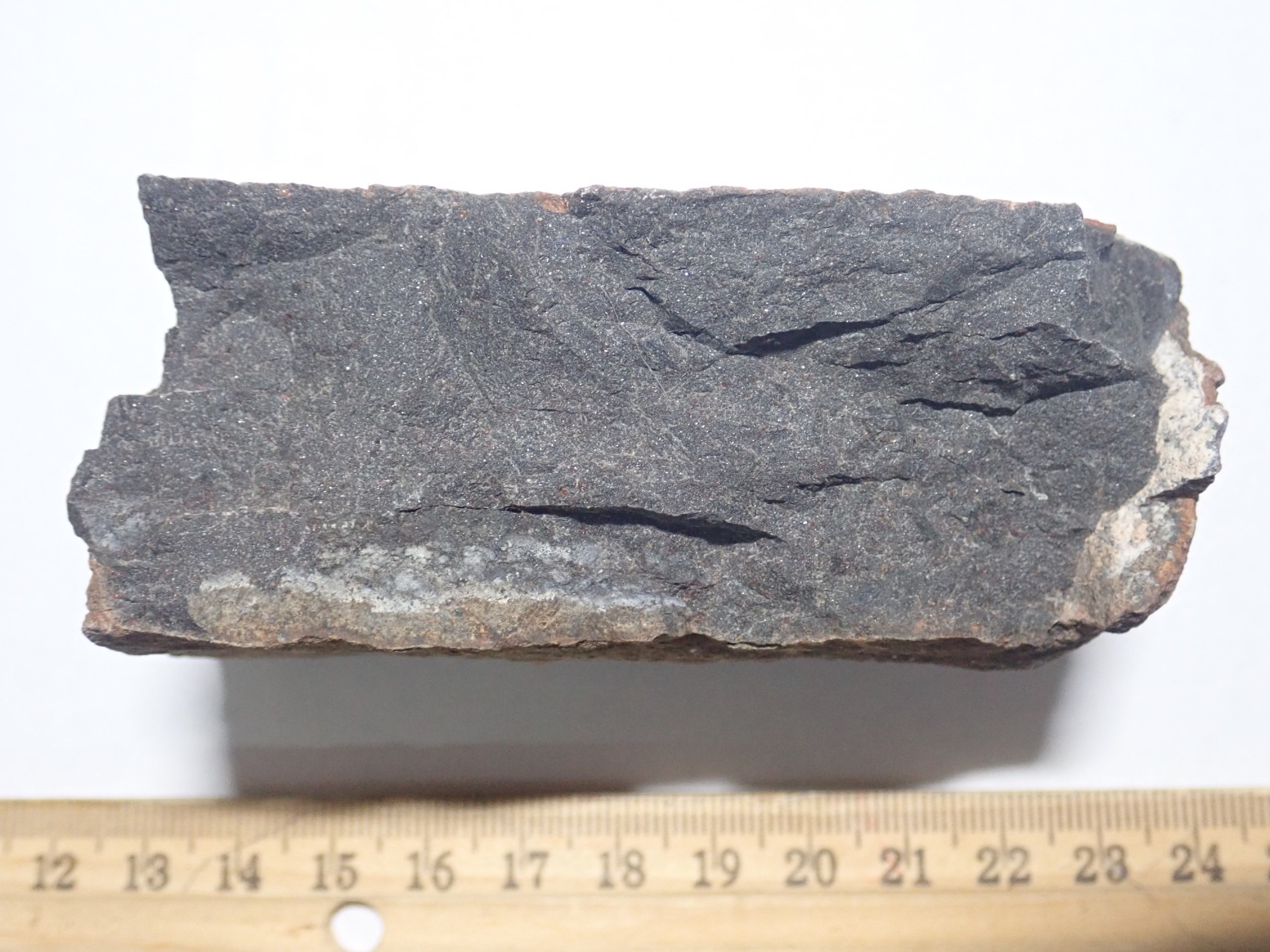
The dike is positively laced with hydrothermal veins, but you can see some dark rock between the veins. Last time I was here, I picked up a sample, but it was pretty crummy — literally: It was very soft rock that crumbled to the touch. This time I dug around a little and got a solid sample of dike rock.
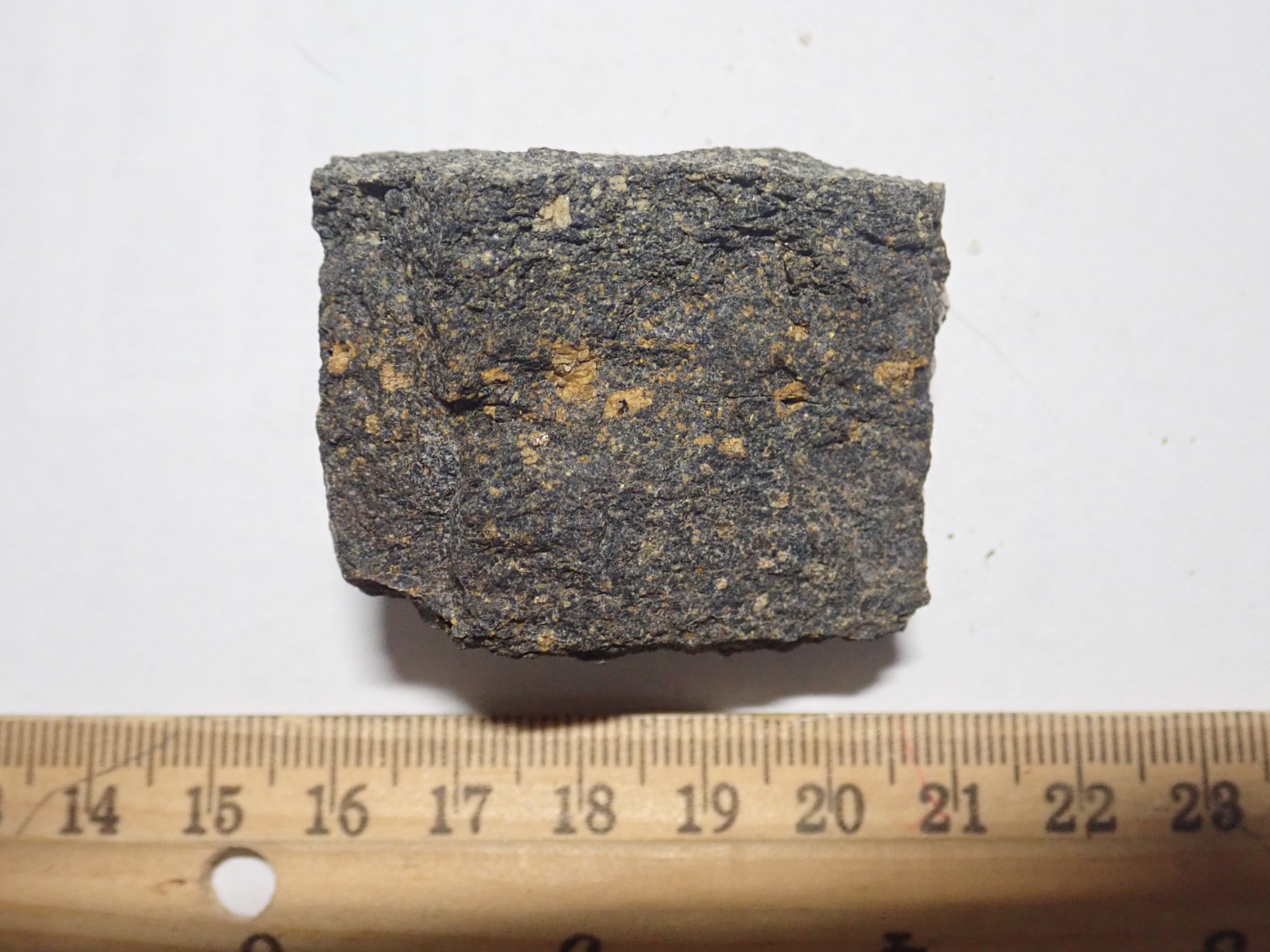
This is not an ordinary igneous rock. It has the dark color of basalt or basanite, but the bright orange phenocrysts (larger crystals embedded in a fine-grained igneous rock) are decidedly unusual. My first guess was that they are potassium feldspar, which is a common mineral in many kinds of igneous rock — but in a rock this dark, they suggest the rock is a lamprophyre, a rock type fully as rare as basanite and somewhat related. Lamprophyres rarely are found anywhere other than small dikes like this one.
However, that’s a shaky identification. A professional geologist I showed these photos to suggested an even rarer rock type, a cabonatite, which is igneous rock with a lot of carbonate minerals in it. I tried dripping some hydrochloric acid on the sample, and it bubbled merrily, confirming that carbonate is present. However, the carbonate may be present as traces filling pores in the rock.
The orange mineral looks like feldspar under the loupe — but I can’t be sure it isn’t an iron-rich carbonate mineral. I plan to send a sample to the geophysics laboratory at New Mexico Tech and see what they think. If they find it sufficiently intriguing, they may even radiometrically date it.
The most mundane explanation is that this is hydrothermally altered basanite. That would make this dike one of the source vents for the Cieneguilla Basanite in this area. But the texture is quite different from basanite, even though the rock has not been “cooked” enough to soften it.
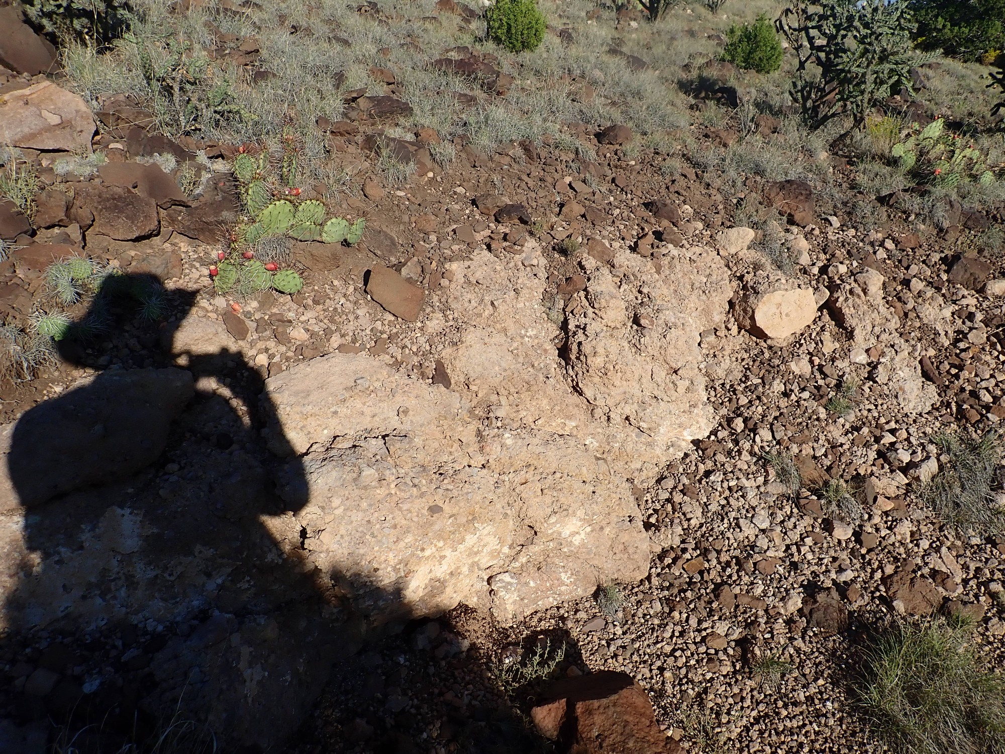
Part of my reason to come here again is to look more closely at the sediments through which this dike erupted. They look very young, but the last volcanism in this area was over 3 million years ago. And if this is basanite, its age would be closer to 25 million years. I examine the nearby very coarse conglomerate beds, this time paying attention to the composition of each clast in the bed. Although the clasts are barely cemented together, so that one can easily pull them out of the bed, every clast I look at is Ortiz monzonite. Not one is the distinctive black basanite from higher up the hillside, even though there are some basanite clasts lying on the road bed below. If these beds eroded off the hillside recently, they should include basanite clasts; and if they were deposited by the nearby Santa Fe River, they should have quartzite clasts from further north in the Rio Grande river valley. The absence of both suggests this is actually a debris flow associated with Ortiz volcanism, over 25 million years old, that was somehow preserved nearly intact — perhaps because it was capped with younger lava flows that protected it from further weathering.
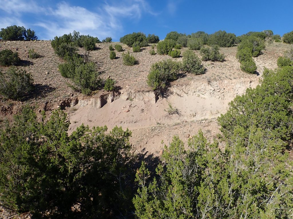
I decide to finish my expedition by climbing up the hill to the north. The lower slopes are covered with soil, with numerous cobbles of rock — mostly monzonite but some basanite, increasing in quantity as I ascend. Partway up I come to a distinctive outcrop that stretches across the hillside.
I could not find a decent view angle that didn’t put my shadow in the picture, but at least that provides scale. This appears to be a thin flow of more resistant rock:
This is rather frothy rock, full of bubbles (though not like a pumice) but I found a fairly solid sample.
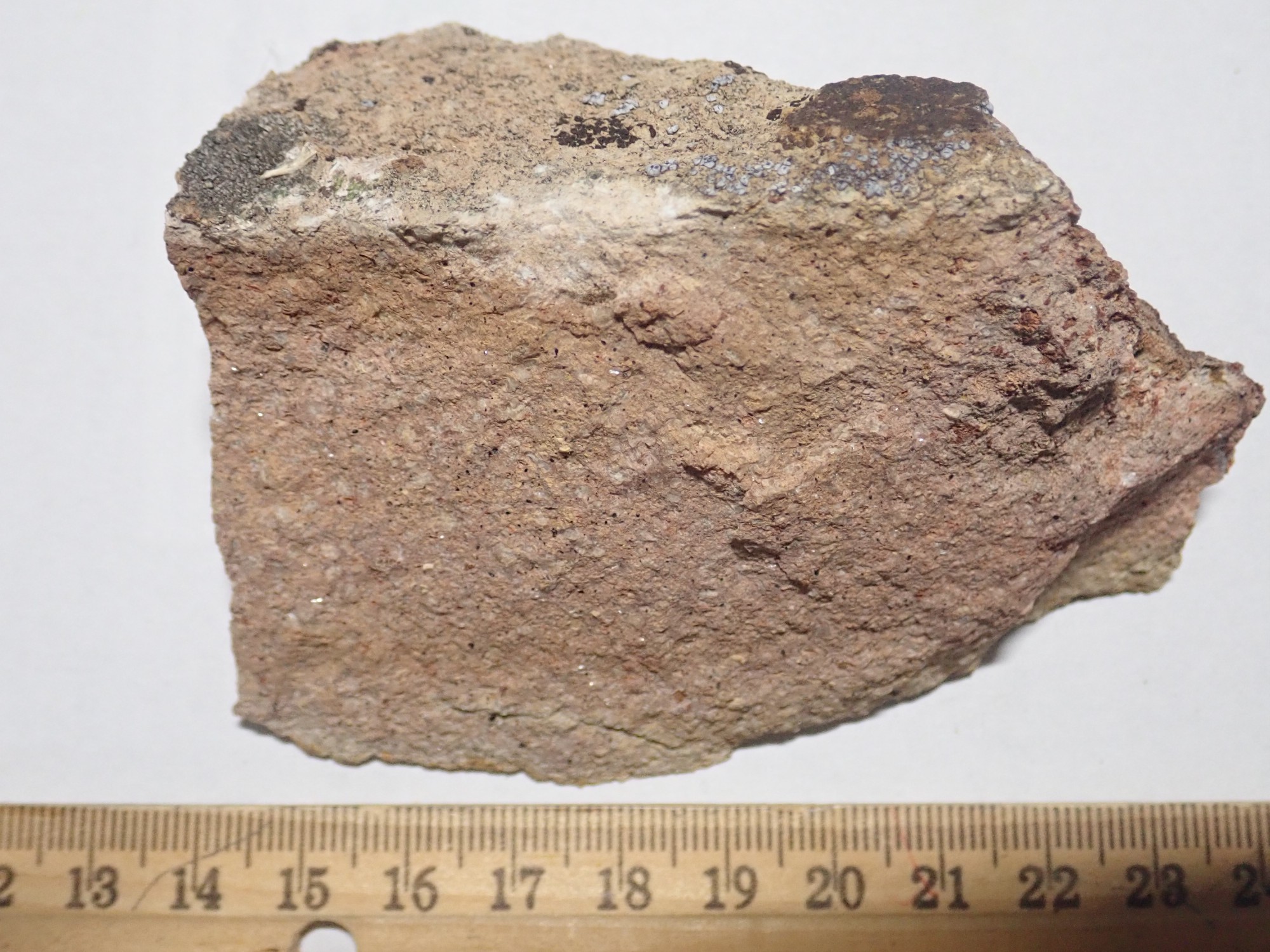
The photograph really doesn’t do it justice. The sample is loaded with crystals that give it a sparkling appearance in good light. The Espinaso Formation is reported to have a few latite beds among its shattered andesite beds; my guess is that the crystals are sanidine, a form of potassium feldspar, and the rock is a latite. Latite is similar to andesite, but with a higher potassium content.
Above the bed are outcrops and boulders of the Cieneguilla Basanite.
So here is the story told by the rocks, as near as I can decipher it. 35 million years ago or so, during the Mid-Tertiary ignimbrite flareup, monzonitic magma was injected into the crust here,where it cooled and slowly crystallized. Erosion exposed the monzonite, producing thick beds of monzonite boulders around the exposed monzonite hills. These would normally have eroded further, but Espinaso volcanism including a resistant latite flow, capped the boulder beds and preserved them. The eruption of the Cieneguilla Basanite 25 million years ago put a second, very resistant, bed of volcanic rock over the Epinaso beds and the monzonite boulder beds beneath. However, at no point were the boulder beds buried deeply enough to harden into a well-cemented conglomerate. Then, in just the last couple of million years, the Santa Fe River finally eroded through the basanite and latite to expose these boulder beds and the basanite feeder dike that had intruded them.
It will still be interesting to get a professional opinion on the rock in the dike, but hydrothermally altered basanite is the mundane (and therefore likely) explanation.
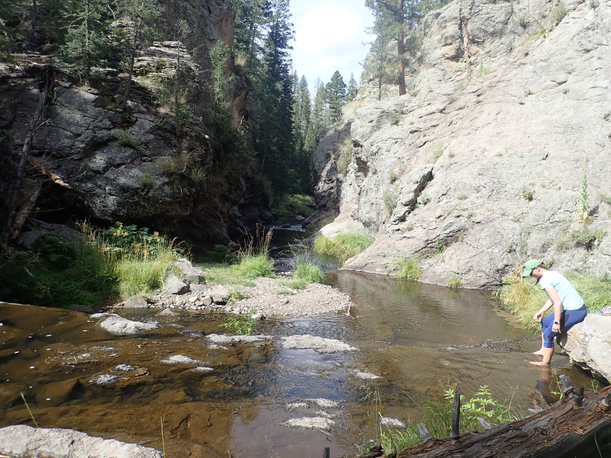
Saturday I took a short but very pleasant hike at Las Conchas with Alden and Dorothy Stradling. I enjoyed the company enough that I didn’t get a lot of pictures; but here they are.
Bandelier Tuff in Ancho Canyon on the drive up.
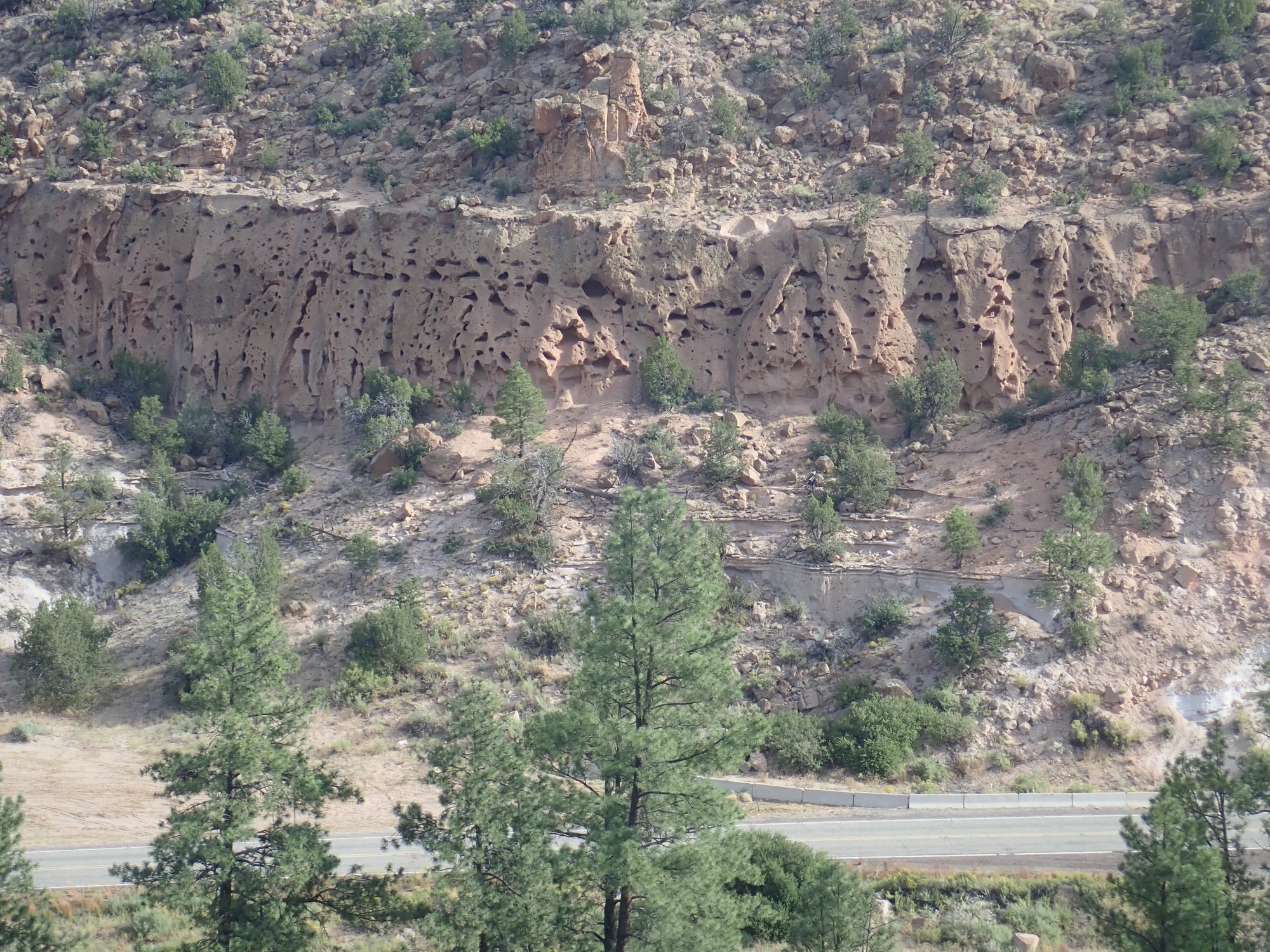
Alden and Dorothy are patient with my geologic yammerings. What caught my attention here were the zeolite ledges near the bottom of the canyon, each of which marks a stand of a lake filling White Rock Canyon when it was blocked by a lava flow.
The rock here is all Valles Rhyolite from South Mountain. Rhyolite is a very high-silica volcanic rock, and the magma that produced it oozed its way slowly out of the ring fracture created by the collapse of the Valles caldera. The collapse itself was 1.25 million years ago; the lava here didn’t ooze through the fracture until about 500,000 years ago. This area is still the most recently active part of the Valles volcano, with the most recent eruption taking place 73,000 years ago.
And this just appealed to the Japanese gardener in me.
