Social distancing
It seems to me that hiking alone is very nearly the ultimate in social distancing. My friend, Gary Stradling, thinks so too, and has been having some very successful fossil hunts out in the San Juan Basin. This is the crisis we’ve been practicing for all our lives!
A lot of other people seem to feel the same way.
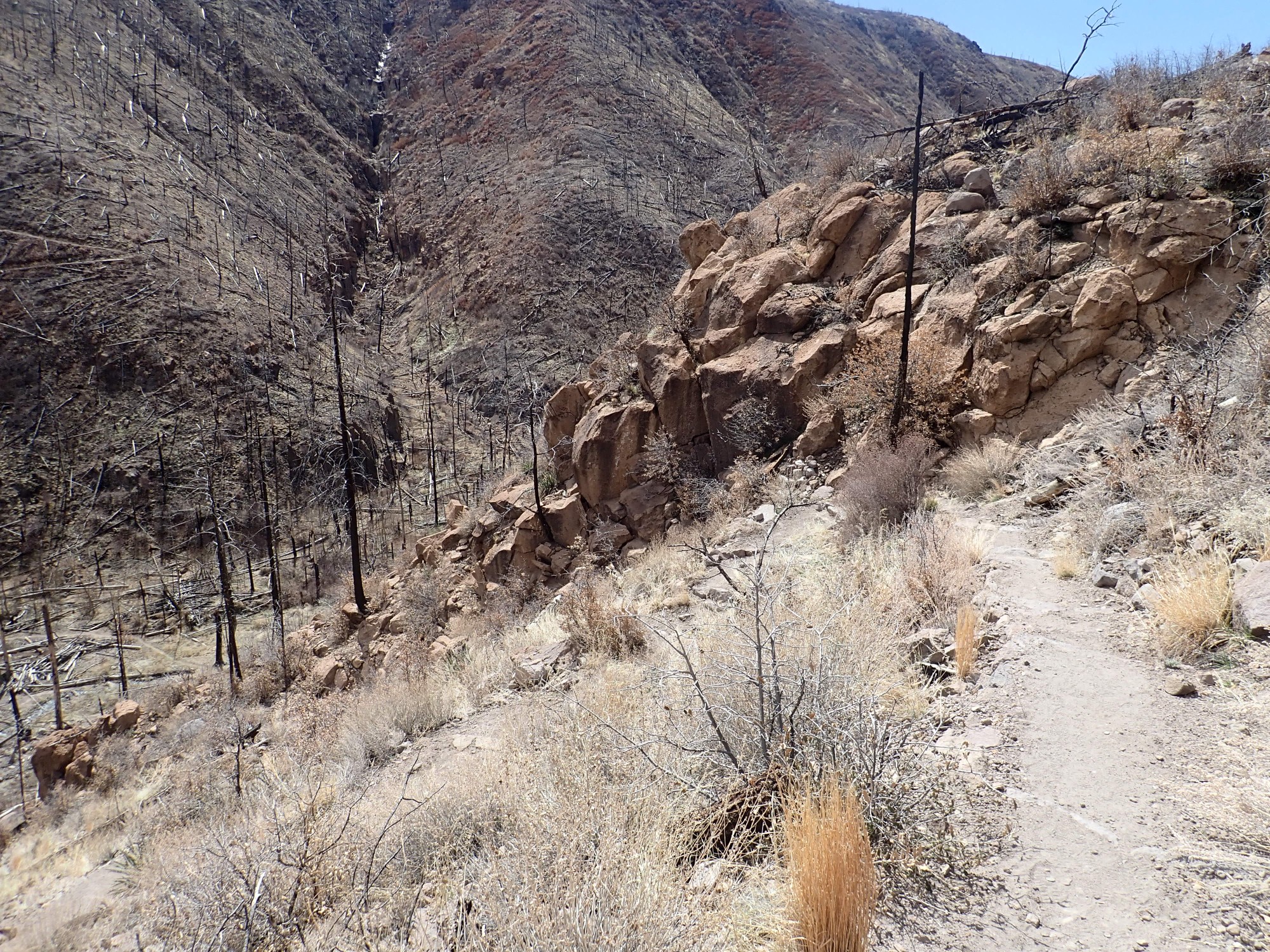
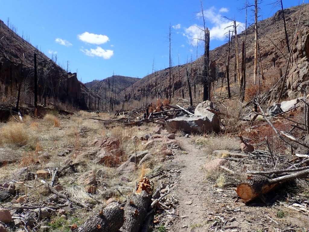
This is the trail head at Redondo Campground, which I visited three weeks ago but didn’t get my fill of. (Three weeks seems like forever now, doesn’t it?) I decided to hike it again yesterday, more thoroughly. I was struck by the fact that every trail head along State Road Four west of White Rock had several cars parked, in some cases to overflow capacity. We hikers are all social distancing together!
Of course, I realize that’s kind of not the idea. But encounters are brief, keeping the 6′ separation is very easy, the people you met are likely feeling well, and there’s plenty of bright disinfecting sunshine. It seems like a reasonable way to briefly get out of the house and shake some cabin fever.
Not that everything is still accessible. There were notices at the campground that the busier trails, such as the Frijoles Trail, Frey Trail, and entire visitor complex, were closed. The notice explicitly stated that the Redondo Trail, among other back country trails, was still open, so I figured I was good.
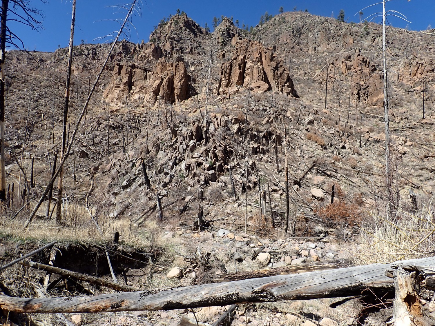
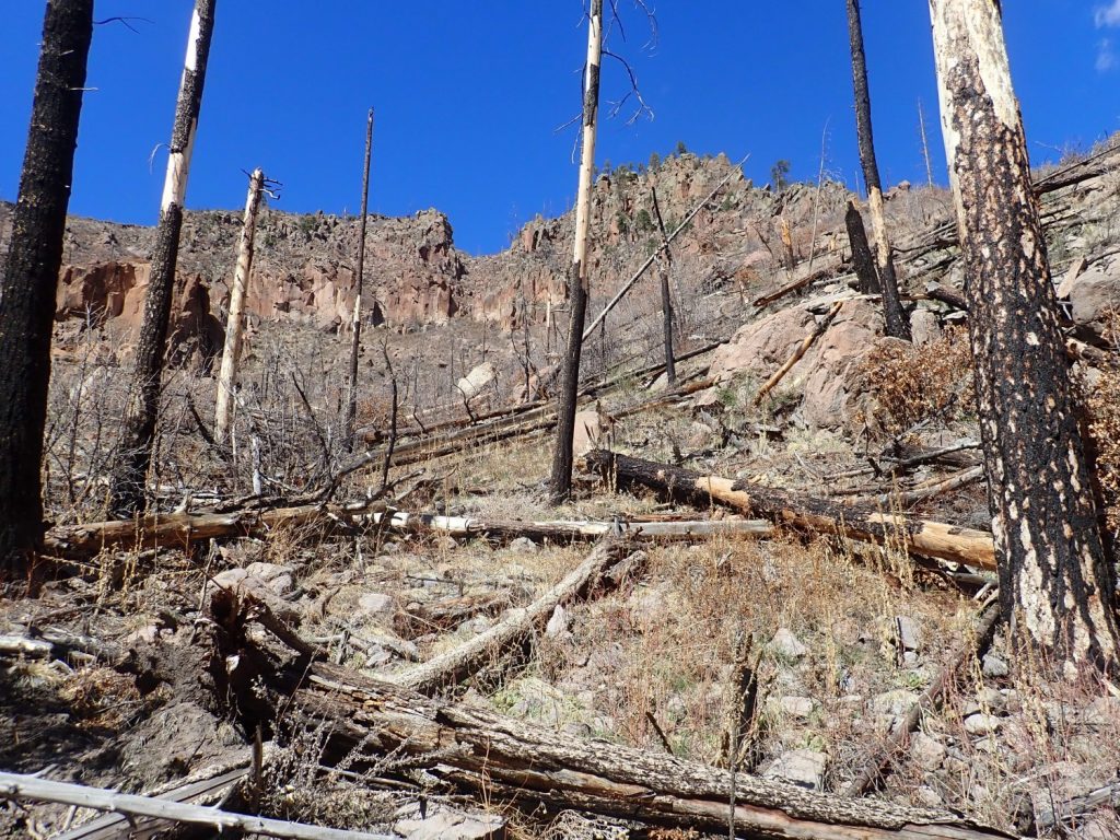
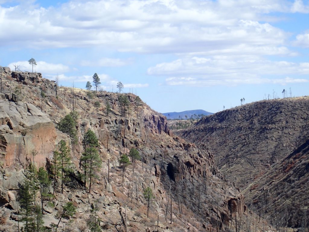
Since I visited just three weeks ago, I didn’t bother with many photographs until I got to the clearing below the Pajarito Fault escarpment. My last panorama wasn’t so great because it was later in the day and cloudy, but this one was under better conditions.
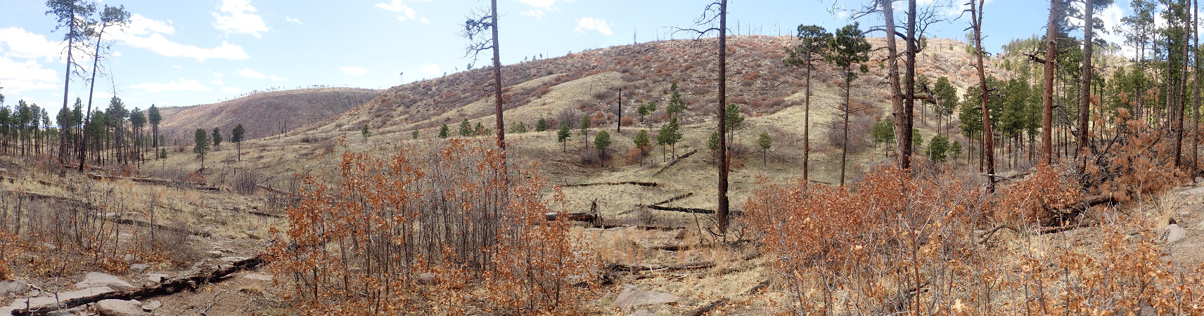
This is not perfect, but I think it’s good enough for the book.
The Pajarito Fault is the main strand of a major fault zone, the Parajito Fault Zone, that runs north to south at the feet of the Sierra de los Valles, the range of mountains just west of Los Alamos. It’s presently the zone of most rapid extension along the Rio Grande Rift at this latitude.
It’s also the greatest earthquake risk in our area, though major quakes are very infrequent, occurring only every few thousand years. I suppose this is why LANL was comfortable placing its emergency operations center just a few hundred feet from the main strand of the fault.
Further south the fault splits into two major strands. I talked about that in the previous post and won’t repeat that part.
I tried a couple more panoramas further down, where there were’t trees blocking the view of the southernmost part of the escarpment, but by then just enough clouds had rolled in to put part of the escarpment in shadows and ruin the panoramas.
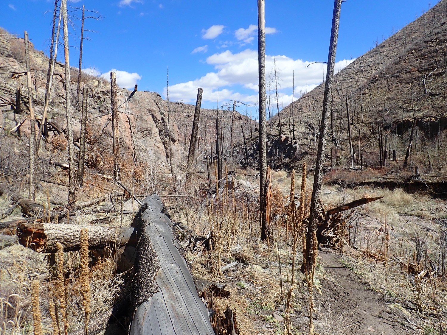
The seasons roll on, and there is now a small trickle of water over this outcrop:

that was quite dry three weeks ago. The snow cover has also completely disappeared from the south face of Frijoles Canyon as seen from the north rim.

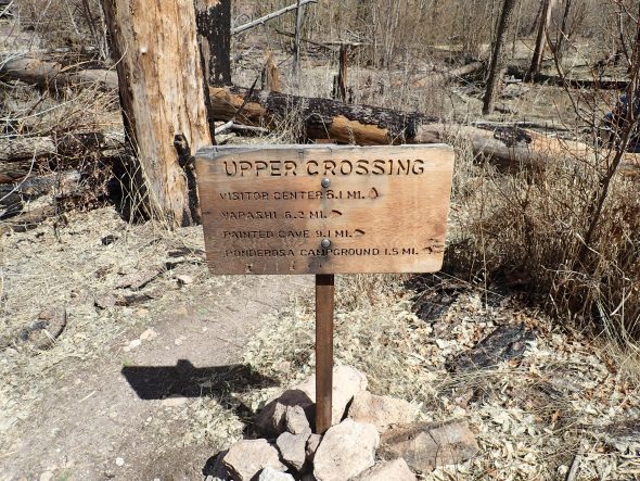
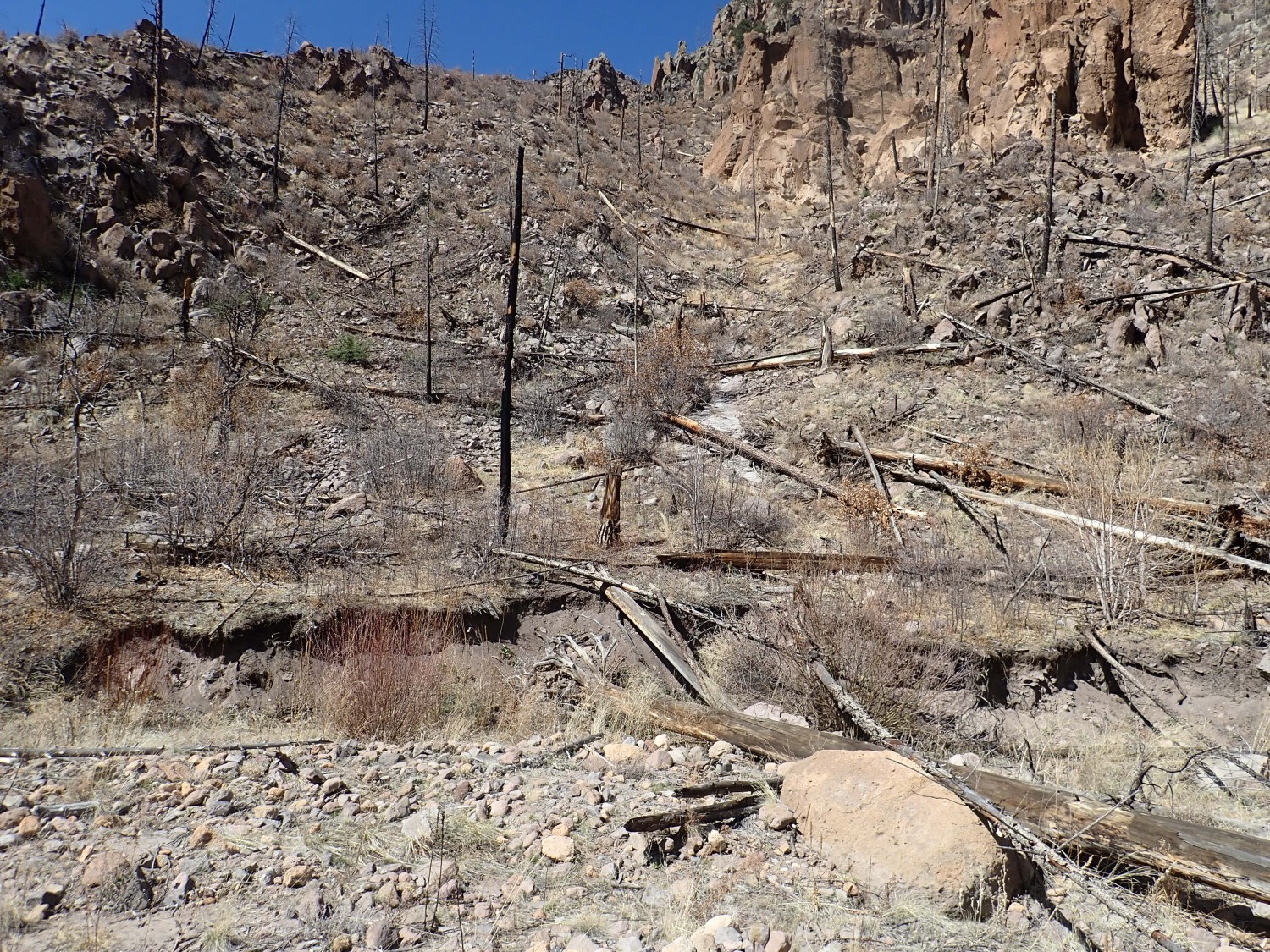
The mesa I’m descending from is Escobas Mesa (“Brooms Mesa”). The mesa across the canyon is Mesa del Rito (“Creek Mesa”, doubtless a reference to Frijoles Creek). Below is Upper Crossing, a crossing of north-south and east-west trails. I’m on Redondo Trail; this continues across the canyon, where you can see it winding up the side of the mesa, and takes you to the back country sites of Yapashi Ruins and Painted Cave. The trail in the canyon is Frijoles Trail, technically closed (though I’m not worrying about it much this far up the canyon, and I doubt the rangers are, either.)
I’m still a little surprised how many small groups are on the trail. I meet at least three in this area headed back up the trail. In each case, we greet each other but keep our distance, which meant climbing some distance above the trail to let the larger groups pass in my case.
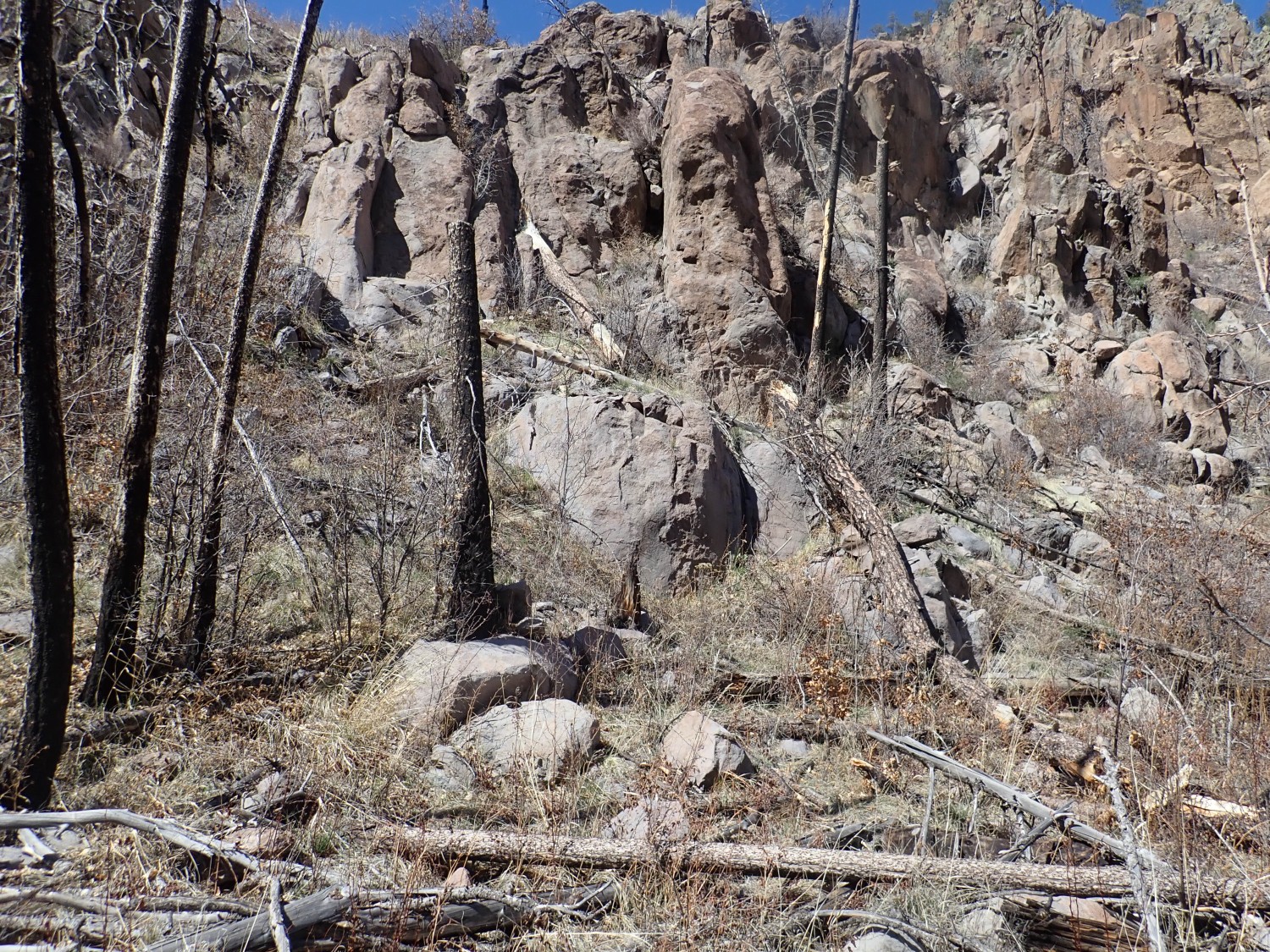
Here is a zone of shattered Bandelier Tuff that I figure may mark the trace of the Pajarito Fault.
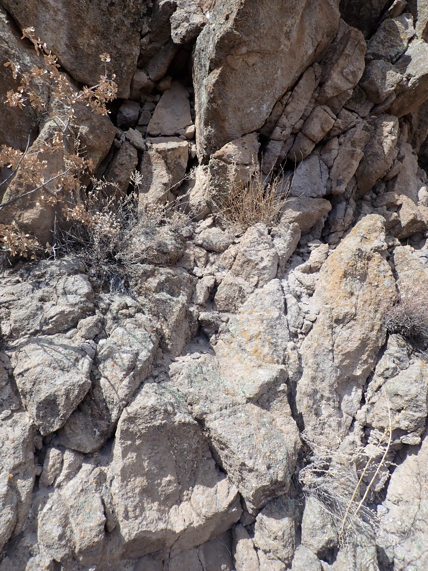
And, blast it, my GPS chooses this moment to lose its lock, so I can’t pinpoint the position to confirm. But, so far as I can tell, the position is right on. The vertical fractures are in contrast with the horizontal bedding to east and west.
I thought this rock spur might mark a strand of the fault.
However, the map seems to put this slightly west of the fault. This location is marked with a symbol I don’t recognize and which is not included in the map legend. But it seems to have a dip of 75 degrees marked for it, so I’m guessing it’s a symbol for a squeeze up or other volcanic feature.
The crossing.
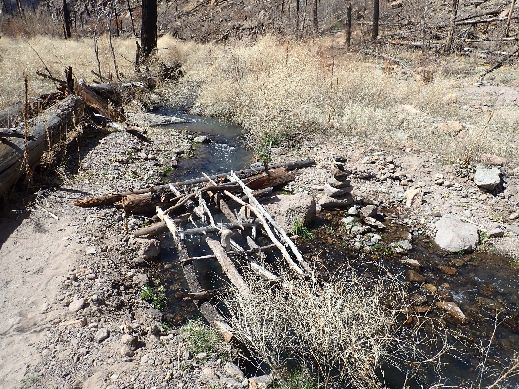
This is Frijoles Creek, the only perennial creek in the entire Pajarito Plateau.
Nearby signage.

There is a young couple nearby resting. We greet each other but keep our distance.
I hike part way up the trail across the canyon, to get a good view of the north side of the canyon. A jogger passes me as I ascend.
Panorama of the north side of the canyon.
(Click to enlarge, as you can do with most images at this site.)
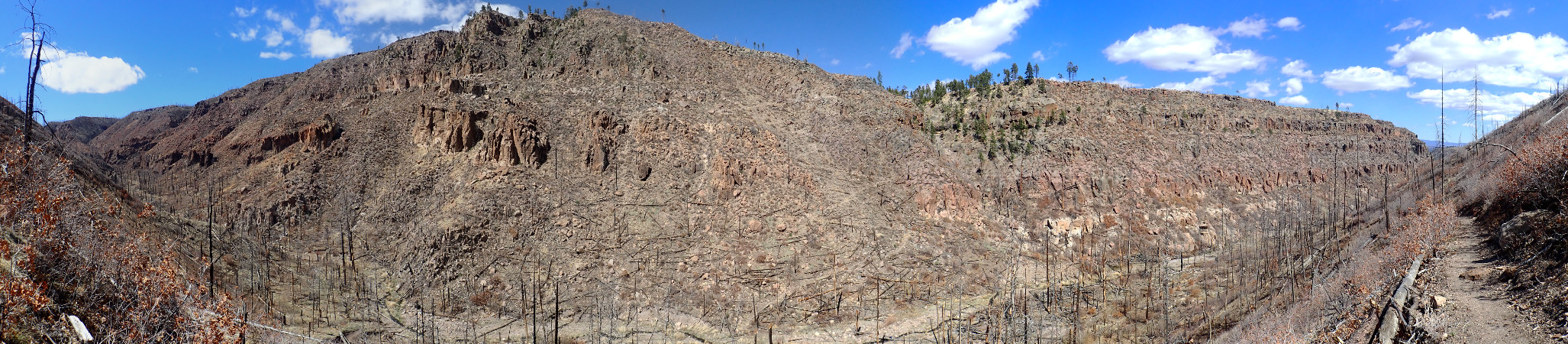
Major fault zones rarely consisten of a single fault strand. Here there are two major and two minor faults mapped on the geologic map. The first and most important fault is located right where the trail zigzags down the north canyon wall, left of the small wooded area. The whitish beds to its right correspond to the whitish beds near the top of the canyon at left and show how much displacement there has been downwards on the east side.
The second strand runs from the notch at the top of the canyon wall, just east of its highest point, and down the canyon wall to the far side of the outcrop of slightly darker rock at the canyon bottom. This fault displaces older rocks but does not seem to displace the Bandelier Tuff very much. It pretty much disappears to the south on Mesa del Rito. In fact, although the geologic map shows the downthrown side to the east, my impression is that this actually threw down the older rocks on the side to the west.
Two other strands are quite minor and produce two small notches to the right (east) of the second strand. You can see some small displacement of the Bandelier Tuff beds beneath.
Here, let’s try diagramming it.

I make no guarantee that I’ve got this right. The geologic map is at a high enough scale to make pinpointing against the topography difficult, and there’s enough stuff (“colluvium”) on the canyon wall to obscure the traces a bit. Still.
The map says those darker outcrops are Cerro Grande Member, Tschicoma Formation. Let’s unpack (and long-time readers, who’ve heard this all before, may skip:) Most of the pinkish rock you see here is Tsherige Member, Bandelier Tuff. This was formed by pyroclastic flows from the giant eruption that formed the Valles Caldera, 1.25 million years ago. The magma was rich in silica and silica makes magma very viscous. The magma was also rich in dissolved gases. When it erupted, it basically disintegrated under the pressure of its own dissolved gas content to make a mixture of tiny half-molten glass shards and red-hot gas that was heavier than air and flowed across the ground for miles in every direction. As it cooled, it settled onto the surface to form a soft rock called tuff. The eruption produced an outflow sheet of tuff that was later carved into the finger mesas of the Pajarito Plateau, of which Bandelier National Monument is the southern part.
Volcanic activity in the Jemez goes back a lot further than 1.25 million years. The earliest eruptions were around 14 million years ago, and the Sierra de los Valles, the range of mountains just west of Los Alamos, was erupted in a series of pulses from about 5 to about 2.5 million years ago. This rock was a bit less silica rich and gas charged and erupted mostly as domes of lava. Cerro Grande was one of these domes, and its lava reached into the area I’m hiking today.
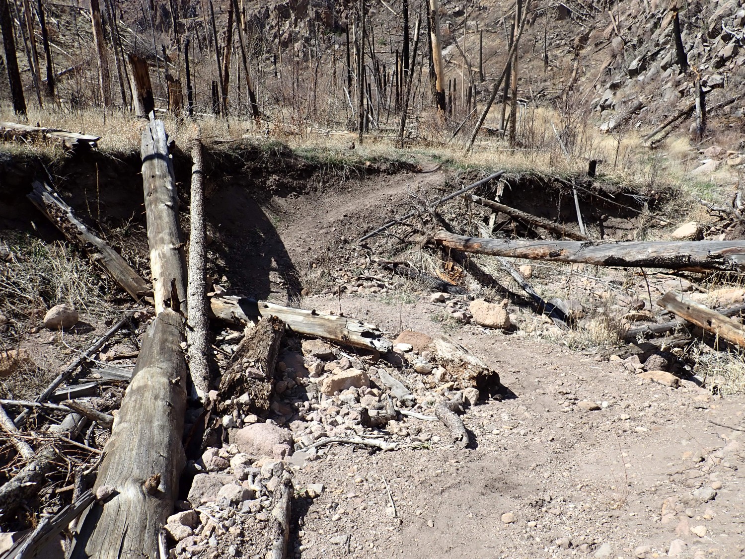
I gotta take a closer look at this older rock. I head up the canyon. There’s been a lot of flood damage from recent forest fires, but the Park Service and their volunteers have done a lot of good work keeping the trails open.
I’m soon across from the outcrop.
Further up, I notice some whitish beds that suggest a fault trace.

The map does indeed place this on one of the minor faults.
I find a place to cross the creek and look at the outcrop.
Yeah, it’s Tschicoma Formation, all right.
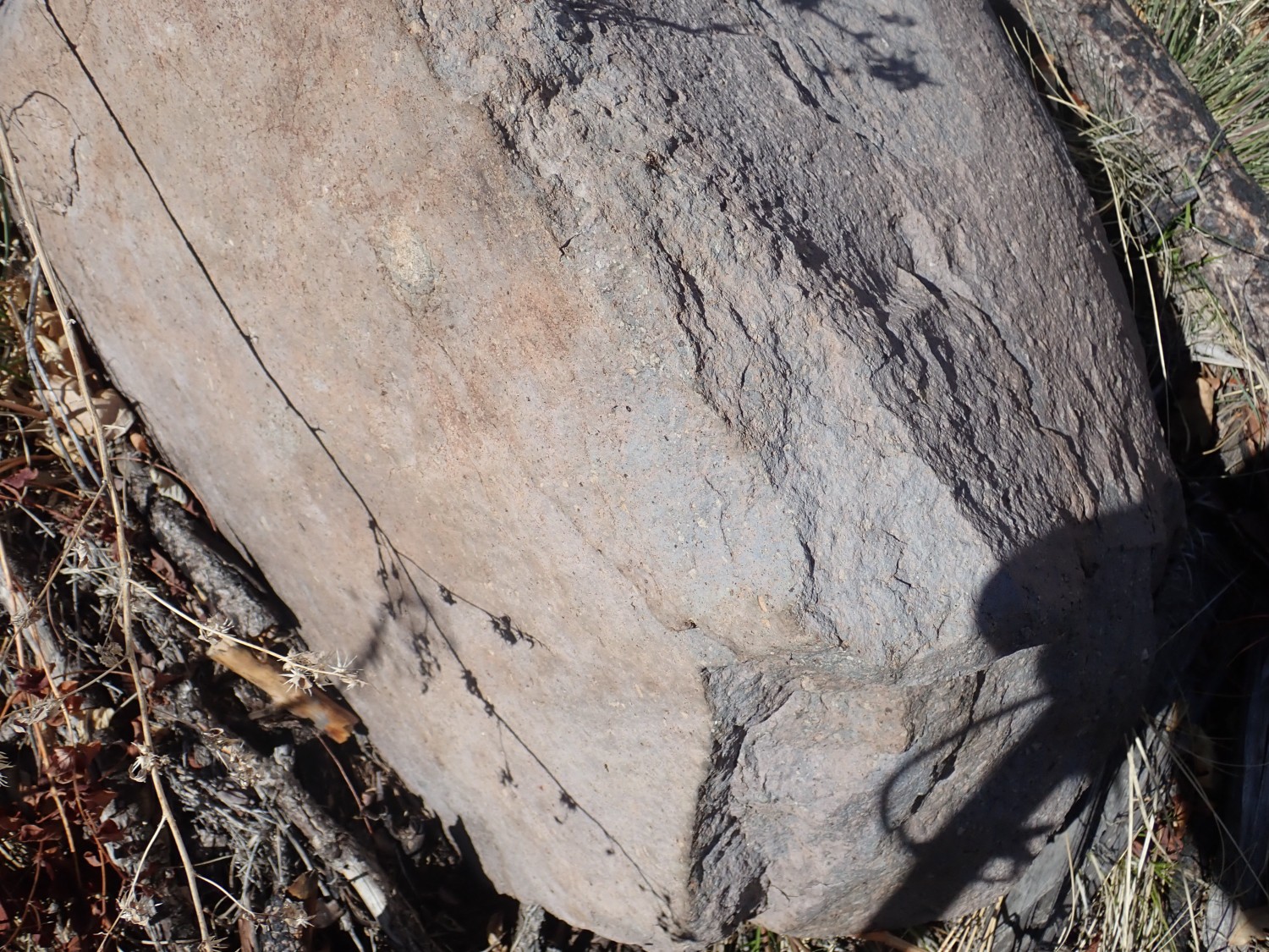
Although some outcrops of Bandelier are fairly hard and dark colored, this rock has white phenocrysts of plagioclase feldspar characteristic of the dacite that makes up most of the Tschicoma Formation.
Would be nice to hike further up the canyon, some other day.
The park map shows the trail continuing another two and a half miles up the canyon before ascending the north canyon wall to State Road 4. In principle, you could bushwack an additional few miles to where the road actually crosses the canyon high in the Jemez. Would be a rugged bushwack; that part of the canyon is pretty wild.
Looking straight up the second fault trace. Alas, once again, my GPS chose this moment to cut out.
Looking back east, we see that the creek has eroded through a buried ridge of Tschicoma dacite, so there is a matching outcrop on the north side of the creek as well.
I find this somewhat interesting. This is a buried island of Tschicoma Formation between two fault strands. I’m not sure how this works structurally.
I cross the river again to take another look at the exposure further east. I’m not sure they’re the same rock; I have a vague recollection that some Paliza Canyon Formation andesite from the San Miguel Mountains to the south are also exposed in this canyon. (Considerably further up, as it turns out.)
Kind of borked that one with the camera shadow, but, yeah, very typical Tschicoma dacite.
And there is duckweed growing in the margins of Frijoles Creek.
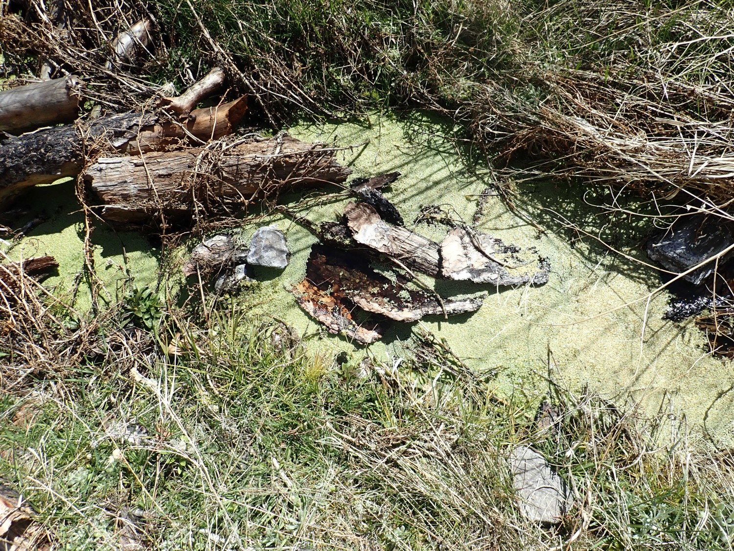
The thought flashes through my mind to grab some for my aquarium, but I’ve no way to get it home alive, and this is Monument land, so it’s illegal to collect anyway. Still, a nice indication of spring in the canyon bottom. Grass is also greening up, but I didn’t notice anything woody budding out yet.
On the way out, a nice view down canyon of Colorado Peak in the Cerros del Rio Plateau east of the Rio Grande.
All in all, a nice way to socially distance for the afternoon.
Personal update
Friday I drove down to UNM Hospital to see the neurosurgeon. The place was under heavy quarantine; I had to verify I had business there and had not symptoms of coronavirus, and I had to take measures to avoid contamination. The place was almost empty and a lot of the people I saw were wearing masks. Flunkies were more or less following everyone else around and spraying disinfectant where they had been. I found this reassuring; going to a hospital is probably the best way to pick up coronavirus right now.
The neurosurgeon confirmed everything I had been told so far. I’m supposed to get further MRI and CAT images of my spine, then meet with him again. He’ll then make arrangments for me to be hospitalized for the imaging to find the leak (this involves a lumbar puncture and so cannot be down outpatient) and then repair it. I don’t know if that’s one hospitalization or two. (You’d think, but…) The wrinkle right now is whether this is considered “essential surgery” or not; having a torn meninge is a dangerous thing, long-term, but it’s not likely to kill me right away and only essential surgery is permitted for the next three months.
I did get a prescription for some super headache pills, and instructions that caffeine is my friend. I don’t drink coffee or tea for religious reasons, but I don’t think there’s any prohibition on caffeinated sodas when prescribed by a physician, so I’m going to need to learn to like diet Coca-Cola.
I tried one of the pills before my hike, and I did fine even going up and down steep switchbacks. To be sure, I slept in until 10:00 this morning, which is out of character, but then it’s a Sunday.
I’ve been working on a new site, on the science of the planted aquarium, and it’s coming along. I’ve been working up a chapter on uninvited aquarium guests, good and bad, and it’s led me to put together a much-truncated Tree of Life:
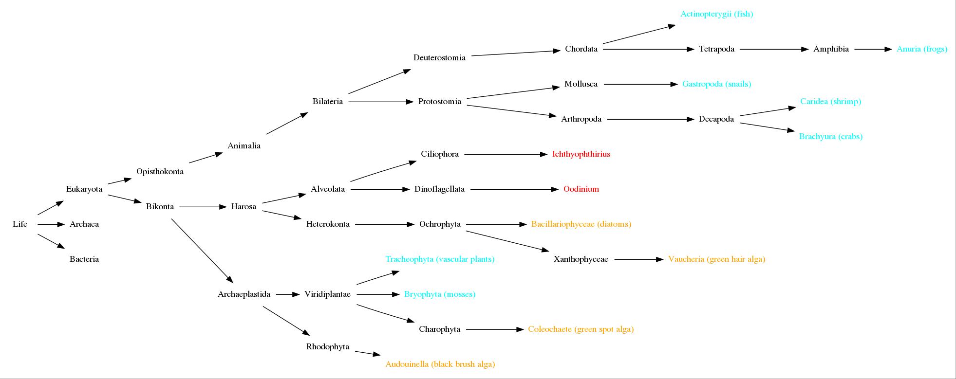
(Yeah. You’re really going to need to click on that one.)
The discoveries in this area are just fascinating. We’ve known for a long time that most microorganisms, and even some macroorganisms, are neither really animals nor plants. The details get pretty fascinating and are constantly expanding as we sequence the DNA of more organisms and sort out the similarities and differences. One interesting example: Ciliated protozoa, like Paramecium, appear to be descendants of the eukaryote that first engulfed a blue-green alga that became a chloroplast. This is thought to be the ancestor of almost every photosynthesizing eukaryote, but some branches of this tree, including ciliates, gave up photosynthesis long ago. This would make ciliates more closely related to green plants than to us.
Unpacking: Eukaryotes are organisms whose cells have nuclei. Bacteria and archaea don’t. Eukaryotes, bacteria, and archaea are the three domains of life at the very trunk of the Tree of Life.
I know. I’m such a geek.