Wanderlusting the Sangre de Cristo Range
In my last post, I described visiting the Pecos area of the southern Sangre de Cristo Mountains to get some photographs of type sections or type locations of geologic formations for Wikipedia. Alas, the weather went sour before I could get very satisfactory photos of most of the sites.
Thursday there was trouble with the Internet, and my work was constantly disrupted by the network going down. By late afternoon I was like:

This was sufficiently frustrating, and I was sufficiently lacking in confidence that it would be fully repaired Friday, that I decided to take Friday off. (Normally I get every other Friday off on my 9/80 schedule.) In any case, as a result of my usual summer excellent adventure being canceled due to the pandemic, I’ve got over five weeks of vacation accumulated and figured I should start taking a day off every now and then. So I sent an email to my group office during an “up” period asking for vacation Friday.
(And the Internet remained up the rest of the afternoon and evening after I sent in my email. Go figure. But Cindy tells me it did go up and down again Friday morning.)
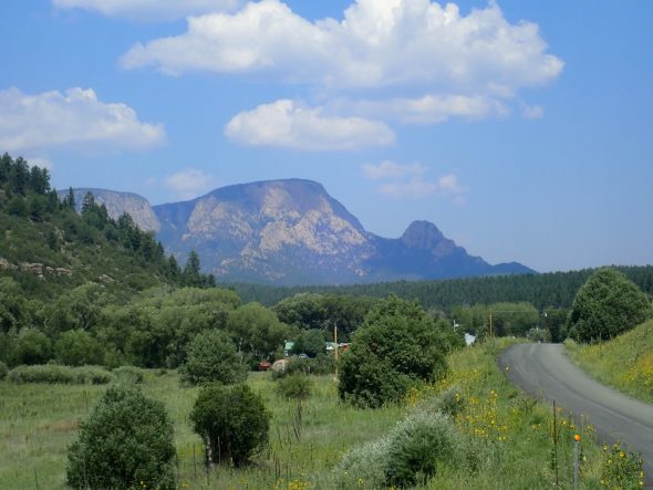
The weather was looking very good, so I figured I’d go back and do all those photos right, and then loop clear around the southern Sangre de Cristo Mountains via Mora and get a few more.
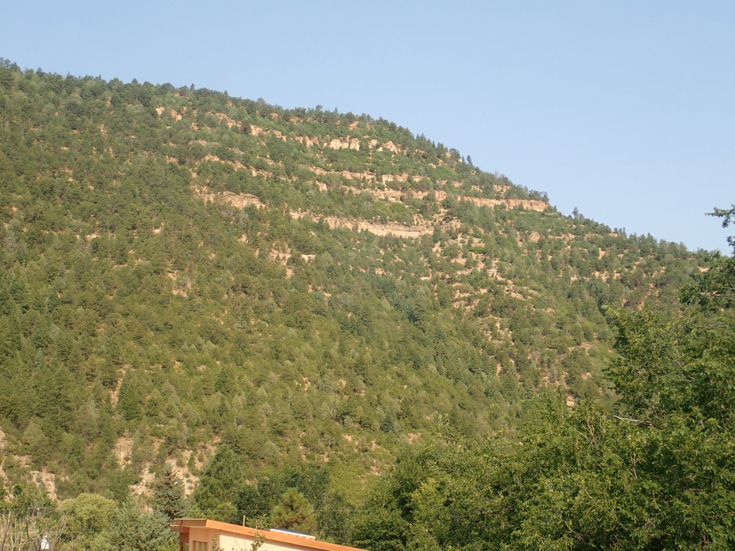
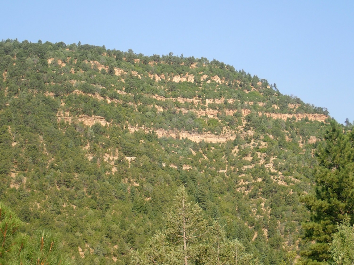
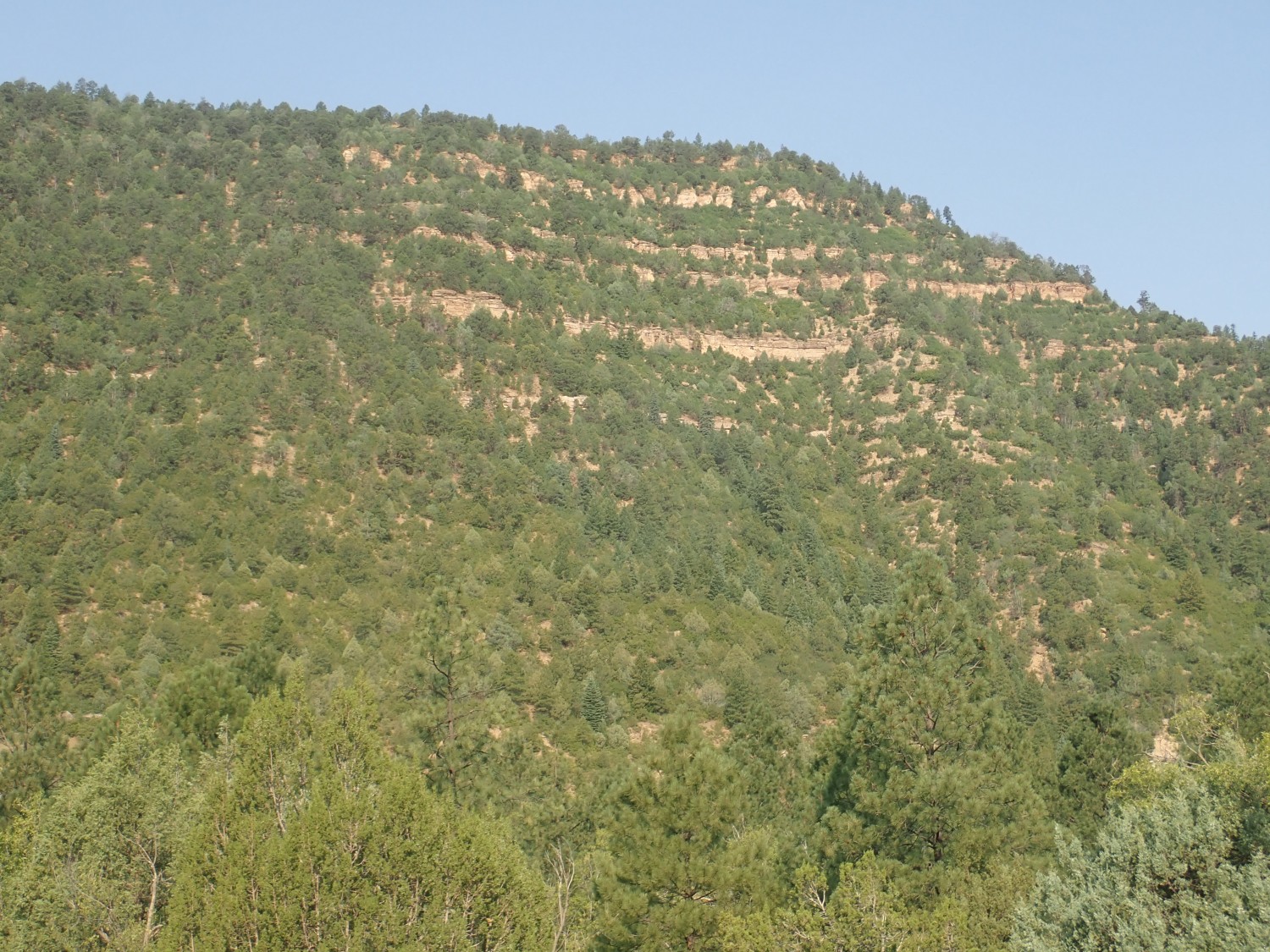
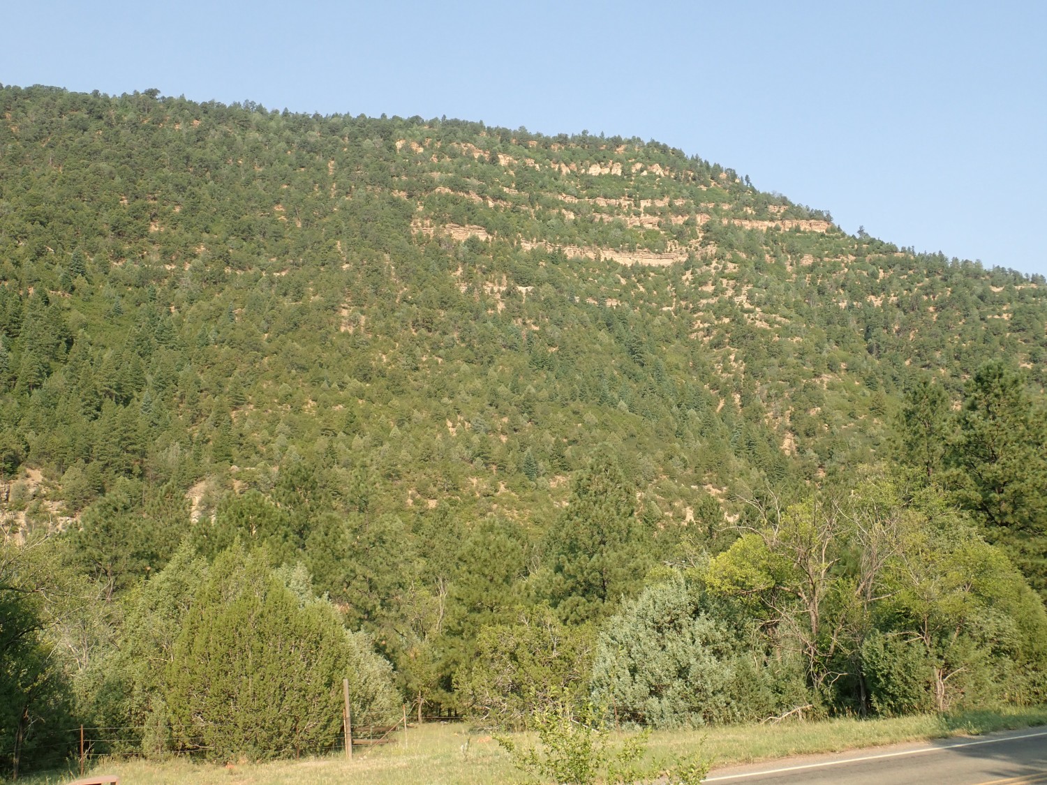
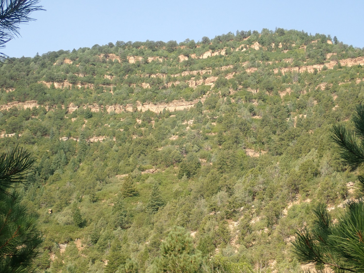
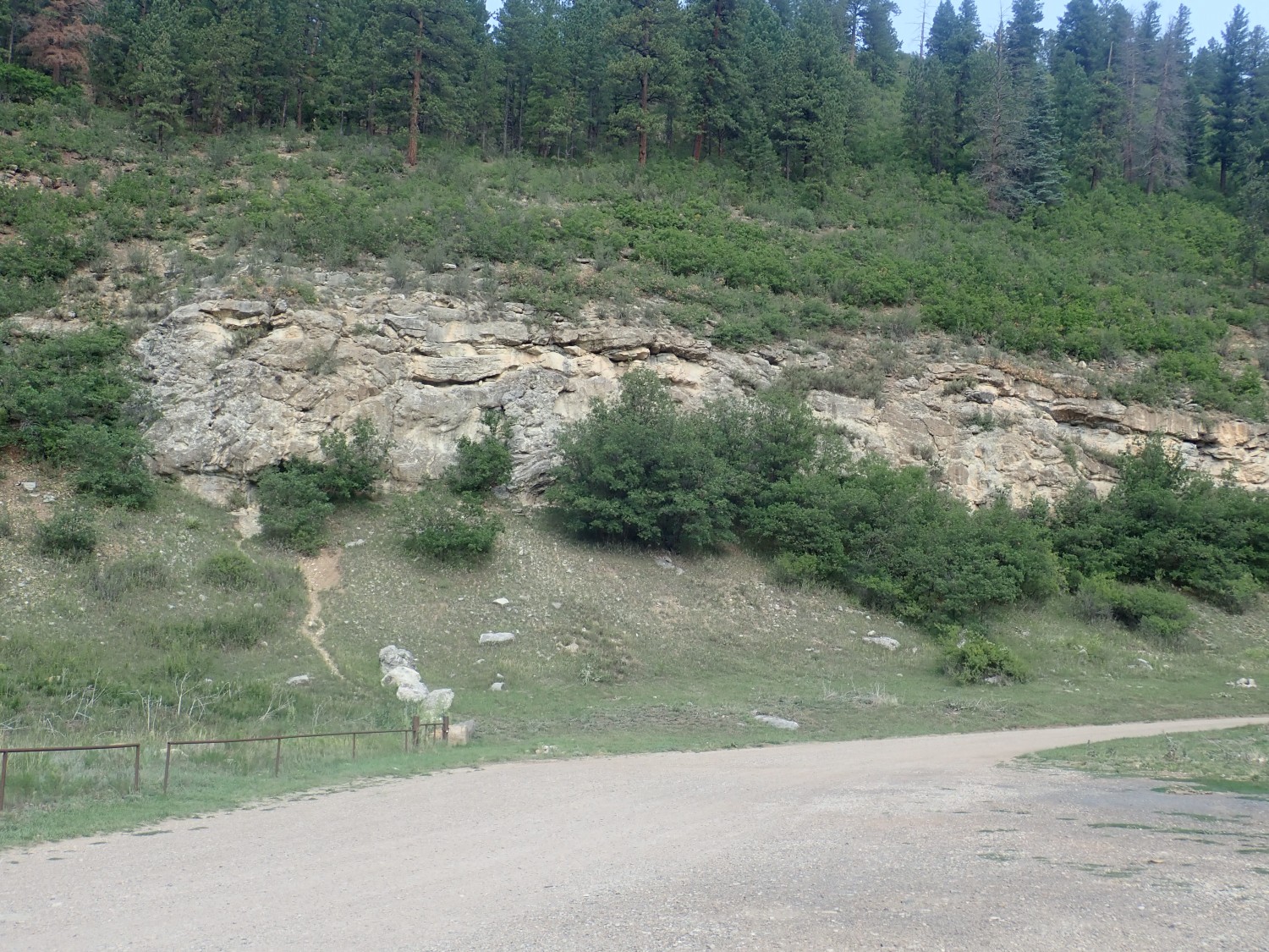
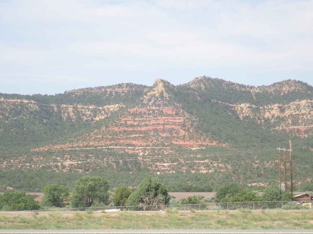
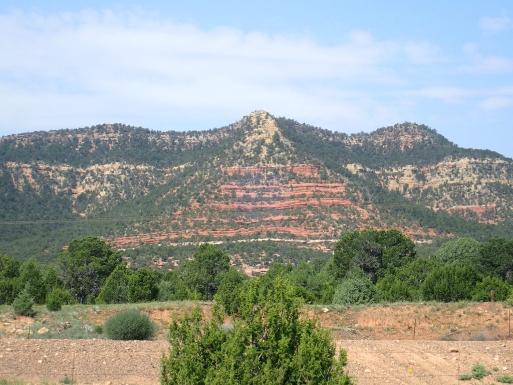
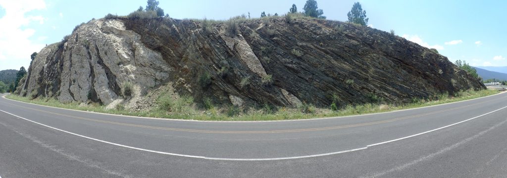
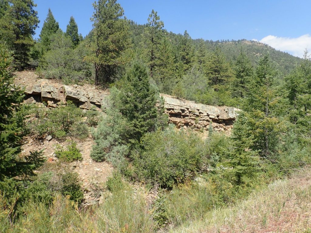
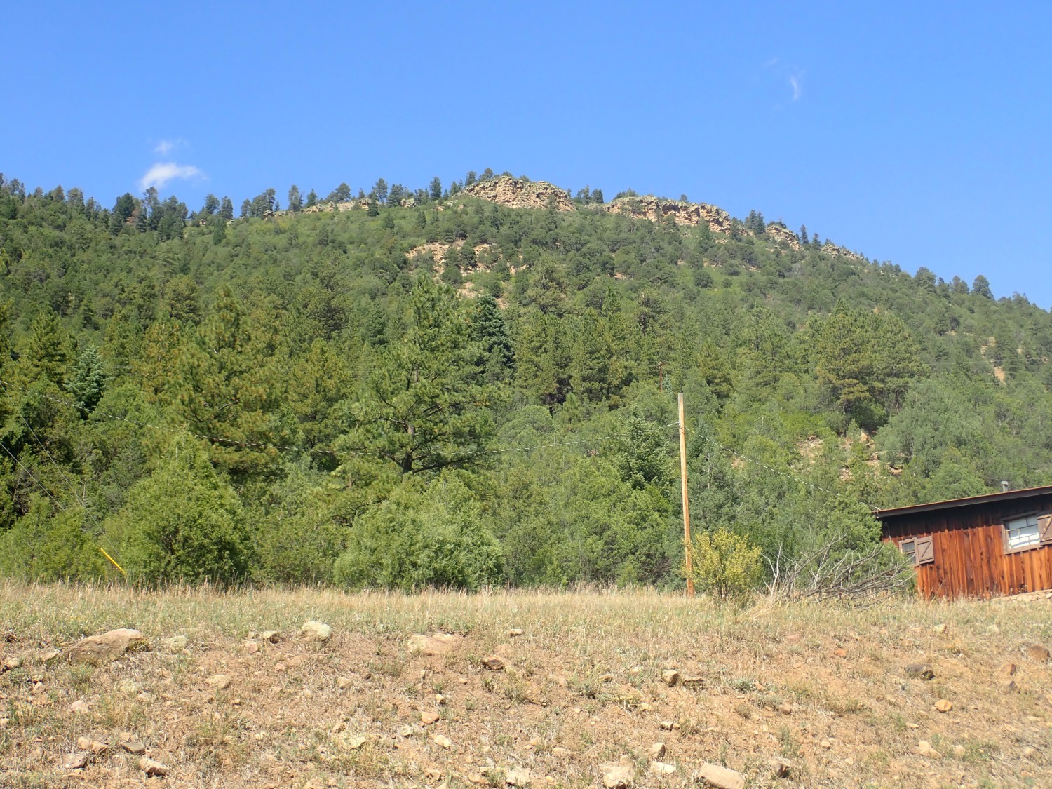
So I packed lunch Thursday night and headed out as early as I could on Friday. There was some mid-level cloudiness, alas, but not enough to spoil my redo of the Alamitos formation type location photos:
For new readers (Welcome!): Almost every image at this site can be clicked for a higher-resolution version, and almost every blue link takes you to the location from which the photo was taken on Google Maps.
If you go back and compare these with the previous set, I think you’ll agree that they’re tons better. They’re not badly backlit due to heavy cloud cover, and I think I chose my viewpoints better. Of the three, I think the second is the one for Wikipedia. The first is marred by the foreground building (of a monastery, interestingly enough) while the last is just a bit too zoomed, and the color is a touch muddier. Or maybe not; the zoom does show more detail. I’ve not entirely made up my mind.
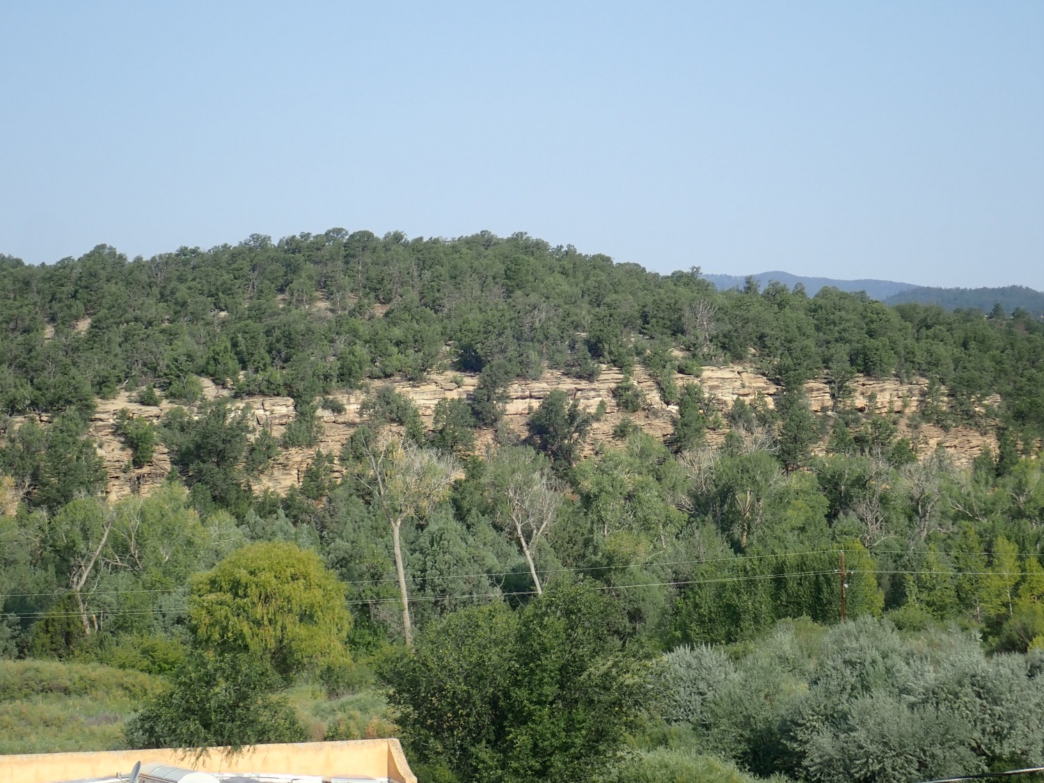
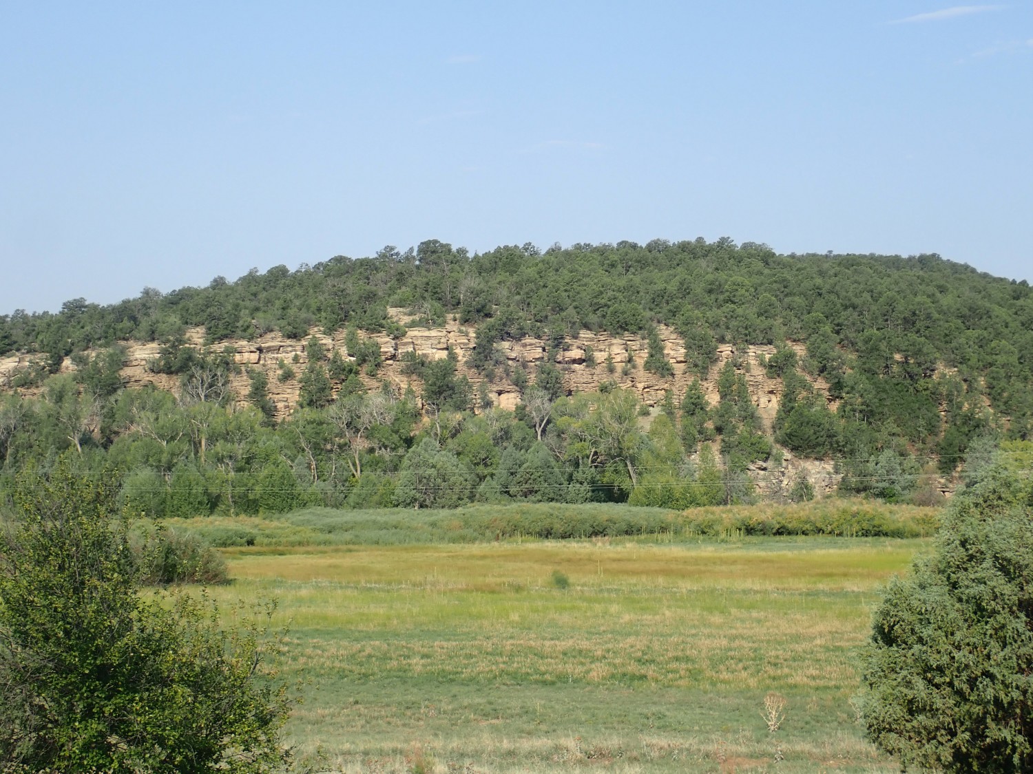
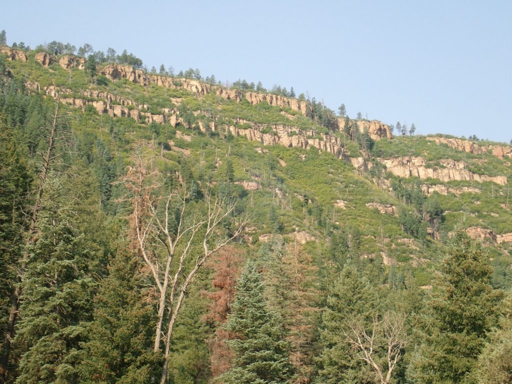
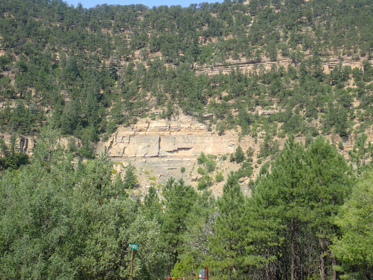
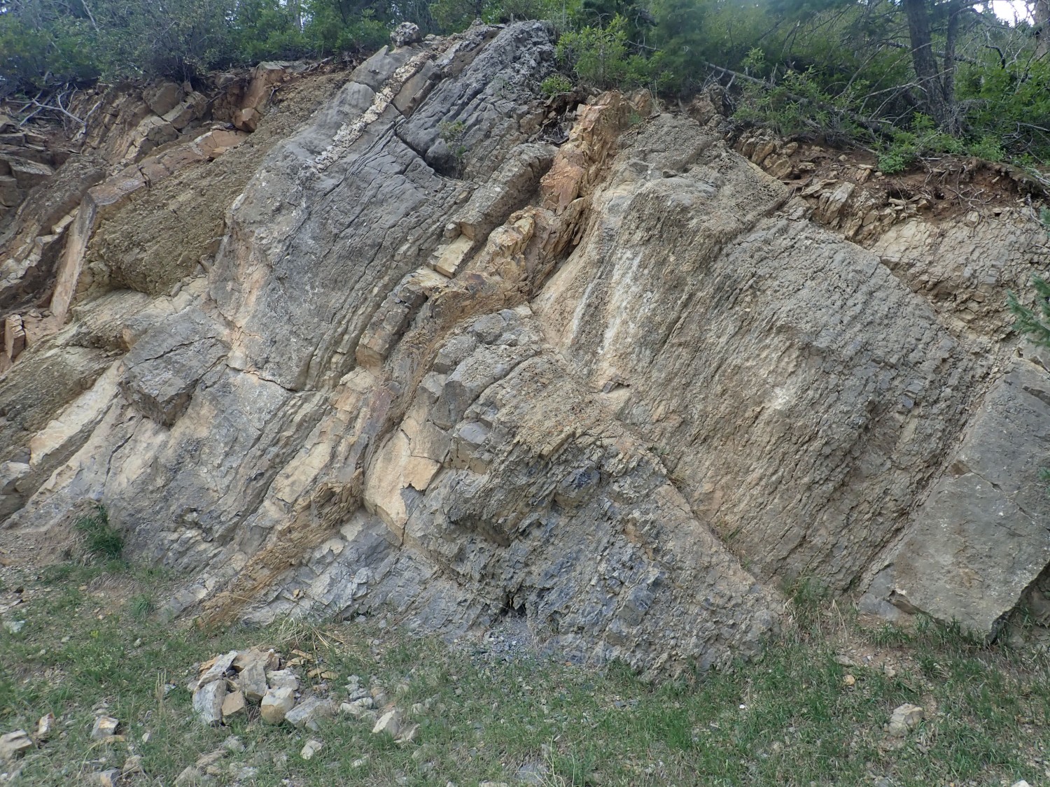
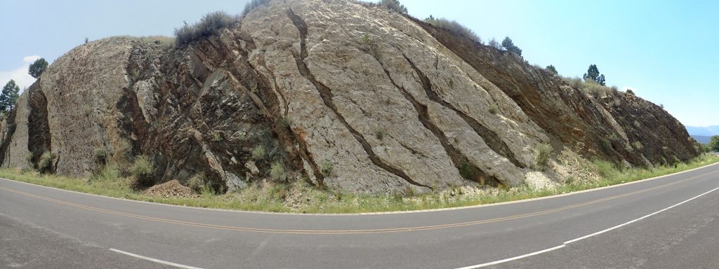
The photograph of Dalton’s Bluff and the type section of the La Pasada Formation is tons better.
I can rule out this first attempt right away; my camera lost its GPS lock, so no electronic verification of the location. And the foreground building is a distraction. This one is a good candidate, though.
Or this one?
Meh. Nah. Too little zoom.
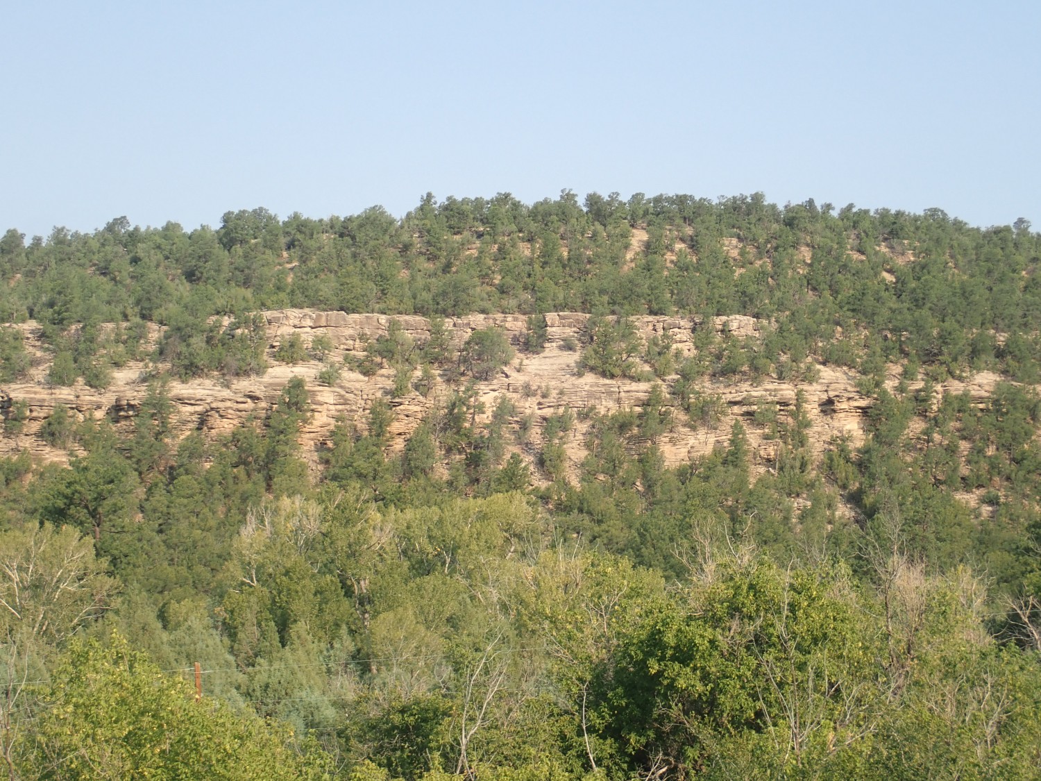
This one I tried to get more of the base, where Mississippian beds are exposed, but to little effect.
I think I’ve bloviated on these pages before that, with digital cameras making it very inexpensive to take many pictures, almost anyone can produce some really good shots if he takes enough pictures. While I still think there’s some truth to that, I’m coming to appreciate just how much talent is required to get really good shots on a regular basis. And I can only say that I’m no professional photographer.
A slightly different angle.
Here I tried climbing up the eastern canyon wall to get a better view point, but it’s just too heavily forested for a clear shot. And I don’t feel I have enough time to thoroughly search for the best view point.
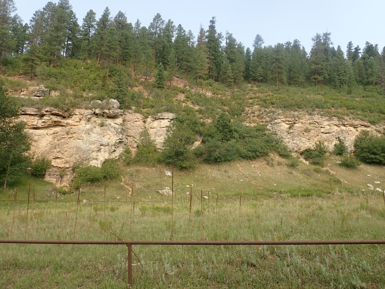
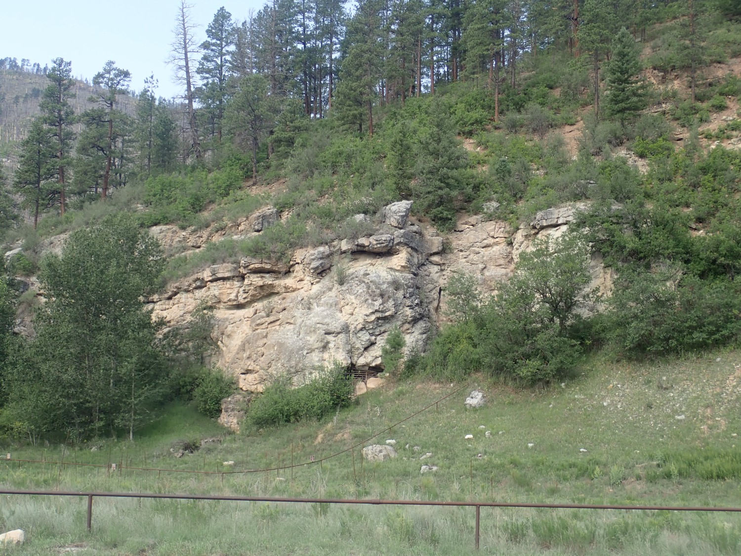
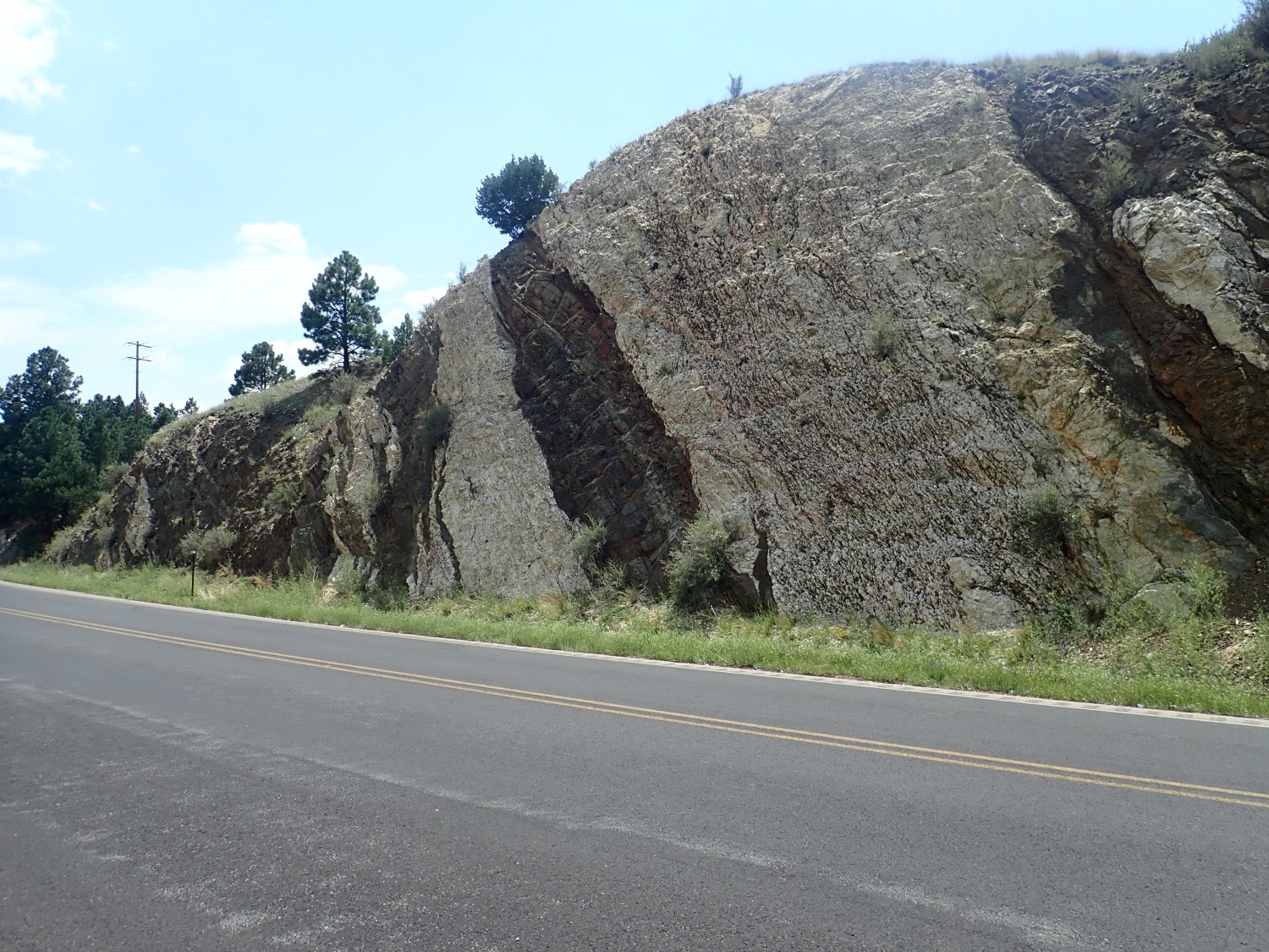
I’m still just a bit uncertain that this is actually the type section. That was defined as “Dalton’s Bluff overlooking Dalton Campground”, but that was 70 years ago. There is now a Dalton’s Picnic Ground, a Dalton’s Fishing Site, and a dispersed camping area, and my guess is that the Picnic Ground was the campsite of 70 years ago and the dispersed camping area is newer. But, just in case, here are some beds just visible over the trees west of the dispersed camping:
You know? I’m going with the first guess. These are a ways west of the dispersed camping, not overlooking it; and the first location looks more like the grainy black-and-white paper from 70 years ago.
But enough whining about the challenges of getting the pictures right. Yes, many of you come here mostly for the pictures (I’m told) but I hope you like hearing about the geology: The Alamitos Formation and Las Pasada Formation are upper and lower Pennsylvanian, respectively, with the Alamitos slopping over into the earliest Permian. This means they were deposited between about 320 and 300 million years ago. “Upper” means the younger part, since only in regions of really serious deformation do the older beds end up on top. Both formations were laid down in a shallow marine environment, but the older formation (La Pasada) is more massive limestone and likely laid down in a cleaner environment, while the younger formation (Alamitos) has a lot more clay, sand, and gravel indicating a lot of erosion off nearby highlands — almost certainly the Ancestral Rocky Mountains. The Sangre de Cristo was low ground then, part of what geologists have dubbed the Taos Trough, which lay between the San Luis Uplift (now the Espanola Basin) to the west and the Sierra Grande Arch (now the flats of the High Plains) to the east. “Every valley shall be exalted, and every mountain and hill shall be laid low.”
I consider — I’ve got a photo I’m pretty sure is the type section of Tererro Formation, but it was in pouring rain — then decide one cannot drive to within four miles of Tererro and not take a crack at a better photo. It may cost me an extra twenty minutes, but seems worth it. I pull into the local general store, which has a wonderful view of the formation outcrop to the west … with telephone wires precisely in the way.
So I drive to the campground and get these.
Any one of these would be an improvement, but the first is slightly off-tint. The third is a bit north of the described type section, but shows more than the second. The second anyway, I think.
On the way out, some more La Pasada.
Last time, I was a bit doubtful that this might actually be underlying Mississippian beds. But in the better weather, I can glimpse the Mississippian beds through the trees and am confident this is a superb exposure of La Pasada. I think that will be a nice supplemental photo for the Wikipedia article.
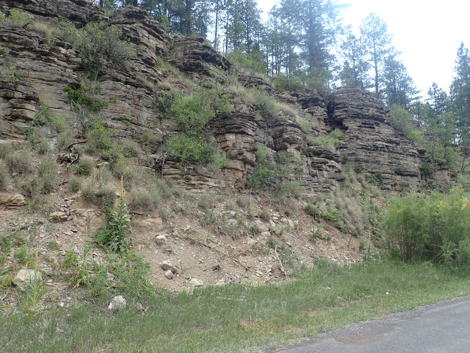
And here’s a road cut I hoped was in the La Pasada:
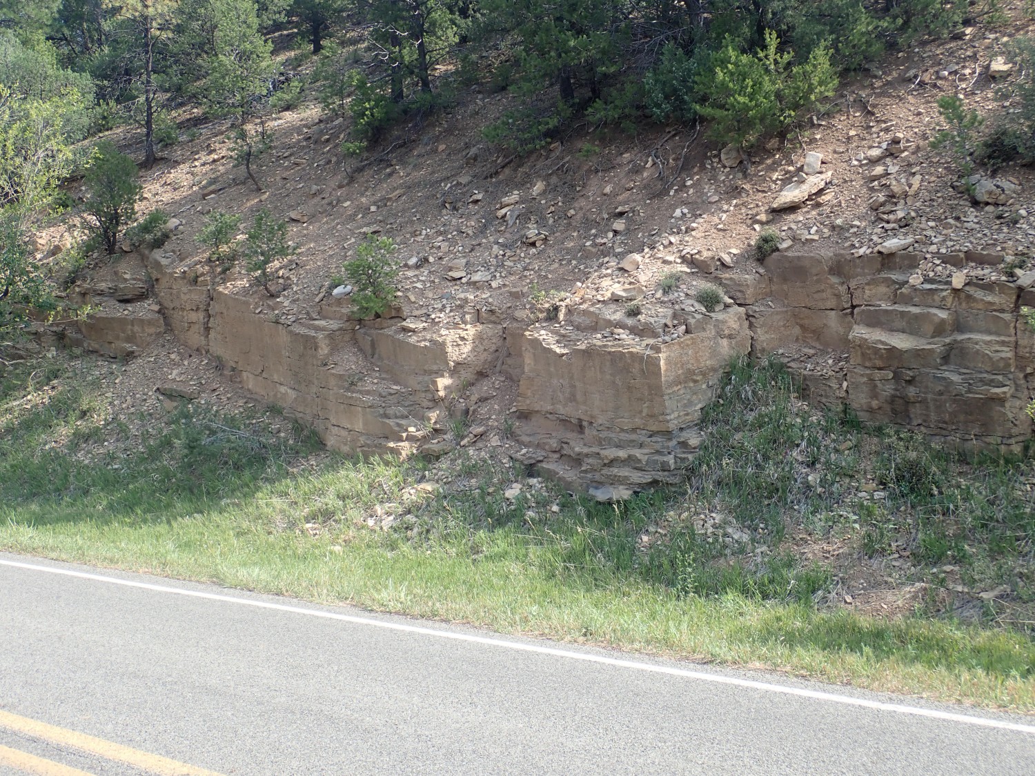

There’s a major fault in this area, the Lisboa Springs Fault, that crosses the canyon just south of the fish hatchery. South of the fault, everything at road level is Alamitos Formation (and I got some fine road cut photos last time.) North is La Pasada Formation, which I did not photograph last time. Well, there’s little doubt I’m at the right spot; I pass the fish hatchery well to the south as I drive out. Unhappily the road cut is backlit. But these are still decent photographs. And fossils!
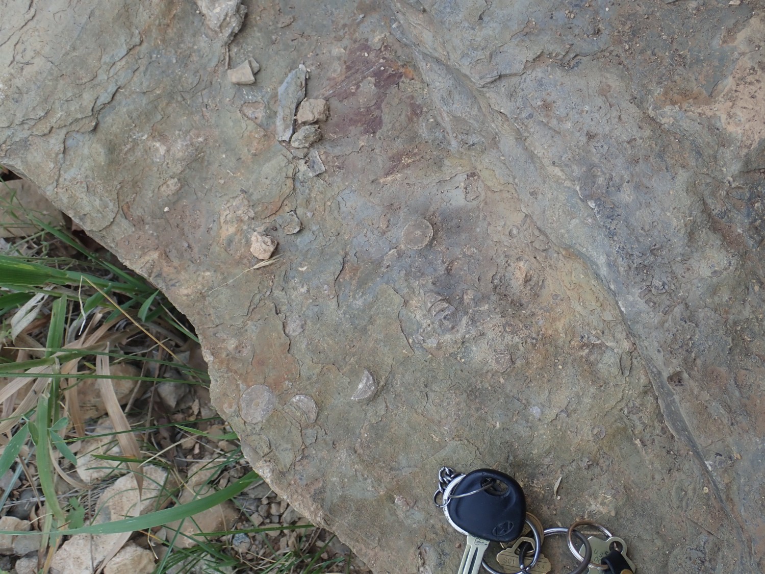
Big honkin’ crinoid stem segments. Don’t think I’ve seen this species before. Not great fossils — I did not take them home with me — but it suggests there may be some decent fossil hunting in this area. This stretch of road is on National Forest land, so there’s no issue of getting permission of private landowners. (Yes, you may collect common invertebrate fossils on National Forest land, as long as you’re not greedy about it.)
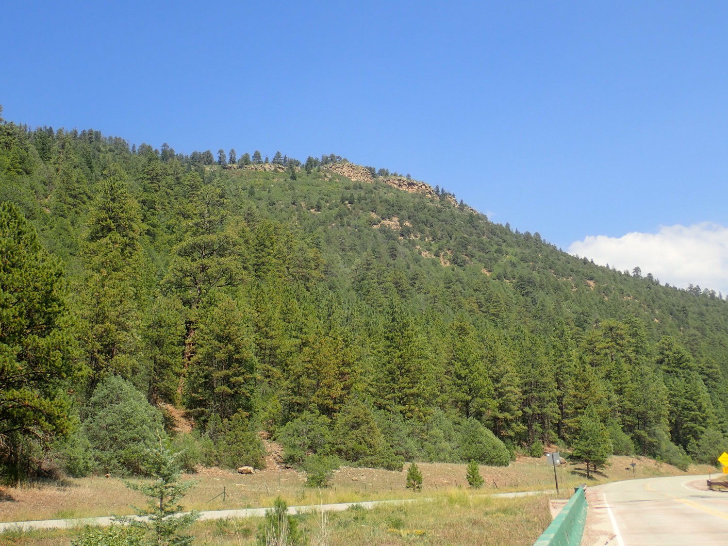
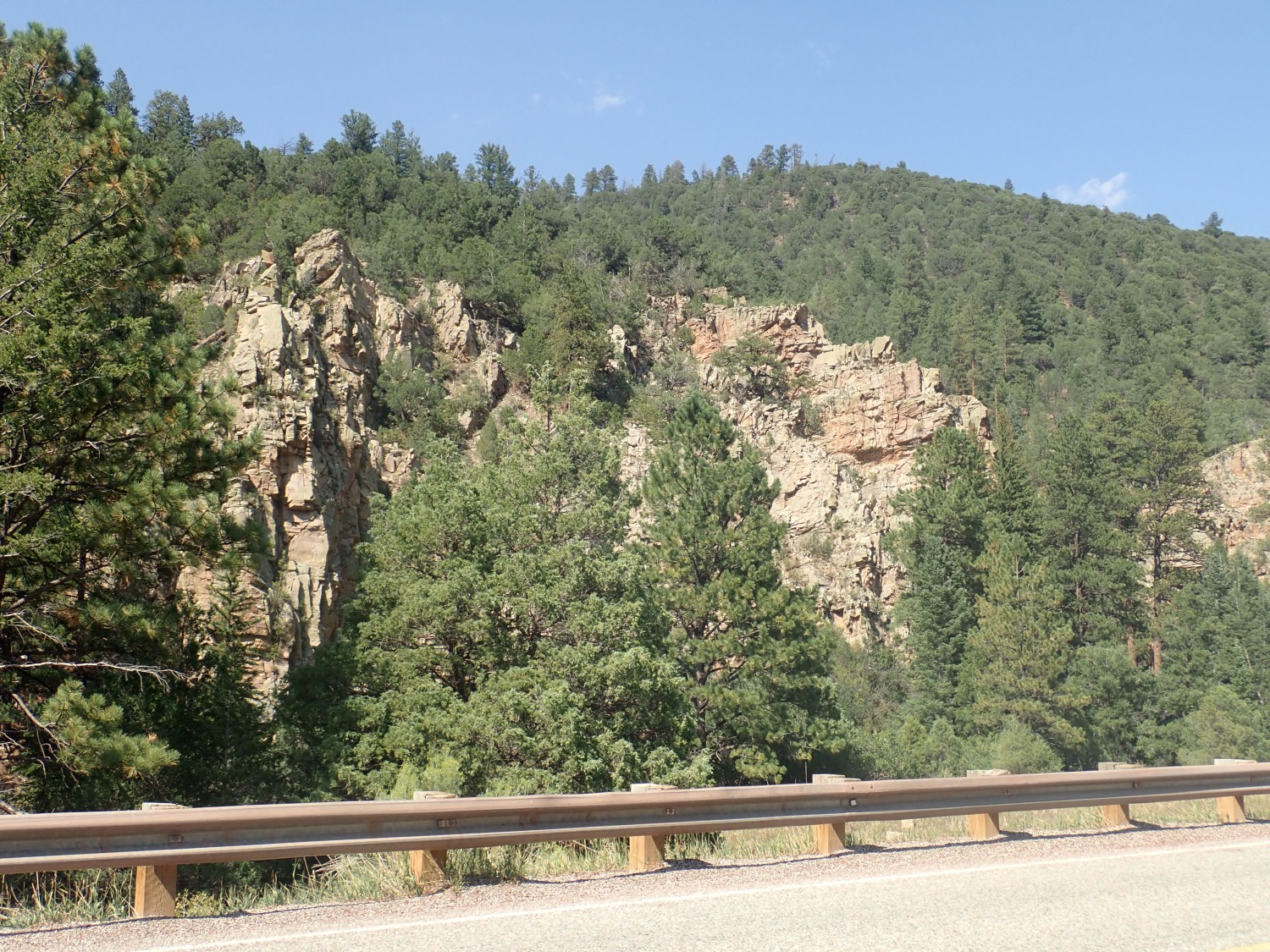
Then south to redo my Glorieta Sandstone type section. It was badly backlit last time. I also hoped for a view from further out, to better show the overlying beds:
but I couldn’t find a spot without a lot of foreground infrastructure, and smoke from a nearby wildfire has muddied this. I ended up doing one from almost the same spot as last time:
I quite like this one; a definite improvement over the previous. But I may go with the slightly muddier one just because it does better show the overlying beds. I may adjust the exposure to make it a bit less muddy.
For brand-new readers: The lower red beds are the Yeso Group, a Permian unit whose type section is about a hundred miles to the southwest. Type section: This is where a geologist first describes and defines a geologic formation, and the formation is tied to the type section forever after. This is a problem if the type section is poorly chosen, and then reference sections are defined which must be demonstrably better exposures of what is definitely the same formation as the type section. It’s a little like biology: The type specimen defines a species, even if it’s a really crummy specimen. Later better specimens may be designated as reference specimens, but if they turn out to be a different species, you go with the original. Or at least that’s how it’s supposed to work.
But the Glorieta Sandstone was defined so long ago that the rules weren’t formalized yet, and it was described simply from its appearance all along Glorieta Pass. A type section was formally defined relatively recently, which is what we are looking at here: The gray cliffs above the red Yeso Formation red beds are the Glorieta Sandstone type section. The Glorieta Sandstone is capped with a thin bed of San Andreas Limestone, then the knolls behind are eroded from the Bernal Formation and Santa Rosa Sandstone. Except the Bernal Formation has since been abandoned and its beds reassigned to the Artesia Formation. Geologists are constantly refining their formations, as they rightly should.
The Glorieta Sandstone was laid down in a coastal dune sea, and there has been a lot of debate over how much was laid down above water and how much below. The hot take is that the northern part was above water and the southern part submerged. The sand is pretty much agreed to have eroded off the (then-young) Appalachian Mountains, carried west by rivers passing north of our area, and carried southwest by the wind to be deposited as the Glorieta Sandstone. How do we know? The sandstone contains zircons, a very durable mineral found in many igneous rocks, that match zircons in the Appalachian Mountains of today.
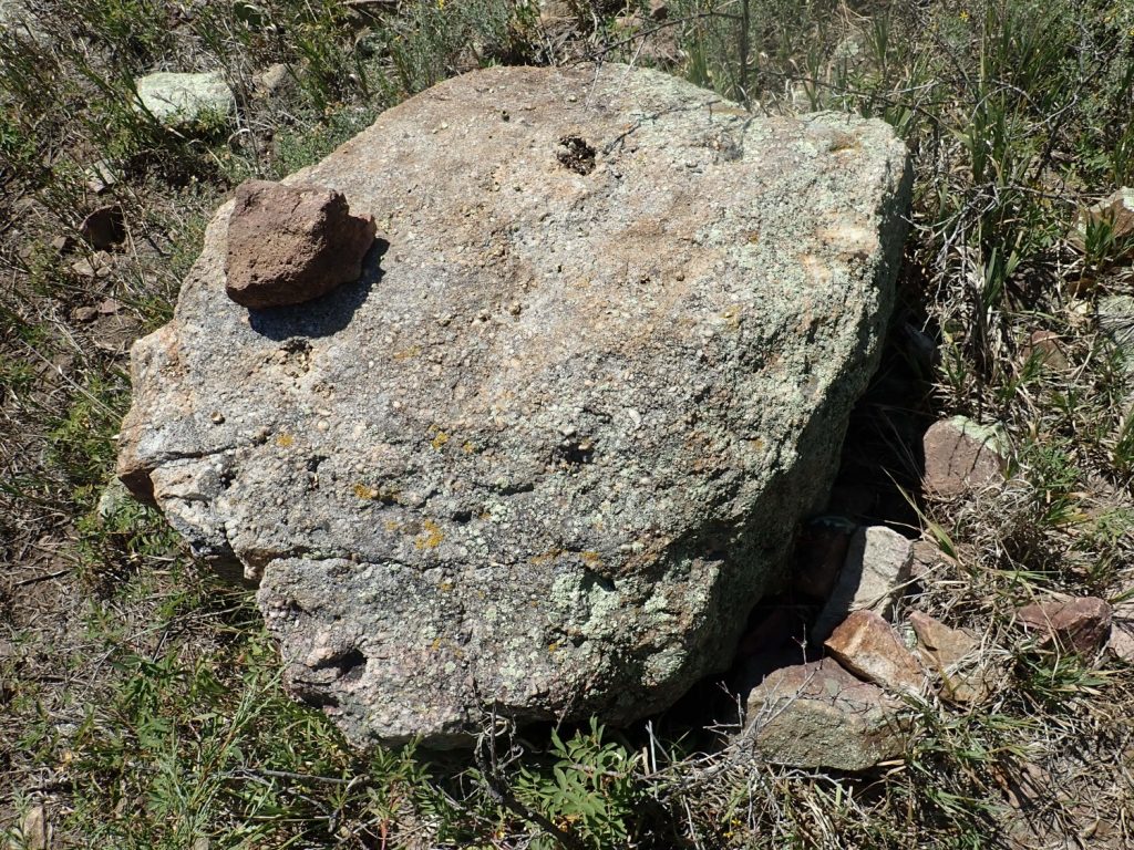
I head west for Las Vegas, and pass some beds I just can’t resist photographing.
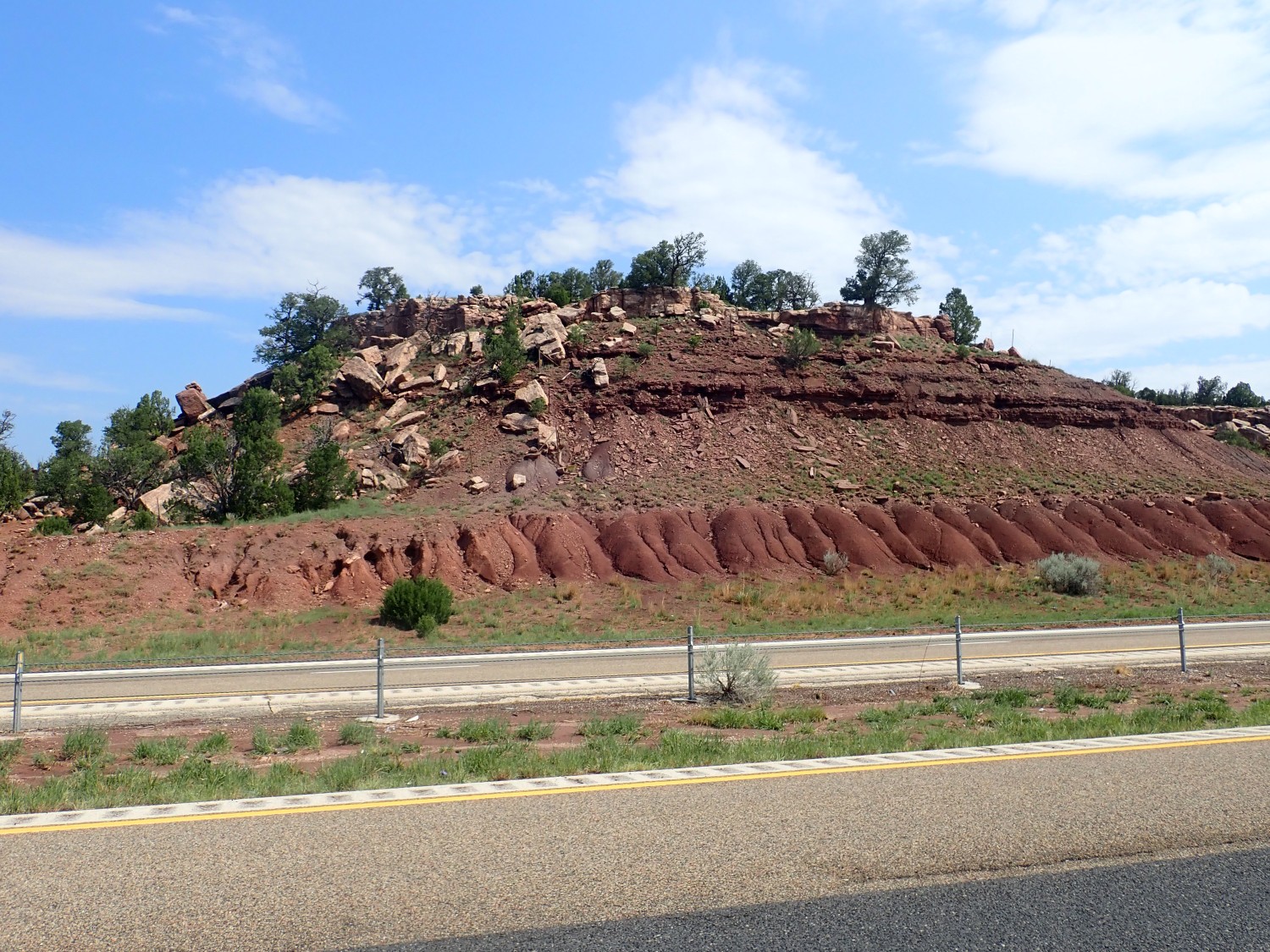
Long-time readers know that, because I don’t possess any electronic device I can take into the field with geologic maps loaded, I like to play Guess The Formation and then check coordinates when I get home. My guess is Yeso Group. Nope; it’s Sangre de Cristo Formation, which is significantly older. Unless it’s Abo Formation; one recent paper argues it should be.
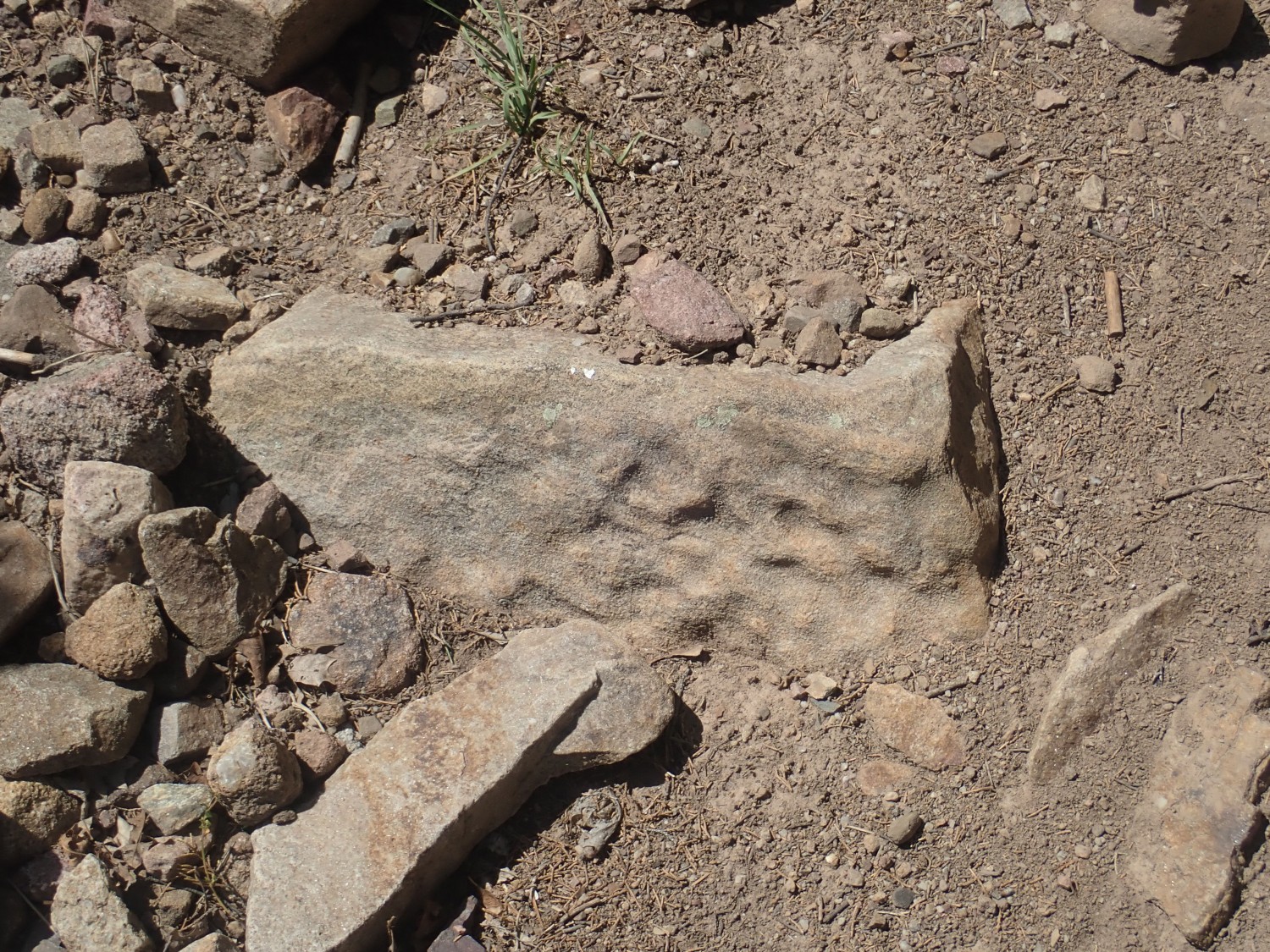
And this.
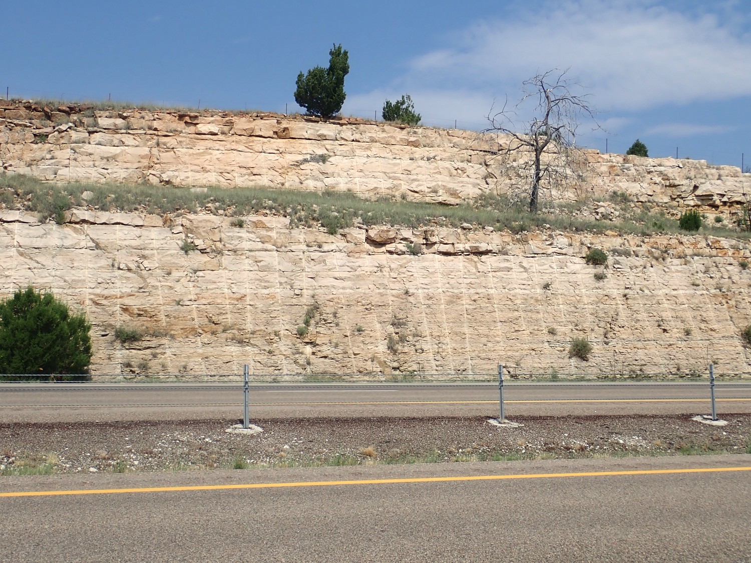
My wild guess is Santa Rosa Sandstone. Nope; Glorieta Sandstone. The grassy ledge is an engineered feature, not a feature of the formation itself.
I drive through Las Vegas and Montezuma into the mountains. Hermit Peak looms ahead.
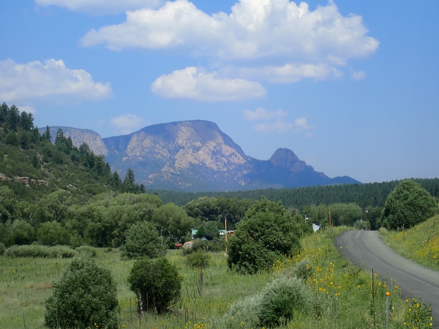
Alas, there is some cloud cover shadowing the mountain. Still quite a sight.
This mountain is mostly granite gneiss with an age around 1.705 billion years. This means it formed during the Mazatzal Orogeny, where a big island arc glommed on to the southern edge of the growing North American continent and became part of the continent. There’s a younger intrusion within the larger gneiss body with an age of 1.448 billion years, corresponding to the Picuris Orogeny, an event which is still poorly understood.
My interest is in the Porvenir Formation, whose type section I think I have located way up a forest gravel road. Fortunately, it’s quite a good gravel road and I have no difficulty driving it to the outcrops. (When I get home and double check coordinates: Yep, I nailed it.)

This is the equivalent of the La Pasada Formation for this area. So why not just call it La Pasada? Formations are defined by lithology, the physical characteristics seen in the rocks in the field, and La Pasada is mostly cycles of limestone and shale while Porvenir is mostly sandstone, conglomerate, and shale with only modest amounts of limestone.
More shots along the road.
Any of those last three would be fine for Wikipedia.
I ruminated once on why it is that I love geology, and it seems worth repeating occasionally:
“If you’ve stayed with me this far, you probably already understand, but: What makes geology so fascinating for me? Isn’t it a little … extreme?
It’s not just geology; I find almost everything interesting. I once saw a tee shirt at a nerd tee shirt store (yes, there are such things, online) that read “I read books and know stuff.” Yes.
There is a scene towards the beginning of the movie, Amadeus, where Salieri, played brilliantly by F. Murray Abraham (for which he deservedly won the Oscar for Best Actor in 1985), is telling his priest the story of his life. He describes his desire to make beautiful music, a desire so strong that he saw even the sudden death of his own father, who disapproved of his ambition, as a blessing from God rather than a family tragedy. He makes the comment that this desire to make music is like “a lust in my body.”
For me, the desire to learn stuff is like a lust in my body.
I have no other explanation.”
I eat lunch (it’s now noon) and drive out. I can’t resist one more shot, well away from any type section, on the way out.
Alas, it turns out there is no geologic quadrangle map available online for this location. So I can’t confidently identify which formation this is — could be Alamitos or Porvenir. Though Porvernir is more likely.
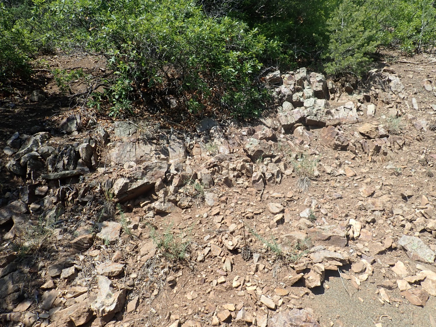
Then back to Las Vegas and north to Mora. The highway follows a strike valley north of Sapello.
This is the eastern boundary of the Sangre de Cristo Mountains. Just to the west is the great Sapello Thrust Fault, where the deep rock was pushed up and over the beds to the east by enormous tectonic forces during the Laramide Orogeny, around 50 million years ago.
An orogeny is an episode of mountain building. The Laramide Orogeny began perhaps 70 million years ago and was mostly done by 30 million years ago. It’s thought to be related to the subduction of the Farralon Plate, a chunk of the Earth’s crust, under western North America. For reasons still being worked out, this section of ocean crust was shoved under western North American at a very shallow angle, compressing the rock beds above far inland and throwing up the modern Rocky Mountains.
The latest theory is that this chunk of ocean crust was unusually thick and buoyant due to a pulse of magmatism far out at sea where plates met. Part of the thick erupted crust ran into Mexico and part is still at sea, halfway to Japan now. Japan could have some trouble with this … in another few tens of millions of years.
Anyway, the sedimentary beds above the crystalline basement were bent upward as they were shoved east, producing a hogback. And there is a strike valley running the length of the hogback, eroded into soft Chinle Formation beds between more resistant Santa Rosa Sandstone beds to the west and Jurassic beds to the east. The highway runs down this strike valley for a considerable distance.
Emerging from the strike valley and looking east:

I would have guessed the lower beds were Entrada Sandstone with a thin white bed of Todilto Formation, overlain by Morrison Formation and Dakota Formation. The geologic map says the lower red is Chinle and the lighter beds are Entrada, and shows no Todilto here. But it’s an older map.
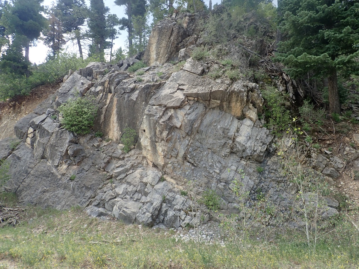
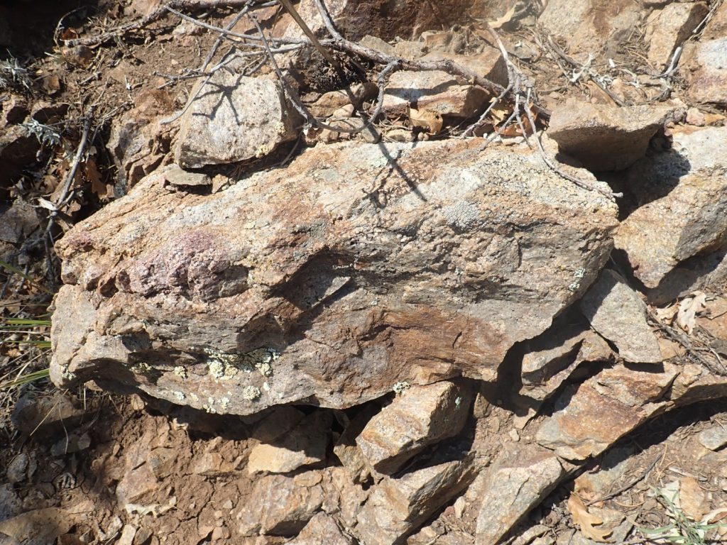
West into the mountains, and a spectacular road cut.
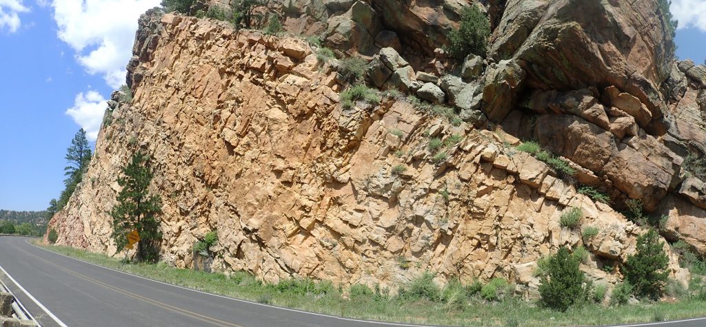
My guess is either Santa Rosa Formation or Dakota Formation. Unless it’s Morrison Formation. Turns out it’s Glorieta Formation again; the red beds to the east are Artesia (Bernal) Formation and the beds east of those are Santa Rosa.
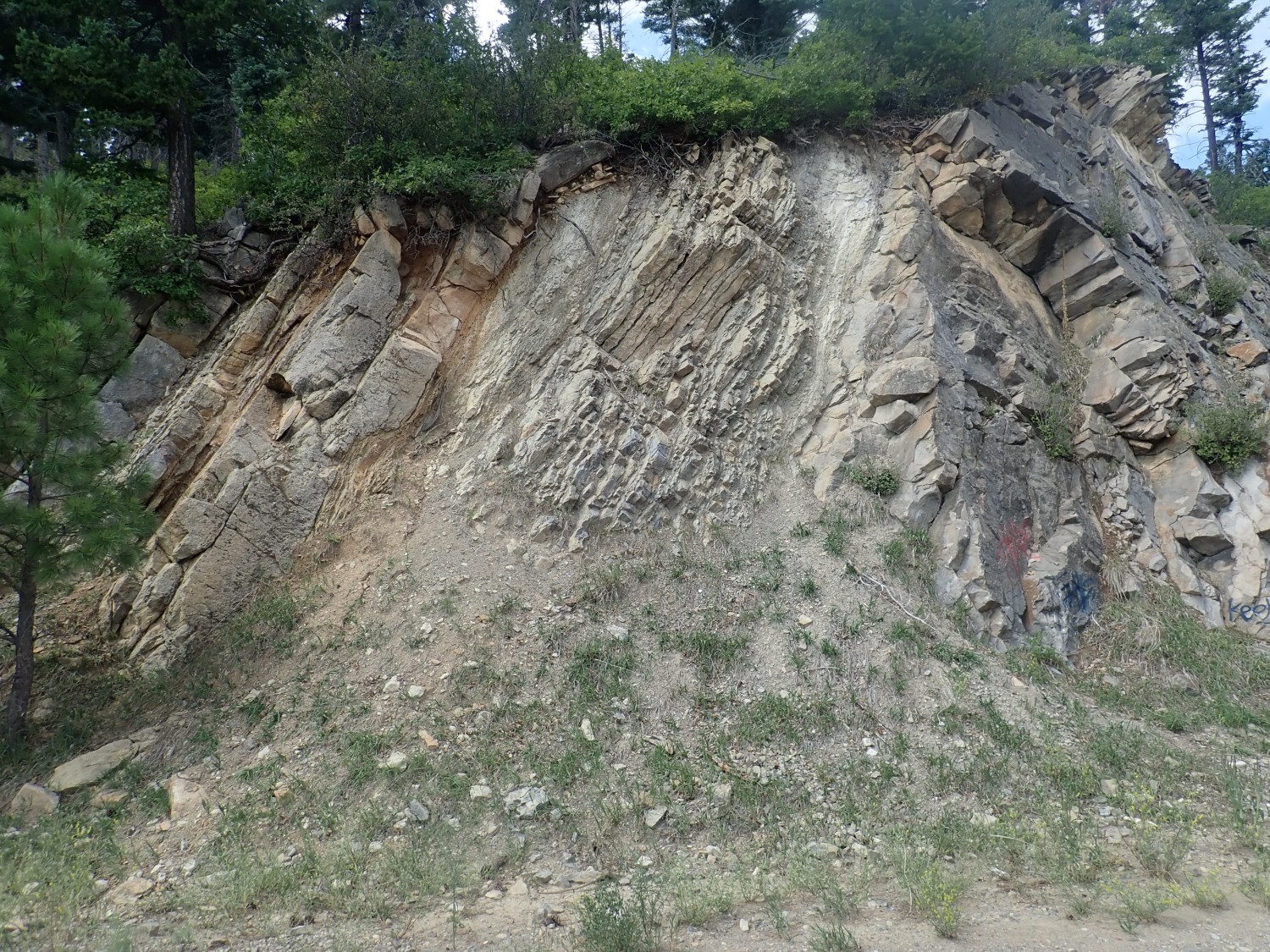
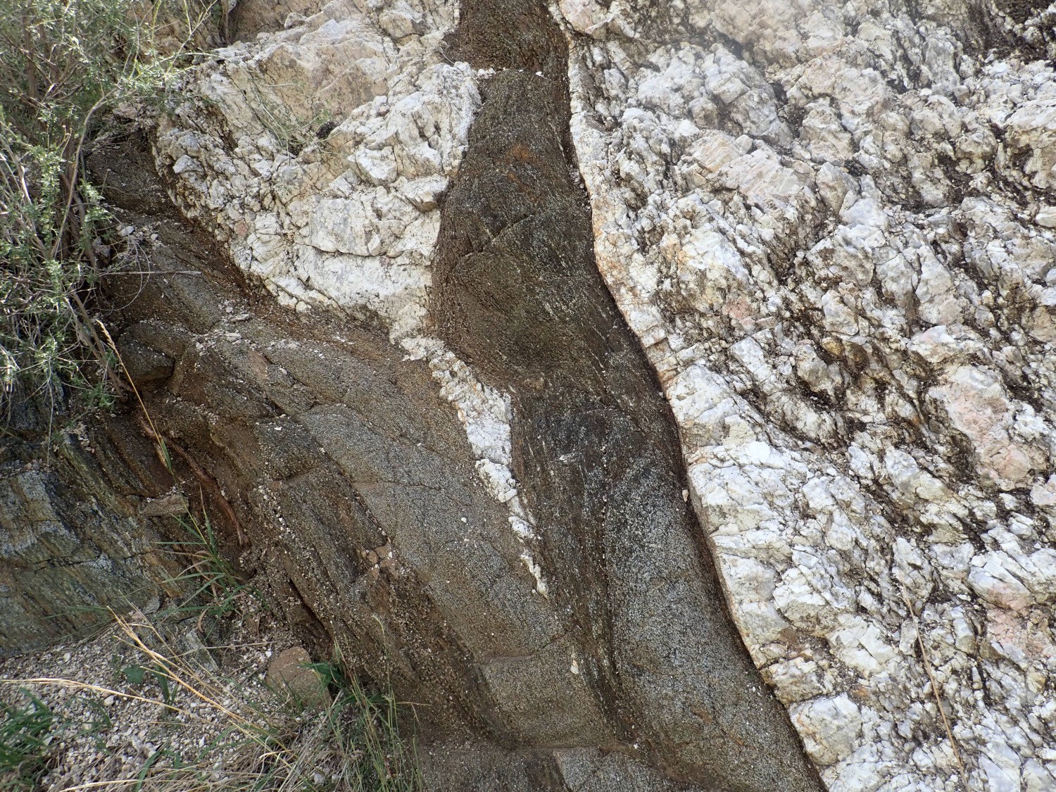
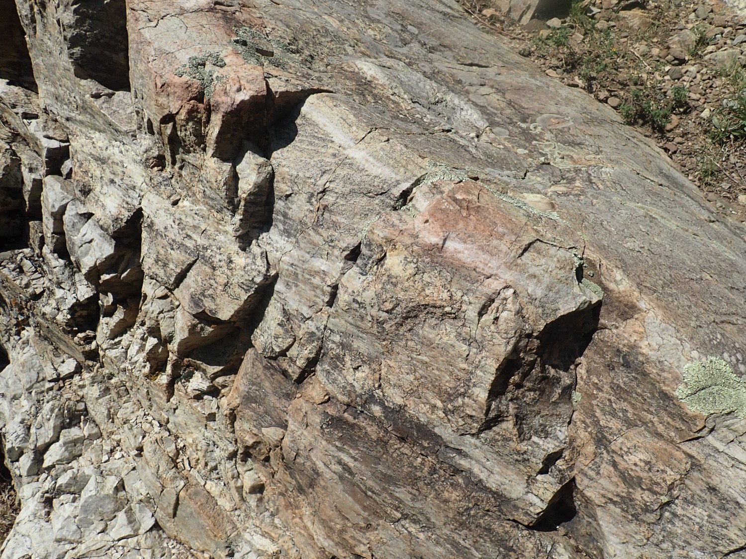
And this really catches my eye.
Alas, the sun is backlighting this badly. But you can see white pegmatite intruding into black amphibolite. This is really a fascinating outcrop. The geologic map guesses the amphibolite is Paleoproterozoic in age and the pegmatite is Mesoproterozoic; I’d guess 1.7 billion for the amphibolite and 1.4 billion for the pegmatite.
There seems to be some interesting variation in lithology across the formation. To the east (left) the pegmatite has a considerable content of black biotite.
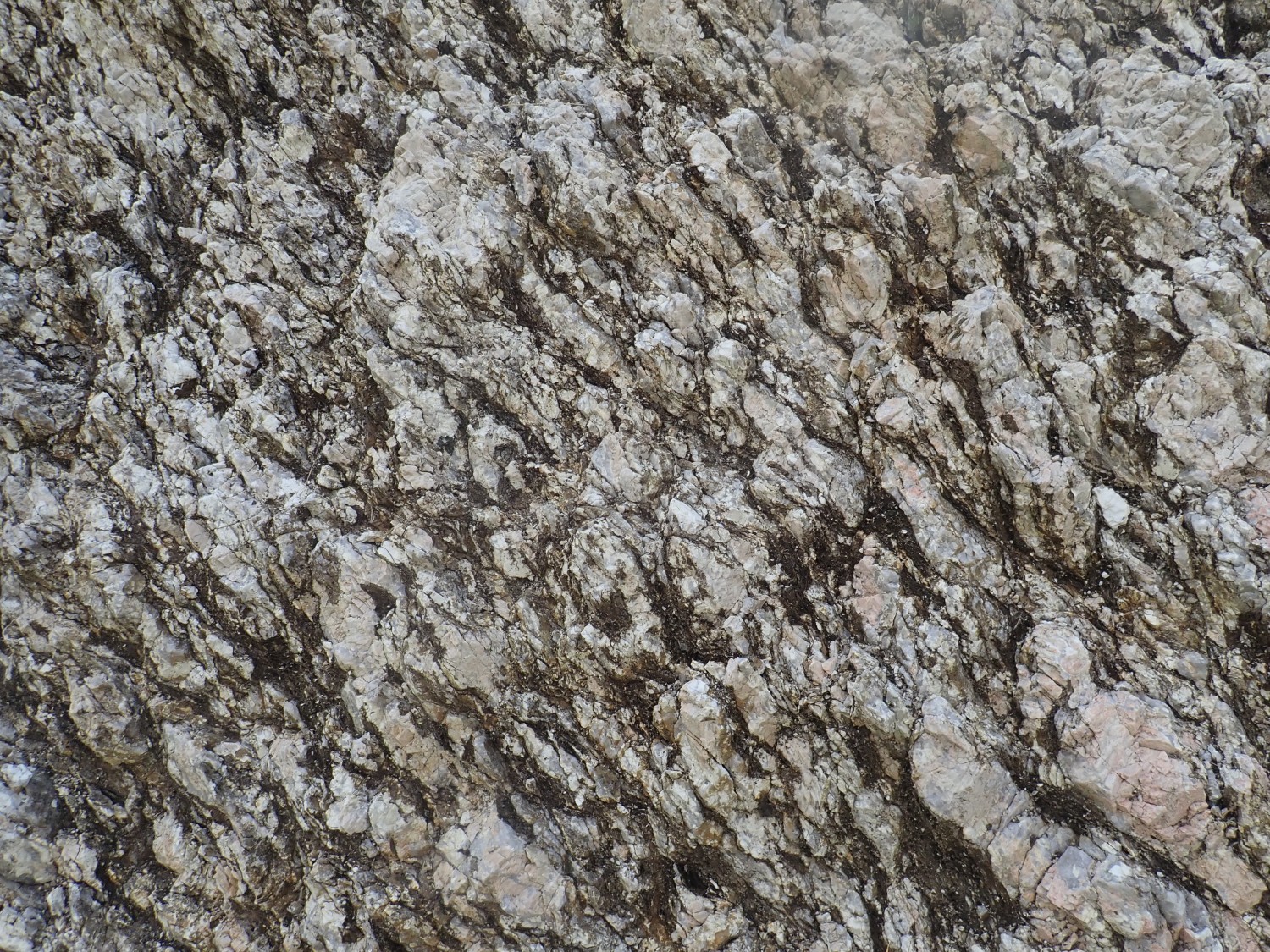
This is interesting because biotite, iron mica, requires water, aluminum, iron, silica, and potassium for its formation. Water and silica are okay; they’re common in any pegmatite. But this white pegmatite isn’t obviously rich in potassium and iron, except for this biotite zone. And this much mica means a lot of aluminum.
Pegmatites form (we think) from the last part of a magmatic body to solidify. Certain elements are highly concentrated in a pegmatite, as is water vapor. Pegmatites tend to be high in silica and alkali metals, and occasionally contain valuable rare elements like lithium, beryllium, tantalum, or rare earths. This one doesn’t show the valuable rare elements.
The black rock here is a biotite schist.
This also suggests a high potassium and aluminum content. And there is some pink feldspar in the pegmatite that could be potassium feldspar.

It would take a laboratory analysis to be sure.
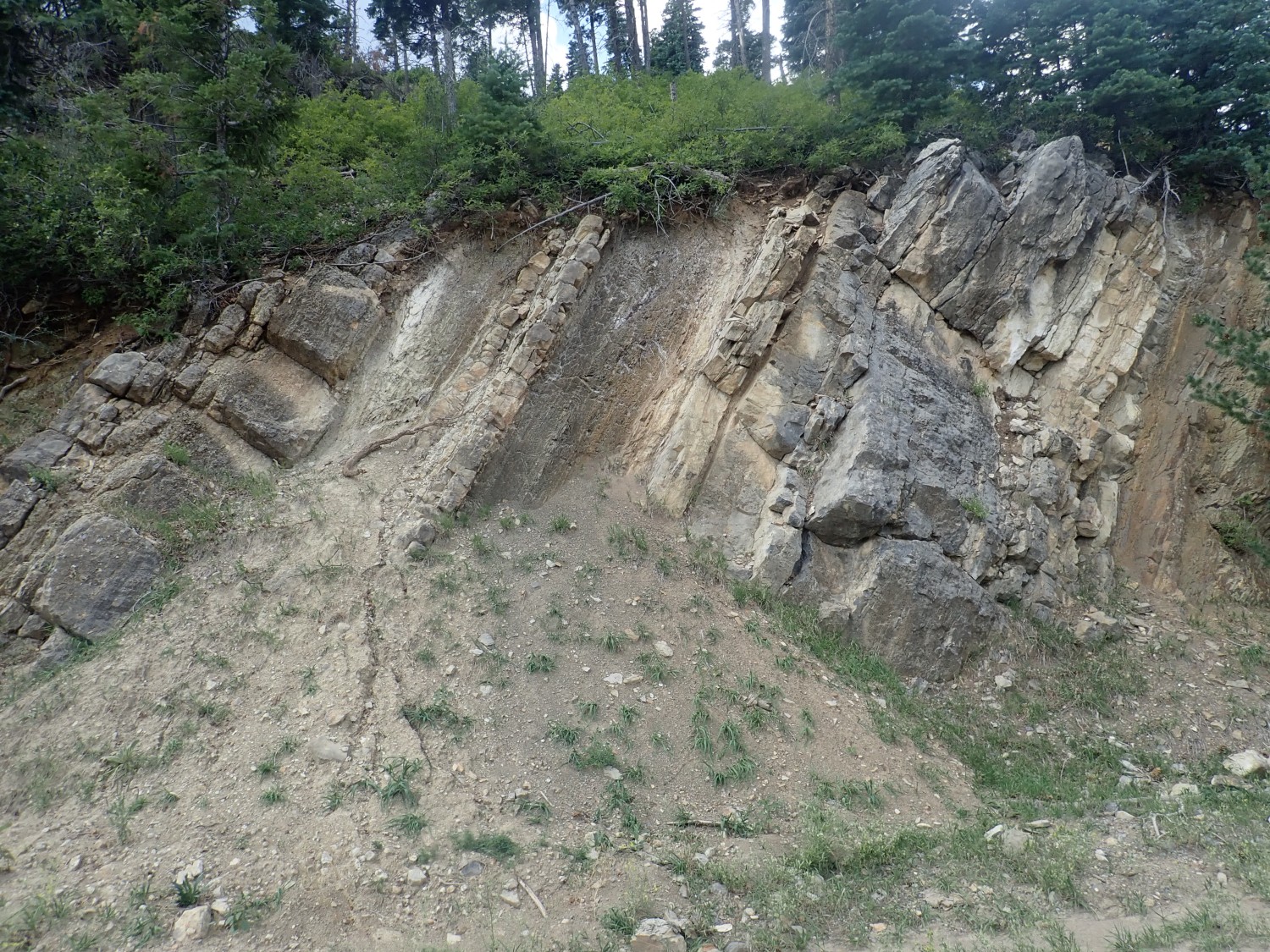
But further west the pegmatite is pure white.
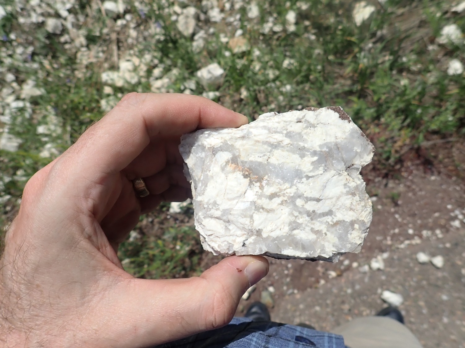
This suggests pure albite (sodium feldspar) and quartz, making this a true alkali feldspar granite pegmatite.
At the very west end, where it’s most black rock and only a few intruding veins, the pegmatite shows green feldspar, amazonite:
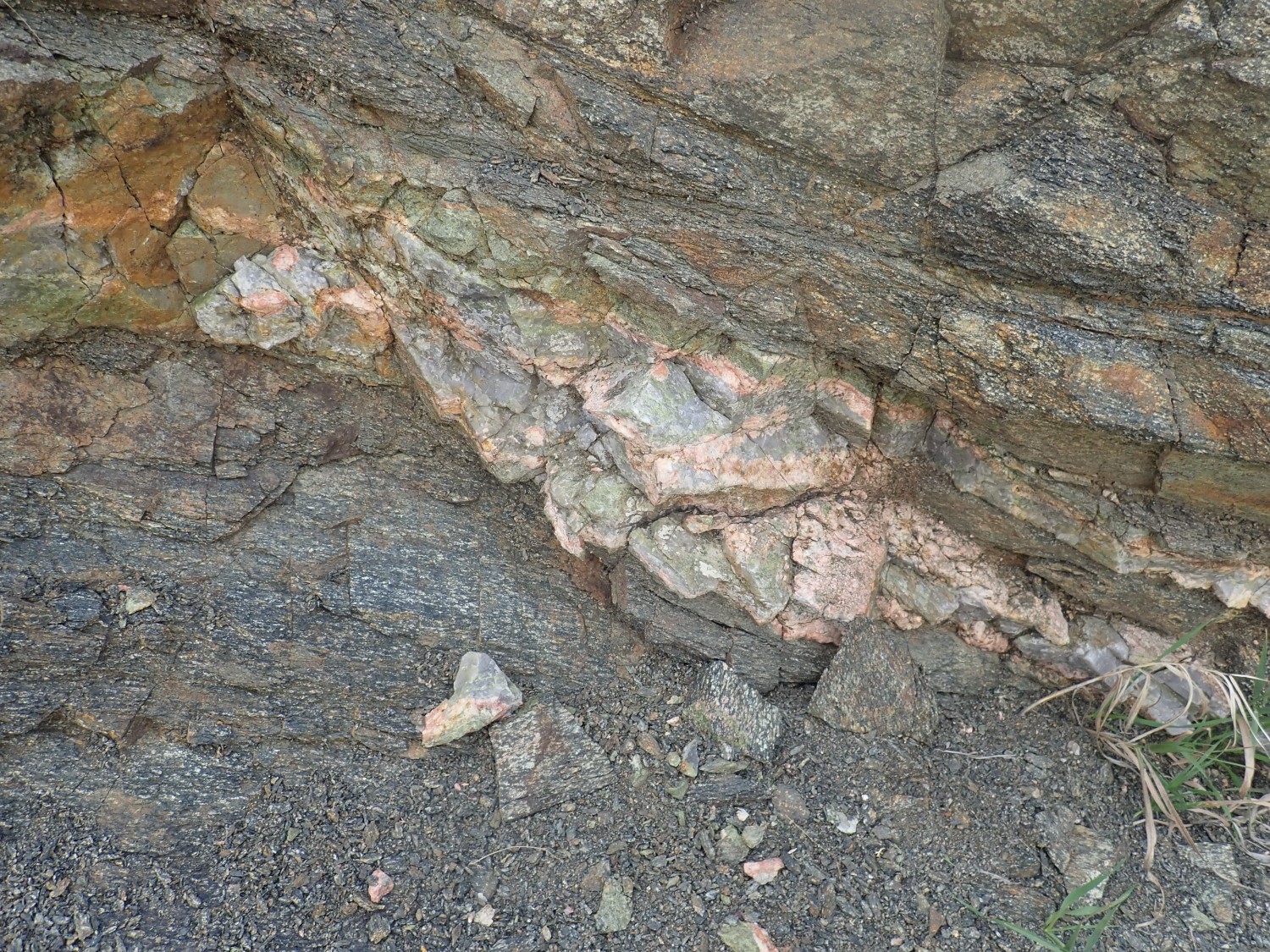
as well as lots of pink feldpar I’m guessing is potassium feldspar. Amazonite, green feldspar, it itself a form of potassium feldspar whose green color is not well understood. Could be ferrous iron; could be lead. The gray rock is quartz.
The black rock here is not biotite schist; it is gabbro, a mixture of plagioclase (calcium-sodium) feldspar and amphibolite. No mica is present.
I find myself speculating on what produces this composition gradient. The potassium is all in the feldspar here to the west, where the pegmatite is sparse. The potassium seems to have migrated into biotite to the east, where there is ample biotite both in the pegmatite and in the amphibolite. Perhaps it’s an aluminum gradient; more aluminum at left allowed biotite to form in both rocks and soak up the potassium from the pegmatite.
It would take laboratory analysis to really know. I don’t happen to have a petrological laboratory in my garage, alas.
I had considered looking for fossils near Holman Hill, but I don’t know where the best beds would be and time is short. I continue on past Tres Ritos to my final type section, for the Flechado Formation.
This is described as the exposures the bluffs overlooking Rio Pueblo Canyon to the north, beginning near Tio Maes Canyon at the base of the Pennsylvanian. That’s pretty specific. But the paper warns that the type section is not that well exposed.
I find a water hole just west of the spot where there are some striking beds.
These look like granite, and the geologic map seems to confirm that I am just west of the base of the post-basement rock here. Basement: That’s the very old crystalline rock found beneath more recent beds almost everywhere in the world. If I hike east, I should pick up some thin Mississippian beds of the Arroyo Penasco Group, and the base of the Flechado type section just above them.
Sure enough:
The geologic map puts this precisely on the Mississippian outcrops. I hike further down, find a bridge across the river,
and come back for a closer look. Well, huh:
This looks like solid quartzite, not sandstone or limestone. Basement? But it sure looks like a sedimentary bed in form.
I hike up Tio Maes (“Uncle Maes”) Canyon. The rock all looks like basement quartzite. And yet, this area is supposed to be Flechado Formation, and:
That’s a conglomerate, or I’m a monkey’s uncle. (Sorry, Steven.) But it is extraordinarily well-cemented, almost to the point of metamorphism.
And this looks like sedimentary structure.
I strike east off the trail to look for a clear outcrop, and finally find:
The geologic map is unambigous that this is Pennsylvanian rock territory. (That’s a geologic time period, not a U.S. state.) But it still looks like quartzite.
It dawns on me that this is, indeed, Flechado Formation, and the beds back at the river were, indeed, Mississippian; but they are so thoroughly cemented as to border on metamorphic rock. Which means this may not be a terribly representative exposure of Flechado Formation, even if it’s at the type section. Well, the paper warned that the type section was not terribly good, but was the only place you could see the entire thickness of the formation at one spot. Maybe I’ll have to go with a distant photo of hte bluffs for Wikipedia.
Though the building is a nuisance. Well, I haven’t time (or stamina) for a climb up to those bluffs; this will have to do.
Final shot.
Neart Comales Campground. This is identified simply as Paleoproterozoic granite on themap.
The map report gives me some comfort. The sedimentary beds here are described as well to very well cemented, to the point of being difficult to distinguish from underlying Precambrian Hondo Quartzite. So it’s not just me.
And home, in a rush, to have time to go shopping at Walmart in Santa Fe with Cindy. We have a long list and fill two carts, and mine must have had at least three hundred pounds in it. I’m very tired by the time I get to the checkout. And we then learn that if we’ve brought our own bags (we did) then we have to bag our groceries ourselves to avoid spreading coronavirus.
I could make a lot of acid comments, and just about did. But it’s the times. No point grousing too much. We’re all struggling with the pandemic, in ways big and small, and I’m grateful my job is one I can do from home (if not nearly as efficiently) and I’m still getting paid.