Wanderlusting with friends old and new
It’s been over a month since my last post, but preparations for the big May trip and mixed weather have limited my hiking.
The preparations have come along well. The sprinkler valve replacement part arrived and the leaky sprinkler valve is now tight. The other leak in the basement proved to be at the very top of the shower riser, where it turned out the nozzle pipe was made of cheap plastic and had cracked. I bought a proper metal one, used plenty of thread tape, and got it tight. The leaking backflow valve on the drip system was replaced and is now tight; no more gallons of water poured out along that part of the house foundations every time I run the drip system. The part of the drip system that got chewed through when they trenched to put in our cable internet has been patched. Reflective screens (to keep the house cooler) are installed in the two biggest sun-facing windows. I still need to get the swamp cooler fully up and running, but I’ve saved that for the last minute (which will be next weekend) in case there is a late freeze. The car seems to be working, as does the new camera; you’ll see examples shortly. The new hiking boots are breaking in nicely.
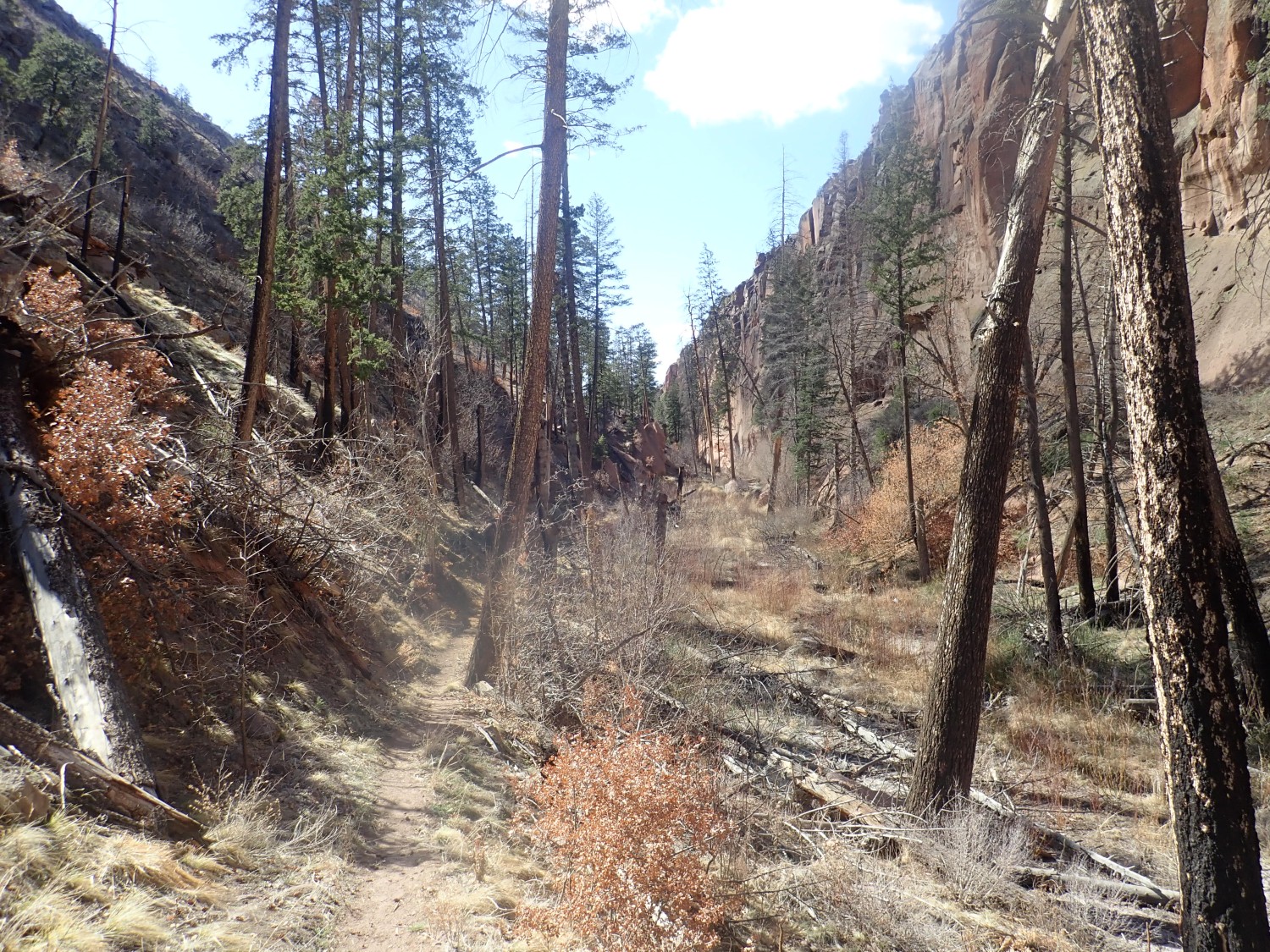
Hard to believe it’s been a month since the last hike that I haven’t posted yet. This was a conditioning hike up Frijoles Canyon to the narrows.
Ancient tree fallen across the trail.
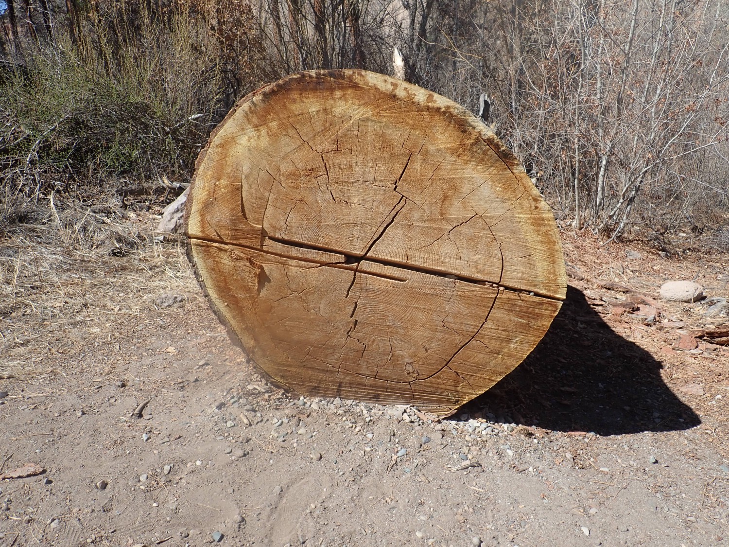
The rings are tough to count, but this was at least 120 years old. And growth was more rapid in its youth.
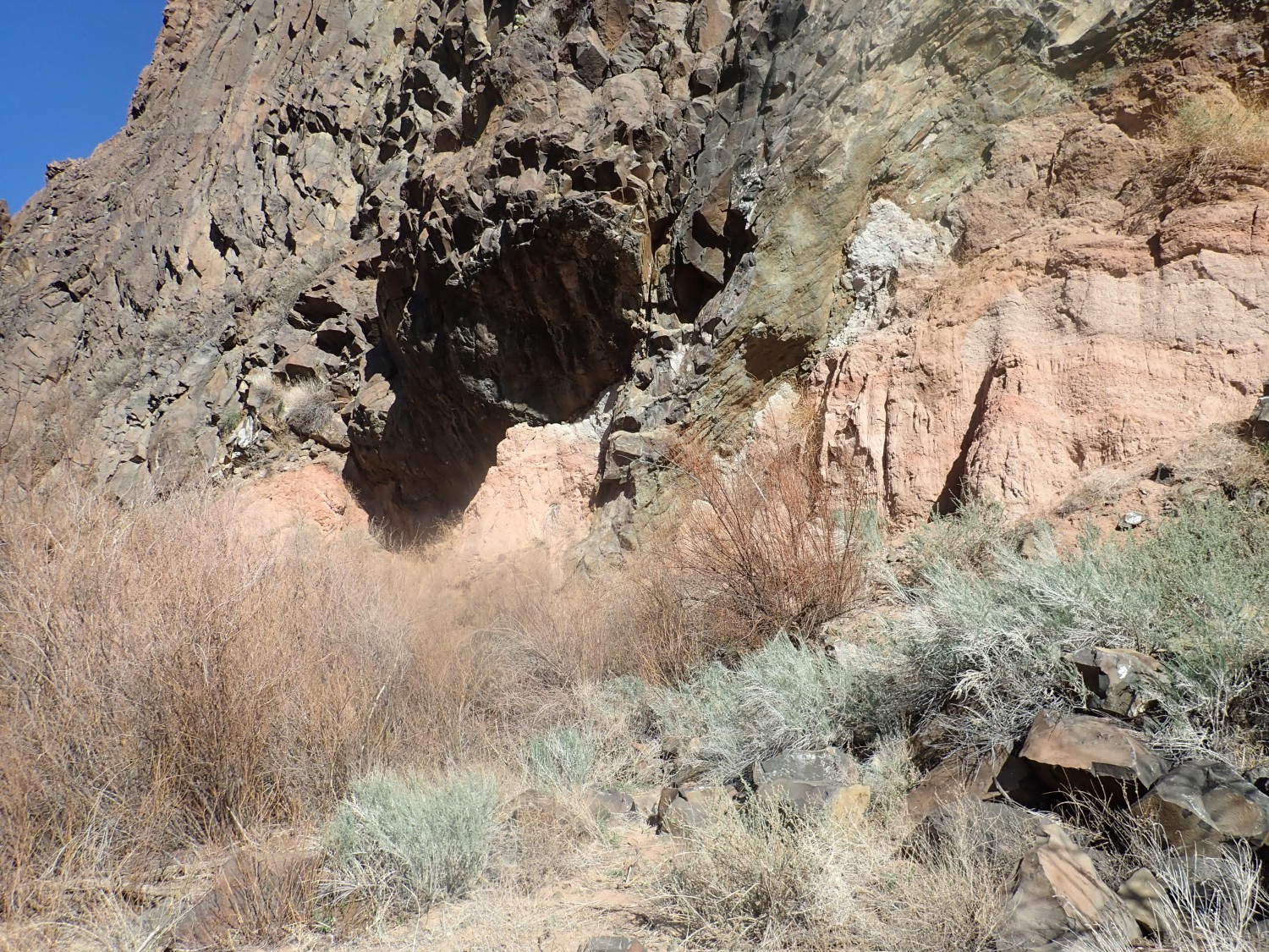
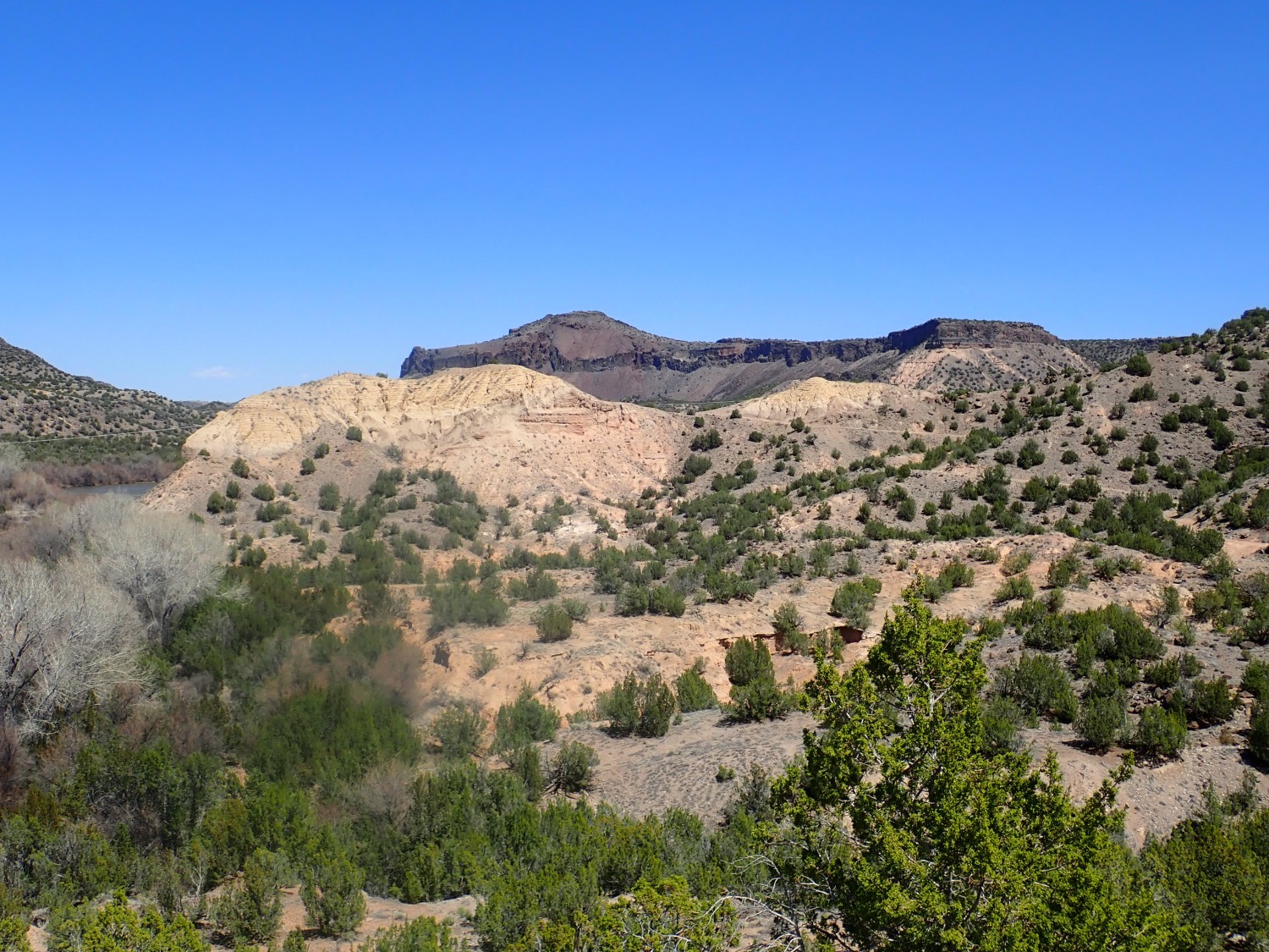
Contact between the Tsherige Member and the Otowi Member of the Bandelier Tuff, just south of Alcove House.
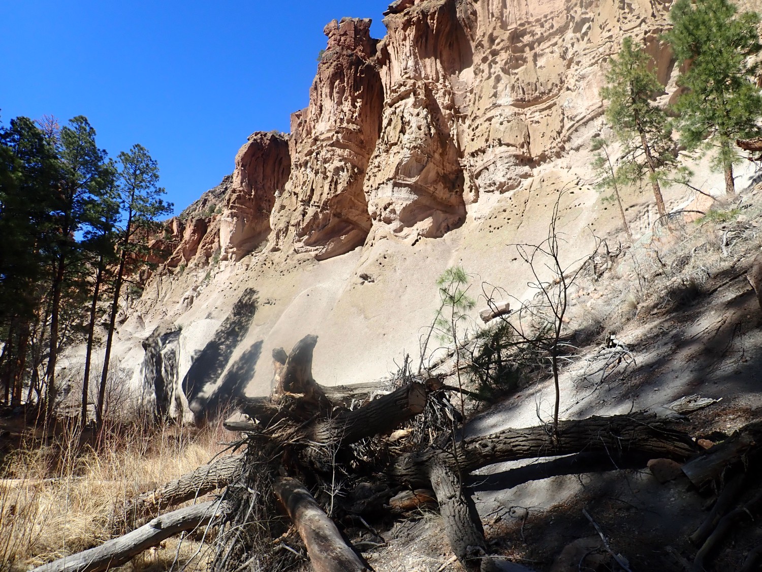
Yeah, you can still see the camera flare. The lens cover plate has just got to be replaced, but I’m not sure I want to fork out the money. Unnecessary; the new Coolpix seems to be working fine and it take magnificent pictures.
For newcomers to this blog (Welcome!): The Bandelier Tuff is pyroclastic flows from the Jemez Mountains erupted in giant caldera eruptions. The Otowi Member was erupted first, at 1.62 million years ago, in the Toledo event. The Tsherige Member was erupted at 1.25 million years ago in the Valles event. In both eruptions, great volumes of gas-rich high-silica rhyolite magma came boiling out of a huge underground magma chamber. The extremely viscous magma disintegrated into countless tiny shards of volcanic glass, which were kept airborne by the red-hot volcanic gas released from the magma. This red-hot mixture flowed like a heavy liquid, covering the ground for miles in all direction and destroying everything in its path. The glass shards (volcanic ash) then settled to the surface, compacting to form a solid rock called tuff.
The magma chamber from which each eruption came collapsed to form a caldera. The Valles Caldera is still obvious on the map. It’s a good 13 miles across. Yeah, the eruption was ginormous. Others in the geologic record were much larger.
In the photo, the featureless lower part of the cliff is the Otowi Member, which seems to have been erupted as a single steady belch. The overlying Tsherige Member was erupted in multiple pulses.
Incidentally, most blue links here take you to Google Maps for the location where I was standing for the photograph, and most images can be clicked for a higher-resolution version.
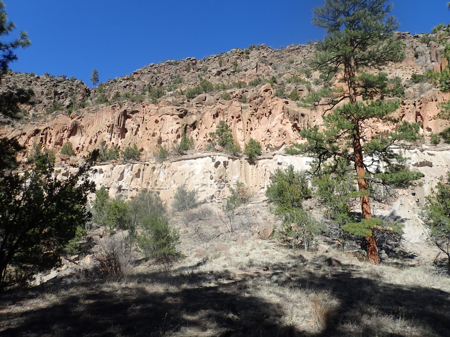
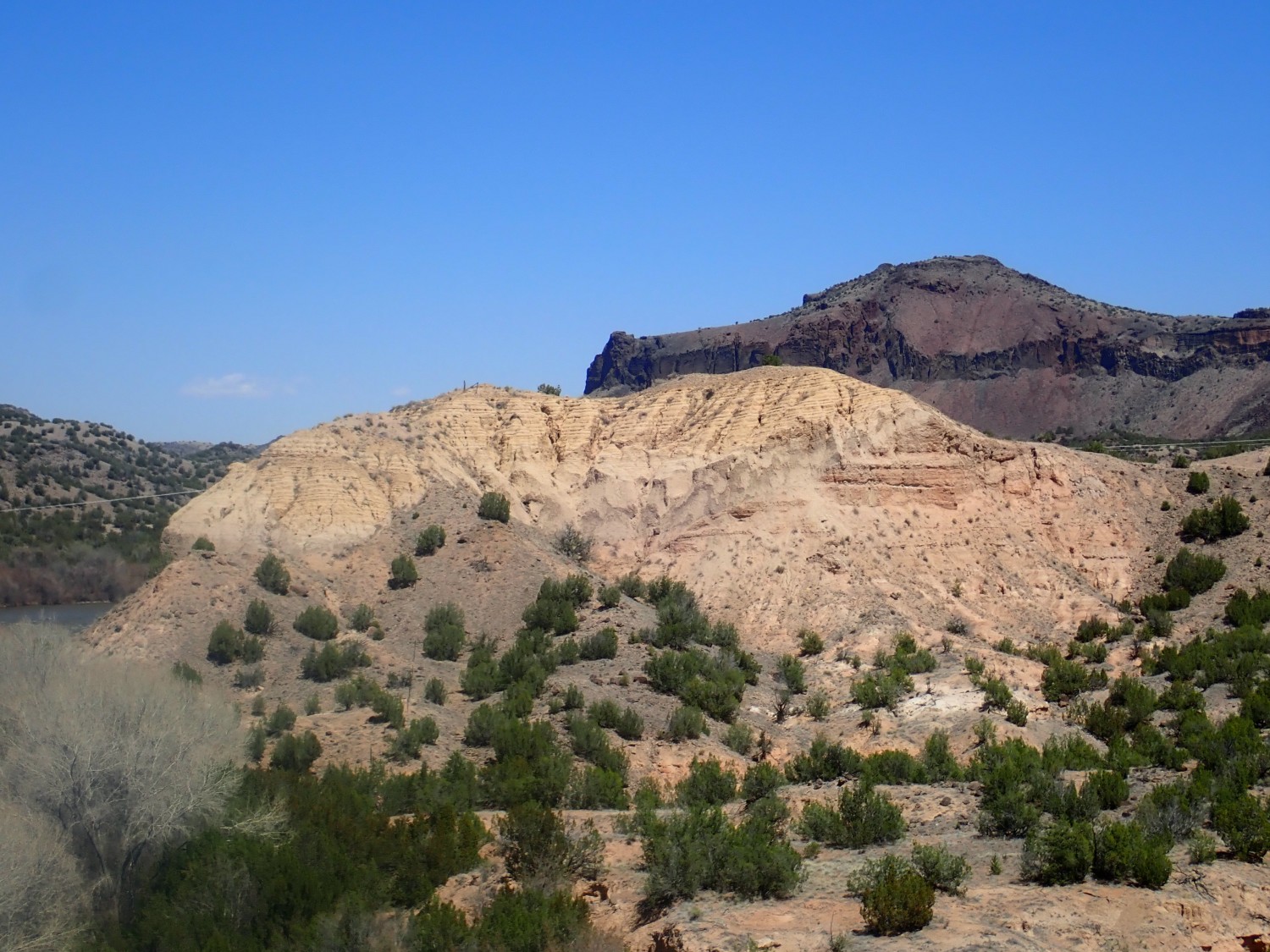
Another view, showing the contact very clearly.
Most tourists don’t go beyond Alcove House (which is a fair hike and well worth visiting). I find myself almost alone on the trail as I approach the narrows.
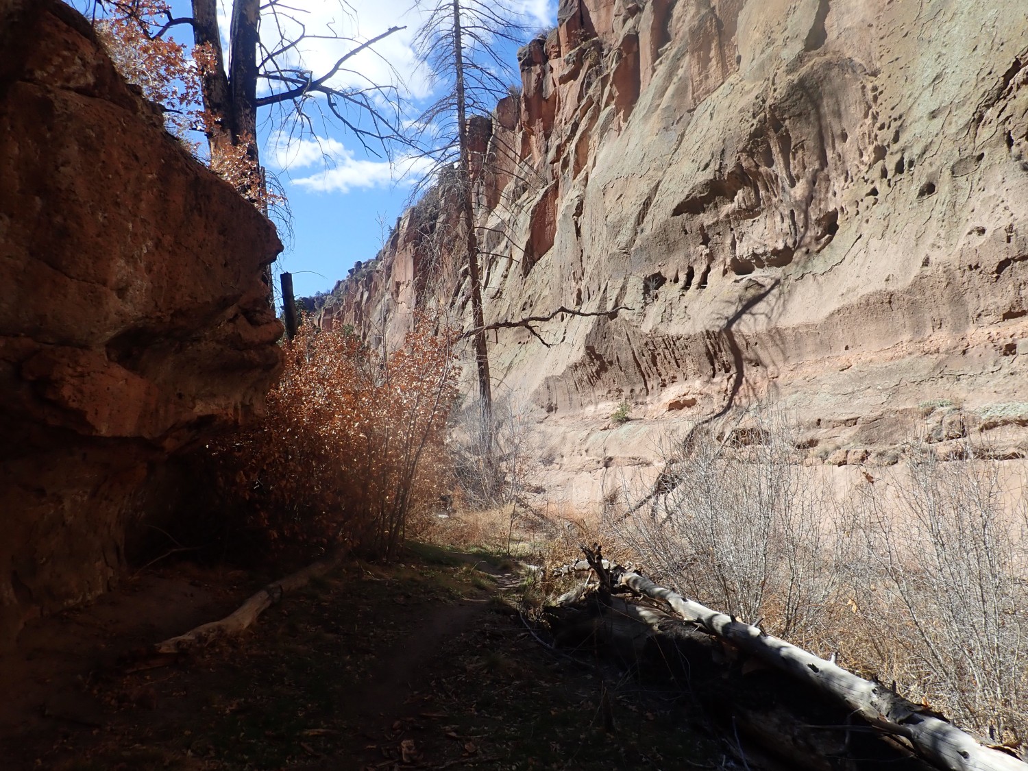
Here the Frijoles River, the only reliably perrennial river draining the Pajarito Plateau, has cut a narrow slot canyon.
The camera’s really struggling, alas.
Here I decide I’ve hiked far enough, and turn back. Conclusion: New hiking boots working well. Camera really has a problem.
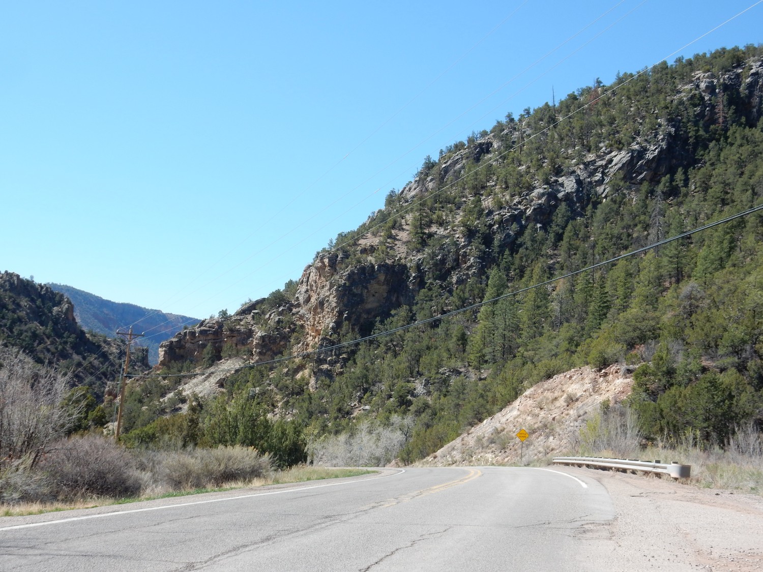
Two weeks ago, I finally held the 30th Annual Kent Is No Longer 29 hike. Accompanying me were friends Steve Harris and Jeremy Conlin. We would be hiking in the Buckman area.
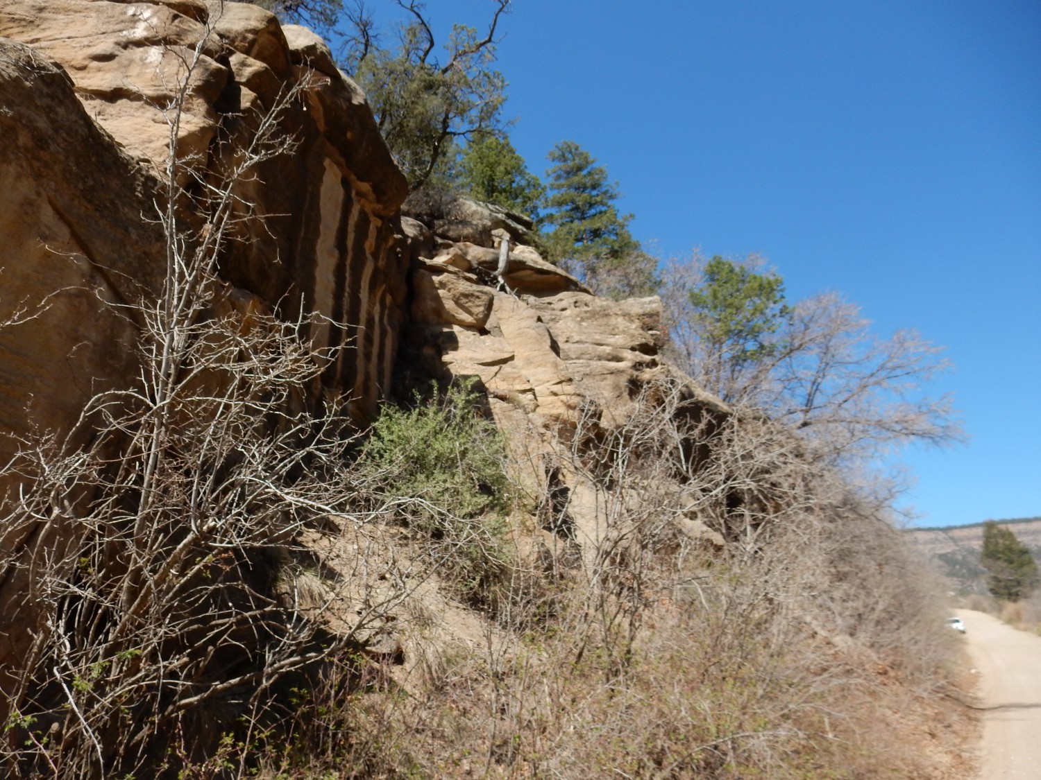
Our first stop, which turned out to be an excellent adventure on its own, was in Diablo Canyon, a.k.a. Rattlesnake Canyon. My first photo was of the Ancha Formation beds just under the Cerros del Rio andesite:
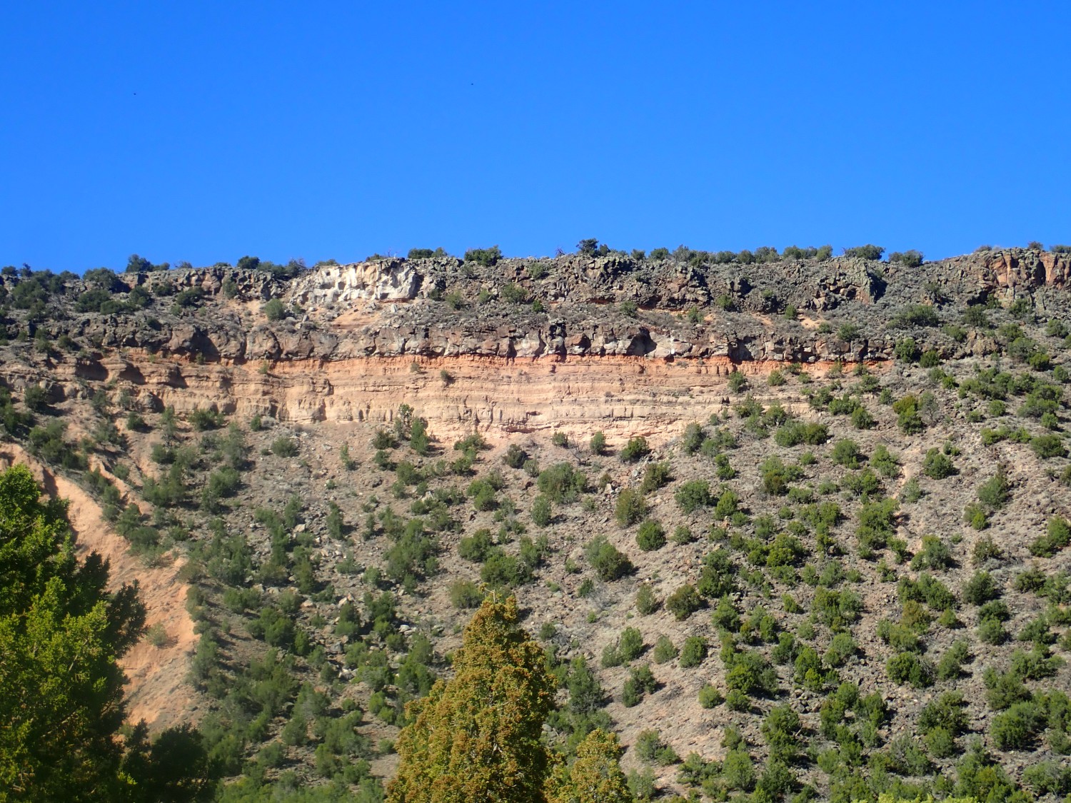
The camera does okay if the sun is directly behind it. This tends to confirm my diagnosis of damaged lens cover reflective coating. Regardless: The black rocks at top are Cerros del Rio andesite. This is volcanic rock with a moderate silica content, erupted around 2.5 million years ago from the area of Ortiz Mountain. The andesite covers a considerable patch of ground at the north end of the Cerros del Rio Plateau. “Cerros del Rio”: “RIver Hills.” Also known as the Caja del Rio, “Box of the River”. In either case, the river in question is the Rio Grande, the great river of New Mexico.
The andesite was erupted over beds of the Ancha Formation, which therefore must be older than 2.5 million years here. In general, the Ancha Formation is dated as 1 to 3 million years. It’s granite-rich sediments eroded off the Sangre de Cristo Mountains to the east and deposited by the ancestral Santa Fe River throughout the southern Espanola Basin.
The vegetation-covered slopes are the next older formation, which is probably the Tesuque Formation in this area. This formation is 10 to 20 million years old, and is sediments that filled the Rio Grande Rift as it opened. The Rio Grande Rift is a great crack in the Earth’s crust stretching from central Colorado to El Paso and beyond. It more or less coincides with the valley of the Rio Grande in our area. The rift has various interpretations; the most common is that it is where the Colorado Plateau is pulling away from the interior of North America, which is almost certainly part of what’s going on. There’s some evidence the rift lies over a long ribbon of upwelling hot mantle rock that has softened the crust here, making it easier to stretch.
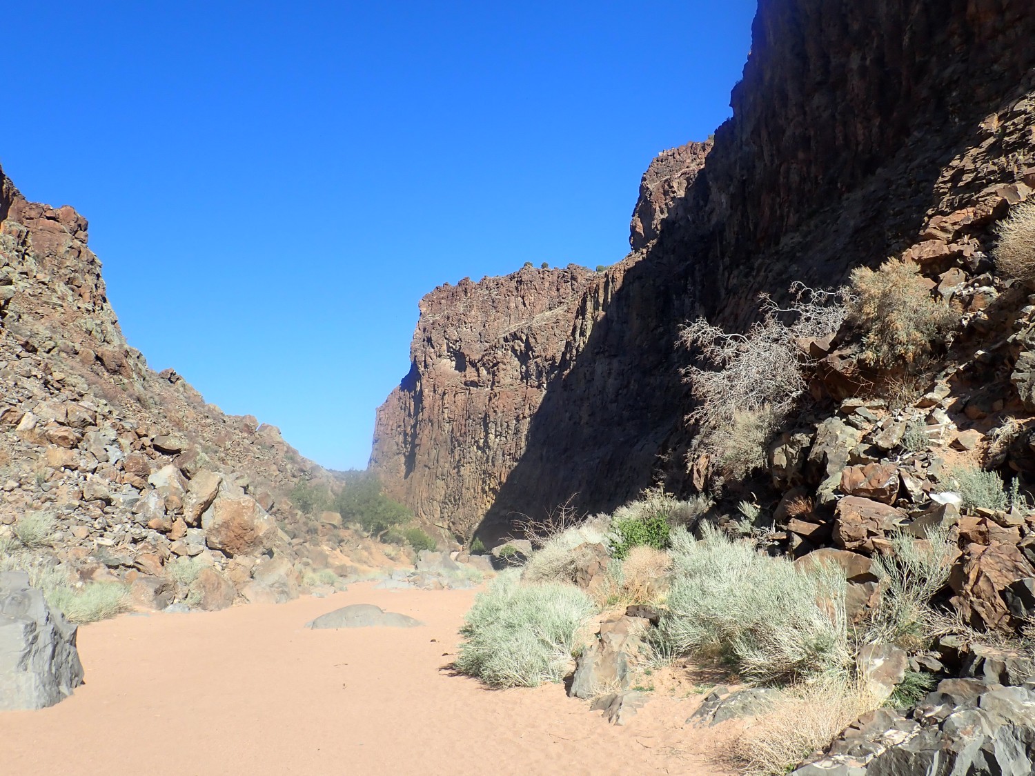
And here’s Diablo Canyon.

The rock here is basalt, and it is unusually thick compared with most of the Cerros del Rio. Geologists speculate that this was a lava lake. Steve and Jeremy and I head into the canyon for a closer look.
Eh, lens flare.
There are some impressive granite boulders in the canyon. They’re rounded enough to indicate they’ve been rolled by flash floods. Mother of All Flash Floods, judging from the boulder size.

This catches my attention.
This looks like a source dike that fed the overlying lava lake. We go up for a closer view, and Steve kindly takes a photo of me by the dike.
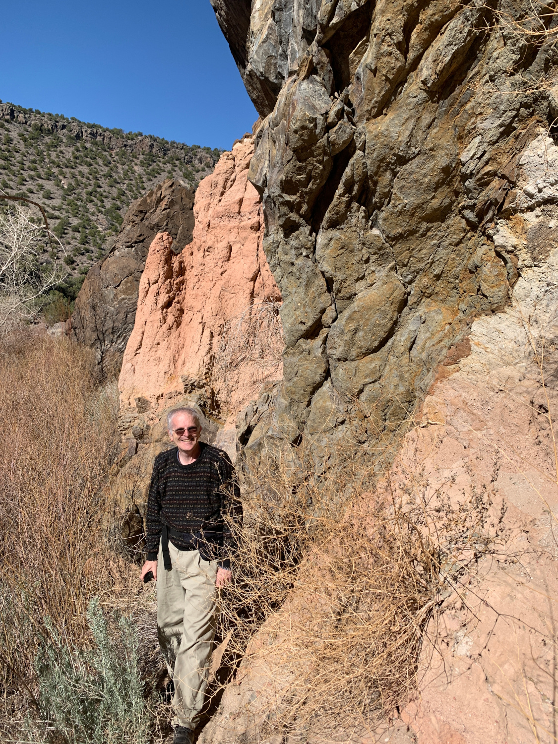
The dike rock is full of little bits of sediments from the surrounding country rock (the preexisting rock through which it erupted.) But I’m not 100% sure it’s a feeder dike; enough is covered by dirt that it can’t be fully characterized. This might just be where a big block of sediments to the west was partially rafted upwards by the heavy basalt magma of the lava lake.
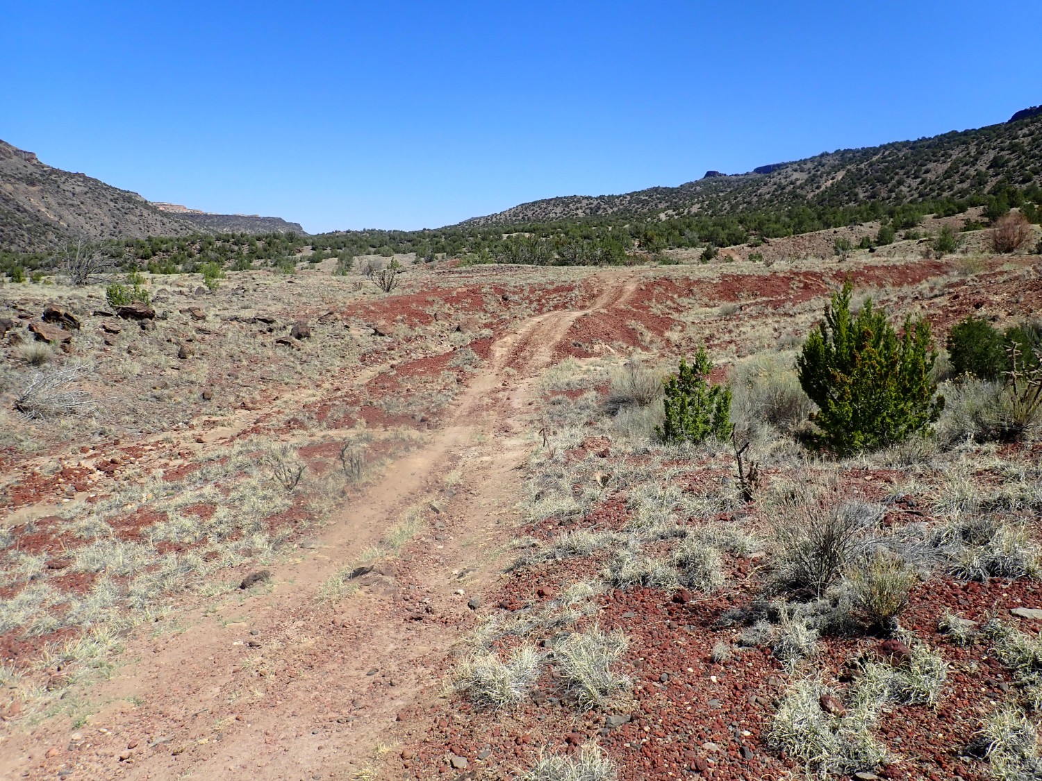
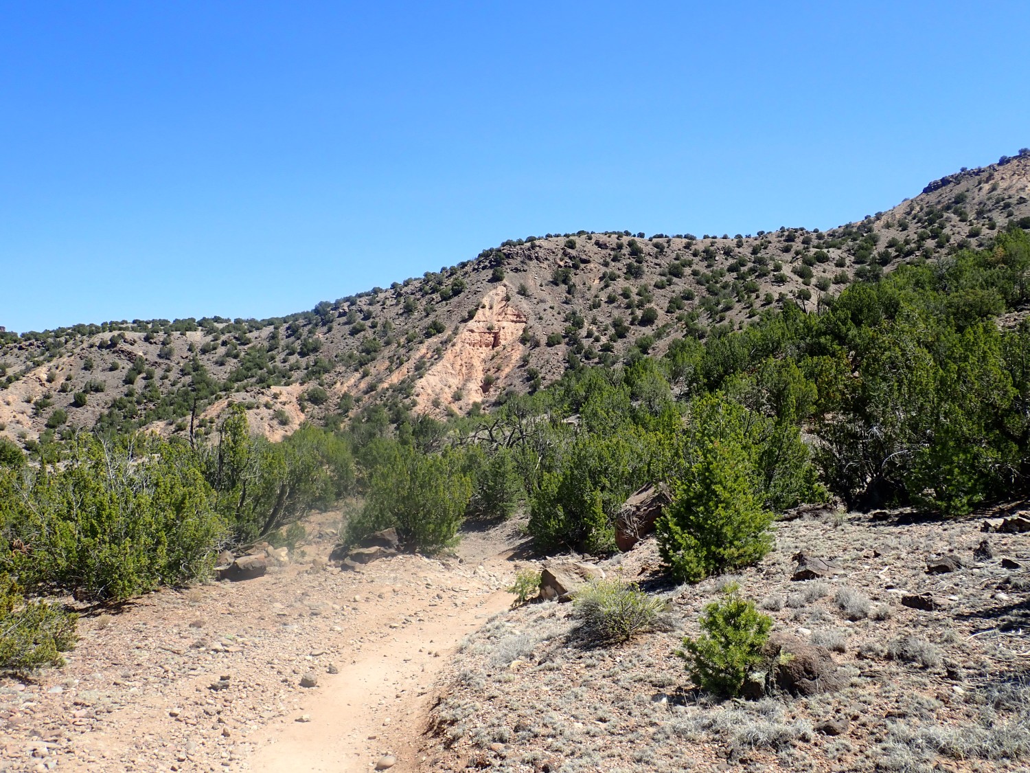
We turn back, head to Buckman, and begin our hike proper, which is south into White Rock Canyon to Soda Springs. I confess I had so much fun talking with Jeremy and Steve that I took no photographs until the return leg. But this included a cinder field:

It turns out this is directly below a cinder cone half-buried in lava flows in the canyon wall.
The cinders are occasionally impressively coarse. Steve grabs one and later gives it to me; it’s a proud addition to my collection of yard rocks.
Colorful Santa Fe Group beds, here:
Colorful young alluvium, here:
So my geologic map says. The young alluvium is very similar to the older Santa Fe Group beds. Both are sediments deposited by flowing water in the distant past; rather more distant in the case of the Santa Fe Group, which includes both the Ancha Formation and Tesuque Formation I mentioned earlier. My older map carefully distinguishes different formations and facies of the Santa Fe Group, but the newer map seems to have decided the distinctions are too uncertain, showing the Ancha Formation but listing all else as simply upper Santa Fe Group.
The map notes that the second set of sedimentary beds is rythmically bedded, but offers no explanation. Closer view:
All in all, a wonderful hike.
This weekend, I was expecting to hike alone: One friend in D.C., another busy with teenage kids, another welcoming home a daughter from a year and a half in Germany, etc. I was going to fossil hunt in Osha Canyon, a new area for me. By astounding coincidence, the fossil beds there are assigned to the Osha Canyon Formation.
On the way out, I try the new camera on what looks like a fault trace very close to Soda Springs.
The new camera seems to work just fine. I was almost afraid to try it out; I’ve now broken two expensive cameras. This one is going to get babied.
The fault trace is just left of center. It brings up Precambrian rock and provides a flow path for the mineral-rich water of Soda Dam.
Further on, I try the deep zoom on Virgin Mesa.

Position is approximate; I didnt’ figure it out until later, but I hadn’t switched the GPS on. Also hadn’t set the calendar properly. Still, the new camera is so much better I could cry. (And I will cry if I end up breaking yet another camera.)
The dark beds at the top of the brush-covered slope, and under the massive beds of the Otowi Member, are old gravel beds apparently full of bits of volcanic rock from the early stages of the Jemez volcanic field.
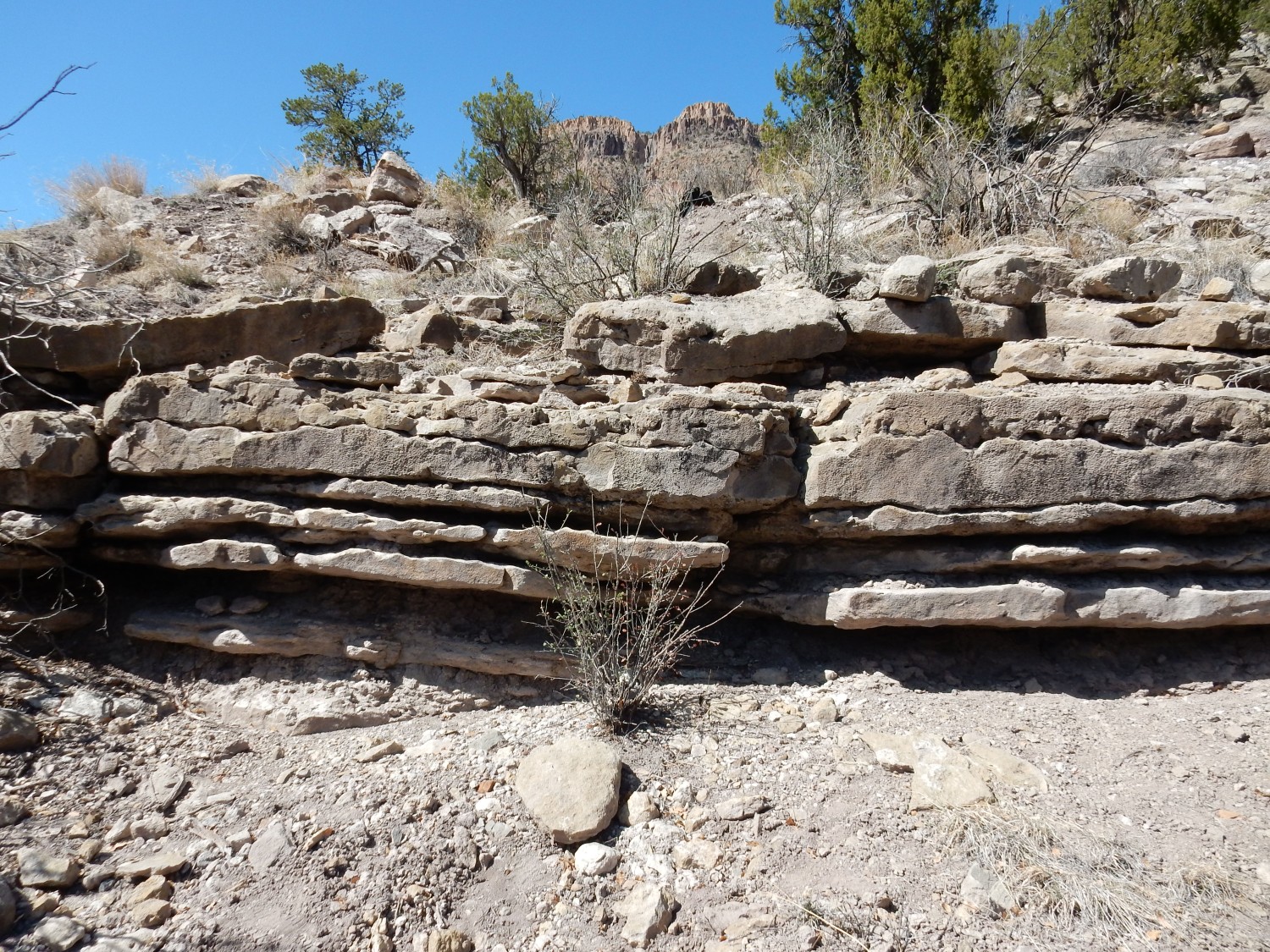
I decide that, before I begin the long hike into Osha Canyon, I’ll just check how high the Rio Guadelupe is. Also, I will take a look at some Osha Canyon Formation beds featured in a recent presentation to the New Mexico Geological Society that are right on the highway. As I look for a parking spot, I notice a woman already checking out the beds. Hmm. I park and start back. At first it’s all massive sandstone of the Sandia Formation.
The Sandia Formation is Pennsylanian in age, around 320 million years old. It’s the oldest Pennsylvanian formation in most of northern New Mexico, but in this immediate area, it rests on the slightly older Osha Canyon Formation, which rests in turn on the Log Springs Formation, which rests on the Mississippian Arroyo Penasco Group. All but the Log Springs are fossiliferous.
The woman seems to be looking for fossils, too. I introduce myself; her name is Deborah and she is a schoolteacher at a local Catholic school. She’s here wth a retired teacher from the same school, Patrick, and, yes, they are hunting fossils. And they know a whole lot more about Pennsylvanian brachiopods than I do. The two turn out to be my best find of the day, and make me feel welcome joining them.
Here’s the contact.
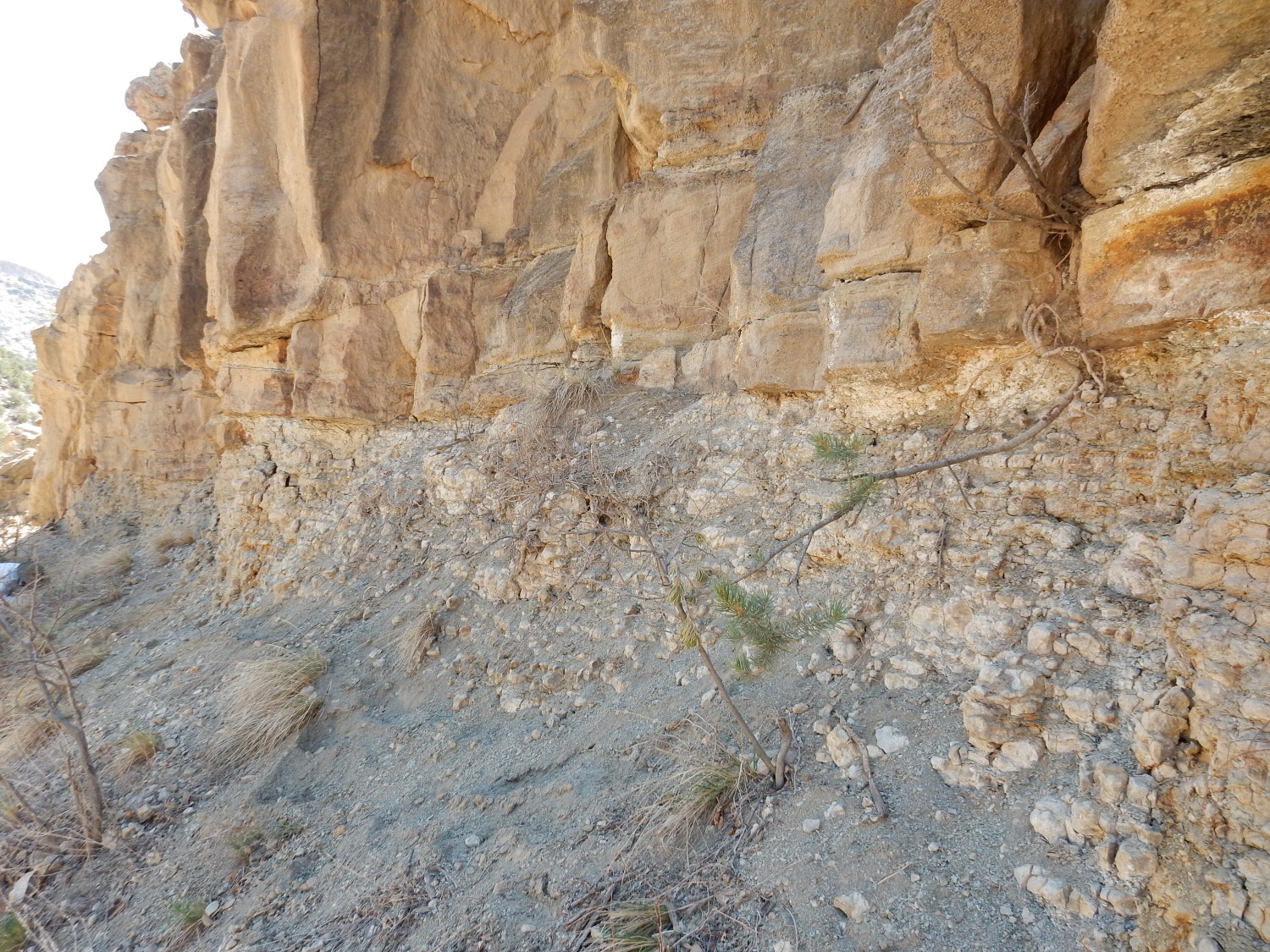
The massive sandstone at top is Sandia Formation. Everything below is Osha Canyon Formation, as redefined in the recent paper I had seen. Which, it turns out, was coauthored by these very two geologists, along with Spencer Lucas of the New Mexico Museum of Natural History and Science, who is well known (even to amateurs like me) in the New Mexico geological community.
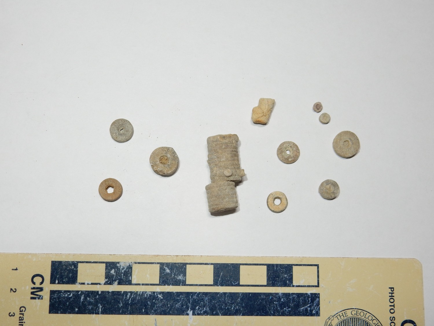
We spend a fair amount of time at these beds, and Deborah and Patrick are generous in sharing finds. Some treasures:
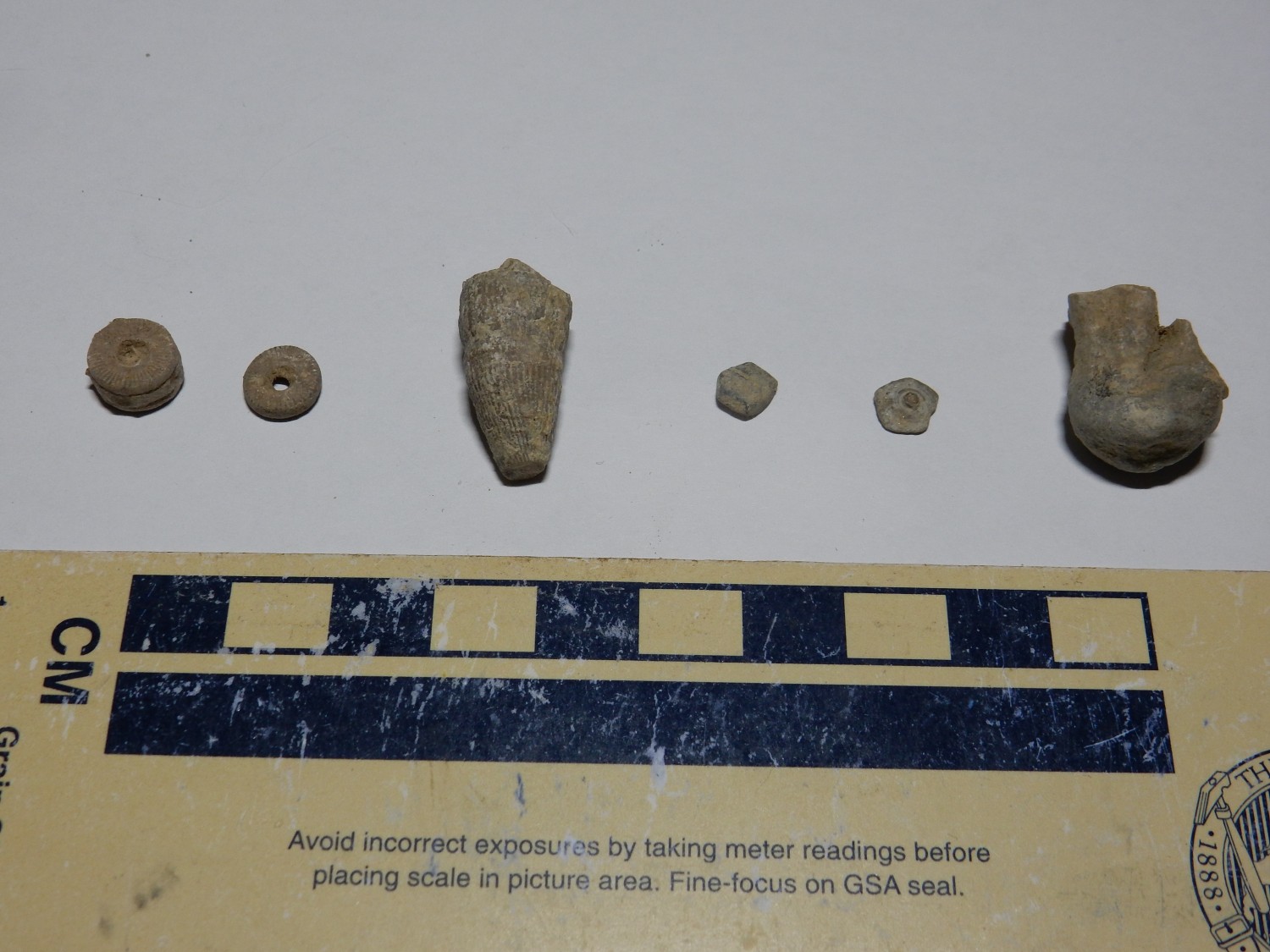
At left are a couple of crinoid segments. Crinoids are distant relatives of starfish (echinoderms) and even more distant relative of ourselves — our closest non-chordate kin, likely. In form, they had a long stem that held fast to the ocean floor, ending in a theca (a central body) with a central mouth and feeding fronds around it. The stem segments are highly calcified and are typically well-preserved in fossil beds; the theca and feeding fronds were more delicate and are rarer finds.
The horn-shaped fossil third from left is a rugose coral (horn coral), which were mostly solitary corals. Unlike the crinoids, which are still with us, the rugose corals were wiped out by the end-Permian extinction, along with about 90% of all other marine families.
The five-sided tiles to the right are (at left) a bit of a crinoid calyx, which was the lower part of the theca and was reinforced by these bony plates. The other is a similar bit of the body shell of a sea urchin, another starfish relative.
At right is what may be a worm burrow trace fossil; that is, the worm’s tunnel, filled in with sediments and preserved.
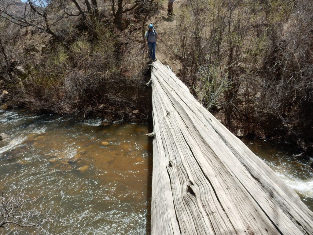
Deborah and Patrick are headed to the other side of the river. I politely ask if they would mind be tagging along, and they are welcoming. The river is full of spring runoff, so our only route across is a big, half-rotten log.
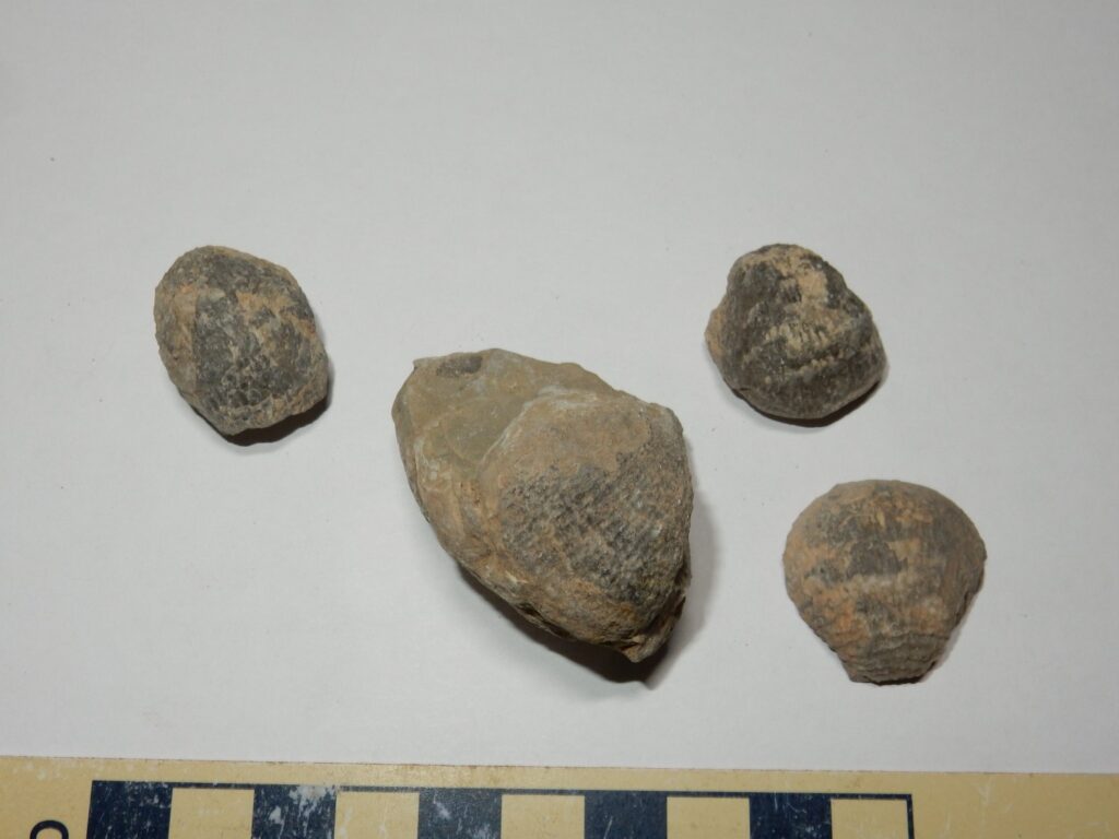
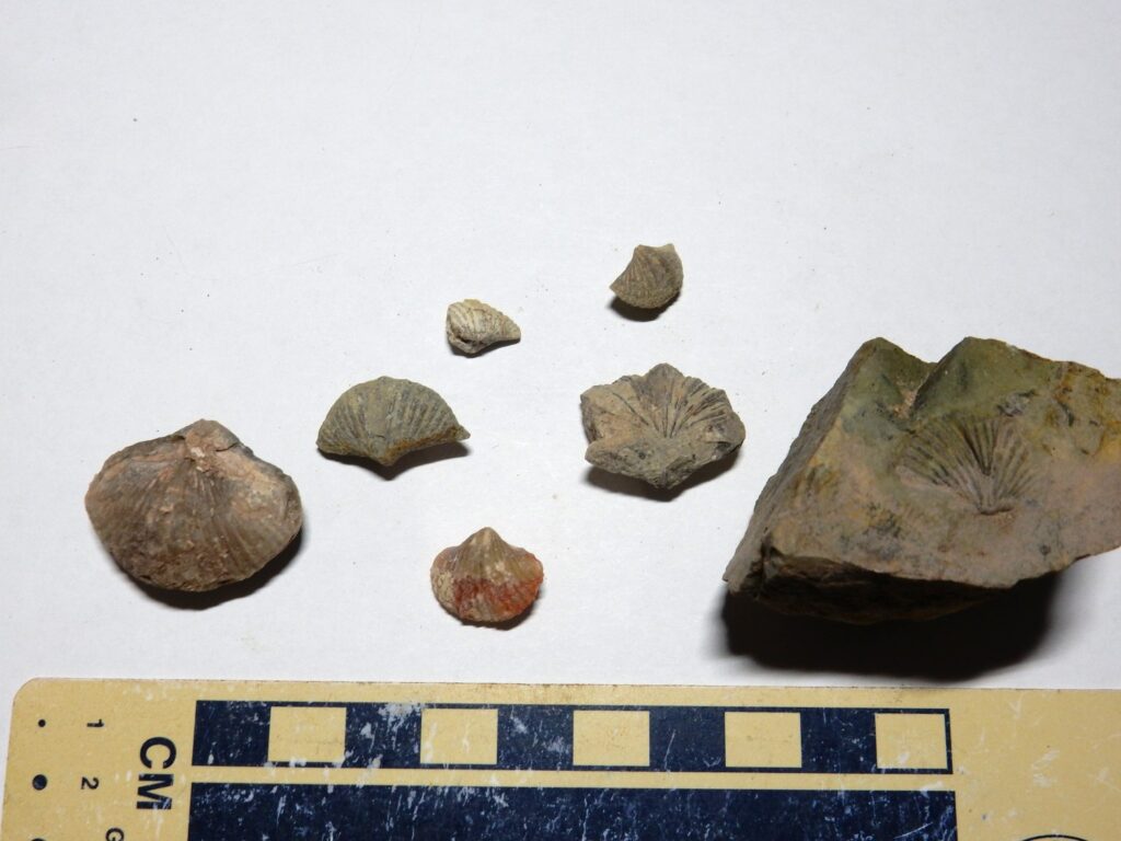
Beyond is a fire road, and along the road are more fossils. This was impressive:
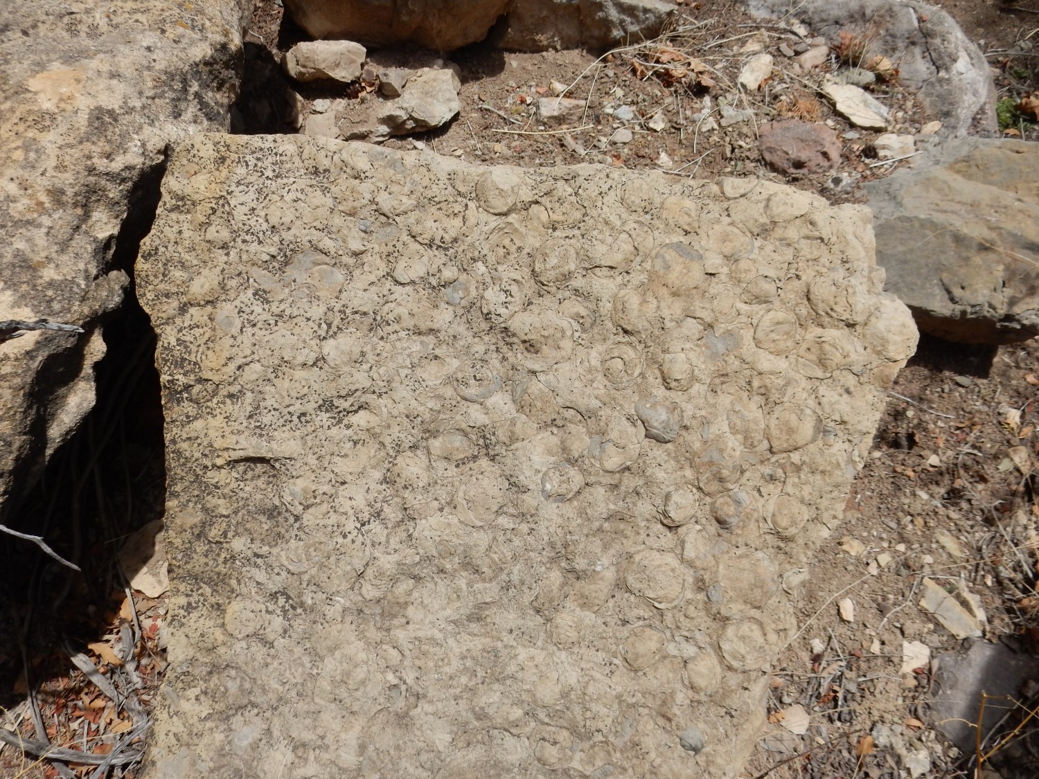
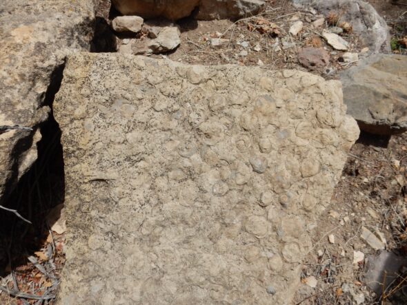
Every concretion here is actually a fossilized brachiopod. Brachiopops resemble clams, but are only distant relatives of mollusks. Whereas a clam wears a shell on each side of its body, brachiopods wear shells top and bottom. The shells in brachiopods are typically much less symmetric, and the brachiopod has a characteristic feeding organ called a lophophore. Brachiopods are still with us, but only in small numbers compared with their distant mollusc cousins.
My knowledge of paleontology is still a little weak. Patrick tells me that the brachiopods of the Osha Canyon Formation are divided into productid and spirifer brachiopods. Later we find a bunch of composita brachiopods; I’m unclear whether these are a third group or a subgroup of one of the other two. I’ll get it sorted out and report back.
Fusilinids:
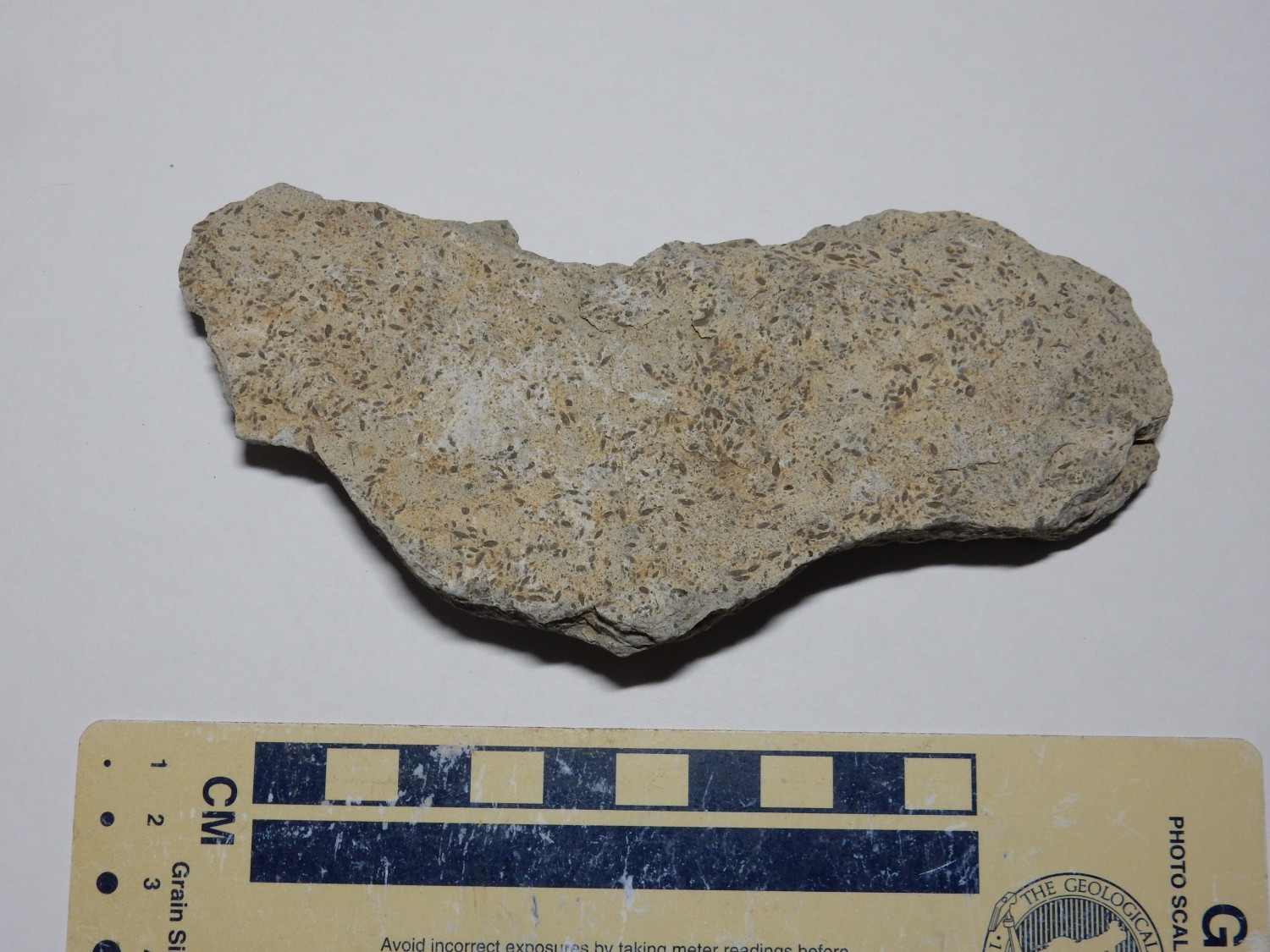
These are enormous considering they’re single-celled organisms. They thrived in the very high oxygen levels of the Carboniferous. They evolved rapidly, making them excellent index fossils, allowing geologists to rapidly identify the age of a fossil bed. However, I gather even Patrick can’t identify species except in thin section.
Patrick told me the name but I’ve already forgotten.
But I gather these are a particular variety of productid brachiopods.
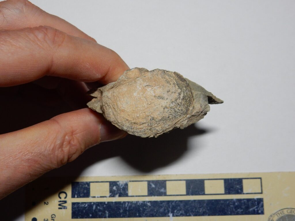
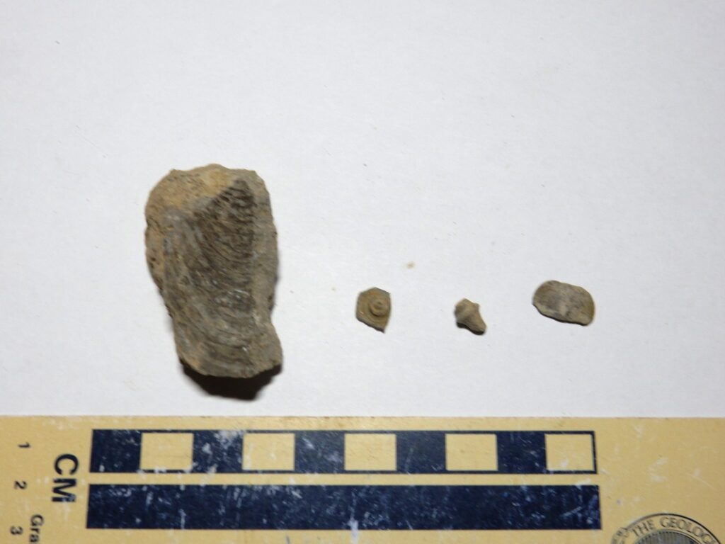
Patrick got a little excited about this rather large partial fossil.
I didn’t quite catch what it was. Inoceramus was what I heard, but that’s a much younger, Cretaceous, variety.
The best spot, at a curve in the fire road, is what Patrick calls The Nursery. Here there are enormous numbers of very small shells — you wouldn’t know they were there if you didn’t know to look. I kind of burn my eyes out hunting for tiny shells. Next time I ‘ll take a pair of reading glasses.

These are apparently Composita brachiopods.
Plenty of crinoid bits.
The ones at center are entire sections of stems, showing how the individual segments stacked. Apparently this area was disturbed enough by wave motion, 320 million years ago, to disarticulate most of hte fossils — to break them up into individual segments.
Also plenty of spirifers.
The reddish patches are silicified portions of the fossils. Patrick is very interested in the silicification process, which he believes took place only at a specific stage of the glacial cycle. Turns out the Carboniferous was an ice age — the coal swamps were all right on the equator, and glaciers were periodically advancing and retreating elsewhere.
Miscellanea.
The one at left is apparently an actual mollusc — part of a clam shell. Whereas molluscs are common and brachiopods scarce today, it was the other way round in the Carboniferous. At center is another sea urchin plate; then a very small rugose coral; then (I think) a somewhat different species of small spirifer.
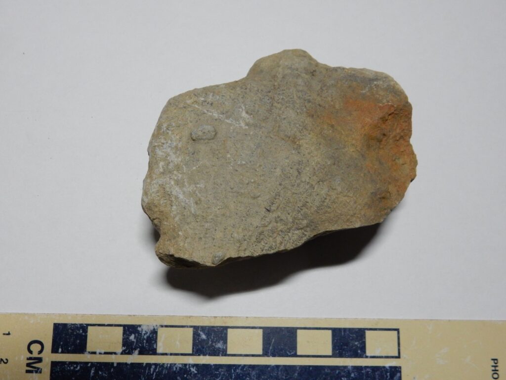
We descend from the road to the lower Osha Canyon Formation, just above a very thin bed of Log Springs Formation sitting atop Arroyo Penasco Formation. I go down to say hello to the Arroyo Penasco, and spot some beds in the lower Osha Canyon Formation that are just too pretty not to photograph.
And then we part ways and head home, after agreeing we should get together again for more fossil hunts. I hope to bring Gary along; I think he’ll have the time of his life asking Patrick questions.