Fanglomerates, faults, and ‘phytes
We’ve had a good monsoon season. It hasn’t quite eliminated drought conditions in the state — we had a lackluster monsoon last summer, followed by a dreadful winter and spring — but even the pessimists in the local press admit that we’re in much better shape.
The down side is that, even though the New Mexican version of the monsoon is occasional cloudbursts rather than inches of soaking rain, monsoon conditions are not conducive to safe hiking. All but the best gravel roads are iffy if there’s been recent rain, and getting caught on high terrain by a thunderstorm is decidedly unhealthy. I find myself looking forward to the fall dry spell we get most years, where the roads and trails dry out and the weather gets just crisp enough to be wonderful to hike in. I’m particularly looking forward to the New Mexico Geological Society field conference in September — assuming it actually comes off. I worry it may yet become a casualty of the resurgence of COVID.
About which I’m inclined to say nothing, because my shotgun anger about the situation is likely to hit almost every reader with a pellet or two. Best leave it alone.
But on my Friday off two weeks ago, the forecast was for a rare day of lasting sunshine — no forecast of thunderstorms in the area. I was not going to waste that, even though I had woken up with a mild sore throat. I looked over possibilities and settled on a hike north of Los Alamos into Guaje Canyon. There are a couple of ignimbrite beds in the Puye Formation I wanted a look at, and the trail would pass a paleochannel I’ve also wanted a look at for a while. Don’t worry; I’ll unpack all that in due course.
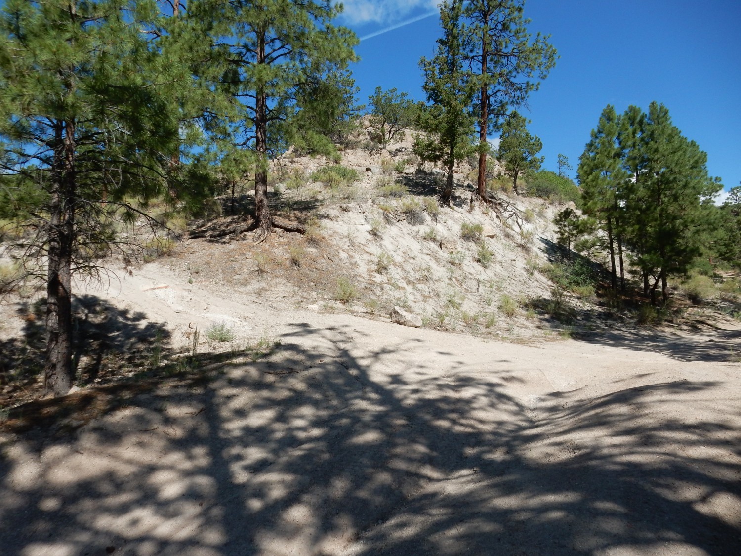
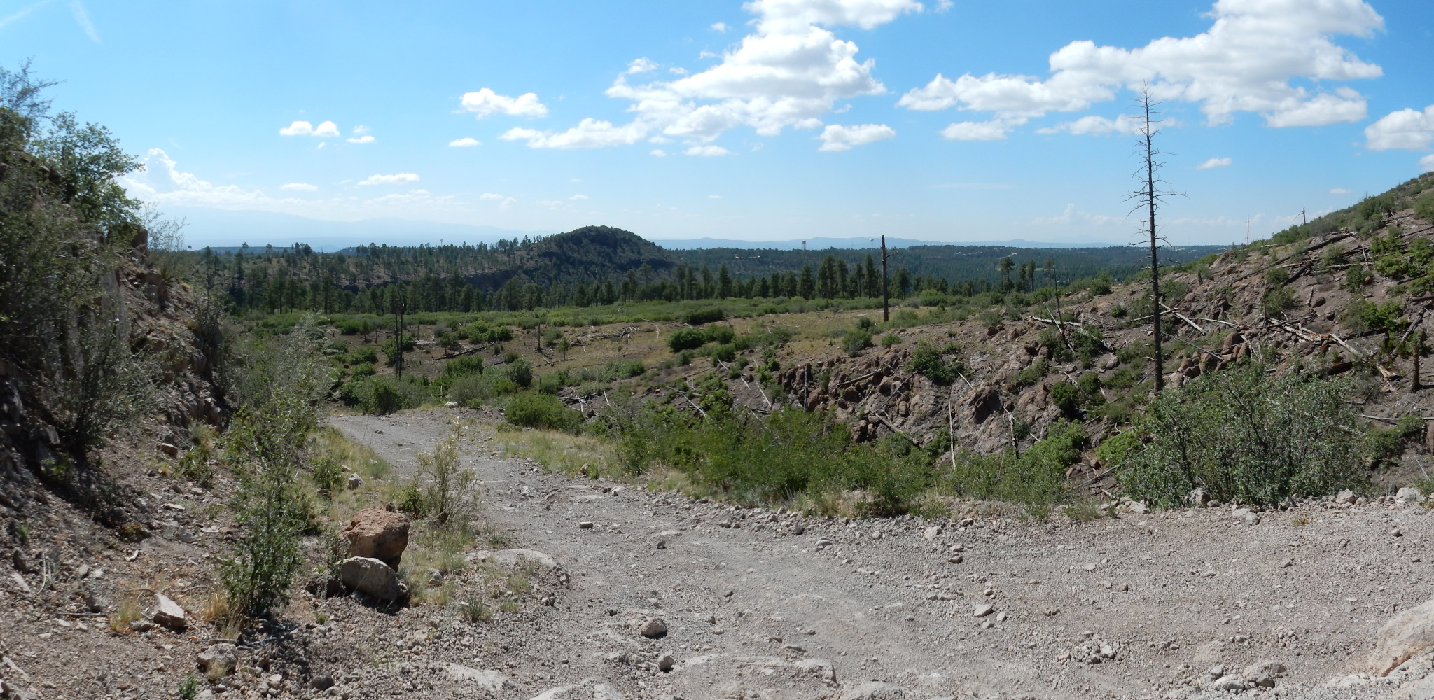
There isn’t really a well-defined trailhead for where I wanted to hike. The trail starts as a maintenance road to the north of Guaje Pines Cemetery, then turns north into national forest. Unfortunately, it then rapidly becomes a fairly rotten road. I got to this point and decided I should take the Wandermobile no further.
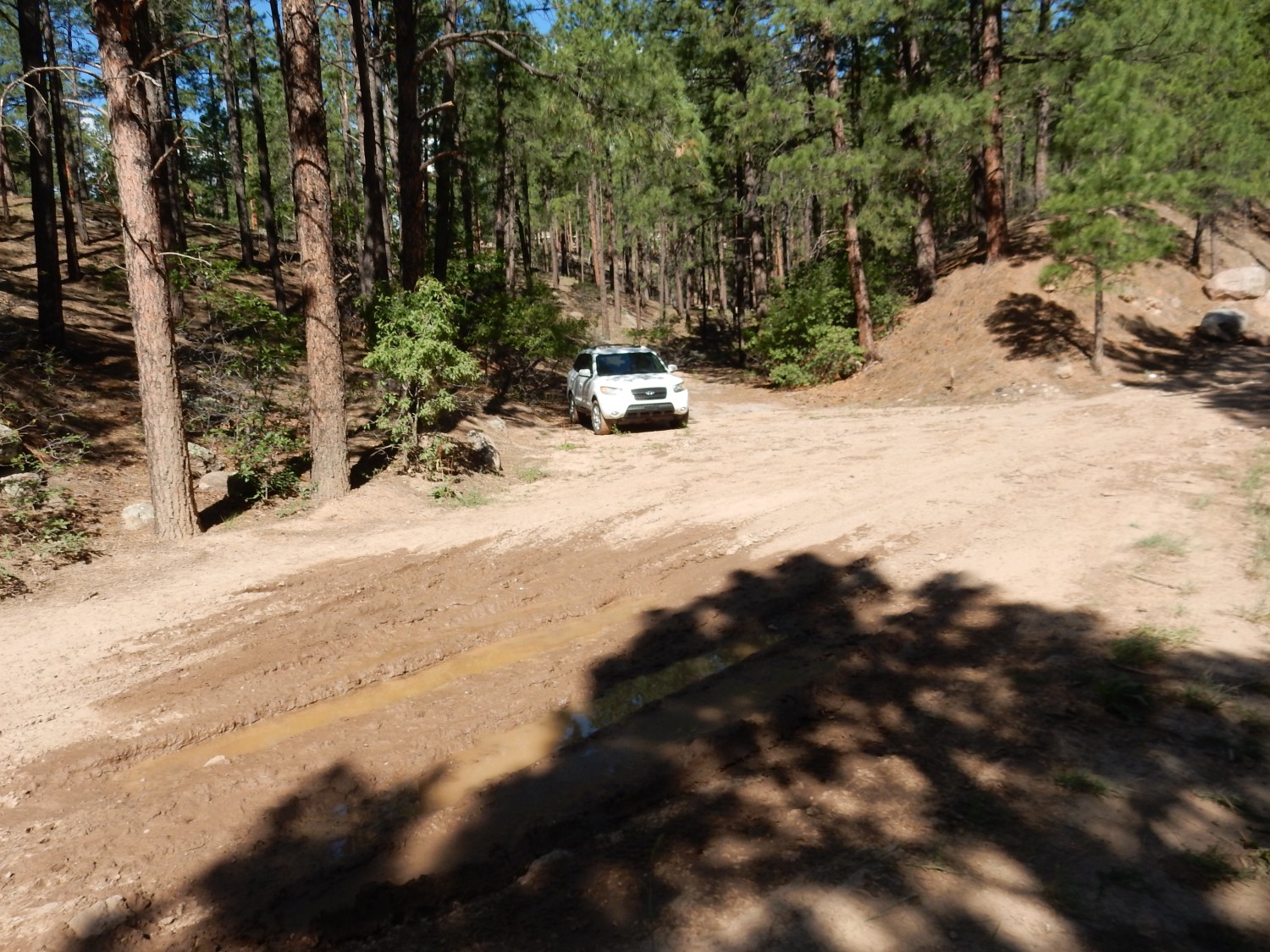
This was not entirely unanticipated; I’d scouted the road some weeks earlier and figured this would probably serve as my trailhead. But the puddle was not quite as bad then. Recent rain. I hoped I’d still be able to get the car out when I got back …
And I noticed houses just up the hill. I could probably have parked safely on asphalt here and added very little distance to my hike. Next time.
I pack up: Satellite beacon activated. Pack loaded with three pints of water, rehydrating tablets, lunch, and miscellaneous geological gear. Camera and spare batteries. Sunscreen and bug botherer. Big straw hat. Hiking boots. Hiking stick.
I’ve grown to love these boots. Not big on product endorsements, but I can recommend Hoka One One hiking boots if you run into them while shopping. They’re not cheap (neither are they the most expensive) but I’ve never had boots so comfortable. My impression is that they’re going to last a while, too.
I head up the road, which rapidly becomes a pure 4WD road.
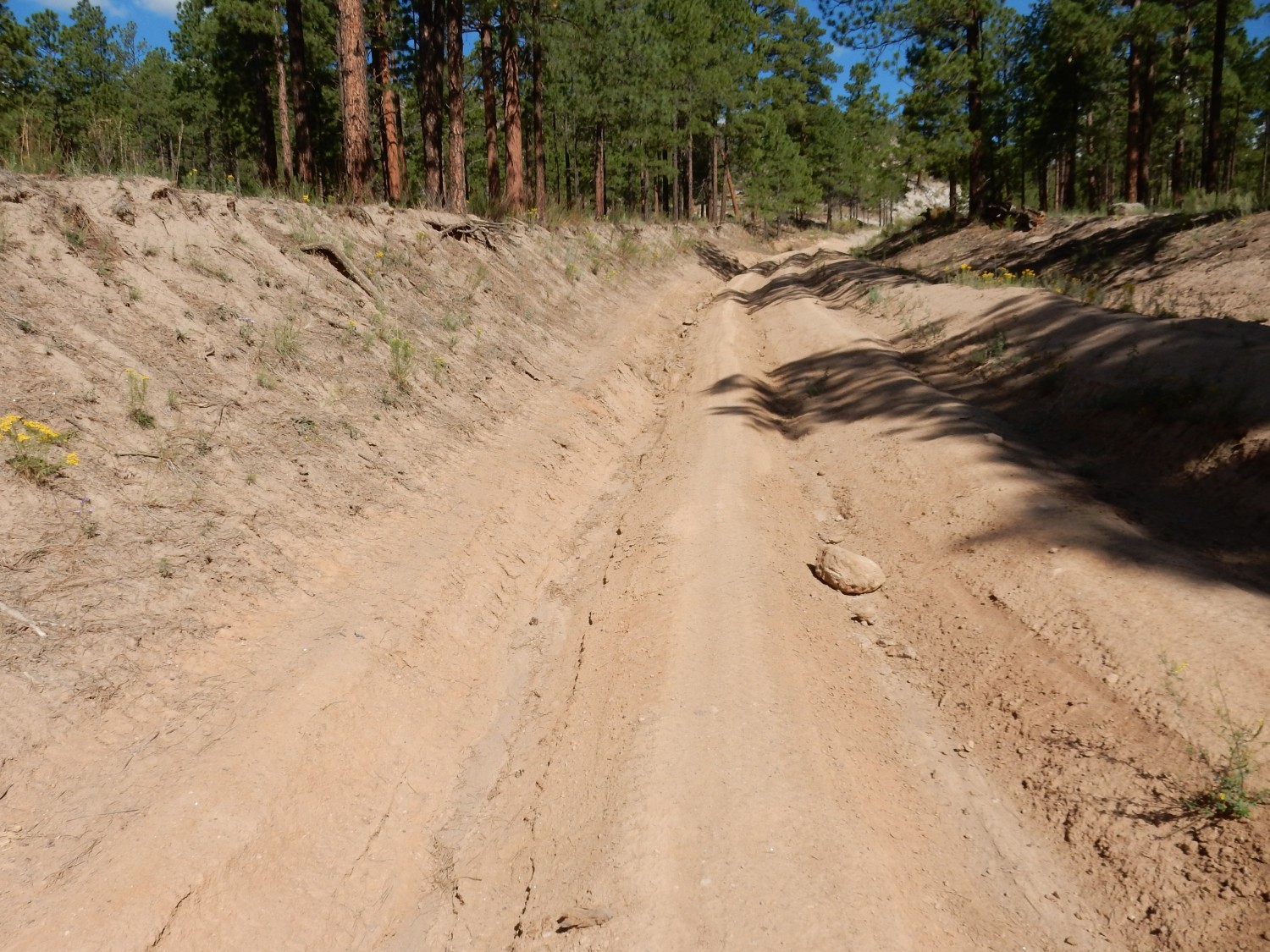
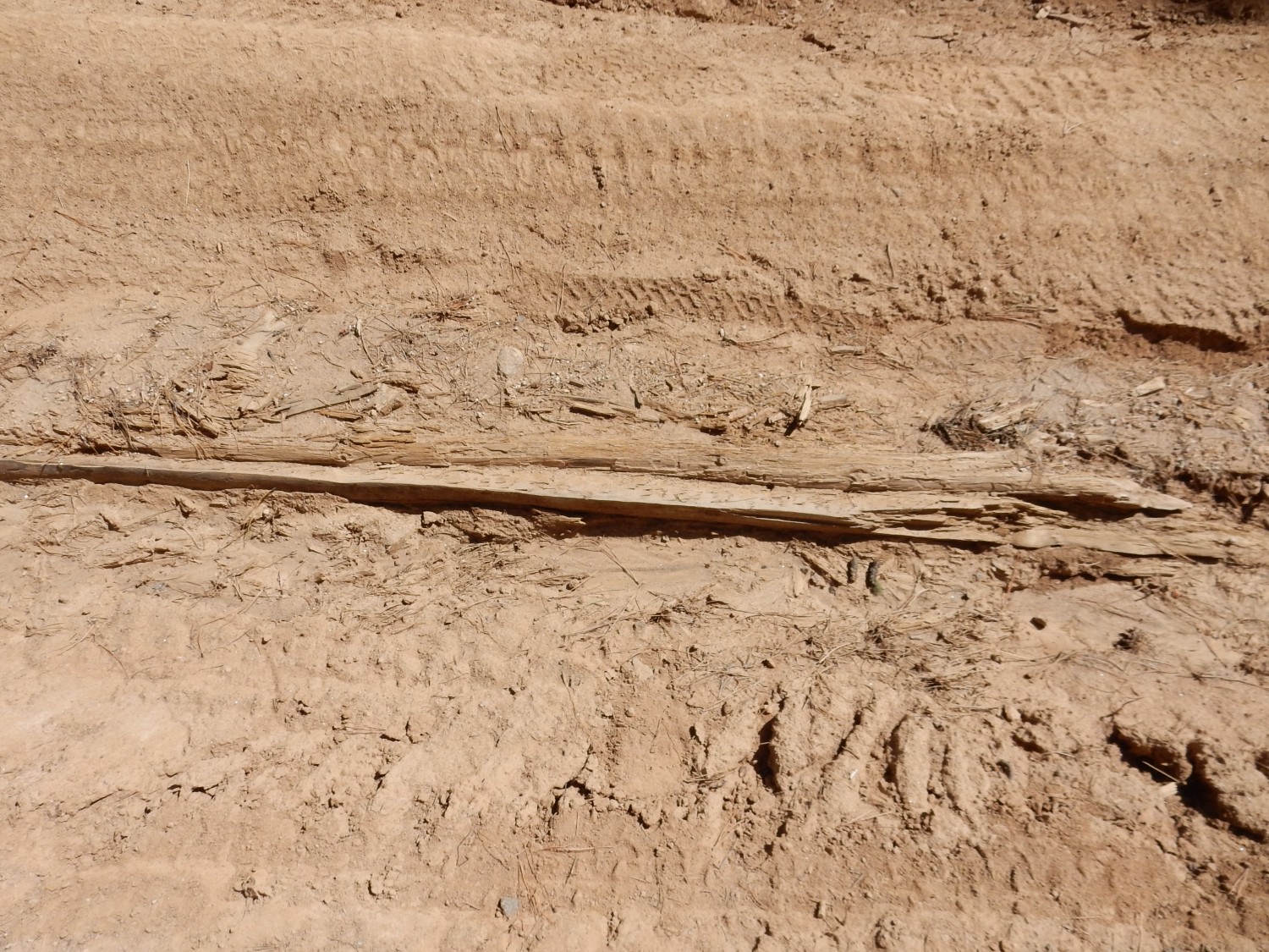
Not sure if this is deliberate erosion control or just fallen wood finding its way into the ruts.
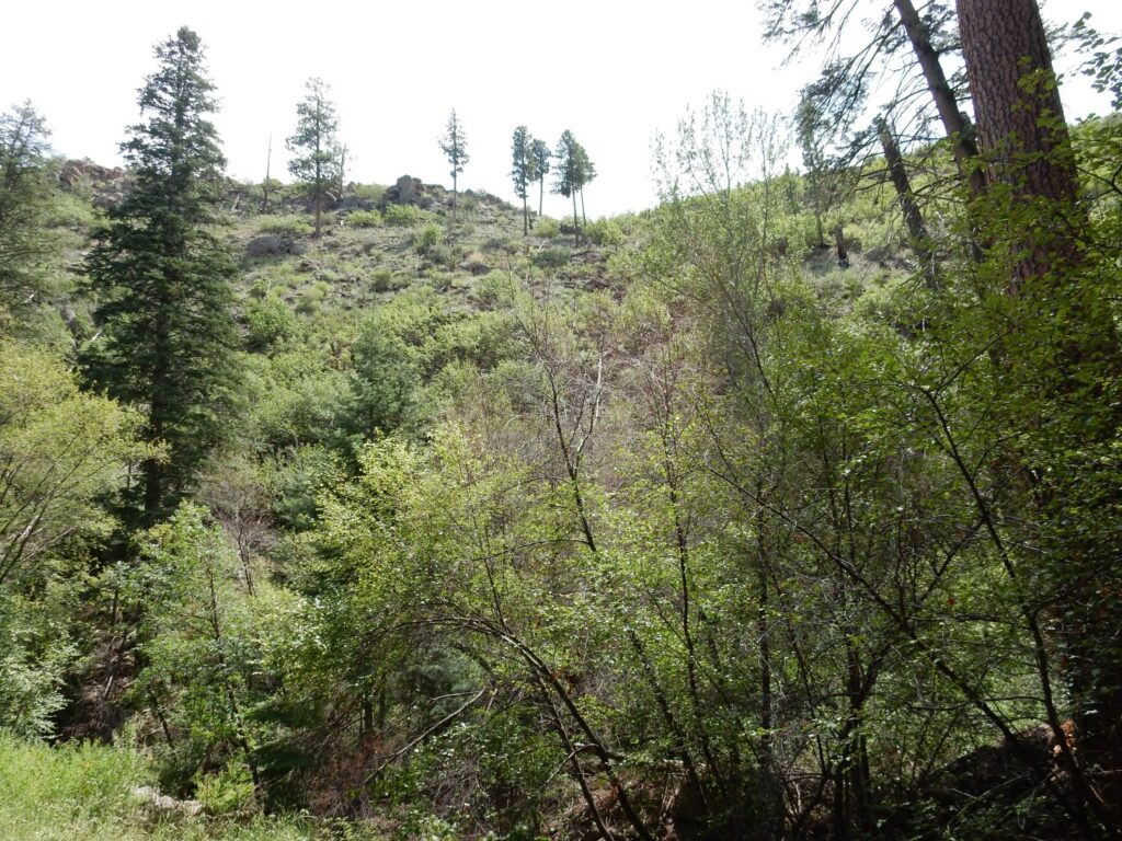
To the east is a mesa of Rendija Canyon Member, Tschicoma Formation.

For new readers (Welcome!): Almost every image at this site can be clicked to give you a higher resolution version. Blue links generally take you to the location from which I took the subsequent photograph, as near as my camera’s GPS can figure it out. (Accuracy is not always high in rugged terrain.)
The Tschicoma Formation is a volcanic formation composed mostly of dacite, a volcanic rock high in silica, but not quite high enough to be a rhyolite (the most siliceous of volcanic rocks). In the rare cases where it is coarse-grained enough to make out individual crystals under the microscope, dacite is found to contain mostly sodic plagioclase feldspar, whereas rhyolite contains a moderate to high amount of alkali feldspar. Otherwise, the distinction is made on the raw silica content. Dacite forms from an extremely viscous magma, which tends to form domes and plugs rather than flows.
We’re looking at a rare steep flow that is assigned to the Rendija Canyon Member of the Tschicoma Formation. This member tends to be a bit more silica-rich than younger Tschicoma Formation members, so that it is often classified as rhyodacite — borderline between rhyolite and dacite. Almost all of the Rendija Canyon Member was erupted around 5 million years ago, forming most of the more rugged terrain of the Sierra de los Valles west and north of Los Alamos. The younger members of the Tschicoma Formation are kind of draped over the Rendija Canyon Member and tend to look visibly less rugged and eroded.
The face of the flow towards us is actually the upthrown side of a major fault located more or less directly underneath the road I’m hiking. Oddly, this fault has no name on the geologic map I’m using. The fault has dropped the terrain to the west into what geologists call the Diamond Drive Graben, producing an escarpment that also forms the western edge of North Mesa and Barranca Mesa.
The road turns northwest and away from the fault trace, and I come to today’s first exposure of the Tsherige Member of the Bandelier Tuff.
The Tsherige Member forms the rocky rim of the little hill here. It’s the iconic rock unit of the Los Alamos area, forming our famous finger mesas, underlying most of the Los Alamos town site, and forming the cliffs north of the subdivision of White Rock.
The Tsherije Member is composed of volcanic ash erupted 1.25 million years ago, in a ginormous eruption which also formed the Valles caldera. The eruption was of rhyolitic magma that was both extremely viscous and highly charged with dissolved gas. When this magma reached the surface, it disintegrated into tiny shards of half-molten volcanic glass and red-hot gas that formed a dense fluidized mixture. This rolled across the landscape for miles in all directions, destroying everything in its path and then settling to the surface to form thick beds of tuff.
Beneath the tuff are layers of sediments rich in pumice and bits of volcanic rock. These are assigned to the Pueblo Canyon Member of the Cerro Toledo Formation. The Pueblo Canyon Member is found beneath the Tsherige Member across most of the western side of the caldera, where it separates the Tsherige Member from the older Otowi Member of the Bandelier Tuff, which was erupted 1.62 million years ago.
This catches my eye:
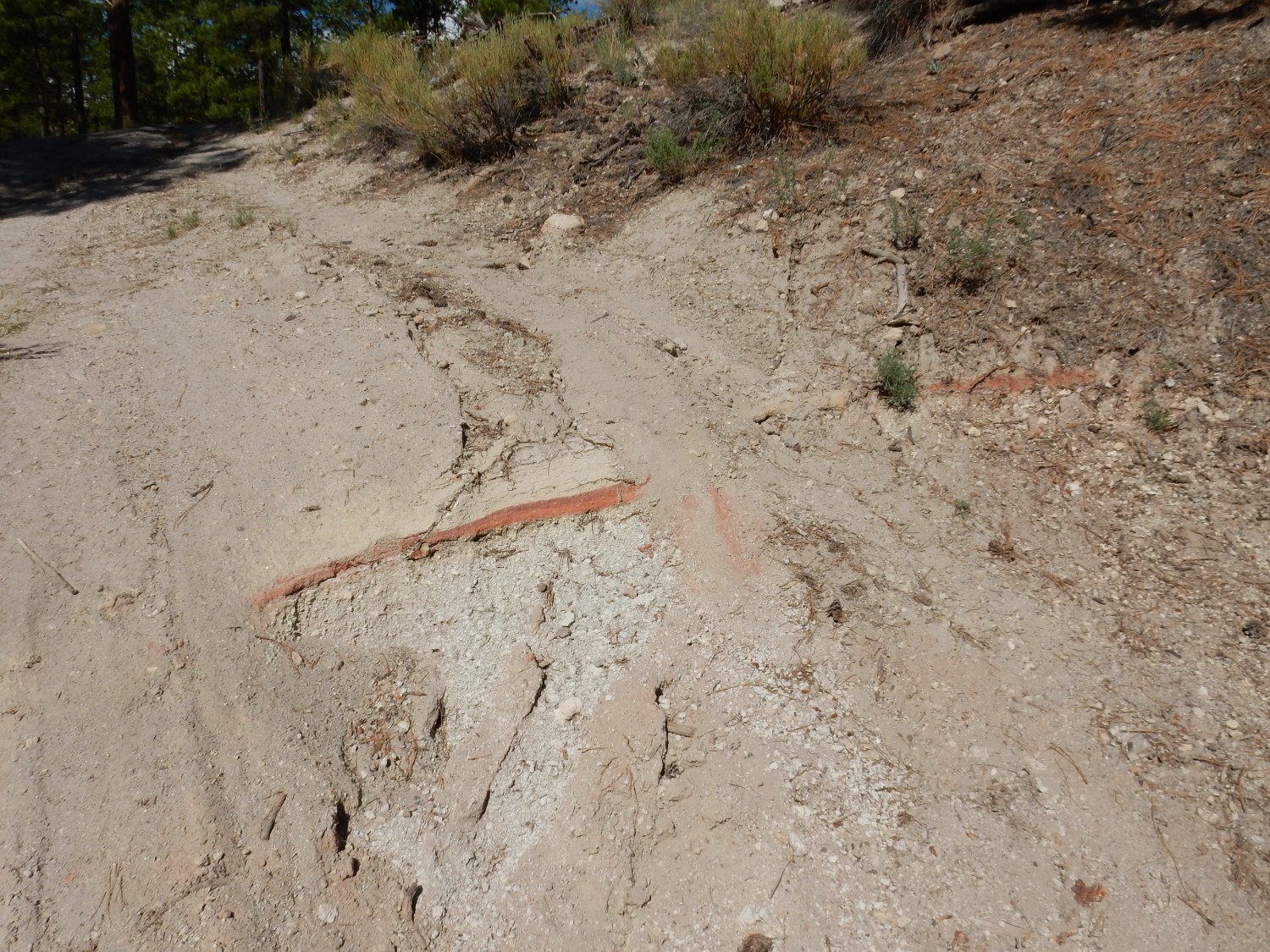
It’s a thin layer of bright red sediment midway through the Cerro Toledo Formation. I don’t know what to make of it.
I soon come to a pumice bed.
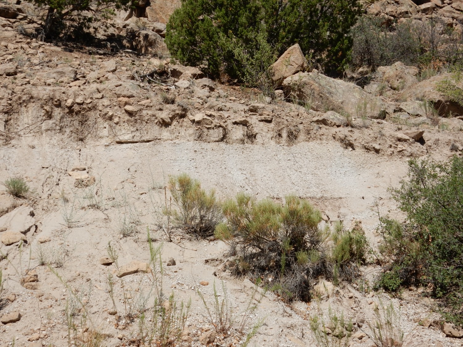
There are a couple of possibilities for what this is. It could be a pumice bed of the Pueblo Canyon Member, or it could be the Tsankawi Pumice that forms the base of the Tsherige Member. I can’t tell until I can get a good look at what lies just above it, but here what lies just above it is rocky debris recently weathered from higher up.
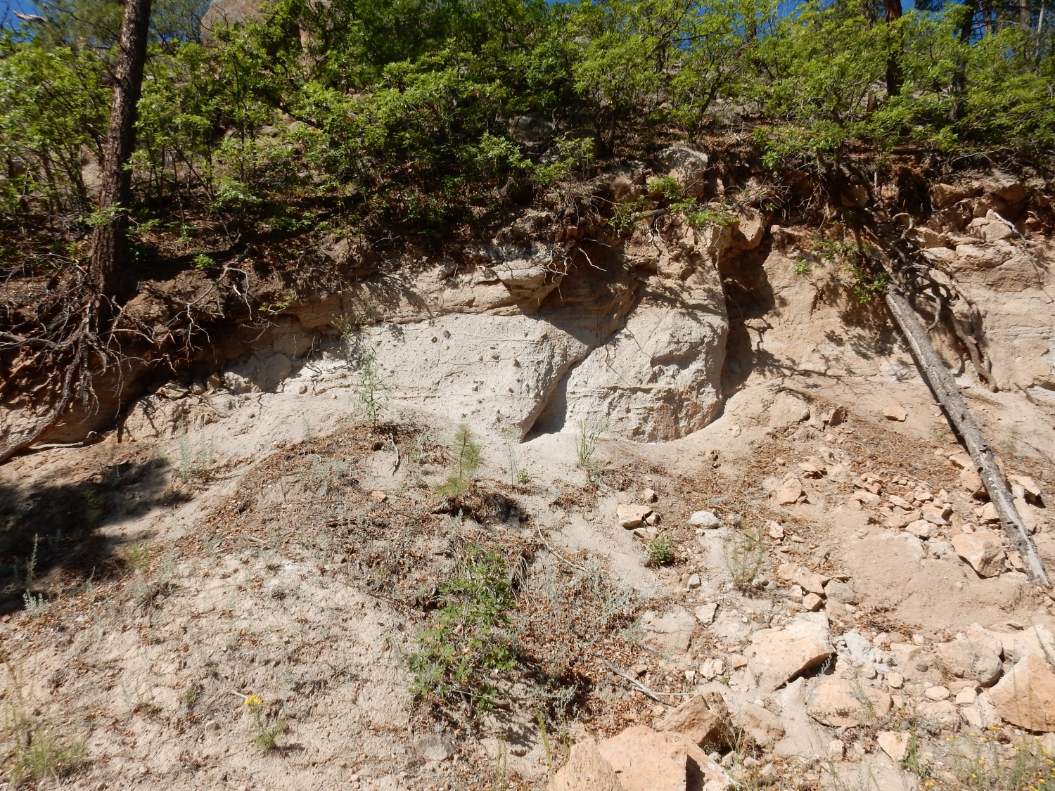
Ah, here the contact is clearer.


The overlying rock looks like sediments rather than pristine tuff. This means this pumice is probably part of the Pueblo Canyon Member.
And this looks like the upper contact of the sediments of the Pueblo Canyon Member with the pristine tuff of the Tsherige Member.
No doubt about it here.
It looks like the tuff is resting directly on the sediments, with no Tsankawi Pumice in this area. This is not unusual; the Tsankawi Pumice was deposited in a rather spotty manner on this side of the caldera, with the thickest and most consistent beds to the northwest of the caldera. That suggests the jet stream was out of the southeast when the caldera erupted, a conclusion further supported by finds of pumice matching the chemical fingerprint and age of the Tsankawi Pumice in Utah and as far away as British Columbia.
The road climbs to the upper surface of the Tsherige Member.

To the west is more Rendija Canyon Member.
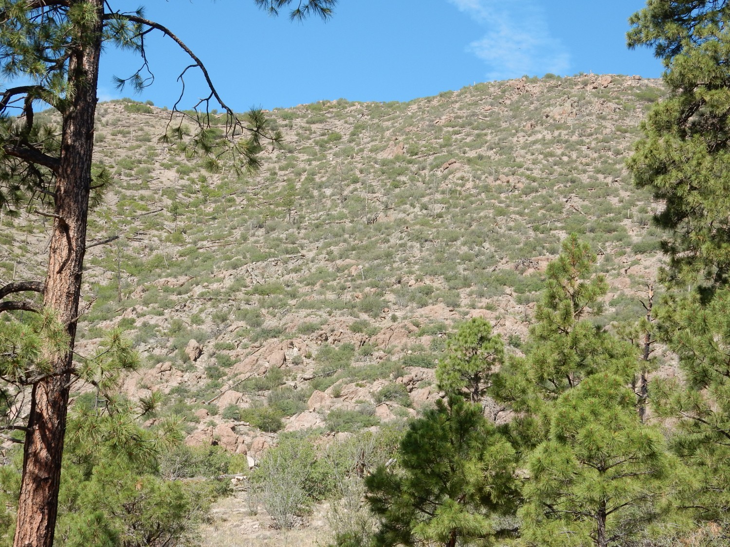
This flow came from an eruptive center to the west that cannot now be identified. The vents may have been buried under younger members of the Tschicoma Formation, or they may have foundered into the Valles caldera and been lost for good.
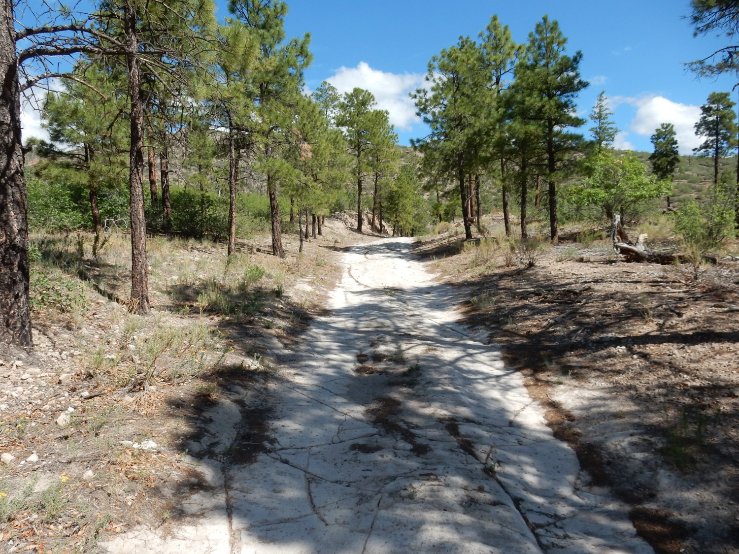
The road is now atop the Tsherige Member, which forms a hard, light surface that actually makes an excellent all-weather road.
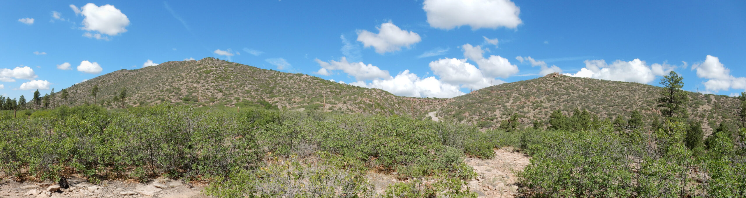
I pause for a panorama of the Rendija Canyon Member hills to the west.
The road reaches an outcrop of Rendija Canyon Member.

Tschicoma dacite isn’t too hard to distinguish from Bandelier Tuff. It usually has large white phenocrysts of plagioclase feldspar that are never present in Bandelier Tuff.
It is also typically harder and less porous than tuff, though some tuff can be quite hard and nonporous.
Looking east at Guaje Mountain in the middle distance.
Guaje Mountain is also underlain by Rendija Canyon Member, and, like the unnamed hill at the start of this hike, it has a fault running along its west face. This one has a name: the Guaje Fault.
I arrive at a small canyon with a ridge of Tsherige Member at its head.
Noticed how the tuff seems to fill in a valley that already had been eroded in the Rendija Canyon Member.
The road hits a patch of pumice.
This is probably the same pumice bed I saw earlier in the hike, forming part of the Pueblo Canyon Member. This pumice likely erupted between 1.25 and 1.62 million years ago, from a vent somewhere to the west or northwest. It dates from between the Valles event that formed the Tsherige Member of the Bandelier Tuff and an earlier ginormous eruption, the Toledo event, that took place 1.62 million years ago, emplaced the Otowi Member of the Bandelier Tuff, and probably produced a caldera roughly where the Valles caldera is now located. The Valles event badly overprinted the earlier caldera, so we are somewhat uncertain of its geometry, but there was a lot of pumice-producing post-caldera activity of which this bed was likely a part.
The road turns east again.

At left in the middle distance, and at center on the canyon rim, is Tsherige Member. At right is darker rock of the Rendija Canyon Member. Guaje Mountain is at far right.
More Pueblo Canyon Member in the road cut.
I think I photographed this because I was not quite sure of my reckoning, and wondered if I had met the old river channel deposit I was hiking too. More:

I think I concluded at this point that I must be looking at more Pueblo Canyon Member. And there are some fine exposures further down the road.

The thin layering in these exposures is typical of the water-worked pumices of the Pueblo Canyon Member. Such layering is not seen in pumice deposited directly by volcanic activity, such as the Tsankawi Pumice mentioned earlier.
This road cut is particularly nice.
It should also be clear just how varied the Pueblo Canyon Member is. It is a melange of water-worked sediments, air fall pumices, and fossil soil surfaces (pedosols).
Oddly, the geologic map shows this entire area as either Tsherige Member or Rendija Canyon Member. So it’s just possible this is sediments that have been reworked very recently in geological time, and not Pueblo Canyon sediments that were reworked over 1.25 million years ago. But I’ve seen plenty of Pueblo Canyon Member before and this sure looks like it.
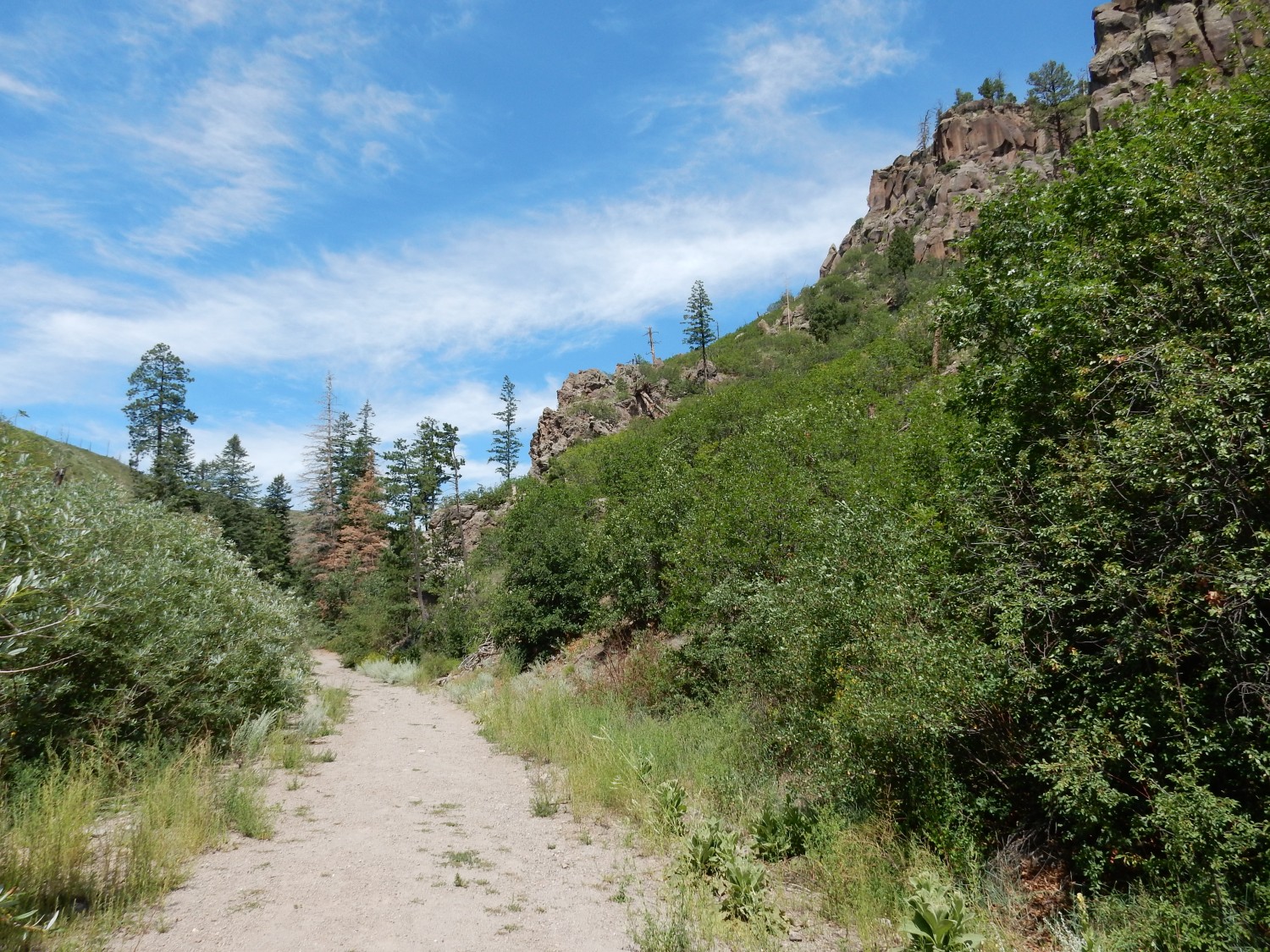
Approaching the south rim of Cabre Canyon.

Clara Peak at center left. This is the oldest rock I’ve seen today, at around 9 million years old, though it doesn’t really come into the story.
The Pajarito Plateau north of this point is the part I’ve least visited. However, there is a road network accessible from Guaje Canyon (though the road is a bit scary), so it’s not impossible I could visit in the future. This assumes I find something worth the trip (I have been to the pumice mines.) Puye Cliff Dwellings is up that way; I may visit once COVID has receded and the Santa Clara Tribe reopens the area to visitors.
Another impressive Pueblo Canyon Member road cut.
The angular unconformity (where beds meet at an angle) is a bit puzzling. The area generally has not seen anything like this kind of tilting of large crust blocks in the last 1.6 million years. My guess is that the tilted beds locally slumped before the horizontal beds were deposited on top of them.
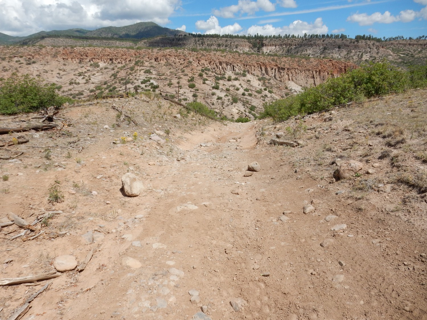
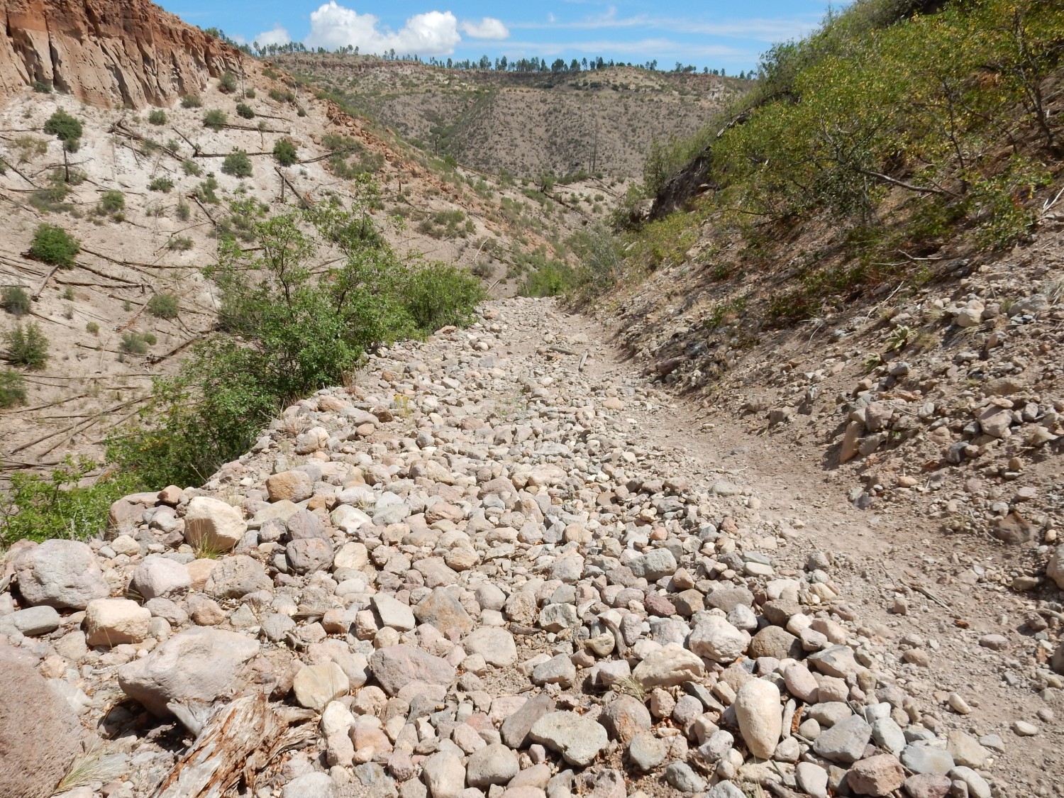
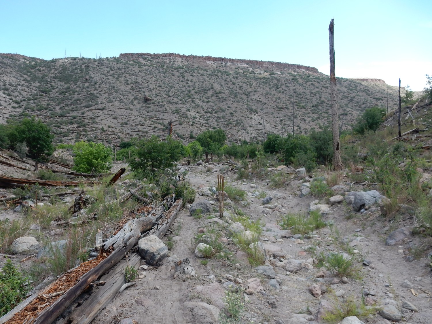
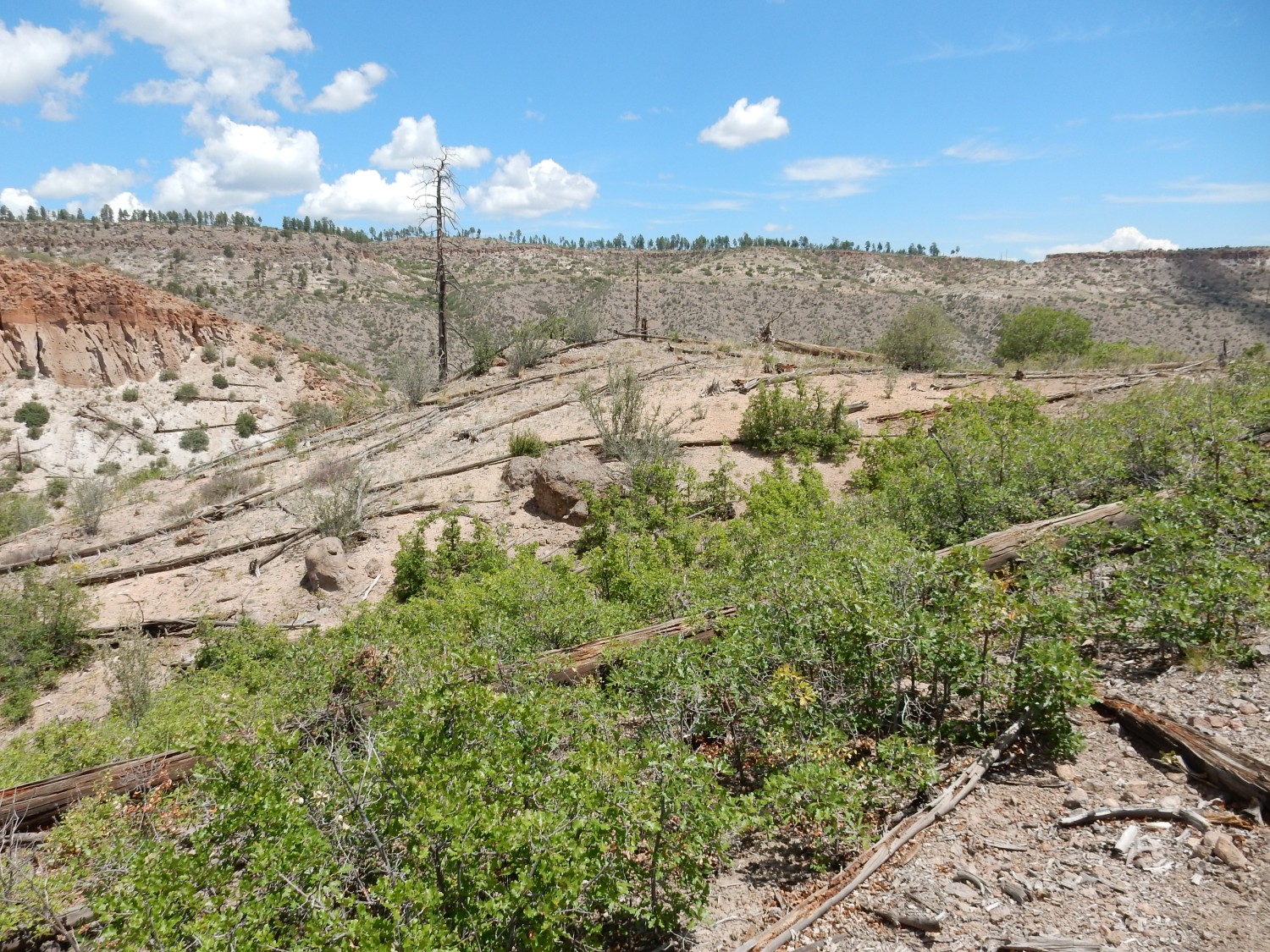
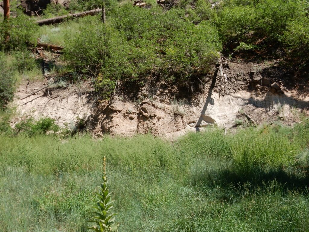
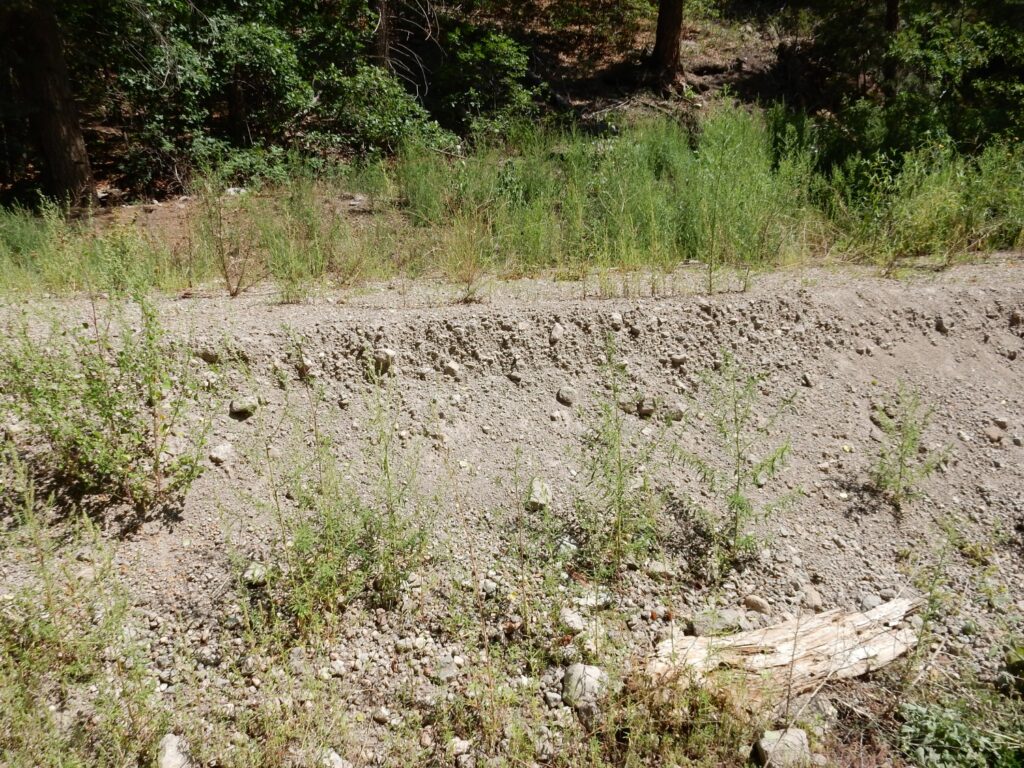
And I find myself at the old river channel that was the main objective of this hike.
This is unlike any other alluvium I’ve seen on the hike so far, and the geologic map confirms it. This is the old river channel cut into the Pueblo Canyon Member sediments and filled with river gravel, mostly Tschicoma Formation dacite but enough Bandelier Tuff to show this is less than 1.25 million years old. The channel roughly follows Cabre Canyon; the softer Pueblo Canyon Member around it has since eroded away, leaving the channel as a ridge. Erosion also explains why there is no longer a river or arroyo here; new drainages have been eroded.
This makes the day a success. This picture is for the book. But for bonus points, I want to hike down into Guaje Canyon and see if I can identify an ignimbrite bed mapped here. It’s supposed to be along the road just as it descends into the canyon.
Which is here.
Well, just down the road, anyway. But I don’t spot it, even though the road supposedly passes right through it.
Some woodpecker was very hungry, I’d guess some years ago.
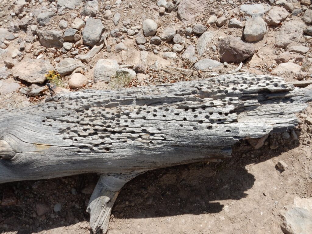
I’m guessing this was a dying tree at the time, damaged by forest fire and infested with bark beetles. The woodpecker must have feasted.
This is where I expected to see ignimbrite.
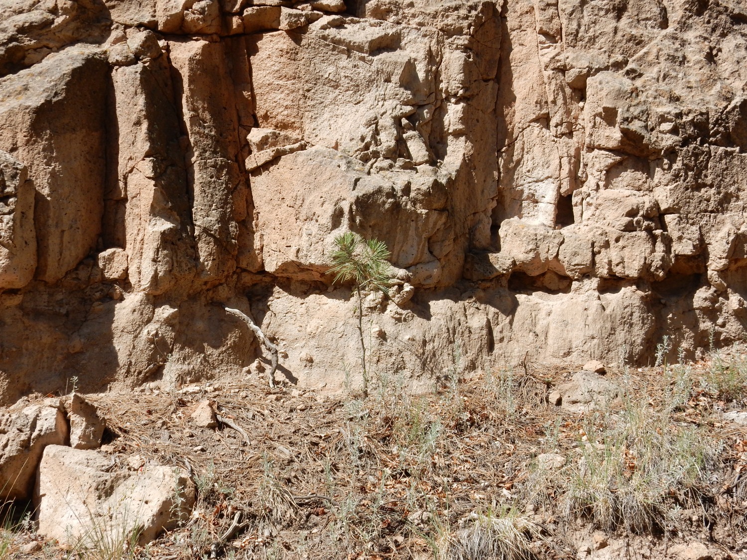
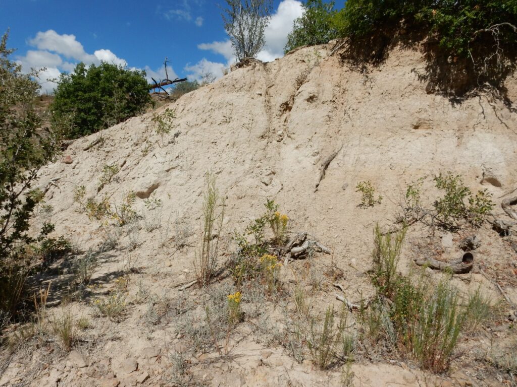
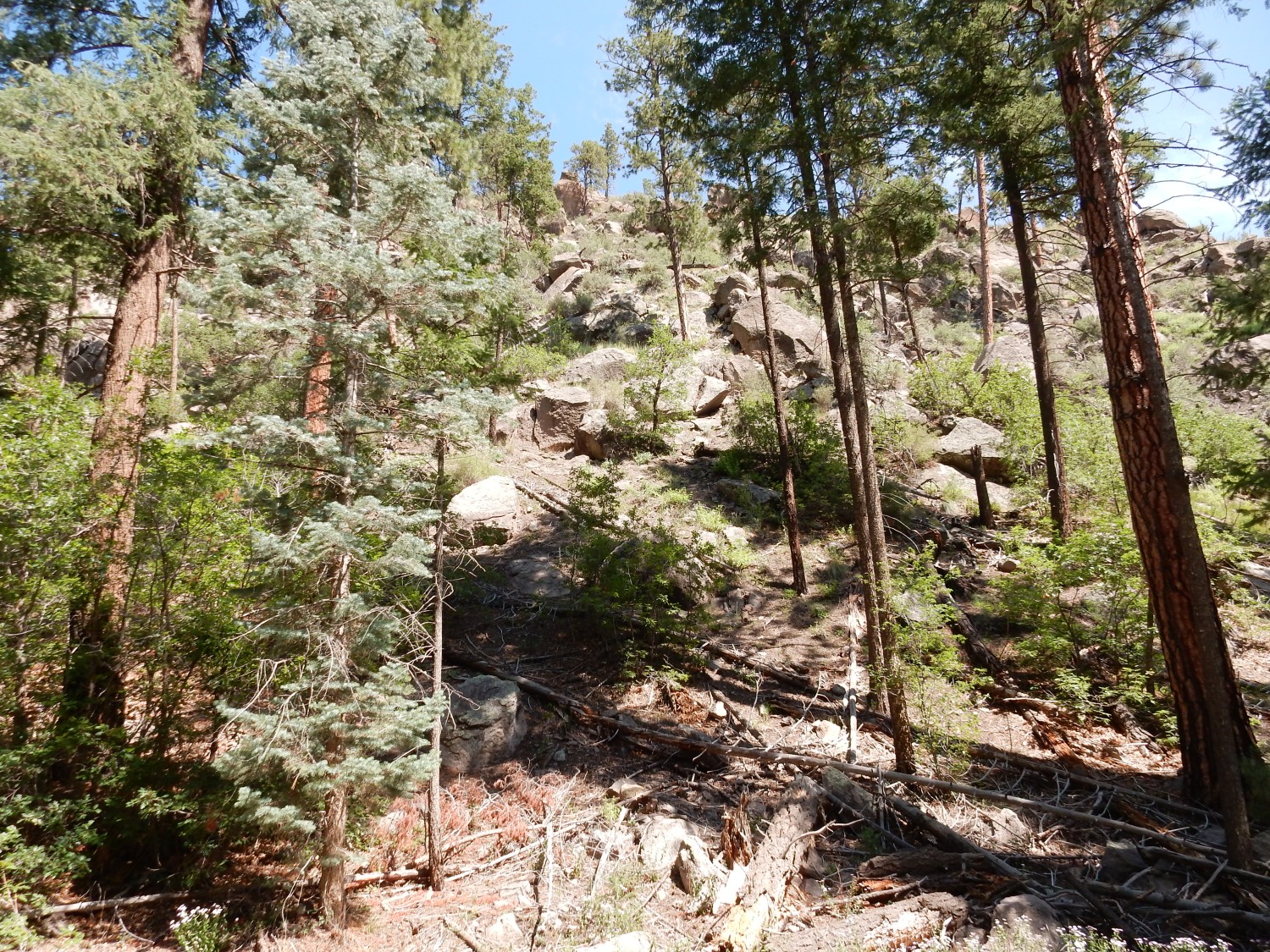
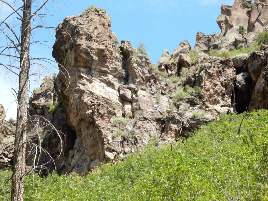
But no. My GPS coordinates show I have already walked past it without spotting it. And this impressive gravel is Puye Formation.
Dacitic volcanism is rubbly. The viscous dacitic lavas of the Tschicoma Formation tended to form block lava flows, which the flow becomes covered with large angular blocks of solid rock. This blanket of rubble is easily eroded away, forming thick fanglomerates around the eruptive centers. The Puye Formation is such a fanglomerate, which is exceptionally well preserved because it was deposited in the Diamond Drive Graben, a subsiding area of crust adjacent to the Tschicoma eruptive centers of the Sierra de los Valles. Much of the walls of Guaje Canyon in to which I am now hiking are thick rubble beds of the Puye Formation.
And I called this “gravel”. To geologists, gravel is any collection of rounded rock fragments over 2mm in size. There’s no upper limit.
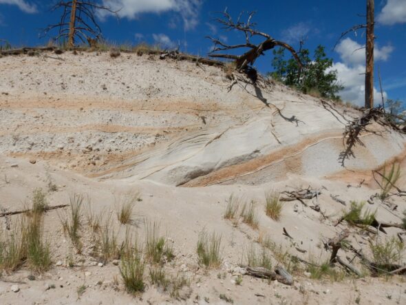
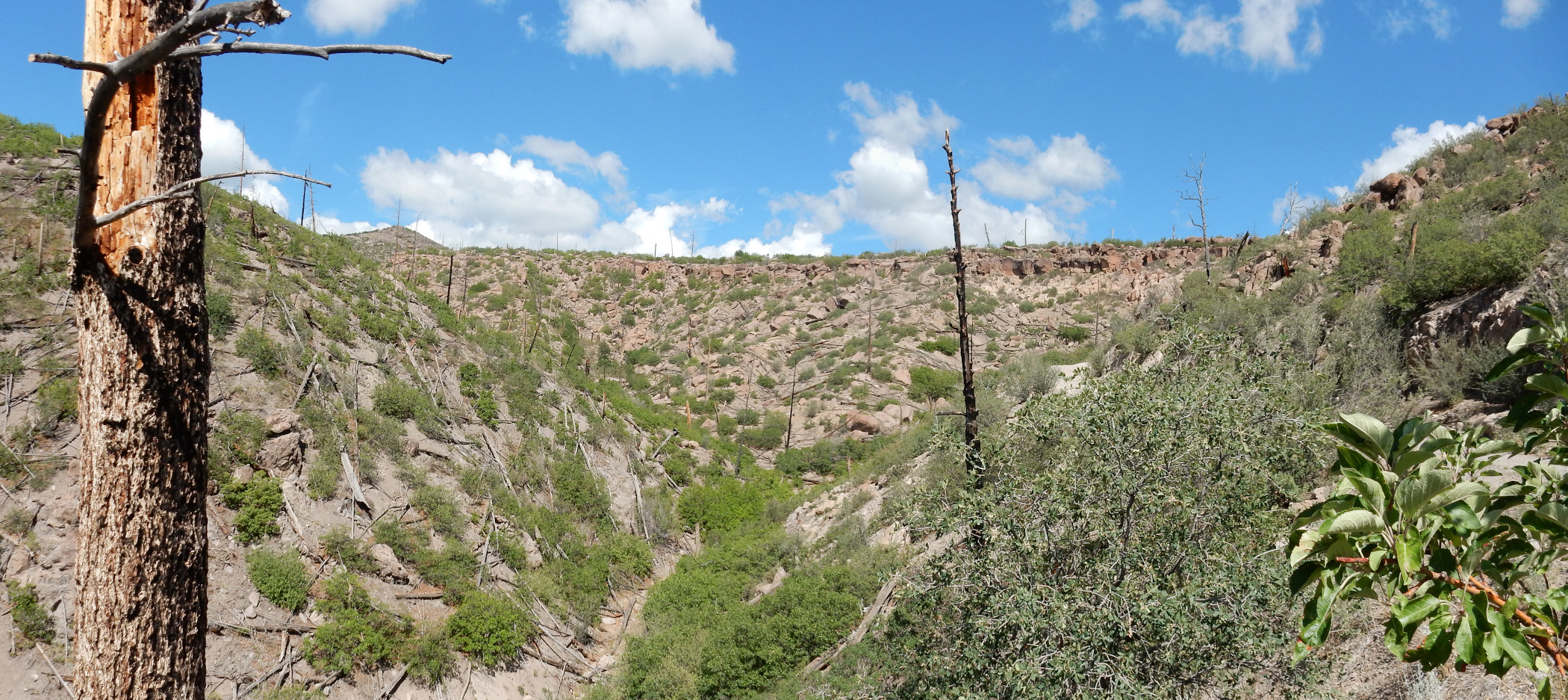
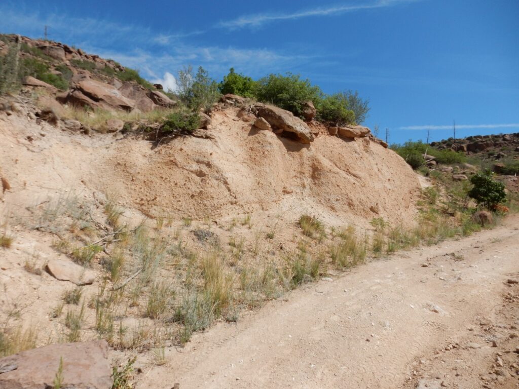
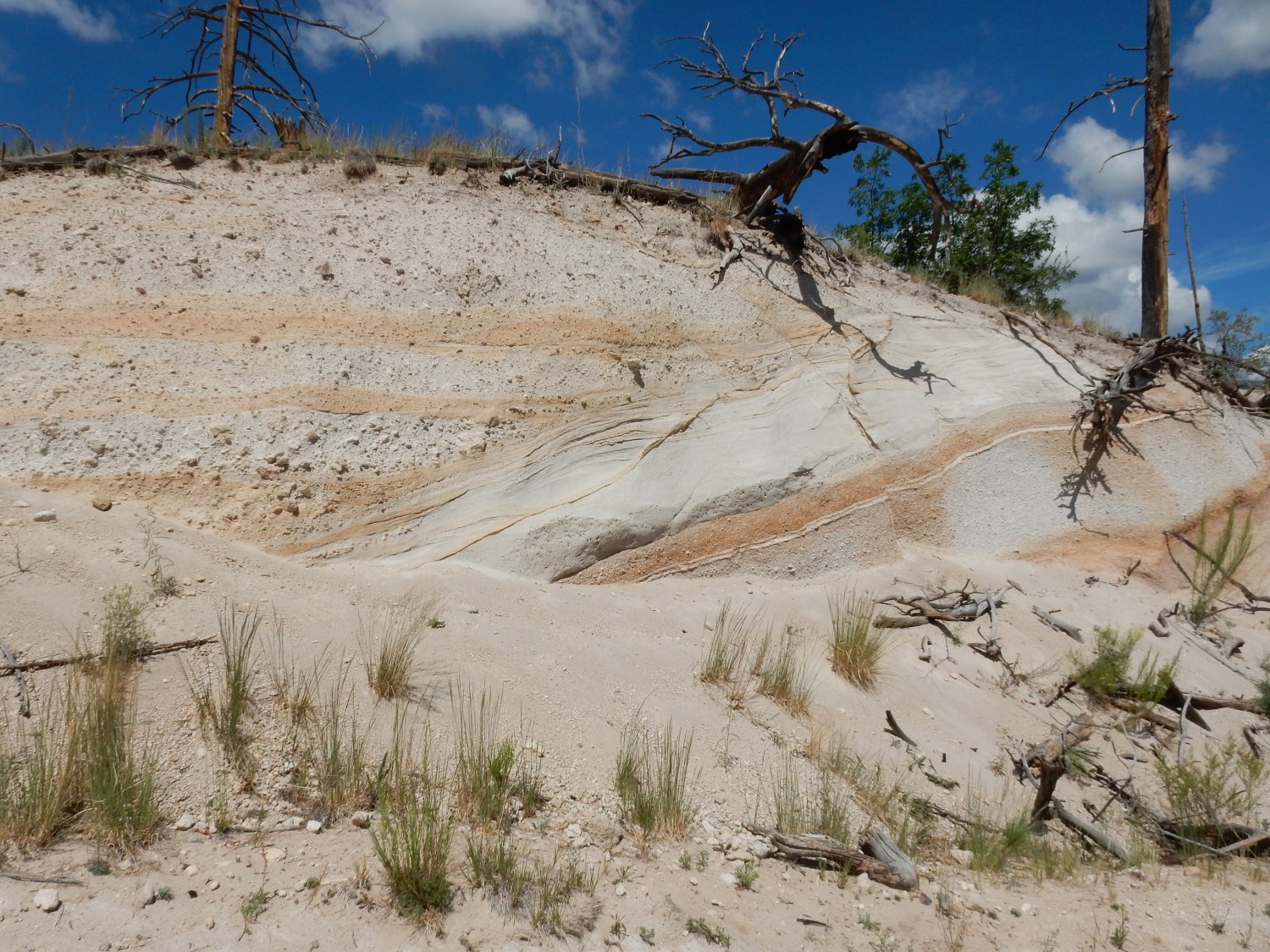
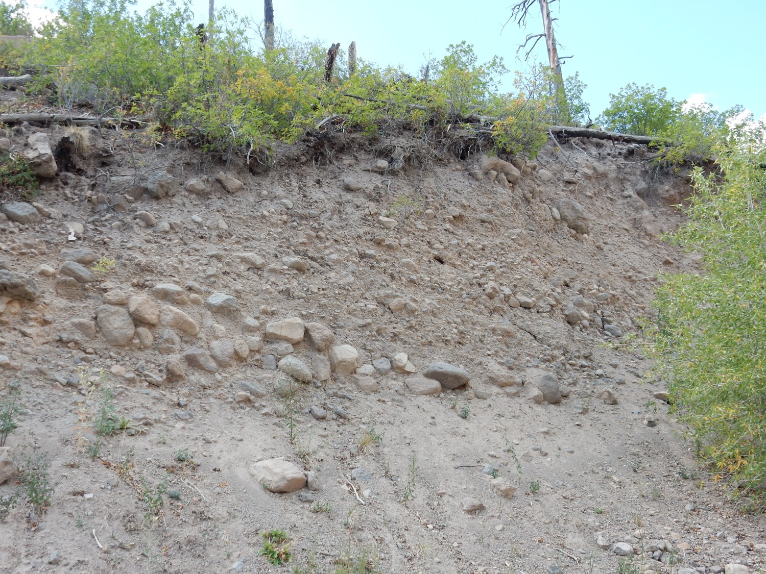
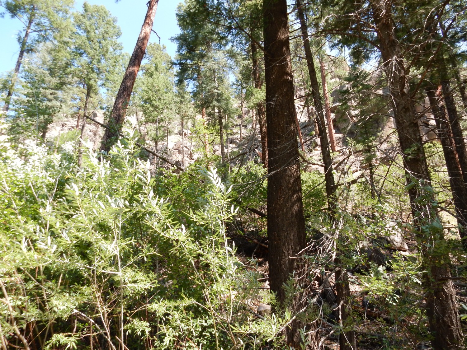
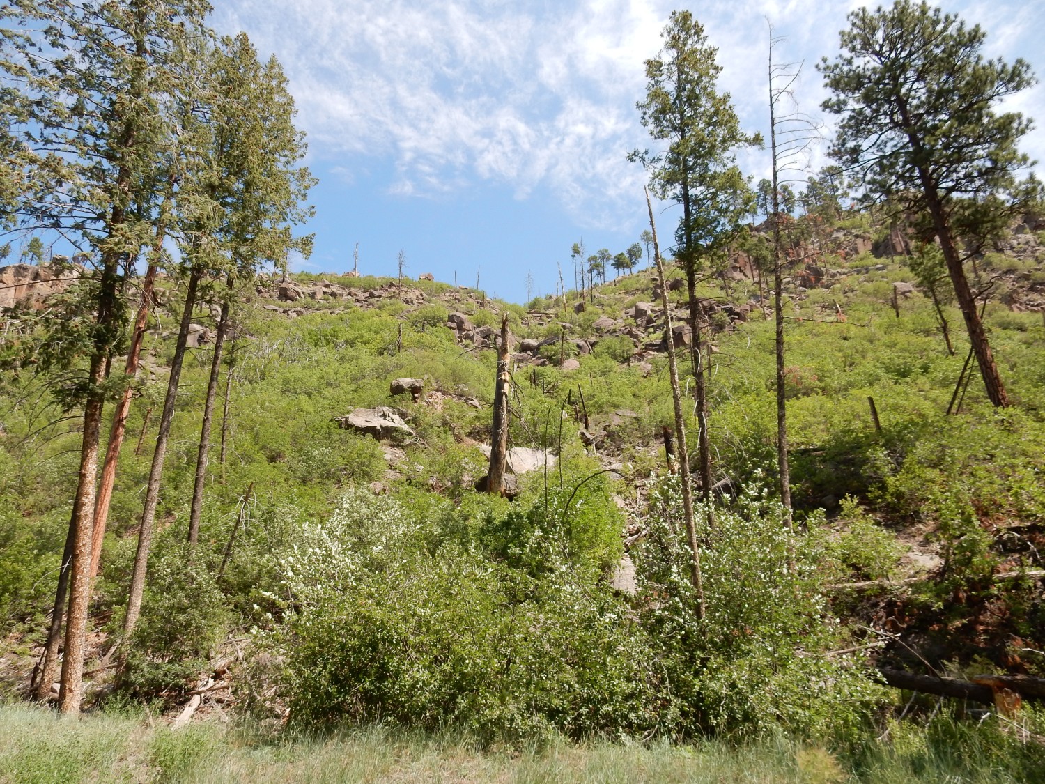
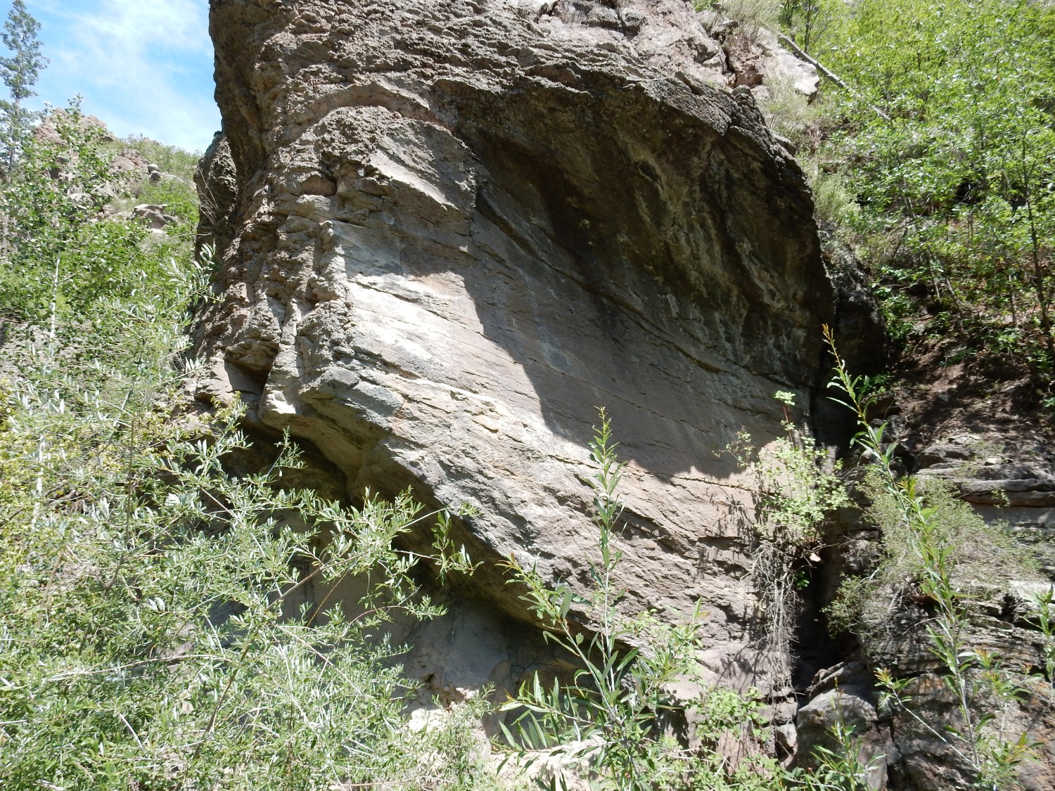
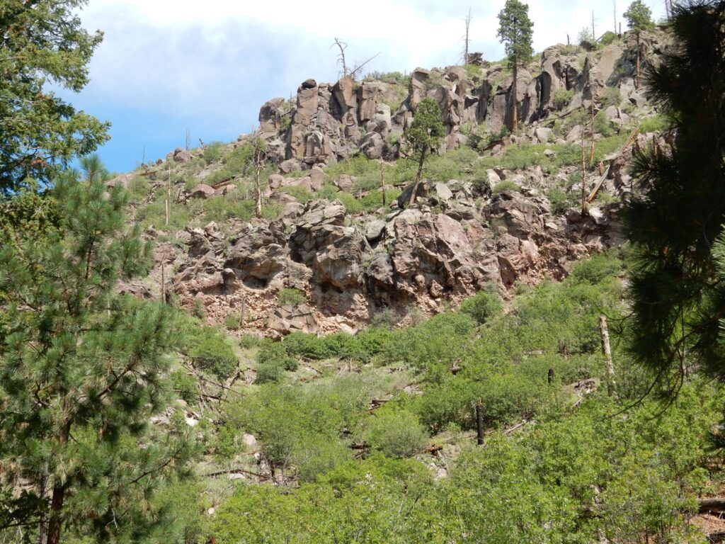
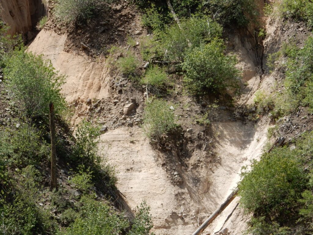
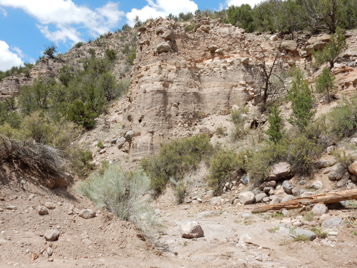
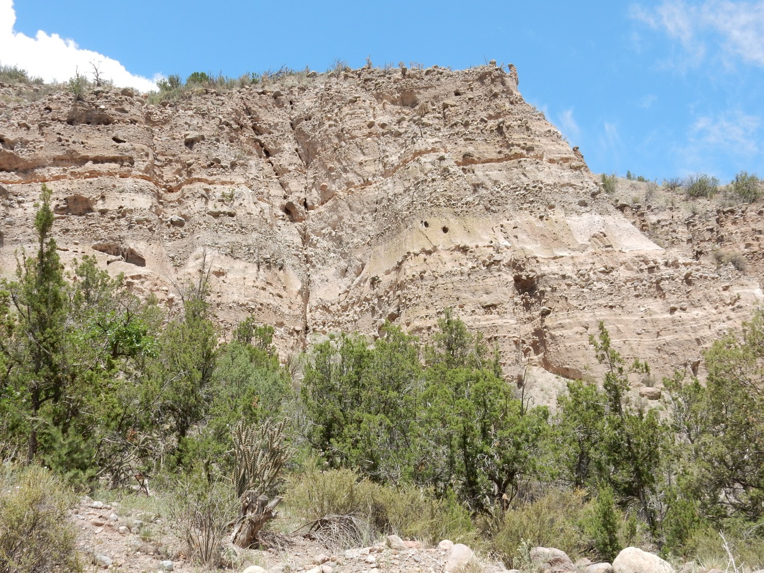
To the northwest, we see the stratigraphy that characterizes Guaje Canyon.
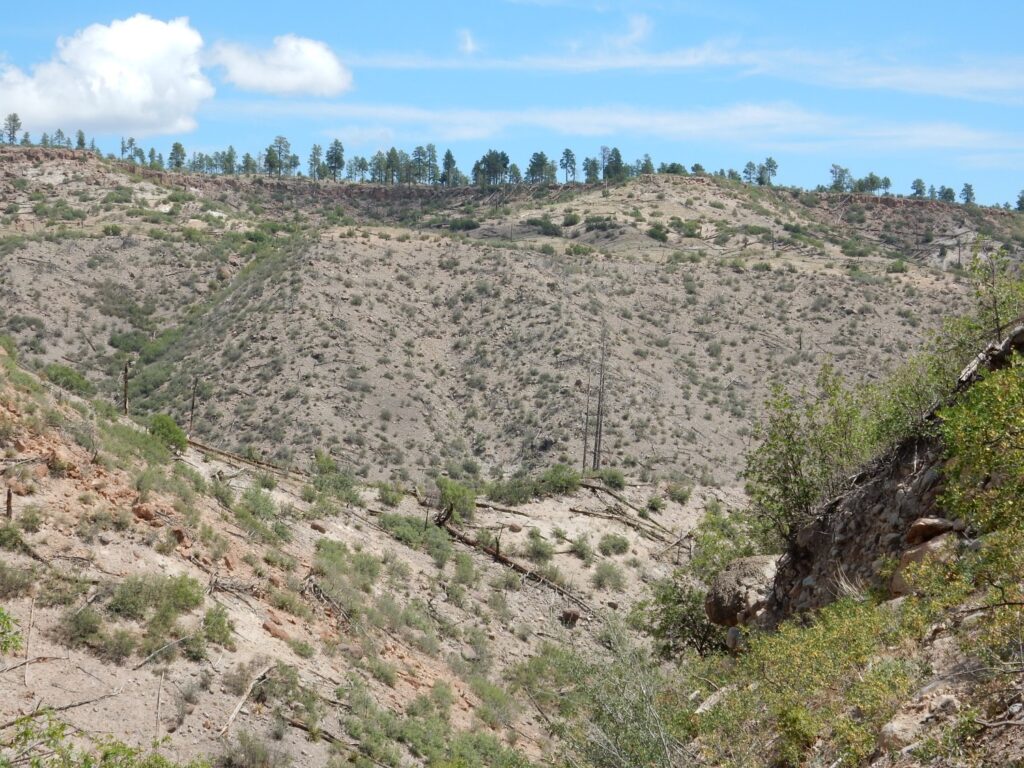
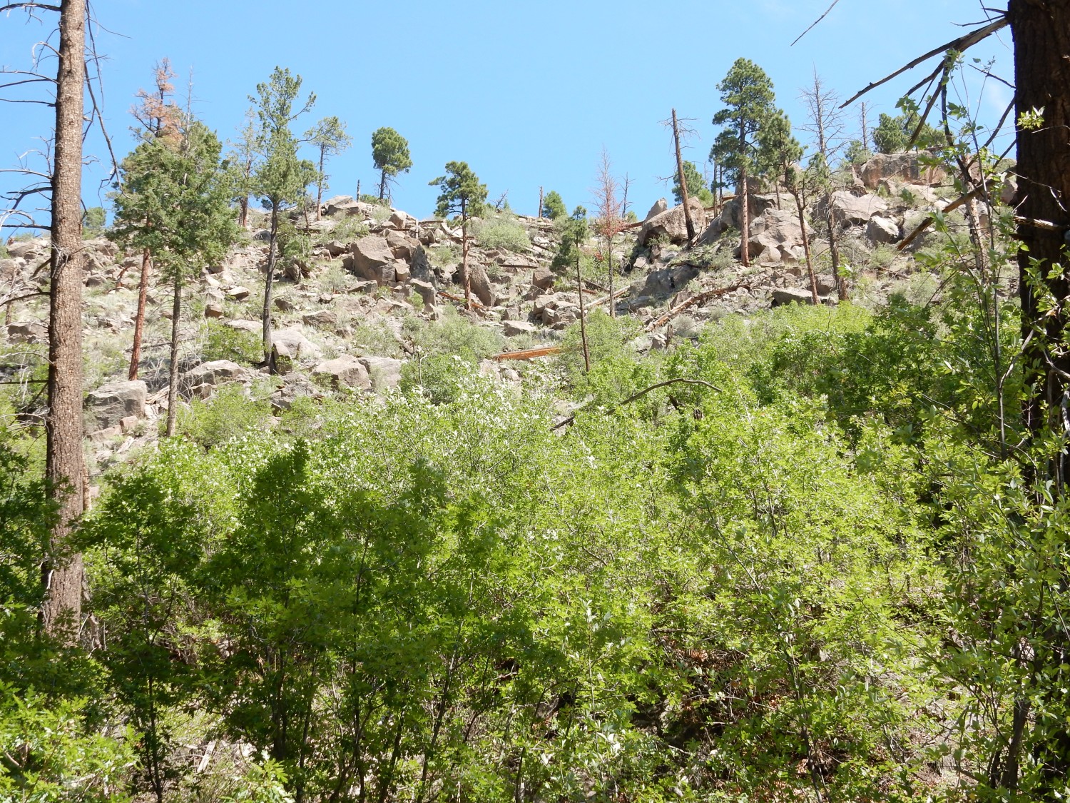
The dark gray making up most of the canyon wall is Puye Formation gravels. Above are much finer-grained beds of the Pueblo Canyon Member. Above that is a thin rim of Tsherige Member. To the west:
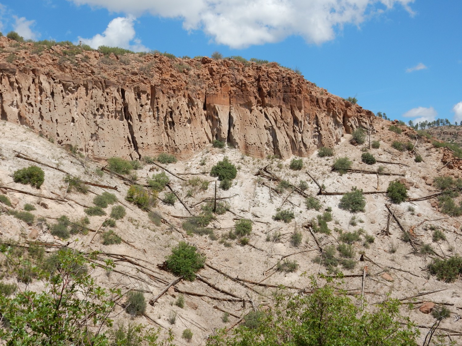
You can see there was significant relief in the surface of the Pueblo Canyon Member on which the Tsherige Member was deposited. Click for a higher-resolution image; you will see better that the lowermost beds of the Tsherige Member conform to the angle of the surface. The irregularity isn’t a slope of young debris.
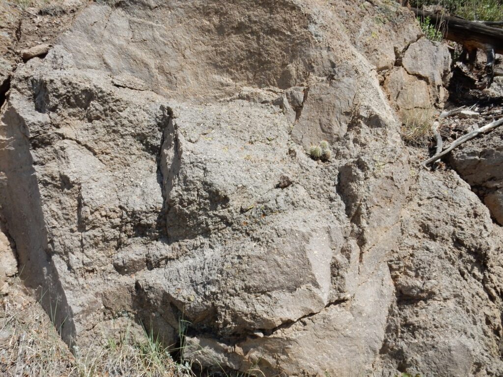
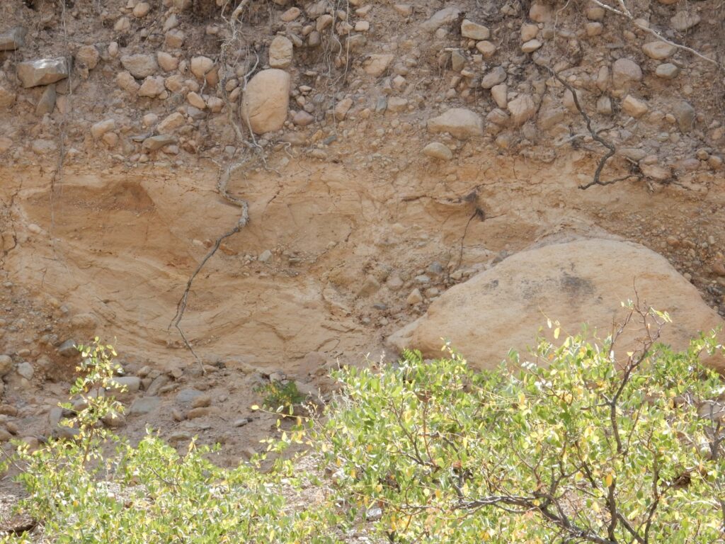
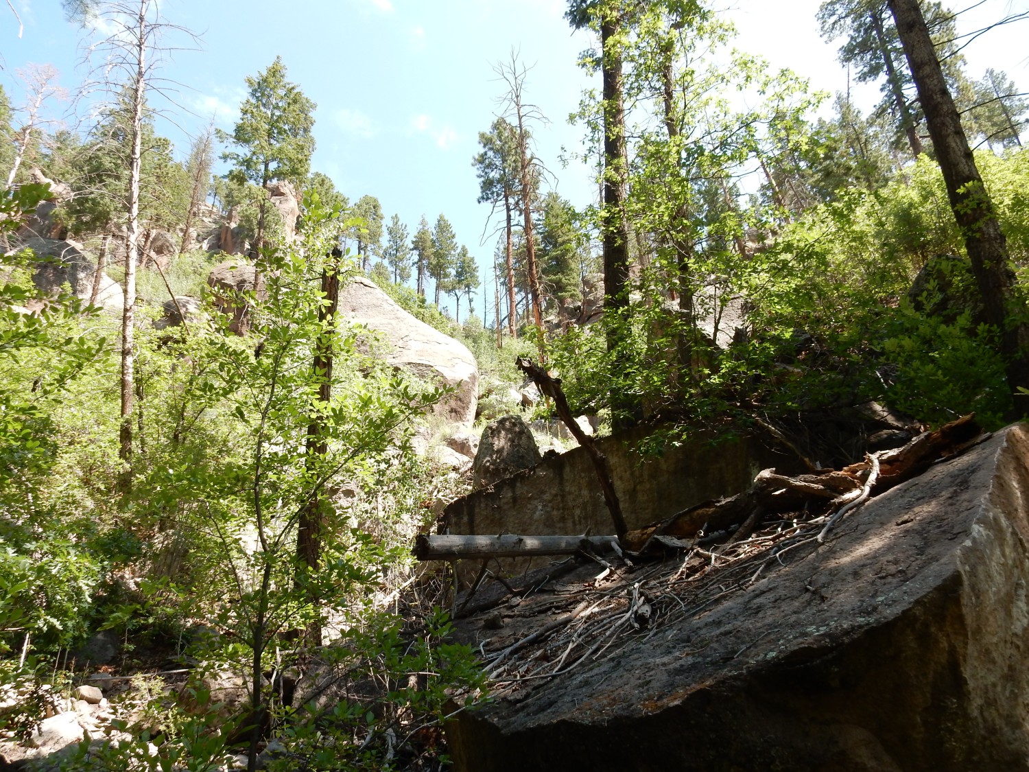
The Puye Formation contains some really large boulders.
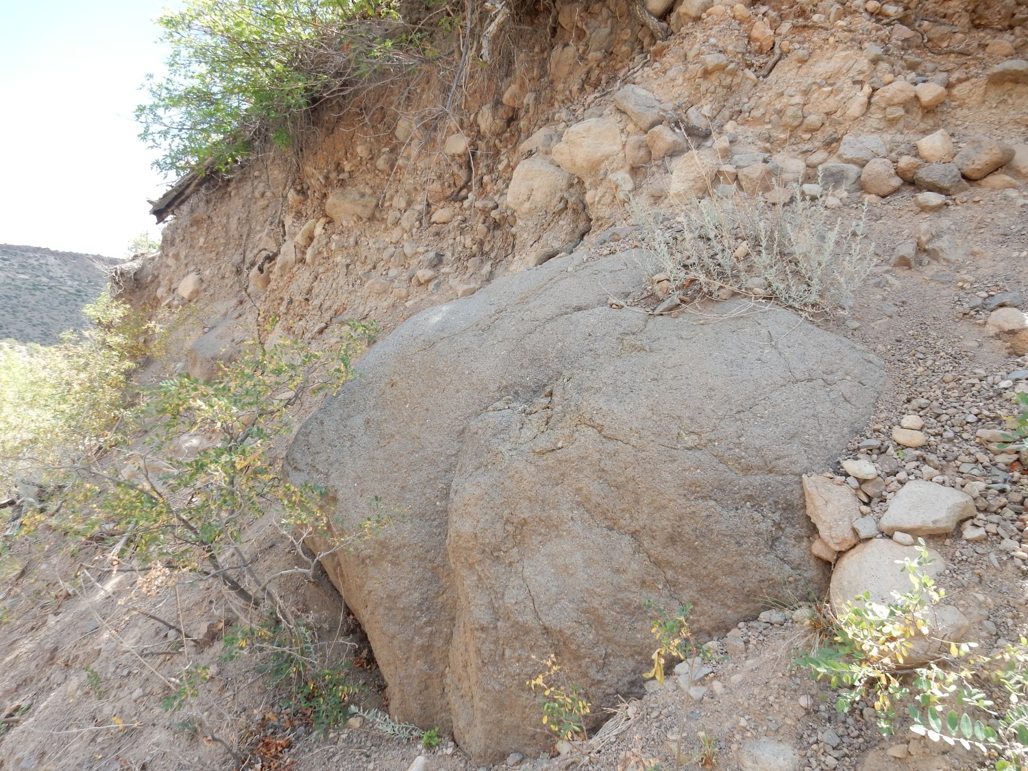
These are rounded enough to have traveled some distance. But rounding can be rapid; this boulder probably originated just a mile or two to the west.
More Puye Formation.
So how old is this stuff? Well, it sits under the Pueblo Canyon Member, which in turn sits under the Tsherige Member, which has been dated more thoroughly than the Kardashian sisters. The most accurate recent radiometric age for the Tsherige Member is 1.25 million years; so this stuff must be older than that. I mentioned the ignimbrite I missed seeing earlier. Ignimbrites can be dated, and the Puye Formation is found to be between about 3 million and 5 million years old. In other words, its deposition began with the big pulse of Tschicoma volcanism that produced the Rendija Canyon Member, but most is older than the volcanism that produced the other members of the Tschicoma Formation.
I’m approaching the canyon bottom, and I still haven’t seen any ignimbrite. (Because I walked past it way up the trail.)
And it’s now past noon. I eat my lunch, guzzle a bottle of water with rehydrating salts, and start back.
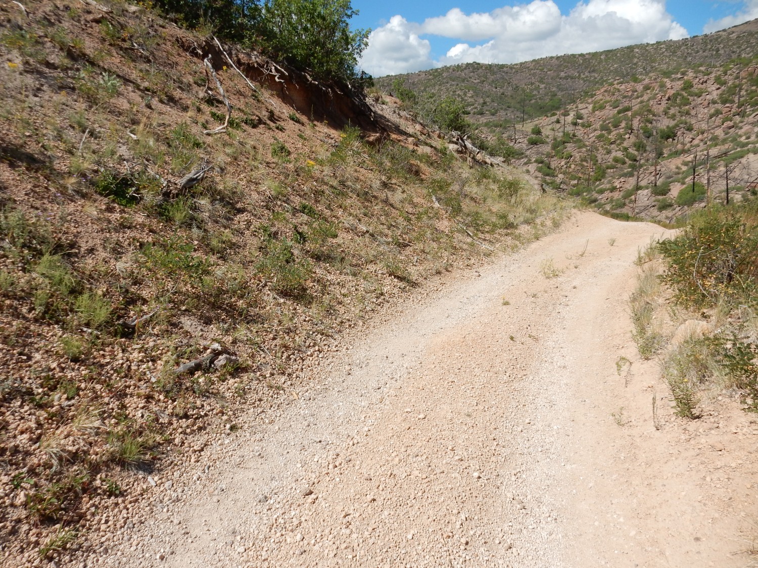
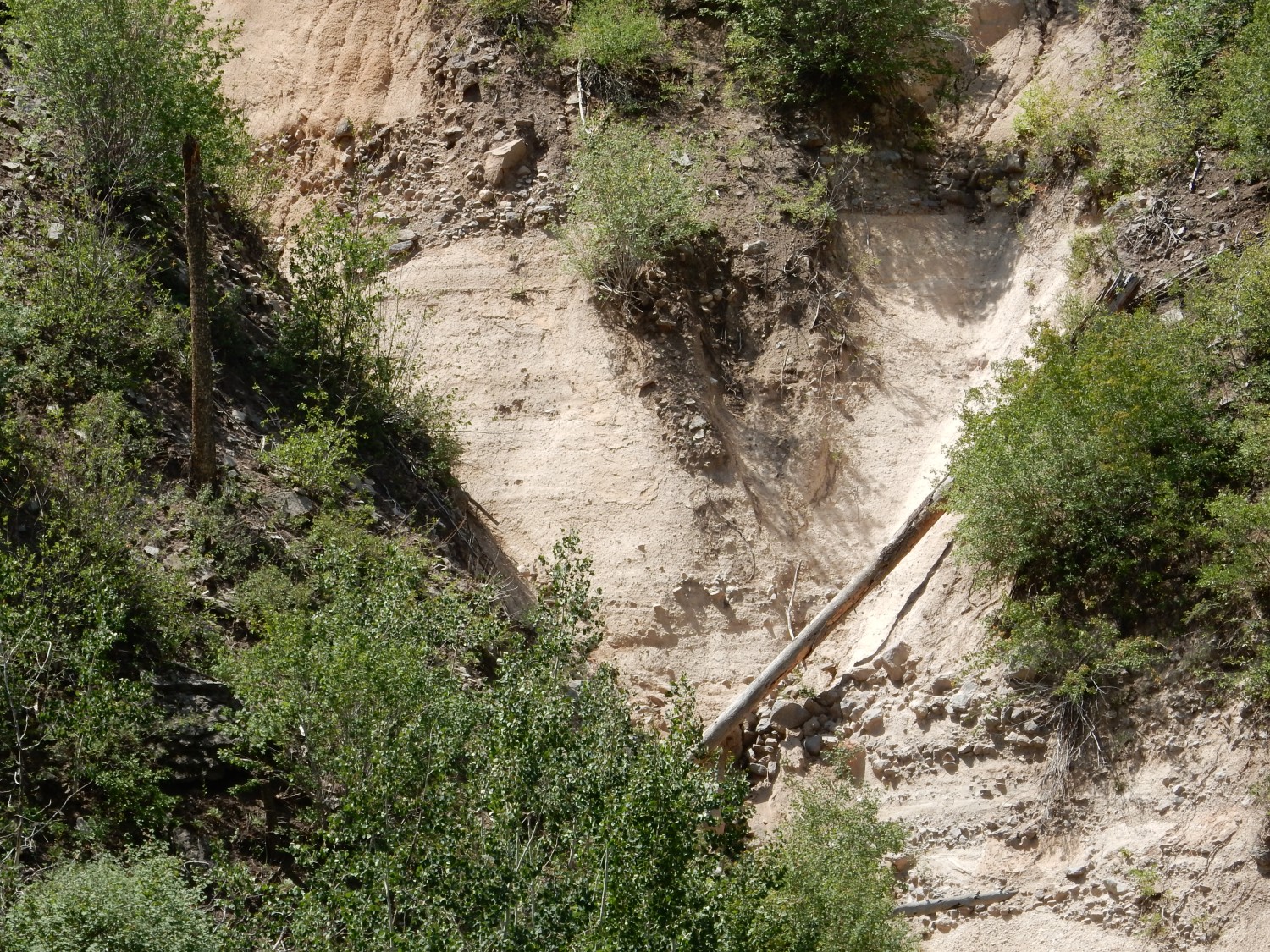
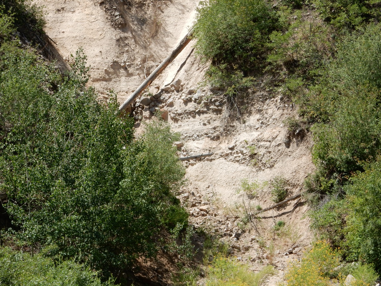
An incipient slump.
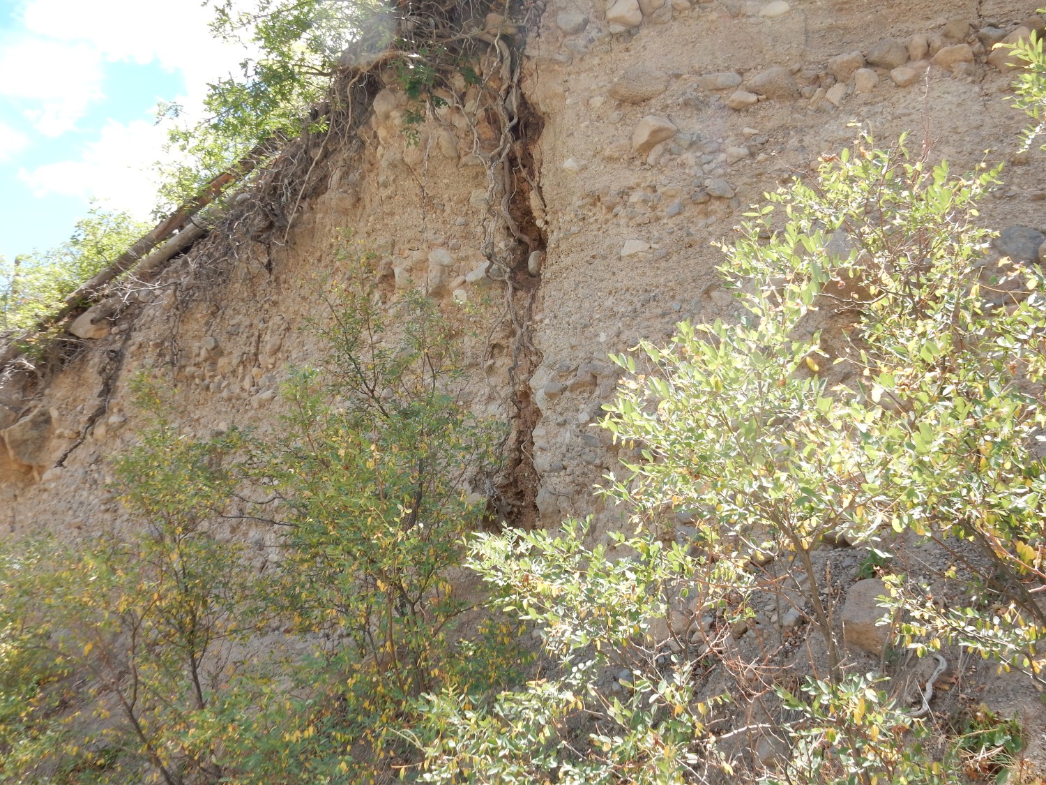
The Puye Formation is only weakly cemented together. This fracture is likely where the material at left is on the verge of pulling away and slumping down the canyon. That’s gonna make a mess of the road, but then the road was already pretty awful.
I’m looking for the ignimbrite again. This, maybe?
Nah; too thin and local. Probably just a mud layer. And when I check my position later, I’m still too far down the canyon.
I notice a hill just above the road that looks different somehow. I climb up towards it.
It turns out to be a large drift of pumice.

I grab a clast, on the off-chance closer examination at home will tell me something. But I think this is the same Pueblo Canyon Member pumice bed we’ve seen off and on all day, fortuitously exposed in a deeper drift here.
Halfway back I meet a fellow going the other way — the only person I’ve seen all day on the trail. We converse briefly; I keep some distance, because my throat is now hurting pretty badly, though I feel okay otherwise.
Near the end of the road, I hear loud motors, then two four-wheelers coming the other way. The stretch of road I’m on is particularly bad; I give them plenty of room, and they struggle up the steep, gullied road. Then I’m back at the car, which I get back onto the highway without too much difficulty, and home.
I let Cindy take Kira shopping with her. I’ve been fully vaccinated, but feel obligated to self-quarantine, just in case. Saturday I wake up feeling dreadful, get on the web, and sign up for a COVID test Monday morning. Sunday I continue feeling dreadful. Monday I drag myself out of bed, put on a mask, and drive to the test.
I’m there on time. Twelve people are in front of me. The office hasn’t opened. No one shows up for another 25 minutes. As we’re finally being moved through the process, it begins to rain lightly. There is no shelter. I’m feeling awful, and that makes my mood a little snotty, and when I get home, I write a nastygram to my local politicians. (It was a New Mexico DOH testing site.) Later I think better of it. Not my best moment.
Wednesday the test comes back negative, as expected. I’m feeling up to a little work, but I spend the rest of the week working from home. I get a splitting headache every time I cough, and the only relief is lying flat on my side for a few minutes. Hard to do at the office.
This week is better. I work from home Monday but am up to coming in the rest of the week. I hit a couple of big milestones that make it good week.
Two weeks ago was the fanglomerates of the Puye Formation. This Friday it’s faults in Los Alamos Canyon and a tour of Rendija Canyon. The latter will once again feature Puye Formation, so I’m lumping these two weekends into one post.
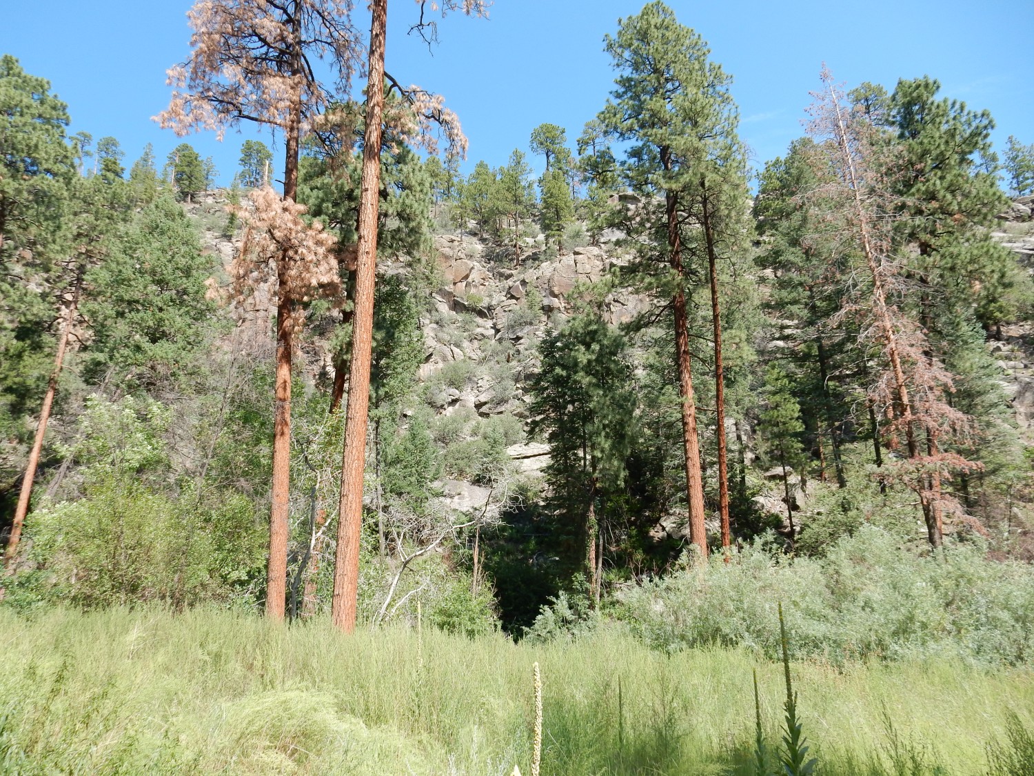
The weather looks splendid Friday morning, but the forecast is for a fair chance of rain in the afternoon. I don’t want to hike for long or on high ground. I settle for hiking as far up Los Alamos Canyon as I can, further (hopefully) than my previous two visits to Los Alamos Reservoir.
The trail crosses the Pajarito Fault Zone, so my goal today is to spot as many fault traces as I can. If I was on the Colorado Plateau, with its distinctive colorful beds, this would probably be fairly easy. But Los Alamos Canyon is almost entirely massive, knobby Tsherige Member, so fault traces are suble. They’ll be expressed in zones of enhanced erosion, perhaps with a decrease in boulder size across the fault.
This is my first guess.
Checking the coordinates after I get back: Too subtle. The map shows no fault here.
The area had a lot of construction earlier, and not all the signs have been removed.
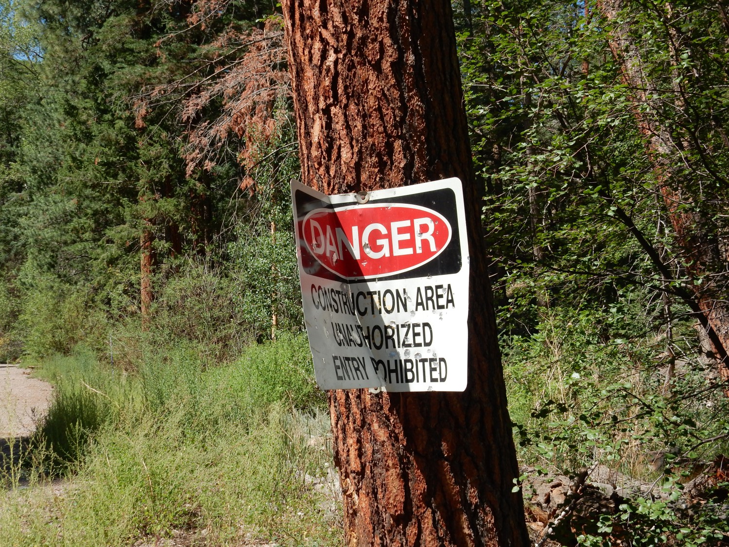
The sign was folded over when construction was complete, but has come somewhat unfolded. Which is disconcerting.
Next fault candidate. Again, a visible notch in the cliff, some hints of displacement, and less coarse rubble along the notch.
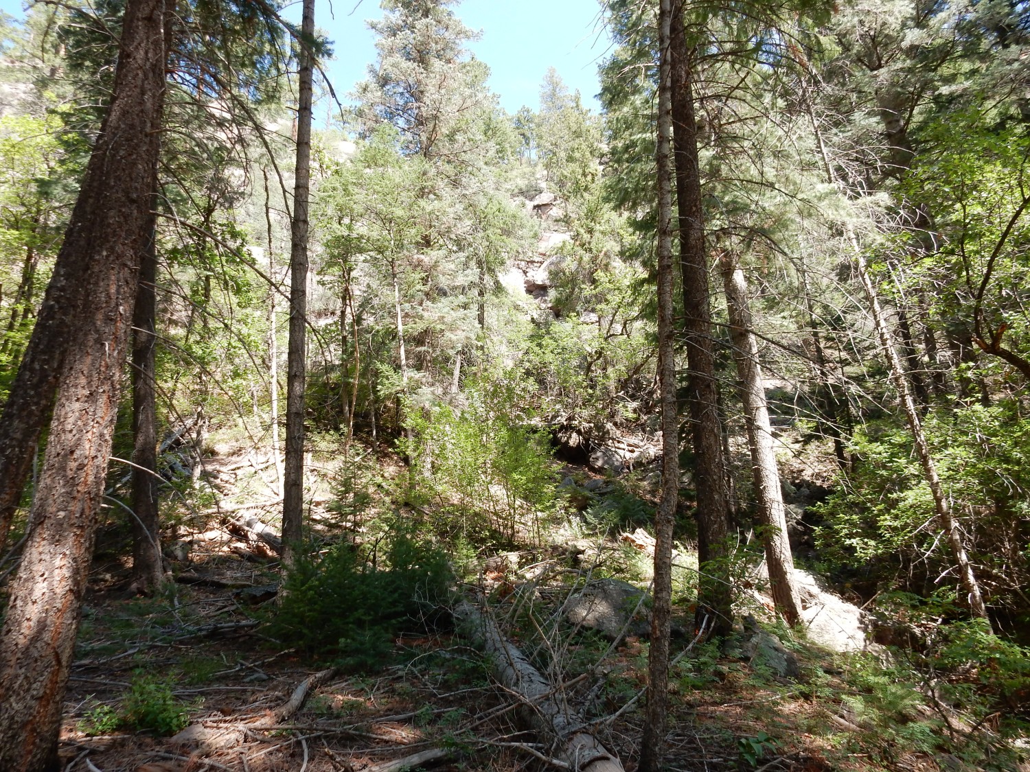
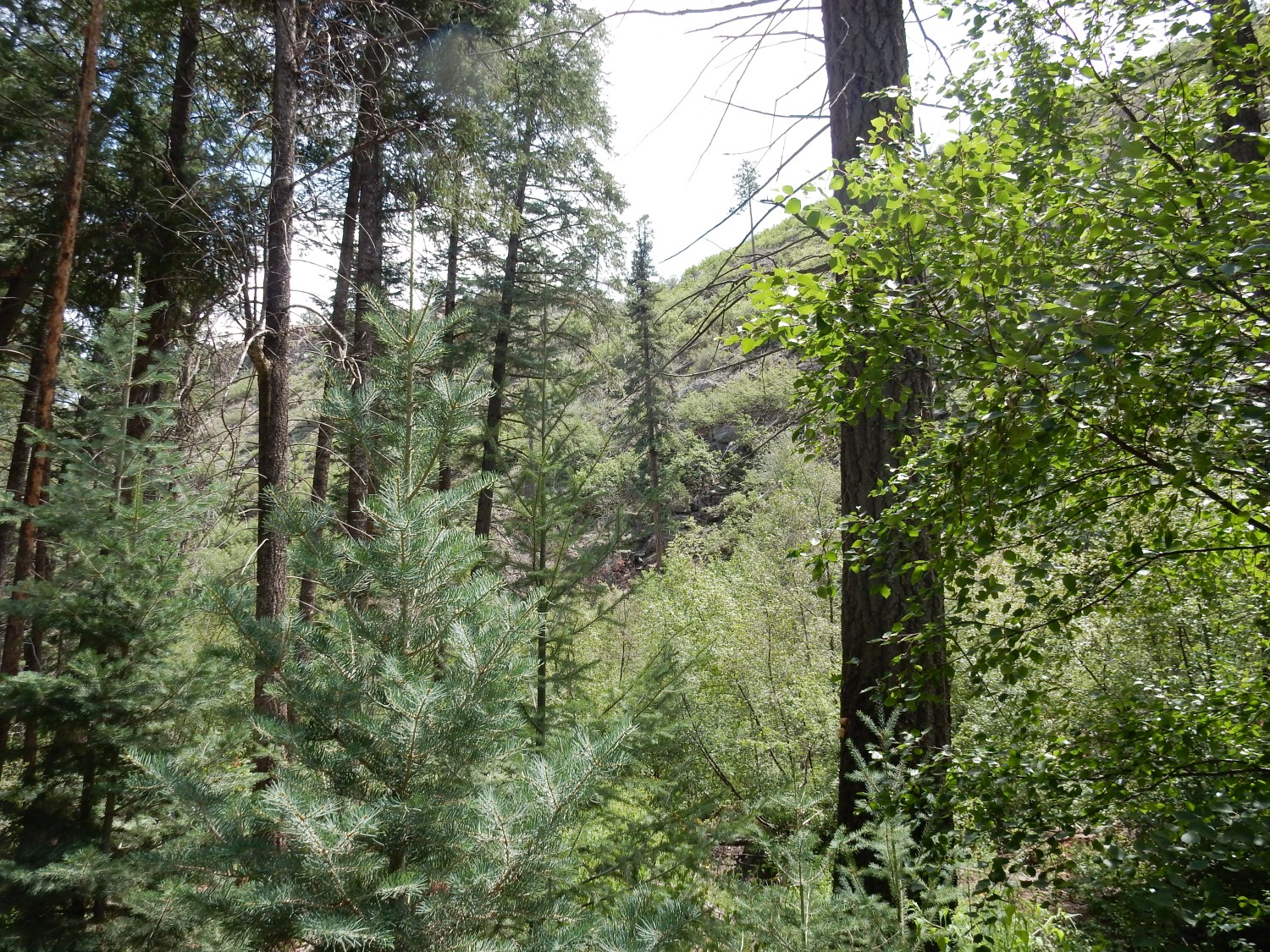
The trees do tend to obstruct the view. But the map shows a fairly significant down to the east fault here, which stretches further north to form the east face of Mount Los Alamos.
I knew it as LA Mountain as a kid. It had a big white “LA” logo of the local high school. But at some point, the Forest Service prohibited the kids from repainting the sign any more, and it’s barely visible now.
I can’t recall if I took this one because I thought there was another fault here, or to show how difficult it was to spot faults.
But the map does show a fault here, though it’s mostly covered by rockfall.
Or perhaps this is the fault.
Another candidate.

The geologic map says Ehh, maybe.
This, more likely.
The base of the cliff shows some more Pueblo Canyon Member.
This seems pretty clearly to be a fault trace.

As indeed it is; the geologic map confirms this. I move closer for a better view.
This one also seems obvious.

My GPS may be off. But this area turns out to be thick with faults, according to the geologic map; this could be one of any four closely spaced faults.
I realize this may be tiresome. This part of the canyon is so fault-rich that I wanted to see what I could spot. The faults here run perpendicular to the canyon, that is, north to south, and mark the present active western edge of the Rio Grande Rift.
It looks like the road I’m hiking is below the level of an earlier road, now washed out.
There was a lot of flood damage in the canyon, due to a severe fire in the watershed some years back. The area has only fairly recently been repaired, and there are still flash flood warning signs posted here and there.
Another fault?

A cluster of at least three closely spaced faults, according to the map. It occurs to me that I should hike the Cave of the Winds trail on the rim above me sometime and look for the surface expression there.
Next fault.
Yep, though rather a small fault.
I come to a ridge of rock that is not Tsherige Member.
This is the Pajarito Mountain Member of the Tschicoma Formation. It’s younger than the Rendija Canyon Member at right around 3 million years old. It’s also slightly poorer in silica than the Rendija Canyon Member — a true dacite.
Moar.
More still.
The rubble at center, overlain by massive beds, is mapped as Puye Formation. The massive rock is Pajarito Mountain Member. Above is the canyon rim, of Tsherige Member.
Another ridge.
This may be Paliza Canyon Formation andesite. The Paliza Canyon Formation is the oldest rock we’ll see today, with this outcrop dated at about 8.72 million years old. It’s a huge formation, making up better than half of the original rock volume of the Jemez volcanic field. This outcrop is andesite, which is poorer in silica than dacite. Andesite is found all around the outlet of Los Alamos Reservoir.
A closer look.
And then I’m at the reservoir.
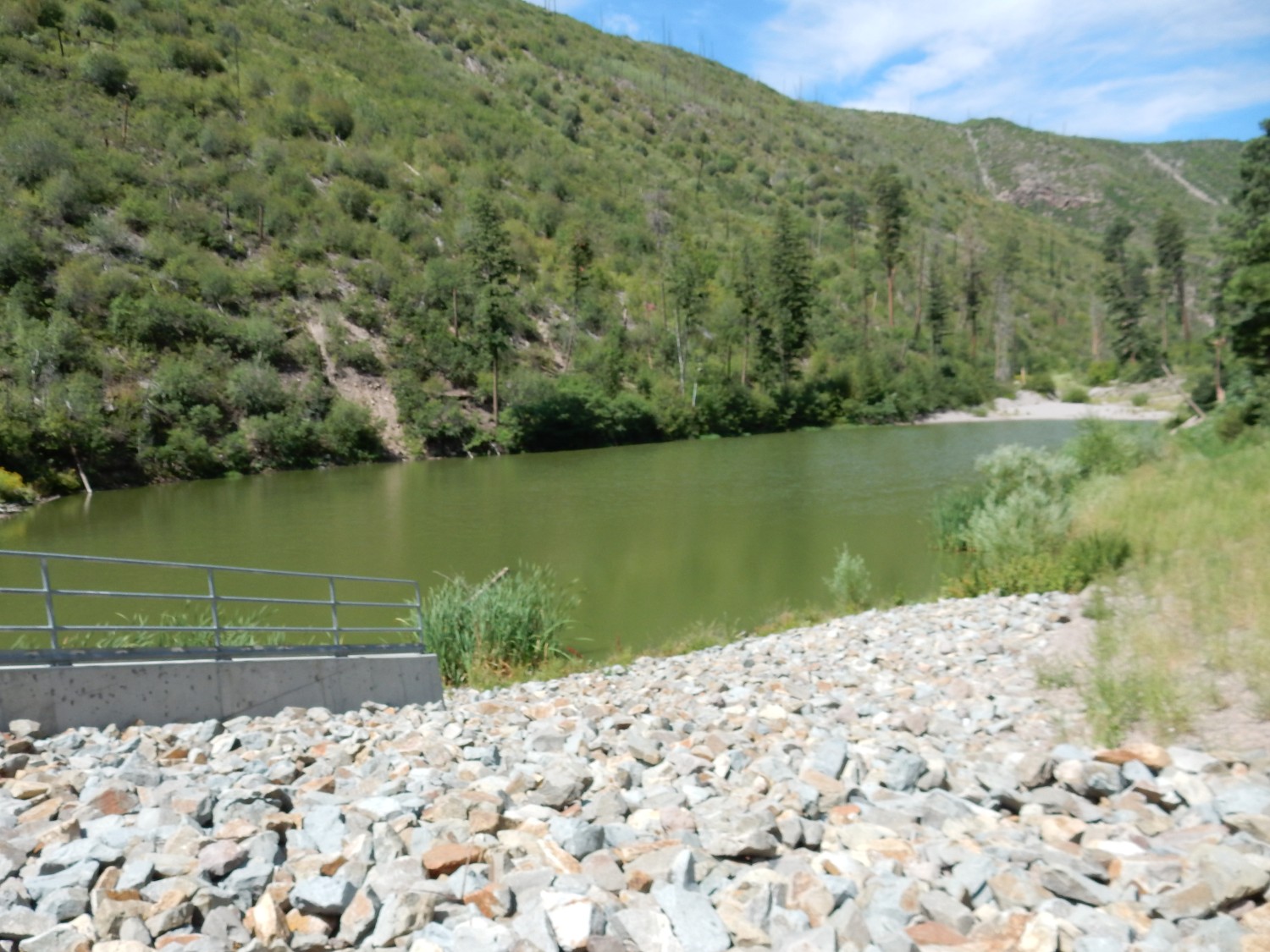
The reservoir has been refilled by monsoon rain. It’s not quite to the top of the outlet, but within a couple of feet.
There is a walkway across the outlet. Alas, the far end is gated. so I can’t explore the far cliffs. But I get a nice view of the reservoir area.
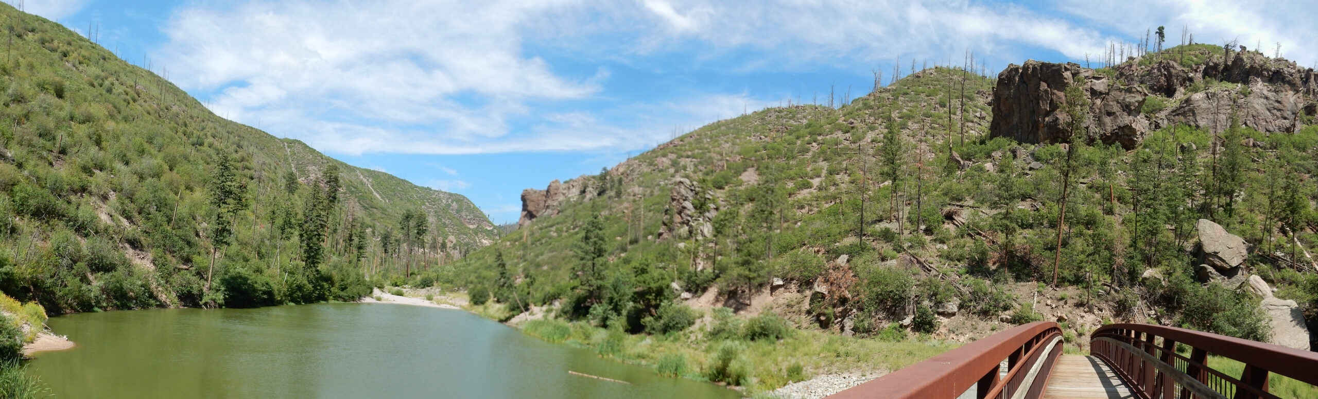
The large knob at right is cut on its west face by yet another fault, this one down to the west. The knob past the end of the lake is more Pajarito Mountain Member.
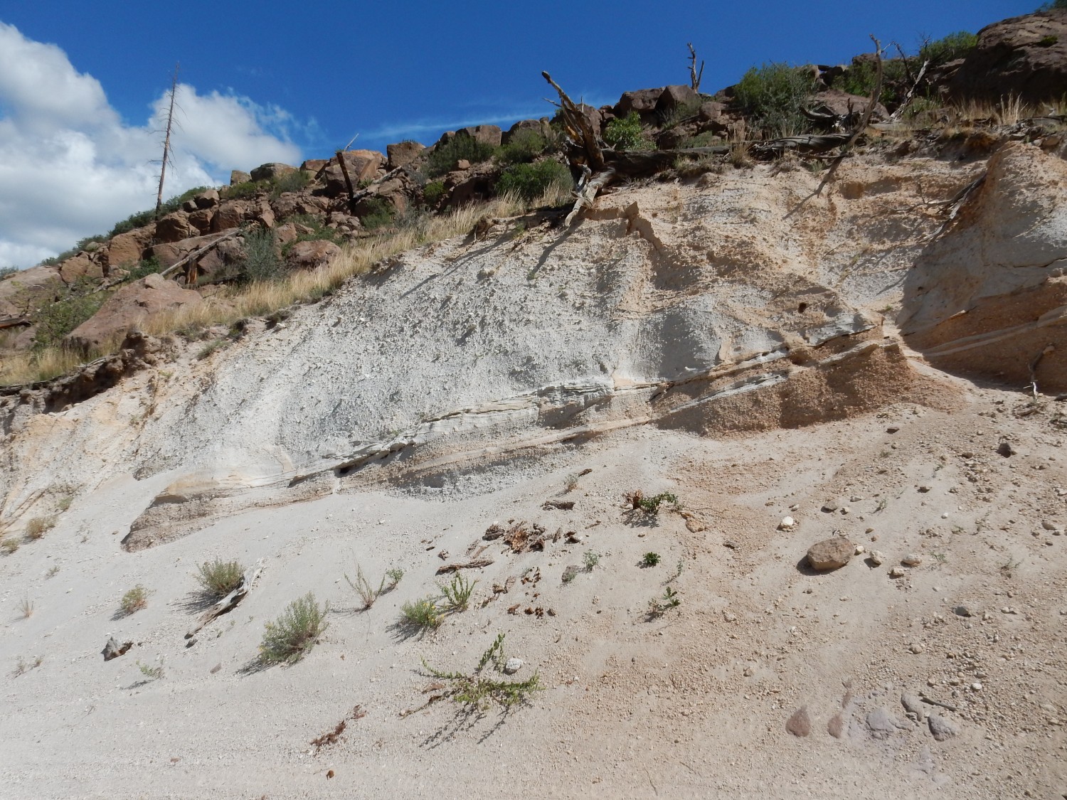
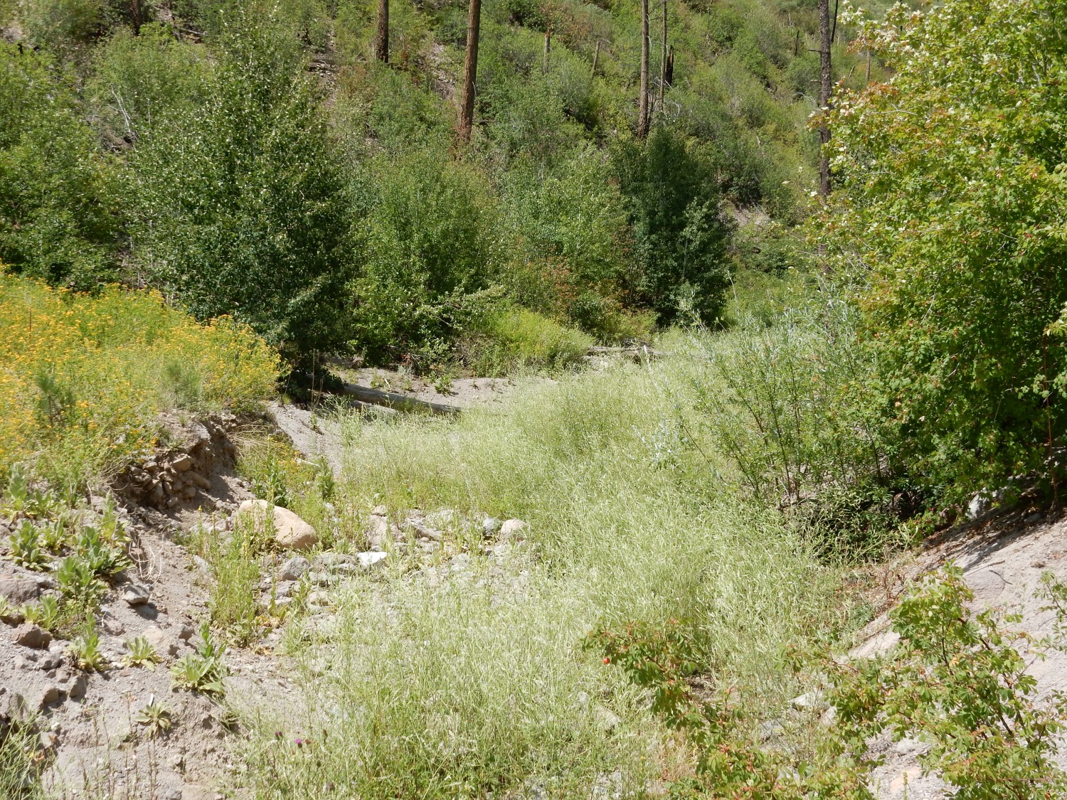
South of the lake, near the outlet, is a deeply eroded gully I explored on my first visit here, some years ago. I was puzzled then by the beds of tuff, pumice, and debris. Here I get a better look with more experienced eyes.
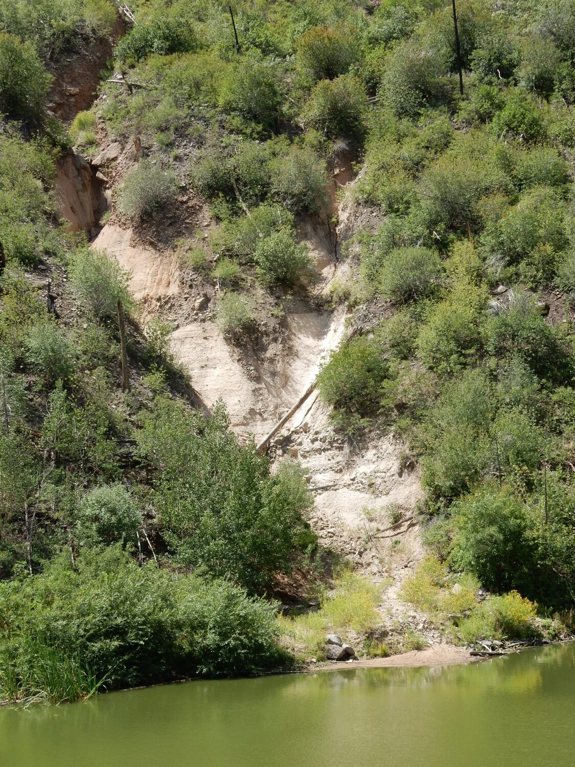
The topmost bed is Tsherige Member sitting on a gravel bed of the Pueblo Canyon Member.
A gravel bed this close to the mountains is not terribly surprising. The pumice bed is also Pueblo Canyon Member.
Below this are debris flow beds, again unsurprising this close to the mountains.
Debris flows: This is a thick mixture of mud and coarse gravel forming a kind of landslide coming off the mountains.
Below this, though poorly exposed here, is Paliza Canyon Formation andesite.
Hiking around the lake, I’m struck by a rock.
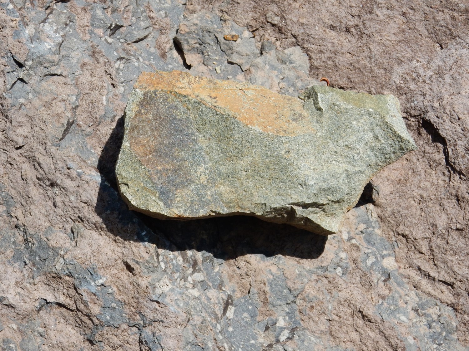
By which I mean that it grabs my attention, not that it actually hit me. The green color suggests hydrothermal alteration. It’s probably not actually from around here.
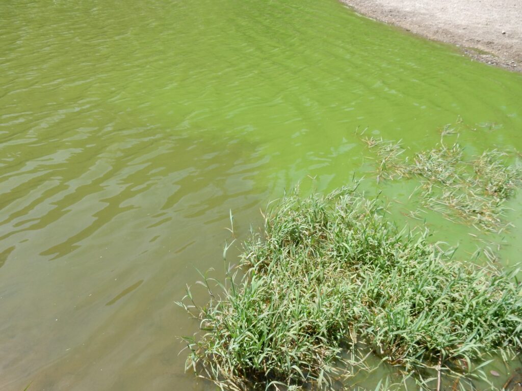
I also notice the deep green color of the lake. Algal bloom?
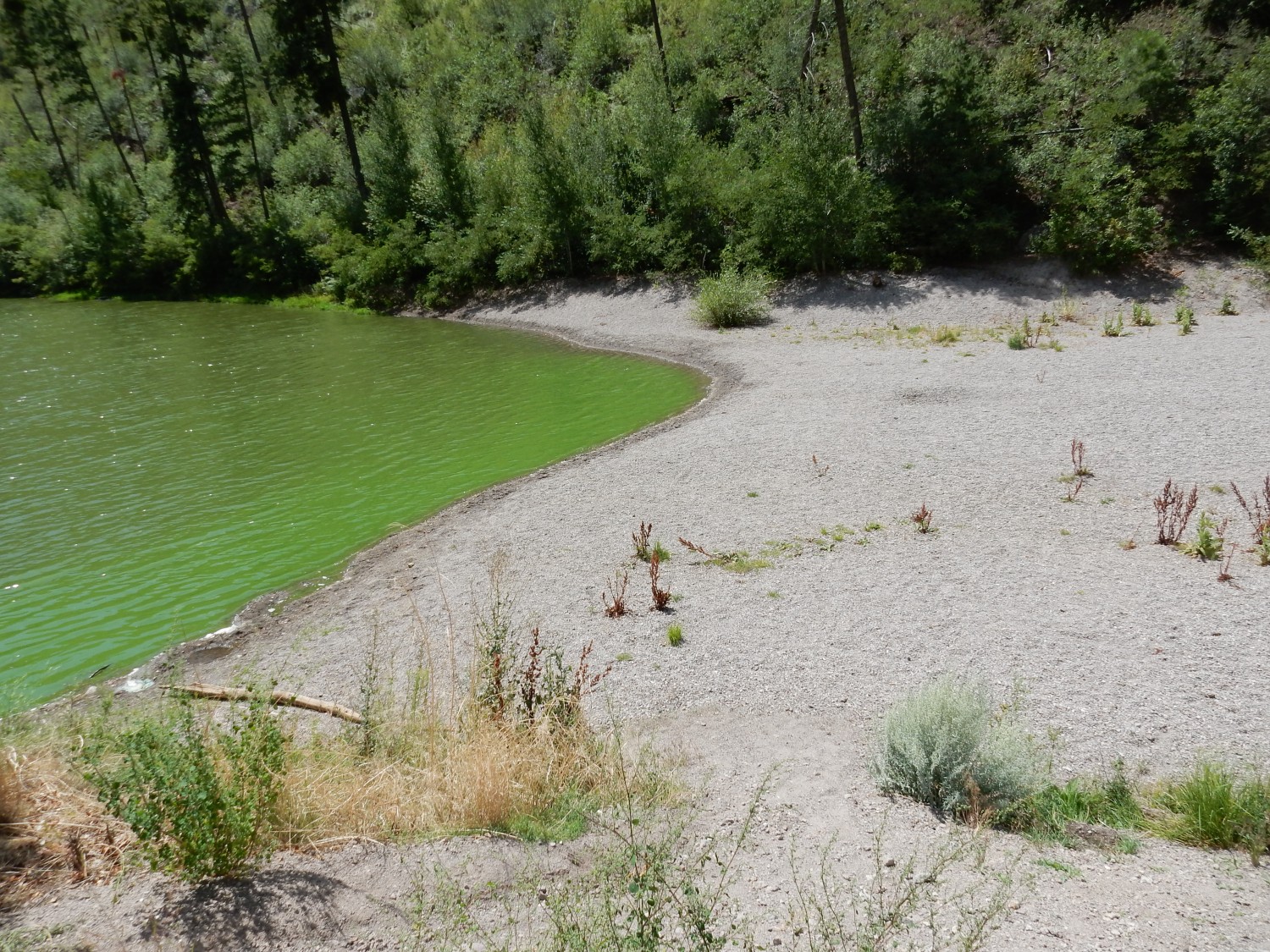
And this beach is surprising. It’s fairly uniform dacite gravel. It looks almost artificial.
Alas, my hike ends here.
It turns out there is, in fact, a trail clearly visible on satellite up canyon. But the entrance is not obvious and apparently I walked right past it.
Back to the lake. Yep, algal bloom.
I have a water bottle I just emptied. I decide to get a sample of lake water to look at under the microscope when I get home.
Then back to the car. I pause for one last fault trace.
Looking right down it, but trees in the way. SIde view from the north:
This is an unusual east-west fault that seems to determine the location of the canyon for some distance to the west. Not unusual.
I still have time and the weather is holding. I decide to visit Rendija Canyon, which I have not done in some time.
Early in this post, I mentined that the west side of Guaje Mountain is cut by the Guaje Fault. As I’m driving to Rendija Canyon, the fault plane is obvious:

The fault curves slightly to the west, so I’m not actually standing on the fault trace here. But I make a mental note to try to trace it on Barranca Mesa to the south later.
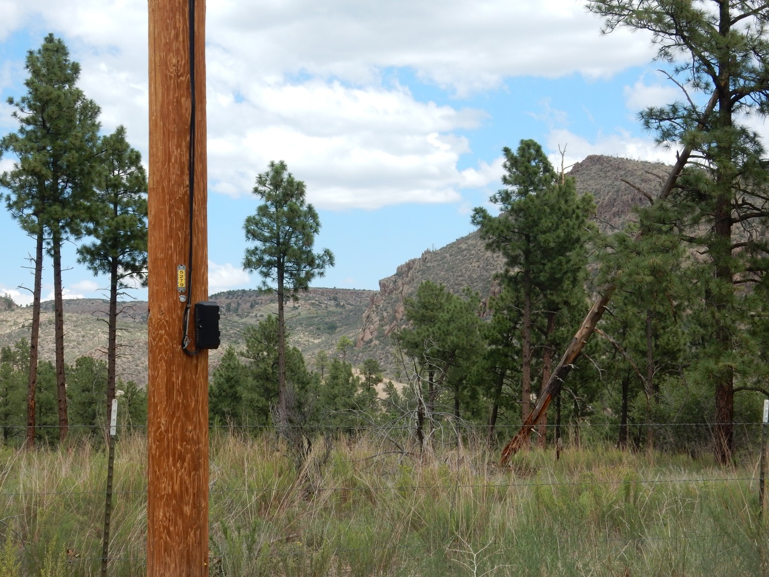
Past the Sportsmen’s Club:

Here Cerro Toledo sediments accumulated in a valley eroded in the Rendija Canyon Member west of Guaje Mountain. The valley was then filled with tuff of the Tsherige Member. This formed a resistant cap that protected the Cerro Toledo sediments beneath from erosion even as the rest of the surrounding terrain was leveled.
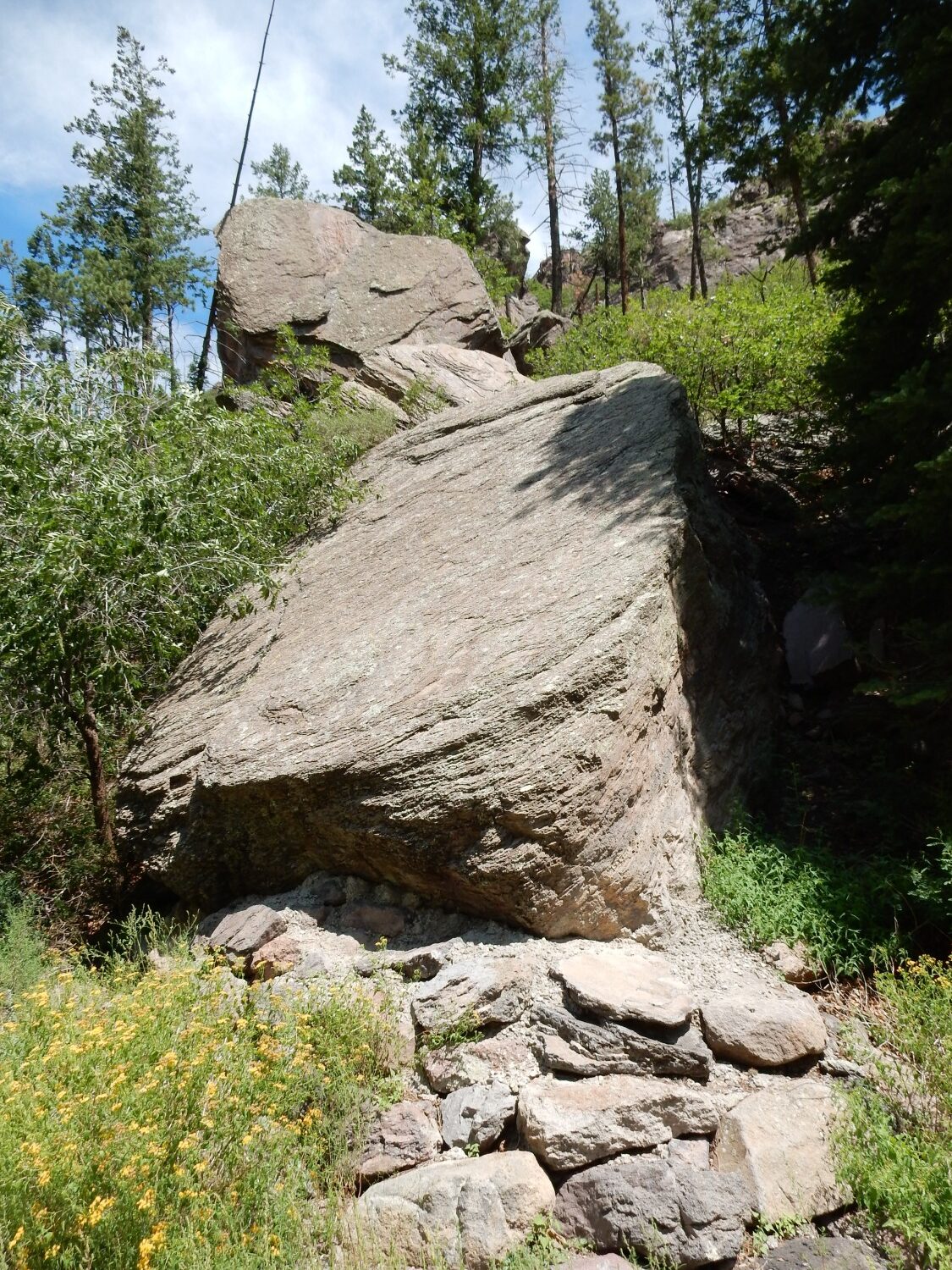
Hoodoo, pedestal rock, or goblin, depending on your taste in terminology. This is part of the Puye Formation.
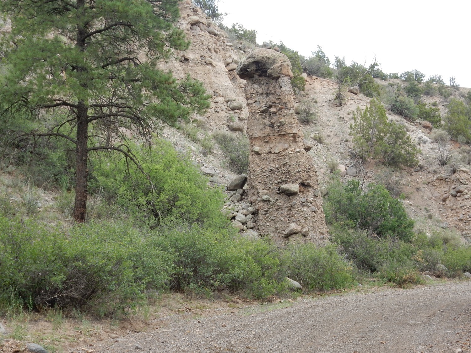
The capping boulder likely helped compact the sediments beneath, causing them to be more strongly cemented, and also provided protection from erosion. Hoodoos are very common in Rendija Canyon in the Puye Formation.
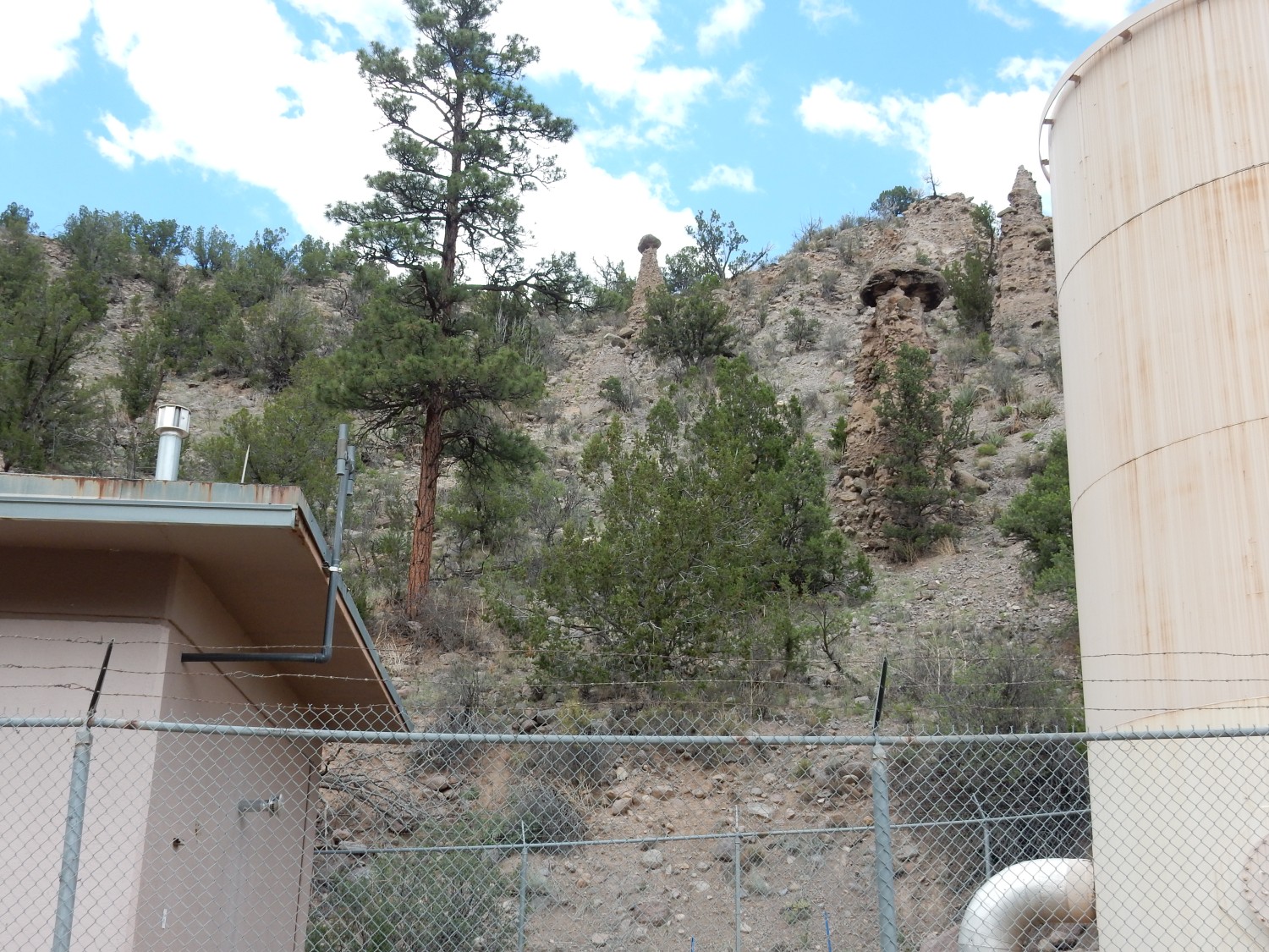
Goblins standing guard over some water tanks.
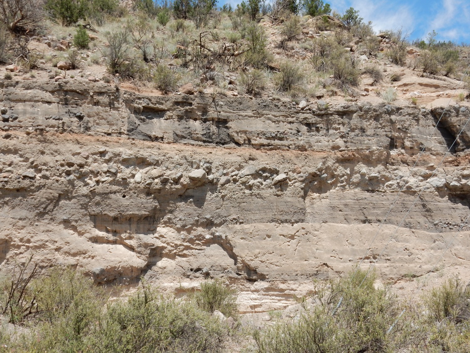
A striking outcrop.
I get out for a closer look. The dark beds are coarse pulverized rock. The brown appears to be mud layers. There’s boulders of a debris flow at the top. This is classical fanglomerate deposits.
A possible ignimbrite layer.
I should have explained already: Ignimbrite is essentially a synonym for primary tuff, tuff deposited directly by volcanic activity rather that tuff formed from volcanic ash reworked by water or wind.
Or it could be another mud later. Hard to tell from this distance. But I have a paper mentioning a prominent ignimbrite at about this point in the canyon. This may be the ignimbrite from which a minimum age of 3 million years was determined for the Puye Formation.
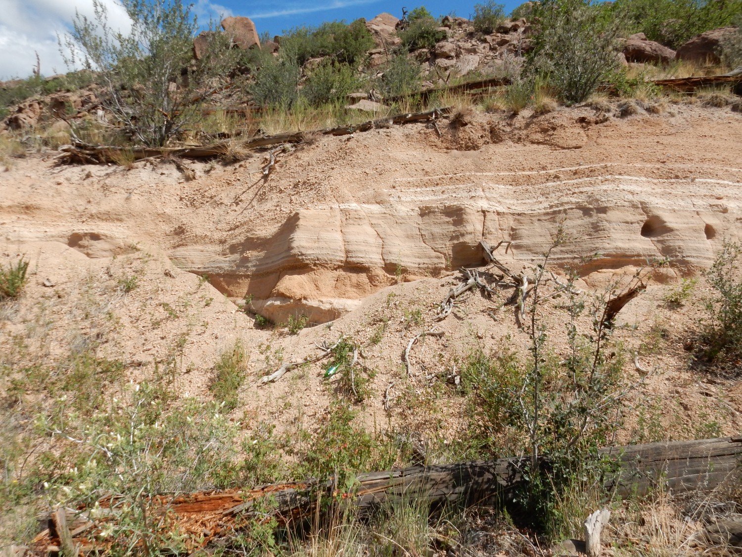
This is fun.
There’s a lot going on here. The lower beds look like either mudflow or ignimbrite. The two dark beds look like cinder, with a debris flow in between, but the red layer looks either baked or otherwise oxidized. Perhaps it’s a thin, oxidized fossil soil or paleosol. I decide to get a closer look.

The lower layer looks muddy. My guess is it’s an ignimbrite that has weathered to clay. The gray layer above looks has an assortment of rock fragments from pea-sized on down — it is very poorly sorted and shows no bedding. And it looks like it scoured the upper surface of the ignimbrite. I’d say this is cinder reworked by water, probably in what geologists call a hyperconcentrated flow — too thin for a mudflow but too thick for ordinary stream action. The layer above really can’t be anything but a debris flow, and the more I look at the red layer, the more I t hink it’s a paleosol. I don’t think it’s baked, becuase the gray later above looks like another debris flow rather than hot ash. But there are chunks of rockfall of about that color that look like very well-sorted sandy cinder. I’m not sure which part of the cliff they fell from and I am not in a good situaton today to try to climb up for a closer look. I may come back another time and try to trace the beds to where I can get at them better.
I drive down to the intersection with Guaje Canyon and drive partway up Guaje Canyon to take a look at the fork up the north side of the canyon. It’s been years since I was last here. The road has an evil look where it first climbs the cliff, but on satellite, it looks like I could make it to the top. But from there all the roads look pretty rotten. The spot worth visiting is Pine Spring, but the road in looks dreadful and it’s too far to reasonably hope to hike. (Not to mention real potential for getting lost.)
I drive to Barranca Mesa and find the southern continuation of the Guaje Fault.

No, seriously. The city bus here has just crossed the fault trace.
I return home and look at a drop of the lake water I collected under my microscope.
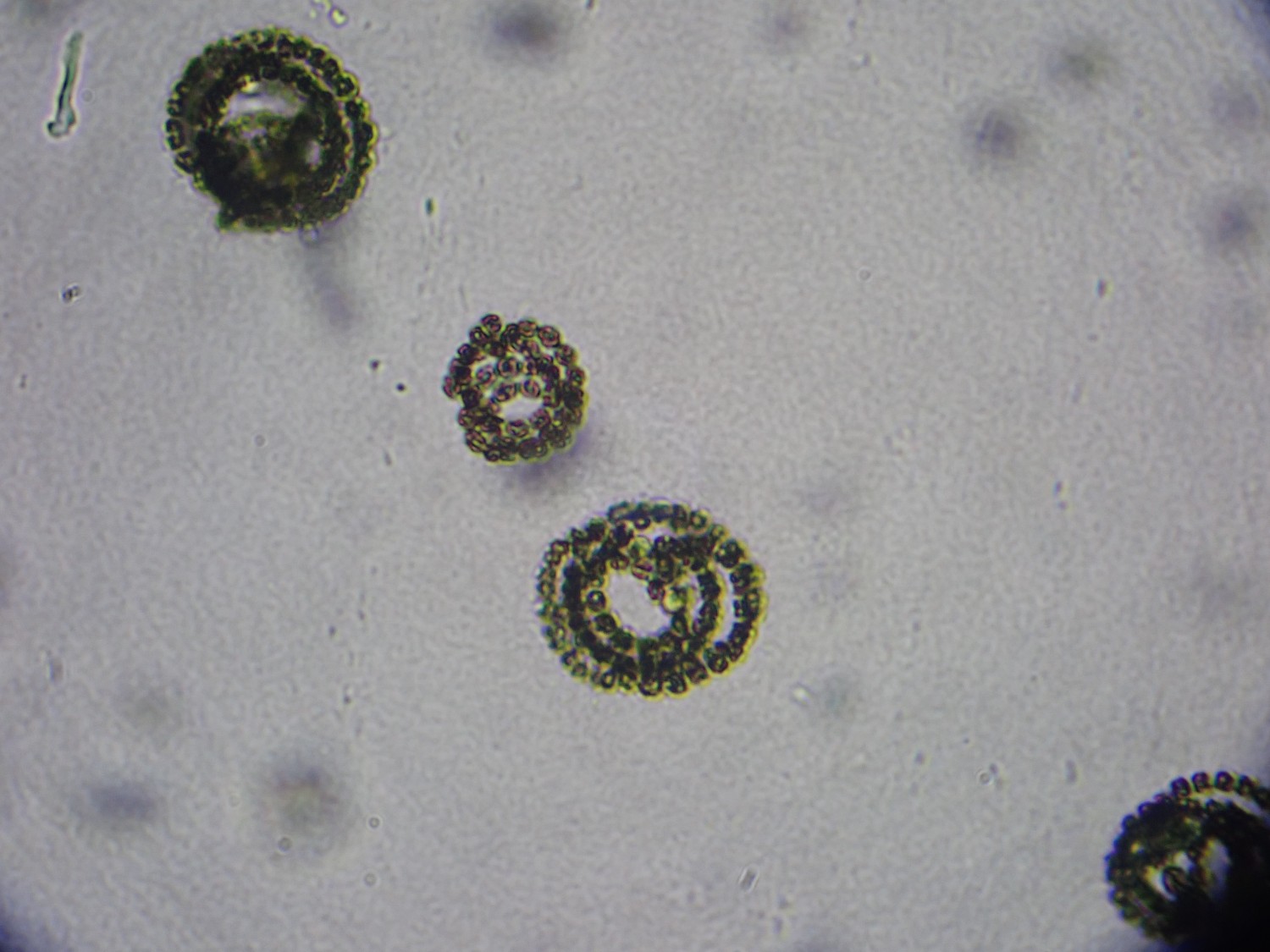
Little strings of green cells like pearls on a necklace.
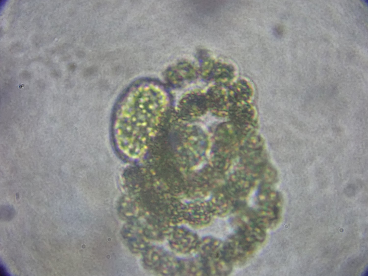

Heterocysts — the oddball cells. This is Anabaena, a cyanobacteria that is very common in freshwater lakes. The heterocysts form when nitrogen levels drop, and manufacture and supply organic nitrogen to the rest of the string of cells.
Cool.
We’ll see how the weather is in two weeks. I’d like to hike to Cerro Picacho again, this time not forgetting my camera. But El Pothold Grande will have to have dried up, and no chance of thunderstorms, and best to take a friend or two.