Wanderlusting Cerro Picacho
Today’s hike has been a long time coming. I visited the area almost two years ago, but it was enough of a last-minute thing that I discovered at the trail head that I had failed to bring a working camera. I knew I wanted to go back and get the pictures, but I had a good friend I hoped to take with me, and I needed to go in good weather. (This is not a good area to be caught by a thunderstorm.) Well, today the weather forecast was excellent, and it turns out my friend is wrestling with plantar fasciitis and is not going to be in shape for a long hike any time soon.
Cerro Picacho (“Peaked Hill”, more or less) is a large hill or small mountain on the southern edge of the San Miguel Mountains, which in turn are a small range of mountains in the southeastern part of the Jemez Mountains. The Jemez Mountains are a volcanic field, formed by eruptions that began around 14 million years ago and have continued almost to the present day. (The most recent was about 68,300 years ago.) The San Miguel Mountains were a major eruptive center within the field from about 9.5 to 8.7 million years ago, which has now been deeply faulted and eroded but remains prominent on the skyline west of Bandelier National Monument. Cerro Picacho itself was erupted quite late, around 7.1 million years ago. There is a lot of very interesting geology in the San Miguel Mountains, particularly in the portions just south of Cerro Picacho.
So I drag myself out of bed (relatively) early, load up the Wandermobile, and head for the mountain. The weather forecast is for light cloud cover, with only a slight chance of evening thunderstorms, and I hope to be done well before then. I am a little worried about the dirt road to the trailhead, which I have not seen in a year, but I remind myself that it’s not like I have a moral obligation to press ahead if I find the road in lousy shape; I can always turn around and find a different hike. I find this thought oddly comforting.
As it turns out, the road is okay. My route is along State Road 4 west of my home in White Rock into the Jemez Mountains, turning south just before reaching the caldera onto Forest Road 289. This continues on to Graduation Flats, a very popular dispersed camping site named for the role it has played in Los Alamos High School post-graduation bacchanalia. Just past Graduation Flats, the road jogs left at a fork, then on to the Dome Lookout spur. Up to this point, the road is well-maintained macadam suitable for passenger vehicles in good weather. At the spur turnoff, either direction, the road immediately drops in quality. The fork headed south is still passable perhaps as far as Cerro Balitas, but the road beyond cannot be recommended for anything but a jeep. The road is now completely washed out in Eagle Canyon, which in any case the Cochiti pueblo has closed.
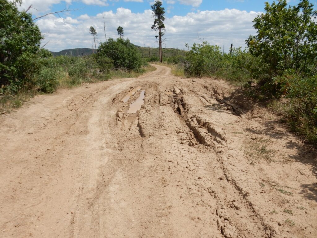
The Dome Lookout Spur is still open and still passable for passenger vehicles, in excellent weather, with care. It is very rocky for the first section and must be driven slowly, but gets better after passing the Forest Service gate (which is open most of the year). The chief hazard beyond is the occasional pothole, of which the worse is El Pothole Grande. It was El Pothole Grande that I was most worried about, and when I arrive, it is deep in mud; but it turns out a path has been beaten around the worst of it and I get through okay. The road again becomes rocky and steep as it ascends St. Peters Dome, but it’s passable with care and then you’re at the parking area for the trail system.
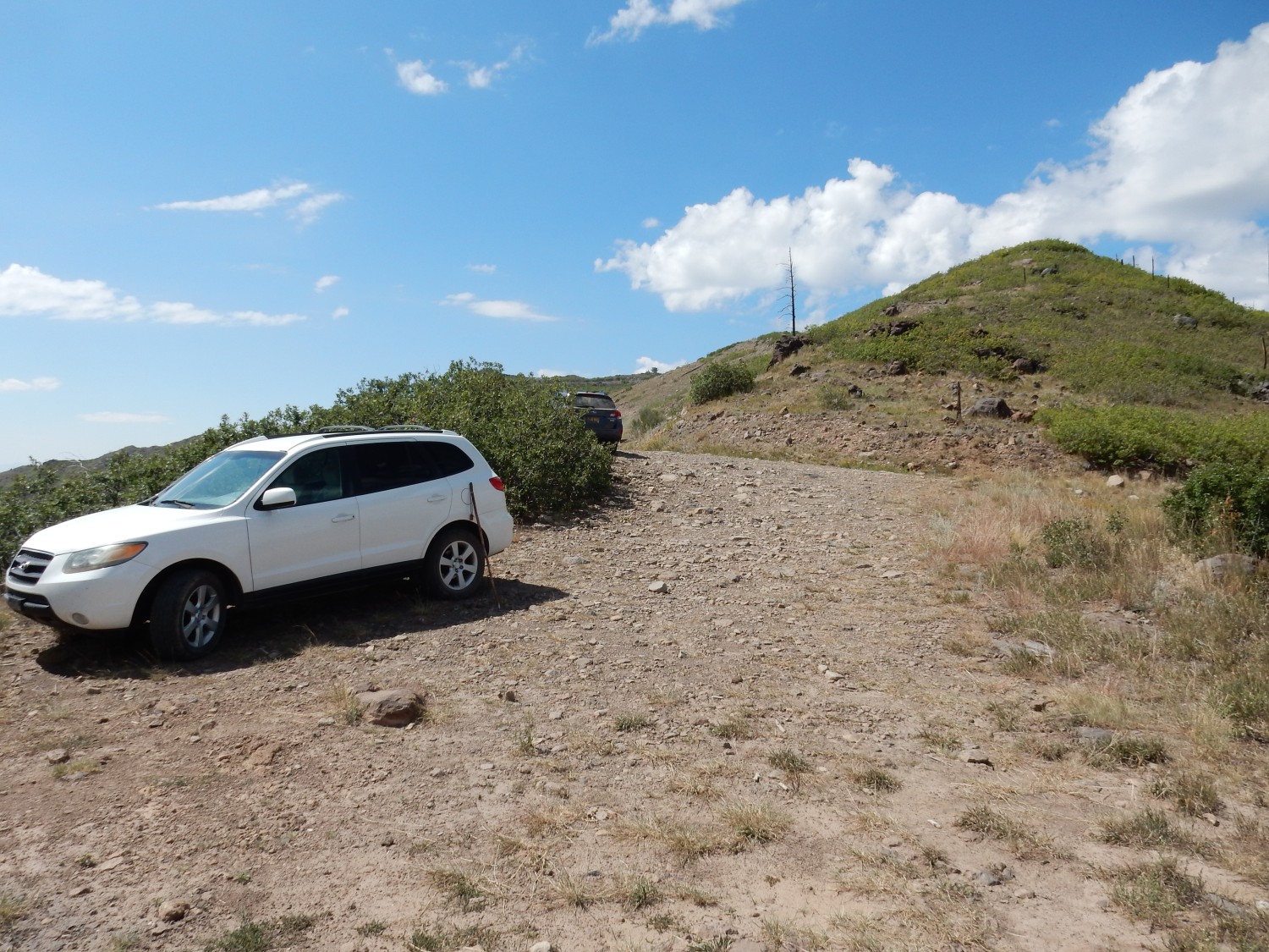
As you can see, I am not alone. In addition to the car parked on the other side of the bushes, there was a rider on a motorized trail bike in the area making a racket. However, I’ve never seen the parking area so crowded that it was hard to find a place to park.
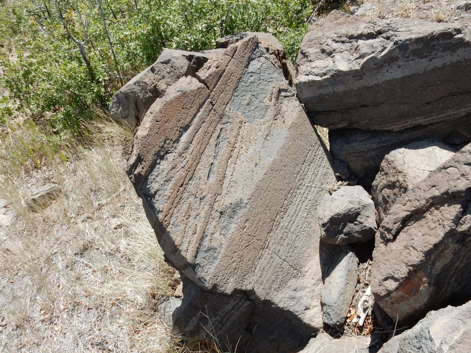
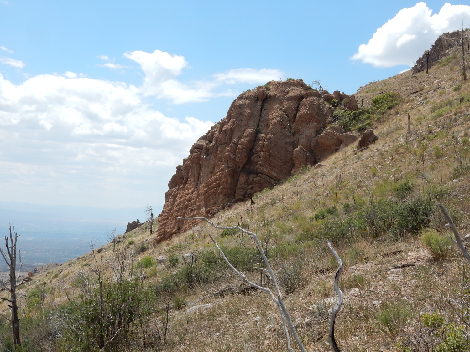
I switch to hiking boots, drink a good guzzle of water from the water jug in back, make sure I have three more pints in my pack, hit the “On the trail” button on my satellite tracker and put it back in the pack, grease up with sunscreen and bug spray, grab my hat and stick, and head out. My first stop is the ridge at right, which is composed of clotted andesite.
This is not quite the youngest flow on the mountain. The very top of St Peters Dome is capped with porphyritic andesite dated at 8.69 million years old. The flow here is slightly older and also much more extensive, capping most of the highest ground in the area.
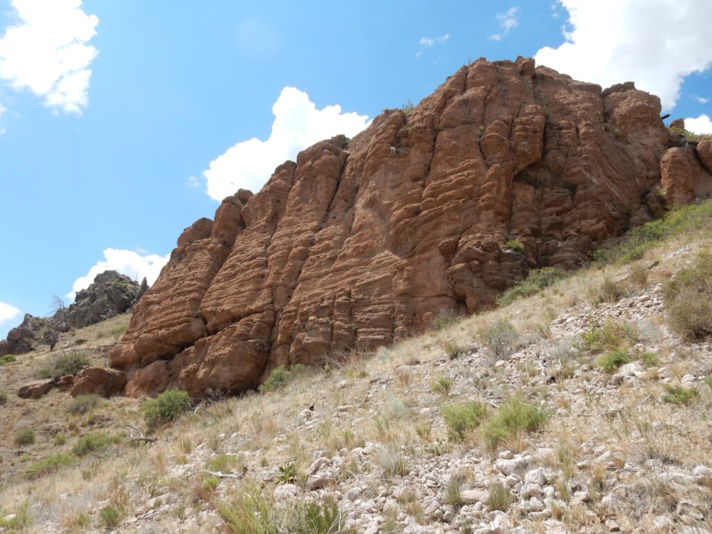
A closer view.
Andesite is an intermediate volcanic rock, meaning that it has a silica content of about 60%, halfway between basalt at 50% or less and rhyolite at 70% or more. Silica makes lava viscous, and andesite lava has about the viscosity of smooth peanut butter. This is enough that it does not spread out to form flat lava flows the way basalt does; but neither does it form stubby plugs or erupt explosively quite the way rhyolite does. Instead, andesitic volcanism tends to form the classic volcanic cones we think of when we hear “volcano”.
The andesite here is described as clotted andesite, because it has distinctive clumps of white plagioclase feldspar and dark pyroxene crystals about 2mm across, plus larger individual phenocrysts of plagioclase. The latter are clearly visible here; the clumps are not quite as obvious. Plagioclase feldspar is a very common mineral, composed of sodium, calcium, aluminum, silicon, and oxygen. It tends to crystallize out as large crystals within magma that is still liquid, and when the rest of the magma is rapidly solidified after being erupted at the surface, you’re left with big white plagioclase phenocrysts in a much finer-grained matrix.
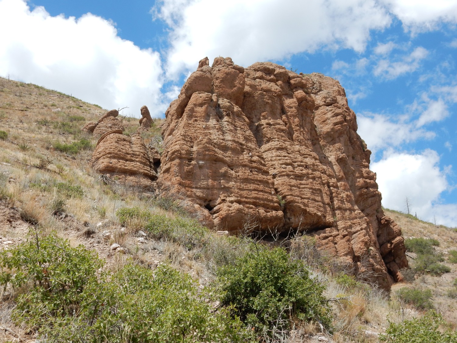
Some nice layering in the rock.
Viscous lava tends to form thin layers like this (flow banding) as it slowly creeps downhill.
Almost all the volcanic rock of the San Miguel Mountains is assigned to the Paliza Canyon Formation, which makes up most of the volcanic rock of the southern Jemez. In fact, it’s been estimated that Paliza Canyon Formation made up at least half the original volume of the Jemez volcanic field.
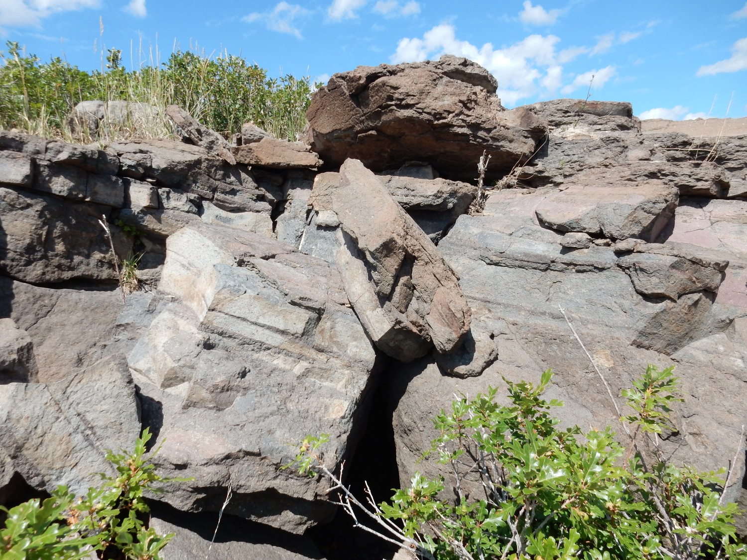
I start down the road towards the summit of St Peters Dome. My trail will eventually fork off the road, but meanwhile there are good exposures of rock beds in the road cut.
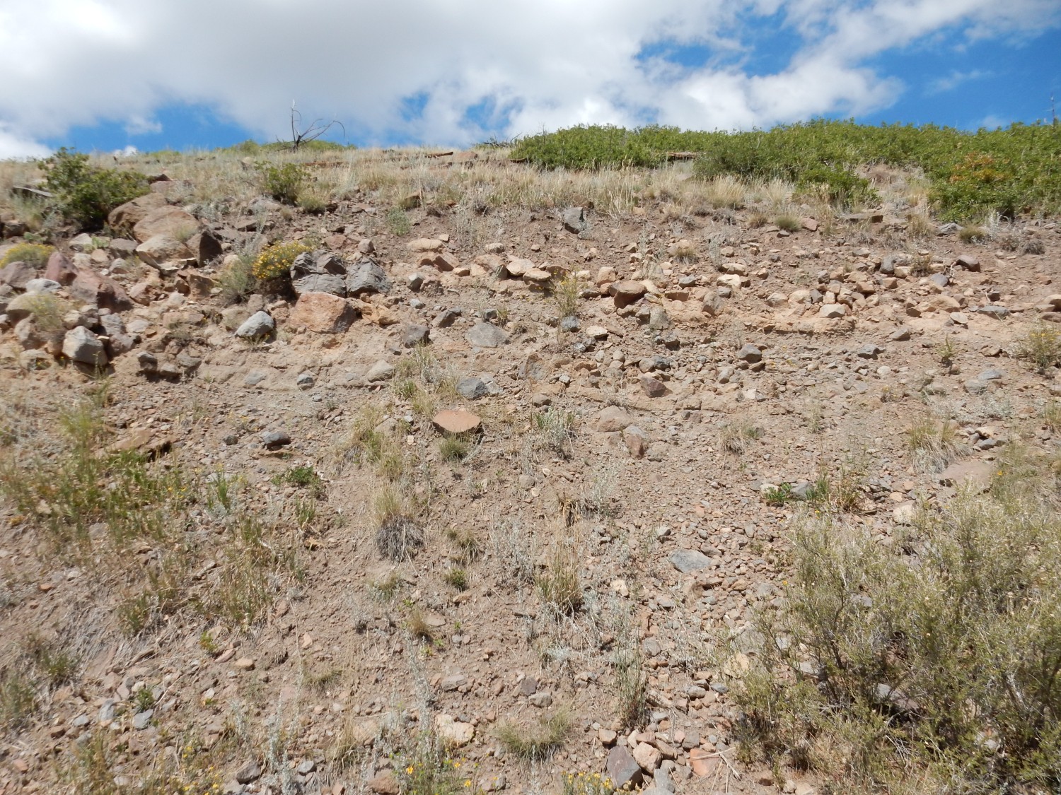
This is volcaniclastic beds, made of broken fragments of volcanic rock of various sizes. Most of the bulk of the San Miguel Mountains seems to be made of volcaniclastics, which is not at all unusual for stratovolcanoes. All the rounded rock chunks you see here are various kinds of andesite. This looks like a debris flow, a mixture of broken rock, volcanic ash, and water that is a common hazard around volcanoes.
I find myself wondering where this all came from. Debris flows come from higher ground; there is no longer any higher ground here. It’s all been eroded way.
Also, notice that the beds dip very gently to the right (north).
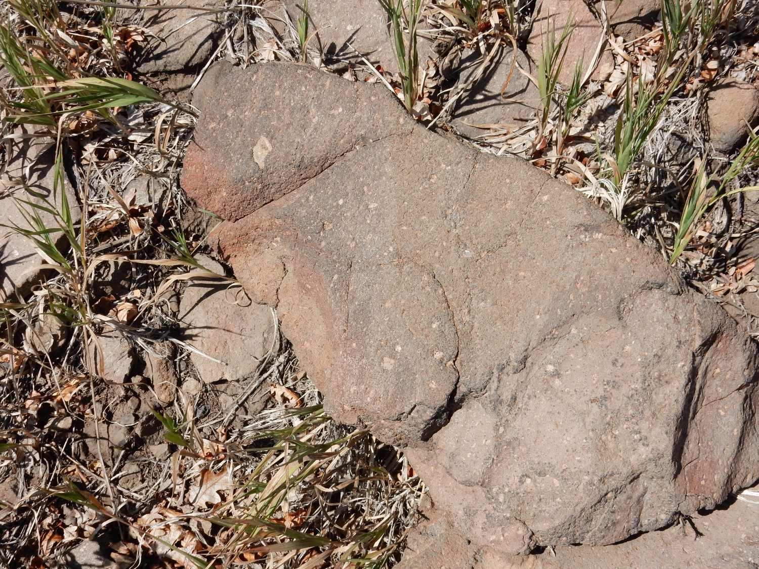
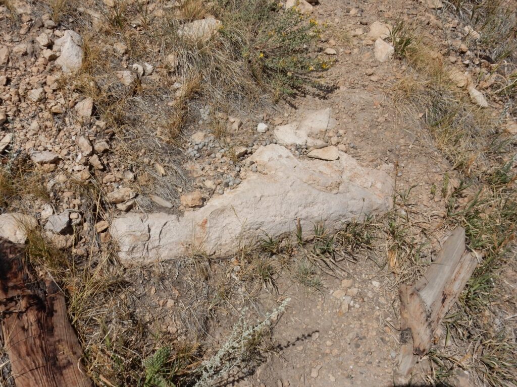
Here is a well-cemented pumice bed.
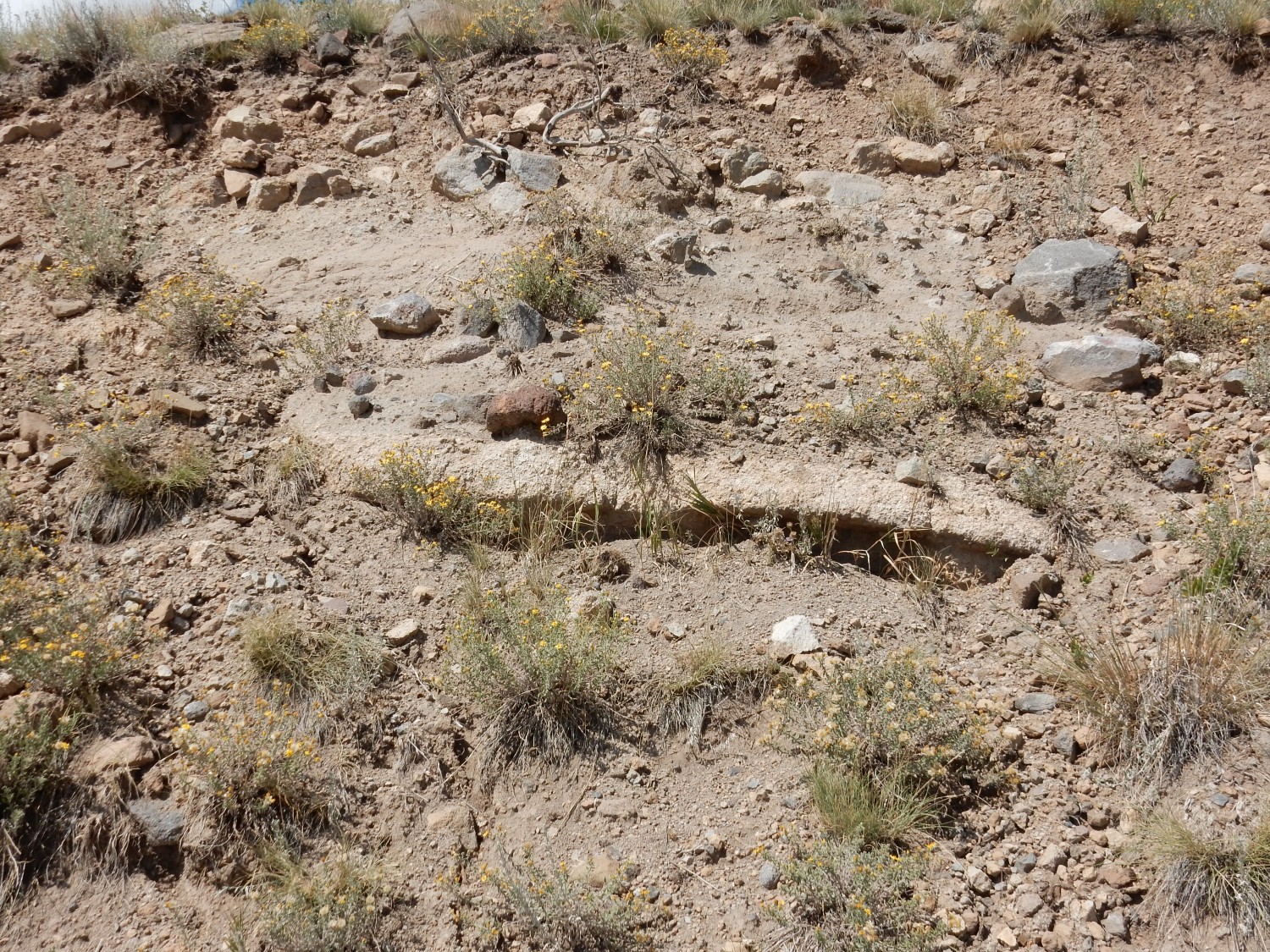
There is a second layer in the road bed.

I examine a fragment. Fresh pumice is a kind of rock foam formed from very viscous lava saturated with dissolved gases. The gases come bubbling out when the lava is erupted, forming rock that is more bubbles than solid rock. The pumice here is old enough that most of its pore spaces have been filled with minerals precipitated long after the ash bed was laid down.
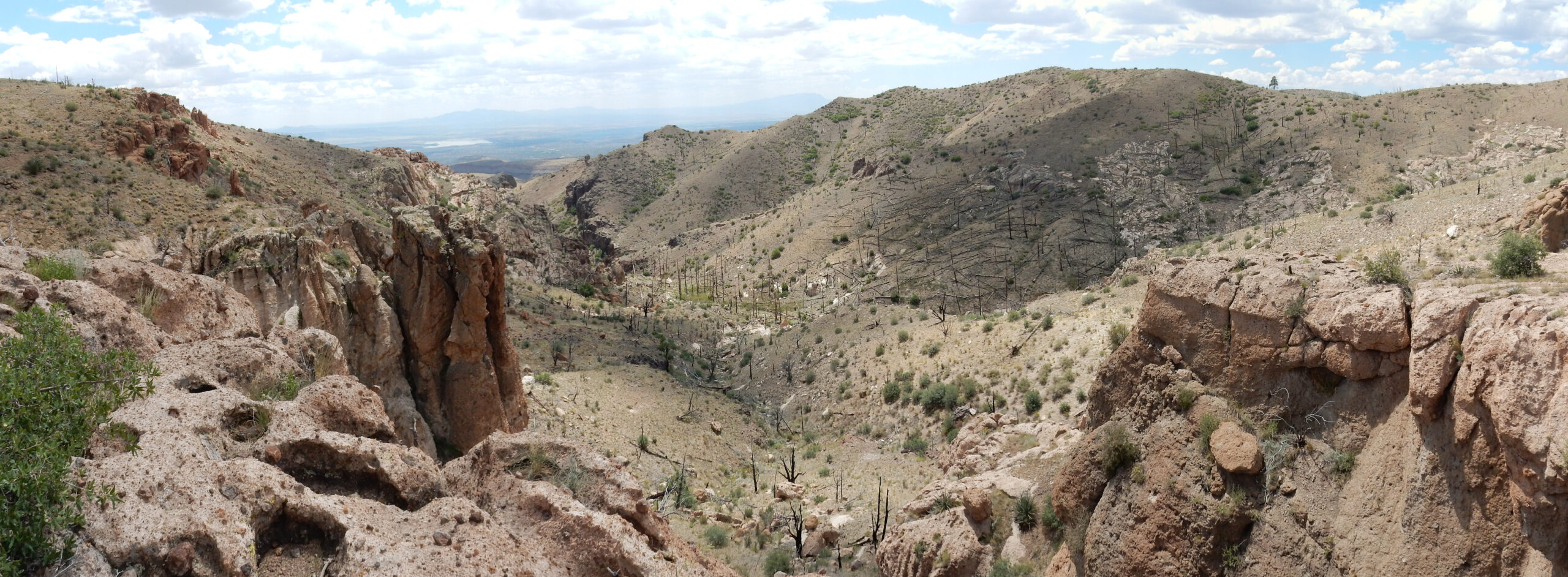
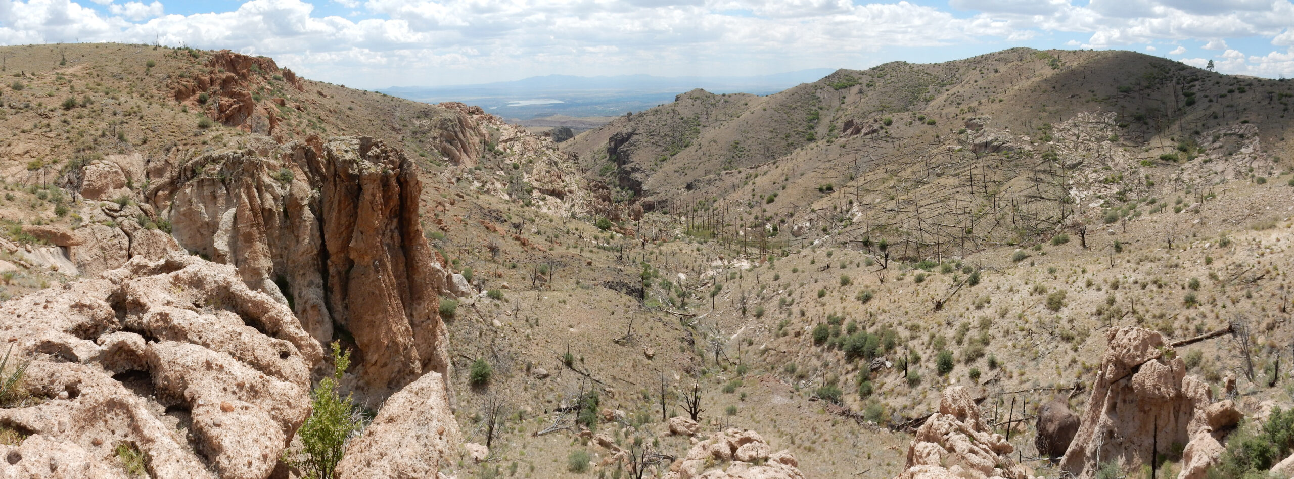
I pause for a panorama. And, although I take two sets, the middle photograph is out of focus on both. Grrr. The best I could do:
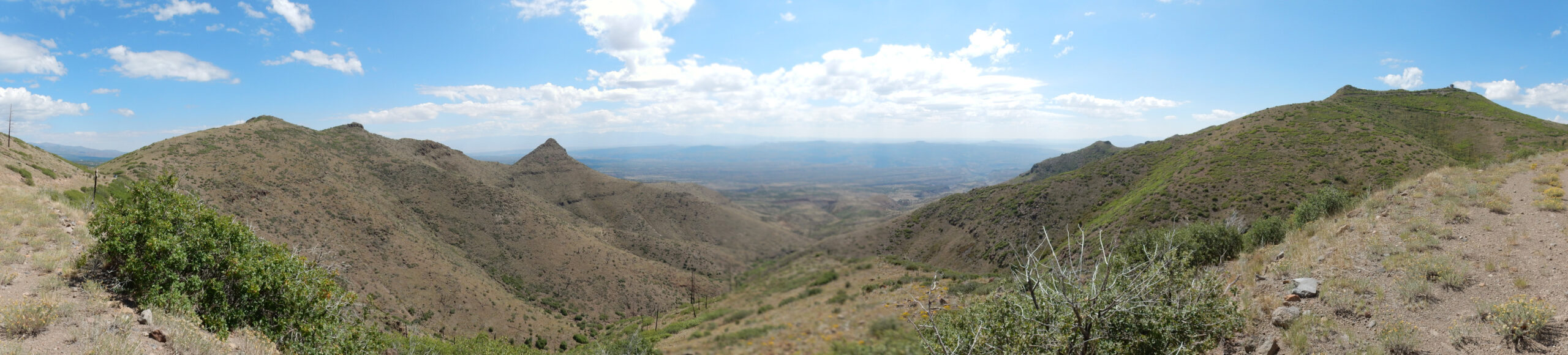
As with most images at this site, you may click the image to get a higher resolution version. This image shows what is left of a stratovolcano whose eastern portion (at center) was cut and dropped by a fault and the remainder heavily eroded. This has exposed much of the heart of the volcano. You can see numerous layers making up the volcano. It is from this layering that stratovolcanoes get their name.
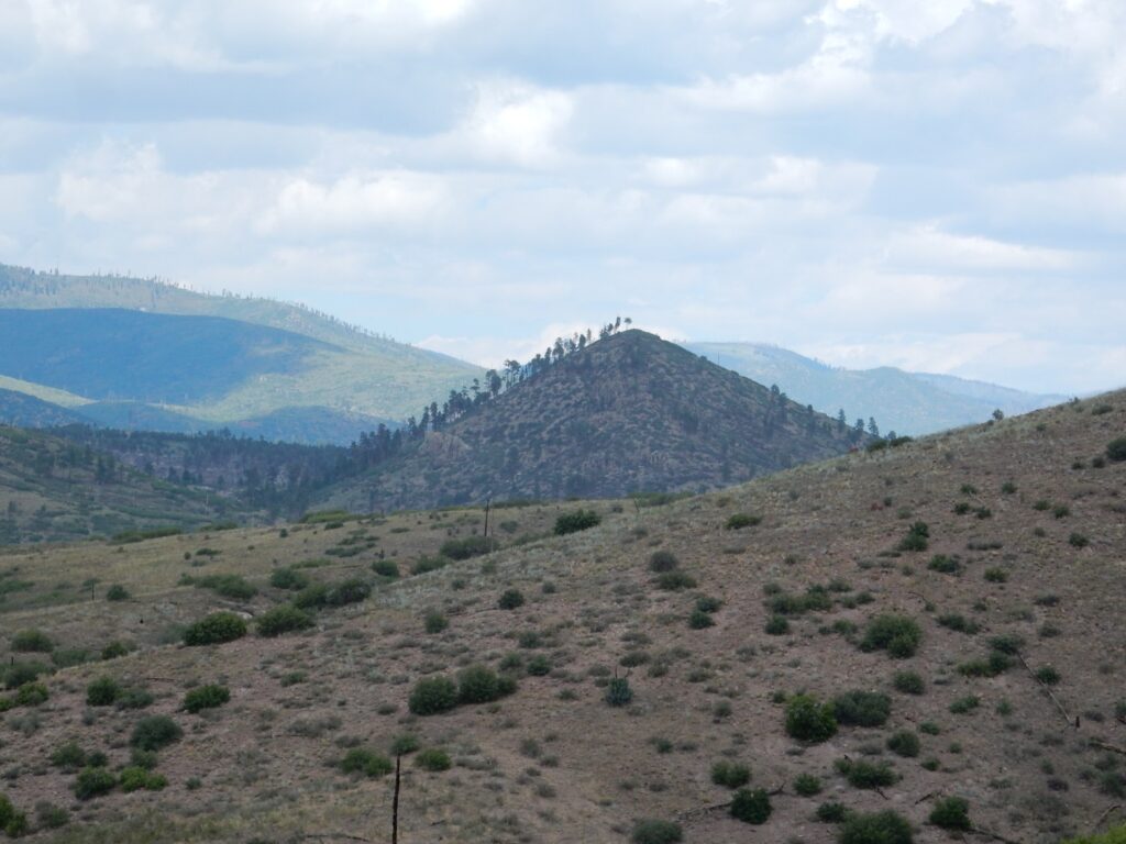
To the south (far right) is St Peters Dome itself. (The topographic map has no punctuation in the name; my impression is that this is the usual convention, so it is not St. Peter’s Dome.)

This is underlain by the porphyritic andesite I mentioned earlier, which lacks the clots but has more abundant phenocrysts. You can see the gravel road to the summit, where there is an old fire lookout tower.
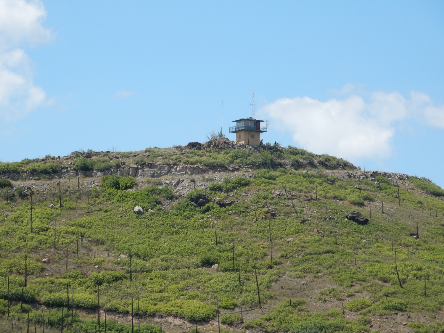
Fire lookout towers are non longer a thing, at least in the Jemez. Aerial reconnaissance and private citizens with cell phones have proven to be a more cost-effective way of spotting wildfires. But there is still some instrumentation active on the tower.
To the northeast is Boundary Peak.
This is capped with olivine andesite, present in small quantities on some of the highest ground in the northern part of the San Miguel Mountains. Olivine andesite is notable for its content of olivine, a silica-poor mineral most characteristic of volcanic rock much lower in silica content than andesite. This is either very iron-rich olivine, which can coexist with silica better than the more usual magnesium-rich olivine, or this shows that a low-silica and a high-silica magma mixed just before being erupted. Some volcanologists claim that this is actually pretty common.
Boundary Peak is so called because it sits almost exactly on the boundary between Forest Service land to the west and Bandelier National Monument to the east. I will be hiking on Forest Service land today. (The significance is that amateur rock collecting is permitted in national forests but not within national monuments. Which is moot; I end up collecting no samples today.)
More volcaniclastic beds.

These dip to the left. My first thought was that I had crossed the axis of a ridge on the original volcano, but it looks like the change in dip is because the road cuts through the beds at a different angle. The beds dip gently north and more steeply west.
More.

A tephra bed.

Lava flows produce solid rock. Debris flows are a mixture of very poorly sorted rock fragments; that is, rock fragments of all different sizes. This tephra bed is composed of grains very uniform in size and composition; that is, it is well sorted. This is typical of cinder deposited directly by a volcanic eruption. A rock like this, composed of volcanic rock fragments erupted directly from a volcano that are sand-sized or smaller (less than 2mm in size) is called a tuff. This tuff is dark enough in color to suggest it is andesitic. I’ll see much more silicic tuff further down the trail.
I pause to admire the view into the heart of Valles Caldera.
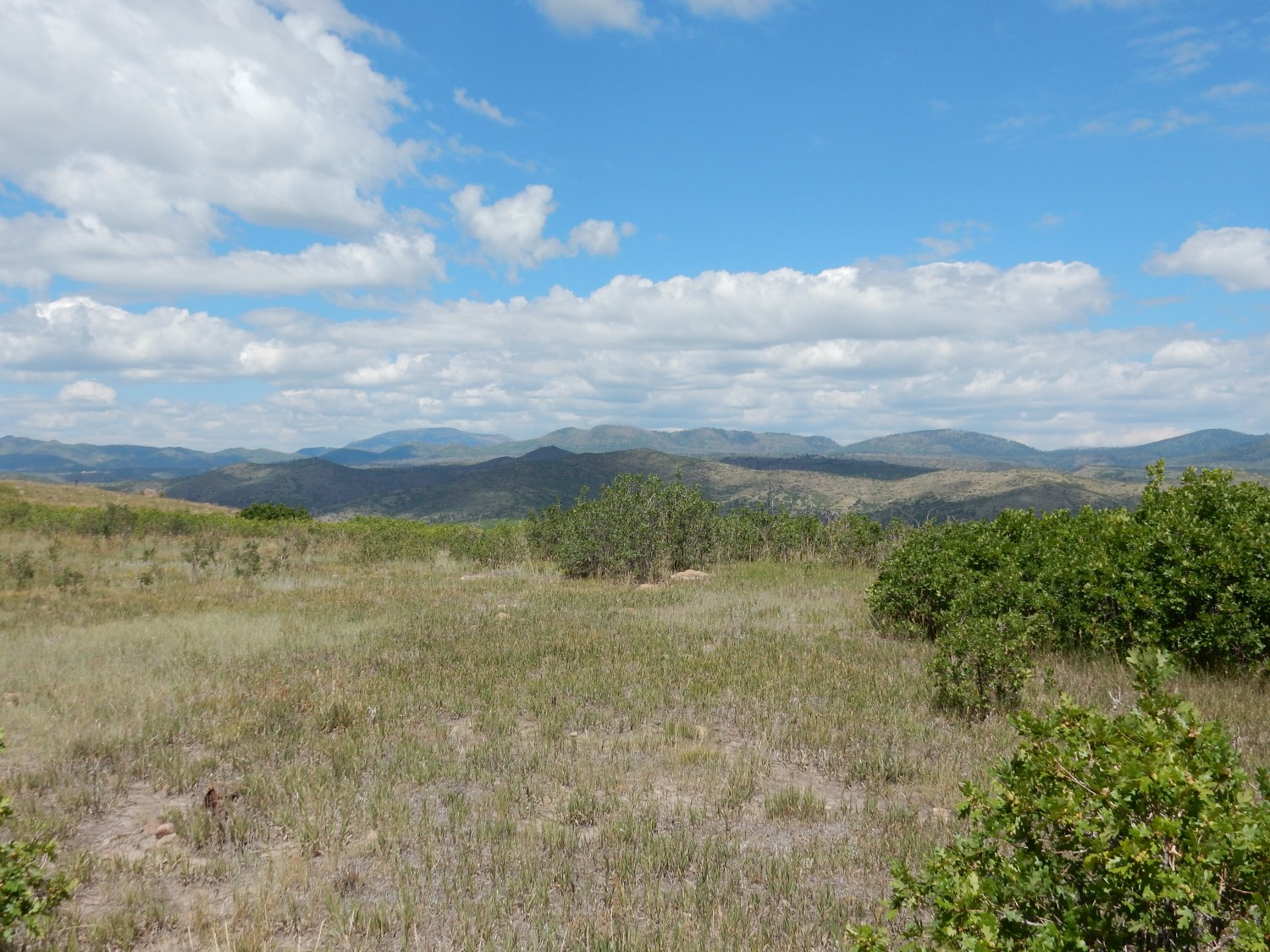
The Valles caldera is the enormous depression, 13 miles across, left by a supereruption 1.26 million years ago. This deposited the Tsherige Member of the Bandelier Tuff, which is the distinctive rock type of the Los Alamos town site. You’ll see plenty of this in other posts. We won’t see that much of it today, since our route is across much older rock that more or less protrudes above the Bandelier Tuff. But we’ll see some.
The distant mountain left of center is Redondo Peak, a great resurgent dome of Tsherige Member formed when the floor of the caldera was pushed back up by fresh lava partially refilling the collapsed magma chamber beneath. This took place very shortly after the caldera eruption, which is a surprisingly common phenomenon. It suggests that such magma injection may be part of what triggers big caldera eruptions in the first place.
At center, in front of Redondo Peak, is Rabbit Mountain, and to its right is Sawyer Dome. Curiously, Rabbit Mountain is younger; it has been disfigured by landslide collapses on its east flank.
I nearly miss my trail. There is no visible signage and the point where the trail leaves the gravel road is hard to spot. You have to be on the trail before you notice the rocks lining it.

General observations for adventurous readers who are interested in hiking this trail: I recommend this hike only for experienced hikers or if you have someone along who has hiked it before. It’s not physically difficult but the trail is quite indistinct in spots. It is not a heavily trafficked trail and in some places it vanishes completely. However, their is some useful rock cairn markers in indistinct spots, and the places where it disappears completely are generally places where the topography really leaves you only one way to go. Getting lost is not really a danger; having a harder and more hazardous hike than necessary is the main risk. On the other hand, if you like bushwacking, this may be just the hike for you.
Once you’re on the trail, the first part is fairly plain. Here the trail crosses a relatively fresh pumice bed.
This is almost certainly El Cajete Pumice, from the most recent burst of volcanism in the Jemez, about 72,000 years ago. El Cajete Pumice is young enough to form loose drifts all over the southern Jemez and is particularly common atop mesas in Bandelier National Monument. Petrographic examination would lock down the identification, but there’s not really anything else this is likely to be.
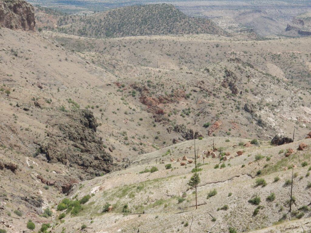
I come around a shoulder of the mountain and see Cerro Balitas to the southwest.
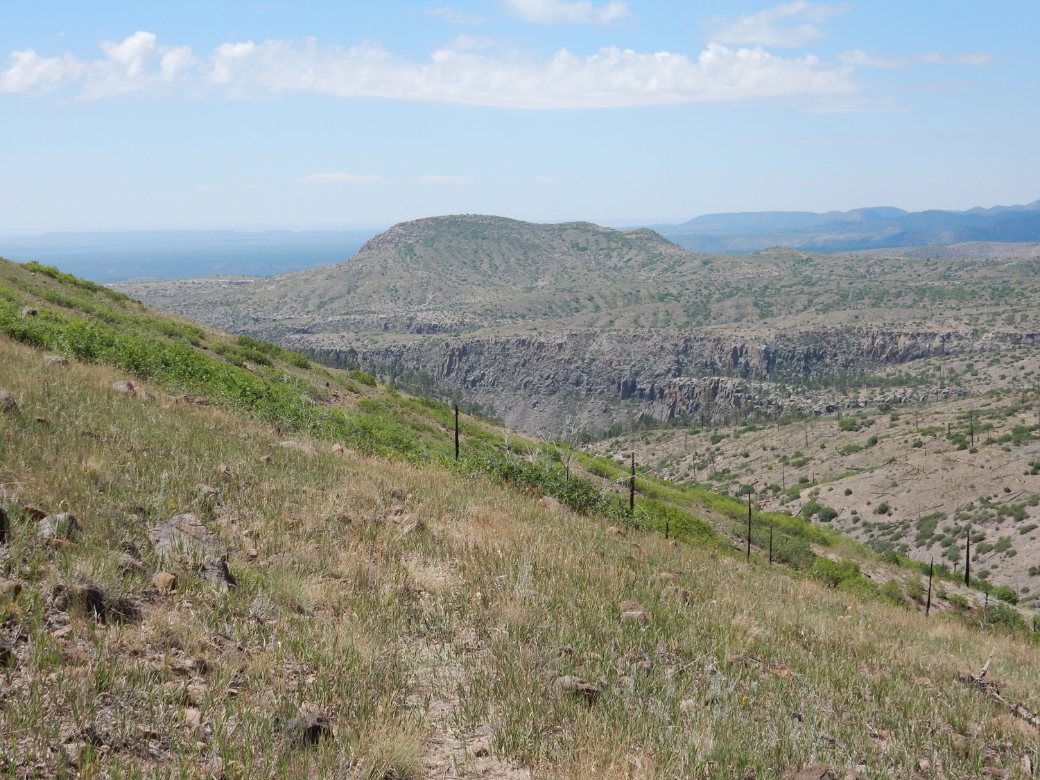
Cerro Balitas is a kind of sister peak to Cerro Picacho. It’s formed of a similar rock (Bearhead Rhyolite) and has the same plug shape. It likely is about the same age. I did a splendid hike around Cerro Balitas a few years back, marred only by the fact that there is no trail — the hike was pure bushwack. However, it was on almost level ground the whole way; the biggest discomfort was lots of seeds in my socks from wild grass.
The bench below Cerro Balitas, forming the canyon rim, is Tsherige Member. I did say we’d see some today.
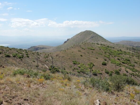
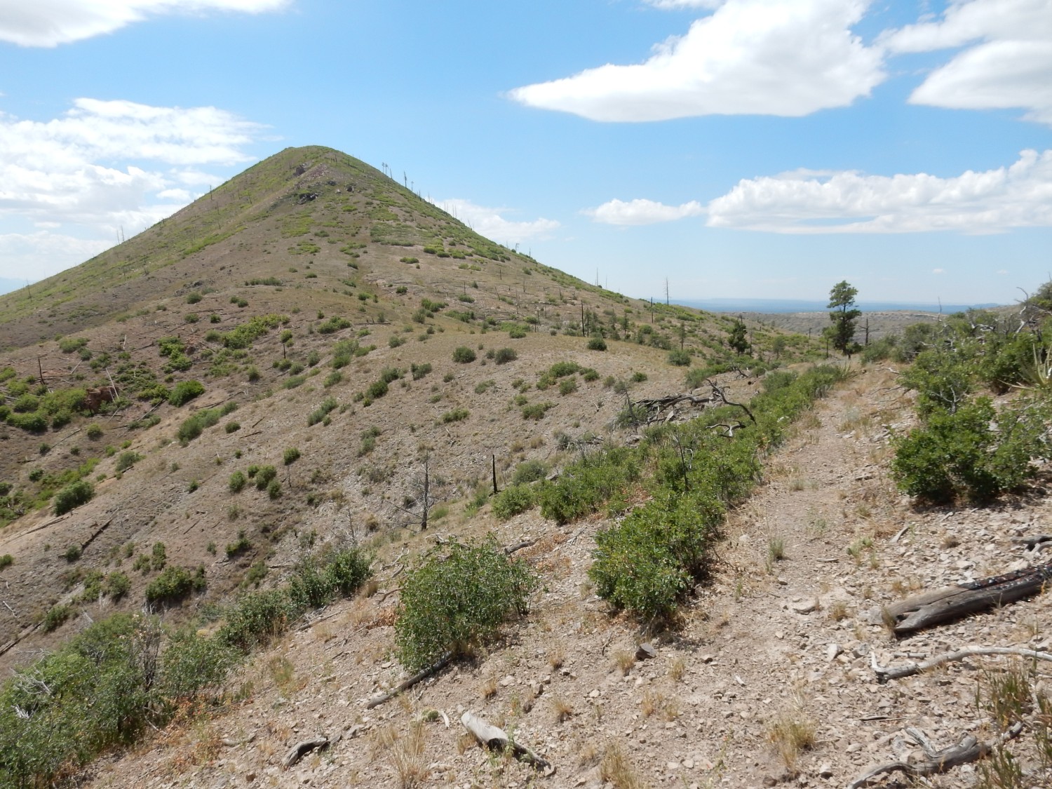
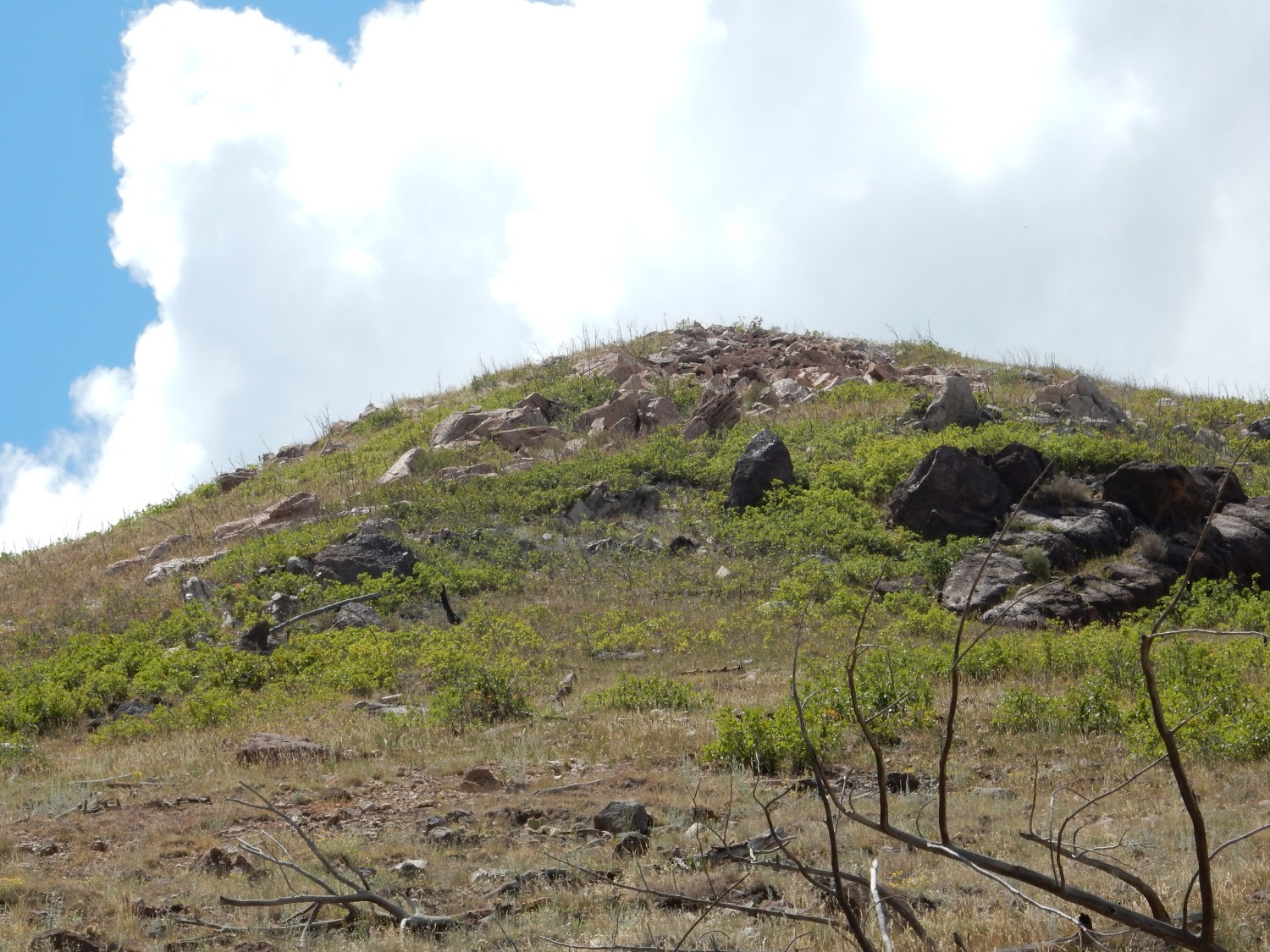
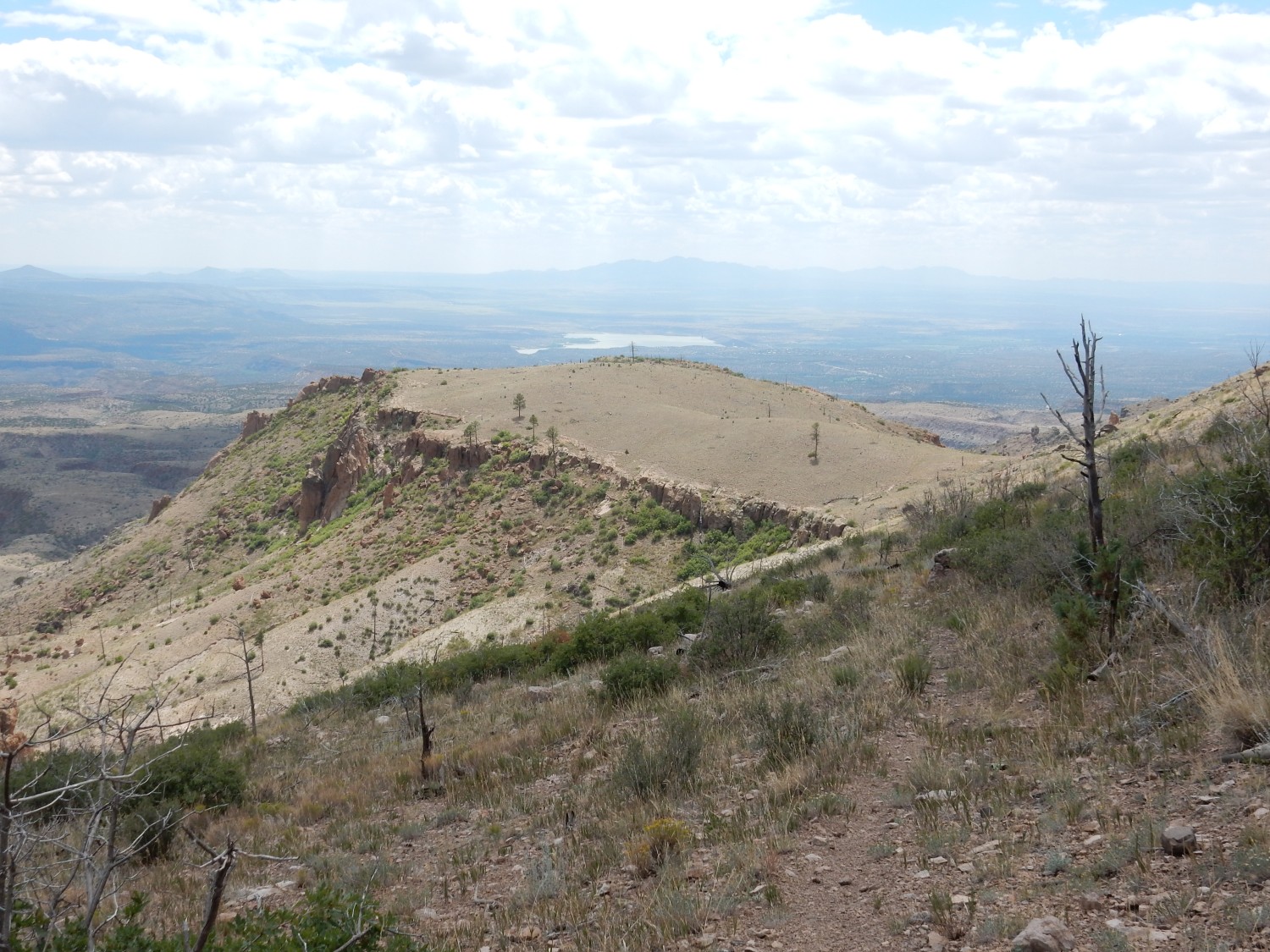
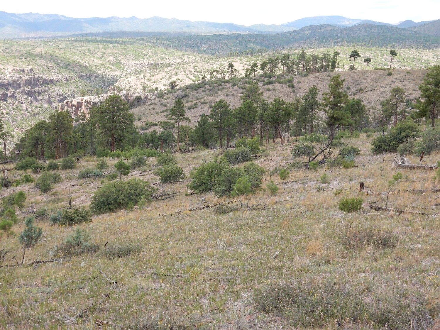
And then Cerro Picacho itself comes into view.

The trail will follow the ridge in the foreground to the north flank of Cerro Picacho, then around its east flank to the area to the south. The reddish ridge is all underlain by volcaniclastics or by yet another rock type, biotite dacite. We’ll see some shortly.
Notice the scattered dead trees. These were victims of the Las Conchas fire of 2011, which swept through this area on its way to my house in White Rock. I had to evacuate my young family to stay with relatives in Albuquerque. Fortunately, the fire stopped short of White Rock. This area was never heavily forested, but the fire wiped out much of what it had.
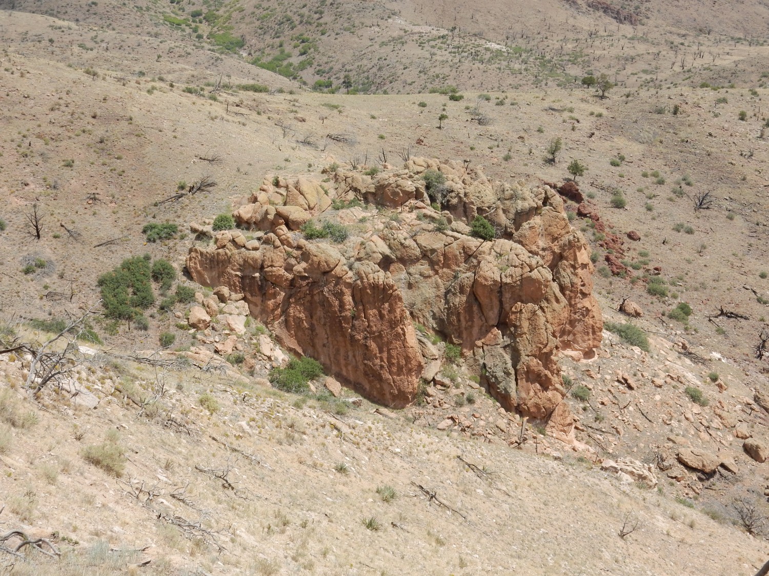
This catches my eye.

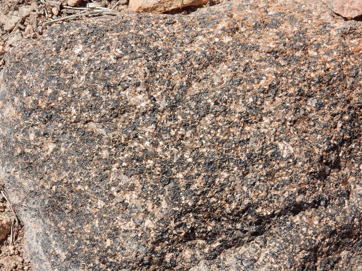
My first thought is that this is a coarsely crystalline rock, such as a gabbro. I find a fragment and look more closely; it turns out what I took for large black crystals was actually glassy volcanic rock. Rather than forming by slow cooling, this rock formed by very rapid cooling.
This area is mapped as biotite dacite. Dacite is more silica-rich than andesite, and so is more prone to cool rapidly to glassy rock. Eventually the glassy material devitrifies; that is, the glass converts to crystalline material. The pink rock in this area is likely devitrified dacite. This glassy rock is likely dacite that has not devitrified yet.
The trail gets a little hairy.
At least there’s a visible trail. In some places, there’s really no trail at all, and you have to look for cairns. And the cairnage is not quite adequate. Fortunately, Cerro Picacho is an obvious landmark towards which you know you’re going, so you really can’t get lost.
Spur ridge southeast of St Peters Dome.
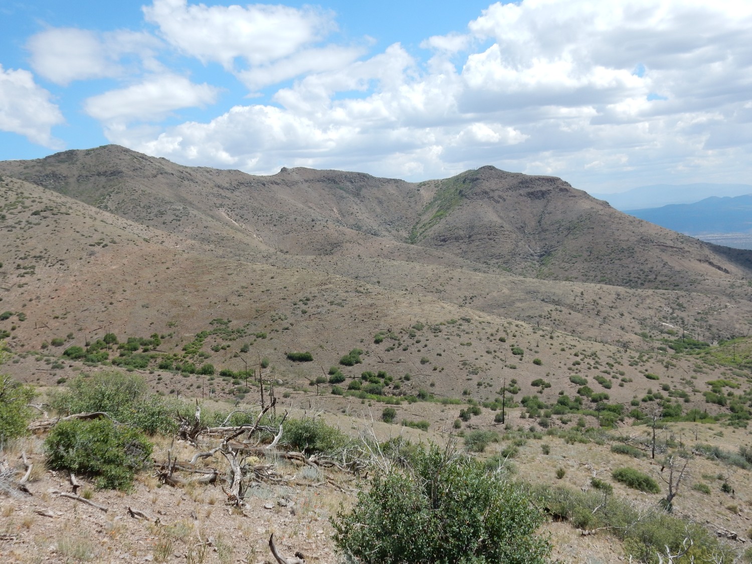
You can see the “layer cake’ of volcanic beds in the mountain. The upper rugged beds are all clotted andesite. The beds lower down are biotite dacite. The reddish beds in the middle distance are likely volcaniclastics.
Like this:

This appears to be dacite rubble cemented together by hot ash — a block and ash flow. The general appearance does not suggest a debris flow in which water was an important lubricant. This probably came about through dome collapse, where a dacite dome became so steep that its flank collapsed, allowing the still-molten, gas-charged, but viscous magma beneath to explode into red-hot volcanic ash than mingled with the rock of the collapsed flank.
The trail comes to the northeast flank of Cerro Picacho.

This is likely more biotite dacite, but a solid outcrop of it.
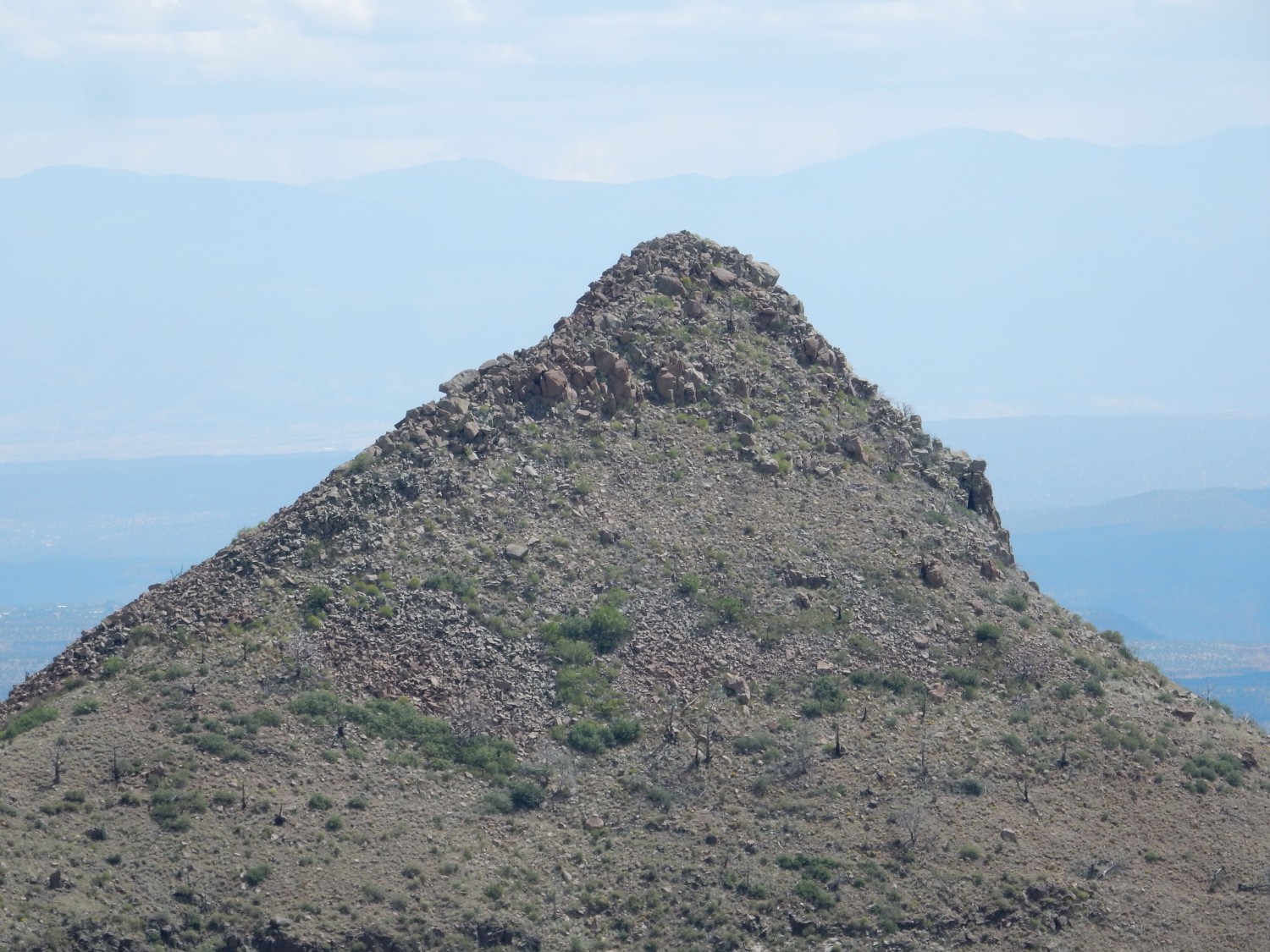
The summit of Cerro Picacho.
This very light rock is rhyolite, the most silica-rich of all volcanic rock. The stuff is so viscous it can barely get out of the ground, and so it forms high domes and plugs where it emerges at the surface. That’s assuming it isn’t charged with dissolved gas, in which case it erupts explosively to produce tuffs. Some of that took place here, as we’ll see shortly. But these exposures appear to be solid rhyolite.
The light color is because rhyolite has very little iron in it. This could be because the magma had already crystallized most of its iron as dense iron minerals while still underground, and these settled out of the magma. Or the magma might have formed from melting of crust granite that was already low in iron. There’s a lot of work being done to sort this out, but the latest seems to be that most of this is melted crust — perhaps crust that has been repeatedly partially melted and resolidified, which does a good job of extracting the most silica-rich, iron-poor part. It’s like a natural version of the zone refining used to create very pure high-tech materials.
On the east flank of the mountain, I come to my first rhyolite.
And then a really big boulder.
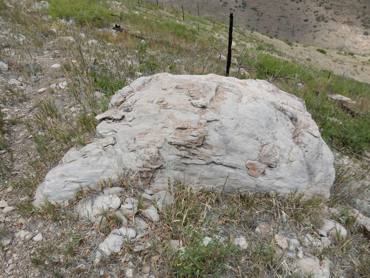
This rock is extremely fine-grained, though not actually glassy. One sees occasional glitters of larger crystals, probably of sanidine. This is a potassium- and sodium-rich feldspar common in volcanic rock. You can distinguish it from quartz because its crystals break along flat faces and because it shows chatoyance, where viewing it from slightly different angles causes it to change color — blue to green tints being common.
To the southeast:
I’m not actually sure what this is. This area is right where for geologic quadrangle maps meet, and that makes it tough to orient. But I think this is an outcrop of biotite dacite.
This I’m more confident about.
This is a well-preserved flow of Peralta Tuff, probably from Cerro Picacho early in its eruptions. Peralta Tuff is Bearhead Rhyolite that erupted explosively, so that the magma disintegrated into a mass of glassy shards and red-hot gas that flowed across the surface almost like a liquid, then settled to the surface to become solid rock.
Here is more tuff.
The trail continues south around this outcrop.
It’s at about this point that I meet the occupants of the other car that was at the trailhead — three lovely young ladies and their dog. We converse briefly. They’re on their return leg.
This also looks like Peralta Tuff.
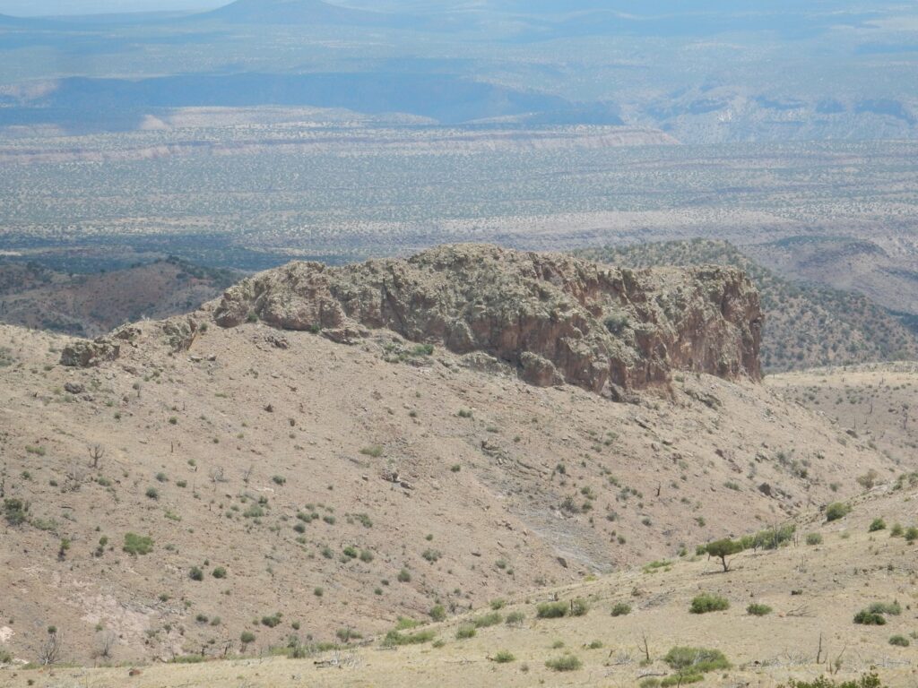
Contrasting bedrock across the canyon.
I’m still struggling with a poorly oriented map in unfamiliar territory, but I think this is what we are seeing: At extreme upper left, the outcrop of hornblende dacite; the dark rock at left is volcaniclastics; the reddish at center is olivine andesite; and the white rock at right is Canovas Canyon Formation. We’re going to see more of that shortly at closer range.
I come round the south of Cerro Picacho and to a canyon rim.
The rim I’m standing on, which continues along the canyon to the left, is Peralta Tuff erupted from Cerro Picacho. I believe the white beds at right, near the canyon rim are, Peralta Tuff as well. The far rim of darker rock is biotite dacite. The white rock poorly exposed in the canyon bottom is Canovas Canyon Formation.
The Canovas Canyon Formation is probably the oldest rock I’ve seen today, with a likely minimum age of 10.5 million years. This formation is found throughout the southern Jemez, generally beneath thick flows of basalt or andesite of the Paliza Canyon Formation. It’s not that different from the Bearhead Rhyolite, except that it’s significantly older and is usually found under Paliza Canyon flows rather than on top of them. Here, the Peralta Tuff (explosivley erupted Bearhead Rhyolite) seems to sit directly on Canovas Canyon Formation.
I would like to stay and explore the area thoroughly, but I’m out of time. I have a couple of errands I need to run for Cindy before the day is out. Also, I explored more thoroughly last time, and found that hiking down into this canyon would be a fair bit of work; there is theoretically a trail but good luck finding it any more.
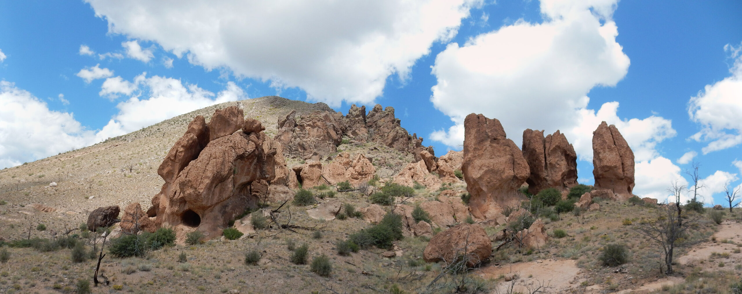
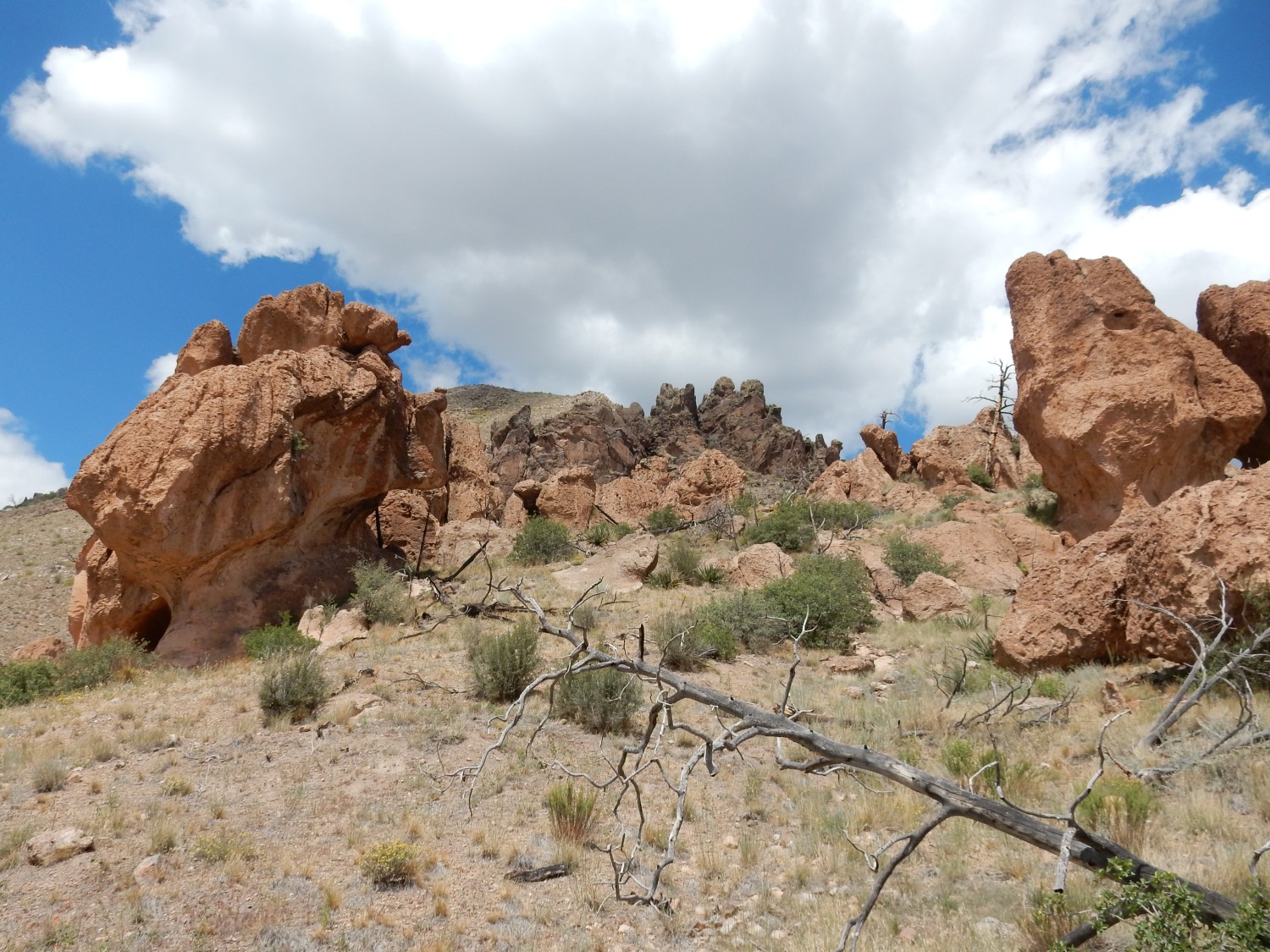
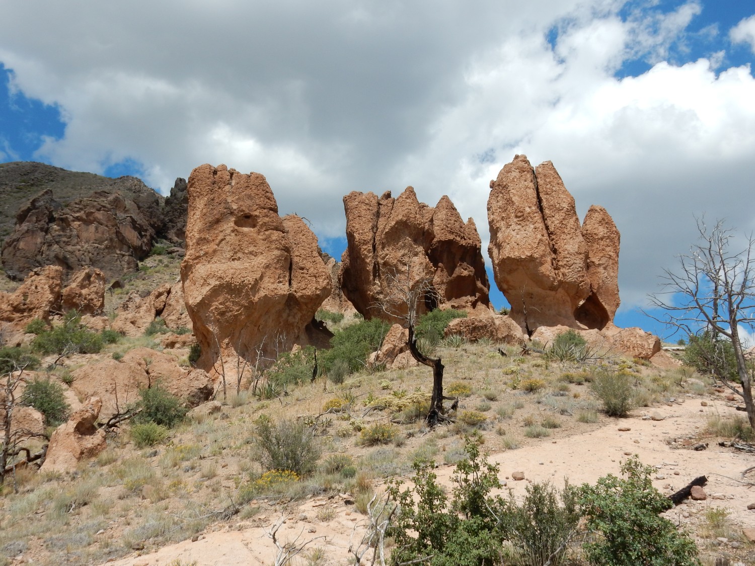
Looking back north at Cerro Picacho and the tuff pinnacles at its base.
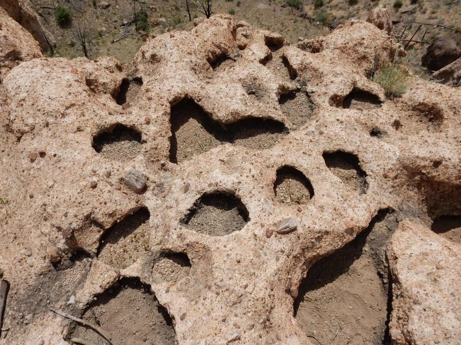
Potholes in the rim.
The sun comes out, and I take a second panorama.
More pinnacles.

Then I hike rather quickly back. I do pause for this:
The Las Conchas fire was rather patchy. Here, that was at least in part because the forest was not very dense. This is probably a representative surviving patch. The rocky ridge is Tsherige Member.
Looking north at Rabbit Hill.
This is yet another plug of Bearhead Rhyolite, erupted around 6.65 million years ago.
On the way out, I decide to get a photo of El Pothold Grande, just so you know what you’re up against.
And this was vaguely touching.
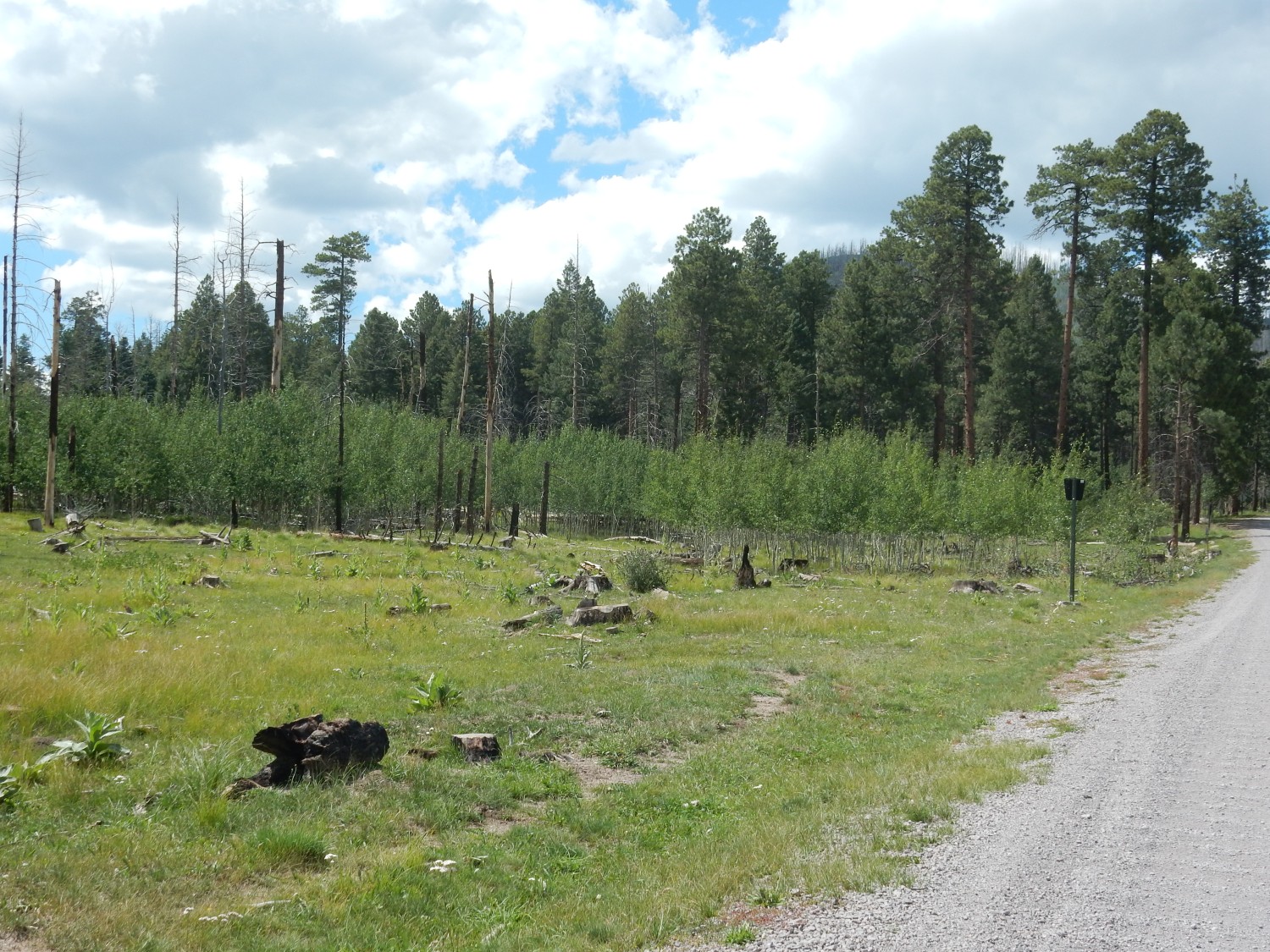
This is ground that was completely burned out by the fire. A patch of old forest beyond was spared, and from under its eaves, an army of aspen are marching out in very slow motion to reclaim this ground for the forest.
Life endures.
I run my errands, get home to find Cindy has gone to a baby shower, and discover that I am completely exhausted. It didn’t seem that hard a hike, but I may have pushed myself rather hard on the return leg. Feeling better today.