Mount Taylor Wanderlust, Day 5
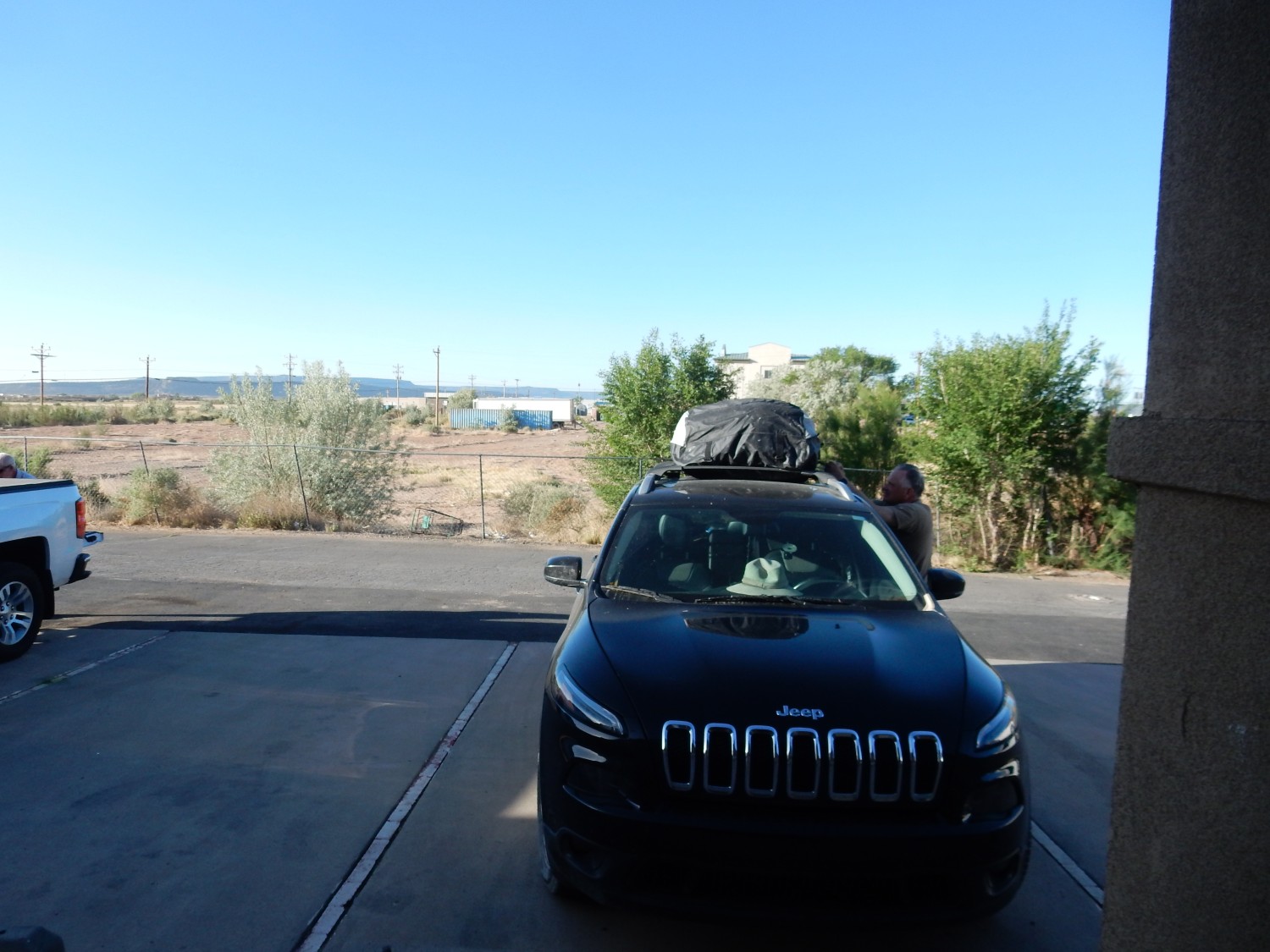
We awake to another cloudless morning, and begin loading up Obsidian.
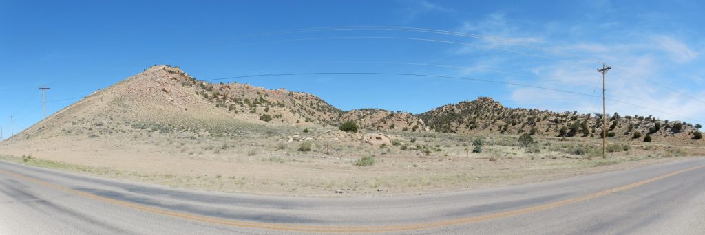
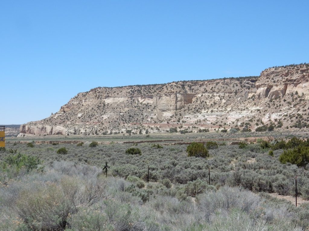
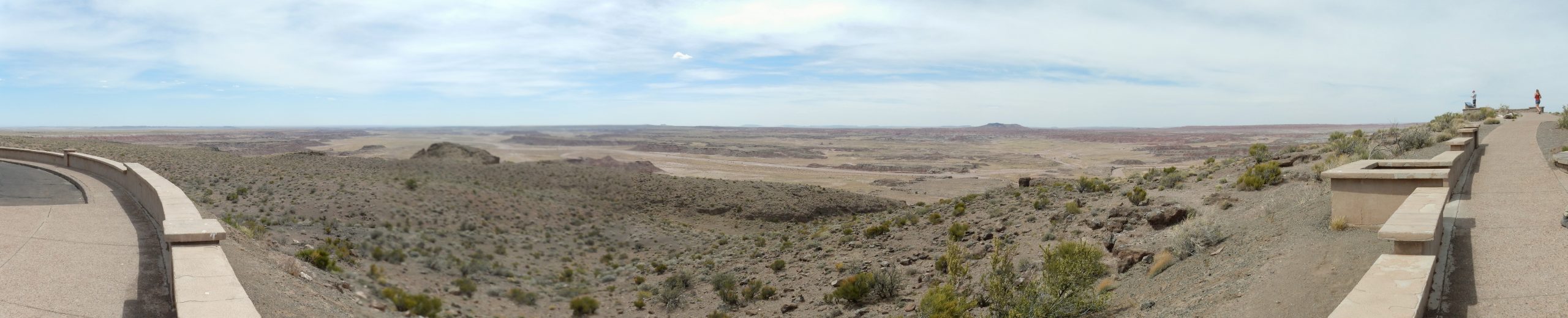
We head west on I-40. Part way towards Gallup, the view north opens up. We pull off at Prewitt and I get a big panorama.
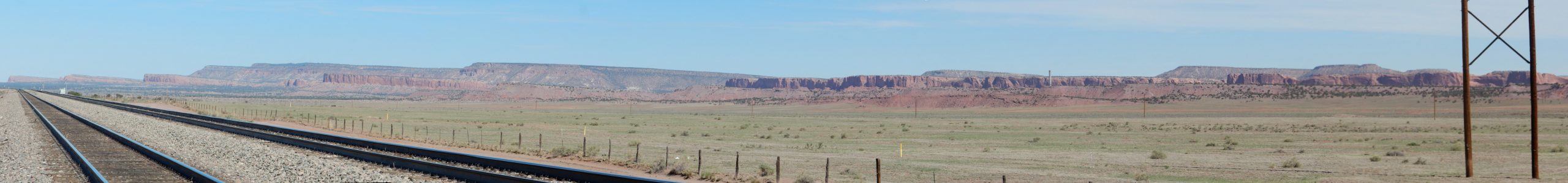
You’ll definitely want to click on this one for the full resolution version. The lowest shelf, visible mostly at the center of the panorama (in front of the plant with the smokestack), is mapped as Chinle Formation. The cliffs behind the plant are Entrada Formation, and the most distant, highest cliffs are capped with Dakota Formation. Morrison Formation is exposed in slopes between the last two sets of cliffs.
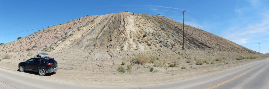
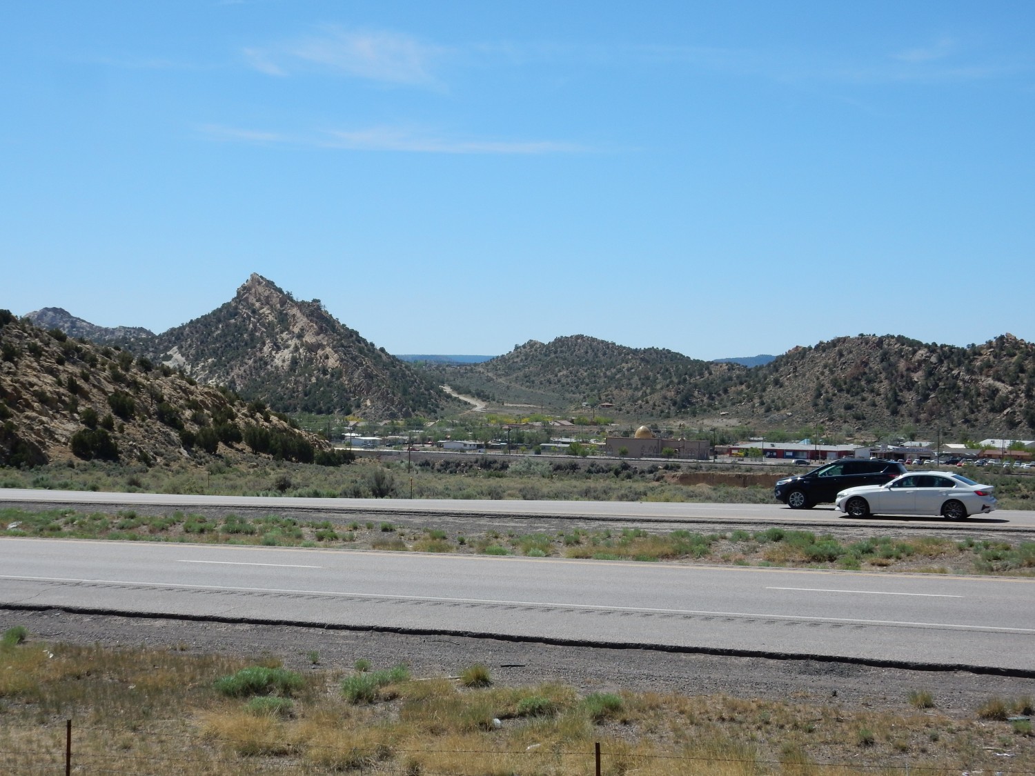
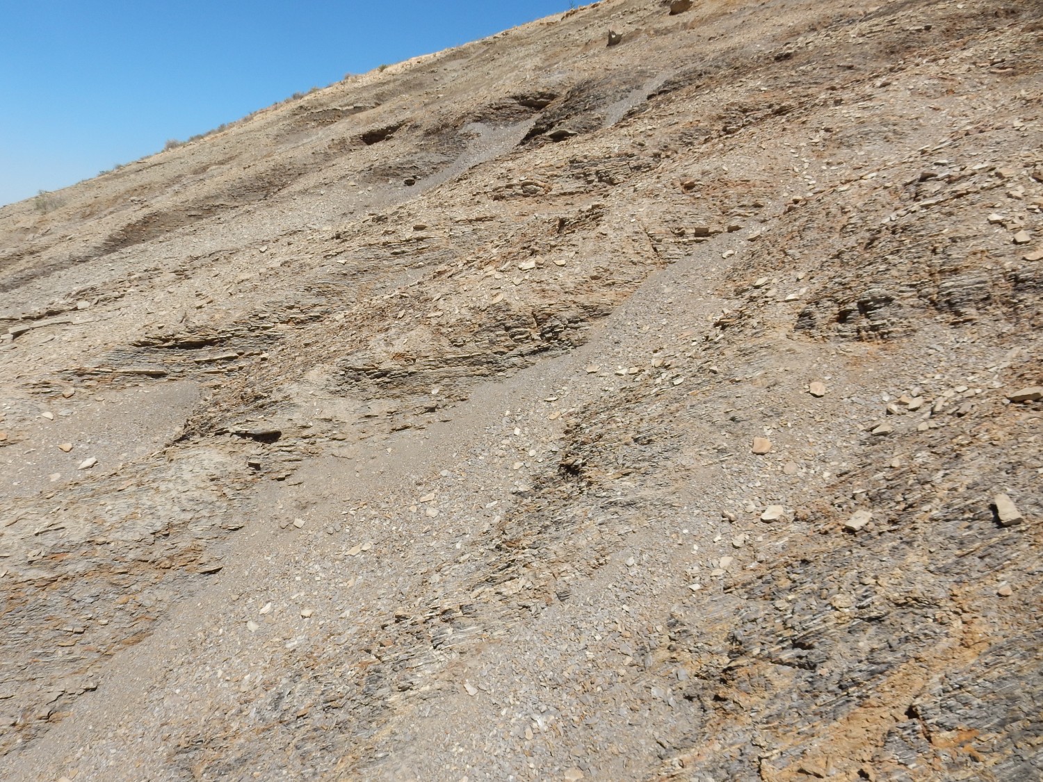
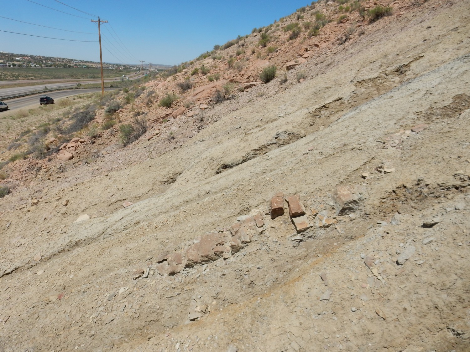
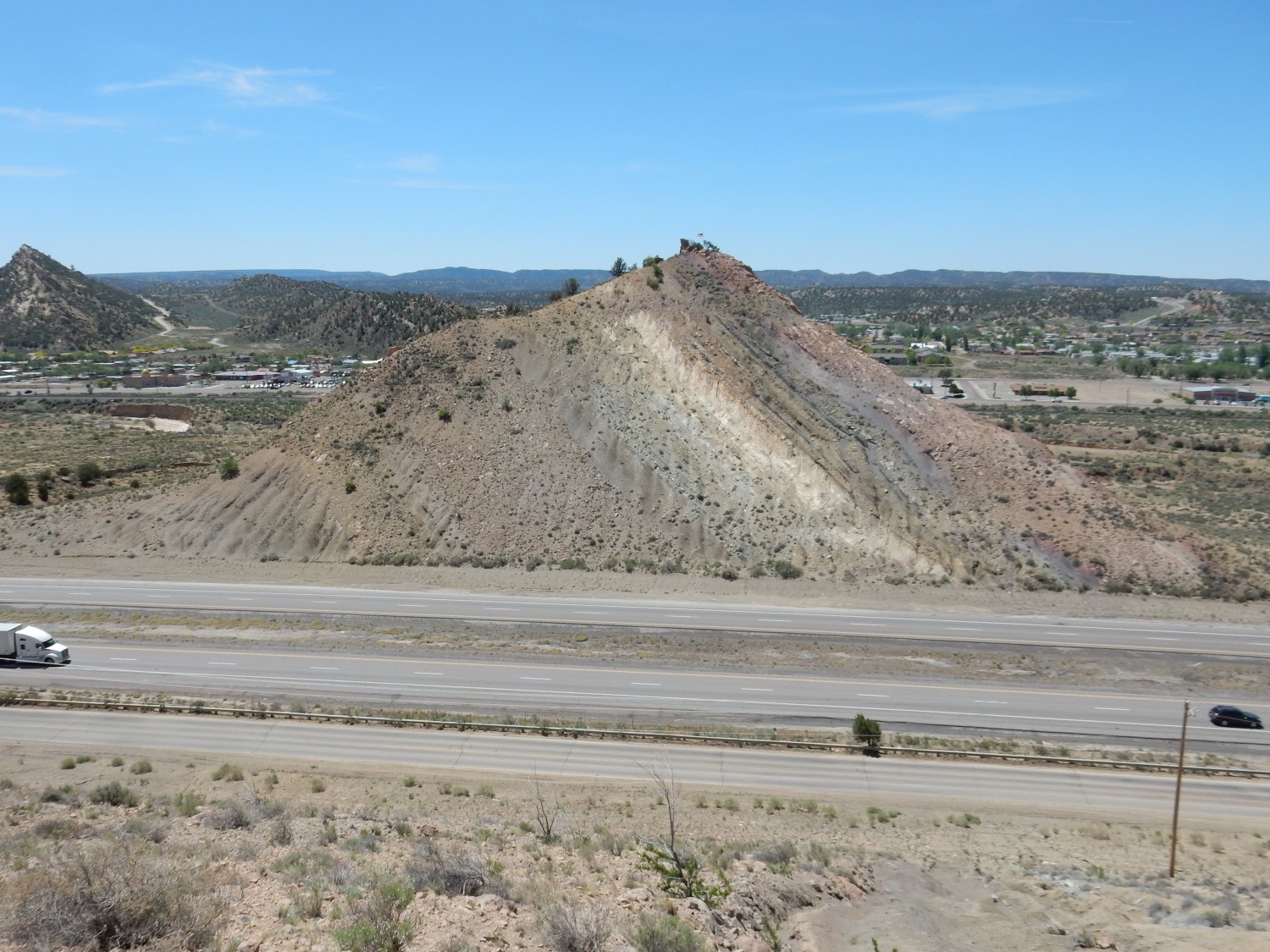
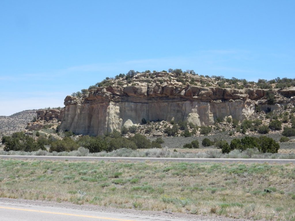
We gas up east of Fort Wingate, then we find a way onto the frontage road where the interstate cuts through the Gallup Hogback. (Or so I think of it. The state geologic map calls it the Nutria Hogback.)
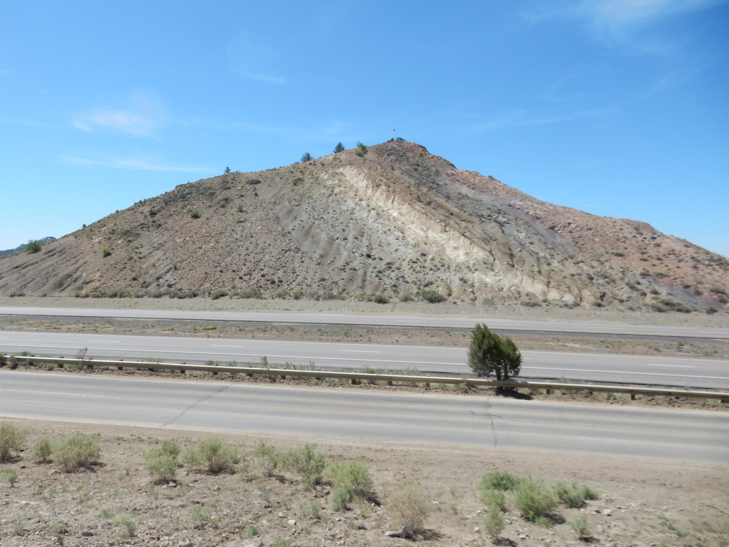
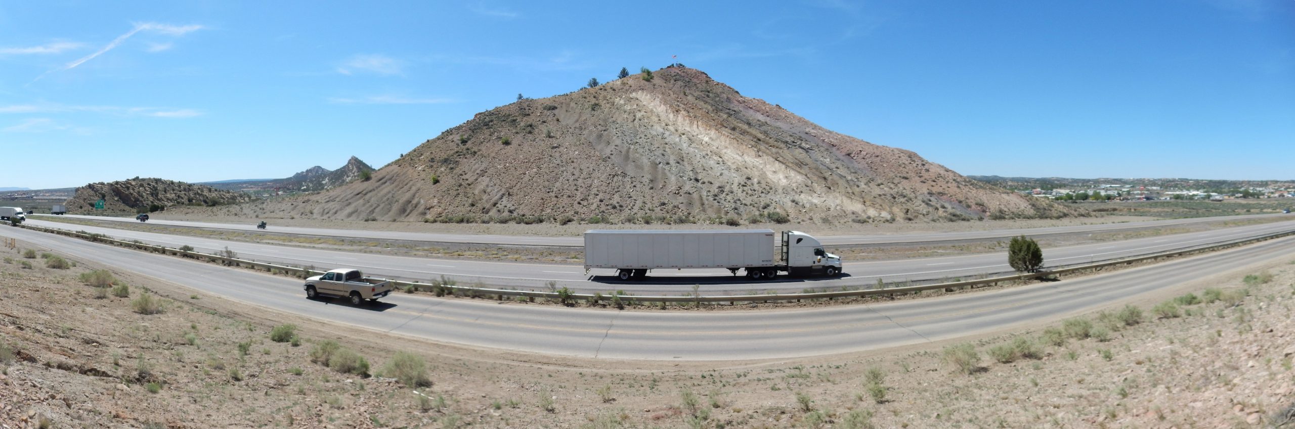
The hogback marks the western edge of the Zuni Uplift, the block of crust that underlies the Zuni Mountains. Somewhere below the surface, basement rock has faulted, and the relatively ductile sedimentary formations on top of it have been tilted across the fault. The ridge at far left, which we did not closely examine, is Dakota Formation sandstone that is relatively resistant to erosion. The main ridge at right is composed of the relatively resistant Gallup Sandstone. The valley between the ridges is where much less resistant Mancos Shale is more easily eroded. Such a valley is known as a strike valley. The level ground left of the Dakota hogback is easily eroded Morrison Formation while the level ground at right is a resumption of the Mancos Shale, which is divided by and intertongues with the Gallup Sandstone here.
The white layer is obviously sandstone, as is the dark pinkish layer forming the right side of the cut. There is a layer of shale between. But there is also a thick dark layer of sandstone at left that is difficult to pick out from the shale above and below it. It’s actually easier to distinguish sandstone and shale in the natural exposures a bit further south, where weathering accentuates the sandstone, and this is where the reference section for this formation is located. (I ought to have photographed it, but was under the mistaken impression that the cut is the reference section.)
Corresponding road cut on the north side of the highway.
On this side, it’s a little clearer that there is pinkish sandstone at far left; a thin layer of siltstone; buff sandstone; a bed of shale; buff sandstone; another bed of shale; then a quite thick layer of dark standstone. At farthest right is shale again.
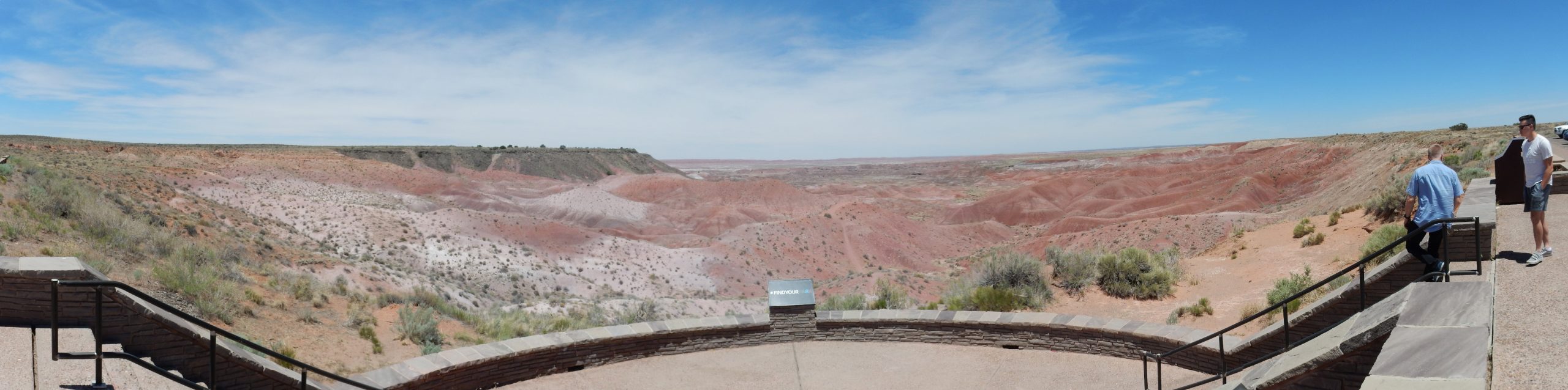
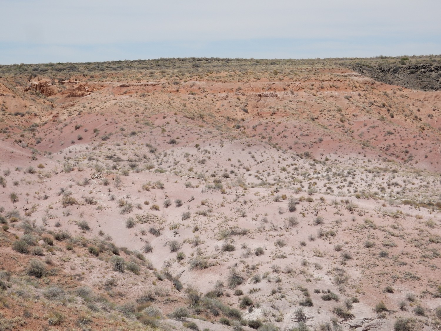
Panorama of the strike valley to the south:
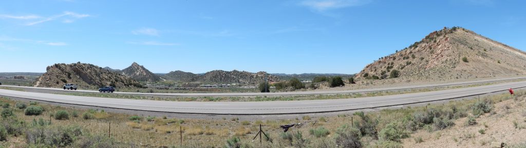
Zoom into strike valley:
The hogback extends about five miles north of here, then curves east for a few more miles before petering out. To the south, it extends twenty miles, nearly to Ramah, before petering out.
The strike valley is much more poorly defined to the north.
It seemed natural to walk across the cut itself to see the succession of beds. In retrospect, I think it might have been at least as useful to hike north of the cut and see the beds in their natural state. Well, if I’m that interested, the hogback isn’t going anywhere.
Meanwhile: The easternmost part is shale of the Mancos Formation.
This section includes some large concretions.

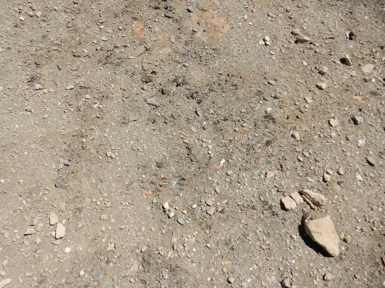
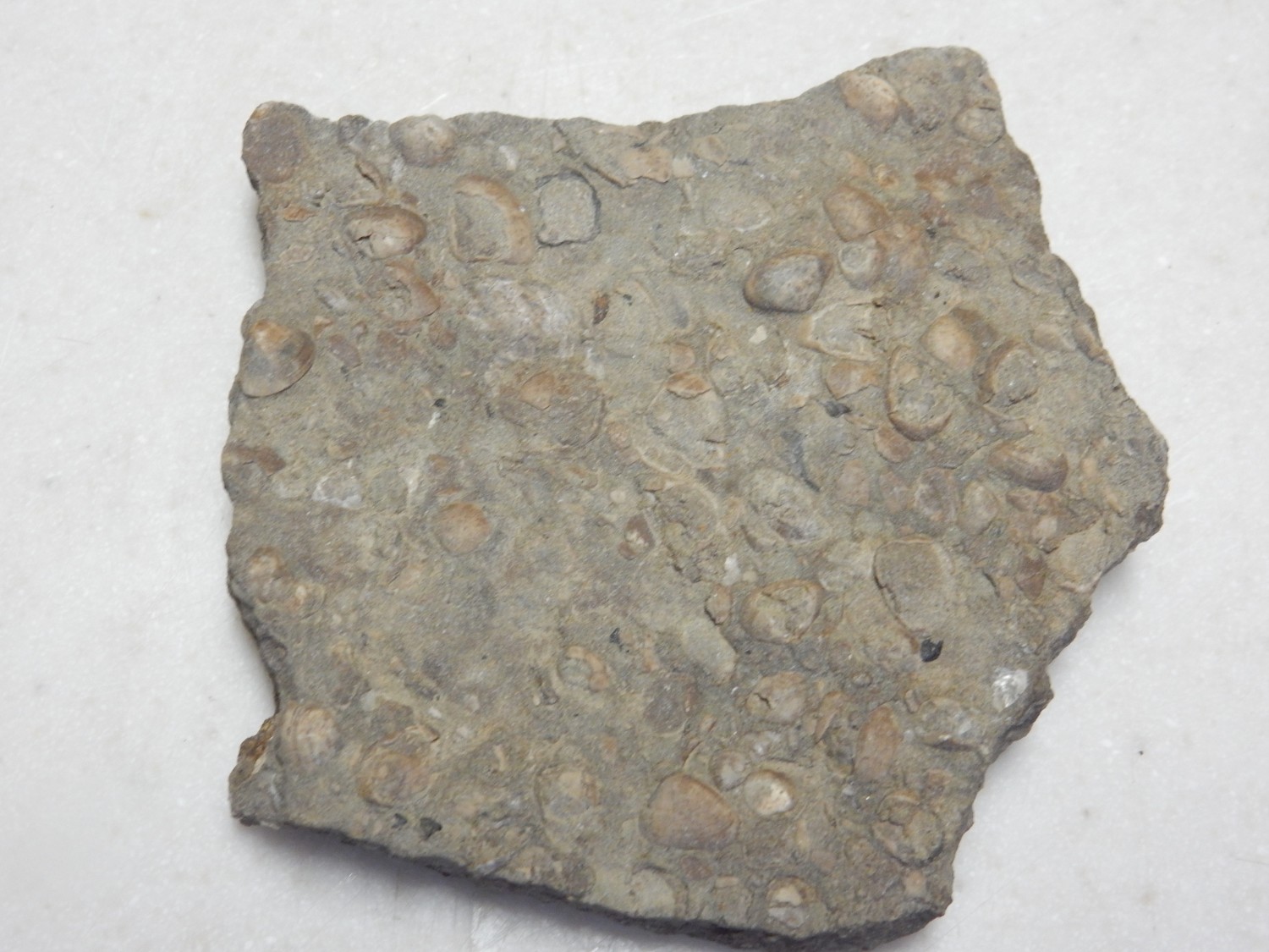
A little further west is my biggest find at this site, and one of the big finds of the trip: A fossil oyster bed.
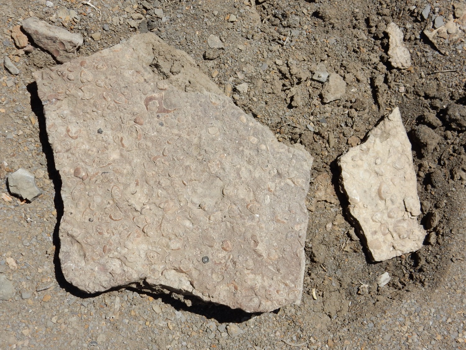
Maybe. Another possibility that occurs to me is that these are oscracods (seed shrimp).
There are occasional thin limestone or sandstone beds within the shale.

Thick beds of very uniform shale.

Buff sandstone.
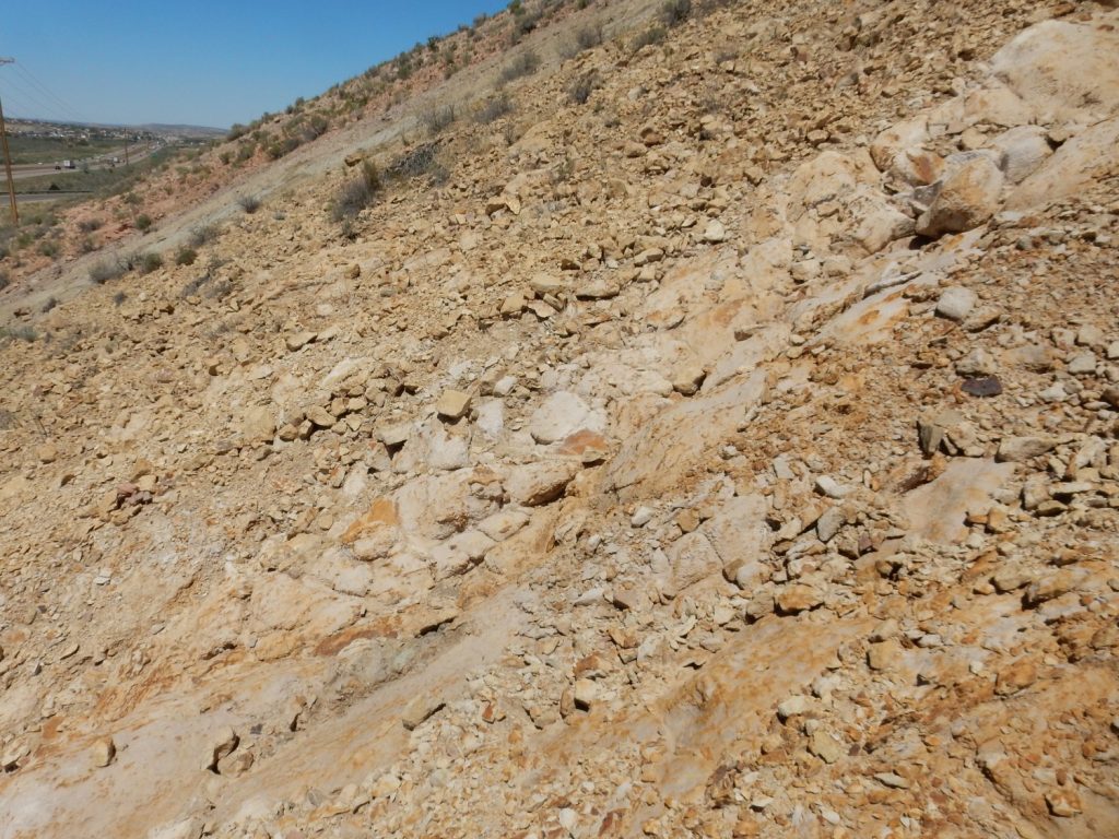
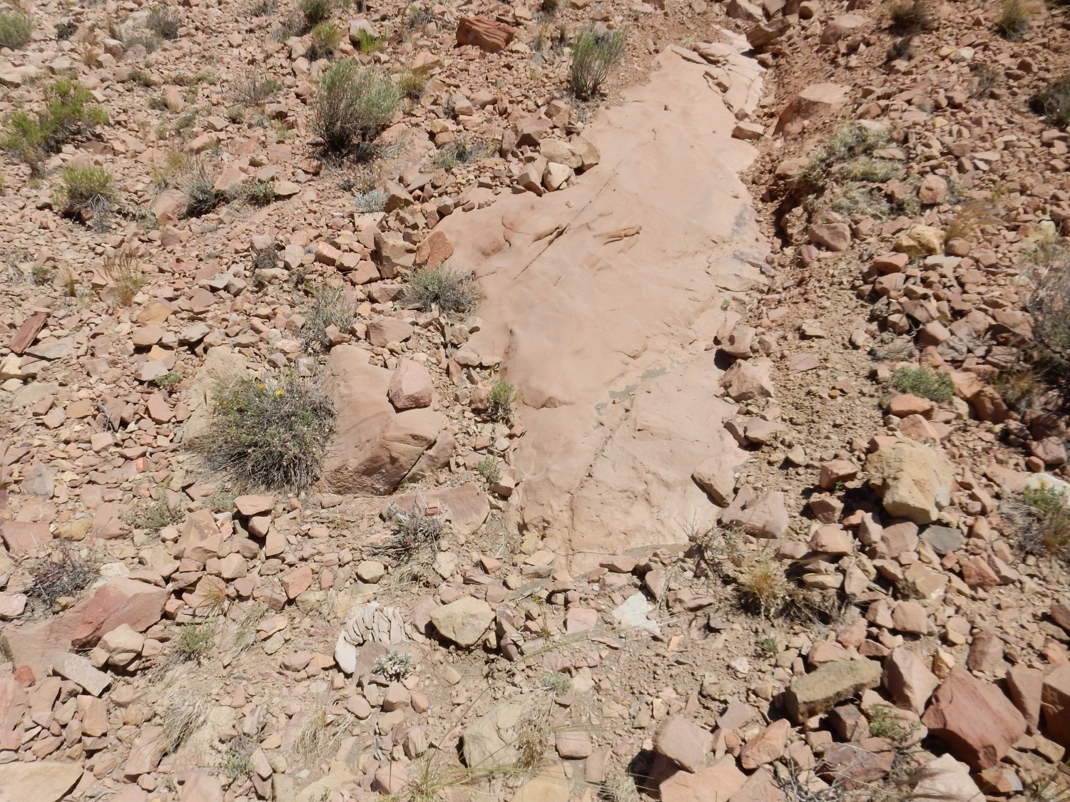
If my GPS coordinates are good, then this is likely the very base of the Gallup Sandstone.
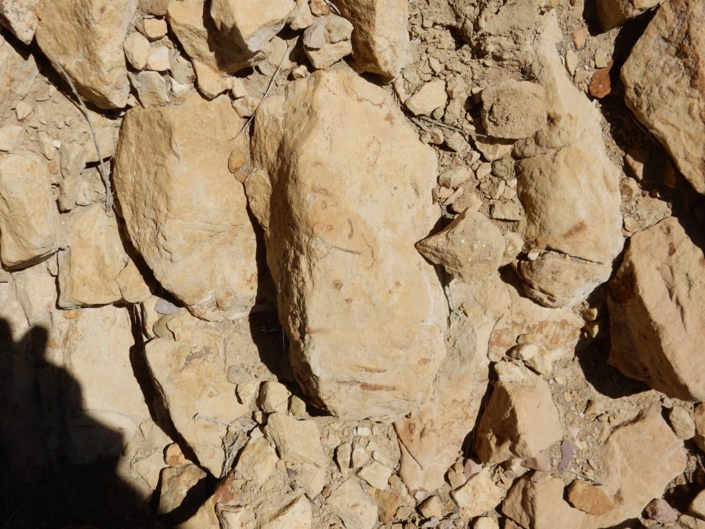
Traces in this sandstone.
Further west, we’re back to shale. This is likely an unnamed tongue of the Mancos Shale.
Then into striking pink sandstone.
Let’s talk about sedimentary rock color.
Shale color is usually determined by its oxidation state and its carbon content. There’s even a handy chart for this:
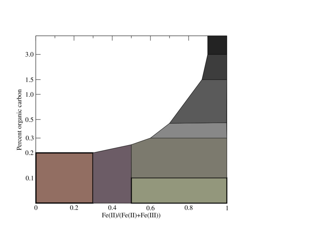
Comparison with the outcrop tells us the Mancos Shale was deposited under reducing conditions (most of the iron is ferrous, Fe(II)) but with only moderate carbon content (around 0.3%). Reducing conditions means that oxygen was lacking. Most of the oxygen was probably consumed by the organic carbon in the rock.
The same color chart is a rough guess for sandstones as well. Sand grains are mostly pure quartz, which is colorless, so the color of sandstones comes either from grains of unusual composition (which is uncommon) or from the cement binding the grains together (much more common.) Red is usually hematite, which is ferric iron oxide. Brown or tan is goethite, which is hydrated iron oxide, formed under less hot and dry conditions. White to buff sandstone contains little colored cement, being cemented by silica or calcite or (rarely) white clay minerals, as with the Jackpile Member. The light pink sandstone here is likely cemented with silica with small amounts of hematite.
And finally the prominent white bed, which has obvious ripple marks in it.
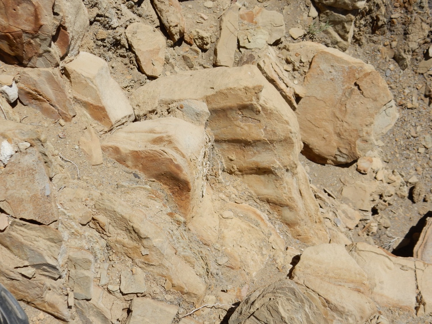
Symmetric ripples like this are typical of a tidal or other coastal setting. The Gallup Sandstone is thus interpreted as coastal deposits of the Western Interior Seaway. The Western Interior Seaway was a shallow sea that covered most of central North America in the Cretaceous, from the Gulf of Mexico to the Arctic Circle and from Tennessee to not much further west of where we’re standing here.
Gary is way up the cut. He waves me to join him. Here I get my type section shot for Wikipedia.

Gary notices some weirdness with the vegetation.
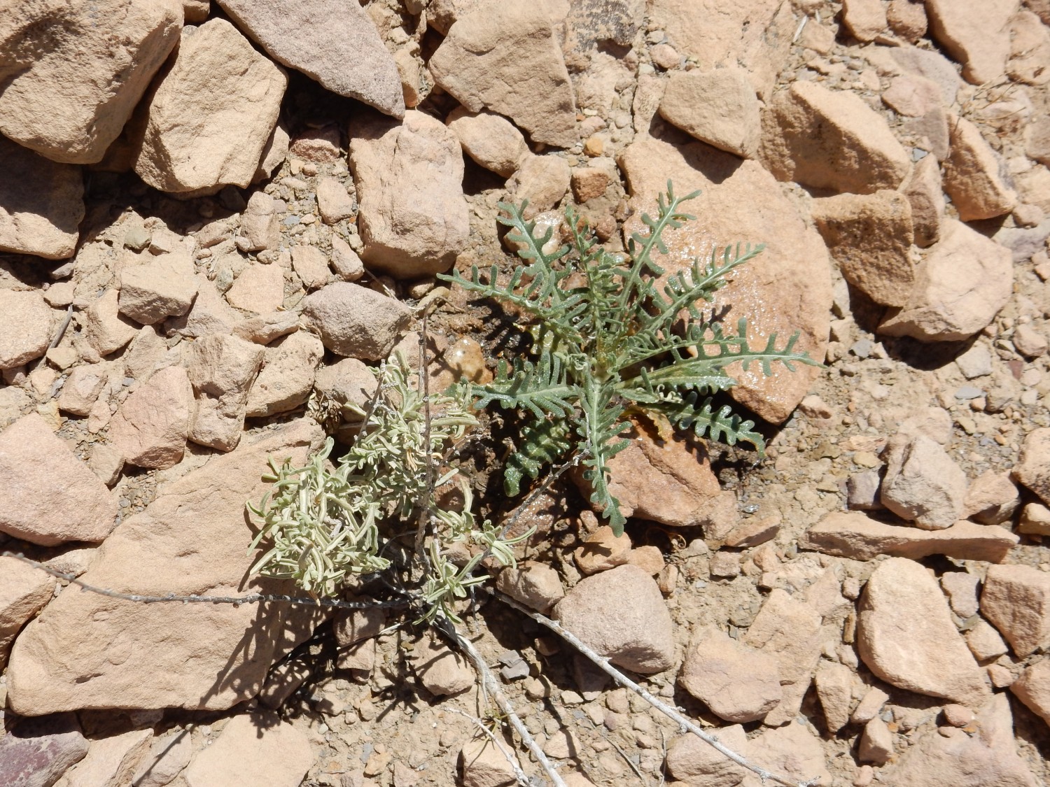
The one plant has exuded something all over itself and the underlying rock. It’s a very hot day and there hasn’t been rain here in weeks; I wonder why the plant would expend moisture this way. It wasn’t just this one, either; we found several plants of this species doing the same thing. Since the plant isn’t blooming, I don’t have a good place to start in trying to identify it.
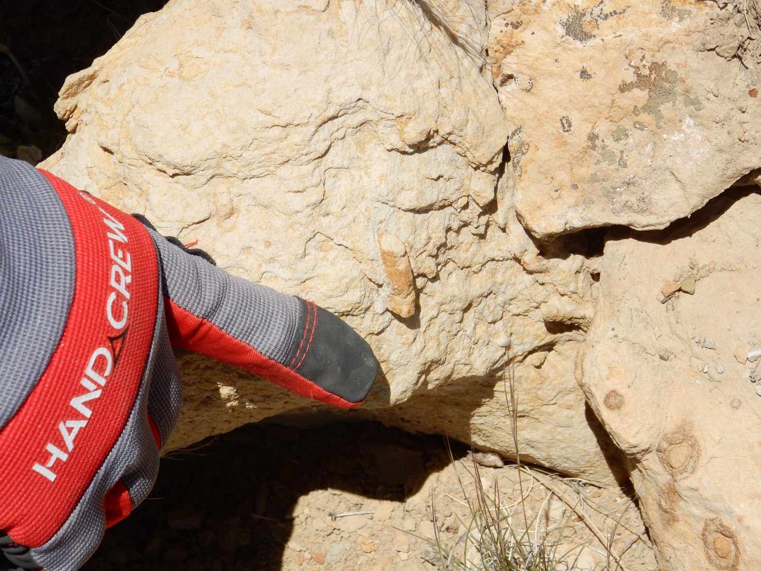
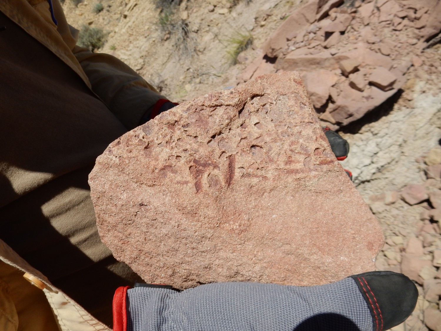
We traverse the road cut one more time from west to east. Gary finds a worm tube near the base of the Gallup Sandstone.
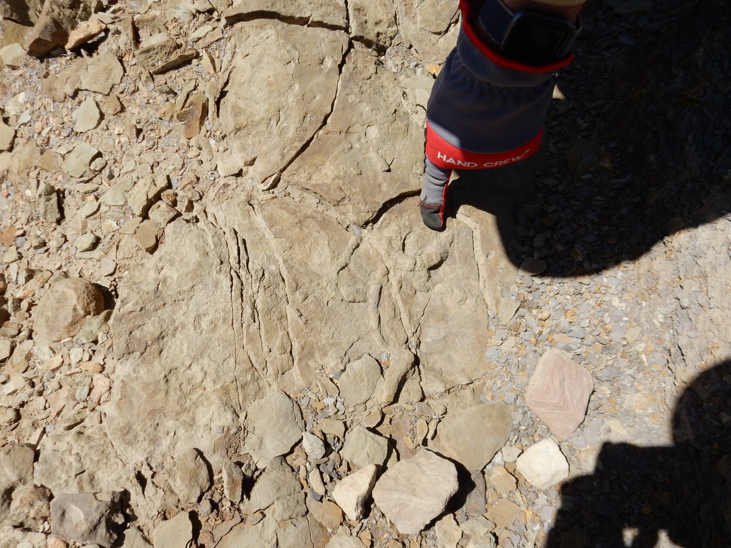
and then more traces in the Mancos Shale.
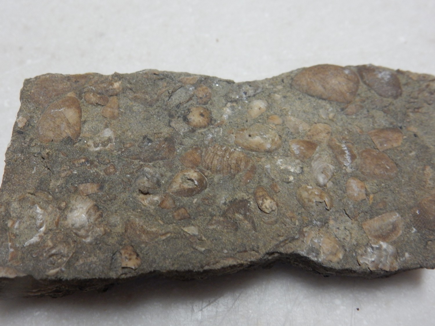
We come back to the fossil bed.
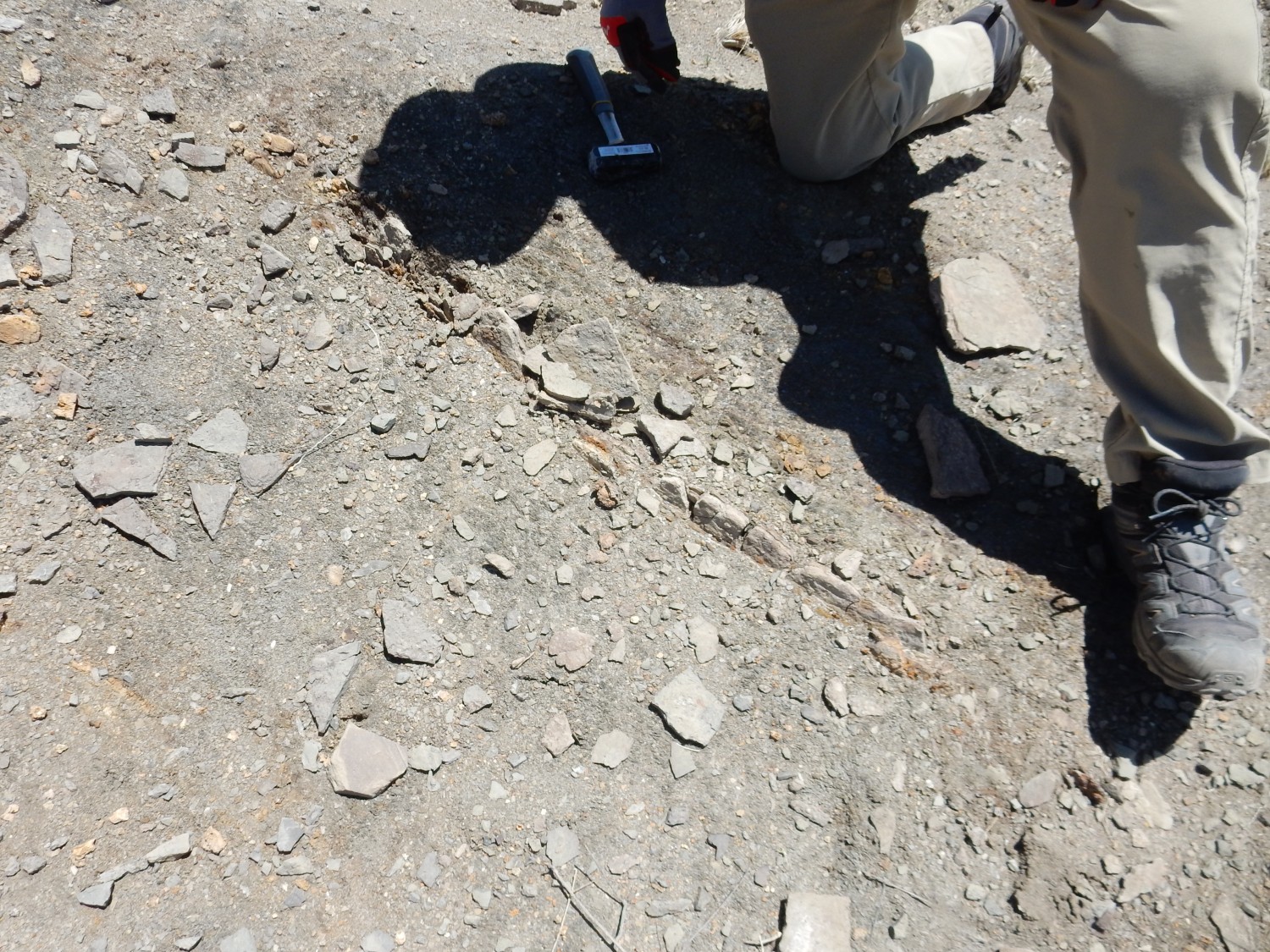
The fossils are all in a single very thin layer of limestone.
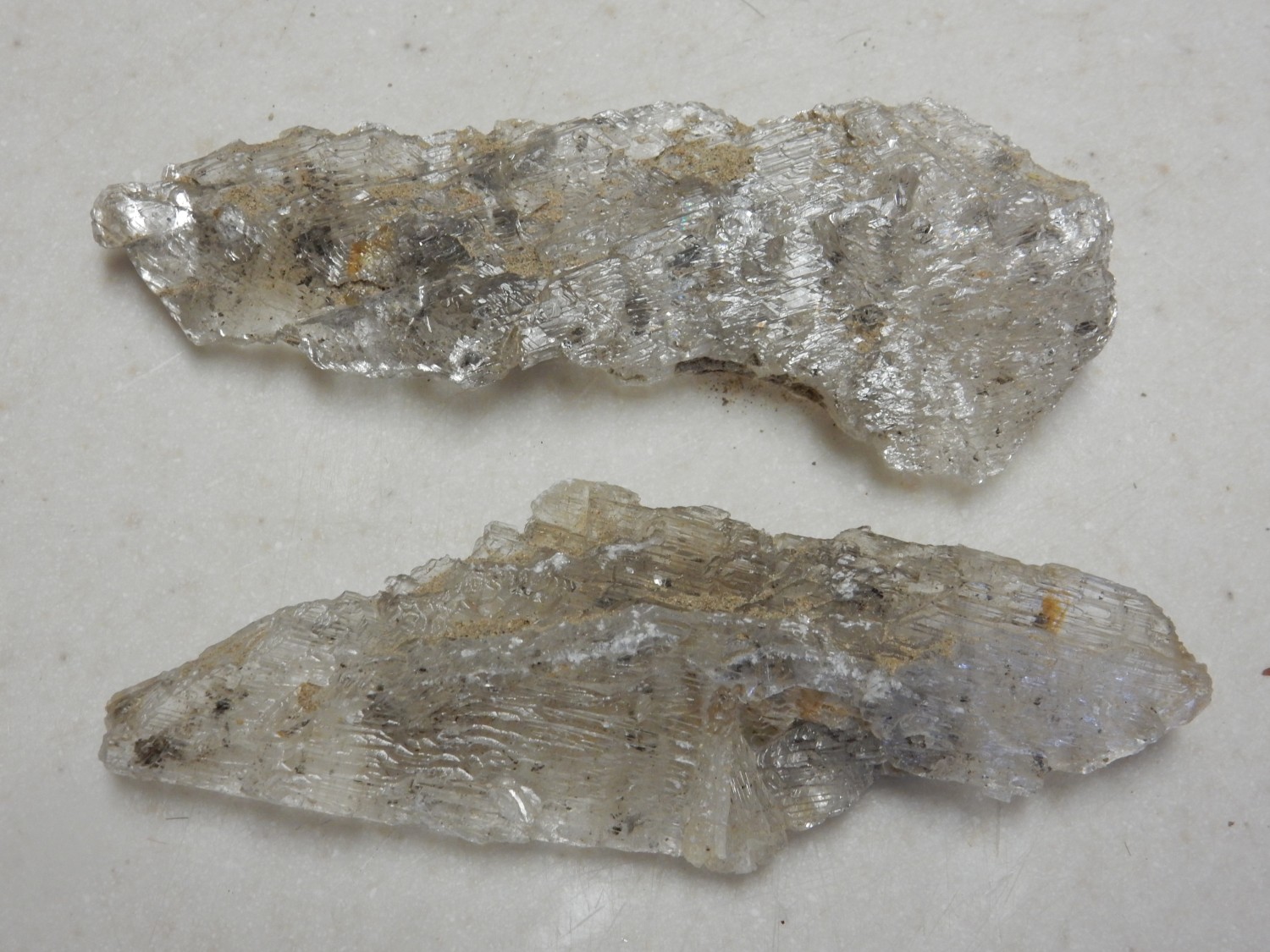
Gary also finds what looks like radiating crystal overgrowth of the shale. This is likely overgrowth of gypsum, of which we found several large pieces throughout the area.
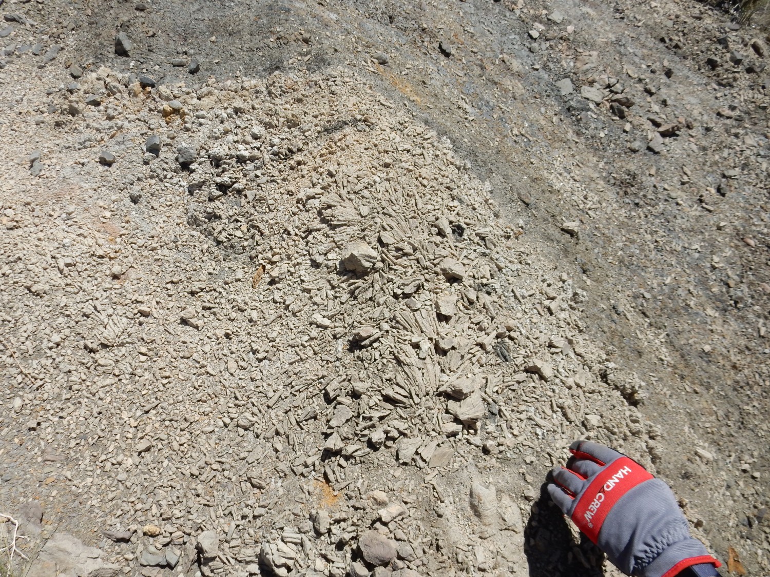
Gypsum spears. Each is several inches long.
Near the car, Gary finds one more set of traces.
About this time an unknown friend stops along the road and tells us there’s a trail along the hogback and gives us directions. Next time.
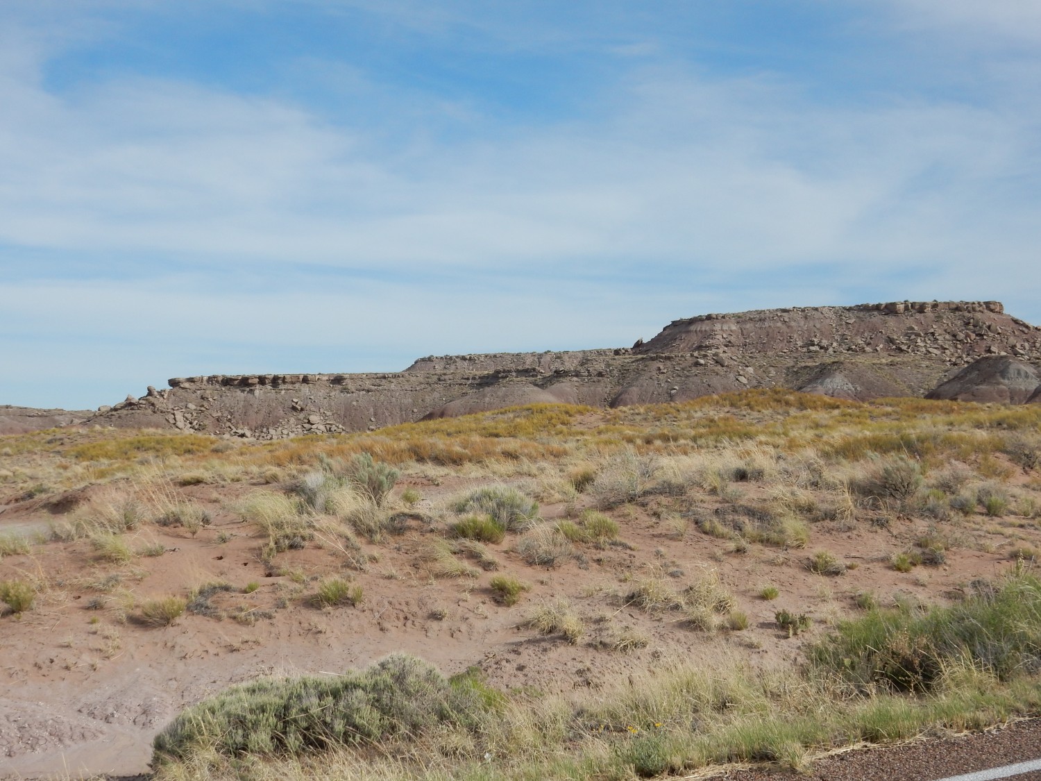
Heading further west, we see a prominent contact.
I don’t have good maps for this area. But my guess is Zuni Formation under the contact, and Dakota Formation above. That means the entire Todilto, Bluff, and Morrison Formations are missing here. So the unconformity is as profound as it looks.
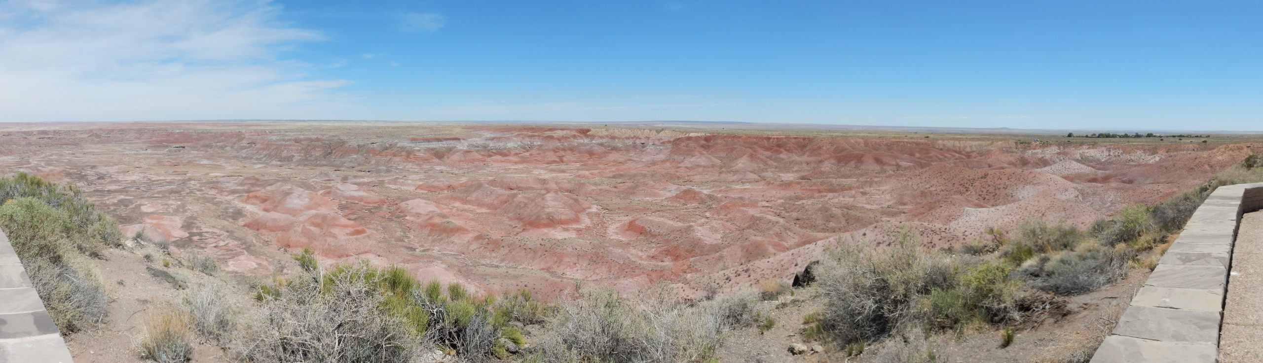
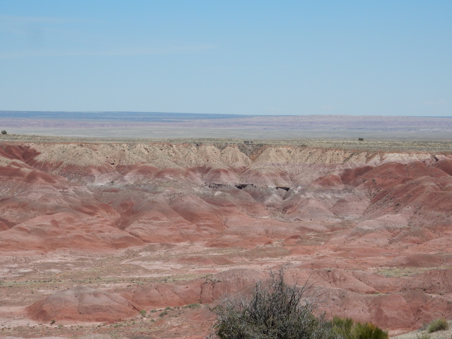
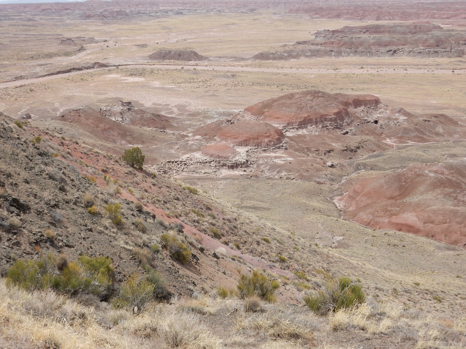
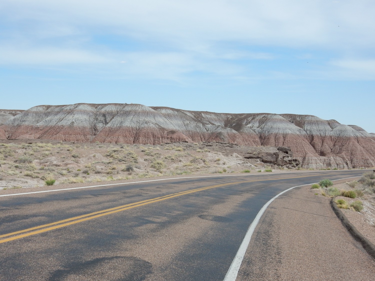
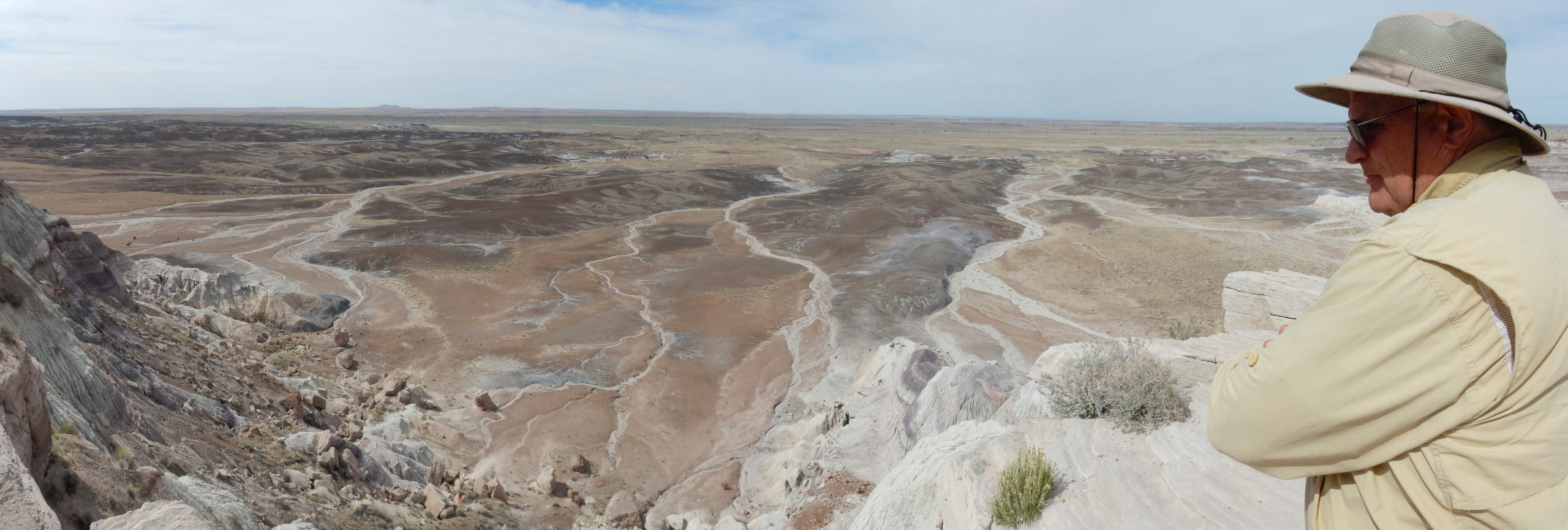
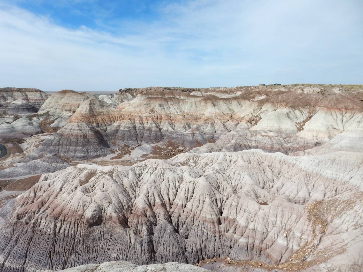
We arrive at Painted Desert National Park, and turn north to the overlook area. Our first stop is at Tiponi Point, where we see the type locality for the Painted Desert Member.
Most of what you see here are red mudstone beds of the Petrified Forest Member of the Chinle Formation. This is a Triassic formation, perhaps 213 to 209 million years old — the youngest age is the more well-determined one. This is from the late Triassic. The beds were deposed in the great Chinle River system, which drained the Central Pangean Mountains. These lay along the equator and were immensely wet, with the Chinle River winding its way through increasingly arid landscapes to the northwest. Life had recovered from the end-Permian extinction event, or “Great Dying”, by this time, but the geography of Pangaea (the great supercontinent of the Carboniferous and Triassic) created an exquisitely hot and dry climate in what is now the southwestern United States. The red beds, devoid of organic matter, thoroughly oxidized, and lithified under hot conditions, represent deposition in this environment.

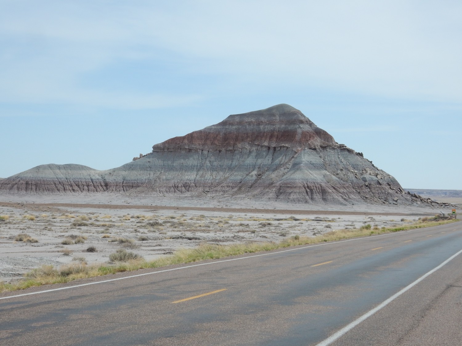
The mesa to the left is capped with basalt and sediment beds of the Bidahochi Formation, with the basalt erupted from a local vent.
The Bidahochi Formation is much younger, at around 15 to 4 million years in age. It nonetheless is hard to distinguish from the much older Petrified Forest Member. I place the contact roughly at the level of the base of the flow at right.
We drive to the next overlook.
I wondered if the tan patch on the far rim was something, but the map doesn’t show anything but Petrified Forest Formation there.
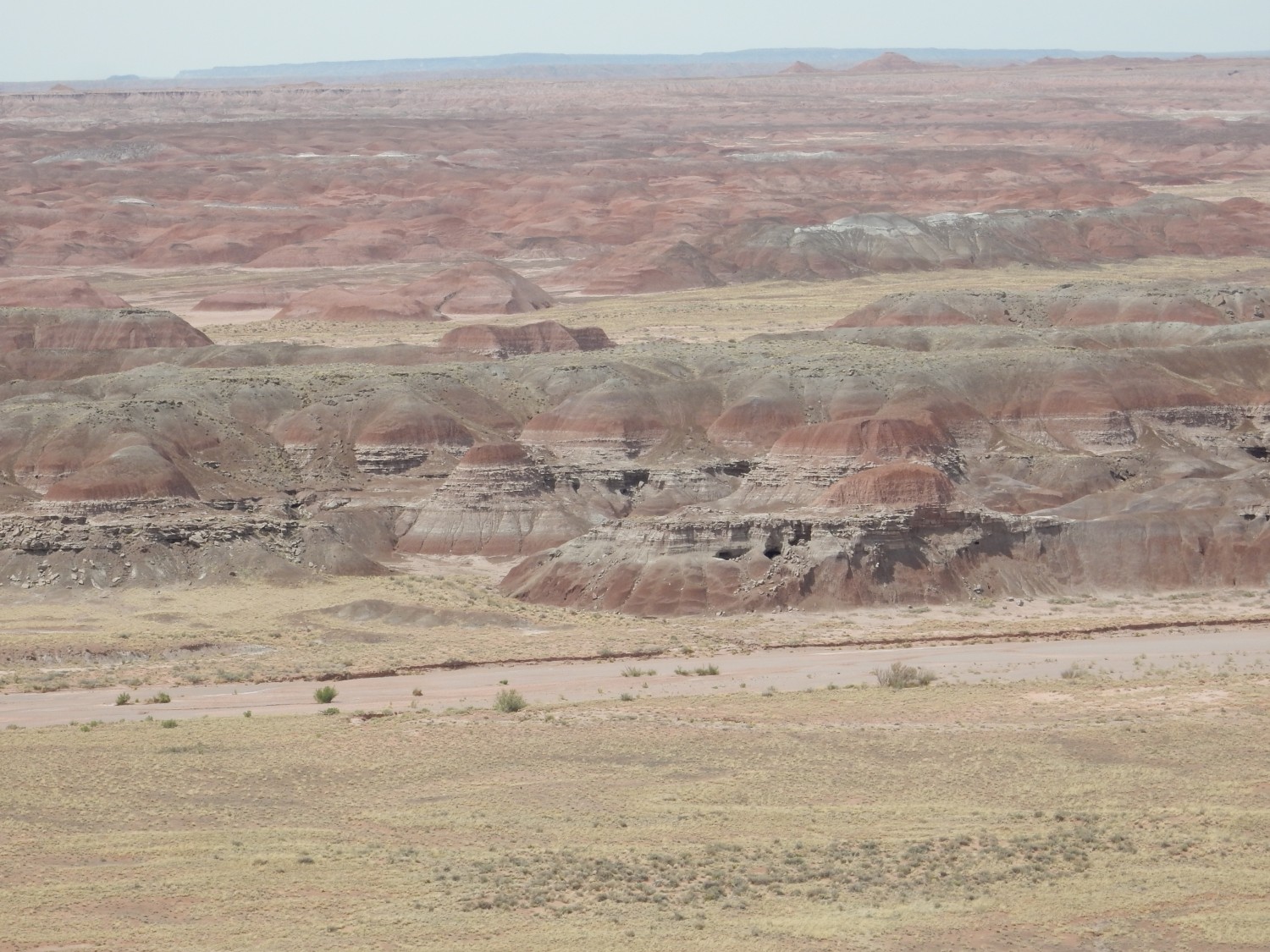
Then on to Painted Desert Rim lookout.
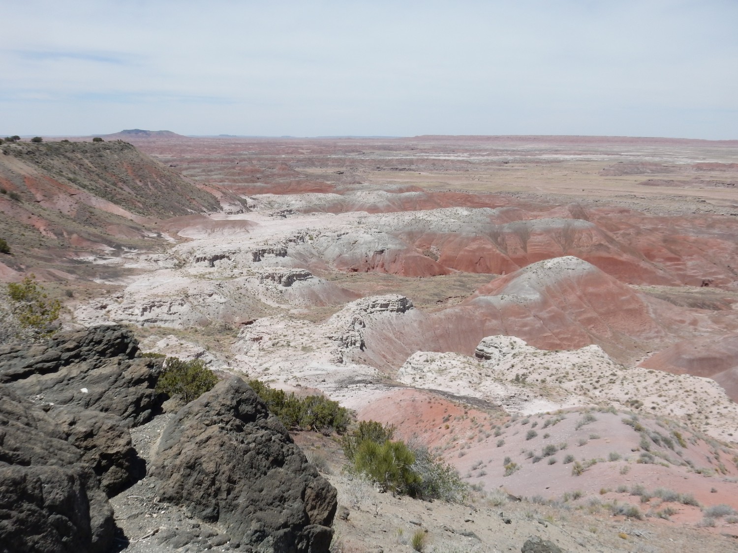
The white, more resistant beds are the Black Forest Bed of the Painted Desert Member. It’s a datable ash bed, from a volcanic eruption that took place quite precisely 209.9 million years ago.
We hike some distance down the trail here, but there’s not much more to see except Mormon tea (Ephedra).
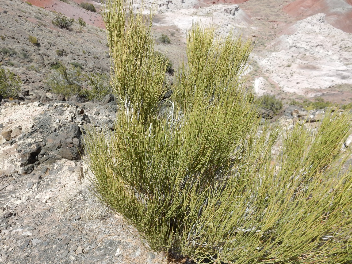
It’s a potent simulant, raising heart rate and constricting blood vessels while expanding bronchiole tubes. This sounds like a recipe for enhanced athletic performance, but it’s also quite dangerous; in rare cases, it stops your heart cold. Supplements based on the stuff are now banned in the U.S. However, ephedrine and pseudoephedrine extracted from it have some legitimate medical uses. Ephedrine was used on my ear when the tumor was cut out, to reduce bleeding, and pseudoephedrine is a decongestant. However, it’s relatively easy to convert pseudoephedrine to methamphetamine, so you have to buy it over the counter directly from the pharmacist nowadays.
There is a picnic area at Chinde Point, and we eat lunch there. Behind our picnic area is a wall of black rock.
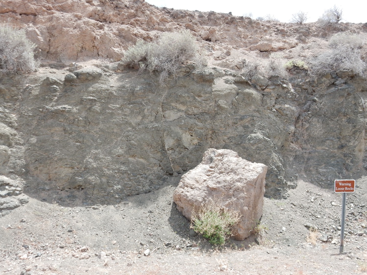
This definitely looks like agglomerated basalt.

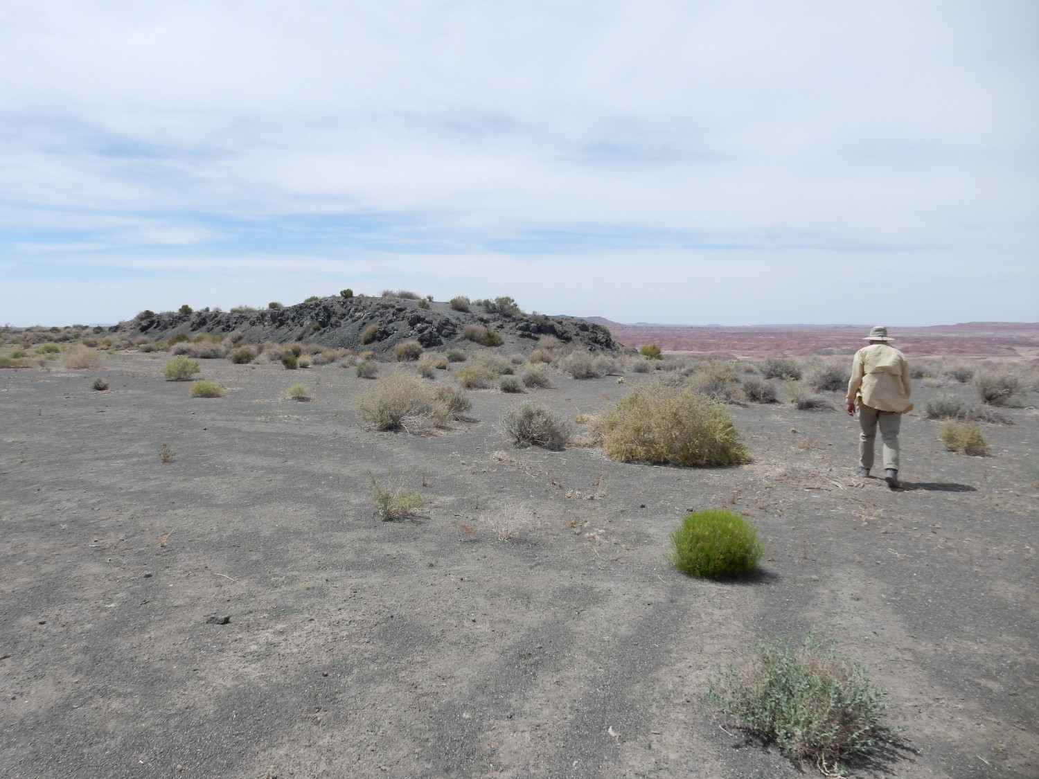
and, from the lay of the land, I suspect a volcanic vent is just south of us.
Lunch complete, we go to take a look around.
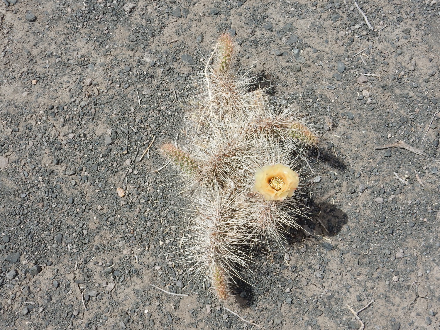
Prickly pear bloom.
Some local features. More Black Forest Bed:
The gully is apparently named Lithodendron Wash. The whole area is named the Black Forest, oddly.
PIlot Rock.
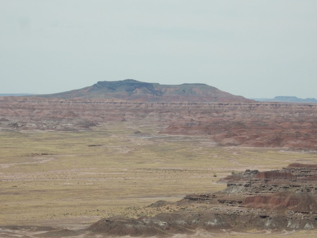
The thin, horizontal beds stretching all the way across the photo in the distance are assigned to the Owl Rock Member of the Chinle Formation. Pilot Rock itself is underlain with Bidahochi Formation, including a capping basalt flow.
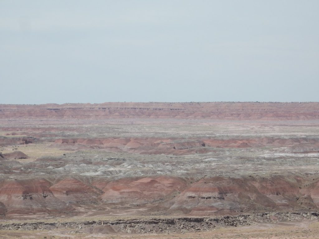
Looking far off into the wastes to the northeast.
The well-cemented white beds were an obvious candidate for a formal unit, and they do indeed have their own bed assignment (Black Forest Bed). I wondered if the more diffuse white layer might have its own formal unit name, but it turns out not.
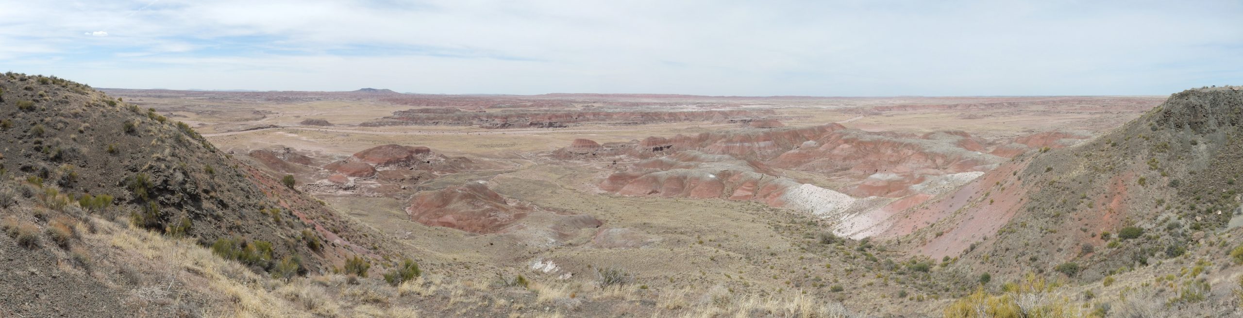
Final stop at Pintado Point.
It doesn’t come out well in this panorama (we’re looking into the sun at this point) but there is a different shelf of resistant beds in the west part of the basin. This is the Lithodendron Wash bed, which is significantly older than the Black Forest bed but has not been precisely dated.
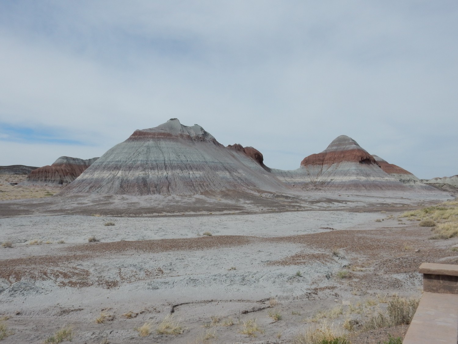
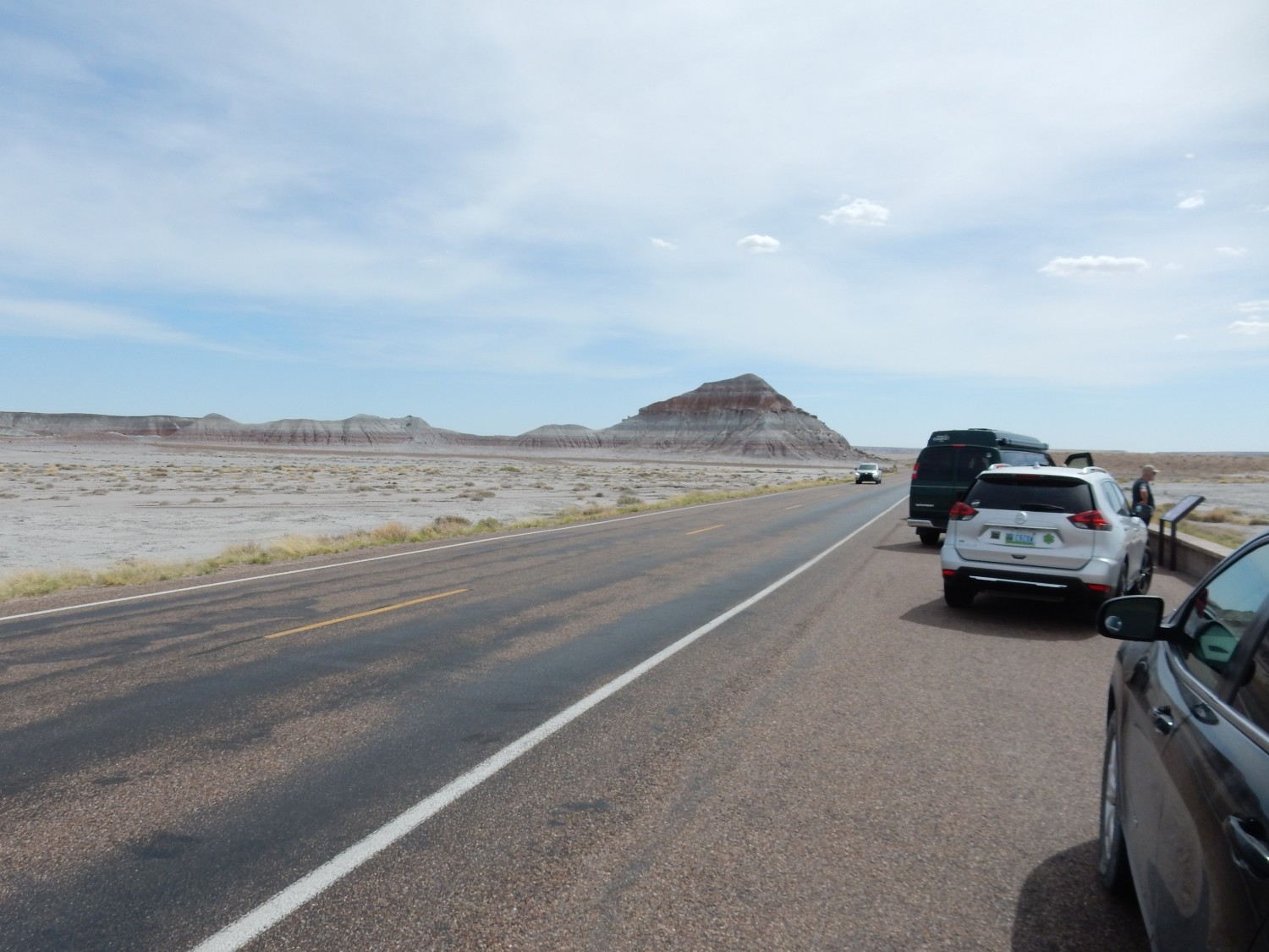
We head now into the southern part of the park, which is the actual petrified forest section. Our first stop is in The Teepees. And here I bork most of the shots, inadvertently setting my camera to a soft focus setting usually reserved for bridal shots. But a few photographs come out.
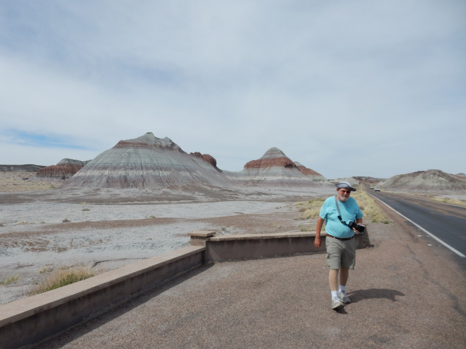
The fellow in blue is a real photographer, who favors Ansel Adam’s Zone System. My system is “Cool! click“.
It hardly seems worth getting more sophisticated until I can afford a much more professional camera. Which, like having my own Jeep, is a genuine and heartfelt wish that is unlikely to ever be fulfilled. I am not the federal government: “A billion here, a billion there, and pretty soon you’re talking about some real money.”
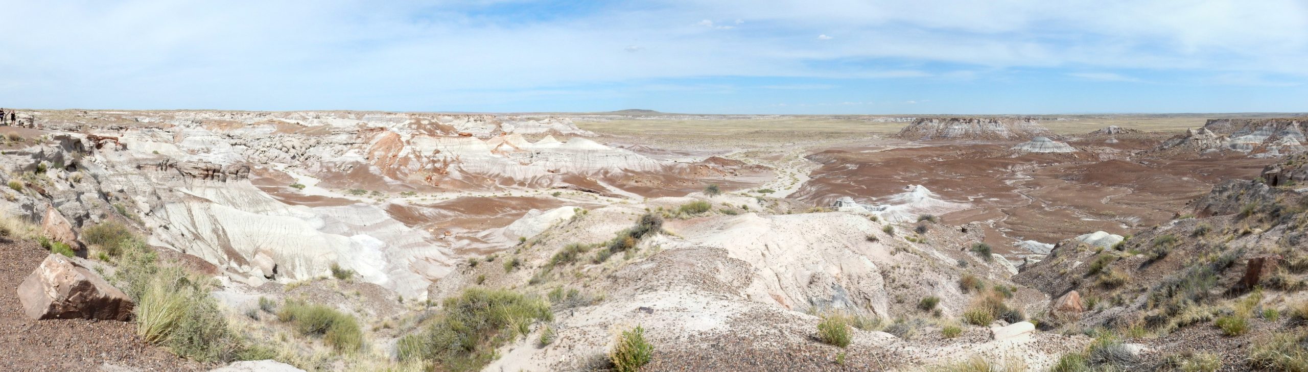
Pretty much everything in these photos is Blue Mesa Member of the Chinle Formation. This is significantly older than the Petrified Forest Member north of I-40 that we visited earlier. The are separated by the Sonsela Member, which we haven’t seen yet. The Blue Mesa is dated to 223 million years in age. The beds have been interpreted as tropical floodplain deposits. The white to blue color may represent reducing conditions, with enough organic matter in the soil to reduce iron from its insoluble and bright red ferric form to a more soluble ferrous form. The iron is then leached away to leave pale clay minerals.
I miss the turn to the Blue Mesa scenic drive, and slam on the brakes. (Gary has me taking a turn driving Obsidian.) My box of All-Brain cereal in the back of the car becomes a projectile, hits the back of my seat, the top pops open, and I am doused in bran cereal. I notice a big trailer is coming up fast behind us, and ease up on the brakes, so I have to miss the turn anyway. Gary is not amused, for which I cannot blame him. We double back and take the Blue Mesa loop.
We are looking now at the Sonsela Member, which is rich in petrified wood. Close up of unnamed butte:
(I should probably acknowledge that the last two images have had some digital manipulation of exposure and contrast. My camera tends to produce rather muddy images whenever there are very white outcrops in the field of view.)
The sandstone capping the mesas in this area is the Rainbow forest/Jasper Forest/Kellogg Butte bed of the Sonsela Member. (I find myself wondering if the butte in the previous image has a name after all, though none is shown on the map…) The softer beds beneath, which also underlie most of the valley floor, are mapped as Lot’s Wife Bed.
Gary and I pick bran cereal out of the front of Obsidian. Gary testily observes that the cereal resembles mouse droppings. I can’t disagree.
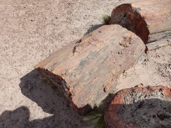
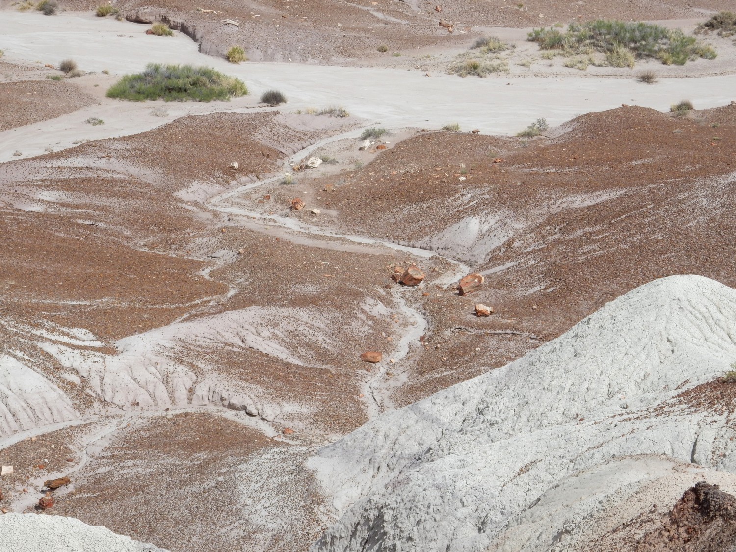
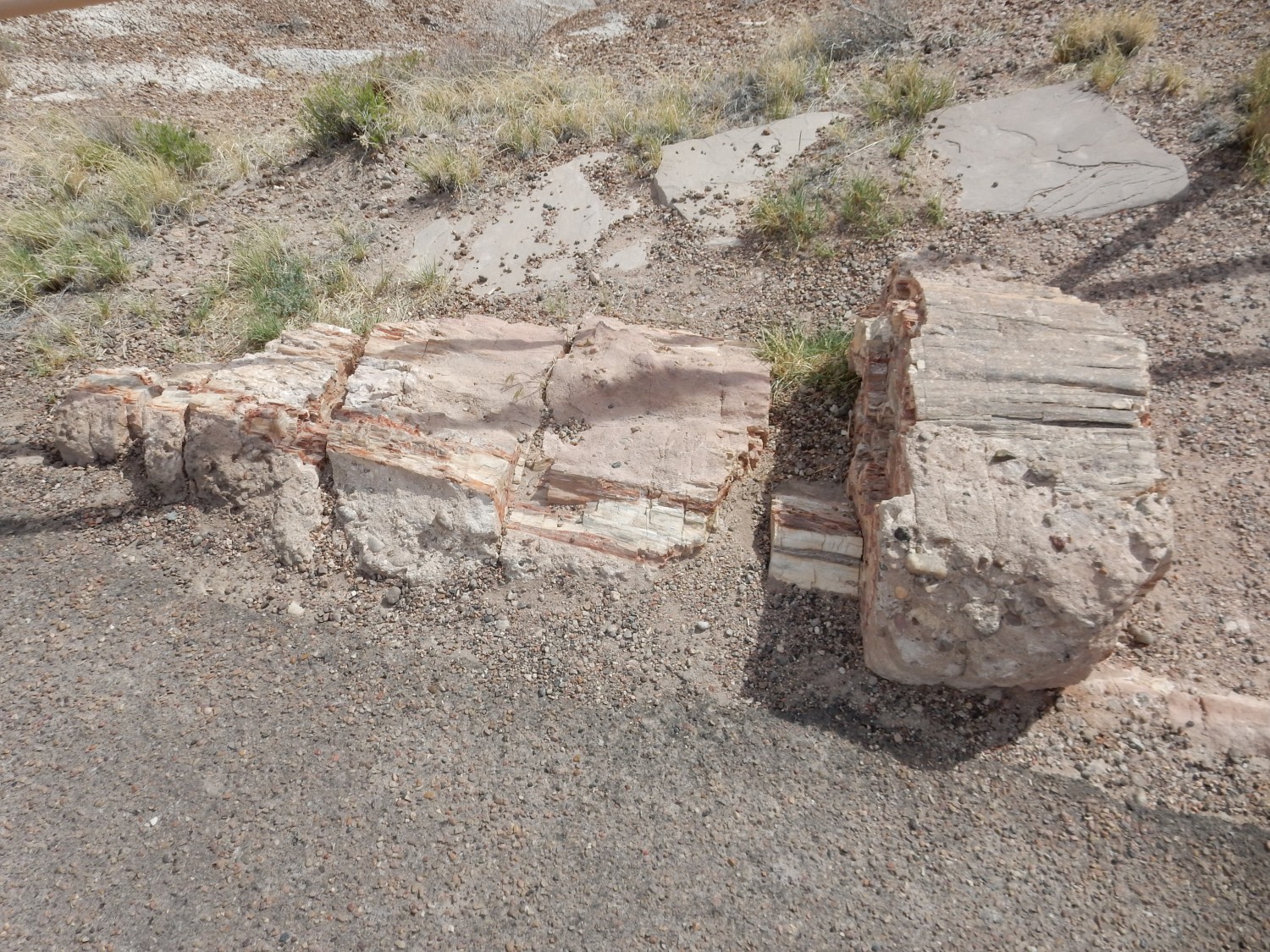
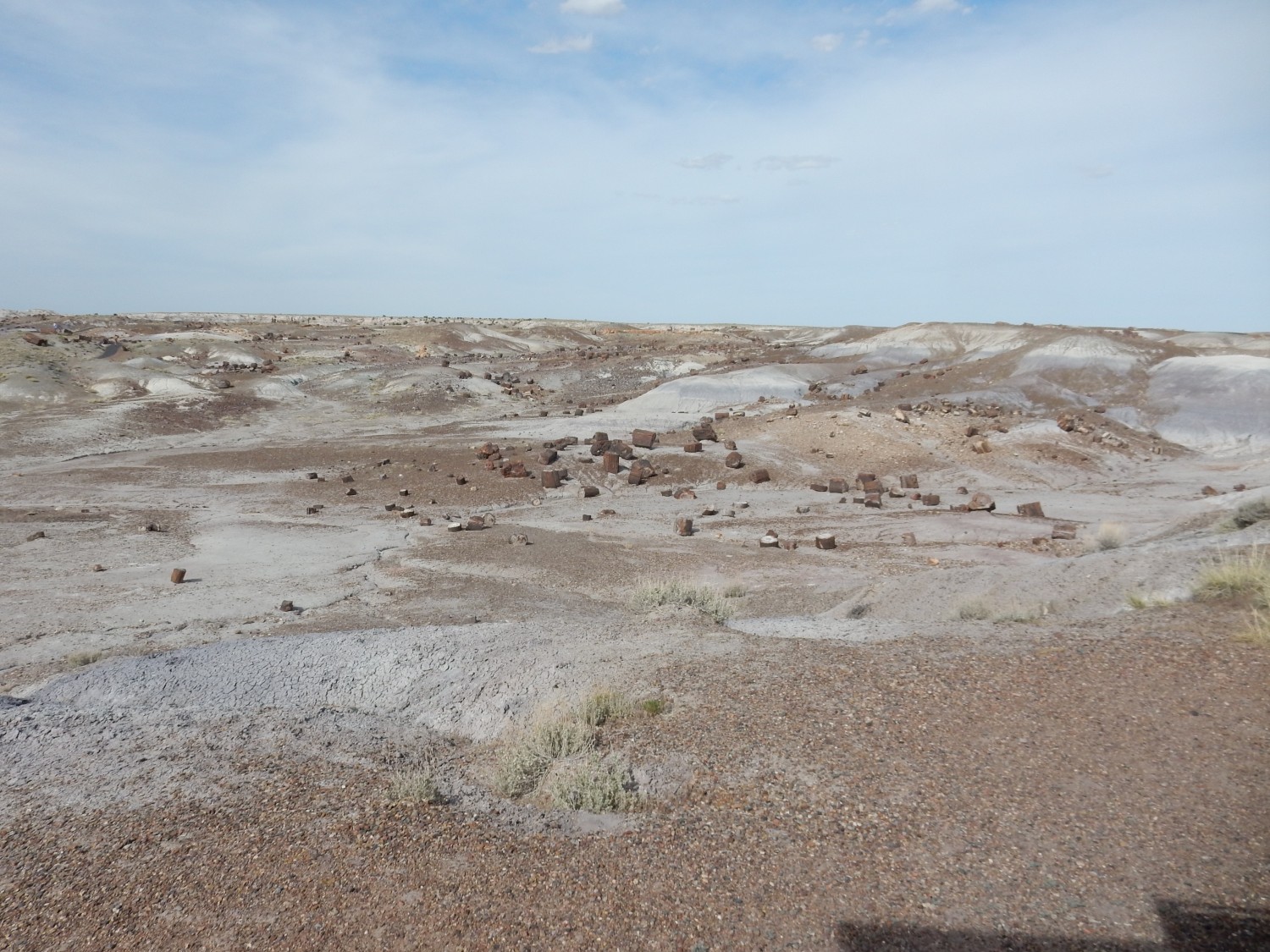
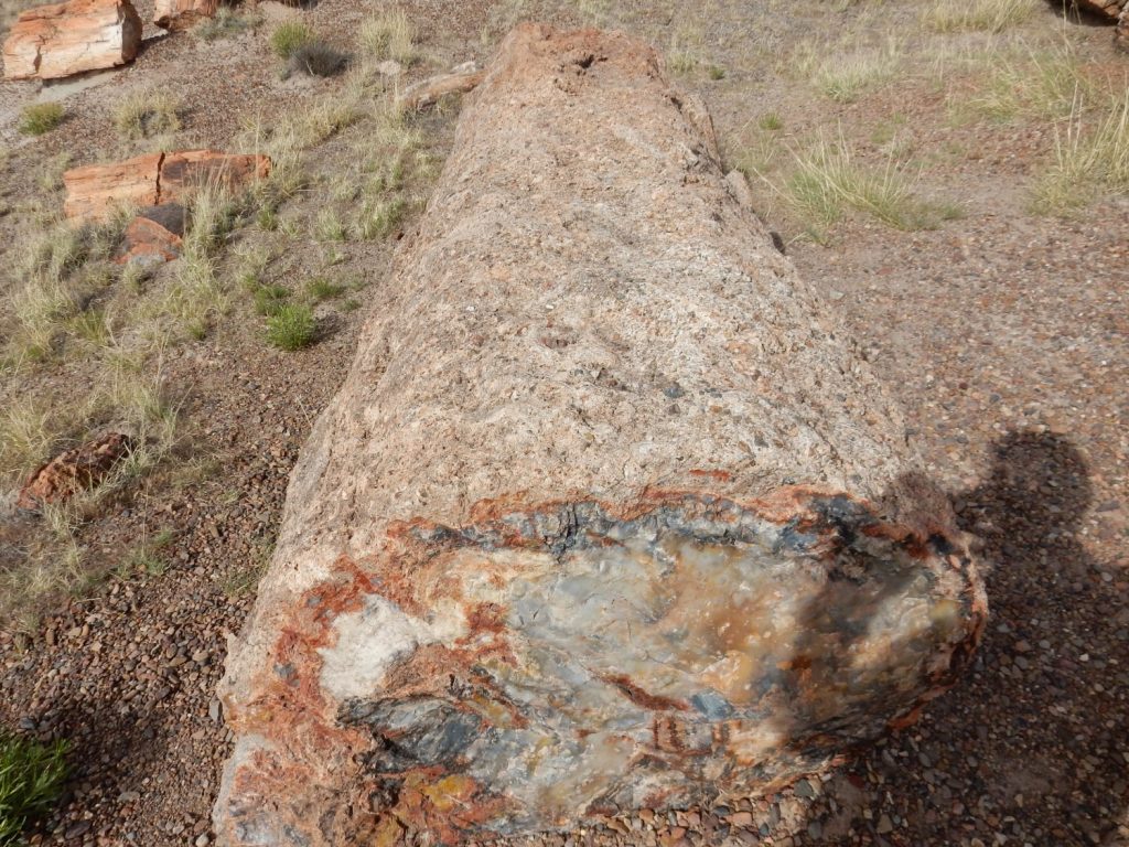
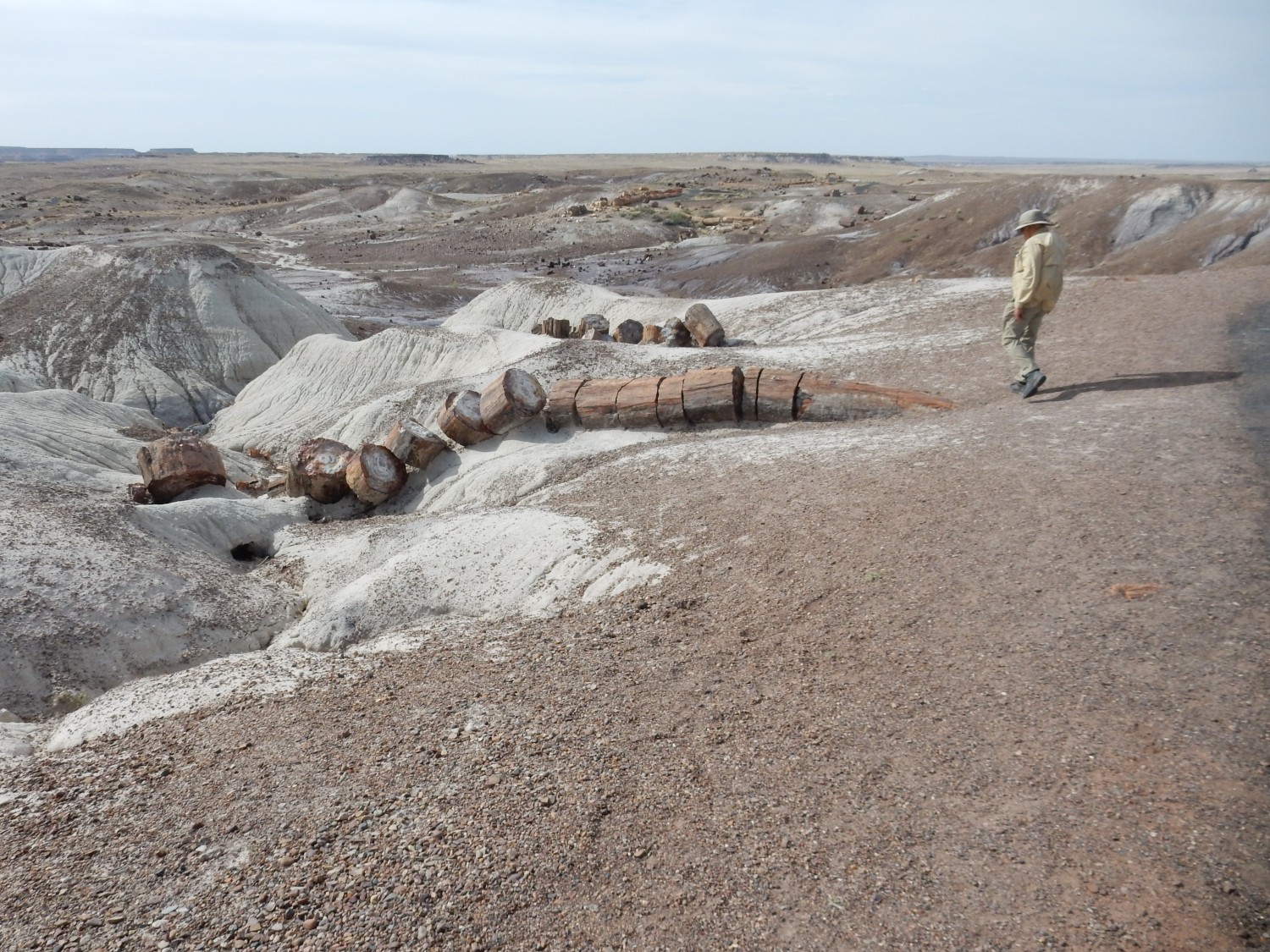
Just a little further down the road is an area rich in petrified logs.


Next stop:
Some of the logs are surrounded by fragments, which I suspect was tourists shattering logs to get a manageable sample before the Park protections went into place.
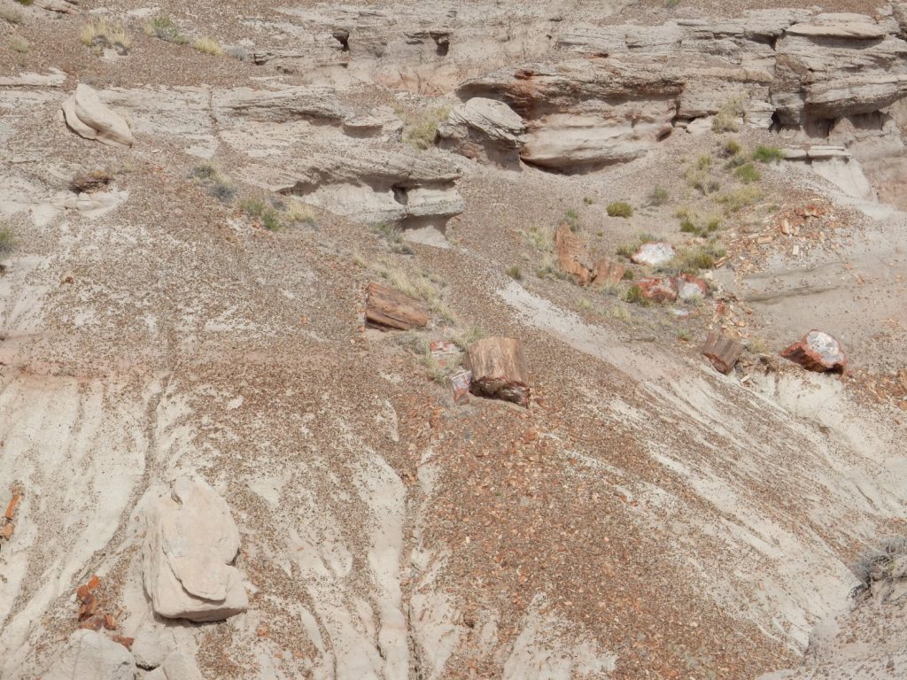
The park is abundantly rich in fossils of all kinds, but it is the trees that stand out. These are mostly Araucarioxylon arizonicum, though much of the wood is poorly enough preserved at the cellular level that there may be a considerably greater variety of species than originally thought. However, A. arizonicum was a conifer, distantly related to modern pines, whose closest living relatives include the Norfolk island pine grown as a house plant. (I have one in my living room.)
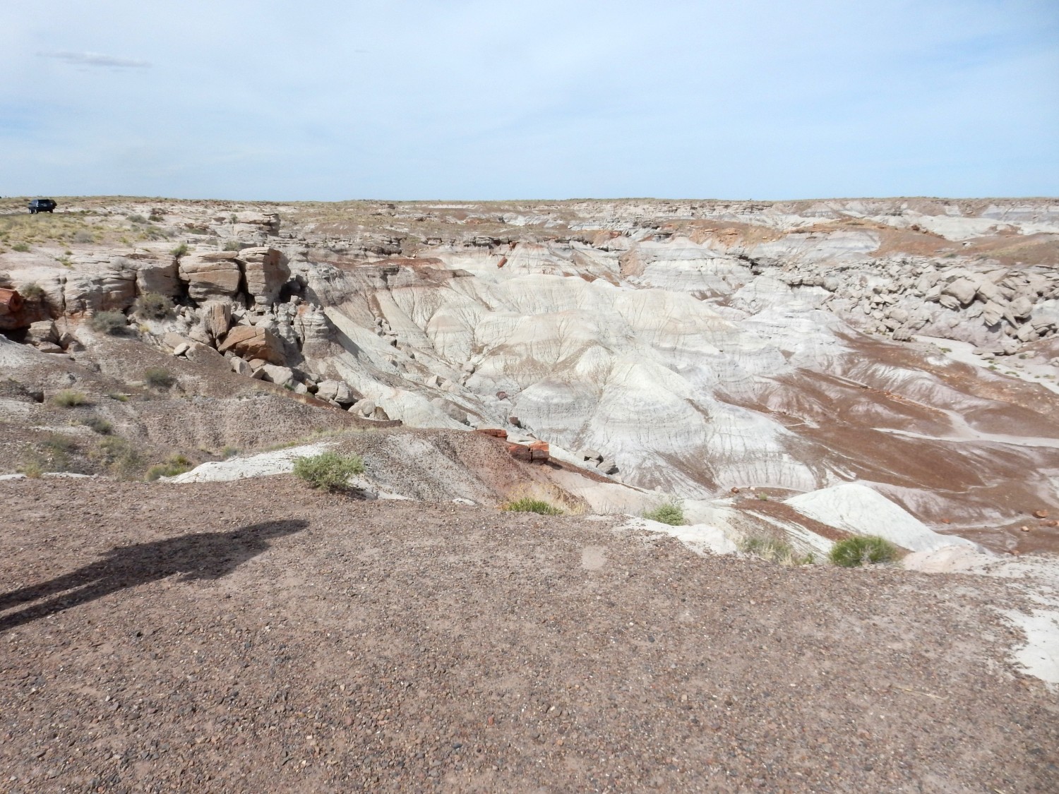
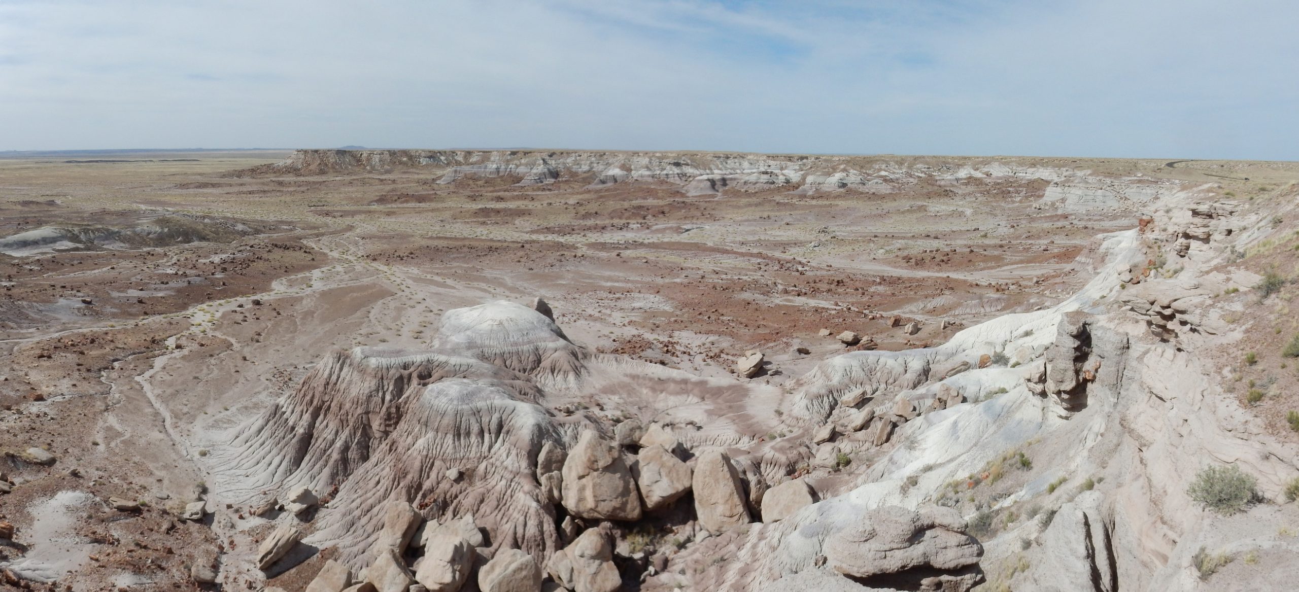
The next stop gives a view to the north.
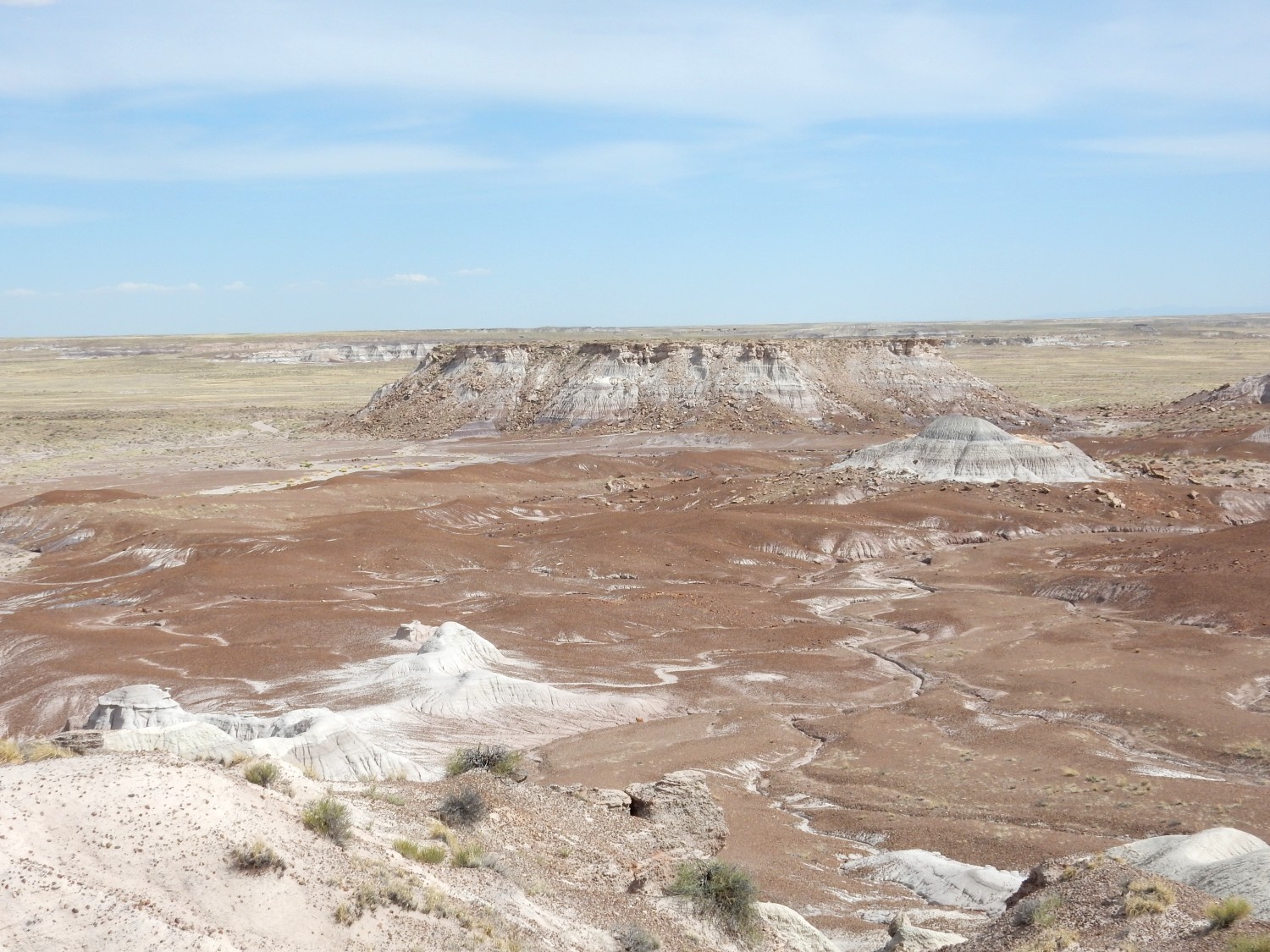
The shelf at far left, at the base of the cliff, is probably the Camp Butte beds of the Sonsela Member. The valley before us is mostly Blue Mesa Member, including some distant exposures of the Newspaper Rock bed.
Some of the beds here (we are standing on the Rainbow Forest, etc., bed) are clearly crossbedded.
This suggests deposition by wind rather than water.
Next stop.
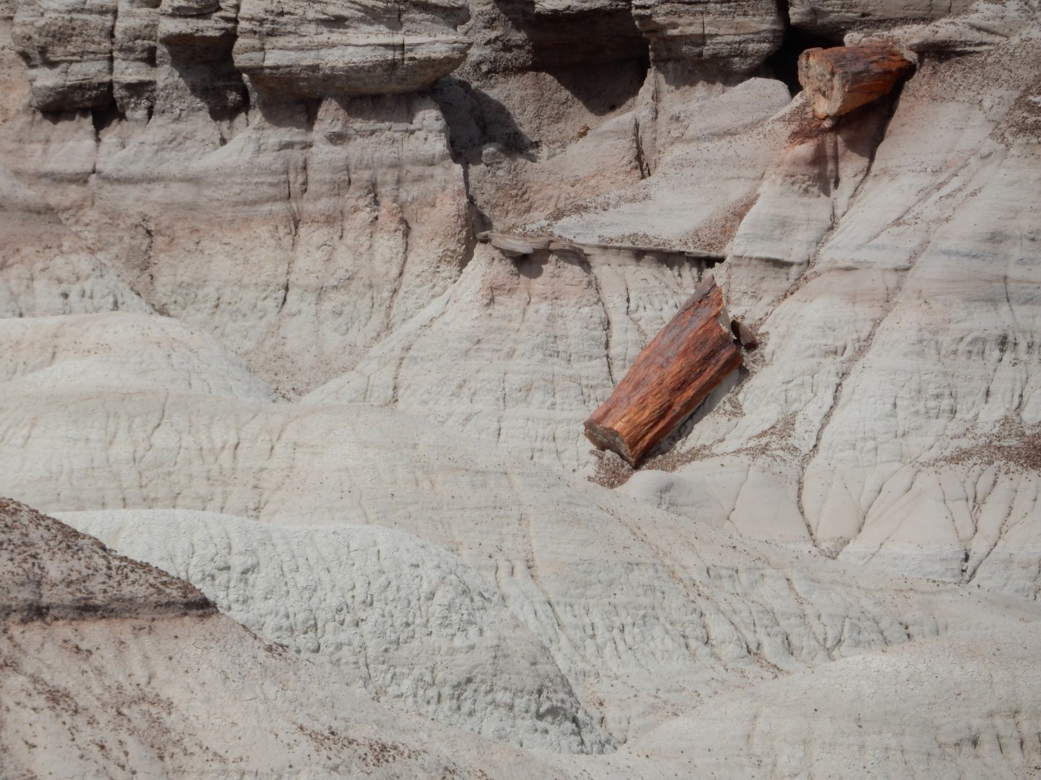
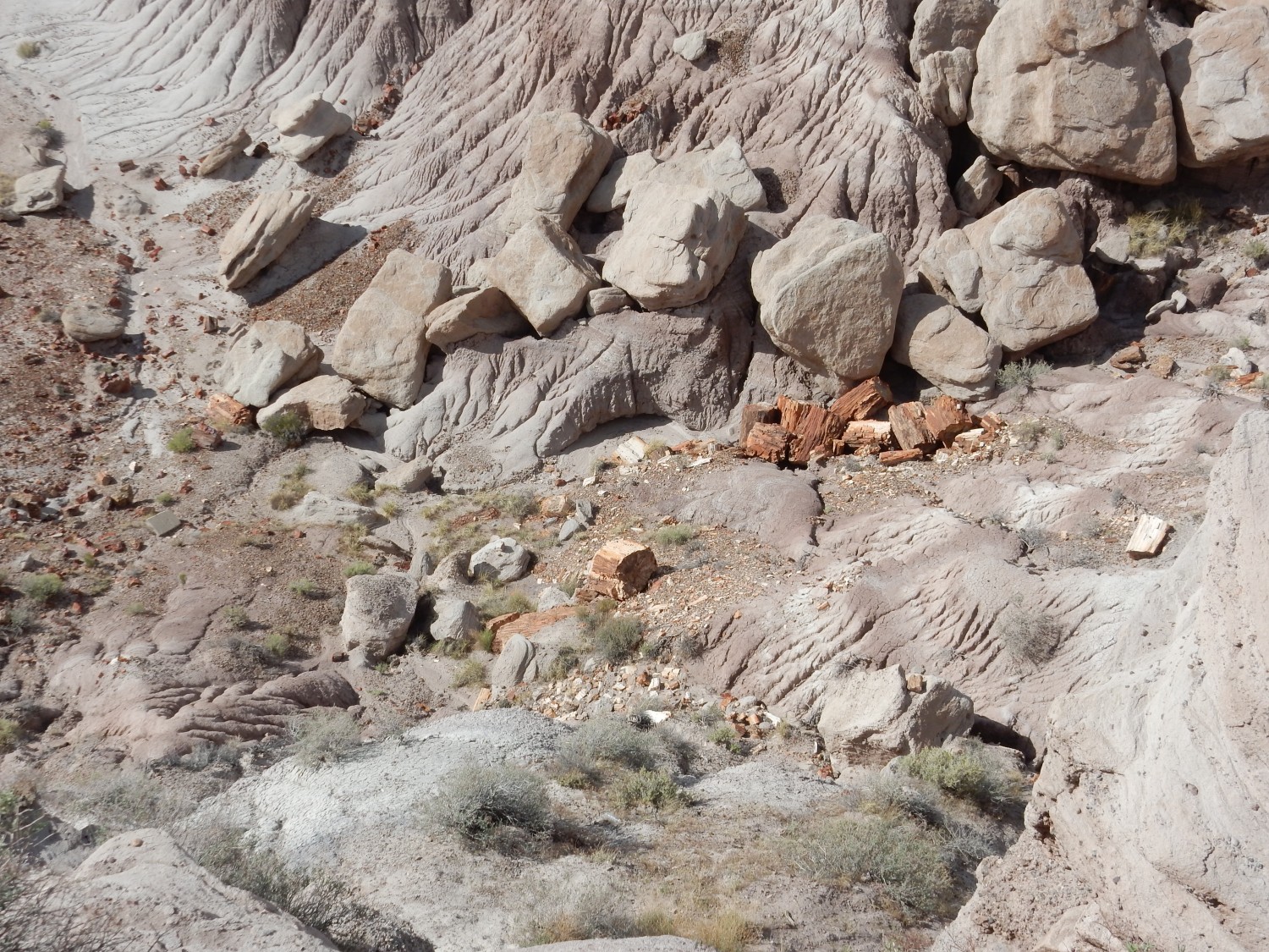
Lots of petrified wood down there. And a hiking trail; maybe next time. We are looking mostly at the Lot’s Wife Bed here.
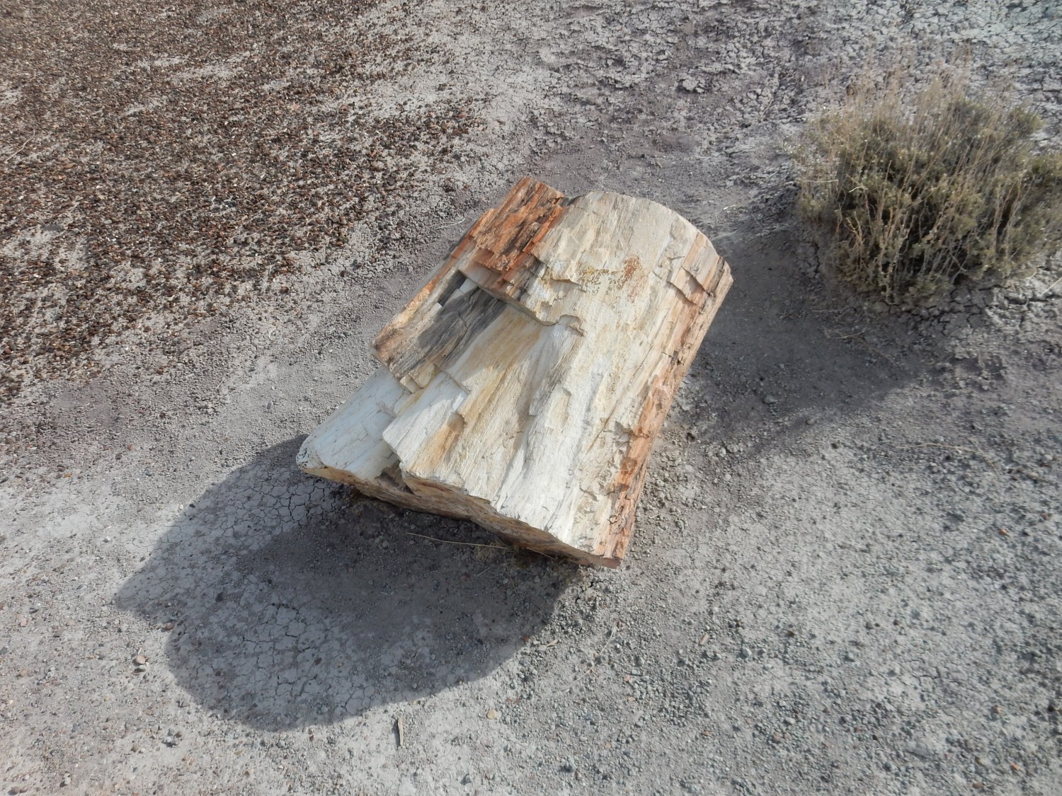
There is a log to inspect close up.
We stop briefly at the Jasper Forest.
This is also in the Lot’s Wife Bed.
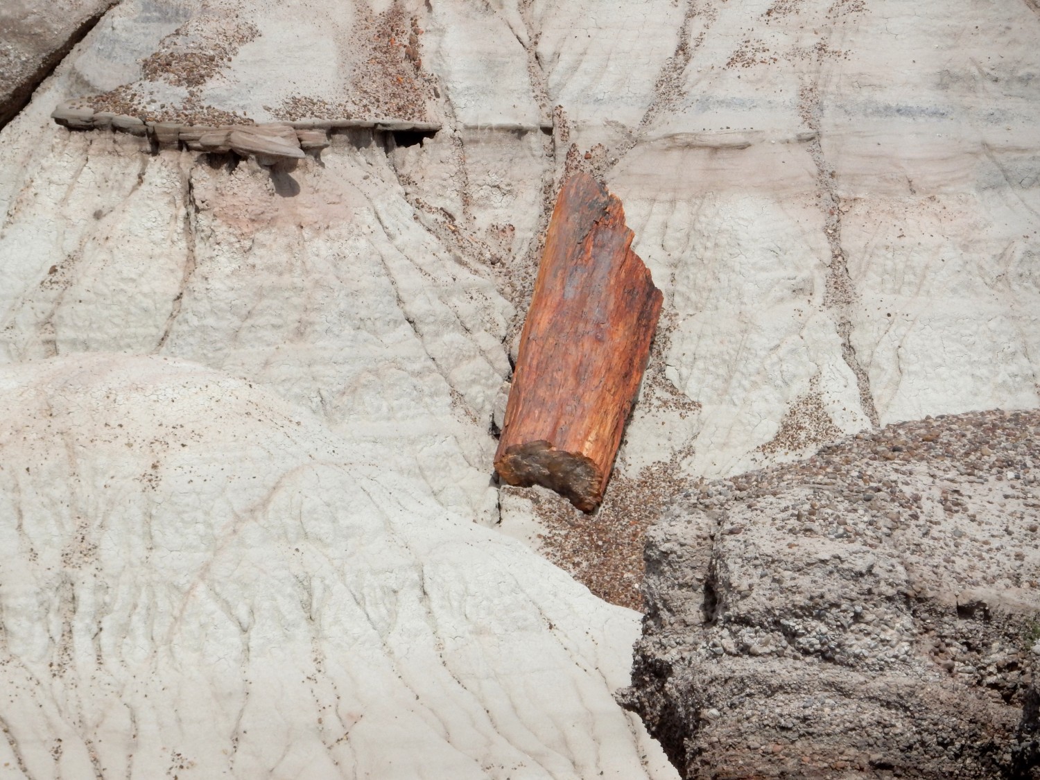
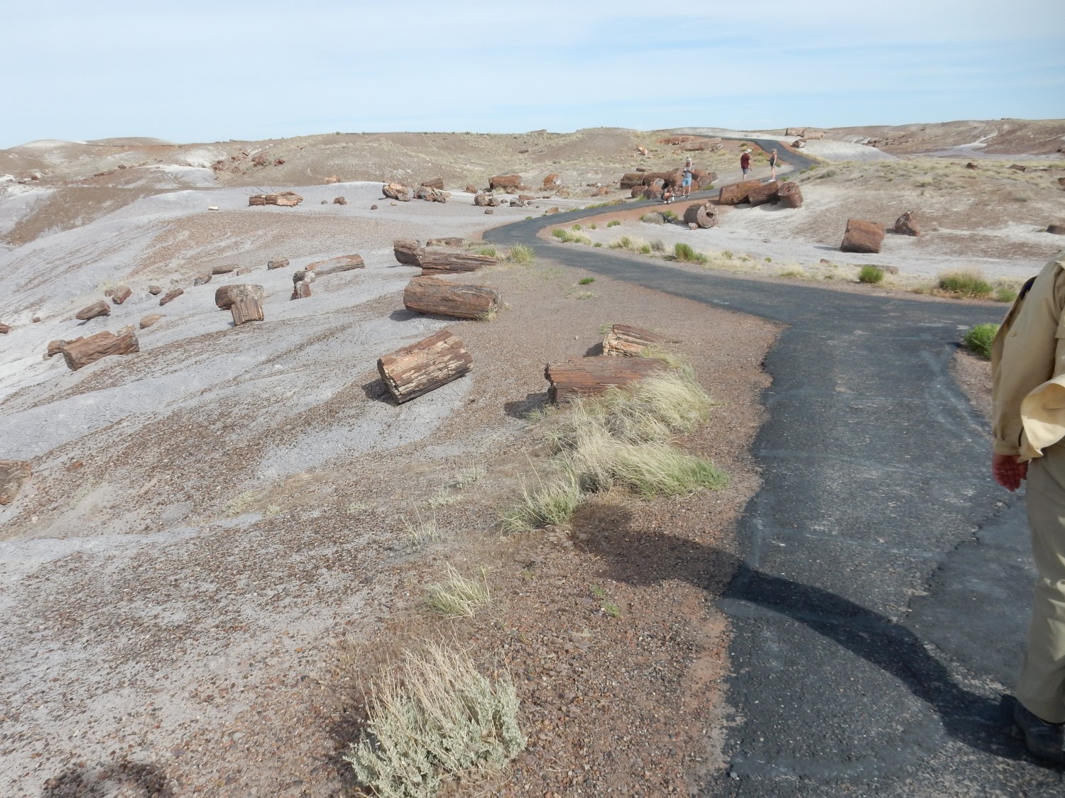
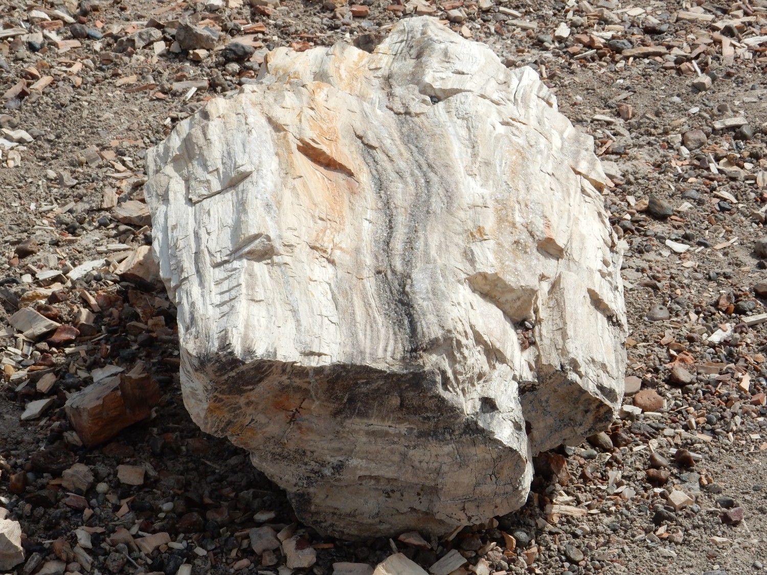
Across from the view area are some petrified logs to inspect up close.

The outer form is often amazingly well-preserved; the interior, not so much. There are some hints of tree rings, but it’s only in rare cases that cell structure is preserved.
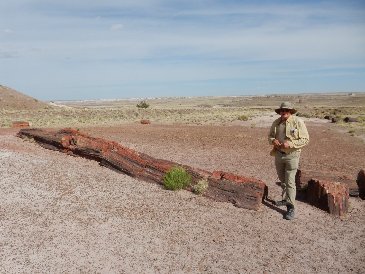
Next is the Crystal Forest.

Signage.
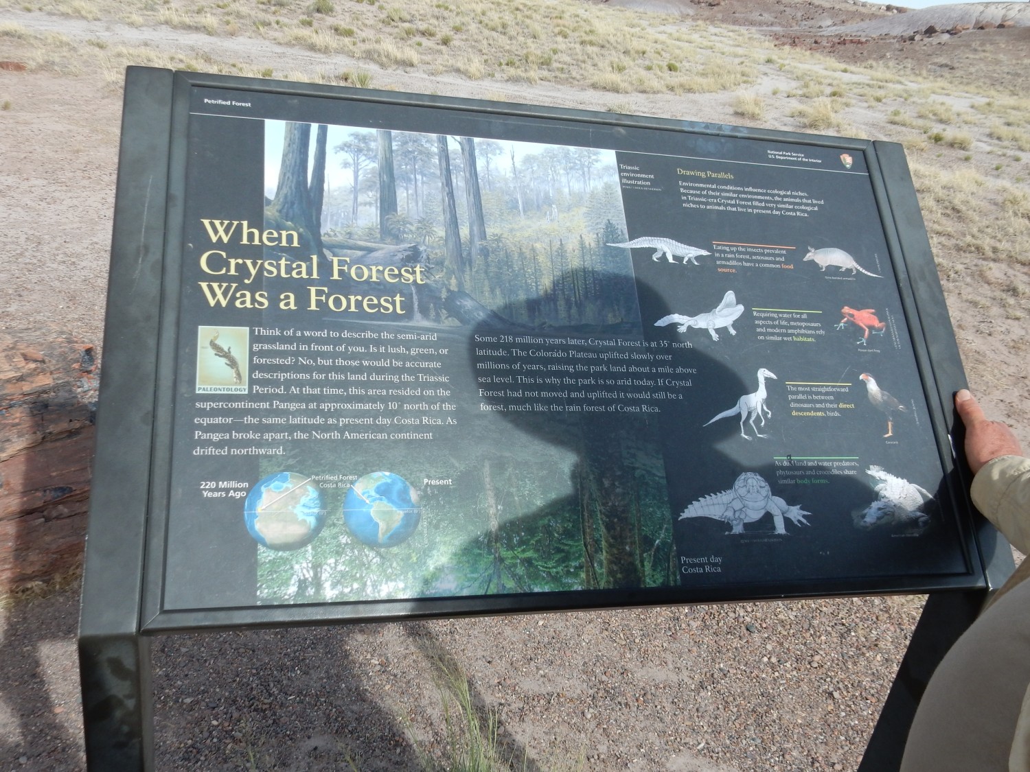
A lot of recent Park Service signage is written at about the third-grade level. This is quite a bit better.
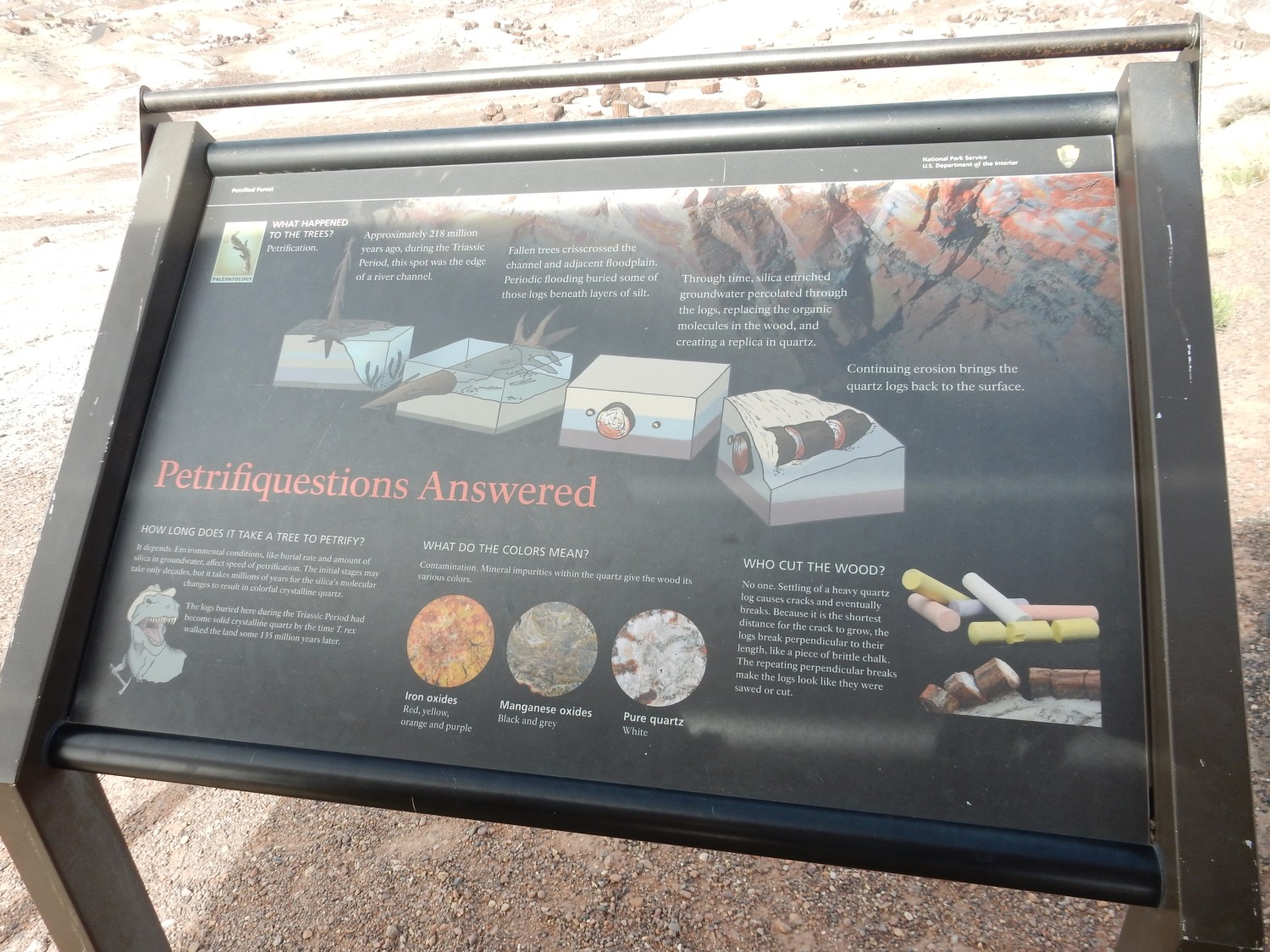
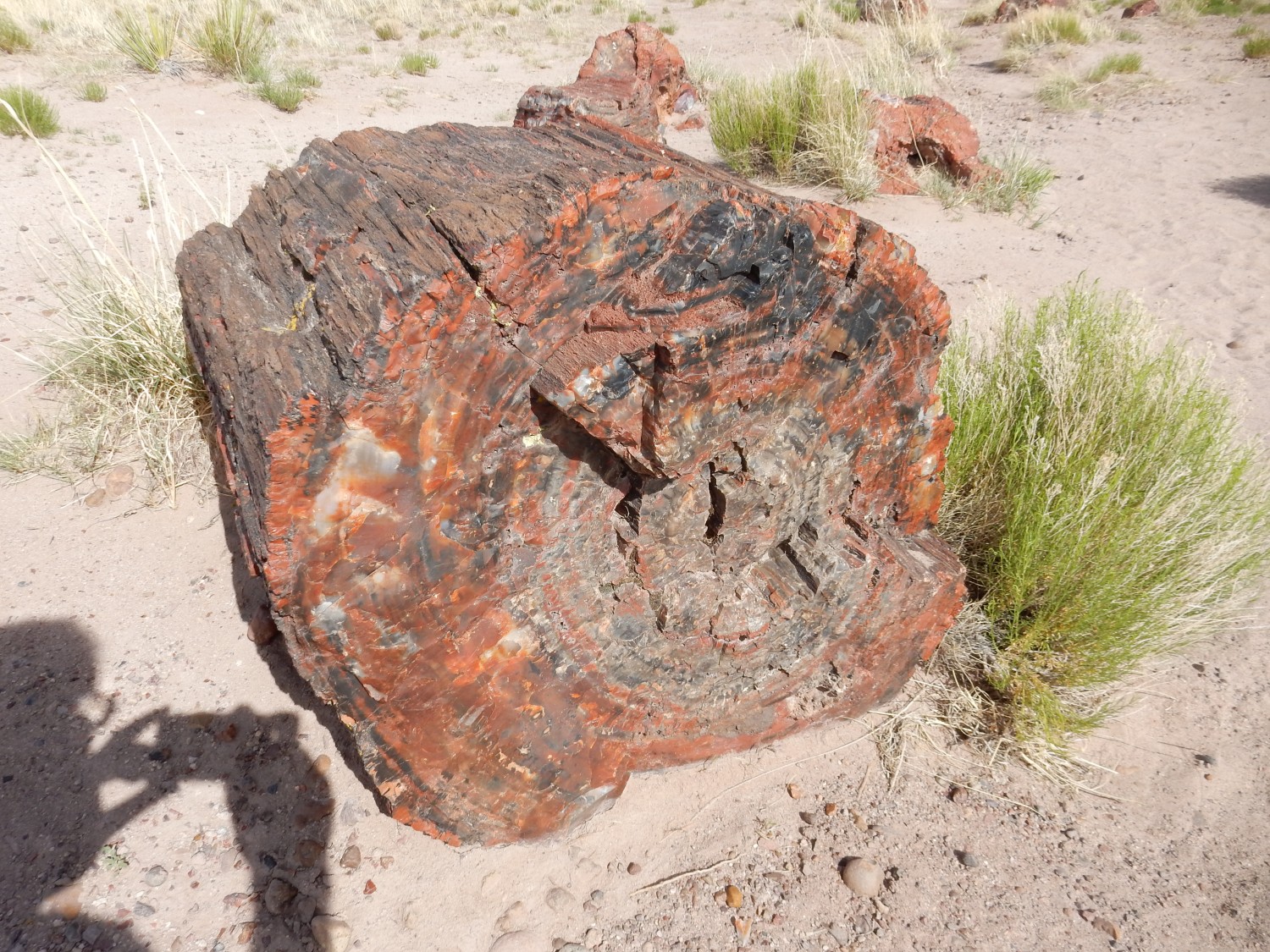
TL;DR: The first stages of petrification must take place fairly quickly, or the logs would decompose first. However, the initial silica gel that replaces the wood is slowly recrystallized to the varied colors seen today over a much longer period of time, perhaps millions of years. Silica is colorless; the vivid colors are various trace elements, particularly iron.
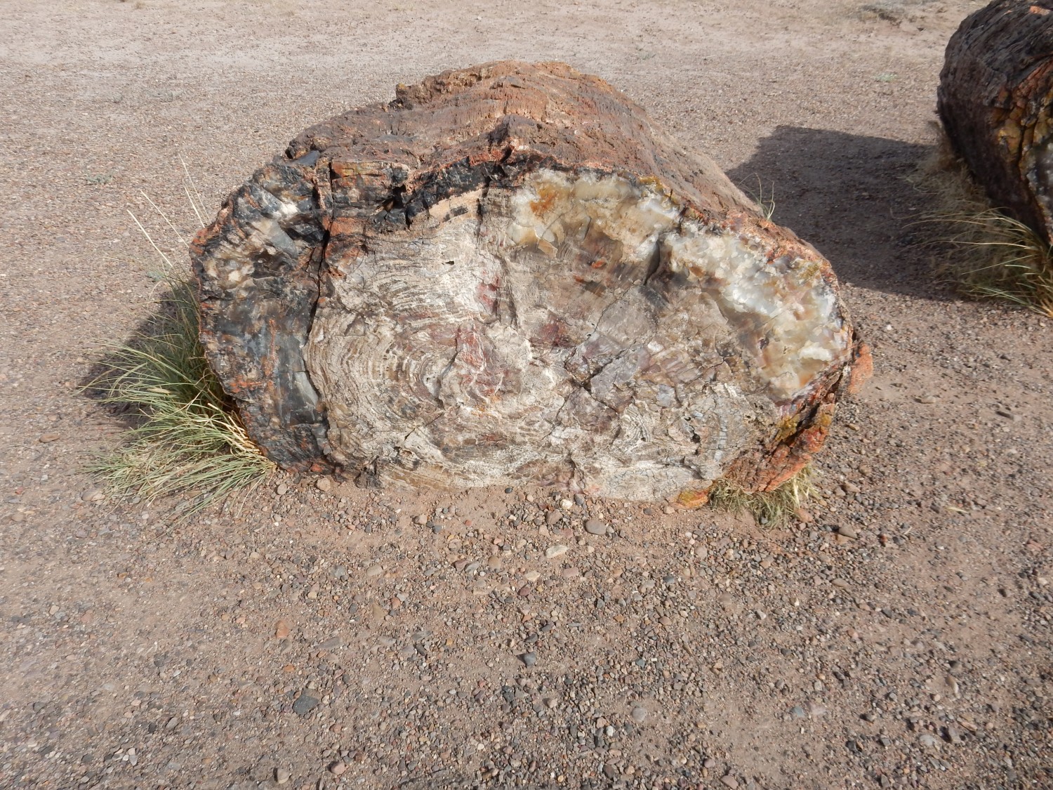
This one looks almost like bark was preserved, though I wouldn’t bet on it.

This final chunk is encrusted with fine quartz crystals, appropriate for the Crystal Forest, but they didn’t come out terribly well in the photograph.
One more butte on the way out.
We are back in the Petrified Forest Member, and the cap of the mesa is likely the Flattops Bed.
We visit the visitor’s center, but for some reason the photographs I take here are not on the camera when I get home. I’m quite sure I took some, so this puzzles me. I also pick up an interesting-looking book at the visitor’s center. Then to a rock shop just outside the park; it’s rather overpriced and I decide to refrain. Gary picks up a couple of large trilobite fossils after I examine them under the loupe and pronounce them probably authentic.
We head for Holbrook, and then south to Show Low where there are camping areas not closed by fire restrictions. I had in mind a campsite by a lake north of town, but we end up at a campsite at a lake southeast of town, and this is perfectly satisfactory. Dinner is from Panda Express.
It is a fairly pleasant evening, except that my air mattress refuses to stay inflated, and I am quite bruised from the hard ground by morning. I envy Gary’s nifty hammock arrangement at times like this.